13,048 and 13,015

RT Length: 16.36 miles

Elevation Gain: 3188’

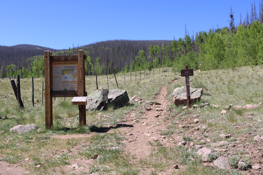
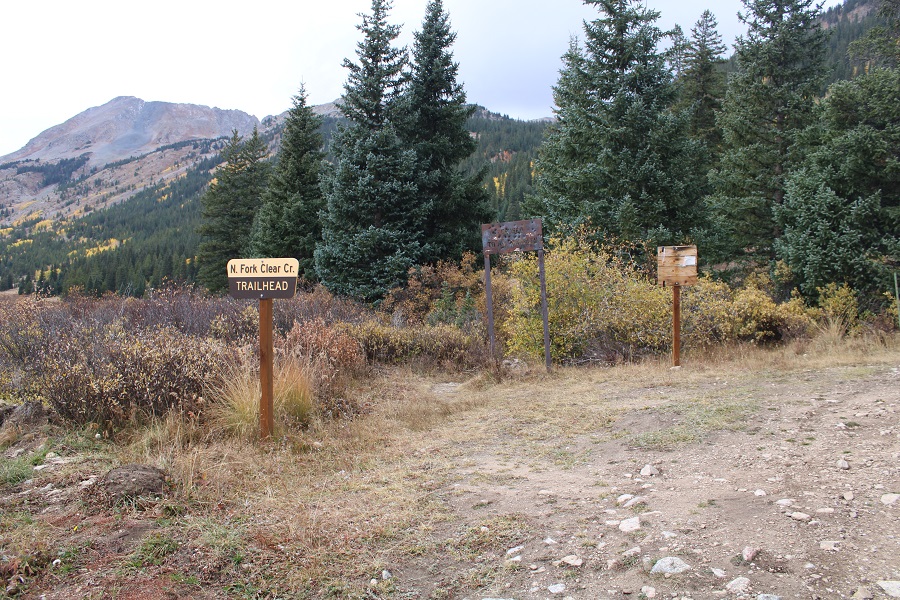
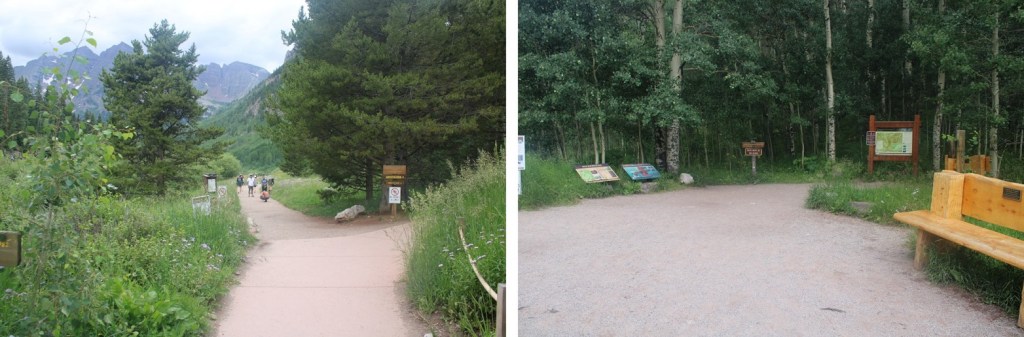
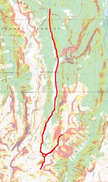
This hike starts at Fall Creek Trailhead. However, Google doesn’t seem to know where that is.  To get there first go to the Little Cimarron Trailhead and continue past it for 4.4 miles until the road ends.  It’s a total of over 18 miles on a 2WD dirt road to get to Fall Creek Trailhead.   There’s room for about 10 vehicles to park, and some dispersed campsites along the way and at the trailhead. 

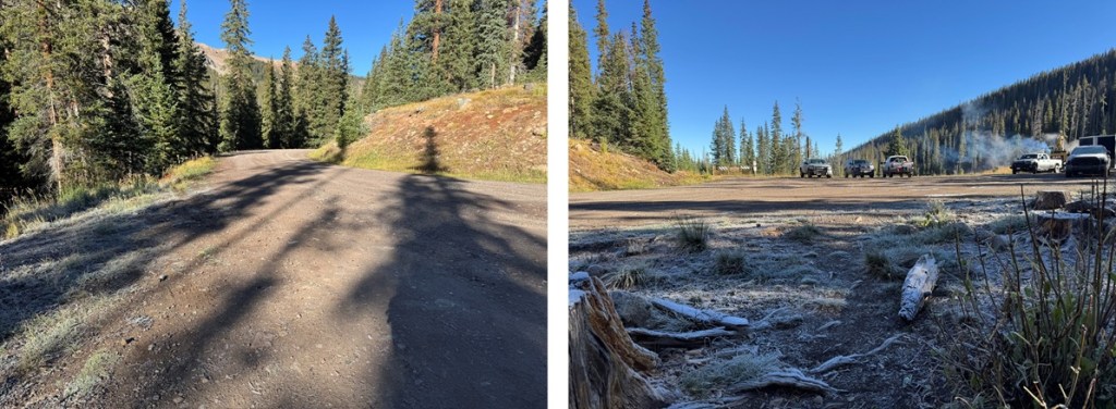
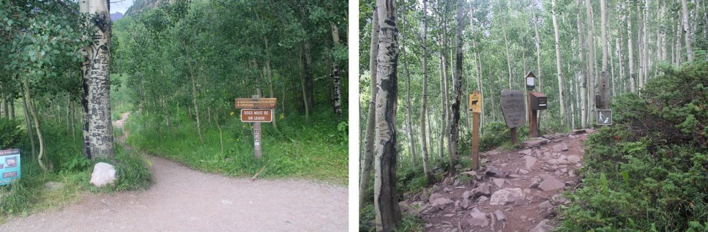
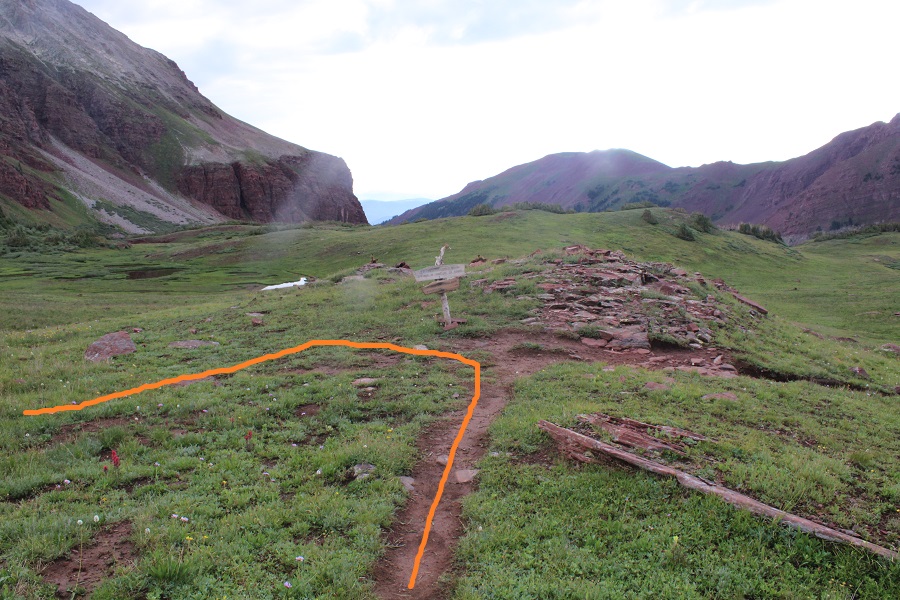
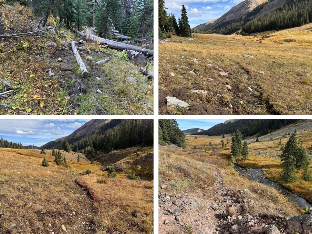
There’s been a fire and a lot of logging in the area, so the beginning of the trail isn’t easy to find.  There isn’t a trailhead marker, etc. but the trail starts at the south end of the parking area. 

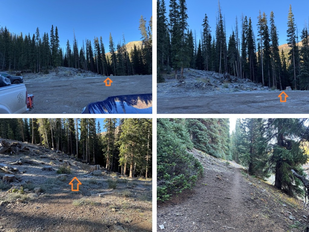
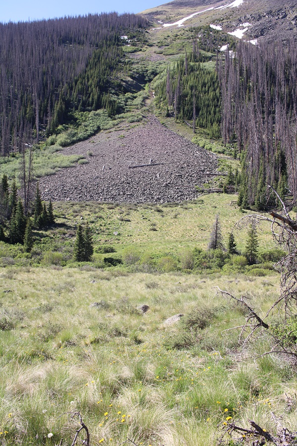
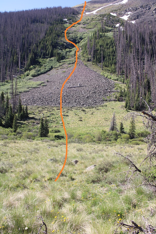
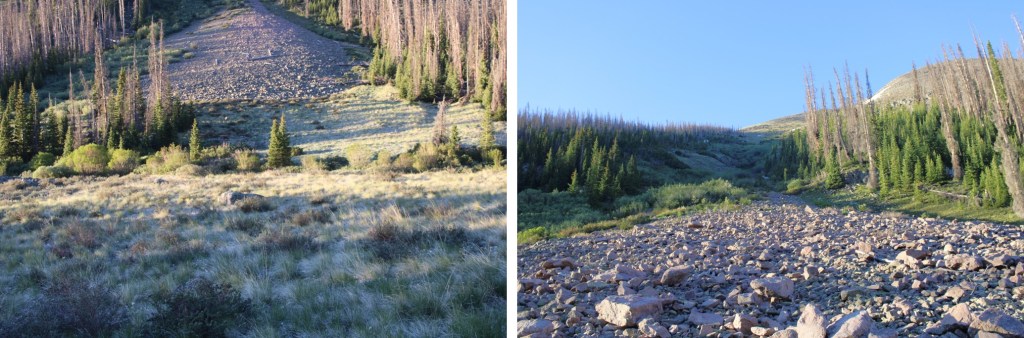
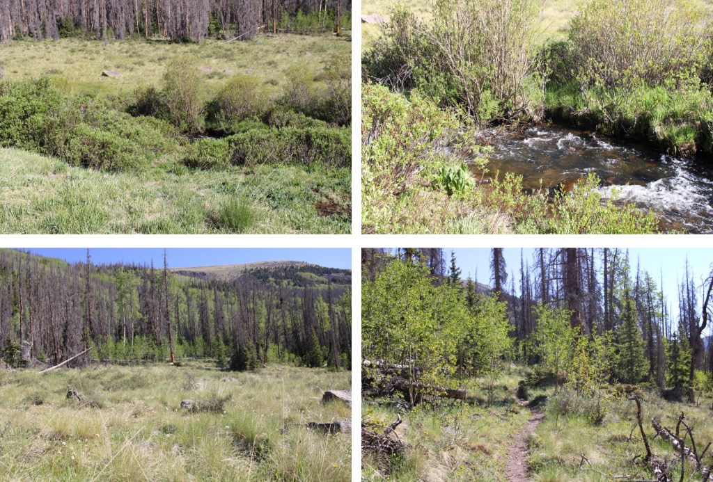
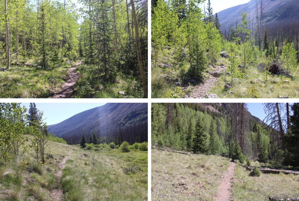
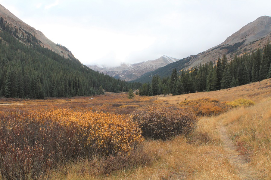
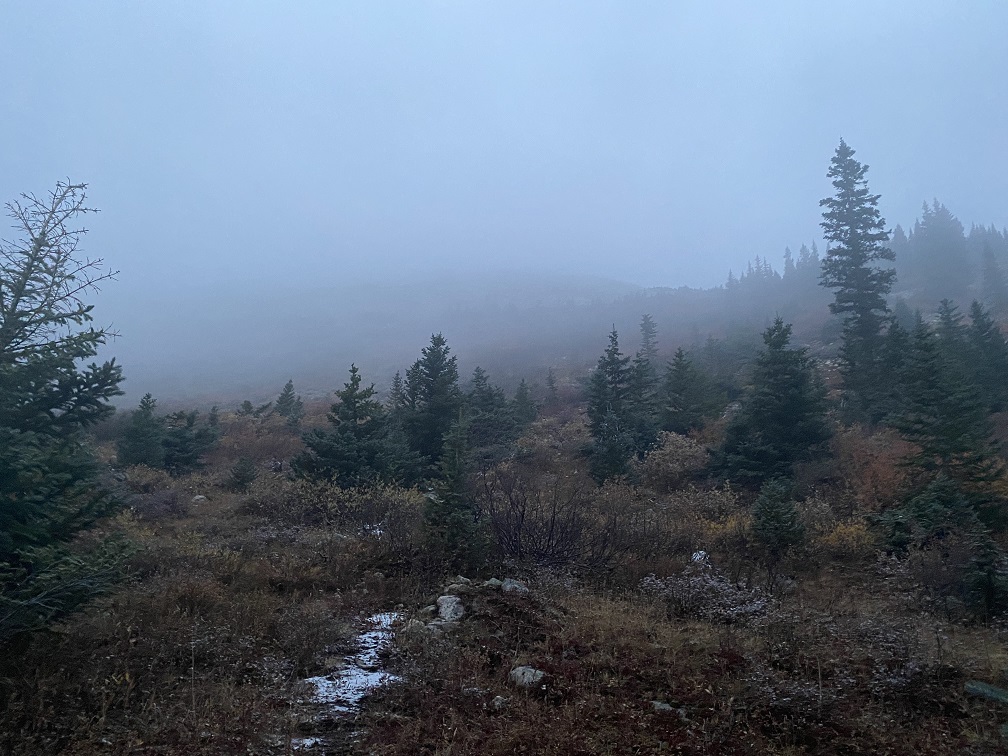
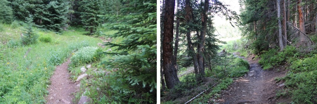
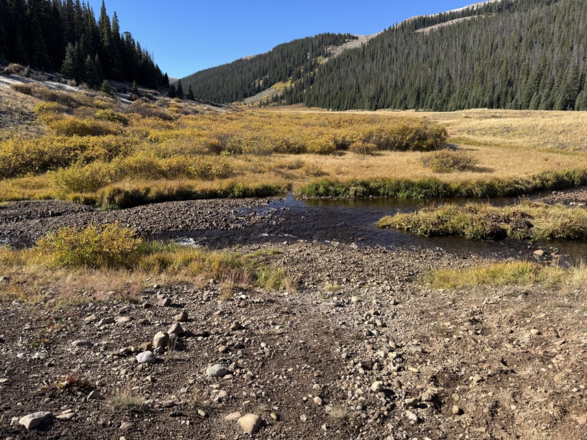
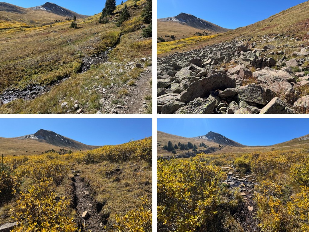
Once I found the trail I followed it south.  This trail follows Fall Creek, and on a map is labeled Fall Creek Trail 9231.  For the first few miles the trail is easy to follow.  It goes through a rocky area and through several large meadows following the creek.

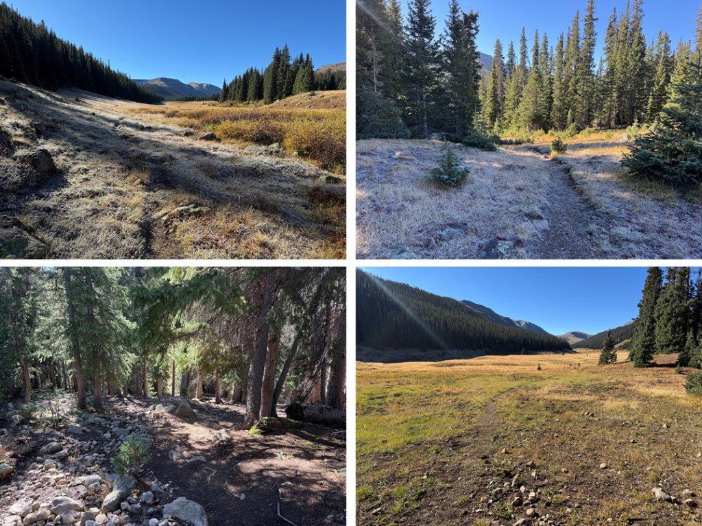
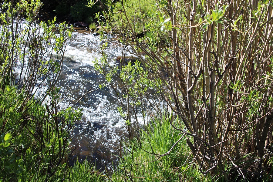
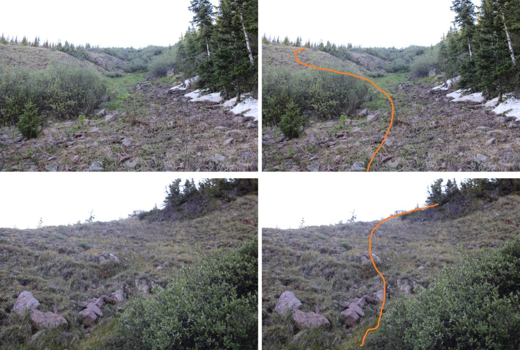
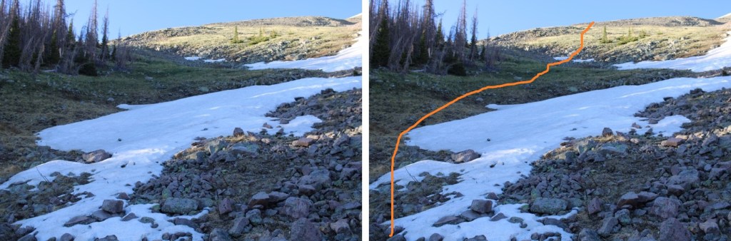
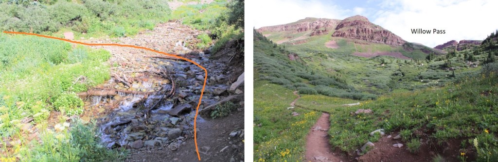
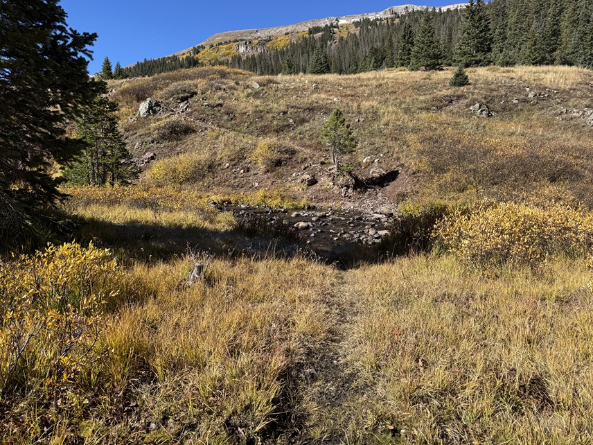
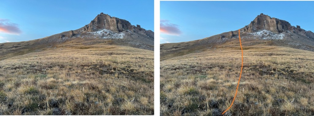
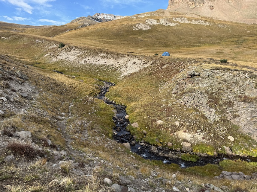
Just after descending through the trees I came to a creek crossing. 

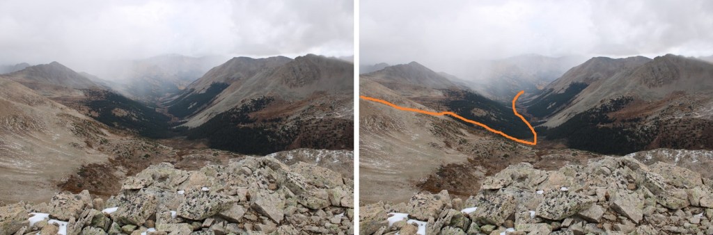
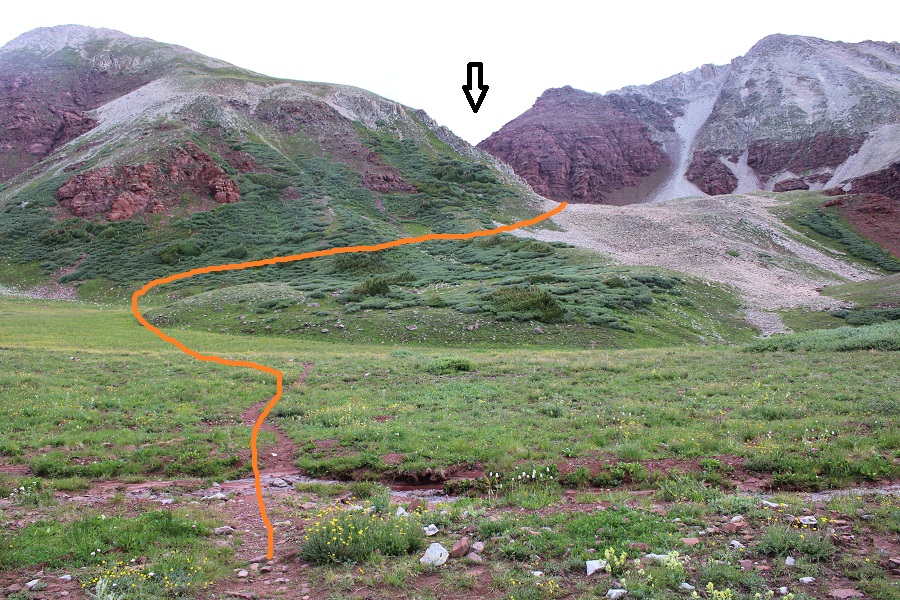
From here the trail can be difficult to follow but there are no trail junctions.  It gets marshy and there are many game trails due to the mud and water.  Also, horses have torn up this area.  Be prepared with an extra pair of socks.  From here I stayed on the left side of the creek until an obvious crossing point.

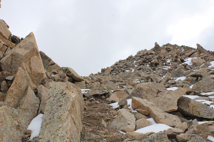
I crossed the stream and the trail brought me into the trees to avoid the willows below.  This is where the elevation gain begins.  There are some downed trees in this area but overall it was much easier to follow than heading through the marsh.  But don’t change your socks yet: it’s going to get muddy through the willows up ahead.

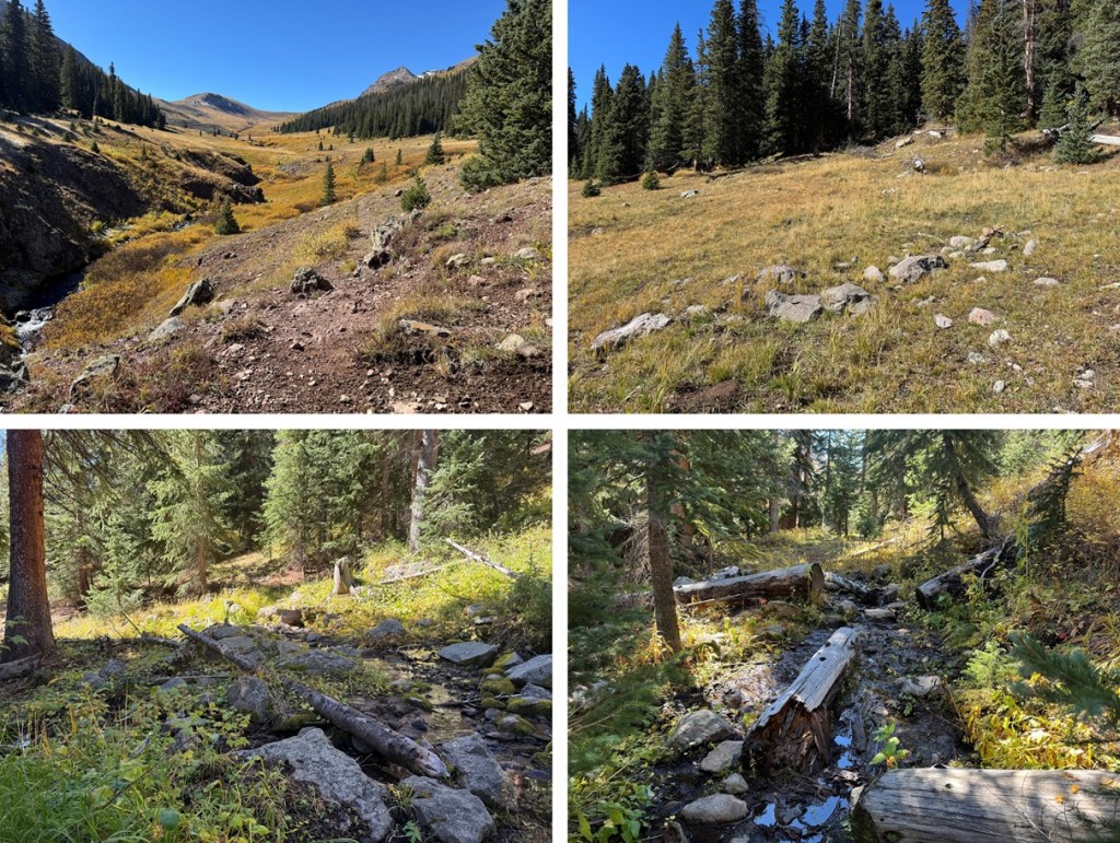
After hiking for 6 miles, and at 12050’ of elevation I found my campsite for the night.  It’s important to note this spot even if you don’t plan on making this an overnight, as this is where you’ll cross the creek again. 

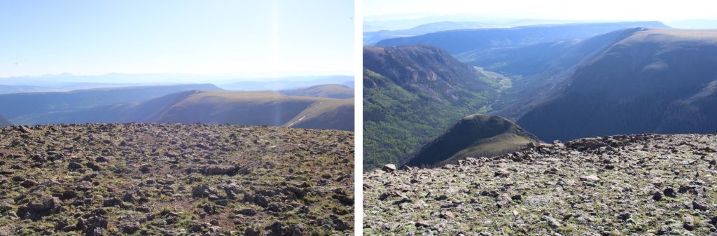
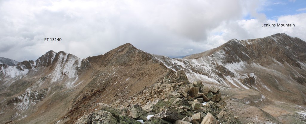
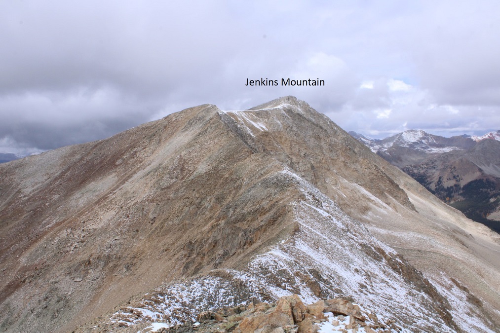
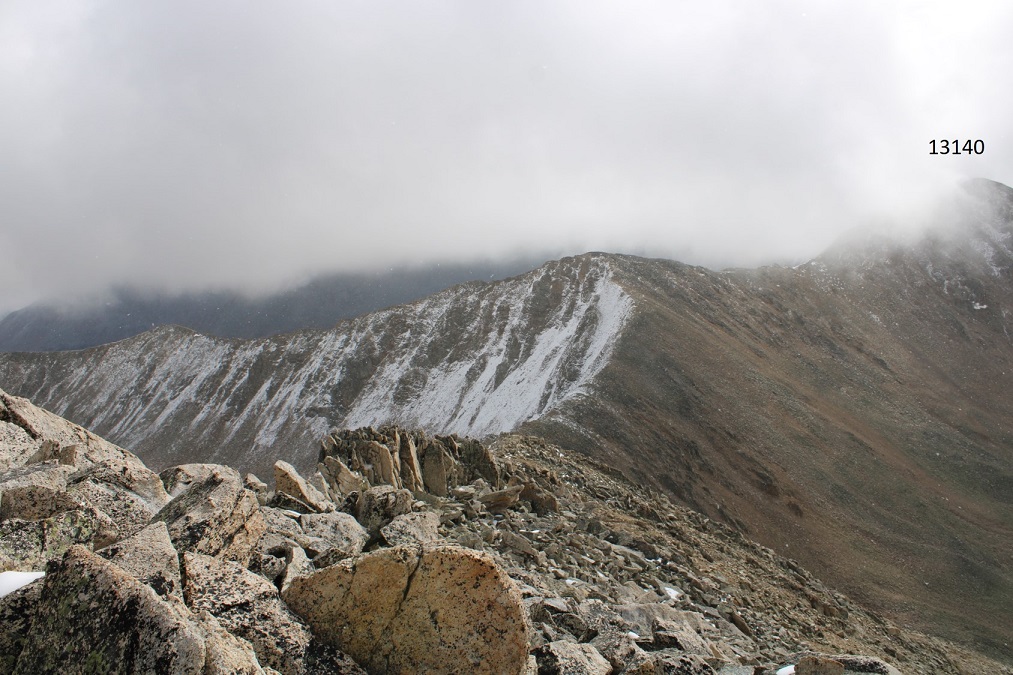
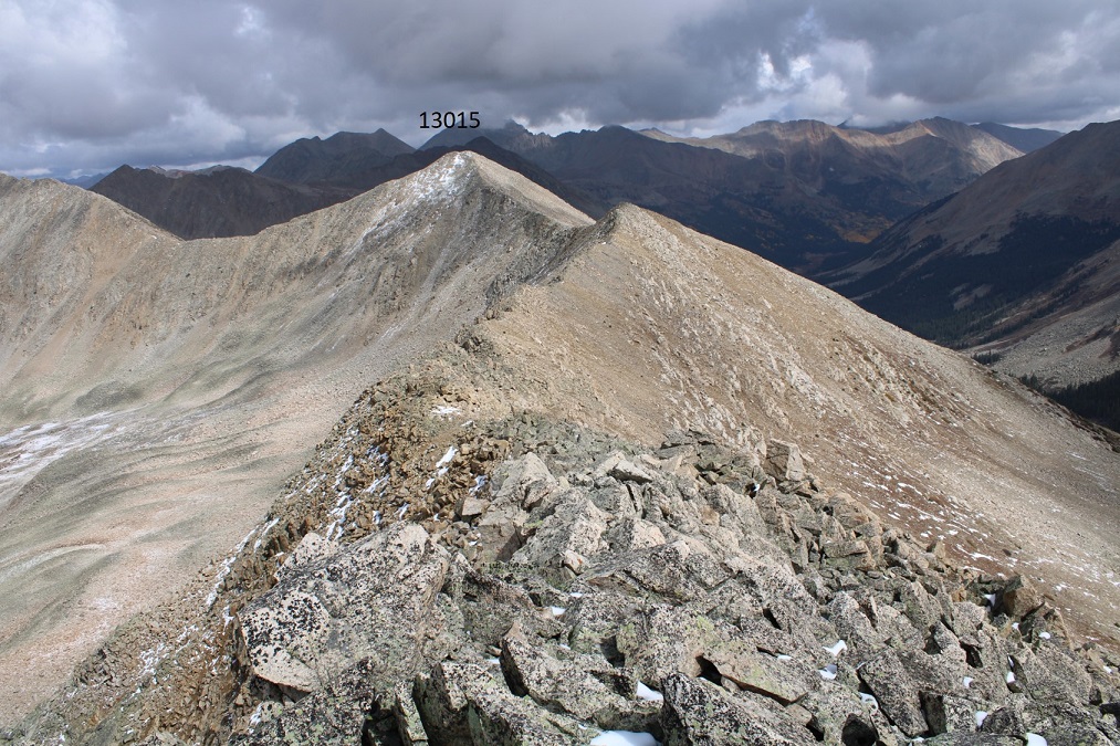
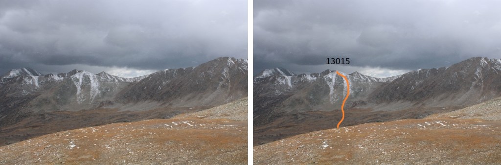
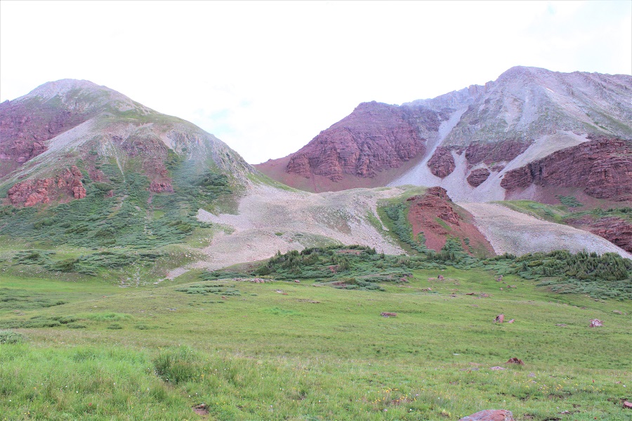
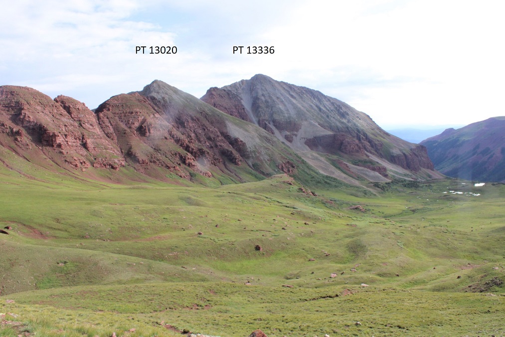
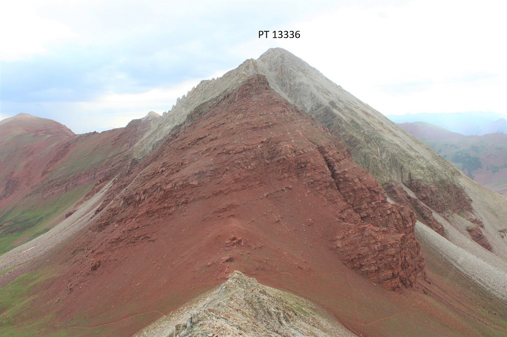
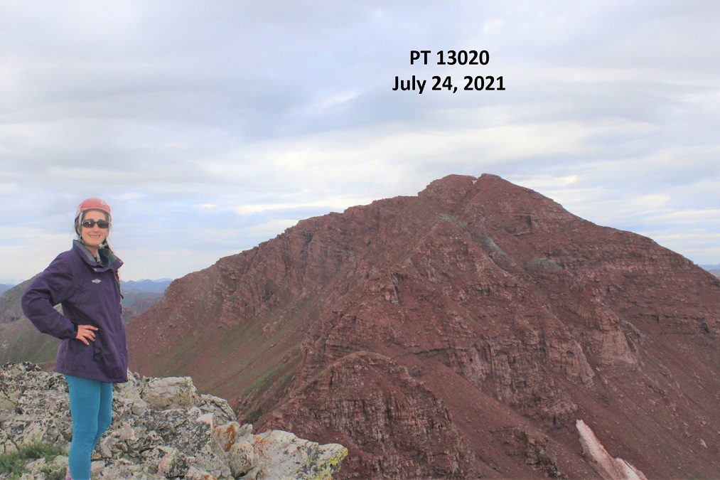
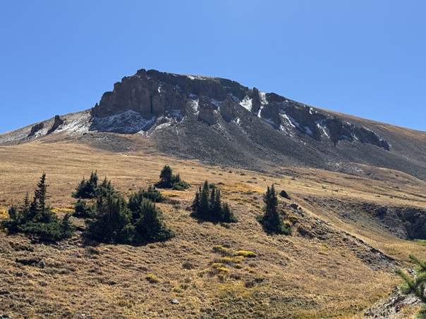
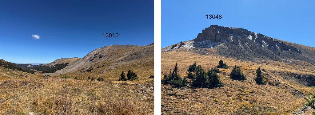
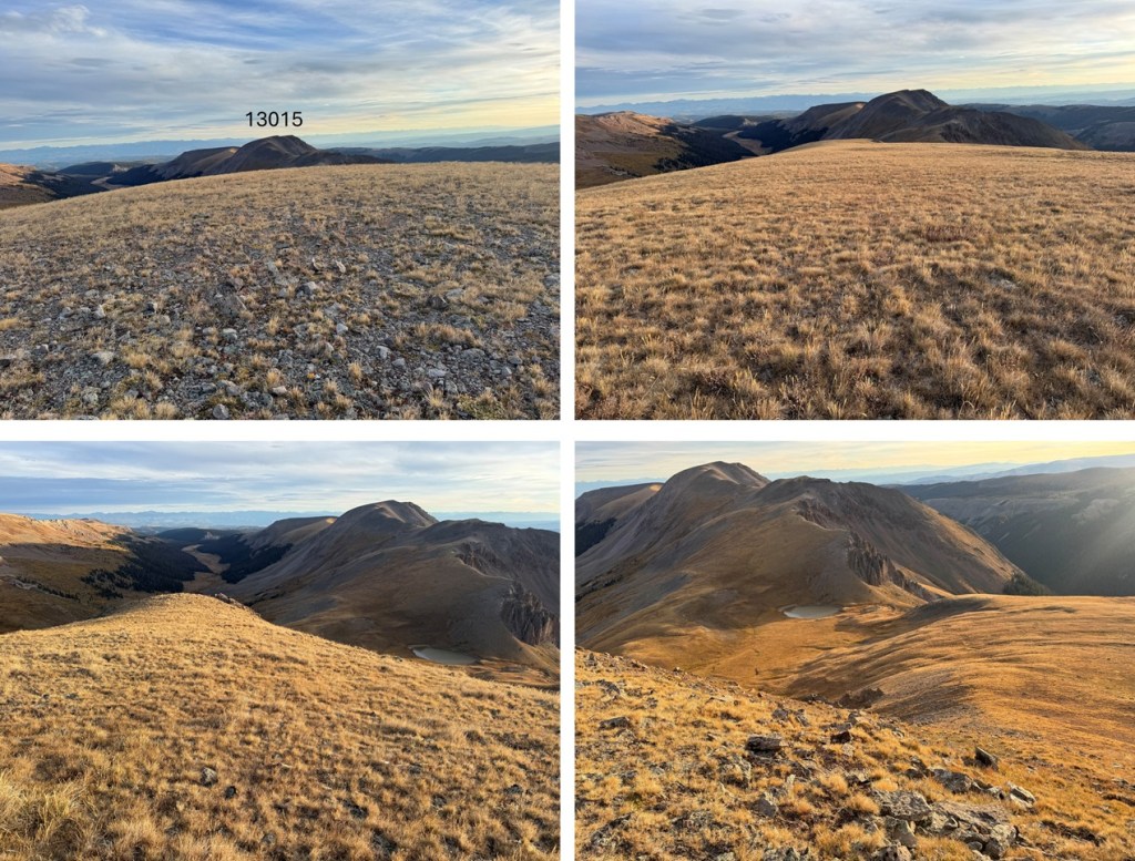
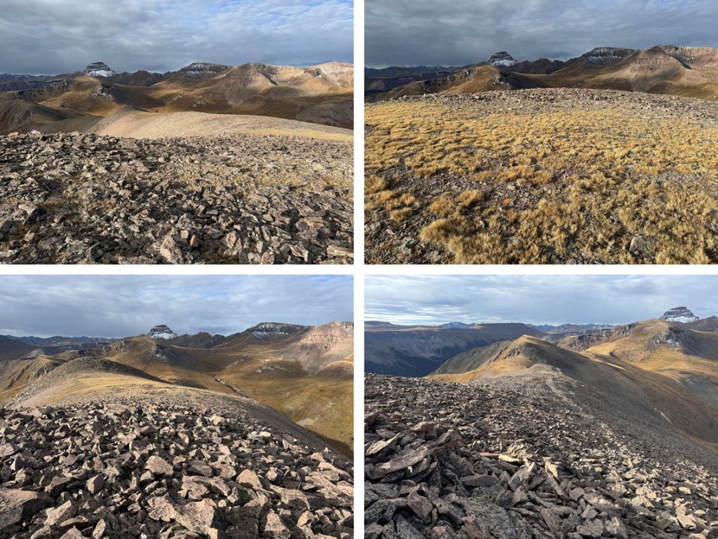
It took me just under 3 hours from the trailhead to my campsite.  I set up camp and enjoyed the rest of my afternoon.  I saw two different herds of elk, lots of raptors, and had amazing views of the peaks nearby.  I could see PT 13015 to the northeast, and PT 13048 to the south.  It was my goal to just enjoy the solitude.

It was a long night, but that was just because I could hear the elk bugling and calling to each other.  I’m also pretty sure I heard a cow moose at one point.  This was why I’d made this trek an overnight: to enjoy the wildlife and fall scenery.  It was worth it.  I was the only one in the basin the entire time I was there.  The next morning I was up and on the trail by 7am.  I crossed the creek on a game trail and headed for the 13015/13048 saddle on tundra. 

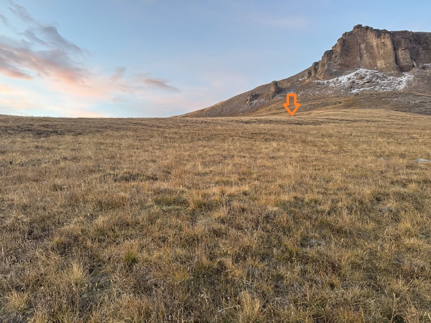
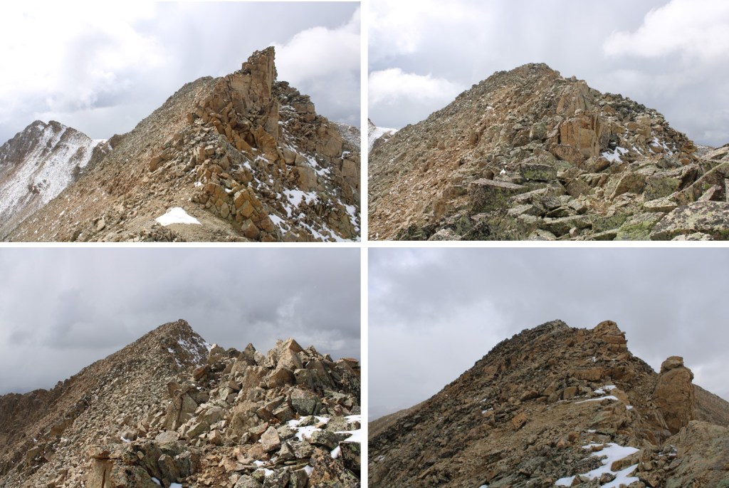
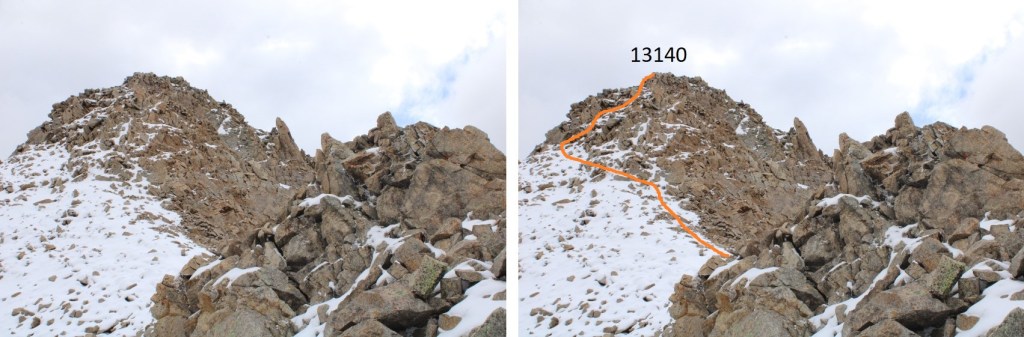
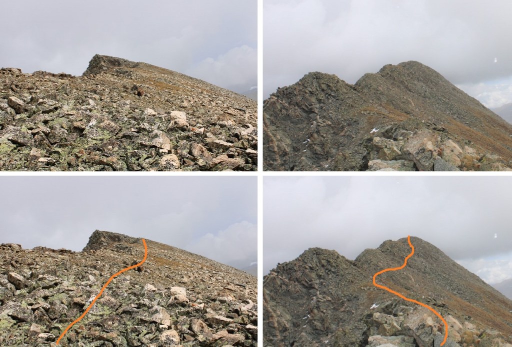
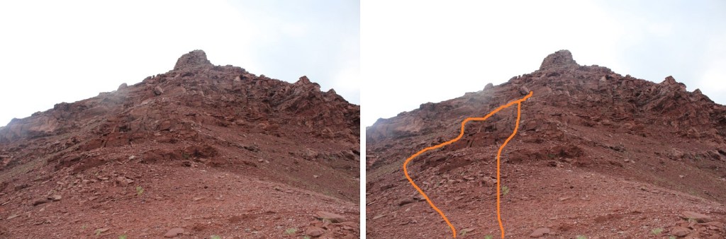
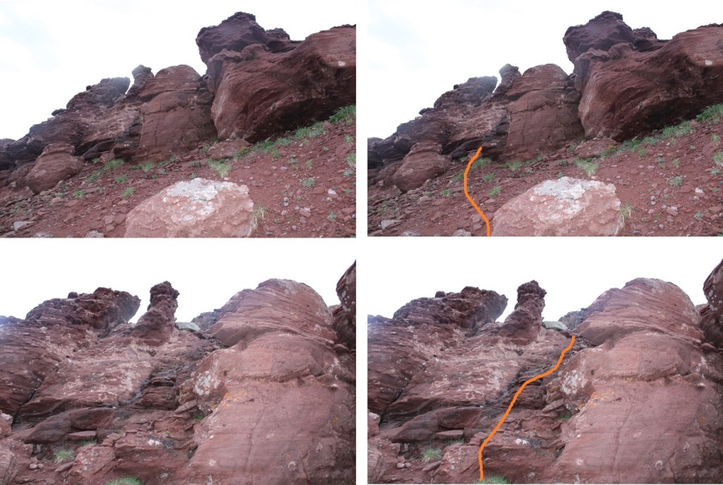
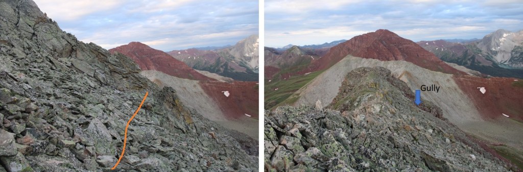
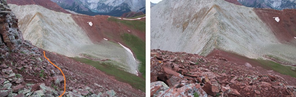
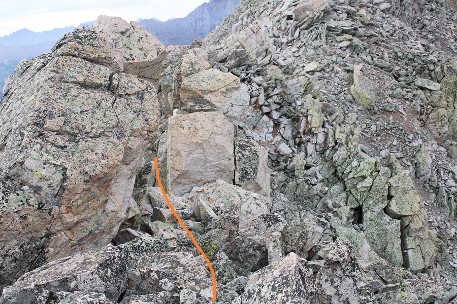
Once on the saddle my first objective was 13048.  I turned right and headed up a small gully to the ridge.  This was a class 2 gully and easy to navigate. 

At the top of the gully I turned right to gain the ridge, also on class 2 tundra.

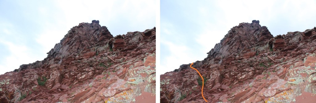
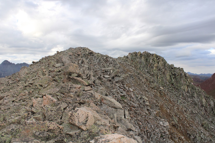
Once I’d gained the ridge I followed it southwest on easy tundra terrain to the summit.

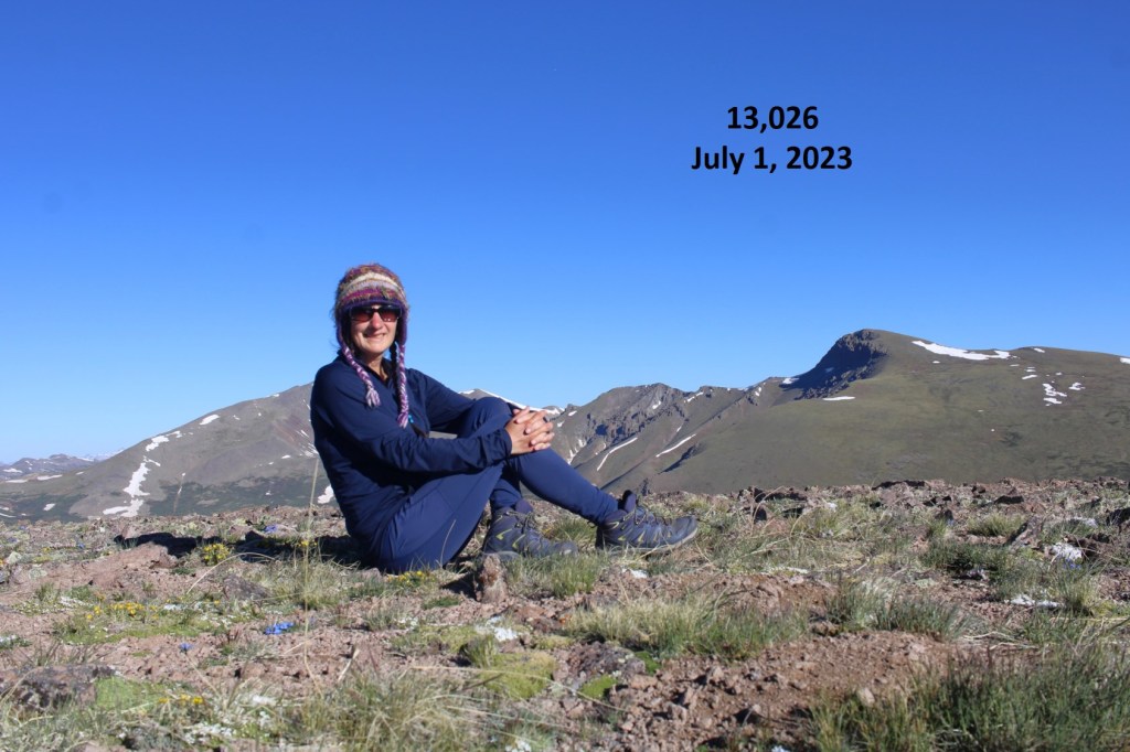
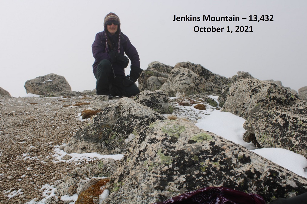
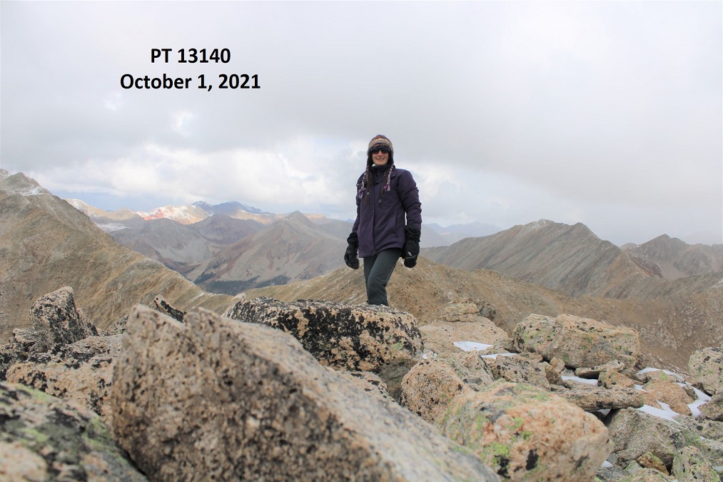
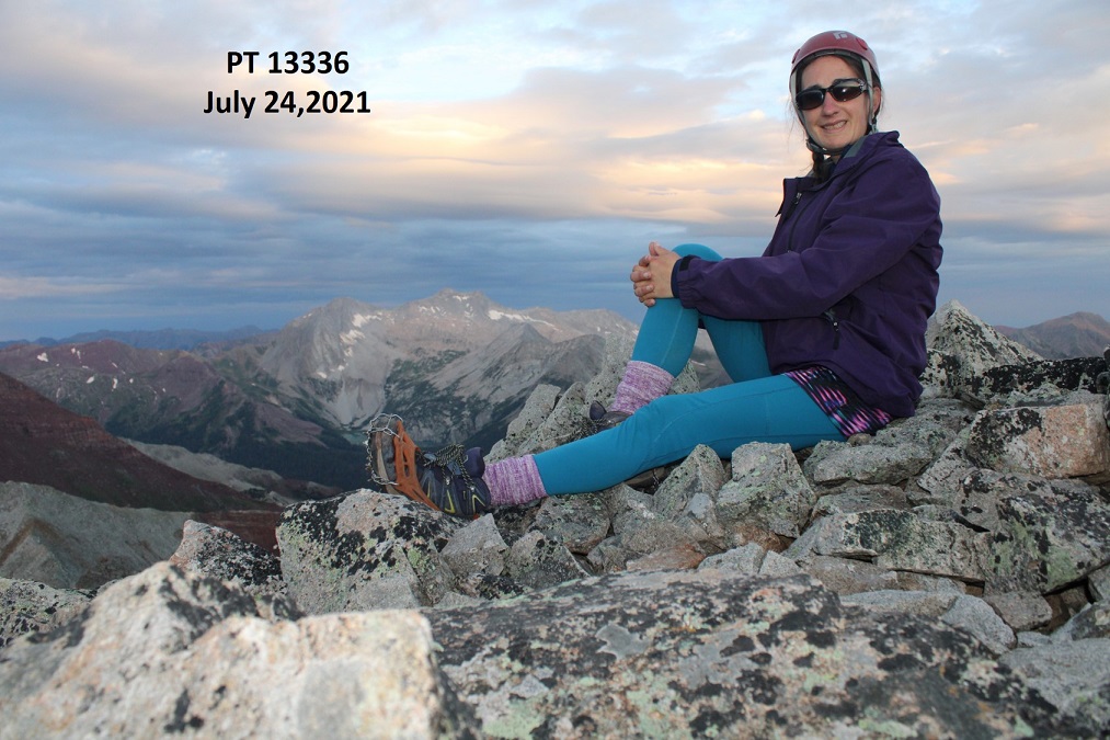
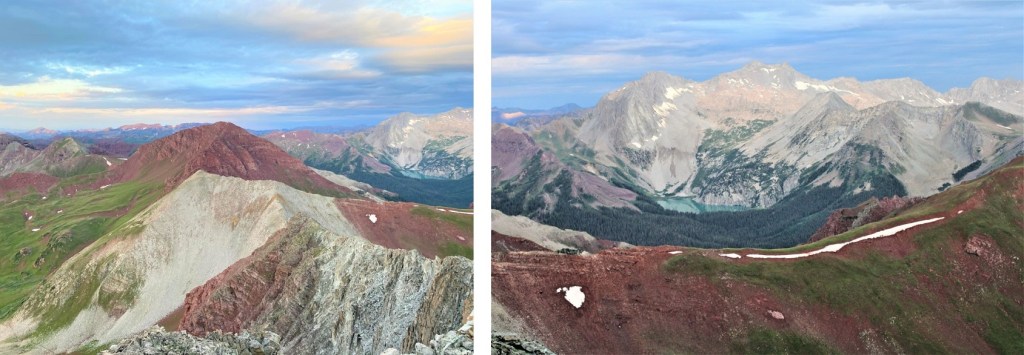
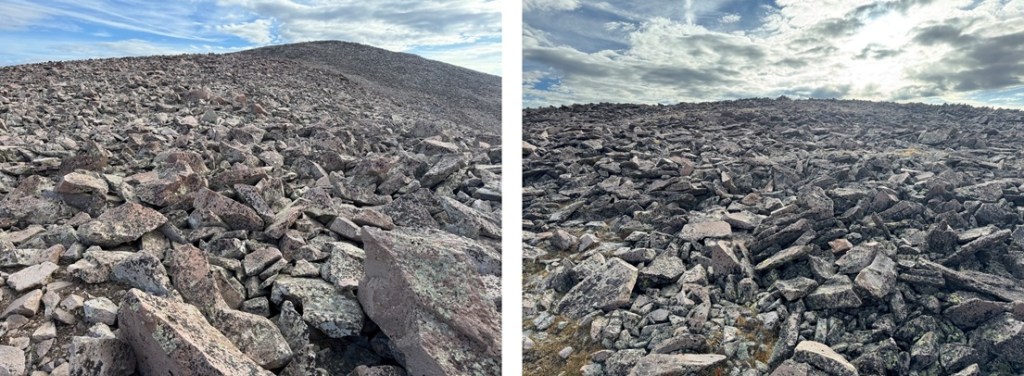
I summited PT 13048 at 7:30am
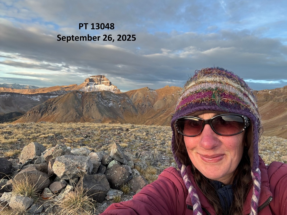
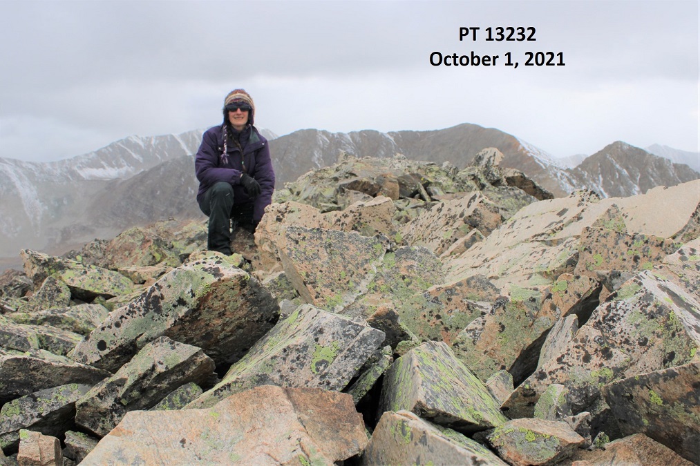
PT 13048:

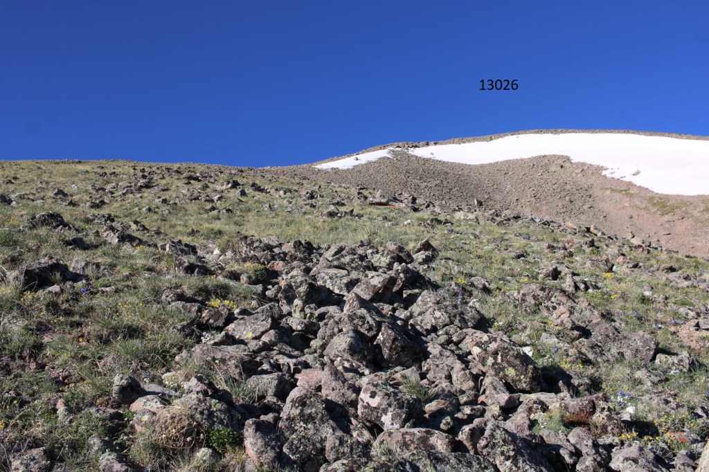
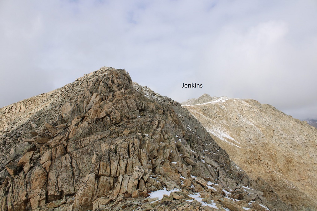
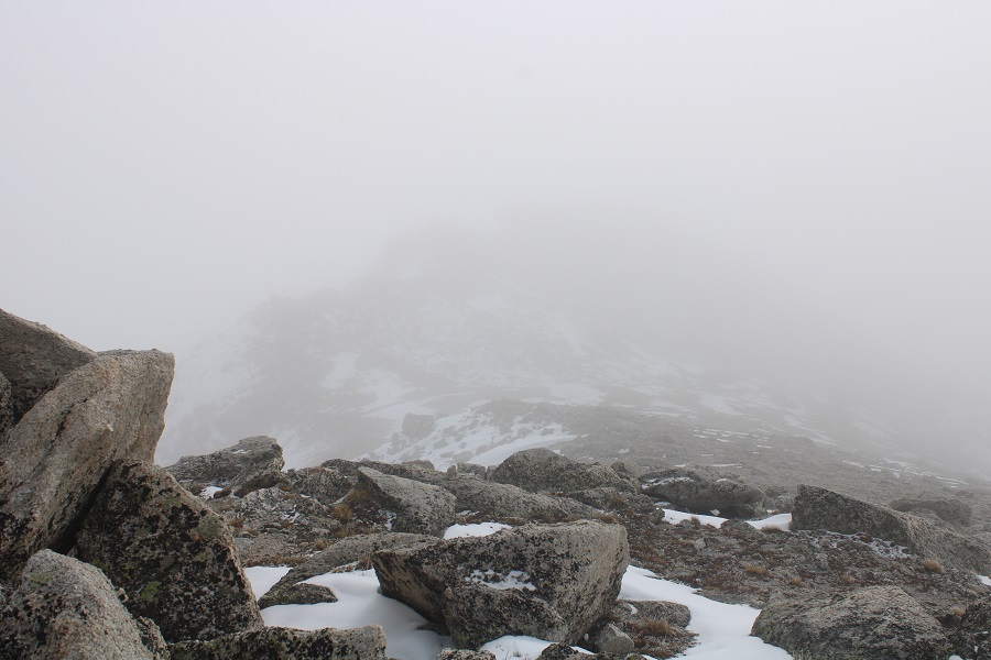
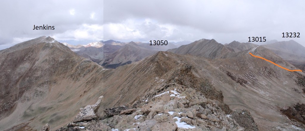
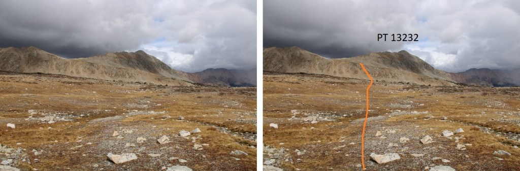
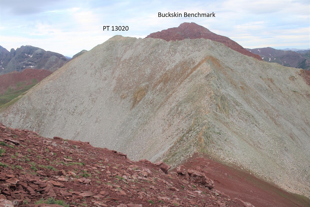
I could see PT 13015 to the northeast, so I descended back to the 13015/13048 saddle.

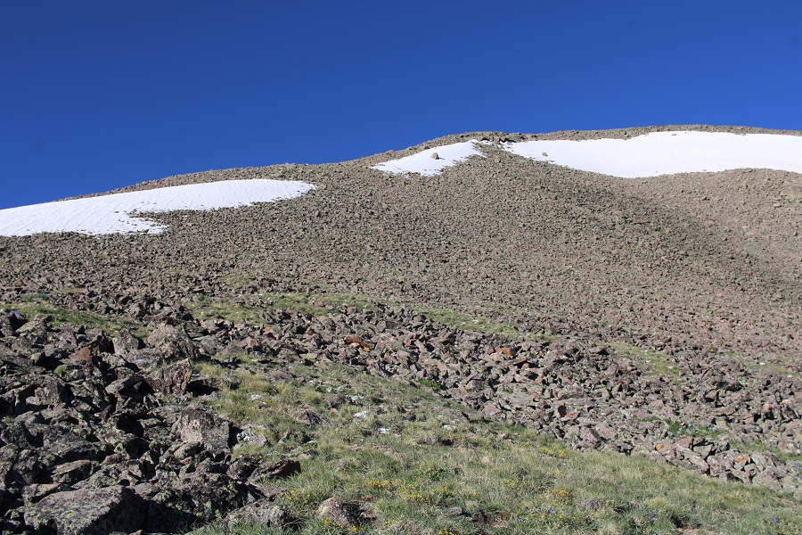
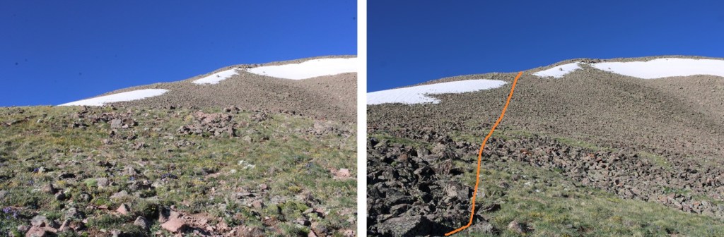
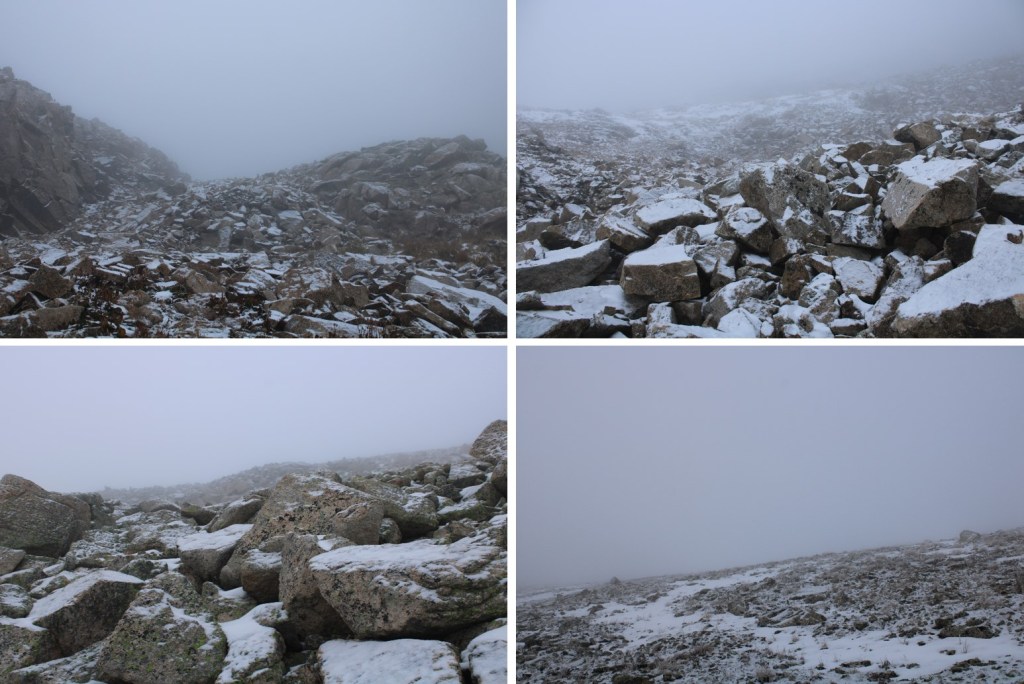
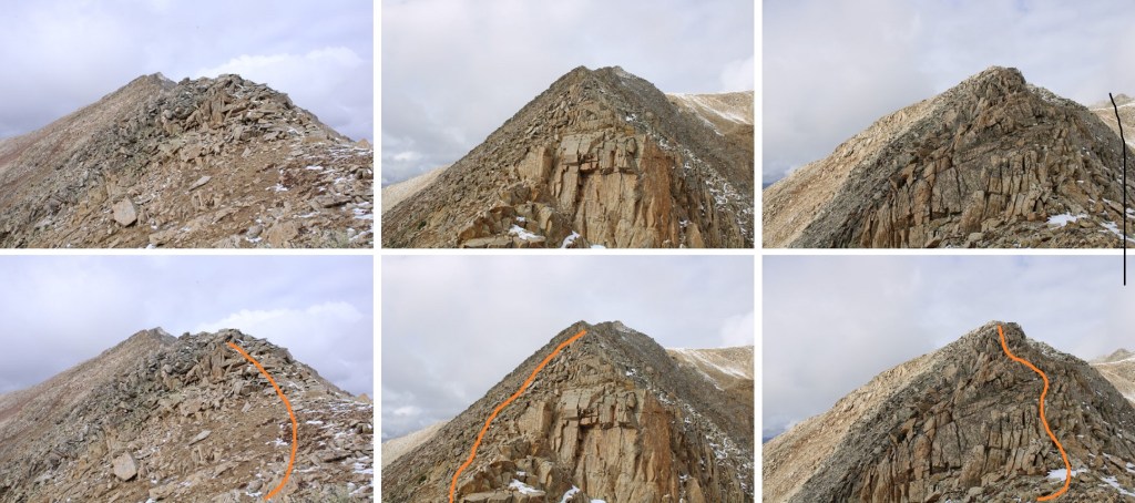
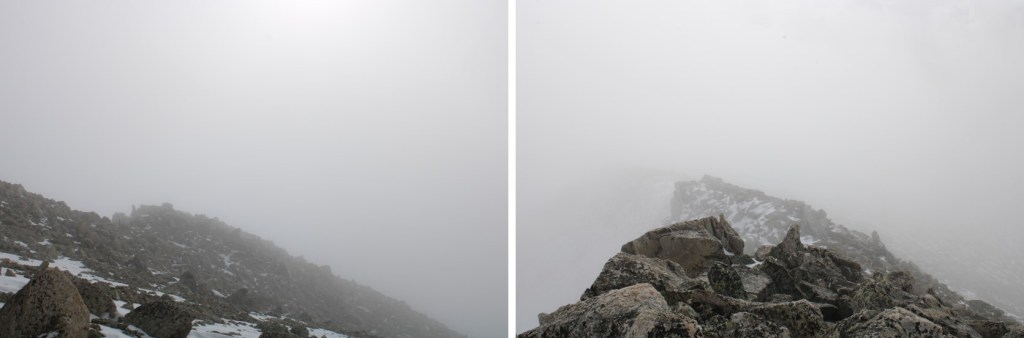
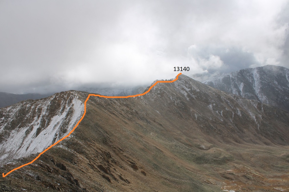
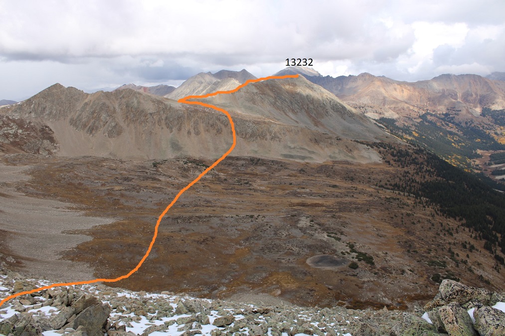
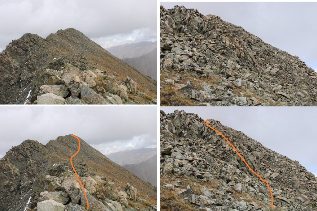
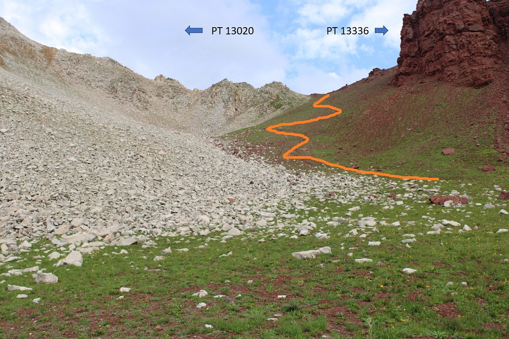
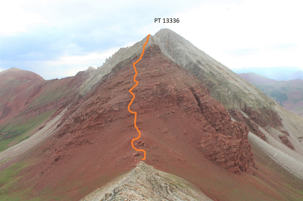
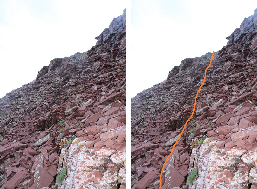
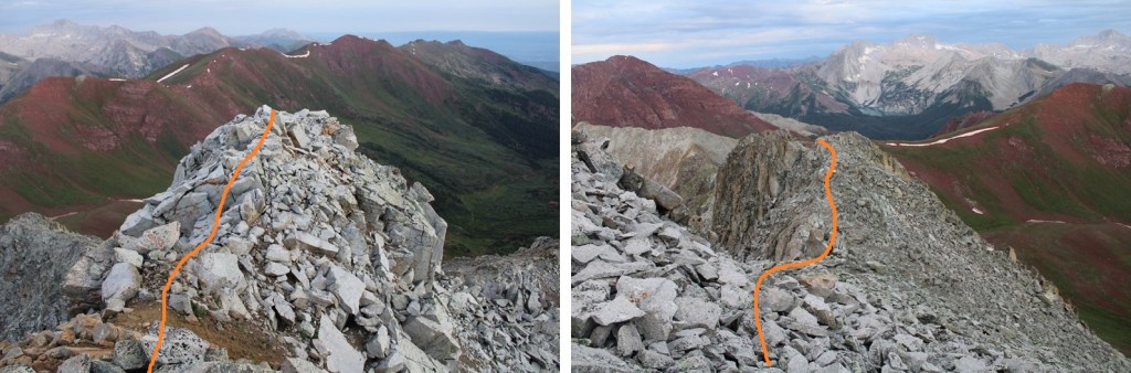
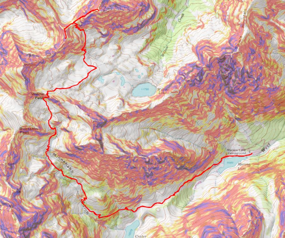
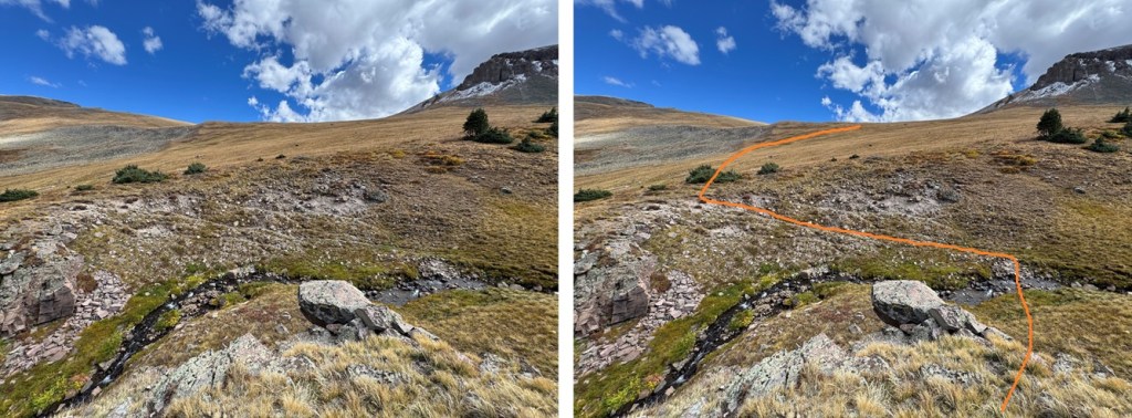
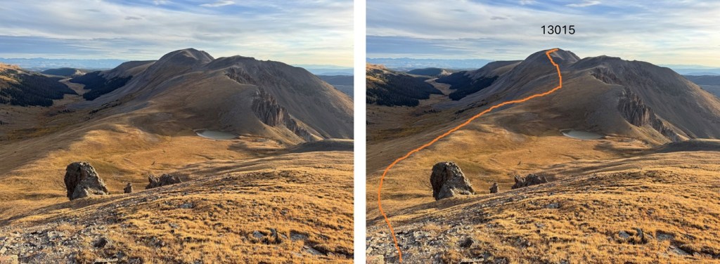
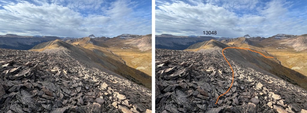
Here’s my overall route to the summit of 13015.  It’s all class 2 on mostly tundra and then rocks at the end.

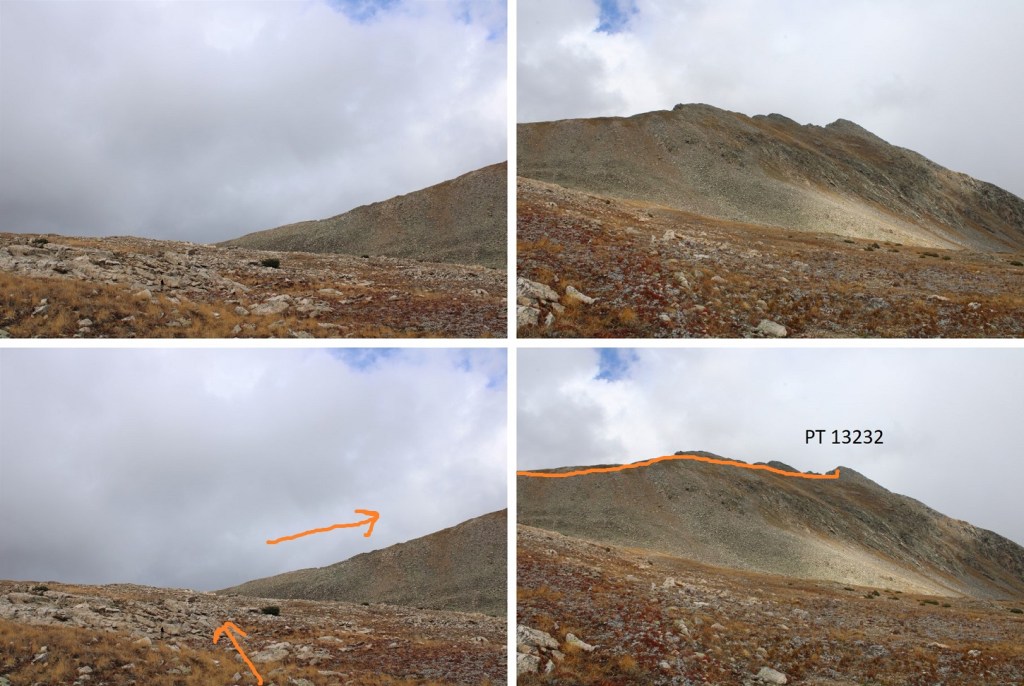
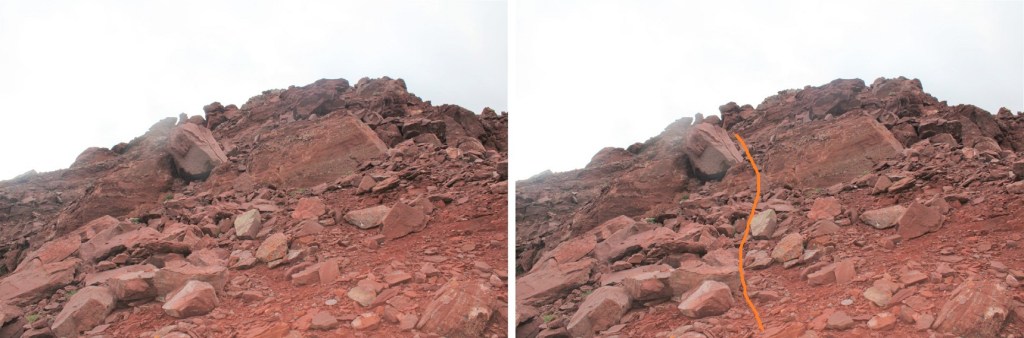
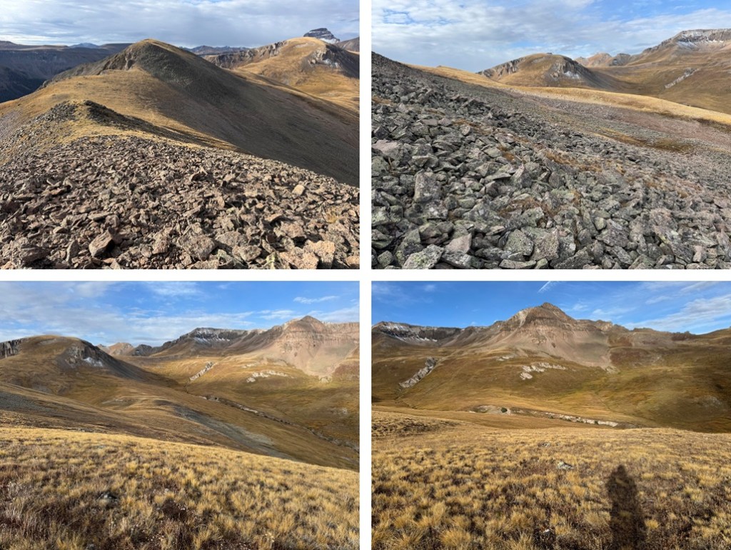
Back on the saddle I aimed for a low point in the tundra

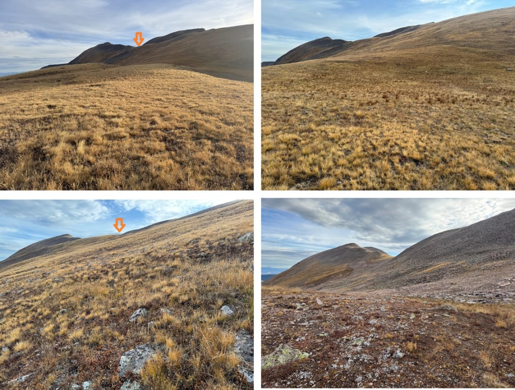
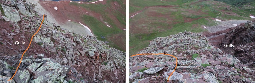
Then I rock hopped to the saddle.

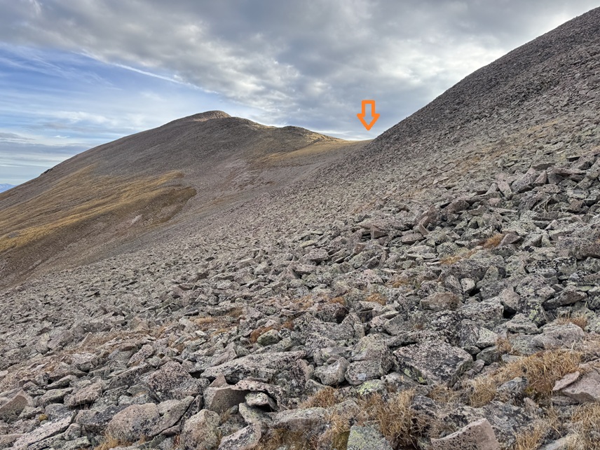
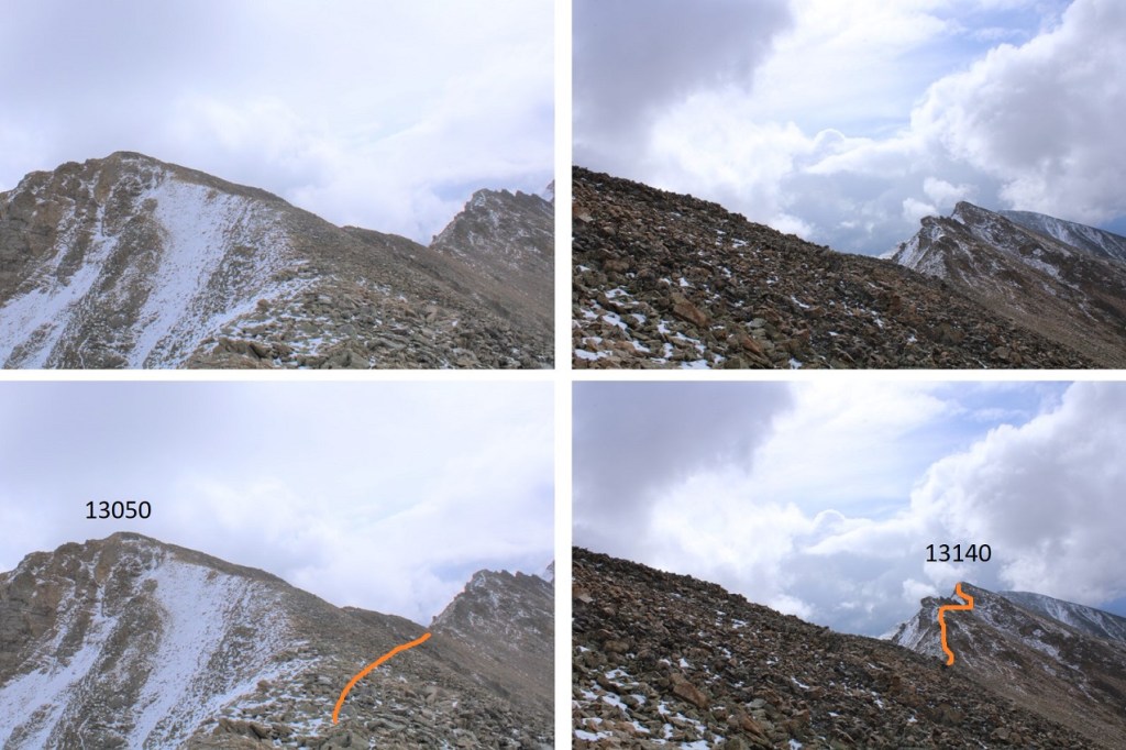
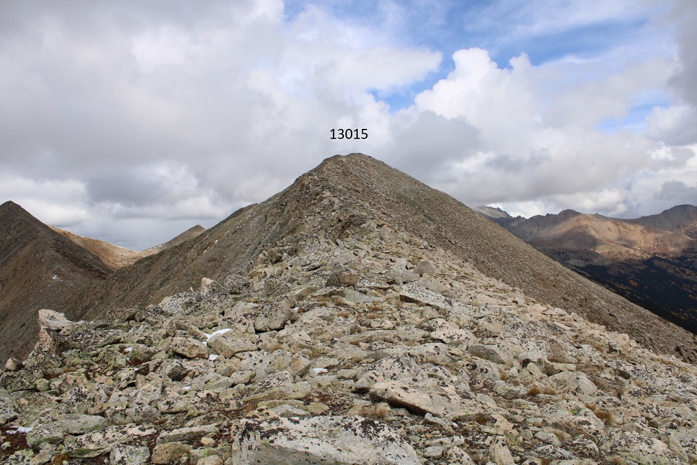
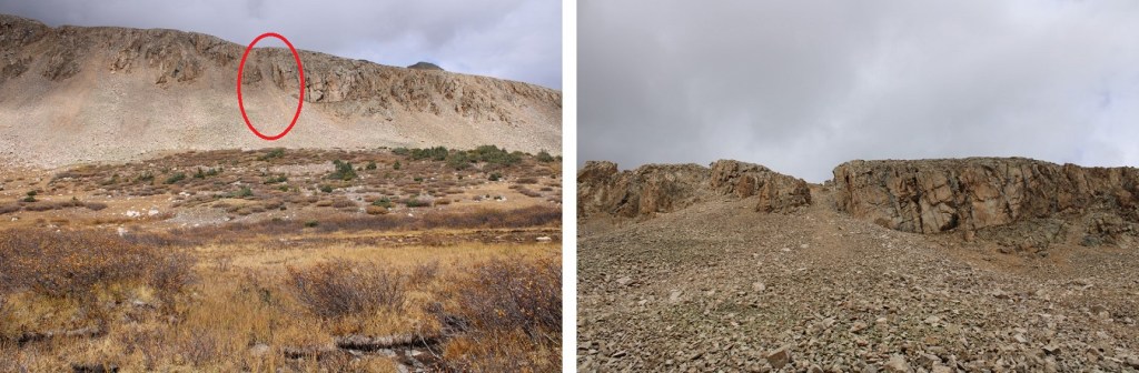
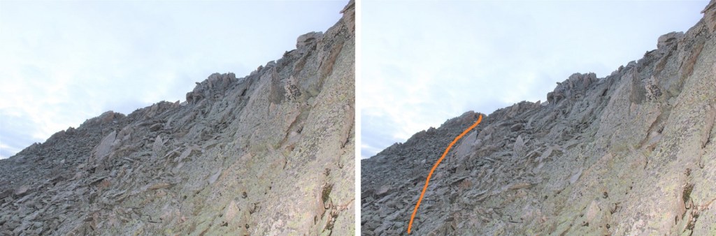
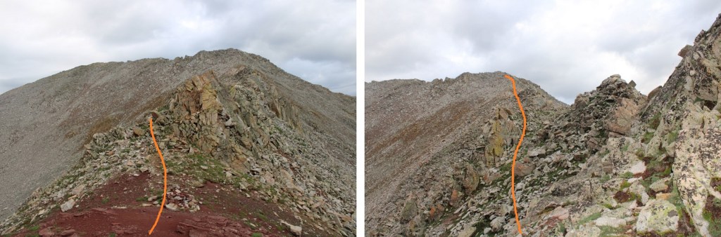
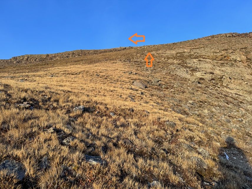
Once on the ridge I followed it north to the saddle.  There was a game trail here to follow.  There are a few false summits, and the last one has a trail that goes to the left so you don’t need to summit it if you don’t want to. It’s rocky, but all class 2.

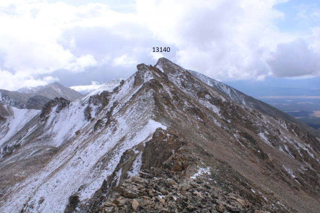
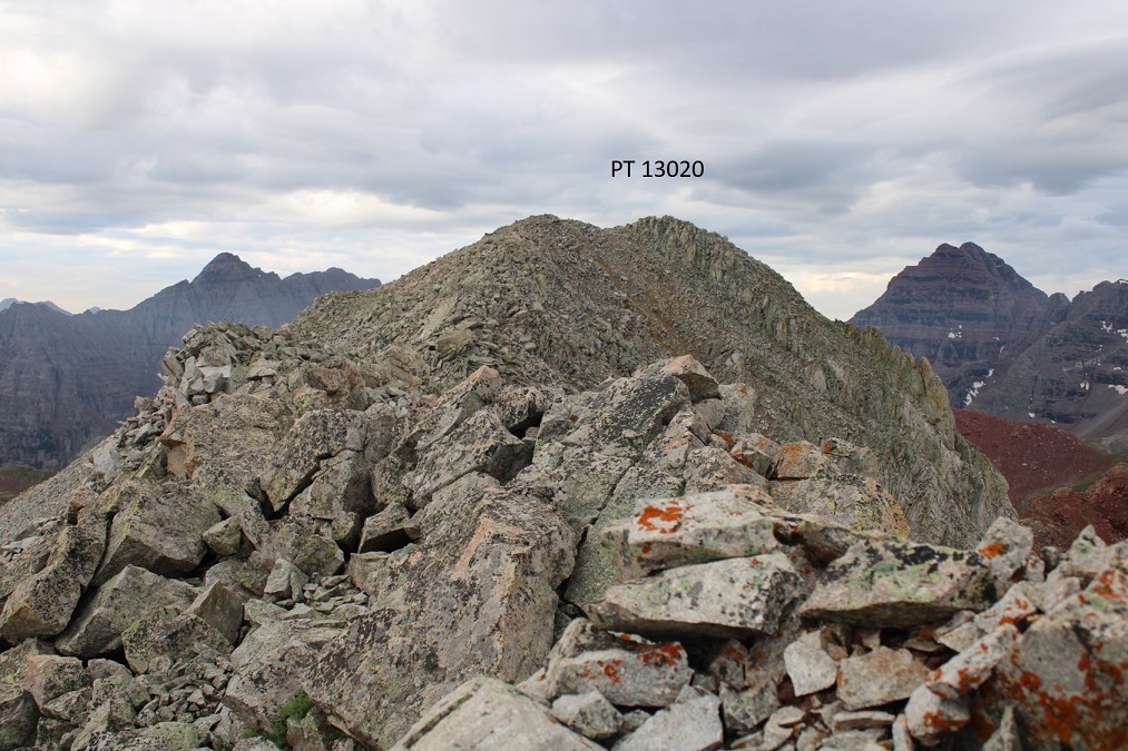
I summited PT 13015 at 8:30am

PT 13015:

By this point it was very windy and very cold.  I need to start carrying my balaclava again.  I turned and headed back down towards the saddle.

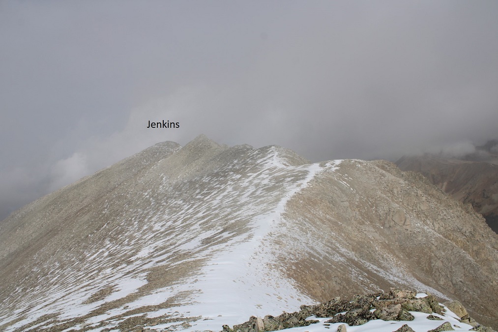
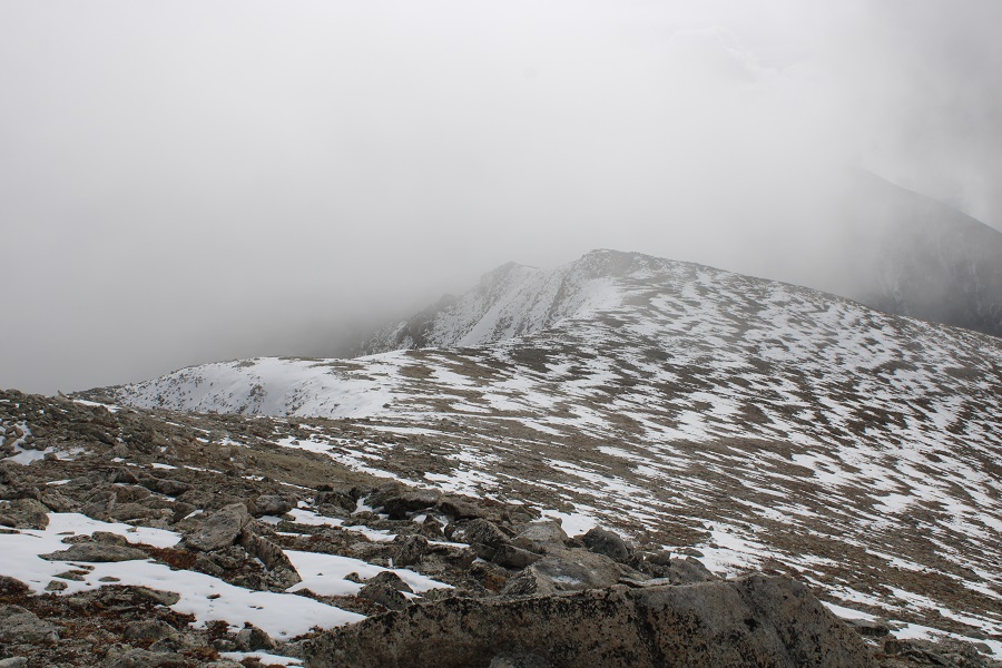
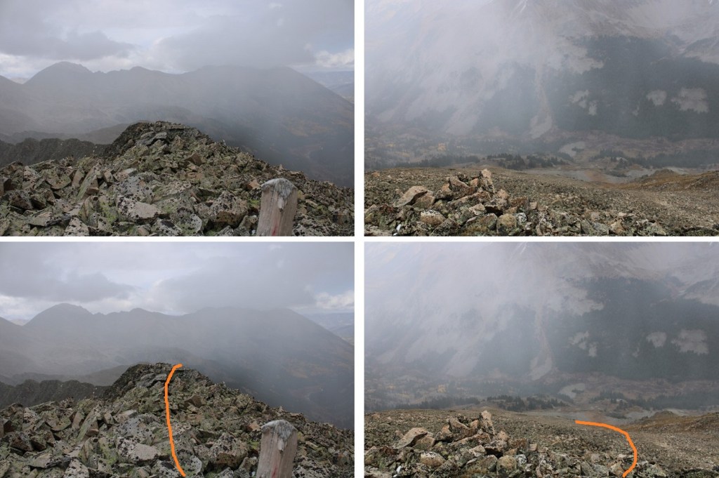
Here’s the overall route back to my campsite:

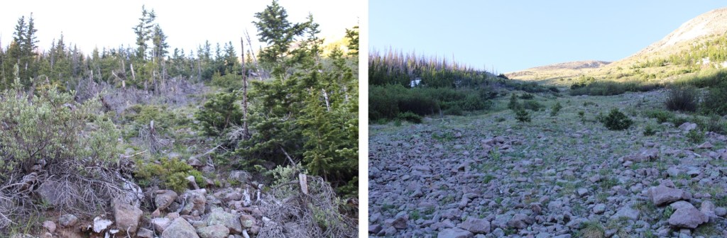
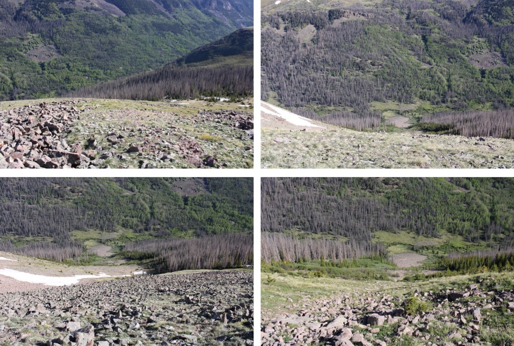
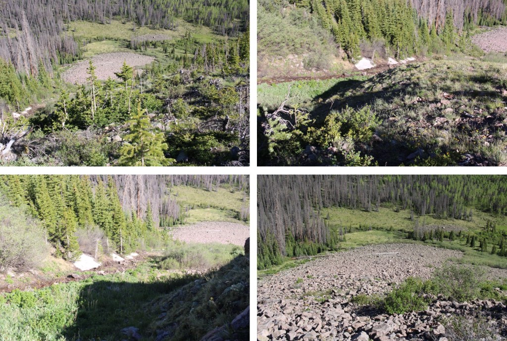
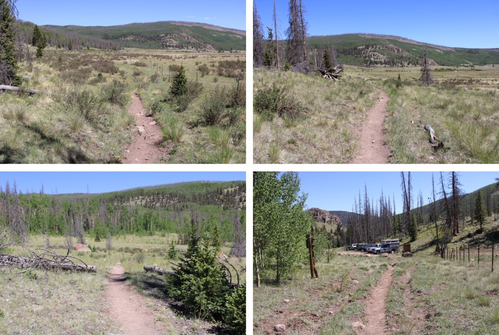
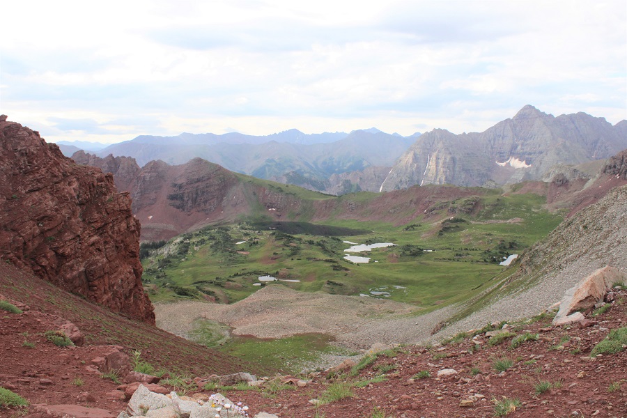
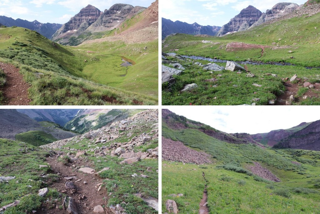
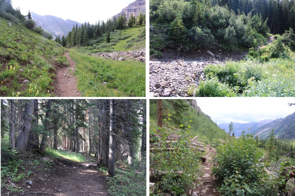
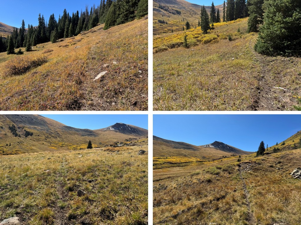
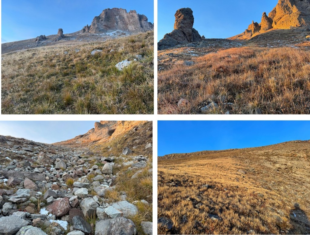
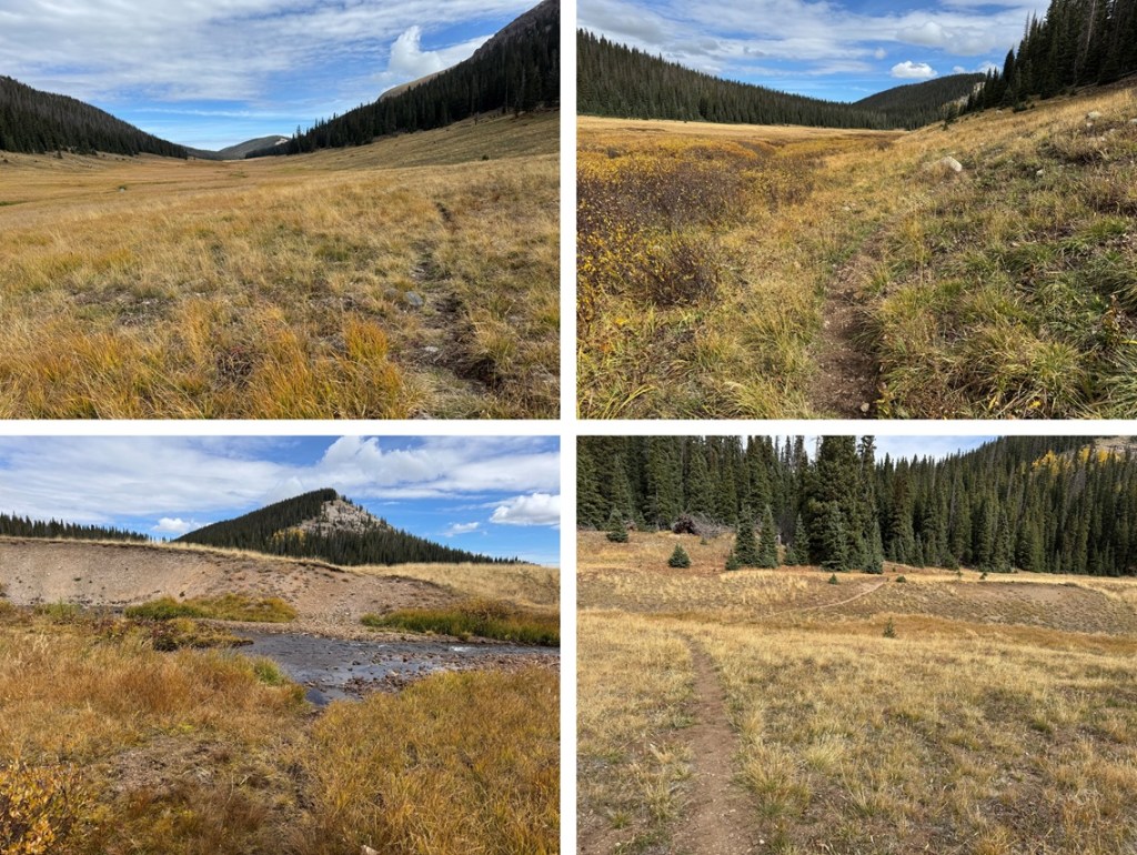
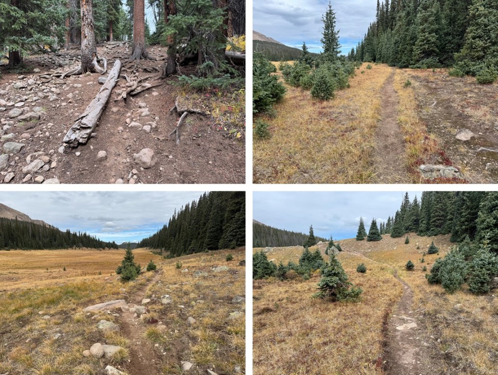
I made it back to my campsite at 9am, so I’d summited both peaks in under 2 hours.  I ate breakfast, packed up my gear, and was back on Fall Creek trail heading north by 9:30am.  Here are some pictures of the 6 miles back to Fall Creek Trailhead.

I made it back to the trailhead at 11:50am, making this a 16.36 mile hike with 3188’ of elevation gain.

On to the next trailhead!

13,026

RT Length:  12.96 miles

Elevation Gain:  2979’

Day 3 at the Eddiesville Trailhead, and I really, really didn’t want to get out of bed.  It had been between 25-30 degrees the past two mornings when I woke up, and this morning it was going to be even colder.  There had been a thunderstorm last night, and I knew there would be a thick layer of frost on the ground.  And it was cold.  I mean really, really, cold, and I had a creek crossing I knew I was going to have to get through.  I have Raynaud’s, so this is actually something rather dangerous for me to attempt, especially in cold weather so far from communication.  And all I had to wear were yoga pants and a thick jacket.  The weather forecast had called for warmer weather, so I hadn’t brought my warm snow pants.  I stayed under the covers for about 15 minutes, contemplating if I should even go out.  I mean, I didn’t even know if the route I was going to attempt ‘went’.  Then, all of the sudden, something clicked.  I started asking myself if it were really worth it, and immediately my attitude changed, and I shot out of bed.  No, I love mountaineering, and that comes with being uncomfortable sometimes.  This was all mental, and I needed to get myself out of this funk.  I never regret a hike, and I was just being silly.  Once I started hiking, I’d warm up.  I had to just rip the band aid off and go. 

I was on the trail at 4:15am.  The trail starts off at the south end of the parking area.

I followed the Colorado Trail south and then southwest for 5.4 miles.  This is a well maintained, class 1 trail, easy to follow, even in the dark.

After hiking for about 5.4 miles, I came to a clearing, and to my left I could see an avalanche runout.  It was my plan to climb up this runout and see if I could summit the peak this way.

I left the trail, and sat down on a rock to exchange my hiking shoes for my stream crossing shoes.  The creek was too big to pole vault across, and the water level was too high to rock hop, so even though it was 5am and freezing cold out, I was going to cross the stream and get my feet wet. 

Imagine my surprise when the water was warm!  Well, not warm exactly, but warmer than the 25-degree air I’d been hiking in.  It was an easy stream crossing, with the water coming up to just above my knees.  I exited the stream, changed back into my socks and hiking boots, and was on my way. 

This is the route I took up the avalanche drainage

And some step-by-step photos.  This ended up being about 2000’ of elevation gain in 1 mile.

Eventually, the terrain gave way to tundra

Once I made it to the ridge, I turned right, and followed it southeast to the summit.  The terrain here was still all class 2, starting out as tundra and then changing to rocky.

I summited 13,026 at 7:45am

13026:

And now, to head back down. I just retraced my steps back to the avalanche runout, heading northeast

And then made my way back down to the creek

I crossed the creek again, and headed back to the Colorado Trail

I then took the Colorado Trail northwest back to the trailhead.  I’d been on this trail 3 times in the past 3 days, and this afternoon I noticed bear tracks along the trail.  A bear must have come through last night, as these tracks hadn’t been there before.

Here are some pictures of the trail back to the trailhead

I made it back to my truck at 10:45am, making this a 12.96 mile hike with 2979’ of elevation gain in 6.5 hours.

On to the next trailhead!

Jenkins Mountain – 13,432, PT 13,145 & PT 13,232

RT Length:  13.75 miles

Elevation Gain:  5322’

Snow had been forecasted for today, but not until later in the afternoon. I made it to the North Fork Creek Trailhead on an easy 4WD road, and it was foggy out.  I was hoping the fog would lift as the sun came up, but it ended up snowing off and on all day. Luckily there was no wind, so the snow was actually enjoyable (if annoying because I couldn’t see very far).   I was on the trail at 5:30am.

I followed North Fork Creek Trail for 2.75 miles southwest to treeline at 11,250’, without gaining or losing much elevation. I never crossed the creek.

Here the trail stopped. I’d hoped by now the sun would have lifted the fog, but unfortunately, it started snowing instead, and visibility wasn’t great.

Here’s a view of the route I took to the ridge, from back on the trail later in the day

I followed the path of least resistance and headed southwest towards a rocky gully and the ridge (better pictures later).  There was a fog, so I didn’t get great photos, but here are some pictures of what I could see:

The rocky gully area brought me to the ridge between point 13050 and 13015. I couldn’t see far, which was frustrating, but I knew to continue following the ridge southwest. Luckily, I came back to this spot later I the day, so I have clear pictures of this part of the hike.  The rocks here rolled.  In the morning they were icy, so I had to be especially careful.

I followed the ridge towards 13050. This ridge was easy to follow, even when it was snowing.  I stuck to the ridge proper, only dipping down to the left one time.  This can all be kept at class 2.

Once at PT 13050 I turned right and headed northwest towards Jenkins Mountain, first losing about 230’ of elevation.

This was another ridge hike, where I briefly dipped down to the left to avoid some rocks

Here are some pictures of the ridge, up to the first “false summit”.  If you can’t stay on the ridge, dip down to the left.

From the top of the false summit, I lost a little bit of elevation, but it was an easy ridge hike to the true summit of Jenkins Mountain.  I’m sure this would be a piece of cake on a clear day. Today however, the ridges were frustrating because I didn’t have visuals of how far they ‘went’

I summited Jenkins Mountain at 10am

Jenkins Mountain: 

I was happy to see it looked like the weather was starting to improve.  There was a summit register.  I turned and headed back towards PT 13050.

Halfway down the ridge I could see PT 13050, as well as PT 13140

I didn’t completely re-summit PT 13050.  Here’s an overview of the route I took to PT 13140

And some step-by-step pictures

I could stay on top of the ridge for most of the ridge;  it wasn’t until the end I needed to dip right.

After the false summit I needed to dip down and lose about 75’ of elevation

I regained the ridge

And this is how I summited PT 13140.  I’m sure there was some sort of a trail here, but it was currently covered in snow. The last few feet are ‘choose your own adventure’, all class 2.

I summited PT 13140 at 11:30am

PT 13140:

From the summit, here’s looking back at the trek from Jenkins, as well as the next few points for the day

For reference, this is how I gained the ridge to the saddle between PT 13050 and 13015.  It’s kind of a ridge itself.

And another view, from PT 13140, looking back at how I exited the basin and gained the ridge. I headed back to PT 13050.

Here’s looking northeast at PT 13015 from 13050.

This was a class 2 hike all the way to PT 13015

From the summit of PT 13015 I could see my next peak:  Pt 13232. 

This is the route I took to get there:

This route had me turning and following the ridge for a short distance northwest, descending a scree, rock, and snow filled gully, crossing the basin, finding another gully and ascending it to a slanting plateau/ramp, taking the plateau to the ridge, and then following the ride to the summit. Here are some step-by-step pictures:

I lost 850’ of elevation, heading int the basin

I then headed northeast and crossed the basin, heading towards an access gully (alternately, you can lose more elevation, skirt the then re-ascend the ramp, but I wanted a more direct route. 

Here’s a closer look at that gully. It was as 2+ gully, but wasn’t technical at all.

At the top of the gully I turned left and headed towards the saddle, then took the ridge to the summit (all class 2)

Here’s looking back at the way I took down and across the basin from 13015

The ridge was rocky, but easy to follow.  I tried to stay where the rocks met the tundra.

I summited PT 13232 at 2:45pm.  It was now snowing, but it was a nice, gentle snow.

PT 13232:

I could see the trailhead from the summit to the northeast: now I just needed to get there.  I descended the ridge to the northeast. Not far, just a few yards, found a scree filled gully, and took that to tundra.  I then aimed northeast towards North Fork Lake Creek, until I found the trail and followed it back to the trailhead.

Sorry for the foggy pictures here: I was in the clouds and it was snowing much of the day.  The trailhead is circled in red

I descended to the north, and round a gully to take down heading southeast, and turned left at the tundra

I then headed northeast towards North Fork Lake Creek

For reference, here’s looking up the gully I took down from PT 13232

Once on the trail I followed it back to the trailhead. 

I made it back to y truck at 4:30pm, making this a 13.75 mile hike with 5322’ of elevation gain I 11 hours. 

On to the next trailhead!

Also, it’s fall

PT 13336 and PT 13015

RT Length:  16.3 miles

Elevation Gain:  5815’

I decided to hike these peaks from the Maroon Bells area because I had a pass and was already there.  I knew today was going to be a straightforward but long day, and it was supposed to storm in the morning, so I was up extra early and on the trail at 2am.  I started at the Maroon Lake trailhead, and passed a few deer grazing in the dark.   I skirted Maroon Lake to the right, and continued on the trail towards Crater Lake.

At the first junction I continued straight, and followed Maroon Snowmass Trail 1975 up into Minnehaha Gulch. 

I continued on this trail all the way to Willow Pass.

This is a class 1 trail that crosses a creek, then heads north through the basin.

Stay right at this sign

And follow the trail to Willow Pass.

CalTopo tells me I hiked 5 miles from the parking area to Willow Pass.  From Willow Pass you can see today’s peaks

From Willow Pass I descended 560’ into the basin

I came to the Junction for East Snowmass Trail/Willow Lake, and turned left, following the East Snowmass Trail.  

I was now following the trail towards the saddle of PT 13336 and PT 13020

The upper basin was really neat, as I could see two different types of rocks, one coming from each mountain.  The color contrast was interesting.  The trail was still class 1 to the saddle, staying on the tundra/red dirt.

Once at the saddle it’s a good idea to put your helmet on.  I decided to tackle PT 13336 first.  This is class 3, and takes place on loose rock.  You may want to put on your microspikes for added traction.  The red dirt was mushy because it had recently rained, but it was still loose.  Here’s the route I took, as seen from higher up on PT 13020 later in the morning:

And here are some step by step pictures of the route:

Easily walk around the first two obstacles to keep this part class 2

Next, you can either skirt the next obstacle to the left to keep this class 2, or go straight up and over if you like class 3

Now, keeping the ridge in front of you, the route becomes class 3.  Head between these two boulders and ease a little left

Look for a break in the rock formation and scramble up

You can now clearly see the ridge.  Keep the ridge to your right, and skirt the north side of the ridge.  There is no need to go up and over the ridge at this point.

The rock here is loose, and only gets looser. Follow the loose rock up a sort of side gully.

At the top of this rubble the rock changes.  It’s no longer the loose Maroon rock:  it now becomes the loose Snowmass rock.  This rock is very slippery when wet, and even when not, so take care.  These rocks are not stable.  Just assume they all move.  Cross this gully high.  There is still no need to gain the ridge, you can stay just a bit below

I have a feeling the terrain here shifts often, so pick your way carefully.  I traversed the ledge by staying about 50 feet below the ridge, and then gaining the ridge through a gully

At the top of the ridge you can see the true summit of PT 13336.  The terrain stays just as loose as before.

I summited PT 13336 at 6:10am

PT 13336: 

Here are some pictures of the way back to the saddle

Across the gully

And down the maroon scree

From here you can see the summit of PT 13020 and Buckskin Benchmark

It was a simple ridge hike, with just a few fun moves to the summit of PT 13020.  Here’s the overall route

And some step by step pictures. To gain the upper ridge, I skirted the rock formations to the left, but still stayed as close to the ridge as possible.

Once on the upper ridge I followed it to the summit of PT 13020, only dipping down to the left once through a gap in the rocks to keep this class 2

I summited PT 13020 at 7:20am. 

PT 13020:  

It was starting to rain, so I headed back down the ridge to the saddle.

Once at the saddle, I followed the class 1 trail back to Willow Pass

There was a large family of marmots at the Willow Lake/East Snowmass/Willow Pass Junction.  As I approached, several jumped underneath the grass, not wanting to be photographed.  I turned and headed southwest towards Willow Pass

And from Willow Pass I followed the trail back to the Maroon Lake Trailhead

I made it back to the trailhead at 10:45am, making this a 16.3 mile hike with 5815’ of elevation gain in 9 hours, 45 minutes

And, just because I have room for one more picture, can we all take a minute to appreciate jut how beautiful this area is?