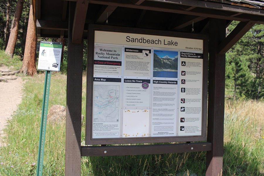
I parked at the Sandbeach Lake Trailhead at Rocky Mountain National Park, and was on the trail at 4:30am.
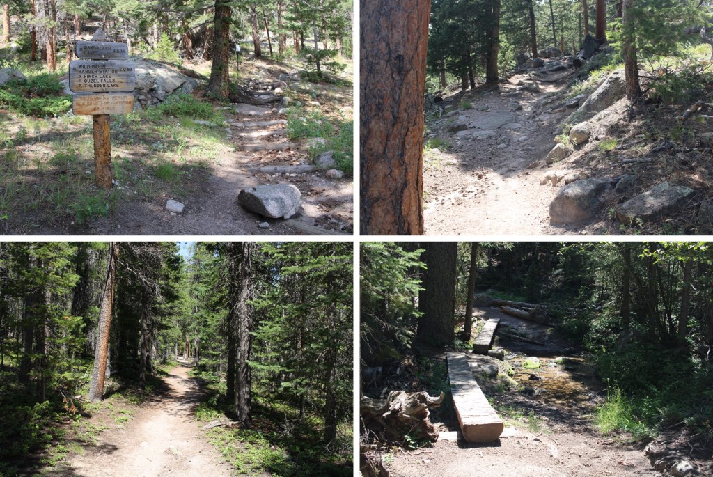
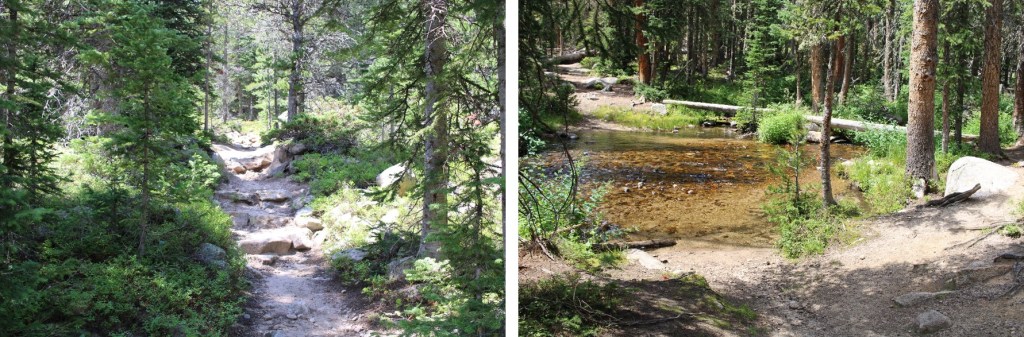
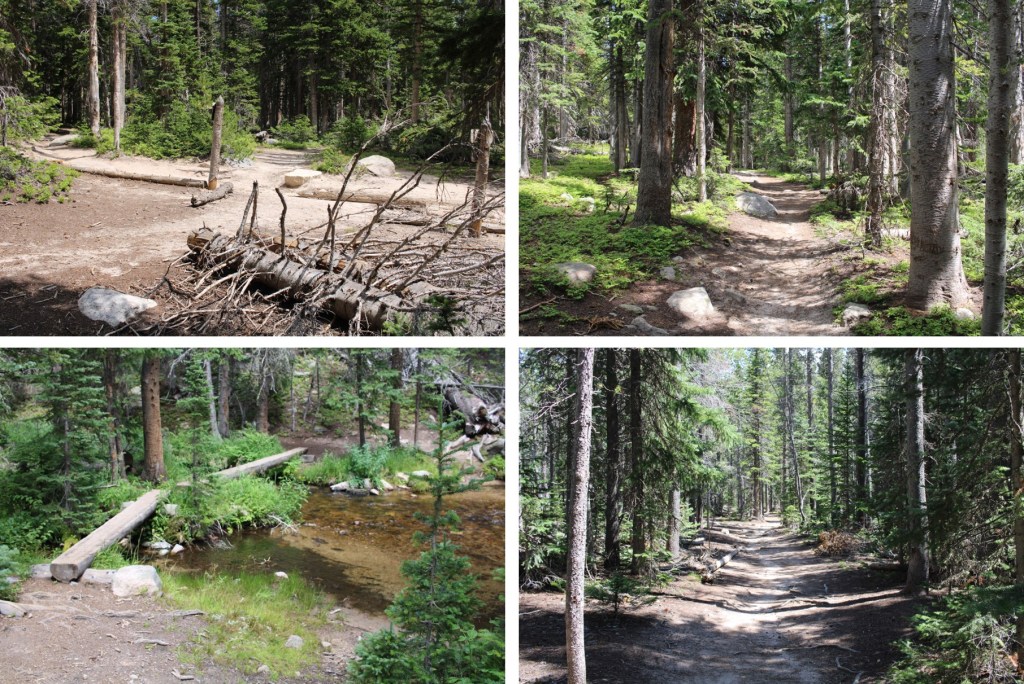
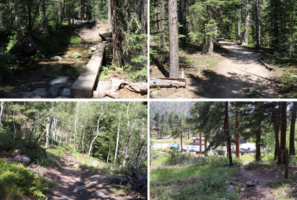
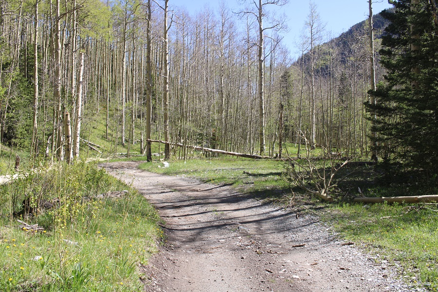
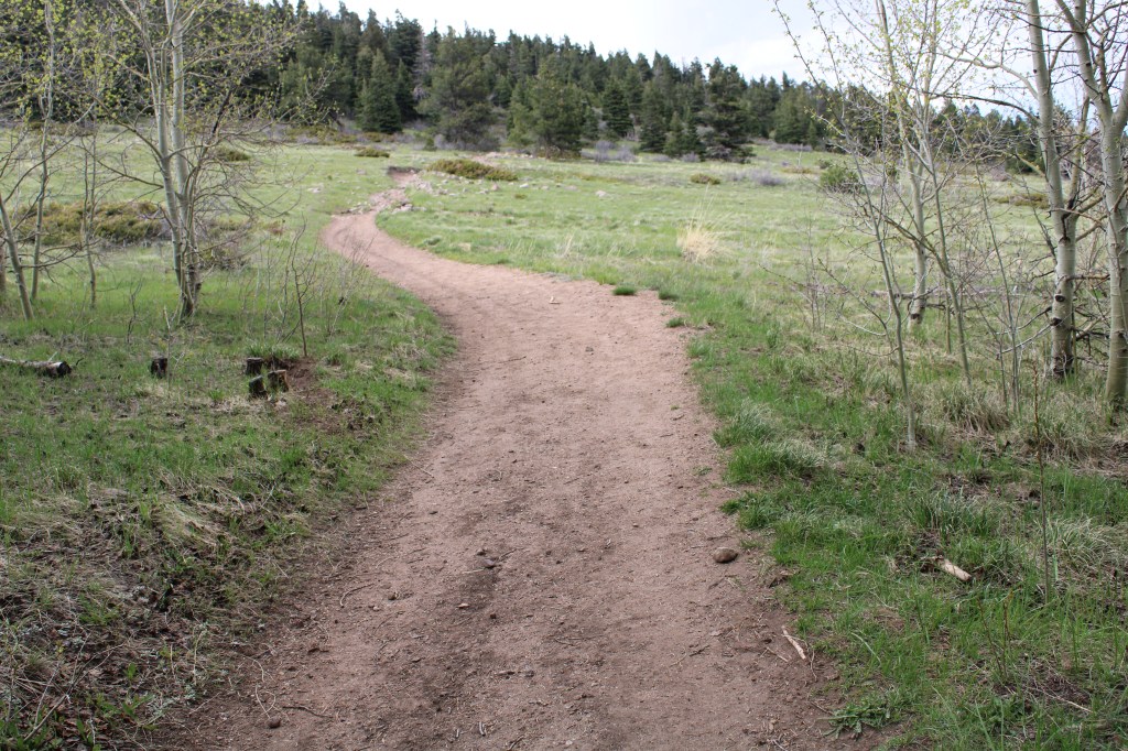
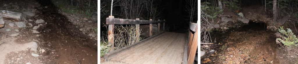
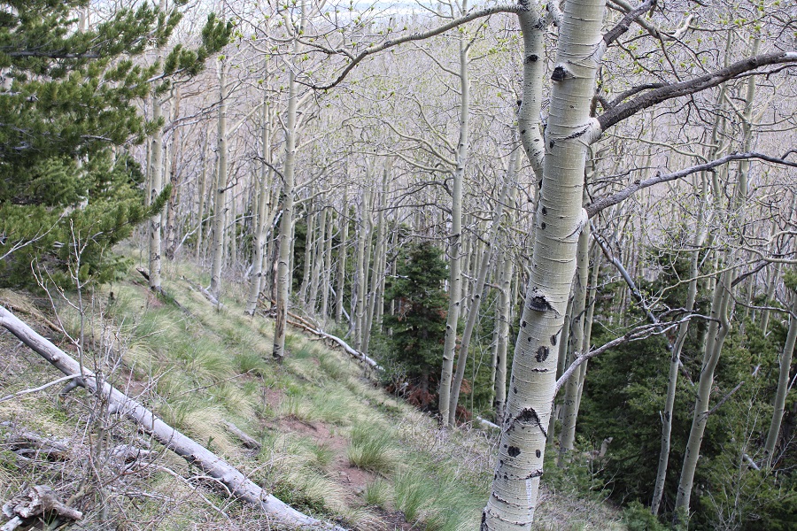
The Sandbeach Lake Trail was a class 1 trail I took all the way to Sandbeach Lake. There were 2 creek crossings, but they had footbridges across.
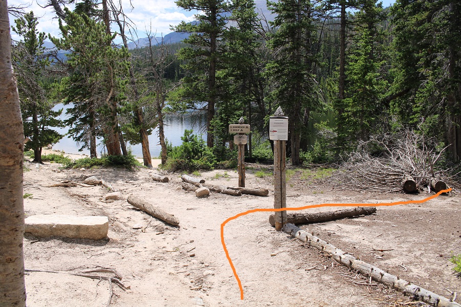
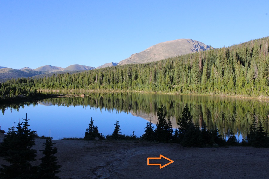
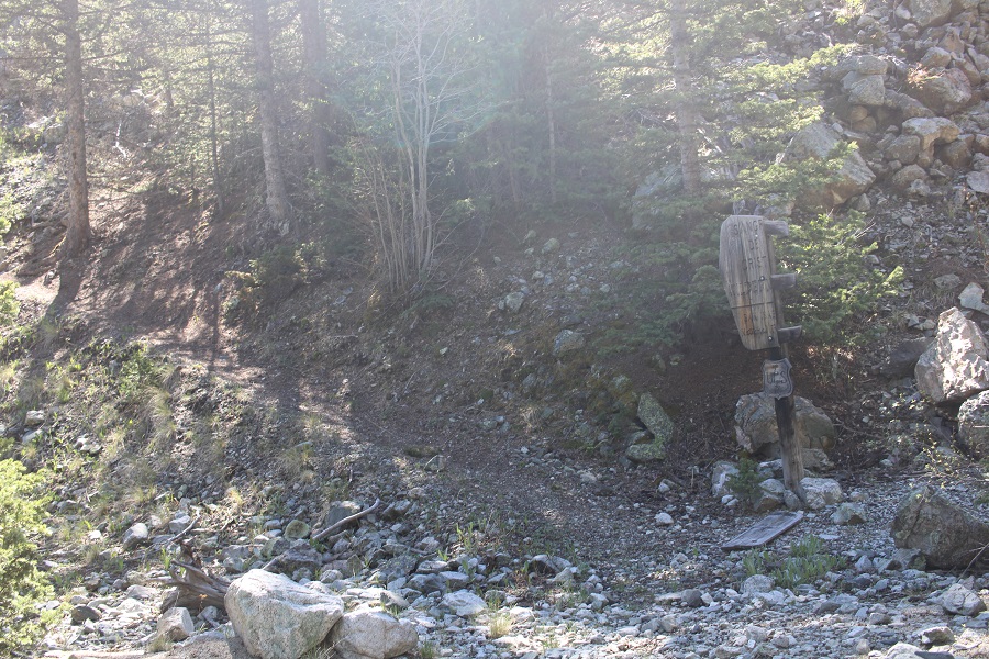
It was 5 miles to Sandbeach Lake. Once at the lake, the fastest way to skirt the lake and find a trail is to go right here
But I wanted to see the lake, so I did, and then followed the lake past a small stream, and caught up with the trail there.
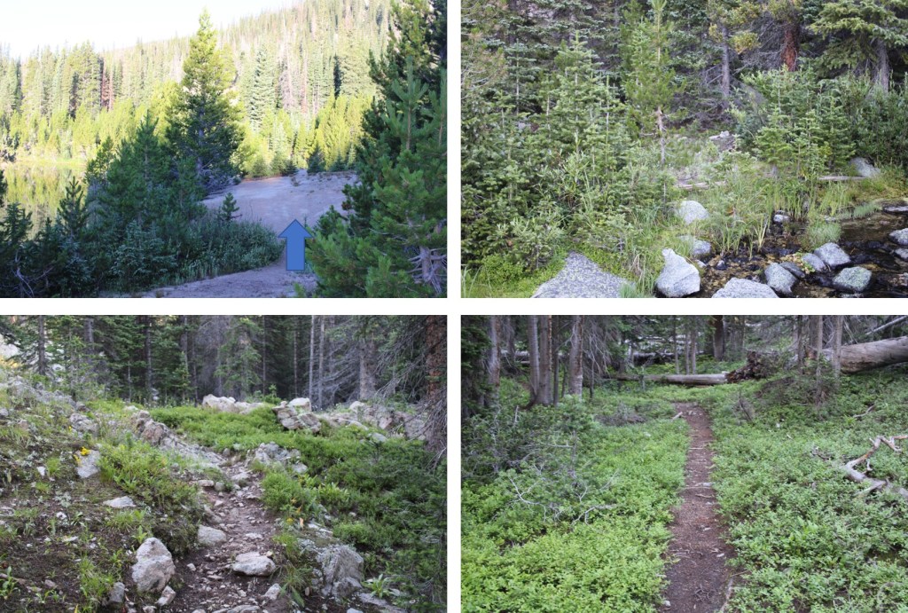
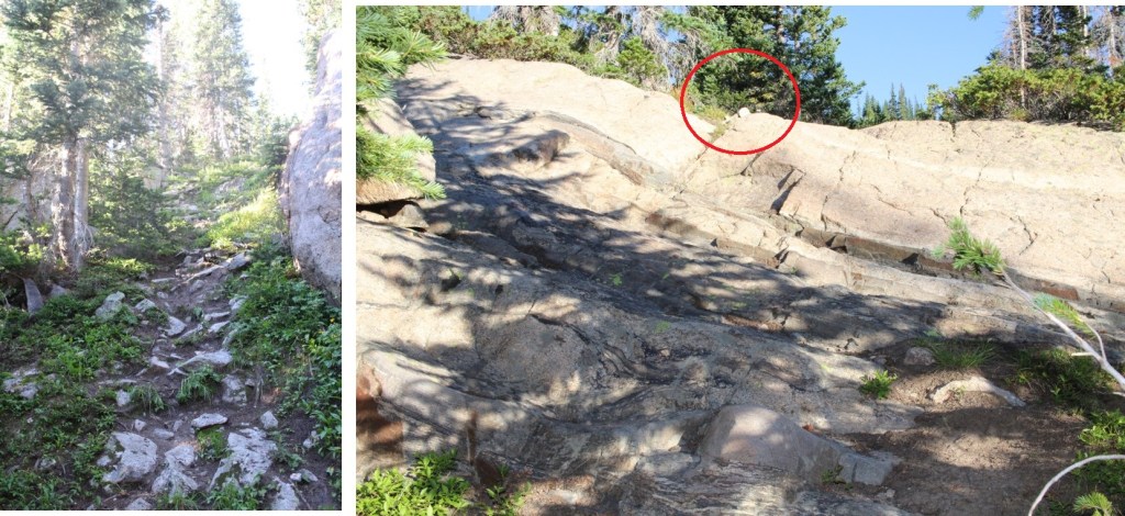
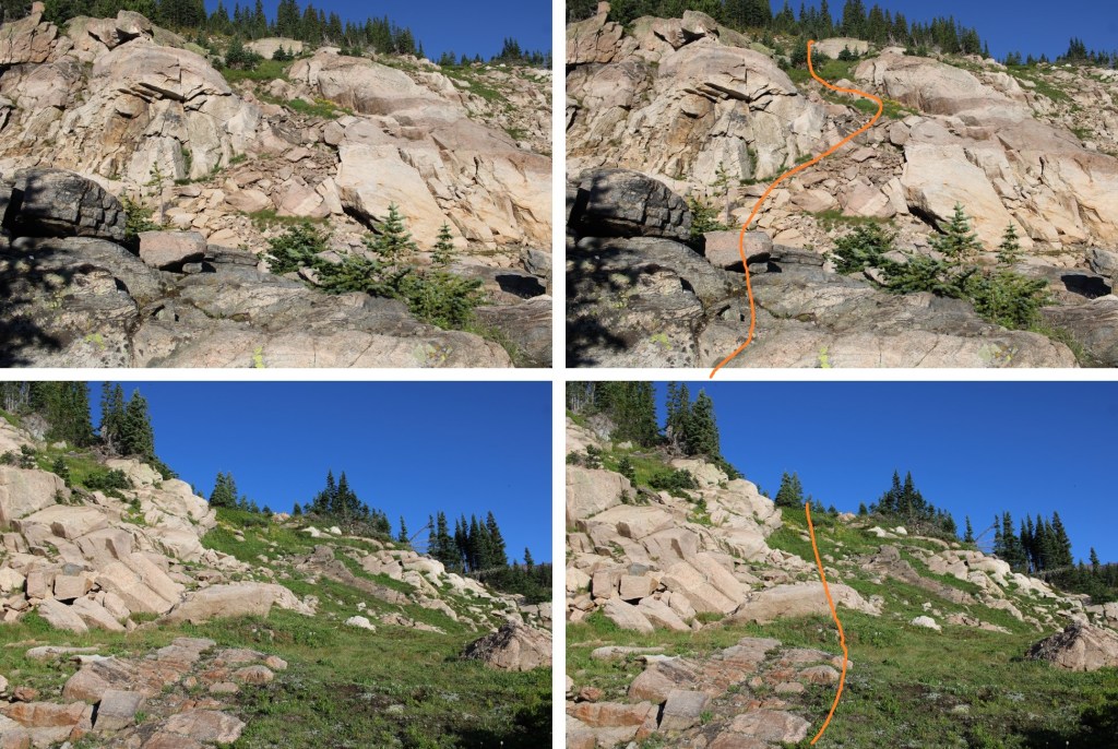
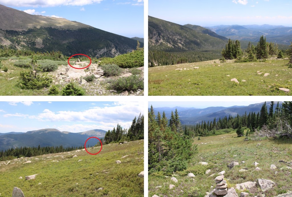
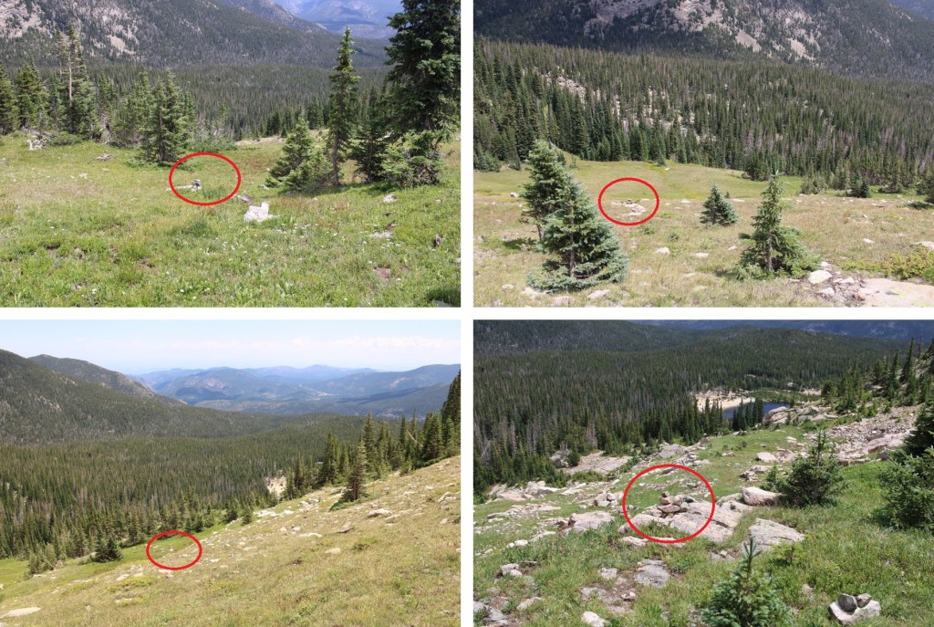
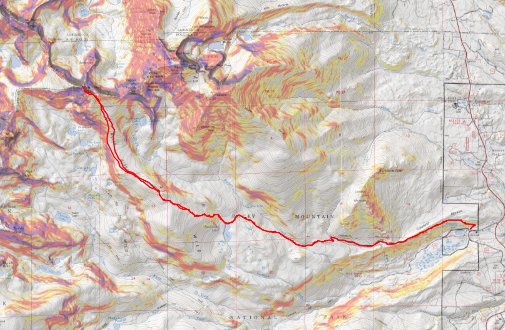
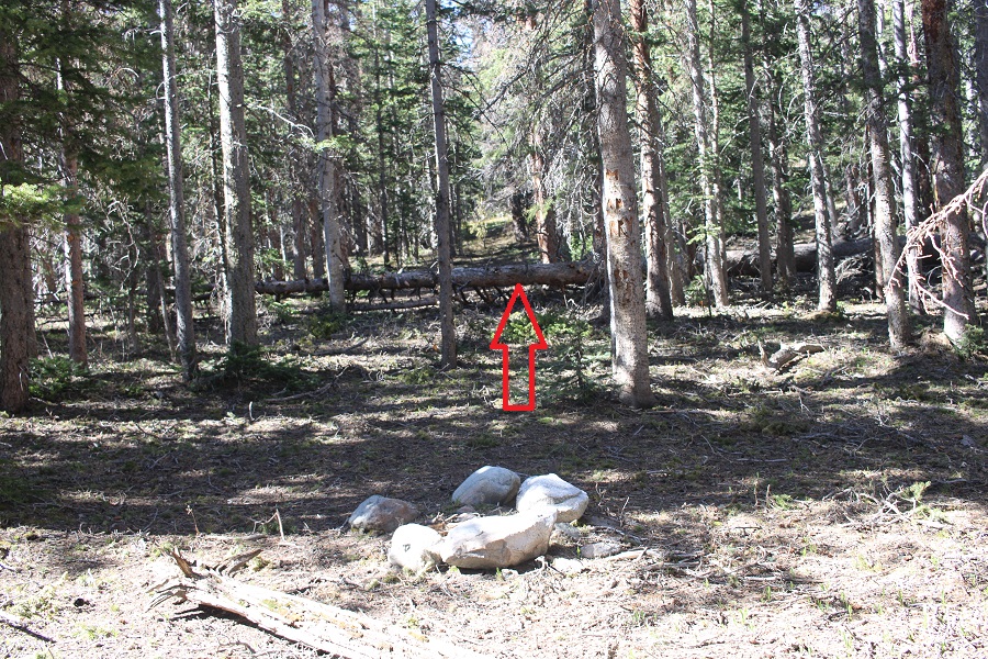
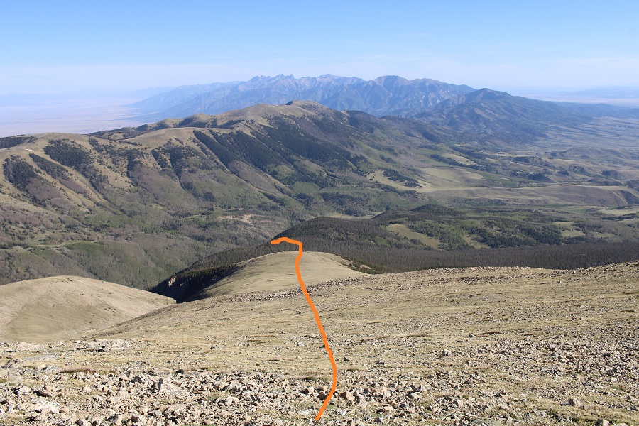
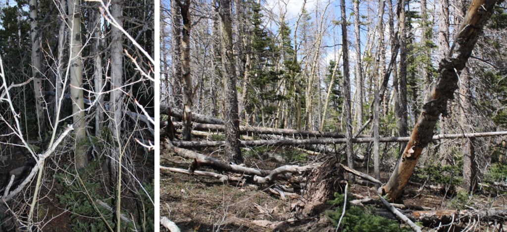
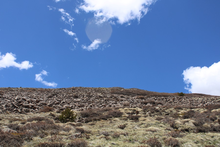
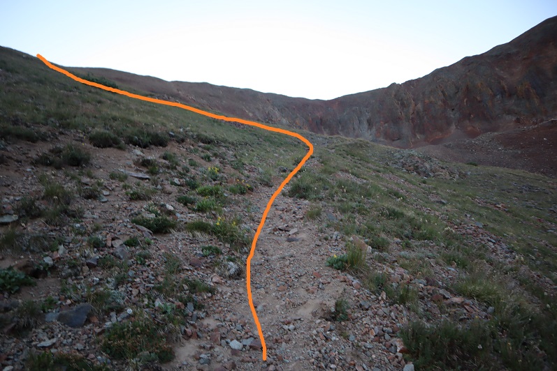
After crossing the creek, I followed the trail northeast to treeline. When the trail ended, there were plenty of cairns to guide the way (circled in red).
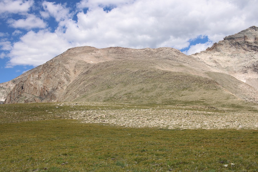
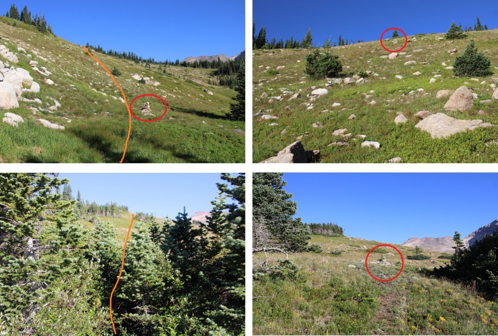
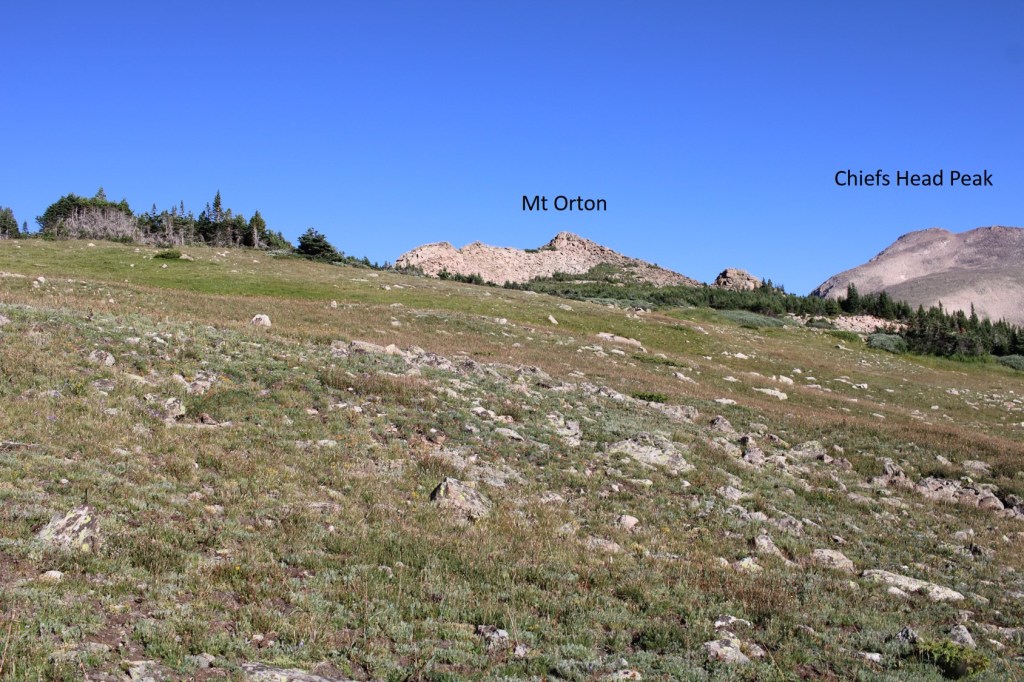
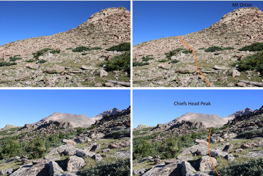
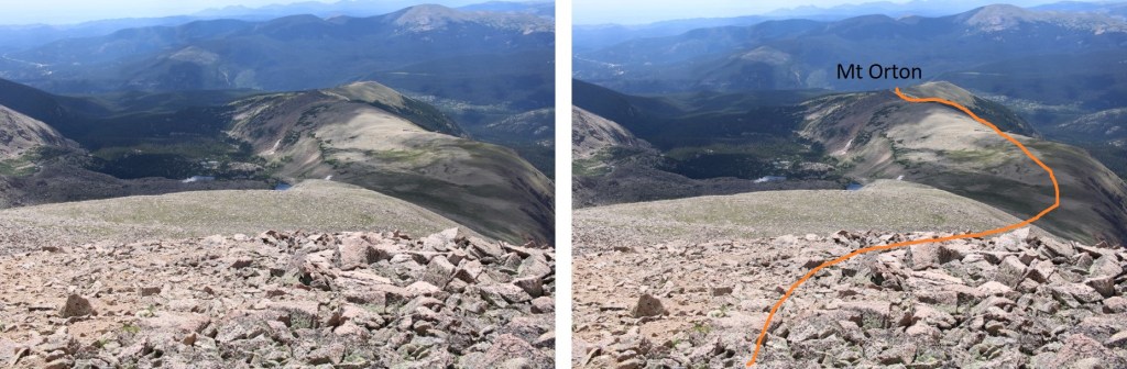
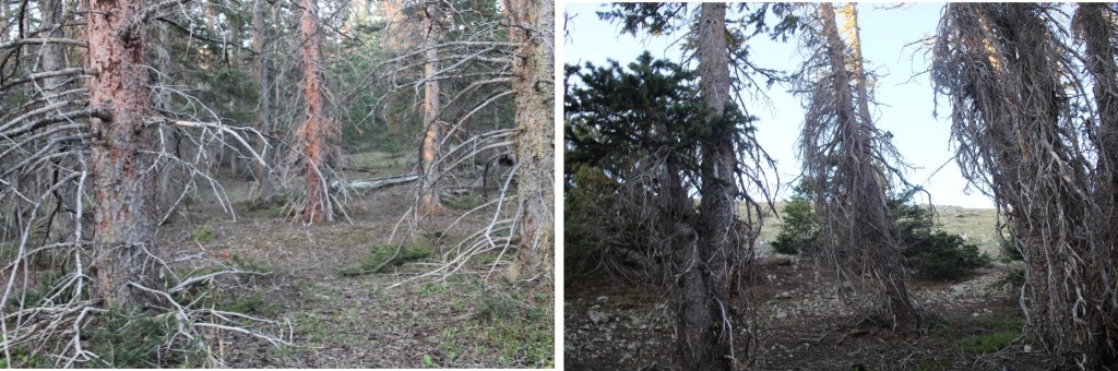
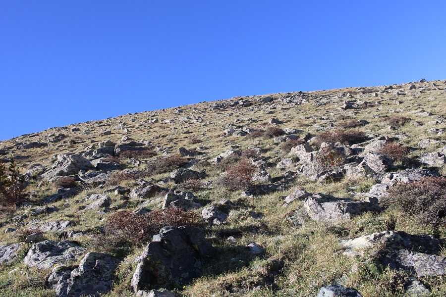
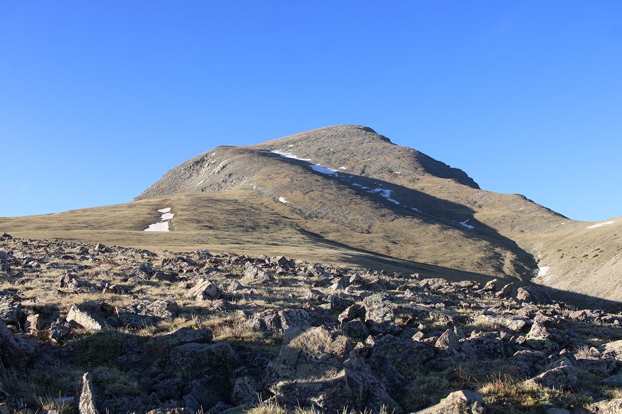
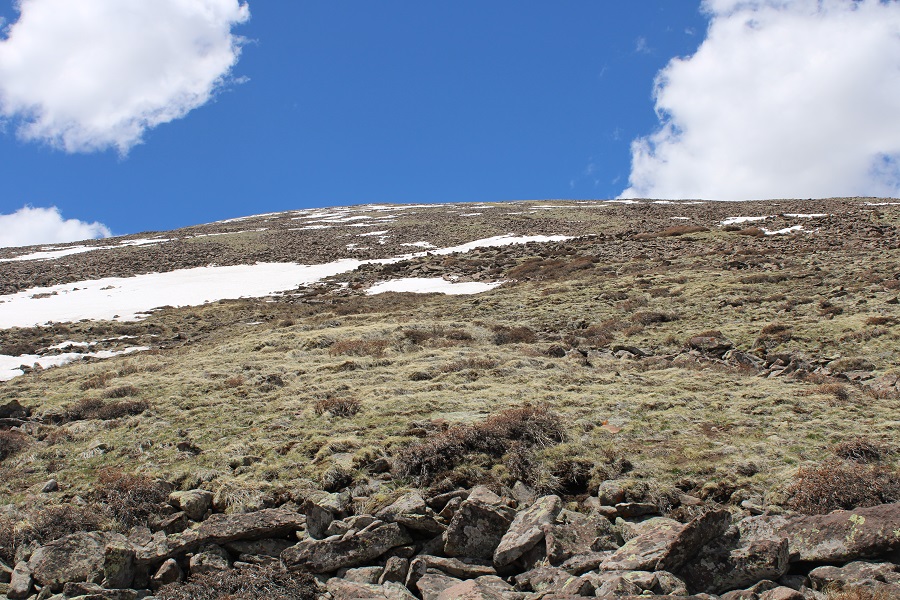
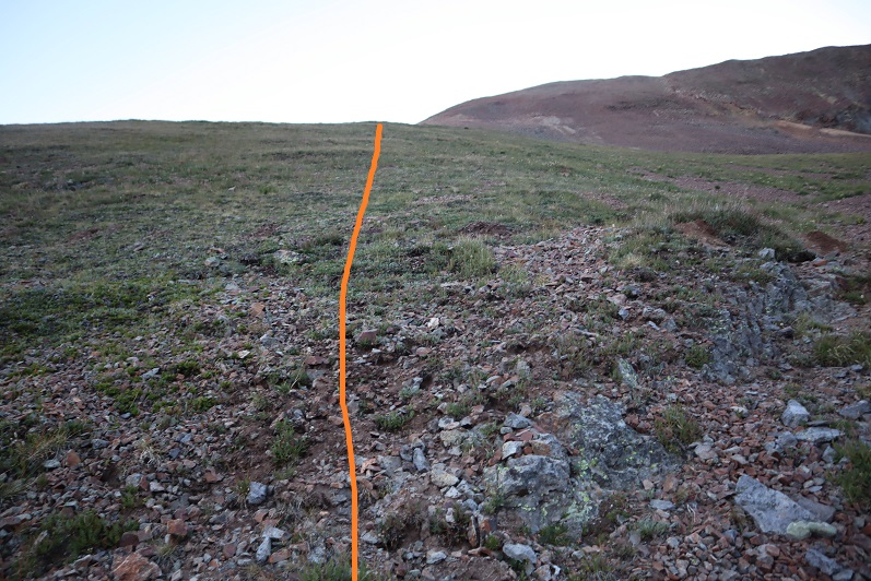
Once at treeline, I kept aiming for Mt Orton (unranked). There were cairns to mark the way until I was in front of Mt Orton
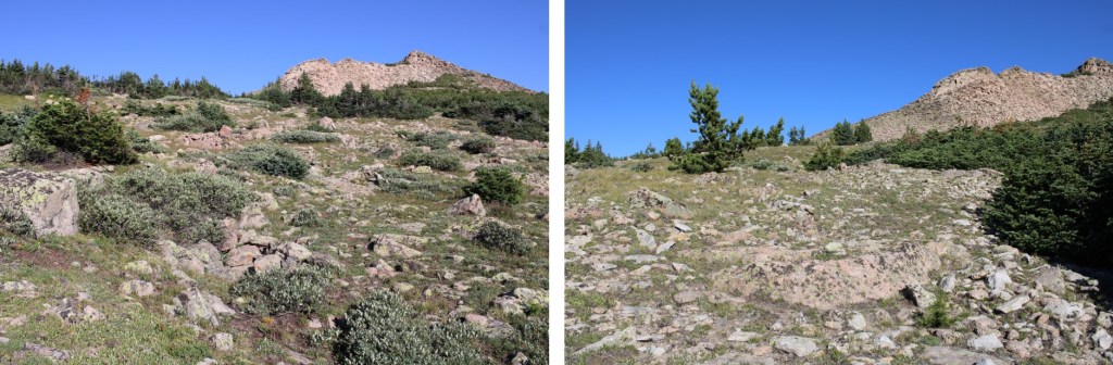
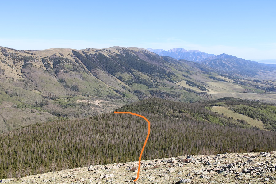
I then skirted Mt Orton to the left, and went through a very small saddle
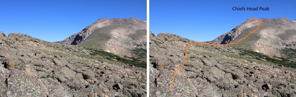
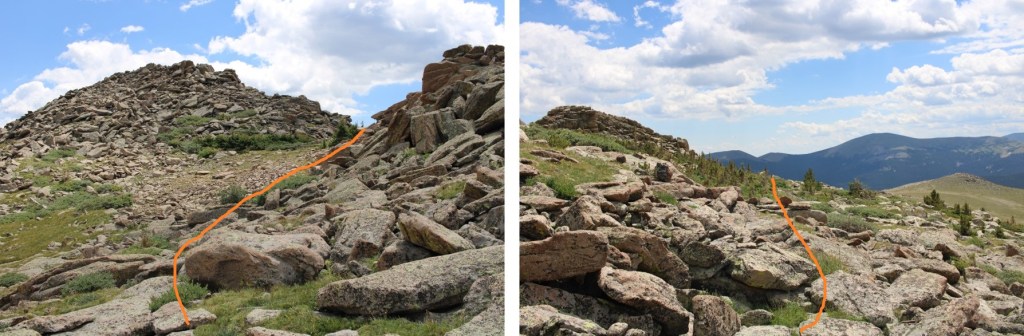
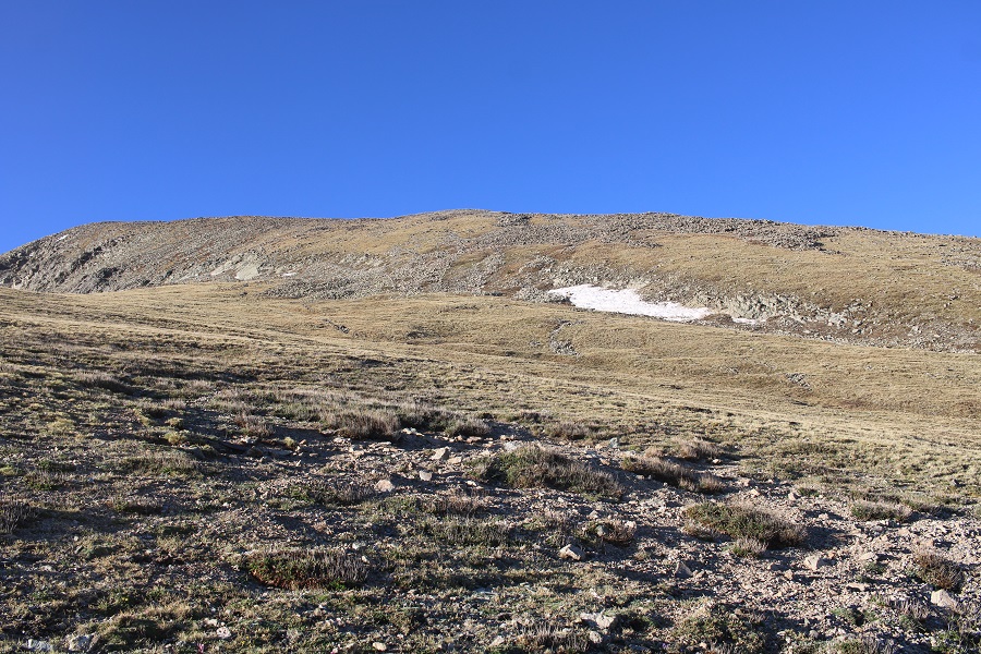
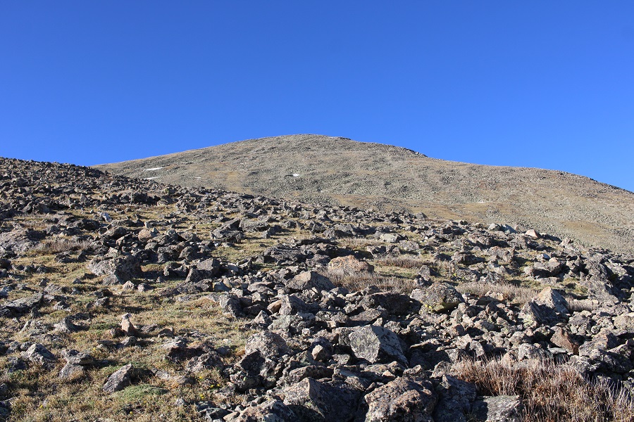
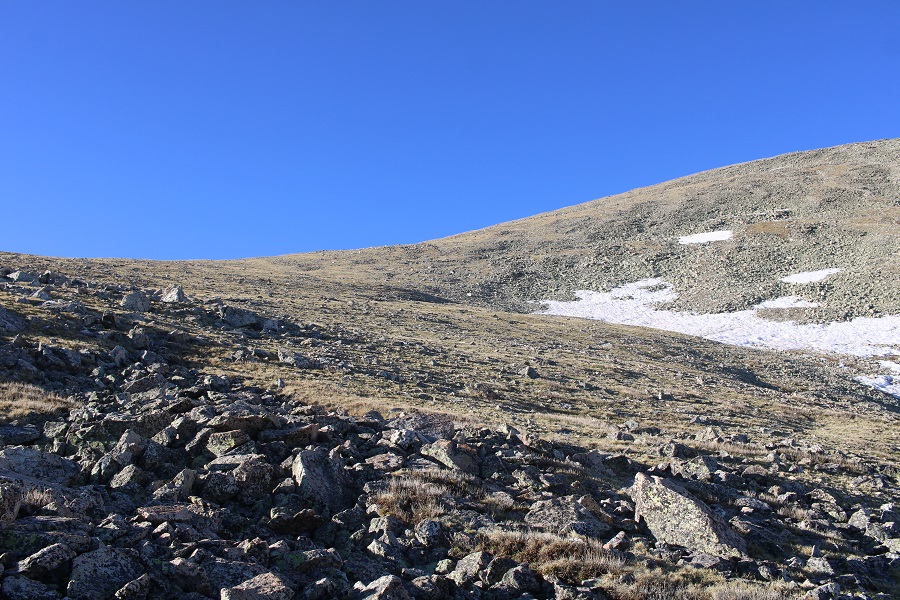
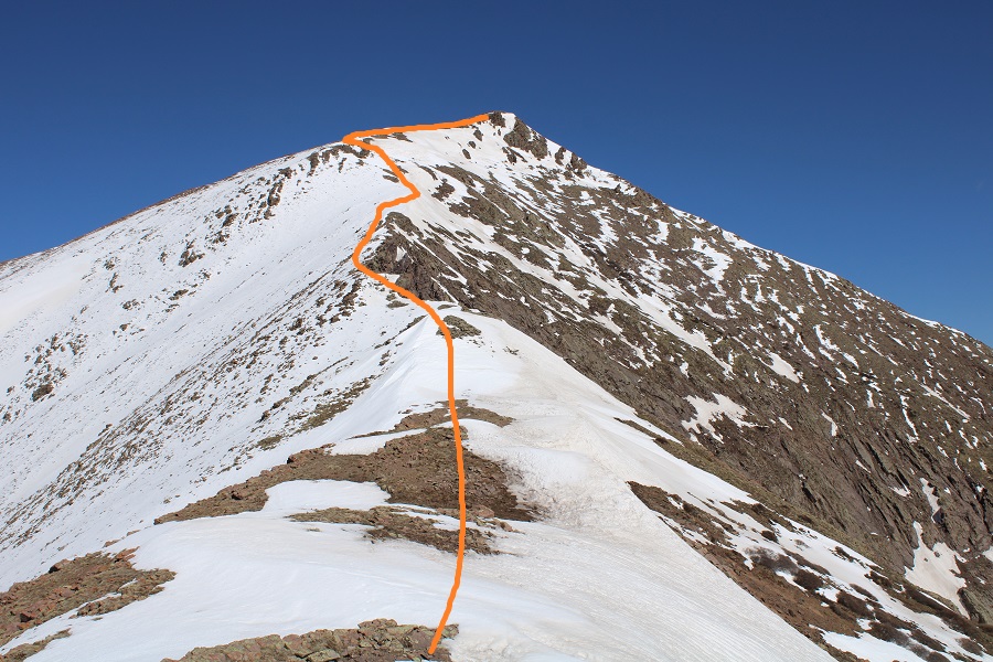
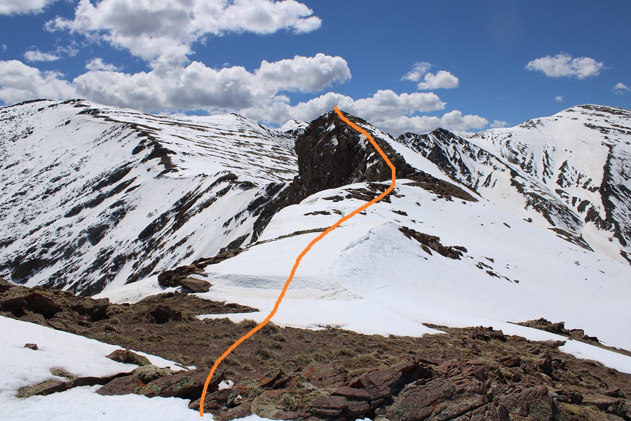
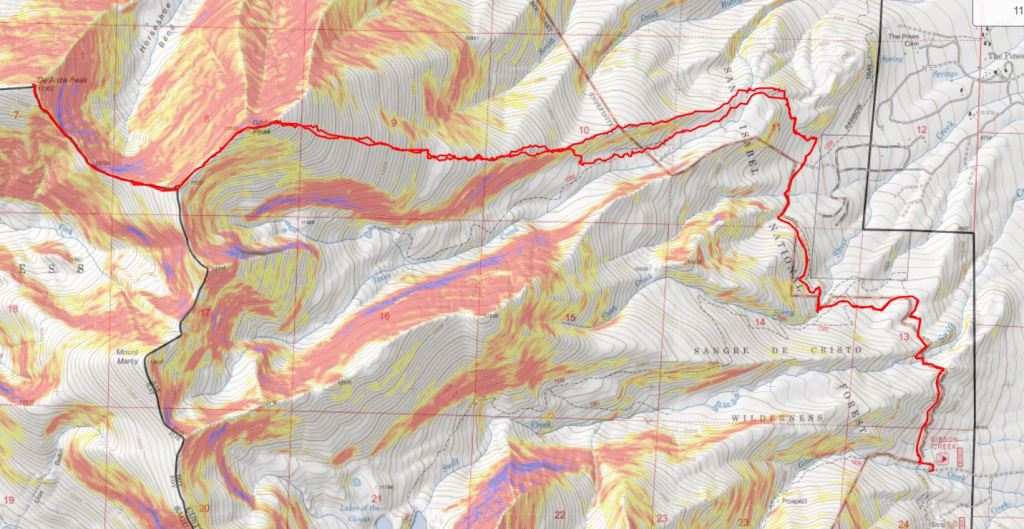
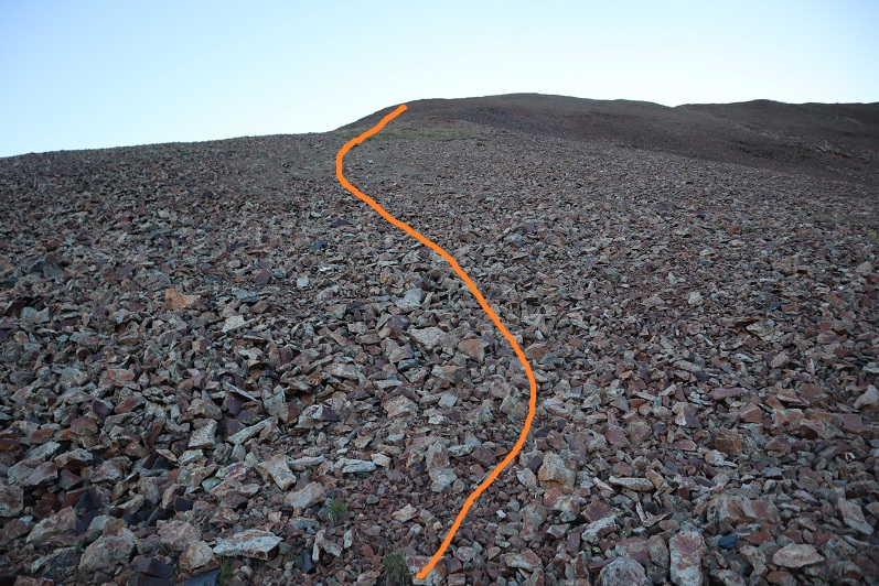
I could now see an easy path to Chief Head’s ridge. Here’s the route I took
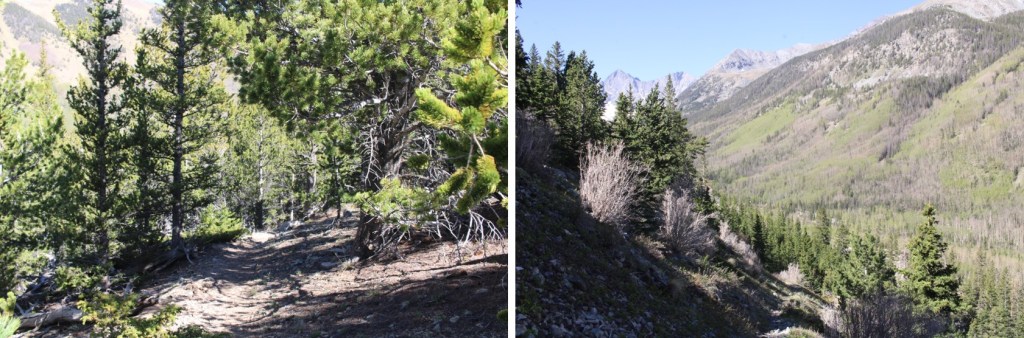
And some close-up pictures
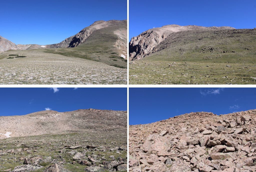
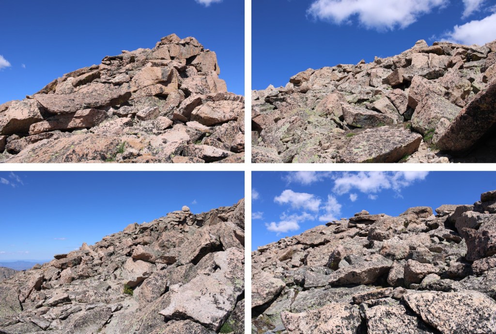
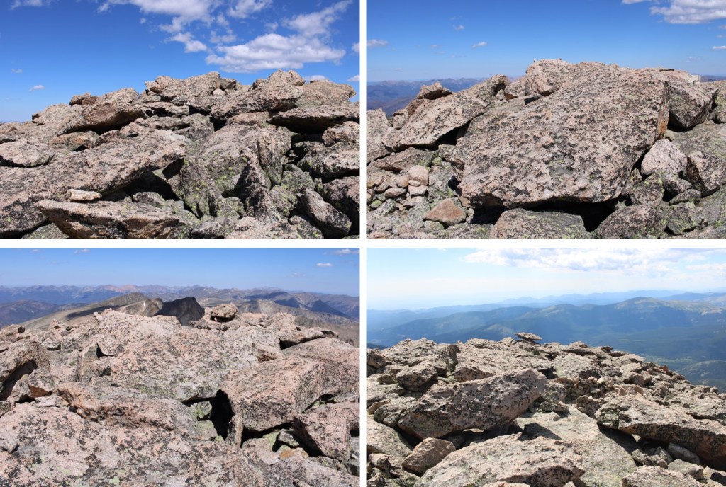
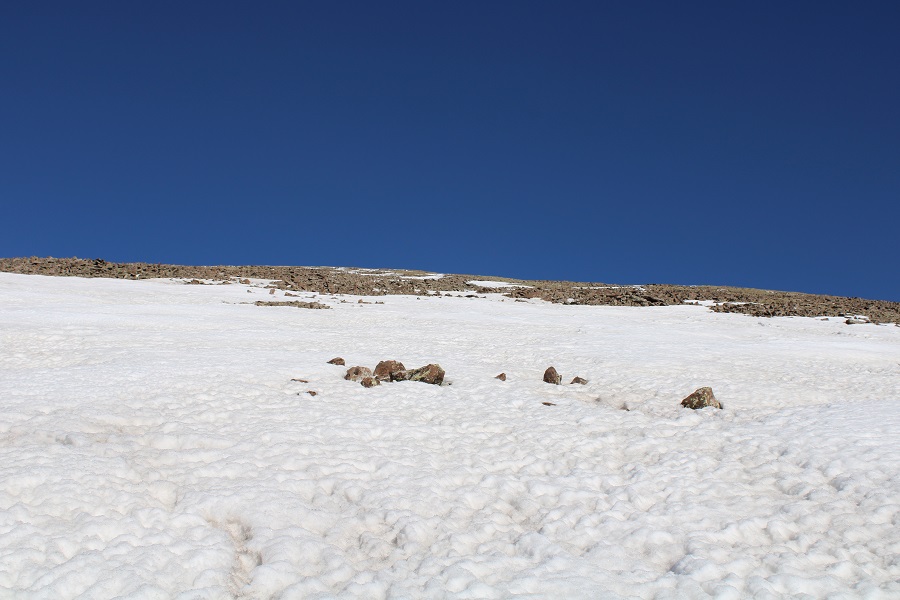
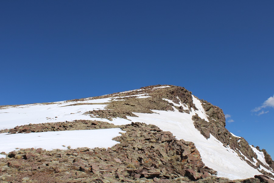
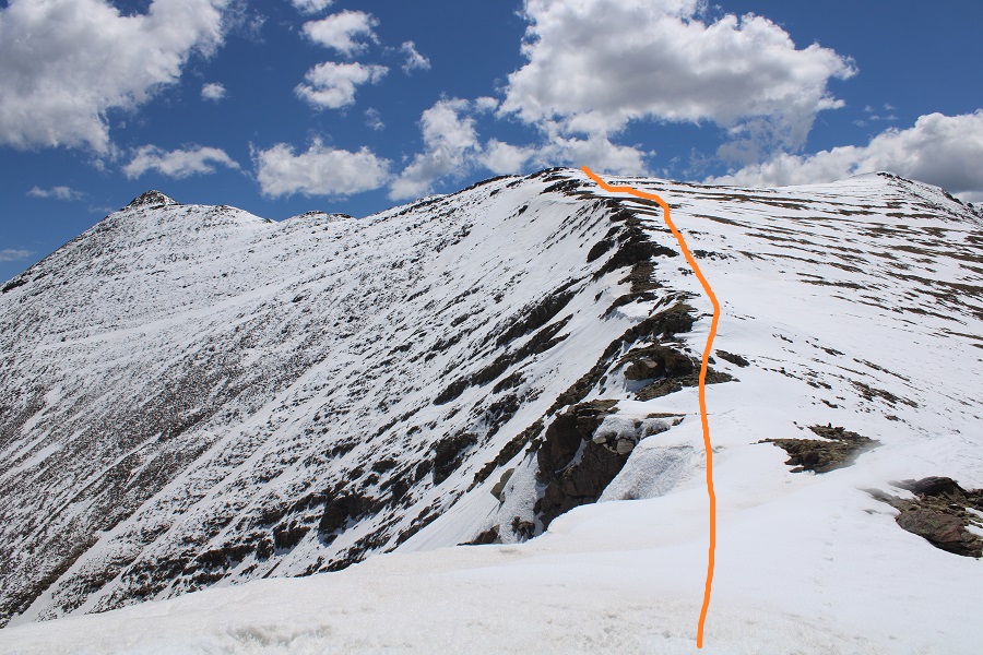
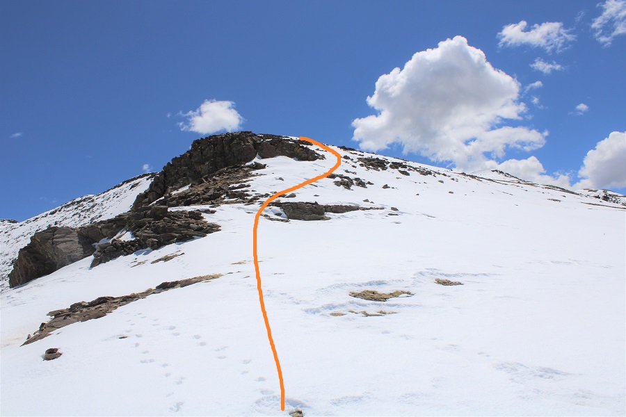
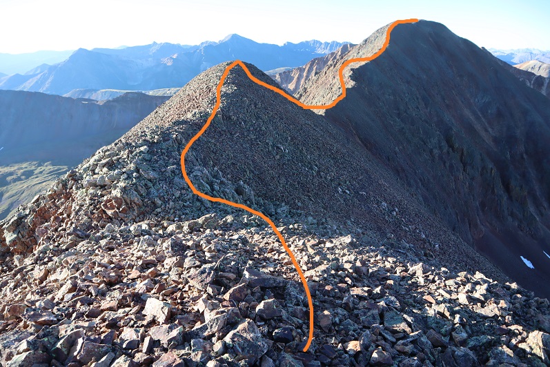
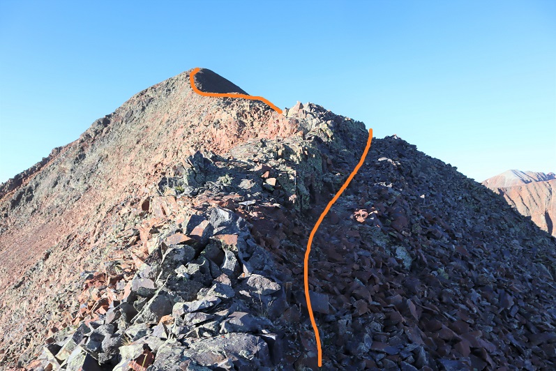
Once on the ridge, I followed it .3 miles to the summit, on rocky terrain. I was able to keep it all class 2 by staying to the left.
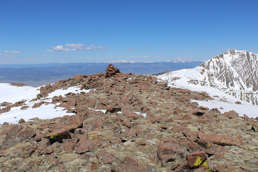
There wasn’t a summit register, or a cairn, or a marker, so I just walked all over the rocky summit.
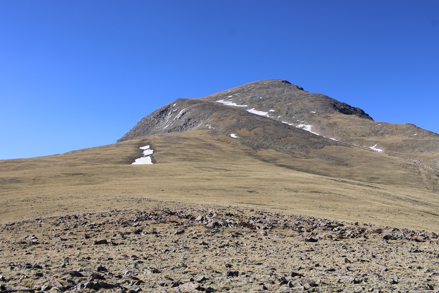
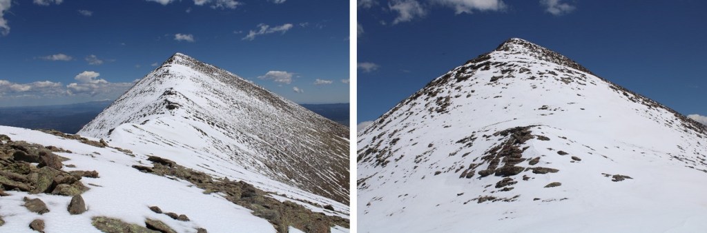
I summited Chiefs Head Peak at 11am
Chiefs Head Peak:
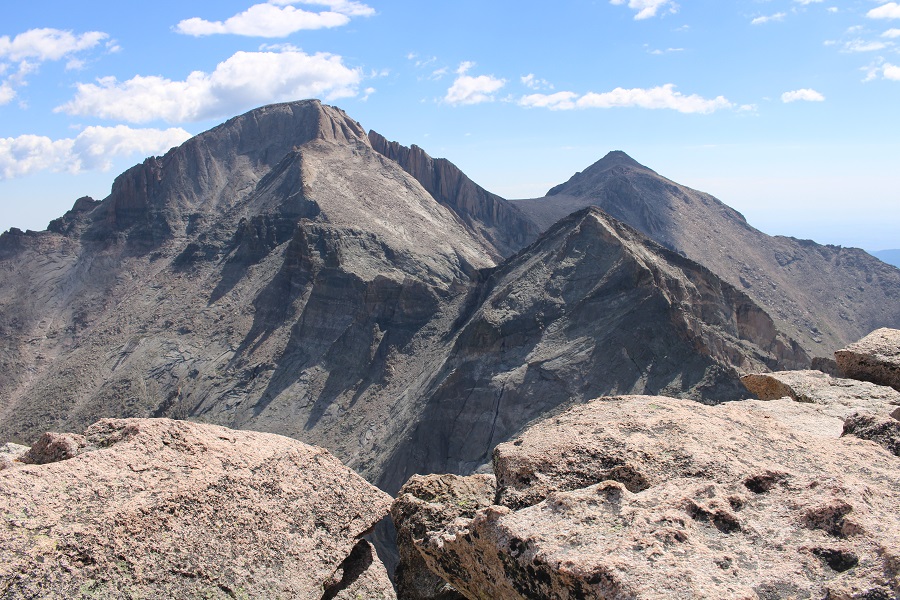
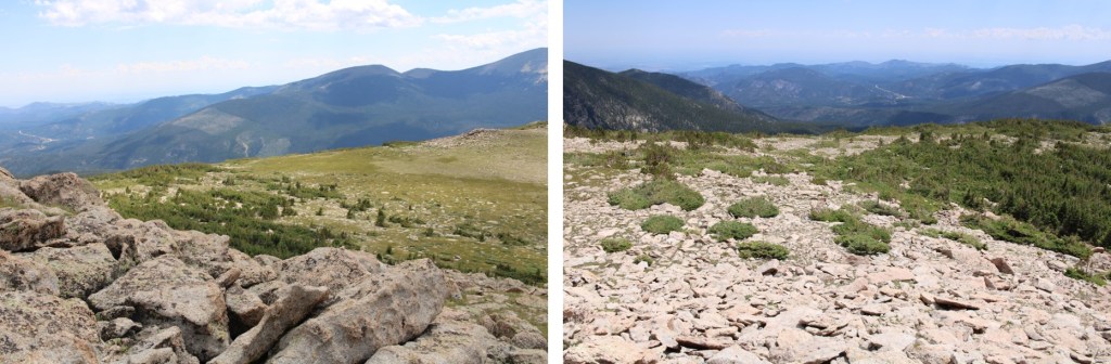
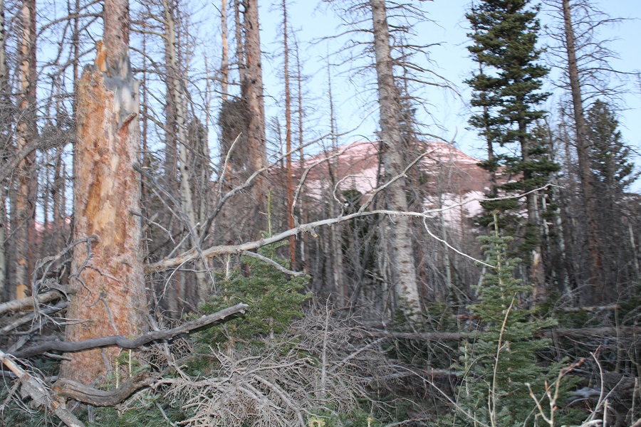
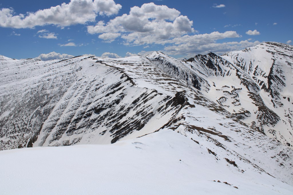
From the summit I had an amazing view of Pagoda, Longs, and Meeker
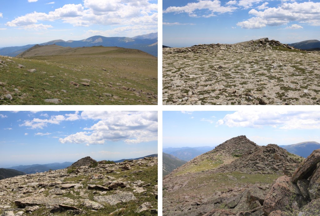
This was an out and back hike, so I turned and retraced my steps back down the mountain, around Mt Orton, and to Sandbeach Lake
The cairns picked up again, and I could now see Sandbeach Lake, so route finding was easy until I hit the trail.
Back at the lake, I picked up the Sandbeach Lake Trail, and took this class 1 trail all the way back to the trailhead.
I made it back to my truck at 3:15pm, making this an 18.17 mile hike with 5476’ of elevation gain in 10 hours 45 minutes.
I was I this area two days ago, but had a commitment back in Colorado Springs, so I went back home for a day. The event ended at 8pm, and I drove back up to the Lily Lake trailhead that evening. It was a Thursday night, but I was surprised to see a lot of the dispersed campsites already taken. I ended up taking the last space, at 10350’, just before the downed trees started along the road. I’d wanted to camp lower, but this would be a good place to set off for my next hike in a few days. I was on the trail at 5am.
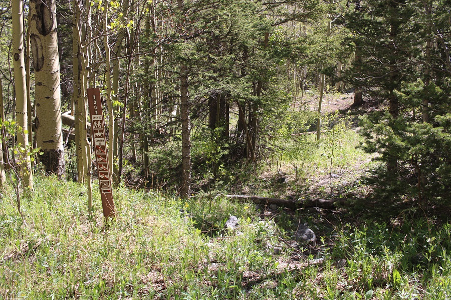
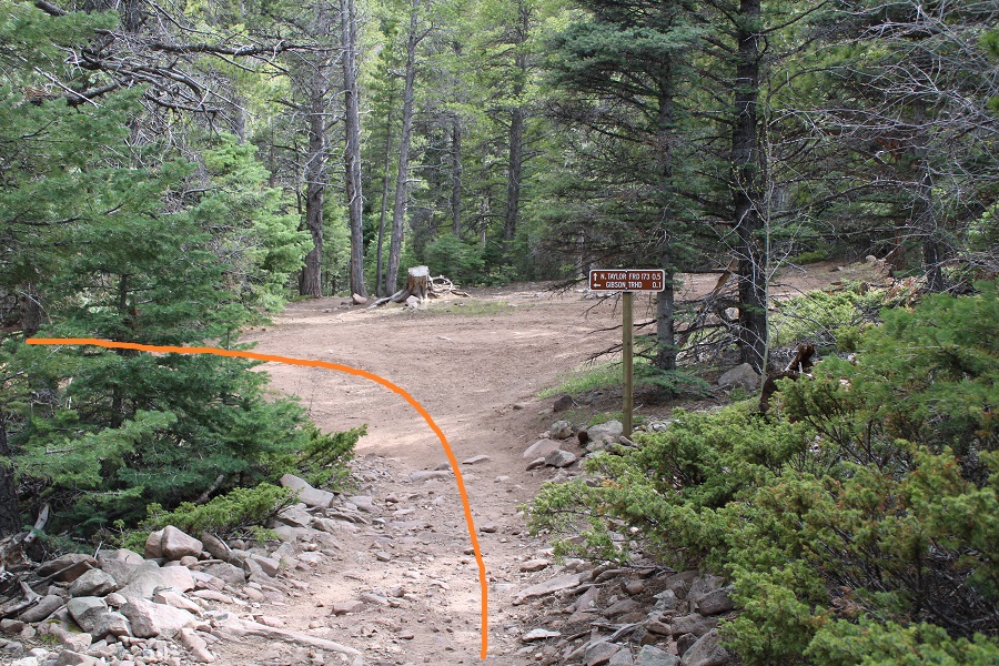
I followed the 4WD dirt road north for XXXX miles, to the Raspberry Trail (1307). This had been where I’d wanted to stop for the night, but there were vehicles already camped there.
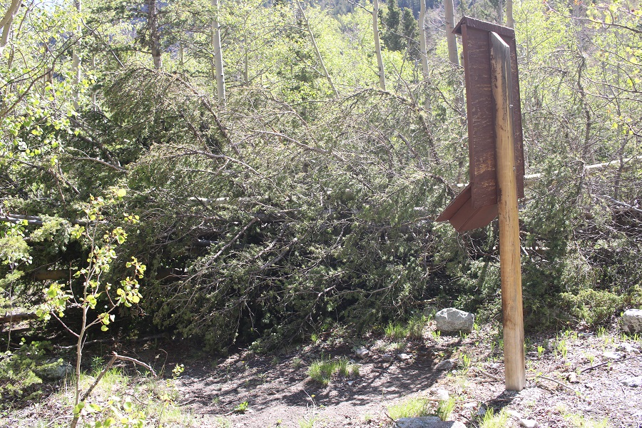
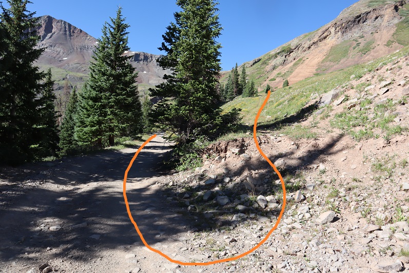
I followed the Raspberry Trail to a register, signed my name, and navigated around the downed tree blocking the path
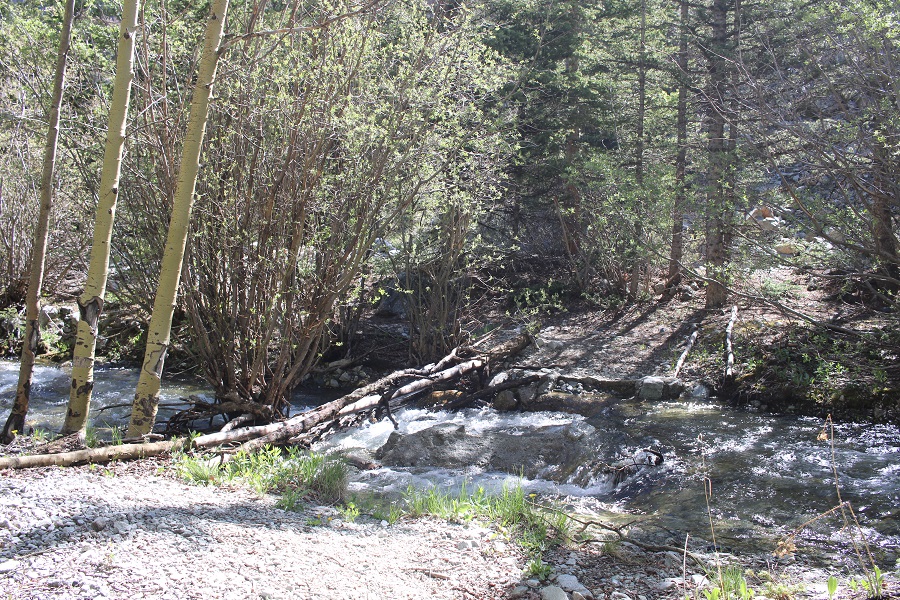
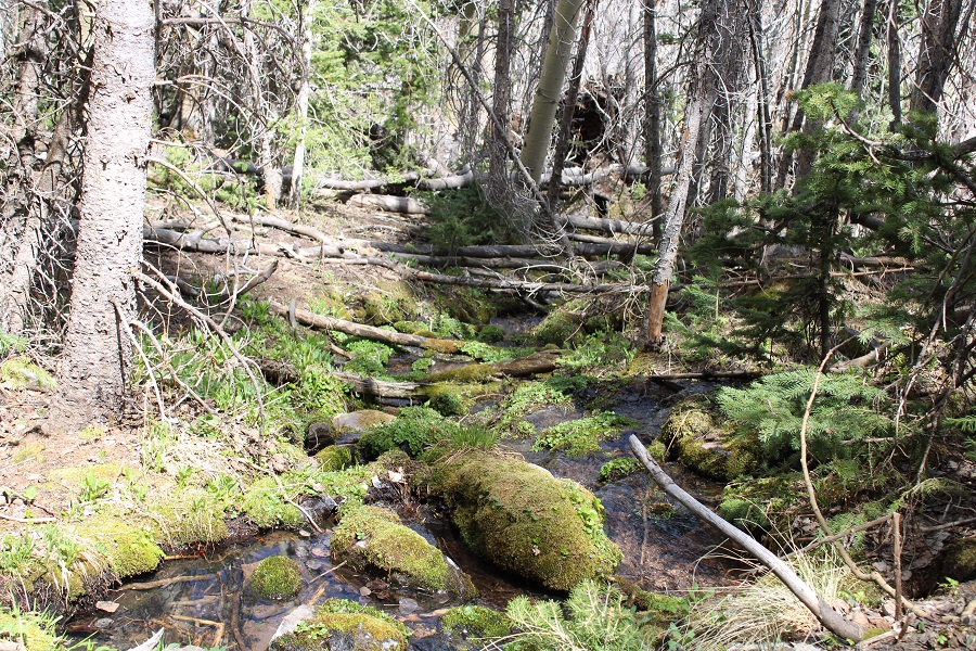
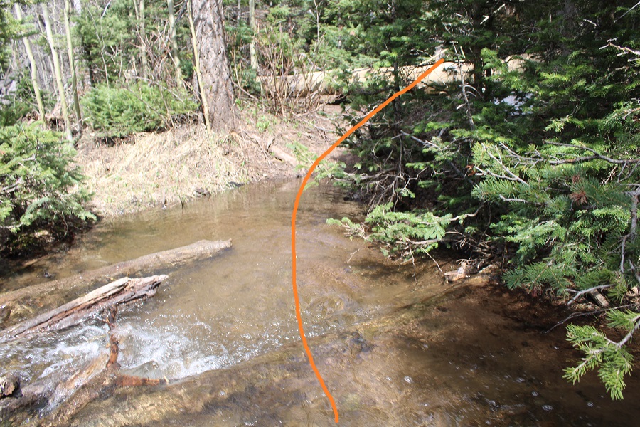
I followed the trail down to the Huerfano River, and crossed it on downed logs
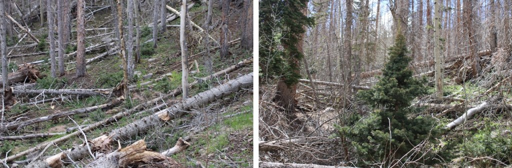
From here, I followed the class 1 trail as it switchbacked up the hillside. There were several large downed trees obscuring the trail, but the trail was always easy to find.
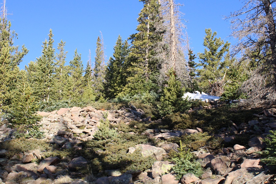
The trail leveled off, and I came across some fire rings. Here I left the trail and headed south until I hit treeline. There was no path, and there were a lot of downed trees, but navigation wasn’t very difficult.
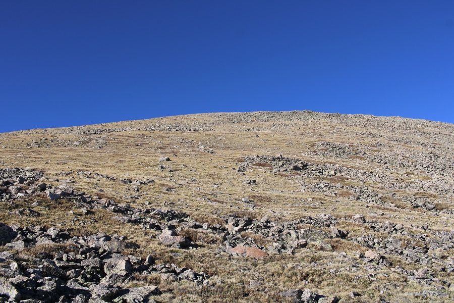
Once at treeline, the ground changed to tundra. I continued following the tundra south.
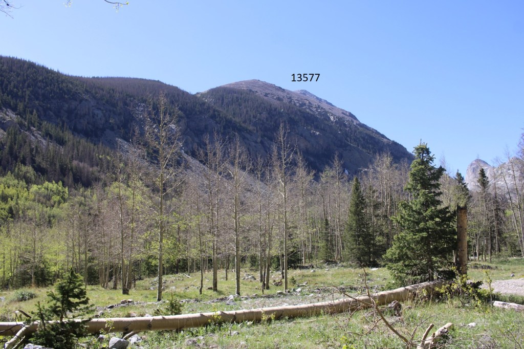
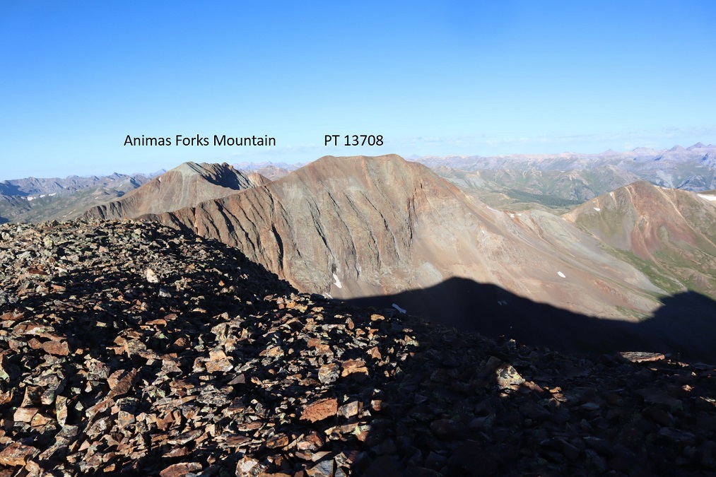
Quickly, 13577 came into view
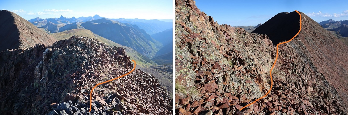
Here’s my route to the summit
This was a simple, but long, tundra walk, with some rocks thrown in. The ridge was 1.5 miles from treeline to summit. Here are a few pictures of the route
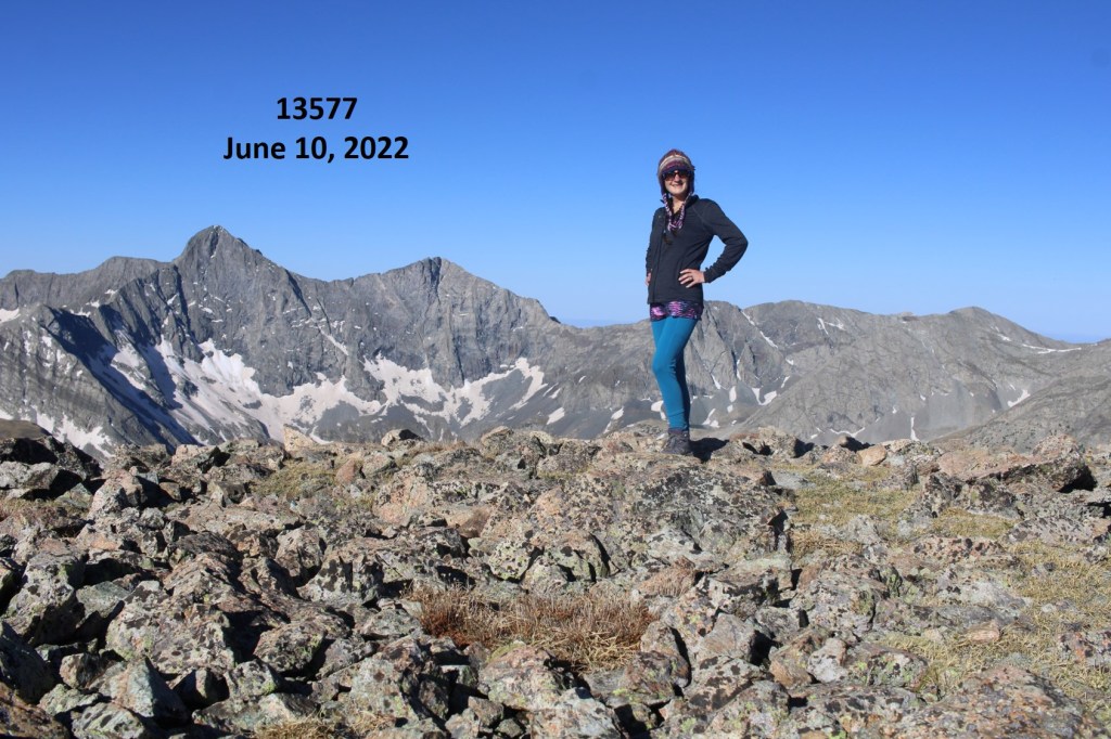
I summited 13577 ay 7:45am
13577:
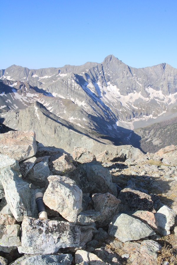
Check out the views of Lindsey
I turned and retraced my steps back to the trail
Here’s the overall route I took back to the trail
One in the trees it was difficult to navigate because I didn’t have any visuals. I continued heading north until I crossed the Raspberry Trail. There will be a lot of deadfall in this area.
Once back on Raspberry Trail, I followed it back to the 4WD road
I then followed the road back to my truck
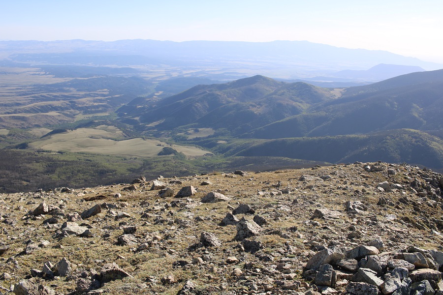
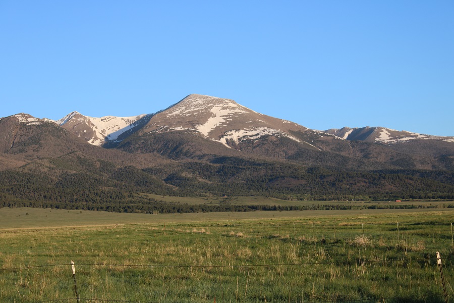
This gave me a great view of PT 13577 from below
I made it back to my truck at 10am, making this an 8.88 mile hike with 3538’ of elevation gain in 5 hours. I’ll be staying at this trailhead…
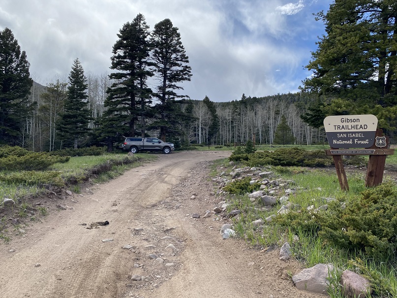
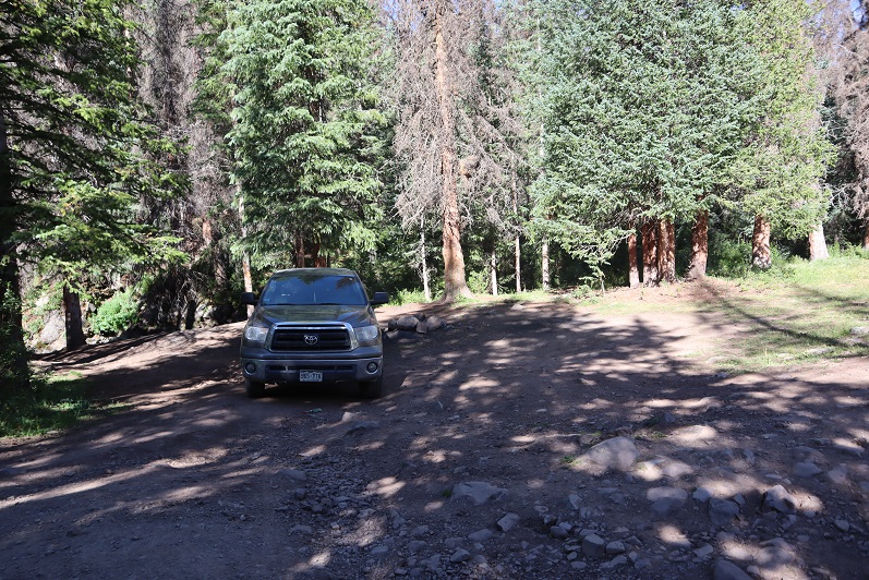
I drove to the Gibson Creek trailhead the night before, concerned I wasn’t going to get a spot to park on Memorial Day weekend. Imagine my surprise when I was the only one there. Two more vehicles would join me later, but I was genuinely amazed the trailhead wasn’t more crowded: there’s great dispersed camping here.
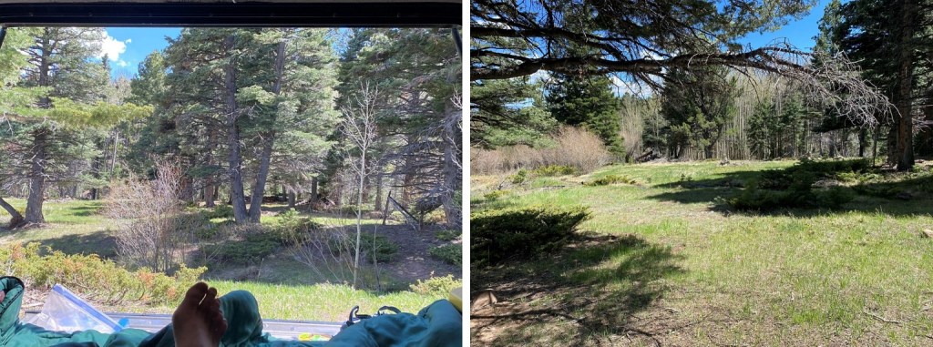
Bonus: no mosquitoes! I spent the next few hours relaxing, making dinner, sipping whiskey, and reading, before making it an early night.
(It was, in fact, a long night, full of nightmares. I’ll spare you the details, but let’s just say they involved frantic mothers holding their decapitated babies, pleading for help and saying there was a horrible accident, and a demon that took over the body of a frail child: the demon needed to die, but doing so hurt the child. Not fun when you’re camping all alone. I woke up around 2am and knew if I went back to bed my nightmare would continue, so I tried to think about other, happier things before starting out on my hike in the dark. What’s happier you ask? I have 3 kids. I told myself when I got a divorce in 2012 I wasn’t going to date seriously until my youngest was 18 and had graduated High School. Well, she graduated this week, and is off to college, so I spent the next hour trying not to think about the nightmare I’d just had, and instead thinking about what I was going to do about dating, whether or not I really want to at this point, and realized I haven’t ‘dated’ since the 90s, and it’s certainly changed. It’s weird to be 40 years old and an empty nester. So, how y’all dating now?)
But I digress. Knowing it was going to be a long day, I was on the trail at 3am.
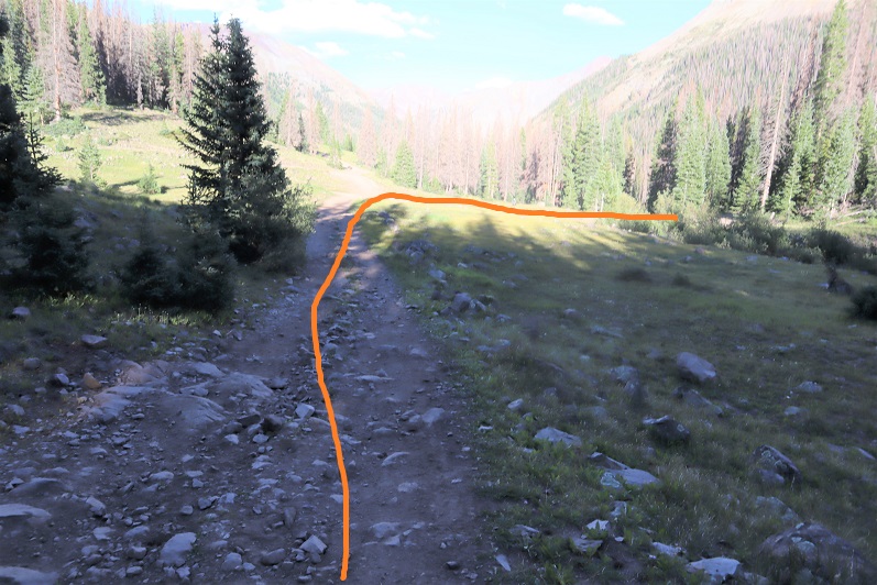
The trail starts at the north end of the parking area, and heads west for .1 miles before turning right and following Rainbow Trail 1336 north.
I followed Rainbow Trail as it wound around the east side of the mountain for 3.25 miles, crossing several creeks along the way. One creek crossing even had two bridges to make the crossing easier (the other areas had shallow enough water where bridges weren’t necessary). There was about a mile of the trail deep in spring conditions, with runoff covering the trail.
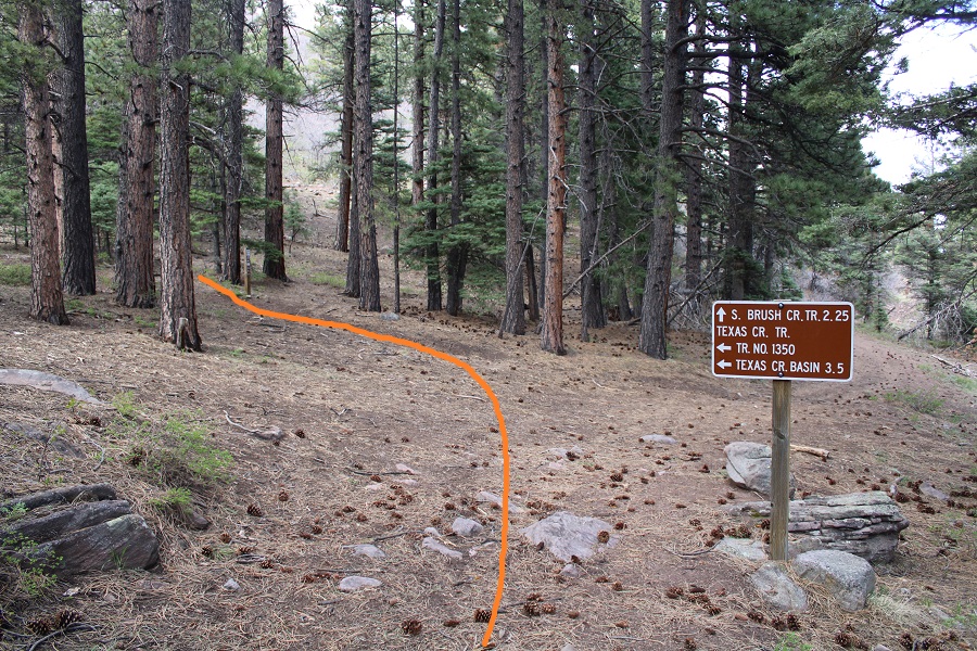
After 3.25 miles I came to a junction, and took Trail No. 1350 left (west) towards Texas Creek Basin. This is where my flashlight went out and I was glad the sun was starting to rise.
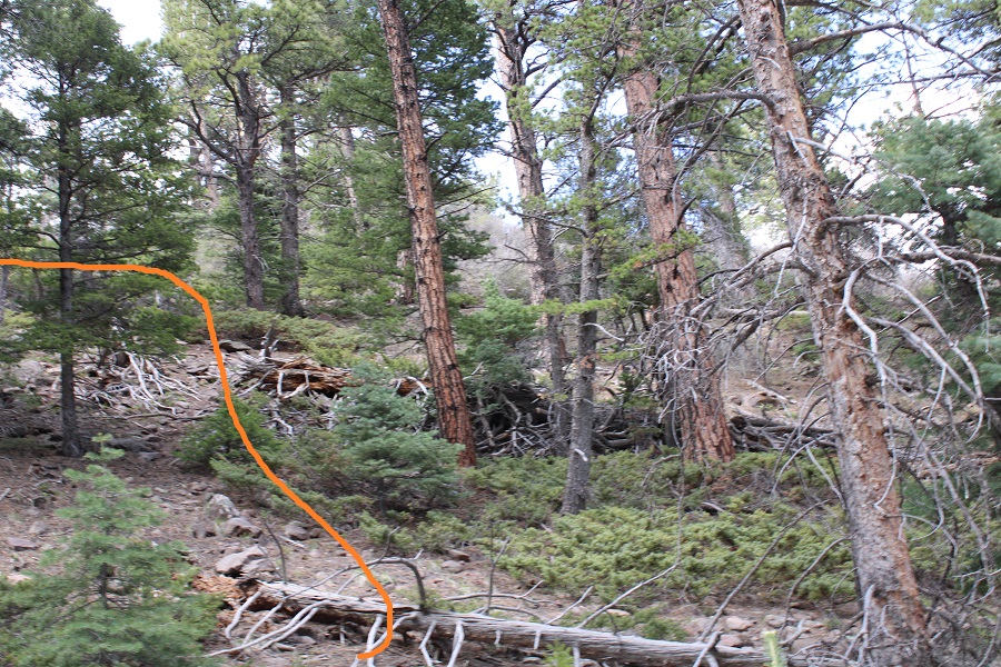
Note: Trail 1350 is not a maintained trail. I was hiking it in the dark at this point, and there were so many downed trees I kept getting off route trying to go around them (going over them wasn’t always practical). It wasn’t much better in the daylight. I decided to gain the ridge as quickly as I could, and follow it west to treeline.
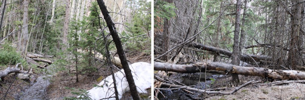
It took me 2.75 miles, and 2000’ of elevation gain to make it to treeline. It was here I experienced the worst and most extensive bushwhacking I’ve ever encountered. It was like hiking up through avalanche debris (although it was obvious the wind had knocked the trees down). The ridge was either dense with new growth, or a jungle gym of downed trees. I would not recommend this route, and I told myself I’d take Texas Creek on the way down (note: I later realized I would not recommend the Texas Creek route either). There was a small but raging creek to ford early on, and then it was straight up the ridge.
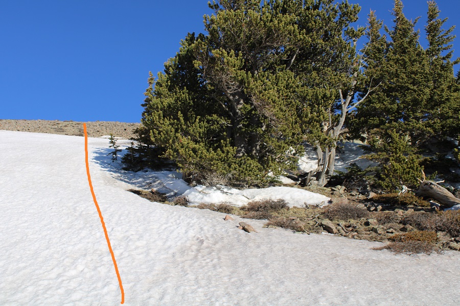
After hiking for a total of 6.75 miles I came upon 100 yards of mashed potato snow. I strapped on my snowshoes and kept heading west towards treeline. The snow kept starting and stopping again. On my way up I kept my snowshoes on. On my way down I misremembered how long the snow section was and kept taking the snowshoes off, just to need them again.
Once at treeline there was a small amount of snow to navigate, and then I was able to avoid most of the snow to the summit.
One good thing about the hike above treeline: there are no false summits to Gibbs Peak. What you see is what you get. As long as you keep heading west and gaining elevation, you’ll make it to the summit.
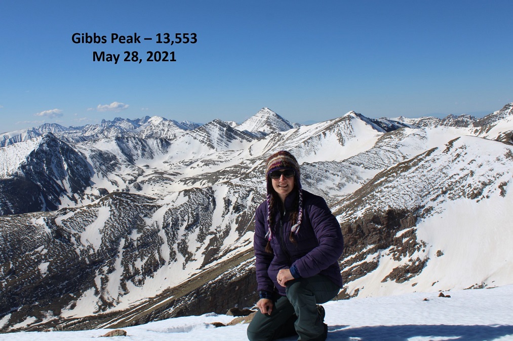
I made it to the summit of Gibbs Peak at 9am, after 6 hours and 8.25 miles of hiking.
Gibbs Peak:
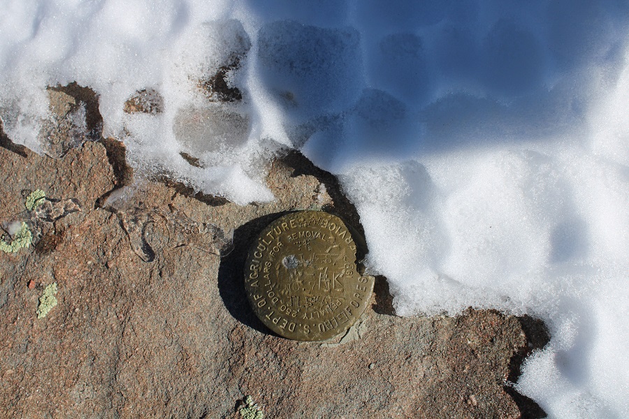
There was a benchmark on the summit. I took off my pack and realized I’d lost my water bottle somewhere. That’s what I get for not strapping it in. No matter, there was plenty of snow if needed. I’d have to look for my water bottle on my way back down.
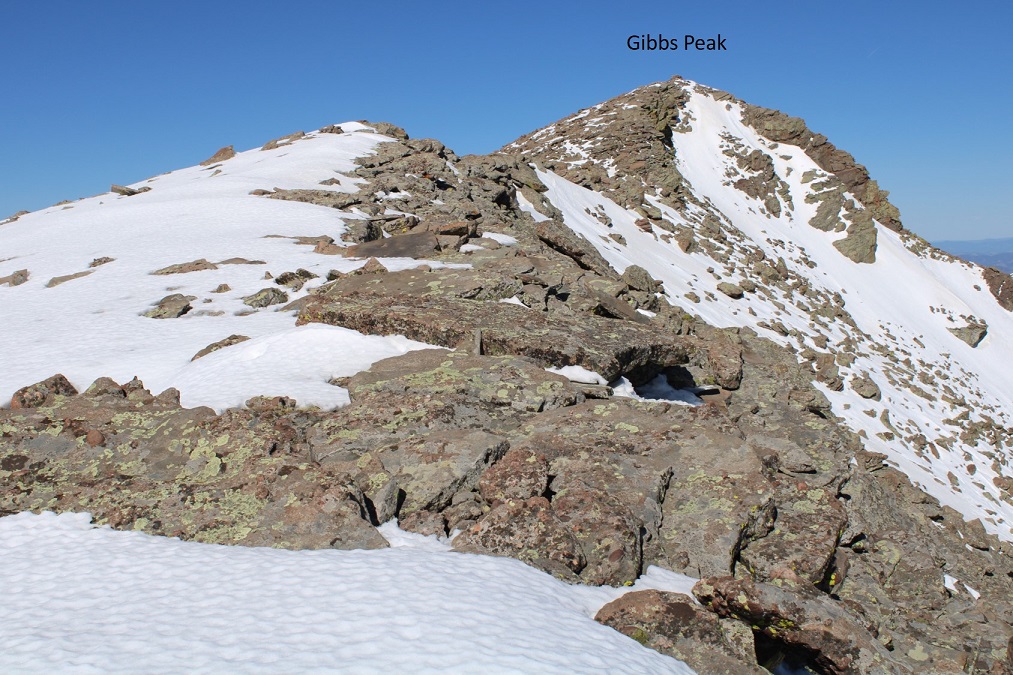
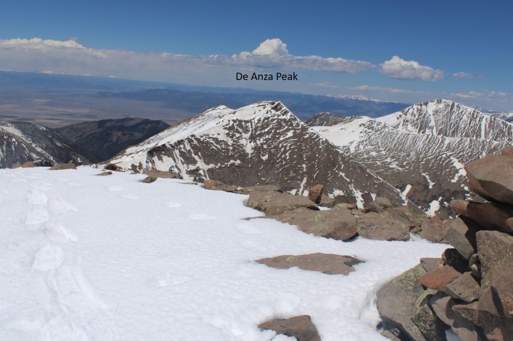
There wasn’t a summit register, so I left one. I had a great view of De Anza Peak to the northwest.
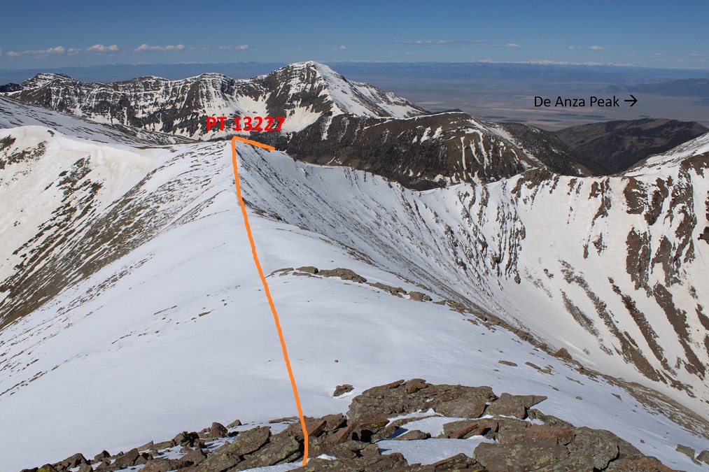
In order to get to De Anza Peak I had to head southwest to point 13227, and then northwest to the summit of De Anza.
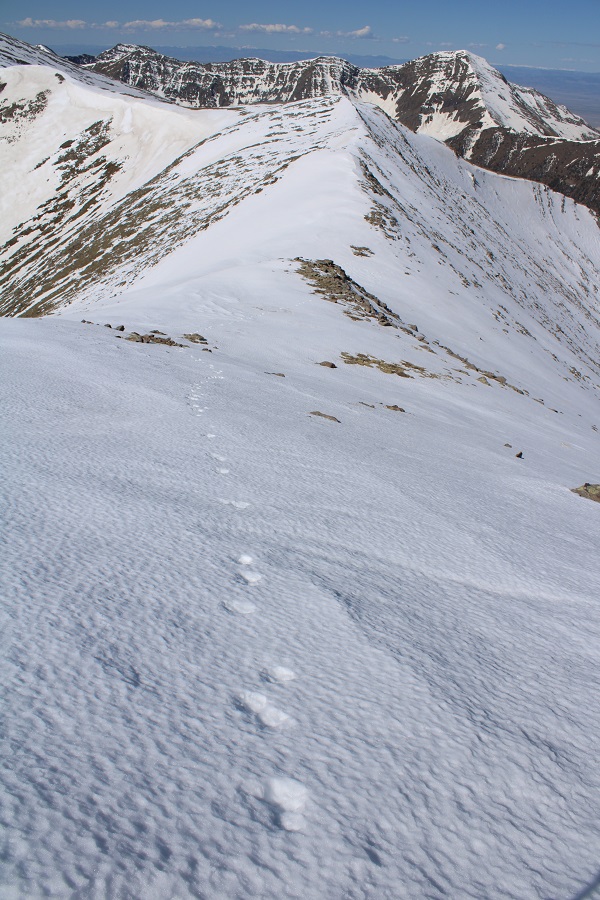
This part of the hike was actually quite fun, as I was now losing elevation, getting a little bit of a break, and following animal tracks the entire way.
When I made it to PT 13227 I turned right and headed followed the ridge northwest. You can’t tell from these pictures, but I was actually downclimbing a bunch of rocky areas. On the way back I stuck to the areas covered with snow, as climbing up the rocks, especially in snowshoes, was a little too spicy for me without a helmet.
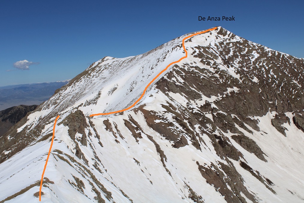
There was still more elevation to lose however. Here’s an overall view of the route to the summit
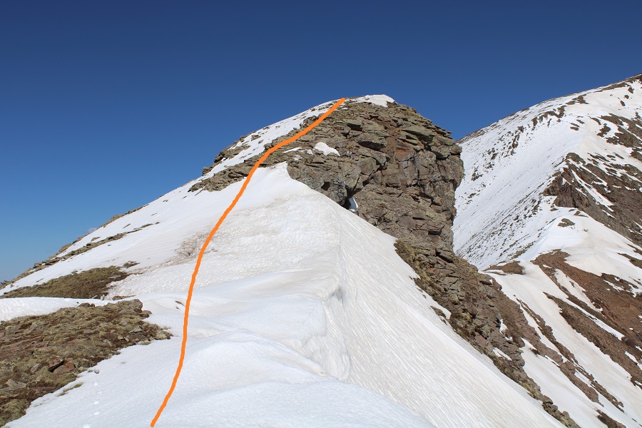
From this point on I needed snowshoes, as I began postholing up to my waist. I strapped them on and followed the ridge. Here are some step by step pictures. I went straight up and over this hump
Then mostly stuck to the ridge, aiming for the gullies to my left just before the summit
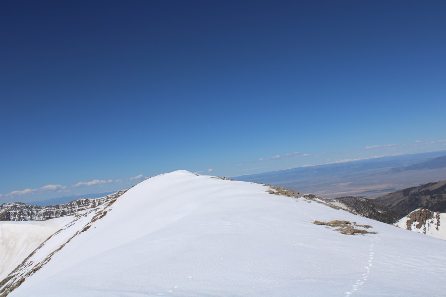
Once up the short (30-40 feet or so) gullies I followed the windswept ridge to the summit
I summited De Anza Peak at 10:40am
De Anza Peak:
Here’s looking back at the route from Gibbs Peak
I left a summit register and started back. While it looks like a simple ridge hike back to Gibbs Peak, the areas without snow are actually rock formations, and I needed to skirt them on my way back.
I made it back down to the saddle, and went up and over the bump in the ridge again
Then skirted the rocks to the right, staying on the areas with snow
Then it was a simple ridge hike back to the summit of Gibbs Peak
I re-summited Gibbs Peak, then followed the ridge east back to treeline. I looked for my lost water bottle, but was unable to find it. (If you find it, it’s yours!)
This time, when I entered the trees, I stayed right. It was my intention to avoid all the bushwhacking I’d one on the way in by taking trail 1350 out. I once again encountered the mashed potato snow at treeline
And at 10,600’ I descended towards Texas Creek.
I was highly disappointed to find this area was no better than the way I’d taken on my way in. In fact, it may have been worse: at least when I was on the ridge, I had a sense of direction. Now I was unable to find a distinguishable trail, so I followed the creek east out of the basin.
At one point I realized the creek was actually the trail, or what used to be the trail.
Eventually the trail became a bit more distinct, although still covered in water and downed trees. Just know if you’re following the creek east, you’re going in the right direction.
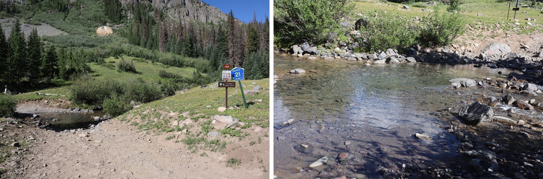
I had to eventually cross the creek, and to do so I needed to take off my shoes. I crossed the creek, and here the trail picked up again. From the creek crossing Trail 1350 was much easier to follow; there wasn’t any water on the trail, but there were still downed trees.
From the creek crossing it was just over a half mile to the Rainbow Trail / Trail 1350 junction, where I picked up the Rainbow Trail again and followed it back to the trailhead.
I made it back to my truck at 5pm, making this a 20.02 mile hike with 7343’ of elevation gain in 14 hours.
So, which approach is better, the ridge or the creek? If I had to go with one, I’d say the ridge, just because I had a better sense of direction. Both were miserable.
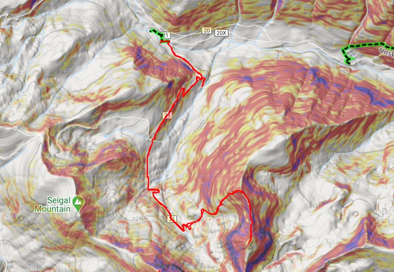
I left Cinnamon Pass after hiking some bicentennials in the area, intent on driving to the Henson Creek Trailhead that leads up to Hurricane Basin. I put together a gpx file on CalTopo which had me taking Road 5 to 2, which is the road that goes over Engineer Pass. However, I wasn’t going to take the pass, I was going to take another road that cut down to 21. I was all excited about this until I drove to the cutoff. At the cutoff all that was there was a sign that said no going off road. Also, the road ended. Hmmm. OK, so there was no road here (or at least, not anymore) so I turned around and drove over Engineer Pass to the trailhead.
I have a stock Tundra, and it handled Engineer Pass just fine. I did see a couple in an OHV, a man in his 40s driving and his wife white as a ghost sitting next to him, clutching her purse as if it were a life vest. She was scared beyond belief, he was having the time if his life…lol! Luckily, since it was after 5pm there weren’t too many other drivers on the road, so I didn’t have to pass too many people. In fact, I didn’t see another vehicle once I went over the pass.
That being said, I wouldn’t recommend driving over Engineer Pass to get to this trailhead: Instead from Lake City take 20 to 21.
I found a nice dispersed campsite near an old cabin.
I walked around for a bit but honestly didn’t stay up long: it had been a long day and I was beat. I ate dinner on my tailgate and had a rather brave chipmunk and Canada Jay beg for food from me. It looked like they’d been conditioned for this behavior. Around 3am I heard what sounded like a wrapper being manipulated by a small rodent. I figured it was the chipmunk from last night fooling around. I thumped on the side of my truck a few times and it left, only to come back again a few minutes later.
I was finally on the trail at 5am. From my campsite I walked down CO Rd 21
I crossed Hensen Creek and changed out of my sandals and into my hiking boots. (I walked the area the night before and figured since it was a short distance to the creek I’d start off in my sandals and change after the creek to save time).
I followed the 4WD road for a very short distance and came to a fork in the road. I went left first, thinking I was supposed to follow the creek, but I ended up coming to private property with ‘no trespassing’ signs. In fact, I should have gone right and followed the road (this is counter-intuitive, but the road actually winds up the mountain).
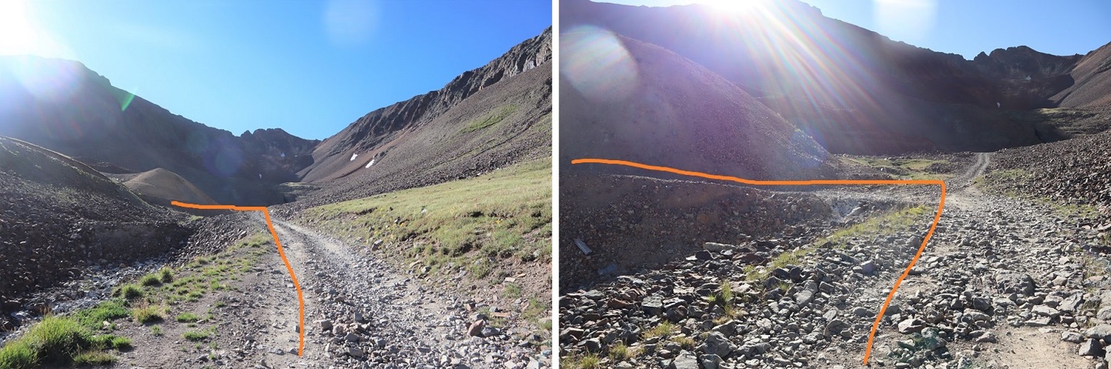
After backtracking I followed the 4WD road for 2.75 miles, all the way to Hurricane Basin.
Note: my truck could have made it all the way to the mine, but I would have run into trouble if I’d needed to pass someone. There are only 2 passing points on this road, one at the first switchback, and one just before leaving the trees (which also happens to be a campsite, pictured below). If you choose to drive this road note other drivers coming up/down, and realize if they’re already on the road you need to let them drive the entire way before proceeding, as there’s no place to pass.
Just before making it to Hurricane Basin the road forked and I took a left
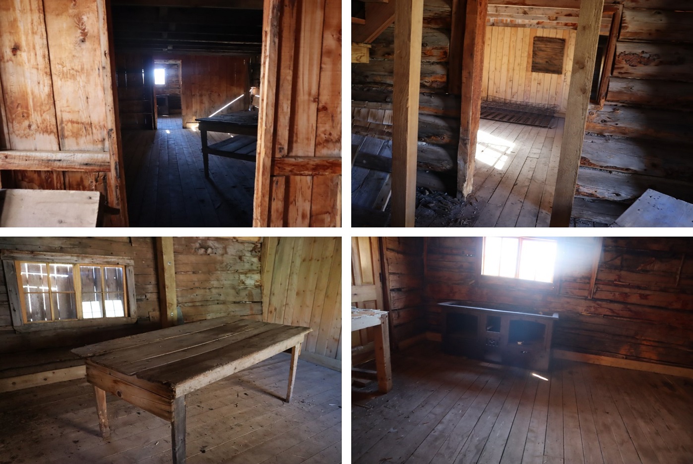
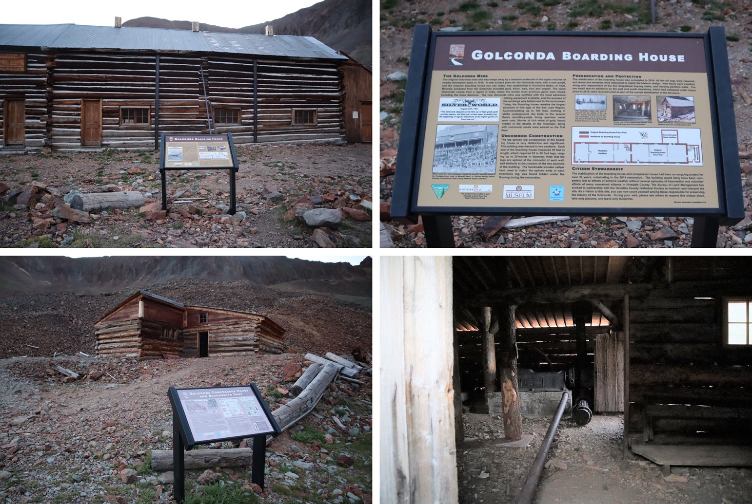
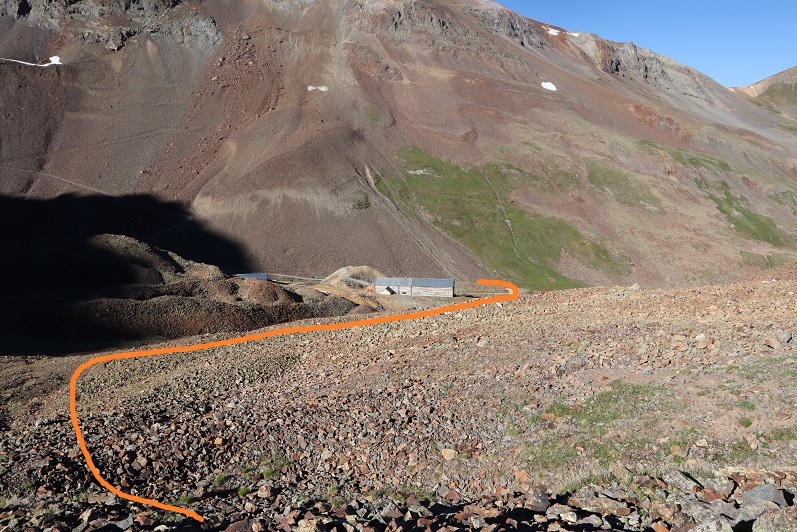
And followed the road all the way to the Golconda Mine. This area is pretty cool, and if you have some extra time I’d suggest you check it out. The mine was refurbished in 2014 but already needs more work, as nature is insane, especially above treeline. The doors open, and you can see some of the original items inside. There’s a blacksmiths’ hut as well, and a lot of leftover ‘trash’ from over a hundred years ago.
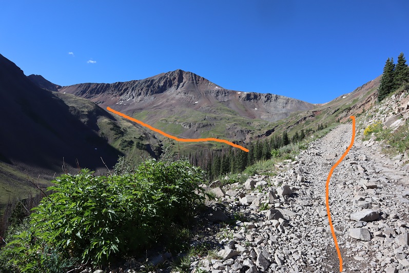
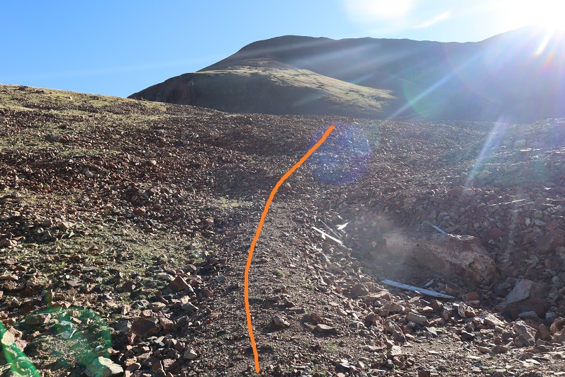
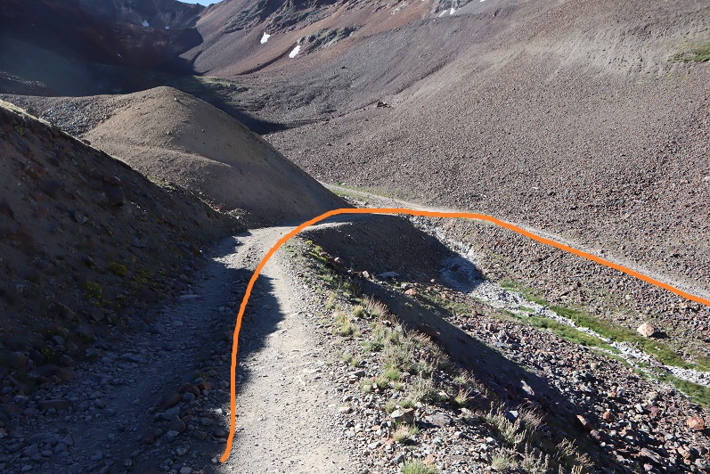
The trail to the summit starts behind the Golconda Boarding House. Well, there’s no defined trail, but that’s the way to start your trek up the mountain. Here’s an overview of the route:
The route starts out in mining rubble
And then changes to tundra. There’s a brief trail here you can pick up and follow for a bit before heading northwest up the mountain
After the tundra came the rubble. There were faint game trails that went up the rubble. On my way down I pushed in steps into the rubble and scree to make more of a defined trail.
I summited unranked Gravel Mountain at 7:10am.
Gravel Mountain:
From here PT 13688 is an easy ridge hike away
The route is obvious and easy class 2. Here are some highlights:
On the way down I did my best to establish a trail in the scree/rubble
Once at the mine I just followed the road back to my campsite
On the way down I was able to see the ‘road’ I’d intended on driving down to the trailhead. It didn’t look like it’d been used in decades. So, long story short, take 20 from Lake City, and not Engineer Pass (unless you have an OHV).
I made it back to my truck at 9:30am, making this an 8.66 mile hike with 3042’ of elevation gain in 4.5 hours.
I got back to my truck, opened the back to shuffle things around, and found mice droppings lining the edge of my sleeping bag! Ugh! At that moment I realized 2 things: 1) it wasn’t the squirrel last night making noise, and 2) the moth balls don’t work. Ugh. So. Not. Cool. A mouse had made its way into the bed of my truck and was looking around for food. At least I didn’t have any food accessible. I was a bit bummed though the hundreds of moth balls I had lining my truck hadn’t deterred a small mouse (and by the looks of the droppings it was a small mouse).
I had another day free to hike, but chose to drive home to spend it with my youngest instead (who was just accepted into her first college this week: in less than a year she’ll be off to college, and I want to spend as much time with her as possible before she leaves).