Anderson Peak – 13,631 & Petroleum Peak – 13,505

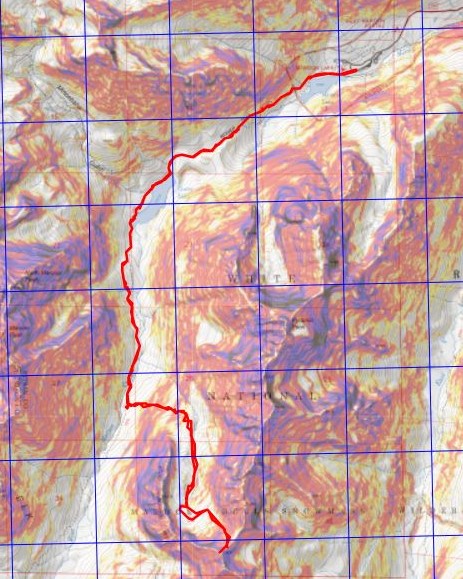
RT Length: 12.14 miles

Elevation Gain: 4624’

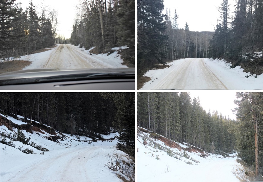
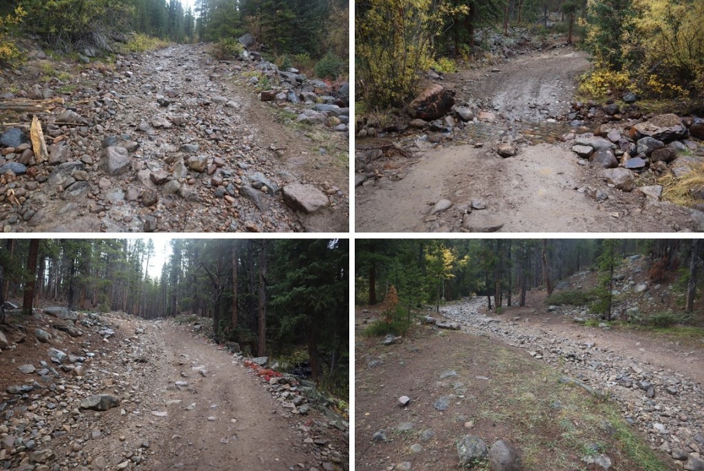
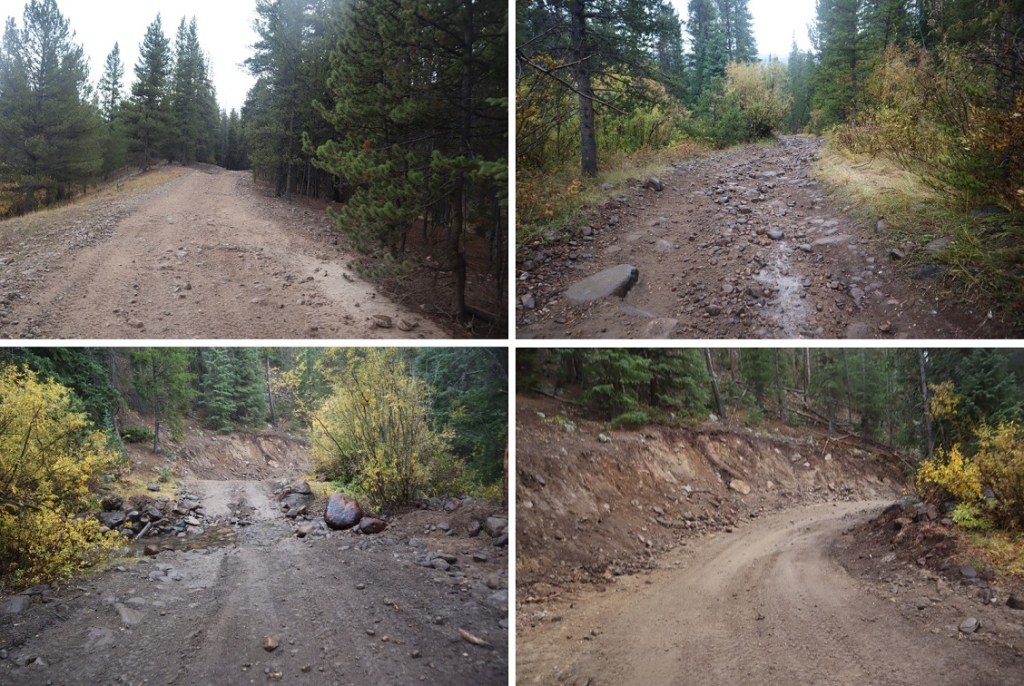
From Tellurium Creek Road. There is no real trailhead for this hike.  A good place to park is at the junction between 742 and 584, and to start out following 584 north.  The rest of the road is 4WD, but is really better suited for an OHV.  There also isn’t a good place to park further up.   I did not park at this junction but should have.  Instead I drove up the 584 road and after about a quarter mile decided I loved my truck too much to continue.  There are some really big rocks.  My truck could have made it further (I didn’t know it at the time, but I’d already driven the worst part) but I decided instead to find a place to park between some trees and hike the rest of the road. 

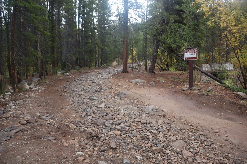
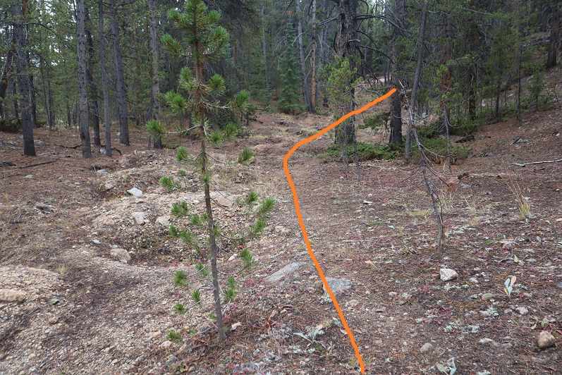
From my parking spot I followed the 4WD road for a mile before turning right onto a closed road.  In the dark I missed the turnoff, but in daylight it’s obvious, marked by large rocks closing the road to vehicle traffic.

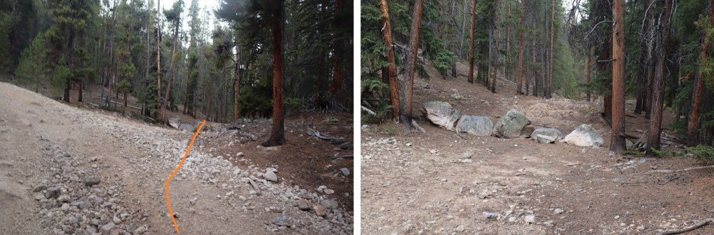
This is an old mining road that switchbacks up the side of the mountain.  They really don’t want you driving on this road:  as if the rock barriers weren’t enough, they’ve mounded the road as well.  It’s still easy to follow.

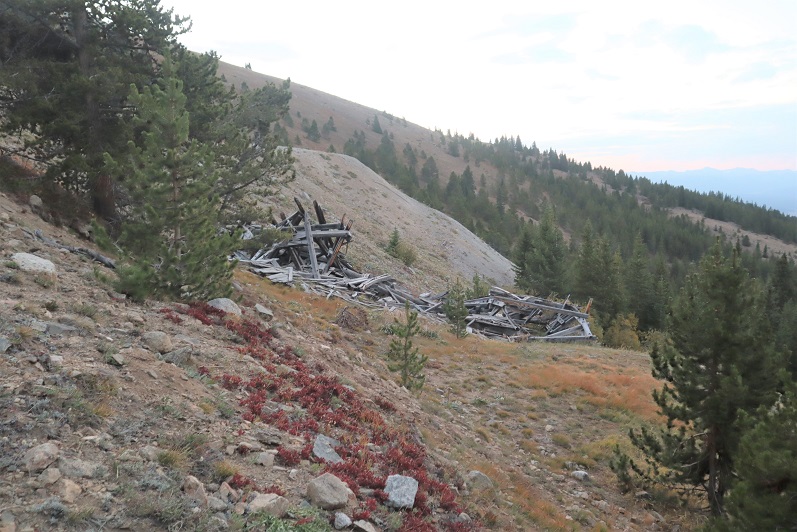
The road passes the Enterprise Mine

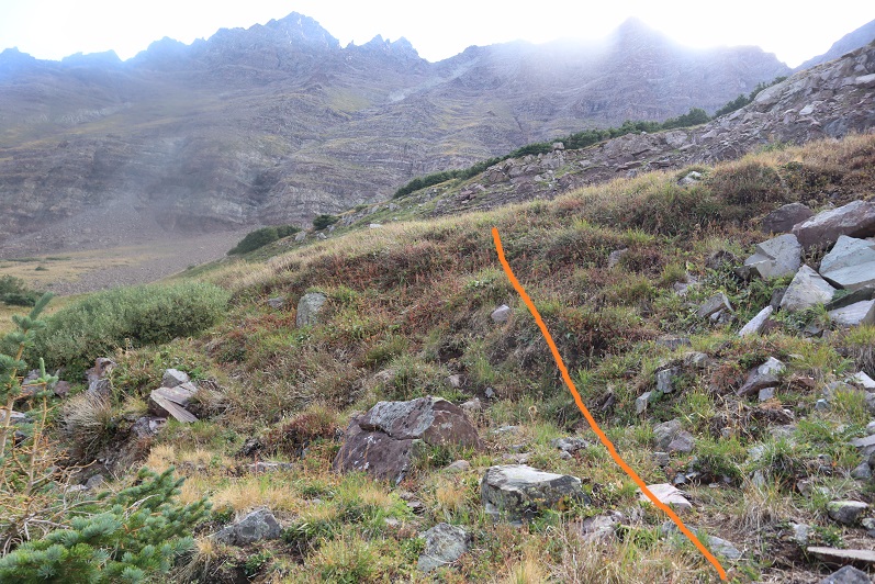
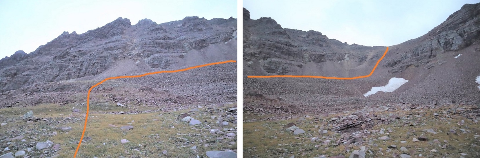
And switchbacks a few more times up the mountainside before heading to another mining claim.  I took two more switchbacks after the Enterprise mine, and then left the road to head north up the mountainside.

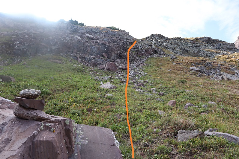
Once I’d gained the ridge I turned left and followed the ridge northeast.

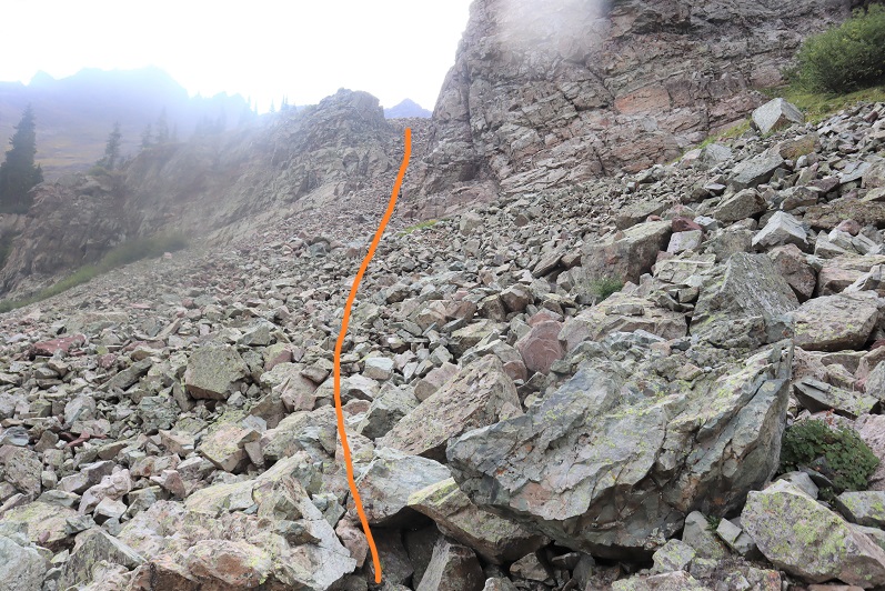
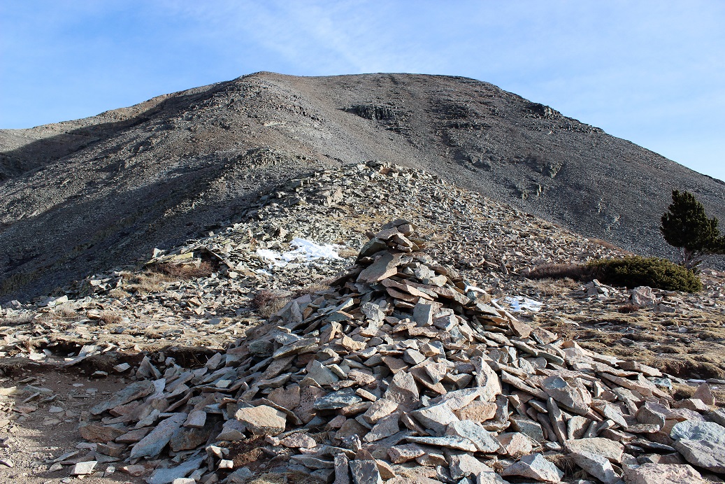
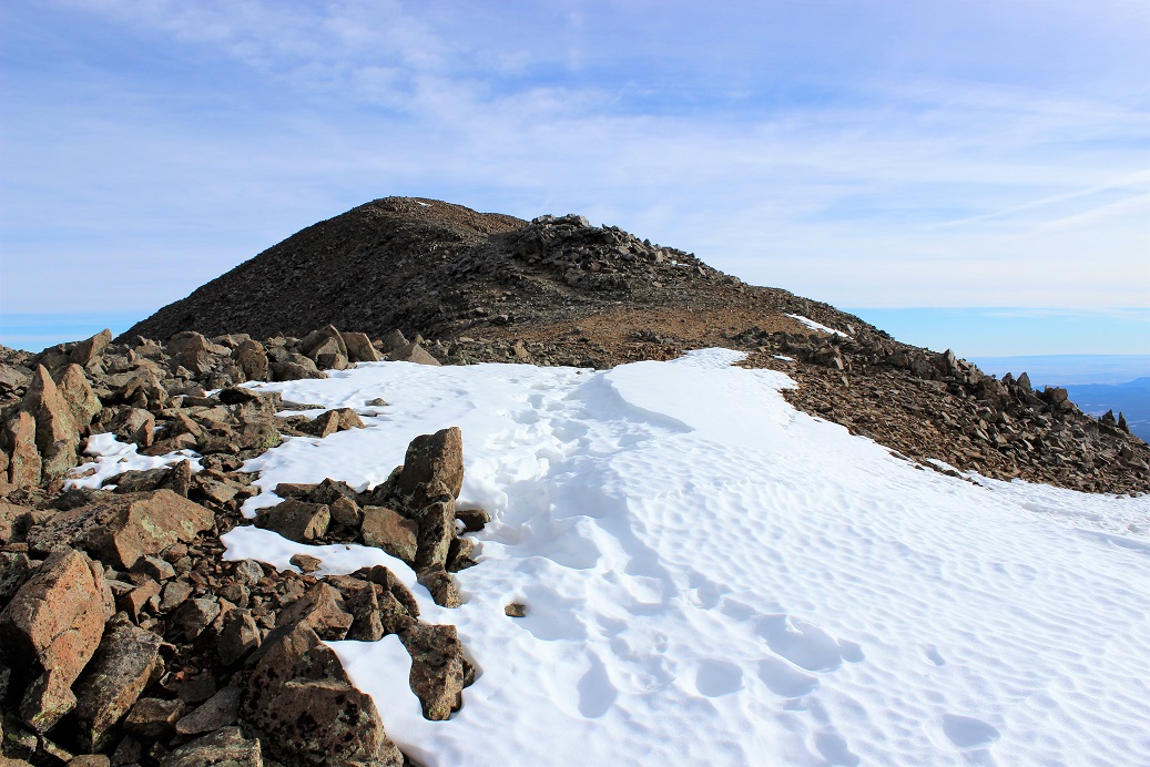
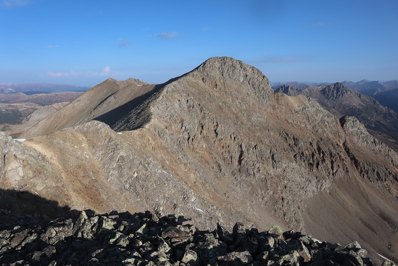
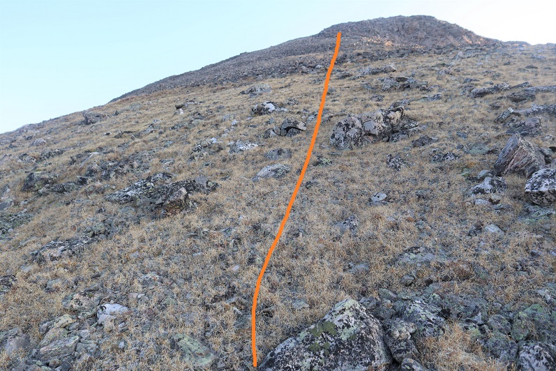
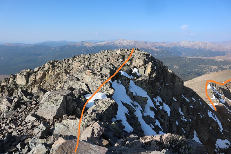
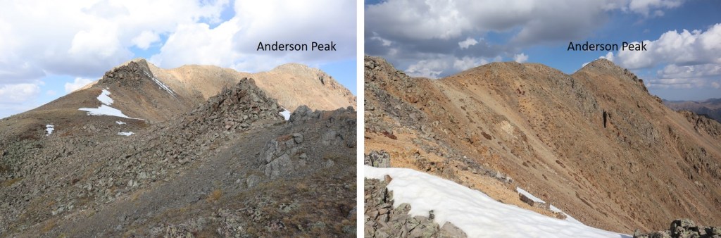
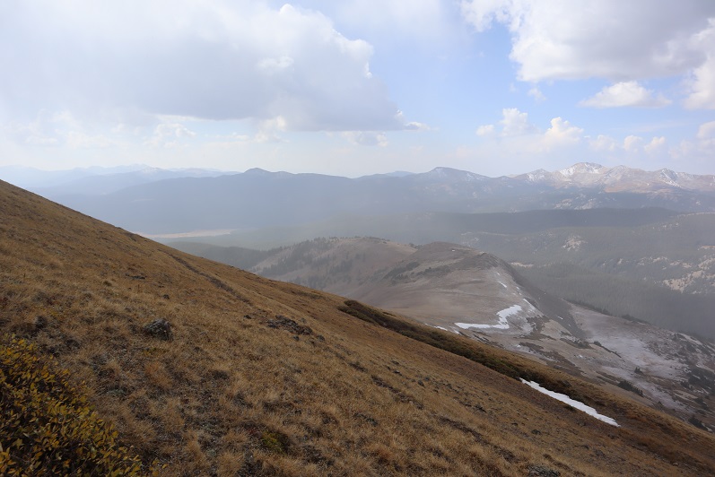
From here on out this is a simple ridge hike, but there are a lot of false summits

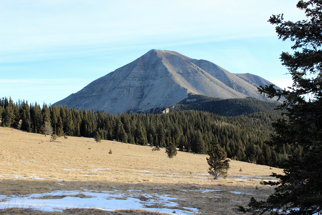
Here’s the actual summit of Anderson Peak

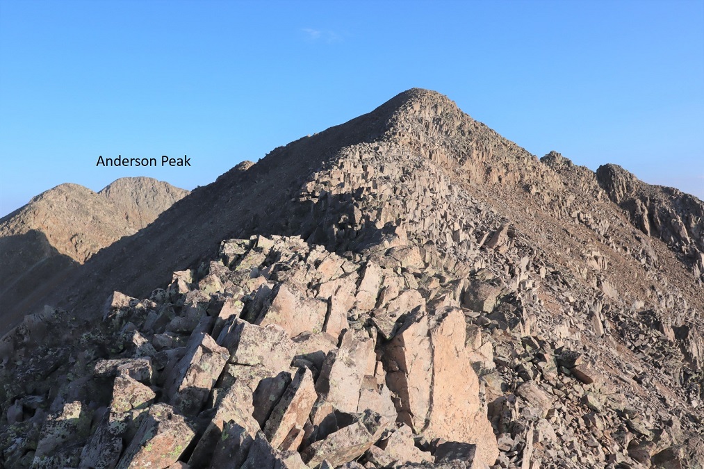
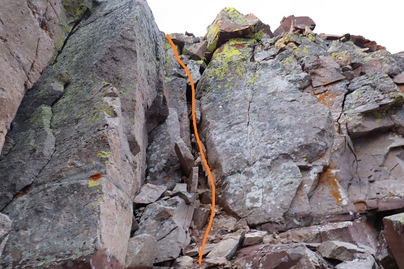
It’s a long but straightforward, class 2 ridge walk to the summit (with a lot of small ups and downs)

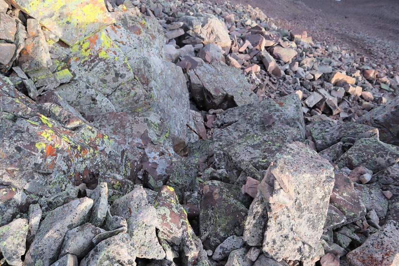
For some reason I saw an anchor set up on the ridge?  I’m not sure what the reason is, considering this is all class 2 and it’s not near the summit. 

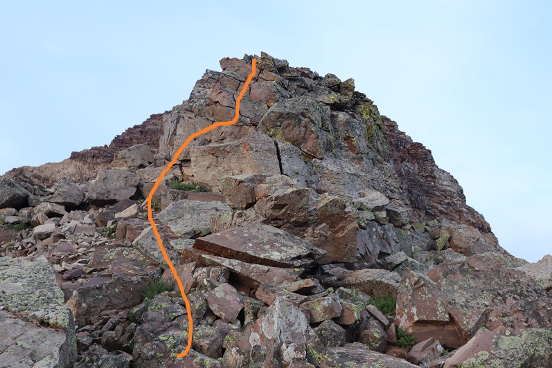
Here’s the last bit to the summit.  Notice how blue the skies are?

I summited Anderson Peak at 8:45am

Anderson Peak: 

https://youtu.be/sX7Og2Fu62c

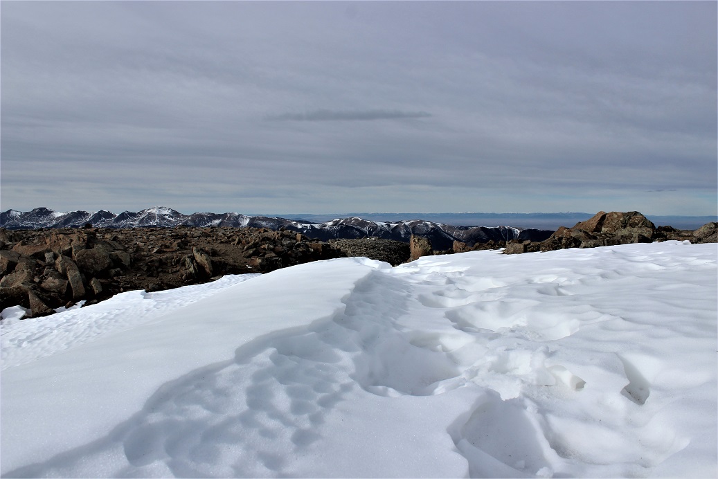
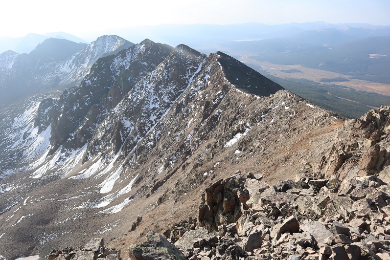
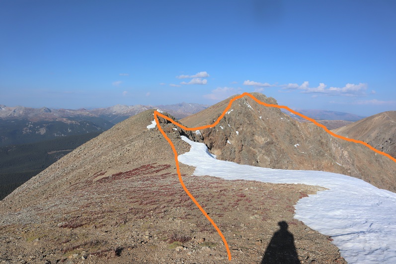
Here’s looking back at the ridge

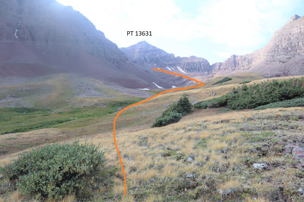
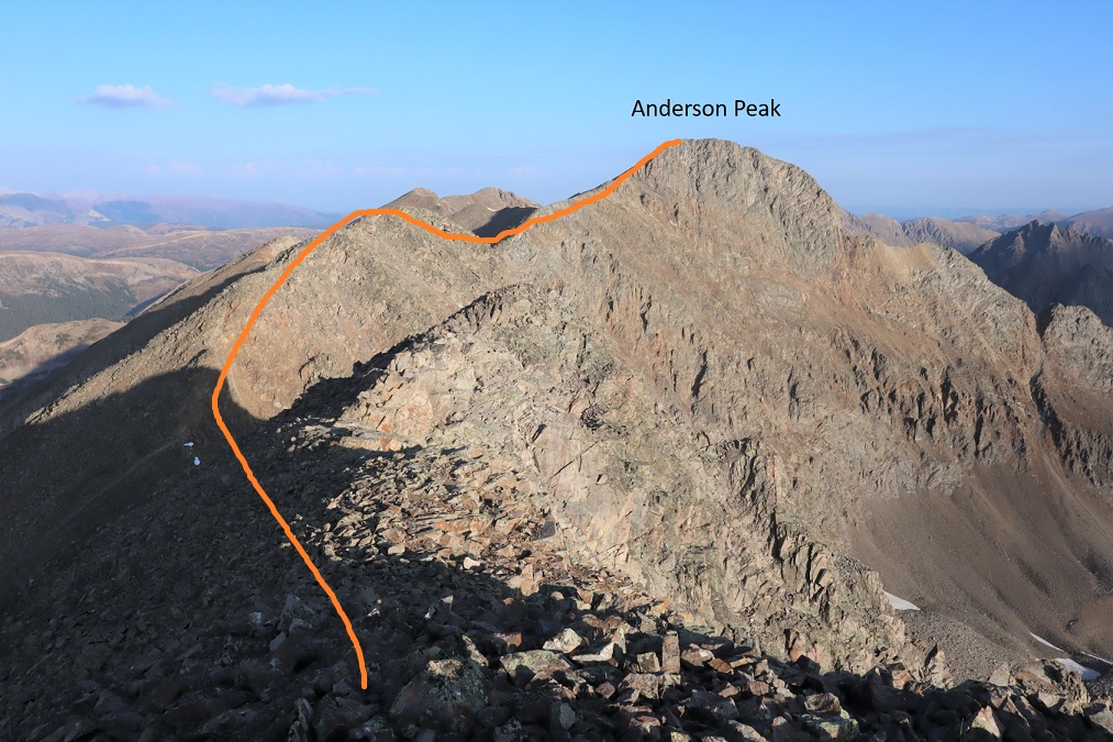
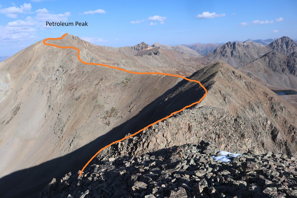
I turned around and continued following the ridge that led to Petroleum Peak

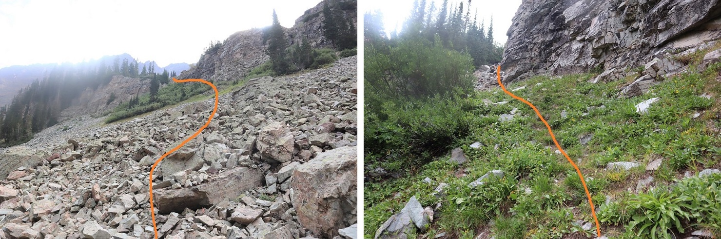
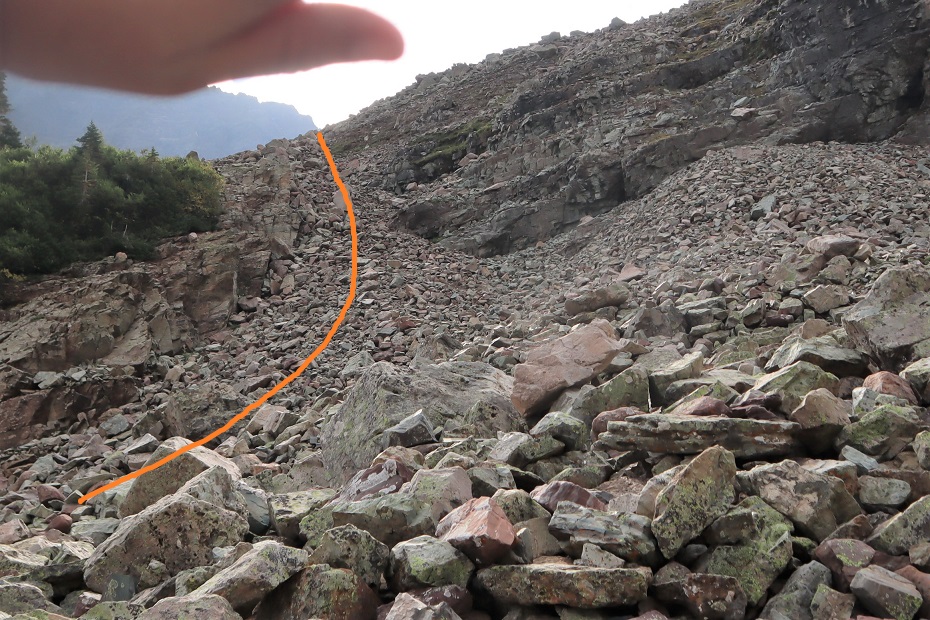
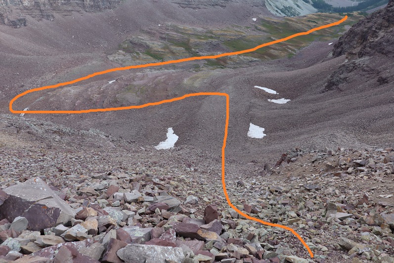
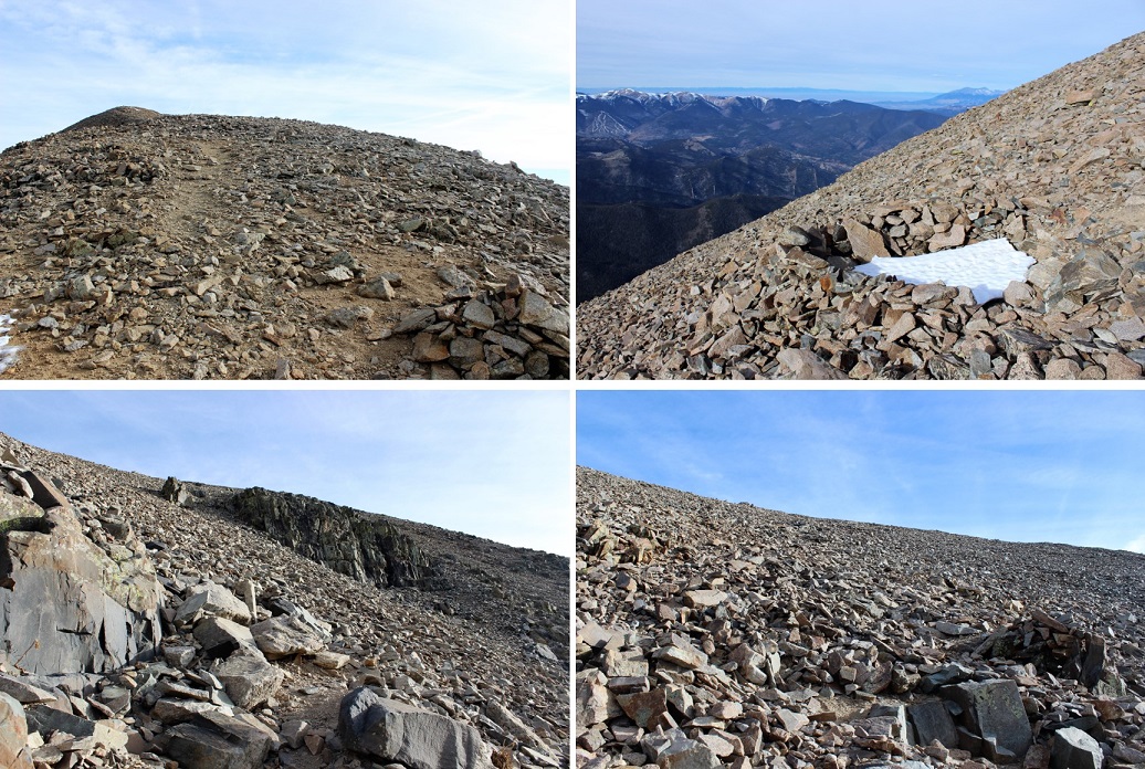
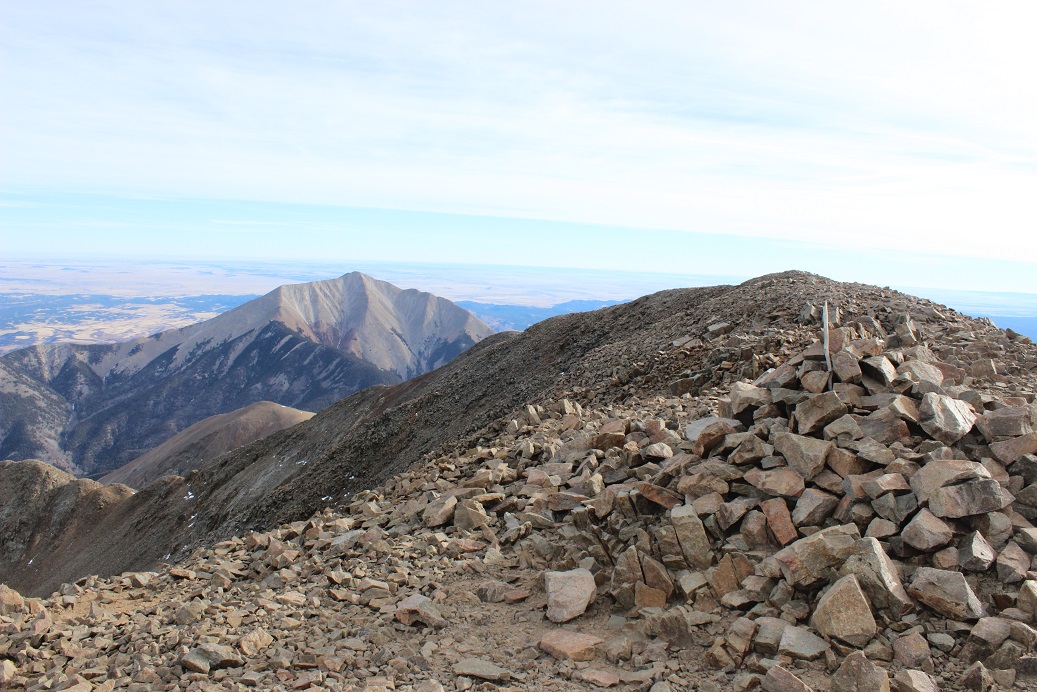
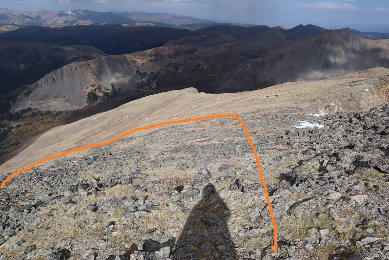
Here’s an overview of the route

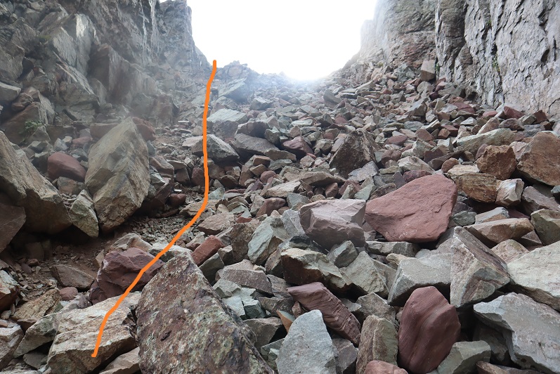
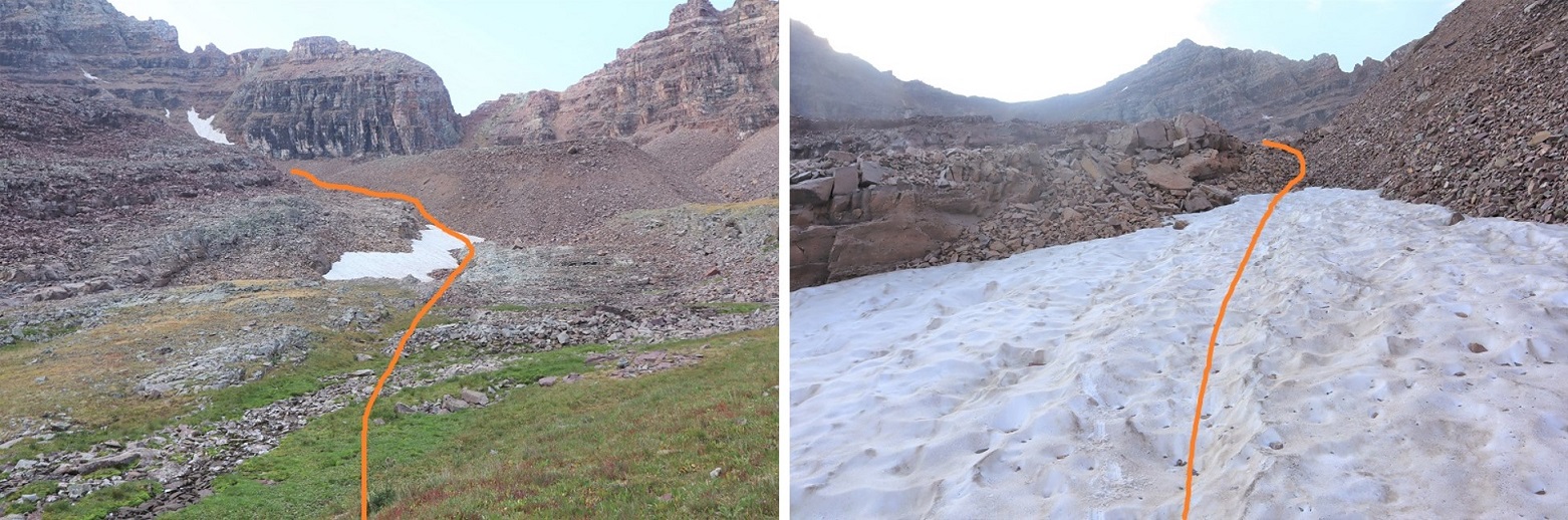
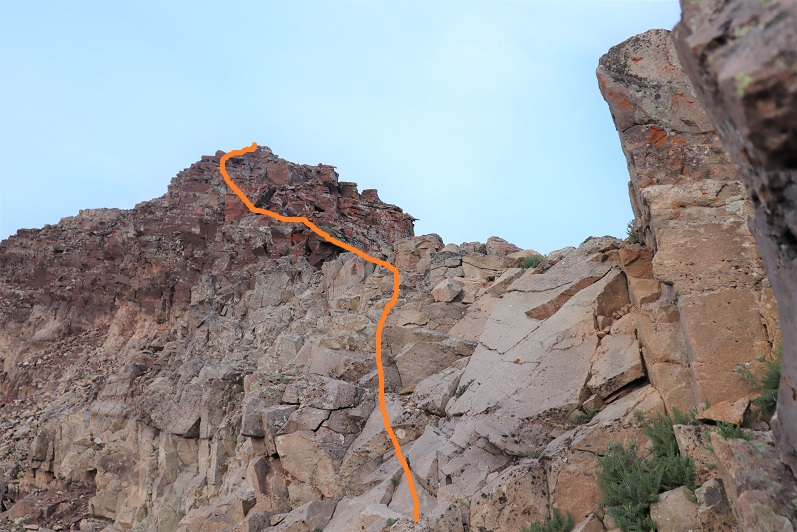
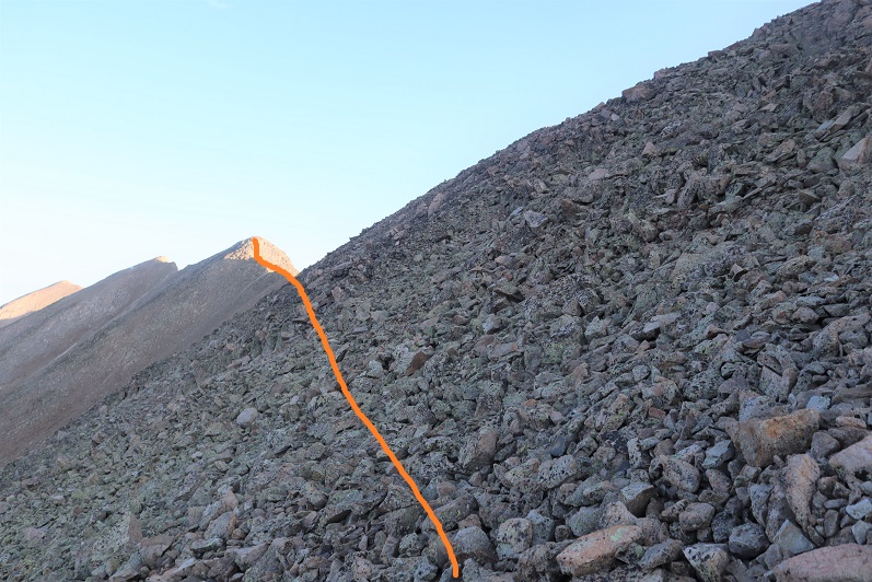
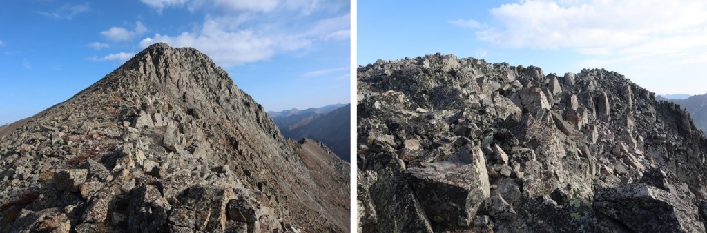
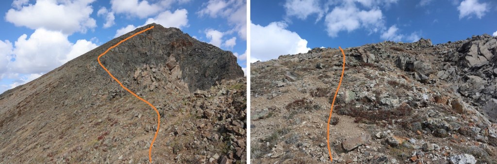
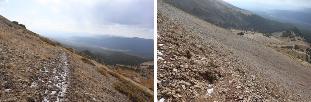
And step by step, all class 2.  Notice the increasing clouds?

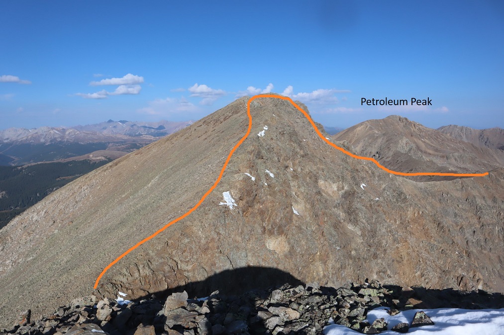
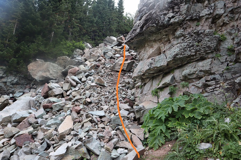
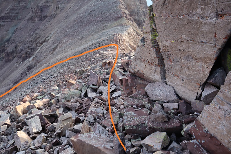
Getting up this section was a little steep, but still class 2

I stuck to the ridge the entire way

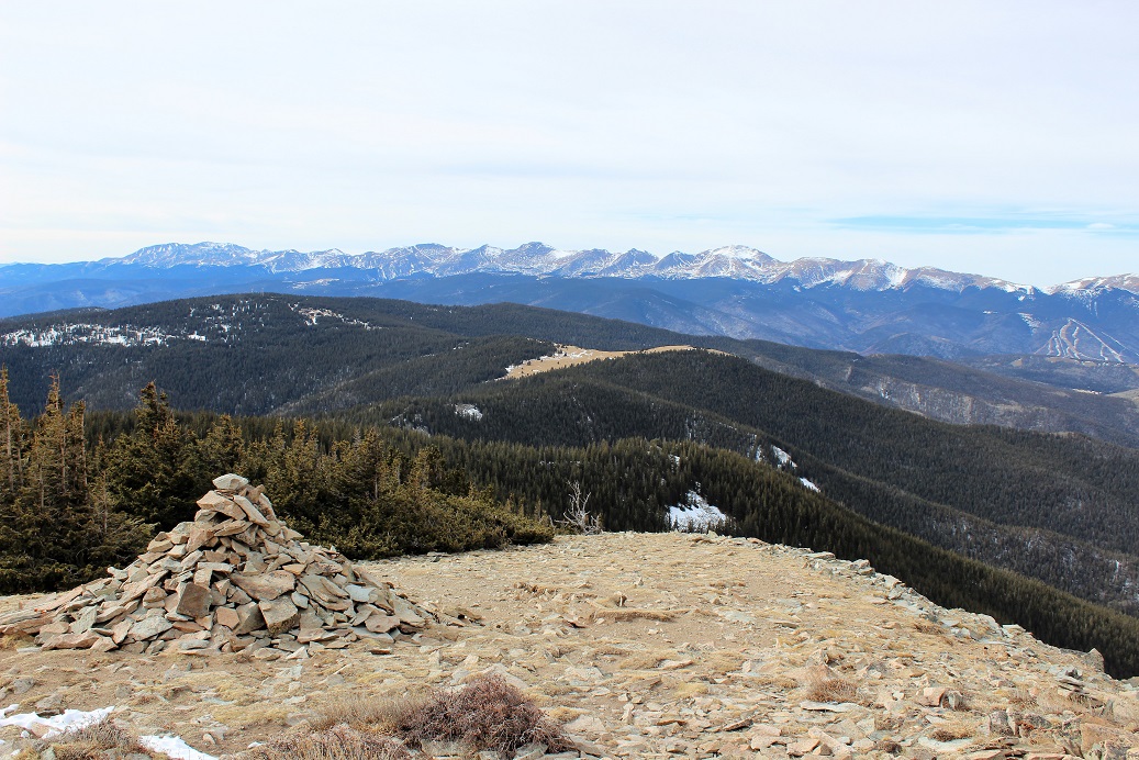
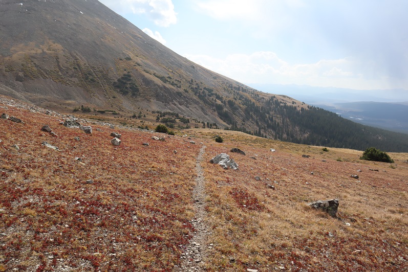
The summit was long and it was difficult to tell where the actual summit was. I walked all along the ridge and found the summit cairn/register further to the north. 

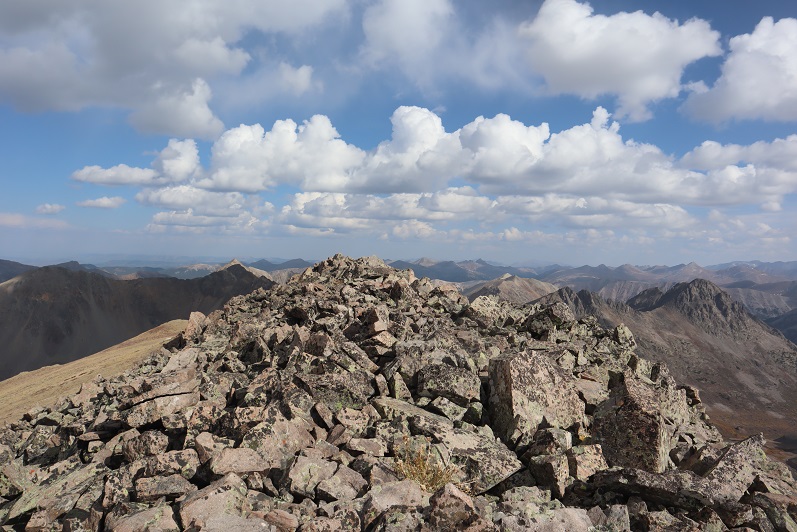
I summited Petroleum Peak at 10:10am

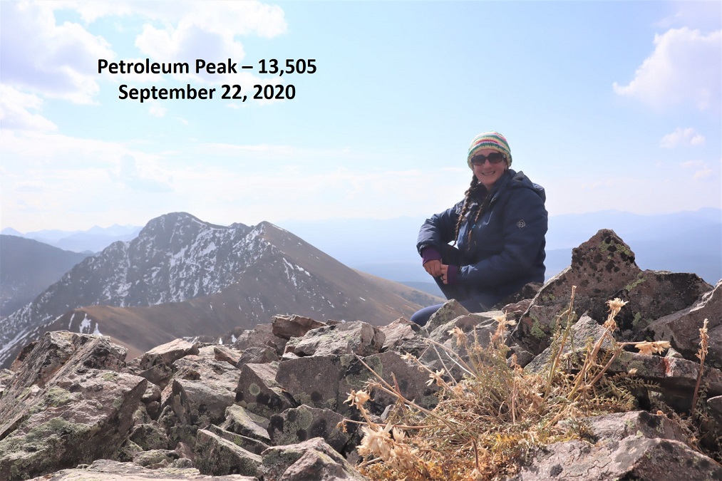
Petroleum Peak:  https://youtu.be/agIJEkY3uqQ

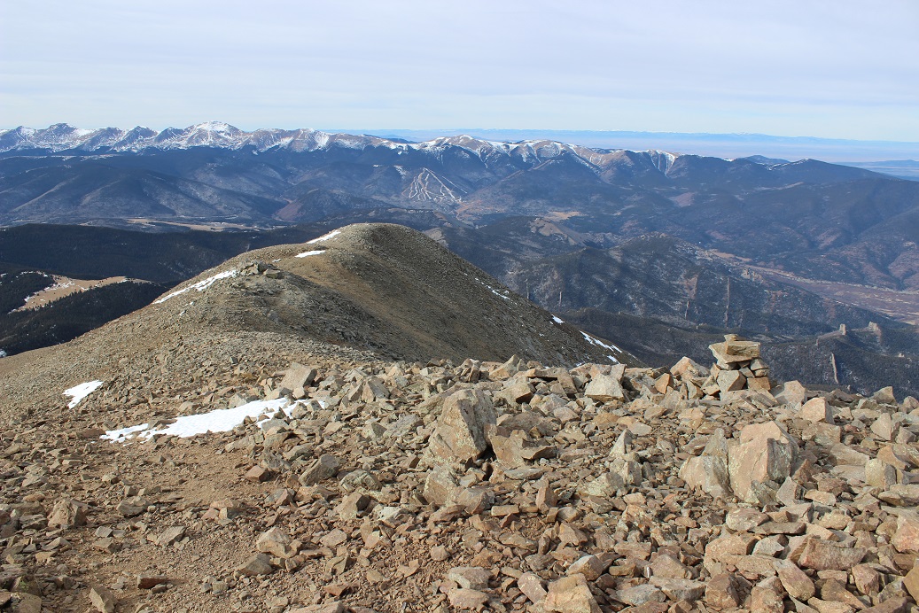
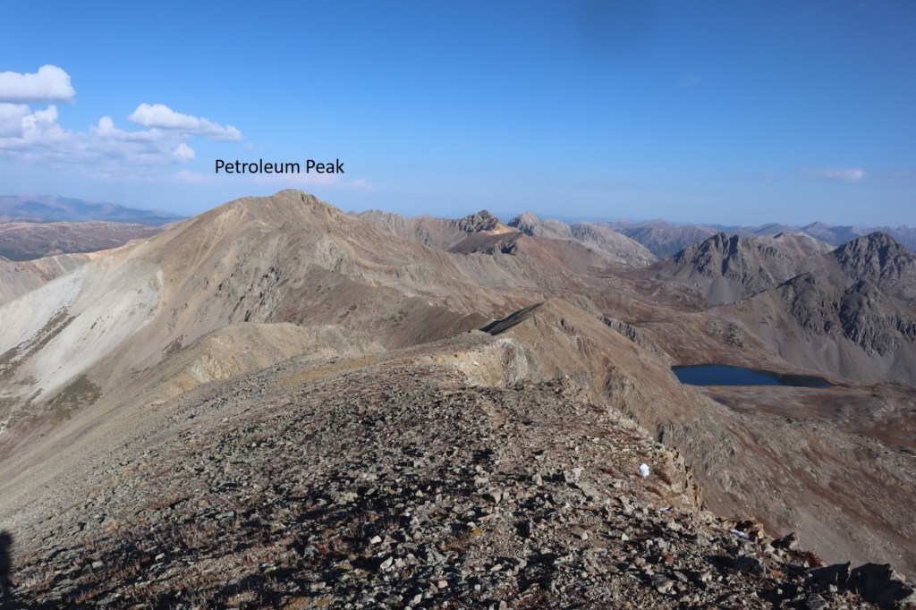
Here’s a look back at the route from Anderson Peak over to Petroleum Peak

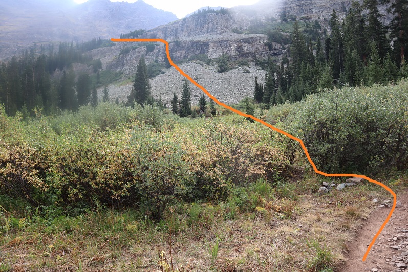
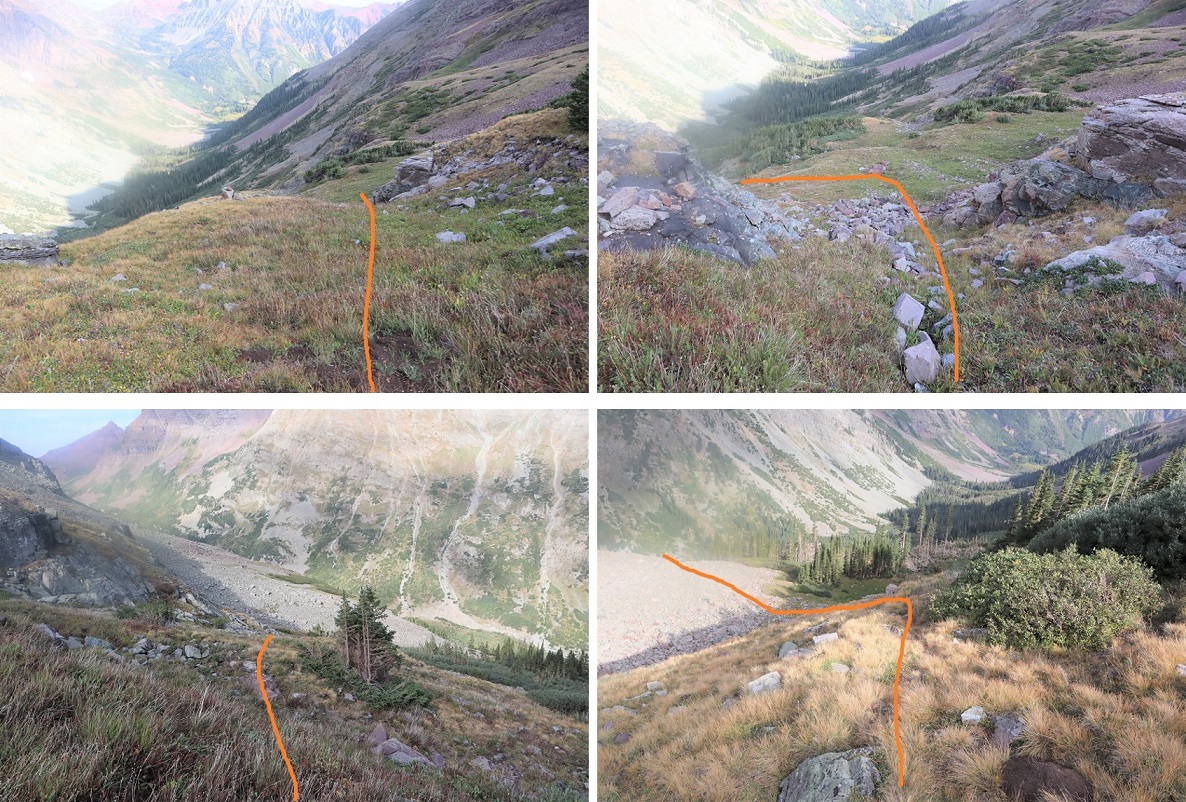
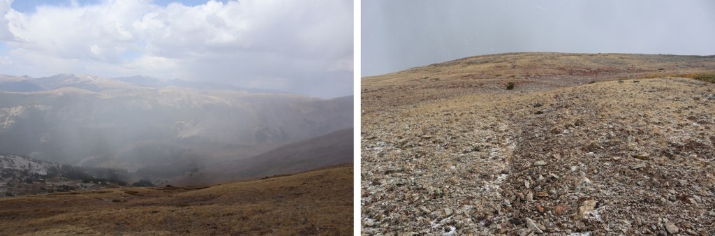
It wasn’t lost on me the clouds were increasing at a rapid rate.  It wasn’t even 10:30am yet, but the forecast predicted a 20% chance of thunderstorms after noon.  It looked like they were going to happen, and I wanted off the mountain as soon as possible.  I continued following the ridge north to avoid rock hopping, then turned and followed the mountainside as it curved south. 

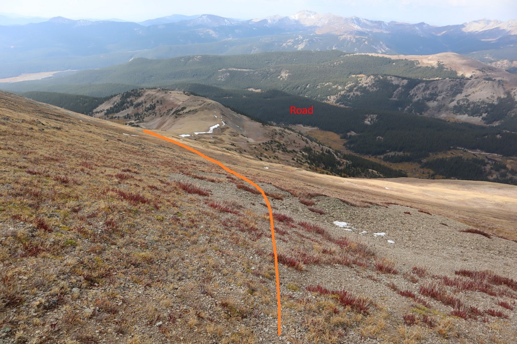
Now, I could have just aimed for the road and taken that back to my truck, but where’s the fun in that? Side note: If you’re not good with route finding off trail, aim for the road. 

Oh, and those clouds I’d been worried about?  Around 10:30am it started snowing!  Wow!  That had happened FAST!  I put my camera away during the worst of it, but it wasn’t too bad, just unexpected.  Mostly graupel and small flakes.

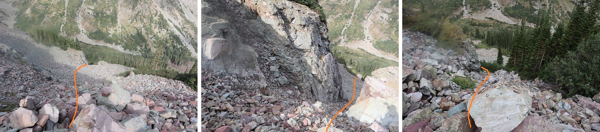
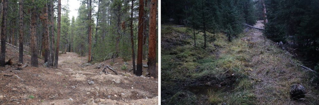
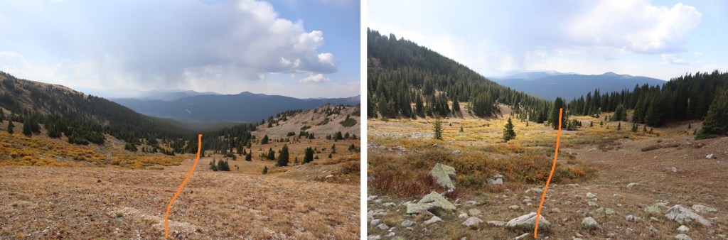
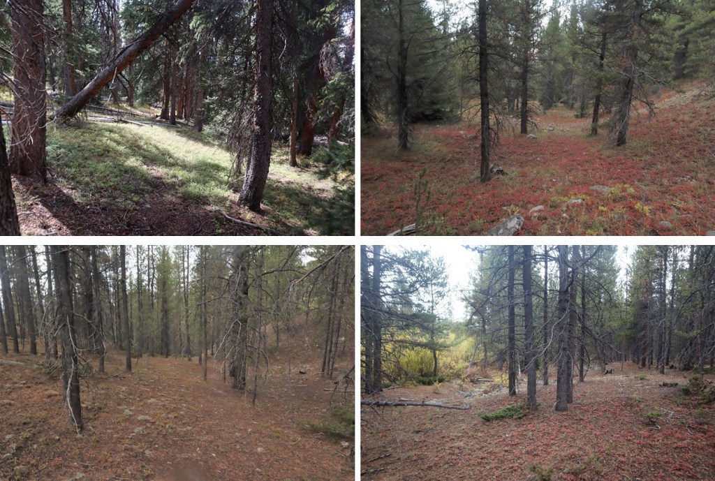
I continued curving around the side of the mountain until I came to a well defined game trail, then followed that to a basin.

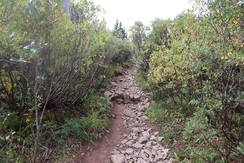
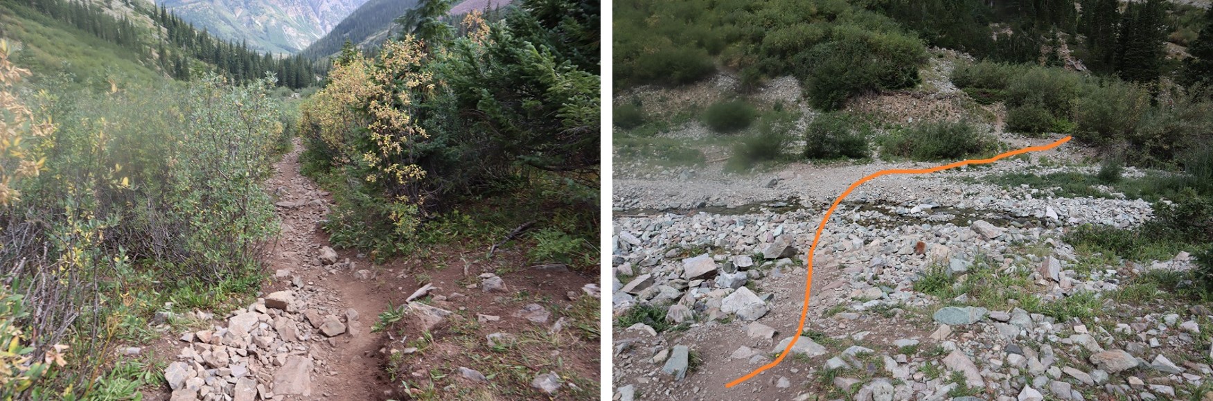
Once in the basin the trail ended.  I turned right and followed the drainage 2.5 miles.  There is no trail here, but if you stick to the creek you will eventually make it to the road you hiked in on.  The brush can be thick at times, there are some willows to contend with, but it’s easy to stay near the creek. Eventually you’ll want the creek on your left, but feel free to navigate back and forth as needed.

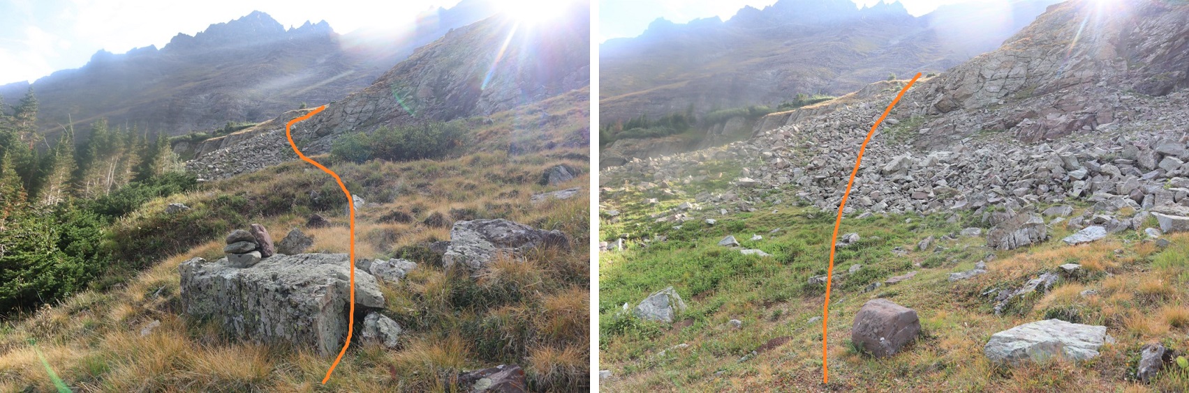
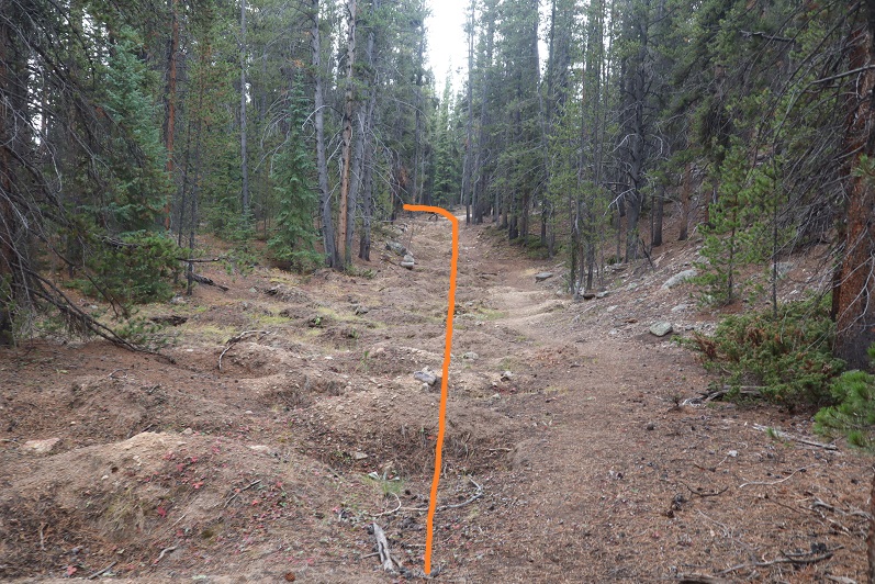
Eventually I made it back to the bumps in the dirt that told me I was back to the destroyed 4WD road

And took the road a short ways southeast to 584 and back to my truck

It rained lightly the rest of my way out. 

I made it back to my truck at 12:15pm, making this a 12.14 mile hike with 4624’ of elevation gain in 6 hours, 45 minutes. 

Now to drive home and get back to work! 

Len Shoemaker Peak -13,642

1

RT Length:  14.93 miles

Elevation Gain: 4584’


This is the third time I’ve been to Maroon Bells this month.  I was able to secure 3 separate permits, and the past few weeks went with friends to summit North Maroon and Pyramid.  Today I was here to tag a new 13er for myself: PT 13631.  Since I70 is now open (it was closed due to fires) I was the only one driving on HWY 82.  I didn’t pass one vehicle between Granite and Aspen.  It was awesome.  I did see 2 vehicles parked at a trailhead near Independence Pass, and two scruffy porcupines to go with them, merrily munching on the wires underneath.  The owners of those vehicles were not going to be happy when then made it back to their cars.  I’d have gotten out and shooed them, but, you know, they may be slow but they have quills.  I saw three other porcupines waddling along the highway as I drove.  HWY 82 is popular among porcupines.

As I passed the parking structure for Maroon Bells I saw a pear shaped bear butt running away from a trash can and then jump over a fence.  It was cute to see it bounding away (although I kind of wanted to get a picture so I wished it had stood still for a second).

I had a permit to park at Maroon Bells from 12am-4:30pm.  It was 1am when I arrived and I felt it was still a little too early to head out so I took a quick nap.  A large group of hikers passed by at 2:40am and woke me up, so I was on the trail by 2:45am.

The trail starts at the west end of the parking area

2

And follows a well-defined path around Maroon Lake

3

At the end of the lake I followed the trail towards crater lake.  I noted the signs:  One said “bear activity in area” as of August 23 (August 1st had been crossed out) and there was also a sign saying there was a moose in the area.  In the last few weeks I’ve seen a bear standing on the side of the road while taking the shuttle ride out and a moose standing in Maroon Lake, so I knew these signs to be true.

4

This is a class 1 trail to Crater Lake

5

I turned left at the junction for Crater Lake

6

And then followed the trail (still class 1) around the ‘lake’ and up the basin.

7

I passed a few camping areas while it was still dark.  In one a large man was standing by the trail, bald, shirtless, and in possession of a rather hairy pot belly.  He seemed to be waiting for me to pass by.  Luckily this is a well-travelled trail, especially at this time in the morning when others are looking to summit Maroon Peak (I count the flashlights so I know who’s ahead of/behind me when it’s dark out:  that large group of hikers wasn’t too far away).  I could see him because he had a headlamp shining from his forehead.  I didn’t see his dog, who started barking at me as I neared.  Of course, I jumped.  The man seemed to think it was funny.  I continued on.  Also, it wasn’t funny.  Here’s an overview of the next few steps, as I made my way up to Len Shoemaker Basin

8

After hiking for 4 miles from the trailhead, and at 10515’ I left the trail to cross Maroon Creek (which at this point of the year isn’t flowing much, but earlier in the season is several feet deep).  There are cairns in the area.  An obvious trail picks up on the other side.

9

10

I followed this trail for .25 miles, until I saw a cairn to my left and then followed a very faint trail east through and then out of the willows, and up the side of the mountain, towards the basin.

11

Making it to the basin required ascending a series of gullies.  I’ve been here several times, and the route gets easier to find each time. This time there were plenty of cairns indicating the way.  However, the route sometimes doesn’t seem like it should follow the cairns, but trust me, it does.  Here’s the route step by step into the basin.  After exiting the willows and crossing a small boulder field there is a faint trail behind the next set of bushes/willows that will lead to the first gully.  Now’s a good time to put on your helmet.

12

I ascended the loose gully, staying to the right for more traction

13

At the top of the first gully you’ll see another gully to your left.  (These are tons of fun in winter BTW, so bring your crampons and ice axe if you expect snow).  Ascend the second gully, this time sticking to the left for more stable ground

14

15

At the top of this gully is… another gully.  Sorry for the hand in this picture:  the sun was at an unfortunate place in the sky while I was trying to take pictures and this was my solution.

16

From here I aimed for the grassy slope and went behind it, angling towards the ridge

17

And could see another gully to my left.  (This entire time I was heading east)

18

Next, I aimed for the grassy slopes, and the final gully that would take me to the upper basin.

19

20

Here I got my first view of PT 13631.  I just followed the basin south towards the end

21

The end of the basin was still holding some snow. This was a light snow year, so I expect there’s snow here almost year-round.  The snow can be avoided, but I just walked over it into another basin

22

I followed the talus rib towards the base of the gully that would lead me to the saddle of Lightening Pyramid and PT 13631

23

This is the last gully of the day.  It’s class 2 but the scree is loose.  I looked for larger rocks whenever possible.  There is no direct path but there are a bunch of game trails.  No area seems to cliff out, so you can pick your line depending on conditions.

24

25

At the saddle I turned right and headed southwest up the ridge.  Most of this was easy scrambling, after first initially gaining the ridge.  To do this I went right, found a class 3 chimney and ascended it.  This was the most difficult part of the entire hike, and I probably could have found a class 2 option around this if I tried harder. I felt this chimney was pretty easy.

26

Here’s looking up at the chimney.  There are plenty of hand/foot holds.  It’s only about 8 feet high and all of the rocks are stable.

27

Once on the ridge I scrambled my way to the summit. This is all easy class 3, just scout around for the best route.

28

29

30

The summit is relatively flat.  There’s a summit cairn with two summit registers.  The metal one is closed and has 2 pens inside.  The white one is open (without a lid) and is empty. Bring some paper if you want to sign this register.

31

I summited PT 13631 at 7:20am

32

PT 13631:

The views were great, but the smoke from nearby fires shaded them a bit.

33

Here’s the route back down the ridge

34

Down the chimney (you can see my trekking pole below for reference)

35

And back around to the saddle.

36

Once again, great views

37

Back down the gully and through the basin

38

And back down the gullies, following the cairns west along the way.

39

40

41

Through the willows

42

Back to the trail that would lead me across the creek

43

And back to West Maroon Creek Trail 1975 and Maroon Lake

44

When I was here last week there’d been a moose standing in the lake.  Guess what?  He was still there (this time lounging by the lakeshore).  Pretty cool!

45

46

I made it back to my truck at 11:45am, making this a 14.93 mile hike with 4584’ of elevation gain in 9 hours (with some time spent ogling the moose).

47

Here’s a topo map of my route.  I have to say, the views were incredible but the peak itself was kind of a letdown.  It had just been too easy, when I’d been expecting the more intense scramble over crummy rock the Elks are known for.  It almost wasn’t worth bringing my helmet, but the moose was an added bonus.

48

On to the next trailhead!


West Spanish Peak – 13,584


West Spanish Peak – 13,631

RT Length 7.9 miles

Elevation Gain 2400’

I’ve been eyeing this trail for weeks, and was finally able to make the hike!  I don’t do well in the cold (or wind) so I’ve been looking for a relatively clear, wind free day.  It’s been clear but the wind hasn’t cooperated, so instead of 14ers and 13ers I’ve been hiking 12ers, 11ers, 10ers, 9ers, and 8ers for the past month and a half: I needed to get above treeline again!!!

Today’s forecast at the summit was 38* with 15mph gusts, which I figured I could handle.  I’d been keeping an eye on the Webcam, and the peak looked pretty barren from snow:  http://www.keno.org/colorado_web_cams/cuchara_cams.htm  (side note:  If you use this link, know the best time to view for clarity is around 3pm, and the bottom webcam is only updated once a week, the others usually every half hour).

I found several directions to the trailhead, but none of them were ‘exactly’ correct.  This is the exact route I took:

I25 South to Walsenburg, Exit 50 (the second 160) turn right

Continue on 160 for about 13 miles

Turn Left onto CO12

Continue on CO12 for 21.8 miles

Turn Left at Cordova Pass CR46

The trailhead is exactly 6 miles on the road, near the campground

The road in was a 2WD road, but iced over in a lot of areas, making it an easy 4WD road for this point in the year.  Just be careful:  there are 3-foot-deep drainages on either side of the road filled with snow so they look like they’re level with the road (but they’re not), and driving into one of those isn’t fun to get out of, even with a 4WD.  It was obvious many had made this mistake.

2

The trailhead is the West Peak Trailhead.  I parked here.  There are restrooms but they’re locked.  I was told to pay a fee, but all signage and fee envelopes (etc.) were gone, presumably closed for the winter.  I gathered my gear and started on the trail at 8am.

3

A few yards in I came upon a trail register.  The last entry was from December 28.  I was pretty sure I wouldn’t seen anyone else on the trail today.

4

I hiked for about a quarter mile before coming to a meadow.  I’d seen quite a bit of cow patties along the trail up to this point, and figured there were cattle in the area.  When I reached this meadow I thought I saw cows on the saddle ahead of me.  I made a mental note to look out for them, and stopped to put on my gloves and hat because I could hear the wind picking up.  The wind didn’t stop for the entire hike!

What I thought were cows ended up being bighorn sheep!  So cool!  They were a bit skittish and ran up and over the hill as soon as they saw me.

5

When I’d entered the meadow I thought I was out of the treeline, but the trail dipped back down and I walked for about 2 more miles through the trees.  Most of the path was clear, but there were a few snow covered areas.

6

This trail is super easy to follow the entire way to the summit.  There’s only one trail junction, and it’s clearly marked.

7

The trail is also very easy until you get to treeline, but make no mistake, most of those 2000+ feet in elevation occur during the last mile of this hike, so it is still quite a workout.  Once you hit treeline you turn right and see what’s ahead of you:

8

The trail follows the ridge on the left (but stay to the right while on the ridge).  It’s all loose rock until it becomes scree, and it’s straight up for over a mile.  Since there are so many rocks there are tons of cairns and the route is easy to follow.  About halfway up I saw a small wind break made out of rocks, which was filled with snow.  There was no other snow on the mountainside.

9

After hiking for what seems like forever you’ll come to a false summit, but it’s ok to be happy about it because the rest of the trail is very easy and is only about another 100 yards or so.  This was also the only spot I saw snow above treeline (besides in that small shelter).

10 False Summit

I was able to make that little bit of snow look like a lot of snow…

11

Here’s a view of East Spanish Peak from the summit of West Spanish Peak

12 East Spanish Peak

And photo proof I summited.  I started at 8am and summited at 9:45am.

13 WSP 13631

The summit was very windy and cold.  The weather predicted 38* with 15mph wind gusts, but those winds were actually closer to 20mph and sustained.  I didn’t spend much time on the summit before heading down.  Here’s a view of the ridge back down.  Crazy huh?  It’s January 5th and there’s no snow!!!  Check out those dry ski runs…

14

About halfway down I noticed a very small heart on a rock.  It was less than 2 inches in diameter, and randomly caught my eye.  At first I thought it was moss, but upon closer inspection noticed someone had painted it on the rock.  I have no idea why they did this, or why they chose this particular area:  it wasn’t on the main trail and it wasn’t very visible.  It made me happy to see it, and I took a picture of it before reminding myself LNT.  So, to the person who painted this, it made me happy, but it’s really not cool to do this stuff so please don’t do it again.

15

Here’s a photo of what it looks like when you get to treeline.  See that meadow in the middle?  That’s the one that I crossed that had the Bighorn Sheep.  The entire hike above treeline I kept that meadow in view in case I got lost (although this is such an easy, well maintained trail I didn’t foresee that happening).

16 Meadow in the middle

The hike back down went quickly.  When I reached the meadow again I looked for those sheep but didn’t see them.  Well, that is until I’d made it all the way across.  At that point I looked back and saw them about 100 yards away from me.  Never one to miss an opportunity, I backtracked and tried to get a few photos.  The wind was blowing towards me so I was able to sneak up on them pretty close before they saw me.  By pretty close I mean about 15 yards away.  I stood in the shade of a tree and tried to get photos of them before they noticed me and ran off (about 3 seconds).

17 SHeep 2

I continued on, and during the last part of the hike I actually saw a pair of birds.  They were about 10 inches long, much bigger than this picture suggests (I still need to identify them…)

IMG_8062

I made it back to the trail register and signed out.

IMG_8067

I reached my truck at 11:40am.  I hadn’t seen another person on this trail.  It’s funny how it usually takes me longer to hike down than hike up:  must be all that elevation training I do everyday…lol!