Side note: Mt Lady Washington is no longer a ranked 13er, but it does have 271’ of prominence. It would be a nice addition to anyone doing Longs Peak, as it’s directly on the route. This peak has been on my bucket list for years, so I’m including it on my website.
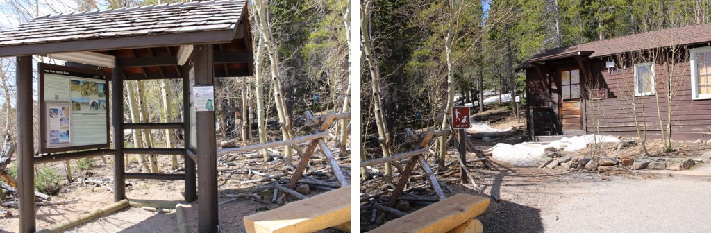
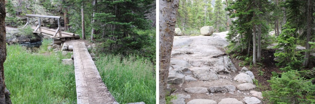
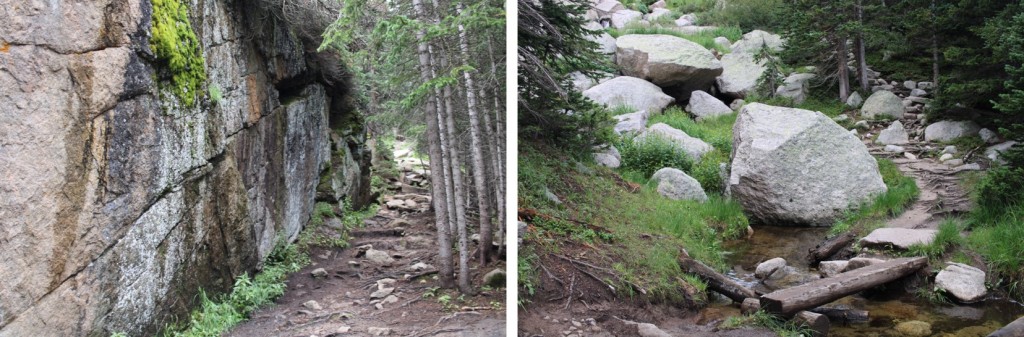
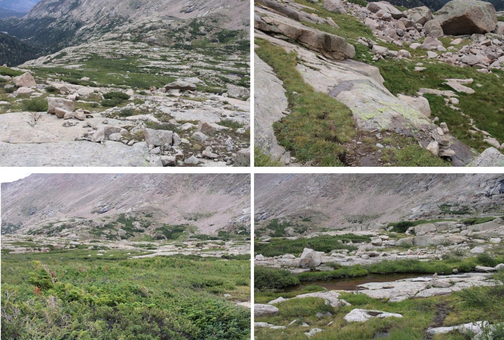
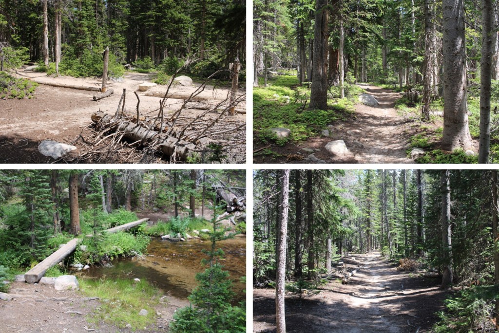
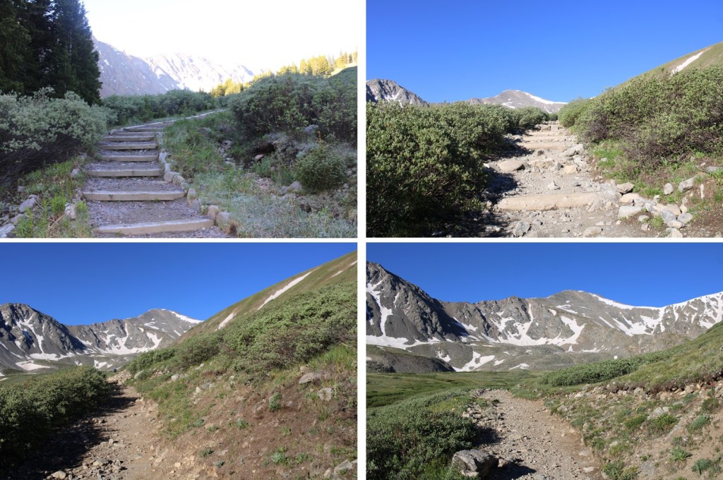
I started on the well-marked Longs Peak Trailhead at 4:30am, glad I’d put on microspikes in the truck.
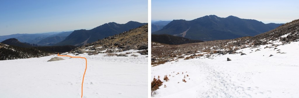
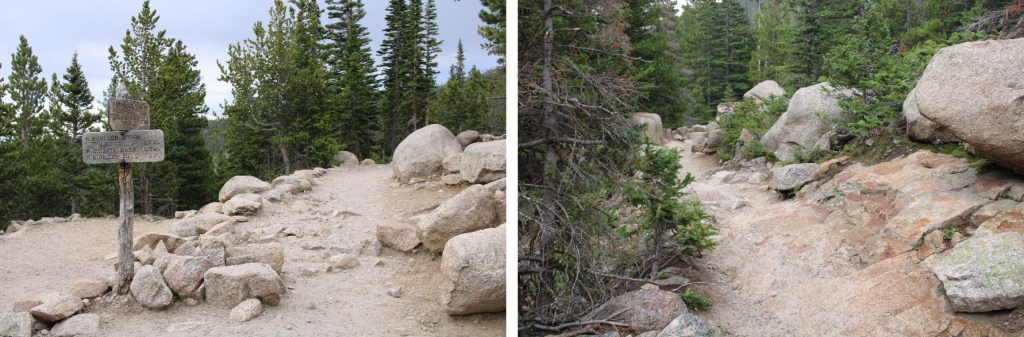
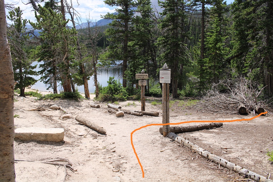
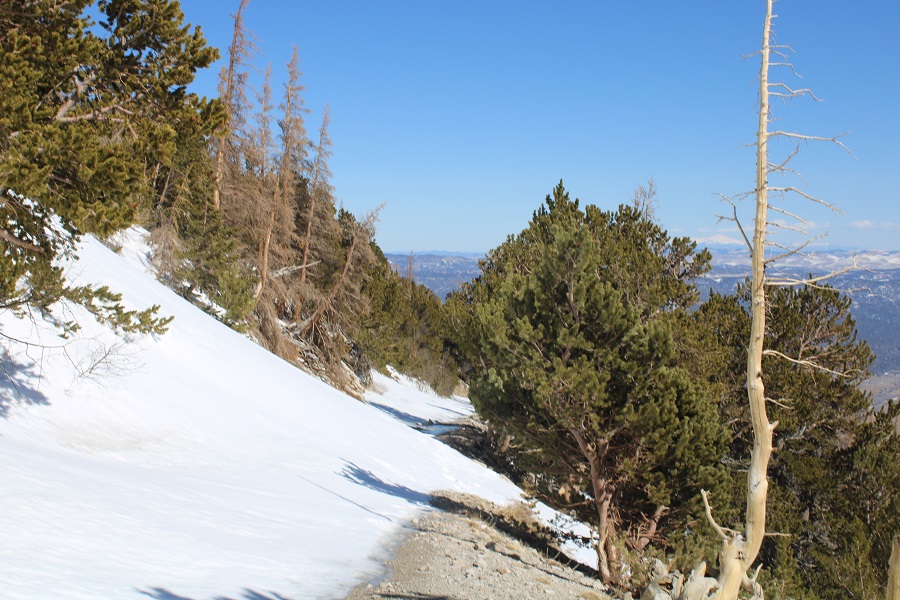
Snow levels increased as I hiked, but they were firmly packed down in the morning. After .65 miles I came to a well-marked junction, and followed it left.
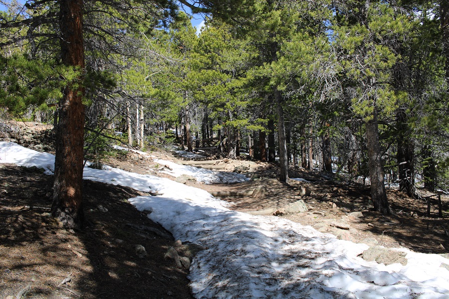
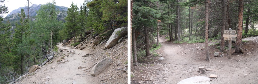
I followed the trail a total of 2.5 miles to treeline.
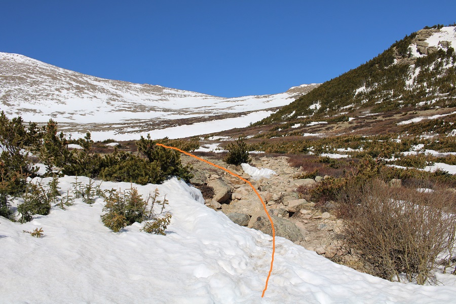
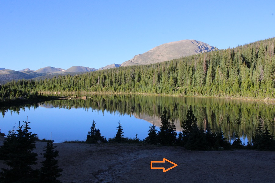
At treeline the trail became difficult to follow, so I headed west, looking for the trail I knew I’d find in the upper basin.
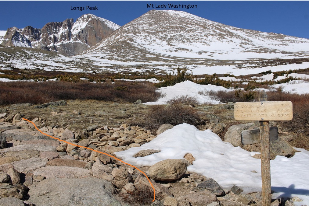
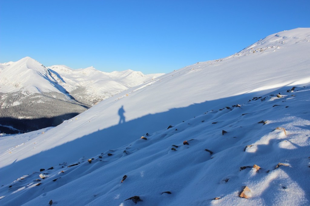
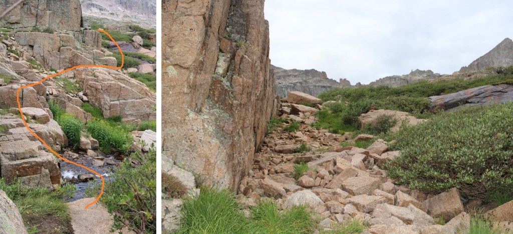
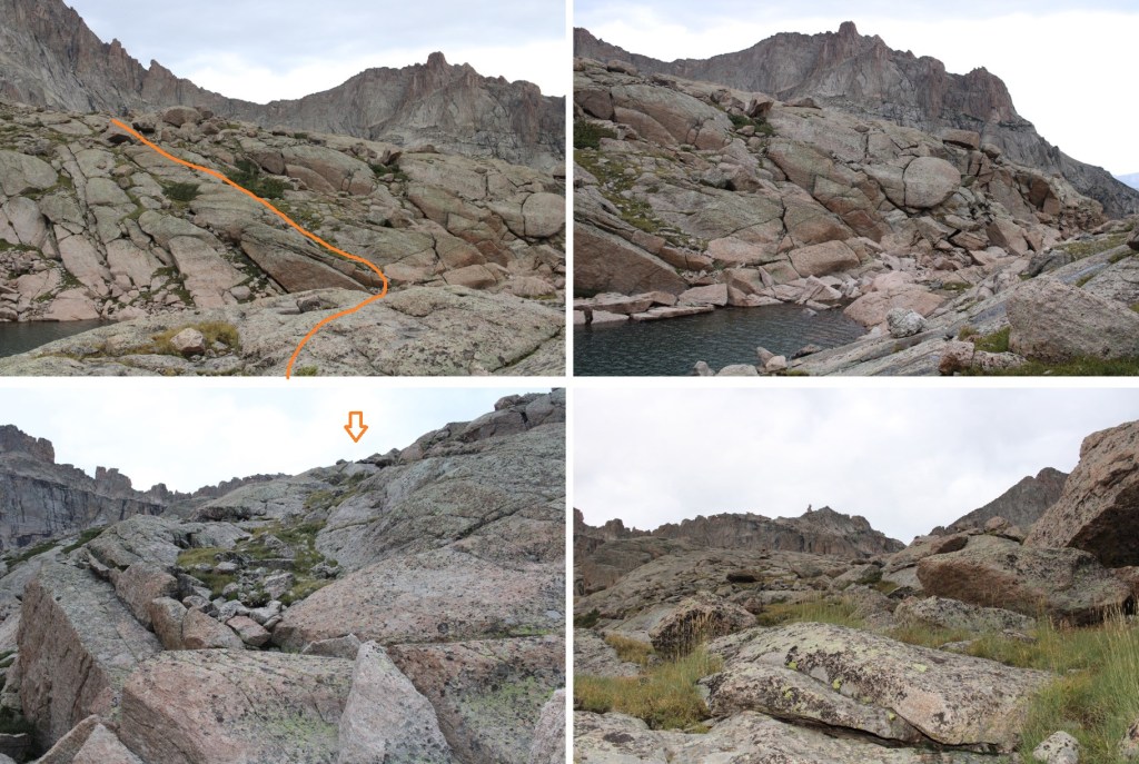
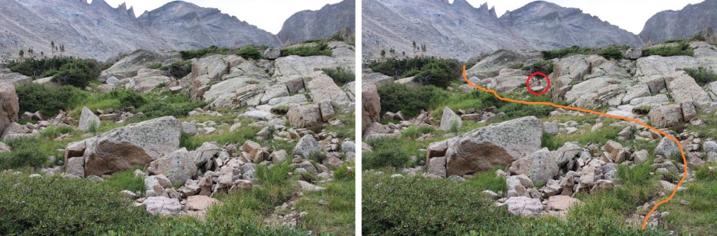
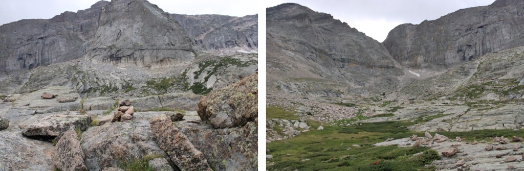
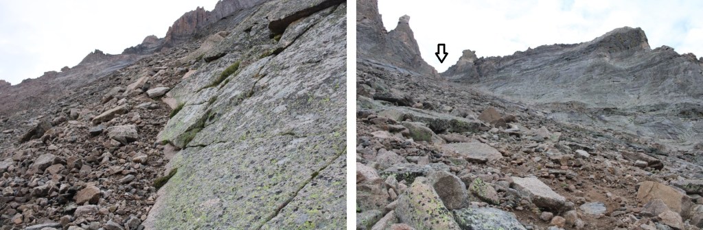
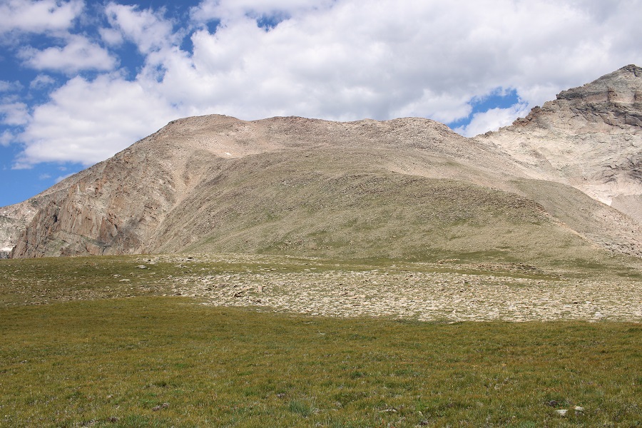
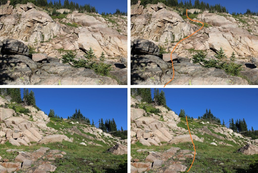
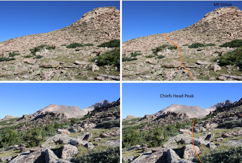
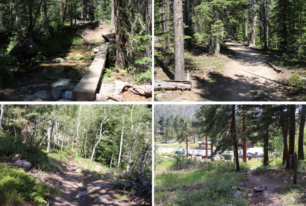
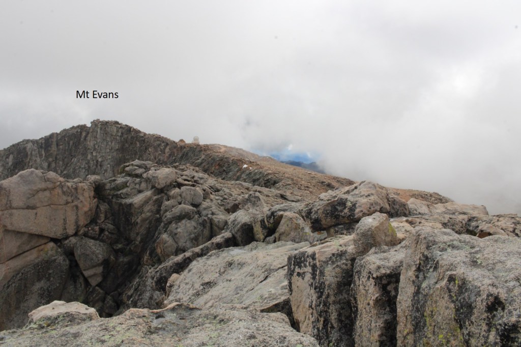
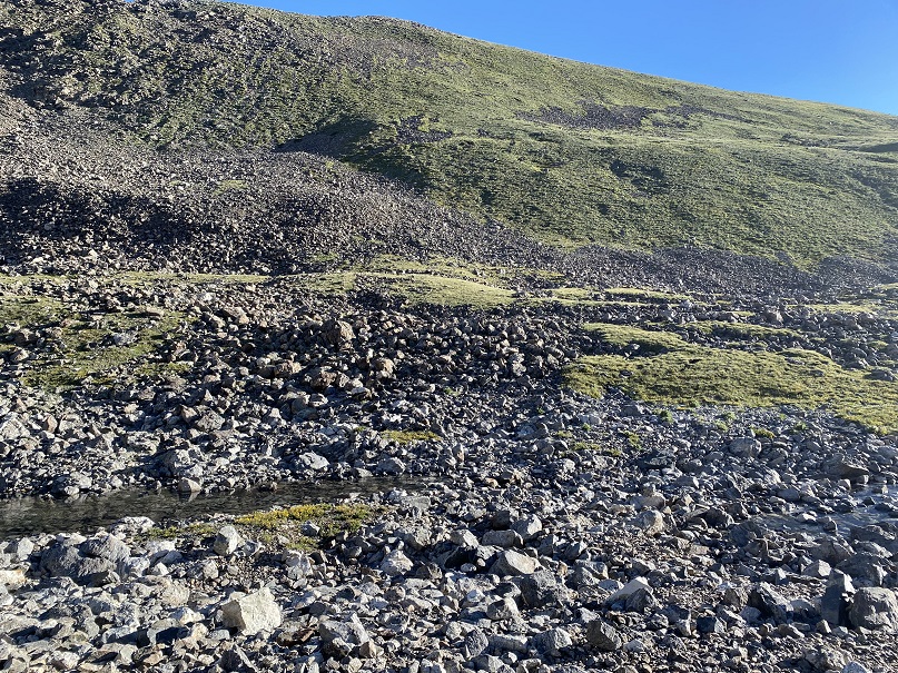
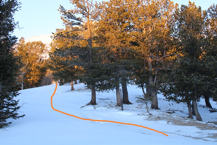
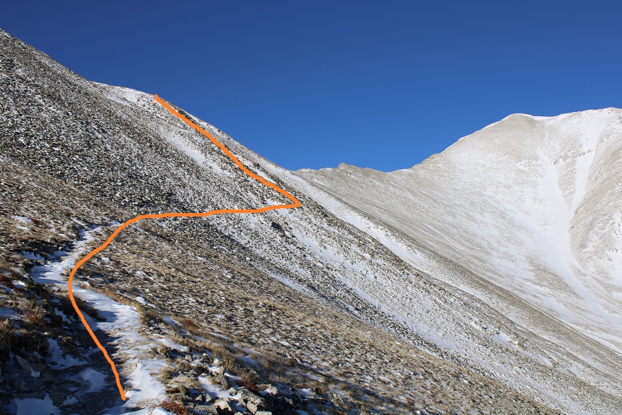
Once above treeline I turned left at this sign
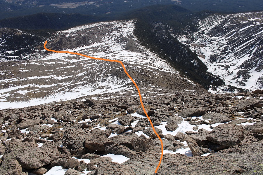
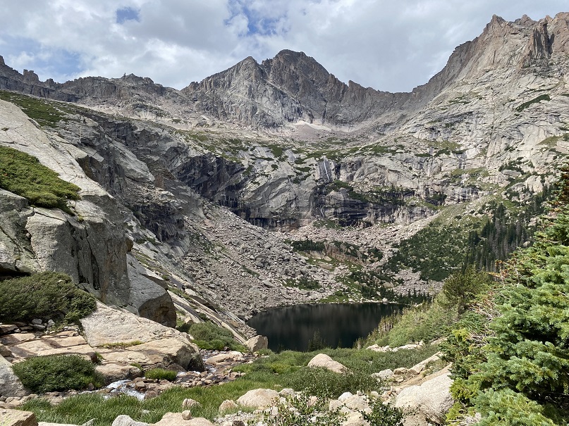
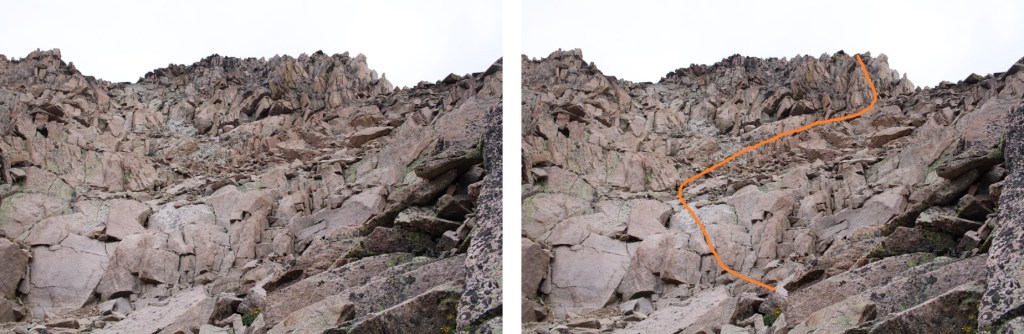
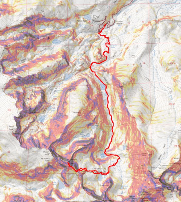
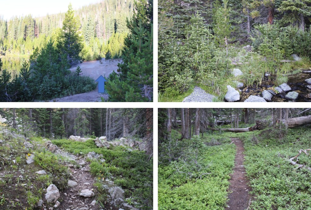
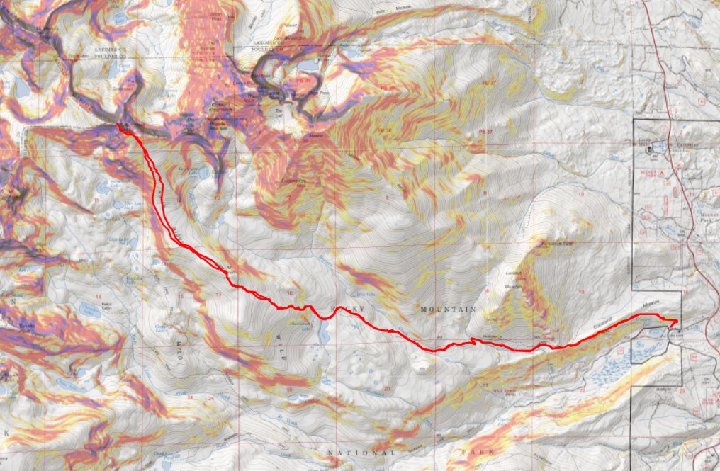
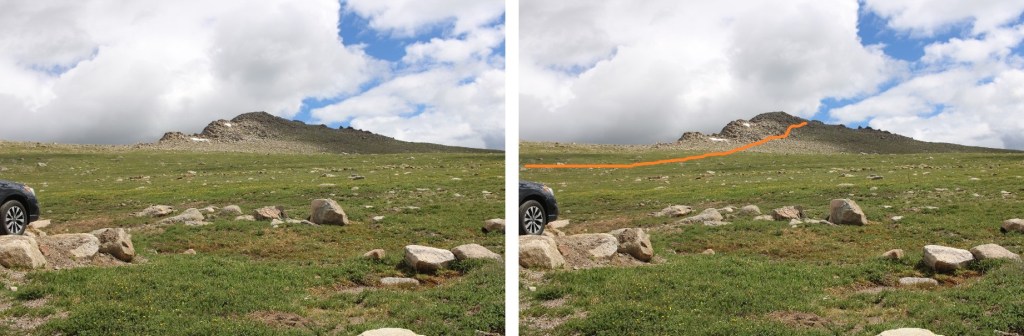
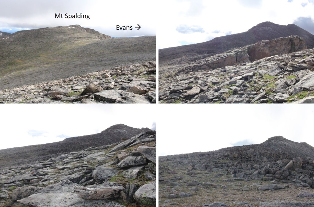
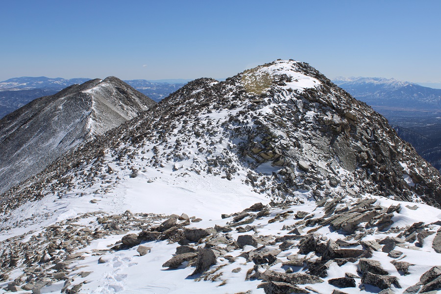
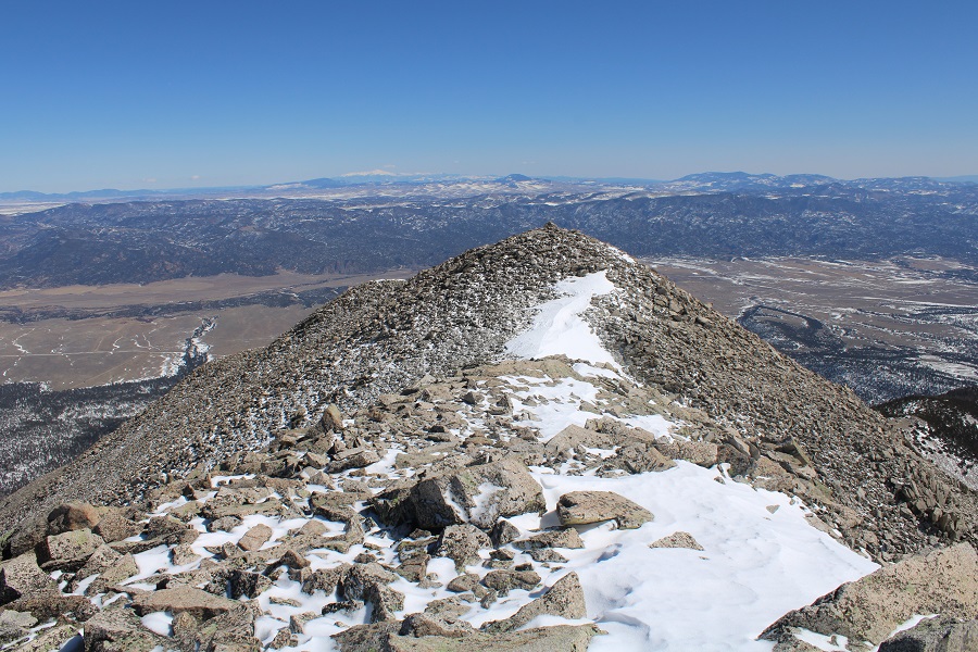
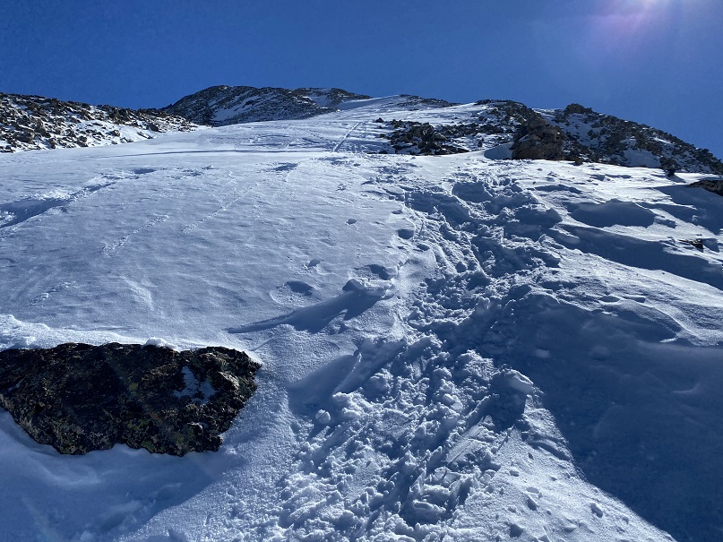
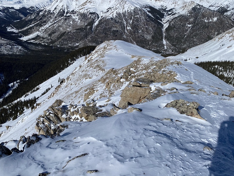
Here’s an overall view of the route. It was very straightforward.
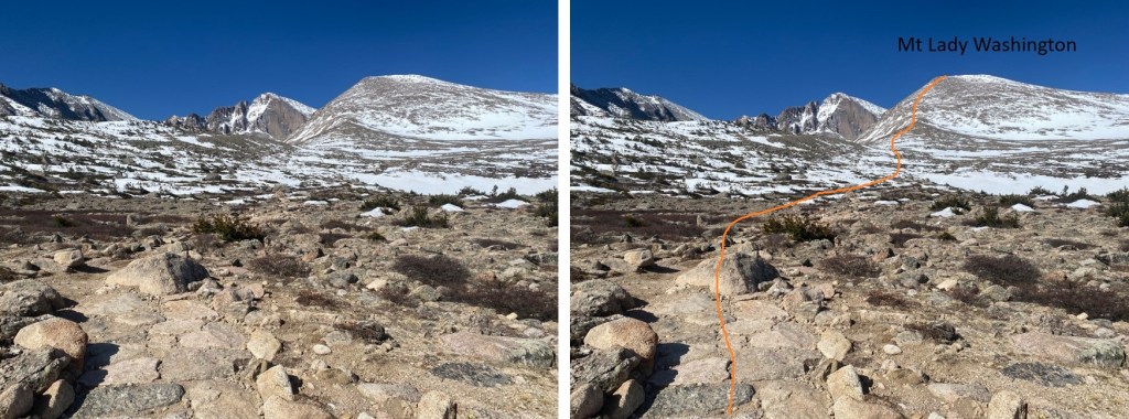
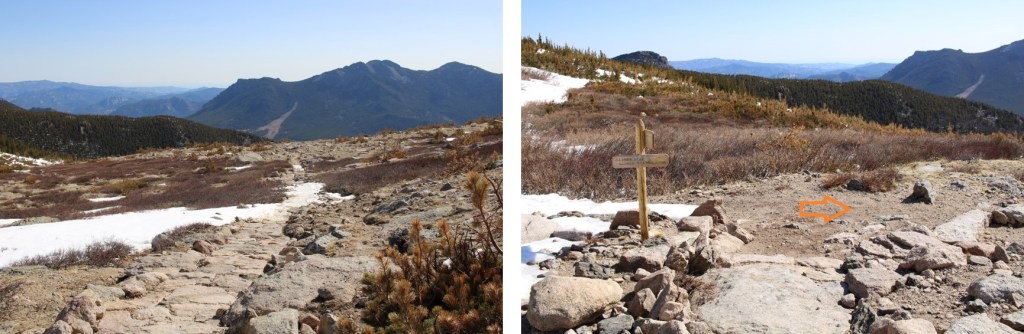
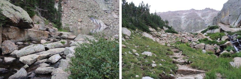
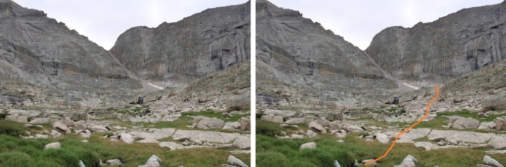
I made my way on the class 1 trail to the junction for Chasm Lake. I’d hiked a total of 3.4 miles to this point.
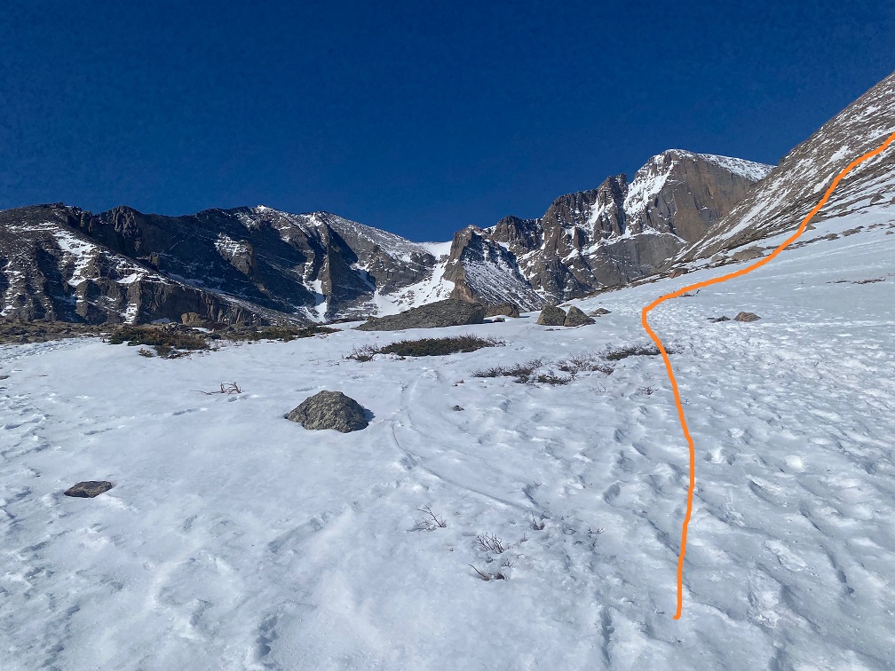
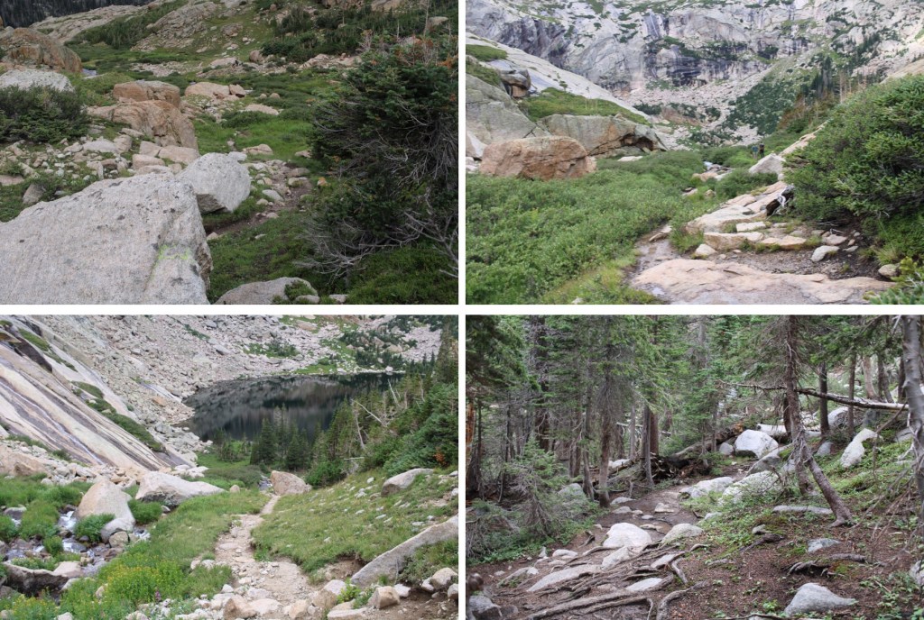
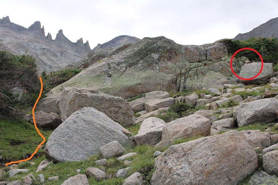
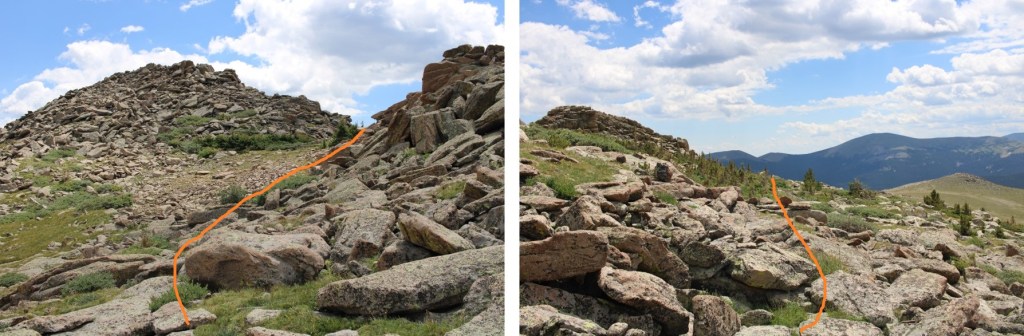
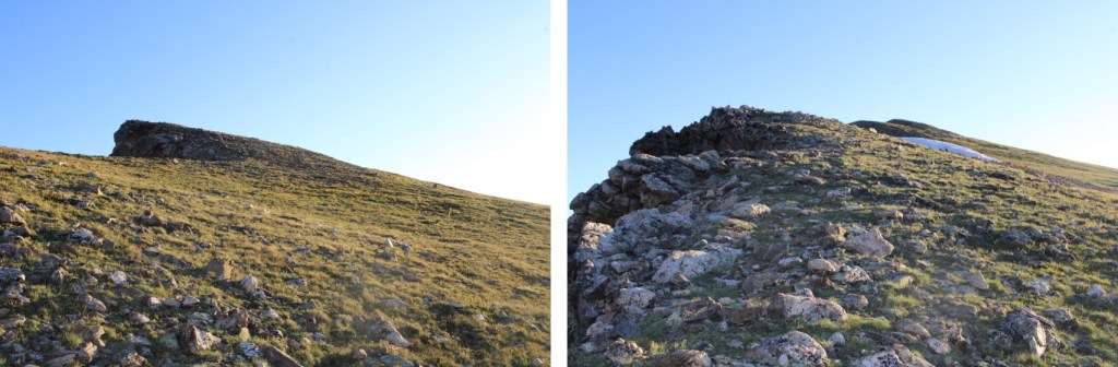
I then turned right, and headed up the east side of Mt Lady Washington
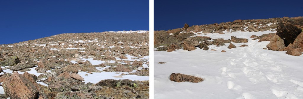
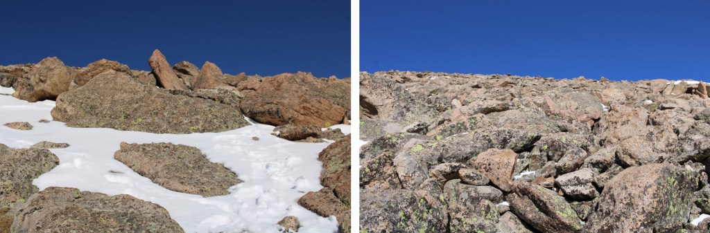
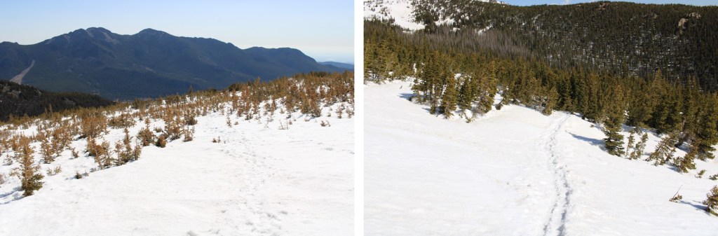
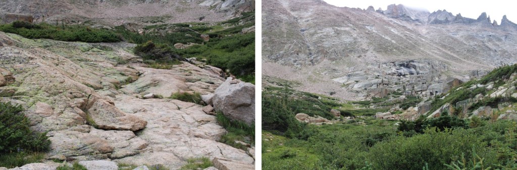
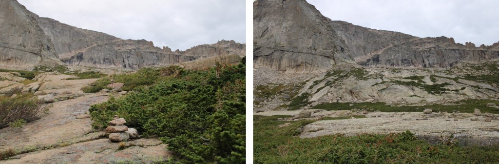
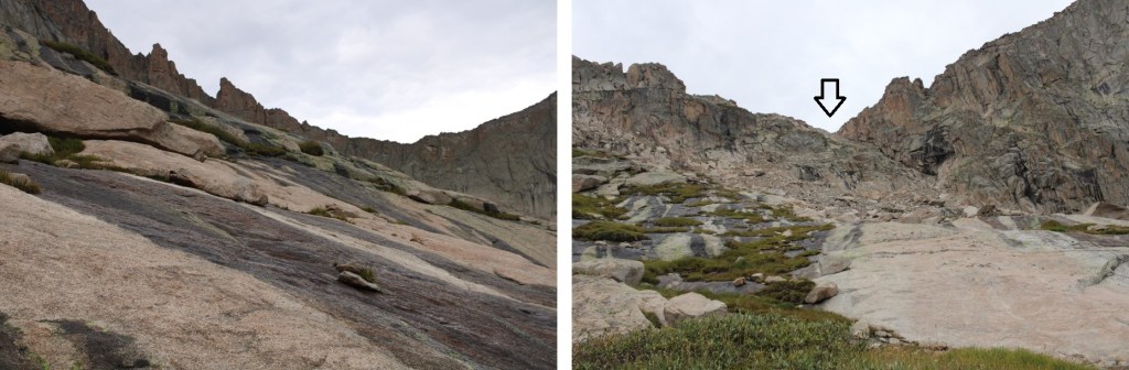
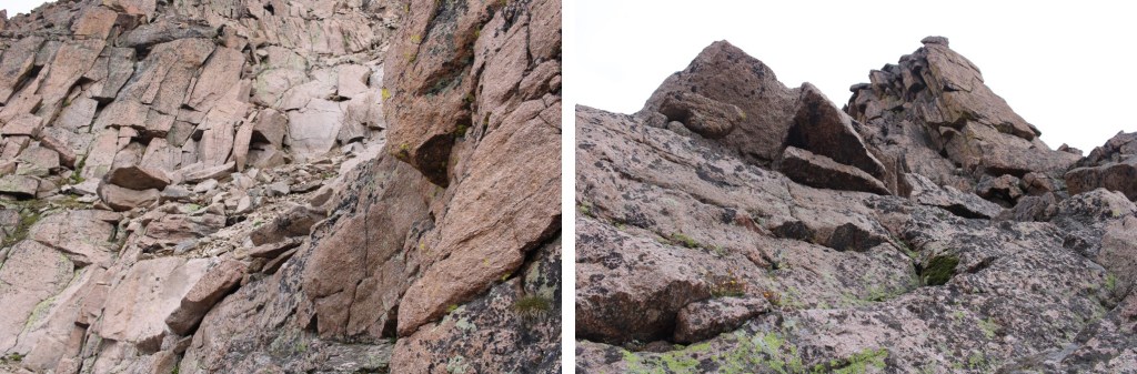
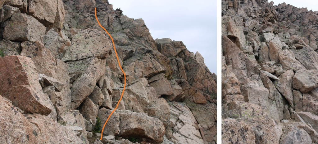
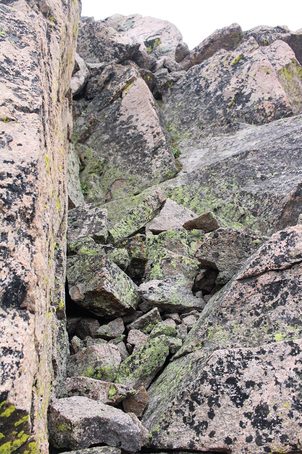
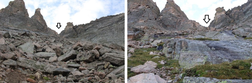
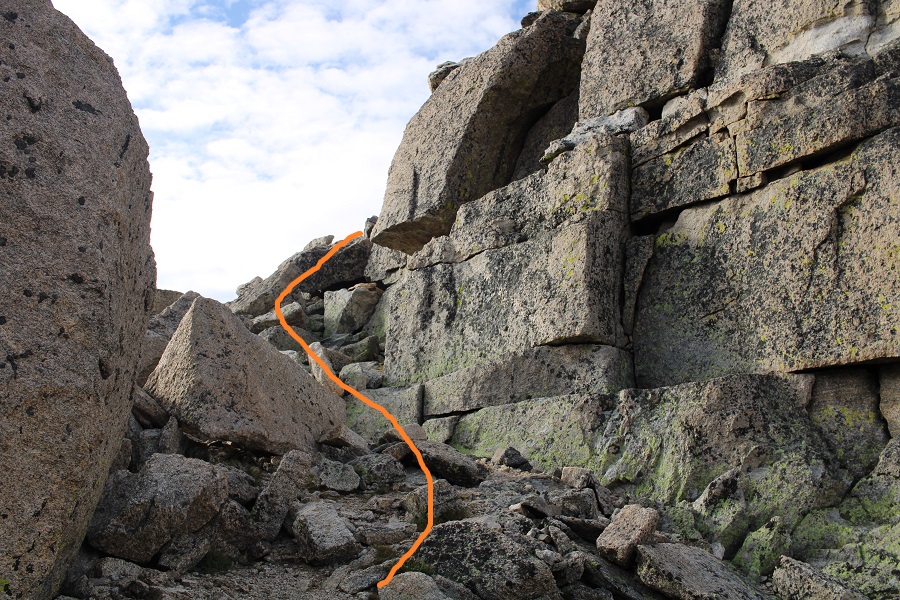
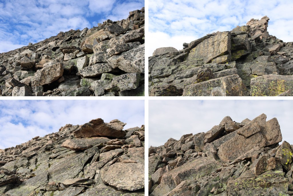
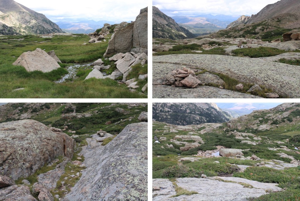
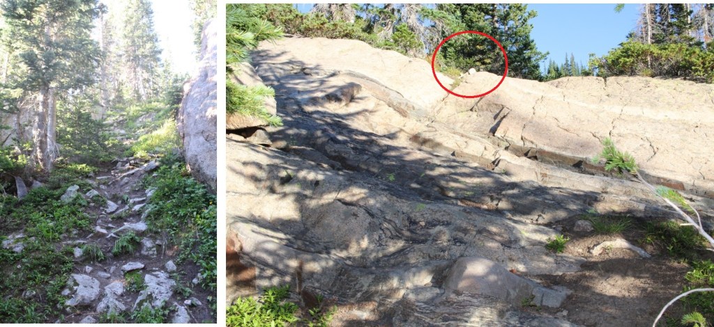
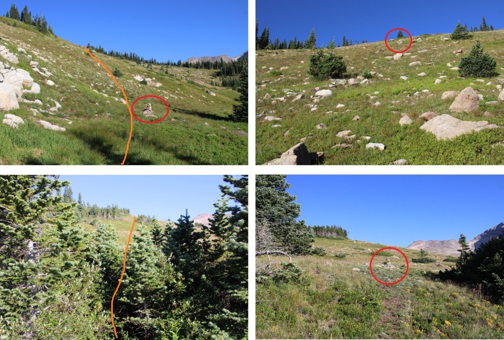
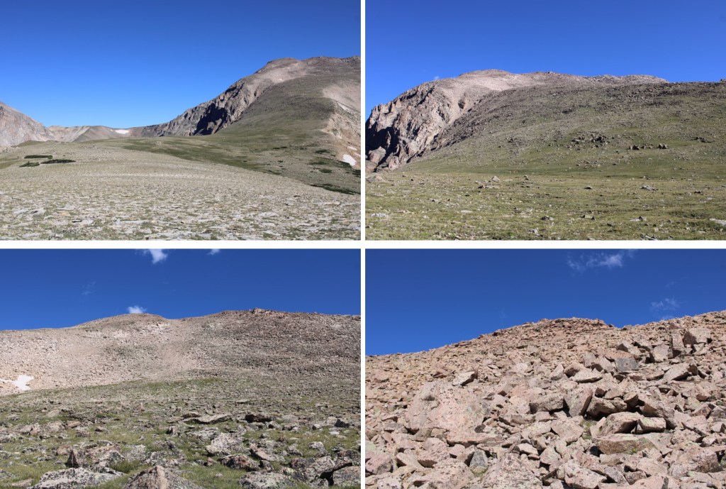
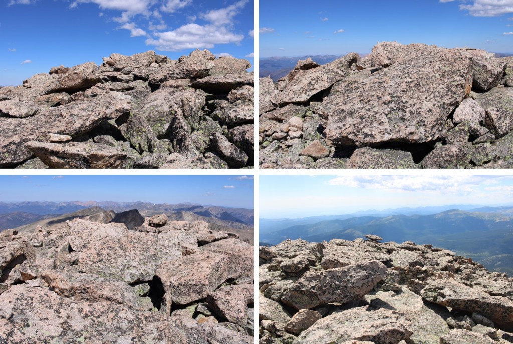
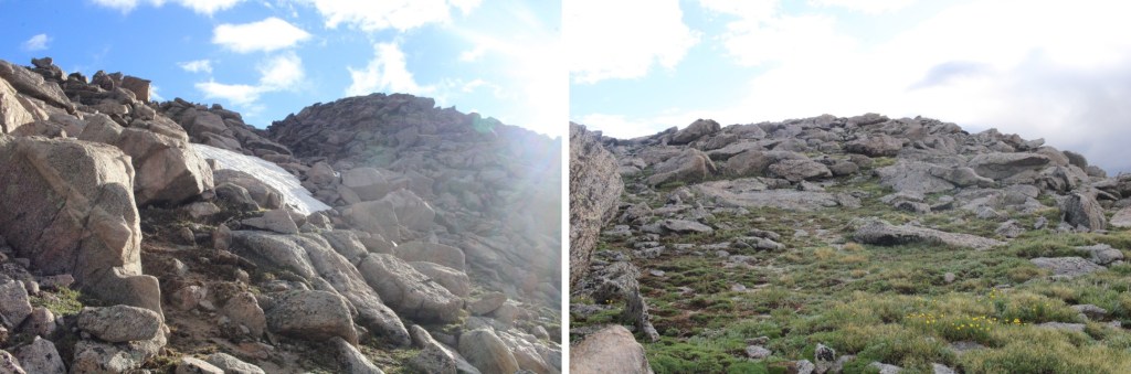
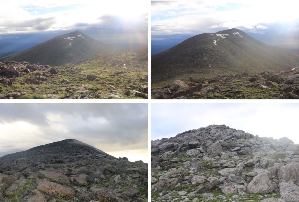
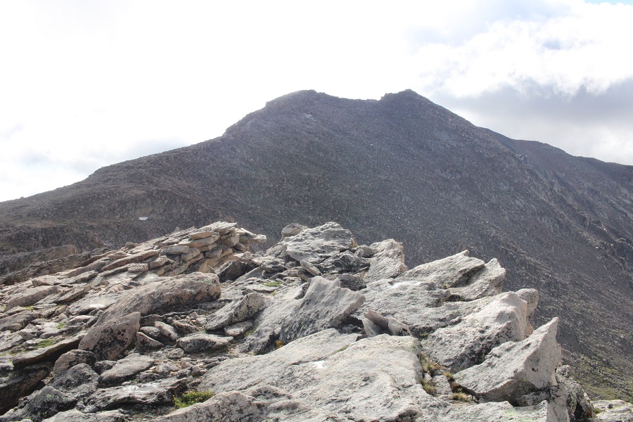
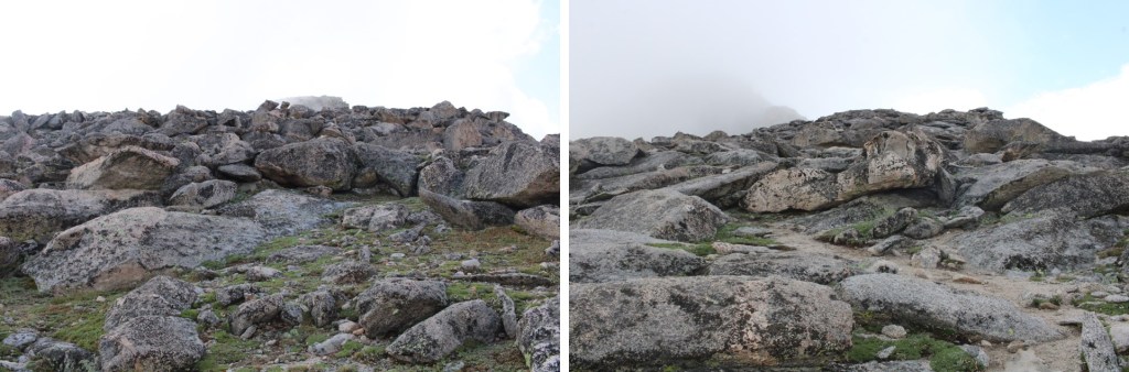
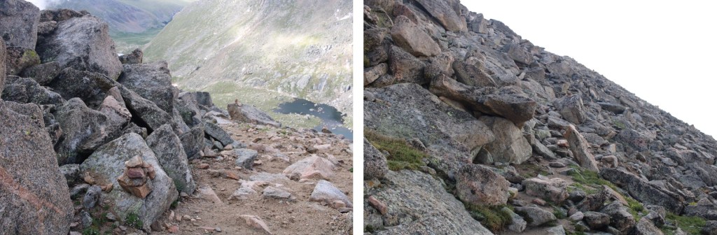
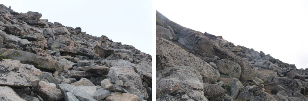
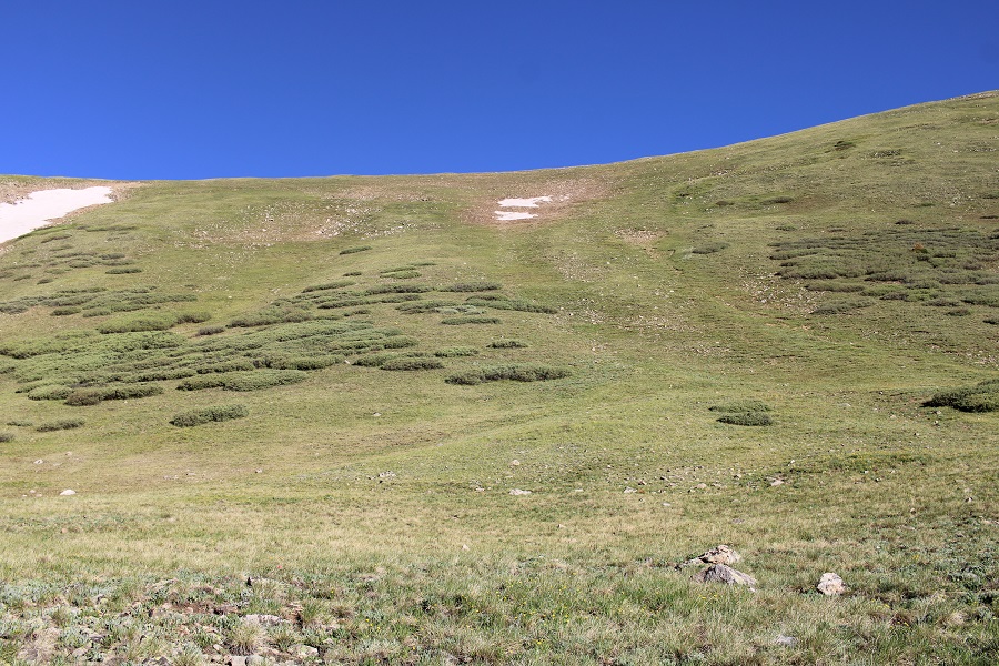
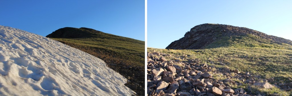
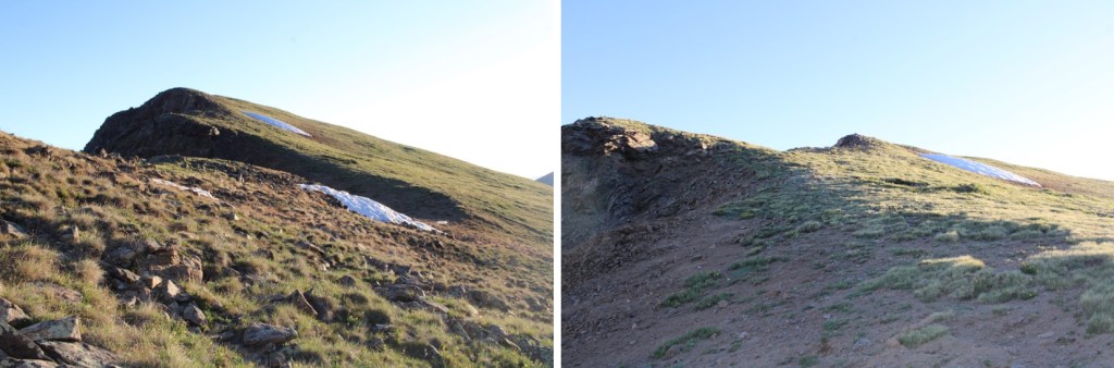
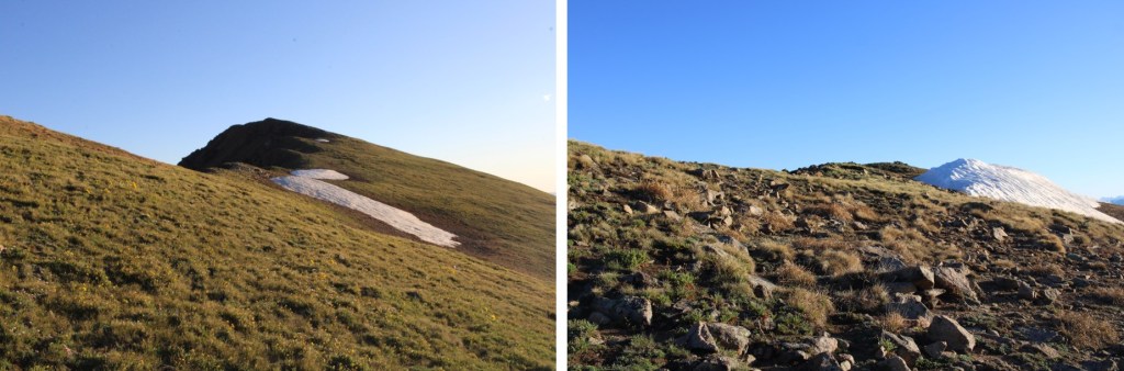
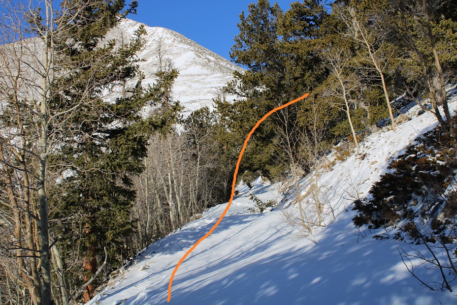
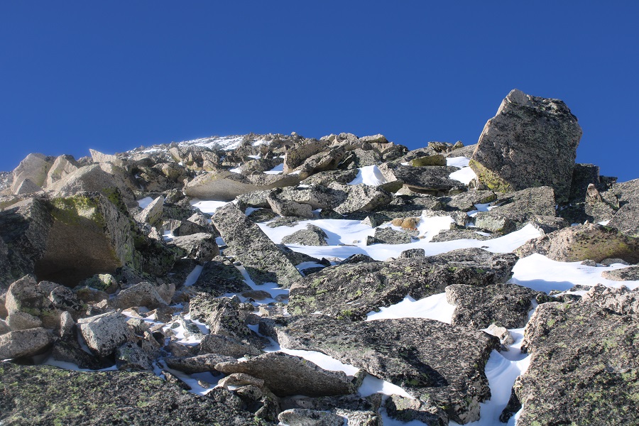
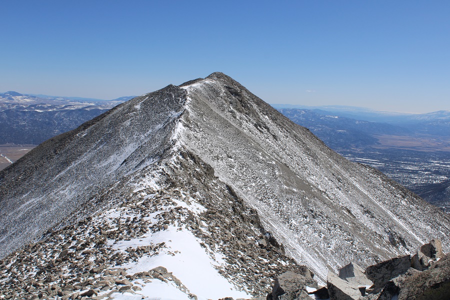
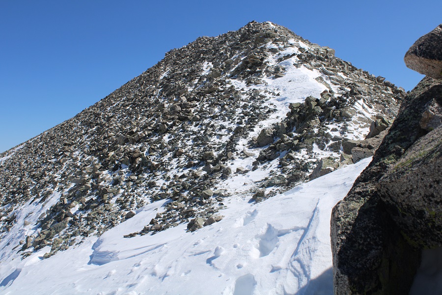
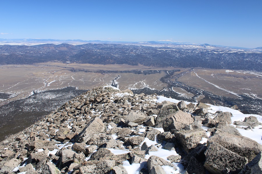
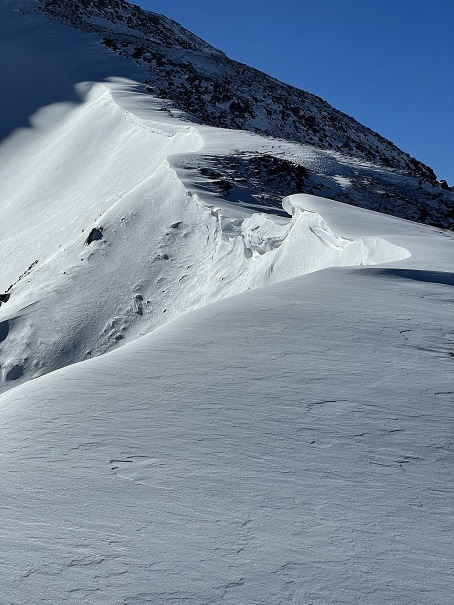
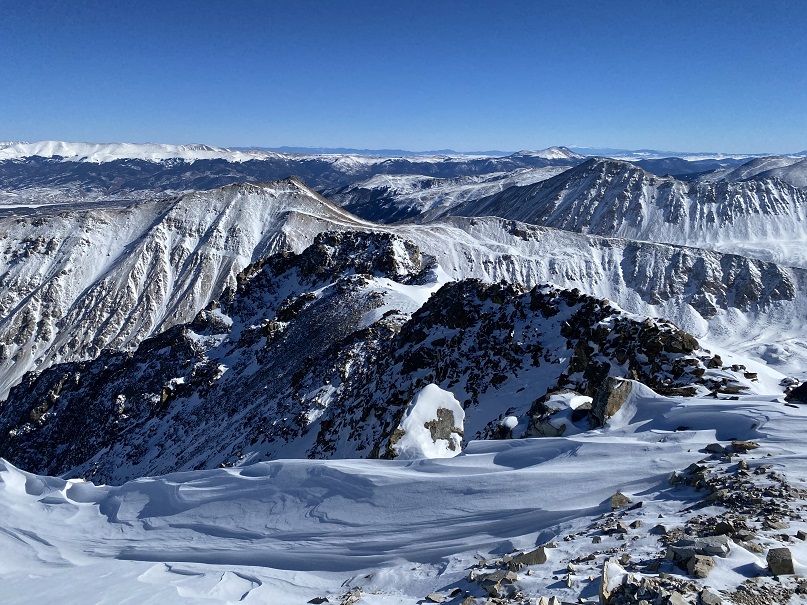
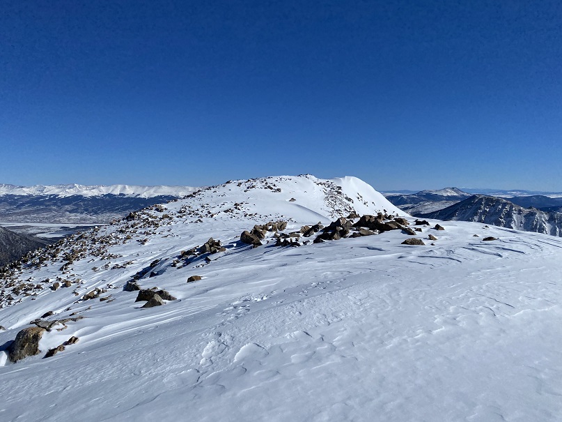
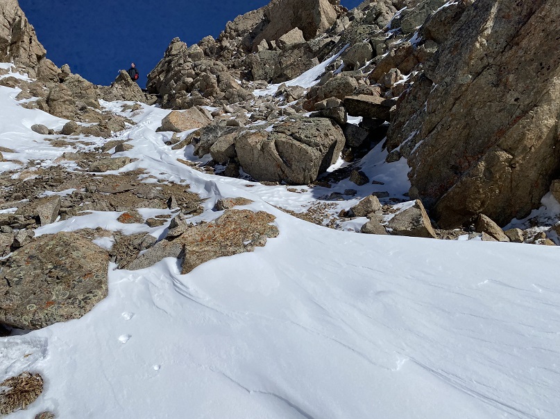
This was a class 2, choose your own adventure, 1 mile with 1700’ of elevation gain trek from the Chasm Lake turnoff to the summit of Mt Lady Washington. Here are some pictures of the hike to the summit, which included a lot of rock hopping. I just kept heading west, to the obvious summit.
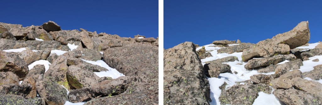
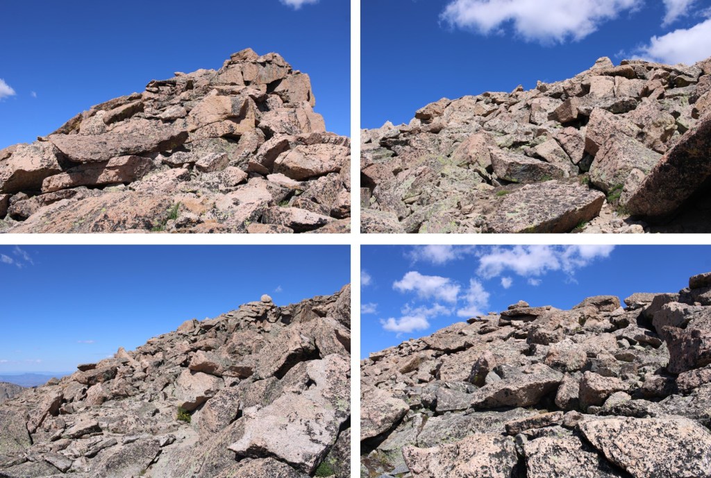
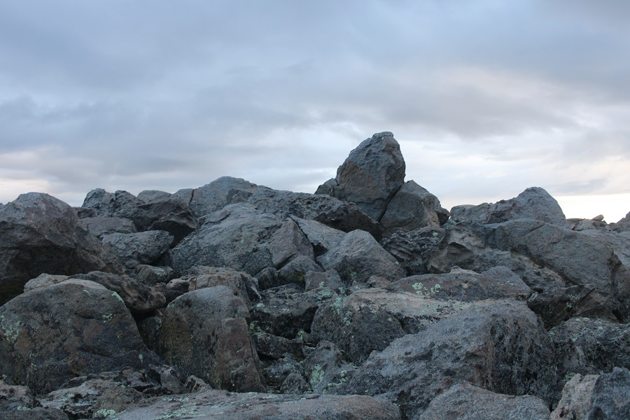
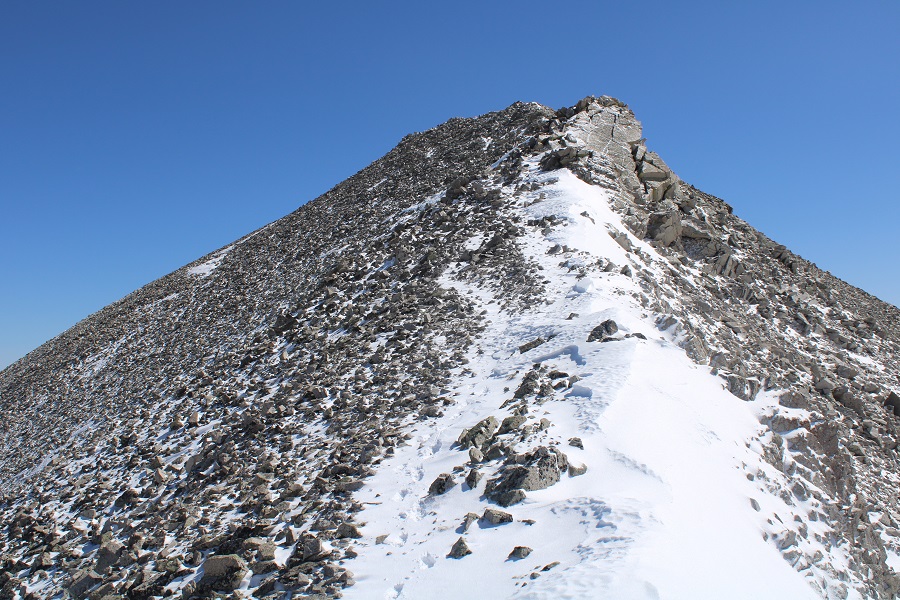
Here’s the actual summit, which is a class 2 rock scramble
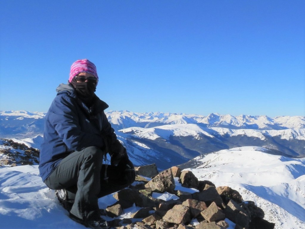
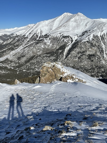
I summited Mt Lady Washington at 8am
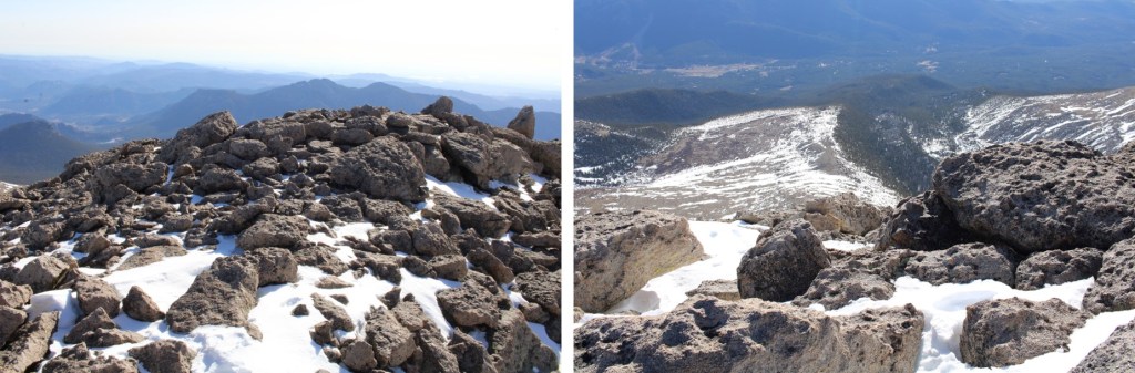
Mt Lady Washington:
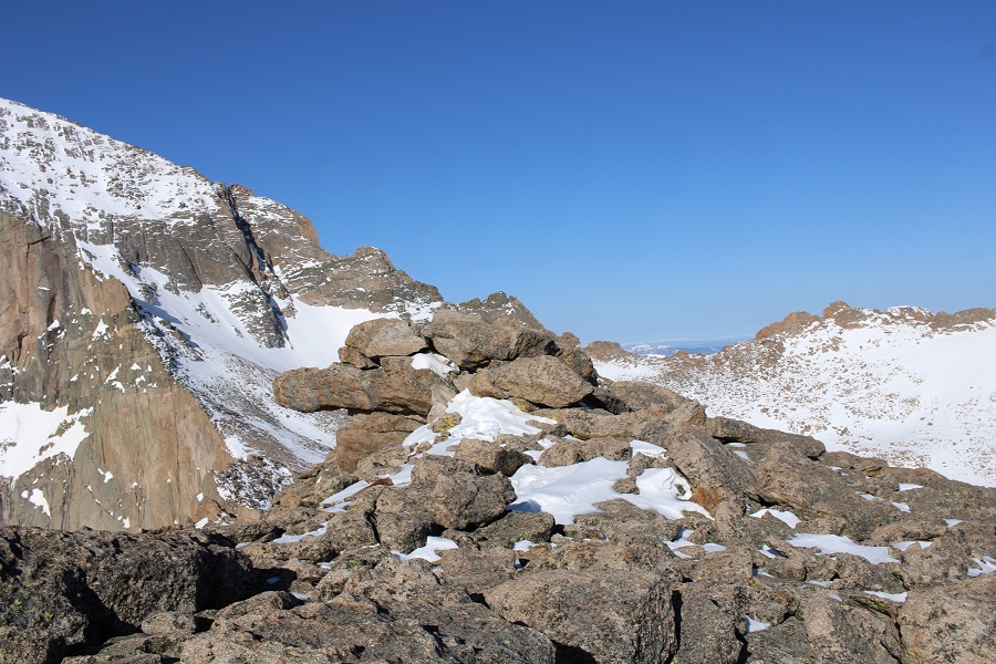
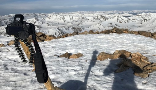
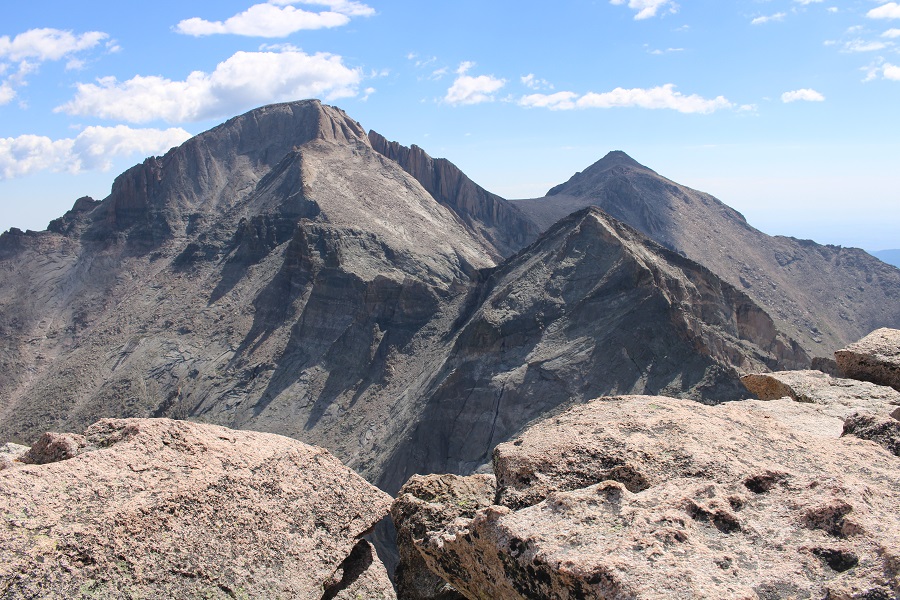
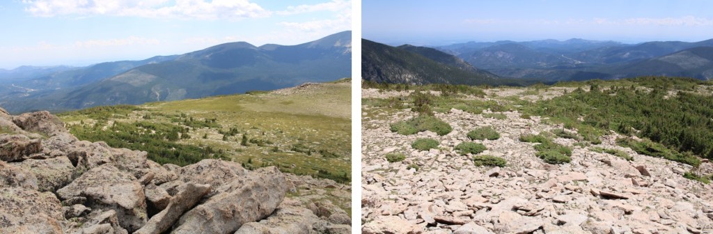
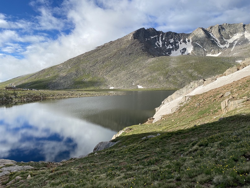
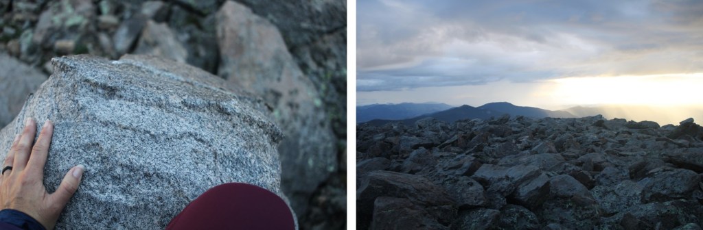
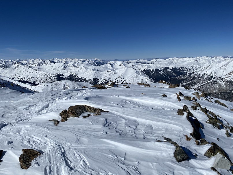
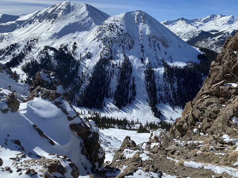
Mt Lady Washington has arguably the best view of the Diamond on Longs Peak, so I sat for a bit to enjoy the view
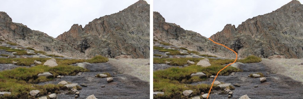
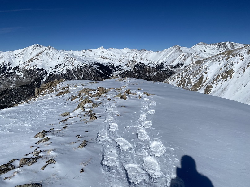
Now to head back. This was an out and back hike for me, so I turned and headed east, following my tracks back down to the trail.
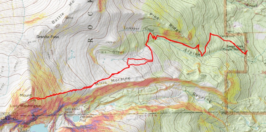
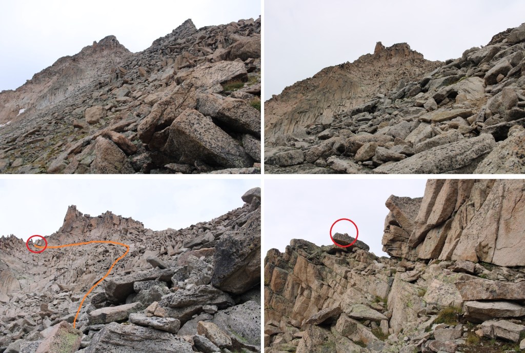
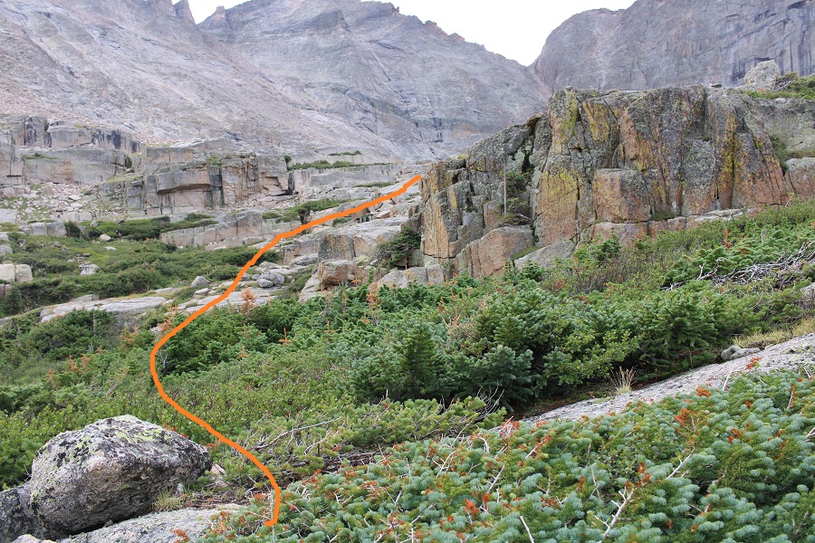
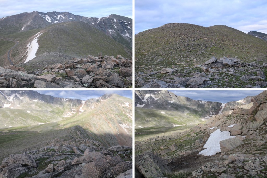
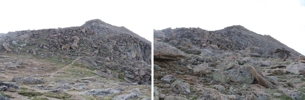
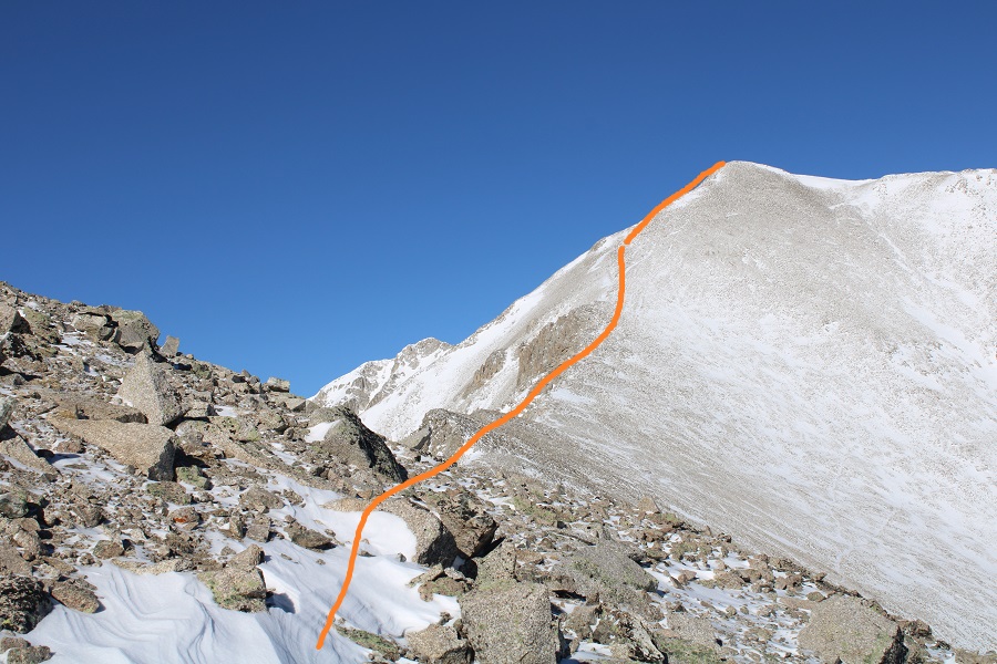
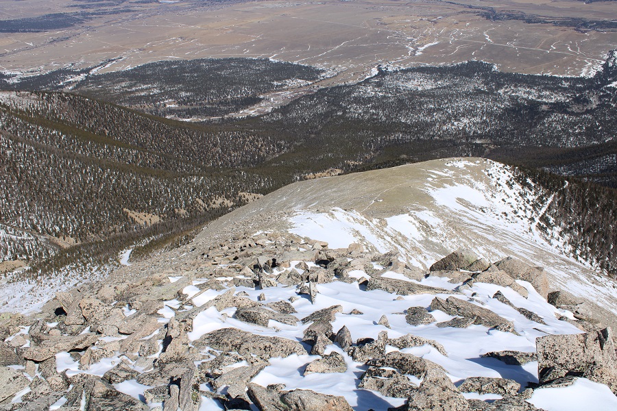
Here’s an overview of my route back to the Longs Peak Trail
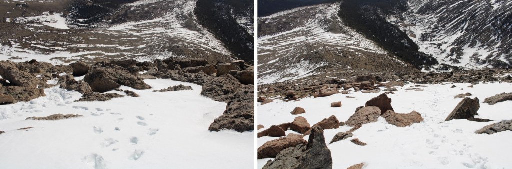
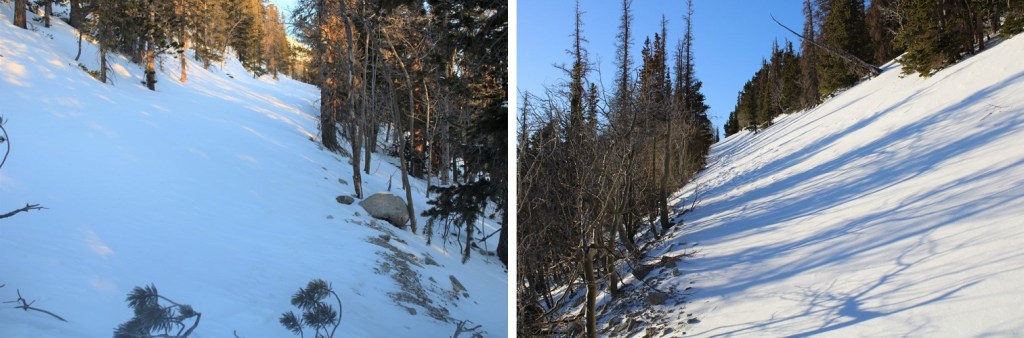
And some step-by-step pictures of the terrain
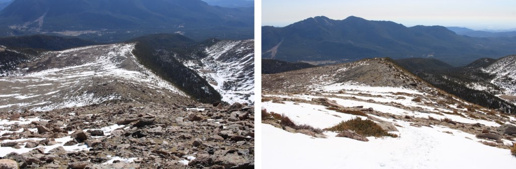
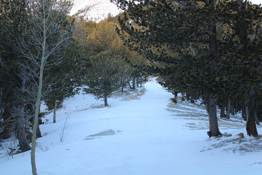
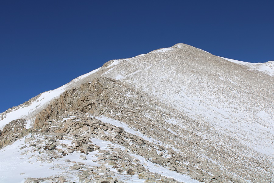
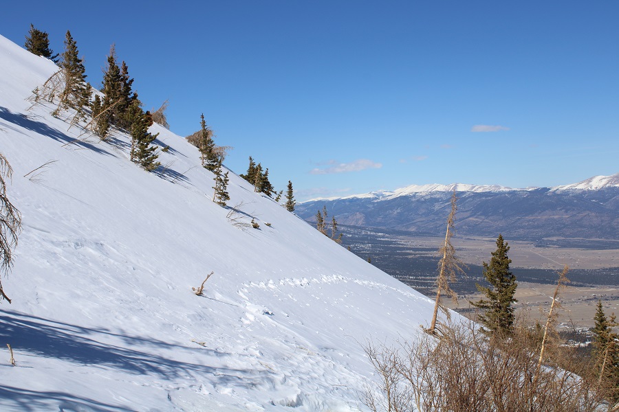
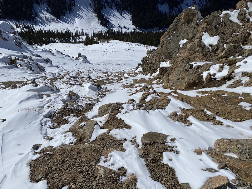
Once back at the junction of the Longs Peak/Chasm Lake trail, the trail was easy to follow back down to treeline
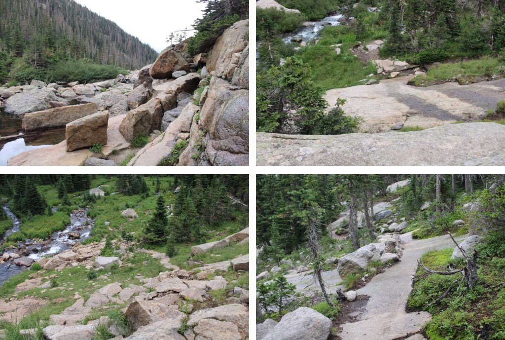
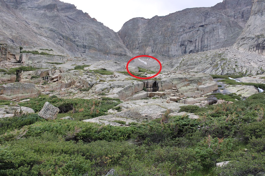
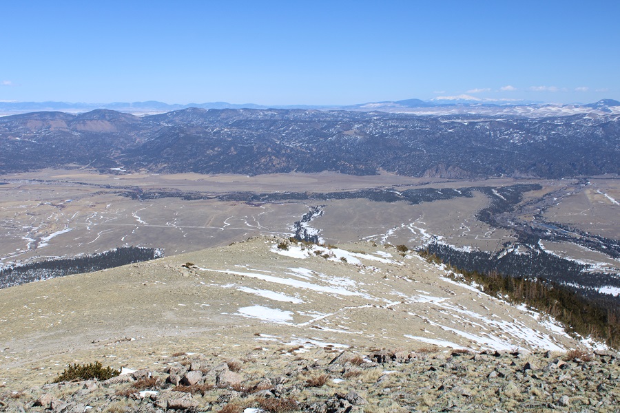
Here are some pictures of the route back to the trailhead. It was only 8:30 in the morning, but the snow was already softening up. There was evidence others had postholed at least 4 feet in this section. I was glad I’d gotten an early start.
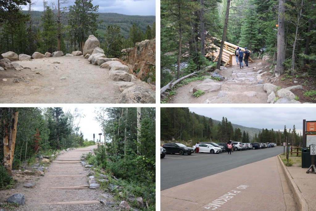
I made it back to my truck at 10am, making this a 8.85 mile hike with 3869’ of elevation gain in 5.5 hours. On to the next trailhead!
My trail name is Wild Wanderer. I’m a mountaineer, and I have Raynaud’s. I’ve summited over 500 peaks above 13,000’, many of them in winter conditions. With the cold weather approaching (or already here!) I’ve been asked to put together some tips on how I successfully mountaineer in the winter and manage my Raynaud’s. I believe these tips can help all cold weather hikers and adventurers.
Disclaimer: These tips in no way all-inclusive or a substitute for the education you should receive before entering the backcountry in winter. Please consider taking classes in alpinism, orienteering, avalanche awareness, and wilderness first aid before entering the backcountry, especially in winter.
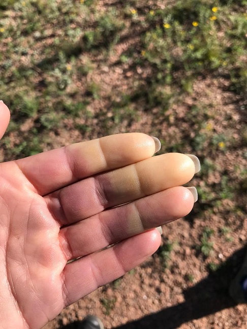
Raynaud’s causes some areas of your body — such as your fingers and toes — to feel numb and cold in response to cold temperatures or stress. In Raynaud’s disease, smaller arteries that supply blood to your skin become narrow, limiting blood flow to affected areas (vasospasm). This can happen even in warm weather. The picture below was taken of my fingers while camping on a 70-degree day.
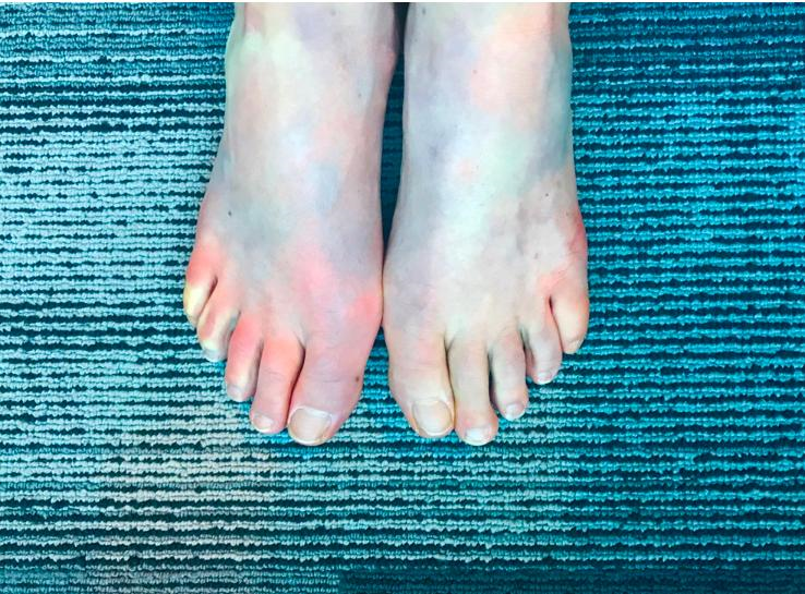
And these are my feet having an attack while I was at work, sitting at my desk
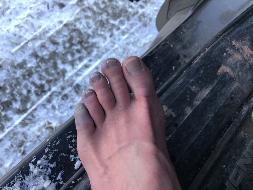
During an attack of Raynaud’s, affected areas of your skin usually first turn white. Then, they often turn blue and feel cold and numb. As you warm and your circulation improves, the affected areas may turn red, throb, tingle or swell. This can be a very painful experience. Many people mistake it for frostbite. This time I’d earned my blue toes, as I’d been snow-shoeing without the proper gear
Winter hiking is a wonderful experience. There’s a special reverence and tranquility to a winter mountain landscape. The trails are less crowded, the views are amazing, the wildlife easier to spot, and with this comes a unique sense of achievement to summiting a mountain covered in snow and ice. However, the cold and wind can be a barrier to this sport. I’ve been a mountaineer for 6 years now, and I’ve learned quite a few tips and tricks to keeping myself (and my digits) warm and attack free. It all comes down to prevention and preparedness.
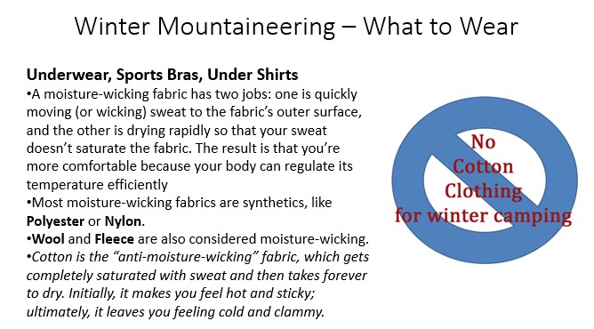
What to Wear
I usually wear the same outfit every time I mountaineer, emphasizing moisture wicking layers and fleece. It’s kind of boring and predictable, but it keeps me warm.
Here’s what I wear, from head to toe (scroll down for detailed information):
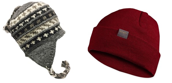
Knit/Wool Hat
Balaclava
Sunglasses / Snow Goggles
Sports Bra
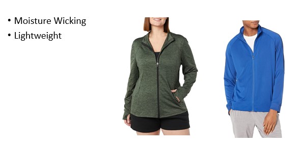
Moisture wicking tank
Moisture wicking jacket
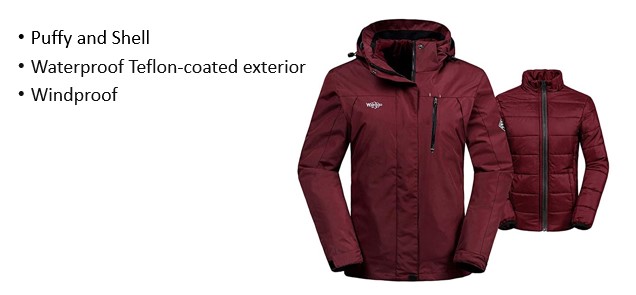
Puffy Jacket
Jacket Shell
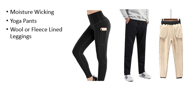
Yoga Pants
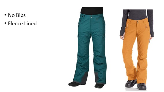
Snowboarding Pants
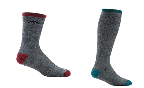
Wool Socks
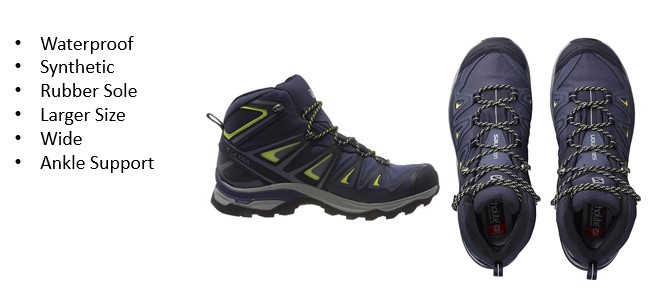
Mountaineering Boots
Gloves
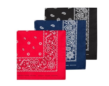
Bandana
Extra Gear (depending on weather/conditions)
Snowshoes
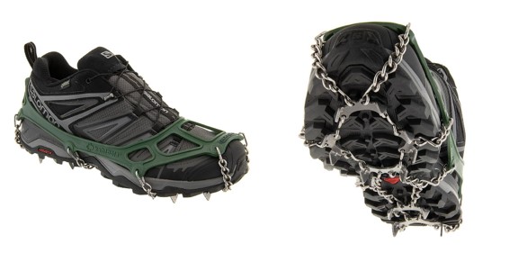
Microspikes
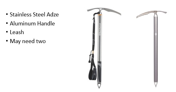
Ice Axe
Crampons
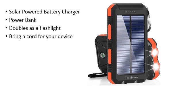
Solar Powered Battery Charger
Surveyors Tape
Note: Do not wear Cotton:
Knit/Wool Hat:
Balaclava: If it’s windy you’re going to want one of these. Make sure it covers your whole face and nose, is made out of a breathable fabric (polyester works) and covers your neck and is long enough to be tucked underneath your inner layers.
Sunglasses / Snow Goggles: The snow can be blinding, and you’d be surprised how a good pair of goggles cuts down on the cold the wind can bring. I put my sunglasses in my jacket pocket before setting out, so they’re easily accessible. I like sunglasses over goggles because they don’t fog up.
Upper Layers: I rarely take layers off during a hike, as I’d rather be too hot than too cold. With Raynaud’s it’s easy to cool off when hot, but difficult to warm up once cold. I wear a moisture wicking sports bra, tank, and jacket all the time, no matter what. On top of that I have a puffy and a shell (the shell doubles as a rain jacket). The shell has a hood, which I have prepped to fit my head if needed to block out the wind.
Bottom Layers: To prevent chaffing, I like to wear form fitting yoga pants (polyester/spandex) under fleece lined snowboarding pants. These snowboarding pants will get torn up from crampons, microspikes and snowshoes, so I reserve a pair primarily for mountaineering. NOTE: Ski bibs are a terrible idea, as you need to take off unnecessary layers to use the restroom. Make sure your pants are just that: pants.
Wool Socks: Not cotton. Not too snug. You want your feet to be able to breathe and circulation to flow. Also, this is an instance where two is not better than one: only wear one pair of socks.
Mountaineering Boots: This is going to be a highly personal choice. I go through 4 pairs of boots a year, but to be fair I put a lot of miles in a year – around 2500 and over a million feet of elevation gain. What’s important here is to buy a pair a size larger than you’d normally wear, and, unless you have extremely narrow feet, get them in a wide size. This is because your feet will swell above treeline and you want them to have room to do so freely. A constricted foot is a cold foot. You don’t want to wear anything too constricting on your hands or feet. The footwear should also be waterproof, have a good tread, be flexible, and feel comfortable. Go to an outdoor recreation store and try on a few pair to see what works best for you before buying. If you plan on carrying more than 30 pounds of gear, you’ll want the added ankle support.
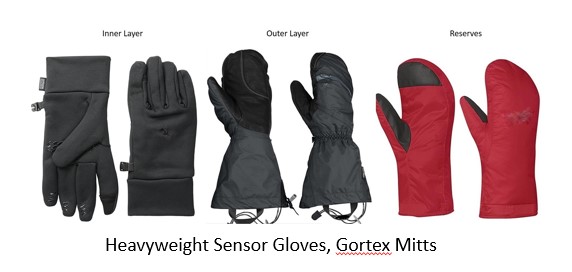
Gloves: Unfortunately, hand warmers have never worked for me (not the chemical ones, the battery-operated ones, or the ones that use fuel). Note: If you have Raynaud’s you can never take off all your gloves while winter hiking. Never. The cold will zap the heat out of your hands instantly, and regaining that heat is difficult.
I bring along 3 pairs of gloves: I wear two at a time, and have the third in reserve in case I loose one I’m wearing: The wind above treeline can be ferocious, and I’ve seen gloves blow away in the wind. If you have Raynaud’s and you lose a glove above treeline it’s quite possible you’ll be losing fingers with it. I buy all gloves one size bigger than I normally wear. This allows for my hands to swell at altitude and makes them easier to put on/take off as needed.
The first pair I wear is made of a 95% polyester, breathable, wicking, quick drying fabric with 300-weight fleece and a 100 weight fleece liner. I always have a glove with fingers as the base layer so I can move my fingers to perform tasks that require dexterity with a layer still on, protecting my hands from the elements. I never take these gloves off. Ever. (See stylus information below).
The second pair I wear is a shell. They’re waterproof, breathable, windproof, wicking, fully seam-taped with a water-resistant leather palm. These do a great job keeping out the wind, and are easy to take on and off. It’s important the outer layer are mittens and not gloves because my fingers and hands stay warmer in a mitten.
My reserve pair is also a pair of mittens. They’re fleece lined and come with the outer mitts. I keep these as a back-up in case I lose one of my other gloves.
Bandana: This is very important! I tie one to a carabineer and put it on the side of my pack so I have easy access to blow my nose. My nose drips like a faucet above treeline, and it’s nice to have something readily available to wipe my nose. (Yes, learning how to clog one nostril and blow is helpful, but not practical with large mountaineering gloves). The bandana should be made of polyester so it dries out fast. If you buy a cotton one it will freeze faster, get stiff, and be unusable until it melts. It becomes frozen snot.
Snowshoes: When it comes to snowshoes, you most likely won’t be putting these on at the trailhead, but later in your hike. Thus, ease of use is very important: you want to be able to put them on without taking off your inner glove. The three things I look for in a snowshoe are that they’re made of steel (not aluminum), have heel risers, and ratchet bindings. Ratchet bindings are the most important feature: I climbed all of Colorado’s 58 peaks over 14,000’ in a cheap pair of snowshoes, but I wouldn’t have been able to accomplish this if they hadn’t had the ratchet bindings.
Microspikes: Don’t spend a lot of money on these, as a good pair is $10. I use them year-round (they work great on scree for stability). My advice here is if there’s any ice at the trailhead to put them on while you’re still in your vehicle, keeping your hands warm while doing so. I’ve worn microspikes for miles when they weren’t needed, and it didn’t damage them. It did however keep my fingers from getting needlessly cold by taking them off. (Remember, when it comes to the cold, prevention is key). Microspikes can also be worn with snowshoes: There’s no need to take microspikes off to put snowshoes on.
Ice Axe: These are usually made of stainless steel/aluminum, which gets cold. I have an ice axe with a rubber grip (which is moderately warmer) and a leash. The leash goes around my wrist, under my outer glove but on top of my shell. I try to hold the ice axe by the leash when it’s not necessary to hold the shaft for safety purposes. Another way to avoid the cold here is to put a bandana around the shaft while gripping it.
Crampons: Make sure they’re made of steel and not aluminum (aluminum bends) and have front facing spikes for traction. Learn how to use these before trying them in the elements for the first time, as they can be tricky to put on correctly, especially while wearing gloves.
Solar Powered Battery Charger: Never worry about your phone losing battery again! I clip one of these onto the outside of my pack, and allow it to charge all day. Most double as a flashlight as well. Just make sure you remember to bring a cord for your device.
Surveyors Tape: I use surveyors’ tape as a way to self-rescue if I think I’m lost. I have a roll I bought at home depot, in a bright color so I can see it, like yellow or orange. I precut about a dozen or so strips about 12 inches long, put them in ziplock bag, and bring the roll with me as well. If I feel like I’m lost, I stop where I am, and create a ‘home base’. I get out my compass, and point it in the direction I think I should be going. Let’s just say that’s north. Then I mark a tree, rock, etc with a piece of the tape, and follow my compass north, adding strips as needed as I go. If I don’t find my way back on route, I follow the strips back to where I started, collecting them on my way. Then I try another direction, like east, and do this over and over until I find my way back on route. Surveyors’’ tape can also be used to mark and entry or exit point, or to signal danger. It’s inexpensive and lightweight and worth having in your pack
Keep Your Pack Packed
Unfortunately, those of us with Raynaud’s don’t have the luxury of packing light: we need to be prepared for all types of weather, and due to the possibility some of our gear might fail/get lost, we need backups. I like to keep all my gear in my backpack when not in use. When I get back from a hike, I usually wash my bandana, refill my water bottle, wash my sunscreen compact, and put them all back in my pack. I don’t forget important gear at home, as it’s always in my pack. In addition to the 10 essentials, I carry the following items (scroll down for detailed information):
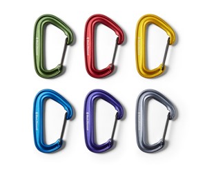
Carabiners
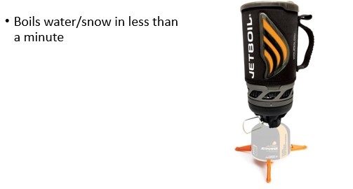
Jetboil
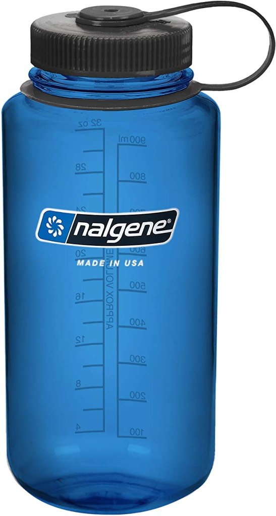
16oz water bottle (in addition to my regular water bottle)
Stylus
Vaseline
Sunscreen
Camera
Collapsible trekking pole
Shovel
Carabiners: Carabiners are your friend! The larger the better, so they’re easier to manipulate while wearing gloves. I use them to attach my water bottle to my pack, as well as my ice axe, bandana, and any other gear I want easily accessible.
Jetboil and 16oz Water Bottle: Jetboils are a useful tool, as they are relatively lightweight and can boil water very, very quickly. I have one in my pack during the winter, along with a 16oz Nalgene. Before the hike I warm up water, put it in the Nalgene, and keep this smaller water bottle close to my skin as I hike (sometimes in a pocket, or the waist of my pants, etc.) This helps keep me warm. I also start my hike with warm water in my drinking water bottle to help prevent it from freezing. Keeping the water bottle close to my body (and not in my pack) helps to keep the water from becoming frozen during the hike. The Jetboil comes along with me, and if needed I can warm up the water again, or, if the water is frozen, I can quickly heat up snow.
Stylus: These are so helpful to people suffering from Raynaud’s! Our fingers don’t register well on touch screen devices, including ATMs, gas station machines, phones, and tablets. A stylus is cheap (I bought 12 in a pack from Amazon for $4) and solves the problem of using our fingers on screens. A stylus while hiking has the added benefit of reducing the need to take off your gloves to use your phone or GPS device to take pictures or find direction. I keep a stylus attached to all my devices that require touch to operate.
Vaseline: I’m in love with Vaseline/Petroleum Jelly. Movie stars have sworn by its beauty effects (wear it to bed to keep skin soft and younger looking), it helps wounds heal faster, restores moisture after wind burn, and when you’re a mountaineer, it keeps your nose from freezing. Before hitting the trailhead I slather a generous layer of Vaseline on my nose to keep my nose warm. It works wonders!
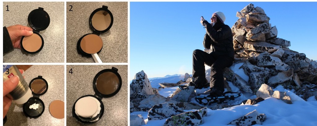
Sunscreen: OK, so it’s cold above treeline, but due to the reflection of the sun on the snow sunscreen is still needed. This can be problematic because a tube of sunscreen freezes in the winter above treeline. Using an aerosol spray isn’t practical for obvious reasons (wind) and the sunscreen that comes in a deodorant-like stick doesn’t apply evenly/melt when frozen. To combat this, I went to the dollar store and bought a compact, took out the powder, cleaned the compact out, and filled it with my favorite sunscreen. Then I placed a new compact sponge over it (30 sponges for $1 at the dollar store) and let the sponge absorb the sunscreen.
I keep the compact in my pocket as I’m hiking (inside of a plastic ziplock bag) and when the sun comes up, I take out the compact and apply the sunscreen. The first time I did this I was surprised at how well it worked: The sunscreen doesn’t freeze this way, and is easy to apply. The only downside is the set-up needs to be washed/replaced every time you use it.
Camera: Of course, you’ll want to bring a camera, and the specific kind is up to you. Did you know cameras get cold too? The batteries freeze and they stop working. To combat this, I put my camera on a strap around my neck, and in between snapping photos keep the camera between my puffy and outer layer. This keeps the battery from freezing.
Collapsible Trekking Pole: These are indispensable for a variety of reasons at all times of the year. In the winter they are used for probing the snow to measure snow depth, determining the stability of ice at frozen stream/river crossings, and to whack snow off trees bent over with snow and blocking the trail. Make sure the handle is made of cork or plastic (not metal/aluminum) and easy to manipulate while wearing gloves. When not in use because you’re using your ice axe, collapse and attach to your pack with a carabiner. Also, a trekking pole is your first line of defense against 2 and 4 legged animals.
Shovel: Two different types, one for digging out of avalanches, one to dig your vehicle out of the snow.
Trail Tips and Tricks:
Use a water bottle, not a water bladder: The hoses in water bladders freeze in the winter, making them inoperable. I like a water bottle with a large opening, as it takes longer to freeze. I like to start with warm water, and if it’s very cold out, place it close to my body so it doesn’t freeze as quickly. Warm water in a water bottle is also a great way to warm up your hands.
Keep your toenails cut short: This will help prevent excess rubbing, discomfort, and blisters.
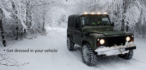
Get dressed in your vehicle: It’s cumbersome to drive to the trailhead wearing all my winter gear, so when I arrive at a trailhead I tend to get dressed in the car. I do so with the heat on high, and put all my gear on without opening the car door (this includes snowshoes). It takes a little maneuvering, but I start the hike warm.
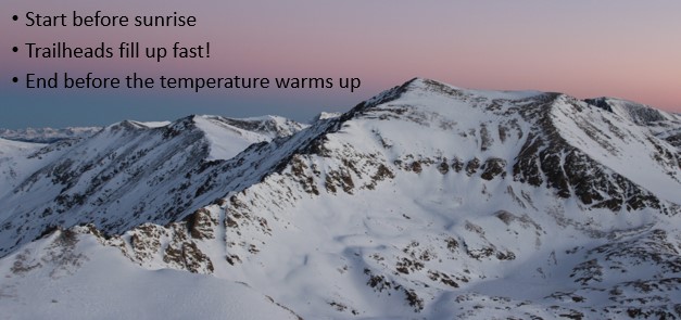
Start Early: Just like in summer, when you want to start early so you can be down below treeline before the noon storms,in the winter you want to start early so you can be down before the worst avalanche danger I’ve found the trailheads in Colorado fill up fast! Many of them before 7am. A side note with popular trailheads, don’t keep valuables in your vehicle, as thieves frequent these sites
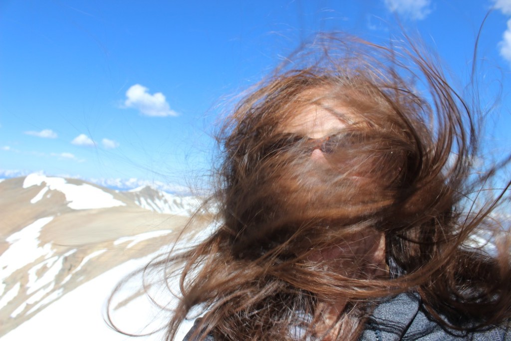
Tie your hair back: Here I believe a picture is worth 1000 words. I now braid my hair before a climb.
Don’t Wear Cotton: Cotton is heavy, takes a long time to dry, adds to rapid body heat loss, and absorbs too much moisture. That means you stay wet/cold for a long time. This includes jeans and that cool ‘It’s another half-mile or so’ t-shirt. Instead, pick a synthetic fiber such as polyester, nylon, fleece, or merino wool.
Add string to your zippers: Yes, wearing lobster-claw gloves is great for keeping your hands warm, but it makes manipulating your fingers and doing ordinary tasks, such as unzipping a zipper, difficult. I’ve added string to my zippers so they’re easier to grab while wearing bulky gloves. Note: don’t make the string too long, as it will flap in the wind and hurt when it hits you in the face at high speeds. 6 inches of string is best.
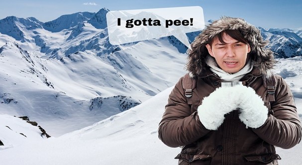
Pee Before Treeline: Wind intensifies at treeline, and stripping off layers in these conditions is not a good idea. If you’ll need to use the facilities (always assume you will), do so under the cover and protection of the trees.
Never Leave Gear Stashed: It’s tempting to leave your snowshoes stashed somewhere when no longer needed to pick up on your way back, but I’ve learned it’s important to carry all gear you’ll need to get down the mountain for your entire hike. I’ve had gear taken (either stolen or someone brought it down to the trailhead, thinking I’d lost it) and it’s easy to forget where you’ve placed the items. If you needed the gear to climb up the mountain, keep it with you so you’ll absolutely have it to get back down.
Keep Moving: There are times when rest is necessary, but resting can quickly lead to frigid body temperatures. Never allow your feet to stop moving, as this is when they cool down. If you’re taking a sip of water or rearranging gear, keep your feet engaged, moving them up and down (marching in place) as you do so. This will help prevent cold toes. Pump your fingers back and forth inside your gloves to keep the circulation going.
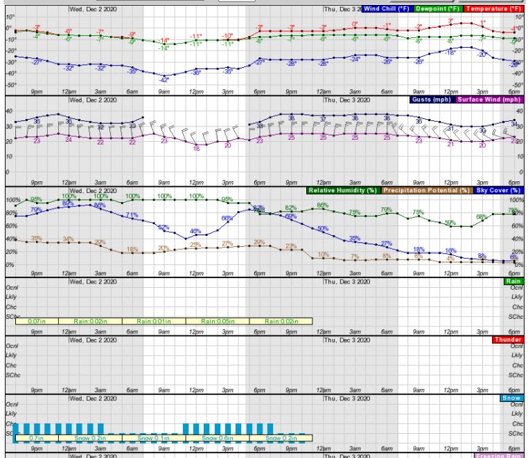
Become a Hobby Meteorologist: In winter the days are shorter, so daylight hiking time is less than in summer. Always check the forecast, but remember forecasts are often wrong and change during the day. Learn how to read weather forecasts and know how they relate to timing, topo maps, and geographic features. I’d recommend spending time learning how to navigate the NOAA weather forecasting site, particularly as it pertains to hourly weather forecasts for specific regions/peaks. You’ll gain information such as temperature, wind speeds, wind gusts, sky cover, potential precipitation, lightning, etc. in an hourly forecast. What you see may look daunting at first, but a few minutes studying and it’s mostly self-explanatory picture of the day’s conditions, letting you know the best times to climb, or if you should climb at all.
Windy Weather: When reading forecasts, know wind speeds/gusts are often much more important than how cold it is outside. Hiking in 20 degree weather is actually quite nice when prepared in proper gear and the sun out, but add in windchill and it can quickly become hazardous. I’ve mountaineered in winds up to 80mph, and from personal experience, if the wind predicted to be above 20mph I choose a different area or stay below treeline.
Learn how to read the forecasts to see which way the wind is coming from, and then you can plan your route to avoid ridges where there will be more wind, or at minimum design a route that avoids the brunt of the wind for as long as possible by staying below treeline for a longer period or in the shelter of the side of the mountain with less wind.
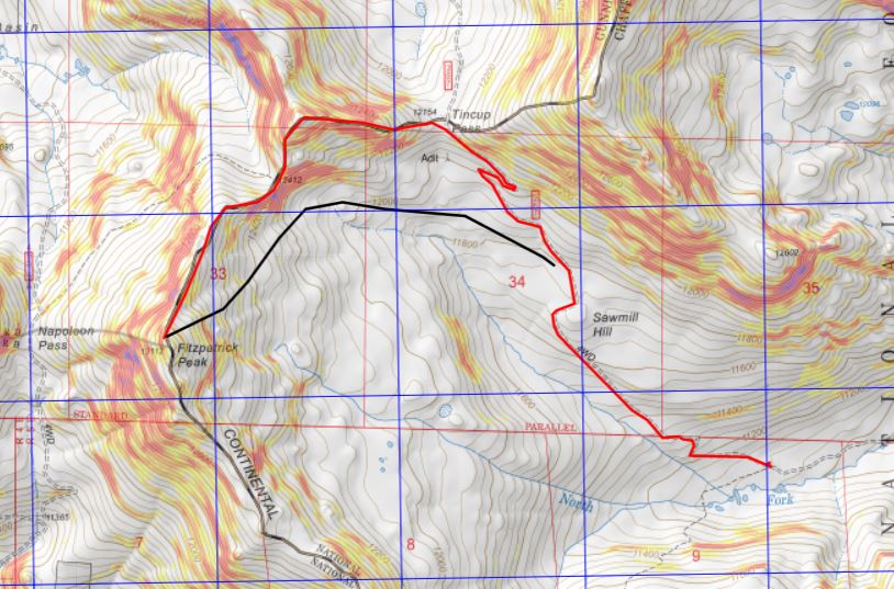
For example, in the picture below, if the normal route is in red, but there are winds coming from the north or west that day, you could avoid most of the wind by taking the black route instead, limiting your exposure time on the ridge.
The summit is only halfway: Know your limits, and realize when to turn back. People with Raynaud’s experience cold much more intensely than other people, with quicker and more drastic effects. Summiting is optional, making it back to the trailhead is mandatory. Preferably with all your digits intact. Know when to turn back. Also know when to celebrate. While a lot of people like to down a beer or a shot of whiskey at the summit, this is a dangerous practice, as often times the route down is more difficult than the route up. You want full use of all your senses.
Prevention is key: A Raynaud’s attack, once triggered, is very painful and can take a while to recover from, even after the affected area has been re-warmed. Doing as much as you can to prevent an attack is never wasted: Dress warmly, wear a wind barrier (outer shell), never take off your inner gloves, keep all your gear easily accessible, and bring along warm water. Start with short winter hikes and work your way up to longer, more technical climbs.
I hope this article has been helpful for those of you with Raynaud’s, as well as those of you who may not have Raynaud’s but are interested in staying warm while winter hiking. I’d love to hear from you! Do you have any advice for winter hiking? Comments? Questions? Is there a topic you’d like me to discuss? Contact Wild Wanderer here.
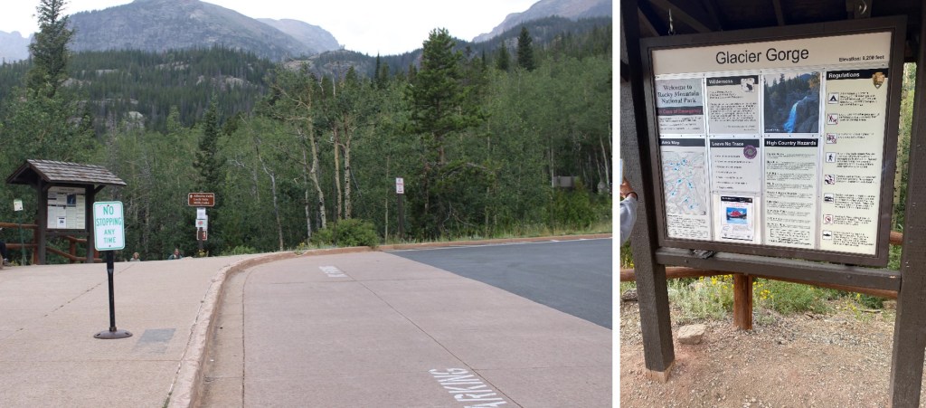
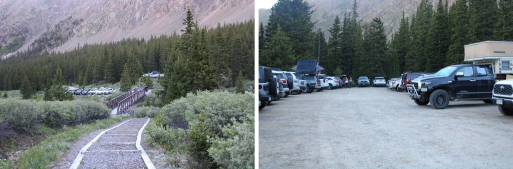
I started from the Glacier Gorge trailhead in Rocky Mountain National Park at 3:30am. There were already several parties in the parking lot (probably 10 vehicles), but didn’t see another person on my route all day. This is also a bus stop for access to Glacier Gorge (and lots of other hikes). All this means is that it was overly crowded the last 2 miles of the hike on my way down. Passing people became impossible, and more of a stroll as I hiked out with hundreds of other hikers.
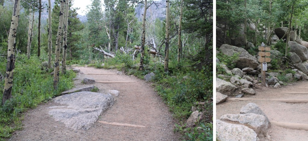
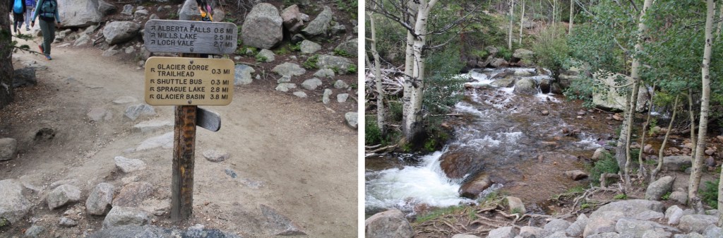
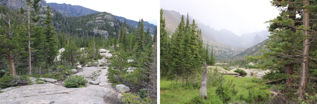
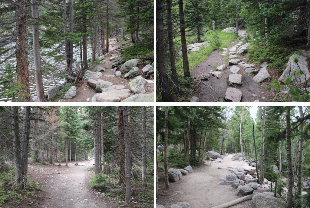
I followed the class 1 trail, staying on the Mills Lake trail. There were wonderful signs that made getting lost difficult.
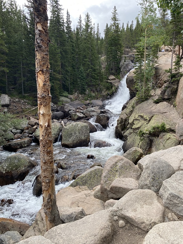
I passed Alberta Falls at 1.15 miles, and continued following the trail to Mills Lake
After hiking for 3.35 miles I passed Mills Lake, and at 3.85 miles I passed Jewel Lake. Side note: there’s great fishing here. Lots of hungry trout, eager to feast on any worm you drop in. The larger trout are in the stream above Jewel Lake, and in Mills Lake.
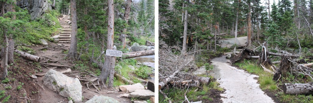
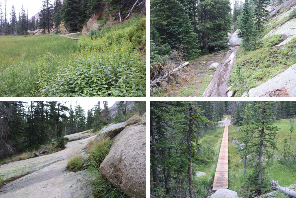
I continued following the class 1 trail all the way to Black Lake (6 miles in). This part of the trail had a lot of wood foot bridges, and rock slabs to cross. All class 1, but the rock slabs were tricky to navigate in the dark.
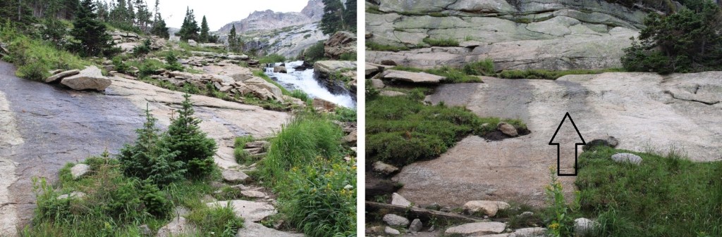
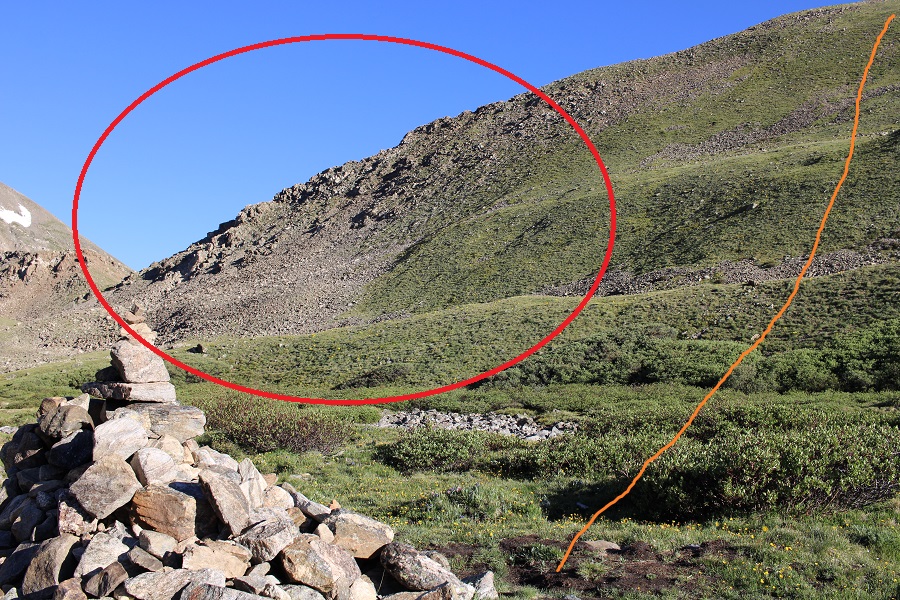
I made it to Black Lake, and continued on the class 1 trail, up a waterfall, and across more rock slabs.
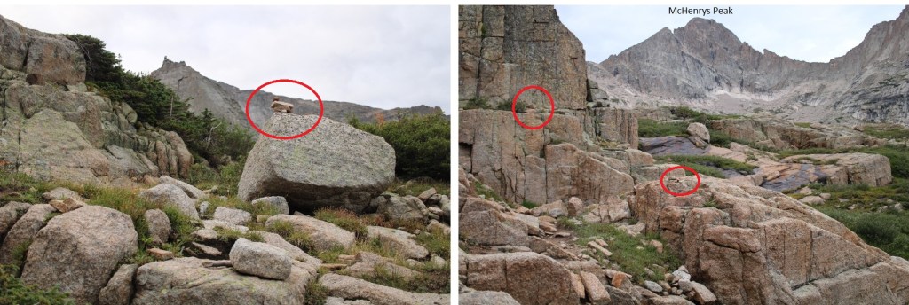
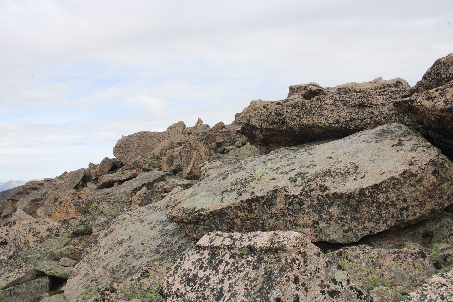
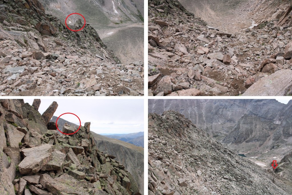
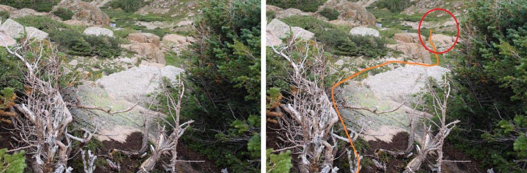
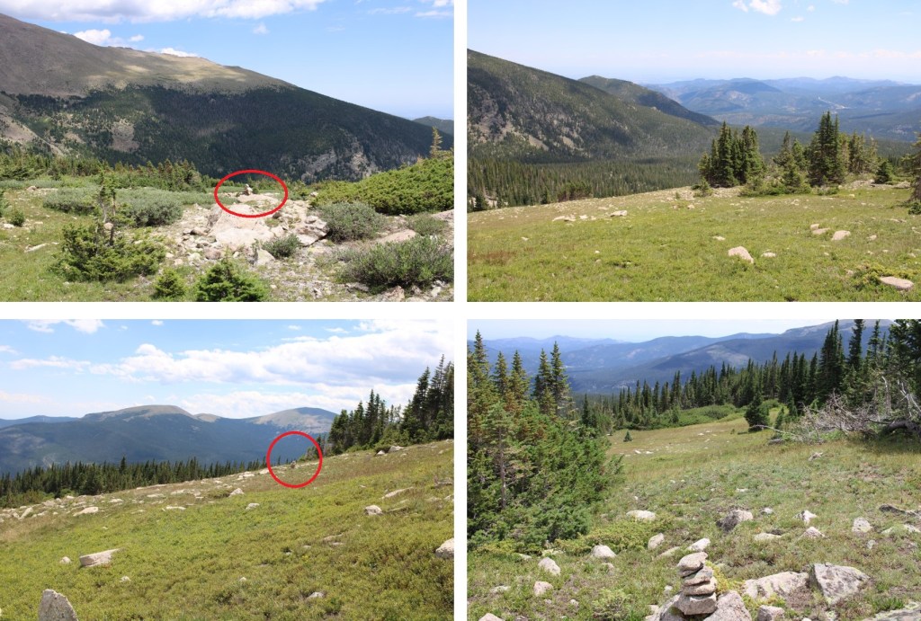
Here the trail kind of fizzled out, but I continued following cairns as I crossed a small creek, and headed southwest towards McHenrys Peak. There are a ton of cairns in this area (circled in red).
Here’s the overall route to Frozen Lake (not pictured) and up Stone Man Pass. There are plenty of cairns to guide you, but for the rest of the hike be careful: there are a lot of granite slabs that are quite steep to navigate (all class 2), and slippery where wet.
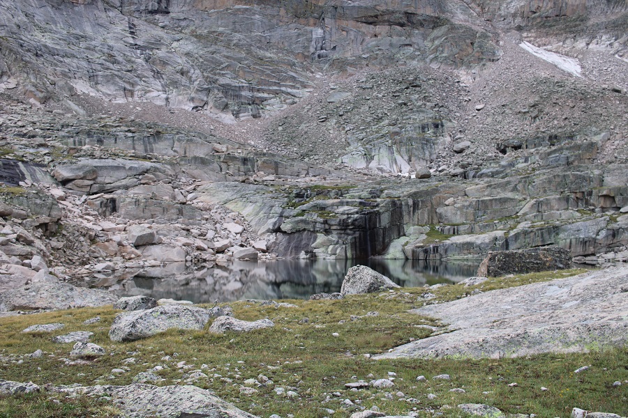
Here are some close up pictures to Frozen Lake
I easily rock hopped and crossed the lake on its north side, and continued heading west towards Stone Man Pass
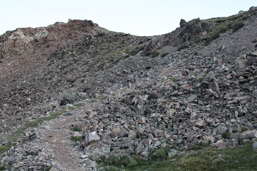
There are still tons of cairns in this area, but choose your route based on the best conditions. The rocks are very slippery where they are wet. I was aiming for the gully below Stone Man Pass.
I didn’t think the gully was that bad. I stayed right on my way up, but took the other side down. I’d recommend climbing up the left side of the gully, as it was more stable, but both were fine. Here are some pictures of the gully
Once at the top of the gully, I turned right and headed northwest towards McHenrys Peak. Everything you can see here is class 2, and there are cairns to guide your way.
I rounded the mountain, and was now on the west side of the peak. Here is got a bit trickier. There were still cairns to follow. I headed up a rock slab, and rock filled gully. This was easy class 3
Here’s the overall route of the rest of the climb. I felt this was difficult class 3, with some exposure.
There was a chimney to head up, and then a short but intense scramble to the summit
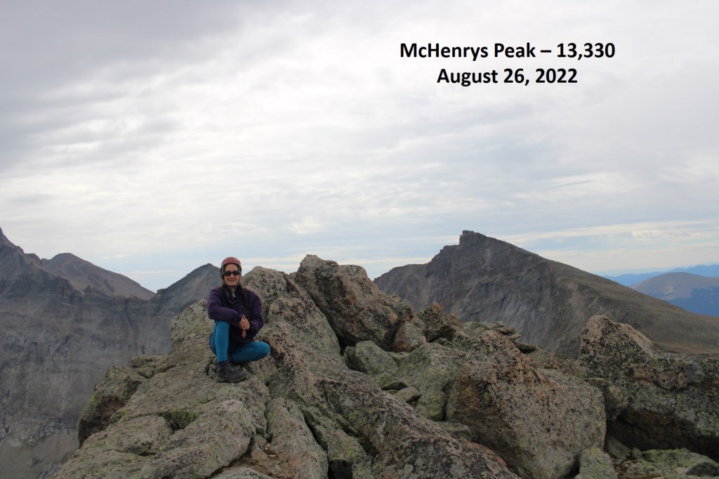
I summited McHenrys Peak at 9:50am
McHenrys Peak:
The summit looked like it could have several actual summits, so despite the large cairn and summit register, I made sure to walk all around the summit to make sure I’d actually summited.
Now to head back down. The trickiest part was descending the initial section, and finding my way back around the side of the mountain. Once I was there, it was easy to find my way to Stone Man Pass, and then back down to Frozen Lake.
And then I followed the cairns northeast, back towards the trail that would lead me to Black Lake
Then followed the trail all the way back to the trailhead.
I made it back to my truck at 2:30pm, making this a 17.46 mile hike with 4442’ of elevation gain, as per CalTopo. Strava told me it was a 15.02 mile hike with 6573’ of elevation gain. I tend to go with CalTopo when I write, for consistency purposes, especially since Strava tends to grossly exaggerate elevation gain.
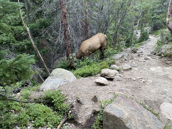
Also, there were a few elk along the trail who didn’t seem bothered by my presence… they wouldn’t even look up from whatever they were eating to acknowledge me.
I started from the Glacier Gorge trailhead in Rocky Mountain National Park at 3:30am. There were already several parties in the parking lot (probably 10 vehicles), but didn’t see another person on my route all day. This is also a bus stop for access to Glacier Gulch (and lots of other hikes). All this means is that it was overly crowded the last 2 miles of the hike on my way down. Passing people became impossible, and more of a stroll as I hiked out with hundreds of other hikers.
I followed the class 1 trail, staying on the Mills Lake trail. There were wonderful signs that made getting lost difficult.
I passed Alberta Falls at 1.15 miles, and continued following the trail to Mills Lake
After hiking for 3.35 miles I passed Mills Lake, and at 3.85 miles I passed Jewel Lake. Side note: there’s great fishing here. Lots of hungry trout, eager to feast on any worm you drop in. The larger trout are in the stream above Jewel Lake, and in Mills Lake.
I continued following the class 1 trail all the way to Black Lake (6 miles in). This part of the trail had a lot of wood foot bridges, and rock slabs to cross. All class 1, but the rock slabs were tricky to navigate in the dark.
I made it to Black Lake, and continued on the class 1 trail, up a waterfall, and across more rock slabs.
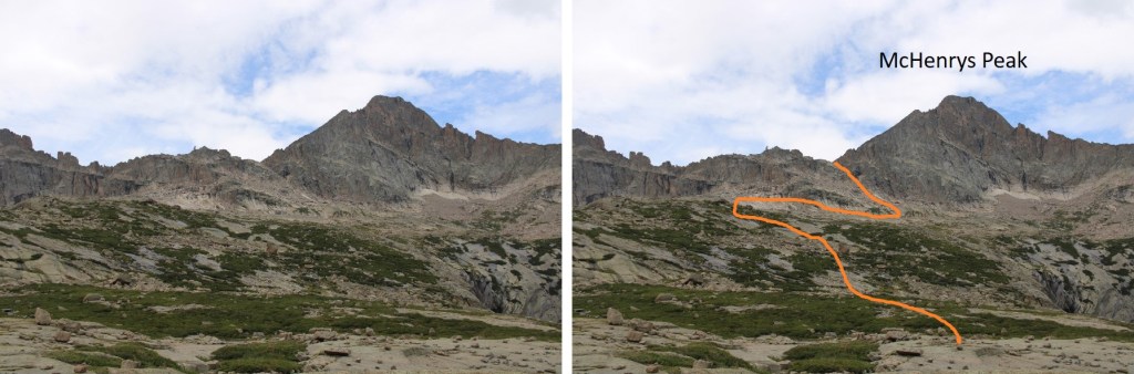
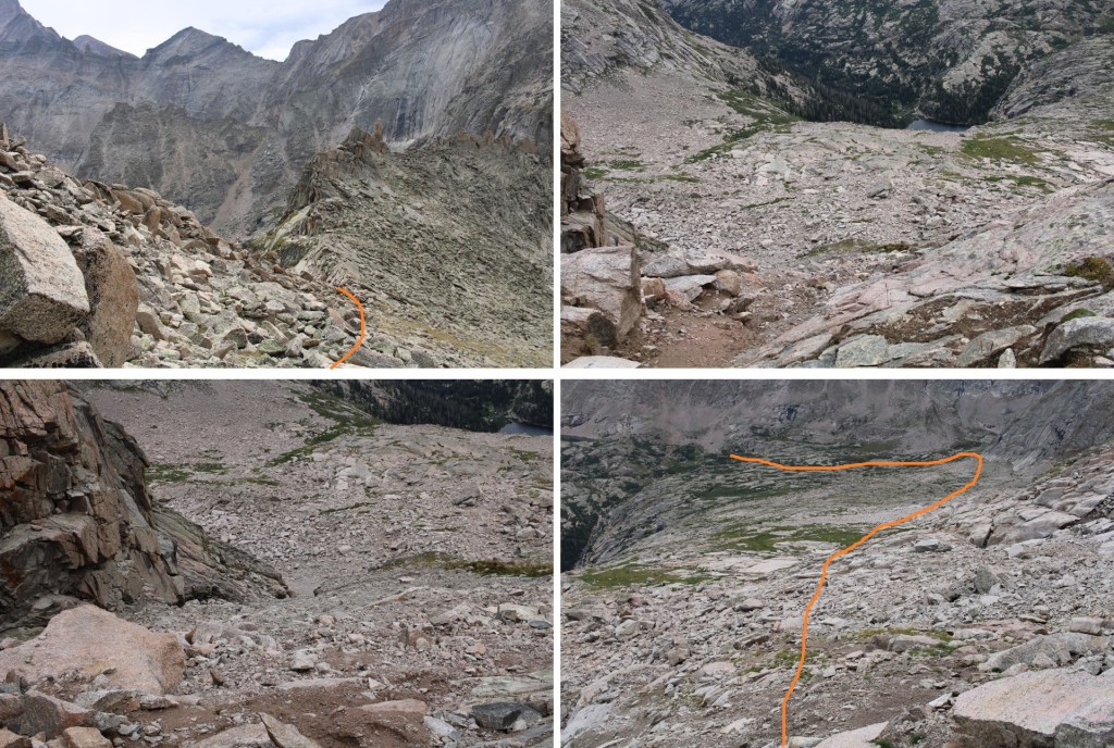
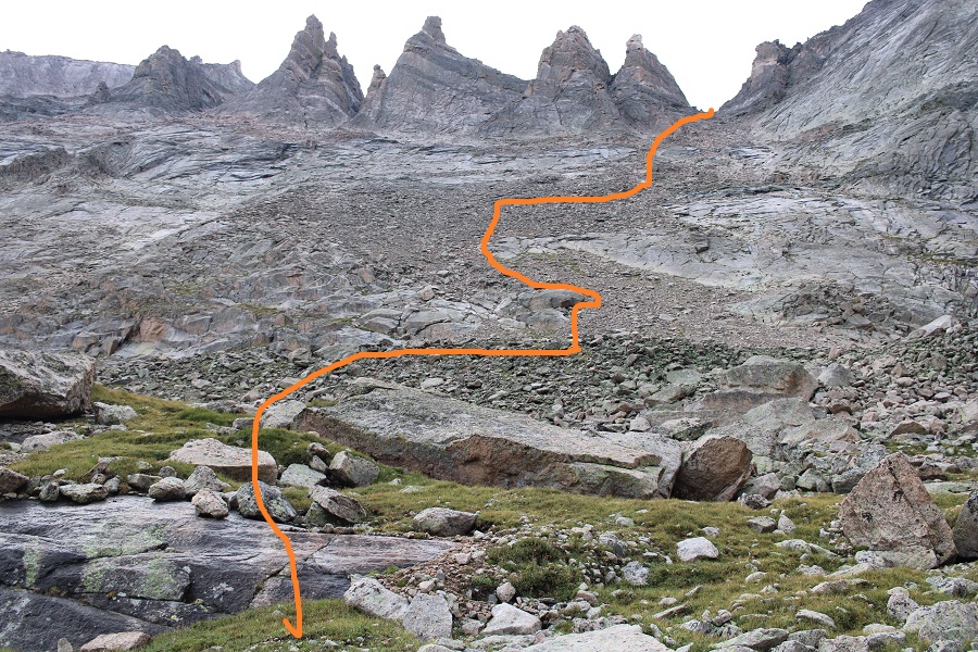
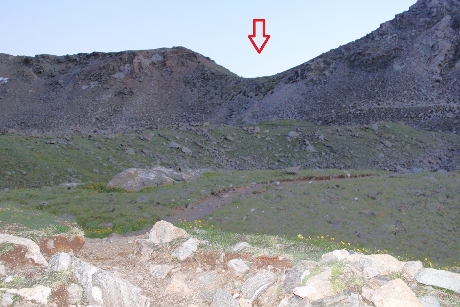
This is where my report may differ from others. I took a different route in than I did out at this point, and liked my route out better. It was easier to follow, and there were less willows/shrubs involved. Here’s the overall picture of what I did. There is a cairn circled in red, indicating the route to McHenry’s Peak. Don’t take that route, but leave the trail and head behind the bush. You will then easily see cairns that will guide you through the upper basin.
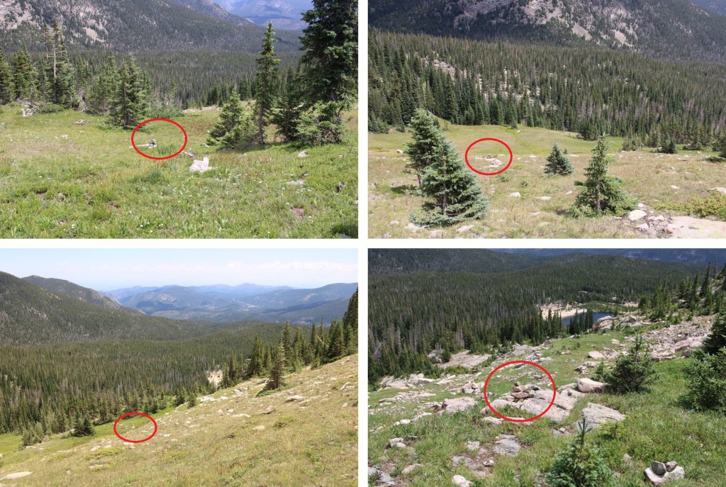
Once again, there is no established trail to Green Lake, but there are some tramped game trails (all covered in grass, not much dirt to be seen) and lots of cairns. This is also choose your own adventure. You’re aiming south, towards the mountains (circled in red). There are several small streams to cross in this area, all easily hop-able.
I navigated a bit to the right of the waterfall to get to Green Lake (cairns here too)
Once at Green Lake, I turned left and headed southeast. Here’s my overall route on scree, navigating around large boulders and rock slabs to keep this all class 2.
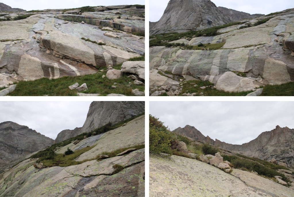
Here are some close-up pictures of my route up the gully, to the saddle
Once at the saddle, I turned right and headed up the ridge. I went directly up the ridge on the way up, which was class 3. I kept it class 2 on the way down by staying more to the left of the ridge.
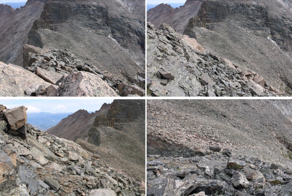
Here are some pictures of the ridge.
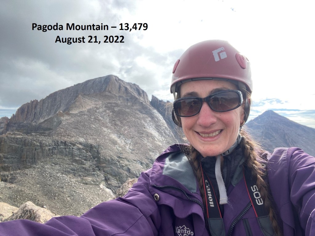
I summited Pagoda Mountain at 9am. There was a plastic tube at the summit as a register, lacking a lid, but with a ziplock bag inside. I didn’t bother opening it.
Pagoda Mountain:
I had a great view of the Longs Peak keyhole route
Now to re-trace my steps back to the saddle, before the storm hit
And back down the scree to Green Lake
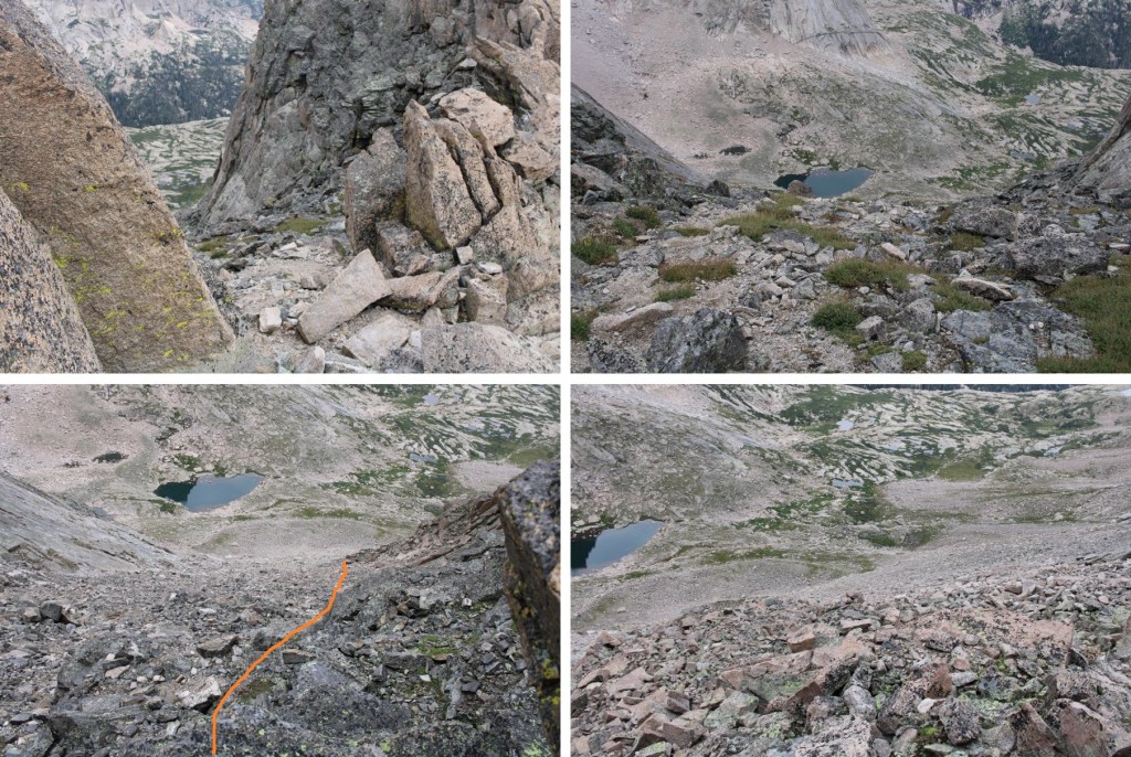
Once back at Green Lake, I turned right and followed the cairns north out of the basin
This time I went behind the rocks and picked up the old trail, circled in red
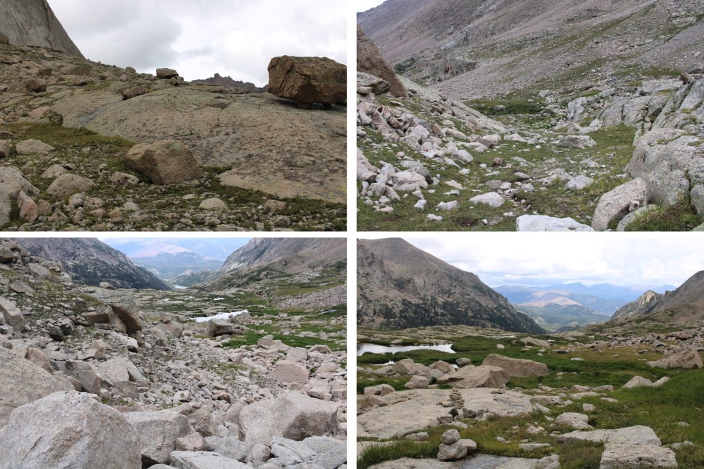
Then followed the trail all the way back to the trailhead. It started raining just as soon as I made it to treeline, accompanied by a flash of lightning, a loud boom, and a wide rumbling all around me.
I made it back to my truck at 1:30pm, making this a 17.74 mile hike with 4544’ of elevation gain in 10 hours.
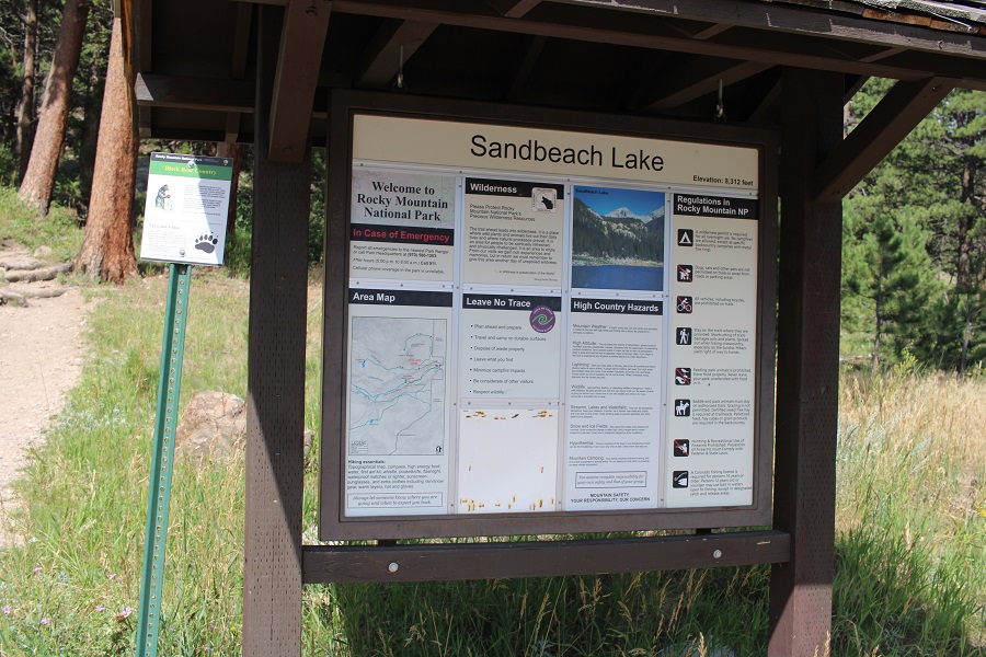
I parked at the Sandbeach Lake Trailhead at Rocky Mountain National Park, and was on the trail at 4:30am.
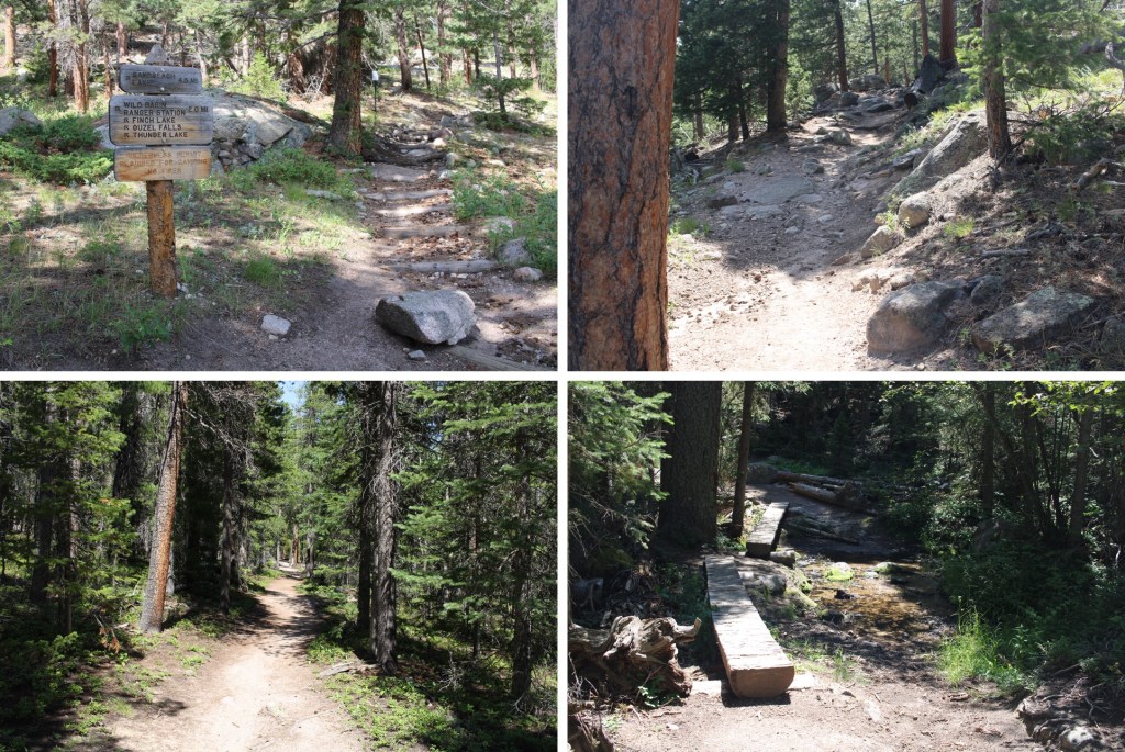
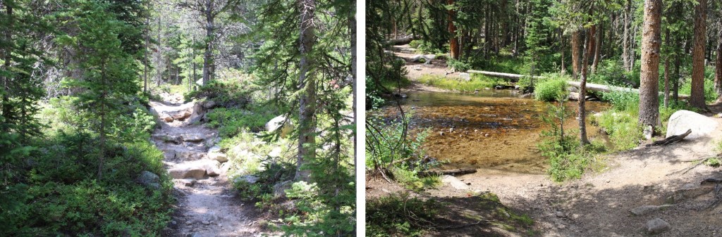
The Sandbeach Lake Trail was a class 1 trail I took all the way to Sandbeach Lake. There were 2 creek crossings, but they had footbridges across.
It was 5 miles to Sandbeach Lake. Once at the lake, the fastest way to skirt the lake and find a trail is to go right here
But I wanted to see the lake, so I did, and then followed the lake past a small stream, and caught up with the trail there.
After crossing the creek, I followed the trail northeast to treeline. When the trail ended, there were plenty of cairns to guide the way (circled in red).
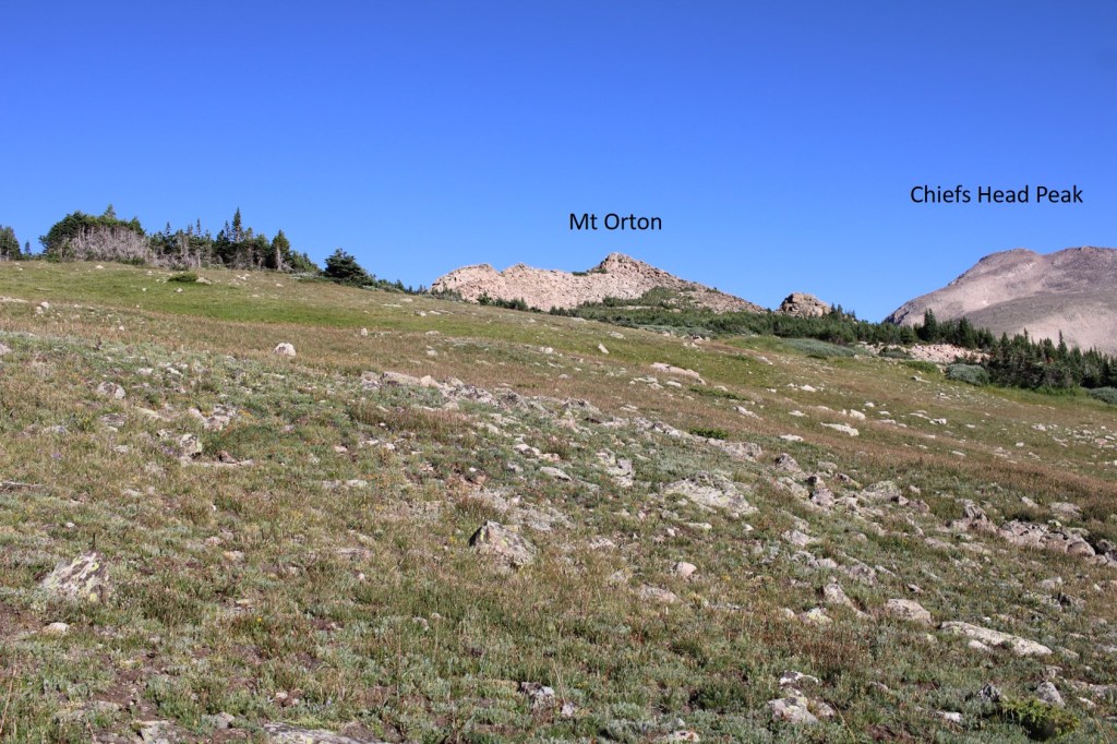
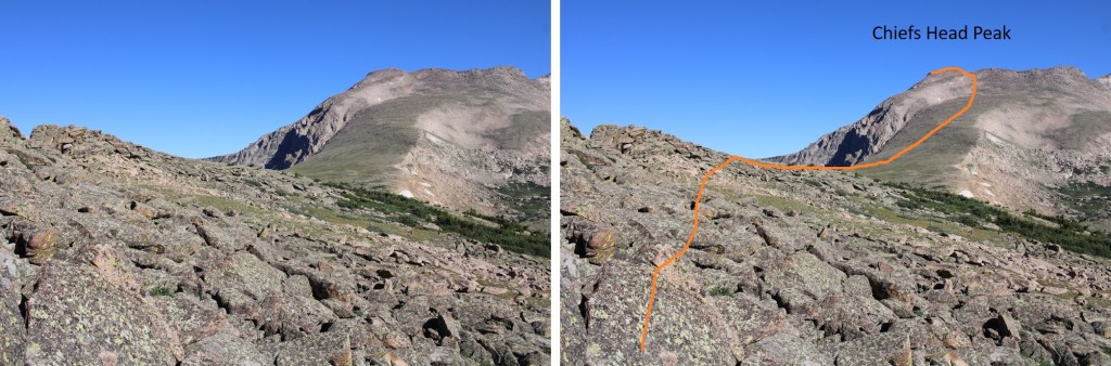
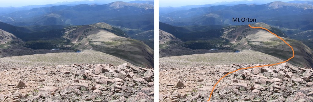
Once at treeline, I kept aiming for Mt Orton (unranked). There were cairns to mark the way until I was in front of Mt Orton
I then skirted Mt Orton to the left, and went through a very small saddle
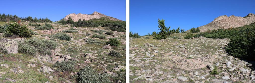
I could now see an easy path to Chief Head’s ridge. Here’s the route I took
And some close-up pictures
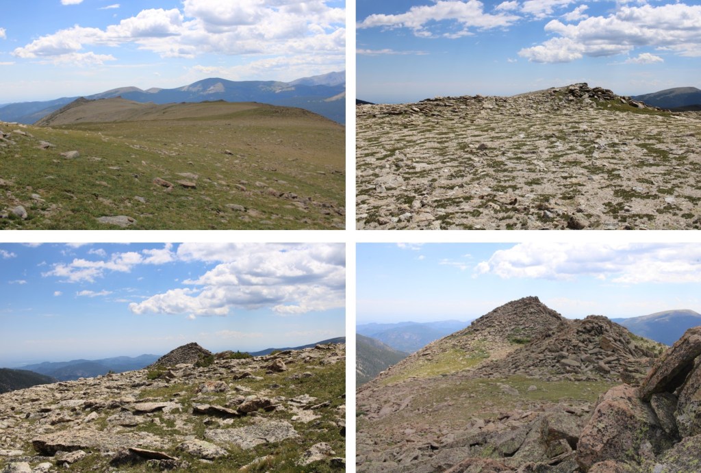
Once on the ridge, I followed it .3 miles to the summit, on rocky terrain. I was able to keep it all class 2 by staying to the left.
There wasn’t a summit register, or a cairn, or a marker, so I just walked all over the rocky summit.
I summited Chiefs Head Peak at 11am
Chiefs Head Peak:
From the summit I had an amazing view of Pagoda, Longs, and Meeker
This was an out and back hike, so I turned and retraced my steps back down the mountain, around Mt Orton, and to Sandbeach Lake
The cairns picked up again, and I could now see Sandbeach Lake, so route finding was easy until I hit the trail.
Back at the lake, I picked up the Sandbeach Lake Trail, and took this class 1 trail all the way back to the trailhead.
I made it back to my truck at 3:15pm, making this an 18.17 mile hike with 5476’ of elevation gain in 10 hours 45 minutes.
The permit system was simple, especially for Summit Lake. I bought it the day before, and there were 23 spots left for entry between 8-10am, the time I picked since it was the earliest. There were two other vehicles in the parking lot when I was on the trail at 4:45am.
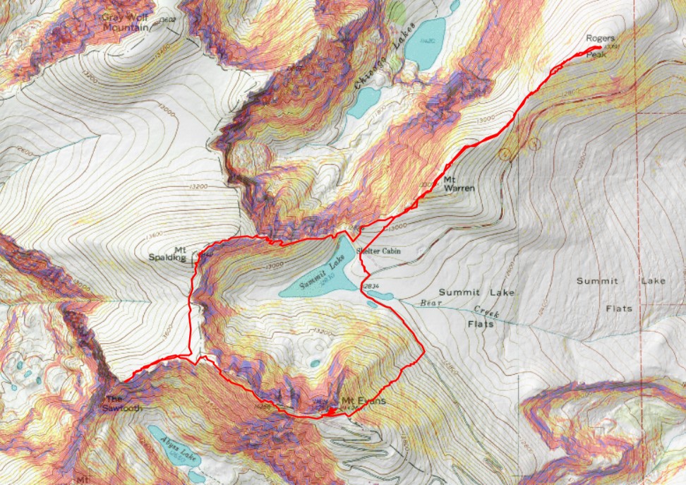
I was headed northeast, to the summit of Mt Warren. This was simple, class 2, and straightforward. Except it was dark and the rocks were slippery because of the rain. Here’s the route I took.
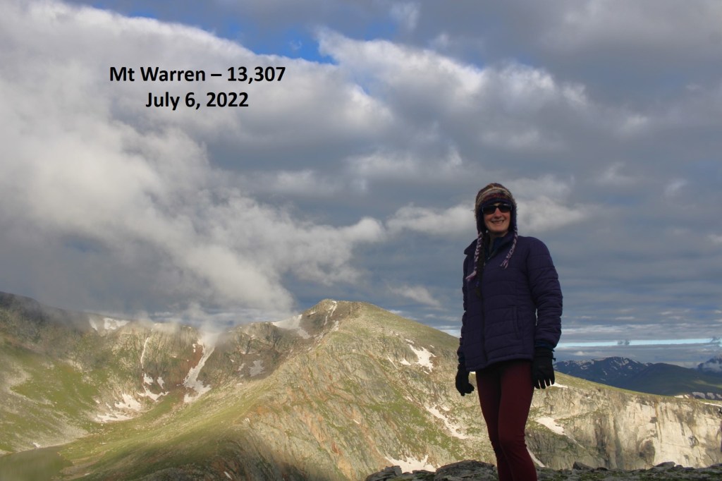
After hiking northwest for .75 miles, I summited Mt Warren at 5:10am
Mt Warren:
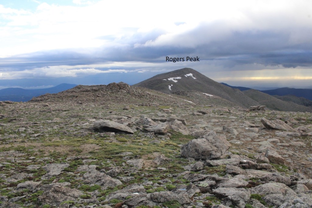
I continued following the ridge northwest, to the summit of Rogers Peak. This was also class 2
The summit of Rogers Peak is the top of this rock.
I climbed up it (not difficult) but took the video from below.
I summited Rogers Peak at 6am
Rogers Peak:
Now to re-trace my steps back to Summit Lake.
I re-summited Mt Warren, and continued southwest towards Summit Lake
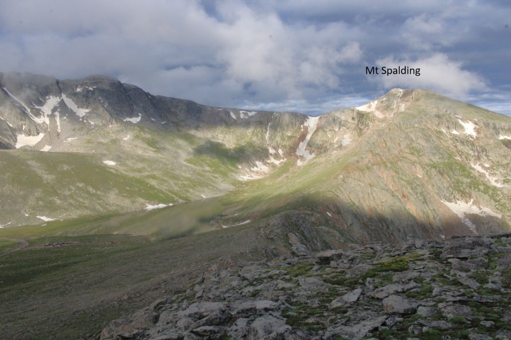
Once at Summit Lake, there was a class 1 trail that let me up to the summit of Mt Spalding
While this was class 1, there were a couple of quick class 3 scrambling moves. Large cairns made the route obvious
I continued following the ridge west towards the summit, on the class 1 trail
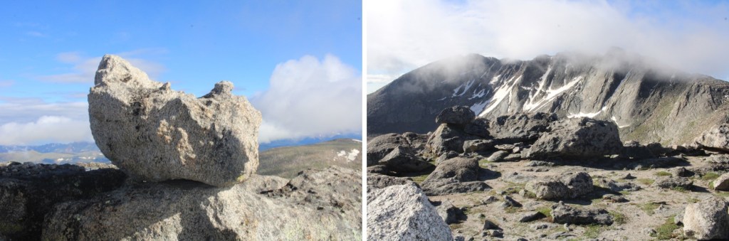
This rock is the summit block. I climbed it. The summit area (besides the block) is flat
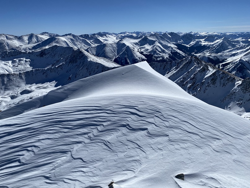
I summited Mt Spalding at 8am
Mt Spalding:
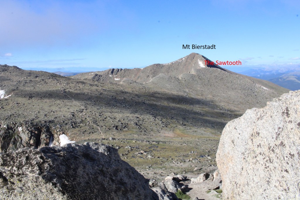
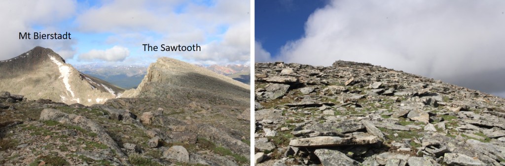
From Mt Spalding I could see my next objective to the southwest: The Sawtooth
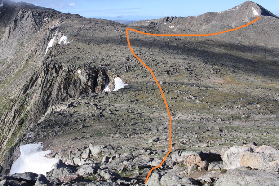
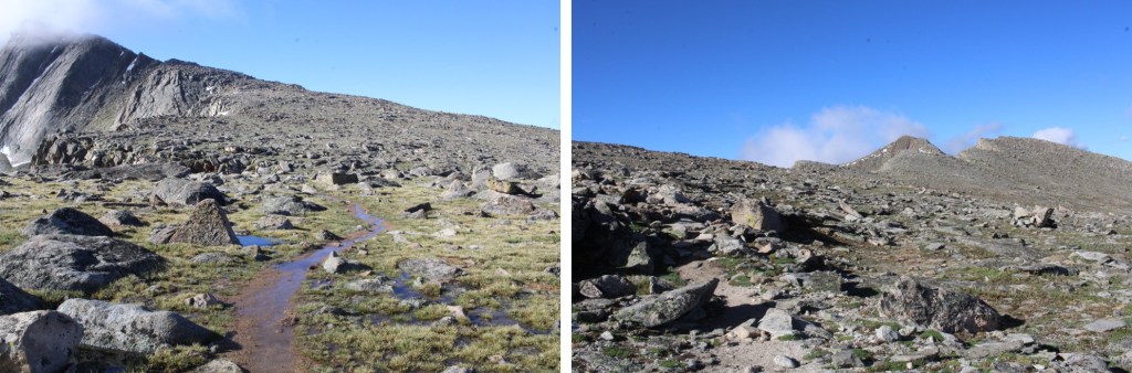
I continued following the class 1 trail south towards Mt Evans, but once I hit the ridge to The Sawtooth I left the trail and headed west. Here’s my overall route
And some step-by-step pictures
I summited The Sawtooth at 8:35am
The Sawtooth:
From The Sawtooth I could see Mt Evans to the east (actual summit hidden)
I made my way back to the Class 1 trail
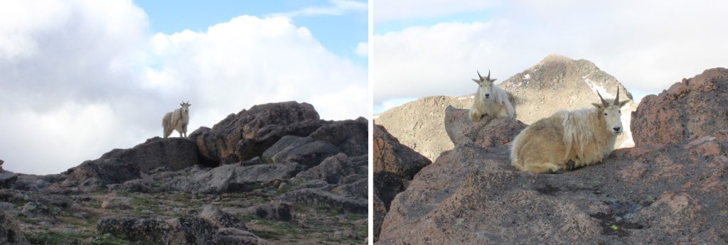
I was still off trail, but just before linking back up with the actual trail I came upon a couple of mountain goats. They didn’t seem to mind my taking their picture. I never would have seen them if I’d been 50 feet away, on the actual trail.
Now back on the trail, I followed it southeast
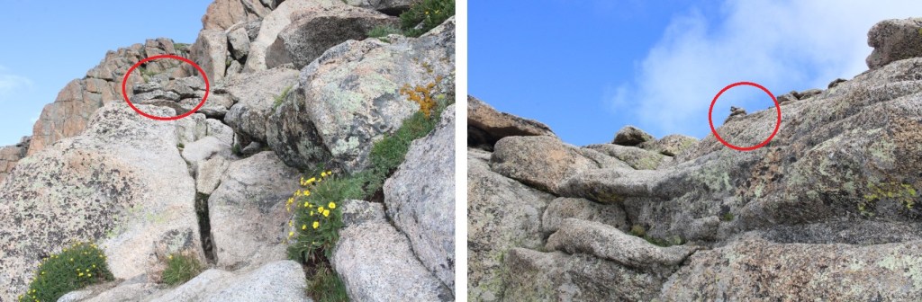
I came to a small saddle, and while there are cairns on the other side, the true trail descends the gully a few feet, and picks up below. There are cairns to indicate this way as well
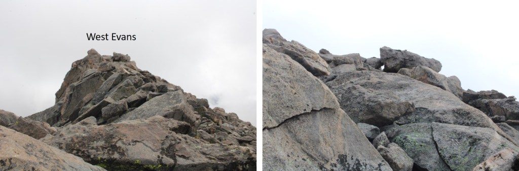
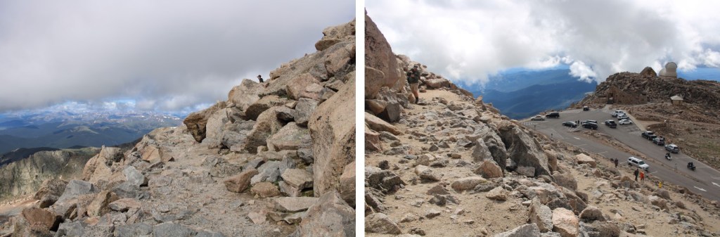
I followed the cairns southwest, until I made it to 14175’. I then left the trail, put on my helmet, and aimed for the ridge, and West Evans above. This was all easy class 3
I summited West Evans at 9:25am
West Evans:
From West Evans I could see the summit of Mt Evans to the east.
I descended back to the class 1 trail, and followed it east to the summit of Mt Evans
Just before the summit I followed the large switchbacks to the summit
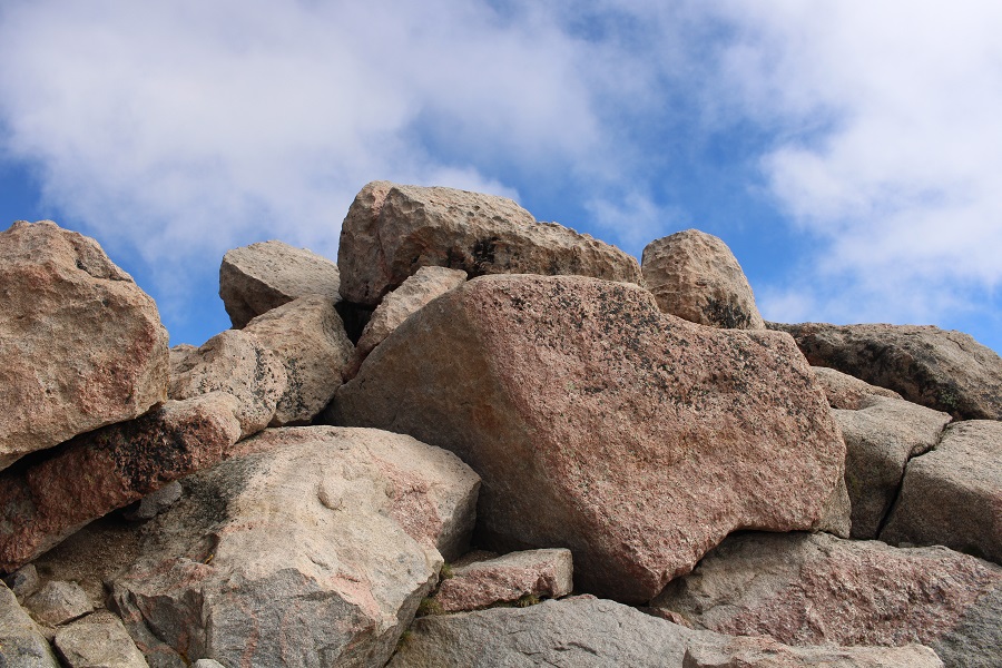
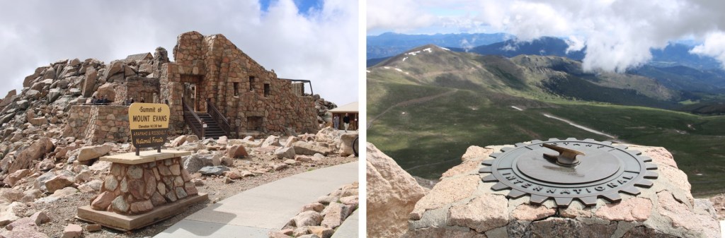
This is the actual summit of Mt Evans. I still had on my helmet, so I scrambled up.
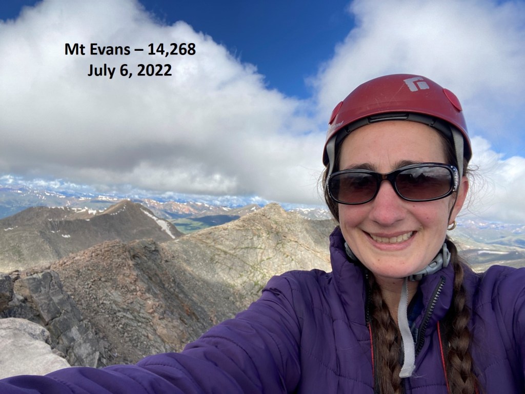
I summited Mt Evans at 9:40am
Mt Evans:
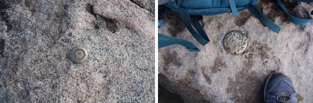
There were summit markers… not on the summit
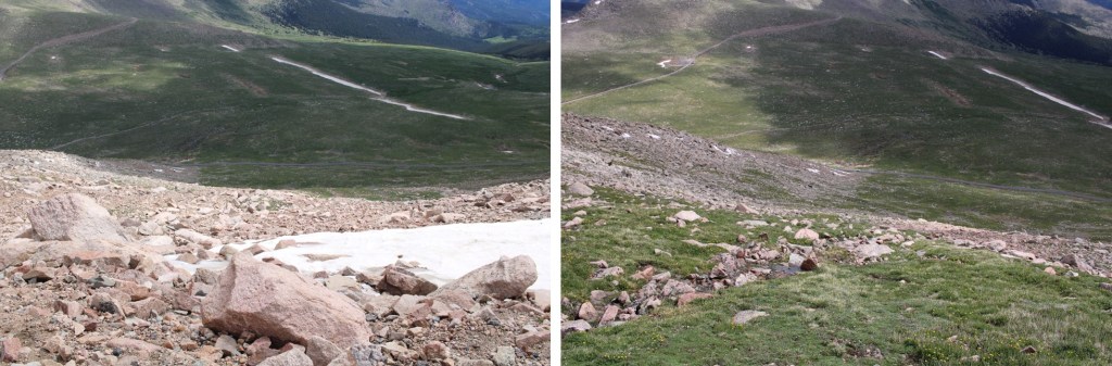
And tons of tourists. Time to head down. I made my way back down the switchbacks, and headed east to the summit house
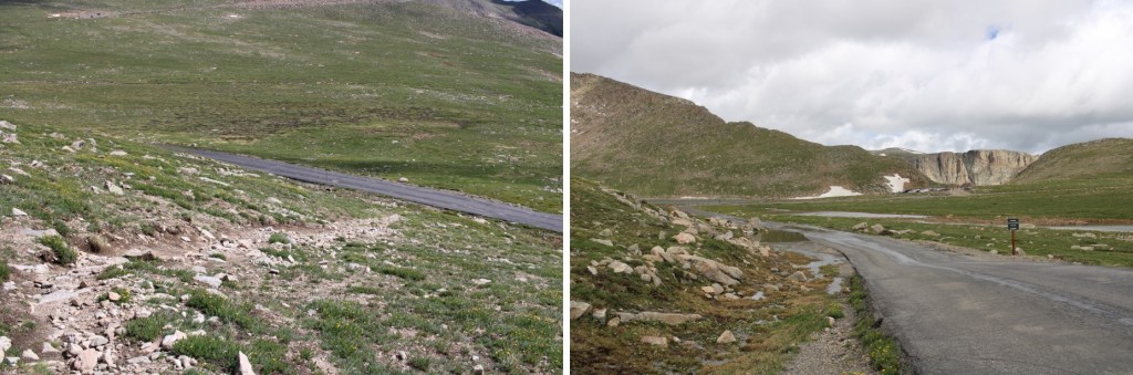
Once at the summit house I continued northeast, back down to the road below. At times there was a well-defined trail here
Back on the road, I followed it north to Summit Lake, and my truck
I made it back to my truck at 10:30am, making this a 10.28 mile hike with 3263’ of elevation gain I 5 hours, 45 minutes.
I arrived at the Grays and Torreys Trailhead the night before, curious to find there were only a handful of vehicles in the parking area.
I picked out a prime spot (that proved later to be a bad choice), and settled in to read a bit before heading to bed. I talked to an awesome CDT thru hiker, and noticed two girls fiddling with a camper in the parking lot. A very old camper, on top of a very old Tundra. They were all over that camper; on top pulling at buckles, on the back, fiddling with the door, banging on the sides, etc. When I saw them bring out a hatchet I stopped reading and walked over to them.
I said hello, told them I was a mom and a Girl Scout Leader, and also told them my kids ages, trying to let them know I wasn’t a freak. I asked them if they needed any help? Yes, yes they did. It seemed they’d locked the keys to the camper inside the camper. I asked them how old they were. 16 and 17. Wow! I was impressed! Not only had they driven this clunker up to the Grays and Torreys Trailhead, they’d convinced their parents to let them do it alone, in their dad’s truck. When I was their age my mom wouldn’t have let me do that. I know because I’d asked, then had to resort to the “I’m sleeping at Kelly’s house” thing as I went to bonfires in the woods where my mom had no idea where I was at. Kudos to their parents. The girls has about 15 14ers under their belts, and wanted to tackle Grays and Torreys in the morning, but it was going to be a long night if they couldn’t get the back open.
OK, time to problem solve. I didn’t think breaking a window was a good idea if we could help it. I knew how to open a car window with duct tape. I asked if they had any, and they brought out a small roll of electrical tape. That wasn’t going to work. Next, I looked at the door handle, which didn’t look too secure. I was thinking we could probably jolt it back and forth and it might break. As I was jiggling the handle, I asked how close the next set of keys would be? They said it didn’t matter, because the keys to the truck were inside the camper as well. I was really thinking I’d just drive them back to Denver or something to pick up the keys from their parents, when one of the girls got the fabulous idea to look for another set of keys to the camper, and found them inside the glove box inside the truck. Problem solved. I wished them luck, happy they hadn’t broken a window with a hatchet, and told them to knock on my window if they needed anything during the night.
It rained. Around midnight I heard something crawling around underneath my truck. It sounded slow, and it was trying to get itself inside the gears. I pounded the side of the truck and it seemed to creep away. Half an hour later it came back, so I knew if I didn’t get rid of this thing it was going to be a long night. Also, I wasn’t going to make friends at the trailhead if I kept banging on the side of my truck all night.
I got out of the topper and into the front seat of my truck. I turned it on and revved the engine a few times. When I was done, and crawling back into the topper, I saw a porcupine waddle away from underneath. It seems my secluded spot at the back of the parking area had been a bad idea, as it was easy access for porcupines. No one else had porcupine trouble that night (that I talked to).
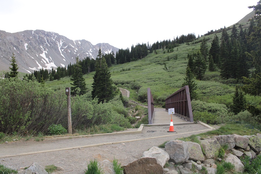
I was up and on the trail at 4:30am, and the trailhead was now about half full of vehicles. I crossed the bridge, and began following the Grays and Torreys trail.
This is a class 1, wide, easy to follow trail.
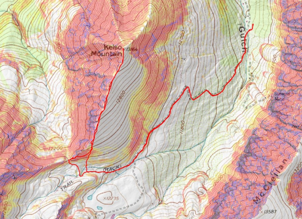
My beta said to follow the trail all the way to the Kelso/Torreys saddle, so that’s what I did, but you don’t need to do that. You can gain the ridge at any point after about 11900’. If I had to do this again, this is where I’d ascend the ridge
But, I had beta that said to go to the saddle, so that’s what I did. I followed the trail for about 2 miles, and then made my way to the saddle. There’s a trail the entire way.
When I got there, I turned to go east up the ridge, but noticed it was all class 3 and above. This seemed silly to me, because there was clearly tundra below.
So I backtracked and took the tundra route to the ridge. This was a fabulous idea, easy going, and I didn’t need a helmet.
This is what I was trying to avoid, which looks ok from this side, but more spicy from above. Just take the tundra route.
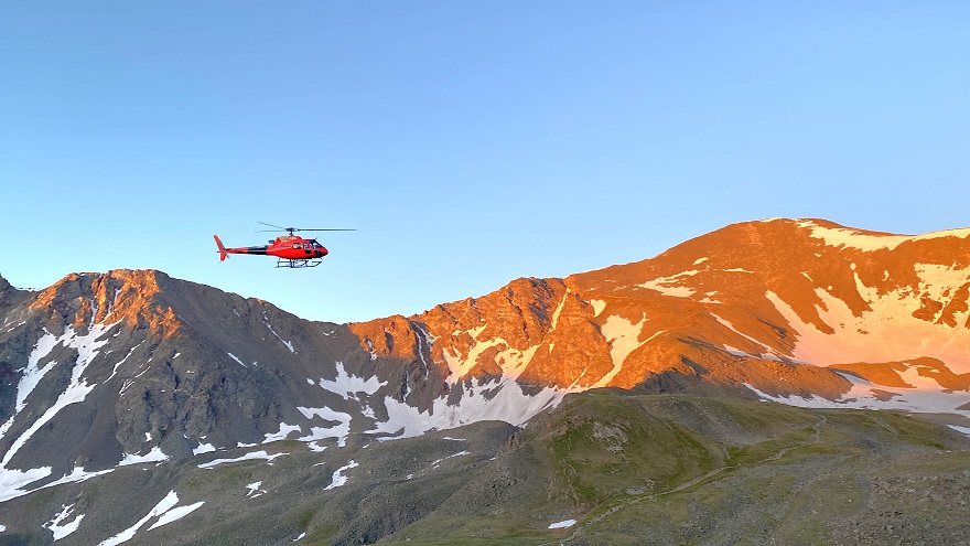
It was here, around 5:30am, when I saw my first helicopter flyover for the day. It got dangerously close to the mountains, and I was worried someone needed SAR. All kinds of scenarios went though my head. I knew CFI was doing work in the area, but the post I’d seen a few days ago said they weren’t starting until next weekend (I found out later they posted again with the proper dates last night, but I was already at the trailhead, so I didn’t know this). I was worried someone needed help, and the helicopter couldn’t find them. I spend a lot of time looking for someone myself as I hiked.
Helicopter:
The helicopter came back around about 20 minutes later, and took a different path. Once again, I was worried they were searching for someone. Then about 20 minutes after that I saw the helicopter carrying wooden ties, and knew it must be CFI doing trail maintenance. THANK YOU CFI!
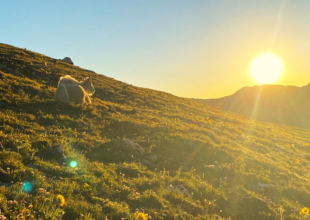
Once on the tundra, before gaining the ridge, I came across some mountain goats lounging, watching the sunrise. I stood there and watched it with them.
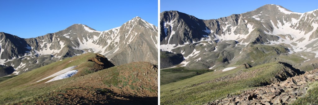
Then I continued on towards the ridge
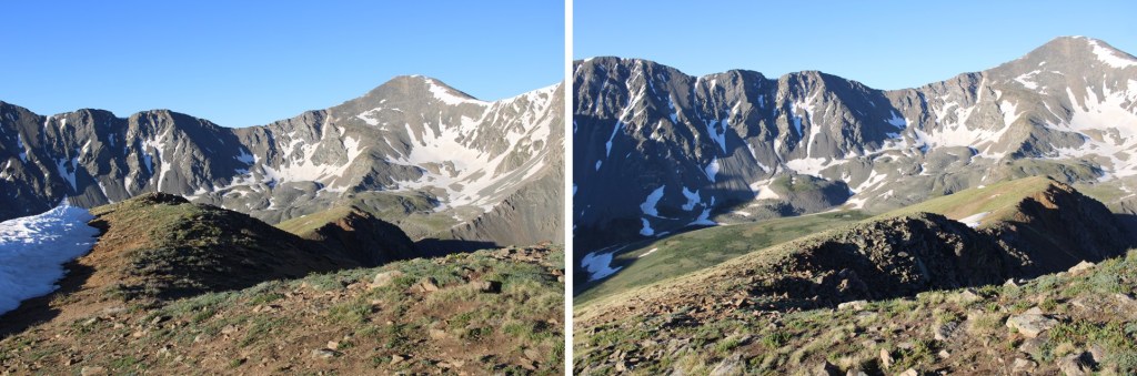
After making it to the ridge, I followed it northeast to the summit. This was a simple ridge walk on tundra.
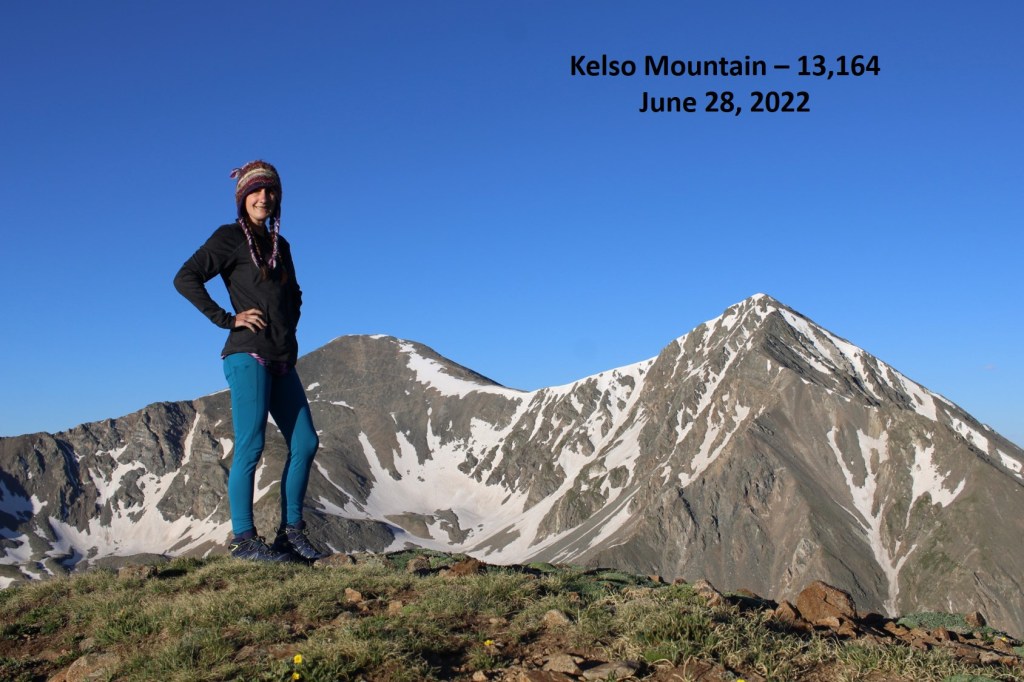
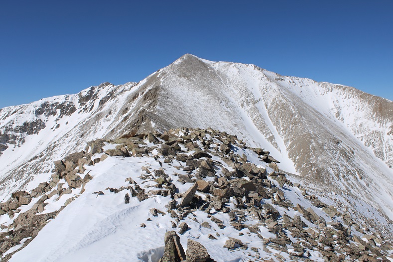
I summited Kelso Mountain at 6:30am
Kelso Mountain:
At the summit cairn there was a journal that was recently placed there. I know some people get worked up about this type of thing, but it’s there for a good cause, and it will be taken back down. Needless to say, I text the man battling cancer a good morning, and sent him pictures of the goats.
Then I retraced my steps back down the ridge
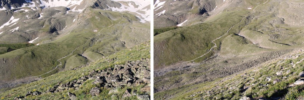
I left the ridge at 11250’ to head back into the basin. I aimed southwest, towards the obvious Grays and Torreys Trail
The goats were still lounging around, so I stopped for a bit to enjoy their presence. They seemed unbothered by the flyovers. I didn’t get too close, but it was neat they were so relaxed. The views were incredible.
After a few minutes I got up again, and headed down the tundra to the trail below, noticing there were tons of people hiking like ants below.
Once back on the trail I realized it was still early, and considered Grays or Torreys or both, but I had a 10am meeting I needed cell service for, and I wasn’t 100% sure I’d have it on the mountain, so I headed back to the trailhead.
Check out the CFI helicopter picking up ties
I made it back to the trailhead at 7:30am, and the parking lot was already full. It’s a Tuesday.
I got back to my truck at 7:30am, making this a 6.32 mile hike with 1937’ of elevation gain in 3 hours. This would be an easy addition to Grays and Torreys.
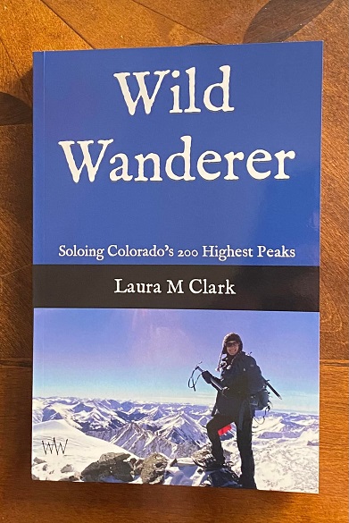
I know I’ve been silent for a few months, and I want to thank those of you who reached out to me asking how I was doing. Yes, I was still summiting peaks, but I was summiting repeat peaks, so I wouldn’t need to write up trip reports. Instead, I was spending my writing time… writing a book! I’m proud to say I’m officially a published author!!! I’m not going to promote the book for a couple of weeks, as I’d like some friends to read it and post reviews first. It takes 10 positive reviews to counter each negative one, so if you enjoy my book, please post a positive review on Amazon. If you notice a spelling error (etc.) please let me know: I can still fix it before the big launch. Please go easy on me: I’m more of a blogger than a writer. Thank you all for your continued support! Don’t buy the hard cover.
There was a fairly recent conditions report on this peak, I so I chose it figuring there’s be a trench to treeline. I had some appointments I needed to be back home by 4pm for, and this seemed like a logical choice for today.
I arrived late, as I woke up to 6 inches of snow at home and had to shovel my driveway before leaving the house. The roads were icy so I took the drive slow. I pulled into the parking lot just before 5am and was surprised to find a fresh layer of snow on the ground. The entire lot was covered, and there were no tracks from any other vehicles. I parked near the entrance and put on my gear. I was on the trail by 5am.
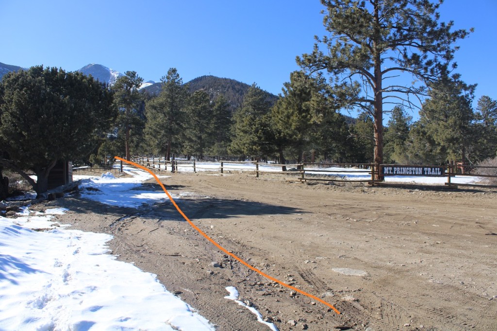
The trail starts at the west end of the parking area. There’s a bathroom and plenty of parking and excellent signage.
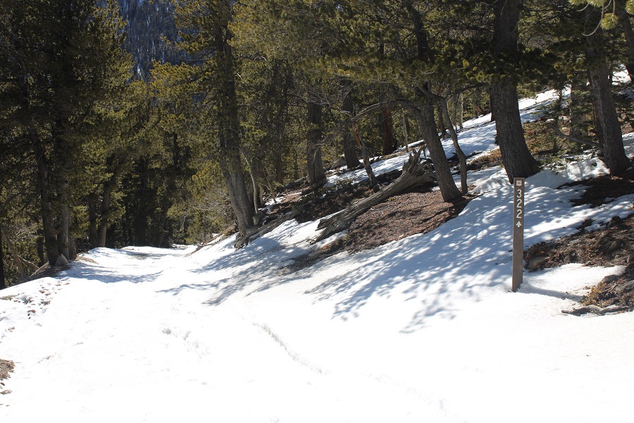
I followed this road (Mt Princeton Road/322) as it switchbacked up the east side of the mountain. I was the first one making tracks, and wore my microspikes the entire day (but lugged along snowshoes).
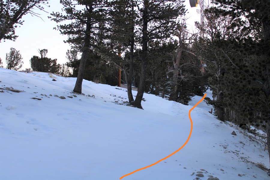
I continued following the road 3.3 miles to the communication towers
At the towers I turned left and followed trail/road 322A
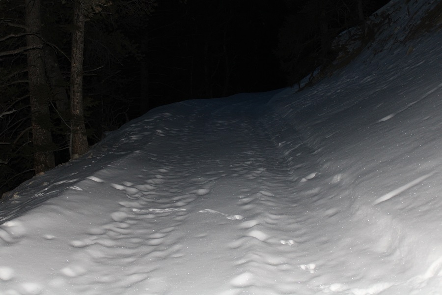
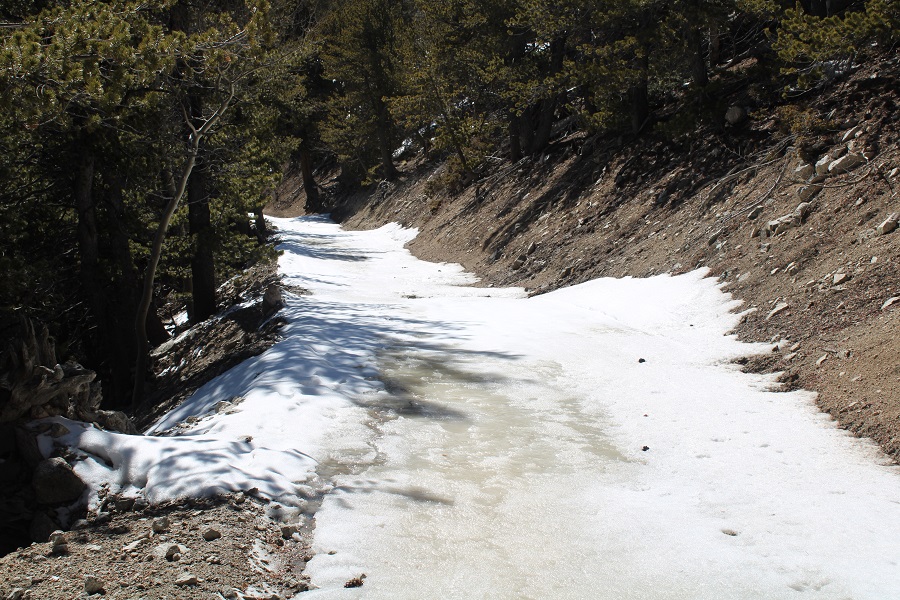
This is where the snow started getting deep. There wasn’t a visible trench, so I postholed a bit, but was stubborn and didn’t put on my snowshoes.
I was still following the road, but there was a lot of snow in this area. The drop-offs were steep (better pictures later, just be aware of avy danger here).
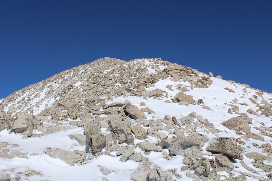
I followed the road to treeline, and then gained the ridge to the right (continuing on this road will take you to the Lucky Mine, and another access point to summit Tigger, but I found the snow was too steep covering the road and decided against that route)
Once on the ridge it was windblown, and I could easily see the summer trail.
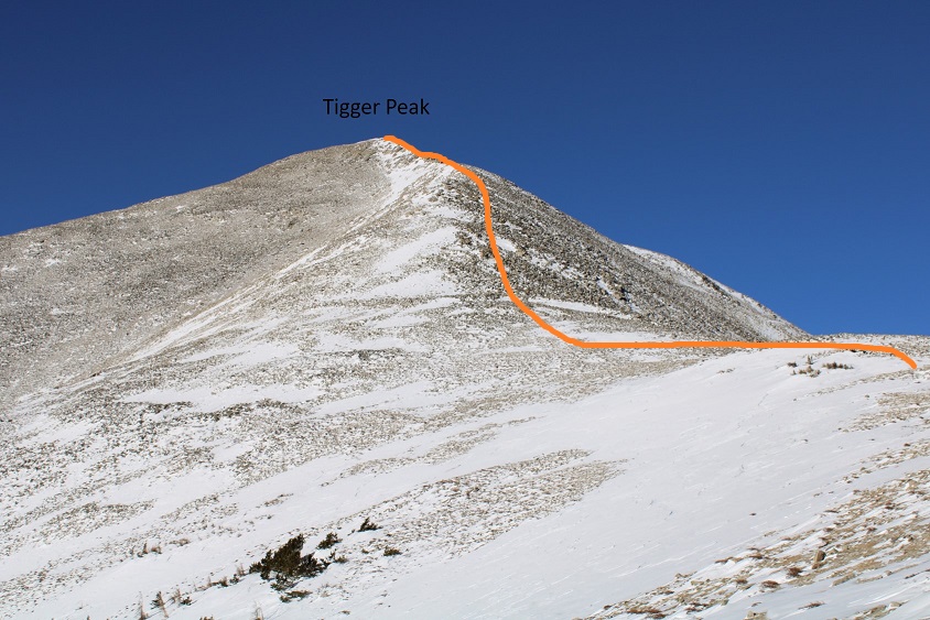
At this point, what I should have done was gone straight up and over Tigger Peak.
But the trail looked easily to follow, and the mountain looked windblown, so I continued to follow the summer route. Here’s the overall summer route
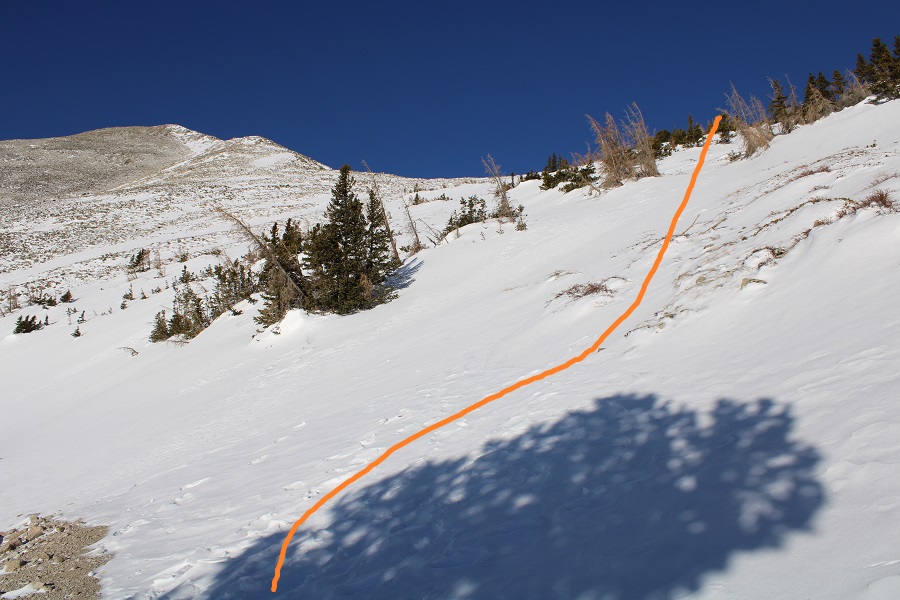
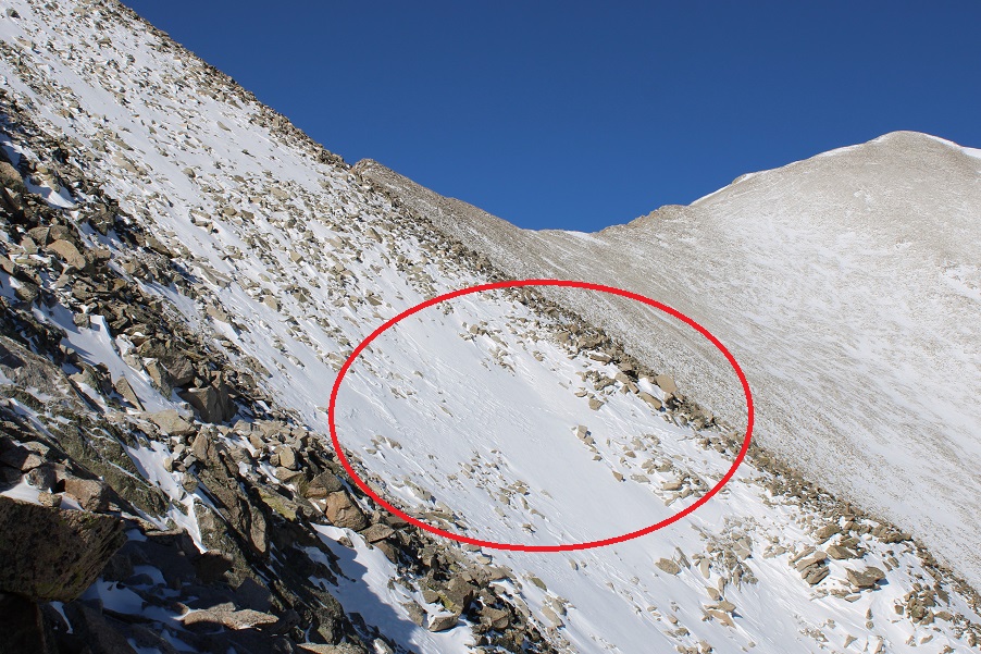
As I said earlier, I was following the mostly bare trail. I crossed a couple of slide areas without difficulty, and then came to one that gave me pause. I could see remnants of old footprints/tracks in the snow further ahead, but I did not feel comfortable crossing this section this morning, even though I had my ice axe and gear. A slip would have been too costly, especially since I hike solo.
I decided instead to change direction immediately and head south to the ridge, rock hopping to the top. Most of these rocks were large, and luckily, few of them moved. The snow in-between the rocks was troublesome at times, and I postholed to my waist, but I felt more comfortable with this route.
Once on the ridge I followed it northwest to the summit. There were several social trails here, but staying on the ridge proper, or going slightly east worked well.
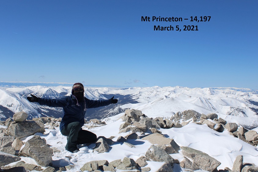
I made it to the summit at 10:45am
Mt Princeton:
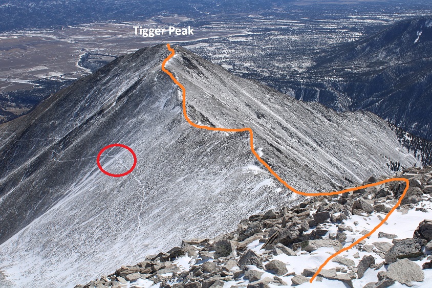
It was a gorgeous day above treeline! However, I had plans and needed to bet back down. I decided to head back over Tigger Peak. Circled is the small slide area I wished to avoid
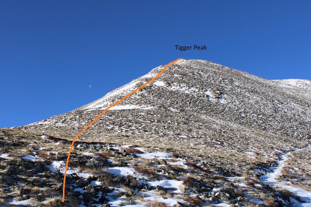
Here are some pictures of the ridge to Tigger Peak, complete with a few small false summits
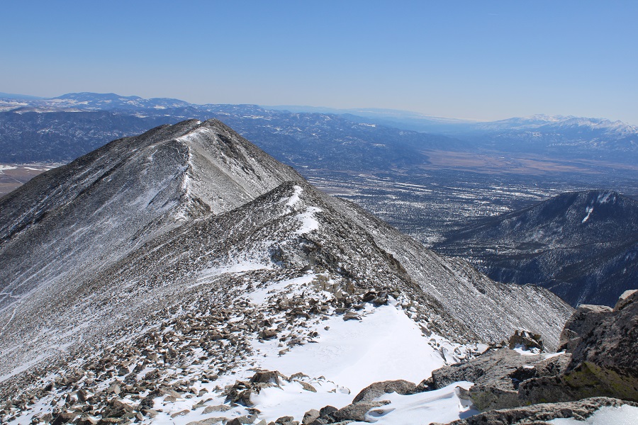
From Tigger Peak, here’s looking at the descent point
I continued hiking the ridge, and then started the longest part of my day: rock hopping back down to the trail. I just had to head northeast, and I could see the trail in front of me, but a lot of these rocks moved and progress was painstakingly slow. Here’s the route
From there I picked up the trail and followed it back to the road
And followed the road back down to the trailhead.
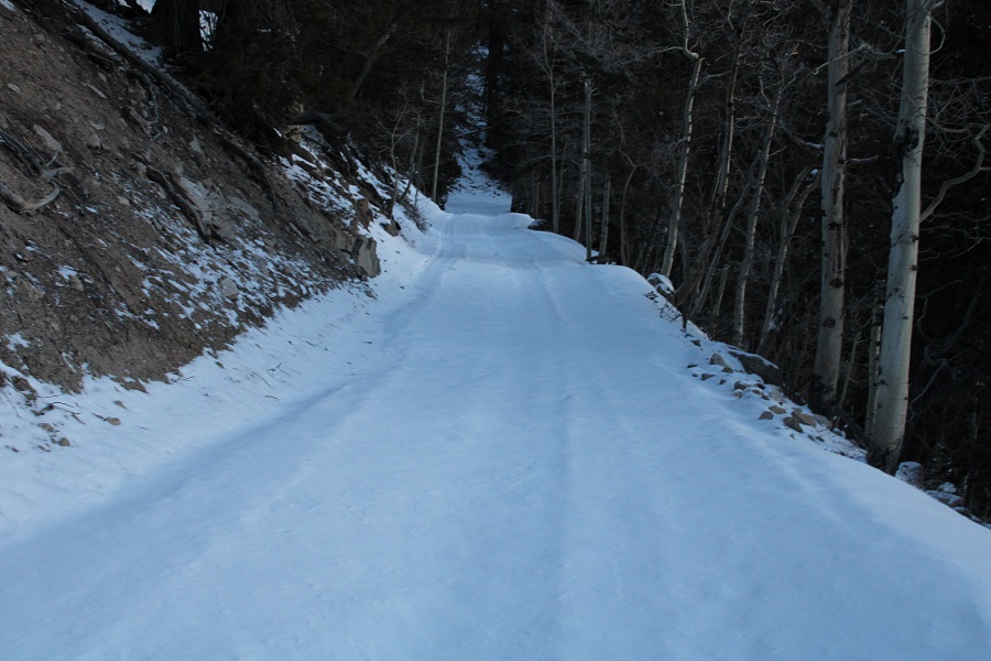
Here are some better pictures of how steep some sections on the road were
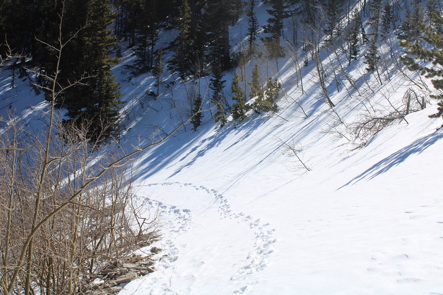
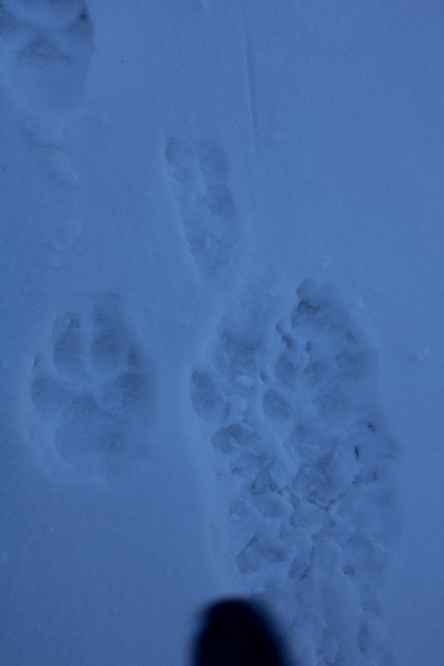
Something cool: I was the first to make prints on my way in, but on my way out I saw coyote prints following my tracks. Some of the prints were directly in my footsteps. Looks like I had a stalker.
The snow on the road became slushy as I descended.
It was downright muddy by the time I made it back to my truck
I didn’t see another person the entire day, which was a shame because it was a perfect day to be above treeline!
I made it back to my truck at 2:45pm, much later than I’d originally anticipated. Luckily, I had cell reception and could call my appointments and move them to 6pm. This ended up being a 15.4 mile hike with 5615’ of elevation gain in 9 hours, 45 minutes.
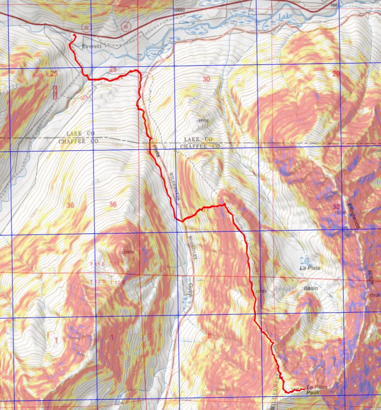
I’ve already done a detailed trip report on this route, so I’m just adding pictures and some notes/a story for today’s hike. Funny thing: It’s been almost exactly 2 years since I’ve done this hike. The end of January seems to be a good week for La Plata in winter.
I was really, really tired on the drive in, so when I got to the trailhead I decided to take a 20 minute nap before starting. I was also hoping someone else would arrive so we wouldn’t be the ones doing all the trenching: no dice. We started out at 6:30am, and were the only ones in the parking area, so we had no hopes of anyone trenching before us.
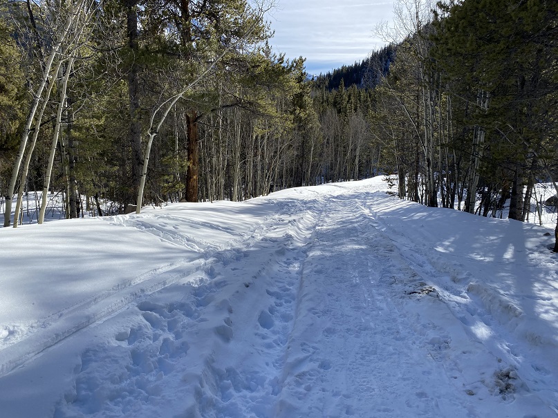
I put on my snowshoes at the truck, knowing I’d eventually need them and not wanting to take off my gloves to put them on. It was -2 degrees when we started hiking. I kept the snowshoes on for the entire hike. We started out following road 391 to the trailhead. This was a well packed down road, but not in the beginning. It looked like someone had tried to drive the snow packed road. They made it across the bridge, then obviously backed up. Funny: that was probably the hardest part of the road.
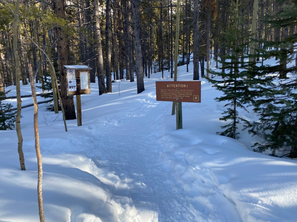
Here’s the trailhead. Note, there’s private property all around: stick to the trail
The trail was trenched! Woot! We followed the trail a short ways, and check this out: An old cabin! This is my 5th time on this trail and I’d never see the cabin before. On our way back we spent some time trying to figure out how old it was by looking at the boards, logs, chinking, etc.
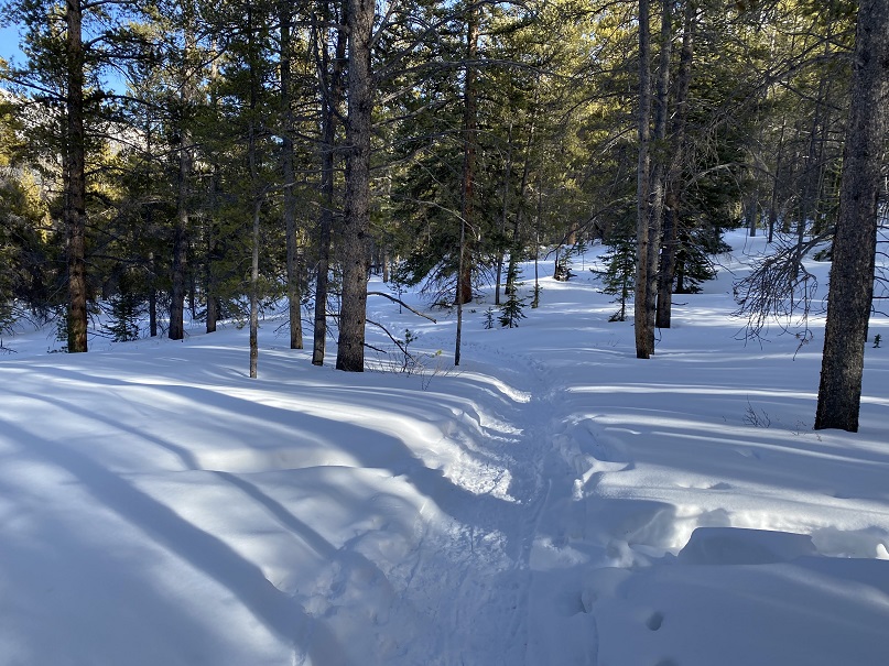
On we went, following the trench as it wound through the trees and across the log bridge/through the willows. From here, it’s all uphill.
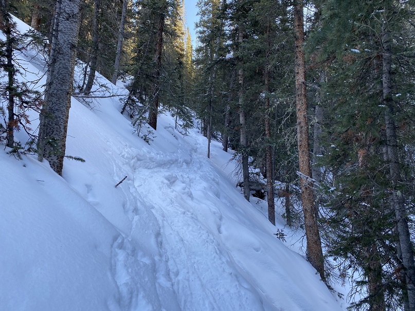
We were following the summer route, and I kept looking for a trench indicating the winter route, but we never came across one. It’s my goal this year not to let a good trench go to waste, so we decided to follow the summer route to the basin and see if we’d be able to summit this way. We hiked on some seriously steep slopes below treeline, where a slip off the trenched trail would send you sliding quite a ways into the drainage below. The trench ended as soon as we made it to the basin, so we decided to make our own trench up the ridge to the headwall. Here you can see our basic route
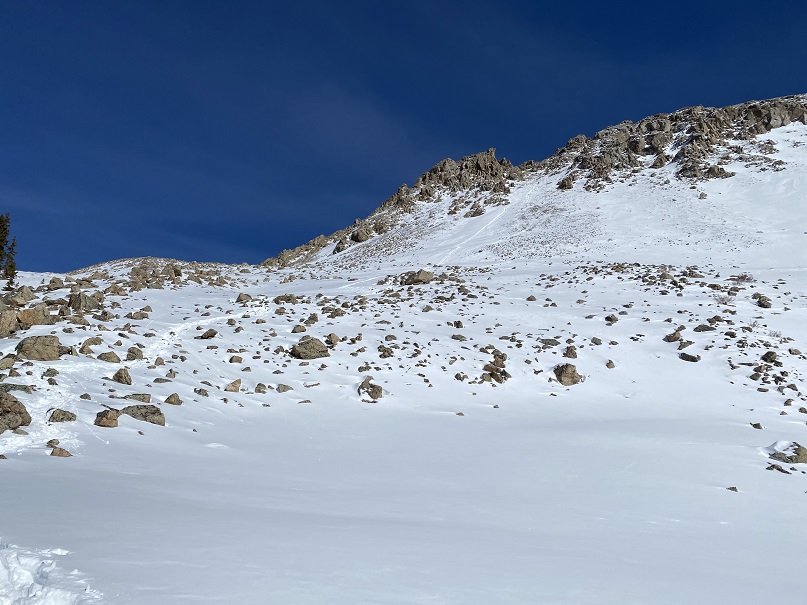
Also, I don’t recommend this route in winter: there’s avy danger. Today however we didn’t see enough snow to be worried. I’d wanted to teach SkydiverHiker how to use his ice axe, and there didn’t seem to be enough snow/ice to make it relevant on the way up. Here’s our route up the headwall.
I should also note it was really, really cold in the morning before the sun reached us. Several times we considered turning back, but in the end we knew the sun was just over the ridge: all we needed to do was make it up the headwall and we’d be fine. This part was slow going and slippery.
Once we made it to the ridge and I felt the sun warm my face I was ecstatic! Also, I screamed. Raynaud’s attacks are no fun, and now that the sun was warming my fingers and toes the blood rush felt like I was picking up a hot pan I couldn’t let go of. Not fun. Luckily SkydiverHiker is used to this and let me scream as loud as I needed without judgement.
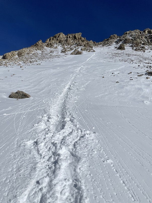
It’s a really long ridge hike to the summit of La Plata Peak. My route says about 2.3 miles of ridge work. I don’t have a lot of pictures of the hike in due to my frozen fingers, so all of these pictures are from the hike out. Here’s a look at the ridge today
We trudged up this ridge, but it was such a nice day we didn’t mind much.
I kept looking back to see if anyone was poaching our trench, but never saw anyone. Such a shame! There were some small cornices forming on the ridge. Nothing too dramatic, but we stayed away from them.
At one point we stopped to get a shadowselfie and a picture of Sayres Benchmark
We summited in bluebird conditions: no wind, no clouds, just a nice, sunny day. There were some small cornices at the top.
Here’s a summit photo and video of the summit
NE La Plata
We actually stayed for a but at the summit because the weather was so nice. The views were amazing, and demanded to be appreciated. I should have put on sunscreen, but didn’t. I have much better pictures of the route down because: warmth. Check out that ridge! Here’s the overall route.
And some step by step to the headwall
Here’s looking down the headwall
I decided to go first to blaze a trail. Here’s looking back up at SkydiverHiker, waiting patiently
I spent a long time gingerly making a nice trail for SkydiverHiker to scree surf down
SkydiverHiker decided to glissade down instead (smh). This was his first real time, as I’ve had him practice before, but never where the run out was so long. He learned first hand about hitting rocks, keeping his feet up, and how long it takes to stop once you place your ice axe. He may have rolled a few times (on purpose, of course).
The snow was getting dangerously soft: we were booking it out of there, but I got a final shot of our paths down (lots of rollerballs).
We made it back to the trench and started our hike out
This part was pleasant, but my feet were thawing out, so every once in a while I’d get a sharp pain in my toes (note: two days later, I’m still having pain. Raynaud’s sucks). We saw our first people of the day; snowshoers who were just following the trench as long as it went. We let them know they had another 20 yards or so to go, and continued on our way.
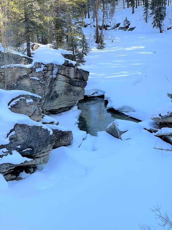
We took some pictures of Lake Creek as we crossed
And made it back to my truck at 3:15pm, making this a 10.93 mile hike with 4620’ of elevation gain in 8 hours, 45 minutes.
Some final thoughts: It was a shame we were the only ones on the summit today, as it was a beautiful day. Also, if possible, take the standard winter rout that goes up the ridge sooner: our route had more avy danger than is recommended.