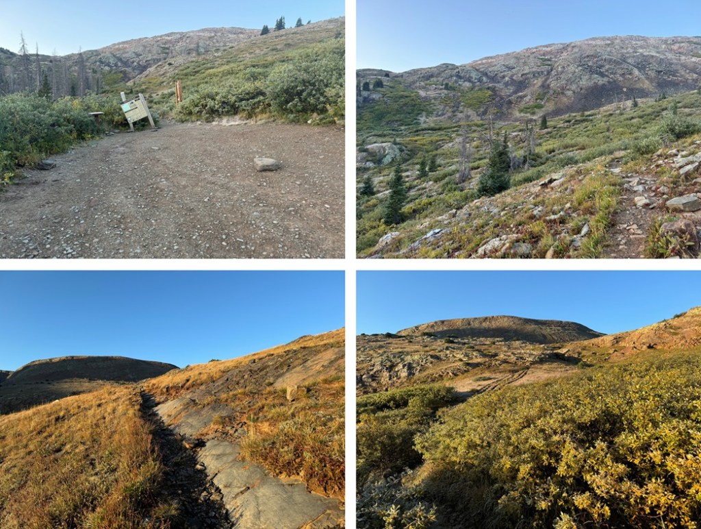
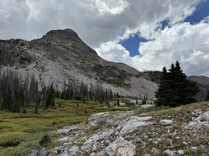
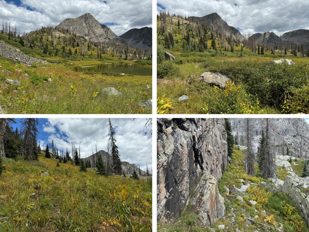
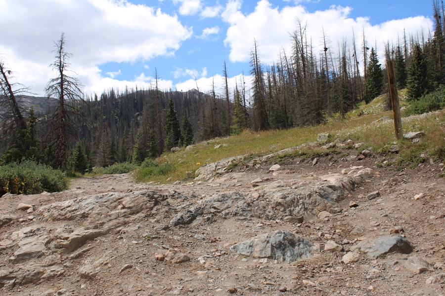
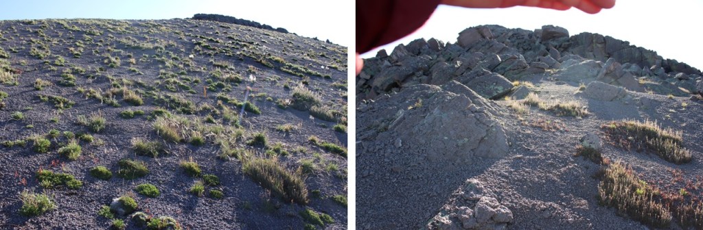
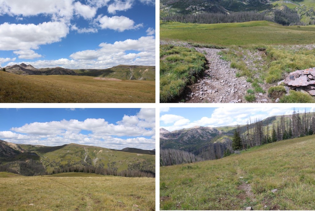
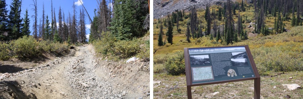
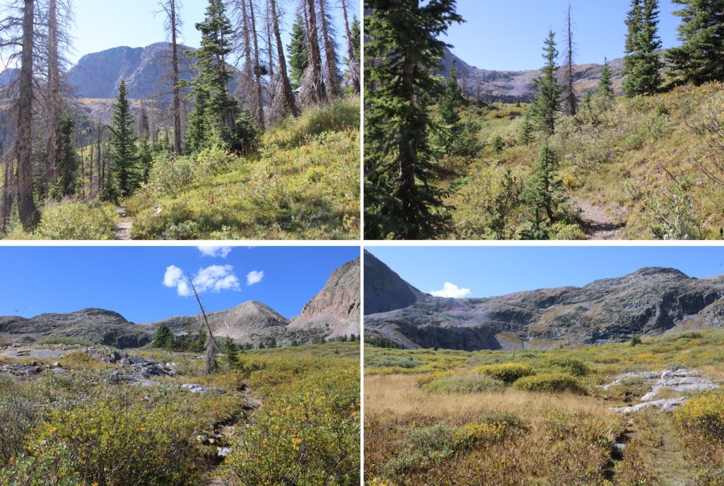
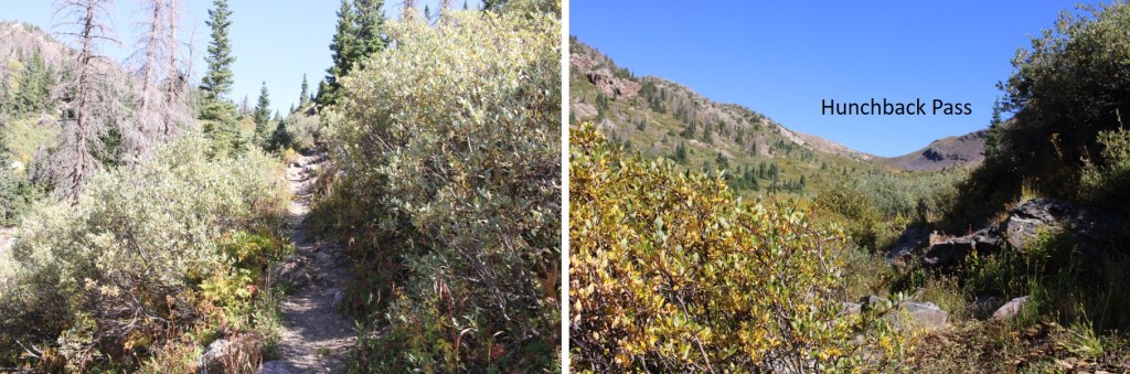
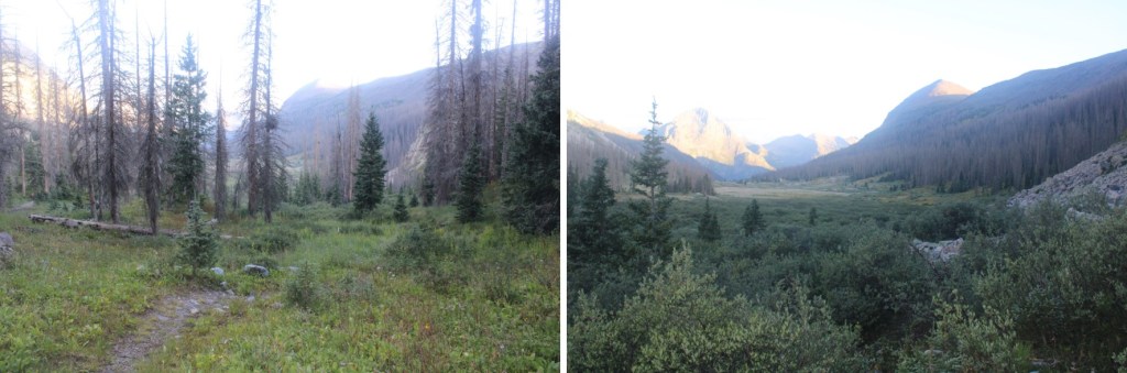
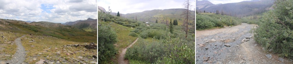
I was up and following the 4WD road towards the Hunchback Trailhead at 6:30am. It was cold because it had rained the night before, and everything was covered in a film of ice. I followed the road for 1.5 miles to Hunchback Pass Trailhead.
I then followed the trail another 1.5 miles to Hunchback Pass
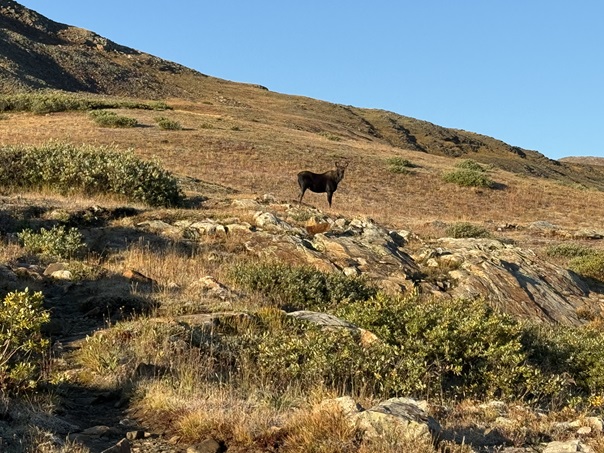
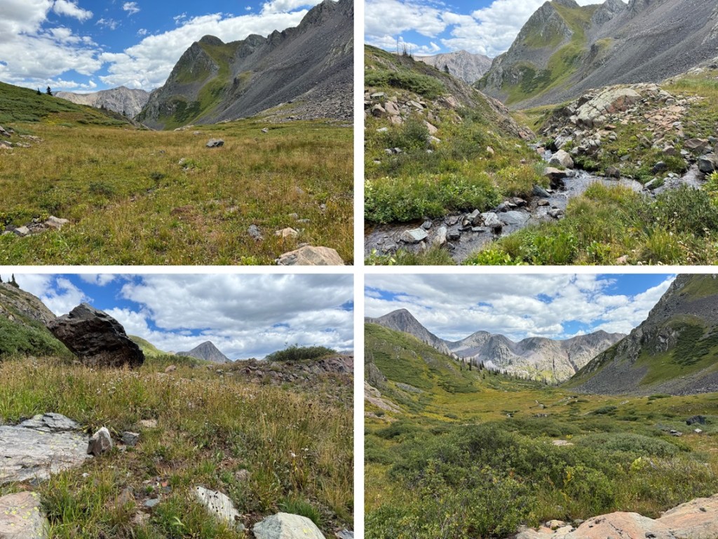
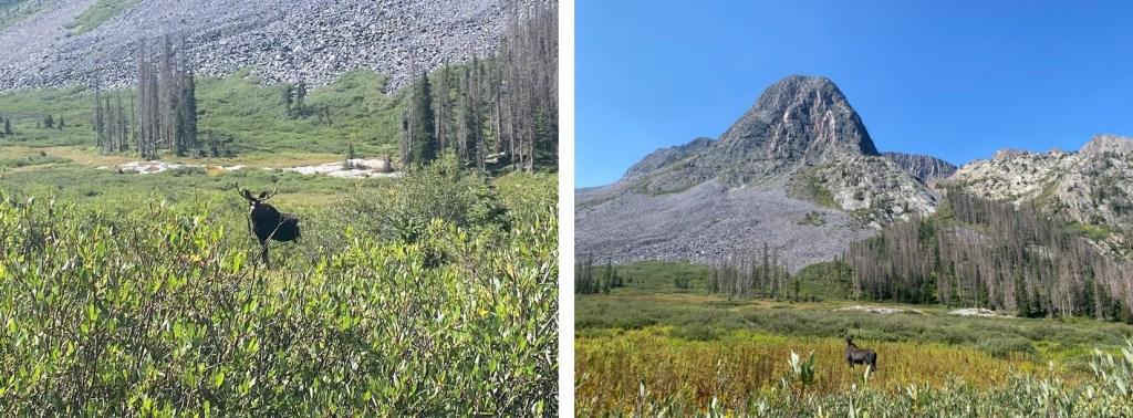
Oh, and I saw a moose along the way. Well, actually two moose, but the male got scared and ran away before I could get a picture. The female wasn’t too bothered.
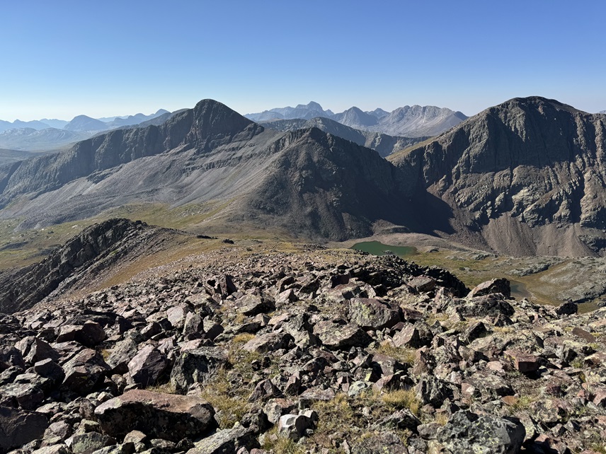
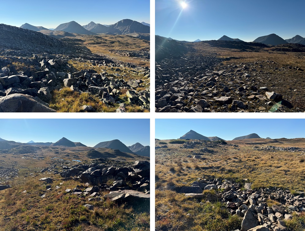
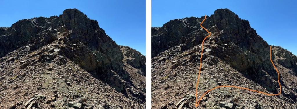
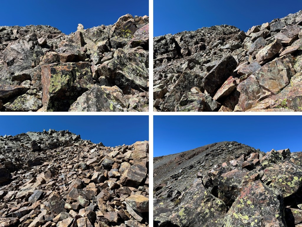
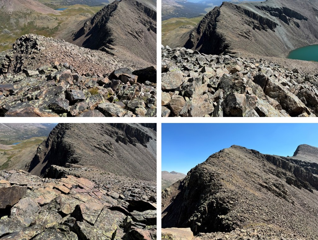
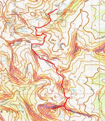
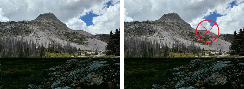
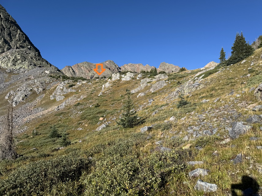
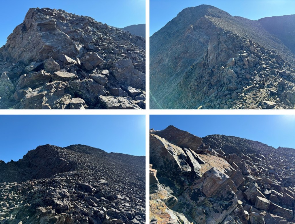
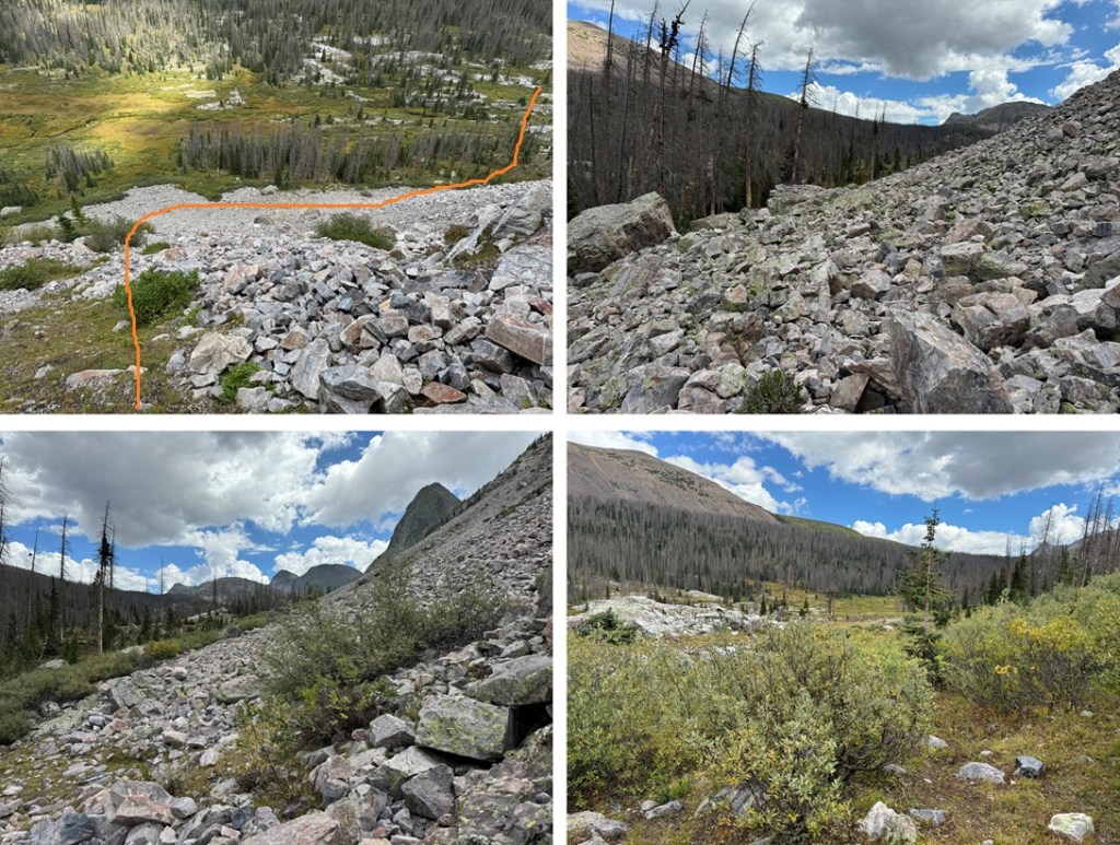
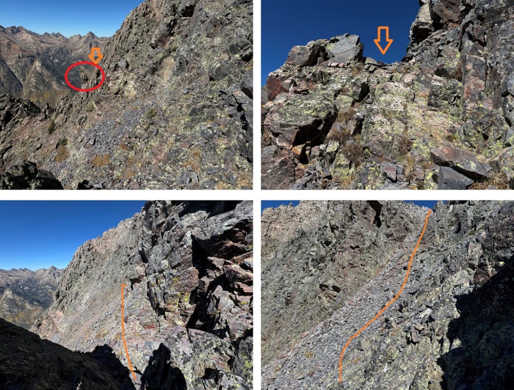
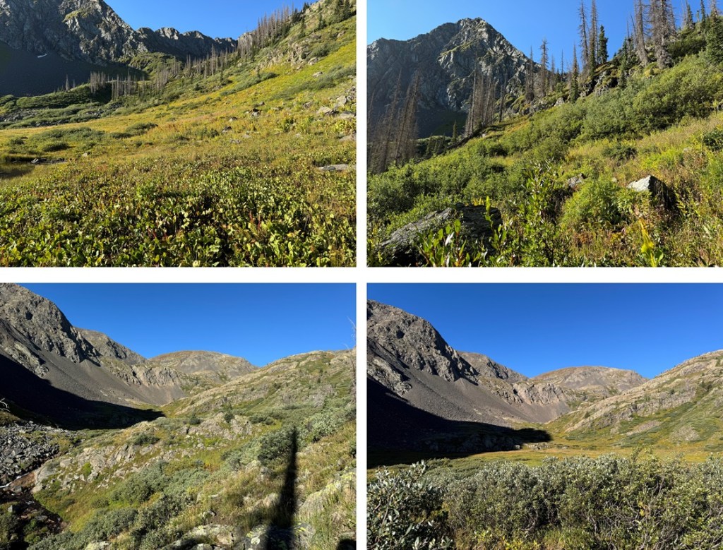
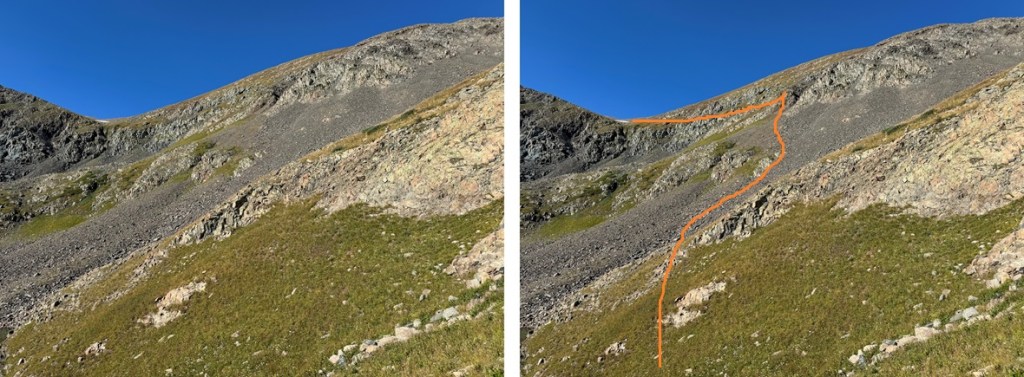
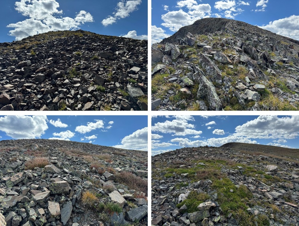
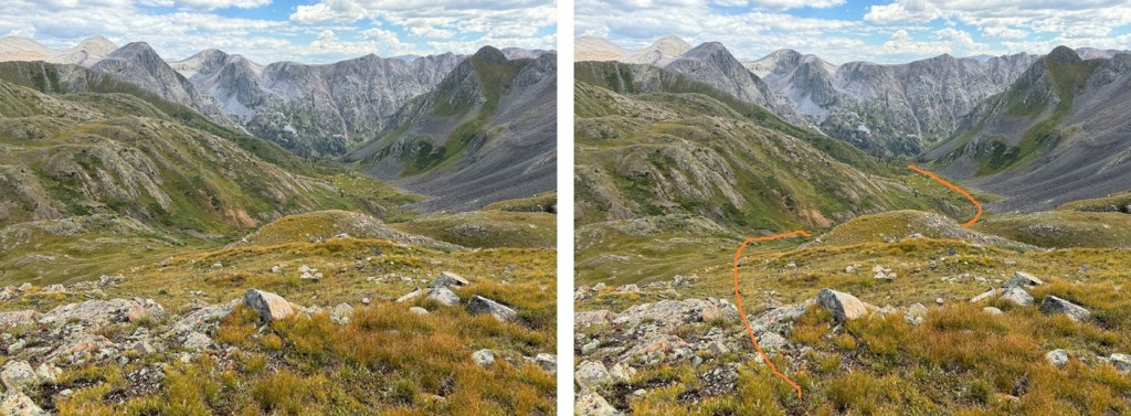
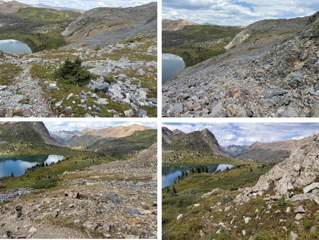
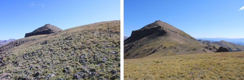
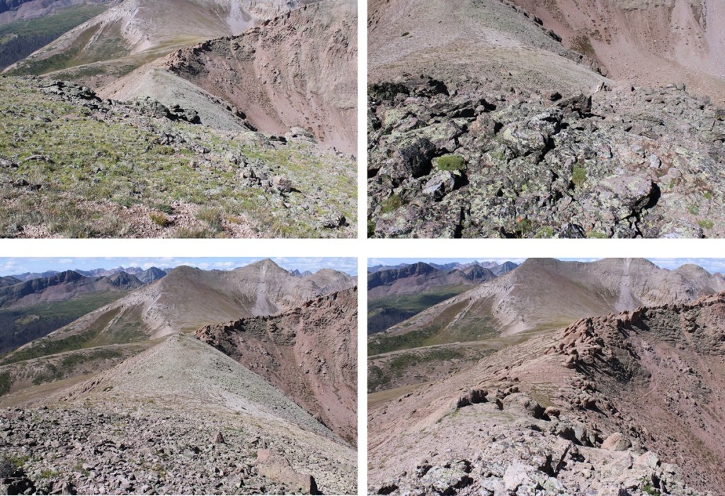
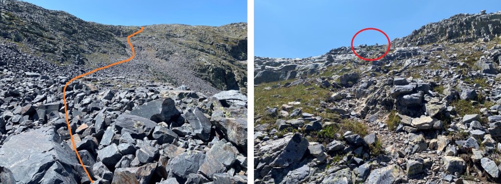
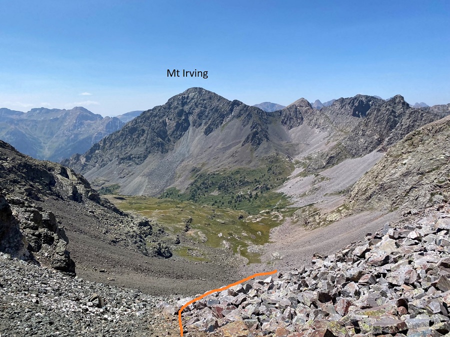
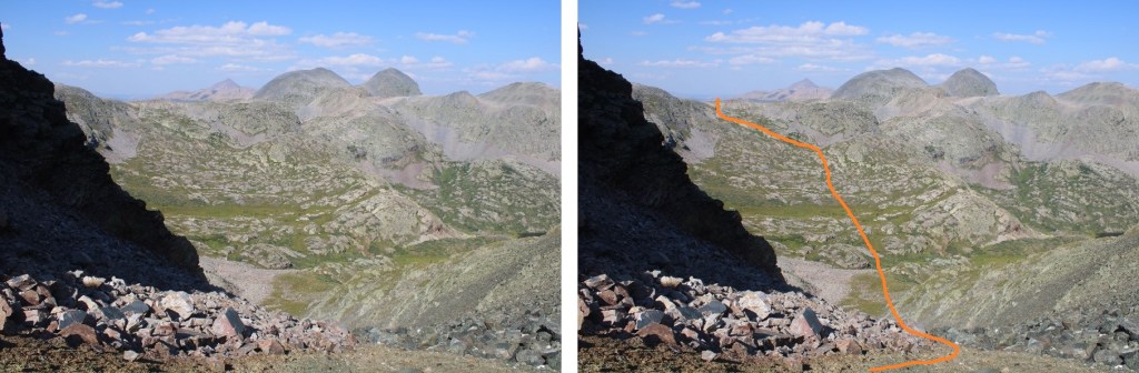
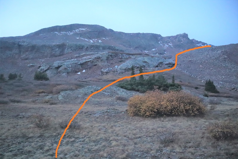
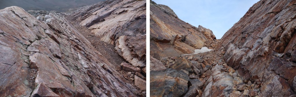
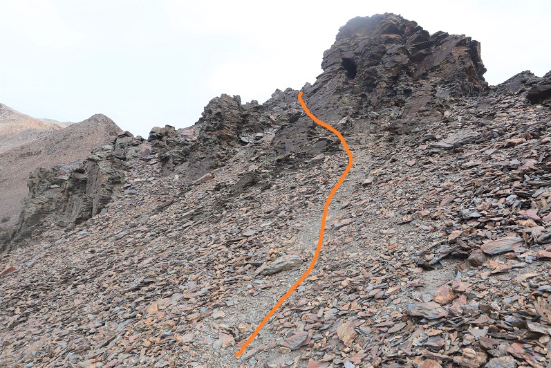
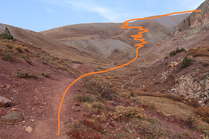
Once at Hunchback Pass, I turned left, and followed the ridge south, then southeast. Here’s the general route I took. This is choose your own adventure, and this morning I went slow because the rocks were icy.
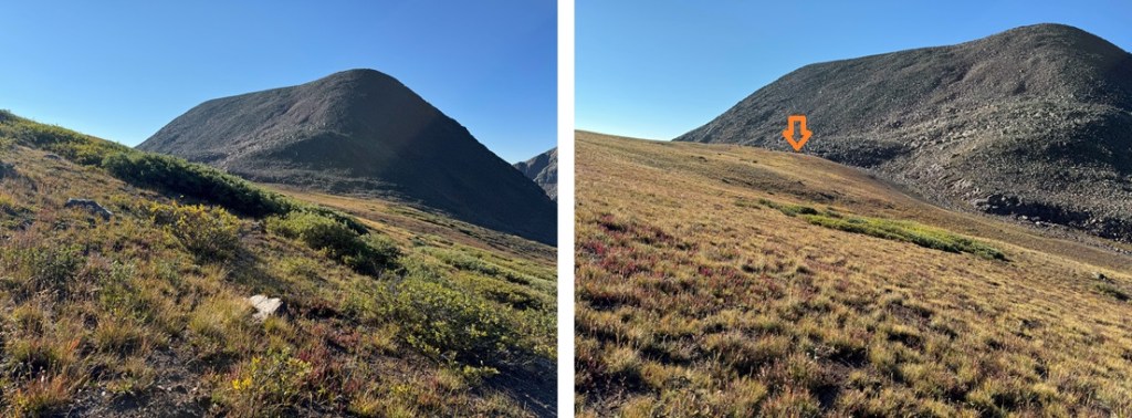
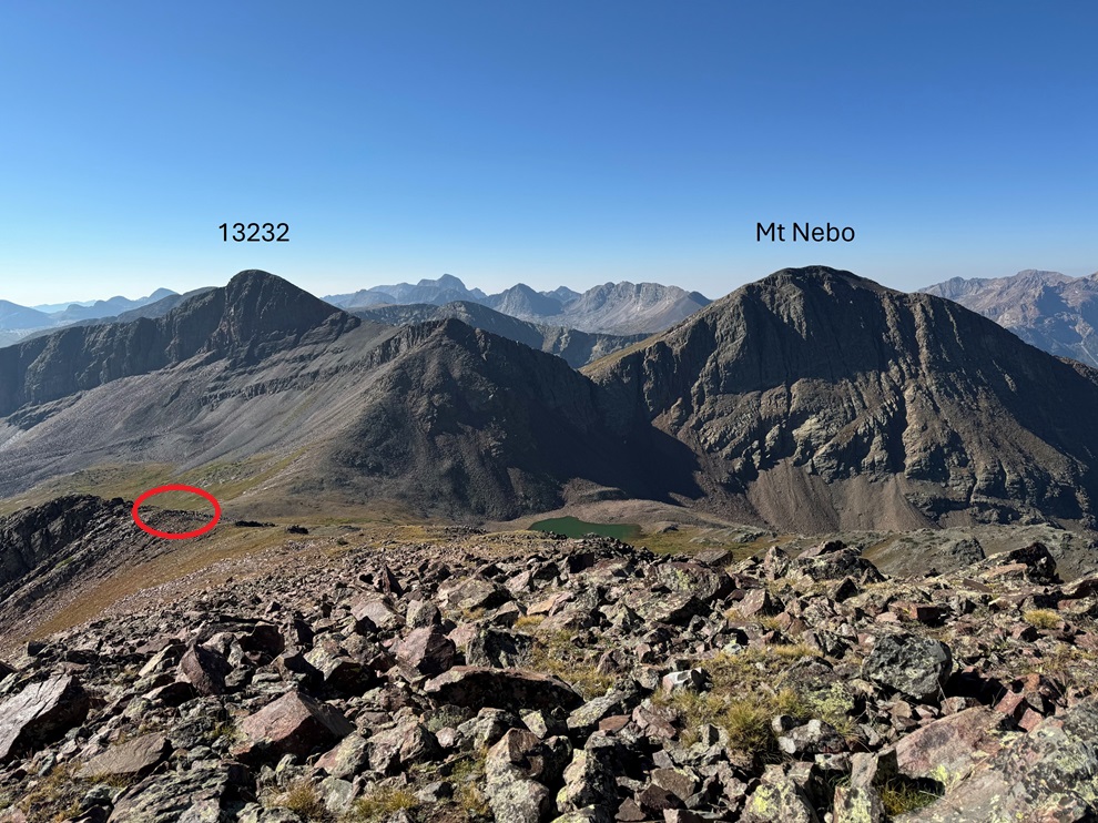
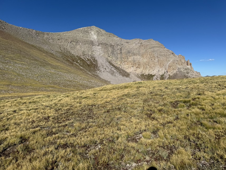
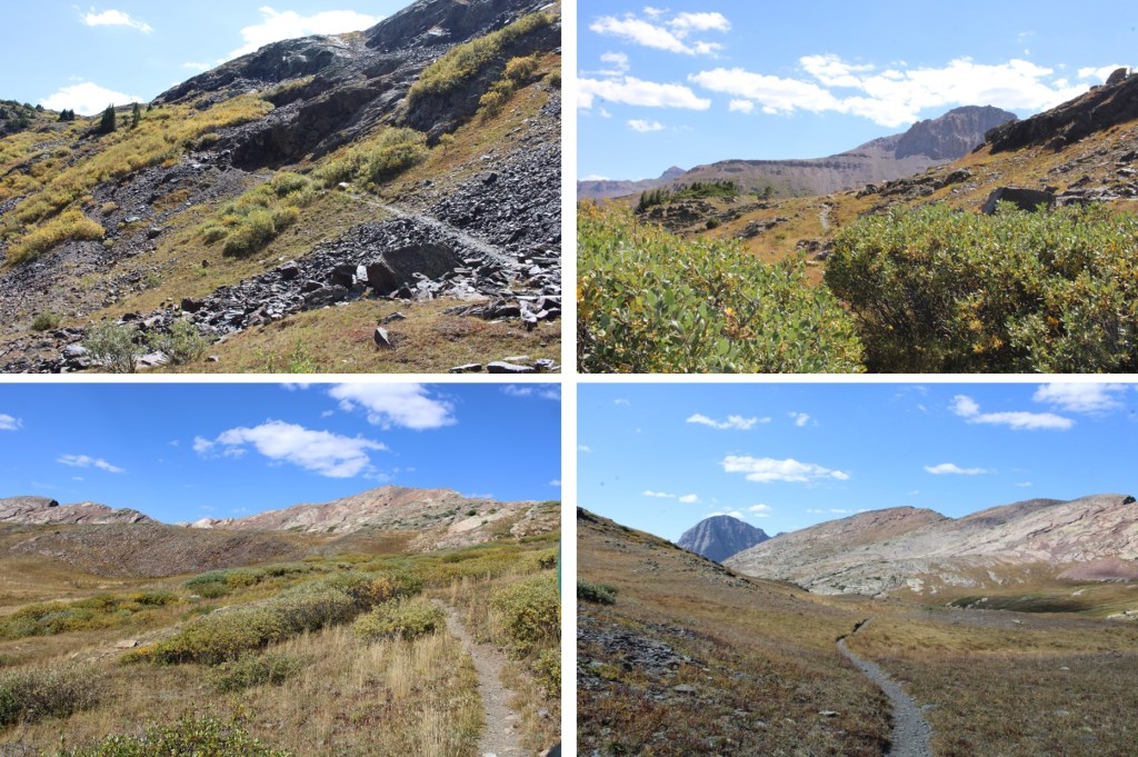
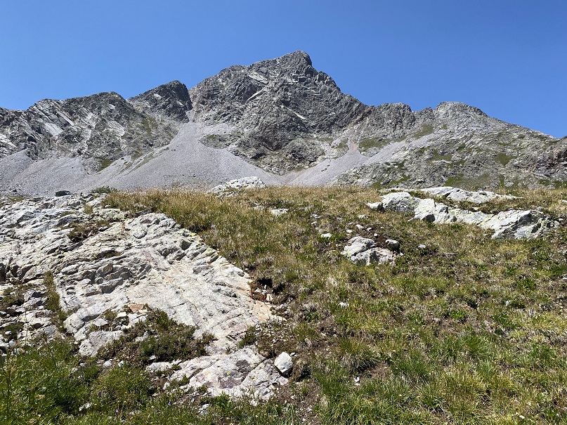
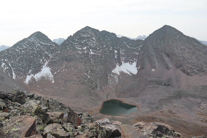
At the top of the ridge I could see PT 13121, Mt Nebo, and PT 13232 in the distance. I followed the tundra towards PT 13121. If you are following my GPX file, you’ll notice it’s a little erratic here. That’s because my compass kept doing crazy things. Just keep heading towards the base of 13121.
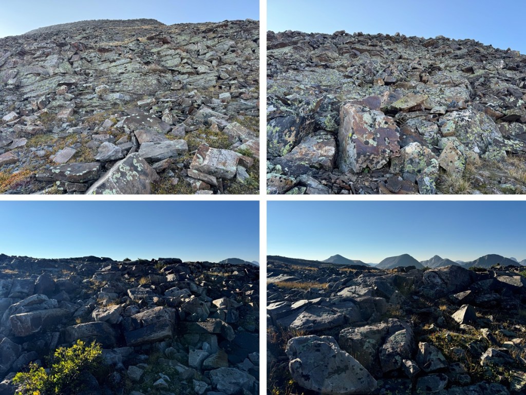
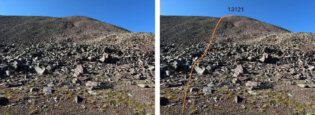
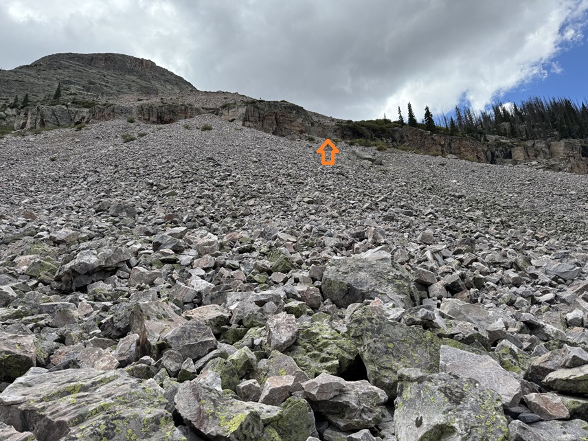
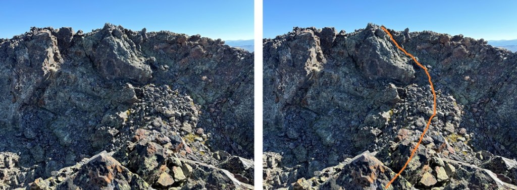
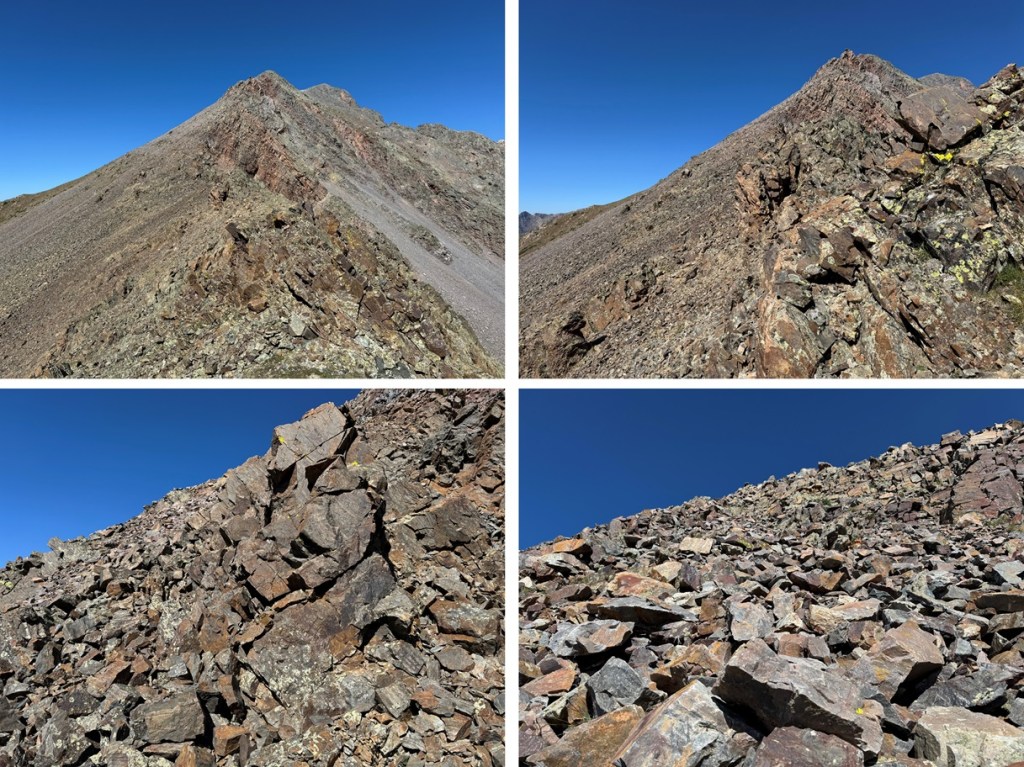
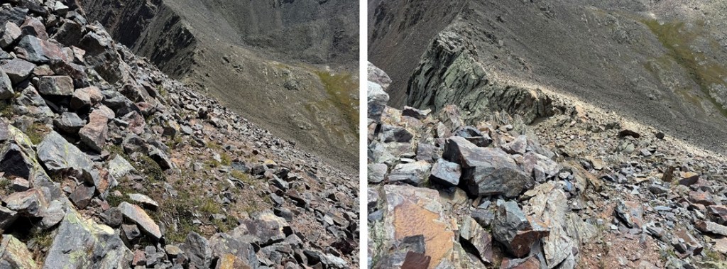
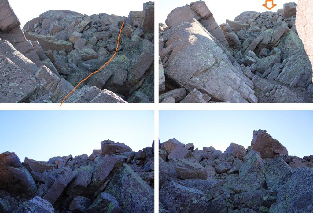
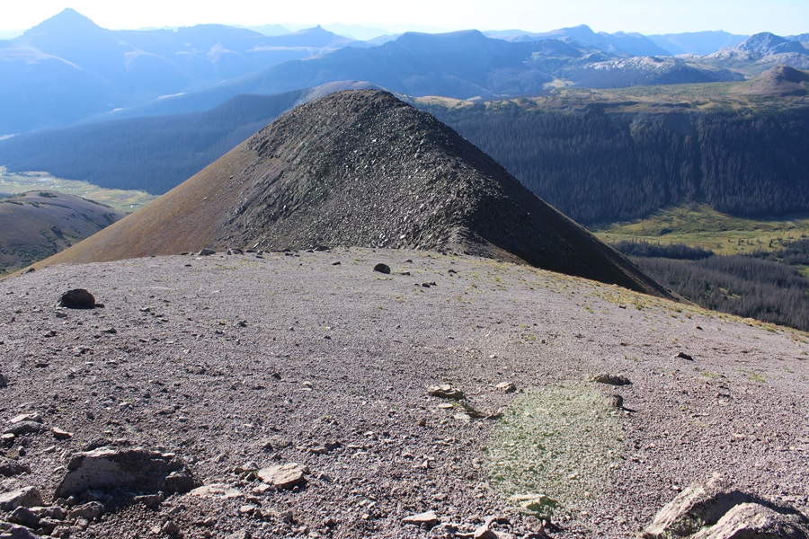
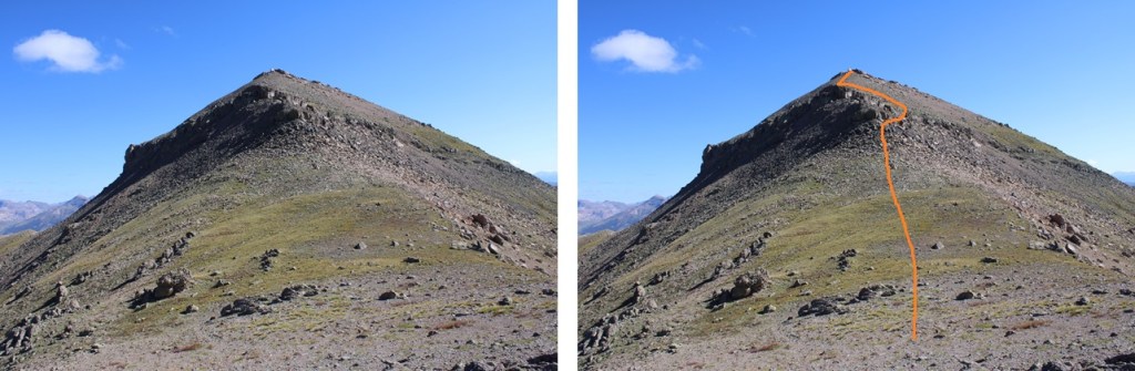
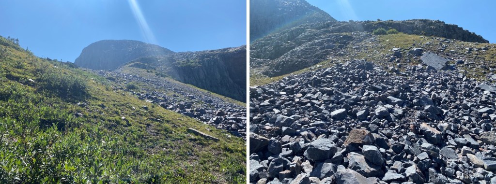
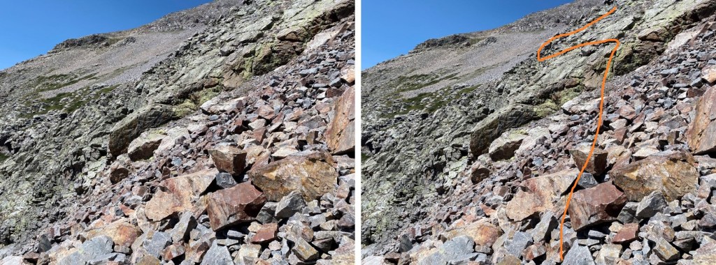
From the base of PT 13121, I headed south on the rocks towards the summit. I would gain 400’ in .2 miles to get to the ridge. The rock here was loose and steep and not fun to climb at all. If you have the option, I’d summit this peak from the way I descended. However, I did not do that, so here is my route, and a few pictures of the rock mess towards the ridge.
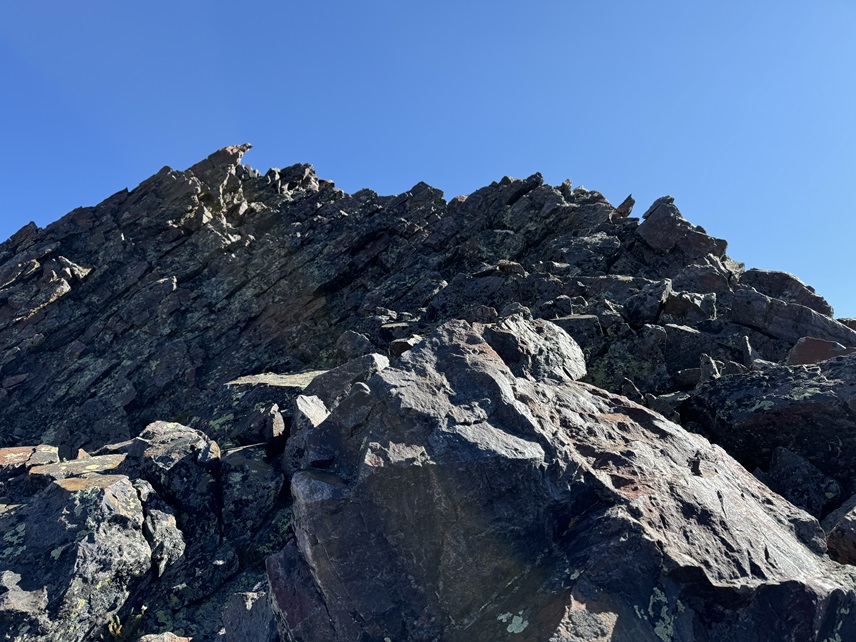
When I made it to the ridge I turned right, and walked the short distance to the summit
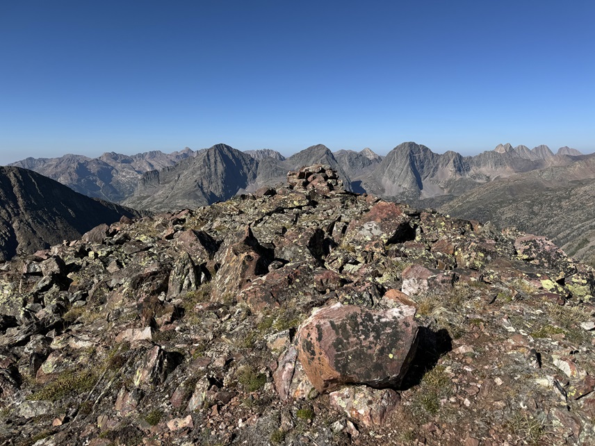
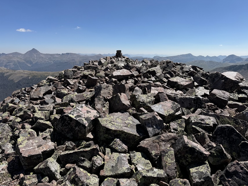
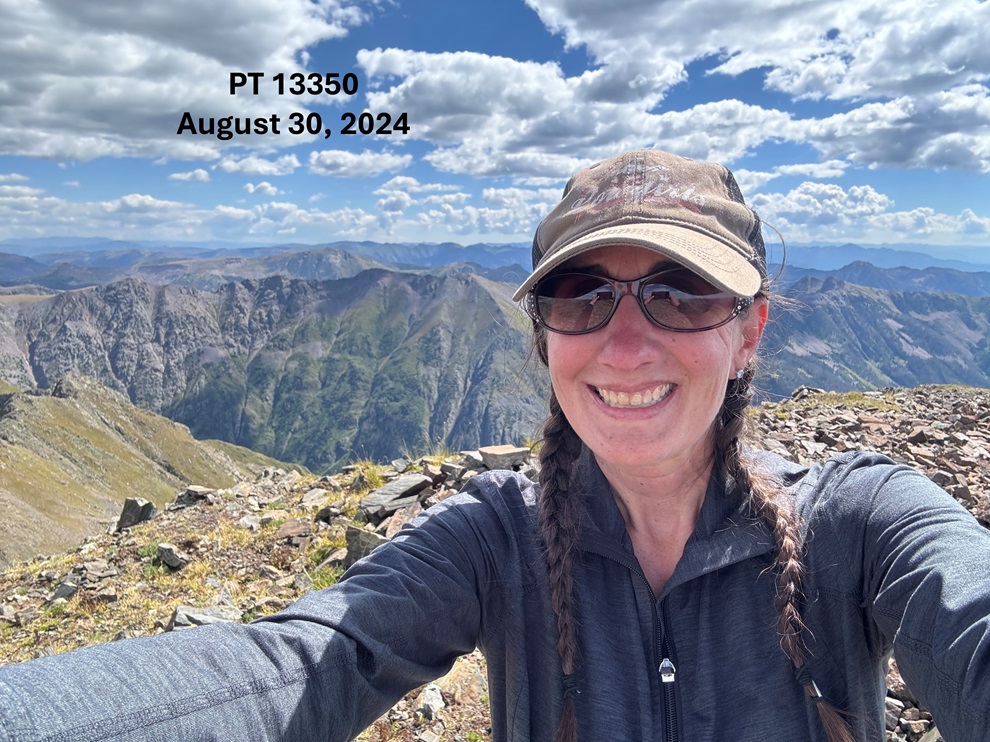
I summited PT 13121 at 9:40am
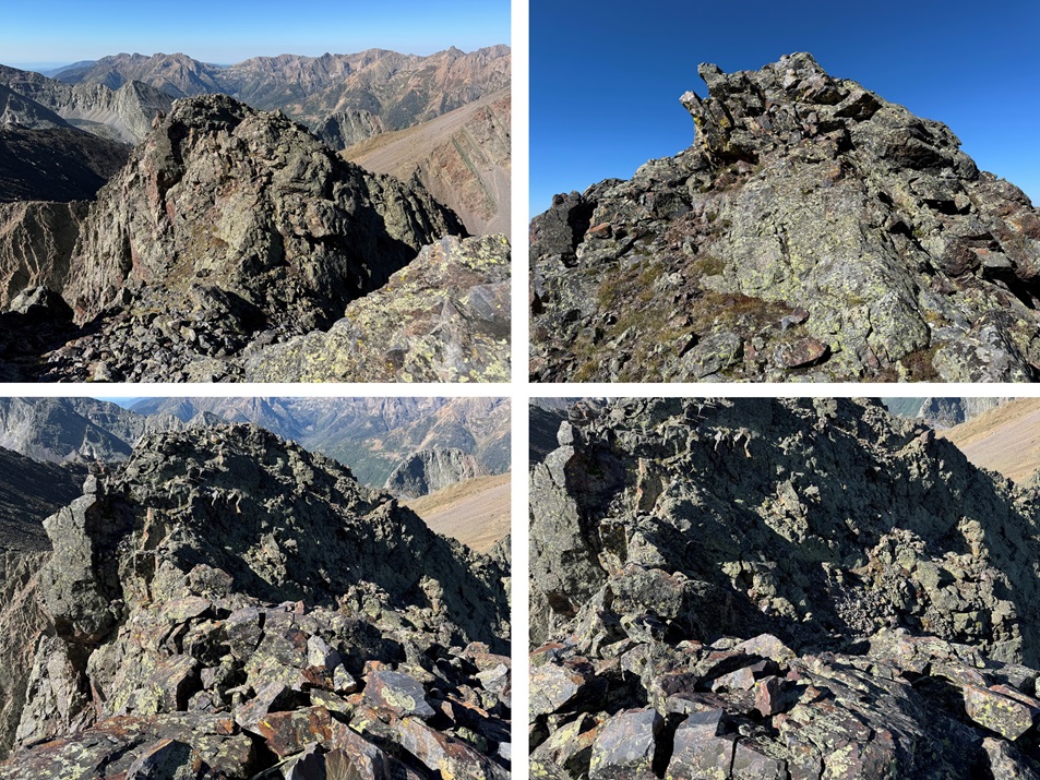
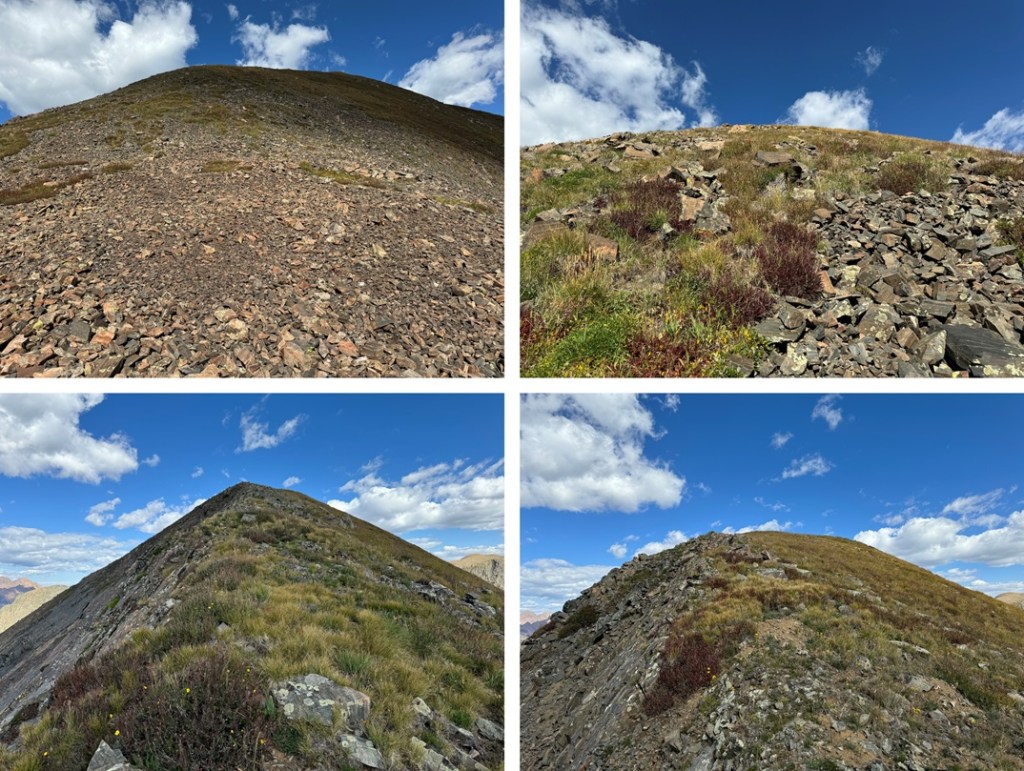
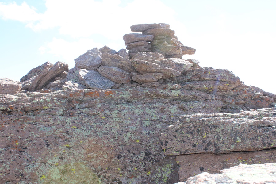
PT 13121:
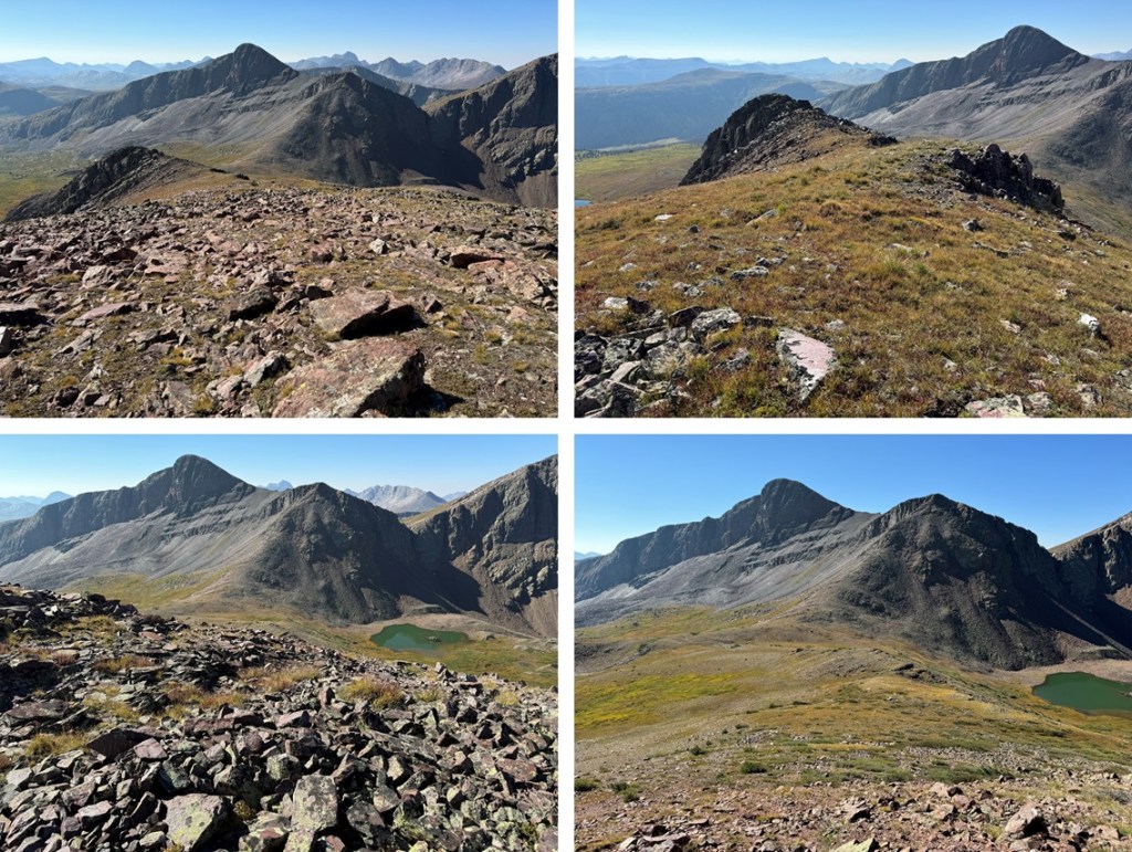
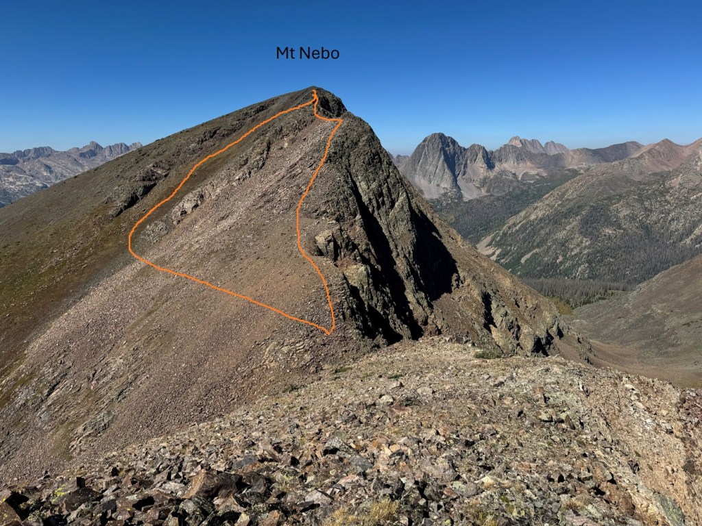
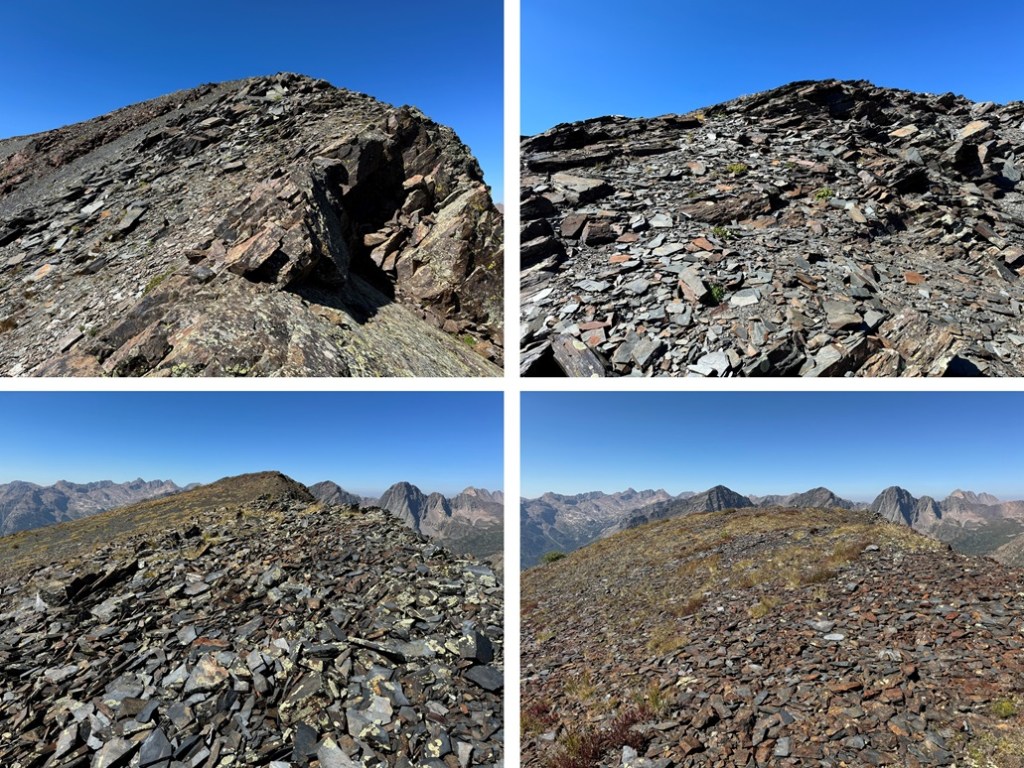
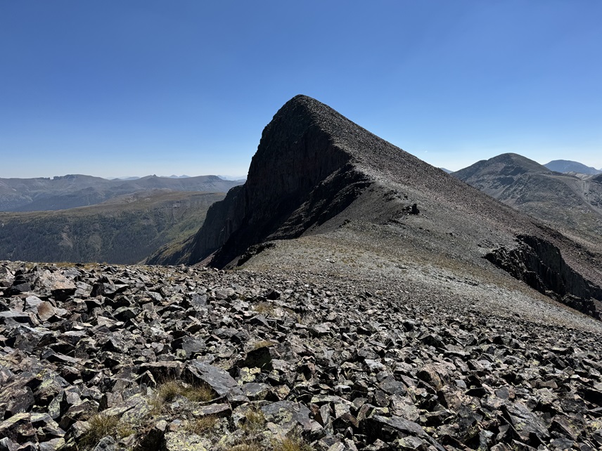
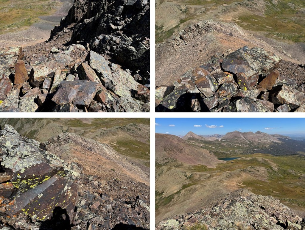
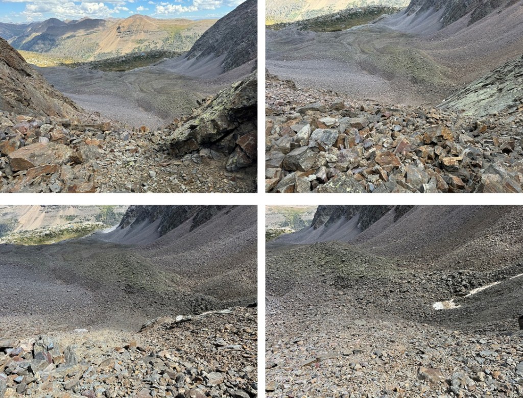
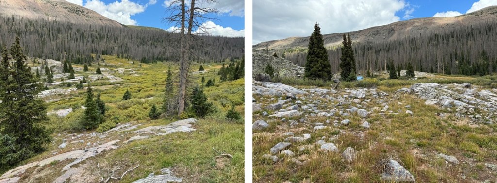
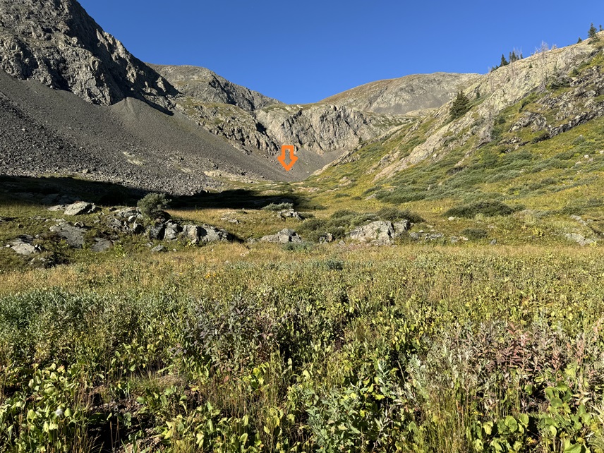
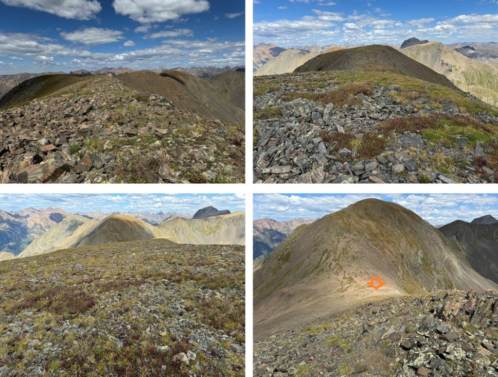
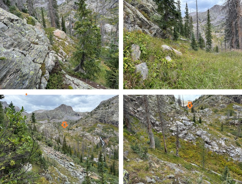
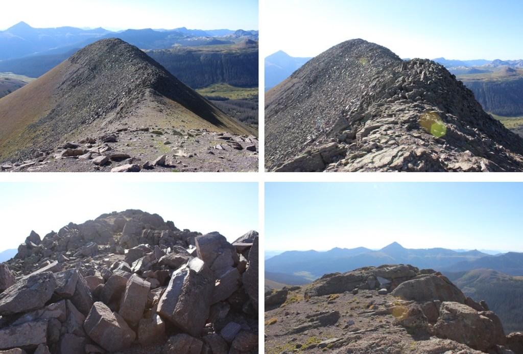
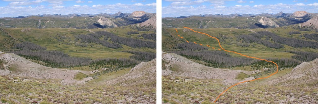
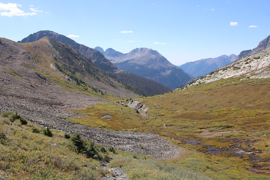
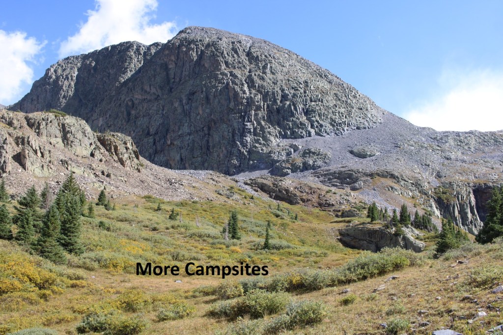
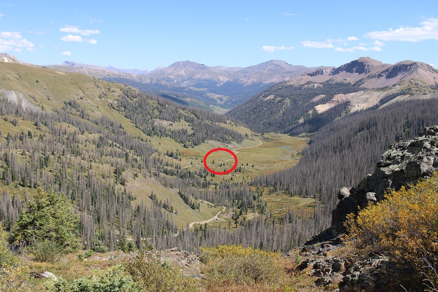
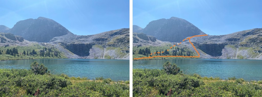
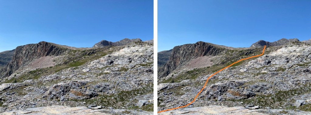
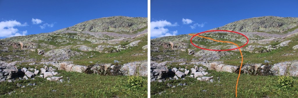
I could see PT 13232 and Mt Nebo to the south. I descended the rocky and tundra ledge towards the PT 13121/Mt Nebo saddle. Circled is where I set up camp for the night. That’s where I was headed. It’s adjacent to the CDT.
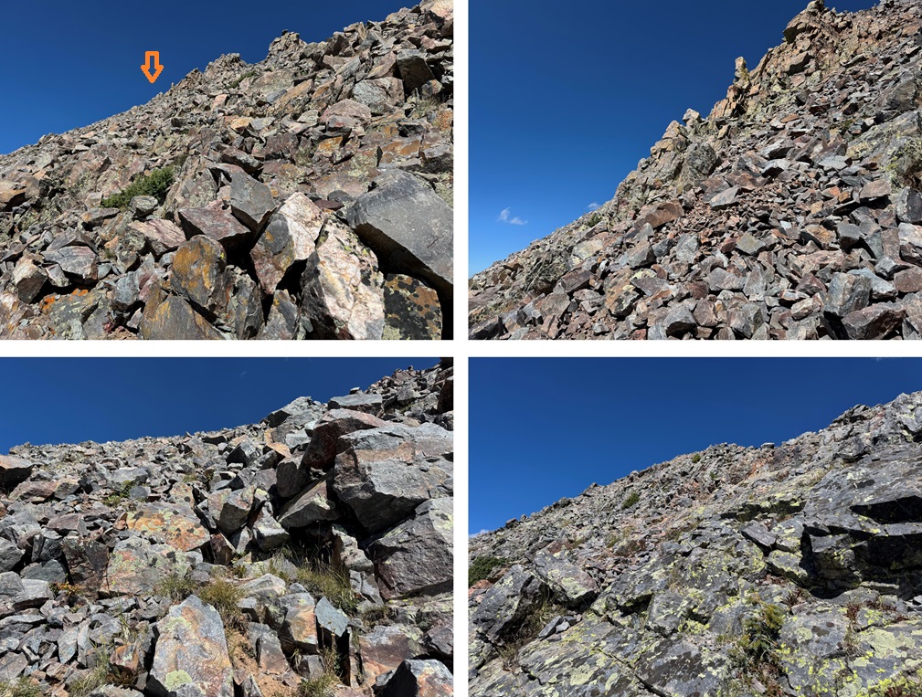
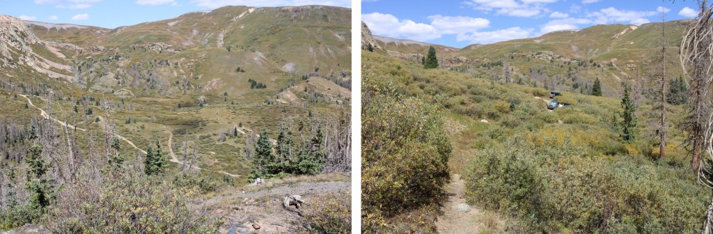
I took some time to set up my tent, then I was on my way again, headed up this ridge
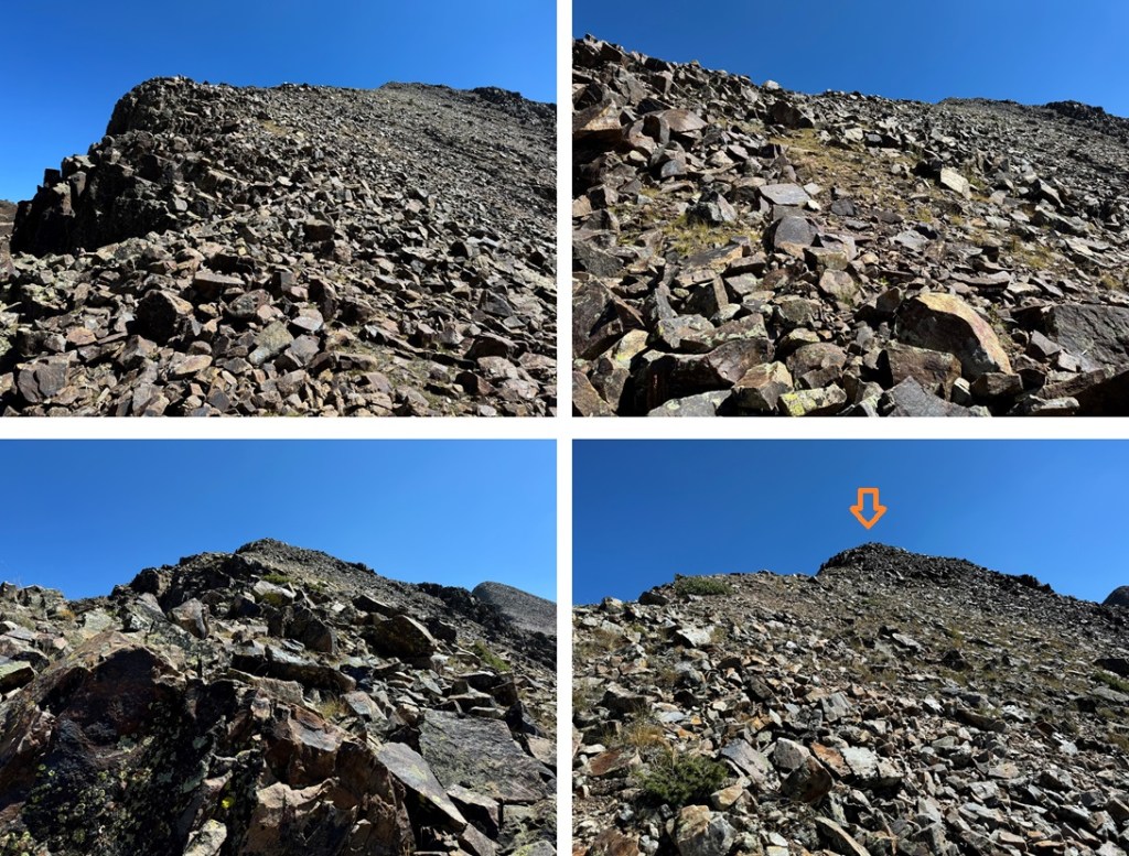
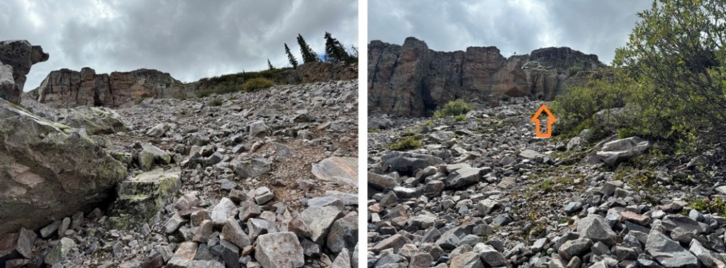
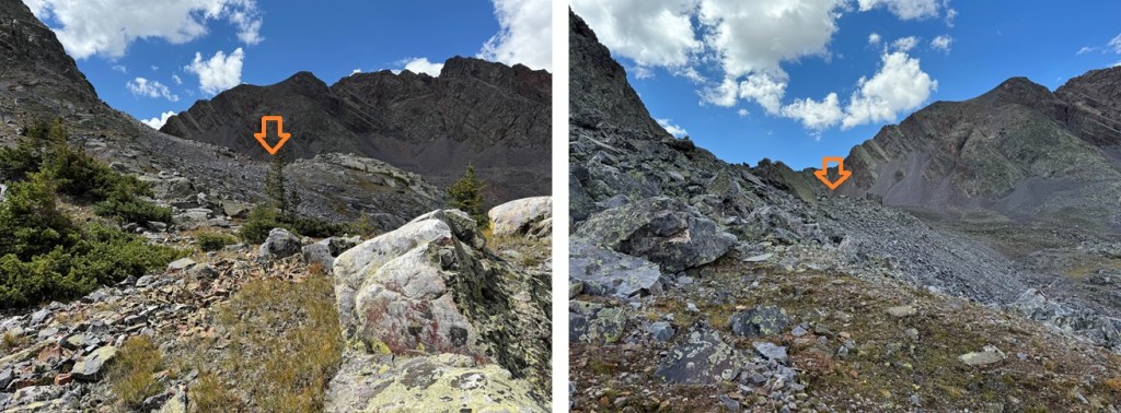
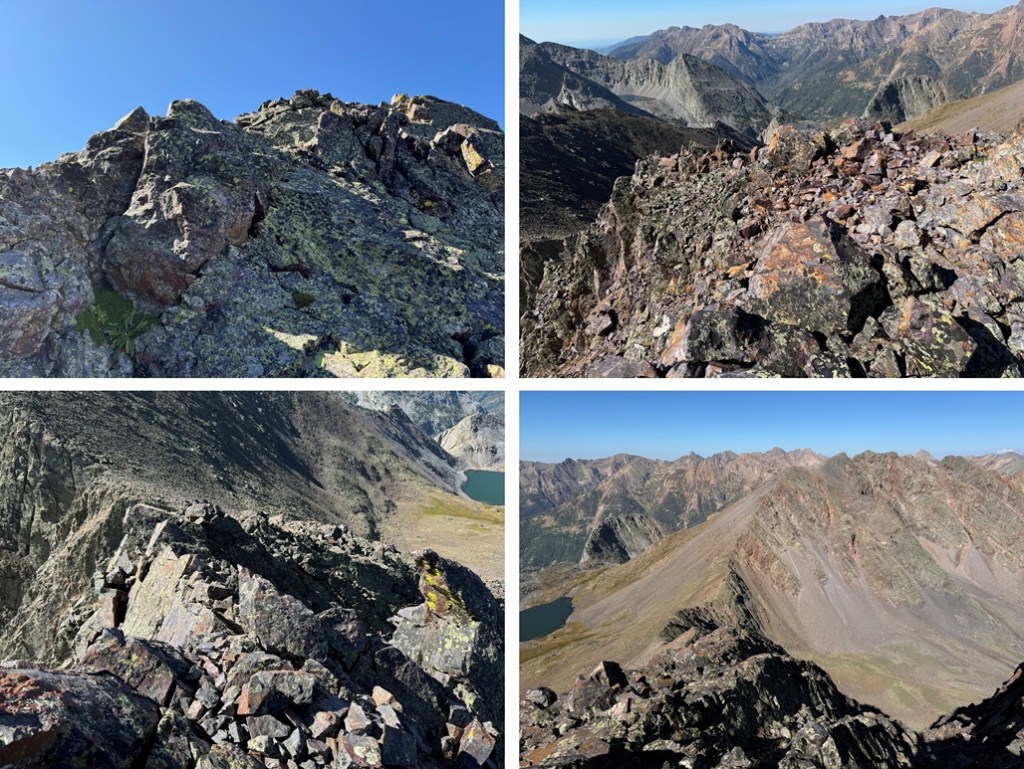
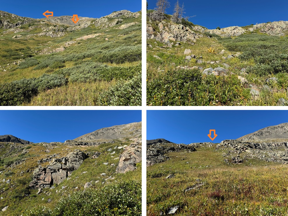
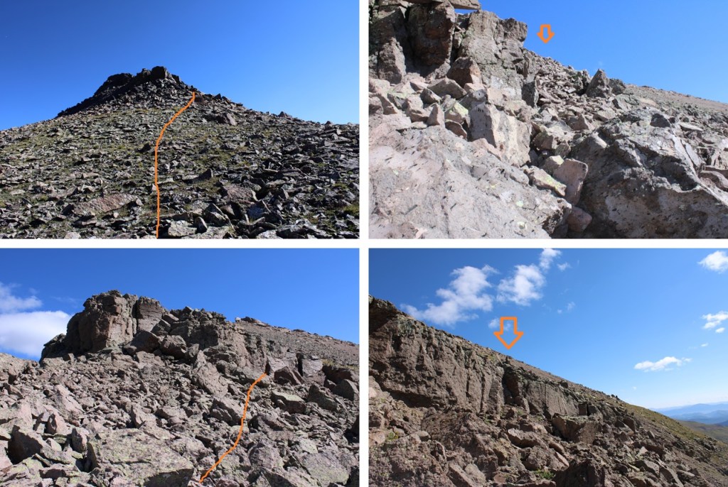
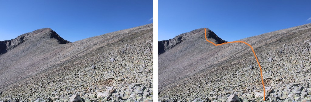
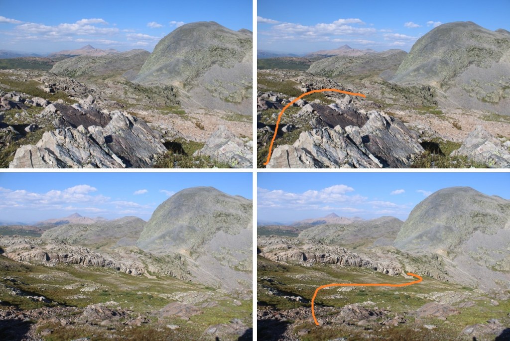
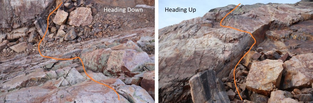
There was a lot of scree and talus here, but it’s all class 2+. There’s a bulge in the middle I skirted to the right, then headed back to the ridge proper, and towards the top you can go either to the left or the right, and I chose right for the way up (towards Nebo), and left on the way down.
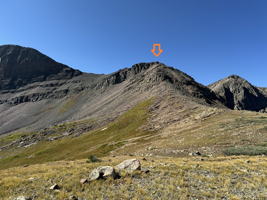
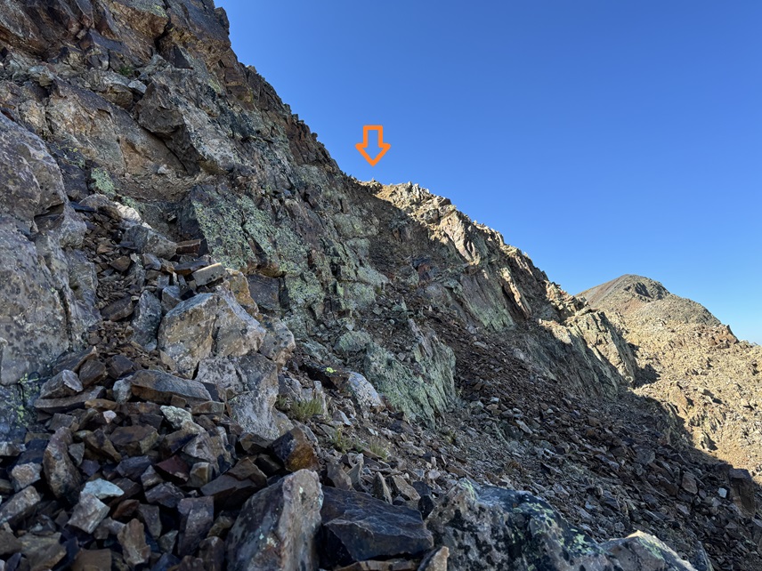
Here’s the option to go either right or left. Both class 2, but the left is on more solid rock.
I chose to go right (there’s a cairn where the arrow is)
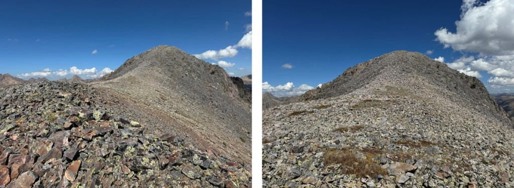
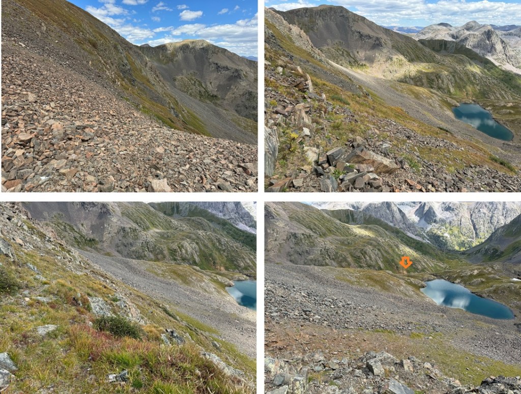
From here I could see Mt Nebo to the west
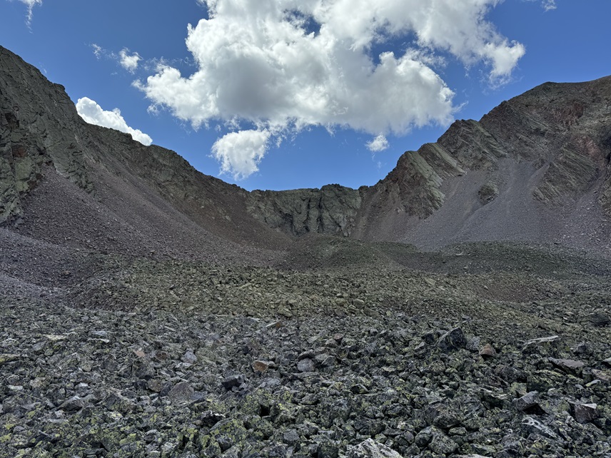
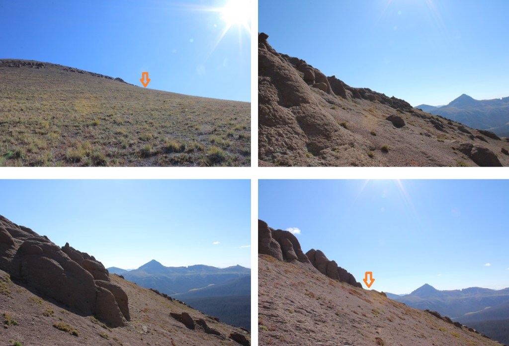
I needed to make my way towards the saddle, but now is a good time to choose your route, You can go up the tundra that turns to talus on the left, and keep this route 2+, or you can take the ridge to the right, which goes at difficult class 2, maybe some easy class 3, and includes a lot of rock/boulder hopping. I chose to stick to the ridge.
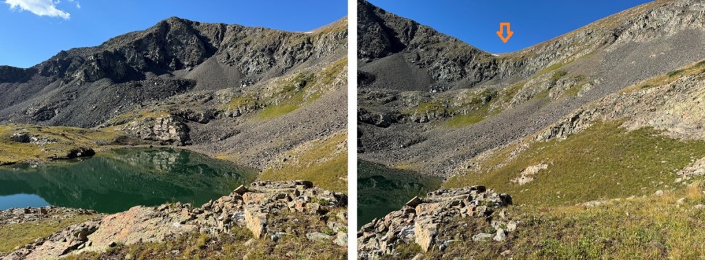
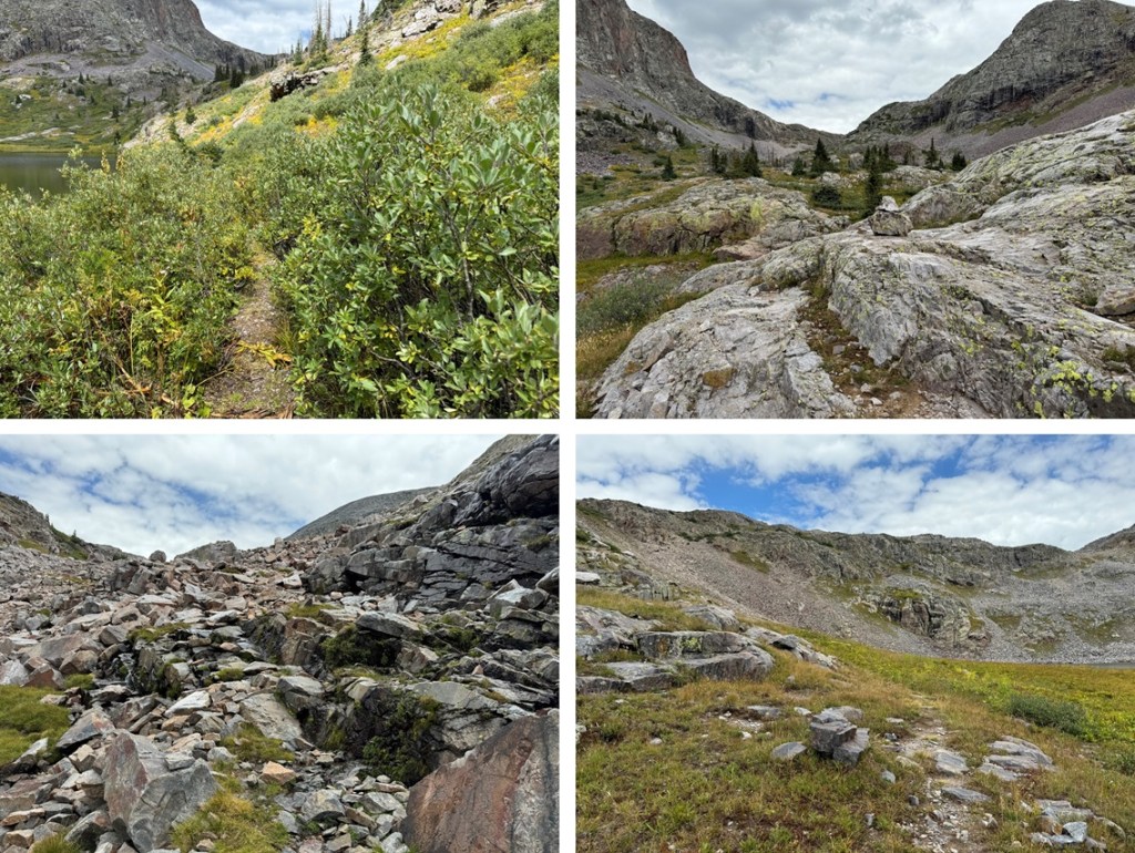
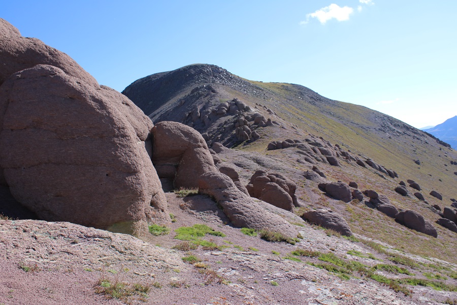
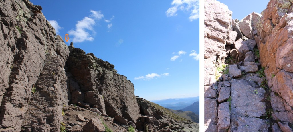
But first, descending down to the saddle. This was rocky, but class 2. From the saddle, here are some pictures of the route up the ridge towards the summit
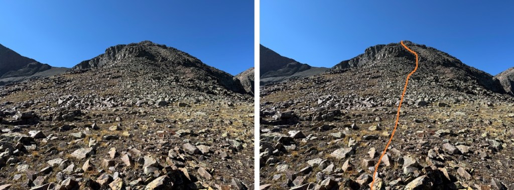
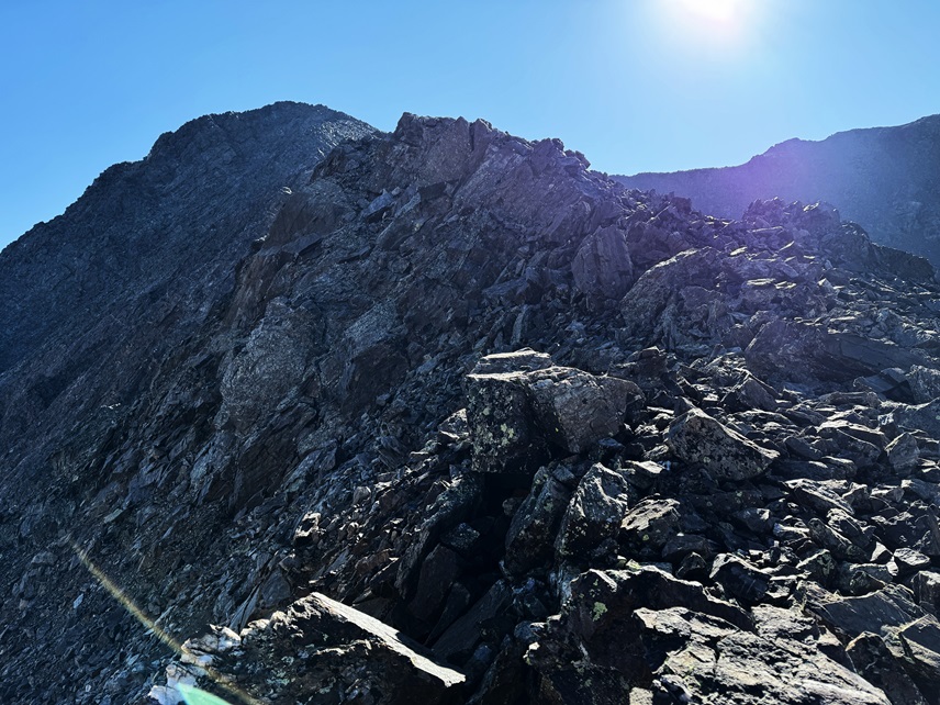
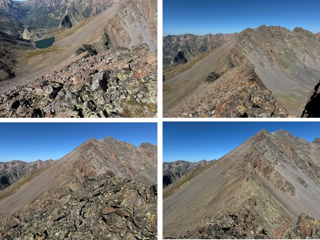
There was one ledge section that went at class 2 but had some exposure. I crossed the ledge, and it was an easy hike up talus to the summit.
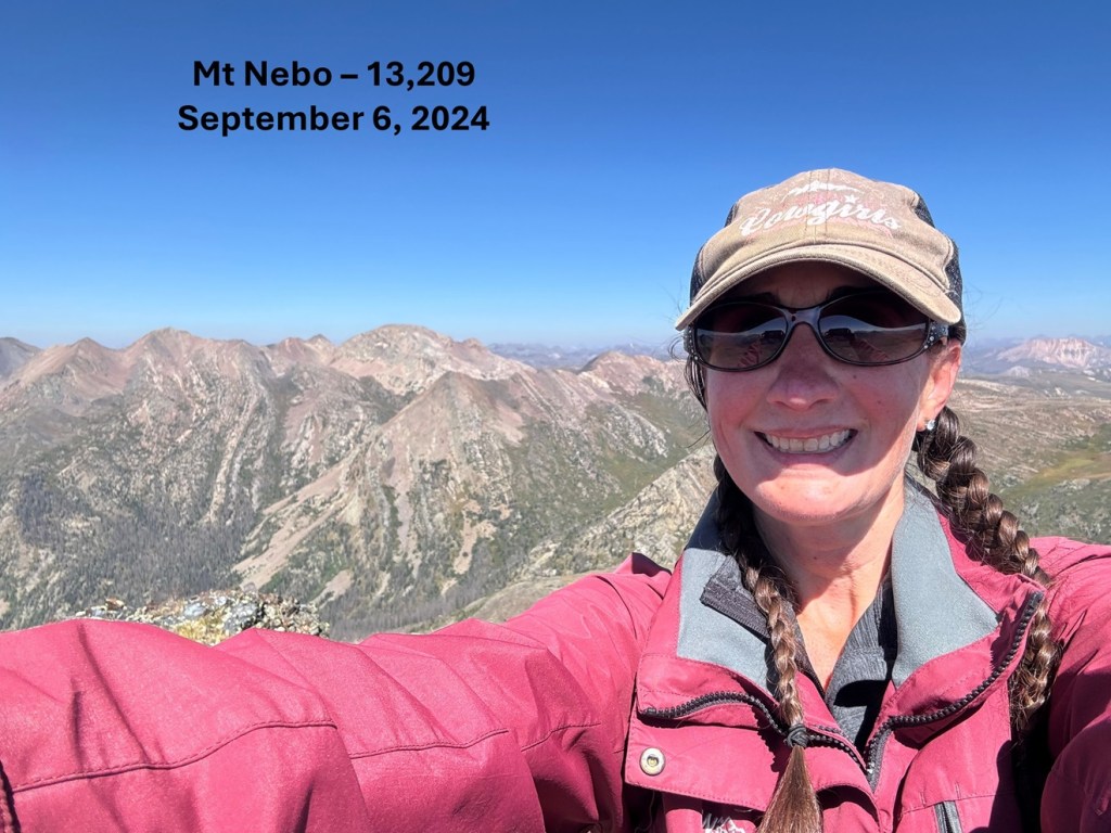
I summited Mt Nebo at 11:30am
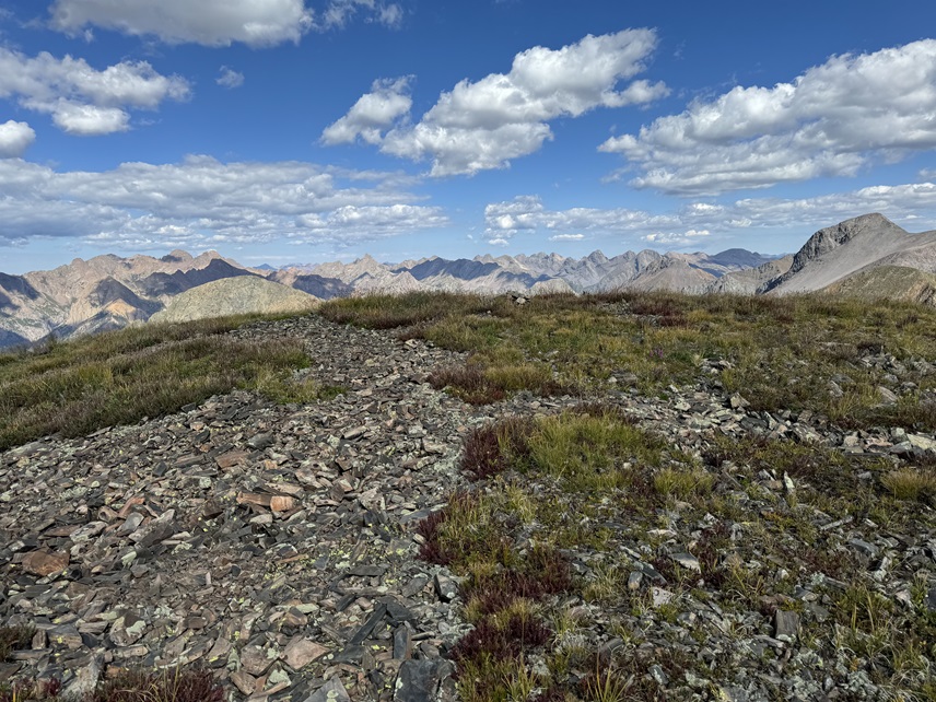
Mt Nebo:
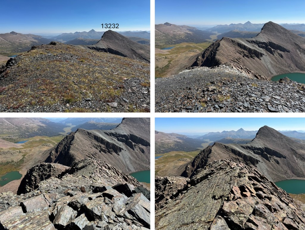
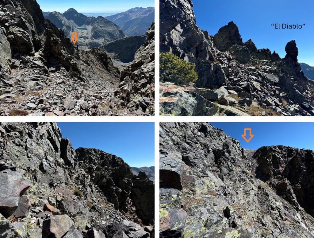
To the east was PT 13232. I descended back to the saddle.
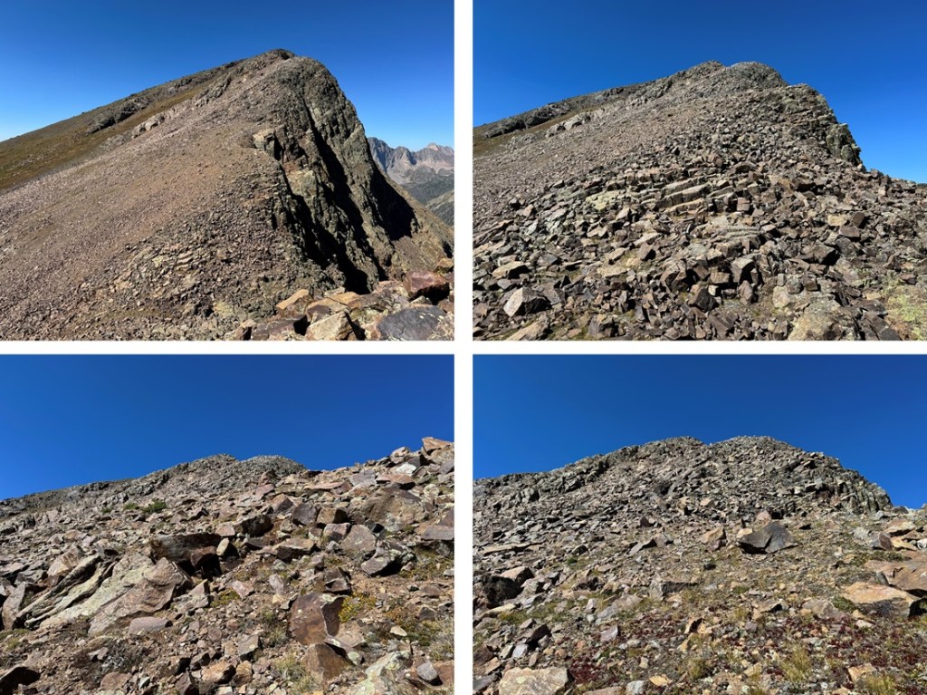
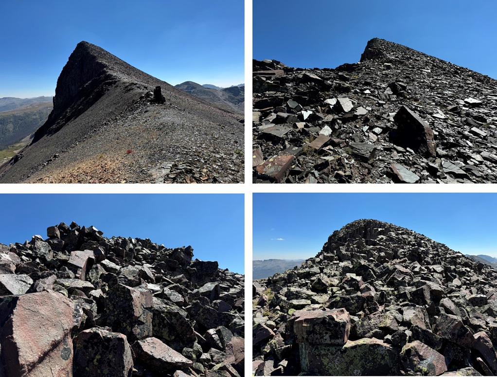
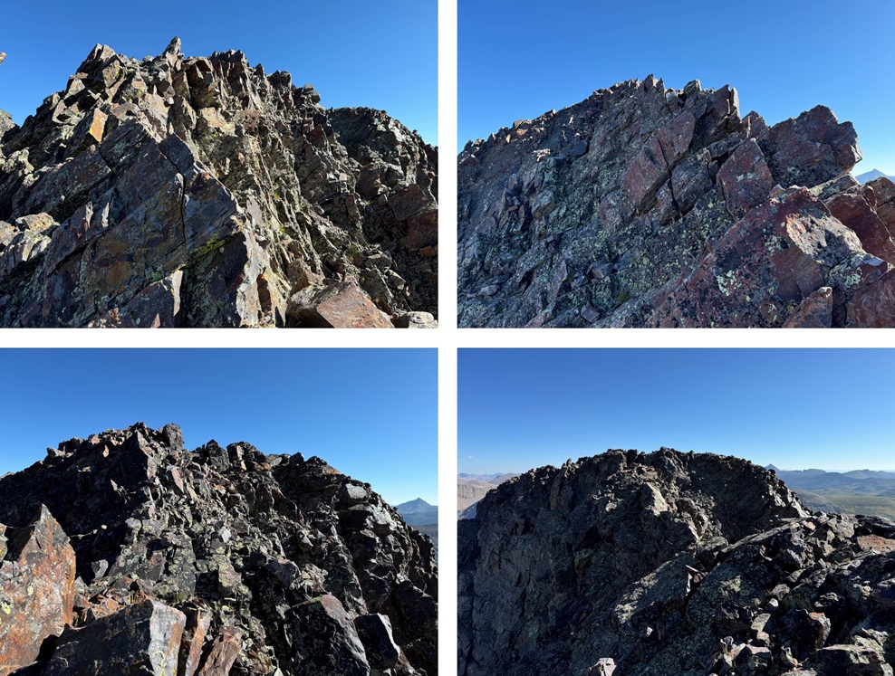
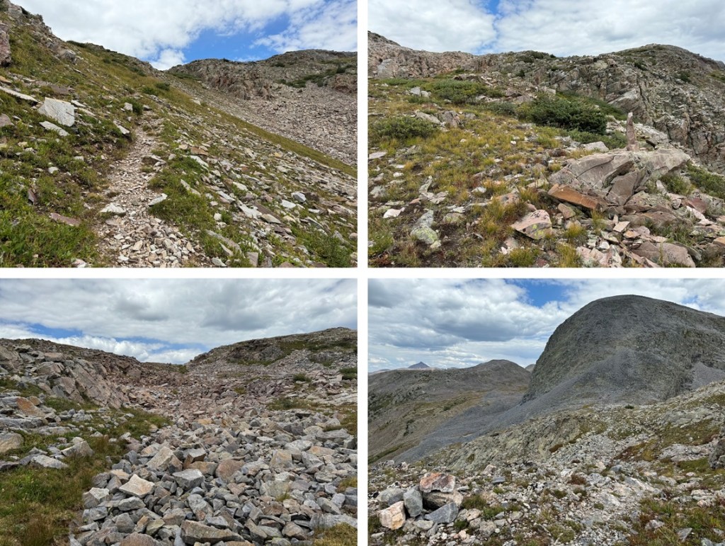
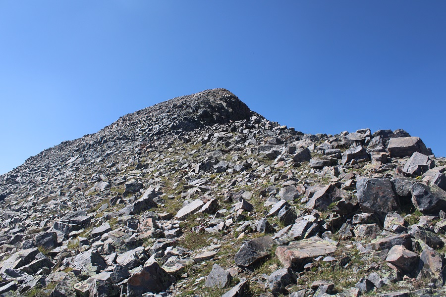
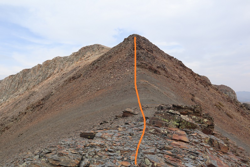
Then it was back up the rocks, following the ridge. The rest of the hike was all class 2 to the summit, mostly boulder/rock hopping.
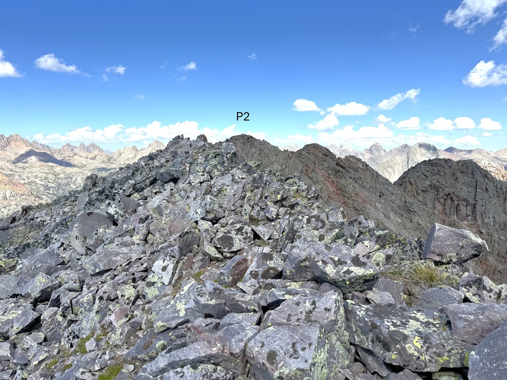
Once back on the rocky point that splits the two peaks, it was now easy to hike southeast to the summit. I followed the talus to the rocks, and kept ascending. The ridge proper goes at class 2. Here are some pictures of the route.
I summited PT 13232 at 12:30pm
PT 13232:
Now I was headed back to my campsite. I turned around, and followed the ridge as it descended northwest.
I then went right when I made it to the bump in the ridge, descending on talus and rocks before making my way back to the ridge.
I then followed the ridge back to my campsite and the CDT, being careful to go left to avoid the steep sections.
I made it back to my campsite at 1:15pm, making this a 8.55 mile hike with 3732’ of elevation gain in 6 hours, 45 minutes, including time to set up my camp and eat lunch. This report continues with PT 13171 the next day, along with a hike out back to Beartown.
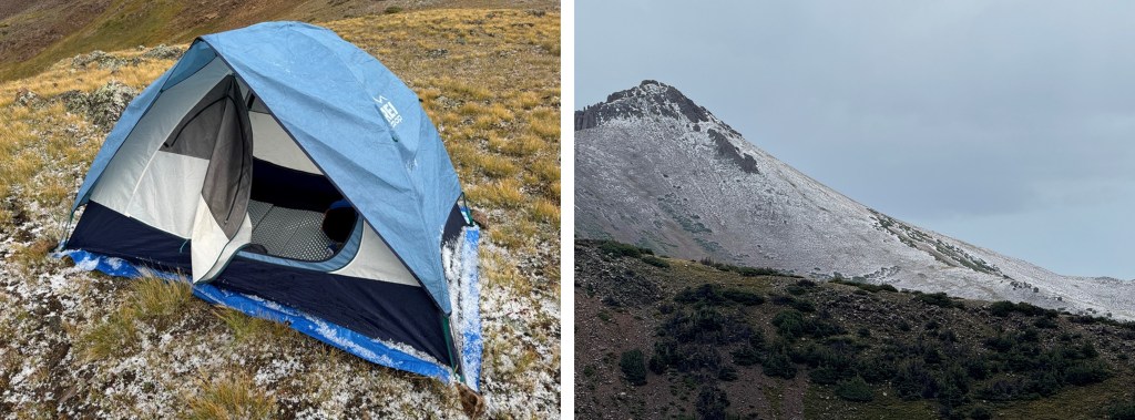
Oh, and it rained and hailed and graupled that night. For hours. I kept punching the top of my tent to get the slush off so it wouldn’t freeze overnight. Here’s a picture from about half an hour into the 4 hour storm, when I got a little break. Gotta love late summer storms above treeline! Good times!
I came back a month later and was successful in summiting P2. Details below.
Full disclosure, I did NOT summit P2. However, I came very close, and thought I’d share the information I have for those who might find it useful.
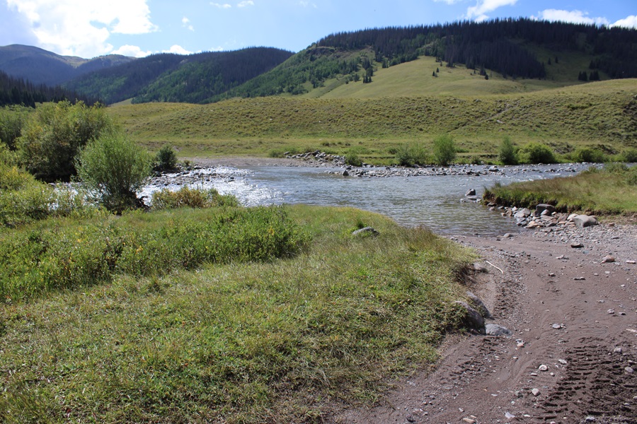
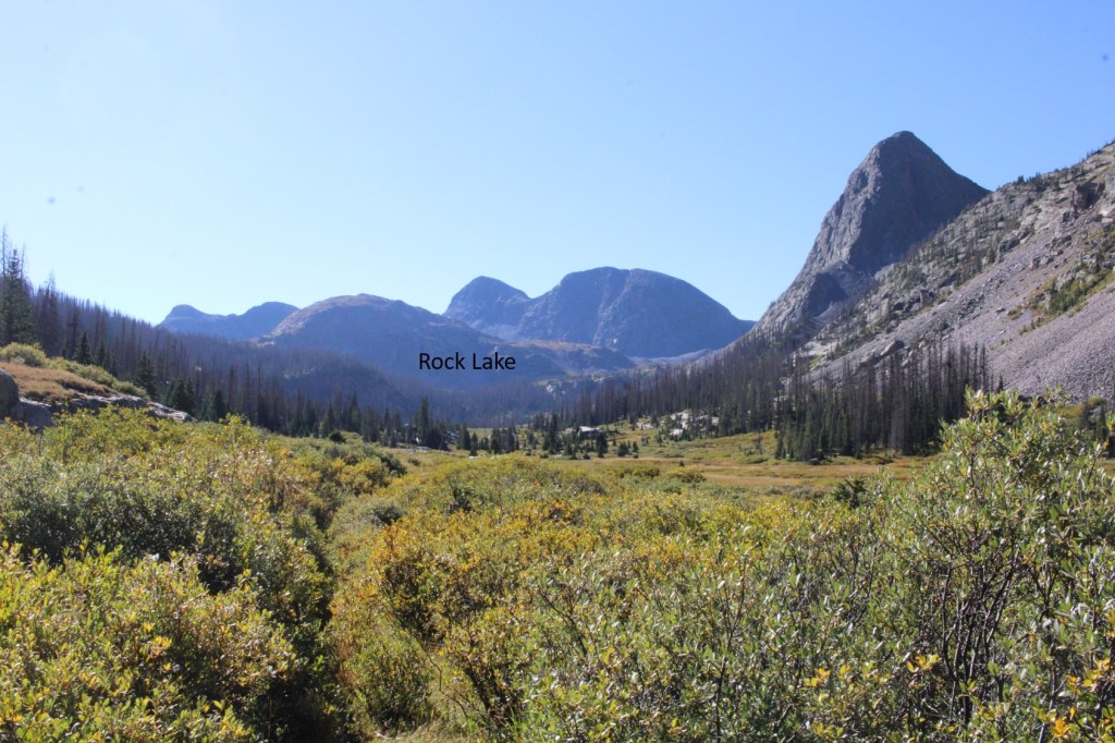
I camped at 11330’ of elevation, along the Rock Lake Trail that parallels Rock Creek in the basin just before Rock Lake.
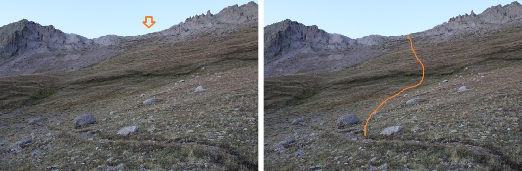
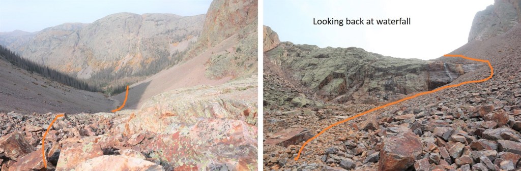
The next morning I was on the trail at 6:30am, heading west. My goal was to gain this ridge, and I did it poorly. I spent way too much time route finding, so I’m going to try to make this easier for you. You need to ascend this ridge, but DO NOT do it here. There is a way to find a weakness and ascend here, which I did, but I was greeted with the steepest, worst scree I’ve ever encountered, where if I’d have fallen, I would have skidded all the way down, over the edge. It was dangerous, and put me at a too high position and I needed to descend anyway.
Instead, start out by crossing Rock Creek (I was able to jump across it) and head for the rocky section.
Parallel the rocky section until you come to just before the waterfall. Then turn left, and head up the scree to what looks like a solid rock wall. There is a very well-hidden access gully here, that will easily get you where you want to go.
Climb up this easy gully, and immediately turn right, and head towards a drainage.
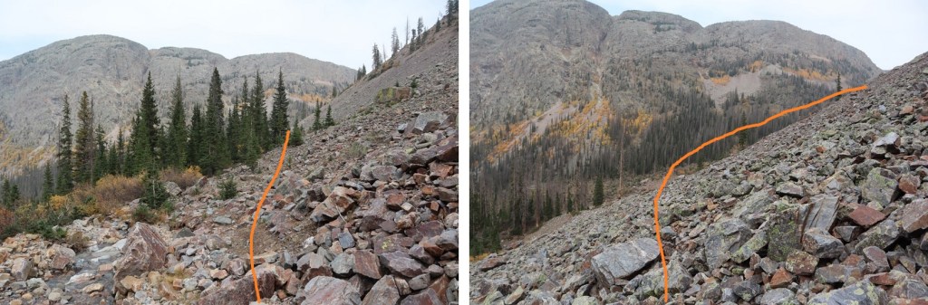
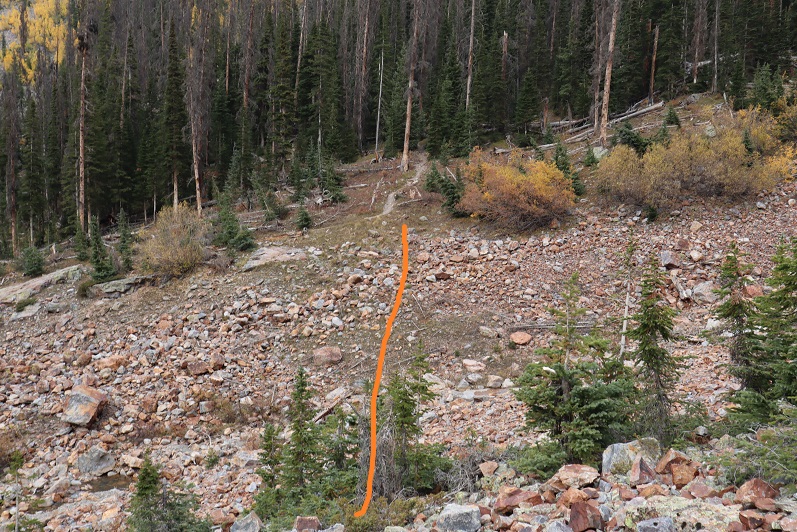
When I made it to the drainage, I followed it west as far as it went, until I was on a small ridge parallelling a pond. There are a few game trails here that will lead you up. Stay in the drainage, which goes from rocky to grassy as it ascends.
I came to a ridge and turned left. Here I could see a rocky basin. I followed the basin southwest, left, until it ended.
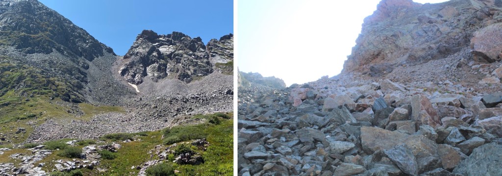
From here you can see two gullies. One leads to P3, the other to P2. I went up the gully to the left, and came down the gully to the right. Both are loose and scree filled. The P2 gully had larger rocks, which would have made it better (for me) to ascend, and the P3 gully had more scree, which would have made it better (for me) to descend. Alas, I ascended the P3 gully, and descended the P2 gully.
Here are some pictures of the P3 gully. I ascended on scree, sticking close to the rock band, and headed towards the ridge.
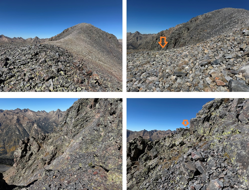
Once on the ridge I turned left, and followed it northeast. While it looks daunting, this was all class 2 on stable rock, and not so stable rock.
Until I got to here. If you haven’t already, now is your time to put on your helmet. From here the rest of the route is exposed class 3 and class 4 climbing. I chose to stick to the ridge. Luckily, the rock here is solid and there are plenty of hand and footholds.
I stuck to the ridge here, so I won’t include direction lines, but I’ll show you a few pictures of this part of the ridge, which I considered class 3
Until I got to here. I felt this was class 4, and the crux of P3. This is the route I took, sticking a bit to the left as I felt there were more holds, but I can see how someone with a higher risk tolerance would have gone straight up the middle.
I could now see the summit of P3. This is the route I took.
I summited P3 at 9:45am
P3:
From the summit of P3, I made my way back to the ridge.
Back on the ridge, I followed it to the P3/P2 saddle
From the saddle, I headed up on talus and scree, following the ridge towards P2, but avoiding the large rock structures to the right.
I then came to a sloping section, with a false summit. I made my way towards the false summit
From the false summit, I could see the true summit of P2 in the distance.
I followed the ridge, and this is what I saw in front of me
The climbing wasn’t what bothered me here. It was that long, yellow rock slab. I’d heard it was maybe 40 feet, but being there in person, it looked double that. I downclimbed a bit to get a better view, and the view didn’t get any better. Pictures DO NOT do this slab and it’s exposure justice.
At this point I had to make a very difficult decision. I do a lot of crazy stuff while hiking solo, but it’s always within my abilities, and I try not to take unnecessary risks. This rock slab was an unnecessary risk, and that’s coming from someone who’s favorite 14er is Capitol because of the knife’s edge. I did not feel safe downclimbing this slab solo, or even with another person present, although I would have tried it going from the opposite direction if I didn’t need to downclimb it again. I had about a 75% certainty if I attempted to downclimb this slab, I would fall. And the exposure wasn’t pretty.
One of the reasons my husband encourages me to hike solo is he knows I don’t take unnecessary risks in the backcountry, and I want to come home safe to him. I also want to be a Grandma someday, and I can’t do that if I die.
I knew there was another way to summit by dropping down to the left, so I got out my cell phone and checked the weather. The 10% chance of rain after 12pm had now become 80% chance of thunderstorms. I wouldn’t have the time needed to route find my way to the summit of this peak and make it back to my tent in time before the storm came in.
So, I turned around at the final crux to the summit and headed back down. I did a lot of scouting around while I was up there and know how I want to attempt this peak next time (I’m thinking of dropping down to avoid the edge or coming in from a different angle). I’ll be back to summit this peak another way.
So, I turned around and headed back towards the P3/P2 saddle.
Just before the saddle I turned left, and took the P2 gully down into the rocky basin.
I then followed the basin back to the drainage, staying mostly to the right of the basin.
When I came to the drainage, I turned right followed it, staying to the left of the pond, back to the ledge, following game trails where I could find them.
Just before making it to the waterfall I headed right, found my access gully, and headed down.
I descended the rocks, then headed back to my campsite.
I made it back to my campsite at 1:30pm, making this a 6.61 mile hike with 2539’ of elevation gain and tons of route finding in 7 hours.
Oh, and that storm? It dumped about 4 inches of slush, rain, snow, and hail on top of my tent in about 2 hours. So now, I had another difficult decision to make: Stay there overnight and wake up at 5am to a tent frozen solid, pack it up, and hike out, or just hike back to Beartown now. For those of you who know me (and my Raynaud’s), you know what I did. I packed it up and headed back to Beartown, hiking in the dark to make it back to my truck in time for my work meeting in the morning. It was NOT a fun hike out, as the trails were now covered in slush (I slipped a few times in the granite rock sections) but I stayed (relatively) warm.
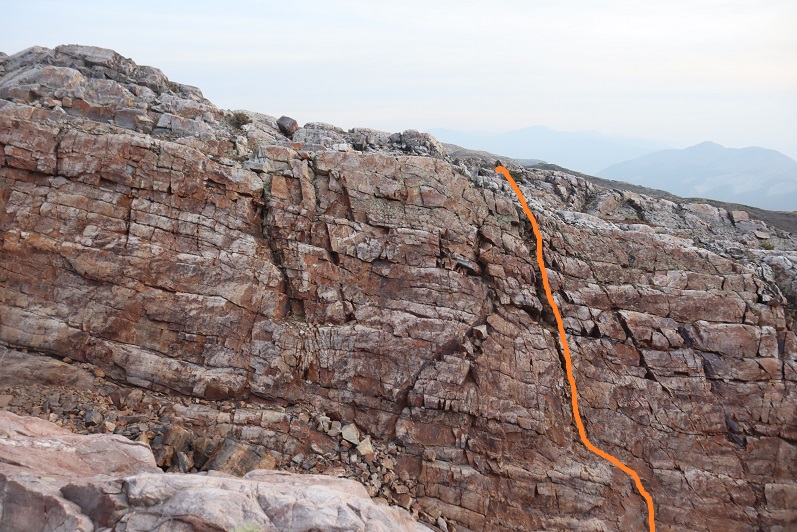
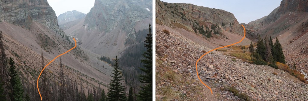
From the saddle of P3 and P2, I followed the ridgeline to 13190’, where you can see the false summit. From below the false summit, I went left (east) and found a gully. I descended this gully, but not all the way. Instead, I stayed high and traversed these rock outcroppings. This route is basically class 3 and choose your own adventure. I stayed high so as not to have to re-gain elevation, and this worked for me. Here are pictures of the route I took:
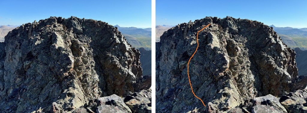
See this rock formation here? While it’s difficult to see from this angle, I’m nicknaming him “El Diablo”, because to me he looks like a lot of things, but also closely resembled my High School Mascot, the Diablo. Yes, my high school mascot is the devil. For middle school we were the Banditos (imagine Yosemite Sam as a Mexican, complete with the mustache and beard, bullet harnesses and a gun in each hand). Alas, after I went there the parents got upset and changed things and now they’re the “Leopards”. The parents keep trying to change the Diablo mascot as well, but the students won’t let them. In any event, I digress. I went to the right of El Diablo on my way in and used him as a spotting point on my way out. After passing El Diablo I could see a large gully to the right. I stayed high on class 3 terrain and climbed the gully, which brought me to the base of the rock slab.
From there, I turned left, and it’s a class 3 climb to the summit. I tried a lot of different routes that others said ‘went’, but I found climbing straight up the face was the easiest way to summit and stayed at easy class 3. Climbing straight up the face is easier than it looks, with lots of ledges. From there I was on a small ridge, and it was 10 feet or so of walking northeast to the summit. Here’s the overall route:
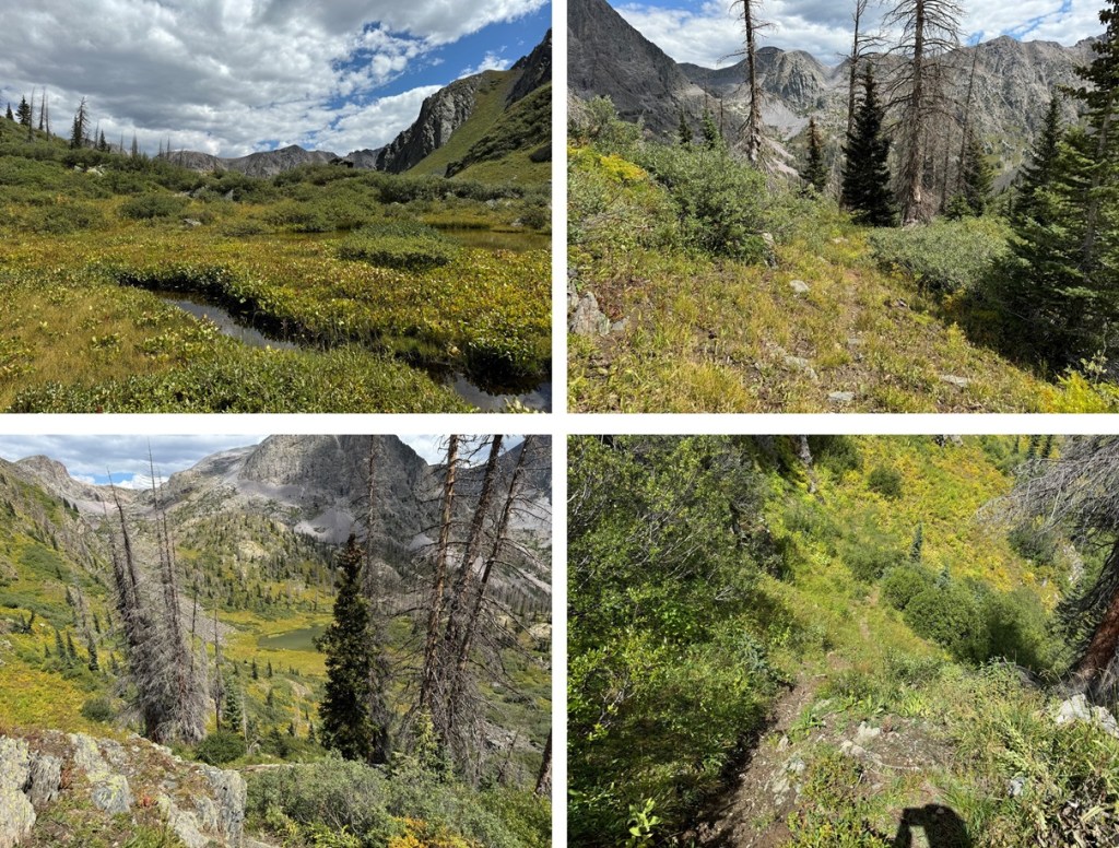
I hiked into Rock Lake the day before, and met a few forest service workers doing trail maintenance along the trails. They were sawing up logs from trees that had fallen directly on the trail to make a clearer path. While I was very excited they were doing this, the trail in was the wettest and muddiest I’ve ever seen it. The entire trail was a river, several inches deep with water, making walking on the rock slabs slippery. Even the side social trails were full of water. In any event, when I got to Rock Lake I set up my campsite (150 feet from the water), filtered some water for the next day, and I dried out my shoes and socks.
I was up and on the trail at 6:30am. I skirted the lake to the left, and found a great trail on the small slope to the left of the lake that brought me to a trail that headed up to the pass. Once in the rocky section, this trail is very well cairned.
From the top of the pass, I would then lose 1000’ of elevation as I headed down towards Moon Lake. This is a very well marked trail that led me towards.
Just after passing by Moon Lake I crossed a creek and followed the trail left.
As soon as I came to a clearing, I left the trail to skirt the side of the mountain, doing my best to stay at around 11600’. If you pass the waterfall (you’ll notice it), you’ve gone too far. There are a few cairns here, but they are few and far between. I did my best to stay on game trails as I skirted the mountain, heading south.
I came to an unnamed pond, and skirted it to the right. There’s actually a really good game trail that will get you through the willows and into the upper basin. Just stay to the right of the creek.
Once in the upper basin, I followed it southwest. It’s marshy here, so watch your step.
I continued following the basin until I could see a ridge in front of me. I gained the ridge, and followed it left.
This brought me to another pond. From here I could see the rest of my route to the 13323/13350 saddle.
I aimed for the scree gully and then the grassy ledge. There are some game trails here, and a good one picks up once you’re on the slope that stays in-between rock formations and heads straight for the saddle. Here’s my overall route:
And some pictures of the route to the saddle:
Once at the saddle I turned right, and headed towards PT 13323. This was an easy hike on rocky tundra.
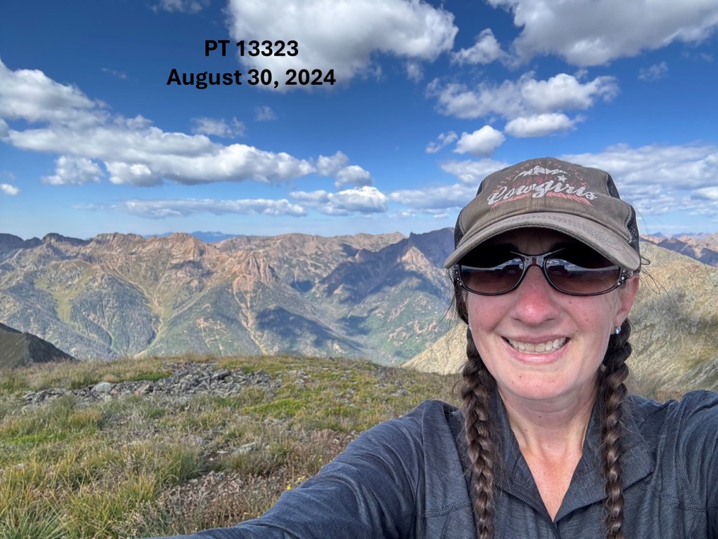
I summited PT 13323 at 10:15am
PT 13323:
To the southeast I could see PT 13350
So I headed back down to the saddle
Then followed the rocky, class 2 ridge to the summit of PT 13350
I summited PT 13350 at 10:50am
PT 13350:
This was an out and back hike for me, so I turned and headed northwest back to the saddle
Once at the saddle, I followed the game trail back to the scree, then the scree and talus back to the small pond.
Once at the pond, I followed the ridge down into the basin, following the creek
Just before the creek turns to do down to the pond, I picked up the game trail that would skirt me through the willows, down to the pond, and then back to curve around the hillside northeast.
I kept heading north, skirting the mountainside a bit to the west, towards the trail that would lead me back to Rock Lake.
Once on that trail, I followed it all the way back to Rock Lake
I made it back to Rock Lake at 2pm, making this a 11.6 mile hike with 4397’ of elevation gain in 7.5 hours from Rock Lake.
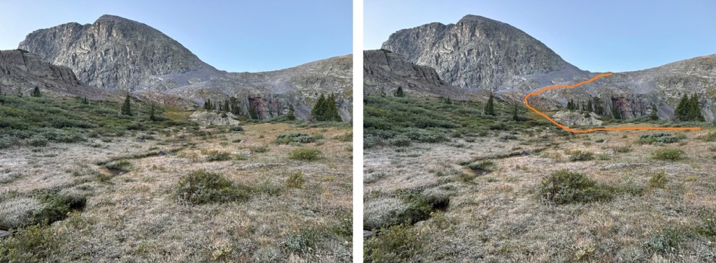
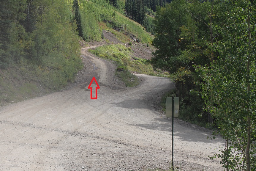
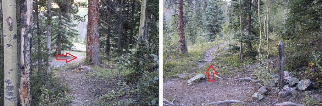
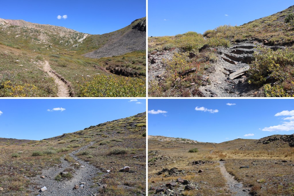
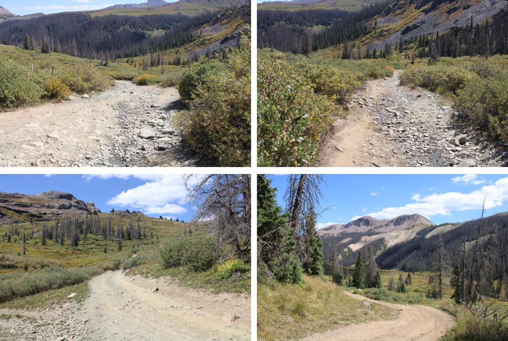
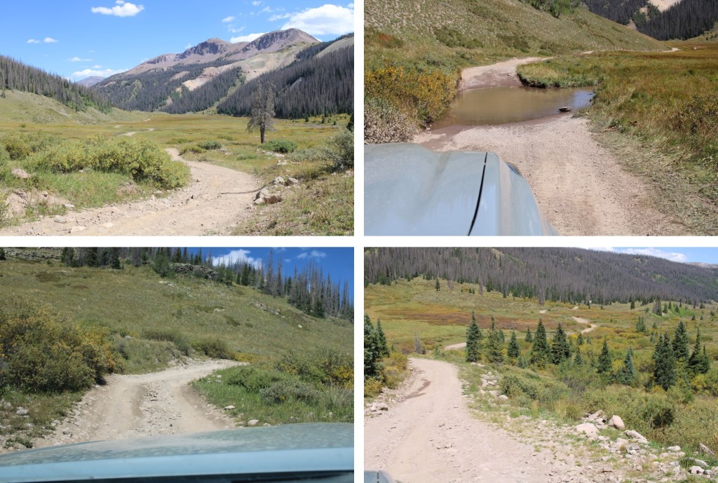
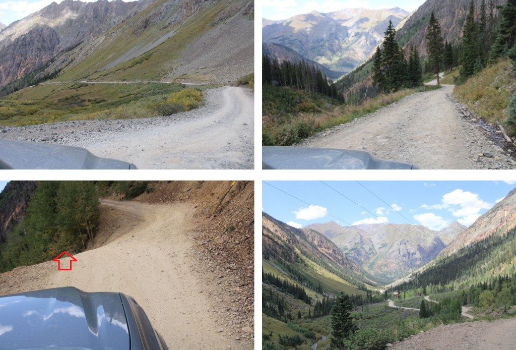
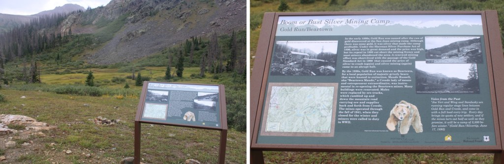
I started this hike from Beartown. I’ve made the drive into Beartown now 4 or 5 times, and from what I remember, the road and river crossings were better this time than my previous visits, but once I made it after the river crossings the road was much worse. It has rained a bunch recently, and all of the potholes were now lakes. From my parking spot at around 11250’, I headed southwest, following the 4WD road.
After hiking for about .4 miles, I came to a junction and turned left, heading towards the actual trailhead.
I was now at the trailhead for Trail 869. I followed this trail to treeline. The trail is class 1, except where there are downed trees and overgrowing vegetation covering the trail. Then some route finding is required, but the trail always picks back up again. Once above treeline, the trail is easy to follow.
At treeline, I continued following the trail south
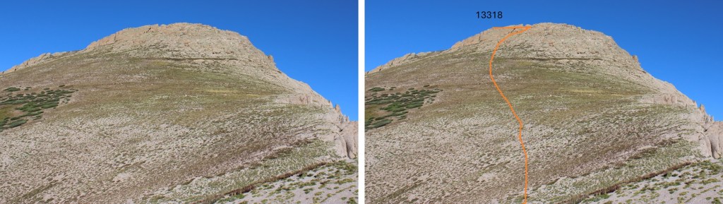
The trail was headed towards the saddle of 13318 and 13351, but before reaching the saddle I aimed for this point in the ridge. There are game trails to get you there, but the route is pretty obvious.
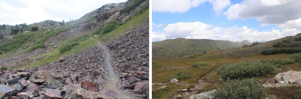
Once on the ridge, I turned right and headed west. Here’s my overall route to the summit. This is all class 2, with some scree mixed in. The boulders can be avoided on class 2 terrain, but be prepared for lots of kitty litter. Look for an access route to the left and center of the boulders, and you’ll find a scree path.
When I made it to the ridge, I realized I was at a false summit, turned left, and boulder-hopped to the true summit.
I summited PT 13,318 at 7:15am
PT 13,318:
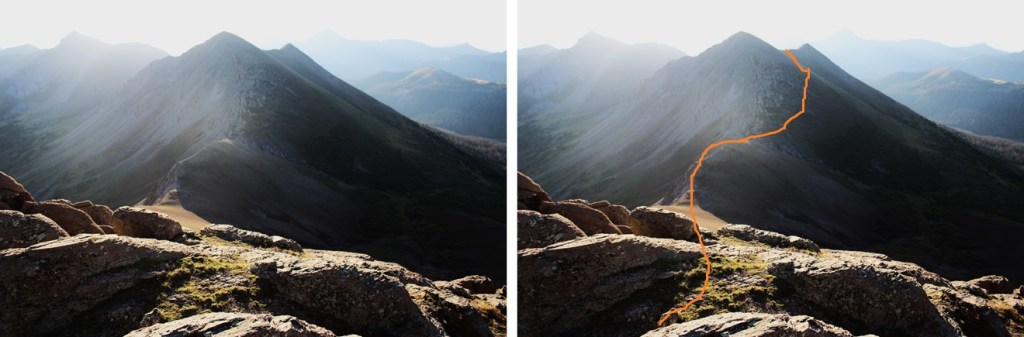
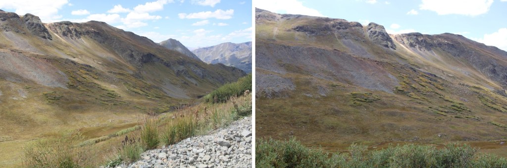
My next goal was PT 13351, to the east. The summit is hidden in this picture by a false peak, but this was my route to the summit. I curved to the right of the peak, avoiding the rocky areas by staying on tundra, then headed for a small saddle.
First, to make my way down to the 13318/13351 saddle.
Then I headed up the slope, staying on tundra, circling around until I could see a small saddle at the ridge.
Once on the ridge, I turned right, and headed east towards the rocky area.
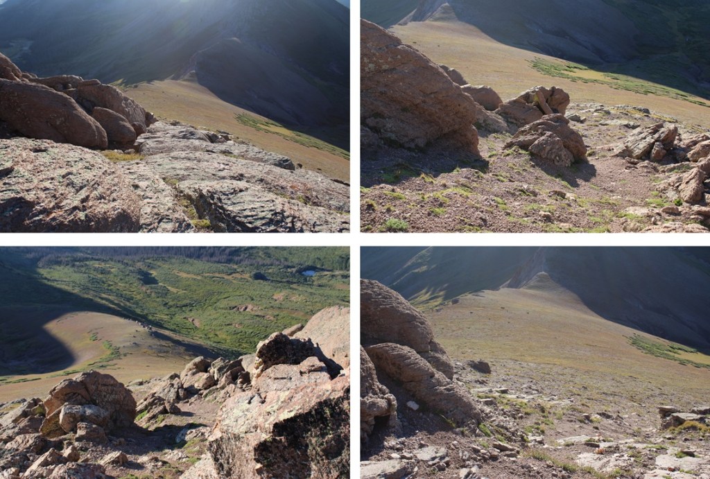
This rocky area was class 3, and once again choose your own adventure. The rocks were loose, and there seemed to be many options to make it to the summit. This is the route I chose:
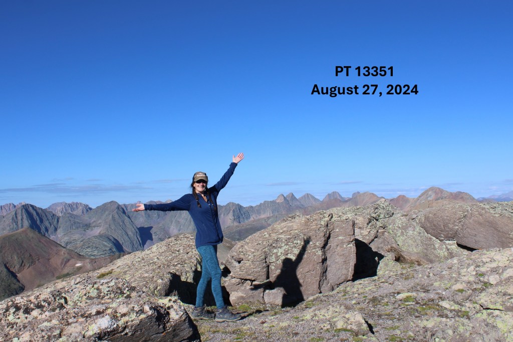
I summited PT 13,351 at 8:30am
PT 13,351:
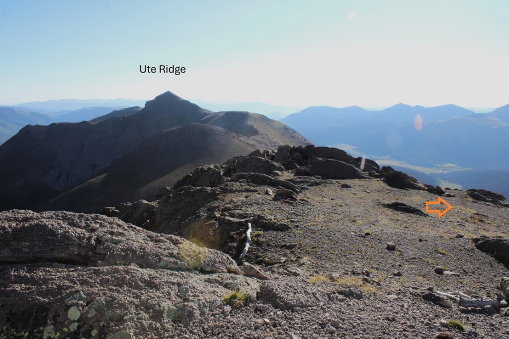
My next goal was Ute Ridge, to the northeast
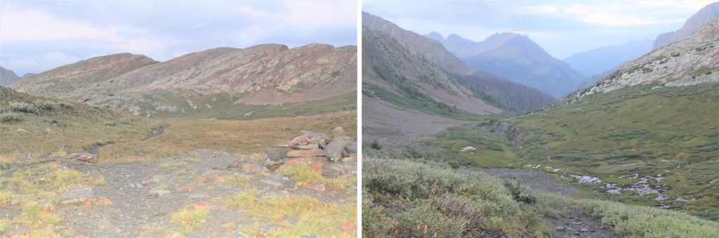
Fist, I’d have to follow the ridge southeast and gain this point before heading down to the 13351/Ute Ridge saddle.
I headed towards the unnamed point. A few thoughts on this ridge: It’s rocky, and loose. It can be kept class 2 if you stick to the right of the ridge, class 3 ridge proper. Once again, ALL of the rocks are loose.
I was able to follow scree and tundra down to the 13351/Ute Ridge saddle. Now is a good time to look at the route you want to take to gain the ridge. I stayed below the rocks, but was able to find game trails through the scree to the ridge. The ridge proper has a lot of unavoidable rock formations, so I wanted to stay below them until they were gone before gaining the ridge.
And now to gain the ridge while avoiding the rock formations
And then following the ridge proper.
I came to a rocky area, and found a game trail up to the left
Then I continued following the tundra towards Ute Ridge
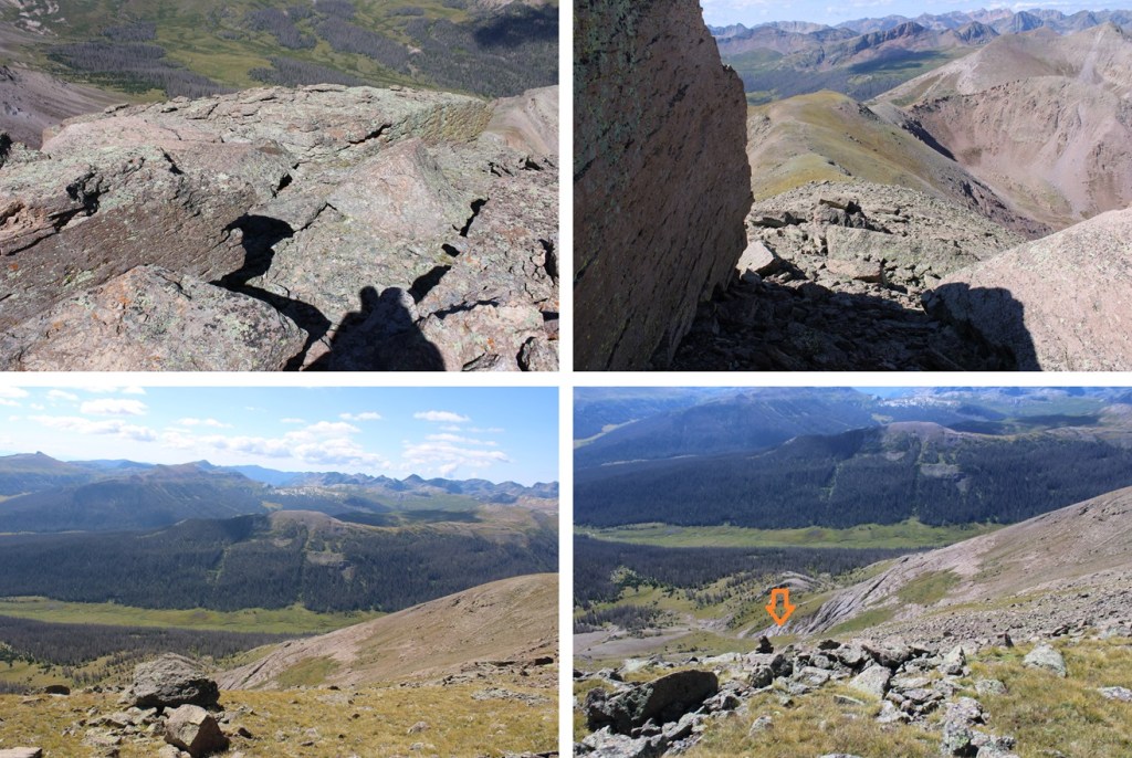
This next section is a little tricky when you’re down in it, so now’s a good chance to take a look at your route. The rocks here are loose. I chose to go right of the ridge when I had the chance. Just before the summit is a large rock band. There were several chimneys there to use as access. I ended up choosing the third chimney I came to, although they all had cairns indicating they “went”. If you want to avoid the chimneys altogether, you can continue further right and use class 2 terrain (although it looks like steep scree is involved).
Here’s the route I took:
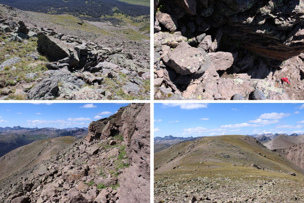
This is the chimney I took:
At the top of the chimney I headed back towards the ridge, and followed the rocks to the summit. The boulders at the top are so large you can walk around them to the summit.
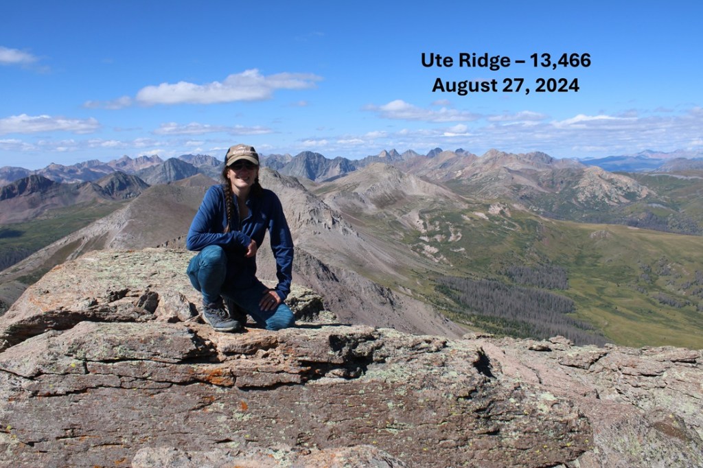
I summited Ute Ridge at 10:30am
Ute Ridge:
And now to head back down towards the chimney
Down the chimney, and back towards the 13551/Ute Ridge Saddle
From the saddle of 13551/Ute Ridge, my intention was to make it back to the ridge and the trail I’d hiked in on from Beartown. The trail goes along much of the ridge, so I just needed to aim for the ridge. You can do this by aiming for the gully, or taking the slope. I took the slope to avoid the willows. Once I was down in the gulch, I gained about 950’ to the ridge.
Here are some pictures of the route:
Heading west on the tundra eventually brought me back to the easily identifiable trail that would lead me back to Beartown
Once back on the 4WD road, I followed it back to my parking spot
I made it back to my truck at 1:15pm, making this a 12.29 mile hike with 4438’ of elevation gain in 8 hours, 15 minutes
For those of you interested, this is what the second river crossing looked like in late August of 2024:
The approach drive is 21 miles from Silverton to Beartown, starting out on 110, then turning right onto 589, or the Alpine Loop, towards Stony Pass. It’s a really good idea to make a gpx file for this drive, as I’ve encountered several people who got lost in the area while taking side roads.
At the fork in the road, keep left to head towards Stony Pass.
The 4WD road quickly begins gaining elevation, but is easy to follow. There are several places to pass vehicles coming the other way. After about 5 miles, you’ll make it to Stony Pass.
From Stony Pass you’ll lose over 2000’ of elevation as you make your way east, towards the Rio Grande River.
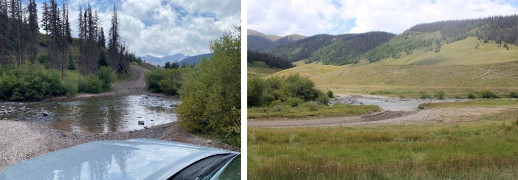
I did this hike in September, when the river crossings were low. In fact, they were lower than I’d ever encountered them before, and my Tacoma had no problem crossing.
First river crossing:
Then there’s a junction. Stay right, and take the road that goes towards Beartown
Second river crossing:
From here you are now on 3A, and the road gets more difficult. It does feel like it’s been graded recently though, as it wasn’t as bad as I remember it being last year.
I parked at a nice campsite at 10890’. My truck could have made it further, but I love my truck, and didn’t want to drive it further down the road. Here’s the topo for the drive in
Now for the approach to Rock Lake. This entire approach is class 1.
Here are the stats:
2.7 miles and 1263’ of elevation gain from my parking spot to the top of Hunchback Pass
5 miles and 2349’ of elevation loss from Hunchback Pass to the Rock Lake cutoff
4.8 miles and 1713’ of elevation gain from the Rock Lake cutoff to Rock Lake.
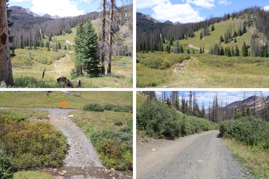
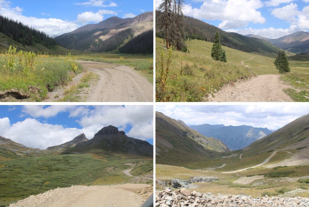
I started out heading southwest along the dirt road (3A), towards the actual trailhead, passing a sign for Beartown along the way.
There were many capable vehicles parked at the trailhead
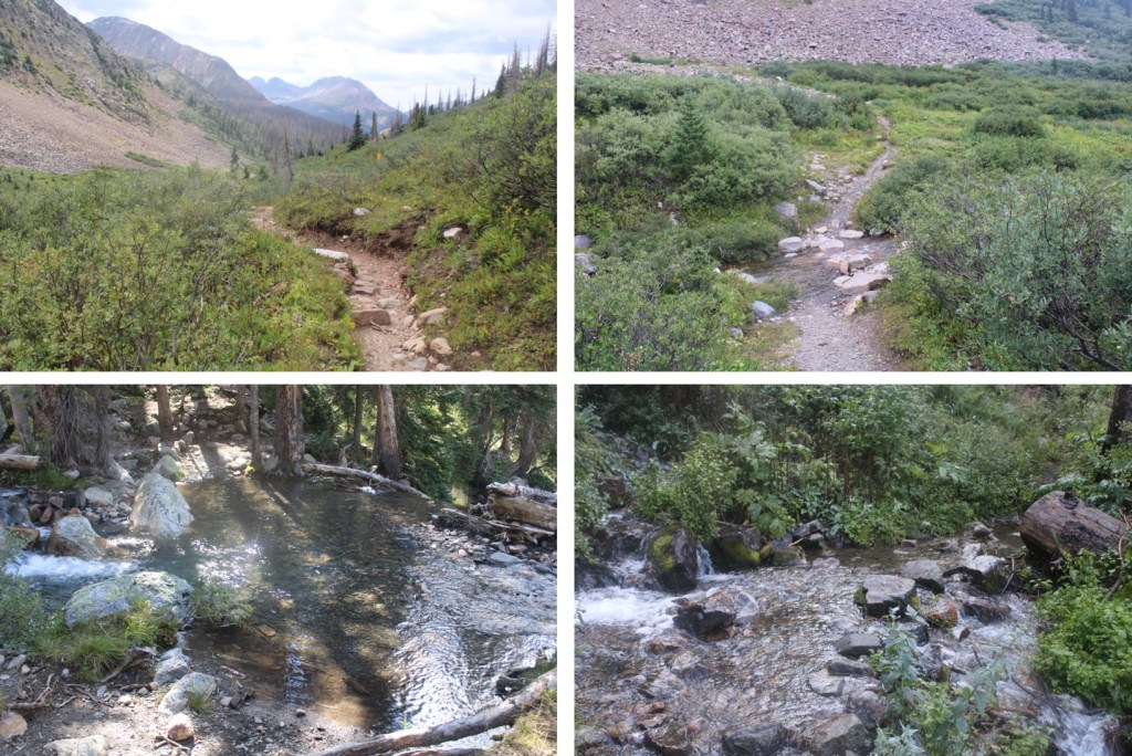
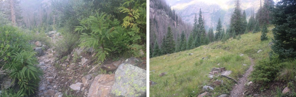
I followed the trail, 813/Vallecito Trail, as it wound its way up towards Hunchback Pass.
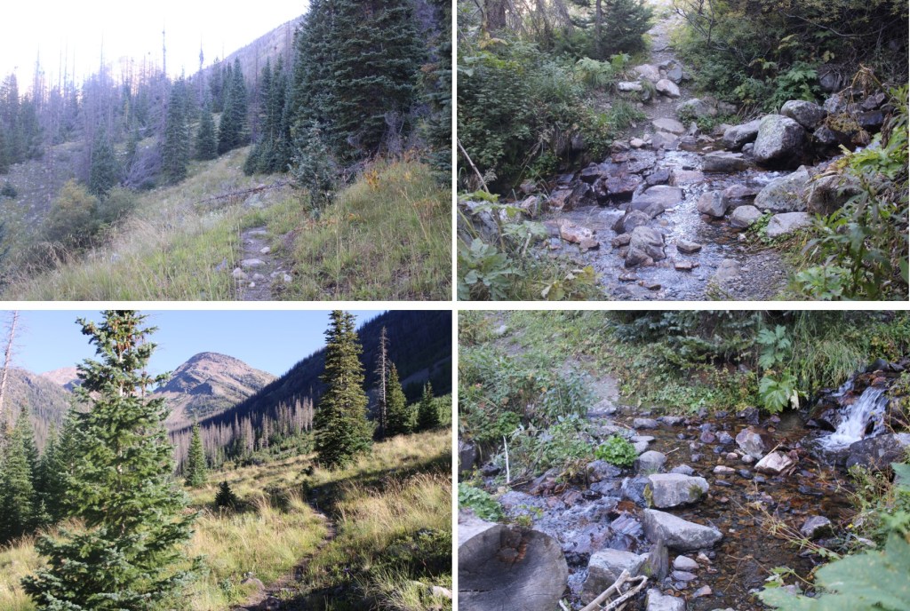
At this point I was above treeline, but that would soon change. From the top of the pass I descended down into the basin
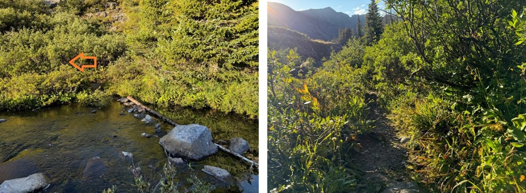
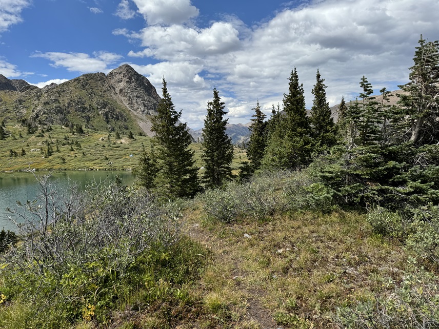
Encountering willows (bring your rain gear) and re-entering treeline.
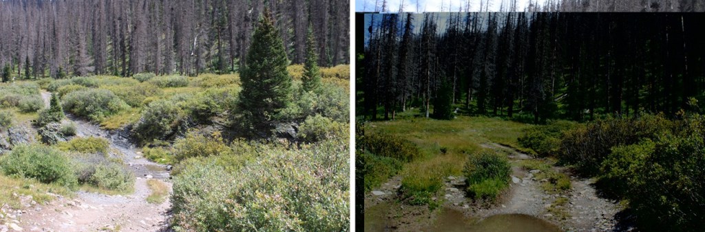
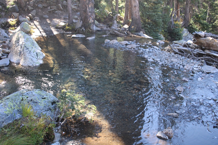
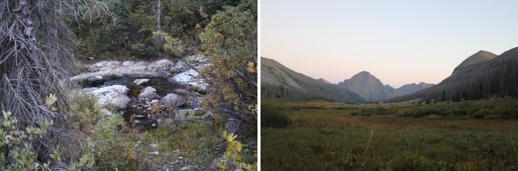
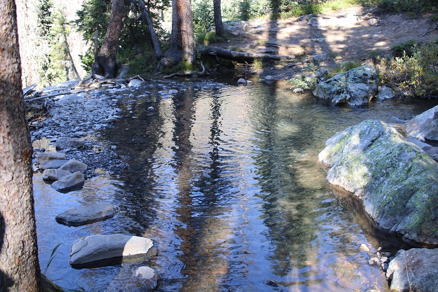
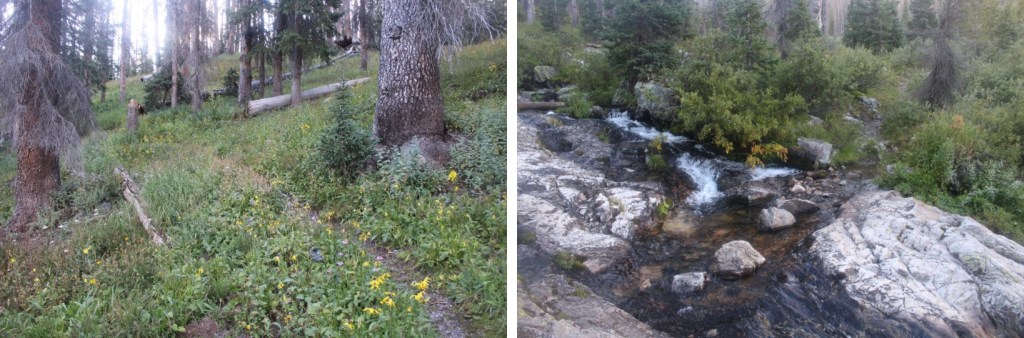
I crossed Nebo Creek, which is a great place to stop for lunch, or to filter water
This is where the downed trees began. There were dozens of them, but luckily this is also a horse trail, so there were paths already beginning to form around the downed trees.
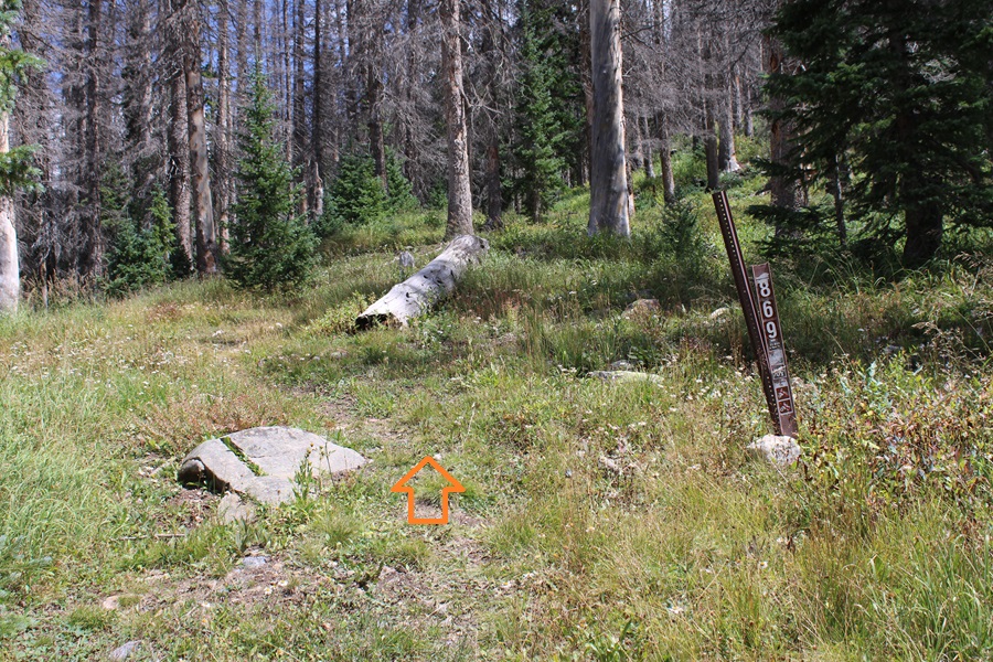
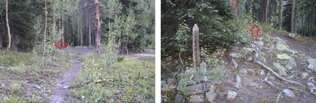
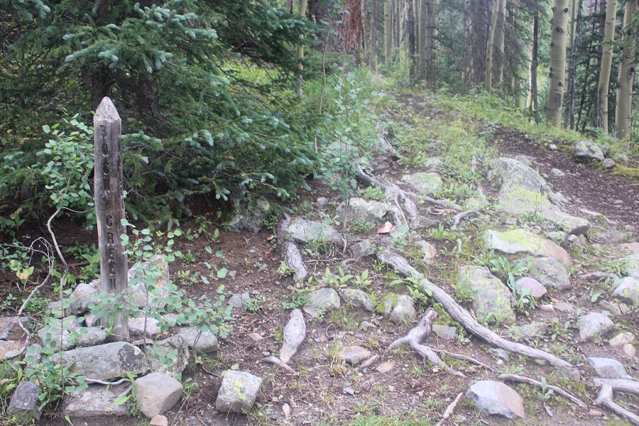
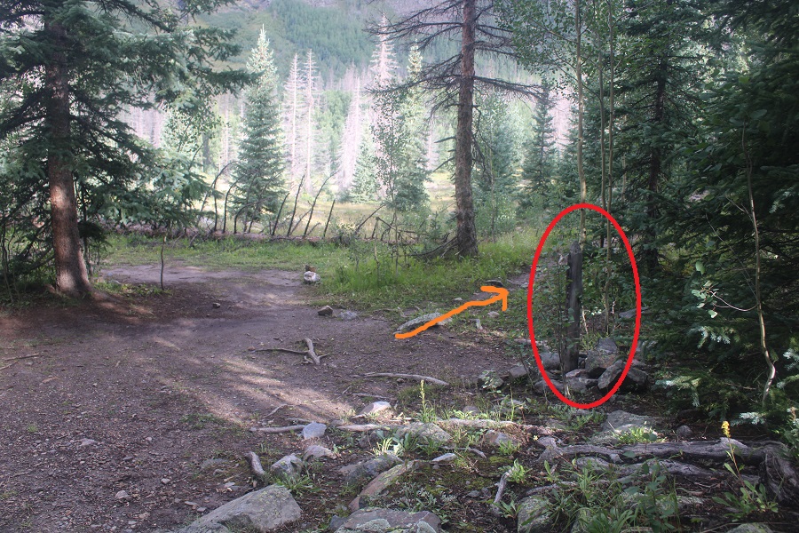
At around 10135’ I came to the junction for the Rock Creek Trail. It’s marked by a wooden post, and easy to miss in the dark.
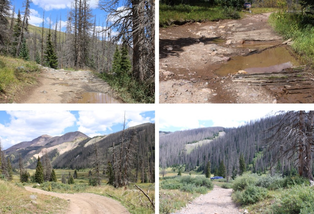
I turned left, and followed the Rock Creek Trail
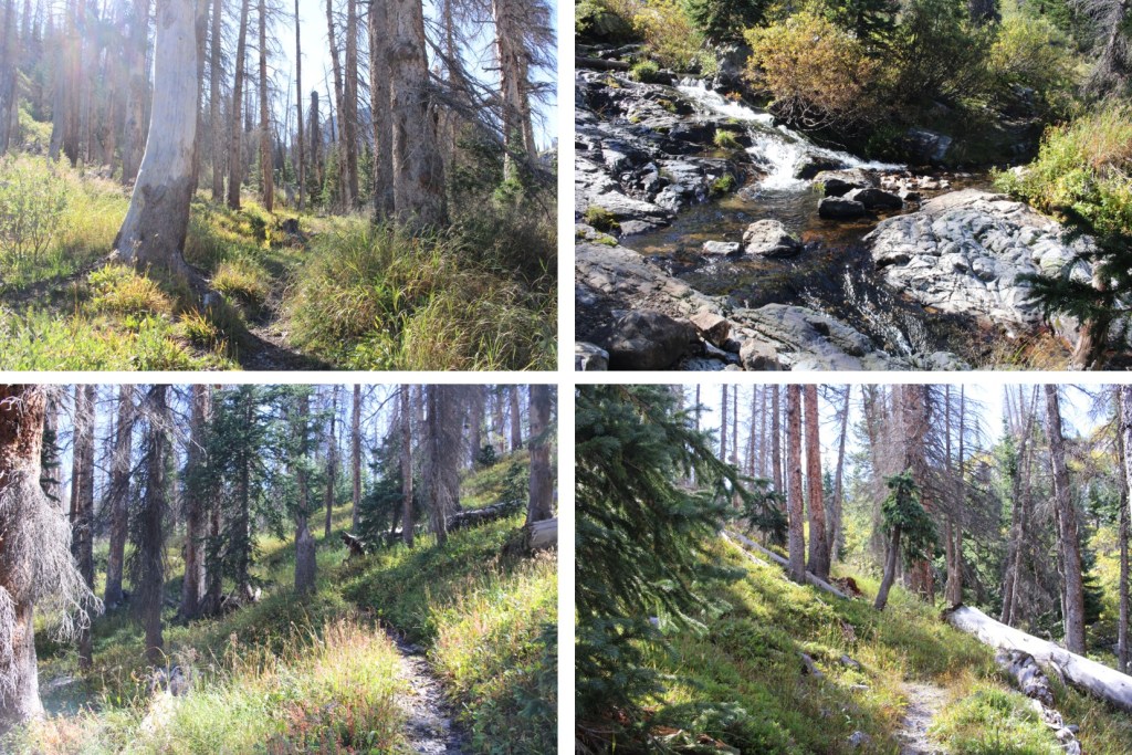
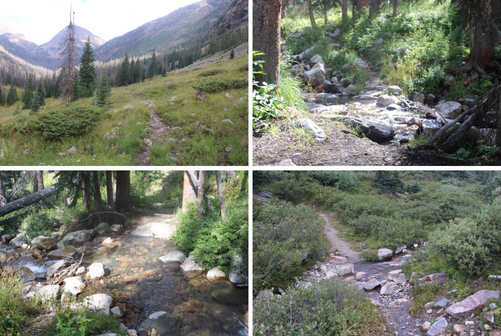
The trail was easy to follow as it gained elevation, heading southeast, paralleling Rock Creek. I entered a wide basin (where I’d been charged by a bull moose on a previous trip to the area), and headed through willows towards Rock Lake.
The willows gave way to trees and switchbacks
Which gave way to more willows
At the end of the willows, was Rock Lake. From where I parked, it was a total of 12.51 miles with 3044’ of elevation gain to Rock Lake
There are tons of places to set up camp directly in front of the lake, but also on its east side. If you see campers set up on the north shore of the lake, realize there are many, many more along the trail ahead as well (hikers left).
Here’s my topo map for the route in from Beartown
And now some pictures of the way out, from Rock Lake back to the Vallecito Trail.
Back at the junction I turned right, and followed the Vallecito Trail. At this junction, there’s a great place to camp (if needed).
Now for the fun part: 2350’ of elevation gain back to Hunchback Pass
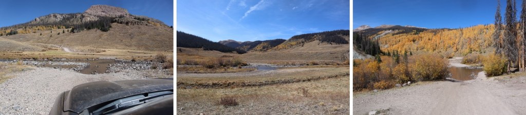
I re-crossed Nebo Creek
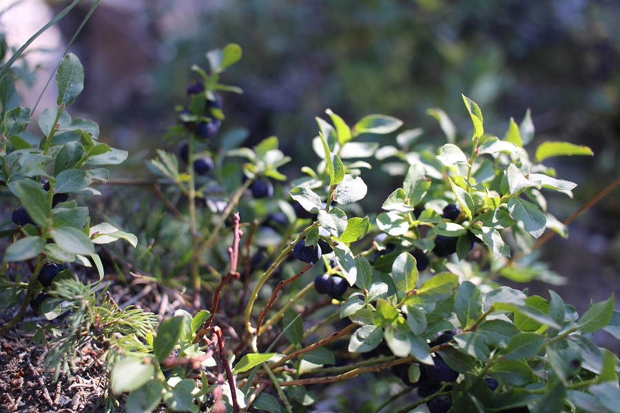
And came across tons of wild strawberries, raspberries, and blueberries. Since it was September, they were all ripe, and a great snack halfway back up the pass
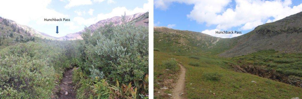
I re-entered willows, and followed them towards Hunchback Pass
From the top of the pass, I headed back to the trailhead
From here you can see where I parked my truck
Back at the trailhead, I followed the 4WD dirt road back to my truck
When I got back, I found another vehicle parked in the campsite alongside mine, ready to combat those pesky marmots (I saw several on my drive out).
Here are some pictures of the drive out. Remember, it’s all left turns now to get back to Silverton.
After Stony Pass I came across a rather large herd of domestic sheep grazing on the hillsides
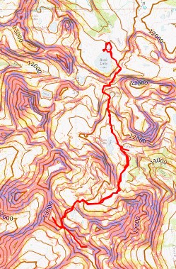
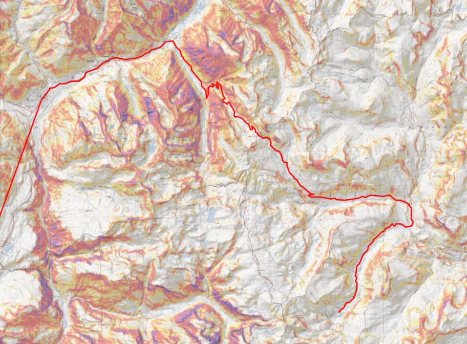
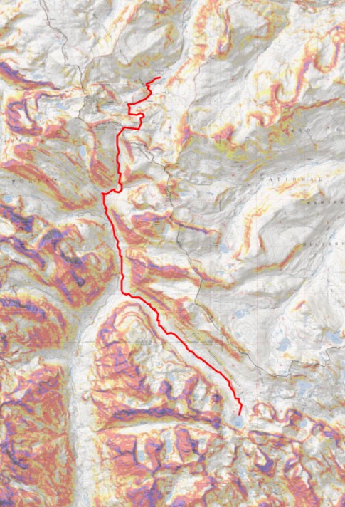
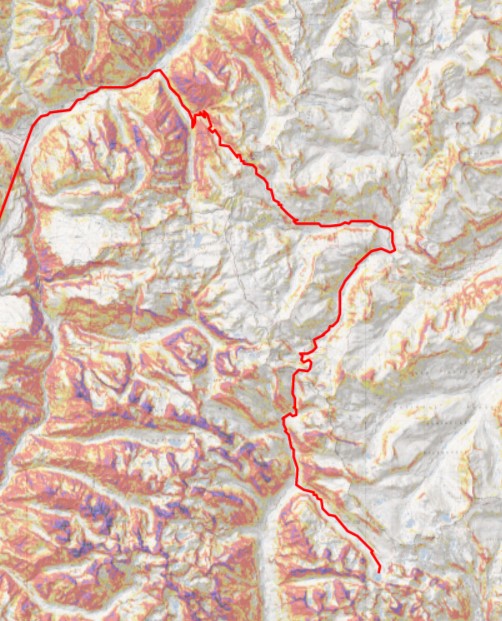
Here’s my topo map for the entire route
As always, please contact me if you’d like a gpx file for this route.
This trip changed so many times before it even began. I have an actual job, with responsibilities, meetings, etc. I drove down to Durango Wednesday night, slept in the cab of my truck at a Walmart (the topper is still on order), got “the knock” at 10:30pm, moved, then woke up and worked/had meetings in my truck the next day. Then I drove to Hunchback Pass through Silverton (my favorite way to get to Hunchback pass). It started raining as soon as I hit the dirt road, and didn’t stop. There was a 60% chance of rain today, but I was still hoping to find a window and hike either 5 or 10 miles to a camping spot (depending on when it got dark, weather, etc.).
The road over Stony Pass was sketchy in the rain. Miles did great, but there were a few times I was worried the mud was too deep to get through. I was a bit worried about the river crossings too, but Miles once again had no trouble.
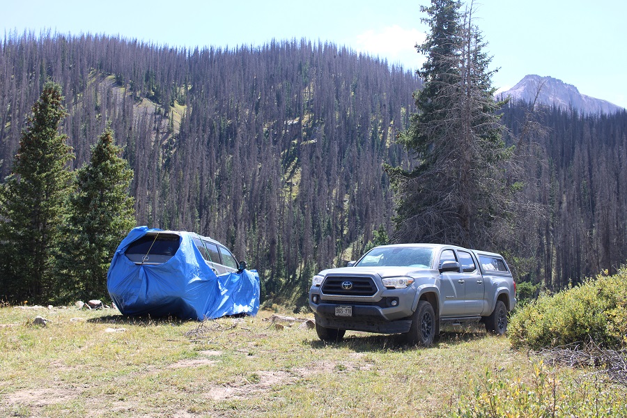
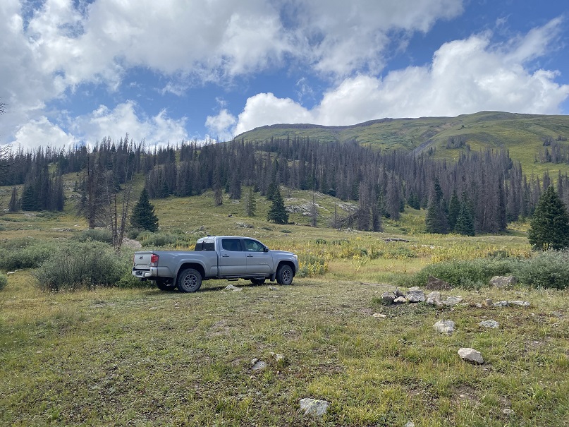
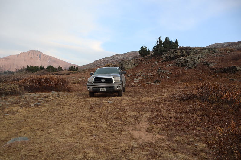
I’ve been to this area 3 or 4 times, and know the perfect place to park: It’s a pullout at 11230’, just before you hit the trees (again), and before getting to Beartown. My truck can make it further, but from past experience I know it’s going to get Colorado pinstripes from the willows and I have the opportunity to scrape the frame a couple of times as well. I love my truck, so I parked here, about 1.3 miles from the trailhead, in a flat spot with a campfire ring at 11235’.
I parked and waited for the rain to stop. The rain turned to graupel, then rain again, then hail. I could see the clouds coming over Hunchback Pass, and they weren’t getting any prettier. Wave after wave of new sets of clouds kept cycling in. After waiting for a few hours, I decided to just get some sleep. I know many of you would start out in the rain, but with my Raynaud’s I can’t risk it: If I get wet/cold that’s it for me, as I cannot warm up. I woke up every hour to check on the weather. The rain didn’t stop/clouds didn’t clear until 4:30am. That was a 15 hour rain delay that was seriously messing with my summiting plans.
I put on my rain gear to ward off water on the trail dripping from plants, and was on the trail before 5am.
Day 1 went like this:
Gained 1275’ over 2.8 miles (to Hunchback Pass)
Lost 2350’ over 5 miles (to Rock Creek Junction)
Gained 2503’ over 6.4 miles (to pass over Rock Lake)
Lost 500’ over .5 miles (From pass across basin)
Gained 1150’ over 1 mile (from basin to Oso/Soso saddle/to Oso Summit)
Woot! Summit!
Lost 1150’ over 1 mile (back to basin)
Gained 500’ over .5 miles (back to saddle)
Made it back to Rock Lake (losing about 600’ more)
Ok, so, let’s start from the beginning: From my parking space at 11235’, it was an easy hike to the trailhead, passing through Beartown. There were two other 4WD vehicles parked here, a 4Runner and a Tacoma like mine, unmodified, so you know it’s doable (choose wisely).
Once at the trailhead (813) I followed the Vallecito Trail up to Hunchback Pass
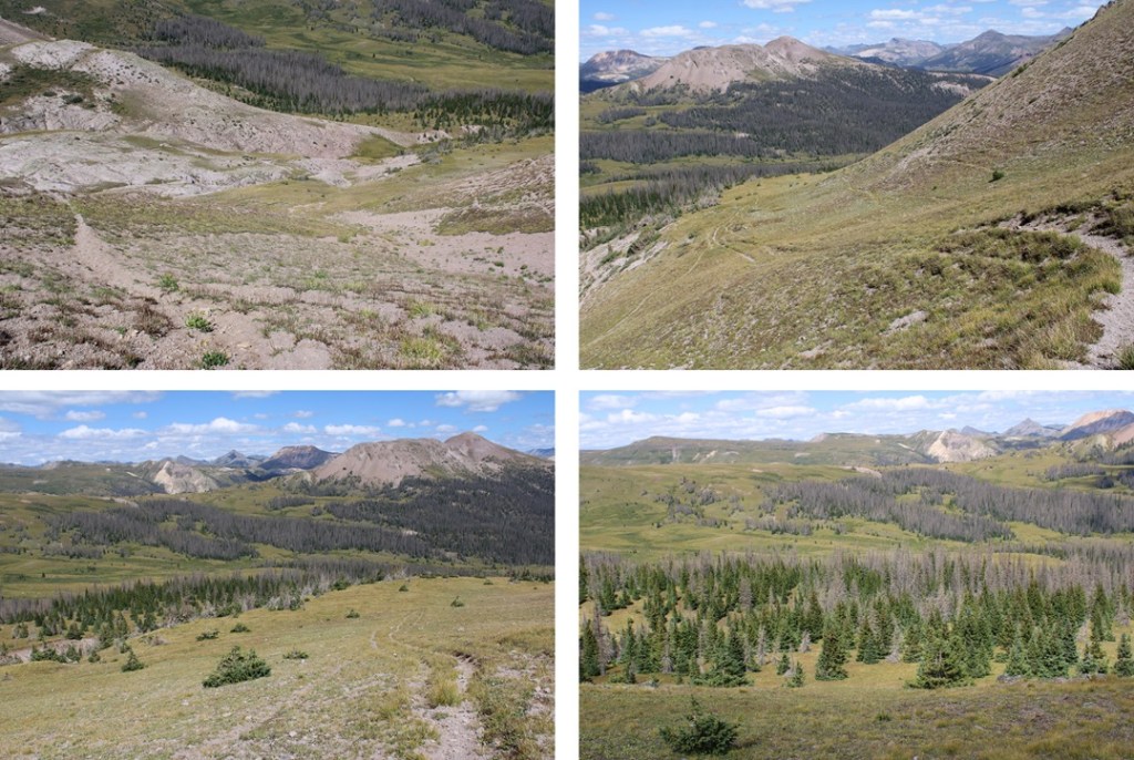
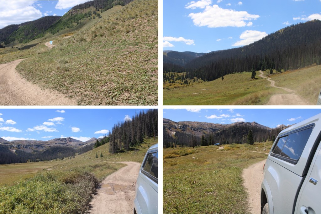
And then I headed south through the basin, following the trail down for 5 miles as it lost 2350’ in elevation
There were willows here, and I was glad to have on my rain pants. There were a few stream crossings, all easily crossable.
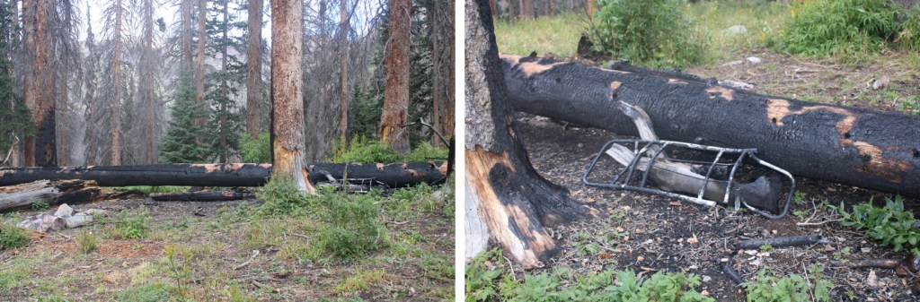
I saw evidence of someone’s fire getting out of control: looks like they lost their pack in the process. I wonder how they put it out? In case you’re wondering, yes, the ground was cold and the fire was out (I’m sure the 15 hours of rain last night had helped).
After hiking for a total of 7.8 miles (from where I parked) I made it to the Rock Creek Junction, and followed that trail southeast for another 5 miles up to Rock Lake. This trail was also class 1, and easy to follow.
Just before making it to Rock Lake I passed through a basin
In this basin was a bull moose. I didn’t worry too much about him, because he was hundreds of yards away from me, on the opposite side of the basin. I continued on the trail, but once he noticed me, he raced towards me and stopped a few yards away. He charged me (it was a bluff). I knew not to make eye contact with him, which was what he wanted. I could actually feel him willing me to look at him. I kept my head straight and walked the trail with a purpose, ignoring him. He continued snorting and pawing at the ground and shifting his head from side to side. Then he paralleled me for about 50 yards, walking about 5 yards to the west of me. When he was done, he trotted away and took in a view of the mountains.
As he trotted away I breathed a sigh of relief, and continued on the trail, exiting the basin and making my way to Rock Lake.
I arrived at the lake at 11am and decided to set up my campsite for the night. I didn’t see anyone else here.
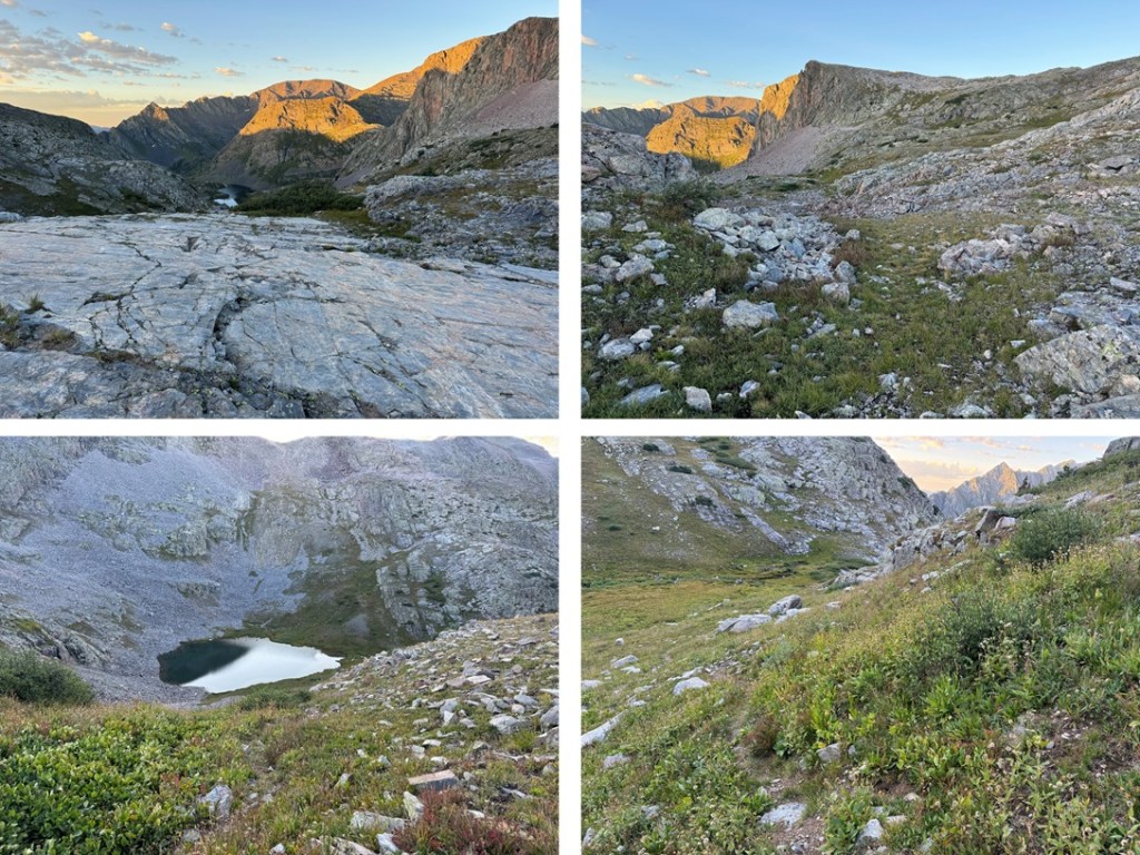
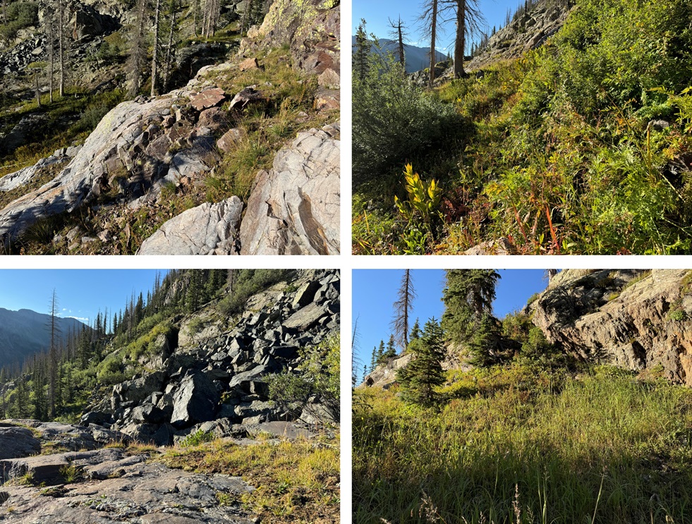
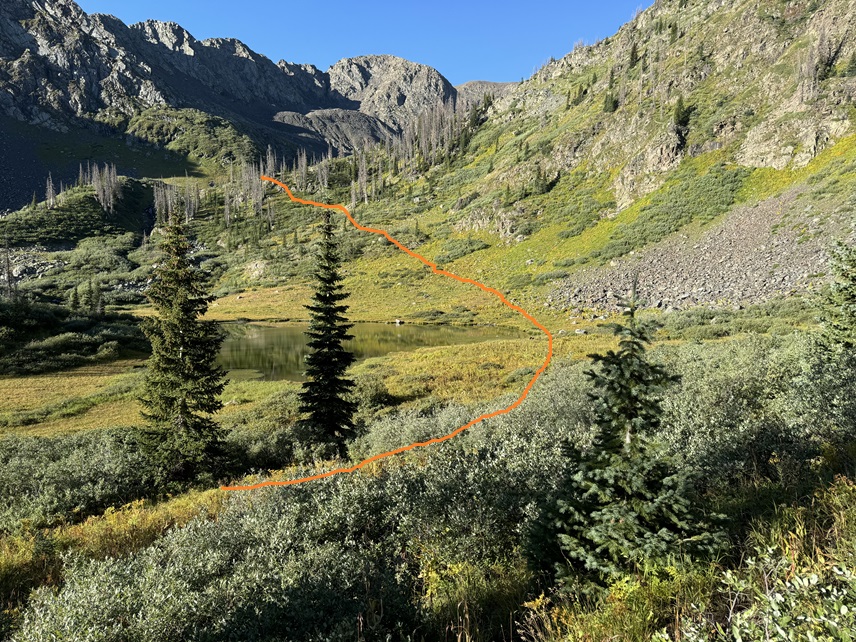
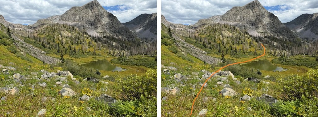
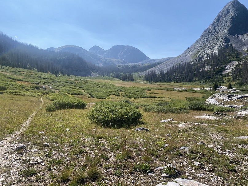
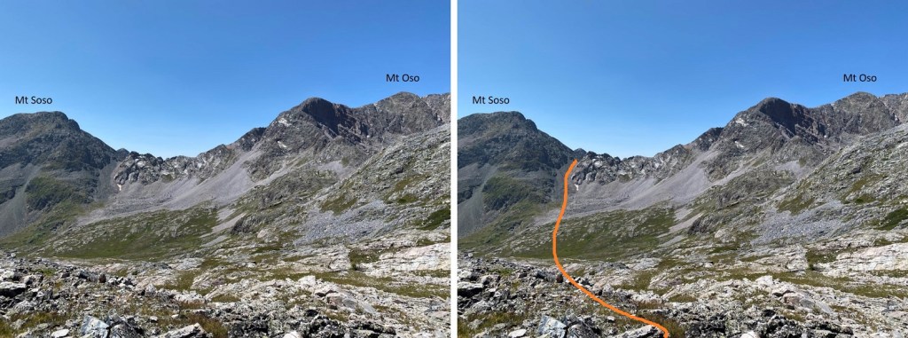
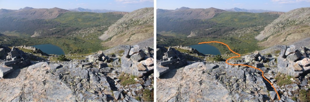
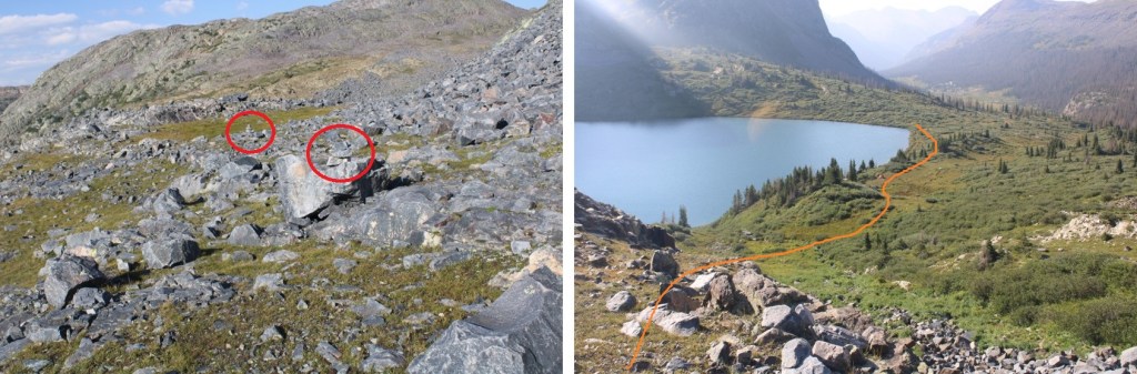
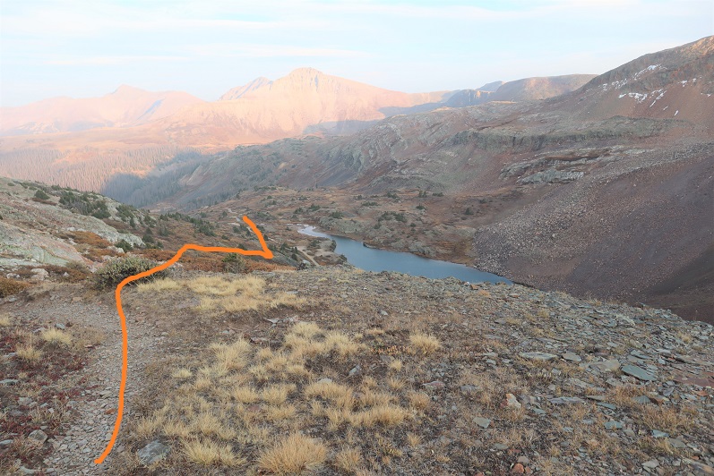
It was still early in the day, so after a quick snack I left my heavier gear and just brought the essentials: I planned to summit Mt Oso today. To do that, I skirted Rock Lake to the east and ascended the rocks
As I made it to the rocky area, I came across a cairned trail, and followed that trail southwest. Note, I took the solid line up, the dotted line down. The dotted line was easier, but both ‘went’. You can’t tell from below, but there’s a grassy area by the dotted line that helped me avoid the willows (pictures on my way down).
Here’s the cairned route, with the ‘exit cairns’ circled in red
Here’s where I left the trail. If you continue following the cairns, you’ll go down to Half Moon Lake. I was headed towards Mt Oso, so I left the cairns and continued heading up (west).
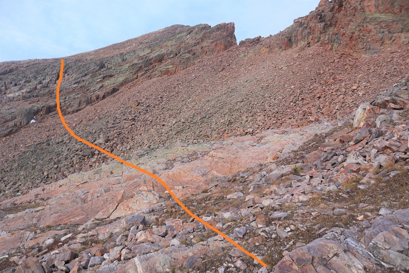
Time for more elevation loss, and gain. I was headed for the Mt Soso/Mt Oso saddle. This required me to lose 500’ through this basin, and then ascend the gully.
The basin was easy to cross. There were small streams and some willows to navigate, but the route was obvious (and choose your own adventure: just keep heading towards the gully/saddle). The gully was a mix of large, loose boulders, smaller loose rocks, and scree.
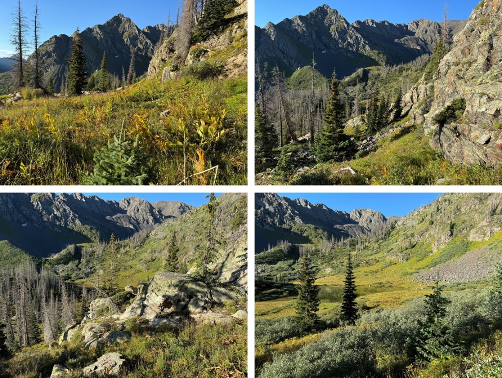
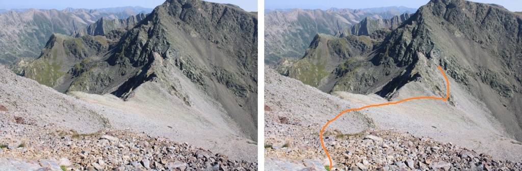
Once at the top of the gully/saddle, it was once again time to lose elevation. Being here also gave me a great view of Mt Irving. I descended the gully to the northwest, staying on the scree at the base of the rock outcroppings, rounding them, and losing 175’ in elevation.
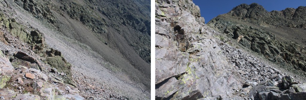
Stay low here. You’re going to want to stay high, but you’re aiming for a green rock band to cross. It’s lower than you’d like it to be (around 12600’)
There’s a little bit of scrambling to get over the rock band. I was able to keep it as easy class 3 by taking this route
Once across the green rock outcropping, it was time to gain the ridge. I turned and headed north. The rocks here were large and loose, with some scree mixed in.
I went low just before ascending the ridge, following a scree/game trail
And then followed the ridge to the summit
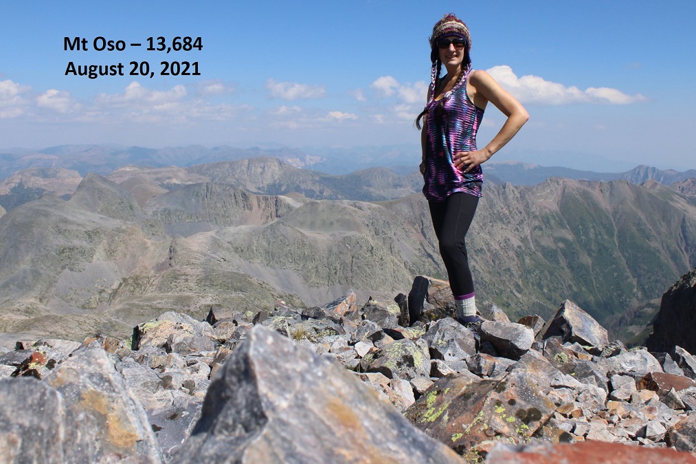
Summit of Mt Oso
Mt Oso:
There was a large, military grade summit register, with a moving dedication inside, as well as some ceramic bowls (I’m sure that’s not what they actually are, ad that they have a purpose?).
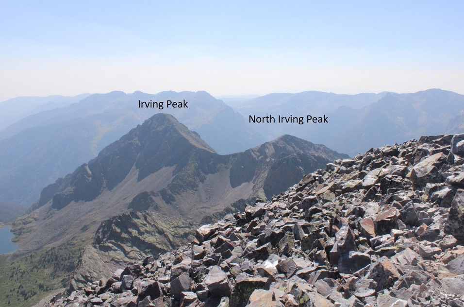
I looked over at Irving and North Irving. I did the math in my head, and there was no way I had time to loose the 1500’ of elevation, then regain 1300’ to summit Irving, plus hike back with all those ups and downs to Rock Lake before sunset. It’s important I’m in my sleeping bag before the sun goes down, which limits my hiking time. Oh well, just one peak for this trip.
So, I turned and headed back towards the Oso/Soso saddle
Back at the saddle I retraced my steps down the gully, back across the basin, and up to the next ridge, finding a grassy bank to ascend
The route looks much different heading back, so be sure to study it on the way in. Stay just below this cliff band
And now to head back down to the trail
You know you’re back on trail when you see cairns
Back down to Rock Lake. Here’s an overall view of the route I took down, and check it out: another camper! I walked by his tent, and apologized for doing so, but told him he was camped in the only area without willows…
There are lots of cairns here to guide you back down.
I made it back to my campsite as the wind started picking up. I was glad I’d made the decision to head back. I jotted down some notes, and looked at my tracker: I’d done 18 miles today, with almost 7500’ of elevation. I sat in my tent for a while, glad I’d decided to bring a tent, listening to the wind howl outside. I eventually fell asleep, and woke up to frost inside my tent. Lovely. I quicky broke camp and headed back down into the basin. Everything was covered in a thinl layer of frost.
Oh, did I mention the trails were mucky? It was from all of that rain yesterday. The entire way in, and out, I was walking on water/mud/avoiding puddles, glad I was wearing new hiking boots that were still waterproof.
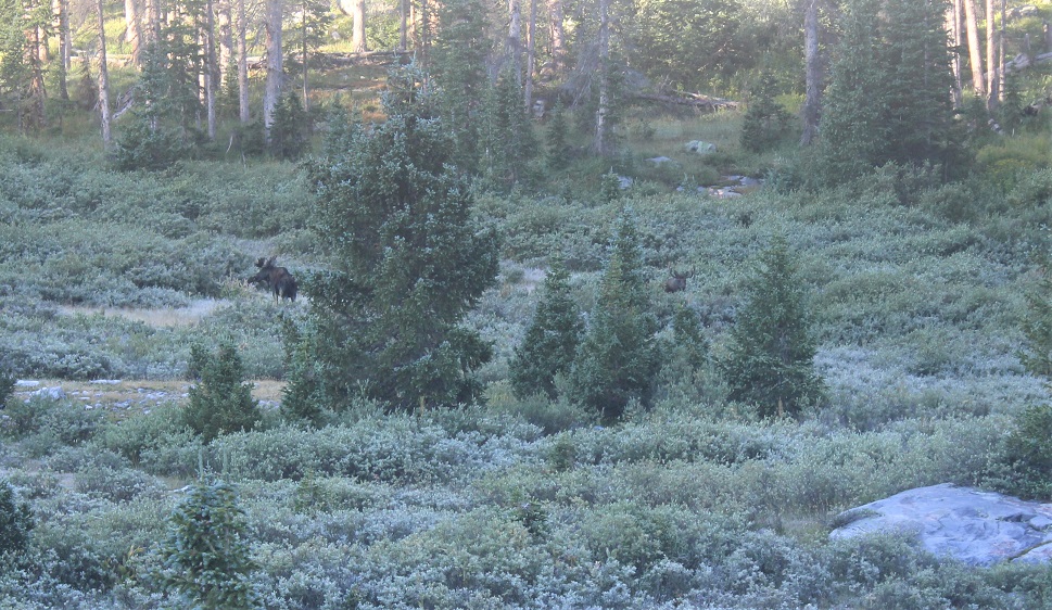
On my way out of the basin I decided not to take any chances, and wore my helmet. Towards the end of the basin I spotted the moose again. This time he had a friend, and didn’t seem to care I was there. I’ve seen over 20 moose in Colorado while hiking, and this was the first aggressive one I’ve come across. It’s interesting today he had no interest in me, while yesterday he was overly intrigued/agitated I was there.
I followed the Rock Creek Trail back down to the Vallecito Trail
Then took the Vallecito Trail back up to Hunchback Pass
And then back to the trailhead, the road, and my truck
When I made it back to my truck, my tracker told me I’d hiked 33.61 miles with 9833’ of elevation gain.
Now, for the hour and a half drive back to Silverton! Oh, also, side note: If you’re driving these back roads, make sure you know where you’re going! It’s easy to get lost back here. I met a man in a jeep as I was hiking back to my truck who was totally turned around. He wanted to know how much further down the 4WD road to the ‘real’ road. I had to tell him he wasn’t going in the right direction (this road is a dead end) and that Silverton was many, many miles away. An easy way to not get lost out there without cell service is to load your track onto CalTopo, then add a line and trace the roads you wish to take, then use that track your drive.
Just for fun, here are some pictures of the road out…
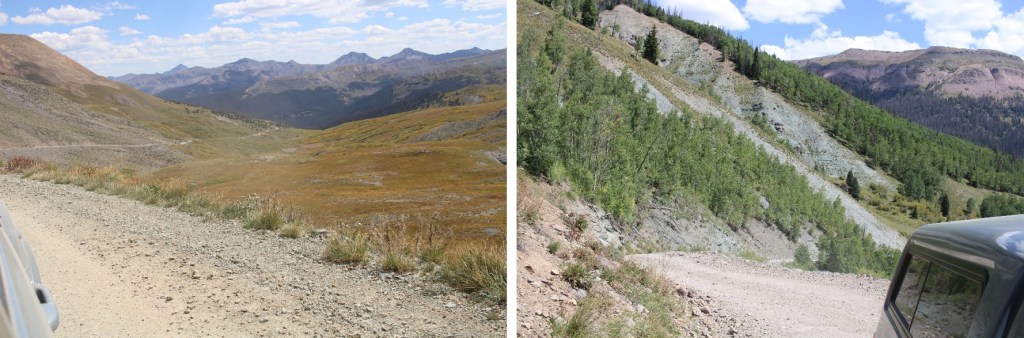
I was in this same area last week, and got a good view of the route I wanted to take to summit these peaks. This weekend the haze from the fires obscured a lot of the photos, but I think I can still get the general description across. I once again drove from Silverton to Beartown, but I decide to drive a little further up the road this time towards Kite Lake. That wasn’t the best idea (the road gets worse as you drive towards Kite Lake) but my truck still made it. She wasn’t thrilled with me, and I’ll be replacing her skid plate this week, but she made it. I drove in and out in the dark, so here are some pictures from last week’s drive.
I parked yards before the lake and was on the trail at first light: 6:30am
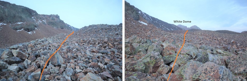
I realized on my way down I could have taken the trail to El Dorado Lake to gain the ridge, but that’s not what I did on my way in. You should though. Instead, before Kite Lake I headed south, and then southwest and followed the drainage below Hunchback Mountain to the ridge.
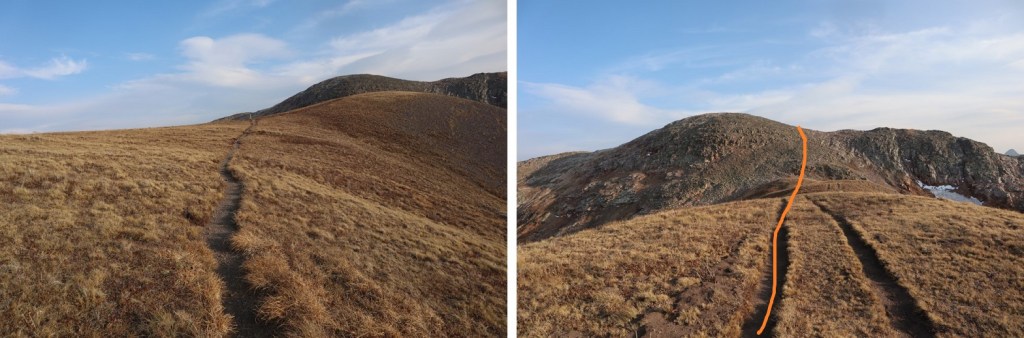
Once on the ridge I came across a trail, and followed it northeast
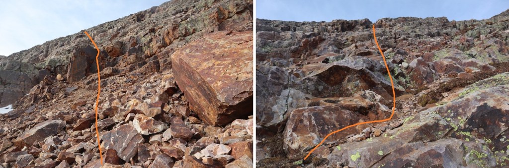
This would bring me to a rocky rib. Here’s an overview of the route up to White Dome, with the rib circled in red (it’s deeper than it looks). The rib drops down about 25 feet, crosses a ravine, and then gains 30 feet. This is class 3, closely bordering on class 4, and the only time I wore my helmet the entire hike.
Here’s looking down and up the ravine
And how I crossed
Here’s looking back on how I climbed into the ravine. This is pretty much vertical, straight down.
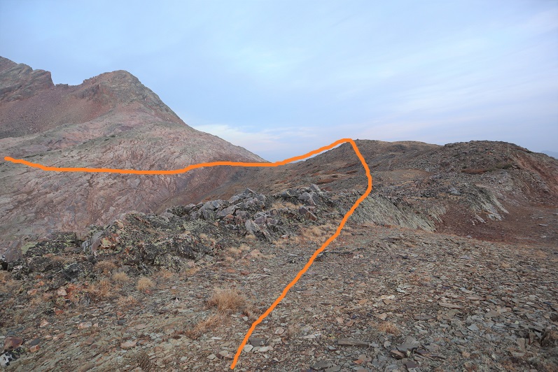
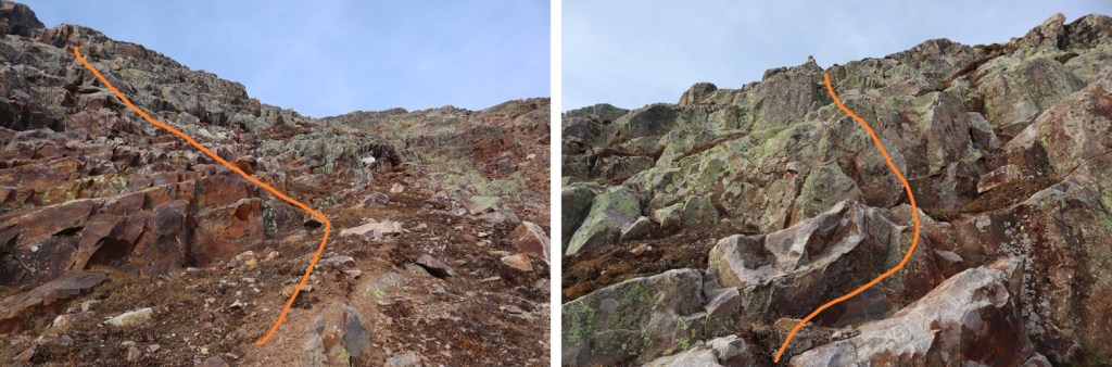
Once out of the ravine I continued southwest across some talus, aiming for another rock band. This was easy to climb up, and there was a cairn at the top, indicating the route to take. This is all class 2/easy class 3. Here are some photos:
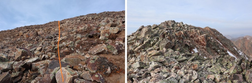
Once I gained the ridge it was an easy hike west to the summit
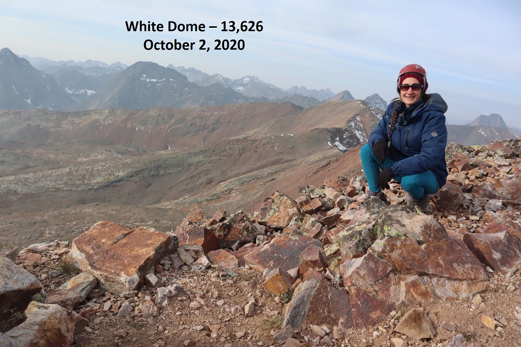
I summited White Dome at 8:45am.
White Dome:
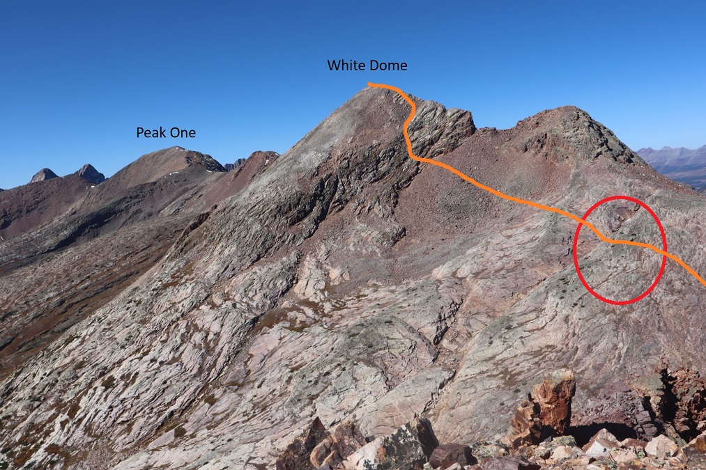
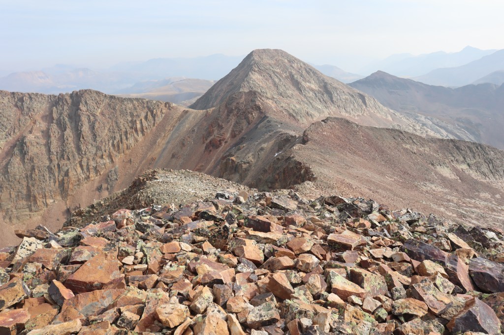
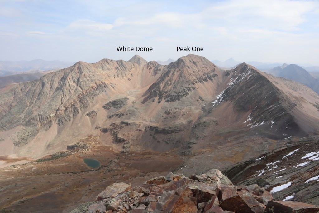
Next up was Peak One. Here’s an overall view of the route
This was a ridge hike, with no large obstacles to summiting. I dipped down once or twice to the right when needed, but this is all class 2
Here’s looking back at White Dome
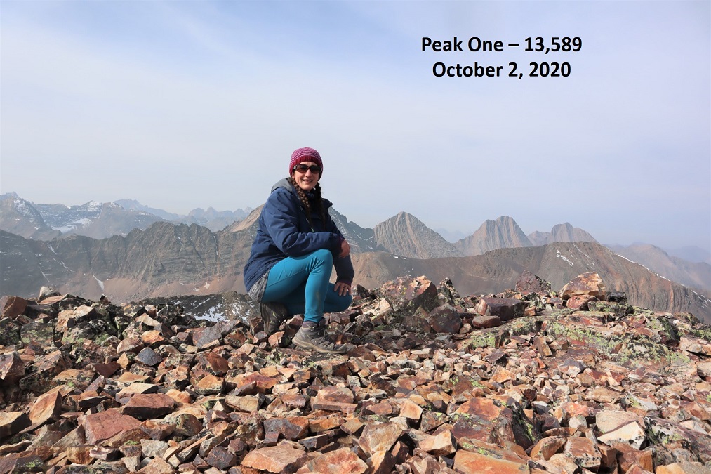
I summited Peak One at 10am.
Peak One:
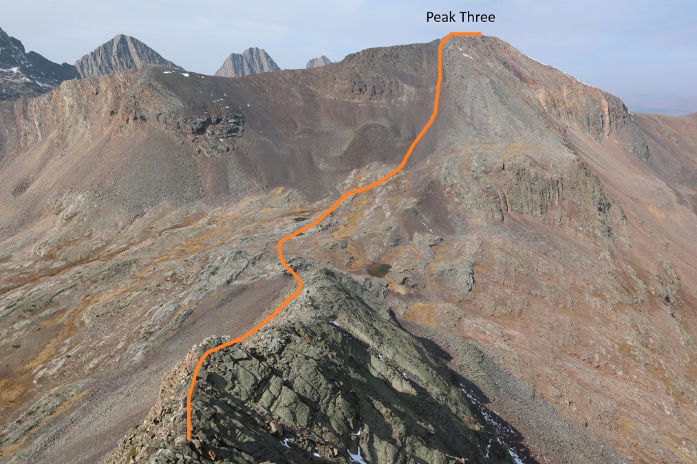
Now I had a decision to make. I could either turn back and head for my truck now, or make this a loop. I looked at my stats. I’d only gone 3 miles. Nope, not enough mileage/elevation/work to justify the drive in. I was going to make this a loop and summit Peak 3 and Peak 2 today as well. It would significantly raise my elevation gain (mostly on the way out) but it would mean I would need to make that 1.5-2 hour drive on a dirt road from Silverton one less time. Here’s looking at Peak Three and Peak Two from Peak One, with my overall route there and down into the basin that would lead me out
I started by heading south and following the ridge down, losing over 900’ of elevation. This ridge was class 2, with nothing too tricky. I could mainly stick to the ridge, but it would be obvious if I needed to dip right or left.
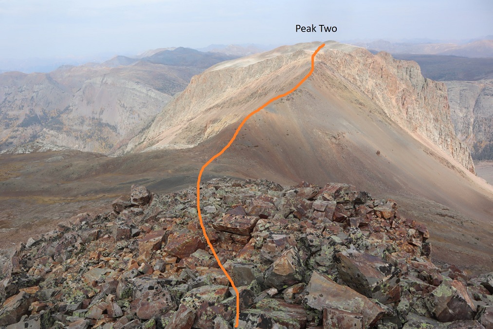
Here’s my overall route from the ridge over to Peak Three
And a look back at Peak One
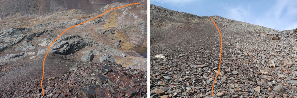
And some step by step photos of my way to Peak Three. After losing approximately 900’ I regained another 800’ to the summit, first by taking a rock rib towards the upper basin, and then ascending using the scree filled gully. The scree here wasn’t too bad.
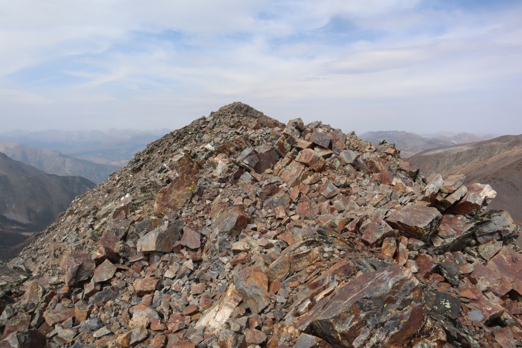
At the top of the gully it was a quick hike to the summit
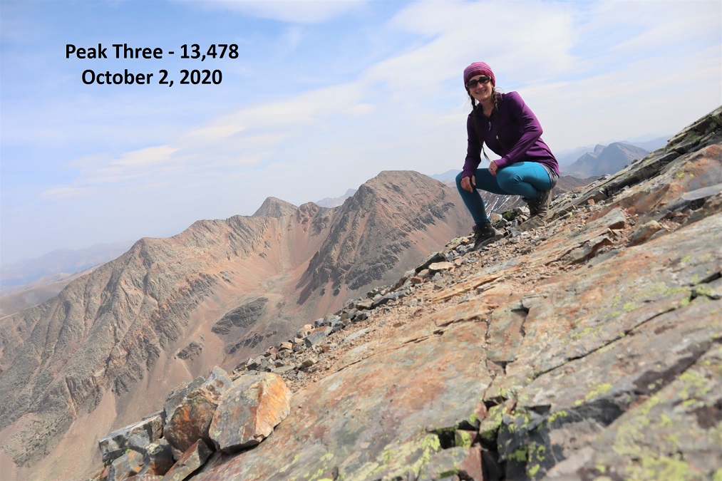
I summited Peak Three at 12:30pm. I had a hard time getting my camera to cooperate, so we get a unique summit photo this time
Peak Three:
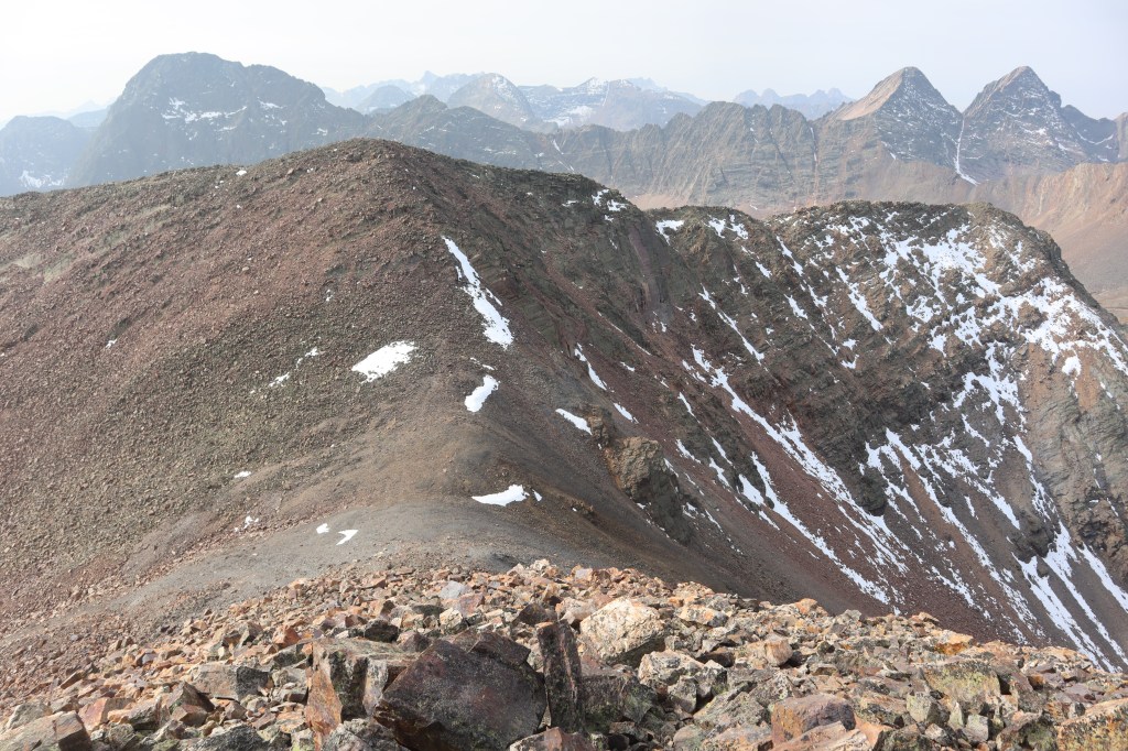
There were some pretty awesome views of the Trinities, and Wham Ridge looked dry (I didn’t get a clear picture of Vestal Peak however, sorry!)
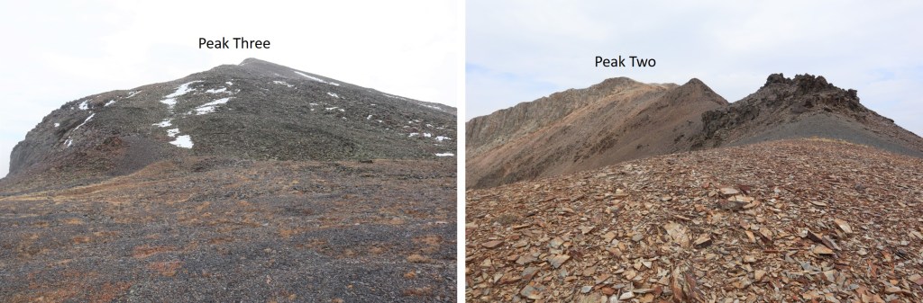
And here’s looking back at White Dome and Peak One
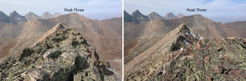
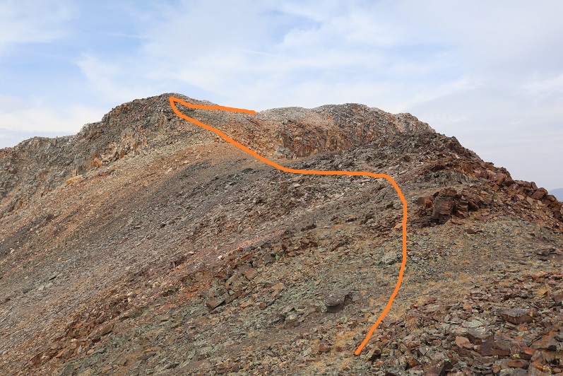
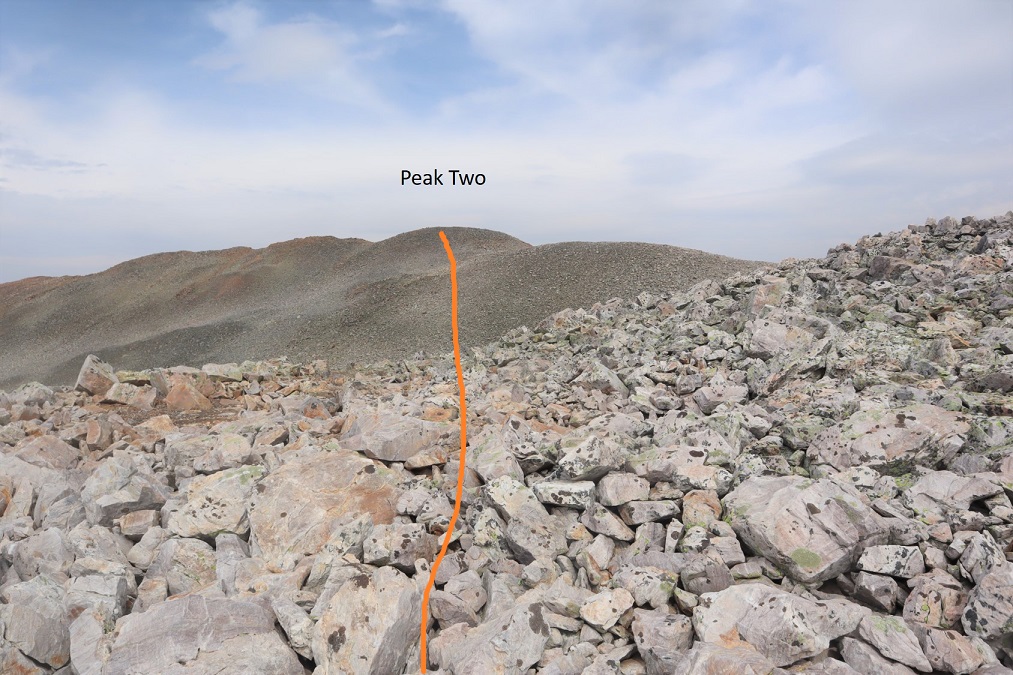
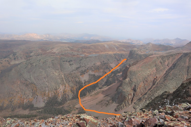
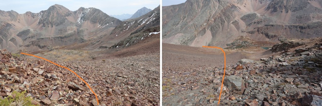
Now on to Peak Two. Here’s the overall route
This is an easy ridge hike. I started out heading north and just followed the ridge. Here are some highlights. From the saddle, looking back up at Peak Three and Peak Two
There’s actually a trail here that skirts the ridge to the left
Then it’s straight up this point to a false summit
And a quick dip and rocky trek to the summit
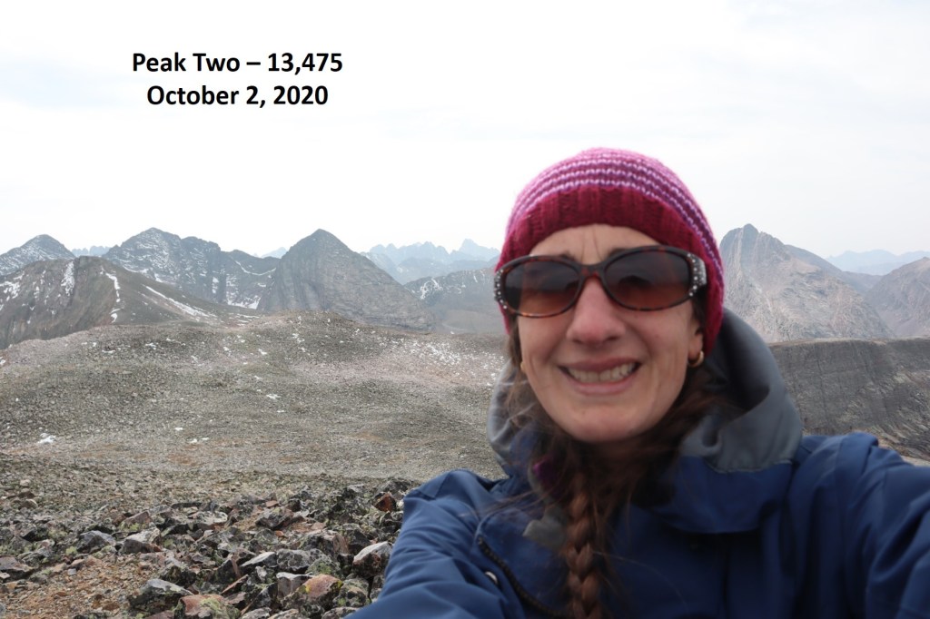
I summited Peak Two at 1:50pm. Something was wrong with my camera. I couldn’t set up the timer for a photo, so I just took a selfie, which ended up being unfocused. I also couldn’t use any of the buttons, the visual playback didn’t work, and I wasn’t entirely sure the camera was taking a photo (even though I heard a click). Oh well, I guess it’s time for a new camera. I’ve never liked this one anyway….
Peak Two:
I looked to the northeast, and could see my intended exit route. I planned to hike back down to the basin and catch up with the Colorado Trail.
That first required me to head back the way I’d come to the Peak Two/Peak Three saddle
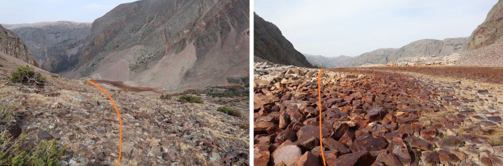
At the saddle I turned left and headed east and then north out of the basin
As you’re exiting, you’ll want to stay left to avoid a smooth rock waterfall
After the waterfall, aim for the trees, pass them to the right, and you’ll be able to see where the Colorado Trail picks up below
This is where I slipped on a rock the size of a microwave that decided to roll as I was using it for balance. I didn’t hurt myself, but I did bang up my camera, and when I went to take another picture all the buttons were functioning again (which was nice, but I’m still investing in another camera). Also, I need new shoes with better traction (this has nothing to do with the rock rolling, I just need new hiking boots). After this I followed the Colorado Trail east for 3.5 miles, gaining about 2100’ of elevation on a class 1 trail
The last bit was especially fun, as it involved dozens of switchbacks (sarcasm)
At the top of the hill I turned right and followed the trail south until I hooked up with the El Dorado Lake Trail, and took that east to Kite Lake and my truck
I made it back to my truck at 1:50pm, making this a 15.03 mile hike with 6051’ of elevation gain in just under 12 hours.