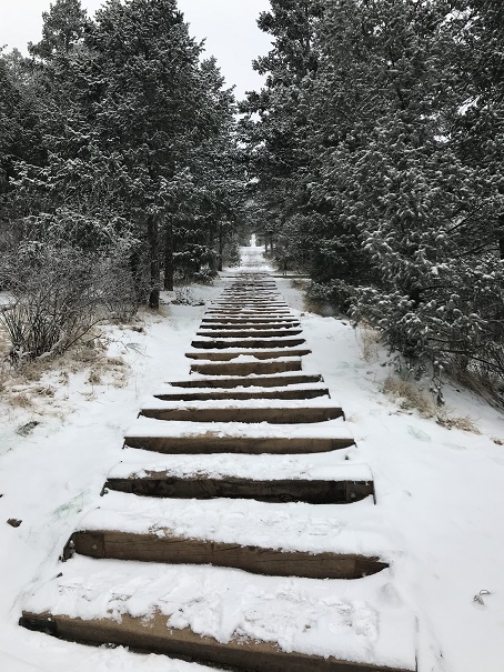
I’ve done this hike several times, so today I’m just going to post some pictures. I started at 6am, and while the sun hadn’t yet risen the moon was full and bright. The moon was so full I didn’t need to use a flashlight as I hiked up the steps. I was able to make it to the top f the incline in 36 minutes, 19 seconds. That’s my second fastest time, and I’m proud to say I did it with full gear, snowshoes and all attached to my pack.
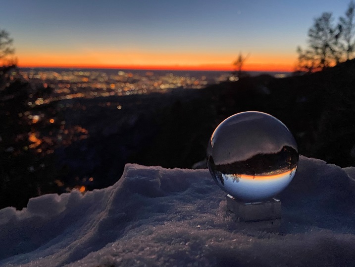
I tried out my photography sphere again, but it was really, really cold (12 degrees when I made it back to my truck) so I couldn’t position the camera right. I’ll keep practicing!
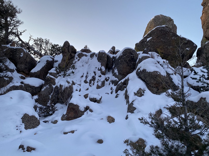
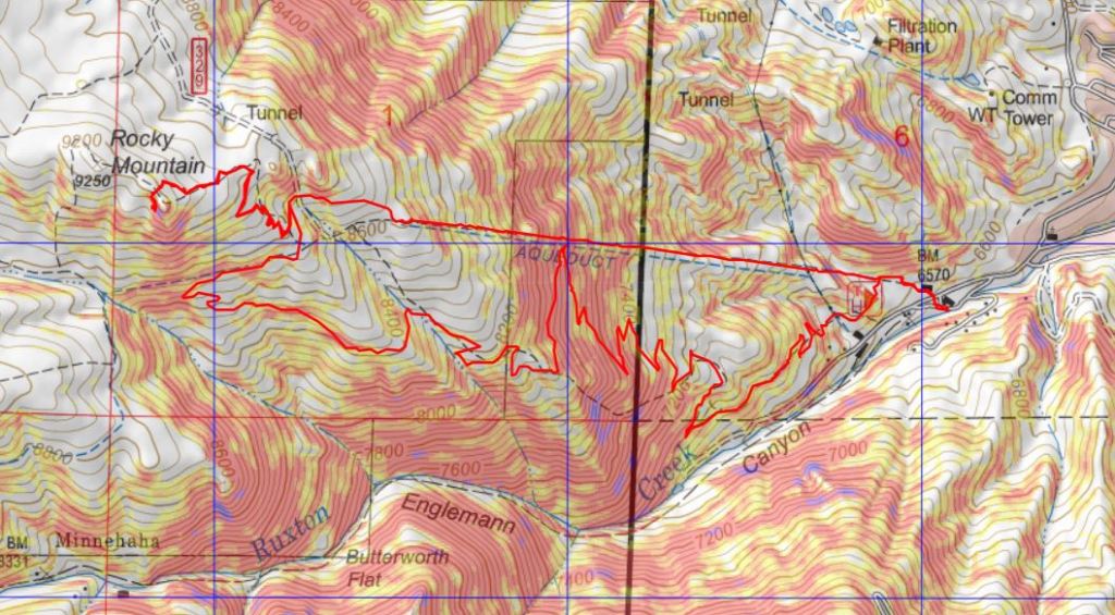
When I got to the top I wasn’t tired yet, so I decided to continue on to Rocky Mountain. The last bit is class 3, especially with snow.
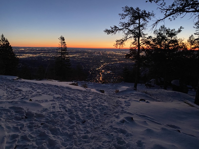
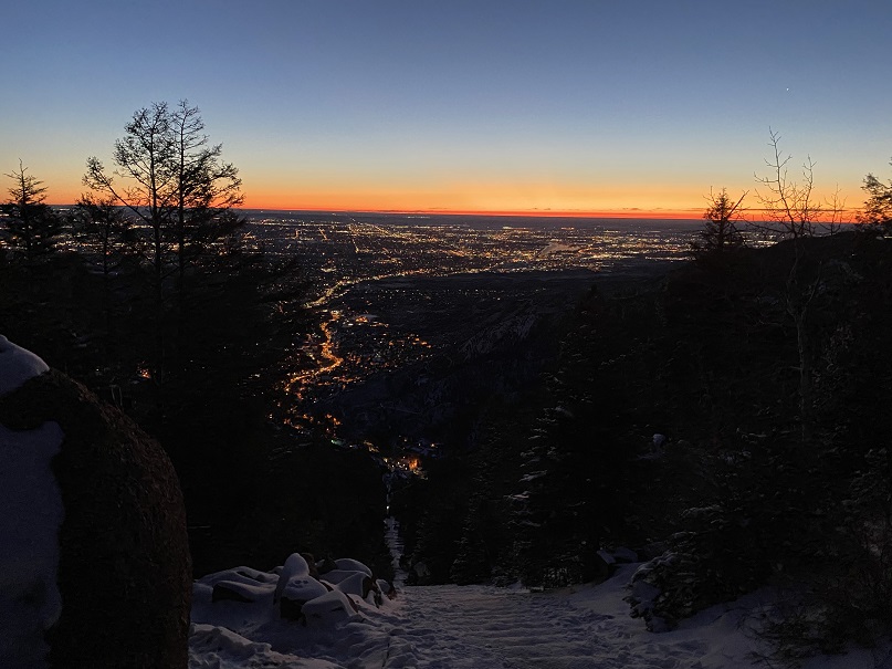
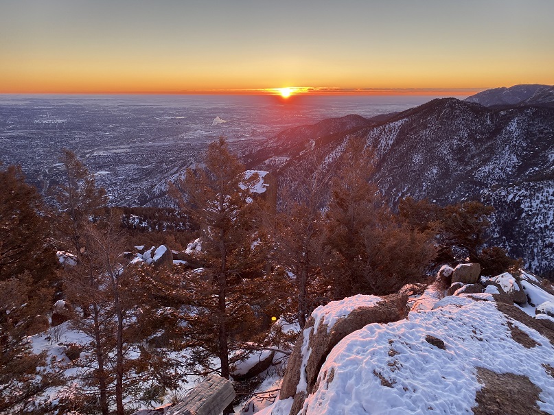
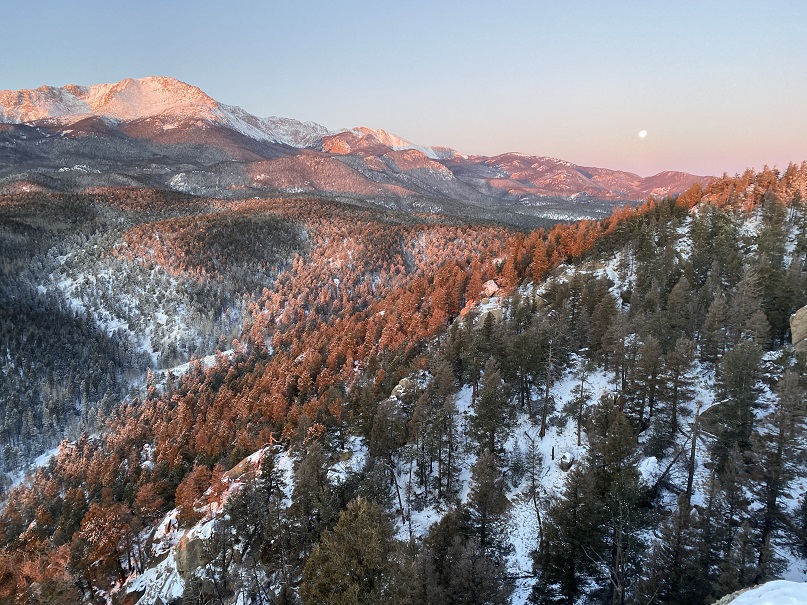
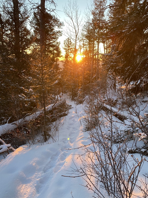
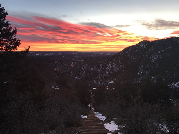
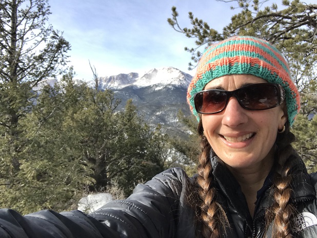
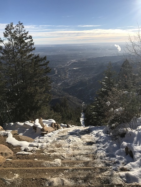
There I made it just in time for the sunrise. And I got some pictures of Pikes Peak with the moon.
I got to hike down heading directly into the sun, which felt good on my face
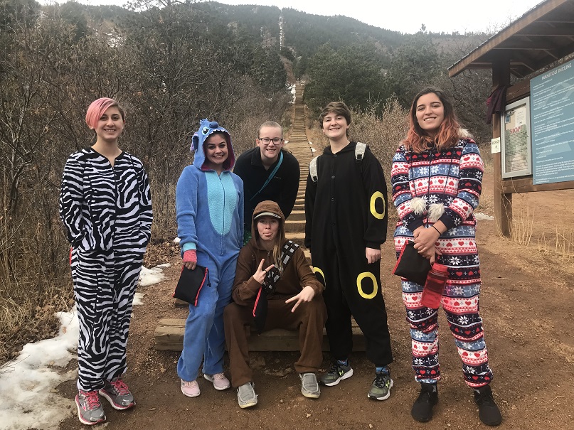
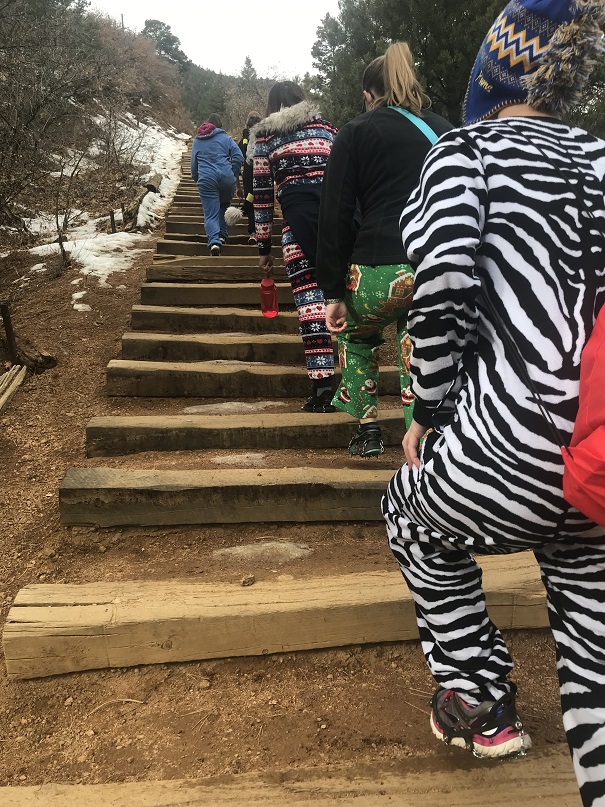
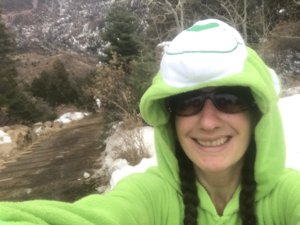
The girls planned this event 8 months ago. The goal: to hike to the top of the Manitou Incline wearing onesies. Me, being their leader and knowing they weren’t referring to outfits they wore as infants, had to look up what onesies were (pajama-like costumes that are all one piece). This sounded fun to me so we worked on setting up a date. We settled on the first week in December because we thought the weather would be cooler, there’d be less people climbing, and because band and cheerleading would be over so more girls could attend. They all met at my house and we carpooled to the free shuttle lot. Side note: they all drive now, which is weird since I’ve known them all since they were 5.
I’ve never used the shuttle before but it sounded like fun to go with a group and it would save us $20 in parking fees so I was all onboard with this idea. Once the shuttle arrived we had to wait a while for it to take us to the incline (it only goes every 20 minutes) so we talked about our strategy and goals for the climb.
I’d shown them a video last week about hiking the incline and they were all excited to try it themselves.
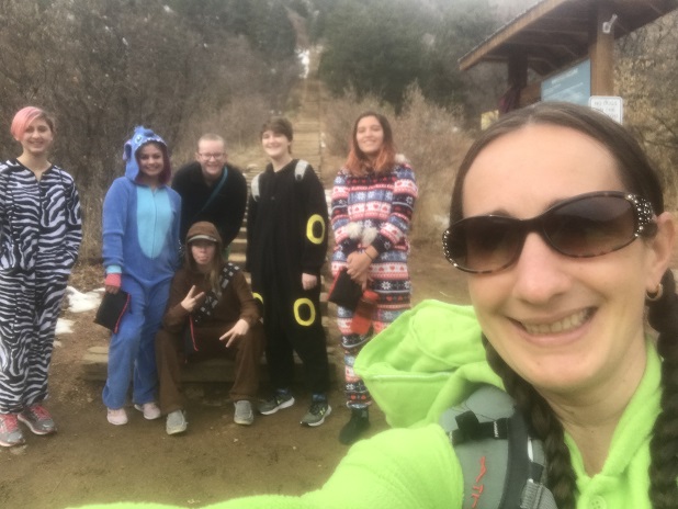
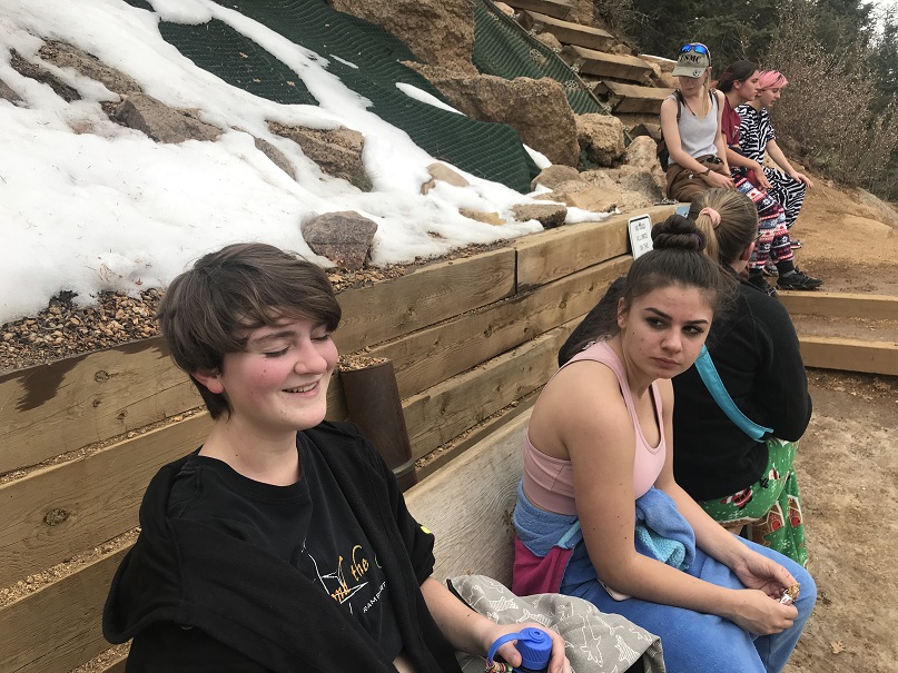
When we finally arrived we walked up to the start of the incline (one of the harder parts of the hike, actually) and the girls put on their microspikes. I wasn’t 100% sure they were needed, but it’s better to be safe than sorry and the troop owned enough pairs so everyone wore them. I took a selfie with the girls and we were off!
We started out at a moderate pace
But after the first 200 steps or so they all needed a break and two of them were having a hard time breathing. Not gonna lie, I got a little worried at this point. When I hike the Incline I don’t take breaks. Well, today we took a lot of breaks. And I mean a lot. Every 100 steps or so we stopped.
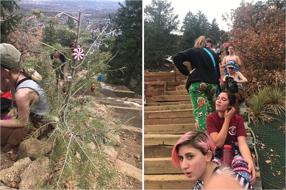
Soon the girls had tied the arms of the onesies around their waist (who’s idea was it to wear felt on this thing?) and we stopped at the Christmas Tree (the halfway point) for an extended rest.
We were glad we’d chosen to hike in December: Yes, the weather was cooler (this would not have been fun in onesies in the sun) and there were less people than normal.
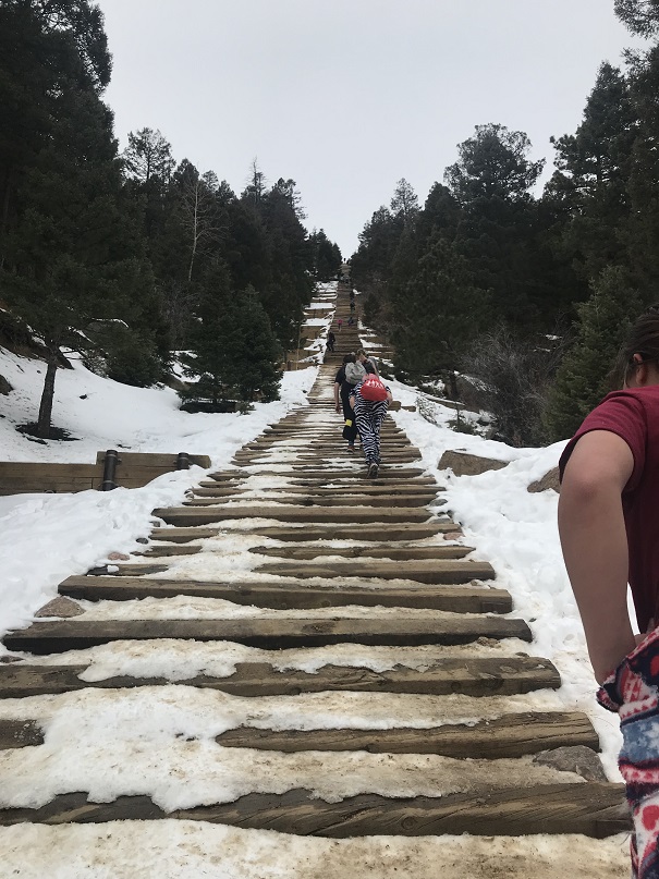
More hiking….
And more resting…
But to be fair, their rests were short and they all kept going. One of my girls had her Tourettes start acting up and she had a hard time seeing due to the ticks but she never complained. They were all tired but no one wanted to quit. I’m proud of them for that! The microspikes ended up coming in handy after the bailout spot, when the trail got icy for a bit.
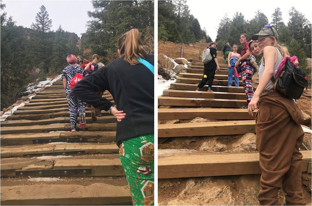
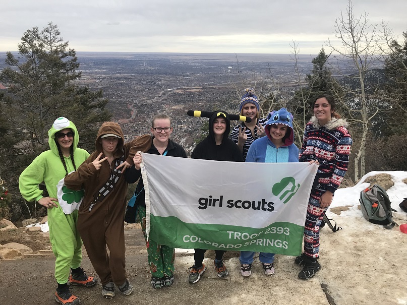
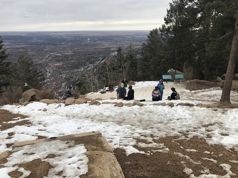
The girls stayed pretty much together, only being separated by a few feet or so for most of the hike, with Kimberly powering on ahead as we neared the summit. Finally, after an hour and a half of hiking, the girls made it to the summit!
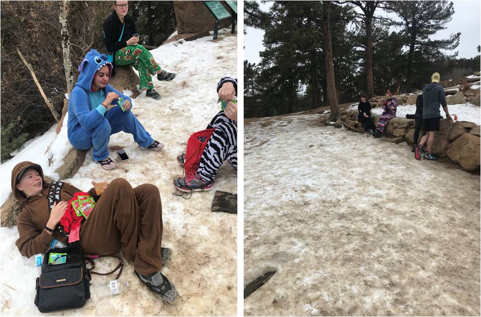
Jules got out the Fun Dip and the girls rested for a bit while I got out the hot chocolate and apple cider. We ended up only having the apple cider though, as my fuel canister had run out and we didn’t have anything to heat the water (bummer!)
I took a selfie because hey, how many people hike the incline in costumes? Caroline did as well, I’m guessing for SnapChat
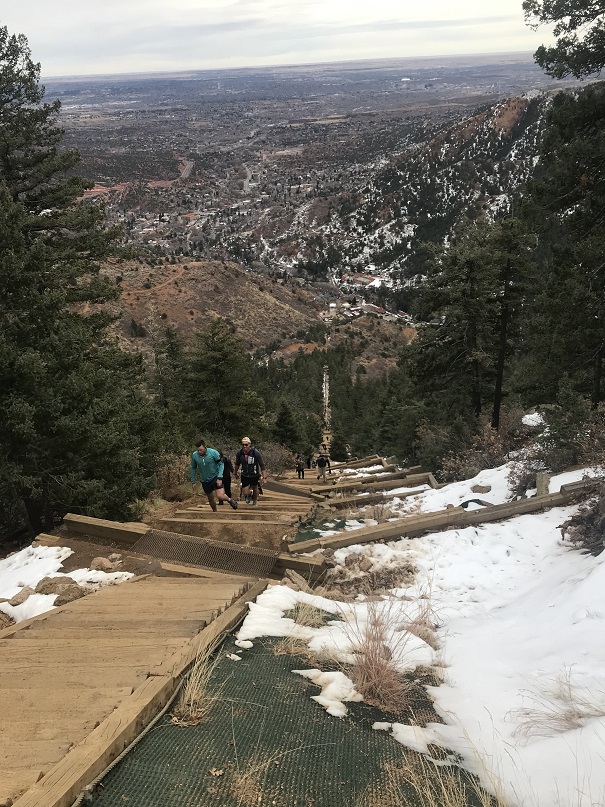
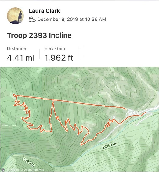
I tried to get them to continue on to Rocky Mountain but Emily had winterguard practice and everyone was hungry so it was time to gather our stuff and head back down. The Barr Trail down was much icier than the Incline route up and I was glad we had spikes. The girls realized just how important they were when one of Emily’s broke and she took it off. In less than a minute she slipped and fell on the ice, landing on her back. Hard. Ouch! But bless her, she took some ibuprofen and kept hiking. We made it back down to the shuttle at 1:45pm, making this a 4.5 mile hike with 1962’ of elevation gain in 3 hours.
We rode the bus back to our cars and drove to Fargo’s Pizza, where Breanna met up with us and we all chatted for a bit. It’s so cool watching these girls grow up! We discussed boys, school dances, cookie sales, homework, teachers, and a little about our upcoming trip to California.
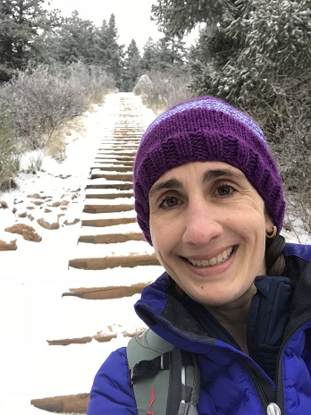
The weather was absolutely perfect today for a hike, but the avalanche danger was high above treeline so I decided to play it safe and stay local. I set my alarm for 3am, decided when it went off that was way too early considering I didn’t need to drive far, and set it again for 4:20am. The cats woke me up around 6am, wondering why I was still asleep. I jumped out of bed, silently cursed my alarm for not going off a second time, realized it was user error on my part, and decided to head out hiking anyway as the sun wasn’t yet up.
There was a man attending the incline parking lot when I got there. He informed me today was the last day they were allowing parking at this lot, as they were going to use the lot as a storage area for equipment needed to fix the cog railway. This was interesting information, and means I’ll have to either park at the shuttle lot (gasp!) or find other parking downtown if I want to hike the incline for the next two years. I made it to the trailhead at 6:40am and was on the trail by 6:50am.
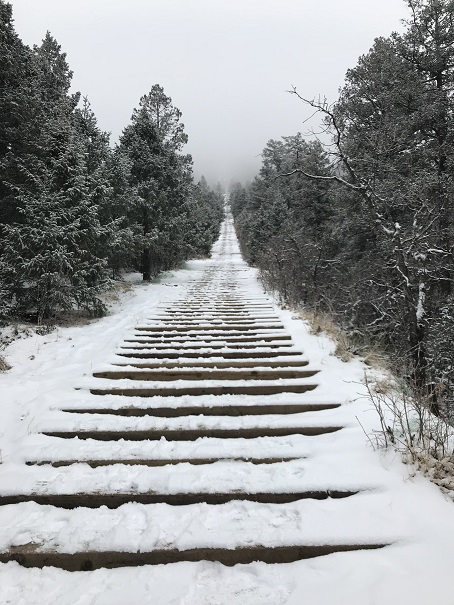
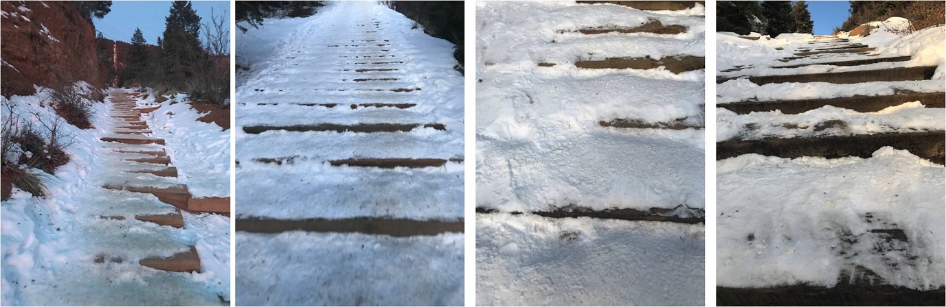
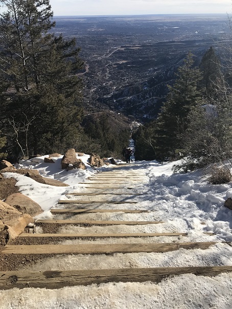
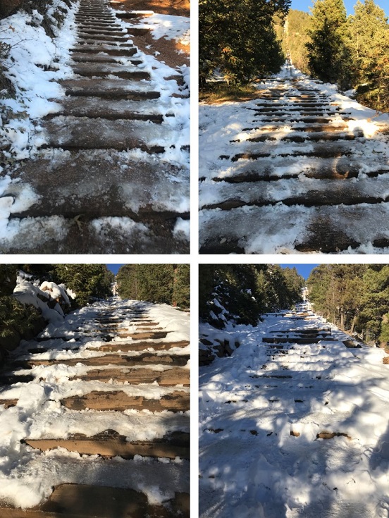
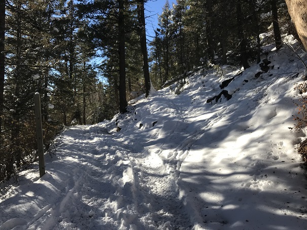
I usually hike for time when I hike the incline, but today I’d planned on just taking it slow and steady as I planned to hike it more than once. The steps were either completely dry or completely covered in snow/ice. I was glad I’d brought my microspikes.
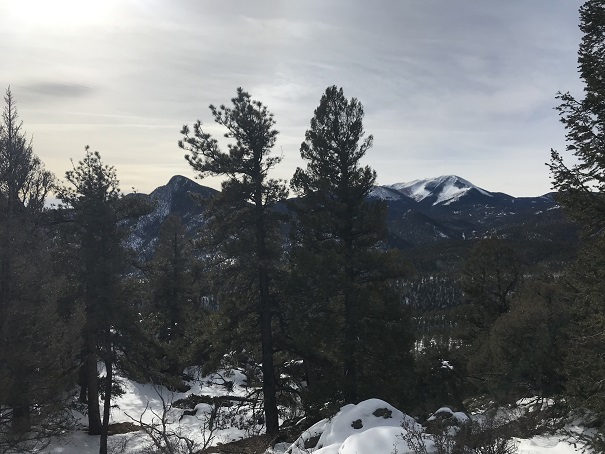
Just before 7am the sun started to rise. There were clouds in the sky so I never got a true view of the sunrise, but it was still beautiful
There weren’t many people on the trail this early in the morning (there’d only been one other vehicle in the lot) so the trail was nice and quiet. I only saw about 5 or 6 people on my way up. I summited the incline around 7:30am.
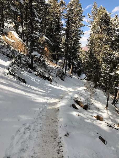
The 2.5 miles down the Barr trail was icy most of the way to the parking lot. Once again I was glad I’d brought microspikes.
OK, time to start this again. Once again I continued up the stairs, slow and steady. It was warmer now but microspikes were still needed. There were also many more people on the trail. I felt overloaded in my knit hat, snow jacket, and with my pack full of gear while everyone else was in shorts and only carrying a water bottle, but I didn’t intend to stop at the top this time. I summited the second time at 9:30am
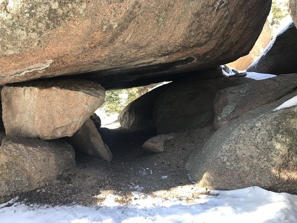
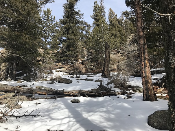
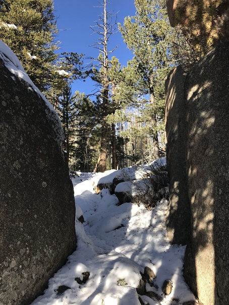
I’d had enough of people (there were dozens on the trail now) and decided to try to find the summit of Mt Manitou. I had a trail map that gave me the general direction of where the mountain was, but knew there wasn’t an established trail so I’d have to get creative to find the summit. I also couldn’t find any trip reports online, so I didn’t have more than my topo map to go by. I headed up the dirt road behind the incline towards the Barr Trail. Here I found a trail that paralleled the 4WD road and decided to take it instead
It led me to a cave
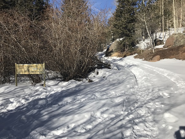
And then brought me back to the Barr Trail where it intersects with the experimental forest.
I’ve hiked in this general area dozens of times and I’ve seen the sign for the experimental forest every time, yet I’ve never taken that route. Today was my day! I knew this trail would get me close to Mt Manitou, so I followed it and quickly came to the old experimental forest area.
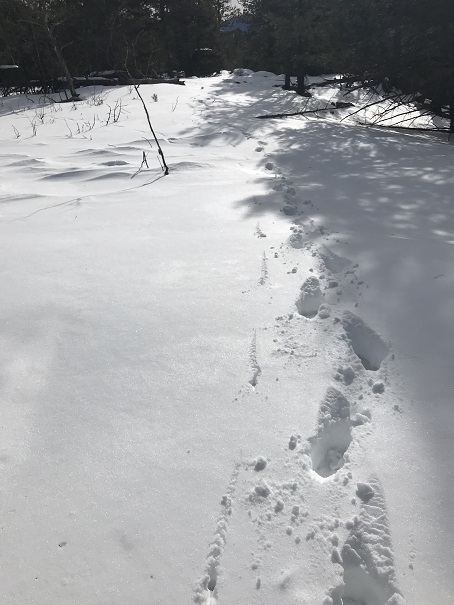
I continued to follow the dirt road covered in snow up and around past the experimental forest. When I was sure I was close I got out my phone and pulled up my Peakbagger app. It showed Mt Manitou as being NWN from where I was, so I aimed my compass in that direction and started hiking off trail. This is where I really could have used snowshoes.
I was sinking up to my shins in show but the good news was there wasn’t any wind so it would be easy to find my way back just following my tracks. I could tell I was getting close to the summit when the snow lessened.
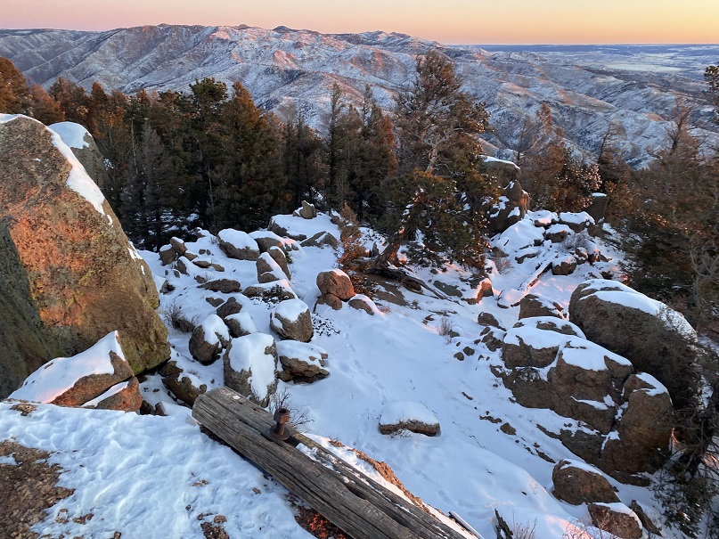
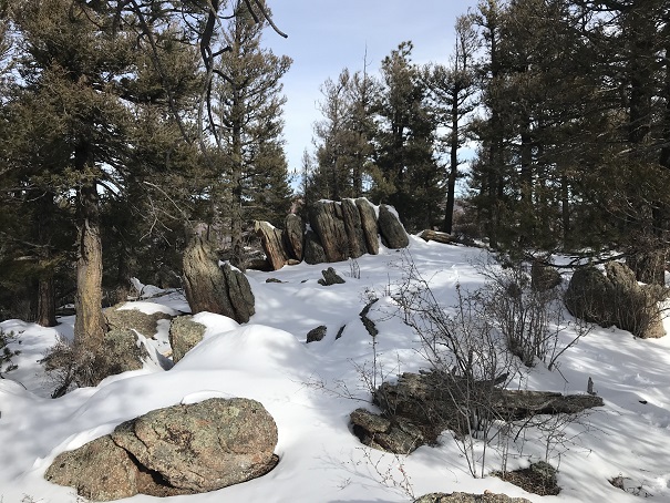
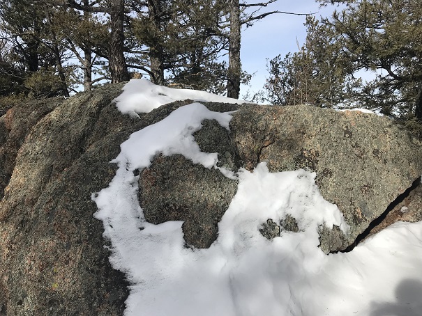
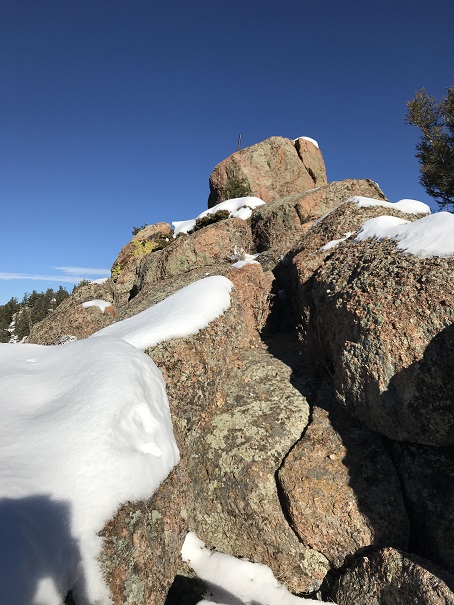
Still no trail, I kept hiking upwards, and soon I was at the ‘summit’. This was a treed summit with a lot of rocks. One of them held a cairn and that was my only indication of a summit (that and it was the highest point around)
I climbed up on the rock both to make sure I was on the highest point
And to get a picture
And a video:
Mt Manitou Summit:
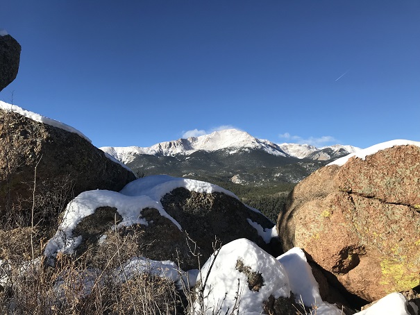
From the summit I could also see Cameron’s Cone, Almagre, and Pikes Peak
Ok, time to head back down. This was super easy as I just followed my earlier tracks back to the 4WD road and the 3.5 miles back down to the parking lot. This time the Barr trail was slushy and I was kicking up rooster tails of dirt onto the back of my pants. I made it back to my truck at 12pm, making this a solid 4865’ of elevation gain 11.5 mile hike in under 6 hours.
The weather forecast for this weekend was terrible. So terrible in fact they cancelled the 14er Winter Welcomer (where they teach newbies how to hike in winter-like conditions). I watched the weather very closely and narrowed the best weather down to the Sawatch range, right along the 82. Unfortunately, they usually close the 82 the first week of November, and today’s the 2nd. Oh, and the weather forecast wasn’t that great, it was just better than anywhere else in the state (40% chance of snow, 15-29*, winds 20-45mph… yes, that was the BEST forecast).
I’m still learning about alpine hiking in late fall/winter (considered early winter season conditions), so I made a promise to myself until I learn more about correlating forecasts to actual conditions to drive out to the trailheads and not make a decision on whether or not I’d hike until I was actually there. So this morning I drove past Buena Vista and a sign indicating the 82/Independence Pass was open. Woohoo! Now my only worry was they’d close it while I was parked at a trailhead and I wouldn’t be able to drive out (do they have plans for that?).
Well, that was my only worry, until I started driving on the 82. Almost immediately it was sketchy. It wasn’t snowing, but snow was blowing all over the roads. I could tell no one had been on the road in quite some time (an hour or more?). No one was passing me coming the other way, and I had to drive much slower than normal to avoid ice. I made it to the trailhead, but when I arrived it was whiteout conditions, and actually snowing at that time. The forecast indicated the snow would stop but the winds would pick up. I knew it wasn’t safe to hike in the dark in these conditions (and most likely not in the light of day either). I couldn’t wait for the sun to rise because I wouldn’t have enough time to complete the hike. Drat. I was going to have to turn around. This stunk, but I knew it was the right decision. Those winds were insane, and the snow was just going to keep blowing as long as the wind did. If these were the conditions below treeline it would be a miserable hike, even more so above treeline, and I most likely wouldn’t summit.
When you show up to the 13er trailhead with the best weather forecast in the state and life gives you whiteout conditions but you NEED TO HIKE you change tactics.
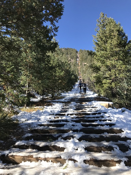
On the drive home I frantically thought of which local mountains (below treeline) I’d yet to summit. I had none in mind… In fact, I haven’t even started planning my local winter summits because I figured if I never planned them I’d never have to use them. Ouch, that was coming back to haunt me now. I didn’t have any of my local maps with me, or any routes planned (I did have 8 different 13er routes though, but the weather wasn’t going to let any of them happen today). I guess I’d just hike the Incline a few times so at least I’d still get in some elevation gain. That’s when it hit me: Mt Manitou! I’d heard that was a nice alternative to the incline that no one used. I googled it. No luck. I couldn’t find a route, but I could find one for Rocky Mountain (a 9K summit directly behind the Incline). I was going to go for it.
I made it to the Manitou Incline Trailhead and began at 8am (after taking off my snow clothes: it wouldn’t get that cold below 10K today).
The Incline was much icier than I’d anticipated.
I had my microspikes, but didn’t put them on. Most experienced incliners had theirs on. As usual with the incline, I kept a steady pace but didn’t stop. It took me 41 minutes 39 seconds to make it to the top, after taking time to help someone with their yack tracks and careful foot placement due to ice.
I was overdressed in my knit hat and snow jacket, but the top of the incline wasn’t my intended destination. I took a few pictures and continued uphill, past the old foundations.
There’s actually a 4WD road here.
I took it for 1.5 miles and then left the road on a trail that heads towards the summit. The cutoff is at this post.
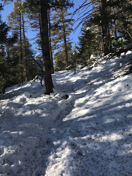
The trail was covered in snow, and I backtracked a few times due to game trails (and fresh prints from said game) but was always able to find my way back to the actual trail.
The snow was about 6” deep. Luckily I had on winter boots that went to my shins. These had looked ridiculous on the incline, but were coming in handy now.
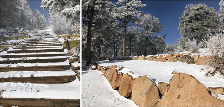
I turned right at an area with some large boulders (after initially heading straight/north, which I soon figured wasn’t a trail that led to the summit)
I rounded several corners and finally came to the summit block of Rocky Mountain. This is what I saw.
What?!?!? This didn’t look too difficult, but I didn’t bring my helmet, as I didn’t think I’d need to do any rock climbing. It was also icy due to snow and, well, ice. Before climbing I decided to walk further around the side to see if there was another route up, and sure enough, there was.
It was an easy climb to the summit, which still had remnants of some sort of past structure.
I summited at 9:15am
VIDEO:
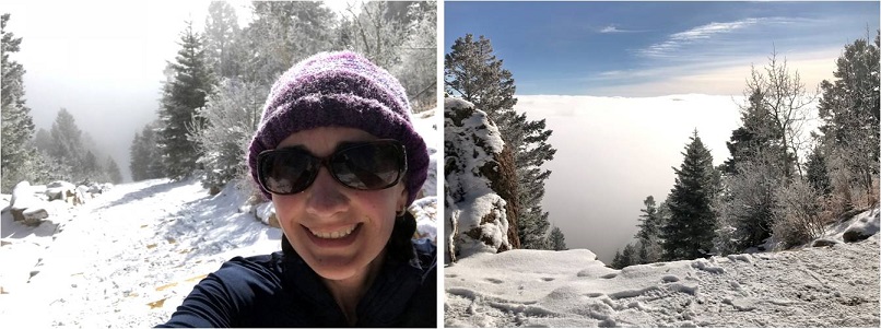
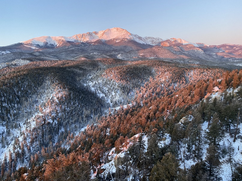
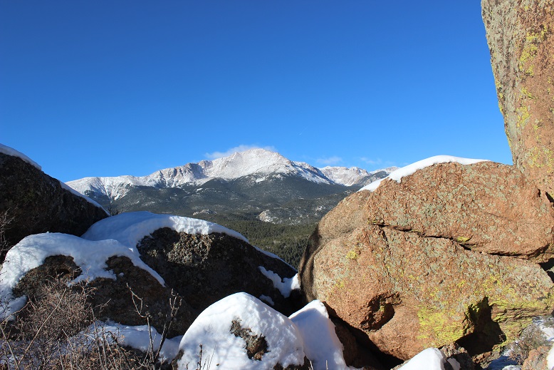
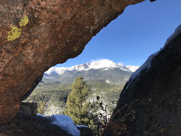
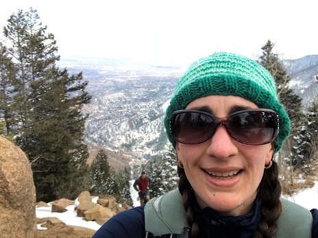
It was WINDY! Seriously windy! And COLD!!! And I wasn’t even above treeline! It was a good call to alter my hiking plans for today and to overdress for the Incline. After retrieving a glove that had been caught in the wind and flown about 10 yards away I hiked back to below the summit block and got a few pictures of Pikes Peak.
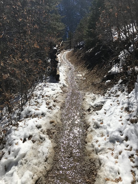
And then I was on my way down. I just followed my tracks. When I got to the boulder area I decided to actually take that trail I’d seen earlier, but I wasn’t entirely sure it was a trail. I stopped for a bit, turned on my data, and tried to see if there was a trail to Mt Manitou from here? No luck. The trail I was on went north (and lower in elevation). I could see Mt Manitou,
and debated just hiking the half mile over there, but the snow was getting deeper and I didn’t have snow pants/snow shoes and the snow I’d been trekking in was turning to water on my clothes. This wouldn’t end well with the wind, so I backtracked and found the Barr trail. Here’s a view of Cameron Cone
taking it back down to the base of the Incline. The Barr trail was much icier than I’d anticipated. Spikes would have been helpful (but I was too stubborn to put them on and instead put up with the occasional sliding: Thank you Yoga for the balance).
I made it back to where I’d started, but I wasn’t tired yet!!! It was exactly 11am, so I decided to hike the Incline again. The second go up the incline was more difficult than the first because there were a lot more people, it was warmer out (I still had on my winter coat and hat) and I was tired. This time it took me 49 minutes to summit. That’s the longest it’s ever taken me, and I was quite tired when I reached the top.
I immediately headed back down the trail, which was muddy now since most of the snow/ice had melted.
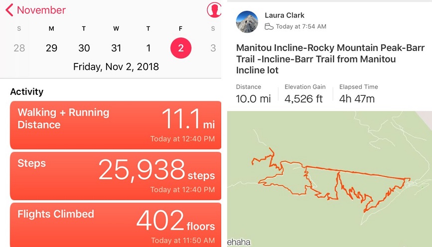
I made it to my truck at 12:40pm. I checked Strava, and this was a 10 mile hike with 4500’ in elevation gain, completed in under 5 hours. I felt great!
My intent this morning was to hike the incline twice: one to see the sunrise, and again for the exercise.
I woke up at 5am, got a cup of coffee, and opened my front door to look at the mountains: fog/clouds were covering them. I couldn’t even see the light atop Pikes Peak. That settled it: I was going back to bed.
I woke up briefly again at 6:50 am to get the kids off to school, then snoozed until the cats woke me up at 11:10am. I looked outside: no serious clouds over the area I intended to hike.
I quickly made a quesadilla and downed it with a glass of milk (those of you who know me know what that means) and made it to the incline in record time. As I was driving up Ruxton Ave I saw someone I’d met at the 14er Happy Hour, offered him a ride the rest of the way, but he declined (presumable because he was on a date).
It was frosty but not too cold (around 30 degrees) when I started. I began at 12 noon and decided to take it slow, mainly because I intended to do this twice today.
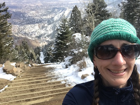
I trudged along, leap frogging with Eric for a bit, and then finally hiking on my own for the last quarter mile or so. I summited in 40 minutes, which was slow for me but reasonable since I’d intentionally paced myself. I took a summit selfie to prove I’d made it, and continued back down (after chatting with the girl hiking with Eric: she and I made it at about the same time… he was a bit behind).
The entire 3 miles back down the Barr Trail I debated if I should actually hike the incline again? I wanted to, but I was worried I was short on time. I needed to be back for cookie appointments, and a shower was essential beforehand. I could just go home and run for 40 minutes or so on the treadmill, but wasn’t that why I was out here today? Because I didn’t WANT to run the treadmill? I wanted to hike outside…
The trail was covered in snow… I was wearing microspikes and kind of walk/jogging my way down. (Note to self: get tighter pants, my yoga pants kept falling down as I tried to jog).
The last part of the Barr trail has a very small incline up about 15 steps. I hiked up them and thought: “Nope, I’m done for the day, this hurts” and continued towards the parking lot.
I made it to my truck, realized it was only 1:30pm, and knew I had PLENTY of time to do it again. So I did. Why run on a treadmill when I could hike in the mountains? I told myself I wouldn’t worry about time: I’d just trudge on and see how long it took me. I kept a slow and steady pace, and it was actually easier the second time. Maybe because I’d warmed up? Or maybe because I wasn’t worried about my time. I met lots of fun people along the way, and summited in 42.57 minutes (we’ll go with 43 minutes). Not too bad, considering it was my second time up today!
I again took the Barr Trail down, and when I was about a mile from my truck started texting my kids about pick-up, after school clubs, etc. Emily actually wanted to stay an extra hour and a half, so I had plenty of time. I mentally congratulated myself for making the right choice and hiking the incline twice. All in all, today I did 4200’ of elevation gain, and just under 8 miles in 3 hours. Woot!
I’m thinking this would be a proper 14er comparison if I could bump it up to 4 rotations. Next time maybe I’ll try 3…
I didn’t really care what the weather looked like today, I was going hiking. The only problem is I had appointments starting at 11am, so it needed to be quick and close to home. It snowed a bit overnight (unexpectedly) so I made sure I dressed warm and brought my microspikes.
I met Dave at Memorial Park in Manitou Springs and we carpooled up the Incline lot. I’m totally ok with parking there for $5 in winter (and think that’s a reasonable year long rate). I was the only one in the parking lot when we got there, but it was obvious from looking at the trail others had been hiking already this morning.
Someone from maintenance shouted up at me, asking if the road conditions were ok. Of course they were, I had my truck (but it was really icy to walk on the pavement: I’m sure cars without 4WD would slip).
We started at 8:22am, and it quickly became apparent we hiked at different speeds. I kind of anticipated this, but after about 2 minutes we separated and I continued hiking up the trail while Dave stretched a bit and told me he’d meet me at the top.
I looked at the route before me: It felt like I was the only one there. It was quiet, peaceful, white, and green. I took a deep breath and thought to myself again: THIS is why I go hiking!
The incline is quite a workout, so even though it was 21* outside I quickly became warm. I couldn’t see much ahead of me due to the low lying fog (that turned into snow). I’m pretty sure the fog and the lack of depth perception it caused made the hike go much faster than normal. I didn’t stop quite as often, and I wasn’t getting tired.
Even though there was a layer of snow on the steps it wasn’t slippery. I did see a few people running down on my way up, but probably only 2 or 3. No one passed me. Every so often I’d look back and see a few people on the route. One lady had brought her dog (ugh! No dogs allowed!) and when I saw it initially I thought it was a black bear (it was the same size and ambling and dogs aren’t supposed to be on the trail, so it was an obvious assumption).
Just as I reached the top the sun started to come out.
I summited before 9am and enjoyed the ‘view’ for about 5 minutes before the clouds rolled back in.
That’s when it started getting cold. I waited at the summit for another 30 minutes before Dave arrived, but kept warm by walking around in circles. I actually didn’t mind much because I was still getting in some exercise, and I got to talk for a bit with those who summited after me. I got the impression the people I talked to do the incline every day.
We put on our microspikes and took the Barr trail back down to the parking lot, talking about ourselves most of the time. We’ve never been hiking together, and only met once briefly, so there was a lot to review and not much dead space. It was a bit awkward talking back and forth to each other though, since we weren’t hiking side by side it was difficult to hear and we had to keep repeating ourselves.
All in all it was a beautiful morning for a hike, and we picked the perfect time because it just got colder after we headed back down.


 1
1