This was actually my second attempt on Sleeping Sexton: I was here last week but got turned around at the false summit due to getting ‘buzzed’. I figured it was for the best however, because I had done some serious route finding that morning and now I could provide a clear and useful GPX file for the route, instead of one with a lot of attempts that didn’t lead anywhere.
I made it to the Maroon Bells welcome station, and this time the attendant recognized me. We chatted for a bit, as he was interested in some of the summits I was doing. Then he referred me to talk with someone at their offices in town, and we’re basically best friends now.
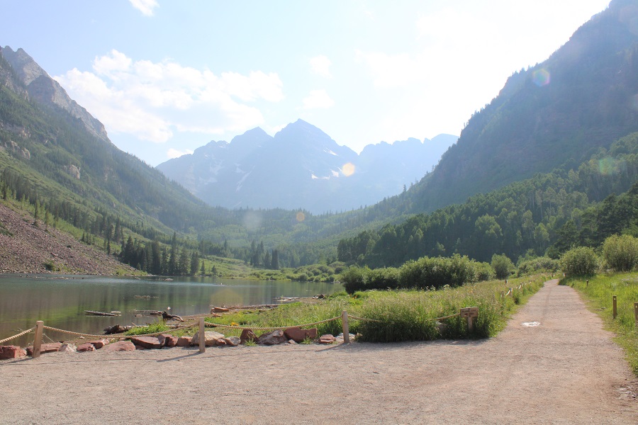
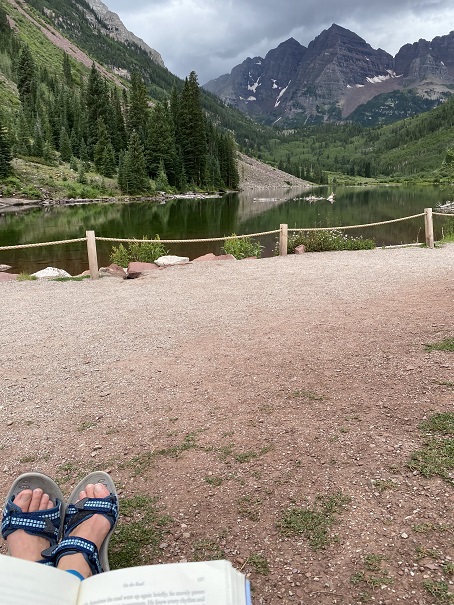
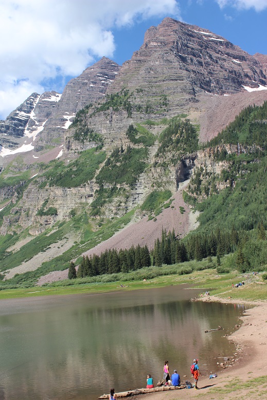
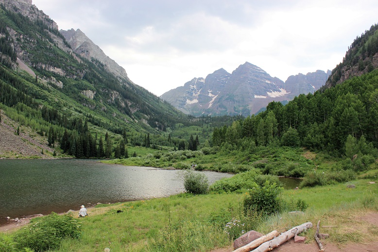
It was raining when I arrived, but people were walking around Maroon Lake anyway.
I was on the trail at 2:15am.
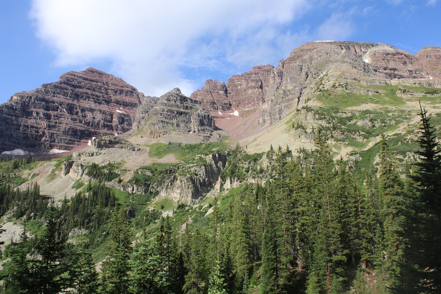
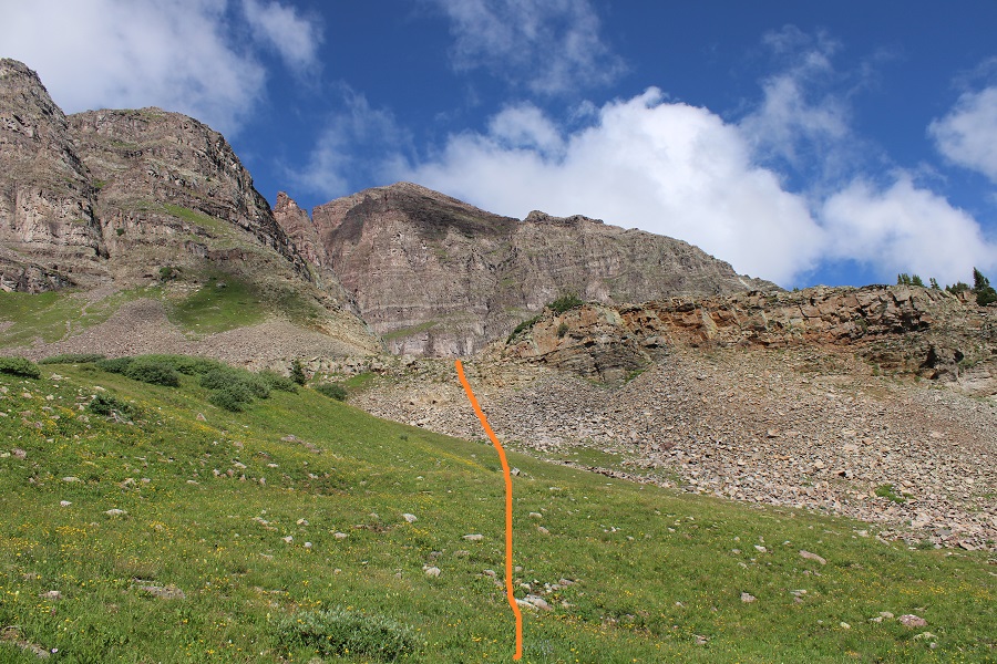
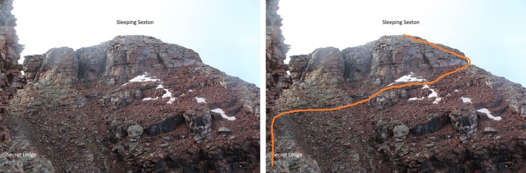
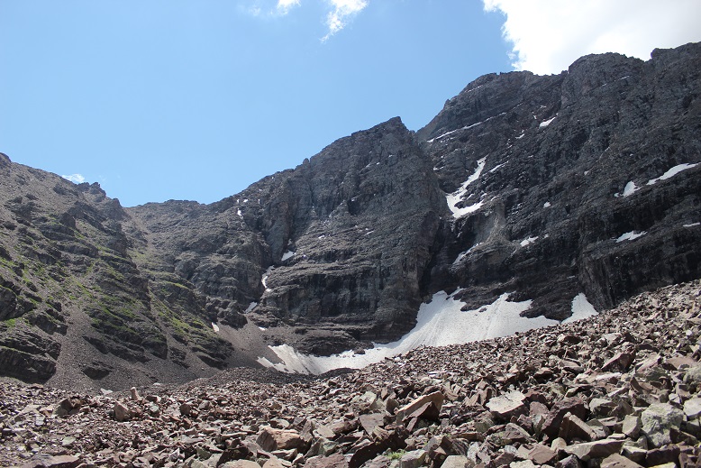
From the parking area, here’s an overview of the route above treeline to the false summit
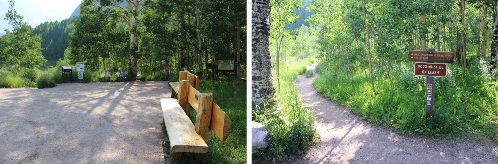
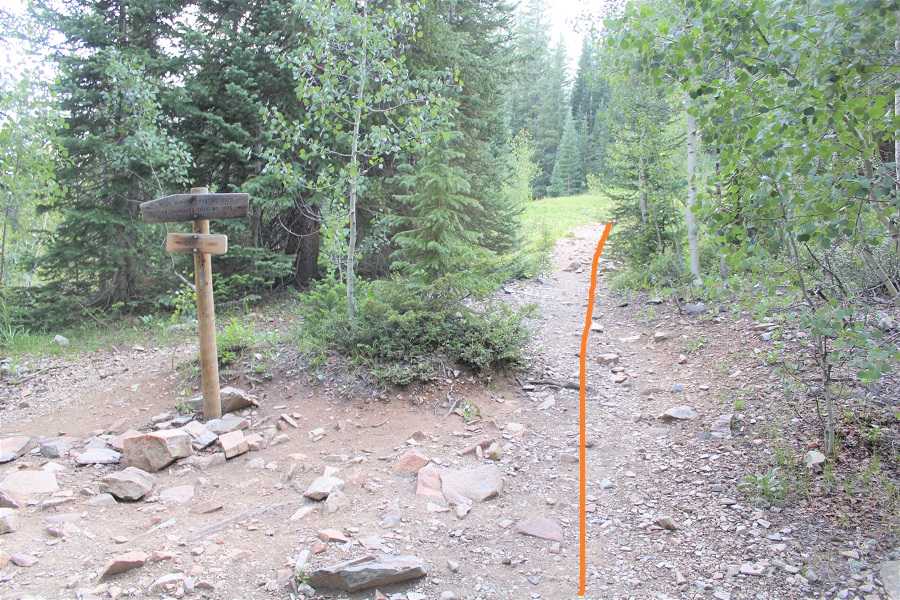
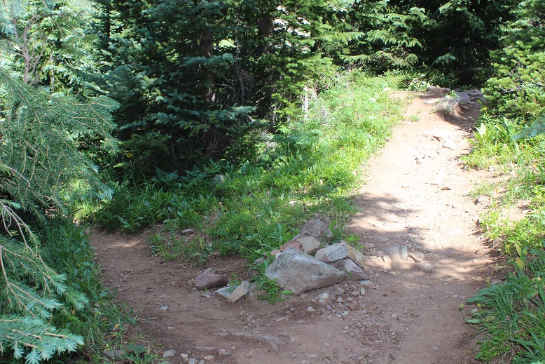
The trail starts by skirting Maroon Lake, then taking the Crater Lake trail southwest.
There was a full moon out, so I didn’t need my flashlight.
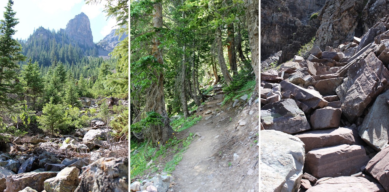
At the junction for Crater Lake I continued following trail 1975 northwest. This is the trail you take if you’re doing the Northeast route for North Maroon Peak. There are camping spots just before the next junction.
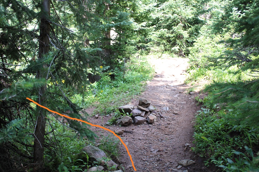
The trail continues to be a well defined, class 1 trail. At about 10775’ there’s another junction. If you’ve hiked North Maroon Peak before, you’ll recognize this trail. I turned left here and crossed the creek, following the North Maroon Peak Trail (still class 1)
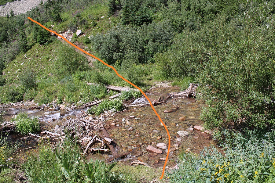
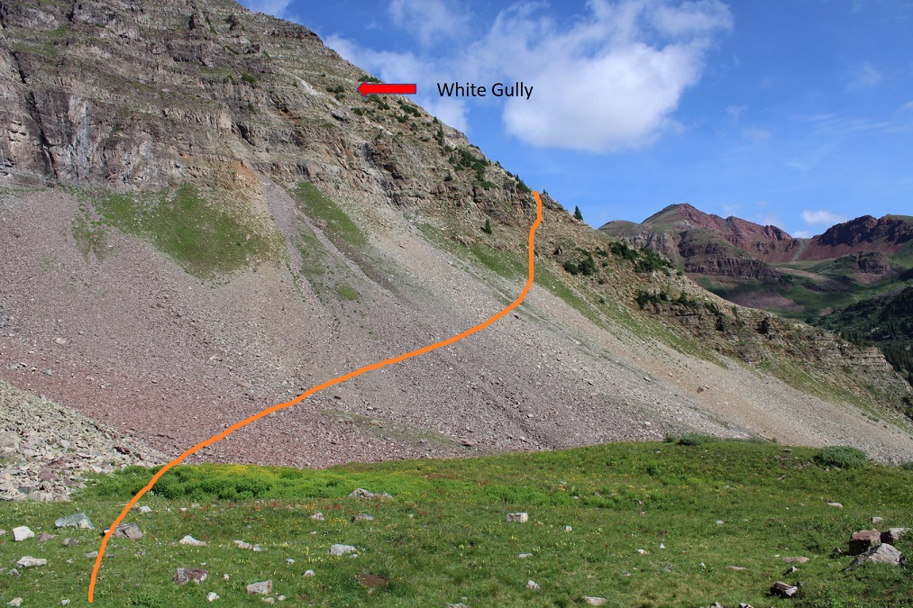
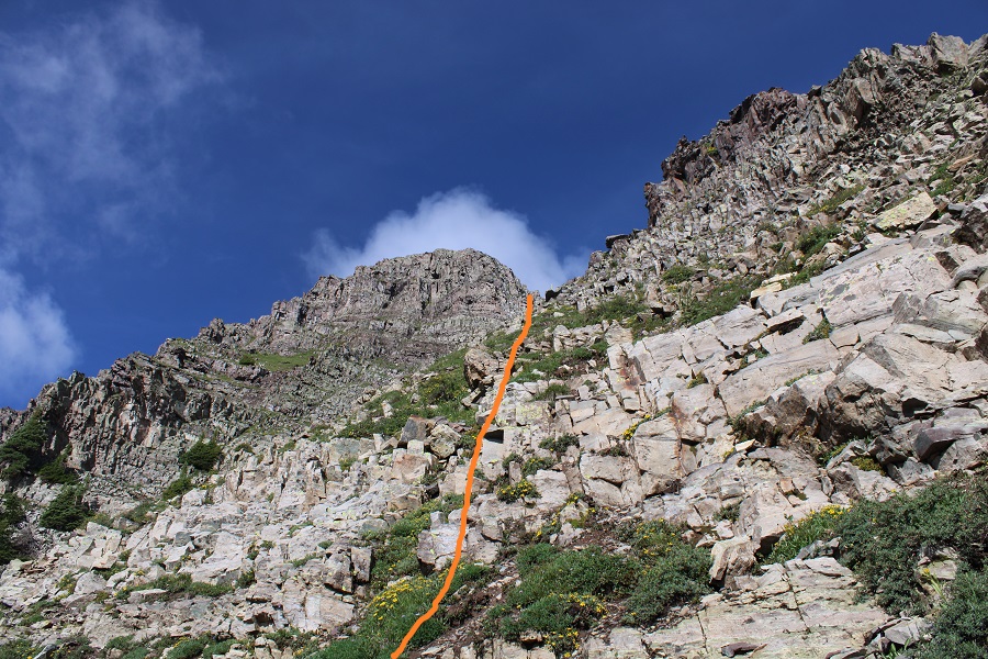
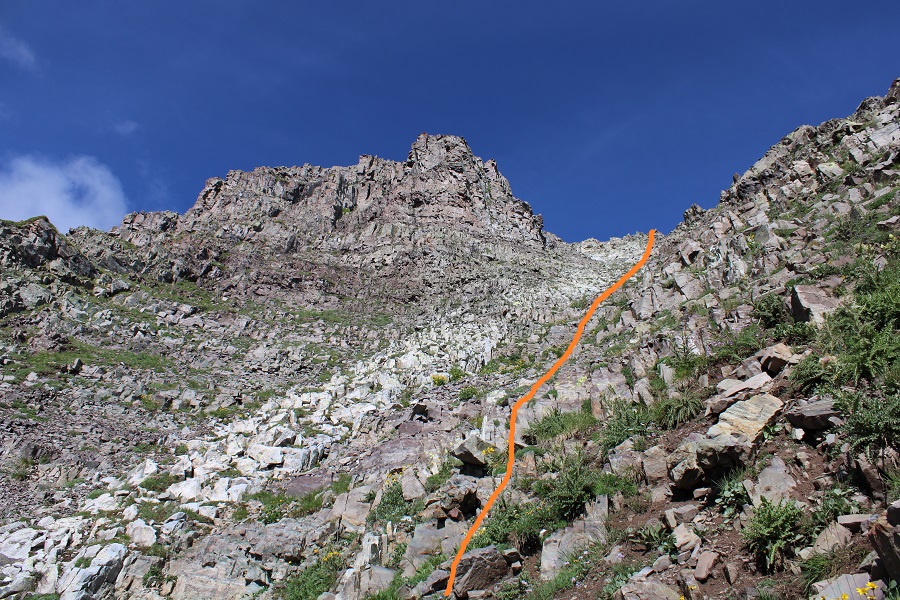
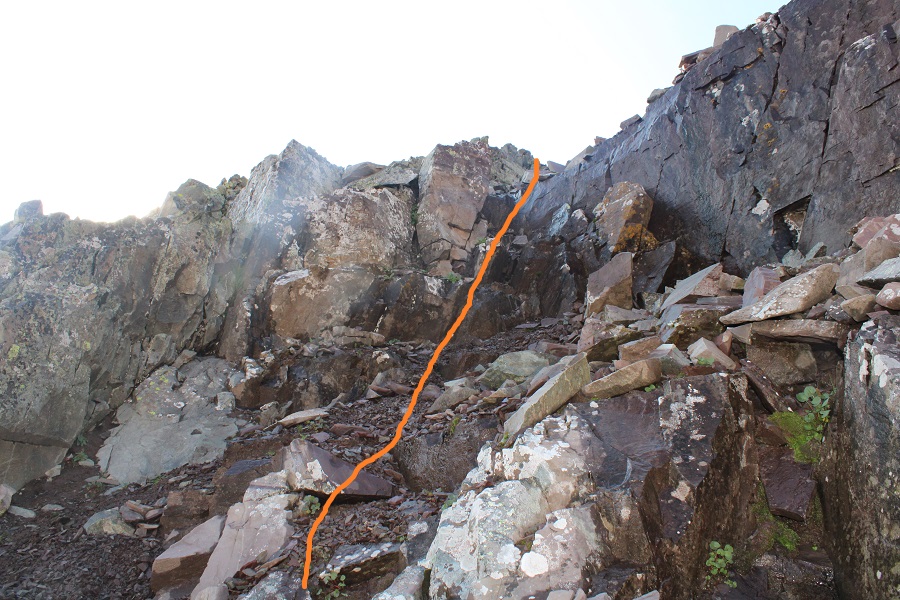
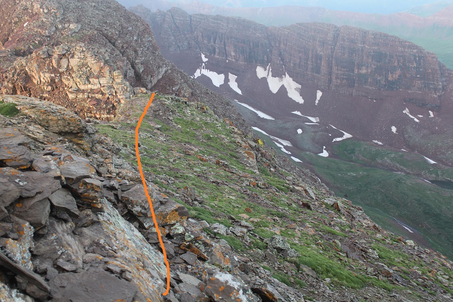
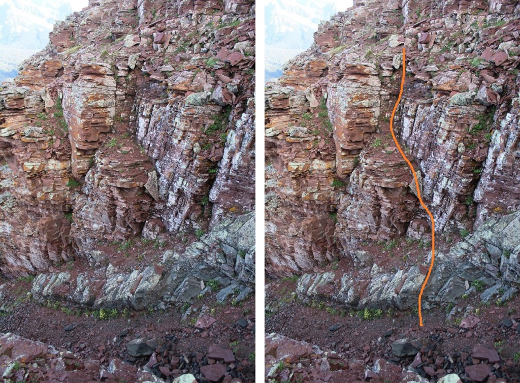
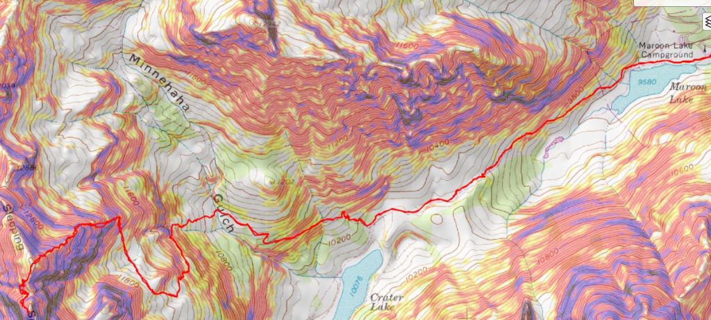
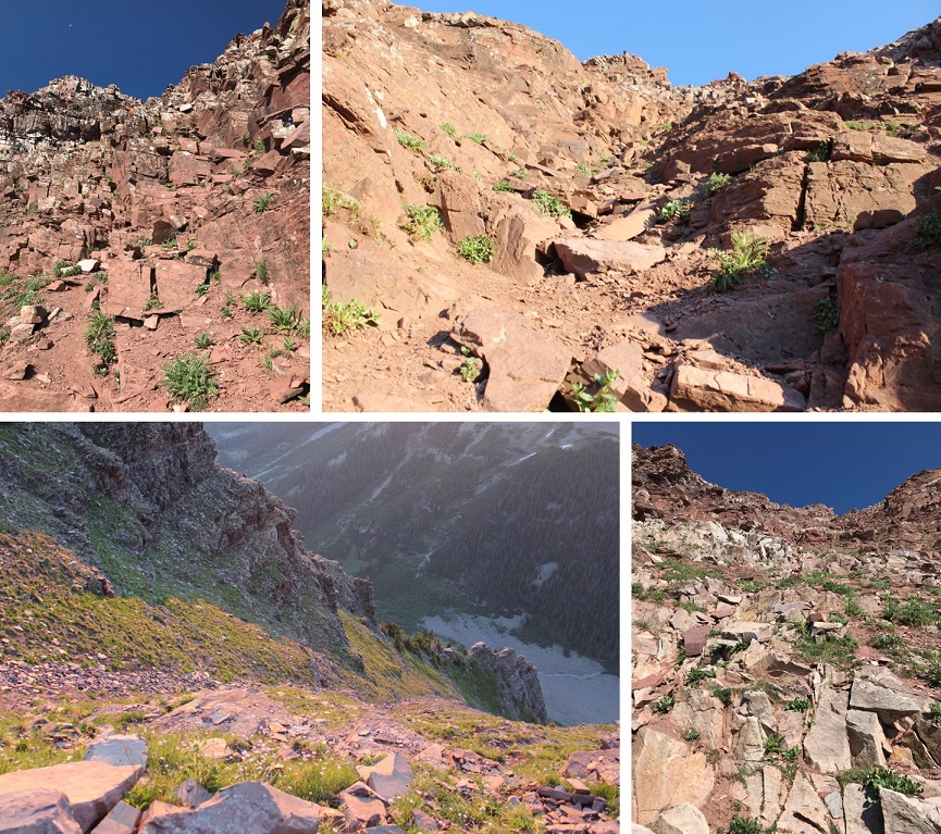
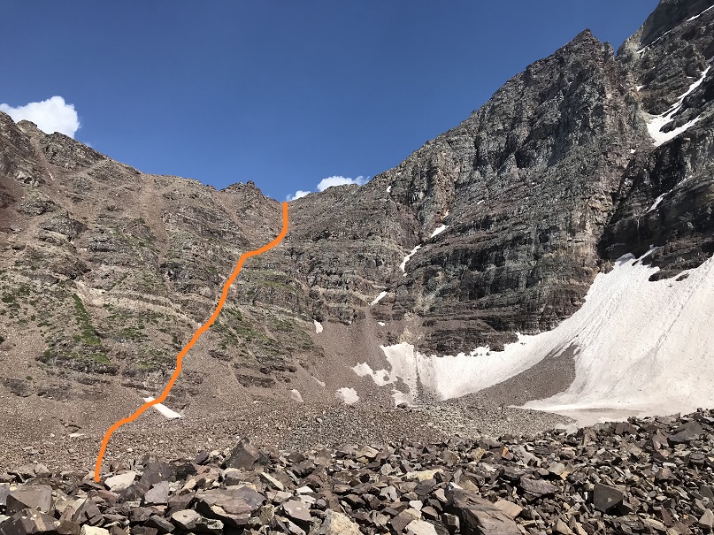
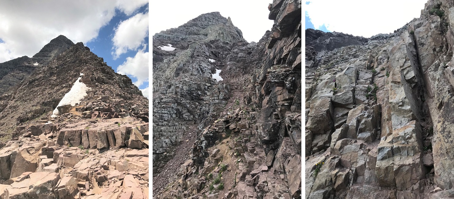
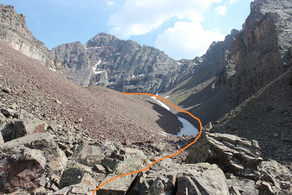
Here’s an overview of the trek to the false summit (or ‘the crown’) from the creek crossing. I followed the North Maroon Peak’s Northeast Ridge Route until I made it to tundra, at about 11,600’. I then left the trail and headed northwest, behind this outcropping, to the base of the white gully. I then trekked up the ridge and followed the white gully until it ended. Here’s a basic overview.
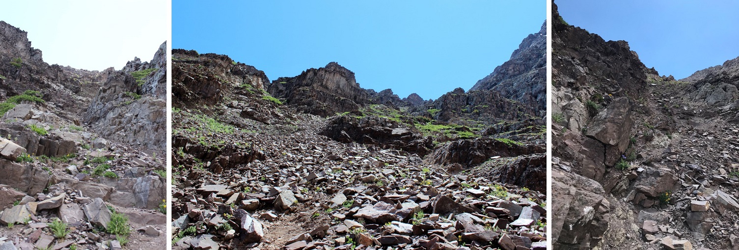
Here are some step by step photos of the way I accessed the white gully: I followed the North Maroon Trail to treeline
At 11,600’ I left the North Maroon Trail and headed northwest
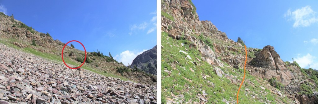
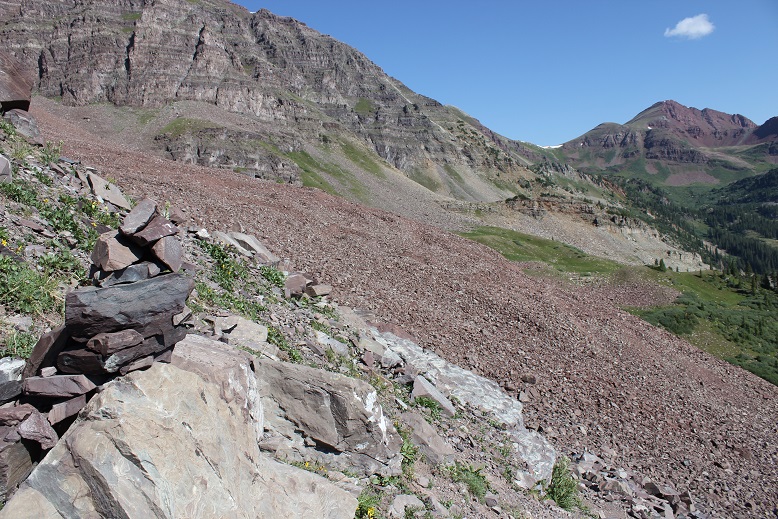
Here you can see the base of the white gully. I didn’t want to climb straight up the gully, as it was very steep. Instead, I accessed the ridge, and followed the ridge to the white gully. (I did this after spending a lot of time last week trying to see if the smaller gullies ‘went’ to access the white gully, and turned back every time because I didn’t have rope. I believe it’s much easier to access the ridge first and then head up).
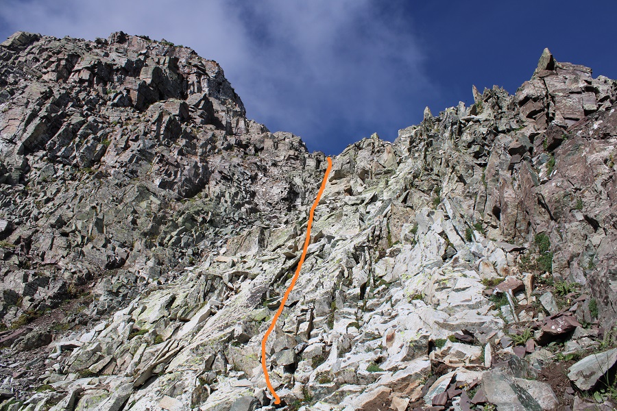
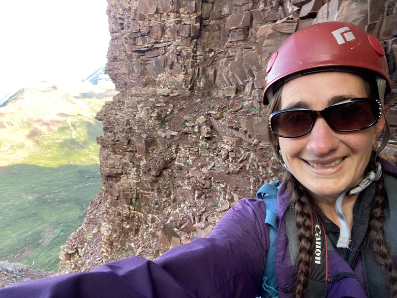
Here’s exactly where I entered and exited the ridge. I found this to be class 2 and direct access. Now’s a great time to put on your helmet if you haven’t already done so.
Once on the ridge I followed it west, staying in-between the ridge and the white gully (to the right of the gully, but left of the ridge). If you look for them, you’ll find game trails here (you may have to duck under some branches to use them though).
Once near the white gully, I found the terrain to the right to be more stable than the white gully itself, especially on my way down.
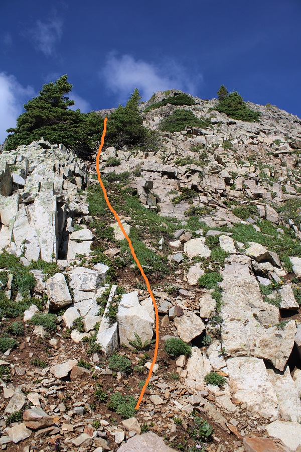
Topping out of the white gully felt class 3
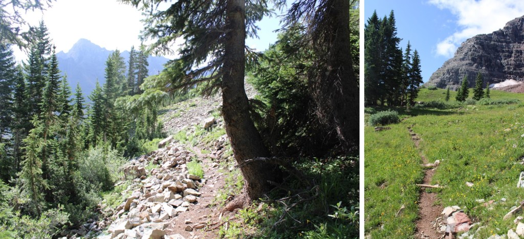
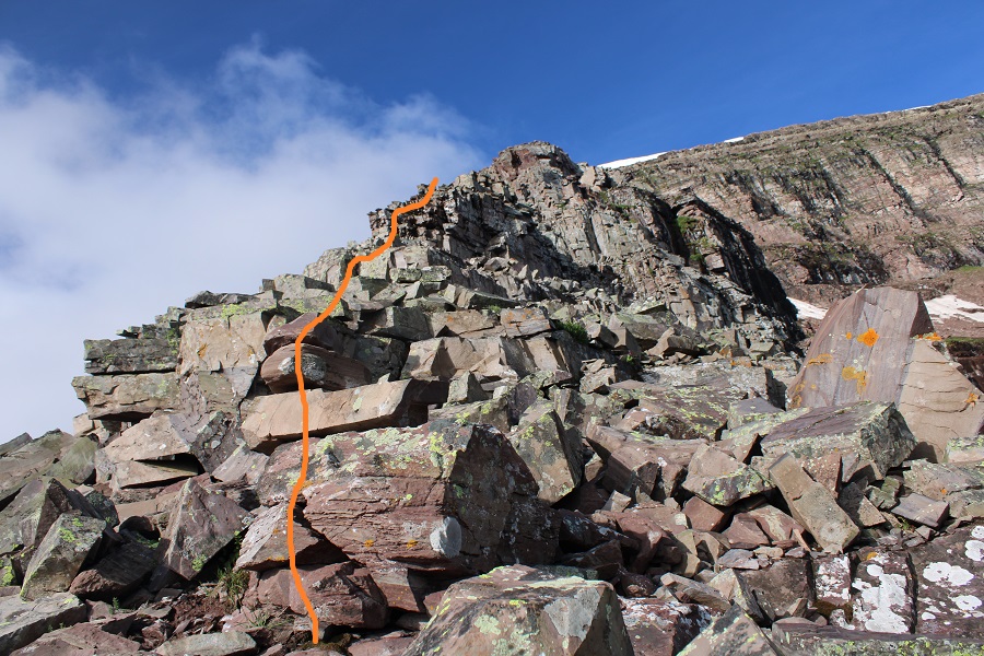
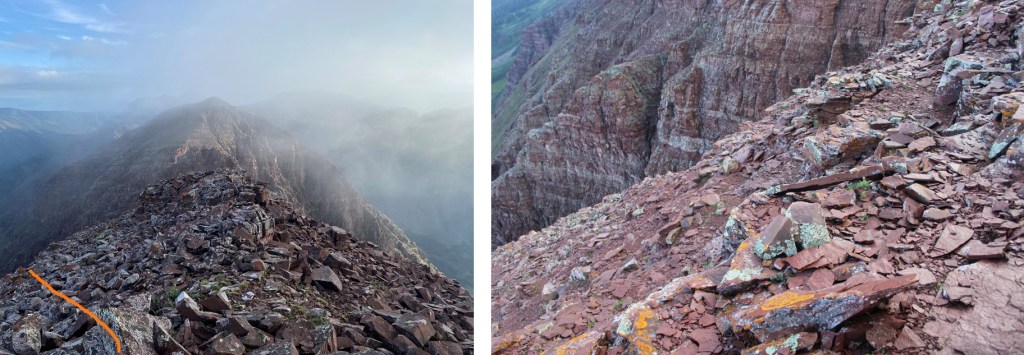
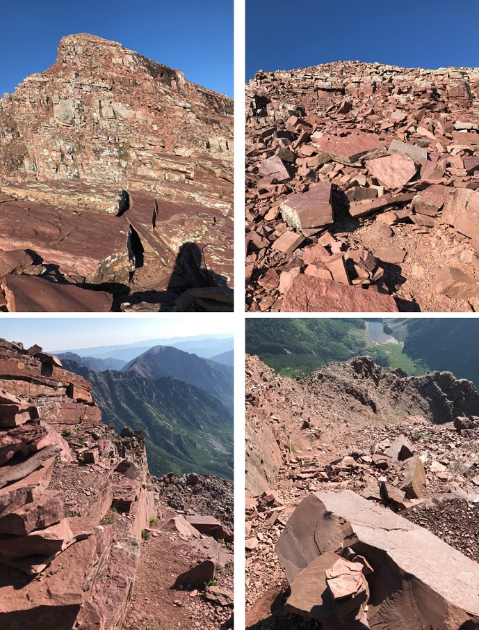
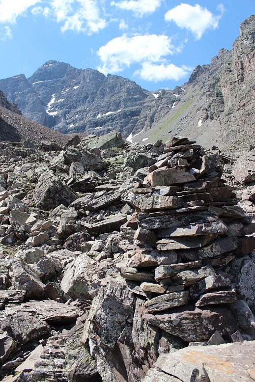
From here it became ‘choose your own adventure’ as I followed the ridge southwest. I started out rounding the ridge’s north side, and then went back and forth between north and south sides of the ridge a few times. There are cairns here, and nothing is more difficult than class 4. In fact, if you’re extra careful/spend a lot of time route finding, you can probably keep this at mostly class 3. Here’s the route I took:
From the top of the white gully I rounded the corner and made my way back to the ridge. It had rained the night before, so I had to be extra careful with every foot placement (wet = slippery)
Once back on the ridge I followed it for a ways
Before hitting a bit of a shelf and crossing over to the south side of the ridge
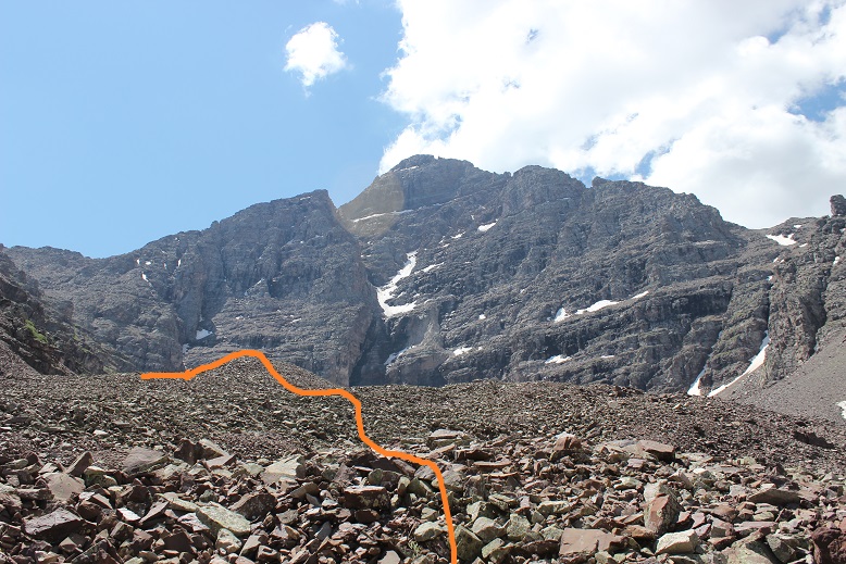
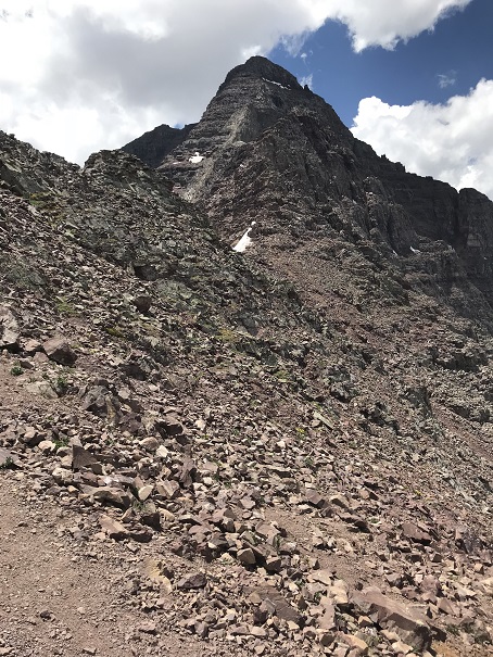
I followed the ridge to the false summit / ‘the crown’
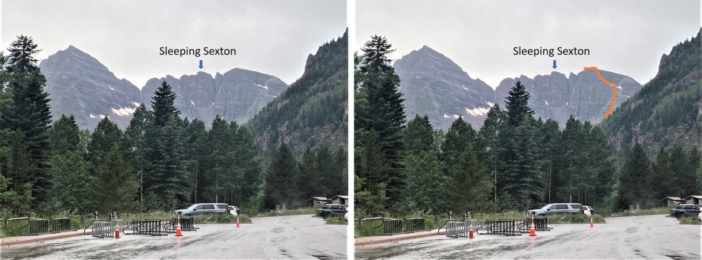
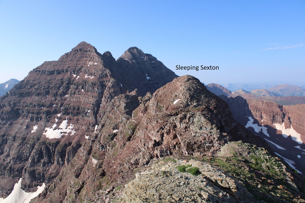
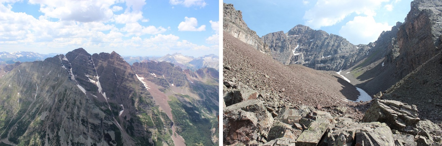
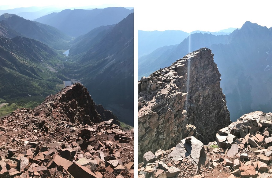
From the false summit you can see the true summit of Sleeping Sexton
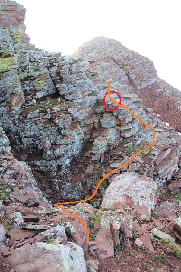
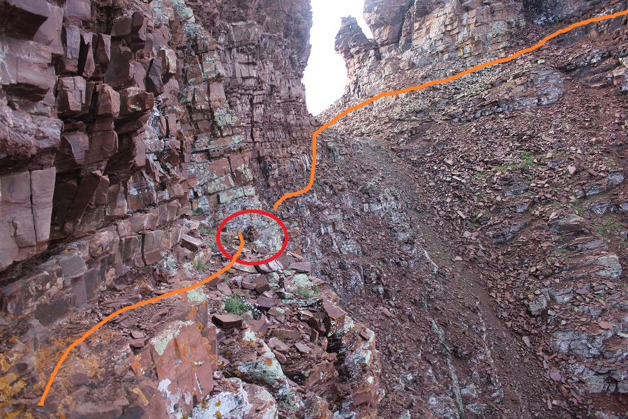
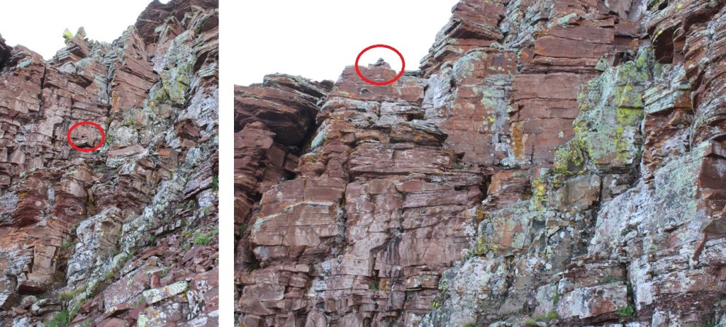
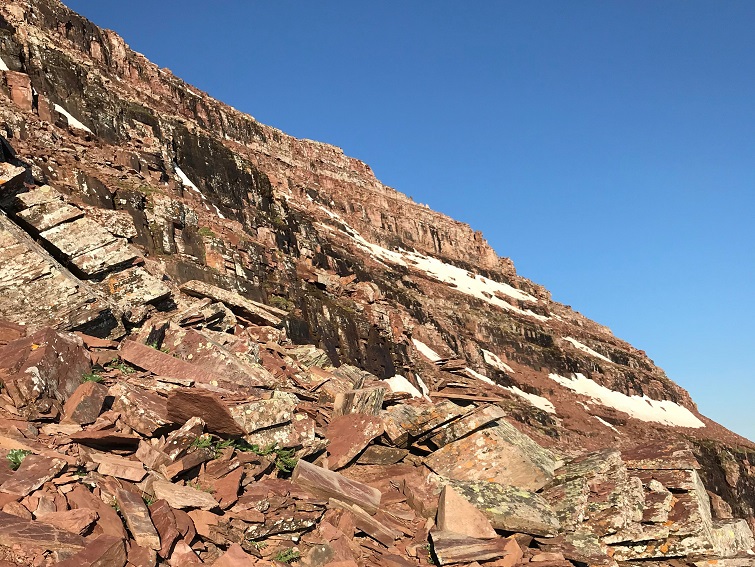
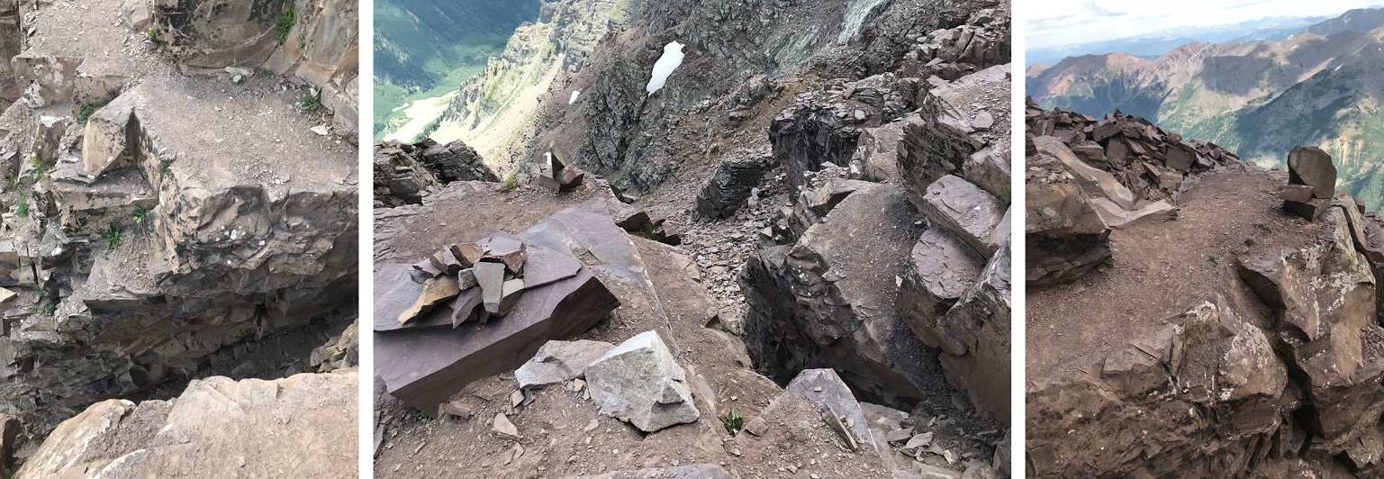
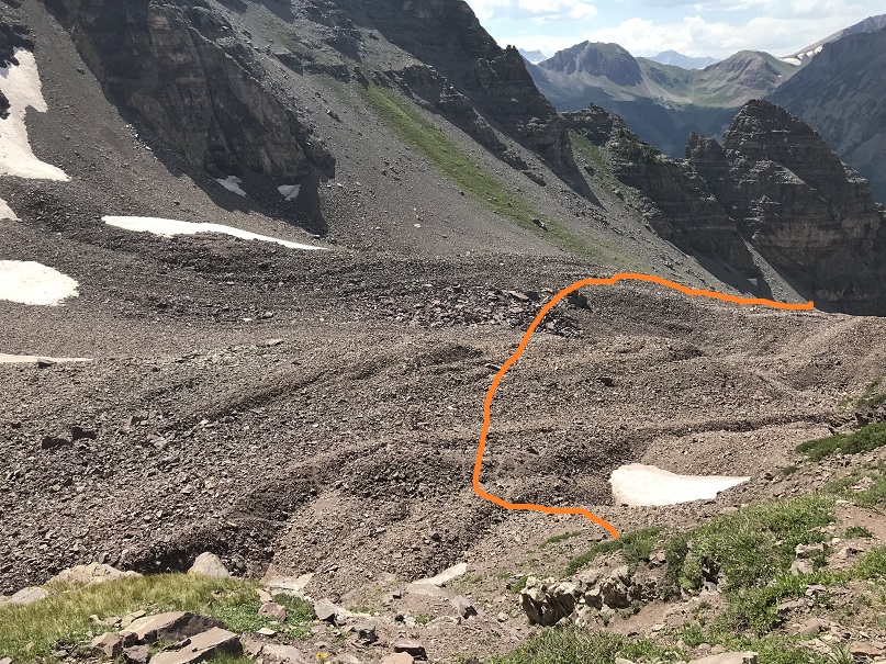
And now, the fun route finding begins! I descended the false summit 125’ and crossed a gully. There were cairns here to help in the crossing (circled in red). These are steep and go at class 3/4
After crossing the first gully I descended once again, another 160’
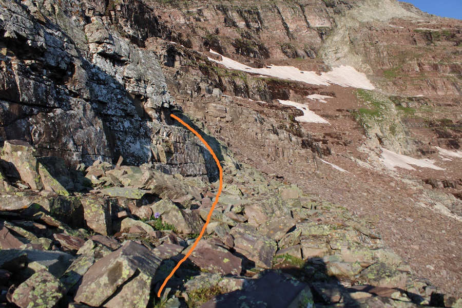
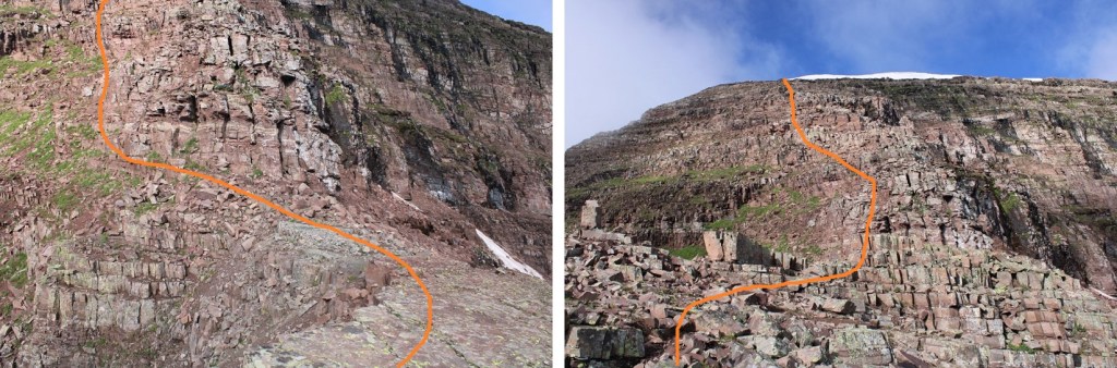
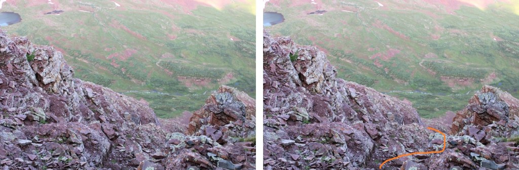
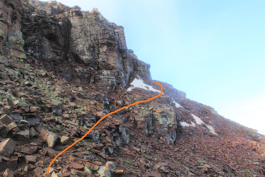
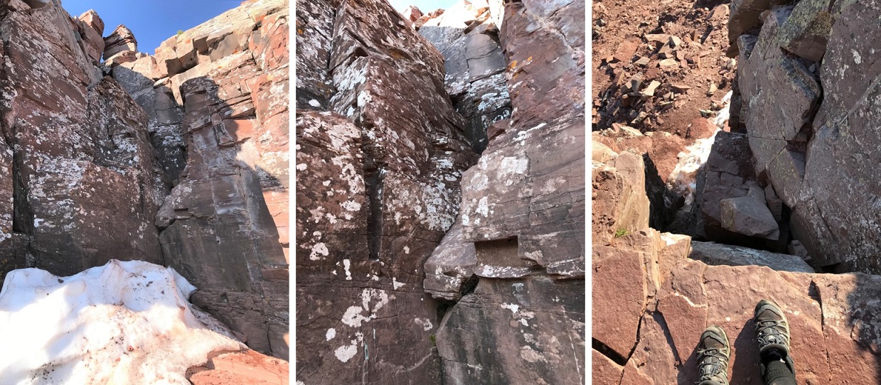
I was now at 13,130’, and parallel with the saddle between Sleeping Sexton and the false summit. I followed the contour of the mountain to the ‘secret ledge’. Here’s what that looks like heading in
I crossed the ledge to the ‘saddle’, then skirted the side of the mountain and headed up to the summit
The ledge is not as bad as it looks. There’s a cairn here (circled in red) DO NOT DESCEND HERE. Instead, use it as a reference point and stay level with it (especially on your way back) and continue following the ledge. If you do this, it stays class 2 to the saddle.
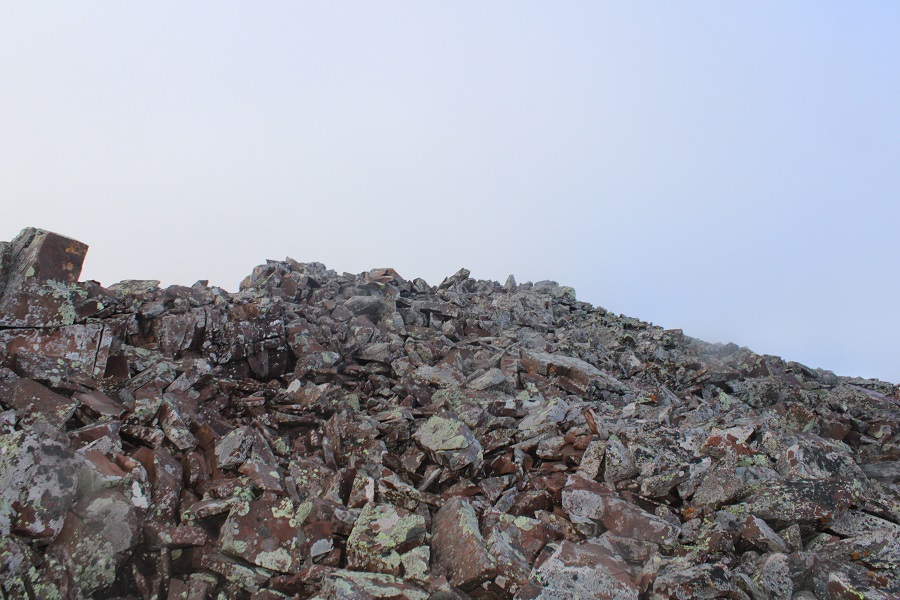
From there it was an easy trek to the summit, first skirting the mountainside
And then ascending the ridge
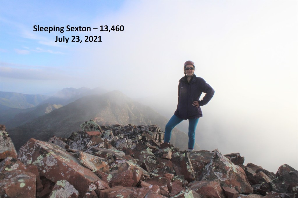
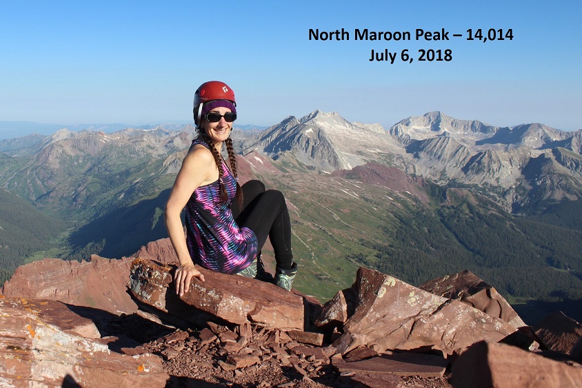
I summited Sleeping Sexton at 6:45am, just as the weather started rolling in
Sleeping Sexton:
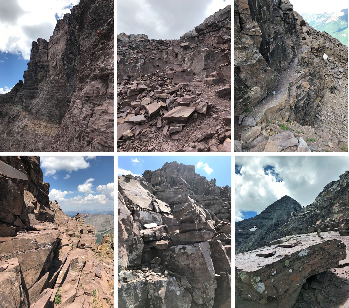
Since the weather wasn’t cooperating I didn’t stay long. I turned and headed back the way I’d hiked in. Here’s looking back at the false summit / ‘the crown’
And a view making it back to the ledge
Here are some more images of that ledge, looking back. Remember to look for the cairn, and stay level with it.
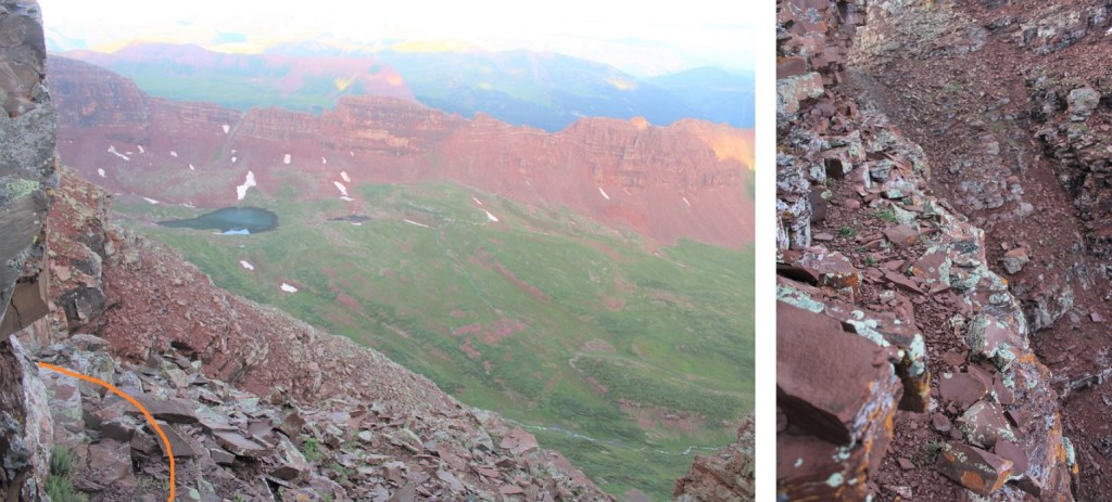
For reference, here’s the size of the route. The route can clearly be seen over my shoulder (to the left)
I rounded the corner, and ascended the gully, aiming for the cairns
Crossed the next gully
And gained the ridge to the false summit / ‘the crown’
I actually stayed here for a bit because I had cell service. I let my family know I was ok, and downloaded the weather forecast for the next day. However, eventually the clouds told me to get going.
Clouds rolling in:
Here are some pictures of my way back to the white gully
Back down the white gully to the ridge
And from the ridge back to the trail
Once back on the trail it was an easy, class 1 hike back to the parking area.
I made it back to my truck at 11:30am, making this a 12.7 mile hike with 5156’ of elevation gain in 9 hours, 15 minutes.
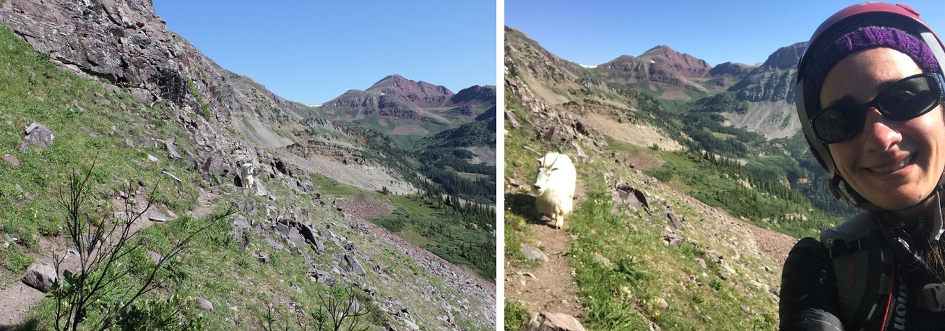
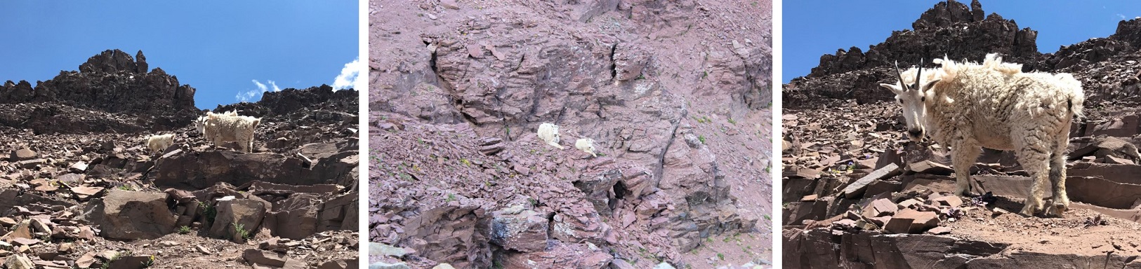
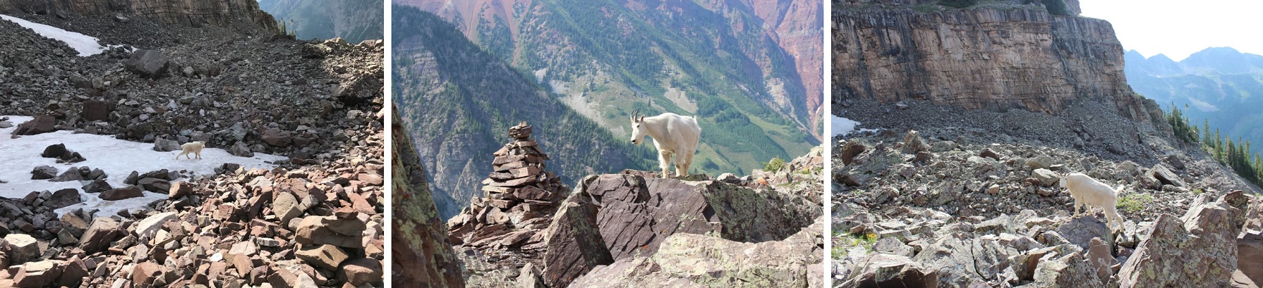
It was still early in the day, so I ate lunch by Maroon Lake, read for a bit, looked at topo maps for tomorrow, and jotted down notes in my journal before making it an early night. Oh, I forgot to mention the goats: They were the same two goats I saw last week, and if for no other reason than them, wear your helmet until you make it back onto the class 1 trail: They were kicking rocks down the gullies the entire time I was there.
The plan: Eat an entire pizza by myself and fall into a pizza induced coma for 4 hours before waking up and driving to the trailhead.
All was going well at 6pm as I jumped into bed after eating an entire pizza (plus 2 pieces of garlic bread, washed down by a glass of wine and 3mg of melatonin). I fell asleep almost immediately as my body began happily processing all the calories I’d just ingested.
At 6:30pm I was woken up by my son playing his accordion in the kitchen. He was multitasking, making himself dinner and practicing his scales. Ugh. I tried to wait him out and get back to sleep but it was no use. His playing was obviously going to last a while. I tried calling his name a few times (loudly) in between sets but he had the stove fan on and couldn’t hear me.
I did not want to get out of bed to ask him to stop. Lately I’ve had vertigo, a complication from Raynaud’s, not enough sleep, and dehydration. For those of you who don’t know what vertigo is, it’s an intense spinning of the room that makes you nauseous. It feels like I’ve had way too much to drink and then try to lay down suddenly: the room spins dangerously like I’m on a spinning carnival ride, and it’s awful. It only affects me as I’m lying down or getting up, and it only lasts 5 excruciating seconds or so, but it sucks and I wanted to avoid it as much as possible. So I lay there for 10 minutes trying in vain to get my son’s attention and finally gave up. I steeled myself for the room to spin, got out of bed, held onto the side of the bed for a second as the room spun and waited for the spinning to stop. When it did I walked into the kitchen.
My son looked up with a ladle in one hand and the other pressing scales on his accordion. He was immediately gave me a sideways smile. He obviously hadn’t known I’d been trying to sleep (he thought he was the only one home) and promised to keep it down while he cooked. I thanked him, went back to my bed, steeled myself for a second round of nausea, lay down, and the next thing I knew my alarm was waking me up at 10:30pm to head to the trailhead.
The drive to the trailhead was uneventful. I didn’t see any deer, which was weird, but I did see a porcupine crossing the road on the 82. Despite triple checking my directions I once again went to the wrong trailhead (this Maroon-Snowmass/ Maroon Snowmass / Maroon Trailhead / Maroon Creek thing really stinks) but noticed my mistake early on and backtracked to the correct trailhead. I paid the $10 fee at the Rangers Station (pay the fee people!) and parked at the trailhead. There were two other cars in the parking lot when I arrived. I jumped out and hit the trail at 3:15am (15 minutes behind schedule due to re-routing… I had time to make up).
While I hadn’t seen any deer on the drive in, as I was passing Maroon Lake I saw about a dozen deer all along the trail. They stopped to look at me and then quickly bounded away. My directions said to hike 1.75 miles to reach a trail junction, and then another .75 miles to another trail junction. I found the first junction just fine, but it seemed like I was hiking a lot further trying to find the second one. I had my GPS, and it wasn’t 100% syncing up, but I’d talked to a couple last week who said the GPS files in the Maroon Bells area had consistently been 50-150 feet off for them, so I didn’t think anything was wrong. Until I saw headlamps hiking up the other side of the hill, about 150 feet across from me. Ugh. I looked at my topo map and I was indeed off course; by about a mile in distance and 500 feet in elevation gain. Double ugh.
So I backtracked, found what was considered the junction (which I’d missed in the dark), crossed the stream in the dark, and headed up the hill.
I’m a pretty quick hiker, so even though I’d started out over a mile behind the headlamp group I caught up to them halfway up the hill, just before the talus field. Yes, they were hiking North Maroon too, just taking a breather before continuing on. I had serious time to make up now, so I didn’t stop to chat long and was on my way. I’m not a fan of talus, but the trail here was well maintained.
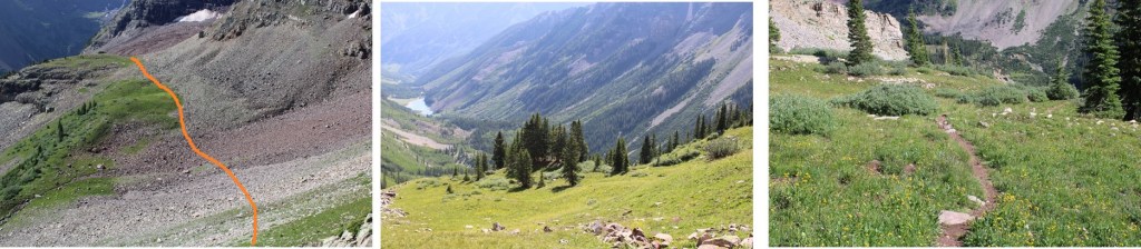
I made it across the talus, under the cliff bands, and over a glacier area, and up about 200’ of steep terrain through some trees before the sun began to rise.
I took a break here to watch the sunrise because this type of beauty is what hiking is all about.
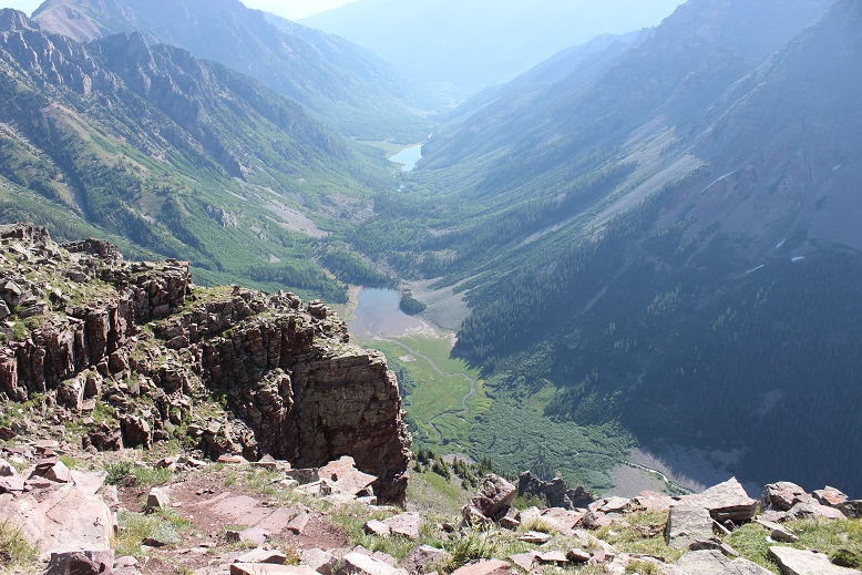
From here I could see both Crater Lake and Maroon Lake. For the rest of the hike I used them as indicators of which direction I should head (especially on my way down). They should always be in the same position as you’re hiking this mountain.
Now was the time to apply sunscreen and start drinking water. I almost never drink water when I go hiking. I always bring 2 liters, but rarely take more than a sip because I just don’t get thirsty. But this vertigo thing had me re-arranging my priorities. If drinking more water would make it go away I’d drink more water: I carried the water, I was going to drink it. So every time I remembered I had water I took a sip.
After the sun rose the gullies began. There are two types of gullies in my opinion: good gullies and bad gullies. The bad gullies tend to be anything labeled “2D”.
These were good gullies. They weren’t too steep, required climbing (not shuffling through scree) and were well cairned. If you couldn’t see a cairn you weren’t on the trail (I know, because I replaced many of them so this would be the case). There was a 1st gully and a 2nd gully and both had the same terrain. The only problem was sometimes the cairn would be behind and above you, not directly on the trail (this made sense though, since climbing was involved).
I took another few sips of water.
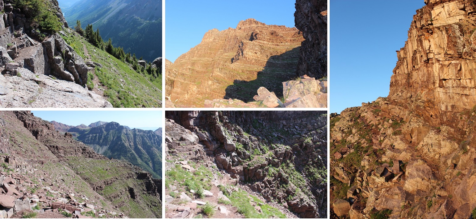
The second gully was very similar to the first, with grassy slopes and steep, loose rock. When I’d reached the top of the gully I was on a class 3 ledge. This meant a lot of scrambling, following the ridgeline toward the summit.
I took another few sips of water.
There is a rock band here that required class 4 climbing to navigate, but offers a class 3 variation by going around the band. Here’s a picture of the class 3 climbing
DO NOT TAKE THE CLASS 3 ROUTE in the next few weeks: It has a lot of runoff water on the route and is steeper (more exposure) than the class 4 chimney, making the class 4 chimney a safer option. It was also more fun! The only downside to the chimney was my height. I could tell where I was supposed to step, but my legs weren’t long enough to reach. So I used my back a lot and balance where necessary to push myself up the chimney. Luckily it wasn’t too long and didn’t have too much exposure, so if I fell I wasn’t going to fall too far. Here’s a look at the Chimney:
The last bit of climbing was all class 3 over ledges up towards the summit, with a few solid rock gullies thrown in for fun.
I took another few sips of water.
I summited at 7:30am. I took a bunch of summit photos, drank more water, and reapplied sunscreen. I was happy with my progress, and kind of excited I could name most of the surrounding peaks.
I took a summit photo
The way down was much easier than the way up, as I followed the route I’d nicely re-cairned. It was almost too easy! In the beginning I just followed the ledge…
I met 2 other pairs of hikers, made small talk, and wished them well. The weather was very, very nice: not a cloud in the sky!
I took another few sips of water.
I made it to the bottom of the gullies and was almost to the talus field when I met my first goat of the day. We took a quick selfie and then passed each other in silence. He wasn’t too interested in me.
I tiptoed across this huge expanse of talus (and lots of spider webs) down the trail.
It was well maintained and easy to follow in the light. As I was crossing the creek I had a decision to make: it was still before 10am, and the weather looked nice. Should I attempt Pyramid Peak as well?
The downside was I’d have to hike all the way back down to 10,000’ in elevation and re-gain over 4000’ to summit. That made for a very long day, but it was good training for the Chicago Basin. On the positive side the weather looked good (50% chance of rain but not thunderstorms), it was still early, and if I summited today I could save 9 hours in driving time and that $10 entrance fee needed for another hike. One trip report I’d read said the record time for hiking up Pyramid was 1 hour, and many considered it a quick jaunt. It was settled. I was attempting it. I took a few sips of water and reapplied sunscreen, albeit haphazardly (I’m not a fan of sunscreen, but on this nice day it was necessary since a jacket was overkill).
I got out my GPS and looked at the connecting route. After consulting with my directions, which said the turnoff was just before crater lake, I decided to just cut around crater lake and hook up with the connecting trail.
This ended up being a lot more complicated than it sounds, and while I did eventually connect up with the correct trail it was after a lot of hiking through dense forest up and down hills and through dried up lakebeds… all off trail. I was glad I was wearing pants. I was also very tired when I made it to the connecting trail. I wasn’t’ sure I’d saved any time, and I was pretty sure I’d increased my elevation gain in the process. I took some more sips of water. I took the route in blue
In any event, I made it to the Pyramid Trail and began the hike up the path that led to the amphitheater. This trail was well maintained, if covered in a lot of talus. I was basically climbing up stairs the entire way, but well constructed stairs.
When I made it to the amphitheater the trail ended and the serious talus began. Luckily there were a few very large cairns indicating the exit of the trail.
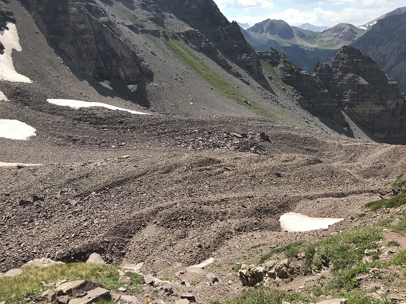
But it looked like this was where the trail ended. My research said to hike through the center of the amphitheater towards Pyramid’s North Face and then turn left to hike up a gully. My GPS had me sticking towards the middle/left. So that’s what I did. I hiked straight through the middle of the area, which was a very bad idea (but probably not so bad in winter with snow). The rock here was loose. I mean, very loose. Have you ever hiked up a 100 foot mountain of corn? Probably not, but I have, and that’s exactly what it felt like: loose, unstable, and with every step up you sink in up to your shin and fall back 2 feet. It’s grueling, not very productive, and even scary at times. I kept drinking water. Here’s the path I took…
When I made it to the top of one hill there was another one in it’s place, and then another one, and when that was over the larger talus began. I just kept aiming towards the gully, trudging on. I made it to some rather large boulders and saw a couple hiking down. We chatted about the route ahead. They told me the rest of the route was cairned and very similar to North Maroon Peak. I told them I was glad it was cairned up ahead and that at this point I was exhausted and never wanted to see Pyramid again. They looked at me quizzically and hiked on (more on this later). I took another sip of water.
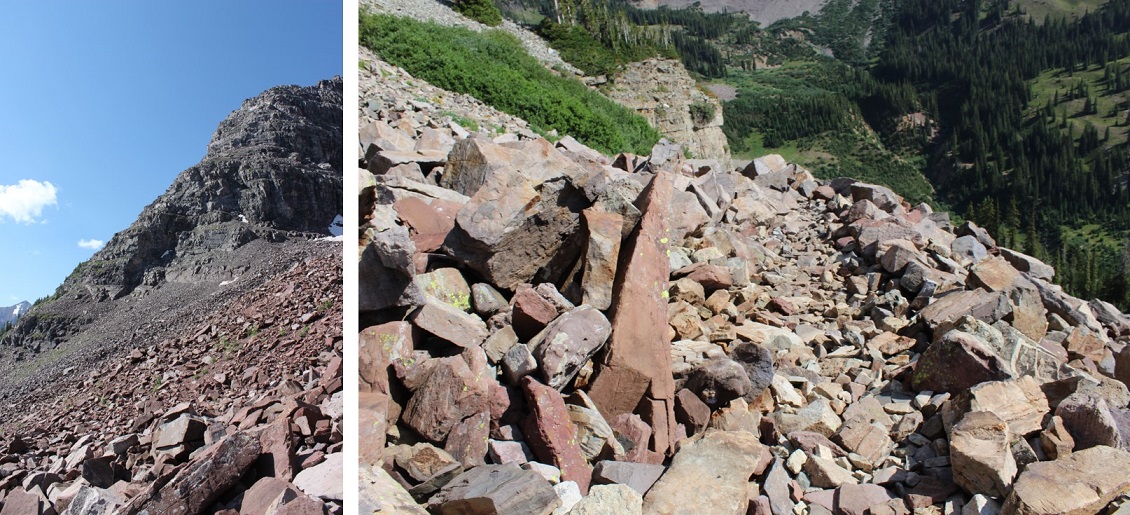
OK, I’d made it to the gully. This is the 2D gully that gives all gullies a bad name. It’s 1000’ of intense elevation gain, loose rock, and no, it was not well cairned. Here’s the route:
This took me forever to climb. I was cursing the entire way, getting more and more exhausted with each step. I never wanted to see this mountain again. Never. This sucked. In a big way. This was torture! How could people enjoy this??? I thought all these things also mentally knowing I was tired to begin with: it probably wouldn’t have been so bad if this was the only mountain I was climbing today. But I’d already done about 7000’ of elevation at this point, and I was tired.
And it was hot. I took another sip of water as the sun went behind a cloud. Well, that was positive. Wait, a cloud? Ugh! Clouds were rolling in. Hmmmm. I studied them for a minute. They didn’t look ominous, but I’d need to keep an eye on them.
With about 150’ of elevation gain before reaching the saddle I encountered two men hiking down. They seemed upset. Worried about the weather, I asked them how long it would take to summit after reaching the saddle and they said at least two hours. I couldn’t believe that, as 2 hours seemed excessive. Then I asked if they’d summited and they replied: “No. There are too many cairns that lead to nowhere but up, and each of them ends in a class 4 move. We decided to turn back”.
Well, it was a class 4 hike, what did they expect? I was a little put off with the 2 hours to the summit from the saddle, but I’d come this far, so I was going to keep at it: I really didn’t want to come back to hike through all that talus and scree another time if I could help it.
I was almost to the top of the gully when I slipped and put my hands forward to catch myself, lading on a rock and breaking my phone screen in the process. Ugh! Have I mentioned I never want to see Pyramid again? I’ve had a cell phone since 1996 and never once cracked a screen. I’d just about had it with this mountain…
I reached the saddle and began seeing goats. They were usually in pairs of two, a few were mother/baby pairs, and covering the ridge from here on out. They liked lounging on patches of snow and cold rock ledges, which made sense considering they were covered in dense fur. They amused me. I took pictures and more sips of water.
I kept watching the weather and it wasn’t getting any worse, so I continued on. This part of the hike was indeed similar to North Maroon, but included a lot of sustained class 4 climbing. I followed my GPS route up to the top, which was not well cairned. There were steep ridges, narrow ledges, and class 4 obstacles to navigate. I was in heaven!
Check out the leap of faith! I’d heard about this but it wasn’t in my instructions, so I was thrilled when I came across it. It’s about 4 feet wide and requires you to jump over the gap or fall about 20 feet down. Luckily I was jumping down (not up) and it felt doable, so I took a video of the process. (Side note: on the way back down it was a different experience as I was jumping up in elevation and not down and I didn’t feel I could make it. As soon as that thought came into my head I steeled myself and jumped: I had no time for those kind of thoughts. Oh, and I made it just fine).
I felt pretty good about myself after this, took another sip of water, and continued on. I encountered a lot more class 4 climbing that wanted me to be a few inches taller to make it easy, and pretty soon I was at the summit! It felt wonderful! I was so proud of myself! That was the most sustained class 4 climbing I’ve ever done… and it was FUN!!!
And there was a summit marker! Woot!
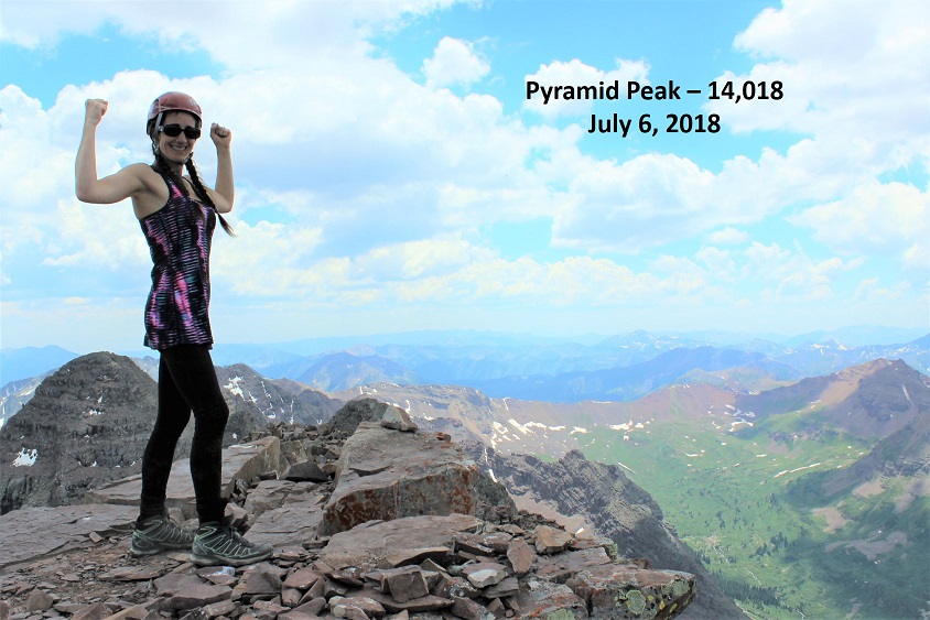
I summited at 2pm and took a summit selfie to prove I’d made it.
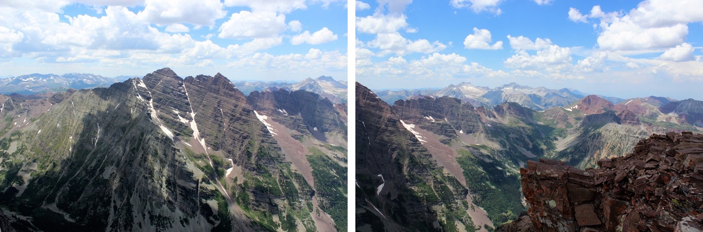
And a video of the surrounding mountains.
And reapplied my sunscreen and took another sip of water… oops! I was out of water! How could that happen? I never run out of water! Never! This wasn’t good. Hmmmm. Well, I rarely get thirsty when I hike, I’d just have to remember that and start down right away. I’d considered hiking Maroon Peak as well today but didn’t feel comfortable attempting it without any water. I had 5 pieces of butterscotch candy in my emergency kit, and while this wasn’t an emergency, sucking on candy would help keep my mouth moist, so I unwrapped a piece and began my descent.
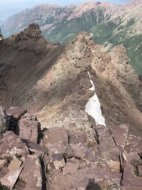
This time I saw a very well cairned route following the ridge down. It also looked well traveled and was pointing in the correct direction, so I decided to take this route down instead of my GPS route. This ended up being a fabulous idea!!! It contained sustained class 4 moves but was easy to navigate due to all the cairns.
The weather was still holding out, and in fact it was looking better. Any chance of rain had dissipated. As I was climbing down those class 4 moves there were many times I wished my legs were just a little longer. These moves had to be easier with another 6 inches of height. I knew where I was supposed to step, my legs just weren’t long enough to make it there without getting creative. Many times I just slid the extra few inches to reach a ledge and went on faith (after looking several times to make sure the hold was solid). Just before reaching the saddle at the top of the gully I spied some goats lounging on ice and came to a quick solution to my water problem.
No, I didn’t want to drink goat water, but ice and snow this high is good to drink if you can find some that’s clean. I walked over to where the goats were (they quickly stood up and walked away) and found a flat rock. I dug in the snow with the rock about a foot deep until I found “clean” snow, and then used this snow to fill my water bladder. A bladder full of snow really only equates to about ¼ of a bladder full of water, so I had to do this several times on the hike down, but my water problem was solved! And what great tasting (and cold!) water it was! Seriously. It was fantastic.
It was a hot day. When I made it to the saddle I thought to myself I really didn’t want to slide down this gully tippy-toed. So I put on my microspikes and side stepped the entire way down. For those of you who don’t use microspikes on these types of gullies you’re missing out: it makes the descent so much easier!!! A goat seemed amused with me.
The only downside to this process was I was descending pretty quickly (but stably) and my feet began to get hot. They started to burn and I had to slow down and take it easy.
OK, back to the amphitheater.
I hadn’t been looking forward to this at all! I took off my microspikes and hopped from rock to rock across the talus. This time when I got to the big boulders I spied a cairn! What?!?! This route wasn’t supposed to be cairned??? So I followed it to the left, and guess what? There is actually a cairned route that’s pretty simple to follow on this side of the basin! I should have followed this when I entered the amphitheater, but hadn’t know it was there. Ugh! Well, I was following it now. I couldn’t help but think how much less pain I’d be in right now if I’d known about this path earlier…
I followed the cairned route near the snow line and sipped my water. It really was a hot day! Then I got another idea: I walked up to the snow, made a large snowball with some clean snow, popped another butterscotch candy into my mouth, and started eating the ice. Woot! Butterscotch snow cone! It was cold, delicious, and amazing. I jaunted out of that amphitheater a happy hiker!
I met a few more goats as I was exiting the amphitheater. They called to each other before they could see each other. I don’t know if they were welcoming each other to a party or warning each other about me…
I took a picture to inform others there’s an easier way across this talus trouble than I’d taken!!! This was most likely why the couple I’d seen in the amphitheater couldn’t understand my disdain for all that talus: there was an easier way!
The rest of the hike down was very slow going. My feet were burning at this point. My feet have never burned on a hike before, but now they were burning, throbbing, and pulsing. They hurt, and I was hiking slow. I’m not gonna lie, it sucked. And it lasted forever! I don’t think I’ve ever hiked this slow before in my life, but I couldn’t physically hike faster without causing myself more pain. So I just kept on hiking, and hiking, and hiking at a steady pace.
Here’s the cutoff I missed for the Pyramid Trail because I was bushwacking…
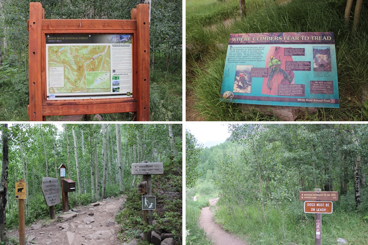
I met a lot of day hikers hiking up to crater lake as I was hiking out. They all seemed chipper and fresh. I smiled even though I didn’t feel like it, answered their “how much farther” questions and aimed toward the lake. This trail actually has some pretty good signs in the daylight…
I made it to the lake at 6pm and immediately pulled off my hiking boots and put my feet in the water: I’m pretty sure I heard the water sizzle. The water was cold and it felt amazing on my burning feet!
I couldn’t help but look around at everyone else enjoying the lake. They looked like their parents were all lawyers and they were visiting Aspen for the summer sporting their Nordstrom best (think sweater vests and white, flowing dresses. Oh, and hats.). I felt a little out of place with my hair a mess and dirt all over my clothes. Honestly though, they were enjoying the beauty as much as I was. We all took selfies to prove it!
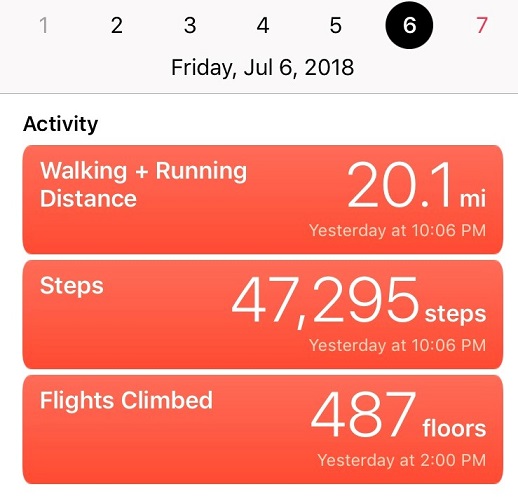
I’d made it down to the lake at 6pm. I covered 19 miles in 15 hours with 8700’ of elevation gain. And I was tired! But I was proud of myself, and you know what? I’d absolutely do Pyramid Peak again, but only if it was a one summit kind of day. The class 4 scrambling totally made all the other stuff worth it!
When I made it home my kids remarked how I was sunburned in weird areas.
Me: “Well, I really hate reapplying sunscreen, so I get a bit lazy, especially in places I can’t reach.”