#4,5,6 & 7 Decalibron 14,148- 14,238 – 14,286 – 14,172

image

I seriously needed this hike today.  I mean NEEDED it.  I’ve had so many negative things going on in the past 2 weeks I needed a break from life for a bit.  Time to clear my head.  It’s a 7.5 mile hike that covers 4 different 14ers, so I was hoping it would give me time to think and process all that’s gone on.  I also chose it because I heard there’s a problem with one of the peaks and I didn’t want to get any of my girls into trouble by hiking it, so today seemed like the perfect time. 

I woke up at 2:30am and made it to the trailhead by 5:30am.  There were already 5 cars at the sign that said “road closed”.  I had to do a 30 point turn to get my truck turned around and not fall off the side of the cliff or into the ridge on the other side (notice would have been nice road guys) but I made it.  

image

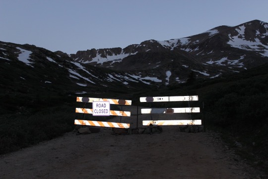
So the road to the trailhead’s closed. Great.  Oh well.  That only added about 1.2 miles to the total hike, so that would bring this hike to 8.7 miles.  Still doable in the time frame I had.  So I got out and started walking up the road. 

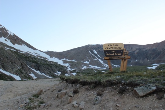
When I got to the trailhead at Kite Lake there were several groups of people standing around, talking.  

image

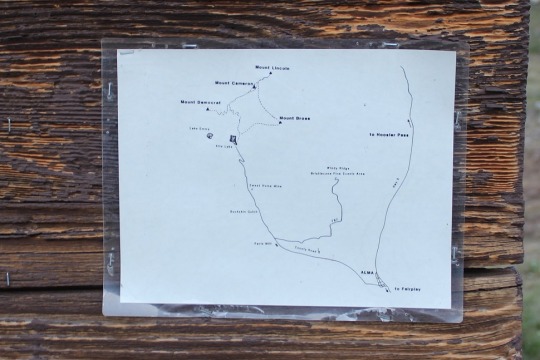
UGH!  I do not like hiking with tons of people!  I hate playing leap-frog, so I looked at the map posted to the board (instead of my instructions/map), took a picture just to be safe, and just headed out at the trailhead. 

image

As I reached the top of a hill I got out my instructions and compared them to where I was.  I’d crossed some fields of snow and I wanted to make sure I was on the right track.  Yep, there was the old mine.  I was good to go. 

image

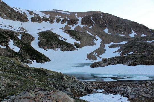
I went up a snow field, and then was surprised to see a lake?  This wasn’t on my map or instructions.  Weird.  

image

I got them out again and looked.  Nope, no lake on my route.  So I called back to a group of girls hiking behind me, asked them which trail they were hiking.  The same one I was.  Cool!  Do you have a map?  Apparently not, they’d just been following me.  Ugh!

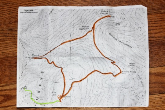
So I took a closer look at my map, and it seemed in my haste I’d started off on the wrong trail.  The orange lines were where I was supposed to go, the green is where I actually went.  Oh, and the green line trail isn’t in the picture I took at the trailhead, so I didn’t even second guess when I’d started. 

image

Deep breath.  I had a lot I could blame it on, but in reality this was a rookie mistake I made because I was in a hurry and don’t like people.  Lesson learned.  Never again.  This added another 3 miles onto my hike (1.5 in, 1.5 back to the original trail, so now I was looking at 11.7 miles).  So I quickly turned around and headed back.  When I reached the correct trailhead it was 6:40am.  Drat!  I’d lost an hour of time!

image

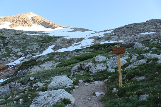
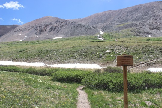
From here until close to the peak I had pretty good signage.  I noticed one saying the Bross trailhead was closed.  Good to know.  I took the Democrat/Lincoln one instead. 

image

The hike up Mt. Democrat was, as I said, pretty well marked most of the way.  I passed 2 groups of hikers and luckily we didn’t play leap frog!  

image

At the mile mark I came across the CORRECT mine and continued on. 

image

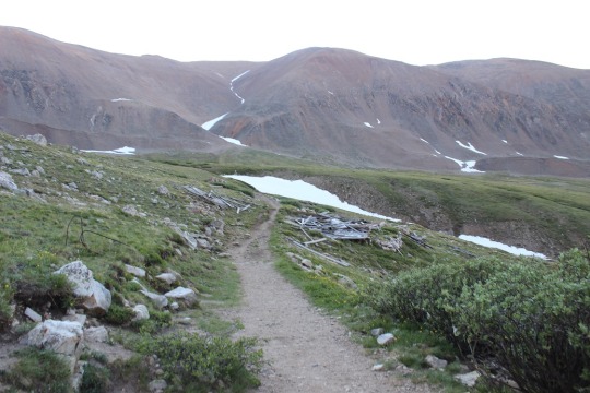
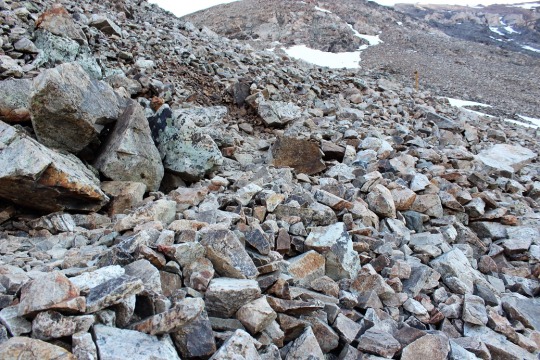
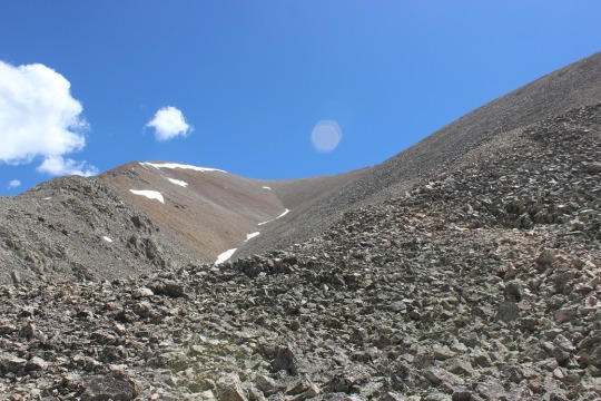
The trail for most of the way was rocks.  Lots and lots of rocks. Unfortunately that often makes it difficult to find the correct trail. 

image

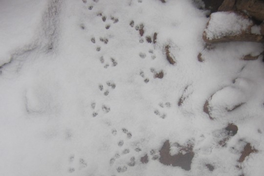
Pikas like the rocks.  They were all small today.  I took a pikature.

image

The sun finally came up, I took off my jacket and put on sunscreen.  This shadowselfie is actually important.  

image

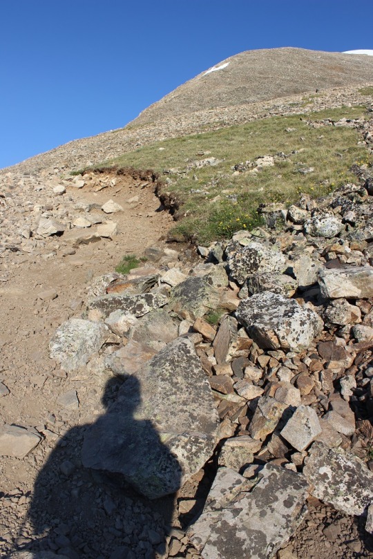
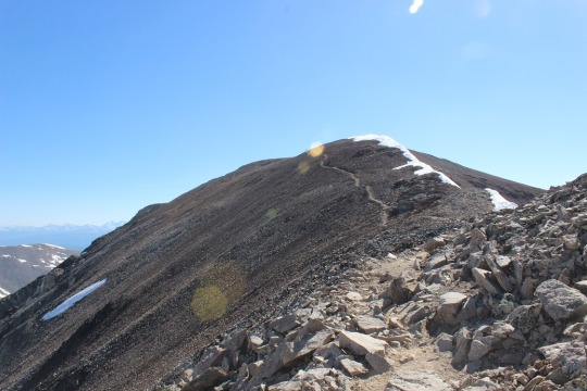
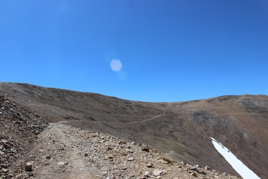
You see, I’m actually looking at all the hikers on the ridge and snow and trying to get a gauge of where the trail goes.  You can note at this time none of those hikers were on the trail (something I didn’t realize until I hiked it myself). 

image

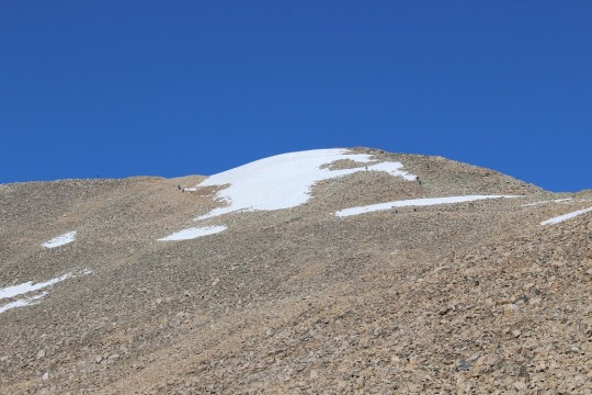
The trail actually goes to the far right, and none of these hikers is even close to it. I found this out on my way back down, but I made it up so it’s all good! These types of hikes often require route finding.  As long as you have the peak in sight you’re usually good.  When I got close to the summit I found the correct trail and just had a little further to go.  

image

Woohoo!  I made it!  The summit had no less than 20 people sitting and enjoying a snack. 

image

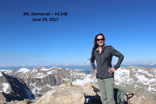
I had one of them take my picture, offer me some twizzlers (I declined because I don’t like to hike and eat) and took a quick video of the peak. (see all videos below)

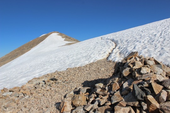
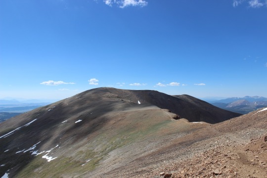
Now it was on to Mt. Cameron!  I found the trail and went down the summit the correct way.  It pretty much followed the saddle and went up the ridge.

image

Here’s a closer view

image

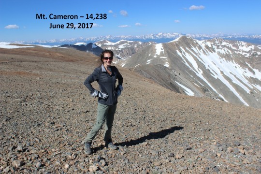
This ridge is where it got really windy.  I mean really, really windy!!!  I’d taken my hair out for the Democrat picture and my fingers were frozen so I couldn’t put it back properly.  The wind was having a field day.  When I summited Mt. Cameron there was one other person there.  He took my picture and I was off.  

image

Oh, but before that, I’d like to explain why Mt. Cameron isn’t an “official” 14er, even though it’s clearly over 14,000 feet.  

It’s not official because it does not have enough prominence.  A mountain has to gain at least 300 feet off the ridge to be considered an official 14er. So it’s not part of the 14er challenge but I count it as one I’ve summited anyway.  I’ll do the same for you.  

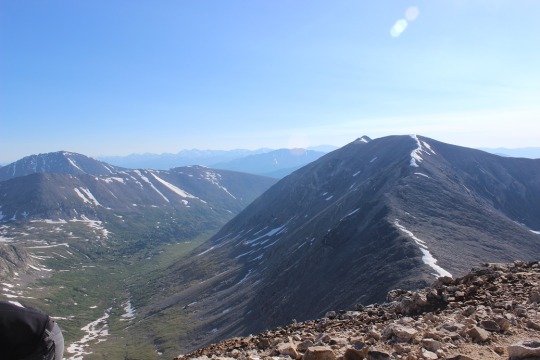
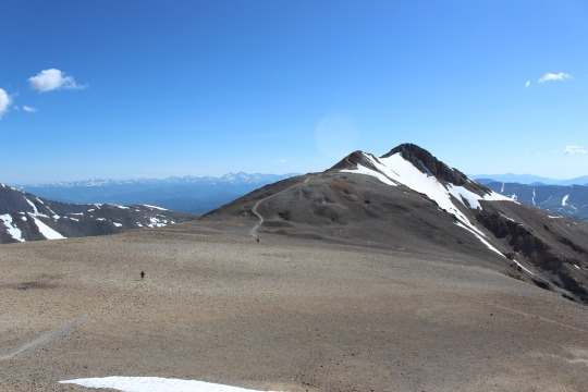
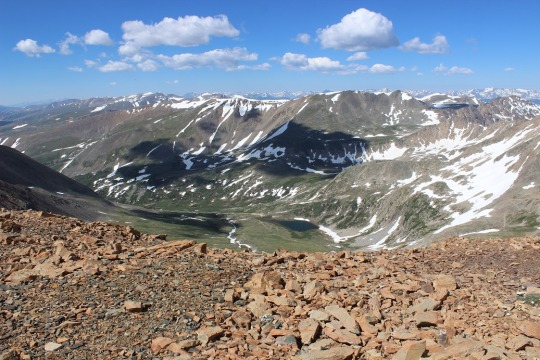
Once I made it across the ridge I could see the path to the summit of Mt. Lincoln.  It kind of reminded me of the moon. 

image

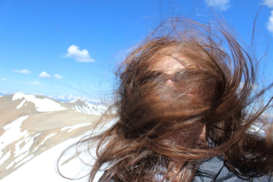
The wind only picked up from here.  I took out my hair and tried to brush it (which happened to be a mistake).  See?

image

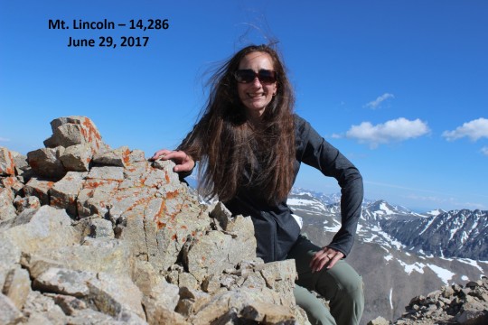
I was the only one on this summit, so I had to take the summit picture myself by setting the camera to automatic (since the selfie thing wasn’t working).  Not great, but not bad, considering the wind and all. 

image

I don’t like to stay on summits long, so I headed down the trail.  There were old mines all over the place!

image

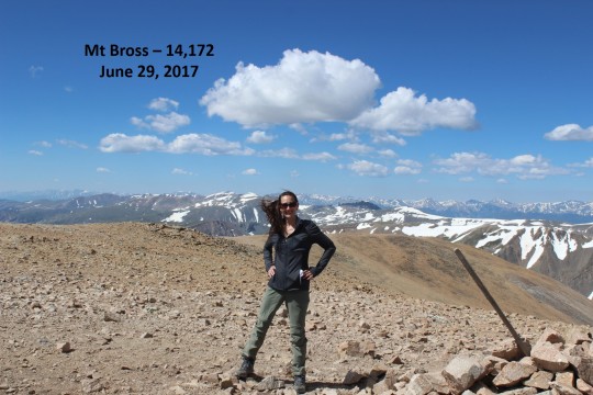
Here’s where it gets tricky.  You see, as I was heading down someone pointed out Mt Bross to me.  

image

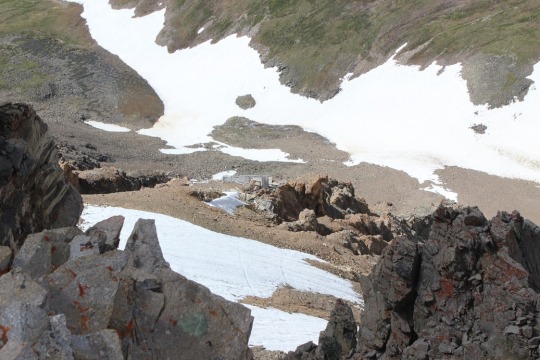
It looked like it was directly on my path down, and as I hiked further I realized it was.  I never saw a sign indicating the trail was closed from this end, so I decided to take it across.  I saw Kite Lake from the ridge.

image

I ended up summiting much quicker than I’d anticipated.  I just crested a ridge and was there.  So were about 10 other people, sitting in a wind shelter (that wind!)  I had one of them take my picture (I’d put my hair into a ponytail by this point, as the wind had actually snapped my barrette in two).  

image

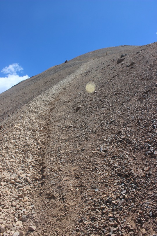
I was only there for about 5 minutes, but I overheard quite a bit of conversation centered around this mountain, but I’ll refer to Rule #1 at this point.  Apparently the hike up Bross was all scree.  Like, all of it, and that’s how they’d all hiked up.  They must have taken an open trail?  I asked what the best way was to get down from someone who’d obviously hiked this several times.  He recommended hiking back the way I’d came.  I really didn’t want to do that since I was already ¾ of the way into the hike and only had ¼ of the way to go according to my map.  He said if I went down to where the post was and turned left I’d make it on a trail that would bring me back down.  That’s what my map said, so that’s what I did.  Two other girls went as well.  Apparently this is the trail that skirts Bross and goes around it.  Great!  Since the Bross trail was closed this must be the one I was supposed to use.  Big sigh of relief!  

image

So many trails to choose from!  And that looked like a LOT of scree.  I mean, a lot of scree!  And it was!

image

Screevalanches all over the place!  

I was slipping and sliding the entire way down.  It felt as if I was skiing on rocks sideways.  

After the scree was this.  Lots of steep hiking!  OMG, this all seemed pretty dangerous (but doable). 

image

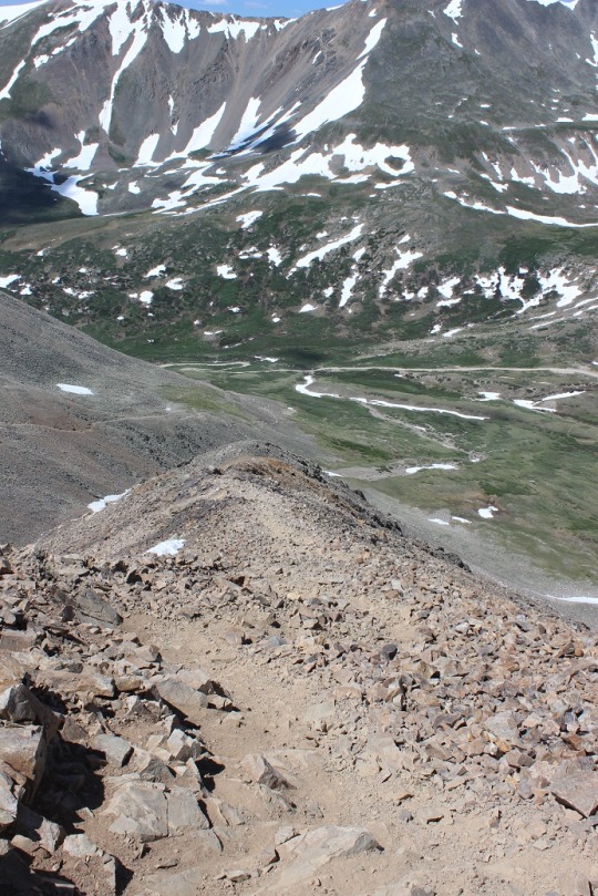
I finally made it down and looked at what I’d accomplished.  I hadn’t hiked up that scree, but hiking down was pretty intense!  I was glad I’d hiked the way I had!

image

Then it happened.  I was exiting the trail when I saw a different sign than I’d seen when I’d started this hike indicating the Bross trail was closed 1.5 miles up.  What the heck?!?!?  While I totally appreciate and approve of this trail being closed (it was difficult) it would have been nice if there had been a sign at the top of the trail!  I’d seen no signs.  None at all.  Lots of trails, no signs.  Ugh. If it’s a LOOP trail people you need to place signs at the top as well, not just the bottom!  I’d seen so many different trails I assumed there’s been more than one to the top and I’d taken one that was ok to take.  Hmmmm.

image

Well, I crossed a small stream

image

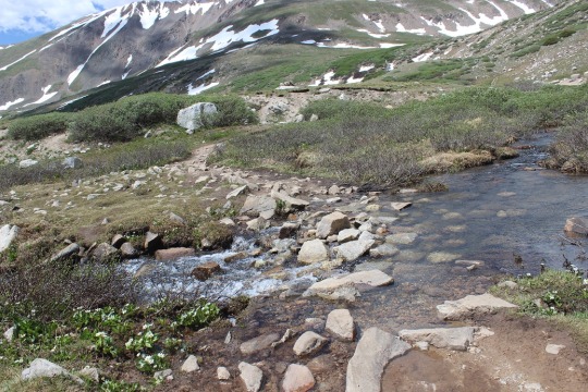
and was back where I’d started.  Woohoo!

image

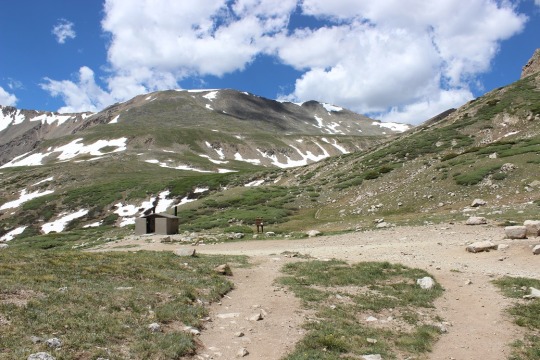
I made a beeline for the bathrooms, but they were closed?  I mean, like locked and with signs and everything.  Not cool guys!  This ENTIRE trail is above treeline, so there’s no place to pee without everyone seeing (and I mean everyone, as it’s a well traveled trail).  If you have bathrooms at the trailhead they should at least be open.  I could tell others had been disappointed as well (some people had just “gone” behind the building.  Yuck!!!).

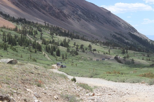
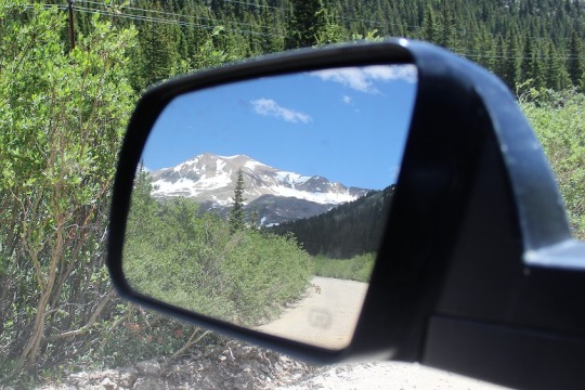
I walked the last .6 miles back to my truck and found the trailhead was FULL!  This picture doesn’t do it justice, as the 4WD vehicles go on for about ¼ of a mile, then there’s a mile of no cars, and then another ¼ mile of the cars that had too low of clearance to get by.  Lots of people out hiking today!  See mom, there’s help if I need it 🙂

image

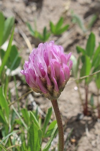
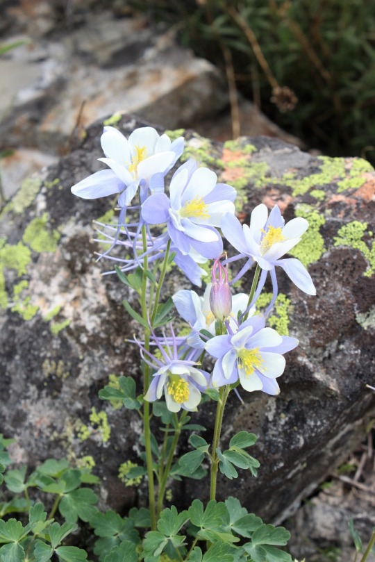
On the way back I took a picture of some of the flowers I’d seen on the way in but couldn’t get a picture of because it had been too dark.  Clovers, Indian Paintbrush, and Columbines were all over the place. 

image
image

As I was leaving I saw a fox walking towards me on the trail.  It was pretty cool because he didn’t dart into the bushes, he just kept walking towards me. 

image

He walked right by my truck!

image

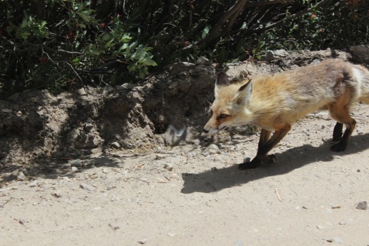
I couldn’t help but think of how I’d actually like to be going the way he was (back towards the mountains).

image

Oh, and here are the summit videos…

Seventh Summit of Pikes Peak

image

This was a last minute trip.
It wasn’t until about 10pm the night before I realized hiking the 26
miles up and down Pikes Peak would even be a possibility.  When I discovered I had some time in my
schedule I immediately went online to check the weather forecast.  As usual, each forecast was different, but
they all agreed there would be storms and possibly snow in the afternoon.  One even predicted thunderstorms starting at
10am, but most stated there would be “fall like weather”.

I’ve missed several opportunities to hike the mountain this
summer because I listened to weather forecasts that turned out to be false, or
materialized later in the afternoon than forecasted (meaning I’d have already
hiked and been home before the storms started).

I asked Rebecca her opinion and she said yes I should go!  She also said she’d look for me if I didn’t
come back tomorrow night.  And by ‘look
for me’ she meant drive to the trailhead and yell.  So I packed up my gear, prepped coffee just
in case, and decided to “decide” in the morning.

My alarm went off at 2am and I looked out my front window to
evaluate Pikes Peak and my chances for a successful hike.  I couldn’t see the light from the summit
house, or, more importantly, Pikes Peak at all; It was covered in low lying
clouds.    

So I went outside.  It
felt warm (low 60s).  I went back and
forth in my head on whether or not to attempt the hike for about 5 minutes
(seriously, which is a long time for someone who usually makes quick
decisions).  In the end I decided to
go:  I could always turn back if the
weather got difficult, and I’ve never regretted taking a hike when I didn’t
feel like hiking.  I made sure I had my
ski gloves and set out on my way with the rest of the gear I’d packed the night
before.

I didn’t get to the trailhead until after 3am.  There were only 2 cars in the parking
lot.   The dashboard of the car read 63
degrees outside.  I figured the cars
belonged to backpackers at Barr Camp, paid my $10 parking fee, and started
hiking at 3:12am.  

image

I usually check the time as we hit different landmarks/mile
markers, but never actually write them down.
I’ve got a pretty good idea of how long each segment should take, but this
time I wanted to keep close track of my progress.  

I love hiking Pikes Peak.
I’m super appreciative of hiking buddies and I’m glad to hike with
anyone who’d like to hike with me (quick caveat:  they must be in good health, have no heart or
lung problems, and WANT to hike the peak), but I find when I hike with others
we take a lot of unnecessary and sometimes lengthy breaks.  These breaks are probably necessary for them,
but I’ve always wondered how quickly I could hike the peak if I only stopped
when I was tired.  So this time I was
keeping a trail log on my phone.

I started hiking to the sound of crickets.  The first three miles of the hike are the
most difficult and require you to ‘power’ through them.  The redeeming factor to this stretch of the
trail are the city lights.  You can see
Manitou and Colorado Springs glowing in the distance.  I’ve tried dozens of times to get a good
picture, but have come to the realization the only way to enjoy the view is to
actually be there.  

image

Strangely I wasn’t able to see the summit house light.  It’s a very bright light I can usually see
from my house, and I’ve always seen while hiking the peak in the morning.  I’d thought I’d have been able to see it
through the clouds, but I couldn’t.  I
hit MM1 at 3:31am, MM2 at 3:53am, and MM3 at 4:14am.  I’d hiked the first 3 miles in 61 minutes and
had taken several stops for pictures (none of which came out really well).  That’s great time!  These are the hardest miles of the hike, so I
consider hiking 3mph basically climbing up stairs a win!

At this point I began noticing the sound of crickets had
silenced.  In fact, I couldn’t hear any
bugs or the sound of the creek I knew I was paralleling.  I made a mental memo of it and kept hiking.  

Side note:
headlamps are NOT useful when you hear a noise in the woods.  Your head automatically turns towards the
sound, but you have to swivel it side to side to look for creatures (or beady
eyes).  A flashlight is much better
suited for this purpose.  

Around MM4 I saw a large reflective rectangle in the
distance and was intrigued.  I wasn’t sure
exactly what it was until I was right upon it, when I realized it was a sign
noting miles to the top.  This is not a
permanent fixture, and was probably put there for the race this past weekend.  I saw them every mile to the top, and
seriously hope the person responsible for putting them there ensures they are
properly disposed of.

image

MM4 came at 4:36am, MM5 at 4:57am, and MM6 at 5:21am.  Even though the trail was evening out and
getting easier to hike I was gradually hiking a bit slower.  Totally ok, but funny to note.  

All along the hike I kept waiting for the sun to rise and for
it to get lighter outside but it just wasn’t happening.  I thought to myself I was glad I’d hiked this
trail many times before.  It’s a very well-marked
trail, but in the dark with just a headlamp it’s easy to lose the trail when you
come upon a bare section not lined with some sort of foliage.  I kept thinking “I could see how someone
could get lost here, and here, and here”.
I was also noting the lack of animal noises.  Usually I hear a lot of rustling and chirping
from birds, run into spider or caterpillar webs, and hear small creatures
scurrying in the dark.  I saw two rabbits
quietly sitting on the trail before me at different points, but that was
all.  No other sounds.  

Well, I did hear a bear once, or what I thought was a
bear.  It startled me in the quiet.  I didn’t stop, but kept on hiking.  You see, I was actually really, really scared
to be hiking out there by myself.  I wasn’t
afraid of anyone attacking me:  there
were only two cars in the parking lot, and honestly, anyone who’d made it this
far out didn’t have the intention of hurting someone at 5 in the morning.  They’d be sleeping.  No one was crazy enough to be hiking in the
dark (ha-ha) so it wasn’t likely someone was ‘lying in wait’ for someone like
me to hike along.  

No, I wasn’t worried about another human being, or even a
bear, but possibly a Mountain Lion.  I
kept noting how unusually quiet it was, and figured I’d be able to hear just
about anything except a predator (meaning a Mountain Lion, as those would be
the only predators in this part of the forest).
I mentally prepared myself to use my hiking stick to defend myself and ‘go
for the eyes’ if attacked.  

So I scanned my headlamp left and right as I hiked, looking
for eyes in the shadows.  When I heard
the growl I was seriously scared.  It
made me jump a bit, but I didn’t see anything.
I thought it had to be a bear, as it was a rather loud noise and a
Mountain Lion would have just attacked from behind. It happened again and you’ll
probably never believe me, but I realized it was my stomach!  Honestly!
I didn’t feel hungry at all (my core was aching right about now), and in
fact I couldn’t actually feel my stomach.
The second time I heard the growl my tummy moved at the same time, and I
audibly noted the hilarity of the situation and sighed in relief. I kept
hiking.

Usually by MM3 or MM4 it’s fully light outside, but I passed MM6
and Barr Camp at 5:23am to an eerie darkness.
Apparently there aren’t any lights at Barr Camp, something I’d never had
the opportunity to notice until now.  Through
my headlamp I saw the railings and porch swing by the river indicating the entrance
to the camp, but opted not to stop because it just felt wrong.  The fog around the campsite added to my
unease.  Everyone was obviously still
sleeping, and I felt like an intruder.  

Just after reaching Barr Camp a very light snow began
falling.  I could see it through my
headlamp.  It was more of a light mist of
snow, but snow just the same.  I reached
the yellow ‘summit sign’ that lets you choose between the Bottomless Pit and
Pikes Peak at 5:46am, and it wasn’t until 6:01am when I was able to turn off my
headlamp.  

A realization hit me:
I had just hiked for 9 miles. In the dark.  

Through the forest.

By myself.  Scared.
There was no moon to guide me, as it was lost in the cloud cover
above.  I’d survived one of the scariest
things I’ve ever done, and was seriously proud of myself for sticking to it and
continuing to hike in the dark!  Rock on
sister!  Let’s do this!

I reached the A-Frame at 6:22am and took my first ‘rest’ of
the hike.  Kind of.  You see, I call my kids to wake them up in
the mornings for school between 6:20 and 6:25am, so now seemed like the perfect
time.  Yes, I had cell service (I have it
at just about every point on the trail, even at the summit, although I can’t
usually post to facebook or Instagram while on the trail).  I called Emily, wished her a wonderful day,
and took a look around.  The tarp was
pulled closed over the A-frame, and when I peeked through the gap in the
curtains I thought I saw a jacket hanging from the window, so I quietly turned
around and started hiking again.

There were a couple of squirrels chattering, so I took a
video (I say chipmunk in the video, but knew they were squirrels:  It wasn’t worth a second video).

Before reaching the trail I saw two bucks!  They stood there and let me get a picture.

image

It was then I realized the squirrels weren’t chattering at
me, but at the deer:

I’d turned off my headlamp about 20 minutes ago, but it was
now that the sun actually began to rise. There is no way to describe or take a
photo of the sunrise from Barr Trail to do it justice, but here are a few
attempts:

image

It was about now the snow began falling harder, the wind
began to pick up and the temperature began to drop.  I was now hiking into the clouds.  

image

I switched my cotton gloves for my ski gloves and trekked
on.  I reached the ‘2 miles to the summit’
sign at 7:05am, and the Cirque (about a mile from the summit) at 7:32am.  I was above treeline, and still hiking at
about 2 mph!  That’s entirely amazing, as
it often times takes an hour to go a mile on this part of the trek.

image

I was now hiking in snow, and saw prints I’d never seen
before.  They were really small rodent
footprints, bigger than a mouse but much smaller than a marmot.  Then I saw one!  I’d never seen one before, but I was pretty
sure this was a Pika and the owner of the paw prints.   I
tried to get my camera out for a picture, but by this time my fingers were
frozen and I wasn’t quick enough:  The
Pika ran away before I could get a picture of him, so I took a picture of his
prints.  

image

I kept the camera in my hand, and kept looking for another
Pika for a ‘Pika-ture’ (yes, I actually said this out loud).

That last mile was grueling only because it was so cold and
the wind whipped the ice and snow into my face.
It wasn’t bad enough to take refuge or turn around, but it was seriously
annoying.  I saw this cairn about 50 feet
from the summit and thought it looked cool.
I still had the camera in my hand so I snapped a quick photo.

image

I reached the summit of Pikes Peak at 8:05am.  It had taken me 5 hours and 7 minutes to
reach the top!  That was absolutely
amazing!  I was hiking at an average
speed of over 2.5mph: UPHILL!  I knew
from reading Backpacker Magazine the
average hiking speed of any trek usually sits around 2mph, so I considered this
a serious win!

image

I reached the summit at the exact same time a cog pulled
up.  Several workers jumped out of the
cog as it stopped, dressed in working overalls, shovels in their hands.  They quickly began clearing the walkway.  

image

The men were exceedingly nice, and asked about my hike up
and if I’d seen any animals?  We
discussed what I’d seen and the animals they’d seen on their way up (mainly
deer as well).  I (sadly) noticed the
Summit House was closed, so I asked one of the men shoveling when it would
open.  He didn’t know.  “Maybe in half an hour, maybe not at all
today because of the snow”.  

Great.  I was quickly turning
into a popsicle and decided to just head back down immediately.  This ended up being a very wise choice.

I waved goodbye to the men shoveling, and as soon as I began
hiking back down they jumped back into the cog and were on their way back down
themselves.   It was cold.
I mean VERY COLD.  The wind didn’t
help.  I was guessing it was about 20
degrees before wind chill.  Hiking kept
me warm; stopping froze my sweat and my muscles.  

About 50 yards into the descent I saw another Pika, and
luckily still had my camera in my hand.
Here’s what they look like: Bigger than a mouse, but smaller than a
chinchilla.

image

I didn’t see any hikers until I was just about at the
A-frame, and surmised by the color of the jacket the man was wearing he was the
one who’d spent the night.  I tried to
warn him of the rapidly deteriorating conditions after treeline, but he didn’t
seem to think I was serious.  When I
reached the A-frame again the tarp was pulled back and no one was inside, so I
was pretty sure he was in fact the overnight occupant.

Between the A-frame and Barr Camp I saw about 10 other
hikers and stopped to talk with them all.
They all wanted to know about the conditions ahead, as they couldn’t see
the mountain from that point of the trail.
Once again I told them it was snowing, cold, the wind was howling, and
it just kept getting worse.  I advised
them all to head back, but every single one of them “had a ticket back down on
the train” and needed to be there to catch a ride back down.  I told them all the summit house might not
open, so if they were relying on it for warmth/shelter be advised it might not
be there.  The cog might also not be
operating.  They continued their hike
anyway, one of them in shorts and a t-shirt.
He told me it was a “good thing he’d brought a jacket”.  I did a face palm and told myself I’d warned
them.  I honestly don’t believe any of
them made it up to the top.  It did
indeed get much worse as the day kept on, and they were at least 4 hours behind
my summit when I saw them (they had 4 hours at best until they reached the
summit).  When I told my kids this after
arriving home they said it was probably because I don’t look like a “hiker” and
that I make hiking look easy.  I’m
guessing they probably thought if I could do it so could they.  Hmmmm…. I digress.  

I was back at Barr Camp at 10:28am and saw my last set of
hikers:  6 women in their early 60s, very
fit, with a LOT of makeup on (maybe it was permanent?).  They seemed to listen to me, and while they
continued ahead, verbally made a pact to turn around if at any time one of them
didn’t feel safe.  They also regretted
not beginning their hike at 4am like they’d originally intended.  High five to them for keeping their options
open!

I was back at my car at 12:18pm.  I’d hiked 26 miles in 9 hours 6 minutes, and
felt absolutely amazing!  I didn’t take
any breaks besides 3 minutes to call my kids and what was probably 3 minutes at
the summit, and it was at this point I realized I hadn’t eaten anything all day
either.  I’d brought a lot of snacks, but
hadn’t opened any of them.  All I’d had
to eat today had been the coffee I’d sipped on the way to the trail.  Now I was starving, and ready to eat.  But first I needed to head to work for a few
hours, pick up Thomas from school, search for a gyroscope, pick up Emily from
softball…  

Trail Log:

3:12amTrailhead

3:31am MM1

3:53am MM2

4:14am MM3

4:36am MM 4

4:57am MM5

5:21am MM6

5:23am Barr Camp

5:46am Summit sign/ Bottomless Pit

6:22am A-Frame

7:05am 2 Miles to go

7:32am Cirque (1 mile to go)

8:05am Summit

10:28am Barr Camp

Trailhead at 12:18pm