While there are a few twists and turns through the back
roads of Chipita Park to get there, this hike has a very obvious trailhead but
very little parking. I had to drive a
quarter mile down the road to find a driveway to turn around at so I could park
my truck alongside the dirt road.
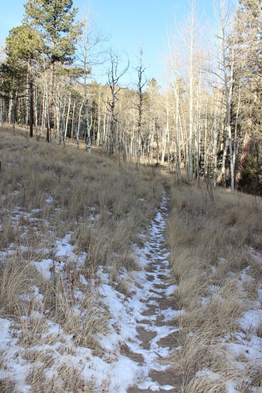
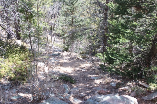
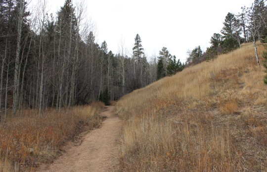
The first 1.3 miles of the trail begins with some steady
elevation gain and a lot of switchbacks.
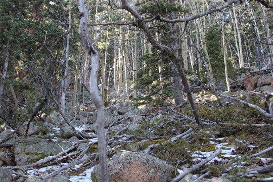
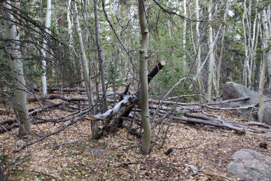
I noticed as I was hiking there had been a lot of tree clearing/cutting/trimming
lately. I saw dozens, if not a hundred
of these piles lining the trial.
Once you arrive at the top of the switchbacks you come to a
nice meadow and a trail junction. Stay
right at the junction. I state this
because many people have told me they mistakenly went left, which takes you on
a long loop to nowhere. (OK, it goes somewhere,
but not directly: you’ll need a topo map
as there are several possible trails you can take, leading in many different
directions: just go right).
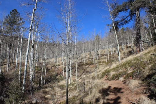
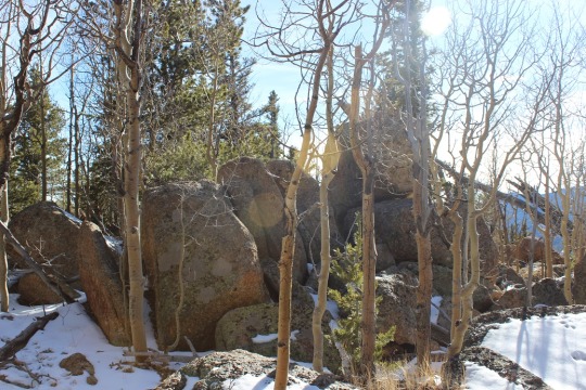
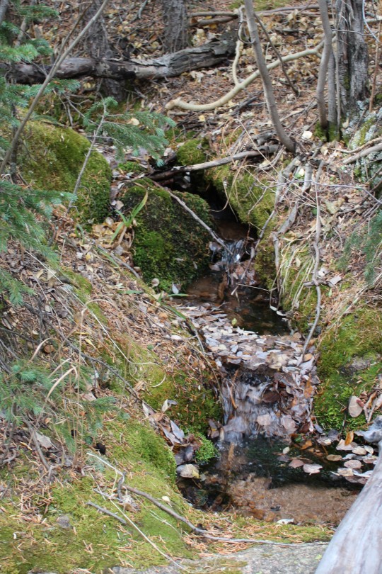
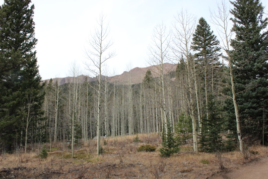
After crossing the meadow and a very small trickle of a
stream you enter an aspen grove
and then start following a forest road. While I was hiking here I heard the loud
rustle of feathers ahead of me, looked up, and saw 2 ptarmigans jump/glide from
the forest floor to the top of a pine tree.
I was able to get a picture (and video) of them, but didn’t want to
disturb them so I didn’t stay long/didn’t get great photos.
The forest road starts to follow power lines from this point
on.
This forest road will take you all the way to the Crystal
Creek Reservoir, but what fun is that? I
looked at my topo map, and figured the power lines were a straight shot to
where I wanted to go, while the road twisted and turned but eventually ended up
in the same place. It’s part of the Ring
the Peak trail system, which they made wide enough here to accommodate 4
wheelers. I’d rather hike. So I turned left and followed the faint trail
under the power lines (hey, there was little chance I could get lost this way,
right?)
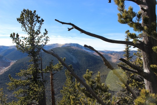
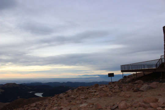
Once I reached a saddle I could see the Crystal Creek
Reservoir, so I knew Mt. Esther must be to my left.
Quite a bit of tree maintenance had been done here as
well.
My directions told me to look for a cairn indicating a faint
trail, but there was no cairn, and no trail.
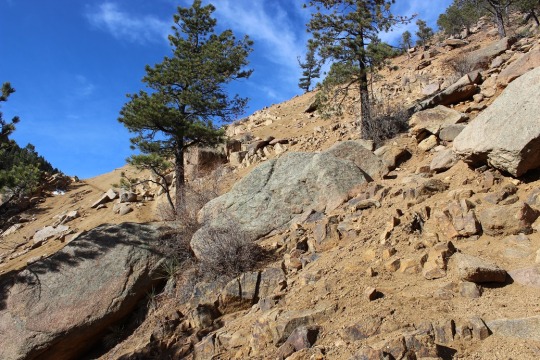
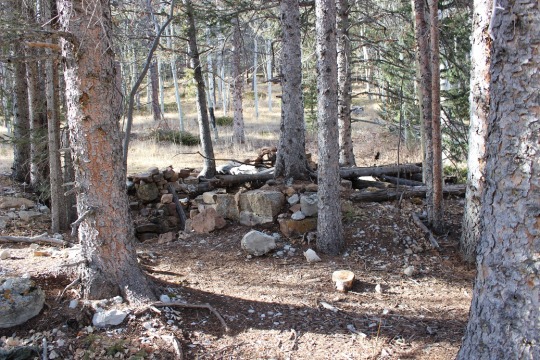
So I turned south and just headed towards the summit. This is what it looked like:
I headed south and up the mountain for about a third of a
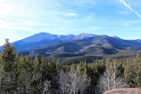
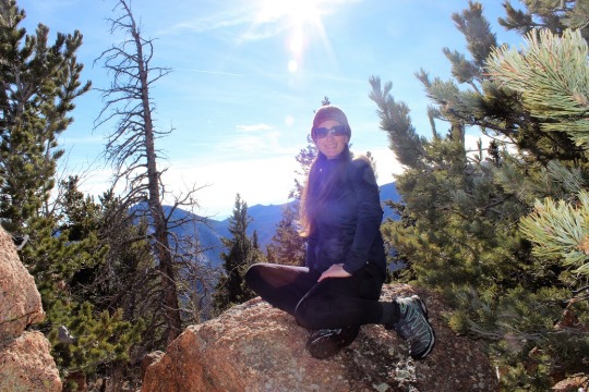
mile before reaching a boulder filled summit with great views of the reservoir!
I had fun bouldering a bit (and jumping from rock to rock where
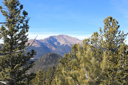
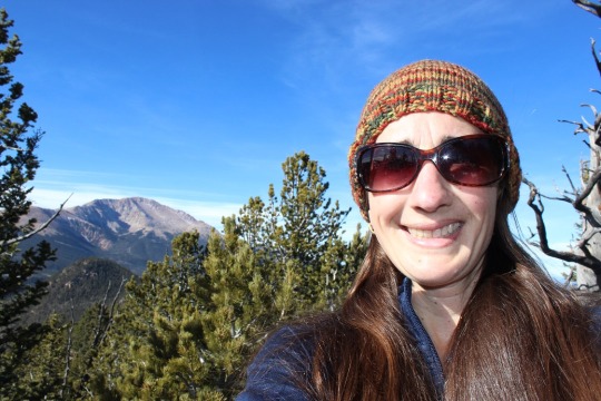
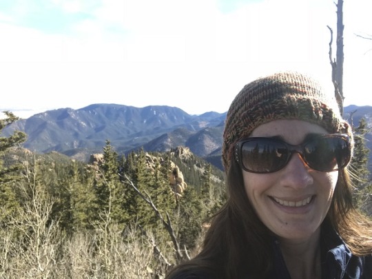
feasible). I took a few summit selfies
to prove I’d made it, one with a view of Pikes Peak and another of the Crystal
Reservoir (which I’ve taken a paddle boat out in with the kids! Fun!)
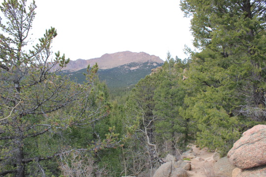
Pikes Peak looked beautiful today, as it does just about
every day
This was a fun, quick hike (7 miles in 3 hours including
stops to watch the Ptarmigan and boulder for a bit). I’ve heard it described as ‘difficult’, but I
think that’s exaggerating a bit. Yes,
the initial mile of switchbacks probably would turn many away, as well as the route-finding
at the end if you intend to summit Mt. Esther, but the hike itself is quite
pleasant and easy to follow!
7 miles
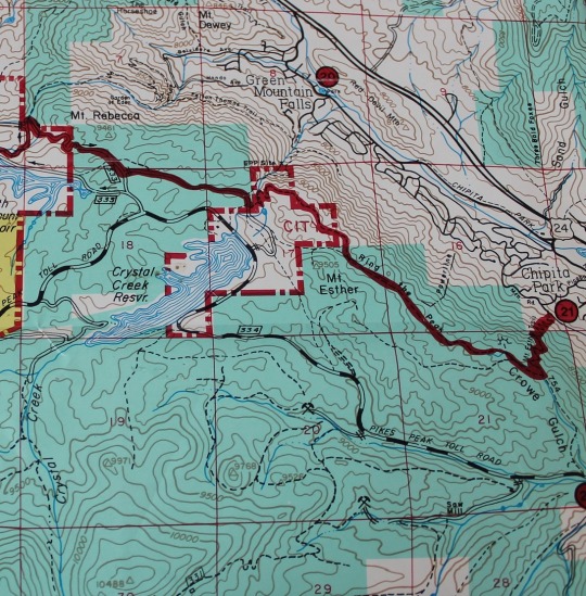
1500’ Elevation gain
I followed the red Ring the Peak route, and then kind of made my own trail. This topo shows where the trail should be. I followed this, even though there was no actual trail off the Ring the Peak trail.
My directions said this was a 6.5 mile round trip, with 1000
feet in elevation gain and some route finding.
Wrong. Wrong. Wrong!!!
You see, the problem with hiking routes that aren’t hiked
often is you often times need to rely on just one person’s post about the area
because no one else has given any information.
Because this was supposed to be a relatively short hike I woke up at
5am, ran 5 miles on the treadmill, did an hour of yoga, and was on my way.
I looked at how much gas I had: just less than half a tank, and since I was
only going about 30 miles I figured this would be plenty. To get there I needed to take Old Stage Road
for 19.6 miles, which took a lot longer than I’d anticipated: This is a 2wd dirt road normally, turned 4wd
in the winter, but there were a lot of turns and I never went more than 15mph
because it was iced over.
I watched my gas gauge quickly and steadily drop and started
to get concerned I’d get stuck out there, 20 miles off a dirt road, out of
gas. I mentally gave myself a point on the
gas gauge of no return and kept driving towards the trailhead. If worse came to worse I’d hike an extra 5
miles of so to take this hike… it wasn’t that long anyway. I turned right onto forest road 376 and went
for another 3.2 miles to the trailhead at the junction of a locked gate/dead
end and Forest Road 379 (which is part of the ring the peak trail and also the
part that still needs to be worked on, depending on which way you turn).
I was the only car there as I grabbed my gear and headed
east up the 379 at 9am.
This part of the trail was quite steep, and since it’d
snowed recently quite slippery. I didn’t
put on my microspikes, but I did use my trekking pole quite a bit.
I was told to hike to a small meadow and turn left. So I did and the trail went nowhere. I was supposed to be heading towards a
saddle, but the trees were too tall for me to see the saddle. Just for reference, DO NOT TURN LEFT HERE:
I backtracked and looked at my map and the area around
me. I was near the microwave tower, and
I could find where I was on my map. I
could tell by looking at my map the road I went on continued all the way to the
summit of the microwave tower and continued on to Almagre. This was not how I wanted to summit, but I
wasn’t ready to give up yet, so I continued on the road. Eventually I came to a rather large meadow.
I realized this must have been the meadow they meant in my
directions, and headed west, looking for that saddle. At the very northwest part of the trail I
noticed another trail, and took that a short distance to a hold in the fence
Now I was getting somewhere!
This vaguely went along with my directions, and I was following my map,
so I continued up the saddle. This was
no walk in the park! The picture below
doesn’t do that scree justice! It was
steep and slippery and much larger in real life (steeper too)
I made it to the top of the saddle and looked for that trail
that was supposed to be so obvious: It
wasn’t there. I’m blaming the snow, but
no worries, as that didn’t stop me. I
could see the microwave tower, as well as the route to get there, and decided
to just head towards that so I could get in some route-finding.
I headed east, and for some reason this easy hike became
difficult. I haven’t been above treeline
in a month and a half, and my body seems to have forgotten how to breathe! Yes, it was a steep slope and physically
challenging, but this was difficult! I
was sweating up a storm in 30 degree weather.
My calves and shins were screaming.
I kept going.
About here it became difficult to breathe. I hadn’t tied my
hair back so it was a bit unruly, but I figured I’d fix it at the summit. I just got mad at myself for being tired so
quickly and continued onwards. Woohoo! I could finally see the microwave tower
again!
This gave me hope, and pretty soon I summited to a much
larger microwave tower than anticipated!
The views were absolutely amazing! I dropped my bag and took a few pictures
I wanted to take a summit photo to prove I’d made it, and
reached into my bag to get my hairbrush and hat. Unfortunately, both were left on the front
seat of my truck. Drat! Oh well, summit hair don’t care! I was just lucky it wasn’t windy today…
I got my gear back together and looked at the route before
me:
I took a look at my topo map and realized I had two
options: I could hike the ridge to
Almagre or the trail down to the Stratton Reservoir, and then back up
Almagre. It looked like there was snow
either way, but experience has told me rocks mean ice, so I decided to take the
road. My immediate views of Colorado Springs
were amazing!
I’m not sure this was in the end the best choice, as it was
covered in snow. It was kind of cool
seeing all the animal tracks though!
I rounded a corner and could see both Pikes Peak and Almagre
and thought it was the most amazing view ever!
I kept going and could see the rest of the route before
me: Stratton Reservoir (or what’s left
of it) on the left, and the road to the right.
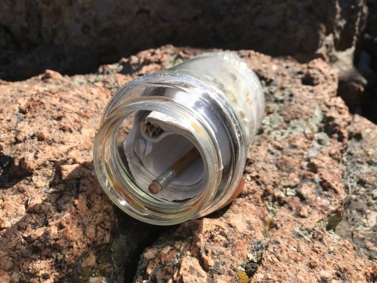
I made it to the reservoir and saw this… I’m not sure what
it is, but it’s obviously not put there as a shelter from lightning…
I crossed the reservoir and headed north
This is where the snow completely covered the trail, but
only enough to get inside my hiking boots.
I was continuously hiking through about 6 inches of snow, but it was up
to 3 feet in areas.
The trail rounded the mountains, and pretty soon I could see
Almagre in front of me. The trail up to the summit covered in snow…
The summit was worth slogging through all that snow! I had a grand view of Pikes Peak, and an
answer to ‘what it was and how to get to that patch of green land I can see
from A-frame’. I’ve been wondering that for years, and today I had my answer! It was Almagre! Awesome!
Now I need to spend the night at A-frame again so I can appreciate it
once more with new knowledge.
I took some pictures to prove I’d summited (once again, summit
hair, don’t care) and headed back down.
Here’s a video of the summit view:
I could have taken the ridge back to the microwave tower and
back down, or any number of routes, but I didn’t feel like summiting again, and
I wanted to see where the road led. Maps are all well and good, but nothing is
as good as visually seeing the trail, as well as the mountains before me. I’d hiked most of them in the past month, and
wanted to see them from this angle. So
when I made it back to the reservoir As
I was hiking here I saw someone hiking up the trail, towards the Microwave
tower. I’m not sure which route he’d
taken because I never saw his footprints. I’m assuming he climbed over from the
west side of the reservoir.
I headed east along a trail that quickly took me to a locked
gate (easily avoided).
From here on out the rest of the trail was lined with 6
inches of snow.
I need new hiking boots (mine have holes) so this was
particularly miserable for 2 reasons:
Sand and rocks getting inside my shoes and snow keeping them wet. At this point I wished I’d brought
gaiters. Microspikes wouldn’t have
helped, floatation would have been nice, but gaiters would have solved a lot of
problems.
The trail back down was slow because of the snow: I kept slipping.
I followed the 379A and had some off roaders in modified
jeeps pass me. I eventually caught up to
them when they were on a break. One guy
asked me “You hiking the ring?” and to save time I told him “Yes! It’s a beautiful day for it!” and continued
on. Hey, I WAS on the Ring the Peak trail,
so I wasn’t lying (I just didn’t want to stop for conversation).
It seemed like it took forever to take this route! It felt like it took twice as long, and it should
have been faster as I was hiking downhill.
However, I eventually made it to the High Park area, and found a trail
that I’m assuming goes to point 12,225’.
I’m going to need to come back and try that one! But not today, because it was probably
getting late… I made it back to the meadow
that has the turnoff for Microwave Tower and noted with a picture the correct
trail to take
Now I was back on the loop, and hiked the mile and a half
back down to mu truck. When I got there
my truck had made a friend! This must be
the truck from the guy I saw at the reservoir.
In any event, here’s the route I took:
I made it back to my truck at 2:30pm. I’m guessing I hiked about 10-12 miles in 5.5
hours. I did the elevation gain when I got back, and it was 3000’ in elevation
gain with all the ups and downs and double summits.
Oh, and my truck made it out just fine (and all the way
home) without needing to stop for gas.
Woot!
This trail isn’t an established trail on any map, so I
needed to do a lot of research before heading out. My advice to anyone taking this route: Bring and know how to use a topo map and
compass. Almost all directions I found
were wrong, but the topo map never failed me!
I woke up this morning and it was a bit overcast when I
looked towards the mountains. However,
the weather looked like it’d clear up in an our or so, so I decided to hit the
treadmill for an hour and get in some exercise, shower, and then head to North
Cheyenne Canyon.
I arrived at the trailhead at 9:40am, and was on the trail
by 9:45am. What a difference a few days
makes in trail hiking! There was very
little snow here, where last week there was a good 3+ inches.
I’ve done this part of the hike several times, so I’m not
going to go into detail. Here’s the
route I took:
Park in the lot above Helen Hunt Falls
Take Gold Camp Road West to 622
622 is the 7 Bridges Trail
After crossing the 7th bridge turn right onto 622
and climb up the mountainside, along a scree filled slope, and stay right
through an Aspen Grove.
At the top of the Aspen Grove you’ll come to a
junction.
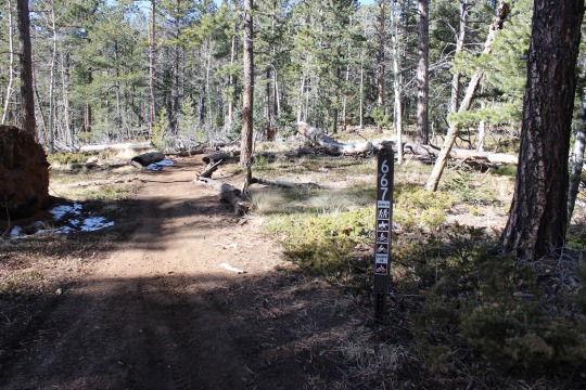
Turn left (West) onto 667
Shortly after this junction you’ll come to another
junction.
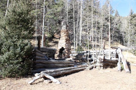
Turn right here onto 622A, and follow the route to Loud’s
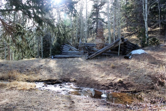
Cabin.
Side note: Professor Frank
Herbert Loud (1852-1927) worked at Colorado College as a mathmatician. He wrote mathematical textbooks, and took
many visitors to his cabins in the woods (there are 3), including the writer of
“America the Beautiful”, Katherine Lee Bates.
Most of my information about trails was wrong for this part
of the trek, and I’m assuming this is the reason:
There are many social trials in this area, but when you
reach Loud’s Cabin head north and cross the stream once again. From here you should follow the trail to the
right (east) for a bit before turning back west and closely following the creek
up the mountainside.
This isn’t a real trail, but more of a social trail filled
with scree and lots of cairns. It can be
difficult to follow at times, but as long as you parallel the stream to the
right and make it to the waterfall you’re on the right path.
Eventually you’ll reach the saddle between Mt. Garfield and
Mt. Arthur. This isn’t a saddle like I’m
used to: It’s covered in trees and
vegetation, with no trails. I was
frustrated because the trees blocked the view of both mountains.
This is where I got frustrated. I knew there wasn’t a solid trail to the top
of either peak, but now that I was on the saddle, I still wanted a trail to
follow. I kept thinking of how easy it
would be to get lost in all that vegetation!
I seriously contemplated turning back around and trying this another
time, but I’m stubborn! I’d hiked all
this way, I was very, very close to my intended destination, and wasn’t this
the reason I was hiking here? For a
challenge? How was I going to practice
route finding if I didn’t take a chance?
I looked around again for a trail. Well, there wasn’t one, so I steeled myself
and turned west, aimed for the top, and bushwhacked to the top of Mt.
Garfield. There was a lot of snow and
fallen trees. Here’s what the “path”
looked like:
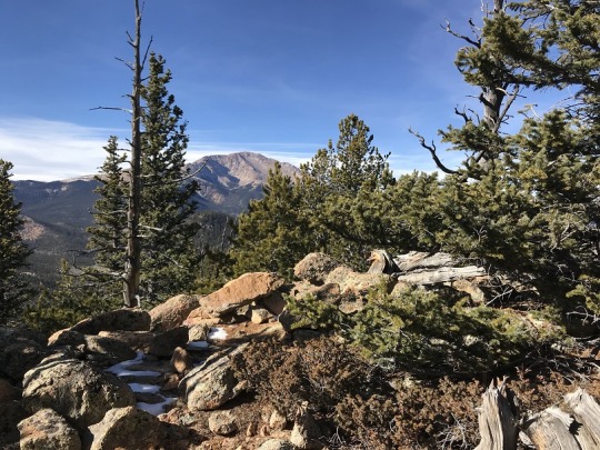
The views at the top were worth it! Not to the east, because trees were in the
way, but to the west I had a great view of Pikes Peak!
Here’s a view of Almaghre
And one of Runs Down Fast Mountain (one I want to tackle
soon)
I spent about 15 minutes on the summit, and then started my
descent. Since there wasn’t an
established trail I just kind of aimed towards the saddle and kept a view of
Mt. Arthur in sight.
It was fun to see some of my old steps in the snow! That meant I was going the right way. Unfortunately the snow wasn’t consistent
enough to follow tracks the entire way, but it was nice to come across them every
once in a while.
I made it back down to the saddle and seriously contemplated
just heading back. This hike had taken
longer than anticipated and I was running out of daylight. But I was so close! Did I really want to hike another 12 miles
just to summit a peak I was less than half a mile away from? Nope. I headed east up the slop of Mt.
Arthur. This area was much easier to
hike up then the terrain on Mt. Garfield.
There was almost no snow, and a lot of rocks, so I basically just
climbed west, taking care to stay away from the rock outcroppings to the south.
It felt really good to summit! The views here weren’t that great, but I took
a few pictures just because I was there.
Now it was time to head back down. The route was much easier to follow on the
way down than it had been on the way up, mainly because I knew where I was
going.
I made it back down to my truck at 3:15pm.
Stats: 12 miles, 3600’
elevation gain, 5.5 hours total hiking time.
This was a challenging hike, but I made this hike a lot more
difficult than it needed to be, but not really on purpose. You see, I’d originally planned to hike
Eagles Peak this morning, but after talking with a friend at the gym decided to
try Blodgett Peak instead. I’m trying to
do as many USAFA hikes as possible before Thomas graduates, leaves ROTC, and I
no longer get a base pass. My friend has
hiked the ‘normal’ route and said it had only taken him about an hour. I’d already calculated this route for later
this week, so I just quickly changed my plans.
I was interested in this hike because while studying the
Pikes Peak Atlas I noticed there was a walking trail through the USAFA to the
peak, and because there was supposed to be wreckage from a WWII plane on the
trail. The aircraft was a C-49J
twin-engine transport, en route from Pueblo to Denver on 23rd Feb. 1943 in
overcast weather. It crashed at 1205 MT, instantly killing the pilot and
crewmen.
This trail isn’t a popular one. In fact, it isn’t even listed as a trail on
the USAFA map (but the peak is)
However, my Pikes Peak Atlas shows there’s a walking trail
to the wreckage site.
So as soon as I was done with my 10 miles at the gym I
hopped in my truck and set out to find the trailhead. There wasn’t any parking there (no room) and
I didn’t want to just park on the side of a USAFA road and leave my truck so I
did my best to fit where I could at the bottom of the dirt road hill and
crossed my fingers I was hidden enough not to get towed. It was a trailhead after all (if not a
popular one).
The trail is labeled as ‘713’, and very well marked so it’s
easy to follow. First you cross a gate
And then you come to a creek crossing. I startled a few ducks upon my arrival.
While you aren’t supposed to cross when water is present I
was able to find a few boards placed just for this purpose.
The beginning of the hike was gradual and went through a
grassy meadow. I could pick out Blodgett
Peak and indeed the crash site from the beginning of the trail. But I wondered
how many people would even notice if they didn’t know what to look for?
I passed a scary/lonely looking Tesla Plant (owned by CS
Utilities) and continued the trail behind building. Here the trial was very well marked and
followed a paved road for about 1/8 of a mile.
I’m pretty good at following topo maps, so I was sure I’d be
able to navigate this trail easily. So
far everything was working just as planned.
While the trail was well marked with ‘713’ signs before the
Tesla Plant. Once I passed the Tesla Plant
the land stopped being owned by the USAFA and began being US forest service
land. This is also where the great signage
stopped. I wouldn’t see one more sign indicating which trail/road I was on for
the rest of the hike, and this was a serious safety hazard.
I was about halfway into the hike, just expecting to make it
to a forest service road when the trail stopped abruptly. I was confused and looked around for a bit to
try and find the trail. I went back and
forth, and realized there had been a rock slide, and the trail had been taken
out. No big deal, except I wasn’t
exactly sure how much of the trial had been taken out, since I couldn’t see a
corresponding trial anywhere ahead.
I’d been following the service road for a little bit of
time, and I knew I was supposed to be on it eventually, so I made my way down
the 75 feet or so on the slope towards the road (it was going to be ‘fun’
getting back up).
OK, so I was ON the service road, but I wasn’t sure where I
was on it. I looked back to my map and
decided to hike east to the end to see if I could find a trail. I followed it to the end and I couldn’t. So I hiked back west, pretty sure in my assumption
I’d eventually see either the walking trail to the left of the original 713
trail intersecting with the trail I was on.
Either way I’d eventually know where I was.
Except that didn’t happen.
I hiked and hiked and hiked, and eventually came to the
Northfield Storage Tank, which wasn’t on either of my maps. I was fairly sure I was on the right road,
but there were no signs indicating which road I was on or where I was on that
road. I looked at my map several times, but it just wasn’t there anywhere on
the trail.
I thought about spending some time admiring the storage
area, but wanted to get on with my hike, so I continued.
The road alternated between a gravel trail and being
seriously poorly paved. I wondered how
vehicles made it on this path: It’s one
direction was up, and I continued to climb.
I never did see where the trail intersected the road, or a path to the
left that would take me up Blodgett Peak.
Eventually I realized just by looking around I was way too far east, but
I knew I’d been diligent about looking for the correct trail. I was sure I hadn’t missed it. So I decided to just ‘give up’ looking for
the USAFA trail to Blodgett Peak and just try again some other time from the
way I was supposed to use.
However, never one to give up a good chance to get some
exercise, I continued the path for about 2 miles, then hiked back down the way
I’d came. This was quite a workout for
my calves! It was a beautiful day and I’d enjoyed the
hike even though I hadn’t found what I was looking for. It was getting hot, so I decided to take a
walk around the storage tank just to get some shade for a bit before heading
back.
That’s when I saw it.
A cairn. “Oh! Are you serious?” I
said to myself.
Yep, serious. This
was obviously the trail I’d been looking for.
I was a bit upset none of this was listed on my detailed
map, but decided at this point is wasn’t very important. I did some mental calculations. I’d been hiking for 2.5 hours (probably 5-6
miles or so, as it was directly uphill) and I’d already done 10 miles that
morning at the gym before hitting the trail.
I hadn’t had any breakfast (or coffee).
I had plenty of water, but only a package of fruit snacks and a ‘fun
size’ Twix in my pack (besides my survival stuff, of course). By looking at my map I had another mile or
two to the summit, and it was ALL UPHILL.
But this was what I’d hiked for, so I decided to go for it
and reserved the right to turn back at any time if I felt the need.
The hike was indeed straight up, and besides the rock arrow
I’d seen at the beginning of the trail, there was no trail to follow. Or, if there was, this is what the trail
looked like (yes, I was supposed to proceed, where this usually means ‘wrong
way’).
This was probably why it wasn’t on the USAFA map. You really had to know where you were
going. I kept my eyes on the peak and
just headed towards it. You can see a lot of visible damage from the Waldo
Canyon Fire in these pictures.
I was so excited when I came upon the plane wreck! Not because of the wreck itself (which was
tragic), but because it meant I was exactly where I needed to be on the
trail. There was no trail down to the
wreckage, so I hiked down about 25 feet from the top to get there.
Nothing about the site looked stable (once again, probably
why it wasn’t listed on the USAFA map) so I didn’t stay long. The plane was in at least 4 large pieces. Due to the drastic angle of the slope I
couldn’t get any good pictures.
There was a sign of dedication and an American Flag.
I didn’t know if I should be smiling or not, but here’s a
selfie anyway for proof of life.
I didn’t stay long at the crash site (it didn’t feel
safe). I continued onward and saw a lot
of strawberry and raspberry plants.
Those raspberry stems were a bugger!
They kept breaking off and getting into my shoes. I’d have to stop to get the stickers
out. Hmph!
About halfway up this ridge I began to see Pikes Peak over
the burn scar and got really excited for the summit.
The last ¼ of a mile or so was exhausting. I’m not sure if it was because I’d just
driven in from a lower elevation in New Mexico last night, because I hadn’t hit
the gym for 3 days prior and just climbed thousands of stair cases instead (my
calves were screaming at this point), because there was no trail and I had to
climb over boulders, or because I was hungry, but it was very difficult. I
considered it good training for future 14er hikes.
It was tough but I made it!
I sat on a rock, enjoyed my fun sized Twix (which seriously helped btw)
and looked around. Check out some summit
photos!
OK, you may think the hard part was over, but it was really
just beginning. If I thought no trail
and climbing up was difficult, imagine climbing down without a trail, on
terrain it was difficult to find my footing climbing up. I was sliding down scree and small chunks of
gravel the entire time. At one point I
slipped a bit and broke the lens of my camera (no worries though, it was just
the lens cover, and it’s why I have one and plenty of extras back at home).
Just after taking the above picture I stopped to look around
and freaked out. While I was extremely careful
while scrambling back down the rocks at the top of the peak to watch where I
was going and to make sure I was heading towards the right ridge, as I looked
around now I began to second guess myself. There were now several ridges, none of which
looked familiar, but of course I was heading down and not up. I took a minute to really study where I was
and concluded I needed to head further west.
This ended up being a great idea.
I was beyond ecstatic to see this burnt tree with two pine cones
together, as I remembered it from the hike up.
Then I saw this ladybug and a few butterflies and all was
well.
I’d thought I’d paid quite a bit of attention while hiking,
but this proved you really need to top every few minutes or so and just look
around. It helps for the way back
down. Also, the wind rushing through the
trees sounds remarkably like a loud stream/waterfall, and when you know there’s
water below you it can be deceiving. I
had to make sure I was on the correct path a few times, but in the end I made
it out (with a few minor scratches… I had to get by a few difficult trees).
I made it back to the storage tank safely and was pleased
with my success. Not only had I made it
to see the plane wreckage, I’d successfully summited difficult rocky terrain and
made it back down a difficult ‘trail’ using only my intuition and a poorly
defined topo map. This was progress!
Just before the meadow I saw a bunch of exposed wires
jutting out of the hillside. Hmmm.
I saw a few more wildflowers on the hike down, made it to my
truck (woohoo! Still there!), and looked at the time. It was almost 12:30pm! My 2 hour hike had
turned into a 5 hour hike, and I didn’t mind in the least. Now to head home and enjoy some lunch!
Distance:2.2 miles (out and back), Elevation Gain 898
feet
Mount Herman Trail is a 2.2 mile
moderately trafficked out and back trail located near Monument, Colorado that is
rated as moderate. It’s pretty much on my way to work so I decided to get in a
quick hike before my team landed from North Carolina and came in this
morning.
I didn’t have a map of the area (ok,
I did, but I didn’t look at it) just directions written on paper.I’d take the actual map out at a last
resort.The directions got me to where I
needed to go:Exit 161 head west, make a
left on Mitchell and a right on Mt Herman Rd. That was all pretty simple, but it didn’t tell me how far to drive on Mt
Herman road.I didn’t know exactly where
the trailhead was (in front of back of the ridge?) There were several places
that could have been the trailhead, but the actual one ended up being about 3.5
miles up a dirt road.The only
indication I was in the right place was this sign indicating it was trial
#716.
This was the only sign I’d see all
morning, except for this one telling directly behind it indicating “no shooting”.
Here’s a picture of the “parking lot”
at the base of the trail.Mine was the
only vehicle there (woot!I shouldn’t
run into anyone!)
My directions said after about a
half mile of hiking I’d reach a meadow, and to turn abruptly right to head up
the trail.Well, after a while it became
apparent I wasn’t on the correct trail. The trial I was on was following a small stream, and wasn’t gaining in
elevation.That couldn’t be right with
the numbers I’d seen (almost 900 feet in a mile means a lot of uphill climbing)
so I turned back.Check out what the
author considered a “meadow”.
To me this isn’t a meadow, but a
campsite/fire pit.In no way would I
call this a meadow, and in fact it was only about 1/8 of a mile from the
trailhead, not the half mile that was indicated, and the turnoff was BEFORE
this meadow, not after it (there was another trail after that led nowhere, as
many do in this area).Who writes these
instructions anyway?In any event, I
found the correct trail (I assumed, as it abruptly climbed uphill) and hiked
on.Here I am taking a picture of where
the turn is while standing on the correct trail.
The trail indeed went straight up
the rest of the way.I was surprised to
see bike tire tracks, as it was a very difficult trail upwards.At several points on the trail there was no
trail, just about 50 feet of rocks in either direction, so I had to guess which
way to go.Luckily it was kind of like a
ski run in that I knew I just had to keep going up and eventually I’d find a
trail again to follow.The bad part
about this is trail maintenance.There
is no easy trail to follow so everyone makes their own trail, stamping down small
plants (etc) as they hike.That gives
way to erosion and is dangerous.
I was pretty proud of myself for
making it to the summit, as there were several times I questioned if I was even
on a trail.I took a few pictures…
And then turned around and gasped.What a BEAUTIFUL view of Pikes Peak!Pictures just don’t do it justice!I was in awe. This was by far the best view I’ve ever had of the peak from any hike I’ve
taken thus far.
I wanted to stay there forever, but
I did need to make it into work this morning, so I took a selfie
And a summit shadow selfie and made
my way back down.
This time I took a different trail
(indeed, it would have been almost impossible to take the same one as there
wasn’t a clear path) and saw two small cairns I hadn’t seen on the way up.They were a nice gesture but didn’t indicate
much.I’m not sure they were indeed very
helpful either since they were at the very top of the trail.
Just as I reached the campsite/fire
pit from earlier I met up with 4 hikers who all looked like they were in high
school (maybe they’d just graduated?).Two
girls and two guys.I asked them if they
were going to the summit to watch the flyover, and apparently that hadn’t occurred
to them.It would be a wonderful
idea:They’d have the best seat in the
house!I’d have stayed if it weren’t for
the whole work thing.They had taken the
hike before though, so I wished them well and headed back to the truck.
I liked the challenge of this
hike.While it’s no fun not to know
where the trail is, I never felt as if I was actually lost.I was actually pretty proud of myself for
finding my way when I had no idea which mountain I was actually on (I knew
where Mt Herman was, but didn’t know which mountain it actually was, as it’s on
a ridge).
Check out the reflection of Pikes Peak in my camera lens…
I had no intention of hiking Pikes Peak again this year. I’ve already hiked it 10 times, and my last hike was my best one (I hope your last one is your best one). But a couple of days ago my mom told me Granny loved wildflowers, and we should plant some in her honor. I just happened to have about ¼ a pound of Rocky Mountain Wildflower seeds sitting around at home. These were nowhere near enough to scatter and make a huge difference on a roadway, but they were perfect for lining a portion of the trail along Pikes Peak. The best time to disperse seeds is either October or April, and since there is no way I’m hiking Pikes Peak in April under several feet of snow I decided to go this week.
The weather Friday looked perfect! All forecasts indicated it would be in the 80s in Colorado Springs and 42 at the summit. That’s GREAT weather! Especially for the end of October. There was also a picture I’ve always wanted to take but for some reason spaced out on the past two times I’ve summited, so I planned a Friday hike.
Up at 2 am I started the coffee and got a spoonful of peanut butter as a snack. I ended up finishing the coffee on the way buy only had about half the spoonful of peanut butter. I just wasn’t hungry.
I made it in good time to the trailhead but there were 4 cop cars and a fire truck at the entrance to the parking lot. Nothing seemed to be going on (no accident/bystanders/victims) so I was a bit intrigued. One of the cops moved his cruiser and waived me on. There were 2 other cars in the parking lot. It was a nice 53 degrees. I saw a hatchback enter the parking lot as I began my hike at 2:58am.
Today I was in no hurry to summit. That doesn’t mean I hiked slow, but I wasn’t pushing myself as I was still sore from the hike earlier this week. I saw no one the entire hike up the mountain. I didn’t trip once (something that often happens in the dark because of all the loose rocks and roots). I didn’t see any animals except a rather large rabbit. I did hear what sounded like a large bird flapping in a tree but didn’t see anything when I shined my flashlight in its direction. When you hike at night eventually you get pretty good at identifying creatures in the dark by the sounds they make. I could tell it was a bird (not an owl because I wouldn’t have heard an owl) and its size by the sound it made. I can also tell if it’s a rabbit or a raccoon even before seeing the animal as different sized animals make different sounds.
There was no one visible at Barr Camp as I passed it in the dark. No tents set up on the outskirts of the camp either. The cars must have belonged to someone staying at the A-frame.
I made it to the A-frame at 6:19am. It was still dark. No one was about but the tarp was in place so I assumed someone was sleeping in the A-frame. I passed and walked about 100 yards before waking the kids up for school (I call them to make sure they’re awake. They usually are…).
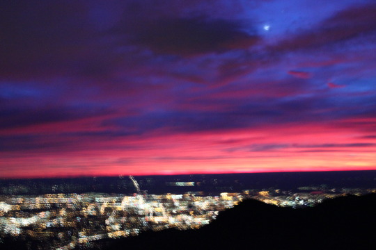
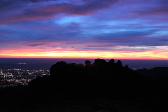
As I reached treeline I could immediately tell I wasn’t going to get the picture I’d wanted to get. It required a good sunrise and despite the fact it was supposed to be 80 degrees and clear there were lots and lots of clouds on the horizon. I wasn’t going to see a sun this sunrise. It was still beautiful:
I now had 3 miles to go to reach the summit and seriously considered turning back. I had no real reason to summit as this was a last minute trip and I wasn’t going to get what I wanted out of the rest of the uphill part of this hike (picture). I went back and forth for a few minutes in my mind and eventually decided to keep at it. Hey, maybe those clouds would miraculously go away in the next hour? While it was highly unlikely I kept hoping and watching east.
Here’s where my mood turned sour. I was sore and tired from the hike earlier this week, and while I’d made fantastic time this far it was obvious I was slowing down. I don’t know why that depressed me but it did. I could tell I was hiking “slow”. I was upset I wasn’t going to get that picture. That meant I’d need to at least TRY to hike again this year, and because of the type of picture it is I’m going to have to get up at 2am and hike for 10 miles in the dark to get it. Despite what I’m sure you’re all thinking, I don’t actually enjoy hiking in the dark alone. It’s quite scary. I’m not a fan of the dark. I don’t get the mail after dark or go on night walks by myself. I’ve been known to run from room to room when the lights are off. Hiking in the dark isn’t something in my comfort zone: I just do it despite being afraid because I like the end result.
I’d ben hiking with my good camera instead of my hand held. It was heavy, cumbersome, and now unnecessary. In addition, I hadn’t seen any wildlife on this hike. My 11th hike on Pikes Peak and I’ve yet to see a bear. That was upsetting in itself. The lack of the sunrise I’d anticipated meant I was going to have to hike in the dark again, risking the cold weather, shadows, and my fears.
This type of thinking on my part wasn’t typical and I became cognizant it must be due to low blood sugar. I hadn’t eaten anything yet and I’d hiked about 12 miles at this point. My stomach began to tighten. I told myself food was just going to have to wait until I reached the summit because I wasn’t making good time.
Check out the ice coming out of the mountain. Ah, geology at work, even without snow.
I summited at 7:54am. Not my best time, but not bad. I was hiking about 15 minutes behind my usual pace. Much to my surprise there was a man in a bright blue winter coat standing in front of the old summit house with his back to me. He was probably in his mid 20s, hunching out of the wind putting his pack together. I said hello and sat in the shelter of the window next to him to block the wind (as the summit house still wasn’t open).
I assumed he’d come up the back way from the Crags (a mere 6 miles and starting at about 10,000 feet, so it’s a much easier route to summit Pikes Peak). Eager to get started again he asked me if it’d been windy on my ascent. I told him no, it just started getting windy as I reached the summit. He told me to “enjoy my time” (mountaineering talk for the time spent on the summit before hiking back down), and was on his way, presumably the same way he came because he didn’t take the Barr Trail down. I
wished I’d engaged him in more information about his trip. He obviously knew what he was doing. I found myself wanting to know more details. Not for romantic reasons but personal: Which route was he hiking? What other hikes are available to me, how long do they take to hike, and are they worth it? He only had on a daypack, so he wasn’t backpacking… oh well.
I’d worn 2 pairs of gloves after reaching treeline, but took one pair off to eat. I had about 12 pieces of dried mango and my fingers were quickly turning numb. The wind was picking up and it was getting COLD quick. I put on my extra pair of gloves, took a picture facing southwest of the Junkins Fire, and started hiking down. I’d only spent 5 minutes at the summit.
This is where the wind became intense. Forecasts stated 20-25mph wind gusts, but these were sustained winds of at least 40mph. I was blown sideways several times. The wind made it miserably cold, and to top off my bad mood my right shoelace became untiled about 20 yards into my decent. Great. I had no use of my fingers at this point because they were frozen solid. I made a pathetic attempt that took way too long to tie the laces. I did a miserable job but it would be functional for a bit (hopefully I’d de-thaw soon and try again). About 100 yards later they became untied once more. I decided I wasn’t going to get far with this and just tucked the laces into my shoe so at least I wasn’t going to trip on them. This lack of support was going to slow me down.
My mind once again took a negative turn. I pulsed my fingers to keep them from getting frostbite (I have Raynauds) and thought about the hike this time. Why had it been so negative? I was upset about so many things I couldn’t control. I hadn’t seen any wildlife besides that rabbit. Not a bear, deer, marmot, pika, bird, or bighorn sheep. Nothing. What bad luck was this???
I knew my bad mood was self-caused but I couldn’t stop it. I’d thought it was due to low blood sugar levels, and indeed, eating did help quite a bit until the wind picked up, then the negativity returned. I’ve never regretted a hike up Pikes Peak. I may not have wanted to start out, but I’ve always been happy I went.
But this darn wind wasn’t letting up! Although my hair was in a bun it was hitting me in the face, as was the strap on my pack. The strap actually hurt. And I was cold.
The wind didn’t stop until I made it past the A-frame, where it abruptly ceased and warmed up at least 20 degrees. Wow. That mountain is brutal! I didn’t stop at the A-frame as I could see its inhabitants waking up and starting their day, preparing their hike to the summit.
As I dethawed I began seeing people. All asked me what it was like on the summit, to which I replied “very windy, and very cold”. They looked confused (forecasts predicted 42 degrees and light wind) but thanked me for the information. My mood brightened as I warmed up. I just needed to change my focus. No, I didn’t get the picture I’d wanted, but hadn’t I started this hike for Granny? Wasn’t scattering seeds for her the real reason I was taking this trip? Not to summit or see wild animals.
Ok. That was it. From here on out this hike was going to be about Granny and I was going to think positive. I took some “better” pictures of the downed trees along the trail. This is seriously insane and goes on for miles!
Just after MM6.5 I heard the sound of running water and my mind immediately cleared. I don’t know what it is about running water that has such a calming effect, but as I heard it I took a deep breath and smiled. This is why I hike.
Some of the trees were even happy to see me…
My mind cleared and I mentally planned where I’d scatter the seeds. I know enough about wildflowers to know they don’t grow just anywhere. Yes, I could have scattered seeds on the peak but it wouldn’t have done any good: they wouldn’t grow there because the growing season is too short. You can’t just plant seeds and expect them to grow. I needed seeds indigenous to the area not only so they would sprout, but also so they wouldn’t become an invasive species. The seeds I chose were specific to regions of the Rocky Mountains between 6000-9000 feet. In other words, they should grow here without harming the environment, and hopefully will contribute some happiness to hikers. Personally, I know I love seeing wildflowers while on a trail.
With that in mind I decided to spread some seeds near the aspen grove at Barr Camp where there was already a bench for weary hikers to sit and enjoy the view of the peak. These wildflowers will probably grow here. I hope they do, but because I wasn’t 100% certain they’d take I only planted a few tablespoons and saved the rest for another area. I also re-tied my shoe. While I was doing so I noticed someone sleeping in a sleeping bag about 40 feet from the trail. Stay warm my friend!
This is the area (below) I picked to scatter wildflower seeds in Granny’s name. I chose it for several reasons. Between MM3-3.5 is a well traveled area of the Barr Trail. I know wildflowers grow here because I’ve seen them in the past. There’s a lot more grass than flowers, but the potential for wildflowers is great. I’d like to see more grow here.
The hillside is facing the sun and has a great
view:
I plan on hiking back next year (probably in
July) to see if they take. I’ll know if they do because I only scattered
them on one side of the trail and I know what grew here before (mainly brown
eyed Susan’s, wild roses, vetch, and columbine).
The last 3 miles of the trail seemed really
slow. I was tired and sore but my mood was elevated, and while there were
a lot of unexpected clouds the weather was warm but not too hot. It
certainly didn’t feel like 80 degrees, but the clouds blocking the direct sun
probably contributed to the good weather. Did I mention it’s October in
Colorado? The mountain mahogany seeds were fun to watch!
I saw this guy too. This interestingly
enough is apparently a popular landmark on the Barr Trail. I’ve never
seen it until today, but last week someone on the trail asked me how far they
were from him and I couldn’t answer because I knew nothing about it.
I made it back to my truck at 12:27pm. 9
hours 29 minutes. Not my best time, but honestly not bad!
When I got home Emily
and I planted more wildflower seeds in front of our house and on the side by
the maple tree. We hope to get a lot of flowers, and bring them inside to
enjoy them during the summer. We’ll be reminded of Granny every year! (Side
note, we still plan to scatter more seeds on a grander scale, but wanted to do
something immediately while we had the chance).
The alarm sounded at 2am, but this time I was ready for it! I jumped out of bed, looked out my window, and was excited to see the forecast for today matched what I saw outside: a perfect view of Pikes Peak! And, a little oddly, a half-moon (the forecast called for no moon at night… whoops!)
I turned on the coffee, made a Nutella and peanut butter sandwich (only because last time I hiked without eating first I ended up regretting it later: I wasn’t hungry. I took two bites this time and threw the rest away). I got dressed and ready to go.
I don’t live close to the trailhead, so while I left at 2:20pm I arrived at 2:50pm. There were 3 other cars in the parking lot, and one was a couple getting ready to hike. As I paid the parking fee (still $10! Woot!) and talked to them a bit. If I pass someone on the trail I always try to strike up a conversation (for safety reasons…) This was their 2nd 14ner and first time up Pikes Peak. I wished them luck. They started as I put the parking receipt on my dashboard. I began at 2:55am but quickly caught up to them taking selfies in front of the lights of Manitou Springs. I advised them the lights would get better between MM2-3, and since this was their first time on the trail to stay left if they got lost in the dark. I then gladly forged ahead. I’m not a fan of leap-frogging fellow hikers.
The night was clear and calm, brisk but not too cold: Perfect for hiking at night! Every once in a while I’d hear what sounded like coyotes in the distance, and I could smell a fire coming from somewhere each time a breeze rolled in. The half-moon was directly above me, and I could see shooting stars as I hiked (meteor shower tonight! I couldn’t have planned that any better).
The coyote sound kept on, but I could tell it wasn’t coyotes. It sounded like yapping, and came at intervals. I deduced there must be hikers up ahead.
At MM3 my deductions were confirmed. There were two women in their 20s hiking ahead of me (car number 2). Although they’d obviously set out at an early time they were in no hurry, chatting and giggling, having a great time together. They commented that I was booking it up the mountain, and for some reason I replied “I hike this trail quite a bit, so I’m always trying to improve my time”.
While indeed this is my 10th summit of Pikes Peak, I hadn’t set out to “beat my time”. I’m not sure why I said this, but once I’d said it I felt I should follow through. My mouth has a way of running away from me at times, and the only way to rein it in is to do what I said I was going to do.
I wished them luck and forged ahead, this time at an accelerated pace, figuring my mom would be happy I wasn’t alone on the mountain (I’d seen 3 women and one man so far, so if anything happened I knew someone would eventually catch up to help).
There weren’t any scary sounds tonight or shadows lurking in the dark, but at MM5 I suddenly came upon a rather large tree in my path. This hadn’t been there the other times I’d hiked, and was a bit of surprise, but I figured trees must fall all the time in the forest and didn’t think too much of it.
I passed Barr Camp in silence. There weren’t any campers on the outskirts, and I figured the last car I’d seen in the parking lot meant someone was sleeping at the A-frame. Over the next 3 miles I crossed about a dozen felled trees and got to thinking: I’d heard 94mph winds had hit Pikes Peak last week. They must have done some damage on the lower elevations as well!
I was making really good time but wasn’t checking the time. I kept my phone in my pocket and just trudged ahead, mentally calculating what time the sun was supposed to come up this time of year and comparing my time/position on the trail to previous hikes. I figured I was about 20 minutes ahead of my best time.
Someone was obviously staying at the A-frame because the tarp/curtains were closed, (car # 3… yes, I like to know who’s on the mountain with me so I keep track as best I can) so I took my first sip of water of the hike, put on my ski gloves over my cotton ones as my fingers were getting cold, and kept going. I wanted to see the sunrise from further up the peak this time. It took quite a while for the sun to rise (40 minutes or so from first light, about mile 10.5 up the trail), and before it did I saw a really cool night-horizon-rainbow (is there a scientific word for this?)
About 2 miles from the summit the sun finally rose. Yes it was amazing. No, my selfies were not.
From treeline until I summited I kept looking for hikers below me. For some reason it became a personal challenge to summit before anyone else made it past treeline. This was an irrational challenge with no scientific basis, but I succeeded and considered it a win! At 7:43am I summited Pikes Peak. That’s 4 hours 48 minutes, and pretty awesome! The summit house was closed, so I sat in the corner of the building, huddled out of the really intense wind for a few minutes.
I’d wanted to buy the new “Pikes Peak Book” only available at the summit (funding the new summit house that was under construction), but there’s no set time for the summit house to open, and while I could see they were beginning to make the donuts inside I was slowly becoming a popsicle, so I decided to take a selfie proving I was there and head down the mountain. I’ll buy the book next time.
It felt like I’d been up there for 5 minutes, but when I checked my phone it indicated it’s been 25 minutes. Time seriously has a way of getting ahead of you on the summit!
It was really, really windy. I tried to put my hair back into a bun but with my Raynaud’s my fingers were useless. I’m pretty sure I looked like a banshee, but didn’t intend to take anymore selfies so it was all good.
I actually saw someone about a mile down the mountain. He looked really fit and was wearing an overnight backpack. I surmised he’d stayed at the A-frame, talked with him a bit to find out this was the case, then wished him luck. His 5 buddies were about 100 feet behind them. They all looked to be in tremendous shape but extremely tired.
I went another mile and a half before seeing anyone else: it was the couple I’d seen in the beginning of the hike. They’d made pretty good time! They only had about an hour to go. I gave them some advice on the 16 Golden Stairs and the false summit, then trudged on.
I had the A-frame to myself so I had a quick snack. I was finally defrosting so I took off my ski gloves and just kept on my cotton mittens. I took a picture of the A-frame and the ingenious way the inhabitants the night before had moved rocks to keep the heat in. This was something I’ve never been strong enough to do, and seriously hope future inhabitants keep in place, as it’s simple genius if you’re strong enough to move the rocks! We’d previously used out backpacks.
I could hear the two women I’d passed earlier on in the hike chatting, so I took a “secret” route around to avoid them (sorry, I’m not one for small talk if I can avoid it), and trudged on.
It was here in the daylight I realized what an impact the previous week’s wind had caused: the damage was insane! Felled trees everywhere for miles! Granted, they were mostly Aspens whose time had come, but the trail was also littered with large pine trees 4 feet or more in diameter. I moved what I could out of the trail as others had obviously done before me (I could see this in the light of day), and hoped the caretakers at Barr Camp took advantage of all this free firewood. Fast, before a forest fire took care of it for them.
I usually stop at Barr Camp to use the restroom, but I’d made such good time so far and I wasn’t in need of using the facilities so I just kept going. I did stop really quick to compare the view from last month and today (almost a month apart to the day…)
I made it down the mountain and back to my car at 12:03pm. I’d summited Pikes Peak and hiked back down again, 26 miles and over 16,000 feet in elevation change, in 9 hours 2 minutes. To qualify for the Pikes Peak Marathon you need to be able to do it in 10 hours. I felt like a rockstar!