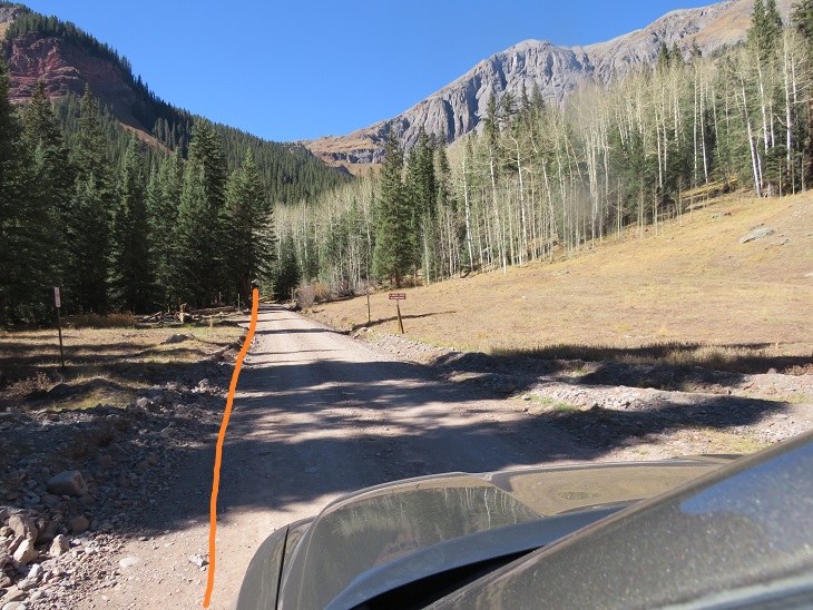
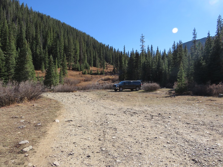
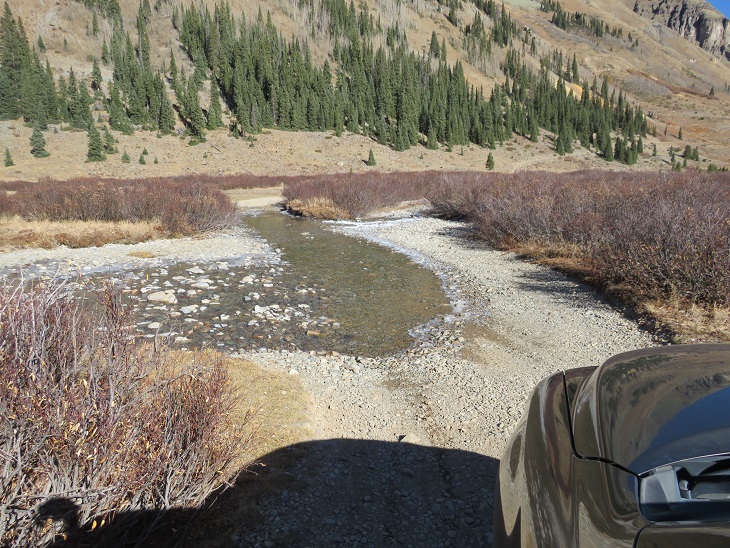
After summiting Pilot Knob I made it back to the Ice Lakes Basin trailhead and took 585 for 2.5 miles down an easy 4WD dirt road, past the Bandora Mine, until it ended at the south end of the basin. Parking at the Ice Lakes Basin Trailhead adds 5 miles total to this hike.
I’ve circled where I parked/dispersed camped for the night. There are quite a few campsites in the area, although I didn’t see another person the entire time I was there.
It was still early, so I made dinner, jotted down some notes, had a few glasses of whiskey, read for a bit, and reviewed my notes from my failed attempt of Rolling Mountain last year.
It was a beautiful evening, so I looked around for a bit to see where the trail started, and then made it an early night.
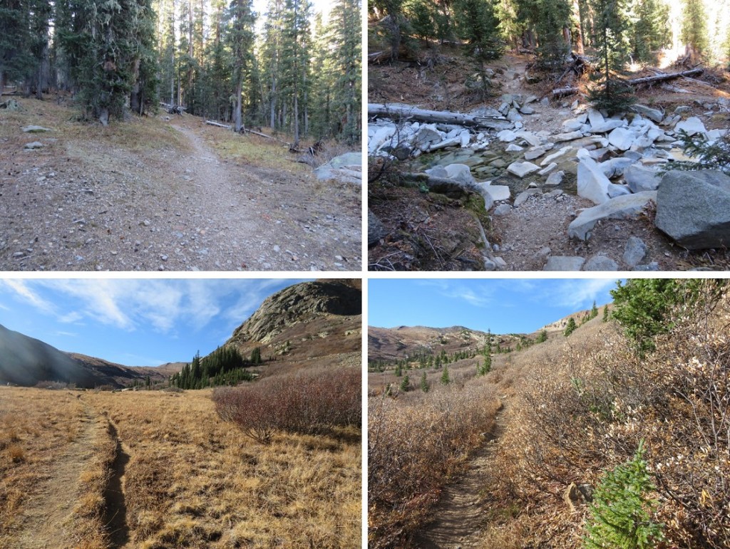
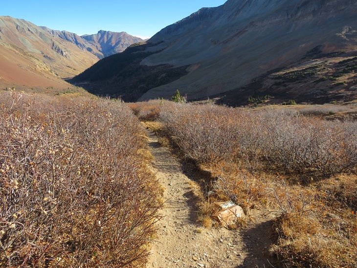
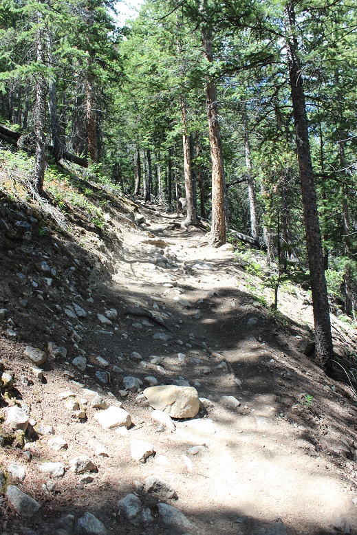
I was up and on the trail at 6am. The trail starts at the south end of the basin, initially crossing a small stream, then following Rico-Silverton Trail 507.
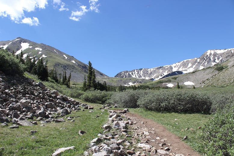
I followed this class 1 trail for 2 miles
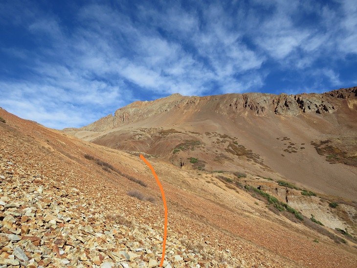
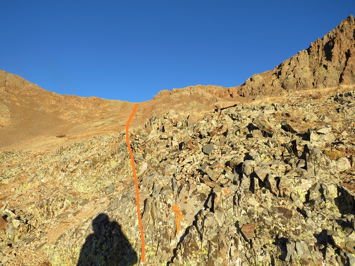
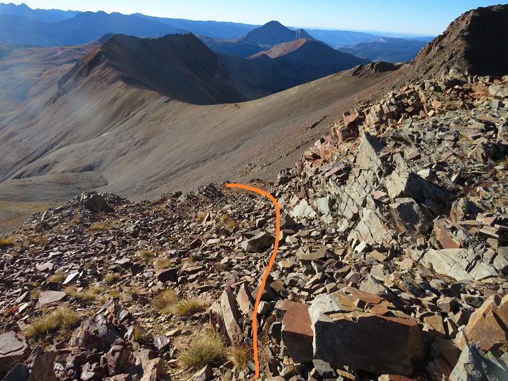
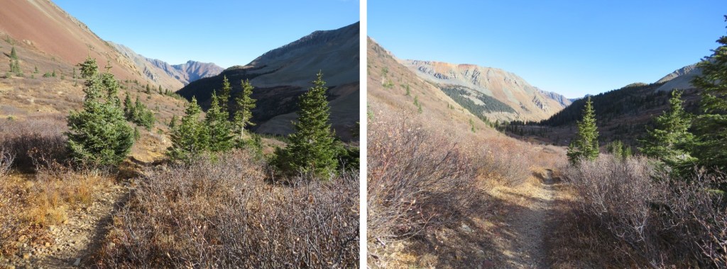
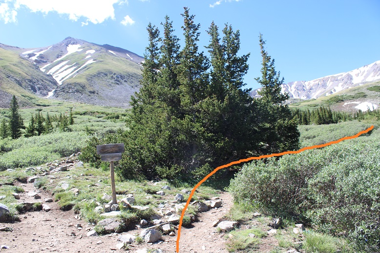
After 2 miles I turned right and headed west up the basin, staying to the left of the small gorge/drainage area. There are a lot of willows to contend with here, but if you stay high you can avoid most of them. If you stay low you can still cross, they’re just annoying.
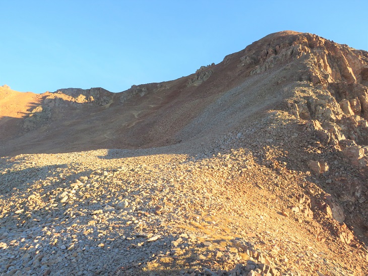
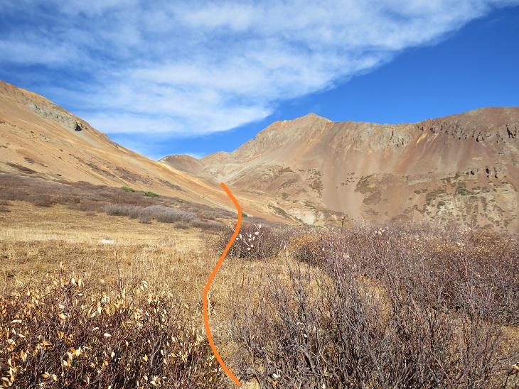
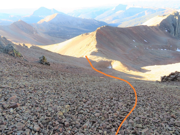
I came to the area that had stumped me last time and was pleasantly surprised to find the depression/bowl wasn’t as deep as it had appeared to be with snow. It was a little steep, but an easy trek across this section and up the gully to the upper basin
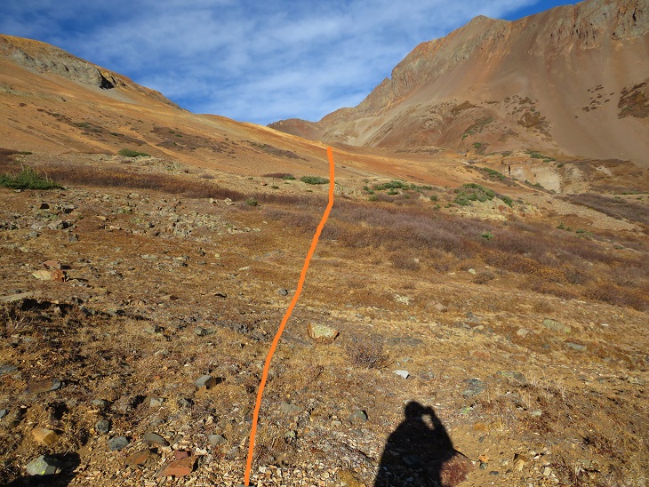
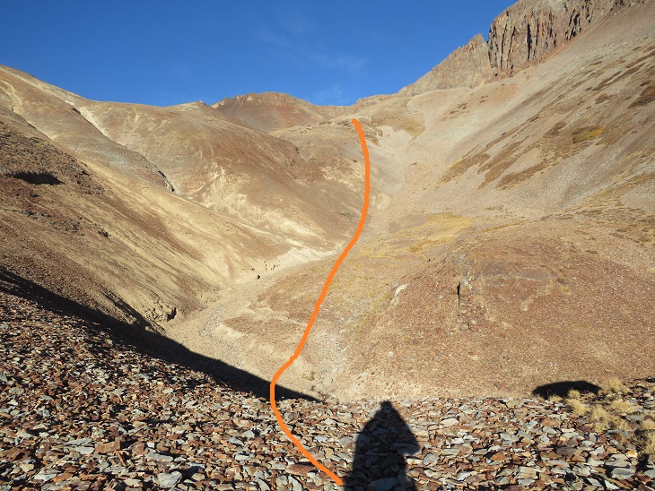
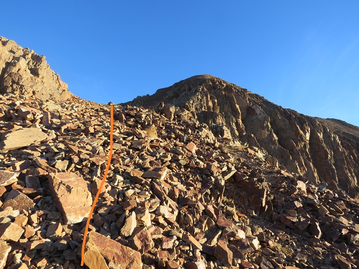
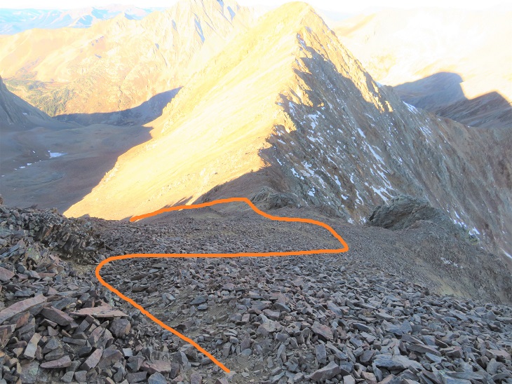
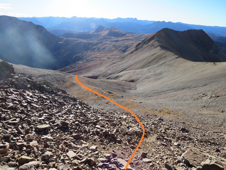
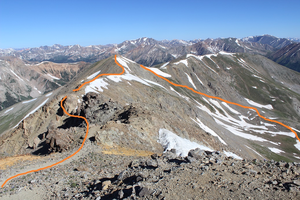
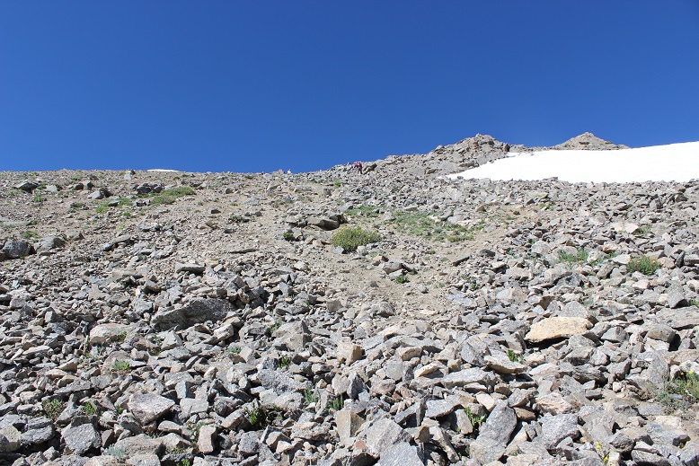
I stayed high here, aiming for the ridge. This was an easy trek on relaxed scree and nicely sloping tundra
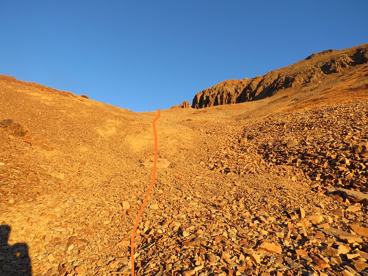
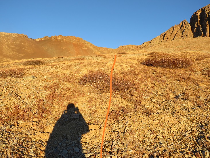
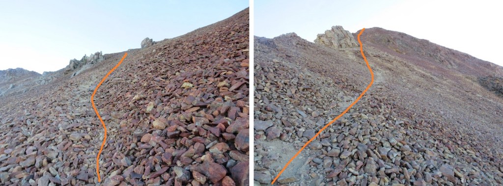
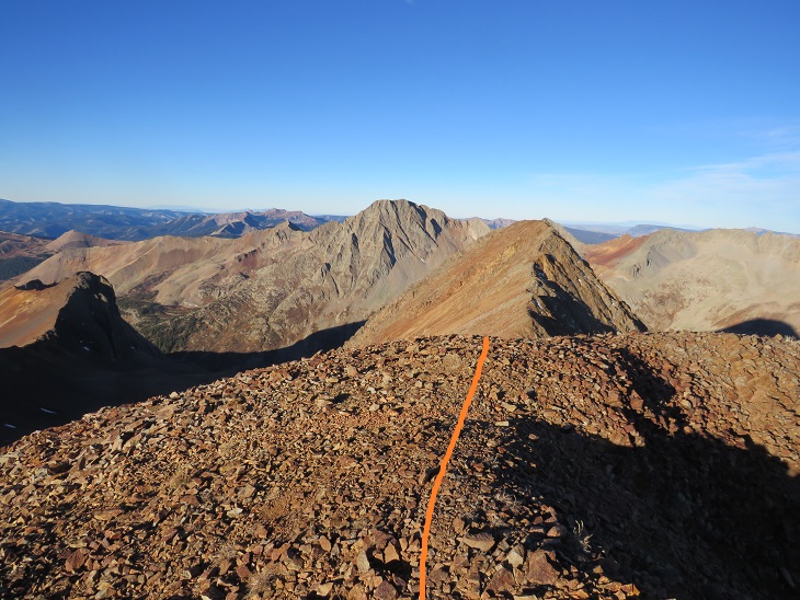
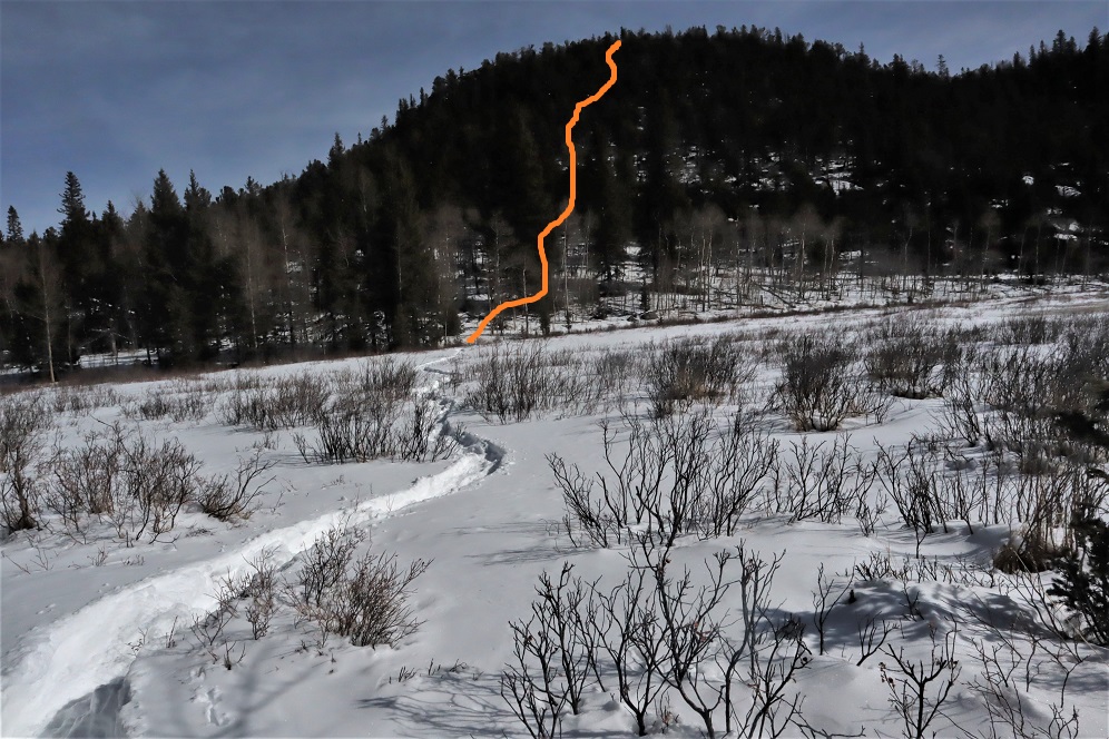
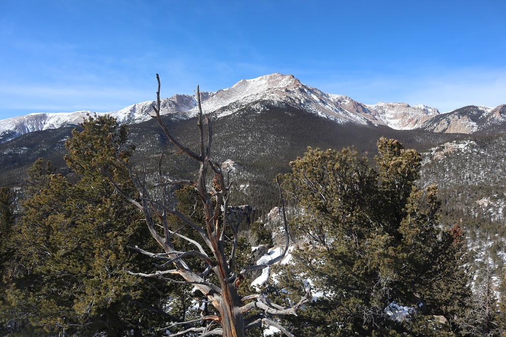
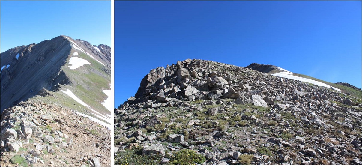
Once on the ridge I turned right and saw an obvious trail that led up to the summit of Rolling Mountain
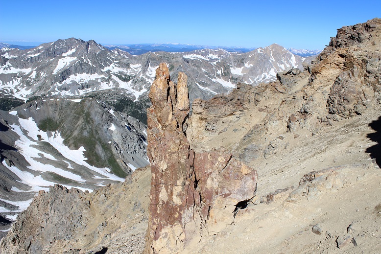
The trail is light but easy to follow. The terrain was a nice class 2 as it followed the ridge to the summit. It would have been much more enjoyable without the wind.
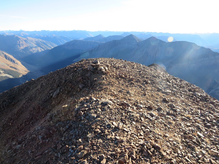
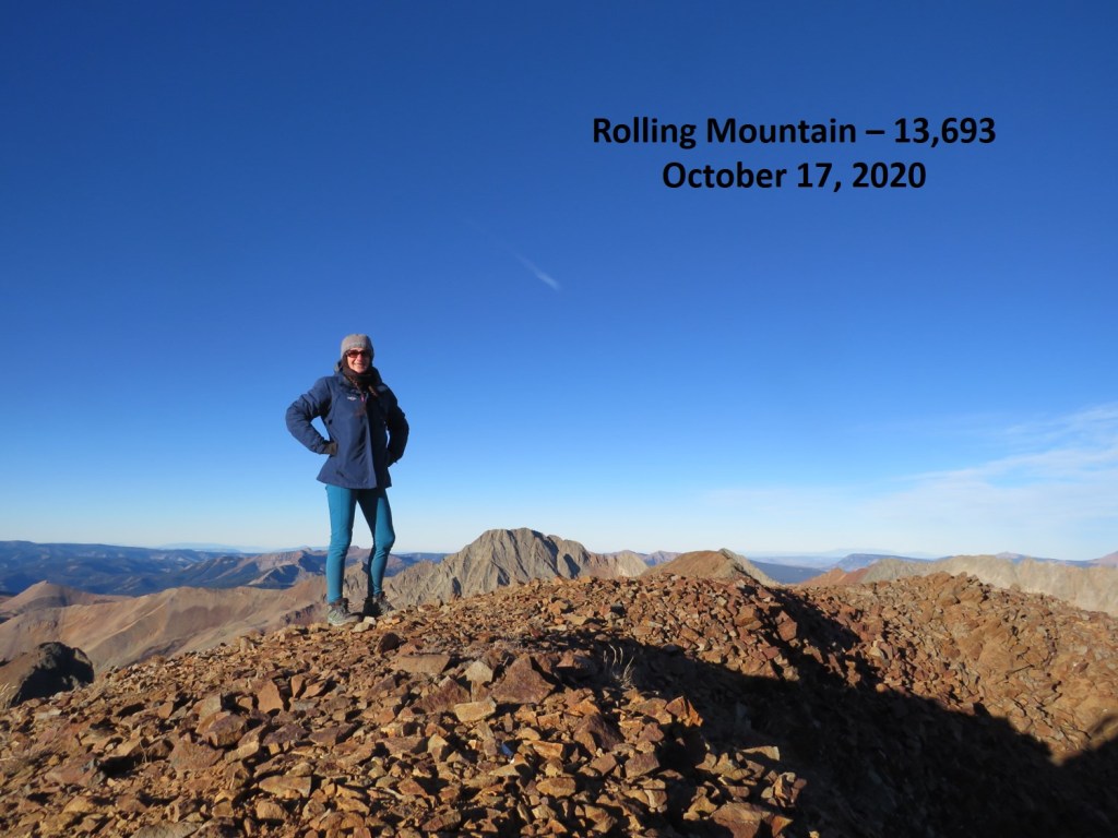
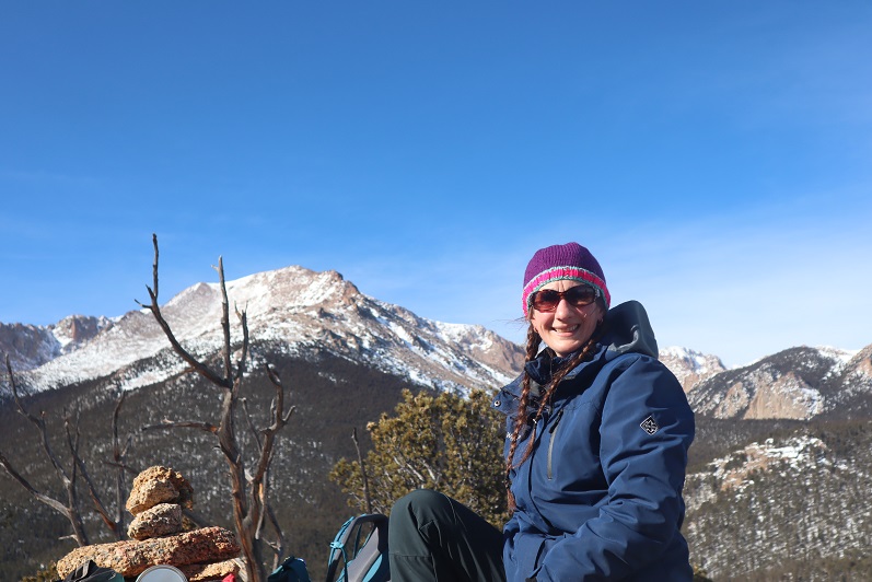
I summited Rolling Mountain at 8:15am
Rolling Mountain:
I had plans to go camping with friends tonight (a 6 hour drive away) so I didn’t waste anytime descending the mountain. Also, it was quite cold and windy. I couldn’t wait to make it back to the ridge and for the wind to settle down. This is an out and back hike, so I retraced my steps
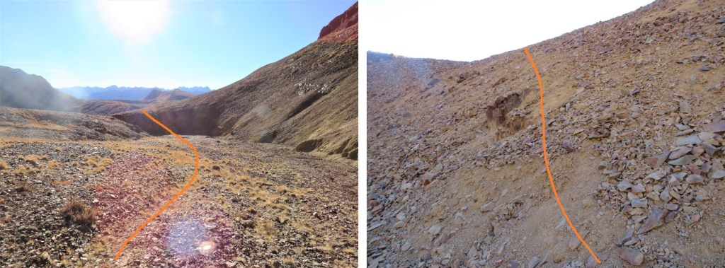
And back down the basin
Up and over the bowl
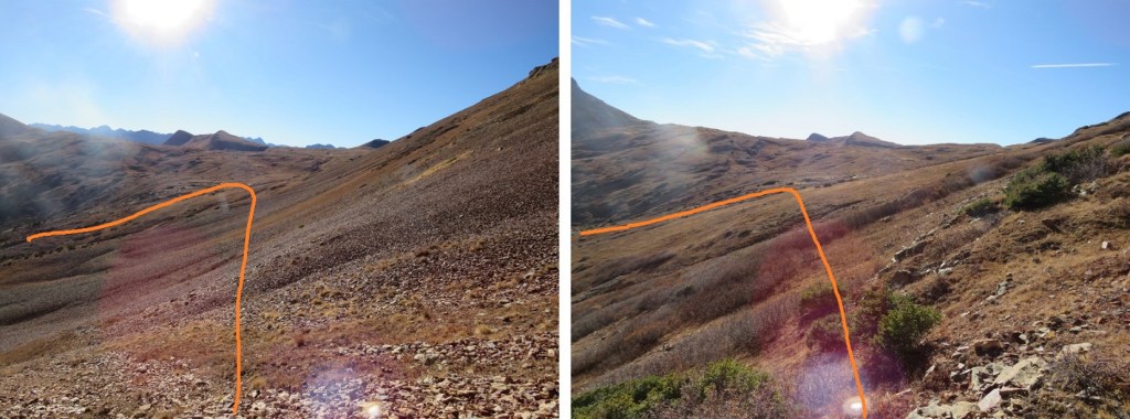
And east towards the Rico-Silverton trail, staying high to avoid the willows
Once back on the trail I followed it back down the lower basin to the trailhead
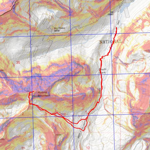
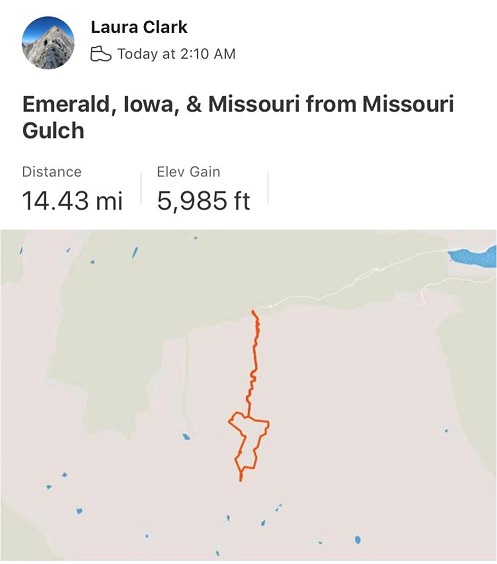
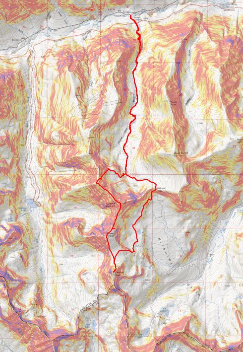
I made it back to my truck at 10am, making this a 7.43 mile hike with 3078’ of elevation gain in 4 hours. The was by far the easiest hike I’ve done in a while, which made my turning around last time sting just a little bit more. Here’s a topo map of the route
Also, the drive in is easy 4WD (most likely doable in a higher clearance 2WD), but there is a small stream crossing, which is probably deeper in summer. Just something to consider
After our misguided attempt at PT 10245 a few weeks ago we really wanted to summit this peak asap, but the weather wasn’t cooperating and my cookie deliveries kept getting in the way. Finally, today seemed like a good day to try it again.
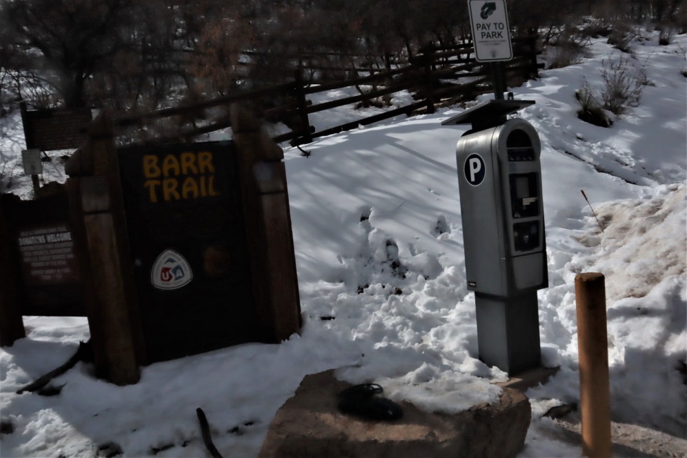
We arrived at the Barr Trail parking lot at 5:30am and were on the trail by 5:45am. The parking situation is the same as last time: $10 via card at the kiosk.
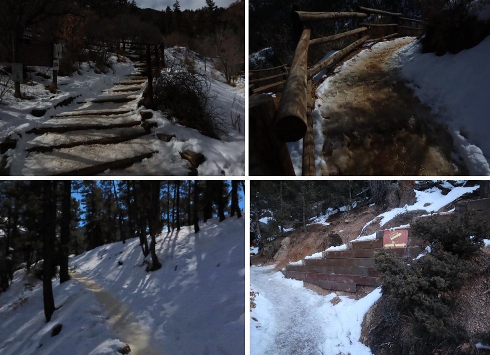
From the beginning microspikes were necessary. We kept them on for the entire hike.
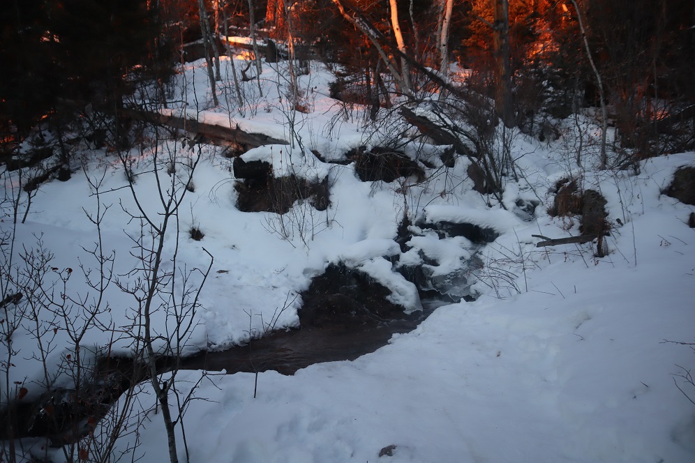
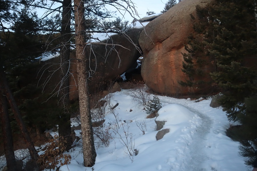
The creek just after the Barr Trail / Incline turnoff was flowing nicely
The ‘cave’ had some snow
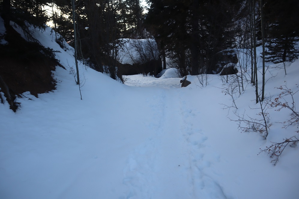
Just before the experimental forest, where the path was all ice 2 weeks ago it was now covered in several inches of snow and nicely trenched. This made it much easier to navigate.
We turned left at the experimental forest and continued along the well trenched Barr trail.
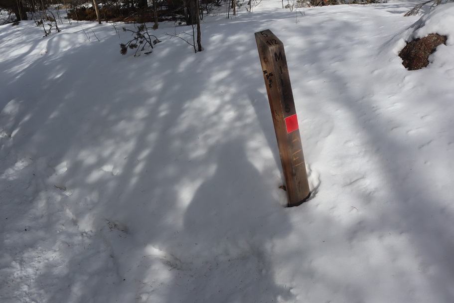
Past mile marker 5.5
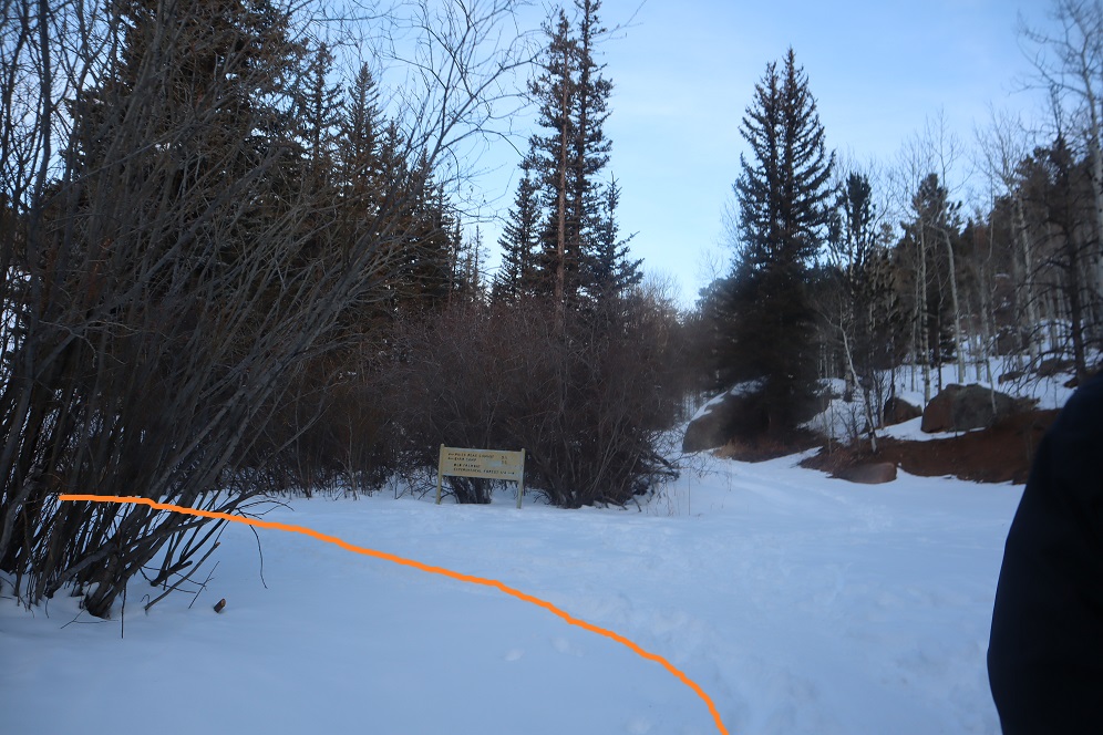
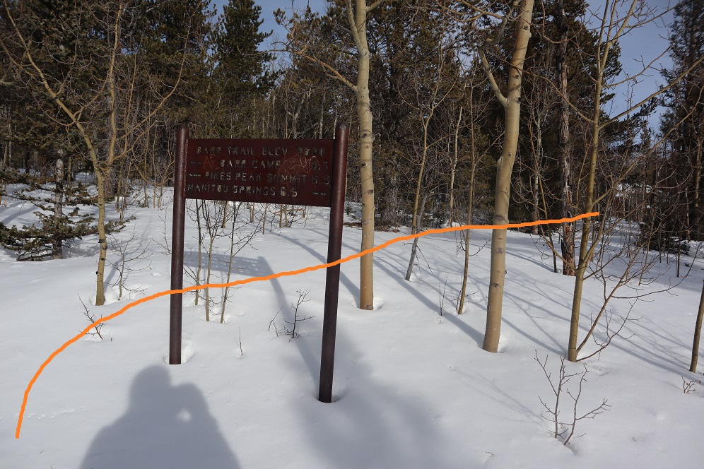
Here’s where we messed up last time: We had gone all the way to Barr Camp (6.5 miles) and at the advice of the guy staffing Barr Camp took the trail just after Barr Camp, ending up at AdAmAn Peak instead of PT 10245. To be fair, the routes are strikingly similar, and while AdAmAn is unranked, it is taller than 10245 at 10405′. This time we were prepared and looked for trail 671, which is about a mile before Barr Camp. This is where we found it:
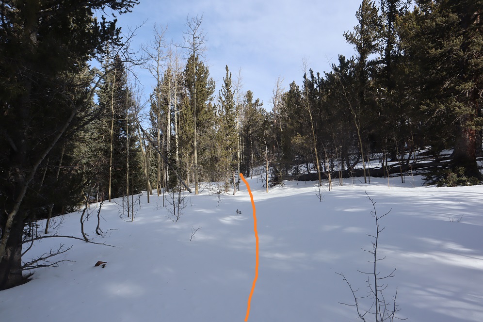
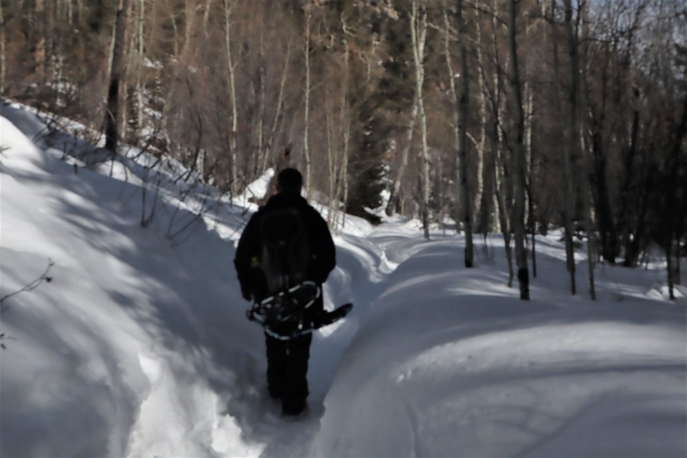
I’m sure there’s an actual trail here, but today it was covered in snow and not detectable. We put on our snowshoes and got ready to trench. At the above sign we left the Barr Trail and headed right (north), trenching our own trail, skirting the rock formation to the left
and heading down a small hill, losing about 200 feet of elevation before coming to a creek and turning left (northwest).
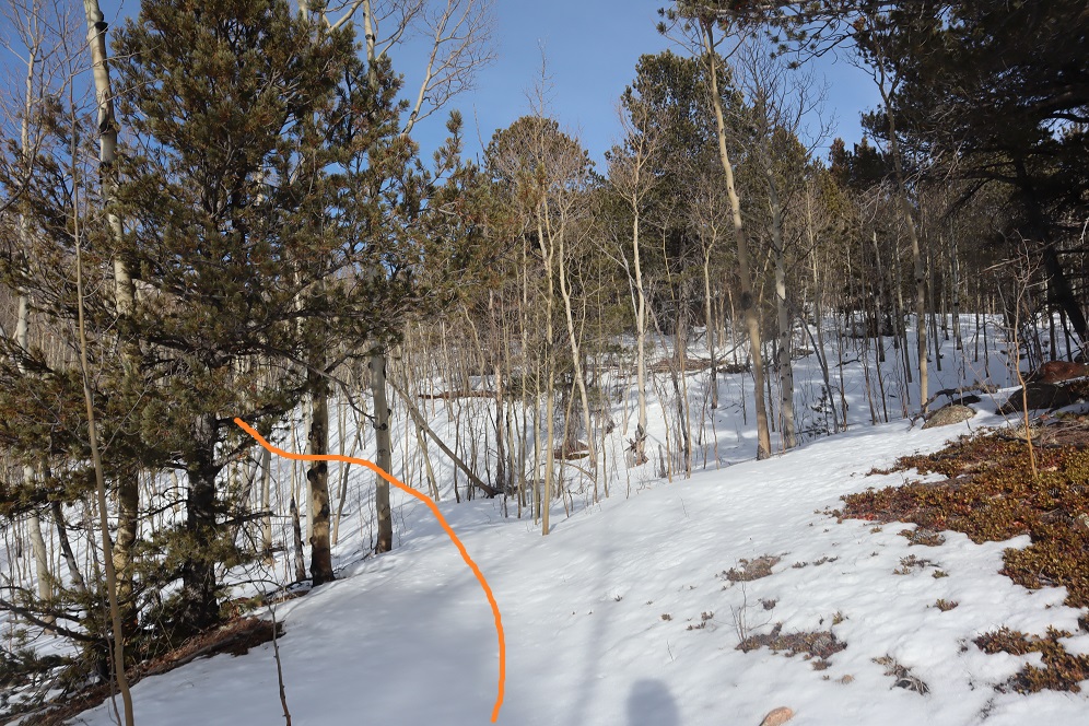
Here I was able to pick up the trail again anf followed it around the creek. Please note, this was NOT South Fork French Creek, but a willow filled off shoot.
We followed the ‘trail’ until it seemed to end. We were just about parallel with AdAmAn peak at this point. Here we turned right (northeast) and could see PT 10245
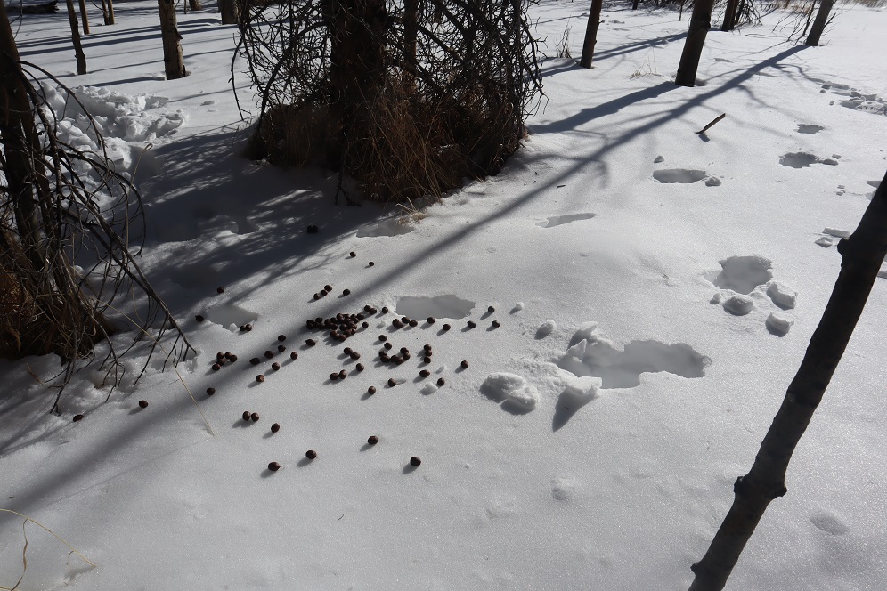
We were going to have to cross an aspen grove to get to the peak. When we were right in the thick of it Steffen said: “This looks like the type of place you’d see a moose” and about 2 steps later we saw evidence a moose had spent the night here. In fact, on our way back we saw moose tracks going over/through our trench, so we must have scared him/her away with our approach.
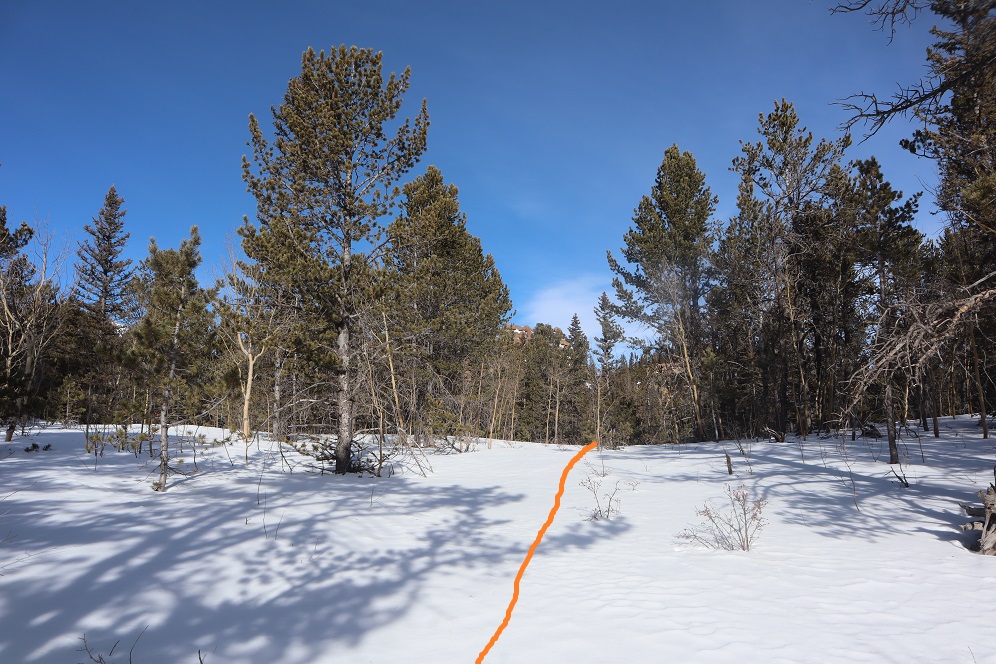
Once past the aspen grove we were in the willows. I’m pretty sure this is where we crossed French Creek, but it was frozen and covered with snow so all we saw was a marshy area. Trenching here wasn’t fun: I sank up to my thighs several times. Here’s the path we took through the trees to the summit
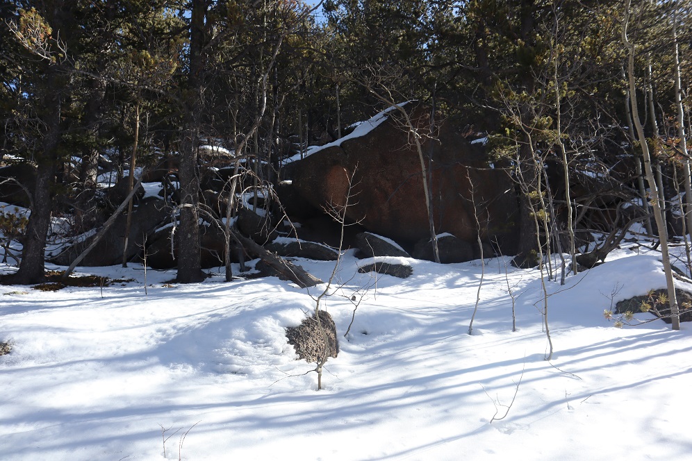
There were large boulders everywhere, and a band of boulder piles to the right that weren’t climbable. Sticking center left of the mountain seemed to work well.
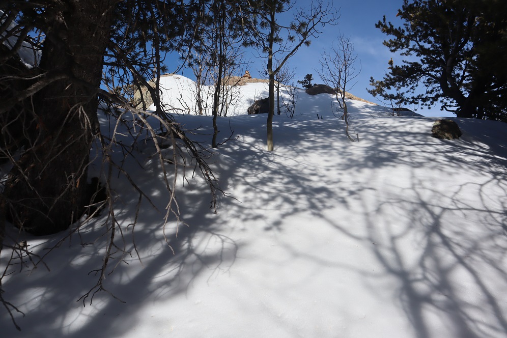
At several points we wanted to take off our snowshoes, but then we’d encounter snow that made us thankful we hadn’t. The summit was located to the left, at the mountain’s northernmost point. There was a cairn indicating the summit. We sumited at 9:50am
There were beautiful views of Pikes Peak, with AdAmAn Peak below (the pile of rocks in the center of the photo).
We took summit photos
and headed back down, solidifying our trench
back through the willows
and to Barr Trail, where we took off our snowshoes and continued our descent. The trench on the trail was indeed deep in places, and microspikes were still appreciated after the incline cutoff.
We made it back to my truck at 12:45pm, making this a 14.15 mile hike with 4000′ of elevation gain in 7 hours. I got a bunch of pictures on the way back, but unfortunately I’m still learning how to use my camera and it had been stuck on ‘program’ mode for the entire hike down, making my pictures all dark and fuzzy. We gave each other a high-five at the bottom, glad to be able to say we’d actually summited the correct peak this time. Check off another El Paso County Highpoint! Here’s a link to the GPX file, for those interested.
No, I didn’t drive straight to the Missouri Gulch trailhead. It took me forever to drive home going 50mph on the I70. I made it home at 7am and limped out of the truck. My feet seemed to hurt more now than they did last night. They’d dried out, but were now red and raw. I decided to take a few hours ‘off’ to let my feet rest. After cleaning up and pampering my feet I took a 5 hour nap. When I woke up my feet had dried out and I was able to get a better look. No blisters. That was a relief. They were still red and swollen though, meaning I’d had a Raynaud’s attack yesterday. It all made sense, and was most likely caused by the 20 minutes I spent trying to dig out my water shoes from the cold creek combined with a long, physical day.
Driving home had been the right thing to do. By the middle of the day my feet were still sore but I found I could walk on them. Kind of… you see, it hurt terribly to begin walking, but after the 10th step or so the pain went away. So I figured I just had to start hiking and not stop and I’d be fine.
At 9pm I made the decision to drive to the trailhead, try to nap for an hour, and attempt another hike. It was either that or stay home and do the treadmill thing in the morning, which did not sound appealing with sore feet.
Everything went well. I made it to the trailhead and slept for an hour before my alarm went off at 2am. There were tons of vehicles at the trailhead. As I was putting on my hiking boots a couple drove up in a Subaru. We were hitting the trail at the same time, so when I got out of my truck I waved and said hi to them. No response. Hmmmm… ok. Maybe they hadn’t seen me (or that the lights on in my truck)? I turned on my flashlight, walked over to the trailhead and once again said “hi guys!” I was hoping to just chat and see where they were going before setting off. When I see others at trailheads I like to connect in case something happens (to either of us). Once again, they didn’t respond (but their dog looked back at me). Maybe the creek was making too much noise for them to hear me? Ok, well, I don’t like to be rude but I’d tried to be nice. Maybe I’d see them on the way down. I didn’t say anything as I quickly scooted past them and headed down to the stream, crossed the bridge, and headed up the trail.
Yes, my feet hurt, but I had a plan: don’t stop. Also, take ibuprofen every 4 hours. The first few steps were painful, but after that as long as I kept moving the pain went away. This was my second attempt of Emerald/Iowa, and my 4th time hiking via the Missouri Gulch trailhead. Call me crazy, but those switchbacks are getting easier. Also, the baby grave doesn’t bother me so much anymore.
The avalanche area has been nicely cleared, and now there’s a log bridge over the creek and a nicely manicured trail through the avy debris.
I made it to the cabin in exactly 1 hour and thought that was pretty good time, considering.
I entered Missouri Gulch and had no problems following the well established trail. The willows seem so much bigger without all the snow.
I turned right at the junction for Elkhead Pass/Belford and followed the trail towards Elkhead Pass.
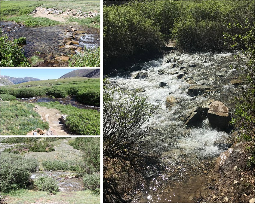
There were several stream crossings to navigate here. These were not fun in the dark, but in the daylight didn’t pose much of a problem. Oh, and there aren’t any ‘easier’ ways to cross: just cross them right where they intersect with the trail.
I felt like I was making pretty good time. It’s amazing how much easier the gulch is to navigate without snow. I made it to the Elkhead Pass/Missouri Mountain junction
This is where I got a little worried: this is the first hike all year I haven’t brought along my snowshoes, and the area before Elkhead Pass looked to be full of snow. Luckily there actually wasn’t that much and what snow there was was solid in the morning so I didn’t need traction (I had spikes and crampons in my bag, but didn’t need them).
It was still dark as I navigated my way through the snow and sometimes trail up to Elkhead Pass. Here’s a look at the route from later in the day coming down from Missouri. The snow was easily navigable, but seems like much more when you’re down there hiking through it.
I found myself at the top of Elkhead Pass at 5:15am. It had taken me 3 hours to get here (4.1 miles and 3580 in elevation gain). Remembering how icy conditions had forced me to turn around here last time I was a bit worried to see snow at the top of the pass, but as I got closer I noticed there wasn’t as much snow as I’d initially thought. (Sorry for the poor quality of the next few photos: I took them in the dark and had to lighten them up so show details)
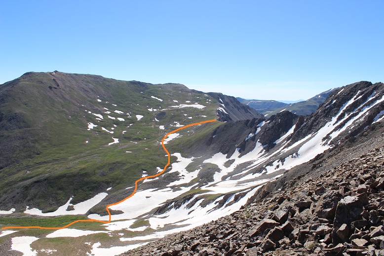
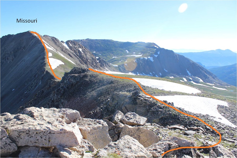
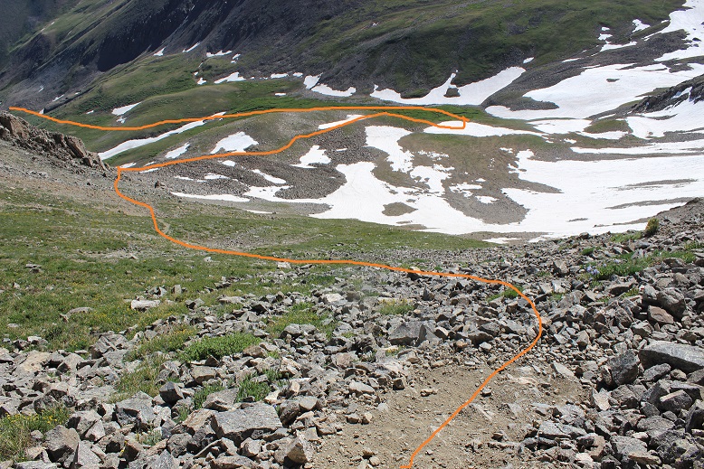
I descended Elkhead Pass, but not all the way to the bottom of Missouri Basin (Yes, Missouri Basin, not Missouri Gulch. We need to get more creative with these names people!). I found a cliff band below Missouri and followed that towards the little lakes, as I didn’t want to lose more elevation than necessary. Here’s the path I took hugging Missouri
At the cliff band I descended the least amount possible, heading towards the lakes
Here’s looking back at Elkhead Pass and the way down (don’t drop lower than necessary: there’s a trail that takes you all the way to the bottom; avoid that).
The area between Missouri and Emerald was mucky
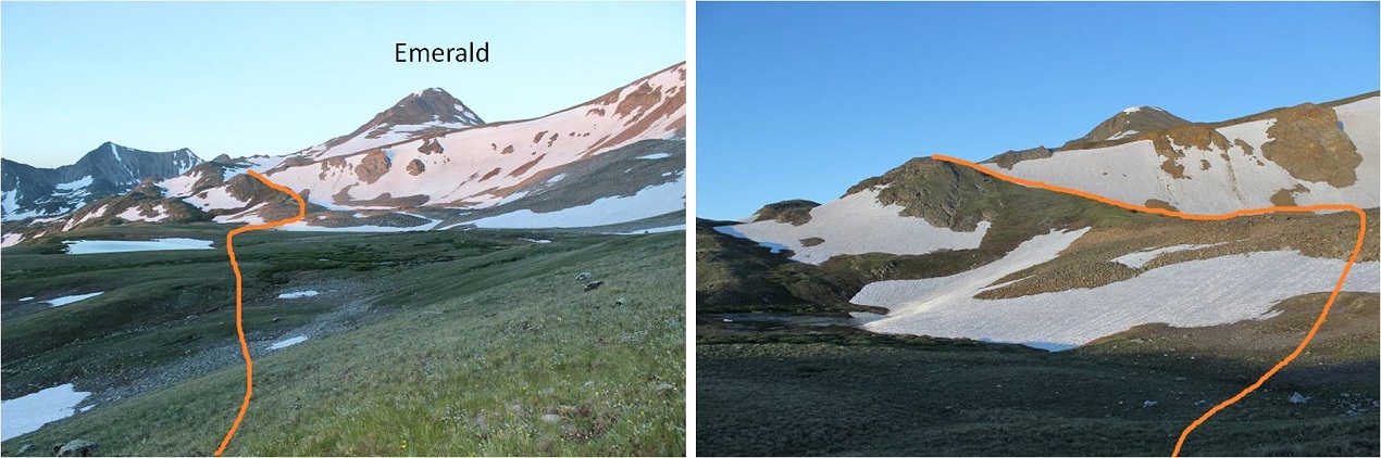
There are several ways to gain Emerald’s ridge. There was snow surrounding the access area to the south, so I went a little further north and took this path, avoiding the lakes and snow as much as possible.
Here’s a look back at the route and Elkhead Pass
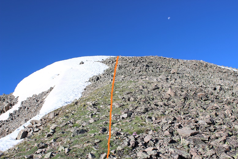
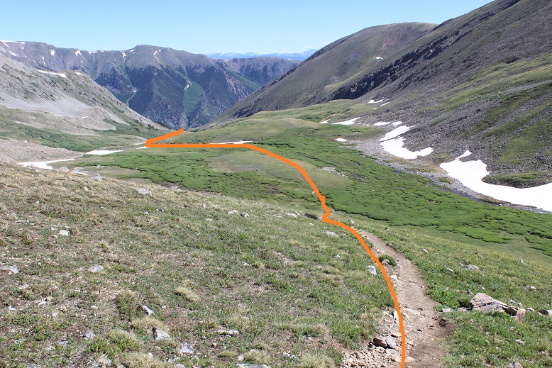
Once I gained the ridge I turned right (west) and followed a faint trail up the ridge. (Note: the standard route up is the dotted line. I did not take this route because I wanted to avoid kicking in steps in the snow: I wasn’t sure my feet would appreciate that today)
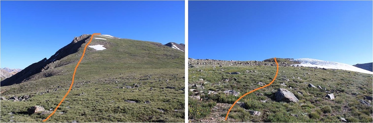
Instead I skirted the mountain to the northwest to the saddle between Emerald and Iowa and summited via Emerald’s north slopes
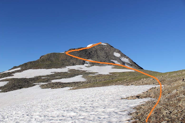
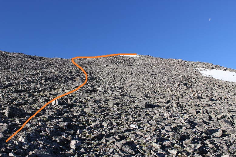
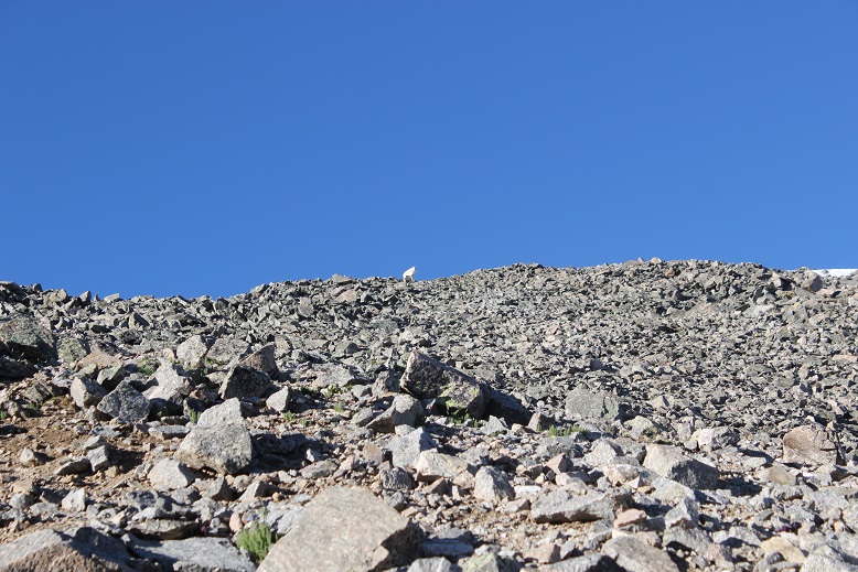
The last 500 feet or so to the summit were filled with scree/talus and tons of goat/social trails. Just aim for the ridge
I had a goat watch me the entire way, then disappear when I reached the ridge
From the ridge I turned right (west) and walked my way to the summit
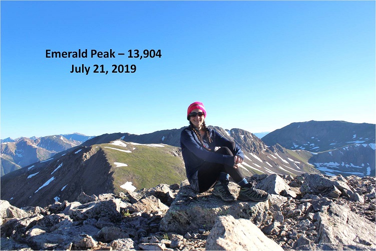
I summited Emerald Peak at 7:20am
Emerald:
Despite the threat of forecasted afternoon storms this morning was beautiful! I looked over to Iowa and back at the route I’d taken thus far. An idea came to me: it looked like similar elevation gain/loss going over Missouri as it did going back over Elkhead pass. I might as well tag Missouri again. I decided to wait and see if the weather held out before making a final decision, but it seemed a draw either way. Oh, and my feet were holding up, so that’s a plus.
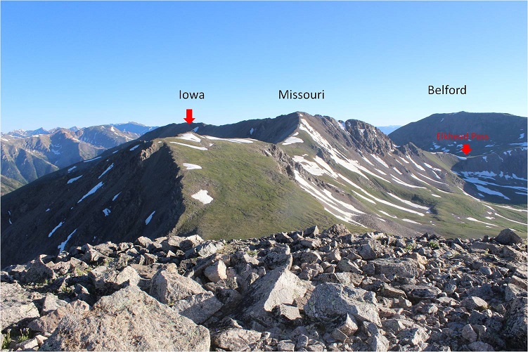
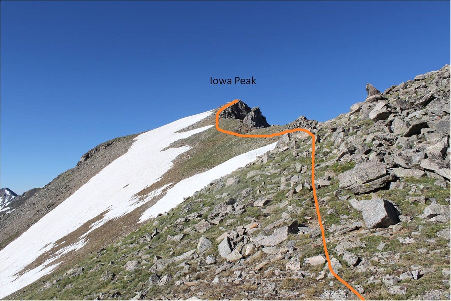
The route to Iowa and Missouri was obvious. I headed down Emerald’s north slopes and towards the Emerald/Iowa saddle and up to the summit of Iowa
The hike up to Iowa’s summit was easier than expected; I just stayed to the left of the snow on the ridge. Once again, a goat watched my ascent.
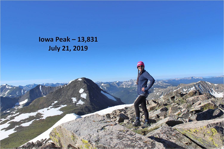
I summited Iowa Peak (an unranked 13er) at 8:10am. You can see Emerald Peak in the background of this picture
Iowa:
The decision had been made: on to Missouri! Initially I tried to descend Iowa too far to the right (east) and had to turn back due to snow I didn’t particularly want to cross. To avoid all snow it was easier just to follow Iowa’s ridge to the Iowa/Missouri saddle.
Looking back at Iowa from the Iowa/Missouri Saddle
The ridge up to Missouri was much, much easier than anticipated. I don’t know if it was the ibuprofen I took on Iowa or just conditioning, but I felt the ridge from Iowa to Missouri wasn’t very challenging at all. In fact, when I made it to the top I’d assumed I was only halfway up, and actually asked the 10 other people I saw as I was approaching “Is this seriously the summit!?!?” (Note to self: not a good question to ask a group exhausted hikers when you aren’t even winded. Tone it down a bit.).
I reached Missouri at 9am and asked one of the other hikers to take my photo because I thought it would look silly setting up my gorillapod.
Missouri:
Missouri had been an added and unexpected bonus peak today, and it has a summit marker!
Here’s a look back on Emerald and Iowa
Knowing I couldn’t let my feet stop moving for long I thanked the photographer for taking my picture and headed back down via Missouri’s northwest ridge. There’s a great trail the entire way from the summit back to the Missouri Gulch Trailhead. Here’s the route of the ridge
The crux area was much easier to navigate than I remember it being when I hiked Missouri last time. This time I could even hold onto the rock face for added stability if needed
Is this rabbit named?
Here’s a look back at the ridge
Exiting the ridge is marked by a cairn (and today a tiny bit of snow). After rounding the corner get ready to do some scree surfing. (Note: if you’re not a fan of scree (who is?), microspikes help provide traction. Seriously, try them on scree, it’ll change your life).
Looking back up at the scree slope to gain the ridge
There were some slight snow fields to cross, but nothing that required traction
From here there’s an obvious trail back down to the gulch.
I met tons of people hiking on the way down from Missouri. It was the perfect day for a 14er, there are 3 in the area, and everyone was out. I made it back to my truck at 11:45am, making this a 14.5 mile hike with 5985’ in elevation gain in 9.5 hours.
My feet did not look pretty when I was done but I was very pleased with today’s hike. I didn’t feel tired, even at the end. My feet successfully made it the entire way without complaining (too much). I think the ups and downs in elevation gain on the ridges gave me little breaks that made all the difference. I’m sure you could do this hike in reverse and feel the same way. I never saw the couple I’d seen at the trailhead in the morning, but I’m hoping they stayed safe and had a fabulous hike as well!