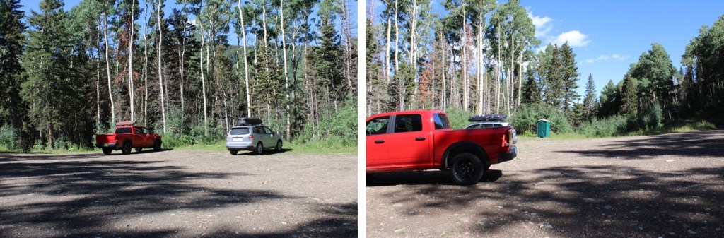
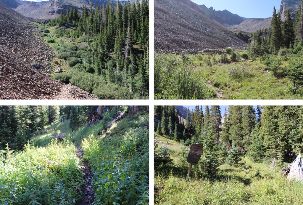
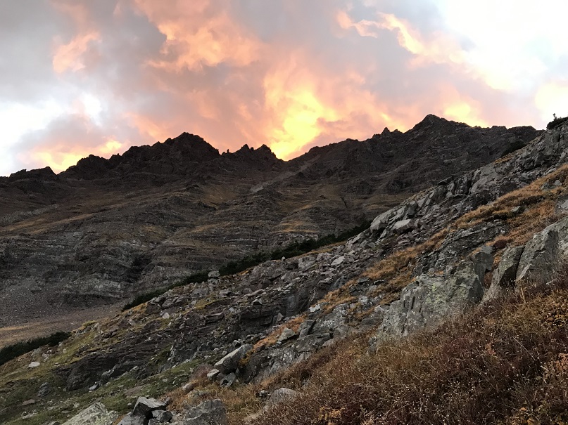
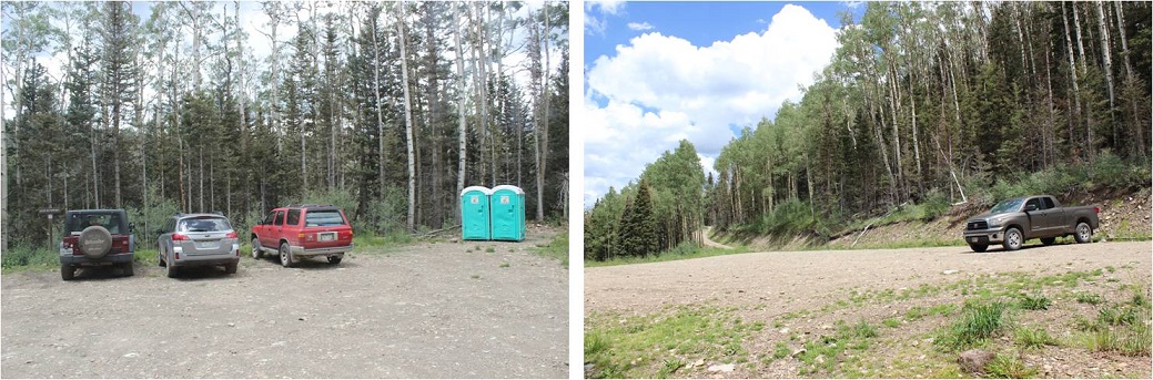
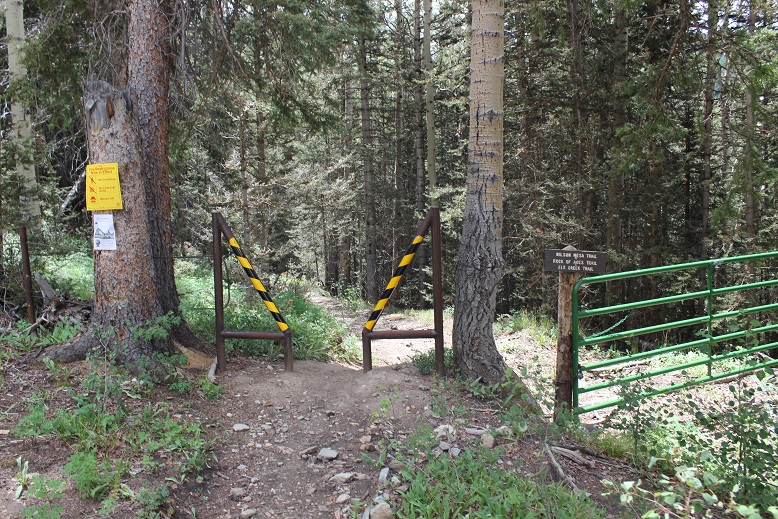
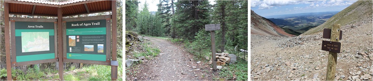
I started this hike at 5am from the Rock of Ages Trailhead. The trailhead has a porta-potty, and room for a couple dozen vehicles, but the road in is at minimum high clearance (with a creek crossing).
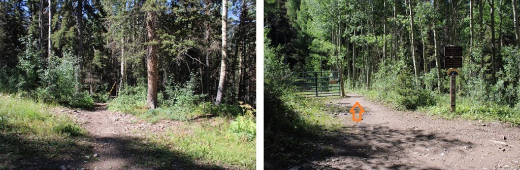
The trailhead starts at the south end of the parking area. I took the trail to the left, the Rock of Ages Trail, at the junction immediately following the entrance to the trailhead.
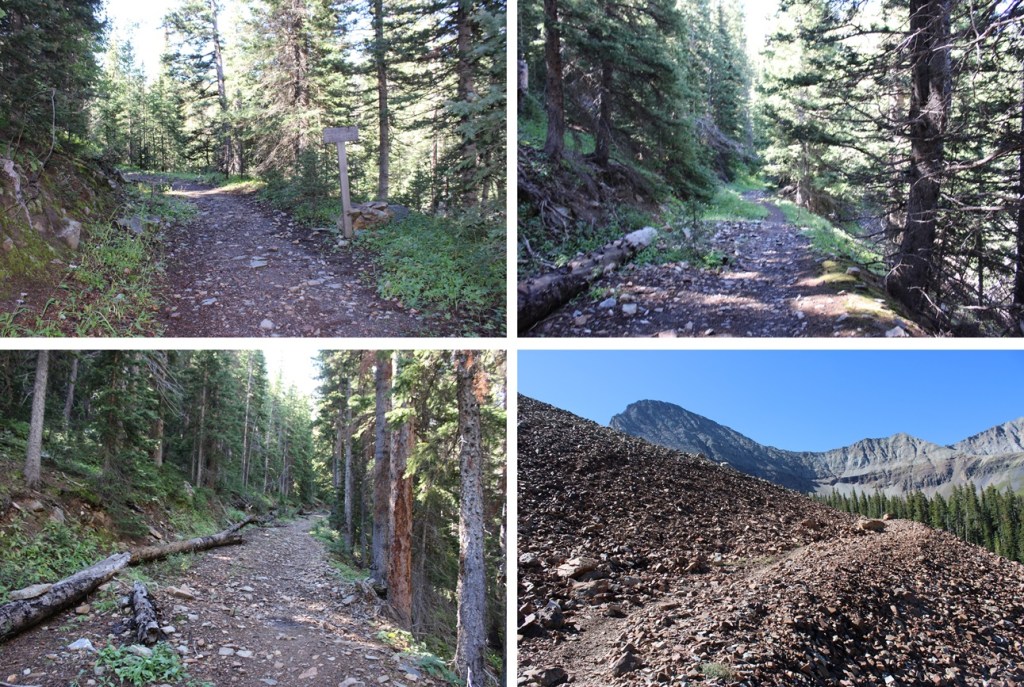
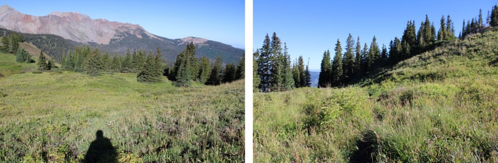
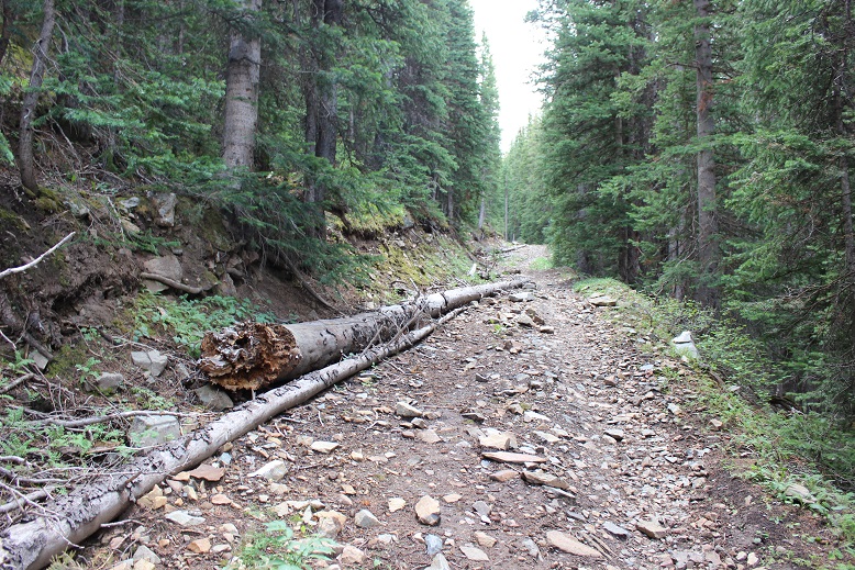
I followed the Rock of Ages trail for 1.5 miles
After following the Rock of Ages trail for 1.5 miles, I came to a junction, and started following the Elk Creek Trail east.
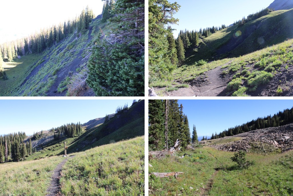
Here is where the trail got interesting. I kept gaining, then losing elevation, then gaining it back again. I knew this would be frustrating on the way out (it was). I continued following the class 1 trail
I then came to another junction, but the sign was broken. I followed the trail to the left.
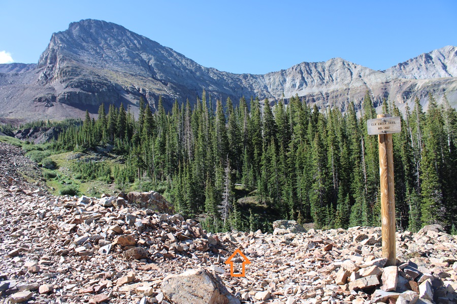
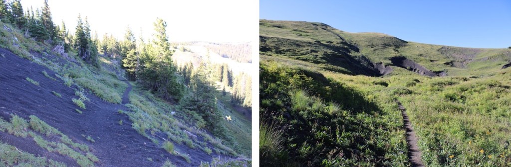
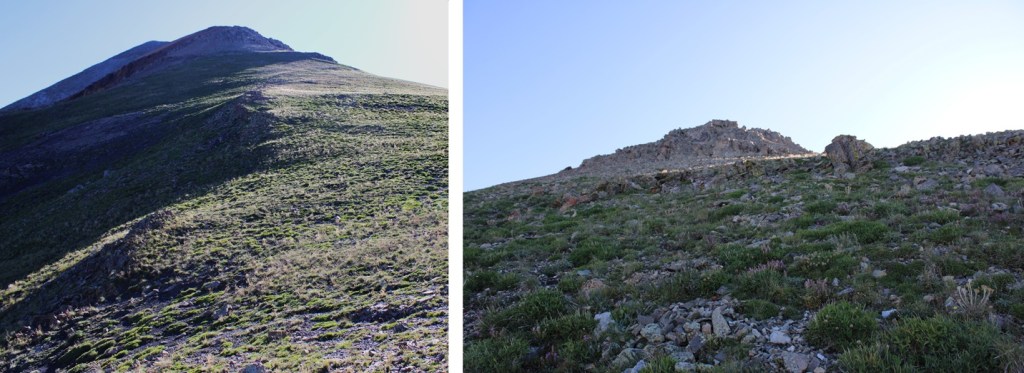
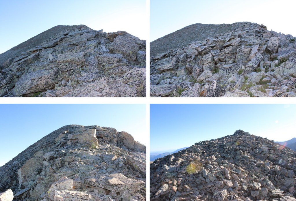
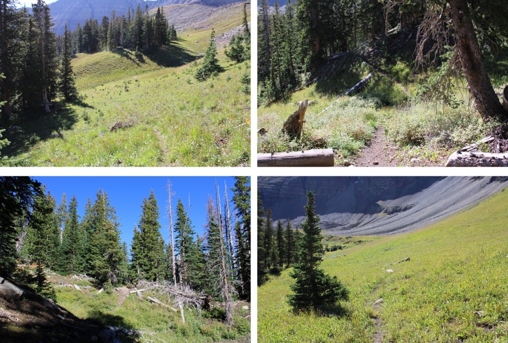
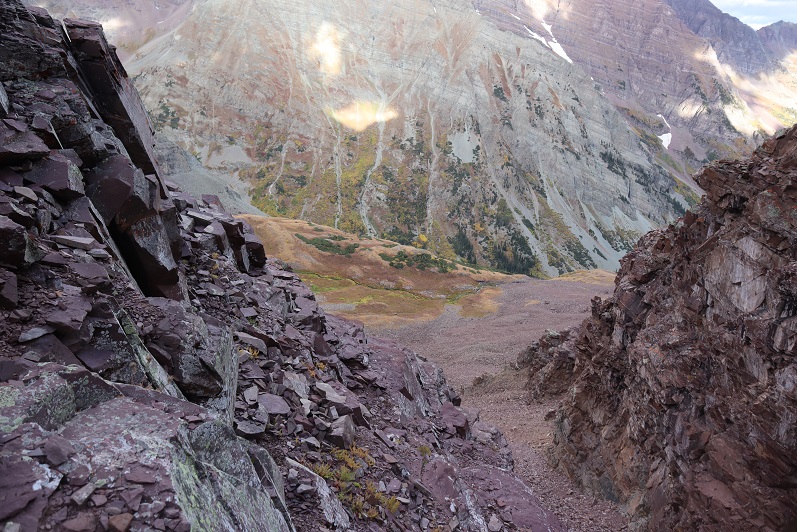
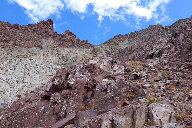
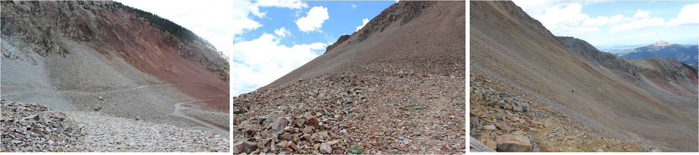
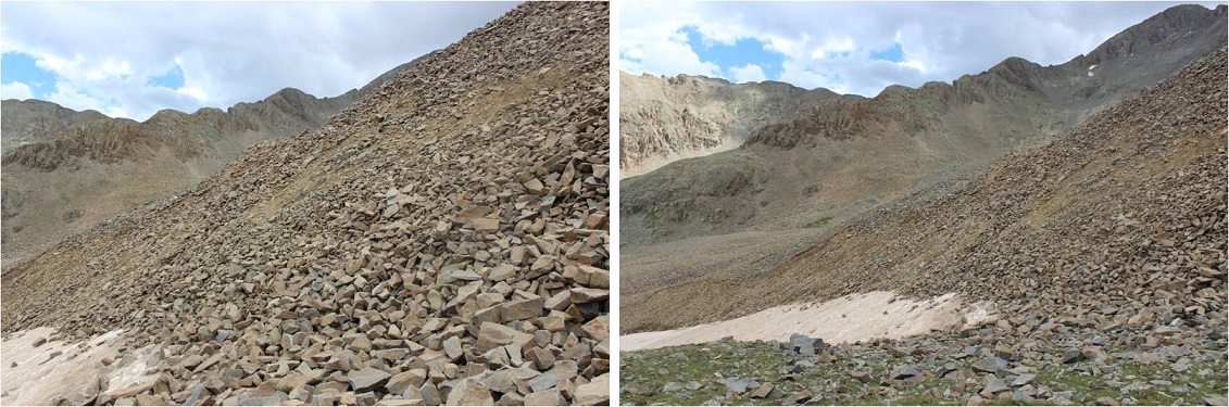
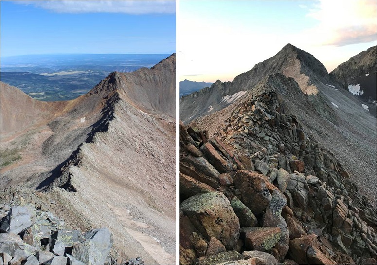
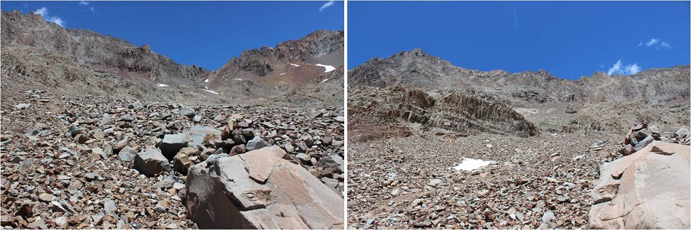
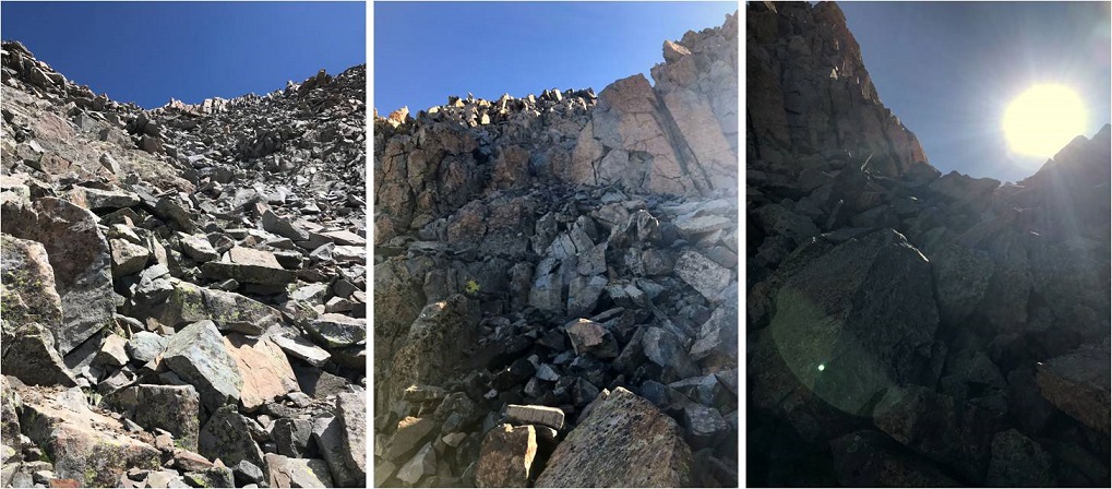
I followed these class 1, well defined trails for 4.3 miles, until I came to the base of a gully running down from Boskoff Peak
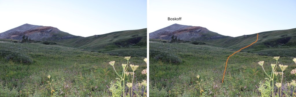
Here I could clearly see Boskoff, and it’s ridge in front of me. I left the trail, and headed southeast up the tundra slope towards the ridge.
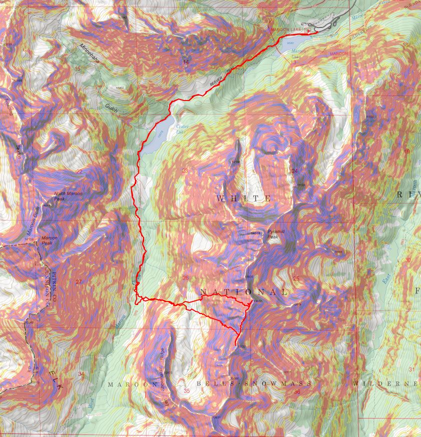
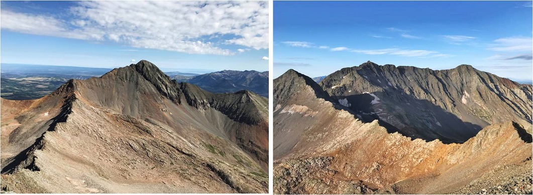
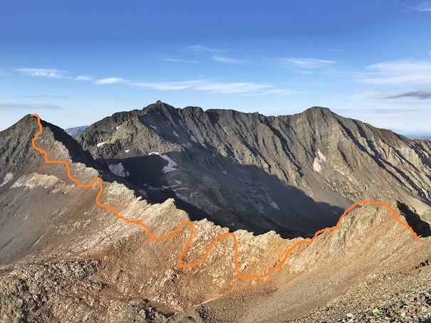
Once on the ridge, I turned left, and followed the tundra northeast. I pretty much stuck to the ridge to summit. Here’s the overall route:
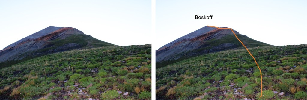
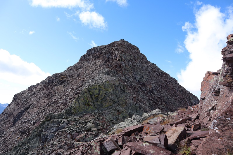
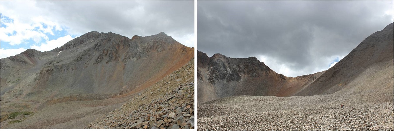
I followed the ridge until the tundra ended.
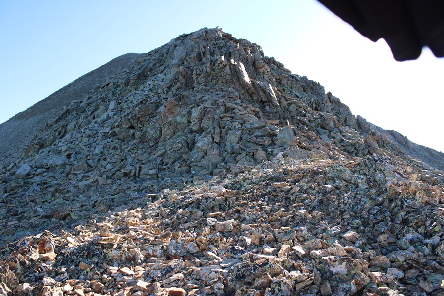
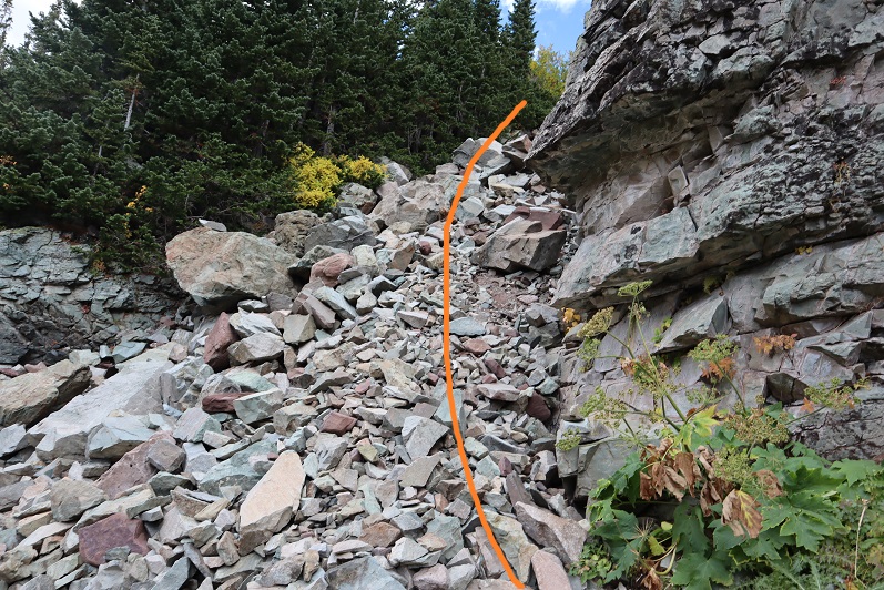
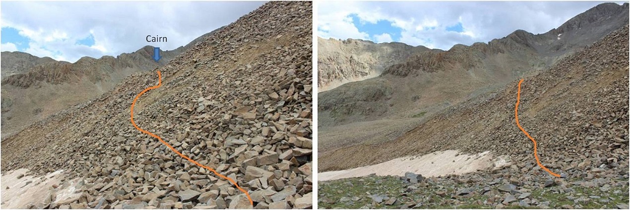
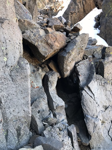
The tundra ended at the base of a rock formation and several gullies. I took the right gully up, the left one down. Both were class 2. The right gully was more stable, but the left gully made for some fun scree-surfing on the way down.
Here are some pictures of the right gully
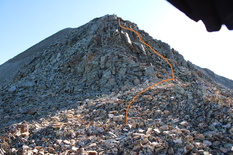
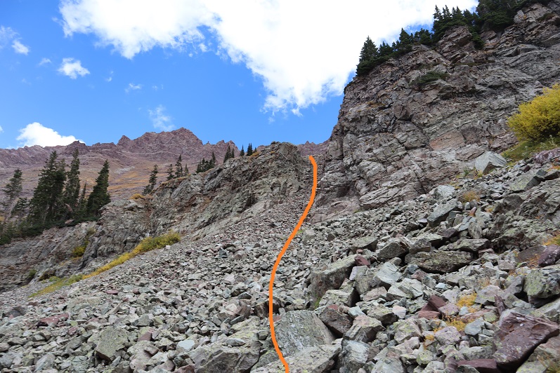
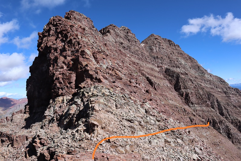
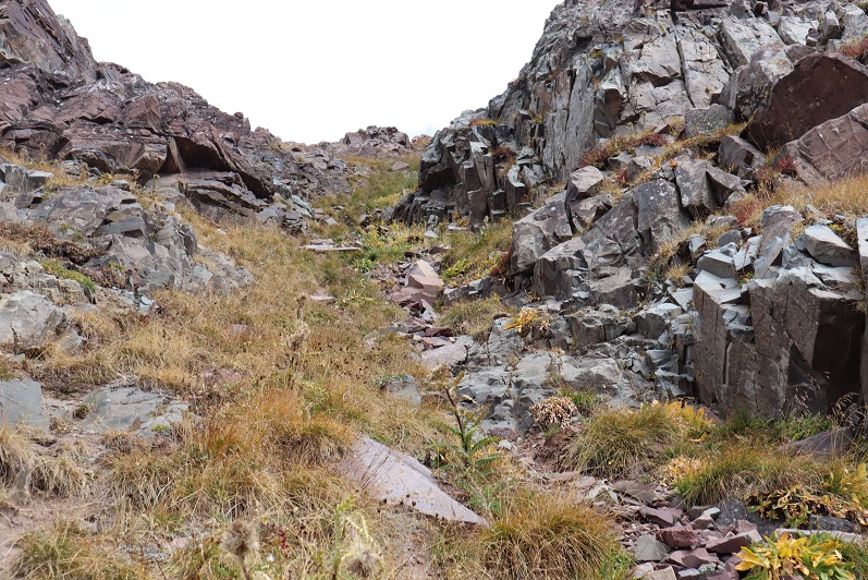
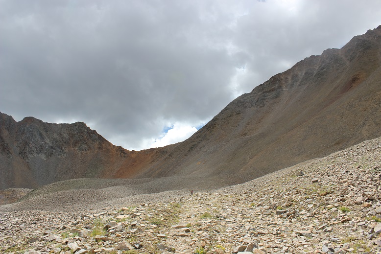
Both gullies end at the same place. From here, there’s a well defined game trail on the talus leading northeast along the ridge. I followed the talus trail until it ended at another pile of rocks.
I went a little to the right, hopping over loose talus doing a couple of easy class 3 moves, then aimed for the ridge.
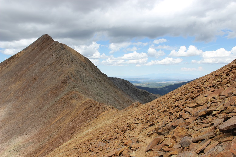
The rest of the hike is class 2, all the way to the summit. Just be careful, the boulders and talus here are loose. I wouldn’t want to do this ridge if the rocks were wet, as I relied a lot on the traction of my shoes to keep balance. I followed the ridge to the summit.
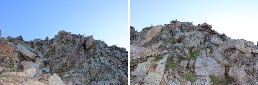
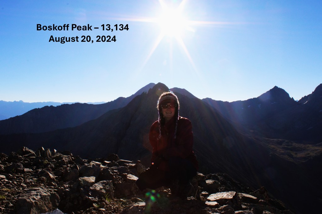
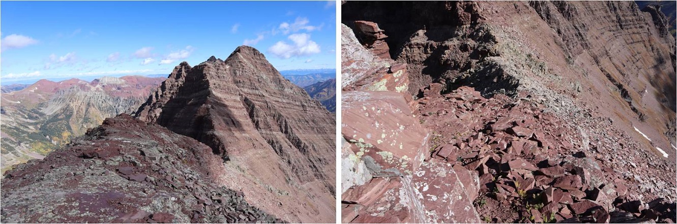
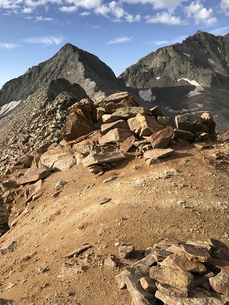
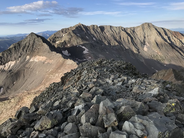
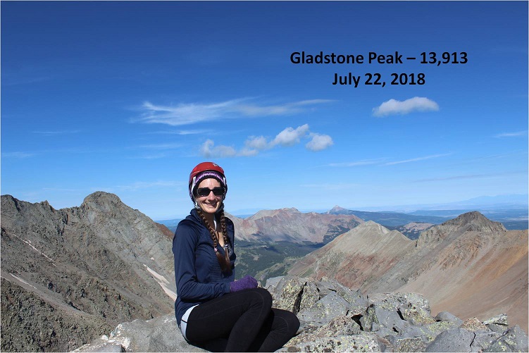
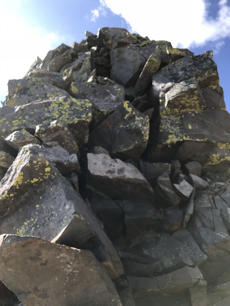
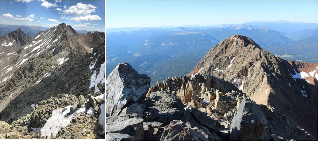
I summited Boskoff Peak at 7:50am
Boskoff Peak:
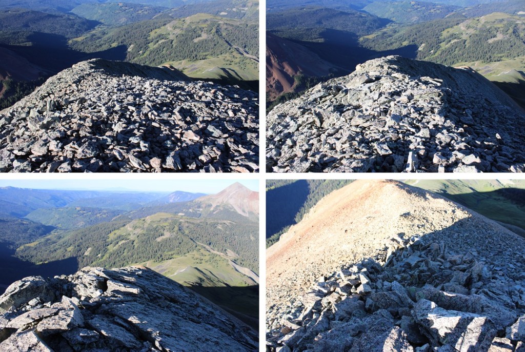
Now to head back. This was an out and back hike for me, so I turned and headed southwest down the rocky ridge
Then back down to the talus
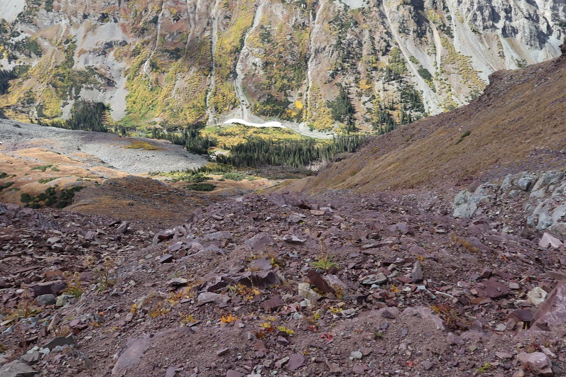
And back on the talus to the gully. This time I took the gully to my right down, scree surfing to the tundra.
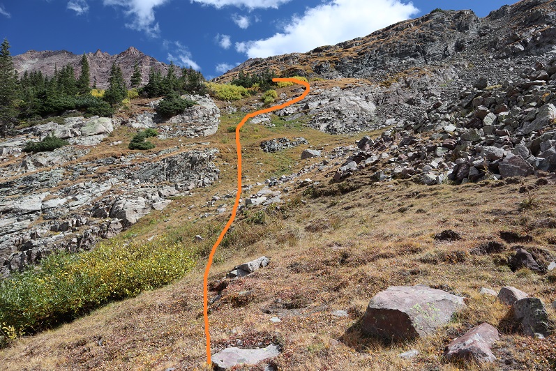
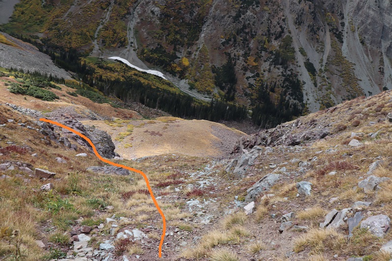
Back on the tundra, this is the route I took back to the trail below.
When I made it back to the trail, I turned right, and followed Elk Creek Trail back to Rock of Ages Trail
I then went left, and followed the Rock of Ages trail north back to the trailhead
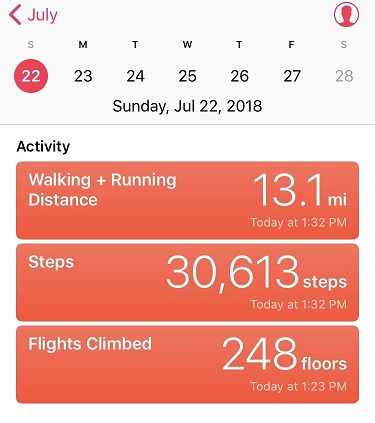
I made it back to the trailhead at 10:45am, making this a 10.63 mile hike with 3398’ of elevation gain in 5 hours, 45 minutes.
After summiting Vestal Peak I changed in my truck into new hiking clothes. I re-braided my hair, ate a packet of tuna and drove to Maroon Lake. It rained the entire 5 hour drive there and I was seriously worried my hike in the morning would be in danger. Originally I’d planned on hiking, taking a day off to rest, and then hiking again on Sunday but the weather forecast for Sunday called for 80-90mph winds so I decided to alter my schedule a bit. I was not impressed with the rain. It was raining when I fell asleep in the cab of my truck but I thankfully I awoke to a clear, starry sky at 2:30am.
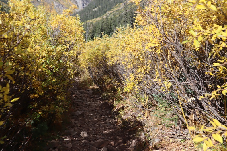
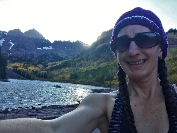
The parking lot was full of both hikers and photographers eager to get a glimpse of the fall colors. I debated going back to sleep for a few minutes but in the end decided I should probably get going. I was on the trail at 3am.
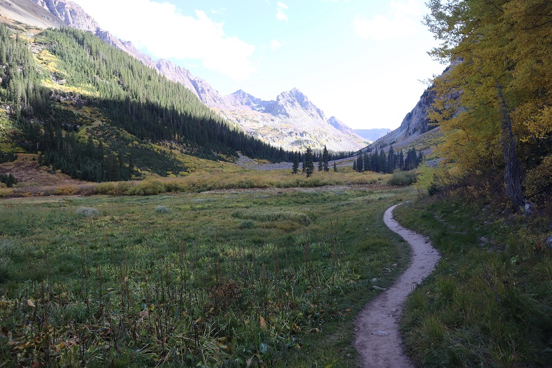
I followed the trail to Crater Lake
And then followed the West Maroon Creek Trail until I’d made it 3.7 miles.
This trail is so much nicer to walk when there’s no snow! Route finding was negligible
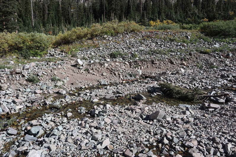
After 3.7 miles I crossed the West Maroon Creek (which didn’t have much water)
And headed east through the willows
Until I reached the base of the slope to the first access gully. This was difficult to figure out in the dark: The last time I was here the willows were completely covered in snow and I just climbed right up, but today those willows were taller than I was.
At the top of this gully is another gully
And at the top of this gully (you guessed it) another gully
Now the rocky gullies started including areas of tundra
Now I was almost to the upper basin.
Once in the upper basin the sun started to rise and I had a good view of “Lightning Pyramid”. Traditionally you climb this peak as a couloir climb in the winter/spring, but obviously that wasn’t an option for me today and I’ve already been here in winter conditions: I wanted summer. I headed across the rocky basin, aiming for the couloir.
This next part in italics is personal and has no relevance on the trip report. Feel free to skip it if you’re just here for route information.
I’m going to summarize this as quickly as possible: I don’t consider myself to be an overly religious person. I grew up in the church but no longer attend (please don’t invite me to your church: I have personal reasons for why I don’t go). I do believe in God and find him more in the mountains than in a building surrounded by people. Often when I hike I have conversations with God. I do most of the talking, but surprisingly I started to feel him talking back (rarely, but it happened). I’m going to be honest here: If someone told me God spoke to them I’d think they were daft, so I totally understand if you think that of me, but I think what I’m going to say needs to be said (for me at least). Also, once again, I’m not a ‘preachy’ person and will most likely never mention anything like this again in a trip report.
For some reason I’m a ‘people-pleaser’. I have a need to be liked and I go out of my way to be friendly and helpful. I feel I need to be ‘perfect’. I don’t do well with rejection. I’ve always been an avid hiker but started seriously tackling peaks after I got a divorce. My ex had supervised visitation of the kids one day a week and on that day I’d go hiking. After my 13th summit of Pikes Peak I met someone on the way down who asked me which other 14ers I’d done. My response: “What’s a 14er?”
Obviously I was immediately hooked and after about 20 14ers I was hiking and talking to myself/God about how amazing Colorado and the mountains and hiking (etc) are and felt God speak back to me. He told me to hike all of the 14ers in Colorado solo. This idea intrigued me: I was both excited and scared. I wasn’t sure I could do it. Also, I didn’t really know why I should?
After hiking about 30 14ers solo I was sitting in a Girl Scout board meeting and Girl Scouts had just partnered with The North Face. We were brainstorming fundraising and marketing ideas and suddenly it all became clear: I could be the first woman to solo all the 14ers! Girl Scouts focuses on first women to do ‘stuff’. We could market this jointly with The North Face, the girls would get exposure to outdoor experiences and(hopefully) some free gear. It all seemed clear now: This must be why I was doing this! I felt I had purpose and direction.
I was so excited when I summited all 58 14ers solo because I felt I was doing it for a cause. Anyone who follows the 14ers site knows what a disaster that turned out to be, and honestly I just wanted it all to go away.
I kept hiking because I like to hike. On my first centennial after finishing the 14ers I felt God telling me to keep hiking the rest of the centennials solo and I balked. Once again, I wasn’t sure I could do this (hello class 5?) but after mulling it over I was willing to give it a shot. I knew I’d write up trip reports and post them to my website because that’s what I do, but he told me to keep posting to the 14ers site as well (I did not want to do this, but I did).
If you were to ask me why I was hiking all of the centennials solo I’d tell you I didn’t know. I honestly didn’t know, but I also wouldn’t have told you it was because “God told me to” because then you’d think I was totally nuts. But that was why I was doing it: Because God told me to.
Then Thunder Pyramid happened. At first I was confused because I knew I’d summited, and then embarrassed, angry, and frustrated. Why was this happening to me? Not only were people commenting on the 14ers site, but they were going through my LinkedIn page and challenging my accomplishments, posting negative comments on my website, facebook, and Instagram (sorry David for ghosting you: I honestly thought the feeling was mutual). People unfriended me both online and in person. They made up reasons to ‘prove’ I was lying and if they couldn’t find negative information they assumed or made it up. The dislike button was hit on my trip reports and I took it all very personally.
The hardest part was just because they were loud didn’t mean they were right. I knew I wasn’t lying but I couldn’t change their minds. I’m also sure they think their behavior was justified. I think it bordered on harassment. It was definitely bullying.
So here I was, halfway to the summit of PT 13,722 and all of this was going through my head, in addition to the anti-climatic day I’d had yesterday when I’d finished hiking the centennials solo and didn’t ‘feel anything’. I was asking God why I just couldn’t get excited about finishing the centennials solo? I didn’t want to post anything on the 14ers site because I didn’t want to go through the drama again. I mean, I know I shouldn’t care what other people think about me…
That’s when it happened. As soon as those words went through my head everything stopped and suddenly it felt as if I was getting the biggest, warmest, most enveloping hug I’d ever had. Overwhelmed I broke down and started crying big crocodile tears, taking huge breaths in and out between sobs.
That was it: I wasn’t hiking for a cause or to help others but because God wanted to teach me a lesson. He wanted me to realize it doesn’t matter what other people think. He just chose to show me that lesson through something I love: hiking.
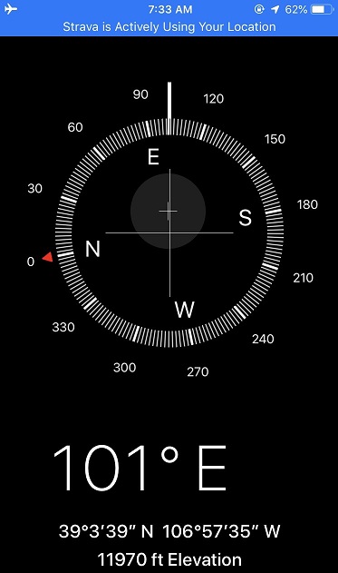
“Wow” I thought: “He had me hike all the centennials solo to teach me not to care what other people think”. A simple lesson we teach out kids and that everyone knows but that I have difficulty accepting. This moment was so powerful I got out the altimeter/compass on my phone and took a picture of where it happened. I thought about just saying it was at 12K but ultimately figured that diminished the experience.
I wiped away my tears, looked at the mountain in front of me and thought to myself “So, if it doesn’t matter what others think of you why don’t you just turn back and go home?”
The answer? “Because I Love to hike”
With light shoulders and a renewed purpose I started off again. It took about 10 steps before another thought overcame me: “Why did God think I needed to learn this lesson? What is he preparing me for where I need to be ok with not caring what other people think about me?” (I squinted and closed my eyes, crossed my fingers and repeated: Please not politics, please not politics, please not politics).
Ok, moving on…
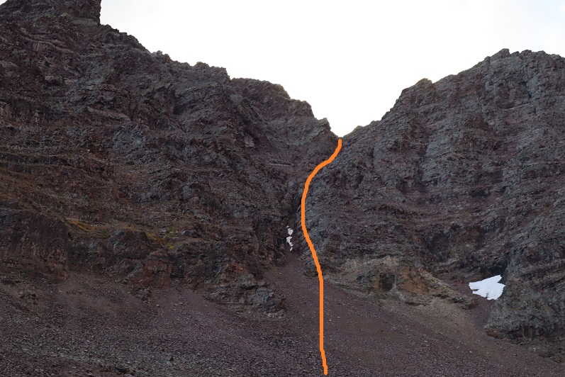
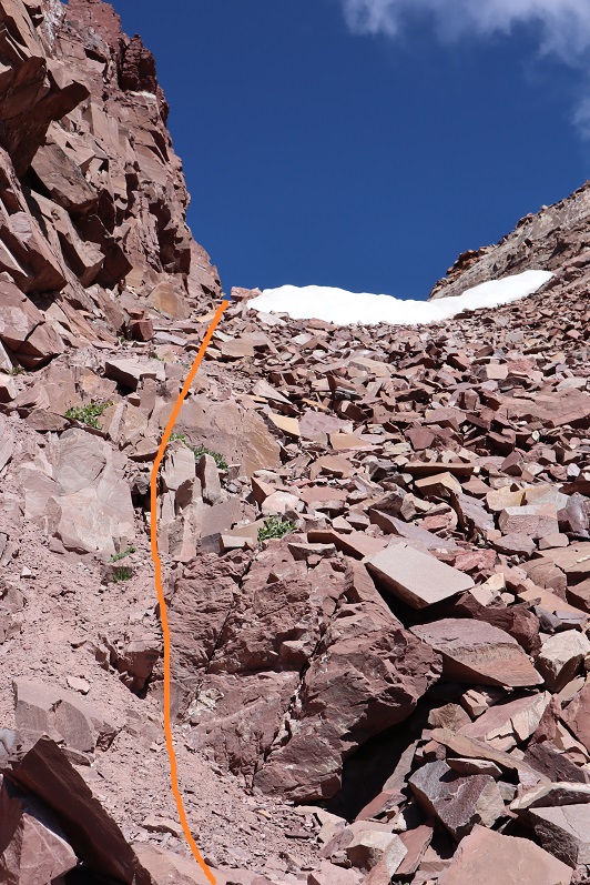
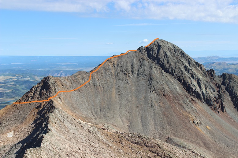
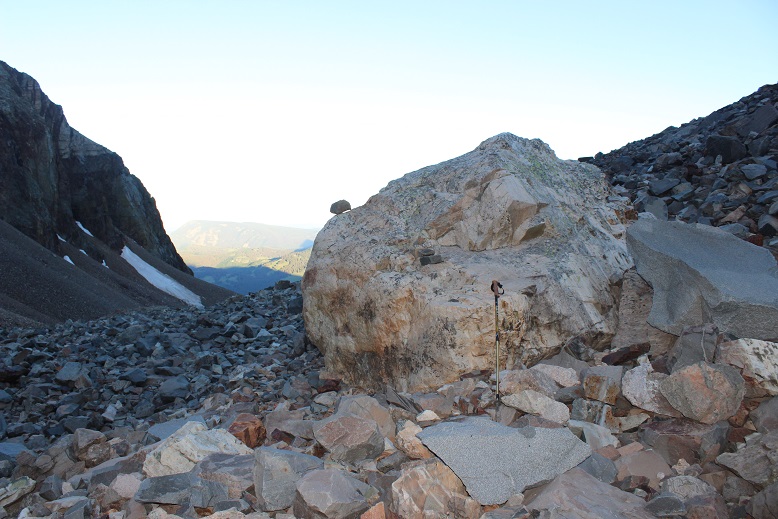
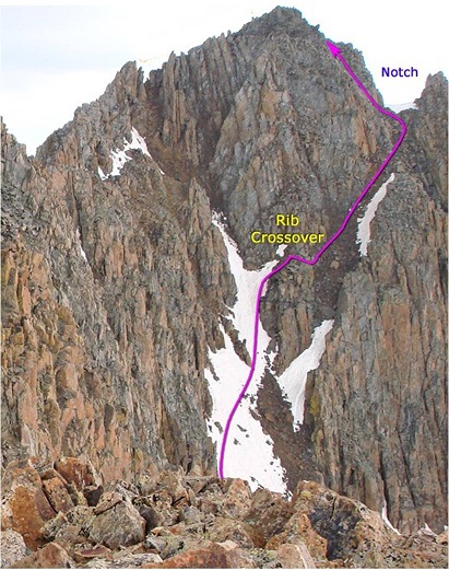
I trudged up the talus towards the couloir. This talus was nasty and each step hurt my ankle (not sure what I did to it yesterday, but it felt bruised). I made it to the base of the couloir and had a decision to make: How was I going to ascend this thing? It looked like it contained (more) nasty scree, so I decided to take the rocky rib to the right. This is the route I took:
I need to stress this might not have been the safest way to ascend. The rock was extremely loose and I had to check and re-check hand and foot placement with every step. It was sustained class 4 bouldering for a good 1000’ of elevation. It was slow going, but I love bouldering and that’s just what this was.
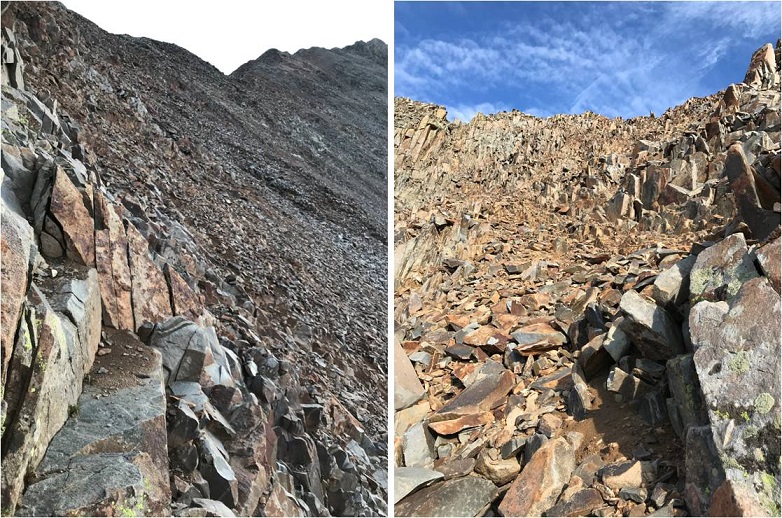
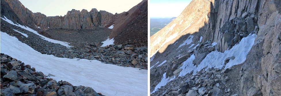
I stayed closely to the right of the couloir for as long as I could, but eventually I had to enter the couloir for the last part of the climb. This area was very loose and I’d suggest you stay as close to the rib on the right as possible.
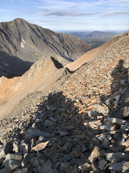
Here’s looking back down the rock rib/couloir and into the basin
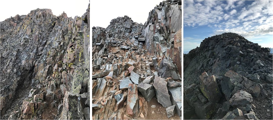
I made it to the top of the couloir and turned right (south), carefully climbing up the ridge
This was actually much easier than it looks (and easier than the climb to this point). I made it to the top of the ridge and saw an easy path to the summit of “Lightning Pyramid”
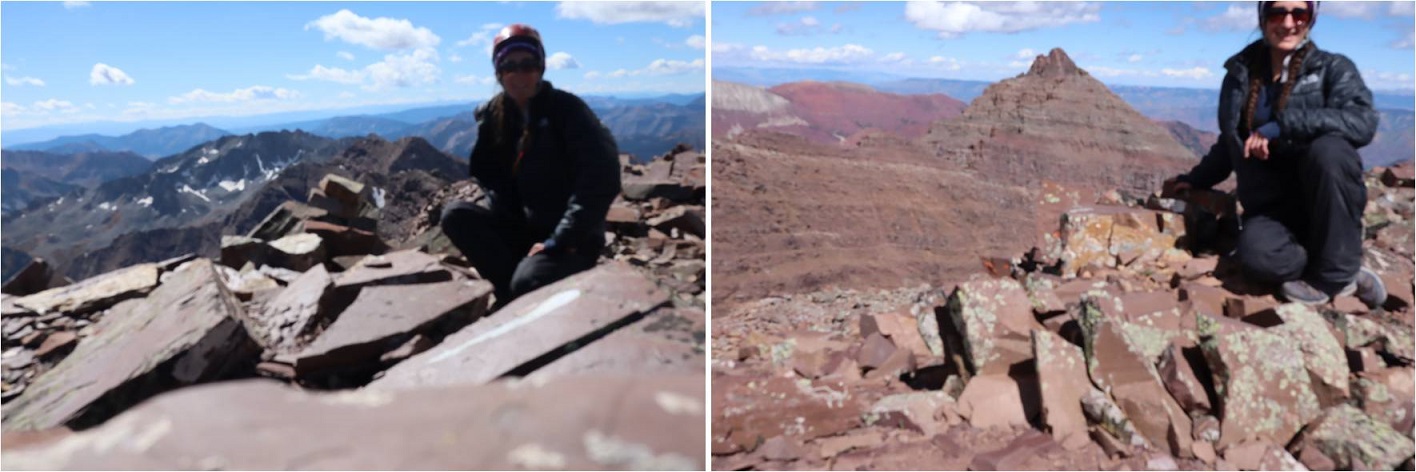
I summited at 10:20am
Lightning Pyramid summit:
Ok, now time to head over to my old friend, “Thunder Pyramid”. I couldn’t find a lot of specific information about this traverse, so I had a lot of figuring out to do. I’d heard heading straight up and over the ridge wasn’t fun, and it in fact didn’t look like much fun, so I decided to scope out another way.
I headed back down to the saddle
Once there instead of hiking up the ridge I decided to stay level with the saddle and hike across the right (east) side of the mountain. This was surprisingly easy
Here’s looking back at “Lightning Pyramid”
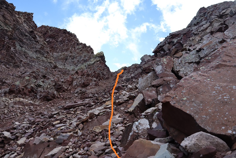
I stayed at the same level as the saddle until I came to a gully. This area took some careful footwork but little climbing. It may have risen to class 3, but realistically was class 2
Next I came to a gully. This gully was very loose and I kept to the left side for stability, holding onto rocks and handholds in the boulders where available. This felt like class 3
At the top of this gully was another gully. I just aimed for the snow.
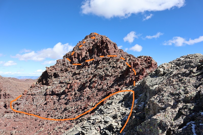
At the top of this gully is where the route picks up with the standard route up “Thunder Pyramid”. I turned right (north) and ascended the ridge
The top of the ridge wasn’t the summit however. I took the solid route up, the dotted route down. If I were to do this again I’d take the dotted route both ways because it doesn’t lose elevation.
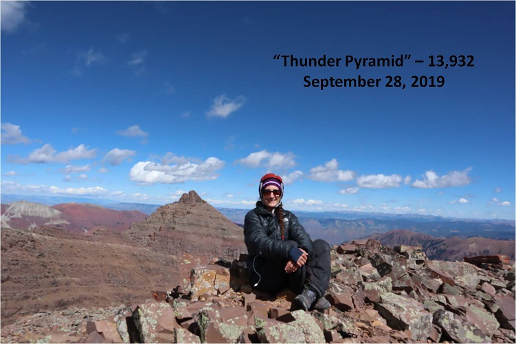
I summited “Thunder Pyramid” at 12:15pm. It took me just under 2 hours from “Lightning Pyramid”. Unfortunately, most of the pictures I got at the summit I realized were blurry when I got home (still figuring this new camera out)
But I did get one “ok” picture
Thunder Pyramid summit:
Up until this point doubt had crept into my mind: maybe what others were saying was true and I hadn’t really summited “Thunder Pyramid” last time. Maybe I’d ended up close but not exactly there? I’d been in a hurry because I’d been having a Raynaud’s attack and I didn’t take my normal number of summit photos/videos (I don’t usually get videos in winter conditions because it’s a death sentence for me to take off my gloves to operate the camera). So today I walked all over that summit, looked around and confirmed what I already knew: Yes, I had indeed summited the last time I was here. Also, the weather today was absolutely perfect! Those 50mph winds never materialized.
I decided to head back down the way most people hike up. I made my way back to the ridge and down the gully
Check it out! Now I know why it’s called the “White Gully” (Last time everything was white)
The descent down “Thunder Pyramid” was no more fun than the ascent up “Lightning Pyramid”, and considering both the gullies and couloir I’d say it’s probably easier to do Thunder first and then traverse over to Lightning. Also, I know this is usually done as a snow climb, but I felt much safer on the scree and talus than I had on the snow. When it was covered in snow I felt like if I slipped I’d fall and never stop sliding. Here I knew I could slip but I wouldn’t fall very far. This climb wasn’t ‘easy’ but it definitely wasn’t as difficult as I’d anticipated.
Hiking down was like déjà-vu (as it should have been)
I made it almost to the bottom of the gully and turned left
And descended the slopes into the basin
Also, I found a shell
I made my way back to the West Maroon Creek Trail and hiked out, loving the fall colors in the daylight.
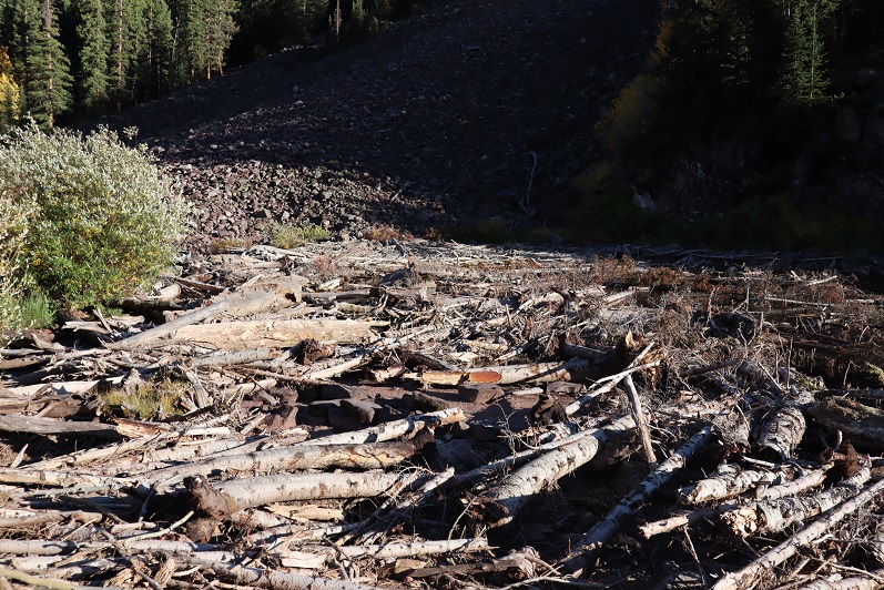
There were a ton of people around Maroon Lake when I got there, all enjoying the fall colors. The base of the lake resembles the Snowmass log jam
While the 50mph winds never materialized on the summit(s) today it was really very windy at the lake. I decided to head to my truck to clean up and then watch the sunset. There was a line of cars waiting for a parking spot and I had to tell no less than 50 of them I wasn’t leaving. None of them took it well, but it had been a long day, and I figured I’d earned watching a good sunset.
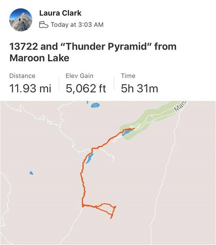
I made it back to my truck at 5:15pm, making this a 12 mile hike/climb with 5062’ in elevation gain in 14 hours.
I enjoyed the sunset
And as soon as it was over I hopped in my truck to drive home. There was a line of vehicles waiting for a parking spot that lasted for over half a mile down the road. The shuttle had stopped for the day and I drove 2 people down to the bus stop because they’d missed the last bus. They were a nice couple from Georgia who were happy not to have to walk those 13 miles back to their hotel. I hope they enjoy Colorado as much as I do!
The weather looked better in the San Juan’s than the Elk’s, so I decided to go for Wilson Peak this time. I left my house at 8:30pm and made it to the trailhead at 3am.
The best part about the drive? Listening to 105.7 ‘The Range’ on the radio after I pass Gunnison. I’ve always been an old soul, but in a previous life (High School) I used to love ‘old’ country music (Lorrie Morgan, Reba, Charlie Daniels, Patsy Cline, George Jones, George Strait, Garth Brooks, Travis Tritt, Pam Tillis, etc.). I’d go dancing every week at our local country bar (another story for another day: How a 14 year old gets into a bar…), and this radio station plays all the classics from the 1950s up through the 1980s. The same ones I grew up dancing to, and thankfully without many commercials. I like a lot of different types of music, but this was a relaxing way to fill a few hours driving. Yes, singing was involved.
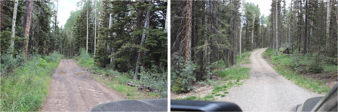
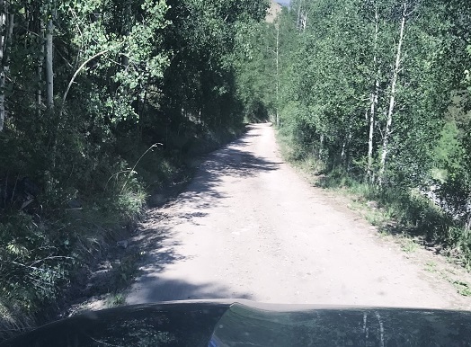
The 8 miles on the dirt road to the Rock of Ages trailhead took me at least half an hour to navigate. It wasn’t a particularly rough drive, just slow going with a lot of little mud puddles.
The trailhead had plenty of parking space, two porta potties, and only one other vehicle in the lot when I arrived. There was a sign that said “Head in Parking” and since it didn’t also say “only” I backed my truck into a space. I’m a Girl Scout and I was a park ranger for a while, which means I never head into a parking space. Ever. It’s just not efficient in an emergency. If there’s an emergency I want to be able to get out of there as fast as possible, so I always either back in or pull through when I park my truck. No exceptions. It’s been drilled into me…
The trail starts here (note, no trail register)
I was on the trail at 3:15am. The moon had already set, so I had a great view of the stars as I started my hike through the trees. The ground was very wet, most likely from all the rain the San Juan’s have been having this week. This was great because it allowed me to look for recent human and animal tracks. I didn’t see any animal tracks (just a few from horses) so I didn’t anticipate seeing any wildlife on this hike. (I didn’t).
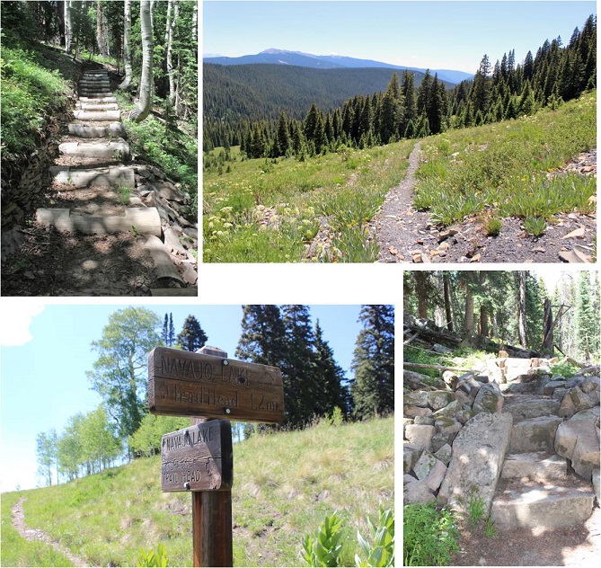
And this trail had great signs! All the way to the basin I knew I was on the Rock of Ages trail (that’s where the signs stopped).
Between the two basins (Elk and Silver Pick) you go up a hill, and then actually lose a couple hundred feet in elevation. I remember thinking as I was hiking in how this wasn’t going to be fun hiking out (it wasn’t).
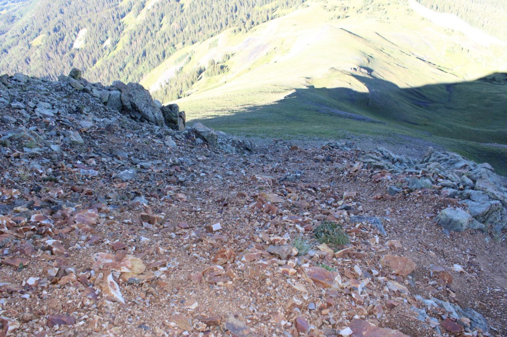
The only thing wrong with this trail? It was made up of lots and lots of talus. The entire basin and in fact 90% of the route was made up of talus. I’m not a fan of talus in general, mainly because I don’t pick up my feet enough when I walk. Even though I’m light I’ve always walked heavy. I could never sneak up on someone, and I recall “Laura, stop stomping like an elephant” being a common phrase in our house, even though I wasn’t actually trying to be obnoxious. Since I walk fast lots of talus for me = lots of tripping. I had to consciously think about each step I took to keep myself from tripping on the talus. This was more of an issue on the way out. It’s also more difficult to follow a talus trail in the dark. During the day route finding is a non-issue, but in the dark everything looks the same (sadly, no CFI stairs here).
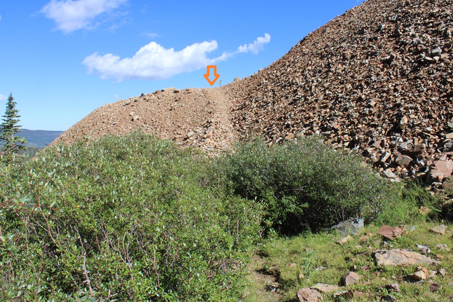
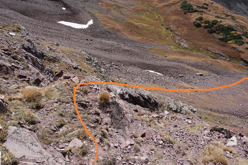
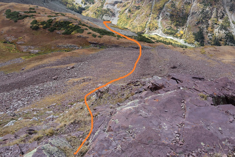
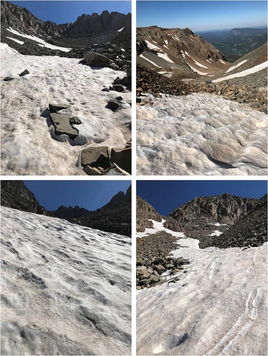
Here’s where talus at night became an issue. I’d been following the service road when it suddenly ended and cairns began. I’m a big fan of cairns, but these seemed to go in a circle, not leading anywhere. Also, the trail ended. I got out my topo map, and knew I was supposed to head straight over the hill into the upper basin, but when I started up the hill the rock was dangerously loose so I backtracked. I hiked up and down the hillside, looking for an alternate route, but there didn’t seem to be one. There was a snow bank without footprints, so I knew that wasn’t the correct way, and I kept coming back to the cairns. My flashlight wasn’t much help, as everything looked the same in the shadows. I honestly tried to find the route for at least 20 minutes, and finally decided to just go for it and trudged up the hillside, navigating carefully through the loose rock. This ended up being the right thing to do, as a cairn invisible in the dark from below awaited me at the top. Here’s what the route looked like
In the light of day the route was obvious (see below), but in the dark I wasn’t able to decipher between the trail and talus. There had been a rockslide of sorts over the direct trail, so there wasn’t a solid trail to follow. Here’s the route you’re supposed to take:
I hiked up and around the rest of the basin towards the Rock of Ages Saddle and noticed I was sweating a lot more than normal. My entire lower back was wet, which was weird? I felt around my backpack and noticed it was drenched. My water bladder was leaking. Well, this wasn’t ideal. I fixed my water bladder with a piece of duct tape and made a mental note to get another one before my next hike. Considering I’ve had it since 2003 it’s probably about time for a new one. The only downside? If the wind picked up I’d have to cancel my hike. Right now there was no wind, but that could change once I made it to the saddle. If it did, my Raynaud’s might start up and I’d get cold have to turn back. Hopefully that wouldn’t happen. The good news? I had on black yoga pants so while it felt like I’d wet my britches if I came across other hikers no one would actually be able to see that my pants were wet in all the wrong places: Let’s focus on the positive here!
Woot! I made it to the saddle, and no wind! The sun was just beginning to rise and I had a great view of the north sides of Mt Wilson and El Diente Peaks.
Here’s what the saddle looks like.
I stashed my trekking pole, turned left, and hiked toward the Wilson Peak / Gladstone Peak saddle.
From the saddle I put on my helmet, turned left again, and started my trek to the summit. I ended up hiking too high on the initial ridge and had to back-track because I got into an area I couldn’t traverse. Here’s the route you should take: Aim for the dip in the ridge, and then follow the ridge towards the summit.
Here’s another view… aim for the small saddle in the ridge. You don’t want to climb too high or you run into lots of choss, i.e. very, very loose talus that isn’t easy/possible to traverse.
Wilson Peak has a false summit. The cool part about this is it’s where the climbing fun begins. You get to climb up a wall, descend, and then climb up again to the true summit.
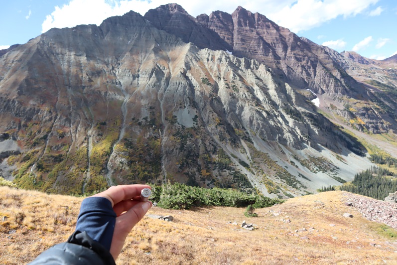
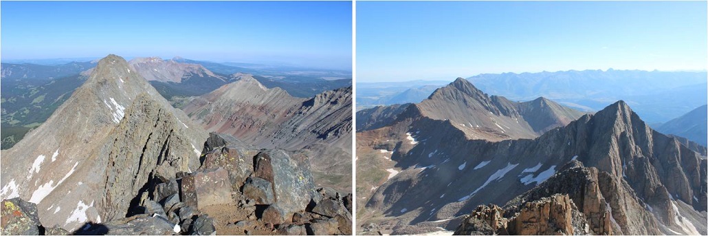
It was 7am. From the summit I could see Gladstone Peak, Mt. Wilson, and El Diente Peak
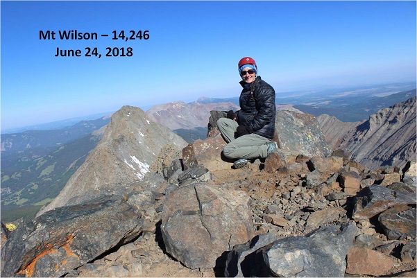
I took a summit selfie to prove I’d summited
And started on my way back down. The trail was much easier to follow now that I knew what to look for.
I made it back to the area I’d climbed too high at and had to backtrack, but this time at the correct elevation. I heard climbers above me and called to them, letting them know they were too high as I’d been. I placed a cairn where I was so they could see where they needed to be and wished them luck.
I made it back to the Gladstone/Wilson saddle. It was almost 8am, and the skies were pretty clear. It’s a centennial, and I was here, and the weather was nice, so I decided to attempt Gladstone Peak. I took off my (now dry) backpack to get out the directions I’d made up. Drat! Apparently I’d accidentally printed two sets of directions for Wilson Peak and none for Gladstone. Hmmmm. No worries, I had my GPS. I pulled up the route and drat again! When I pulled it up it kept me in the basin for the entire hike (and I knew that wasn’t right). I looked at the mountain before me and considered.
I’d put the directions together, so I tried to recall what they’d said. I remembered this was a class 4 hike, I was supposed to stay mainly on the ridge, only dropping down once to class 3 terrain to avoid a more difficult section, if the rocks are too loose you’re off trail, and if I had to go off the ridge to go left.
Well, I was here, so I decided to attempt Gladstone. I followed the saddle to the beginning of the ridge and did my best to stay on the ridge. I’m sad to say I failed almost immediately. There were no cairns. I quickly became a wuss and didn’t think I could stay on the ridge, so I dipped down and when I felt safe again climbed back up to the ridge. That meant I was going up and down loose gullies to avoid exposure. This happened over and over and over again. I knew I was off route and making this harder than necessary, but I kept looking for easier terrain (and not finding it). This was actually the more dangerous option.
The rock was all unstable, loose and shifting as I tried to step on it. I had to be careful with each step I took. I was frustrated but slowly making progress. When I got past point 13,341 I heard someone shout enthusiastically from the summit. Apparently someone else was on this mountain! He seemed pretty excited with himself. I watched him descend and aimed for where he was on the mountain. At one point a rock about the size of a microwave I was going to stand on let loose and cracked and tumbled down into the gully below me, producing a lot of noise and that fire and brimstone smell that comes from such an event. I took a deep breath and continued on.
When the climber was about 50 feet above me I called out to him. I wanted his advice on the trail back since the trail I took in hadn’t been all that pleasant. I called three or four times before I realized he had ear buds in. Why anyone would willingly take away one of their senses on a class 4 hike is beyond me, but I did applaud him wearing ear buds instead of blasting his music. Oh well, I was close, I could make it the rest of the way on my own and re-assess the route from the summit. I don’t think he ever knew I was there. Here’s the final push to the summit.
This is the path I followed (kind of… I probably went up to the ridge and down a gully a few more times). Please, please, please don’t do what I did. I realize this is a total mess.
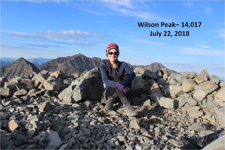
But I did it! I summited at 9:30am and knew why ear bud guy was so excited: That was one tough climb! Here’s my summit selfie
From the summit I could see the ear bud guy had trekking poles (WHY on a class 4 route?!?!?) and was following the ridge. After point 13,341 he disappeared and I never saw him again. Nothing nefarious, I was just focused on the weather/views and wasn’t able to locate him again when I looked towards the ridge.
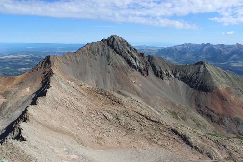
Here’s the view from Gladstone Peak, looking at Wilson Peak
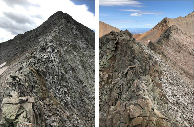
Wow! What a mountain! OK, now it was time to head back down. I made the decision to do my best this time to follow the ridge, no excuses. I’ve done class 4 before, I know I can do this. And so I started down, doing my best to follow the ridge. Here’s what the beginning looked like
I began scrambling. Luckily the rock, although unstable, was sticky on the ridge. There was a lot of exposure but as long as I focused on the task at hand it didn’t bother me. The weather however did. The clouds were moving in fast, and this was slow going. I religiously stuck to the ridge, and you know what? It was doable! Scary as hell, but doable. I could do this! I was climbing up 30 foot rock faces, balancing on ledges, stuffing my hands into cracks and balancing my feet on thin lines that shouldn’t have been possible, but I was successful with every step. I just kept thinking to myself “If I can do this in the gym I can do it here”. Check out the view from the base of Gladstone looking at what I’d just accomplished, and what I had left
Here my confidence soared. I started picking up speed, still careful to make sure my placements were stable before using them. I was making great time and I was actually having quite a bit of fun with each new obstacle. I’d look at something, think “no way” and then go for it. Here’s the route I took back… I just followed the ridge.
I made it to the Gladstone/Wilson saddle and did a happy dance. Woot! I’d done it! Class 4 all the way baby! Let me tell you, Gladstone Peak gives Capitol a run for its money.
I learned a lot about myself on that ridge about what I can do. It’s ok to be scared because that’s your body’s natural response to a dangerous situation: Do it anyway.
The clouds were rolling in as I made it back to the basin. The basin was busy, filled with hikers coming in from multiple trails. I felt a few sprinkles, but nothing seemed too ominous or threatening. It was weird hiking through the basin in the daylight where I could clearly see the trail.
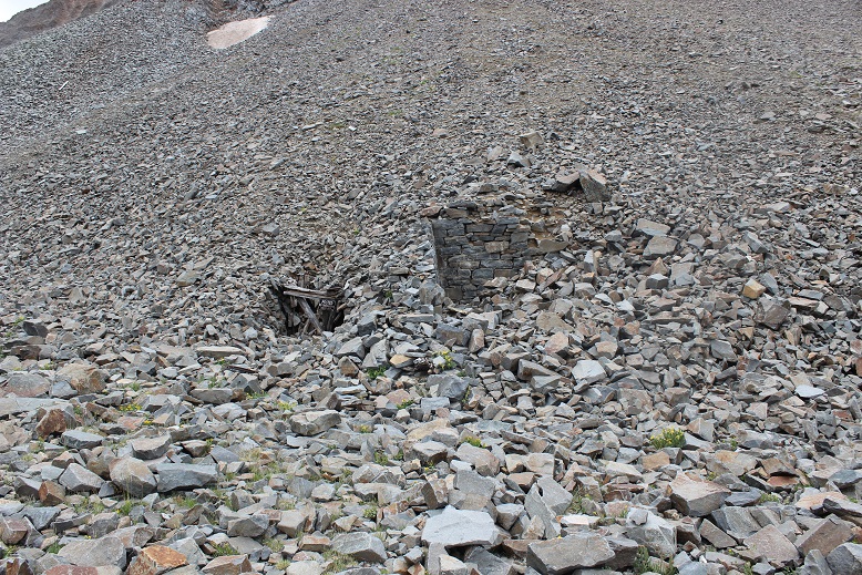
I could also see a bunch of abandoned mines I hadn’t known were there in the dark
And remember the 20+ minutes of route finding I had to do? That was a cinch in the daylight! The hillside is right next to the old rock house and yes, those cairns do lead to nowhere but in a circle.
I made it back to my truck at 1:15pm, making this 13 mile double summit hike/climb in 10 hours. Not bad considering I lost quite a bit of time to route finding both on the trail and on the ridge.
I decided to let my truck play in the mud puddles on the dirt road back to the highway, getting her dirty in the process. No worries though, because it rained the entire way home, so in the end I came home with a clean truck.
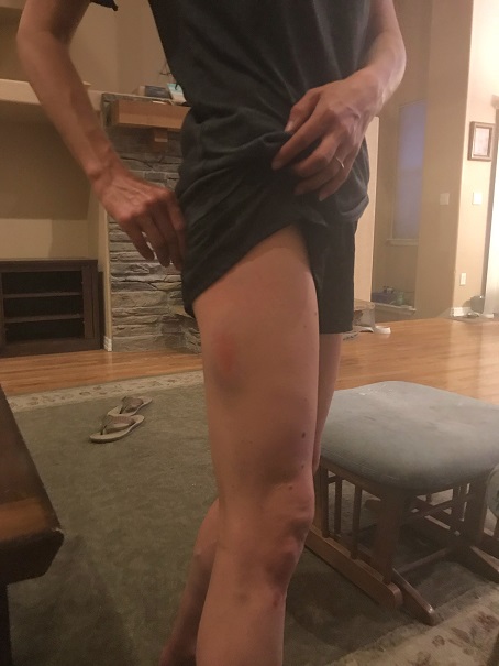
I didn’t make it home until 8:30pm, making this a 24 hour trip door to door. I immediately took a shower, and was confused at how many large bruises I had I didn’t remember earning, mostly on my shins, thighs and forearms. I guess the ridge bites back!
Oh, and push-ups were a killer this morning! I must have really used my arms yesterday…
It’s 7:30pm on Saturday night, and I go downstairs to find all 3 of my teenagers hanging out in my youngest daughter’s room. My son is sitting in a chair in the middle of the room serenading everyone, trying to figure out how to play a Bruno Mars song on his accordion. My oldest has her laptop in her lap, and my youngest has her headphones on (but takes them off when I enter the room).
The kids ask me why I’m not driving to the trailhead? Didn’t I have a long drive and hike ahead of me tomorrow?
Me: Well, you see yesterday I saw a really big bear when I was coming home from hiking. A really big bear. I didn’t realize we had bears that size in Colorado! I’m stalling because I don’t really want to hike solo in the dark for longer than I have to with bears on my mind.
My son: I thought you talked to us yesterday about not letting other people’s fears dictate your hikes?
Me: Yes, but currently, this is my fear.
My youngest: That’s fair.
My oldest: But you’re not hiking the same mountain, right?
Me: You’re right! Hey, I’m not even hiking in the same mountain range. Thanks! I’m out!
My oldest knows how I think, and knew just what to say to get me moving. I’ve hiked for miles and miles in the dark solo dozens of times, but for some reason seeing that really large black (cinnamon colored) bear yesterday kind of freaked me out. Sure, it was running away from me, but it wasn’t the smallish black bear I’m used to seeing. I encountered it during the day, but it’s not something I’d like to repeat at night. I know I’ll get over it after a time or two of hiking at night again; the experience was just still fresh in my memory and didn’t sit well.
So I drove the 6.5 hours to the Kilpacker trailhead. Quick note: the driving directions given on the dot com are correct, but I misinterpreted them. The instructions said to drive to Lizard Head pass and continue south. So when I got to Lizard Head Pass sign I turned south into the lot, thinking this was the pass, and looked for a route south. This wasn’t the pass, and I circled the parking lot twice looking for it. It was dark and the road was a half loop, leading to other trailheads and me to believe I was missing the turn off. I figured I must have missed something? Nope, there was no turn at Lizard Head Pass: just continue driving when you see it and don’t go into the parking lot (unless you need to use the restroom, because they have one there and not at the trailhead).
The 2WD dirt road in was a bit narrow in places, but easy to navigate. I put my truck in 4WD because I could, but it wasn’t necessary.
I signed the trail register at the well marked trailhead and started my hike a little before 4am. In the dark. Here’s proof:
The first 5 miles of this hike are really easy. Very little elevation gain (in fact, you lose more than you gain it seems, which stunk on the way out) and no real challenges. That is, if you put aside the fact when you hike in the dark your sense of hearing intensifies and every shadow becomes a mountain lion/bear/rabid squirrel coming at you at full speed. About 2 miles in I heard a large pine tree fall 20 feet in front of me on the trail, which was a first for me (but it’s gotta happen a lot, right?).
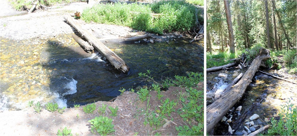
I came upon the stream crossing and it was more difficult than anticipated. You see, when I came upon it in the dark I saw a broken log in the water, with no way to cross. I walked up and down the banks a few times until I noticed an in-tact tree that was easy to cross. It’s one of the fun challenges of hiking at night! (I had a GPS but it wasn’t helpful in this situation, as it showed the crossing far from both logs, in a place where there were no logs).
So, how did I deal with my bear thoughts? I diverted my mind to a speech I’m writing for a presentation I’m giving next week at a conference on sensor technology, tapped each and every log and large rock I passed with my trekking pole to make noise, and said “Hey Bear!” more than I have in years. It worked, because I didn’t see any animals (which was also kind of a downer because I actually like seeing animals when I hike).
The route was very well maintained until I reached the basin.
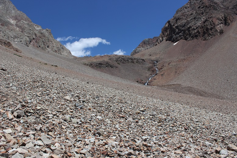
I reached the basin just as the sun was coming up. This was a very large basin filled with a lot of talus.
From here the route wasn’t difficult to follow, but everything looked the same, making cairn finding a fun game.
I never did see the cutoff for El Diente because I wasn’t looking for it. I was focused on route finding for Mt Wilson, but here it is (I found it on my way back down).
I left my trekking pole near a large rock, fully expecting a marmot or pika to destroy it (it’s time I got a new one anyway).
I chose to do Mt Wilson first because it’s further and there was a chance it would have snow. I wanted to get the snow part of the hike done in the morning before the snow softened. The jury was still out on the traverse. After hiking through miles of talus I came to a drainage area with larger rocks. I could see a snow free line to where I needed to go so I didn’t put on my crampons and spent the next hour and a half carefully hopping from rock to rock up the drainage.
Once I made it to just below the gullies below the summit it was much safer for me to put my crampons on, so I did, and left them on until I was about 150 feet away from the summit (when rock climbing became necessary).
Here’s the route I took (I’m using the photo from 14ers.com because mine don’t have this great of a perspective).
After making it to the notch rock climbing was necessary. Yes, it is important here to look back at the way you came. You’ll be surprised at how different it looks from this perspective!!!
There was one class 3 move
And the rest was a fun uphill scramble with the added bonus of the sun blinding me as it was just rising over the ridge
Wow! What a beautiful day for a summit!
I took a summit selfie, a summit video, and was back on my way.
This time I put on my crampons for the gully and kept them on as I was descending most of the basin, straight down the snow. Wow! What a difference from hoping rock to rock! This was so much easier! I wished I’d have done this on the way up: I’d have saved quite a bit of time.
Now it was time to head over to El Diente. I’d made the decision I wanted elevation gain today, and the best way to do that was to descend Mt Wilson and climb El Diente instead of doing the traverse. Also, I didn’t have a map or instructions for the traverse with me and this seemed like a safer option, even though the traverse was snow free.
The pink “v” is what you’re supposed to do if you hike each peak separately, but I found an established cairned route and took the blue line.
I still looked for and traversed the rib, but I took a route from the west instead of the east.
I climbed the gray gully and hiked just below the organ pipes
After gaining the ridge I actually moved from the south side and traversed the north side of El Diente. The north side had some snow directly on the route, but it was easily navigable. Here’s a picture looking back at the north side part of the trail and also of the traverse.
Here was the crux of the climb for me: I rounded the corner and since there was snow on the direct route from this point on I made a few class 4 moves to gain the summit. (It’s a steeper climb and those rocks are larger than this picture makes them look).
I couldn’t tell where the exact summit was. My GPS kept switching between points, and some were obviously not the summit (it was doing this for the north and south side of the mountain too, which was frustrating). There was no summit marker so I just stood on multiple high points on the ridge, just to be sure I hit the ‘actual’ summit. The high points were quite narrow so this picture is closer than I’d have liked.
Take a look at that ridge heading back to Mt Wilson!
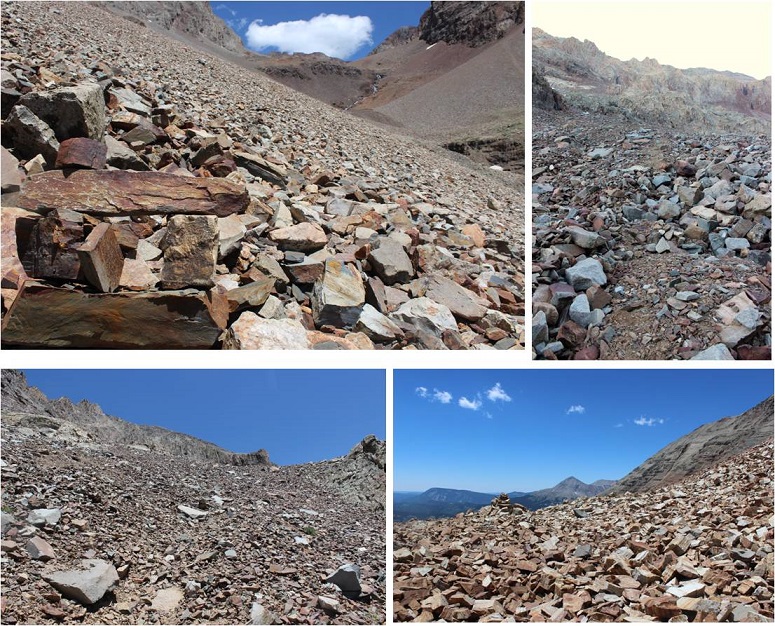
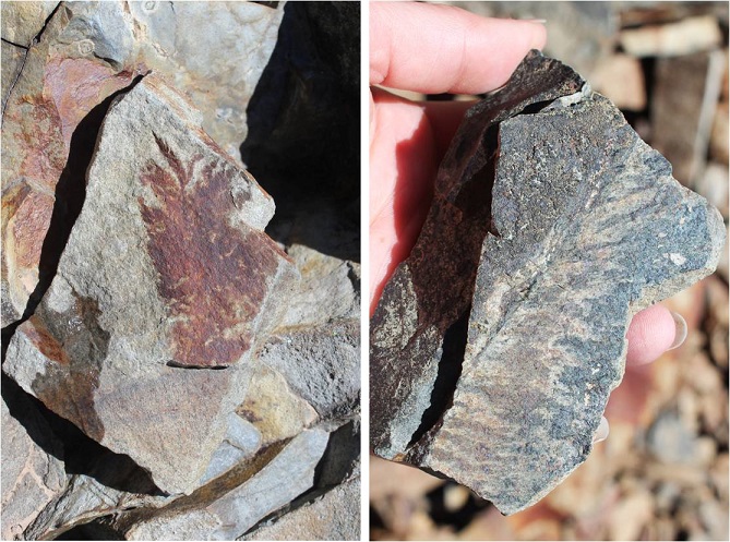
I was much more confident on the way back down El Diente. Both of the climbs I did today were completely within my abilities. They were fun, and while there was exposure I wasn’t scared at all (not even much of an adrenaline rush). These routes seemed very similar to the Mt Sneffles ridge route. The only downside? The talus! OMG, that stuff didn’t quit! Talus stinks to hike in because all of the rocks are of irregular size, none of them are stable or large enough to securely put your foot down, and they cause you to slide when hiking downhill. It’s hard on the knees and impossible to hike down fast without slipping.
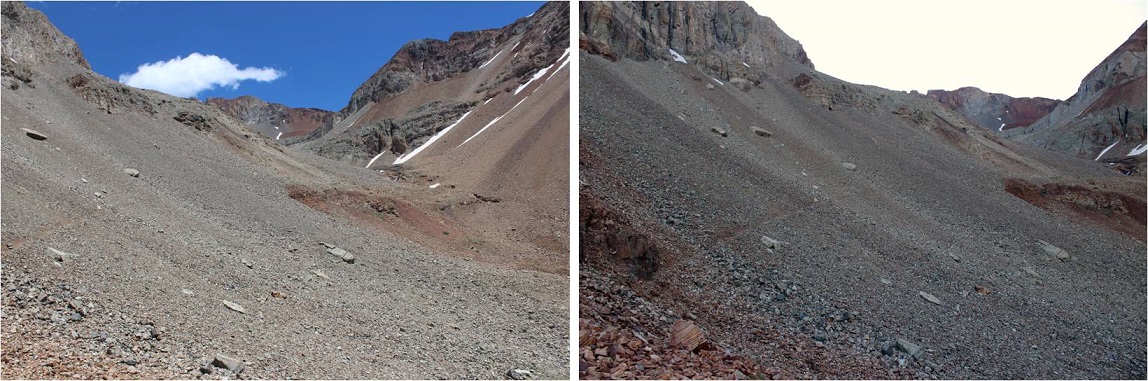
The only good thing about talus? It’s gorgeous to look at! I found several pieces that looked like they contained fossils of plant material. I left them there for the next hiker to find.
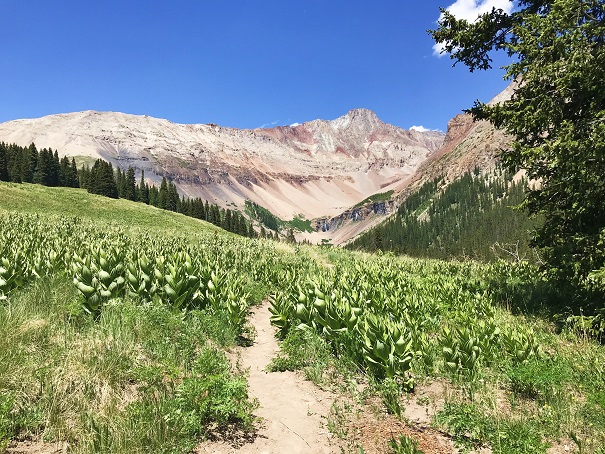
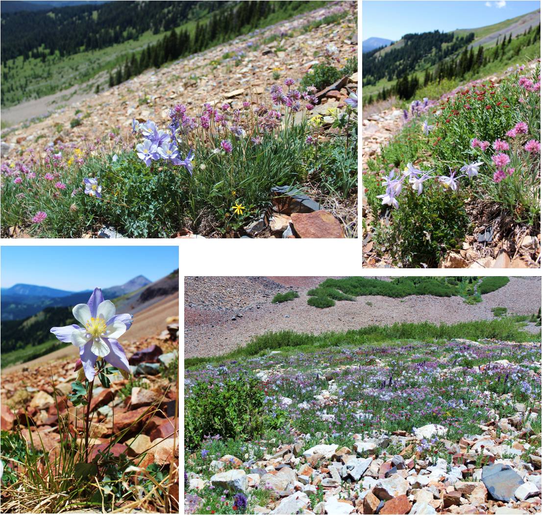
On the way back down I was able to see flowers that weren’t visible in the dark. Absolutely stunning! Pictures don’t do them justice!
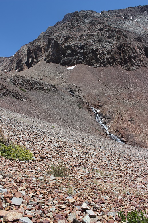
I turned around before exiting the basin to get a good look at the waterfall
Here’s more of that talus route down…
I was able to retrieve my trekking pole with only minor bite marks. Due to the bite size I’m assuming a pika was involved, and was pleasantly surprised it wasn’t destroyed. I’ve heard stories of the rodents ruining gear, but they only seemed to have a nibble this time. Apparently they didn’t like the taste of the cork handle.
This hike made for a long and beautiful day, as I made it back to my truck at 4pm (and home at 10:30pm, so door to door it was a 27 hour day). I actually stopped at treeline to let some hikers pass (two young men trying to run down the talus to catch up with/pass me, and falling several times doing so… I figured I’d just let them pass since I wasn’t in a hurry today). To make sure they were well ahead of me so we wouldn’t play leap frog I waited for about half an hour in the meadow, enjoying the view. Talus might be tough to hike in, but it sure makes a beautiful mountain!