Wheeler Mountain – 13,698
RT Length: 9.5 miles
Elevation Gain: 2810’
My alarm clock rang and I hit snooze. Today’s worry: starting too early. I wanted to be home from the hike around 1pm because that’s when my daughter would be home, but I didn’t feel the need to start too early when this was a short hike with minimal elevation gain. I didn’t think it would take me more than 5 hours.
After trying to fall back to sleep for 20 minutes I gave up and drove to the Montgomery Reservoir trailhead, arriving at 4am and taking my time getting ready. It was much colder than I’d anticipated and I put on my winter gloves from the beginning. The drive in was uneventful and I was the only one in the parking area when I arrived.
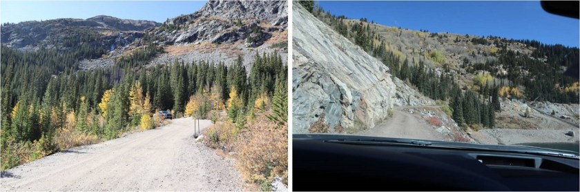
I was on the trail at 4:30am. It starts at the east end of the parking area (you pass it when you drive in).
The trail passes the Magnolia Mine and follows an extreme 4WD road for 3.3 miles to Wheeler Lake. If your vehicle can make it to the top of Lake Como you have a chance in being able to navigate this road, but you should probably just hike the 3 miles. This is my third time on this trail, and I can tell you it’s much easier to follow without snow.
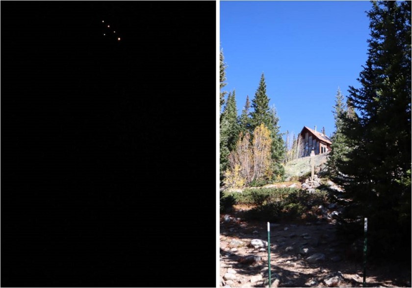
In the dark I saw a bunch of flickering lights and wondered what they were? They looked like gas-powered lights, fire and all, and I figured they were probably from a mine. In the daylight on my way out I realized they belong to a house/structure on private property.
There are some flat areas and very bumpy parts to this road, making a quick pace nearly impossible.
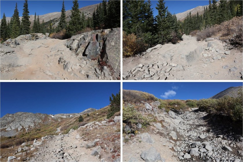
It was windy and cold and I wasn’t ‘feeling it’ today so I trudged along, hiking slower than usual. Windy is normal here (it’s a basin after all) but the cold along with the wind made this easy part of the hike more challenging. After hiking for 3.3 miles and an hour and 45 minutes I made it to the lake, just as the sun was beginning to rise. I still needed my flashlight but aimed it away from the lake, as there appeared to be campers there. I could see a tent and heavy-duty 4WD vehicle parked beside the lake.
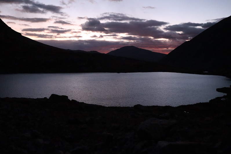
There’s a trail along the left side of the lake that’s used for both the Clinton-McNamee-Traver hike and Wheeler Mountain, so it’s easy to follow. The only downside? It was iced over and slick. In fact, any part of the road/trail thus far that had held water had been iced over.
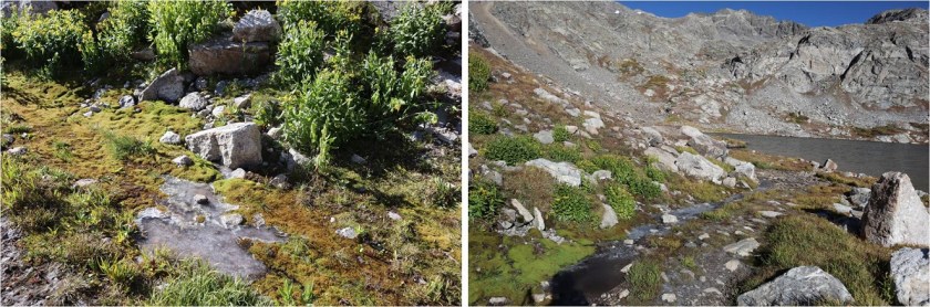
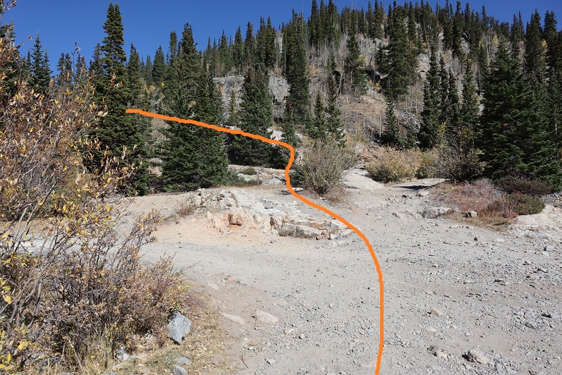
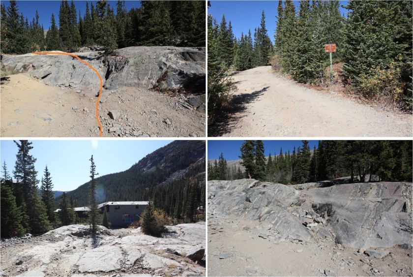
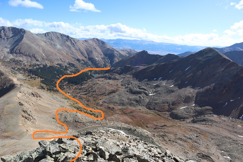
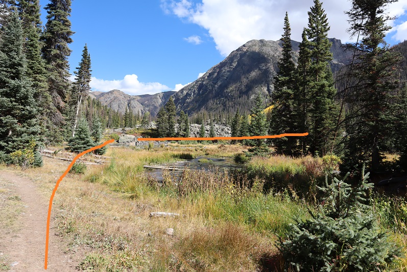
The trail up past Wheeler Lake towards Wheeler Mountain is less traveled and more difficult to find. Here’s the path I took, staying to the left of the waterfall. It passed around the outskirts of the willows.
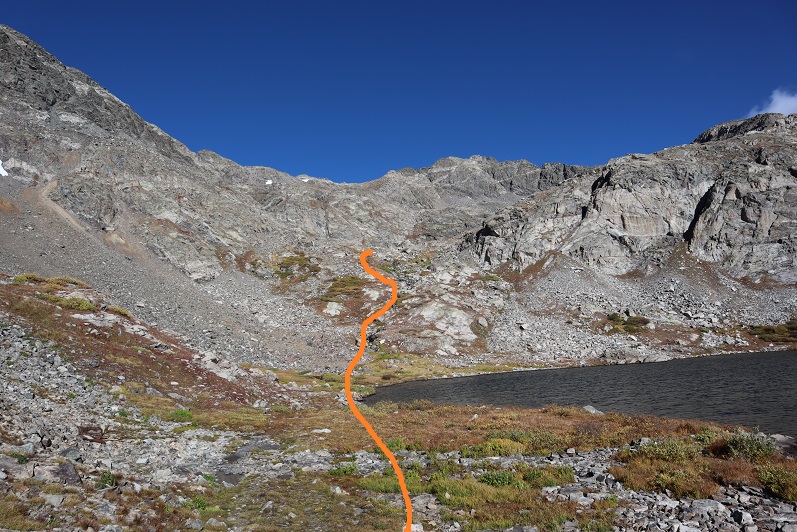
I passed someone’s getaway vehicle along the way
At the top of this gully there’s another small lake. This time I skirted the lake to the right, following well placed cairns. Oh, and the wind stopped! This was fantastic! I was finally starting to warm up a bit.
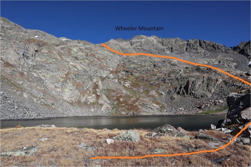

Once above the second lake the trail is faint but the cairns are helpful. The trail turns and heads northwest. The goal here is to gain the saddle.

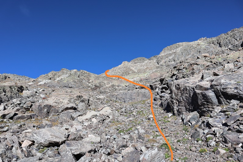
I felt there were just the right amount of cairns here to keep me headed in the right direction, but basically I was just aiming towards the saddle. During the last bit the trail goes left and then angles back right over a grassy area
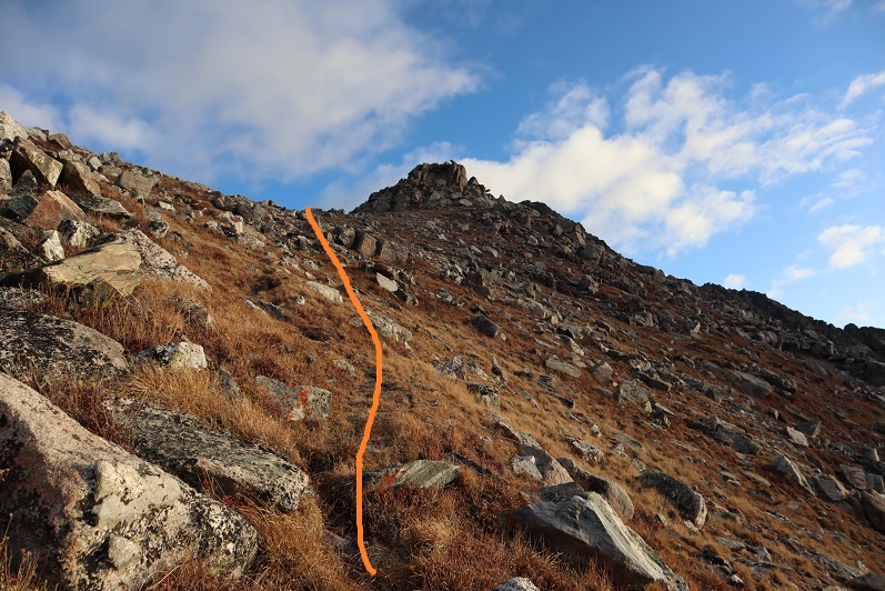
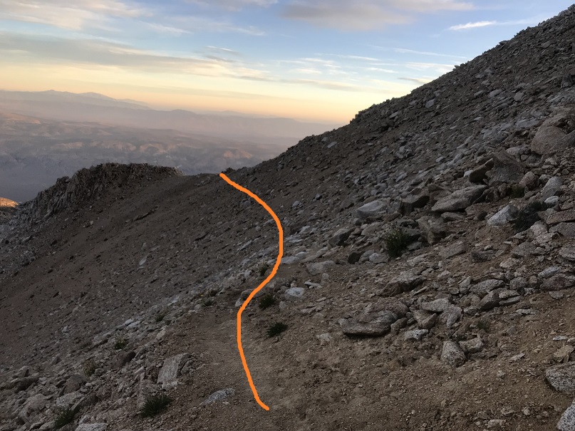
Once I gained the saddle the wind picked up intensely. It wouldn’t have been so bad if it had been a normal wind, but this wind was a steady 40mph and icy. It was like an arctic blast was blowing directly against me as I hiked. I turned right at the saddle and headed northeast. Instead of going up and over the ridge (which doesn’t look possible) I skirted it to the left, following the cairns.
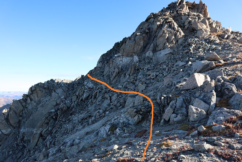
There aren’t very many cairns here, but they are all placed in helpful areas. If you can’t see a cairn, you’re off trail. This is not something I’d want to attempt in the snow. I skirted several gullies

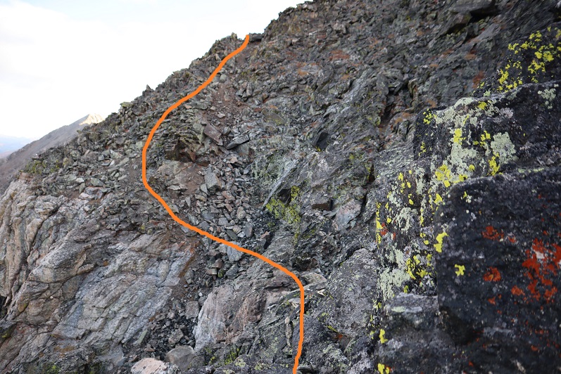
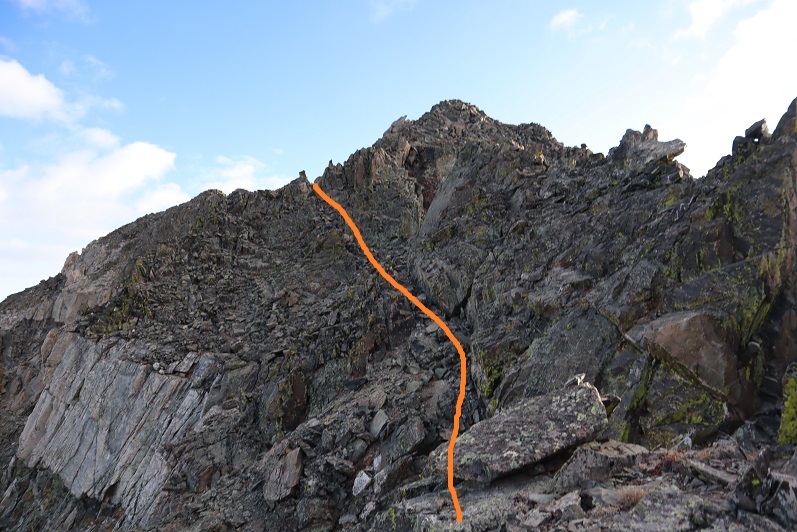
I found myself at the top of a particularly sketchy gully where it looked like I was going to have to lose some elevation and I didn’t think I was headed the right way. Also, I couldn’t see any more cairns. The wind picked up dramatically and I seriously considered turning back. My fingers were frozen and finding the “Y” in the ridge that indicated the summit was taking a lot longer than I thought it should. I looked all around but wasn’t sure where to go? I started jumping up and down to get warm, and that’s when I saw it: a cairn just over the next rib. Woot! I just hadn’t been tall enough to see it. So yes, I went down this gully, and then back up and around, aiming for the cairn
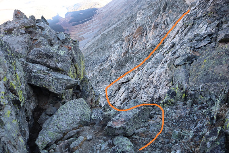
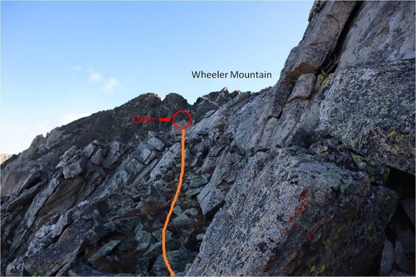
I was so glad I hadn’t decided to give up! The summit was in sight, and there were enough cairns leading the way so I didn’t need to do too much route finding. Here’s the way I took to the summit

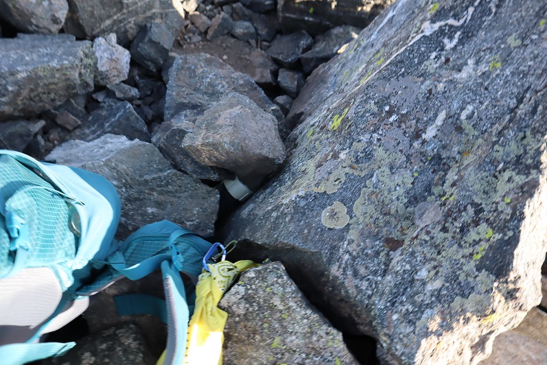
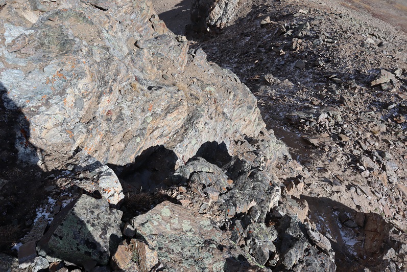
There was a rock gully to climb
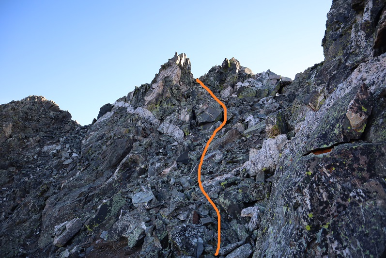
And then I turned left (north) and did some fun rock climbing the last way to the summit. Well, it would have been fun if I hadn’t been frozen and if the wind would have stopped. This part was exposed and I stayed low on the rocks to avoid the gusts of wind, worried they’d knock me off balance and I’d fall over the edge.
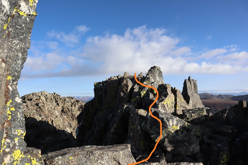
I finally knew I was on the summit when I found the summit register (which I never sign, but it’s nice to know they’re there)
It was far too cold for me to take off my gloves to set my camera up to take a good photo, and there honestly wasn’t much room to set it up, so I just took a selfie. I have no idea what time it was (I couldn’t pull out my cell phone to check) and sorry, but no video either (I take those on my cell phone as well).

I didn’t stay on the summit any longer than it took to take a few pictures. I returned the way I came
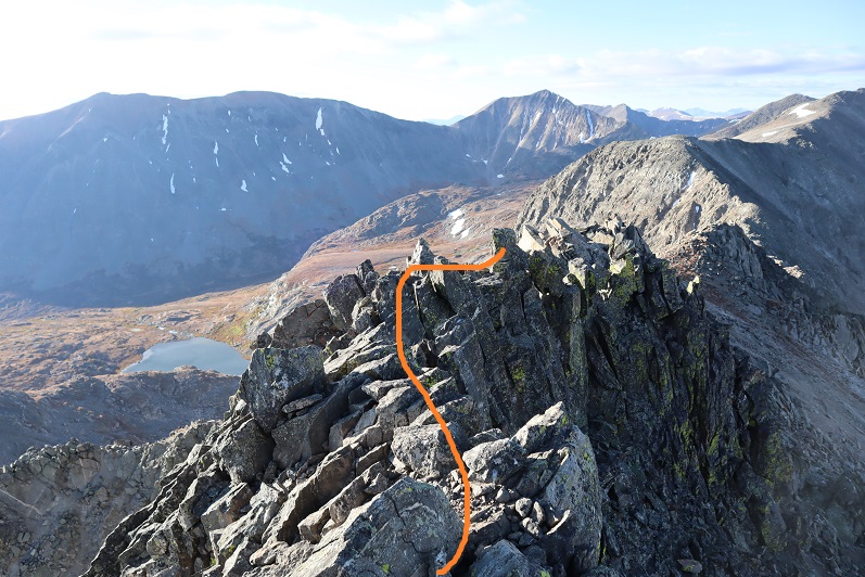
Back down the rocky gully, aiming for the cairn

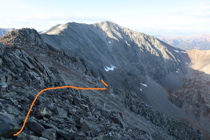
Heading back was much quicker because I was sure of the correct way and had no problem locating cairns. I was in a hurry to thaw out.
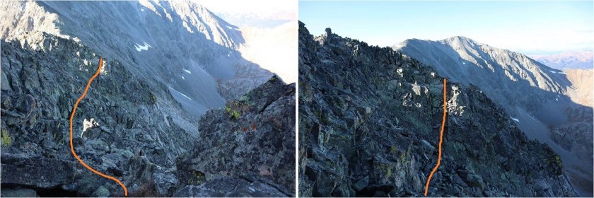
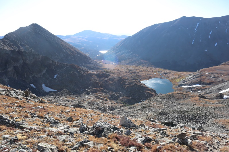
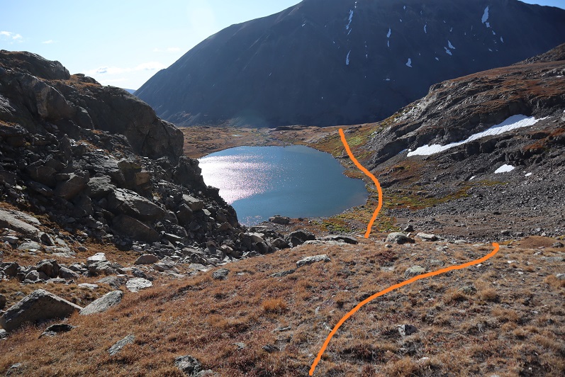
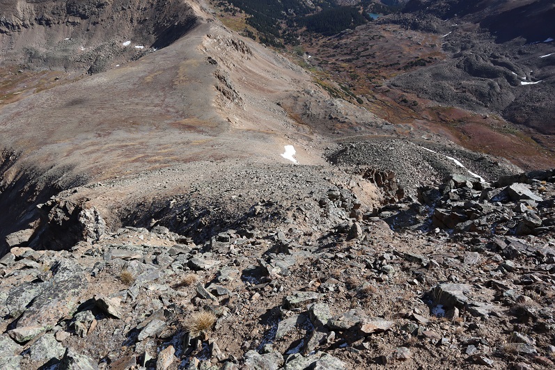
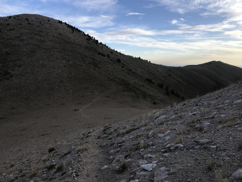
Once back at the saddle I located the cairn that told me where to descend, and turned and headed back down to the lake(s)


And back down to the 4WD road
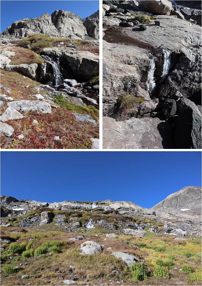
In the daylight I could see all the waterfalls were a bit icy. I completely understood: It was cold, even without the wind (which hadn’t yet let up).
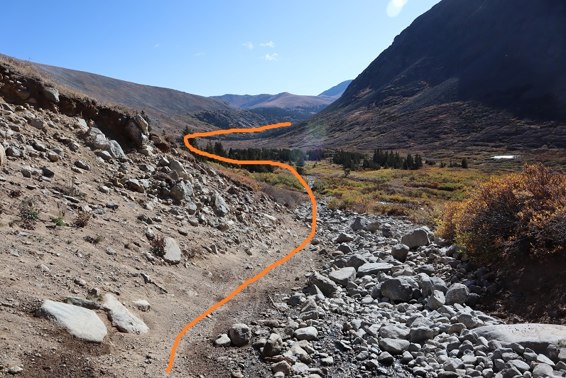
The campers I’d seen at the lake in the morning were gone, and their vehicle had crushed all the ice along the road as it drove out. I saw several modified vehicles on my way back: probably 10 or more, all part of a caravan. I was hoping to see wildlife, but with all the vehicles I realized that wasn’t likely. I didn’t see any hikers the entire day. Here’s looking at the way back to the reservoir.
The wind never let up but it did get a bit warmer as the sun rose. I never took off my gloves. It looks like it’s time to bring out my heavy-duty winter gear! I started this hike at 4:30am and made it back to my truck at 11am, making this a 9.5 mile hike with 2810’ of elevation gain in 6.5 hours.

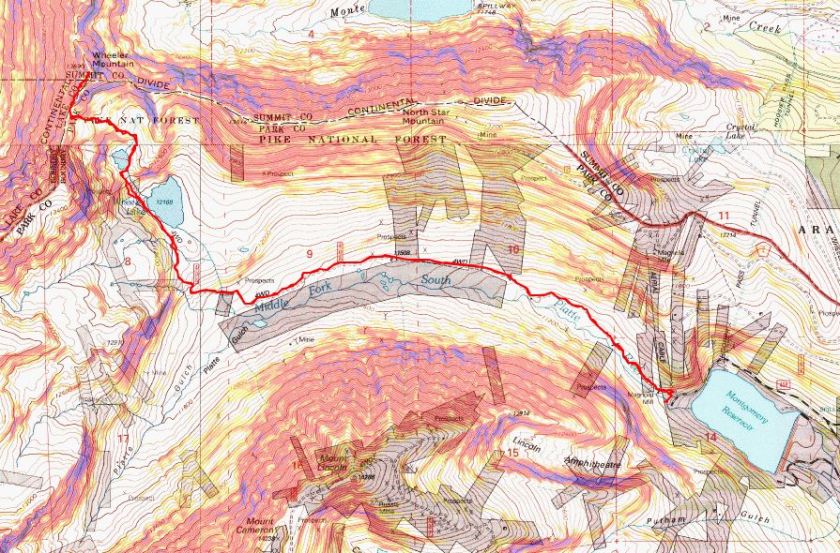
I was a little bummed it had taken me so long because the elevation gain was minimal, but I knew it was due to the cold and that bit of route finding on the ridge. This peak all in all was much easier than I’d thought it would be, yet took me a bit longer than I’d thought to complete. Despite the wind and cold, today was a fantastic day!
Raftpacking
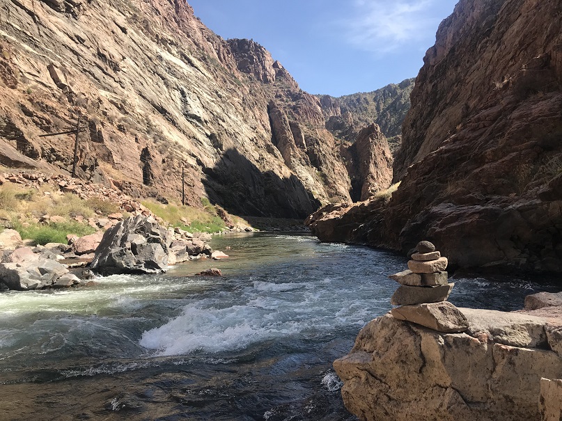
The day had its ups and downs. I’d set my alarm and it hadn’t gone off, putting me 4 hours behind schedule for the day. I’d summited Deer Mountain A in the coldest conditions I’ve seen this season, made it back to the trailhead, and drove as fast as I could to Canon City. I hate being late, and felt awful for putting us behind schedule. No, not going wasn’t an option: we were raftpacking in the Bighorn Sheep Canyon in October, the weather wasn’t going to get any better than it was right now and I really didn’t want to wait until summer. Also, I’ve recently accomplished a few major goals and came to the realization I need to start making time for my friends.
Rafting isn’t a quick process, so after combining vehicles and driving and setting up the raft and our dry bags we weren’t on the water until just after 5pm. I didn’t do much (any) of the set-up, and learned a few things about putting together gear (no water or backpacks in dry-bags). I made a mental note to start relaxing now that I’d made it and we were on river. I tried not to get too apprehensive about the weather. It was a warm day, but we were starting late. It wasn’t supposed to get too cold but I can have a Raynaud’s attack even in good weather, so I was hoping not to get cold. Or wet. As long as it wasn’t windy I should be fine. Last time we were out here I didn’t get wet at all, so I was thinking positively.
The ride down the river was nice. We were on river, so phones/cameras were in dry-bags. (Sorry, no on water pictures). We saw raptors flying overhead and river dippers skimming the water and catching bugs near the shore. All around fish jumped and caught their own dinner. The gorge was beautiful and Eric made the rapids look easy (I didn’t do much).
The sun was slowly starting to set in the gorge and the wind picked up just a little bit. I was getting splashed in the rapids and instead of drying out between runs I stayed wet. It accumulated, and before I knew it I was cold. Very, very, cold, even though it was nice out.
Trying not to be too much of a baby I asked how much longer until we made it to camp? 15 minutes. Good, that was good. I could do that. I thought. Unfortunately I don’t remember much about that last 15 minutes because I was so, so, so, so cold. I was losing feeling in my fingers, toes, and legs, but didn’t want to scare Eric and tell him that. I pumped my fingers back and forth. I had goosebumps and my toes were now white.
At 7pm we parked the boat at the beach (yes!!!) and I got out.
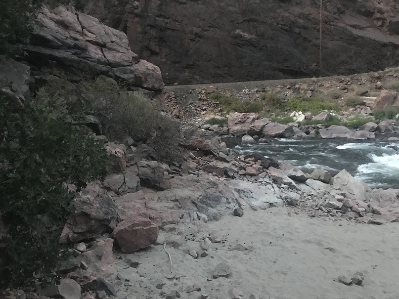
Well, I kind of tumbled out of the boat and walked about 10 steps, stumbling towards the scrub oak on the other side of the sand like a newborn giraffe.
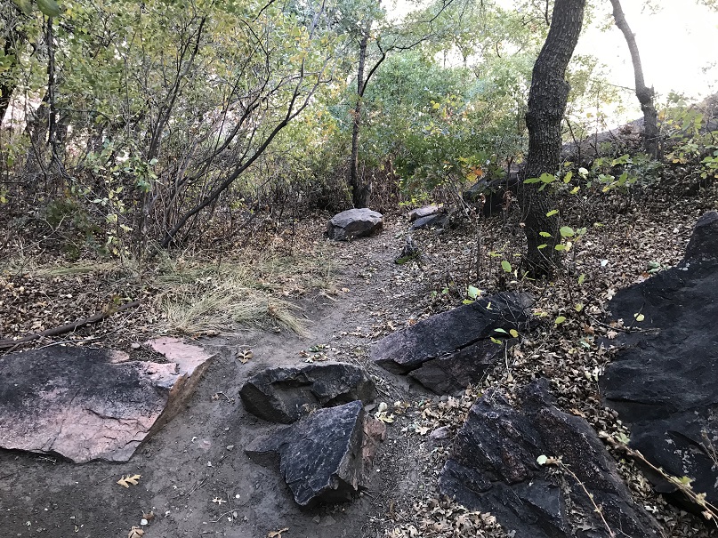
I’m used to losing fine motor skills, but this loss of gross motor skills was a bit embarrassing. I could tell by the look in Eric’s eyes he was scared and I tried to reassure him I was ok. He wasn’t buying it and kept a close eye on me. He told me he knew I was used to either leading or doing things on my own, but he was here to teach me how to work as a team (filing that one away).
I knew I just needed to change my clothes so I could get warm, but he wasn’t leaving my side. I took off my life vest and put on a thermal and sweatshirt (something I could do to get warm without taking any clothing off). He had me dry my feet in the sand (it didn’t work). It took me a while to convince him I was ok and just needed to change out of my wet pants. I left the immediate area to go change and he stayed by the raft. Yesterday I’d bought new snow pants: shout out to Roxy for making a pair that, almost, fit me! They’re size xs and I could use one size smaller, but being a little big I was able to put them on without struggling. Bonus: They aren’t kids snow pants and snow pants they’re warm!

It was a slow process but with new dry clothes and a knit hat I felt much better. I still couldn’t feel my toes. I decided walking around in socks was going to have to be ok, put some on, had a shot of whiskey and started feeling much, much better. I began talking more and moving around. Eric was visibly relieved. I’m sure he was worried he was going to have to airlift me out of there or something. It was my fault all around (I got there late) so this never should have been an issue. And, now warm and dry I could focus on other, less basic survival need kinds of things.
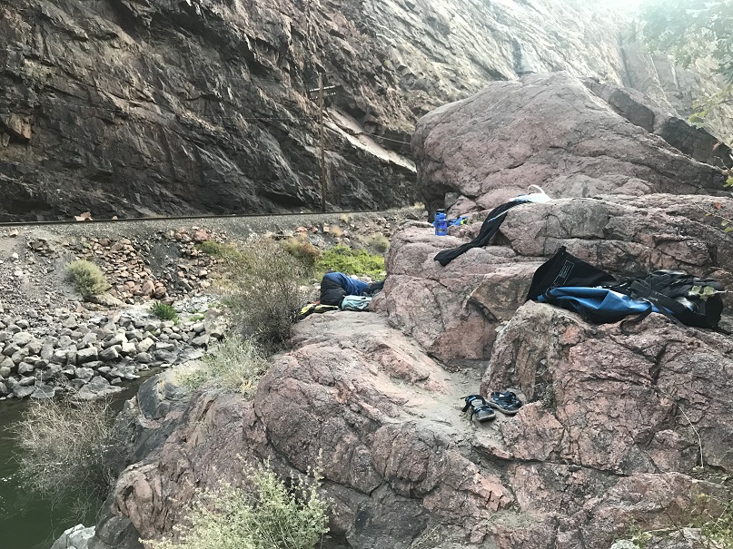
My pants were dripping wet. I placed them on a rock, not convinced they’d dry through the night and started setting up my bivvy. We were sleeping about 20 feet above the river on a rocky ledge. There was just enough room for 2 people so we set up our sacks side by side. Unbeknownst to me, Eric put his good sleeping pad underneath my sack (which would come in handy during the night if it got cold). I think he may have been concerned I was going to have another attack during the night (I didn’t).
Knowing I don’t have fine motor skills when it gets cold I don’t usually cook when I backpack/camp in the wilderness, so I was snacking for supper. Drat! I’d forgotten my dried mangoes in the front seat of the truck! Oh well. Beef jerky and almonds it was for dinner. Eric heated up ramen.
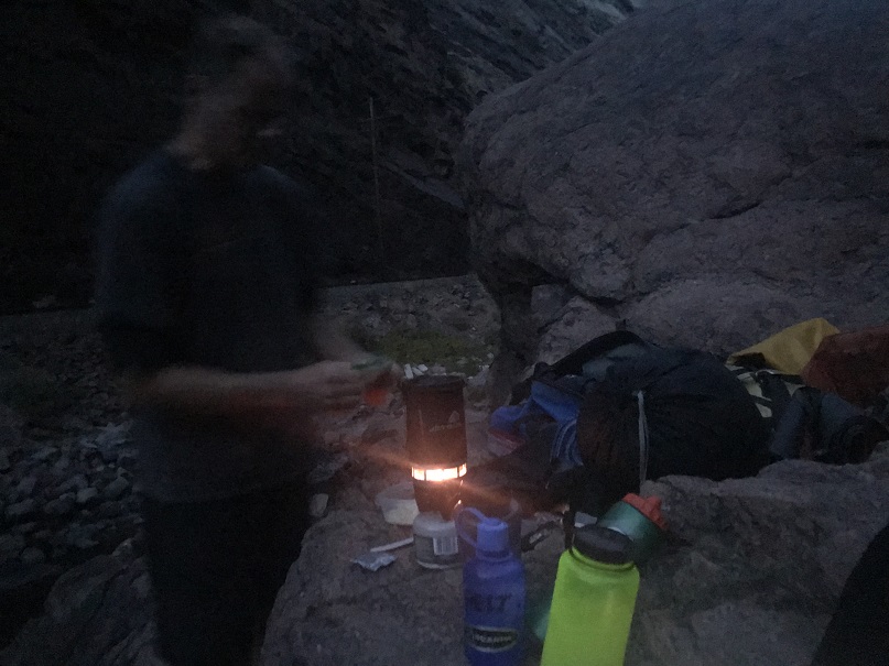
We sat and ate dinner on the rock ledge and talked, watching the stars come out. I’m not sure when I fell asleep, but I woke up twice during the night because I was thirsty. Bonus: I wasn’t cold! Here’s the view from our sleeping shelf
I woke up first and watched the sunrise, or as much as I could see from inside the gorge. I wrote up some trip notes from the day before

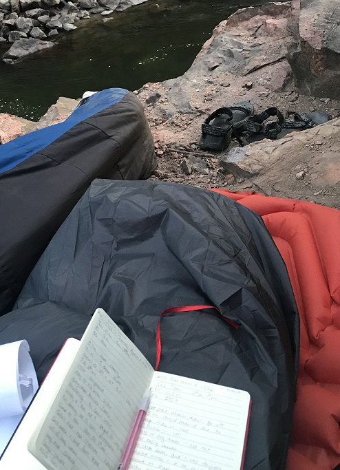
And made a friend. Actually, lots of friends: there were little caterpillars everywhere! I put every caterpiller I found on the rock behind me and eventually decided to go for a walk because my legs were falling asleep. As quietly as I could I got up, stretched, and went exploring. The area isn’t large, but looks like it could support about 10 people camping (if you don’t mind close quarters and no tents).
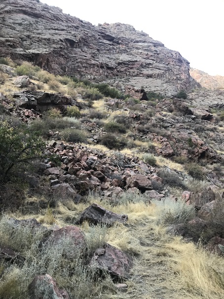

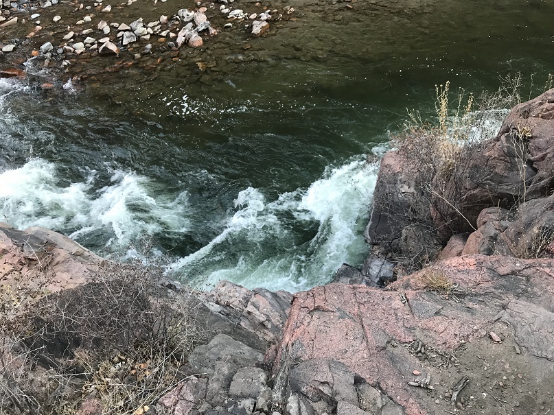
Check out the down view from the sleeping area
I was just getting ready to head back when I saw a mama deer and her two babies running like they were late for school
Deer
I took an early morning selfie because I was still the only one up, and decided to take a nap.
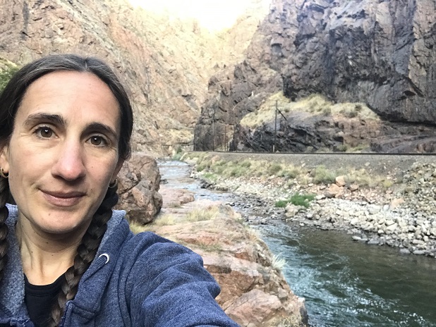
I woke up just before the first train went by. I got out my breakfast (you guessed it: beef jerky and almonds). Eric warmed up some water and I had ‘coffee’ and he put the rest in a water bottle for me to use to warm up. He’s convinced me to perpetually hike with a jetboil so my fingers get used to using it when they are numb: Last time I almost started a forest fire, so I haven’t tried to use one when cold since. Everyone on the train waved as they passed and were excited to see us ‘camping out’ in a place only accessible by watercraft. Also, I love my new socks!!! Totally worth the $6. And my pants dried over night so I didn’t have to raft out with snow pants! Another win!

We sat so long on the ledge we saw another train go by. I enjoyed just watching the river, glad to be warm
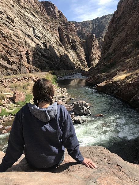
Around 11am we gathered our gear and got ready to head out.
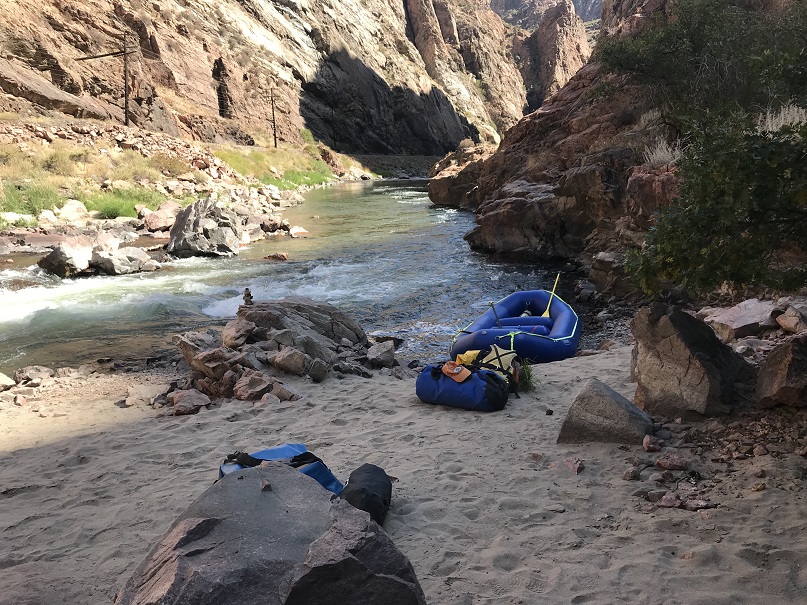
We were careful to sweep the area one more time to make sure we left no trace. This is the sleeping area (sans gear)
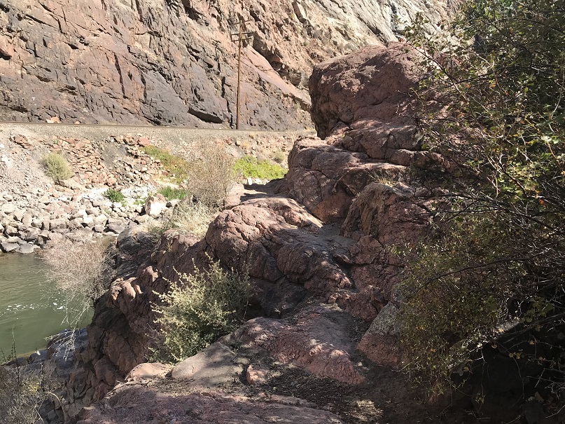
Back in the boat I was worried I’d get cold again, but thankfully the rest of the rafting was done in the sunlight. We stopped and waved to another train and enjoyed some wild grapes on the side of the river. We made it back around 1pm and drove to get Eric’s car. There we parted (he said he could take down the raft and put all the gear away by himself, and I selfishly agreed so I could go home and cook my daughter dinner before heading out again at midnight).
So, minus the brief Raynaud’s attack it was a great trip! We camped at the perfect spot, had some great conversations, and I learned quite a bit about raftpacking. We were the only ones on the water the entire trip. Hopefully next time I can be of a little more help on the water!
After arriving back home I looked at the pictures/videos from the trip. There was one point where I’d thought I’d taken a picture of the train passing, but ended up taking a quick video of the train along with a 4 minute video of the inside of my pocket. While listening to the video I realized something: I’m a lot!!! I talk rapidly, move from one subject to the next, over explain, and monopolize the conversation. This is something I’m going to need to work on. I may need to implement a code word or something with my kids to help me realize when I’m like this (all the time?). BTW, my nickname in preschool was “M-O”, for “Mellow Out”. So I guess what I’m saying is this isn’t something new…
Deer Mountain A – 13,761
RT Length: 10.5 miles
Elevation Gain: 3737’
Immediately I knew something was wrong. It was still dark outside, but my alarm hadn’t gone off. I threw back the covers and grabbed my phone: it was 3:24am. Drat! If I were the kind of person to swear several choice words would have been uttered. I had set my alarm correctly for 11:45pm, and wasn’t sure why it didn’t go off? I need a new phone because stuff like this keeps happening.
I’d wanted an extra early start today because I was meeting a friend to go Raft-packing tonight and wanted to get there with plenty of rafting in the sun time. Oh well. I sent a quick text to my friend saying I’d be a little later than intended and was out of the house by 3:30am.
I made it to the North Halfmoon Creek Trailhead at 6:10am. Well, almost there. Someone had put large rocks in the last ‘difficult’ area before the trailhead (most likely an owner whose vehicle shouldn’t have been out here in the first place because it didn’t have enough ground clearance). In any event, I just got new tires yesterday and didn’t want to subject them to those pointy rocks (mentally grumbling because I wouldn’t have thought twice about this section if the rocks hadn’t been there). So I made a 30-point turn and parked just below the trailhead on the side of the road. When I came back another driver with a competent vehicle had done the same. I put on my helmet and started on the trail at 6:30am.
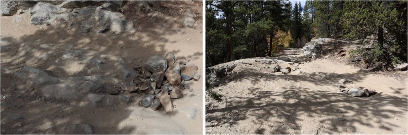
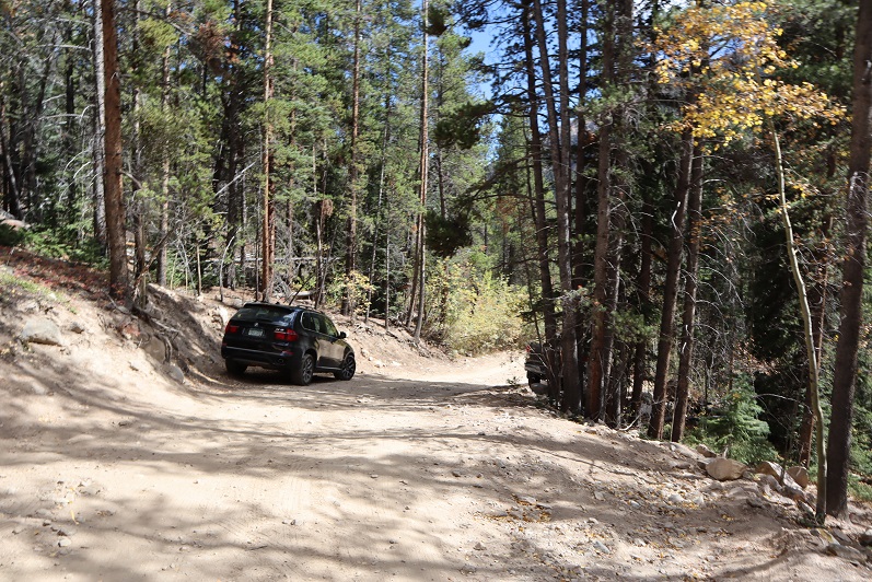
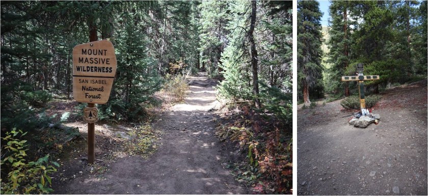
As I got out of my truck it started raining. Luckily it didn’t last too long. There was a 4Runner in the lot when I got there (the only other vehicle I saw all day). The North Halfmoon Creek Trailhead has wonderful signage.
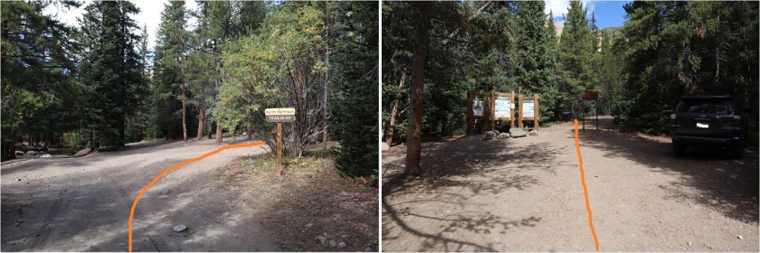
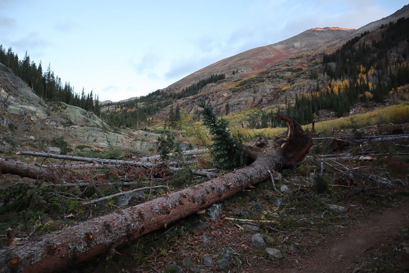
It was weird starting this hike in the daylight: I haven’t started a hike this late in a very, very long time. It made route-finding so much easier! There were a bunch of small avalanche areas along the trail which had been cleared so they were easy to walk through.
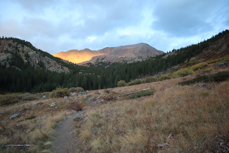
The first part of the trail is very easy to follow
I continued straight at the Mt Massive turnoff
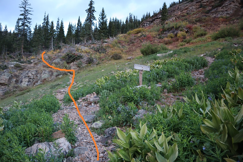
Through a small forested area
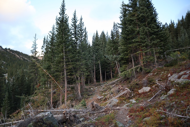
Up a large rocky area
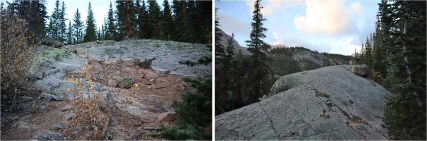
And came to this junction. Here I went left, even though it’s ‘blocked off’. I believe going the other way takes you to Mt Oklahoma.
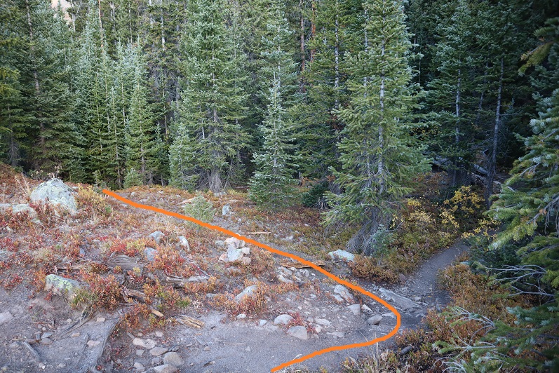
Here the trail ends and the fun begins! I traveled west, crossed a small stream
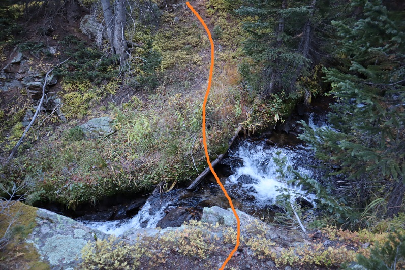
Continued across an open area back into the trees
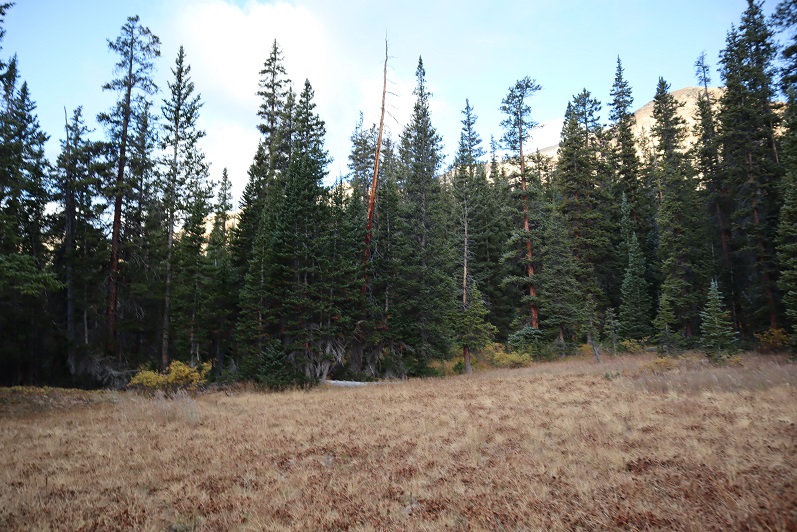
And crossed another stream
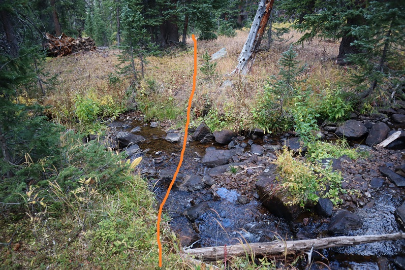
Back into the trees the ‘trail’ looks like this
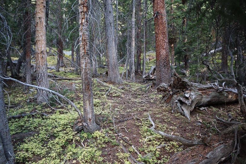
I angled southwest down the mountainside, losing about 100’ in elevation. There were tons of game trails here, but not one that were consistent.

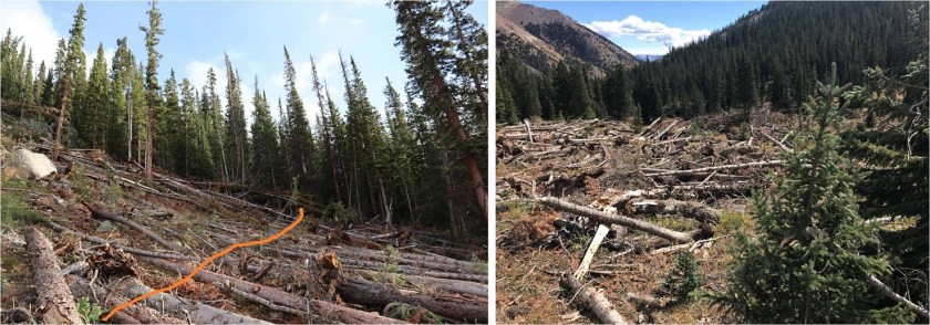
After losing about 100’ of elevation I came to a recent avalanche area. It hadn’t been cleared and there’s no straight path through the debris. It started to snow. At this point I was glad I’d started late because this wouldn’t have been fun to traverse in the dark. Luckily it wasn’t too difficult in the light of day. I just looked for the path of least resistance, crossed, and then headed down to North Halfmoon Creek. The snow ended before I reached the creek.

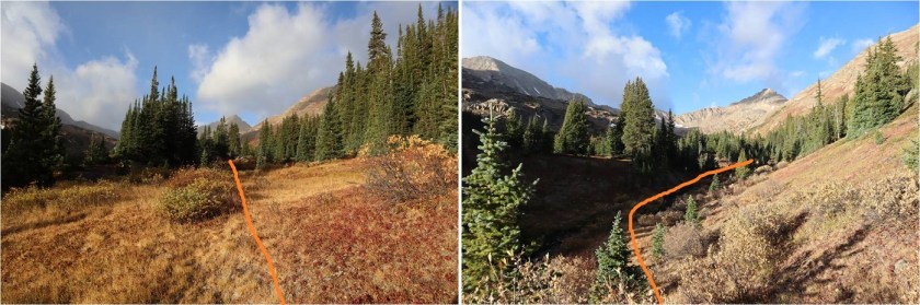
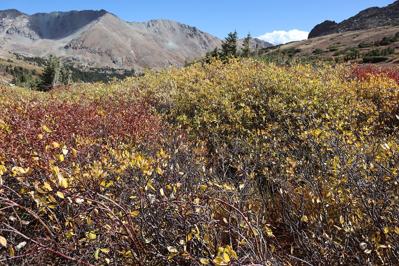
When I made it to the creek I followed it to the end of the basin. At first I walked through the willows, but (obviously) this wasn’t ideal
After a few dozen yards I looked over at the creek, noticed the top of the rocks were dry and decided to just walk along the creek to the end of the basin. This ended up being a fabulous idea and saved me quite a bit of willow-time.
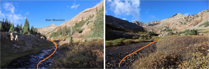
At the end of the basin the creek becomes a small trickle. Here I turned right (northwest) and headed up a grassy gully and then another, more rocky gully. The grassy gully was full of terribly mean-prickly plants.
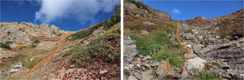
Here the terrain became rockier, with loose talus and unstable rocks. At the top of the gully I turned left (west).
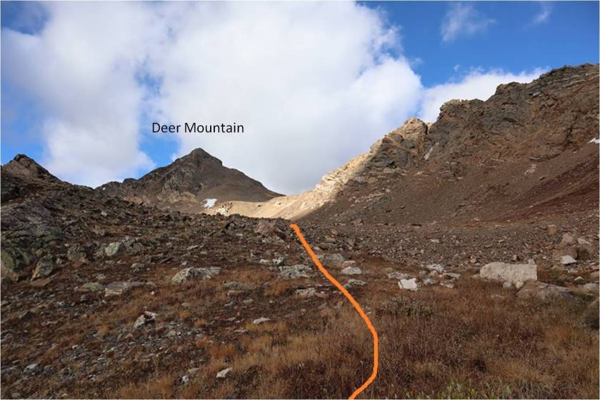
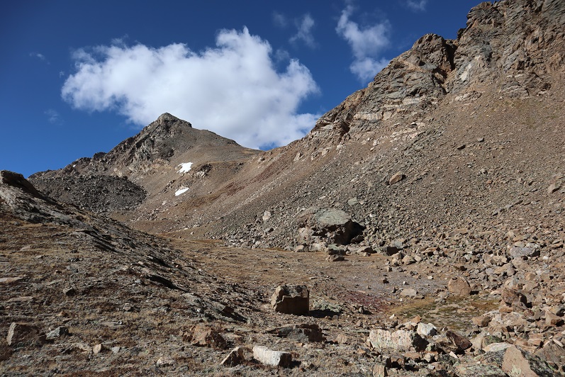
The goal from here is to gain the saddle. I took the solid line up (thinking it would be easier) and the dotted line down. The dotted line down the gully was much easier. If I were to do this again I’d take the dotted line both up and down the saddle.
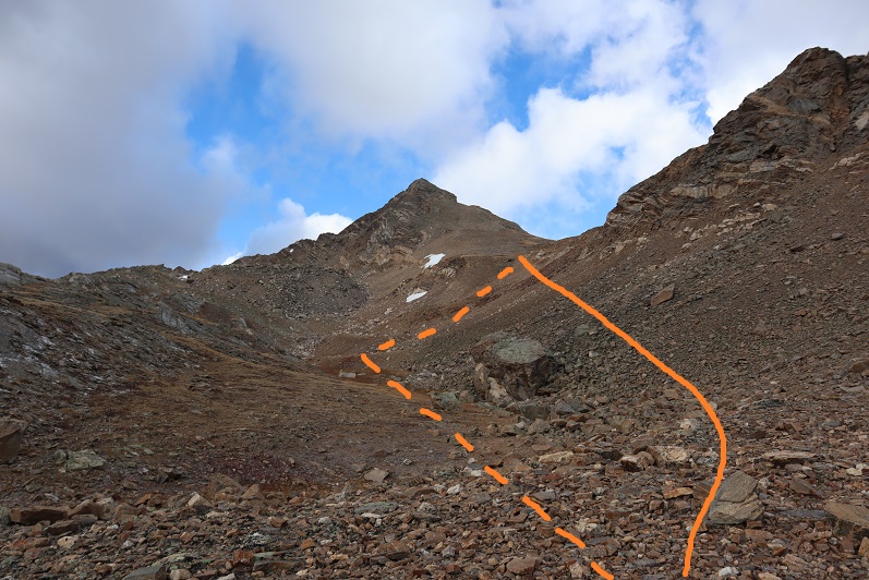
At the saddle I turned left again. My goal now was to gain this point (which is a false summit). Once again, with no trail I just headed towards the peak. This is steeper than it looks, but still class 2
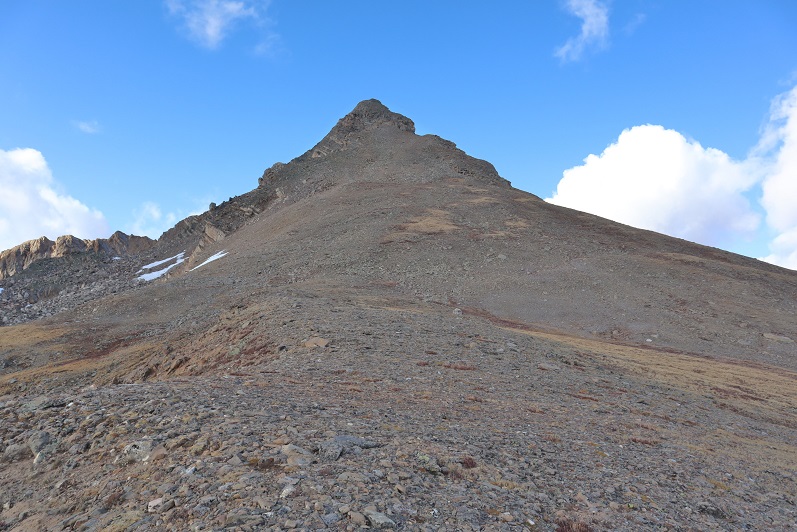
Until you get here, and then it becomes a class 3 chimney. There are several chimneys to choose from. I went straight up the center. It was a little loose, but there were plenty of hand/foot holds.
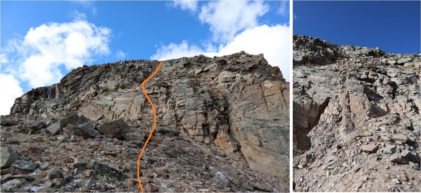
At the top of the class 3 chimney I still wasn’t there: I continued along this ridge. The best option here is to stick to the right.
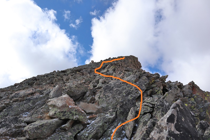
As you can probably tell by the photos, here’s where it started to get icy. What you can’t see is that it was quite windy as well. I made it to the final ridge section and had a choice: I could turn back now and attempt Deer Mountain A at another time, or be extra-super careful and continue on. I kept going, but slowed down my pace so I could be extra careful where there was snow/ice.
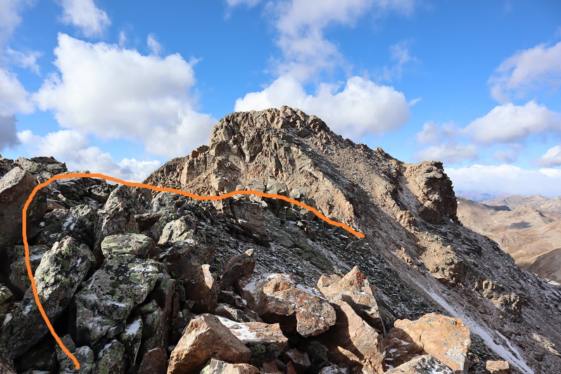
This ridge is short but packs a punch (especially with wind, which there was). The boulders here are very large and unstable, with huge gaps between them you could fall through. Also, there’s exposure. I’d liken it to Halo Ridge but add larger drop spaces and tons of exposure. I would not want to do this in winter where the snow would make invisible the huge gaps between the boulders. Somewhere along this ridge the wind swept the paper I had made with instructions on how to attempt the final summit push out of my pocket. Lovely.
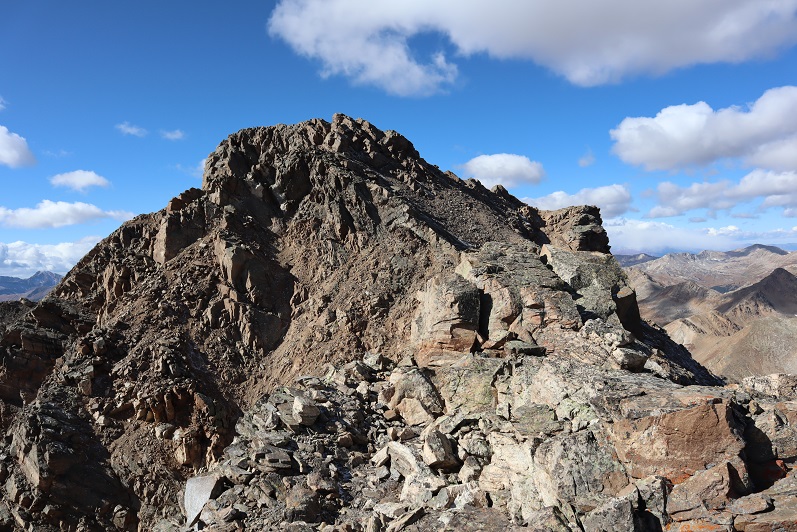
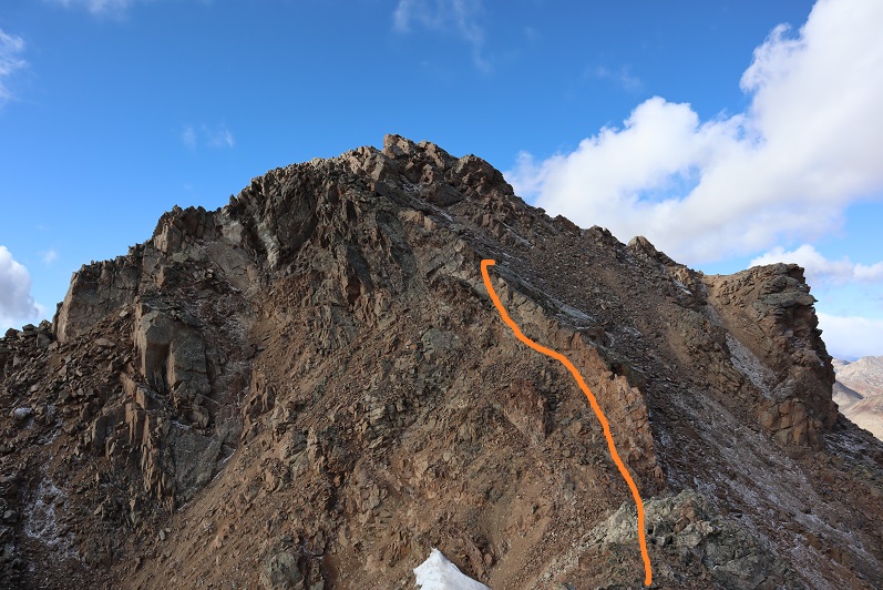
Once across the ridge I came to the most difficult part of the climb. This is class 4, and took me a few attempts to figure out (I hadn’t quite memorized the instructions I’d just lost). At first I started with the circled area, but about ¾ of the way up came to a place that felt way too committing to be class 4 (even for someone short like me) so I retreated and tried again.
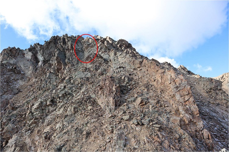
I took another look behind the ridge and decided this was not the better option, as this side was much icier than the one I wanted to climb. I tried again in another area and this time was successful making it over the ridge. I had to take off my mittens here to climb, and my fingers were becoming numb: I kept putting them on and then taking them off again to climb. Here’s the route I took. This felt solid class 4.
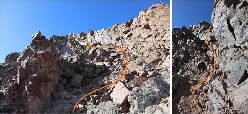
Once on top of the ridge I wasn’t happy to see all the ice (it’s pretty much invisible in these photos, but it’s there). I once again committed myself to being extra careful as I mapped out the safest route. This is the route I took (sometimes on my hands and knees on the rocks to avoid slipping)


From the top of this area it was a short walk to the summit

I summited at 10:20am
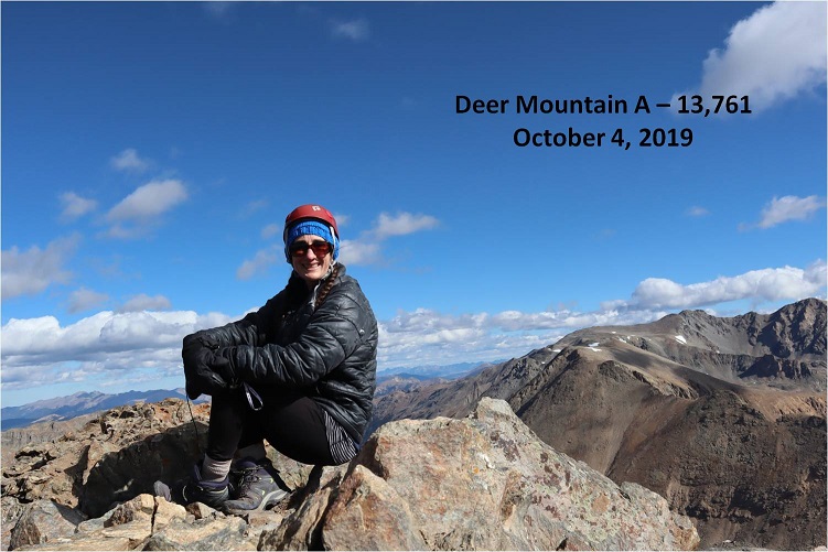
Deer Mountain A Summit:
The wind was still a steady 30-40mph at this point and I didn’t want to stay long because I was worried about my fingers. Here’s a look back at that ridge after the class 3 section.
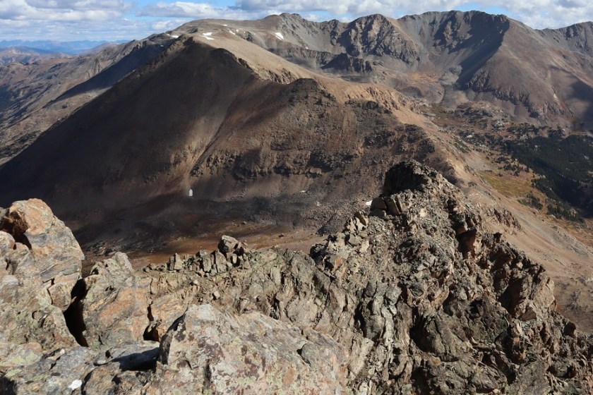
Ok, time to head back. Here’s the route I took back to the class 4 section, aiming for a small notch in the ridge
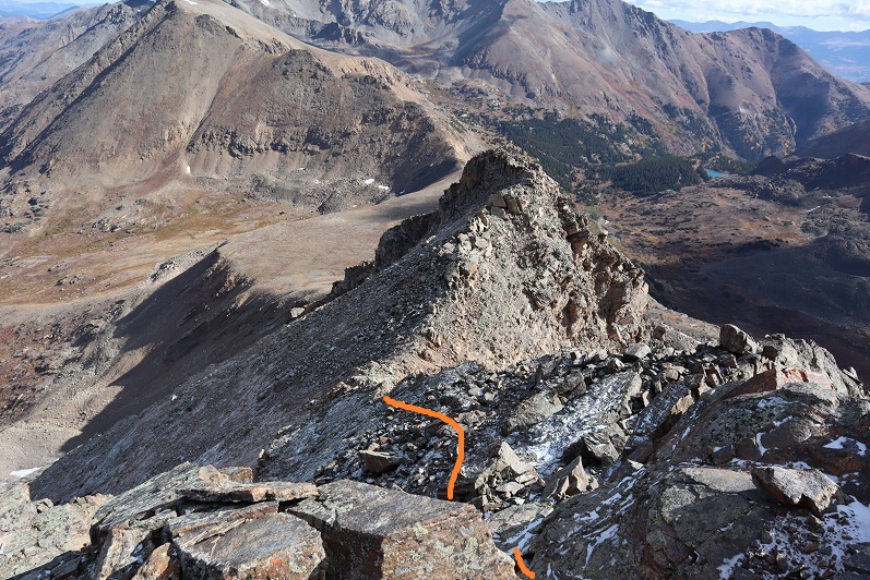
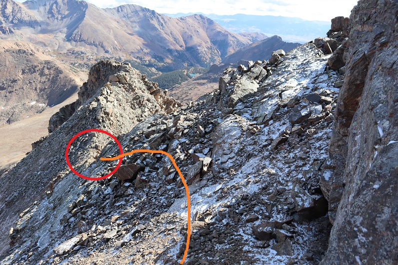
Here’s what it looks like heading back down the class 4 area. You can see why I didn’t want to take the icy area up or down: it was flat, unclimable rock due to the ice
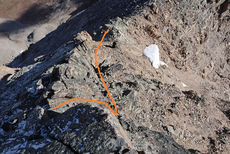
Back over the ridge with the large boulders
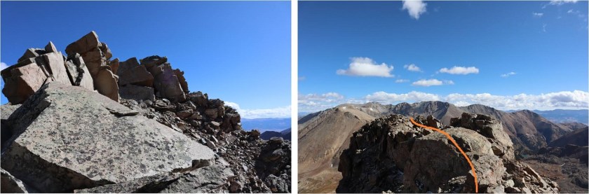
From here you can see the rest of the route back. Oh, and amazingly enough I spotted my instruction paper stuck under a rock. It took some fancy footwork, but I retrieved it and, no longer needed, I put it in my pack.
Here’s looking down the class 3 chimney
And the class 2 section back down to the saddle
At the top of the gullies I aimed for the creek and headed out. This is where my fingers started to thaw.

I followed the creek most of the way
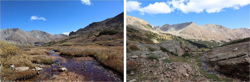
While following the creek, about halfway to the avalanche area I came across a male hiker, surprised to see anyone this far off trail. I asked him where he was headed (expecting him to say Deer Mountain). “Mt. Oklahoma” he replied. He’d never heard of Deer Mountain. I wished him luck and was on my way. I’d hiked on over a quarter of a mile before thinking much of it, but he’d passed the route I’d taken to summit Oklahoma about half a mile before reaching me. I know there are several ways to summit each mountain, and hoped he knew of a different route. Otherwise, he was off track. I wished I’d had a way to let him know, but he also looked like a competent hiker and it was still early in the day with no chance of storms, so if he was off route he had time to figure that out. I got a picture of his vehicle at the trailhead (the only other one there) just in case.
I made it back to the avalanche area, crossed the streams, and found the trail with no difficulties. The rest of the hike out was uneventful.
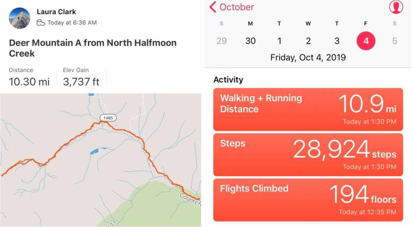
I started at 6:30am and ended at 1:30pm, making this a 10.5 miles hike with 3737’ in elevation gain in 7 hours.
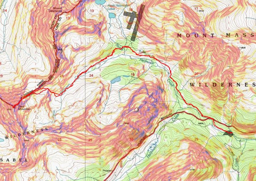
And now to meet my friend for some early October rafting/camping along the Arkansas River!
Lightning Pyramid – 13,729 & Thunder Pyramid – 13,944
RT Length: 12 miles
Elevation Gain: 5062’
After summiting Vestal Peak I changed in my truck into new hiking clothes. I re-braided my hair, ate a packet of tuna and drove to Maroon Lake. It rained the entire 5 hour drive there and I was seriously worried my hike in the morning would be in danger. Originally I’d planned on hiking, taking a day off to rest, and then hiking again on Sunday but the weather forecast for Sunday called for 80-90mph winds so I decided to alter my schedule a bit. I was not impressed with the rain. It was raining when I fell asleep in the cab of my truck but I thankfully I awoke to a clear, starry sky at 2:30am.
The parking lot was full of both hikers and photographers eager to get a glimpse of the fall colors. I debated going back to sleep for a few minutes but in the end decided I should probably get going. I was on the trail at 3am.
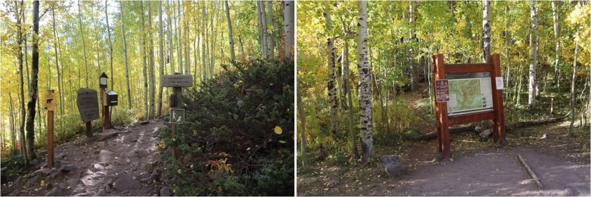
I followed the trail to Crater Lake
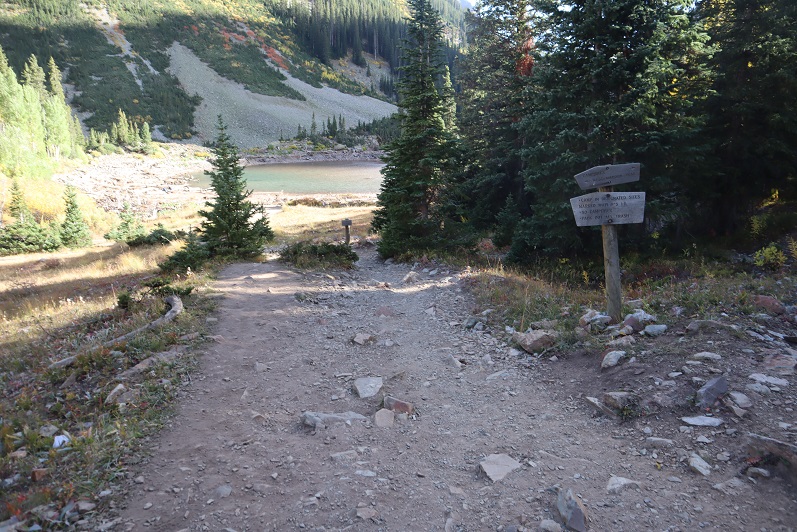
And then followed the West Maroon Creek Trail until I’d made it 3.7 miles.
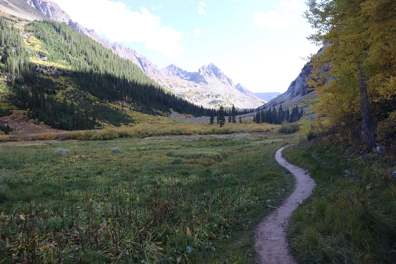
This trail is so much nicer to walk when there’s no snow! Route finding was negligible
After 3.7 miles I crossed the West Maroon Creek (which didn’t have much water)
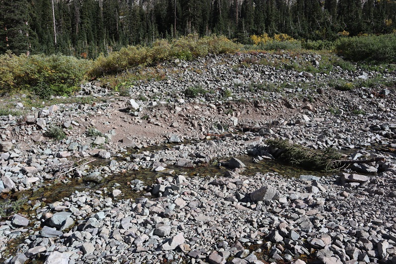
And headed east through the willows
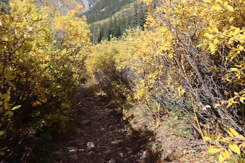
Until I reached the base of the slope to the first access gully. This was difficult to figure out in the dark: The last time I was here the willows were completely covered in snow and I just climbed right up, but today those willows were taller than I was.
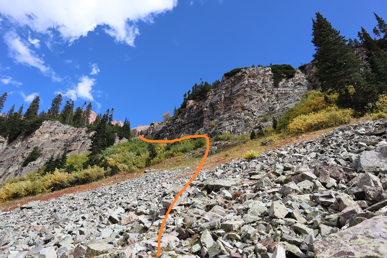
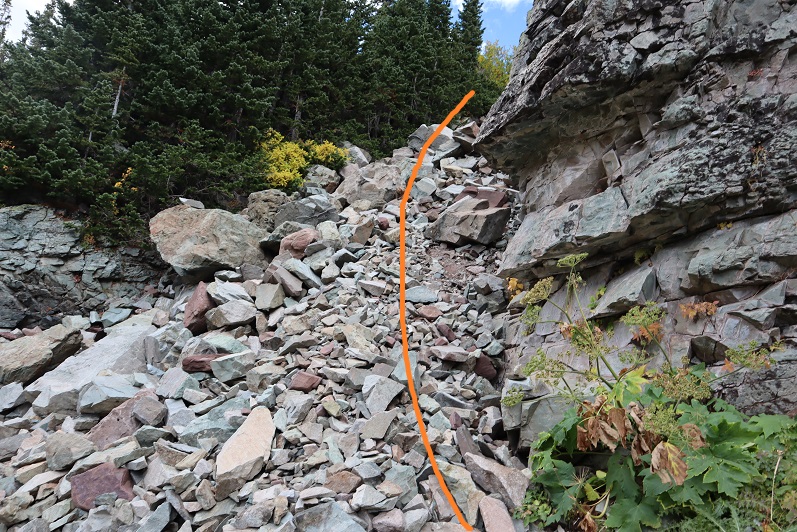
At the top of this gully is another gully
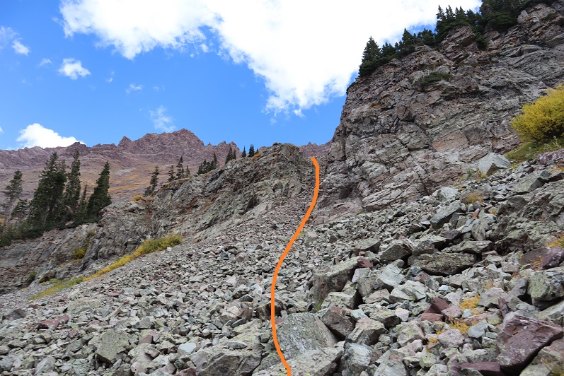
And at the top of this gully (you guessed it) another gully
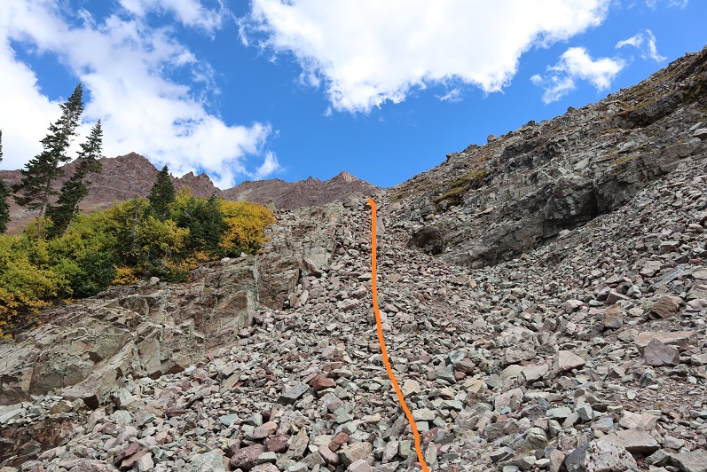
Now the rocky gullies started including areas of tundra
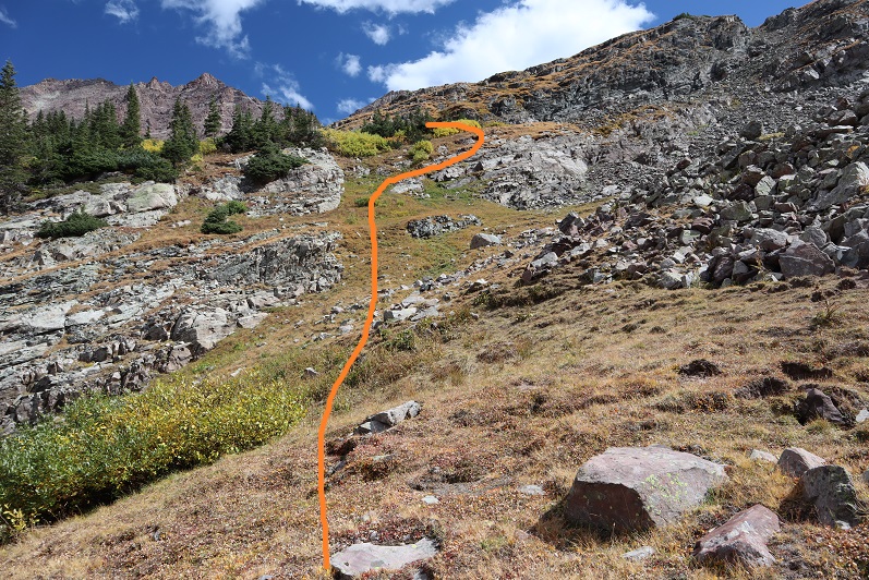
Now I was almost to the upper basin.
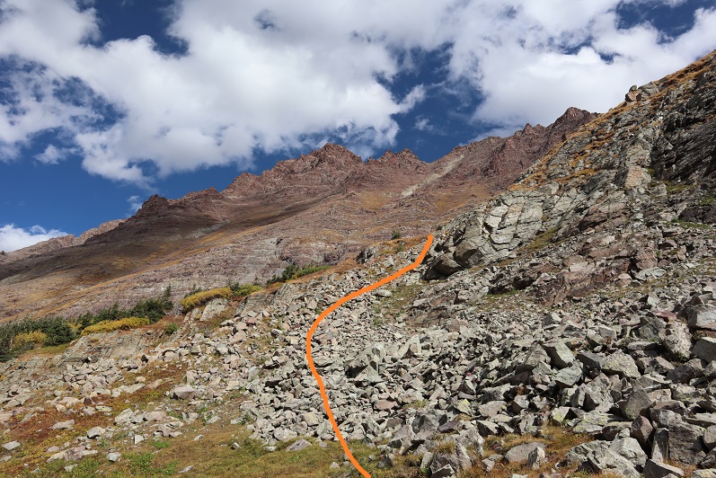
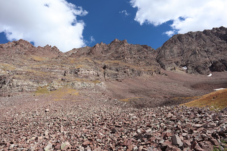
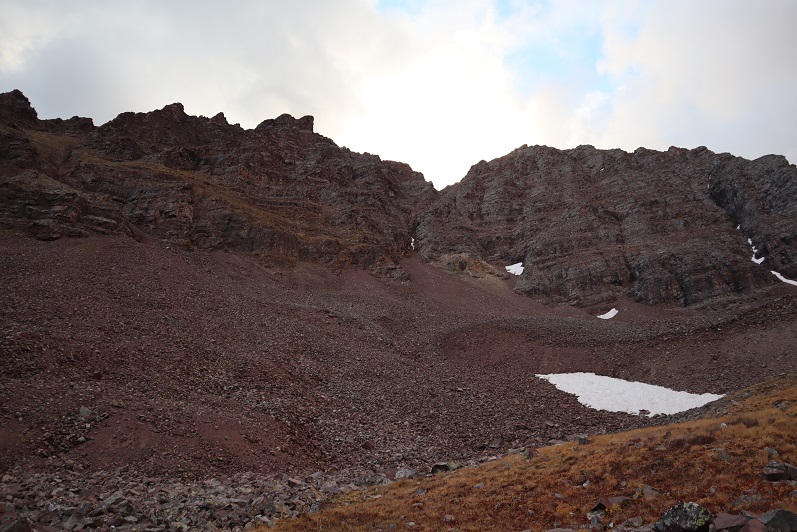
Once in the upper basin the sun started to rise and I had a good view of “Lightning Pyramid”. Traditionally you climb this peak as a couloir climb in the winter/spring, but obviously that wasn’t an option for me today and I’ve already been here in winter conditions: I wanted summer. I headed across the rocky basin, aiming for the couloir.
This next part in italics is personal and has no relevance on the trip report. Feel free to skip it if you’re just here for route information.
I’m going to summarize this as quickly as possible: I don’t consider myself to be an overly religious person. I grew up in the church but no longer attend (please don’t invite me to your church: I have personal reasons for why I don’t go). I do believe in God and find him more in the mountains than in a building surrounded by people. Often when I hike I have conversations with God. I do most of the talking, but surprisingly I started to feel him talking back (rarely, but it happened). I’m going to be honest here: If someone told me God spoke to them I’d think they were daft, so I totally understand if you think that of me, but I think what I’m going to say needs to be said (for me at least). Also, once again, I’m not a ‘preachy’ person and will most likely never mention anything like this again in a trip report.
For some reason I’m a ‘people-pleaser’. I have a need to be liked and I go out of my way to be friendly and helpful. I feel I need to be ‘perfect’. I don’t do well with rejection. I’ve always been an avid hiker but started seriously tackling peaks after I got a divorce. My ex had supervised visitation of the kids one day a week and on that day I’d go hiking. After my 13th summit of Pikes Peak I met someone on the way down who asked me which other 14ers I’d done. My response: “What’s a 14er?”
Obviously I was immediately hooked and after about 20 14ers I was hiking and talking to myself/God about how amazing Colorado and the mountains and hiking (etc) are and felt God speak back to me. He told me to hike all of the 14ers in Colorado solo. This idea intrigued me: I was both excited and scared. I wasn’t sure I could do it. Also, I didn’t really know why I should?
After hiking about 30 14ers solo I was sitting in a Girl Scout board meeting and Girl Scouts had just partnered with The North Face. We were brainstorming fundraising and marketing ideas and suddenly it all became clear: I could be the first woman to solo all the 14ers! Girl Scouts focuses on first women to do ‘stuff’. We could market this jointly with The North Face, the girls would get exposure to outdoor experiences and(hopefully) some free gear. It all seemed clear now: This must be why I was doing this! I felt I had purpose and direction.
I was so excited when I summited all 58 14ers solo because I felt I was doing it for a cause. Anyone who follows the 14ers site knows what a disaster that turned out to be, and honestly I just wanted it all to go away.
I kept hiking because I like to hike. On my first centennial after finishing the 14ers I felt God telling me to keep hiking the rest of the centennials solo and I balked. Once again, I wasn’t sure I could do this (hello class 5?) but after mulling it over I was willing to give it a shot. I knew I’d write up trip reports and post them to my website because that’s what I do, but he told me to keep posting to the 14ers site as well (I did not want to do this, but I did).
If you were to ask me why I was hiking all of the centennials solo I’d tell you I didn’t know. I honestly didn’t know, but I also wouldn’t have told you it was because “God told me to” because then you’d think I was totally nuts. But that was why I was doing it: Because God told me to.
Then Thunder Pyramid happened. At first I was confused because I knew I’d summited, and then embarrassed, angry, and frustrated. Why was this happening to me? Not only were people commenting on the 14ers site, but they were going through my LinkedIn page and challenging my accomplishments, posting negative comments on my website, facebook, and Instagram (sorry David for ghosting you: I honestly thought the feeling was mutual). People unfriended me both online and in person. They made up reasons to ‘prove’ I was lying and if they couldn’t find negative information they assumed or made it up. The dislike button was hit on my trip reports and I took it all very personally.
The hardest part was just because they were loud didn’t mean they were right. I knew I wasn’t lying but I couldn’t change their minds. I’m also sure they think their behavior was justified. I think it bordered on harassment. It was definitely bullying.
So here I was, halfway to the summit of PT 13,722 and all of this was going through my head, in addition to the anti-climatic day I’d had yesterday when I’d finished hiking the centennials solo and didn’t ‘feel anything’. I was asking God why I just couldn’t get excited about finishing the centennials solo? I didn’t want to post anything on the 14ers site because I didn’t want to go through the drama again. I mean, I know I shouldn’t care what other people think about me…
That’s when it happened. As soon as those words went through my head everything stopped and suddenly it felt as if I was getting the biggest, warmest, most enveloping hug I’d ever had. Overwhelmed I broke down and started crying big crocodile tears, taking huge breaths in and out between sobs.
That was it: I wasn’t hiking for a cause or to help others but because God wanted to teach me a lesson. He wanted me to realize it doesn’t matter what other people think. He just chose to show me that lesson through something I love: hiking.
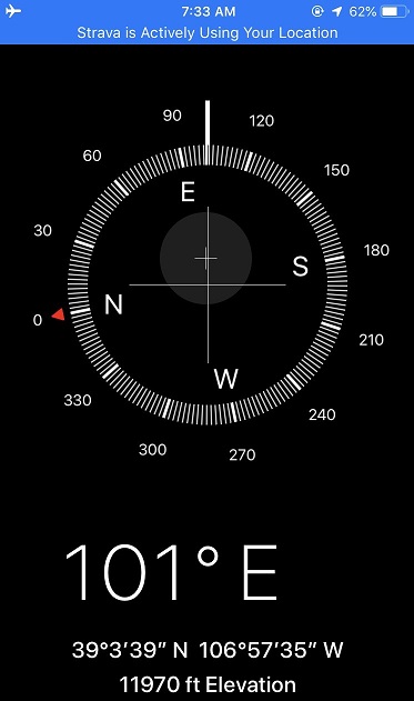
“Wow” I thought: “He had me hike all the centennials solo to teach me not to care what other people think”. A simple lesson we teach out kids and that everyone knows but that I have difficulty accepting. This moment was so powerful I got out the altimeter/compass on my phone and took a picture of where it happened. I thought about just saying it was at 12K but ultimately figured that diminished the experience.
I wiped away my tears, looked at the mountain in front of me and thought to myself “So, if it doesn’t matter what others think of you why don’t you just turn back and go home?”
The answer? “Because I Love to hike”
With light shoulders and a renewed purpose I started off again. It took about 10 steps before another thought overcame me: “Why did God think I needed to learn this lesson? What is he preparing me for where I need to be ok with not caring what other people think about me?” (I squinted and closed my eyes, crossed my fingers and repeated: Please not politics, please not politics, please not politics).
Ok, moving on…
I trudged up the talus towards the couloir. This talus was nasty and each step hurt my ankle (not sure what I did to it yesterday, but it felt bruised). I made it to the base of the couloir and had a decision to make: How was I going to ascend this thing? It looked like it contained (more) nasty scree, so I decided to take the rocky rib to the right. This is the route I took:
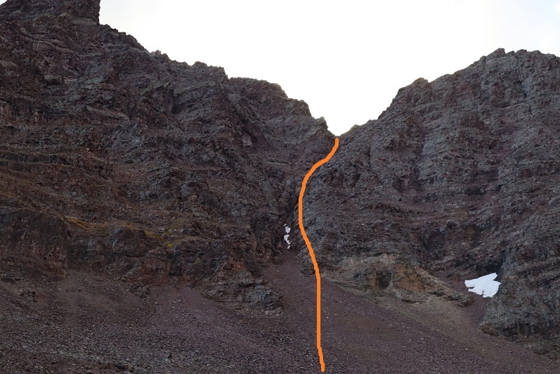
I need to stress this might not have been the safest way to ascend. The rock was extremely loose and I had to check and re-check hand and foot placement with every step. It was sustained class 4 bouldering for a good 1000’ of elevation. It was slow going, but I love bouldering and that’s just what this was.
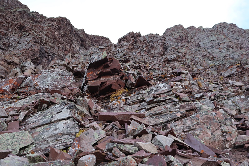
I stayed closely to the right of the couloir for as long as I could, but eventually I had to enter the couloir for the last part of the climb. This area was very loose and I’d suggest you stay as close to the rib on the right as possible.

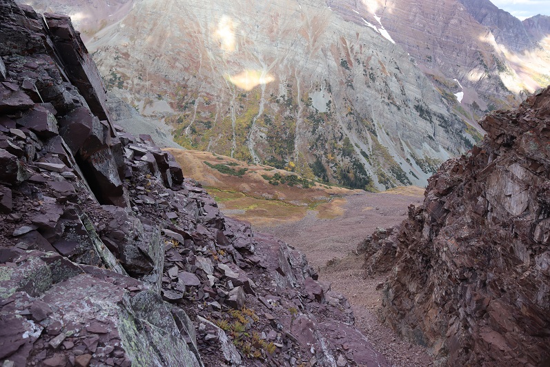
Here’s looking back down the rock rib/couloir and into the basin
I made it to the top of the couloir and turned right (south), carefully climbing up the ridge

This was actually much easier than it looks (and easier than the climb to this point). I made it to the top of the ridge and saw an easy path to the summit of “Lightning Pyramid”
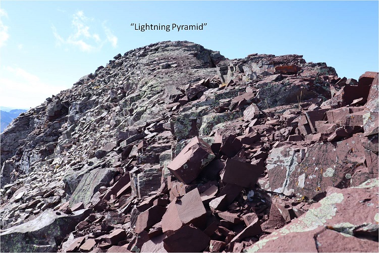
I summited at 10:20am
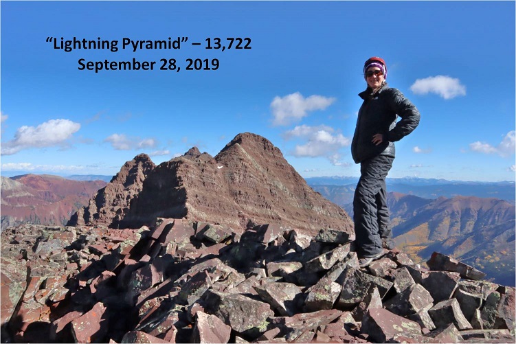
Lightning Pyramid summit:
Ok, now time to head over to my old friend, “Thunder Pyramid”. I couldn’t find a lot of specific information about this traverse, so I had a lot of figuring out to do. I’d heard heading straight up and over the ridge wasn’t fun, and it in fact didn’t look like much fun, so I decided to scope out another way.
I headed back down to the saddle
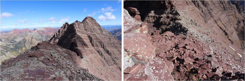
Once there instead of hiking up the ridge I decided to stay level with the saddle and hike across the right (east) side of the mountain. This was surprisingly easy
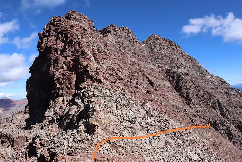
Here’s looking back at “Lightning Pyramid”

I stayed at the same level as the saddle until I came to a gully. This area took some careful footwork but little climbing. It may have risen to class 3, but realistically was class 2

Next I came to a gully. This gully was very loose and I kept to the left side for stability, holding onto rocks and handholds in the boulders where available. This felt like class 3
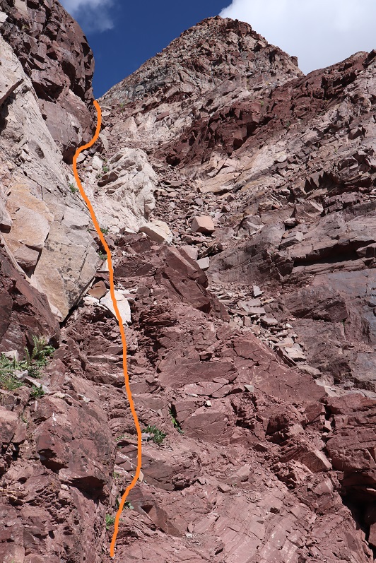
At the top of this gully was another gully. I just aimed for the snow.

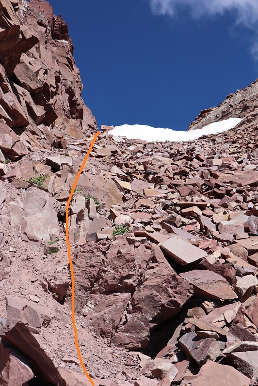
At the top of this gully is where the route picks up with the standard route up “Thunder Pyramid”. I turned right (north) and ascended the ridge

The top of the ridge wasn’t the summit however. I took the solid route up, the dotted route down. If I were to do this again I’d take the dotted route both ways because it doesn’t lose elevation.

I summited “Thunder Pyramid” at 12:15pm. It took me just under 2 hours from “Lightning Pyramid”. Unfortunately, most of the pictures I got at the summit I realized were blurry when I got home (still figuring this new camera out)
But I did get one “ok” picture
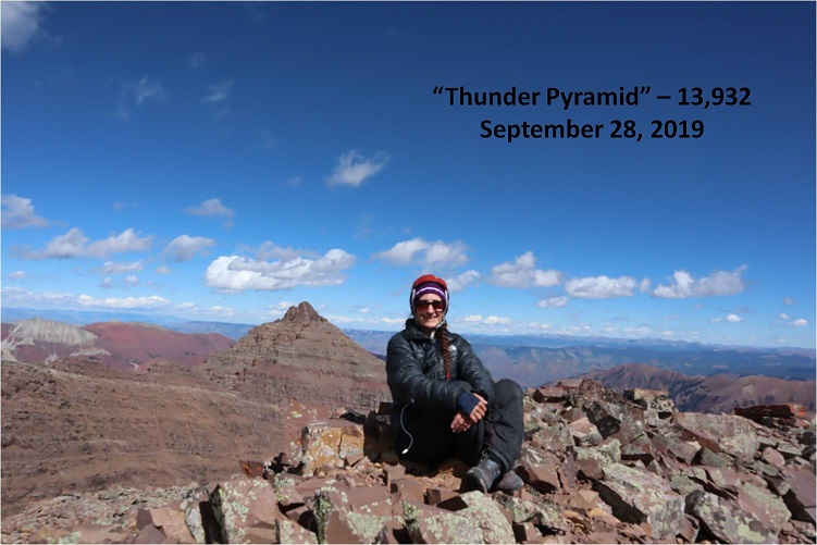
Thunder Pyramid summit:
Up until this point doubt had crept into my mind: maybe what others were saying was true and I hadn’t really summited “Thunder Pyramid” last time. Maybe I’d ended up close but not exactly there? I’d been in a hurry because I’d been having a Raynaud’s attack and I didn’t take my normal number of summit photos/videos (I don’t usually get videos in winter conditions because it’s a death sentence for me to take off my gloves to operate the camera). So today I walked all over that summit, looked around and confirmed what I already knew: Yes, I had indeed summited the last time I was here. Also, the weather today was absolutely perfect! Those 50mph winds never materialized.
I decided to head back down the way most people hike up. I made my way back to the ridge and down the gully
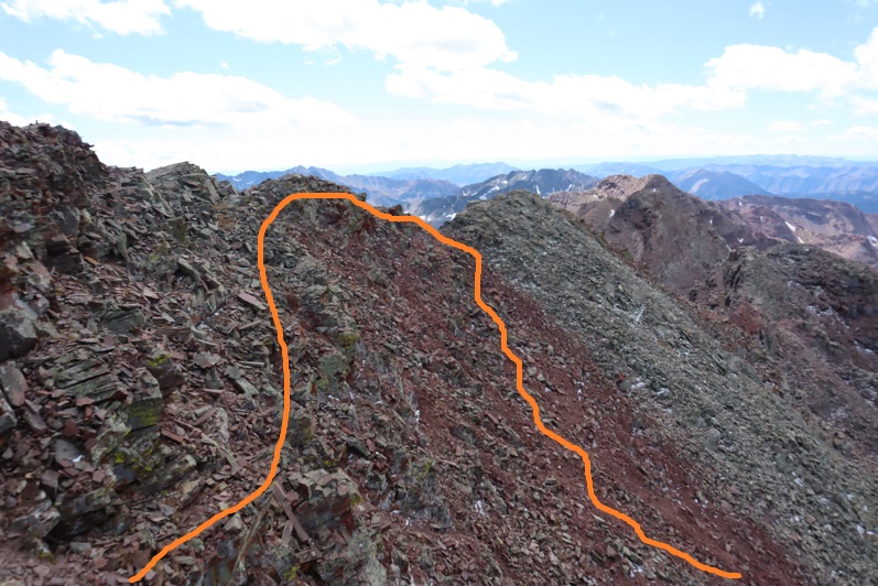
Check it out! Now I know why it’s called the “White Gully” (Last time everything was white)

The descent down “Thunder Pyramid” was no more fun than the ascent up “Lightning Pyramid”, and considering both the gullies and couloir I’d say it’s probably easier to do Thunder first and then traverse over to Lightning. Also, I know this is usually done as a snow climb, but I felt much safer on the scree and talus than I had on the snow. When it was covered in snow I felt like if I slipped I’d fall and never stop sliding. Here I knew I could slip but I wouldn’t fall very far. This climb wasn’t ‘easy’ but it definitely wasn’t as difficult as I’d anticipated.
Hiking down was like déjà-vu (as it should have been)
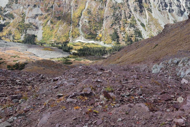
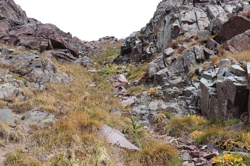
I made it almost to the bottom of the gully and turned left

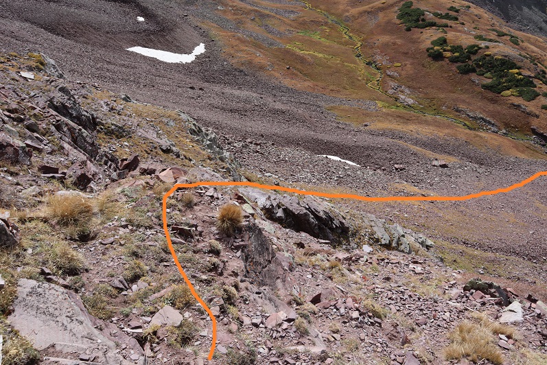
And descended the slopes into the basin

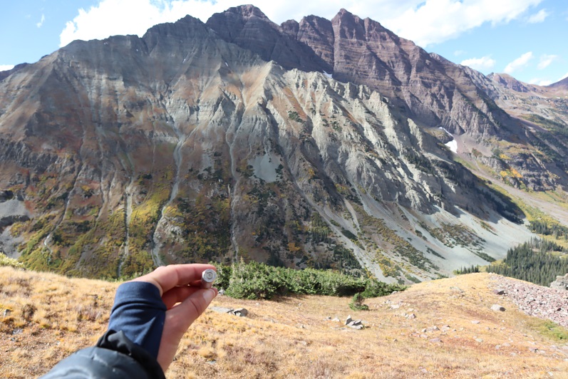
Also, I found a shell
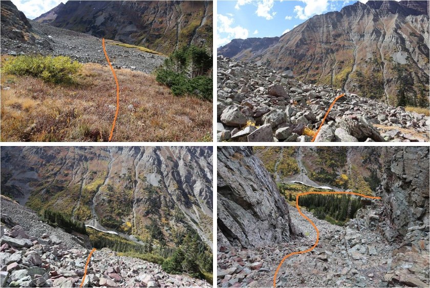
I made my way back to the West Maroon Creek Trail and hiked out, loving the fall colors in the daylight.
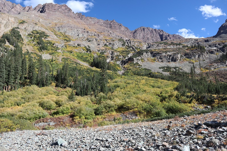

There were a ton of people around Maroon Lake when I got there, all enjoying the fall colors. The base of the lake resembles the Snowmass log jam
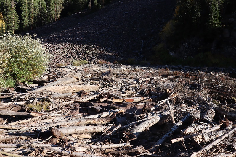
While the 50mph winds never materialized on the summit(s) today it was really very windy at the lake. I decided to head to my truck to clean up and then watch the sunset. There was a line of cars waiting for a parking spot and I had to tell no less than 50 of them I wasn’t leaving. None of them took it well, but it had been a long day, and I figured I’d earned watching a good sunset.
I made it back to my truck at 5:15pm, making this a 12 mile hike/climb with 5062’ in elevation gain in 14 hours.
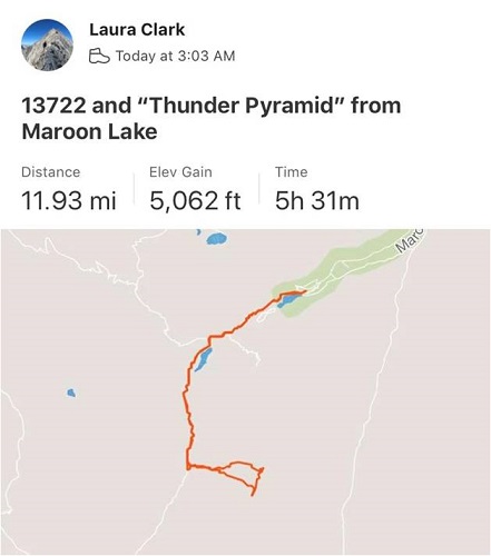
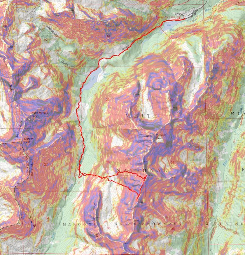
I enjoyed the sunset
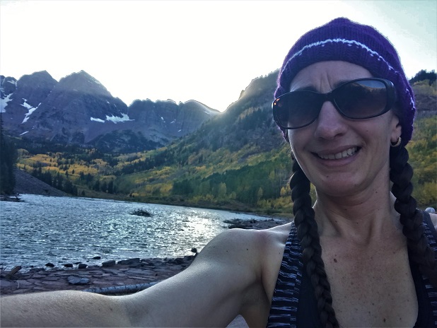
And as soon as it was over I hopped in my truck to drive home. There was a line of vehicles waiting for a parking spot that lasted for over half a mile down the road. The shuttle had stopped for the day and I drove 2 people down to the bus stop because they’d missed the last bus. They were a nice couple from Georgia who were happy not to have to walk those 13 miles back to their hotel. I hope they enjoy Colorado as much as I do!
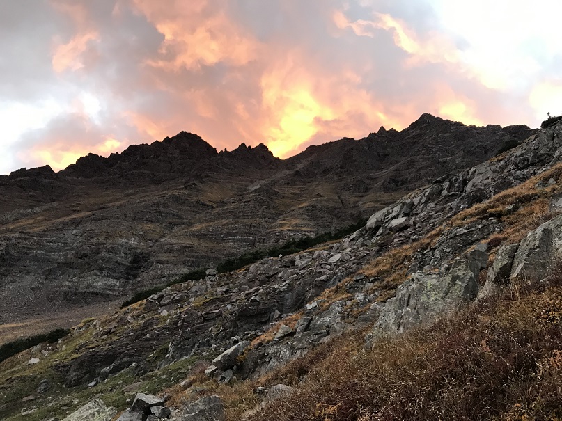
#100 Vestal Peak – 13,867
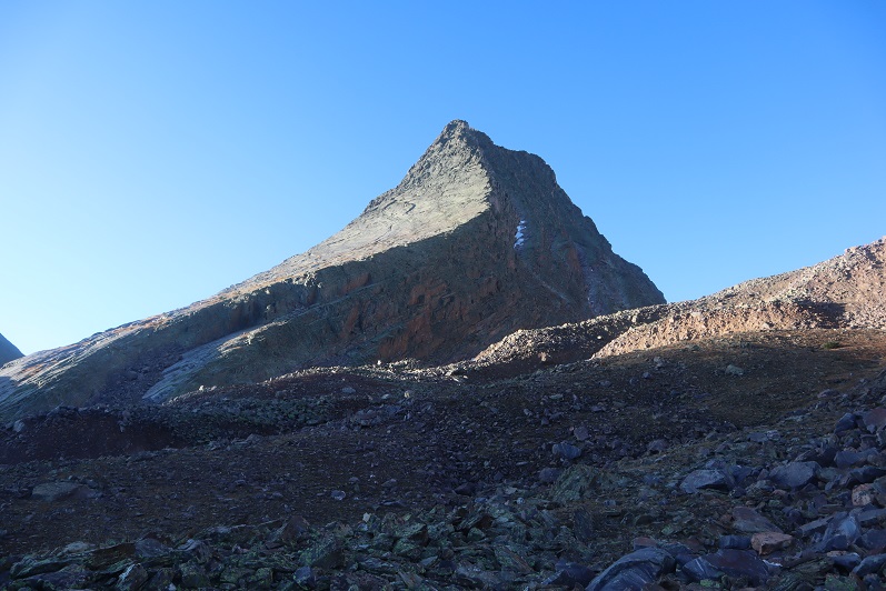
RT Length: 23.5 miles
Elevation Gain: 8020’
After a full week of work in Tennessee where I gorged myself on comfort food (fried chicken, fried oysters, collard greens, cornbread, etc.) and went highpointing in Mississippi because I could, my flight got in at 1:30pm and I drove from Denver to Molas Pass and slept for about 3 hours in my truck before waking up at 1:30am and hitting the trail. There was one other truck in the large parking area when I arrived.
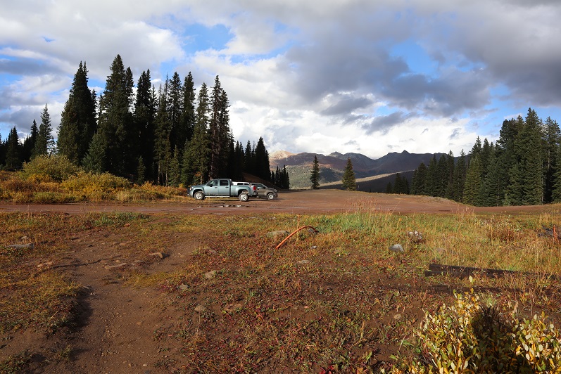
I checked the weather reports and anticipated rain/snow/wind for today so I put on my snow pants and went light on gear. Initially I’d planned on camping in the Vestal Basin and hiking Arrow and the Trinities as well, but with snow in the forecast I decided to make this a one summit/day trip. The trail started at the south end of the parking lot. It was really easy to follow and had plenty of signs
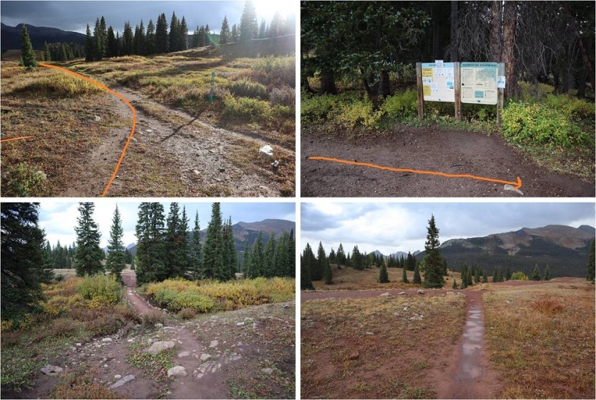
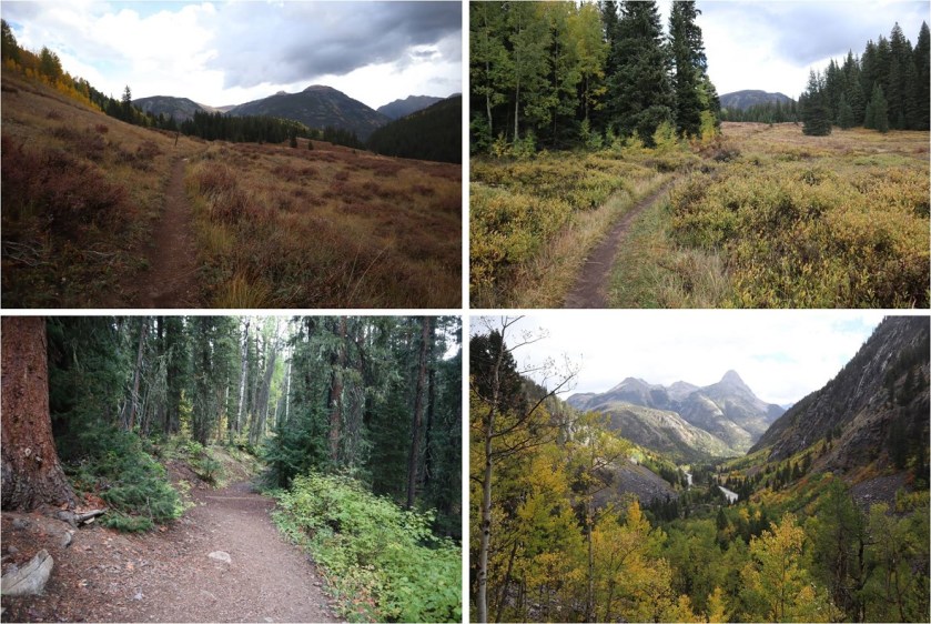
For about a mile the trail stayed pretty much level, and then it descended 1500+ feet down to the Animas River
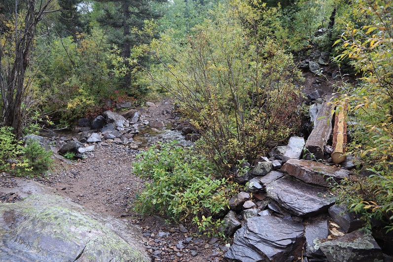
At 3.8 miles I crossed a small creek
And heard a rustling in the bushes. I knew there was an animal about 6 feet off the trail, and it felt larger than a coyote but smaller than a bear. I tapped my trekking pole loudly against a rock a few times to flush it out/scare it away. Usually when I do this the animal quickly runs in the opposite direction, but this time it started advancing towards me in the dark. Thinking this was not a good sign I braced myself as the animal came closer to me, moving through the tall brush. Was it a rabid raccoon? A baby bear? (I swung my head from side to side: Oh no! Where’s mama???) and then suddenly it was on the trail in front of me and I realized it was a rather large beaver.

This beaver wanted nothing to do with me, it was just aiming for the trail as an escape route, and kind of looked like a land manatee (BTW, I just finished reading the book “On Trails” by Robert Moore and the experience of hiking has broadened for me and I was immediately reminded of why animals are attracted to trails. It’s a good book with no direct conclusion but connects many aspects of hiking: you should check it out).
Seeing the beaver was cool: it was much larger than I thought they’d be. The downside? I had the “Beaver Song” in my head for the next 2 hours. Not as much fun as it sounds…
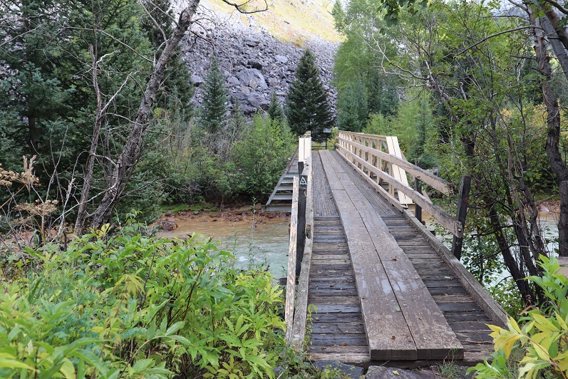
At 3.9 miles I crossed the bridge that goes over the Animas River
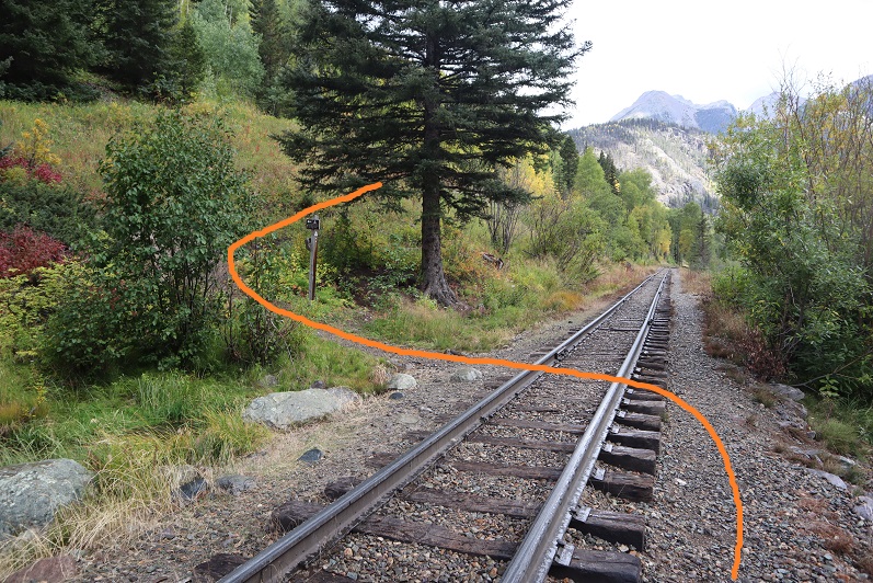
Turned right (southeast) and followed the train tracks for about a dozen yards, crossed the tracks, and followed the trail up the mountainside.
At 4.7 miles I came across the trail register and signed it in the dark.
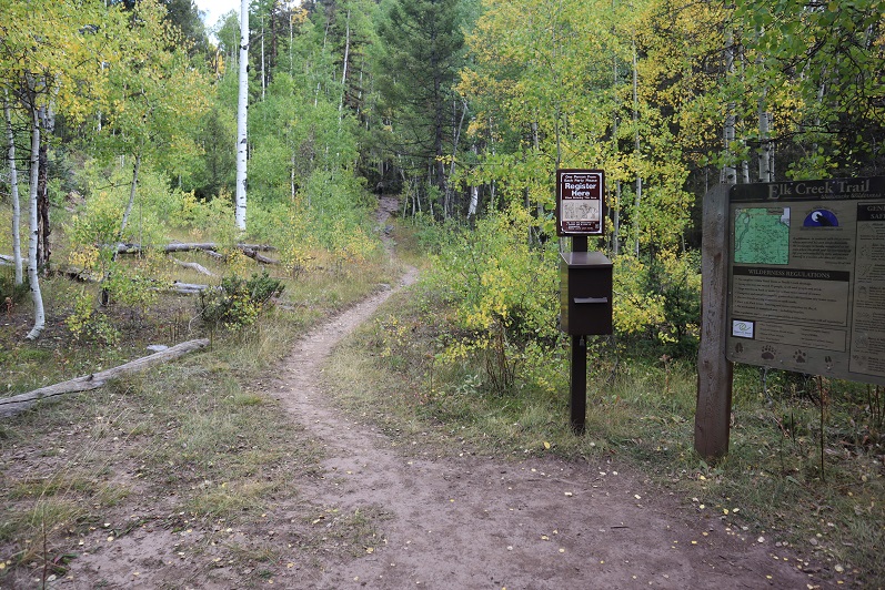
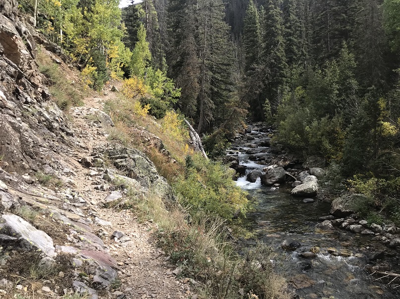
The trail parallels Elk Creek
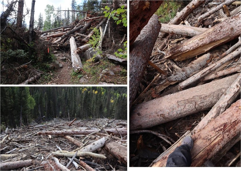
At 6.1 miles I came across the first area of avy debris. I’m guessing there were 3-4 slides all in close proximity that kind of ran together. I’d heard there’d been avalanches here and to just follow the marked tape through them, but was surprised at how dense and large the debris was. I was able to follow the marking tape easily through the first area but got lost in the second and ended up climbing a little higher than necessary.
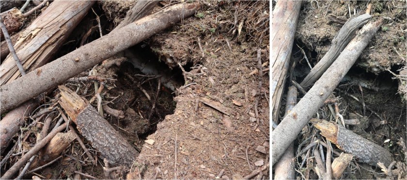
In the daylight I had no issues getting across the debris, but noticed there’s still ice and snow under the logs that’s melting and forming caverns, so be careful where you step! There were flies circling the debris.
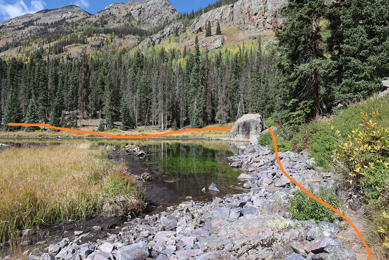
After the avy area I came across some beaver ponds and turned right (south). The best place to do this was just after the large boulder: the trail parallels a pond at this point
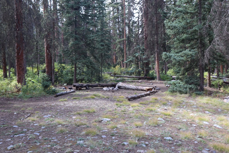
There was a good camping spot after the beaver ponds. Side note: anyone else’s carabineers hanging off your pack double as bear bells?
Mile 7 was the mile of creek crossings. What I couldn’t tell in the dark was this was some extremely clear water (it was refreshing on the way back to dip my bandana in it and cool off). All of the creek crossings were easy and had several options (rocks and fallen trees abound)
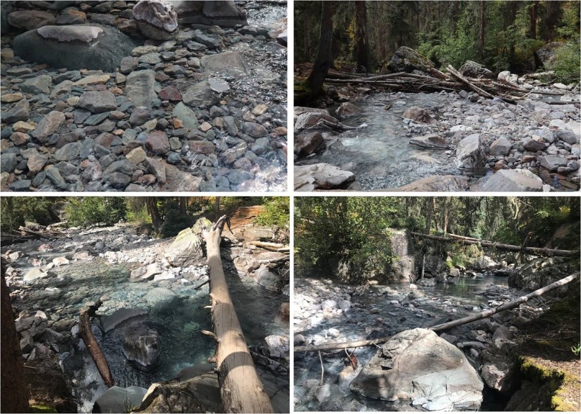
The trail continued to climb up the mountainside. There were frequently fallen trees on the trail (not from avalanches) but they were all passable and for once I celebrated in being short because I could pass under them easily.

This part of the hike was really cool because I started hearing elk bugling. I tried to get some of it on video but it’s hard to hear (turn your volume to the max). The bugling lasted for over an hour and came from all directions.
Elk Bugling:
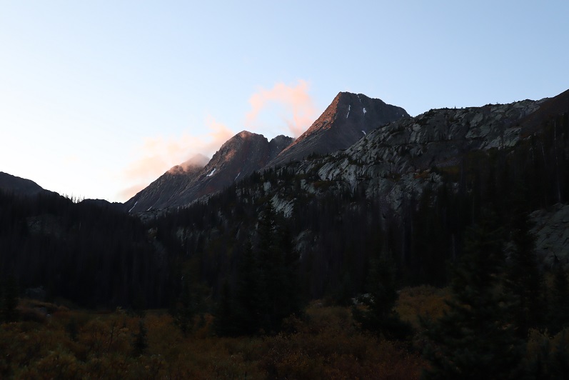
The trail was well defined all the way to the basin. I reached the basin at 9.1 miles, just as the sun was coming up. There was a light dusting of snow on the Trinities.
I followed the trail through the willows and lost one of my gloves. No worries though, because of my Raynaud’s I always bring at least 2 pairs (I had 3 today).

There’s an obvious campsite in the basin. I turned right (southwest) at the campsite at 9.8 miles- 11,380’, careful not to make too much noise because the campers were obviously still sleeping.
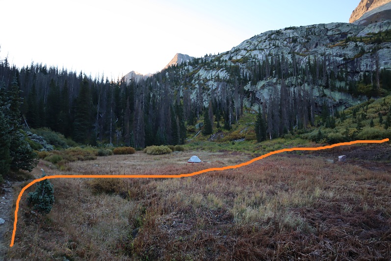
The trail crosses another small creek
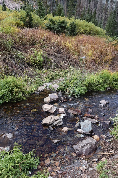
And then climbs up the hill to another (rocky) basin/amphitheater
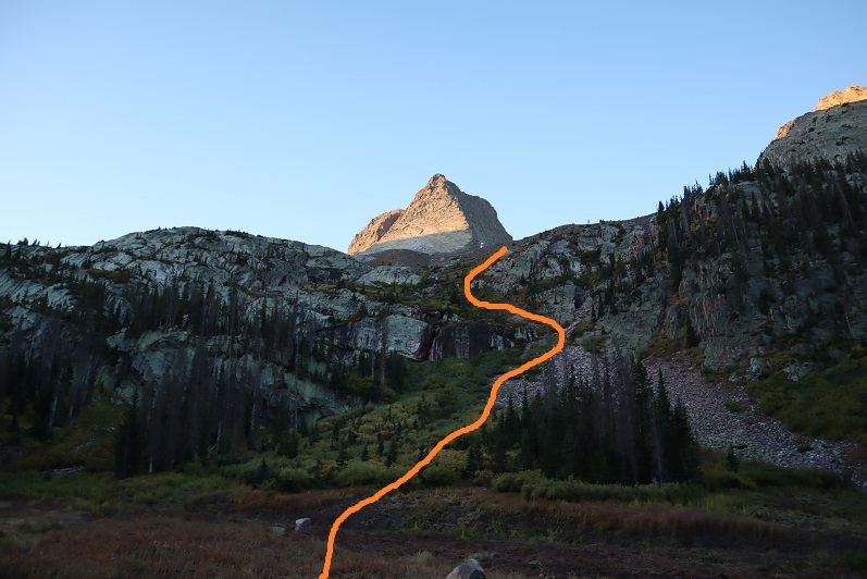
This is where the trail ends. I made my way over the talus, hiking closer to Arrow than Vestal
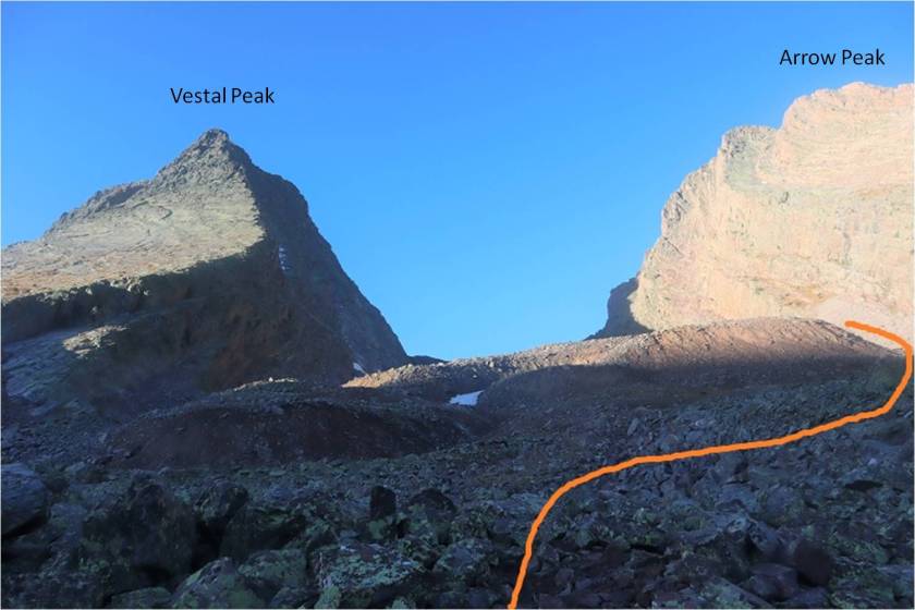

The goal is to gain the saddle at the top of the gully. This was harder than it sounds because that scree/talus is terrible. I was glad I’d worn my helmet. I strapped on my microspikes and took the solid line up, dotted line down. I’d do it the same way if I did it again.

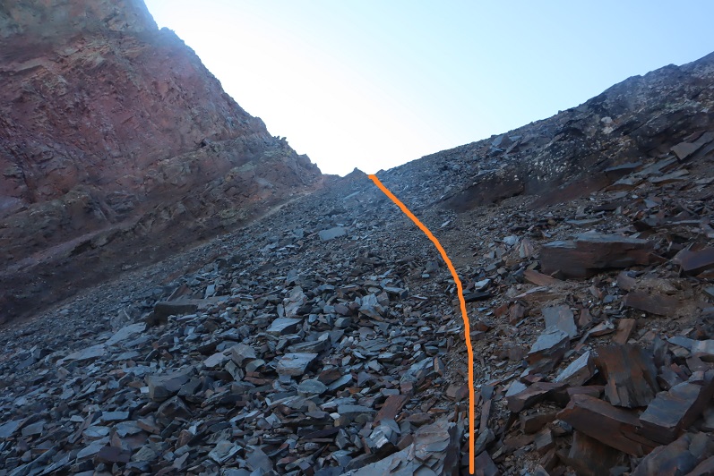
Once on the saddle I headed southeast around the backside of Vestal
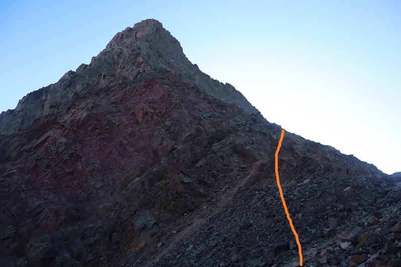
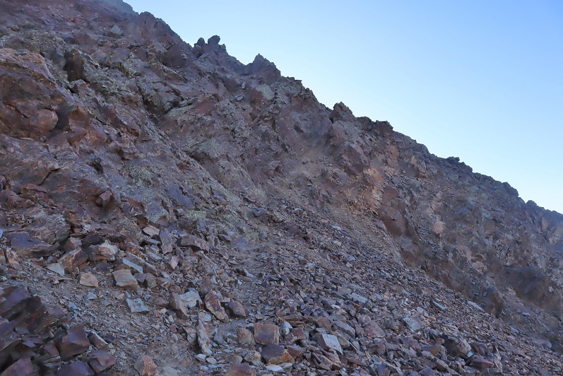
This eventually led me to an area of the mountain separated by a gully. Here I turned left (north) and climbed what I’d consider class 3 terrain towards the summit, careful not to go into the gully, aiming for where the gully originates.
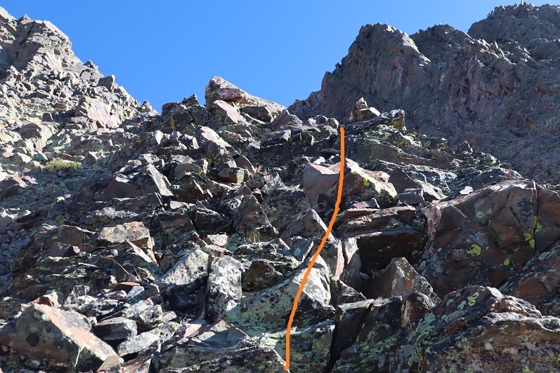
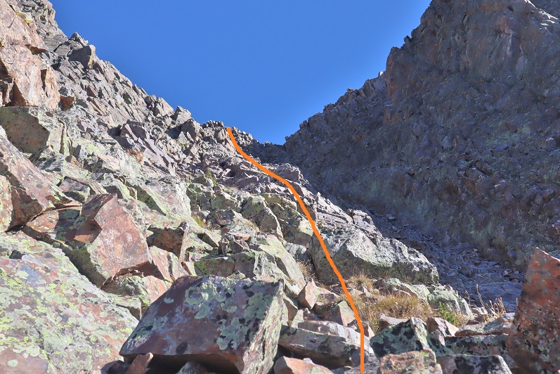
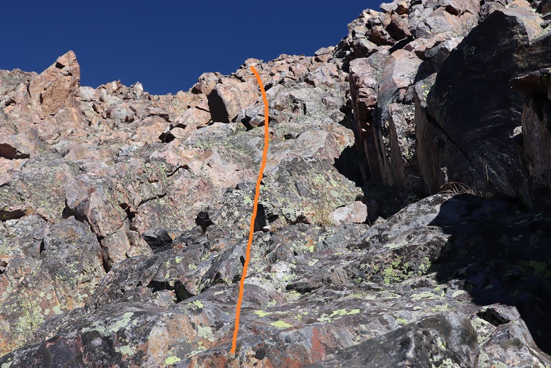
At the top there’s a false summit, but the true summit isn’t far off
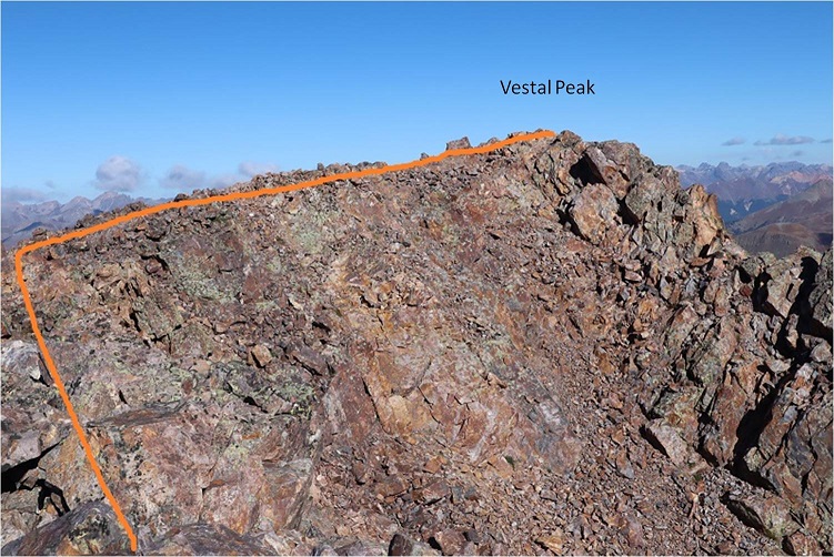
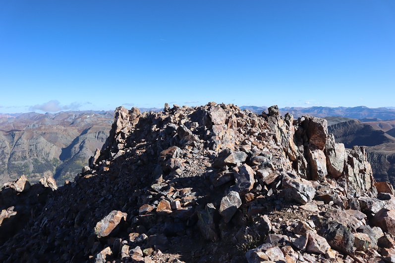
I summited Vestal Peak, my 100th Centennial, at 10am, after 8.5 hours and 11.4 miles of hiking.
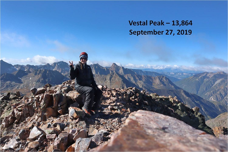
Vestal Summit:
Despite the forecasted winds and cold temperatures and rain/snow it was a perfect day! I spent over half an hour on the summit, something I’ve rarely done, and took pictures of the Grenadier range and the beauty of the San Juans
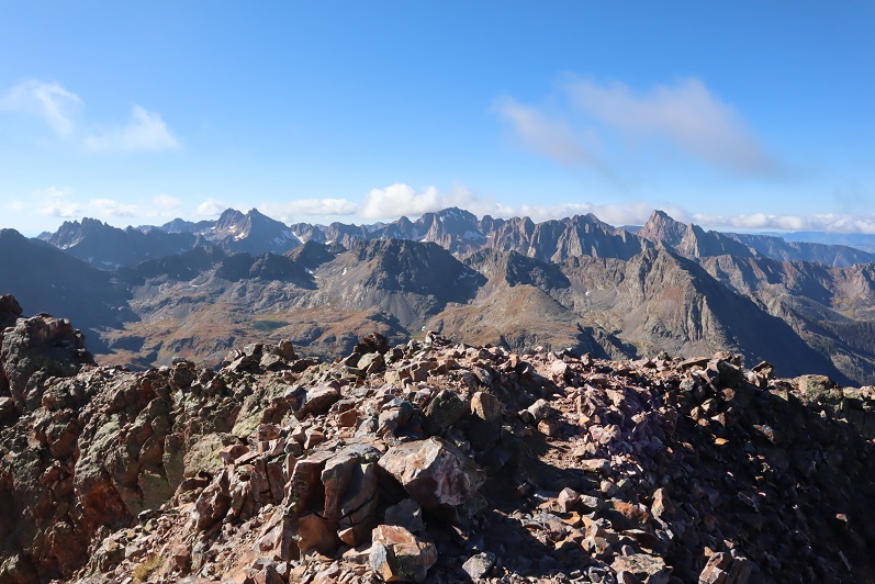

Knowing the weather was nice now but it was supposed to turn I decided it was time to head back.
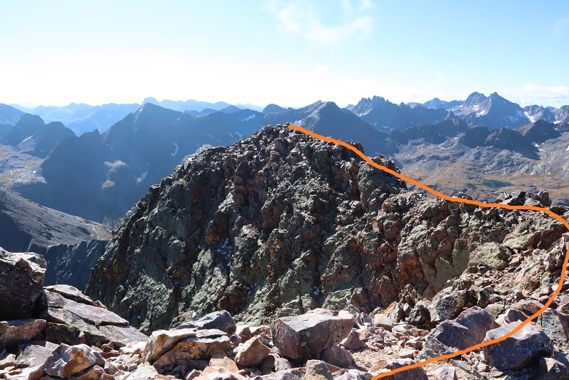
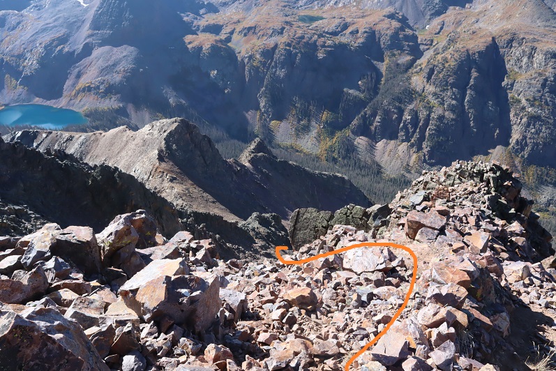
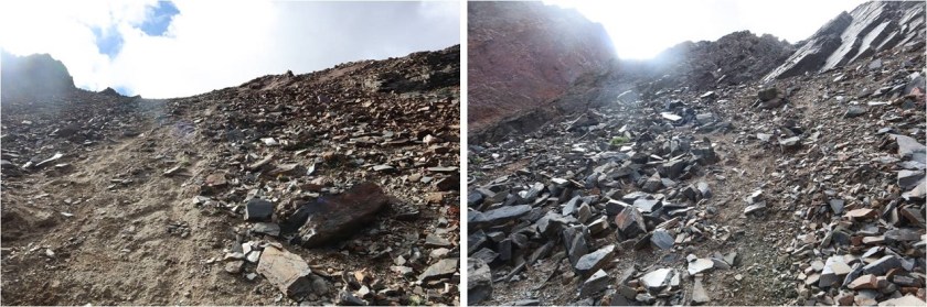
Here’s the path I took back down into the talus basin

It wasn’t pretty. In fact, I did something to a ligament in my ankle and it became very sore on the way down (still hurts, but it’s just bruised)
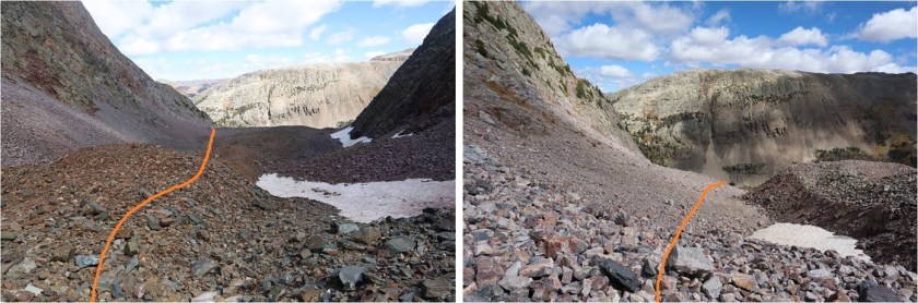
I decided to keep my microspikes on until I made it back down to the camping area. As I approached the area above the campsite I could hear someone shouting excitedly about nothing in particular and it looked like there were two people just finishing tearing down their tent. I figured it was a parent and child out camping and slowed down a bit to give them time to head out before me.
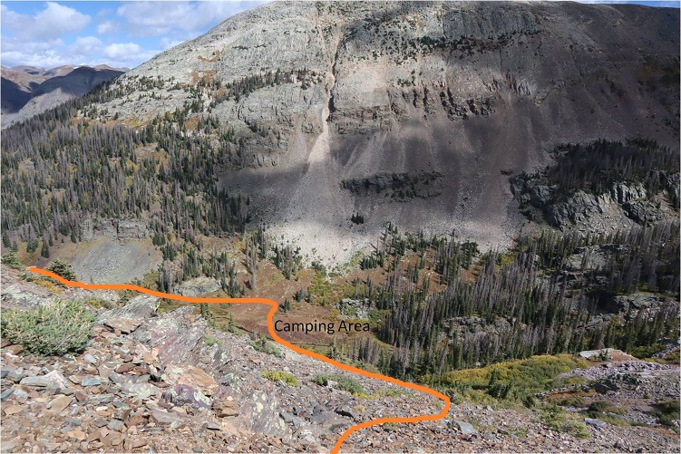
At the camping area I sat down for a bit, enjoyed lunch (peanut butter and pretzels) and took off my microspikes.
Here’s a look heading out of the basin
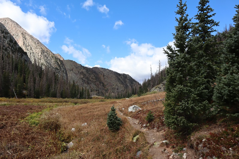
I found my lost glove (woot!) and caught up to the couple within about a mile of hiking. They were two girls in their early 20s who were out backpacking together. They seemed like they were having a terrific time (or high on something: I don’t judge) and were wonderfully boisterous. One of their boyfriends had dropped them off at one trailhead and was picking them up tonight at another one so they could make it a longer trip. We chatted for a bit and then I was on my way. The best part about the conversation? No one mentioned we were women out here alone.
The hike out was beautiful in the daylight. I made it back to the beaver pond area (I suspect the beavers moved to down by the Animas river because there’s no current sign they’re here anymore).
The avalanche area was much easier navigated in the daylight. I followed the Elk Creek Trail back to the Animas River
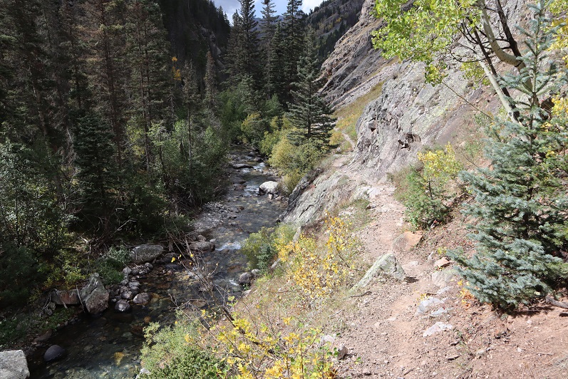
There were a few waterfalls along the way

I made it back to the trail register and even though it was sunny it started raining. For the rest of the hike it rained and didn’t stop. I was glad I’d worn waterproof clothing, even if it hadn’t been needed for much of the day. The rain was nice in the beginning but eventually the thunder started and I got a bit antsy. It was a beautiful hike out though, and much better than the trail back to the Purgatory trailhead (I’d take Molas over Purgatory any day).
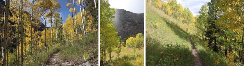
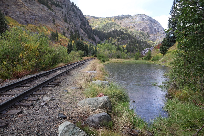
The downside to the rain was the mud. It got really bad about half a mile before the trailhead and mud was starting to stick in layers to my boots. The last mile felt like it took forever to finish, but that was most likely because by this time I was quite tired. I’d made a good decision to make this a day trip: as I turned and looked back at the Vestal Basin I could see it was covered in dark clouds full of rain/snow/graupel/etc.
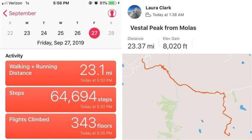
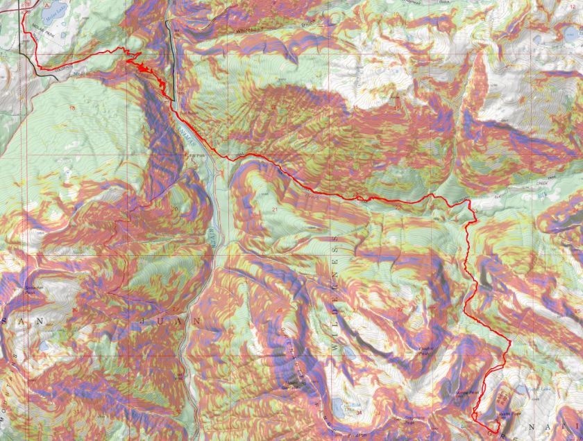
I made it back to my truck at 5:30pm, making this a 23.5 mile hike with 8020’ of elevation gain in 16 hours.
I changed in my truck into new hiking clothes and took a quick wet-wipe bath. I re-braided my hair, ate a packet of tuna and drove to the next trailhead. It rained the entire 5 hour drive there.
Mississippi Highpoint – Woodall Mountain – 806′
RT Length: 320 miles (by vehicle)
Elevation Gain: negligable
When work sends you to Nashville and you have 7 hours between appointments you go highpointing in Mississippi. I’d have loved to make it to the Tennessee or Alabama highpoints, but they were all out of my time range, so last week I made a reservation for a rental car pick-up that was thankfully half a mile from the hotel I was staying for work.
I was on the road by 7:20am, following google maps for guidance. One of the cool parts about driving to highpoints is taking county roads instead of interstate highways. I didn’t see a lot of people, but those I did were mowing their grass on riding lawn mowers. There were homes, barns, and vehicles in various states of decomposition. Moss covered stone walls marked boundary lines. I followed the Natchez Trace trail south, which was covered in overhanging trees.

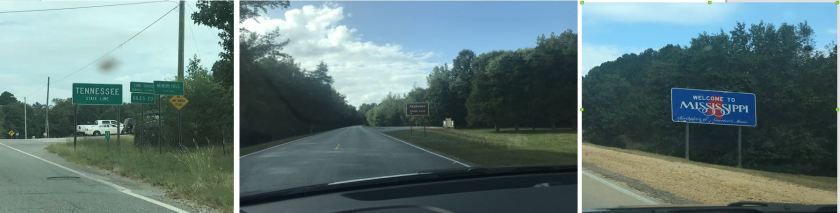
I love traveling through the south! I passed through Tennessee and Alabama before entering Mississippi
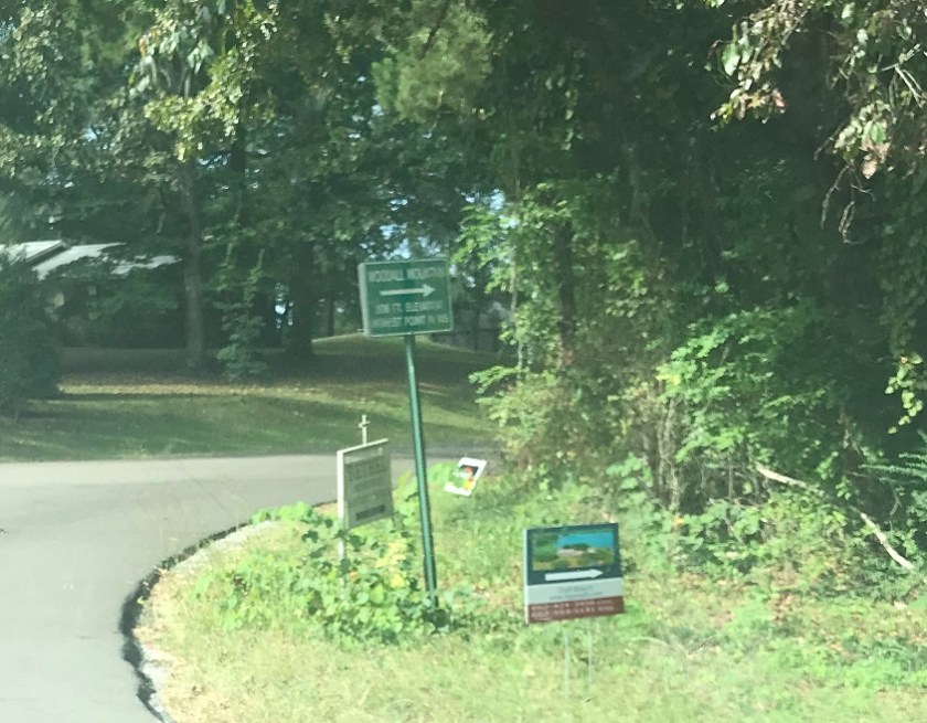
This highpoint has a lot of good signage.
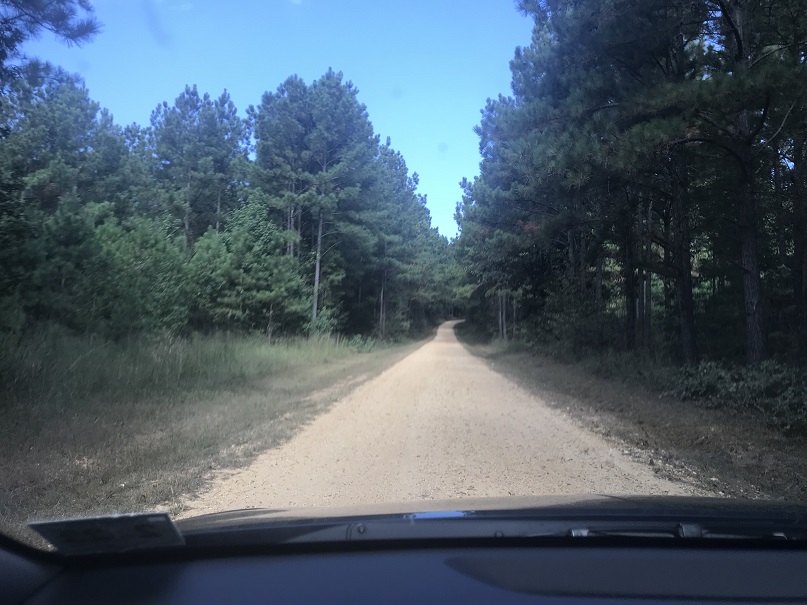
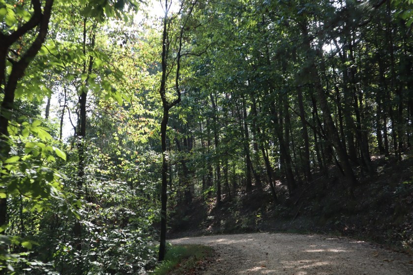
I turned off the main road onto a dirt road and was a little apprehensive with my rental vehicle, but it stays at 2WD the entire 2 miles to the top.
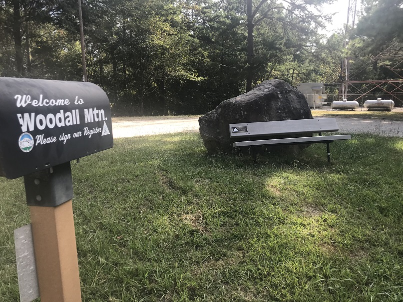
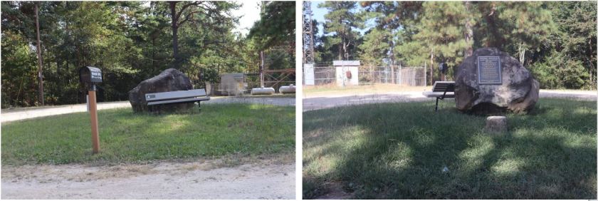
To my surprise, the road brought me all the way to the ‘summit’. There was a mailbox with a trail register (which needs to be replaced), a sign, a rock, a bench, and a summit marker.
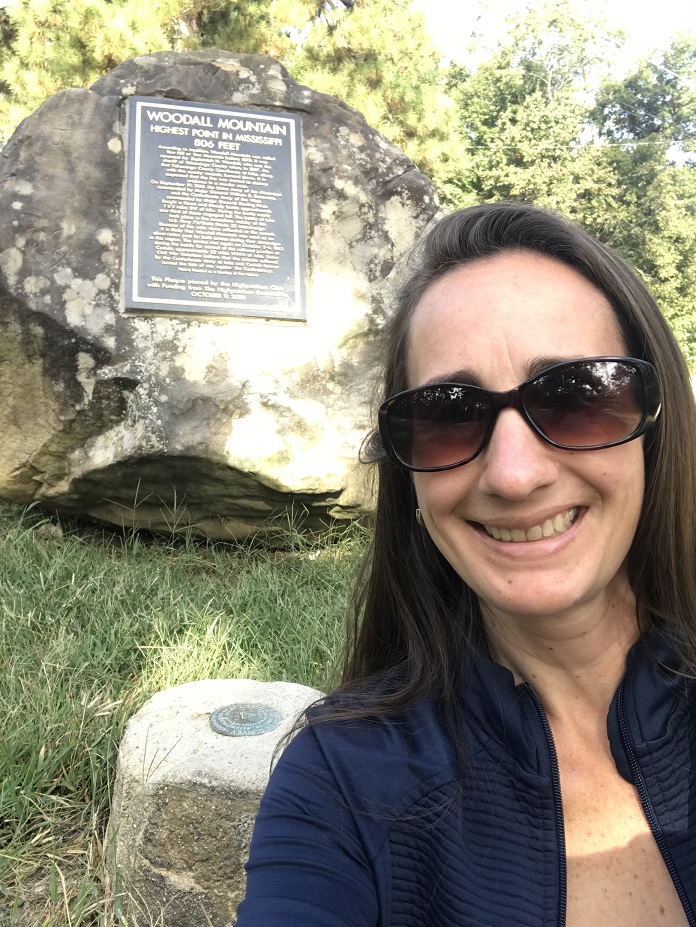
There was no one else around so I took a ‘summit-selfie’
And a close up of the sign and summit marker
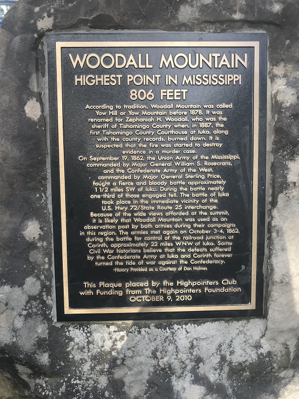
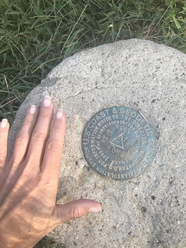
I’d been told this area was ‘a dump’ but it looks like it’s been cleaned up recently. Time to head back (it was 3 a hour drive which didn’t give me time to dawdle)
I got stuck behind a tractor for a bit, which was annoying, but par for the course, considering I was visiting the south. Also, I don’t think he realized I was behind him. It was frustrating because he drove in the middle of the road and I couldn’t pass him until he turned off the road onto a side street.

I google searched the nearest Starbucks, which was only 15 minutes out of the way in Alabama. This was perfect because I needed an Alabama state mug (I have the rest in the area, and I’m not a fan of their coffee). I was hoping to get an espresso mug, but settled for a coffee mug when they were out. I stopped by Subway for lunch.
On the drive back I swerved to avoid buzzards, armadillos, and small deer (the deer in the south are REALLY small). I made it back to my hotel at 3pm, in plenty of time for my 4pm meeting!
Phoenix Peak – 13,904

RT Length: 12.5 miles
Elevation Gain: 4441′
The last couple of trip reports have been rough to write: I’m traveling for work and using my work laptop computer for these write-ups which isn’t ideal. My work laptop doesn’t have simple functions like spellcheck (so please go easy on me there), everything I have is a “reader” and the keypad is slow, inaccurate, and last night it stopped working altogether. I googled the nearest computer store and this morning walked 2 miles to buy a computer mouse. I’m hoping the problem’s solved, but not holding my breath as the laptop is several years old and I’ve taken it to dozens of states and multiple countries so the hardware has been switched several times (I work for a software company, so this is a security measure). Side note “just in case”: I’m using this computer during off working hours, and not using it on company time.
After summiting Rio Grande Pyramid yesterday I hopped right back in my truck and drove the short drive to Creede, CO. I knew the ‘easy’ road in (503) had been washed out, so I was getting creative and took in the 502. I Google wasn’t going to get me there, so I’d created the route on Caltopo and turned it into a gpx file. I credit this ability to those who’ve challenged my summits, as a few months ago I wasn’t even aware this sort of thing was possible because I don’t use a GPS when hiking. Now knowing this is a possibility with Strava it’s opened up a lot of back country roads for me! Woot! I made it to my desired area with no difficulties.
At the north end of Creede I took the West Willow Creek Road up past numerous mines and then turned right onto a 4WD dirt road after the Midwest Mine (County Road 502).
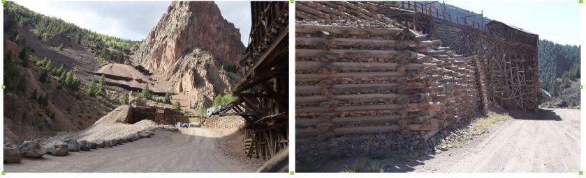
From this point on I was glad I’d creaded a GPX file, as the roads itersected a few times and it was nice to know I was going in the right direction. The road was easy 4WD with little room for passing but luckily I was the only one on the road on this Friday afternoon.
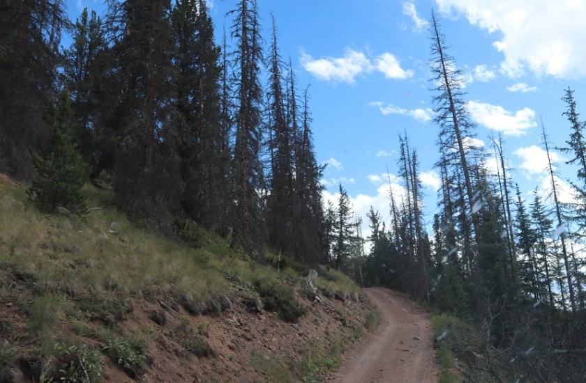
There were 2 hairpin turns where I had to back my truck up a couple of times to navigate, but my Tundra had no problem making it to the 502/502-1A junction.
When I made it here I got out of my truck, looked at the 502-1A 4WD road and said “nope”. I wasn’t doing that road to my truck (this ended up being a stellar idea). I carefully backed in to a spot big enough for 2 vehicles if we both parked nicely and got out my maps/info for tomorrow. I’d parked next to a small creek that hadn’t been on the map but I knew where I was on the road.
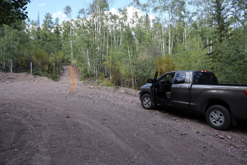
Today had been a long day so I had some tuna, a few pieces of beef jerky, some dried fruit and two shots of whiskey before heading to bed rather early (5:30pm?). I was parked at the beginning of 502-1A and a little worried because the area was so small that I’d impede traffic but on the positive side I didn’t see one vehicle that night.
It was a cold, cold night. My altimeter told me I’d parked at 10,000′, and the forecast told me it was supposed to be a low of 30* at the summit (a few miles and several thousand feet of elevation away). It was colder than 30* where I parked. I woke up halfway through the night and put on socks (they were off because they needed to air out after yesterday) and I even got out an extra sleeping bag and put on my knit hat. It was so much colder than last night! I was thrilled when my alarm went off at 2:30am, and puzzled when the first thing I saw was a vehicle coming down the road at me. Kind of interesting the only vehicle I’d see at all was one at 2:30am. They didn’t stop and I never saw them again, so I’m not sure where they were headed. I put on my winter gear (winds were expected again today and it was already below freezing outside). I was on the trail by 3am.
I started the morning with a Raynaud’s attack in my hands and was worried this would prematurely end my hike. I put on my gloves and pumped my fingers back and forth: this hasn’t happened in a while and I wasn’t happy.
Immediately I was glad I’d decided to park my truck and hike to Phoenix Park. The road was what I’d consider “extreme 4WD”, and nothing I’d subject my Tundra to. The pictures don’t do it justice; you need high clearance and a good dose of insanity to navigate this road.
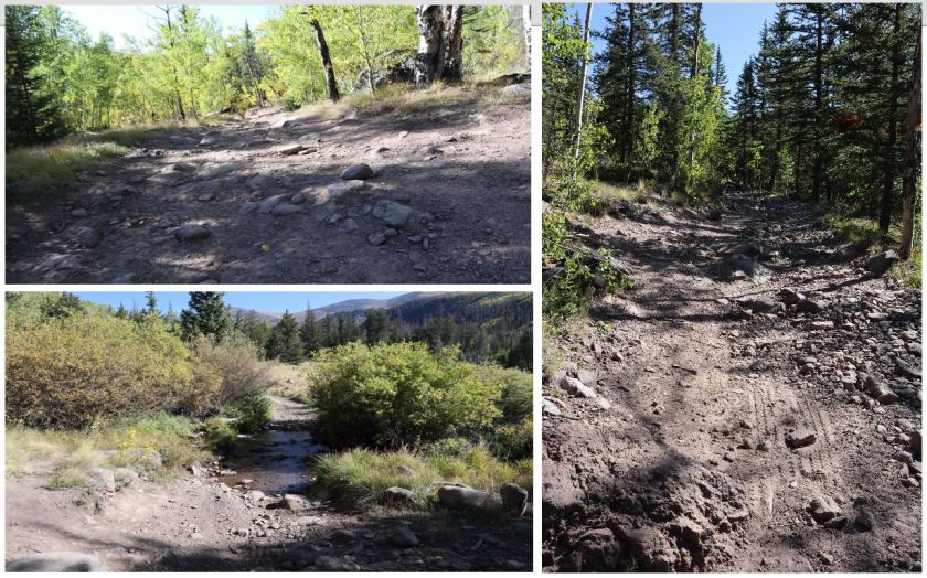
The only downside? The road started around 10K and seemed to loose hundreds of feet in elevation. It was actually only a couple hundred feet, but it felt like forever and I was worried it would ‘hurt’ on the way out.
After 1.6 miles I made it to the turn off from the 4WD road to the trail (787)
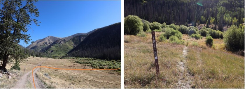
Well cairned but not well established, the 787 quickly crosses a stream
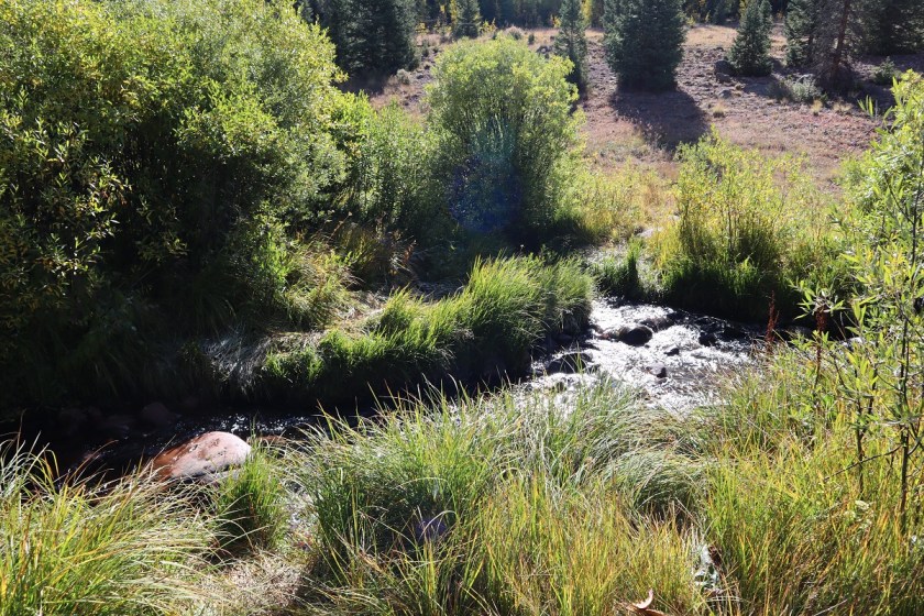
and comes across an avalanche area. I’m not sure when the avalanche occured, but there’s a trail to the left of trampled down grass to follow
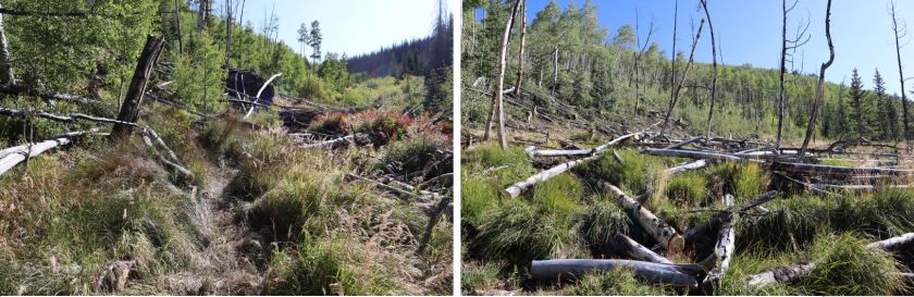
This trail doesn’t look like it’s used often, and would be difficult to follow if it weren’t for the numerous cairns marking the way as I headed northeast

Still hiking in the dark I was now starting to get really cold. I switched my gloves for my mitts and trudged on, glad there wasn’t any wind. At 2.3 miles I came across another stream crossing and then quickly another at 2.4 miles

At this point I began to regain all the elevation I’d lost earlier in the morning. I could tell I was surrounded by raspberry bushes and lots of shrubs and plants turning fall colors, all covered in frost. I scared a bunch of ptarmigans at one point and they scared me as well. About halfway to the top of this area I could smell sheep (I used to raise them, and they have a very distinctive smell). Since it was dark I decided to figure out where they were: I hit my trekking pole harshly against a tree and heard to my right a loud snap, bleat, and rustling. The sheep went in the opposite direction and I continued on, following the cairns. I crossed one final stream at 4 miles. Here is where the trail ended.

I headed south until I came across a cairn with a large wooden pole, turned right (east) and followed the slope in the dark
Here there was a solid trail for about 200 yards that went along the ridgeline

and once I made it to the end of the ridge the trail disappeared. From here I just needed to head to this point, and there was no exact way to get there so I took what I felt was the path of least resistance. Note, this point is NOT the peak, but it’s close.
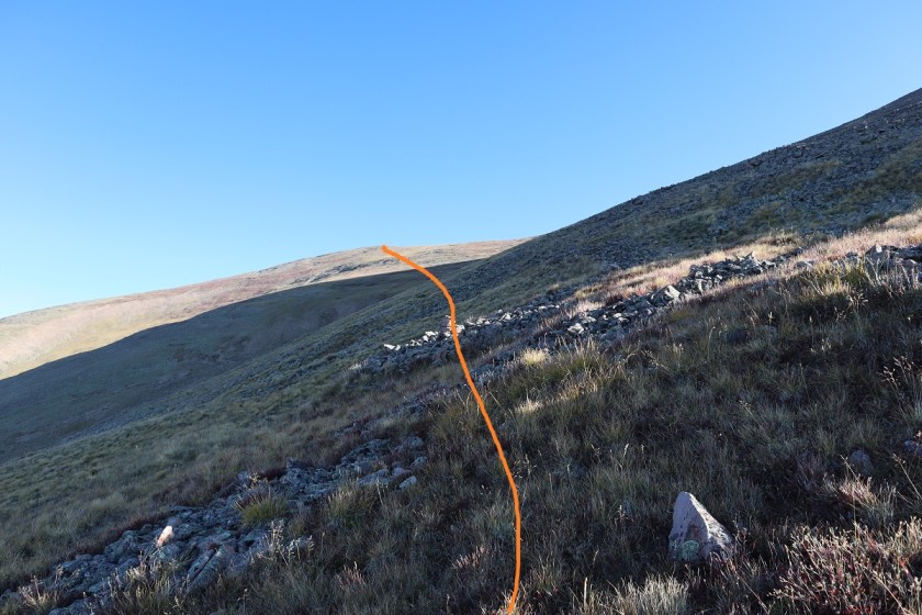
Halfway to the ridge it became windy. By ‘windy’ I mean sustained 40mph winds with a few icy 60mph gusts thrown in. It was so cold my water bladder froze (something I hadn’t anticipated with a forecasted low of 30* on the summit). I kept pumping my fingers back and forth, put on my balaclava, and trudged on, noticeby tired from yesterday’s 25 miles. I heard an elk bugle in the distance and thought how amazing it was to be out here all alone.
The sun began to rise as I was halfway to the point
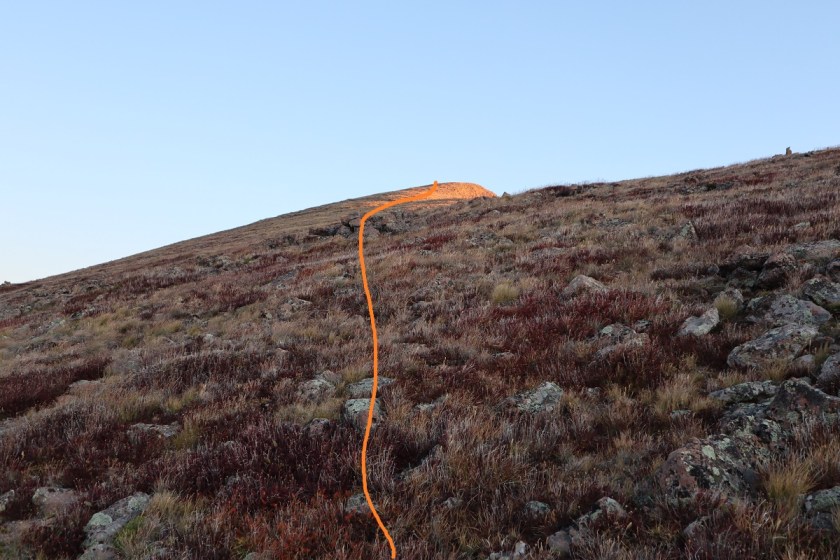
The wind never stopped. There’s a lot I could say about the cold for the rest of the hike, but I’ll end it here: it was cold, cold, cold. And windy. The kind of cold and wind where the snot dries as it’s flying from your face and then comes back and freezes to your cheek (another reason I like to hike solo: not the most glamerous of moments).
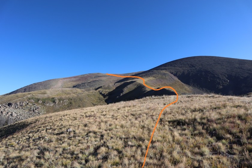
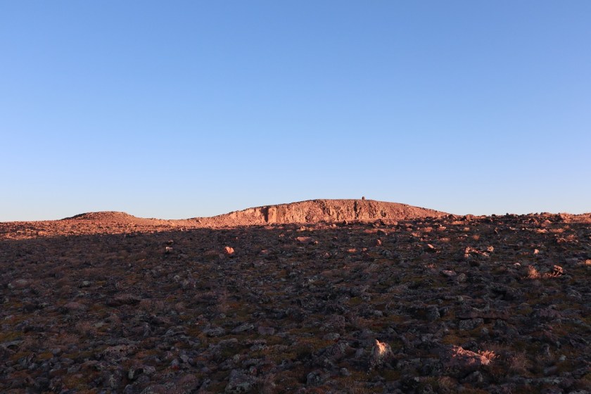
At the top of the ‘point’ I could see the rest of the route before me. Thankfully it was short and there was a well developed cairn to welcome me.
I just followed the ridge to the left as it swung around to the right
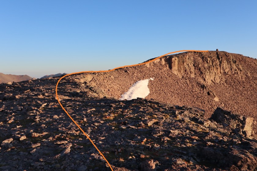
The rocks here were looser than expected but it was an easy final hike to the summit.

I summited at 8:15am
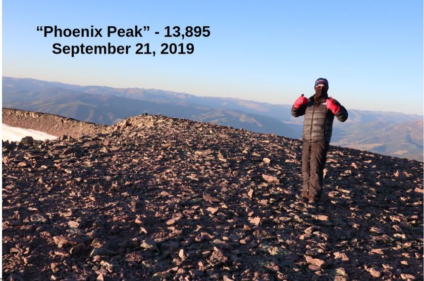
“Phoenix Peak”:
From here I could see unranked 13er la Garita Peak, but it wasn’t on my agenda today because I needed to get back home to watch my daughter perform at halftime. After getting a quick summit photo and video (the cold is telling me this may be the last of the year) I headed back down.
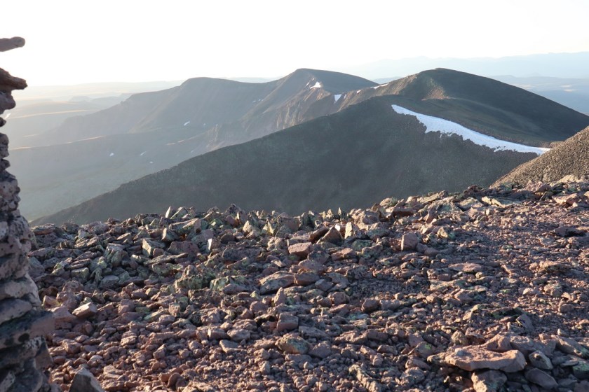
Here’s the route back down. Be careful not to desced too soon (specially if you ascend in the dark). There are two ridges you can take back down, and the correct one is the second one you see from the summit.
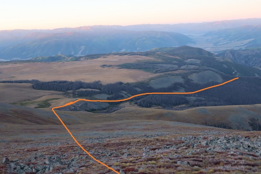
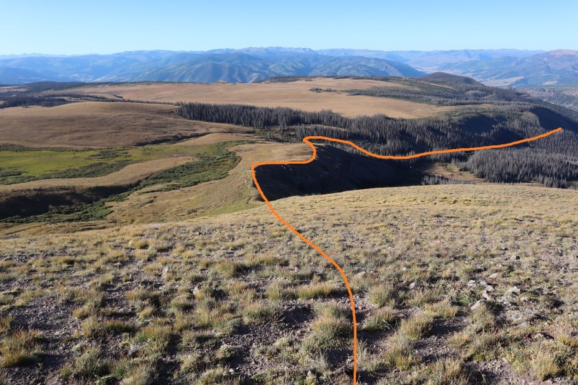
I made it back to the large cairn

and headed back down the hill (stay below the boulders)

The wind stopped just where it started (about a mile and a half below the summit) and I was able to warm up. Back in the treeline I took off my gloves and balaclava and tried to crunch the tube of my water bladder to get water to flow. It was light now, so I stopped when I came across a large raspberry patch. I picked one and it crumbled in my hand. Curious, I took a closer look and upon further inspection realized they were frozen! Not completely frozen but frozen enough to add a small crunch and a much needed flare to their refreshment (for in the sunlight I was now warm). I picked a handful and ate frozen raspberries for the next 10 mintues, wondering why there weren’t any animal tracks near here? The currents weren’t as tasty, so I left those for the birds.

The sheep were gone and I never saw any elk, but I did see and hear dozens of crows on my way down. I wondered what had died? There was a stream along the avalanche area

and here’s a look out from the last stream crossing back onto the 4WD road

It was still 1.5 miles back to my truck, and as I walked this road I was thankful I hadn’t taken my truck this way: it was worth the walk, and actually not that bad. The last few hundred feet of elevation gain I’d been dreading was all completed in the shade and didn’t slow me down that much.

I made it back to my truck at 10:30am, making this a 12 mile hike with 4441′ in elevation gain in 7.5 hours.
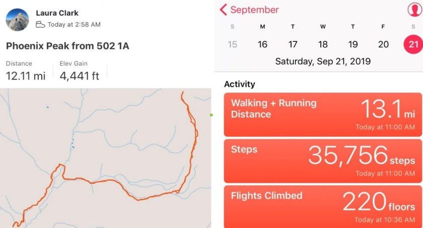

I drove home and made it in plenty of time to be at my daughter’s performance. I put all my dirty clothes in the laundry and when I changed it found a dead grasshopper in the bottom of the bin. Sorry little guy! I’m sure it got caught in the holes in my snow pants (I REALLY need a new pair, but despite shopping at multiple stores can’t seem to find one that fits).
Rio Grande Pyramid – 13,825

RT Length: 23.5 miles
Elevation Gain: 5115′
NOTE: I have been to this area again, and have a better approach. Please use this approach to the base of Rio Grande Pyramid.
I finally received my new camera in the mail and was quite excited to try it out. I left my house at 8pm and arrived at the Thirty Mile Campground at 1am after a long but easy 2WD dirt road in. There’s a designated area for backpackers/hikers to park.
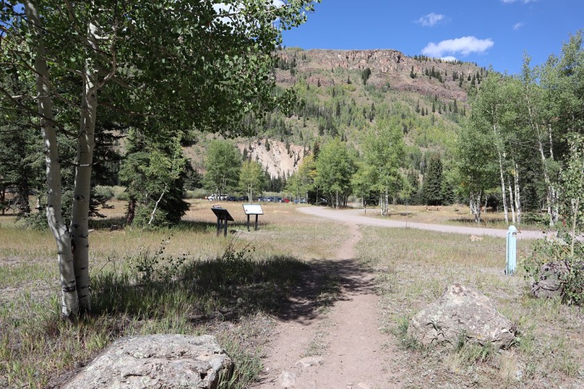
I really wanted to get out on the trail, but as soon as I parked my truck it started raining. Hmph! It was supposed to stop raining at 1am, but from the looks of things the rain was just getting started. So I got all ready to go and then leaned the drivers seat back and tried to get some rest. I set my alarm for 20 minute intervals, and after the fourth time realized the rain wasn’t going to stop so I might as well get going. I put on my poncho and snow gear (I’m still in the market for waterproof pants, choosing instead to get the Alti Mitts this month because keeping my hands warm is more important) and headed out on the trail.
This is the start of the trail. It follows the Weminuche Trail.
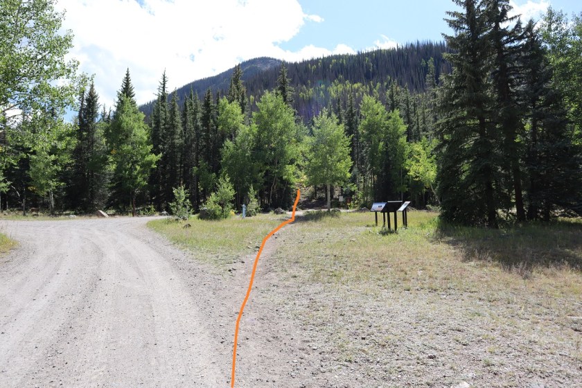

I signed the trail register (which was a mess!!! It needs a new notebook) and was off
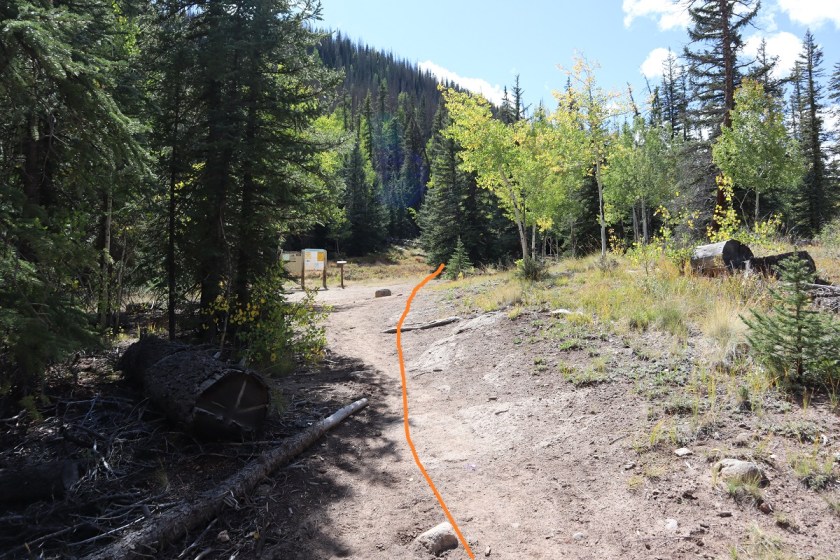
The beginning of the trail is easy to follow, if a little muddy. Since it was raining I expected the mud. I hiked alongside the Rio Grande Reservoir and after a little over a mile I turned left and headed up the drainage area. As I was hiking here I heard a loud “snap” and figured I’d scared a deer.
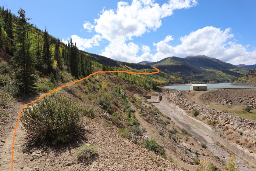
There was an easy creek crossing

and lots of mud (mixed with horse manure)
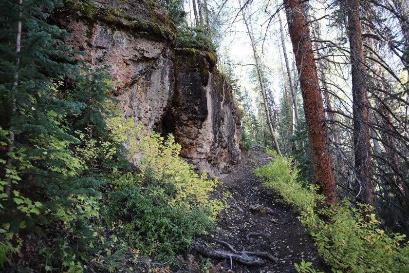
After turning the corner to the left (south) I encountered a small boulder field

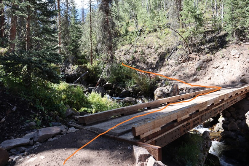
Before coming to a well built bridge at 2 miles. I crossed the bridge and turned left. It was still raining.
From here the trail switchbacked a bit through some aspen trees
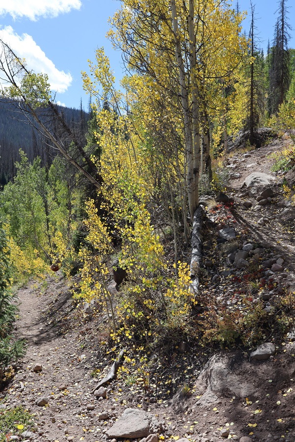
and was a bit washed out in areas but there were side trails to navigate the damage
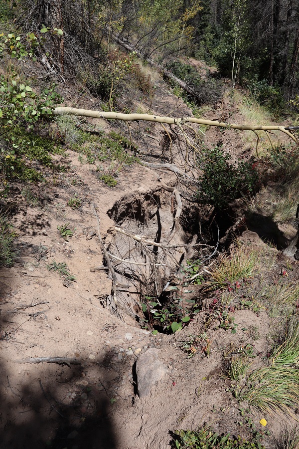
From here I hiked for what seemed like forever along the CDT. Forever. It was relatively flat hiking and I could tell I was in a basin, with lots of large boulders strewn about and open space.
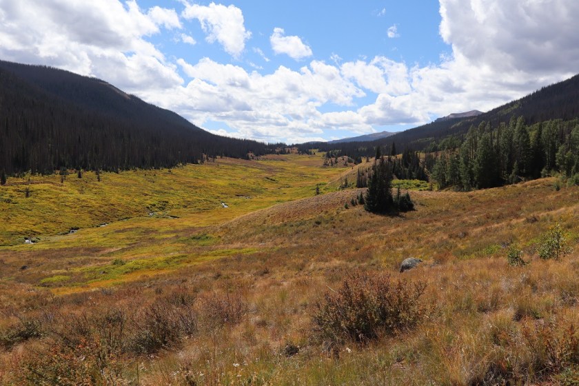
At 4.2 miles I came to another stream crossing
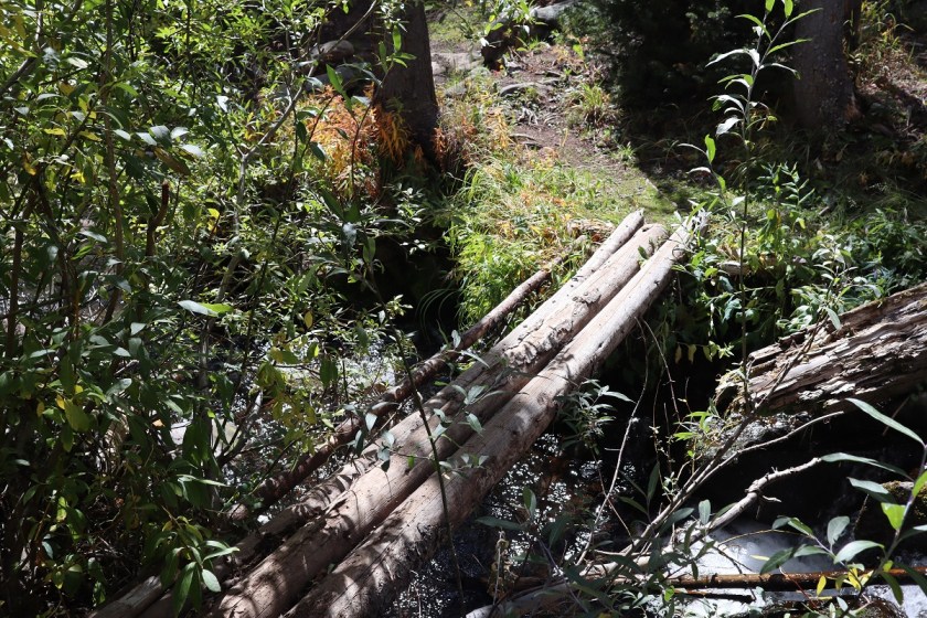
and continued hiking in the mud (and rain) to another stream crossing at 5.3 miles
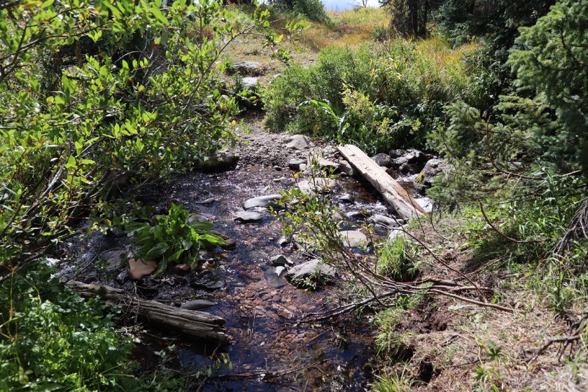
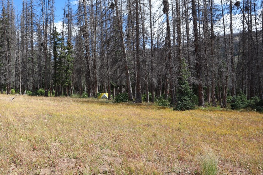
There also seemed to be camping here
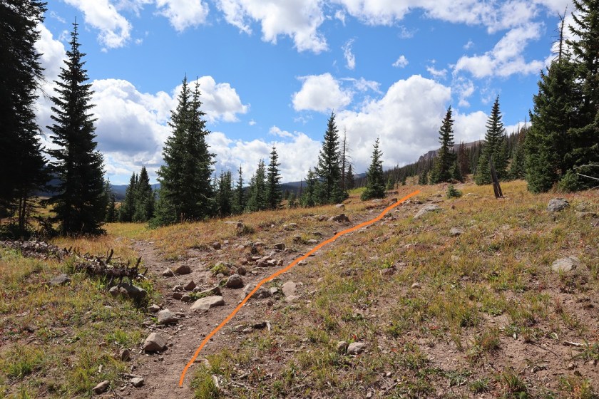
Still on the CDT, I went right here
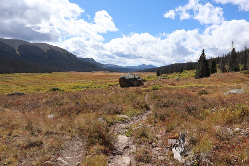
and kept following the CDT
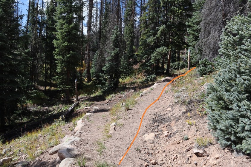
After 6.8 miles I came to the CDT Junction and once again stayed right
Now heading west I passed a small pond and celebrated the rain stopping (finally!!!)
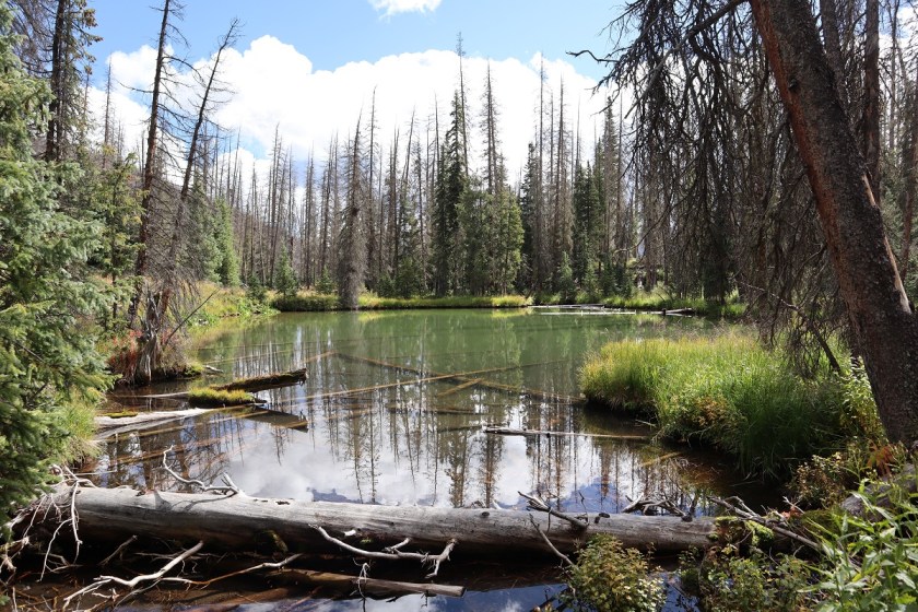
I entered and exited trees and came to an area that looked good for camping after about 8.5 miles
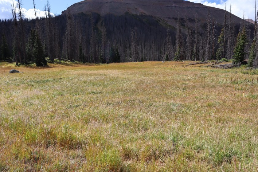
I entered the trees again
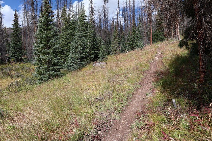
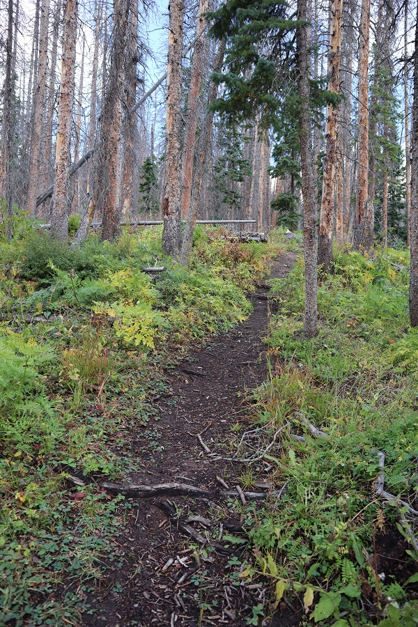
and after what seemed like forever (9.5 miles actually) I made it to treeline! Still on a good trail I passed another small boulder field
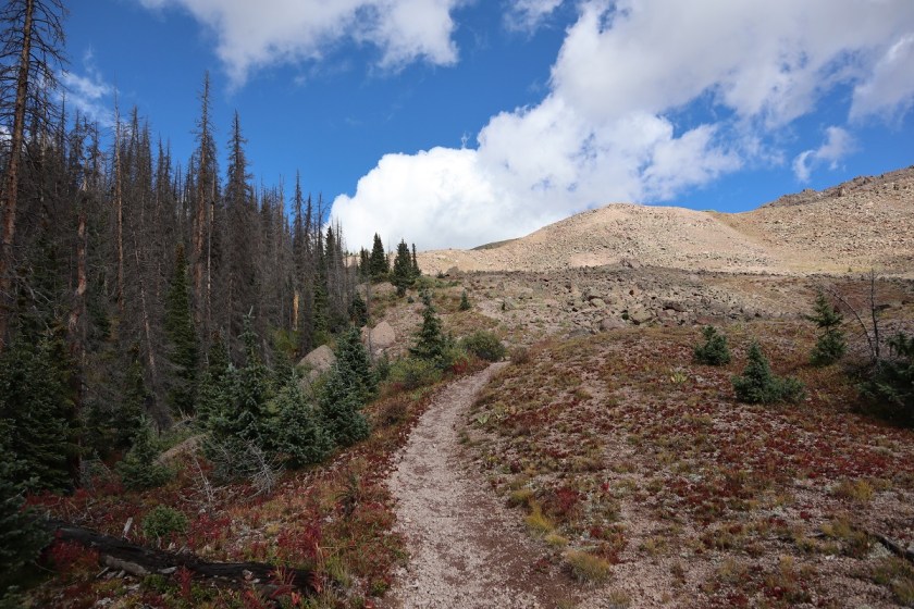
At the top of the boulder field I had a choice to go left or right. I went right (although both ways will get you where you need to go). Overall, I felt the way I chose was shorter (at least, it should have been if I’d taken the direct route the first time and not got bogged down in the willows).
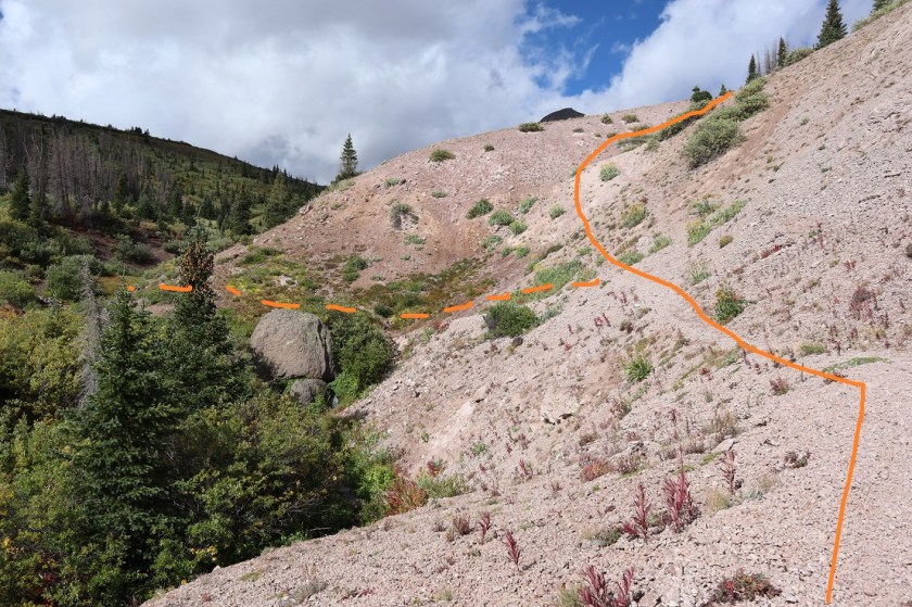
I made it to the top of the hill and this is what I saw. All I needed to do was to make my way around the willows to the gully and ascend the rest of the way to the peak. Also, it was evident it had been snowing on the peak while it had been raining on me this morning
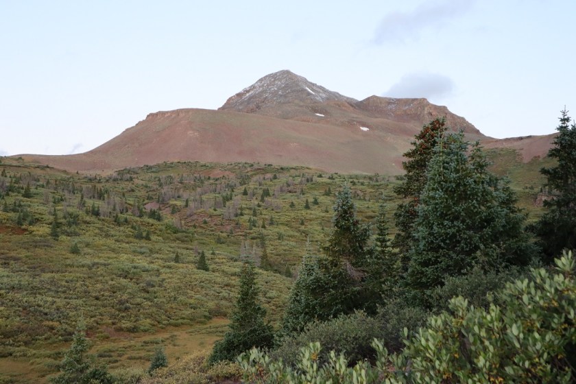
Here I lost the trail, and initially tried to cut across the willows and head straight for the gully. That didn’t last long: there were little streams everywhere and boggy areas and the willows were saturated with water (so I became so as well). It looked like there were trails through the willows, but they always ended at a stream and an area of willows too thick to pass.
I retraced my steps and went right (northwest) and trudged up the hillside. Eventually I found a surprisingly intact trail and followed that around the mountainside and up towards the gully (on my way back I followed the trail further, knowing where it began).
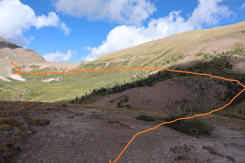
Here there were still willows but they were much more manageable. An added bonus was the sun was starting to warm things up and evaporate the rain. I was still “soaking wet” but now I was able to dry off in the sun.

Once out of the willows I followed the cairns up the hillside and aimed for a class 2 gully
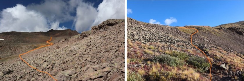

This gully wasn’t really that bad…
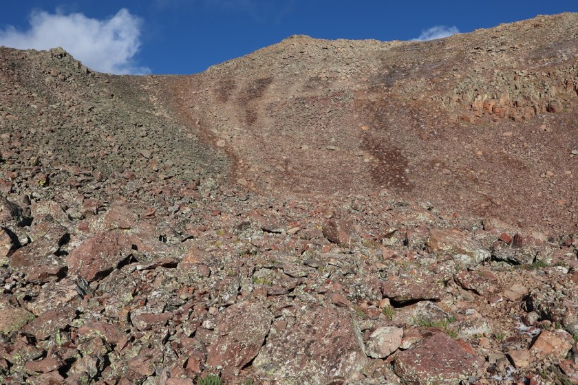
and at the top there was a cairn
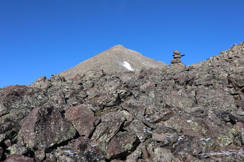
All I had to do now was head straight up the slope to the summit. Unfortunately, here is where the sprinkling of snow began. It didn’t require traction, but it did require careful footing, as a lot of the snow had turned into ice.
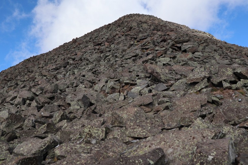
The boulders were a bit loose, but I found several dirt paths that led straight up

After hiking for 11.7 miles I summited at 8:50am
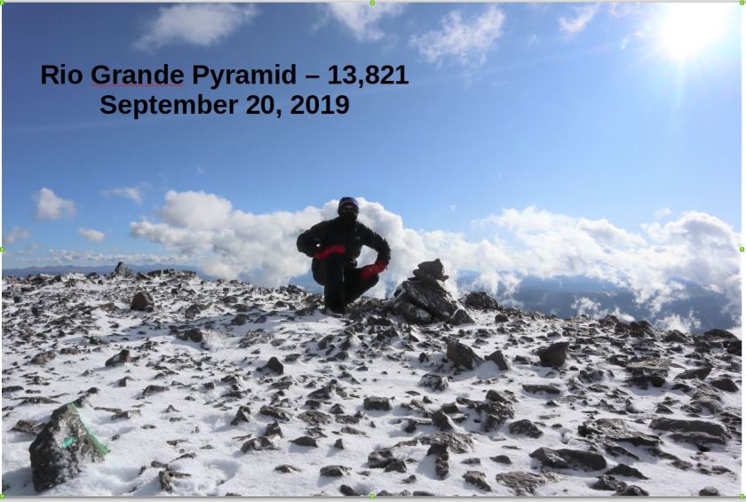
Summit:
It was really, really windy at the summit, and while it had looked clear while hiking up from below, now I wasn’t so sure. The wind and snow made it cold, and looking at those clouds I wanted to make it down as soon as possible. Those mitts has been a good choice.

Route finding on the way down was much easier than on the way up.
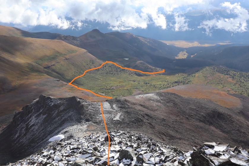
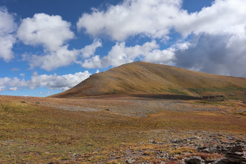
Here’s a look at “Fools Pyramid” if you’re thinking of attempting it. I had another big day tomorrow and I was worried about the potential snow for today so I didn’t head that way, but it’s definately something I’d consider in the future. I found a really great camping spot near treeline (before the boulder field by a stream) that I’d like to hike into some day, spend the night, hike “Fools Pyramid” and PT 13,261, camp again, and hike out the next day. Today was not that day.
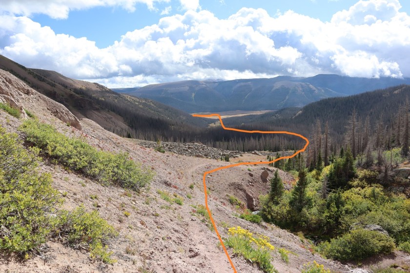
Once at the top of the basin here’s the route back on the CDT
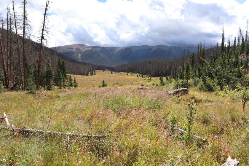
The further I descended the more the wind picked up. I heard what sounded like gunshots and realized I was hearing trees falling over. I kept looking at the clouds, wondering if it was going to rain again, but the wind seemed to blow them away as quickly as they came.
On my way down I came across a strawberry patch and even a few raspberry bushes.
Back down in the basin I had a clear view of the trail in the daylight. What I thought might have been tents in the dark ended up being large boulders. The wind here became insane. I’d stir up a bird as I was walking on the trail, and startled, it would try to fly away, only to be swept sideways in the wind. This happened about a dozen times (the birds were sheltering from the wind in the bushes) and I felt bad every time one took to the air. They were usually pushed by the wind sideways into bushes.
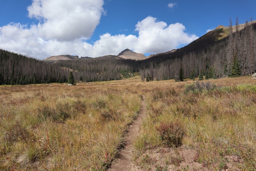
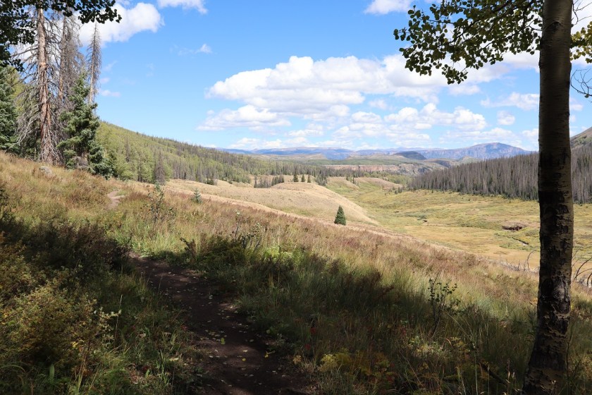
Just before I made it back to the bridge I came across someone who had all the right equipment but looked too clean and tidy to be a thru hiker. I asked him where he was going and he said he’d just started and was trying to find a lake. I’d travelled pretty far and hadn’t seen one, and told him as much. His response was it was 180 miles in. I was jealous, and wished him luck.
The last 5 miles took what seemed like forever for me to complete, and I was glad I’d chosen not to summit those two other peaks: I was tired!
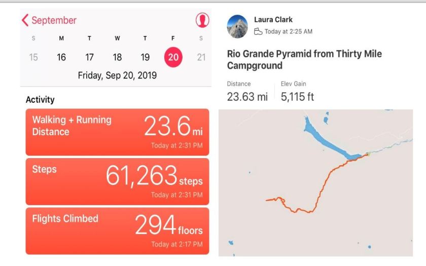
I made it back to the trailhead at 2:30pm, making this a 23.5 mile hike with 5115′ of elevation gain in 12 hours.

Nevada Highpoint Boundary Peak – 13,140
RT Length: 13 miles
Elevation Gain: 5144’
After hiking Mt Whitney I drove my rental vehicle to a Subway, got lunch/dinner, and paid too much for gas

My goal was to drive as close to the Boundary Peak trailhead as I could get in the Toyota Corolla I’d rented. I’d heard a lot of different things about the drivability of this road and since I didn’t have a 4WD or even a vehicle with much clearance (5.2 inches) I was a little worried. About 30 miles from the turnoff my cell phone lost service, and I knew I’d be on my own if I got a flat tire or damaged the vehicle on the 4WD road.
I was pleasantly surprised when I turned off US 6 and this is what I saw
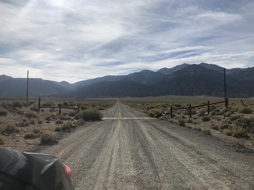
I knew the Queen Canyon Trailhead was about 6 miles from here, and it looked like I’d be taking a well maintained 2WD dirt road for at least the first few miles. The first two miles were flat and relatively easy, and with each passing mile I became more confident and a little more excited to be getting closer to the trailhead.
Around the 3rd mile the road became one lane and entered the canyon. I was a little skeptical about the road because I couldn’t see what was ahead of me, but I figured if I couldn’t turn around at least I’d be able to back up. Here the willows brushed both sides of the vehicle as I drove past, and the grass growing from the middle of the road made whooshing noises as it hit the underside of the vehicle.
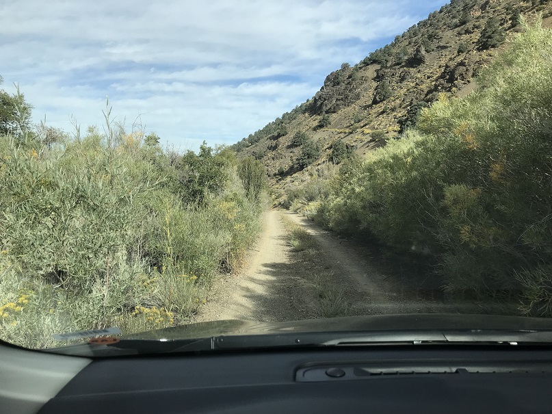
I was beginning to think I’d be able to drive all the way to the trailhead when around mile 4 I came to a roadblock: the road had washed out a little bit and with the low clearance vehicle it became too difficult to navigate. I got out of the car and walked up and looked for a fancy way around that wouldn’t require bottoming out and was unsuccessful. I was a little bummed because this section was so short and the road looked clear if I could just make it past this section about 10 yards long, but I didn’t want to get stuck and I seriously didn’t want to get stuck with paying for damages to the rental vehicle.

So I made a 10 point turn and looked for a spot to park. I was able to find a small pullout (thankfully the vehicle was small) but unfortunately it wasn’t in the shade (there wasn’t any).
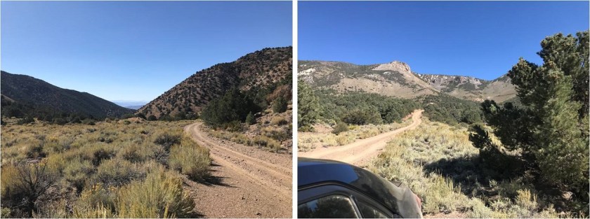
I relaxed, ate my sandwich, and pulled out my altimeter: I’d parked at 8220’. I did the math and figured this would add a little over 2000’ to my hike tomorrow and 2 miles each way. I liked those numbers, but they meant I’d only be hiking Boundary Peak and not adding on Montgomery Peak (because I had a plane to catch). I really wanted to get some sleep, but it was 4pm in Nevada in September and 95* outside. I tried to lie down in the back of the Corolla in my sleeping bag but it was just too hot to sleep. Rolling down the windows just invited the flies in, so I tossed and turned for quite a bit. The last thing I remember before drifting off to sleep was seeing a red Jeep race down from the road above and pass by my vehicle. It was the only other car I saw the entire time I was there.
I woke up at 1:30am and was on the trail before 2am. I started up the 1N146 road, forgot to turn on my tracker, stopped, turned it on, and was on my way. The road was very easy to follow to the trailhead; just stay on it and don’t take any turns. In the dark I passed a mine (I noticed on the way back there was a light on inside and wondered at why I hadn’t seen it on my way in).
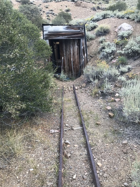
This mine is at 9010’ and provides a great place to camp before the road becomes 4WD

After the mine there’s still a mile left to go, and the road indeed becomes 4WD, although you could probably do it in a high-clearance vehicle that isn’t 4WD as well. The Corolla never would have made it.

You can see how easy it is to follow the road to the trailhead

As I was walking along the road something bobbled past me and flew like an awkward cross between a bat and a bird. It landed in the grass in the middle of the road, so as I approached it I aimed my flashlight at it to get a closer look. It looked up at me with a round face and large, yellow eyes. It was a fledgling burrowing owl. “Oh! You’re a baby!” I said to the owl. It hopped twice, jumped about 6 feet in the air, and once again awkwardly and silently glided into the brush on the other side of the road. That had been a fun encounter!
The trail starts at the right (south side) of the saddle around 10,000’.
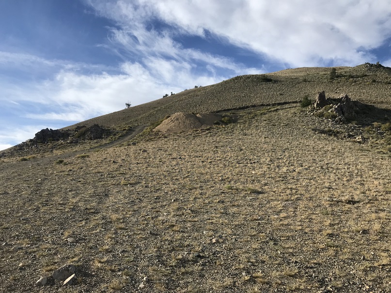
As I made it here I thought to myself “I should have brought my bivy with me”. It doesn’t weigh that much and it would have been a great idea to have hiked up here last night, slept, and started the trail from here. Oh well, next time I’ll add it to my pack on trips like this because it only weighs 1 pound.
I followed the trail a short distance to a trail register that was lacking a lid, arriving at 3:55am. I signed the register, replaced it in the ziplock bag and was off.
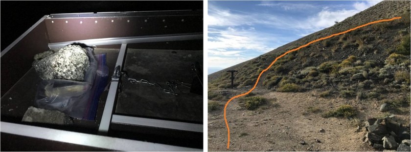
The trail begins with about 1000’ of elevation gain as it heads south and switchbacks easily up the hillside

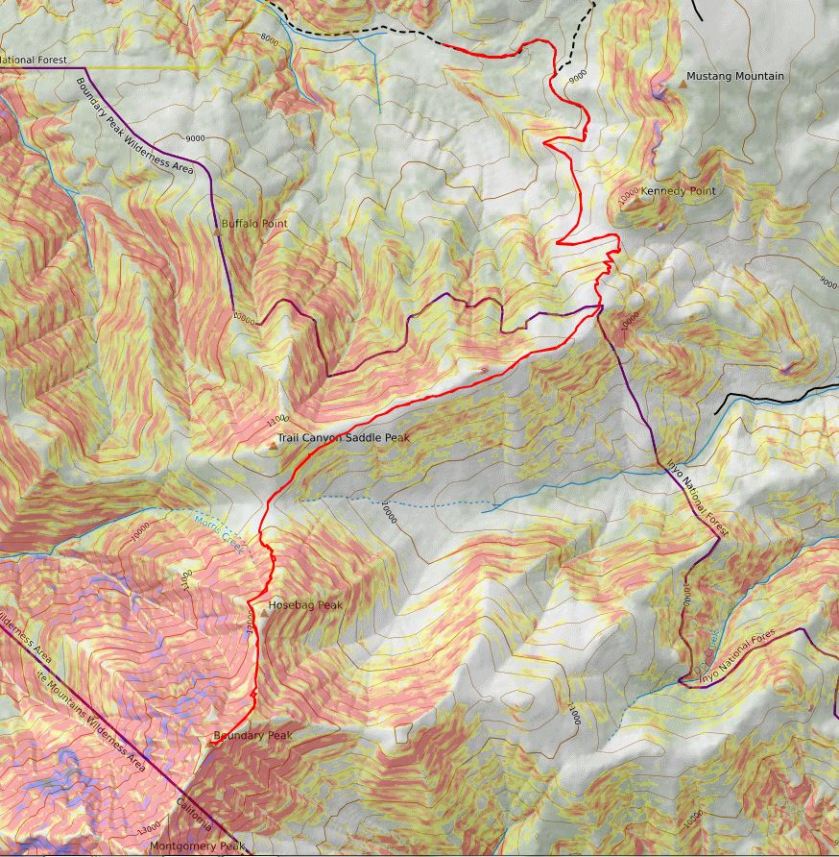
From the top of the hillside it’s a little disappointing as you then spend the next mile and a half losing 300’ in elevation, aiming for the saddle between Trail Canyon Saddle Peak and Boundary Peak.
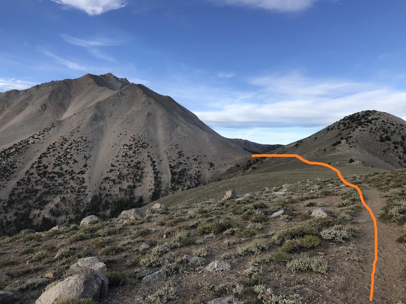
Here I started seeing horse manure, and quite a bit of it. Initially I thought how crazy someone must be to take a horse up at this elevation, but then I noticed there was a lot of it off trail as well and figured there must be wild horses in the area.
Once at the saddle there’s a cool wind shelter made out of bristlecone pine and rocks and an obvious trail that goes up the mountain.

This is the path the trail takes. It’s obvious in the daylight, but in the dark there were a lot of social trails and I kept getting off trail, yet stayed pretty much on course

Oh, and the top of this hill is NOT Boundary Peak.
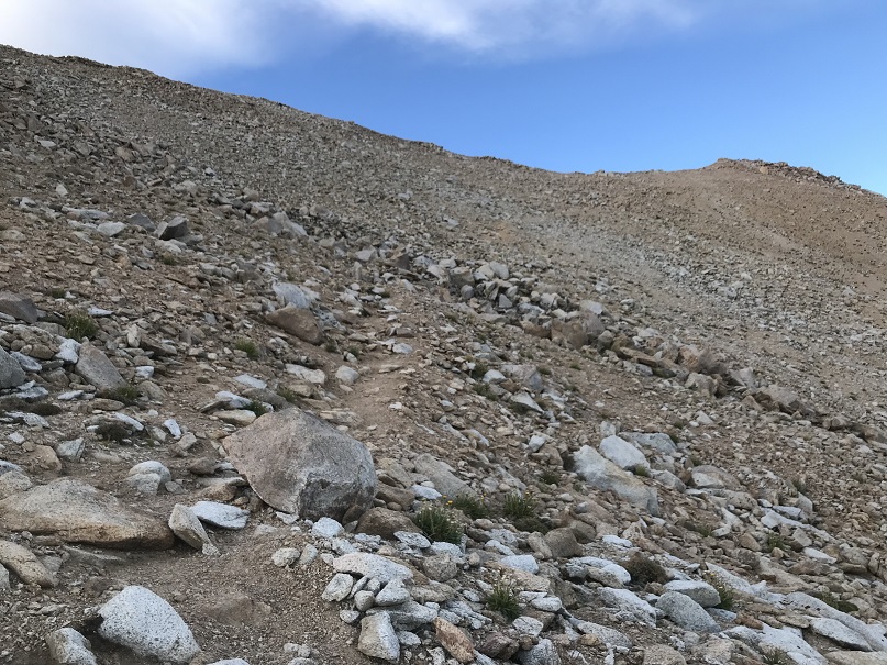
Around this time is when my tooth started hurting again. I took some ibuprofen and thought to myself “well, isn’t this fun?”
Once you reach the top this is the path before you
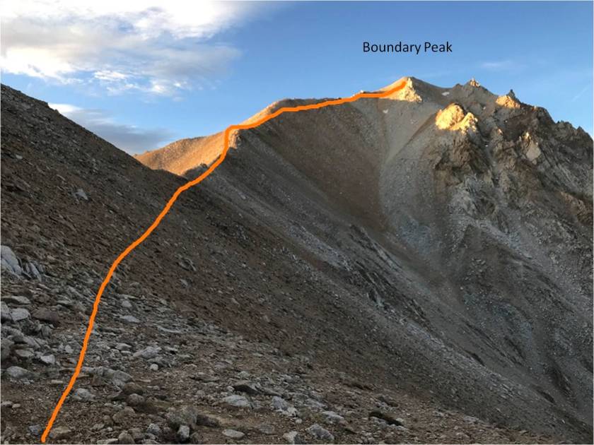
The trail splits a lot in places, but basically follows the ridge to Boundary Peak. It doesn’t matter which path you follow, they all stay at class 2 or below. This is the path I took
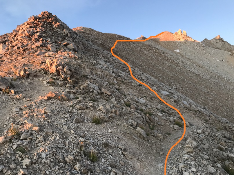
The last little bit to the summit has larger rocks but still stays at class 2
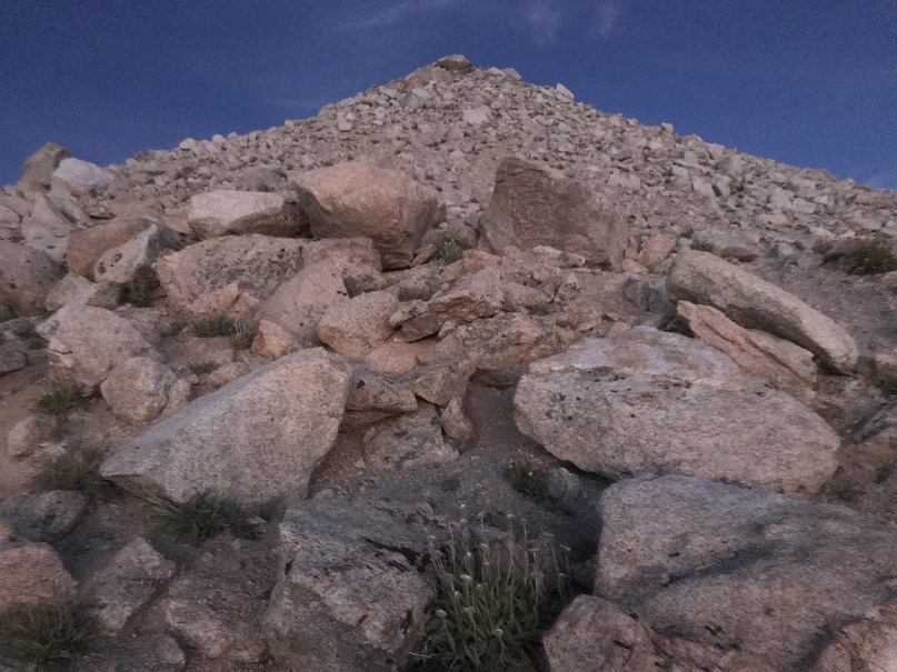
I summited at 6:45am, and the sun still hadn’t risen. My glasses are on to hide the crows feet…

Boundary Peak Summit:
It was very cold at the summit, and since I still didn’t have my new camera I had to keep taking off my gloves to get pictures on my iPhone: my hands were freezing! I took a few pictures and (again) actually signed the summit register. I figured I should eat something so I got out some dried mangoes, took one bite and felt the most intense dental pain I’ve ever felt in my life! Oh no! This was NOT good! Tears came to my eyes and I decided right then and there I was going to see a dentist as soon as I got home.

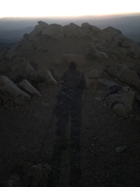
I sat here for a minute and contemplated watching the sunrise, but it was just too cold (and I figured I’d have a great view of it as I hiked back down). The moon was full and extremely bright, so I got a shadowselfie in the moon-glow
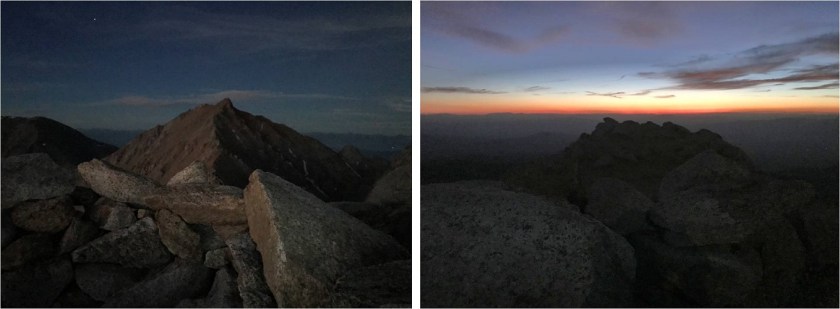
I also took some pictures of Montgomery Peak and the summit I was currently on (I lightened them up a bit so you can see detail)
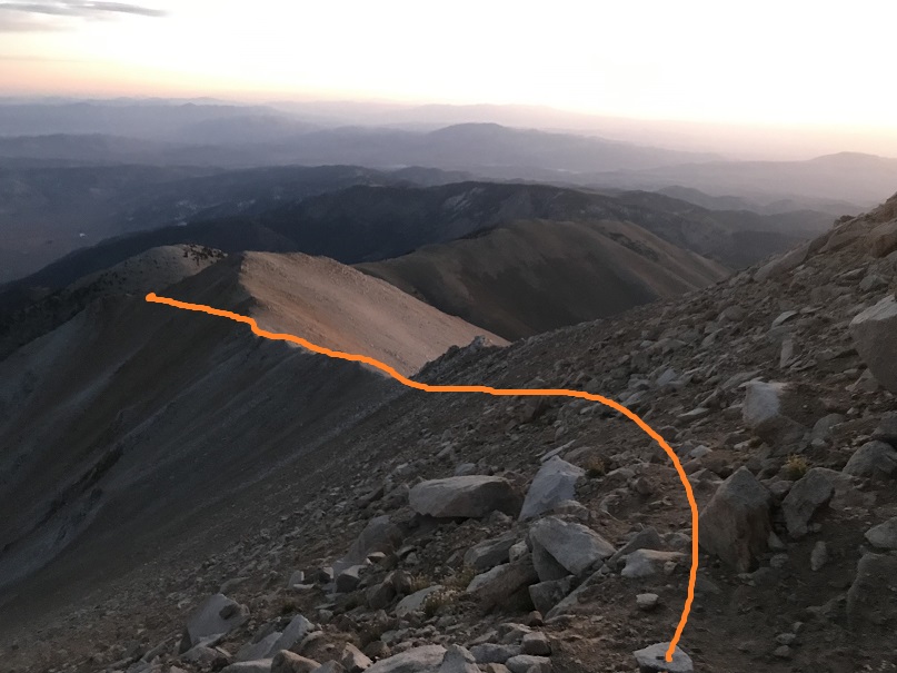
I headed back down, and within about 10 minutes there was enough light to see the path ahead of me. It was so nice to be able to see an actual trail instead of guess where it was in the dark!
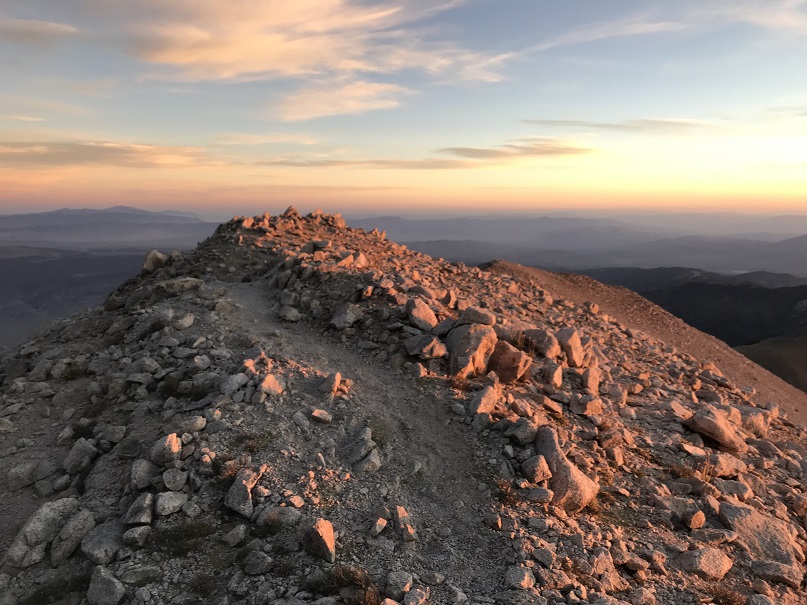
I sneezed and my teeth bumped together in the process. The pain was so intense I stood there for 3 full minutes waiting for it to subside. The sun finally rose at 7:35am (which I thought was late, but maybe that’s normal for Nevada?)

I followed the trail back down the same way I came up
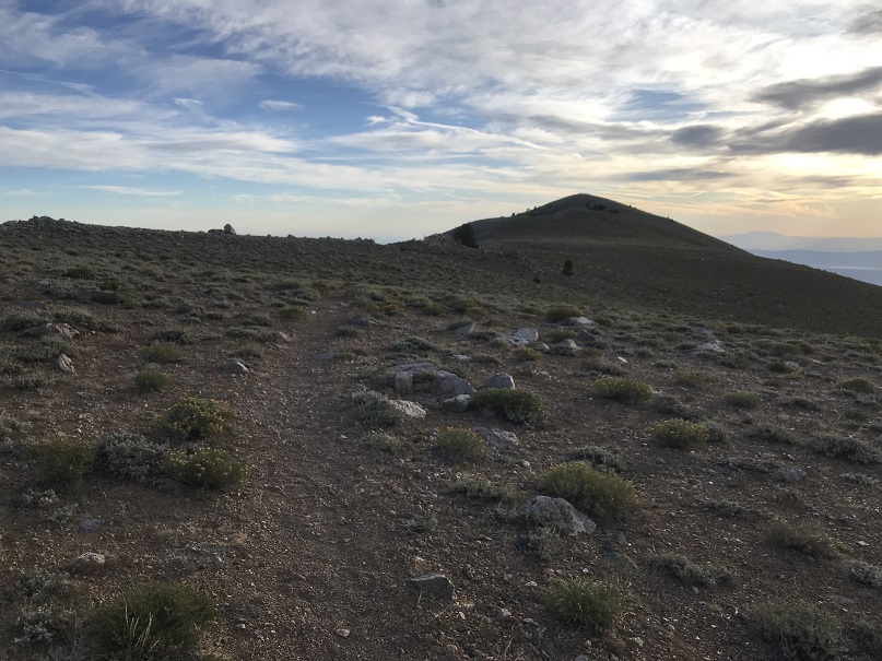
Back down to the saddle and then up to regain those 300’ I’d lost

Regaining the elevation actually wasn’t that bad, but I was also lucky the sun had gone behind the clouds and it wasn’t that warm out. It felt like I was hiking in the shade, and at this point my dental pain was more of an annoying dull ache and I was beginning to think the pain was directly related to elevation.
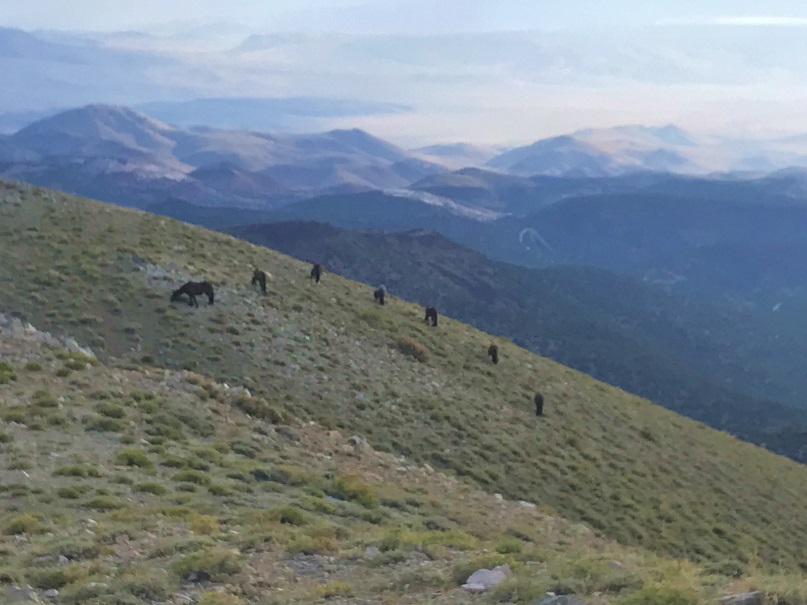
I came across a few deer near the trail, and as I rounded the last bit of hillside I saw a small herd of horses, grazing in a semi-circle on the hill.
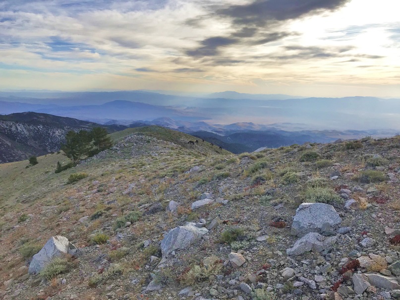
Boundary Peak Horses:
I made noise but they didn’t really seem to care I was there. Once again I wished I had my good camera with me and not just my cell phone: these could have been awesome pictures!
From here it was all downhill back to the trailhead

I signed out of the register and headed back down the road to my vehicle.
I made it back to the car at 9am, making this a 13 mile hike with 5144’ in elevation gain in 7 hours 15 minutes.

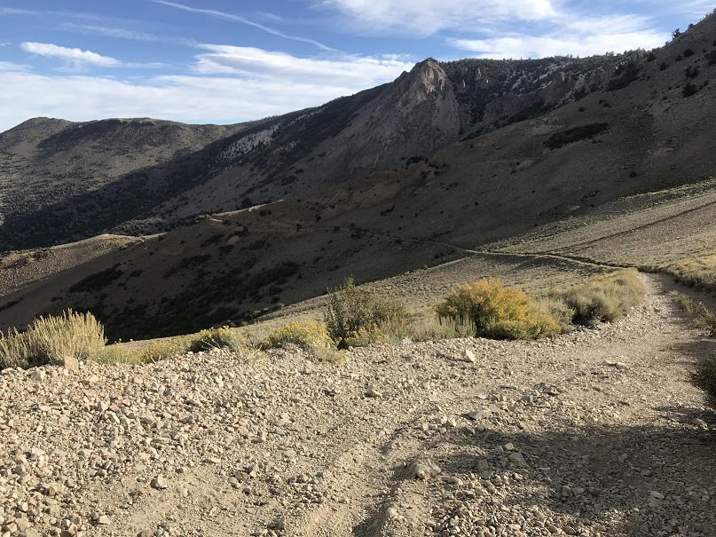
Once back at the car I cleaned up and got ready to head out, saying a silent prayer I didn’t do any permanent damage to the vehicle in the next 4 miles. I knew I’d be ok as long as I just drove slow, and since I hadn’t seen any vehicles since that Jeep last night I wasn’t too worried about the need to pass another car in the tight spots. In the daylight I saw an abandoned house

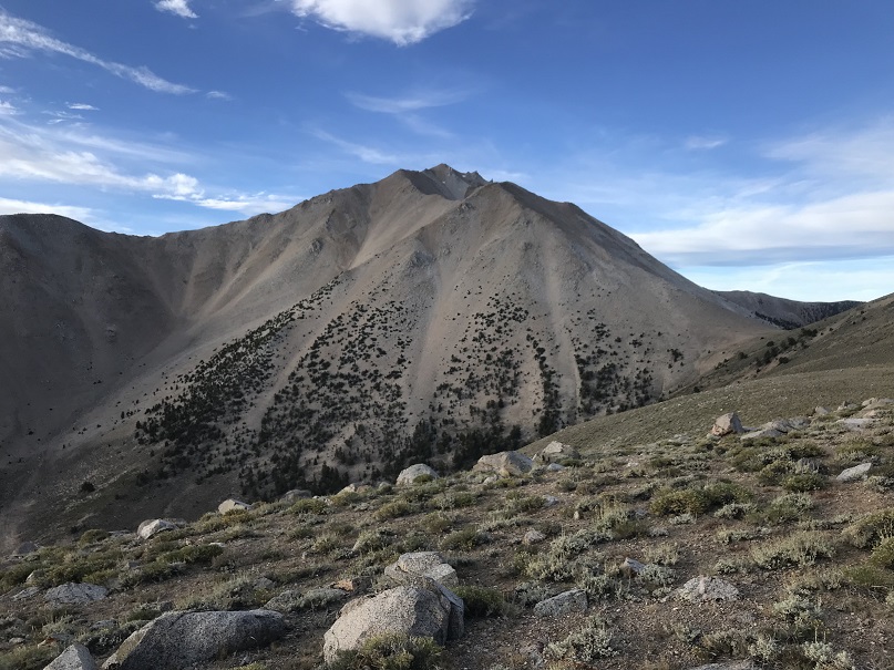
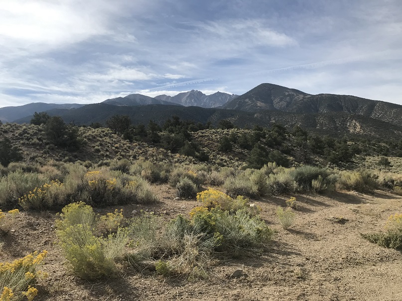
And a really neat view of Boundary Peak
I made it back to US 6 without incident, but the vehicle was quite dirty and had pinstripes from the willows. It was a 5 hour drive from here back to Las Vegas. I spent it with the radio turned up to avoid the constant “not in your lane beeping”. Once in Vegas I looked for a car wash to try and buff out he streaks. It was surprisingly difficult to find one that was open and operating (I found a bunch of closed or non operational car washes however).
After driving around for half an hour I was finally able to find a car wash, paid the $7 and was extremely happy with how everything turned out: no scratches left on the rental car! Woot! Now it was off to return the car (I didn’t have any issues) and to get to the airport early, hopefully to change my flight to an earlier one so I could hike again tomorrow.
My flight didn’t leave until 9pm and I was at the airport by 3pm. I went to the desk to try and get an earlier flight but even on standby they wanted more than double what I’d paid for both tickets combined to take an earlier flight home. I was not ok with this, so I decided to take a shower and eat instead (yes, the Las Vegas airport has showers, if you know where to look).

I spent the next few hours relaxing before my flight home, listening to others talk about what they’d done during their Bachelor/Bachelorette parties that weekend. I was a little upset I’d get back to late to hike the next day, but all in all considered my birthday weekend a win!

