PT 13801 & “Campbell Creek Peak” – 13,454

RT Length: 11.29 miles

Elevation Gain: 4559’

To finish off my birthday weekend I wanted to hike two more 13ers, which would bring my total to 200 unique Colorado 13er summits.  I chose these peaks because we’ve recently had our first snow and I’ve attempted this peak before and turned back due to snow/conditions.  If I wanted to get PT 13795 in this year I was going to have to do it soon.   

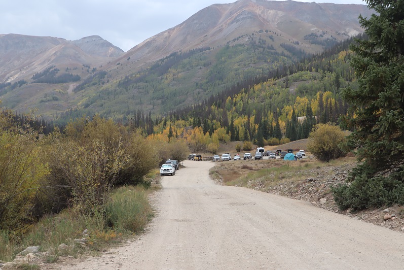
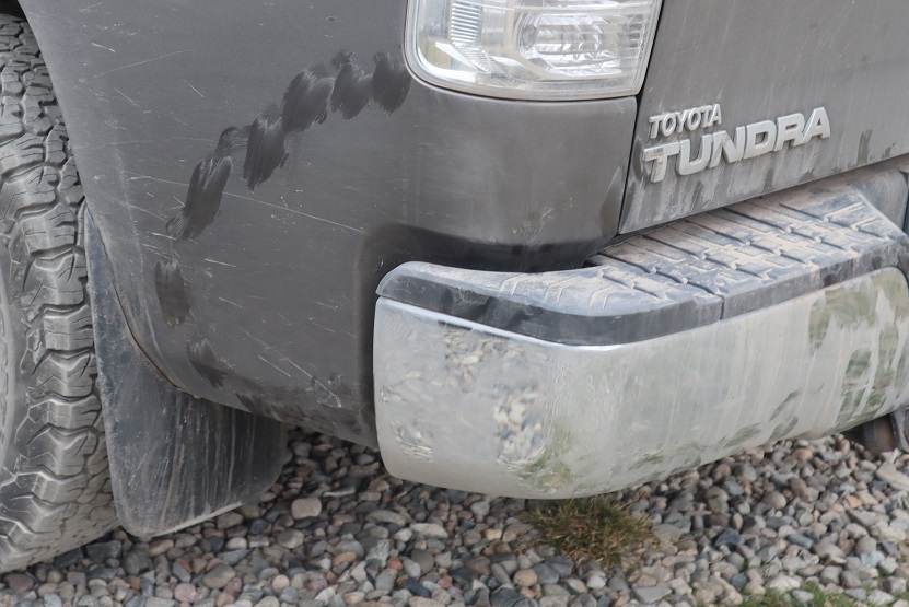
I drove down to the Grizzly Gulch/Silver Creek Trailhead and didn’t make it there until after dark.  The parking lot was packed, there were several tents set up, and tons of campers enjoying campfires.  In short, it was loud and everyone seemed to be enjoying themselves.  I parked, fired up my jetboil and made my birthday dinner of cup noodles and mashed potatoes.  As I ate dinner, I made some notes from the days climb, then got ready for bed.  There are clean bathrooms at this trailhead (no toilet paper though).  As I came back from the bathroom I ran into a rather large deer licking my truck.  I tried to shoo it away but she wouldn’t budge, so I carefully made my way into the back of my truck while she continued licking my bumper.  On a positive note, by 9pm the entire trailhead was silent and everyone had gone to bed, so I had no problem falling asleep.

I awoke to 32 degree weather and a layer of frost on top of my sleeping bag.  Looks like I’m going to have to start winterizing my topper.  Since it was cold I put on my puffy as well as my windbreaker, knit hat and gloves, and was on the trail at 5:15am.  

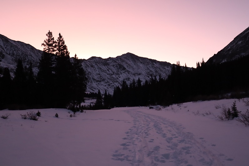
I started out by heading west, following the same trail as Handies Peak.  If you’re reading this I’m going to assume at this point you’ve summited Handies Peak and I won’t go into detail about the initial approach.  If you’d like to see the approach I’ve written it up from my failed attempt of PT 13795 last year.

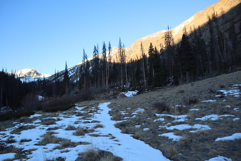
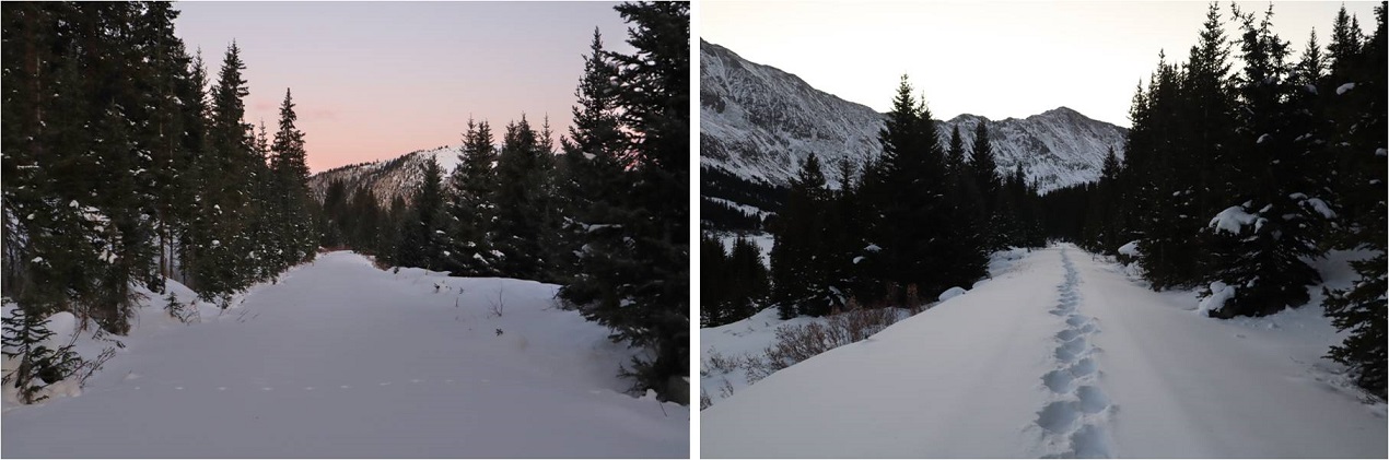
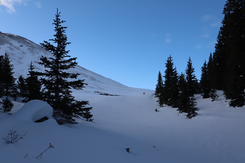
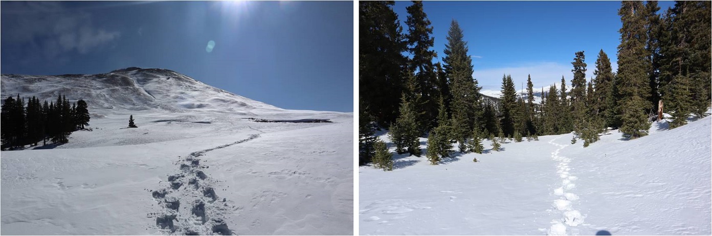
I followed the Grizzly Gulch trail through the woods and past treeline.  After hiking for 2.5 miles I turned left and headed southeast towards an upper basin.  There was a faint trail here

Once in the upper basin I came to a lake.  There were two tents set up, so I tried to be quiet as I passed.  I skirted the lake to the left and headed towards the gully that would bring me into another basin.

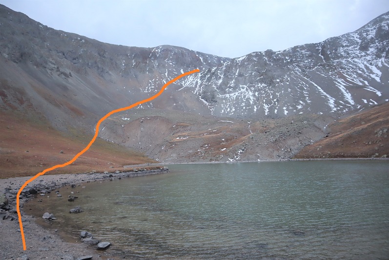
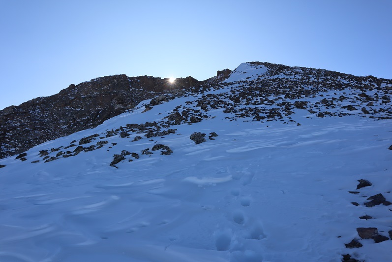
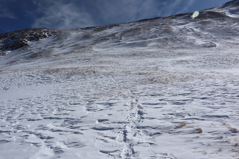
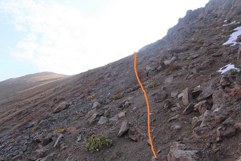
Ascending the gully beyond the lake was class 2+.  The scree here was awful:  I’d take one step forward and slide backwards.  I actually used my ice axe and trekking pole here for stability, glad the sand was wet from the recent snow.  There was no trail, so I just aimed southeast and tried to avoid the snow (it was bulletproof by the way).

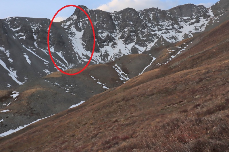
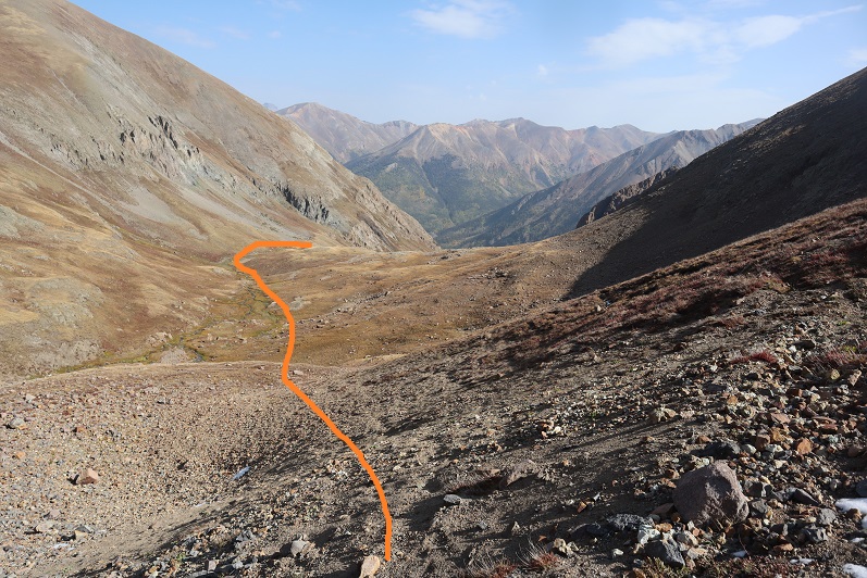
Once in the upper basin I had a few options.  I’ve read trip reports where hikers have used the gully to the left, but I’m not a fan of gullies.  In fact, I consider ‘gully’ to be a 4 letter word.  I took a look at the gully and said “nope”.  Instead I took the ridge to the right.  This was an easy hike on tundra, and should be the standard route.

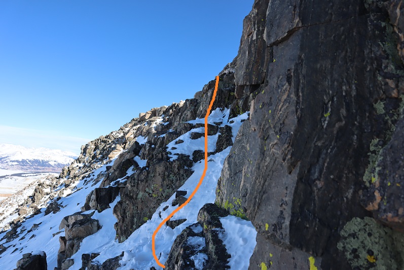
Here’s a look at that gully I didn’t want to ascend

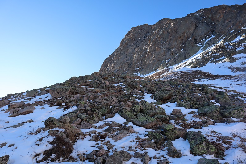
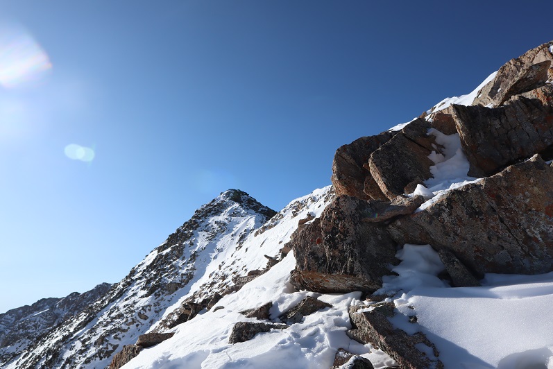
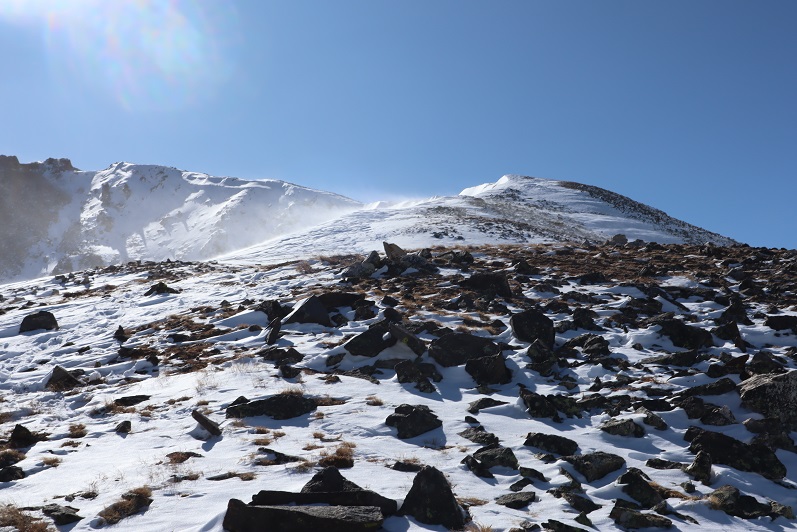
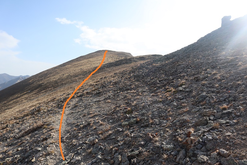
Just before gaining the ridge the tundra gave way to rock

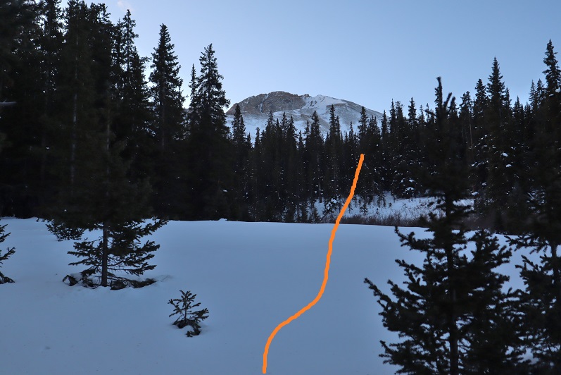
At the top I turned left and headed southeast for an easy tundra stroll towards PT 13795

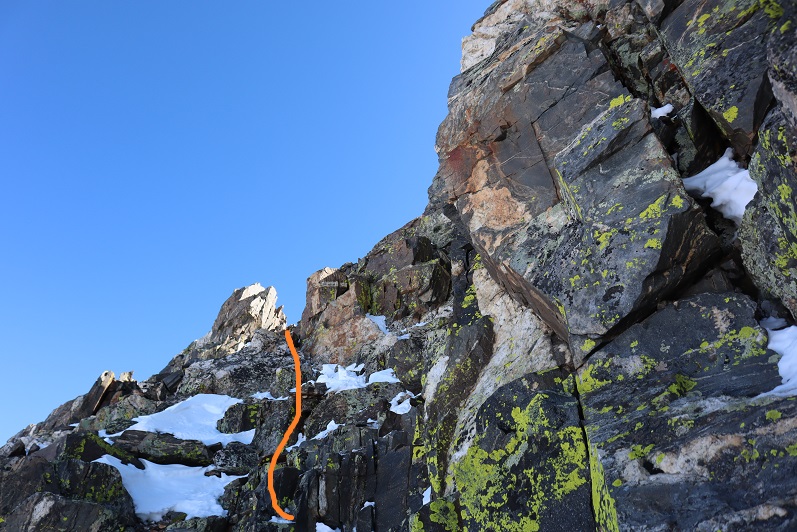
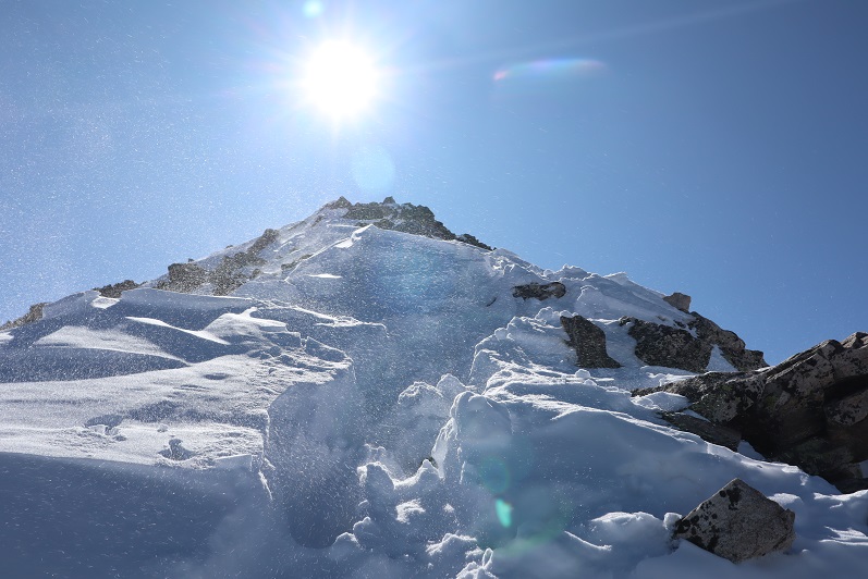
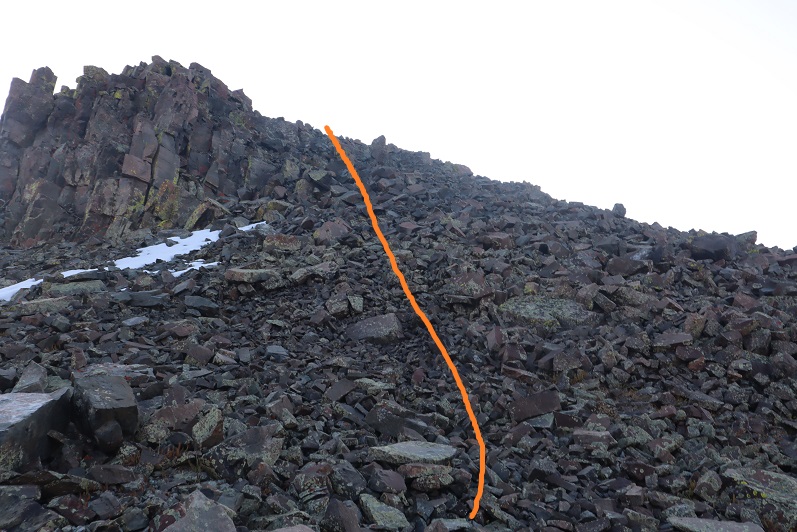
The last push to the summit was rocky, but stayed class 2

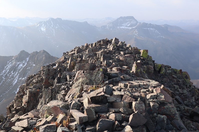
The summit was rocky as well

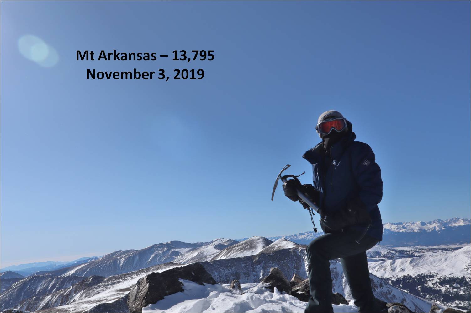
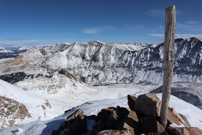
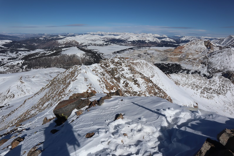
I summited PT 13795 at 8:20am. I only took 2 photos, and when I got home they were both terrible (oh well). 
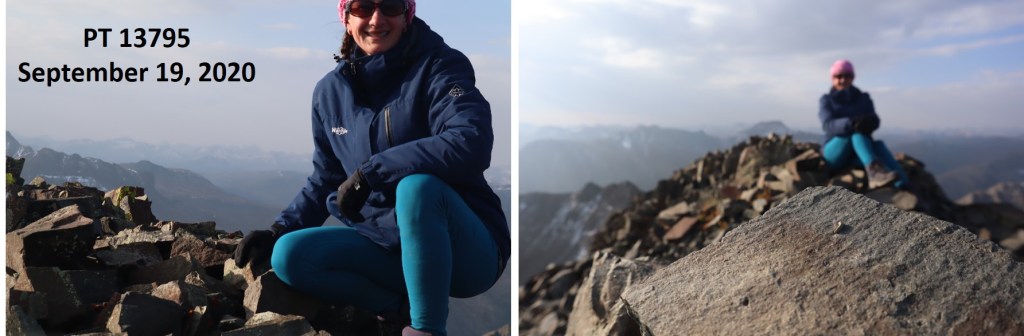
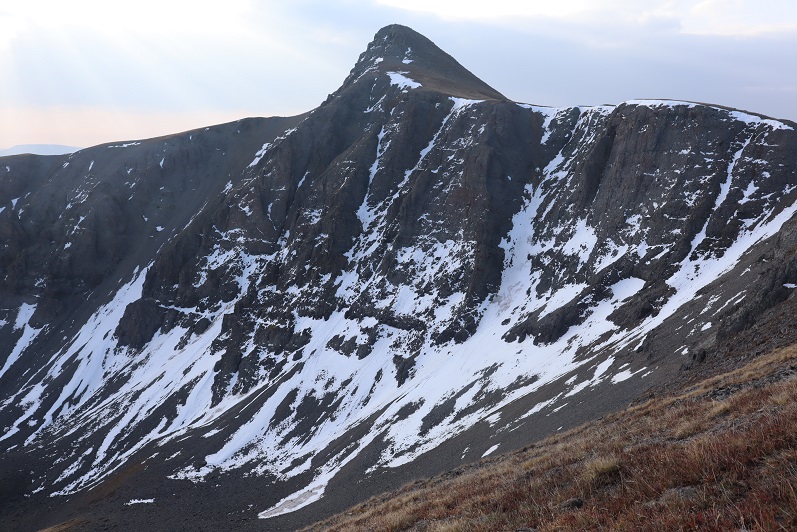
PT 13795:

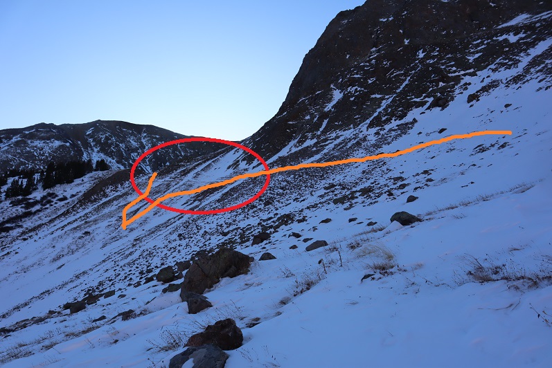
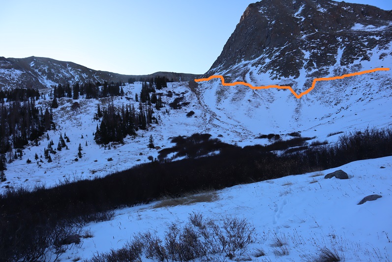
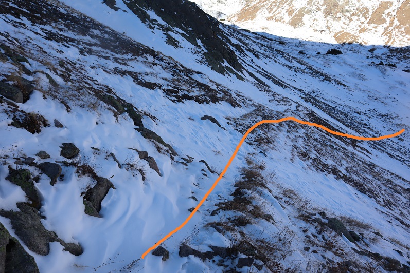
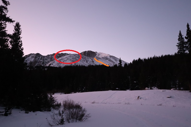
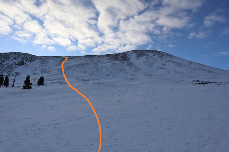
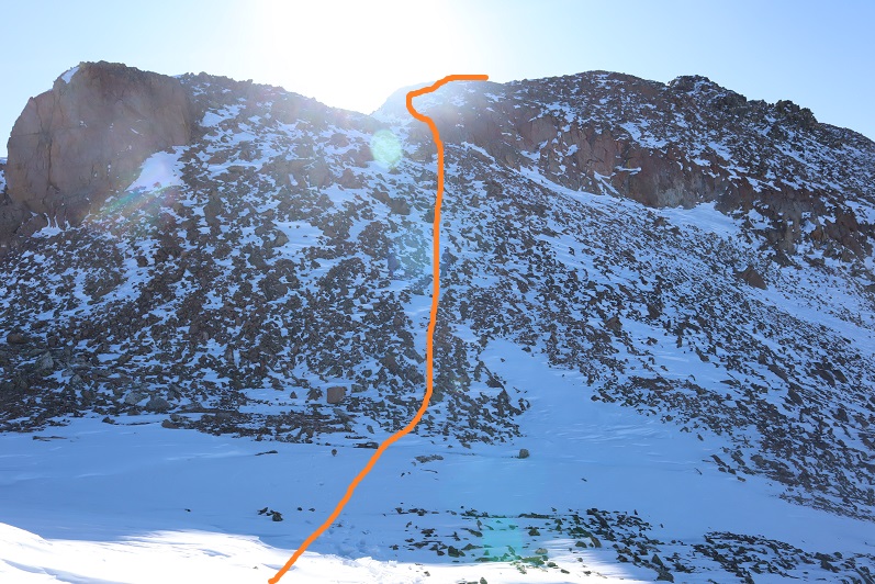
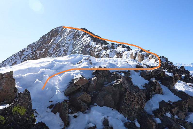
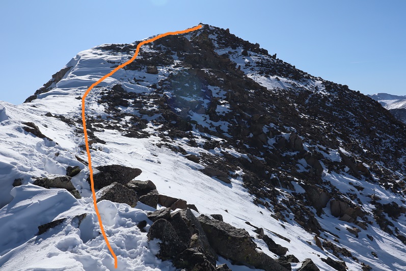
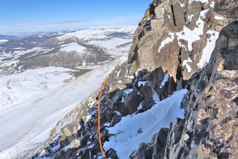
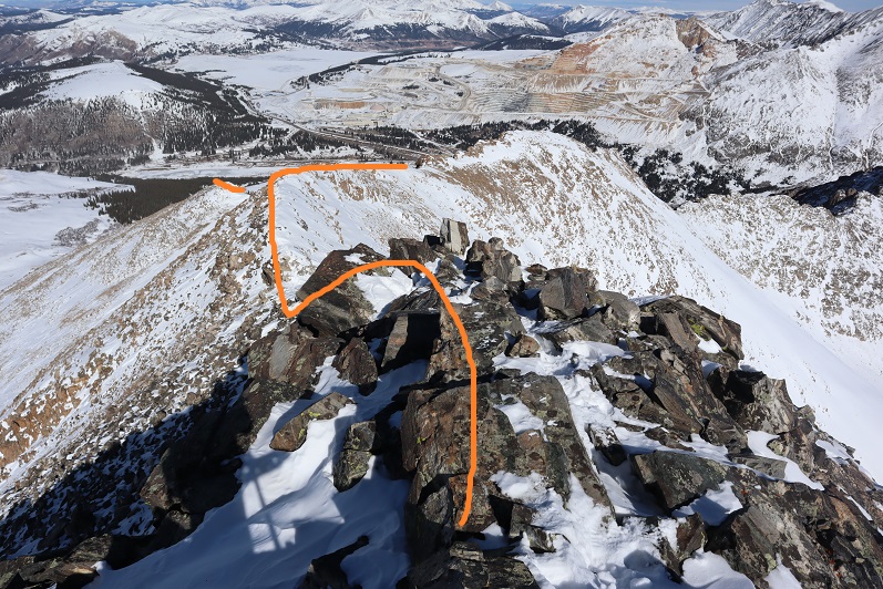
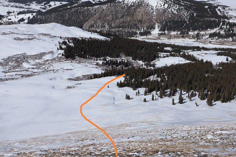
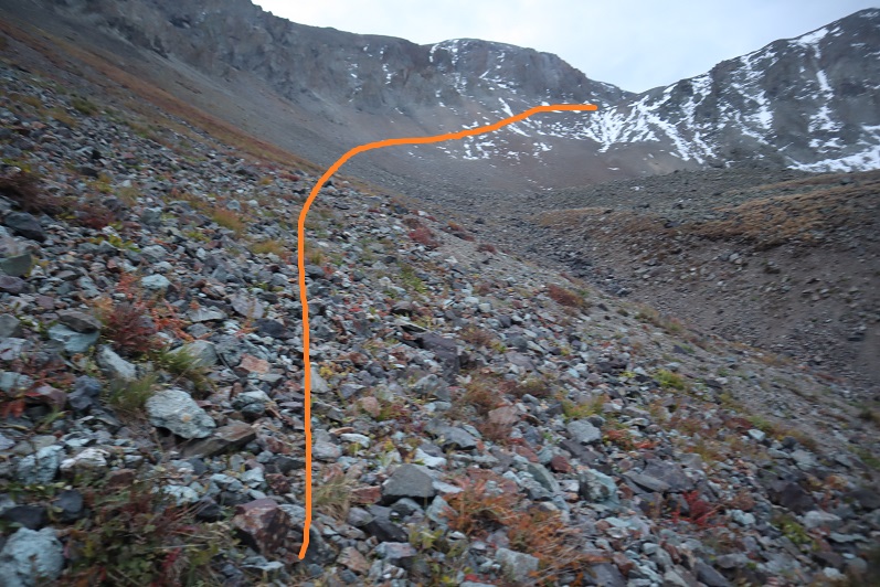
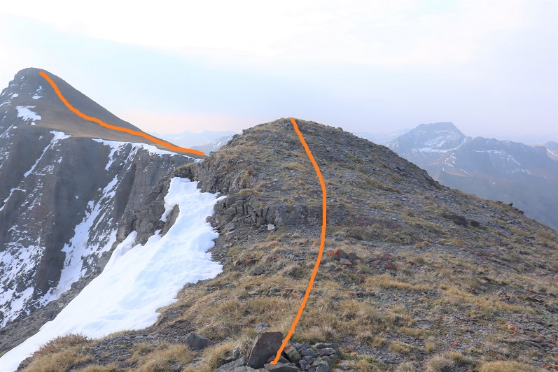
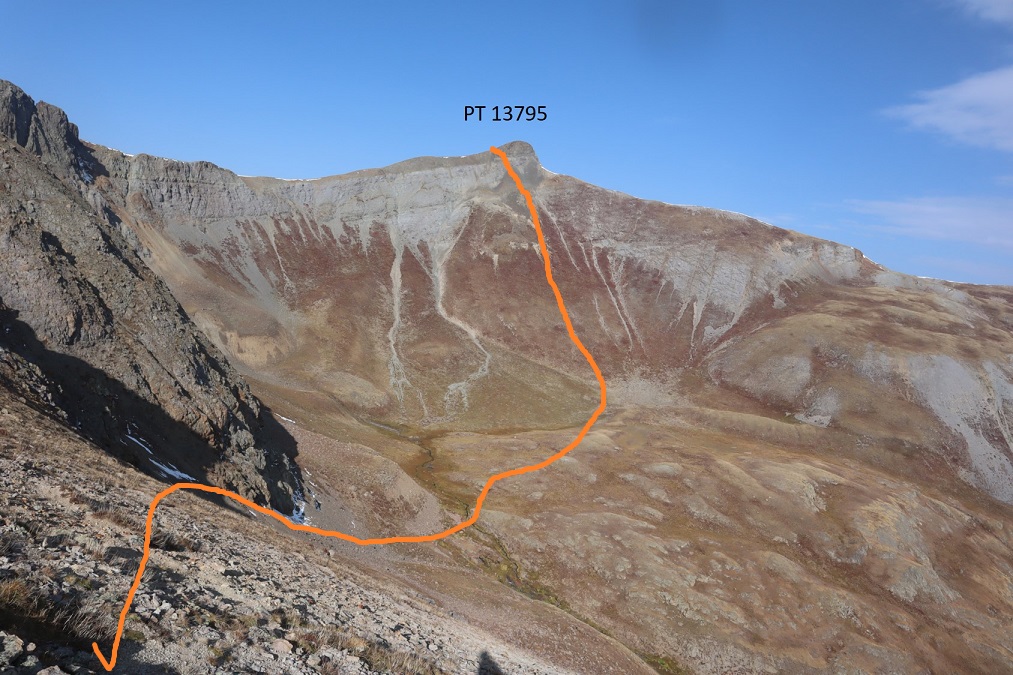
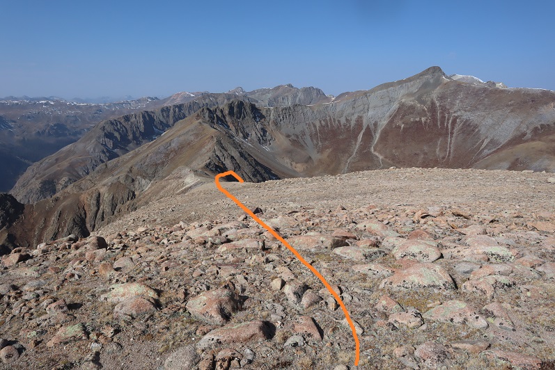
It was really hazy due to the fires, so I had a hard time getting a clear view of Campbell Creek Peak.  I’d heard the ridge between PT 13795 and Campbell Creek Peak didn’t ‘go’ so I was going to need to drop down into the basin and ascend another gully.  That gully didn’t look too bad.   Here’s the overall route I took

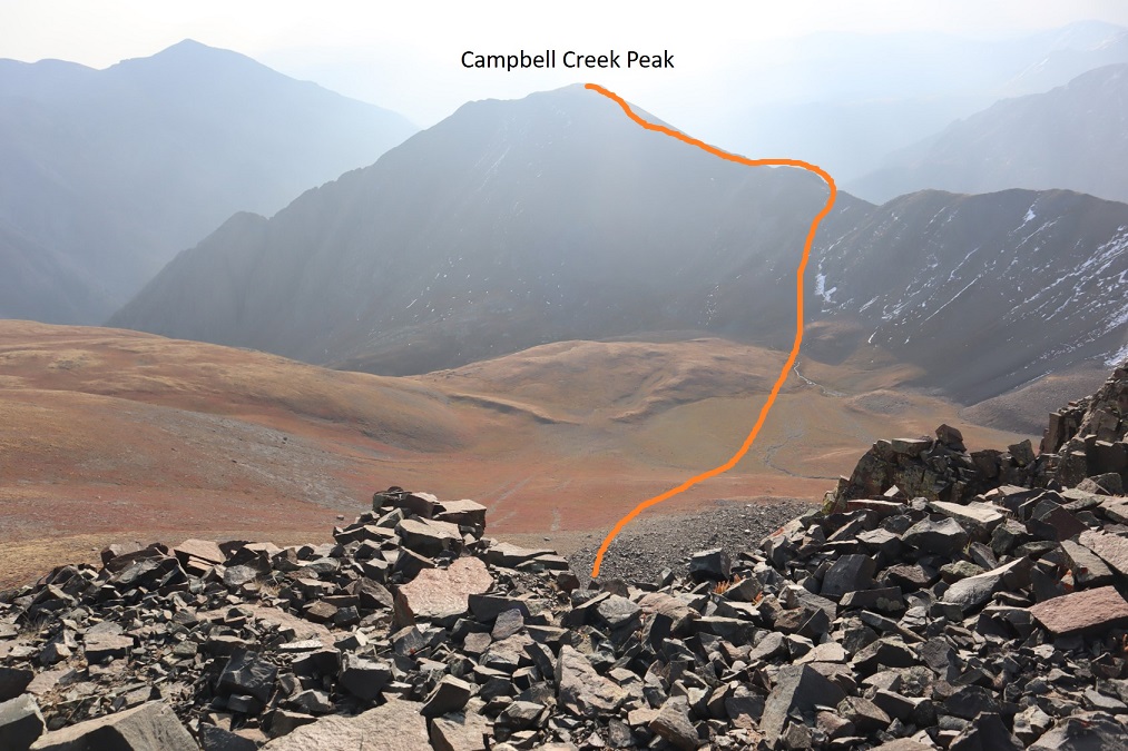
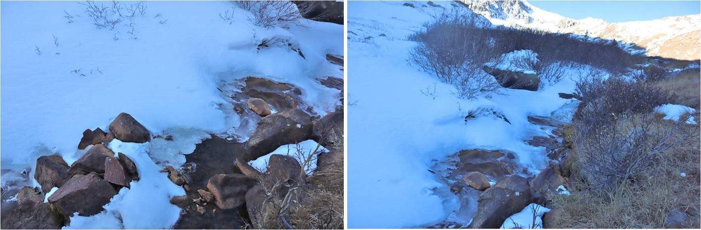
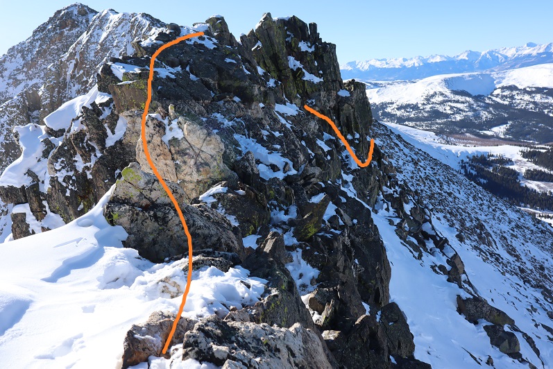
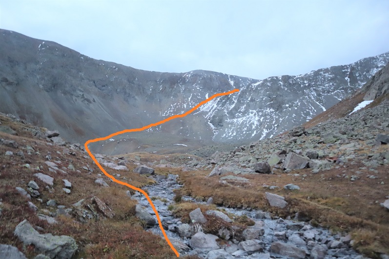
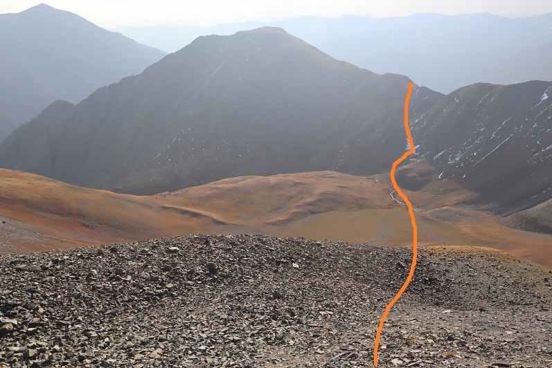
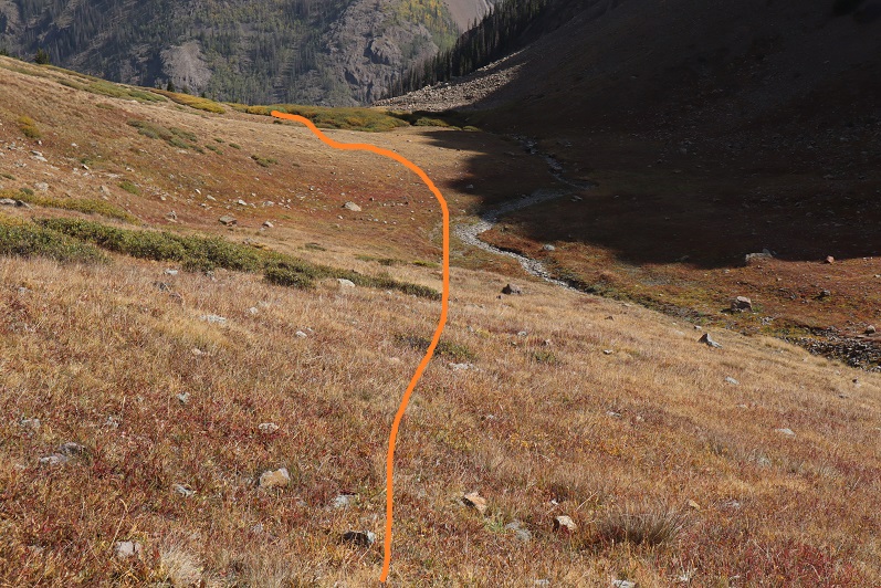
First heading south to avoid the class 3-4 section directly below the peak, and then east towards the basin

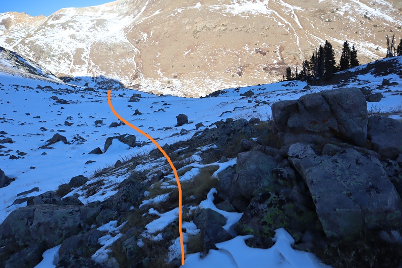
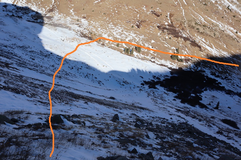
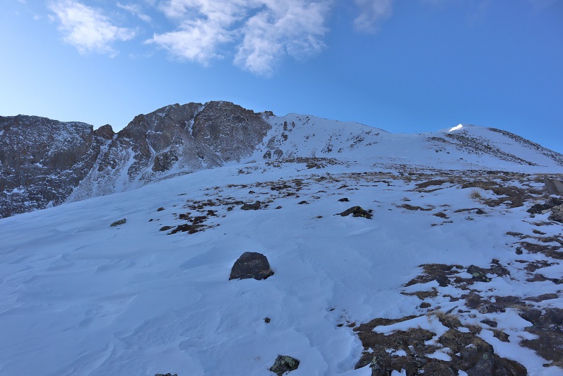
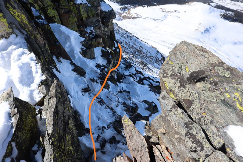
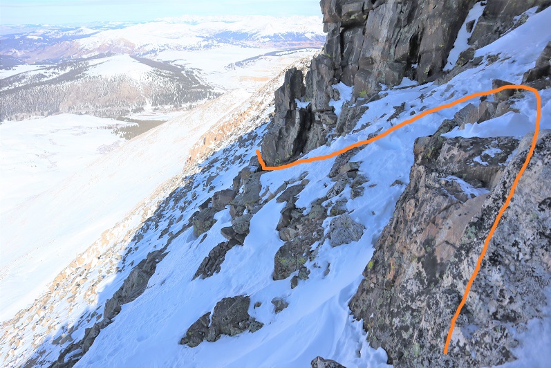
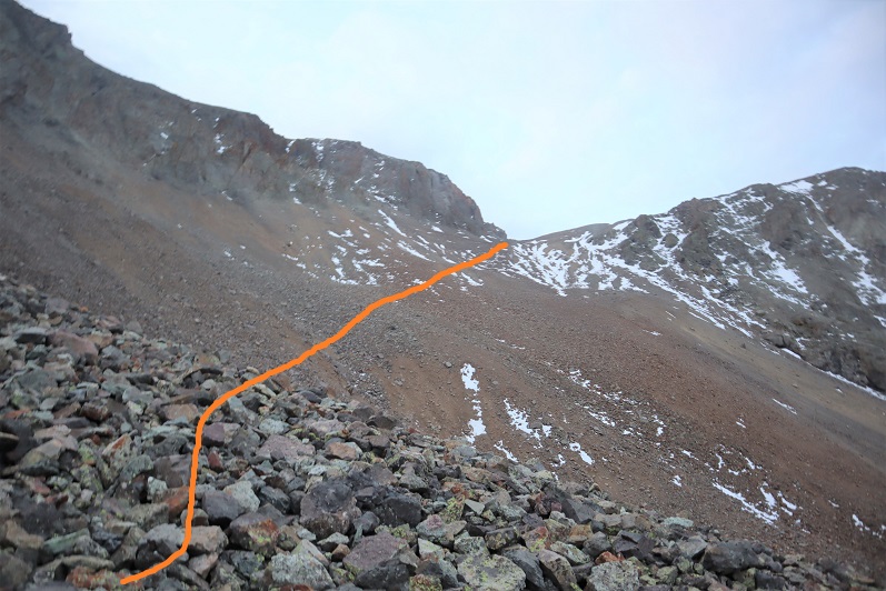
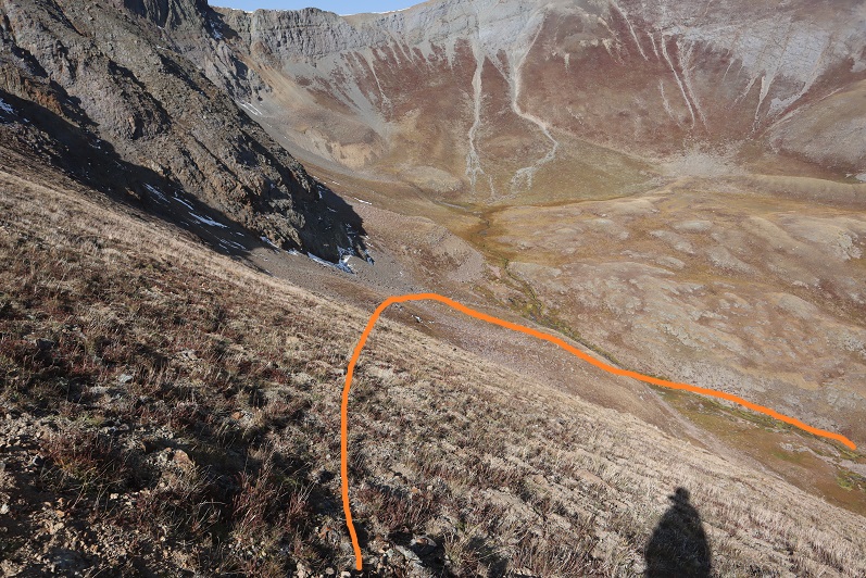
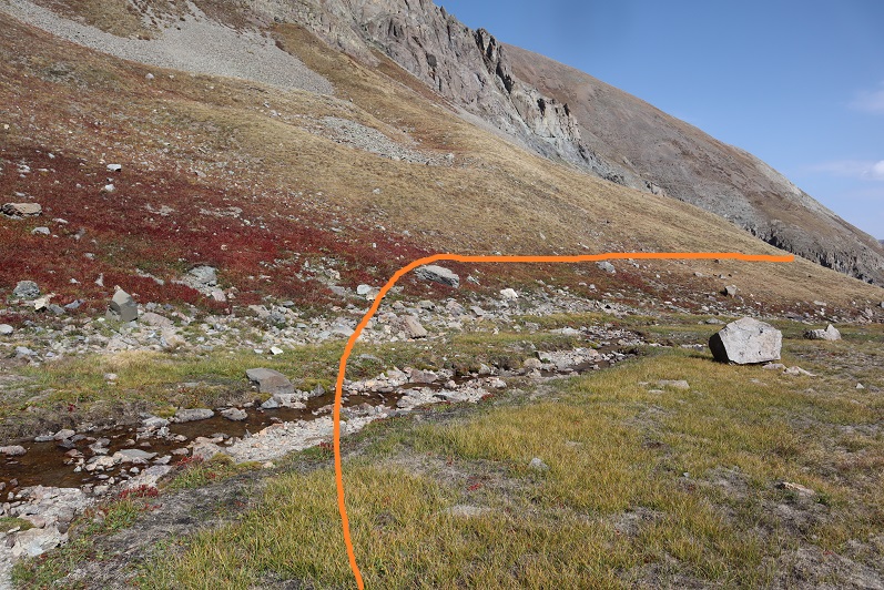
I just aimed for the stream, and then stayed to the left of the rock to gain the ridge

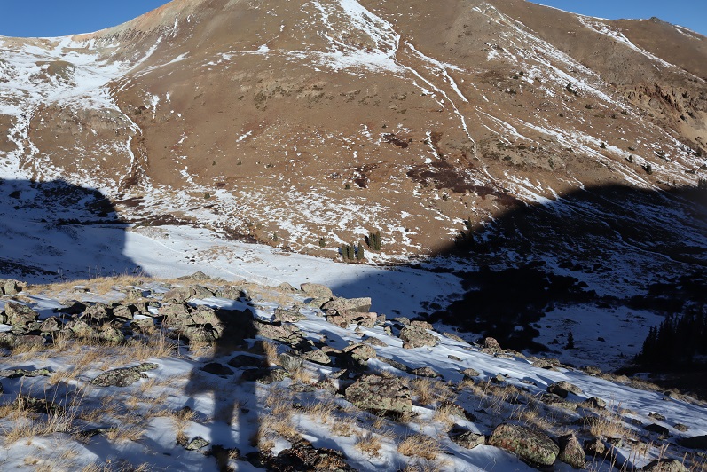
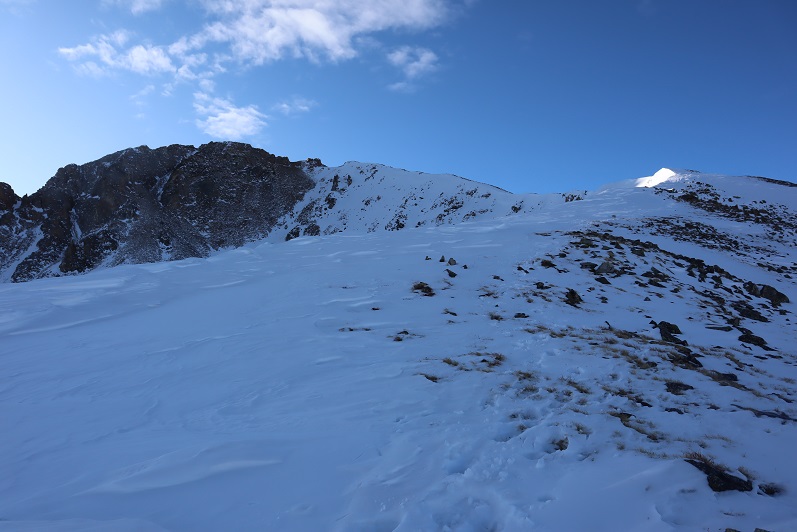
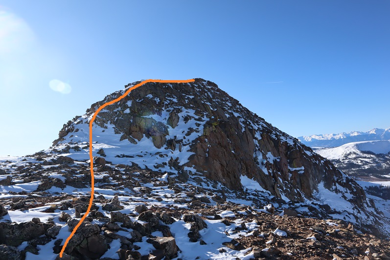
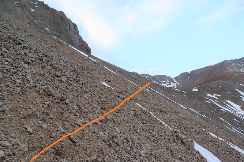
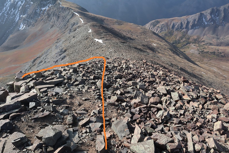
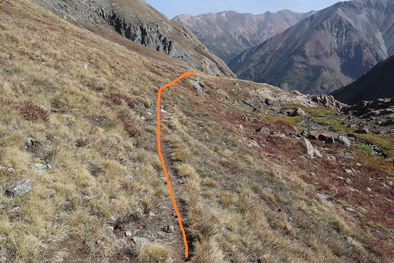
Here’s a look back at the route I took down from PT 13795 (it’s not as steep as it looks, but I was glad I’d hiked down this and not up)

I followed the ridge northeast to the summit of Campbell Creek Peak

I summited Campbell Creek Peak at 9:45am

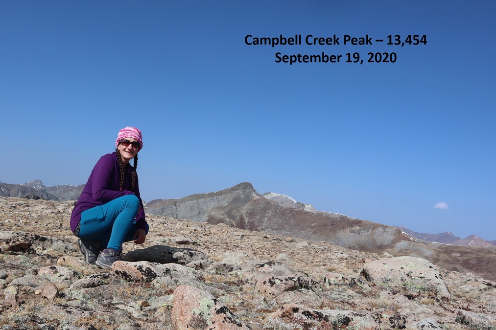
Campbell Creek Peak:

After summiting I turned around and headed back down the ridge and into the basin.

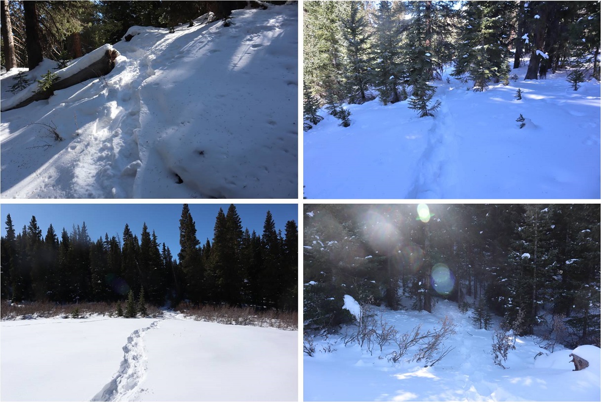
Once in the basin I turned right and followed Campbell Creek north.  I crossed the creek towards the end of the basin and picked up a faint game trail

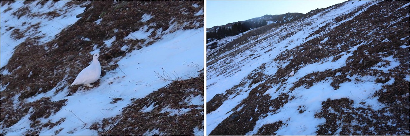
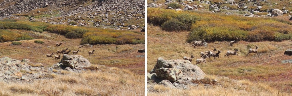
It was here I saw a herd of Bighorn Sheep.  They also saw me and quickly bounded away.

The game trail I was on kept disappearing and reappearing, so I decided to just follow the creek out of the basin

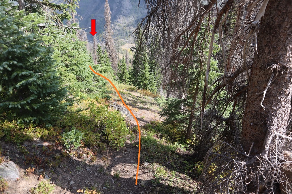
This led me to a large patch of willows.  I followed game trails northeast through the willows, around the side of the mountain

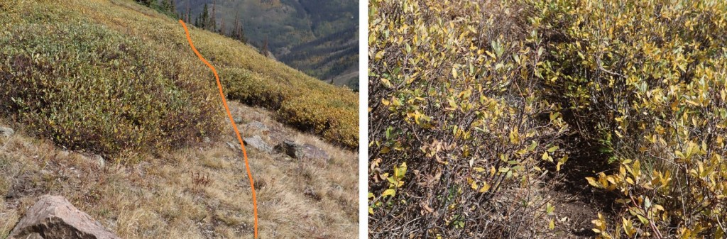
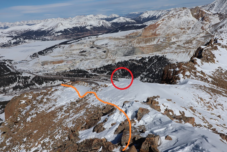
From here on out there was a lot of bushwhacking and route finding involved.  Luckily, I could see CR 30 in the distance, so I just kept traversing the side of the mountain, heading northeast and aiming for the road, slapping willows, bushes, and branches out of my way as I went. 

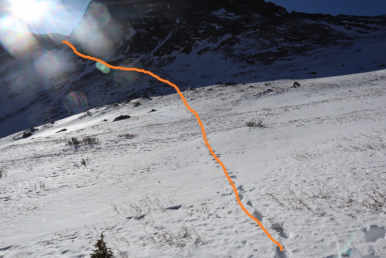
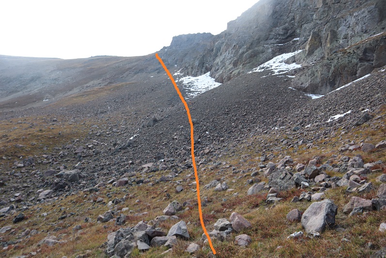
Eventually I came to a gully and followed it own to the Gunnison River, crossed the river on avalanche debris, and followed the road a mile back to the trailhead. 

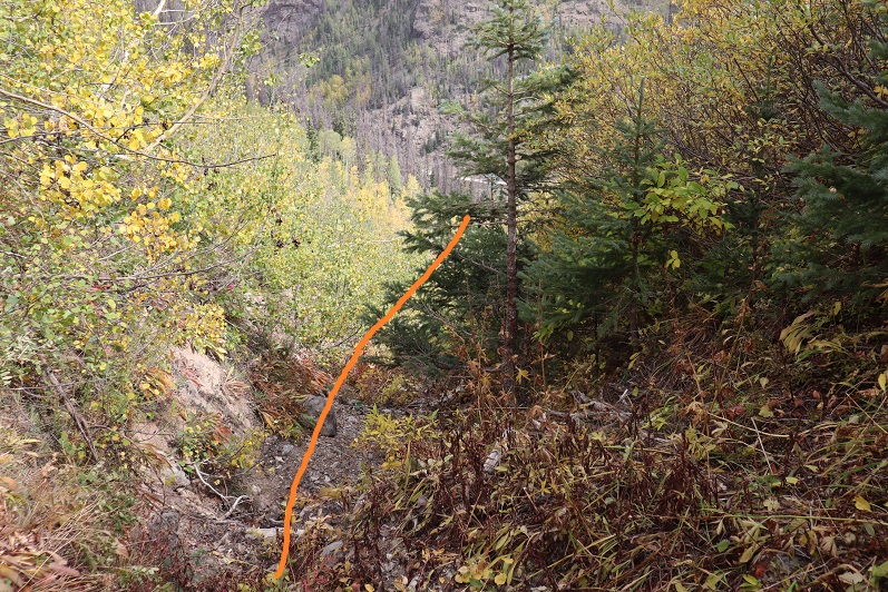
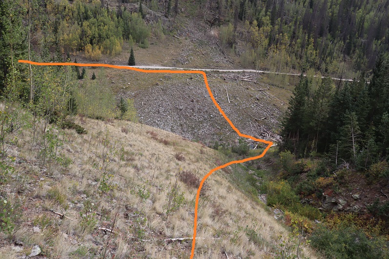
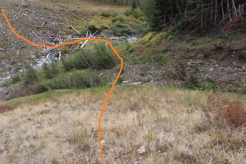
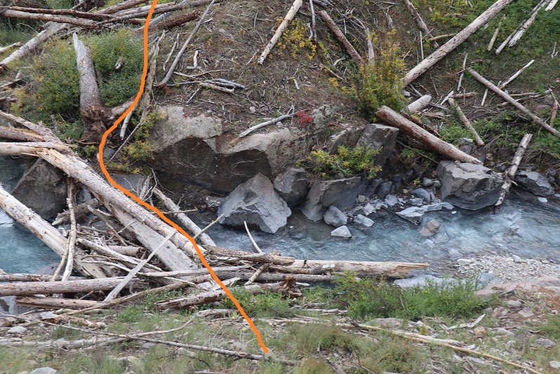
Here’s a look back at the gully I came down

I made it back to my truck at 12:30pm, making this a 11.29 mile hike with 4559’ of elevation gain in 7 hours 15 minutes.

Oh, and I didn’t get a picture of the deer licking my truck, but there were obvious signs it had when I got back and saw it in the daylight.

Campbell Creek Peak was my 200th unique 13er.  Not a bad way to end a birthday weekend! 

13,795 (attempt)

1

RT Length: 5 miles

Elevation Gain: 1948’

Note:  My successful summit of this peak can be found here.

I never should have attempted this hike today, but the weather was clear and my beta told me the mountains in this area were snow free. There are so many 13ers in the San Juans I wanted to knock another one out before the snow sets in again.  As I was leaving the house around midnight my daughter asked me if I’d take her to the school musical that night at 7pm.  I did some mental math and figured I’d have plenty of time to climb this 7.5 mile peak and be back in time to take her to see the musical.

I drove in the dark to the Grizzly Gulch trailhead, a little surprised to see so much ice on the 2WD dirt road in

2

There was one other vehicle in the lot when I arrived. I’m guessing they were headed to Redcloud/Sunshine today.  Last time I was here I’d had a porcupine visit me in the middle of the night, making noise in the gravel below my truck as he tried to get up inside.

3

It was getting light as I put on my gear. From the parking lot it didn’t look like I’d need microspikes or snowshoes, but I decided to bring them anyway.  I was on the trail at 6:30am.  The trail starts at the west end of the parking lot and then crosses a bridge and heads southwest on a well defined trail.

4

5

6

Well, it would have been a well defined trail if there hadn’t been so much snow! Not enough in the beginning to put on spikes/snowshoes, but way more than I’d anticipated.

7

It was immediately obvious no one had been on this trail since the last snow, which had to have been over a week ago. What was curious was how soft and sugary the snow was after sitting for so long.  There were also tons of animal tracks visible in the snow, mostly fox and moose, and they’d been here recently by the signs of urine and scat on top of the snow.

8

Last time I was here I’d seen a moose, so even though I never ended up seeing one I was extra vigilant today. I went in and out of the trees several times and noticed much less snow in areas without trees.  This gave me hope for the rest of the trail above treeline.   Of course, most of the snow in these areas was only on the trail itself.

9

When I made it to treeline I was disappointed to find quite a bit of snow. It wasn’t the snow that bothered me, it was the type of snow:  all sugary with very few areas that were consolidated.  The drifts were the worst! 4+ feet of sugary snow that didn’t respond to snowshoes made for difficult traversing.   I put on my microspikes.  Here’s the path I took to the middle of the basin

10

There was a stream that needed crossing. It was partially covered in snow/ice and I couldn’t tell how wide or deep it was.  It took me several minutes to find a good area to cross where I wasn’t worried about falling in.

11

After crossing the creek I located a faint trail on the side of the mountain and worked my way towards it. The trail was only visible because it was covered in snow.  The walk to the trail took a long time because I was postholing with every step.

12

Climbing up the hill should have been easy, but the snow was still sugary and the talus below unstable. Rocks rolled with every step I took, so I took them slowly

13

There were several large areas of snow directly on the trail that were not passable. I tried making a bridge in the snow but it wasn’t consolidated enough to hold my weight.  Stomping it down did not create a trail so I had to descend on the talus to find a stable route.

14

Oh, and I met a few ptarmigans

15

Here’s another view of the ascent

16

All of this careful footwork meant I was going slowly. I was really excited when I made it to the top of the headwall, as I knew I’d have a view of the rest of the route to the ridge and I was hoping to find it snow free.

17

It wasn’t.  Here’s the route up to the ridge

18

I continued for about 20 yards, trudging through sugary snow that went up to my thighs and mentally did the math. This hike had taken me about twice as long as it should have to this point, mainly due to the condition of the snow.  I had 1.5 hours left before my turnaround time and looking ahead of me the snow in the gully areas looked similar to the snow I’d already had to avoid to get this far.  Unfortunately, there was no way to avoid the snow ahead of me.  There was a small lake out there I couldn’t see and I was worried I’d break through the snow and ice and fall into the lake.  I grudgingly made the decision to turn around and head back home.  That would give me time to make dinner and shower before the musical tonight.  I was super bummed because it was a 6 hour drive out here and the day felt wasted, but I also knew I’d had bad beta and couldn’t have anticipated these conditions.  The snow needs to consolidate before it’s safe to hike here.  Here’s the path I took back:

19

Postholing the entire way…

20

In this picture you can see moose tracks and the trail I needed to make my way back to

21

I followed the trail where possible

22

Aiming for the creek and the trail out

23

Here’s looking back at my tracks

24

Getting through the willows is the hardest part, especially in sugary snow

25

26

Isn’t it fun when the only snow is directly on the trail?

27

The creek was almost frozen

28

I made it back to the trailhead at 10:30am, surprised to see another vehicle in the lot. This hike ended up being a little over 5 miles with 1948’ of elevation gain, done in 4 hours.  I’d been hiking at close to 1 mile per hour this morning, which is considerably slow considering I average 2+mph normally.  The good news is I made it back home in plenty of time for the musical.  I’ll be back either in spring or summer, when the snow’s either consolidated or gone.   Here’s a look at my route:

29

Mt Arkansas – 13,804

1

RT Length: 6 miles

Elevation Gain: 2759’

I got a late start on this one but I didn’t mind much. I made it to the Freemont Pass South trailhead just before 6am, surprised to see two other vehicles already parked there.  I’m not sure we made the best use of our parking spaces

2

When I looked up at the mountain I could see headlamps. Wow!  It’s not often I’m not the first person out.   That’s what happens when you sleep in.  They were taking a different route to the ridge than I planned on taking, and I wondered if they knew something I didn’t?  You can’t really see them, but they’re circled here.  The orange line is how I gained the ridge

3

I put on my microspikes under my snowshoes and headed out. As the sun started to rise I followed the road as it wound southwest, switchbacking a couple of times

4

There were plenty of tracks on the road until I came to a straightaway. All tracks went left (east) but my instructions said to go right, so I got to be the first one on the new snow!

5

After about a quarter mile I turned left and entered the trees

6

There was no trail here but I could see the mountain. I trenched my way south, sometimes coming across ski tracks or old game trails

7

8

Eventually I made it to treeline and had no difficulty figuring out the route before me. There were some large snow drifts towards the end of the basin I wanted to avoid so I decided to gain the ridge early.  The snow here was soft and sugary and I was once again glad I’d worn snowshoes.

9

Here’s the path I took up the ridge

10

It’s steeper than it looks. Once on top of the ridge I ran into the tracks of the hikers I’d seen that morning. None of the tracks headed back down so they must still be on the mountain. I turned southwest and started up the ridge

11

12

The snow here wasn’t consistent.  In some places there wasn’t any snow, and in others it was consolidated.  I saw just enough postholing tracks from the hikers above me to convince me to keep my snowshoes on.

13

I followed the ridge to a small saddle and ascended the hill.

14

I completely thought I was nearing the end of this climb and kept looking for the other hikers. They should have been way ahead of me.  Why hadn’t I seen them yet?  I kept feeling like I was getting closer and closer to the end, which meant they should have been on their way back by now.  At the top of that hill there was a pole. This pole is important, as it signifies the correct route to take back down.  It’s good to make a mental note of where this is. I went right here

15

This is where the fun began. Once again, I totally assumed this was the summit (it wasn’t). I went up and over

16

And saw this

17

No worries… that must be the summit (it wasn’t). It was an easy class 2 hike though, until I came to a short class 4 section here, which was interesting in snowshoes

18

At the top of the class 4 section my heart sank: I still had a long ways to the actual summit, and it looked like all class 3+ from here.  I couldn’t see the other hikers anywhere and I was getting seriously worried because all tracks still pointed up.

19

I looked for the class 2 section as an alternate, but there was so much snow it wasn’t a viable option. If I was going to continue I was going to have to climb class 3 in the snow.  That wasn’t going to be possible with my snowshoes on.  I seriously considered turning back.  This would be an easy hike with no snow, one I could do quickly next summer.   I debated my chances of success in the current conditions.

I decided since it was a nice day I’d take it one step at a time and turn back if necessary.   The snowshoes weren’t necessary so I sat down to take them off and stash them while I summited.  Just as I was kicking them off (I didn’t want to take my gloves off so there was a bit of a struggle)  I saw the group of hikers coming towards me.  No, they hadn’t been slow, it had just been a much longer ridge than I’d anticipated and they’d been behind rocks when I’d made it within final view of the actual summit.  I waited for them to pass me.  I had a hard time making conversation (my mouth was frozen and it was difficult to make words) but we had a quick chat.  They said the headwall on the way they’d come up hadn’t been fun.  I wished them luck and we were on our separate ways.  I was so glad I’d decided to put on my spikes under my snowshoes!  It was worth it not to need to take off my gloves.  The wind wasn’t too terrible, but I’d need all the feeling in my fingers I could get for some class 3 scrambling.

This last route on the ridge mainly sticks to the ridge, but it does dip down a few times to the right. Here’s the route I took

20

21

22

It looked like the group ahead of me had gone a little higher in places than I did but I felt their route looked class 4 and felt more comfortable staying a bit lower. I was never more than 30 or so feet below the ridge and most of the time I was right on top.  The last push to the summit was on class 2 rocks

23

24

There was a big cairn indicating the summit. I was thrilled I’d decided not to turn back!  That had been easier than I’d anticipated.

25

Here’s my summit photo

26

It is much harder to work a camera with large gloves on than you’d think. If you have a few minutes to spare you can watch one of my attempts (I couldn’t figure out why it wasn’t working.  Turns out it was on video mode).  This sort of stuff happens frequently and wastes time on the summit.  I tend to give up quickly and go with the first shot I take, especially when it’s cold and time has more meaning.

Summit Post

27

Here’s a look back down the ridge

28

The trail down the ridge was pretty similar to the way up. Here’s a look at the tricky sections

29

30

31

32

Remember how I said that pole was important? Here’s why:  You don’t follow this ridge all the way down.  You’ll eventually turn left and follow a different ridge

33

The wind was starting to pick up, and some of the trenches forming were body-sized because of the sugary snow

34

The pole is circled here in red. Follow the ridge to the left, don’t go straight or it will take you to point 12923.

35

From here I followed the ridge to just before the headwall

36

Looking back things started to get windy

37

I turned left and headed down the side of the mountain. Down was much easier than up.

38

Here’s my exit route back into the trees

39

My tracks were mostly gone in a lot of the basin but I could see where they picked up near treeline

40

Once at treeline I just followed my tracks back to my truck, doing my best to form a nice trench

41

I made it back to my truck at 12:30pm, making this a 6 mile hike with 2759’ of elevation gain in 6 and a half hours. The hike had felt longer distance wise than it was, and I it felt shorter time wise.  I guess I kind of went into a zone when crossing the ridge and lost track of time.

42

43