Crestone Needle – 14,197

1 IMG_1165

RT Length: 13 miles

Elevation Gain: 4400’

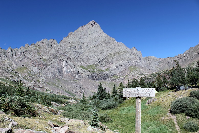
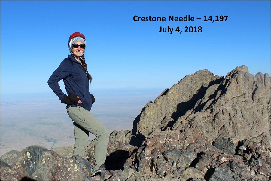
The decision to hike Crestone Needle today didn’t come until late yesterday. I’d had this day on the calendar for this particular hike for over a month, but the fires in the area had me hesitant.  I did a lot of online research and was 80% sure the road to the trailhead I needed to take was open.  That was a chance I was willing to take.  What I wasn’t thrilled with was the possibility of inhaling smoke for the entire hike.  The weather looked good, and in the end I chose to take the hike because it’s my last 14er I need to complete the Crestones and I was afraid if I waited too long the fire would expand and I’d miss my opportunity to hike.

I woke up at 12:15am and drove to the trailhead. All roads were open from Colorado Springs South, but there were more deer on the roads than I’ve ever seen.  I’m assuming they were displaced because of the fires.  Most deer I see when driving at night are female, but these were mainly male deer in the velvet.  I was just glad I was the only one on the road so I could drive cautiously and stop when needed.

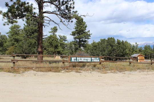
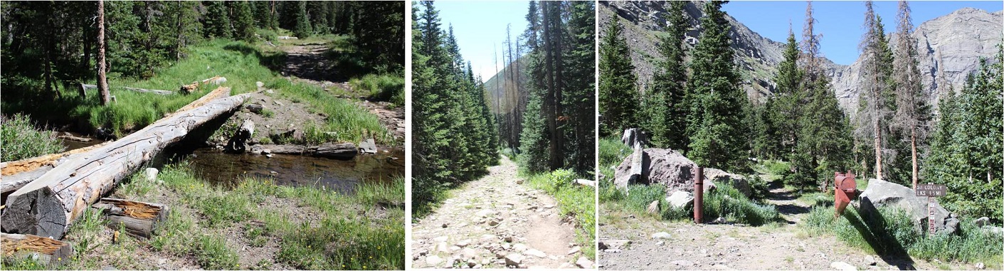
I turned South on Colorado 69 and saw a flashing sign indicating the highway was closed ahead and only open to residents. I crossed my fingers and drove on.  I was able to make it to the turnoff (Colfax) before the road closed.  The drive in past the 2WD trailhead was worse than I remember it being back in April (but not worse than last year at this time).  The drainpipe was a bit steep.

2 4WD road in and drainpipe

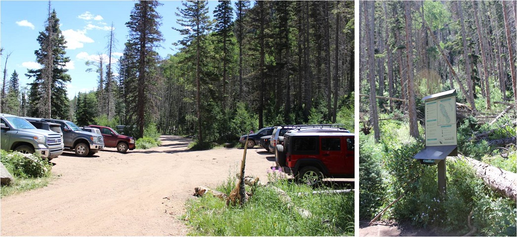
When I arrived at the trailhead at 3am the parking lot was almost full, which I’d expected even though it was a Wednesday morning. After all, it was the 4th of July!  There was a lot of activity in the parking lot as people were getting ready for their respective hikes.  I hate leapfrogging people, so to get a head start I jumped out of my truck and hit the trail, grabbing a bagel to eat on the way.  There was no smell of fire in the air and I hadn’t been able to see flames the entire drive.

At 3:15am I signed the trail register and was on my way. BTW, the trail log book is in serious need of repair/updating.  The pages are mostly loose, and there’s no clear order to signing it.  I found a blank page and signed in, but if there was an emergency (say, a fire) and they needed to know who was hiking in the area it would take them a very long time to figure it out.

3 Trailhead register

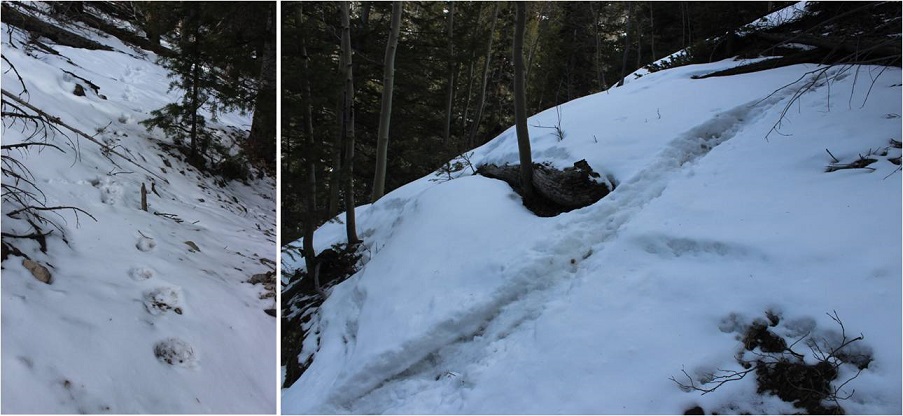
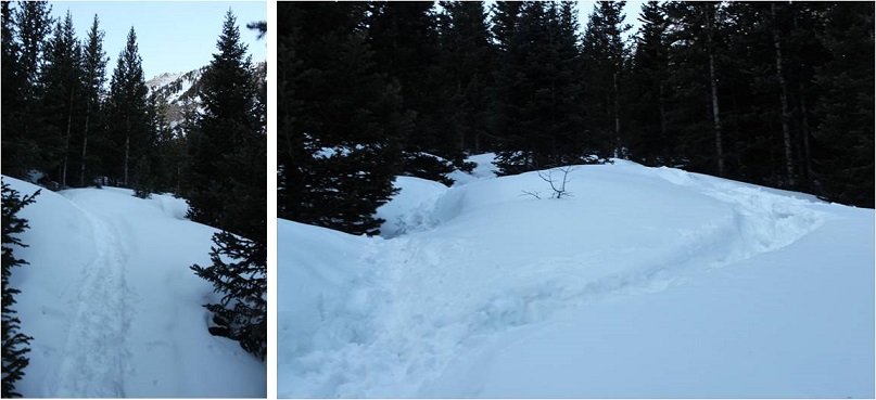
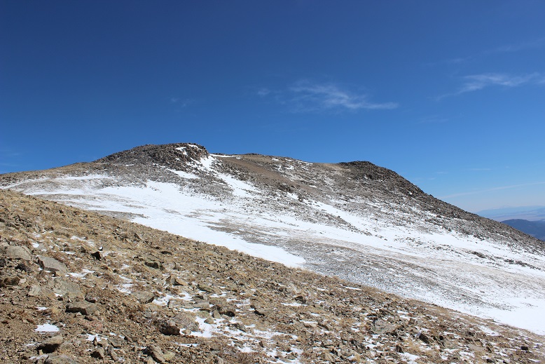
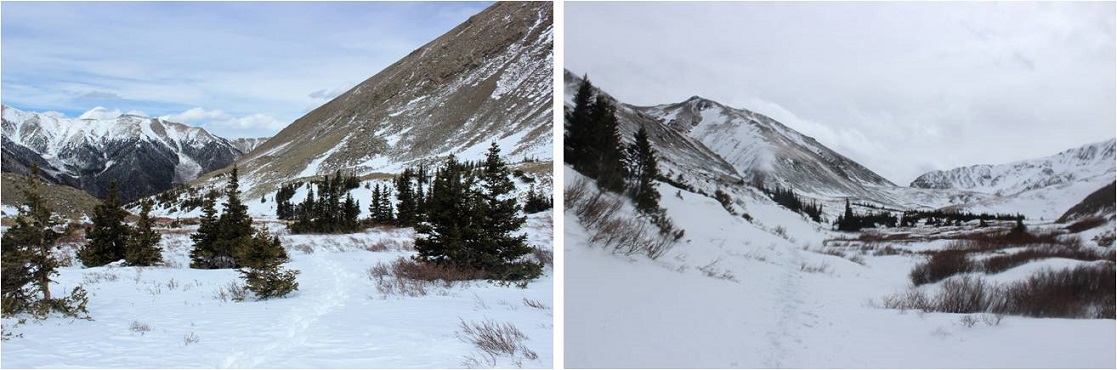
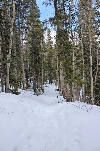
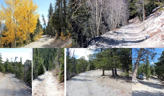
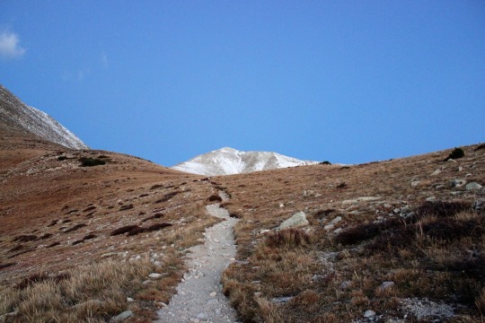
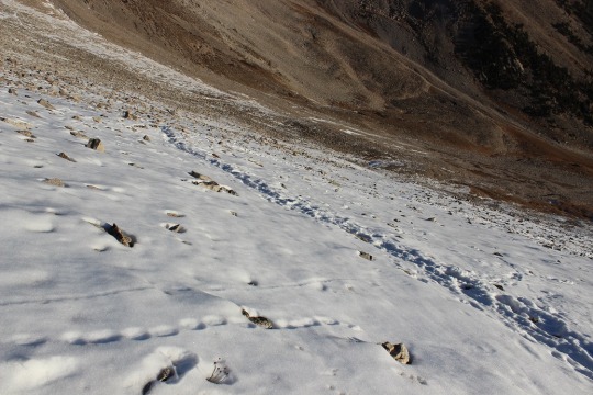
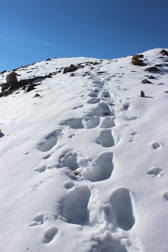
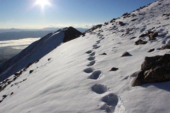
This is my third time this year hiking in through the South Colony Lakes trailhead. I have to say, it’s much easier and faster without snow to navigate through!  It’s amazing how easy the trail was to follow without snow, and how difficult it is to navigate when snow is present.  The hike in didn’t take me long at all.  I was way ahead of schedule.  Last time I was here the creek was frozen over and there was snow up to the footbridge.  Today there was no snow to be seen.

4 Hike In

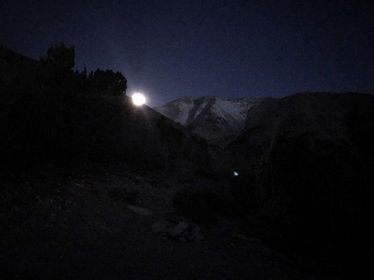
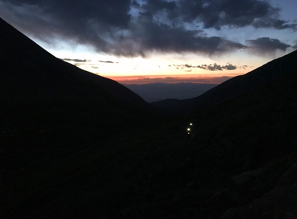
I made it to the South Colony Lakes and saw many tents lit up as people were preparing for their hikes today. It looked like there were dozens of people camping by the lake.  I made it up Broken Hand Pass around 5:30am and looked behind me at the trail of lights from hikers taking the pass as well.

5 hikers below IMG_7034

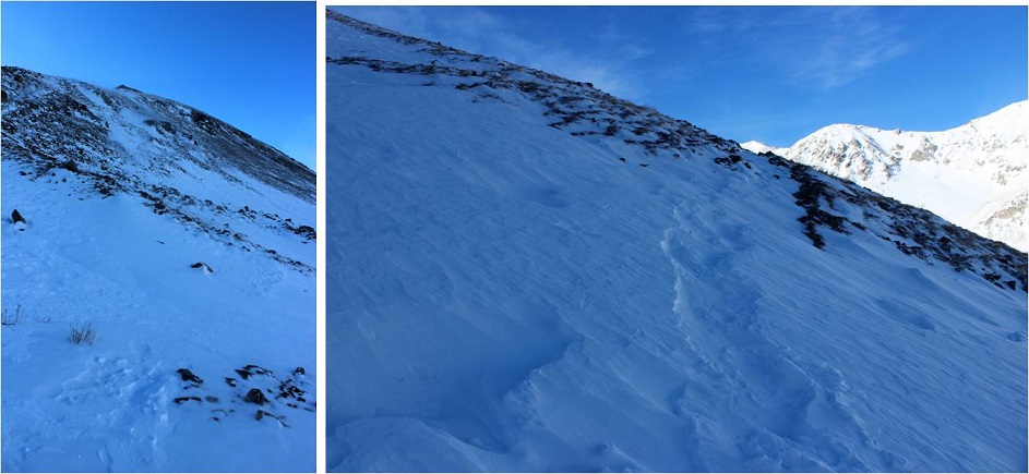
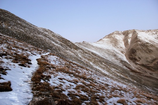
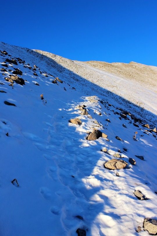
The only other time I’ve hiked Broken Hand Pass it was filled with snow and there was no clear path to follow, so I crossed the slope wearing snowshoes. Today the path was clearly visible, yet harder to hike without traction.  I kind of missed the snow here!  As I looked around me at the slope I realized back in April I must have been hiking on over 10 feet of snow!  What a difference the snow made!

6 Pass no snow

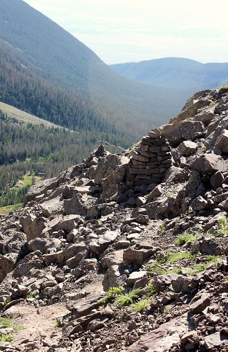
The trail up and through Broken Hand Pass is very well cairned. I now know why those cairns are so big!  They looked small (or were non-existent) under the snow.

7 heavily cairned IMG_1162

Last time I did this hike I forgot to put on my helmet until it was too late and I was in a position where it was too dangerous for me to take my helmet out of my pack to put it on, so this time I put it on before it was needed. Here are the first class 3 moves up the pass.

8 Class 3 moves in Broken Hand Pass

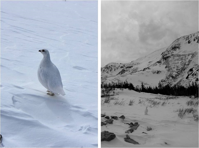
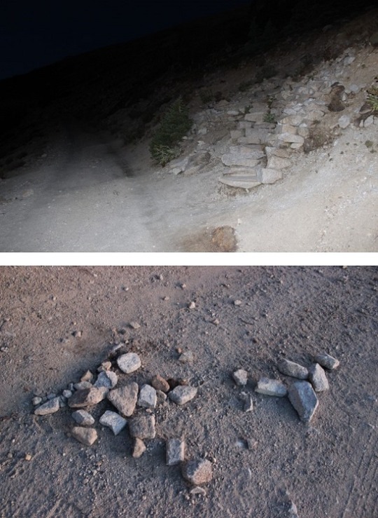
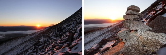
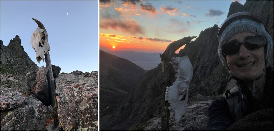
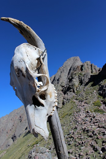
I made it to the saddle just as the sun was coming up, and when I looked over to my left I saw a skull that wasn’t there last time, placed on a large stick. Of course I went over to investigate.  As the sun rose I made friends with Skully and got a few selfies with my new pal.  He seemed to be keeping sentinel over the area.

9 Skully Sunrise

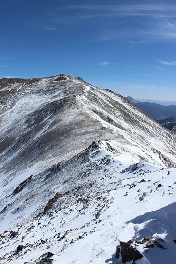
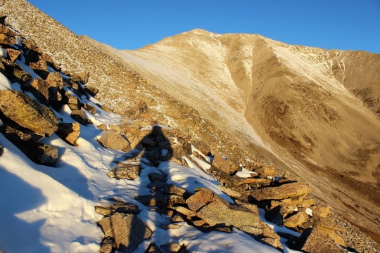
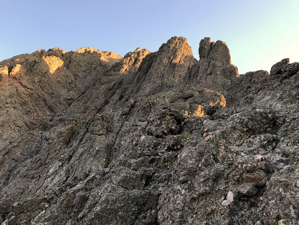
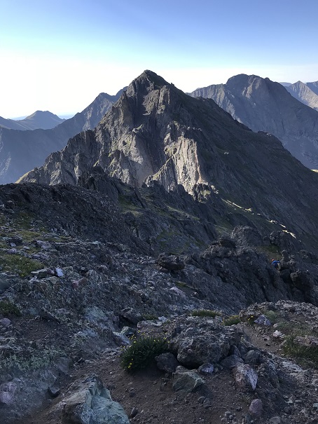
I was way ahead of schedule at this point, but decided to keep hiking so I wouldn’t get cold. I followed the ridge and went to the heavily traveled trail to the right, and realized it cliffed out, so I turned left and encountered more class 3 moves.

10 go left not right IMG_1132

11 First Class 3 after pass

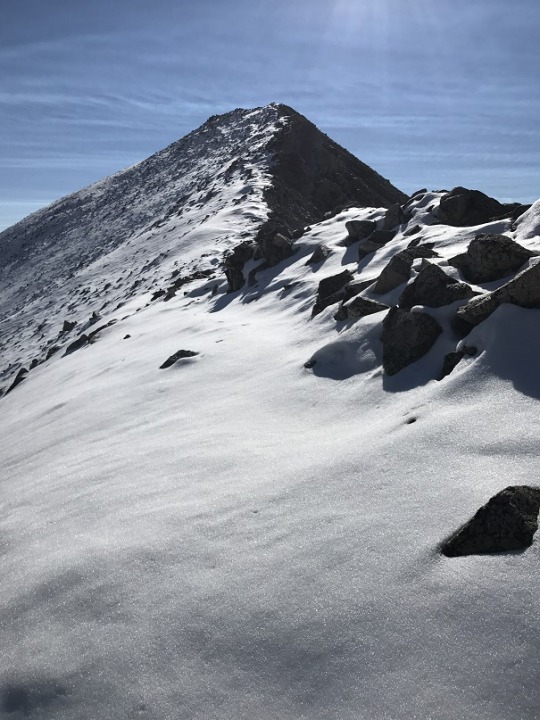
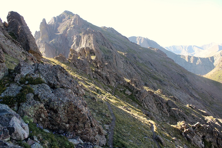
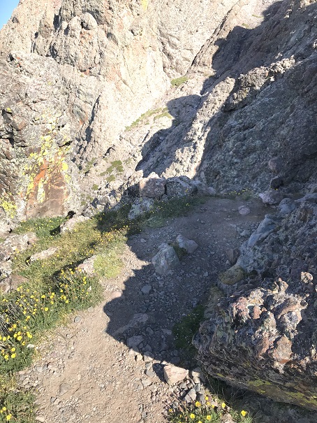
The trail was well marked, although sometimes it split into two parallel trails. They both followed the South side of the mountain and ended in the same place.  Here’s a look back at the trails and Broken Hand pass.

12 Two Trails and Broken Hand Pass

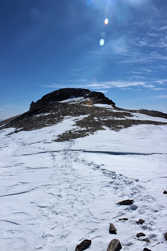
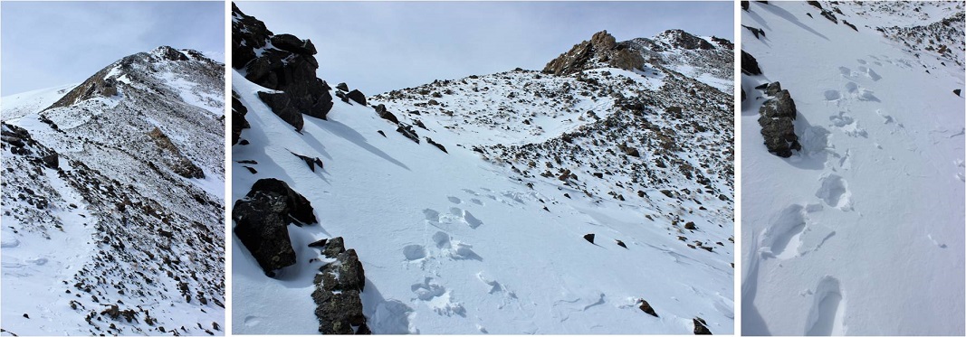
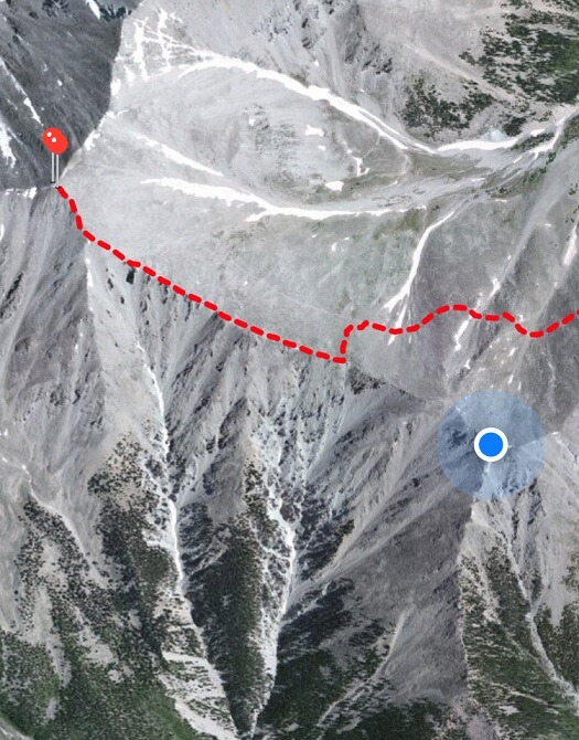
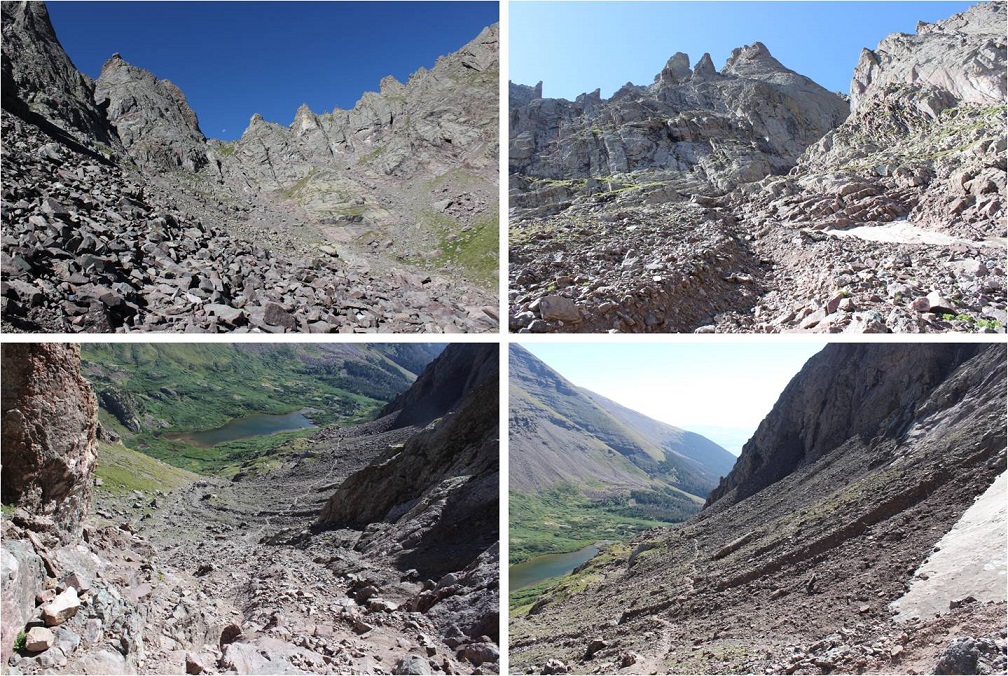
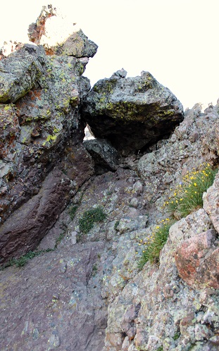
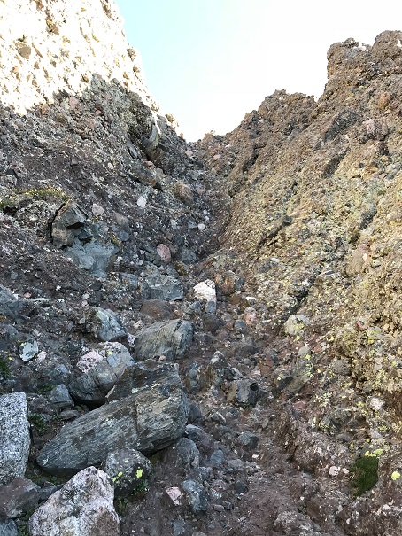
After hiking the slope the trail abruptly stops. I knew this was going to happen, but was surprised at how abruptly it did just… stop.  I mean, it just ended at a rock.

13 trail stops IMG_7092

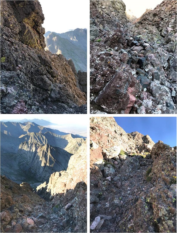
I looked up and down and then got out my directions. I needed to hike down about 75 feet, then over to the east gully. Here’s a picture of the route before me.

14 Sun rising behind needle IMG_7058

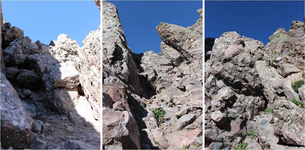
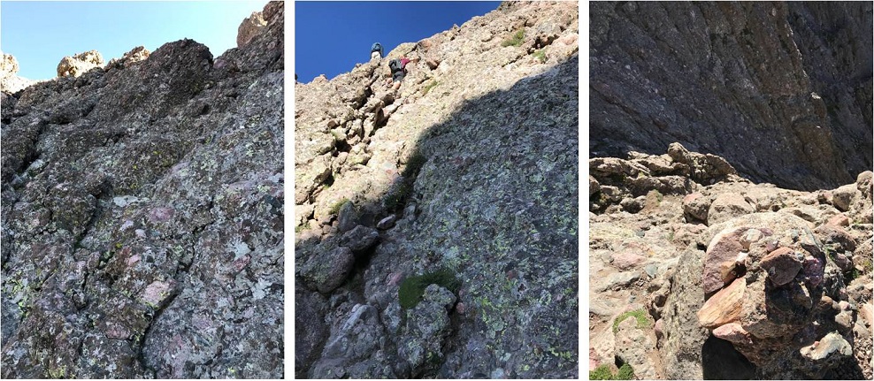
This is where the fun began! Climbing the gullies is a lot of fun!  There was exposure, sure, but plenty of hand and foot holds available.  I once again praised myself for joining a rock climbing gym and going weekly.  This was child’s play!  While this class 3 scrambling should have been challenging, for me it was really just fun.

15 Climbing in the gullies

The route wasn’t heavily cairned, but there were enough cairns in just the right areas so you knew you were on the right path (which I prefer to multiple cairned paths). For me the crux of the climb came at the dihedral, where you switch from the east to the west gully.  The dihedral was obvious to find but difficult to cross.  It’s much larger in width and depth than this picture suggests, and my task was to climb on top of it, locate a cairn, and cross the rib.  There was a trickle of water running down its base, just enough to make climbing up slippery with wet soles.

16 water in dihedral

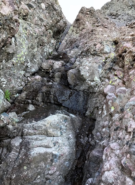
I’m not a large lady, and while I’m pretty flexible, here my 5’4” height was a hindrance and flexibility wasn’t much help. There were hand and foot holds all over this mountain, except in the dihedral.  The rock here was smooth and there weren’t many places to grip.  The width was just far enough apart where I couldn’t stretch across (although I’m assuming it wouldn’t be much difficulty for someone over 5’10” to navigate).  So I was stuck:  I couldn’t climb up the dihedral to cross over, and I couldn’t climb across the gap either.  I searched and located the cairn on the rib above me and to the left.  I knew that’s where I needed to be, but getting there seemed impossible!  (The cairn is in the red circle)

17

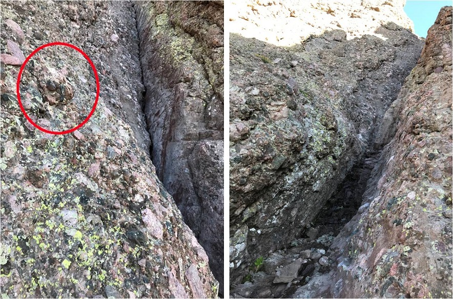
I took a deep breath. This had to be traversable.  There had to be a way across, I just wasn’t seeing it yet.  I went back to where the dihedral was narrowest and tried again.  There were a few stretch moves, but I was able to successfully climb up the wall and back over to the left where the cairn was located.  Woot!  I’d made it!!!

This is where the real climbing began! I climbed up the ridge and aimed for a notch.  Here’s a picture from my way back down when I passed three male climbers heading up (who’d had trouble with the dihedral too, so it wasn’t just me!).

18 exposure after dihedral

The exposure here was real! One of the other hikers told me this part almost made him lose his breakfast.  Personally, I loved it!  Yes, the exposure was extreme, but there wasn’t much danger from loose rock and there were plenty of hand and foot holds, so as long as you didn’t slip and fall you were fine.

I couldn’t help but thinking how awful this route would be with snow, and once again praised myself for not trying this peak after completing Crestone Peak last April and the waterfalls that were present then. It wouldn’t have ended well.

There were several large gullies to climb, all with the same secure rock and lots of holds.

19 up a gully

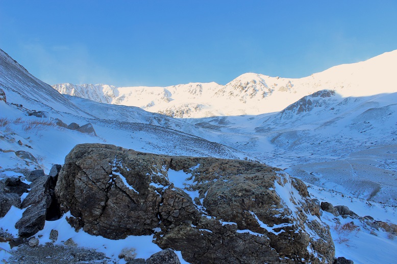
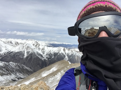
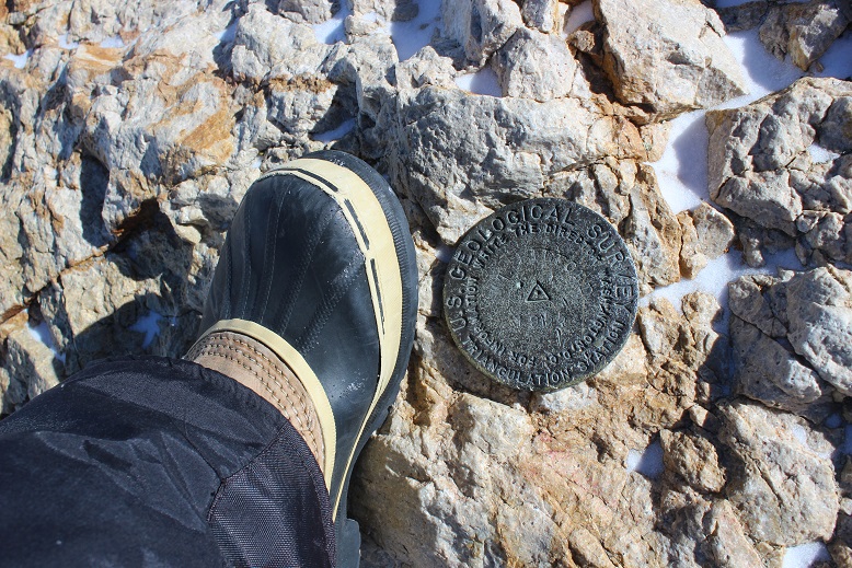
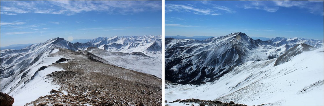
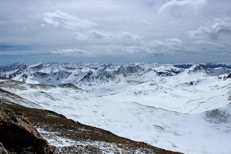
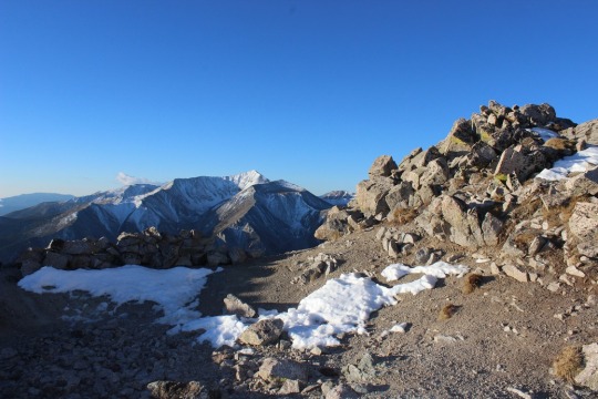
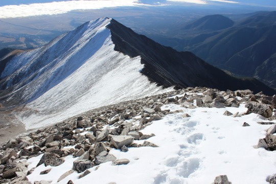
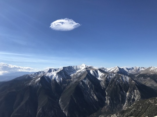
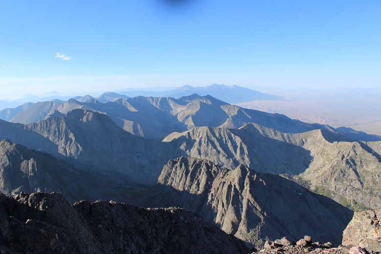
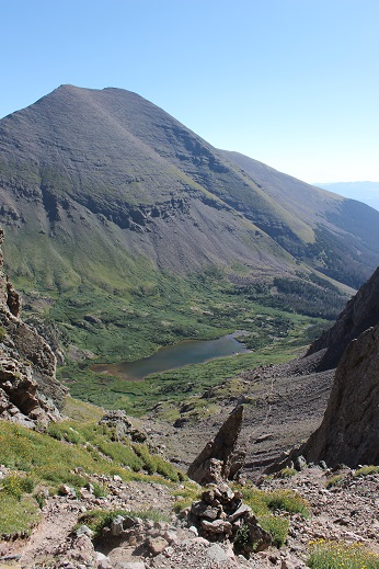
At 7:20am I summited! I had a great view of Crestone Peak

20 View of Crestone Peak

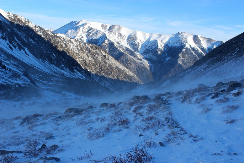
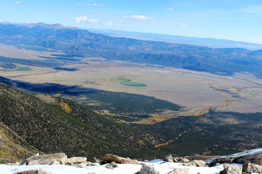
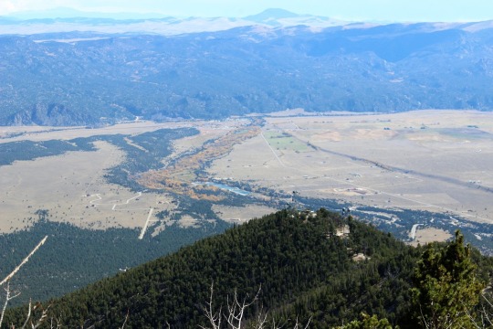
As you’ll notice from the video, there isn’t evidence of a fire anywhere

For the first time while hiking a 14er I was able to see the Sand Dunes in the distance


21 Sand Dunes to right

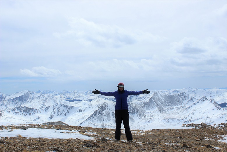
I took a summit selfie to prove I’d summited

22 Crestone Needle 14197

And while it was still early I headed back down because I was only half way through with this hike. It was too early to celebrate yet.

Remember all those steep gullies I’d climbed up? Well, now it was time to climb back down them.  They were pretty steep, so I turned and faced the wall and began climbing down, once again grateful for all the holds.

Thankfully the dihedral was much easier to navigate heading down than up. I just pressed my stomach on the wall and slid off and down into the open space below, using friction for balance, knowing I didn’t have far to fall if I did.

I have to pause for a second here to talk about down climbing. I may not know a lot about rock climbing, but I do know I have better balance when I’m facing the wall on the way down.  I passed a hiker who was heading down these gullies feet first.  He was continually off balance and honestly scaring me.

So I engaged him in conversation: “Have you tried turning and facing the wall when you down climb?  You’ll thank yourself for it!”

I got no response, so I figured he must not have heard me. We parted but caught up to each other once again in another gully, where he was once again tip toeing down and sliding feet first.

I tried again: “Do you rock climb?”

Hiker: “No”

Me: “Oh, well if you turn and face the wall you’ll find your center of gravity isn’t off and the gully will be easier to navigate”

Once again, no response and he continued doing what he was doing. All I could think was “He’s going to fall and I’m the only one anywhere near him.  He’s going to slip and tumble headfirst down one of these gullies and I’m going to have to rescue him because I’m the only other person out here”.  I’d already warned him twice and he hadn’t listened.  I decided to just sit and take a break for a while and let him get far enough ahead of me where we wouldn’t pass each other again.  This way I wouldn’t have to watch him scare me half to death.  I’d just keep an ear out for him falling.  (Luckily he never did)

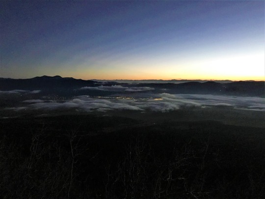
I made it back to Broken Hand Pass at 8:40am. The sun still hadn’t made it over the ridge

23 back to brokenhand IMG_7089

I waved to Skully and got a picture of him with the Crestone Needle in the background

24 Skully and Needle

Ahead of me were Humboldt and Broken Hand Pass. I was completely ready for the class 3 moves back down and got to it.

25 Humboldt and Pass

About 1/3 of the way down I heard a very loud and deep chirp, looked up, and saw a rather large marmot ahead of me skid to a stop on top of a pile of rocks. The rocks then went tumbling down the pass, making quite a racket and causing a rockslide.  Wow!  That marmot was a jerk!  He’d just put about 4 people in danger of getting brained by rocks the size of my fist.  I called down to the hikers below me, made sure they were ok, and blamed it (rightly so) on the marmot.  See people?  Wear your helmet, even if you’re the only person on that mountain!

I passed quite a few hikers on the way out. South Colony Lakes is a trailhead for multiple 14ers, as well as a great place to backpack and fish.  Most people I passed who’d been there for a few days had no idea there was a fire or that the roads were closed.

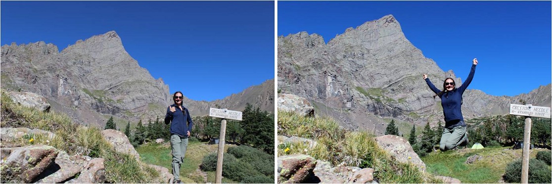
As I hiked the last few miles out I marveled at what an awesome day it was. The weather was gorgeous, the wildflowers were just starting to bloom, the trail was in full summer conditions, and I’d made a quick and successful summit of what’s considered the 6th most difficult 14er in Colorado.  So why wasn’t I jump up and down happy?  Well, I kind of was.  I took a few celebratory photos once I was back near the lakes.

26 Celebrating

But I wasn’t euphoric as I had been for many other hikes. No fist-bump, high five kind of feeling.  This hike had been too easy.  Don’t get me wrong, it’s not an easy hike, but it wasn’t as difficult as I’d anticipated and been looking forward to.  Yes, there was exposure. Yes, there was climbing involved.  Yes, it was a long hike with elevation gain, but it wasn’t as technical as I’d anticipated and everything I did was well within my abilities.  There wasn’t even any snow to navigate!!!  I wasn’t tired at all and even considered hiking up Humboldt to make the day a little more aggressive.  Maybe I wasn’t tired because I wasn’t carrying all the stuff I’ve needed lately (crampons, ice axe, snowshoes, extra jacket, etc)?

I know the conditions were awful when I hiked Crestone Peak last April, but that seemed much more difficult than today’s climb of the Crestone Needle, and this was supposed to be harder. I didn’t feel challenged.  Hmmmm… So I came to the conclusion these hikes are indeed tough, I’m just advancing in my skills.  What scares me is I enjoy a challenge.  I enjoy being tested and learning new skills.  That’s something I’ll seriously need to spend some time considering.

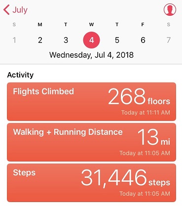
I made it back to my truck at 11am, making this a 13 mile hike/climb in 8 hours. This also means I was home by 1:30pm, in plenty of time to wake up my kids (yes, they’re teenagers, with nothing scheduled for today they were still sleeping when I got home) and grill some steaks for the 4th of July!

27 mileage IMG_7099

Mt Belford – 14,197, Mt Oxford 14,153

1RT Length: 11 miles

Elevation Gain: 5967’

I’ve been saving this hike as a practice hike for winter conditions, since the route is relatively straightforward and it has a 2WD trailhead. Unfortunately I don’t have much time in the winter to actually hike, so it had to wait until early spring.

I woke up at 3am and drove to the Missouri Gulch trailhead. There were a few easily manageable mud puddles to avoid, but nothing anyone would get stuck driving through.  I made it much faster than I thought, as I was honestly waiting for daylight for this hike.  After seeing a herd of elk on 390 I made it to the trailhead at 5:45am.  There was one other vehicle in the parking lot, and it looked like it hadn’t been there long (no frost on the windows, etc).  This would make my family happy, knowing there was someone else out on the trail today.  They hate that I hike alone.

I usually love hiking well before sunrise, but today for several reasons I decided to sit in my truck for a bit and wait:

  • I’m not a fan of hiking by graves in the dark. Does anyone else think it’s weird the baby’s grave is so far away from all the others? I mean, it’s across the street and up the hill and everything…
  • I really didn’t want to play ‘leapfrog’ with whoever was already hiking on the trail. I figured I’d give them some time to get far enough ahead of me so we wouldn’t need to pass each other/hike together the whole time.
  • I’ve heard reports there’s a mountain lion that frequents the area, and I’d rather not run into one in the dark. (side note: I’m not afraid of mountain lions, in fact I’d love to see one while hiking, I’d just rather it be in the daylight)
  • But seriously, that baby grave in the dark freaks me out.

I debated for a while which hiking boots to wear (my regular ones or my winter ones) and whether or not to bring my snowshoes. There wasn’t a recent conditions report in the past week or so, and the last one said none were needed.  I left the snowshoes in the truck and headed out at 6:15am in my snow boots and winter gear.  It was still dark.

I made it about .25 of a mile when something told me to turn around and go back and get those snowshoes. It’s tough to head back after you’ve already started, but the feeling was strong and I thought how mad I’d be at myself if I made it up the trail 3 or 4 miles and needed to turn back because I didn’t have the proper gear.  So I hiked back to my truck, pulled them out, and was on my way again.

The trail was covered in slush that quickly turned to packed snow. As I looked on the ground I could see clearly defined mountain lion tracks (noted by size and lack of claw marks) on the trail.  Cool!  I also saw trails made in the snow that were obviously from a large animal (the mountain lion?) that detached from the main trail and went off into the hillside.  The tracks were going the opposite direction, but that didn’t stop me from looking all over for signs of animal life/more tracks.  After about 1.5 miles in the tracks disappeared.

2

20 minutes into my hike I passed the couple belonging to the truck. They didn’t look like they had snowshoes and I felt a bit foolish for carrying mine.  The trail was pretty hard packed here, and snowshoes didn’t seem necessary.  I briefly asked them if they’d seen the animal tracks, they had, and I was on my way.  I never saw them again.

I crossed a small stream and decided the snow was thick enough to put on those snowshoes I’d been carrying.

3

The snow got thicker, but luckily others had been here in the past few days because there was a pretty good trench all the way to the cabin.

4 AM Trenches

I made it to the cabin much faster than I’d anticipated. I took this trail on my way to Missouri Mountain last summer, and from what I’d remembered it had been a long slog full of switchbacks. But for some reason today it didn’t seem to take me much time at all.  The cabin was surrounded in snow.

5

From here on out snowshoes were mandatory. There was no trail from the cabin through the willows/gulch area, so I had to make my own trail.  Luckily I kind of knew how the trail went, since I’d hiked this area before.  It was really cool to be breaking my own trail, and doing so successfully!  This was the first real time I’ve broken trail: I hiked Humboldt Friday and broke a little bit of trail, but mostly followed others’ tracks.  In fact, this was only the second time I’ve ever been snowshoeing, and I kind of liked it!  It was so cool to be 5 or more feet above the trail in the snow, traversing over willows instead of around them.   There was no way I could have done this a year ago, and I was proud of my route finding.

When I turned around I saw the alpine glow of the sunrise

6

I stayed by the creek and headed towards the Elkhead Pass/Belford Summit Junction.

7

The sun was really starting to come up, and the view of Missouri Mountain was fantastic!

8

This is where the wind really started to pick up. It was relentless for the rest of the day, hovering around 35mph.  It looked like all that snow in the gulch was directly blown down from the mountains.

9

I looked at the route before me up Belford, and as I was ascending thought not for the first time how grateful I was to have gone back for those snowshoes.

10 Belford AM

The hike up Belford took forever. It just kept going and going and going up, up, and up.  And that wind!  Without the sunlight that wind was chilling.  I just kept moving, pretending it was the Manitou Incline, and trudged up that mountain wearing those snowshoes, breaking trail.

11

There were several false summits to Belford, which were a bit annoying but anticipated.

12 False Summits

Finally (and I mean finally, as I was exhausted) the real summit of Mt Belford came into view and I thought to myself: 4500’ in snowshoes for 4 miles was exhausting!

13

I was frozen, but set up my gorillapod and camera and took a summit photo.

14 Belford

15

and just because it was there (they usually aren’t) a photo of the summit marker

16

I took a look around. The view was magnificent!!!

17

I didn’t take out my instructions/map, but remembered the route to Mt. Oxford would be clearly visible from this location. It was just 1.5 miles away. I followed the clearly defined path with my eyes and my jaw dropped.

18

No way! There was no way I was doing that today in these conditions!  That’s when I took a closer look, realized I was looking at Mt. Harvard (which I’ve already hiked), breathed a sigh of relief and looked east.  There I saw the second summit I was after today:  Mt. Oxford.

19

It looked doable in today’s conditions. That is until I made it to the ridge.  The ridge down from Belford to Oxford was covered in snow.  There weren’t any tracks to follow (either no one had taken this trail in the past few days or that relentless wind had covered the tracks with snow).  As with any hiking/climbing challenge, I don’t make a decision to hike/climb until I’m right up next to the obstacle.  I often find it’s easier than it looks when you’re up close.  I decided to just take this ridge one obstacle at a time, and if I felt uncomfortable gave myself permission to turn back.  This was supposed to be an easy winter 14er, so I should be able to do this, even in these conditions.

I looked for the areas with the least exposure and least snow, and began my descent. It was really cool making tracks!  I carefully made each foothold by drawing a line with my trekking pole and stamping it down with my boot, making sure I had a firm stance before traversing.

20 Making Tracks

It was more than I’d anticipated running into today, but nothing I couldn’t handle. Microspikes/snowshoes weren’t needed.

I made it down to the saddle and looked back up at Belford, and then up at Oxford. Wow.

21 Back at Bel up at Ox

The saddle was dry and came with absolutely amazing views! I stowed my snowshoes and was off.

22 Saddle Views

To the north there was a small cornice that provided interesting views as well.

23

I looked ahead of me at the route up Oxford. Piece of cake.  And it was.

24

The summit was actually closer than I’d anticipated (the first outcropping, not the second). I took a summit photo.

25 Oxford

And another one of the summit marker (because it had one too!)

26

I turned around to see what I’d accomplished thus far today. What a view of Belford!

27

I started back, ready to tackle that ridge again head on, and this time uphill. I gathered my snowshoes and kept an eye on the weather, since it was supposed to snow after 3pm (it was currently around noon).  While all morning it had been windy and clear the clouds were now starting to form.  I hiked back up the ridge using the footsteps I’d made on my way down.  It took a while but I was successful!

At the summit of Belford the second time I stopped for a bit to really take in and enjoy the view. Since now the hardest part of the hike was behind me, I felt I could afford to rest for a bit.  I sat down at the summit marker and took a deep breath.

After a grueling and extremely windy 6000 feet in elevation gain in 6 miles (in snowshoes) I sat at the summit of Mt Belford, my 3rd 14er Peak today (out and back, so 2nd time here today). Suddenly the wind stopped and all was still. This is what I saw.

28 IMG_5026

Immediately tears came to my eyes. It was like God knew I was the only person in the world with this view and he wanted to show off just for me. I was absolutely mesmerized by the intense beauty before me. It’s the closest thing to a religious experience I’ve ever had.  All the hard work of the day and the frozen extremities that came with it was worth it!  I sat there for 5 minutes before he picked up the wind again and reminded me to get my butt off that mountain: a storms coming in.

29

Of course I took another photo, trying and failing to capture the beauty around me.

30

I walked over the summit and took a look at the rest of the route down to the gulch. It looked like the sun had melted some of that earlier snow.

31

I was making good time, so I decided to have a little fun and use my remoteness from any other human being to practice some winter skills without embarrassment. Much of the earlier snow was gone, so I was able to safely practice glissading and running down the snow without worrying about sliding too far or out of control.  I did this for most of the hike back down, laughing as I went.

32

Back down at the gulch, this was my view back down towards the cabin and back up at the route I’d come. As you can see, clouds were just beginning to form for that storm anticipated for tonight.

33 Missouri Gulch Front and Back

I put my snowshoes back on, crossed a frozen river of ice, and waiting for me on the other side was a ptarmigan. I knew he was a male because he had a red stripe over his eye.  He just stood there, looking at me, and then slowly turned towards Missouri Mountain and looked over his shoulder, as if he was beckoning me to follow.

34 Ptarmigan

I took several pictures, thanked him for being so cooperative, and followed my snowshoe tracks back through the gulch and down the mountain. It looked like several people had actually hiked up to the gulch today, as around the cabin there were several new ski and snowshoe marks, but no people to be seen.  The trench was also a bit more compact than it had been earlier.

35

The hike back down seemed longer than the hike up, and I kept my snowshoes on for most of it. Somewhere along the way I lost my beanie which was unfortunate (I’ll make another one).  As I was nearing the end of my route I kept looking for signs of a mountain lion (nope) or any other form of wildlife (again, nope).  As I approached the area with the grave in the daylight I realized I was ‘told’ to get those snowshoes exactly as I passed the grave… Hmmm.

I crossed clear creek and my days hike was over.

36 Clear Creek

On my drive home I thought about the details of today’s hike, and how this is something I wouldn’t have been able to accomplish a year ago. I was glad I’d saved these ‘easy’ 14ers for winter-like conditions, as it allowed me to apply the knowledge I’ve learned thus far (snowshoeing, traversing ridges covered in snow), while giving me time to practice more intense skills in a safe environment (glissading, self arrest, running down a snow field).

Here are some summit videos. The views were amazing!

Video of Mt. Oxford –

Mt Princeton – 14,197 and Tigger Peak 13,280

image

Notes:

·
Snow starts at 12000’ and keeps going from
there.  Bring microspikes.  Snowshoes weren’t needed.  

·
I can see tons of potential avalanche danger on
this hike with more snow.  

·
The lower Mt Princeton Road Trailhead is
actually pretty nice.

image

·
The road from here to the radio towers wasn’t as
bad as I’d been led to believe.  It was definitely
4WD, but it wasn’t that difficult.  The
only down side was it was narrow, so if you came across another vehicle it
would take a bit of maneuvering to get around each other.  I have a Tundra, so this was an issue for
me.  Two Jeeps wouldn’t have an
issue.  Side note:  the trail was dry when I took it.  If it was wet or had snow or ice it would
probably be much more technical to navigate.
I could see several dry gullies I’m assuming flow over the road when it
rains/snow melts.  

image

·
There are spots to park your vehicle at the
radio towers, but they aren’t obvious, and they’re tight.  I had ‘fun’ turning around my truck when I
discovered the road was one way in and out.

I began at 6am.  For
anyone wanting to know what it looks like hiking in the dark, here you go:

image

This was my first view of Mt Princeton

image

The trail after the towers begins on road 322A.  It can be difficult to find the towers in the
dark, but if you’ve driven 3 miles since the lower trailhead and come upon a
sharp curve, you’ve missed the towers.  

image

It was pretty cool to look back on Buena Vista and see it
covered in fog and haze

image

The first couple of miles follow the 4WD road up 322A.  Then the real trail starts up to the right of
the hillside.  There’s no sign, except
this wonderful, um, arrow of rocks? pointing the way.

image

As soon as you get up this small hill you get a great view
of Mt. Princeton.  

image

From here snow at minimum lined the trail for the rest of
the hike, and at most completely covered it.
I put on my microspikes and continued on.  

image
image
image

Shadowselfie, because I do that type of thing

image

At this point I was thinking it was probably a good thing I
had snow on the trail, since I was probably walking over a lot of scree.  I prefer snow to scree any day.

Oh, and when I turned back around I saw the SUNRISE!  Colorado 14er sunrises are AMAZING!!

image

When I got to the top of the ridge I noticed a wind wall in
front of me and a mountain to my left.  I
got out my Peakbagger app, and discovered it was Tigger Peak (13,280).  It was only .3 miles away, so I made note of
the location to hike on the way back.

image

I turned right and got a good look at the rest of the hike
up Mt. Princeton.  From here it’s .7miles
to the top.  There was a pretty good
trail for most of the way, but when it was covered in snow I just followed the
ridge to the right.  

image

Some places had a lot of snow and I did a bit of post holing

image
image

Others were bare

image

I summited to an absolutely beautiful view!  Here’s photo proof I summited:

image

The weather reports said 40 degrees with 25-30 MPH winds and
45MPH gusts, so I dressed warmly (multiple layers, hats, scarves, etc.)  Either I did an excellent job over dressing,
or it wasn’t that cold out.  I barely had
any wind for the entire hike, except on the exposed ridges.  

At this point I turned to head back down Mt Princeton’s
ridge. Take a look at Tigger Peak!  

image

It took a lot longer to hike down than I remembered hiking
up, but I had to be very careful of foot placement.  Despite microspikes it was still slippery.  I ended up tripping once and hitting my left
knee pretty hard.  I felt silly and
continued on.  

The trail to Tigger Peak had a ridge and what I considered a
false summit.  And due to the recent
snow, no trail.  Well, I’m assuming it’s
due to the recent snow.  It might not
have a trail at all anyway?  In any
event, there wasn’t a visible trial, so I got to make my own!  I considered this a very awesome opportunity,
and I was careful to make sure my steps were secure.  

image

On the ridge between the two small what I considered summits
of Tigger Peak it happened:

image

I was on a part of the route with exposed rock (no
snow).  I lifted my right foot to take a
step, and abruptly pirouetted and started falling towards the rocks.  You see, when I’d tripped earlier apparently
I’d tripped on broken microspikes:  One
of the hooks holding them together had come loose, and now, when I’d lifted my
foot, the hook on my left microspike attached to my right microspike, and I
fell down like that giant in Jack and the Beanstock with the tied
shoelaces.  It all happened in slow
motion.  In fact, I had time to curse
twice.  (Side note, I don’t actually
cuss, so I said “Gosh Darn It! Flibbity-gibbit” (seriously)).  

I’m not going to lie, it hurt.  But I didn’t sit there.  As soon as my knee hit the rock and I could, I
untangled myself, got up, and started hiking.
I could tell nothing was broken, but it stung badly.  The best way to fix this (I know from
experience) is to walk/hike it off.  So I
kept going, looking down at my knee every few seconds, expecting to see
blood.  Luckily that never happened.

I’m proud to say I continued on up and over the second ridge

image

and summited my first 13er! (yes, I know it isn’t “official”)

image

This is the first time I’ve forged a trail on snow, and I
was pretty proud of myself!  Oh, but I
had to prove I was in the right spot, so I took a picture of my Peakbagger app
indicating I was on the peak

image

And a picture of my GPS, showing where I was

image

And as I looked across the mountain range, I snapped a
picture of this cloud that looks like a pufferfish?  Yoda?  Floating
majestically over Mt Antero.  

image

Then I headed back.
It was cool following my tracks!

image

So now I had a serious dilemma:  My microspikes were broken.  I’d slipped and fallen hard twice, but I knew
the hike would be much worse without them.
This is what I still had to hike (well, about 3 times this, as the trail
looped all the way around the mountain, remember those earlier snow pictures?):

image

So I made the decision to hike with the broken microspikes,
but to be very, very careful (slow).  I
kept my feet wide apart from each other:
I waddled, felt like a pregnant woman, and my pace was slow, but I didn’t
slip again!  I was excited to make it
back to 12000’ where the snow stopped and I could take off my microspikes.  This was also where I met my first hiker of
the day:  A newby without spikes but with
a good and realistic attitude (he was prepared to turn back but wanted to see
how far he could go).  I also met a group
of 5 or 6 friends hiking with a dog:  ON
A LEASH!  Major points to these
people.  They were friendly too!

image

I made it back to my truck at 11:30pm, which wasn’t a great
time for a 7.5 mile hike, but I’ll allow it because I was hiking on extended
fields of snow for the first time, I forged my own trail and I was being extra
careful on the way down.  Here’s a
picture of the towers

image

Video: