Hike/walk/run/treadmill elevation gain of 1 million feet
Summit a combined total of 10 winter 13/14ers
Finish the Bicentennials
Summit 3 new state highpoints outside of Colorado
Summit 3 new El Paso County Highpoints
Hike another section of the Colorado Trail
Keep my average above 10+ miles and 4000’+ of elevation gain per hike
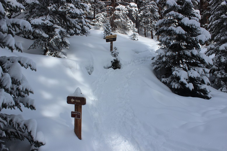
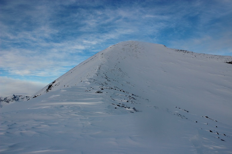
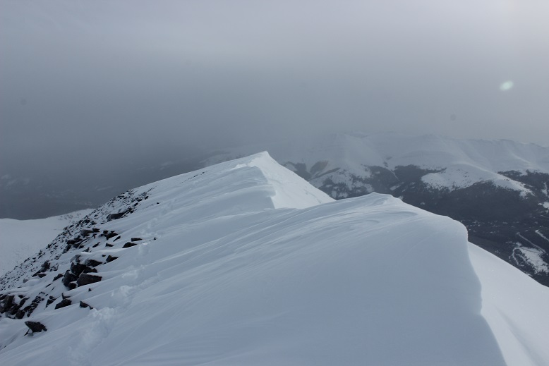
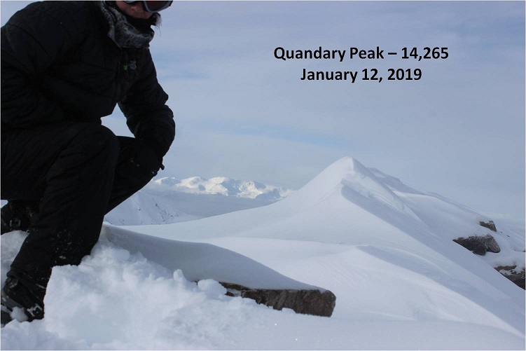
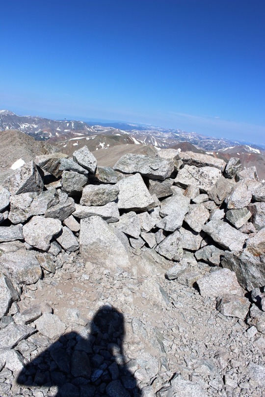
Quandary Peak – 14,265
RT Length: 7.22 miles
Elevation Gain: 3444’
Just to get 2021 off to a good start, I set my alarm for early and made a reservation to hike the Manitou Springs Incline on New Years Day. Unfortunately, my alarm didn’t go off and I ended up missing my start time. I was super bummed, but I didn’t let it get me down: I still had enough time to get a hike in. I figured I’d just do Quandary Peak instead. This is the 4th time I’ve hiked Quandary, and I’ve written several trip reports on the peak, so I’ll just post some pictures with highlights:
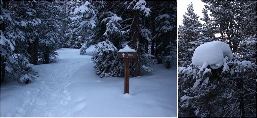
The road and trail was well packed down
This time I decided not to stop at all, and guess what? I had my fastest summit of Quandary Peak! There were tons of dogs on the trail today, and I even saw a group of skiers with guides. Here’s the summit
It was very, very cold today. It didn’t get above 18 degrees (that’s what the temperature was when I got back to my truck). There was a slight layer of frost on everything
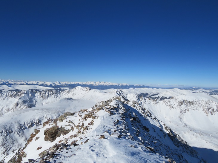
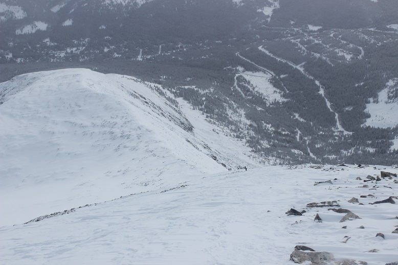
Looking west
Heading back down I came across some BASE jumpers who were intending to jump from the summit. I didn’t think it was windy enough today. In fact, it was a perfect, bluebird day to go hiking!
I saw Mountain Goats on the way down, but they were kind of far away
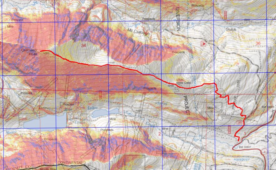
Here’s a topo map of the route. I made it back to my truck at 11:45am, making this a 4 hour hike: 7.22 miles with 3444’ of elevation gain
The Quandary Peak Summit Sticker can be found here
Here are my stats for my 2020 Hiking Related Goals:
Hike on 60 days this calendar year: I hiked 110+ days
Hike/walk/run/treadmill 2020 miles: Done: 2630 miles
Summit a combined total of 10 winter 13/14ers: I summited 12
Finish all the Bicentennials outside of the San Juans: Done
Hike in the San Juans at least 4 times: Done
Complete one new class 5 Bicentennial: Done (Coxcomb)
Summit 2 highpoints outside of Colorado: I summited 9
Summit 3 new El Paso County Highpoints: Done
Hike one section of the Colorado Trail: Sections 1-3, done
Complete Grand Canyon R2R: Done
Keep my average above 10+ miles and 4000’+ of elevation gain per hike: Almost. I averaged 12+ miles per hike with 3745’ of elevation gain
I was able to get in 164 peaks, 110 hikes, 1,315,869’ of elevation gain, and 2630 miles this year, so I’m considering my 2020 hiking adventures a success. On to 2021!
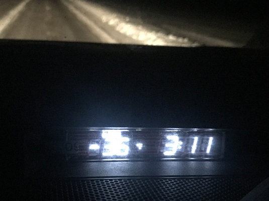
Today was my last day of the year I had available to hike, and while the weather was chilly I had no idea just how cold it actually was. The forecast said the low was -6 and the high was 5, but there wasn’t supposed to be any wind so those temperatures seemed doable to me. I got up and drove to the trailhead, just to discover it was negative 36 degrees outside. I didn’t realize it could even get that cold in Colorado!
I sat in my truck, willing the temperature to rise for a good half an hour before it didn’t and I decided to drive home. I felt -36 was just too cold to make an attempt. In fact, I was even a little scared to turn off my truck because I wasn’t sure it’d start again in those temperatures. I was bummed the weather forecast had been so off, but enjoyed the solitude on the drive there and back. Since this was my last chance to hike I can now re-cap my 2019 goals and reflect on how I did:
Hiking related 2019 goals:
Help someone climb a 13er or 14er, or any hike they didn’t think was possible for them. Done. Started them on Sniktau and kept going from there.
Complete 4 highpoints outside of Colorado, with at least 1 being above 10,000’. Done, I did 7, with 3 above 10,000’
Black Mesa – OK, 4973’
Guadalupe Peak – TX, 8749’
Reno Point – DC – 409’
Wheeler Peak – NM – 13,161
Mt Whitney – CA – 14,508’
Boundary Peak – NV- 13,180’
Woodall Mountain – MS – 806’
Complete 21 Centennials (I’m currently at 76, so this would bring me to 97). Done, I completed all the Centennials.
Complete 5 winter 14er ascents (duplicate peaks are ok). Done. I completed 10 winter 14ers and 4 winter 13ers, summiting a couple (Quandary) more than once.
Climb 80 peaks. Done. 80 ranked, 18 unranked, for a total of 98
Hike on 50 days this calendar year. Done. I hiked on 71 days, not including my treks up the Manitou Incline and down the Barr Trail or local hikes.
Attend 12 Happy Hour meet-ups. Nope. I attended 10.
Try 3 new types of Whiskey (yes, this is hiking related, and not a stretch goal considering the point above). Done, done, and done. I stopped counting at 8.
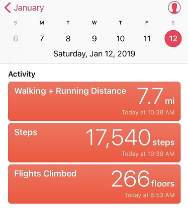
Keep track of miles hiked. Done, 839 total miles hiked, not including my Manitou Incline hikes, local treks without a summit, or daily treadmill time
The weather just about everywhere in the state today was forecasted as miserable. Everywhere except for Quandary (even the 13ers and mountains adjacent to Quandary were forecasting snow). Quandary showed clear weather from 4am-2pm so I decided to make the best of the situation and work on my winter 14er goal for the year.
I slept an extra hour this morning. It’s been a long time since I’ve hiked in the daylight, and now that my youngest has her license and I don’t need to be home quite so early every time I hike. I had the ability and wanted to start out hiking today with light. The roads were terrible on my drive in for most of the way. The worst tended to be in the cities (looking at you Woodland Park) but surprisingly the back highways were mostly clear. In any event, due to ice on the roads I didn’t go above 30mph the entire way so I didn’t arrive until after 6:30am.
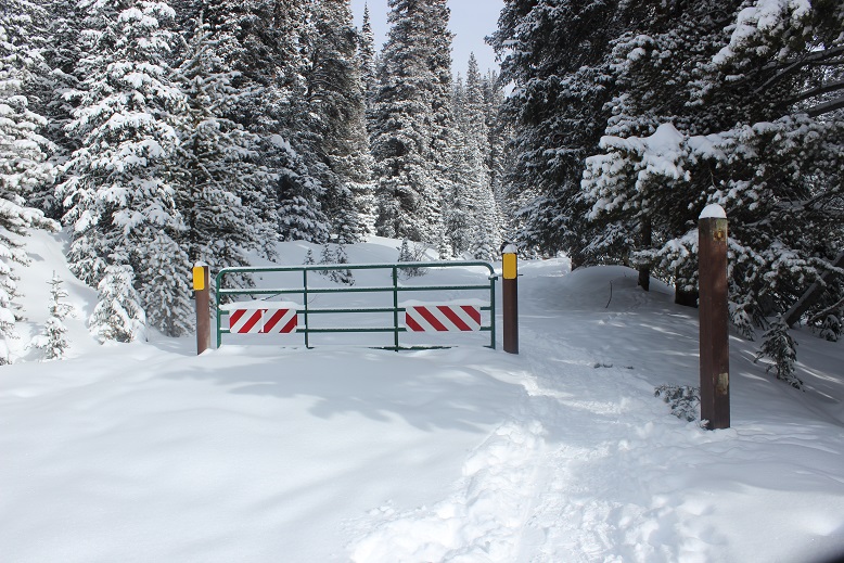
The upper trailhead was closed so I parked at the lower trailhead. This adds about 100 feet to the hike so it was no big deal.
I was surprised to find 3 other vehicles in the parking lot when I arrived. I reminded myself this was a popular 14er, even in winter time, and I’d gotten a late start.
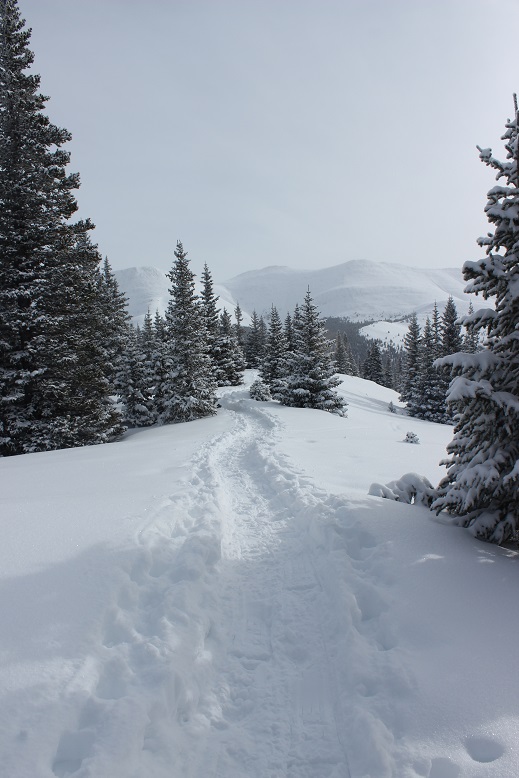
The path was easy to follow up the dirt road to the start of the trail. It was just beginning to get light out, so I didn’t need my flashlight (woohoo!).
I’d read from a conditions report yesterday there was no trail, but quickly found the upside to others being here before me: They were trenching the trail! It feels like it’s been forever since I’ve had someone else trench a trail for me. In fact, it was only one other time and I can name the date: Evans, my 2nd 14er, June 2017, and it wasn’t the trail they trenched but the last bit to the summit.
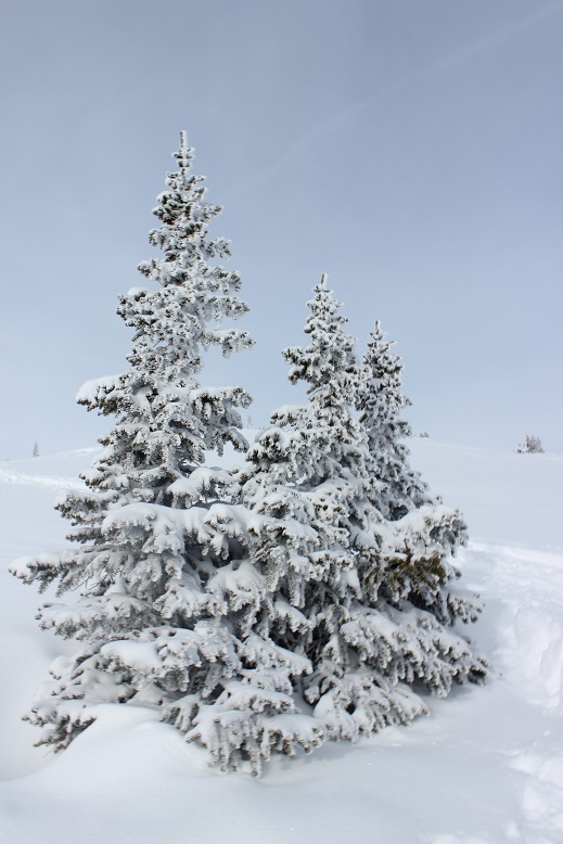
The trail today was quiet and peaceful and I enjoyed just walking through the snow.
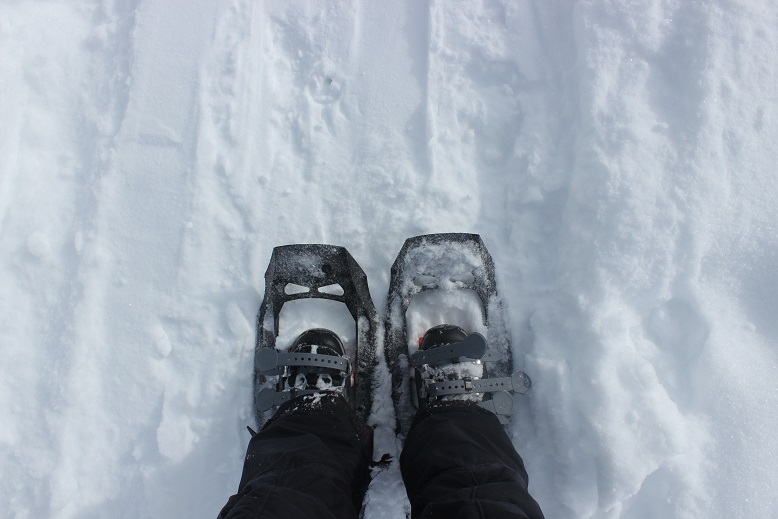
Well, all except for my snowshoes. Today I’d decided to see if my microspikes had any effect on the bindings of my snowshoes, and apparently they didn’t: They come undone whether or not I’m wearing microspikes. Sigh. Oh well. It’s not too big of an inconvenience, but they should really replace these things with ratchet bindings so they don’t come undone. Or add another way to secure the straps.
I was appreciative of the group before me, trenching lazy ‘S’ curves up the mountainside.
But just after I took this picture I caught up to the group and decided to take over trenching: They’d done such a good job and must have been tired. They deserved a break and I wanted the exercise. The difference between their trench and mine was theirs gradually gained the slope: I just trudged straight up the ridge.
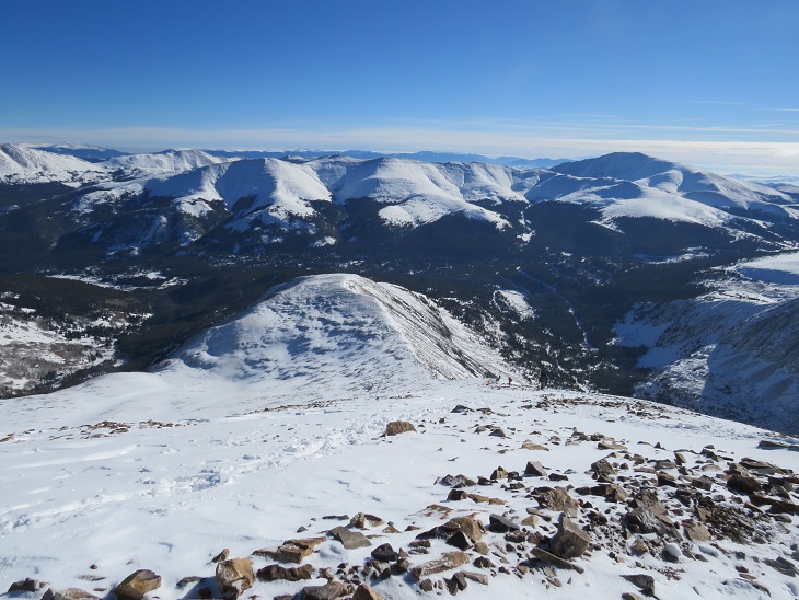
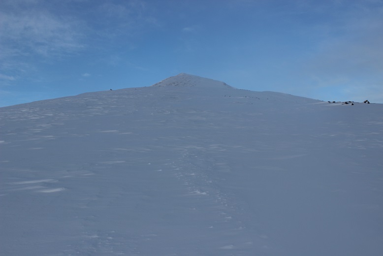
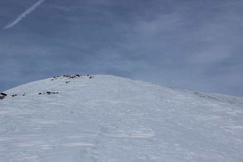
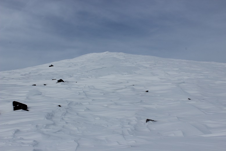
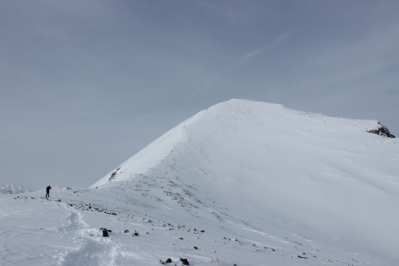
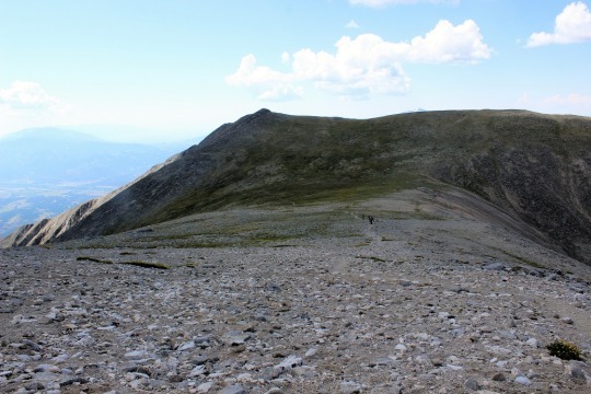
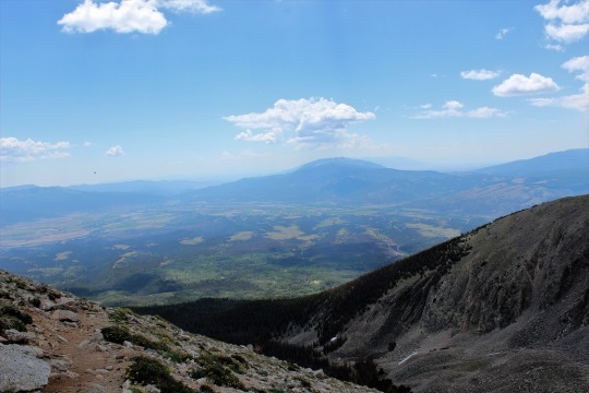
I continued hiking until about 13,100’, crossed a flat ridge and saw the rest of the route before me
It was here with 1000’ left of elevation gain I decided to try out the heel lifts on my new snowshoes. I take back everything negative I’ve ever said about these snowshoes… well, everything except the need for ratchet bindings. Those heel lifts are amazing!!! Where have they been all my life? They made an insane difference, and I was flying up the mountain.
About halfway up I turned and looked around. I knew there were at least 5 people behind me, but they were nowhere in sight. They must still be below the ridge.
OK, this was all I had left. Time to book it to the summit
OK, maybe a little more
Wait, what?!?! What’s this? There was a large grouping of snow where the summit should have been. I was going to need to cross this in order to officially claim I’d summited. I took one step and sank up to my knees. Hmmm. This snow was not stable and I wasn’t sure what was beneath (I found out later it was just a flat summit and I most likely could have walked straight across). I decided to play it safe and stick to the right. It was slow going, slippery, and unstable. Here’s looking back from the true summit.
I set up my camera to take a photo and got one shot before my camera died (well, stopped working until it warmed up again). So here’s my one summit photo… Good thing this isn’t my first summit of Quandary.
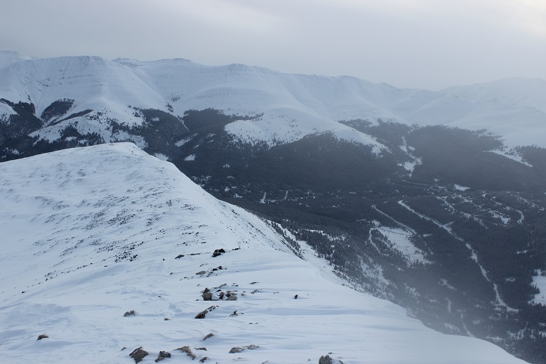
It was snowing on all the mountains all around me, and while the snow was headed towards Quandary it didn’t look like it would make it here. It seemed like I’d chosen the correct peak to summit today! And: Quandary with no wind? That’s unheard of! I started my trek back down. I made it halfway down the ridge before seeing anyone else.
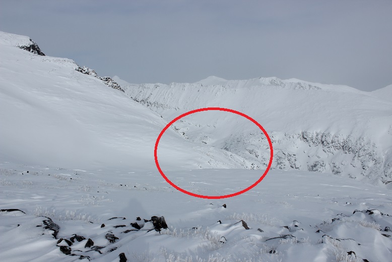
I’d wanted to hike Hoosier Ridge today, but the weather was forecasted as better on Quandary, and indeed the forecast had been correct as it was now snowing on Hoosier Ridge. I took a good look at it for tomorrow and marked in my mind the features I could see.
I stopped along the flat section to get a few pictures
And noticed some goats!
I was only able to see them due to the trails they were making in the snow, otherwise I’d never have known they were there.
OK, time to get serious about heading down. Check out that trench!
As I descended I kept seeing more and more people working their way up: snowshoers, skiers, and some hikers just wearing microspikes. I wasn’t sure there was enough snow to ski, but there sure were a lot of skiers out today. I don’t really understand 14er skiing. It’s not that I don’t like to ski, it just seems like a lot of work for a “you get one” kind of experience. Also, I don’t want to become addicted to another sport, especially something that involves snow, so I’ll leave the 14er skiing to others for now. There was plenty of skiable snow just at and below treeline, but it seemed these skiers intended on summiting as well. I saw at least two dozen people, if not more, and was glad I’d gotten an ‘early’ start. Boy was that trench looking good now!
I saw a group of three men on my way down working their way up. They’d found my bandana and the microspike I wasn’t aware I’d lost. Thanks guys!
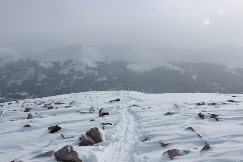
I made it down at 10:30am, making this a 7 mile hike in 4 hours. The parking lot was packed.
This really is a straightforward hike: make it to treeline and follow the ridge. With clear skies (at least over Quandary) and no wind it was a perfect hike for today. I’d like to summit four 14ers during winter this year. 1 down, 3 to go!
Today I hiked Mt. Shavano and Tabeguache Peak,
otherwise known as Shav and Tab to most because no one know how to pronounce
Tabeguache (TAB-uh-wash). Up until late last night I wasn’t sure which
peak(s) I was going to hike today. I’d
planned on three possible hikes for today before I left for Europe, and it
would just depend on the weather when I got back. I really wanted to hike Redcloud, Sunshine,
and Handies because I had 2 days in a row available and I’m 75% sure it would
require an overnight, but when I looked at the weather for the area it showed
thunderstorms all day for the next two days.
Drat.
So I looked up the two
other hikes I had ready, Shav and Tab, and Grays and Torreys. They both had similar weather (rain and
thunderstorms at either 10am or 11am both days), so I decided to make a
spreadsheet. In the end I went with Shav
and Tab because it’s further away (by half an hour), a longer hike (10.5 miles),
and had more elevation gain (5400+ feet). I figured if it was going to rain in
the afternoon both days at both places I’d get the harder one over first when
the rain was scheduled for an hour later and have more time to deal with
weather if it became an issue on the shorter hike.
For this one I was up
at 2am and on the road by 2:30am. I had to do a little work (like, for my job)
before leaving so it took longer than anticipated. I was able to find the trailhead without too
much difficulty and began at 5:30am, at the last-minute stuffing a winter coat
in my backpack just in case. It adds about 3lbs to my pack (which honestly only
has water, some snacks and first aid supplies), but I’ve never regretted having
it on a hike.
I hiked for a bit and
found the register. I signed the date,
my name, Colorado Springs, and continued on.
The sun was just
beginning to light up the sky, waking up the crows, flies, and cows. I heard them all for the first two miles or
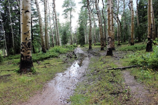
so as I walked through a muddy trail.
Then the red glow of
the sunrise. I always LOVE this time of
the morning on a hike. It only lasts
about 5 minutes, but everything is bathed in a reddish orange glow. It’s beautiful.
The sunrise woke up a
woodpecker (I’ll upload the video on Wednesday, sorry!)
I walked over several
small streams those first few miles, then didn’t see any water for the rest of
the hike.
Early on in the hike I
passed a group of three male hikers. They
were glad to let me pass, as they couldn’t keep up. They were taking their time and didn’t know
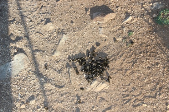
if they were going to summit both peaks today or not. Around mile 2 I started seeing scat. Lots of it and it looked fresh. Then out of the corner of my right eye I saw
something move quickly and bound up the hill.
I only say the legs, but I’m thinking it was either a deer or a bighorn
sheep. I’m thinking sheep because of the
scat. It even smelled like they were in the
area.
I rounded a corner and saw the Angel of Shavano, or
where she should be. I’ve known of Mt.
Shavano for years, ever since we’ve started skiing at Monarch. She’s the famous symbol of the area. The Twisted Cork (where we like to go out to
eat when we ski) owns the Mt Shavano winery and the Angel of Shavano is on all
their bottles. It’s a pattern in the
mountain when there’s snow that looks like an angel. Kind of like a Native American Angel (hard to
describe, but that’s what she looks like).
The middle of this picture is where she’d be… only half of her is still
here due to snow melt.
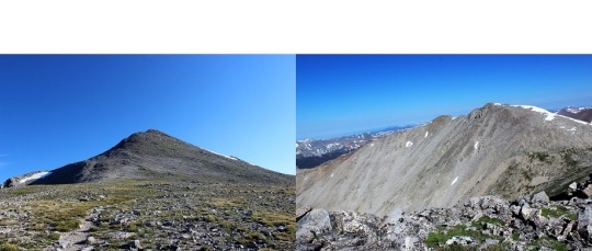
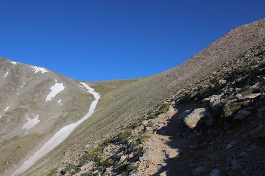
This hike goes up, up, up, up, with just about no
leveling out. I made it to the top of
the saddle, looked right, and could see Mt. Shavano, but I didn’t know it was
Mt. Shavano at the time. To be honest most
hikers, no matter how much research they do, aren’t sure which one is the
actual peak until they’re hiking it.
Most hikers today thought it was a peak to the left. Nope, this is it. As you can see, I cross the saddle, then make
my left before swinging over to the right to cross between the two humps, and
then around again to the left to summit.
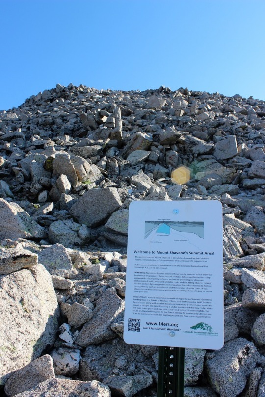
I came across this sign about half way up that
mountain.
There was no clear trail, but a bunch of little trails
to try and follow. Probably because this
is a popular snow route and it’s sometimes easier to just make it up as you go. In any event, I summited, and was super
proud! Oh, and it wasn’t windy and I
didn’t need my extra jacket! Bonus
points for this peak!
Now to find Tabeguache. I got out my map and figured out which peak
it was, and my stomach dropped. I was going
to have to cross this ridge (there was no trail, I just had to cross it).
Here’s a better picture. I had to cross the ridge to the bottom right,
then go down and left towards a saddle, and follow the snow line to the left to
the peak. I took a deep breath and was
on: I’ve got this!
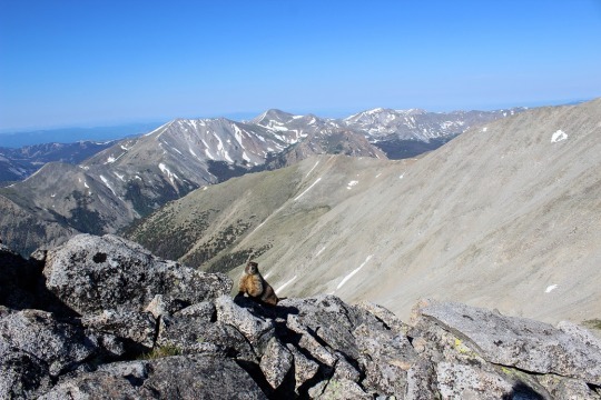
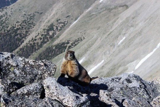
I met a rather photogenic marmot just as I started
descending Mt Shavano towards the ridge.
As I was hiking I was continually disturbed there was
no actual trail to follow. My mind got
to wandering and I got to thinking about how dangerous it was not to have a
trail to follow. I knew this was senseless
because of the activity I was partaking in, but I felt it anyway. For some reason, I felt entitled to a
trail. Well, there wasn’t one, so I
aimed towards where I needed to go and just worked my way towards it.
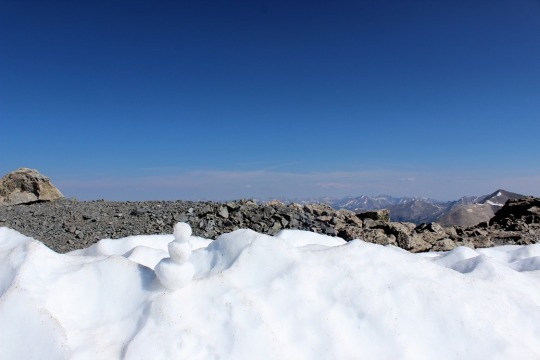
As I was crossing the last patch of snow I spied a snowman. So cute!
There was one other hiker ahead of me (I’d noticed him off in the distance
as I summited Shavano), and I’d seen him stop here, but I thought he was just
resting. This was much better!
There was just a little more ways to go. I skirted the snow to the left
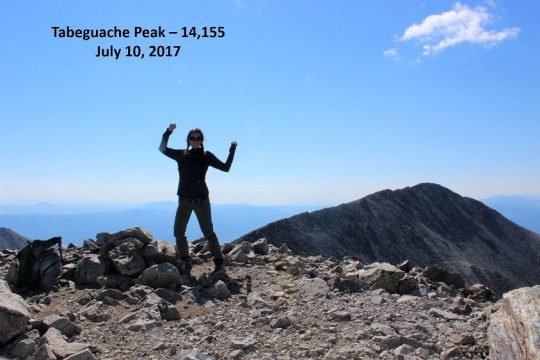
And all the sudden, I was there! I’d summited!
I was super proud of myself for this one! I’d hiked for over a mile down one mountain
and up another, over piles and piles of rocks, without a trail, and still
managed to get where I needed to go. It
was now 9:30am and there was one tiny cloud in the sky.
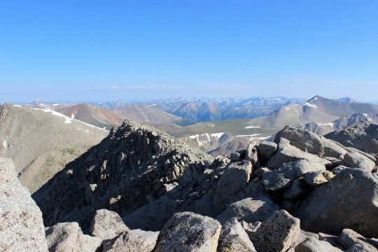
I turned around and saw what I’d hiked thru without a
trail (that’s Mt. Shavano as seen from Tabeguache). I’d hiked just over 5 miles
in 4 hours. That’s a very, very slow
hiking time for me, but I had hiked over 5400 feet in elevation, so hiking 1100
feet in elevation an hour isn’t so bad, right?
I took a summit-shadow-selfie and was back on my way. I don’t like to spend too much time at the
summit.
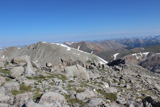
At the saddle I had a great view of Mt. Antero. I’ll probably do that one soon…
This hike is an out and back hike. So I hiked up Mt.
Shavano, then to Tabeguache, then down Tabeguache, back up Mt. Shavano, and
down Mt. Shavano to the trailhead.
Basically I summit Mt. Shavano twice, which seems awfully unfair since
it only counts as two summits.
As I was hiking back up Mt. Shavano I got to thinking
about what I’d just accomplished. Sometimes
there isn’t a trail, and that’s ok.
Maybe you need to make your own trail.
Set a goal, keep your eye on that goal, head in that direction and keep
putting one foot in front of the other. Eventually you’ll make it. It may not be how everyone else made it, but
you can make it just the same. There’s a
moral in there somewhere…
I summited Mt. Shavano a second time and saw the group
of three hikers I’d seen earlier. They
were impressed I’d already hiked out to Tabeguache and back. I was about 2 hours ahead of them hiking
time. We discussed whether or not they
could make it to Tabeguache. They weren’t
planning on hiking it because they didn’t have a ‘summit sign’. I thought this was a lame excuse, but did comment
on the clouds building quickly. When I’d
looked at the weather last night it had said thunderstorms were highly likely
after 11am, and it was now 10:15am. While
it had been clear at 9:30am clouds were quickly forming. I wished them luck and told them to watch the
weather.
Unfortunately, people just don’t realize how quickly
weather moves in on a 14er. The weather
can turn in 15 minutes and put you in a dangerous position. I saw about 15 hikers as I was making my way
down to the ridge. For some reason, I
feel a personal responsibility when I’m hiking to everyone else hiking the same
trail, since I’m usually the one with the most experience. I talk to them all,
ask how they’re doing, if they’ve ever done a 14er before (or this one), where
they’re headed, etc. It takes time out
of my hike but I feel responsible to advise in some way because I have more
experience.
I told each and every hiker on my way down to watch
the weather. I got a lot of responses,
none of which sounded concerned. Most
said things like “it’s not forming too fast” or “it doesn’t look that bad” or “we
aren’t supposed to get rain today, are we?”.
But I had more information than them.
I knew it was supposed to thunderstorm today. I advised them to watch the weather and if
they couldn’t hike it in an hour to turn back.
None of them did, and I also knew none of them could make it the rest of
the way in an hour. Hmmmm.
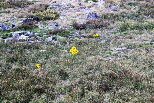
I crossed the saddle and came upon an alpine
meadow. I love how these flowers seem to
be saying “hi”.
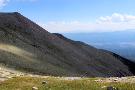
Then I turned and saw the trail back. Ugh!
This wasn’t going to be fun. The
entire trail was up, up, up (much more than is visible in this photo). While it was challenging to hike up it was
extremely difficult to hike down. I
couldn’t hike fast. There were just too
many rocks in the way and it wasn’t safe to hike down any faster than I’d hiked
up. Oh, and notice the shadow in the
picture? Clouds are beginning to
seriously form above me. I needed to
make it to the treeline as fast as possible.
At least the view was great!
So, I hiked and hiked and hiked and hiked down, down,
down. It was slow going and I really had
to pee, but, you know, I’m above treeline so that’s not really a good
idea. Just as a side note, NEVER pee
directly on a trail. Besides the obvious
‘ew’ factor and LNT and all that, no matter how sure you are you’re alone, you’re
not. Someone WILL come into view as soon
as you drop your pants. This is a fact.
Anyway… about a
mile after I made it past treeline I started feeling drops of rain. Small, icy, cold drops of rain. They started out slow, and then I heard
thunder and it started pouring. Within
30 seconds there was thunder and lightning everywhere and it started to
hail. I quickly pulled out my winter
jacket (Woot! See? I’m always glad to have it) and put my camera
into my backpack to keep from getting wet (so no pictures, sorry). At one point, it was hailing so hard I wasn’t
sure if I was still on the right trail, but I was below treeline and I needed
to keep getting lower, so I continued.
The entire time I kept thinking about everyone behind
me on the trail who hadn’t turned around when I’d warned them of weather. I was absolutely positive they were ALL still
above treeline at this point, right in the middle of that thunder and lightning
and hail. I sent encouraging vibes their
way and continued onward.
Eventually the rain stopped and all that was left was
water slowly dripping down from the trees.
I was roasting in my coat (but dry!) and started looking for a time to
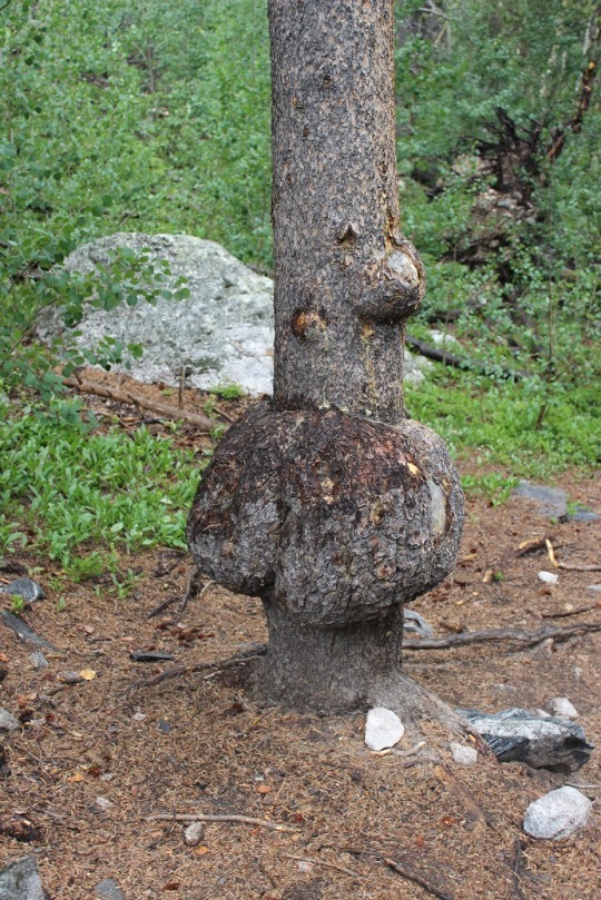
take it off. I came upon this tree,
figured it was something I needed a picture of, stopped and made the switch
(and took the picture).
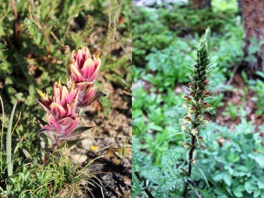
I saw several pretty flowers on the trials today. Here are just a couple…
The last 2 miles seemed to take forever. I mean, forever. And they kind of did. It took me 4 hours to summit and 3.5 hours to
make my way back to the trailhead when I would have expected it to take about 2
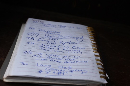
hours to get back down. I found the
register, added #8 and #9 to my name (it seemed bad luck to do so before
actually summiting them) and sloshed my way back to my truck.
I got a lot of good thinking done on the mountain
today. Oh, and I’ve now decided to write
a book.
I’ve actually had the poster for a few days, but I didn’t have a frame, so this afternoon I went out and bought one. The poster looks much better inside a frame, even if it is a cheap one. I bought a simple frame at Walmart because I plan on opening and closing it several times over the next few years and don’t want to invest too much on something that will most likely break with overuse. Once it’s complete I’ll get a nicer frame for the poster. I hung it outside my bedroom door. Rebecca noticed it when she got home: “Oh, I see you already have your poster hung up.”
This 18 x 24 inch poster was designed as a kind of log of your 14er hikes. 54 of Colorado’s 14ers are represented from original paintings of the summits by Robert L. Wogrin. There’s a small rectangle below each peak for you to write the date you successfully summited each 14er. I plan to write the summit number in the boxes instead of the date, and I also plan to put a picture of me at the summit over each image as I progress. In the photo I’ll most likely be holding a cardboard sign indicating the name of the summit, elevation, and date. Yes, I know that’s a predictable and sort of following the crowd type of thing, but it’s what I intend to do. I’m open to other suggestions?
Another idea: Collecting a small rock (maybe 1.5 inches?) from each summit, then writing the name of the summit and elevation in Sharpee on the rock. If I’m successful, I’ll have 54 rocks from the highest points of Colorado.