Pilot Knob – 13,746

RT Length:  12.6 miles

Elevation Gain: 4162’

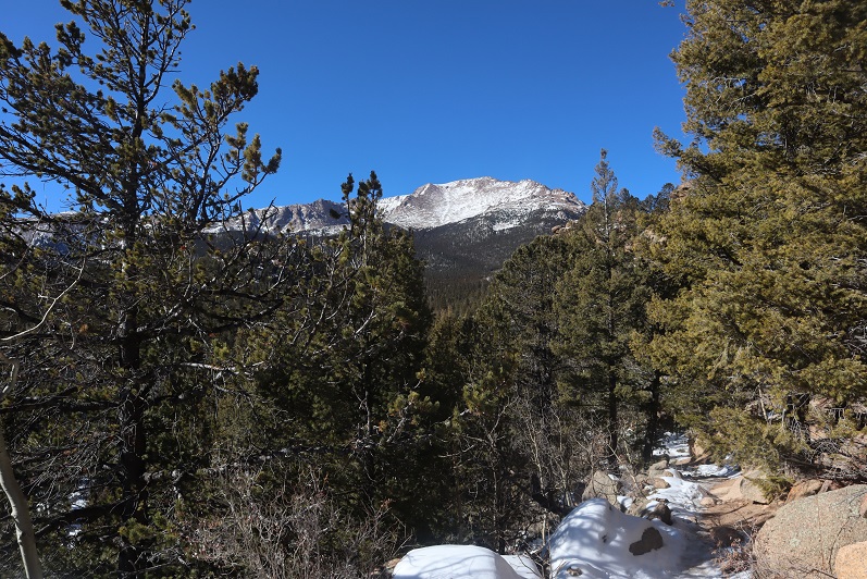
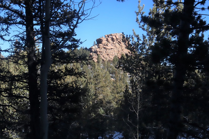
This was my second attempt of Pilot Knob, the first being a few years ago when I tried to link it up with Golden Horn and got caught up in some seriously scary scree.  This time I was approaching from the north, my only fear being lingering snow from an early September storm. 

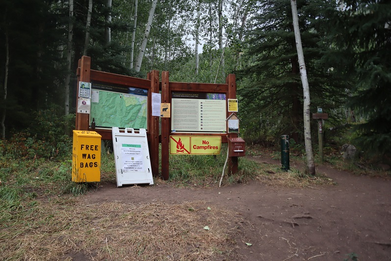
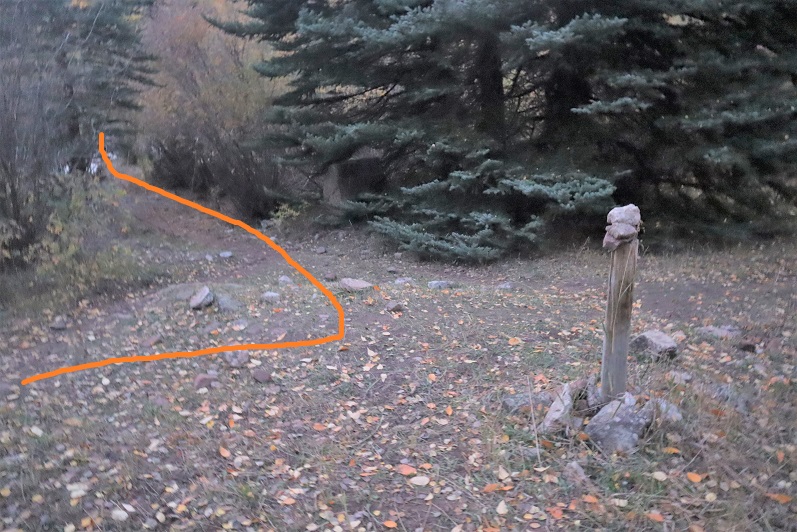
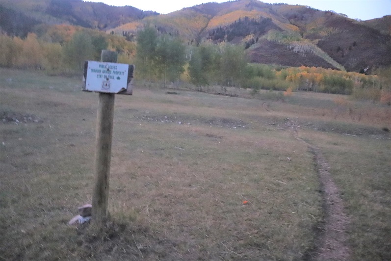
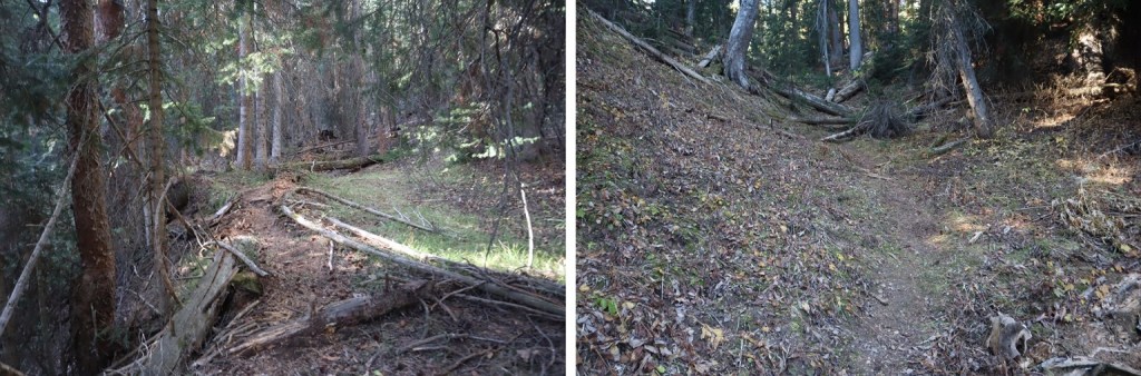
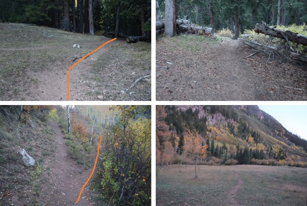
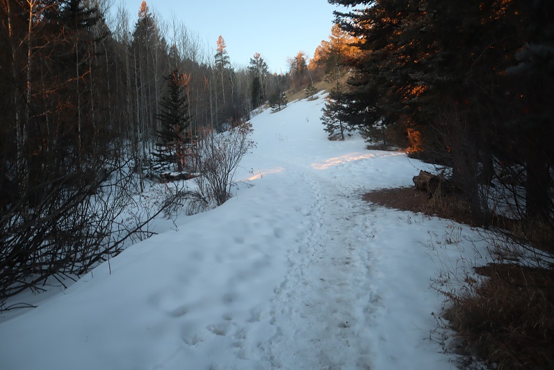
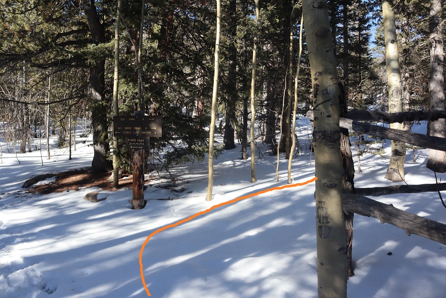
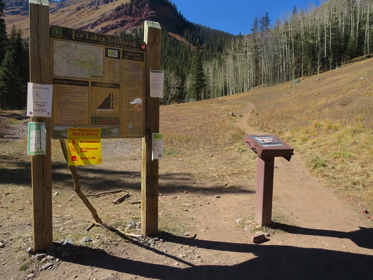
I arrived at the Ice Lakes trailhead at 5am and was the only vehicle in the lot.  It was a balmy 22 degrees and since I wasn’t in a hurry I decided to take a nap in my truck until first light.  I was on the trail at 6:45am.  The trail starts at the obvious trailhead sign at the west end of the parking area

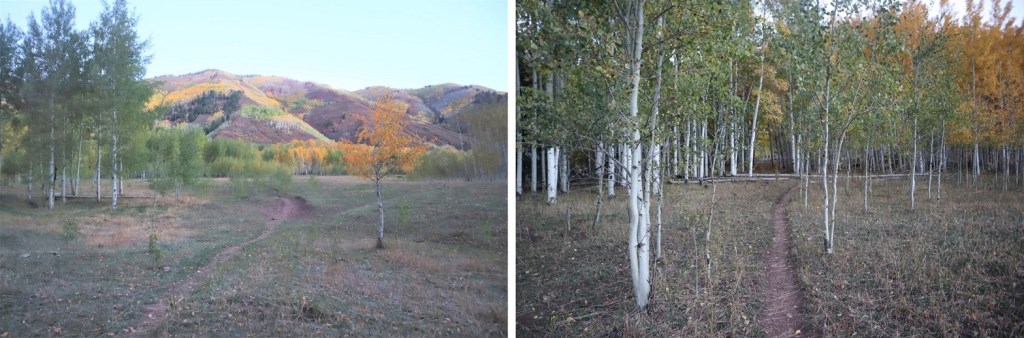
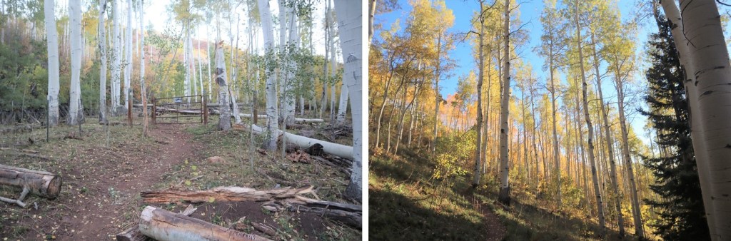
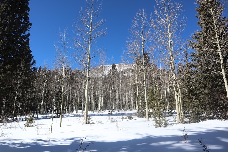
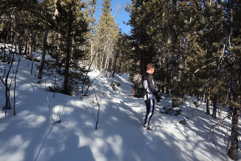
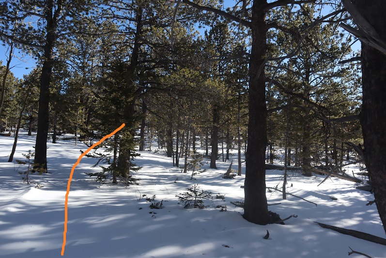
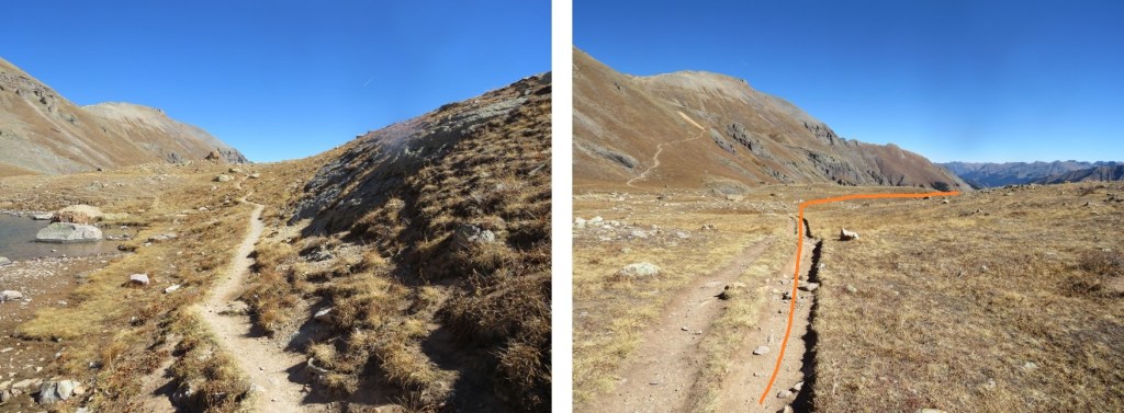
From here it was an easy hike on a class 1 trail all the way up to Ice Lakes Basin.  The avalanche area was easy to navigate. 
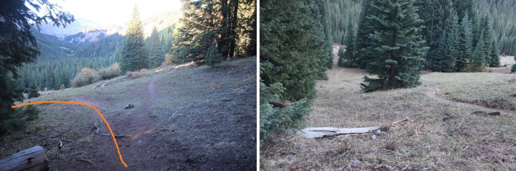
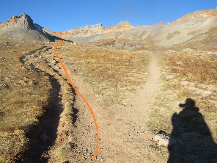
Stay left here

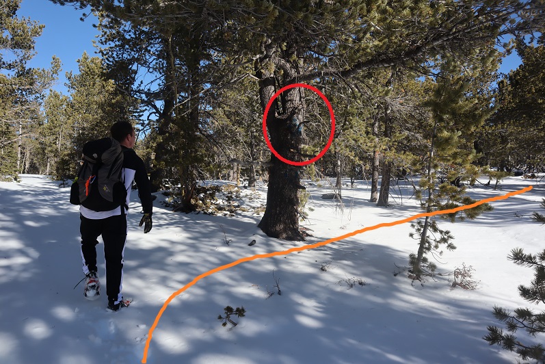
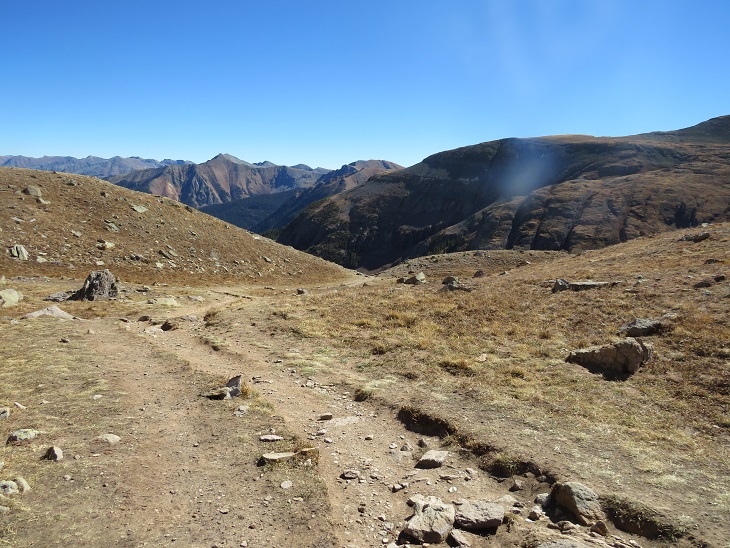
And continue to follow the trail to gain the basin

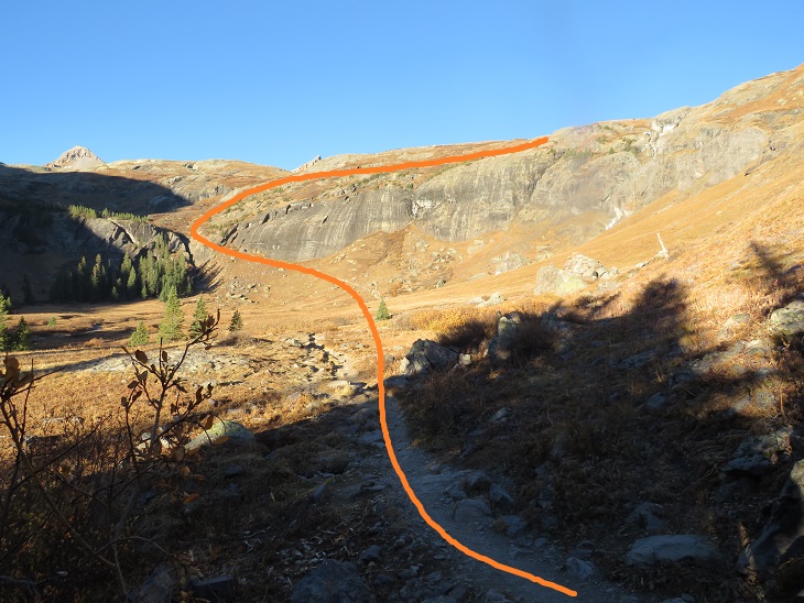
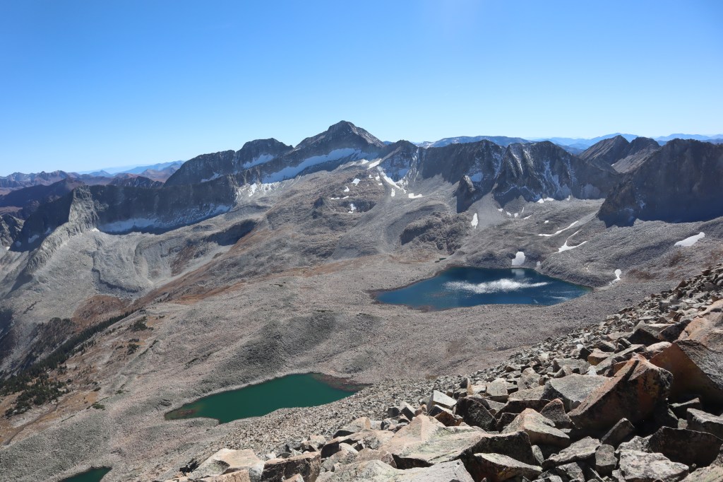
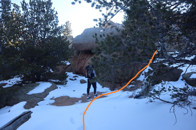
Once in the Ice Lakes Basin the trails get kind of goofy.  I skirted Ice Lake to the south and continued heading west.

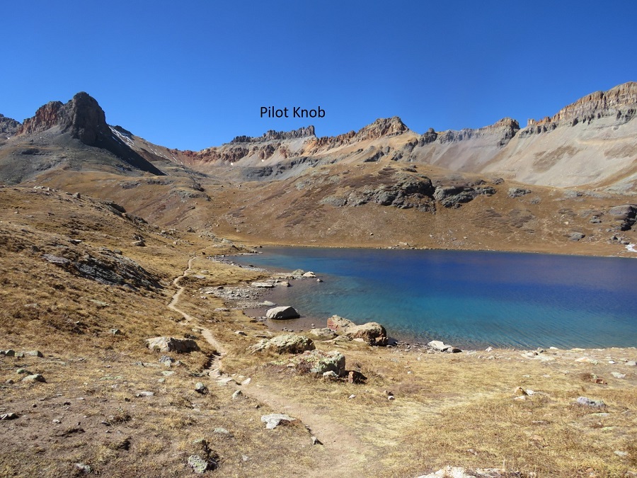
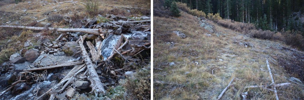
After Ice Lake there’s a little stream to cross, and then the trail ends and the class 2 section/route finding begins.

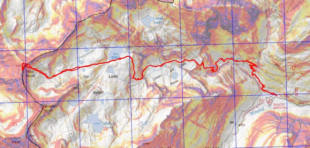
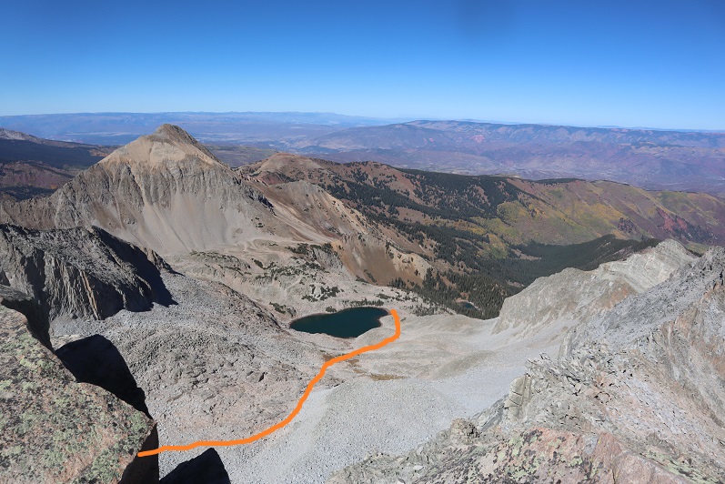
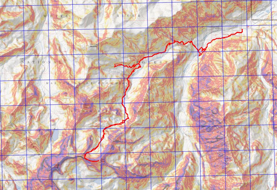
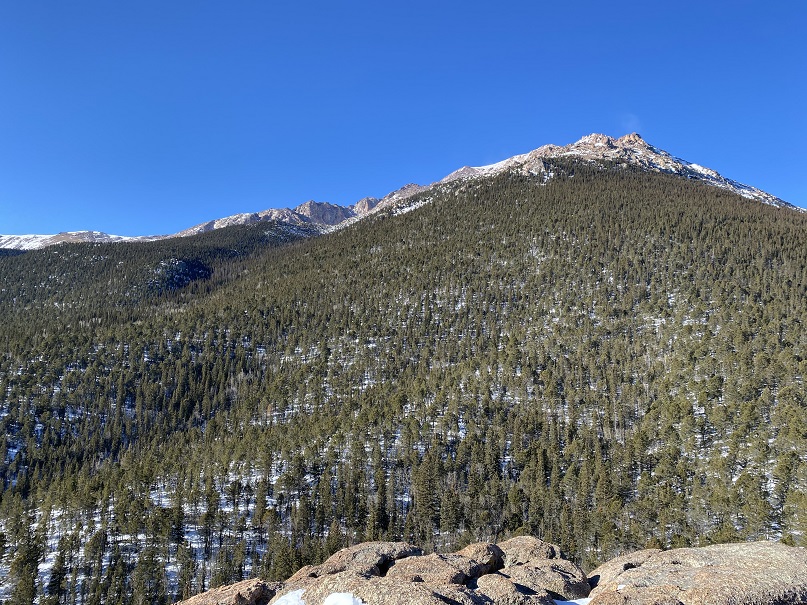
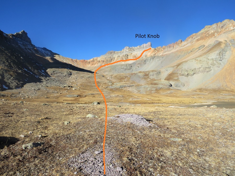
Here’s an overall view of the route I took up to Pilot Knob

And step by step (sorry, I couldn’t resist; I thought this was cool)

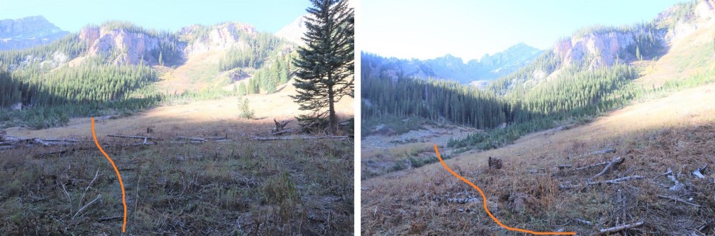
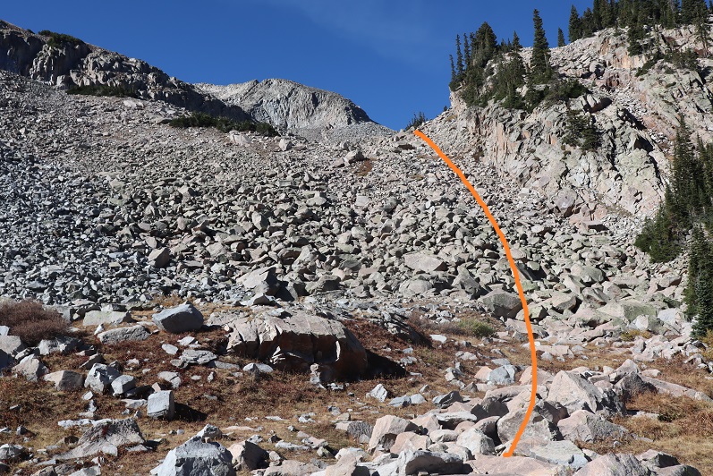
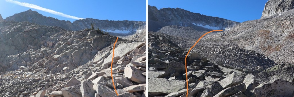
I followed the drainage west up the basin

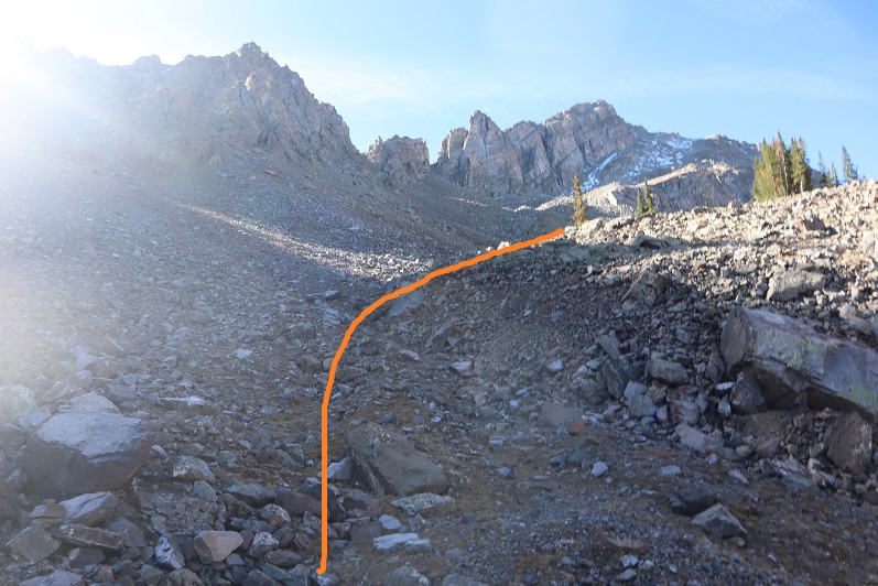
And once I reached the basin I turned right and headed for the gully that would lead me to the ridge

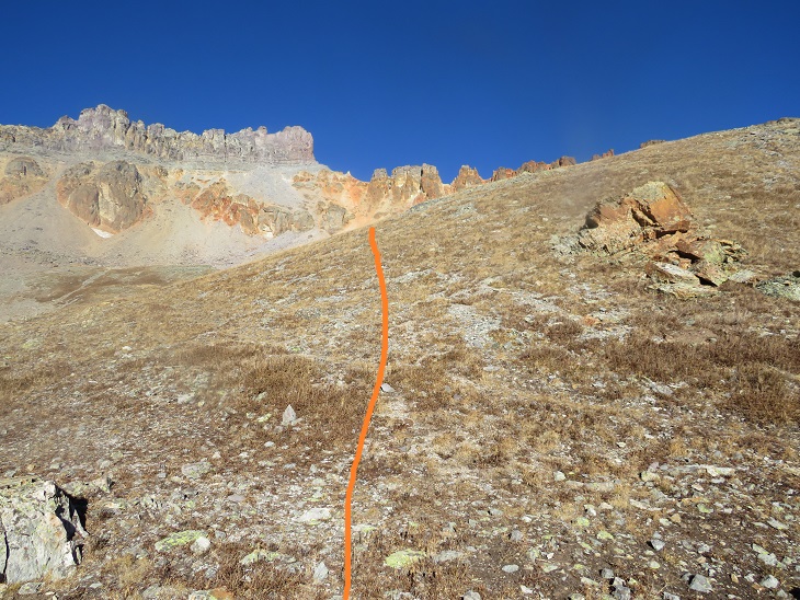
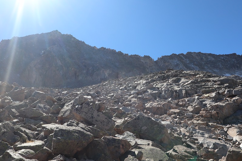
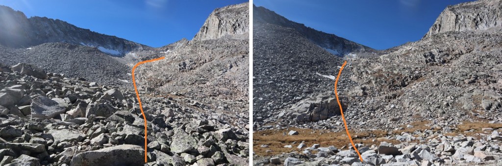
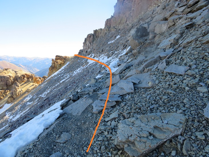
There are a lot of ways to ascend this gully, none of them fun.  The rock here is loose, the scree runs out below you, and there aren’t many handholds.  Basically, pick your line and head for the ridge. Microspikes and poles help. I took the solid line up, the dotted line down, but there are tons of options here

Once on the ridge I continued to skirt the north side of Pilot Knob.  There was a little bit of snow here, but nothing that required traction.  Here the wind picked up, and in the shadows it got really cold. 

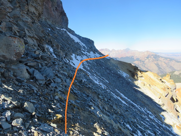
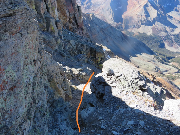
I rounded the corner and picked up a faint trail in the scree that continued to skirt the mountain.  You basically want to stay high here.  The scree here is loose, but much, much more table than the scree when coming from the opposite direction (Golden Horn).

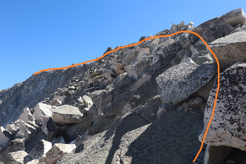
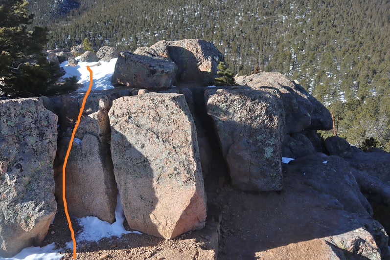
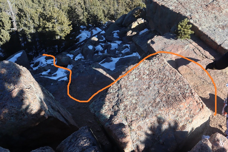
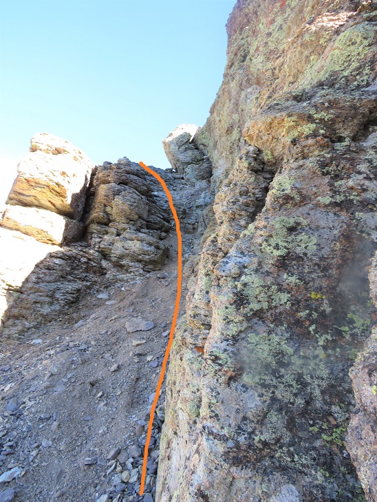
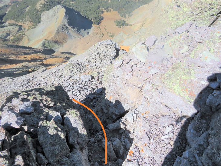
By sticking high here I came upon cairns that led me to the access gully.  This gully is extremely well cairned and easy to follow.  The climbing is class 3, bordering on class 4, and when you see a cairn and think to yourself “There’s no way I go over that”, you do.  Stick to the cairned route here; it goes.

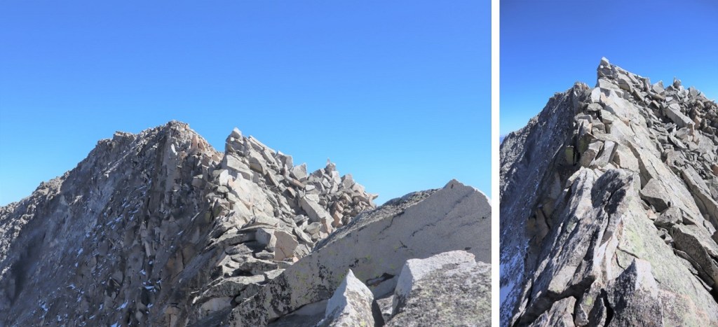
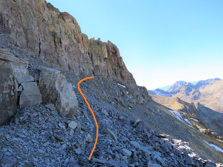
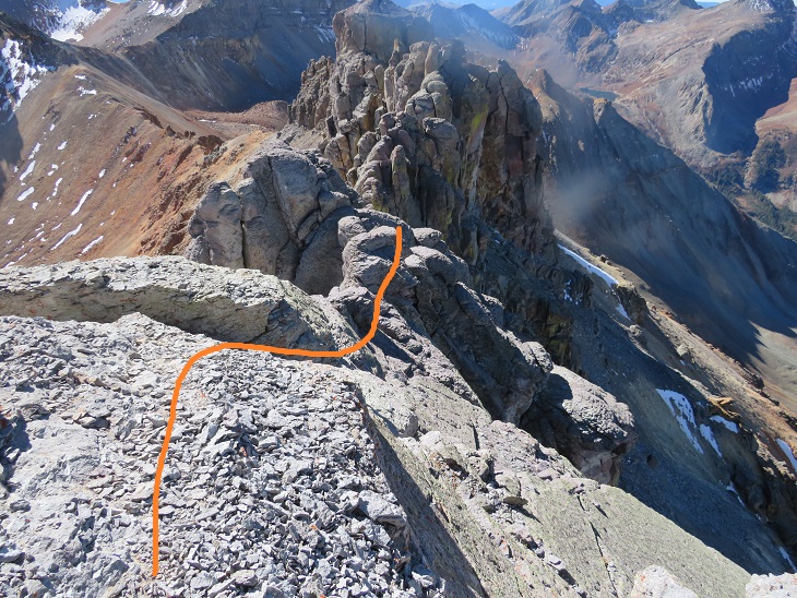
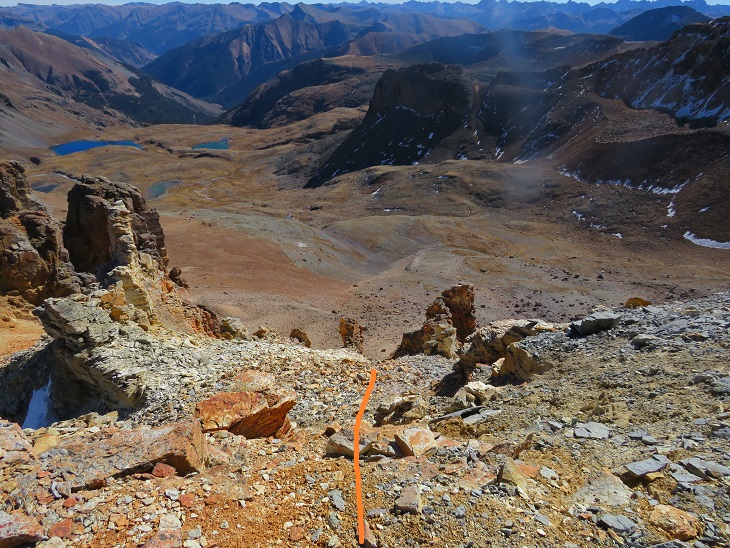
Here are some highlights:  I followed the gully northeast to the ridge

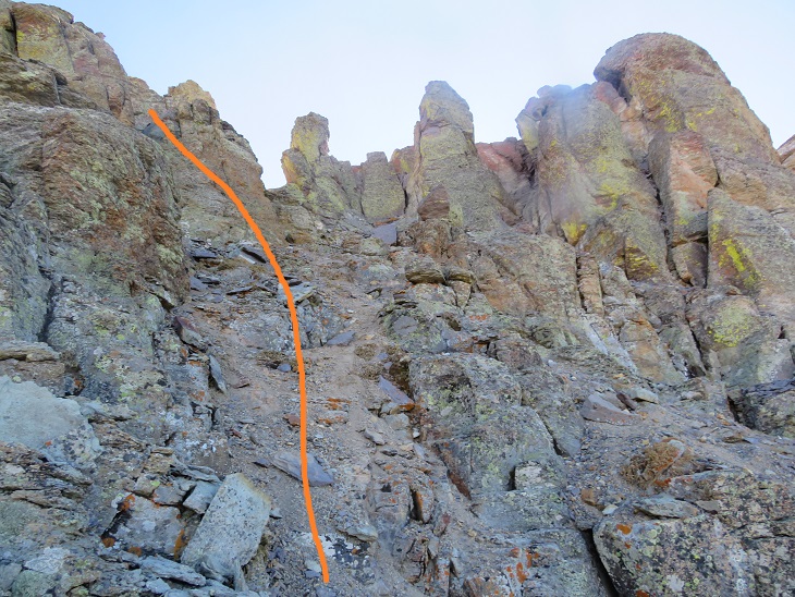
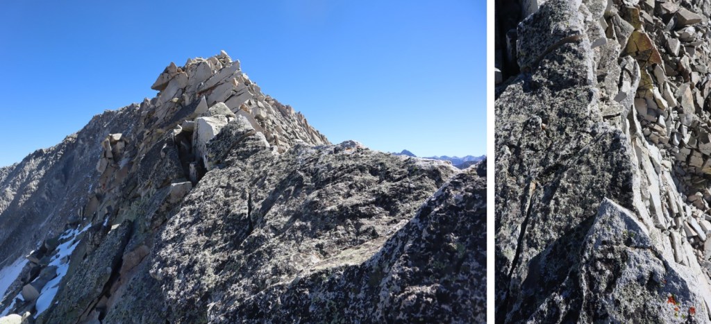
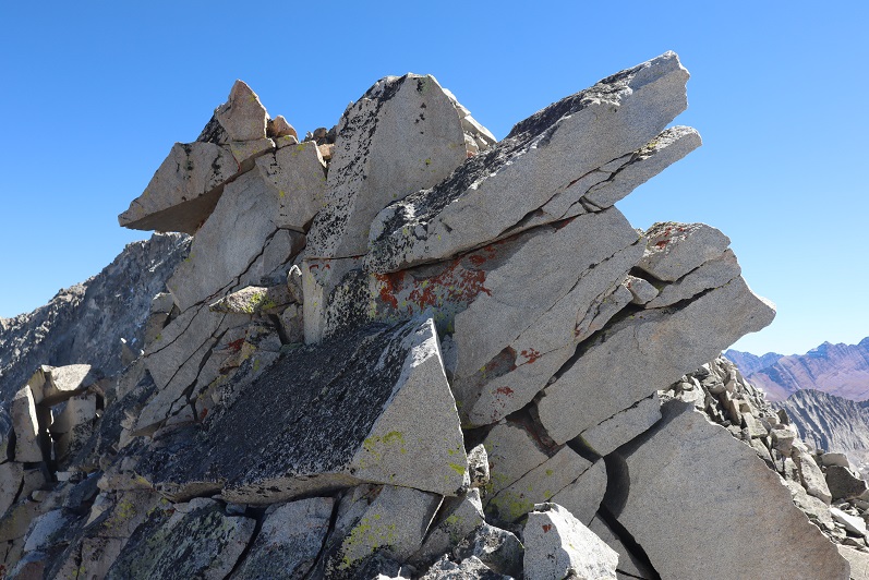
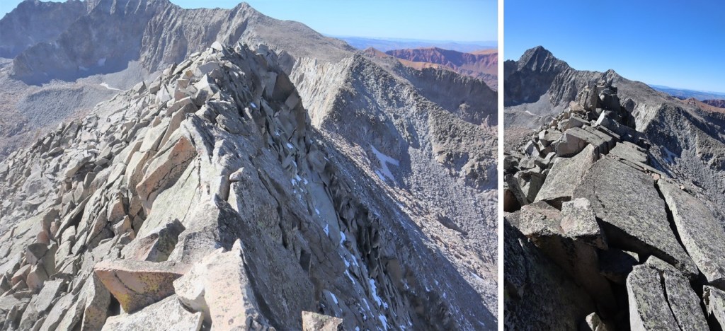
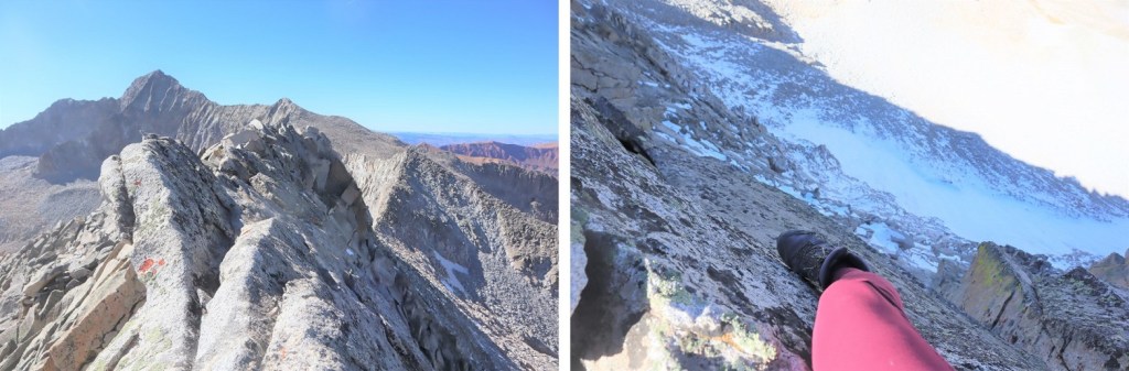
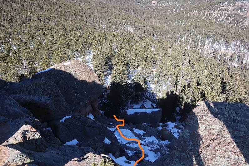
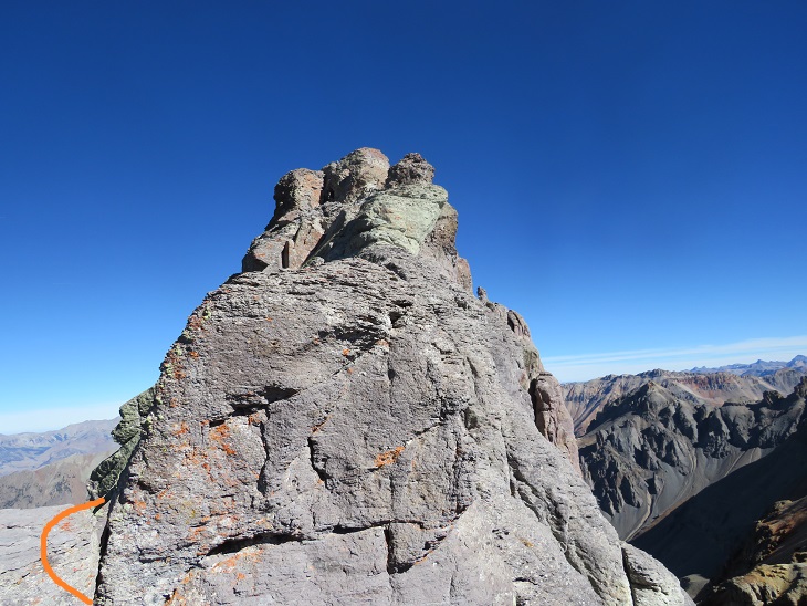
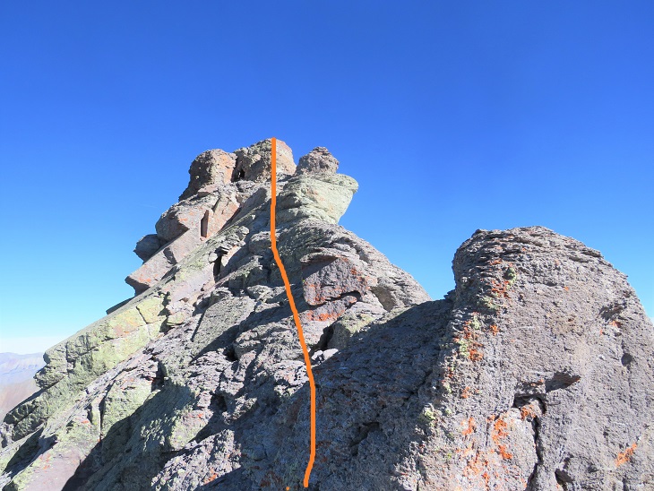
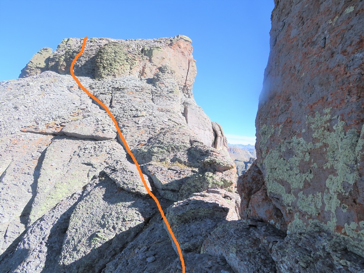
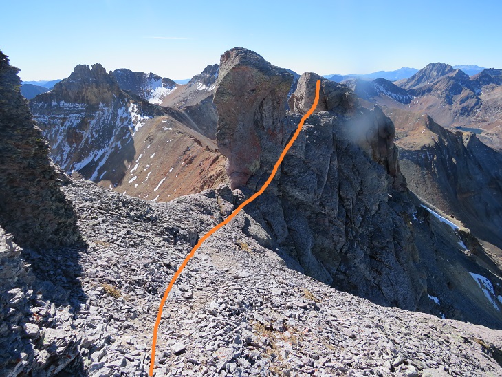
Once on the ridge the scrambling got interesting.  This is class 4 and there’s exposure, but luckily the rock is grippy.  Here’s the exact route I took, staying to the left of the ridge

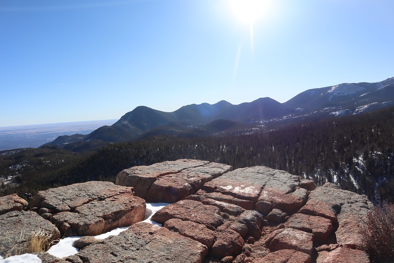
The last bit to the summit was underwhelming, and very, very windy.  And cold.  And windy. 

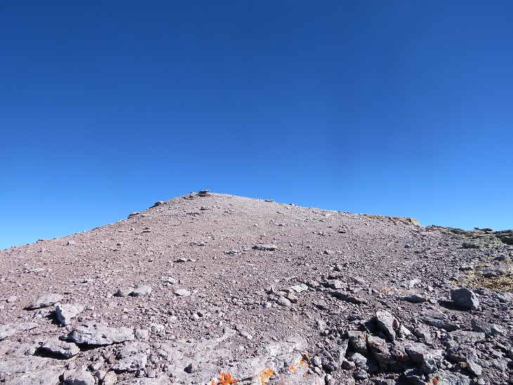
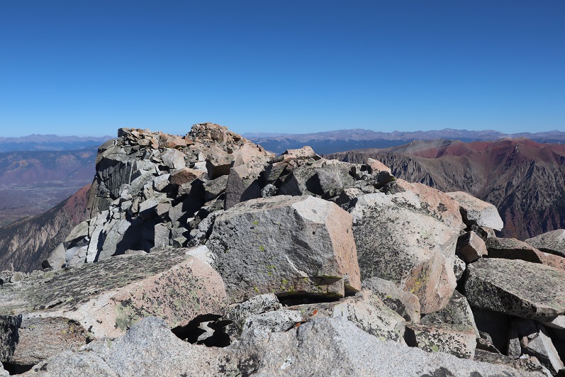
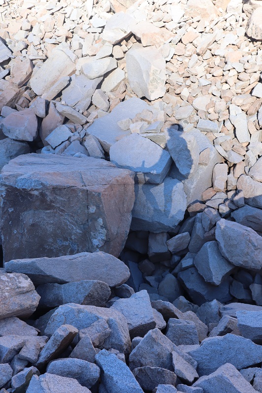
I summited Pilot Knob at 11am
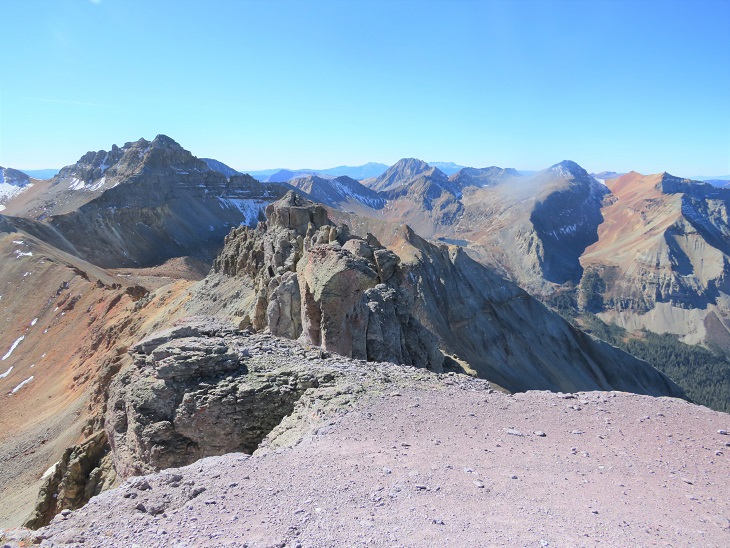
Pilot Knob: 

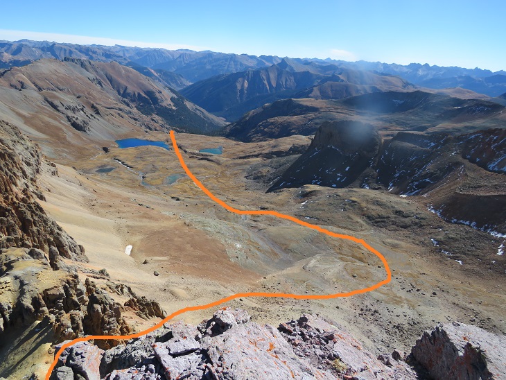
Here’s a look down at the way I came in through Ice Lakes Basin

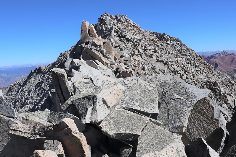
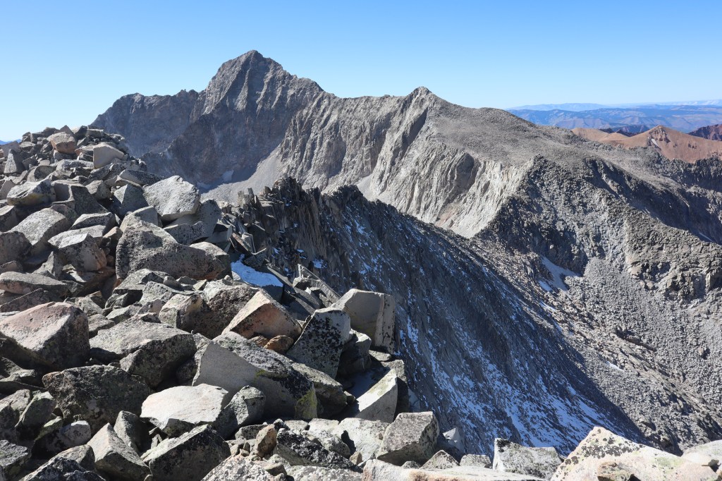
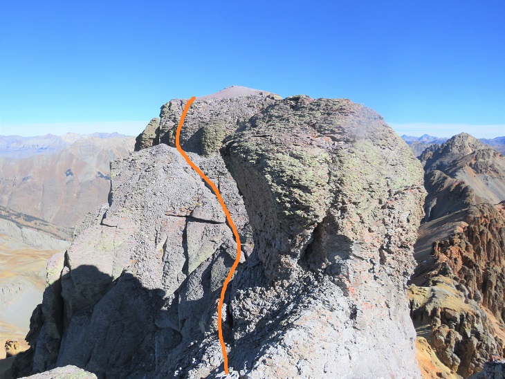
Time to head back.  Here’s an overall view of the ridge to the gully

And a step by step view back down the gully

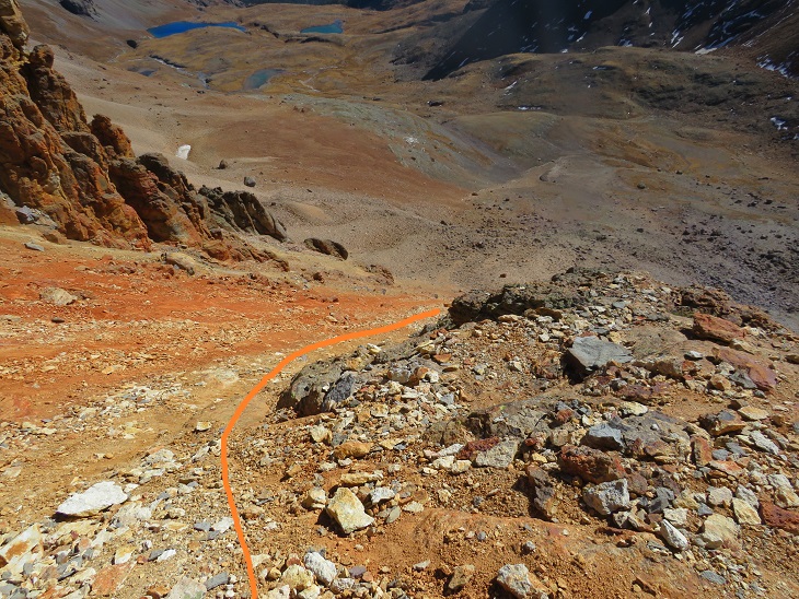
Once down the gully, here’s the route back to the access gully

The access gully was much more fun do descend than ascend.  I put on my microspikes and literally scree-surfed the entire way down, stopping a few times when the rubble became dangerously fast. 

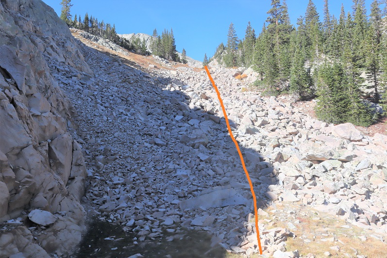
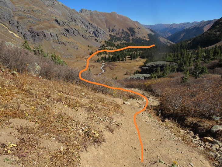
Once at the bottom of the gully I followed the same route out

Past Ice Lake and down into the lower basin.

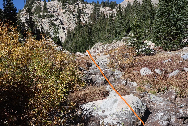
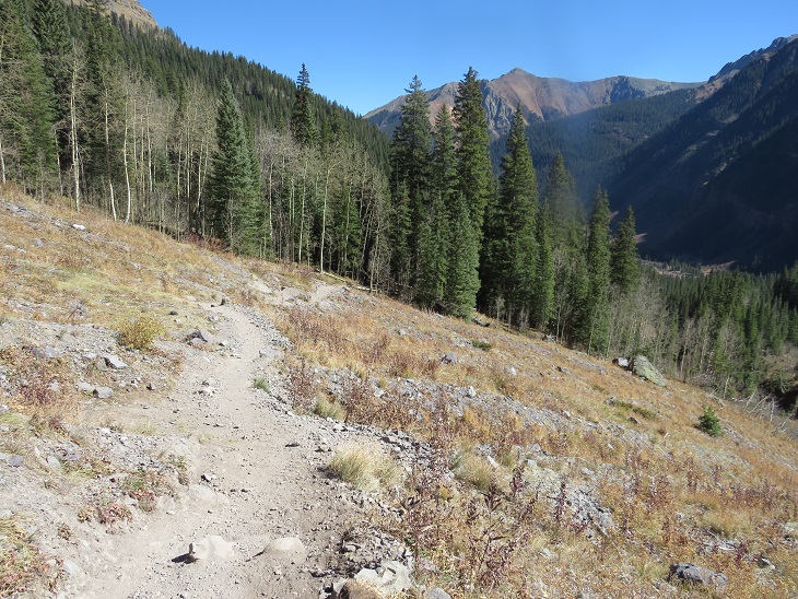
And back down to the trailhead

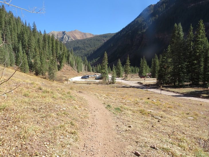
I made it back to my truck at 2pm, making this a 12.6 mile hike with 4162’ of elevation gain in 7 hours.  On to the next trailhead!

Clark Peak – 13,579

RT Length: 25.36 Miles

Elevation Gain:  6619’

This was my second attempt of Clark Peak.  On the first attempt I’d been unaware there was a creek crossing, and the creek looked too high for me to safely cross in the dark.  A storm was coming in later in the day, so waiting for daylight hadn’t been an option.  I’d turned around and done another peak instead.  This time I was prepared (or so I thought) for the creek crossing.  Also, please don’t make the same mistake I did crossing the creek…

I drove to the trailhead the night before and got a few hours sleep before staring on the trail at 5:45am.  The trailhead has space for about 20 vehicles, and good signage

I started off following the Maroon Snowmass Trail south, and then southwest.  I went through two unlocked gates

And shortly after the second gate there’s an unmarked side trail that leads down to cross Snowmass Creek. However, after my last failed attempt I’d done more research, and was told I’d gone too far last time and to look for an easier crossing earlier.  So I did.  I ended up crossing the creek and then running into Beaver Ponds about 20 yards long.  I was able to gingerly cross them, stepping through a thin layer of ice while doing so.  I picked up a faint trail on the other side, which brought me to the actual trail, where I noticed last time I’d indeed been in the correct area.  Hmph.  So I’d done all that wading in cold water for nothing.  Here is where you should cross:

Doing so will bring you to the West Snowmass Creek Trail.  A well-defined, class 1 trail.

The trees were absolutely beautiful!  It was still early morning, so these pictures aren’t the greatest, but the trees had me daydreaming.

This is where I made my second mistake of the morning:  I missed the cutoff.  The cutoff comes after hiking for just over 4.5 miles.  It’s an obvious junction you can see if you’re not looking up at the trees. And cows (there were cows in the meadow). I ended up hiking quite a ways past this junction, just following the trail.  It wasn’t until I realized I was switchbacking and I wasn’t supposed to be that I noticed my mistake.  This mistake cost me well over a mile and added about 1000’ of elevation to the hike.  Here’s where you turn left

After hiking a few dozen yards south the trail abruptly ends.  When it ends, turn right and head west towards the hillside.  A trail will pick on the hillside.

Here’s where I made my third (and final) mistake of the morning:  When you see the path split in two, take the higher one (the lower one is a cow trail that leads you through gooey mud then ends).

From this point on the trail becomes faint.  At times I questioned whether I was on an actual trail at all.  It will parallel West Snowmass Creek, and stay high.  Here are some photos:

I came to a clearing and headed southeast, crossed West Snowmass Creek, and once again picked up a trail.

I took this trail to treeline, where it ended. I put pink surveyor’s tape on a tree so I’d know where the trail picked up on my way back.   

From here the rest of the hike was full of rocks and boulders.  I headed southwest

I lost a little bit of elevation before gaining it again

Rock-hopped up this drainage

Followed the creek for a bit until it ended

Ascended another drainage and at the top turned left to skirt Moon Lake

This basin never seems to end!  I just kept heading southwest

At the end of the basin it was time to gain the ridge.  I stayed right of the drainage. 

This was mostly class 2, but towards the end became class 3 to avoid the snow

Once I gained the ridge I turned left and followed it to the summit.

Ha!  That’s an oversimplification.  I did indeed follow the ridge. The ridge proper goes all the way to the summit.  However, it’s a fun scramble to get there, with a lot of exposure, and more than one knife edge.  If you did Capitol Peak and it left you wanting more, this is the peak for you!  Here are some highlights:

I summited Clark Peak at 2:25pm

Clark Peak:

There were some great views of Snowmass and Capitol Peak, and check out the ridge looking back!

Here’s looking back on the way in through the basin and around Moon Lake

Here are some pictures of the ridge on the way back.  I had fun with the exposure here

At the saddle I turned right and headed back through the basin

Skirting Moon Lake to the east and back to the trees

Next profile pic?

Once at treeline I picked up the trail again.  After crossing West Snowmass Creek I headed for the trees.  The trail picks up again in-between these two trees

Here are some pictures of the trail back down.  As I was hiking, I heard a faint bugle.  It didn’t sound like a normal elk call:  it sounded close but faint.  Usually when I hear an elk bugling it resonates, it’s crisp, and I can hear it from far away.  This didn’t seem loud enough for being so close. As I reached the meadow I noticed a hunter sitting beneath a tree.  I raised my hand to silently say hi, he did the same, and I continued back to the trail.

I kept picking up my pace.  Due to this morning’s route finding errors this hike was taking me much longer than I’d anticipated.  It was quickly getting dark, and I wanted to get back to cell service so I could call my daughter and tell her I was ok, just running late.  I ended up using a flashlight for the last two miles of the hike.  Here are some pictures from the rest of the way back to the creek.

I crossed the creek and took Maroon Snowmass Trail back to the trailhead

I made it back to my truck at 8pm, making this a 25.26 mile hike with 6619’ of elevation gain in just over 14 hours.

AdAmAn Peak

1

RT Length: 15 miles

Elevation Gain: 4027’

Partner: Steffen

Steffen was interested in visiting Barr Camp, it felt like it’d been forever since I’d been,  I hadn’t been aware of and the weather was perfect, so today seemed like a great day to hike the Barr Trail.

I wasn’t able to find a lot of information on this peak, but looking at the Pikes Peak Atlas it seemed to be just behind Barr Camp. I figured we’d figure it out.

We arrived at the Barr Trail parking lot around 5:30am and were surprised the parking situation has (again) changed. As of today it’s $10 to park in the upper lot.  Last time I was here it was $40, but it’s been $5, $10, and $20 in the past.  The parking app is gone, and the fee machine is back.  This is all good news.

We gathered our gear and were ready to go at 5:45am. The guy who parked next to us unfortunately left the dome light on in his truck, but fortunately (maybe?) he also left his truck unlocked so we were able to shut it off for him.  He was planning on summiting Pikes Peak and most likely had a 12 hour day; we didn’t want him to come back to a dead battery.  Also, he was getting a late start if he truly intended to summit today. We ended up passing him within 20 minutes and let him know about the situation.

I’m not going to spend a lot of time describing the trail to Barr Camp because it’s an easy class 1 hike the entire way. There are very accurate mile markers every half mile, great signage, and as long as you stay on the trail it’s difficult to get lost, even in winter.  As we ascended the first 3 miles we had great views behind us of the city lights.  Too bad it’s difficult to get pictures at night.

2

We passed the cutoff for the incline as the sun started to rise

3

And as soon as we crossed the creek (which is usually dry in summer) the trail conditions changed.

4

They went from a bit of ice every once in a while to a frozen river of water that would be perfect for ice skating

5

This lasted until just after the junction with the experimental forest (turn left/southwest here)

6

This is where the trenched snow started, and also where I scattered wildflower seeds two years ago in memory of my Granny (yes, the seeds were local to the area)

7

If it were summer you could walk three people wide without tripping on each other along this trail, but today we walked single file.

8

Around mile 4 we heard a noise and looked up, confused to see a rather young looking squirrel jumping around in the trees. Shouldn’t he be hibernating?  The views of Pikes Peak were (as always) amazing today

9

I stopped for a second because I saw something curious on the ground: it looked like some sort of pollen (which made no sense:  it’s February) but upon closer inspection discovered they were little bugs on top of the snow!  I could see them jumping and wondered how in the world they got there?

10

We made it to the aspen grove just before Barr Camp and I took a picture: I have a picture of this grove in every season except winter, and was excited to add this one to my collection.

11

From the aspen grove it’s a quick jaunt to Barr Camp

12

13

We decided to use the restrooms there and then went inside to inquire about PT 10245’

14

15

The caretaker didn’t know what PT 10245’ was, but when we looked at the Pikes Peak Atlas he said they called it “AdAmAn Peak”. (Note, this ended up being a different peak altogether).  In the summer there’s a nice trail that will get you within a few dozen yards of the peak, but since it was winter the trail was covered in snow.  He said to go up, then down, then up again, and then back down, heading northwest.  Then there would be quartz rocks on the ground in an arrow showing us where to go (but those would be covered in snow as well).  We couldn’t miss it.

Um, ok. Good thing we’re good with a map and compass!  We exited the lodge, put on our microspikes, and were on our way.  We took the Barr Trail again a little bit southwest (just to the end of the fence) and turned right (north) towards Elk Park on trail 652.

16

The caretaker had been correct: the trail was covered in snow, but some of the time we could make out where the trail was.  We hadn’t brought our snowshoes, so we were having a time getting snow in our shoes (and pants, etc.).  Next time remind me to bring gaiters.

17

18

We hiked on this trail for almost exactly half a mile, and we did indeed have a great view of the summit from the trail. I started to worry we wouldn’t be able to summit today:  I hadn’t brought any rope and that summit looked like it needed rope!

19

The trick to this summit is to summit from the west. After half a mile we came to a small saddle and decided to turn right and head for the summit (this is how the caretaker should have described the route to us:  follow the trail until you come to the saddle, turn right, and then scramble to the summit).  Coincidentally, there were blue dots spray painted on the trees here, a good indication that’s where you should turn

20

There was no visible trail here, so we just aimed for the summit block (east)

21

Here’s how we summited:

22

23

24

It was a class 3 scramble and tons of fun! My advice is to initially go left up the rocks, but you summit more near the middle of the rocks.  The summit was flatter and larger than I’d anticipated

25

26

There were some great views!

27

28

29

I’ve never seen Pikes Peak from this angle before…

30

There wasn’t a summit register (we looked longer than we should for one)

Time to head down. It’s not as scary as it looks…

32

33

We followed our tracks back to Barr Camp, and noticed our tracks were filled with thousands of those little bugs already! Yuck!  I went home and researched them and apparently they live under the snow until it’s a nice day out, and then they hang out on top of the snow.  They were very, very small.  So small I’m thinking we were probably breathing them in and not noticing it.  Yes, those little black dots are the bugs.

34

We made it back to Barr Camp and decided to buy a protein bar and leave a donation (hey, we used their bathrooms). I noticed the stream where I usually filter water was just a trickle

35

The hike back down was uneventful except for the flight for life helicopter we saw making a beeline for Pikes Peak (it never landed). Actually, the hike was beautiful!  I’ve hiked this trail dozens of times and I never get tired of it!  We kept our microspikes on the entire way, even though they weren’t necessary most of the time.  The trail cleared and opened up around the incline junction

36

We made it back to my truck a little before 12:45pm, making this a 15 mile hike with 4027’ of elevation gain in 7 hours.

37

This was a really nice trail with decent elevation gain you don’t notice much because it’s so gradual.