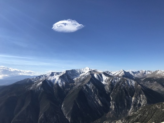
The Colorado winds were high so I decided to head down to New Mexico this week to do some highpointing. Taos is actually closer to my house than many Colorado peaks, so the 4 hour drive wasn’t too demanding. In fact, it was kind of fun. When I made it past Ft Garland I saw a road sign indicating there were bighorn sheep in the area. To my surprise I immediately encountered a herd of bighorn sheep standing along the side of the road. A few minutes later I saw a sign warning of cows, and wouldn’t you know it? Cows on the road. The same thing happened with the deer and elk warning signs, and a few minutes later, even horses! I hadn’t realized there were wild horses in the San Luis Valley, but yep, there sure are! With all this good luck with animal sightings I kept hoping to see a sign indicating buffalo or elephants or zebras were in the area, but alas, wild horses were about as exotic as it got. Kudos to the group that placed those signs so accurately.
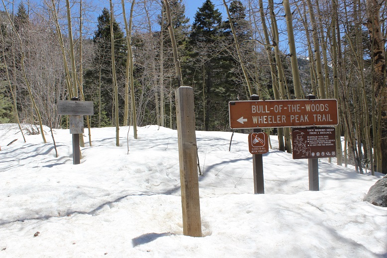
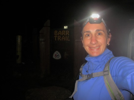
I made it to the trailhead at 4:45am and was on the trail by 5am. Oh, and I did a terrible job parking (without realizing it). I actually made it to the trailhead about half an hour earlier than expected, and only recognized I was there because I saw the “Bull of the Woods trailhead” sign as I was driving by, so I backed up, parked, and was on my way.
It wasn’t until I was on my way down I saw there was a real parking area directly below where I’d parked. Oops!
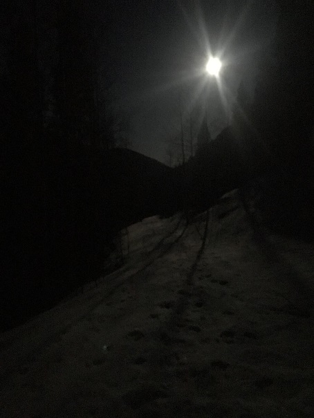
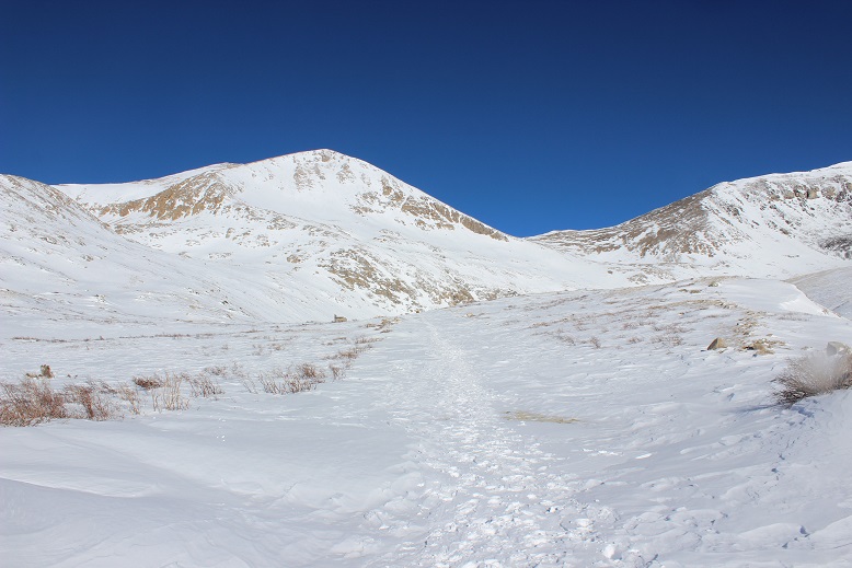
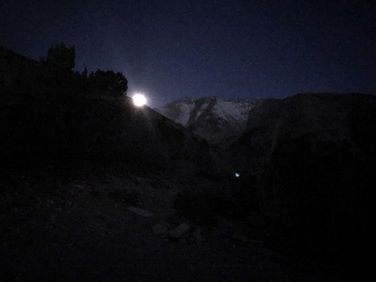
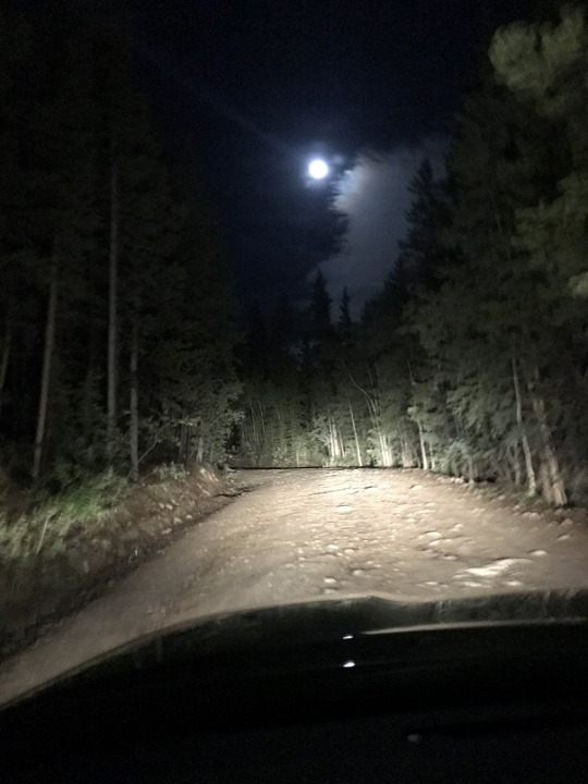
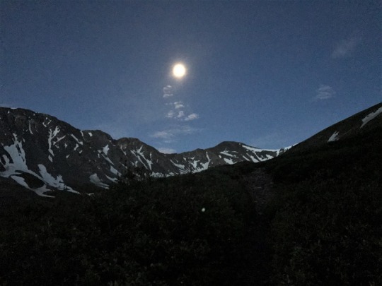
The full moon was absolutely amazing! Unfortunately I wasn’t able to get a good picture, but it was so bright I didn’t need my flashlight. I brought my snowshoes but didn’t put them on until I’d almost made it to treeline. There was quite a bit of snow on the trail (4 feet or so) but the snow was consolidated so I was able to just walk on top of it. There were also tracks to follow.
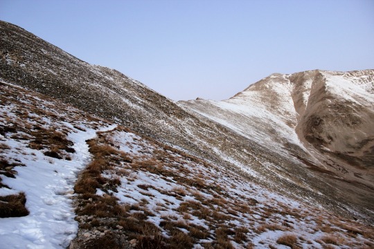
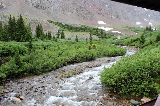
I could hear a stream to my right, but in the dark I wasn’t able to see the water. There were numerous trails criss-crossing the trail I was on, but as long as I kept hiking in the same direction (northeast) and aimed for the ridge I knew I was on the right track. I stayed on the widest path, or what looked like the widest path.
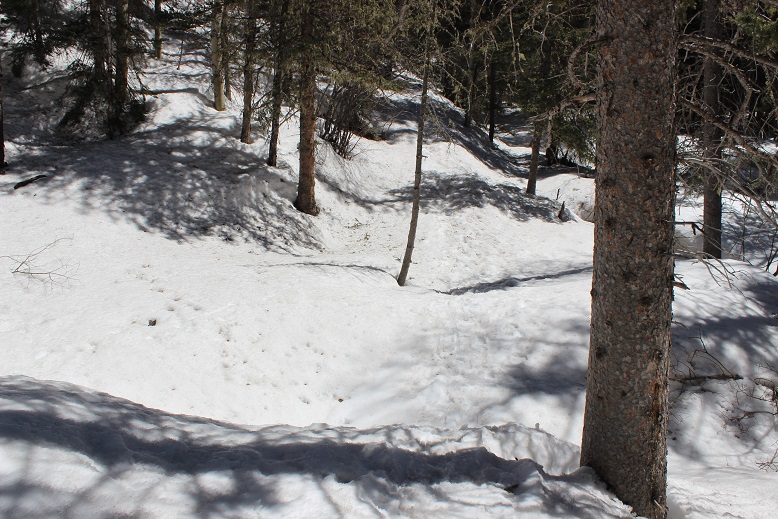
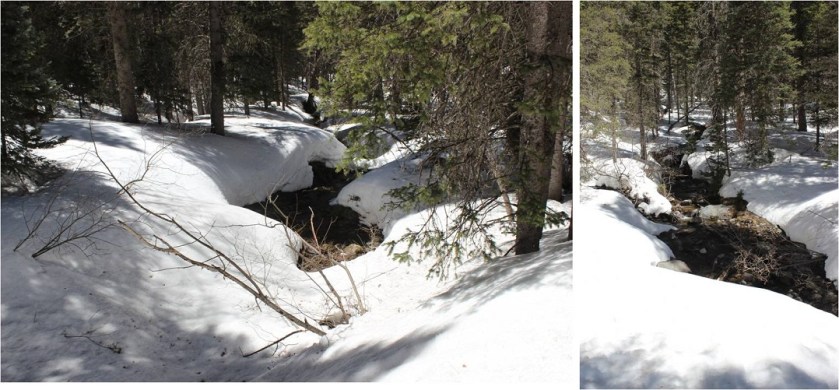
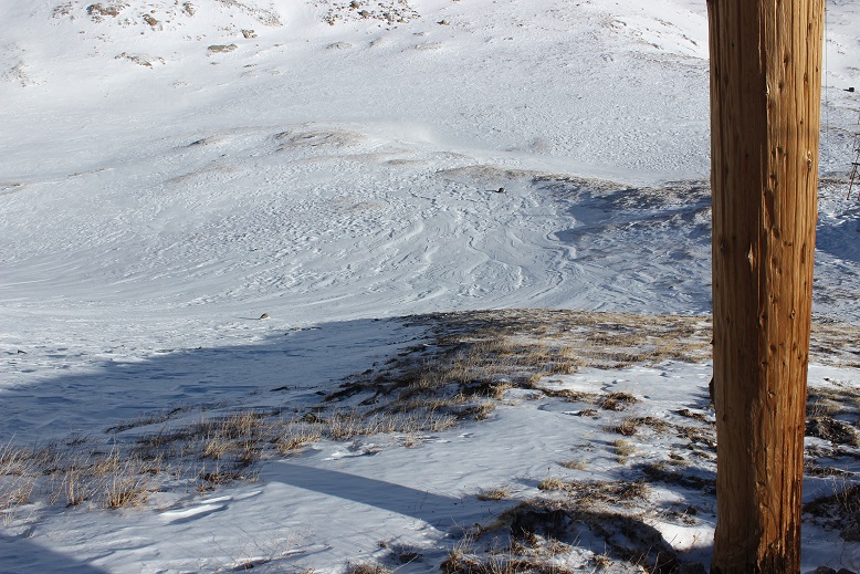
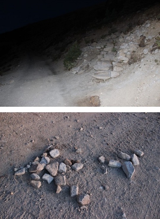
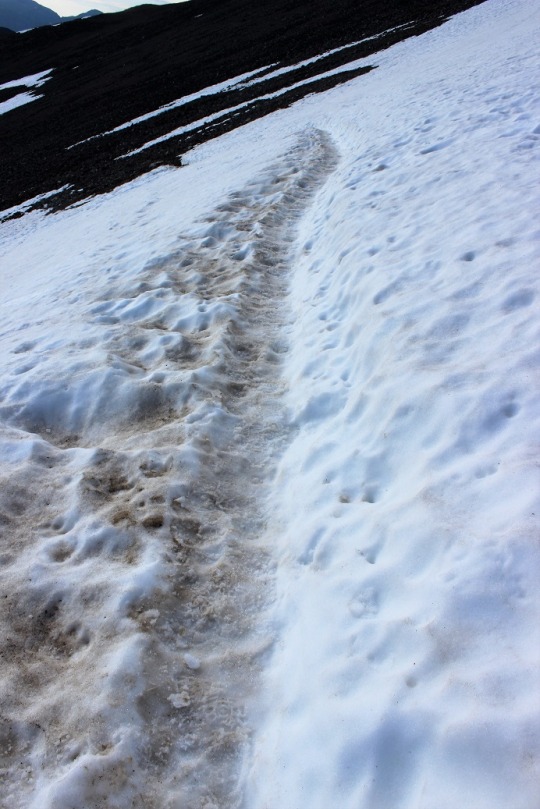
I knew I was supposed to cross the stream at some point, but never saw a bridge. It turns out I crossed the stream without knowing it! Here’s a look at the “stream crossing” from my way back.
Yes, that moon was full!
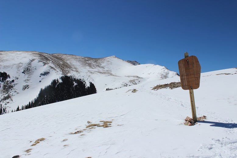
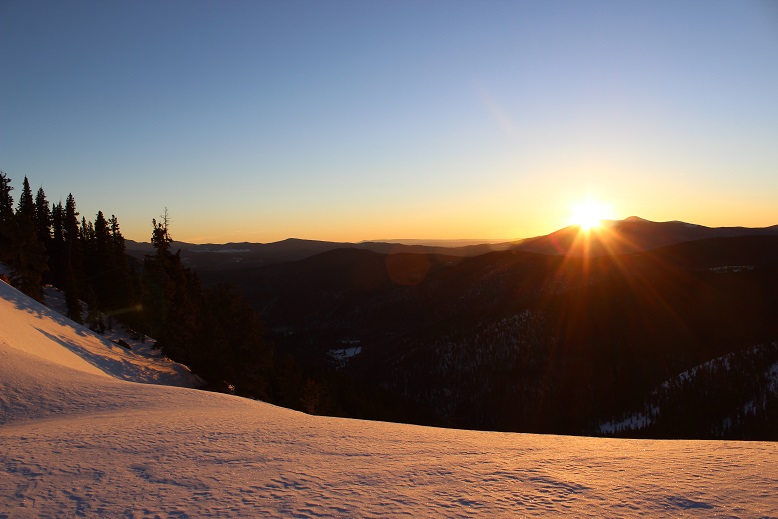
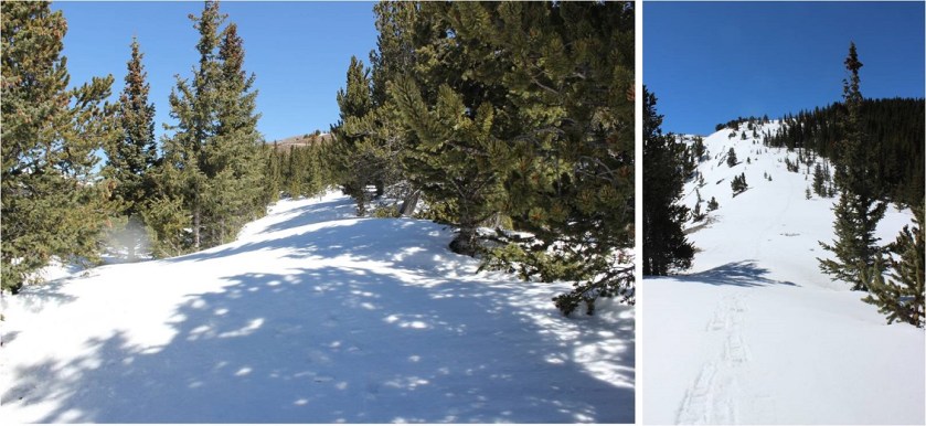
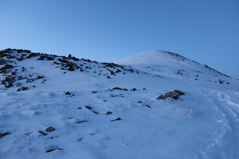
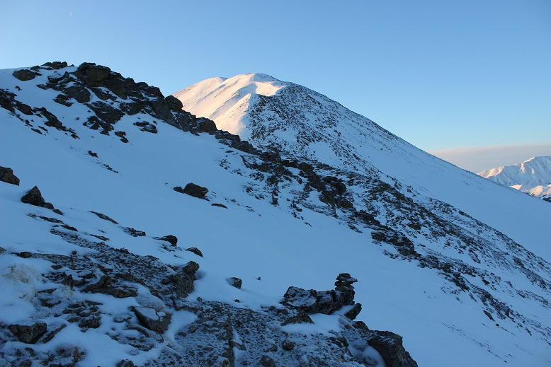
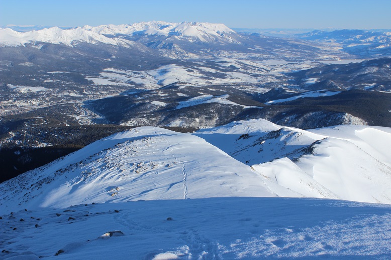
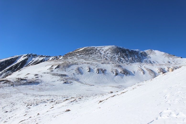
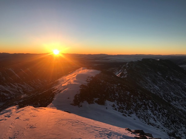
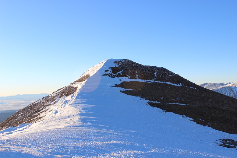
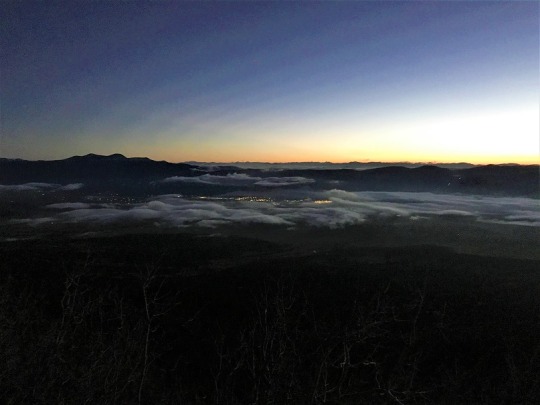
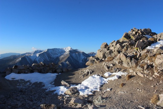
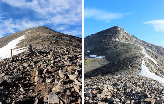
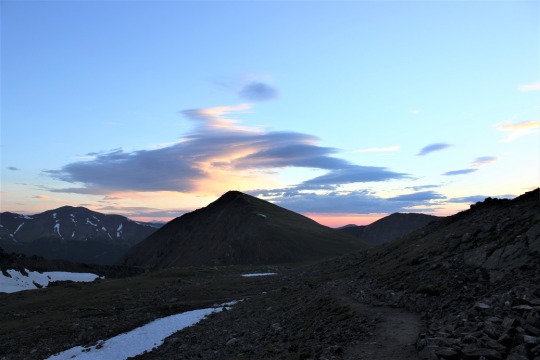
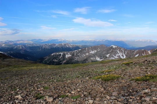
I made it to the Red River Canyon Overlook just as the sun was beginning to rise
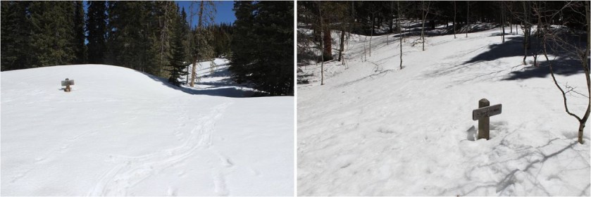
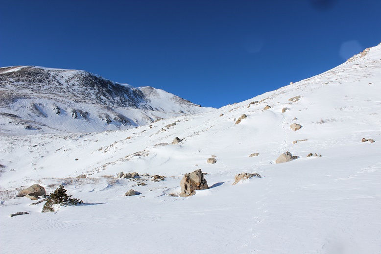
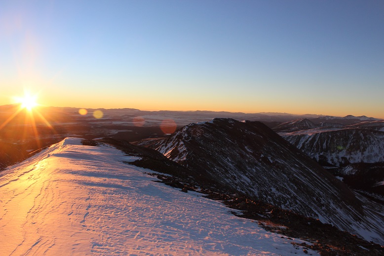
At the overlook I turned right and followed the trail to the Bull of the Woods pasture (which didn’t resemble a pasture at all. Maybe it was the snow?)
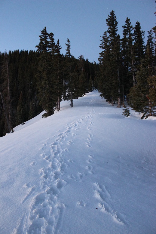
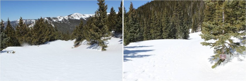
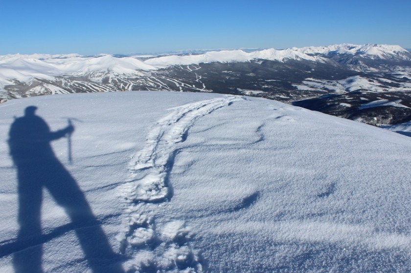
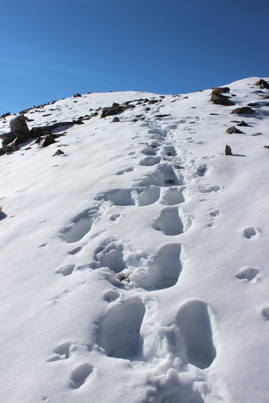
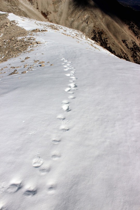
The footprints stopped, so I was breaking trail from here on out. I got lost a few times trying to stay off private property, but there was so much snow it was impossible to know where the trail was on the mountain. (Hint, go left)
I stopped and put on my snowshoes and followed the ridge, making my own trail.
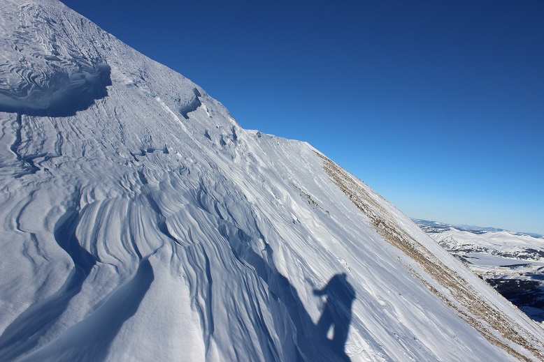
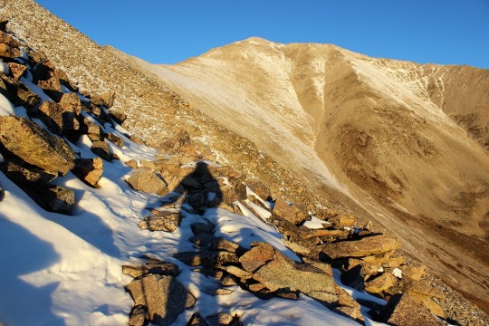
The section after cresting this hill was much steeper than it looks. I had to swing around to the right in order to safely climb through the snow. Here the crampons on my snowshoes came in very helpful.
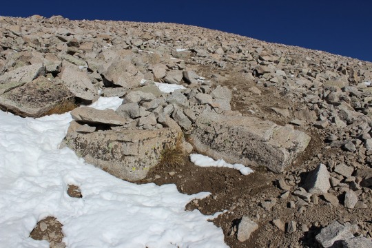
Until the snow just kind of stopped. I knew more snow was coming, so instead of taking off my snowshoes I followed the faint trail of snow around Bull of the Woods Mountain. Here there was either very little snow, or large, steep drifts of 20+ feet. I was glad to have my ice axe.
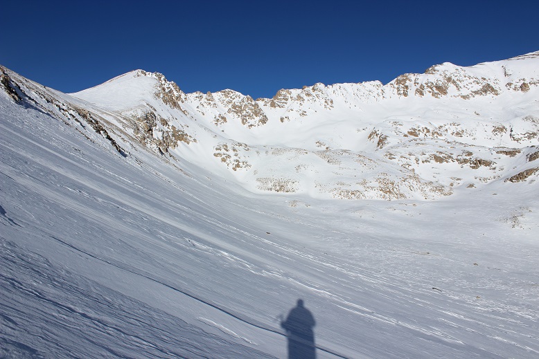
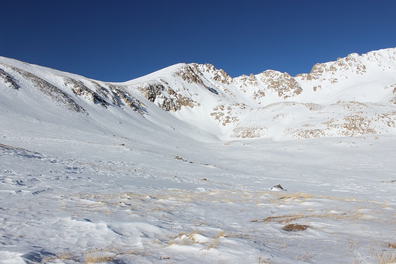
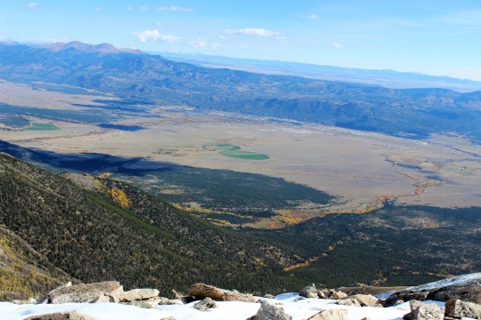
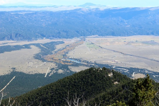
I rounded Frazier Mountain and could smell sheep. I looked all around, but not seeing any figured they must have passed the area recently (but that smell was strong!). I was now presented with the La Cal Basin, which included a 300 foot loss in elevation. This is also where there was quite a bit of snow, which I decided to take advantage of. I needed to cross the basin, avoid those dicey avalanche areas, and then re-ascend the switchbacks on my left.
Crossing into the basin was a bit sketchy
And I was glad to make it to the switchbacks on the other side. Here there wasn’t much snow, so in keeping with my goal of not taking off my snowshoes (just to put them back on again) I stuck to the snow lined trail.
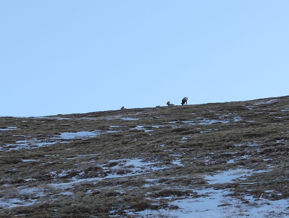
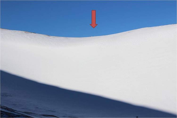
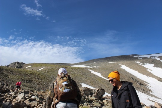
About halfway up the mountainside I saw a few bighorn sheep
And when I looked across the ridge I saw even more!
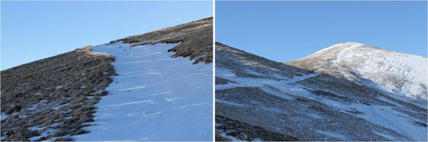
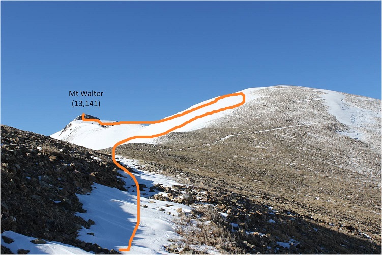
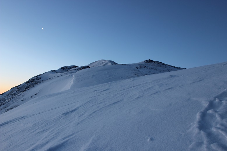
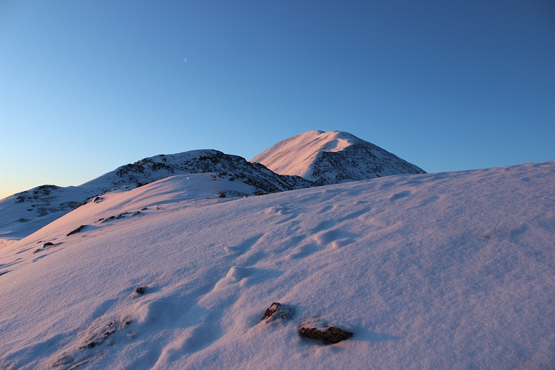
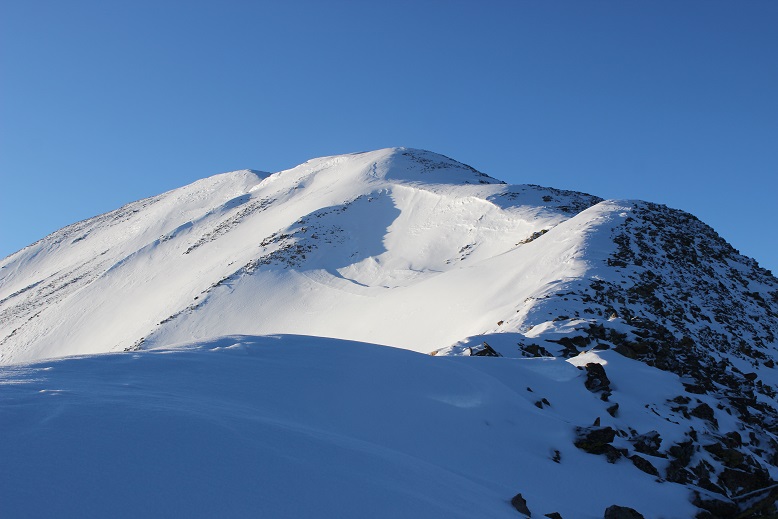
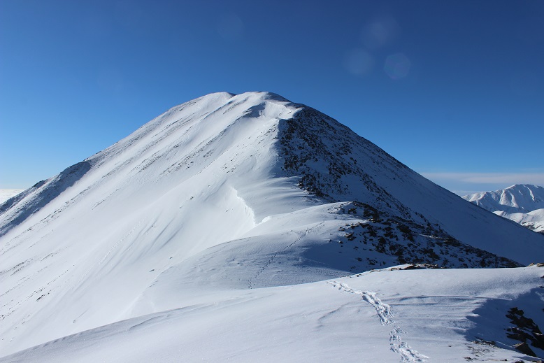
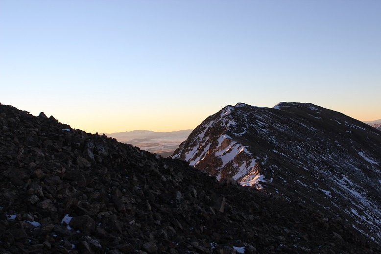
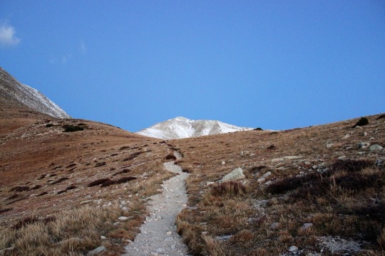
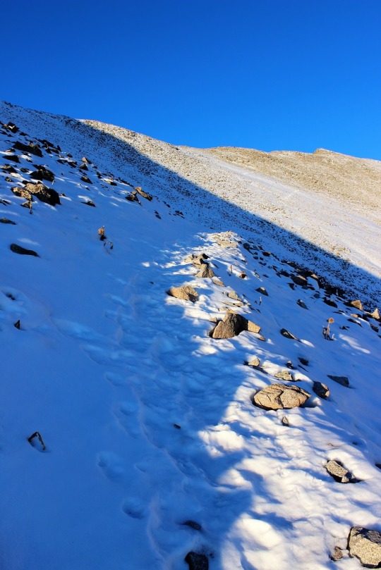
From here I saw what I thought was Wheeler Peak, but it was instead Mt Walter (Wheeler is beyond). I stuck to the snow to make use of my snowshoes
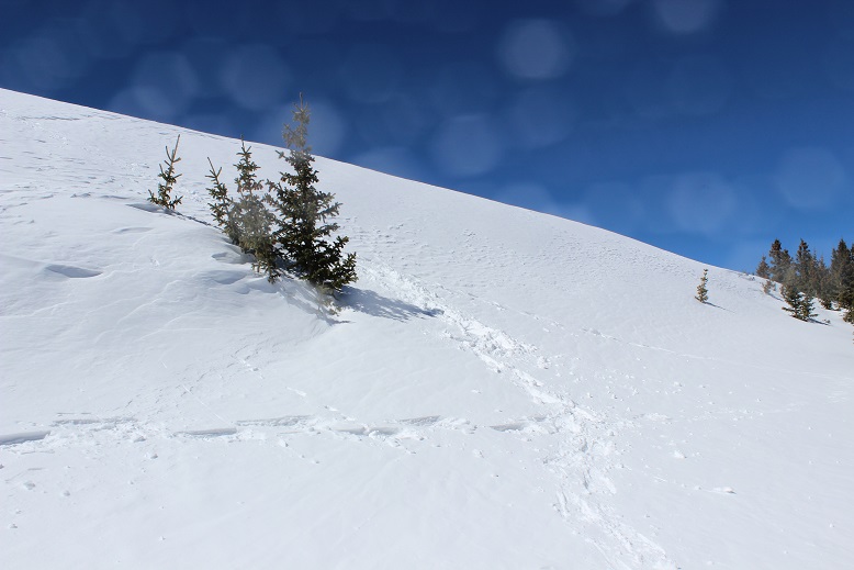
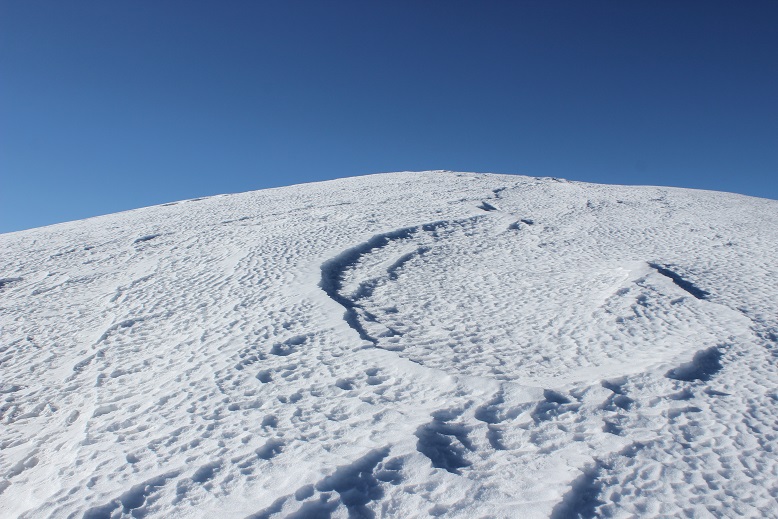
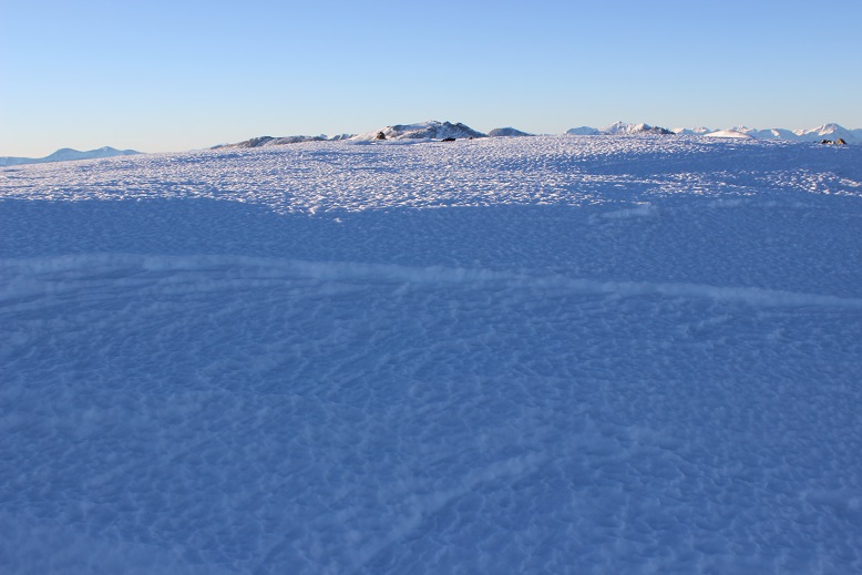
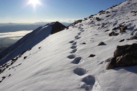
Sticking to the snow looked like this
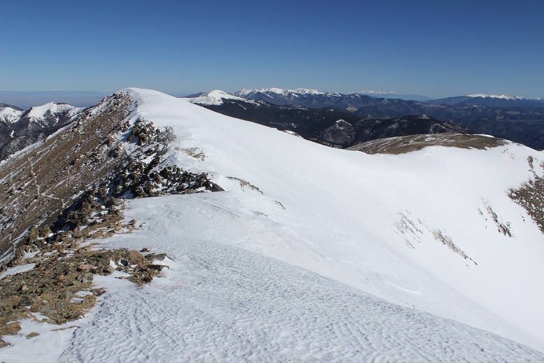
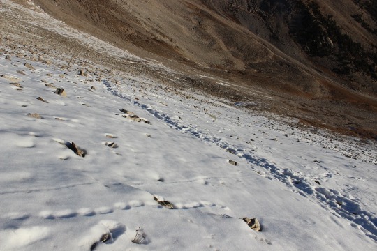
And from the top of this point (13,045) I could see Mt Walter and Wheeler Peak. Sticking to the ridge (and the snow) was the way to go!
I passed Mt Walter and took a few quick photos of the signs and a selfie to prove I was there.
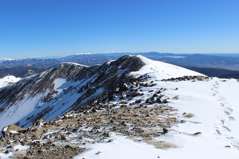
From here you can clearly see the summit of Wheeler Peak
Once again, I stuck to the ridge
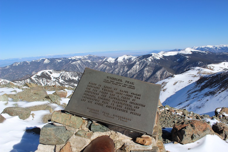
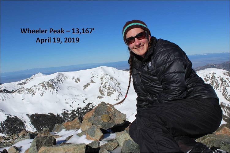
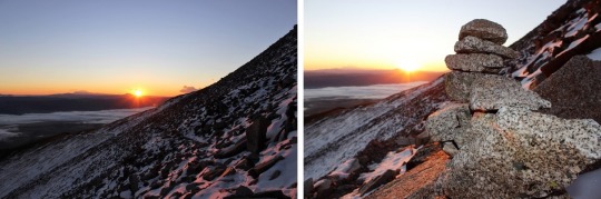
And summited at 8:45am
Here’s the Summit Video, which I’m excited to say is the first summit video I’ve been able to take all year! I’m so glad it was warm today and sans wind.
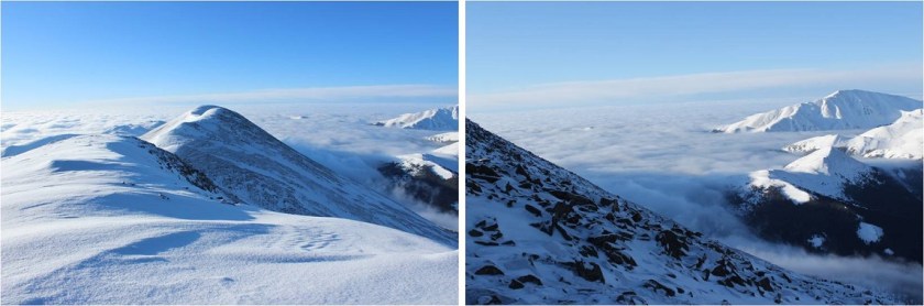
OK, time to turn back. Here’s what the route looks like back from Wheeler Peak… just stick to the ridge
Yep, lots of snow! I was glad to have my ice axe. Snowshoes were a must the entire way back down.
I started crossing the basin again, and unfortunately the sun had warmed up the snow. Snow kept collecting under my snowshoes and I had to keep stopping to kick it off. I made it back to Frazier Hill and saw those sheep I’d smelled earlier (I KNEW they were there somewhere!)
Following the trail in the light of day proved much easier than in the dark, with the added bonus of being able to follow my snowshoe tracks.
I made it back to Bull of the Woods pasture and once again found footprints. Lots and lots of prints, both human and animal.
The only downside to the warmth of the sun (besides clumps of snow in my snowshoes)? Rollerballs the size of dinner plates
As I followed the trail back to the stream I was actually able to see the stream
I didn’t see anyone all day until I was about half a mile from the trailhead on my way back down. I talked with a gentlemen about the conditions on the trail. He said he’s hiked these trails for years and was surprised I’d summited today. He was even more surprised when I told him I’d started at 5am. In fact, he didn’t entirely believe me. I made it back to the trailhead at noon, and when I stopped my Strava tracker I was told I’d sent a new app record for completing this hike. Pretty cool! I’d hiked the 14.2 miles of 4467’ in elevation gain in 7 hours.
Just for fun, here’s the relive of my hike. Note: Obviously I summited today, yet the tracker shows my high point was just shy of Mt Walter at 13,139’ (not Mt Wheeler at 13,167’), which is one of the reasons I take what these trackers record with a grain of salt. I’ve had people tell me because my tracker doesn’t show a summit that I didn’t summit. I call those people summit snobs and unfollow them from my account(s). No one needs that kind of drama in their life!
Oh, and the good news? I was finally able to get my New Mexico Starbucks mug in Taos! I’ve been trying for years to get a New Mexico mug to add to my collection, but they’re always out when I visit. Funny, the mug doesn’t mention aliens at all…
Also, the ski season in Taos is over, which was a real shame because there was so much snow! And, Taos is beautiful! Majestic even. I had no idea!
I was supposed to hike yesterday. I got up at 2am and drove up and through Woodland Park to increasing snow. I checked my weather app and it looked like it was going to snow in this area until 8am. I made it to Lake George and was forced to turn around due to road conditions (they don’t plow this road at night). So while I’d done my research and the weather conditions were good on the peak I’d intended to hike, the only road into that hike had bad weather and I was forced to turn around. Bummer! What’s worse is I’d already had quite a bit of coffee, so when I made it home around 5am I was unable to go back to sleep. Oh well, I ran on the treadmill, got a lot of much needed cleaning done, took my daughter ice skating, did some grocery shopping, and made it to bed a bit early to try again the next day.
OK, round two. I chose a different peak for today because of weather reasons. I drove almost the exact same roads as I had last night and thankfully they were completely clear: You’d never know it had snowed yesterday. I made it to the Baldy Trailhead around 4:45am and there were several other cars already parked in the lot.
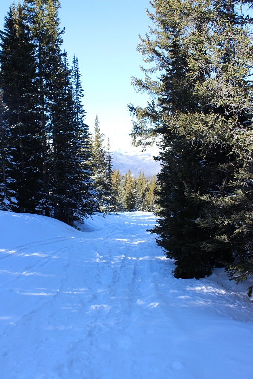
I gathered my gear and was on the trail around 5am. The 4WD road was closed, but the hike along the road was packed down from previous skiers/hikers. I wore my snowshoes from the parking lot, but they weren’t really necessary (I just didn’t want to carry them). They were necessary at the Iowa Mill.
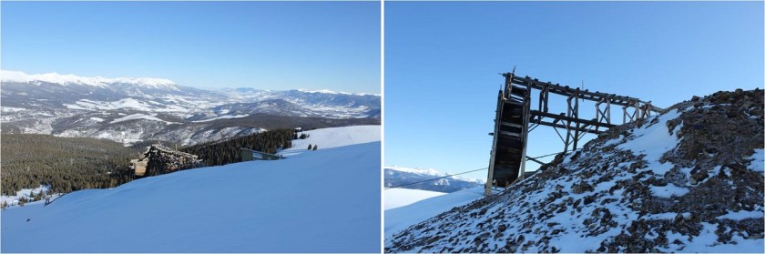
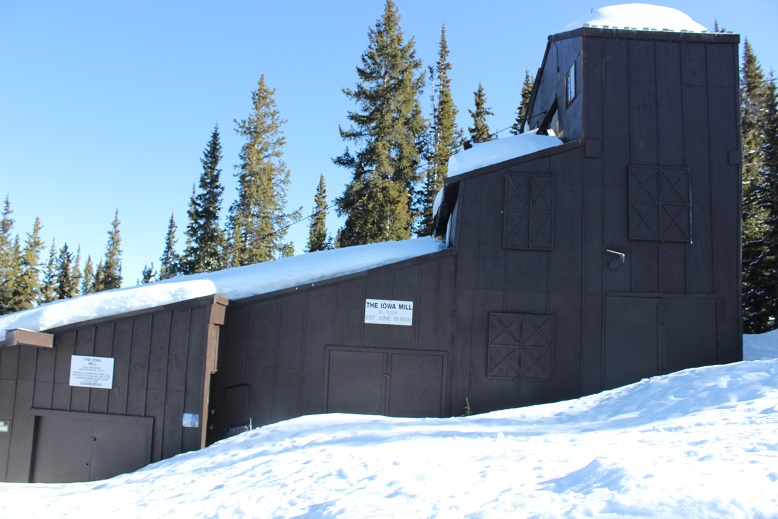
This part of the hike was quite peaceful. I made it to the Iowa Mill while it was still dark and here is where the road ended and I encountered tons of ski tracks. I got out my map and saw there was supposed to be a dirt road that switchbacked up the slope, but since I couldn’t find the road under all this snow and I’m not a fan of switchbacking I just aimed south and hiked straight up the slope. This was very efficient and quite a workout on my calves. There weren’t any ski marks here, or footprints. In the dark the slope seemed steep, but I knew it was less than 30 degrees. Also, in the dark it seemed to last forever! I just kept aiming towards the radio tower and trudged on. I could see what looked like a mine in the distance I’d like to explore on my way down and made a mental note to check it out later.
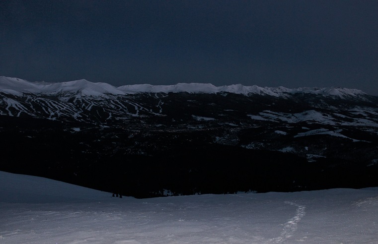
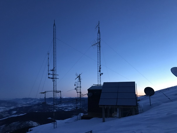
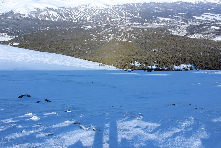
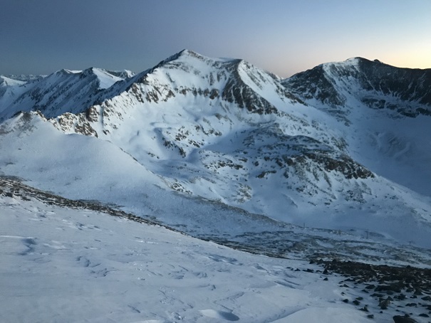
I made it to the radio towers and took out my phone to take pictures. It immediately died and I stuck it back in my pocket. It’s a good thing I always lug around my DSLR while hiking. For those of you wondering what Breckenridge looks like from 12000’ at 6am, here you go:
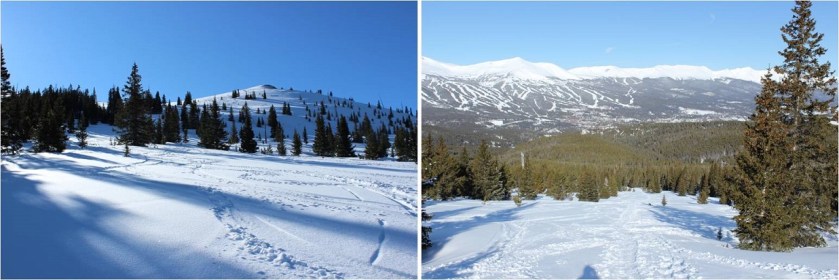
OK, I’d made it to the radio towers
From the radio towers here’s the view of the remaining route
This was going to be easy! All I had to do was follow the ridge to the summit. There were many ups and downs. Here’s a look at the first up
and a few more
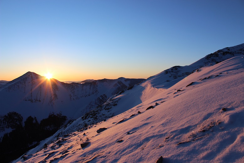
Around now the sun was beginning to rise. Alpine sunrises are totally worth 2am wake up times! I took a few minutes to just stop and enjoy.
There are cairns indicating you should go right (west)around the mountain, but with this much snow it’s much easier to just stick to the ridge (at this point I took the cairned route, but don’t recommend it). The cornices are very large but also very avoidable.
The sun had only just risen, but I could already tell it was going to be a bluebird day for most of the day, despite the cloudy forecast. As I looked in the distance I could see clouds, but they wouldn’t be getting in the way of my hike today.
I’m not sure what time I summited (my phone was still dead and while I had a charger I didn’t much care). The summit was flat and snow covered, so much that even the wind shelter was invisible. I wanted to get a picture with the mountains in the background so this is what I came up with.
Not only was today a bluebird day, there was no wind! This was fantastic! I wasn’t even cold (it had to be warmer than the forecasted 18 degrees… it felt more like it was in the 30s). My fingers and toes weren’t cold either. Woot!
Here’s a look back at the way I’d summited
OK, so on the way up I’d taken the cairn way around the side of the mountain, but I could tell from my view here it’d be an easier hike if I just stuck with the ridge, avoiding all of the exposed rocks on the west side. The climb was a bit steeper in areas, but that just meant I got to use my ice axe
Using my ice axe means shadowselfie time
Here’s more proof it’s better to stick to the ridge
I made it back to the radio towers and in the light of day could see the slope here is a popular backcountry ski area.
This is when I realized I hadn’t seen another person all day, yet there had been several other vehicles in the parking lot when I’d arrived, with signs that clearly said no overnight parking/camping. Hmmm.
All the tracks were to my left (west) but I really wanted to get a look at that mine, so I went right. It was nothing special, or it could have been more special when less covered in snow. In other words, there wasn’t much to see.
From here you can just follow the wires back to the Iowa Mill, but I decided instead to cut across the slope and pick up the trail the way I’d come. I could see my morning tracks from where I was, so I just aimed for them and cut across the slope. I debated glissading but in the end decided against it as it would put me far away from my earlier tracks.
It’s actually a bit steeper than it looks (although apparently not 30 degrees)
Back at treeline all the ski tracks came together and I was able to find the road again.
Here’s the Iowa Mill in daylight
The hike out was very straightforward. I saw three skiers hiking up as I was hiking out (the only people I saw all day). I was glad I’d gotten an early start: I wouldn’t want to be hiking the slope while others were trying to ski.
The entire hike today had been very enjoyable. The weather was perfect, there weren’t other people on the trail, I got to make my own route for much of the way, and I even used my ice axe for a bit. Nothing had been too technical, which allowed me to get in some really good thinking.
I made it back to my truck at 9:30 am, making this a 9 mile hike in 4.5 hours. I changed my clothes and put on sandals in place of my shoes for the drive home. I took a good look at my feet, surprised they hadn’t hurt today like on so many of my recent winter condition hikes. My feet were a yellow-white, and I mentally high-fived myself, not exactly sure how but thinking I’d avoided an attack. My truck wouldn’t start so I adjusted the battery (that fixed it) and looked at the temperature: 21 degrees at the trailhead. Wow! It had been cold out there! I just hadn’t noticed because there hadn’t been any wind and I’d been exercising.
About 10 minutes down the road my left toes started hurting quite a bit. The pain was a very intense burning sensation. I immediately knew what was going on but kept driving anyway, as there was nothing I could do about it. I looked down and yes, my toes were blue. Ugh! When I made it to the town of Alma I stopped to take a quick picture for documentation purposes (they looked much better at this point) and just kept driving. When I have an attack they go from white to blue to red. Red is the good color. My toes were still hurting but since my left foot was the only one affected I could still drive. I saved this picture for the end, as well as one of the less graphic pictures of my digital ulcers from last month. By now I’m used to this, and know it’s a consequence I’m willing to pay for getting above treeline in winter/spring. Apparently it happens even when my toes don’t get cold. Luckily, as long as I baby them they only take about a week to heal, which ends up being perfect for my next week’s hike!
I thought I was done with summits for 2018. I’ll be gone next week on a road trip visiting my family in Mississippi for Christmas, and along the way picking up my son from his base in Texas to join us (I’m so glad he got leave for the holidays before transferring to Alaska!!!). I’d just been hiking yesterday, but today I noticed the weather for tomorrow was perfect for hiking as well. I did some mental calculations, and then had this conversation with my youngest (a sophomore in High School).
Me: What are your plans for tomorrow?
Her: I was planning on sleeping in and then studying for finals. And I’d like to get in some rink time if possible.
Me: Do you want any help studying? I did graduate with my undergrad 2nd in my class. And I have an MBA. I’m pretty good at the whole ‘studying’ thing.
Her (with a terrified look on her face): No mom. Just… no. I get straight A’s and have my academic letter to prove it. I’ve got this.
Me: I was thinking of hiking tomorrow, but I’d also like to spend time with you. What do you think?
Her: You should go hiking. That way I can sleep and study. I’ll probably still be sleeping when you get back anyway.
Me: How much studying do you need to do? Is studying more important than sleeping?
Her: Mom, I’m a teenager. Teenagers gotta sleep. At this point I need more sleep than study time.
Me: OK, but that still leaves rink time. How about we go to the rink tonight from 7-9pm, tomorrow I’ll hike, you’ll sleep, I’ll wake you up to study, and we’ll have dinner together.
Emily: Deal.
Woot! It looked like I was going to get one more hike in this year after all! The weather looked great, and my schedule for the morning was cleared. Because of rink time I didn’t make it to bed until 10pm, which meant I only got 4 hours of sleep, but that seems to be the norm for me these days. I’ve discovered the hike is always worth the lack of sleep.
Once again, I woke up at 2am and drove to the trailhead. I encountered a herd of about 40 elk at the same place I had on Friday, and this time I was prepared when I saw them in the center of the road. I slowed down and waited for them to budge, but they didn’t seem concerned with doing so. They were quite happy to stand in the middle of the road and just watch me wait. It seemed I was in more of a hurry than they were. Luckily there were no other vehicles on this road. After two minutes I did something I knew would make them move: I took out my camera. Sure enough, before I got the chance to take picture they’d scattered to the sides of the road. I was on my way!
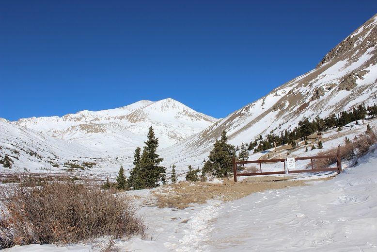
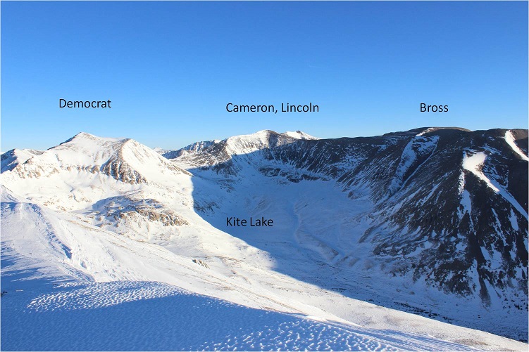
I haven’t been to the Kite Lake Trailhead for what seemed like ages. The last time I was here was back in June of 2017. The 2WD dirt road was icy but clear and plowed up to the gate closure, about a mile from Kite Lake.
This was also a pleasant surprise: I’d expected to park about 3 miles from the trailhead, and here I was, just 1 mile away. This day just kept getting better and better!
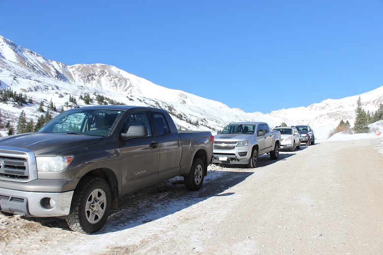
There was room for about 5 cars at the gate, if everyone cooperated and parked nicely.
I was the first vehicle there, so I tried to pull up and leave as much room as possible for others. Also, about 40 feet before the gate the road isn’t plowed, and a few vehicles tried to drive past a snow drift and obviously had to turn back. My advice: Don’t even attempt to drive past where it’s plowed. Your vehicle might make it, but there’s no parking in front of the gate so you’ll need to turn around and park lower anyway.
I gathered my gear and began hiking towards Kite Lake at 4:45am. Just after the gate I had to stop and put on my snowshoes. I left them on for the entire hike.
The hike up to Kite Lake was simple: I just followed the road.
The sky was clear with no moon, and when I looked up I often saw leftover shooting stars from Friday’s Geminid Meteor Shower. The only downside was the wind! Wow! It sure wasn’t the forecasted 8mph, and it wasn’t letting up. It was like I was walking headfirst into a wind tunnel: the wind was funneling down the mountains and straight towards me as I trudged towards the lake. I remembered last time I was here the wind was intense as well, and hoped it died down at some point.
OK, I made it to Kite Lake.
My directions said to look for the trail to Lake Emma, which was supposed to be highly visible behind the bathrooms to the left. Hmmm. No trail was visible, just a lot of snow.
I hiked around for a bit, looking for an obvious trail sign, tracks, path indentations in the snow, etc, and when I didn’t find any I just headed southeast.
Before long I was in a basin, and thankfully here the wind stopped. Even though it was dark I could tell I was in a basin because the ground was relatively flat, and there were outlines of the mountains surrounding me. I’d been told there were willows here, but they must have been buried under all the snow.
I crossed the basin to the south, squinting in the dark, trying to see Mt Buckskin before me. From the basin I’d wanted to get a good look at Mt Buckskin so I could pick a safe line to climb, but in the dark all I could see was there were a lot of snow covered slopes surrounding me. I couldn’t be sure in the dark how stable/deep/etc. those snow covered slopes were. In fact, I couldn’t see much but lots of white surrounding a few areas of black shapes. I was pretty sure the dark areas were cliffs, and not climbable. Imagine seeing this (which is actually more than I was actually able to see at the time), and trying to decide which path was safest to take.
I kept slowing my pace, hoping the sun would rise and I’d be able to see what I was up against conditions wise. Why wasn’t it getting light out? This would be a whole lot easier if it were light out.
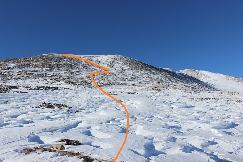
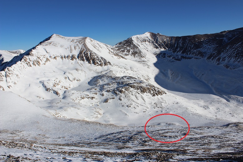
After checking my watch and realizing it wouldn’t be light out for quite some time I decided to aim left, where it looked like there was tundra near the snow. I looked at my topo map and it seemed to have the least drastic slope angle. I figured if I stuck to that path I’d have firm ground to hike up if the snow wasn’t stable. This ended up being an excellent idea. The terrain was quite steep but not as steep as in other areas, and no cliffs. Here’s the route I took. In the daylight I realized I’d made the correct choice.
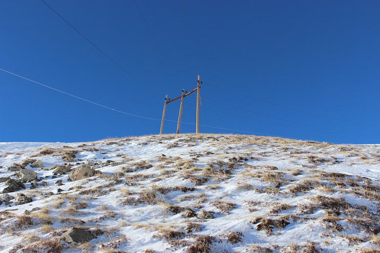
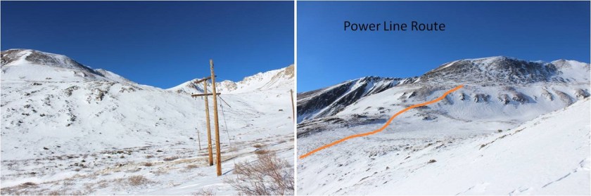
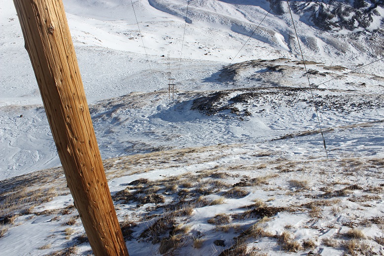
About halfway up the hill I could see power lines in front of me, and decided this would be an excellent point of reference. I aimed for the power line with 3 poles (and discovered later all the others only had 2).
This was a very steep section. Here’s the look back down (from later in the day)
When I made it to the power line I set my next goal of making it to the top of the summit ridge. While the sun hadn’t risen yet, the sky was beginning to get light and I could see better than when I was down in the basin.
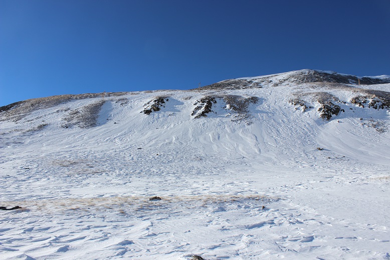
Here the snow was firm and I wanted to keep my snowshoes on so I looked for a continuous line of snow to the ridge. Here’s the path I took
Once again, pictures don’t do the steepness here justice.
The snow at this point was consolidated and I was glad my snowshoes had crampons: microspikes wouldn’t have been sufficient. I was also glad I had my ice axe.
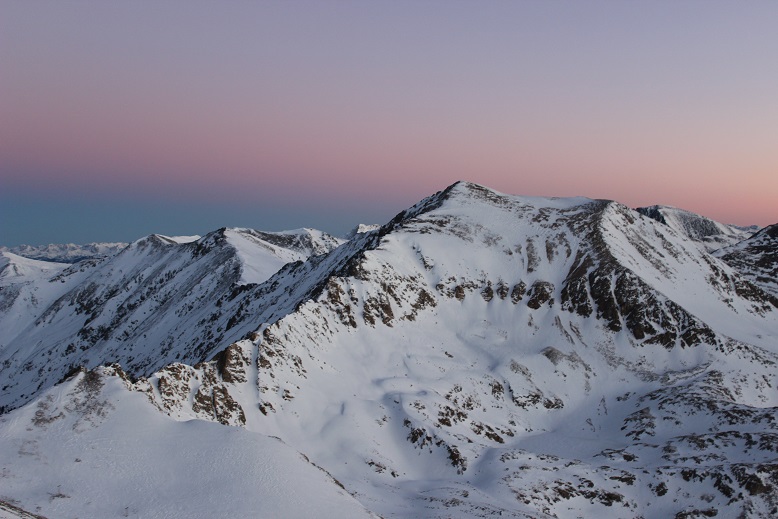
After what seemed like forever I gained the ridge just as the sky began to turn pink.
I stopped for a minute to admire the view, and then realized if I hurried I’d be able to make it to the summit to watch the sunrise. I quickly sauntered in my snowshoes the last hundred yards or so towards the summit.
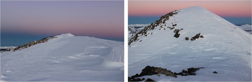
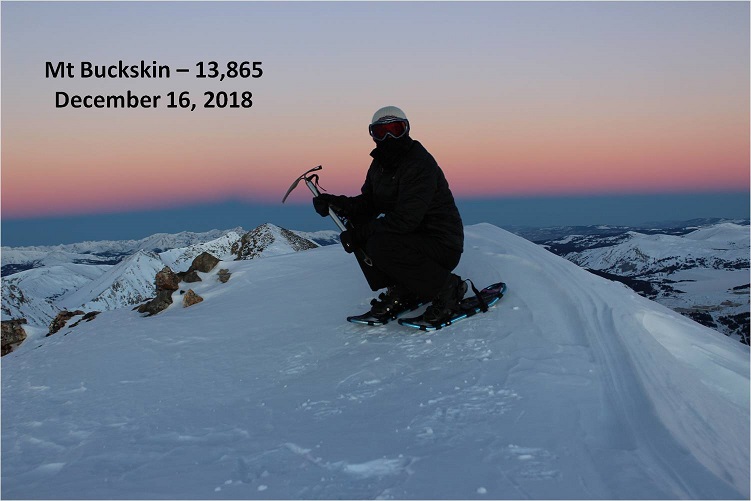
I summited at 7am
Mt Buckskin:
And yes, I was able to watch the sunrise (it rose directly from behind Pikes Peak, which was cool but not something I was able to capture with my camera)
I also wanted to summit Loveland Mountain today, so I turned and walked back the way I’d come. The trail over to Loveland Mountain looked very straightforward. I could see the path outlined in snow
I made my way to the Buckskin/Loveland saddle, careful not to trip in my snowshoes.
From here there was a rocky section to navigate
And then I had the choice to summit via the trail to the right or the hard packed snow to the left.
I had on my snowshoes, so I decided to take the snow route, which has more snow than it looks like from a distance
I gained Loveland’s ridge and walked to the cairn on the relatively flat summit
I summited Loveland Mountain at 7:50am
Loveland Mountain:
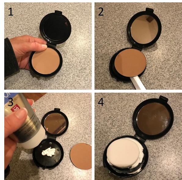
Now that the sun had fully risen it was time to apply my sunscreen. This has been problematic in the past because a tube of sunscreen freezes in the winter above treeline. Using an aerosol spray isn’t practical for obvious reasons (wind) and the sunscreen that comes in a deodorant-like stick doesn’t apply evenly. Yesterday I’d visited my new esthetician and we’d had the usual sunscreen talk. I’d told her I usually just keep my face completely covered when above treeline, since I’m unable to apply sunscreen when it freezes. She told me about something she’d recently heard of, and I decided to give it a try. I went to the dollar store and bought a compact, took out the powder, cleaned the compact out, and filled it with my favorite sunscreen. Then I placed a new compact sponge over it (30 for $1 at the dollar store as well) and let the sponge absorb the sunscreen.
I had the compact in my pocket as I was hiking this morning (inside of a plastic ziplock as well) and now was the time to take it out and see if the sponge had kept the sunscreen from freezing. I sat on the summit cairn, took out the sunscreen filled compact and applied the sunscreen to my face using just the sponge. I was amazed at how well this worked! The sunscreen hadn’t frozen! Using the sponge it was easy to apply the sunscreen to my face, and my fingers didn’t get cold because they weren’t in direct contact with the sunscreen. I hadn’t expected this to work so well. This is life changing. I took a picture to prove to her I’d tried out her idea.
OK, that had been fun, but now it was time to head back down. Here’s a look at the ridge back to Mt Buckskin
Yes, I had to regain some elevation, but at this point I was feeling great so it was no big deal. When I reached the top of the Mt Buckskin ridge I noticed a few cool looking cornices forming (these were small, only a few feet wide)
Here’s a look at the view from the Mt Buckskin Ridge
On my way back down I once again aimed for the power lines, which were much easier to see in the light of day.
Here’s looking back up the slope to Buckskin
From the power lines I headed back into the basin.
And from the basin a look back up at the route I’d taken
Wow, what a basin! In the light of day I could full appreciate how vast it was. I stopped to take some pictures and admire the view
I realized I’d made the right choice in choosing the line I had to ascend Buckskin’s slope, and now aimed for Kite Lake
Once at Kite Lake, and while hiking the road back to the gate, I got a really good view of Mt Buckskin and the path I’d taken to the top. I had the realization this hike would have been much more straightforward in the dark if I’d just followed the power lines up the ridge.
The power lines start on the road and lead up the mountain, avoiding the basin altogether. I’m not sure if they cross private land (etc.) but this seems a much easier option that would have made the hike quicker as well.
In any event, the weather had been perfect today once the wind had stopped. Not a cloud in the sky, and as I was walking from Kite Lake back to my truck it got really warm out and I was able to take off my hat and balaclava.
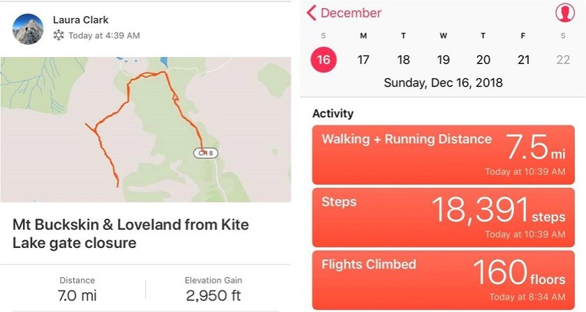
I made it back to my truck at 10:30am, making this a 7 mile hike with 2950’ in elevation gain in 5 hours, 45 minutes. This gave me plenty of time to drive home, get the truck washed and gassed up for the road trip, and to wake my still sleeping daughter up to start studying. All in all, an absolutely perfect day!
Fridays are my hiking days, and today’s Friday. However, it’s also the day I pick my daughter up at camp (at 2pm), which seriously cuts into my hiking time. I’m totally ok with this however, because I planned ahead. I saved Mt Massive for today because it’s a peak I knew I could summit quickly and head back down to pick up my daughter.
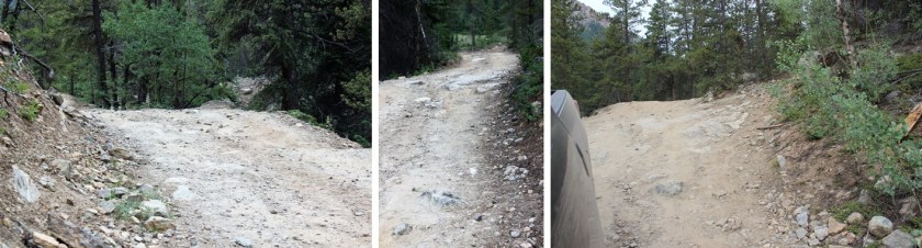
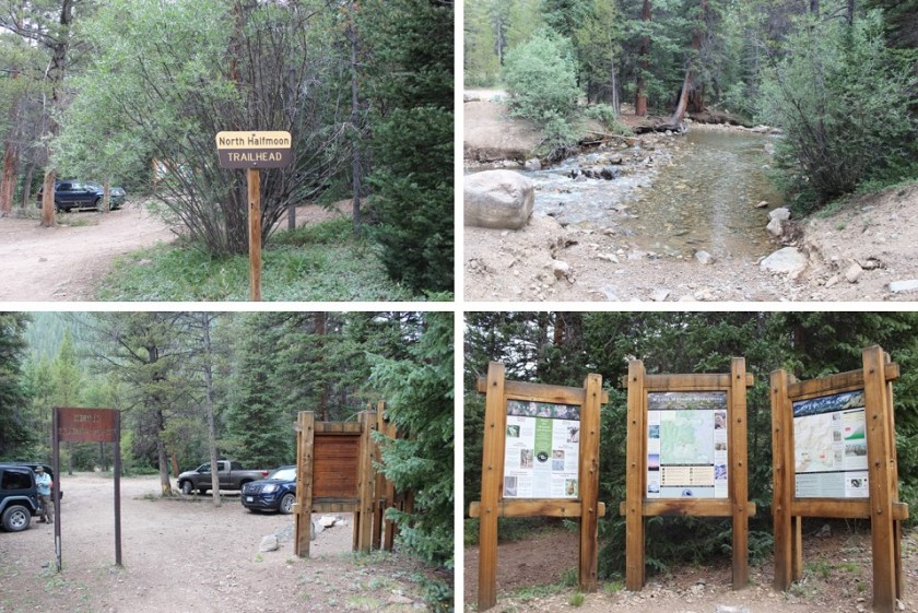
So I left the house at 11:30pm and drove to the North Halfmoon Creek Trailhead. Just when I was almost there I saw a huge campsite with about 20 RVs set up. They had a pallet bonfire going, and I thought to myself how I used to do that kind of stuff at 2:30am when I was younger. It wasn’t until I reached the trailhead I remembered I’m pretty sure there’s a fire ban here and they shouldn’t have been burning like that. The road in was rough 2WD most of the way, and the last bit 4WD. Here’s the worst of it.
I arrived at 3am to just one other car in the lot. It’s a small lot, but there’s a larger one adjacent to it that probably holds 15 more vehicles.
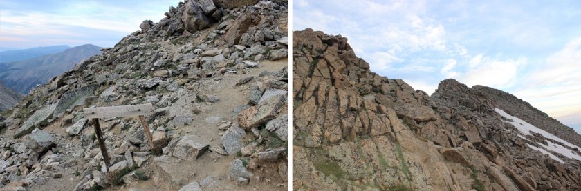
I’m a sucker for signs. This trailhead had tons! It also had a memorial to a helicopter crash that occurred on Mt Massive and those who died. There were quite a few liquor bottles surrounding the memorial, as well as cigarette lighters, coins, and shot glasses.
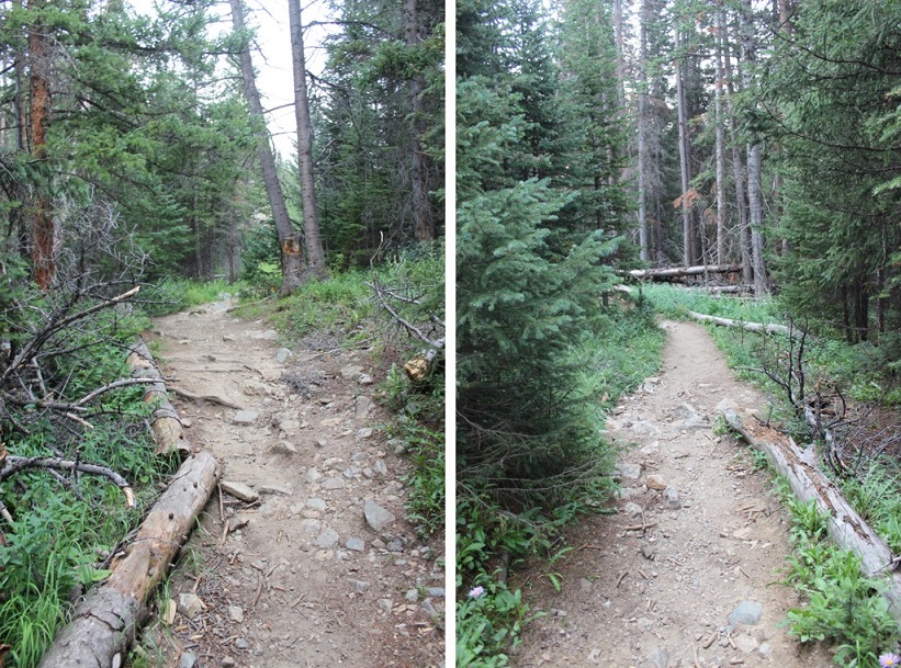
Wow! After last weekend’s Chicago Basin trip, my backpack felt light! This was great! I was practically running up the trail. I hiked almost the entire trail in the dark, so here are some pictures from the way back. The trail started out through the forest. I was surprised at how much I could smell smoke from the surrounding fires. I’ve been hiking a bunch of 14ers the past few months, and this was the strongest smell of smoke I’d encountered yet.
There’s a wall you need to climb towards the beginning of the trail that requires you use your hands to balance yourself. This is much easier than it looks, and if you can do this, you can absolutely hike the rest of the trail. This hike is considered a class 2, but I think it’s only because of this one move. IMO, if Pikes Peak is a class 1 this should be as well. This trail is well maintained all the way to the summit. I came across this move in the dark and was sure I wasn’t supposed to go this way, but yes, this is the correct way to go, up the rock.
The trail passes through a meadow
Turn right at this junction
And then start climbing up some well made talus-stairs (thank you CFI!)
Your goal is to climb up this
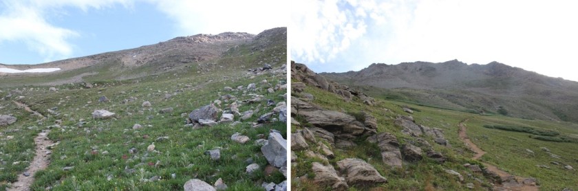
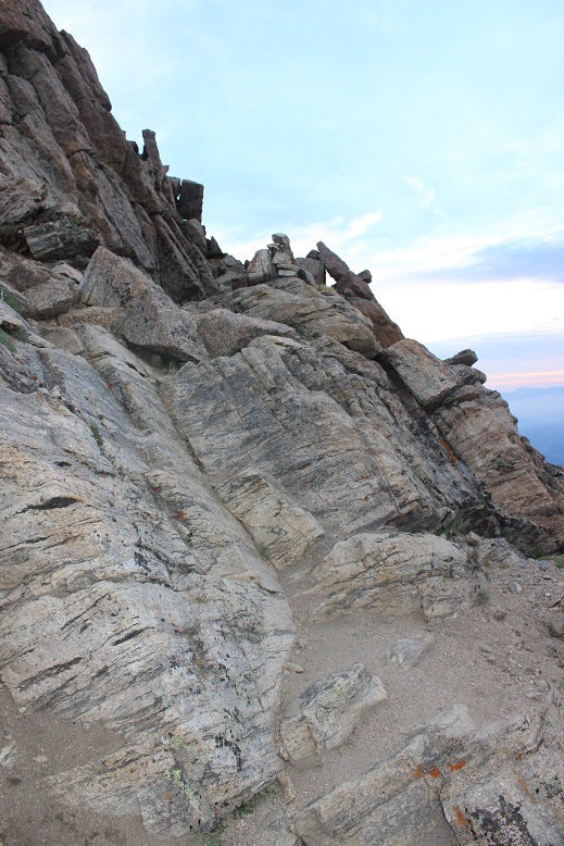
It was a nice, steady climb on a well maintained trail with a lot of switchbacks. I never needed to stop to catch my breath or take a break. At the top of this hill you reach a rocky ridge and a couple of false summits. This is where the trek gets fun! There isn’t really any route finding or climbing to be done, but the stairs/steps up make for a nice change of pace.
This is the worst of the “climbing”, and you can skirt around it to the right and avoid it altogether on a trail.
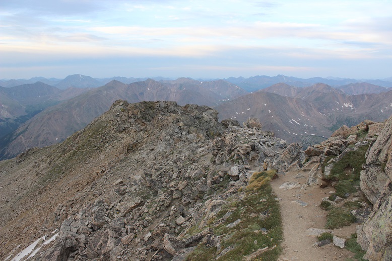
Here’s a look back at the ridge
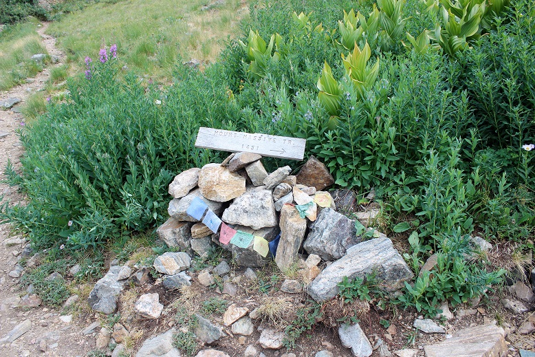
There are several false summits, but here’s the true summit. You know the true summit is coming up when you see the wind shelter: the true summit will be the highest point north of the wind shelter (about 15 yards away).
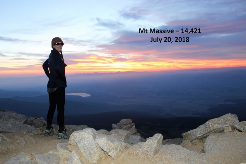
I summited at 5:30am, just in time to watch the sunrise!
Summit Selfie
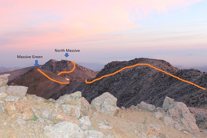
I’d summited in plenty of time and intended to use my extra time to head over to Massive Green and then to North Massive and maybe some of the other sub-summits of Massive. The route goes through a rocky area, but doesn’t get much lower than 13,900’. Here’s the route:
It wasn’t that cold, and the temperature on the summit was supposed to be 40-60* with 5-10mph winds. This sounded perfect for today! I decided to go light with layers and just bring my moisture wicking zip-up and a hat. This had worked perfectly so far. I got excited when the sun rose because that meant the temperature could only get warmer from here, right? Well, it didn’t . The sun stayed behind the haze and never warmed up the air, and as soon as I summited the wind began picking up and it started getting cold. This is something really hard to explain unless you’ve got it, but let me just say Raynaud’s stinks. With each step I took the temperature seemed to drop as I headed toward North Massive. It wasn’t so much the temperature, but the wind. It was icy and probably hovering at a steady 25mph, which isn’t that bad, but I wasn’t prepared for this. I didn’t have the proper jacket and my gloves weren’t winter gloves. I have Raynaud’s, so it’s important I prevent getting cold because once I do I cannot warm up (it’s a circulation thing). I’m sure most people would have been ok, but as I reached Massive Green I had lost feeling in my fingers. I pulled off one glove and my fingers were white down to the second knuckle. Great. I’d hoped the wind would die down, but it didn’t look like it was going to happen, so I made the executive decision to turn back and head towards Massive before losing my fingers to frostbite. It hurt to turn back. I was seriously mad at myself! I wasn’t tired at all, and I wasn’t even that cold, yet my fingers were in the early stages of frostbite (it happens much faster for people with Raynaud’s) so I had to go back. I couldn’t move them and the only way to get blood back into them to start circulation again was to go where the wind wasn’t. I didn’t regain feeling until just before treeline. Lesson learned: pack extra jacket/gloves no matter what.
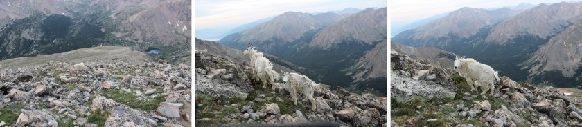
I re-summited Massive and headed down the ridge, this time seeing two goats on my way. I love seeing Mountain Goats!
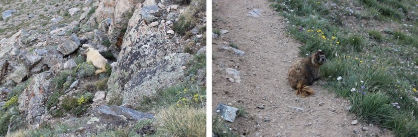
About halfway down the slope I saw something I’ve never seen before: a white marmot! Well, it was more of a very light tan color, but still pretty cool. I didn’t know marmots came in this color? I saw a bunch of brown marmots as well.
Across the trail from me there was evidence of avalanche
Back into the forest I came across more proof nature is amazing
I made it back to my truck at 8:30am, making this an 11.5 mile hike completed in just over 5 hours. That gave me plenty of time to drive to Woodland Park, set up my computer at a local Starbucks to write my trip report, and pick up my daughter at 2pm. I’d definitely do this one again, not only to get in those other sub summits but because it was a nice and peaceful way to spend the morning. It didn’t really feel like a 14er. I could just hike and think and not think too much about the hike…
The weather today for just about every 14er in Colorado was
the same: Windy. I’m not a fan of wind gusts of 45+ mph (which
usually end up being around 85mph up on the peaks if we’re honest) but they’re
manageable if it’s a warm day. I ruled
out any peak with snow on it because wind and snow don’t mix (as I learned last
week). That left me with Wetterhorn Peak
for today’s 14er. I checked the weather: 20% chance of snow and 100% chance of 25mph+
winds with gusts of 43mph. Hmmmm. That didn’t sound too promising. Not bad, but not great. I knew there wasn’t any snow on Wetterhorn,
so that was a plus. I was just worried
it would get snow during the night/day and ruin the trip. I didn’t want to drive 6 hours out there to
turn around.
I was musing all this to my kids when my youngest said “Mom,
you should just go. You’ll never really
know the weather or if you can make it or not unless you try.” She’s a smart 14 year old. (She must have an
amazing mom…). I told her she was right,
and set my alarm for midnight. Besides,
this would be my 33rd 14er and my 3rd class 3. Lots of 3’s mean it’s meant to be, right?
The trailhead is easy to find/follow. From this sign it’s really a 4WD road.
I know others have posted it’s manageable in a 2WD, and I’m
sure it is for those amazing 2WD gods out there, but if you value your 2WD
vehicle, do NOT take it on this road. However,
if you’re looking for a reason to get a new vehicle, by all means proceed. Here are a few pics:
I made it to the trailhead at 5:30am and was on the trail by
5:45 (I drive fast). There were 2 other
vehicles in the lot (I parked lower down).
There’s probably room for 15 vehicles total at the upper trailhead,
including parking about 10 yards below the lot.
Here’s what the trailhead looks like in the daytime. The trail starts to the left of the trail
signs.
Note: Most of these
pictures were taken on the way down because my fingers were too frozen to take
pictures on the way up.
The beginning of the hike was pretty uneventful. (Another Note: The summit ledger is full and the pen
provided doesn’t have any ink left. Maybe
a hiker could bring new supplies with them?) It was just me hiking in the
dark. The trail was wide, clear of snow,
with just a few muddy spots in areas. It
was about 37 degrees, and there wasn’t any wind. Yet.
As soon as I hit treeline the wind began to blow, but it
wasn’t too powerful and it wasn’t cold outside, so it was bearable. As the sun began to rise I noticed what
looked suspiciously like snow clouds on the mountains next to where I was
hiking. Luckily the wind was blowing
them away from me. It seemed like the
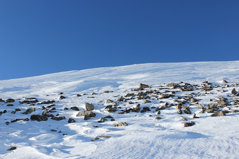
sun took an awful long time to rise this morning. I passed a boulder field that was easy to
navigate but didn’t have any cairns?
This could be a problem in the winter.
The entire trail was very well maintained, all the way to
the ridge
I looked for the turnoff to Matterhorn Peak but never saw
it? I did see this sign, which, despite
it’s name, does not go to Matterhorn Peak.
I could see a few hikers in front of me by their
flashlights. They seemed far away, but I
quickly caught up with them. They looked
really cold in their hoodies. I was cold
in my snow clothes.
At this time the sun began to rise and the temperature began
to drop as I hit the ridge and the wind picked up. I still think Colorado Flag sunrises are
cool!
At the top of the ridge I could see most of the route
left. This scree hill was insanely
slippery! I could tell a lot of people
had chosen to just walk on the tundra. I
put on my microspikes and braved the scree.
At the top of the scree hill I could see the path to the
summit (or part of it).
It included a LOT of scrambling over a lot of rock walls/large
gullies/insanely tall boulders. These
pictures just do not do them justice!
This part should have been fun for me (I love scrambling)
but the weather made it really difficult to find my way. The wind was cold and intense. I had to find a cave to shelter in to get out
my map, and taking my gloves off made my fingers freeze instantly. I’d look at my map, put it away, put on my
gloves, head out to hike, and the terrain kept changing on me. I even brought up the pictures on my
phone. Nothing up close looked like the
pictures I had? Well, every once in a
while they did, but not on a consistent basis.
I gave up and just followed the cairns.
Luckily there were a lot of them.
Did I mention the boulders were COLD? My hands were frozen! And it was pretty windy, so I didn’t want to
rest too long to appreciate the view. I
just wanted to summit, and was thrilled when I did!
I could see Matterhorn Peak and Uncompaghre Peak in the
distance.
I took a selfie to prove I’d summited
And a quick 360 degree video
And headed back down.
I needed to get warm again.
Soon. I was seriously worried
about two fingers on my left hand at this point that were solid and starting to
burn. I kept trying to flex them to keep
the blood pumping but they wouldn’t move.
(No, not frostbite, I have Raynaud’s, so I’m overly susceptible to cold
temperatures).
Climbing down is different than climbing up, as your center
of gravity is off and you can see more of the exposure so it’s more mental. I took my time, even though my fingers were
frozen. I didn’t want to slip.
Just as I was finishing the climbing part of this hike I ran
into the three hikers again, getting ready to cross over the first obstacle.
OK, time to book it back down in elevation to warm up these
fingers! Luckily the sun was coming out
and the clouds all seemed to gravitate towards other peaks. It was still windy
though. As I hiked back down I
contemplated Wetterhorn. She was beautiful!
Summiting had been really anti-climactic and I was trying to
figure out why? I should have LOVED that
climb! It must have been the
cold/wind. I mentally tried to decide if
I was even up for hiking Matterhorn Peak today?
I went back and forth in my mind a few times, and told myself the
decision hinged on actually finding the trailhead and my fingers defrosting. Oh, and warmer weather and less wind wouldn’t
hurt…
As I descended into the basin and passed through the boulder
field there was a brief period where all wind stopped. The silence was deafening. I didn’t hear a bird, marmot, pika, airplane,
wind, etc. Nothing. I grew up in Southern California, and
directly before and after earthquakes everything becomes still (for different
reasons). That’s what this felt
like: The still before the chaos. I hoped that wasn’t foreshadowing for the
hike ahead.
I kept debating the whole Matterhorn Peak thing. My fingers had finally defrosted, the wind
had died down a bit (but don’t let those photos fool you: the wind was intense!) and I didn’t really
want to drive all the way back here to hike Matterhorn at a different time. But I was tired, and I still wasn’t sure
where that trailhead was? As I was
hiking I had a thought: Could it be
here? At the Ridgestock Driveway and
Wetterhorn Peak junction?
That wasn’t in any of my notes, and didn’t really make sense
(shouldn’t it be at the Matterhorn trail junction where it wasn’t?). But in the daylight it looked right. I got out my altimeter. Ugh! I
was at 12,500’. If I was going to do
this hike I was going to have to gain another 2000’ in elevation, after already
doing 3300’ this morning. I was
tired. Did I REALLY want to do
this? I heard my daughter’s voice in my
head again: “Mom, you should just go.
You’ll never really know if you can make it or not unless you try.”
Before making the decision to hike Matterhorn Peak I decided
to see if this was actually the correct junction to take. Then if it was I could either continue
hiking, or know for next time when I’d most likely be hiking in the dark. I started up this hill. It really did seem to go on a lot longer than
it looked like it should, and more than once I thought about stopping this
nonsense and heading back down the trail.
But I’m stubborn, so I continued on.
At the top of the hill the trail kind of split in two. Left is the correct way to go
This is what I saw:
I was intrigued. What
I saw before me truly looked like fun.
Sure, I was tired, but this looked like FUN! There was no trail, I’d get to make a trail
for the first time, and this looked totally doable! I just needed to cross the stream and head
up! I was in a basin, so it would be
difficult to get lost.
I was in. Since there
was no established trail I designed a plan:
I’d leave the trail, cross that little creek and hike straight up the
mountain (no sissy switchbacks for me, I wanted that elevation gain). I looked at the entire mountain and visually
picked cues (rocks) to aim towards. Here’s
the route I took:
Before heading out I turned around to get a good visual of
where I’d started from so I could return to the same spot. I snapped a picture with my camera just in
case I forgot, and was off!
I told myself no looking back/down. The elevation gain was indeed intense because
I just went straight up, but I kept making small goals and taking breaks when I
met them. I took a lot more breaks than
I normally do. As I got further up the
mountain I could see the rocky ridge above me, and made out two figures in the
center that looked to me like rabbits (think Easter Bunny Chocolate
Candy). They were right in the middle of
the ridge, so that’s where I aimed.
As I got closer they looked more and more like rabbits.
I reached the rabbits and gave them my trekking pole for
safe keeping. I trudged on. I could see the summit in front of me.
There was no clear path to the top, but I could clearly see
the peak and several routes I could take to summit. There was a lot of easy scrambling (compared
to Wetterhorn this was a piece of cake!) and a very small summit. So small I couldn’t get a summit selfie. I straddled the summit and just sat there,
thinking about what I’d just done. I’d
rocked that climb! And check out my
view!
I was surrounded by Uncompaghre, Wetterhorn, and the entire
mountain range. I was in the middle of
it all, sitting on a peak, completely enjoying the experience. I the sun and a huge smile on my face. This was awesome! This is why I’d come to hike today! And guess what? For the 15 minutes I was on Matterhorn Peak
the wind completely stopped. I was warm,
could take off my gloves, and took a few pictures.
I was happy. I was
thrilled. I felt accomplished and my
self esteem soared. I love solo
hiking!!! I spent about 15 minutes on
the summit, which is unheard of from me.
I usually summit, take pictures, and head back down to a lower elevation
to warm up. However, it was now time to
head back. I still had a 6 hour drive
home ahead of me. I revisited the
rabbits, thanked them for watching my pole, looked for my point of reference
and headed back down the mountain.
I kept looking for and finding my past reference points and
headed towards where I’d initially gone off the trail. I must have done a really good job, because
about three quarters of the way back I started walking over the tracks I’d
initially made! How crazy is that? All those years of practicing orienteering
paid off!
I made it back across the creek, found the trail, and headed
back down the mountain. I was in a much better mood than when I’d started
today! I was so glad I’d decided to come
hiking. Matterhorn Peak is my new favorite
13er!
I had to be at work by noon today and I didn’t really feel
like getting up at 2am this morning, so I chose a quick, easy, and close
hike. Also it’s a Thursday and there’s
snow on the peaks, so I was hoping to avoid hiking traffic.
I got up at 3:30am and made it to the Quandry Trailhead at
6am. There were noticeably more vehicles
on the road this morning than when I usually drive to 14ers. Must have been because I wasn’t leaving quite
as early.
The road to the trailhead is a short 2WD dirt road. I can’t imagine it ever gives people
problems. There are two parking lots, a
lower one (with 2 clean porta potties) that can hold about 50 cars, and an
upper one that can hold 5-6.
I started at 6:15am. This
is obviously a great snowshoeing trail, as it’s wide and has a lot of wooden
trail signs pointing the way. I was able to see them, even in the dark.
The trail meandered through a forest and when I came to
treeline the snow began on the trail and sun began to rise. I absolutely LOVE sunrises from 14ers, so I
stopped to take a few pictures.
At this point I was at 12,800’ and microspikes were
needed. Well, not needed necessarily, as
technically you could just follow the ridge to the left and not need them, but
what’s the fun in that? I put on my
microspikes and climbed straight up that ridge, looking for cairns. This one was obvious, but after this I didn’t
see any more.
Funny thing, that ridge didn’t seem to end! As soon as I’d reach the top of one, I’d see
another. And they were all covered in
snow. Luckily the snow was packed
tightly, but it felt like I was hiking on my tip-toes.
I kept climbing and climbing and climbing, and eventually I just
had one more ridge to go
It felt like it had taken FOREVER to climb that entire
ridge, but I summited at 8am. The summit
was flat but looked a bit rocky under all that snow.
I took a look around.
The views were amazing! The
entire high country is blanketed in snow!
I took a picture to prove I’d summited
And turned around.
Now I got to hike back down that ridge!
Hiking down is usually more difficult for me than hiking up because I
train running uphill (so my muscles are used to it) and my center of gravity is
off when hiking down hill. Also, my
knees are at about 95% right now after those falls two weeks ago. I only notice it when I either touch my knees
where they were injured or go down stairs/climb down mountainsides. Not to mention by now the sun had come up and
the snow was now more icy/slippery.
That ridge seemed to go on forever on the way down as well! It was indeed quite slippery, and I was happy
to practice maintaining my balance on the ice/snow. I appreciated when I sank into the snow about
2-3 inches, as it gave me traction. I
never post-holed, but it was obvious others had and would later in the
day.
Here’s a happy story:
I rounded a corner, and saw a Mountain Goat!
I’ve hiked 14ers dozens of times and this is the first time
I’ve ever seen a mountain goat while hiking!
I know they’re popular on a lot of the trails, but I never seem to see
them on those trails. Anyway, I named
him Billy and he seemed to like me.
In fact, Billy followed me for about a quarter mile of the
trail!
He was a slow hiker however, and soon I had to say
goodbye.
This part of the trail gave me the views I’d missed hiking
in the morning: views of a few 13ers:
Wheeler Mountain, Drift Peak, and Fletcher Mountain.
All in all, this was a pretty easy hike. I made it back to the trailhead at 9:55am,
which meant I’d hiked about 7 miles with 3500’ in gain elevation in less than 3.5
hours, and that included time to take a lot of sunrise/goat pictures, and to
hike alongside a mountain goat for quite a while.
I’ll probably be back to do this one with more winter
conditions (and friends) later this season!
I need an excuse to try out my new snoeshoes…
Oh, and I made it to work at 11:58am. I hadn’t made it home to take a shower first,
but that’s ok because I was the only one there and just needed to be there for
a WebEx call. I put on a new shirt, did
my hair, and was good to go!
·
Snow starts at 12000’ and keeps going from
there. Bring microspikes. Snowshoes weren’t needed.
·
I can see tons of potential avalanche danger on
this hike with more snow.
·
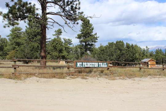
The lower Mt Princeton Road Trailhead is
actually pretty nice.
·
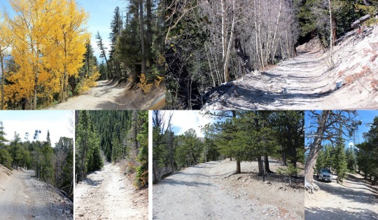
The road from here to the radio towers wasn’t as
bad as I’d been led to believe. It was definitely
4WD, but it wasn’t that difficult. The
only down side was it was narrow, so if you came across another vehicle it
would take a bit of maneuvering to get around each other. I have a Tundra, so this was an issue for
me. Two Jeeps wouldn’t have an
issue. Side note: the trail was dry when I took it. If it was wet or had snow or ice it would
probably be much more technical to navigate.
I could see several dry gullies I’m assuming flow over the road when it
rains/snow melts.
·
There are spots to park your vehicle at the
radio towers, but they aren’t obvious, and they’re tight. I had ‘fun’ turning around my truck when I
discovered the road was one way in and out.
I began at 6am. For
anyone wanting to know what it looks like hiking in the dark, here you go:
This was my first view of Mt Princeton
The trail after the towers begins on road 322A. It can be difficult to find the towers in the
dark, but if you’ve driven 3 miles since the lower trailhead and come upon a
sharp curve, you’ve missed the towers.
It was pretty cool to look back on Buena Vista and see it
covered in fog and haze
The first couple of miles follow the 4WD road up 322A. Then the real trail starts up to the right of
the hillside. There’s no sign, except
this wonderful, um, arrow of rocks? pointing the way.
As soon as you get up this small hill you get a great view
of Mt. Princeton.
From here snow at minimum lined the trail for the rest of
the hike, and at most completely covered it.
I put on my microspikes and continued on.
Shadowselfie, because I do that type of thing
At this point I was thinking it was probably a good thing I
had snow on the trail, since I was probably walking over a lot of scree. I prefer snow to scree any day.
Oh, and when I turned back around I saw the SUNRISE! Colorado 14er sunrises are AMAZING!!
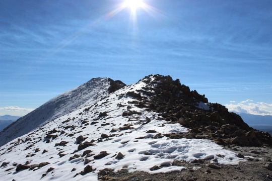
When I got to the top of the ridge I noticed a wind wall in
front of me and a mountain to my left. I
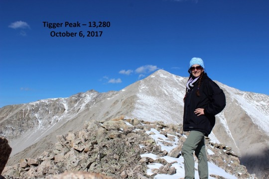
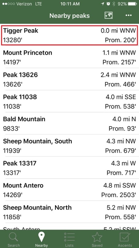
got out my Peakbagger app, and discovered it was Tigger Peak (13,280). It was only .3 miles away, so I made note of
the location to hike on the way back.
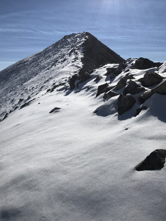
I turned right and got a good look at the rest of the hike
up Mt. Princeton. From here it’s .7miles
to the top. There was a pretty good
trail for most of the way, but when it was covered in snow I just followed the
ridge to the right.
Some places had a lot of snow and I did a bit of post holing
Others were bare
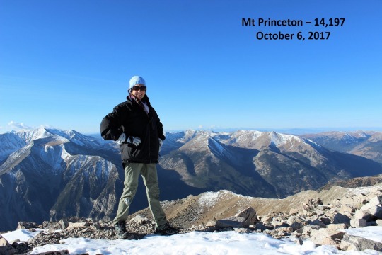
I summited to an absolutely beautiful view! Here’s photo proof I summited:
The weather reports said 40 degrees with 25-30 MPH winds and
45MPH gusts, so I dressed warmly (multiple layers, hats, scarves, etc.) Either I did an excellent job over dressing,
or it wasn’t that cold out. I barely had
any wind for the entire hike, except on the exposed ridges.
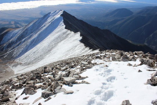
At this point I turned to head back down Mt Princeton’s
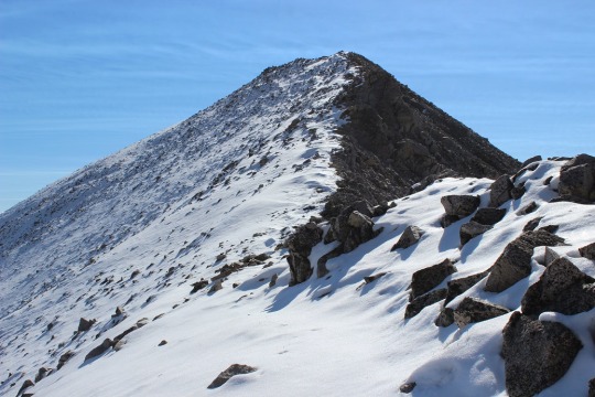
ridge. Take a look at Tigger Peak!
It took a lot longer to hike down than I remembered hiking
up, but I had to be very careful of foot placement. Despite microspikes it was still slippery. I ended up tripping once and hitting my left
knee pretty hard. I felt silly and
continued on.
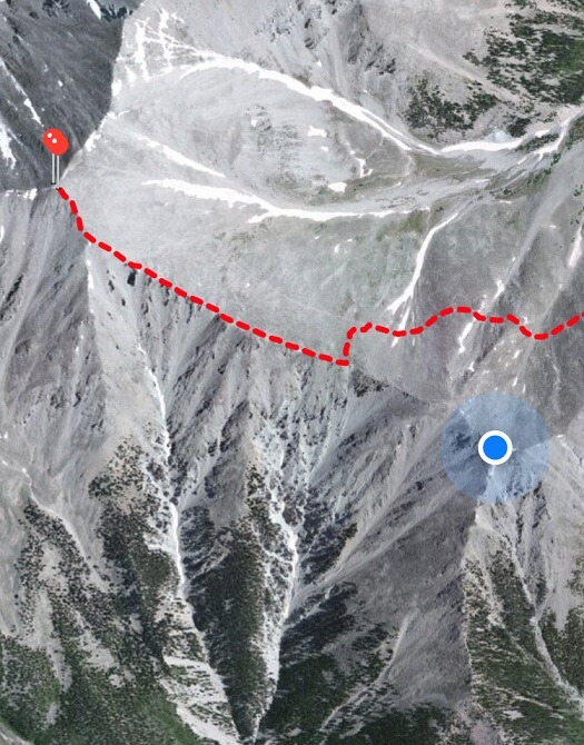
The trail to Tigger Peak had a ridge and what I considered a
false summit. And due to the recent
snow, no trail. Well, I’m assuming it’s
due to the recent snow. It might not
have a trail at all anyway? In any
event, there wasn’t a visible trial, so I got to make my own! I considered this a very awesome opportunity,
and I was careful to make sure my steps were secure.
On the ridge between the two small what I considered summits
of Tigger Peak it happened:
I was on a part of the route with exposed rock (no
snow). I lifted my right foot to take a
step, and abruptly pirouetted and started falling towards the rocks. You see, when I’d tripped earlier apparently
I’d tripped on broken microspikes: One
of the hooks holding them together had come loose, and now, when I’d lifted my
foot, the hook on my left microspike attached to my right microspike, and I
fell down like that giant in Jack and the Beanstock with the tied
shoelaces. It all happened in slow
motion. In fact, I had time to curse
twice. (Side note, I don’t actually
cuss, so I said “Gosh Darn It! Flibbity-gibbit” (seriously)).
I’m not going to lie, it hurt. But I didn’t sit there. As soon as my knee hit the rock and I could, I
untangled myself, got up, and started hiking.
I could tell nothing was broken, but it stung badly. The best way to fix this (I know from
experience) is to walk/hike it off. So I
kept going, looking down at my knee every few seconds, expecting to see
blood. Luckily that never happened.
I’m proud to say I continued on up and over the second ridge
and summited my first 13er! (yes, I know it isn’t “official”)
This is the first time I’ve forged a trail on snow, and I
was pretty proud of myself! Oh, but I
had to prove I was in the right spot, so I took a picture of my Peakbagger app
indicating I was on the peak
And a picture of my GPS, showing where I was
And as I looked across the mountain range, I snapped a
picture of this cloud that looks like a pufferfish? Yoda? Floating
majestically over Mt Antero.
Then I headed back.
It was cool following my tracks!
So now I had a serious dilemma: My microspikes were broken. I’d slipped and fallen hard twice, but I knew
the hike would be much worse without them.
This is what I still had to hike (well, about 3 times this, as the trail
looped all the way around the mountain, remember those earlier snow pictures?):
So I made the decision to hike with the broken microspikes,
but to be very, very careful (slow). I
kept my feet wide apart from each other:
I waddled, felt like a pregnant woman, and my pace was slow, but I didn’t
slip again! I was excited to make it
back to 12000’ where the snow stopped and I could take off my microspikes. This was also where I met my first hiker of
the day: A newby without spikes but with
a good and realistic attitude (he was prepared to turn back but wanted to see
how far he could go). I also met a group
of 5 or 6 friends hiking with a dog: ON
A LEASH! Major points to these
people. They were friendly too!
I made it back to my truck at 11:30pm, which wasn’t a great
time for a 7.5 mile hike, but I’ll allow it because I was hiking on extended
fields of snow for the first time, I forged my own trail and I was being extra
careful on the way down. Here’s a
picture of the towers
OK, so it says Peaks 10 and 11, but this is really my 22nd 14er if you count all my climbs, it’s just my 11thunique 14er. And I summited on 7-11-17, which I think is pretty cool. Oh, and 11+11 is 22 and it’s the 11th and this is my 11th and 22nd peak… ok, I’m reading too much into this.
I am so glad I took this hike today instead of yesterday!
I drove up the 4WD trailhead to a full moon. It was magical in a way photos can’s capture. I always try anyway.
I arrived at the trailhead at 4:30am and was surprised to see so many cars in the parking lot for a Tuesday. I could see two people just starting the trail and two other groups getting out of their cars, so I decided to make a quick restroom stop and be on my way. The restroom was DISGUSTING! It had plenty of toilet paper, but it looked like everyone gave up using the toilet and just went on the floor. There was excrement everywhere. Yuck!!!
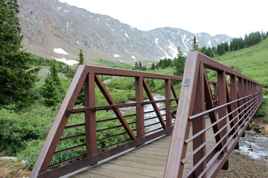
I grabbed my headlamp just to be safe, crossed the bridge and tried a few more times to get a good picture of how beautiful the full moon was but failed. It really was amazing! I didn’t need a flashlight to light the path because the moon gave off enough light. I LOVE hiking in the moonlight!
I passed the two hikers ahead of me within the first 20 yards, looked ahead and didn’t see any more flashlights and breathed a sigh of relief. Hopefully these would be the only people I’d pass this morning. I walked for about 2 miles before the sun started to light up the sky.
It was really neat seeing the sun and the moon in the sky at the same time, directly across from each other on wither horizon. It was if they were wishing each other a good morning and a good night.
I call this one “Between the Cairns”
The sun fully rose and I tried to get another Colorado Flag picture. This was the best I got. Not great, but not bad either.
And here’s my usual shadow-selfie photo in the sunrise light:
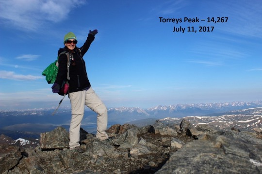
This hike is kind of a loop, but more like an awkward kite. It’s about a 2.5 mile hike in, then the trail diverges into two different paths: one to go up Gray’s Peak, the other up Torrey’s Peak, but they connect over the saddle. It’s not a perfect kite, as you have to hike back down Torrey’s to get back to the saddle, but you get the idea (I hope, if not there’s a picture later). It was at this point where the path diverges I met a couple trying to figure out which way to go. I helped them out (they didn’t have a map) and talked with them for a little while. They were with The Texas Roadhouse. Today over 200 of their employees were hiking Grays Peak. I sighed inwardly. Wonderful. There go my plans for a peaceful hike.
After talking with them for a bit they told me they’d planned on all meeting up at the summit at 11am for a picture. It was now about 6am and they had a mile and a half to go. I told them they may want to change their plans, as storms were supposed to come in today at 10am and even if they weren’t, waiting at the summit for 2-3 hours is never a good idea.
We parted and I continued on. This hike was pretty easy for a 1 mile stretch to the summit. Don’t get me wrong, it’s still a 14er and still difficult because of all that implies, but I’m not sure why it’s listed as a Class 2? I had absolutely no difficulty finding the trail. It was great because I didn’t waste time route finding! When I reached the summit there were three guys already there, laying in the wind shelter. I asked if one of them would mind taking my picture? I could see right away they were all cold and weren’t up for the challenge, so I quickly said “No worries, I’ve got this, you work on staying warm” and set it up on automatic.
These guys were from The Texas Roadhouse as well. They’d summited early and had set up a go-pro to capture everyone else summiting. They’d planned on staying until everyone reached the summit. I discussed weather with them, and the fact they were already freezing. Were they really up for sitting on the summit another 3+ hours? I left them to decide, took out a banana from my backpack for breakfast, and ate it as I headed down the ridge towards Torreys Peak.When I got to the saddle I looked back the way I’d come at Gray’s Peak. Pretty cool!
This summit was easy to find as well. Lots of cairns on this hike. Lots. When I reached the summit I was the only one up there so I set up my camera to automatic again and got proof I’d summited.
Then I was off again. I passed a couple of really fit guys on my way towards Torrey’s, and again on my way back down. They were winded and a little embarrassed I’d passed them, summited, and was passing them again. I did my best to make them feel better (I do this all the time, and I run 5-10 miles a day uphill when I’m not hiking, etc.). They seemed mollified and I took a look at the rest of the route before me.
As you can see by the picture below, there’s one trail on the left that divides into two. The one on top goes to Gray’s Peak, the one on the bottom is the way back down from Torrey’s Peak. I was headed through that patch of snow on the right and back down to the trail.
Ah, another beautiful view from the saddle! I love saddle views!
OK, here’s the snow patch I needed to make my way through. It was now starting to get warm and thus slippery. It was pretty straightforward though.
The skies were still clear but clouds were beginning to build. I had no idea what time it was (I had forgotten to look when I summited due to the cold temperatures) but I wanted to be back at my truck by 10am to avoid the storms I knew were coming in. At this point I started passing Texas Roadhouse employees. TONS of them. None of them were prepared for this hike with anything except music on their phones, blasting for everyone to hear. I talked to each of them on the way down. I don’t think any of them had a map, most didn’t know which peak was which, and they all needed help route finding. Facepalm.
I advised them all to watch the weather. They all seemed confused. None of them seemed to realize the magnitude of what they were undertaking. They all had 2+ hours of hiking left to reach the summit, not to mention the hike back down. The entire hike is above treeline. There’s no place to go on the entire 8.8 mile loop if a storm breaks out. The weather forecasted a strong likelihood of storms beginning at 10am. Blank stares.
Since I’m sure you all know my feelings on this subject I’ll leave it at that. I headed back to my truck at a brisk pace, intending to make it there before the rain hit.
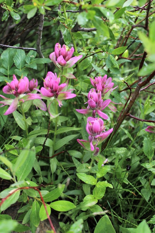
I saw a few more “new” flowers (I’m thinking these are some type of paintbrush)
And followed the creek.
Just as I crossed the bridge signaling the end of my hike the first few raindrops began to fall. I was at least 2 hours ahead of anyone else on that trail. I wished them luck, downed a beer, and got in my truck.
When I turned it on and looked at the clock I thought that can’t be right? It said 9:16am. Wow! I thought it must be at least 11am or 12? Woot! That’s a much better time than yesterday. I did this hike in 4.5 hours, despite stopping and talking with all 200 of those Roadhouse people on the way down. Not too shabby for an 8.8 mile 14er hike with 2 summits.
A final view from the road back. These houses always make me melancholy. I’m sure at one time they held hope, joy, and memories. It’s sad to see them left to the elements. But that’s another post for another day.
This was a last minute trip.
It wasn’t until about 10pm the night before I realized hiking the 26
miles up and down Pikes Peak would even be a possibility. When I discovered I had some time in my
schedule I immediately went online to check the weather forecast. As usual, each forecast was different, but
they all agreed there would be storms and possibly snow in the afternoon. One even predicted thunderstorms starting at
10am, but most stated there would be “fall like weather”.
I’ve missed several opportunities to hike the mountain this
summer because I listened to weather forecasts that turned out to be false, or
materialized later in the afternoon than forecasted (meaning I’d have already
hiked and been home before the storms started).
I asked Rebecca her opinion and she said yes I should go! She also said she’d look for me if I didn’t
come back tomorrow night. And by ‘look
for me’ she meant drive to the trailhead and yell. So I packed up my gear, prepped coffee just
in case, and decided to “decide” in the morning.
My alarm went off at 2am and I looked out my front window to
evaluate Pikes Peak and my chances for a successful hike. I couldn’t see the light from the summit
house, or, more importantly, Pikes Peak at all; It was covered in low lying
clouds.
So I went outside. It
felt warm (low 60s). I went back and
forth in my head on whether or not to attempt the hike for about 5 minutes
(seriously, which is a long time for someone who usually makes quick
decisions). In the end I decided to
go: I could always turn back if the
weather got difficult, and I’ve never regretted taking a hike when I didn’t
feel like hiking. I made sure I had my
ski gloves and set out on my way with the rest of the gear I’d packed the night
before.
I didn’t get to the trailhead until after 3am. There were only 2 cars in the parking
lot. The dashboard of the car read 63
degrees outside. I figured the cars
belonged to backpackers at Barr Camp, paid my $10 parking fee, and started
hiking at 3:12am.
I usually check the time as we hit different landmarks/mile
markers, but never actually write them down.
I’ve got a pretty good idea of how long each segment should take, but this
time I wanted to keep close track of my progress.
I love hiking Pikes Peak.
I’m super appreciative of hiking buddies and I’m glad to hike with
anyone who’d like to hike with me (quick caveat: they must be in good health, have no heart or
lung problems, and WANT to hike the peak), but I find when I hike with others
we take a lot of unnecessary and sometimes lengthy breaks. These breaks are probably necessary for them,
but I’ve always wondered how quickly I could hike the peak if I only stopped
when I was tired. So this time I was
keeping a trail log on my phone.
I started hiking to the sound of crickets. The first three miles of the hike are the
most difficult and require you to ‘power’ through them. The redeeming factor to this stretch of the
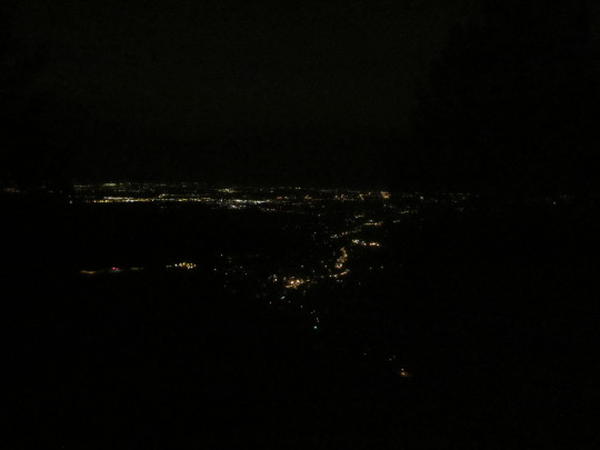
trail are the city lights. You can see
Manitou and Colorado Springs glowing in the distance. I’ve tried dozens of times to get a good
picture, but have come to the realization the only way to enjoy the view is to
actually be there.
Strangely I wasn’t able to see the summit house light. It’s a very bright light I can usually see
from my house, and I’ve always seen while hiking the peak in the morning. I’d thought I’d have been able to see it
through the clouds, but I couldn’t. I
hit MM1 at 3:31am, MM2 at 3:53am, and MM3 at 4:14am. I’d hiked the first 3 miles in 61 minutes and
had taken several stops for pictures (none of which came out really well). That’s great time! These are the hardest miles of the hike, so I
consider hiking 3mph basically climbing up stairs a win!
At this point I began noticing the sound of crickets had
silenced. In fact, I couldn’t hear any
bugs or the sound of the creek I knew I was paralleling. I made a mental memo of it and kept hiking.
Side note:
headlamps are NOT useful when you hear a noise in the woods. Your head automatically turns towards the
sound, but you have to swivel it side to side to look for creatures (or beady
eyes). A flashlight is much better
suited for this purpose.
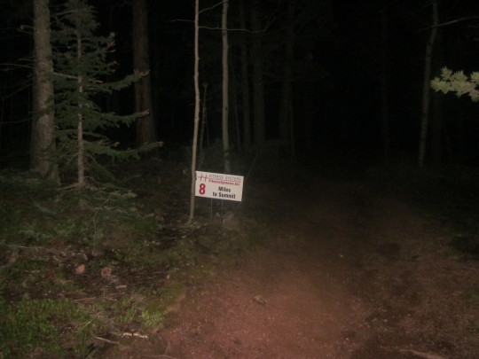
Around MM4 I saw a large reflective rectangle in the
distance and was intrigued. I wasn’t sure
exactly what it was until I was right upon it, when I realized it was a sign
noting miles to the top. This is not a
permanent fixture, and was probably put there for the race this past weekend. I saw them every mile to the top, and
seriously hope the person responsible for putting them there ensures they are
properly disposed of.
MM4 came at 4:36am, MM5 at 4:57am, and MM6 at 5:21am. Even though the trail was evening out and
getting easier to hike I was gradually hiking a bit slower. Totally ok, but funny to note.
All along the hike I kept waiting for the sun to rise and for
it to get lighter outside but it just wasn’t happening. I thought to myself I was glad I’d hiked this
trail many times before. It’s a very well-marked
trail, but in the dark with just a headlamp it’s easy to lose the trail when you
come upon a bare section not lined with some sort of foliage. I kept thinking “I could see how someone
could get lost here, and here, and here”.
I was also noting the lack of animal noises. Usually I hear a lot of rustling and chirping
from birds, run into spider or caterpillar webs, and hear small creatures
scurrying in the dark. I saw two rabbits
quietly sitting on the trail before me at different points, but that was
all. No other sounds.
Well, I did hear a bear once, or what I thought was a
bear. It startled me in the quiet. I didn’t stop, but kept on hiking. You see, I was actually really, really scared
to be hiking out there by myself. I wasn’t
afraid of anyone attacking me: there
were only two cars in the parking lot, and honestly, anyone who’d made it this
far out didn’t have the intention of hurting someone at 5 in the morning. They’d be sleeping. No one was crazy enough to be hiking in the
dark (ha-ha) so it wasn’t likely someone was ‘lying in wait’ for someone like
me to hike along.
No, I wasn’t worried about another human being, or even a
bear, but possibly a Mountain Lion. I
kept noting how unusually quiet it was, and figured I’d be able to hear just
about anything except a predator (meaning a Mountain Lion, as those would be
the only predators in this part of the forest).
I mentally prepared myself to use my hiking stick to defend myself and ‘go
for the eyes’ if attacked.
So I scanned my headlamp left and right as I hiked, looking
for eyes in the shadows. When I heard
the growl I was seriously scared. It
made me jump a bit, but I didn’t see anything.
I thought it had to be a bear, as it was a rather loud noise and a
Mountain Lion would have just attacked from behind. It happened again and you’ll
probably never believe me, but I realized it was my stomach! Honestly!
I didn’t feel hungry at all (my core was aching right about now), and in
fact I couldn’t actually feel my stomach.
The second time I heard the growl my tummy moved at the same time, and I
audibly noted the hilarity of the situation and sighed in relief. I kept
hiking.
Usually by MM3 or MM4 it’s fully light outside, but I passed MM6
and Barr Camp at 5:23am to an eerie darkness.
Apparently there aren’t any lights at Barr Camp, something I’d never had
the opportunity to notice until now. Through
my headlamp I saw the railings and porch swing by the river indicating the entrance
to the camp, but opted not to stop because it just felt wrong. The fog around the campsite added to my
unease. Everyone was obviously still
sleeping, and I felt like an intruder.
Just after reaching Barr Camp a very light snow began
falling. I could see it through my
headlamp. It was more of a light mist of
snow, but snow just the same. I reached
the yellow ‘summit sign’ that lets you choose between the Bottomless Pit and
Pikes Peak at 5:46am, and it wasn’t until 6:01am when I was able to turn off my
headlamp.
A realization hit me:
I had just hiked for 9 miles. In the dark.
Through the forest.
By myself. Scared.
There was no moon to guide me, as it was lost in the cloud cover
above. I’d survived one of the scariest
things I’ve ever done, and was seriously proud of myself for sticking to it and
continuing to hike in the dark! Rock on
sister! Let’s do this!
I reached the A-Frame at 6:22am and took my first ‘rest’ of
the hike. Kind of. You see, I call my kids to wake them up in
the mornings for school between 6:20 and 6:25am, so now seemed like the perfect
time. Yes, I had cell service (I have it
at just about every point on the trail, even at the summit, although I can’t
usually post to facebook or Instagram while on the trail). I called Emily, wished her a wonderful day,
and took a look around. The tarp was
pulled closed over the A-frame, and when I peeked through the gap in the
curtains I thought I saw a jacket hanging from the window, so I quietly turned
around and started hiking again.
There were a couple of squirrels chattering, so I took a
video (I say chipmunk in the video, but knew they were squirrels: It wasn’t worth a second video).
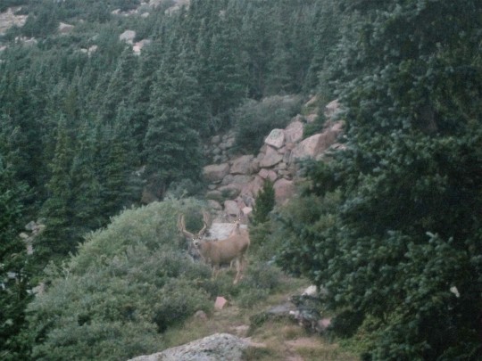
Before reaching the trail I saw two bucks! They stood there and let me get a picture.
It was then I realized the squirrels weren’t chattering at
me, but at the deer:
I’d turned off my headlamp about 20 minutes ago, but it was
now that the sun actually began to rise. There is no way to describe or take a
photo of the sunrise from Barr Trail to do it justice, but here are a few
attempts:
It was about now the snow began falling harder, the wind
began to pick up and the temperature began to drop. I was now hiking into the clouds.
I switched my cotton gloves for my ski gloves and trekked
on. I reached the ‘2 miles to the summit’
sign at 7:05am, and the Cirque (about a mile from the summit) at 7:32am. I was above treeline, and still hiking at
about 2 mph! That’s entirely amazing, as
it often times takes an hour to go a mile on this part of the trek.
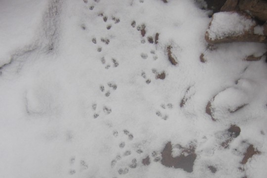
I was now hiking in snow, and saw prints I’d never seen
before. They were really small rodent
footprints, bigger than a mouse but much smaller than a marmot. Then I saw one! I’d never seen one before, but I was pretty
sure this was a Pika and the owner of the paw prints. I
tried to get my camera out for a picture, but by this time my fingers were
frozen and I wasn’t quick enough: The
Pika ran away before I could get a picture of him, so I took a picture of his
prints.
I kept the camera in my hand, and kept looking for another
Pika for a ‘Pika-ture’ (yes, I actually said this out loud).
That last mile was grueling only because it was so cold and
the wind whipped the ice and snow into my face.
It wasn’t bad enough to take refuge or turn around, but it was seriously
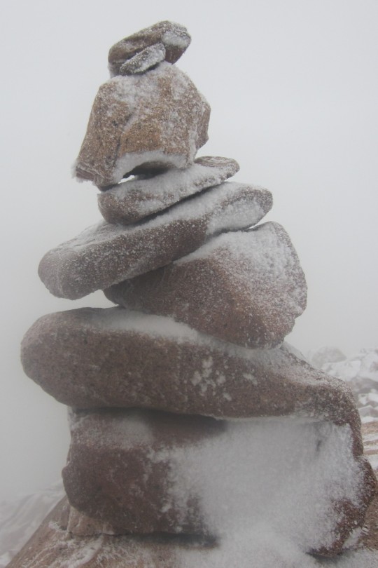
annoying. I saw this cairn about 50 feet
from the summit and thought it looked cool.
I still had the camera in my hand so I snapped a quick photo.
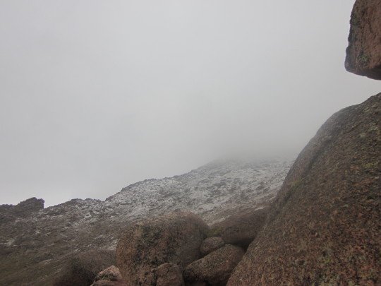
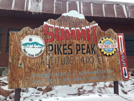
I reached the summit of Pikes Peak at 8:05am. It had taken me 5 hours and 7 minutes to
reach the top! That was absolutely
amazing! I was hiking at an average
speed of over 2.5mph: UPHILL! I knew
from reading Backpacker Magazine the
average hiking speed of any trek usually sits around 2mph, so I considered this
a serious win!
I reached the summit at the exact same time a cog pulled
up. Several workers jumped out of the
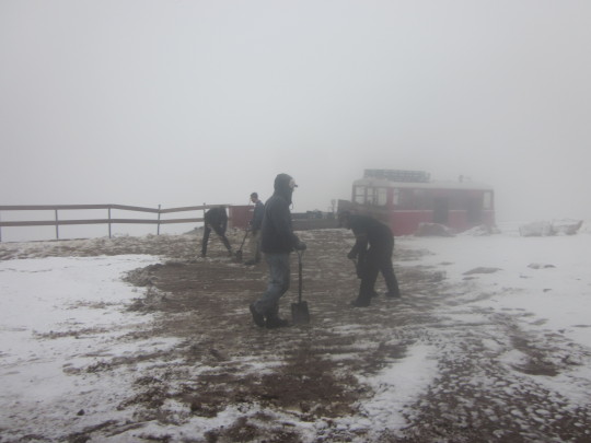
cog as it stopped, dressed in working overalls, shovels in their hands. They quickly began clearing the walkway.
The men were exceedingly nice, and asked about my hike up
and if I’d seen any animals? We
discussed what I’d seen and the animals they’d seen on their way up (mainly
deer as well). I (sadly) noticed the
Summit House was closed, so I asked one of the men shoveling when it would
open. He didn’t know. “Maybe in half an hour, maybe not at all
today because of the snow”.
Great. I was quickly turning
into a popsicle and decided to just head back down immediately. This ended up being a very wise choice.
I waved goodbye to the men shoveling, and as soon as I began
hiking back down they jumped back into the cog and were on their way back down
themselves. It was cold.
I mean VERY COLD. The wind didn’t
help. I was guessing it was about 20
degrees before wind chill. Hiking kept
me warm; stopping froze my sweat and my muscles.
About 50 yards into the descent I saw another Pika, and
luckily still had my camera in my hand.
Here’s what they look like: Bigger than a mouse, but smaller than a
chinchilla.
I didn’t see any hikers until I was just about at the
A-frame, and surmised by the color of the jacket the man was wearing he was the
one who’d spent the night. I tried to
warn him of the rapidly deteriorating conditions after treeline, but he didn’t
seem to think I was serious. When I
reached the A-frame again the tarp was pulled back and no one was inside, so I
was pretty sure he was in fact the overnight occupant.
Between the A-frame and Barr Camp I saw about 10 other
hikers and stopped to talk with them all.
They all wanted to know about the conditions ahead, as they couldn’t see
the mountain from that point of the trail.
Once again I told them it was snowing, cold, the wind was howling, and
it just kept getting worse. I advised
them all to head back, but every single one of them “had a ticket back down on
the train” and needed to be there to catch a ride back down. I told them all the summit house might not
open, so if they were relying on it for warmth/shelter be advised it might not
be there. The cog might also not be
operating. They continued their hike
anyway, one of them in shorts and a t-shirt.
He told me it was a “good thing he’d brought a jacket”. I did a face palm and told myself I’d warned
them. I honestly don’t believe any of
them made it up to the top. It did
indeed get much worse as the day kept on, and they were at least 4 hours behind
my summit when I saw them (they had 4 hours at best until they reached the
summit). When I told my kids this after
arriving home they said it was probably because I don’t look like a “hiker” and
that I make hiking look easy. I’m
guessing they probably thought if I could do it so could they. Hmmmm…. I digress.
I was back at Barr Camp at 10:28am and saw my last set of
hikers: 6 women in their early 60s, very
fit, with a LOT of makeup on (maybe it was permanent?). They seemed to listen to me, and while they
continued ahead, verbally made a pact to turn around if at any time one of them
didn’t feel safe. They also regretted
not beginning their hike at 4am like they’d originally intended. High five to them for keeping their options
open!
I was back at my car at 12:18pm. I’d hiked 26 miles in 9 hours 6 minutes, and
felt absolutely amazing! I didn’t take
any breaks besides 3 minutes to call my kids and what was probably 3 minutes at
the summit, and it was at this point I realized I hadn’t eaten anything all day
either. I’d brought a lot of snacks, but
hadn’t opened any of them. All I’d had
to eat today had been the coffee I’d sipped on the way to the trail. Now I was starving, and ready to eat. But first I needed to head to work for a few
hours, pick up Thomas from school, search for a gyroscope, pick up Emily from
softball…