PT 13552

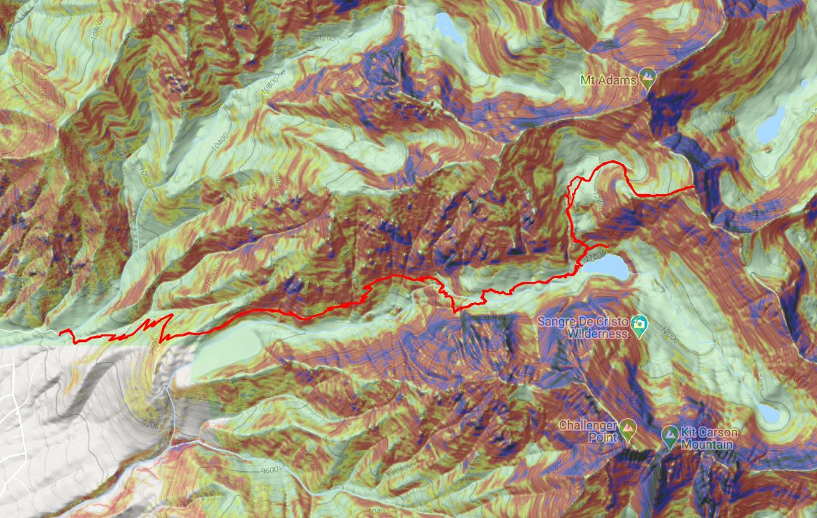
RT Length:  14.15 miles

Elevation Gain:  5337’

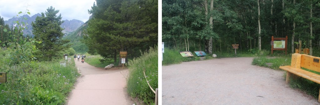
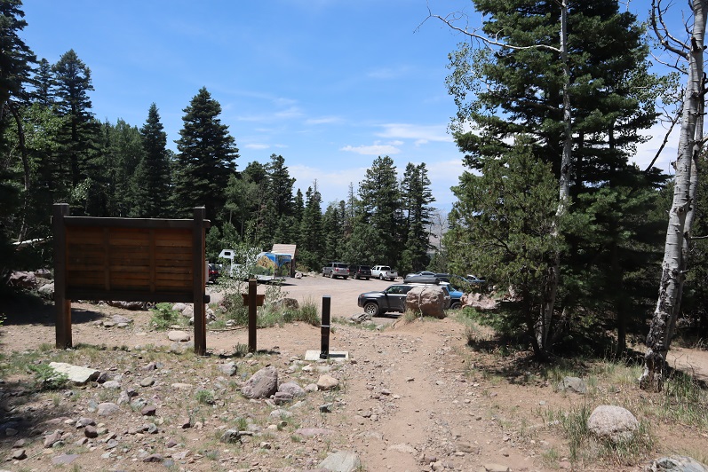
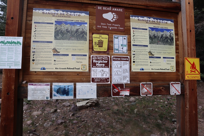
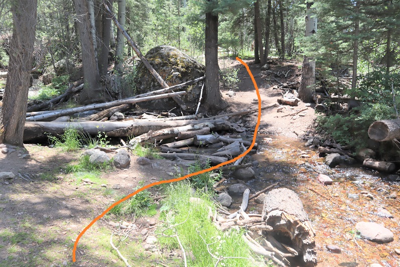
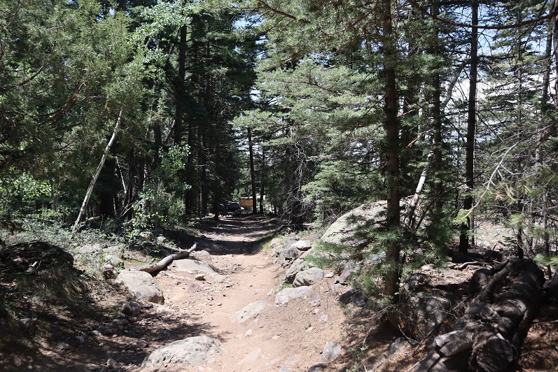
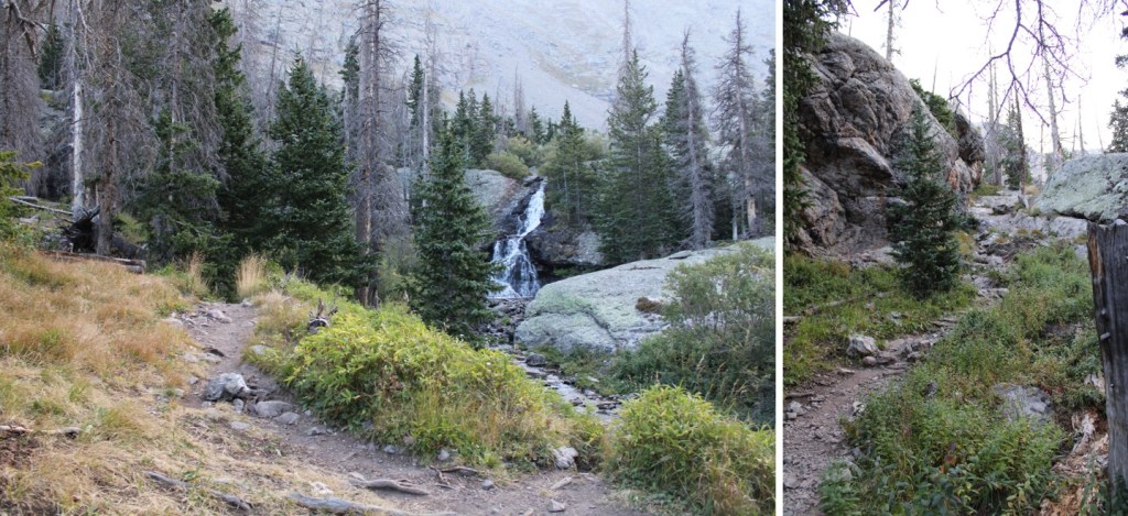
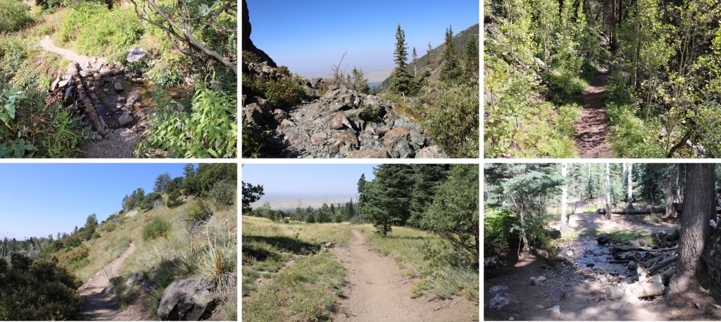
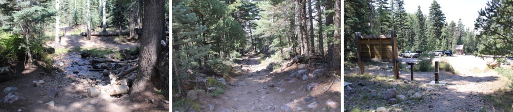
I’ve taken the Willow Lake trail several times, and I’m guessing if you’re doing this peak you have too, so I’m going to start this report from the camping area just before Willow Lake. If you’d like detailed instructions on the approach, click here 

I would also like to recommend pairing this up with other peaks in the area:  PT 13153, Mt Adams, PT 13580, etc.  This felt like a really easy day.

I was on the trail at 4:30am, surprised at how easy the approach was this time.  I attribute it to taking the week off from hiking to visit my son in Alaska, and in doing so, consuming about 10 times more calories than I normally would, thus giving me an excess of energy. 

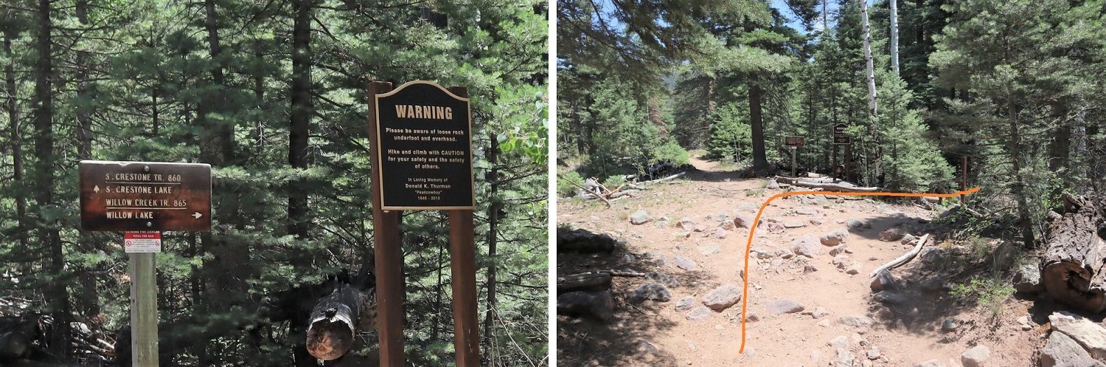
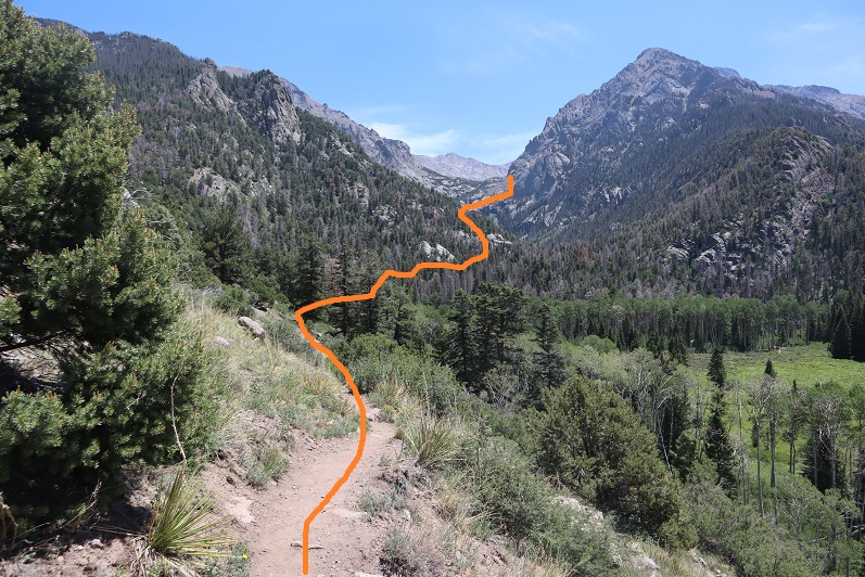
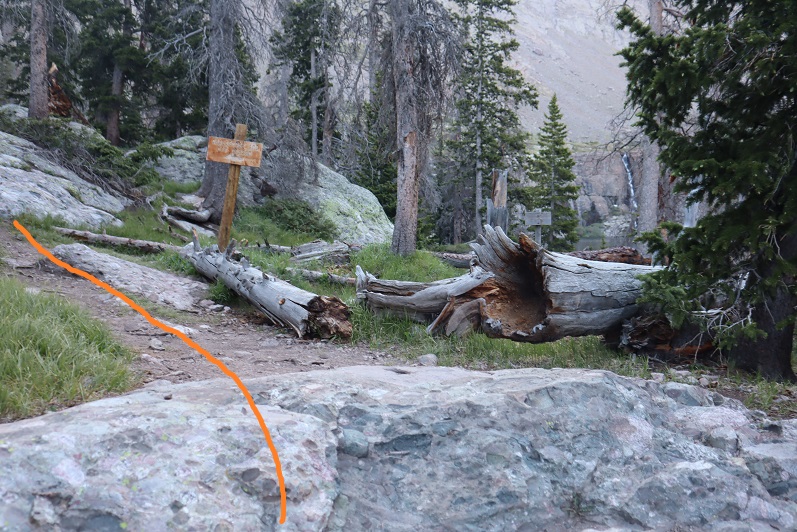
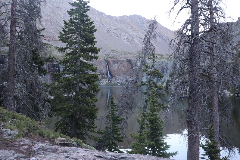
There are several spots to camp just before making it to Willow Lake, including one very large area at 11500’. There are still plenty of areas to hang bear bags already set up (for public use).  I continued to hike west. My tracker told me I’d hiked 5.3 miles to this point.  

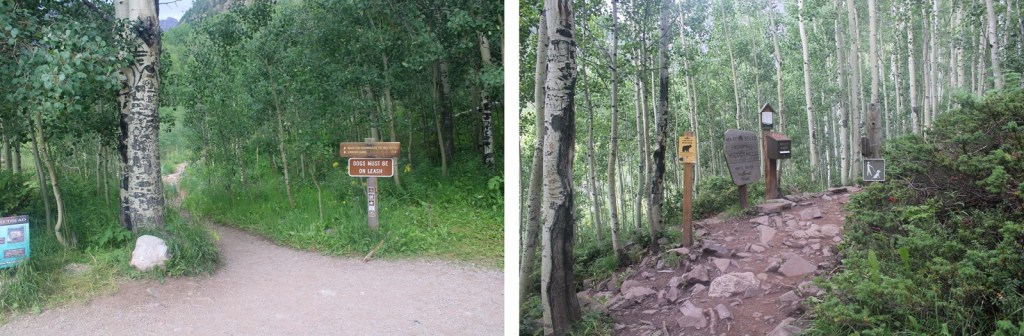
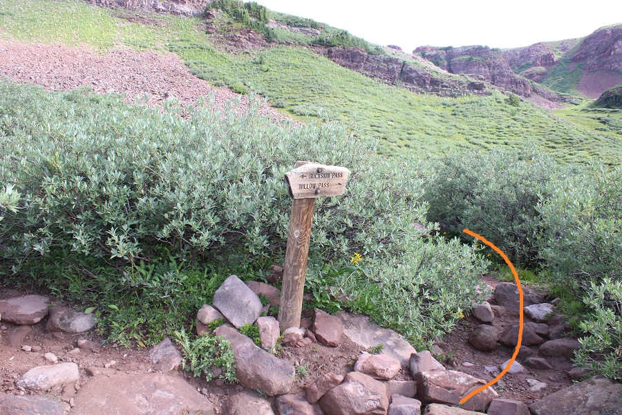
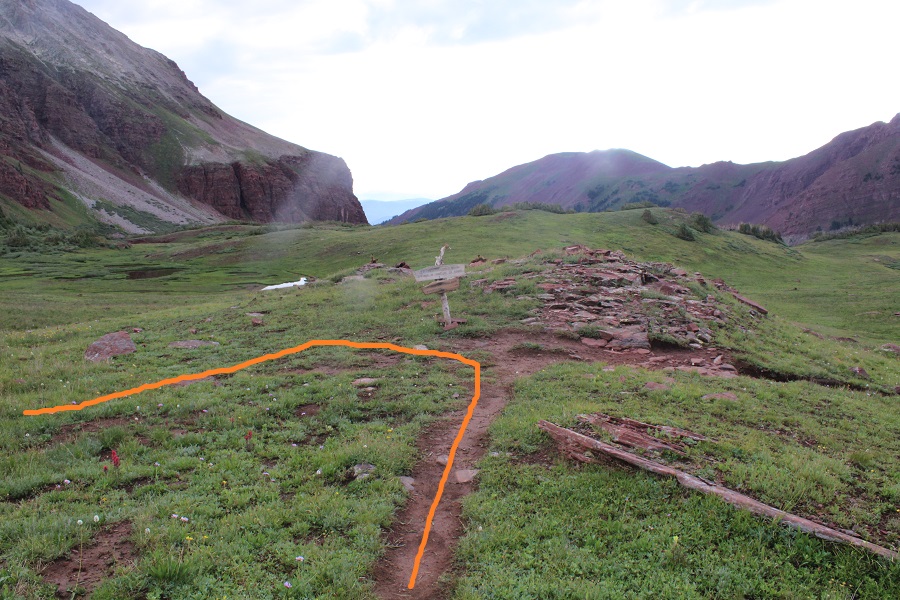
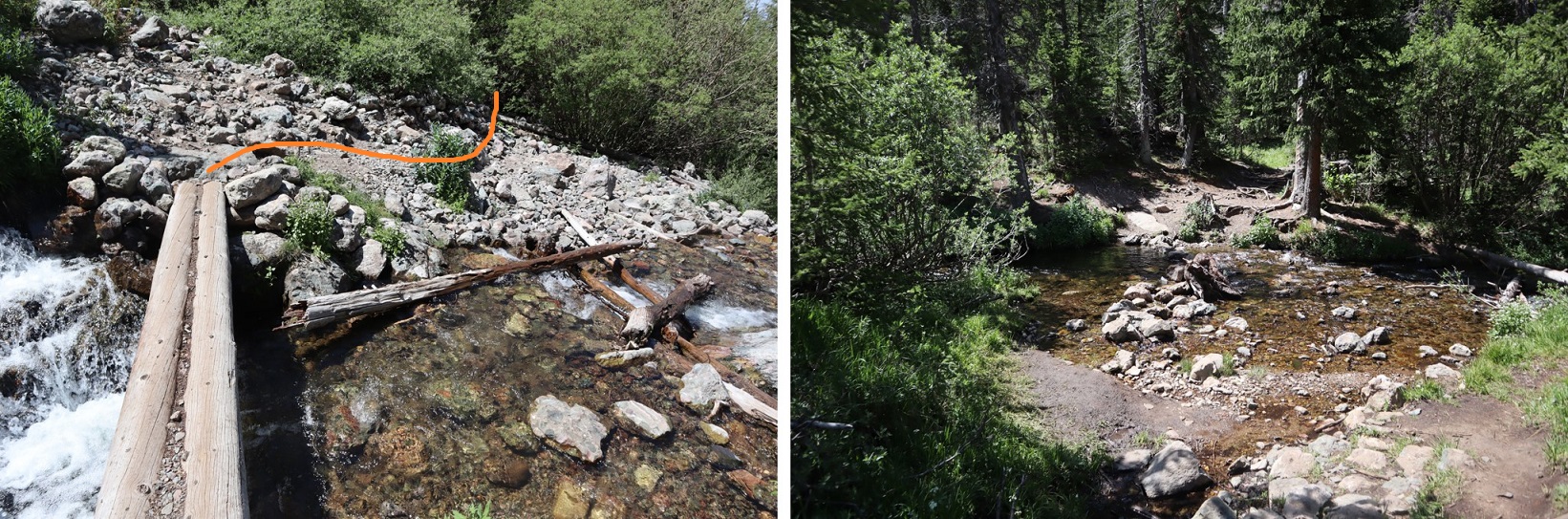
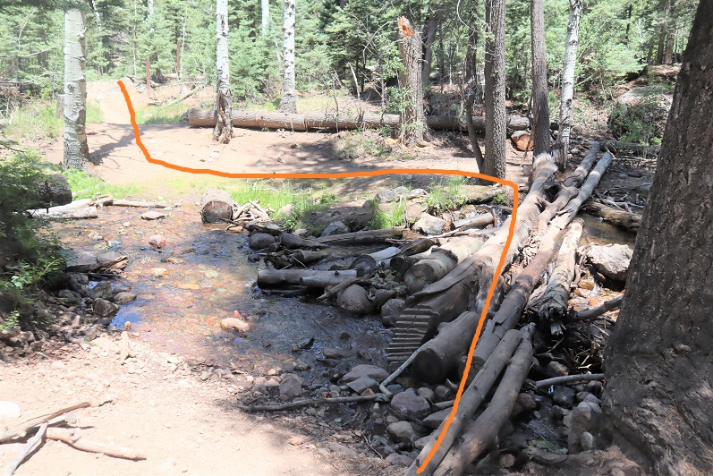
I followed the sign left that took me on the trail for Challenger/Kit Carson

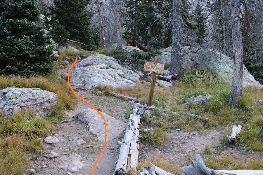
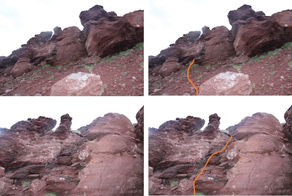
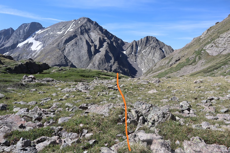
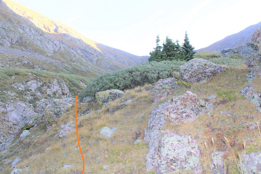
About 10 yards after this sign I left the trail and headed north up the hillside.  There are cairns here, but they may be difficult to see in the tall grass.

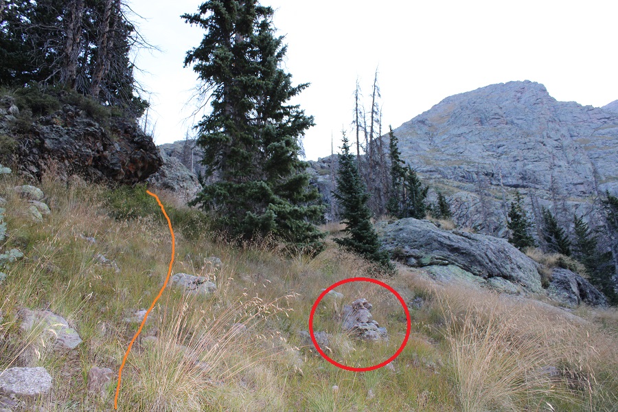
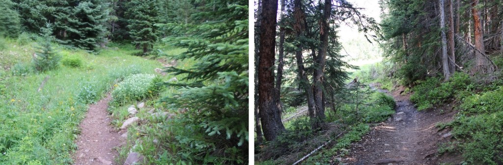
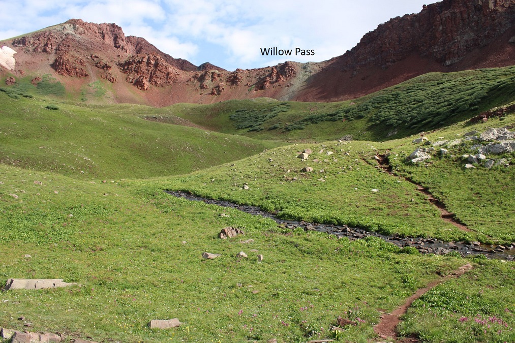
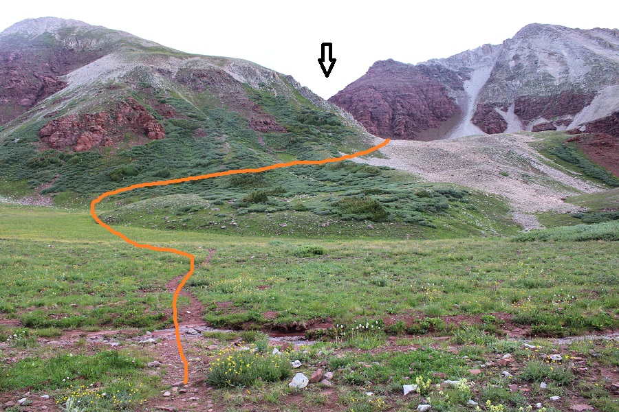
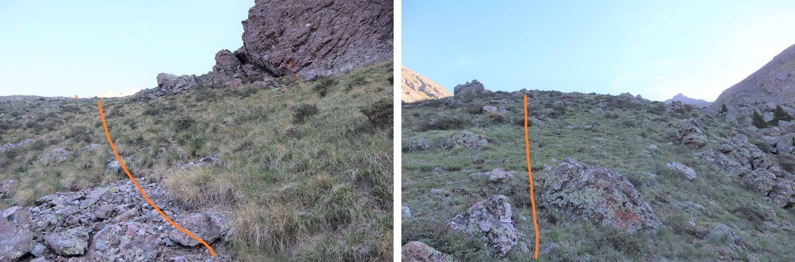
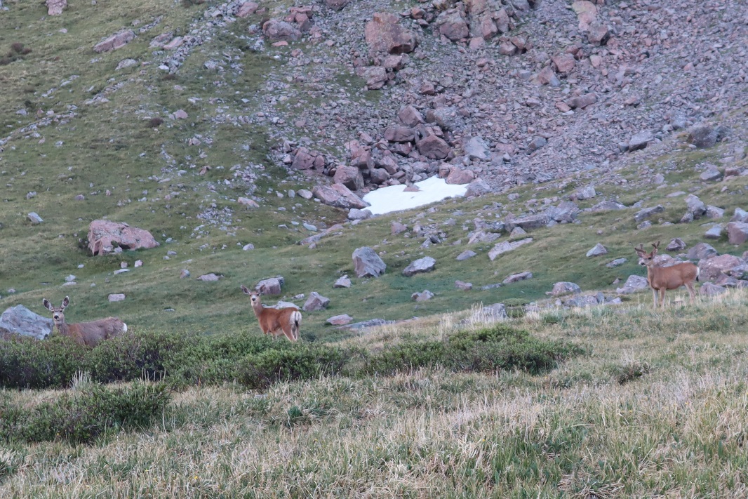
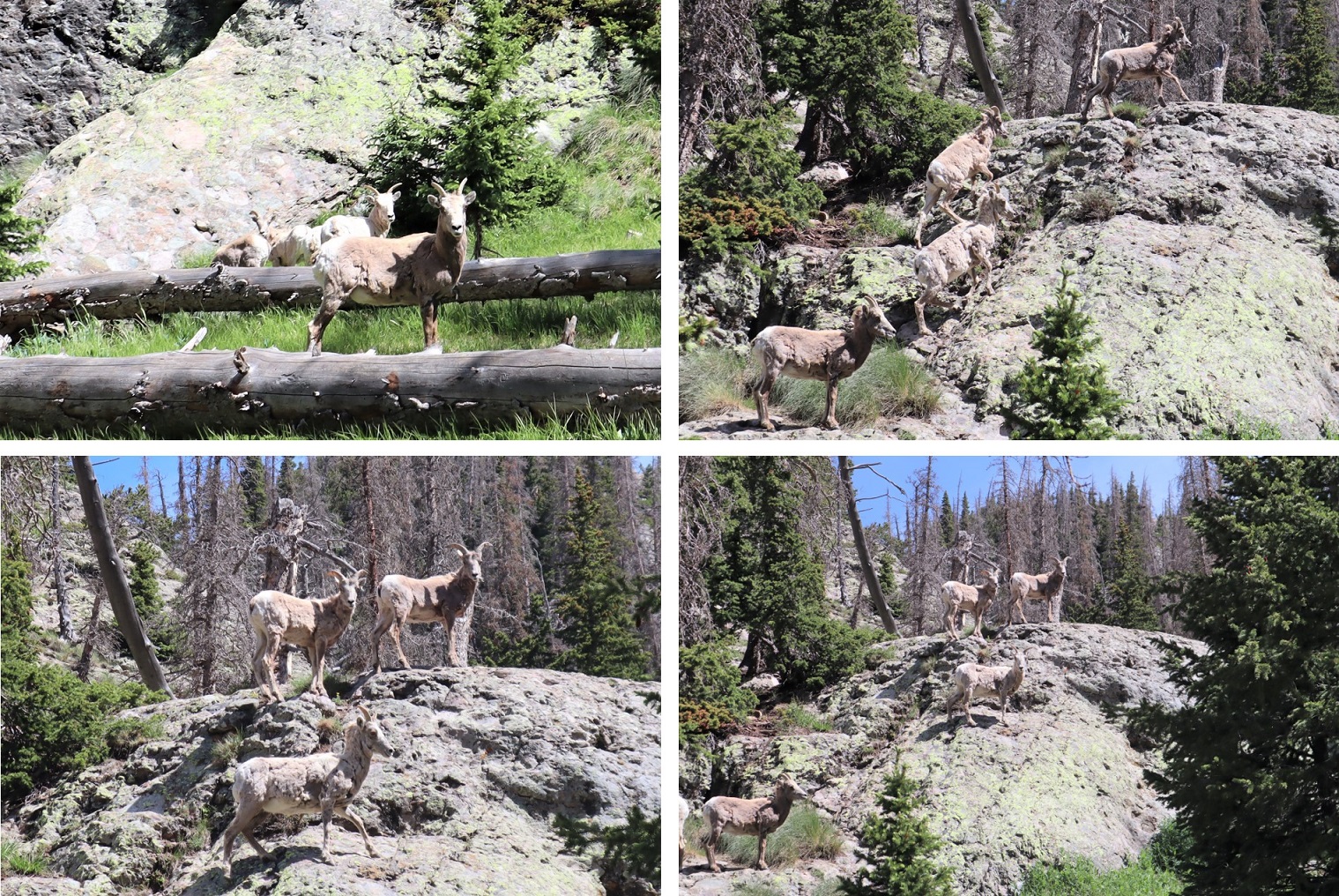
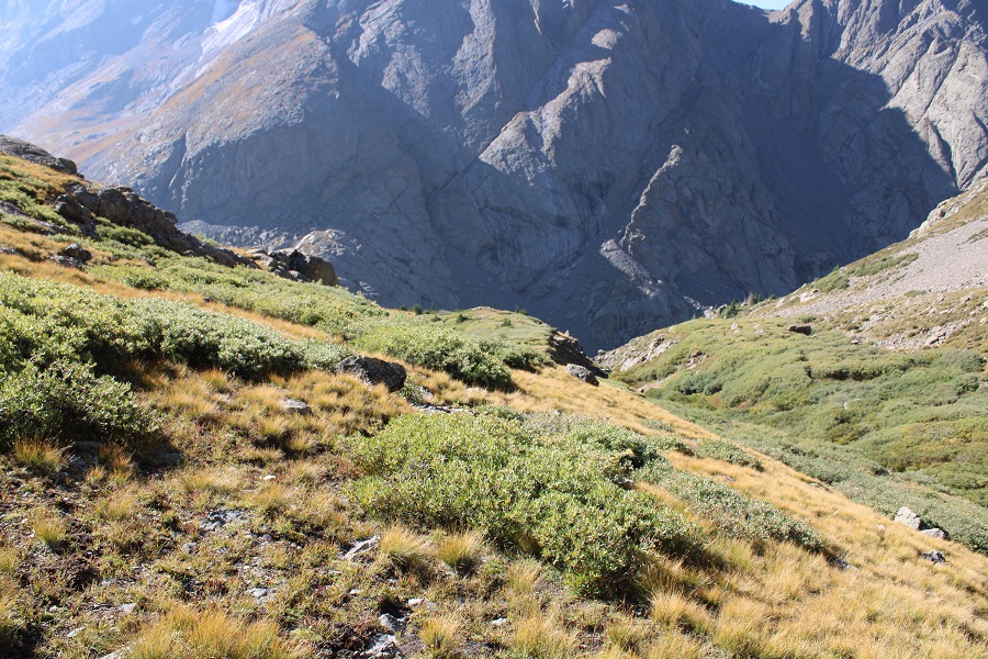
There are game trails here.  I saw tons of deer and bighorn sheep the last time I was here, and this time I saw a few deer.  Find a game trail and follow it north, keeping the creek to your left and rock outcropping to your right.

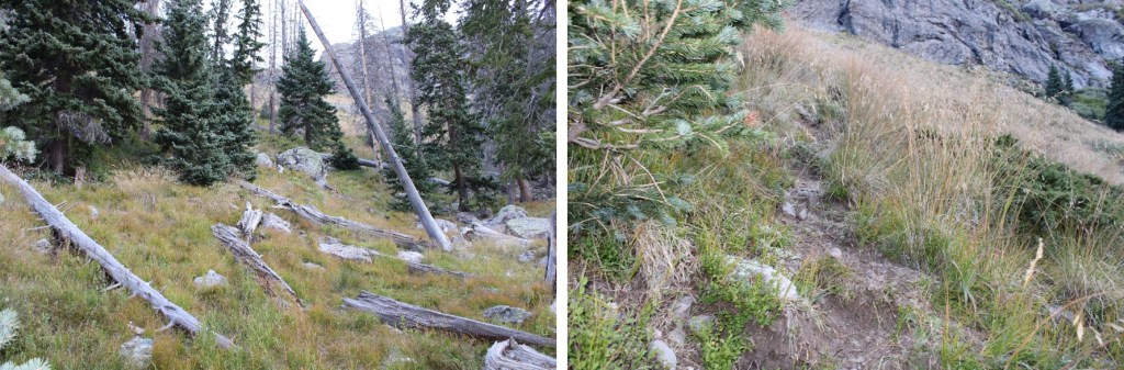
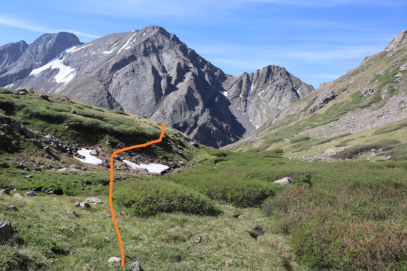
At the top of this hill there are cairns indicating you should go right, but if you do so, you’ll be going through a lot of willows. Instead, parallel the creek, staying to the right of the creek, and you can follow a game trail to the end of the basin, staying out of the willows, or at least keeping them to the easy ones that just reach your knees. Just keep heading north.

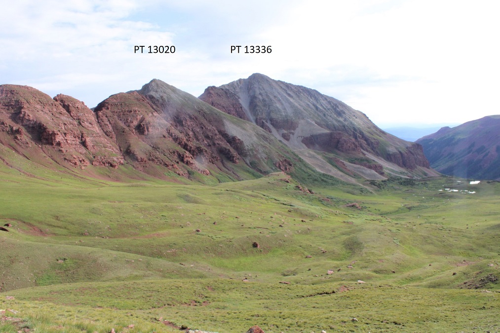
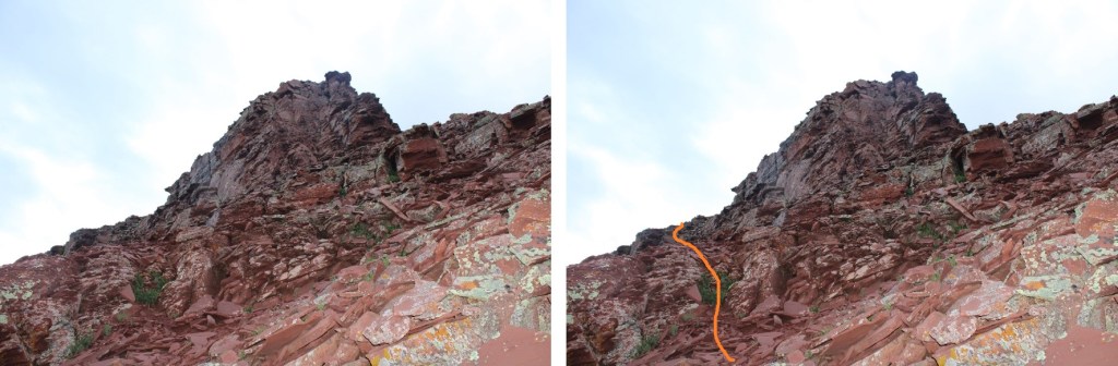
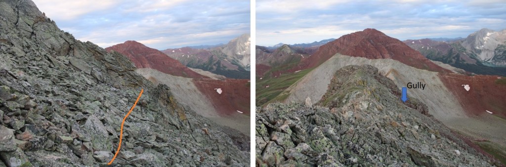
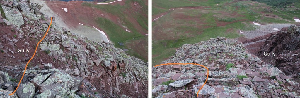
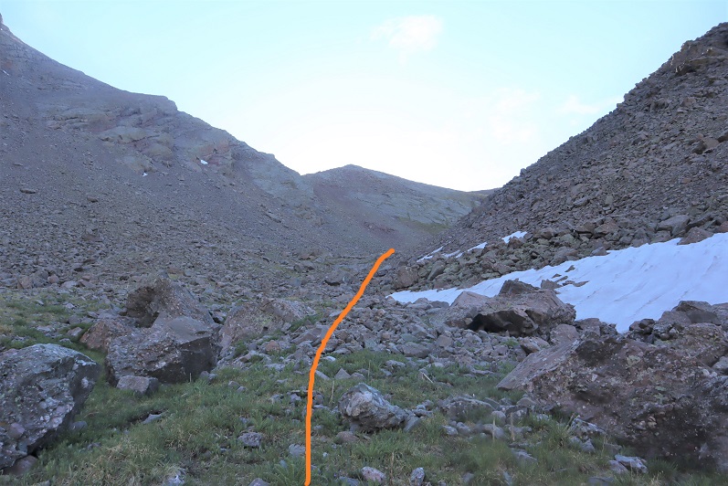
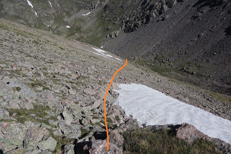
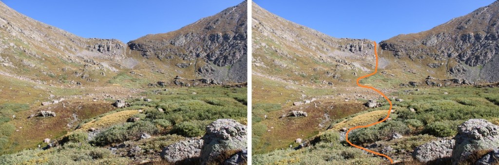
You’re aiming for this gully

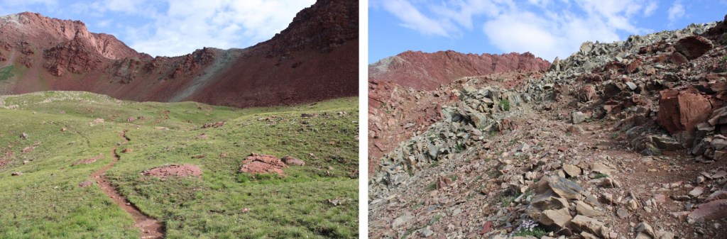
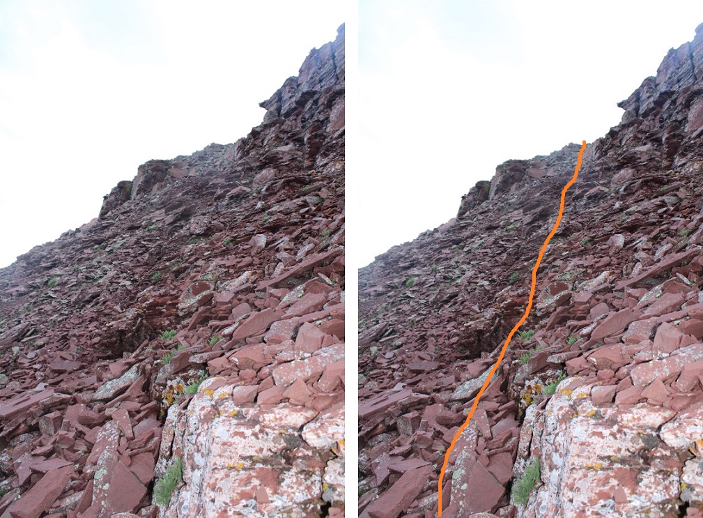
Here are some step-by-step photos (just keep heading north, this is class 2 terrain on tundra). First, stay to the right of the creek, and to the left of the willows

Then, continue north towards the gully.  I was easily able to cross a creek and avoid the willows.  I kept to the left of the willows and right of the creek the entire time.

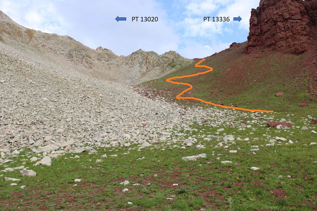
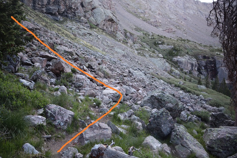
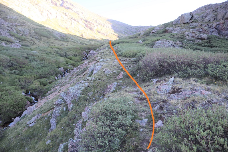
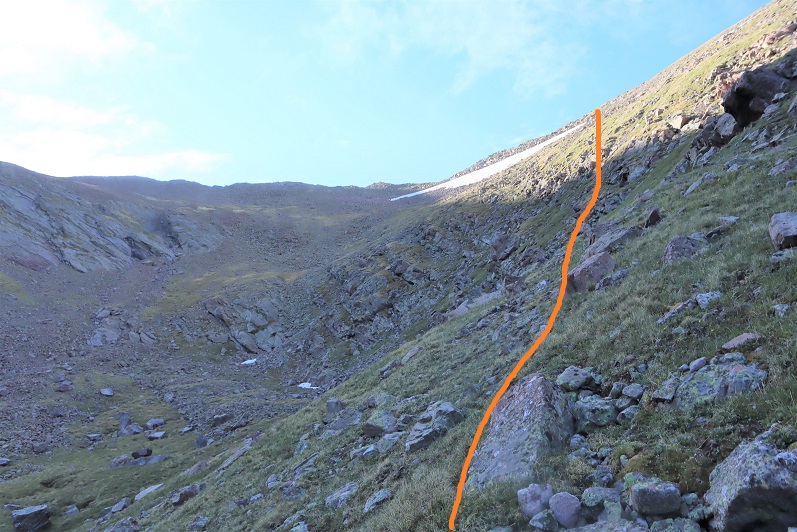
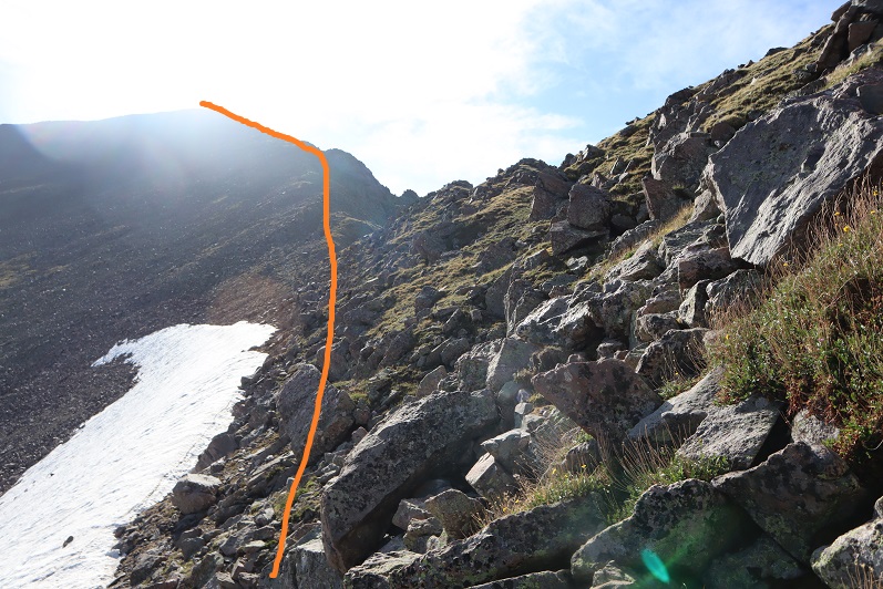
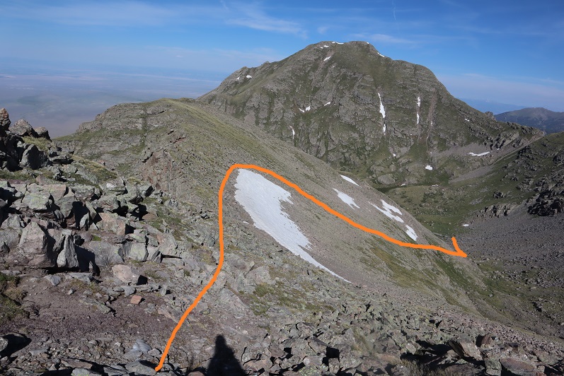
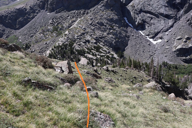
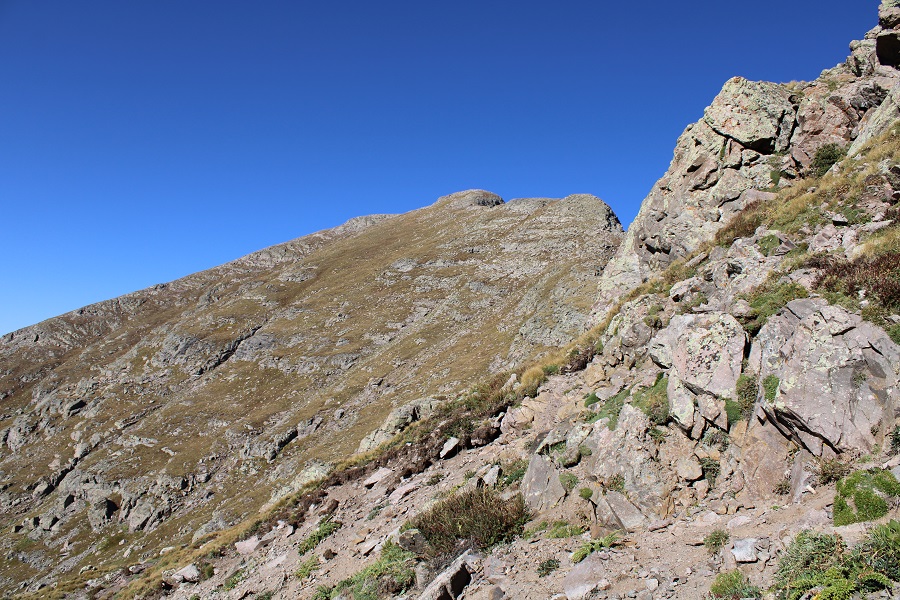
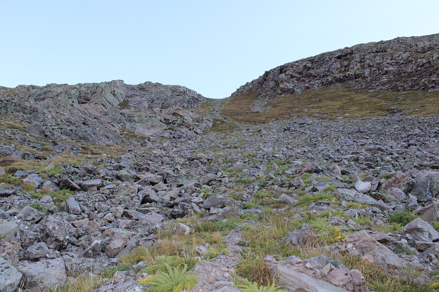
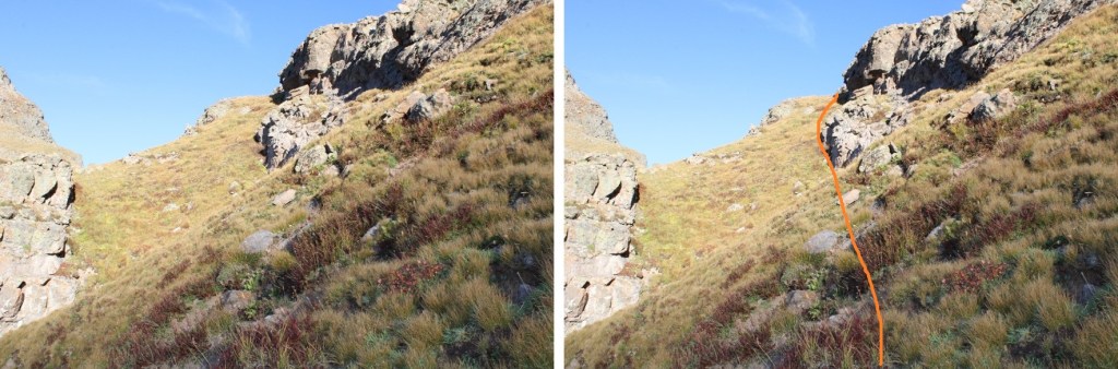
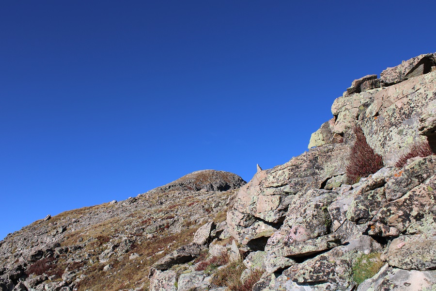
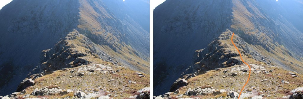
Next, I ascended the gully.  This was easy as far as gullies are concerned.  I was able to stay mostly on grassy areas.  Note, you do NOT need to ascend all the way to the top of the gully.  About 15 feet before topping out, take the grassy ramp to the left, staying below the rock outcropping of the ridge.

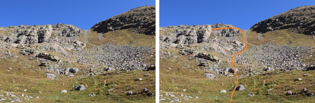
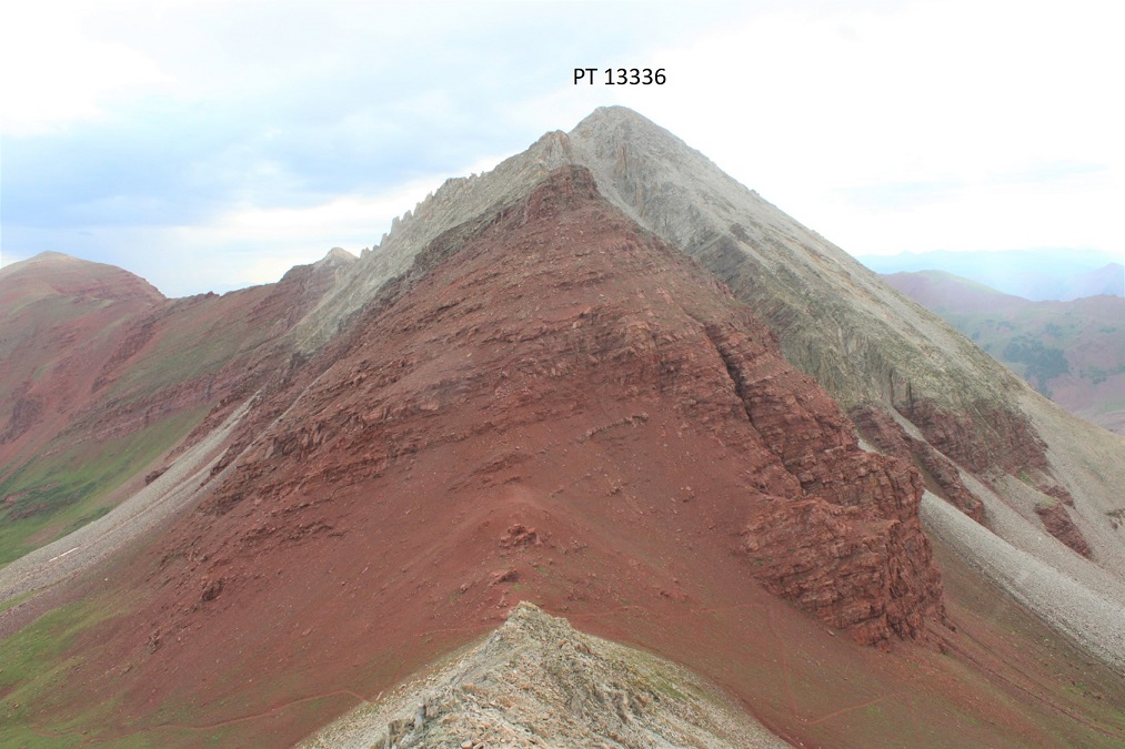
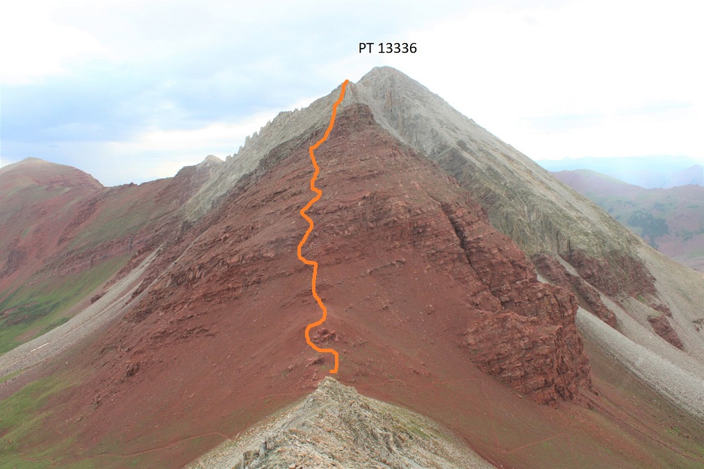
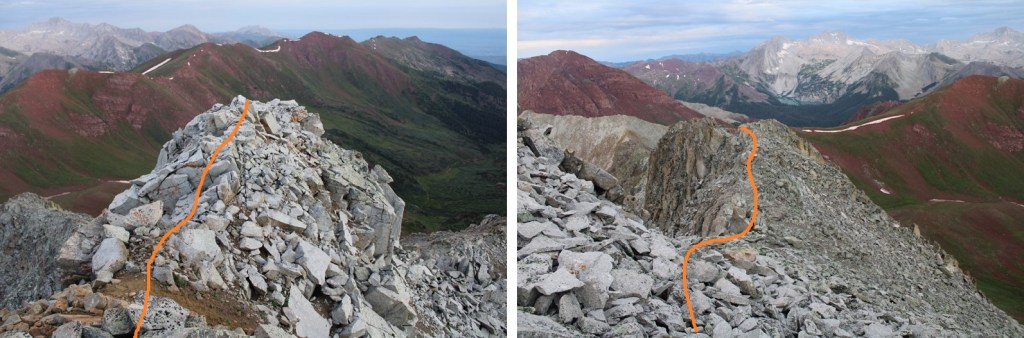
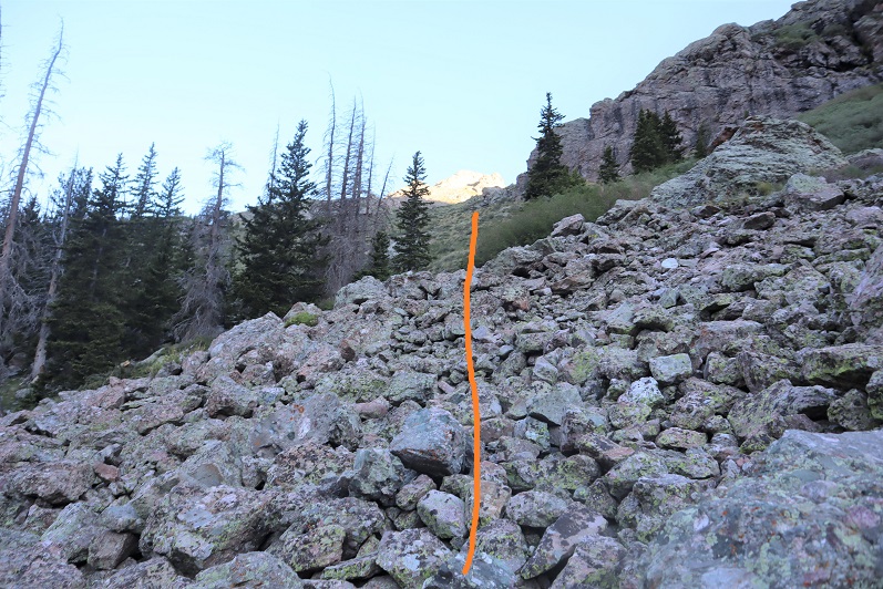
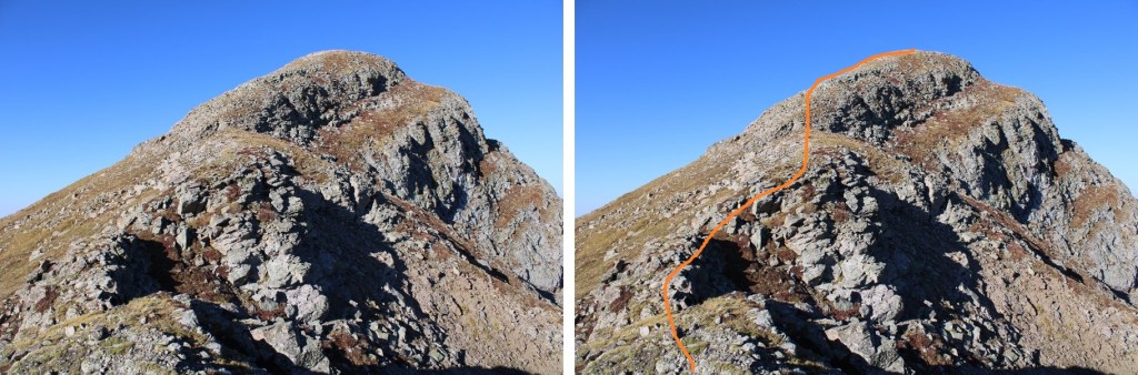
This grassy area is easy to follow. I just stuck below the rock.  Here’s an overview of the route to the summit.

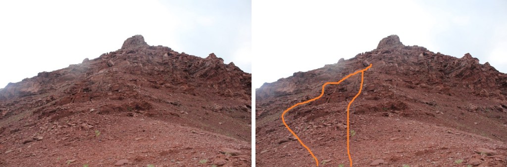
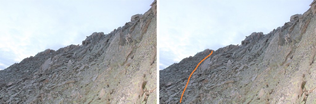
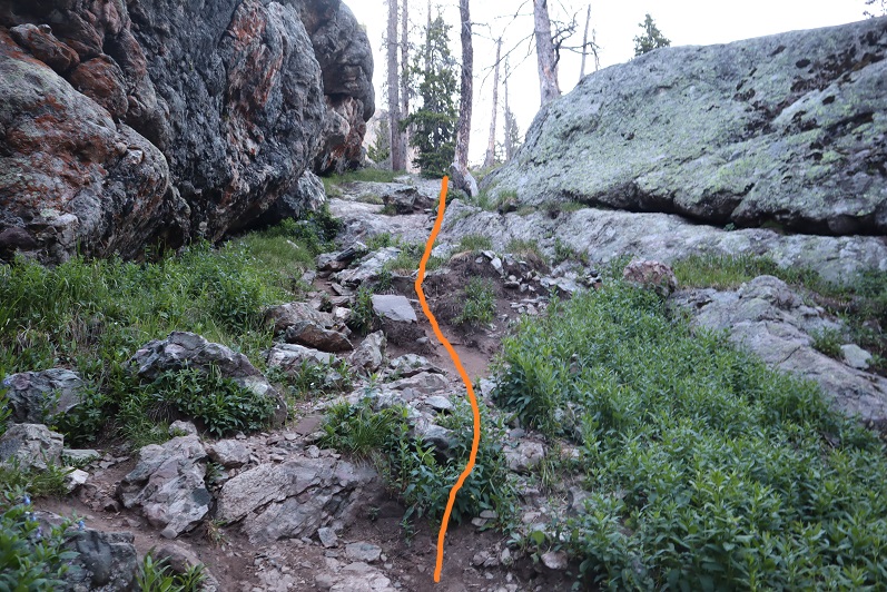
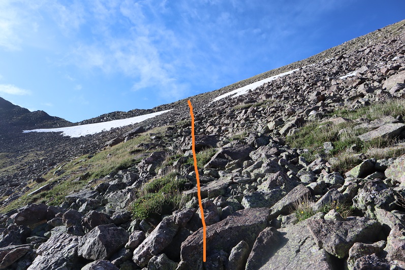
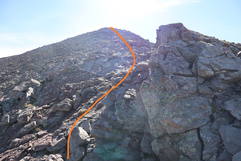
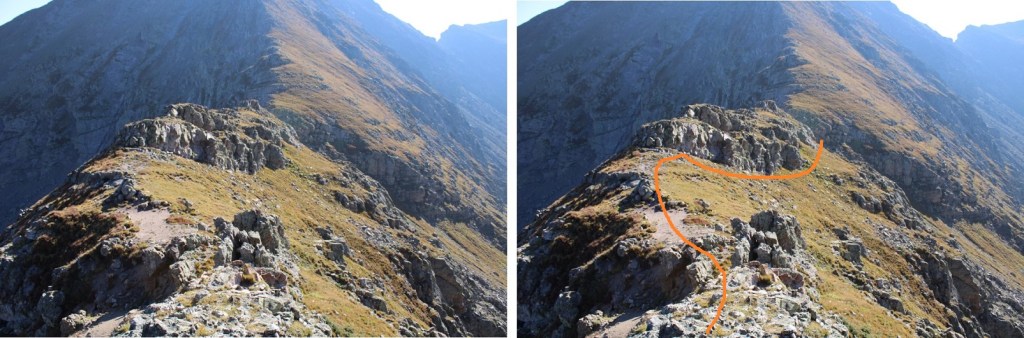
And step by step, first, following the ridge west

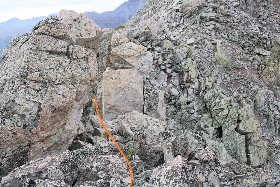
After the rocky ledge, I stayed on the ridge all the way to the summit.  Once again, all class 2, and you can stick to the ridge.

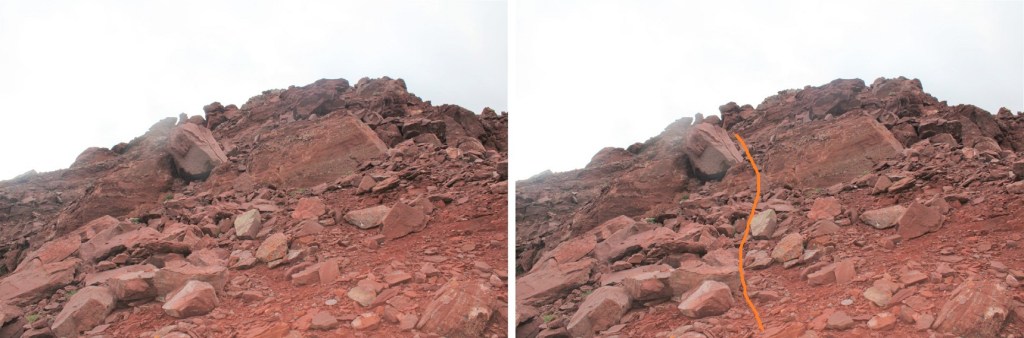
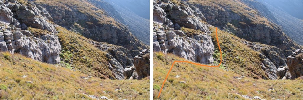
Yes, this stays at class 2 (it looks harder than it is)

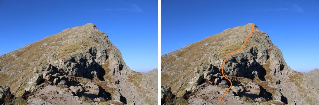
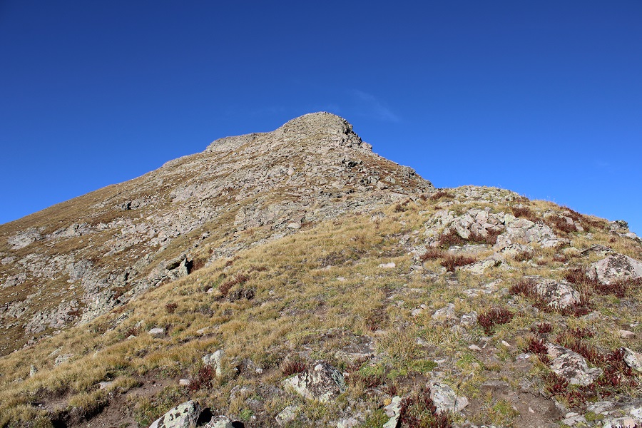
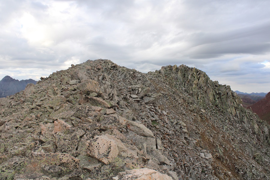
There’s a small false summit, and then it’s an easy trek to the peak

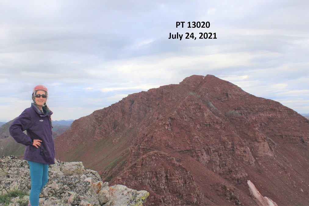
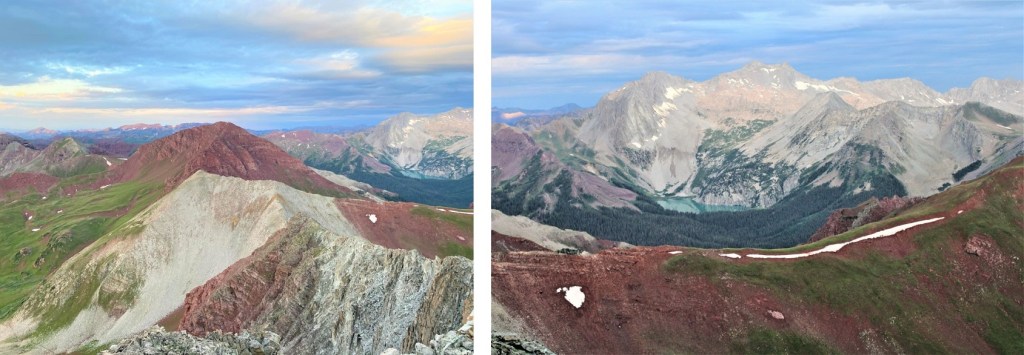
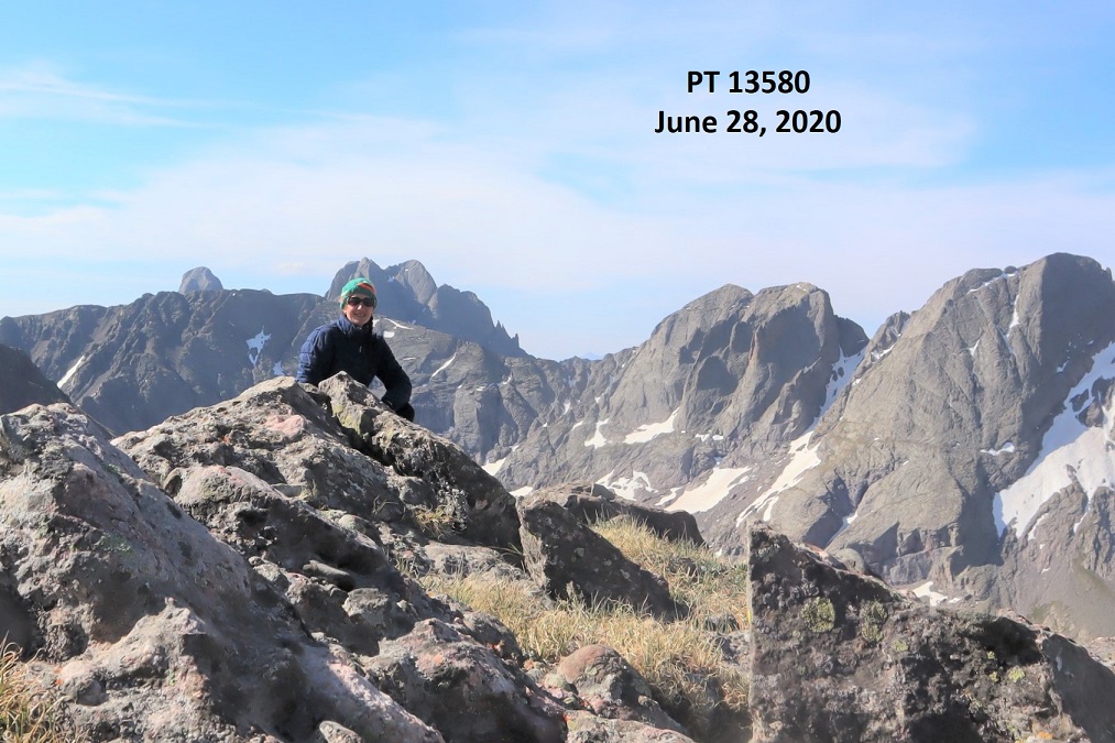
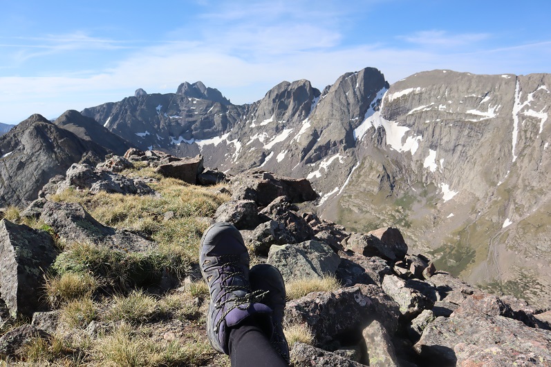
I summited PT 13546 at 8:30am
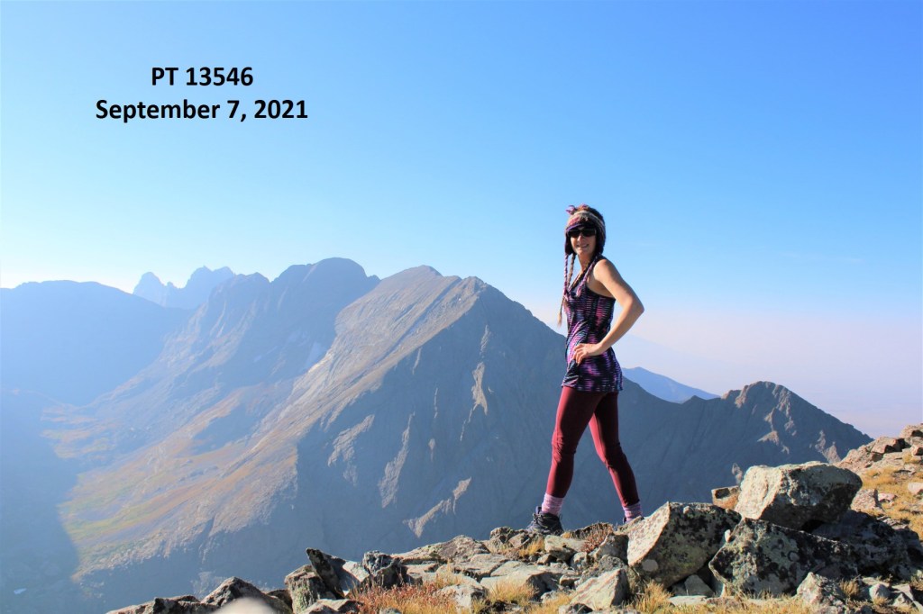
PT 13546: 

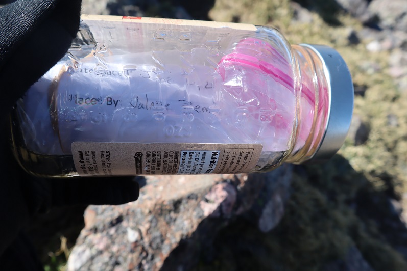
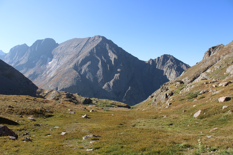
It was a hazy day. There was a summit register, but it was one of those pipe ones, so the paper inside was wet.  It was also completely full of signatures, so I left the paper in the tube and added another one. There was a nice view of the Crestones; I just wish it was a little less hazy today.

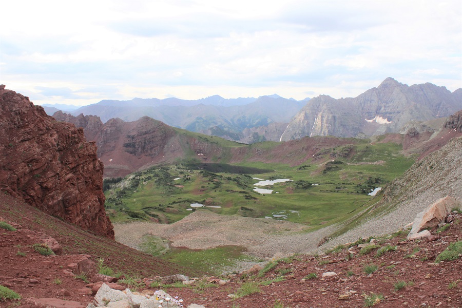
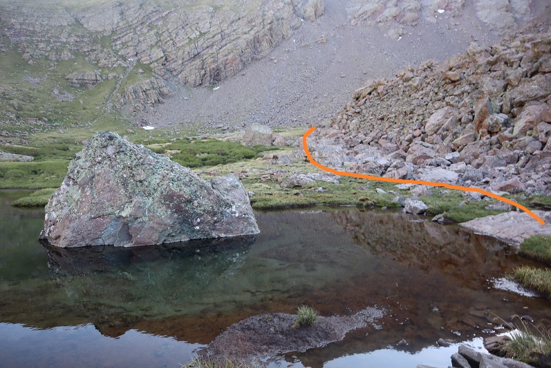
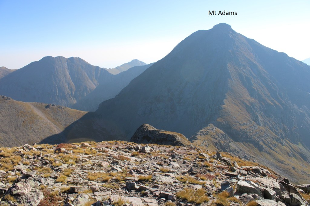
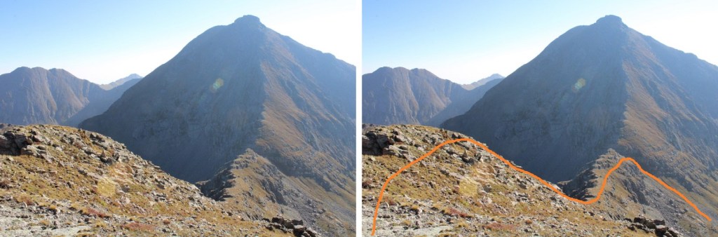
I turned and headed back the way I came in, aiming for the Adams/13546 saddle.  If you look closely, you can see a route to Mt Adams. I still had to get to work today, so I didn’t have time for Mt Adams (or PT 13153). Both look straightforward though from the saddle.

Here’s how I exited the ridge

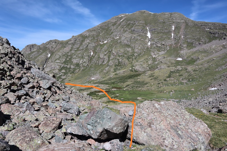
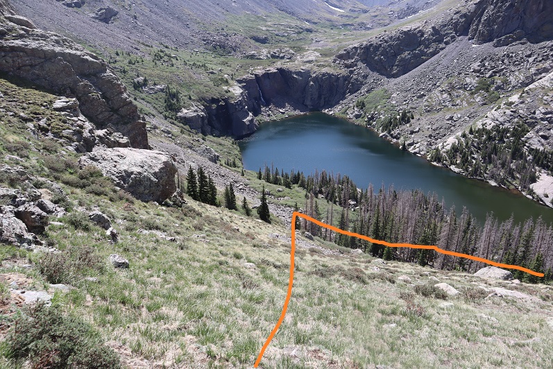
Once back on the saddle, I headed south out of the basin

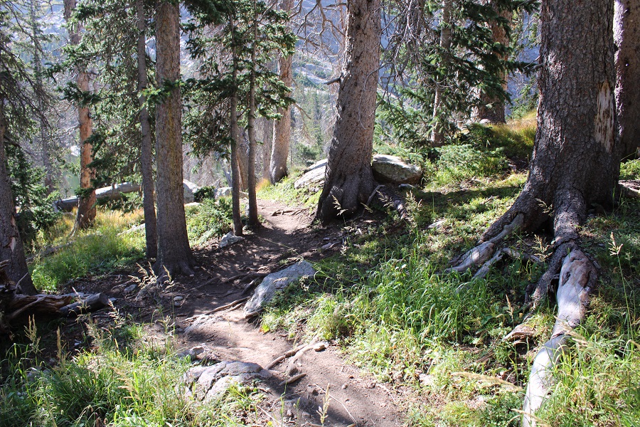
At the south end of the basin, I turned and followed the grassy ridge down (make sure you’re on the grass, not in the trees:  there will be game trails here)

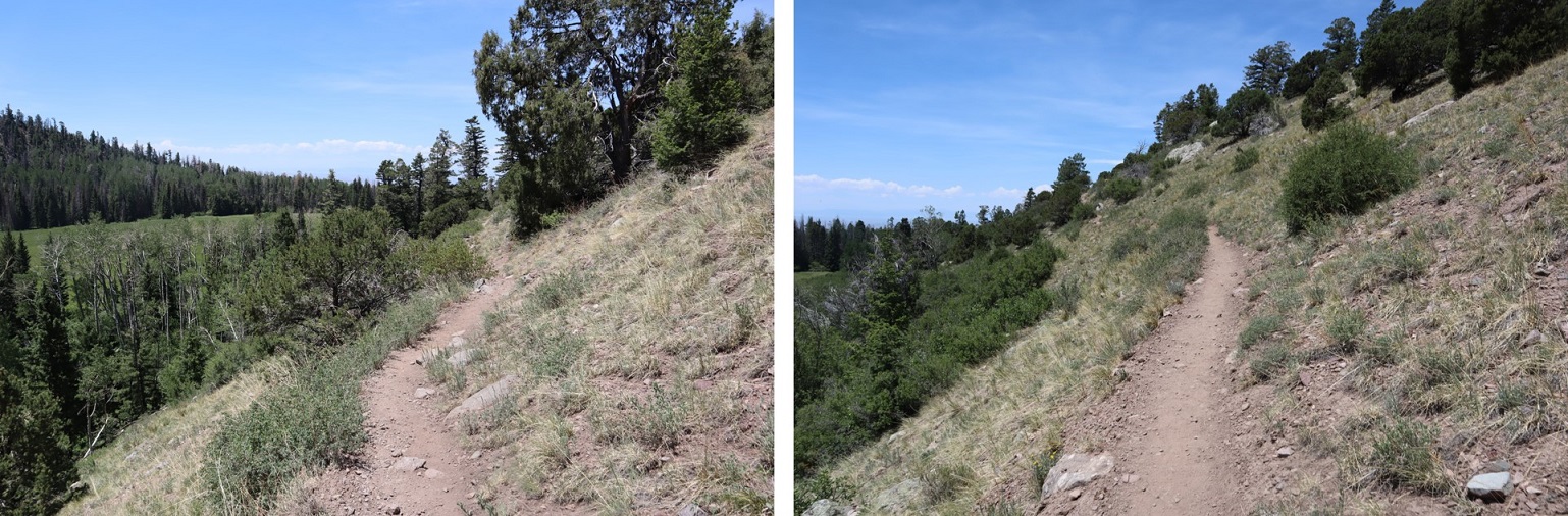
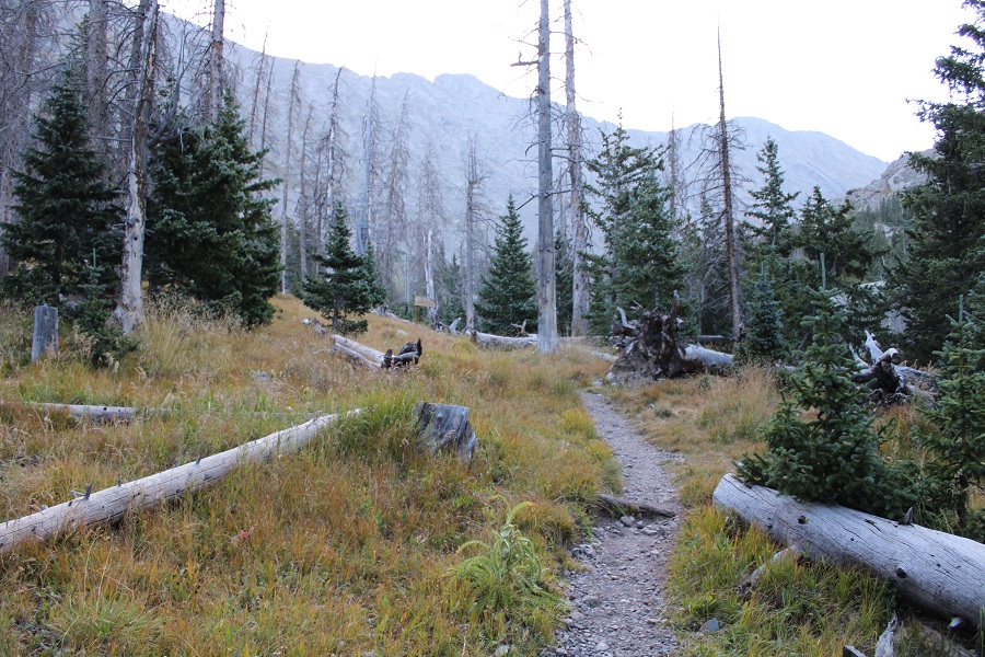
From the grassy area, the trail is easily visible.  I made it to the trail, and followed it west, back to the trailhead.

I made it back to my truck at 11:30am, making this a 14.15 mile hike with 5337’ of elevation gain in 7 hours.  While it was hazy today, it felt like a perfect day to be out! 

PT 13336 and PT 13015

RT Length:  16.3 miles

Elevation Gain:  5815’

I decided to hike these peaks from the Maroon Bells area because I had a pass and was already there.  I knew today was going to be a straightforward but long day, and it was supposed to storm in the morning, so I was up extra early and on the trail at 2am.  I started at the Maroon Lake trailhead, and passed a few deer grazing in the dark.   I skirted Maroon Lake to the right, and continued on the trail towards Crater Lake.

At the first junction I continued straight, and followed Maroon Snowmass Trail 1975 up into Minnehaha Gulch. 

I continued on this trail all the way to Willow Pass.

This is a class 1 trail that crosses a creek, then heads north through the basin.

Stay right at this sign

And follow the trail to Willow Pass.

CalTopo tells me I hiked 5 miles from the parking area to Willow Pass.  From Willow Pass you can see today’s peaks

From Willow Pass I descended 560’ into the basin

I came to the Junction for East Snowmass Trail/Willow Lake, and turned left, following the East Snowmass Trail.  

I was now following the trail towards the saddle of PT 13336 and PT 13020

The upper basin was really neat, as I could see two different types of rocks, one coming from each mountain.  The color contrast was interesting.  The trail was still class 1 to the saddle, staying on the tundra/red dirt.

Once at the saddle it’s a good idea to put your helmet on.  I decided to tackle PT 13336 first.  This is class 3, and takes place on loose rock.  You may want to put on your microspikes for added traction.  The red dirt was mushy because it had recently rained, but it was still loose.  Here’s the route I took, as seen from higher up on PT 13020 later in the morning:

And here are some step by step pictures of the route:

Easily walk around the first two obstacles to keep this part class 2

Next, you can either skirt the next obstacle to the left to keep this class 2, or go straight up and over if you like class 3

Now, keeping the ridge in front of you, the route becomes class 3.  Head between these two boulders and ease a little left

Look for a break in the rock formation and scramble up

You can now clearly see the ridge.  Keep the ridge to your right, and skirt the north side of the ridge.  There is no need to go up and over the ridge at this point.

The rock here is loose, and only gets looser. Follow the loose rock up a sort of side gully.

At the top of this rubble the rock changes.  It’s no longer the loose Maroon rock:  it now becomes the loose Snowmass rock.  This rock is very slippery when wet, and even when not, so take care.  These rocks are not stable.  Just assume they all move.  Cross this gully high.  There is still no need to gain the ridge, you can stay just a bit below

I have a feeling the terrain here shifts often, so pick your way carefully.  I traversed the ledge by staying about 50 feet below the ridge, and then gaining the ridge through a gully

At the top of the ridge you can see the true summit of PT 13336.  The terrain stays just as loose as before.

I summited PT 13336 at 6:10am

PT 13336: 

Here are some pictures of the way back to the saddle

Across the gully

And down the maroon scree

From here you can see the summit of PT 13020 and Buckskin Benchmark

It was a simple ridge hike, with just a few fun moves to the summit of PT 13020.  Here’s the overall route

And some step by step pictures. To gain the upper ridge, I skirted the rock formations to the left, but still stayed as close to the ridge as possible.

Once on the upper ridge I followed it to the summit of PT 13020, only dipping down to the left once through a gap in the rocks to keep this class 2

I summited PT 13020 at 7:20am. 

PT 13020:  

It was starting to rain, so I headed back down the ridge to the saddle.

Once at the saddle, I followed the class 1 trail back to Willow Pass

There was a large family of marmots at the Willow Lake/East Snowmass/Willow Pass Junction.  As I approached, several jumped underneath the grass, not wanting to be photographed.  I turned and headed southwest towards Willow Pass

And from Willow Pass I followed the trail back to the Maroon Lake Trailhead

I made it back to the trailhead at 10:45am, making this a 16.3 mile hike with 5815’ of elevation gain in 9 hours, 45 minutes

And, just because I have room for one more picture, can we all take a minute to appreciate jut how beautiful this area is?

PT 13580

1

RT Length: 13.38 miles

Elevation Gain: 4934’


I chose this peak for today because it was the closest one on my list of unfinished bicentennials to Cielo Vista Ranch, where I’d just spent the morning hiking. I drove to the Willow Creek Trailhead and backed into the only available parking space. Vehicles were parked and double parked in each space, as well as several hundred feet down the road on the drive in. This is a popular trailhead and it was a Saturday afternoon.

It was raining a bit as I got out and looked around. There is an open and stocked bathroom here, and lots of signage.

2

3

I opened the trail register container and was disappointed to find another full register. Every page was so full people were just writing in the margins of past pages. This one is from 2019. There were probably 7 pages total, which could probably get filled up here in a week. How are these useful when they aren’t kept up to date? Signing these seems useless.

4

I went back to my truck and got my stuff ready for the hike tomorrow. I didn’t have a flashlight so I decided to use my phone’s flashlight app. That meant conserving battery, so I put it in airplane mode. Then I people watched. There was a man hiking with a small dog in a basket, a group of about 20 high school aged backpackers returning from what looked like their first outdoor experience, and two men hiking in to Willow Lake to summit Challenger and Kit Carson tomorrow. I spent a good 30 minutes watching a man trying to turn his pulled trailer around in the parking lot. He must’ve been looking for a dispersed camping spot and wasn’t able to find one before the trailhead. Turning his rig around in the parking lot of the Willow Lake trailhead was his only option, and it took dozens of attempts. His rig was loud and he set off several car alarms in the process. It was all quite entertaining.

When the mosquitoes came out I decided to call it a night and went to bed early. I woke up at 2:30am, decided I was way too comfortable, and went back to sleep. The only bad thing about having a bed in the back of my truck is I don’t seem to want to get up in the mornings. I was on the trail by 4am.

The trail starts at the east end of the parking lot and almost immediately comes to a junction. I turned right here, crossed a creek, and continued on a sandy trail.

5

6

7

During the first mile of this hike, as I was hiking in the dark, I kept hearing chirping. It sounded like one of those bird boxes that’s put in the middle of nowhere to monitor birds and chirps every few seconds was out there somewhere, and broken. It wasn’t chirping on my way back, so it either ran out of battery or was an actual bird going crazy at 4am. The Willow Creek Trail is a class 1 trail that switchbacks all the way up to Willow Lake. Here’s an overview

8

And some pictures of the trail

9

There are a couple of streams to cross, each with bridges/rocks

10

Before making it to the lake there’s a camping area. Someone has set up communal bear bag hanging areas, which I think was a brilliant idea. What’s even better is people actually seem to be using them. I saw two such areas, but there may be more.

11

After the camping area it’s a short distance to Willow Lake. I went up this rocky area

12

And was greeted by this sign and the lake. I turned left at the sign

13

I made it to Willow Lake after 5 miles of hiking

14

I continued following the trail until just before the boulder field. At this point I left the trail, turned left and continued north/north west up the hillside

15

16

17

There is no trail, but the route is easy to follow, as after I gained this small ridge I kept the creek to my left and willows to my right and continued north up to the basin.

18

It’s important to try to stay as much in the center here as possible, as to the right there are willows and shallow ponds to contend with. (I made this mistake on my way in, but was able to avoid it on my way out. I scared several deer out from willows in the process.). At the end of the basin you turn right and head east

19

20

This area was a bit mushy, so I went to the right around this rock/water to avoid getting wet, and then entered another basin

21

There were a lot of friendly deer here who didn’t seem to mind my hiking past them. I gave them room, but they let me get within 20 feet of them with no problem.

22

I headed east into the second basin, which was full of large rocks

23

There are a lot of ways to summit this point. I decided to gain the ridge and follow it to the summit of PT 13580

24

25

26

Once on the ridge it was an easy hike to the summit. The only problem was the sun was rising directly in front of me as I was hiking and I couldn’t see anything due to the glare. These pictures are from the way back down. While hiking up this ridge I heard someone from over on the Kit Carson/Challenger side yell “rock!” every couple of minutes. It’s amazing how sound carries out here.

27

28

I summited PT 13580 at 8:45am, after 6.8 miles of hiking

29

13580:

There was a summit cairn at the top, as well as a summit register. I didn’t open it, but I could read through the glass it was recently placed there (6/20/2020?)

30

It was a beautiful day and I stayed for a long time on the summit, enjoying the views

31

When it was time to go I retraced my steps back down the ridge into the basin. Here’s an overview, with Willow Lake to the south

32

And step by step…

33

34

Staying higher and dryer this time in the lower basin

35

36

It was easier this time to avoid both the willows and the creek

37

38

Once Willow Lake was in view it was easy to make my way back down to the trail

39

There are some beautiful waterfalls here

40

I made it to the camping area and was startled to see bighorn sheep just off the trail. The camping area was full of tents but the hikers were all out hiking. It seems while everyone is out hiking for the day the sheep came to play. They posed for me while I took a few pictures. Yes, they were a little unkempt, but friendly enough.

41

Here are some shots of the class 1 trail back down to the trailhead

42

43

44

45

I made it back to my truck at 12:30pm, making this a 13.38 mile hike with 4934’ of elevation gain in 8.5 hours.   Here’s a topo map of my route. Oh, and just for reference, using my iPhone’s flashlight took up 66% of it’s battery in 2 hours (while on airplane mode).

46

I drove back home, cleaned up, and noticed I was full of mosquito bites. Curiously, they were only on the left side of my body.