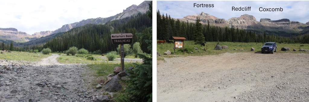
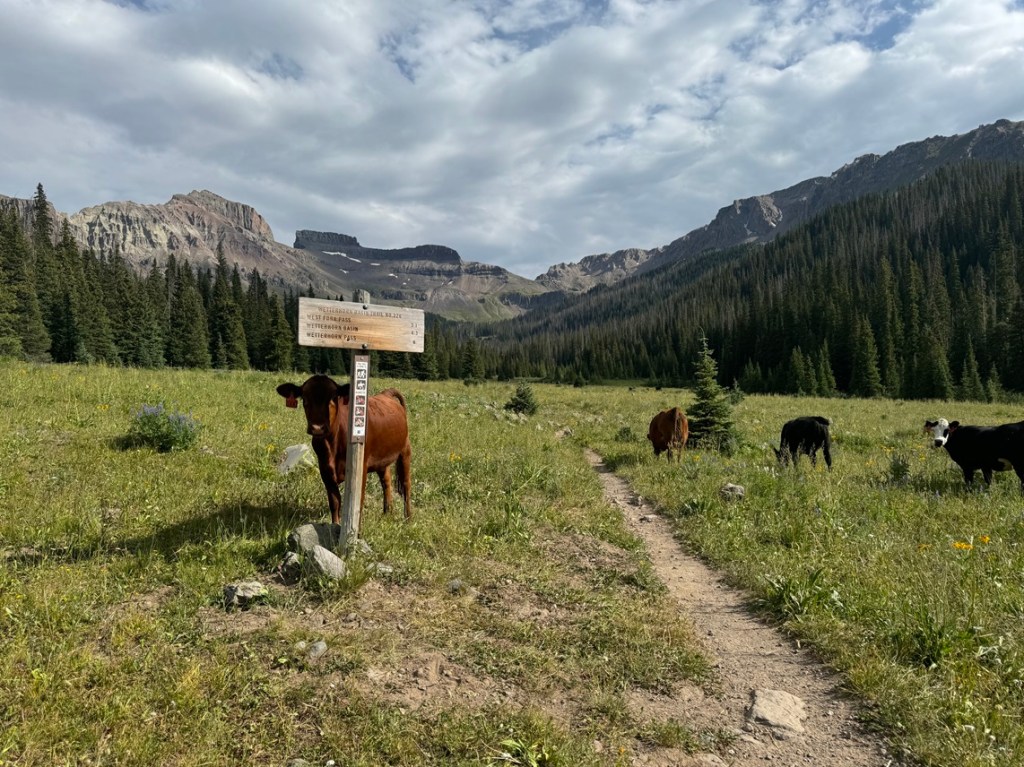
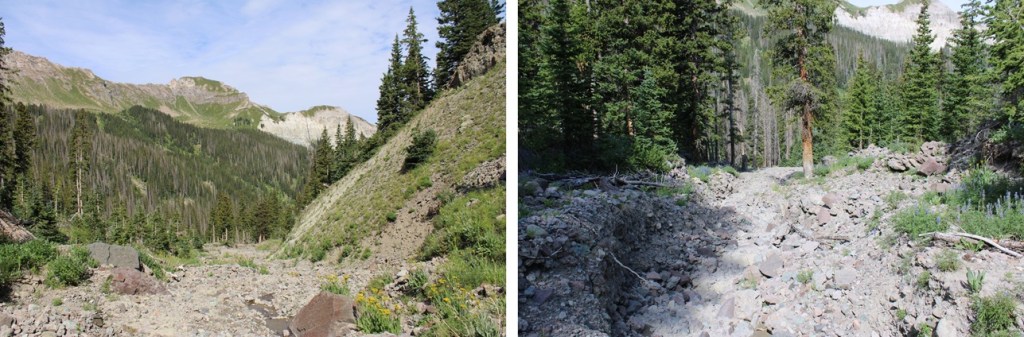
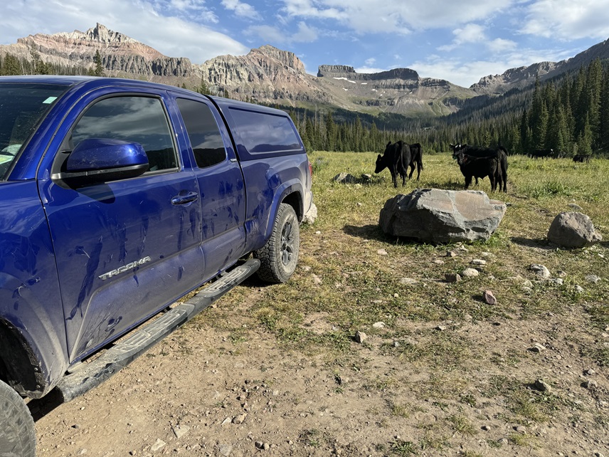
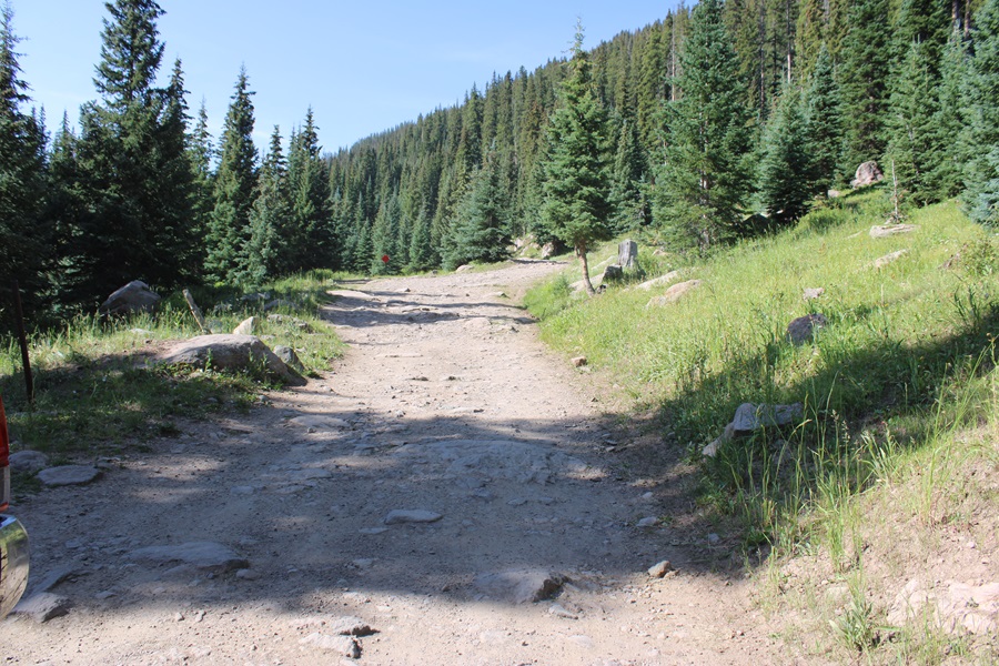
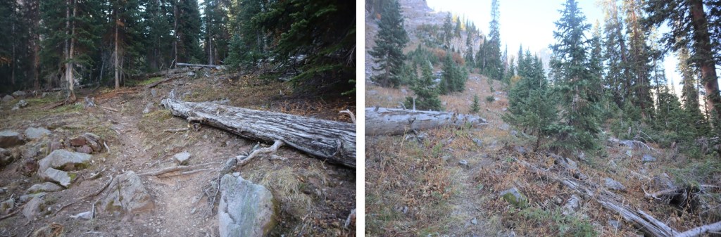
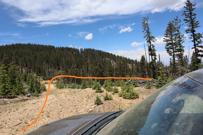
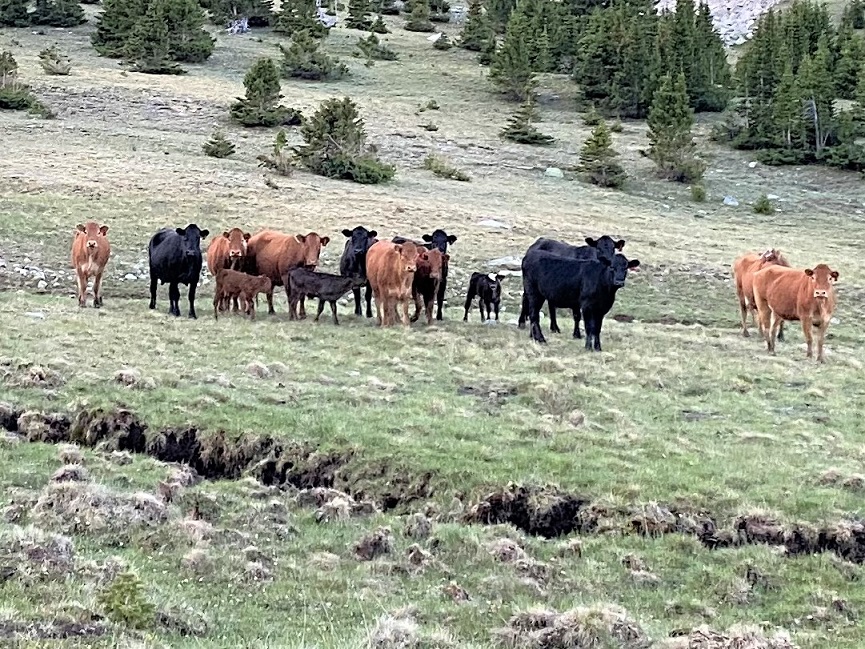
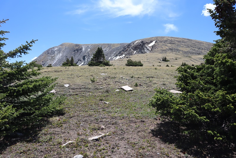
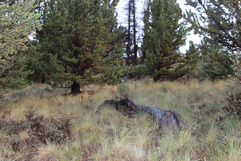
I parked at the Wetterhorn Basin Trailhead, and was greeted to a herd of cows. They were all over the basin, and would be my companions for the next few days. They had a penchant for licking my truck. The drive in is 2WD on a dirt road until 2 miles before the trailhead, where it becomes 4WD and requires clearance. None of these pictures are as clear as I’d like. The fires weren’t helping in the morning, and the sun wasn’t helping with shadows in the early afternoon. I know not to head east early in the morning, but I did it anyway. Sorry!
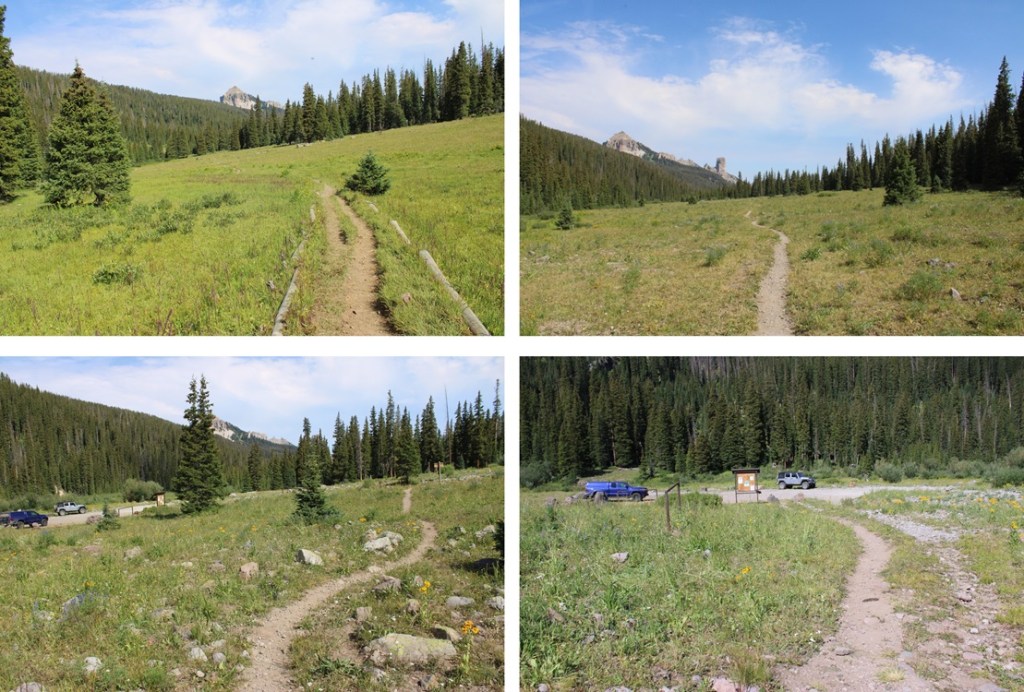
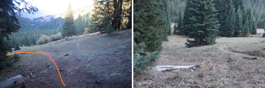
I was on the trail at 6am, following Wetterhorn Basin Trail No 226 south for just under 1.5 miles.
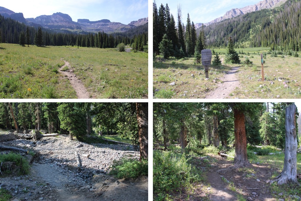
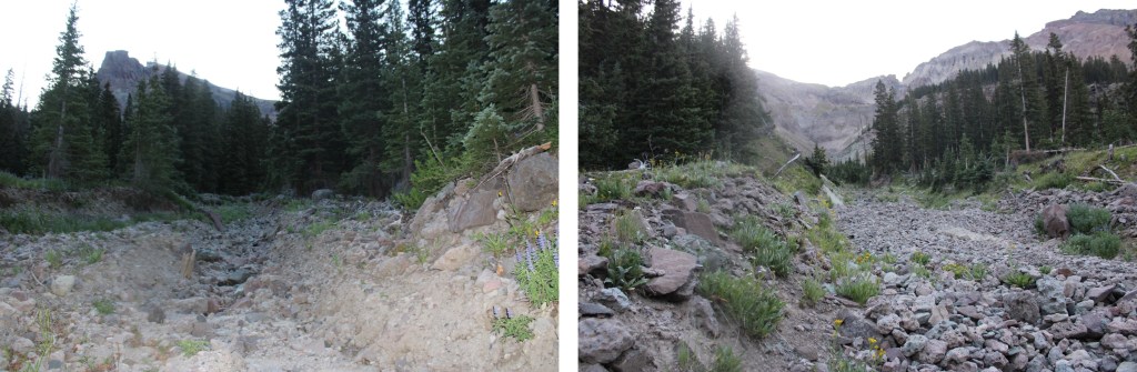
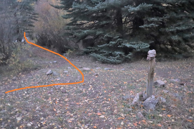
After hiking for 1.4 miles, and at around 11050’, I came to a drainage, and followed it east
I came to an obvious “y” in the drainage, and went left, still following a drainage.
The drainage became narrower, so now I hiked to the left, trying to stay on tundra, but mostly staying on rocks
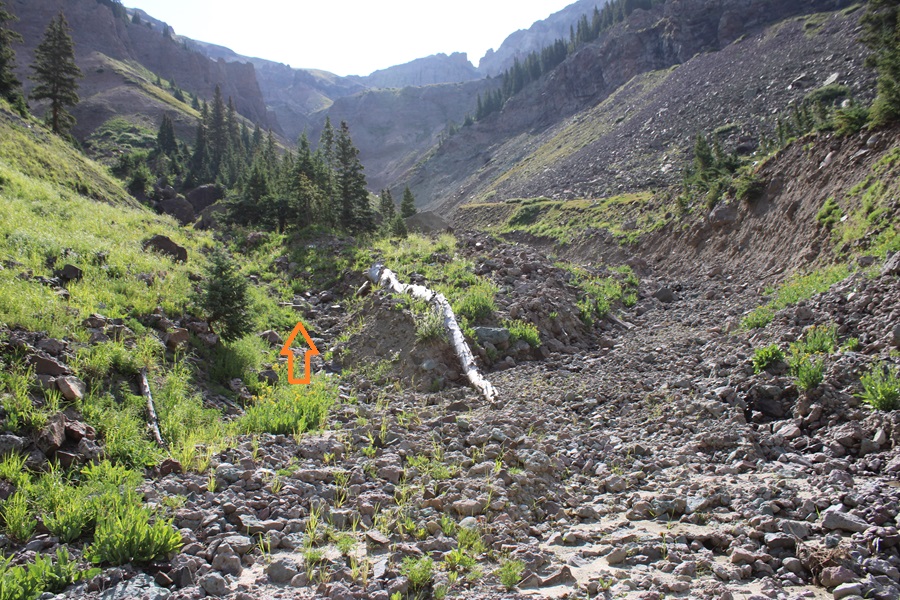
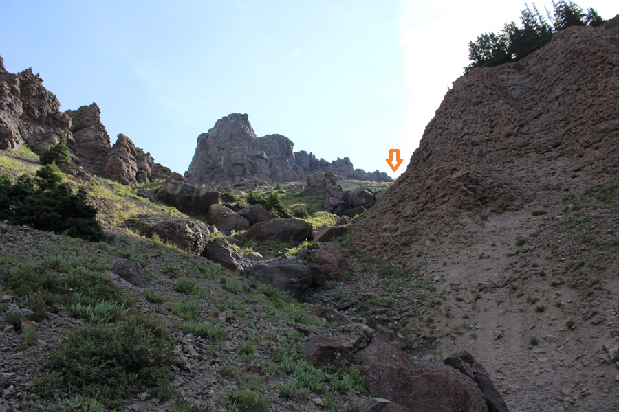
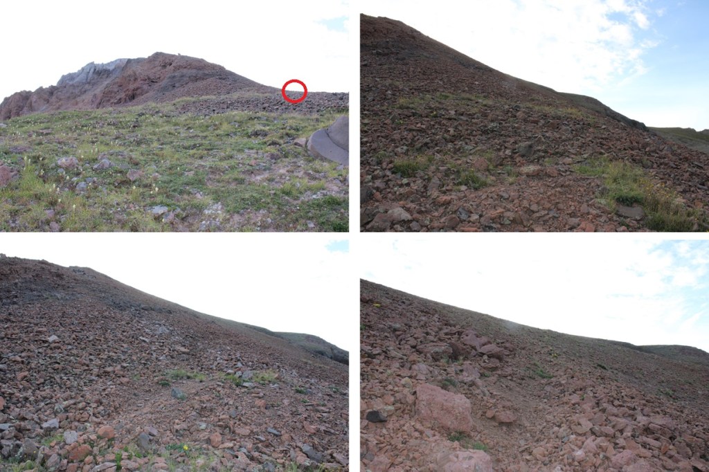
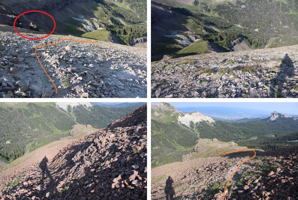
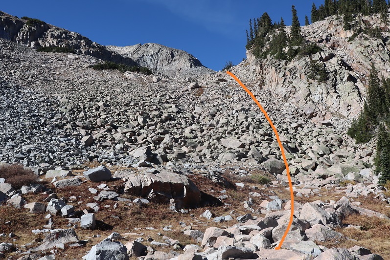
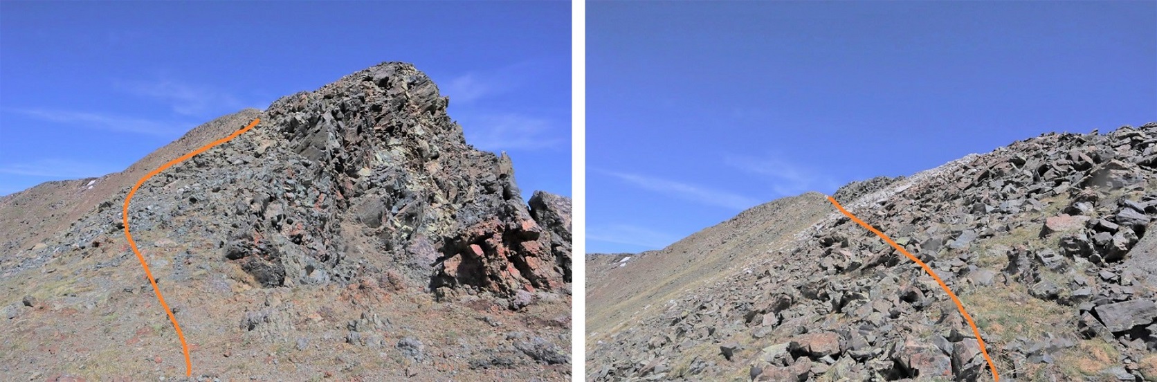
This next part is difficult to explain. You’re going to WANT to head straight up to the rock formation in front of you, but don’t do that. Instead, continue following the drainage, but aim to the right of the rock formation.
You’re trying to avoid the mess to the right of this picture… loose kitty litter on solid rock
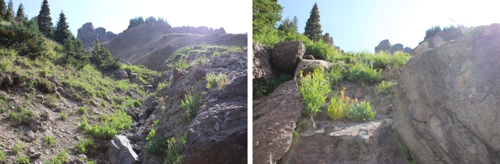
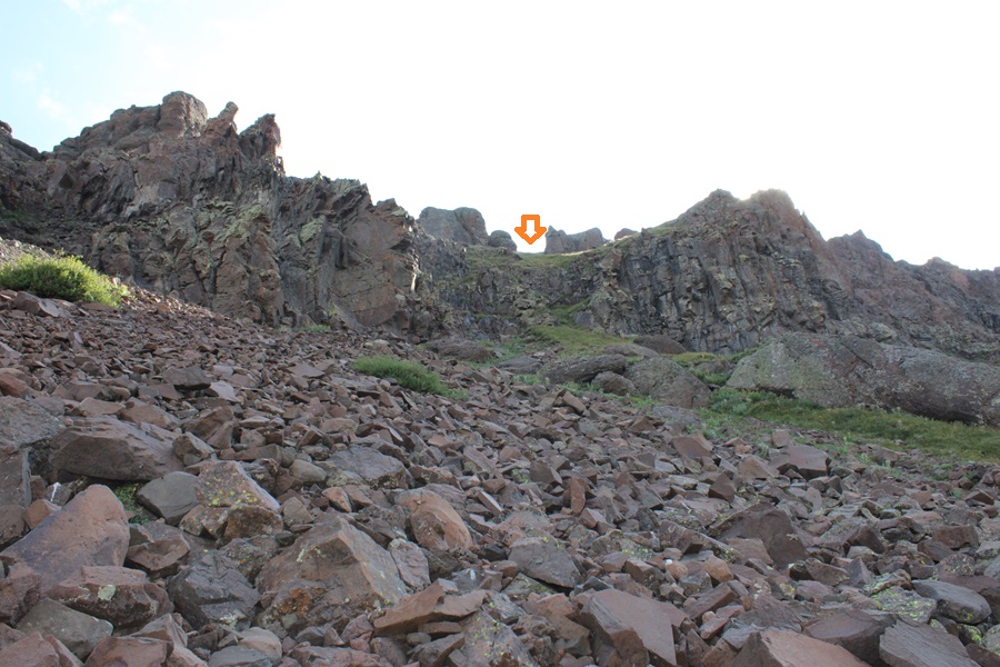
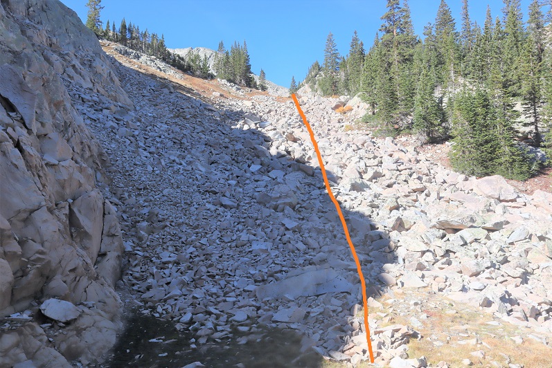
Now is the time to put on your helmet. Ahead there’s a more solid gully to climb. You can climb either to the left or right, I chose right.
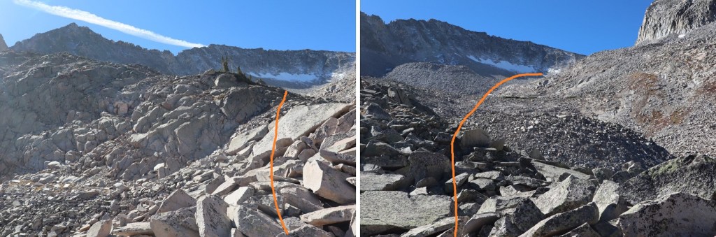
At the top of this gully is another gully to the northeast.
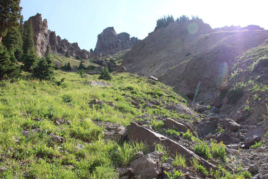
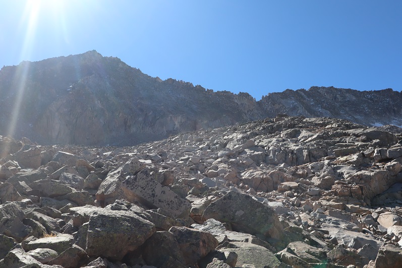
This one was more difficult then the last. Solid on the sides with large scree down the center. I went straight up the center
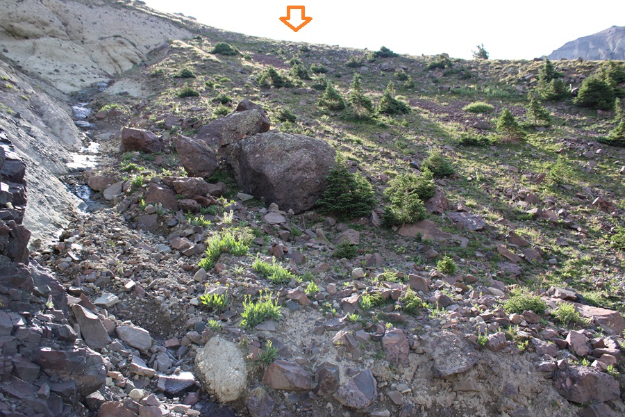
And then walked on tundra to the ridge.
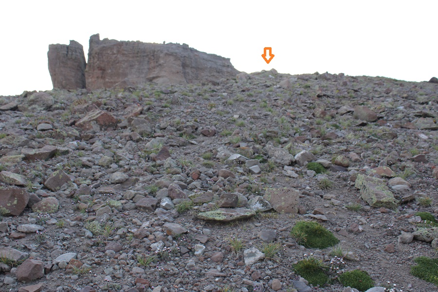
Once on the ridge, I turned right and followed it east, staying below the ridge. I noticed a cairn that marked an ok game trail, and followed that trail as it skirted below the ridge. The cairns especially helped in this area.
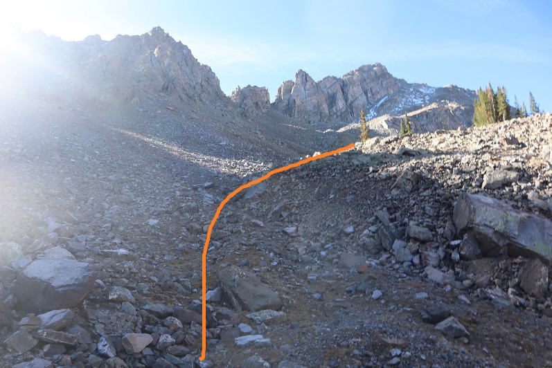
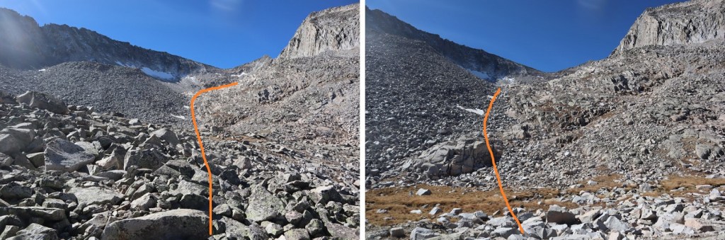
At 12700’, just before the rock formations directly in front of the trail, I left the trail and headed northeast for the ridge once again, this time on scree.
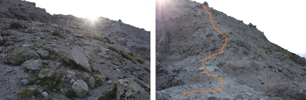
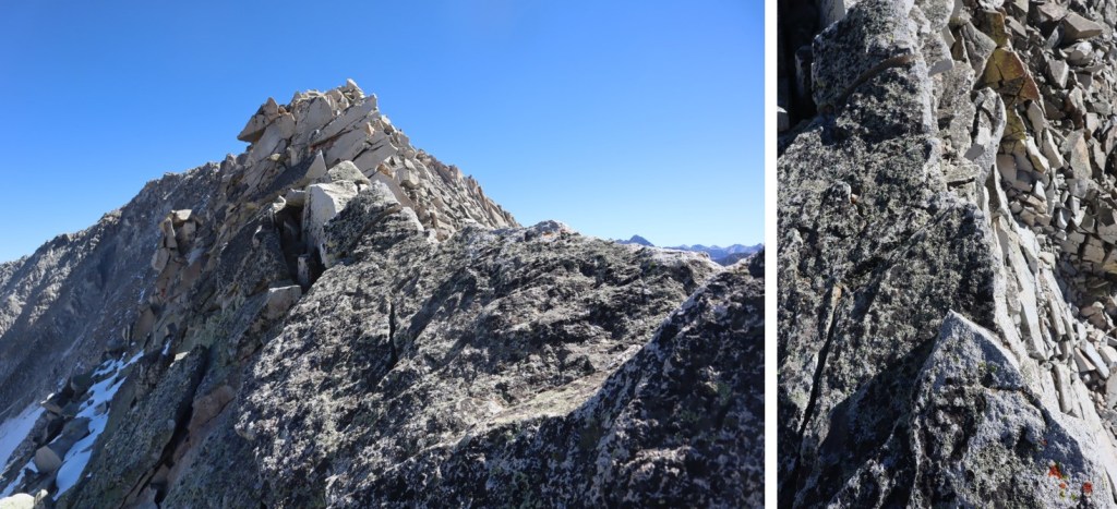
Back on the ridge, I followed it east towards the summit. The terrain here became slippery. Rocks the size of softballs and footballs were held together by dirt, and that’s what I was walking on. There were steep runnels on either side of the trail, which at times was less than 2 feet wide. A slip would have been dangerous here, on either side. This was all class 2, but I’d advise wearing microspikes for traction.
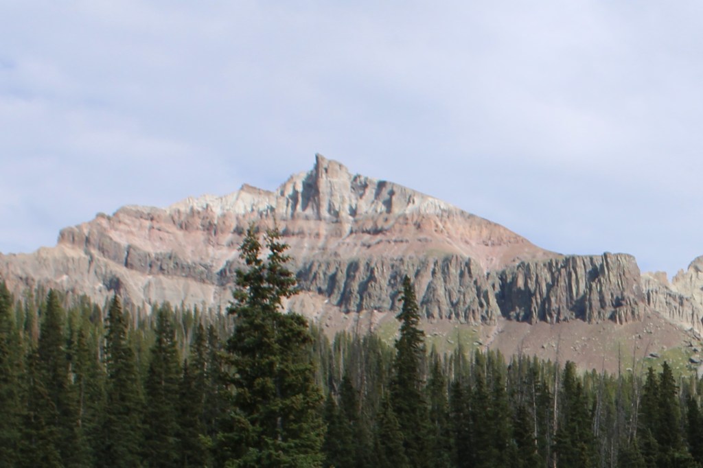
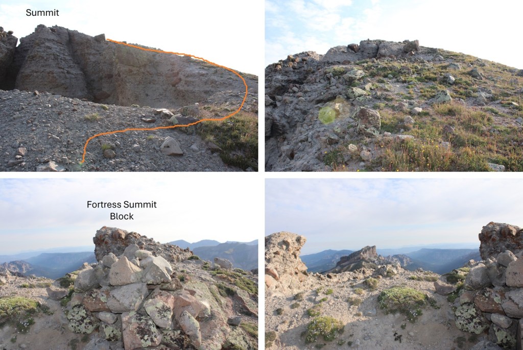
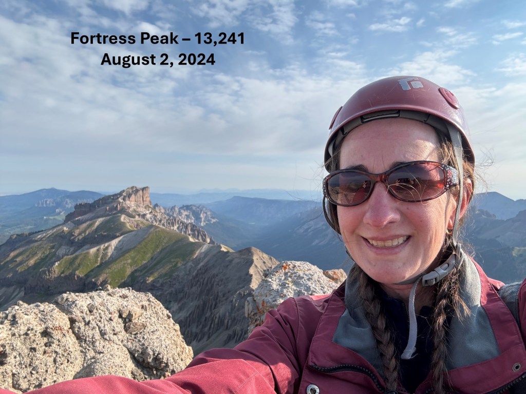
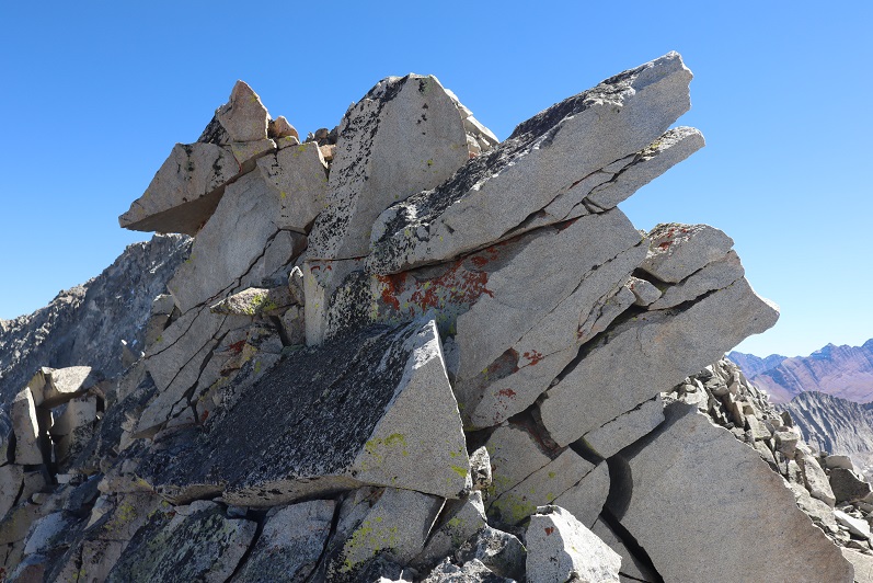
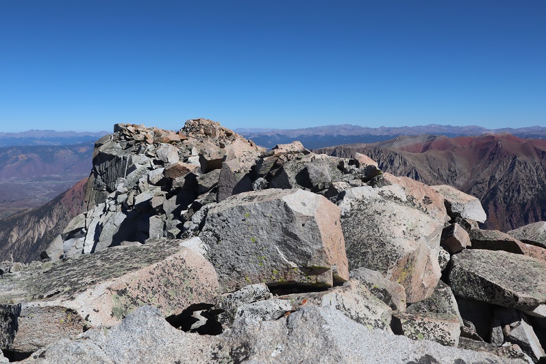
I summited Fortress Peak at 8:15am. There was a summit register in one of those pipe tubes, but the paper inside was so wet I didn’t want to disturb it, so I left it alone.
Fortress Peak:
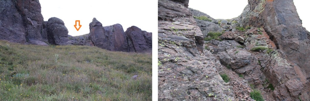
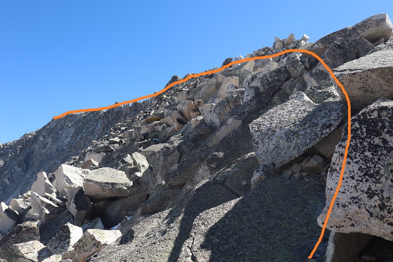
Here’s what some of that exposure looks like
Now to head back down. This was an out and back hike for me, so I just retraced my steps, back down the sketchy section with no traction just below the summit.
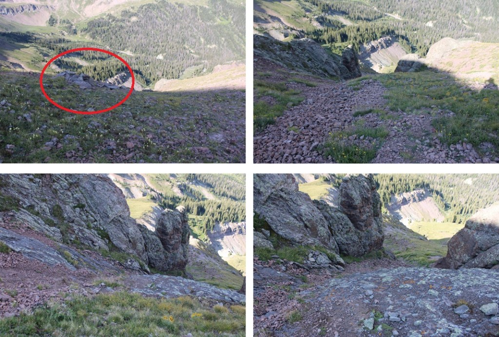
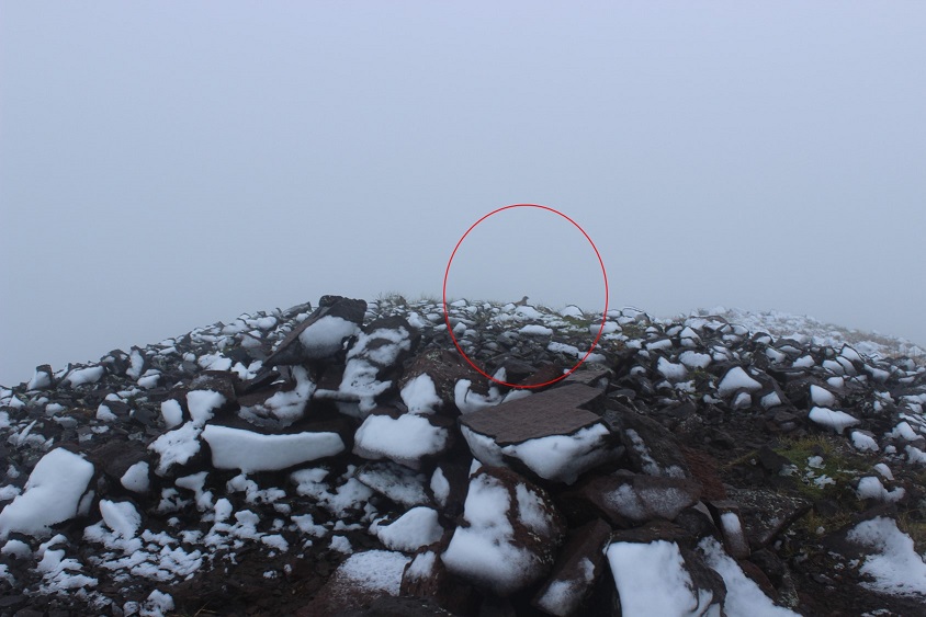
Then I hiked down the ridge until I was parallel with the rock formations on my left (circled). Here I turned and headed southwest towards the game trail.
I then followed the game trail south, back to the gullies. I descended near this big rock (circled).
Now for the second gully.
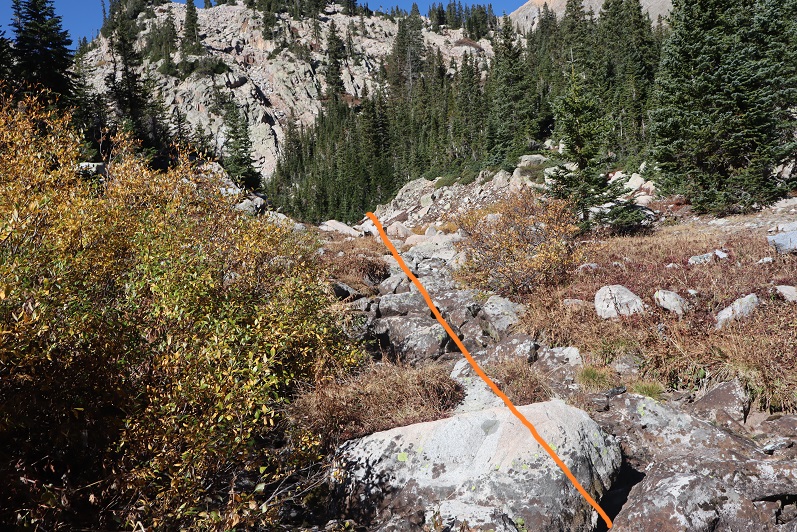
At the base of the second gully, I headed west towards the tundra ridge that would bring me to the drainage.
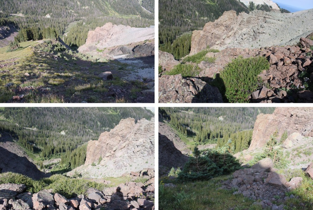
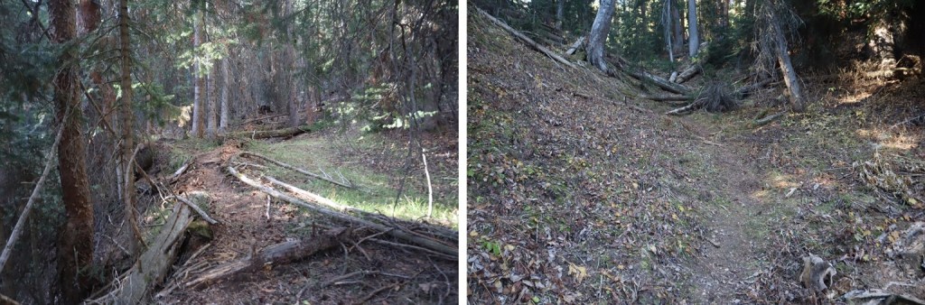
And now to follow the drainage back to Wetterhorn Basin Trail No 226
Back on Wetterhorn Basin Trail No 226, I followed it 1.4 miles north back to the trailhead.
Where the cows were still licking my truck
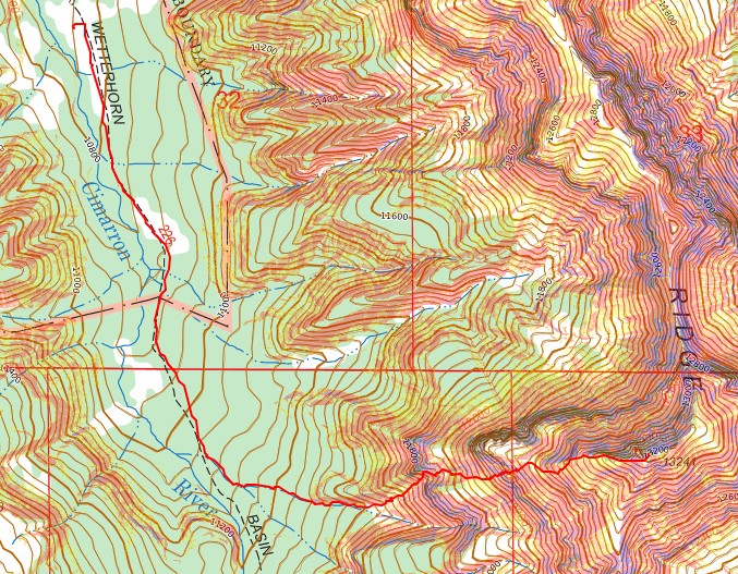
I made it back down to the trailhead at 10:30am, making this a 5.76 mile hike with 2482’ of elevation gain in 4.5 hours.
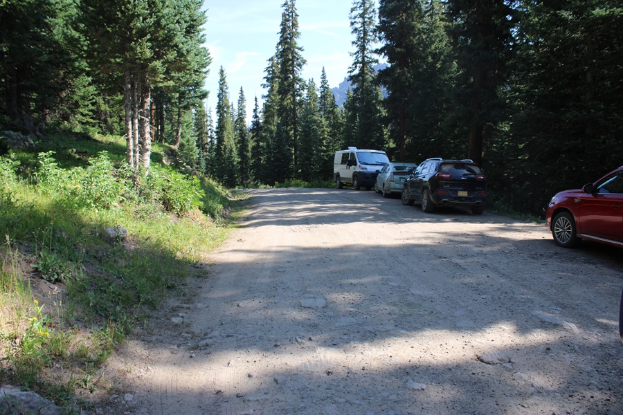
Here are pictures of the start of the 4WD road, and where to park if you have a 2WD vehicle
This was my second attempt of Clark Peak. On the first attempt I’d been unaware there was a creek crossing, and the creek looked too high for me to safely cross in the dark. A storm was coming in later in the day, so waiting for daylight hadn’t been an option. I’d turned around and done another peak instead. This time I was prepared (or so I thought) for the creek crossing. Also, please don’t make the same mistake I did crossing the creek…
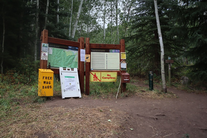
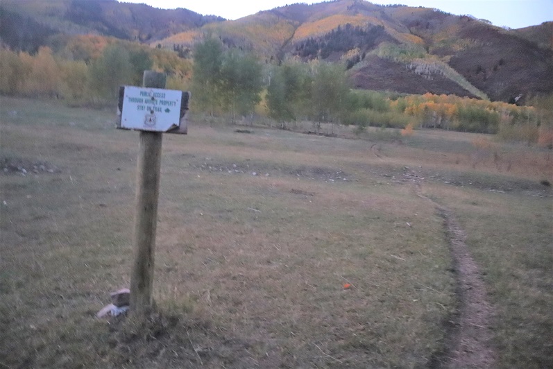
I drove to the trailhead the night before and got a few hours sleep before staring on the trail at 5:45am. The trailhead has space for about 20 vehicles, and good signage
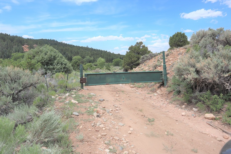
I started off following the Maroon Snowmass Trail south, and then southwest. I went through two unlocked gates
And shortly after the second gate there’s an unmarked side trail that leads down to cross Snowmass Creek. However, after my last failed attempt I’d done more research, and was told I’d gone too far last time and to look for an easier crossing earlier. So I did. I ended up crossing the creek and then running into Beaver Ponds about 20 yards long. I was able to gingerly cross them, stepping through a thin layer of ice while doing so. I picked up a faint trail on the other side, which brought me to the actual trail, where I noticed last time I’d indeed been in the correct area. Hmph. So I’d done all that wading in cold water for nothing. Here is where you should cross:
Doing so will bring you to the West Snowmass Creek Trail. A well-defined, class 1 trail.
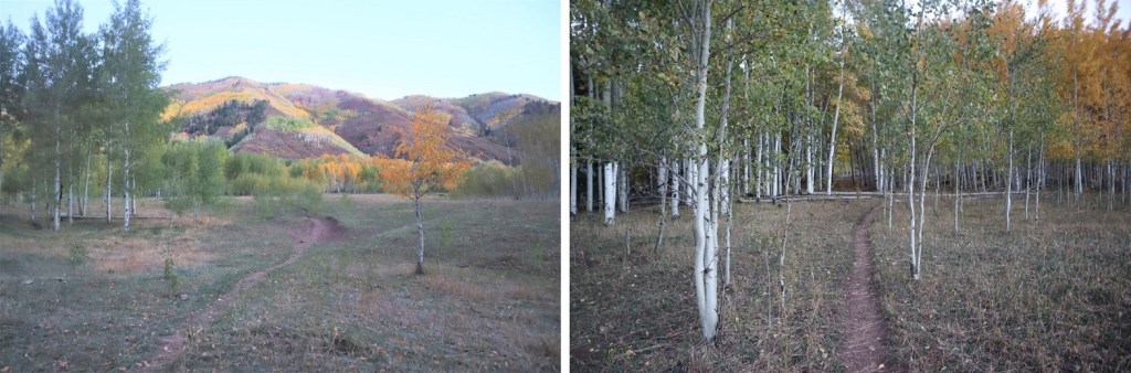
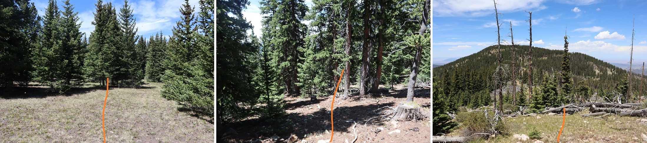
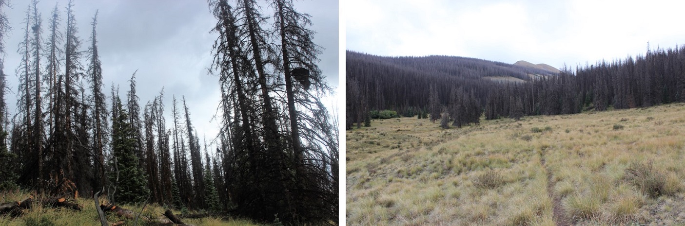
The trees were absolutely beautiful! It was still early morning, so these pictures aren’t the greatest, but the trees had me daydreaming.
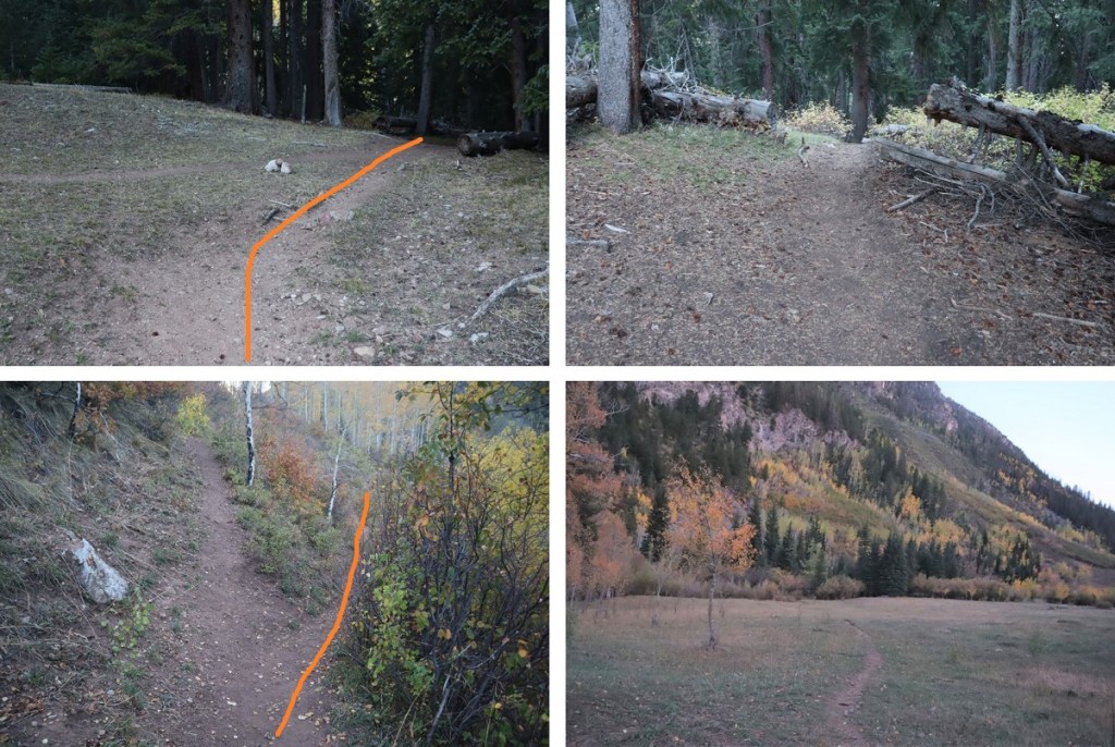
This is where I made my second mistake of the morning: I missed the cutoff. The cutoff comes after hiking for just over 4.5 miles. It’s an obvious junction you can see if you’re not looking up at the trees. And cows (there were cows in the meadow). I ended up hiking quite a ways past this junction, just following the trail. It wasn’t until I realized I was switchbacking and I wasn’t supposed to be that I noticed my mistake. This mistake cost me well over a mile and added about 1000’ of elevation to the hike. Here’s where you turn left
After hiking a few dozen yards south the trail abruptly ends. When it ends, turn right and head west towards the hillside. A trail will pick on the hillside.
Here’s where I made my third (and final) mistake of the morning: When you see the path split in two, take the higher one (the lower one is a cow trail that leads you through gooey mud then ends).
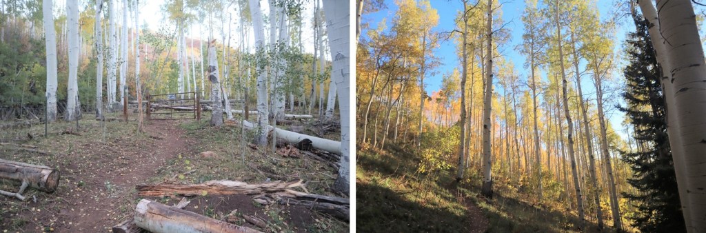
From this point on the trail becomes faint. At times I questioned whether I was on an actual trail at all. It will parallel West Snowmass Creek, and stay high. Here are some photos:
I came to a clearing and headed southeast, crossed West Snowmass Creek, and once again picked up a trail.
I took this trail to treeline, where it ended. I put pink surveyor’s tape on a tree so I’d know where the trail picked up on my way back.
From here the rest of the hike was full of rocks and boulders. I headed southwest
I lost a little bit of elevation before gaining it again
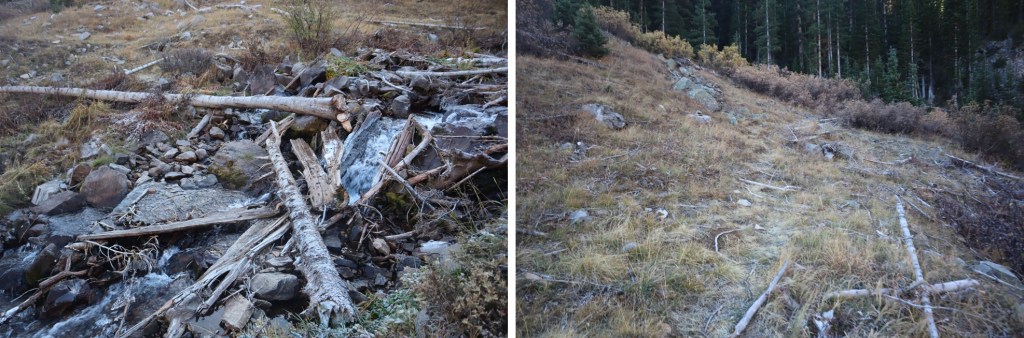
Rock-hopped up this drainage
Followed the creek for a bit until it ended
Ascended another drainage and at the top turned left to skirt Moon Lake
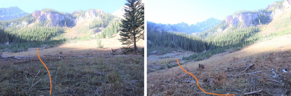
This basin never seems to end! I just kept heading southwest
At the end of the basin it was time to gain the ridge. I stayed right of the drainage.
This was mostly class 2, but towards the end became class 3 to avoid the snow
Once I gained the ridge I turned left and followed it to the summit.
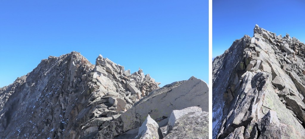
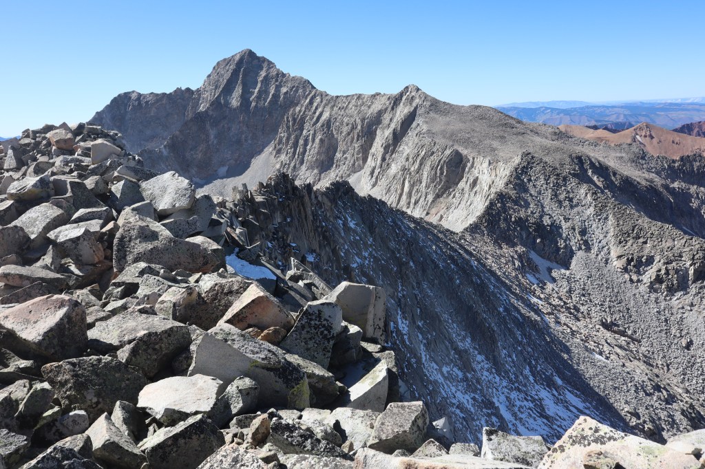
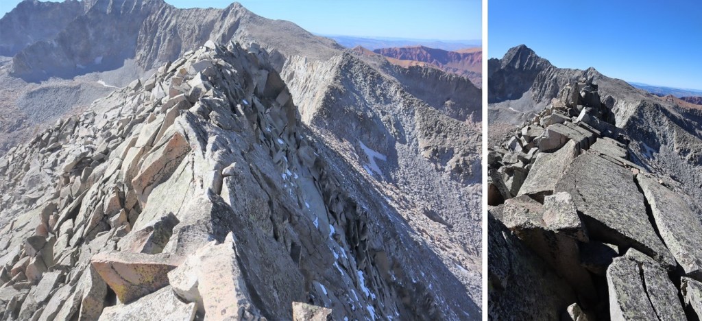
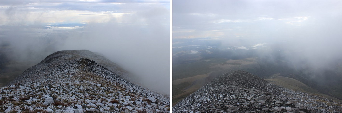
Ha! That’s an oversimplification. I did indeed follow the ridge. The ridge proper goes all the way to the summit. However, it’s a fun scramble to get there, with a lot of exposure, and more than one knife edge. If you did Capitol Peak and it left you wanting more, this is the peak for you! Here are some highlights:
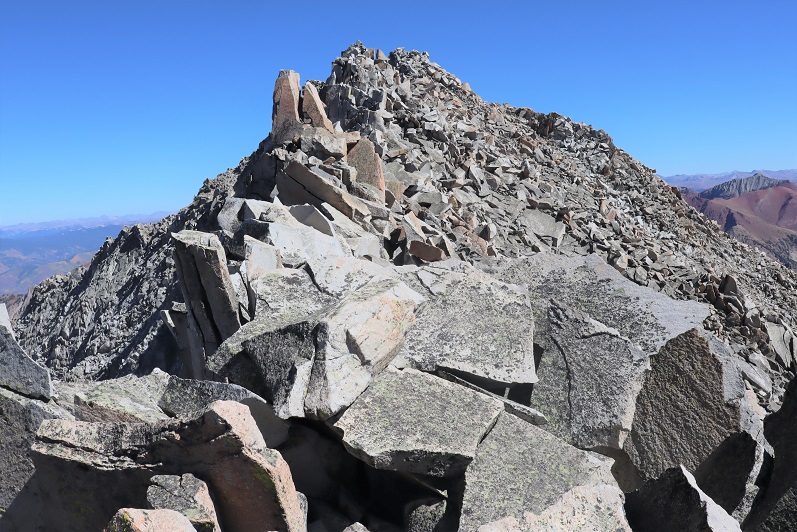
I summited Clark Peak at 2:25pm
Clark Peak:
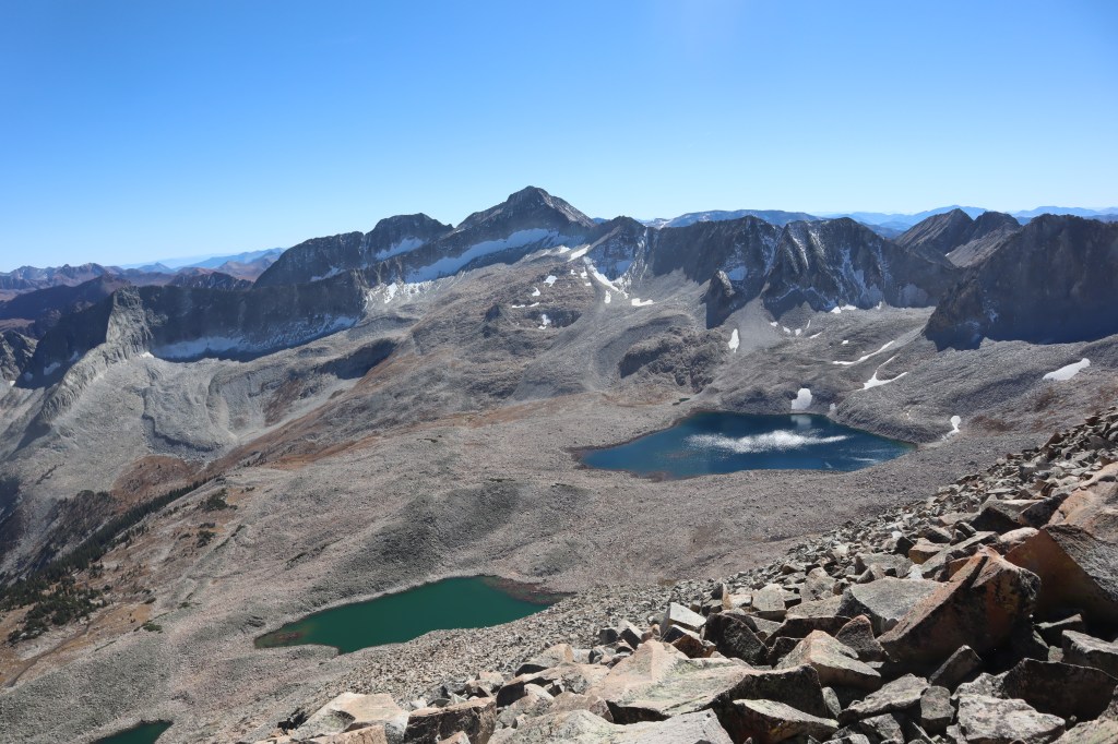
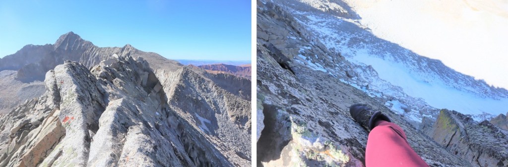
There were some great views of Snowmass and Capitol Peak, and check out the ridge looking back!
Here’s looking back on the way in through the basin and around Moon Lake
Here are some pictures of the ridge on the way back. I had fun with the exposure here
At the saddle I turned right and headed back through the basin
Skirting Moon Lake to the east and back to the trees
Next profile pic?
Once at treeline I picked up the trail again. After crossing West Snowmass Creek I headed for the trees. The trail picks up again in-between these two trees
Here are some pictures of the trail back down. As I was hiking, I heard a faint bugle. It didn’t sound like a normal elk call: it sounded close but faint. Usually when I hear an elk bugling it resonates, it’s crisp, and I can hear it from far away. This didn’t seem loud enough for being so close. As I reached the meadow I noticed a hunter sitting beneath a tree. I raised my hand to silently say hi, he did the same, and I continued back to the trail.
I kept picking up my pace. Due to this morning’s route finding errors this hike was taking me much longer than I’d anticipated. It was quickly getting dark, and I wanted to get back to cell service so I could call my daughter and tell her I was ok, just running late. I ended up using a flashlight for the last two miles of the hike. Here are some pictures from the rest of the way back to the creek.
I crossed the creek and took Maroon Snowmass Trail back to the trailhead
I made it back to my truck at 8pm, making this a 25.26 mile hike with 6619’ of elevation gain in just over 14 hours.
First of all, I’d like to recommend doing this hike backwards from the way I took the hike: Route finding is easier and it’s much more straightforward; You’re above treeline almost immediately and have great visuals of all the peaks/route.
Secondly, Cielo Vista Ranch makes special arrangements for people to hike these southern peaks and because of this they require you to hike (or at least drive in and camp) as a group. They wouldn’t give me a reservation to go solo, so every month since December I emailed Carlos asking if anyone else was hiking and if I could tag along. I’d get a response saying he’s “look into it” and then he’d go silent. Thank you Rose for putting the ask out there and letting me tag along on your reservation!
We all met at a special entrance to the ranch and around 5:30pm. Carlos met us at the gate and had one of his guys drive us 7 miles up a dirt road to our campsite. This is a 4WD dirt road, and while 4WD wasn’t necessary the entire drive it did come in handy once or twice. Carlos gave us each his business card and asked that we text him when we exited the property the next day. At this point I view Carlos as a celebrity. I mean this in a positive way. Yes, he’s charging us all out the nose, but at least he’s nice about it. Also, he’s known by his first name.
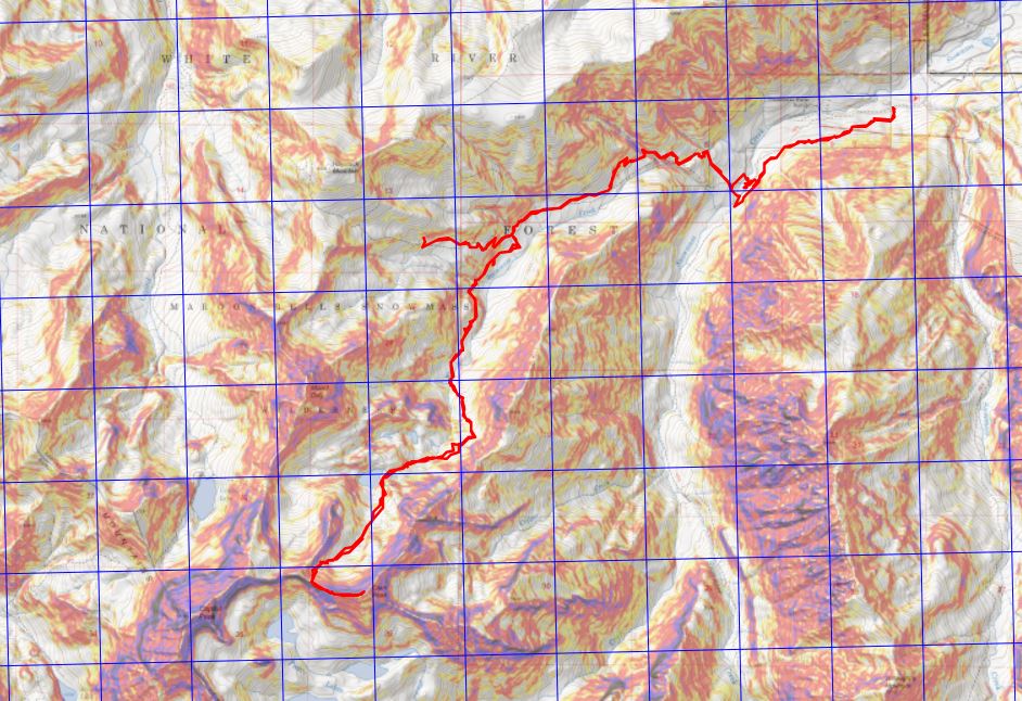
Here’s a topo of the road we took. These roads are not shown on maps (CalTopo). I made a GPX file on the way back, which came in handy because there aren’t many ways to get lost on this road but I always seem to find them (I backtracked twice). We’d noticed on the way in the GPX file(s) we had were correct, but the road they took us on switched back and forth between the two files (apparently some of the roads are now washed out and impassable). Also, TONS of moths. Like, Biblical plague amounts. We had our Miller Moth season last month: Cielo Vista is experiencing it now.
Here’s a picture of where we parked our vehicles and camped for the night, around 11,750’
We all sat and chatted for a bit. I kept thinking to myself I should go look at the route I’d intended to start out on while it was still daylight, but I had a couple glasses of whiskey and I fear I was a bit too chatty. You see, I’m used to drinking alone (that sounded bad) but what I mean by that is when I usually hike/camp/etc. alone I have a few drinks, scope out the beginning of the route or at minimum where the trail starts, and call it a night. Early. Instead here I was, talking to people at camp. It was so nice to have like-minded people to talk to: we understood and appreciated each other’s mountaineering experiences and goals. That’s so much more refreshing than my mom freaking out every time I bring up hiking because she thinks I’m going to die. We discussed our intended routes for tomorrow and I decided to take the opposite route as the others so I’d be able to do it solo. I didn’t get to bed until a little after 9:30pm, and I never got a good look at the route I intended to take.
I woke up at 3:30am and decided I wasn’t ready to get up yet so I slept a bit more. I was way too comfortable. The third time my alarm went off I figured I’d better get going. I woke up, gathered my gear, and was off. My plan was to head northeast around the mountain and pick up a trail in the basin to the north of Purgatoire. After hiking for about a quarter mile I came to a rocky area that didn’t look passable in the dark. Well, it might have been, but at that moment my flashlight went out and I couldn’t see a thing (I later confirmed on the hike both visually and after talking with others telling me they’d turned around there as well that that route’s not passable). I decided to retrace my steps and try again.
Back at my truck I saw the others getting ready; their headlamps glowing inside their tents/trucks. I got a new flashlight from my truck (a headlamp: I’m not fond of headlamps as they make me dizzy but it was better than nothing). I restarted my tracker and was on my way, following the 4WD dirt road as it wound around the mountainside, losing about 450’ of elevation in the process (which was what I’d been trying to avoid by going around the mountainside first. Oh well).
After about a half mile my headlamp gave out. Great. Two flashlights out in the same hour. Who would have guessed? At least I was just following a dirt road and the sun would be rising soon. I’d just make a lot of noise to scare the larger critters who may be hiking with me this morning away.
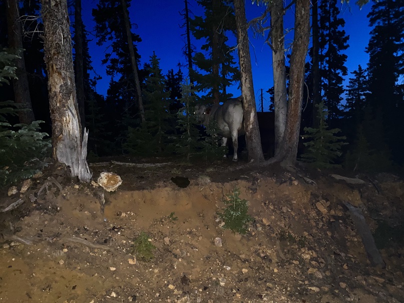
I heard a loud noise ahead of me. An animal had been startled by the noise I’d made, ran through the deadfall for about 20 feet and then stopped. Knowing some animal was standing still ahead I made a lot of noise with my trekking pole. It didn’t budge. I slowly hiked forward and noticed whatever I’d scared into bolting for a little bit I’d scared pretty badly: I could tell by the smell.
The animal was still there, and now I could hear it breathing. I made noises again but it didn’t move. I was worried it may be an injured animal and wanted to know what it was, and obviously I didn’t feel comfortable turning my back to it. In the dark I got out my phone and decided to take a picture (thinking the flash would go off and I’d be able to see what it was, even if the photo didn’t turn out. Note: Later in my hike I realized I could have used the flashlight app on my phone, but since I’d never used it before the thought didn’t come to mind until later).
I took a picture and the beast in front of me was…. a cow. Yep, a cow, and the first of many I’d see today.
Well, that was anticlimactic! I’ve raised cows before (both dairy and beef) and I know how to handle them. I clapped my hands, waved and shouted “Move on!” held my walking stick parallel to the ground and advanced forward. The cow turned, moved out of my way, and I continued on. I saw about 10 more cows before it got light, but knowing what they were I didn’t have a problem with them anymore.
I followed the dirt road for about 1.25 miles until it came to a 3 way divergence. I randomly took the middle road as it looked to be heading in the direction I wanted to go and it turned out to be the right one.
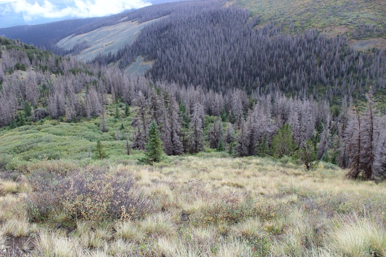
I continued east through the trees, encountering more cows, until I made it to the basin. The sun was now up and my anxiety level dropped. There were still tons of cows, but now I could see them, as well as cow trails and ATV trails. I followed the ones that went east.
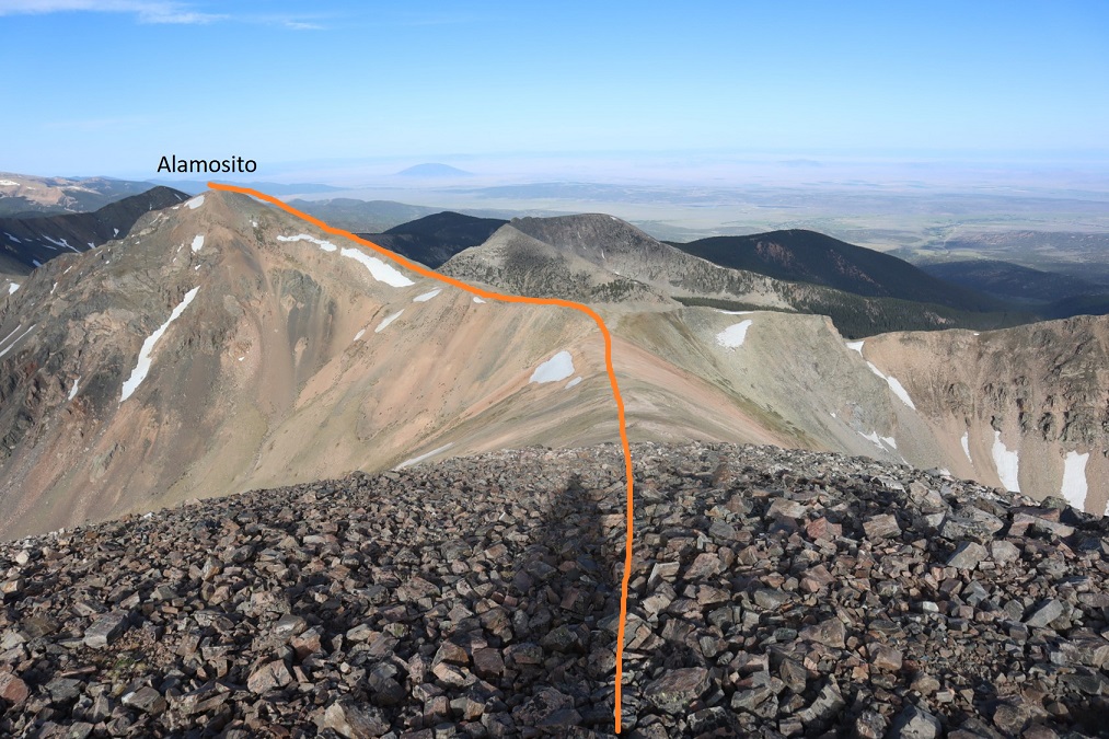
Once out of the trees I could easily see the path I wanted to take to summit Alamosito. (Note, some routes tell you to take the saddle and drop down into another basin and then gain another saddle, summiting Vermejo first then backtracking to Alamosito. The way I went just made more sense to me, but several routes all ‘go’. Alternately you could gain the Alamosito/Purgatoire saddle and summit from there as well).
This was straightforward, except for these cows who didn’t seem to want me to pass. I made noise and told them to “get along” they just stared at me. One even lifted its hind foot and stomped a few times, kicking up dust. I got the impression they were expecting something from me. Even the calves had ear tags, so they’re used to humans (at least in some part). I passed them to their left and they went back to grazing.
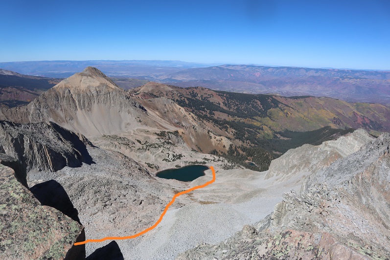
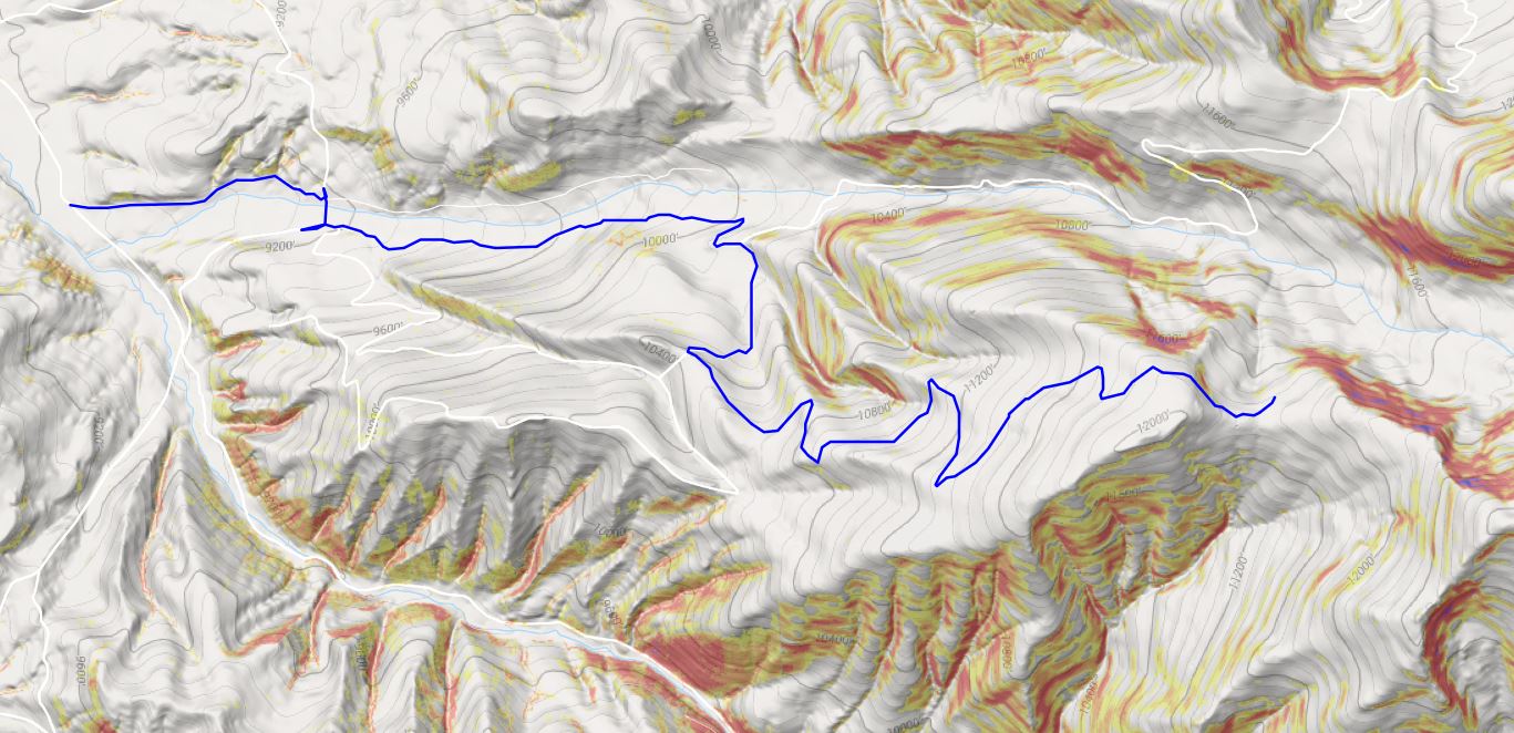
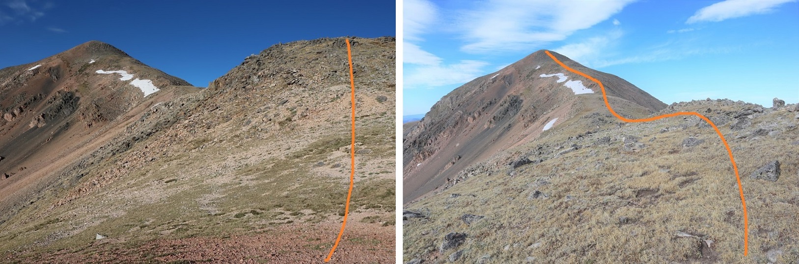
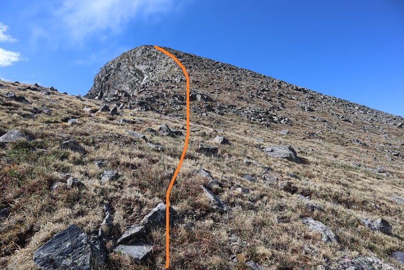
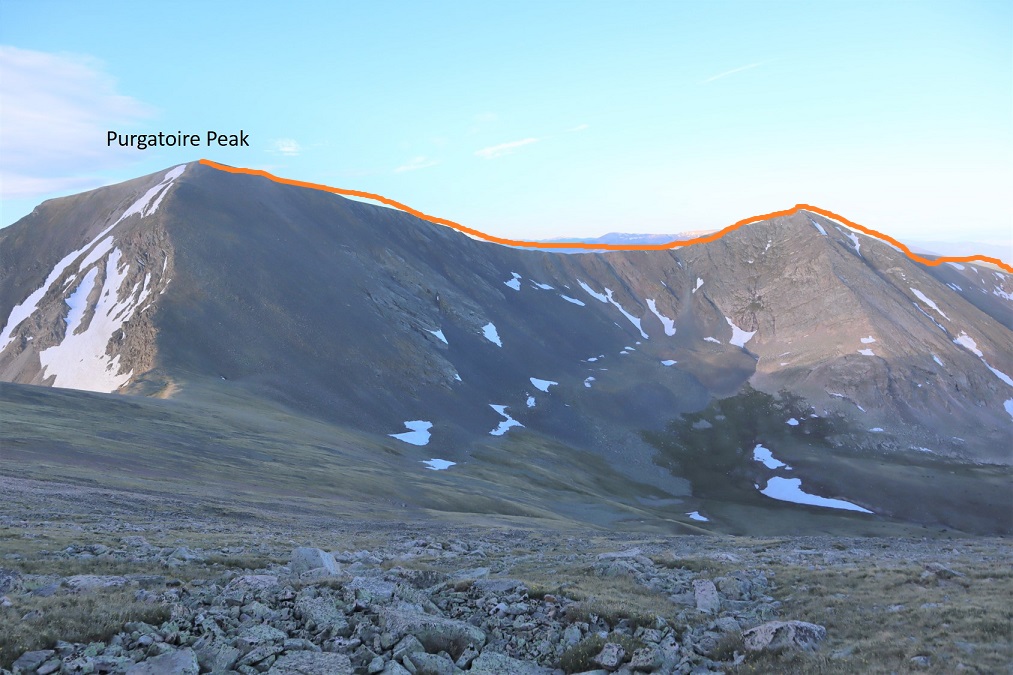
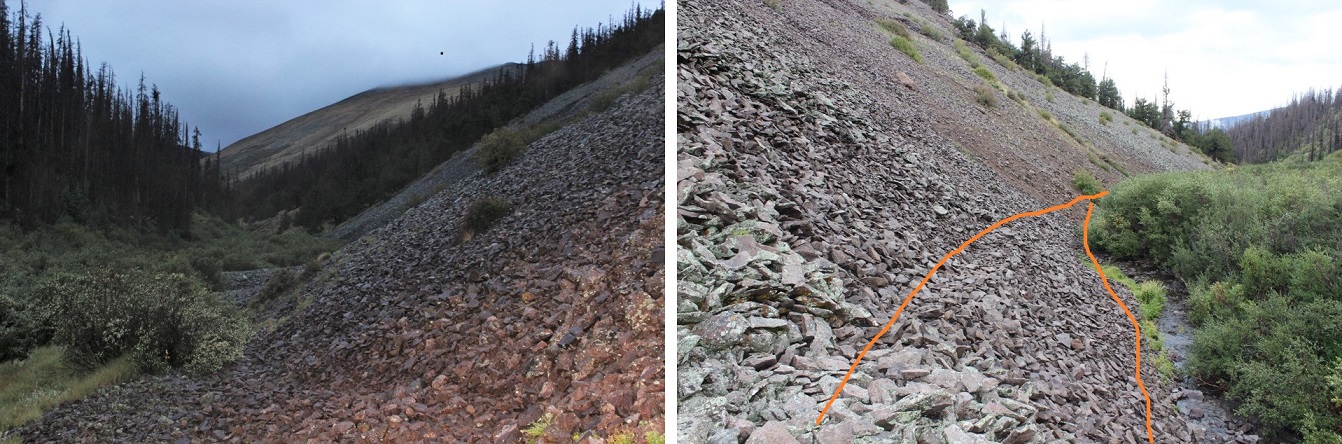
Here’s a look back from the saddle. I’ve circled the campsite in red, and the area that cliffed out in yellow. Note: Everyone else just went straight up the ridge to start (a better choice to begin). My route to the saddle is in orange.
From the saddle I turned right and headed east. This was a very straightforward ridge hike. In fact, they all were today.
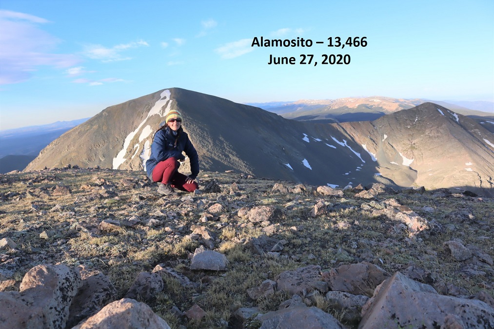
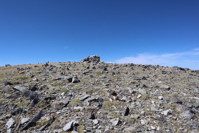
I summited Alamosito at 6:45am, after 2 hours and 3.3 miles of hiking. There was a summit register in a glass jar buried in the cairn.
Alamosito:
I turned north and headed down the ridge to the Alamosito/Vermejo saddle
There was some rubble to contend with on the way down, but all class 2
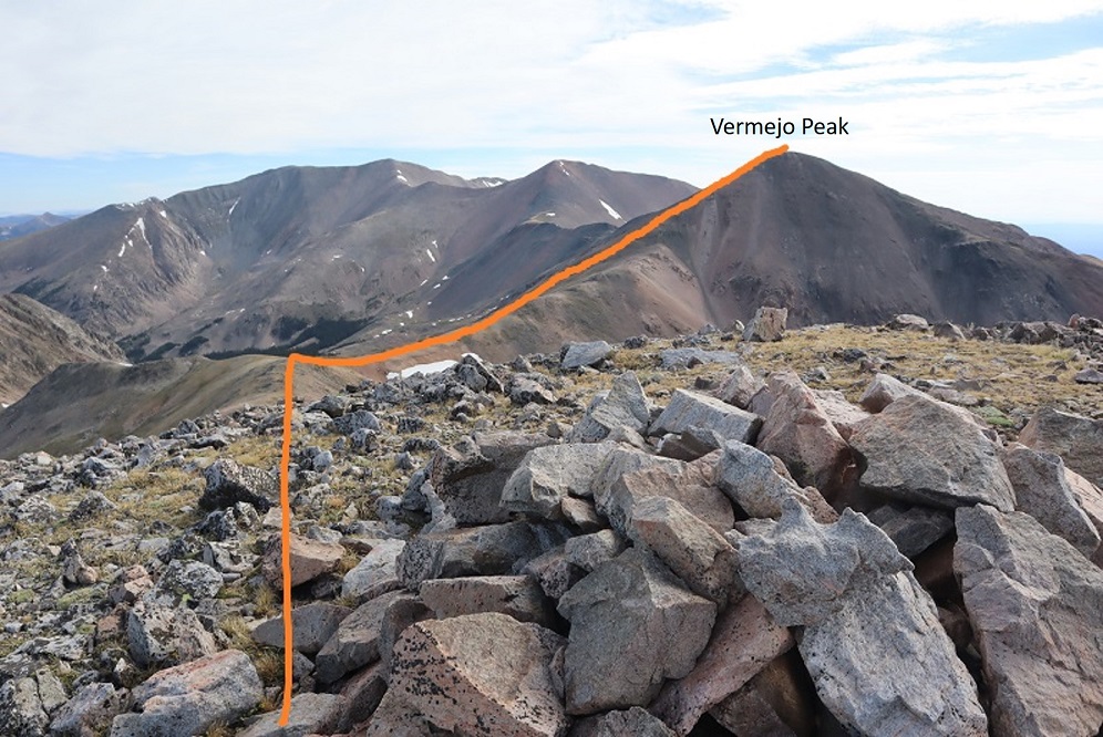
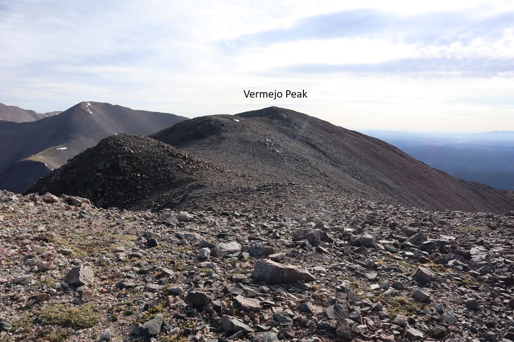
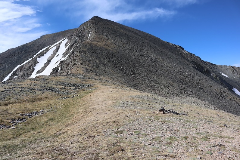
From the saddle I turned right and headed east up to the summit of Vermejo Peak (that’s a false summit you’re looking at here). There was some rubble here as well
At the top of this easy ridge walk there was another .3 miles to go before making it to the summit, also an easy trek that reminded me of Ireland: the tundra was green and there were lots of black and white rocks. The picture doesn’t do that justice.
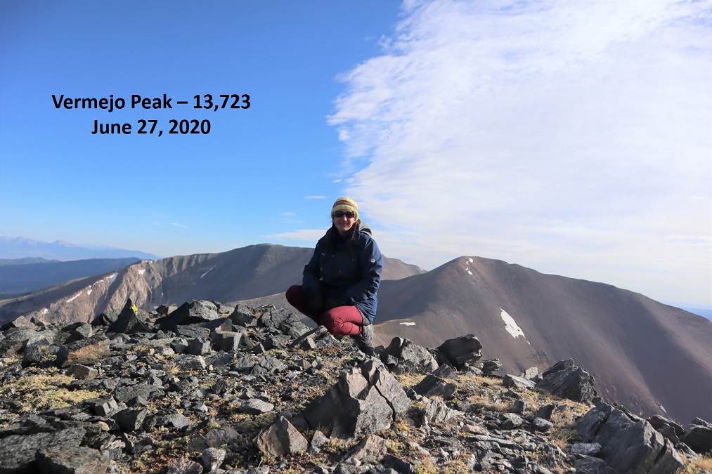
I summited Vermejo Peak at 7:45am. From Alamosito to Vermejo it’s just over a mile and a half of hiking. There was a summit register here as well (one of the pipe ones I can never open because: Raynauds).
Vermejo Peak:
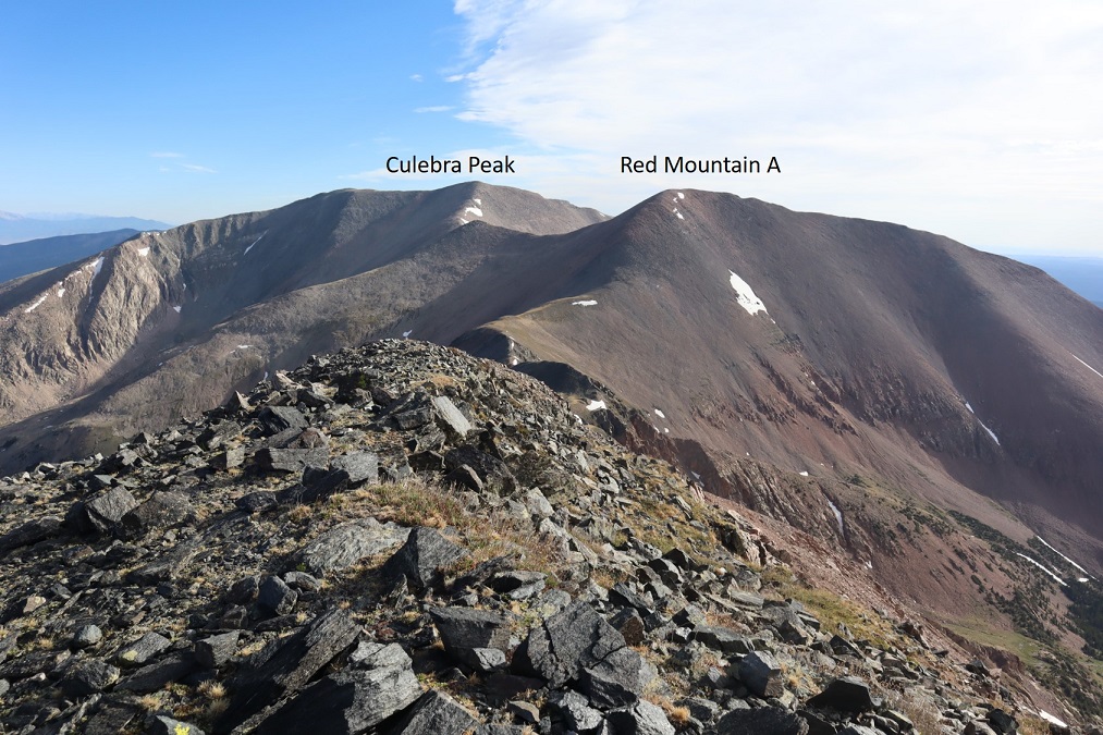
There were great views of Red Mountain A and Culebra from the summit
I turned and headed back the way I came, towards the saddle and back up to Alamosito
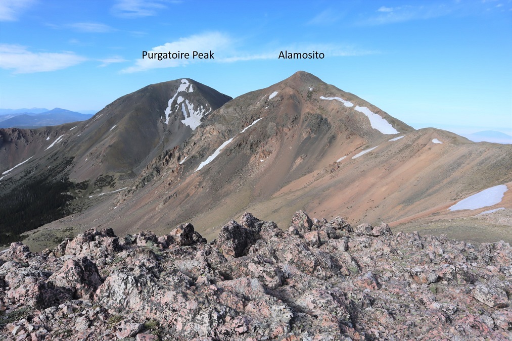
From the saddle there’s a great view of both Purgatoire and Alamosito
From the saddle I made my way back up to summit Alamosito
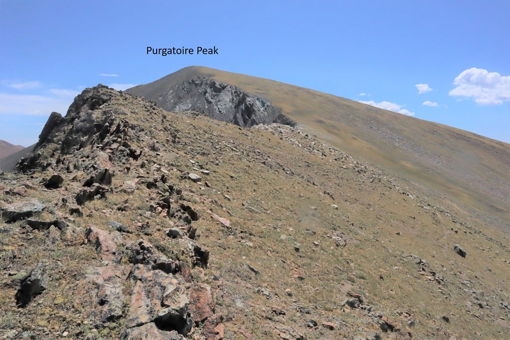
I re-summited Alamosito at 9am and looked over at Purgatoire Peak
This was another easy ridge walk. Rubble turned to tundra as I made my way towards the saddle
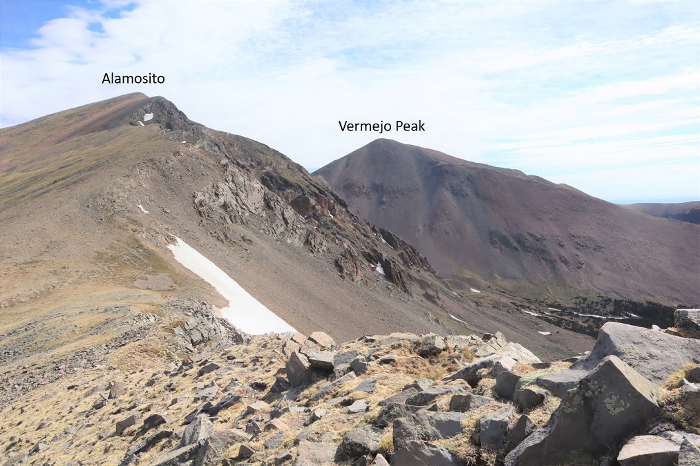
Here’s looking back at Alamosito and Vermejo Peak from the Alamosito/Purgatoire saddle
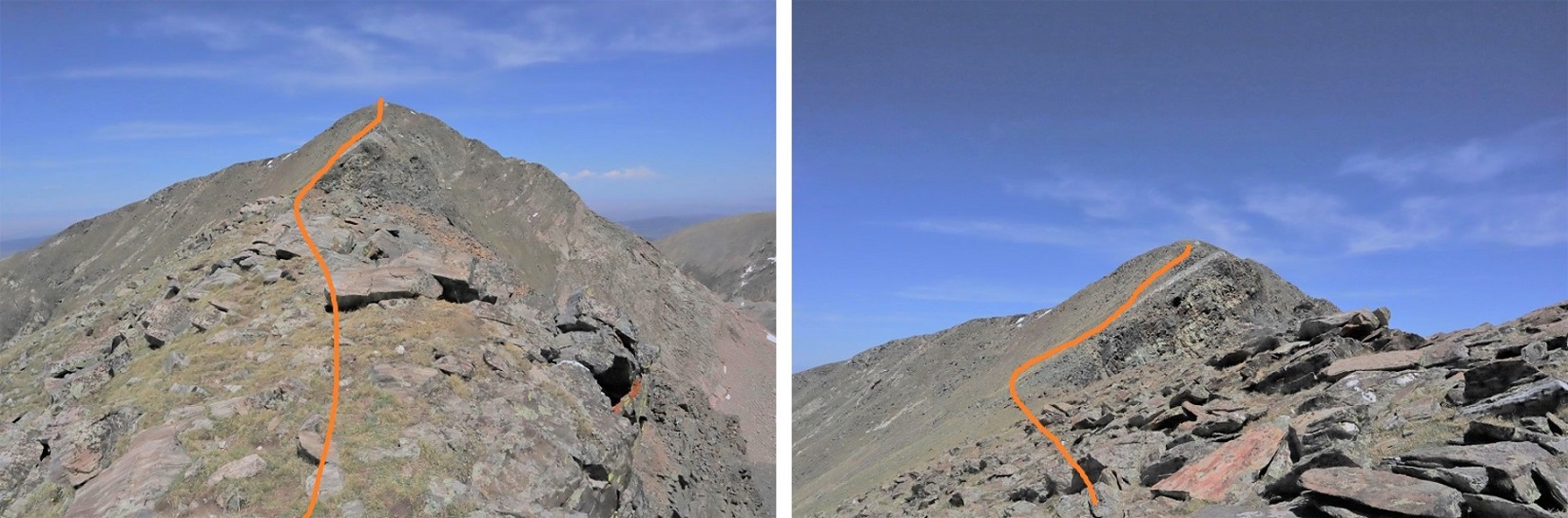
The rest of the ridge to the summit of Purgatoire was straightforward
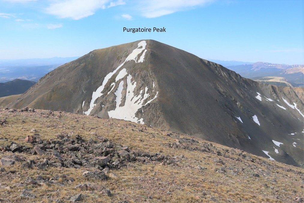
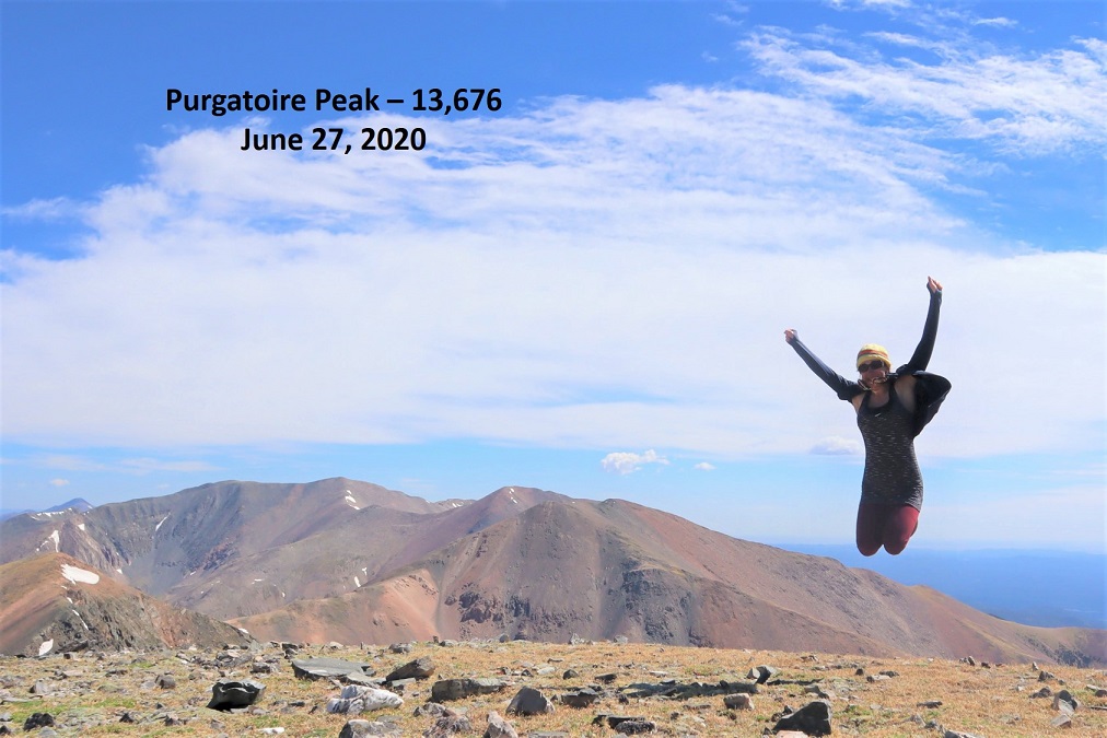
I summited Purgatoire Peak at 10am
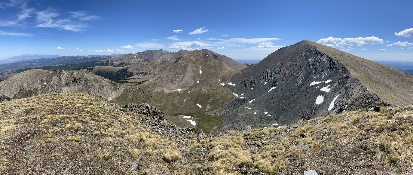
Purgatoire Peak:
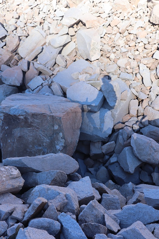
There was a summit cairn, and also this thing. I’m not sure what it is? I could probably look it up, but, thoughts?
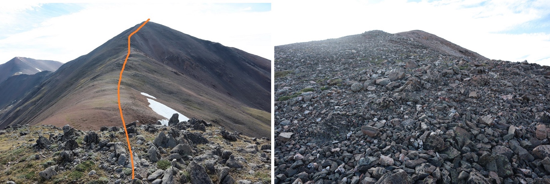
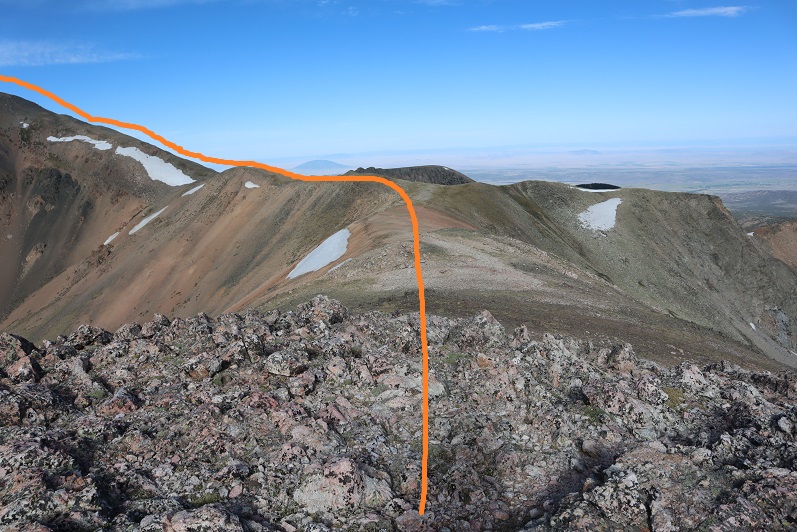
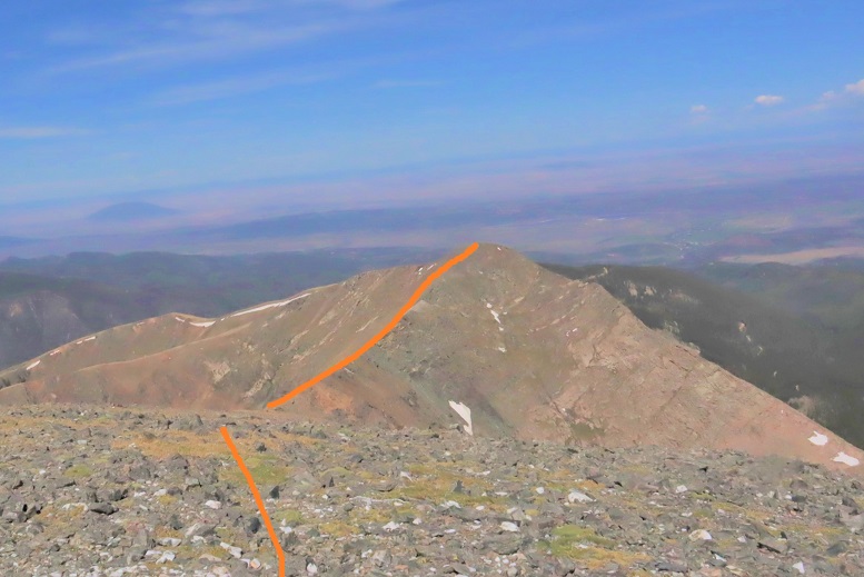
I turned west to head down the way I should have headed up, back over this unnamed point (which has about 260’ of elevation gain from the saddle, and tops out at well over 13K)
Here’s looking at the route from the morning when I was hiking up Alamosito
It starts out as a simple ridge walk on tundra, dotted with rocks the size of toasters, and once at the saddle it looked like there may be some scrambling involved, but there’s actually a game trail to the left of the ridge that makes the ridge easy to follow
Here’s a look at the route from the saddle towards Purgatoire Peak
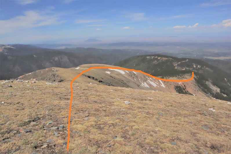
From the top of the point there’s a tundra ridge to walk down, and just a little bit of forest to go through before reaching the road. As long as you aim for the road you’ll be fine, as you can follow it to the campsite. Yes, I should have hiked the couple hundred feet up this last night: it would have made the entire route more obvious.
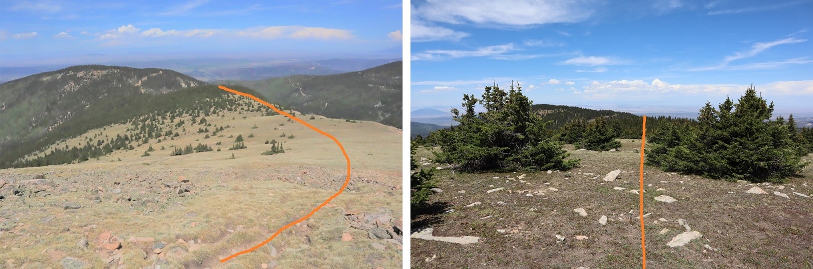
Here’s a look back from treeline on the point you need to ascend if heading this way
Once you’re in the trees navigation can be a little difficult. Just keep aiming west and you’ll hit the road. Oh, and you can’t see them in these pictures, but there were moths everywhere! Thousands of them swarming around. They apparently appreciate the elevation / pines today.
I made it back to the 4WD road we drove in on and followed it back to my truck. I arrived back at my truck at 11:45am, making this a 9.74 mile hike with 4828’ of elevation gain in 7 hours (not counting my early morning false start).
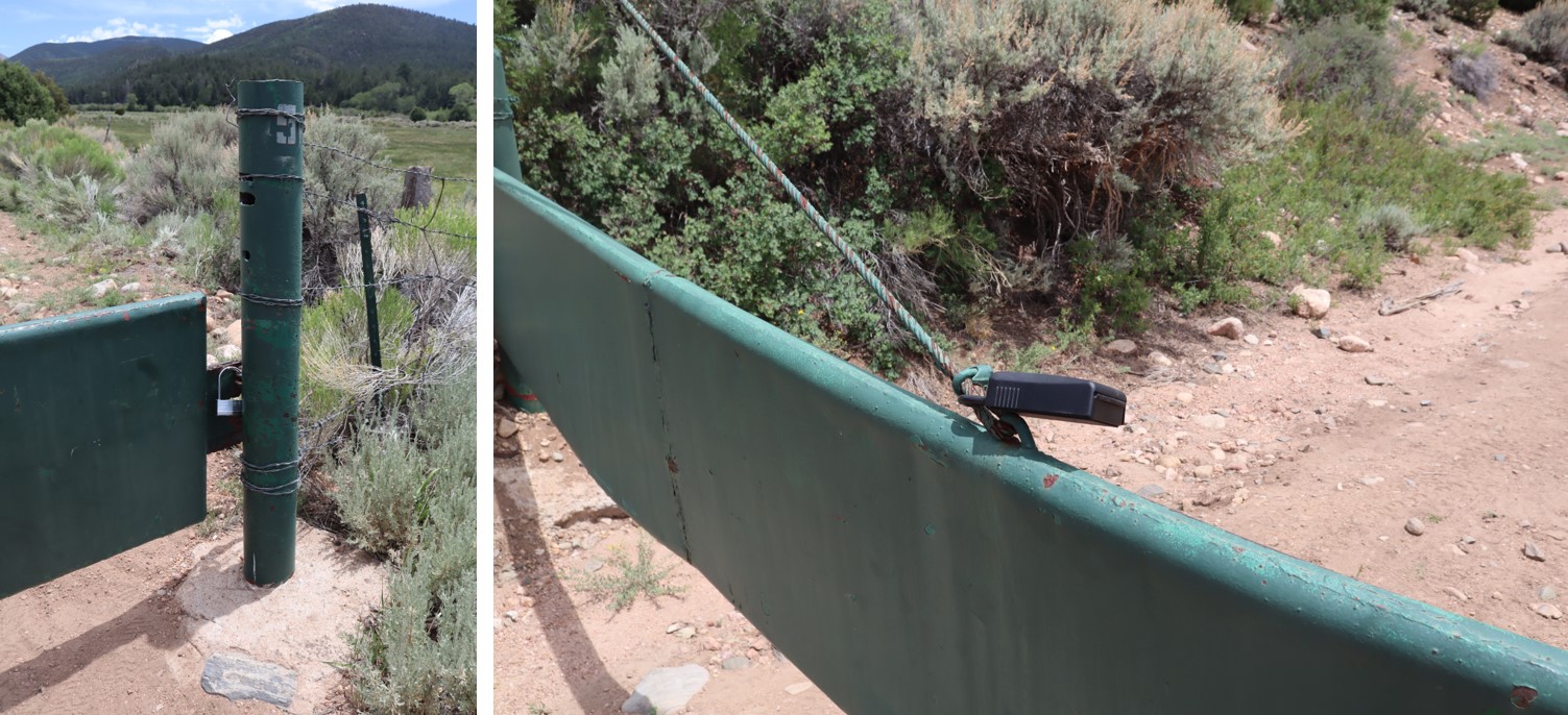
I got back in my truck and followed the road back to the gate. The route was much easier on the way down than on the way up. I unlocked the gate, re-locked it, drove through, and text Carlos to let him know I’d exited the property. Also, the lock was much easier to figure out than the one that was there when I hiked Culebra (but to be fair, it was also the first day they’d implemented that system).
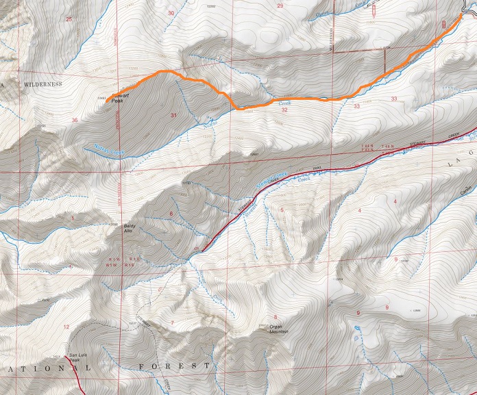
Here’s a topo map of my route, as well as the drive in.
It was still early in the day. I ate a sandwich as I drove the 3 hours to the next trailhead during a thunderstorm.
Woohoo! Unexpected summit day! The only downside? The weather was terrible across the entire state of Colorado!!! I had a full day I could use for hiking (I didn’t need to be home until 6pm) but it seemed everywhere I looked there were storms forecasted for the night before and all day. The best forecast I could find was in the San Luis Peak area, where it was supposed to rain all night until 5am, then stop until noon (when thunderstorms would hit). I hate to waste an opportunity to hike, so I woke up at 11:45pm and drove 5 hours to the trailhead. It rained the entire way, from the time I left my house until I arrived at the Nutras Creek Trailhead at 4:45am. Oh, and I saw a bear as I was driving through Divide (high-tailing it away from me as fast as it could, why do they always run away?).
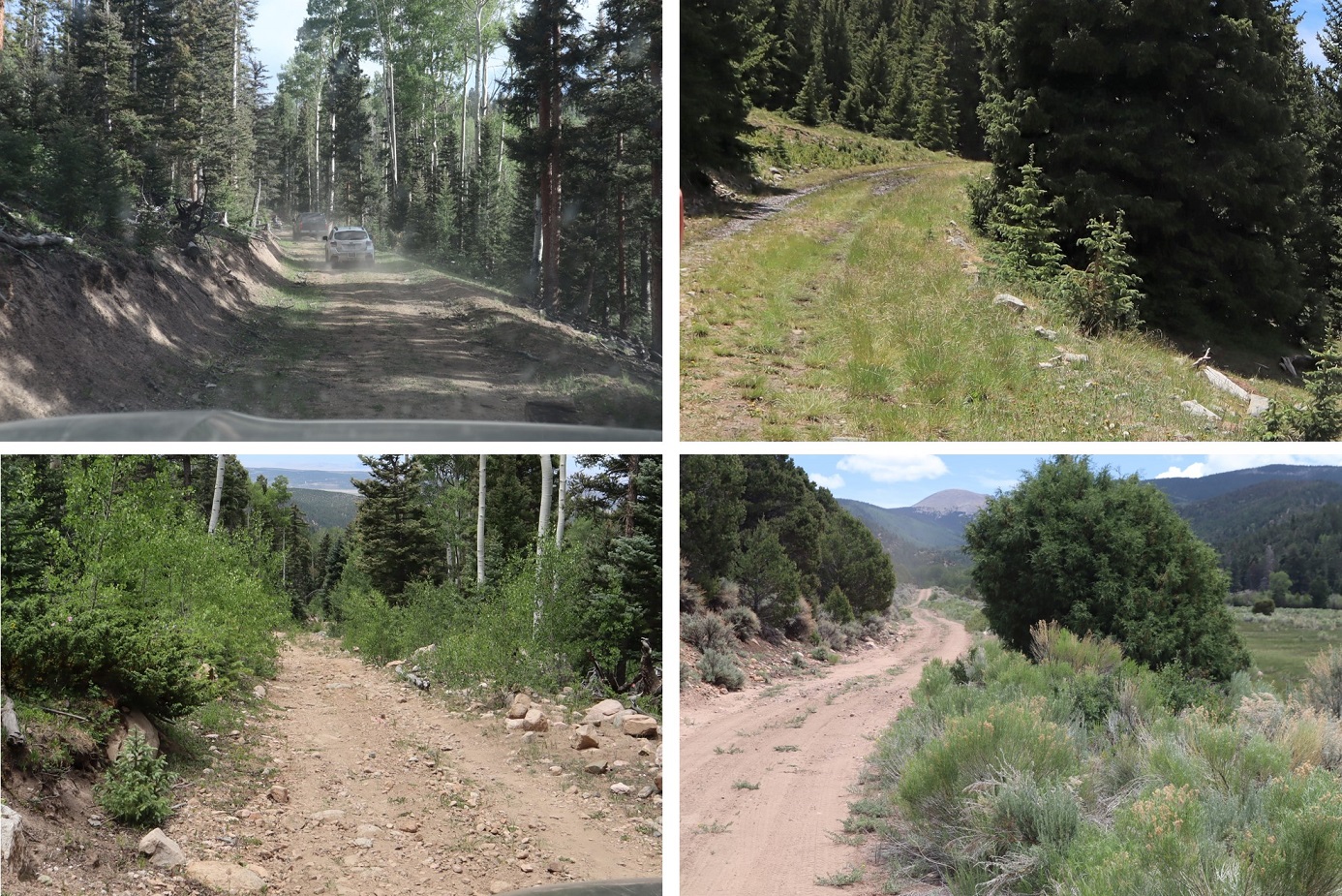
The road in is 20+ miles of 2WD dirt road, unless the Pauline Creek is high then it’s 4WD (it wasn’t). I absolutely love this road! It’s a great/solid 2WD dirt road that goes on for miles and miles and miles. I remembered to get gas in Salida this time since the gas station in Saguache is closed at night.
A plus to the rain? There were tons of puddles on the road in! I had fun aiming for them and watching the water/mud splash up past my rear view mirrors. Everyone should have a truck.
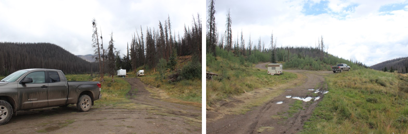
I made it to the Nutras Creek Trailhead and parked on the side of the road because what looked like the parking area had a couple of trailers set up and there wasn’t any actual parking available.
The trailers looked semi-permanent. I sat in my truck, eating Ritz crackers, waiting for the rain to stop. It didn’t. Hmmm. It was now 5am and I wanted to get on the trail, so I decided to set out anyway. It was just a light rain at this point and it was supposed to stop soon, what harm could it do?
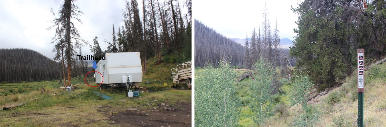
There was a sign that said “Nutras Creek” directly over the bridge covering the creek. This is NOT the trailhead. After some searching I found the trailhead, located behind the trailers. When I arrived and parked the lights were off in the trailers, but as I passed them looking for the trailhead, swinging my flashlight back and forth trying not to make noise (there was a generator going, so I knew they were occupied and didn’t want to be seen as a prowler) l noticed the lights had switched on and I could smell coffee. There was a lot of logging going on in the immediate area. I figured they were either hard core early rising campers or loggers.
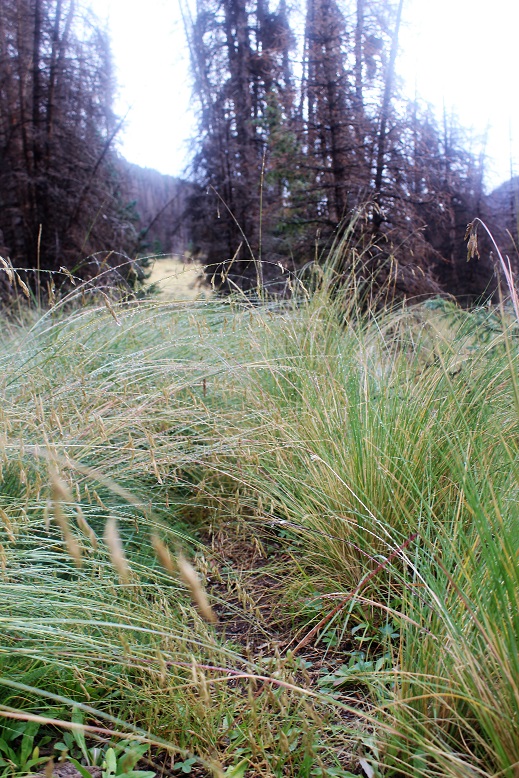
After last Friday’s fiasco with the GPX app I downloaded another one. Before beginning I started the track. Almost immediately the rain died down. I considered this a good sign and hoped the clouds would move so I could see the stars. No such luck. The clouds never lifted. Well… at least it wasn’t raining! That was a plus, right? Well, kind of. You see, it had rained all night, and the trail was covered in tall grass heavy with water. As I trekked I brushed past the grass and thus copious amounts of water droplets. Here’s a picture from later in the day
I’d worn my new hiking pants, which boasted they were water proof and bug proof. Let me tell you, they were NOT water proof/resistant/etc. I was immediately soaked: It was like I was wearing a cotton bandana instead of pants. I had on waterproof hiking shoes that I’ve trekked across numerous creeks with without getting my feet wet, but as I hiked today the water soaked through my pants, then my socks, and drained into my shoes. Within minutes I was squishing in my shoes as I was walking. This was not good on so many levels. I knew this meant I’d most likely need to turn back before summiting, but I drove this far: I wanted to at least get some hiking in. So I kept hiking.
There was a trail in the beginning, and then there was no trail. Then there was a trail again, but I couldn’t really tell if it was a trail? Then there were two trails…. Ugh! OK, just follow the creek to the right and you’ll be fine. After about 2 miles you have to cross the creek (it was a 2 foot jump but the area was full of brush so kind of hidden)
and then follow the creek again through a small boulder field. There is kind of a trail here, but if it’s not stable (a real possibility) hug the creek.
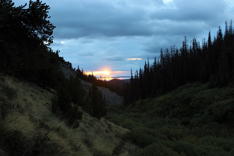
I turned back and noticed the sunrise! I love sunrises!
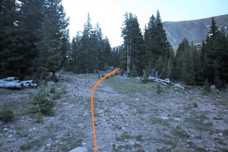
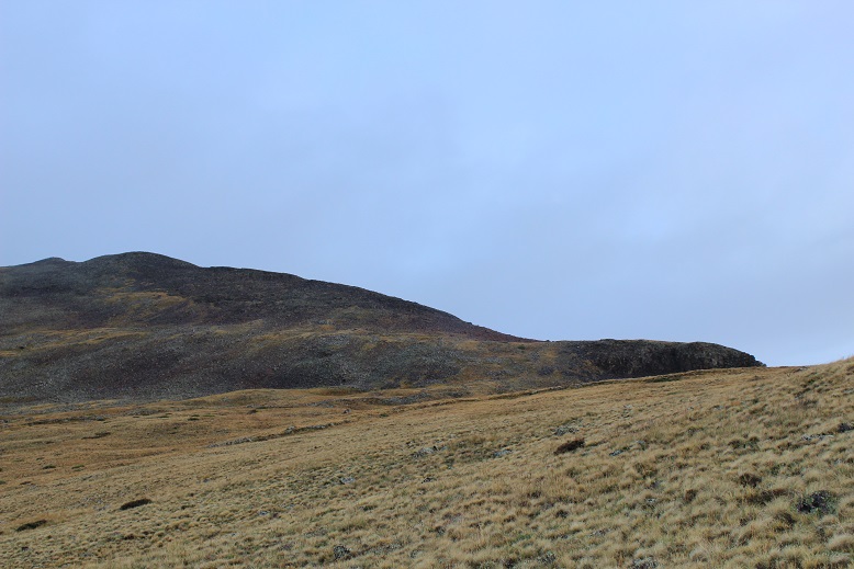
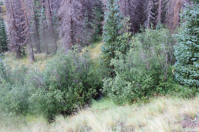
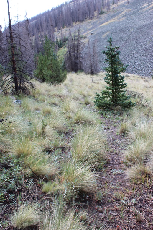
After the boulder field you’ll come across some bristlecone pines. At this point turn right (northwest) and make your own trail until you reach a ridge (above treeline). The area looks like this
There is no trail, but there are dozens of game trails, and after the rain I could see where elk had spent the night and left in the morning (I could tell due to scat and pushed-over grass). One you make it past treeline look left and you can see Stewart Peak. Theoretically. I couldn’t, because it was covered in clouds.
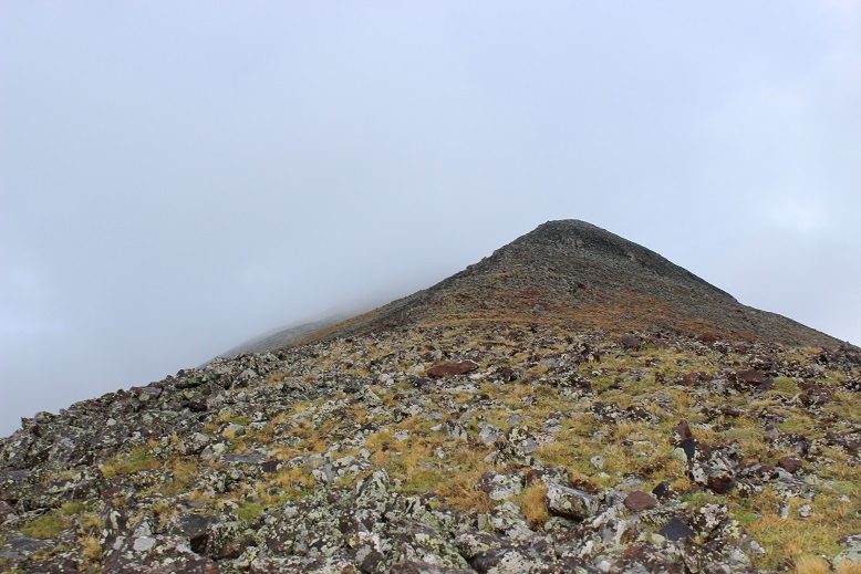
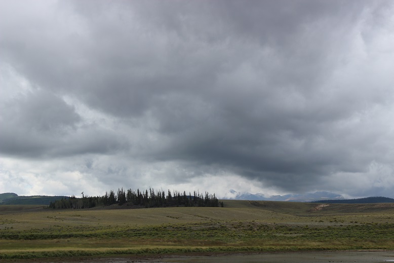
This wasn’t good. It wasn’t supposed to be cloudy!!! There was supposed to be a 50% chance of thunderstorms after noon, but none of the forecasts I’d seen said anything about clouds. 13ers and 14ers tend to make their own weather, and that’s just what was happening here. Clouds were forming in the saddle between Baldy Alto and Stewart Peak, rolling and settling at about 13,500’. I’ve seen this type of thing before, and hoped as the sun rose it would go away.
I turned and headed northwest, staying in the grassy area but aiming toward the ridge.
The clouds lifted and the sun came out! Woohoo! What a great turn of events! My feet were still squishing (I’d hoped they’d dry out by now, but there was so much water on the trail as soon as I started to dry off in an area without grass I’d pass another area full of brush and get wet again).
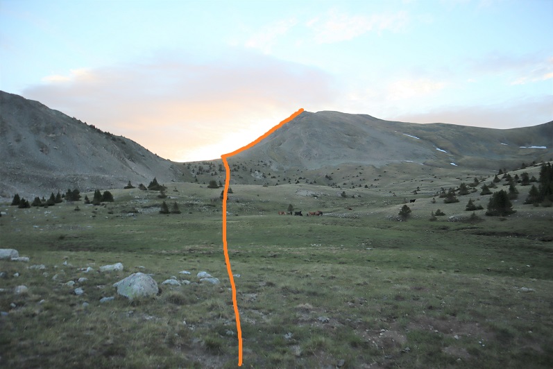
Once you gain the ridge follow it to the summit, passing a bunch of false summits
(or at least that’s what they looked like to me, but it could have been the clouds hiding the true summit… yep, the clouds were back).
Oh, and it started snowing. Ugh!!!
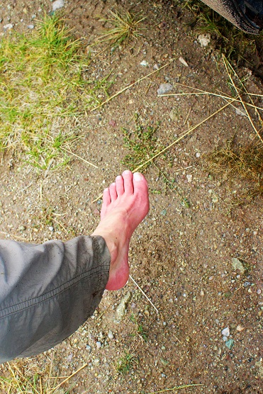
The snow didn’t look like it was going to stop (it didn’t) but I was close, so close to the summit! I decided to trudge on. Oh, and remember how my socks were filled with water? As I gained elevation and the temperature dropped the water in my socks turned to ice. Just as I was nearing the summit I lost all feeling in my feet (no worries, I have Raynaud’s, so I have intense reactions to cold and know how to handle them: I’m sure it wouldn’t have been such a big deal to anyone else). You know that feeling you get when your foot falls asleep and you try to walk but you can’t feel your foot so you’re clumsy and over step? That’s what this felt like. That feeling just before the pins and needles set in, but it didn’t end. And this is what I was walking on…
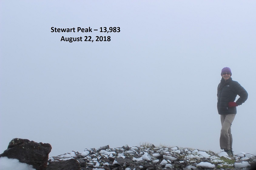
It was icier than it looks. And slippery. I was not a happy camper. I wasn’t prepared for ice/snow. Rain, yes (I had an umbrella, poncho, and my North Face Jacket) but snow? Nope. I needed warmer clothes. All I had warm weather wise were two pairs of gloves, a knit hat, and a heavy jacket. I needed better boots, socks, and pants. My pants weren’t keeping any heat in (or ice/rain/wind out for that matter) and my shoes were soaking wet. I carefully limped to the summit… but I made it at 7:50am.
VIDEO:
I’d love to give you a better view, but this is what I got. I did see a confused ptarmigan at the summit
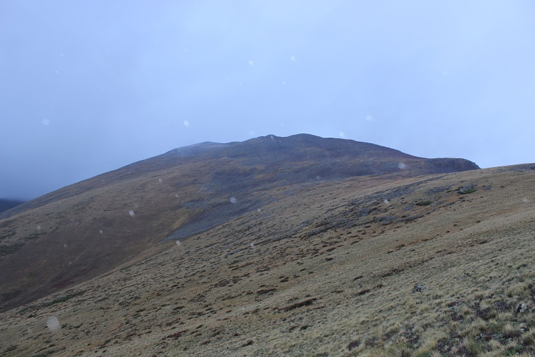
And despite not being able to feel my feet I wanted to continue on. It had been my goal today to summit Stewart Peak, Baldy Alto, and Organ Mountain. I’d gotten a good view of them from the basin and knew which way to go, but once I’d summited Stewart Peak this was my view
I knew to angle left/south, but I’d also see bits and pieces of the ridgeline(s) and figured in the clouds/fog it would be way too easy to get lost. Plus, I couldn’t feel my feet. I hiked about 20 yards towards the ridge and told myself not to be stupid: I turned back. I hate turning back!!! It hurts on so many levels, but it was the correct choice. On the positive side, heading back down meant sunshine, warmth, and eventually feeling in my feet and fingers again…
I kept seeing the clouds roll in and out and in and out and hovering around the peaks. Yes, descending had been the correct decision, but that didn’t keep me from mentally calculating time to figure out if I could skirt the ridge and still summit Baldy Alto… I actually had to stop myself from doing this after turning to try it out… reminding myself my feet would freeze again and I planned on coming back again soon.
Here’s the path back down the ridge
I was saddened by all the dead trees!
Once you get to treeline just head towards the creek and turn left.
The sun never came out, so once I made it back to treeline I was soaked all over again. Here’s one of the better trails
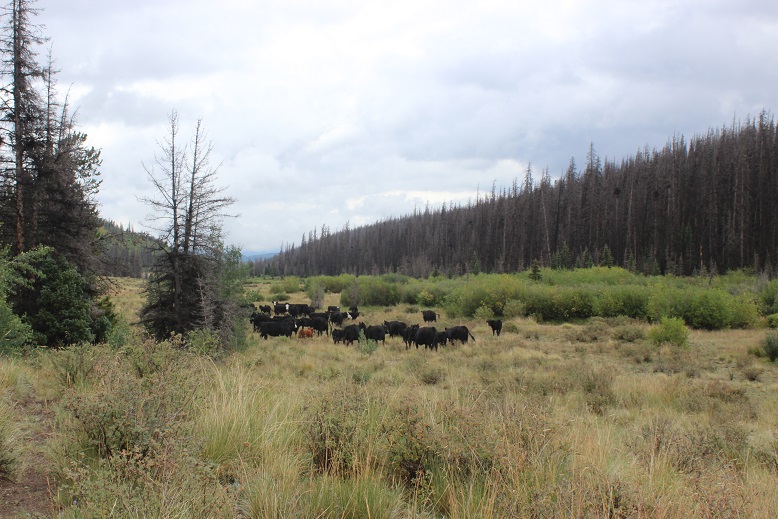
Oh, and the cows! One of the reasons there are so many trails are the free range cattle. I encountered a bunch of them on my way out. I’m a fan of cattle: I used to raise them. However, these cattle weren’t too fond of me. There was a lot of mooing, running as a herd (stampede! OK, not really) and one mama got separated from her calf and was quite vocal about it. I told her to go get her baby. None of this was intentional on my part: I was just hiking and following the trail, they were the ones taking it out of proportion. The downside? When cattle aren’t happy they poop. Immediately. And it’s sloppy poop. It’s some sort of defense mechanism. Fight or flight or some such nonsense (since they always run). In any event, there were slimy cow patties all over the trail, and while I tried to avoid them accidents happen. I had to wash my boots and pants as soon as I got home.
VIDEO:
I made it back to my truck at 10:30am, making this a 10 mile hike in 5.5 hours.
Oh, and my GPX file failed. Again. Even though it was a different app. This time even though I started it the app failed to record anything. I may have to either give this up or bite the bullet and actually pay for an app. Or a GPS. Oh well. Here’s the path I took:
When I made it back to my truck I immediately took off my shoes/socks and did an assessment on my feet: they were bright red and almost done thawing out, but functional (and thankfully not white or black or purple). I’d been a little bit worried I’d caused them some damage with the frozen water (a quick complication of Raynaud’s).
I’m not gonna lie, I was a bit disappointed with my day. I’d planned on 3 summits, and only completed one. It’s not fun to turn back, but it was for the best. In any event, I was able to plan out my route for Baldy Alto and Organ Mountain (I’m thinking Nutras Creek again, up the saddle to Baldy Alto, and then over to Organ Mountain).
On a positive note, I got to drive that fun 2WD dirt road for 20+ miles back to the highway. In the light of day I could see the creek crossing and all the logging that’s been going on. Also, I waved to the loggers as I passed.
Oh, and the clouds never lifted, they just intensified. Yes, it was a good call to head back.