PT 13139 and Williams Mountain

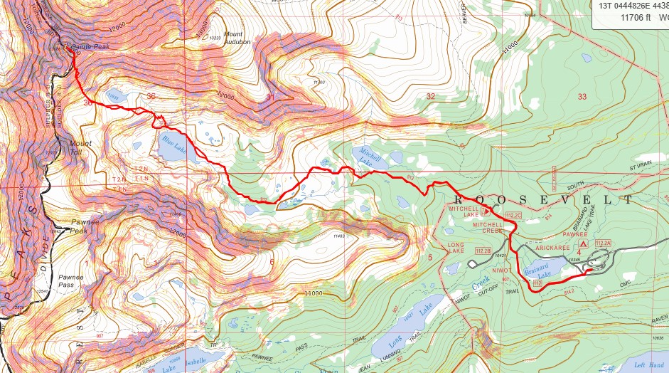
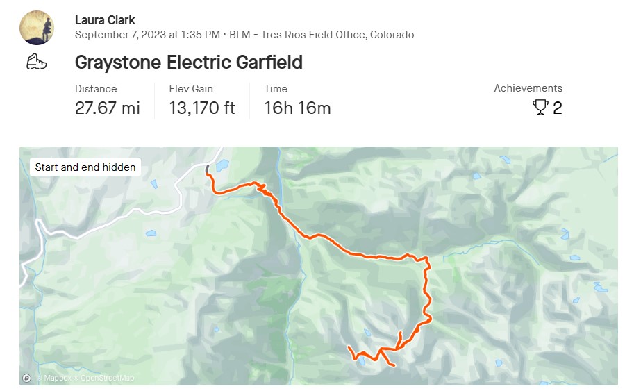
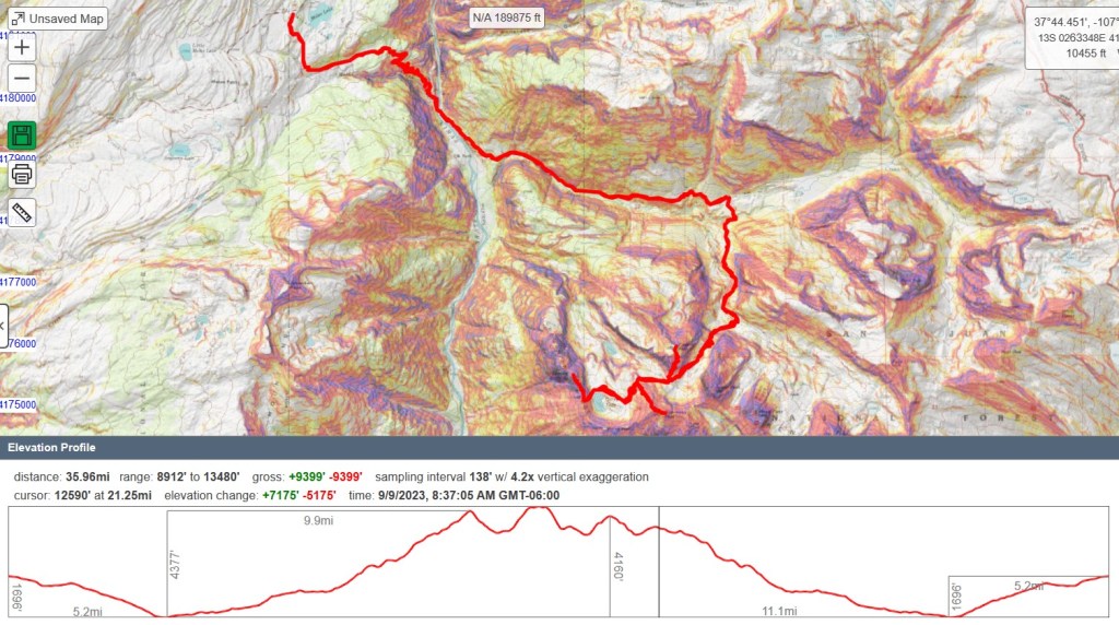
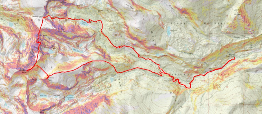
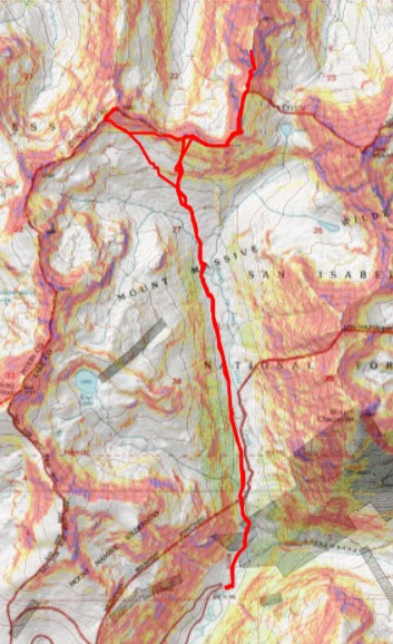
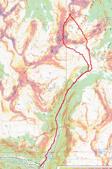
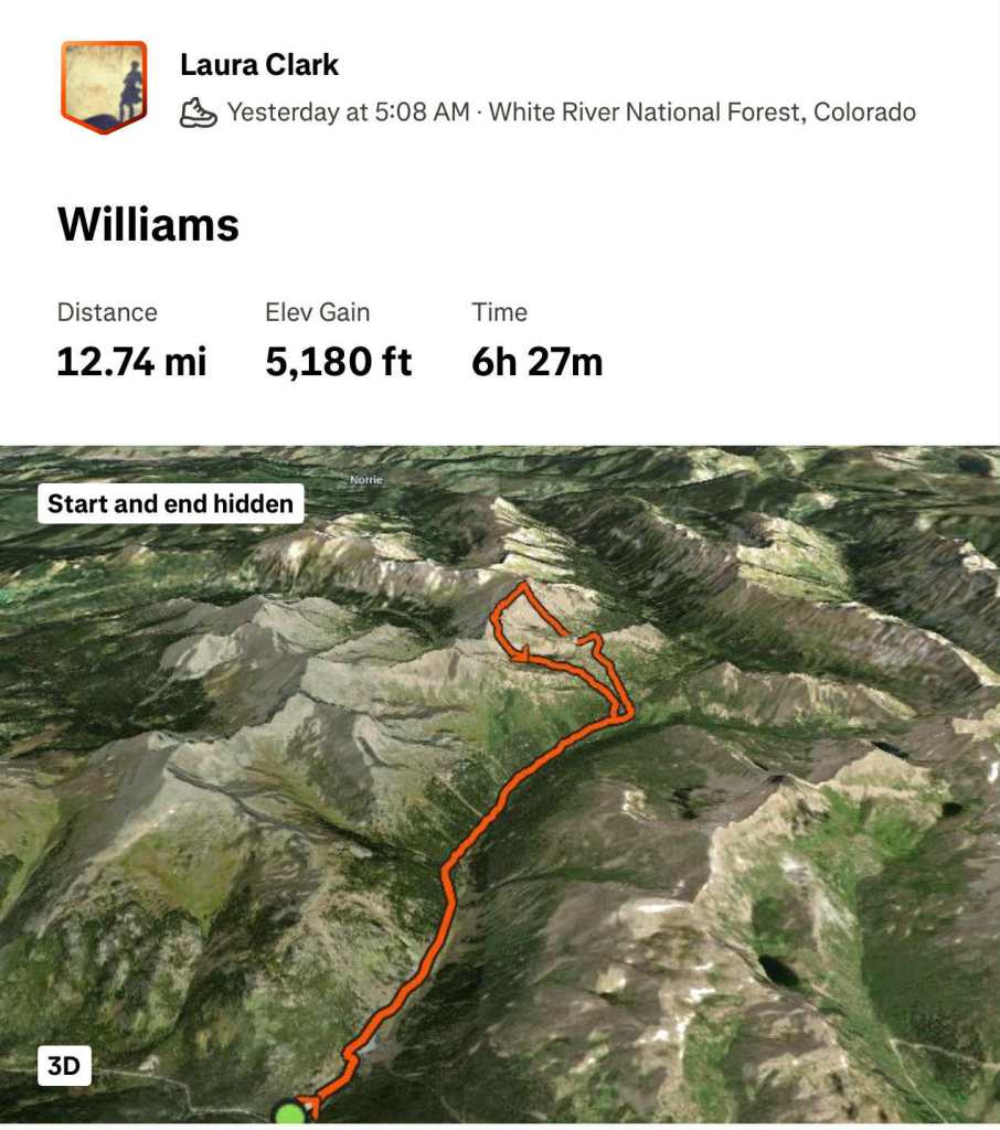
RT Length: 15.26 miles

Elevation Gain: 3918’

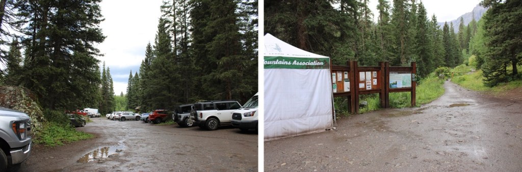
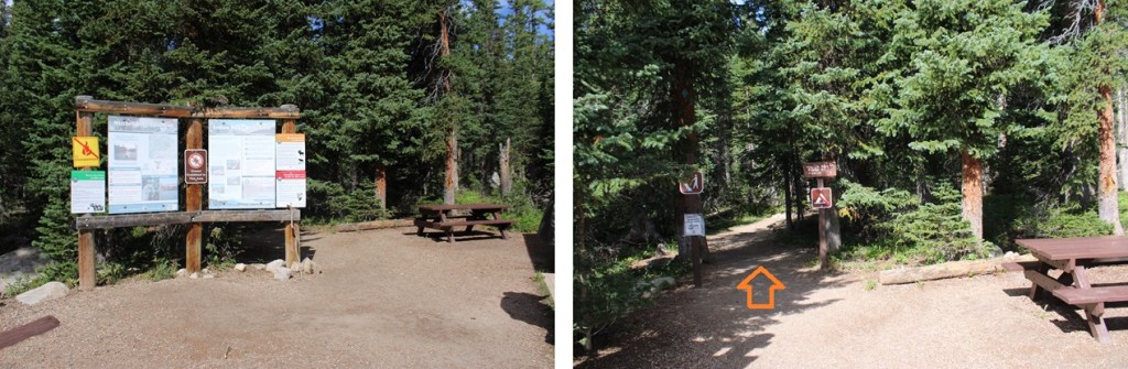
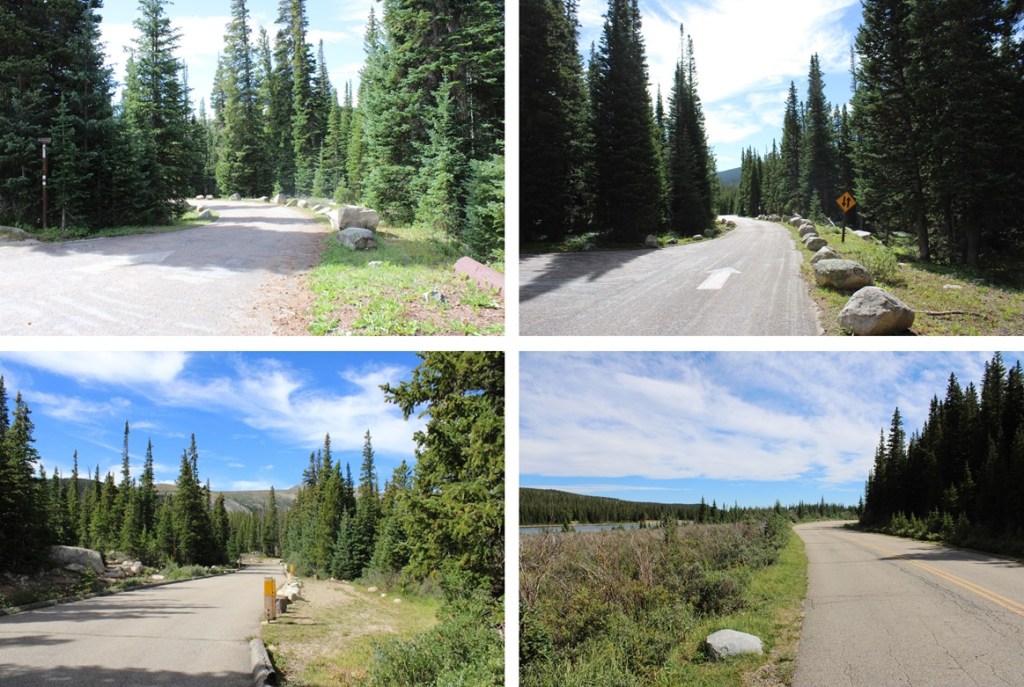
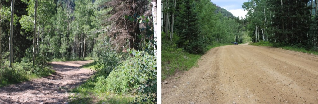
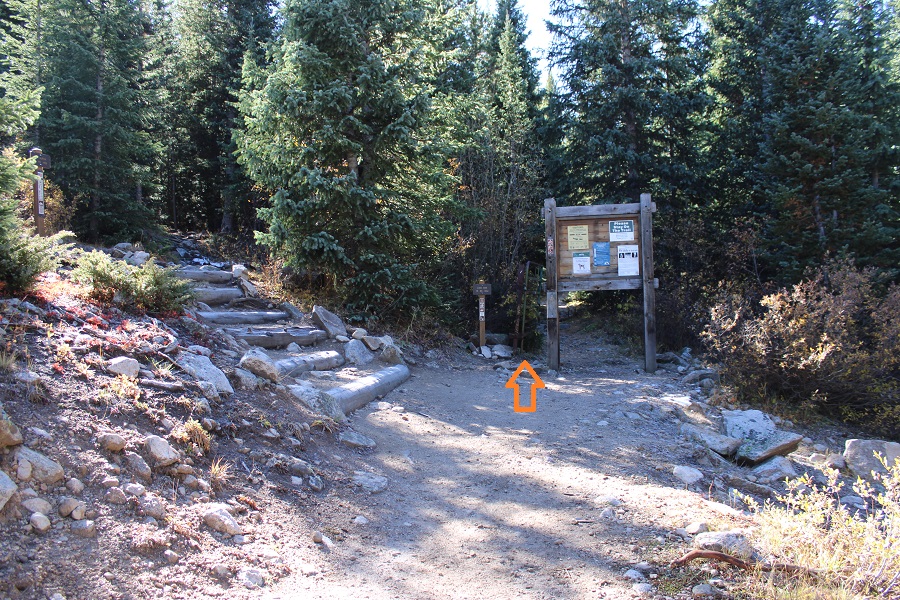
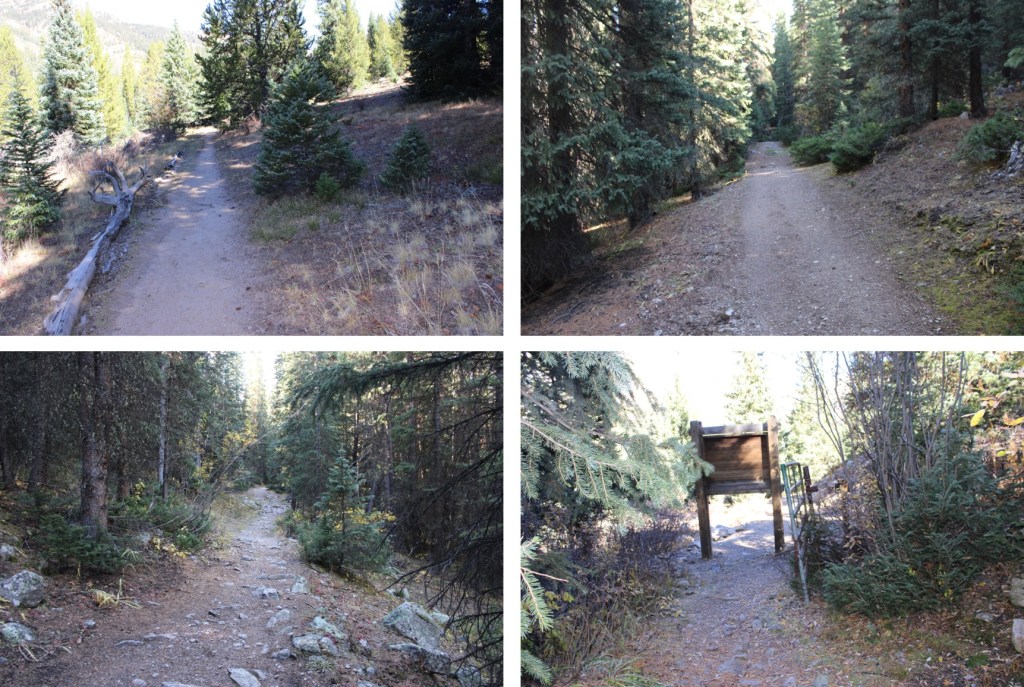
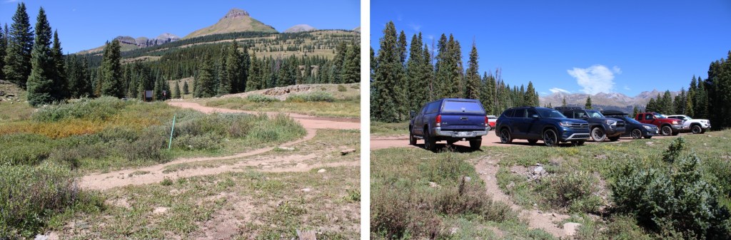
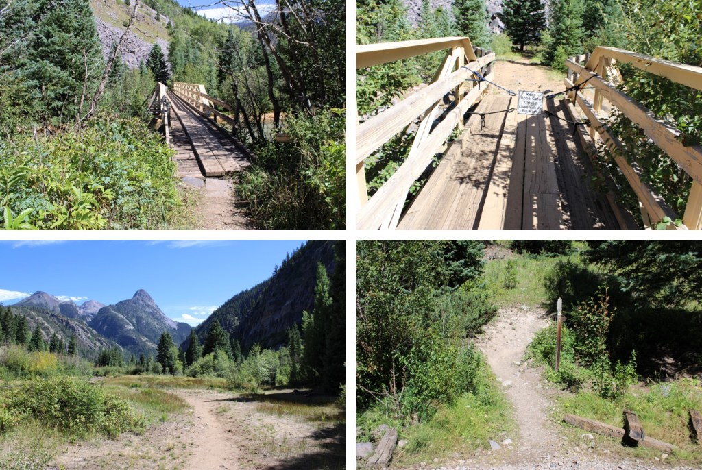
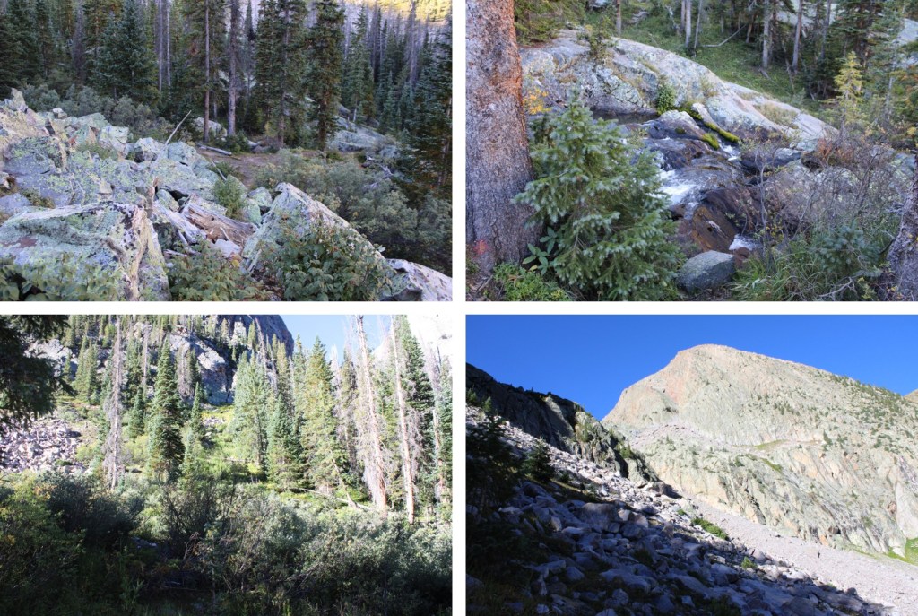
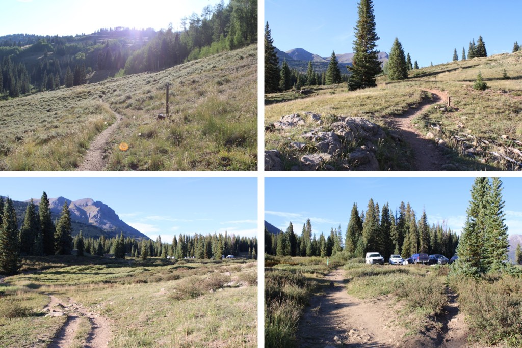
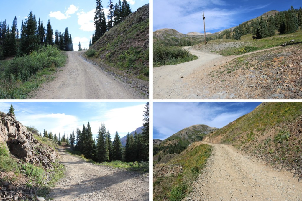
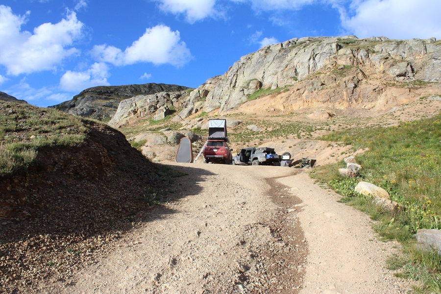
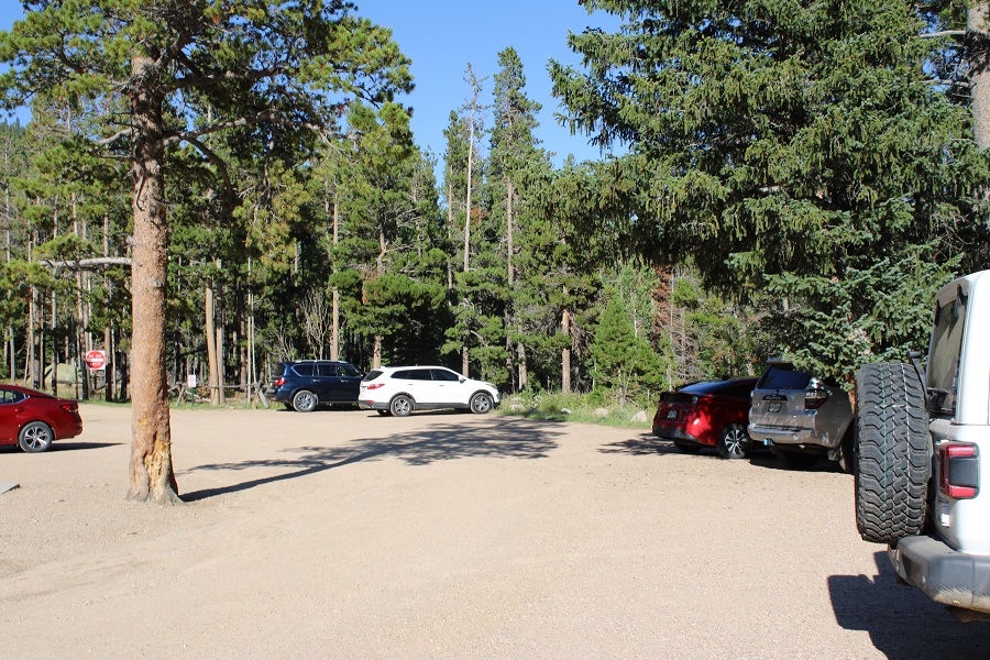
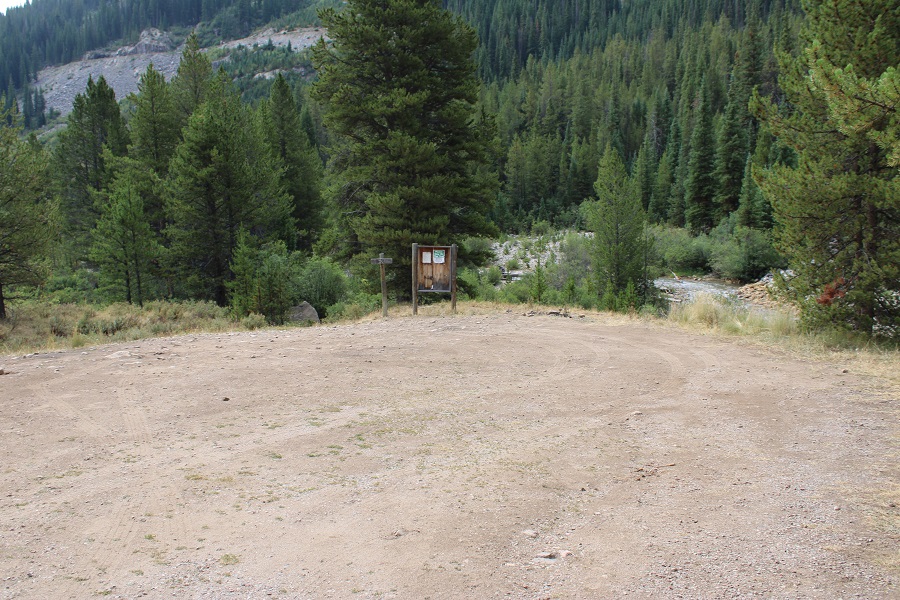
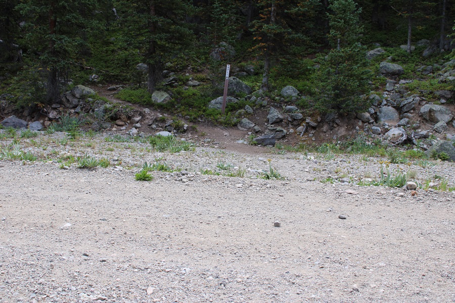
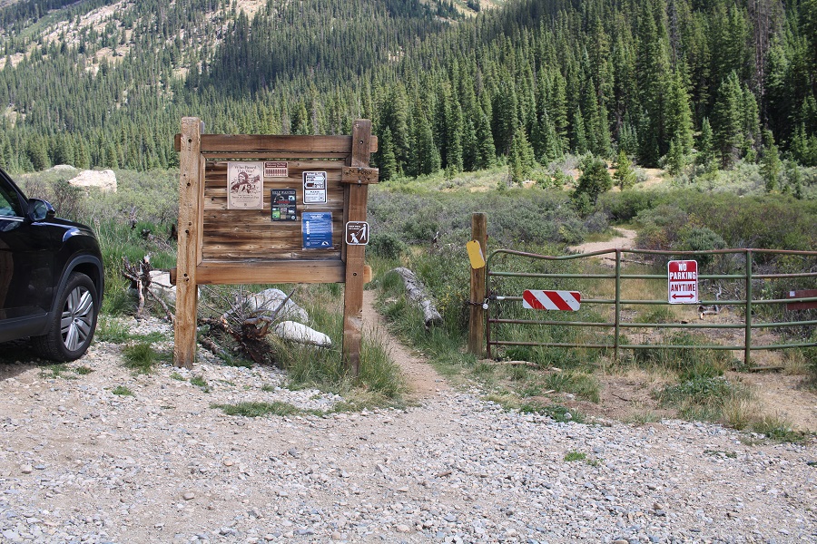
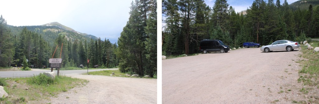
I started from the Lost Man Trailhead at 5am.  This trailhead has capacity for around 35 vehicles, if everyone parks nicely.  The trailhead is obvious.

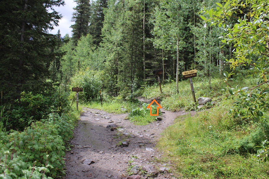
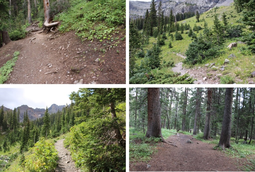
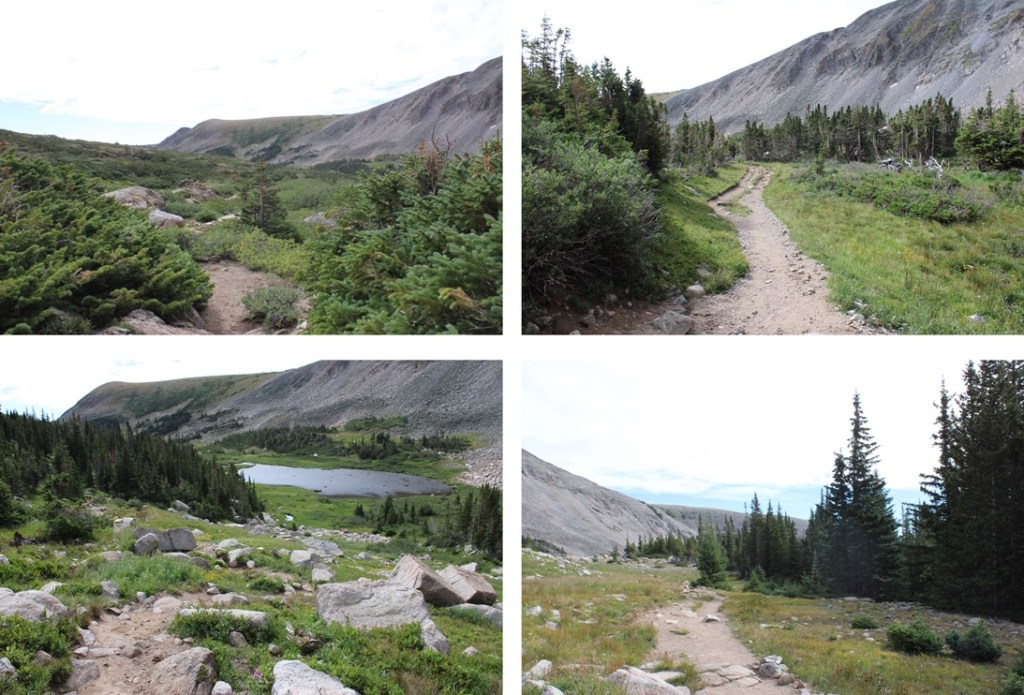
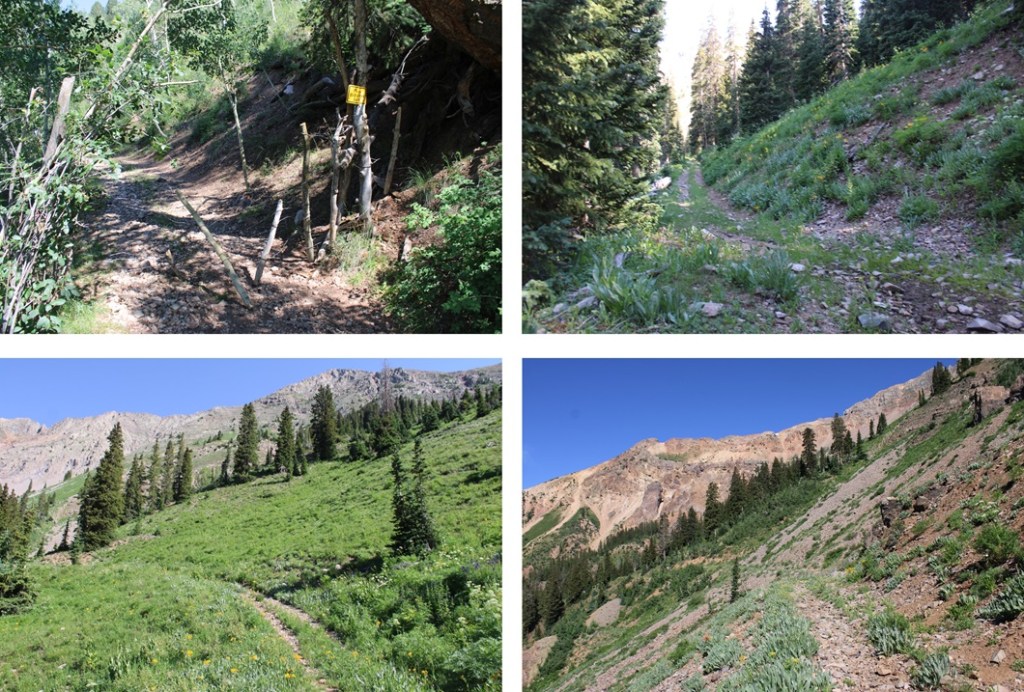
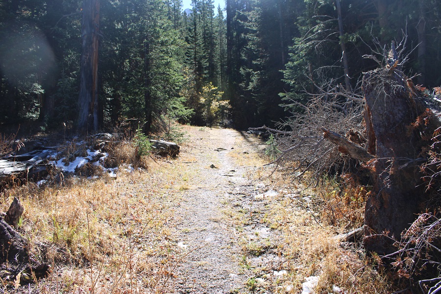
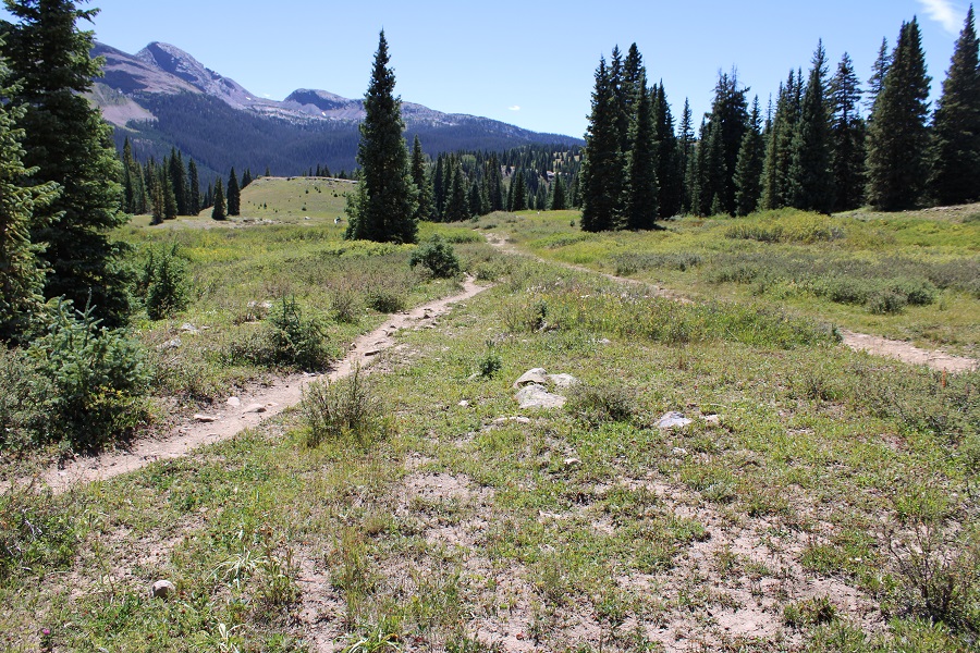
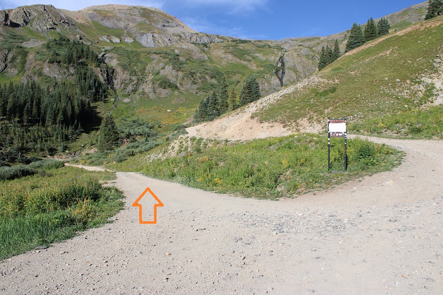
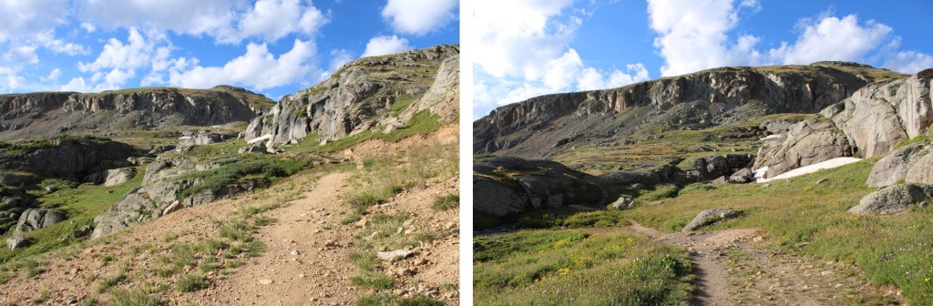
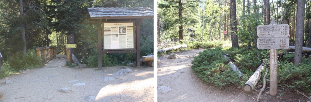
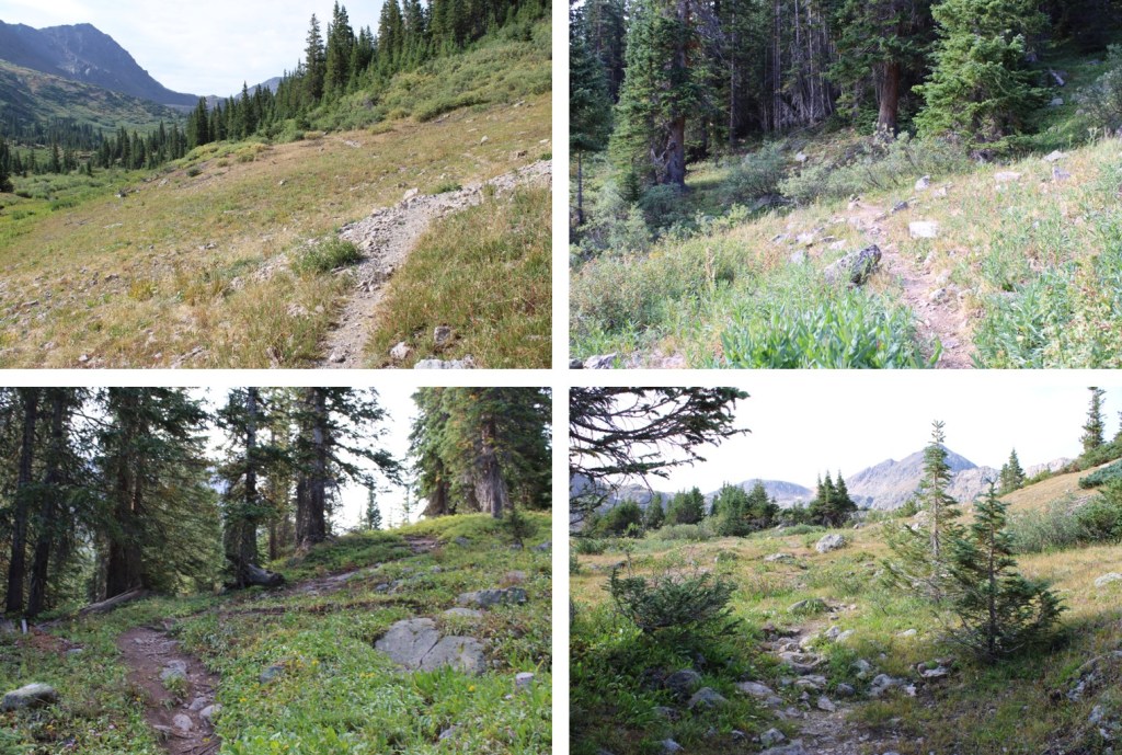
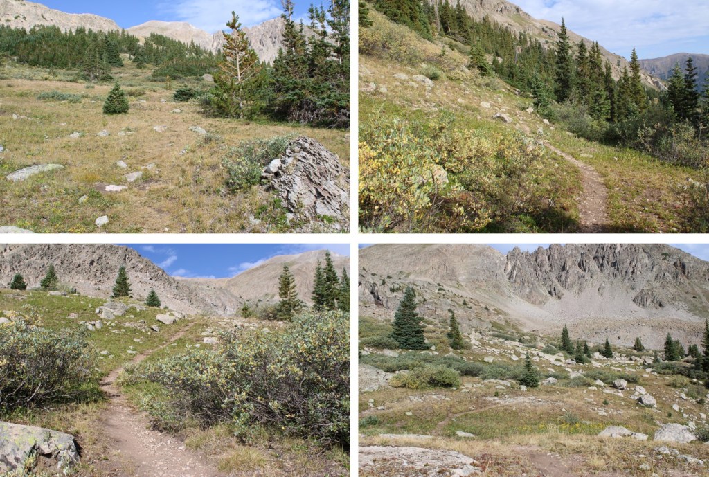
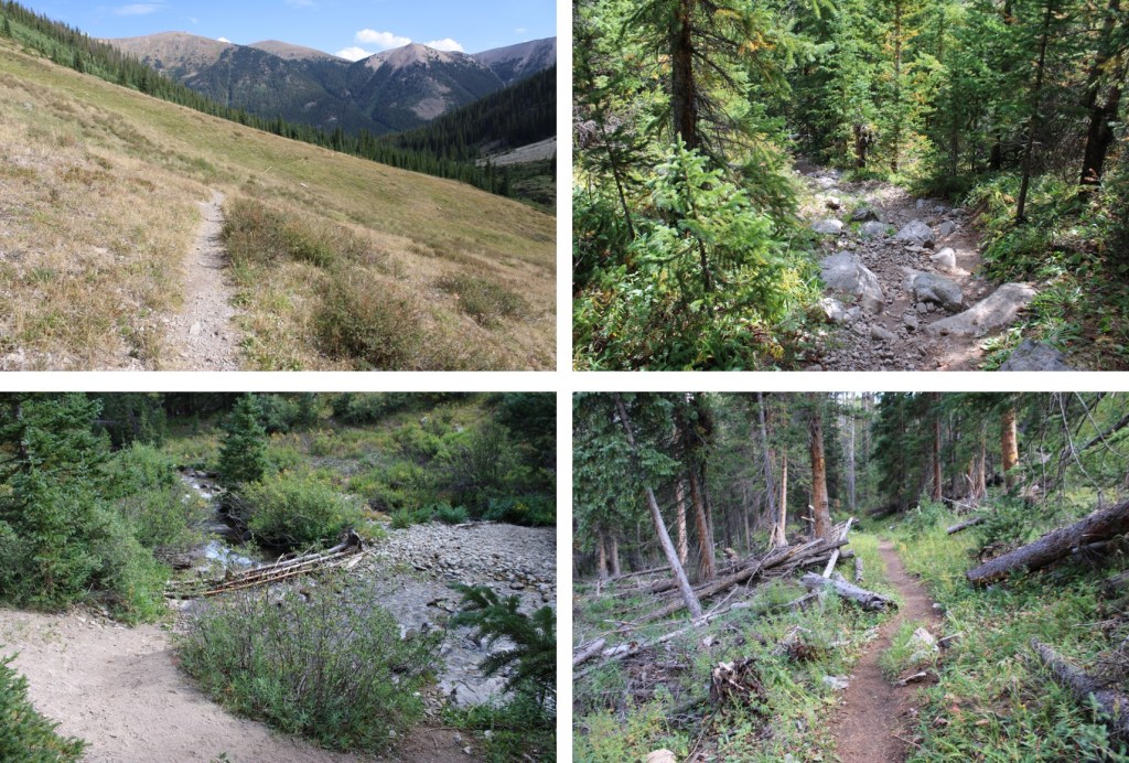
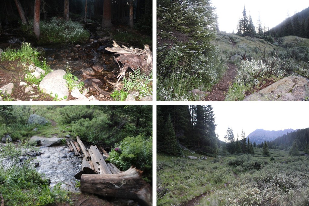
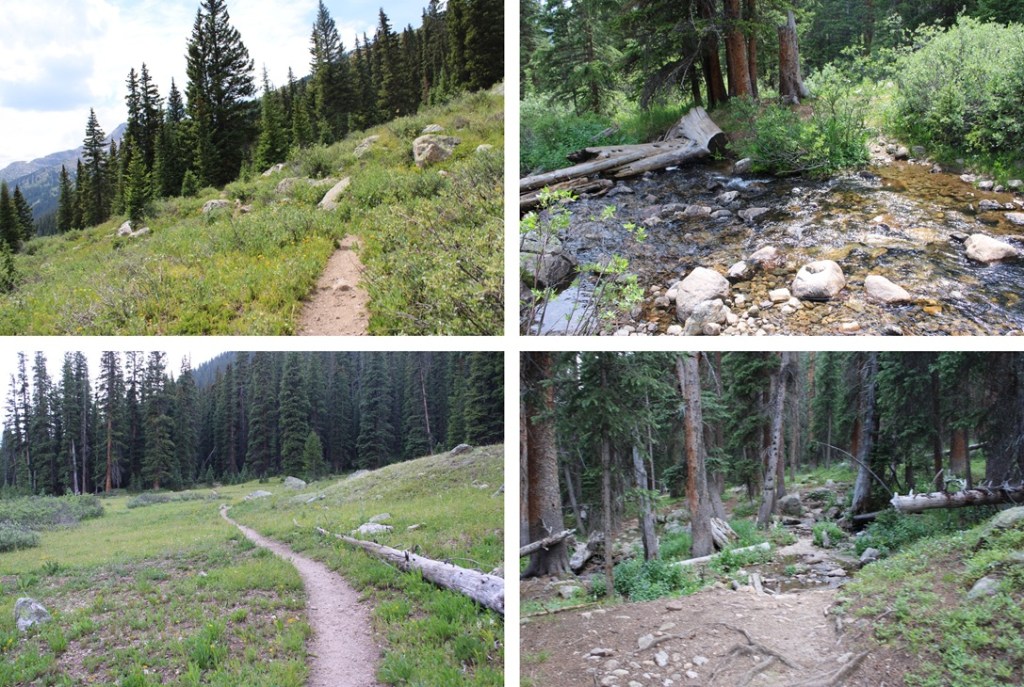
At the trailhead sign I went right, following the Lost Man Loop Trail.

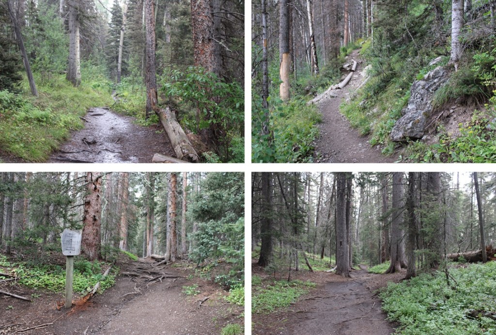
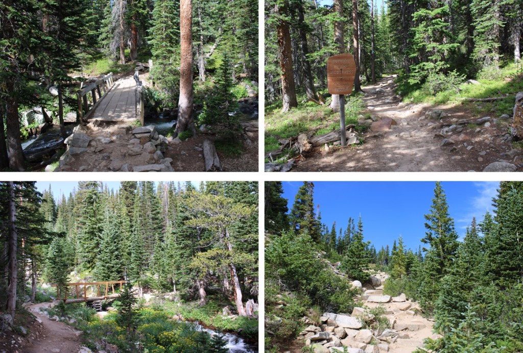
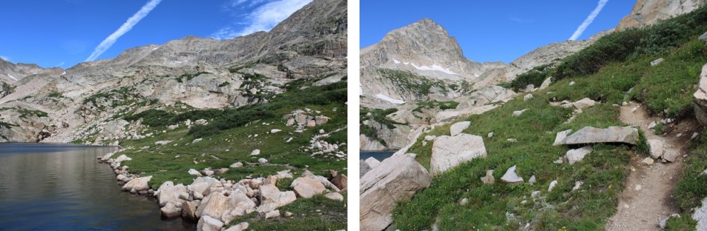
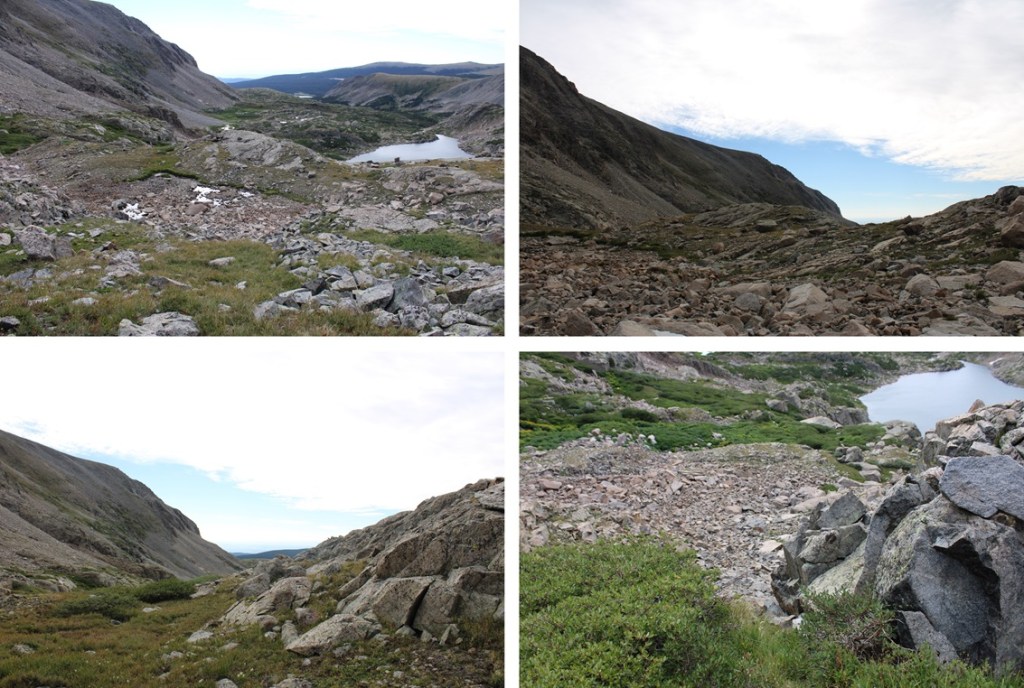
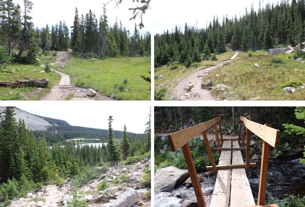
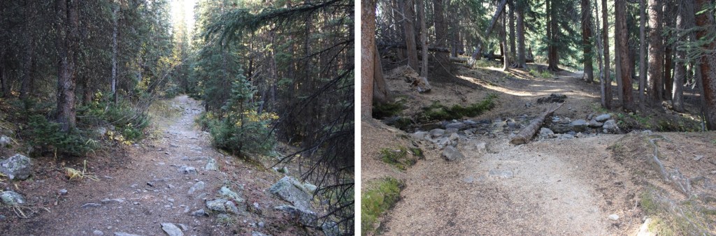
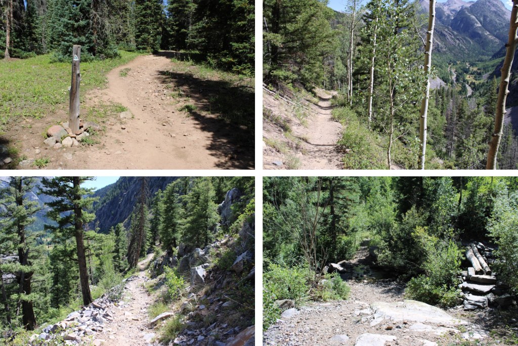
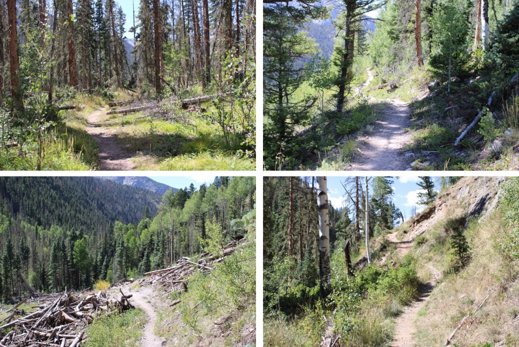
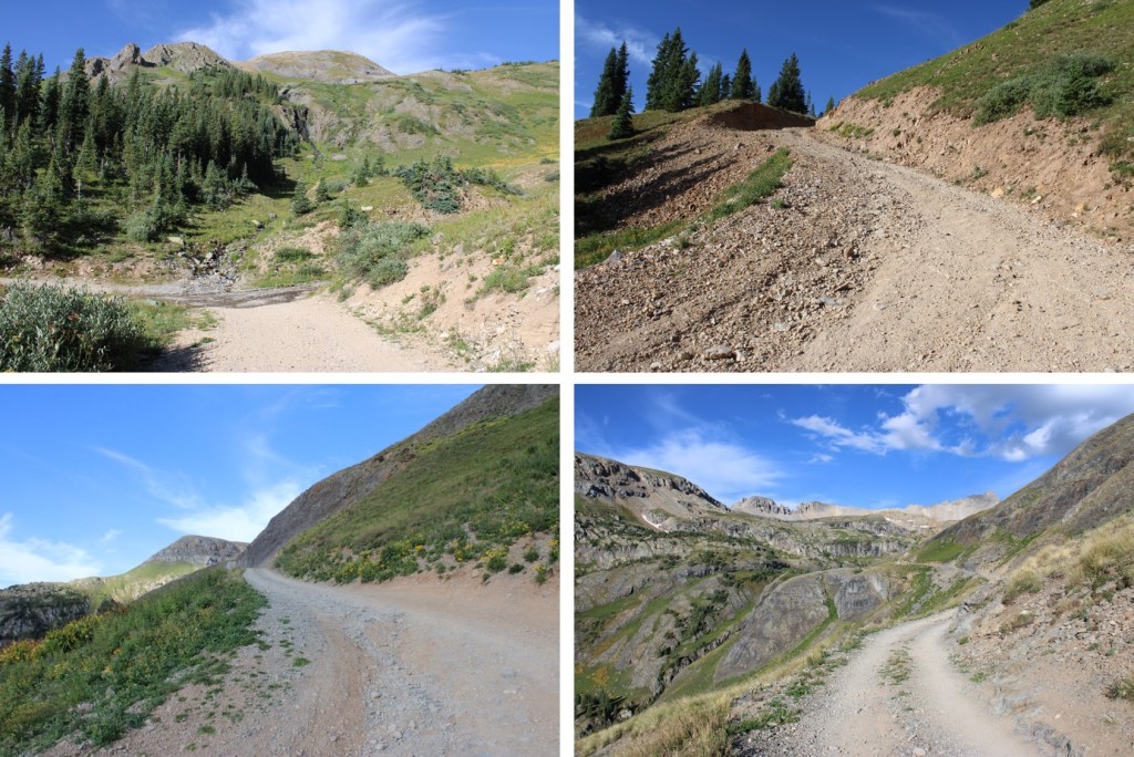
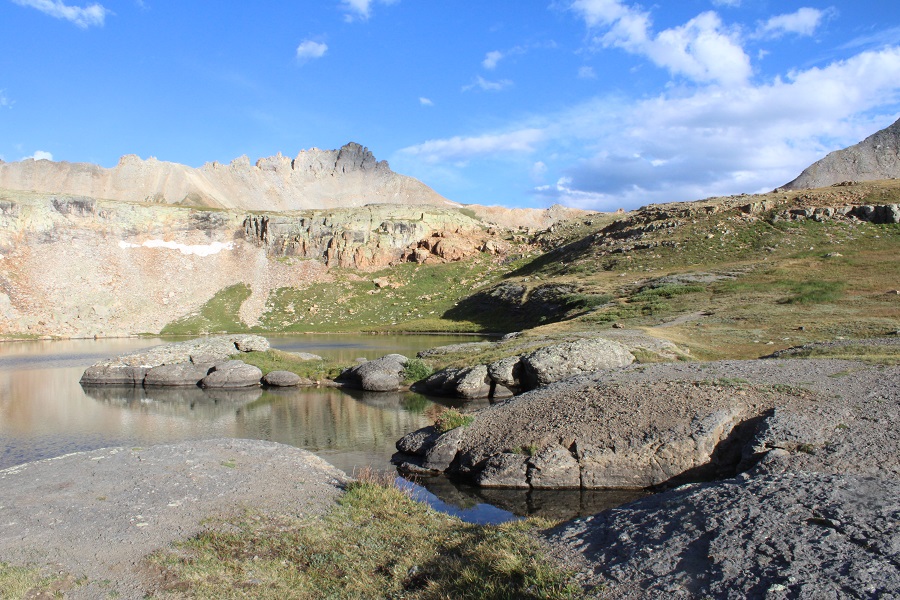
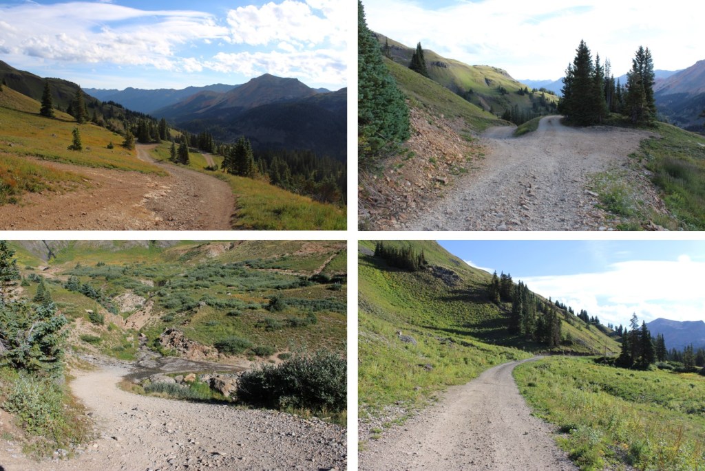
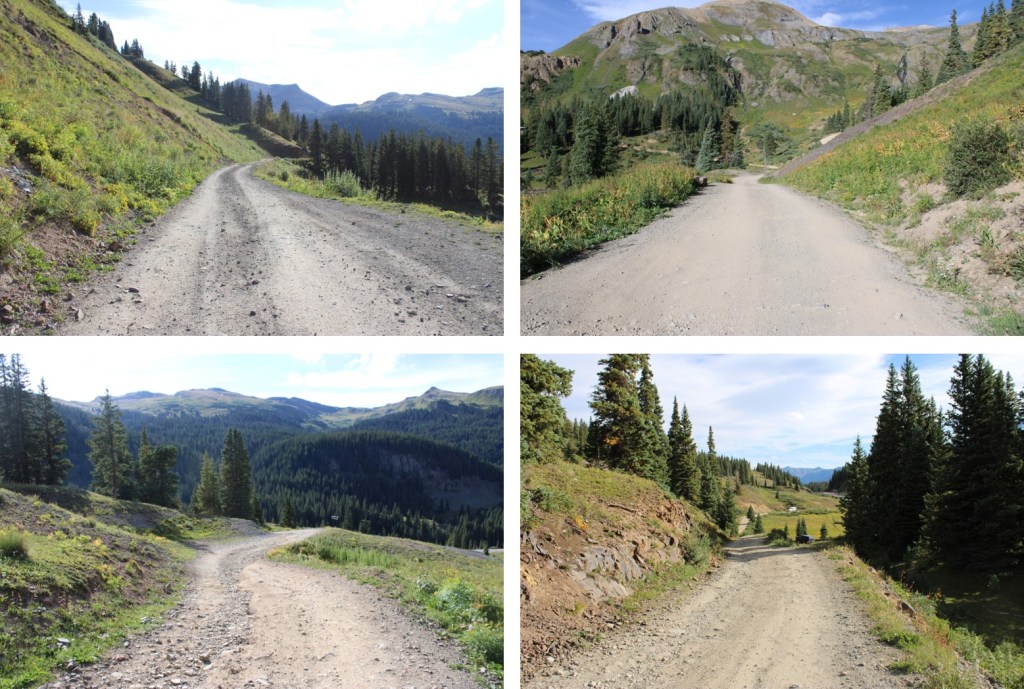
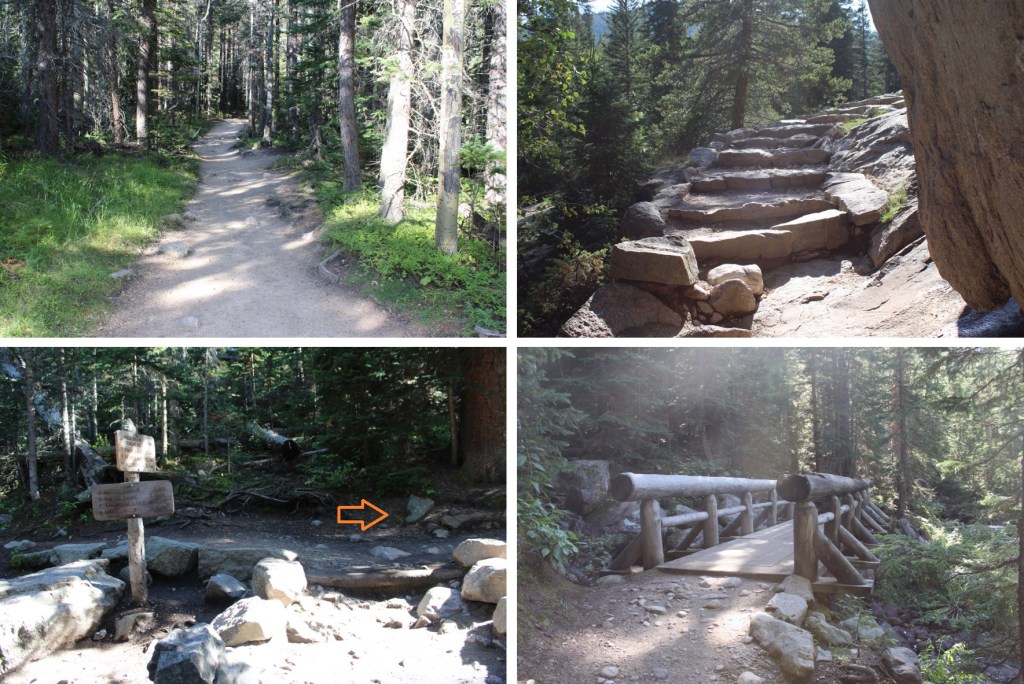
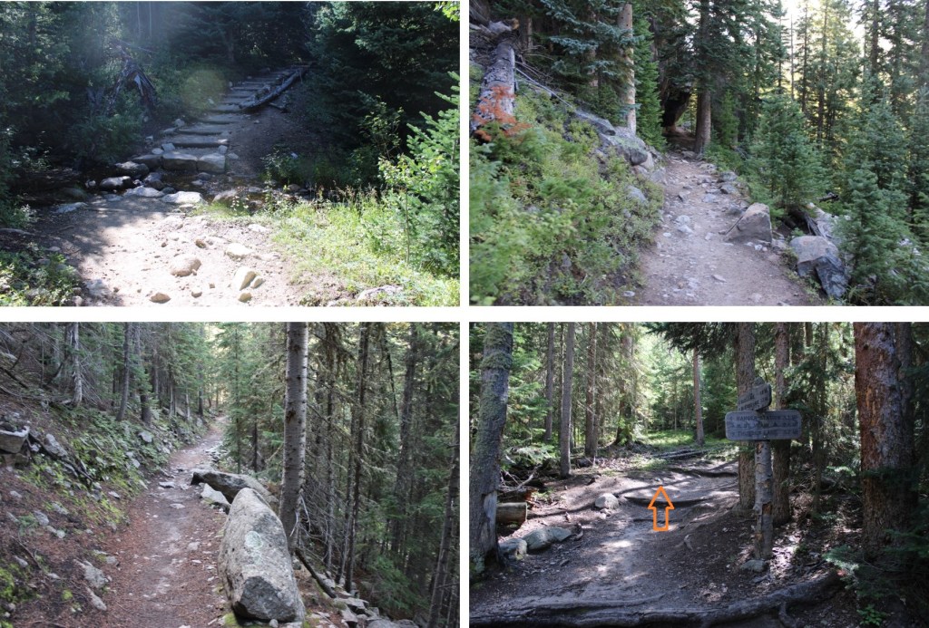
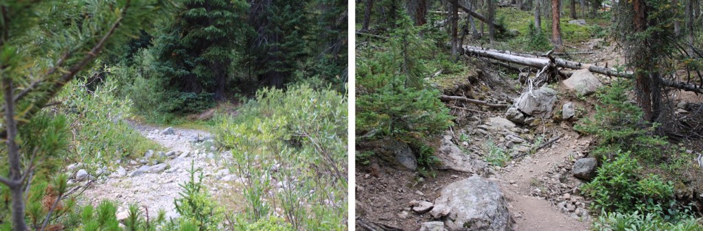
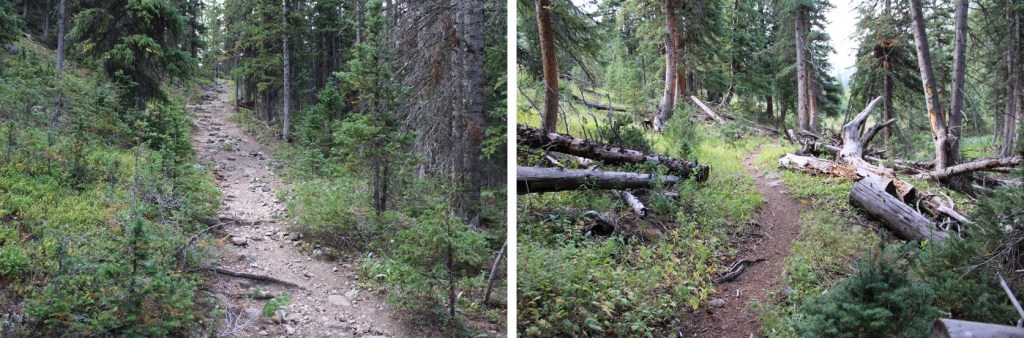
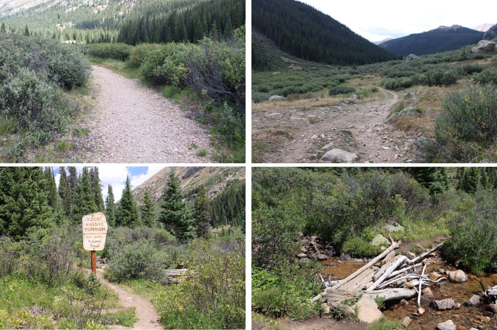
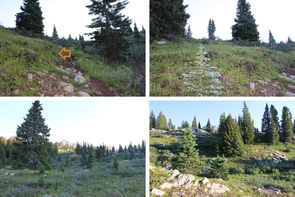
This is a well-maintained class 1 trail that passed by Lost Man Reservoir and then continued north, paralleling Lost Man Creek.

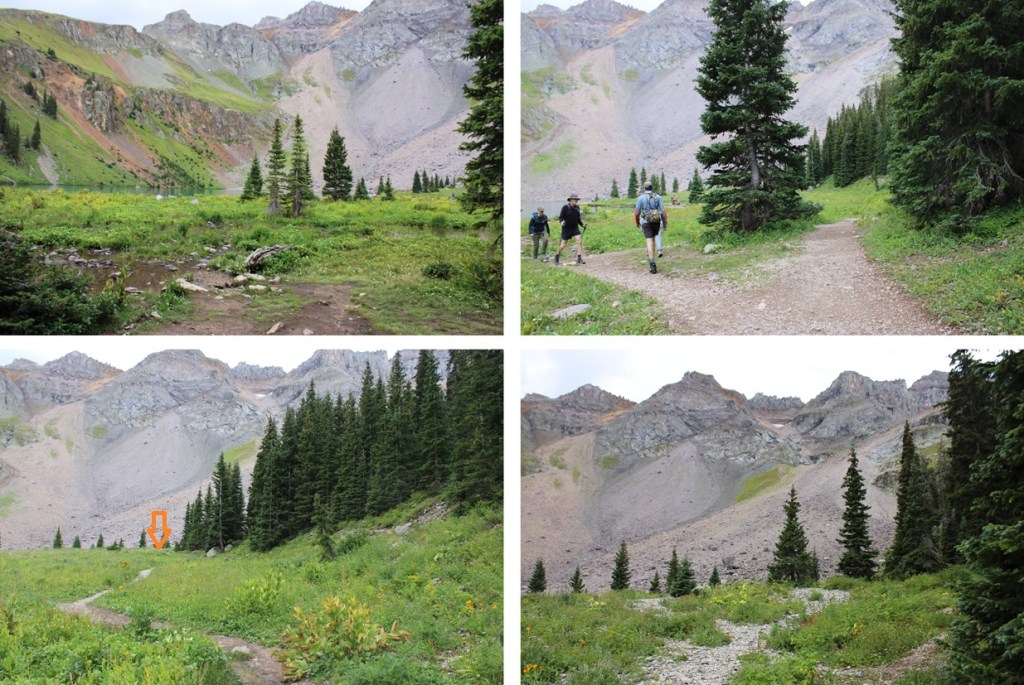
I followed this trail for about 4 miles.  If you make it to South Fork Pass you’ve gone too far.

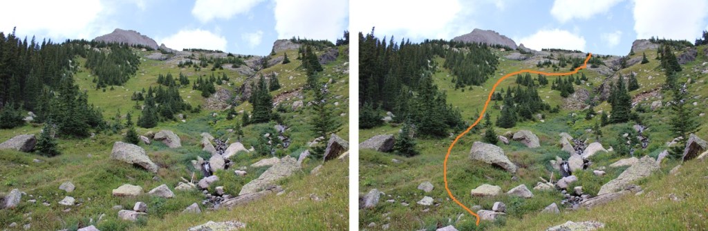
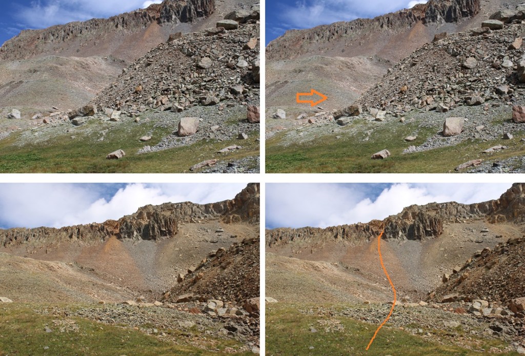
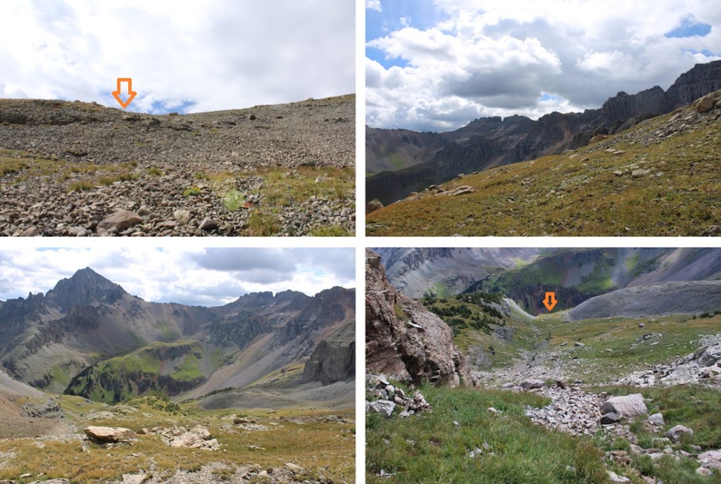
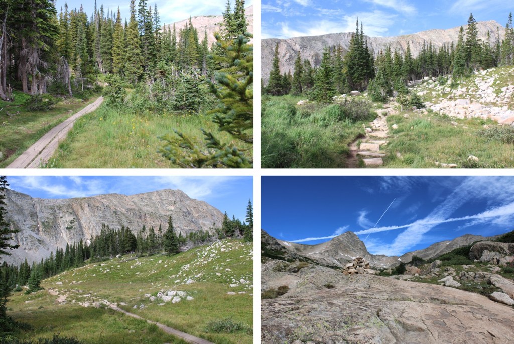
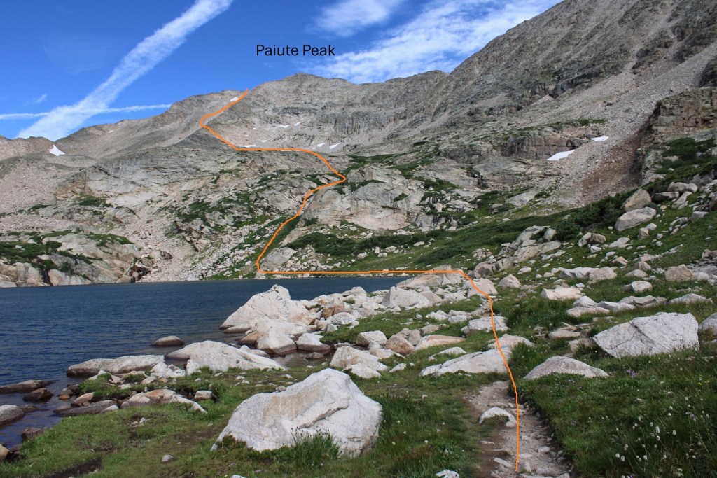
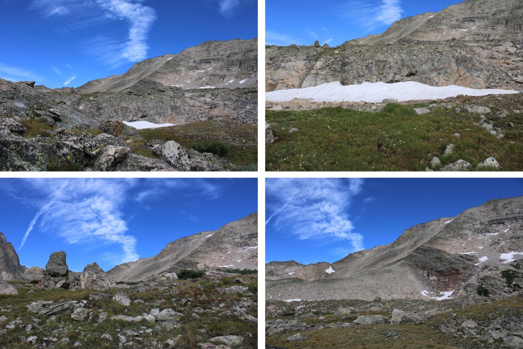
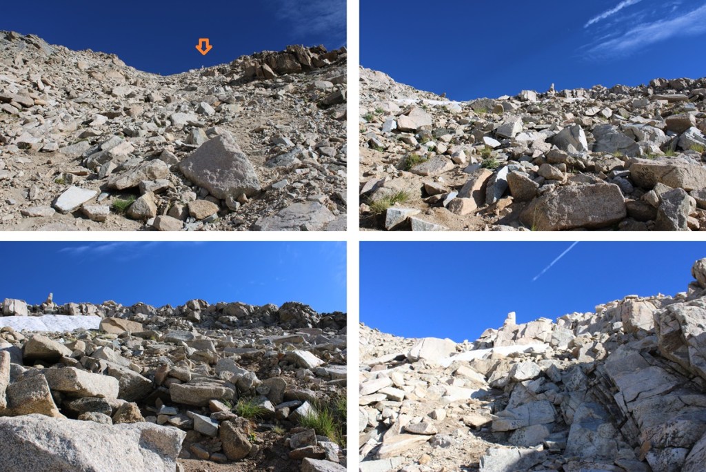
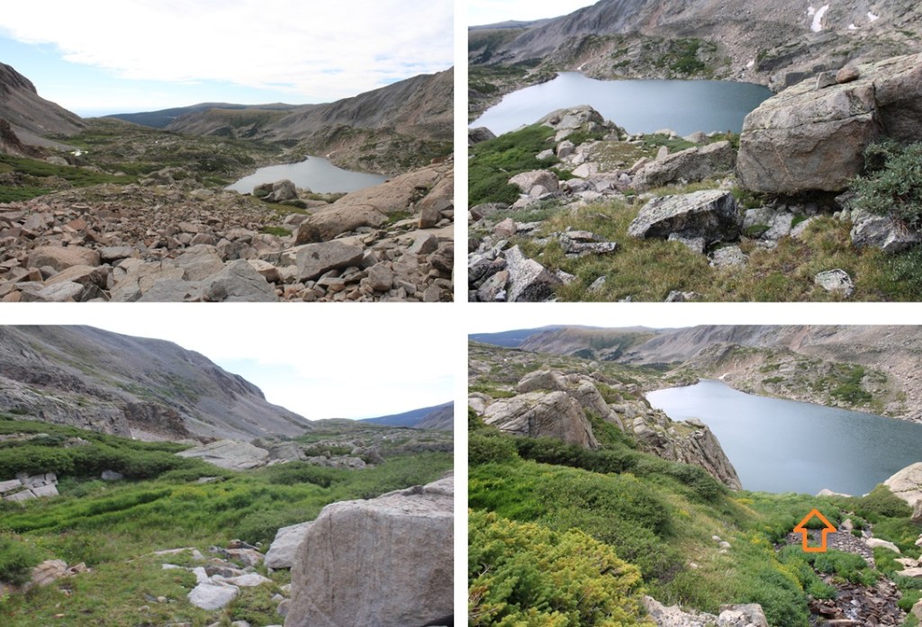
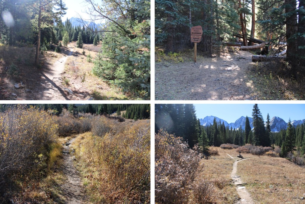
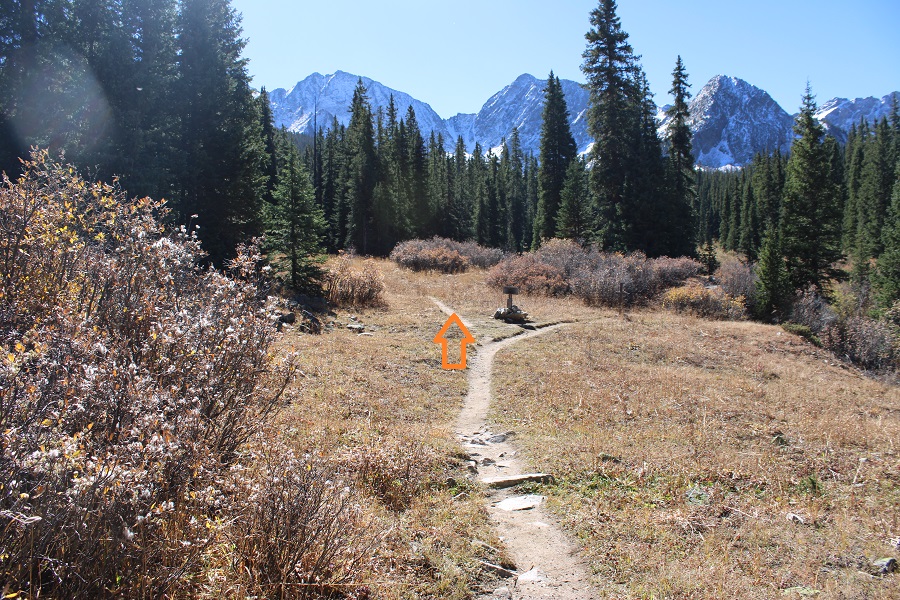
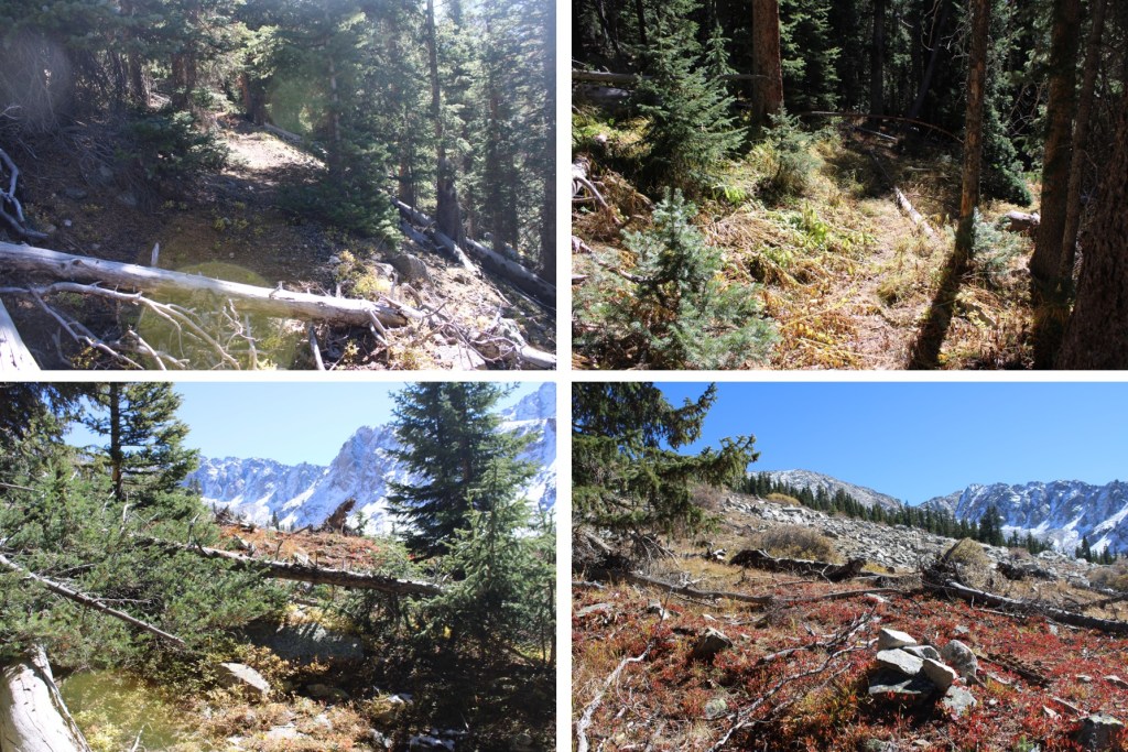
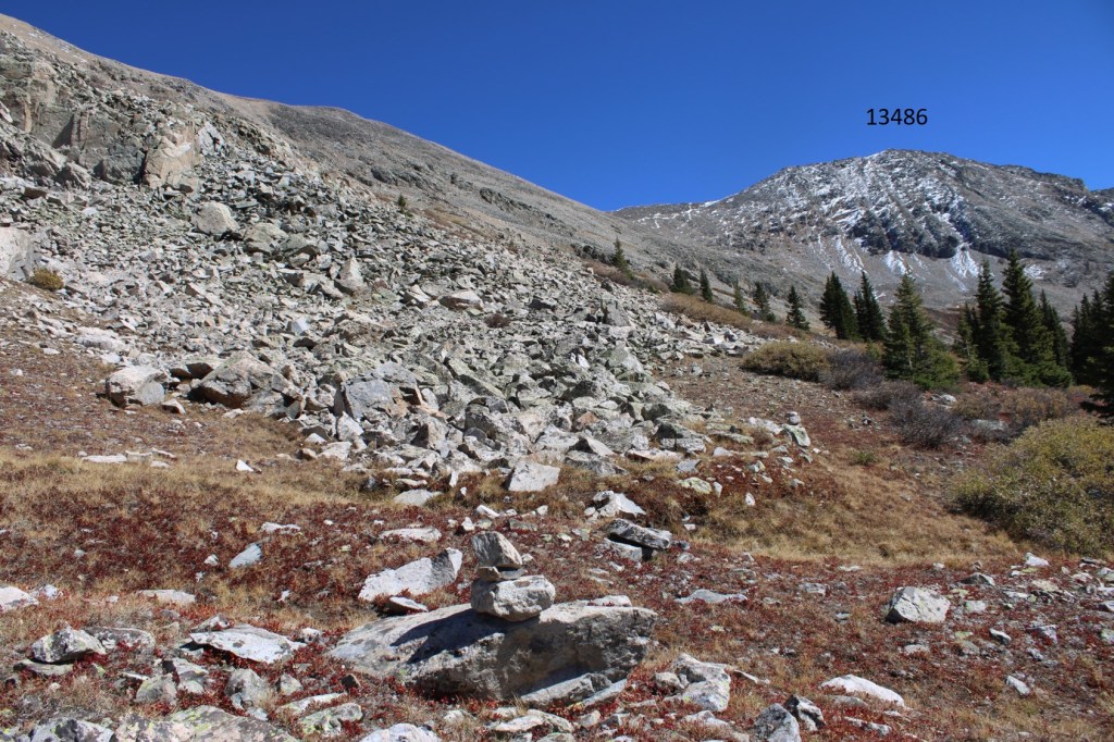
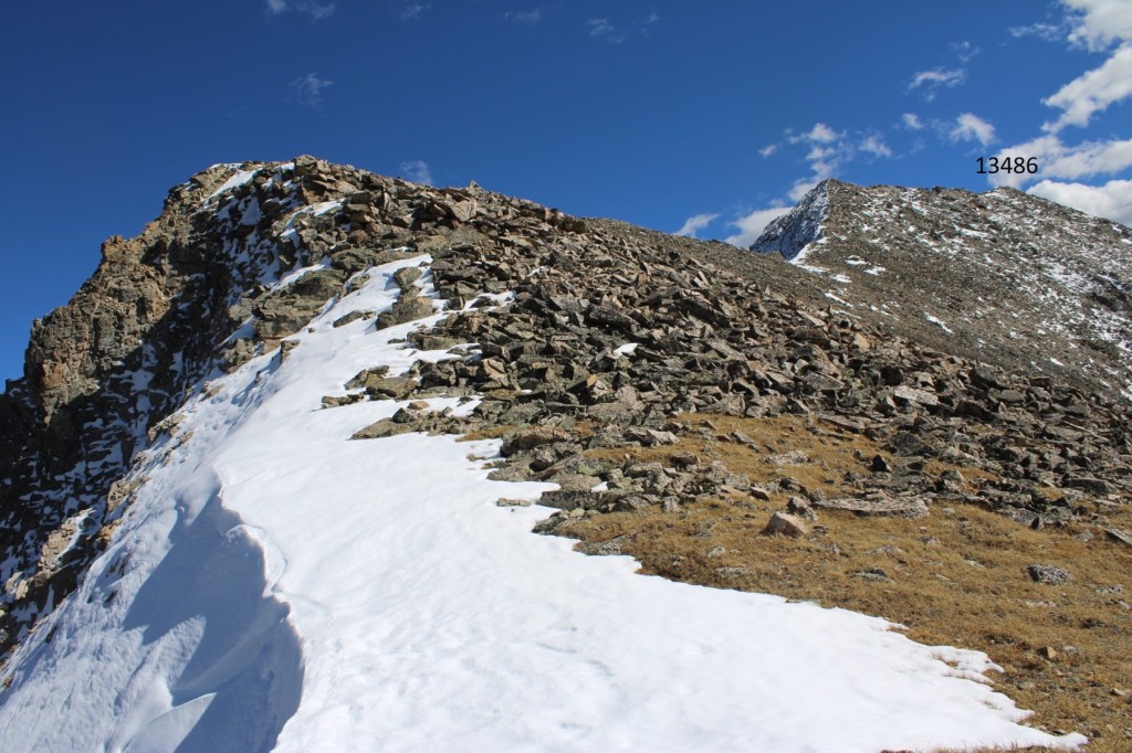
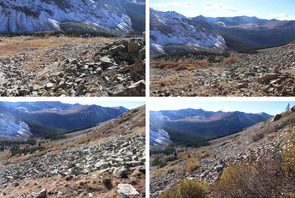
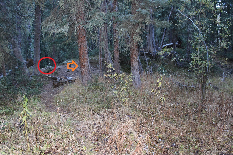
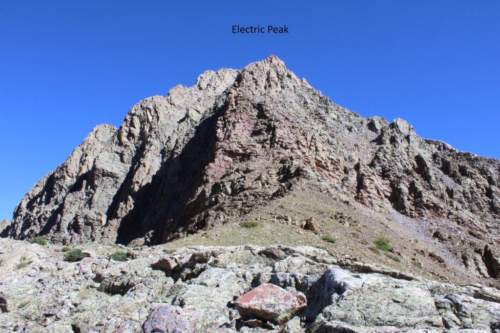
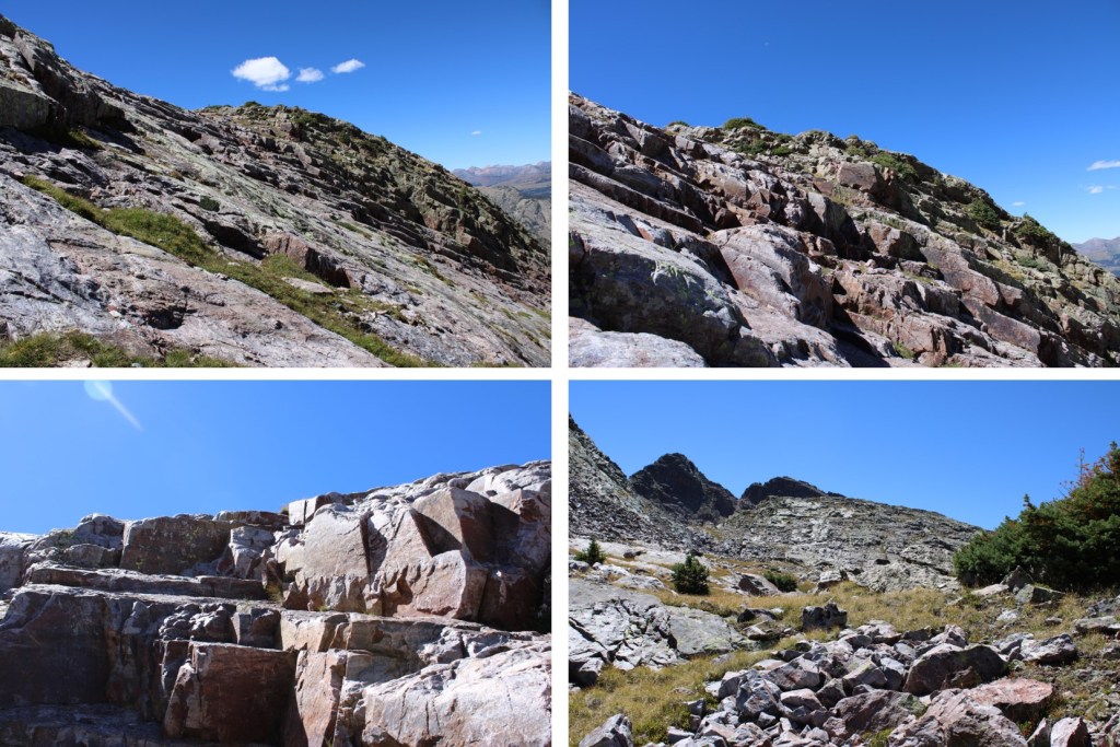
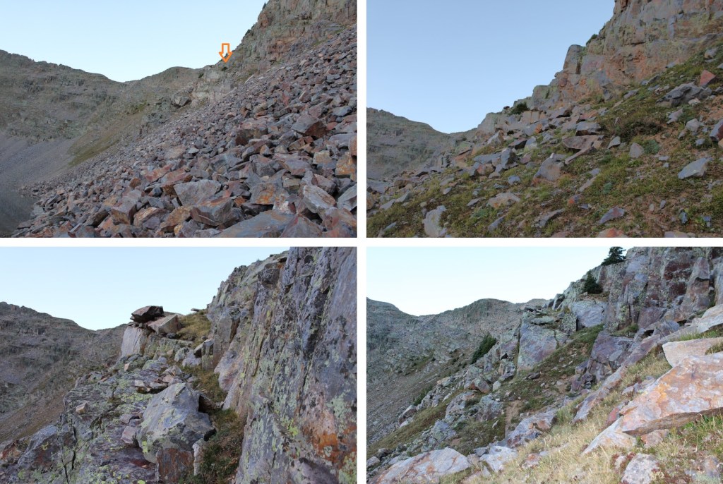
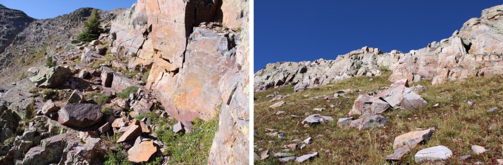
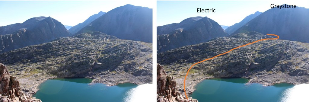
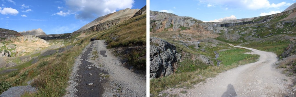
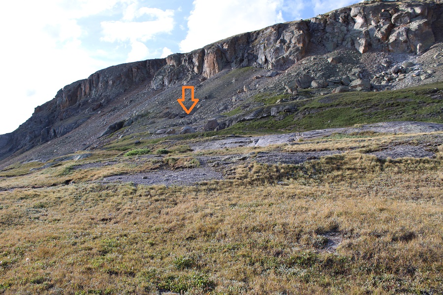
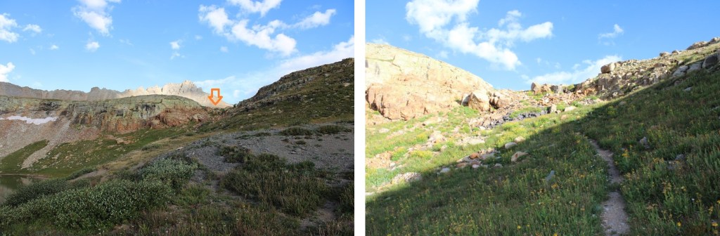
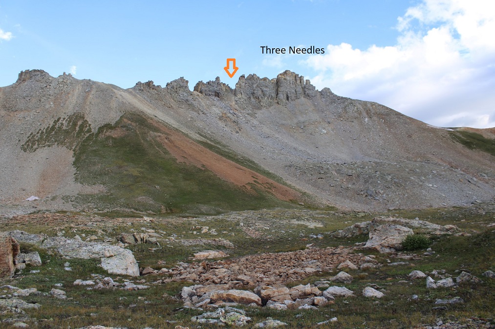
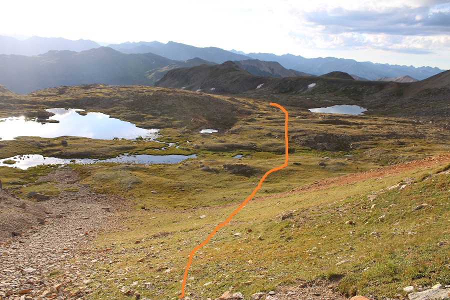
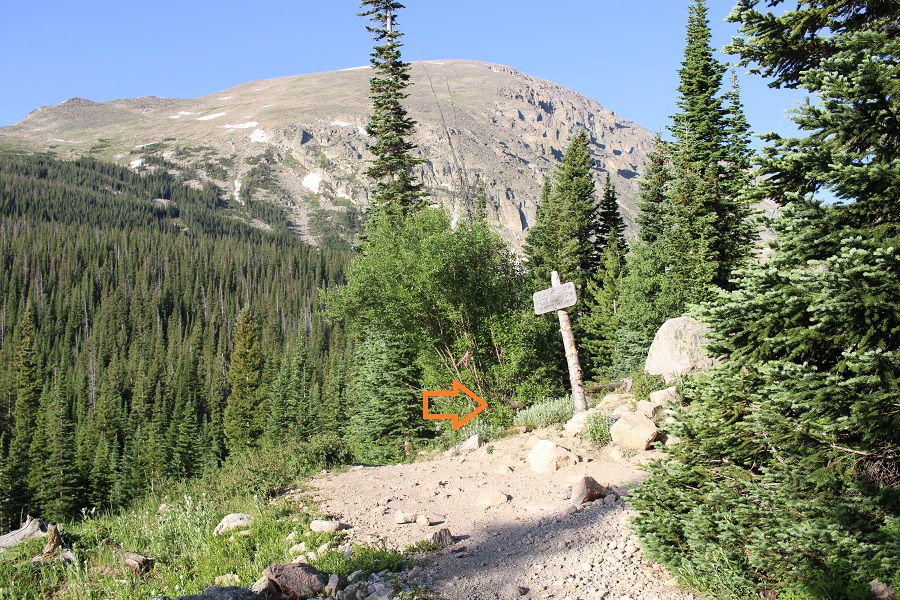
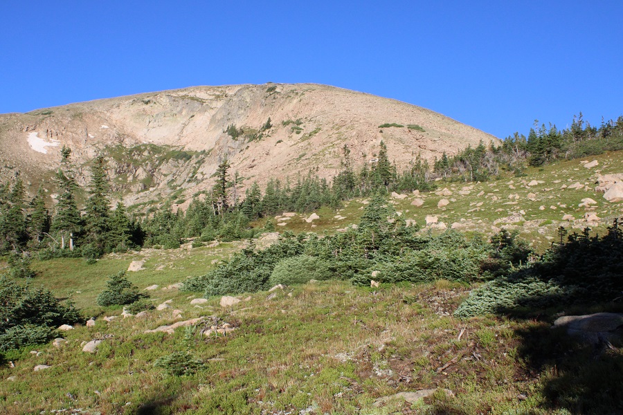
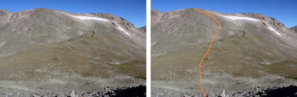
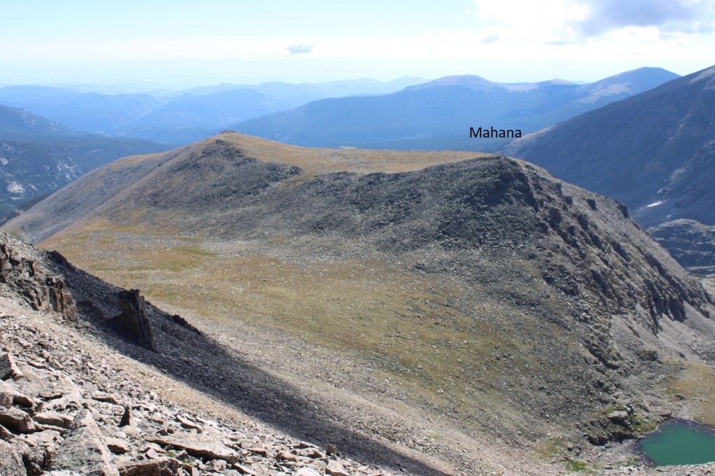
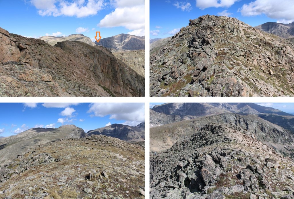
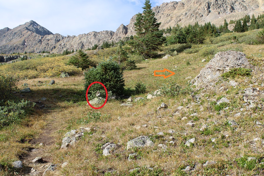
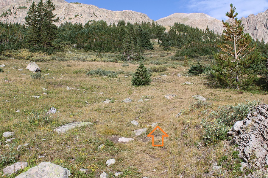
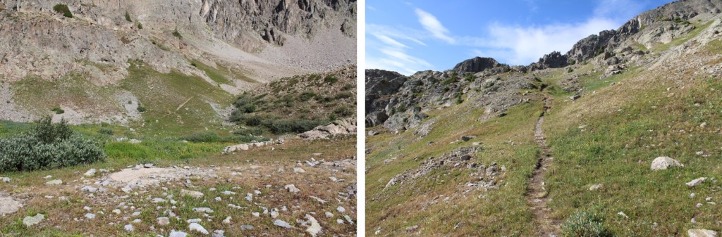
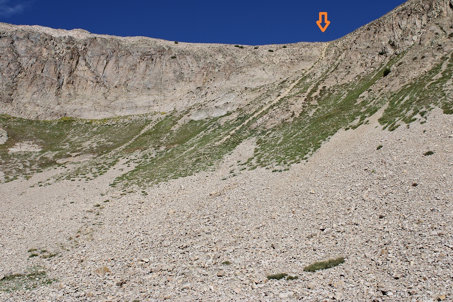
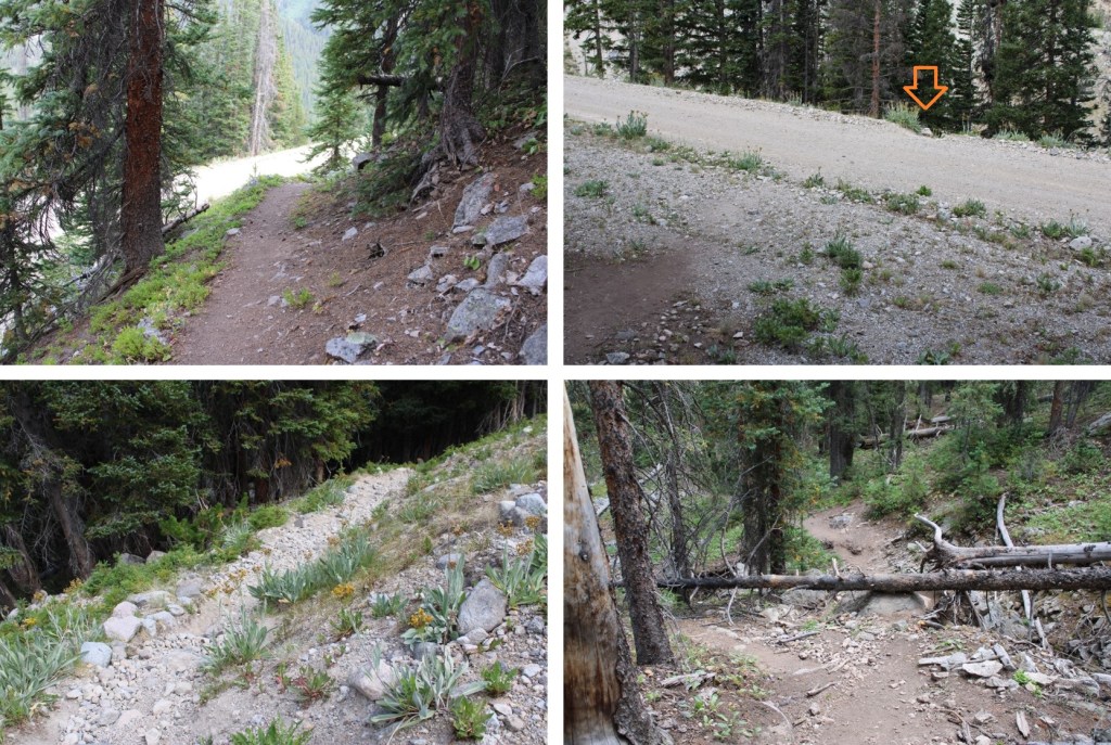
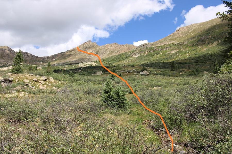
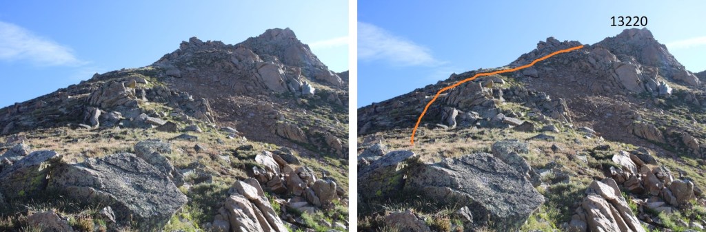
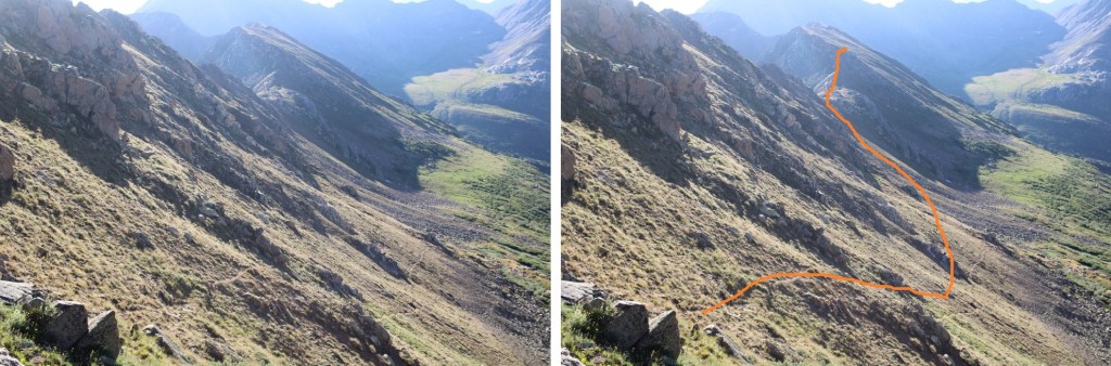
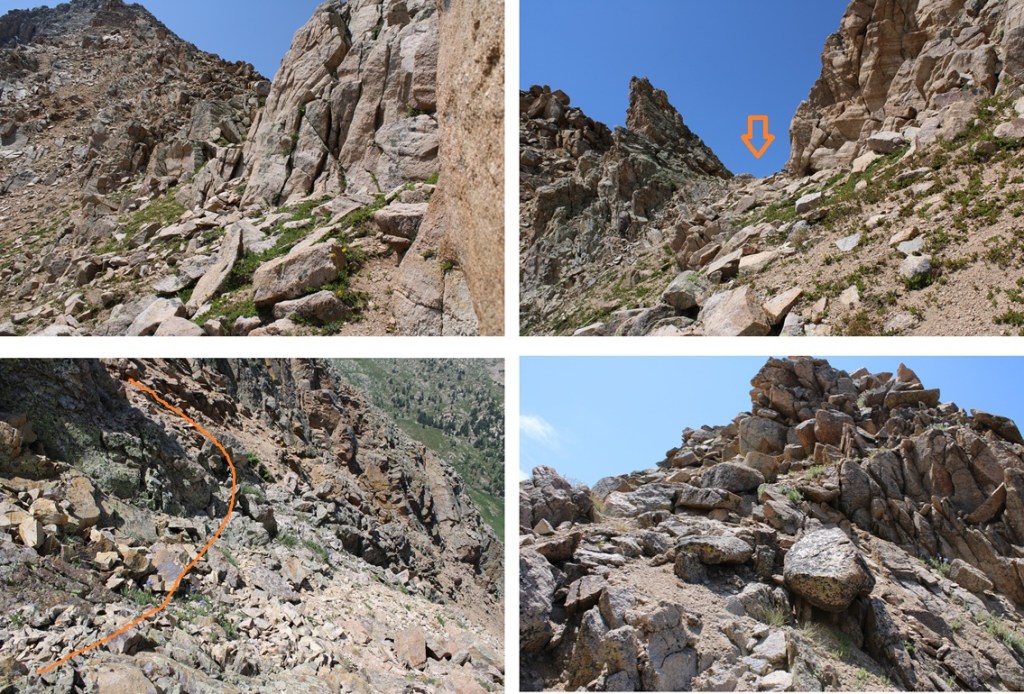
At 11550’ of elevation I left the trail and headed north towards an unnamed pass to the right of PT 12683.

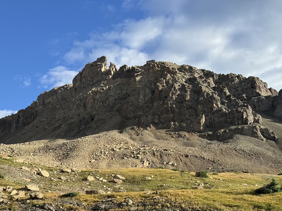
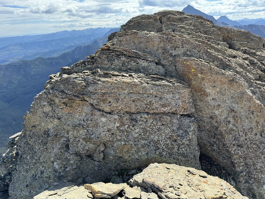
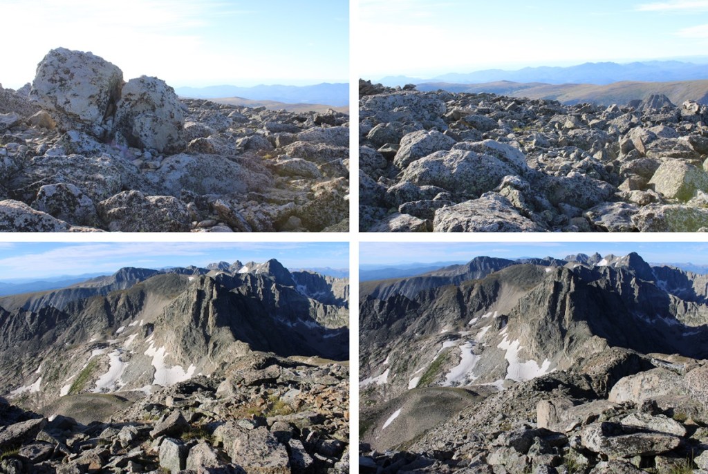
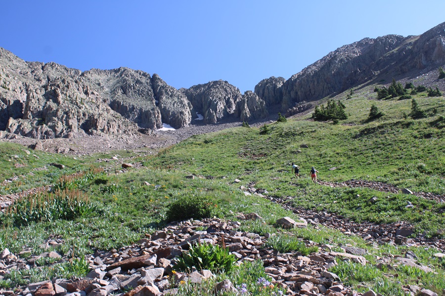
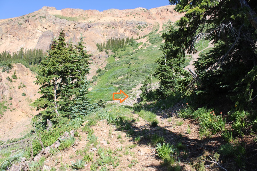
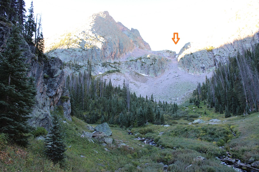
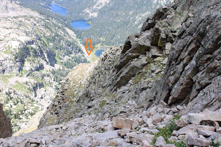
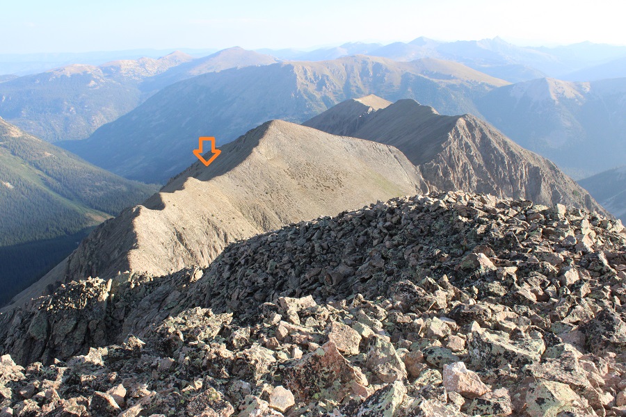
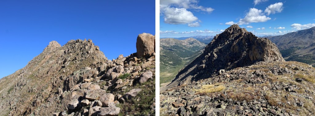
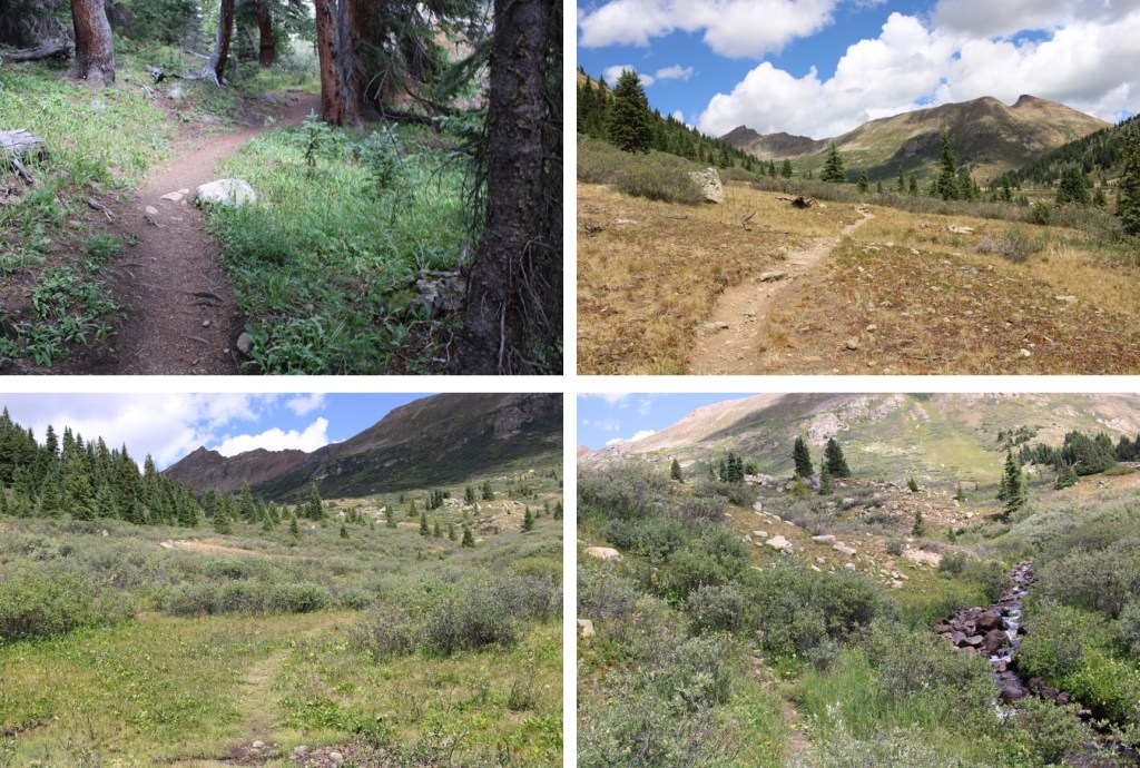
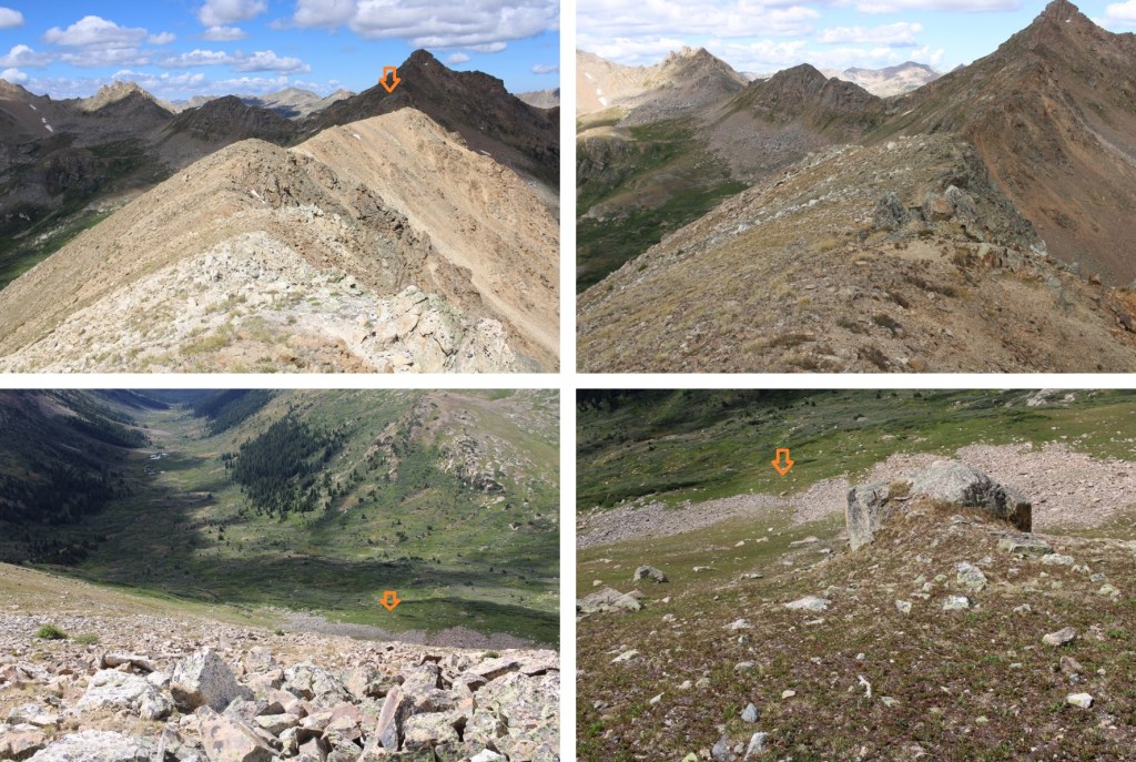
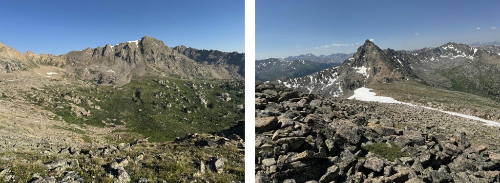
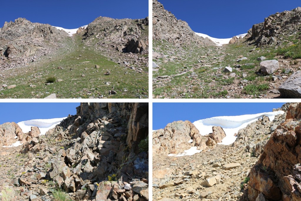
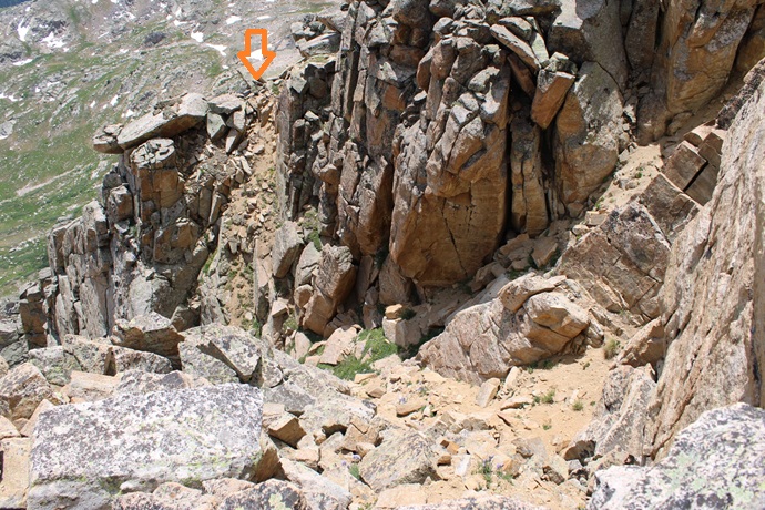
For a visual, I was headed here:

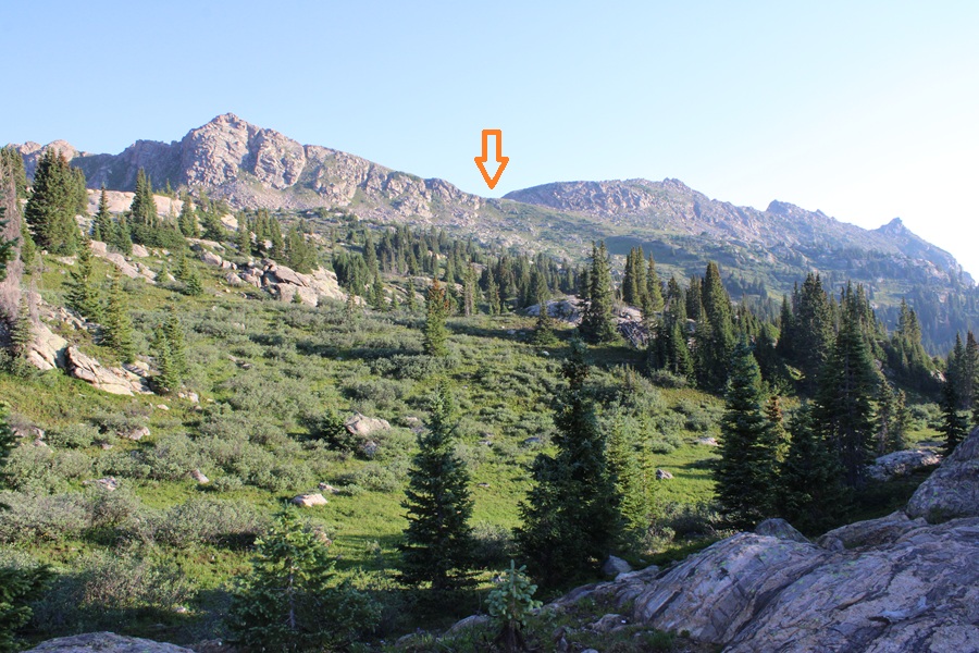
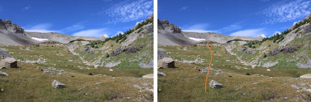
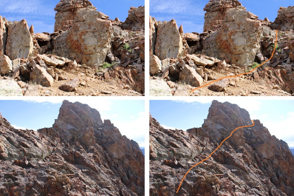
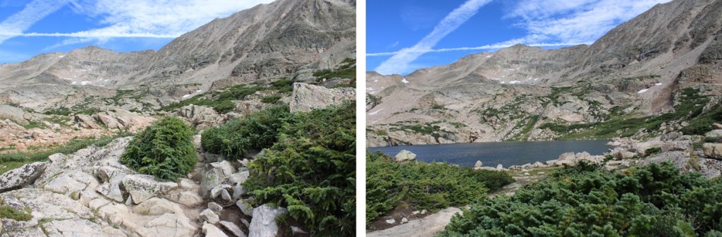
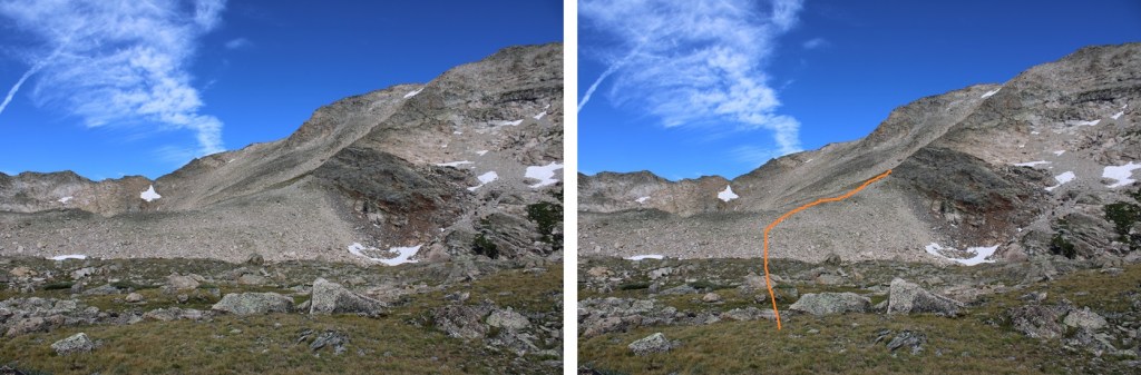
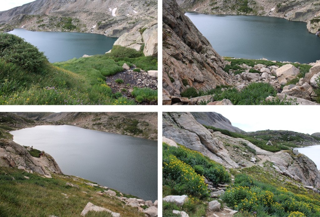
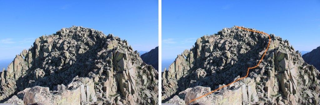
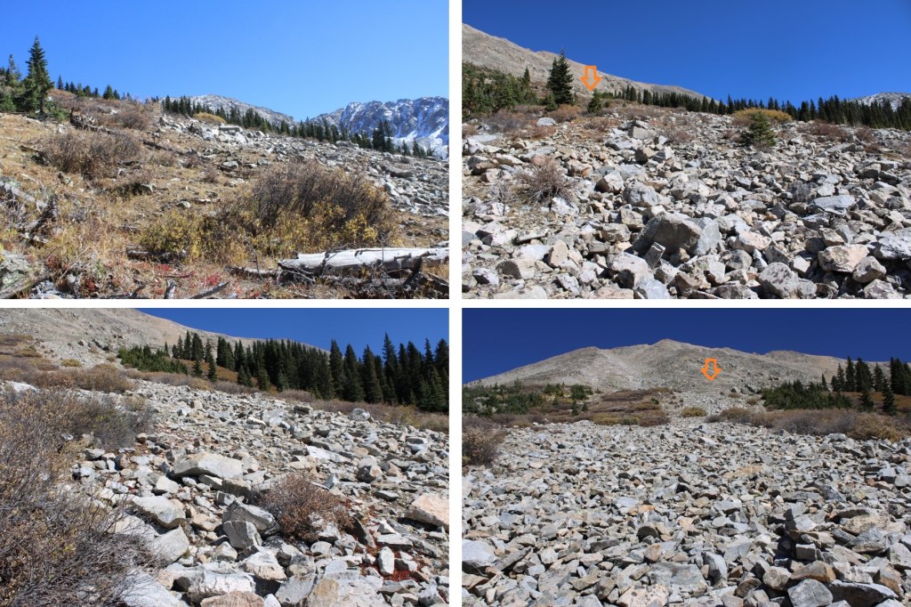
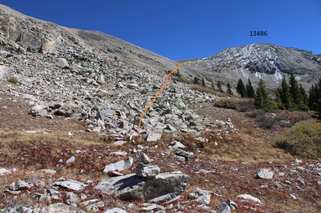
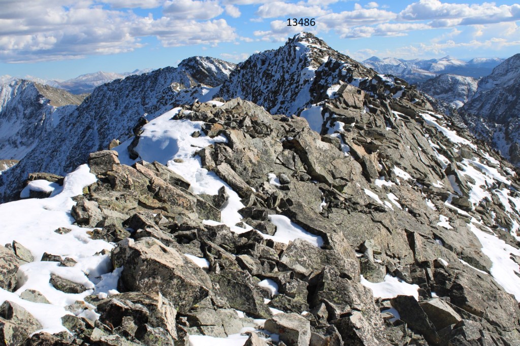
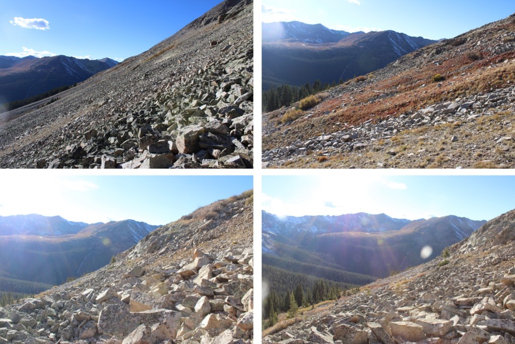
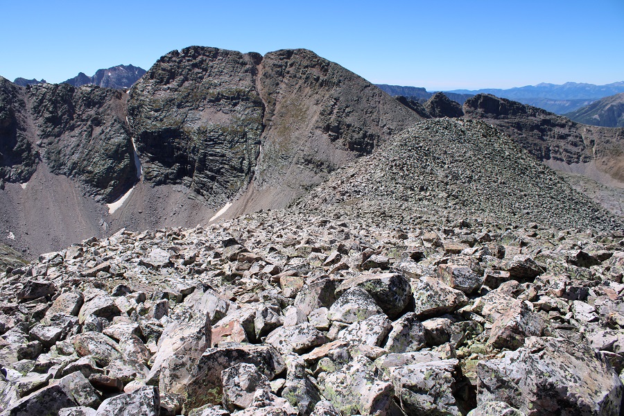
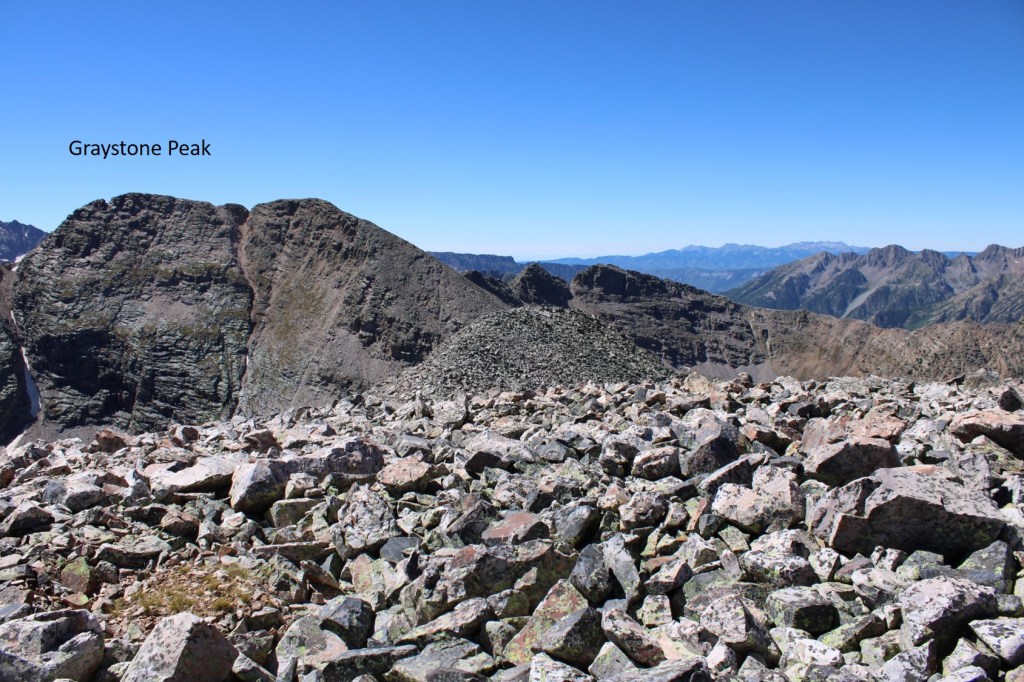
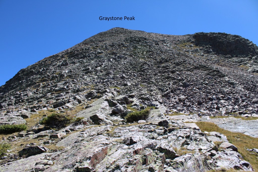
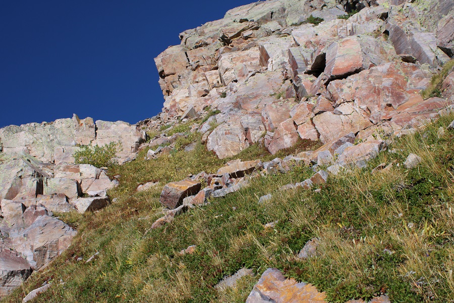
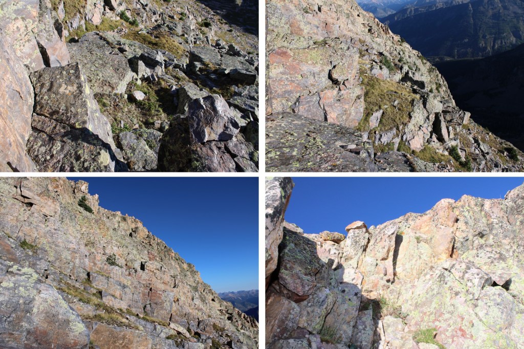
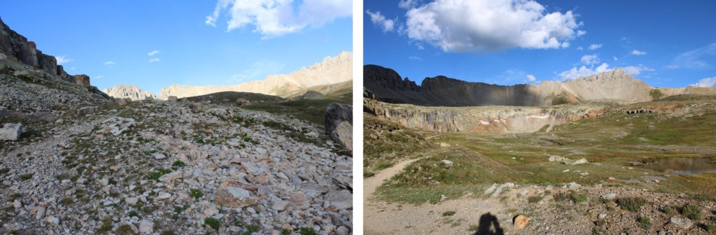
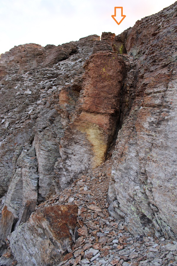
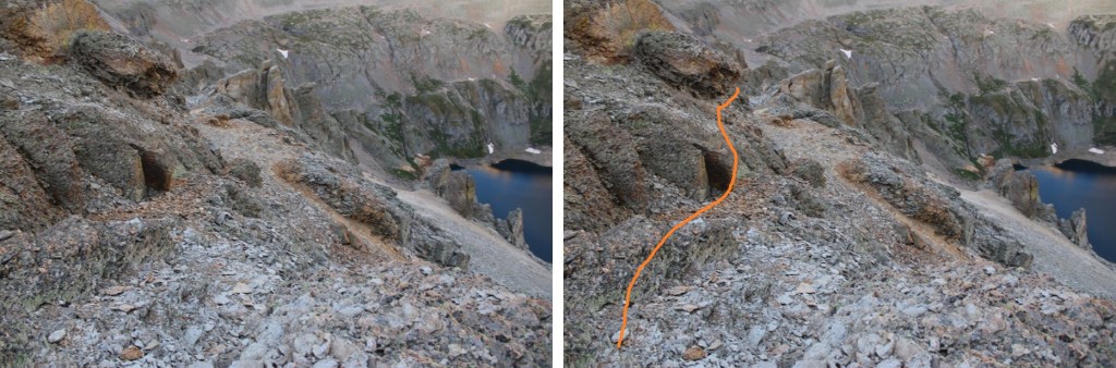
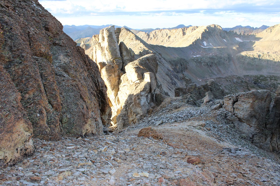
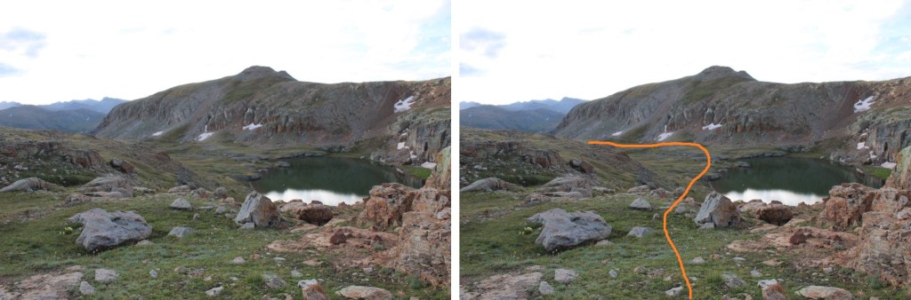
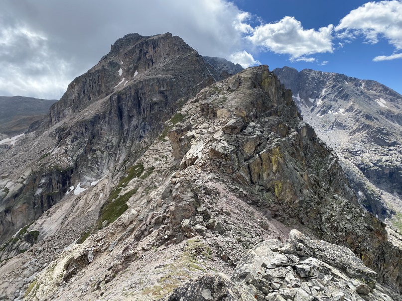
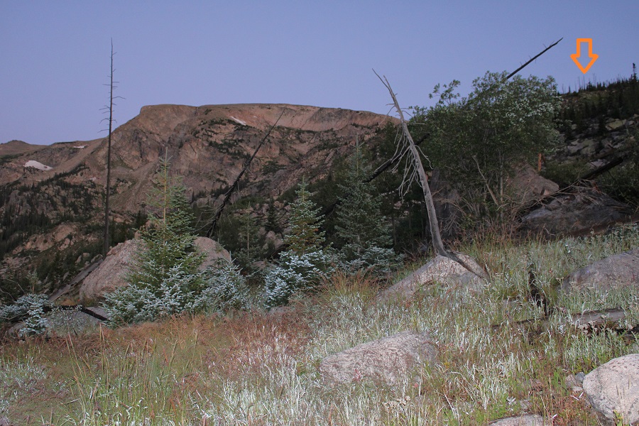
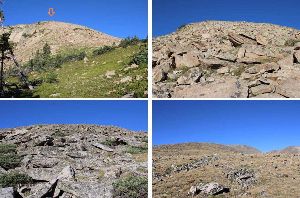
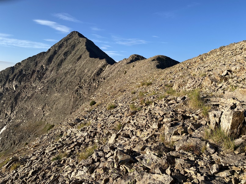
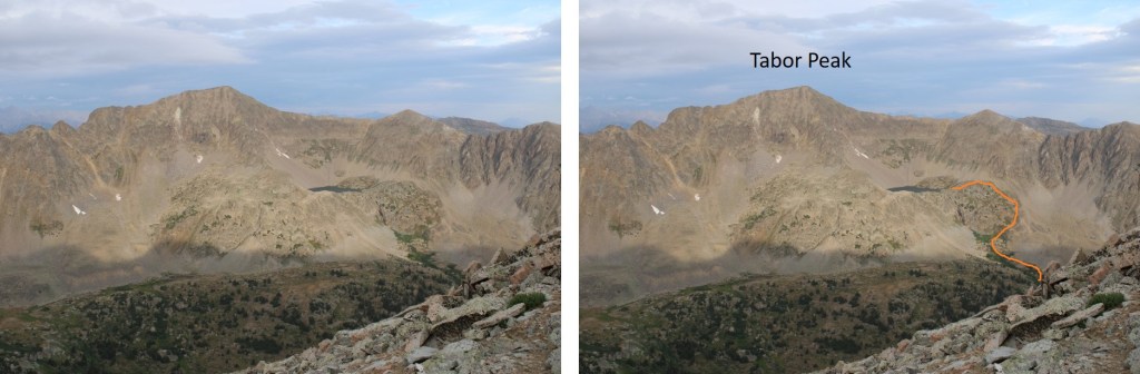
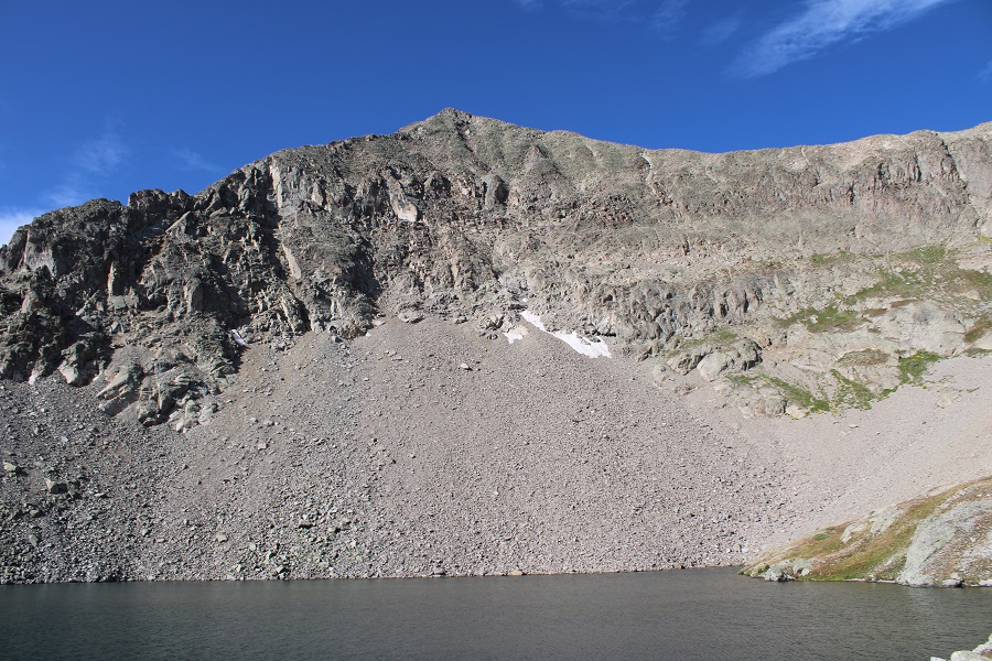
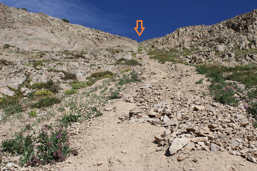
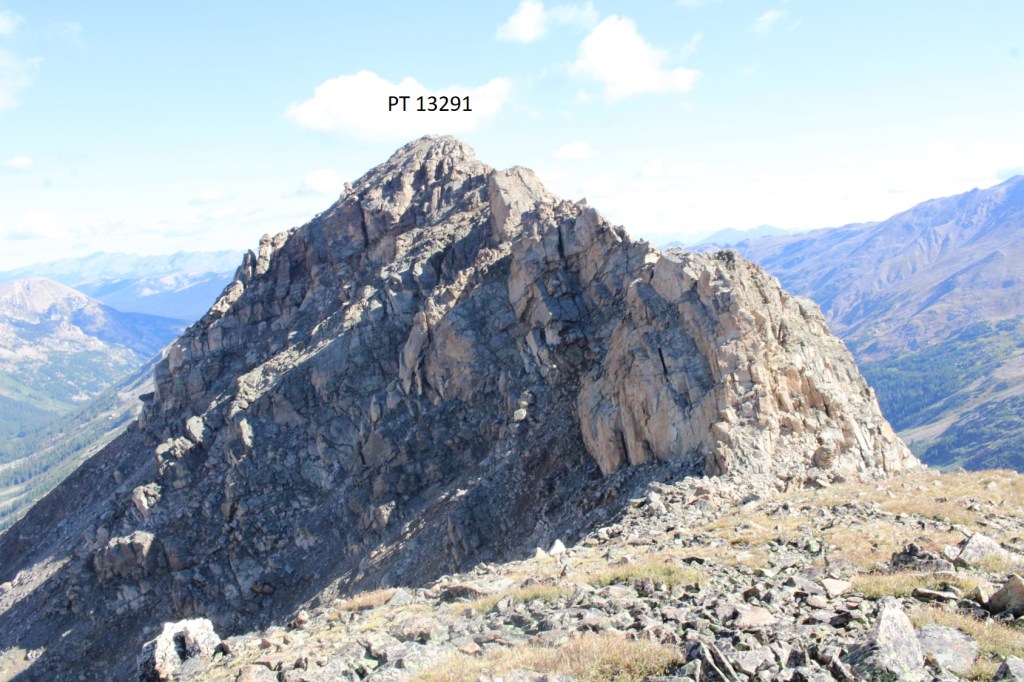
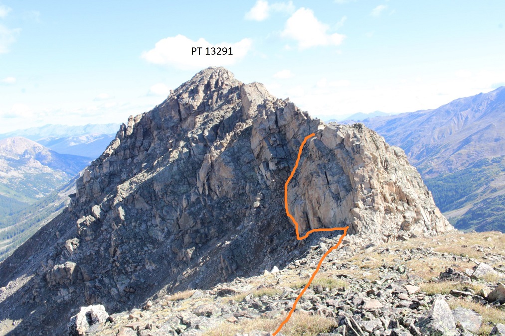
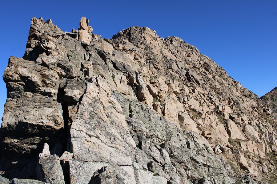
When I got to the top of this small pass I had a visual of the route before me to PT 13139. 

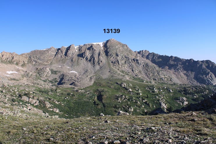
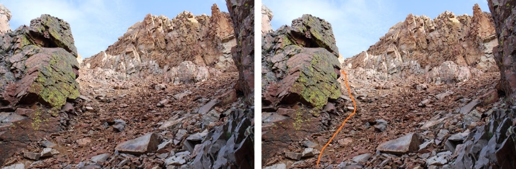
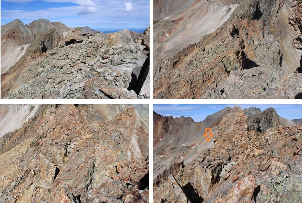
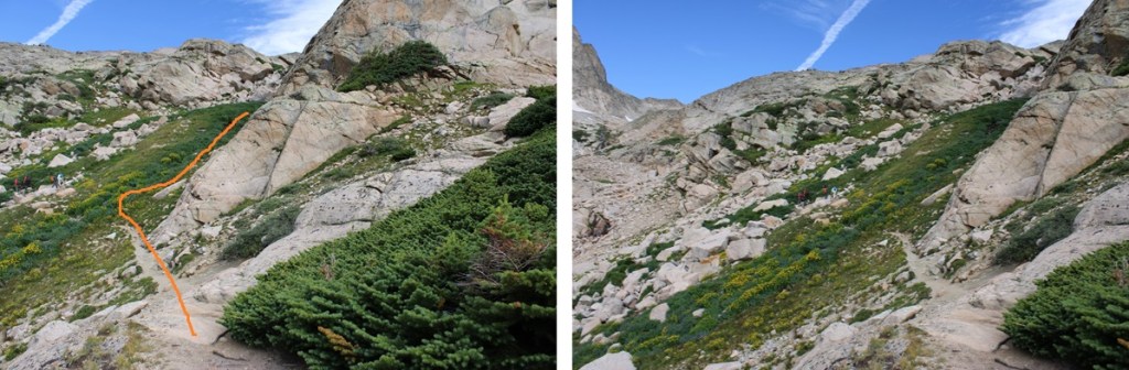
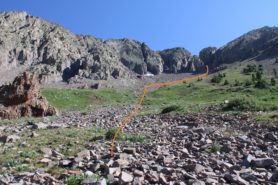
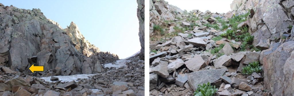
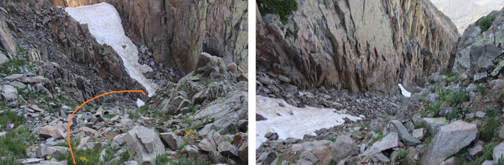
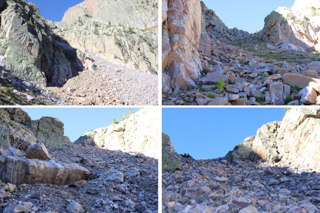
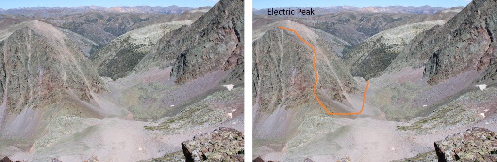
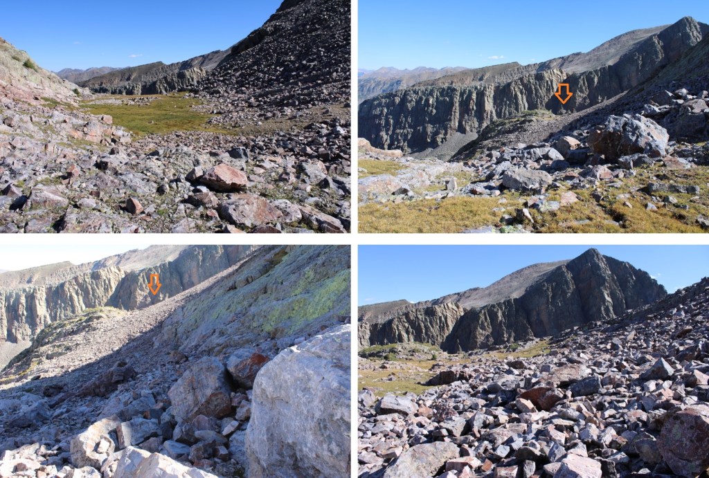
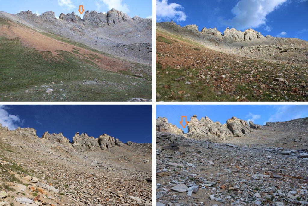
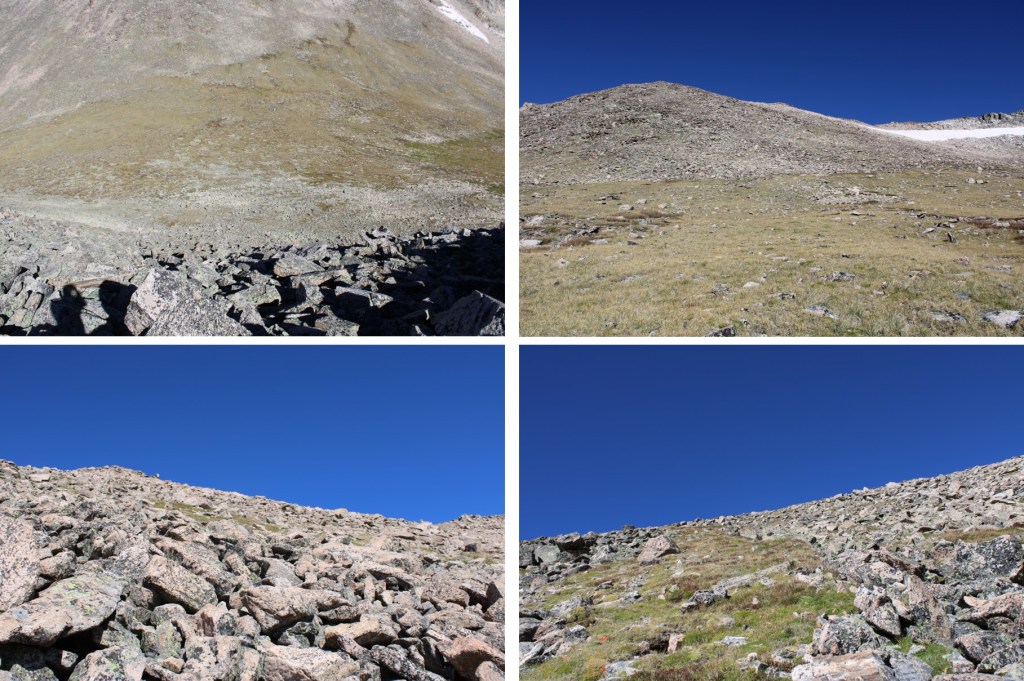
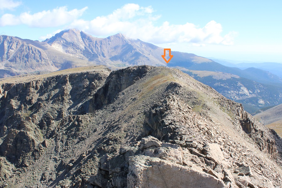
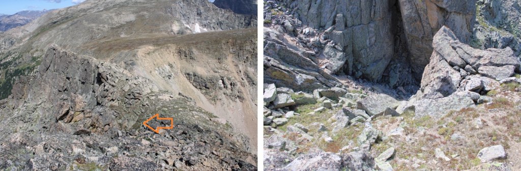
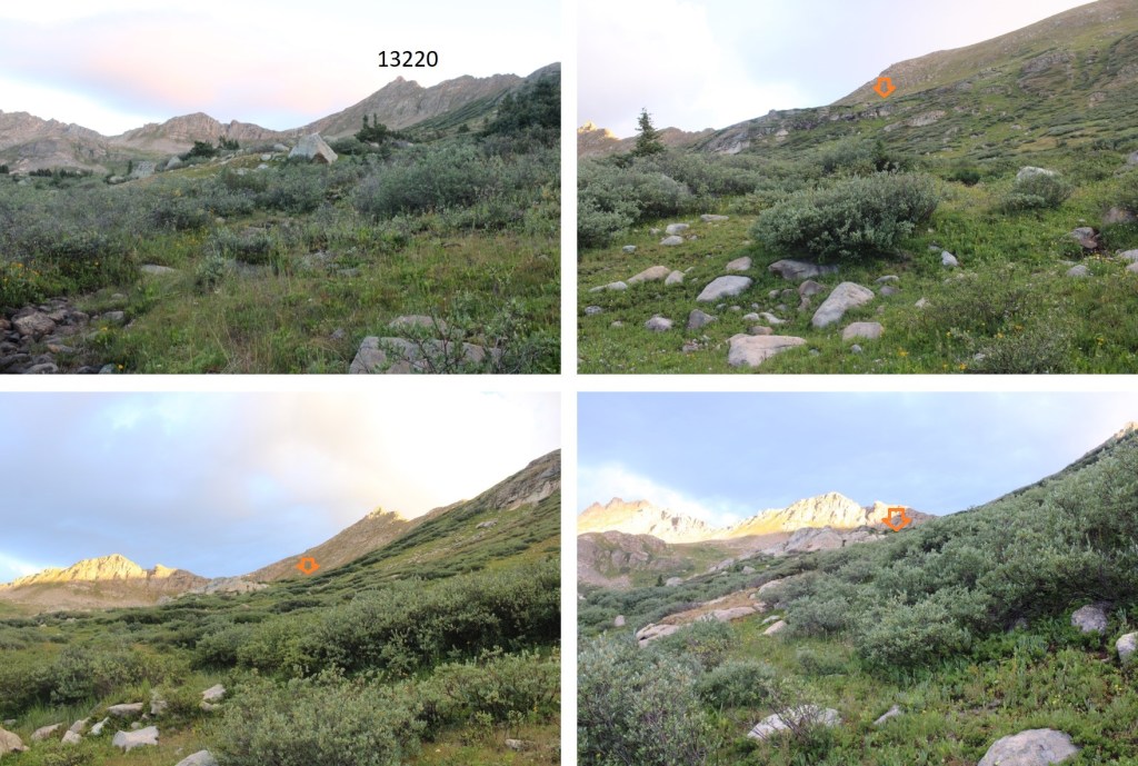
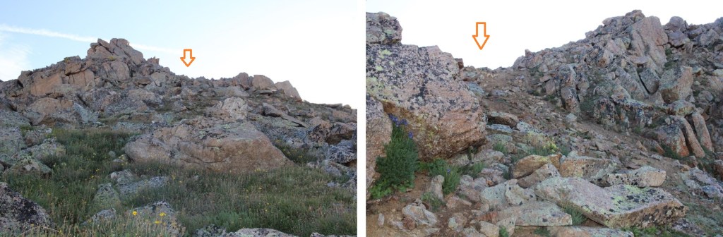
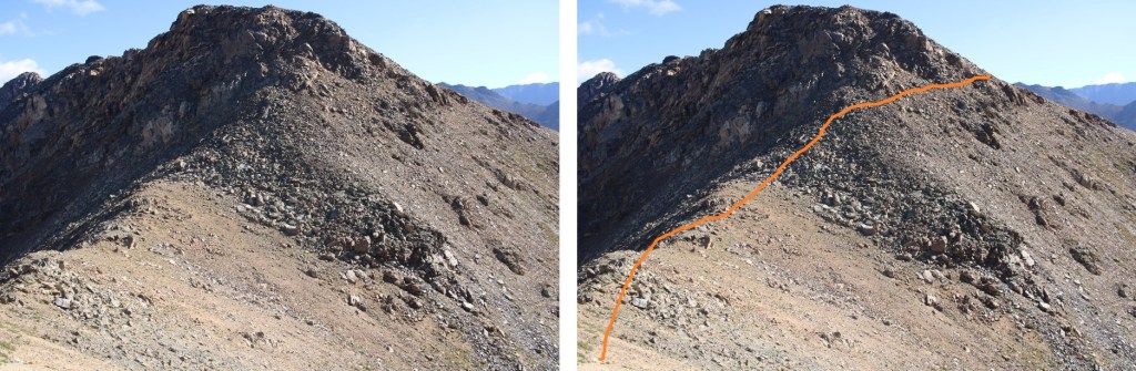
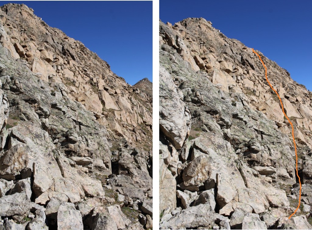
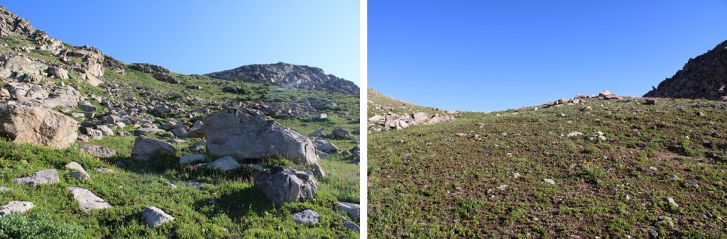
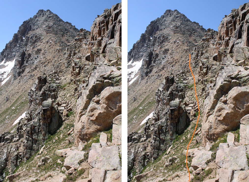
I was disheartened.  That cornice looked big.  I sat on that pass for longer than I wanted, contemplating my next move.  It was only July 15, and I’d already had over a dozen failed attempts already this year.  Mostly due to cornices, but also due to wildfires (I evacuated twice) and getting “the knock” twice and being told I can’t park my vehicle at a trailhead overnight (even to leave it to go backpacking: it would be towed).  I remembered hearing (somewhere) that the entire Williams traverse was clear of snow this week, so in my mind I figured it was possible to make it around the cornice.  Needing a ‘win’ I decided to go for it.  Here’s my route, dropping 620’ into the basin on an adequate game trail, staying to the right of the creek and avoiding the willows, and then climbing up the gully.

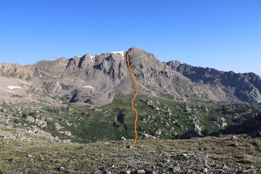
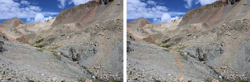
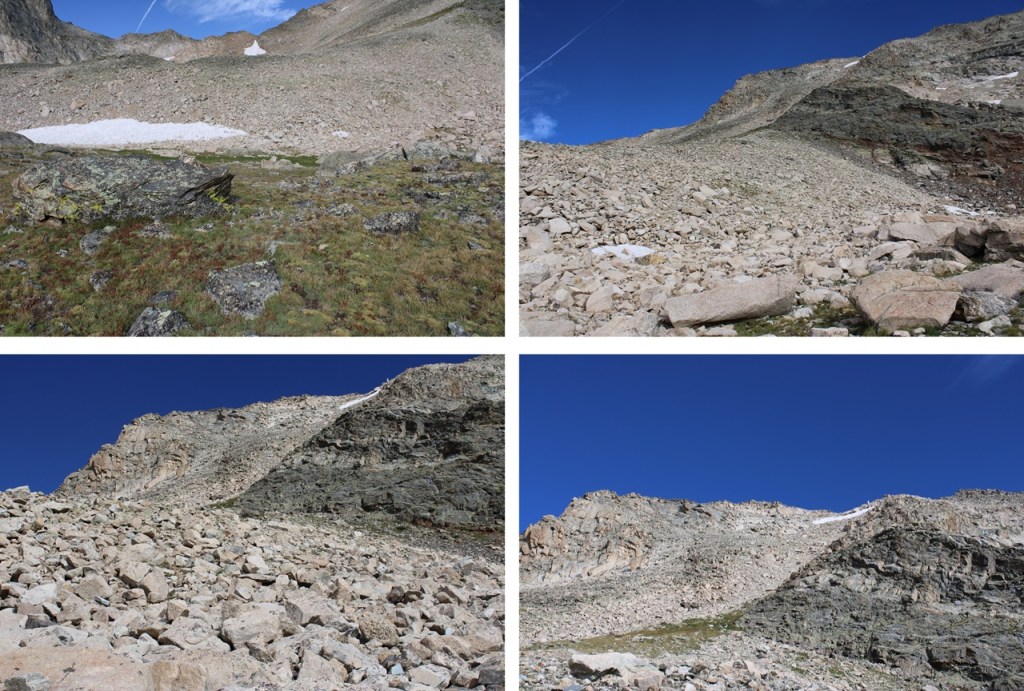
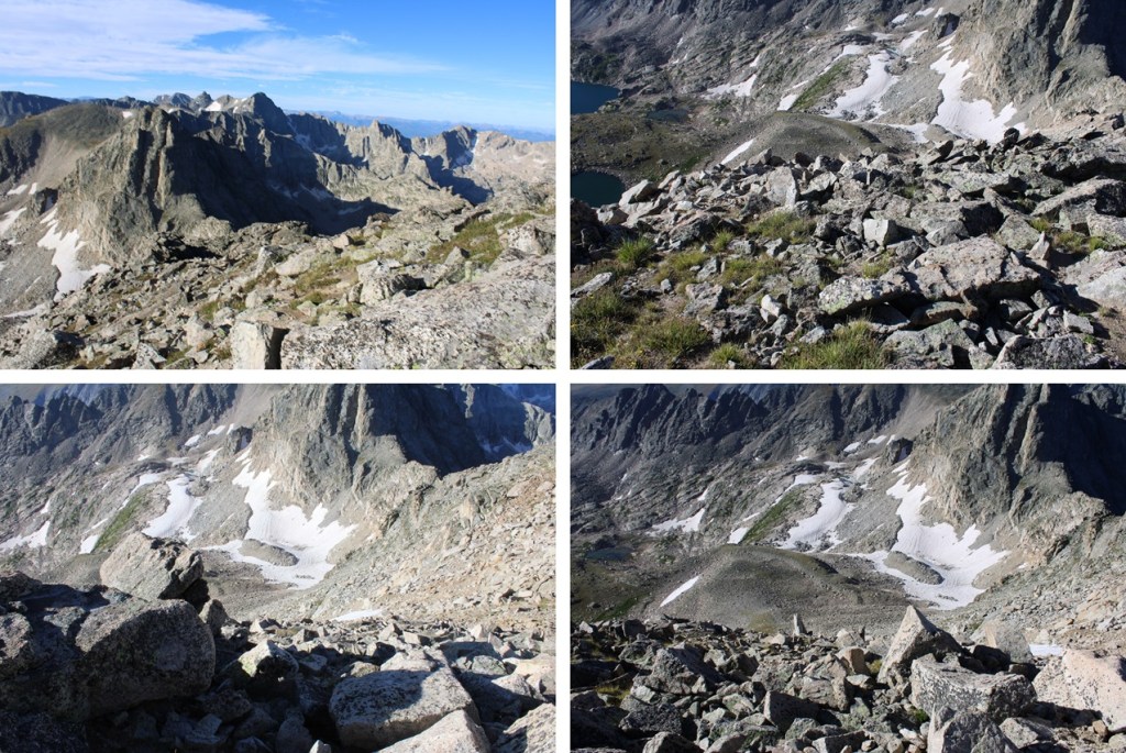
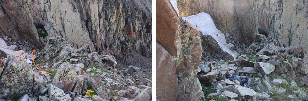
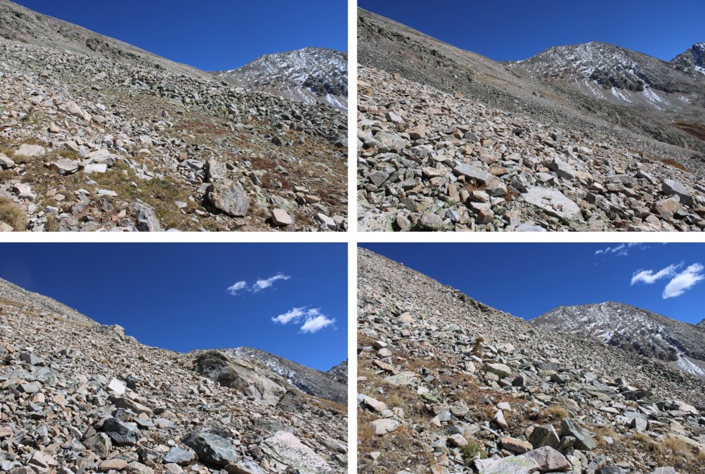
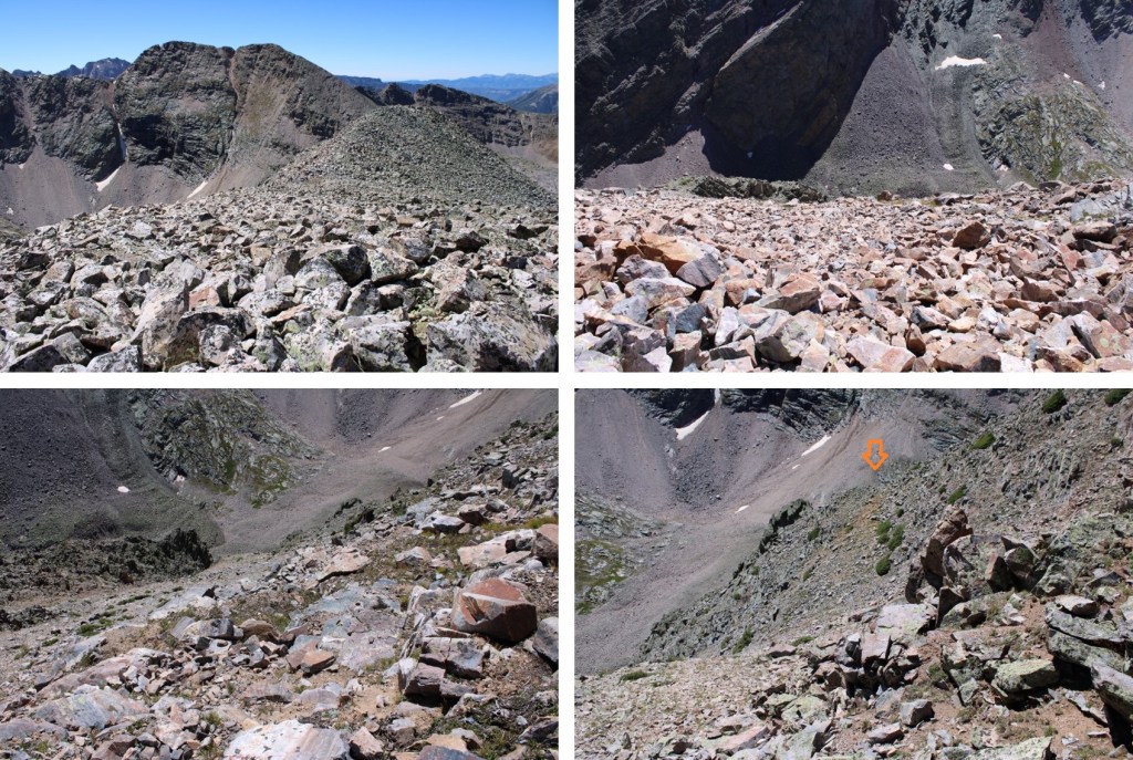
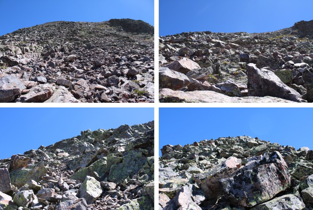
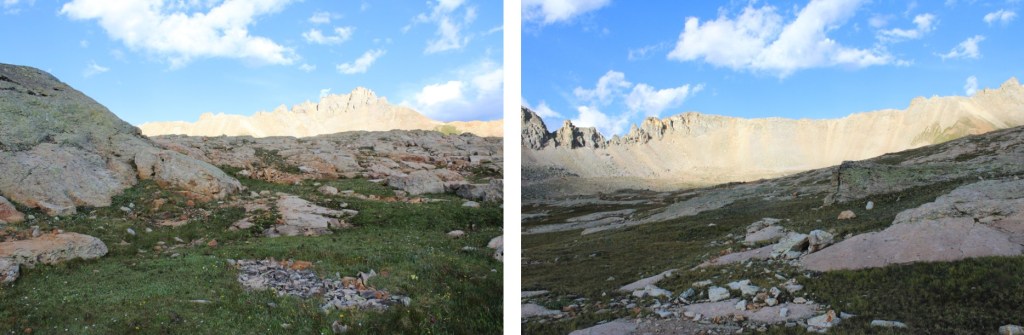
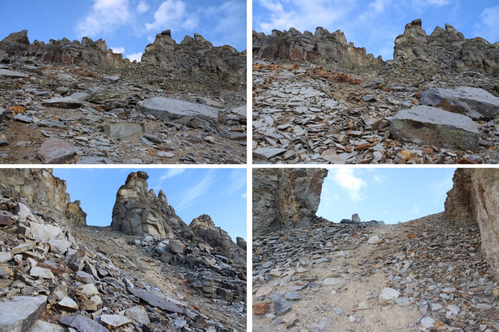
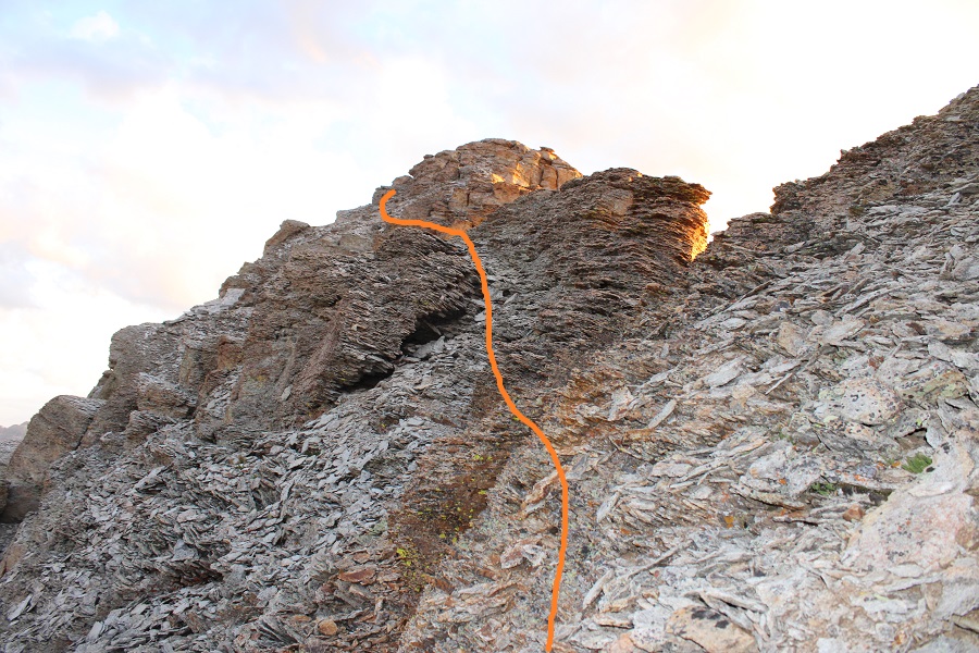
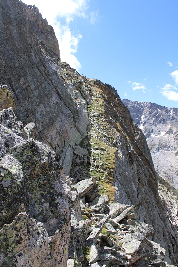
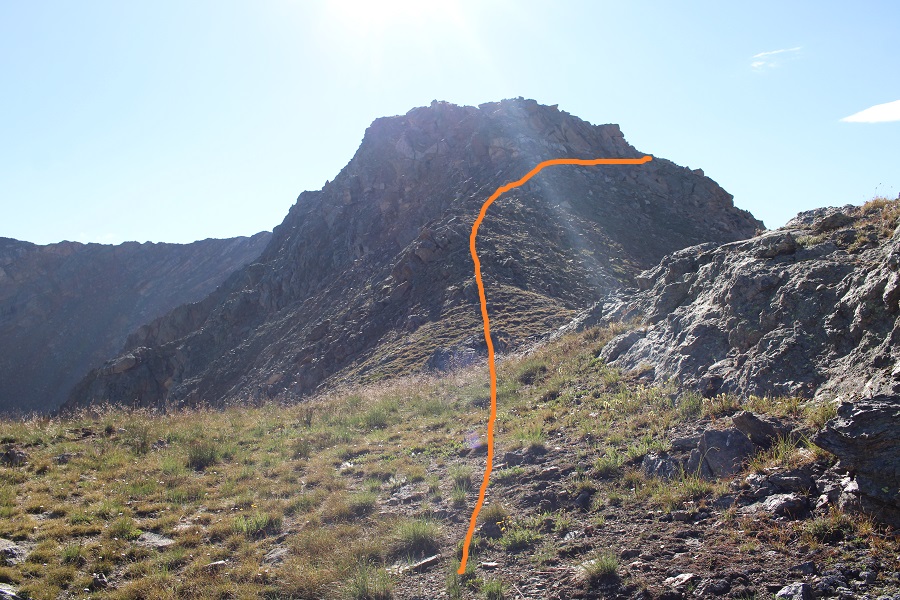
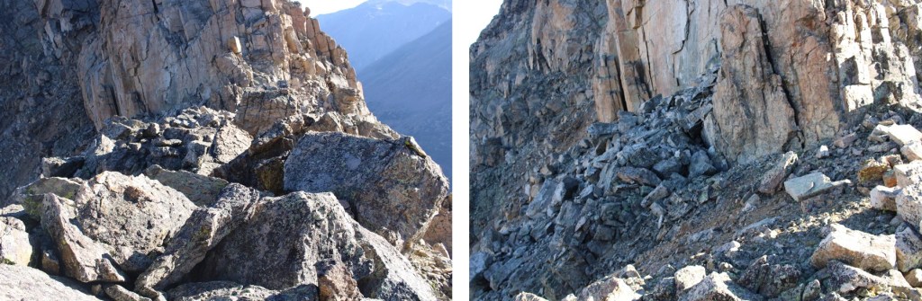
At the base of the gully I once again stopped to rest and contemplate the ascent.  That cornice looked really big (it was).  But it also looked like I could go around it to the right.  I ascended the gully, trying to stay in the middle but drifting towards the right because the terrain there was more stable.  This gully is steeper than it looks and it took quite a while to ascend. 

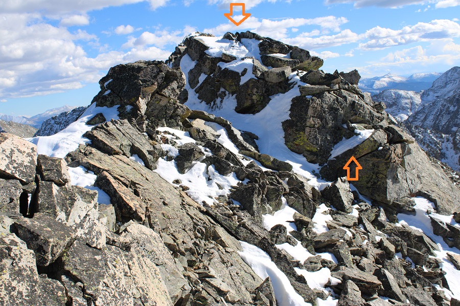
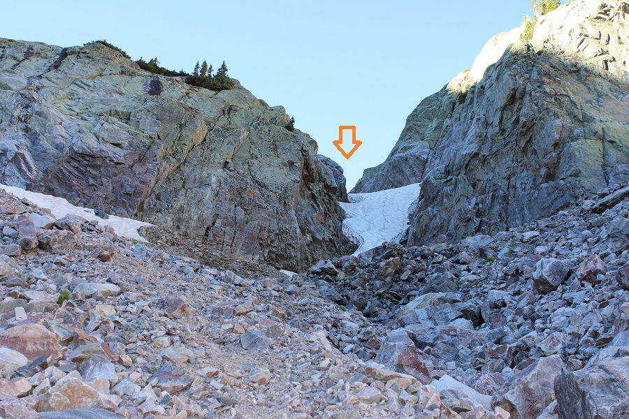
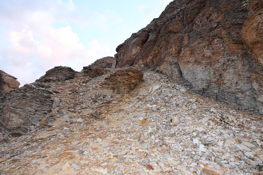
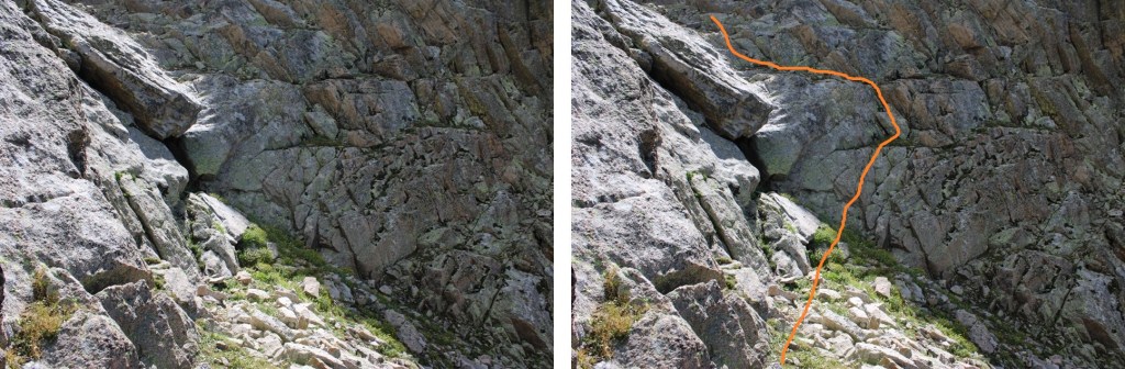
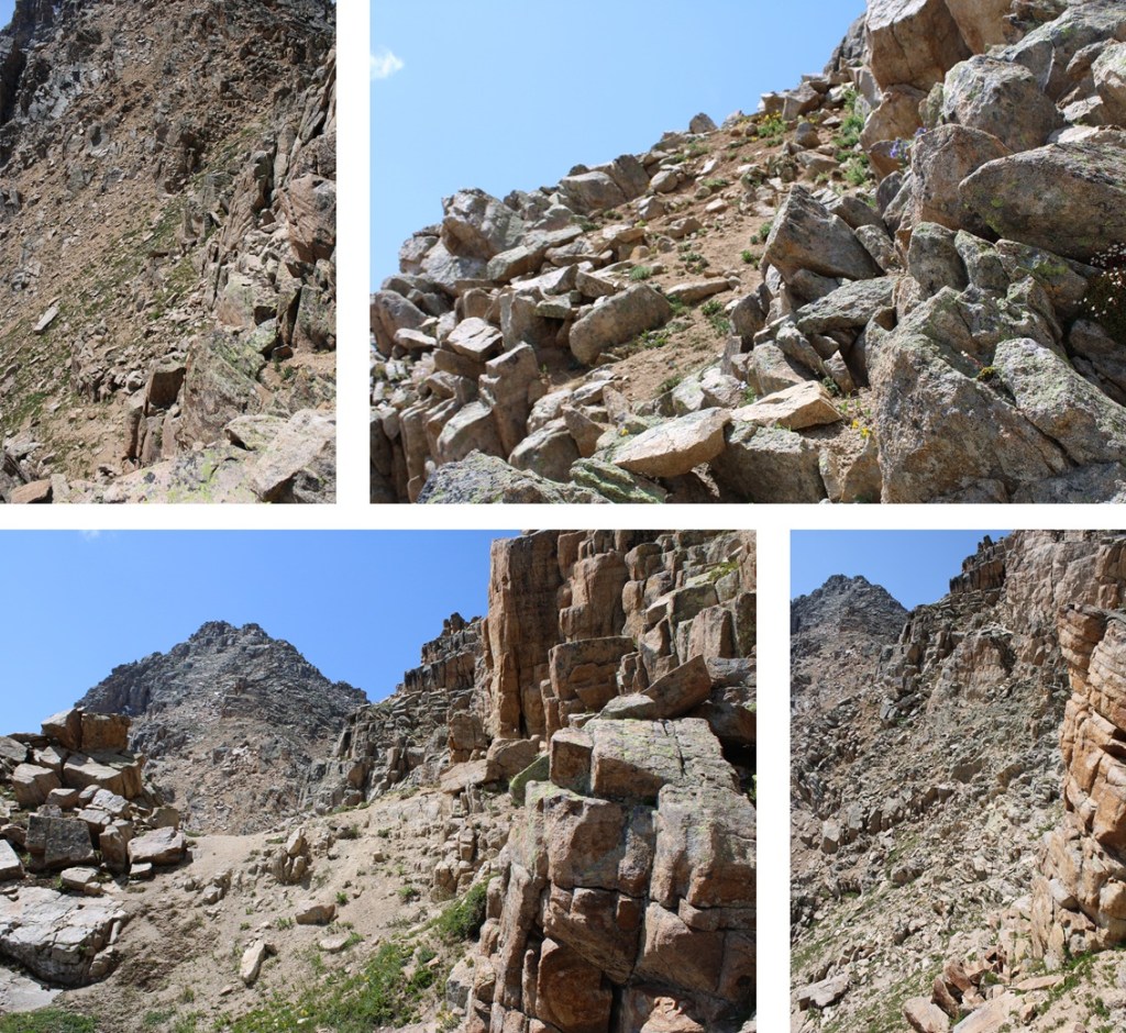
The cornice was indeed large.  At the base of it I thought I saw a line to the right that would lead me to the ridge, so I headed that way.  Long story short, it did NOT go.  I got myself into a very scary situation where the rocks and dirt (which was wet) caved out from underneath me and slid down, leaving me standing on a slick rock slab with no traction, and no way to go up or down.  While it looks like it goes, even when standing right beneath it, it does not (at least not safely).  It is much steeper than it looks from below.

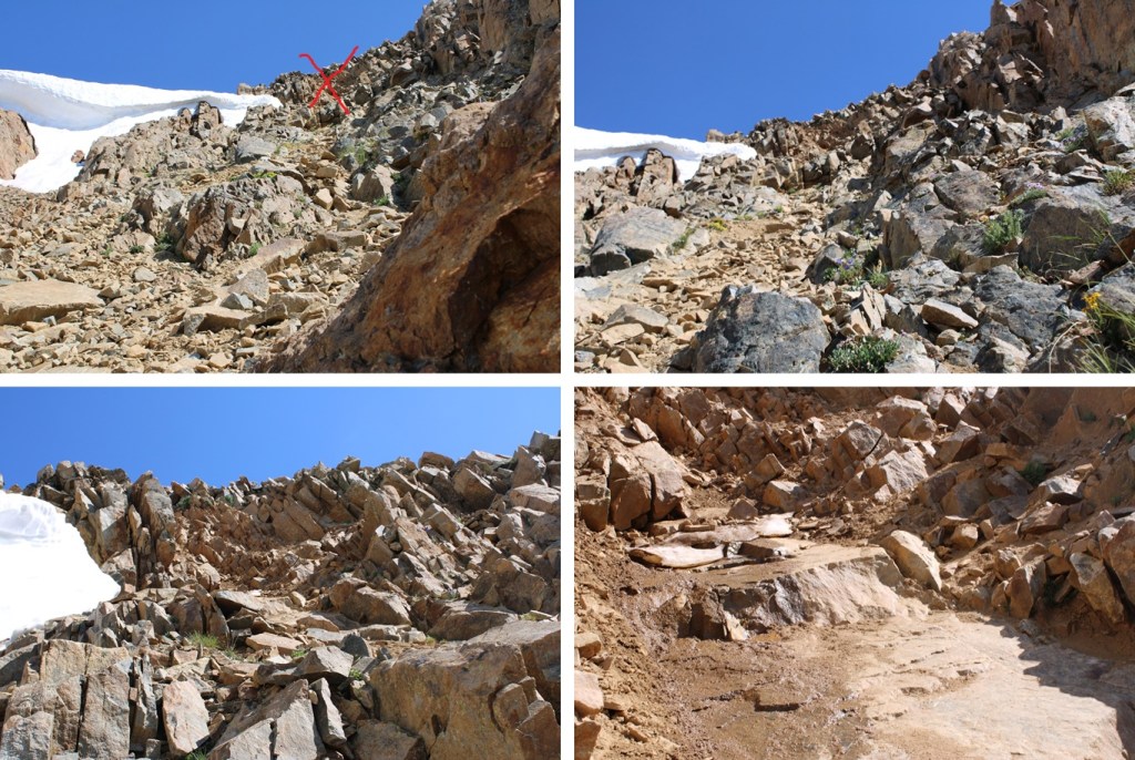
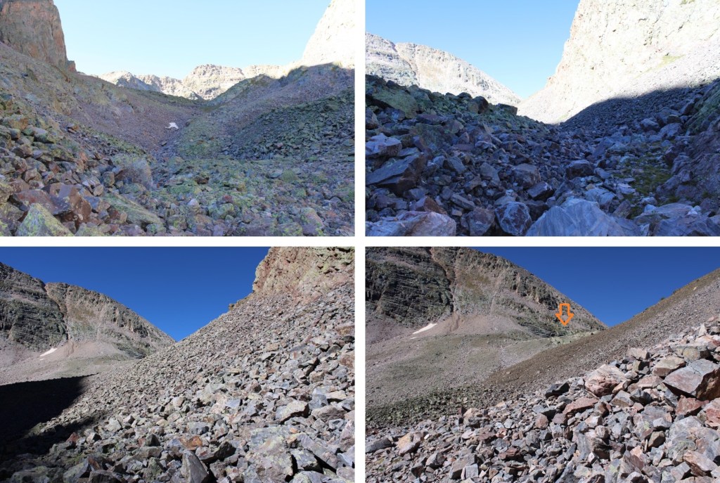
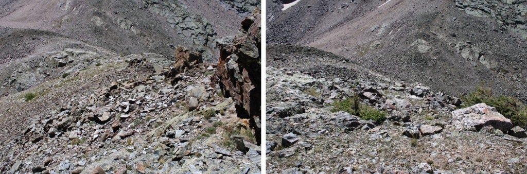
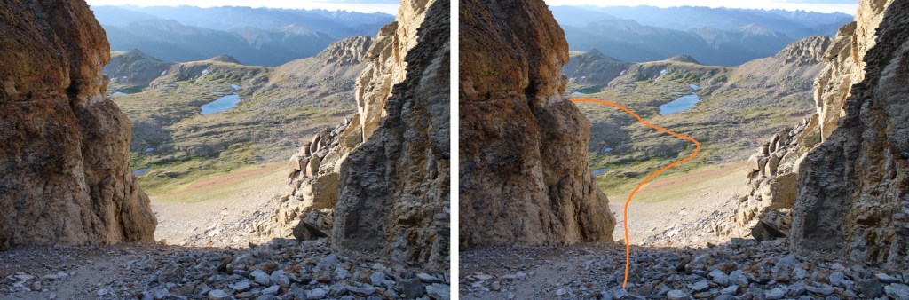
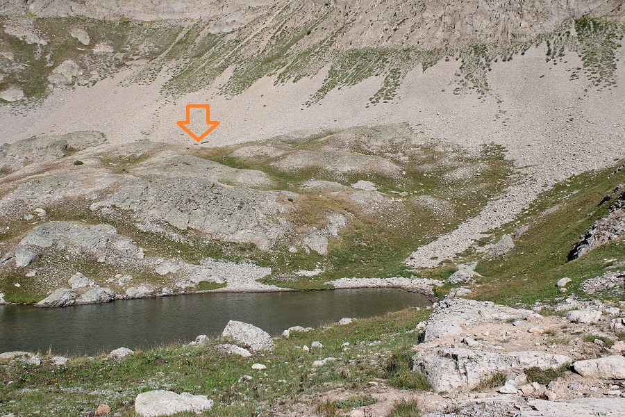
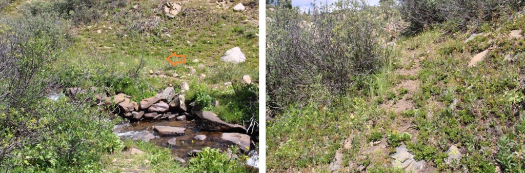
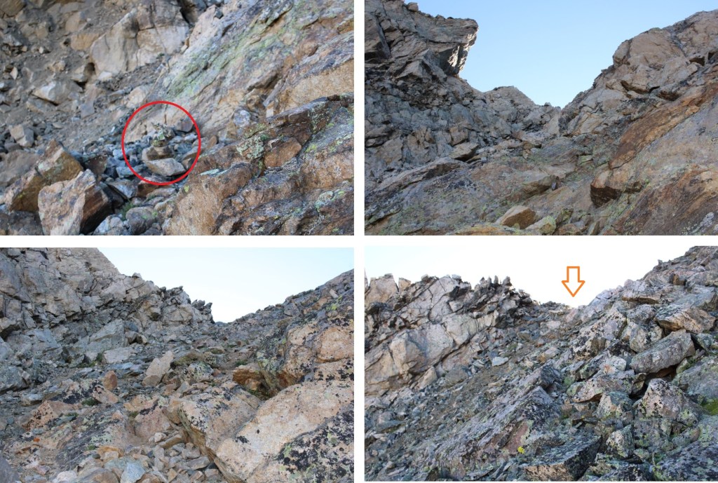
I was frustrated, especially since I’d heard someone else had already done the route this year.  There were no footprints to be seen (I didn’t see any at all the entire hike), and no clear line to the ridge.  I was heading back when I took a different look at the cornice, this time from above.  There was about a foot of space behind the cornice I could crawl through (and get wet in the process) that would lead me to the ridge.  I squeezed behind it and was quickly standing on the ridge.

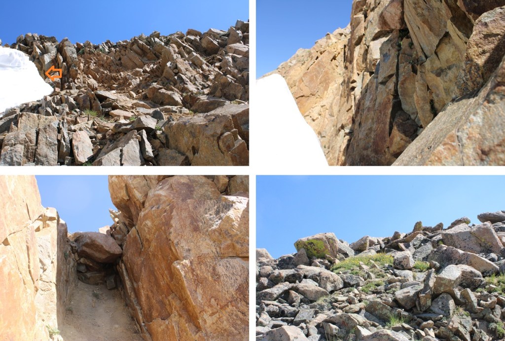
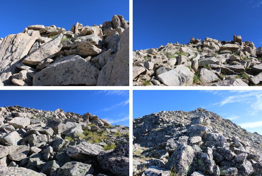
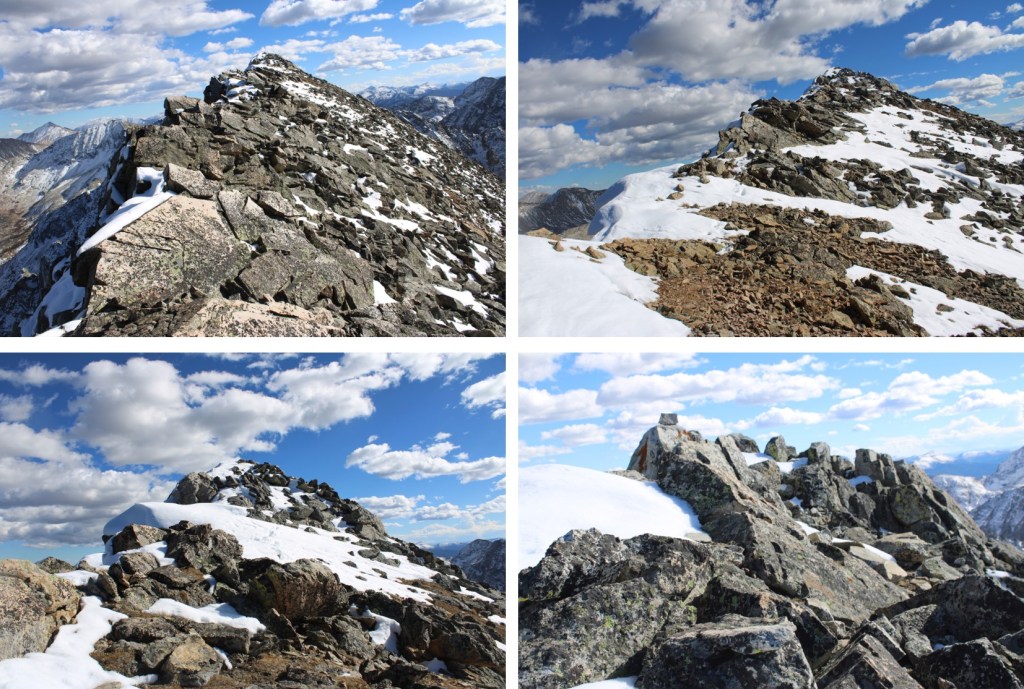
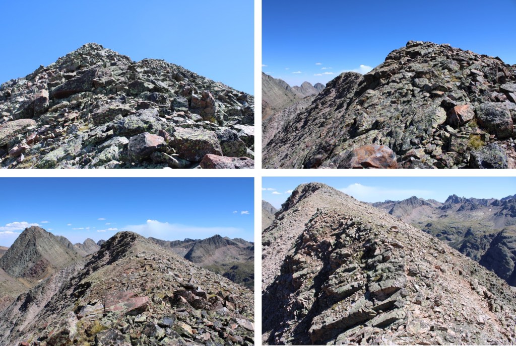
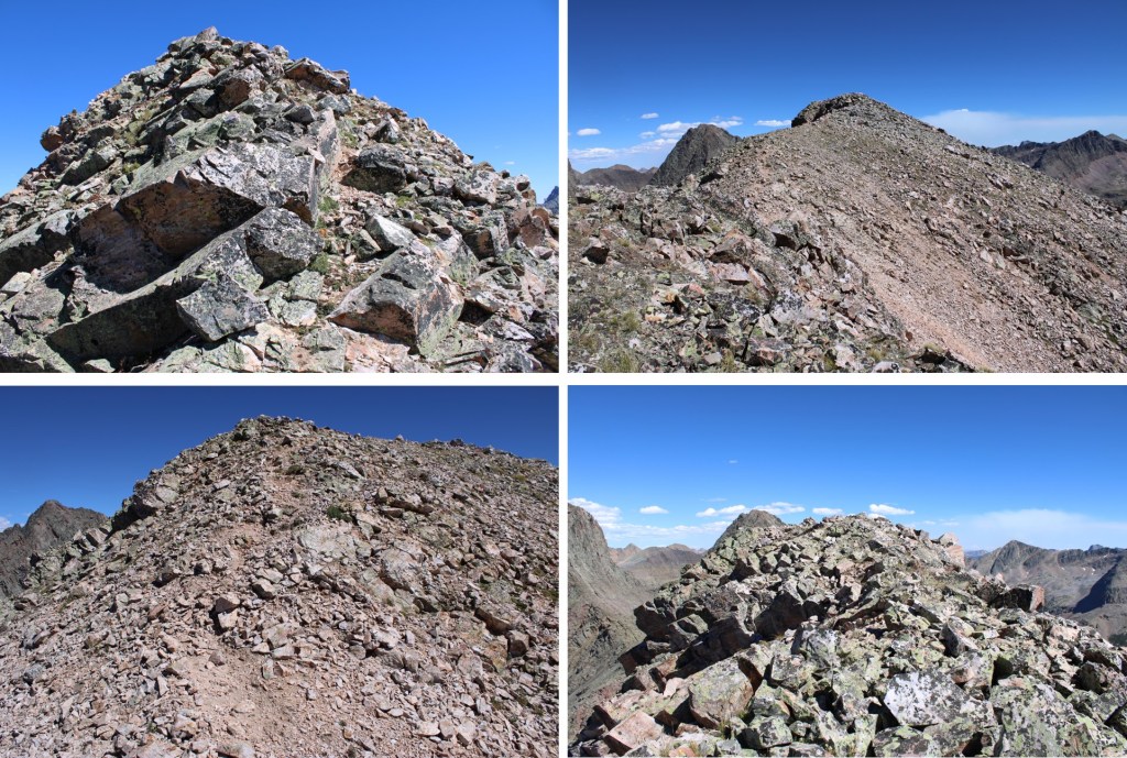
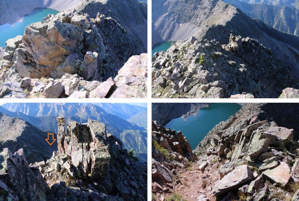
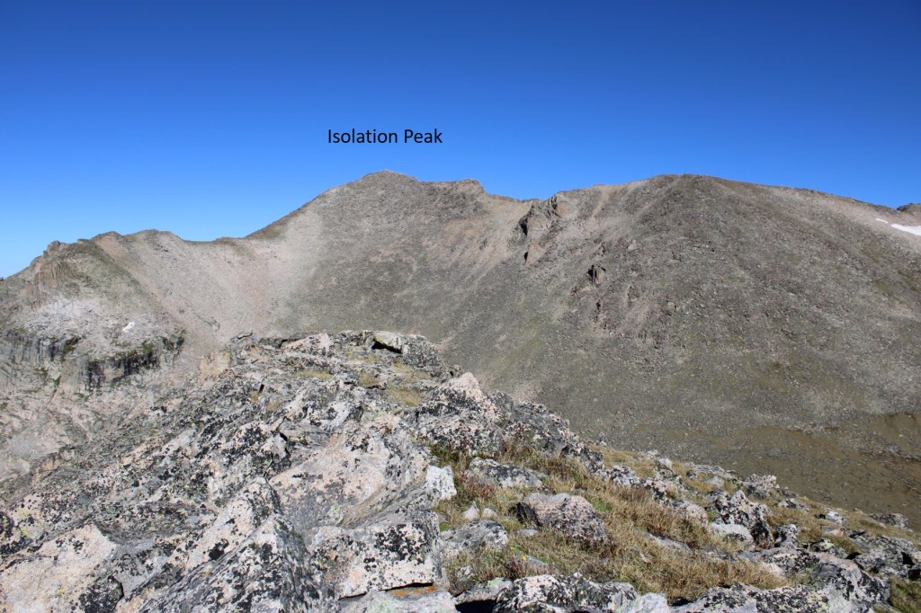
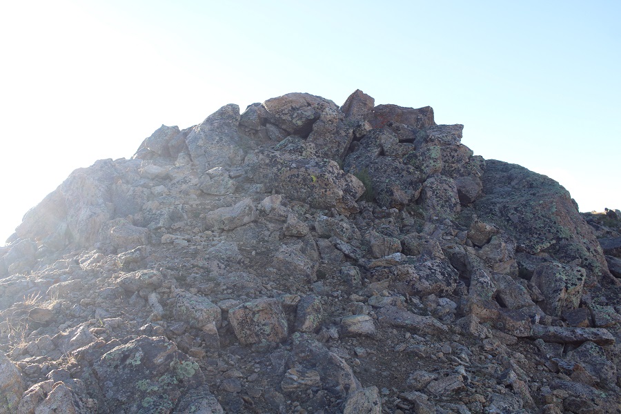
Once on the ridge I turned right and headed northeast to the summit.  The terrain was class 2, and very rocky.

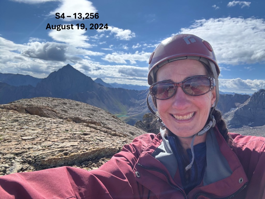
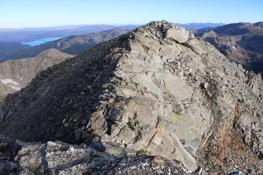
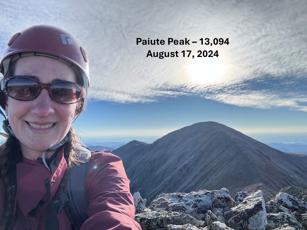
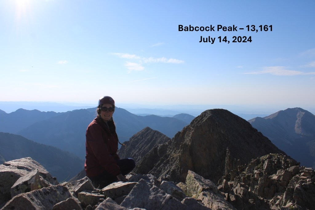
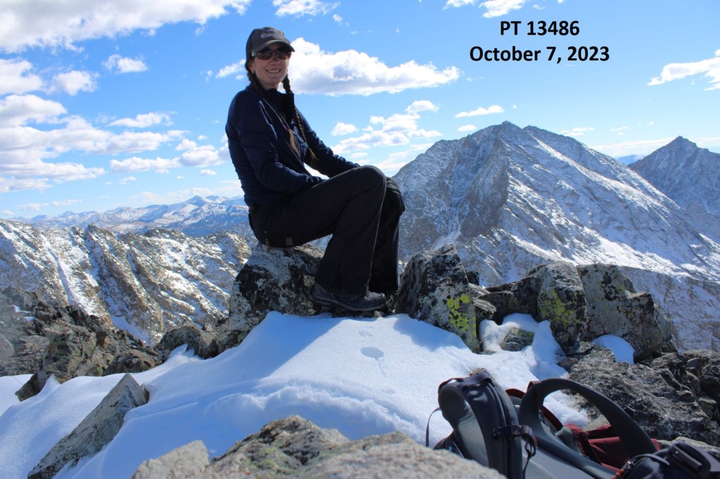
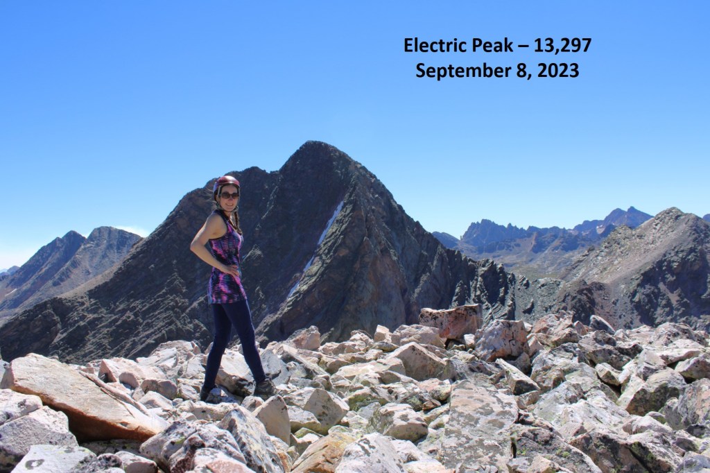
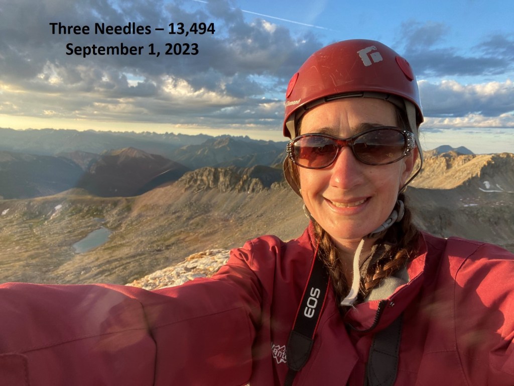
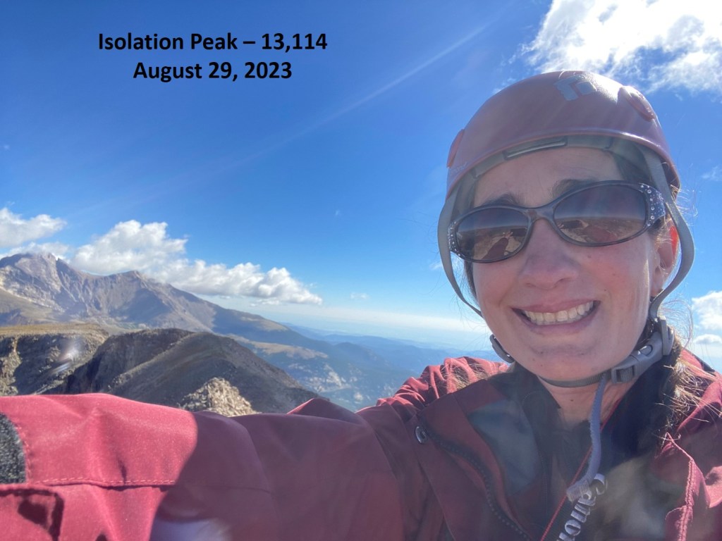
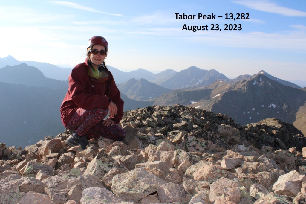
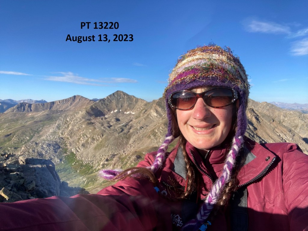
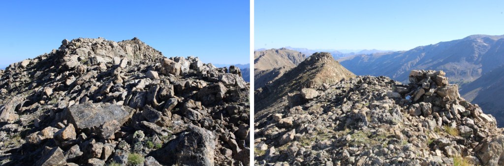
I summited PT 13139 at 10:40am
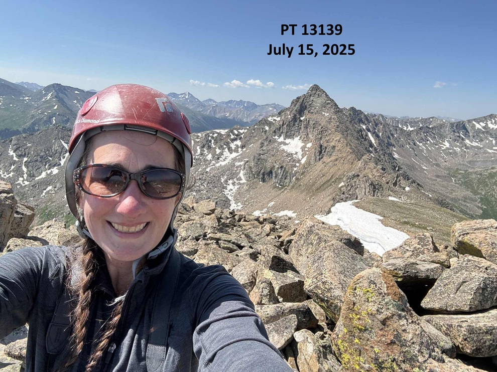
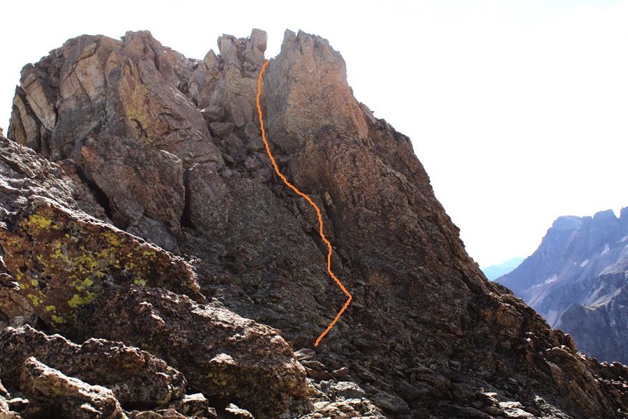
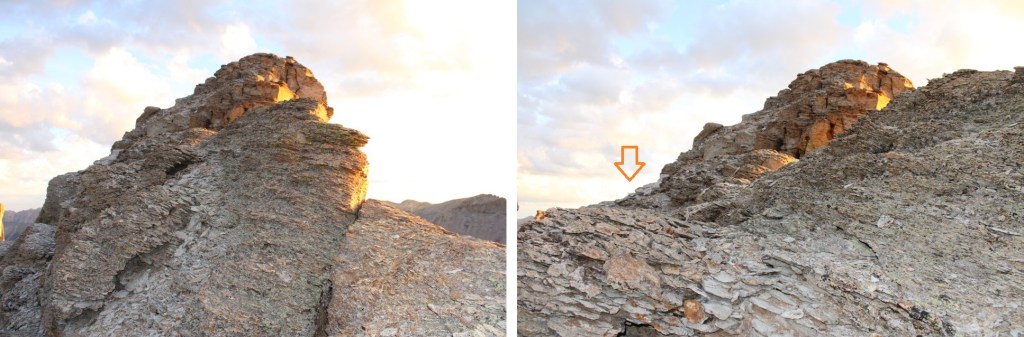
13139:

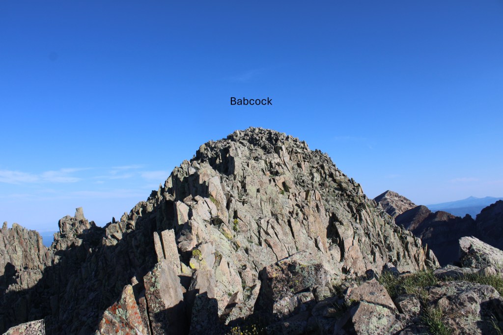
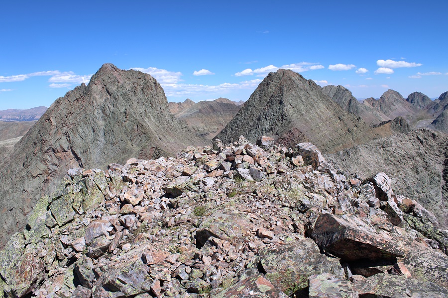
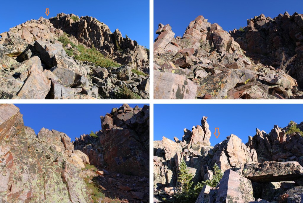
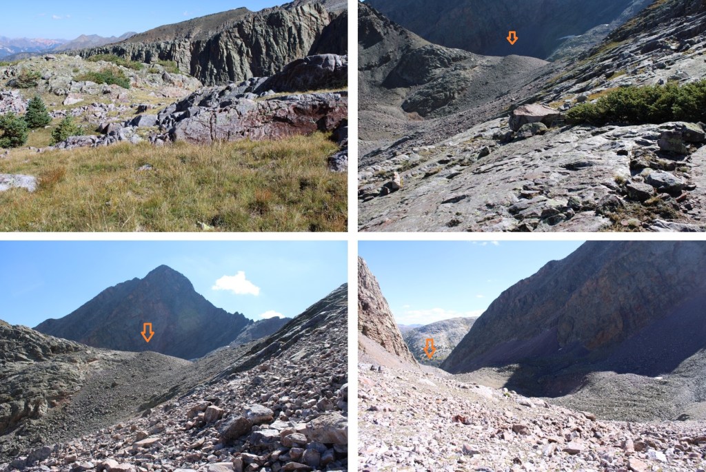
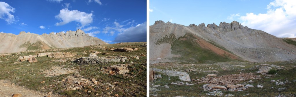
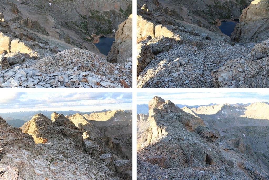
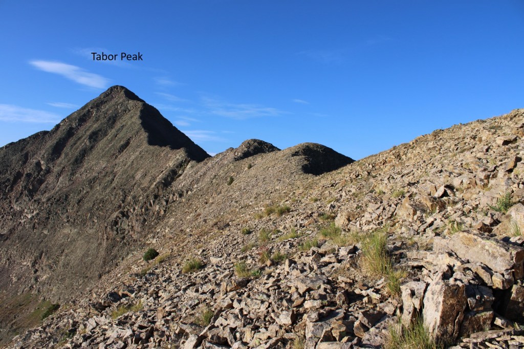
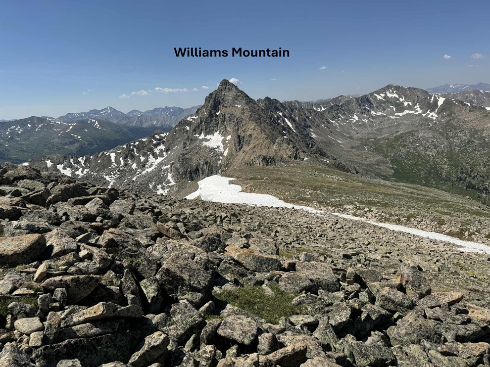
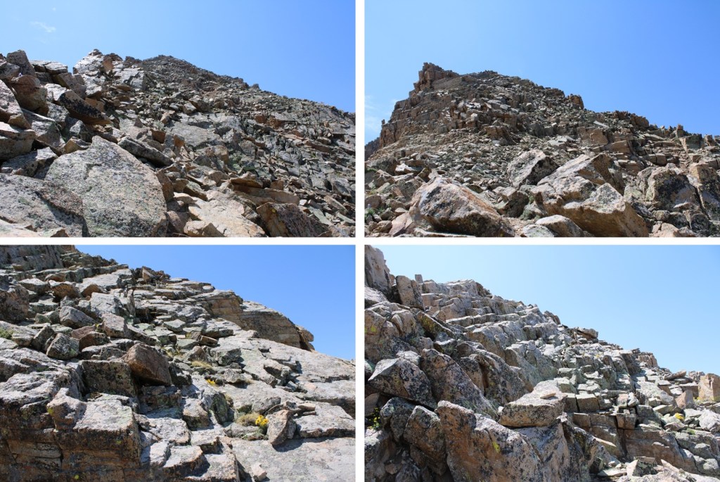
Once again I had a chat with myself on the summit.  I am getting closer to finishing the 13ers, and when they’re done for me that’s it.  I’m not going for 12ers, etc. because I’m starting a new phase of my life.  However, I want to enjoy the 13ers for as long as possible.  That’s a long way of saying I’m trying to stretch out my remaining climbs by making them multiple day trips.  I’d planned on doing the Williams group in 3 days, but since if I returned the way I’d summited I’d need to gain over 600’ of elevation anyway, I figured I’d head over to Williams Mountain and summit that one today as well.  So, I turned and headed southwest along the ridge towards Williams Mountain.

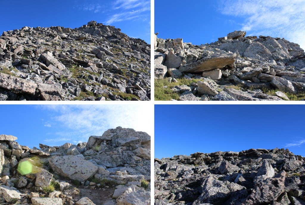
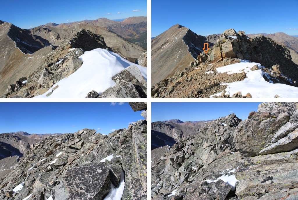
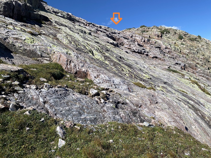
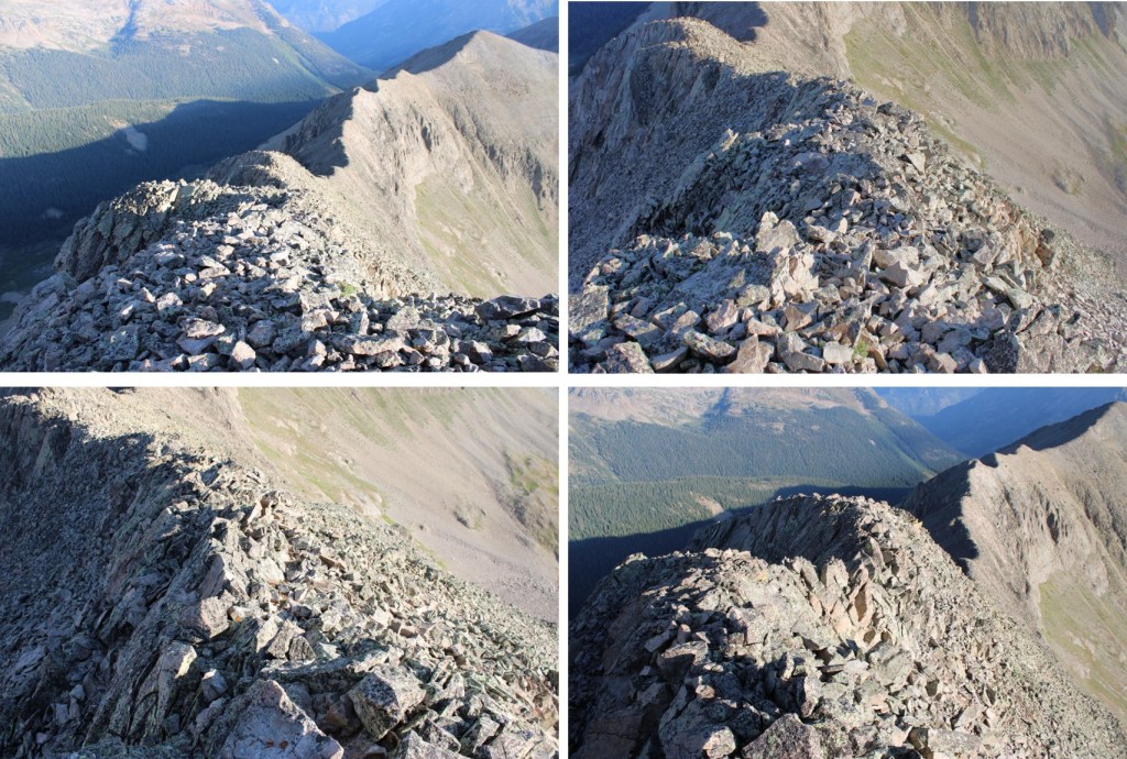
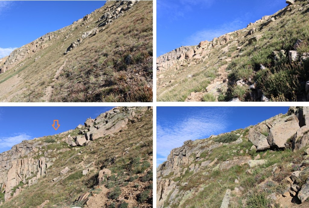
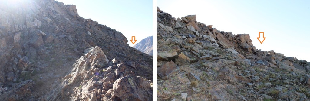
The ridge started out calmly, then quickly became rocky.  I stayed to the ridge proper on class 2 and 3 terrain.

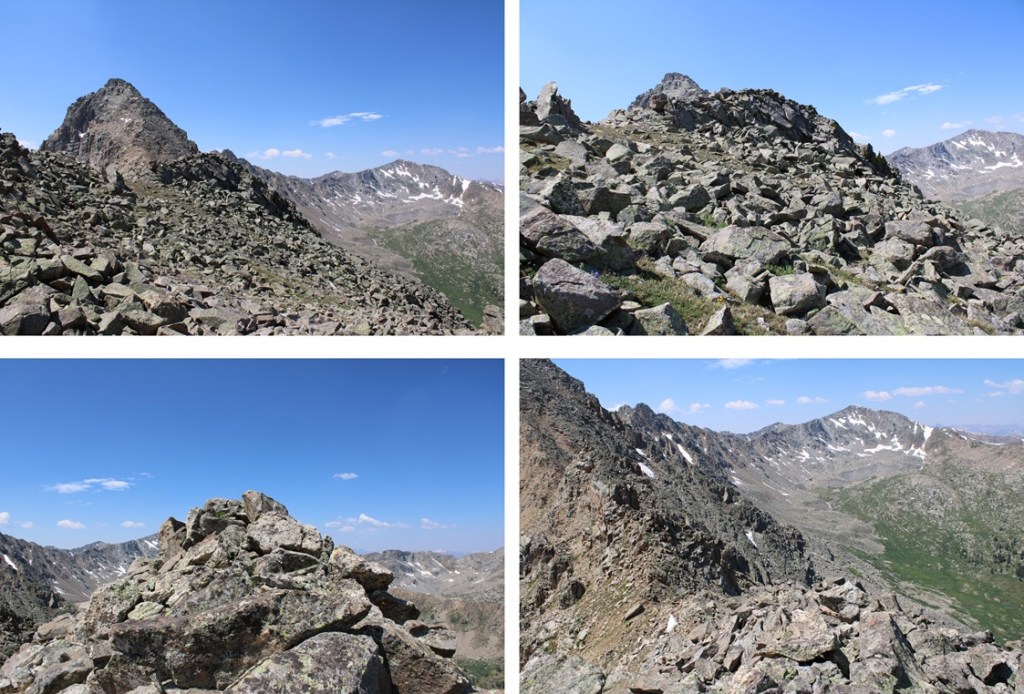
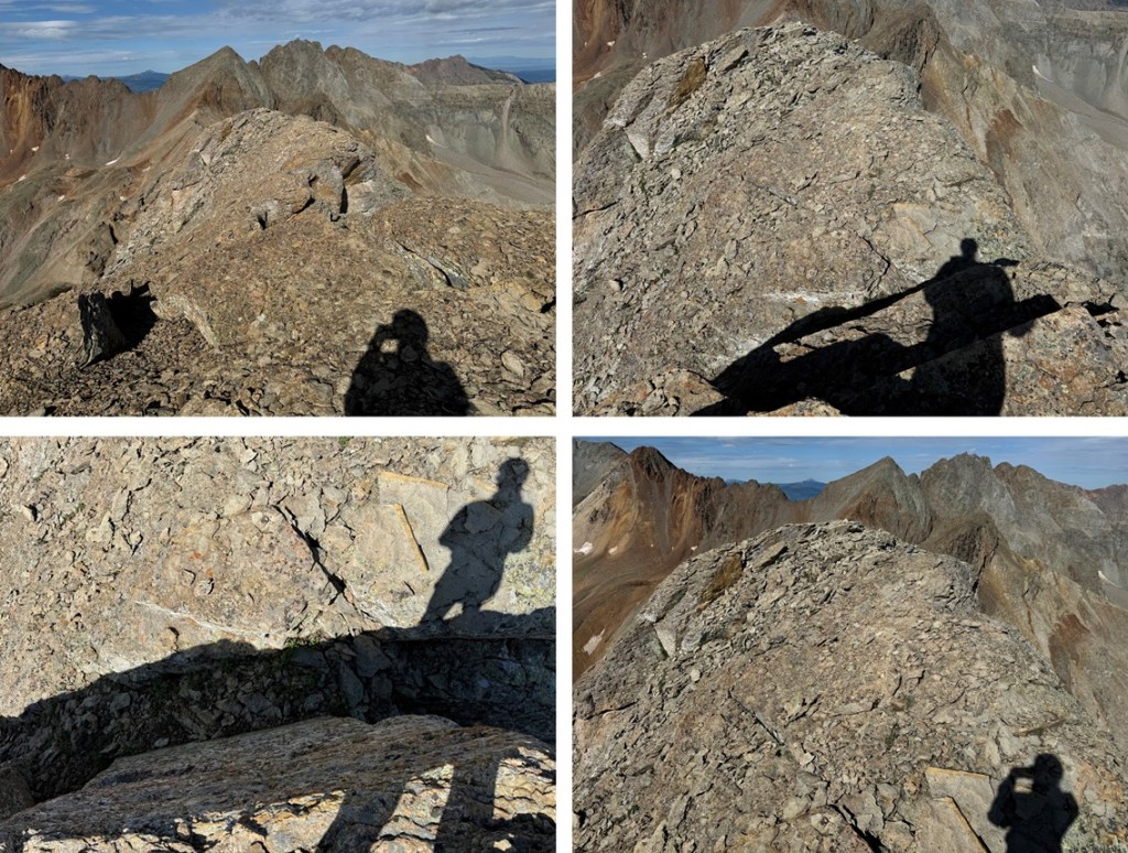
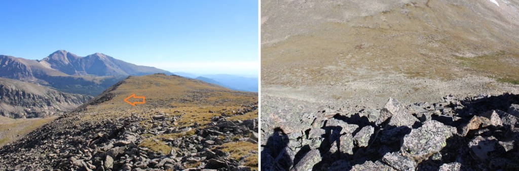
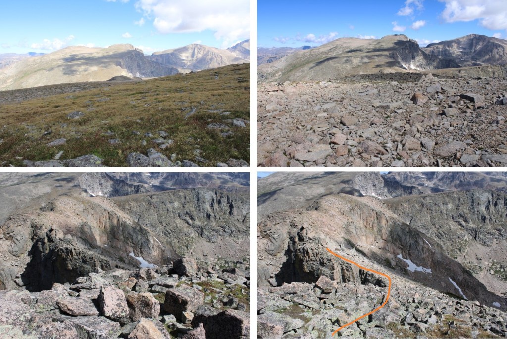
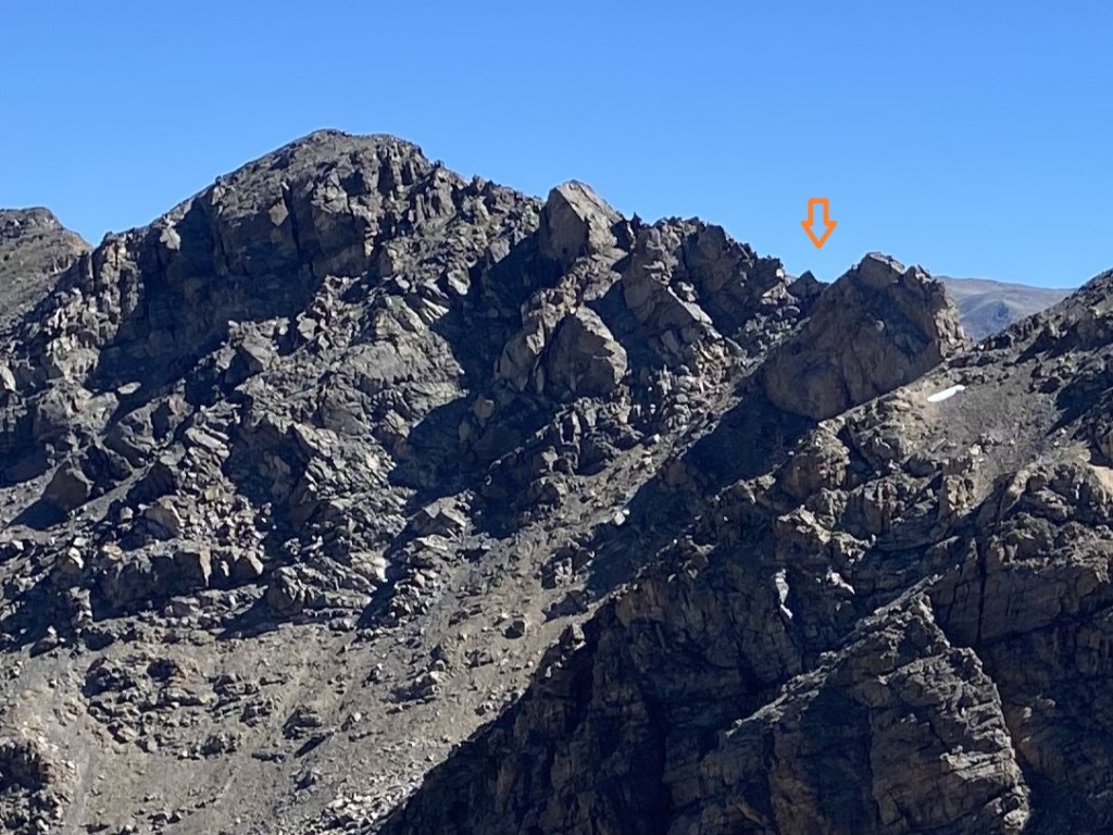
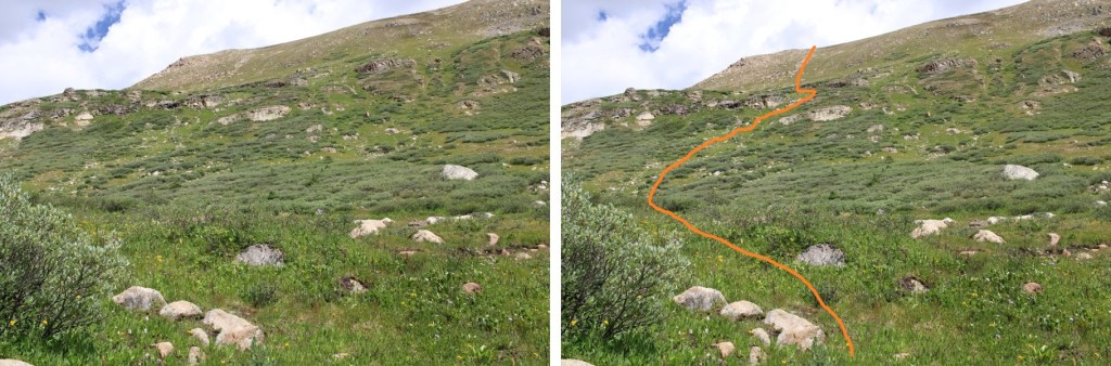
Until I came to this point, where I dropped down to the left and followed the scree filled slopes before regaining the ridge.

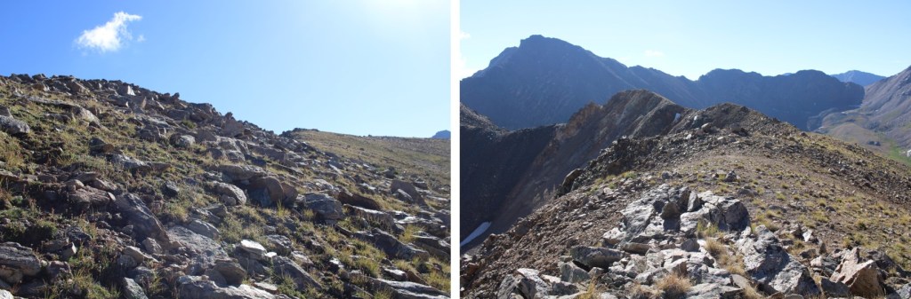
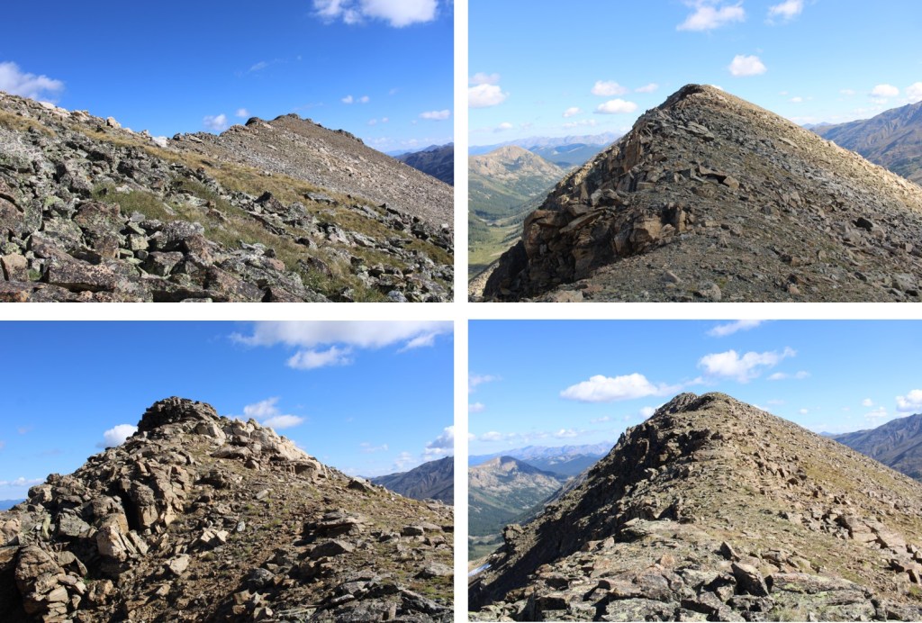
While it may look flat, there were a lot of ups and downs along the way.

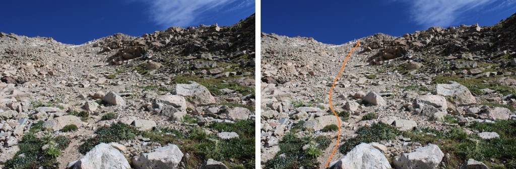
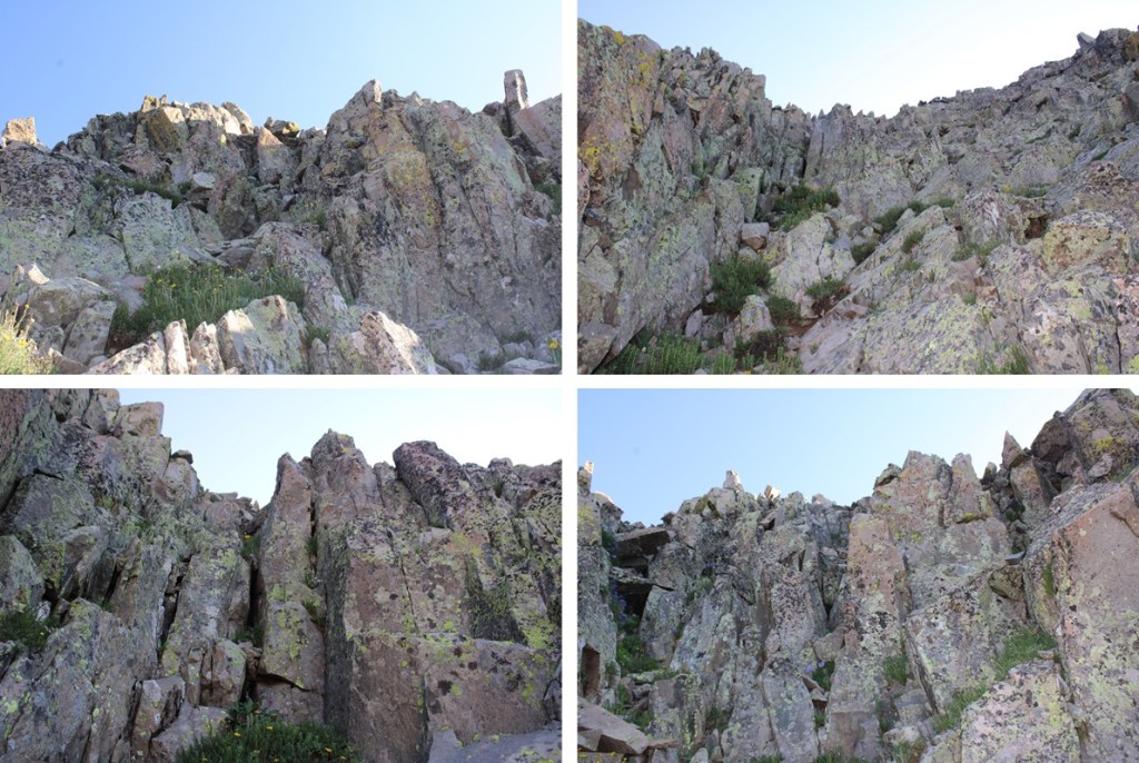
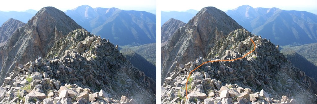
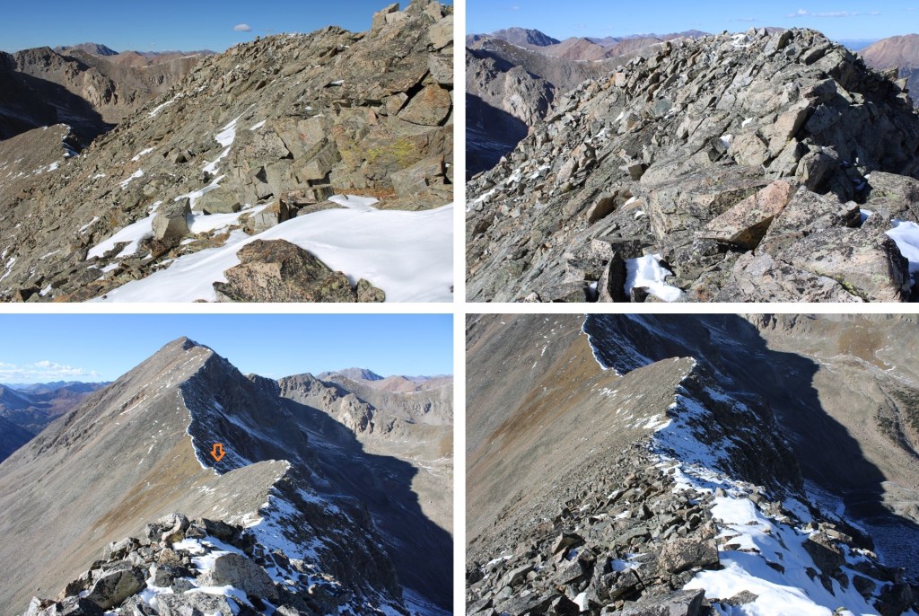
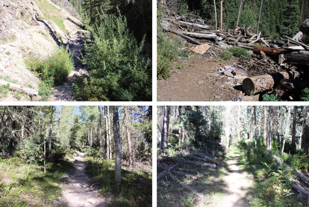
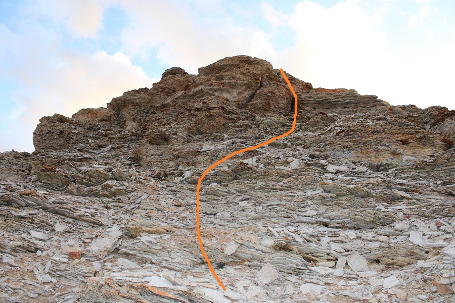
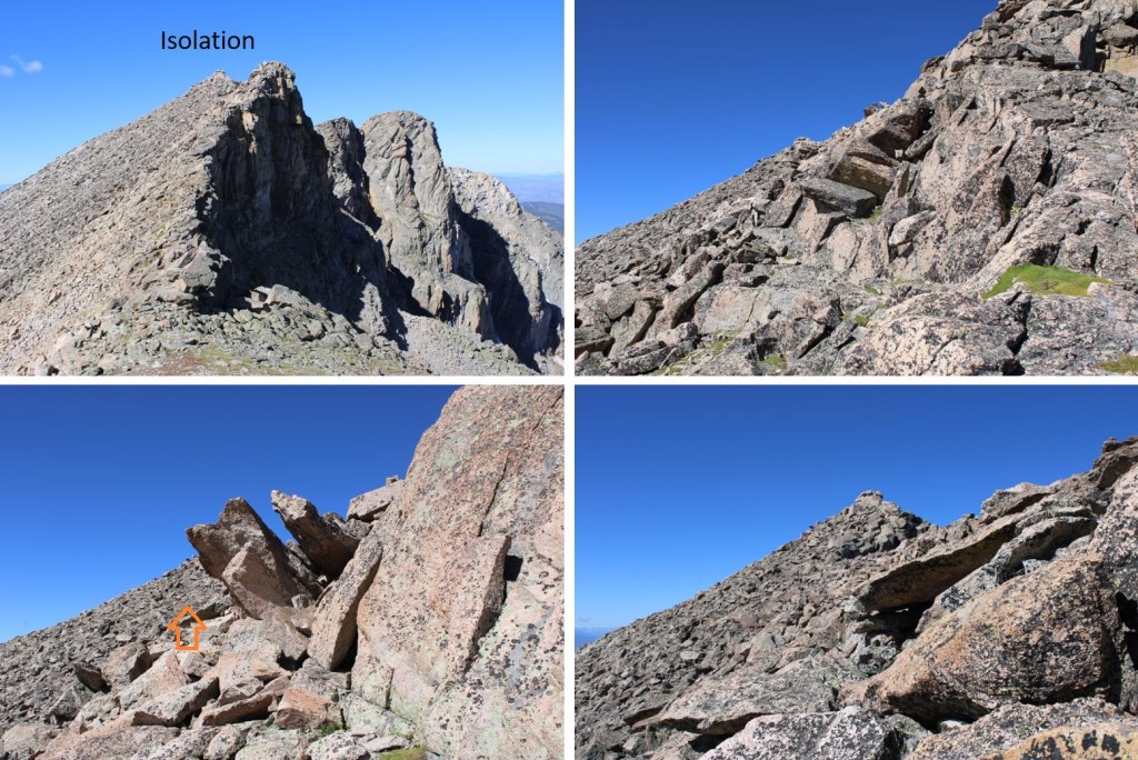
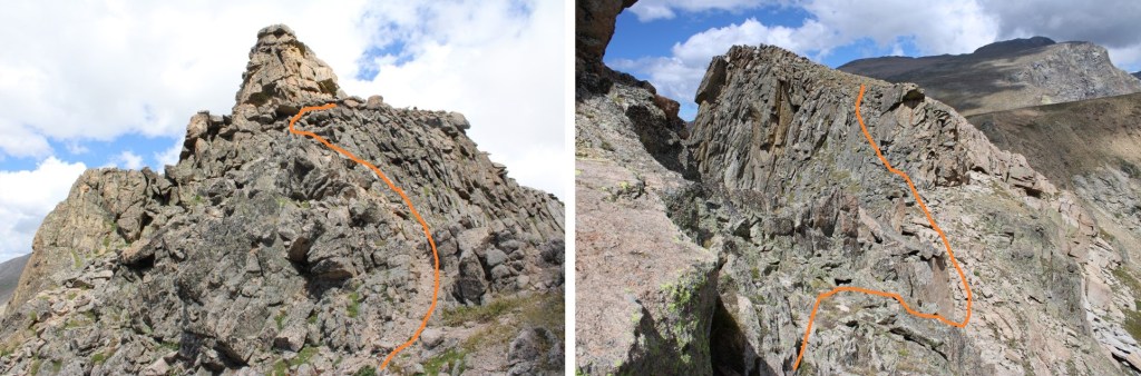
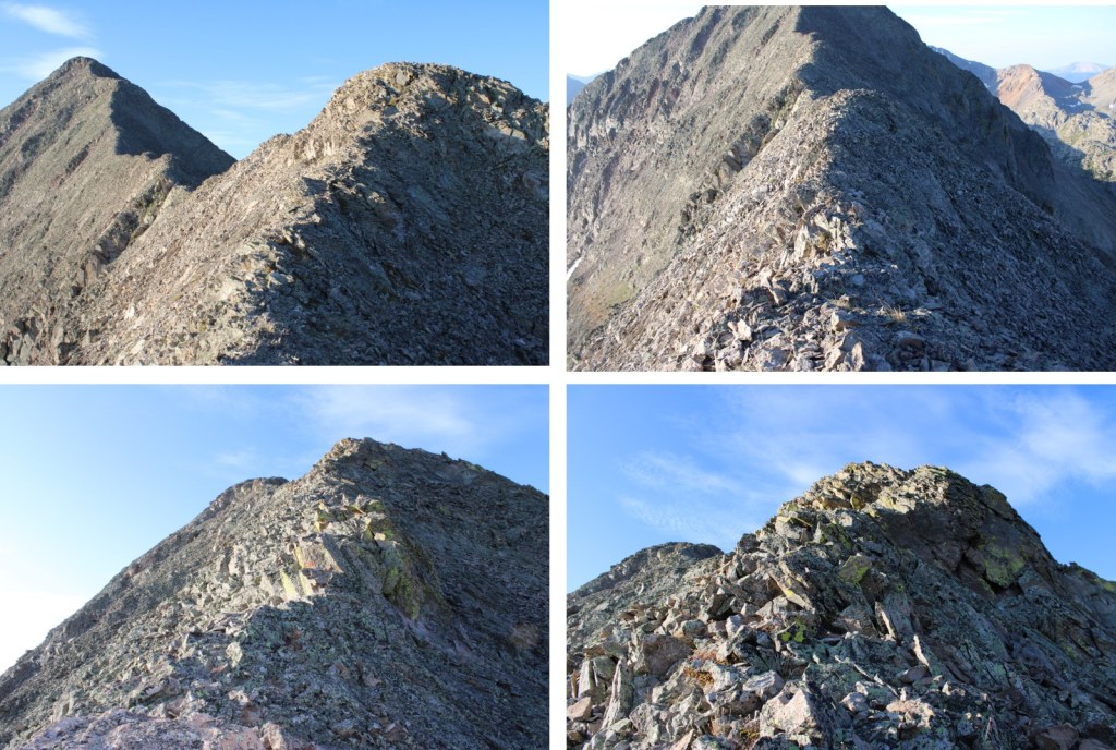
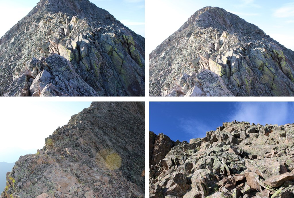
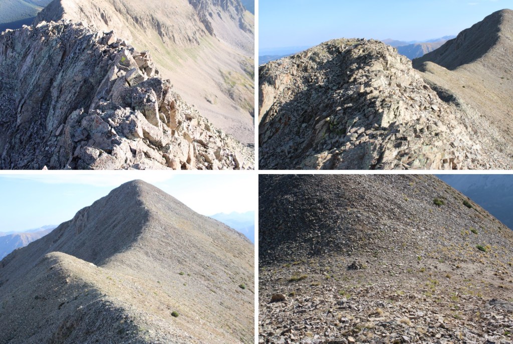
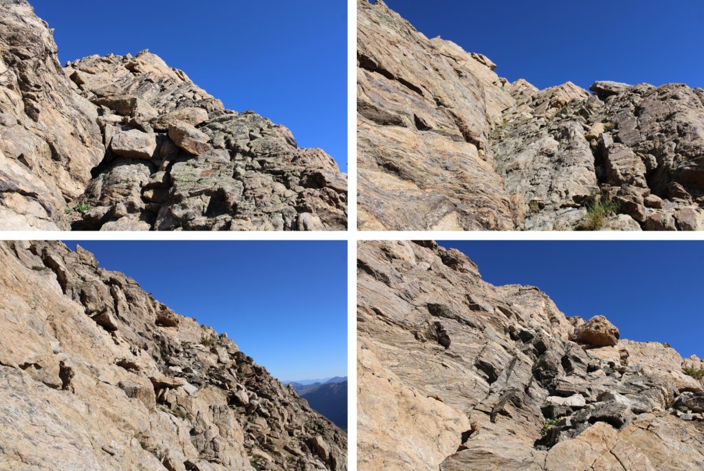
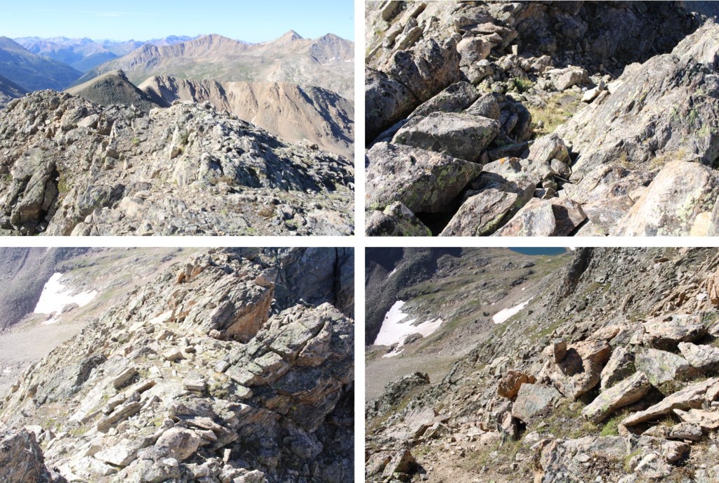
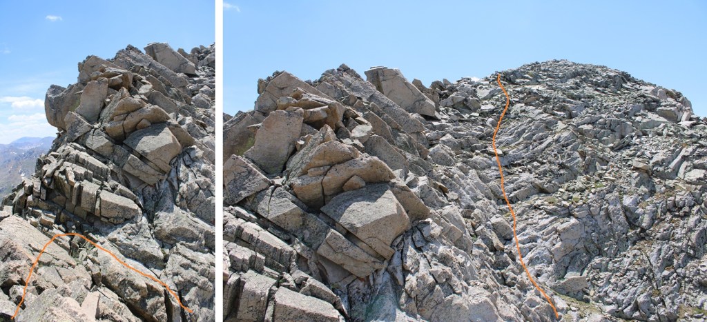
Once on the ridge again I followed it south. There were large boulders to navigate, but the rock was pretty solid.  This is where the ‘fun’ begins.  For the rest of the route to the summit it’s intense class 3, if not class 4.  It’s probably the most difficult class 3 I’ve done to date, bordering on class 4 in areas (I’m short, so a lot of the holds are a stretch).  There are a few cairns in this area, but don’t rely on seeing them. This was an intense, exposed scramble, and more than once I got myself ‘stuck’ in a not so friendly position and had to backtrack (which was also not so friendly).  Be sure of your holds, be sure of your moves, and please have climbing experience before attempting this climb because it only gets more difficult as you ascend.  I stuck a little to the west of the ridge, heading south.

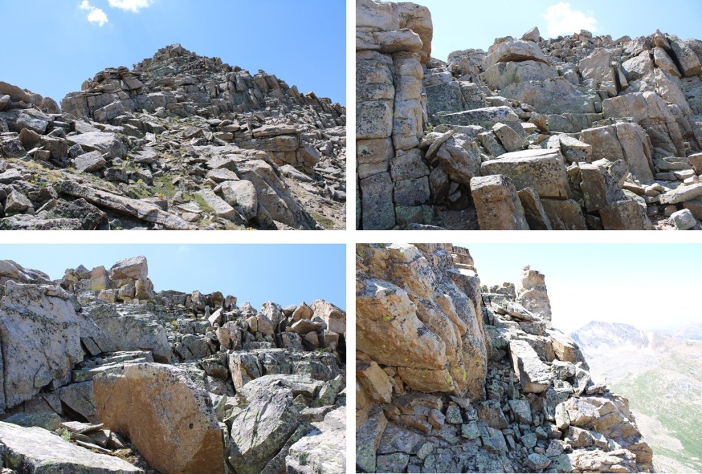
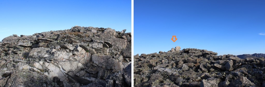
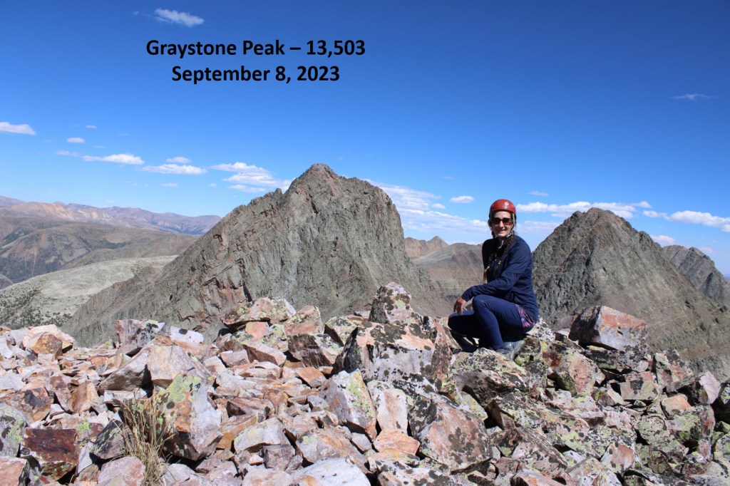
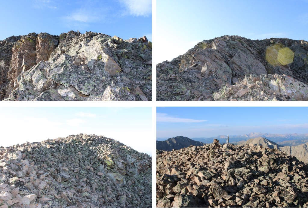
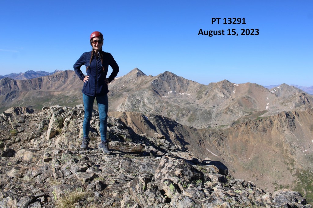
I summited Williams Mountain at 12:55pm
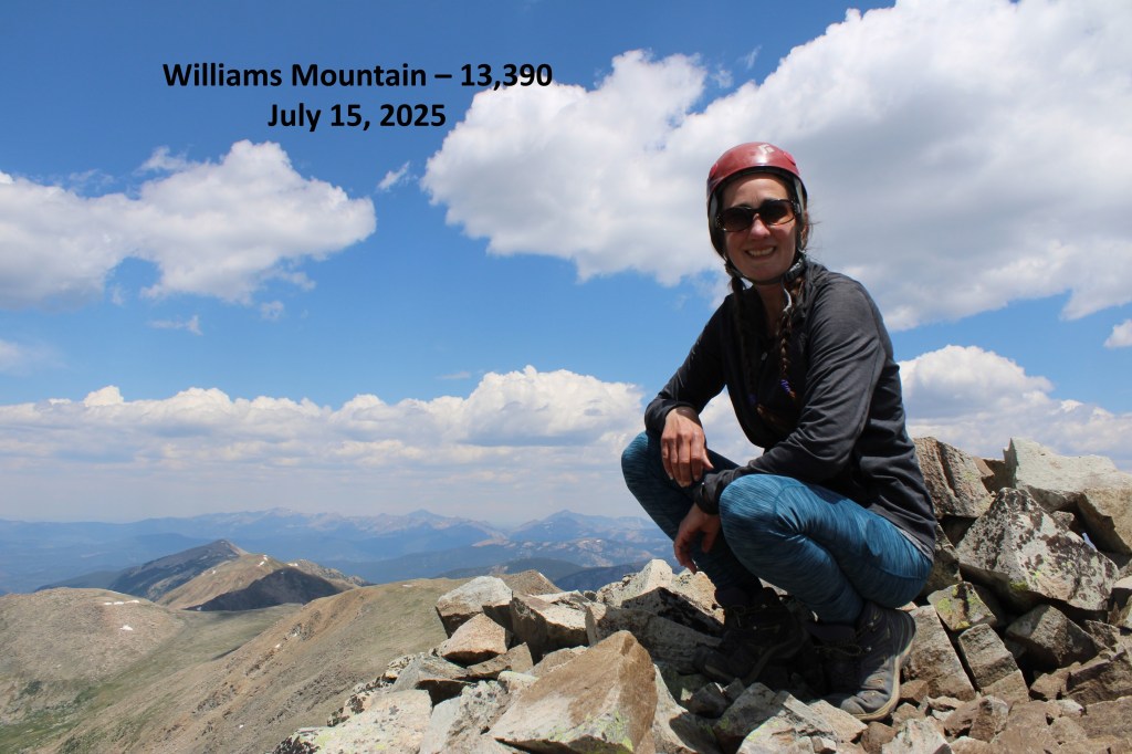
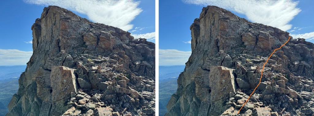
Williams Mountain:

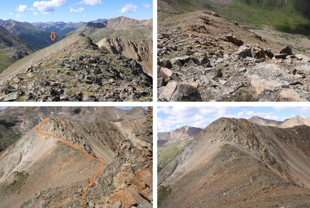
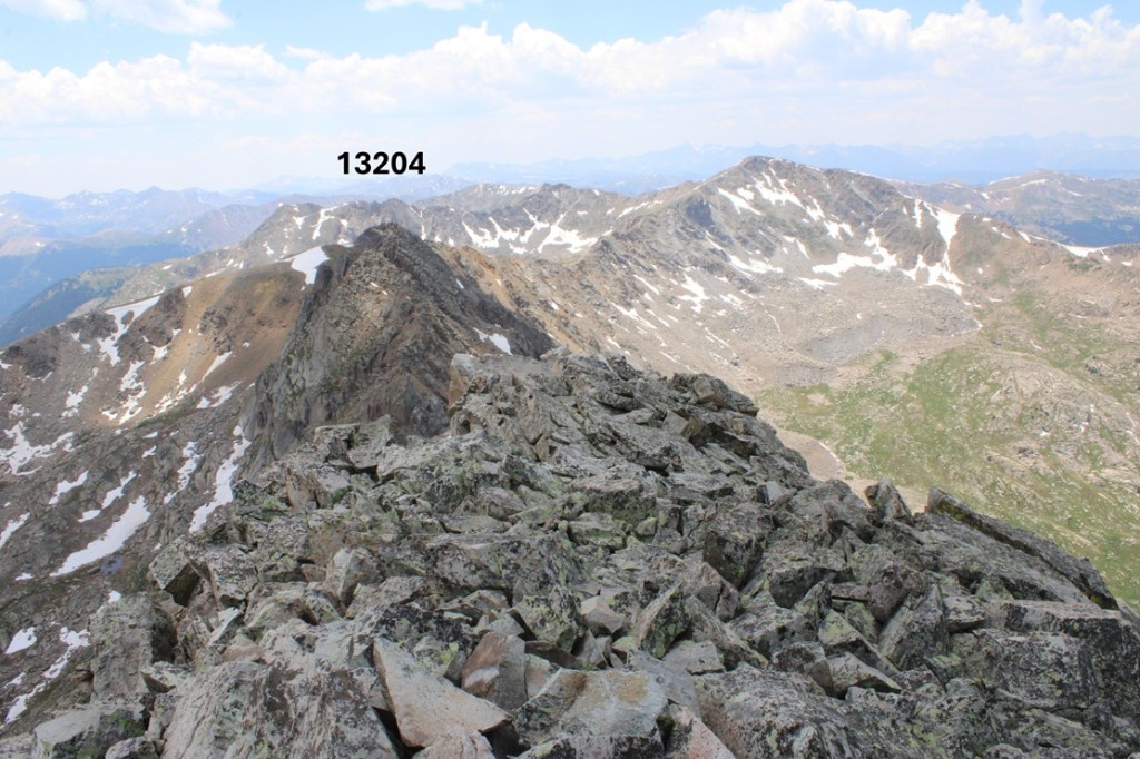
After summiting I kept heading south, towards 13204.

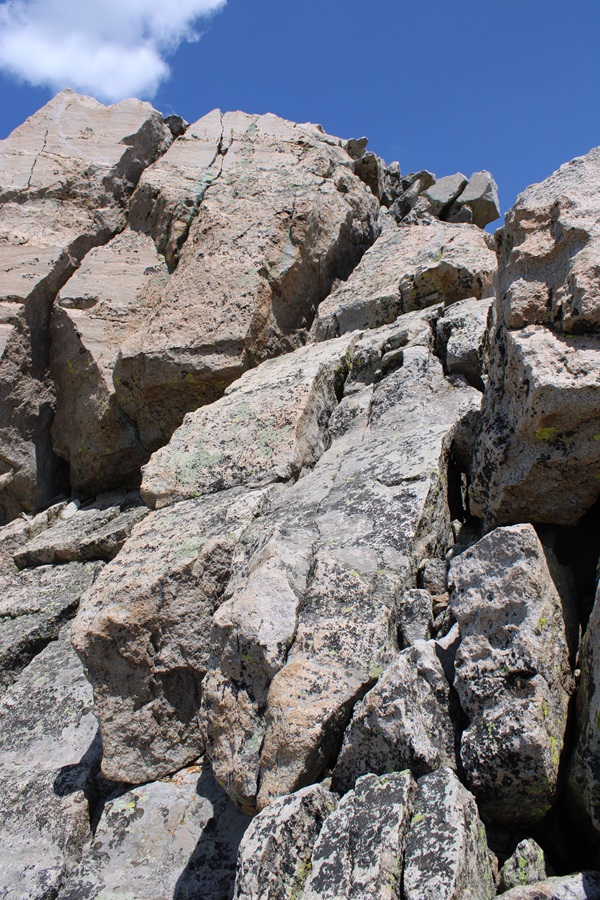
I’d thought the difficult climbing was over, but I was wrong.  Almost immediately I was greeted with a rock slab I’d need to descend. I butt-schooched down this thing.

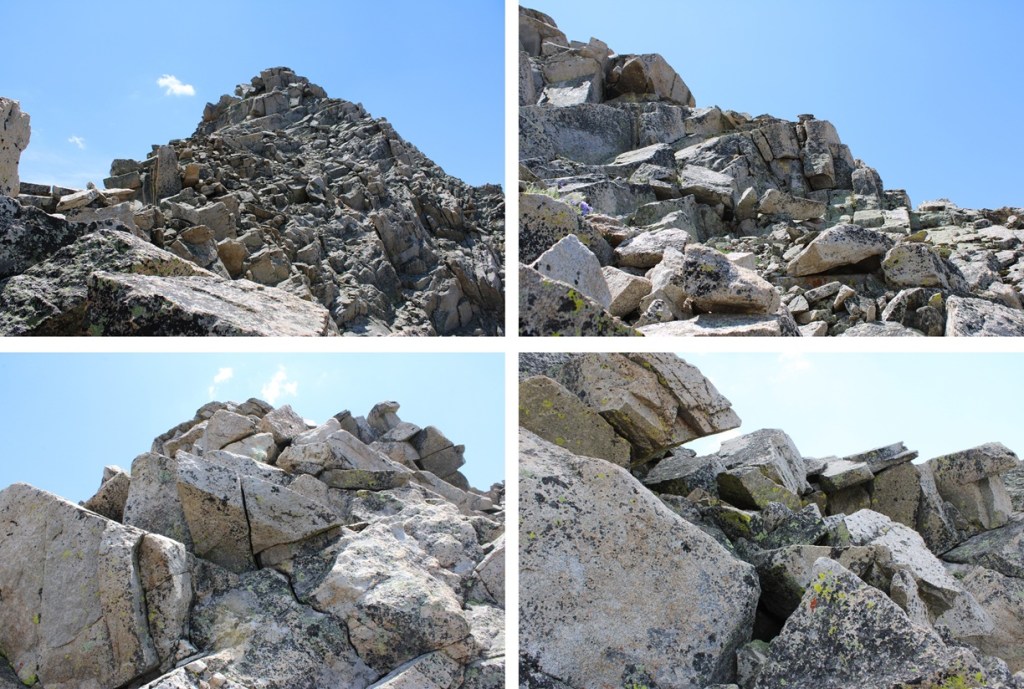
Here’s looking back up at the rock slab

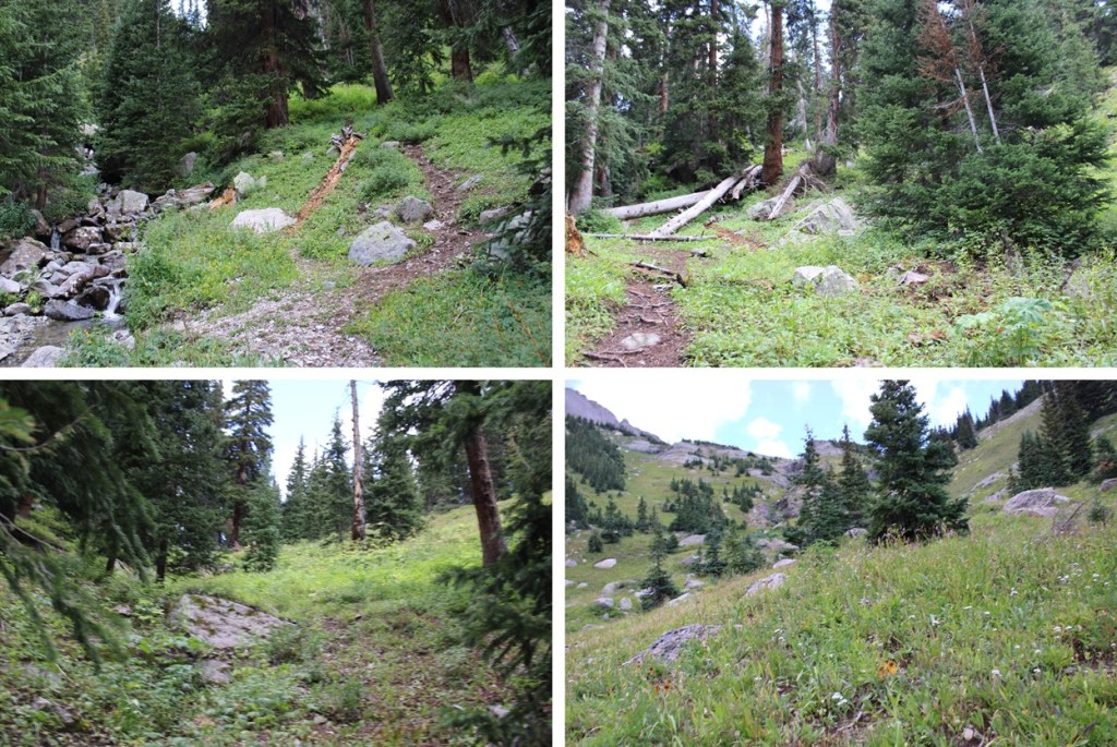
That was the worst of it though.  I went left and descended and then reascended this little gully

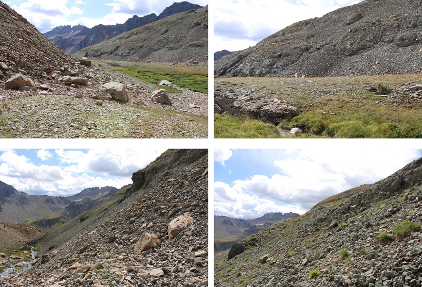
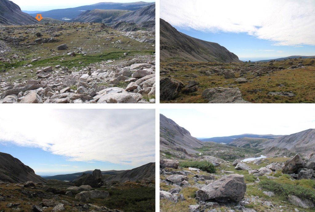
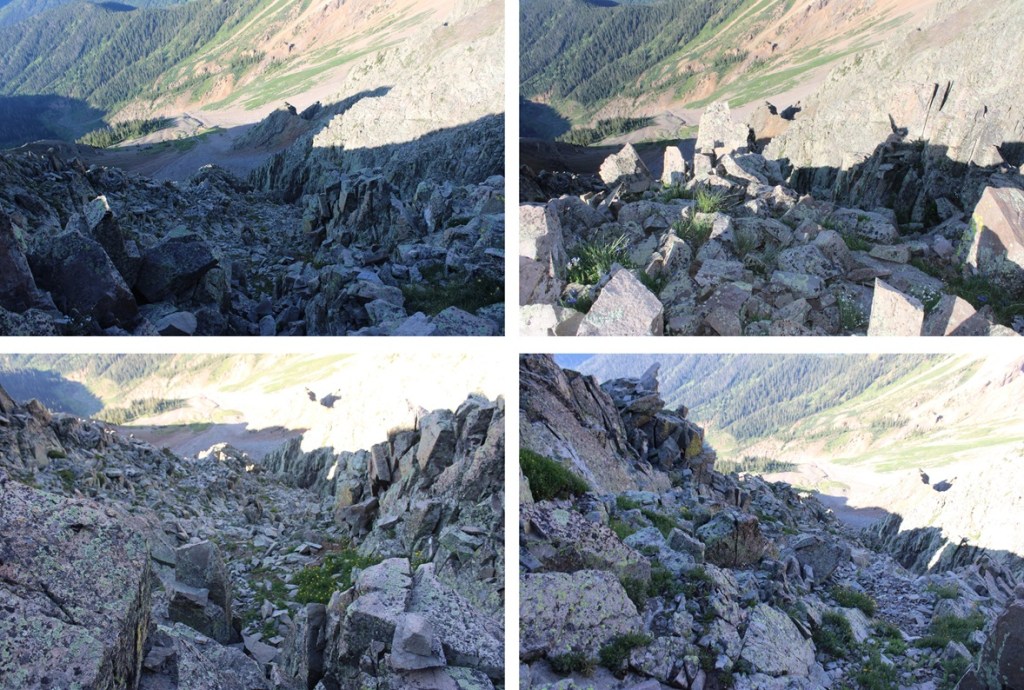
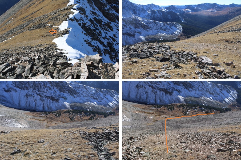
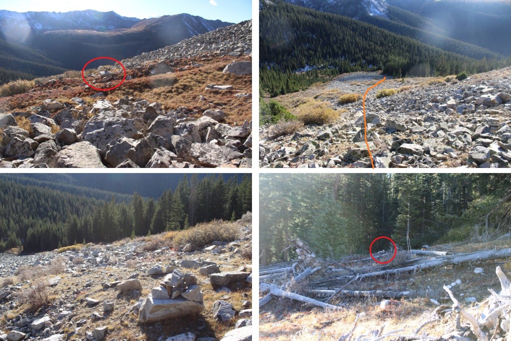
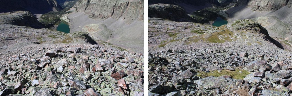
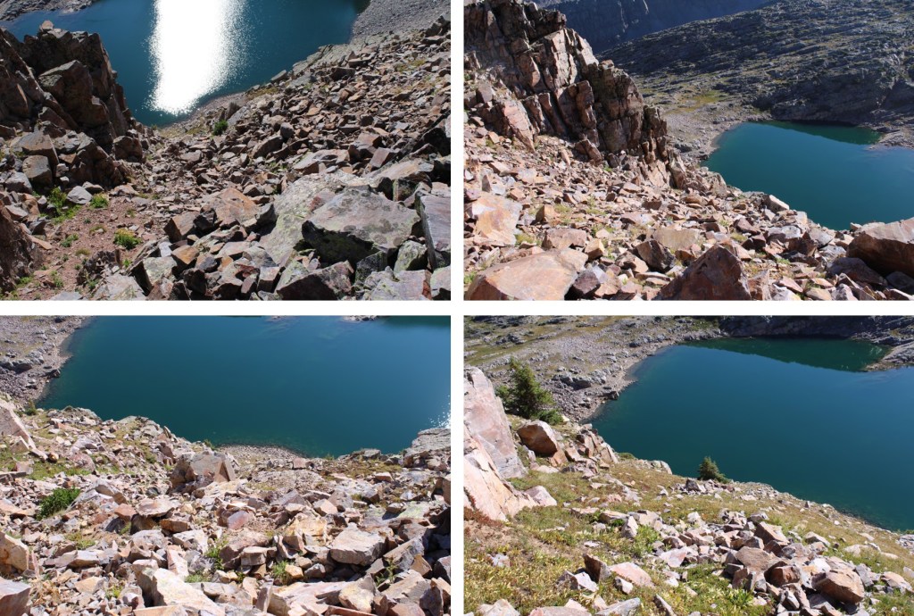
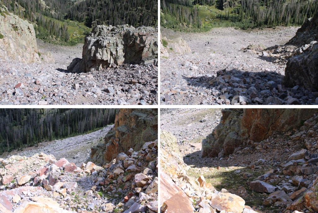
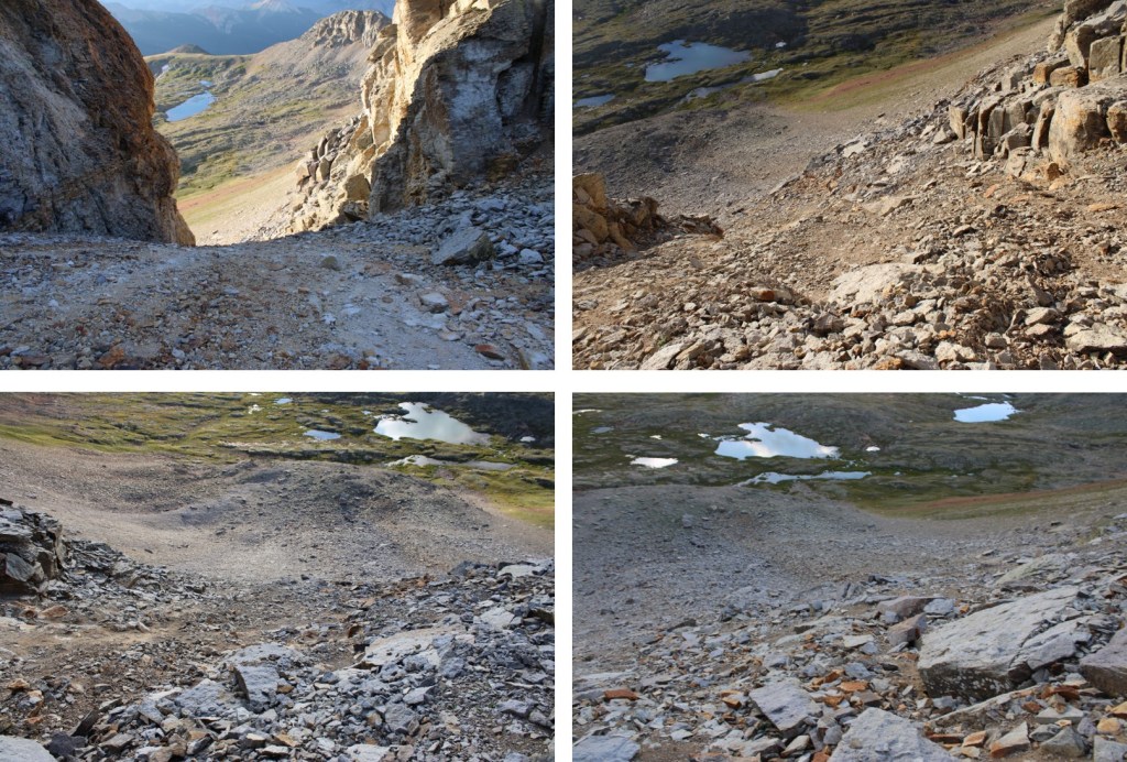
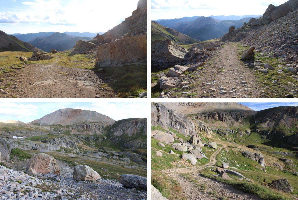
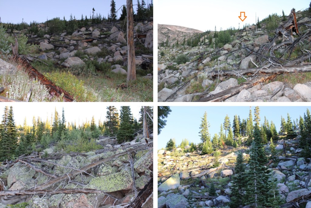
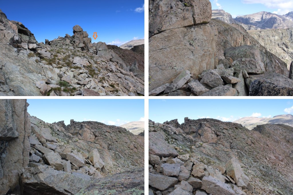
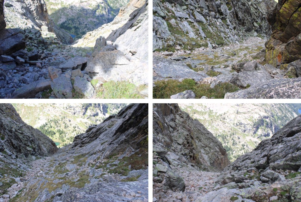
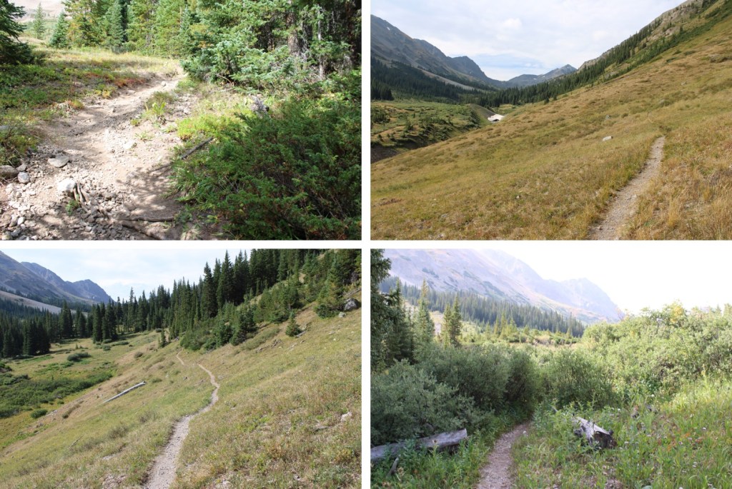
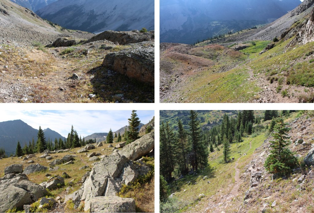
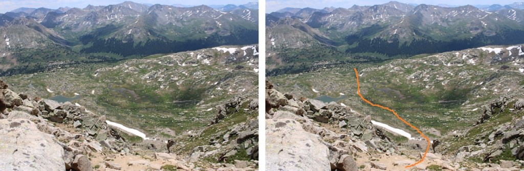
Then I made my way down the ridge to a larger gully and followed it southeast into a basin.  This gully was easily manageable, with game trails to follow.  Towards the middle there were options to go left or right.  Both went, but I took the right side. 

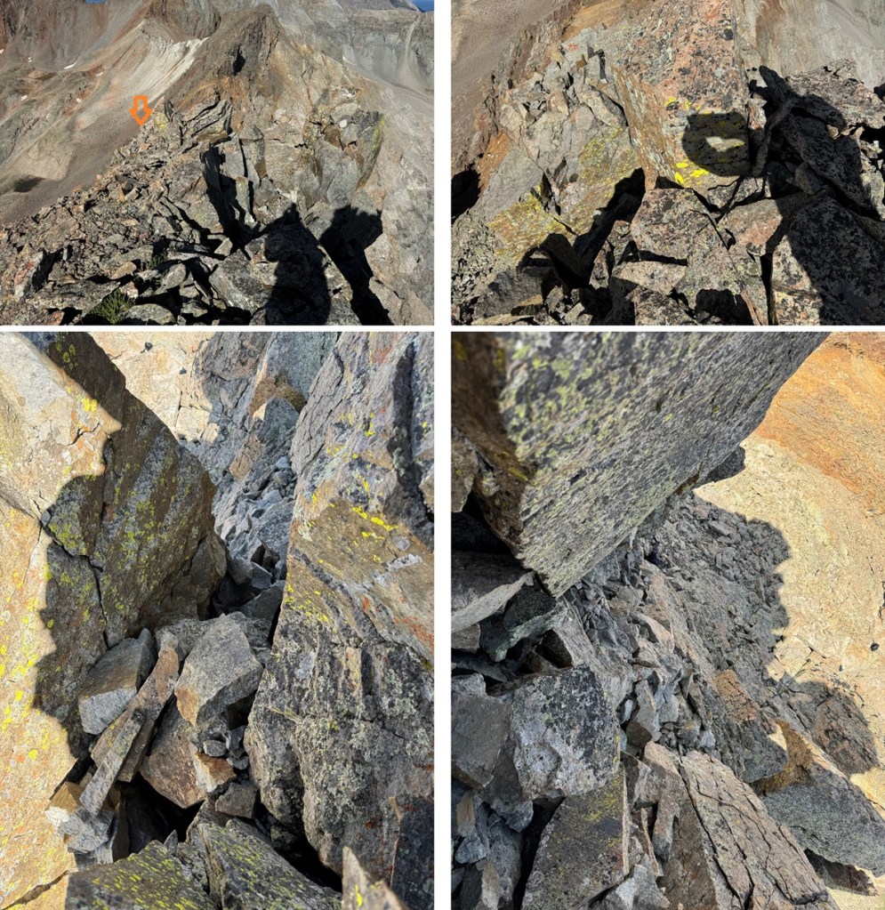
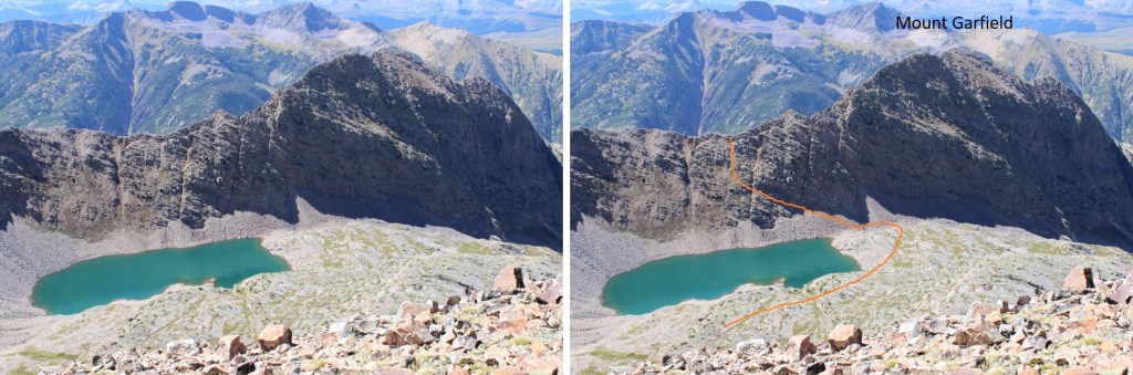
From the top of the gully you can see my route out of the basin.

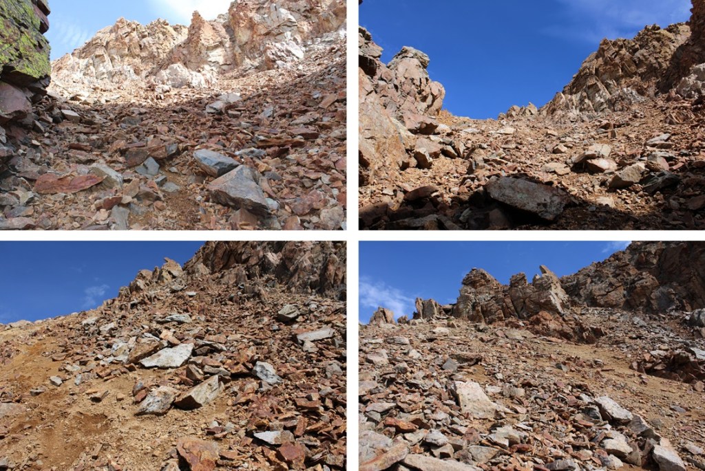
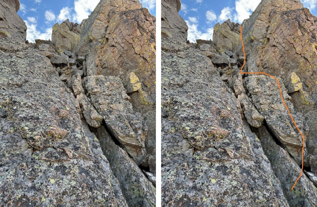
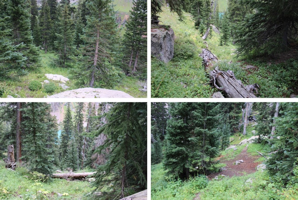
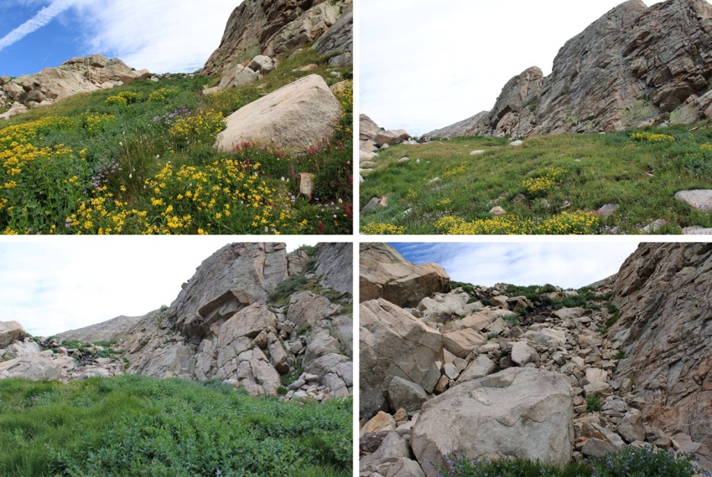
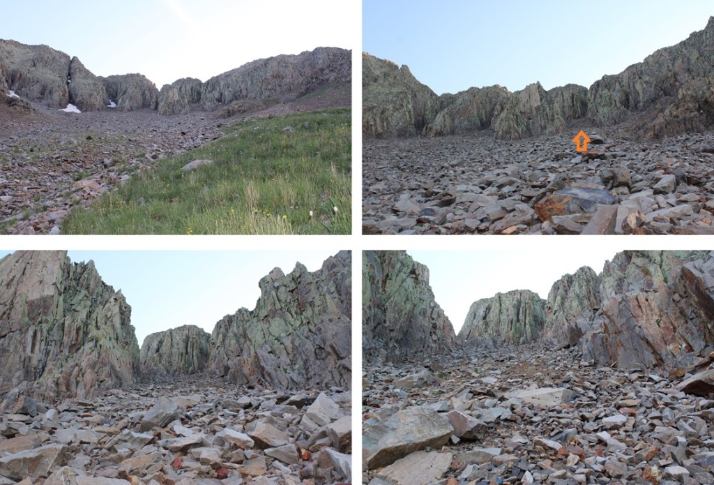
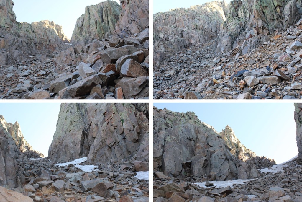
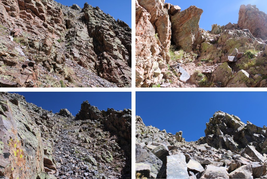
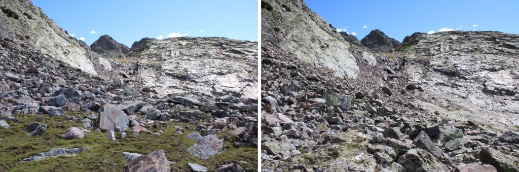
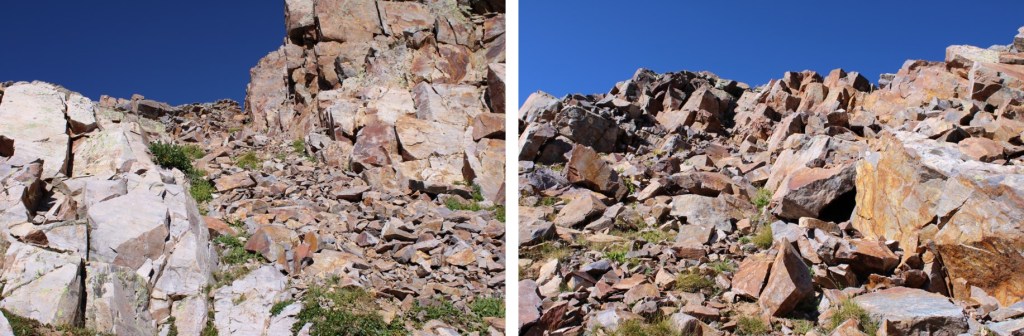
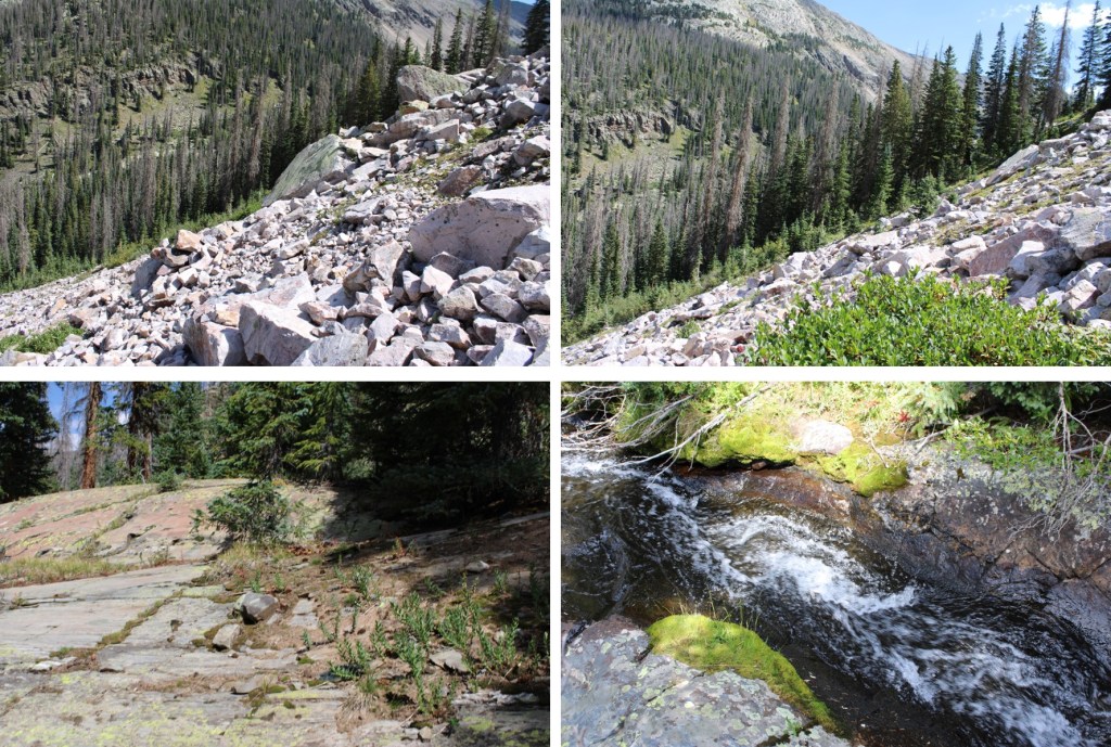
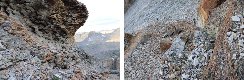
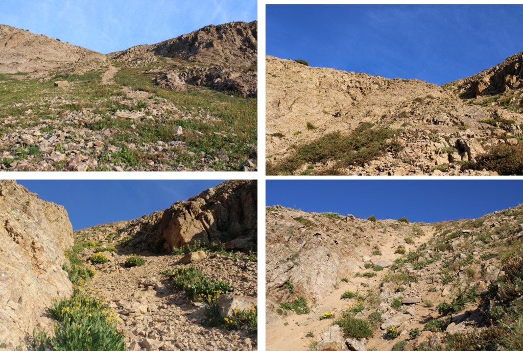
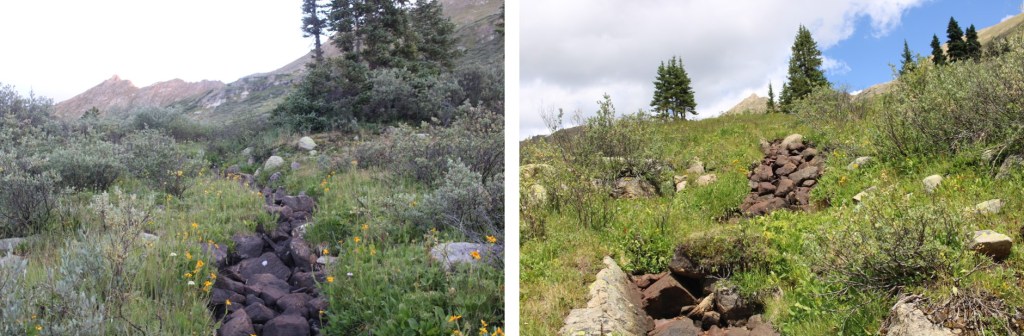
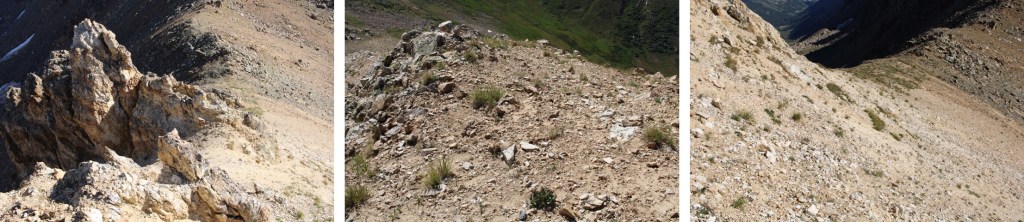
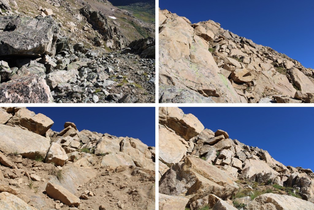
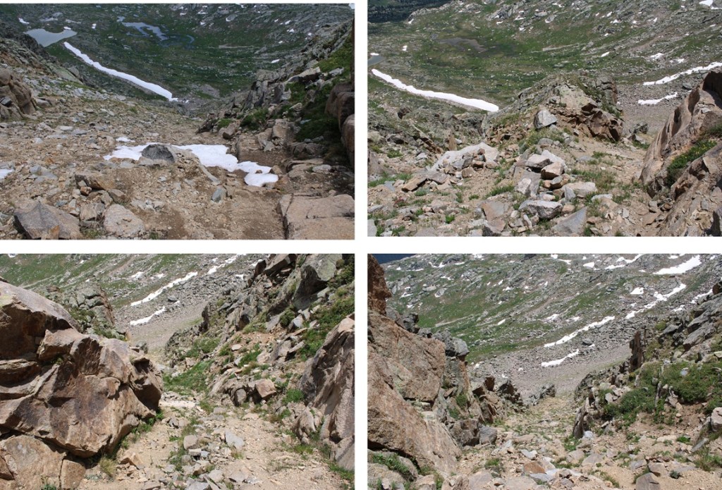
Here are some gully pictures

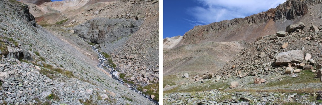
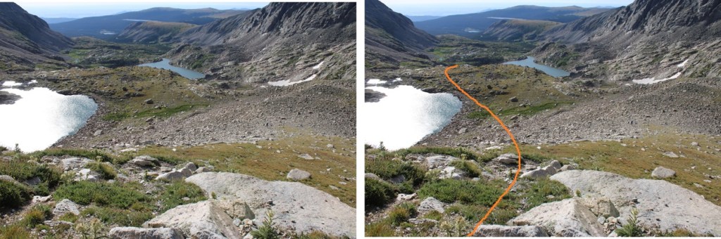
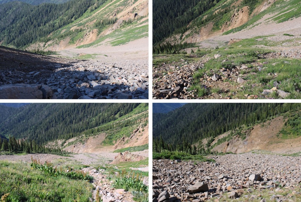
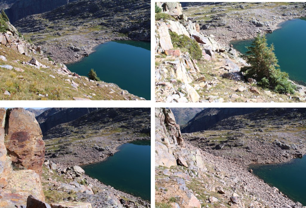
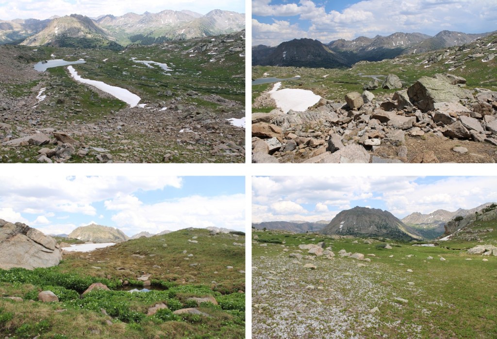
At the base of the gully I headed southeast along the basin. 

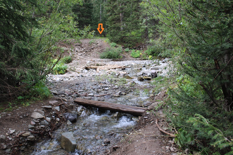
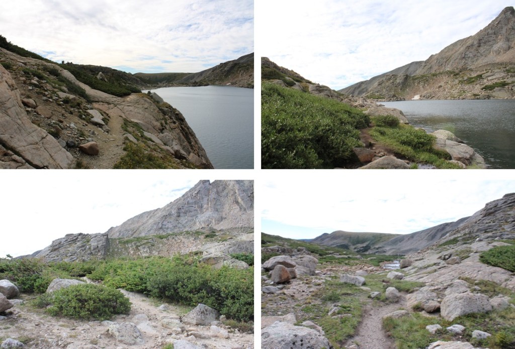
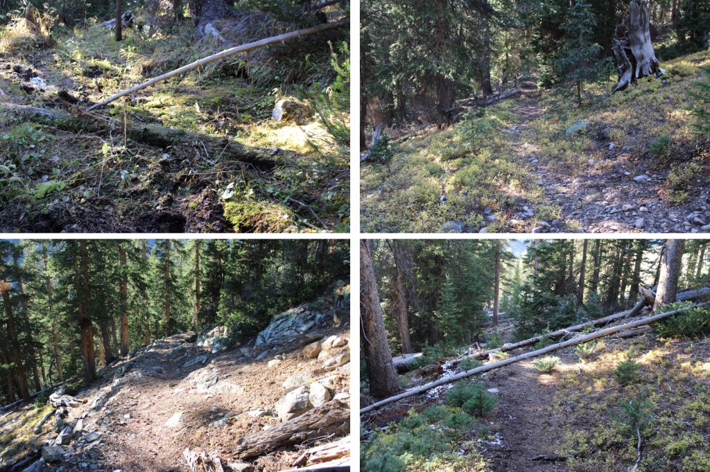
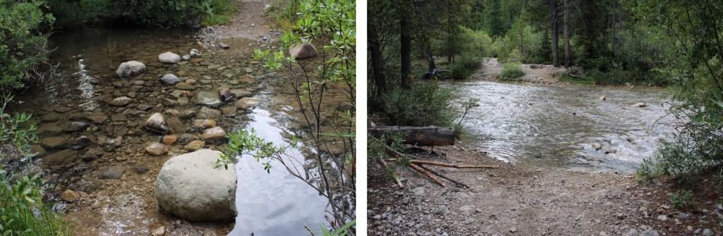
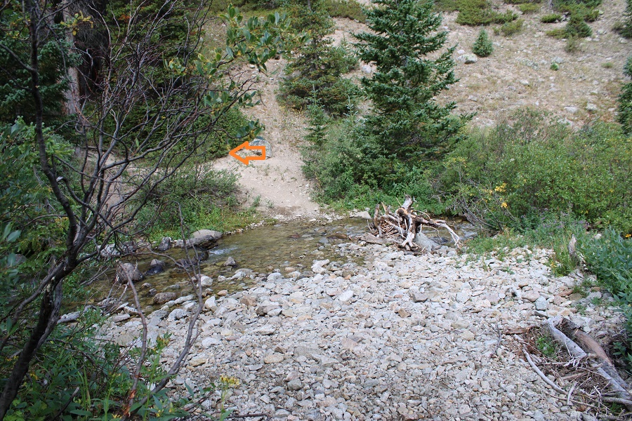
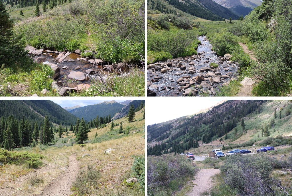
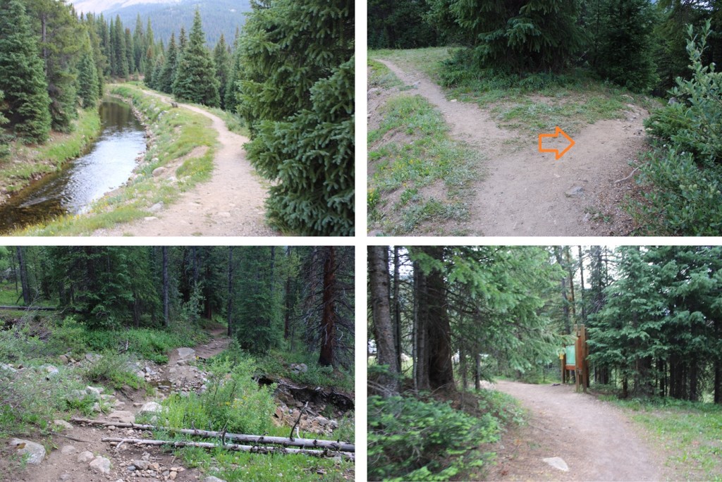
At the end of the basin I followed the stream that was running pretty strongly all the way back down to Lost Man Loop Trail, staying to the left of the stream the entire time.

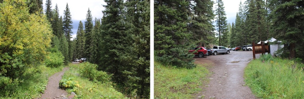
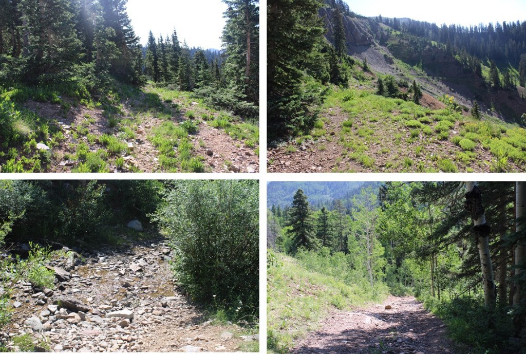
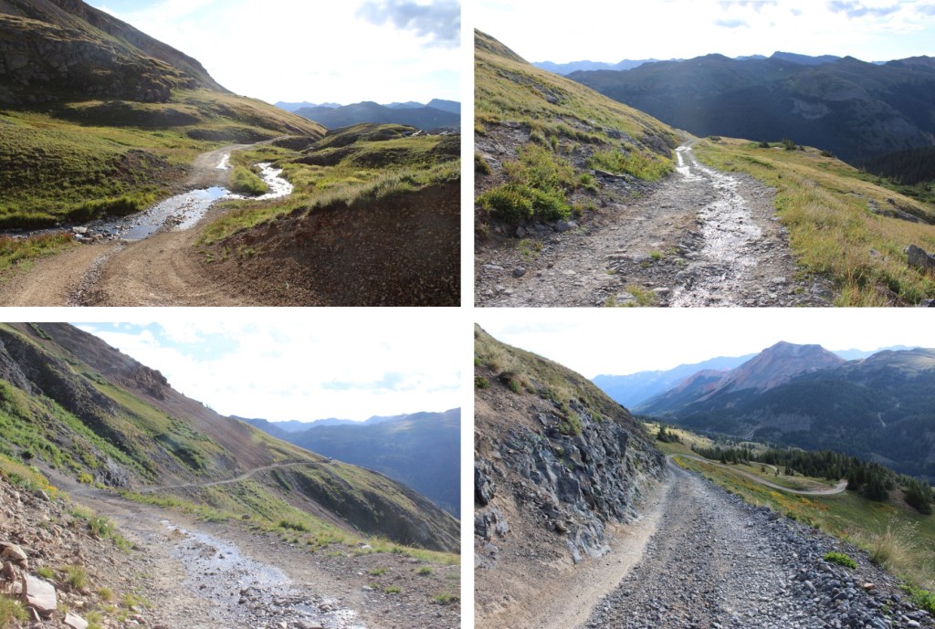
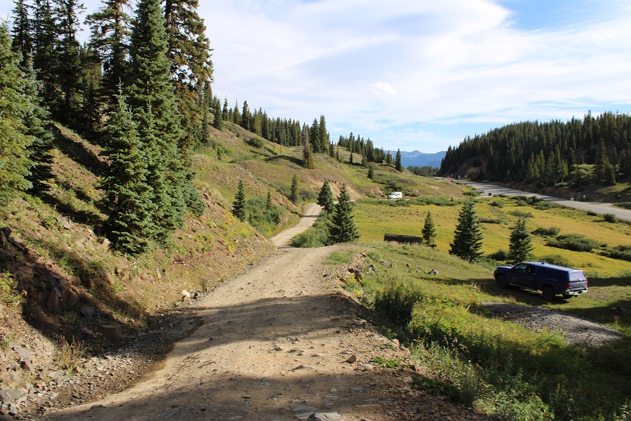
Back on Lost Man Loop Trail, I followed it southwest back to the trailhead.

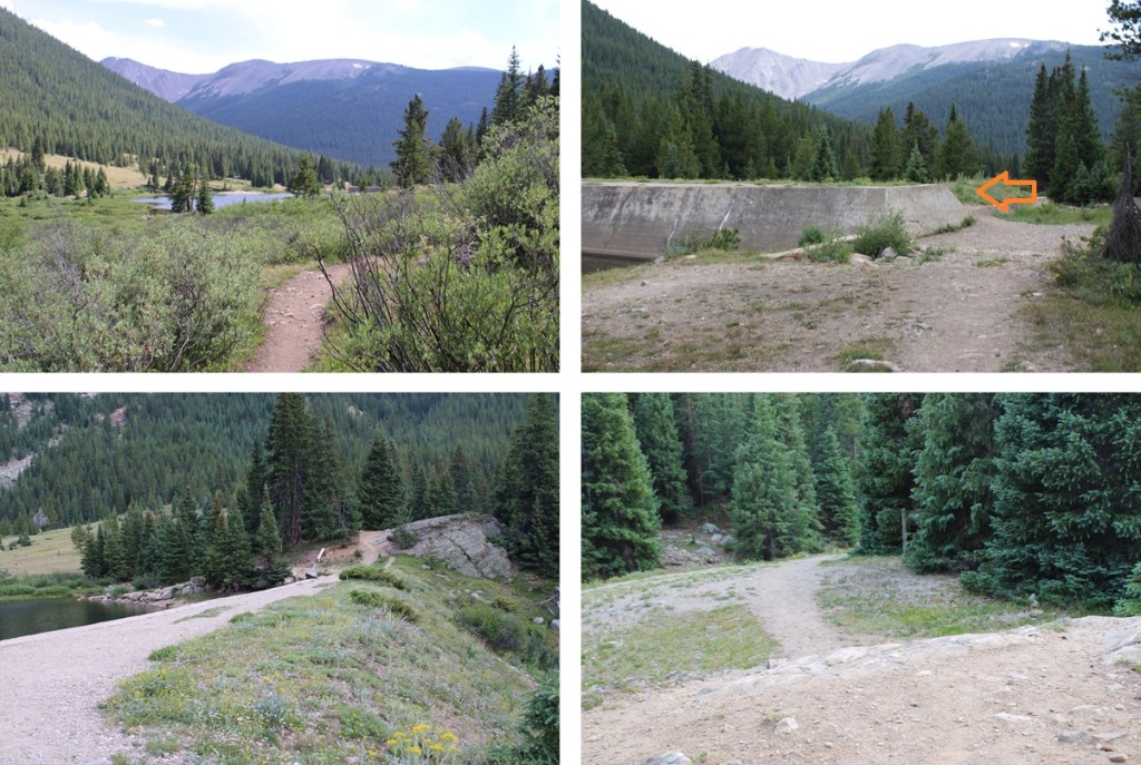
I made it back to my truck at 4pm, making this a 15.26 mile hike with 3918’ of elevation gain, according to CalTopo.  My numbers with Strava were different.

On to the next trailhead!

S4 – 13,256

RT Length: 11.57 miles

Elevation Gain: 4082’

There were only two other vehicles in the lot when I parked at the Blue Lakes Trailhead.  It was raining, so I waited for the rain to stop, and was on the trail at 5am.  The trailhead starts at the south end of the parking area, and is clearly marked.

Immediately after the trailhead there’s a junction.  I went right, taking the Blue Lakes Trail.

This was the only junction until I made it to Blue Lakes.  I followed the trail 3.5 miles to Blue Lakes.  About 2.5 miles into the hike it started raining again, and I had to take shelter for a bit under a tree.  However, the trail was class 1, and easy to follow the entire way.

There was an easy creek crossing

And then I continued my way up to Blue Lakes

Once I arrived at Blue Lakes, there were several social trails to campsites.  I stayed on the trail closest to the lake, skirting the west side, towards a creek flowing into Blue Lakes.

At the last campsite before the creek, I followed the drainage on the right side of the creek up to treeline.

Once at treeline, or at least very close in a wide open space, I crossed the creek and headed west up the slope, keeping the creek to my right.

At the top of the slope I continued heading west, staying on the tundra.  You can go right and use the talus, but it’s going to be a LONG day of talus, and I’d rather use the tundra when available. 

At about 12330’, I went right and dropped about 50 feet down to the talus.  There is a game trail here on the talus that will bring you to the upper basin.

Once in the upper basin, there will be an obvious drainage to the right.  I went through the drainage, rock hopped for a bit, and then ascended 600’ of the worst talus ever to a gully.  I put on my helmet and started up.  Here’s the overall route:

As I ascended further up the gully, the talus became looser, but there were also areas of sand mixed with scree.  The rain that morning had turned the sand into a thicker substance, which gave me some much needed traction.  When you enter the gully, stay to the LEFT.  I tried to stay to the right because it looked more stable, but found I was unable to cross over to the left when the time came, because I was now in an hourglass, and traversing it meant rocks above and below me would give way in a rockslide towards the base of the gully, like a funnel (or an hourglass).  After the first few attempts at traversing from up high and sliding several feet before stopping, I downclimbed and re-traced my steps up this part of the gully, sticking to climbers left.  Also, if you’re doing this with other people (in your group or not) stay clear when someone is in the gully, and even if you don’t think anyone is below you on your descent, yell to see if anyone is there. Large rocks will fall as you ascend and descend (there’s nothing you can really do to prevent it). 

Keep heading left, until the scree ends

Once the scree ends, if you haven’t already, now is the time to put on your helmet.  The rest of the summit is class 3 and class 4 on the loosest terrain I’ve ever experienced.  NOTHING is stable.  Trust nothing above, in front of, or below you without attempting holds several times to make sure they are solid.  There is large kitty litter on solid rocks, loose talus, and rock slabs that look stable but are hanging precariously, especially from above. 

From the top of the gully I headed east, to follow the ridge.  Here’s the route I took:

You should now have a good view of the class 4 chimney to the summit.  This is a very loose chimney, and it stops halfway and starts again.  Even the large boulders are loose, so be careful with hand and footholds until you’re sure it won’t move.  I started out by climbing straight up the center, until I came to a “y” where both sides looked perilous.  I decided the right side looked more protected.  The were both loose, sometimes with just large wobbly boulders stacked on top of each other to climb, and sometimes what looked like 10 foot boulders sitting atop rocks the size of a microwave.  Between the two chimneys, there’s probably 40 feet of climbing.  I wouldn’t trust an anchor here:  to many of the boulders are loose.  (There weren’t any anchors set up).

Here’s the overall route I took:

And some closer pictures of the chimney(s)

Chimney 1:

Chimney 2

From the top of the second chimney to the east you can see the route you scramble up to the summit

But wait!  There’s more!  Keep heading east, and climb down and then up this rock slab covered in kitty litter.  It’s not tall, maybe 7 feet, but another fun surprise!

And then it’s a quick walk to the actual summit, on… you guessed it, more talus!

I summited S4 at 9:40am

S4:

And now to head back.  I re-traced my steps to the chimney(s)

Safely down the chimney(s), I made my way back to the top of the gully.

Here are some pictures of the descent down the gully

And the route down into the basin

Once in the rocky basin, I stayed to the right of the creek and descended on the talus to the tundra towards Blue Lakes.

I headed east back to treeline and crossed the creek

Then headed north back towards the Blue Lakes Trail

And followed the trail in the rain all the way back to the trailhead

I made it back to the trailhead at 12:30pm, making this an 11.57 mile hike with 4082’ of elevation gain in 7.5 hours

On to the next trailhead!

Paiute Peak – 13,094

RT Length: 11.32 miles

Elevation Gain: 2781’

I was parked at the Brainard Lakes parking lot.  I already posted about why I was parked there, and not the Mitchell Lakes trailhead, so I’m going to skip that part this time. 

I was on the trail at 4:30 am.  My first order of business was to hike the 1.3 miles to the Mitchell Lake Trailhead. 

From the Mitchell Lake Trailhead, I followed the Blue Lakes Trail west towards Blue Lake. This is a well defined, class 1 trail with no junctions, so I was able to follow the trail the entire way.  From the Mitchell Lake Trailhead, it was around 3 miles to Blue Lake. 

From Blue Lake I had a clear view of Paiute Peak.  Here’s an overview of the rest of my hike

First, I followed the trail around the north side of the lake

When I came to a grassy drainage, I left the trail and followed the drainage north

At around 11580’ I crossed the creek at a small waterfall, and headed northwest.

After crossing the waterfall I kept heading west, aiming for the ridge in the distance.  This was choose your own adventure.  I chose to go up and over the rocky gullies, doing my best to avoid the snow.  This can all easily be kept class 2.

At this point , the lake at 11833’ was to the north of me, on my right.  I kept heading west, to gain this ridge.  There are a couple of cairns here, and parts of a game trail, but the main goal is to head towards the gully.    

And now to head up the gully. I did this by heading north, staying to the right of the snow.   If there isn’t snow when you’re doing this route, you can aim for a rather large vertical rock sticking up straight (you’ll know it when you see it, as it stands out).  This gully had game trails leading to the top, and I’m sure you could take them all the way to the top of the gully.  However, I stayed to the right of the snow and then climbed up the rocky rib.  This was mostly class 2, with a few easy class 3 moves thrown in.

At the top of the rock rib, you’ll see what appears to be the summit of Paiute Peak to the north. It’s actually a false summit, but aim for it.

From here, the true summit is to the northeast.  Head towards two boulders that look like the summit (they’re another false summit)

From those two boulders, the summit of Paiute Peak is visible to the north.

To get there I downclimbed a difficult class 3 section (or easy class 4) with exposure.  This was much more difficult to downclimb than to upclimb.  And it was very windy this day, making this ridge extra spicy.  The route down and then up to the summit are obvious.  There was a cairn at the top, and a summit register.

I summited Paiute Peak at 7:30am

Paiute Peak:

From the summit looking back, it really, really looks like where those two boulders are is higher, but there was a register here, so I’m assuming it’s the true summit.  Now to head back.  This “v” was much easier to upclimb. I used the same route down as I did on my way back up.

I then made my way towards the gully.

I went southeast down the rocky rib

Then descended the gully

At the bottom of the gully I turned left, and made my way back towards Blue Lake

I aimed for the drainage, then followed it south towards Blue Lake and the trail below

Back on the trail, I followed it east back to the Mitchell Lake Trailhead, passing several lakes along the way.

Back at the Mitchell Lake Trailhead, I followed the road back to the Brainard Lake parking area.

I made it back to the Brainard Lakes trailhead at 10:30am, making this an 11.32 mile hike with 2781’ of elevation gain in 6 hours.

On to the next trailhead!

Babcock Peak – 13,161

RT Length: 9.23 miles

Elevation Gain: 3868’

I parked at a turnoff near Boren Creek and124/794 with room for about 5 vehicles if everyone parked nicely.  The drive in is dirt 2WD.   I was on the trail at 4:30am.

I followed 4WD road 794 for over 3 miles as it switchbacked it’s way northeast, following Boren Creek.

After hiking for around 3 miles I made it to treeline.

Here I turned right, and could see Babcock Peak to the north.

Route finding here was pretty easy.  I headed north towards the gully, aiming for the gully to the right.  I gained about 1500’ here to the summit in about a mile.  This gully is very loose, and full of all different sized rocks.  I didn’t stick to one side, but chose whatever route looked best.  Here are some pictures of the gully.  It’s pretty straightforward.

Just before reaching the saddle, I turned left, and ascended this much smaller gully

From here, it’s choose your own adventure to the ridge.  Everything is class 3 climbing, and I’m pretty sure there is no wrong way to get to the ridge, as long as you’re heading north/northwest.  I can’t say the same for heading down, so it’s a good idea to keep looking behind you for reference points for the way back.  Also, pictures were very difficult to put everything into perspective.  Right now you should be at the junction of the left and right gullies.  Take note of where you are, because this is where you’ll want to descend to on your way down, and as you can see by looking ahead of you, the initial climb to the ridge is steep and it can be difficult to know exactly where you are.  Here are some pictures as I made my way up to the ridge.

Once on the ridge, I turned left, and headed northwest towards the summit.  There was only one ‘tricky’ move, and the rest was class 2.

Here’s the tricky move.  Go right here to ascend the ridge.  It feels like difficult class 3 or easy class 4, with some exposure.

Then it was a quick ridge hike to the summit, staying on the ridge proper.

I summited Babcock Peak at 8am

Babcock Peak:

Now to head back down. Here’s a picture of the ridge

And the one tricky section

Now it was time to head back towards the gully.  Visuals are good here.  When heading down, keep moving to your left as you do so, making your way down to where the left and right gully meet up. 

Where the two gullies meet, I turned left and headed down the same gully I’d ascended.

And now, to descend the gully back to the 4WD road

Back on the road, I turned left and followed it southeast back to the trailhead.

I made it back to the trailhead at 10:30am, making this a 9.23 mile hike with 3868’ of elevation gain in 6 hours.

On to the next trailhead!

PT 13486

RT Length:  14.11 miles

Elevation Gain:  3299’

I had no intentions of summiting a peak today.  Seriously.  After yesterday’s long ridge hike I decided today would be a rest day.  I was simply going to hike to the upper trailhead and back to get pictures I was unable to get yesterday, due to starting and ending the hike in the dark.  I also needed to put together a rather long trip report, and I wanted to get that out of the way as soon as possible.

I woke up at 9:15am and it was 27 degrees outside.  There was at least half an inch of frost on the ground, and my shoes, which I’d kept inside my truck, were frozen solid.  I couldn’t even get my feet inside of them.  So I sat in the cab of my truck with the heater blaring for half an hour to warm them up. 

Once I could stuff my feet inside my shoes I was on the trail, at around 10am.  My plan was simply to hike to the upper trailhead and back to warm up and get pictures.  I was parked just before the Lulu Gulch trailhead at 10,300’ at a nice dispersed campsite.  My truck could have made it to the Huron Trailhead, as it has before, but the road seemed a little more intense this year and I love my truck, so I decided to park lower and get the extra mileage. 

I followed the 4WD road as it meandered south, past the Lulu Gulch trailhead and numerous dispersed campsites. 

After hiking for about 1.75 miles I made it to the Huron Peak/Lake Ann trailhead.  From here, I followed Lake Ann Trail 1462 south.

At the Lake Ann/Hope Pass junction I went left, following the Lake Ann trail

At the Apostle Basin/Lake Ann junction I went left, towards Apostle Basin

This is where I made the decision to continue towards PT 13486.  I was feeling pretty good, and said “to heck with a rest day”.  I almost immediately regretted this decision.  I continued on until I made it to 10845’, where there was a cairn and a blocked trail to the left.  I took this trail.

This was an old trail that doesn’t look like it gets a lot of use.  There were tons of downed trees to navigate as I made my way east to treeline. At this point I stopped and looked at my readings.  I’d gone 3.5 miles and gained 600’ of elevation.  I was already exhausted, and wanted to turn back.  My mind kept telling me I was tired (I wasn’t), thirsty (I wasn’t) and couldn’t go on (I could).  I reminded myself it’s usually your mind that gives out long before your body does, and kept telling myself to go just a little bit further before deciding to turn back.  This hike was very much a mental game, but I kept going.  I just took a lot of breaks.

Just before treeline, at around 11600’ there’s an abandoned cabin that was cool to look at.  When you get to the cabin keep heading east, as the trail becomes difficult to follow, but you’re almost to treeline.

Once at treeline a cairned route begins that leads for about a quarter of a mile.  The rocks however, never ended.  I followed the cairns up.

I could now see PT 13486 to the east.

There are several routes to get there.  I took a high route on my way up, the gully on the way down.  There were cliffs I was trying to avoid. This is the route I took as I ascended.

And some step-by-step pictures of the route, keeping high to avoid the steeper rocky sections

I kept rounding the hillside until I could see the Huron/13486 saddle.  I headed for the saddle.

This now became a ridge hike.  There were a few class 3 moves, and snow to make the route spicy. 

I mostly stuck to the ridge.  Here are some pictures of the route to the summit.

Here’s a look at the rest of the ridge. This is where it gets spicy.  I stopped here for a bit because I met another climber on the trail, Larry, who’s a recent Bicentennial finisher (Congrats!!)  We chatted for a bit, and I learned he was in more of a hurry than I was to get to another trailhead before dark, so I let him go ahead while I took a bit of a break.  I checked my cell phone for service (none) and decided instead to play a bit of solitaire while I waited.  After Larry summited, I was on my way again. 

This was the hardest move for me.  It was class 3, but the snow made it interesting.  I went up to the right, came back down on the left

Here’s the final push to the summit

I summited PT 13486 at 3:30pm

PT 13486:

It was here I realized my negative thoughts had stopped as soon as I’d hit treeline.  I guess having a visual of the route really helped clear my mind.  I was glad I’d pushed on, even though it had already been a long day.  I turned and headed back down the ridge to the Huron/13486 saddle.

Back on the saddle, I turned left and decided to take the gully down.  I descended to the patch of tundra below, at about 12400’

Here’s looking back up at the gully I’d descended (which you could ascend as well instead of taking the higher route)

At 12,400’ I turned right, descended about another 200’, and stayed at that elevation until I made it back to the cairned area.

I was aiming for the trees to the west

I then picked up the cairned route back down to the trees and the trail

I followed the miners trail through the trees, back to the actual trail

Then followed the trail north back to the Huron/Lake Ann Trailhead

And took the road back to the lower Huron Trailhead

I made it back down to the lower trailhead at 7pm, making this a 14.11 mile hike with 3299’ of elevation gain in 9 hours.

On to the next trailhead!

Electric Peak – 13,297, Graystone Peak – 13,503 and Mount Garfield – 13,087

RT Length:  35.96 miles

Elevation Gain: 9399’

I started from the Molas Trailhead parking area.  This trailhead has plenty of parking, and is a popular spot among CT hikers. 

The trail starts at the south end of the parking area. 

Much of the approach route follows the Colorado Trail, so it’s well maintained and easy to navigate.  I followed the trail as I descended 1700’ to the Animas River.

I crossed the river on a well-maintained bridge, and then followed the trail as it crossed the railroad tracks

Here is where the elevation gain begins.  I hiked along the Colorado Trail east to the Beaver Ponds, following Elk Creek and passing through a couple of cleared avalanche areas.  This trail is easy to follow, with no trail junctions.

This part trips people up all the time when headed towards Vestal Basin: Once at the beaver ponds, I turned right off the trail and traversed behind this large boulder.  There’s a faint trail here that picks up again once you’re past the ponds.

The trail picks up again after the beaver ponds, but it’s no longer as well maintained as the Colorado Trail.  There are fallen trees to navigate, but the trail is easy to see.  I followed the trail as it crossed a beautiful creek and headed south.

At 11260’ of elevation I left the trail.  There are several options to do this, but here’s a visual of where I was headed. 

This is the route I took:

I headed a little further up the trail, crossed the creek at an easily accessible spot, and headed southwest up the slope.  However, this is choose your own adventure, and you can climb straight up the talus/scree if that’s your choice.  I decided to skirt around it.

This gully wasn’t too bad as far as gullies go, but I put on my microspikes anyway. 

Towards the top I could see quite a bit of snow still left in the gully.

I traversed the gully to the right, finding there was about 2 feet of space where the snow had melted away from the rock.  The snow was avoidable until the last 30 feet or so, when I climbed on top of the snow and walked to the top of the gully on several feet of rock-solid snow.

However, if this is outside of your comfort zone, you can also traverse to the left and make it to the top of the gully on more scree.  Both routes lead to the same place (I took this route on my way down).

I was now in an upper basin, full of all different sizes of loose rocks.  This wasn’t difficult to navigate, but it was extremely time consuming.  I was headed southwest, staying to the right.

At 12500’ of elevation I turned right to start my climb up Electric Peak’s south side.  If you don’t already have your helmet on (I usually put them on for scree-filled gullies) now is the time to do it. 

Much of the route to the summit is hidden at this time.  I started by climbing up a class 3 gully to the right

From Graystone Peak, I had a good visual of the route I took, keeping it mostly class 2 after the initial class 3 gully

Once on top of this gully, there are several options to make it to the summit.  Here are some on the ground pictures.  The terrain was rocky most of the way to the summit.

The summit was fairly flat and rocky.

Electric Peak:

From the summit of Electric Peak, I could see my next objective, Graystone Peak, to the south.

I re-traced my steps back to the saddle

Now to head over towards Graystone Peak.  I looked east, and saw these wonderful rock slabs.

Traversing up and down large rock slabs is mostly a mental exercise in not freaking out. I kept telling myself “My shoes have got this, trust your shoes. Also, don’t look down”. This is the route I took.  There’s no avoiding the slabs.

Another view of the rock slabs, with a little bit of climbing towards the end (which was favorable to the smooth slabs)

After making it up the rock slabs, I turned left, now ready to scale Graystone Peak

Scaling this peak is exactly what it looks like:  straight up the side with a lot of various sized rocks to traverse that are loose.  I headed southeast up the mountainside.

Once making it to the ridge, I stayed on the ridge proper to the summit, with some easy class 3 ups and downs along the way.

There was a large cairn at the summit

Graystone Peak

I turned around and headed back down the peak the way I’d ascended, doing my best to keep my balance and navigate the loose rocks.

It had been a long day, so once I made it back down to the little patch of grass at the base of Graystone Peak I decided to call it a night and set up my bivy.  I dried out my clothes, ate some dinner, and wrote notes down in my journal.  Just before settling down for the night, I heard rocks tumbling and then skidding to a halt behind me.  I turned around, and about 30 mountain goats were standing on the ledge, about 20 feet away.  Most of them dashed away before I got a picture, but they seemed just as surprised to see me as I did them.  They were probably headed towards the patch of grass I was using as a bivy site, and seemed a little disappointed to find me already occupying the space.  I wish I could have told them I wouldn’t bother them and they were free to stay, as there wasn’t any other grazing areas around, but they all bounded away to find another site.

I was up early the next morning and on route to Mount Garfield.  Even though this was the shortest of the peaks I was doing this weekend, it was by far the most challenging.  Once on the ridge it was consistent class 3 the entire way.  I started out by heading southeast around the base of Graystone Peak. I was headed here:

This was a quick and easy gully to climb.  Once out of the gully, I passed through an open grassy area and then descended over 300 feet down grassy slopes to the right, towards Garfield Lake. 

Once at Garfield Lake, I needed to gain the ridge.  This can be done in several ways, but this is the overall route I took.  There were a couple of nicely placed trees I used as a guide on the ledges.  I just aimed for one tree, and then the next.  Here’s an overview of the route to the ridge as seen from Graystone Peak

From Garfield Lake, I aimed for the rock ledge with two trees on it, spaced about 300 feet apart.  It was class 2 to the ridge.

When I’d passed the two trees, I looked up and saw this gully. 

I made my way straight up the gully to the ridge.

Once on the ridge I turned right, and this became a class 3 ridge hike all the way to the summit.  I was able to mostly stay on the ridge, dipping to the right one time.  If you encounter a class 4 move, you’re off route.  Here are some pictures of the ridge.

I stayed to the left of this gully, climbing up the rocks instead of on the scree.

At the top of the gully I turned right, and continued following the ridge.

The only time I dropped off the ridge was when I came to this large rock.  At this point I dropped to the right and descended about 30 feet before re-gaining the ridge.

Back on the ridge, I followed it to the summit, class 3 the whole way

Mount Garfield

Here are some pictures of the route back down the ridge

Then back down the gully to Garfield Lake

Back at Garfield Lake, I took the same route back to the base of Graystone Peak, this time going up the grassy ledges

This was an out  and back hike, so I re-traced my steps down the rock slabs, across the rock field, and back down the gully to the trail.

This time, instead of going down the snow-filled gully I went to the right, and descended on scree

Back on the trail, I followed it back to the Beaver Ponds

Then I followed the Colorado Trail back to the Animas River

I crossed the train tracks, and trudged back up to Molas Pass, something I timed just right so I’d be doing later, during the cool part of the day.

I usually go by CalTopo stats to keep things consistent.  CalTopo gave me 35.96 miles with 9399’ of elevation gain, but Strava gave me 27.67 miles with 13,170’ of elevation gain.  Take your pick! 

On to the next trailhead!

Three Needles – 13,494

RT Length:  8.82 miles

Elevation Gain: 2420’

I drove up the night before, and parked at Red Mountain Pass.  There’s a dispersed campsite you can see from the road that I like, so I parked there.  There are a few more sites further up.

Knowing the area was supposed to get rain and storms starting at 9am, I was up and on the trail at 4:30am.  I followed Road 823 to the junction with Black Bear Pass.

At the junction with Black Bear Pass, I turned left and followed Road 622 through Porphyry Gulch

It was 2.6 miles from Red Mountain Pass to the upper trailhead, on an easy 4WD shelf road with few passing areas.  When I got to the upper trailhead, I was surprised to find someone had set up camp in the upper parking lot/turn around area.  Normally, there’s room for 7 cars here, but these people took up at least 4 spots.  When the ant train of 4WDs come up later today, they are not going to be happy.

The trail starts to the left of the parking area, and is initially well defined.

In the dark, the trail was difficult to find for a bit.  I was aiming for these rocks

Just behind these rocks, a nice trail picks up to the right, and brings you to Bullion King Lake. 

Here’s where the trail ended.  I skirted the lake to the right, and started heading northeast into Porphyry Basin

There’s no need to climb all the way to the top here.  I skirted to the left, and continued heading northwest.  If you look around, you’ll see remnants of old mining equipment and structures in the area, but they’re all flattened at this point.

Here is where I strapped on my helmet and microspikes. I could clearly see Three Needles in front of me.  I went straight up this gully.

The gully was full of shale and scree.  It was loose, and hard to get stable footing.  I was glad to have on my microspikes.  It looks like the terrain shifts every year, as well as every time it rains. Towards the top there are game trails, but they were more needed down below.  Here are some pictures of the gully

At the top of the gully, I turned right, and followed the scree

I was headed here

I looked for a weak point to ascend, and found this chimney.   I didn’t climb up the chimney, but you certainly could

Instead, to the right of the chimney I found a narrow ledge.  Yay!  Being short is finally working out for me when it comes to scrambling!  I climbed up to the right of the chimney, they traversed left to the ridge.

The ridge was short but full of kitty litter and talus. It never got worse than easy class 3, but it was loose. 

This is the overall route I took to the summit

And some step-by-step pictures

I summited Three Needles at 6:45am

Three Needles:

I had cell service, so I checked the weather, and even though I could see dark clouds and virga in the moonlight this morning, it looked like the weather had been pushed back until later in the day.  So I decided to sit on the summit for a bit, and enjoy the cell service and sunrise.

This was an out and back hike for me, so I retraced my steps to the access gully

Once again, I did not descend the chimney, but ducked under a rock ledge to the left, then headed down

At the bottom of the chimney I turned left, and headed back to the access gully

From the top of the gully, I could see my route out of the basin

The gully was much easier to navigate heading down, but still very loose.

Now to make my way back to Bullion King Lake

And pick up the trail on the other side that lead me back to the 4WD road

Back at the upper trailhead, I followed the 4WD road back to Red Mountain Pass


I made it back to Red Mountain Pass at 9am, making this an 8.82 mile hike with 2420’ of elevation gain in 4.5 hours.

Mahana Peak – 12,643 and Isolation Peak – 13,114

RT Length:  21.79 miles

Elevation Gain:  5665’

I parked at the Wild Basin Trailhead inside Rocky Mountain National Park and was on the trail at 4am. There’s plenty of parking here, but they have timed entry from 9am-2pm every day. 

The trailhead starts at the south end of the parking area

I followed the signs for Ouzel Lake/Bluebird Lake.  This class 1 trail is really well marked, so it’s difficult to get lost if you read the signs.  I passed several waterfalls (Copeland Falls, Calypso Falls, and Ouzel Falls).

After hiking for 4.75 miles I came to the junction for Ouzel Lake and Bluebird Lake.  I turned right onto the Bluebird Lake Trail.

I didn’t stay on this trail long however.  Maybe about 10 yards or so. Then I left the trail and headed northeast to gain the ridge

This is where I startled a moose.  He was about 15 feet away from me when I saw him, so I quickly ducked behind a large boulder.  Usually, moose run away when they see you, or ignore you, but this guy seemed interested in me.  I’ve seen probably over a hundred moose in Colorado, and I’ve only been charged once.  This guy looked like he wanted to charge me, so I remained hidden.  For a solid 15 minutes, every time I peeked out from behind the boulder, he was still staring at the boulder I’d hidden behind.  I know moose have poor eyesight, so while he knew I was still there, he was probably trying to figure out if I were a threat or not.  (That’s Chickadee Pond in the background).

Eventually I crawled away on my hands and knees so he couldn’t see me in the brush, and continued my way up the ridge.  This included a lot of bushwhacking through downed trees.  A lot of downed trees.

Once I made it to the ridge, I followed it west to treeline

The route from here was straightforward.  I stayed o the ridge, following it west.  The terrain started out as loose rocks, then changed to tundra.

When you get to the tundra, don’t be fooled:  this is a false summit.  Stay to the left of it

This is the true summit of Manaha Peak.  It’s easy class 2 to get there

I summited Mahana Peak at 9am

Mahana Peak:

From Mahana Peak, I could see Isolation Peak to the northwest

To get there, I headed northeast along the ridge until I came to a low point, and then headed northwest towards the ridge.

This is the overall route I took to gain the ridge of Isolation Peak.  If you look carefully, you will see a green band of grass that makes the route easy to follow.  I descended on rocky terrain, then was greeted with tundra, then rocky tundra as I ascended.

Once on the ridge, I turned left and could see Isolation Peak to the southwest. This was a class 2 hike, sticking to game trails either directly on or to the left of the ridge, until the last 10 feet or so, when it was a quick class 3 scramble to the summit

I’m pretty sure this block is the summit.  I sat on it, but briefly.  Pictures/video were difficult.  The summit rocks didn’t feel stable, and I could see through them to air below if I looked down. 

I summited Isolation Peak at 10:30am

Isolation Peak:

Here’s looking back at Mahana Peak from Isolation Peak

If you’re not up for class 3-4 scrambling, now’s the time to head back the way you came in, towards Mahana.  It’s the fastest route.  If you’re up for some scrambling, strap on your helmet if you haven’t already, and head northeast along the ridge.  Some of this ridge I’d consider choose your own adventure.  This is the route I took, keeping it class 3, with some easy class 4 scrambling (down chimneys/gullies).

I was now back to where I ascended the ridge, and followed the ridge northeast.  There is a lot of elevation gain and loss on this descent

I went to the right of this boulder.  Getting through was sketchy class 3.  The boulders were large, but there was a lot of empty space between them, and they didn’t feel solid. 

My next objective was to make it here (this was class 2, sticking to the ridge)

This is where it got a bit tricky.  I turned left, and descended into a rather large and steep gully.  I spent a lot of time in this gully route finding, and my advice is to stick to the gully proper until you make it down to 12160’.  You’re trying to go below this rock formation, which goes a lot further down than you’d think.

I turned left, and descended into the gully

I came to a place that looked like it cliffed out, but it was really just a drop onto a boulder, then a 7-foot downclimb. 

Here’s looking back up at the gully

And a look at the final drop.  The boulder in the middle was essential to the descent.

This was at about 12160’, where I stopped descending the gully, and looked for a grassy ledge climbers right. 

I made it to the ledge, descended another grassy ledge, then reascended a grassy ledge to re-gain the ridge

For those of you doing this the opposite way, here’s a look back at the grassy ledge I descended.  You can see why I had to drop down so low in the gully, with the sheer cliff face to navigate.

Here’s how I got around the next few obstacles

And that was it for the climbing for today.  I kept my helmet on because I still had a scree-gully to descend, but all the class 3 and 4 stuff was done.  I’d wanted to head over to Mt Alice today too, but clouds were forming and I didn’t think it was a good idea.  I headed towards Boulder-Grand Pass, turned right, and descended the gully towards Lake of Many Winds.  From the pass, it was 9.5 miles back to the trailhead.

A good trail picks up here, and leads all the way back to the Wild Basin Trailhead.  Here you can see Thunder Lake.  This trail becomes the Thunder Lake Trail, skirting the lake to the left.  This is a class 1 trail.  Once again, it’s very well marked, with signs indicating the route back to the Wild Basin Trailhead

I made it back to the trailhead at 4:45pm, making this a 21.79 mile hike with 5665’ of elevation gain in 12 hours, 45 minutes, at least according to CalTopo.  Strava gave me drastically different numbers

On to the next trailhead!

Tabor Peak – 13,282

RT Length:  9.72 miles

Elevation Gain:  3055’

I parked at the Tabor Creek Trailhead (2185) and was on my way at 4:30am. 

I followed the class 1 trail south as it crossed Lincoln Creek, and then began gaining elevation.

After hiking for .5 miles I came to a road, crossed it, and continued following the trail on the other side

I crossed Tabor Creek, and continued on this class 1 trail, staying to the right (west) of the creek for the rest of the hike.

The trail brought me through a gulch, and in and out of treeline and willows several times.

After hiking for 3.2 miles, and at 11630’ of elevation I turned right onto a game trail and headed west.  Actually, the trail isn’t visible the first few yards, but once you find it, it’s a class 1 game trail.  I put up a small cairn to indicate where it starts, but if that gets knocked down, notice the unique shaped rock in front of it.  That’s where you turn right.

I followed this trail all the way to Tabor Lake. For reference, here’s a view from PT 13102 of the route

And some pictures of the terrain

Tabor Lake and Tabor Peak

I skirted the lake to the north

Then sat down and put on my microspikes,  My next goal was to make it to the top of this gully

The gully doesn’t really look that bad, and for the first third of it or so, it wasn’t. There was plenty of scree to use for footholds, and it was easy climbing.  However, the further up I went, the less and less scree there was, and more and more hard, compact dirt.  I wasn’t able to get a footing on the dirt, even in microspikes, and ended up ascending via the rocky area to the left.  This was better, but not much. The rock was steep and filled with kitty litter.  I still felt safer on the rocks than I did in the gully.  You can also take the rocks to the right.  I felt this would have been much easier with snow.  Here are some of your options:

At the top of the gully was a cairn to congratulate me

I turned left, and followed the ridge south

There’s not much to say about route finding on the ridge.  I was able to stay directly on top of the ridge the entire time and kept it at easy class 3.  The rock was chossy and loose, so I had to watch my hand and footholds, and I had to stop a few times due to excessive wind, but it was a straightforward ridge climb.  With exposure.  Here are some pictures of the ridge

I summited Tabor Peak at 7:50am

Tabor Peak:

Oh, and this was the summit register.  No pen/pencil, and all the paper was wet.  Maybe the next person can bring a proper one?

This was an out and back hike for me, so I turned around and headed back down the ridge to the gully

At the cairn I turned right, and headed down the gully towards Tabor Lake.  I stayed on the rocks to climbers right for most of the descent, then took the gully proper the rest of the way down.

I then skirted the lake to the left to pick up the trail back down

I followed this trail back down to the Tabor Creek Trail

Back on Tabor Creek Trail, I turned left and followed it north back to the trailhead

I made it back to the trailhead at 20:15am, making this a 9.72 mile hike with 3055’ of elevation gain in 5 hours, 45 minutes.

On to the next trailhead!

PT 13220 and PT 13291

RT Length: 11.89 miles

Elevation Gain: 3560’

Full disclosure, I did these peaks in two days.  The first day I got thunder stormed out just before the access gully of PT 13291, and had to turn around.  I came back 2 days later to finish the summit.

I stayed overnight at the North Fork Lake Creek Trailhead, and was on the trail at 5am the next morning.   The parking area has room for about 15 vehicles if everyone parks nicely, as well as some overflow spots on the short drive in.

The trail starts at the north end of the parking area, close to a locked gate.  It’s trail number 1483.

I followed this class 1 trail for 3 miles north into the basin

When I came to a creek, I crossed it and turned left. 

Here there is a faint trail for a few yards, and then it fades out.  I headed northwest into the upper basin.

Here’s an overall view of my route to the ridge

While there was no trail in the basin, I was easily able to follow dried up creek beds through the willows.  Staying on the dry rocks kept me mostly away from the willows, and became a great path to follow.

Once I got past the willows, I aimed for the ridge.  Specifically, this boulder first.

After making it to the boulder, a game trail picked up and took me to the ridge

Once making it to the ridge, I turned right, and followed it northeast to the summit.  This was all class 2.

Here are some pictures of this short ridge

 I turned right at the top of the small gully, and walked to the summit

I summited PT 13220 at 7:45am

PT 13320:

PT 13291 was to the northeast, but to get there I was going to retrace my steps down the ridge first.  I headed back to the ridge.

I picked up the game trail again, and skirted the rocky section that was on my left, and re-gained the ridge on a grassy slope.  Here’s my overall route

Once on the ridge again, I skirted this rocky section to the right.  Resist the temptation to ascend any higher until you get to the tundra and it will stay class 2.  Otherwise, you can go up the rocks at any point for some class 3 or 4 fun.

Now it was a class 2 stroll along the ridge as I headed east.

When I got to this point I put on my microspikes, turned right, and dropped down to navigate the formations.  This was class 2+, but the loose scree and exposure added a layer of fun.

This was my next obstacle.  My first thought was to go right up the center of the gully, but I ended up scouting around and found it was much easier, and still class 2, to skirt around and gain the ridge from the right side.

Back on rocky tundra, I now followed the ridge direct north.  This was all class 2.

At the top of the ridge I got my first good view of PT 13291.  Unfortunately, the first day I was here I had to stop at this point due to time constraints and an impending thunderstorm.  It sucked to turn around, but it was something I had to do. 

The next time I was here, two days later, this is the overall route I took to get past the steep rock in front of me.  Also, this is a good time to put on your helmet if you haven’t already done so. 

This looks loose and fraught with exposure, but the route is actually pretty solid and wider than it looks from a distance.  I started out rock-hoping on stable boulders, then descended west about 100 feet, staying as close as I could to the rock wall, to the base of a gully

At the base of the gully, I turned right and ascended the 100-foot gully.  Climbers left was extremely loose, but the right side was steep but stable rock.  I chose to stay on the stable rock.  There is a cairn (circled) at the base of the gully, indicating where to ascend.

Here’s a view from 13220 of the gully I went up to access 13291.

Now for the fun part!  It was time to scale the east side to the summit.  This is choose your own adventure.  I stayed on the east side the entire time.  The ridge proper looks like it goes at class 4.  I stayed more to the east while climbing.

This is the overall route I took, dropping down about 25 feet, aiming for a break in the rocks, and then heading up the east side, keeping it mostly class 3, but once again, it’s choose your own adventure.

Here are some pictures of the terrain to the summit.  I dropped my pack to make for easier climbing.  It also made it easier to find my way back, as I just aimed for my pack below.

Now the summit was in sight.  There was a short class 4 chimney to climb with solid hand/footholds.

And then a rocky walk to the summit.  There was a summit register, but it was closed so tight I couldn’t open it.

PT 13291

Now to head back down.  I descended the chimney, and headed back towards my pack. 

Then it was up to the gully, down the gully, and around the west side to head back to the saddle. 

Back up to the ridge

And then I followed the ridge, descending it to the left, and curving around the south side.  It’s a good idea to have your microspikes on for this part. It’s class 2+, but the rocks are loose and the angle is steep.

I followed the ridge until I made it to just before where I’d accessed the gully from 13220.  Instead of heading down that way, I descended south into the basin below.  This was the same way I’d ascended earlier that morning.  This would be a good option if just doing 13291. It’s class 2, and led me into the basin.  I aimed for the thinnest section of rock below. The entire time I was hiking down, I was looking for the dry creeks that led me in, knowing they’d eventually bring me back to the creek crossing and the trail.  They were easy to spot from above.

Once in the basin, I followed the dry creeks to the trail

Here’s a look back on my route down from the ridge (and how I hiked in that morning). Taking the dry creeks keeps you away from most of the willows.

Back on the trail, I followed it south back towards the trailhead

Doing the math by combing my two days of hiking, the total for the route in one day should be about 11.89 miles with 3560’ of elevation gain.

On to the next trailhead!