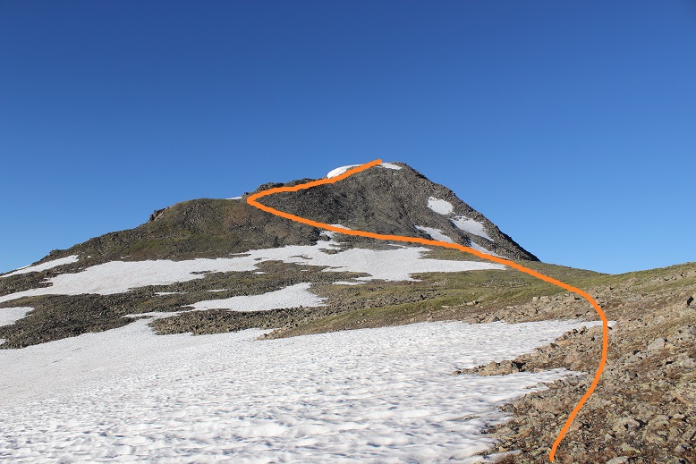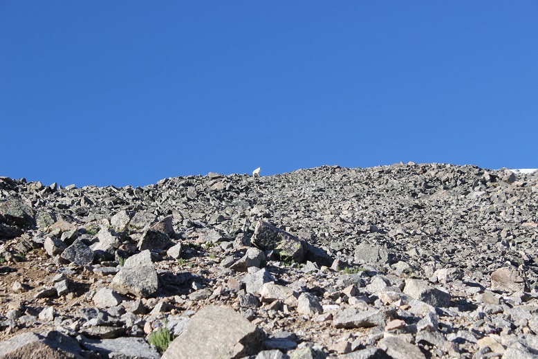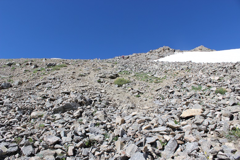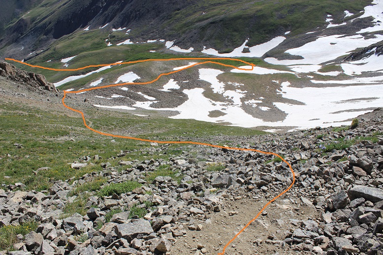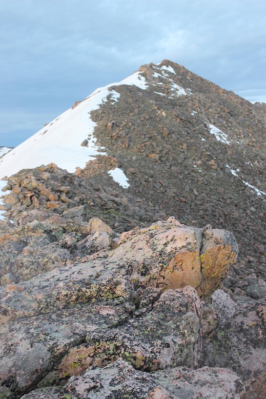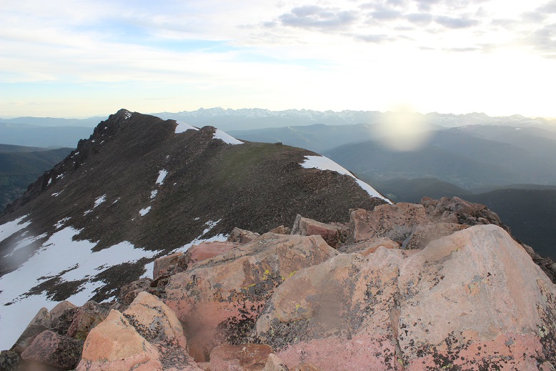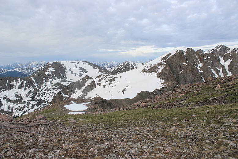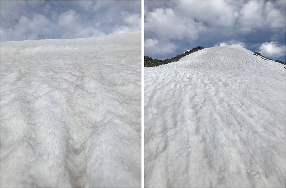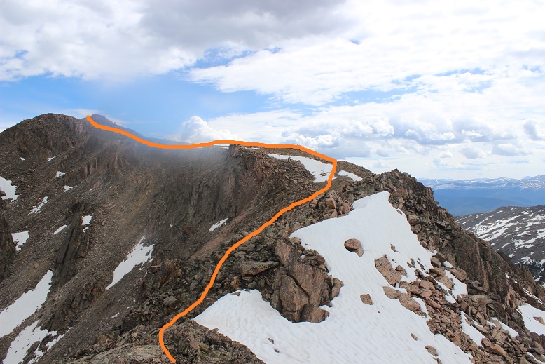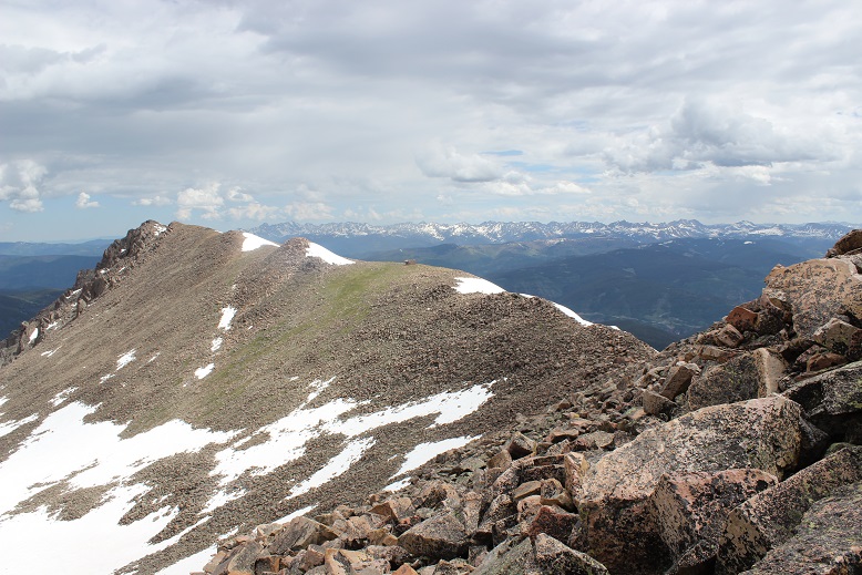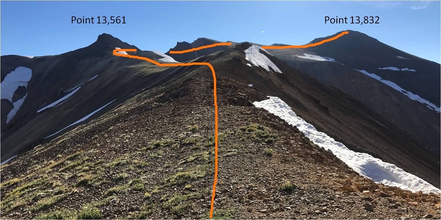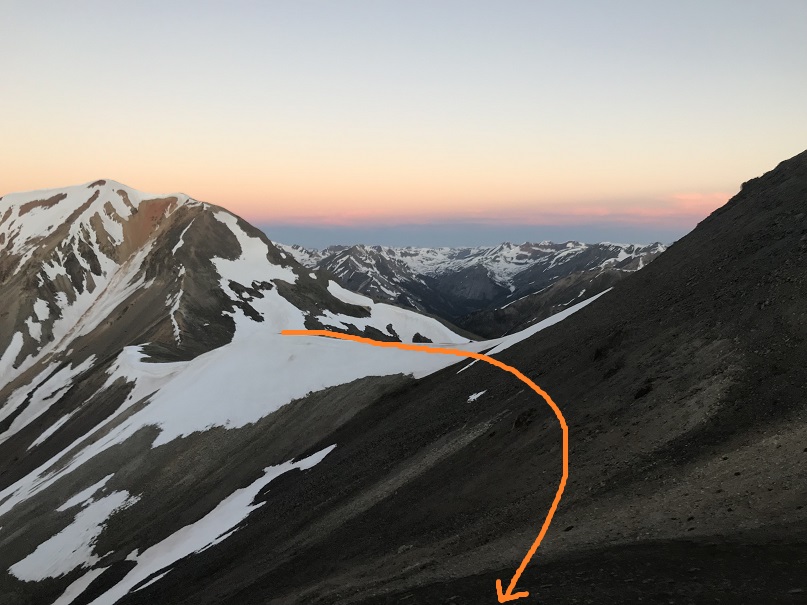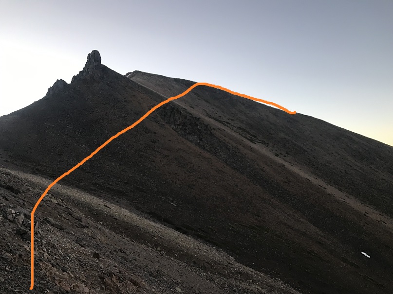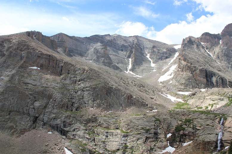
Mt Meeker 13,916, Meeker Ridge (UR) 13,861, & Southeast Longs (UR) 14,060

1

RT Length: 13.5 miles

Elevation Gain: 5764’

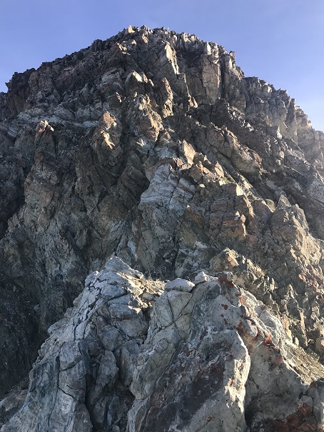
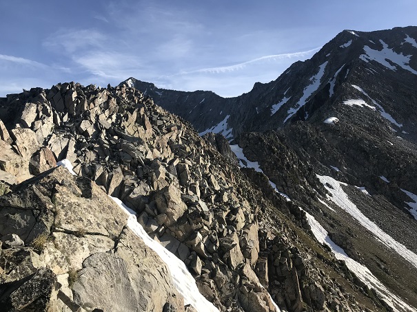
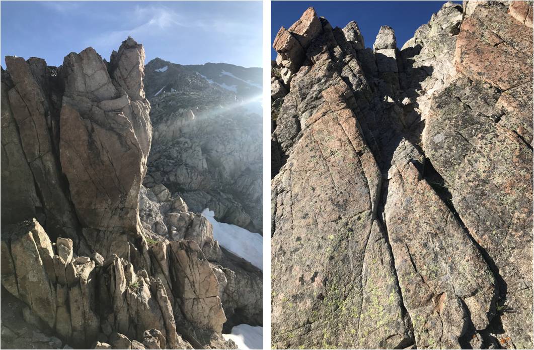
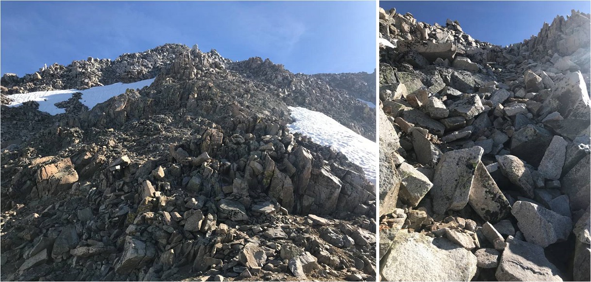
There are so many routes up Mt Meeker, and some have pretty cool names: Flying Dutchman, Dream Weaver, Dragon’s Tail, etc.  I chose the Iron Gates route because for some reason it sounded cool to climb through The Iron Gates.  I was also told this route had the best views of Longs Peak (I wasn’t disappointed).  Plus… the knife edge between Meeker Ridge and Mt Meeker sounded like fun, and I wanted to find out what a “flying buttress” was.

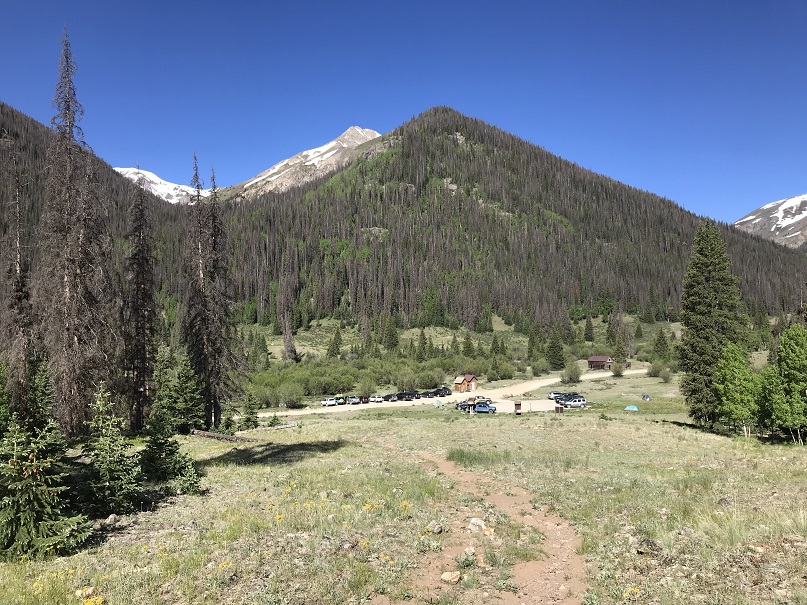
I was surprised with how many vehicles were in the Longs Peak Trailhead parking area when I arrived. It’s a large lot, and was at least halfway full.  Several hikers were readying their gear.  Last time I was here was the Friday before a Labor Day weekend, and I hadn’t seen very many people at all.  I saw dozens of hikers on the trail this morning.

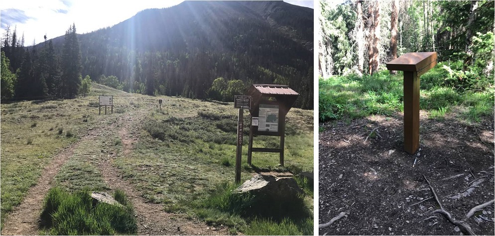
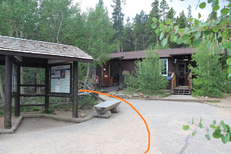
I arrived at the parking lot at 2:30am and was on the trail by 2:40am. I chose to take the Chasm Meadows Approach from Longs Peak Trailhead.  The trail starts to the left of the Rangers Station.
2

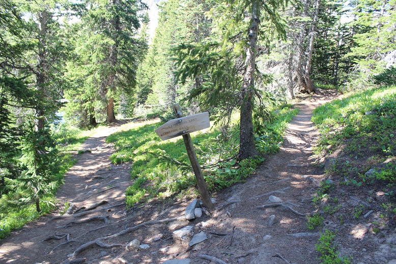
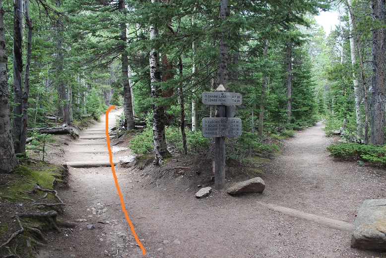
I could see headlamps shining brightly ahead of me, and passed four groups of hikers before making it to the first junction about ½ a mile from the trailhead. Stay left here
3

The trail is definitely class 1 all the way to Chasm Lake. I saw multiple groups ahead of me, all intent on Longs Peak.  They had very bright headlamps.  Very bright.  In fact, at times they were almost blinding, especially as I got closer to a group of hikers and they’d turn around to look at me.  I realized this morning just how dim my flashlight actually is (but I like it that way:  sometimes a bright flashlight gives too much information).
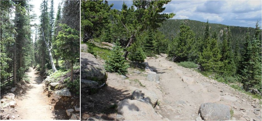
4

Around treeline I could see the full moon with city lights in the background.
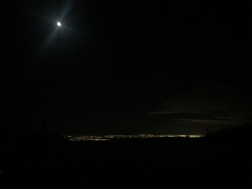
5

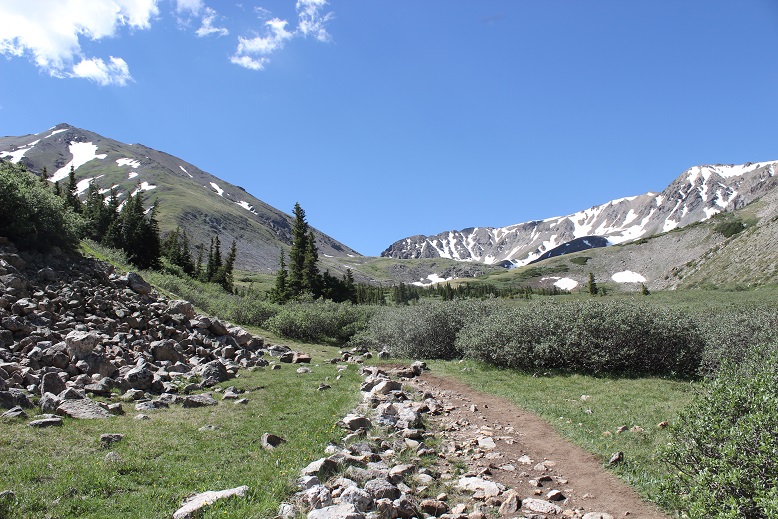
After making it to treeline there’s still 1.7 miles left to Chasm Lake. Stay left here as well.

6

About a mile before reaching chasm lake there’s a trail junction where you can stop for a bit to use the privy and let your horses rest.
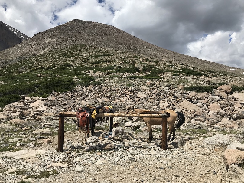
7

Having to do neither I continued on towards chasm lake, a little disappointed to lose a couple hundred feet in elevation in the process.
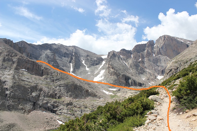
8

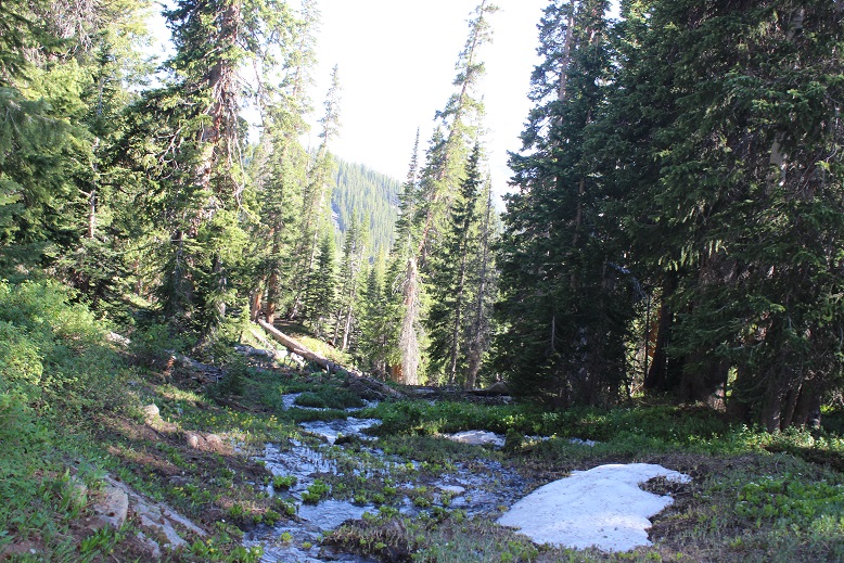
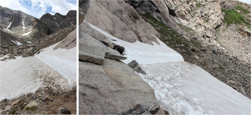
Here there were a couple of small snow areas to cross that were quite slippery in the morning, but easy to navigate in the afternoon.
9

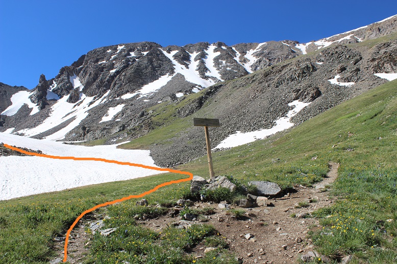
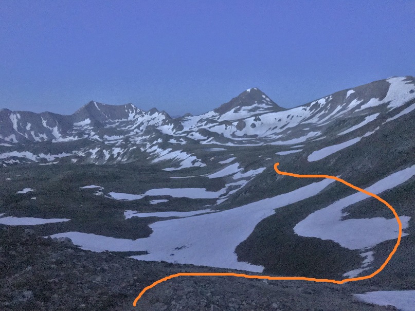
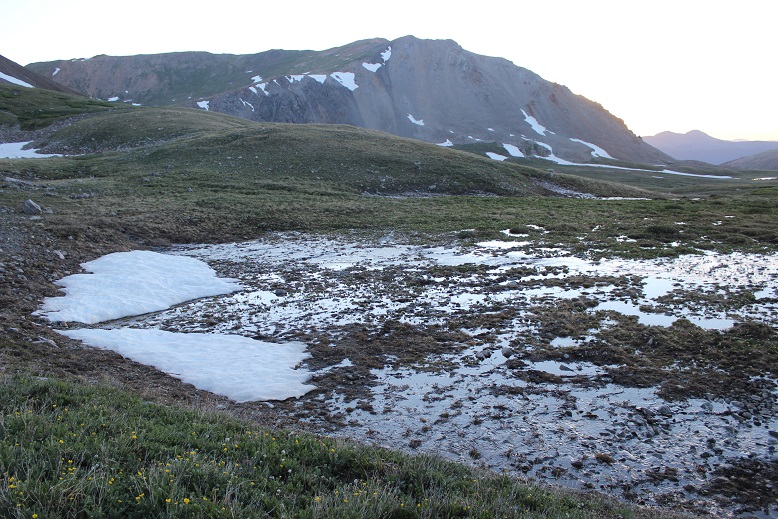
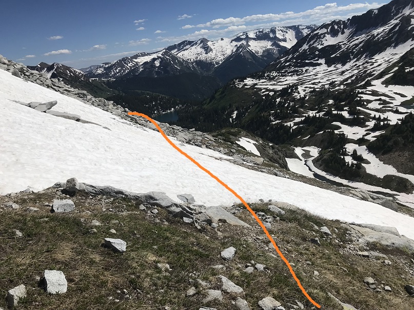
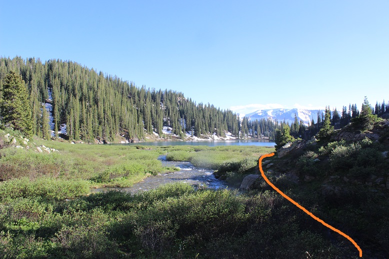
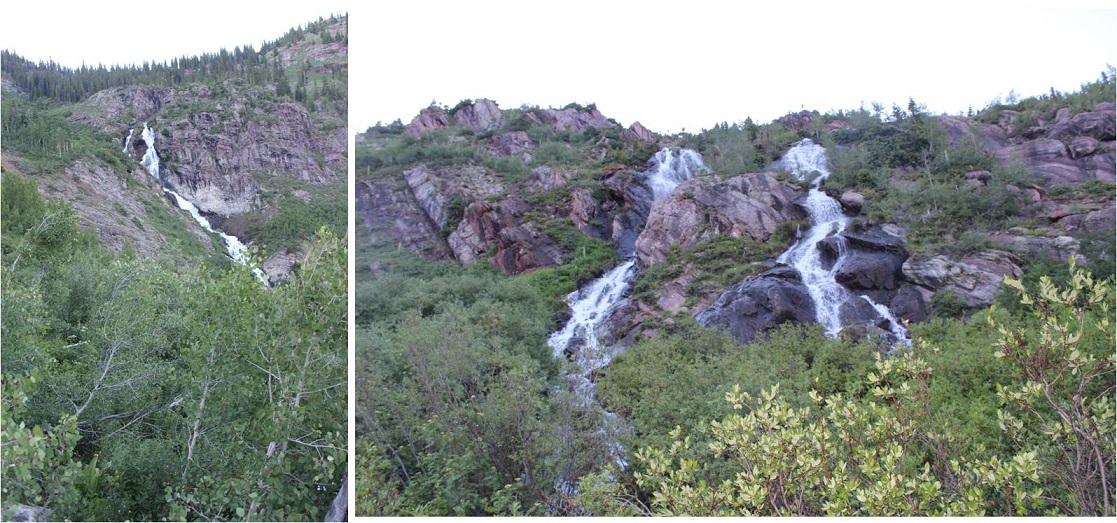
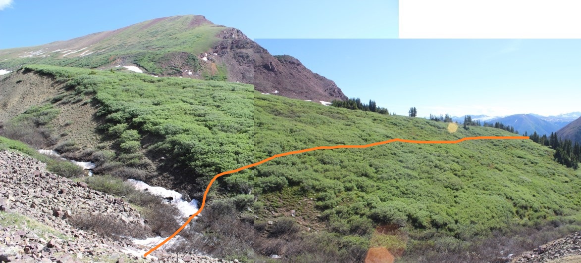
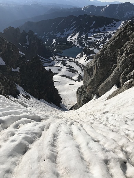
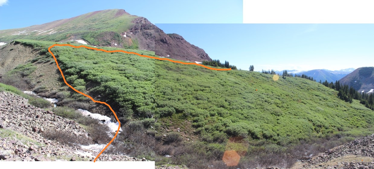
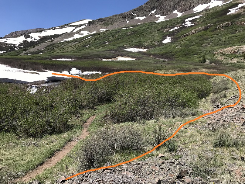
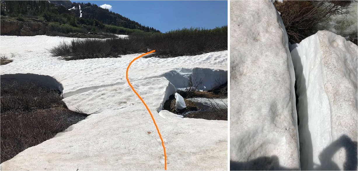
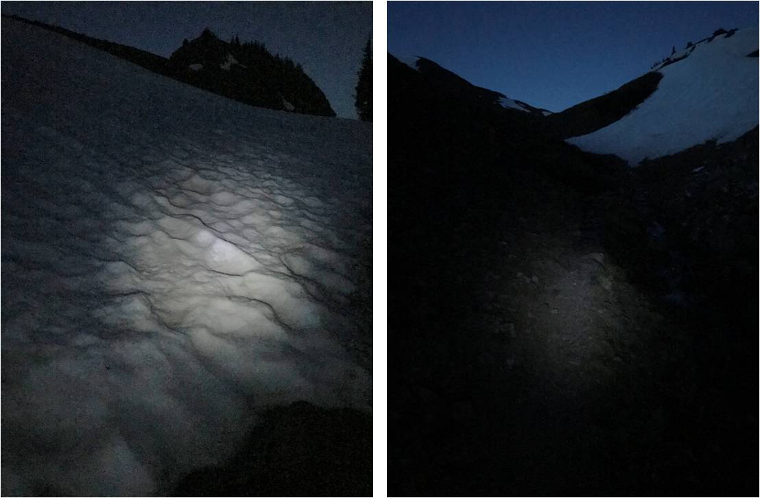
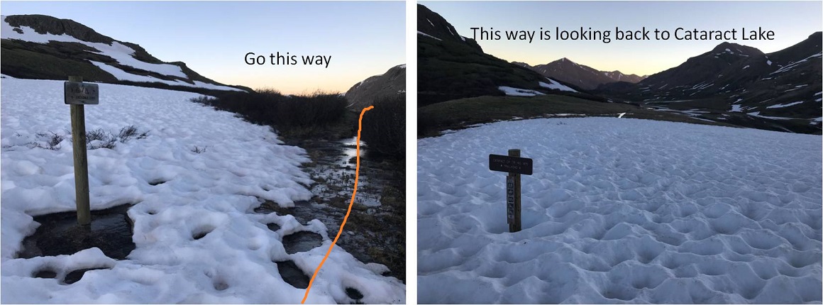
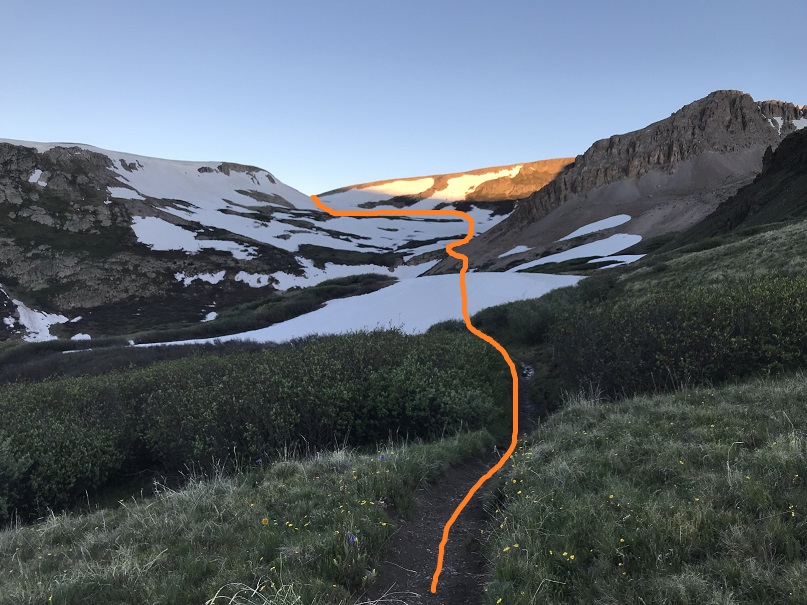
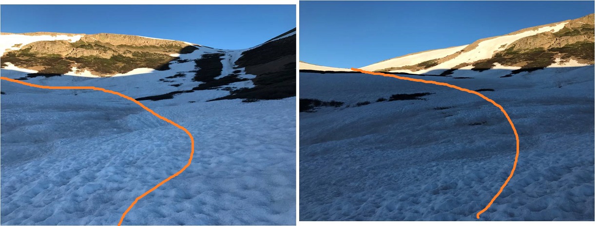
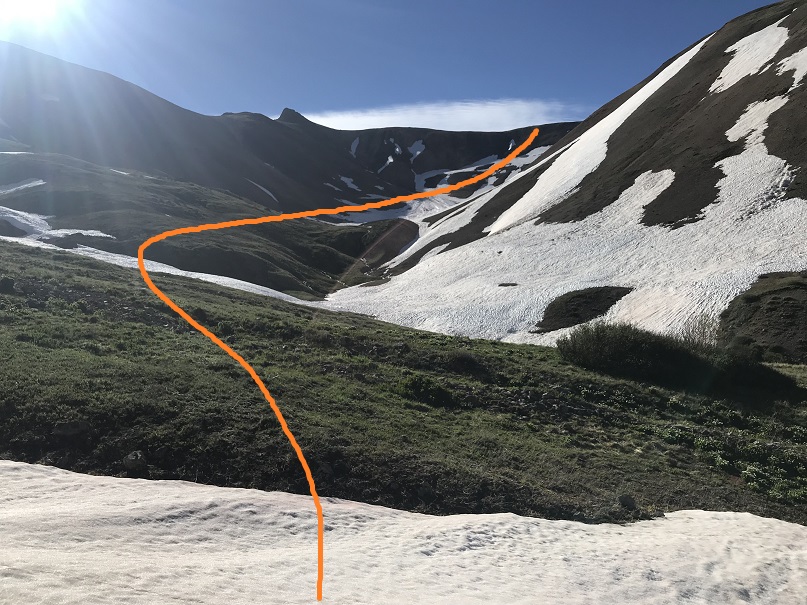
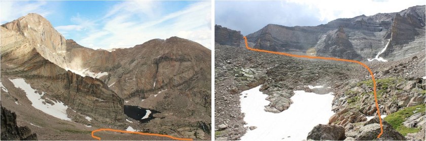
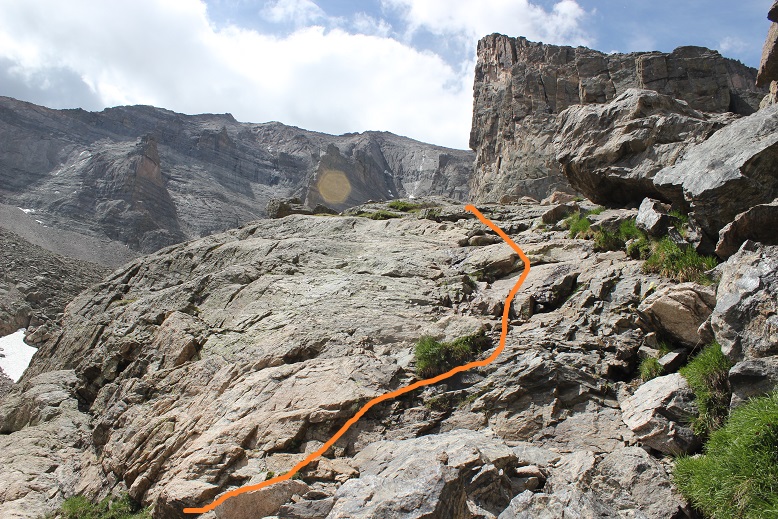
Just before Chasm Lake the trail ended. I made it to this area while it was still dark and it looked like there was a lot more snow than there actually was.  The dotted line is the route I took up the gully, the solid one is the route I took on my way back down. This ended up being a good approach, as the solid way down went through a waterfall that would have been messy in the dark.

10

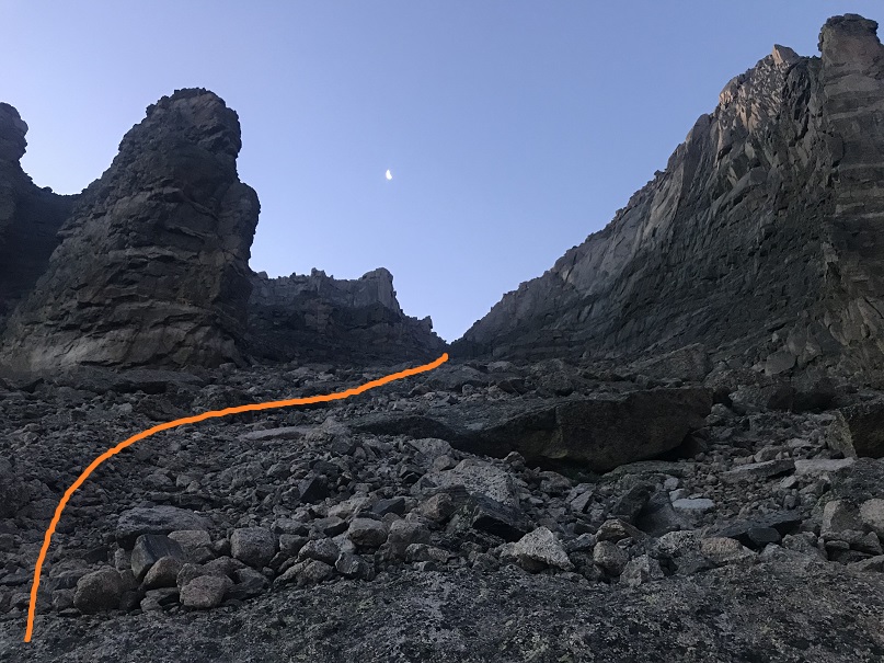
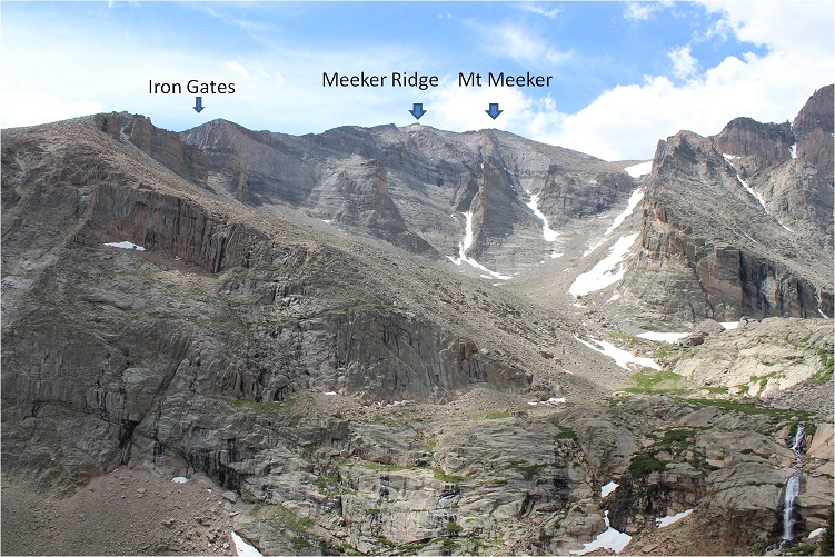
My goal was to make it to the Iron Gates. In the dark I couldn’t see much and while I knew I was headed in the correct direction I didn’t have a visual yet of the Iron Gates.
11

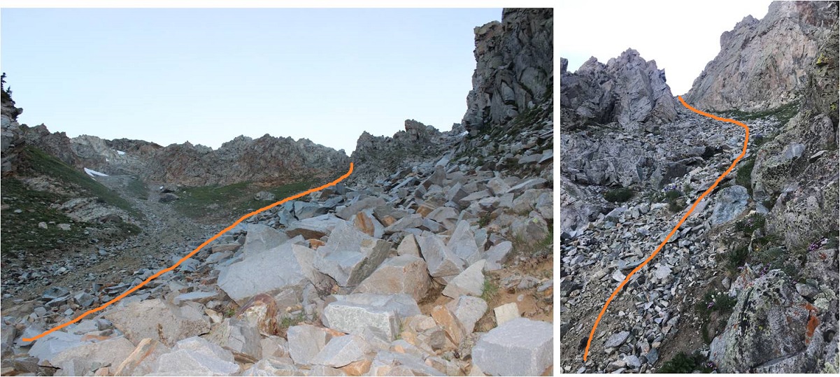
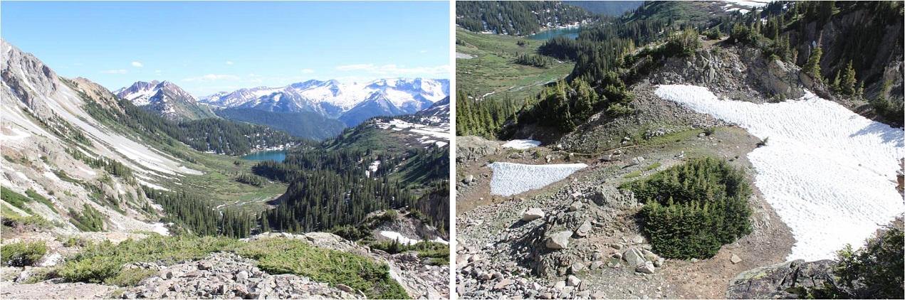
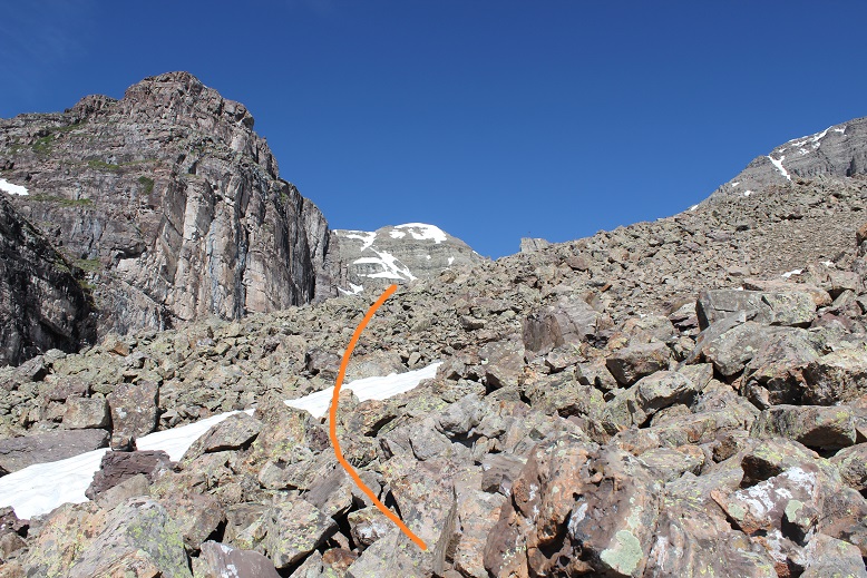
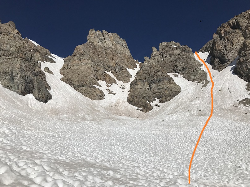
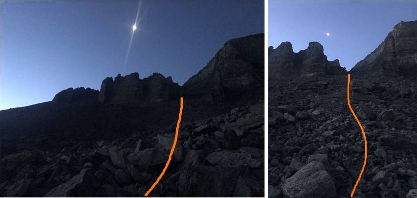
The terrain at the base of the Iron Gates was very loose scree, mixed with small rocks. As I climbed higher the ground became loose talus that became more stable until it eventually turned into solid rocks.  I headed straight through to the back of the Iron Gates
12

13

Here the sun began to rise and I was able to see why this route is said to have great views of Longs Peak

14

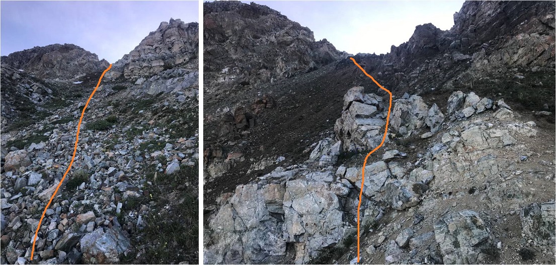
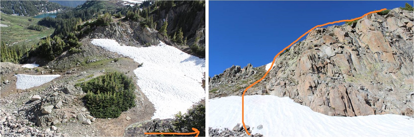
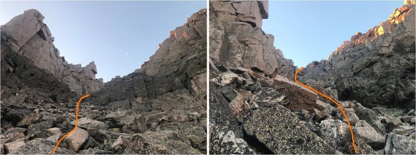
At the end of the Iron Gates there’s some class 3 scrambling to gain the ridge
15

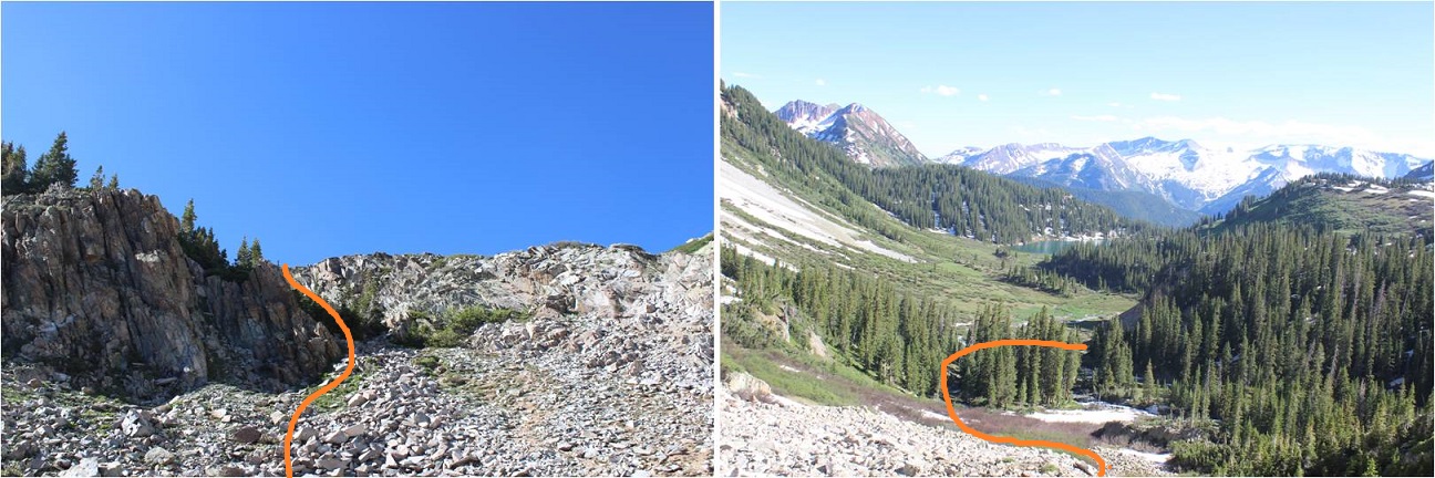
There’s a cairn at the top I made a mental note of to help me find the entrance on the way back down

16

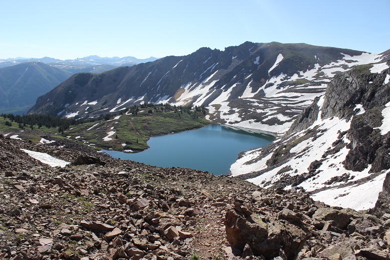
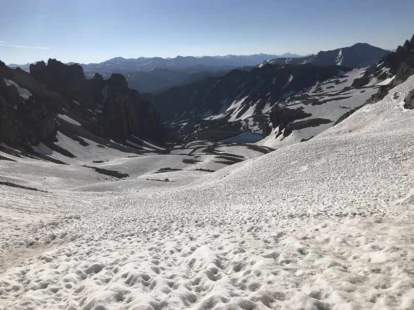
Here’s a look back down the Iron Gates at Chasm Lake
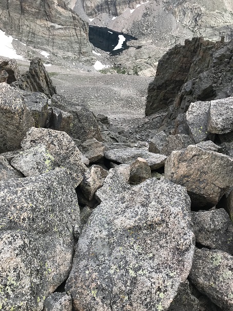
17

At the top of the Iron Gates I turned right (south) and climbed the northeast ridge to Meeker Ridge (the unranked peak, not the ridge itself)
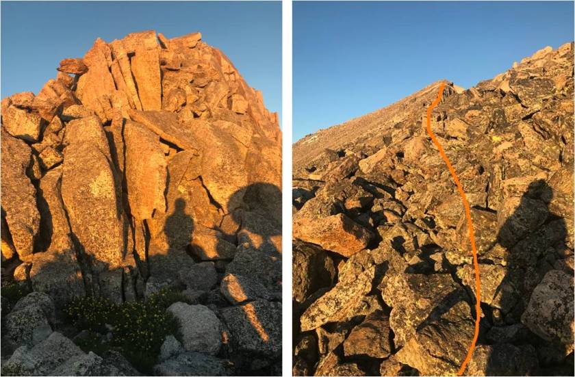
18

Yes, there were some pretty awesome views of Longs Peak
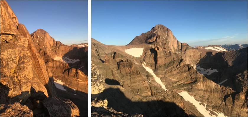
19

I made it to Meeker Ridge at 6:45am. I got a quick selfie and video at this unranked 13er

20

Meeker Ridge:

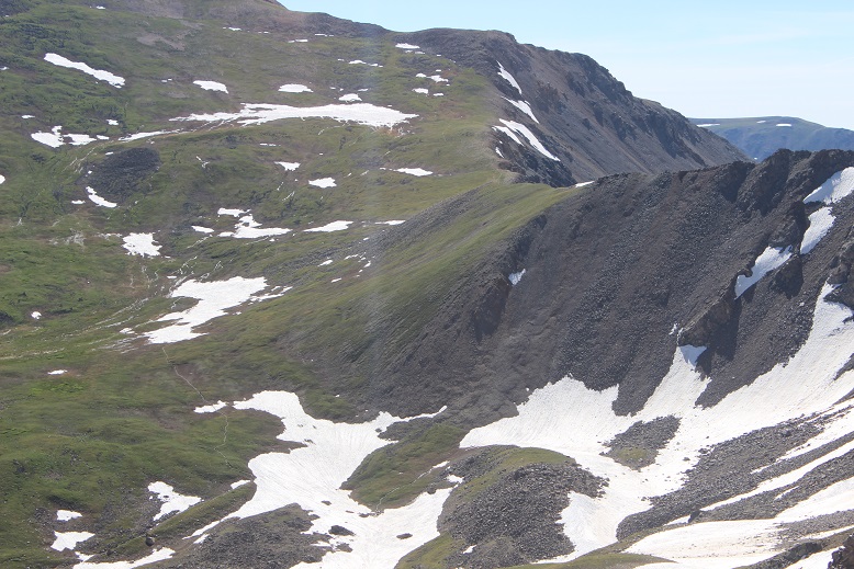
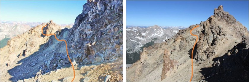
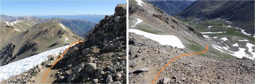
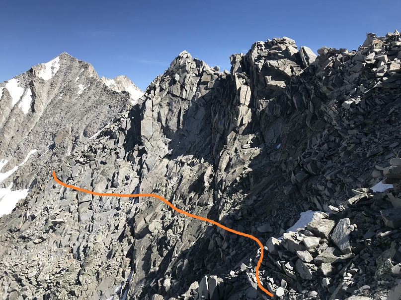
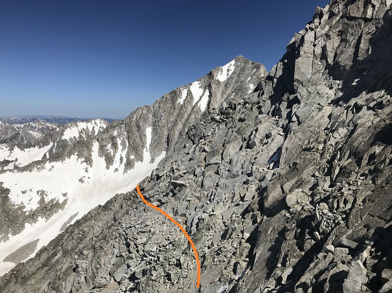
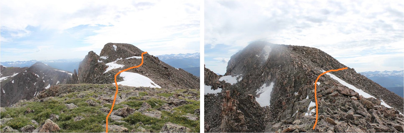
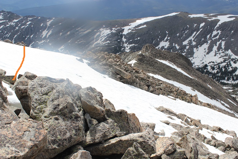
Up until this point the hike had been easy, but now it was about to get a little spicy. It was time to traverse the short ridge between Meeker Ridge and Mt Meeker.  This ridge has a ‘mini-knife edge’ similar to the one on Capitol Peak.  I was able to stick to the ridge for this short traverse, dropping down to the right only once when absolutely necessary. This is a solid class 3 ridge with exposure.

21

Here’s a tip for the knife-edge part: It’s very similar to the one on Capitol Peak, and would make for a great practice run if you’re hesitant to try Capitol but feel solid with class 3 climbing. While on Meeker’s knife edge you can cross and use your right foot for balance by placing it on the rock beneath the ledge.  This rock is underneath the knife ledge and difficult to see, but a few inches wide, solid, and you can use it for extra balance if needed. The rock here felt more solid than on Capitol.

Here’s looking back at Meeker Ridge

22

And some of the climbing/exposure on route

23

I made it to the summit of Mt Meeker at 7:15am, or what I thought was the summit of Mt Meeker. At the top of the traverse there were two points about 40 feet apart that both looked like the true summit.  I sat on top of the first point, but the second point looked higher.  So I went over and climbed to the top of the second point, but from there the first point looked higher.  So I decided to take a video from the middle of both points and pictures from both.
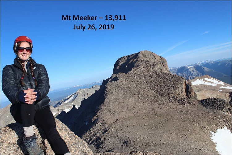
24

Mt Meeker:

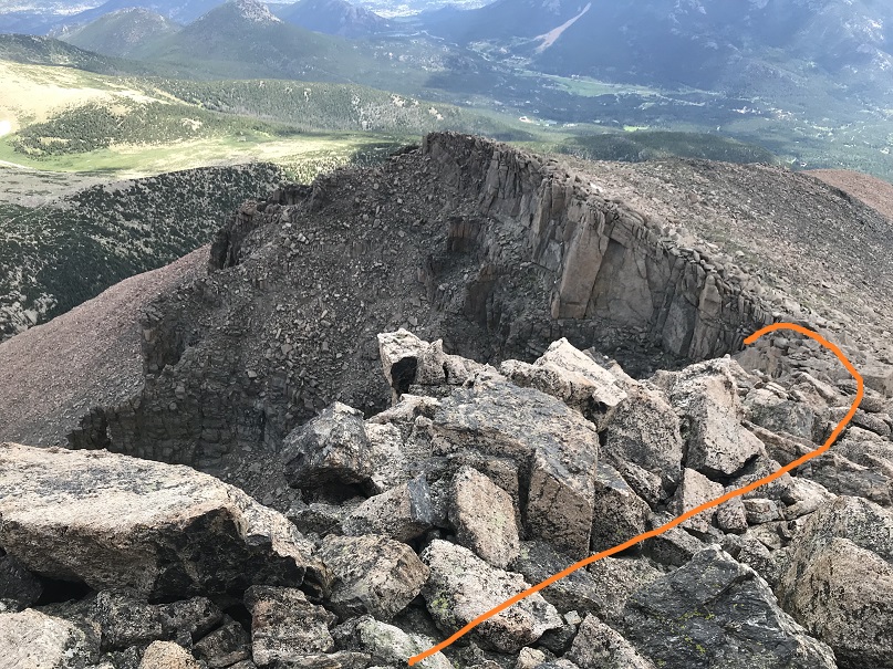
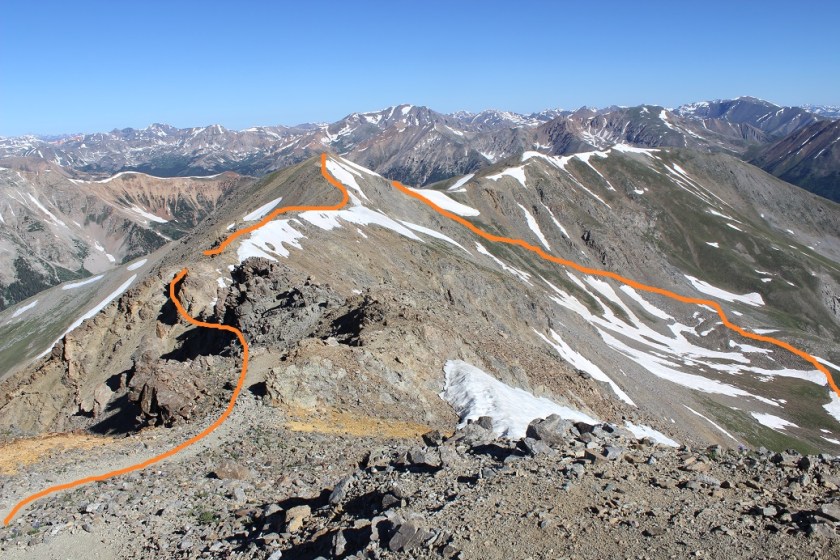
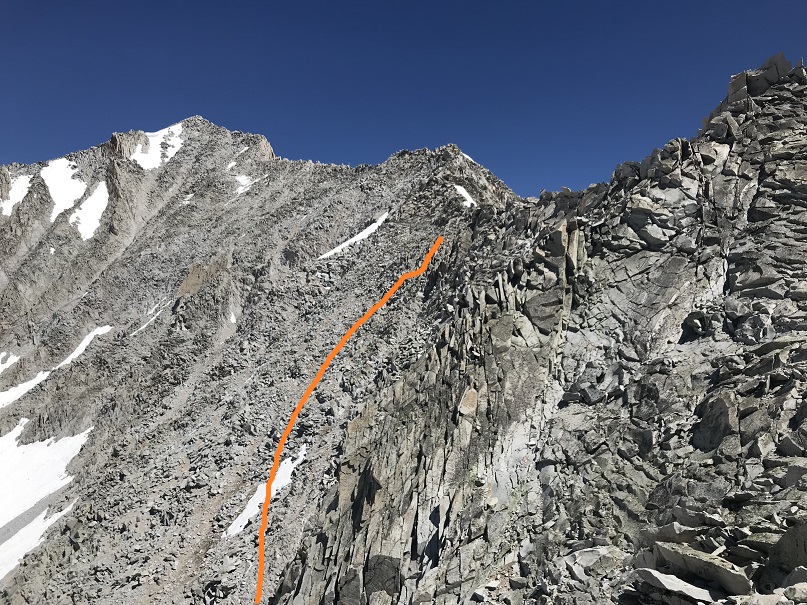
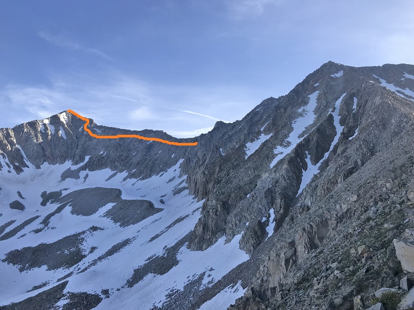
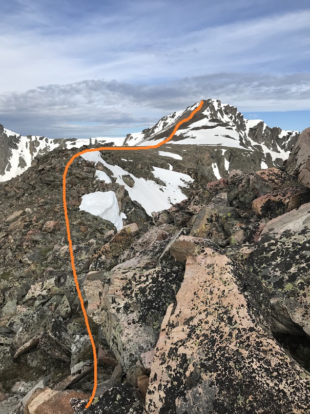
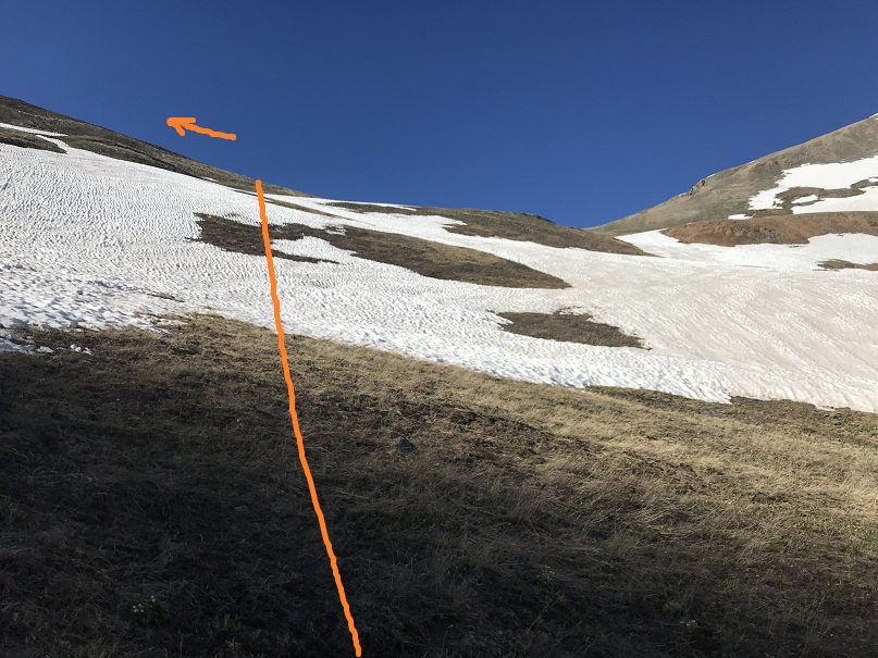
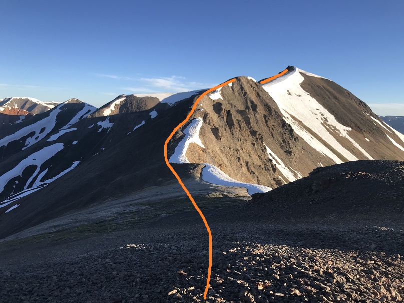
It was still early in the morning and the weather was holding out nicely. I decided to descend Mt Meeker and cross the Loft towards Longs Peak.  Longs Peak wasn’t my goal, as I’ve already summited Longs, but I wanted to get a look at the Notch route up Longs and summit Southeast Longs (an unranked 14er sub summit).  Southeast Longs is where the orange line ends.
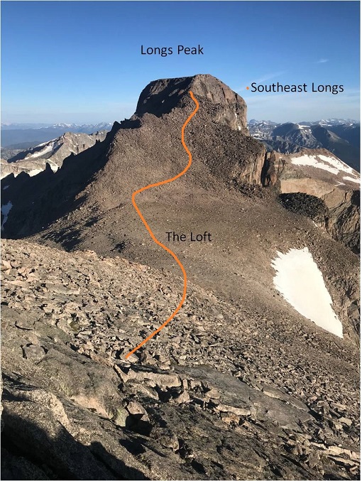
25

To get there I descended 450’ to the loft, and then gained 600’ to the top of Southeast Longs.
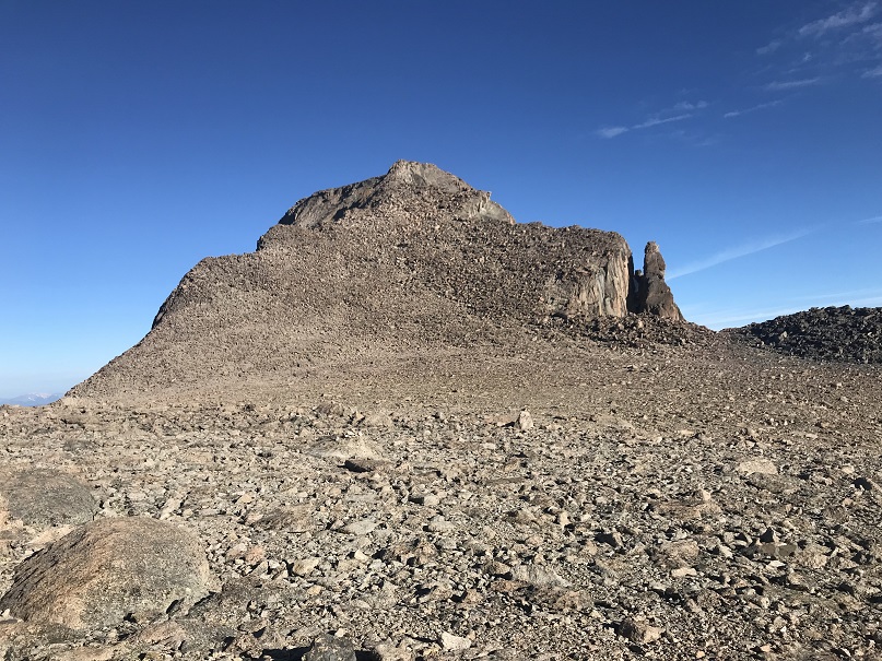
26

The rocks here were solid and much larger than they looked from Mt Meeker. There were a bunch of social trails here so I just took the path of least resistance to the top.
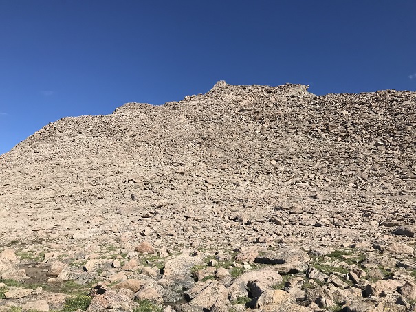
27

I made it there at 8:25am. You can see Longs Peak Summit in the background

28

Curious as to what the Notch and path to Longs Peak looked like from here I descended to the cairn that indicated the entrance to the Notch and looked over. It looked like a class 3 scramble that would lose a couple hundred feet in elevation, and then re-gain it on the other side, connecting with the traditional Longs Peak Route just before the final pitch.
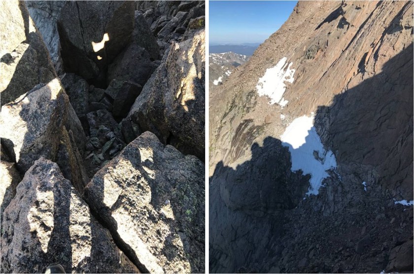
29

I briefly thought about attempting Longs Peak as well, but did some mental calculations and figured it would get me back around 3-3:30pm, and I really wanted to be back around 1:30pm, so I decided to save Longs Peak round 2 for another day. Also, there were a ton of people queued for the final push on Longs (I could see/hear them) and a lot of people on the summit as well.  I’m not a fan of crowds, especially on peaks.  In any event, I still had some more climbing to do myself, as I needed to re-ascend Mt Meeker to head back.  I did not want to make this a loop.

30

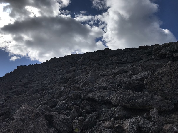
The clouds were starting to build as I gained Meeker’s ridge
31

While they looked ominous at first (especially for being so early in the day) nothing came of them. The clouds did hide the sun for most of my return back to the trailhead and I did get a few drops of rain here and there, but I was never worried about thunderstorms.

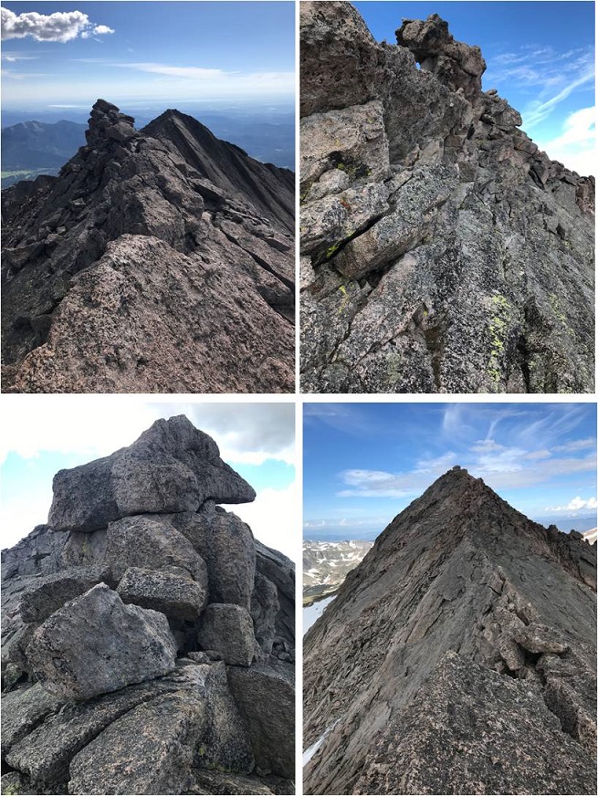
Time for knife-edge part 2. I felt much more confident the second time around, and the traverse went much faster.  I was well aware of the group of 15 or so people on top of Longs Peak watching me make the traverse.  I could hear them talking to each other as I climbed up boulders and balanced on the ridge.
32

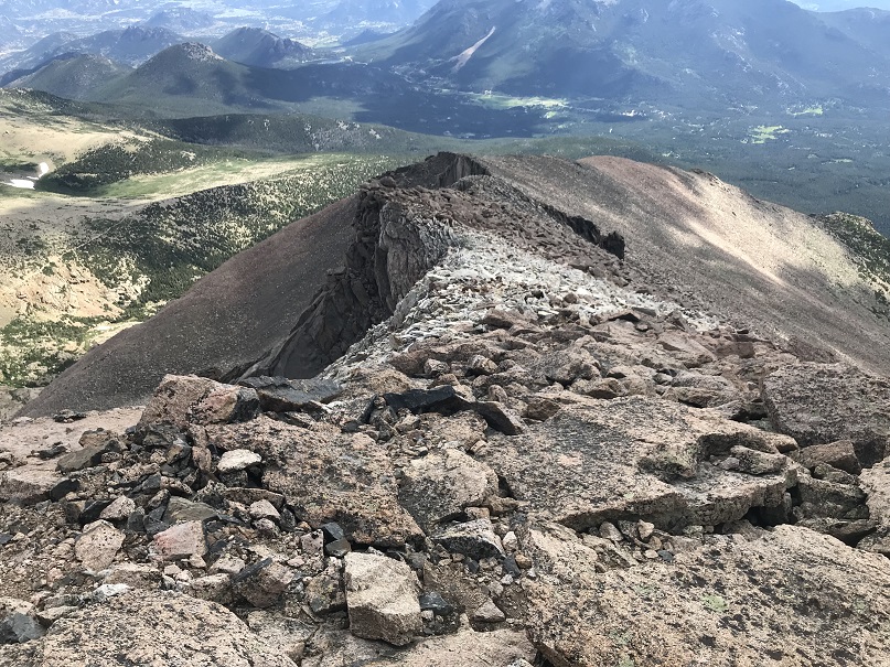
Just as I made it back to Meeker Ridge I met a young man beginning his attempt of the traverse. He’d had a long day, starting from Sandbeach Lake.  I wished him luck and was on my way back down the Northeast Ridge towards the Iron Gates
33

34

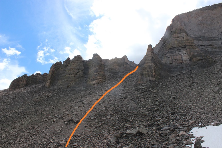
As Chasm Lake came into view I could hear loud shouts that sounded like a large group was down there having fun. A group was paddleboarding. It seemed like a lot of work to me to get multiple paddleboards up to Chasm Lake, but hey, they must really be into the sport. I wondered to myself if it was legal to paddleboard there?  I descended into the Iron Gates and had no problem on the larger rocks/talus.  However, descending the scree was a bit of a small nightmare.  I was so glad when I made it to the bottom of the Iron Gates and turned around to see them in the daylight

35

36

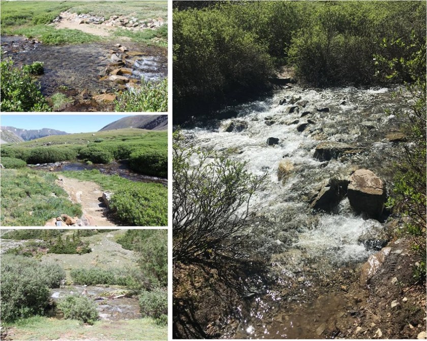
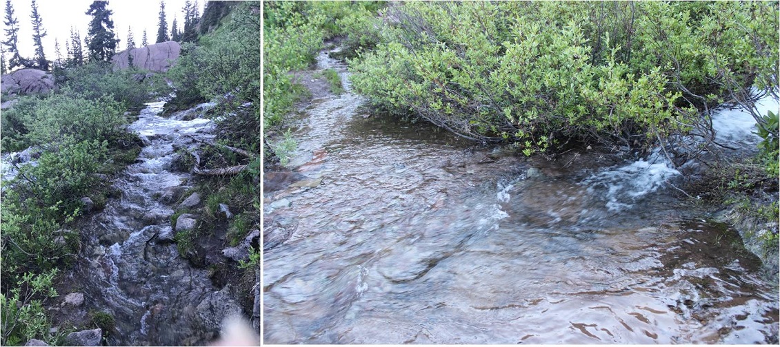
I followed the gully more to the west this time and descended via a wide waterfall area with small rivers of water flowing throughout
37

38

This brought me to the base of Chasm Lake, where I picked up the trail back to Chasm Meadows. This is also where I met up with a group of 12 or so campers from a nearby camp.  I could tell immediately they weren’t Girl Scouts because there was only 1 adult with them, the girls were all wearing shorts and did not look like they’d been “roughing it”.  I asked them where they were from and wished them well as I hiked out.

39

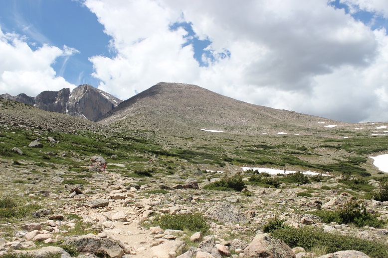
A few minutes later as I reached the Jims Grove area I could hear the girls behind me, their counselor yelling at them every 10 seconds or so to “hurry up” even though they were setting a fast pace. Long story short, she pushed them too hard and one of the girls clipped and fell. She’s alright and just scraped her knee, but I hope the counselor learned her lesson and slowed down a bit.
40

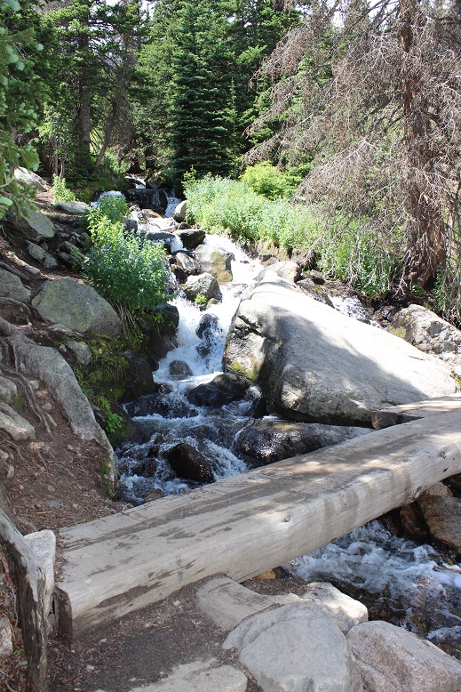
It was great seeing the waterfall crossing areas on my way down in the daylight.
41

I made it back to my truck at 1:15pm, making this a 13.5 hour hike with 5764’ in elevation gain in 10 hours 30 minutes

42

43

Today’s hike was absolutely beautiful! I can’t wait to head back here to tackle a few more 13ers…
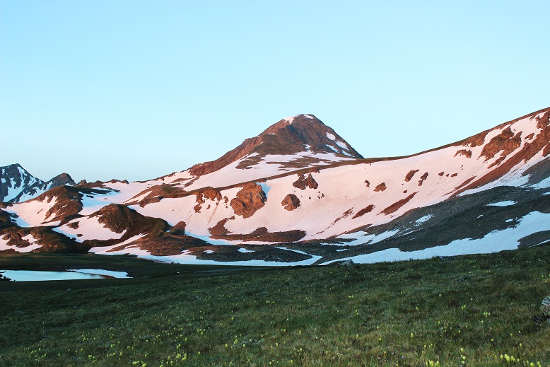
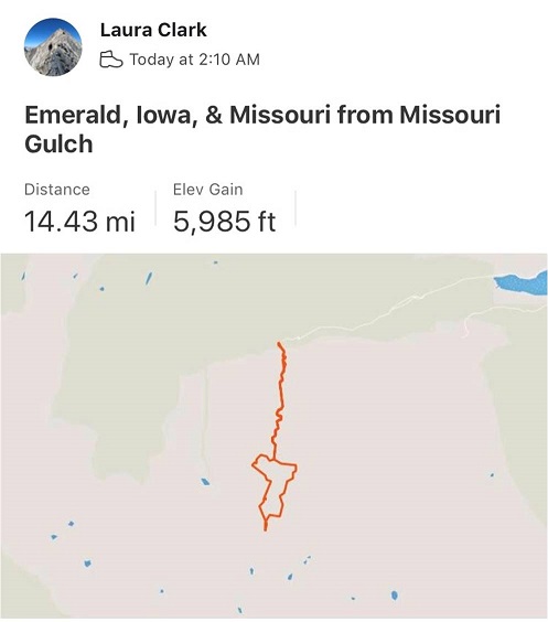
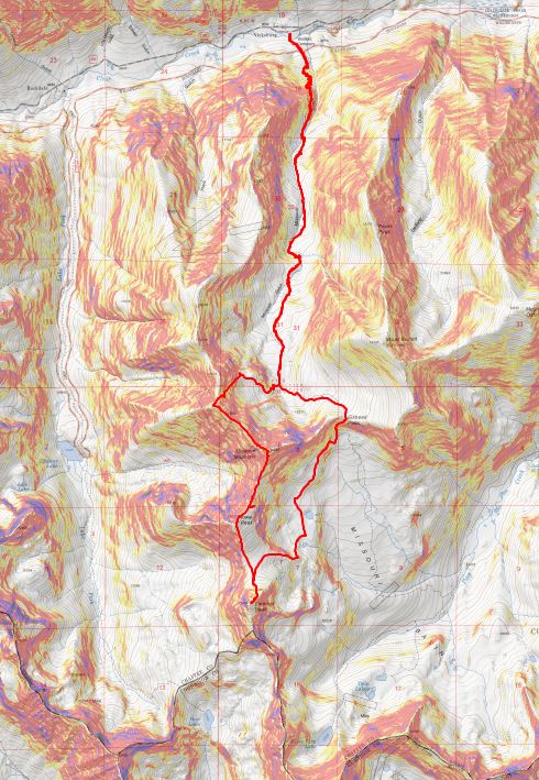
Emerald Peak 13,904, Iowa Peak (UR) 13,831 & Missouri Mountain 14,067

1

RT Length: 14.5 miles

Elevation Gain: 5985’

No, I didn’t drive straight to the Missouri Gulch trailhead. It took me forever to drive home going 50mph on the I70.  I made it home at 7am and limped out of the truck.  My feet seemed to hurt more now than they did last night.  They’d dried out, but were now red and raw.  I decided to take a few hours ‘off’ to let my feet rest.  After cleaning up and pampering my feet I took a 5 hour nap.  When I woke up my feet had dried out and I was able to get a better look.  No blisters.  That was a relief.  They were still red and swollen though, meaning I’d had a Raynaud’s attack yesterday.  It all made sense, and was most likely caused by the 20 minutes I spent trying to dig out my water shoes from the cold creek combined with a long, physical day.

Driving home had been the right thing to do. By the middle of the day my feet were still sore but I found I could walk on them.  Kind of… you see, it hurt terribly to begin walking, but after the 10th step or so the pain went away.  So I figured I just had to start hiking and not stop and I’d be fine.

At 9pm I made the decision to drive to the trailhead, try to nap for an hour, and attempt another hike. It was either that or stay home and do the treadmill thing in the morning, which did not sound appealing with sore feet.

Everything went well. I made it to the trailhead and slept for an hour before my alarm went off at 2am.  There were tons of vehicles at the trailhead.  As I was putting on my hiking boots a couple drove up in a Subaru.  We were hitting the trail at the same time, so when I got out of my truck I waved and said hi to them.  No response.  Hmmmm… ok.  Maybe they hadn’t seen me (or that the lights on in my truck)?  I turned on my flashlight, walked over to the trailhead and once again said “hi guys!”  I was hoping to just chat and see where they were going before setting off.  When I see others at trailheads I like to connect in case something happens (to either of us).  Once again, they didn’t respond (but their dog looked back at me).  Maybe the creek was making too much noise for them to hear me? Ok, well, I don’t like to be rude but I’d tried to be nice.  Maybe I’d see them on the way down.  I didn’t say anything as I quickly scooted past them and headed down to the stream, crossed the bridge, and headed up the trail.

2

Yes, my feet hurt, but I had a plan: don’t stop.  Also, take ibuprofen every 4 hours.  The first few steps were painful, but after that as long as I kept moving the pain went away.  This was my second attempt of Emerald/Iowa, and my 4th time hiking via the Missouri Gulch trailhead.  Call me crazy, but those switchbacks are getting easier.  Also, the baby grave doesn’t bother me so much anymore.

3

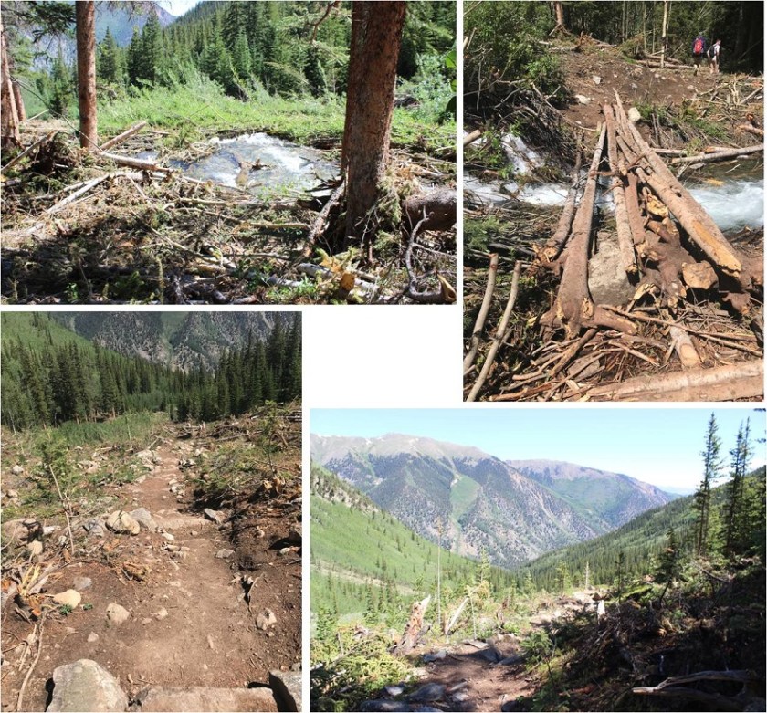
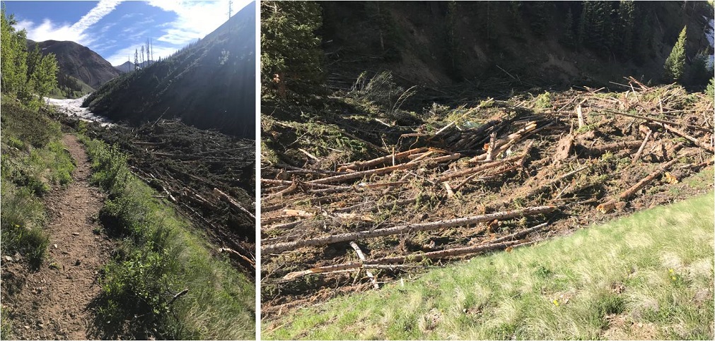
The avalanche area has been nicely cleared, and now there’s a log bridge over the creek and a nicely manicured trail through the avy debris.

4

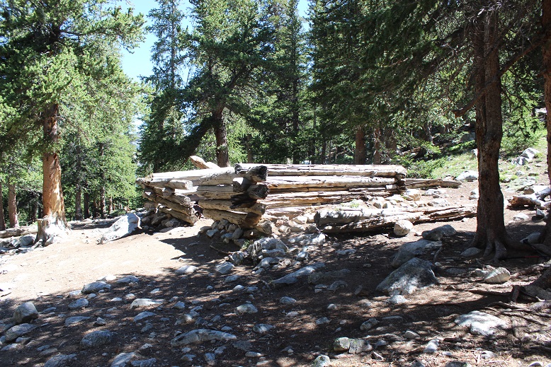
I made it to the cabin in exactly 1 hour and thought that was pretty good time, considering.

5

I entered Missouri Gulch and had no problems following the well established trail. The willows seem so much bigger without all the snow.

6

I turned right at the junction for Elkhead Pass/Belford and followed the trail towards Elkhead Pass.

7

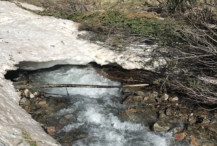
There were several stream crossings to navigate here. These were not fun in the dark, but in the daylight didn’t pose much of a problem.  Oh, and there aren’t any ‘easier’ ways to cross:  just cross them right where they intersect with the trail.

8

I felt like I was making pretty good time. It’s amazing how much easier the gulch is to navigate without snow.  I made it to the Elkhead Pass/Missouri Mountain junction

9

This is where I got a little worried: this is the first hike all year I haven’t brought along my snowshoes, and the area before Elkhead Pass looked to be full of snow.  Luckily there actually wasn’t that much and what snow there was was solid in the morning so I didn’t need traction (I had spikes and crampons in my bag, but didn’t need them).

10

It was still dark as I navigated my way through the snow and sometimes trail up to Elkhead Pass. Here’s a look at the route from later in the day coming down from Missouri.  The snow was easily navigable, but seems like much more when you’re down there hiking through it.

12

I found myself at the top of Elkhead Pass at 5:15am. It had taken me 3 hours to get here (4.1 miles and 3580 in elevation gain).  Remembering how icy conditions had forced me to turn around here last time I was a bit worried to see snow at the top of the pass, but as I got closer I noticed there wasn’t as much snow as I’d initially thought.  (Sorry for the poor quality of the next few photos:  I took them in the dark and had to lighten them up so show details)

13

I descended Elkhead Pass, but not all the way to the bottom of Missouri Basin (Yes, Missouri Basin, not Missouri Gulch. We need to get more creative with these names people!).  I found a cliff band below Missouri and followed that towards the little lakes, as I didn’t want to lose more elevation than necessary.  Here’s the path I took hugging Missouri

14

At the cliff band I descended the least amount possible, heading towards the lakes

15

Here’s looking back at Elkhead Pass and the way down (don’t drop lower than necessary: there’s a trail that takes you all the way to the bottom; avoid that).

16

The area between Missouri and Emerald was mucky

17

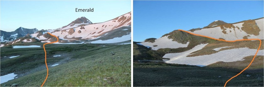
There are several ways to gain Emerald’s ridge. There was snow surrounding the access area to the south, so I went a little further north and took this path, avoiding the lakes and snow as much as possible.

18

Here’s a look back at the route and Elkhead Pass

19

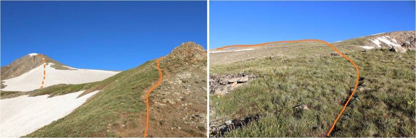
Once I gained the ridge I turned right (west) and followed a faint trail up the ridge. (Note: the standard route up is the dotted line. I did not take this route because I wanted to avoid kicking in steps in the snow:  I wasn’t sure my feet would appreciate that today)

20

Instead I skirted the mountain to the northwest to the saddle between Emerald and Iowa and summited via Emerald’s north slopes

21

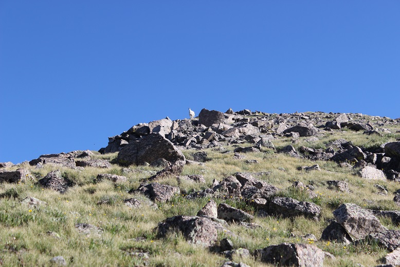
The last 500 feet or so to the summit were filled with scree/talus and tons of goat/social trails. Just aim for the ridge

22

I had a goat watch me the entire way, then disappear when I reached the ridge

23

From the ridge I turned right (west) and walked my way to the summit

24

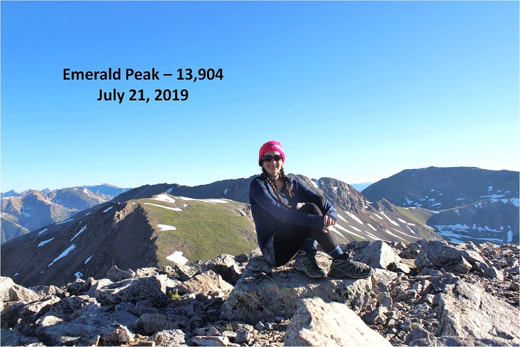
I summited Emerald Peak at 7:20am

25

Emerald:

Despite the threat of forecasted afternoon storms this morning was beautiful! I looked over to Iowa and back at the route I’d taken thus far.  An idea came to me:  it looked like similar elevation gain/loss going over Missouri as it did going back over Elkhead pass.  I might as well tag Missouri again.  I decided to wait and see if the weather held out before making a final decision, but it seemed a draw either way.   Oh, and my feet were holding up, so that’s a plus.

26

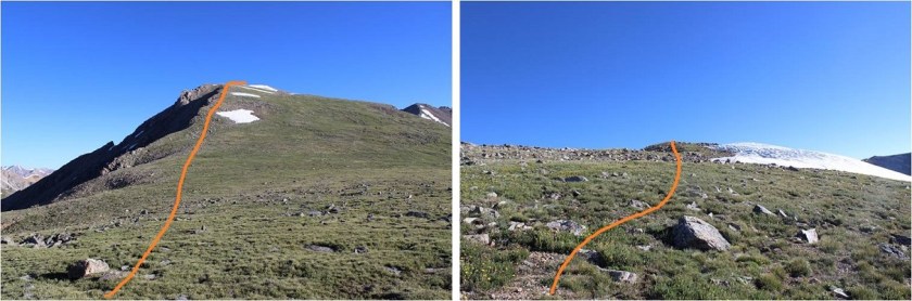
The route to Iowa and Missouri was obvious. I headed down Emerald’s north slopes and towards the Emerald/Iowa saddle and up to the summit of Iowa

27

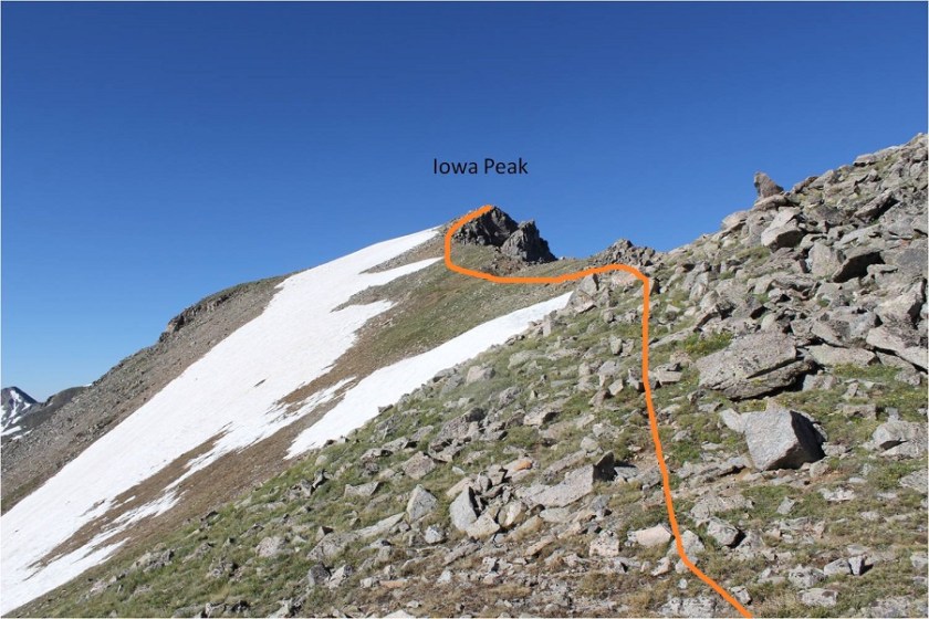
The hike up to Iowa’s summit was easier than expected; I just stayed to the left of the snow on the ridge. Once again, a goat watched my ascent.

28

29

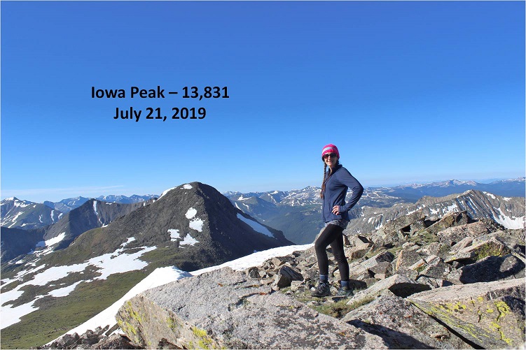
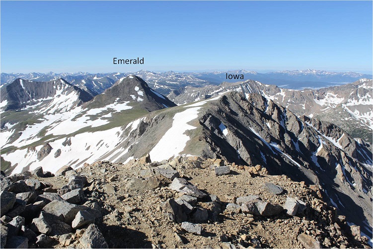
I summited Iowa Peak (an unranked 13er) at 8:10am. You can see Emerald Peak in the background of this picture

30

Iowa:

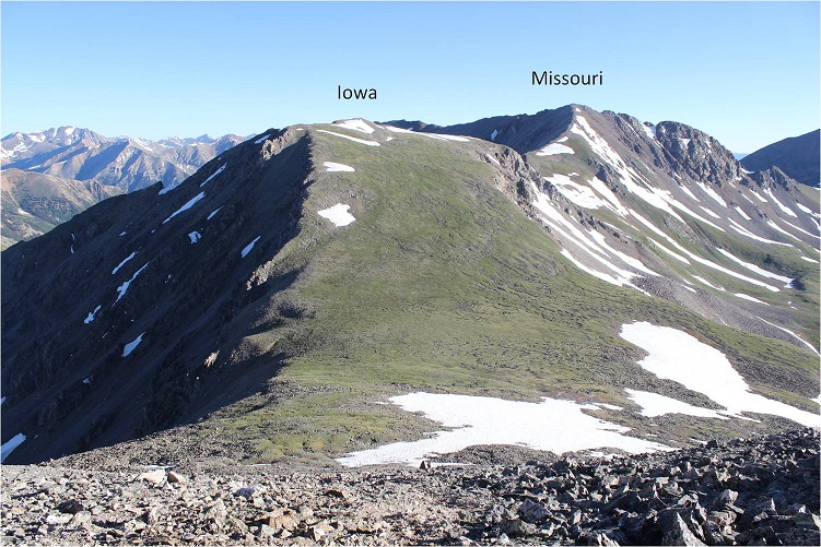
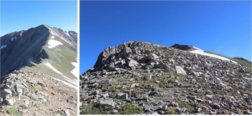
The decision had been made: on to Missouri!  Initially I tried to descend Iowa too far to the right (east) and had to turn back due to snow I didn’t particularly want to cross.  To avoid all snow it was easier just to follow Iowa’s ridge to the Iowa/Missouri saddle.

31

Looking back at Iowa from the Iowa/Missouri Saddle

32

The ridge up to Missouri was much, much easier than anticipated. I don’t know if it was the ibuprofen I took on Iowa or just conditioning, but I felt the ridge from Iowa to Missouri wasn’t very challenging at all.  In fact, when I made it to the top I’d assumed I was only halfway up, and actually asked the 10 other people I saw as I was approaching “Is this seriously the summit!?!?”  (Note to self:  not a good question to ask a group exhausted hikers when you aren’t even winded.  Tone it down a bit.).

33

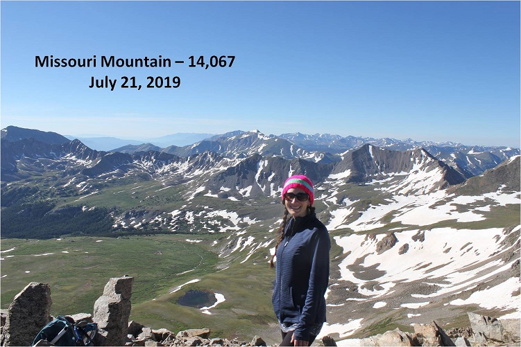
I reached Missouri at 9am and asked one of the other hikers to take my photo because I thought it would look silly setting up my gorillapod.

34

Missouri:

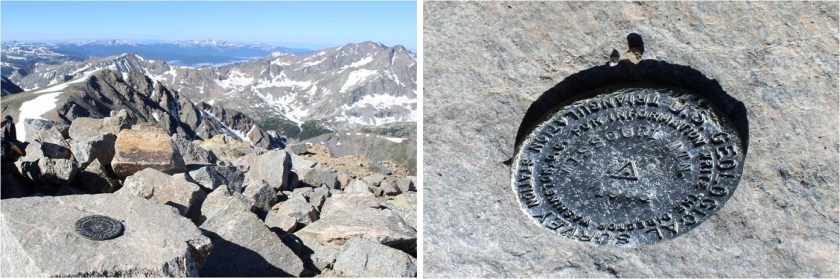
Missouri had been an added and unexpected bonus peak today, and it has a summit marker!

35

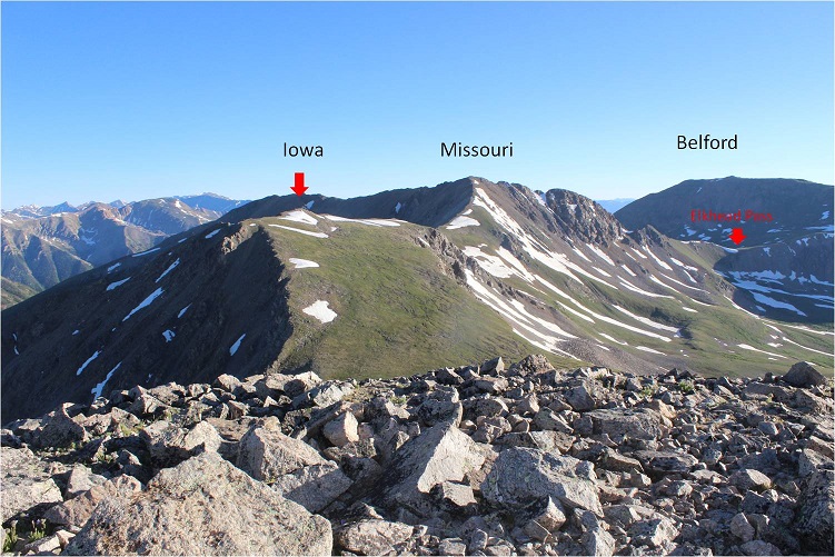
Here’s a look back on Emerald and Iowa

36

Knowing I couldn’t let my feet stop moving for long I thanked the photographer for taking my picture and headed back down via Missouri’s northwest ridge. There’s a great trail the entire way from the summit back to the Missouri Gulch Trailhead.  Here’s the route of the ridge

37

The crux area was much easier to navigate than I remember it being when I hiked Missouri last time. This time I could even hold onto the rock face for added stability if needed

38

Is this rabbit named?

39

Here’s a look back at the ridge

40

Exiting the ridge is marked by a cairn (and today a tiny bit of snow). After rounding the corner get ready to do some scree surfing.  (Note:  if you’re not a fan of scree (who is?), microspikes help provide traction.  Seriously, try them on scree, it’ll change your life).

41

Looking back up at the scree slope to gain the ridge

42

There were some slight snow fields to cross, but nothing that required traction

43

From here there’s an obvious trail back down to the gulch.

44

45

I met tons of people hiking on the way down from Missouri. It was the perfect day for a 14er, there are 3 in the area, and everyone was out.  I made it back to my truck at 11:45am, making this a 14.5 mile hike with 5985’ in elevation gain in 9.5 hours.

46

47

My feet did not look pretty when I was done but I was very pleased with today’s hike. I didn’t feel tired, even at the end.  My feet successfully made it the entire way without complaining (too much). I think the ups and downs in elevation gain on the ridges gave me little breaks that made all the difference.  I’m sure you could do this hike in reverse and feel the same way. I never saw the couple I’d seen at the trailhead in the morning, but I’m hoping they stayed safe and had a fabulous hike as well!

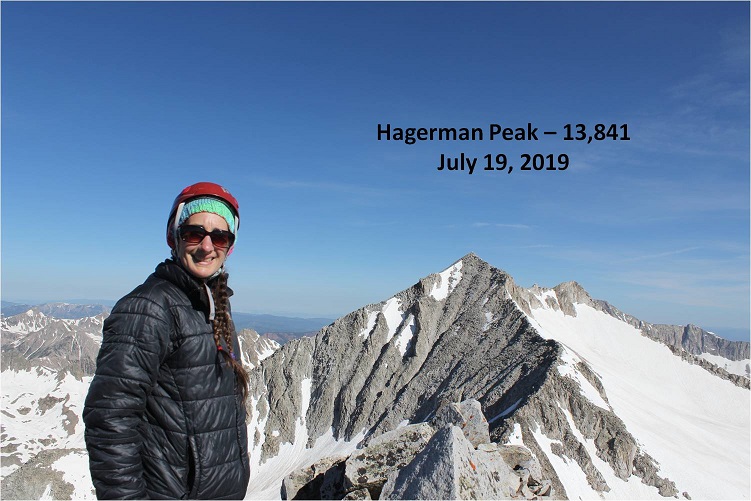
Hagerman Peak 13,848 & Snowmass Mountain 14,105

1

RT Length: 15.5 miles

Elevation Gain: 6211’

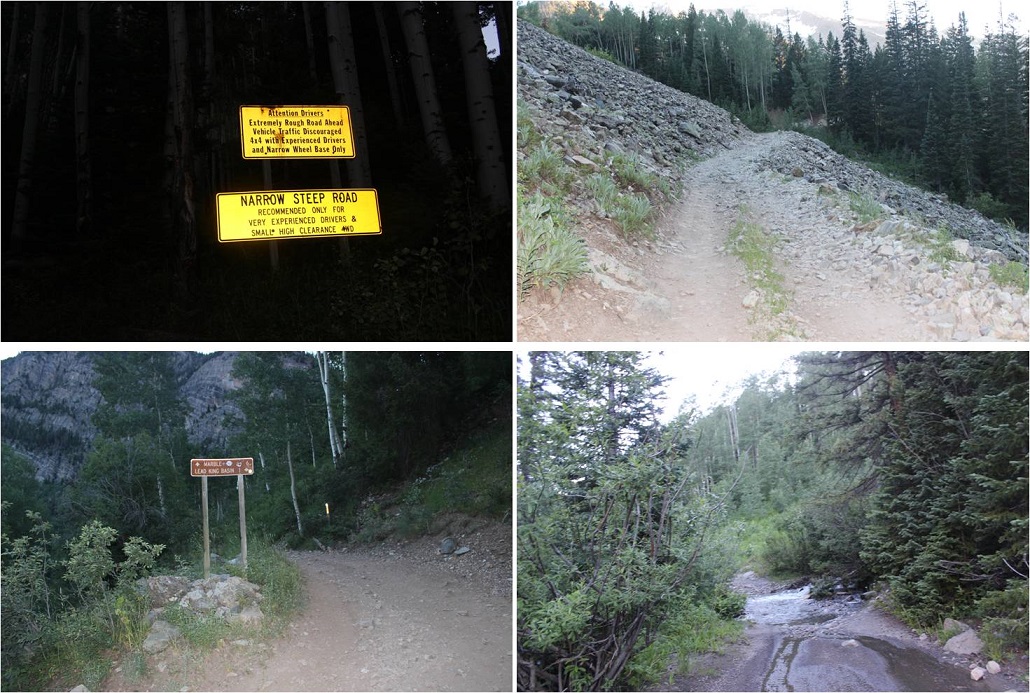
After my failed attempt  last week I decided to do more research and try Hagerman again today.  I learned the upper road to Lead King Basin had an avalanche about 1 mile after the stream crossing (very close to where I’d parked) so I decided to take the lower road from Marble to Crystal instead.  I’d heard a lot of conflicting reports on this road, but when I searched it online I found this video, which was very helpful.

Marble to Crystal

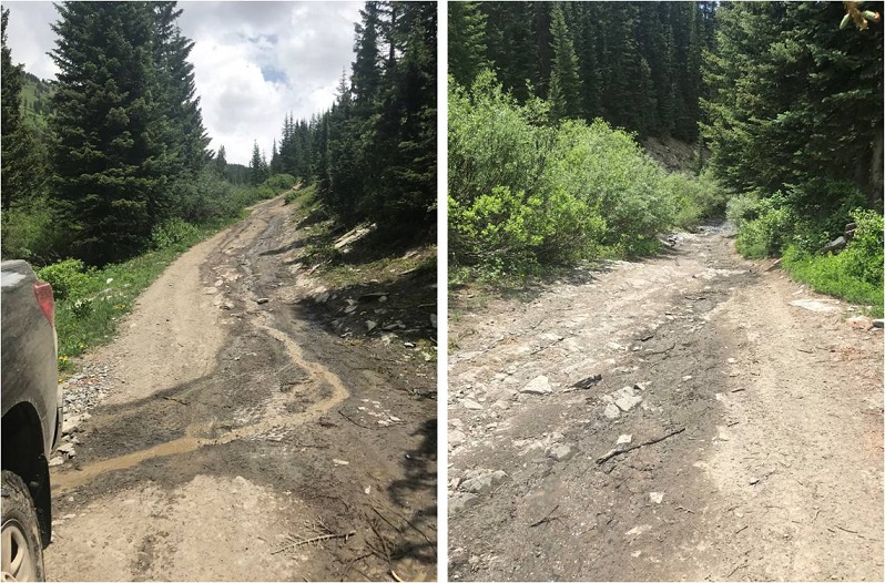
The road itself wasn’t that difficult with a 4WD (I wouldn’t attempt in a 2WD), and my Tundra handled it just fine. The only problems I can foresee would be passing other vehicles.  Luckily there are a lot of small turnout areas on this road, especially before and after the committing areas.  I drove in at night to ensure I wouldn’t need to pass oncoming vehicles, which I knew would be problematic in my big truck, no matter the size of the other vehicle.

Since I drove in when it was dark I wasn’t able to see the Crystal Mill, but I expected to see it on my way out the next day.

I made it to Crystal around 10pm on a Thursday night and all the lights in the ‘city’ were out. As I passed the Crystal Mill I saw a sign saying Lead King Basin was closed, so I dimmed my lights and parked at the east end of town, mentally calculating the extra mileage and what time I needed to start in the morning.  Looks like I was getting about 3.5 hours of sleep.

As I was preparing to go to bed (my lights were out) I saw the lights go on in the second story windows of a cabin across the street. The two story 18th century style wood cabin had two tiny windows upstairs, covered in lace curtains.  The light from the windows was glowing pale blue, and I saw the silhouette of a woman walking around.  She was wearing a long nightgown and her hair was pinned up in a bun.  The woman slowly walked around the room, picking up objects and setting them back down.  Then the lights went out.

I set my alarm for 2am. When I woke up I crawled from the back seat into my front seat and started putting on my shoes.  I didn’t need to turn on any lights because the full moon was shining bright enough to allow me to see.  I saw a fox run down the center of the road, and then noticed the lights in the second story window of the house across the street turn on.  Once again I saw the silhouette of a woman walking around.  She was wearing a long nightgown and her hair was pinned up in a bun.  She slowly walked around the room, picking up objects and setting them back down.  Then the lights went out.

Whoa. That was spooky.  I knew I hadn’t woken her up because I hadn’t made any noise, opened any doors, turned on any lights, etc.  I was going to have to investigate that house in the daylight upon my return because that was just… weird.  I mean, what are the chances she was up at 10pm and 2am, just like I was?  Also, how many women still wear nightgowns to bed?

Ok, so I was on the trail at 2:15am. It was a 2 mile hike to Lead King Basin along a 4WD road that didn’t offer many turnouts, but was indeed open and my truck could have made it just fine to the trailhead.  Oh well, I was getting in 4 extra miles today.

2

The trailhead was about 2 miles from Crystal. I didn’t see any of this in the dark (these signs seriously need reflective elements to them for us who start before daylight).

3

There’s a nice junction where you turn left to head up and around the north end of Lead King Basin to Geneva Lake

4

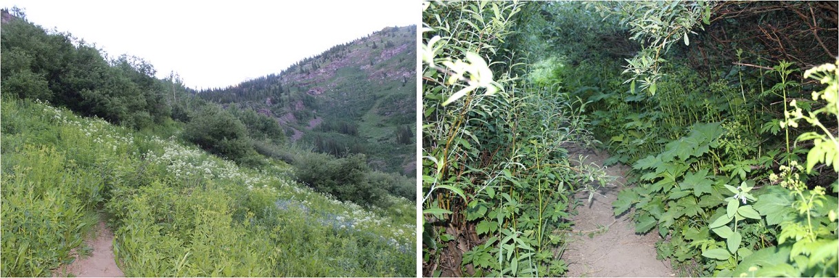
Here the trail was quite overgrown with flowers, plants, and trees. I thought to myself how it felt a little like being in a rainforest, and how much fun the flowered areas would be on my way back (I’m not a fan of flying-stinging insects, so I was being sarcastic).  On the positive side: no mosquitoes!

5

It was in this area I saw my first ever porcupine on the trail. I see them along the side of the road when I’m driving to trailheads quite a bit, and one time I heard one under my truck at the Grizzly Gulch trailhead and had to fend it off in the middle of the night, but this was the first one I’d encountered on the trail.

He was just sitting there, staring at me. So I talked to him to get him to move.  He turned around and waddled ahead of me, staying directly in the middle of the trail.  I didn’t really want to follow a porcupine to the lake, so I talked a little louder to him.  He scurried into the bushes and I immediately realized the error of my ways:  now I couldn’t see him and didn’t know where he was.  I didn’t want to experience porcupine quills and all that entails, so I nicely talked to the porcupine in a sing-song voice as I passed where I’d last seen him, crossing my fingers I hadn’t made him mad/scared and that he wasn’t sitting in the bushes:  poised to shoot.

Mission “pass the porcupine” accomplished I continued on to the lake. The moon was full and bright so I conserved flashlight battery and hiked by the moonlight.  Just as I made it to the lake I heard a faint barking in the distance.  I was worried there was a lost dog out there somewhere (hey, it’s happened) but as I rounded the bend to the lake the barking got louder, and then I saw a flashlight turn on.  The owner was pointing the flashlight in the direction opposite of me, and the dog was starting to bark really loud.  I yelled up at them “It’s just a hiker!”  I received no response, but the dog stopped barking and the flashlight turned off.  It was about 4:45am.  I immediately felt more secure hiking in the dark:  I was pretty sure there wasn’t another animal in the area, as that dog would have been alerted to it.

Just north of the lake the trail continues north and then there’s a stream crossing. There were tons of areas to cross here, and all required taking off my shoes.  At times the water was knee deep (I’m 5’4”), but mostly it was just high on my shins. Also, it was cold.  When I was done my water shoes were quite muddy so I left them on a rock to dry and to pick up later.

6

This is where my trip report diverges from some of the more popular field guides. I took the 1st west side gully to the southwest ridge. 

I crossed the creek and headed north for about 100 yards, looking for a gully to my right (west gully). I’d seen pictures of the access gullies on the east that were still full of snow, so by taking the west side I was hoping to avoid any snow filled gullies.  I wasn’t disappointed.  Here’s the gully I took:

7

This gully was steep and loose. I did not feel comfortable sticking to the scree in the middle, so I stuck to the right side where the rocks were larger.

8

My goal was to gain the ridge as quickly as possible, aiming for this small saddle

9

Here’s looking back on the route

10

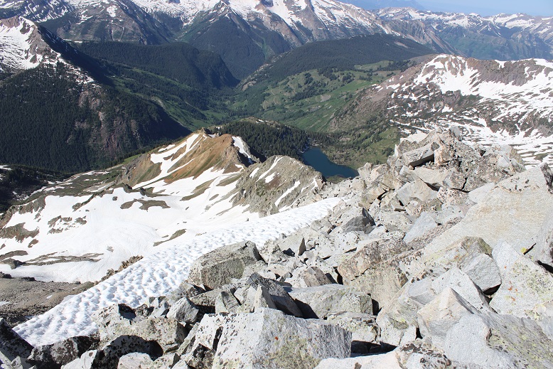
From the small saddle you can see Hagerman Peak

11

I turned left (north) and faced a class 3 section and headed up and over the ridge.

12

At the top of this point I could see the rest of the route before me

13

It’s important to note if you’re attempting this ridge to start early and make sure you have a large weather window. This ridge is very committing.  I went at it slowly and carefully.  The rocks here crumble:  I’d find a hand hold, grip, and the rock would crumble in my hands.  I had to make sure to test out each hold several times before using it to secure myself.  Luckily, the ridge was snow free.

14

This is definitely a ridge you take by… sticking to the ridge. I was able to go directly up and over most areas, dipping to the left or right just a couple of times.  As I ascended the rocks stopped crumbling and started tipping a bit (nothing fell, but not much was stable).  Here’s the final push to the summit.

15

I made it to the summit at 9:10am

16

Hagerman:

I started the ridge at 7:15am and ended at 9:10am, making this a 2 hour ridge to cross. Here’s looking back at the route

17

The day was absolutely beautiful and it was still early morning so I considered traversing over to nearby 14er Snowmass Mountain. I’d done a lot of research and came up pretty empty with details, but I knew it could be done.  I spent quite a bit of time looking around at possible paths before deciding if I was going to attempt traversing or not.  I looked at Snowmass Mountain’s east side:  nope, that was a no go. Tons of snow and no way I could see to begin from the summit. Next I looked to the left (west).  A lot less snow but the shadows weren’t helping much.

18

I stopped and did a lot of thinking here. I knew the traverse was possible.  The rock looked loose, but I could also see goat trails (or maybe those were gullies…).  I was confident I could find traction in the dirt.  I mentally calculated how much time I had, the weather, and looked for exit strategies in case I got to a place where I couldn’t continue.  I decided both time and weather were in my favor today so I decided to go for it.

Note: This may not be the safest way to traverse from Hagerman to 14er Snowmass Mountain. For me and my abilities, it was the safest way on this particular day.

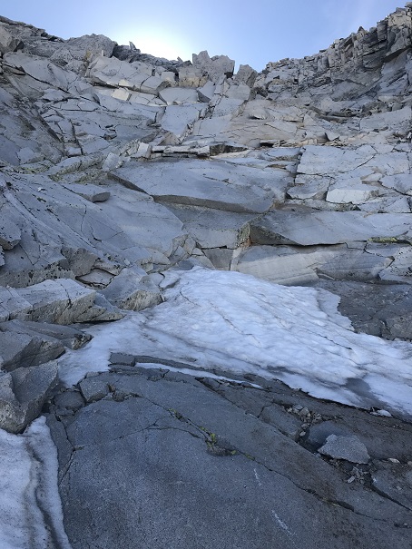
The first move committed me to the traverse: I down climbed about 50 feet of… this.  I’m not sure I could have climbed back up this wall. (Ok, I could have or I wouldn’t have climbed down, but it would have been a lot of work).

19

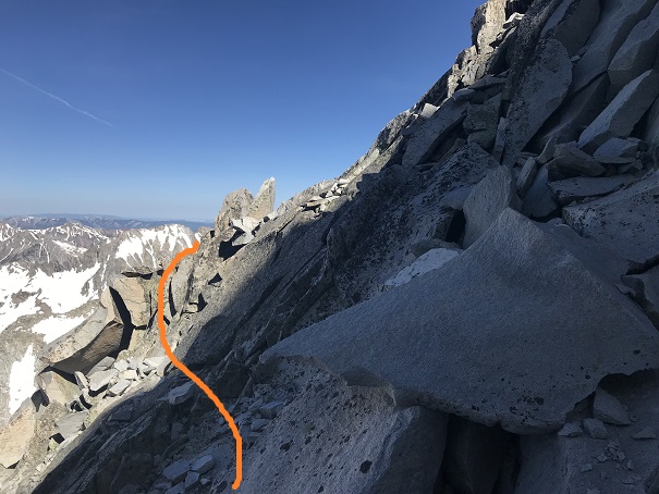
I turned and looked towards Snowmass Mountain. This is what I saw. So I headed northeast and rounded the corner.

20

I was taking this one section at a time, focusing on what was directly in front of me but glancing up at the rest of the route every so often to make sure I was on course. I found myself trying to stick to the ridge, but that is not the way to do this traverse:  you need to drop down much lower than you want to.  Every time I tried to regain elevation I was forced to head back down.

21

22

My advice is to descend lower than the saddle, and then take the scree line up to where the trail connects with the east route. The best terrain was consistently 100-200 feet below the ridge.

23

24

Once you connect with the ridge where the east route links up you can easily follow the cairns to the summit.

25

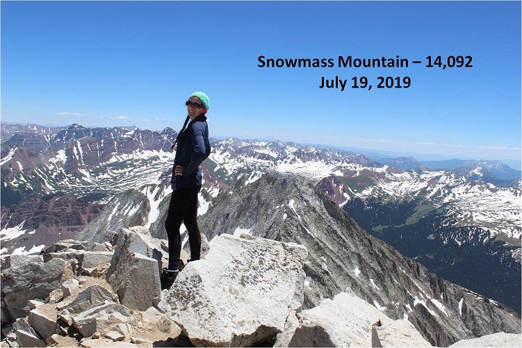
This was a very slow climb. Everything was loose and what wasn’t loose was scree.  I took extra time to be careful with each and every step, and kept the entire route in view as often as possible.  I most likely made this take longer than necessary, but I stayed safe.  I made it to the summit of Snowmass Mountain at 12:50pm, making this a traverse that took over 3.5 hours to complete.  Here’s looking back at the route

26

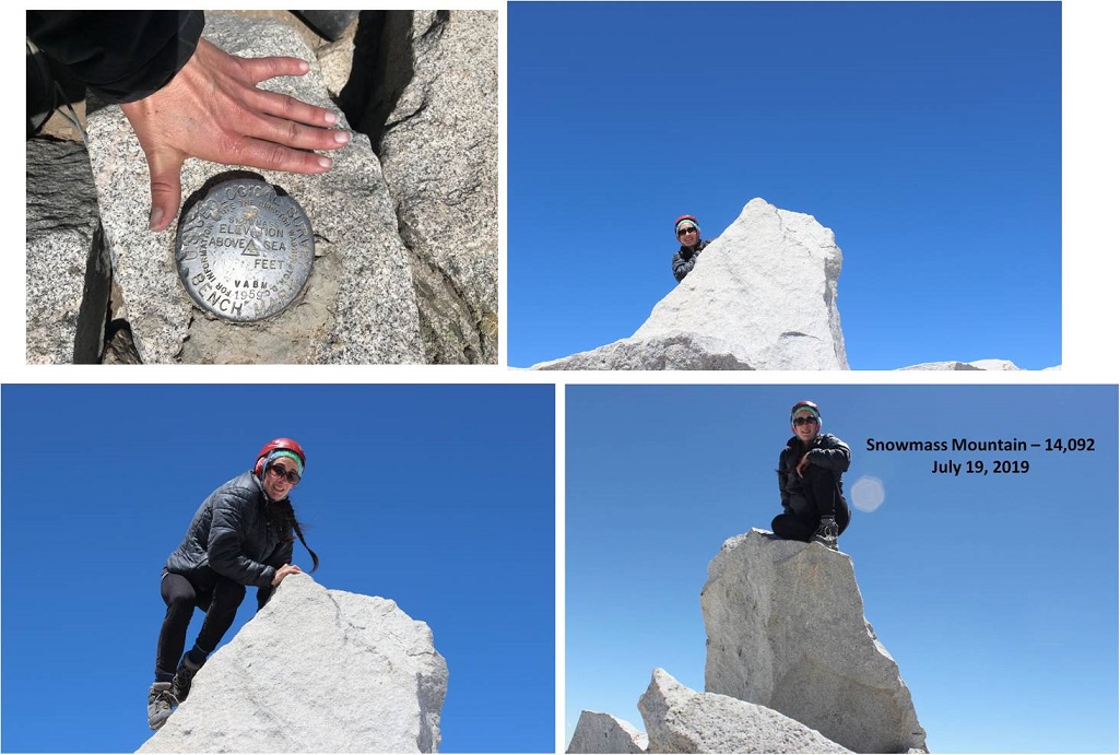
Summit photo

27

Summit Video

I spent a lot of time on this bluebird day taking pictures. It’s harder than you think to set an automatic timer and then scramble up to the summit block.  It took a few tries… and the ones that actually turned out were fuzzy, so I gave up.

28

After spending much more time on the summit than necessary I needed to make the decision of how I was going to head back down. I’d been hoping, similar to the west side of Hagerman, that the west side of Snowmass Mountain would be free from snow.  No such luck.  There was still snow in the gullies.

29

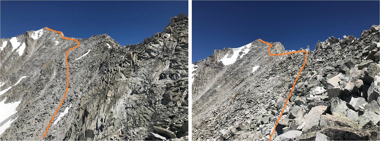
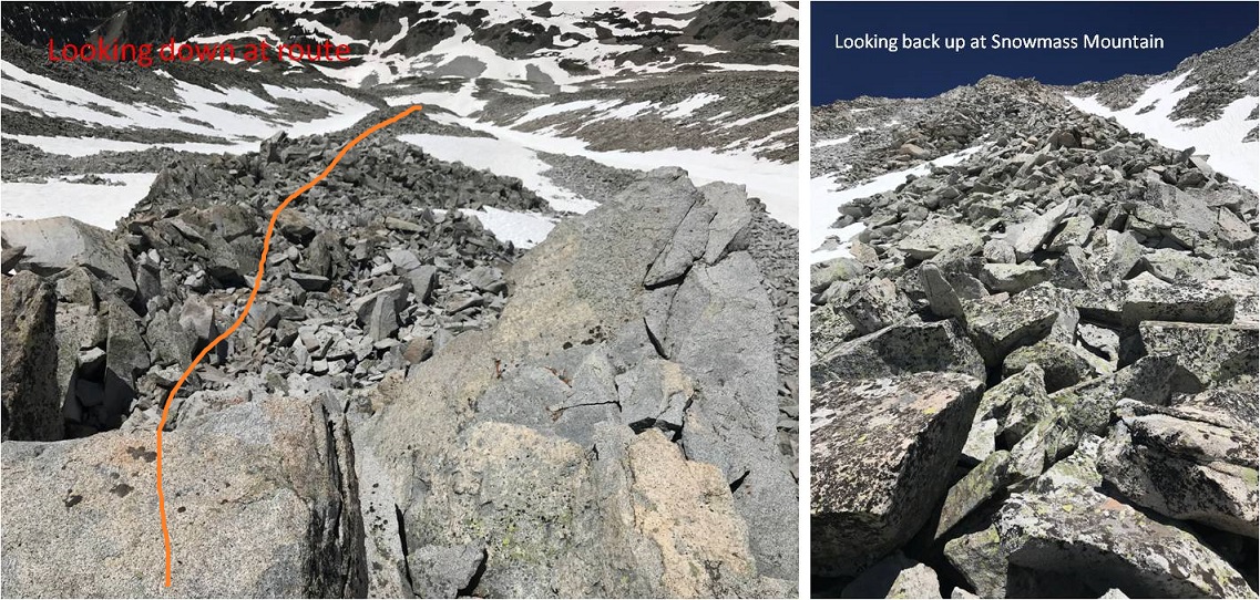
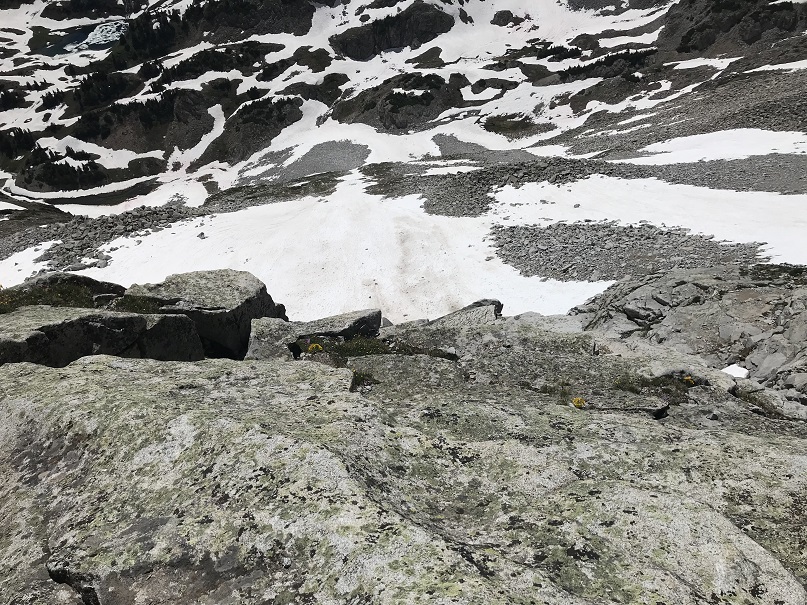
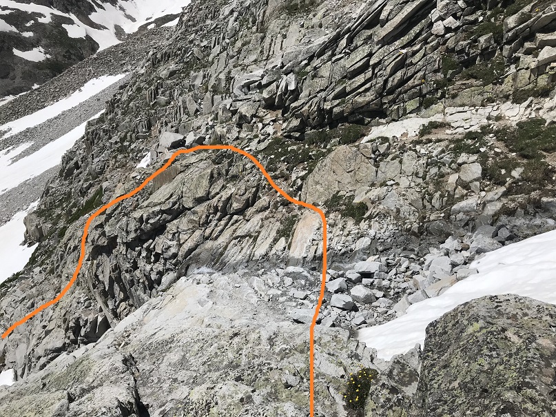
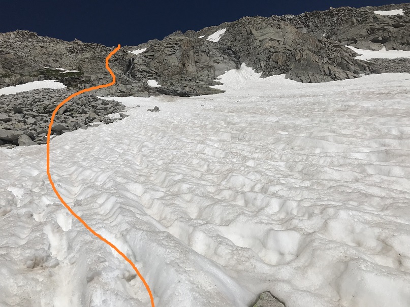
I did not want to do the traverse back to Hagerman because that and another 3 hour traverse would have been exhausting. I could tell the gullies on the west side of Snowmass Mountain ended/cliffed out in a waterfall area, but I could also see bare rock I could traverse either north or south to connect up where I needed to be.  I decided to head down Snowmass Mountain’s west side, but for safety I would slightly alter the traditional route.  It was too late in the day to safely take the gullies, so I was going to take the rock rib that wasn’t a rib but a bunch of loose rock that bulged from the mountainside.  Here’s the route I took

30

Do not let these photos fool you: this is where I encountered the loosest rock of the day.  These rocks are the size of refrigerators and tables.  Every 3rd rock would tip, and I would think to myself:  “That’s a lot of rock to tip!” Luckily not one rock actually tipped/fell/tumbled/caused a rock slide.

31

This was a very slow process but eventually I made it to the waterfall area. My feet were starting to hurt at this point from all the rock work.

32

The snow ended just at the waterfall and surprisingly I crossed the waterfall pretty easily here and headed down. I made it down to this area at 3:30pm.

33

The snow started up again after the waterfalls

34

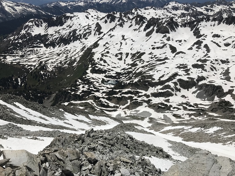
From here I looked down at the basin, and unfortunately there was a lot of snow covering the trail I was supposed to take back to Geneva Lake. That snow was going to be several feet of mush at this time of day so I decided to traverse south along the mountainside, looking for a safer route down.

35

36

I made it here and unfortunately cliffed out yet again… but I could see where I needed to be:  That goat trail should get me down.
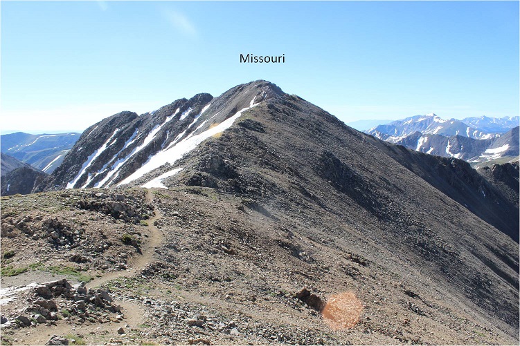
37

After searching around for a bit I was able to find a way off this spot by circling the area to the north and down the small cliff

38

From here I followed the goat trail that went down a forested gully and came out ready to exit and head towards Geneva Lake.

39

The area through the trees to the stream crossing was wet.

40

At the stream crossing I reconnected with my water shoes. They were now dry but had been scattered and were now no longer sitting on the rock together but in the grass a few feet apart.  I changed out of my shoes into my water shoes and crossed the creek

41

I’m ashamed to say the creek ate my water shoes. Seriously.  The banks were quite muddy and during the last two steps my water shoes got sucked off my feet and into the muck.  I spent 20 minutes trying to dig them out with my ice axe, but no dice.  I couldn’t find them.  They were buried in the banks of the stream.  Ugh.  From here I sat and put on my shoes and new, dry socks.  I looked back at the route I’d taken to Hagerman.

42

My feet were hurting, and I still had 4 miles to go. Time to hit the trail.  I skirted the lake and headed back towards Lead King Basin.

43

One great part of this hike was being able to see the waterfalls. And, since it was so late in the day: no bees!

44

At the base of the waterfalls the trail was running with quite a bit of water.

45

In the daylight I could see the upper 4WD trail to Lead King Basin

46

This is where my feet really started burning. I was surprised, since I’ve done more challenging hikes with greater mileage/elevation gain than this one, yet my feet were very sore.   I made it past the Lead King Basin trailhead as the sun set and each step I took hurt more than the last.  I wanted to cry.  I’ve never felt foot pain like this.  Also, I’d been hoping to stop in Carbondale tonight to get Subway for dinner, but it looked like I wasn’t going to make it back in time for that to happen.

It seemed as if it were taking forever to reach Crystal. I eventually came across a sign that said “Private Property next 2.5 miles” and mentally freaked out for a second.  There was NO WAY it was 2.5 miles to Crystal!  Not only could I physically not make it 2.5 more miles (My feet! My feet!!!) but I was pretty sure it had been 2 miles to the upper trailhead.  Had I been wrong and it’d been 4?  Ugh, I needed rest and I needed calories because my mind was playing tricks on me.  Luckily it was only half a mile past that sign to the town of Crystal.  I finished this hike at 8:45pm, making this a 15.5 mile hike/climb with 6211’ in elevation gain in 18.5 hours.

47

48

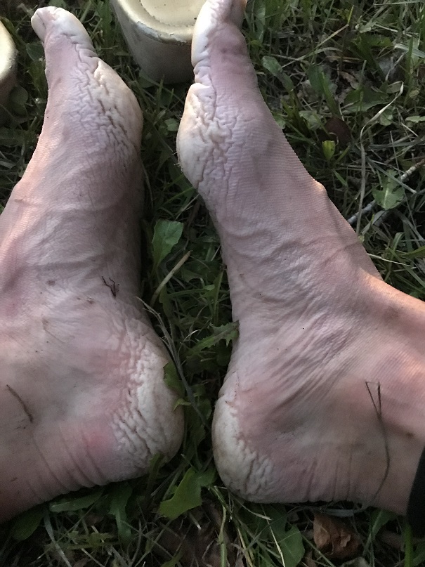
Read on for gross feet pictures and segue into the next hike…

I limped to my truck and sat down by a small access creek about 1 foot wide on the side of the road. I took off my shoes and gasped:  Yuck!  My feet had never looked like that before!  The heels and pads were completely swollen and red/gray, and very painful to the touch (no blisters though).

IMG_5160

I decided to wash them off in the water.  I placed them both in at the same time and immediately felt relief, and then 2 seconds later started screaming because they started burning as if I’d placed them into a pot of boiling water.  My feet turned bright red and were rendered useless.  Seriously.

I couldn’t walk the 5 feet to my truck so I sat there for half an hour in the wet creek bank and thought about what I was going to do. I was supposed to drive to the next trailhead for my hike tomorrow, but doing the math if I left now I would get there and only have 1 hour to sleep before starting again.  This hike had taken much longer than anticipated.  I’d only had 3 hours of sleep last night so it was a bad idea to try to drive and then hike at this point.  Also… my feet.  I wasn’t sure they’d function tomorrow.  They needed time to dry out.  But long distance runners/thru hikers have this stuff happen, right?  They just tape them up and hike/run anyway.  I decided I was really, really tired and should sleep before attempting anything.  I’d adjust my schedule as needed.

I had pain killers but decided not to take them: I wanted to be sure of an accurate pain level when I woke up so I could plan my day accordingly. Unfortunately, I never really made it to bed.  I crawled into the cab of my truck, thankful I hadn’t rolled up my sleeping bag this morning.  I tried to nap but even though I was exhausted I couldn’t get myself to fall asleep.  After 2 hours I gave up and decided to drive home, with the added bonus of doing so in the dark late at night so I most likely wouldn’t need to pass anyone on the shelf road out.  My feet had dried out a bit and were raw but less sore.  They still overreacted every time I tried to use them.  My right foot was healthier than my left; I couldn’t press down on the pedal very hard, so I drove slowly, but I made it.

Oh, and since I’d returned in the dark I never got to see the Crystal Mill, or get a good look at that old house with the lady in the windows…

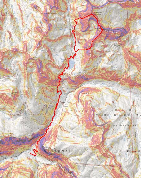
Sheep Mountain – 11,660

1

RT Length: 5 miles

Elevation Gain: 1659’

I really did’t want to write this one up because I made some amateur mistakes, but I also learned something, so here it goes…
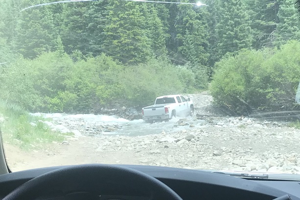
My goal today had been 13er Centennial Hagerman Peak. I drove from the Cathedral Lake Trailhead and set my GPS to Geneva Lake, where the trailhead was supposed to begin.  Just after the small town of Marble (which had tons of marble statues on front lawns) the road became rough and honestly quite fun in my 4WD Tundra.  The dirt road was narrow, and I had to pull over a few times to let OHVs by, but all in all I was having a great time.

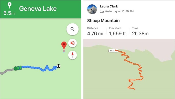
I came to a stream crossing and looked at my navigation. I was 5.5 miles from the trailhead.  Not bad.  Even if I decided to stay where I was and camp for the night I could still do the hike in under 20 miles.  Totally doable.  It’s important to note at this point I had no signal, so I was just going off this picture of my location (which rotated as I drove).

2

As I sat in my truck eating dinner (I’d found a Subway on the drive in) I watched several vehicles attempt to cross the creek.

3

The water was just to the top of most of their wheels. The OHVs were lower to the ground and thus their occupants got soaked.  The vehicles did just fine crossing though.  I watched a GMC truck get stuck, but after some back and forth action it was able to get unstuck.  Then I saw an F150 cruise across the stream and thought “My truck can do anything those trucks can do and more” so I put it in drive and crossed the stream, no problem.

4

About a mile and a half up the road began to get rough. I’m talking closed upper south colony lakes trailhead rough (the part you can no longer drive on).  My truck was handling just fine, but huge boulders and water were increasing on the trail and there weren’t many (any) places to turn around, so I used a switchback to reverse my course and ended up parking back at 9960’.  I was pleased with this spot, as I was now 4.2 miles from the trailhead.

5

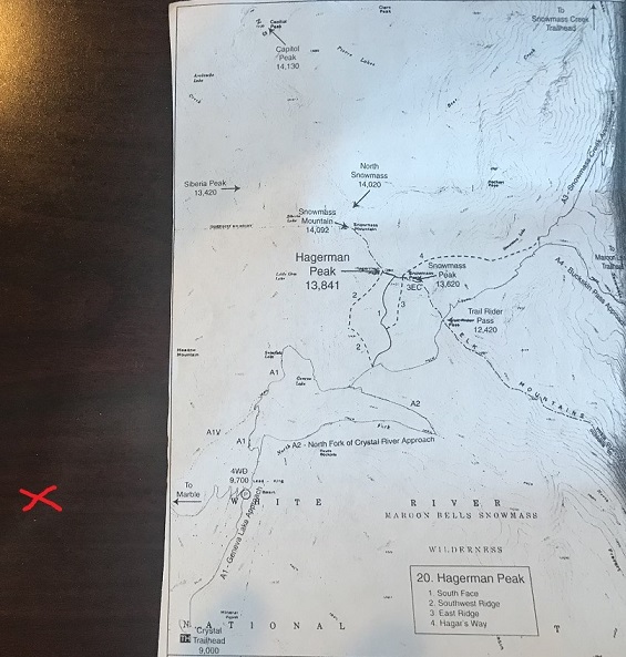
I got out my topo and did my best to guestimate where I was on the map. Unfortunately I was pretty sure I was currently “off map” at this point, but figured I was about here (red x). I realized later I was indeed correct in my assumed location.

6

Had I had a better topo or cell service I would have realized my mistake instantly, but going off of what I had I was sure of my current location (and actually, I was). I just needed to follow the 4WD road to the trailhead and I could pick it up from there.  I had several great topo maps that started at the trailhead, as well as a pre-loaded GPX file.  I spent the next 15 minutes or so going over the route again, and calculating how much elevation gain I’d add from starting from my current location. It looked like an extra 700’ each way, so no more than 1500’in total.  I was willing to live with that.

I made it an early night and woke up at 10:30pm to start my adventure. I was on the road by 10:50pm.  It started out easily enough:  I just followed the 4WD road.  I didn’t think to take out my map (etc) because I was just following the road.  After about a mile the snow started, and it was obvious no vehicle had been in this area yet this year.  Hmmm.  That was curious:  I saw a conditions report from last week stating it was snow free to the lake.  I should have stopped and reassessed here, but if I had I wouldn’t be telling this story.  Also, some people lie on conditions reports (it’s happened before).

I continued on and thought to myself “Wow! This sure does feel like more than 700’ in elevation gain! I must still be sore from yesterday.”  There was a full moon out but it was obscured by the trees.  I kept following the road through increasing snow until the road just stopped.  That was curious.  It just ended and there was no trail to hook up with it. There was supposed to be an obvious trailhead… and I’d never decreased in elevation.

I took out my phone and looked at the picture I had of where I was going, and then looked at my tracks so far. It sure seemed I was going in the right direction.  At least my tracks looked similar to the route description. The trail must hook up here somewhere close. I got out my GPS track and yes, it looked like I just had to head in that direction and I’d make it.  The problem was ‘that direction’ led me over a cliff.

I kept scouting around and found what looked like fresh tracks. Awesome!  Someone had been here after all.  I walked over to them and noticed the tracks were from a mama bear and cub, and yes indeed they looked fresh.  That did it.  I was turning back and heading back to my truck.  I did not feel confident continuing in the direction I was going, and I was sure something was wrong with my navigation (I just wasn’t sure what I’d done wrong).

I followed my tracks back to my truck and made it back a little before 1:30am. Drat.  It was too late to drive somewhere else and start another hike.  The day was shot.  What really stinks is I lost an entire day of potential hiking.  I decided to drive back home and figure out where I went wrong.  On the positive side I was the only one on the 4WD road at 1:30am, so I didn’t need to move over for any passing vehicles.

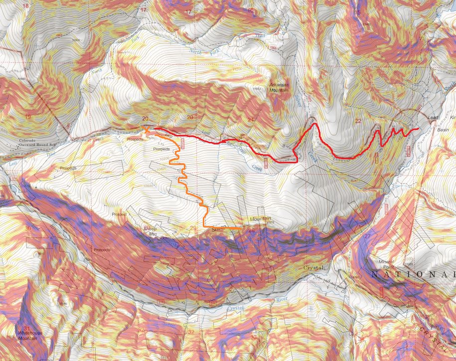
OK, so here’s what I’d done wrong: I followed the orange line, when I was supposed to follow the red line.  Note:  the orange trail hadn’t been on my map, so I didn’t even know it had been an option.  I just figured I was following the same 4WD road.

7

But if you look at my tracks, they do look pretty similar when you rotate them (which was what was happening as I was hiking)

8

On the positive side, I ended up unknowingly summiting Sheep Mountain, a ranked 11er, so there’s that. Also, I got in 1659’ in elevation gain (see, I knew I’d gained more than 700’).  So, lesson learned.  Have topo maps that cover the approach in, even when it’s on a road.  I’m going to have to attempt this one again… luckily it’s only a 5 hour drive.

Peak A – 13,952

1

RT Length:  9.5 miles

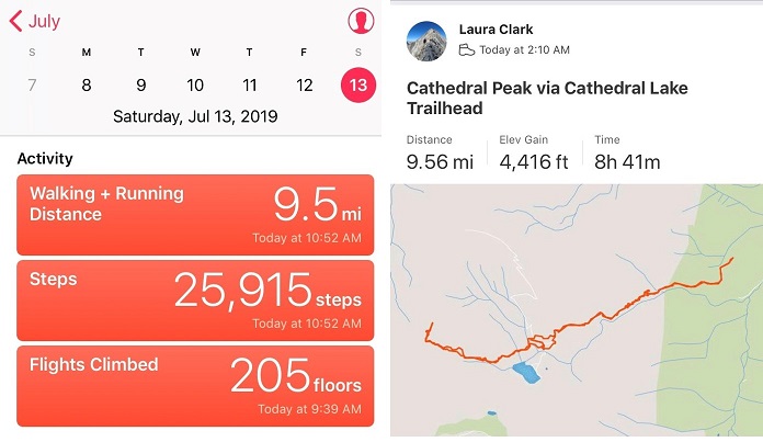
Elevation Gain: 4416

This was my second attempt to summit Cathedral Peak this year.  The first time was back in April when I had to turn around due to avy debris I was unable to navigate in the dark.  I’d read a recent conditions report stating there was now a path around the avy debris and decided to attempt Cathedral Peak on my next free day.

My sleeping schedule is currently all messed up.  I’d woken up at 2pm, took my daughter to the art museum, and then left my house at 9:30pm to make it to the trailhead by 2am.  I wanted to get an early start on this one because of the potential thunderstorms later in the day, but mostly because I was worried the snow in the couloir would soften up early in the sunlight.

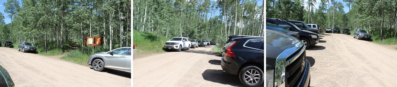
The trailhead had room for plenty of vehicles.  When I arrived, there were 4 or 5 cars in the lot, but when I left there were dozens, all lined up on the side of the road.  Also, apologies to the man I woke up who was trying to sleep in his vehicle:  apparently my trucks headlights were too bright.  I was on the trail at 2:10am.

2

The trail starts off meandering through an aspen grove.  Last time I was here this had been covered in 3-4 feet of snow and I’d missed the sign…

3

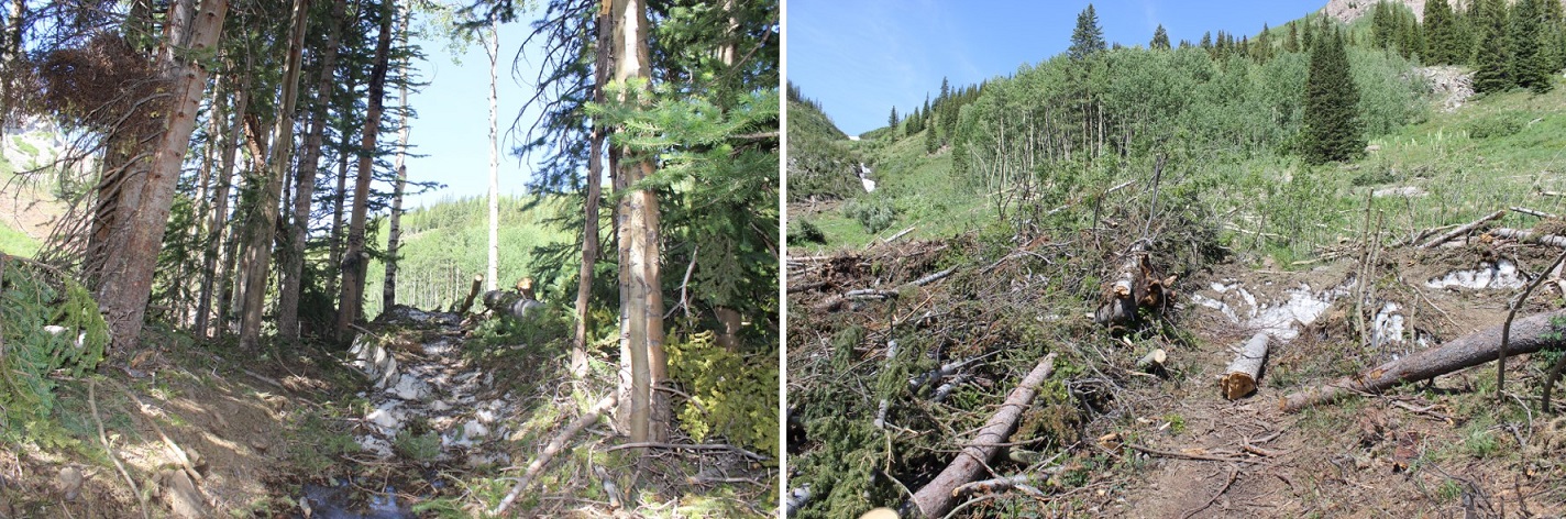
I made it to the avy debris area after about a mile and a half of hiking.  When I was here last I couldn’t see the top of the downed trees; they were supported by a huge layer of ice that was at least twice as tall as I am.  Today the area was much more manageable to navigate.

4

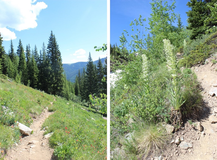
Next I followed the side of the mountain up some switchbacks on an obvious trail.  Side note:  Beargrass (the tall plant with lots of tiny white flowers) looks scary in the dark; kind of like children waiting for you silently in the night.  I like to keep my flashlight directly in front of me to keep myself from freaking out.

5

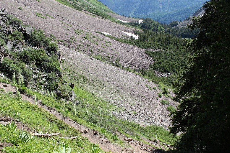
Once again, the trail is easy to follow.  Here’s a look back at the trail

6

I stayed left at this junction on the way in (but on the way out ended up coming back down the Electric Pass trail and rejoining the trail here)

7

The most difficult route finding occurred here, before the lake.  I knew I could pass the lake on either side but due to a creek crossing I didn’t want to take I navigated to the north.  I was told there was a miners trail here, but was unable to locate it in the dark.  I lost half an hour going up and down the trail, looking for the offshoot and was unsuccessful (although I did find a lot of trails that went in other directions).  Finally, I decided to just head northwest through the willows.  This sounds easy enough, but the willows here were several feet taller than I am.  I just turned my trekking pole parallel to the ground and held it out in front of me while I bushwhacked across them.  I only got hit in the face a few times (and had a swollen upper lip the rest of the day to prove it).  The good news is I made it across, and the willows were no worse for the wear.  On my way back I could see the miners trail in the daylight (more on this later).  Here’s the route I took through the willows and across the creek (which was small enough I could jump across here without getting my boots wet).

8

Next I rounded Cathedral’s east ridge and found a well cairned trail that led me into the basin

9

This trail brought me above Cathedral Lake

10

This route was well cairned, and the talus was terrible.  I got to be the first to experience the spider webs this morning.  Tons of fun in the dark!  Second only to phantom children.

11

Once in the basin you can see the route up the access gully.  Today the basin was half filled with snow and I couldn’t help but think how much easier it would have been to traverse if it had all just been snow.

12

In the morning I didn’t need snowshoes.   I made it to the base of the access gully at 5:25am and put on my crampons and helmet and got out my ice axe and garden tool (that tool’s really coming in helpful, but I may just break down and buy another full ice axe).  This is steeper than it looks, but luckily it ‘went’ all the way to the ridge

13

Here’s looking back at the basin

14

The snow was still really firm and I was unable to kick in steps but I was able to ascend with crampons and ice axe.  I was glad to have both my ice axe and (garden) tool.  I was about 30 feet from the top when I decided it was better to be on the left side of the gully rather than the right and started traversing sideways.  About 4 steps in my crampon hit the ice sideways and my boot slipped out of the bindings.  This was the worse possible place for this to happen:  I was balanced on the side of the wall of ice, with one foot in front of the other (I wasn’t able to kick in steps here, and was balancing on a very small mound of frozen snow with my right toe pointed at my left heel, sideways).  I needed to have an ice pick in the wall for balance or I was going to slide all the way down the gully.  My pulse rate quickened as I realized the severity of the situation.  Luckily I had two tools. I carefully balanced on the working crampon and tried to knock the other back into place with my ice axe.  No dice, my crampon wasn’t going back over my toe by sheer force (as well it shouldn’t;  I’d fastened it pretty tightly initially, and had no idea how it had been knocked loose from my boot).  That meant I was going to have to untie the crampon and re-tie it with one hand while holding onto the ice with the other:  Without losing my balance and sliding down a few hundred feet of ice.  It took me a solid 10 minutes to gingerly untie and re-tie the crampon, but I was able to do so from where I was perched.  I mentally praised my daily yoga routine for developing my balancing skills.  Here’s where my crampon was knocked sideways

15

Ok, crampon back on I carefully hustled my way to the top of the gully, topping out at 6:09am, a little shaky as I looked back down.

16

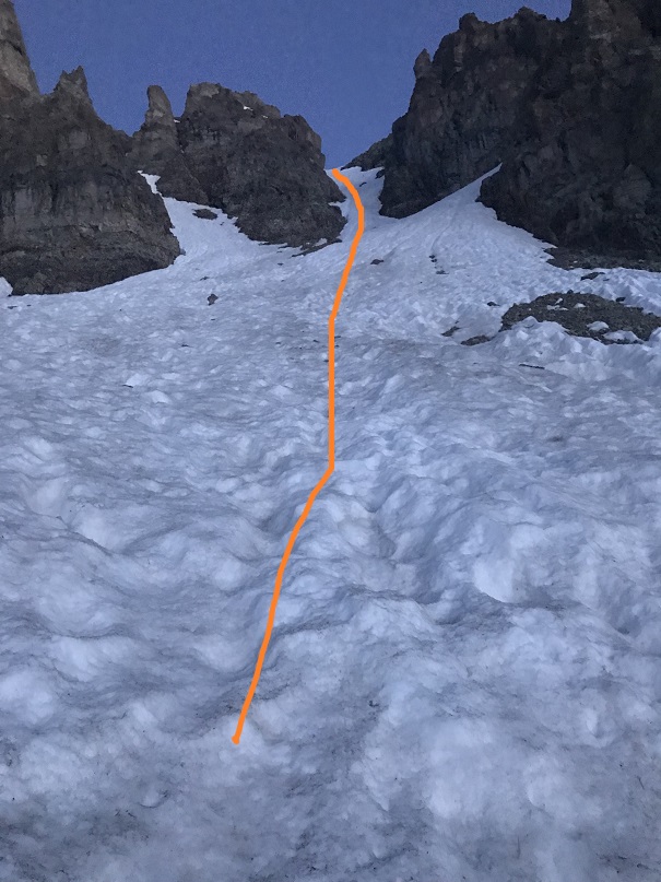
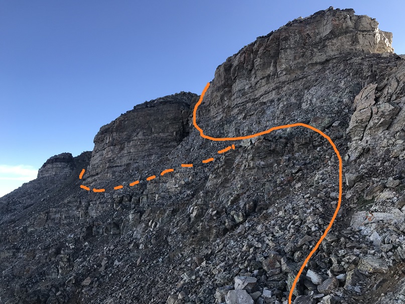
From the top of the gully I turned right and noticed the rest of the route was snow free.  Woot!  I took off my crampons and put them in my pack.  Time for some scrambling!  On the way up I took a class 3-4 route up and over the ridge (solid line) on the way down I found the cairns and took the class 2+ route along the side of the towers (dotted line).

17

The last bit to the summit was easy

18

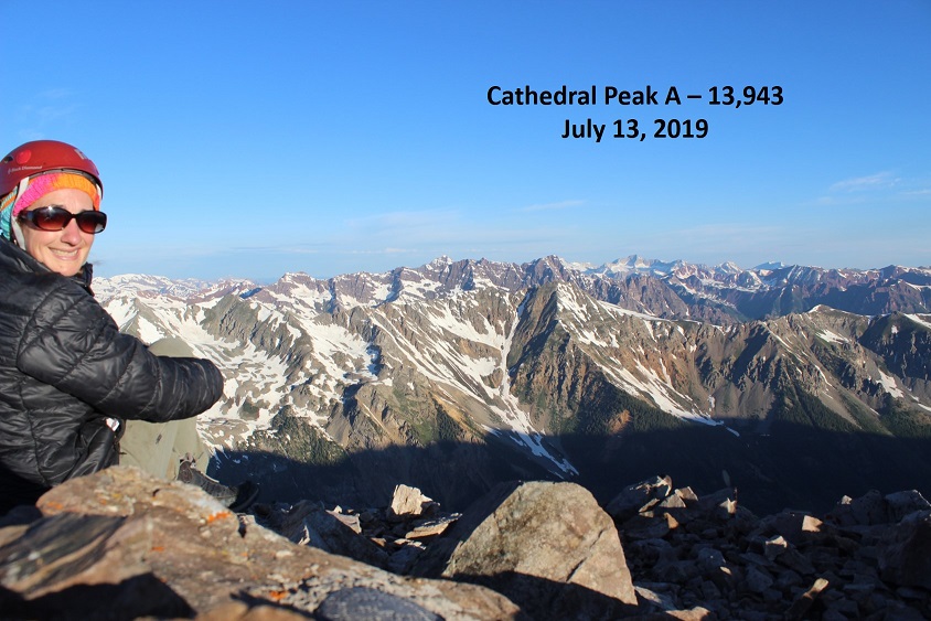
I summited at 6:40am (it took me half an hour from the top of the gully to summit).

19

Summit Video

Check it out!  A summit marker!

20

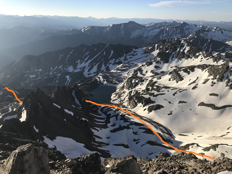
Here’s a look back at the basin and my route up to the gully

21

Time to head back down.  I made it back to the top of the gully and met 3 other climbers.  We chatted for a bit.  They said they’d kicked in steps on the way up to make their descent easier.  It was 7:20am as I headed back down the gully. On my way up I’d forgotten to put on my gloves (it wasn’t cold) and my knuckles were a bit tore up, but that’s the best way to learn a lesson.  Also, I wasn’t sure I’d have been able to untie and then re-tie my crampon with gloves on.  At any rate, I was putting gloves on for my descent.

22

I turned, faced the gully, and began my descent.  It was only just after 7am, but there was a huge difference from when I was climbing at 6am.  The snow was quickly softening up.  I was careful to either avoid the kicked in steps, or if I had to use them to make sure I only made them better, but the softening snow wasn’t making things easy.  Sticking to the climbers left of the gully seemed the best way to go.  About ¾ of the way down the snow was slush and I really just wanted to glissade the rest of the way (but didn’t because I was worried I’d mess up what was left of the kicked in steps).

Here’s the route once again

23

I actually took more time than necessary heading back down, and as soon as I could I switched out my crampons for snowshoes to exit the basin.

24

I met a man starting his climb up the gully and was worried for two reasons:  #1, the three people I’d met at the top of the gully hadn’t yet began their descent, and #2, it was rather late in the day for someone to start their climb (the snow at this point was rubbish).  I figured the trio up top must have decided to picnic at the summit and asked the current climber to look out for them.  It was now 8:25am, and I knew I wouldn’t want to begin my descent at this time.  I figured I’d timed it pretty well starting at 2am: it would have been perfect if I hadn’t spent half an hour lost in the willows.

Speaking of willows, I made my way back to the small creek crossing and in the light of day was able to locate the miners trail.  I crossed the creek and headed up the slope, aiming at a small pine tree.  From here I was able to follow a faint trail, which eventually led me to the Electric Pass Peak trail, which I took back to the junction with the Cathedral Lake trail.

25

On my way out I couldn’t help but think how dreadful this climb would have been with snow all the way up to the lake!  I have no idea how I found my way so far the first time.  Here’s a look at some of the avalanche debris

26

I made it back to my truck at 10:55am, making this a 9.5 mile hike with 4416’ in elevation gain in 8.5 hours.  The hike felt longer than it was, most likely because much of the trek out was done in direct sunlight on the way out (no trees for shade).

27

Second Attempt for the Win!


Life’s Not a Competition: I Hope We All Win

IMG_4210.JPG

Solo hiking!  So solitary, and yes, so lacking in absolutely anyone that can easily corroborate your accomplishments afterwards.

Yep, it happens. Questions about a route we took, a summit we might have missed, and fortunately, these are all usually handled so easily by simply getting the group together and comparing notes. Done. In light of everyone’s thoughts and ideas, a clear picture emerges and all questions are answered.

Not so much when you are the sole person making the attempt; sometimes there are questions. Despite Strava data, GPS tracks, and photos which all clearly paint a reasonable picture of where you were and what you accomplished, some people will still want more.

I do appreciate their comments, even the negative ones.  I appreciate them because they are making me better at what I love: summiting mountains and documenting those experiences to help others enjoy them as well.

My daughter asked me why the opinions of others mattered to me so much.  “Because the commenters are wrong and purposely trying to make me look bad”.  I’m not sure why this means so much to me, but it does.  Also, she’s right:  it shouldn’t matter if you’ve told the truth.

You never look good trying to make someone else look bad.  Successful people do not need to put others down.

We all experience judgement from others, but all that matters is the truth.  Clearly, I must be doing something worth talking about – and that’s worth celebrating! The reality is when someone creates a negative post aimed at me my website hits go up, and I get tons of positive private messages cheering me on.  In the end all of these comments make me better at what I do.  They bring up things I’d never think of, making me a better writer, photographer, documenter, blogger, and public speaker in the process.

Still, being a solo hiker/summiter means I’m often the only one who knows my experiences, so I do my best to document them as accurately as possible.  I’m human, and I’m not perfect.  I miss the photo sometimes, I don’t always see things I should, and yes, sometimes I miss the summit.  However, when these unfortunate mishaps occur I blog about what happened accurately and honestly, even if it makes me look bad.  I’ve taken wrong turns, forgotten important gear, and turned back on summits more times than I can count.  But if I wanted to, I could go back, read my blogs and list them all off because I’ve documented each and every one of them.

In the end, if you do have questions about people’s claims, ask yourself, “Why question them in a public setting?” Could it be solved by sending them a private message and getting your questions answered directly, allowing you both to save face? Why call someone out in a public forum?

Still, before you post/comment/etc., ask yourself:  Would you ever purposefully ridicule someone in person? If not, then why do it online?  If so, you might need to reevaluate your interpersonal communication skills.

For anyone wanting specific clarifications of my accomplishments, discussions of my data, GPS, or photos, I’d be more than happy to connect with you; Happy Hours are my favorite!

Life isn’t a competition:  I hope we all win.

Holy Cross Ridge – 13,850 & Point 13,253


1

RT Length: 13.5 miles

Elevation Gain: 4863’

After 2 hours of sleep I woke up at 9:30pm to drive to the Halfmoon/Tigiwon/Fall Creek Trailhead.  My kids think I’m nuts, but starting early when hiking above treeline really has its advantages.  I was afraid of encountering afternoon thunderstorms, as there was a 50% chance after noon, and while I didn’t know if I’d be encountering any snow it was likely and would soften up during the day so I wanted an early start.  The 2WD dirt road in was a little rough but easy to navigate. I arrived at the trailhead at 2:15am and took one of the last available parking spots.

2

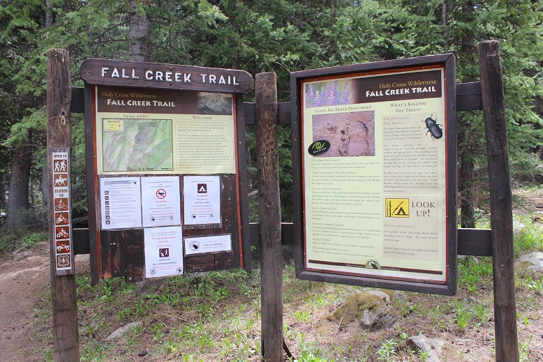
There’s a ton of signage at this trailhead and multiple routes up to the same peak(s). I chose to take the Fall Creek Trail, heading south.

3

This trail is well established and well maintained. The first half mile or so was dry

4

And then the trail was completely covered in several inches of water. I took off my boots to cross the waterfall area (about 1.5 miles into the trail)

5

6

At 2.4 miles I came to a trail junction for Lake Constantine and Notch Mountain Trail, taking Notch Mountain Trail west.

7

This trail switchbacked up the side of the mountain for another mile or so, and where there wasn’t water there was snow

8

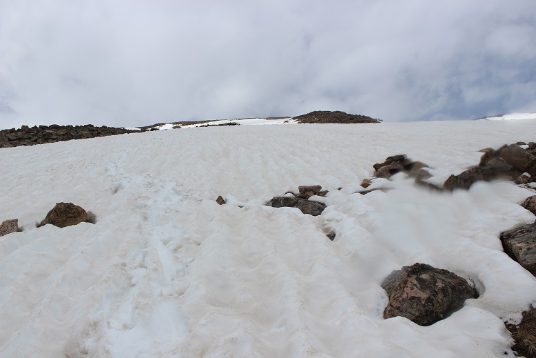
At 11,750’ I came to the base of the slope up to the ridge, and needed snowshoes

9

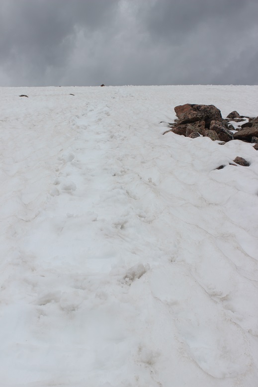
In the dark I could only see a few feet in front of me and there was a lot of snow, so here I lost the defined trail and just hiked straight up the ridge. Snowshoes were very helpful here!  It’s also steeper than it looks

10

11

12

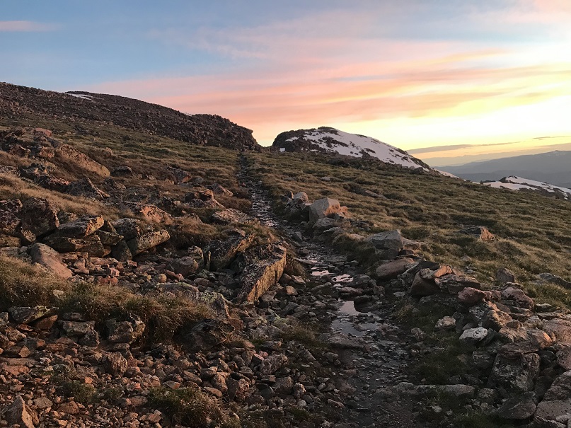
About 150’ from the ridge the snow stopped and I was able to follow a snow free trail to the ridge

13

The sun was beginning to rise, and I love sitting and watching sunrises, so as soon as I reached the ridge I ascended a small (and unranked) slope to sit and enjoy the view

14

The sunrise didn’t disappoint!

15

The best view was behind me though, of 14er Mt of the Holy Cross. Wow!  It’s beautiful in the morning light.

16

After enjoying the sunrise I walked over to the ridge shelter and was excited to find it unlocked (well, it had a lock but the lock wasn’t securing the door).

17

The shelter’s actually quite roomy, with a fireplace (not that there’s any firewood above treeline) and a great view of Mt of the Holy Cross. This would be a nice place to shelter if a storm hit the ridge.

18

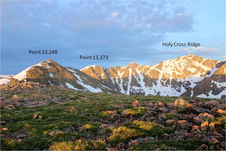
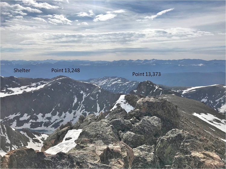
From the cabin I could see much of the rest of the route: Up Point 13,248, over to Point 13,373, and across to Holy Cross Ridge

19

The hike over to Point 13,248 was full of large rocks and hollow snow: the kind where you step on it and sink in a hole between the rocks up to your waist.  After the first few postholes I stuck to the rocks

20

I summited Point 13,248 at 6:20am

21

Point 13,248

Here’s looking back at the shelter

22

And here’s the route before me. It didn’t look like the sun wanted to peak out above the clouds this morning

23

Here’s where I got a little nervous. The ridge looked like it was covered in more snow than I’d anticipated.

24

But when I made my way down there (losing about 600 feet in elevation along the way) the ridge was snow free enough to walk across. Well, not really walk, but more like scramble up and down on the rocks.  Sticking to the ridge worked well.

25

26

I was a bit worried about the large patches of snow I saw, hoping they weren’t hollow like the snow I’d encountered higher up on the ridge. Luckily, the snow here was solid

27

This is also where the crux of the route began. The solid line is the route I took up, and the dotted one is the route I took on the way down.

28

On my way up I went straight across the slope and then up the ridge

29

If I were to do this again I’d take the route I took down up as well. I didn’t initially because the rocks looked loose and unstable, but on my way down I found them to be stable and easy to climb through.  I needed my ice axe and crampons for this part (on the way up and down) because the snow was steep.  The traverse across the slope on my way in was sketchy, as every few feet or so I’d hit an air pocket and sink to my waist.  I went slowly, seriously worried at some point I was going to slip and fall.  Once I’d traversed the slope I needed to gain the ridge.  This was steep as well.  I couldn’t have done this without my ice axe and crampons

30

I breathed a sigh of relief when I finally gained Point 13,373. That had been more difficult than anticipated.  I took a look back at Point 13,248

31

And at the rest of the route before me

32

I descended a bit, and then traversed a flat area before ascending once again. The last few hundred feet go up and down in elevation quite a bit, creating a few small false summits.  My advice is not to go straight up the ridge, but circle the mountain to the left (west), gaining in elevation as you go

33

There were several large patches of snow to traverse here as well, and just my luck, the sun started to peek out from behind the clouds, making these crossings tricky as well

34

35

I summited at 8:30am

36

Holy Cross Ridge:


Here’s looking back on the route I took along the ridge

37

Ok, the sun was really warming things up and I was debating how safe the route back down Point 13,373 was going to be with soft snow. The ridge to Mt of the Holy Cross looked quite easy, and I considered just making this a loop, but I really wanted pictures of the route I took in, meaning I was going back the same way.  Time to head back.

38

This time instead of going directly over the top of Point 13,373 I skirted the mountain to the right (east)

39

This put me at a great place to descend, so I once again put on my crampons and got out my ice axe and garden tool

40

The snow had indeed softened up, but was now perfect for kicking in steps. I felt much more comfortable traversing down than I had up, and the best part was the rocks I thought had been loose were really much larger and stable than they’d looked from across the ridge.  Here’s the route I took down

41

And now the fun part: re-ascending point 13,248

42

I skirted the summit of this one as well, sticking to the left and then heading back to the shelter

43

Once at the shelter I met a couple eating lunch and taking a break. They’d intended on hiking the ridge today as well but were turning back due to weather/conditions. I thought this was a great idea, and noted it did look like we were indeed going to get some thunderstorms today after all.

I made it back to the switchbacks and when I came to snow put back on my snowshoes. This section looks short, but it’s actually a long and steep descent (which is made ‘easier’ with the switchbacks I couldn’t see under the snow, so I just headed straight down).

44

The sun had warmed up the snow, and what had been solid on my way in was now the consistency of a slushie. Each step I took I sank in the snow past my knees, and my trekking pole and ice axe were useless.  I was sliding everywhere, and finally gave up and glissaded down.  The couple behind me kept getting their feet stuck in the snow between rocks.  The conditions were terrible, and I mentally high-fived myself for an early start:  I wouldn’t have been able to descend Point 13,373 at this time of day.

45

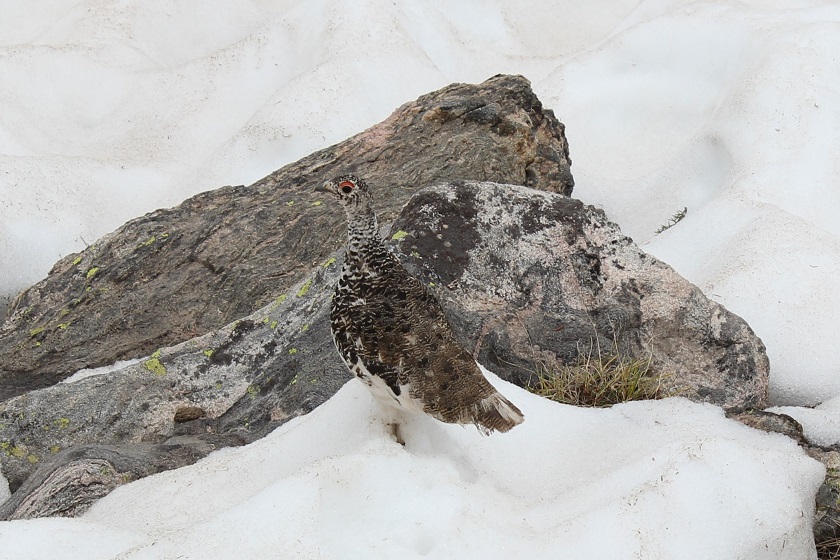
Oh, and I saw a ptarmigan. I love those guys!

46

Snow stopped at about 11,700’ and everything was wet again, including my feet. The slushy snow had gotten inside my boots and my feet were soaked through. Changing socks wouldn’t have helped because my boots were wet as well. I didn’t even bother taking off my boots for the creek/waterfall crossings because they were already soaking wet

47

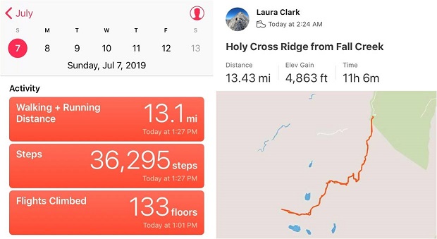
I made it back to my truck at 1:30pm, making this a 13.5 mile hike with 4863’ in elevation gain in 11 hours.

48


Half Peak – 13,866 & Point 13,164

1

RT Length: 18.5 miles

Elevation Gain: 5640’

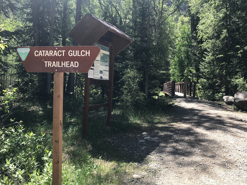
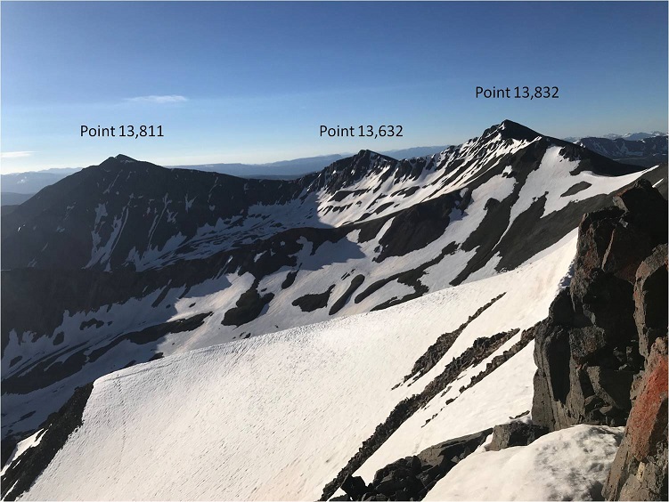
I arrived at the Cataract Gulch trailhead the day before, after summiting Point 13,832.  I was pleasantly surprised to find a well stocked and clean bathroom, as well as plenty of open parking space.   Mine was the only vehicle in the lot, despite it being 4th of July weekend.

2

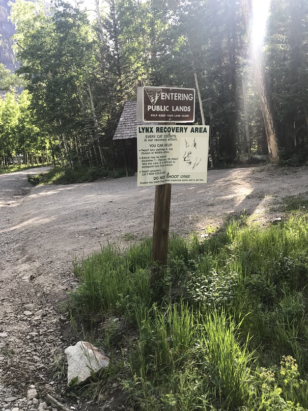
Also, apparently this is a Lynx recovery area, which I found interesting.

3

I’d ended my hike early and desperately needed to catch up on sleep, so I went to sleep around 2:30pm and only woke up twice:  once because it was too hot in my truck (the sun was going down but at exactly the right angle to heat up my vehicle drastically in just a few minutes) and another time I around 10pm. I still had over 4 hours of potential shut eye so I took a melatonin with a shot of whiskey and fell back asleep.  I didn’t wake up again until my alarm went off after 2am, so I consider it a successful night of truck camping (I notoriously sleep terribly at trailheads).

I fished around in my backpack for my flashlight and couldn’t find it.  I was sure I’d placed it in the small pocket the day before, but it was nowhere to be found. Luckily, I always carry a spare as well as extra batteries.  Immediately I remembered why I didn’t like this flashlight:  it was TOO bright.  That sounds like a good thing, but when hiking in the forest in the dark I’d actually rather not see every detail.  This flashlight was too good. I was going to have to replace it when I got home.

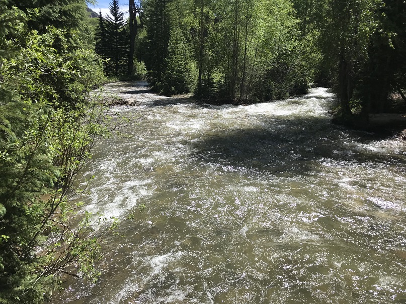
On this hike I was armed with a topo map, a compass and some beta from the campers I met last night, as well as a rough route description.  I started on the Cataract Gulch trailhead around 2:45am, crossing Cottonwood Creek on a well built bridge over a swiftly flowing creek

4

5

And then I crossed the creek twice more on well placed log bridges I had to hunt for in the dark because they weren’t on the main trail.  I was seriously worried I’d have to ford this creek multiple times before discovering the log bridges, which were (as usual) easy to spot in the daylight.

6
This trail had a trail register (Woot!  More noise!) and was easy to follow up to the first avalanche area

7

The avalanche area was very small and well packed down

8

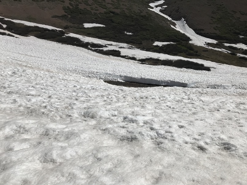
I didn’t have any difficulties until I made it to the waterfall area.  There had been a small avalanche and it looked as if the trail wanted me to cross the waterfall.  I took out my topo map and it looked too early to cross yet, which meant I’d have to follow the waterfall up for a ways first.  There was no trail so I bushwhacked in the dark up the mountainside, paralleling the creek.

9

Here’s when I came to the crux of the waterfall. It was still dark out (I’m guessing it was around 3:30am) and the waterfall was raging.  I could feel the spray of water on my face, even though I was standing several feet away.   I went right and left looking for a better way up and encountered very large boulders blocking the route in every direction.  I could tell I just needed to ascend 15 feet or so (maybe less) and I’d be where I needed to be to cross the waterfall.  It took some fancy footwork and a class 4 move, but I was able to work my way up the side of this boulder, up and over to flat terrain.  (Side note, apparently I made this too difficult and there’s an easier way I was unable to find in the dark.  Check out Angry’s conditions report for a class 2 route over the waterfall).

10

There was a camping area directly above the waterfall, and I was able to pick up a trail again.  I was already considering today a success:  the campers I’d talked to the night before hadn’t made it this far.  The trail rounded a corner and brought me to a creek crossing above the waterfall.  I had 2 options here:  either balance my way across the log and potentially fall in the water (I was carrying a full pack) or take off my shoes and wade across.   In the dark I took off my shoes and put on my water shoes (hurray for new gear and dry socks!).  Yes, I’m sure some could have walked across the log, but I decided to use the log for stability and wade across, keeping my feet dry in the long run.

11

The well established trail picks up directly after the creek crossing

12

And brings you to a boulder field

13

Just after the boulder field there’s another creek crossing.  Unfortunately, the creek was running quite high here and I became frustrated trying in the dark to find a passable route.  I noticed some cairns to the right and followed them to what looked like a goat trail through the willows.  This led me to a snow bridge that looked ready to collapse any day now, but it would get me across the roaring creek.

14

Check out the snow bridge.  I was so excited to come across this in the dark.  There weren’t any footprints from here on out, so I crossed my fingers I’d be able to find my way.

15

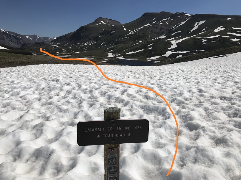
I didn’t find many pictures of this route, and to be honest route finding was difficult in the dark due to the snow, so I’m going to do my best to post some details.  I followed the well defined (when there wasn’t snow) Cataract Gulch Trail.  Just after the last creek crossing I headed south and rounded a large boulder

16

The (still snow free) trail brought me to a ravine

17

(In case anyone wants to see what the trail looks like at 4am…)

18

Here the snow picked up, covering the trail about 80% of the time.  This was both good and bad:  It was nice to see a trail every once in a while, but it was covered so much it was difficult to follow and became frustrating to someone like me who hikes on established trails when available.  Just head south until you reach Cataract Lake. It feels like you’re hiking forever, but I promise you it’s there.  My tracker showed it at 4.9 miles from the trailhead.

19

Here the birds started waking up.  This is one of my favorite part of early morning hikes!  I also saw a herd of Elk in the meadow.

Video:

Continue past the lake and you’ll come to a trail junction.  Continue heading South

20

You’ll pass a small pond on your right and head towards Cuba Gulch, which is also the East Fork Middle Pole Trail (another well defined trail when there’s no snow).

21

Follow this trail west as it hugs the side of a mountain, unfortunately losing a little bit in elevation in the process.  Here’s the general idea of where you’re headed

22

And some close ups.  There was quite a bit of snow here, obscuring the trail.

23

Here I rounded the small basin and headed to a small saddle

24

This section is steeper than it looks, and snowshoes were helpful.

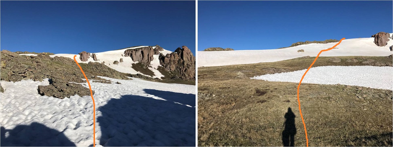
25

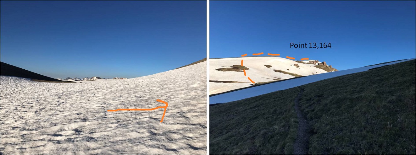
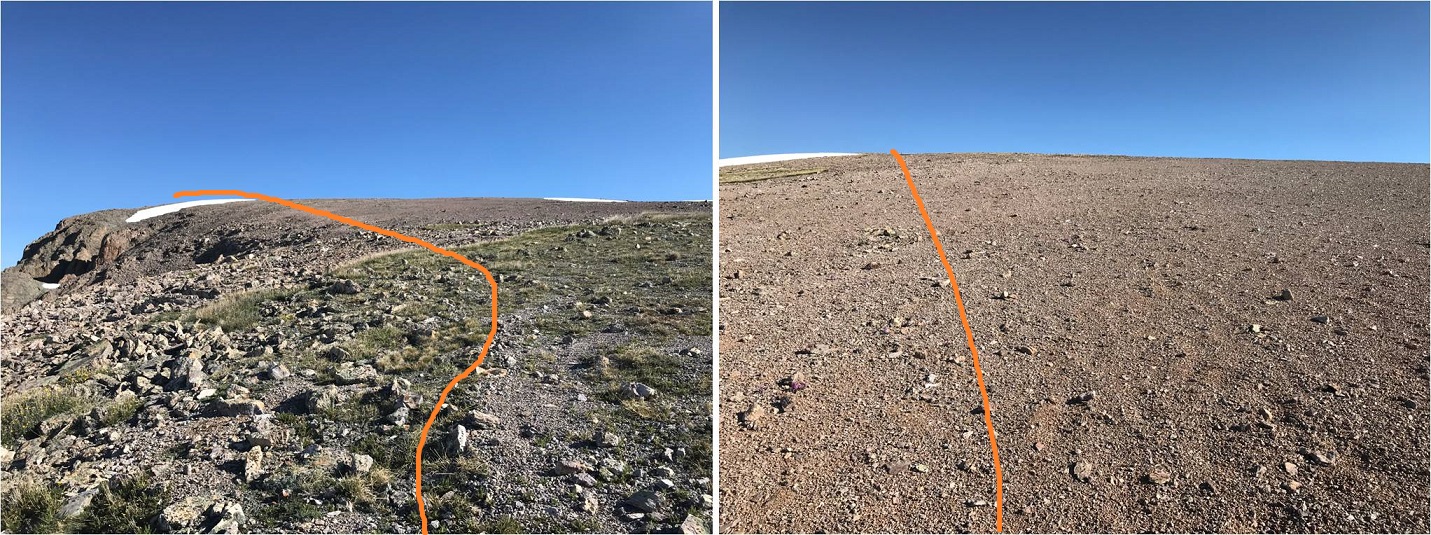
Turn right at the saddle and follow the trail towards Point 13,164.  The dotted line is the suggested route to summit this ranked 13er, but I didn’t like the angle of the snow, so I continued on the trail until I found a better way to summit.

26

This is the route I took to gain the ridge of Point 13,164:  I needed snowshoes and an ice axe here

27

At the top of the ridge I wound my way north to the summit.

28

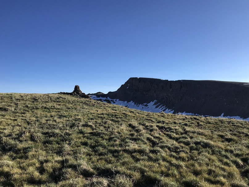
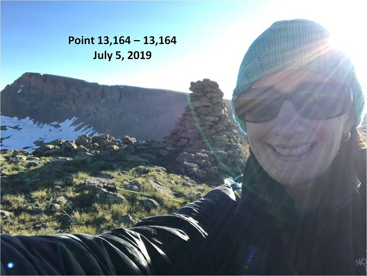
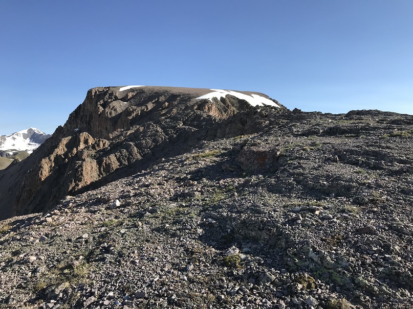
From there it was an easy walk up a tundra slope to the summit with a rather large cairn and a great view of Half Peak

29
I summited at 7:10am

30

Video:

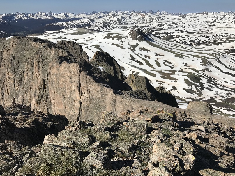
Also, the San Juan’s still have a lot of snow!!!

31

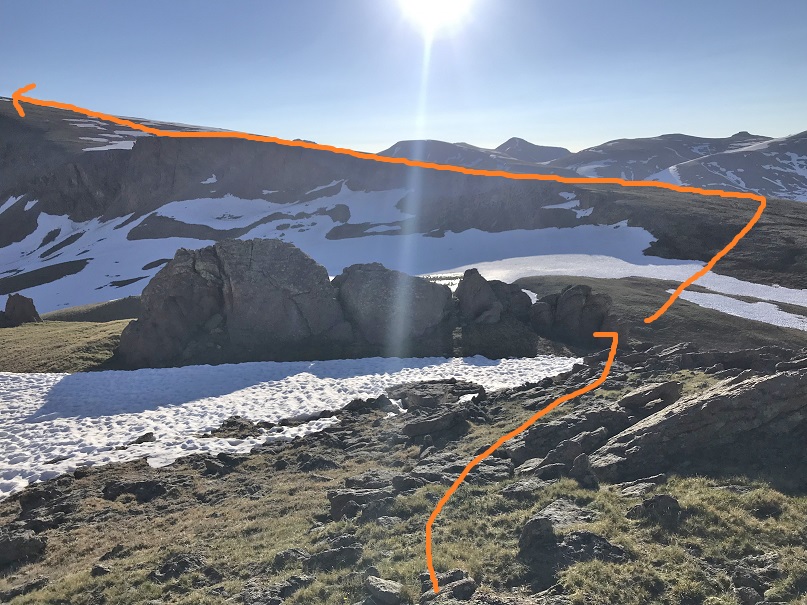
Ok, back down so I can get started with Half Peak.  Here’s the view of the way I went back down and then gained the ridge to hike up Half Peak.

32

Side note:  If you’re not interested in summiting 13,164 here are the coordinates along the trail you turn east at to gain the ridge of Half Peak

33

This is a long but gentle slope with no defined trail.

34

The crux of this route comes just before the summit at around 13,500’.  There is a narrow ridge to navigate.

35

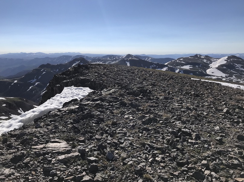
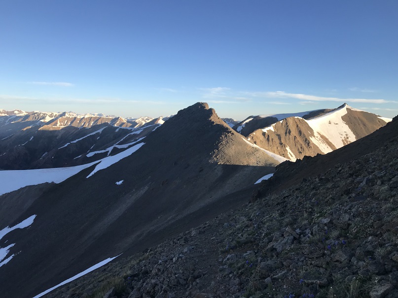
Ther37e’s a lot of exposure but I agree with Roach’s assessment this can be kept class 2 with careful footwork.  I found the best strategy was to stick to the ridge in most places, dropping down 15 feet or so only when necessary
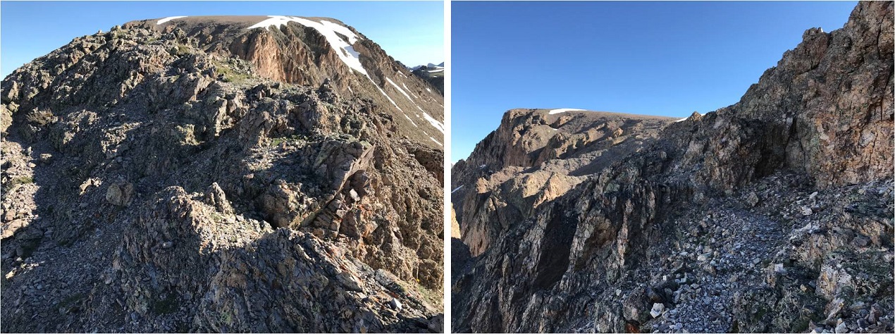
36

Here’s a picture looking back.  The ridge reminded me of the catwalk along the ridge to Eolus.

37

From here it’s an easy walk to the summit

38

The summit is large and pretty flat

39

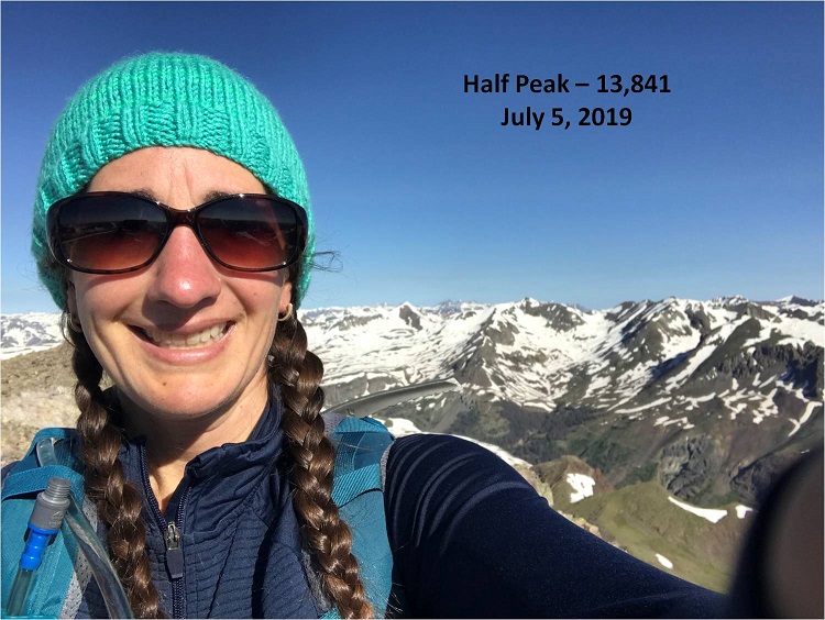
I summited at 8:30am

40

Video:

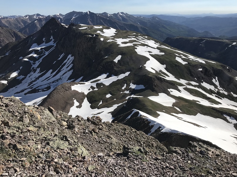
Here’s a look back on the route up the slope

41

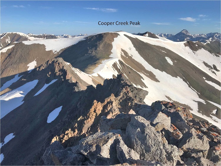
I’d initially planned on hiking Quarter Peak (a bicentennial) today as well, but in the morning I’d gotten a look at Half Peak and the decent route off Half and towards Quarter had a lot of snow.  I didn’t feel ready to commit to the descent in this warm weather.  However, looking at Quarter from Half the ridge up to the summit of Quarter looked dry enough to summit without tackling snow

42 (2)

Oh well, time to head back down.  The snow was softening up, and the snow below the saddle required snowshoes once again (more necessary this time).   In this picture you can see a river flowing underneath several feet of snow
43

Here’s a look at the route back from Cataract Lake

44

I was almost back to the river crossing with the snow bridge when I looked over at the basin and saw 3 Bull Moose enjoying lunch together in the willows!  Very cool!
45

Video :


I crossed the snow bridge, following my previous tracks.  Here I started seeing people on the trail.  I warned those with unleashed dogs about the moose up ahead and gave some people advice on how to find the snow bridge so they could hike to the lake.  Actually, the park ranger/mom in me talked to everyone on the way down, but mostly just to see where they were headed.  Today was such a beautiful day to hike!
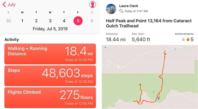
I crossed the stream above the waterfall, descended the waterfall the same way I’d ascended, and made it back to my truck at 12:45pm, making this an 18.5 mile hike with 5640’ in elevation gain in 10 hours.

46

Here’s a topo map of my route

47

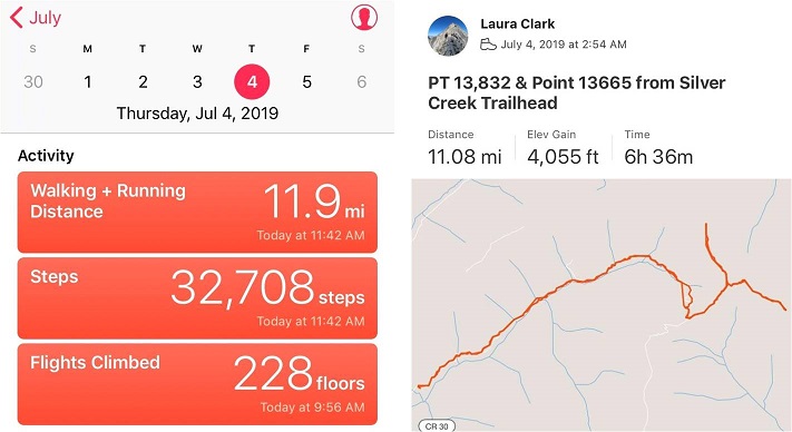
13,838 & Pt 13,665

1

RT Length: 11 miles

Elevation Gain: 4055’

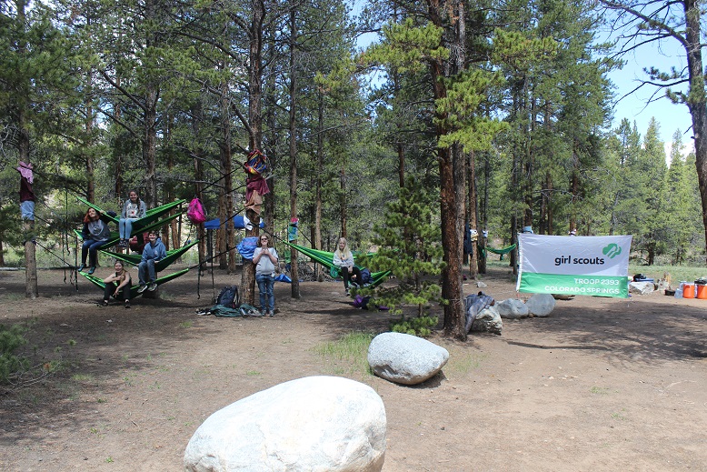
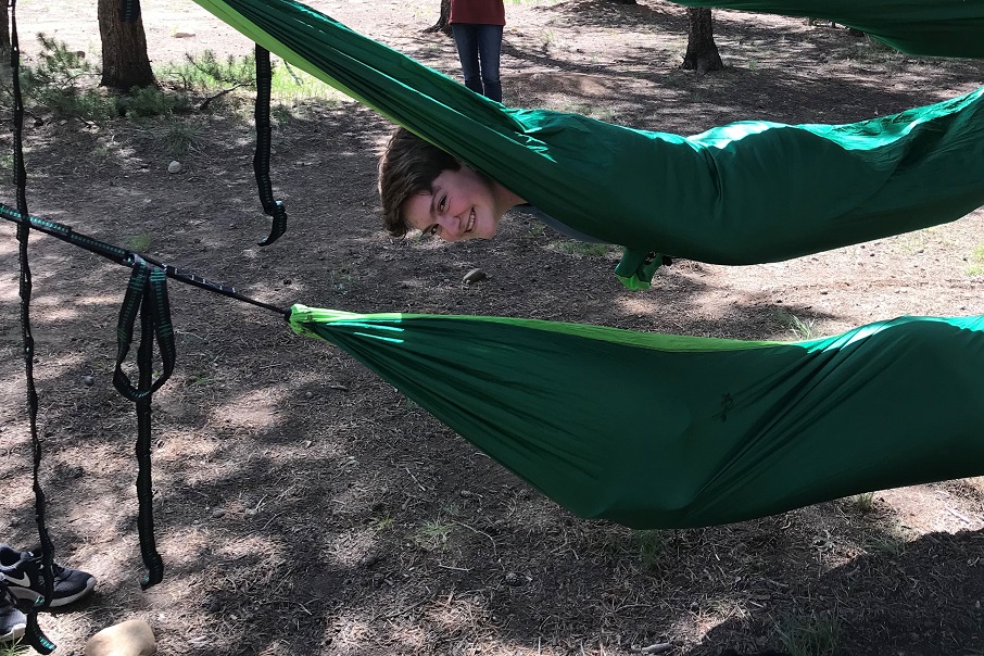
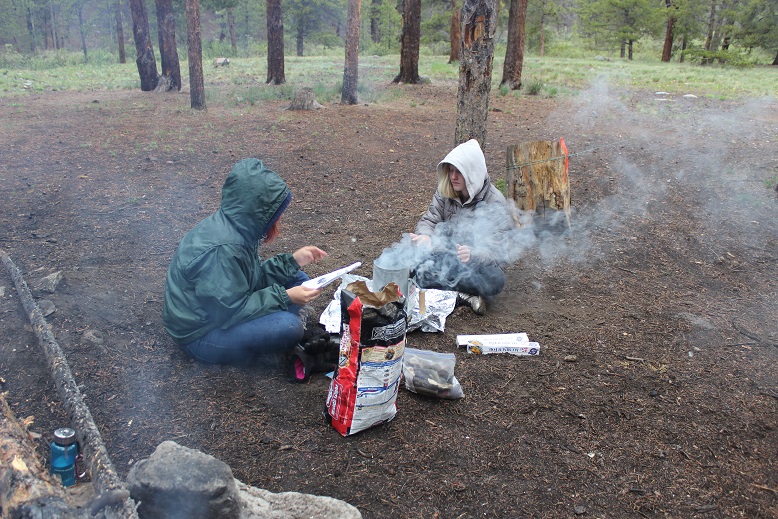
I had a totally different set of peaks in mind for the 4th of July weekend, but due to the (still) high levels of snow in the San Juan’s my plans changed a bit.  I feel a bit out of shape because haven’t been out hiking in 2 weeks: I took my Troop Hammock Camping (it snowed on us in June!) and then to Alaska/Canada for a week, staying mostly at or around sea level.  I got home the night of the 3rd late, decided to get in a 2 hour nap and was up and on the road at 9pm, headed to Lake City.  To most this schedule may seem crazy, but I suffer from nightmares when I get too much sleep so I’d rather keep myself busy.

The drive up until Lake City was uneventful, except for a cop that pulled me over doing 61 in a 60mph zone coming over a hill in Nathrop. This is the second time this has happened in the same area, which means I didn’t learn the first time.  Of course I was let off with a warning, and this time he didn’t try to give me his phone number.  Also, he had no idea where Lake City was.

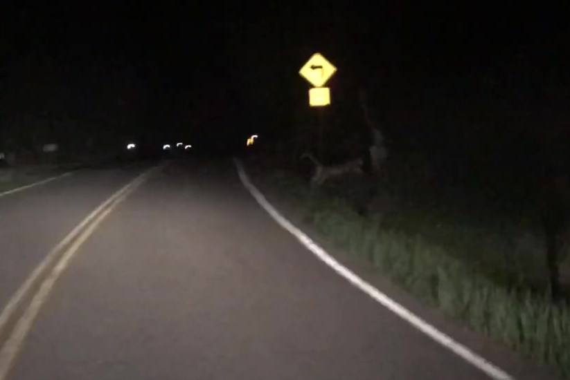
I was about 2 miles from Lake City when I saw it: My first thought was “Wow!  A mountain lion!”  Then quickly afterwards “Wait, that’s too big to be a mountain lion…” I was asking myself what animal could have a tail like that and be bigger than a mountain lion when it turned and looked at me:  White muzzle, pink nose, dark alert whiskers, and tan face.  That was definitely a mountain lion!  Woot!  And a healthy one to boot:  I’m talking African Lioness size, brawny and muscular.

I slowed down my truck to get a better look.   He(she?) was walking on the side of the road, seemingly not in any hurry.  I’ve hiked thousands of miles in Colorado, and this was the first mountain lion I’ve seen here, and also by far the biggest mountain lion I’ve ever seen.  Naturalist Nerd that I am, I’ve spent whole days at the Rocky Mountain Wild exhibit at the zoo, just sitting and watching Mountain Lions.  Those mountain lions at the zoo had pouchy stomachs and loose skin, but not this guy!  He was all muscle.

I was also a Park Ranger when I lived in California, and one time I encountered a Mountain Lion as I was leading a class of 3rd graders to the picnic area.  It saw us coming, jumped out of the tree it was lounging in and quickly bounded away (30 lunchtime 3rd graders will do that to wildlife).  While collared, that one must have been a juvenile because it had nothing in size on the one currently walking front of me.

After about 30 seconds I came to the conclusion I should try to get a picture. My cell phone was in my lap, so I turned off navigation and clumsily opened the camera app.  I took a quick video and tons of pictures and studied him until he eventually turned around and bounded up the hillside.  Imagine my disappointment when the video was too dark to see anything, and none of the pictures turned out of him sitting and looking straight at me.  The best one I got was of him jumping, which wasn’t too great to begin with.  In any event, it was a cool experience.  Lake City has some big mountain lions!

2

Video

The Grizzly Gulch / Silver Creek trailhead was full when I arrived at 2:30am and I had to get creative to find a parking spot in the parking lot big enough to fit my truck.

3

I headed northeast and was on the trail before 3am, a little jumpy after seeing the mountain lion but confident he was at least 20 miles away from my current location. I just tapped my trekking pole on every rock I saw and hoped I was scaring unwanted encounters away.  Also, there’s a trail register at this trailhead; one of those big metal ones that makes a terrible creaking sound when it’s opened and closed, and a big bang when the lid drops.  After signing my name and closing the lid I’m pretty sure I scared every creature within a couple mile radius.

4

Almost immediately there was evidence of avalanche activity along the trail, and while it was still dark and I couldn’t see the downed trees I could smell the fresh pine scent that accompanies an avalanche.

5

This is a very easy trail to follow, as it parallels Silver Creek all the way to the basin. As the trail began to follow Silver Creek I found myself walking on ice.  At first I thought the creek was frozen, but quickly realized the creek wasn’t frozen but covered in a layer of ice several feet thick.

6

The ice was solid and reminded me of the glaciers I’d just seen in Alaska. It looked like an ice flow, but was most likely caused from avalanches throughout the basin.  Mixed in were various tree branches and avy debris

7

And even areas of rockslides (the creek was flowing swiftly underneath all the debris).

8

Once in the basin I ascended the slope to the saddle between Redcloud and Point 13,561. This was fairly straightforward, and while it was covered in snow I didn’t need traction.

9

At the top of the saddle I turned left

10

The sun was starting to rise so I dug in my backpack for my camera, but unfortunately must have left it at home. Drat!  I bring along my DSLR for pictures because taking photos on a phone is difficult with Raynaud’s:  any type of touch screen is an issue as my finger touches don’t always register, but it’s much worse when my fingers are cold.  I inwardly sighed and crossed my fingers there wouldn’t be too much wind, mentally resigning myself to not getting summit photos today (or tomorrow, as I was staying in Lake City hiking for a few days).

From the saddle I could see the rest of the route before me, and rejoiced it was basically snow free!

11

I looked left and was greeted with an unexpected view: I’d planned on summiting “Cooper Creek Peak” today as well, but hadn’t realized while going over my topo map there were gendarmes and a rocky ridge involved (and I didn’t have a helmet).  Looks like I was only summiting one peak today.

12

I headed towards the patch of snow on point 13,561

13

This was easy to cross. Here’s looking back at Redcloud and the patch of snow

14

I followed a faint trail across the ridge

15

The path to the summit was tundra mixed with small rocks.

16

17

I summited at 6am, thrilled I was able to take photos with my phone (yet upset I was forced to take a selfie). Also, the sun was in my eyes

18

Summit Video

I turned to head back

19

The snow patch doesn’t look so bad from here

20

I crossed back over the patch of snow and thought again about Cooper Creek Peak. It was still really early and I wasn’t tired.  I didn’t think I could summit, but I could make it to the halfway point (Point 13,665) and add some extra mileage and elevation gain to today’s hike, helping to keep me at my 10 mile/4000’ average.  Here’s the path I took from the saddle

21

This was more challenging than Point 13,832, but in no way difficult. I just followed the ridge

22

I just kept to the left of the snow, hiking up surprisingly stable scree

23

The fun part came at the end. The actual ‘summit’ is the bump to the left

24

This ended up being quite a fun (if short) scramble to the top!

25

It reminded me a bit of the final scramble on El Diente (but with a lot less scrambling to get there).

26

Yes, there were a few chosen class 4 moves and some exposure as well.

27

From here I could see the summit of Cooper Creek Peak, and once again verified I wouldn’t be climbing the ridge connecting it with point 13,665 today (next time I’ll bring a helmet)

28

I had a really cool view of PTs 13,811 & 13,832 as well

29

Here’s a look back on the route

30

I trekked back to the saddle, having fun taking shadowselfies now that the sun was in the perfect position to do so

31

32

Back in the basin the 4th of July weekend was ramping up:  I saw a couple dozen people on their way to Redcloud.  I was glad I’d started early!  The snow was softer on the way out, but I still didn’t need traction.

33

In the daylight the trail was much easier to follow: I just walked along the river of ice.

34

I made it back to my truck at 9:30am, making this an 11 mile hike with 4055’ of elevation gain in 6.5 hours

35

I hopped back into my truck and drove to the next trailhead, anxious to find a spot on a busy 4th of July weekend.  No need however, since I was the only one there when I arrived (besides thousands of mosquitoes of course).  I forced myself to eat (a bagel, tuna, and some dried fruit) and appreciated the close and clean bathroom.  Eventually some dispersed campers wearing tank tops, flip flops, shorts, and backwards baseball camps arrived and I went to talk with them before heading to bed early (I’d only had 3 hours of sleep in the past 48 and needed to do some catching up:  Luckily, even though I’m prone to nightmares I’ve never had one while camping so I was hoping to get in a solid 10-12 hours or so).

I talked with the other campers about the trail I was taking for tomorrows hike, as they’d attempted the approach today but were unsuccessful. They hadn’t been able to make it more than 2 miles due to avalanches and high creek crossings.  I mentally filed this information away for tomorrow.  Between slapping mosquitoes and trail talk I discovered they were camping to celebrate the holiday weekend with a dozen or so of their closest friends and they offered me a Coors Light later if I was interested?  I thought back fondly to my days as a young 20-something, dispersed camping in the middle of nowhere with cheap beer, and then thought of the bottle of Knob Creek I had waiting for me in my truck.  I thanked them, but they didn’t need a 38 year old parental figure spoiling their fun… and I was pretty sure I was all set in the alcohol department.

“Chill” Hammock Camping

1

This year Girl Scout Troop 2393 decided to use some of the proceeds from their cookie sales to go Hammock Camping. Of course I was all about this, so we planned a couple of dates, one for June, another for July.  The theme?  “Chill”.

This past weekend was the first campout, and I just have to say, success! (kind of…)

After a long week of little sleep everyone met at my house at 6am on Saturday morning and we packed up the gear in my truck. It’s amazing how much gear is needed for a few days doing nothing!  After the 3 hour drive full of conversations centering around summer reading lists and upcoming concerts we arrived at the dispersed camping area and the girls spent some time picking out a site.  They didn’t like the first few spots, but settled on one that had creek access and trees they could set up their hammocks comfortably.

We unloaded the truck and split up into two teams: One to set up hammocks, another to collect firewood. I headed up firewood collection, which proved more difficult than anticipated.  We weren’t able to find much wood on the ground, but we were able to find some downed trees, and decided to just take those back and cut them up at camp.

2

The girls weren’t yet done setting up camp when we made it back with the firewood so I got some pictures of them in the process (the towels help protect both the trees and webbing).

3

After campsite set up the girls had fun playing in the hammocks. The girls who chose to set up their hammocks on top of each other (despite my telling them it would make getting in/out difficult) had a blast getting up into their hammocks, and then turning themselves over so they were face to face with the person below…

Getting into hammocks

4

5

The girls did a great job! The only thing wrong with this set-up?  The weather forecasted rain, and they didn’t have tarps set up yet.  That changed quickly when the weather picked up.  We got a light dusting of snow and the girls all ran to set up shelter

6

Believe it or not, the tarps were adequate. Ok, next we’re on to food.  The girls cooked their own food as well… some were in charge of fire

7

and others were in charge appetizers. The plaintain chips were amazing!

8

My favorite was the whole chicken they cooked in the Dutch Oven!

9

After dinner the girls sang songs by the campfire. Emily, just getting back from a week at Girl Scout Camp, was especially energetic.  Her call and response songs garnered less than enthusiastic comebacks, and she loved hamming it up even more!  As you can see from the photo below, the weather became colder than anticipated

10

Around 8pm the snow became heavier and even though it was still light out we decided to call it a night. It continued snowing all night long.  It wasn’t enough to accumulate, but it was wet and icy

11

12

This was the first time I’ve ever slept in a hammock, and I have to say, it’s not a bad way to camp! I didn’t sleep very well, but it wasn’t due to the hammock, it was due to the cold.  I was warm everywhere except for my feet, which felt like solid blocks of ice.  I woke up in the middle of the night to 3 rounds of gunshots, 20 at a time in rapid succession.  After that it was hard to fall back asleep.  It got down to 24 degrees. The morning was cold and the girls were slow to become cheerful.  They wanted to “chill” as much as possible, so we cooked our waffles over the campfire (ok, heated them up)

13

The snow wasn’t letting up and it didn’t look like it had any plans to stop, so we packed up our gear earlier than we’d anticipated and drove back home. Everything came back wet and muddy.  It’s currently sitting in my living room (on a dry tarp), ready for the next trip.  All in all the weekend was a success, and we expect the next one to have better weather, so it should be just as much fun!