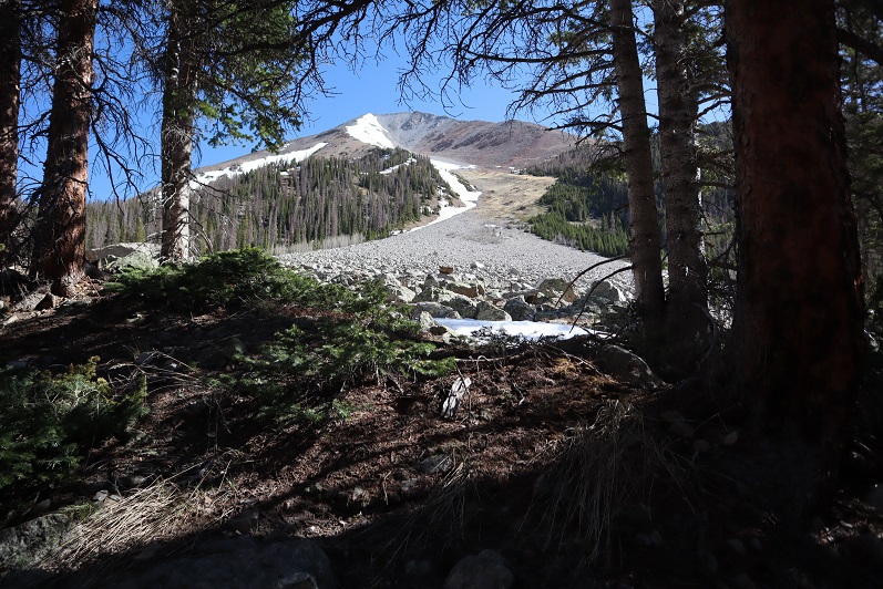
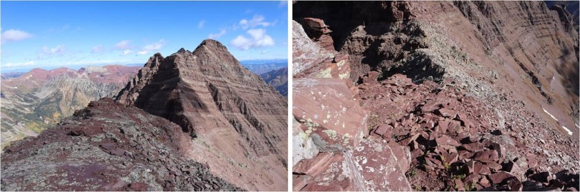
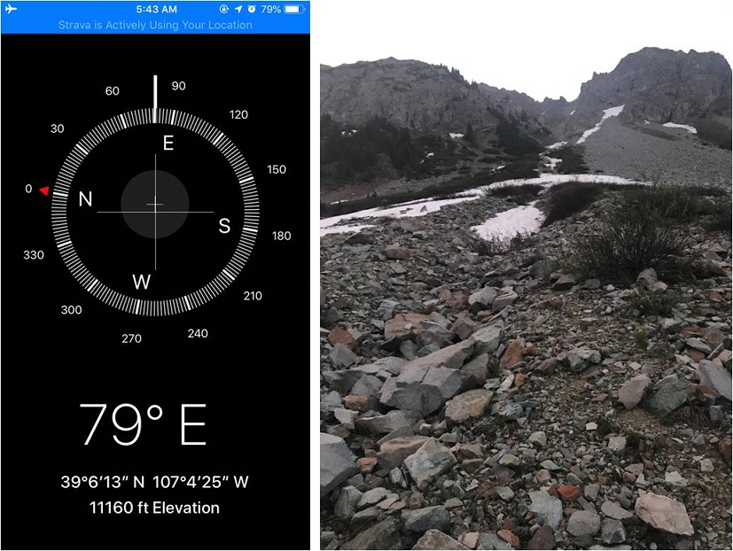
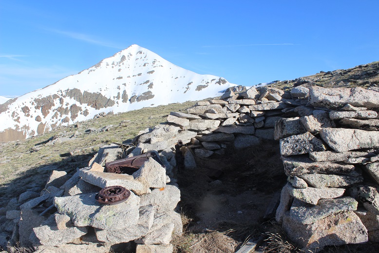
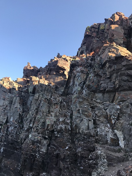
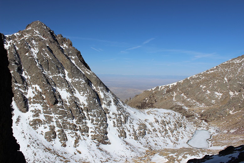
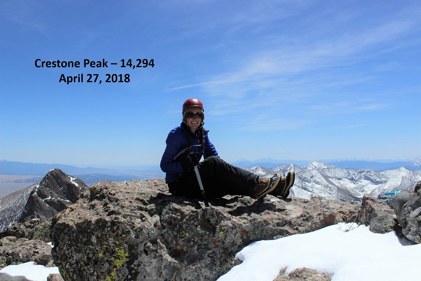
I’m not a fan of couloir climbs, but feel they are something I should practice. I intentionally chose to climb Mt Aetna when there wasn’t a ton of snow so I’d have the option of hiking on either snow or rock.
I left my house at midnight to a swirl of thousands of Miller moths. I’m not exaggerating; as I opened my garage door they swarmed my truck and at least 5 made it inside the cab with me. I spent the next few hours doing my best not to get frightened when one flew past my face.
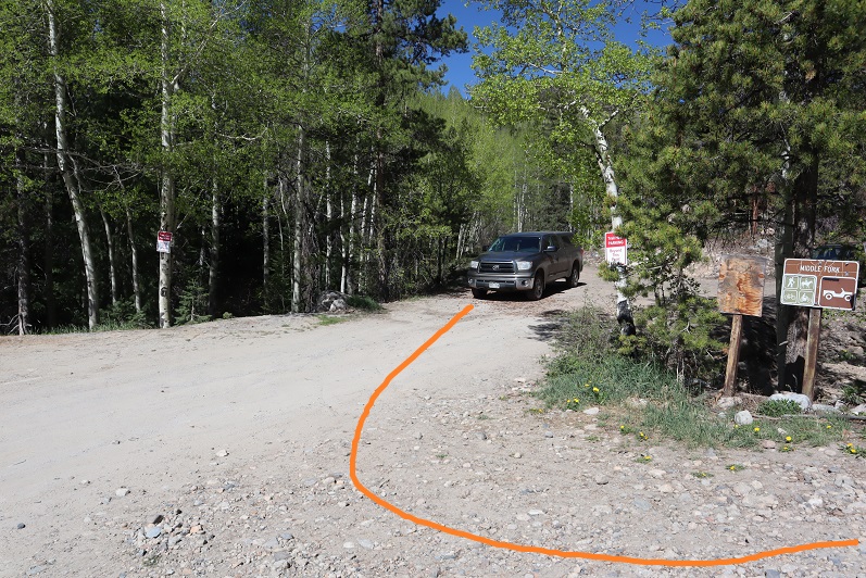
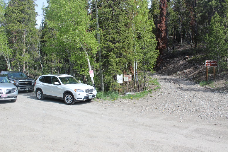
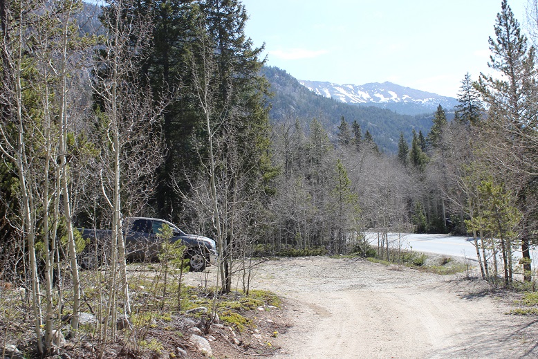
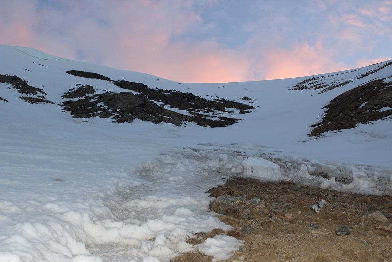
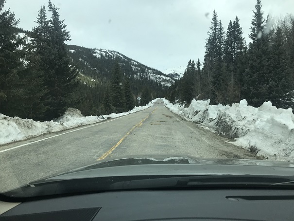
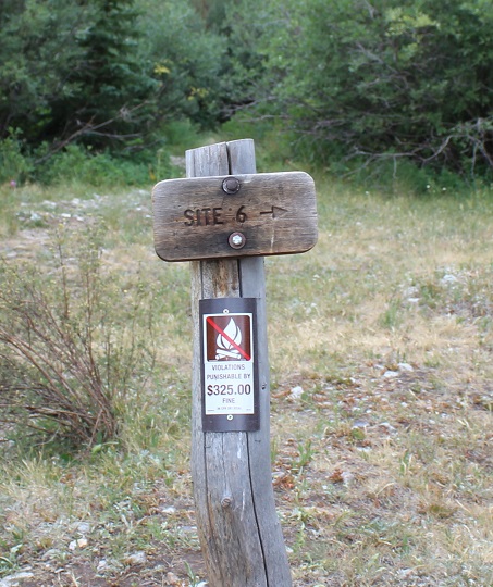
The drive was uneventful, but I saw no less than 6 police vehicles in the short drive from 285 to the Boss Lake Trailhead (seemed excessive for such a remote area at this time of night). Memorial Day weekend should be interesting. I parked at the lower trailhead so I could add the 1.4 miles each way and hopefully some elevation gain: I’m still trying to keep my average at 10 miles per hike with 4000’ of elevation gain and I’m a little under that right now so every little bit helps.
I parked and was on the trail by 3:15am.
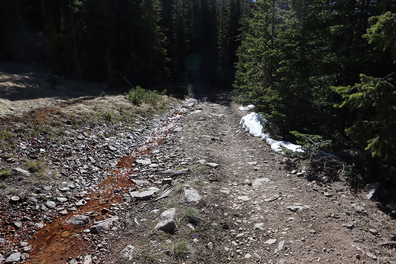
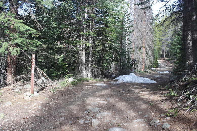
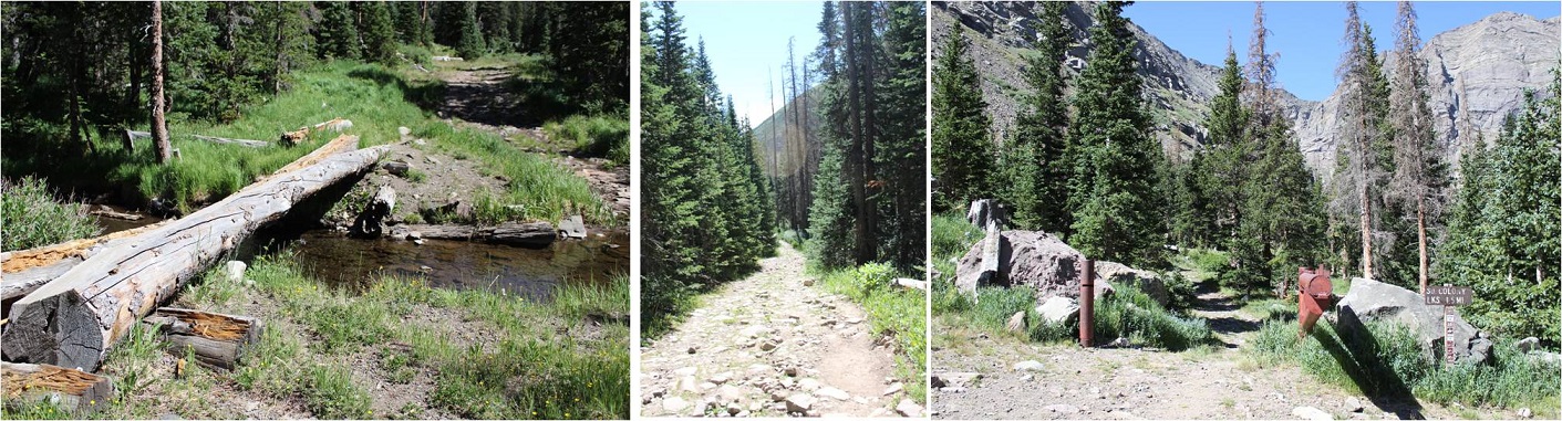
The 230 4WD road isn’t that bad to drive or to hike. I was glad I’d parked where I did because there were downed trees on the road before a little ways before the trailhead
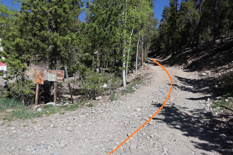
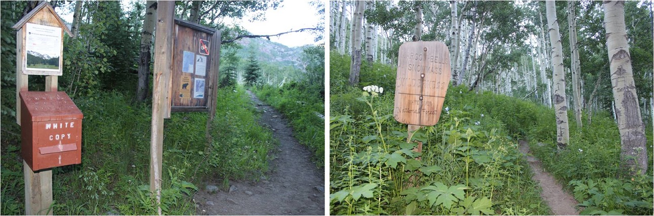
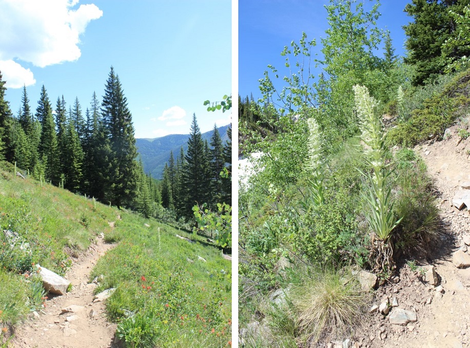
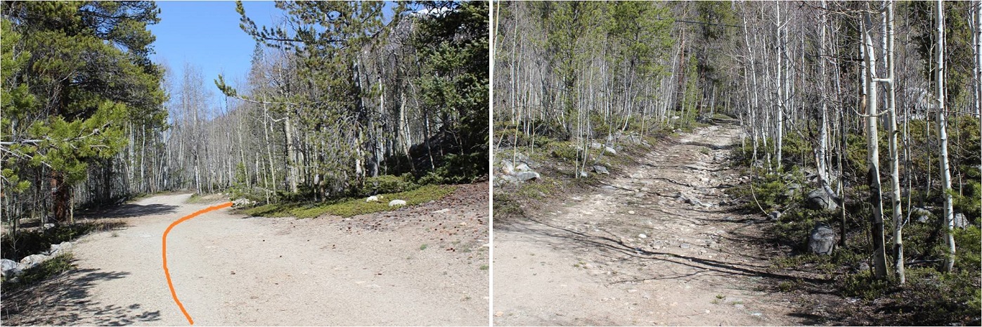
At the trailhead sign I went right
And at the fork in the road I went left (the road has a chain across it and a “no trespassing” sign to the right)
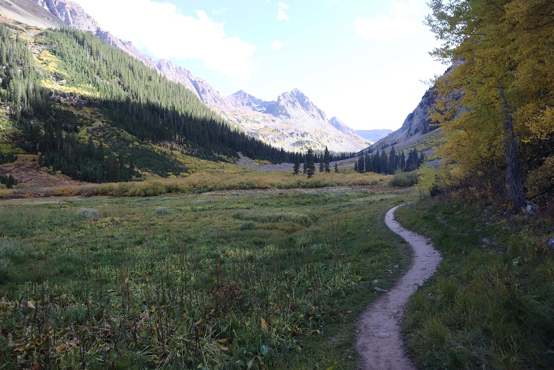
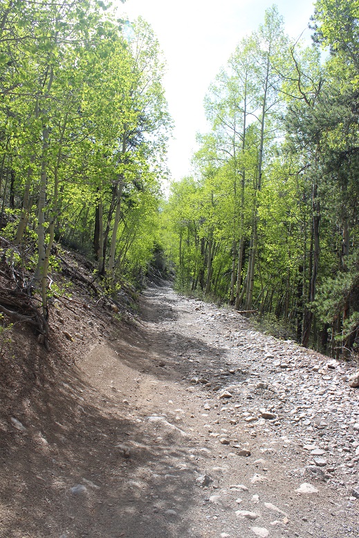
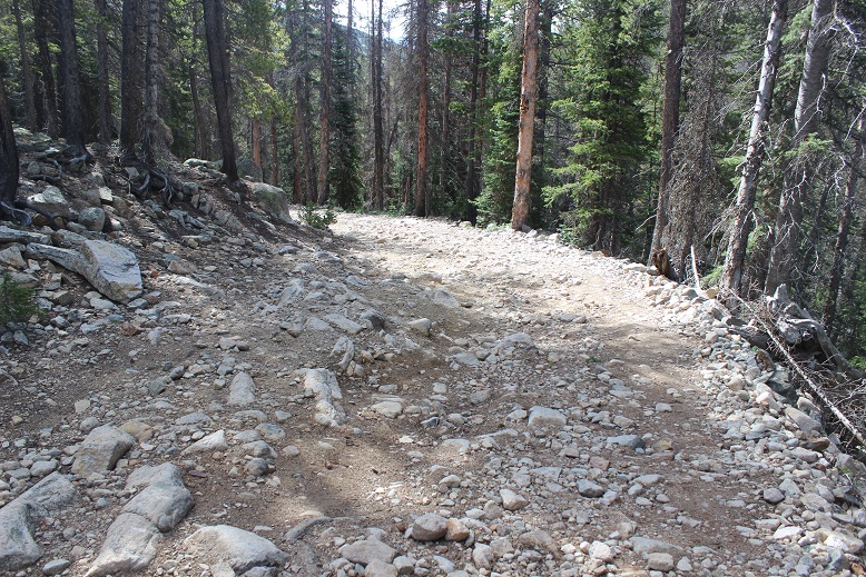
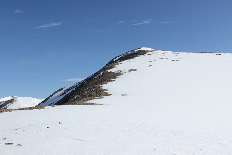
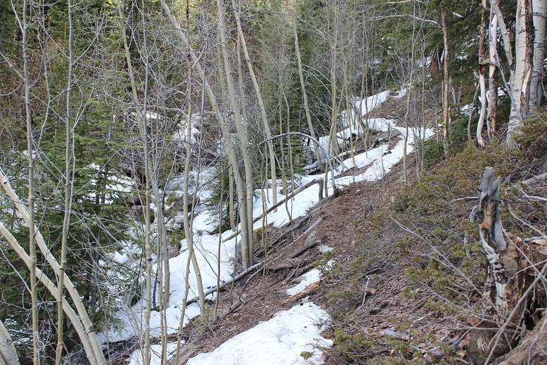
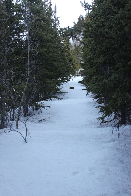
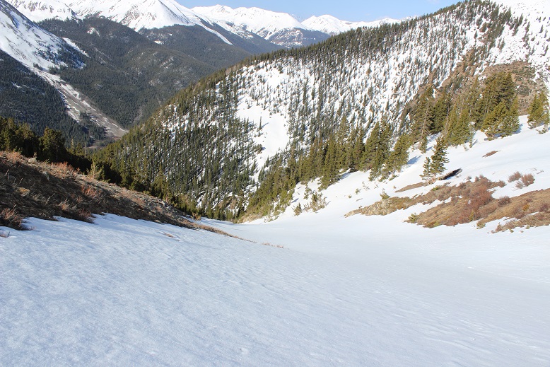
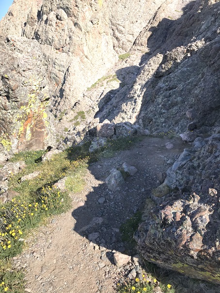
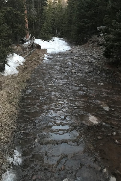
The trail follows the 230 4WD road for 2.5 miles from the lower parking area. At 2.5 miles if it were light out you could see Mt Aetna on your right. I could have driven the entire way to this spot if there hadn’t been downed trees in the way.
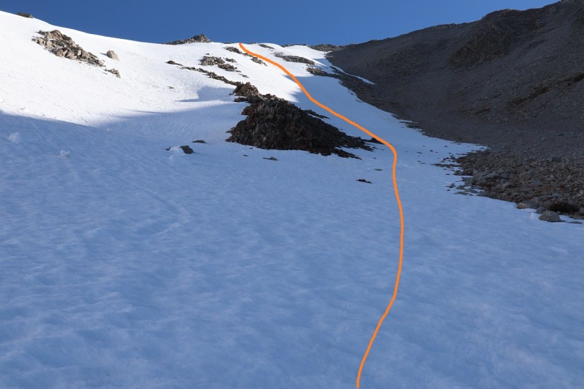
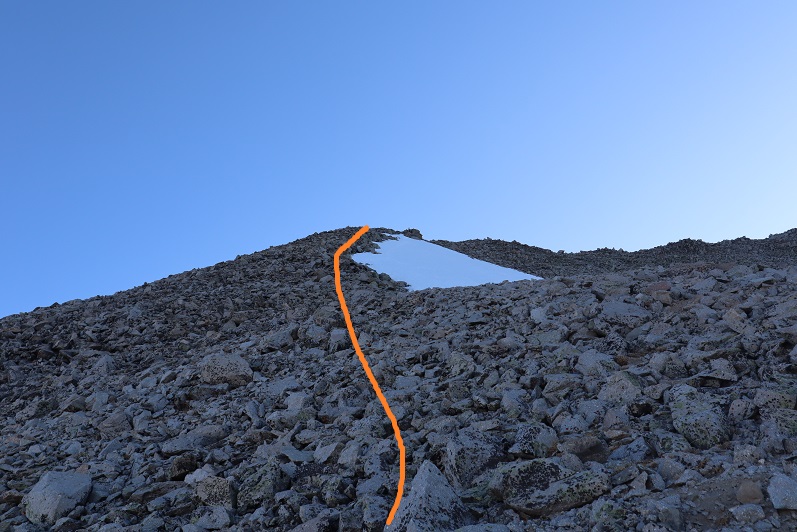
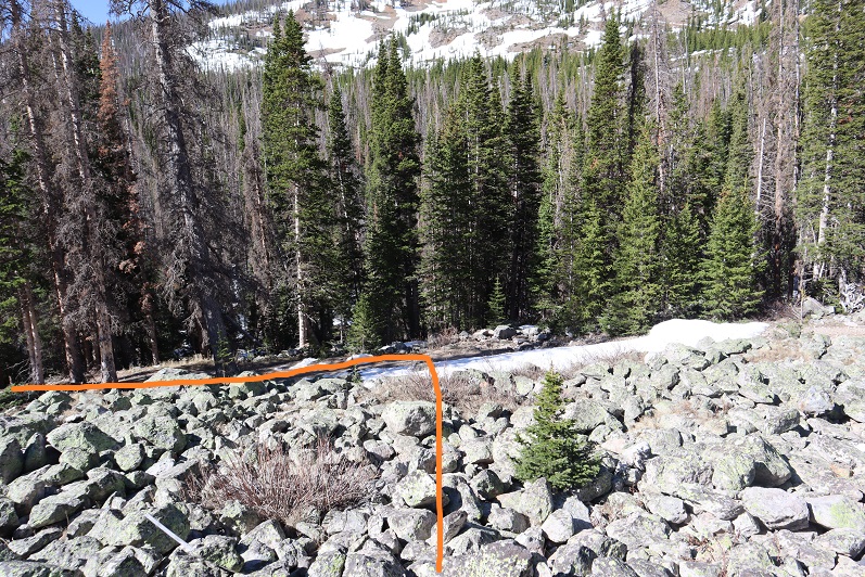
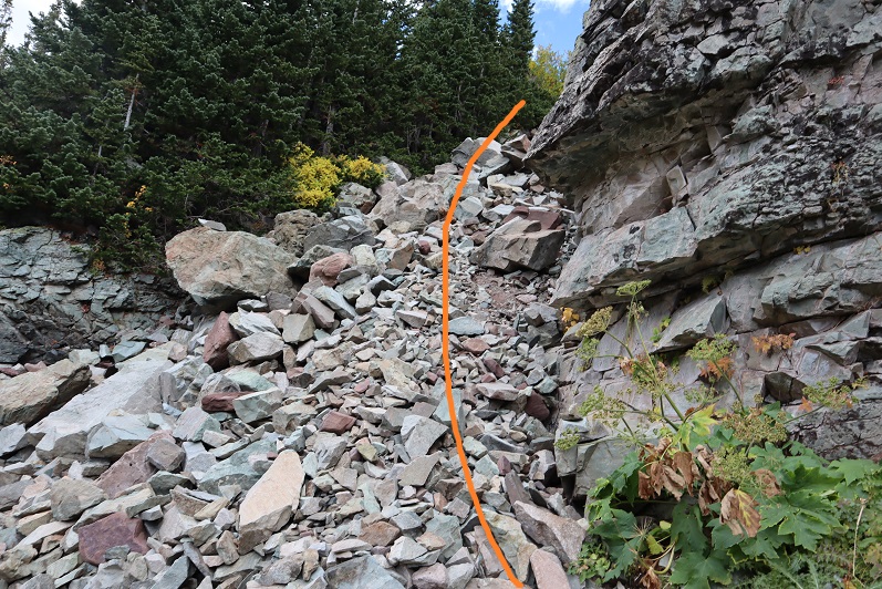
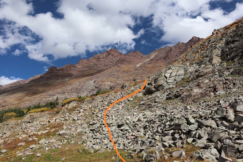
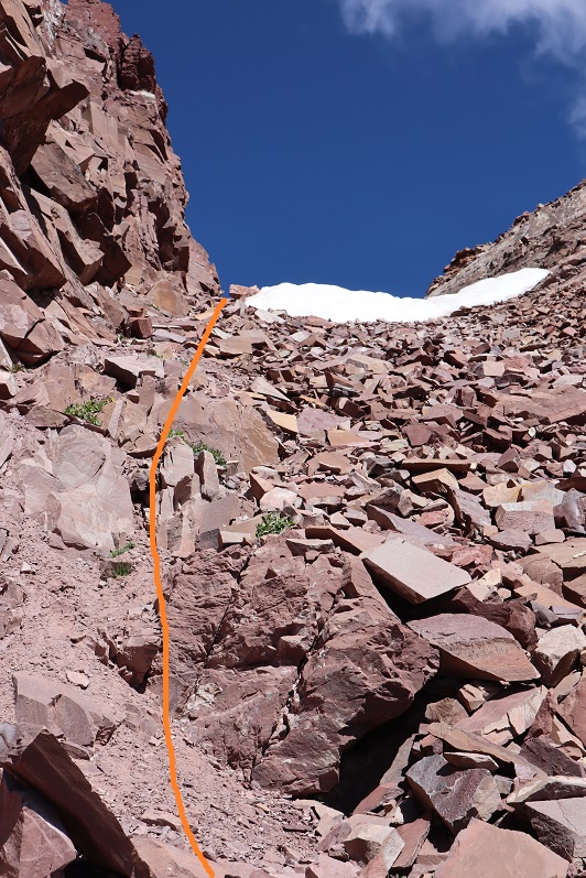
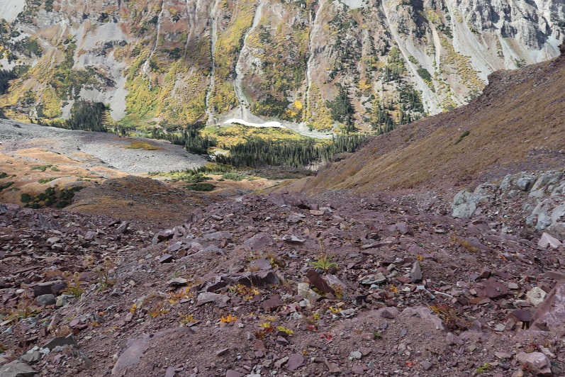
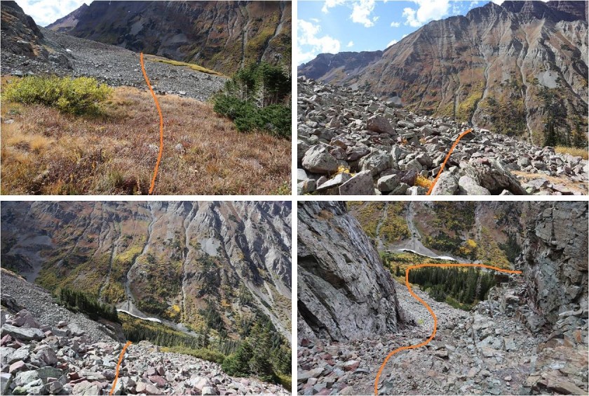
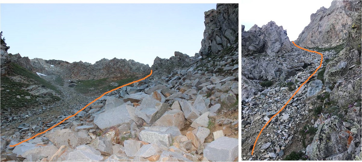
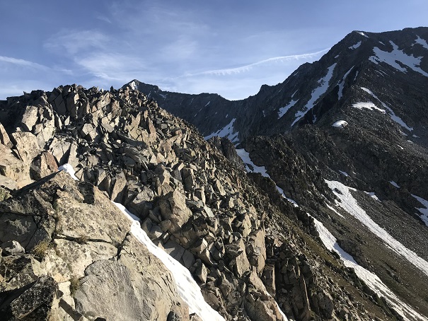
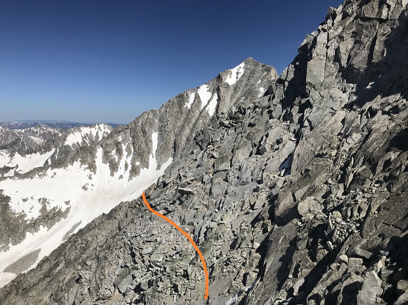
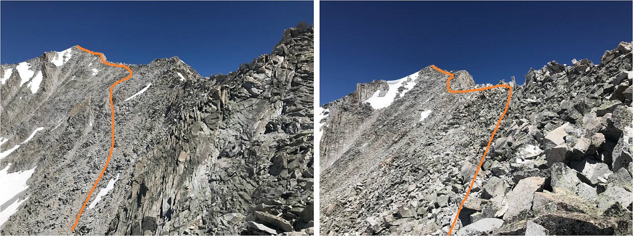
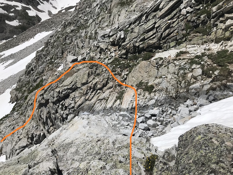
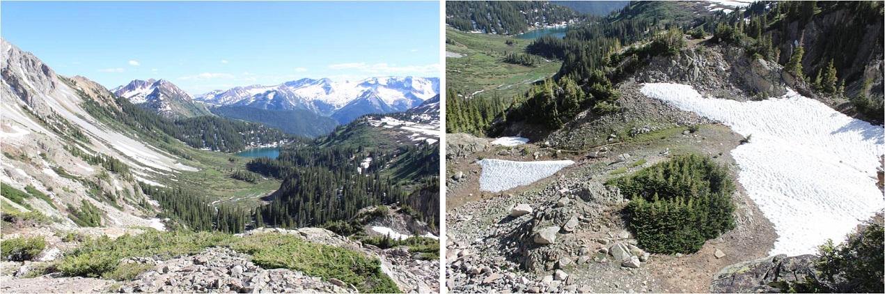
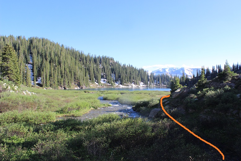
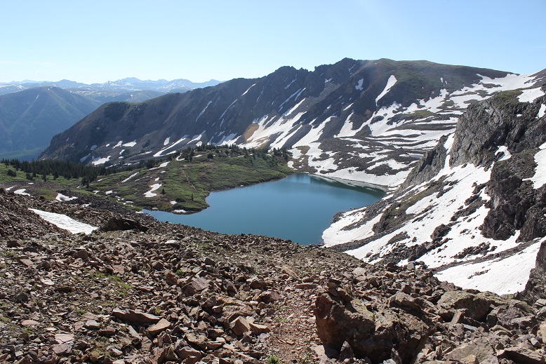
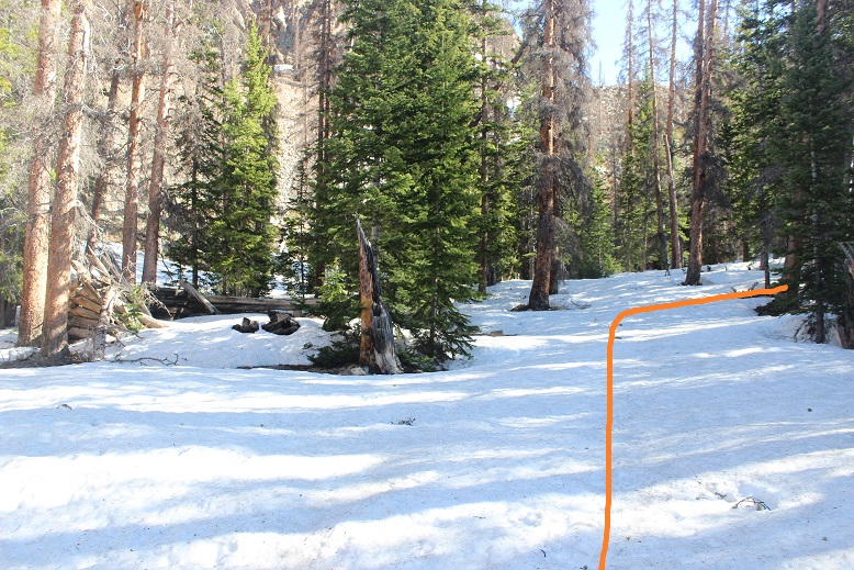
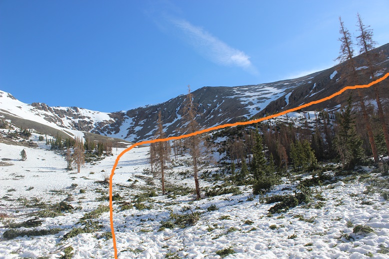
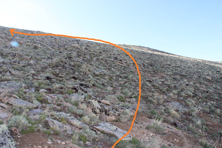
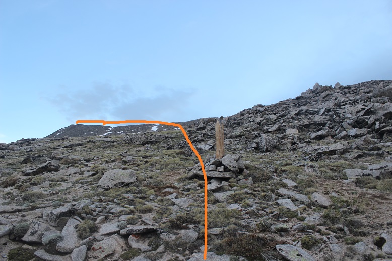
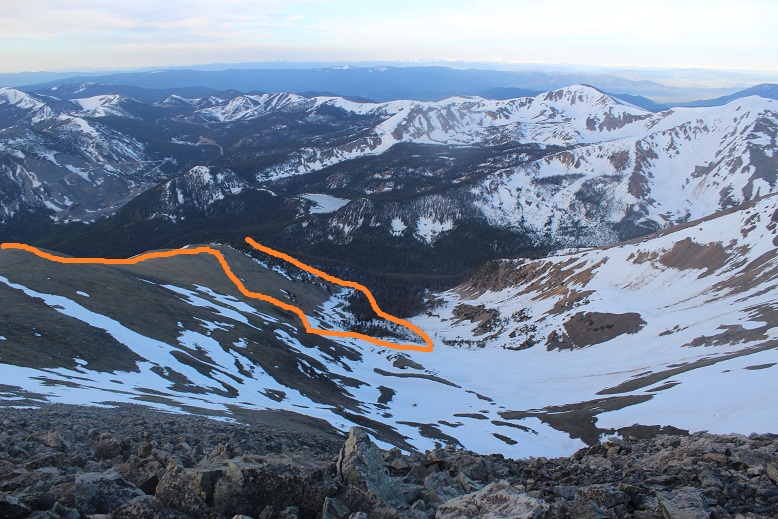
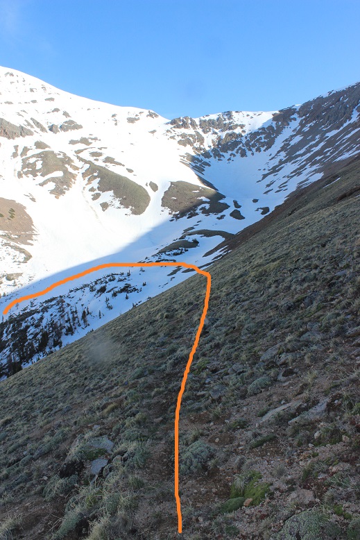
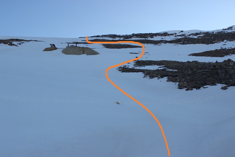
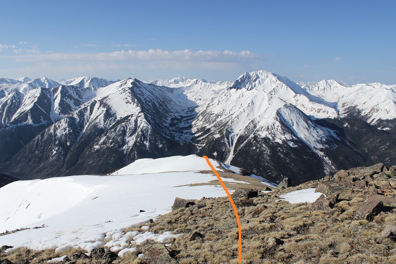
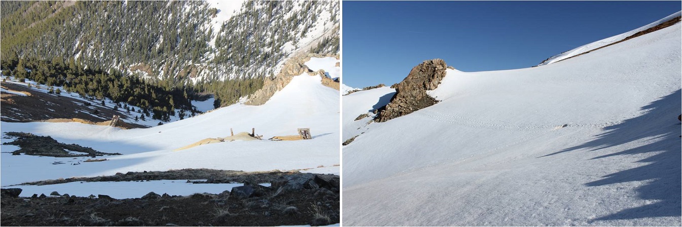
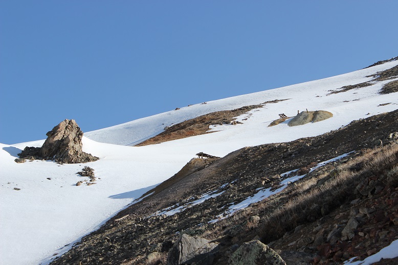
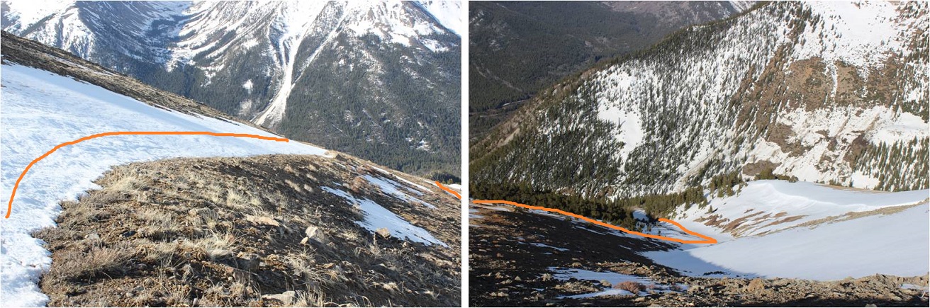
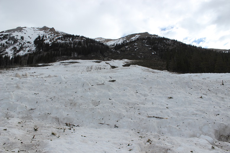
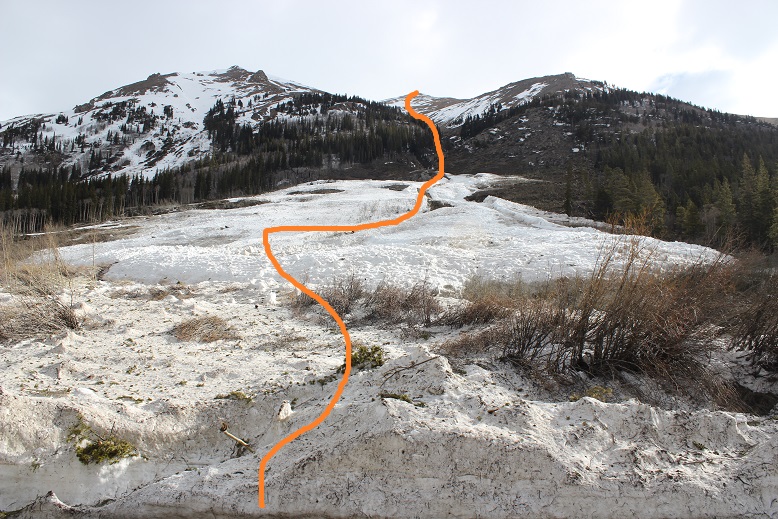
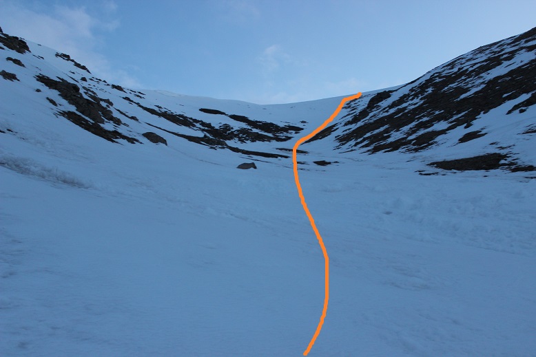
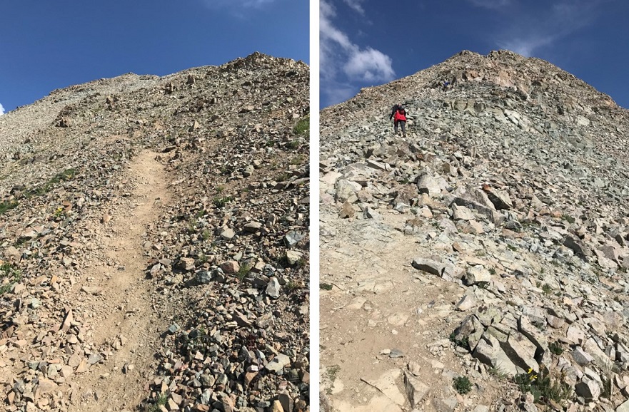
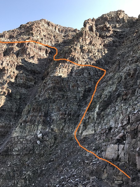
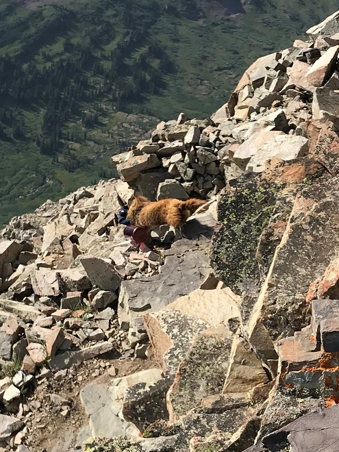
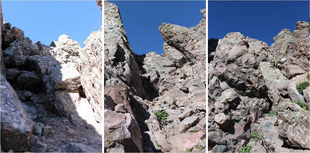
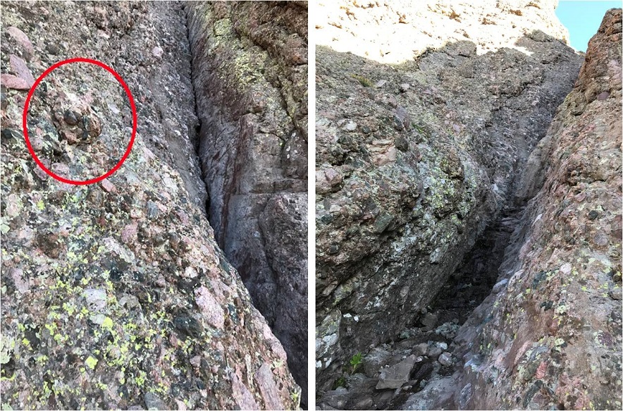
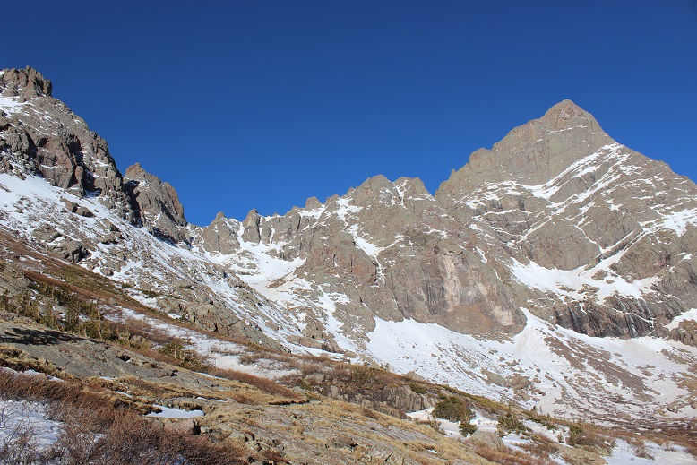
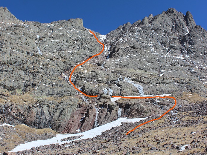
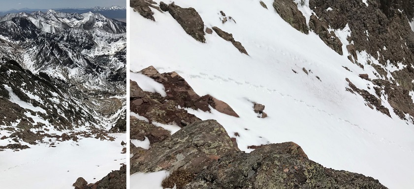
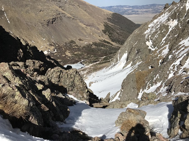
I turned right and crossed a boulder field. These rocks were loose and rolled. Since it was still dark I couldn’t see where I was going, so I headed northeast. As the sun started to come up it was obvious I had a lot of options for today’s summit. Here’s an outline of the route I took:
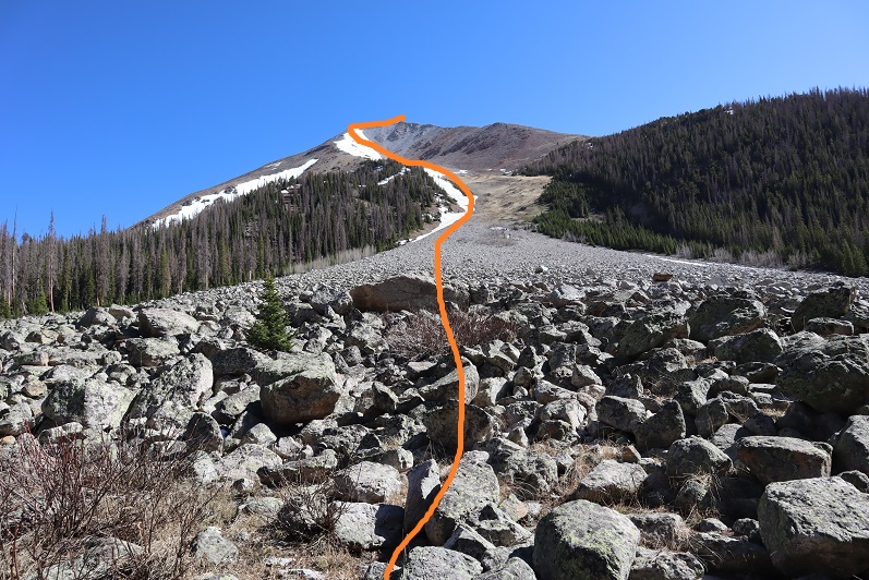
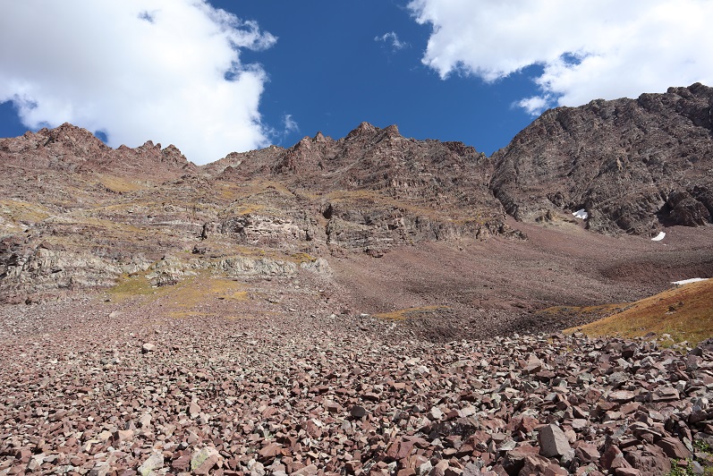
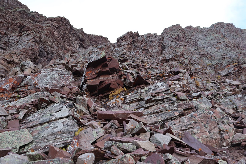
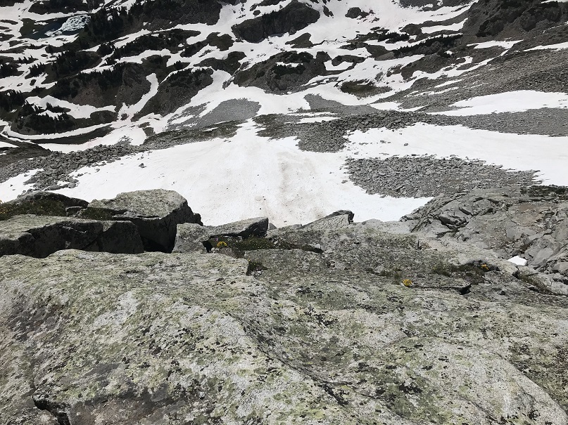
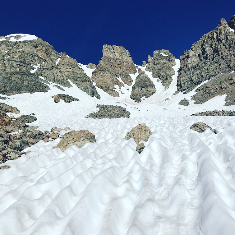
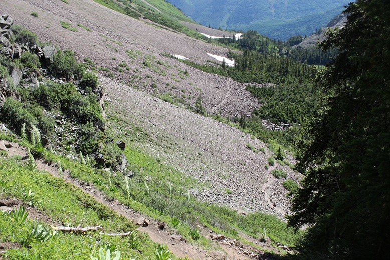
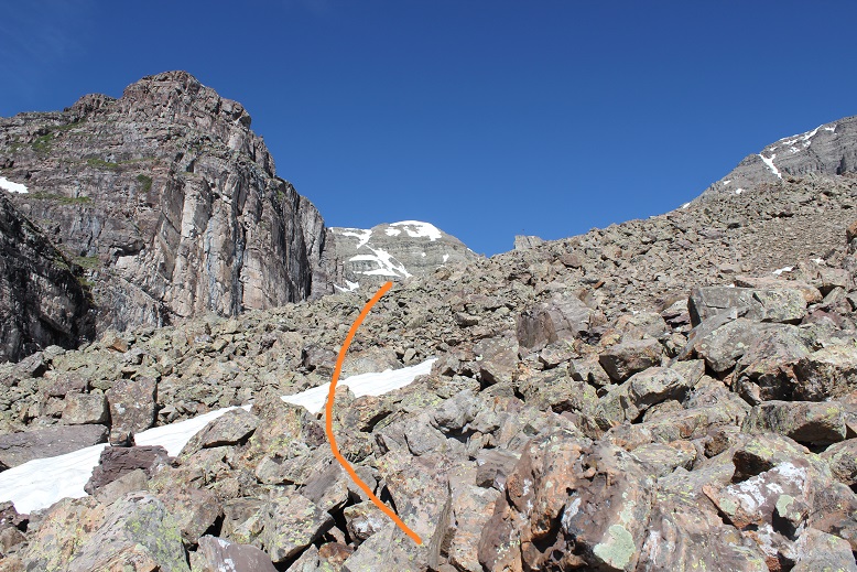
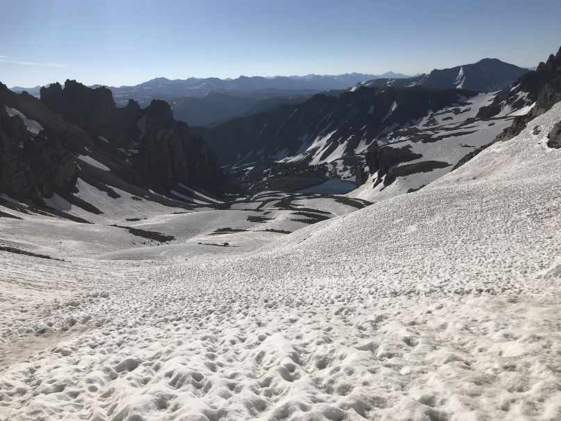
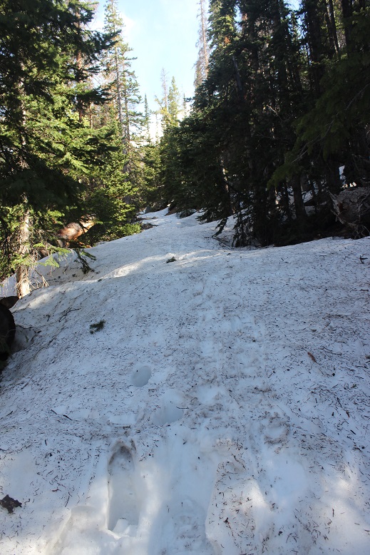
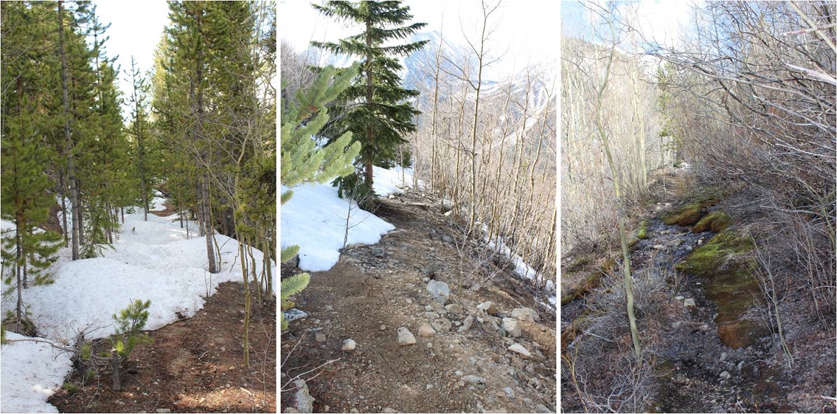
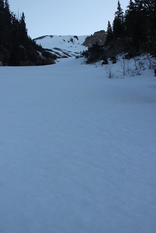
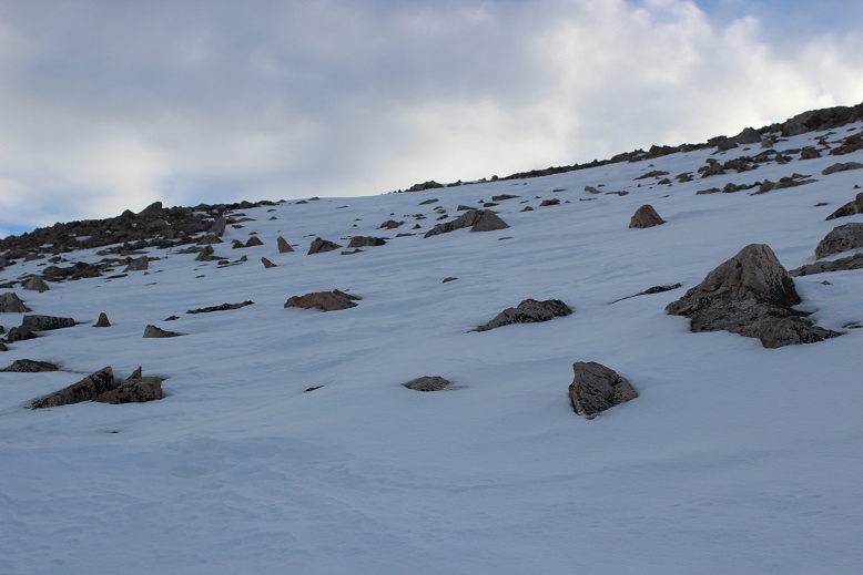
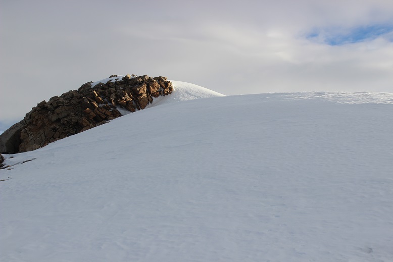
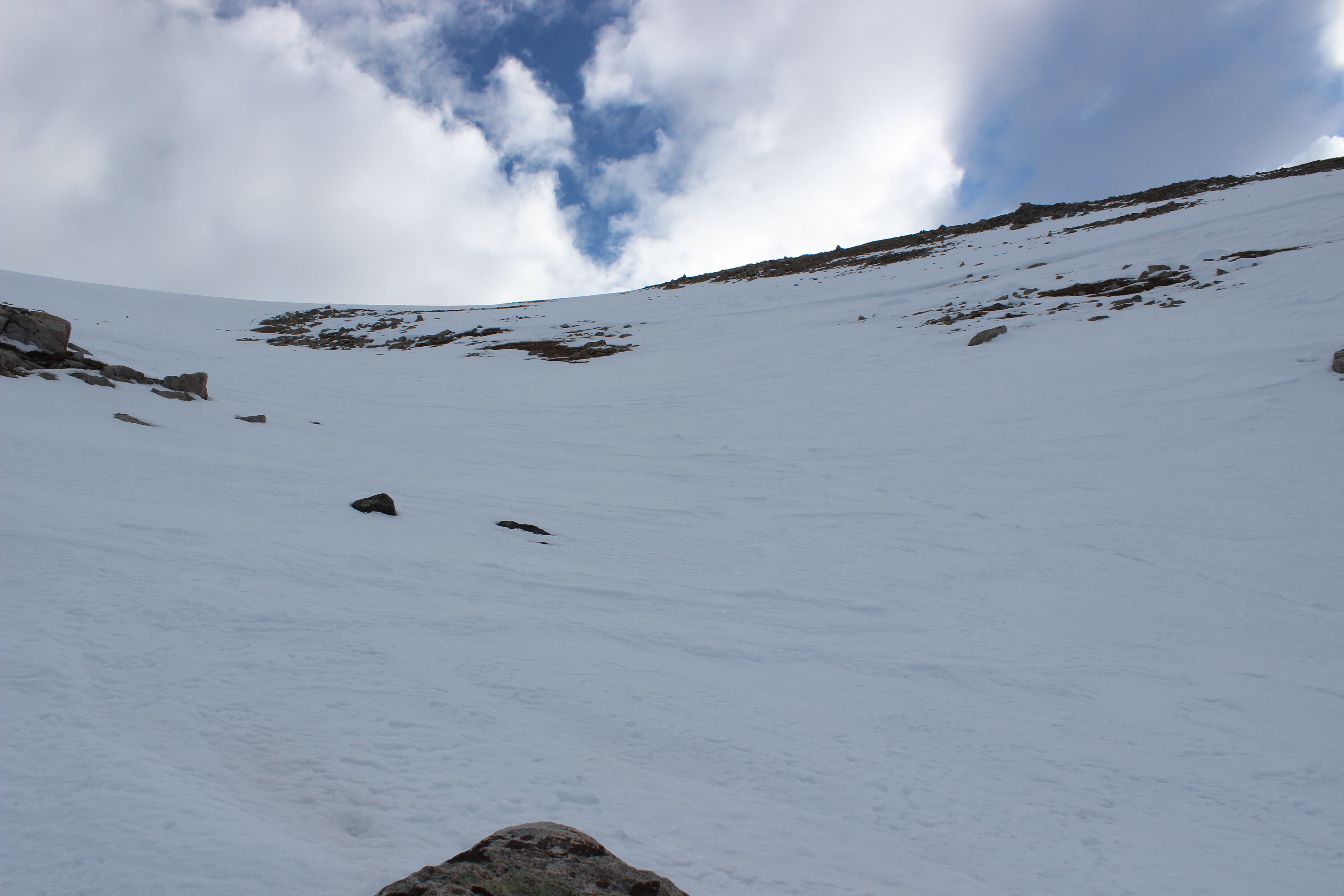
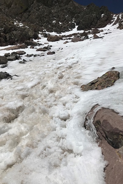
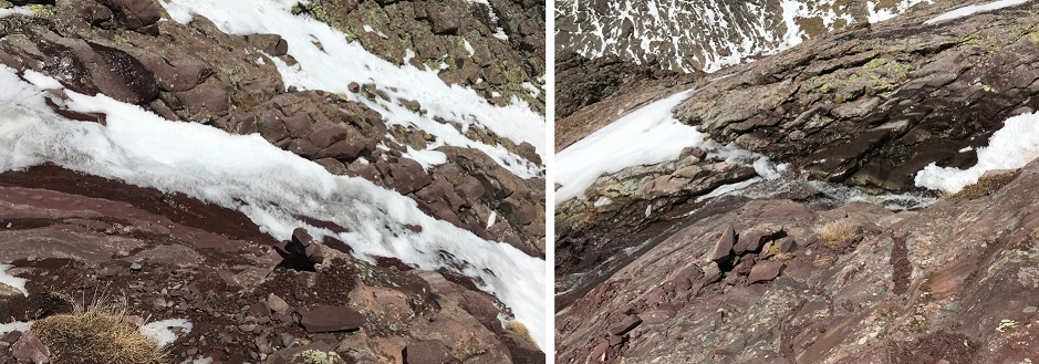
There is actually a lot more snow than it looks like from far away. I followed the gully about a third of the way on rocks and tundra until I had a decision to make: take the ridge to the left, the ridge to the right, ascend the scree just to the right of center, or put on crampons and go straight up the snow
I decided today was a good day to practice my couloir climbing. The snow was firm and I wasn’t the slightest bit tired yet. I strapped on my crampons, got out my ice axe (I brought along two proper ice axes this time but only needed one) and got to climbing.
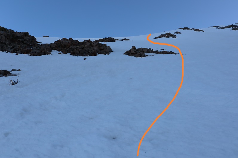
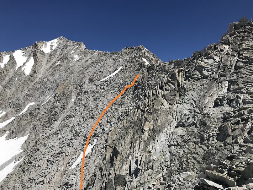
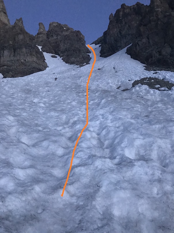
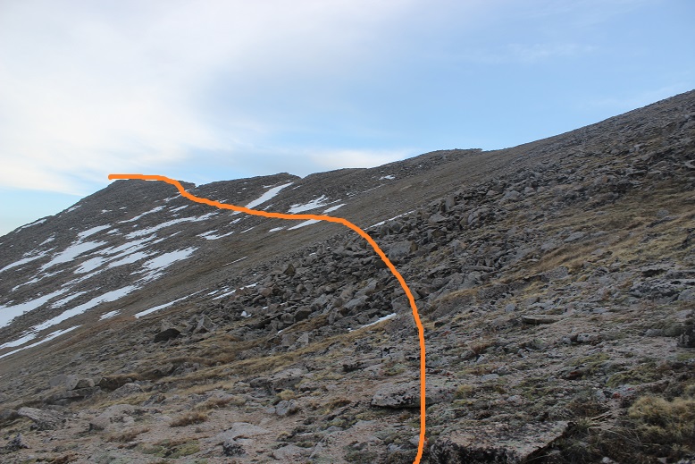
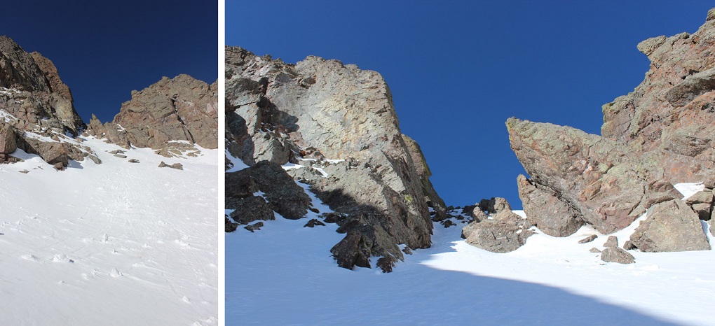
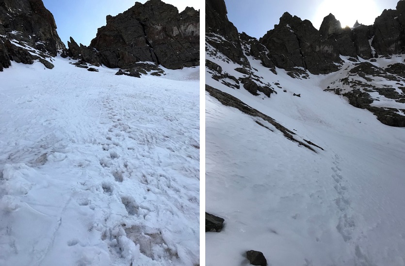
I changed my intended route several times because the snow was steeper than it looked in some sections.
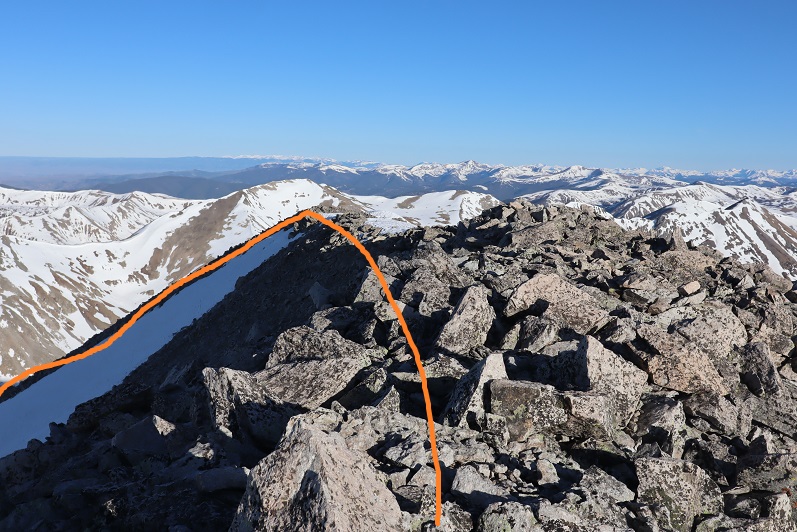
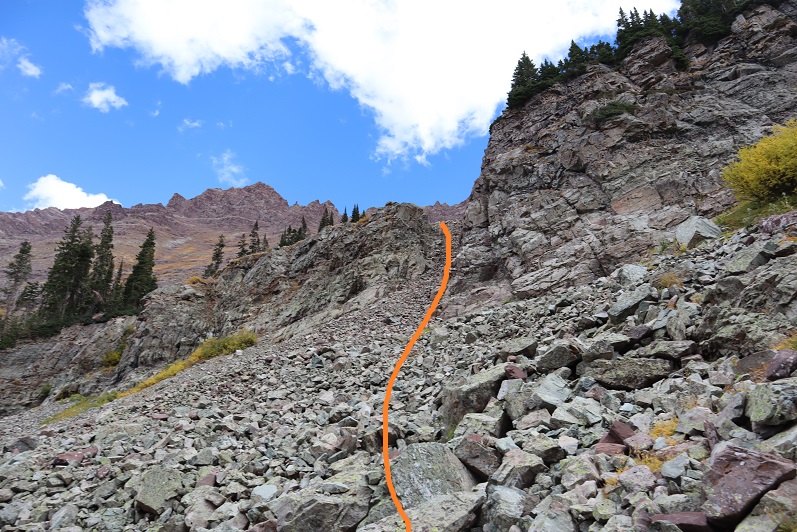
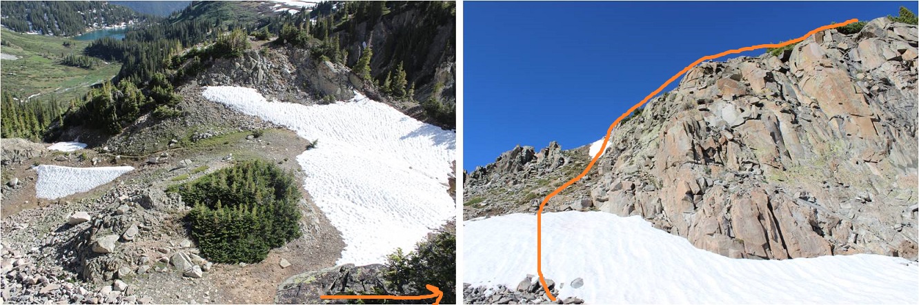
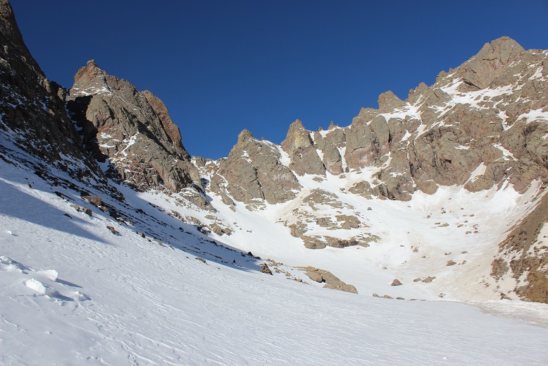
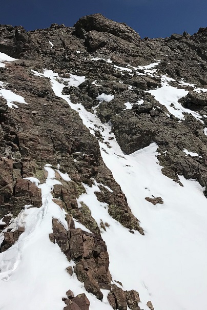
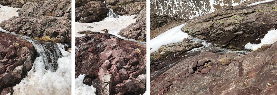
Once I made it to the ridge I found it was easier to keep my crampons on and walk along the snow than it was to walk on the loose rocks, so for as long as I could I stuck to the snow
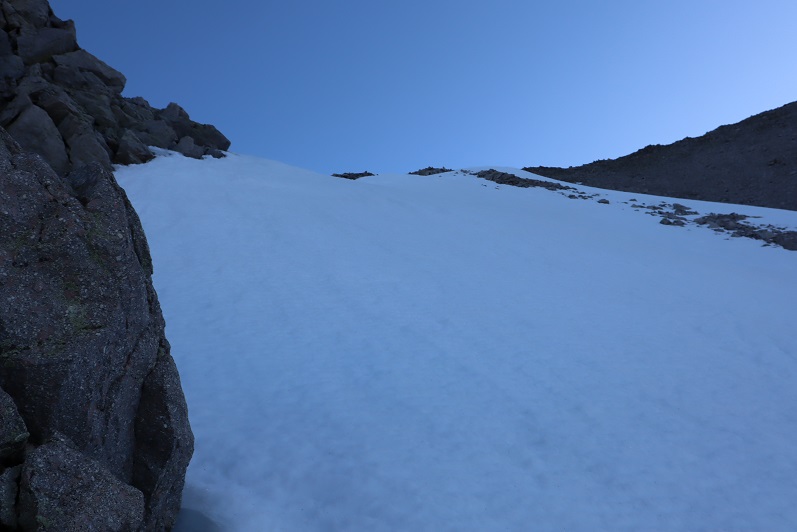
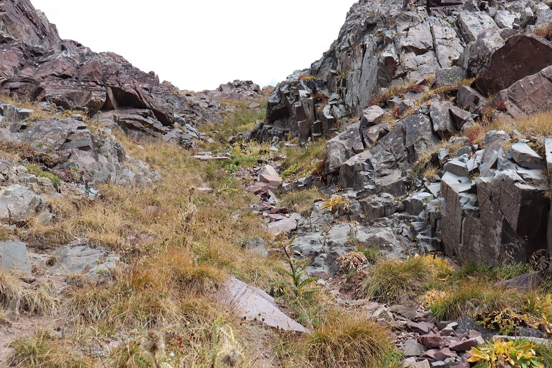
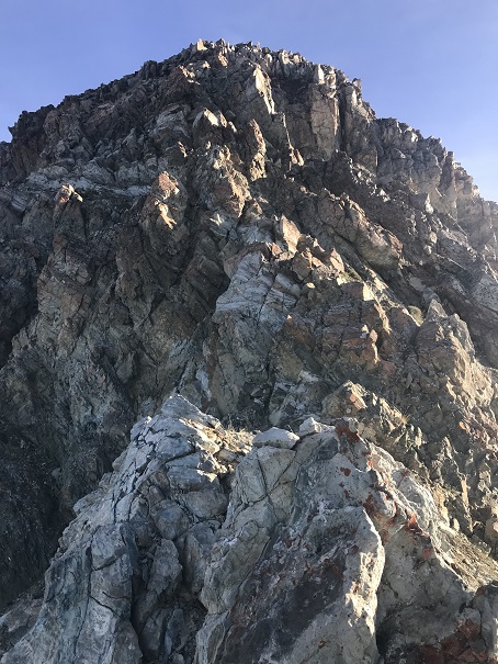
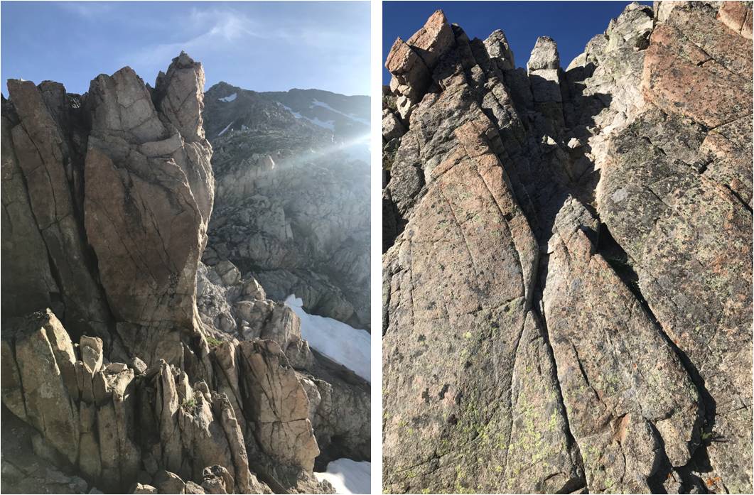
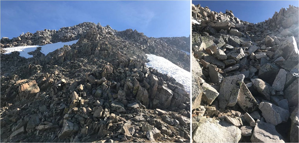
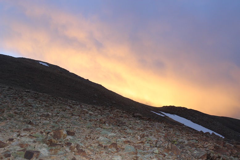
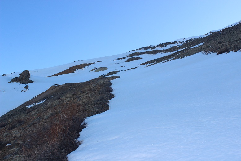
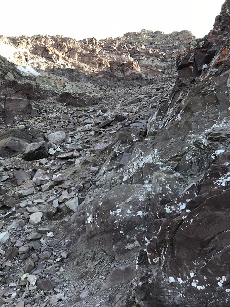
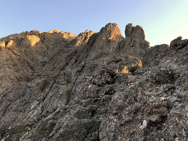
Eventually the snow ran out and I followed the rocky but (mostly) dry ridge to the summit
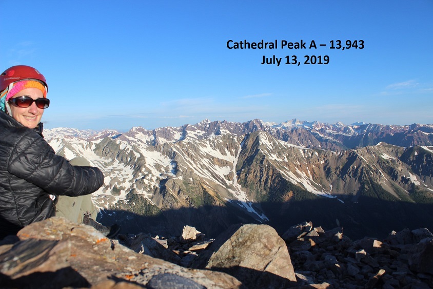
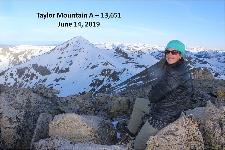
I summited at 7am and kept thinking to myself “that was much easier than I’d anticipated: why don’t I like couloir climbs again?”
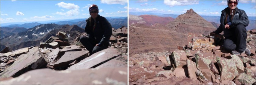
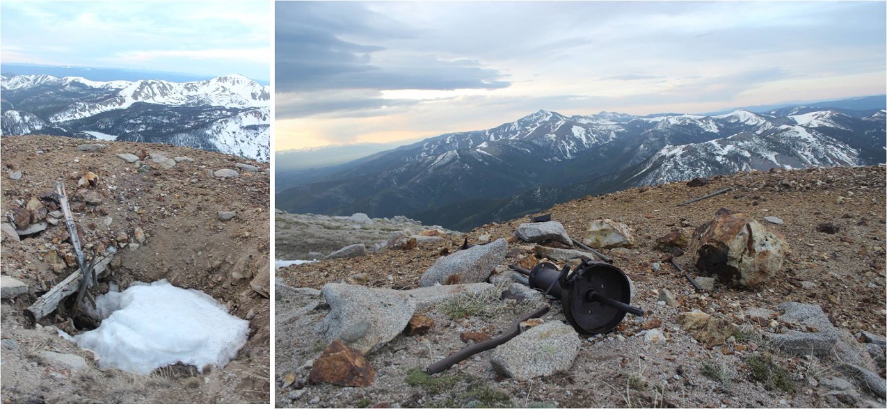
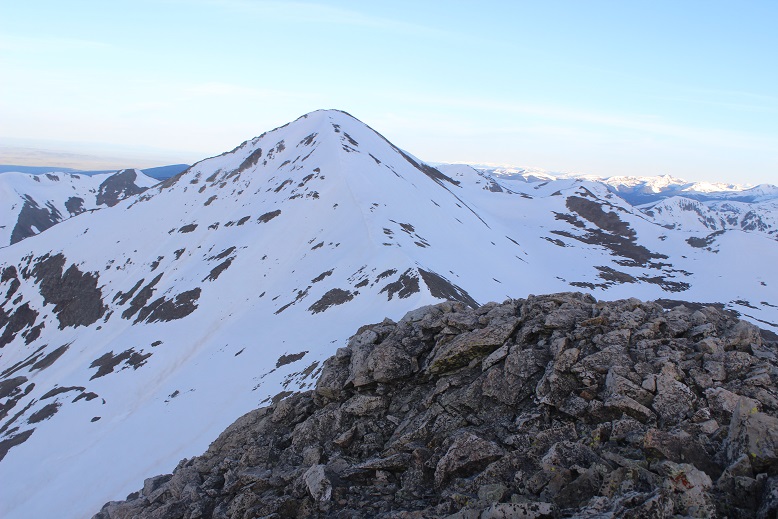
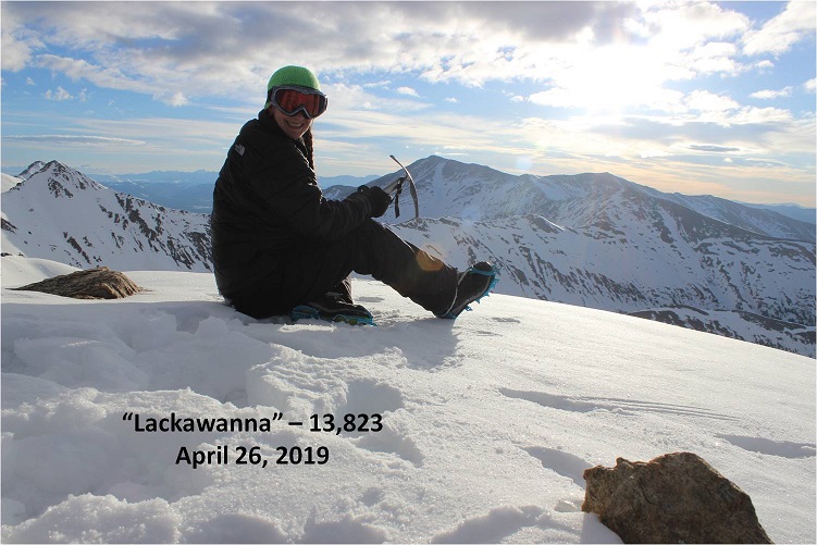
Mt Aetna Summit:
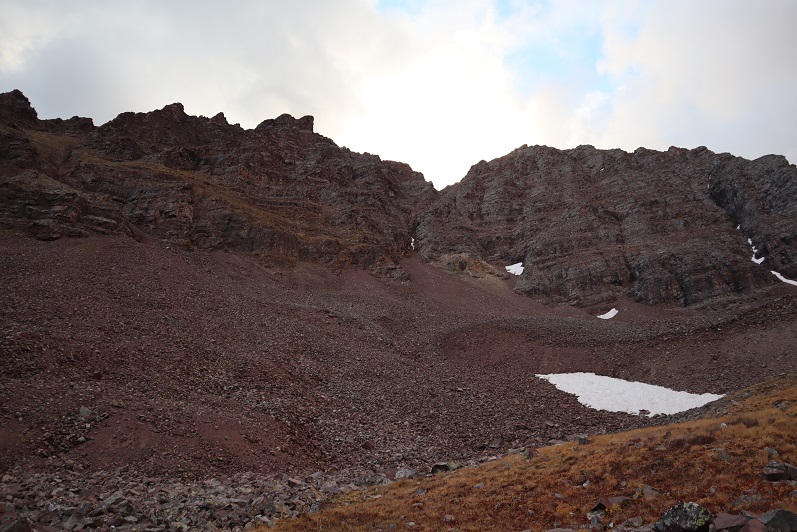
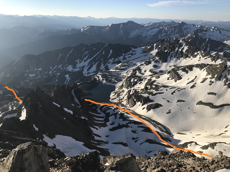
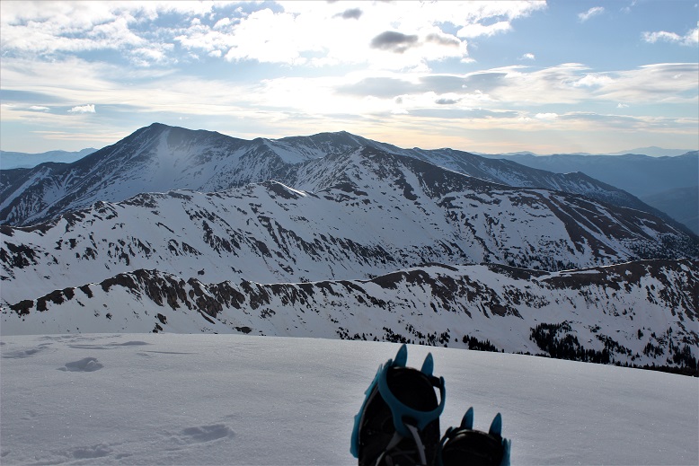
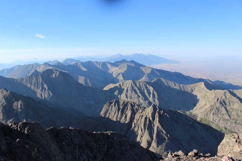
I stayed longer at the summit than I usually do, taking a good look at the nearby mountains I wanted to summit tomorrow, checking to see if the crux area was free from snow. It looked like it was, but a lot of the area seemed to be hit or miss with snow and too much was still in shadows to be completely sure.
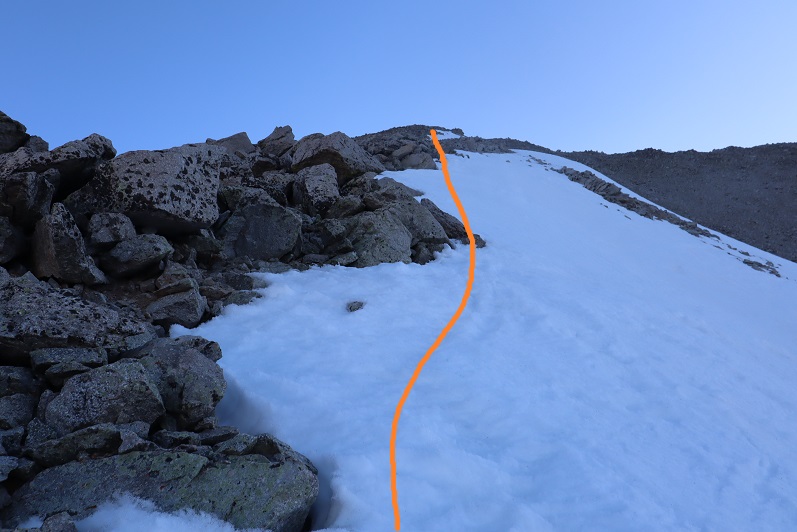
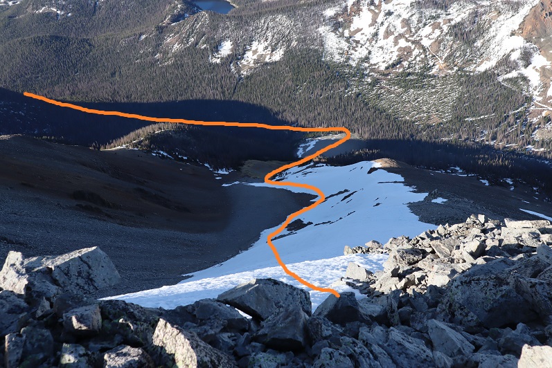
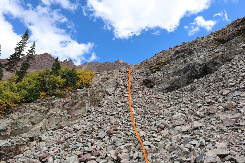
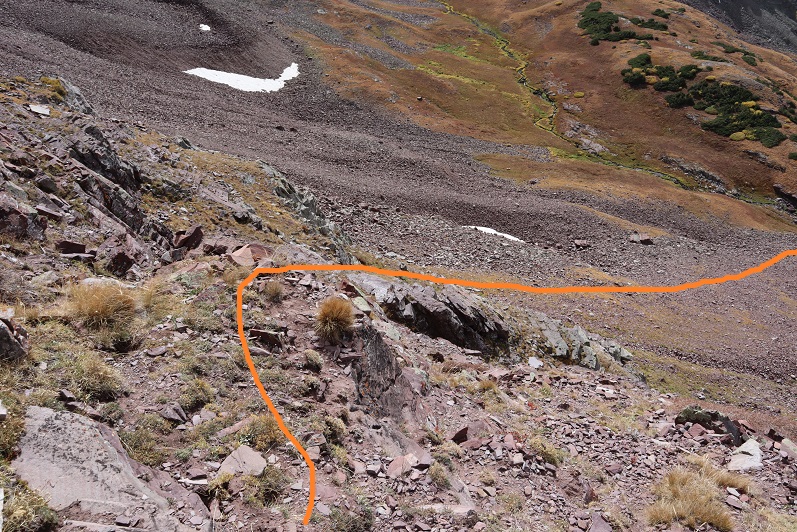
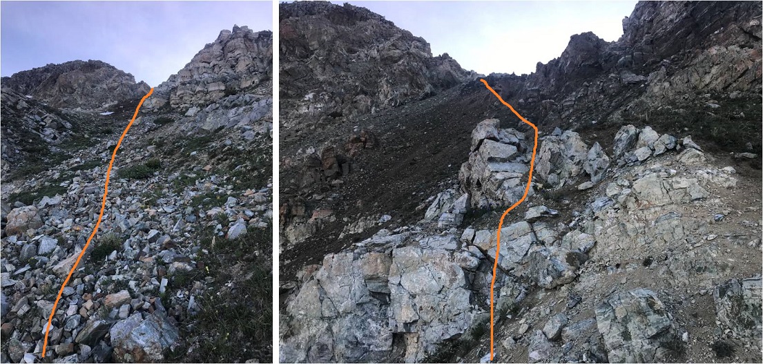
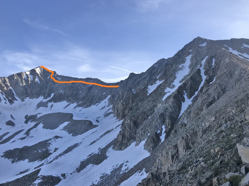
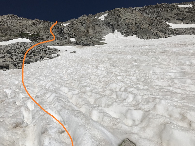
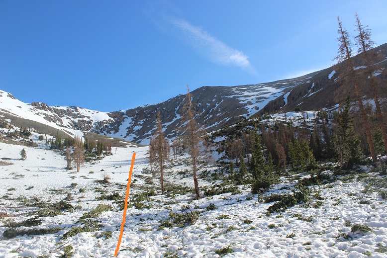
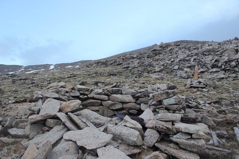
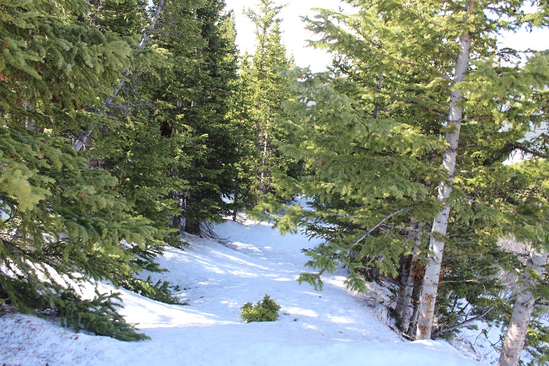
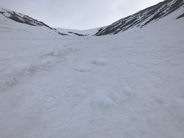
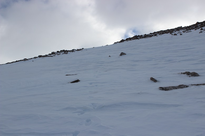
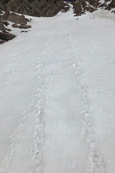
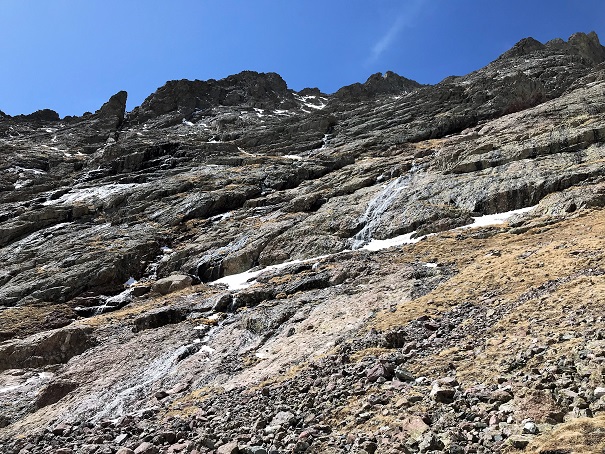
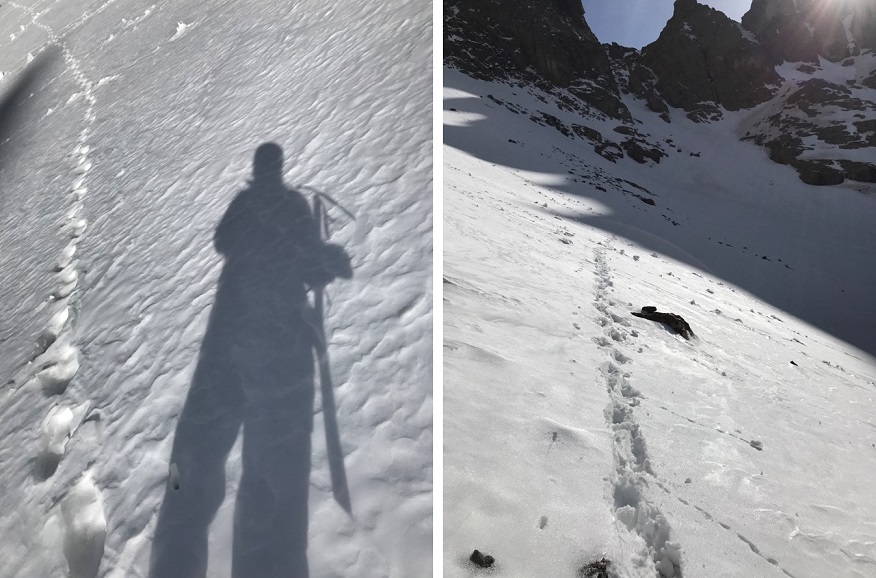
Here’s the route I took down, keeping to the snow as much as possible.
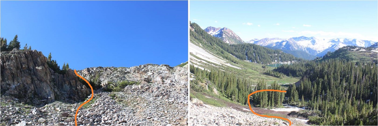
Make no mistake, it’s steeper than it looks but the snow was still firm and I was able to walk down the entire way without turning to face the mountain.
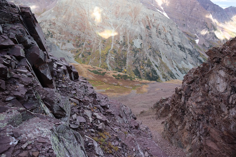
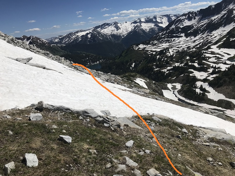
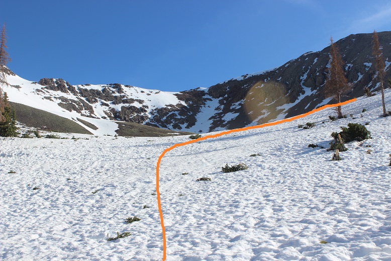
What’s nice about this climb is you have a visual the entire way up and down of where you need to go.
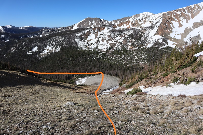
I made it back to the road, turned left, and followed it back to the trailhead.
I made it back to my truck at 10am, making this an 8 mile hike/climb with 4103’ of elevation gain in 6 hours, 45 minutes.
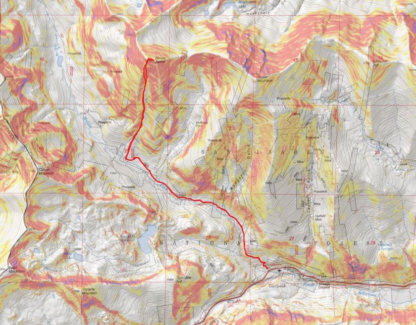
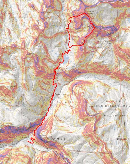
Here’s a topo map of my route.
Now I was off to the next trailhead. As soon as I came to an area with cell-service I pulled over to text my kids and see how they were doing (they were still sleeping). As I was sitting there an undercover cop pulled someone over for speeding right behind me. At first I only saw the flashing lights and thought I was in trouble for something. I sat there for a good 20 minutes and luckily for me, I was never approached and the police officer left before I did. But I got to see him again.
I turned onto CR 240 as I was headed to my next trailhead and saw two police vehicles parked on either side of the road. There were two police officers standing outside of their cars, stopping vehicles. I panicked and turned right into the (semi) residential area, drove for a bit, parked, and thought about my next move. Should I try to continue on to the trailhead, or turn around and go home? In the end I chose to continue to the trailhead: If I got stopped and ticketed or told to turn around at least I’d have beta for the next person.
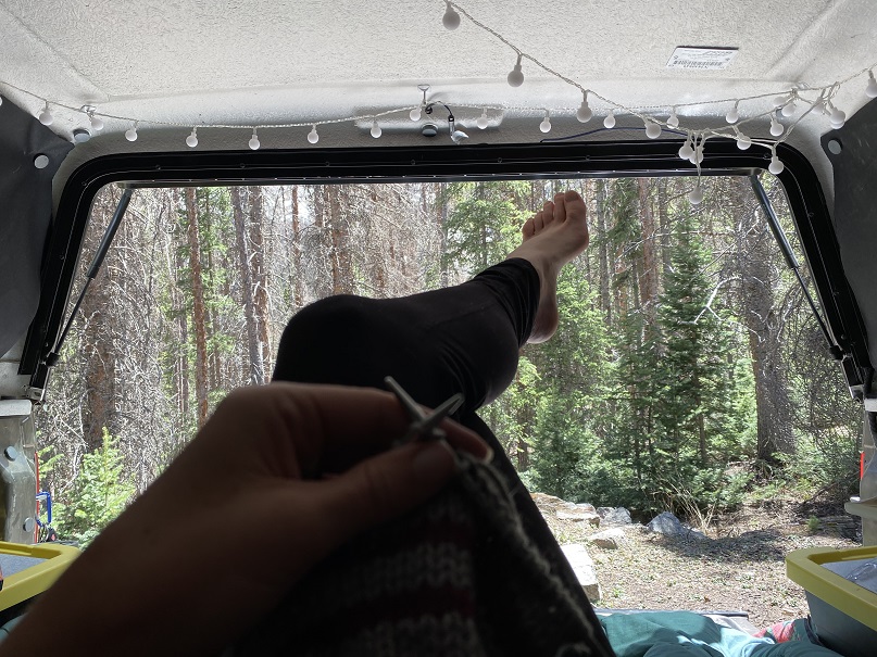
I drove back the way I’d come and slowed down when I came to the police officers. I waved to them, and for some unexplainable reason, they waved me on! Woot! Maybe because I’d turned from the residential area and not the main highway they assumed I was a local? In any event, I drove the rough 4WD road to the next trailhead, found a place to park, made dinner, jotted down some trip notes, set out my gear for the next day, walked around the creek for a bit, knitted a hat for tomorrow, read a bit from a Colorado History book, had a few glasses of whiskey and went to bed early (tomorrow was going to be a long day). Oh, and I didn’t see one other vehicle drive down the road the entire time I was there, and it’s Friday to Memorial Day weekend at a well known dispersed camping area.
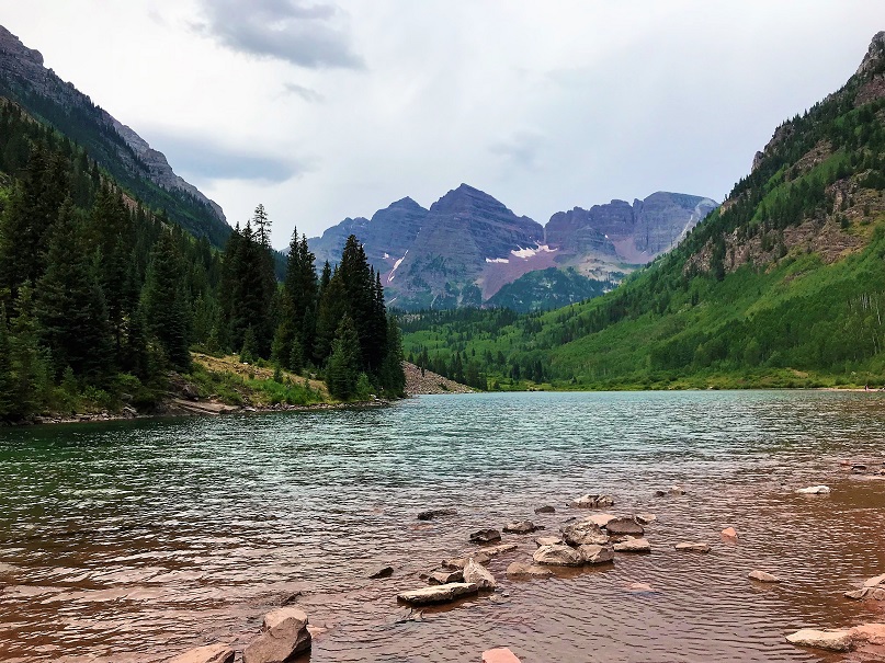
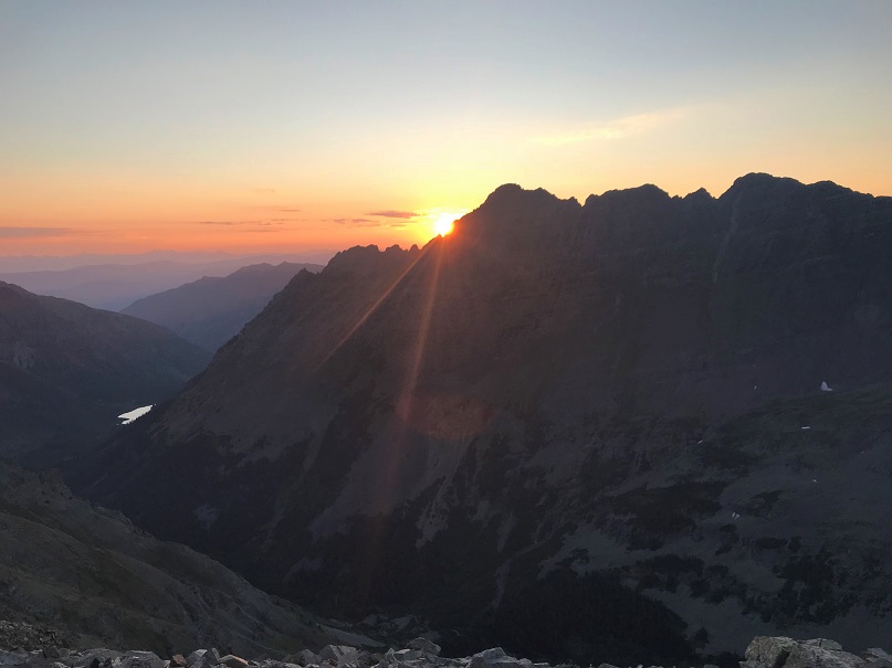
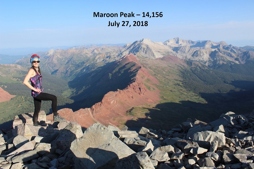
After summiting Vestal Peak I changed in my truck into new hiking clothes. I re-braided my hair, ate a packet of tuna and drove to Maroon Lake. It rained the entire 5 hour drive there and I was seriously worried my hike in the morning would be in danger. Originally I’d planned on hiking, taking a day off to rest, and then hiking again on Sunday but the weather forecast for Sunday called for 80-90mph winds so I decided to alter my schedule a bit. I was not impressed with the rain. It was raining when I fell asleep in the cab of my truck but I thankfully I awoke to a clear, starry sky at 2:30am.
The parking lot was full of both hikers and photographers eager to get a glimpse of the fall colors. I debated going back to sleep for a few minutes but in the end decided I should probably get going. I was on the trail at 3am.
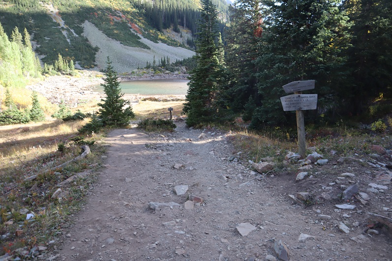
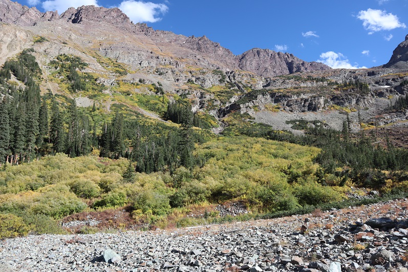
I followed the trail to Crater Lake
And then followed the West Maroon Creek Trail until I’d made it 3.7 miles.
This trail is so much nicer to walk when there’s no snow! Route finding was negligible
After 3.7 miles I crossed the West Maroon Creek (which didn’t have much water)
And headed east through the willows
Until I reached the base of the slope to the first access gully. This was difficult to figure out in the dark: The last time I was here the willows were completely covered in snow and I just climbed right up, but today those willows were taller than I was.
At the top of this gully is another gully
And at the top of this gully (you guessed it) another gully
Now the rocky gullies started including areas of tundra
Now I was almost to the upper basin.
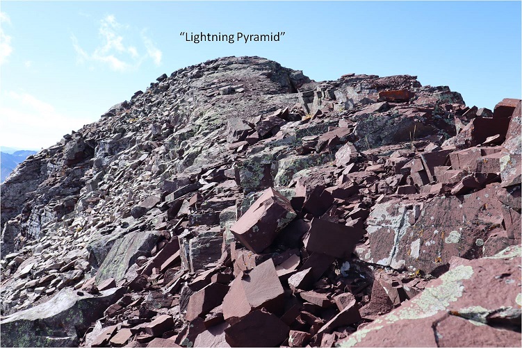
Once in the upper basin the sun started to rise and I had a good view of “Lightning Pyramid”. Traditionally you climb this peak as a couloir climb in the winter/spring, but obviously that wasn’t an option for me today and I’ve already been here in winter conditions: I wanted summer. I headed across the rocky basin, aiming for the couloir.
This next part in italics is personal and has no relevance on the trip report. Feel free to skip it if you’re just here for route information.
I’m going to summarize this as quickly as possible: I don’t consider myself to be an overly religious person. I grew up in the church but no longer attend (please don’t invite me to your church: I have personal reasons for why I don’t go). I do believe in God and find him more in the mountains than in a building surrounded by people. Often when I hike I have conversations with God. I do most of the talking, but surprisingly I started to feel him talking back (rarely, but it happened). I’m going to be honest here: If someone told me God spoke to them I’d think they were daft, so I totally understand if you think that of me, but I think what I’m going to say needs to be said (for me at least). Also, once again, I’m not a ‘preachy’ person and will most likely never mention anything like this again in a trip report.
For some reason I’m a ‘people-pleaser’. I have a need to be liked and I go out of my way to be friendly and helpful. I feel I need to be ‘perfect’. I don’t do well with rejection. I’ve always been an avid hiker but started seriously tackling peaks after I got a divorce. My ex had supervised visitation of the kids one day a week and on that day I’d go hiking. After my 13th summit of Pikes Peak I met someone on the way down who asked me which other 14ers I’d done. My response: “What’s a 14er?”
Obviously I was immediately hooked and after about 20 14ers I was hiking and talking to myself/God about how amazing Colorado and the mountains and hiking (etc) are and felt God speak back to me. He told me to hike all of the 14ers in Colorado solo. This idea intrigued me: I was both excited and scared. I wasn’t sure I could do it. Also, I didn’t really know why I should?
After hiking about 30 14ers solo I was sitting in a Girl Scout board meeting and Girl Scouts had just partnered with The North Face. We were brainstorming fundraising and marketing ideas and suddenly it all became clear: I could be the first woman to solo all the 14ers! Girl Scouts focuses on first women to do ‘stuff’. We could market this jointly with The North Face, the girls would get exposure to outdoor experiences and(hopefully) some free gear. It all seemed clear now: This must be why I was doing this! I felt I had purpose and direction.
I was so excited when I summited all 58 14ers solo because I felt I was doing it for a cause. Anyone who follows the 14ers site knows what a disaster that turned out to be, and honestly I just wanted it all to go away.
I kept hiking because I like to hike. On my first centennial after finishing the 14ers I felt God telling me to keep hiking the rest of the centennials solo and I balked. Once again, I wasn’t sure I could do this (hello class 5?) but after mulling it over I was willing to give it a shot. I knew I’d write up trip reports and post them to my website because that’s what I do, but he told me to keep posting to the 14ers site as well (I did not want to do this, but I did).
If you were to ask me why I was hiking all of the centennials solo I’d tell you I didn’t know. I honestly didn’t know, but I also wouldn’t have told you it was because “God told me to” because then you’d think I was totally nuts. But that was why I was doing it: Because God told me to.
Then Thunder Pyramid happened. At first I was confused because I knew I’d summited, and then embarrassed, angry, and frustrated. Why was this happening to me? Not only were people commenting on the 14ers site, but they were going through my LinkedIn page and challenging my accomplishments, posting negative comments on my website, facebook, and Instagram (sorry David for ghosting you: I honestly thought the feeling was mutual). People unfriended me both online and in person. They made up reasons to ‘prove’ I was lying and if they couldn’t find negative information they assumed or made it up. The dislike button was hit on my trip reports and I took it all very personally.
The hardest part was just because they were loud didn’t mean they were right. I knew I wasn’t lying but I couldn’t change their minds. I’m also sure they think their behavior was justified. I think it bordered on harassment. It was definitely bullying.
So here I was, halfway to the summit of PT 13,722 and all of this was going through my head, in addition to the anti-climatic day I’d had yesterday when I’d finished hiking the centennials solo and didn’t ‘feel anything’. I was asking God why I just couldn’t get excited about finishing the centennials solo? I didn’t want to post anything on the 14ers site because I didn’t want to go through the drama again. I mean, I know I shouldn’t care what other people think about me…
That’s when it happened. As soon as those words went through my head everything stopped and suddenly it felt as if I was getting the biggest, warmest, most enveloping hug I’d ever had. Overwhelmed I broke down and started crying big crocodile tears, taking huge breaths in and out between sobs.
That was it: I wasn’t hiking for a cause or to help others but because God wanted to teach me a lesson. He wanted me to realize it doesn’t matter what other people think. He just chose to show me that lesson through something I love: hiking.
“Wow” I thought: “He had me hike all the centennials solo to teach me not to care what other people think”. A simple lesson we teach out kids and that everyone knows but that I have difficulty accepting. This moment was so powerful I got out the altimeter/compass on my phone and took a picture of where it happened. I thought about just saying it was at 12K but ultimately figured that diminished the experience.
I wiped away my tears, looked at the mountain in front of me and thought to myself “So, if it doesn’t matter what others think of you why don’t you just turn back and go home?”
The answer? “Because I Love to hike”
With light shoulders and a renewed purpose I started off again. It took about 10 steps before another thought overcame me: “Why did God think I needed to learn this lesson? What is he preparing me for where I need to be ok with not caring what other people think about me?” (I squinted and closed my eyes, crossed my fingers and repeated: Please not politics, please not politics, please not politics).
Ok, moving on…
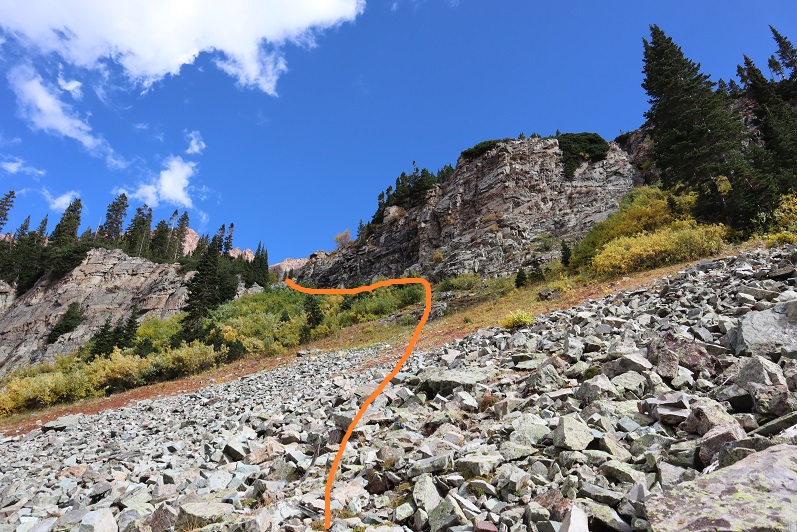
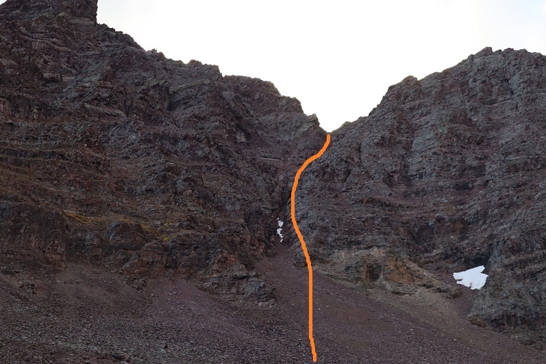
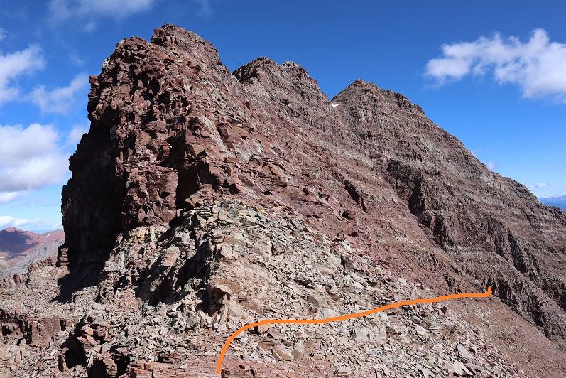
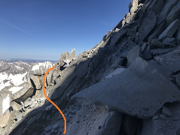
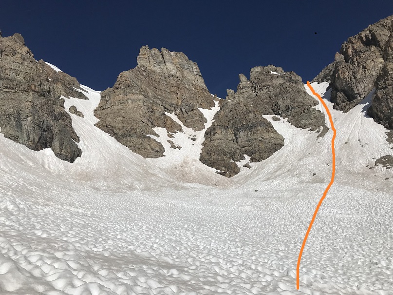
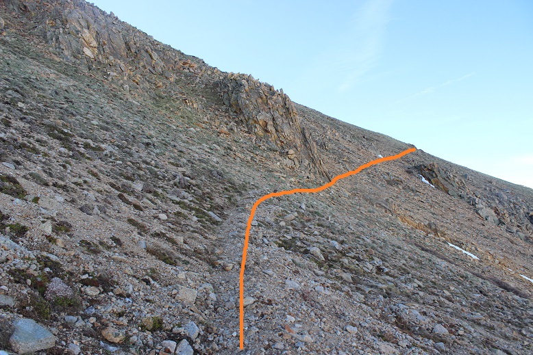
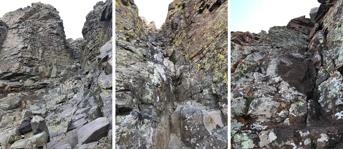
I trudged up the talus towards the couloir. This talus was nasty and each step hurt my ankle (not sure what I did to it yesterday, but it felt bruised). I made it to the base of the couloir and had a decision to make: How was I going to ascend this thing? It looked like it contained (more) nasty scree, so I decided to take the rocky rib to the right. This is the route I took:
I need to stress this might not have been the safest way to ascend. The rock was extremely loose and I had to check and re-check hand and foot placement with every step. It was sustained class 4 bouldering for a good 1000’ of elevation. It was slow going, but I love bouldering and that’s just what this was.
I stayed closely to the right of the couloir for as long as I could, but eventually I had to enter the couloir for the last part of the climb. This area was very loose and I’d suggest you stay as close to the rib on the right as possible.
Here’s looking back down the rock rib/couloir and into the basin
I made it to the top of the couloir and turned right (south), carefully climbing up the ridge
This was actually much easier than it looks (and easier than the climb to this point). I made it to the top of the ridge and saw an easy path to the summit of “Lightning Pyramid”
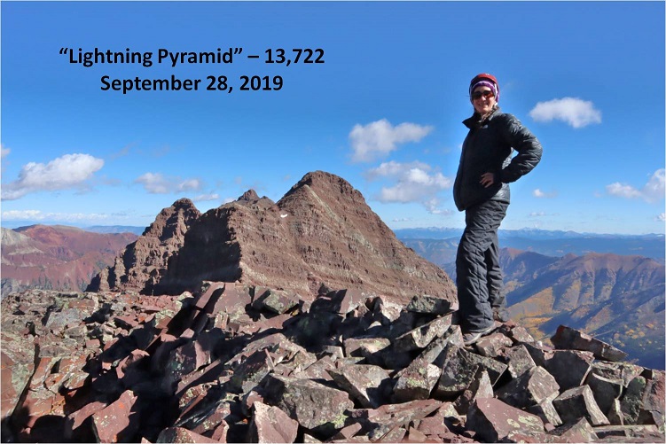
I summited at 10:20am
Lightning Pyramid summit:
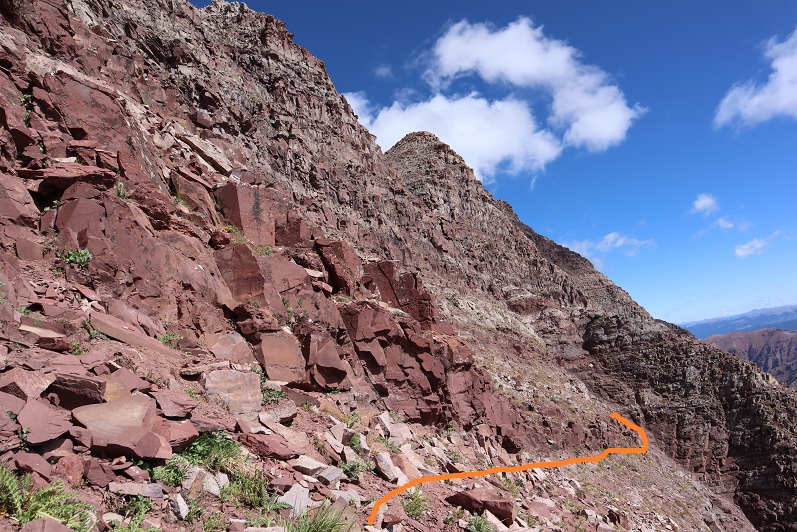
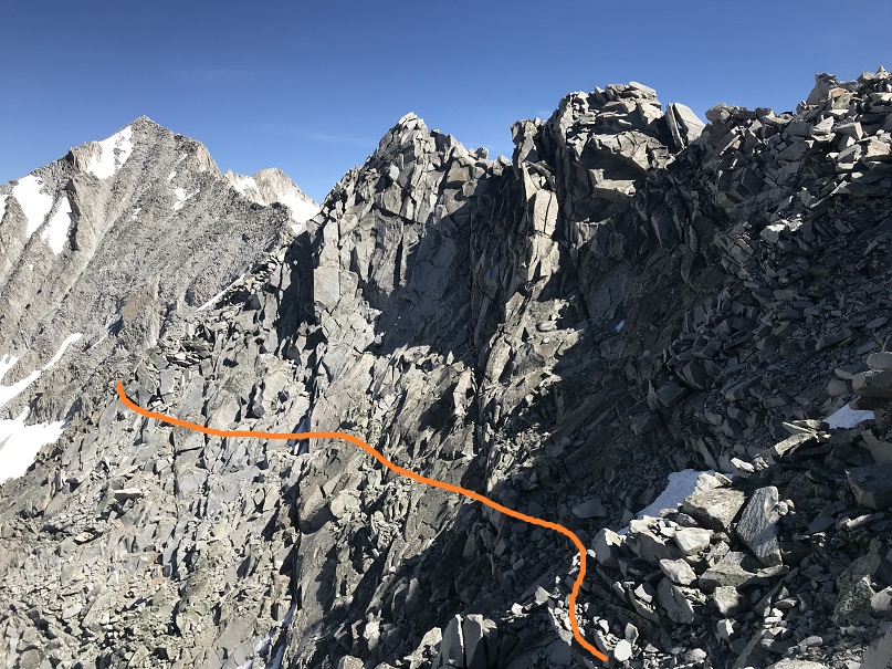
Ok, now time to head over to my old friend, “Thunder Pyramid”. I couldn’t find a lot of specific information about this traverse, so I had a lot of figuring out to do. I’d heard heading straight up and over the ridge wasn’t fun, and it in fact didn’t look like much fun, so I decided to scope out another way.
I headed back down to the saddle
Once there instead of hiking up the ridge I decided to stay level with the saddle and hike across the right (east) side of the mountain. This was surprisingly easy
Here’s looking back at “Lightning Pyramid”
I stayed at the same level as the saddle until I came to a gully. This area took some careful footwork but little climbing. It may have risen to class 3, but realistically was class 2
Next I came to a gully. This gully was very loose and I kept to the left side for stability, holding onto rocks and handholds in the boulders where available. This felt like class 3
At the top of this gully was another gully. I just aimed for the snow.
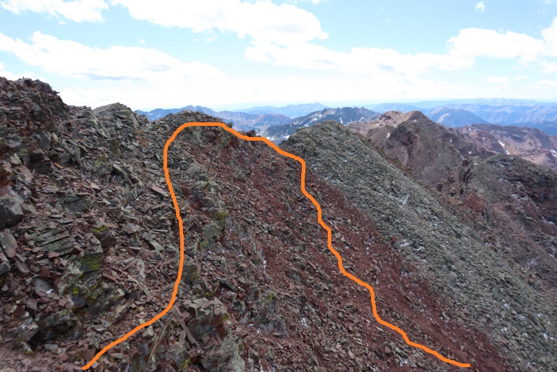
At the top of this gully is where the route picks up with the standard route up “Thunder Pyramid”. I turned right (north) and ascended the ridge
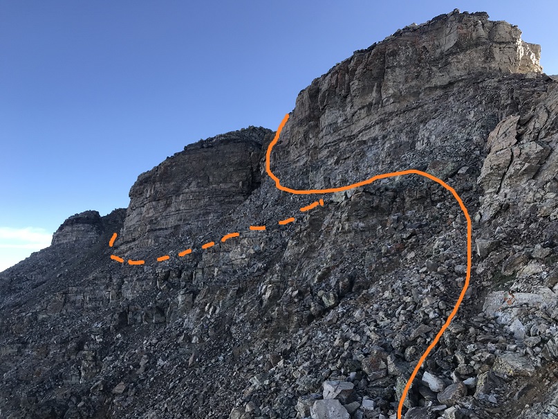
The top of the ridge wasn’t the summit however. I took the solid route up, the dotted route down. If I were to do this again I’d take the dotted route both ways because it doesn’t lose elevation.
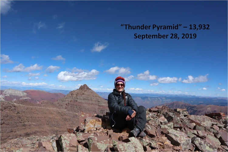
I summited “Thunder Pyramid” at 12:15pm. It took me just under 2 hours from “Lightning Pyramid”. Unfortunately, most of the pictures I got at the summit I realized were blurry when I got home (still figuring this new camera out)
But I did get one “ok” picture
Thunder Pyramid summit:
Up until this point doubt had crept into my mind: maybe what others were saying was true and I hadn’t really summited “Thunder Pyramid” last time. Maybe I’d ended up close but not exactly there? I’d been in a hurry because I’d been having a Raynaud’s attack and I didn’t take my normal number of summit photos/videos (I don’t usually get videos in winter conditions because it’s a death sentence for me to take off my gloves to operate the camera). So today I walked all over that summit, looked around and confirmed what I already knew: Yes, I had indeed summited the last time I was here. Also, the weather today was absolutely perfect! Those 50mph winds never materialized.
I decided to head back down the way most people hike up. I made my way back to the ridge and down the gully
Check it out! Now I know why it’s called the “White Gully” (Last time everything was white)
The descent down “Thunder Pyramid” was no more fun than the ascent up “Lightning Pyramid”, and considering both the gullies and couloir I’d say it’s probably easier to do Thunder first and then traverse over to Lightning. Also, I know this is usually done as a snow climb, but I felt much safer on the scree and talus than I had on the snow. When it was covered in snow I felt like if I slipped I’d fall and never stop sliding. Here I knew I could slip but I wouldn’t fall very far. This climb wasn’t ‘easy’ but it definitely wasn’t as difficult as I’d anticipated.
Hiking down was like déjà-vu (as it should have been)
I made it almost to the bottom of the gully and turned left
And descended the slopes into the basin
Also, I found a shell
I made my way back to the West Maroon Creek Trail and hiked out, loving the fall colors in the daylight.
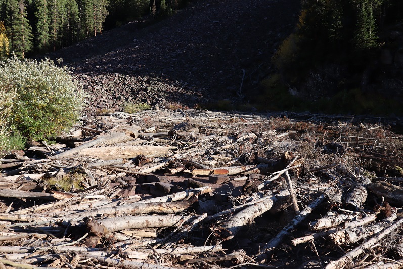
There were a ton of people around Maroon Lake when I got there, all enjoying the fall colors. The base of the lake resembles the Snowmass log jam
While the 50mph winds never materialized on the summit(s) today it was really very windy at the lake. I decided to head to my truck to clean up and then watch the sunset. There was a line of cars waiting for a parking spot and I had to tell no less than 50 of them I wasn’t leaving. None of them took it well, but it had been a long day, and I figured I’d earned watching a good sunset.
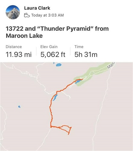
I made it back to my truck at 5:15pm, making this a 12 mile hike/climb with 5062’ in elevation gain in 14 hours.
I enjoyed the sunset
And as soon as it was over I hopped in my truck to drive home. There was a line of vehicles waiting for a parking spot that lasted for over half a mile down the road. The shuttle had stopped for the day and I drove 2 people down to the bus stop because they’d missed the last bus. They were a nice couple from Georgia who were happy not to have to walk those 13 miles back to their hotel. I hope they enjoy Colorado as much as I do!
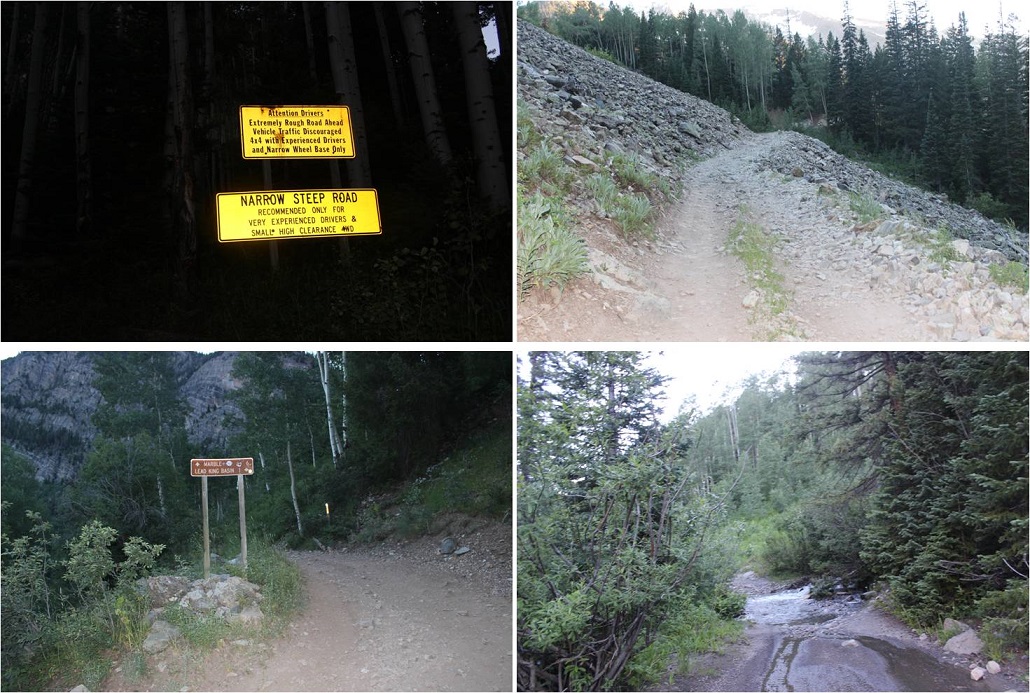
After my failed attempt last week I decided to do more research and try Hagerman again today. I learned the upper road to Lead King Basin had an avalanche about 1 mile after the stream crossing (very close to where I’d parked) so I decided to take the lower road from Marble to Crystal instead. I’d heard a lot of conflicting reports on this road, but when I searched it online I found this video, which was very helpful.
The road itself wasn’t that difficult with a 4WD (I wouldn’t attempt in a 2WD), and my Tundra handled it just fine. The only problems I can foresee would be passing other vehicles. Luckily there are a lot of small turnout areas on this road, especially before and after the committing areas. I drove in at night to ensure I wouldn’t need to pass oncoming vehicles, which I knew would be problematic in my big truck, no matter the size of the other vehicle.
Since I drove in when it was dark I wasn’t able to see the Crystal Mill, but I expected to see it on my way out the next day.
I made it to Crystal around 10pm on a Thursday night and all the lights in the ‘city’ were out. As I passed the Crystal Mill I saw a sign saying Lead King Basin was closed, so I dimmed my lights and parked at the east end of town, mentally calculating the extra mileage and what time I needed to start in the morning. Looks like I was getting about 3.5 hours of sleep.
As I was preparing to go to bed (my lights were out) I saw the lights go on in the second story windows of a cabin across the street. The two story 18th century style wood cabin had two tiny windows upstairs, covered in lace curtains. The light from the windows was glowing pale blue, and I saw the silhouette of a woman walking around. She was wearing a long nightgown and her hair was pinned up in a bun. The woman slowly walked around the room, picking up objects and setting them back down. Then the lights went out.
I set my alarm for 2am. When I woke up I crawled from the back seat into my front seat and started putting on my shoes. I didn’t need to turn on any lights because the full moon was shining bright enough to allow me to see. I saw a fox run down the center of the road, and then noticed the lights in the second story window of the house across the street turn on. Once again I saw the silhouette of a woman walking around. She was wearing a long nightgown and her hair was pinned up in a bun. She slowly walked around the room, picking up objects and setting them back down. Then the lights went out.
Whoa. That was spooky. I knew I hadn’t woken her up because I hadn’t made any noise, opened any doors, turned on any lights, etc. I was going to have to investigate that house in the daylight upon my return because that was just… weird. I mean, what are the chances she was up at 10pm and 2am, just like I was? Also, how many women still wear nightgowns to bed?
Ok, so I was on the trail at 2:15am. It was a 2 mile hike to Lead King Basin along a 4WD road that didn’t offer many turnouts, but was indeed open and my truck could have made it just fine to the trailhead. Oh well, I was getting in 4 extra miles today.
The trailhead was about 2 miles from Crystal. I didn’t see any of this in the dark (these signs seriously need reflective elements to them for us who start before daylight).
There’s a nice junction where you turn left to head up and around the north end of Lead King Basin to Geneva Lake
Here the trail was quite overgrown with flowers, plants, and trees. I thought to myself how it felt a little like being in a rainforest, and how much fun the flowered areas would be on my way back (I’m not a fan of flying-stinging insects, so I was being sarcastic). On the positive side: no mosquitoes!
It was in this area I saw my first ever porcupine on the trail. I see them along the side of the road when I’m driving to trailheads quite a bit, and one time I heard one under my truck at the Grizzly Gulch trailhead and had to fend it off in the middle of the night, but this was the first one I’d encountered on the trail.
He was just sitting there, staring at me. So I talked to him to get him to move. He turned around and waddled ahead of me, staying directly in the middle of the trail. I didn’t really want to follow a porcupine to the lake, so I talked a little louder to him. He scurried into the bushes and I immediately realized the error of my ways: now I couldn’t see him and didn’t know where he was. I didn’t want to experience porcupine quills and all that entails, so I nicely talked to the porcupine in a sing-song voice as I passed where I’d last seen him, crossing my fingers I hadn’t made him mad/scared and that he wasn’t sitting in the bushes: poised to shoot.
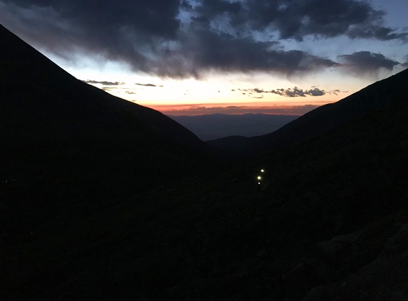
Mission “pass the porcupine” accomplished I continued on to the lake. The moon was full and bright so I conserved flashlight battery and hiked by the moonlight. Just as I made it to the lake I heard a faint barking in the distance. I was worried there was a lost dog out there somewhere (hey, it’s happened) but as I rounded the bend to the lake the barking got louder, and then I saw a flashlight turn on. The owner was pointing the flashlight in the direction opposite of me, and the dog was starting to bark really loud. I yelled up at them “It’s just a hiker!” I received no response, but the dog stopped barking and the flashlight turned off. It was about 4:45am. I immediately felt more secure hiking in the dark: I was pretty sure there wasn’t another animal in the area, as that dog would have been alerted to it.
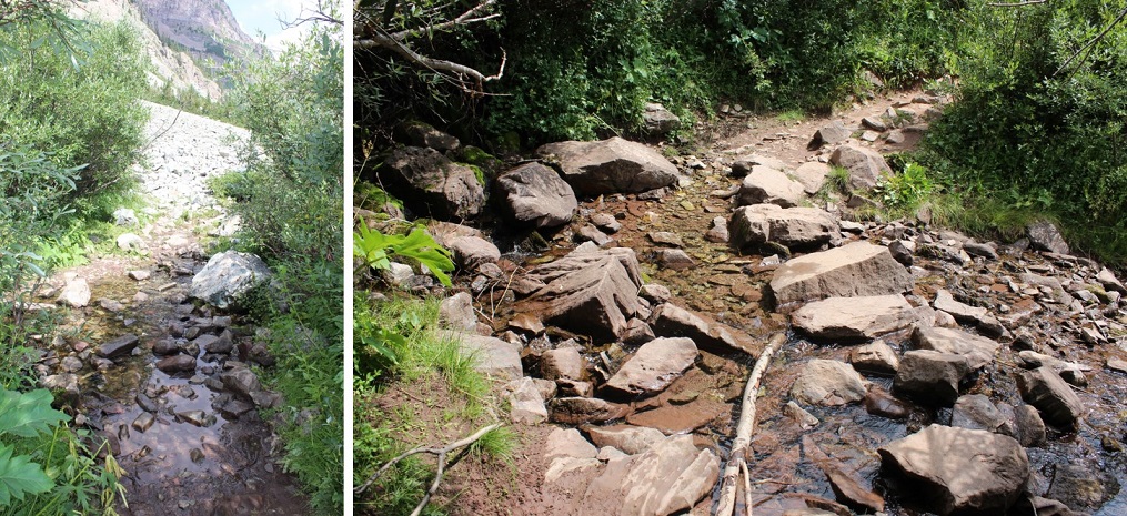
Just north of the lake the trail continues north and then there’s a stream crossing. There were tons of areas to cross here, and all required taking off my shoes. At times the water was knee deep (I’m 5’4”), but mostly it was just high on my shins. Also, it was cold. When I was done my water shoes were quite muddy so I left them on a rock to dry and to pick up later.
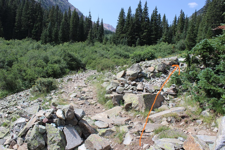
This is where my trip report diverges from some of the more popular field guides. I took the 1st west side gully to the southwest ridge.
I crossed the creek and headed north for about 100 yards, looking for a gully to my right (west gully). I’d seen pictures of the access gullies on the east that were still full of snow, so by taking the west side I was hoping to avoid any snow filled gullies. I wasn’t disappointed. Here’s the gully I took:
This gully was steep and loose. I did not feel comfortable sticking to the scree in the middle, so I stuck to the right side where the rocks were larger.
My goal was to gain the ridge as quickly as possible, aiming for this small saddle
Here’s looking back on the route
From the small saddle you can see Hagerman Peak
I turned left (north) and faced a class 3 section and headed up and over the ridge.
At the top of this point I could see the rest of the route before me
It’s important to note if you’re attempting this ridge to start early and make sure you have a large weather window. This ridge is very committing. I went at it slowly and carefully. The rocks here crumble: I’d find a hand hold, grip, and the rock would crumble in my hands. I had to make sure to test out each hold several times before using it to secure myself. Luckily, the ridge was snow free.
This is definitely a ridge you take by… sticking to the ridge. I was able to go directly up and over most areas, dipping to the left or right just a couple of times. As I ascended the rocks stopped crumbling and started tipping a bit (nothing fell, but not much was stable). Here’s the final push to the summit.
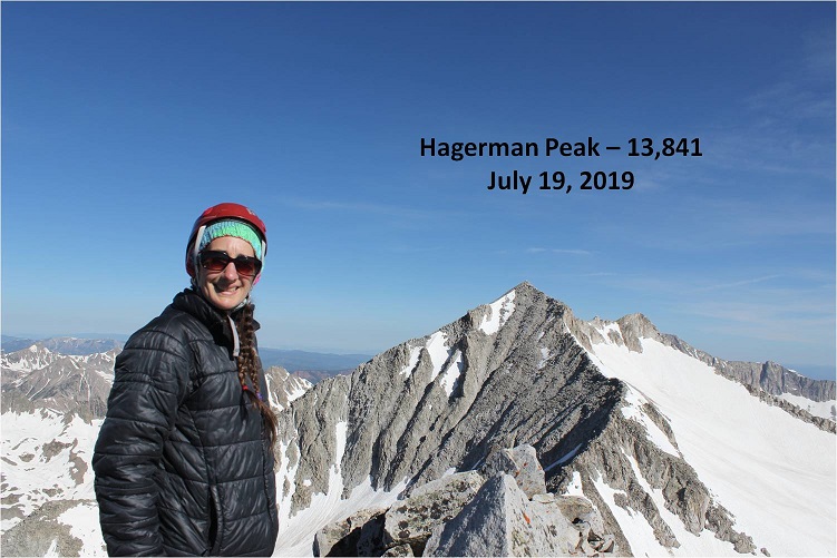
I made it to the summit at 9:10am
Hagerman:
I started the ridge at 7:15am and ended at 9:10am, making this a 2 hour ridge to cross. Here’s looking back at the route
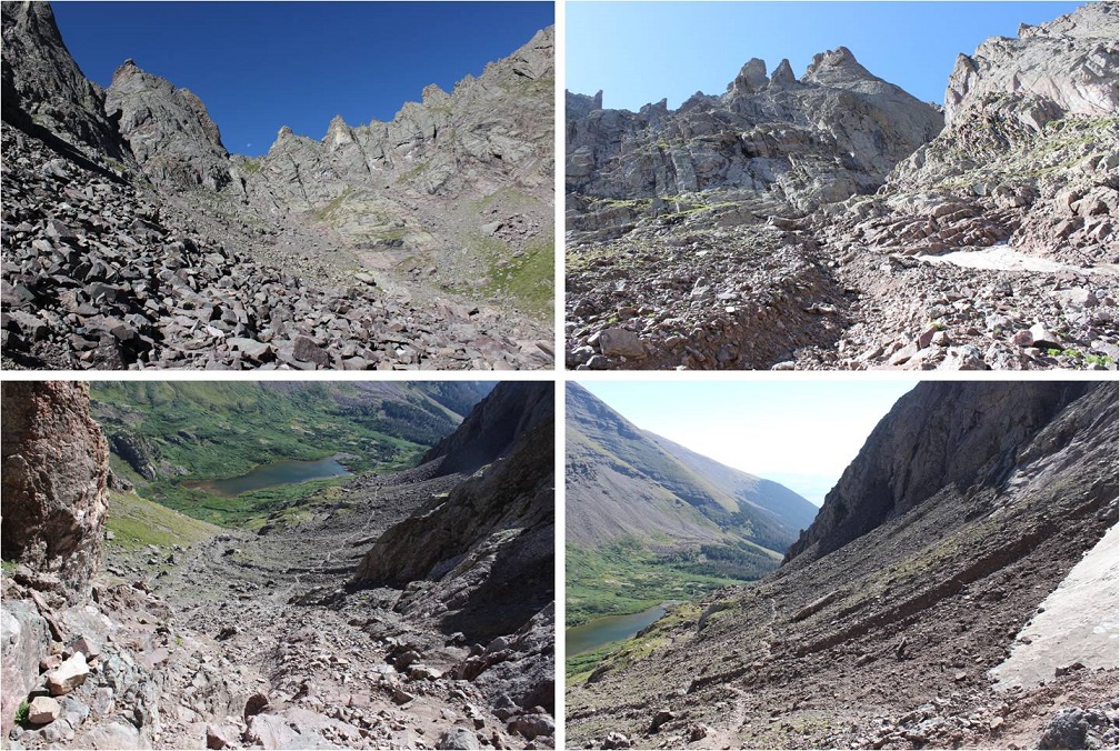
The day was absolutely beautiful and it was still early morning so I considered traversing over to nearby 14er Snowmass Mountain. I’d done a lot of research and came up pretty empty with details, but I knew it could be done. I spent quite a bit of time looking around at possible paths before deciding if I was going to attempt traversing or not. I looked at Snowmass Mountain’s east side: nope, that was a no go. Tons of snow and no way I could see to begin from the summit. Next I looked to the left (west). A lot less snow but the shadows weren’t helping much.
I stopped and did a lot of thinking here. I knew the traverse was possible. The rock looked loose, but I could also see goat trails (or maybe those were gullies…). I was confident I could find traction in the dirt. I mentally calculated how much time I had, the weather, and looked for exit strategies in case I got to a place where I couldn’t continue. I decided both time and weather were in my favor today so I decided to go for it.
Note: This may not be the safest way to traverse from Hagerman to 14er Snowmass Mountain. For me and my abilities, it was the safest way on this particular day.
The first move committed me to the traverse: I down climbed about 50 feet of… this. I’m not sure I could have climbed back up this wall. (Ok, I could have or I wouldn’t have climbed down, but it would have been a lot of work).
I turned and looked towards Snowmass Mountain. This is what I saw. So I headed northeast and rounded the corner.
I was taking this one section at a time, focusing on what was directly in front of me but glancing up at the rest of the route every so often to make sure I was on course. I found myself trying to stick to the ridge, but that is not the way to do this traverse: you need to drop down much lower than you want to. Every time I tried to regain elevation I was forced to head back down.
My advice is to descend lower than the saddle, and then take the scree line up to where the trail connects with the east route. The best terrain was consistently 100-200 feet below the ridge.
Once you connect with the ridge where the east route links up you can easily follow the cairns to the summit.
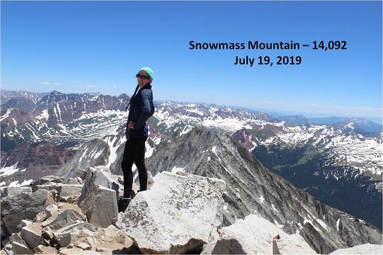
This was a very slow climb. Everything was loose and what wasn’t loose was scree. I took extra time to be careful with each and every step, and kept the entire route in view as often as possible. I most likely made this take longer than necessary, but I stayed safe. I made it to the summit of Snowmass Mountain at 12:50pm, making this a traverse that took over 3.5 hours to complete. Here’s looking back at the route
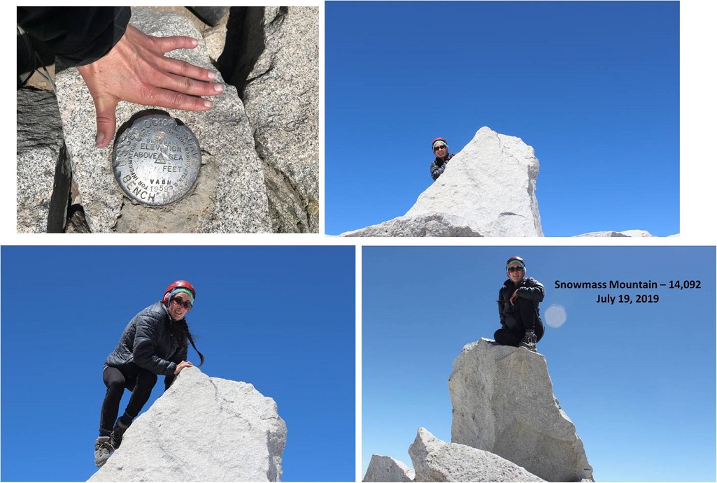
Summit photo
Summit Video
I spent a lot of time on this bluebird day taking pictures. It’s harder than you think to set an automatic timer and then scramble up to the summit block. It took a few tries… and the ones that actually turned out were fuzzy, so I gave up.
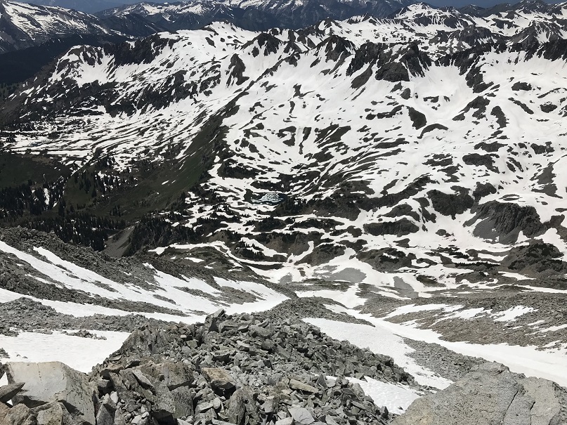
After spending much more time on the summit than necessary I needed to make the decision of how I was going to head back down. I’d been hoping, similar to the west side of Hagerman, that the west side of Snowmass Mountain would be free from snow. No such luck. There was still snow in the gullies.
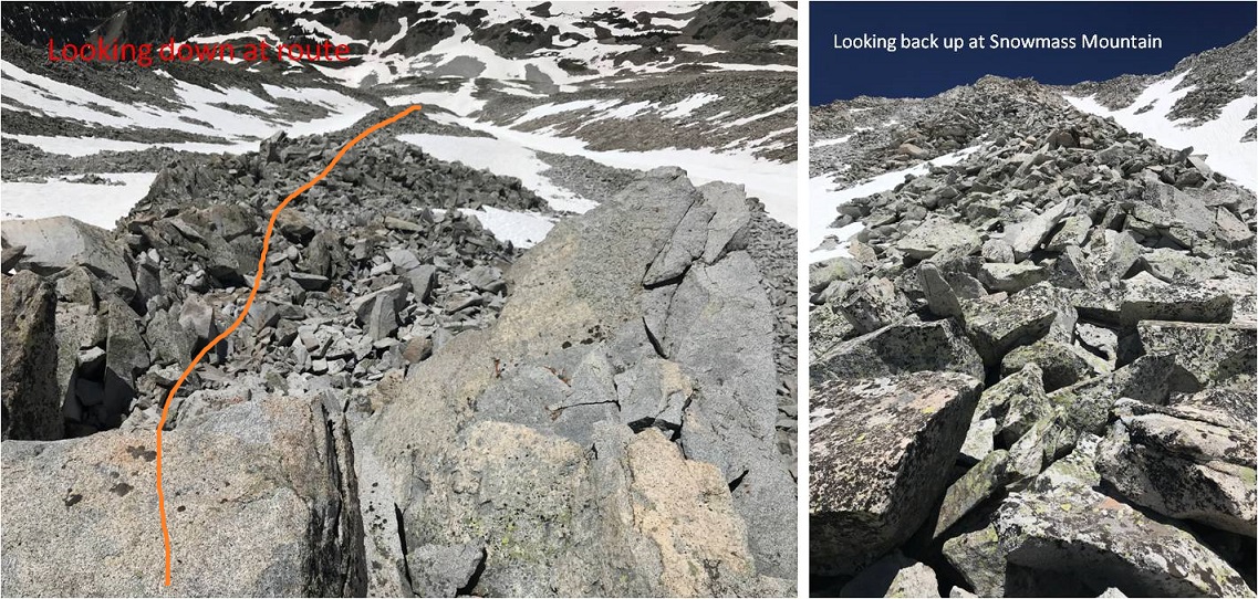
I did not want to do the traverse back to Hagerman because that and another 3 hour traverse would have been exhausting. I could tell the gullies on the west side of Snowmass Mountain ended/cliffed out in a waterfall area, but I could also see bare rock I could traverse either north or south to connect up where I needed to be. I decided to head down Snowmass Mountain’s west side, but for safety I would slightly alter the traditional route. It was too late in the day to safely take the gullies, so I was going to take the rock rib that wasn’t a rib but a bunch of loose rock that bulged from the mountainside. Here’s the route I took
Do not let these photos fool you: this is where I encountered the loosest rock of the day. These rocks are the size of refrigerators and tables. Every 3rd rock would tip, and I would think to myself: “That’s a lot of rock to tip!” Luckily not one rock actually tipped/fell/tumbled/caused a rock slide.
This was a very slow process but eventually I made it to the waterfall area. My feet were starting to hurt at this point from all the rock work.
The snow ended just at the waterfall and surprisingly I crossed the waterfall pretty easily here and headed down. I made it down to this area at 3:30pm.
The snow started up again after the waterfalls
From here I looked down at the basin, and unfortunately there was a lot of snow covering the trail I was supposed to take back to Geneva Lake. That snow was going to be several feet of mush at this time of day so I decided to traverse south along the mountainside, looking for a safer route down.
I made it here and unfortunately cliffed out yet again… but I could see where I needed to be: That goat trail should get me down.
After searching around for a bit I was able to find a way off this spot by circling the area to the north and down the small cliff
From here I followed the goat trail that went down a forested gully and came out ready to exit and head towards Geneva Lake.
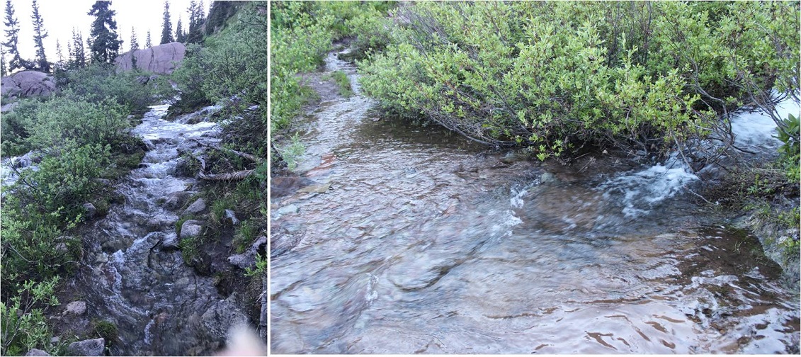
The area through the trees to the stream crossing was wet.
At the stream crossing I reconnected with my water shoes. They were now dry but had been scattered and were now no longer sitting on the rock together but in the grass a few feet apart. I changed out of my shoes into my water shoes and crossed the creek
I’m ashamed to say the creek ate my water shoes. Seriously. The banks were quite muddy and during the last two steps my water shoes got sucked off my feet and into the muck. I spent 20 minutes trying to dig them out with my ice axe, but no dice. I couldn’t find them. They were buried in the banks of the stream. Ugh. From here I sat and put on my shoes and new, dry socks. I looked back at the route I’d taken to Hagerman.
My feet were hurting, and I still had 4 miles to go. Time to hit the trail. I skirted the lake and headed back towards Lead King Basin.
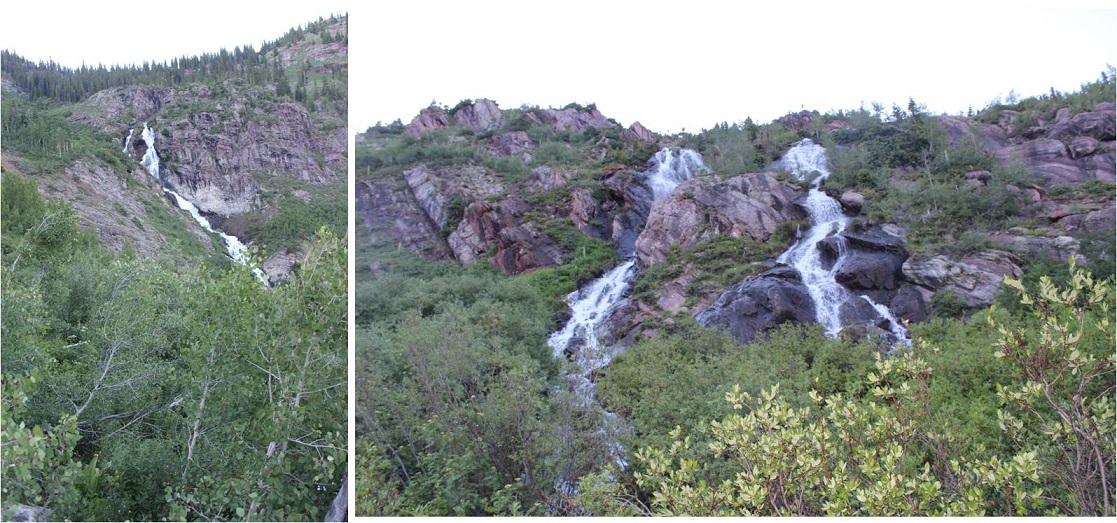
One great part of this hike was being able to see the waterfalls. And, since it was so late in the day: no bees!
At the base of the waterfalls the trail was running with quite a bit of water.
In the daylight I could see the upper 4WD trail to Lead King Basin
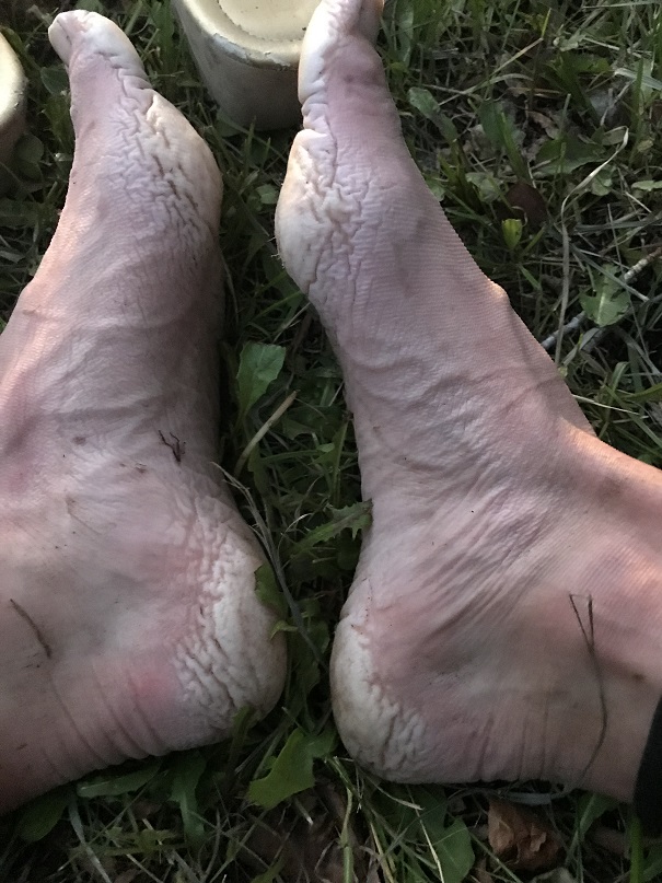
This is where my feet really started burning. I was surprised, since I’ve done more challenging hikes with greater mileage/elevation gain than this one, yet my feet were very sore. I made it past the Lead King Basin trailhead as the sun set and each step I took hurt more than the last. I wanted to cry. I’ve never felt foot pain like this. Also, I’d been hoping to stop in Carbondale tonight to get Subway for dinner, but it looked like I wasn’t going to make it back in time for that to happen.
It seemed as if it were taking forever to reach Crystal. I eventually came across a sign that said “Private Property next 2.5 miles” and mentally freaked out for a second. There was NO WAY it was 2.5 miles to Crystal! Not only could I physically not make it 2.5 more miles (My feet! My feet!!!) but I was pretty sure it had been 2 miles to the upper trailhead. Had I been wrong and it’d been 4? Ugh, I needed rest and I needed calories because my mind was playing tricks on me. Luckily it was only half a mile past that sign to the town of Crystal. I finished this hike at 8:45pm, making this a 15.5 mile hike/climb with 6211’ in elevation gain in 18.5 hours.
Read on for gross feet pictures and segue into the next hike…
I limped to my truck and sat down by a small access creek about 1 foot wide on the side of the road. I took off my shoes and gasped: Yuck! My feet had never looked like that before! The heels and pads were completely swollen and red/gray, and very painful to the touch (no blisters though).
I decided to wash them off in the water. I placed them both in at the same time and immediately felt relief, and then 2 seconds later started screaming because they started burning as if I’d placed them into a pot of boiling water. My feet turned bright red and were rendered useless. Seriously.
I couldn’t walk the 5 feet to my truck so I sat there for half an hour in the wet creek bank and thought about what I was going to do. I was supposed to drive to the next trailhead for my hike tomorrow, but doing the math if I left now I would get there and only have 1 hour to sleep before starting again. This hike had taken much longer than anticipated. I’d only had 3 hours of sleep last night so it was a bad idea to try to drive and then hike at this point. Also… my feet. I wasn’t sure they’d function tomorrow. They needed time to dry out. But long distance runners/thru hikers have this stuff happen, right? They just tape them up and hike/run anyway. I decided I was really, really tired and should sleep before attempting anything. I’d adjust my schedule as needed.
I had pain killers but decided not to take them: I wanted to be sure of an accurate pain level when I woke up so I could plan my day accordingly. Unfortunately, I never really made it to bed. I crawled into the cab of my truck, thankful I hadn’t rolled up my sleeping bag this morning. I tried to nap but even though I was exhausted I couldn’t get myself to fall asleep. After 2 hours I gave up and decided to drive home, with the added bonus of doing so in the dark late at night so I most likely wouldn’t need to pass anyone on the shelf road out. My feet had dried out a bit and were raw but less sore. They still overreacted every time I tried to use them. My right foot was healthier than my left; I couldn’t press down on the pedal very hard, so I drove slowly, but I made it.
Oh, and since I’d returned in the dark I never got to see the Crystal Mill, or get a good look at that old house with the lady in the windows…
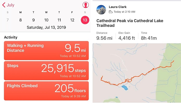
This was my second attempt to summit Cathedral Peak this year. The first time was back in April when I had to turn around due to avy debris I was unable to navigate in the dark. I’d read a recent conditions report stating there was now a path around the avy debris and decided to attempt Cathedral Peak on my next free day.
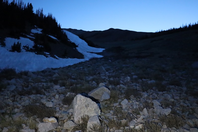
My sleeping schedule is currently all messed up. I’d woken up at 2pm, took my daughter to the art museum, and then left my house at 9:30pm to make it to the trailhead by 2am. I wanted to get an early start on this one because of the potential thunderstorms later in the day, but mostly because I was worried the snow in the couloir would soften up early in the sunlight.
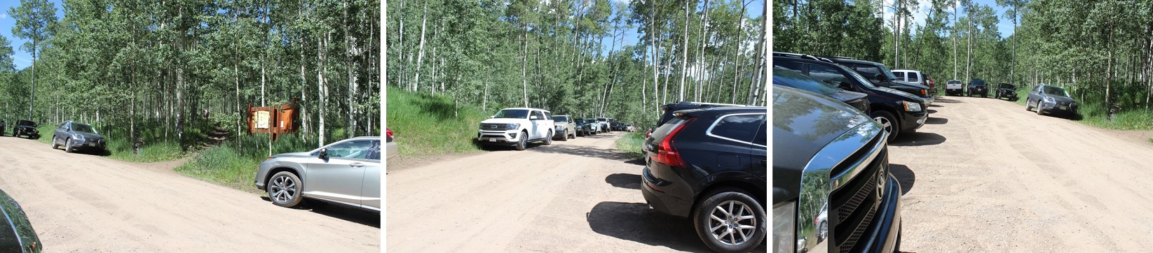
The trailhead had room for plenty of vehicles. When I arrived, there were 4 or 5 cars in the lot, but when I left there were dozens, all lined up on the side of the road. Also, apologies to the man I woke up who was trying to sleep in his vehicle: apparently my trucks headlights were too bright. I was on the trail at 2:10am.
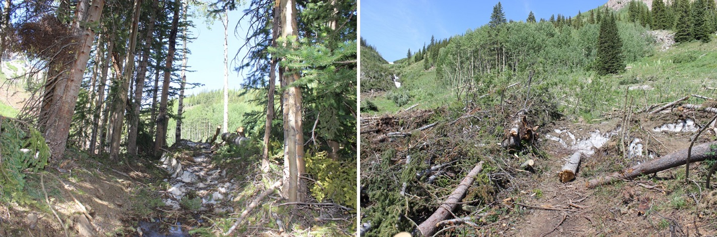
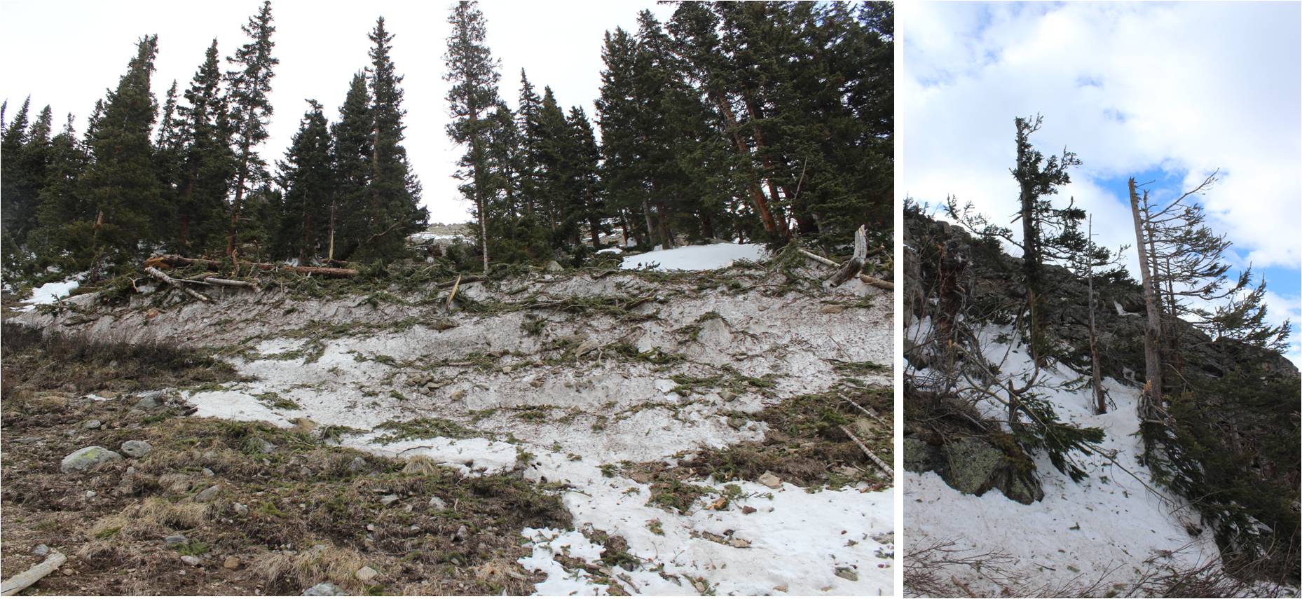
The trail starts off meandering through an aspen grove. Last time I was here this had been covered in 3-4 feet of snow and I’d missed the sign…
I made it to the avy debris area after about a mile and a half of hiking. When I was here last I couldn’t see the top of the downed trees; they were supported by a huge layer of ice that was at least twice as tall as I am. Today the area was much more manageable to navigate.
Next I followed the side of the mountain up some switchbacks on an obvious trail. Side note: Beargrass (the tall plant with lots of tiny white flowers) looks scary in the dark; kind of like children waiting for you silently in the night. I like to keep my flashlight directly in front of me to keep myself from freaking out.
Once again, the trail is easy to follow. Here’s a look back at the trail
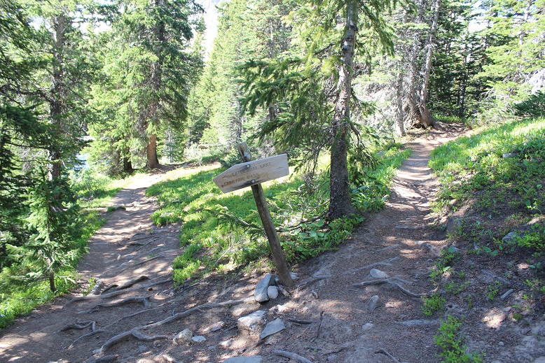
I stayed left at this junction on the way in (but on the way out ended up coming back down the Electric Pass trail and rejoining the trail here)
The most difficult route finding occurred here, before the lake. I knew I could pass the lake on either side but due to a creek crossing I didn’t want to take I navigated to the north. I was told there was a miners trail here, but was unable to locate it in the dark. I lost half an hour going up and down the trail, looking for the offshoot and was unsuccessful (although I did find a lot of trails that went in other directions). Finally, I decided to just head northwest through the willows. This sounds easy enough, but the willows here were several feet taller than I am. I just turned my trekking pole parallel to the ground and held it out in front of me while I bushwhacked across them. I only got hit in the face a few times (and had a swollen upper lip the rest of the day to prove it). The good news is I made it across, and the willows were no worse for the wear. On my way back I could see the miners trail in the daylight (more on this later). Here’s the route I took through the willows and across the creek (which was small enough I could jump across here without getting my boots wet).
Next I rounded Cathedral’s east ridge and found a well cairned trail that led me into the basin
This trail brought me above Cathedral Lake
This route was well cairned, and the talus was terrible. I got to be the first to experience the spider webs this morning. Tons of fun in the dark! Second only to phantom children.
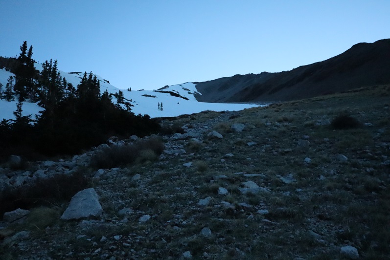
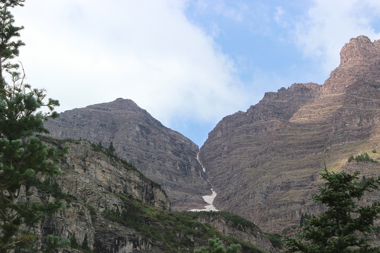
Once in the basin you can see the route up the access gully. Today the basin was half filled with snow and I couldn’t help but think how much easier it would have been to traverse if it had all just been snow.
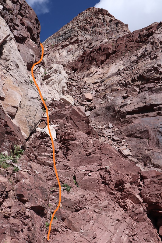
In the morning I didn’t need snowshoes. I made it to the base of the access gully at 5:25am and put on my crampons and helmet and got out my ice axe and garden tool (that tool’s really coming in helpful, but I may just break down and buy another full ice axe). This is steeper than it looks, but luckily it ‘went’ all the way to the ridge
Here’s looking back at the basin
The snow was still really firm and I was unable to kick in steps but I was able to ascend with crampons and ice axe. I was glad to have both my ice axe and (garden) tool. I was about 30 feet from the top when I decided it was better to be on the left side of the gully rather than the right and started traversing sideways. About 4 steps in my crampon hit the ice sideways and my boot slipped out of the bindings. This was the worse possible place for this to happen: I was balanced on the side of the wall of ice, with one foot in front of the other (I wasn’t able to kick in steps here, and was balancing on a very small mound of frozen snow with my right toe pointed at my left heel, sideways). I needed to have an ice pick in the wall for balance or I was going to slide all the way down the gully. My pulse rate quickened as I realized the severity of the situation. Luckily I had two tools. I carefully balanced on the working crampon and tried to knock the other back into place with my ice axe. No dice, my crampon wasn’t going back over my toe by sheer force (as well it shouldn’t; I’d fastened it pretty tightly initially, and had no idea how it had been knocked loose from my boot). That meant I was going to have to untie the crampon and re-tie it with one hand while holding onto the ice with the other: Without losing my balance and sliding down a few hundred feet of ice. It took me a solid 10 minutes to gingerly untie and re-tie the crampon, but I was able to do so from where I was perched. I mentally praised my daily yoga routine for developing my balancing skills. Here’s where my crampon was knocked sideways
Ok, crampon back on I carefully hustled my way to the top of the gully, topping out at 6:09am, a little shaky as I looked back down.
From the top of the gully I turned right and noticed the rest of the route was snow free. Woot! I took off my crampons and put them in my pack. Time for some scrambling! On the way up I took a class 3-4 route up and over the ridge (solid line) on the way down I found the cairns and took the class 2+ route along the side of the towers (dotted line).
The last bit to the summit was easy
I summited at 6:40am (it took me half an hour from the top of the gully to summit).
Summit Video
Check it out! A summit marker!
Here’s a look back at the basin and my route up to the gully
Time to head back down. I made it back to the top of the gully and met 3 other climbers. We chatted for a bit. They said they’d kicked in steps on the way up to make their descent easier. It was 7:20am as I headed back down the gully. On my way up I’d forgotten to put on my gloves (it wasn’t cold) and my knuckles were a bit tore up, but that’s the best way to learn a lesson. Also, I wasn’t sure I’d have been able to untie and then re-tie my crampon with gloves on. At any rate, I was putting gloves on for my descent.
I turned, faced the gully, and began my descent. It was only just after 7am, but there was a huge difference from when I was climbing at 6am. The snow was quickly softening up. I was careful to either avoid the kicked in steps, or if I had to use them to make sure I only made them better, but the softening snow wasn’t making things easy. Sticking to the climbers left of the gully seemed the best way to go. About ¾ of the way down the snow was slush and I really just wanted to glissade the rest of the way (but didn’t because I was worried I’d mess up what was left of the kicked in steps).
Here’s the route once again
I actually took more time than necessary heading back down, and as soon as I could I switched out my crampons for snowshoes to exit the basin.
I met a man starting his climb up the gully and was worried for two reasons: #1, the three people I’d met at the top of the gully hadn’t yet began their descent, and #2, it was rather late in the day for someone to start their climb (the snow at this point was rubbish). I figured the trio up top must have decided to picnic at the summit and asked the current climber to look out for them. It was now 8:25am, and I knew I wouldn’t want to begin my descent at this time. I figured I’d timed it pretty well starting at 2am: it would have been perfect if I hadn’t spent half an hour lost in the willows.
Speaking of willows, I made my way back to the small creek crossing and in the light of day was able to locate the miners trail. I crossed the creek and headed up the slope, aiming at a small pine tree. From here I was able to follow a faint trail, which eventually led me to the Electric Pass Peak trail, which I took back to the junction with the Cathedral Lake trail.
On my way out I couldn’t help but think how dreadful this climb would have been with snow all the way up to the lake! I have no idea how I found my way so far the first time. Here’s a look at some of the avalanche debris
I made it back to my truck at 10:55am, making this a 9.5 mile hike with 4416’ in elevation gain in 8.5 hours. The hike felt longer than it was, most likely because much of the trek out was done in direct sunlight on the way out (no trees for shade).
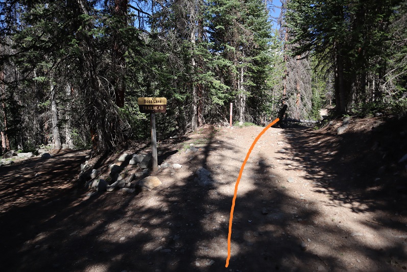
I’ve been listening to a lot of Taylor this week, so it was only fitting I chose to hike Taylor Mountain A today. I made it to the snowmobile area (lower trailhead) around 3am, and decided to park here. There was one other vehicle when I arrived, and 7 when I left. This area can hold about 10 vehicles if everyone parks nicely. Be sure to park behind the red and white signs.
One of the deciding factors for parking here was the sign indicating the trailhead was only 1 mile away. This was only supposed to be a 7 mile hike, so I welcomed the added 2 miles distance. Note: The trailhead is actually 1.4 miles up this road, which isn’t a big deal unless you’re hiking and worried you ‘missed’ the turnoff in the dark.
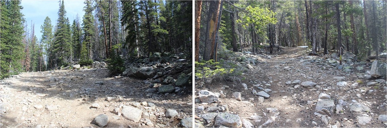
The trail started off dry-easy-4WD, and stayed that way until I made it to the Boss Lake Trailhead. I could have easily driven my Tundra here.
About ½ a mile before the Boss Lake trailhead there was avy debris that had been cleared just enough to let a vehicle through
From here the road got a little muddy, but it wasn’t something that would stop a 4WD vehicle from making it to the trailhead.
I was very excited when I made it to the upper trailhead (I hadn’t past it in the dark!). There was a little bit of snow here, and no vehicles parked. There was room for about 4 vehicles total.
I followed the 230 for another quarter mile or so, realized I’d missed the turnoff to the 230C in the dark, and turned around. The turnoff was about 1/10 of a mile away from the trailhead.
The road became increasingly rockier but was still dry
On my way back I took a picture of the turnoff to 230C. It’s on the right side of the road. The intersection is easy to see in the light, but easy to miss in the dark, and as you can tell, the signage is well off the road (20 feet down 230C after the turn).
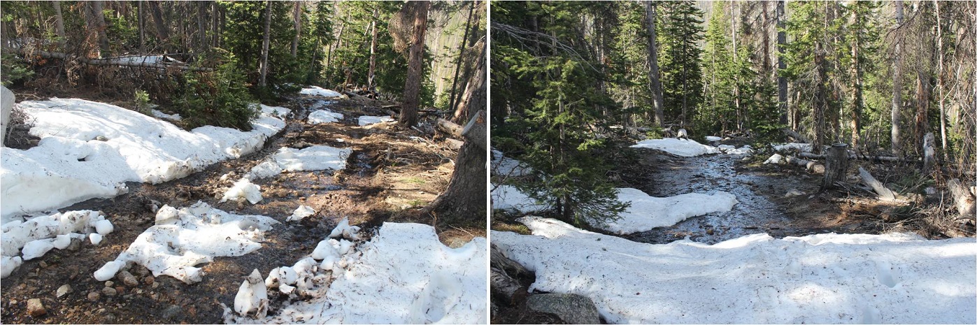
This is where the road really started to get muddy
There were tire tracks from an ambitious off road driver all the way to about 10,880’.
I started needing snowshoes around 11,000’, and didn’t see any other tracks in the snow
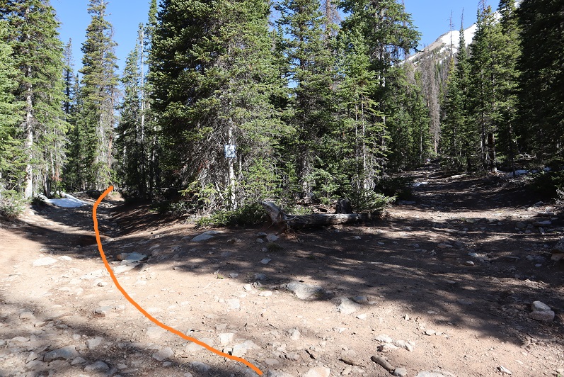
The road was easy to follow until it ended at the cabin area, and from here to treeline I was breaking trail. I turned right at the last cabin and navigated my way northwest through the trees, keeping the creek to my left and hugging the mountainside to the right.
I never came to a meadow, but this is most likely due to a recent (small) avalanche in the area. I just followed the avy debris to the bottom of a small basin
And followed the small gully to the top. The snow here was well consolidated, and even a bit icy.
At the top of the small gully I turned right
And looked for a trail that hugged the mountainside…
This was more difficult than it sounds. There wasn’t actually a defined trail. Well, maybe there was one 50 or 60 years ago, but I’d venture to guess this ‘trail’ hasn’t been use more than a handful of times recently. It’s more of a goat trail, completely overgrown with tundra. I took off my snowshoes here and didn’t need them until I made it back to this point.
Can you see the trail? Here’s a clue, go this way, under the rock and up the hillside
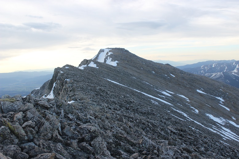
Eventually you’ll reach the ridge and turn left to ascend Taylor’s long ridge
I made it here just as the sun was beginning to rise. I got a nice view for a minute, but the sun quickly hid behind clouds for most of the rest of the morning
The rest of the route up Taylor Mountain A is a straightforward hike up the ridge.
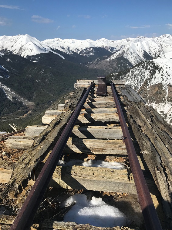
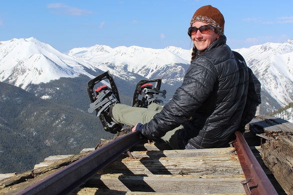
I passed several neat mining sites on the way up
The terrain got increasingly rockier, but nothing too difficult.
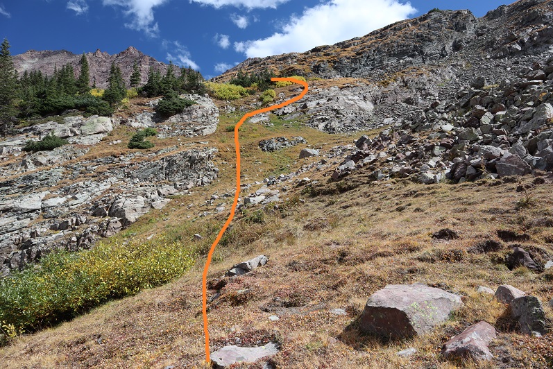
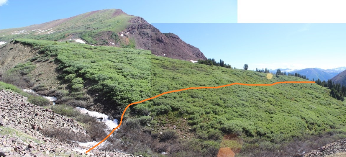
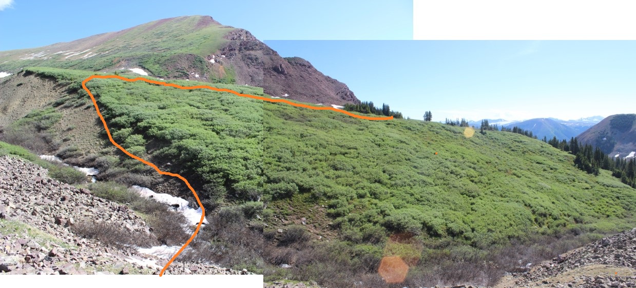
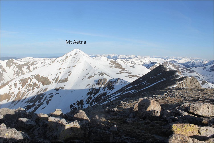
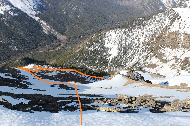
I was actually hoping to make this hike a double summit and attempt Mt Aetna as well. However, I didn’t have any good beta on the ridge below Mt Aetna towards Taylor Mountain. I knew it usually holds snow, but I’d been hoping the ridge was clear enough to trek without snow on part of the ridge. Worried the snow would soften up too much for me to be able to climb Mt Aetna, I decided to check out the conditions there before summiting Taylor. I headed left, to towards the Aetna/Taylor Saddle
I made it to the ridge, and even before walking all the way to the end became disappointed: the wind had held at a steady 20-25mph all morning, but on this ridge I kept getting knocked down. The wind here was most likely well above 50mph, and while the route up to Mt Aetna looked to be in great climbing condition, I didn’t feel comfortable crossing the ridge in all this wind. I wasn’t entirely sure I could do it before the sun warmed up the snow either.
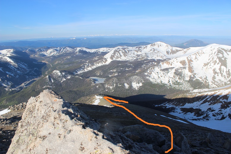
So I turned around and looked at the path back to Taylor Mountain.
This didn’t look too difficult, and indeed, it wasn’t. A bit rocky, and a few of the rocks were loose, but they weren’t going to tumble down below me or cause a rockslide. The most they could do is put me off balance. I navigated the rocks along the ridge
Stopping in the middle to take a picture of the route through the avalanche area to the basin and up the ridge
Almost immediately the sun came out from behind a cloud, and I was pleased with my decision not to attempt a summit of Mt Aetna today, guessing I’d only be making it to the snow now as the sun rose.
I turned to head back down Taylor’s South Slope
Stopping for a little bit in the mining area to take some more photos
Here’s a picture of the ridge between Aetna and Taylor
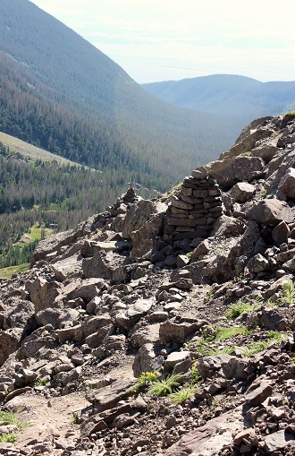
I made it to the ridge, turned right, found the old miner’s trail, and followed it back down into the basin, humming as I hiked
I followed my earlier snowshoe tracks through the avalanche area, down through the trees, and back to the trail, where I was able to see remnants of old cabins in the daylight I hadn’t seen in the dark.
I made it back to my truck at around 10am, making this a 10 mile hike with 4017’ in elevation gain in just under 6.5 hours.
All in all, today was a fabulous day! Now to drive home and take my daughter to the movies before she heads off to camp for a week.
I picked Bull Hill because I needed something easy for today so I could be home by noon to meet a friend. The weather forecast was perfect (no wind, 50s at the summit) and I was tired from Friday’s climb but didn’t want to waste a great opportunity to get out and hike.
This was my third attempt at Bull Hill this year. The first time I got turned around before making it to the trailhead due to unexpected heavy falling snow and a road closure. The second time I had no problem making it to the trailhead, but even after a hard freeze I was postholing up to my waist and couldn’t find the trail. I ended up turning around shortly after the creek crossing. Today I learned what a great choice that had been!
The trailhead is easy to get to but difficult to find. It’s located at exactly 12.5 miles down the 82 from Granite. Turn right and there’s a small parking lot that will hold 4 cars if you all play nice.
I started at 4am. From here walk about 10 yards and turn north on an unmarked trail.
This trail is super easy to follow, as it’s an old 4WD road. There’s quickly a stream to cross that gave me some pause in the dark. I couldn’t tell how deep it was and it seemed to be flowing pretty fast. I walked up and down a bit, looking for a better area to cross, but this was it.
I decided I was wasting too much time on this: I had on winter climbing boots, so I decided to just walk across the stream. I started out the hike with wet feet but they quickly dried. The trail followed the stream, and here was where the “fun” began
And by fun I mean postholing. This was by far the worst experience I’ve ever had postholing. Every step I took on snow for about 2.5 miles I postholed. Over and over and over again. I knew this was a possibility going into this hike (it had happened to me last time, even with a hard freeze) and I just gritted my teeth and continued on, sinking to my knees with every step. Yes, I was wearing snowshoes, which helped, but they weren’t needed 100% of the time.
They were needed just enough to make taking them off not worth it
I followed the ill defined (due to the snow) trail to a gully, and took switchbacks up the south ridge. The switchbacks seemed unnecessary.
OK, so postholing isn’t fun, and I was getting tired of it. I came to an unexpected avalanche (although this year they seem to be the norm) and considered what to do?
It looked like this area went straight up the slope, but I wasn’t entirely sure the path was safe, so I continued on for another few switchbacks, the snow getting deeper and the postholing getting more aggressive as I went.
I switchbacked over to the gully once again and took another look.
This time it looked like it went all the way to the mine, and the snow in the gully was very consolidated. It didn’t take me long to pick consolidated-snow-gully over postholing-switchbacks. Yes, this was the way to go! I turned to look back over my shoulder and thought this was a cool view of La Plata and Ellingwood Ridge
I took the gully until it met up again with the road below the mine. The road here was covered in snow, but not a lot of the surrounding terrain had snow.
I stopped for a bit at the mine to rest. My quads were killing me! That type of postholing had been the 4 letter word type of postholing. I was not looking forward to a repeat of that on my way down. After applying sunscreen (yes, I did get sunburned on Friday’s climb of Thunder Pyramid) I took a look at my next step: To gain the ridge in front of me. I decided it was best to keep my snowshoes on and looked for a line that would get me to the ridge
There was just one rocky area to climb over
And by looking left I could see the rest of the route before me
This was by far the easiest part of the entire day. The slope was gentle and had enough snow for me to keep my snowshoes on.
The only downside was a false summit that took me by surprise, but it was close to the actual summit so I didn’t mind too much.
I was amazed at how calm everything was! There wasn’t any wind, which was amazing. This is the first summit this year I haven’t needed to wear snow clothes to hike, but where there was still a ton of snow!
I turned to head back down, making sure to stay right (the ridge to the left goes the wrong way and has a massive cornice, but they look similar, so stay right)
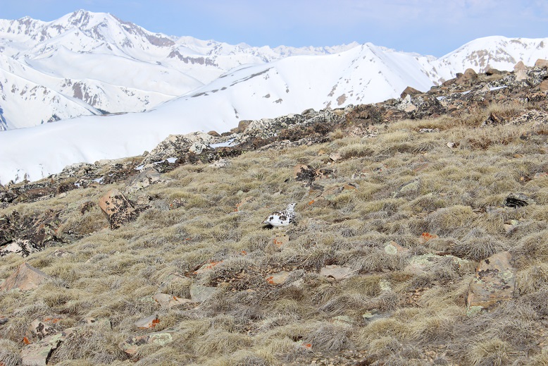
Halfway down the slope I made a new friend! Ptarmigans have great camouflage.
From the ridge here’s a look back down at the mine and the route I took back to the gully
There was a busy marmot running to and from its den
I decided to have a little fun at the Last Chance Mine, just because I could and I knew I had postholing to look forward to (ok, I was stalling)
Doesn’t it look like a lot of fun?
I again followed the snow covered road back to the gully
And hiked back down to where I’d entered the gully earlier
I briefly considered taking the gully all the way back down to the stream, but wasn’t sure if it went the entire way. I found out it didn’t, so if you plan on taking the gully instead of the switchbacks you need to wait until the last set (see map)
The postholing was actually a little better on the way down because I could re-step in my previously made postholes, which meant more stability. The creek crossing wasn’t too bad in the daylight. My feet got wet again but I was close to my truck and warm socks so I didn’t mind.
I made it back to my truck at 9:30am, making this a 7 mile hike in 5.5 hours: I blame it on the excessive postholing and the Last Change Mine. You should be able to complete this hike in much faster time.
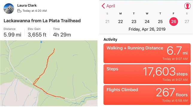
I made it to the La Plata Trailhead a little after 4am and was surprised to see someone getting ready to hike La Plata. As I was getting my gear together I heard him trek off in his snowshoes.
I started at 4:20am, excited to find the 82 open well past the La Plata trailhead. I briefly considered moving my truck, but quickly thought this wasn’t a long hike anyway: It would be nice to get in a few extra miles to make this hike a little longer.
The road was open, but there wasn’t a lot of parking available because of all the avalanche debris lining the roadway. Everything that could slide in the area apparently had slid at least once.
On a positive note, everything smelled like fresh cut pine. I followed the road for a mile in the dark and then turned right to begin the climb. This area had seen an avalanche as well, and even though they weren’t completely necessary at this point I put on my crampons and left them on for the entire hike. In the dark navigating the debris up the avalanche slide felt daunting, but in the light of day it looks pretty easy. Here’s the route I took
The gully was steep and filled with snow, so I just kept to the center and followed the gully. Even though this area had avalanched, as I neared the top of the gully I discovered it was loaded with snow ready to drop. I didn’t want to be here when the weather warmed up today!
The sun started to rise, and at about 13,000’ I started using my ice axe, following the center of the gully.
The steepest part was just below the summit ridge. Here is where my ice axe proved extremely useful and my calves started screaming. I just kept crawling forward, intent on summiting before the weather warmed the snow.
At the summit ridge the terrain became much easier. I stood up and walked toward the summit bump
This part was easy! There was a small section to climb
The weather was absolutely perfect! It wasn’t warm, but it wasn’t cold either, and there wasn’t any wind! I was able to get a video on the summit, and actually stayed and enjoyed the view for a while
OK, now it was time to head down.
In the light of day I could appreciate just how steep the gully was
About halfway down I paused to take a video of the water I could hear flowing under the snow below me. Yep, it was time to get off this waterfall
I decided to see just how far the 82 was open, so I drove down the road a bit in my truck. I made it 2.5 miles before the next closure sign, and saw evidence of multiple avalanches along the way.
With my morning over at 9am I decided to drive 4 hours to the next trailhead and rest a bit before my next adventure…
Today’s peak wasn’t much of a mystery: With 2 left and good morning weather and a finisher already selected, Maroon Peak was my only option. I left my house at 10:30pm and made it to the trail head at 3am. Note: I made it on the first try this time!!! There were several other hikers already in the parking lot getting ready to hike when I got there. I jumped out of the truck to get a head start, putting on my gloves as I walked.
Ugh! I’d brought two left gloves! No worries though, I just turned on inside out: Problem solved!
The best part about hiking this morning in the dark? The (almost) full moon! If you’ve never hiked under a full moon you should. It’s fantastic and amazing and difficult to describe. You don’t need your flashlight, as the moon lights up the trail with a glowing mist. The moonlight was reflecting off the lake and mountains. I so wished I had a better camera to take pictures of the moon and stars. Also, there was a rather loud bird on the lake, which was weird for 3am.
I passed crater lake and did my best to get as far ahead of the hikers behind me as possible. I was about ¼ a mile ahead of the first group of hikers when I got worried: I’d made it to a creek, which meant I’d missed the turnoff somewhere. I should have been going uphill. Drat! So I backtracked and saw a string of flashlights starting up the mountainside. Ugh! I’d lost a good half mile of distance between me and the hikers behind me! Now we were all kind of clumped together. On the way back I took a picture of the junction. Can you tell which way I should go? Let me tell you, in the dark it all looks the same….
This is the way you’re supposed to go
In any event, I politely rushed past them as best I could and was on my way up the mountainside. The trail up to this point was very well maintained and has great signs
But not for long. It quickly turns into a slippery scree and gully trail that goes for 2800’ with some rocks thrown in. In the dark I noticed 3 flashlights ahead of me? Hmmm…. I hadn’t noticed them before? Maybe they’d gotten a super early start?
Your goal is to hike up this
Once you reach the top of the scree and gully trail you’re at a ridge that’s also full of scree and dirt
Here I saw goats. Side note: Last year I saw 1 goat. Just 1, and this year I’ve probably seen 50. Insane!
After I saw the goats the sun started to rise! I stopped for a bit just to enjoy
At the top of the ridge crest I met up with the three other hikers. They’d started at 3:45am from the junction (yes, the one I’d missed) and were impressed I’d caught up with them. We had a great chat, and I was on my way, intent on route finding alone (I like route finding… it makes me feel like I’ve “earned” the hike).
OK, so after the ridge crest this is the next obstacle…
The best way I can describe this is a lot of loose rock, and just keep going up and to the north. There are several routes to the top, but I tried to stick to the “standard” route. Several gullies are involved. But first you encounter a chimney. This was a great chimney to climb: very stable with lots of hand/foot holds
After this just follow the cairns… see them up there? Yes, those cairns.
I kept following the ridge north and came upon the two gullies. I’m not a fan of gullies. Either one of these gullies is climbable, but when I looked at them the first gully looked like it had more stable rock, and the second gully had that sand/scree mixture I dread. I chose the first gully. My instructions said to get a good look at the route you want to take before doing it because once you’re in it it’s difficult to figure out. Those directions were right. Take some time to study the route you want to take before diving in. Here’s the route I took. (I was very happy with this route…)
OK, more ledges and more going north until you hit another gully (big sigh). This gully had a lot of sand and large rocks, but if you hug the right side you have stable hand holds.
At the top of the gully is a notch
Aim for this and turn left. More ledges…woohoo! Actually, I like this type of climbing! These were taken from the way down (so you can see depth with other hikers). The ledges just keep going, and going, and going. Just aim up
Eventually you’ll reach a ledge. Follow that ledge to the summit (it has cairns)
I was so excited when I reached the summit! The climb had been intense but FUN!!! From the summit I could see Snowmass and Capitol
I took a summit selfie to prove I’d summited
And headed back down. I saw tons of people coming up as I was coming down! All those flashlights form earlier in the day took on faces. Some people looked more than prepared for this climb, and others looked scared out of their minds. I helped several with route finding. Just for fun, here are a few of the gullies on the way back down
I talked to several more hikers, and just after taking a photo of a group on the ridge lost my phone! I spent about half an hour trying to find it (I did, but backtracking up stinks!)
I made it back to the first ridge and noticed a marmot absconding with someone’s hat and water bottle. Marmots are notorious thieves, stealing everything they can get their paws on. I was surprised someone had left these items without putting something (a rock?) on them to hold them down. It was comical to see the marmot running away with them. Sorry to the owners, the marmot was actually pretty quick and far away from me when this happened, or I would have tried to stop it
I didn’t see any more goats on the way down, but I did see a lot of late and ill prepared hikers. Most had no clue what they were getting into, as they’d just come up for a “day hike”. Water? Check. Anything else (hat, jacket, map, food, sense of direction/upcoming weather etc?) Nope. They didn’t even know climbing as involved. I guess this is how people get into trouble….
Anyway, as I hit the final ridge I put on my microspikes for the scree/dirt descent. I’ve heard too many stories of people slipping here and breaking/spraining a wrist or ankle to take a chance without them. If you don’t use microspikes on scree you totally should! It makes a world of difference: I didn’t slip once!
I was down the hillside in no time and got a good look in the daylight at the small creek crossings
And the Bell Cord Couloir (for those interested)
Crater Lake looked really low…
And check this out!
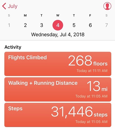
There were tons of people on the trails today! Tons! I made it back to my truck at noon, making this a 14.8 mile hike in 9 hours.
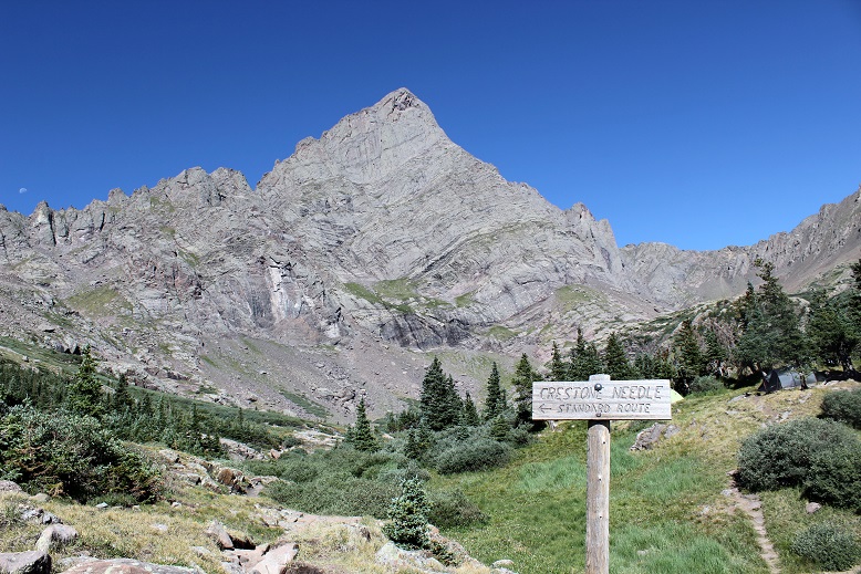
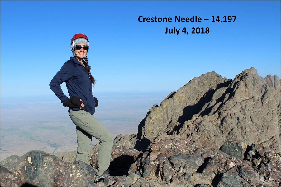
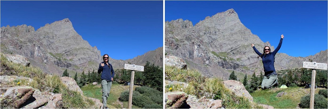
The decision to hike Crestone Needle today didn’t come until late yesterday. I’d had this day on the calendar for this particular hike for over a month, but the fires in the area had me hesitant. I did a lot of online research and was 80% sure the road to the trailhead I needed to take was open. That was a chance I was willing to take. What I wasn’t thrilled with was the possibility of inhaling smoke for the entire hike. The weather looked good, and in the end I chose to take the hike because it’s my last 14er I need to complete the Crestones and I was afraid if I waited too long the fire would expand and I’d miss my opportunity to hike.
I woke up at 12:15am and drove to the trailhead. All roads were open from Colorado Springs South, but there were more deer on the roads than I’ve ever seen. I’m assuming they were displaced because of the fires. Most deer I see when driving at night are female, but these were mainly male deer in the velvet. I was just glad I was the only one on the road so I could drive cautiously and stop when needed.
I turned South on Colorado 69 and saw a flashing sign indicating the highway was closed ahead and only open to residents. I crossed my fingers and drove on. I was able to make it to the turnoff (Colfax) before the road closed. The drive in past the 2WD trailhead was worse than I remember it being back in April (but not worse than last year at this time). The drainpipe was a bit steep.
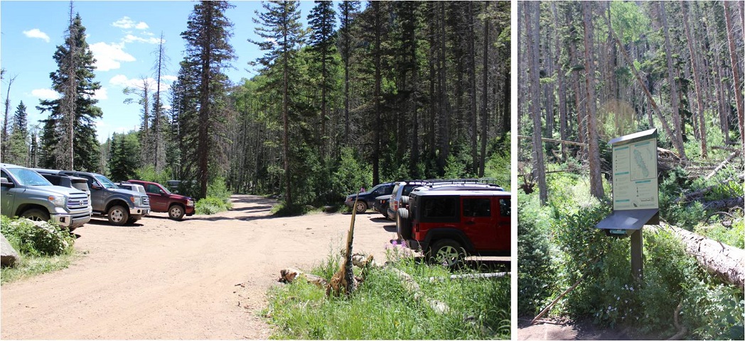
When I arrived at the trailhead at 3am the parking lot was almost full, which I’d expected even though it was a Wednesday morning. After all, it was the 4th of July! There was a lot of activity in the parking lot as people were getting ready for their respective hikes. I hate leapfrogging people, so to get a head start I jumped out of my truck and hit the trail, grabbing a bagel to eat on the way. There was no smell of fire in the air and I hadn’t been able to see flames the entire drive.
At 3:15am I signed the trail register and was on my way. BTW, the trail log book is in serious need of repair/updating. The pages are mostly loose, and there’s no clear order to signing it. I found a blank page and signed in, but if there was an emergency (say, a fire) and they needed to know who was hiking in the area it would take them a very long time to figure it out.
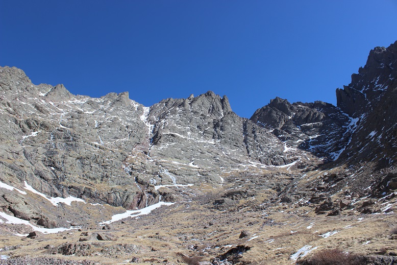
This is my third time this year hiking in through the South Colony Lakes trailhead. I have to say, it’s much easier and faster without snow to navigate through! It’s amazing how easy the trail was to follow without snow, and how difficult it is to navigate when snow is present. The hike in didn’t take me long at all. I was way ahead of schedule. Last time I was here the creek was frozen over and there was snow up to the footbridge. Today there was no snow to be seen.
I made it to the South Colony Lakes and saw many tents lit up as people were preparing for their hikes today. It looked like there were dozens of people camping by the lake. I made it up Broken Hand Pass around 5:30am and looked behind me at the trail of lights from hikers taking the pass as well.
The only other time I’ve hiked Broken Hand Pass it was filled with snow and there was no clear path to follow, so I crossed the slope wearing snowshoes. Today the path was clearly visible, yet harder to hike without traction. I kind of missed the snow here! As I looked around me at the slope I realized back in April I must have been hiking on over 10 feet of snow! What a difference the snow made!
The trail up and through Broken Hand Pass is very well cairned. I now know why those cairns are so big! They looked small (or were non-existent) under the snow.
Last time I did this hike I forgot to put on my helmet until it was too late and I was in a position where it was too dangerous for me to take my helmet out of my pack to put it on, so this time I put it on before it was needed. Here are the first class 3 moves up the pass.
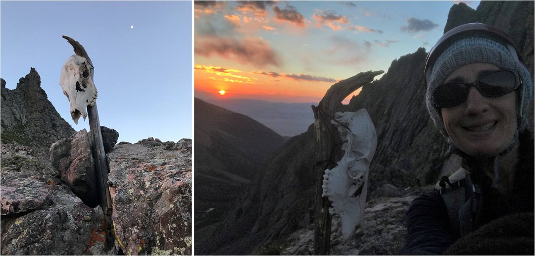
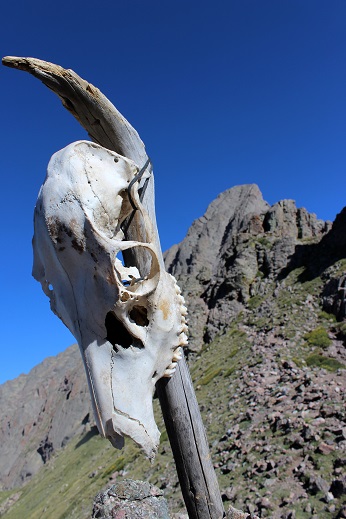
I made it to the saddle just as the sun was coming up, and when I looked over to my left I saw a skull that wasn’t there last time, placed on a large stick. Of course I went over to investigate. As the sun rose I made friends with Skully and got a few selfies with my new pal. He seemed to be keeping sentinel over the area.
I was way ahead of schedule at this point, but decided to keep hiking so I wouldn’t get cold. I followed the ridge and went to the heavily traveled trail to the right, and realized it cliffed out, so I turned left and encountered more class 3 moves.
The trail was well marked, although sometimes it split into two parallel trails. They both followed the South side of the mountain and ended in the same place. Here’s a look back at the trails and Broken Hand pass.
After hiking the slope the trail abruptly stops. I knew this was going to happen, but was surprised at how abruptly it did just… stop. I mean, it just ended at a rock.
I looked up and down and then got out my directions. I needed to hike down about 75 feet, then over to the east gully. Here’s a picture of the route before me.
This is where the fun began! Climbing the gullies is a lot of fun! There was exposure, sure, but plenty of hand and foot holds available. I once again praised myself for joining a rock climbing gym and going weekly. This was child’s play! While this class 3 scrambling should have been challenging, for me it was really just fun.
The route wasn’t heavily cairned, but there were enough cairns in just the right areas so you knew you were on the right path (which I prefer to multiple cairned paths). For me the crux of the climb came at the dihedral, where you switch from the east to the west gully. The dihedral was obvious to find but difficult to cross. It’s much larger in width and depth than this picture suggests, and my task was to climb on top of it, locate a cairn, and cross the rib. There was a trickle of water running down its base, just enough to make climbing up slippery with wet soles.
I’m not a large lady, and while I’m pretty flexible, here my 5’4” height was a hindrance and flexibility wasn’t much help. There were hand and foot holds all over this mountain, except in the dihedral. The rock here was smooth and there weren’t many places to grip. The width was just far enough apart where I couldn’t stretch across (although I’m assuming it wouldn’t be much difficulty for someone over 5’10” to navigate). So I was stuck: I couldn’t climb up the dihedral to cross over, and I couldn’t climb across the gap either. I searched and located the cairn on the rib above me and to the left. I knew that’s where I needed to be, but getting there seemed impossible! (The cairn is in the red circle)
I took a deep breath. This had to be traversable. There had to be a way across, I just wasn’t seeing it yet. I went back to where the dihedral was narrowest and tried again. There were a few stretch moves, but I was able to successfully climb up the wall and back over to the left where the cairn was located. Woot! I’d made it!!!
This is where the real climbing began! I climbed up the ridge and aimed for a notch. Here’s a picture from my way back down when I passed three male climbers heading up (who’d had trouble with the dihedral too, so it wasn’t just me!).
The exposure here was real! One of the other hikers told me this part almost made him lose his breakfast. Personally, I loved it! Yes, the exposure was extreme, but there wasn’t much danger from loose rock and there were plenty of hand and foot holds, so as long as you didn’t slip and fall you were fine.
I couldn’t help but thinking how awful this route would be with snow, and once again praised myself for not trying this peak after completing Crestone Peak last April and the waterfalls that were present then. It wouldn’t have ended well.
There were several large gullies to climb, all with the same secure rock and lots of holds.
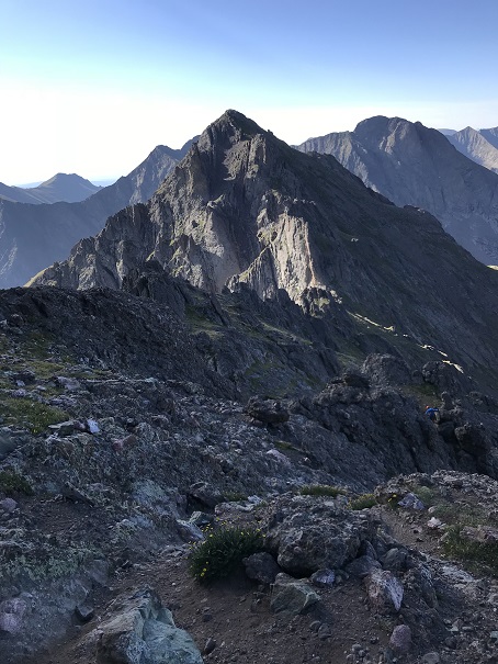
At 7:20am I summited! I had a great view of Crestone Peak
As you’ll notice from the video, there isn’t evidence of a fire anywhere
For the first time while hiking a 14er I was able to see the Sand Dunes in the distance
I took a summit selfie to prove I’d summited
And while it was still early I headed back down because I was only half way through with this hike. It was too early to celebrate yet.
Remember all those steep gullies I’d climbed up? Well, now it was time to climb back down them. They were pretty steep, so I turned and faced the wall and began climbing down, once again grateful for all the holds.
Thankfully the dihedral was much easier to navigate heading down than up. I just pressed my stomach on the wall and slid off and down into the open space below, using friction for balance, knowing I didn’t have far to fall if I did.
I have to pause for a second here to talk about down climbing. I may not know a lot about rock climbing, but I do know I have better balance when I’m facing the wall on the way down. I passed a hiker who was heading down these gullies feet first. He was continually off balance and honestly scaring me.
So I engaged him in conversation: “Have you tried turning and facing the wall when you down climb? You’ll thank yourself for it!”
I got no response, so I figured he must not have heard me. We parted but caught up to each other once again in another gully, where he was once again tip toeing down and sliding feet first.
I tried again: “Do you rock climb?”
Hiker: “No”
Me: “Oh, well if you turn and face the wall you’ll find your center of gravity isn’t off and the gully will be easier to navigate”
Once again, no response and he continued doing what he was doing. All I could think was “He’s going to fall and I’m the only one anywhere near him. He’s going to slip and tumble headfirst down one of these gullies and I’m going to have to rescue him because I’m the only other person out here”. I’d already warned him twice and he hadn’t listened. I decided to just sit and take a break for a while and let him get far enough ahead of me where we wouldn’t pass each other again. This way I wouldn’t have to watch him scare me half to death. I’d just keep an ear out for him falling. (Luckily he never did)
I made it back to Broken Hand Pass at 8:40am. The sun still hadn’t made it over the ridge
I waved to Skully and got a picture of him with the Crestone Needle in the background
Ahead of me were Humboldt and Broken Hand Pass. I was completely ready for the class 3 moves back down and got to it.
About 1/3 of the way down I heard a very loud and deep chirp, looked up, and saw a rather large marmot ahead of me skid to a stop on top of a pile of rocks. The rocks then went tumbling down the pass, making quite a racket and causing a rockslide. Wow! That marmot was a jerk! He’d just put about 4 people in danger of getting brained by rocks the size of my fist. I called down to the hikers below me, made sure they were ok, and blamed it (rightly so) on the marmot. See people? Wear your helmet, even if you’re the only person on that mountain!
I passed quite a few hikers on the way out. South Colony Lakes is a trailhead for multiple 14ers, as well as a great place to backpack and fish. Most people I passed who’d been there for a few days had no idea there was a fire or that the roads were closed.
As I hiked the last few miles out I marveled at what an awesome day it was. The weather was gorgeous, the wildflowers were just starting to bloom, the trail was in full summer conditions, and I’d made a quick and successful summit of what’s considered the 6th most difficult 14er in Colorado. So why wasn’t I jump up and down happy? Well, I kind of was. I took a few celebratory photos once I was back near the lakes.
But I wasn’t euphoric as I had been for many other hikes. No fist-bump, high five kind of feeling. This hike had been too easy. Don’t get me wrong, it’s not an easy hike, but it wasn’t as difficult as I’d anticipated and been looking forward to. Yes, there was exposure. Yes, there was climbing involved. Yes, it was a long hike with elevation gain, but it wasn’t as technical as I’d anticipated and everything I did was well within my abilities. There wasn’t even any snow to navigate!!! I wasn’t tired at all and even considered hiking up Humboldt to make the day a little more aggressive. Maybe I wasn’t tired because I wasn’t carrying all the stuff I’ve needed lately (crampons, ice axe, snowshoes, extra jacket, etc)?
I know the conditions were awful when I hiked Crestone Peak last April, but that seemed much more difficult than today’s climb of the Crestone Needle, and this was supposed to be harder. I didn’t feel challenged. Hmmmm… So I came to the conclusion these hikes are indeed tough, I’m just advancing in my skills. What scares me is I enjoy a challenge. I enjoy being tested and learning new skills. That’s something I’ll seriously need to spend some time considering.
I made it back to my truck at 11am, making this a 13 mile hike/climb in 8 hours. This also means I was home by 1:30pm, in plenty of time to wake up my kids (yes, they’re teenagers, with nothing scheduled for today they were still sleeping when I got home) and grill some steaks for the 4th of July!
The drive to the trailhead was much easier than I’d remembered it from last time. It’s still a 4WD trail in, but after some of the other 4WD roads I’ve navigated this one really isn’t so bad. It was clear of ice and snow, and pretty much mud free. On the way back there were a few more cars and a bit more mud.
I was the only one in the parking lot when I got there. I gathered my gear and was off around 5am. The first thing I saw after crossing the bridge were bear tracks…
The 2.5 miles to the junction on the old (closed) 4WD road had lots of varying conditions. There was mud, ice, snow, and water. I was able to hike this part without traction, but it would have been helpful.
I came to the junction, turned left, and headed across a log bridge and followed the service road.
The road took me to the South Colony Lakes campground. There was a gate for emergency access only.
From here until I made it back to the trees traction was necessary.
Because of the snow it was difficult to stay on the correct trail, but that just meant a little more route finding. When I was back in the trees I took off my crampons and made my way towards the lakes. This part of the hike was frustrating because traction was needed for about 25% of the hiking. Not enough to really put on snowshoes and crampons, but a bit miserable without them as well. Route finding was challenging here as well.
Here’s the trail junction. I love obvious trail junctions!
I finally broke down and put on my crampons when I reached the base of Broken Hand Pass.
I’d been carrying my snowshoes as well, and decided to just stash them at the cairn. It was obvious by looking at the route in front of me no one had been here in a few days at least (no foot tracks). That meant I got to make my own!
I crossed the slope and looked up at the route before me. Time for my ice ax!
I felt much more confident this time climbing. I’m not sure if it was because I’d done it before or the conditions were easier (probably both) but I was much more confident in my abilities. It wasn’t until I was at the crux I realized I’d forgotten to put on my helmet! Whoops! I felt like a total idiot, but at this point it would have been more dangerous to take out my pack and put it on, so I carefully navigated my way around the difficult part and climbed to the top of Broken Hand Pass.
The trail down to Cottonwood Lake was dry.
I made my way around the lake to the right, and curved towards the Crestone Basin. Here’s where I got my first look at Crestone Peak. It was full of ice.
I was supposed to hike straight up the red gully. It looked daunting, but I’ve found things that look daunting from far away are actually not that bad up close, so I continued on. Here’s the route I took.
This definitely has some class 3 scrambling! More than once I patted myself on the back for joining a climbing gym this winter. Those tiny holds (pinches) that make rock climbing so difficult and frustrating at the gym? I encountered several of them here, and was glad I knew how to navigate them! The only downside is my backpack made me unsteady. I think from now on I’ll practice climbing at the gym with my backpack on. I also would have felt much more comfortable with different shoes. I had on my winter boots, which don’t exactly make rock climbing easy.
Much of the route was navigable without crampons until I made it about ¾ of the way up just scrambling. That’s when I ran into a problem: snow, and lots of it. The last trip report indicated a dry scramble to the top, but it had obviously snowed quite a bit since then because I had to put back on my crampons and ice ax (and my helmet) to navigate this part. I took one step onto the snow, and sank up to my thigh.
Ugh! Not fair! I was so close! This didn’t look doable, but there was no way I was turning back now, so I kept prodding around until I found a stable route and started climbing again. That meant being closer to the ice (which didn’t make me comfortable) but at least I was making progress.
This gully was about 1500 feet in elevation, and just didn’t quit! It kept going and going and going. Just as soon as I felt I must be near the top I’d turn and see another stretch of gully. And it was getting warmer. The snow was melting and becoming soft underneath me.
I finally made it to the notch, and while crampons would have been helpful in a lot of areas, I took them off because they were a hinderance for most of the remaining route. Check out the view from the top of the red gully!
I summited around 12:30pm, and stayed there for longer than I usually stay on a summit.
It was incredibly perfect conditions! Very little wind, and warm but not hot. I took some pictures and made my way back down to the notch.
This is where it got dicey. That perfect weather I’d had on the peak was quickly melting the route I’d taken to summit. This was not good. I sat down and put on my crampons and developed a plan.
My plan? Get down this gully as quickly as I could. Now.
I turned and faced the mountain and began my descent. The first bit wasn’t too difficult, but that quickly changed. I’d step into the snow, and immediately my footprints would fill with water melting beneath me. This was instantaneous and terrifying. There’s just no way to describe the feeling I was having knowing my route was quickly turning to slush.
I could hear the ice turning to water and flowing underneath me, and the ice wasn’t condensed. Several times I thought about how to handle this situation if I got to a place where I couldn’t continue. I was prepared to spend the night in that gully if necessary (hoping the water would freeze and I could navigate back down in the morning).
I downclimbed as quickly as I safely could, but was on edge of my comfort level the entire time. The water just kept coming and coming and the ice and snow was rapidly disappearing from underneath me as I descended the mountain. I was aware I needed to reapply sunscreen, but terrified to do so, as I’d have to take off my backpack to get it and I knew I couldn’t do that without falling. I gave up and mentally prepared for a nasty sunburn on my face.
I got back to the place where I’d initially put on my crampons for the gully climb and took them off, thankful I’d made it this far. I then looked at the remaining route below me: waterfalls. Lots of waterfalls and water running down the exact path I needed to take. This is not a route you want to do when it’s raining, or now when ice was melting into waterfalls. Added to that bouldering down rocks is more difficult than climbing up. I was extremely careful and spent a lot of time crawling to stay safe. Once again, I was thankful for my time spent at the climbing gym. There were several moves I wouldn’t have been able to pull off had I not known how to execute them. There were a few close calls and I knocked my shins a few times on my way down, but I made it safely.
When I turned back to look at the mountain there were waterfalls everywhere! It was beautiful, and I was glad to be alive!
I hiked back to Cottonwood Lake and up Broken Hand Pass. This part of the hike was difficult for me. Not because of the terrain, but because I was physically exhausted by this point. It was my third time going up a gully for the day, and I hate gullies. The hike was slow going, with lots of slow steps. I found a pretty cool jaw bone though.
I made it to the top of Broken Hand pass for the second time that day at 4pm. I’d really wanted to try and get Crestone Needle today too because this route included 3 gullies and I wanted to make the effort worth it, but at this point my time was running out. I didn’t want to hike back down in the dark, and while I knew the North Facing gully below me would most likely not have been affected like the South Gullies, I wanted to get down it just in case.
I looked down at the route below me: still snow!
It was obvious I’d been the only one up today, so I put back on my equipment, turned and faced the mountain again and began my descent. This was a breeze! I’d done a terrific job last time making steps, and I was really getting the hang of this crampon/ice ax/climbing thing. This was much easier than Little Bear! The angle of the slope probably helped as well.
Now all that was left was to traverse the slope and head back down.
The only difficult part was avoiding the snow rollers. They were silent, and quickly picked up both speed and mass. I did not want to be hit by one of those things. They ranged in size from a baseball to car tire. I narrowly escaped at least a dozen in the 15 minutes it took me to navigate this area. But once again, I made it!
The hike out was frustrating. The varying conditions made it not worth putting on crampons or snowshoes, but they were needed as well. The trail was mostly clear, with areas of consolidated snow, and every 100 feet or so on the snow I’d posthole up to my thighs. It was like playing wack-a-mole in reverse: I never knew when I was going to end up in a posthole! Most of the time I was ok though.
The sun began to set and the mosquitoes came out. Tons of them! I just wanted down this mountain and back to my truck, so I picked up my speed and booked it down. I made it back to my truck at 7:30pm. That’s by far the longest day I’ve ever spend hiking a 14er! Frustrating too because it was only 14 miles, but 14 intense miles with 3 gullies and a lot of work in the ice and snow.
I have a major sunburn on just my face (it wasn’t safe to stop while downclimbing to take off my backpack to re-apply sunscreen), but it was worth it!