RT Length: 18 miles
Elevation Gain: 5800’
I’ve said it before, and I’ll say it again: I’m NOT a fan of the permit system. Even though I was on their website exactly when permits were released, I wasn’t able to get an overnight permit for Maroon Bells on a date I could go, so I had to get three back-to-back permits instead. When I pulled up at the gate my paperwork confused the attendant. He didn’t know what type of a parking pass to give me, but settled on an overnight pass that expired in two days time. He then asked me to park in the further lot, as the closer lot was intended for day use.
I balked at this: I’d wanted a 2 night pass, but because of the reservation system I couldn’t get one. Instead, I paid 3 times what those who were able to score a longer permit were paying for the same amount of time in the park. I felt if I was paying that much more, the least they could do was give me a better parking spot. Also, while annoying, the main reason I don’t like the permit system isn’t because of stuff like this: it’s because it encourages bad decision making among people who feel they need to hike/continue when dangerous because it’s difficult to get a permit, etc. One of the reasons I left California in 2006 was because of the permit system, and all the fees associated with said system. I hate seeing it brought to Colorado.
Ok, rant over. I was on the trail around 5:30pm. It was my intention to camp around 11,000’ and start early the next morning. For those of you who haven’t hiked the Maroon Bells area before, the trail is obvious:


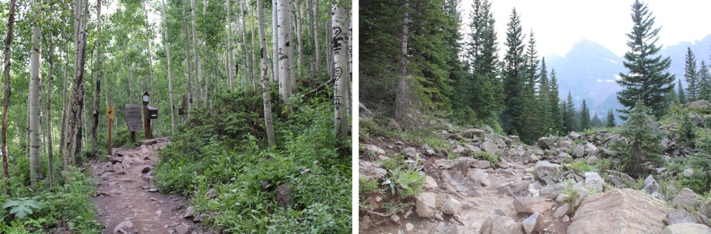
I followed the trail west, staying right at the junction for Crater Lake

And continued up the hillside to my camping spot at 11,100’. I was surprised no one else was camping here, as it’s the perfect spot.


I’ll spare you the details of the next day’s hike, as I came back to this spot, spent the night, and started from here the next morning. I’d gotten to bed early after a long day of hiking, and woke up to sunlight. I looked at my phone and it showed 5:30! Ack! I initially thought I’d slept through my alarm, and started rolling up my sleeping bag. About 30 seconds later I realized I’d only been sleeping about an hour, so I happily went back to bed and slept soundly until 3:30am the next morning. I left my new water filter bag inside my tent and was on my way.
I was on the trail by 3:45am, heading northeast along the well-defined trail through Minnehaha Gulch. I crossed a stream and continued along the trail, not really ‘feeling it’ today. I was more tired than I should have been, and wasn’t feeling very motivated.

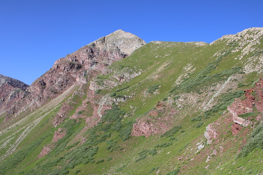
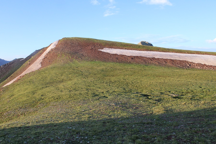
I followed the trail all the way to Buckskin Pass
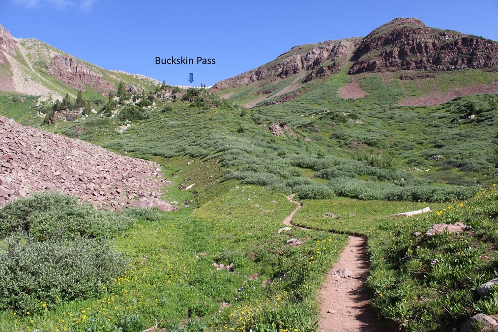

Once at Buckskin Pass, I turned right and headed north towards Buckskin Benchmark

This was an easy, class 2 hike, mostly on tundra

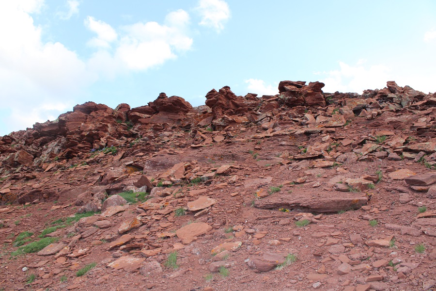
Towards the top it got a little rocky, but stayed class 2. I saw several ptarmigans here, and a few crows

Right about now the sun was starting to rise, along with my motivation.

Here’s the last bit to the summit. It stays class 2 if you keep left

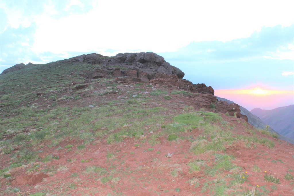
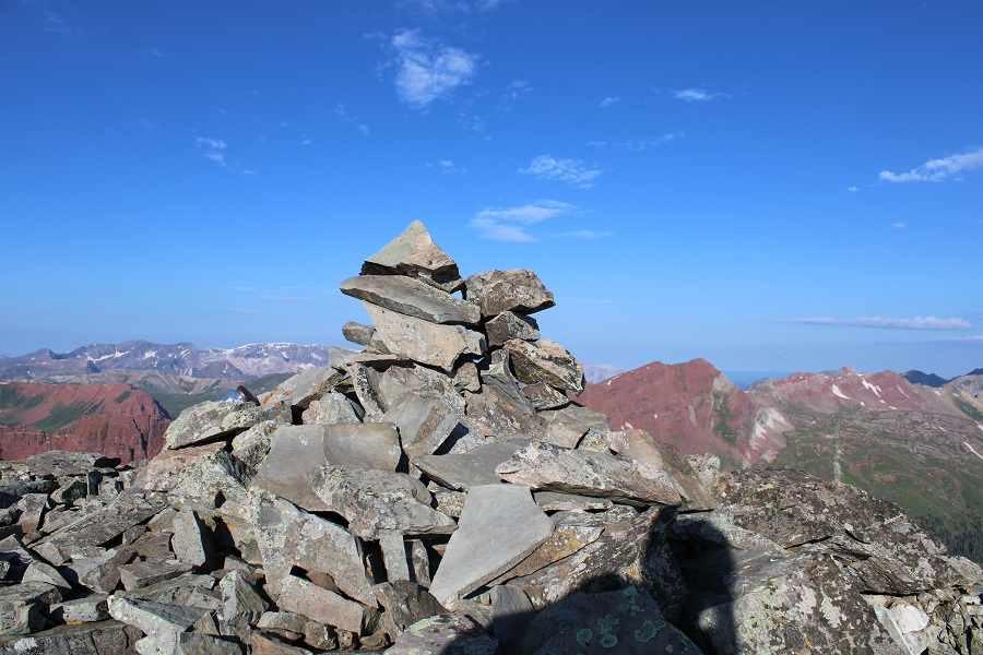
I summited Buckskin Benchmark at 6am

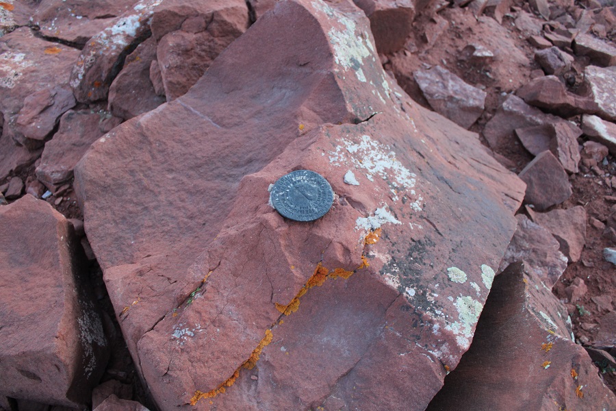
Buckskin Benchmark:
The benchmark
The views from up here were amazing! My spirits lifted, I actually ate a snack, and headed back down to Buckskin Pass.
On my way down I made some mountain goat friends (those are Snowmass and Capitol peaks in the background)

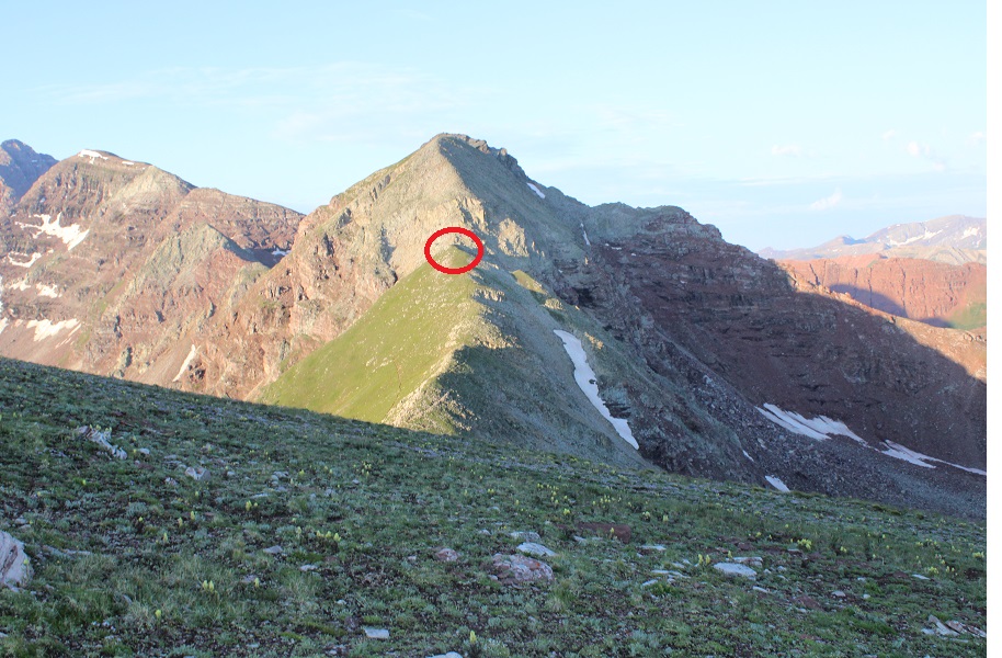
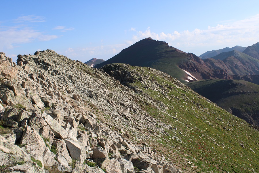
My next peak was PT 13039

It was a tundra walk back to Buckskin Pass
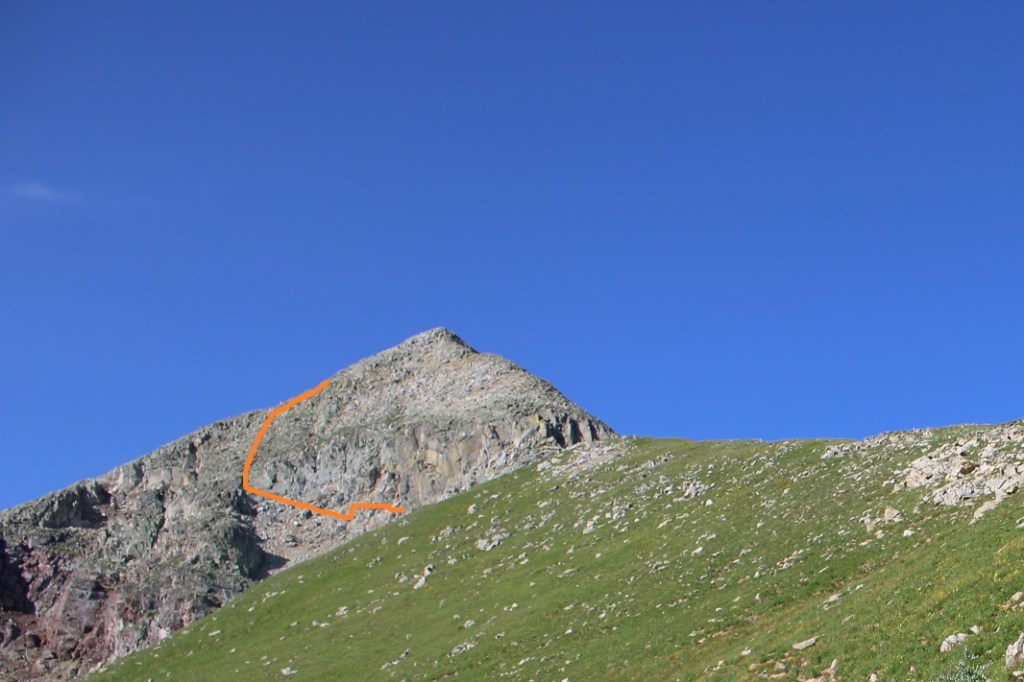
And a trail hike up to the point circled in red
This is where it got interesting. I wanted to go straight up and over the face, but it seems as if there have been several slides in the area, and nothing went at class 2. This was supposed to be a class 2 hike, so I looked for a better way. My advice here is NOT to go directly up one of these gullies (you probably can, but they all looked sketchy/prone to slides).
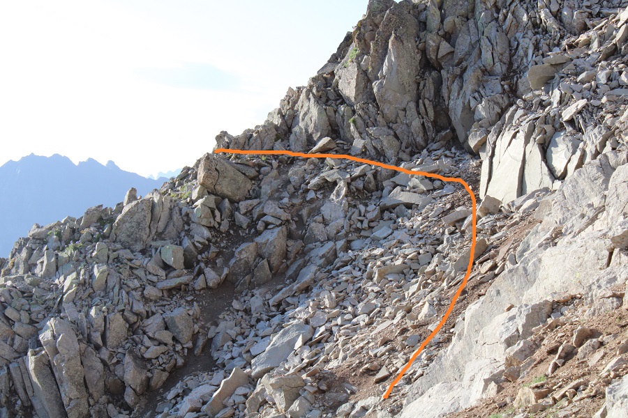
Instead, dip down to the left. This area stays class 2.
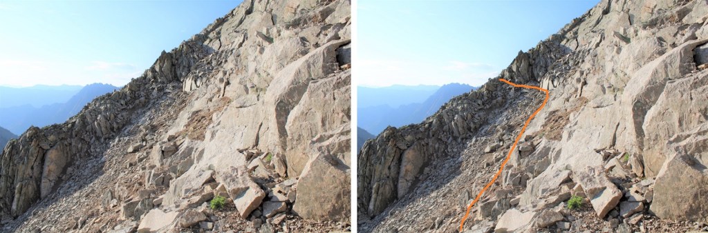
Here’s what my route looks like from below
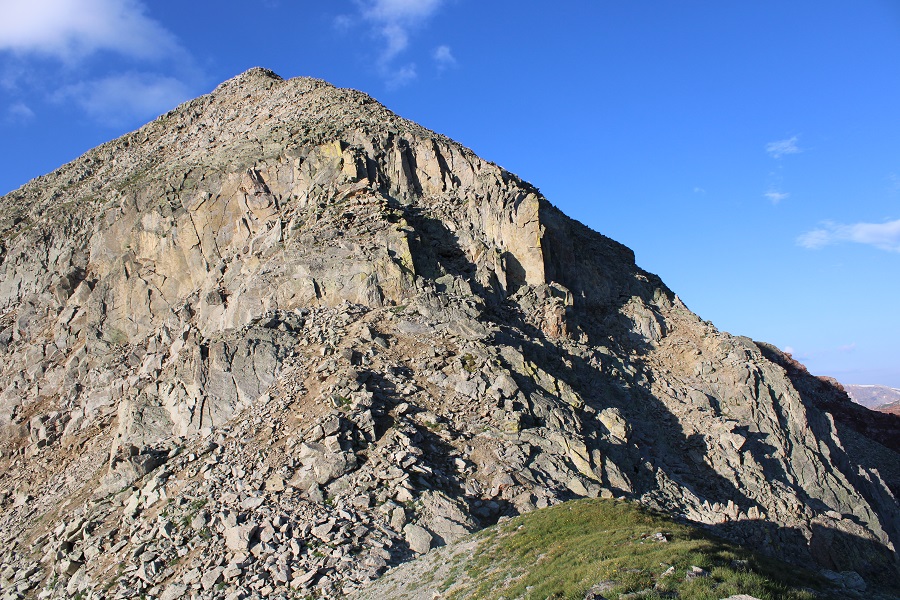
Once I was past this area, I turned right and headed southwest to the ridge (still class 2).

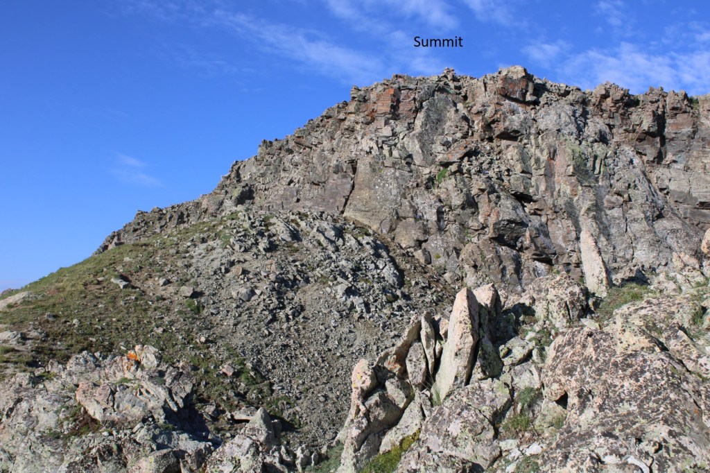
Then I followed the ridge south. I could clearly see the cairn indicating the top of 13039

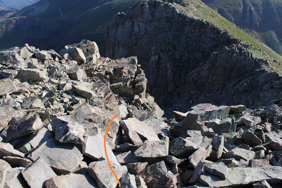
At the edge of the ridge is where it got spicy. It turned form a class 2 hike into a class 4 climb. I looked around for an alternate route, and realized the only way up to the summit was to climb the 30-40 feet or so up the chimney/gully to the summit block
I was a little disappointed because I’d left my helmet back in my tent. I debated if I should continue or not, and in the end I figured I did enough class 4 climbing yesterday without incident and was warmed up: I should be fine today. Also, I’d recommend wearing a helmet. I dropped my gear and headed up with just my camera. Here’s the route I took

I made it about halfway up the chimney, and once again had second thoughts. I continued on however, because I knew the worst was behind me and either way I’d have to downclimb that area again. Here’s another angle

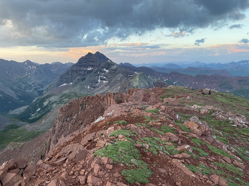
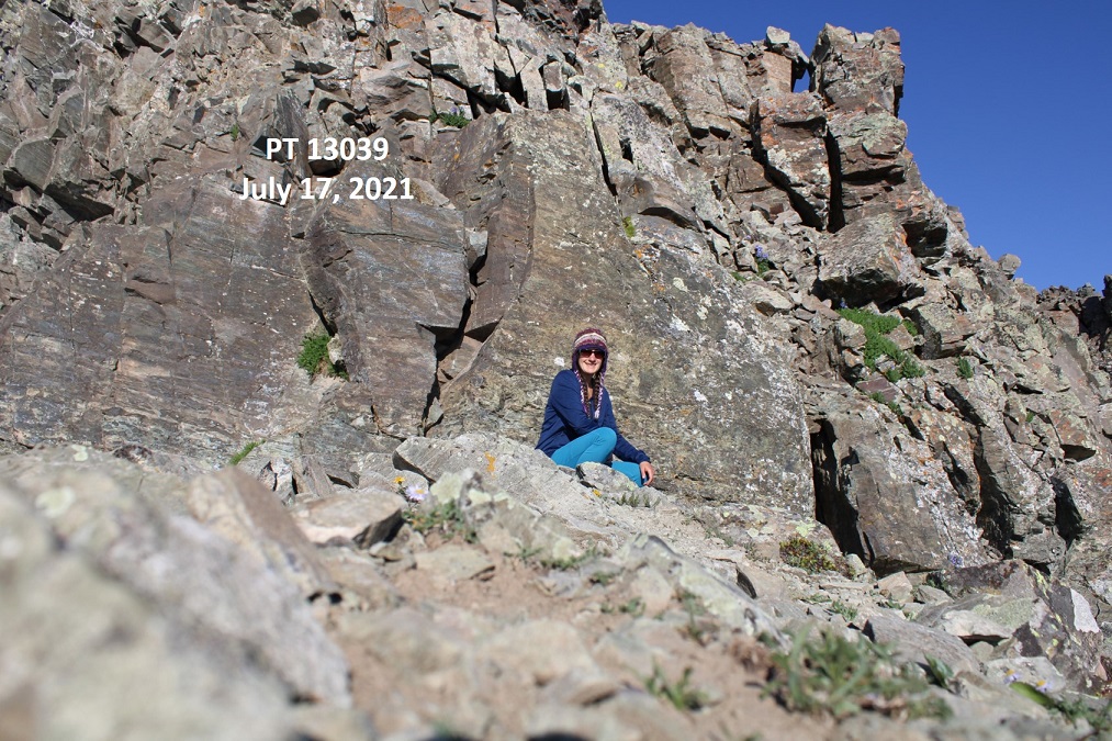
I summited PT 13039 at 7:45am
PT 13039:
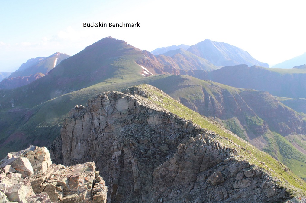
Here’s looking back at Buckskin Benchmark
From the summit you can see where I left my gear.

I turned and exited the way I came
The initial downclimb was steep and committing. I turned and faced the rock for this part.

I made it about halfway down and realized I hadn’t taken a picture of myself on the summit, but I wasn’t willing to re-summit again. I figured I’d just get a photo at the bottom.

I made my way back down the ridge
And back to Buckskin Pass

From the pass it was an easy, class 1 hike back to my campsite.

Side note: there are also good camping sites at 11,500’. Once at my campsite I was disappointed to find my water filter had leaked water all over the bottom of my tent. I dried it out the best I could, packed up my gear, and headed down.

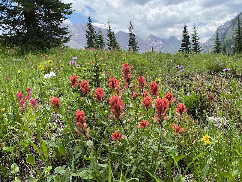
Also, the wildflowers were on point today
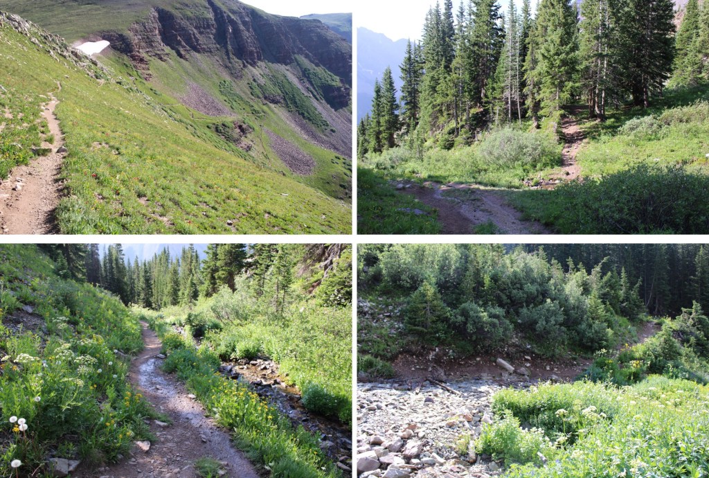
Here are some pictures from the trek out

Once I made it back to the Crater Lake area I started seeing tons of people on the trail. They travelled in groups, and were spaced about 15 minutes apart (I’m guessing this is due to the bussing times). I met one lady who asked me how fat it was to Crater Lake, and when I told her it was another mile or so she looked like I’d just told her it was another 20 miles. She was exhausted, and I’m pretty sure she turned around (the round trip hike to Crater Lake is about 4 miles). There were several groups being led by guides, which leads me to believe guiding companies may be buying up the permits.

I made it back to the parking lot, cleaned up, and headed out.

I had another entire day of hiking yesterday, so my stats are estimates based on CalTopo math: Today’s hike was 18 miles with 5800’ of elevation gain.

