I really wish I would have linked up this peak with PT 13164 when I did it in 2019, but then it wasn’t a known ranked 13er. In any event, today was a long day, so I was getting an early start so I could drive back home for work the next morning.
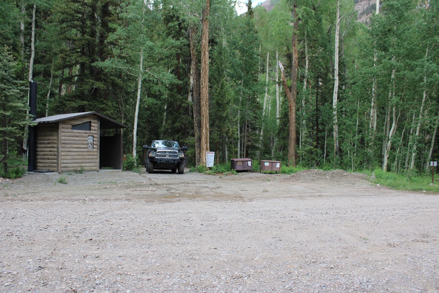
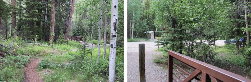
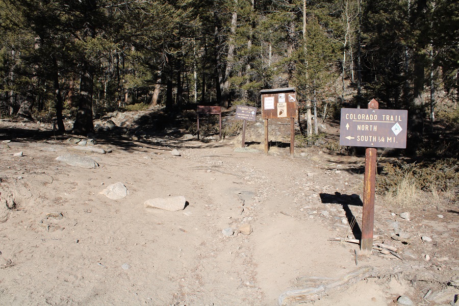
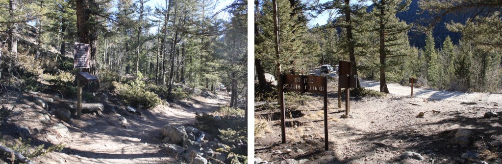
I parked at the Cataract Gulch Trailhead and was on the trail at 3:30am. The trailhead has several parking spaces, dispersed campsites, and bathrooms.
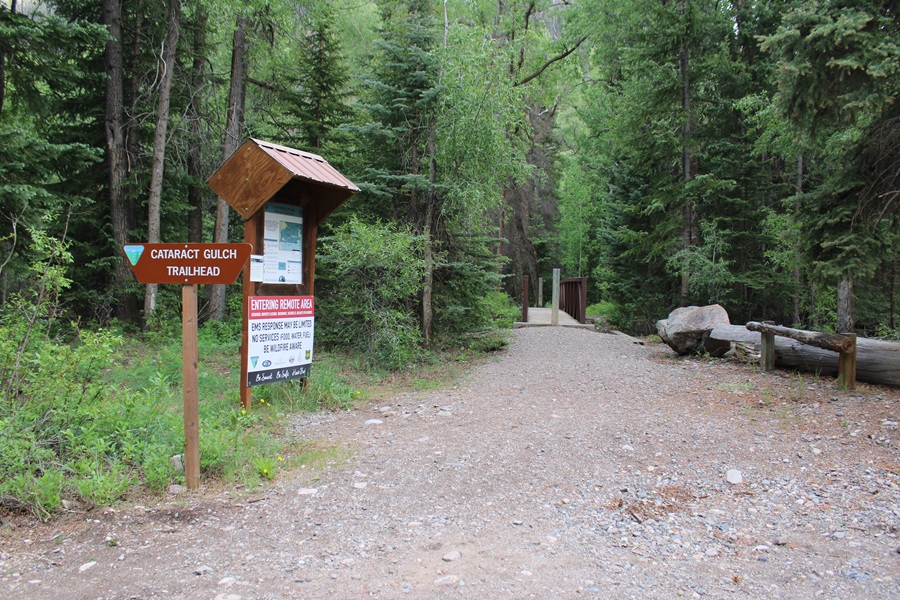
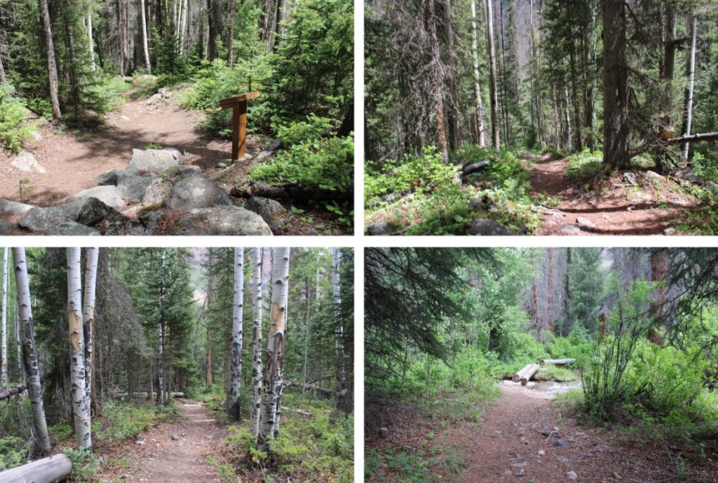
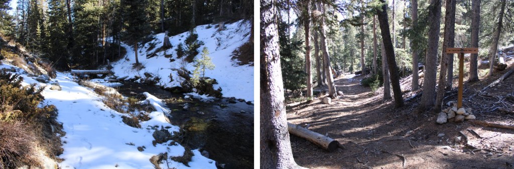
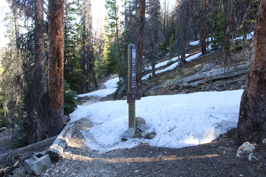
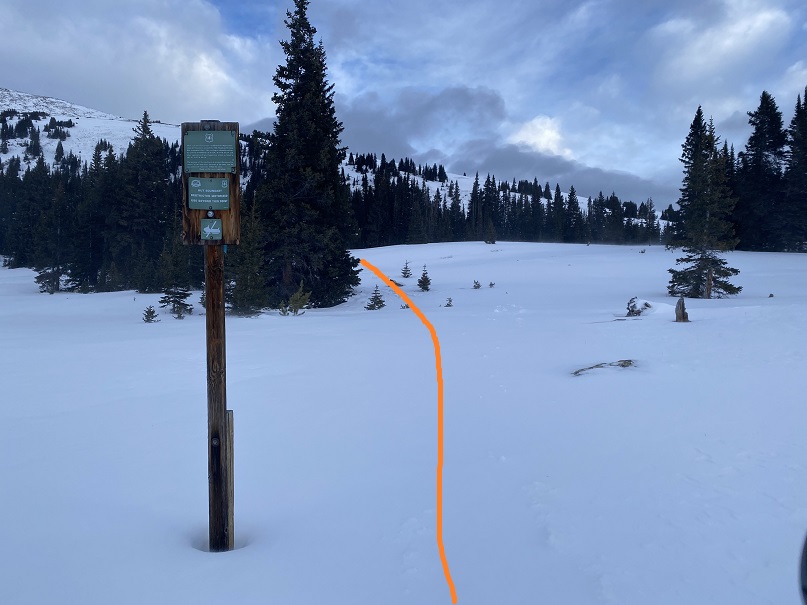
The trailhead is clearly marked, and easy to find.
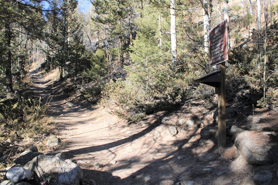
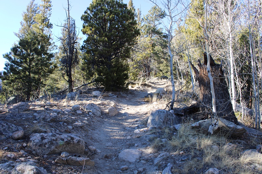
I followed the class 1 Cataract Gulch Trail south, towards Cataract Gulch.
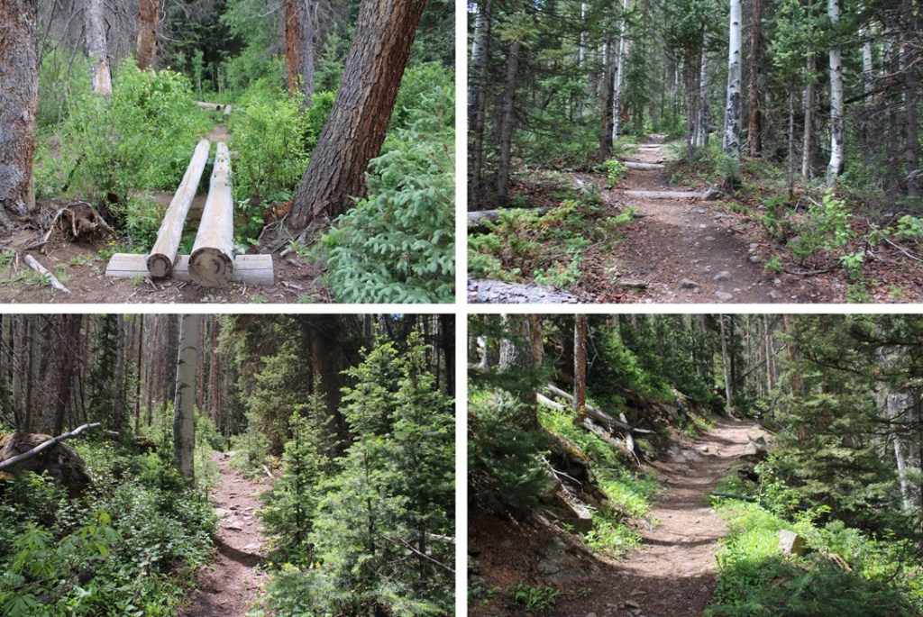
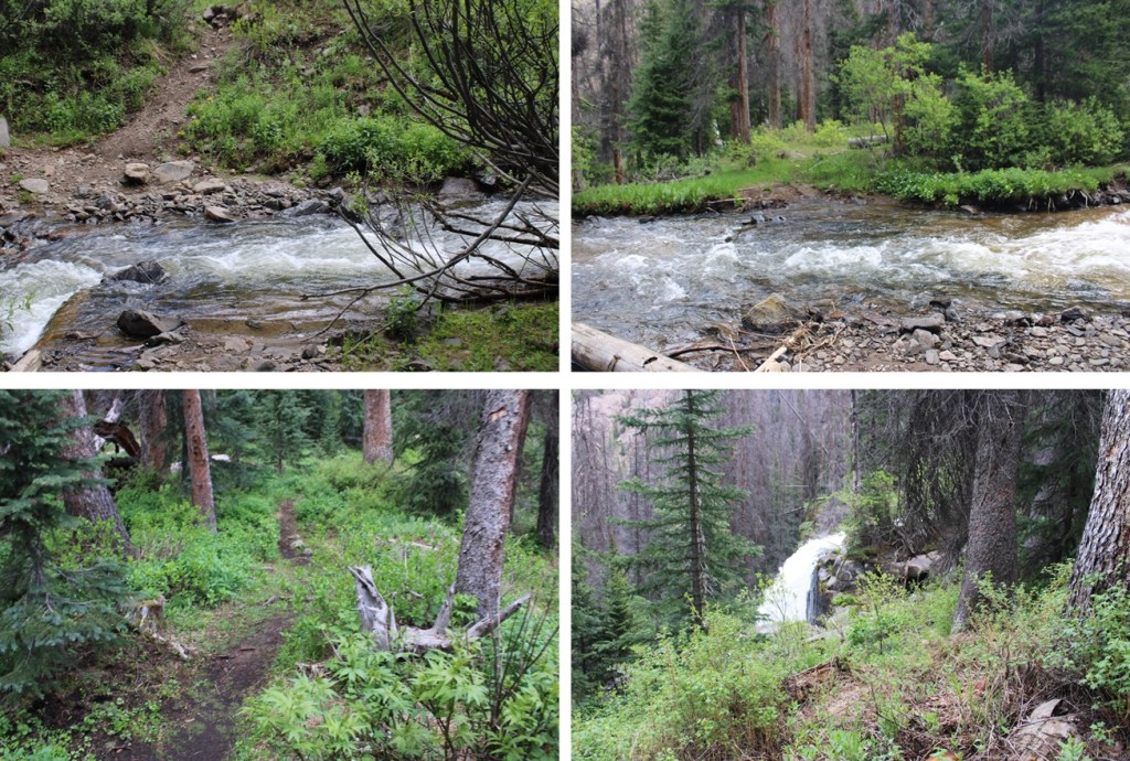
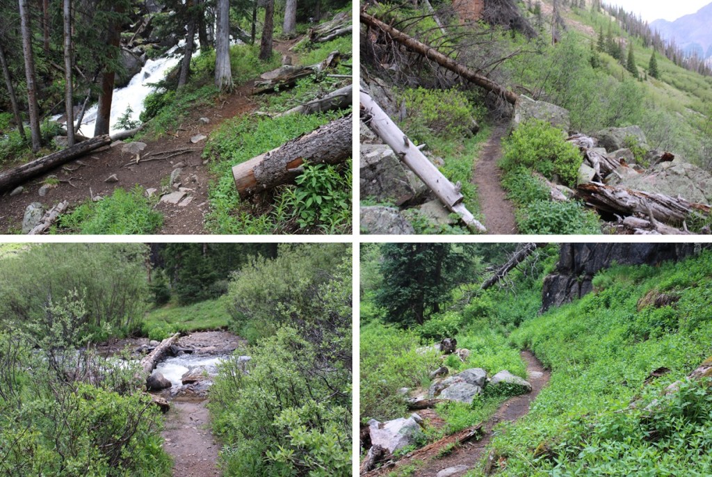
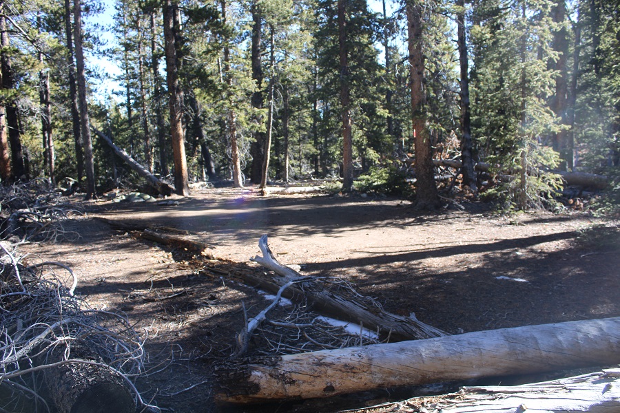
There were several downed trees on the trail, but it was easy to navigate.
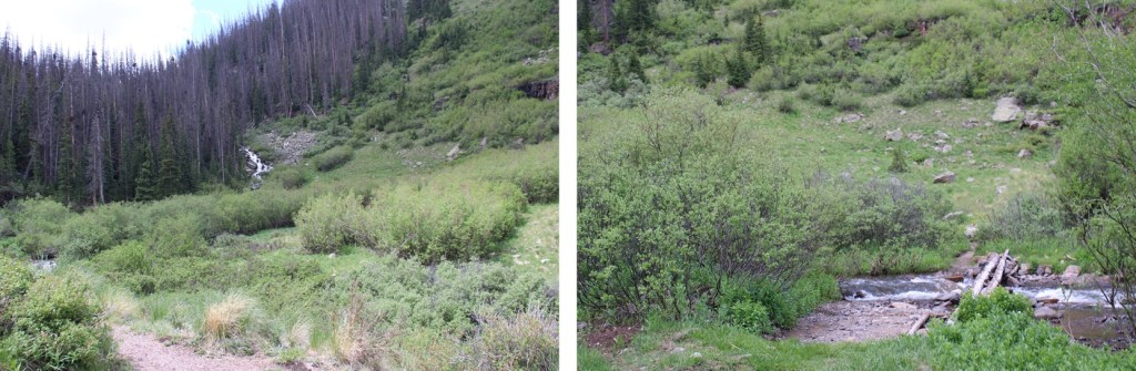
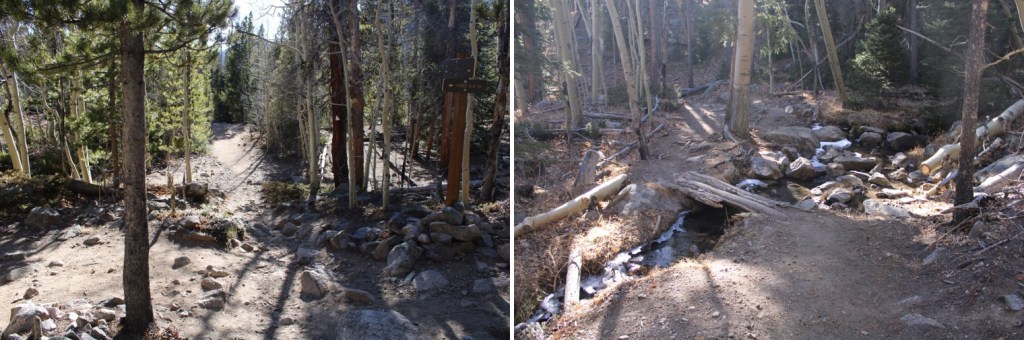
Just before reaching the waterfall about 2.5 miles up the trail, I crossed the creek on a couple of logs.
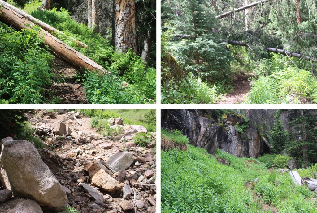
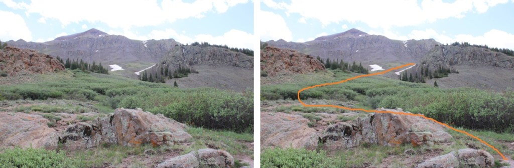
This is where many people get lost. I headed up the slope, and there was a large tree blocking the path. I went left, navigated willows and some boulders, then regained the trail.
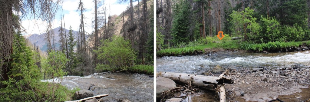
I could now see the waterfall clearly. A lot of people continue straight here, towards the waterfall, following the social trails. Instead, look for a trail to the right that goes up and behind the waterfall.
Next, to cross the creek. I crossed directly above the waterfall. Probably about 10 feet from where it drops off. At night I knew where to cross because there are little reflecting circles on the trees across from the water that glow when you shine your flashlight across them. The water was running high today, and I didn’t want to go over the edge, so I crossed carefully. The water was up just past my knees.
I picked up the trail on the other side, and quickly came to a second creek crossing.
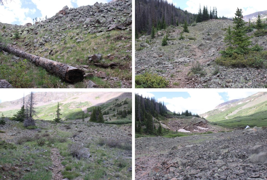
I picked up the trail again on the other side, and ascended through a cairned, rocky area.
This led me to my final creek crossing of the morning.
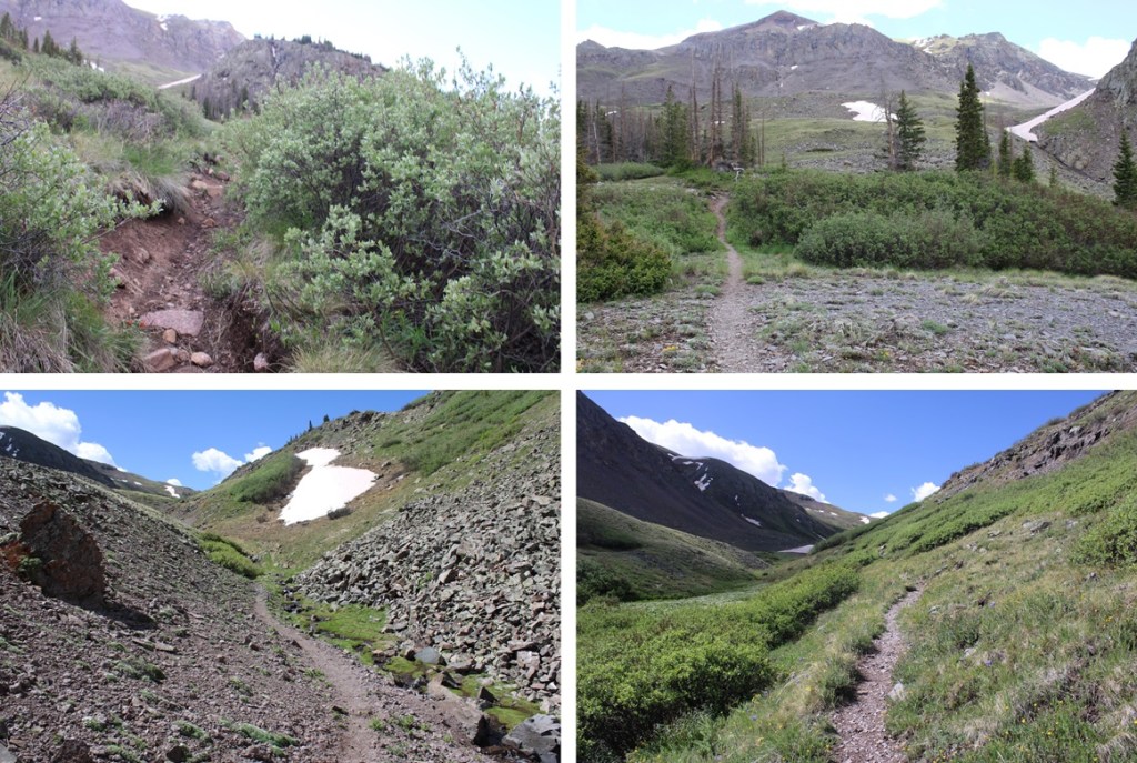
I crossed the creek one more time, and picked up the trail on the other side. It led me up and around to the left, behind boulders and through a small canyon.
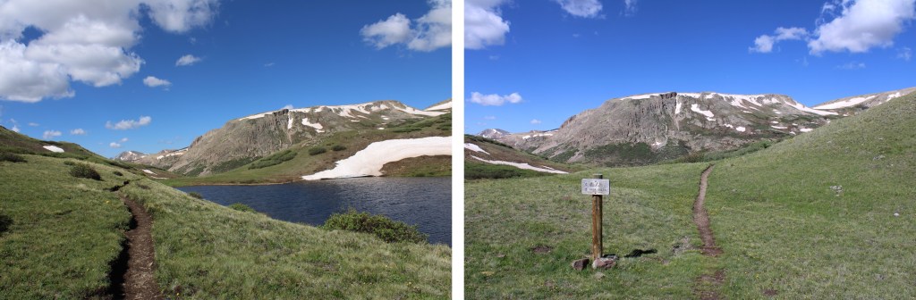
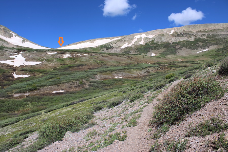
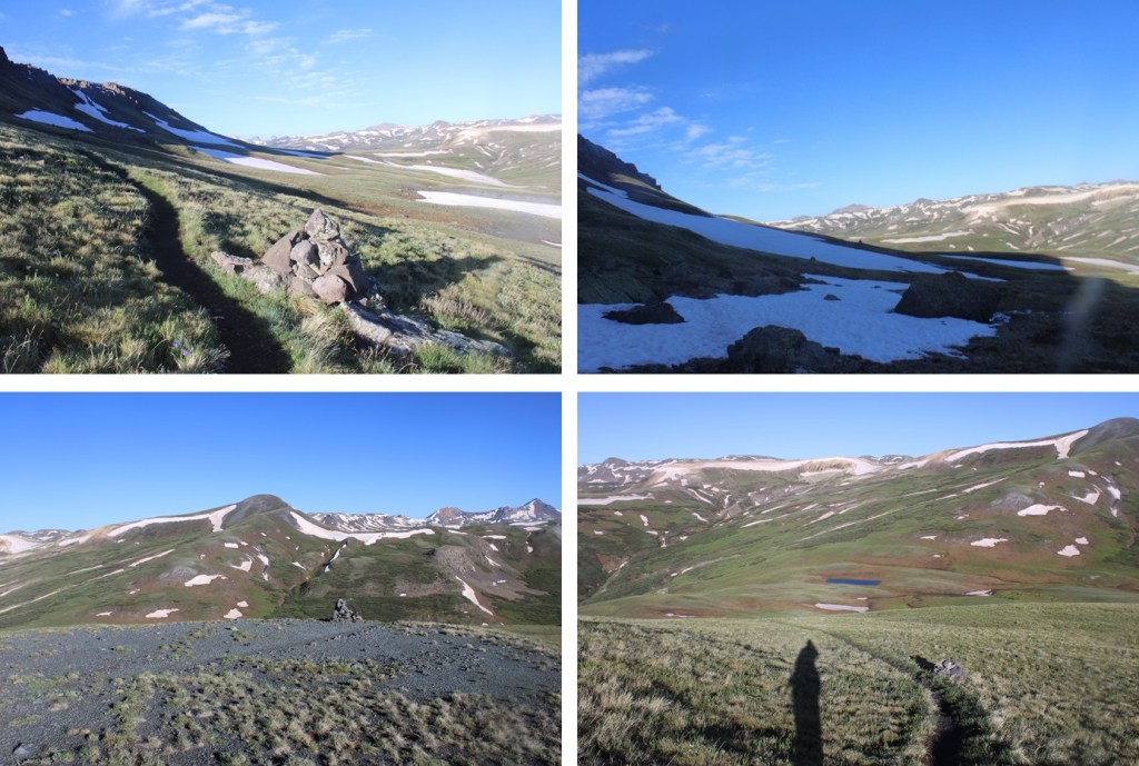
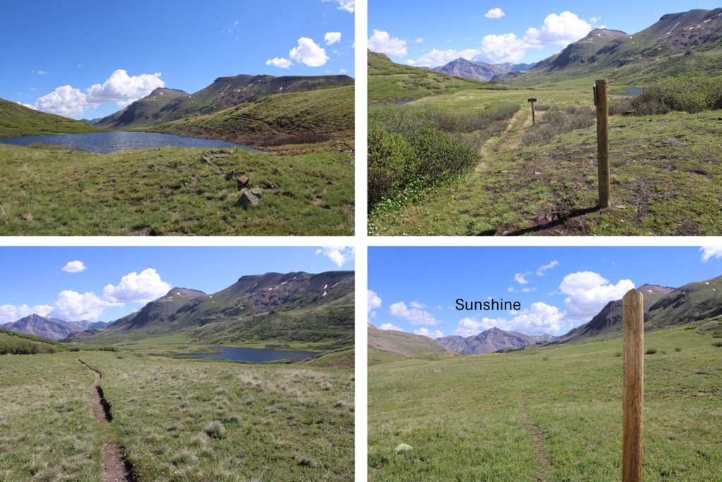
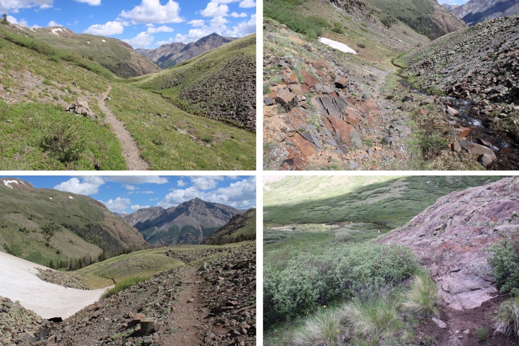
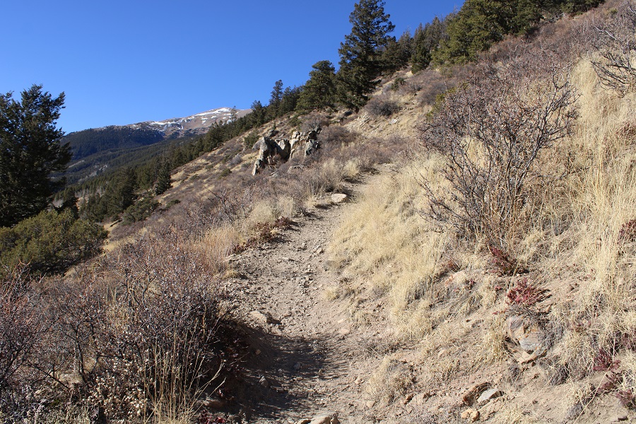
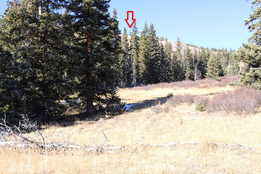
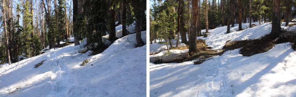
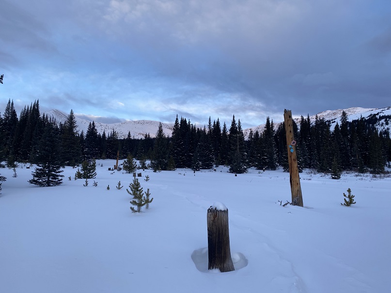
I was now headed south towards Cataract Lake. There’s a pretty good trail here, but every once in a while it gets overgrown. The trail slopes slightly downward as it goes across the tundra and through the willows. There are posts to help guide you if you lose the trail. I was headed here:
I passed Cataract Lake to my left, and a small lake to my right. Here the trail picked up with the Colorado Trail, and I followed it right, west, towards Cuba Gulch.
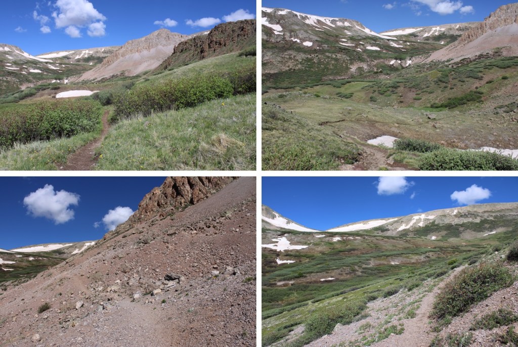
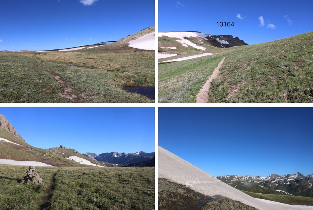
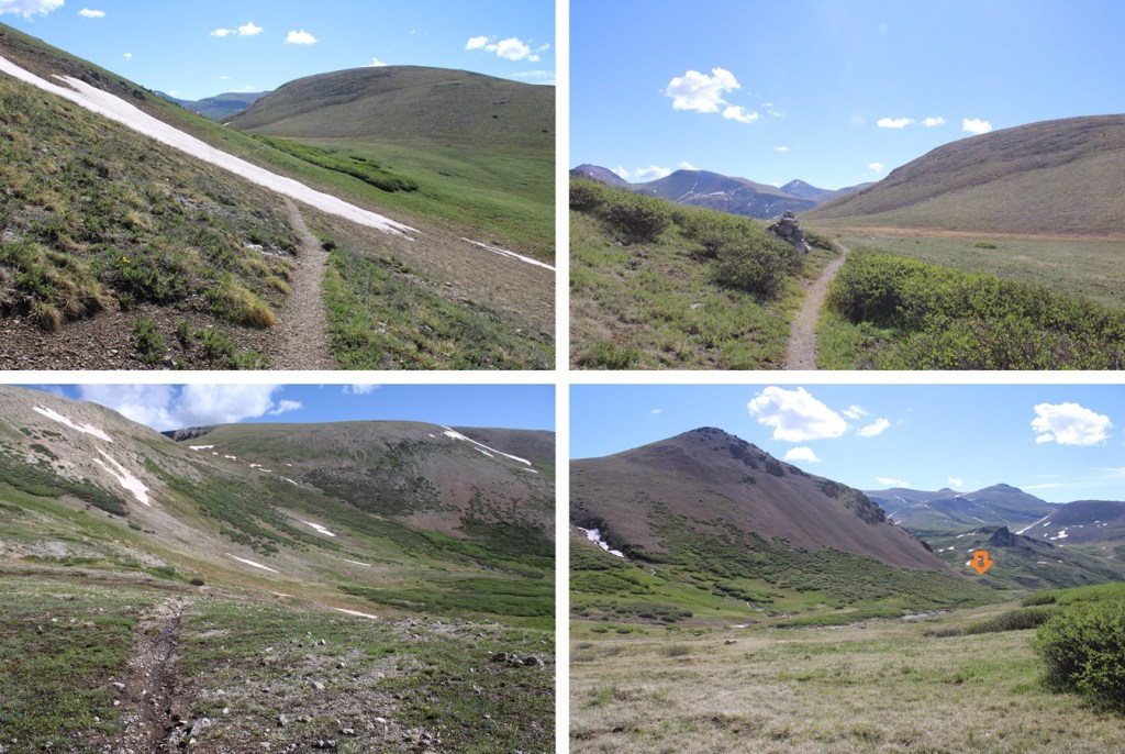
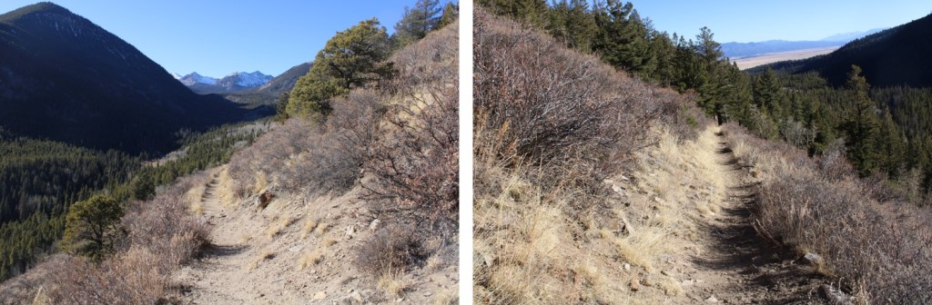
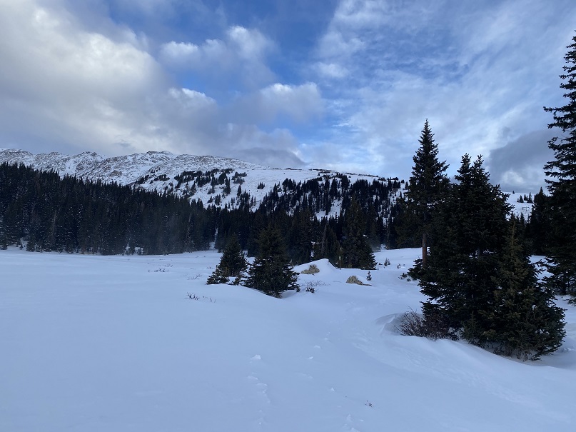
I stayed on the Colorado Trail (East Fork Middle Pole Trail) for most of the rest of the hike. Here are some pictures of the trail.
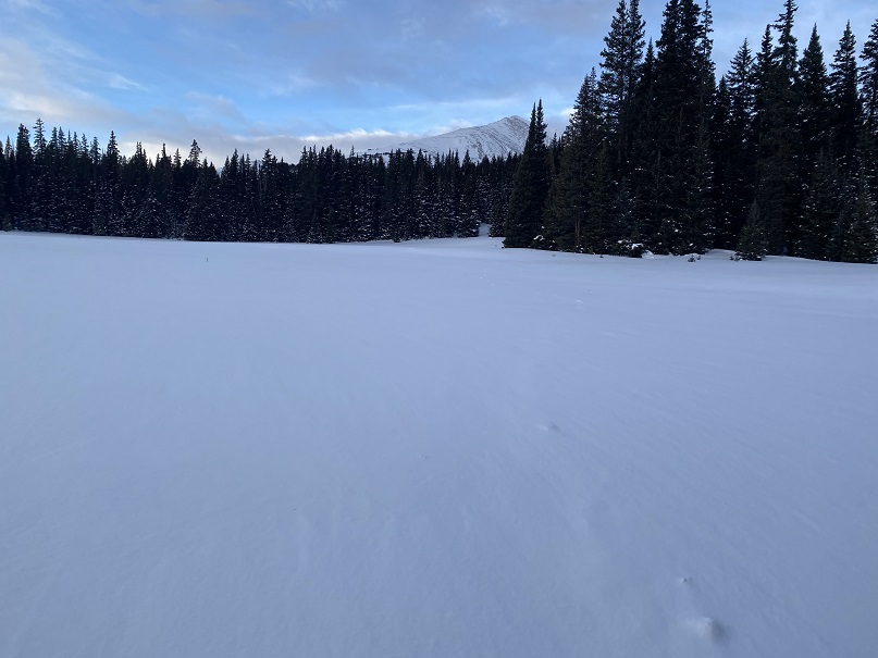
The trail meanders it’s way to a saddle:
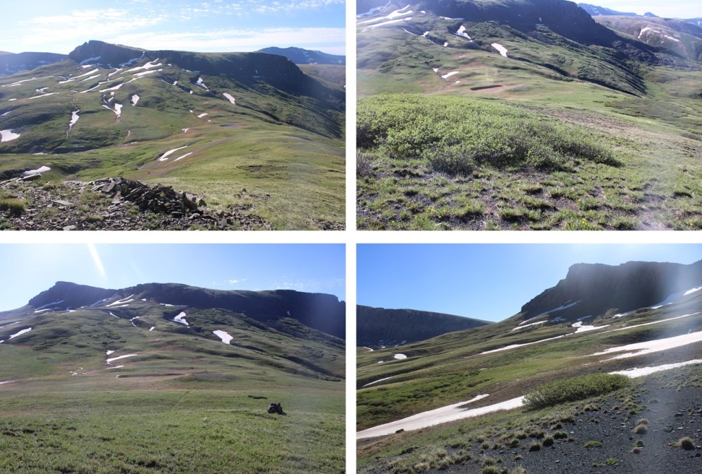
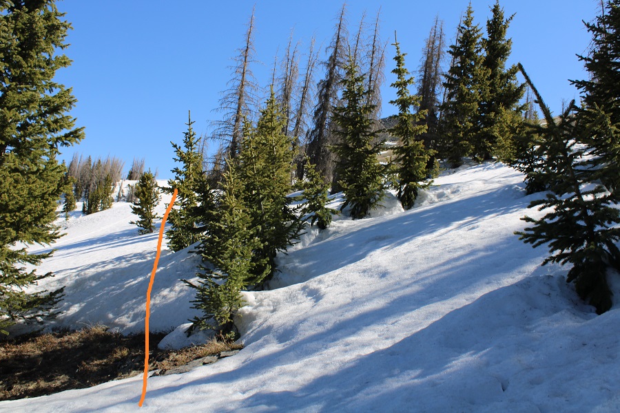
I skirted around the north side of 13164, navigating through a could of ice patches.
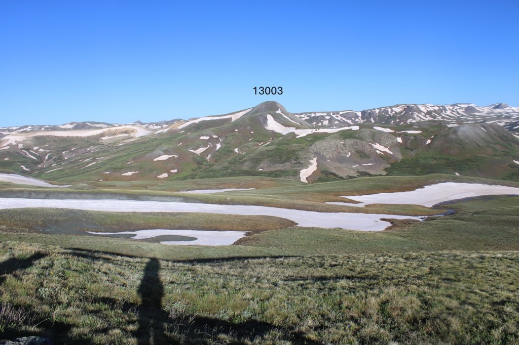
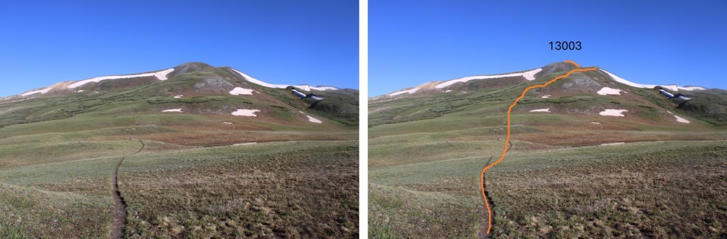
Now on the north side of 13164, I could see 13003 to the west.
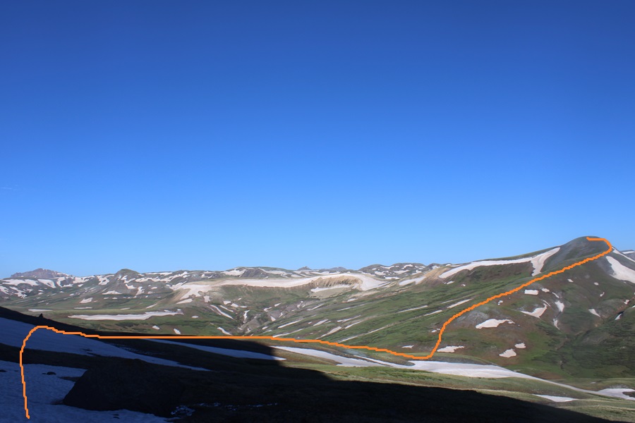
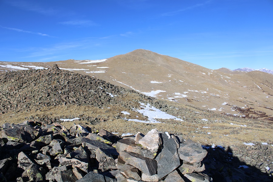
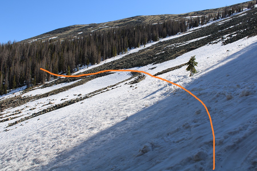
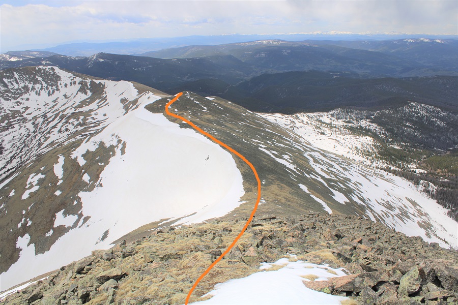
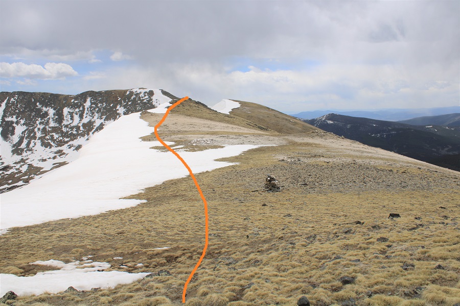
I stayed on the Colorado Trail until I hit the saddle of 13164 and 13003, losing about 500’ of elevation, then left the trail and took the tundra covered ridge to the summit. This is the route I took.
I made my way to the saddle
Then hiked the ridge to the summit
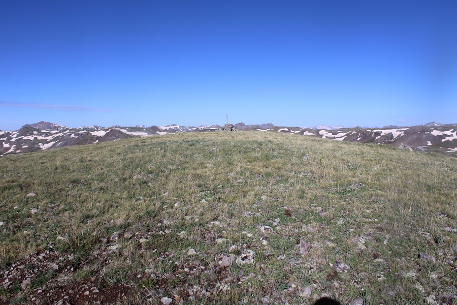
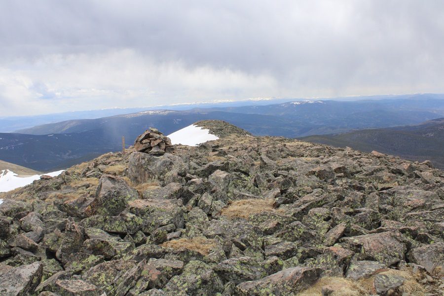
I summited PT 13003 at 8:15am
PT 13003:
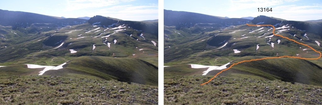
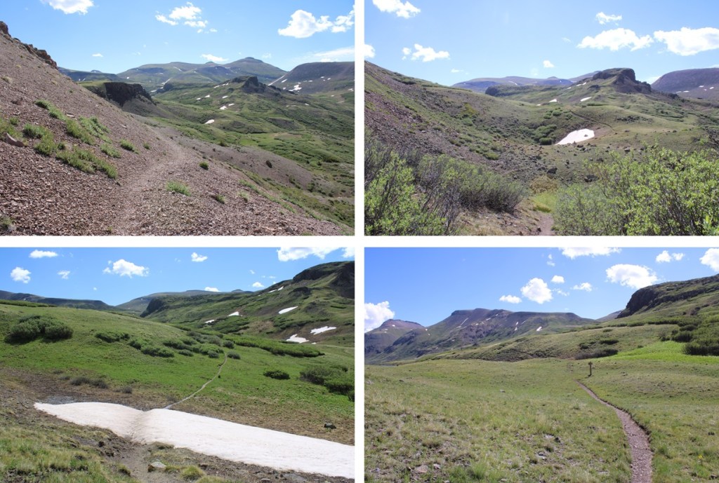
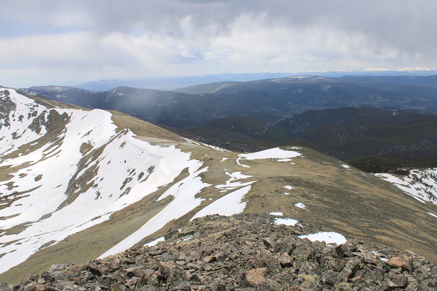
This was an out and back hike for me, so I turned around and retraced my steps. Here’s my route back down the saddle, skirting around the left side of PT 13164, following the Colorado Trail.
I then continued following the trail as it wound back to the Cataract Gulch Trail
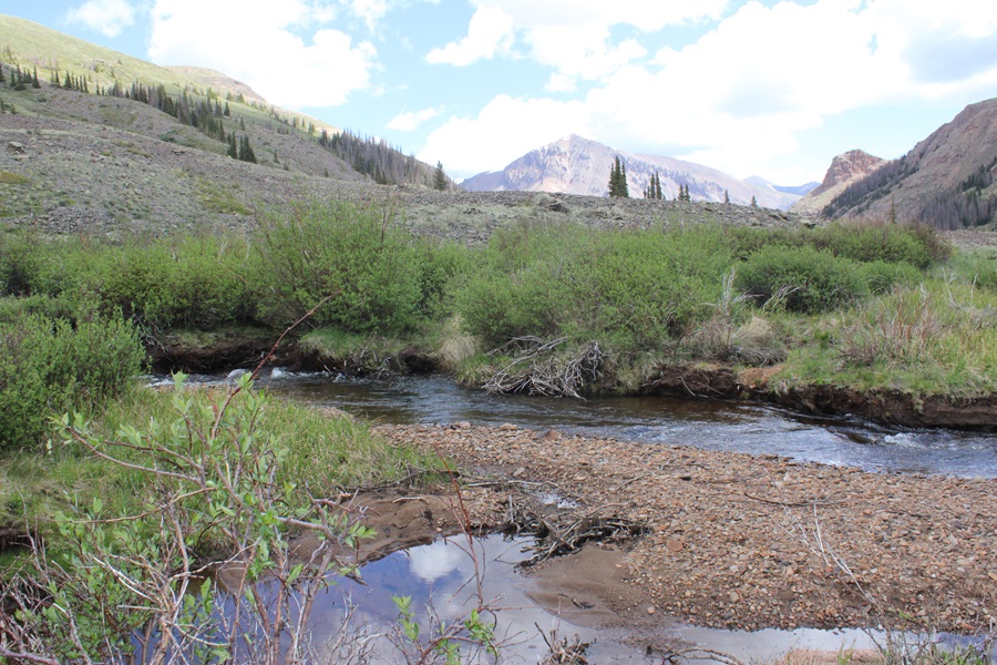
Past the lakes and through the upper basin, I kept following the trail, aiming for Sunshine Peak to the north.
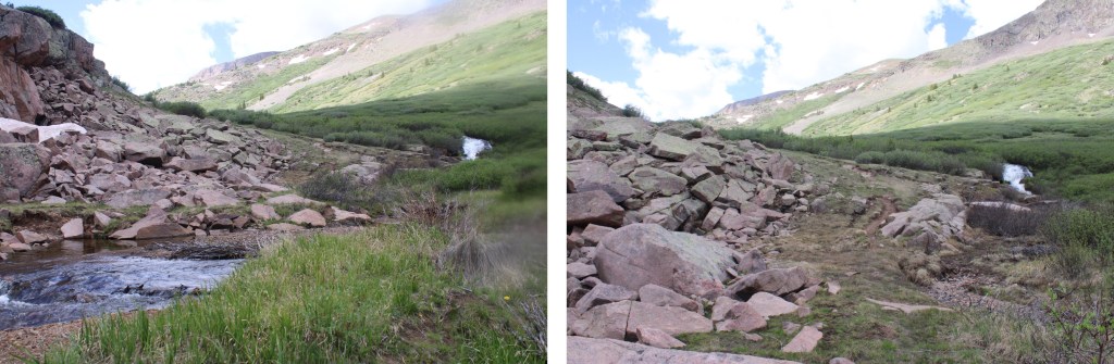
I crossed the creek
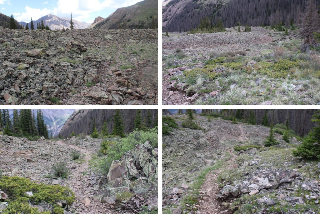
Then descended through the rocky basin
I crossed the creek twice more, and then followed the trail back down around the waterfall and back to the trailhead.
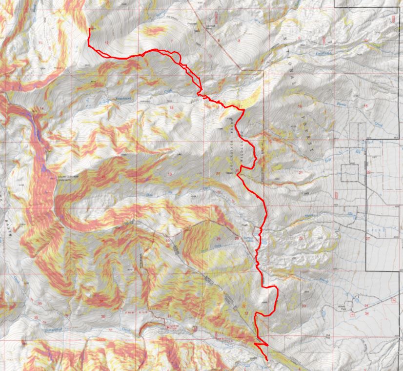
I made it back to the trailhead at 12pm, making this a 17.1 mile hike with 4750’ of elevation gain in 8.5 hours. Note: My Strava glitched about 2 miles into this hike, so I drew in my route for this peak on the topo map. This was easy because most of the route was on a trail, so it auto populated. My phone and watch gave me 19.1 miles for the hike, but I got 17.1 miles when I drew the map in CalTopo.
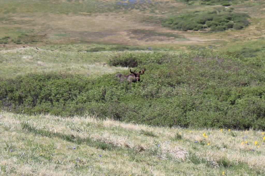
Also, every time I’ve been to Cataract Gulch I’ve seen moose. Today was no exception.
I’ve spent the past week in Florida for work, so I was a little worried about breathing above treeline today. I made it to the Harvard Lakes trailhead easily, as there wasn’t any snow on the ground (and it’s December!). I parked and was on the trail at 5am. I was following the Colorado Trail north.
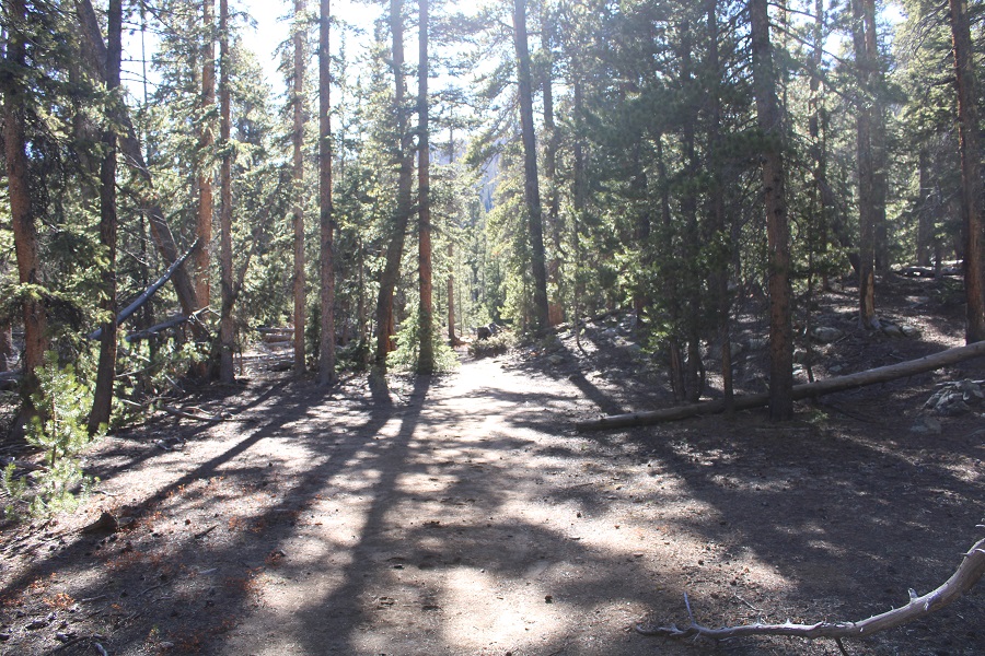
The first 7 miles of this trail follows the Colorado Trail. The Colorado Trail is an easy to follow, class 1 trail. It started with a few switchbacks, and then followed the curve of the mountainside north.
After hiking for 3 miles I came to Harvard Lakes. They were both frozen and looked neat in the dark. Later in the day I saw people walking across both lakes. They didn’t seem frozen enough for that to be safe.
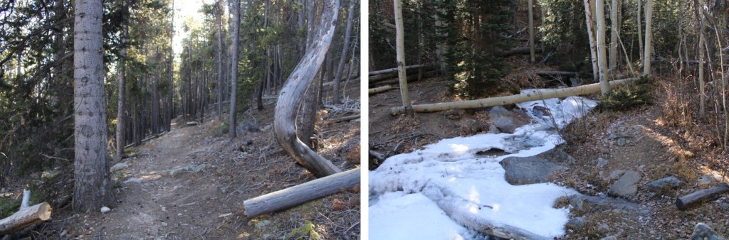
There were several, easily crossable stream crossings along the trail
After hiking for 6 miles I briefly lost about 250’ of elevation, which led me to a trail junction.
The junction was between the Frenchman Creek Trail (Harvard Trail on a topo map) and the Colorado Trail. I continued along the Colorado Trail
I crossed Frenchman Creek. There were no tracks in the snow past this point, but there wasn’t much snow to begin with. It didn’t look like anyone had been on this part of the trail in a while.
I quickly came to an area with several camping spots at 11150’. I’d been hiking for a total of 7.15 miles.
Here I left the trail and headed northwest to the ridge.
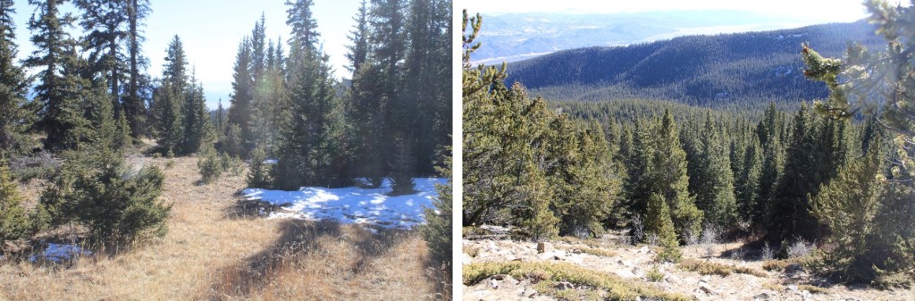
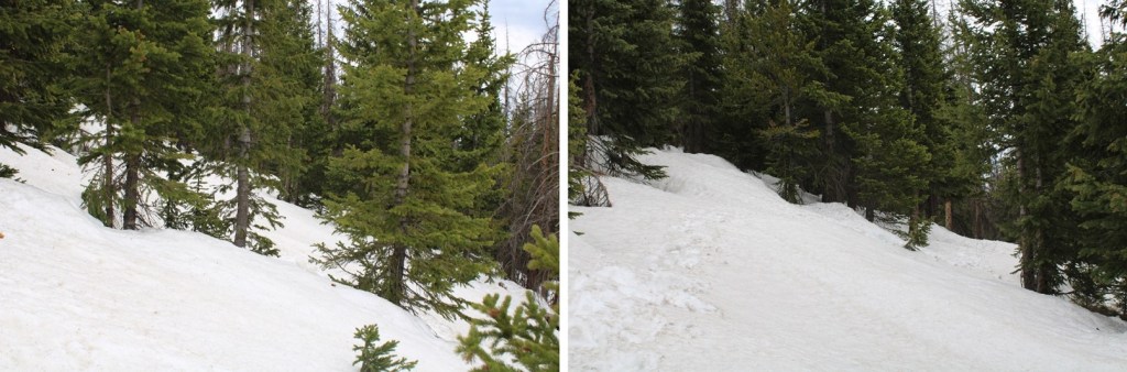
I bushwhacked to treeline. This was easy as far as bushwhacking goes, as there weren’t too many downed trees and the trees weren’t jumbled close together.
At treeline I could see the ridge, and headed towards it
I skirted the ridge a little to the left
Once on the ridge I followed it west
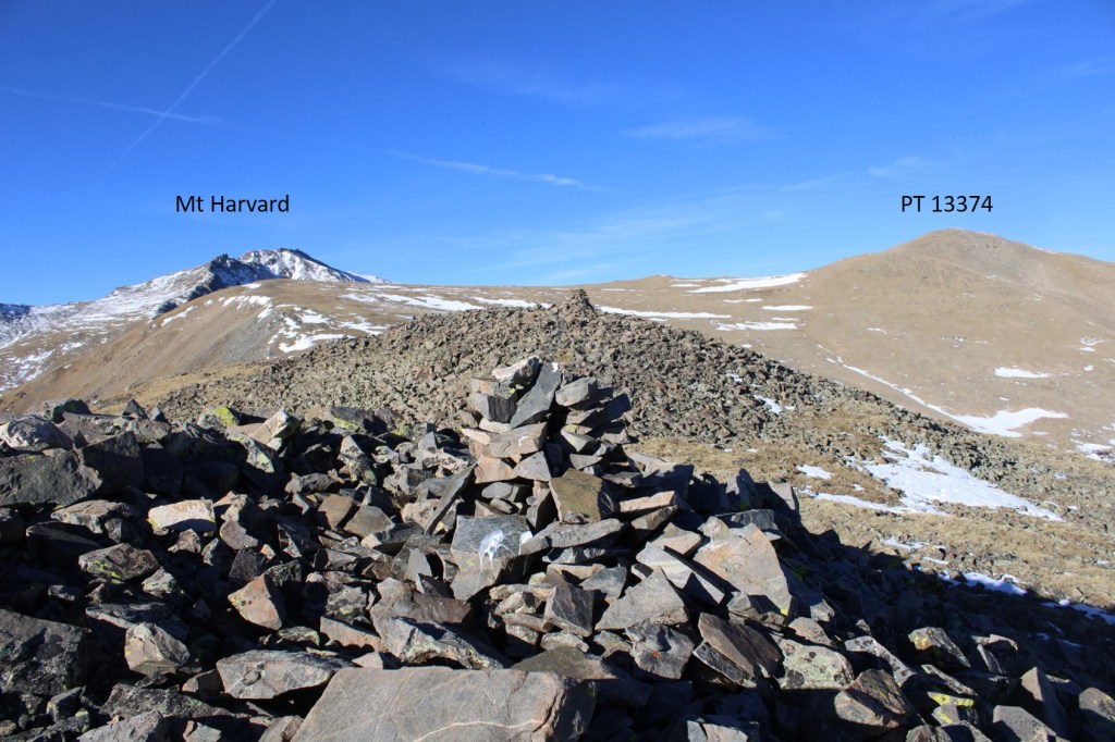
I came to a rocky, cairned area, and could see the route before me to PT 13374.
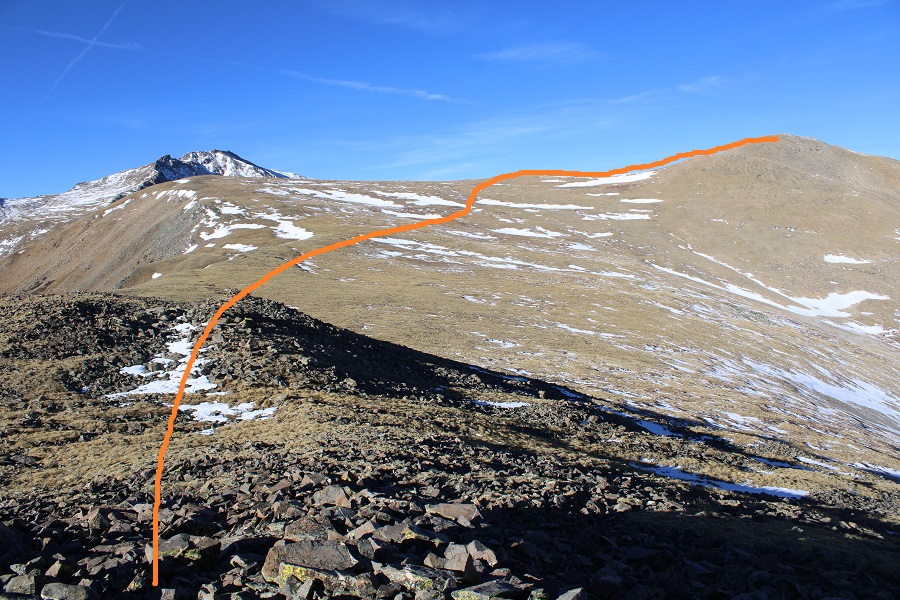
I crossed the rocky area, and followed the tundra to PT 13374, easily avoiding the snow
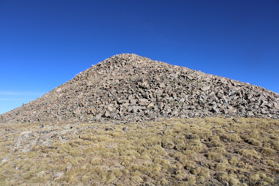
Here are some pictures of the final push to the summit
I summited PT 13374 at 8:45am
PT 13374:
There was a summit register (in a tube). It was such a nice day I opened it and signed the register. I then turned and retraced my steps back to the ridge.
I then followed the ridge back to treeline
At treeline I aimed southeast and bushwhacked it back to the Colorado Trail
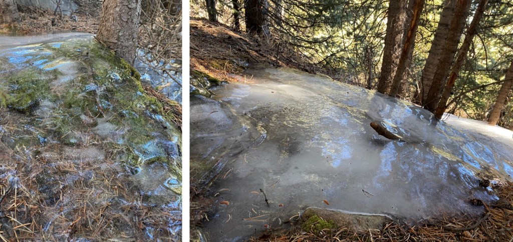
There’s surprisingly little snow for this time of year, but it’s still cold outside. There were several areas of frozen water below treeline that looked really cool.
I made it back to the Colorado Trail, and followed it for 7 miles south, back to the trailhead
I made it back to my truck at 2pm, making this a 19.77 mile hike with 5178’ of elevation gain in 9 hours. Today seemed almost too easy: the gradual elevation gain made the miles fly by.
This was my third attempt at Chipeta Mountain this year. The first time I drove out the road was open but impassible due to snow. The second time the road was clear, but the gate was closed. I saw several videos/pictures of people on the pass this year, but later found out they were part of a mining operation and the only ones allowed to access the road. The road formally opened on May 28. Today was May 29. It had already been a long morning: I’d woken up at the Gibson Creek trailhead, intent on hiking a few 13ers in the area (also not my first attempt these peaks this year), but after about 1000’ of elevation and deteriorating snow conditions I decided to make today a ‘me day’. I hiked back to my truck, chugged a beer, and came up with a new plan: I was going to drive to Marshall Pass, see if it was open, spend a day relaxing, and then tackle Chipeta Mountain tomorrow.
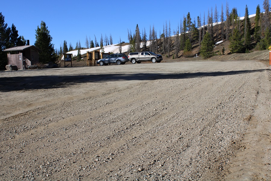
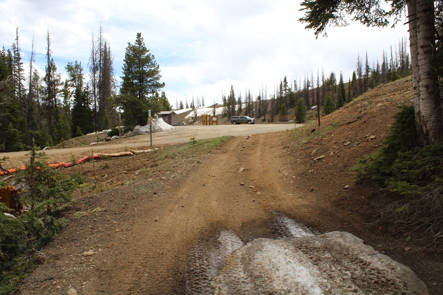
Marshall Pass was open and snow/mud free to the pass. I was surprised at how few people were dispersed camping this Memorial Day weekend. I parked near the bathrooms and information signs.
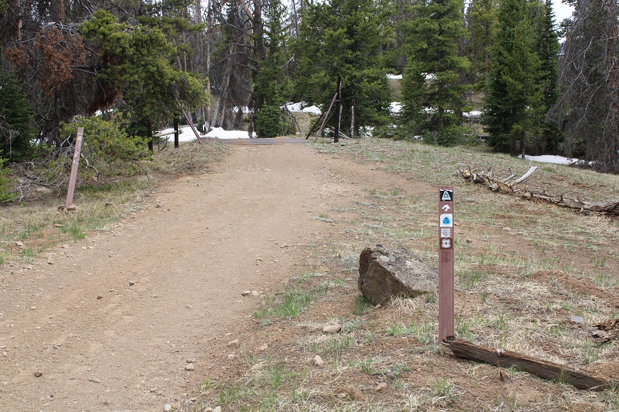
I checked the weather, and it wasn’t supposed to rain until 5pm tonight. I did the math, figured I had plenty of time to get in a hike before weather set in, gathered my gear, and was on my way. I was on the trail at 8am. The usual trail from the trailhead has a sign saying it’s no longer in use, so I took the very short bypass and started along the road instead. This is road 243G, located at the north end of the parking area. If was a bit muddy to begin with.
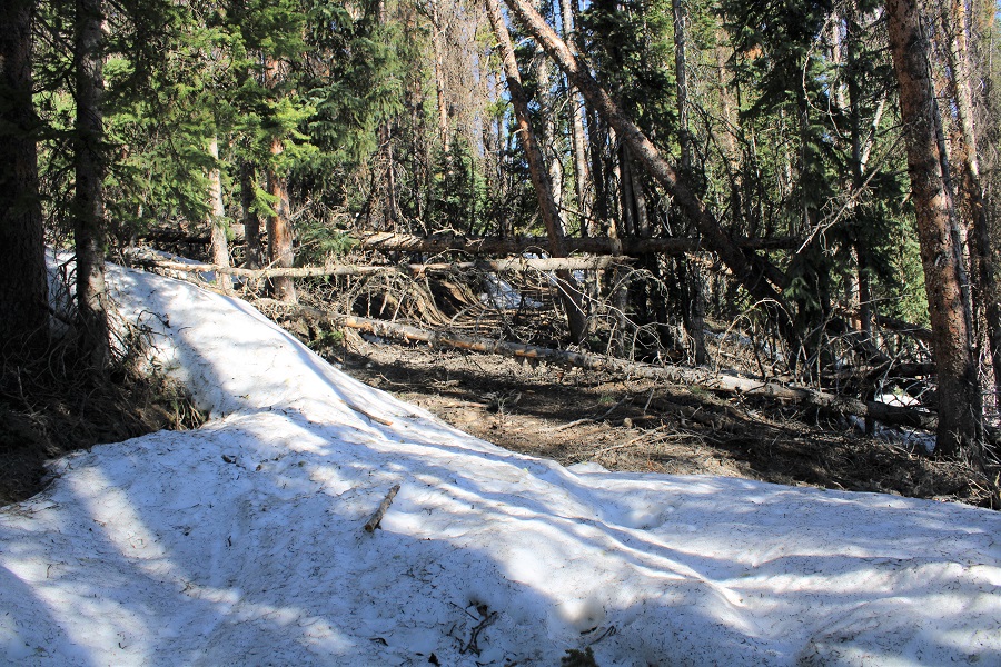
It was obvious from the start motorized vehicles hadn’t been on the trail yet this year, as there were numerous downed trees at the beginning (not much after a mile in, however).
I was following the Continental Divide and Colorado Trails north, along the west side of the mountains.
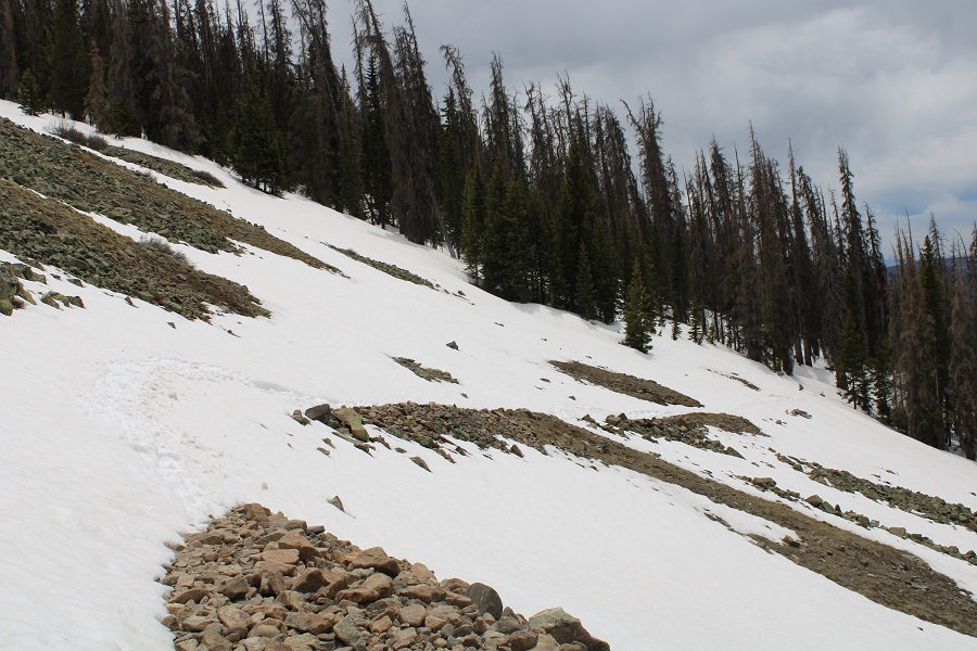
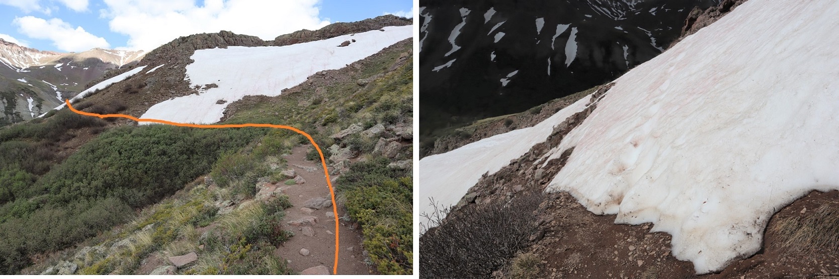
After hiking for 1.7 miles snow started covering the trail. Luckily, this snow wasn’t quite mashed potato snow, and I could get by hiking over it with just microspikes (on the way in),
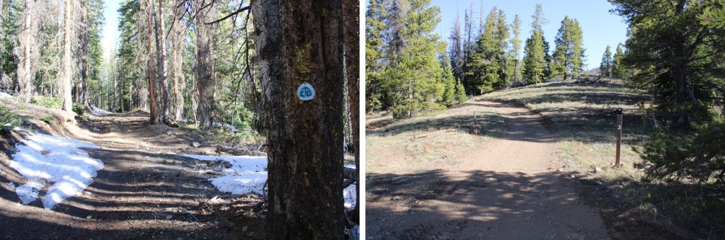
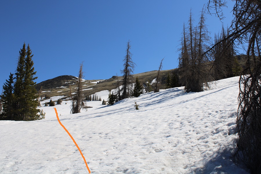
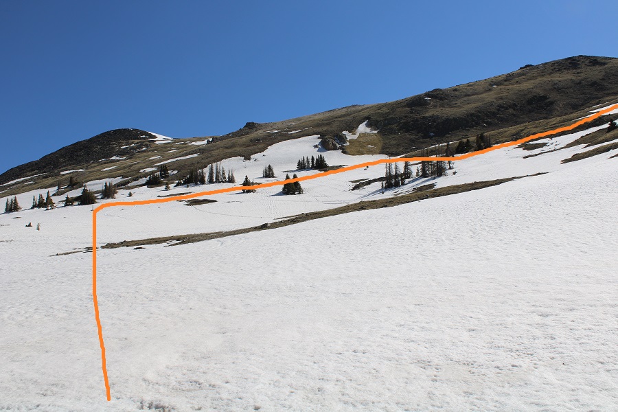
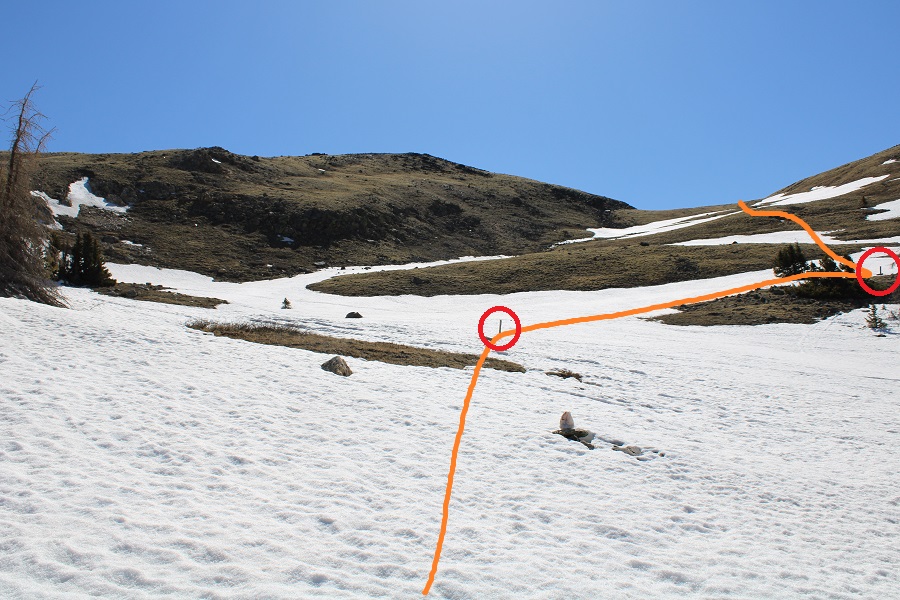
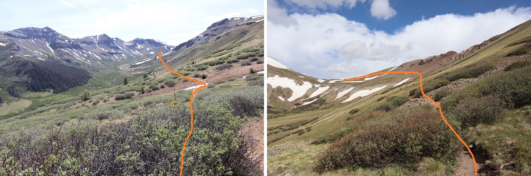
After hiking for a total of just over 3 miles I turned right and headed east up the slope. A map will tell you this is trail 484.1, but since it was covered in snow I headed east, and once I saw them, I followed the posts to the saddle.
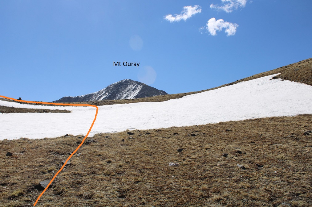
Once at the saddle I had a great view of Mt Ouray. I turned left and headed north along the ridge.
Here an obvious trail picked up (the trail only lasted to the top of this hill).
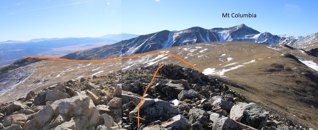
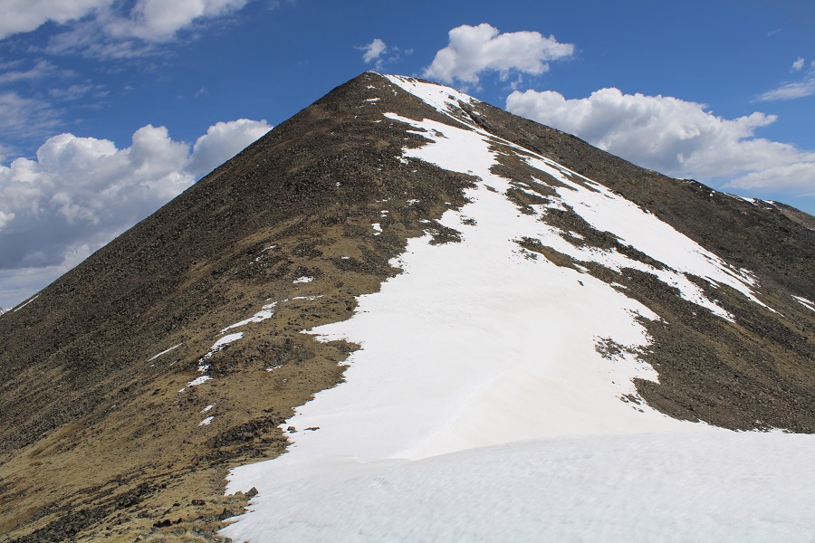
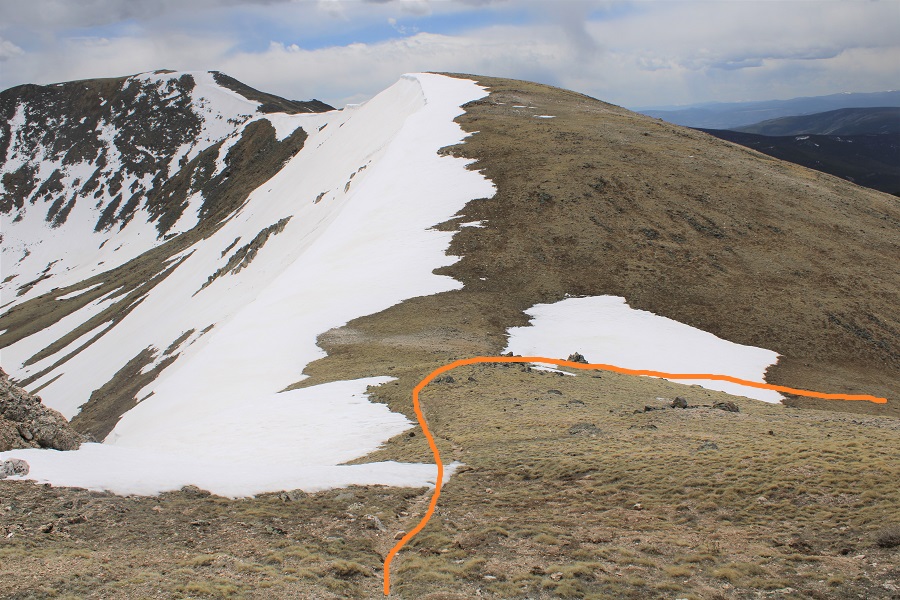
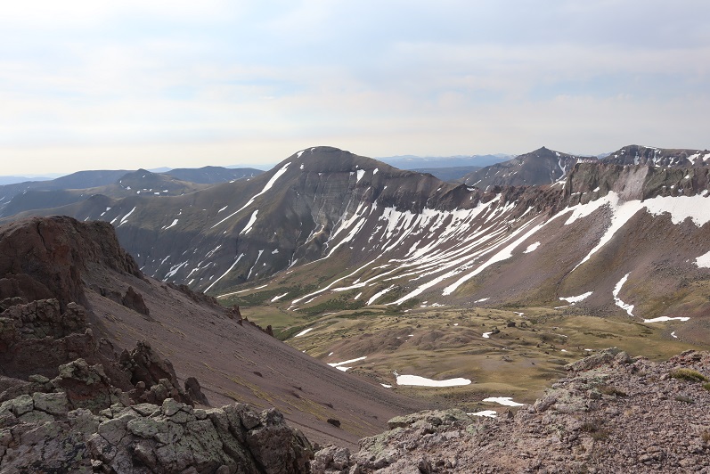
From here you can see the rest of the hike: it’s a straightforward ridge hike that starts out with tundra, and ends with a lot of loose rocks the size of tires. Note: The drop from South Chipeta Mountain to Chipeta Mountain is more drastic than this image would indicate.
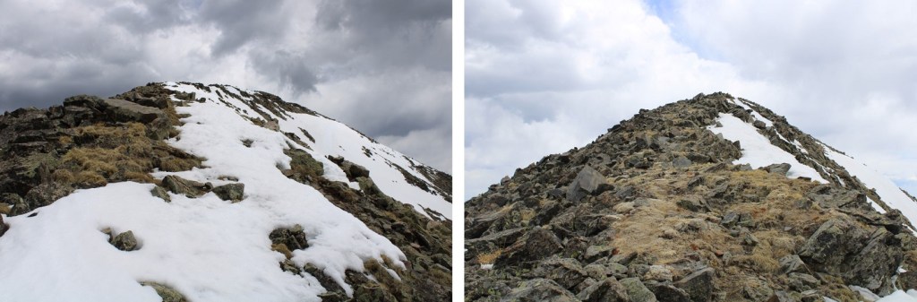
Here are some step by step pictures of the ridge.
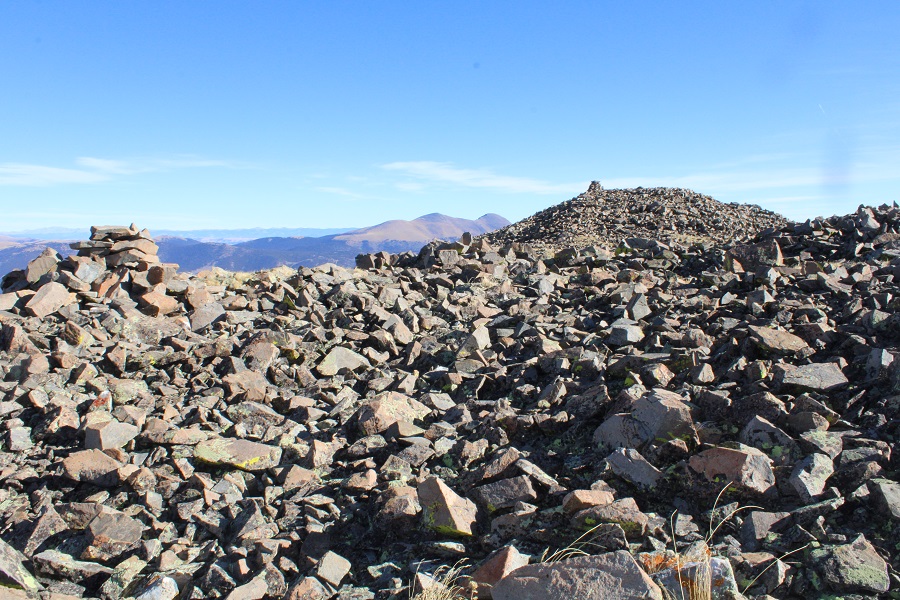
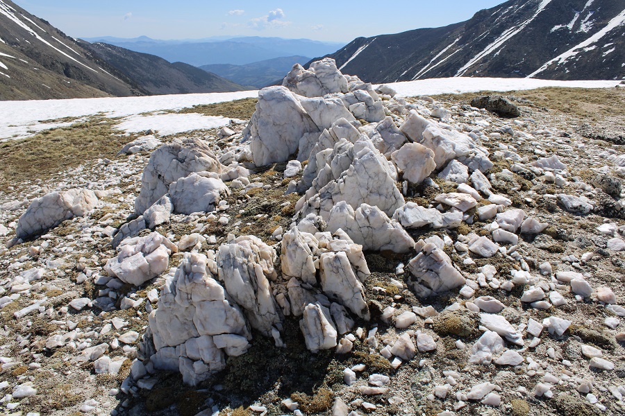
There’s a cool Quartz formation, with a lot of interesting rocks lying around
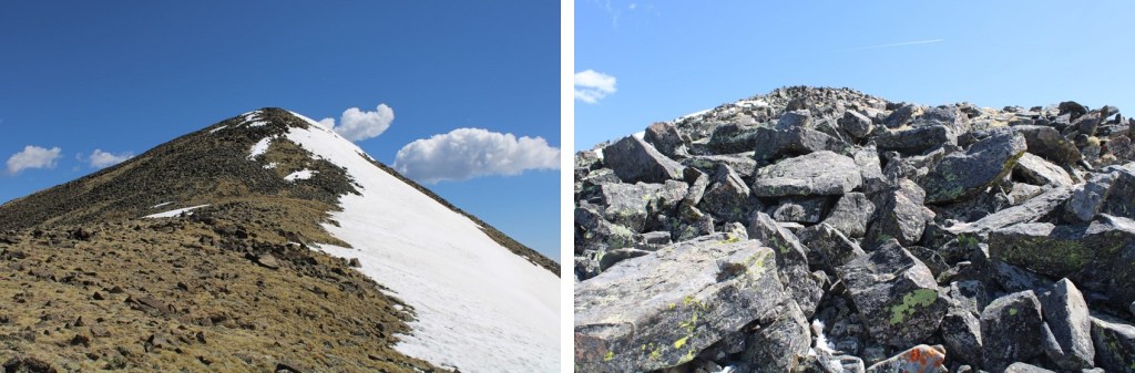
Then it’s on to South Chipeta Mountain
It’s rockier than it looks towards the top
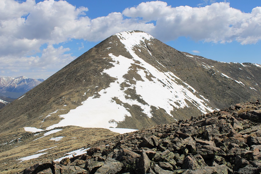
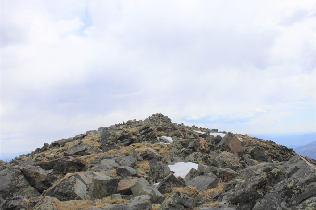
From the top of South Chipeta Mountain (12850) you can clearly see the route to Chipeta Mountain (13472). From South Chipeta you will lose 200’ of elevation, and then gain 825’ of elevation to the summit of Chipeta Mountain.
This is also a simple ridge hike, but it takes time and careful foot placement because the rocks aren’t stable and tend to roll. Nothing above class 2 however.
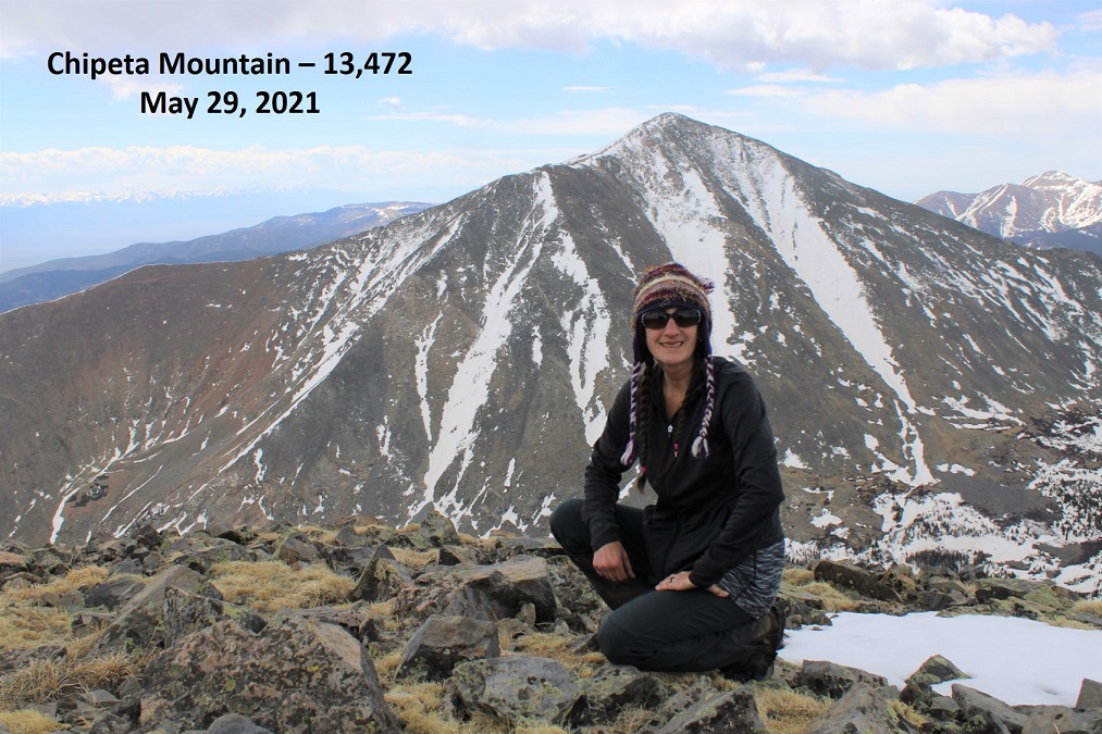
Weather unexpectedly started coming in early as I neared the summit of Chipeta
I summited Chipeta Mountain at 11:15am, after just over 3 hours of hiking
Chipeta Mountain:
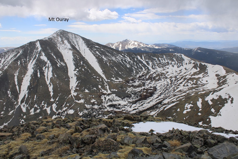
Here’s the view of Mt Ouray from the summit of Chipeta
I didn’t like the look of the clouds, and there was virga in the direction I was headed, so I didn’t stay on the summit long. I retraced my steps back over South Chipeta Mountain to the saddle.
At the saddle I turned right and headed back down to the Continental Divide / Colorado Trail
At this point I needed snowshoes. Strapped them on and followed my tracks from this morning south
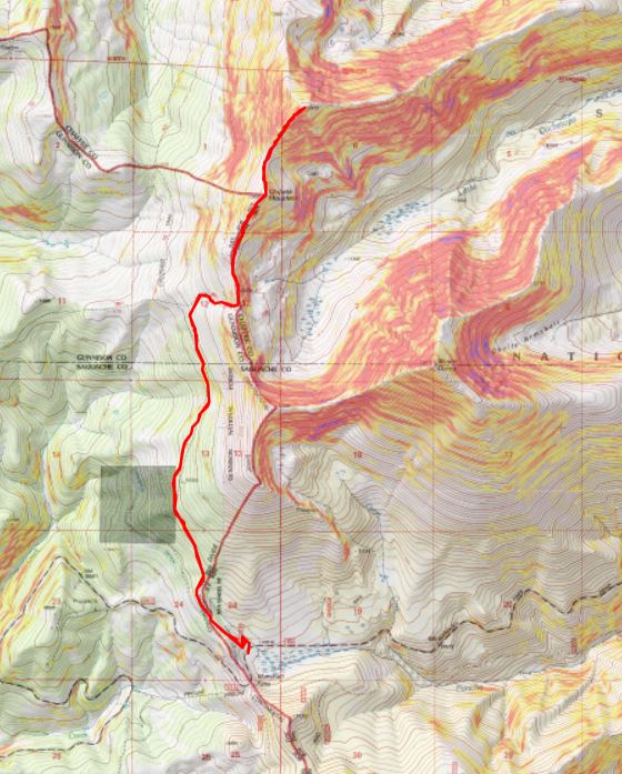
I made it back to the trailhead at 2pm, making this a 10.58 mile hike with 3281’ of elevation gain in 6 hours.
I was still intent on taking a ‘me day’, so I decided to sleep in my vehicle here overnight. Around 5pm a couple drove in, saying they were planning on backpacking part of the CDT/Colorado Trail. The had along their dog, and a ferret on a leash (the woman had a ferret fanny pack as well, for when needed). I asked them if they had snowshoes? The woman slapped the man across the chest and said “See? I told you so!” They didn’t have snowshoes but headed out anyway. When I woke up at 5am their vehicle was gone, so I’m guessing they didn’t end up staying the night, which was a good idea, considering there was a storm coming in. I’m not sure what a wet ferret smells like, but it’s probably not ideal.
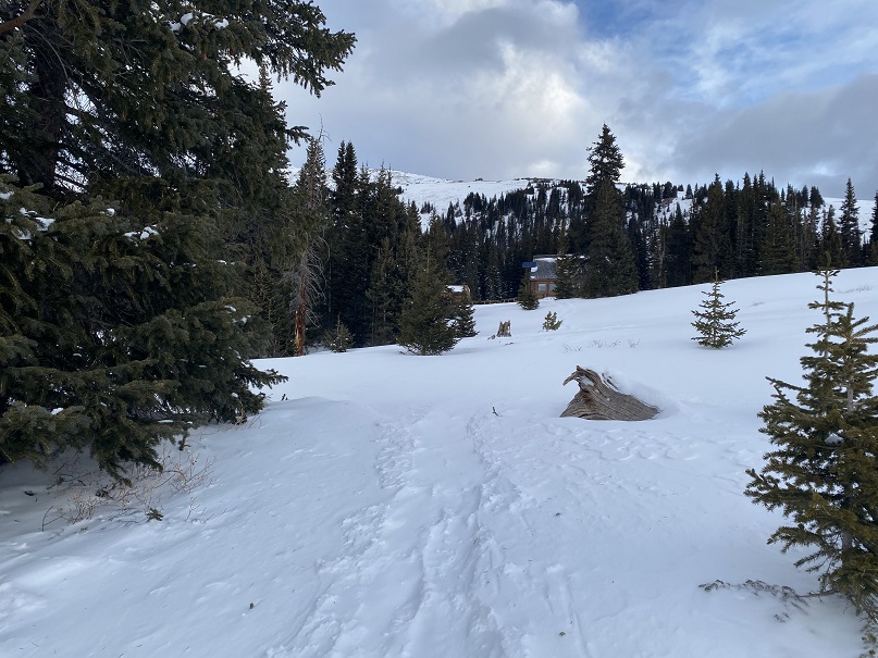
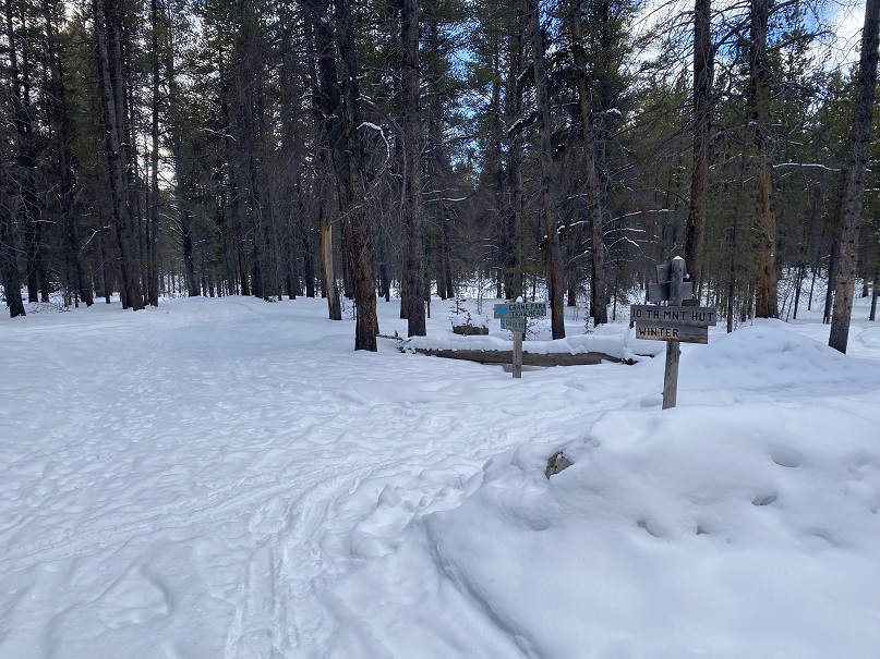
This trip started out as a summit attempt on Homestake Peak, but it ended with an unexpected trip to the 10th Mountain Hut.
Weather all over the state either had high avalanche danger or high winds, so I settled on hiking Homestake Peak today, with a frigid forecast but only 5-10mph winds and no cloud cover. Or, so I thought. I arrived at the trailhead and put on my gear, including snowshoes, inside my truck.
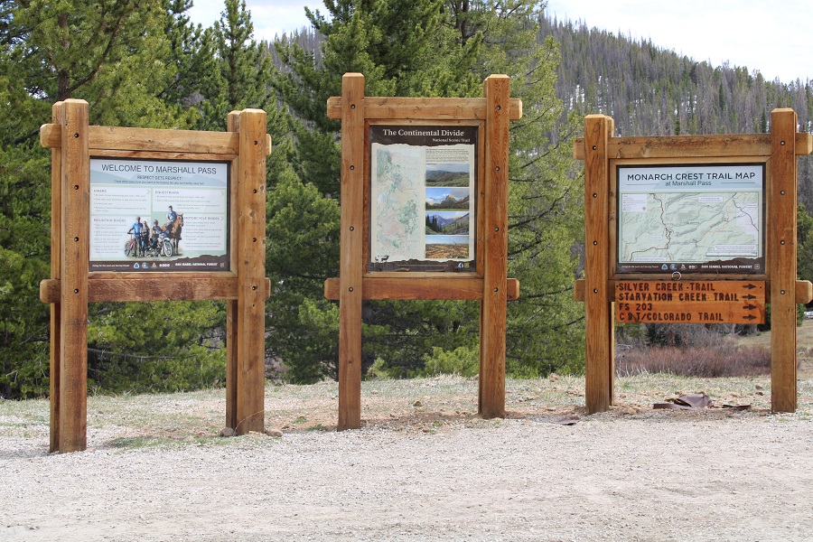
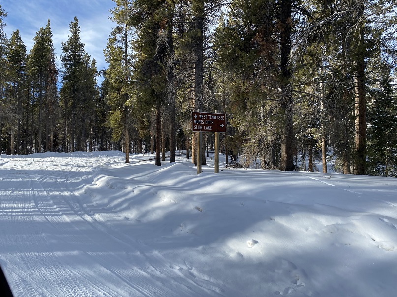
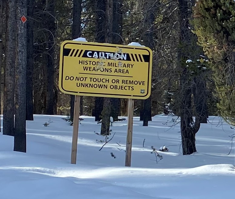
There were some cool signs in the area
I was on the trail when it was still dark, and noticed tracks coming towards me, presumably made earlier in the night. I’m guessing they’re coyote
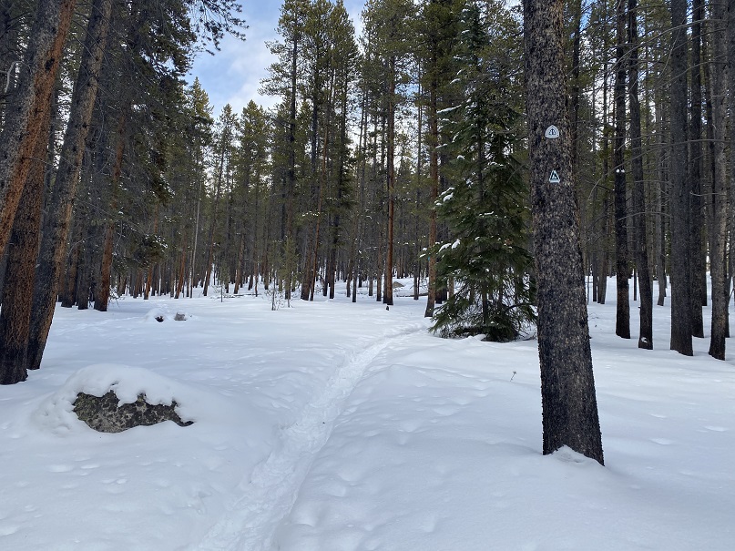
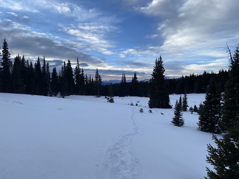
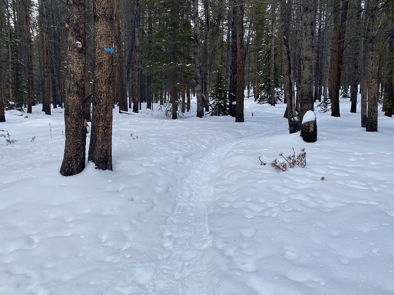
I followed the well-marked trail, using the blue diamond route
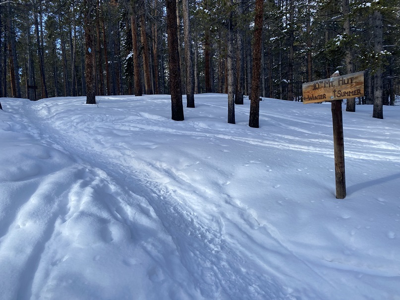
And then following the route to the 10th Mountain Hut (still blue diamond/arrows).
Here I was following the Colorado Trail. It was just a for a short time, but still kind of cool to be back on the trail for a bit.
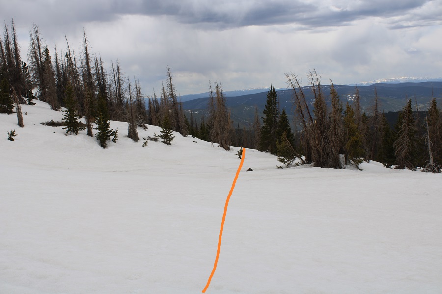
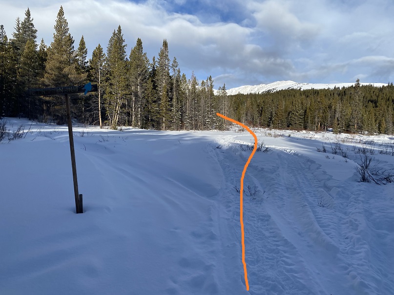
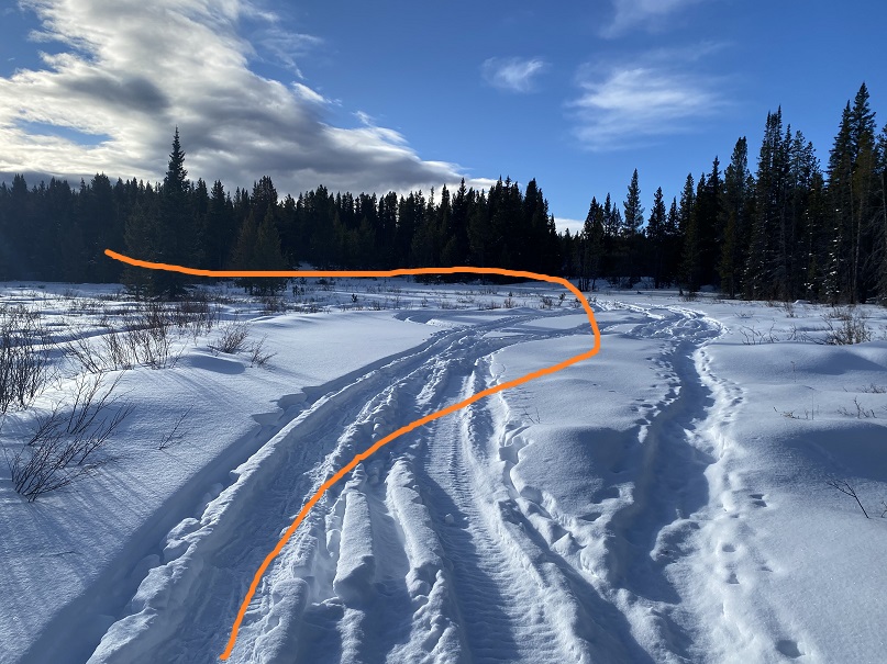
The trail was easy to follow until I came to a meadow. I was supposed to take the route outlined below, but the snow was too soft in the willows.
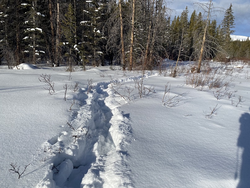
I ended up zig zagging back and forth, trying my best to follow deer/elk tracks. I kept falling into invisible streams covered in several feet of snow. At one point my phone froze and I was unable to unlock the screen to see where I should have been going. My stylus wasn’t working in the cold either. Several times I sank up to my chest in snow, and after the third time getting my snowshoe caught in debris that immobilized me I decided to call it and head back to the trail. I wanted to try to find another way to summit: the conditions in the marshy area were just not safe. I could see myself twisting an ankle or breaking a leg on this route. Here’s my route out of the willows.
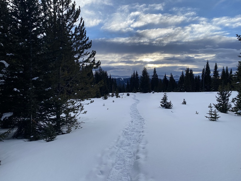
I didn’t want my day to be over, so I decided to follow the tracks to see where they led. They continued to follow the blue diamonds.
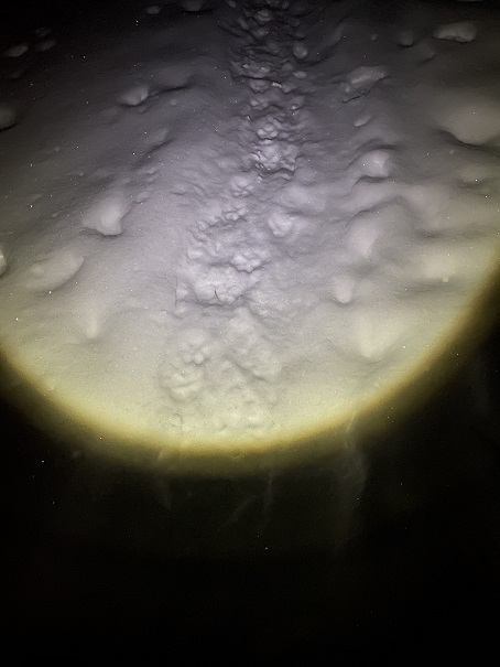
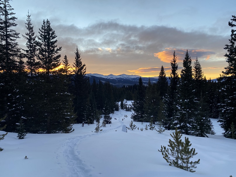
Right about now the sun was beginning to rise, and I could see it wasn’t going to be a cloudless day. The clouds made for a beautiful sunrise though!
As the sun rose the wind picked up. I could see snow swirling all around me, which was pretty cool. I also knew I needed to be more to the southwest if I wanted to attempt Homestake Peak today, but every time I tried to cross the snow and head southwest I sank up to my chest in the snow. That snow was seriously deep, and sugary. I’d need skis to attempt a safe crossing (I don’t own skis).
I could also tell the clouds were increasing, and by looking at how fast they were moving, they weren’t going 5-10 mph (more like 40mph or so). Here the well trenched trail ended, but I could see a faint line of where it had been a few days ago and decided to re-trench the trail to see where it went.
I came to a small sign, stating no snowmobiles were allowed past this point, and continued heading northwest.
Just after the sign I came to the 10th Mountain Hut! So cool!
I wanted to take a look around, but as I got closer I could see people moving about inside and decided to leave them be. They looked like they were packing up to head back out. They must have trenched in on Friday, and I’m sure they’d be excited when they noticed I’d re-trenched their way out.
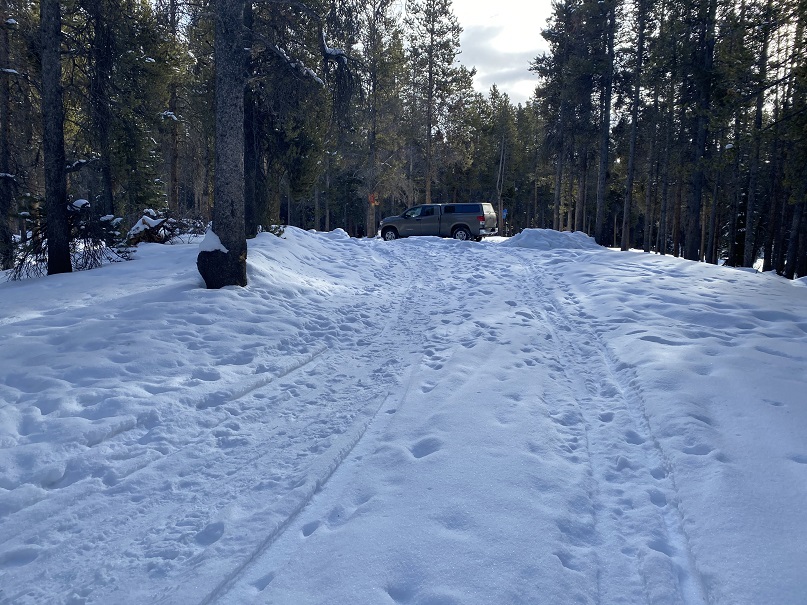
Heading back was easy, as I just followed my tracks
I made it back to my truck at 9:15am, making this a 9.06 mile hike with 1456’ of elevation gain in 4 hours
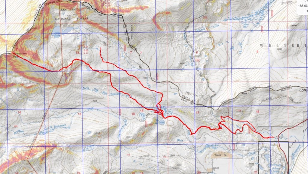
Here you can see my intended route (bottom) and the route I actually took (top)
As I drove home the winds became more intense. There were semis parked on the side of I70, waiting out the wind. Yes, it had been a good idea to switch directions today. While any day out hiking is a great day, I wasn’t happy with today’s stats, so after making it home I hopped on the treadmill.
I drove up to Carson Pass the night before and slept in my truck. For details on the drive in, please see this post: Carson Pass.
That night was a rough night, not only because my mind wouldn’t turn off, but because the winds were constant and curiously loud. I woke up before my alarm and decided to sit in the cab of my truck with the heat on to warm up a bit before starting out. I turned the ignition, heard a “thunk” and noticed my ABS and traction control lights were on. Oh, and my 4WD light was blinking. That seemed strange, and a little troublesome. I tried turning the truck off and on again and taking it in/out of 4WD but I couldn’t get it to engage. I didn’t like this turn of events but figured I might just need to get the truck moving to get it to work. Hopefully it was just an actuator problem. I was on the trail at 4am.
The forecast called for rain today, which most likely would transfer to snow at this altitude. I usually like to do the longer hike first, but today I was afraid I’d get caught too far when weather hit and since these entire hikes are above treeline that just didn’t sound safe. I grabbed my helmet and figured I’d play it by ear.
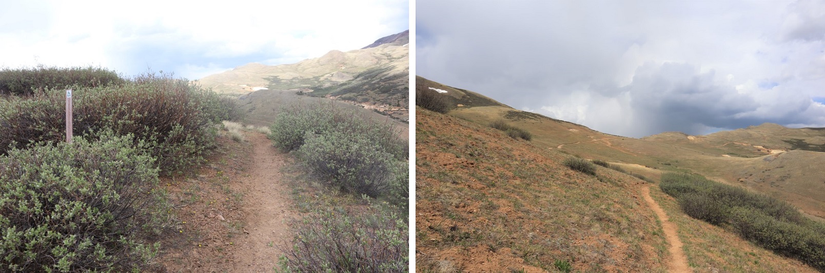
From my parking spot I traveled south for half a mile along trail 821 before turning right onto the Continental Divide Trail/The Colorado Trail/Trail 831. I didn’t know it at the time, but just past this junction there is actually a parking area, so if you wanted to cut off a mile from this hike (and extra elevation gain) you could just park there.
I followed the class 1 Trail 813 as it lost a total of 400’ as it wound down the canyon, and then gained almost 1000’ to the top of the pass.
There was one small section of snow to cross, but luckily for me the elk had already done a great job blazing the trail.
I saw quite a few elk this weekend. They are definitely all over this basin. The first ones I encountered at about 5:30am. Of course they trotted away from me, but I was able to get a photo of one up on the ridge (I’d be on that ridge in about half an hour)
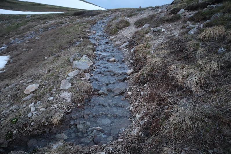
Up towards the top of the pass the trail got a little wet, but it was still easy to follow.
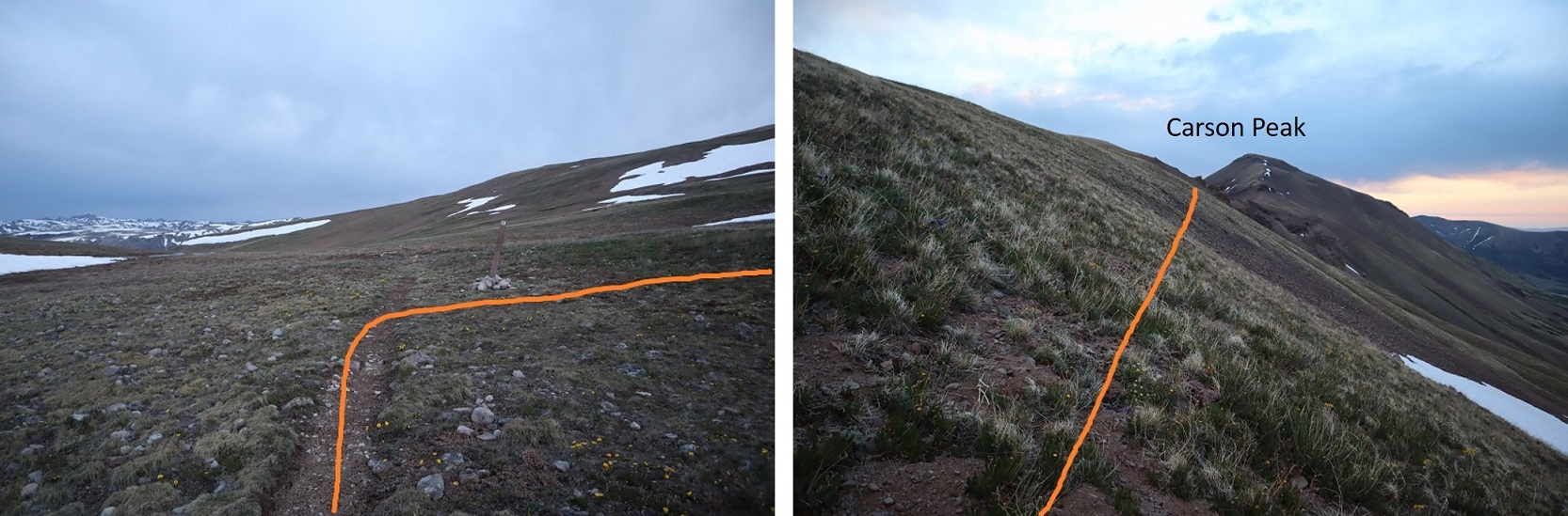
From the top of the pass I left the trail, turned right and headed northeast to the ridge.
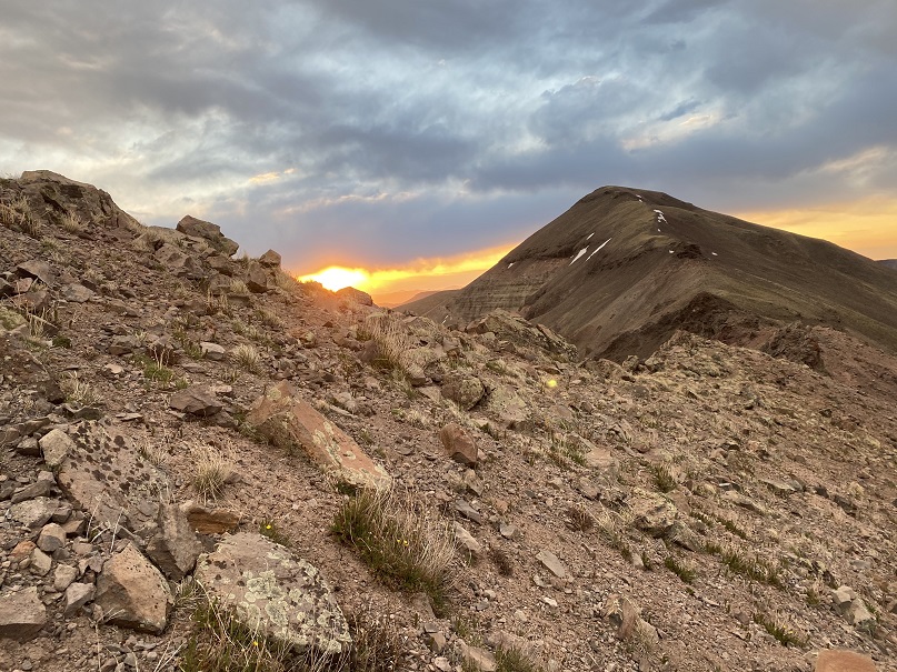
I aimed for the saddle and got a great view of the sunrise.
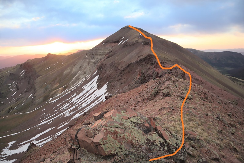
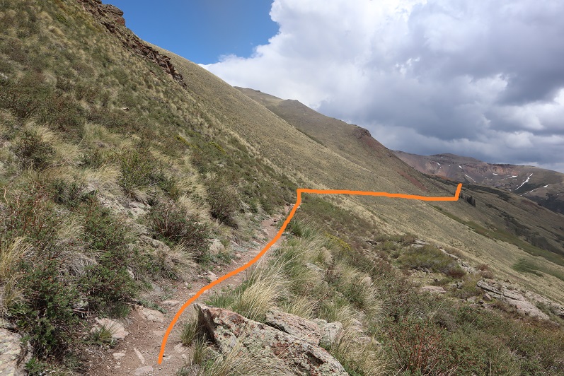
From here it was a class 2 ridge hike. I stayed on the ridge when possible, and when not I dipped to the right. Here’s the route I took:
In the beginning there were some steep sections to navigate. Nothing too difficult, but it’s all choss and there’s some decent exposure, so choose your footing carefully. This area was about a foot and a half wide in places.
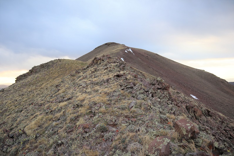
This section is easier than it looks: Just dip down to the right
From there it’s an easy walk up tundra to the summit
I summited at 6:40am
Carson Peak:
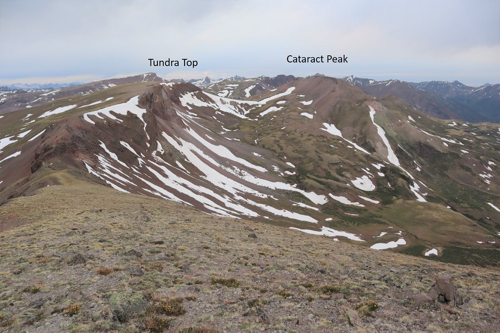
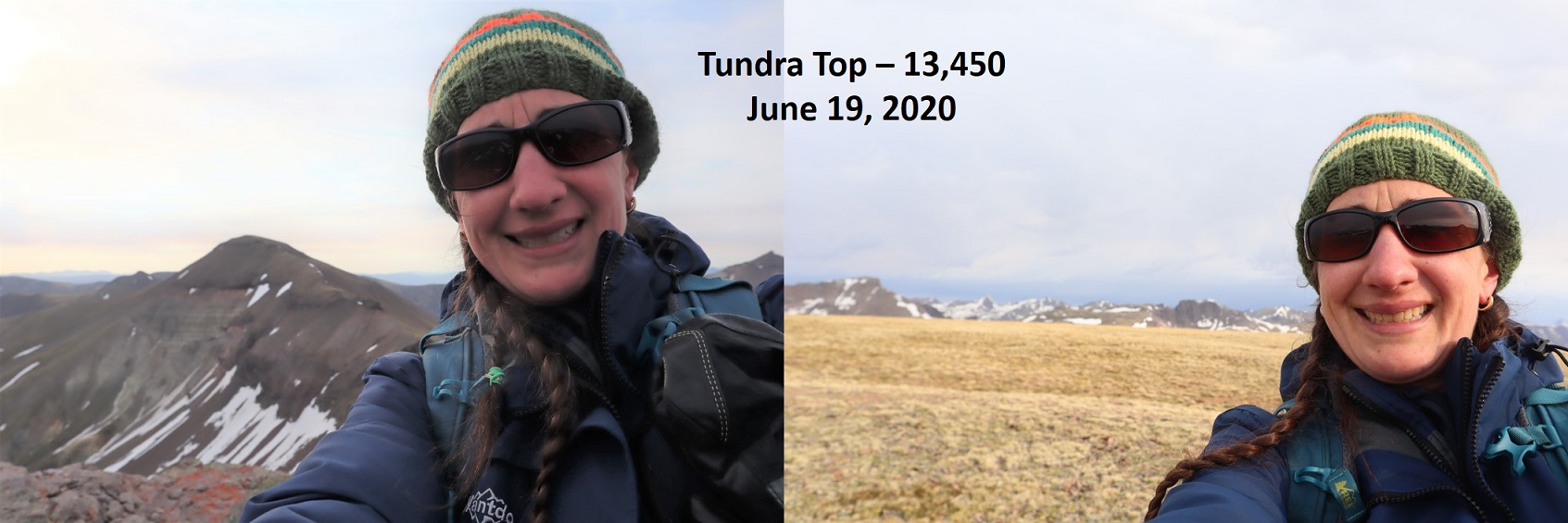
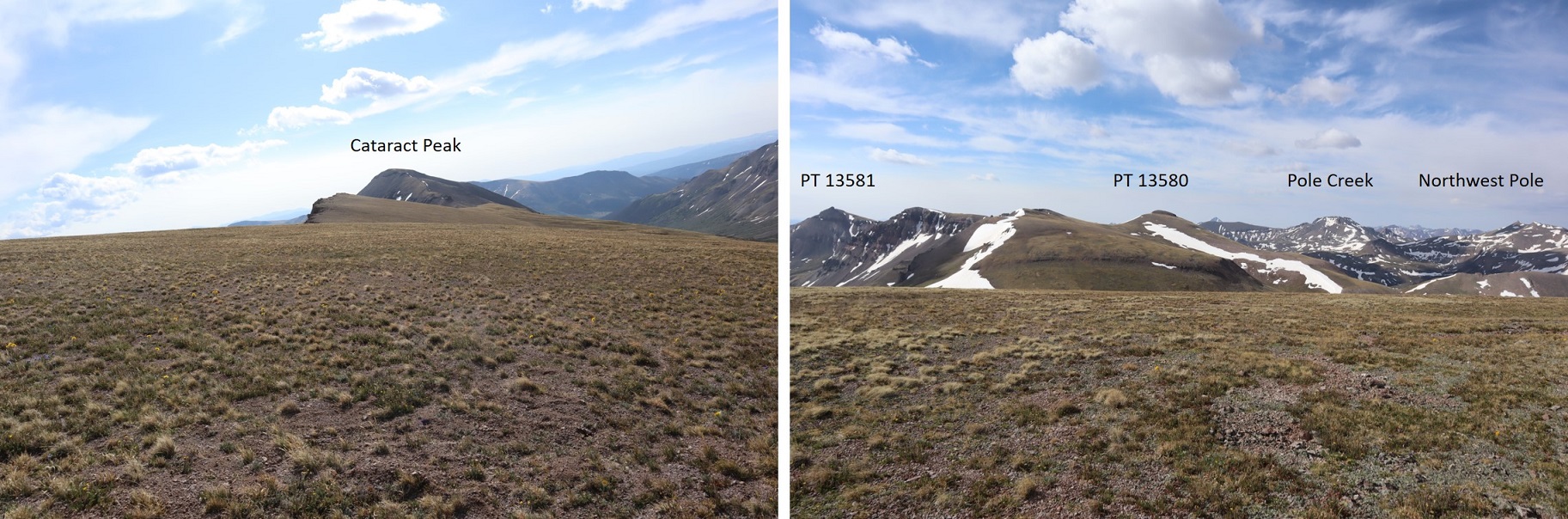
I turned around and headed back over the ridge. From here I had a good view of my next 2 objectives: Tundra Top and Cataract Peak
The route looks a little different on the way back.
Go straight over this part. Once again, there is some exposure here, along with loose rocks. Be sure of your footing.
And straight up this. Once again: loose, but straight up is the way to go
Once the ridge section is done it’s an easy walk up tundra
The only problem? I’m not sure exactly where the summit is to Tundra Top. It looks like it’s at the jagged point you can see from Carson Peak, and indeed that feels like the summit and also has a large cairn, but when I used my altimeter I measured the middle of the flat, open space further to the west as being 30 feet higher. Also, there are cairns all over the summit, as well as at the high point after the ridge. So I basically walked all over the mountain (between summiting the first time and when I came back over from Cataract) and I’m considering it a summit.
In any event, here’s a couple of summit photos from somewhere on the top of Tundra Top, and a video (not sure if the video is from the actual summit though)
Tundra Top:
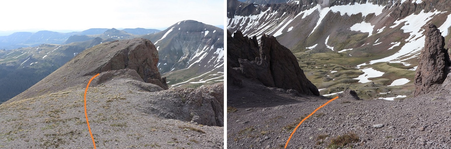
I turned north and headed over towards Cataract Peak
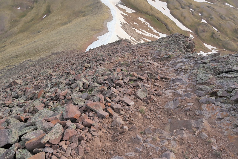
The hike down started with unstable rocks and then switched to scree. This was class 2, and I’m pretty sure I was using game trails, making my way towards the saddle.
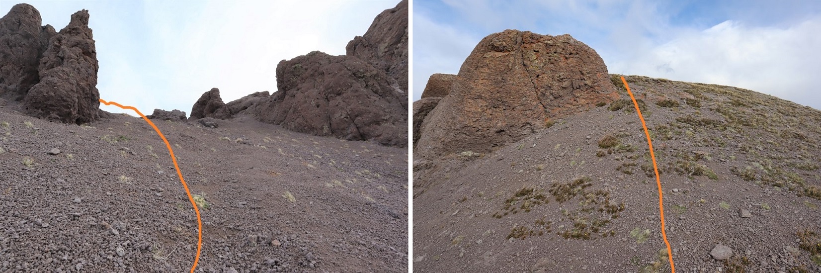
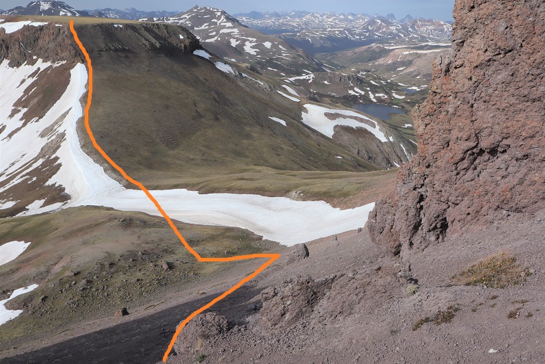
There are two ways to summit Cataract Peak: you can go to the left (west), gain the ridge, and then summit, or go straight up the south face. Not knowing ridge conditions, I decided to go straight up the south face, even though that meant crossing some snow. (After summiting Cataract I realized the ridge is easy class 2 and a viable option).
After crossing the snow I made my way up the mountainside on loose scree, which was steep at times. I followed an obvious game trail with one switchback.
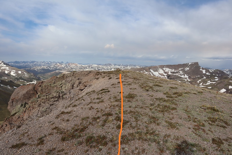
At the top of the ridge I turned left, went around this boulder, and hiked the short distance to the summit (which had a cairn)
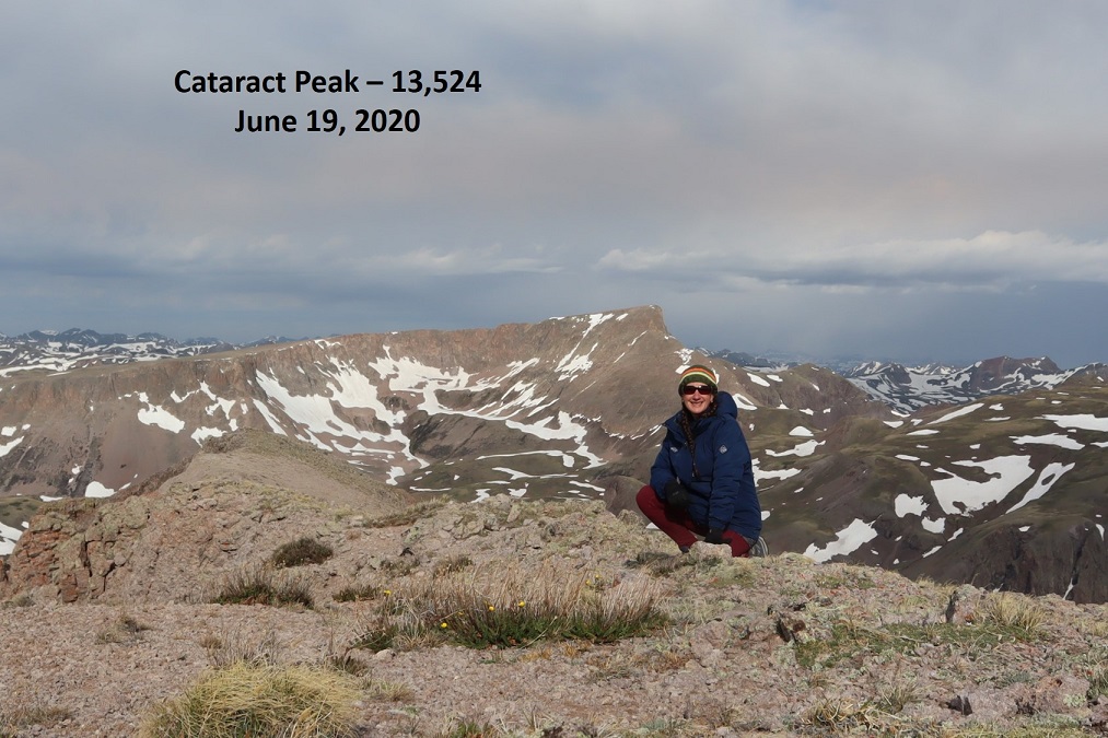
I summited Cataract Peak at 8:25am
Cataract Peak:
I re-traced my steps back to Tundra Top
Encountering an elk on the ice flow before the easy hike up to Tundra Top
From Tundra Top you could see a bunch of the peaks I was hiking this weekend. I spent a lot of time here, checking out the weather and looking at routes for tomorrow to see if they were clear or not. Unfortunately, these peaks require a lot of ups and downs through basins, and while I could see ridges were clear, I had no idea what the basins looked like.
I headed back to the pass, picked up the trail, and headed back down into the basin.
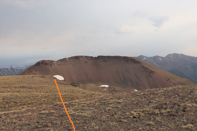
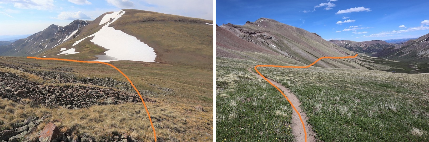
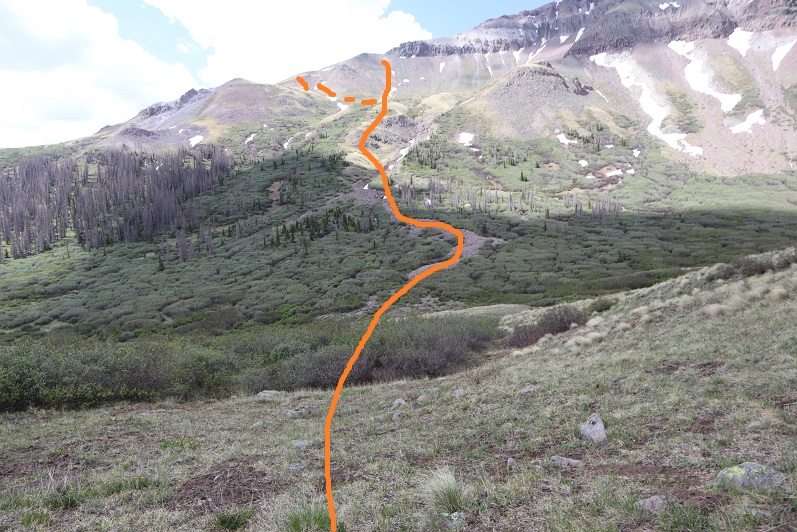
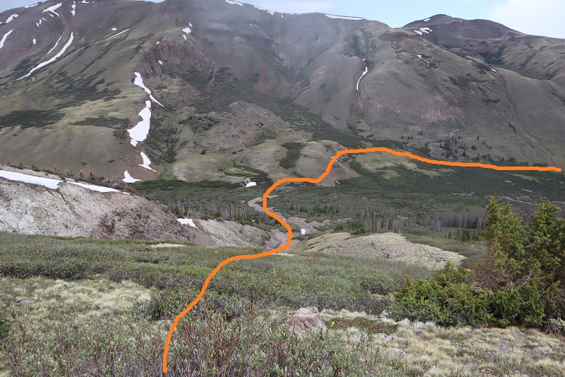
When I got to the lowest point in the basin I decided to attempt PT 13581 today as well. The weather looked like it would hold, and I was so close (and not yet tired) that I figured I should at least give it a try. I eyeballed this one, looking for the best route up. I decided to leave the trail, cross Lost Trail Creek, and follow the drainage until I hit the tundra that paralleled willows. Then I would stay on the tundra, using the willows as guidance before taking a gully up. To gain the ridge I took the solid line up, the dotted line down.
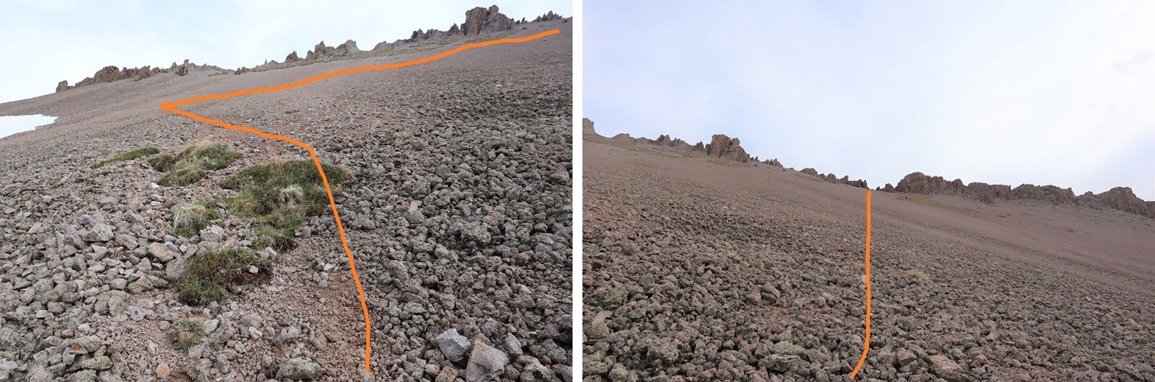
This proved to be a fabulous plan. The only downside was the gully: it had recently melted out and was still soft. I almost lost a hiking boot in the mud, and it was very steep. It almost felt like it should have been a winter route with snow, an ice axe and crampons.
Here it is in a little more detail:
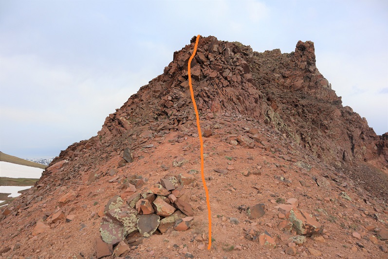
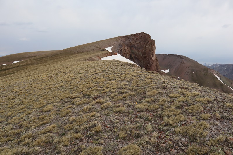
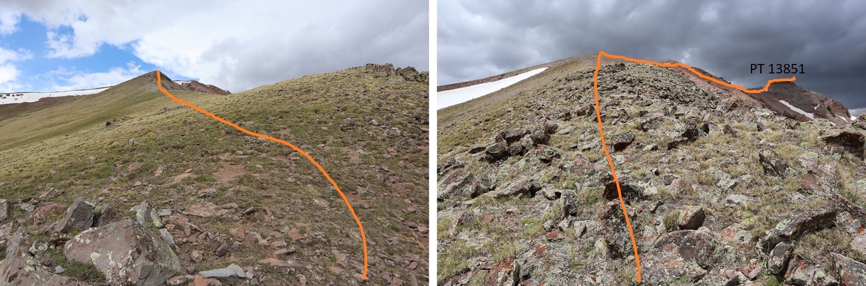
At the top of the ridge I turned right and followed the ridge to the summit block
I was keeping a close eye on the weather. The clouds were building, and fast. Luckily, they looked like snow clouds and not thunderclouds. I had a feeling that 40% chance of rain was going to happen.
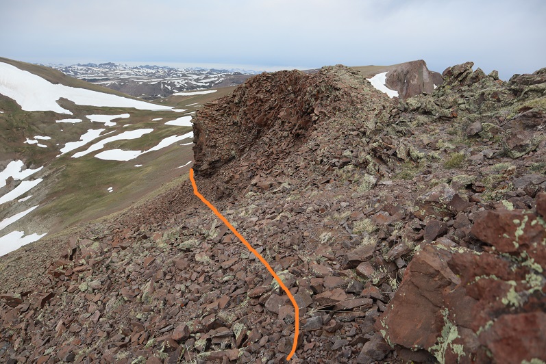
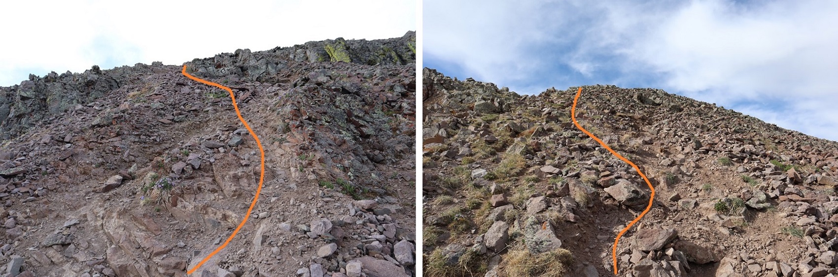
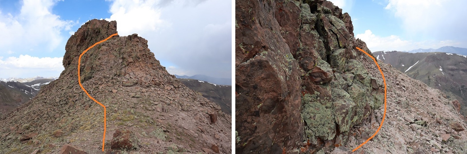
When I made it to the summit block I was surprised to find it wasn’t a class 2 hike as my (quick) research had told me. Nope, this was definitely class 3. I was glad I’d brought my helmet. I strapped it on and left my pack and trekking pole and headed in to figure out how to summit. This is the route I took: I circled around to the left, found a bunch of easy class 3 access gullies, took one up, followed the ridge around to another access gully and climbed to the top. There was exposure in the second gully.
I summited at 12pm
PT 13581:
The weather was turning so I quickly retraced my steps back down the gullies to my gear, then followed the ridge
On the way out I took the second gully down, which wasn’t as steep, and then followed the same path I’d used as on my way in back to the trail.
The wind picked up as I hit the gully and it started snowing. Not big fluffy flakes, but more like slush being carried by the wind that splattered when it hit me. I put on better gloves and kept hiking.
The hike out was uneventful, as it was on a well maintained class 1 trail. The extra 600’ of elevation gain on the way out was kind of a bummer, so I just took it slow. The trail actually inclines gradually, so it wasn’t too bad.
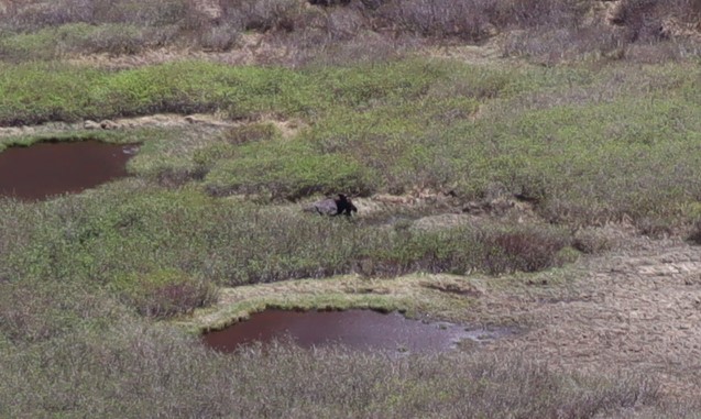
Oh, and I saw a moose in the basin, so that was kind of cool. It was a little far to get a good picture of, but it’s a male.
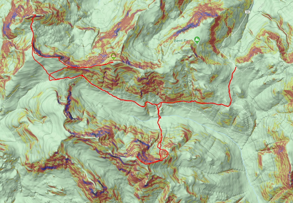
I made it back to my truck at 2pm, making this a 15.41 mile hike with 5543’ of elevation gain in 10 hours.
Here’s a topo map of my route:
It was still early so I decided to clean up, get something to eat, and try to start my computer. It lit up but quickly turned off. Maybe it will dry out overnight and work tomorrow? OK, with my computer out I decided to do some reading. My favorite book for a long time has been “Death in the Grand Canyon”, so I picked up it’s sequel, “Death in Yosemite” and have been reading it the past few weeks. Lovely how the book reiterates, several times, how it’s important to always make good choices, retrace your steps before committing when you’re unsure if you can continue, and not to go solo. Also, don’t be a male between 20-30 years of age. I like to remind myself of these things often and use these stories to try to learn from others’ mistakes.
Idea: Devotionals for hikers (not necessarily religious) that are quick, a page or two, and detail real accidents and how they occurred. Then discussion questions to see what steps could have been employed to prevent the accident. In other words, more books like “Death in the Grand Canyon”, just in a different format.
From inside my truck I watched the marmots and pikas and chipmunks go about their business. They couldn’t see me in the topper, and it was fun to watch them skitter around. One marmot chirped incessantly for over an hour, and I as I sat there my thoughts drifted to how everyone should get to experience climbing in the mountains at least once in their life.
After reading I got out my topo map and looked at routes for the next day, prepped my gear, and got to bed early. I wanted to get a lot of rest before an early start tomorrow, and I was still a little worried about my 4WD and computer problems…