On my way down from Imogene Pass, I parked at the Junction for Richmond Pass and Imogene Pass near the Richmond Trailhead at around 10950’. There’s a nice dispersed campsite here (but when I arrived it was already taken). This hike is entirely class 1 or class 2.
I was up and on the trail at 6:30am. I followed the 4WD road all the way to 12600’
At the first and only junction I came to, I turned right and followed the road that said it led to the Richmond Trail, which I never found the entrance to on either my way up or my way back down (which is why I didn’t take the trail all the way back to the 4WD road on my return… that and there was a private property sign down below and I didn’t want to make a mistake there).
I continued following the road to treeline, where it became very rocky. If you have a 4WD vehicle you can drive up this road, but there will be a rather large rock in the middle of the road above 12000’ that’s difficult to navigate around.
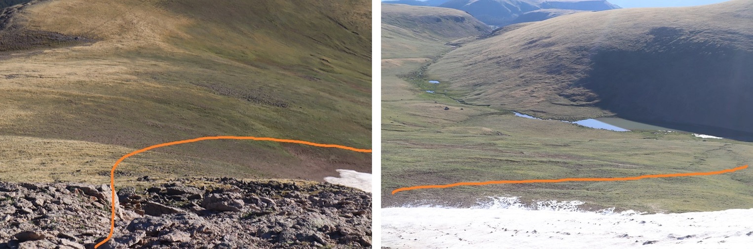
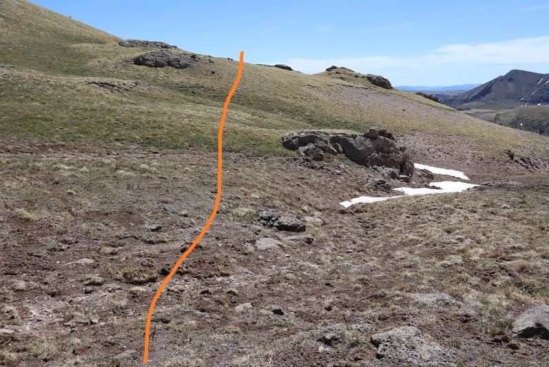
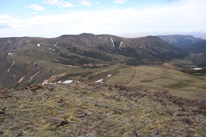
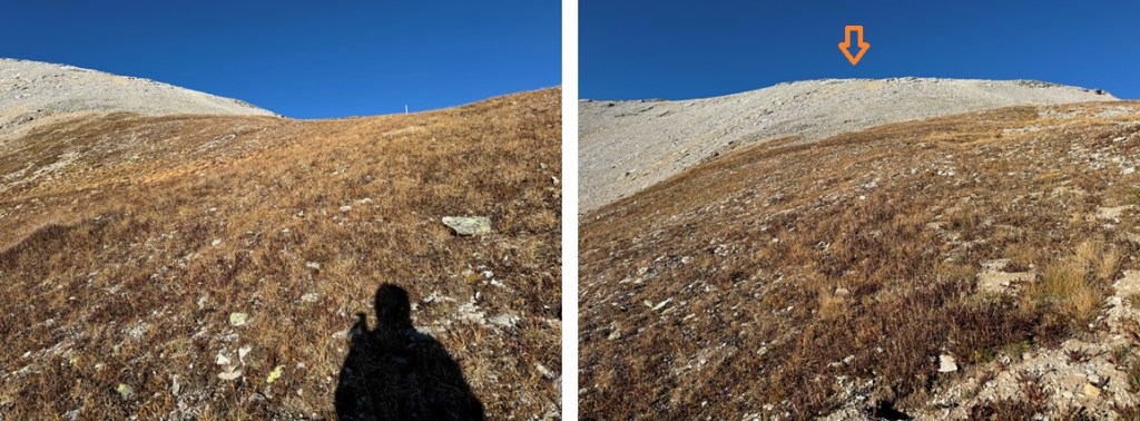
After 2.7 miles of hiking, at about 12600’ I left the road, and headed southwest on tundra. This is where I was going.
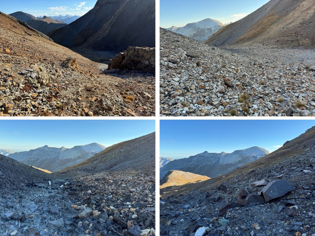
From there I came to an obvious drainage and headed towards it.
At the end of the drainage I gained the ridge, mostly on tundra.
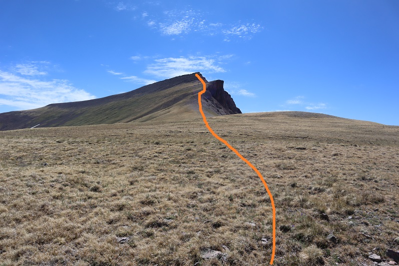
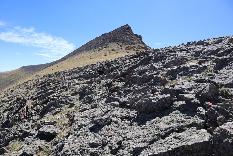
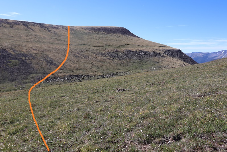
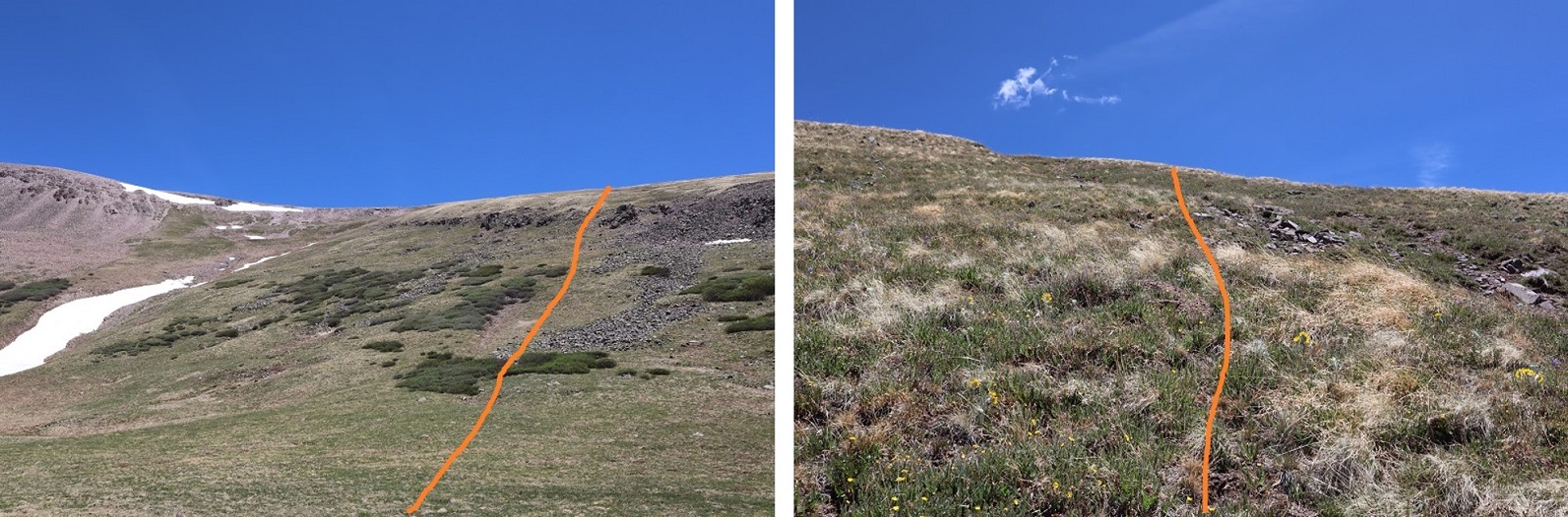
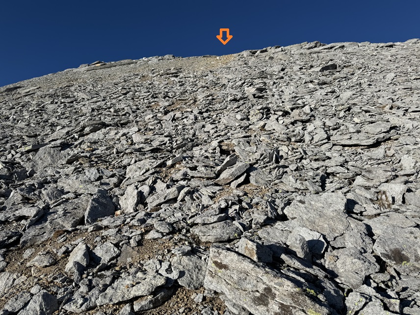
After gaining the ridge I turned left and headed southwest up solid shale and game trails.
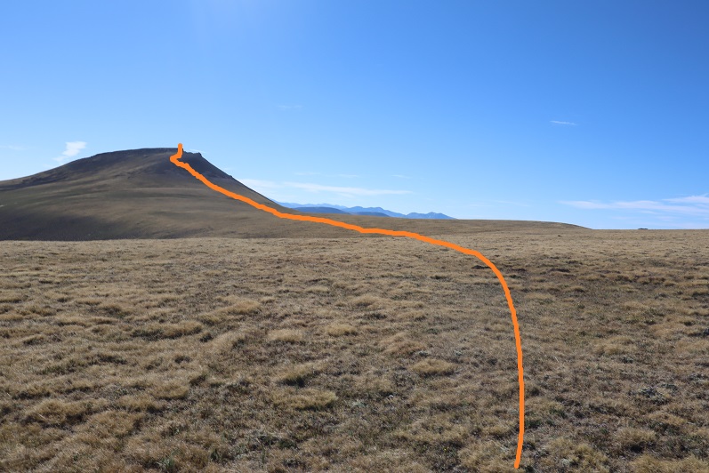
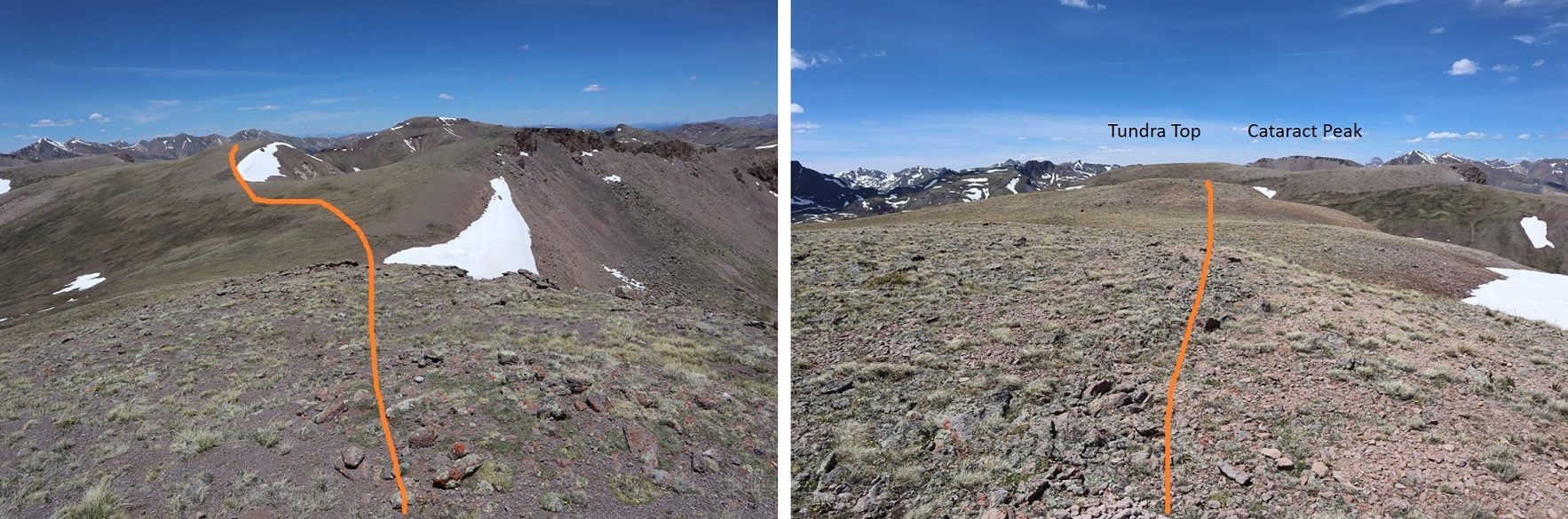
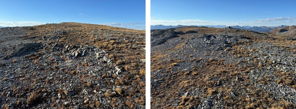
At the top I turned left, and headed south to the summit
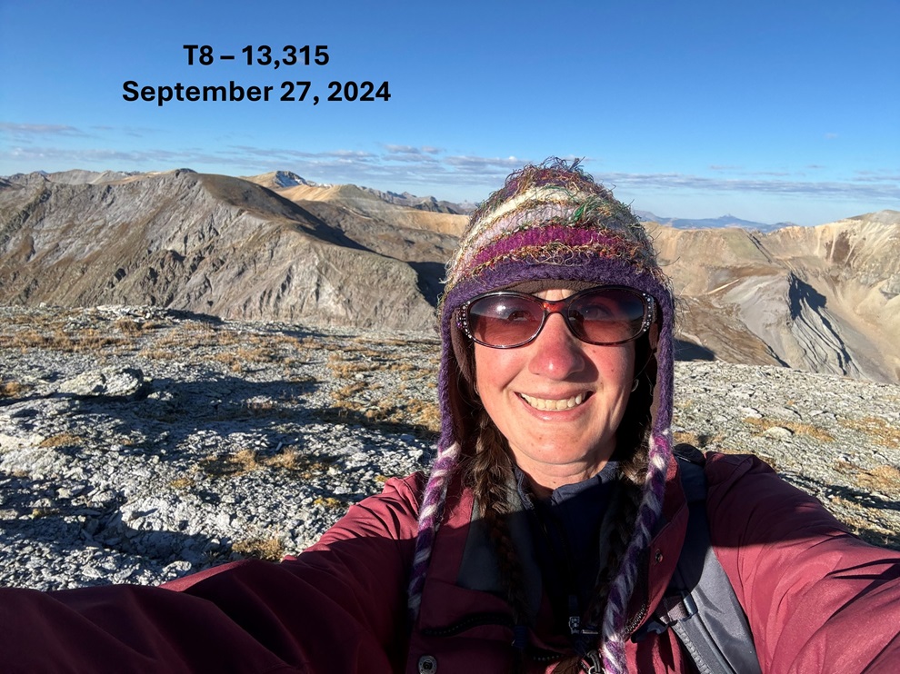
I summited T8 at 8:15am
T8:
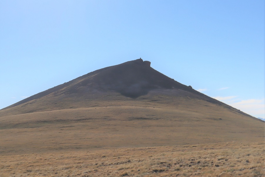
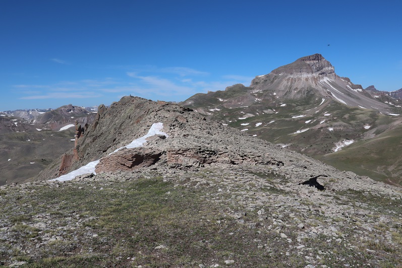
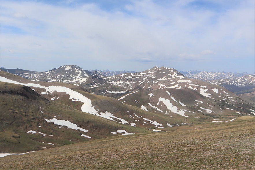
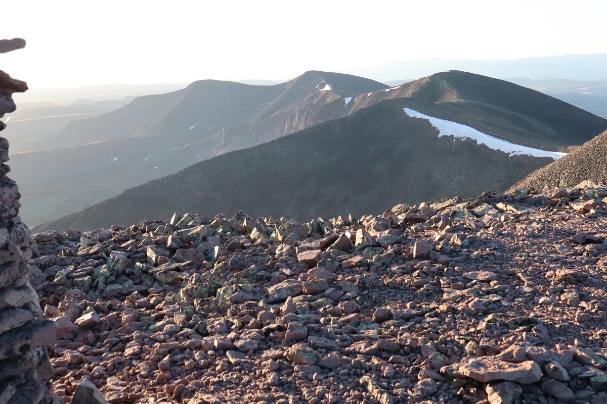
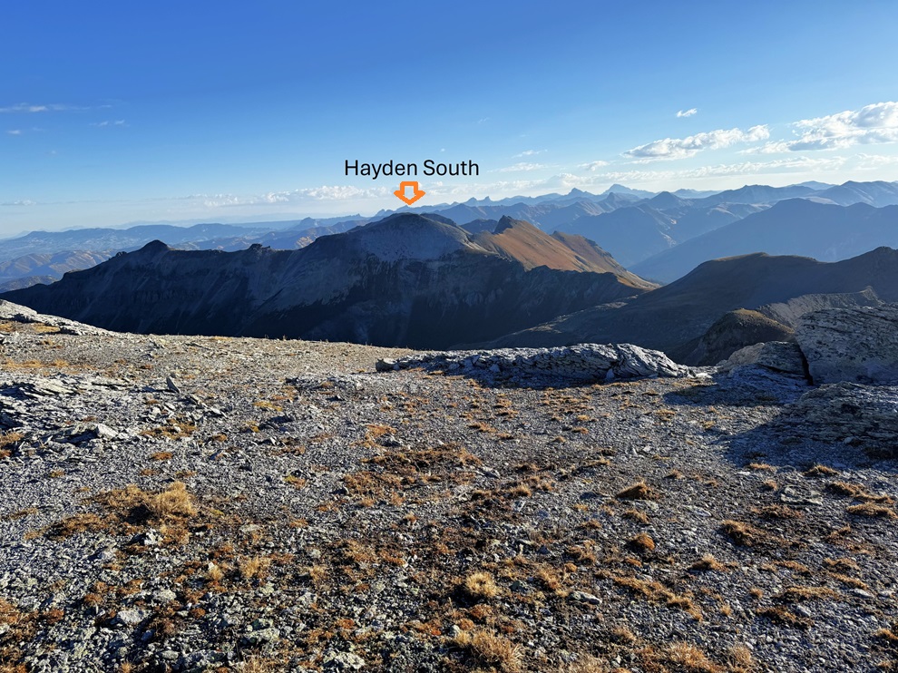
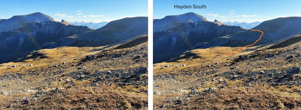
From the summit of T8, looking northeast I could see Hayden Mountain South
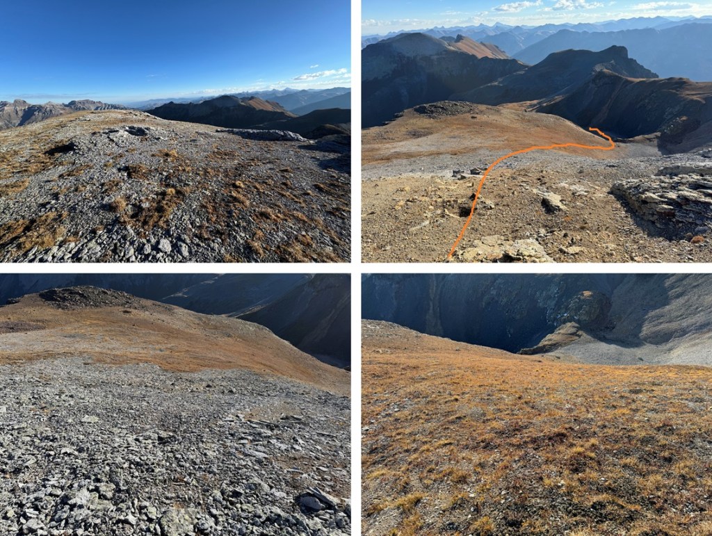
To get there I first re-traced my steps back to the 4WD dirt road
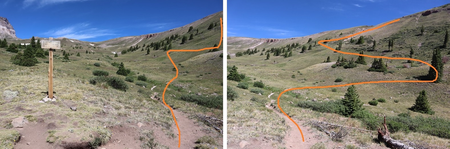
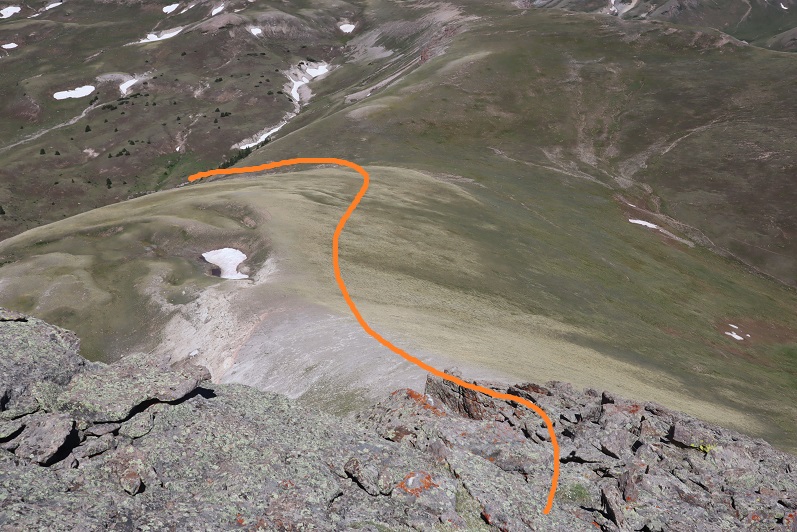
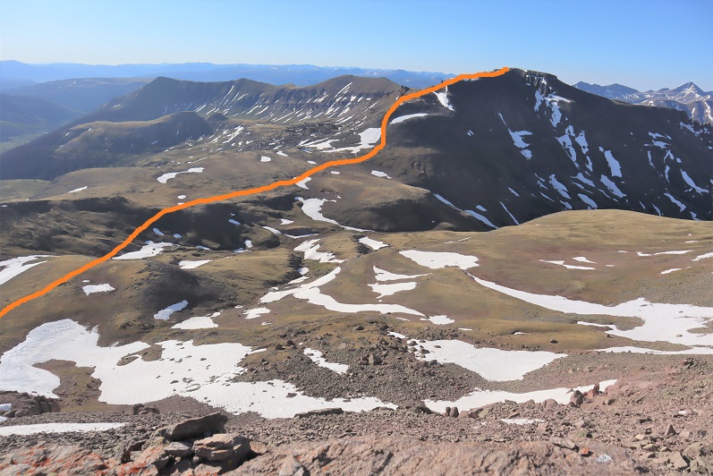
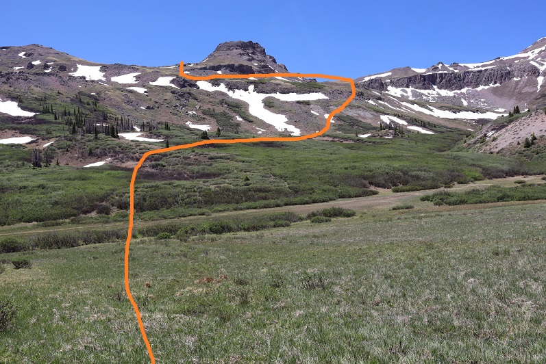
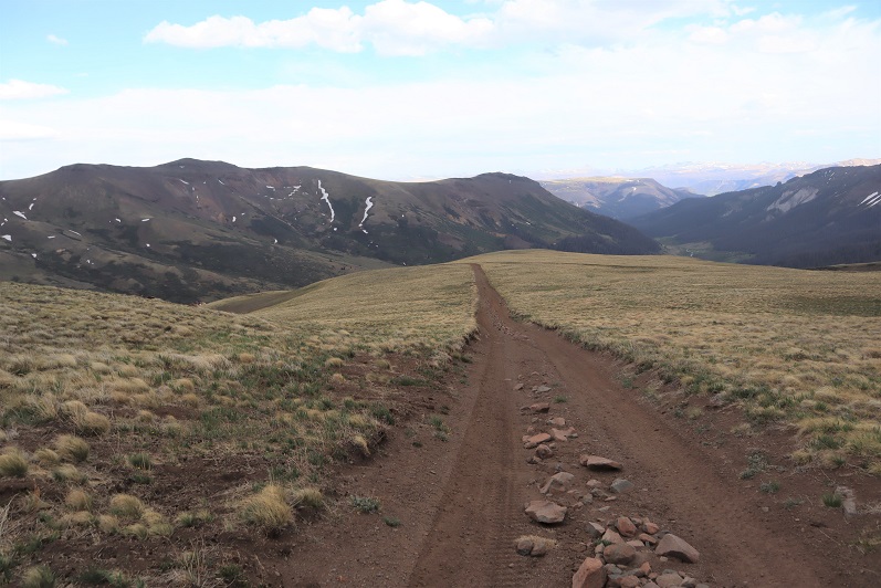
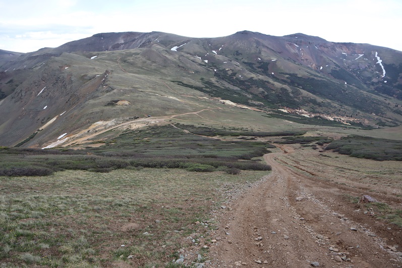
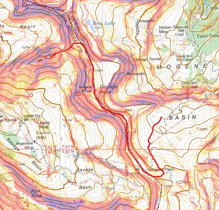
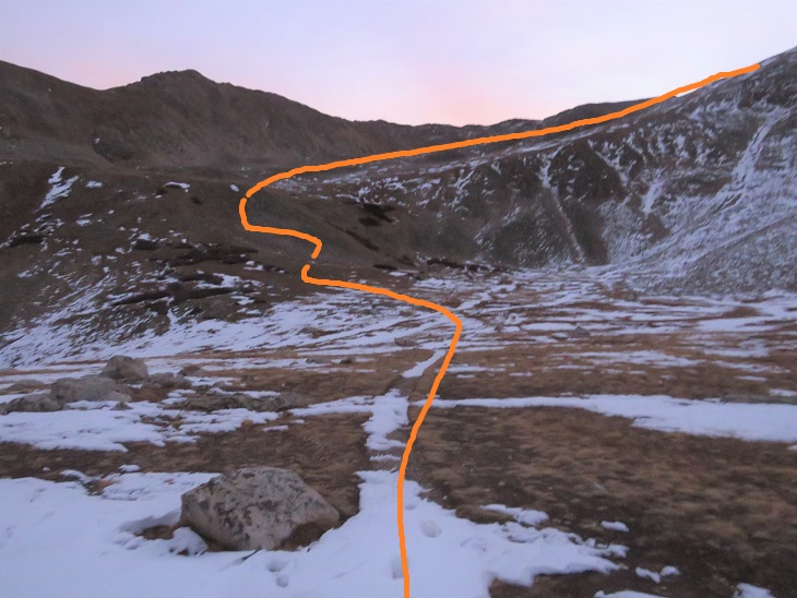
Once back on the road, my next objective was to make it to the saddle. This is the overall route I took:
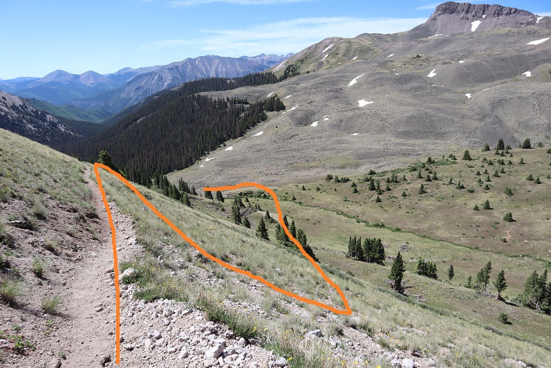
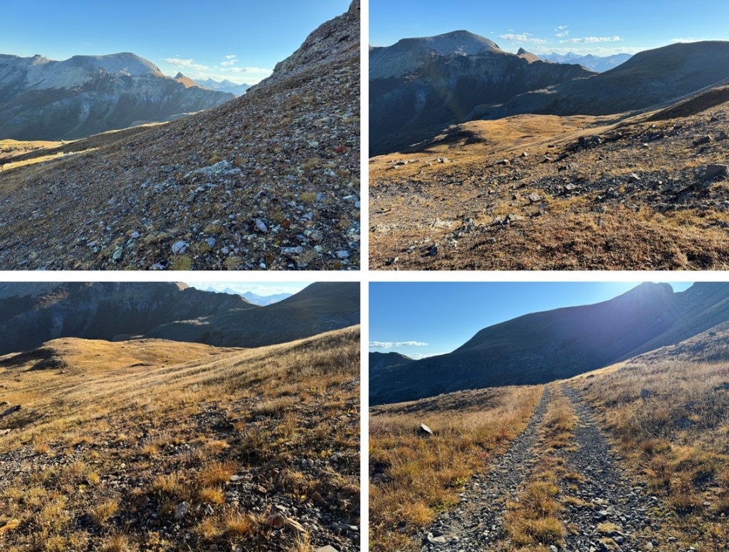
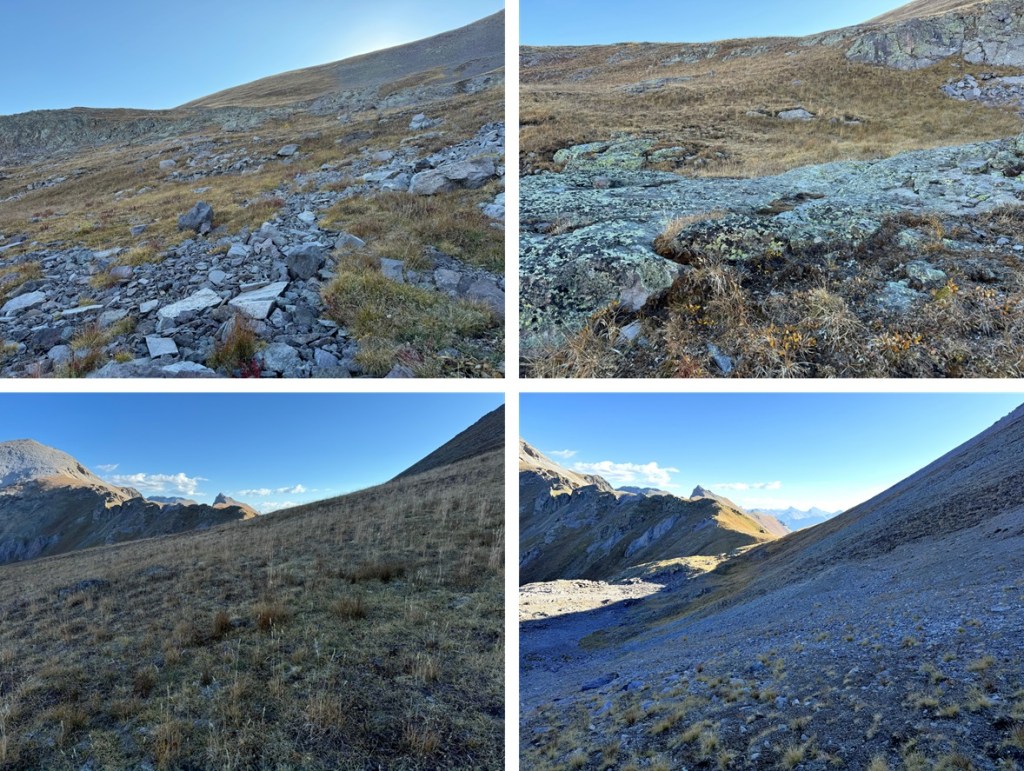
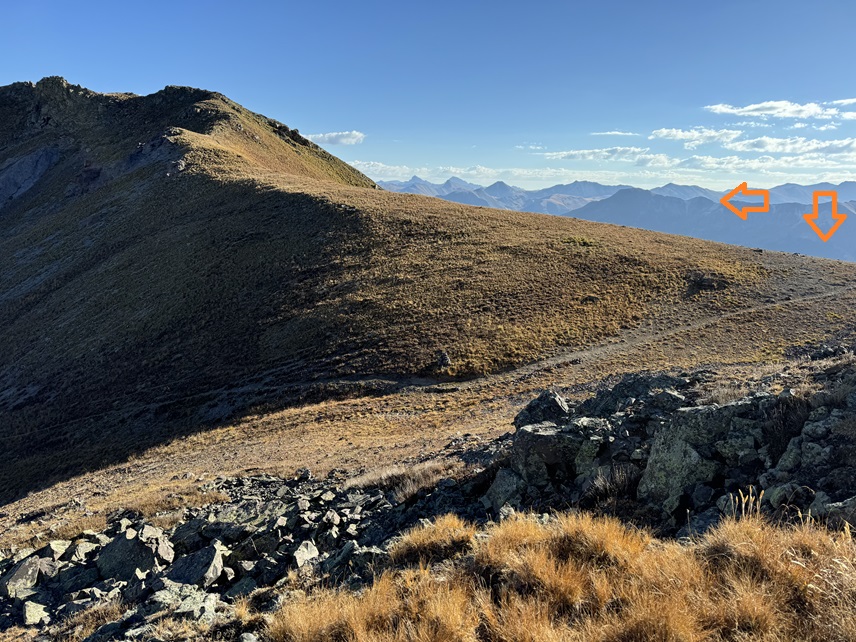
I was able to do this entirely on tundra and game trails, avoiding the rocky sections to the left. I chose to stay high on the tundra to keep me level with the saddle.
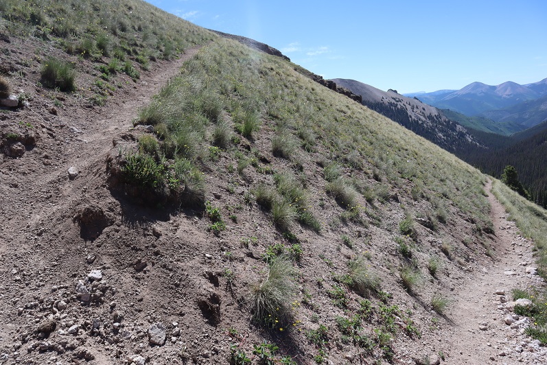
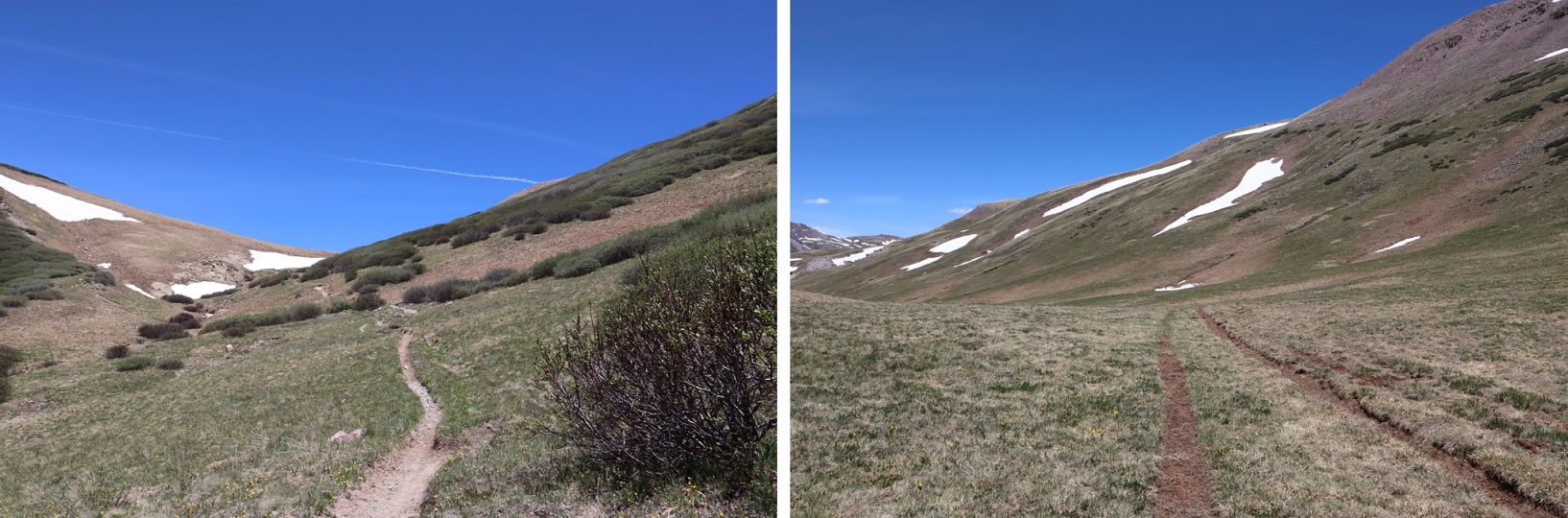
From the saddle, I could clearly see the Richmond Trail.
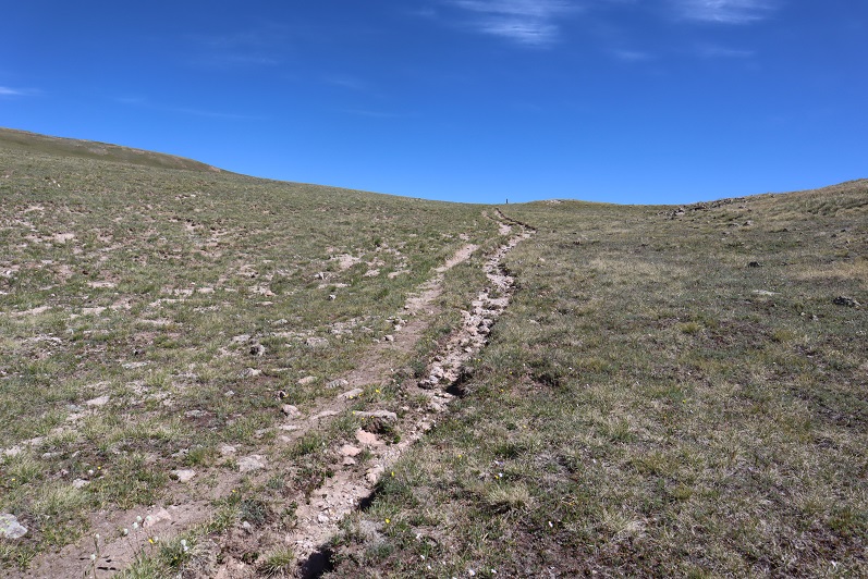
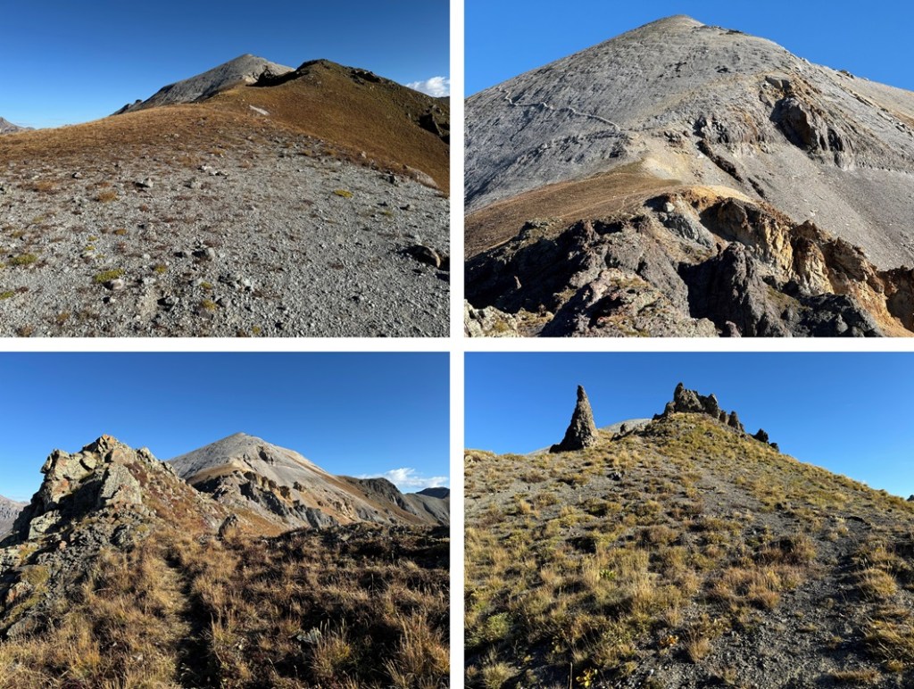
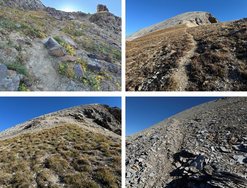
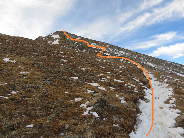
At the saddle I took the trail that headed along the east side of the ridge north. This is a class 1 trail that will lead you almost all the way to the summit. It has some ups and downs, but it’s easy to follow and keeps you below the rock formations.
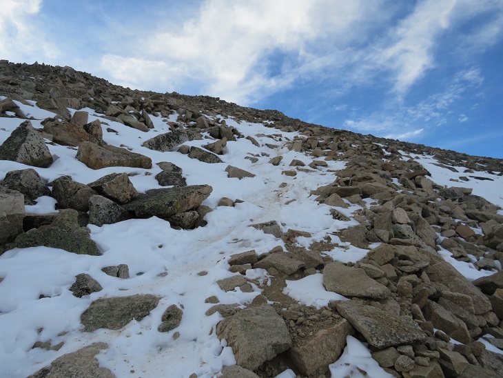
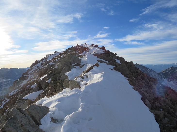
The trail was even easy to follow up the talus. I continued following it until I hit the ridge at 13130’. There’s a cairn here. I turned right at the cairn and followed the short ridge east to the summit.
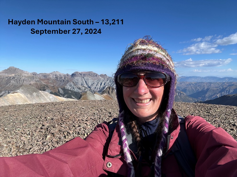
I summited Hayden Mountain South at 10:45am
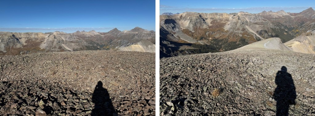
Hayden Mountain South:
From the summit I headed east back down to the trail
Then I followed the trail down the scree, and back down part of the ridge.
At 12785’ I found a side trail that would lead me back to the Richmond Trail on the east side of the ridge, just below the pass. It looked like it went (it did) so I decided to take it. It’s a game trail, but solid.
Now on the Richmond trail, I turned right and followed it west to 12220’
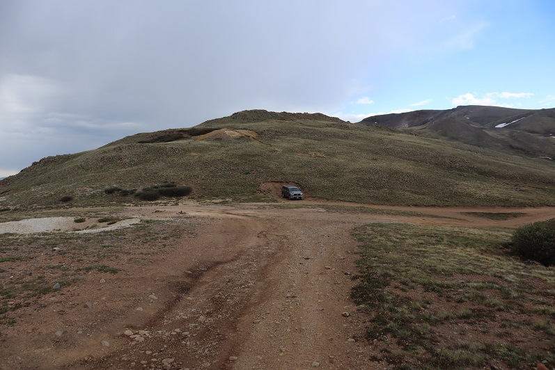
At 12220’ I left the trail, and headed southwest towards the 4WD road I could see in the distance I’d hiked in on.
Back on the road, I followed it back to my truck
I made it back to my truck at 10:45am, making this a 7.61 mile hike with 3137’ of elevation gain in 4 hours, 15 minutes
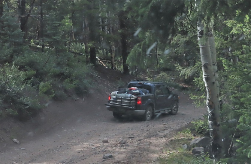
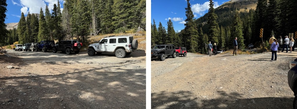
On to the next trailhead! But I would have to wait a while. There was a train of about 20 (or more) Jeeps heading up to Imogene Pass, so I waited while they made their way, stopping to take pictures as they went.
The drive to Imogene Pass is not for the faint of heart. You need a 4WD vehicle and a competent driver. Be prepared for narrow roads and large rock slabs with steep drop offs. The worst part is the very beginning (at the separation from Yankee Boy Basin) and at the very end. I drove in from the Ouray side. I didn’t drive all the way to the pass, but parked about a mile below at a wide turnout. I was on the trail at 6:30am, following the road south towards Imogene Pass.
Just before the final switchback to Imogene Pass I bypassed the road and took a game trail to the right, which led me back to the road and Imogene Pass.
The Telluride side was closed
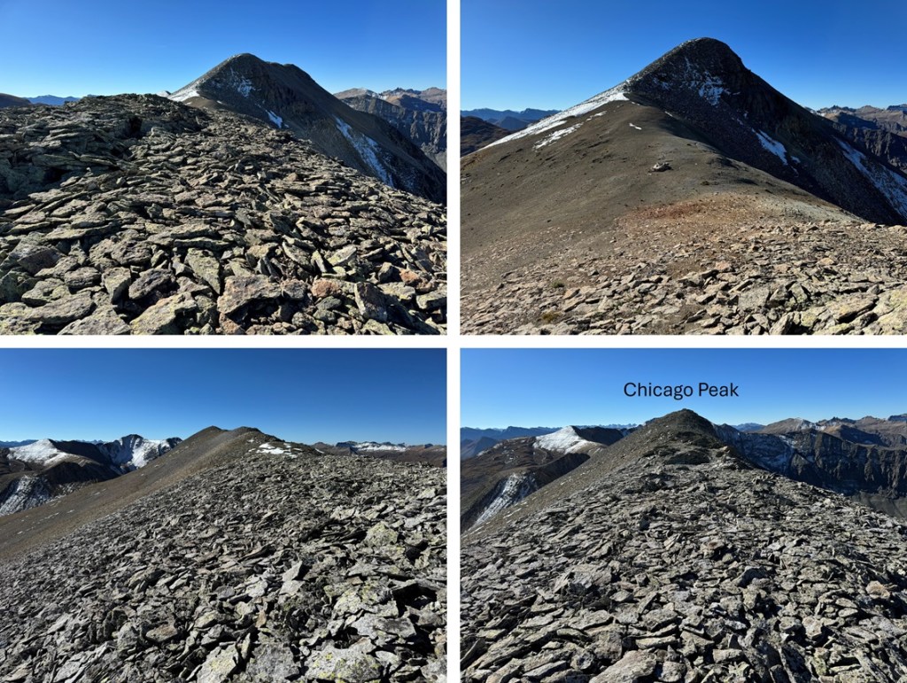
From Imogene Pass I followed the road/ridge north
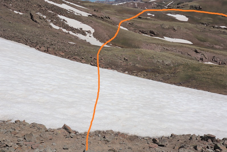
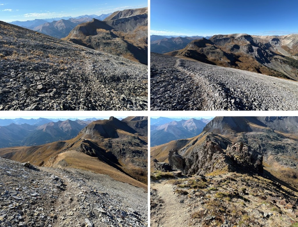
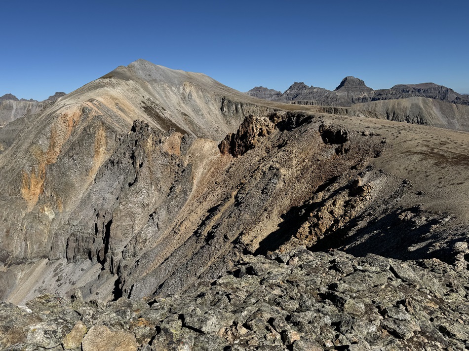
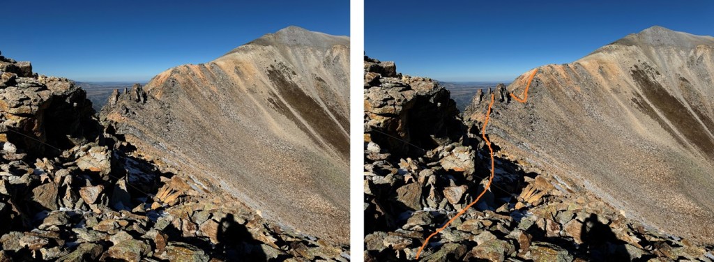
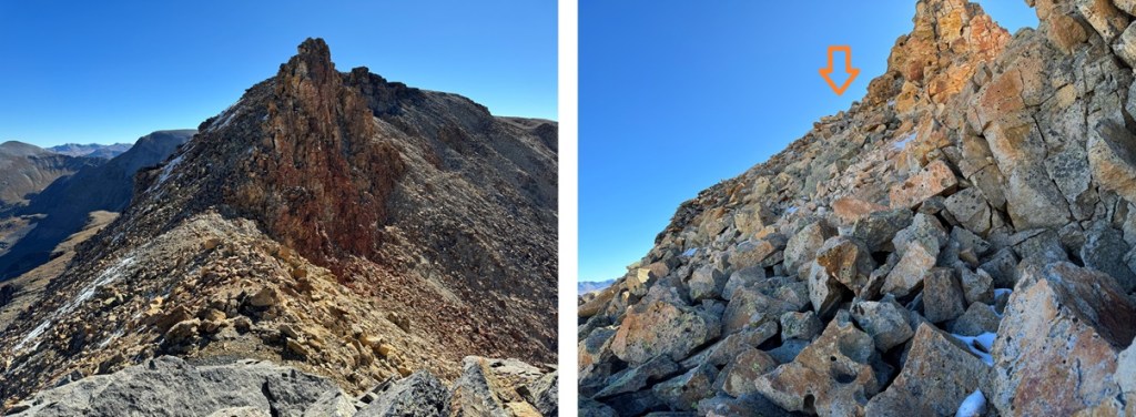
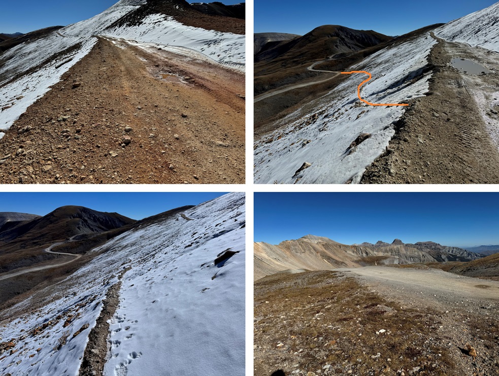
Maps show a trail here, but if there is one, it’s faint/has been destroyed by rockfall. This hike is class 2, but difficult class 2. Everything is loose. The talus and shale are not secure, and there’s exposure, so be mentally ready for more than a normal class 2 hike. Watch your step, as there are large metal wires strewn all about the ground on this ridge. There’s a trail until you hit this point, then you get to route find. From here I could see Chicago Peak. This is the route I took:
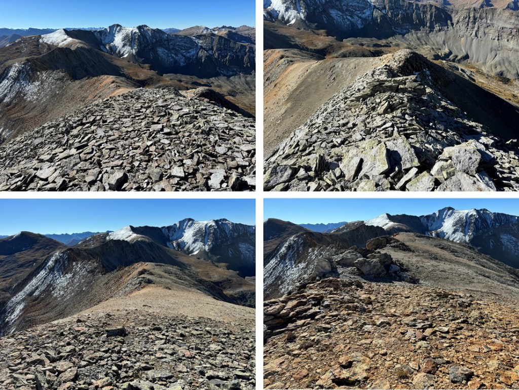
I then rounded the ridge, following the ridge proper
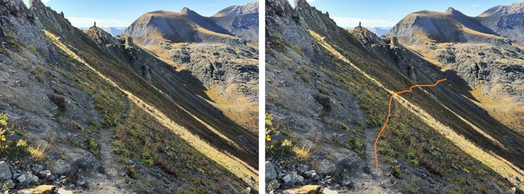
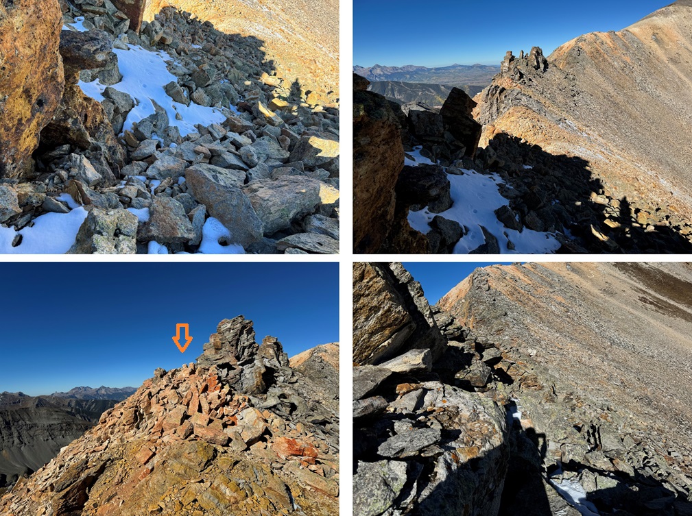
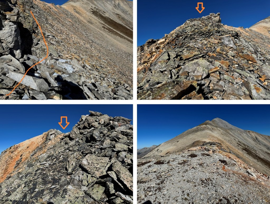
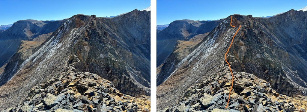
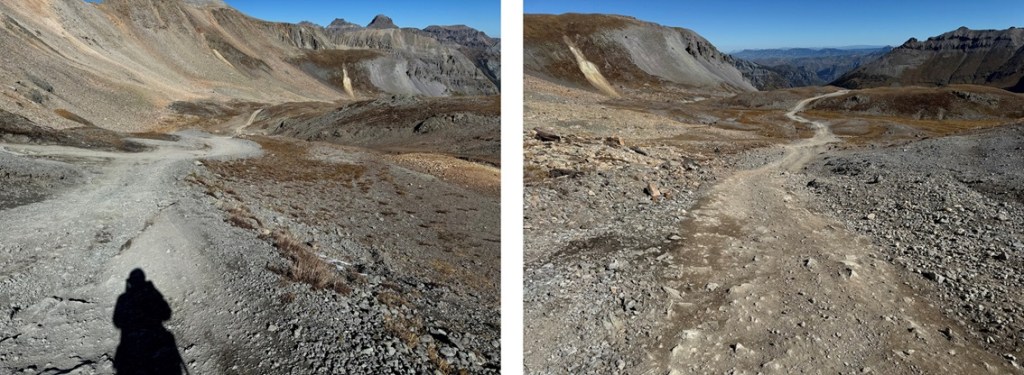
This is where the fun begins. You want to stay high, but not on top of the ridge. I pretty much followed the bottom of the rock outcroppings, traversing on shale. I started out staying to the right, then in the middle switched to the left to go around a large rock, and then took the ridge proper to the slope. Here’s an overall view of my route:
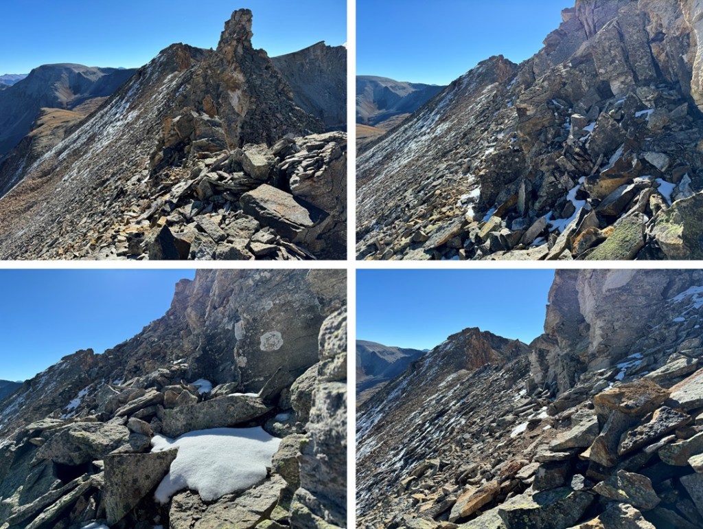
And some pictures:
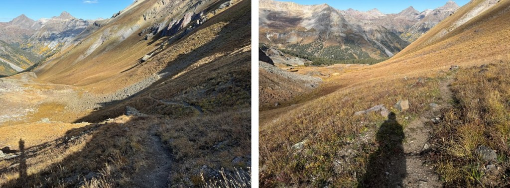
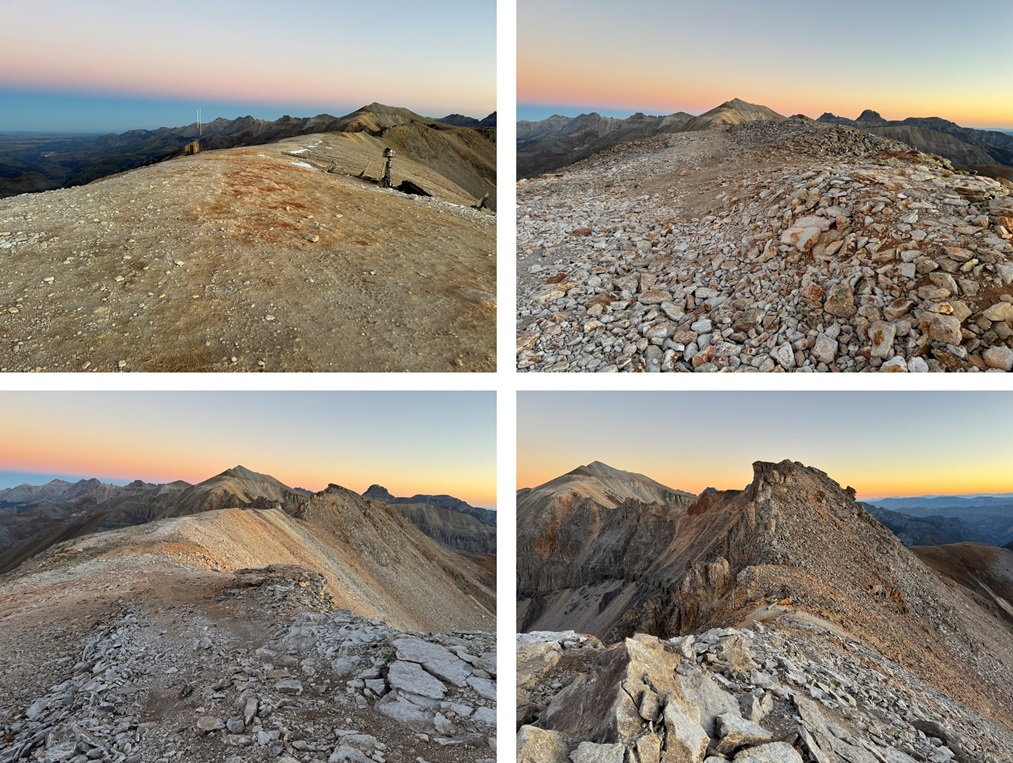
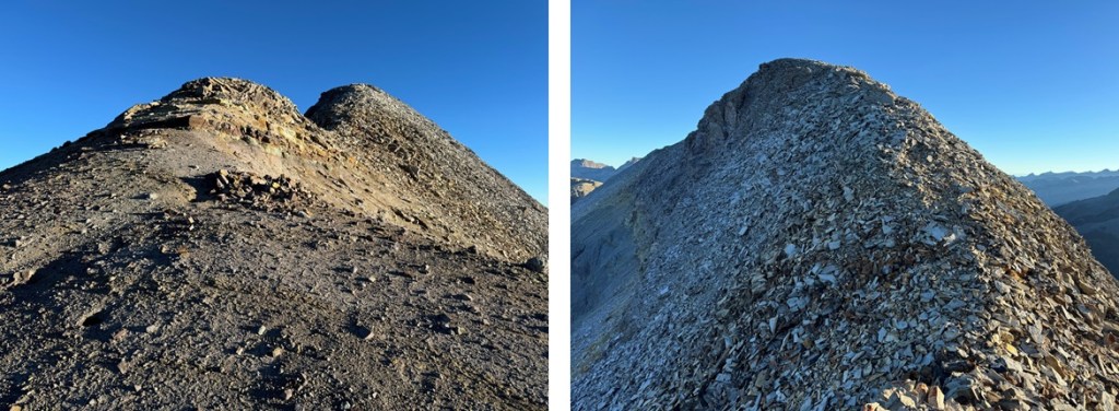
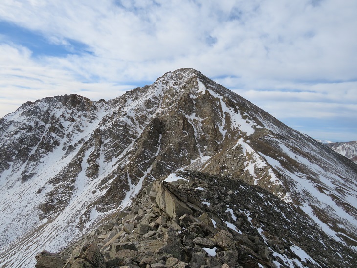
From here it was an easy ridge hike on shale game trails to the summit. I followed the ridge north.
I summited Chicago Peak at 7:45am
Chicago Peak:
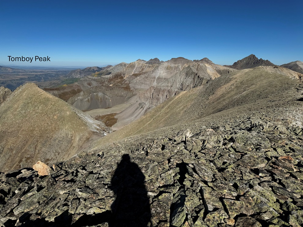
My next peak was Tomboy Peak, which I could see to the northwest. It looked too small to be a 13er from here, but that’s just because Chicago Peak is taller.
This is the overall route I took to get there
First, I continued hiking down the ridge until I came to a small saddle at 13220’. If you’re lucky, you’ll see the game trail to the right that will circle you back to the saddle.
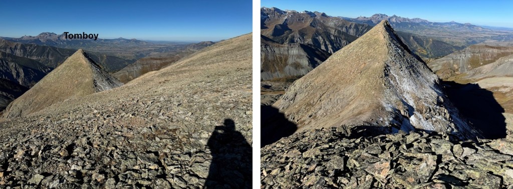
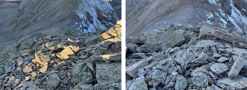
I then turned left, and headed west towards Tomboy Peak, losing 400’ of elevation on very loose shale (no trails here, watch your step).
At the saddle, I headed straight up the ridge to the summit (also on very loose shale).
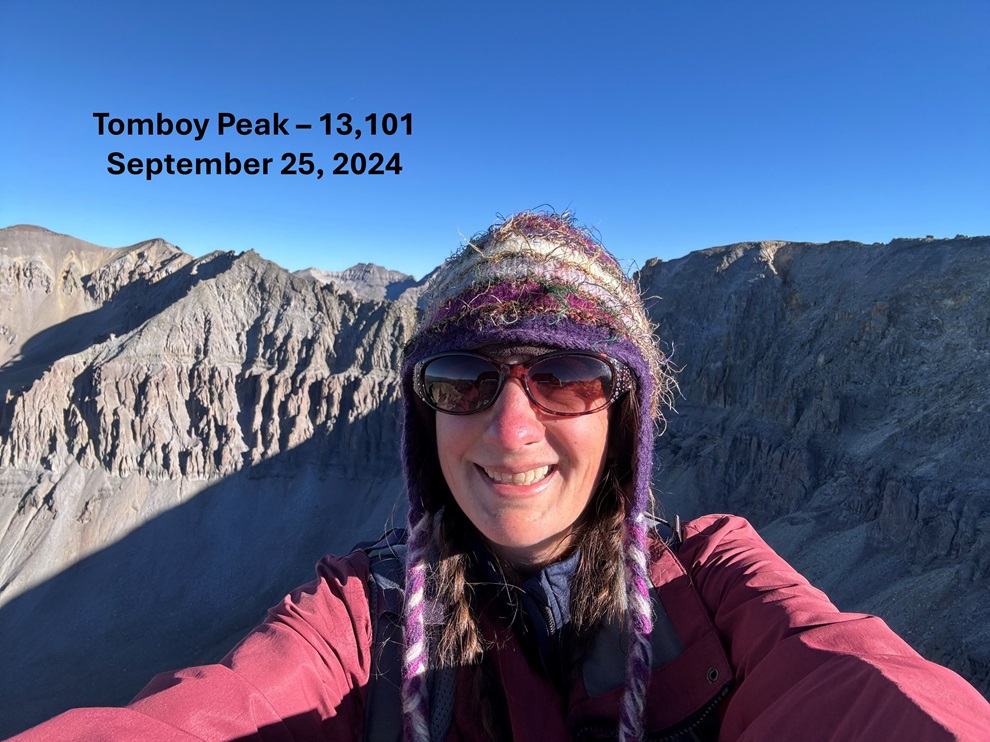
I summited Tomboy Peak at 8:40am
Tomboy Peak:
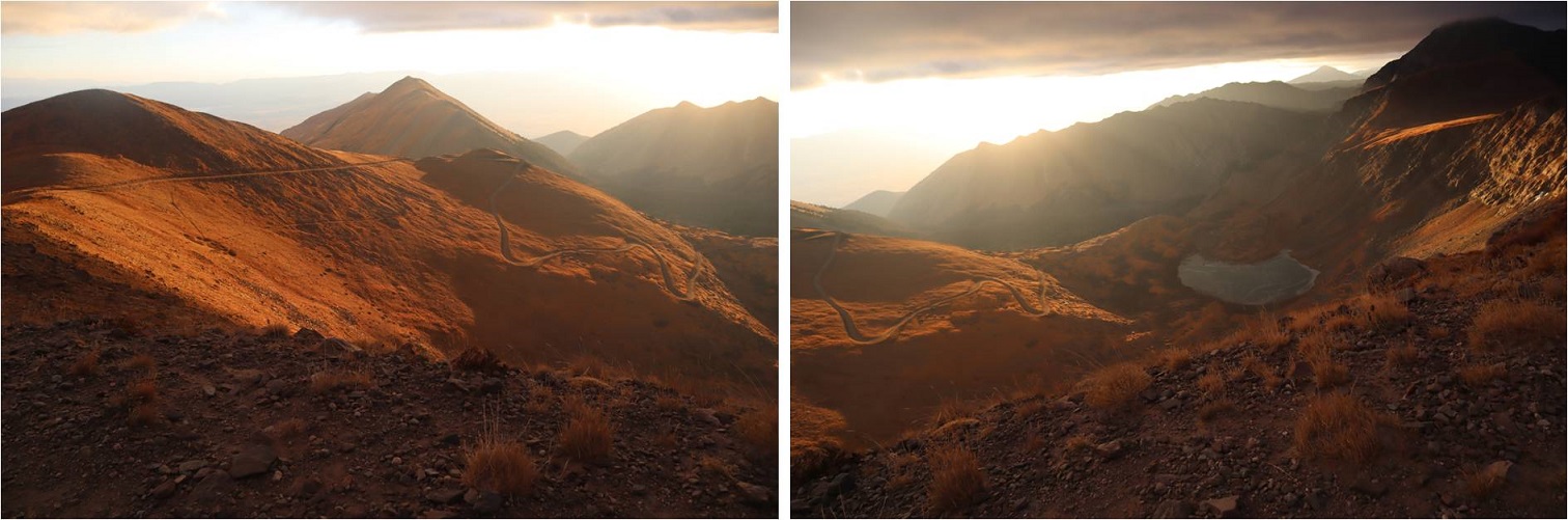
This was an out and back hike for me, so I turned around and headed back towards Chicago Peak. The pictures heading back are probably more useful than the ones coming in, due to the angle of the sun. First, I descended to the Chicago/Tomboy Saddle
And then to re-ascend to the ridge
Then to re-ascend Chicago Peak. I followed the ridge south.
After re-ascending Chicago Peak I continued following the ridge.
Here’s an overall view of my hike through the rest of the ridge.
After making it to the top of the ridge, I followed it south back to Imogene Pass
Once back at the pass I followed the road to my access trail, then the trail back to the road, and the road back to my truck.
I made it back to my truck at 10:30am, making this a 6.16 mile hike with 1975’ of elevation gain in 4 hours.
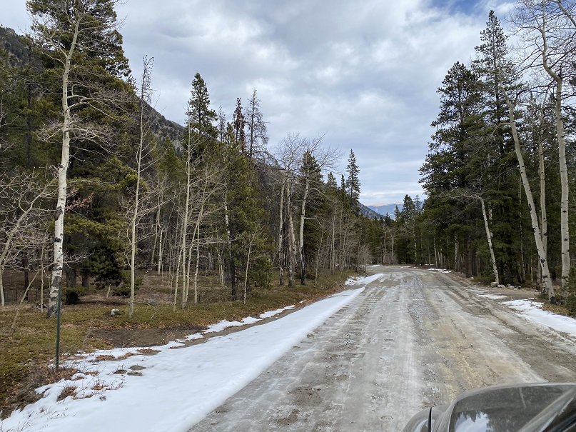
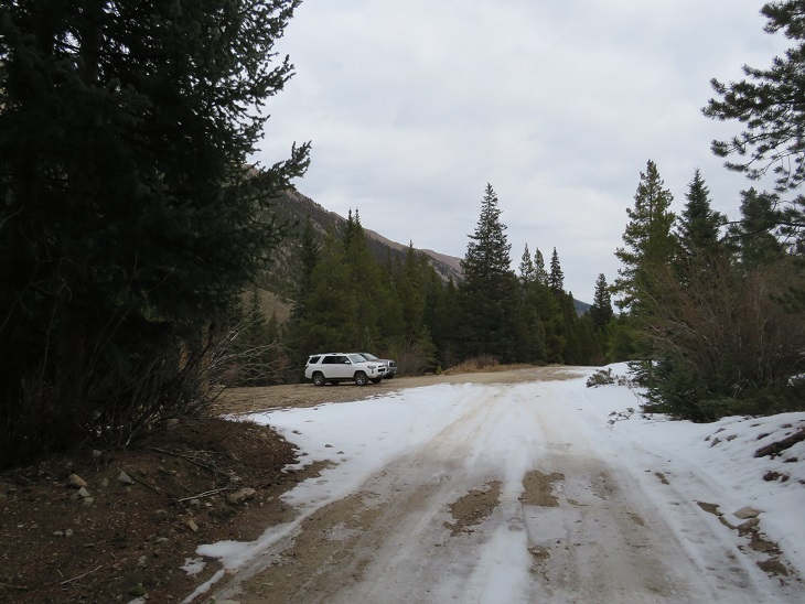
There was a storm predicted for this weekend, so I set out to try to get this loop in before the snow hit. I had no trouble driving the 2WD dirt road all the way to Winfield, even though it was icy in spots.
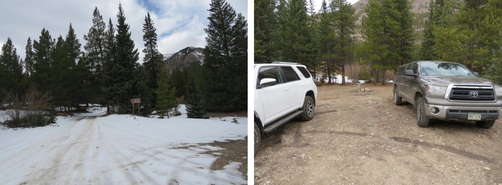
Once I made it to the 4WD road it became icy. I decided to park in the dispersed camping area and hike along the road. There are several dispersed camping areas here, and plenty of parking.
I put on my microspikes at the truck and didn’t take them off the entire hike (although they were overkill for over half of the hike). I started out following the 4WD road southwest. It quickly became icy and I was glad for the spikes. I could also hear owls on either side of the trail. They were hooting, calling to each other back and forth. We’ve recently had an owl take up residence in our backyard and the calls were similar, so I’m guessing they were great horned owls. I also heard a chirping in-between calls. I’m not sure what animal the chirping belonged to, but it happened every time an owl’s call ended, and before the next one began. In any event, the sounds kept me occupied as I hiked in the dark.
I followed the 4WD road for 2 miles to the upper trailhead (Lake Ann). Here the trail splits. I took the well marked ‘Huron Trail’ that went left up the mountainside.
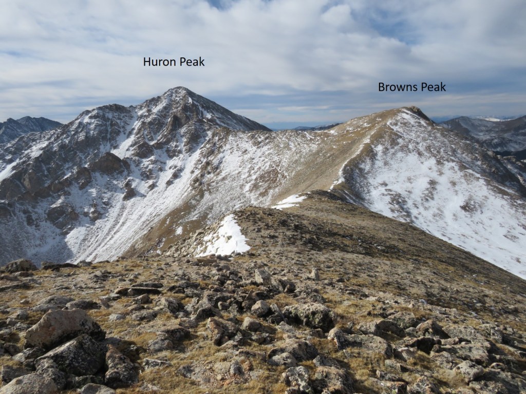
The Huron Trail is a well marked and easy to follow class 1 trail that takes you all the way to Huron Peak. This is also a well documented trail, so I’ll just add a few photos.
Once at the saddle the trail became increasingly icy, and I was glad to be wearing my microspikes. Also, one of them broke (I continued to wear it anyway. The other one broke as well later on, but microspikes are easily fixable so I wasn’t too worried).
I summited Huron Peak at 7:45am
Huron Peak:
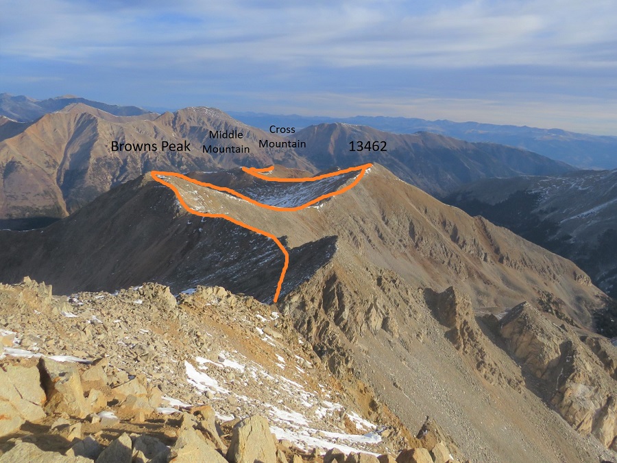
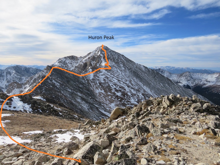
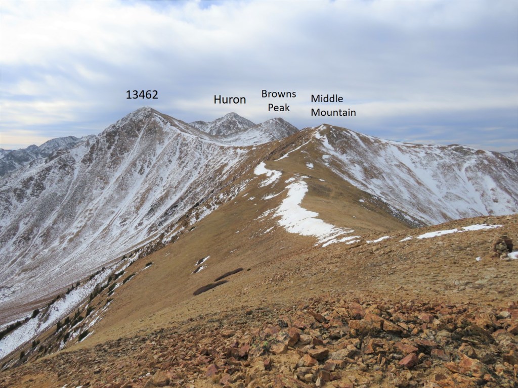
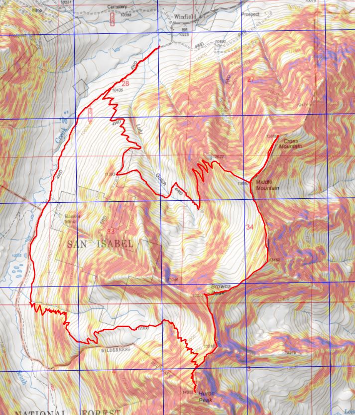
From the summit I had a great view of all the other peaks I intended to hike on this loop. Here’s the overall route, which consists of a nice ridge hike
I turned around and headed back to the Browns/Huron saddle, and then over to Browns Peak. I summited the point here on my way over to Browns, but that’s unnecessary, as it’s not ranked and just adds elevation (the elevation part was why I summited the point)
I summited Browns Peak at 9:10am. Browns Peak is unranked.
Browns Peak:
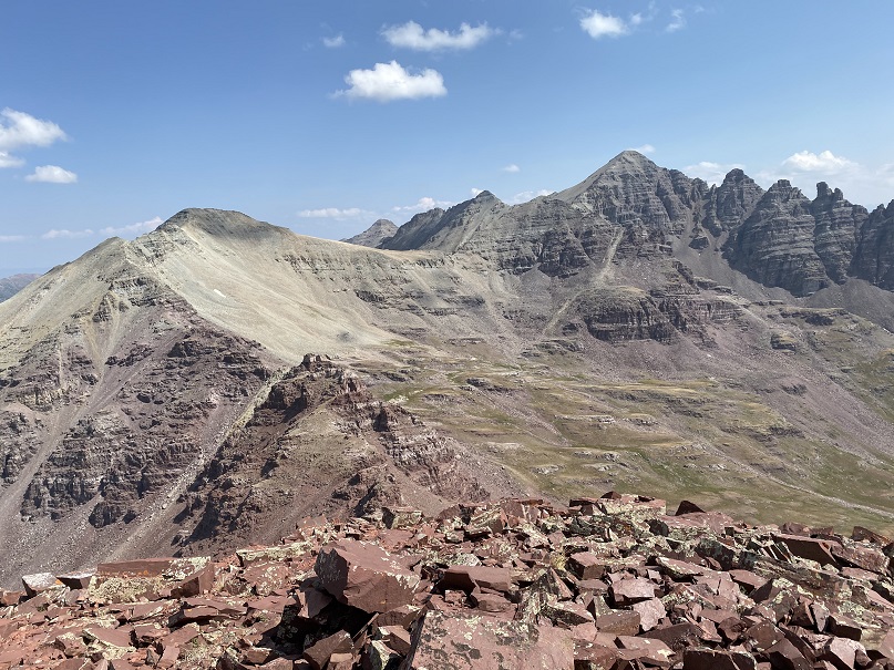
Here’s a look back on the route to Browns from Huron
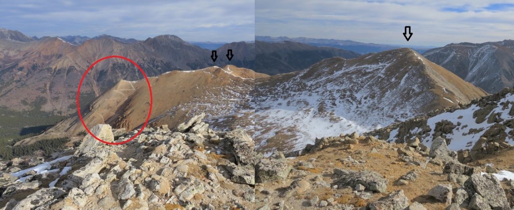
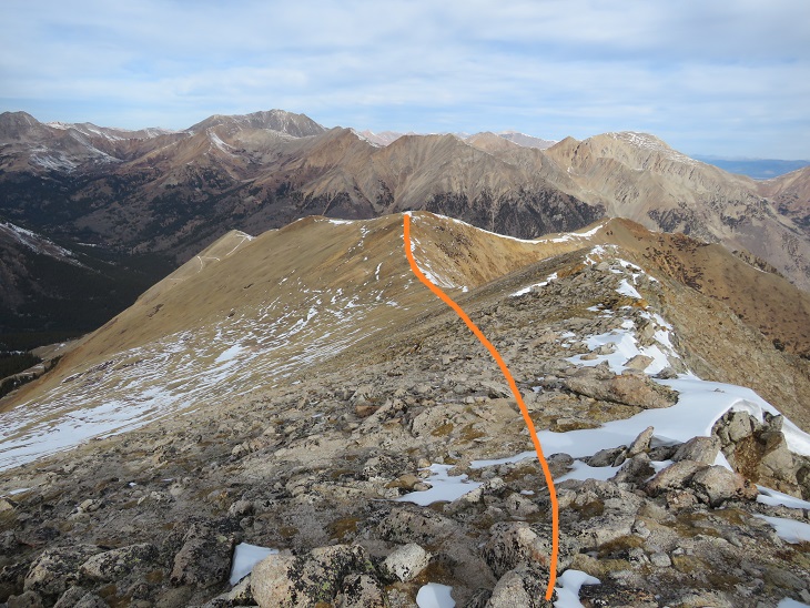
From the summit of Browns I could see my next 3 summits, as well as the trail I intended to take back down
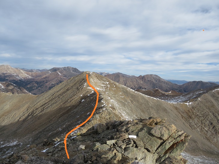
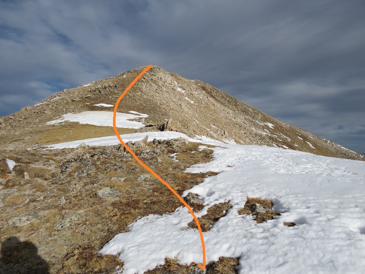
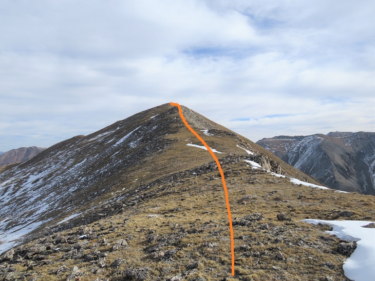
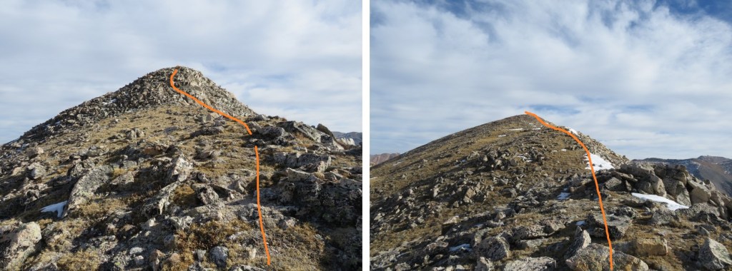
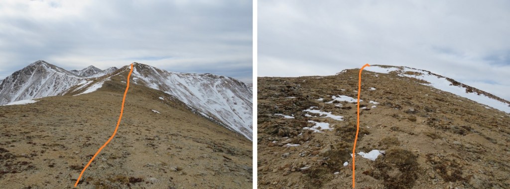
It was a simple ridge hike to the saddle and then back up to PT 13462
There was a small false summit before the actual summit
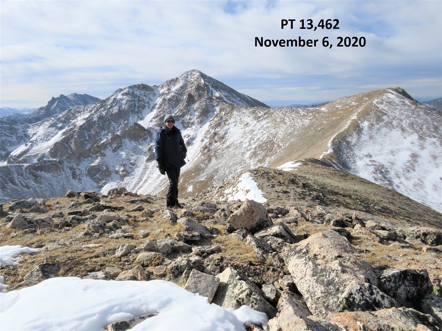
I summited PT 13462 at 9:40am
PT 13462:
Here’s looking back at Huron Peak and Browns Peak
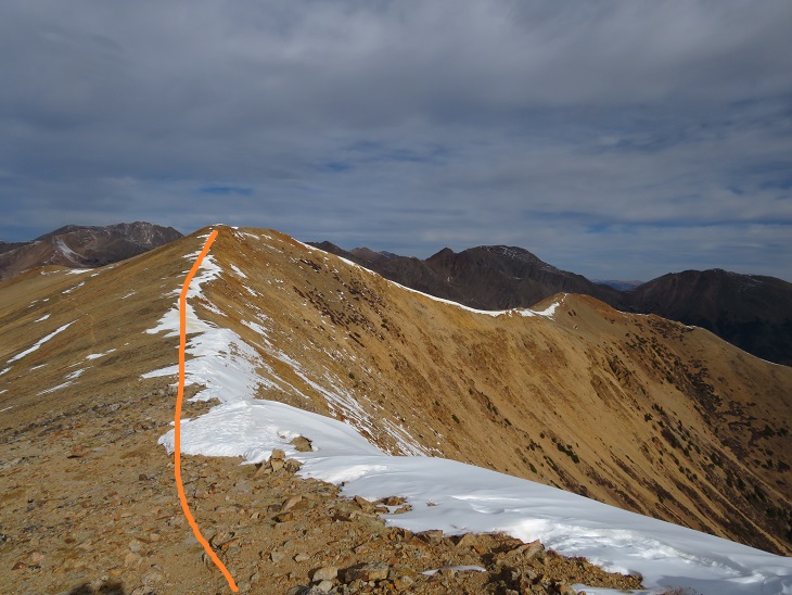
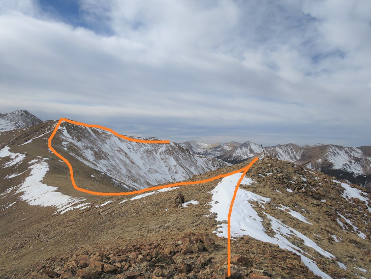
The hike over to Middle Mountain B was also a simple ridge hike. Here’s the route
I summited Middle Mountain at 10:10am (also unranked)
Middle Mountain:
Here’s looking back on the route so far
It was still early in the day so I decided to head over to Cross Mountain. This is another unranked peak, but it’s named, so I didn’t want to leave it out on today’s hike. It was a quick and easy hike northeast over to Cross Mountain.
I summited Cross Mountain at 10:35am
Cross Mountain:
Here’s a look back at the other peaks I summited this morning
I was making this a loop, which meant I needed to re-summit Middle Mountain, turn right and head northwest down the ridge to the 4WD road. Here’s an overview of the route
First, I made my way back to Middle Mountain
Once I’d re-summited Middle Mountain I turned right and headed northwest down the ridge, aiming for the 4WD road
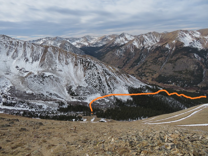
Then I followed the road back to my truck. Here’s an overview:
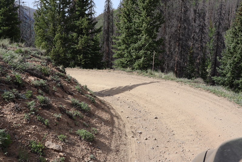
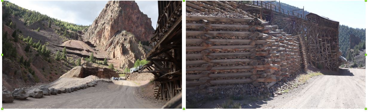
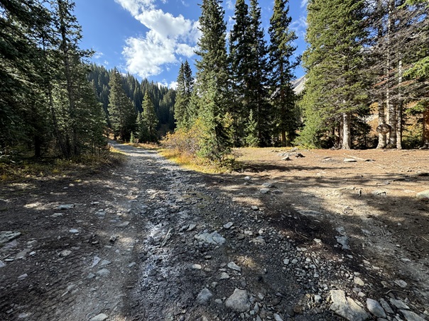
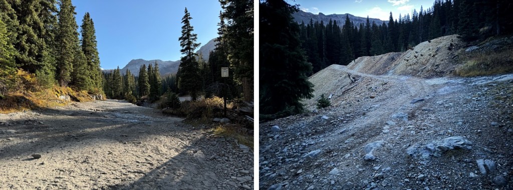
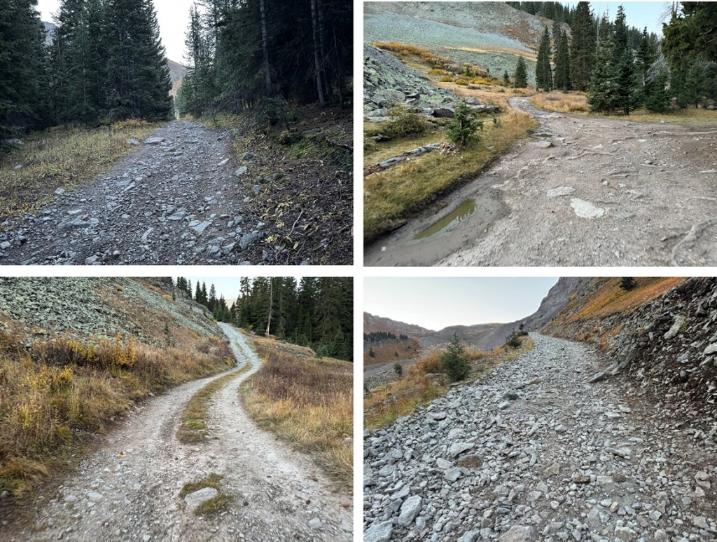
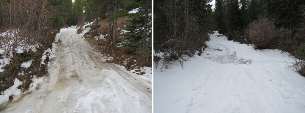
A word of caution here: the 4WD road isn’t truly a road for most of the way up the side of this mountain. It looks to be an old mining road that hasn’t been used in many years, and has experienced rockslides and avalanches, turning the road into more of a trail down the mountain and into the gulch. In other words, if you have a 4WD vehicle, or even a motorcycle, don’t plan on driving it up this road. Evidence:
Once down in Lulu Gulch the 4WD road picks up again, and is easy to follow.
Here’s a look at the hike down from the ridge
The 4WD road was indeed easy to follow, but it seemed to go on and on. And on. And on. I was very happy with my choice to summit Huron first today, as this was a very long slog back to the main 4WD road and I would have been terribly bored following this road as it switchbacked (needlessly?) down the mountainside. It kept going, and going, and going. I seriously wanted to just cut the switchbacks and make it a straight line (but didn’t)
I was thrilled when I reached the main road
Here’s looking back at the turnoff (this is what you see when hiking in, you can go straight to the Huron Trail or left to follow the mining road and summit Middle Mountain first)
I followed the icy 4WD road back to my truck, thankful for my microspikes
I made it back to my truck at 12:15pm, making this a 13.83 mile loop with 4811’ of elevation gain in 8 hours, 15 minutes.
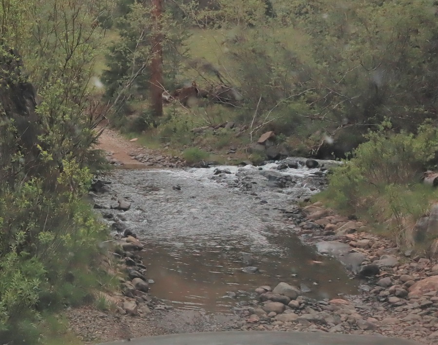
Peal Pass road is no joke. I drove up late at night (a little after midnight) because I had appointments until 7:30pm, and I was glad I’d decided to drive in so late: there were no other vehicles to pass on this road. Also, it was a Monday night, so I’d missed the weekend traffic. I would have been in trouble if I’d met another vehicle on this road: in the 10+ miles I only saw 2 or 3 possible turn out areas. There are many areas that are shelf road with no visibility of vehicles coming from the other direction. There were potholes several feet deep: more than once I got out to make sure my truck could handle the terrain. The stream crossings were only about a foot deep and easily crossable, but committing since you couldn’t see vehicles coming from the opposite direction.
Since it was night the shadows played tricks, but my truck was able to successfully make it to 10,420’ where I parked it for the night at the junction of 738/402. There was a 4Runner in the 2 vehicle lot and I backed in right next to it. My truck could have made it the last mile should I have chosen to drive further. Knowing I was only going to get a few hours of sleep tonight (it was almost 2am) I quickly went to bed and got up at 4:45am. I was no the trail by 5am. The trail heads up and northeast, following the 4WD dirt road.
I came to another creek crossing and decided to take off my shoes to cross (I kept them on when I crossed on my way back, as I could see the rocks better)
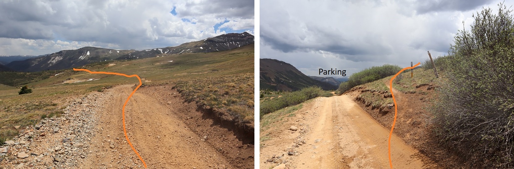
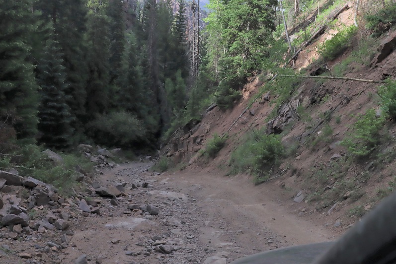
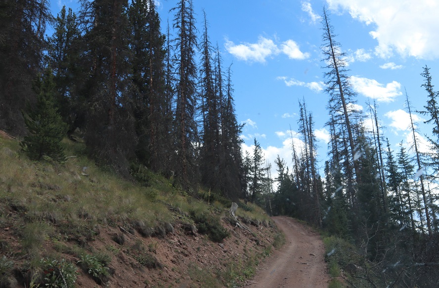
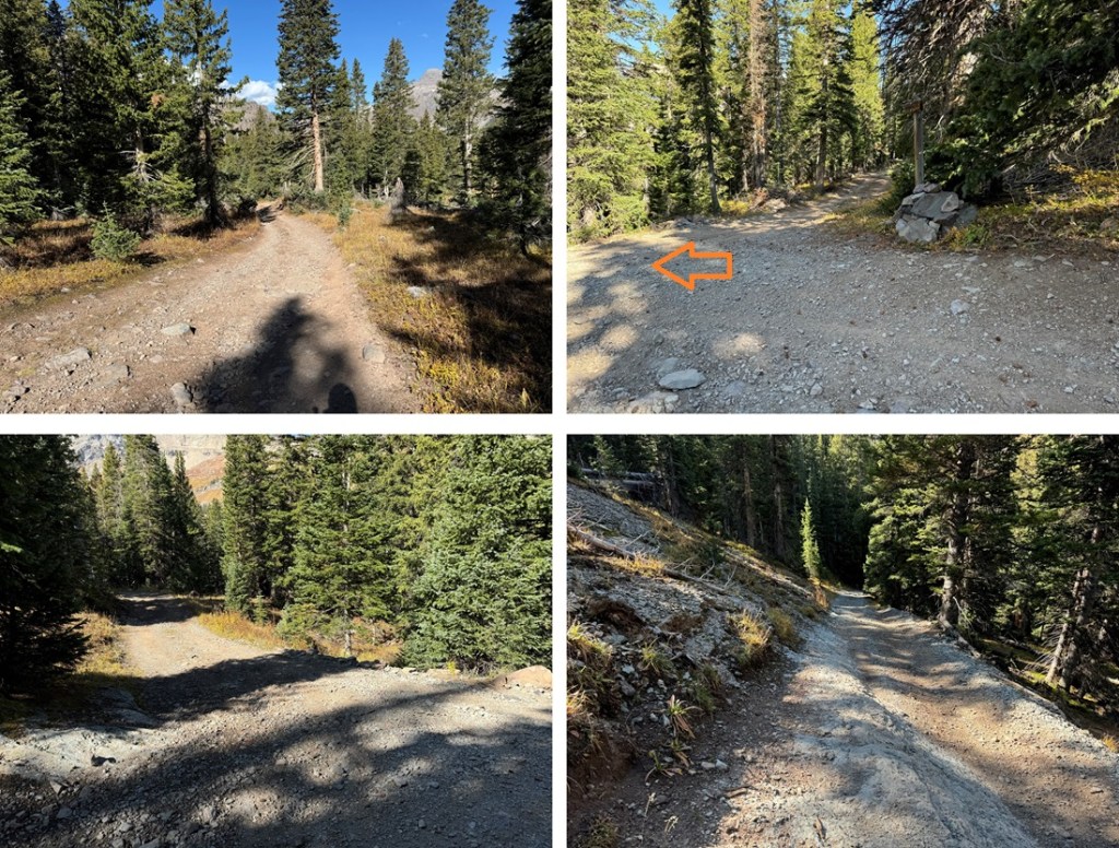
Here’s the rest of the 4WD road
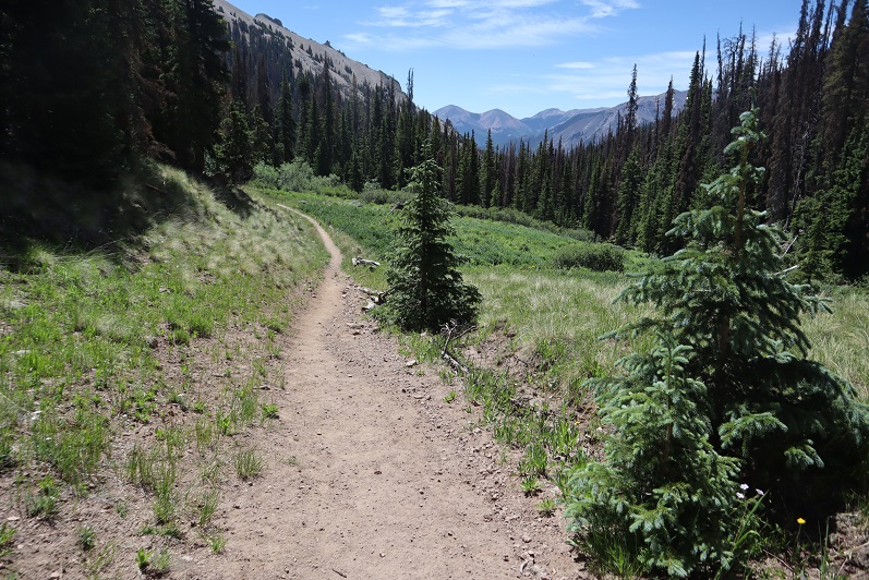
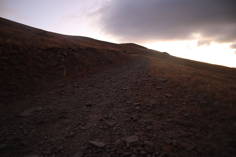
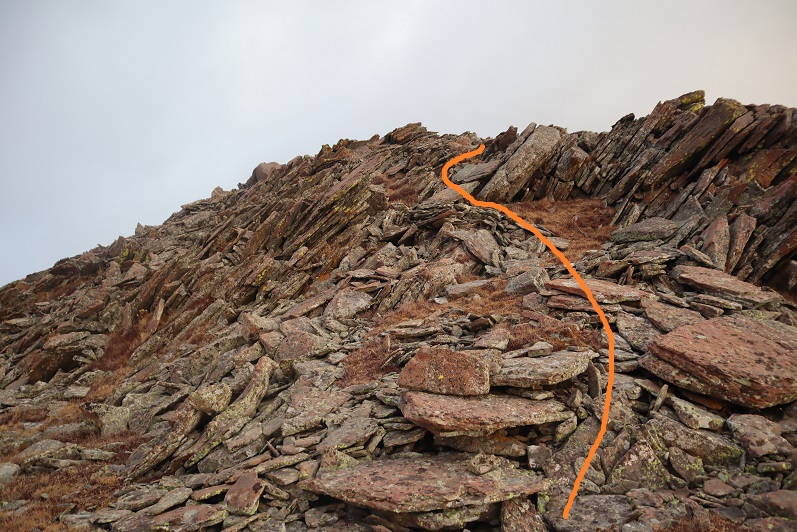
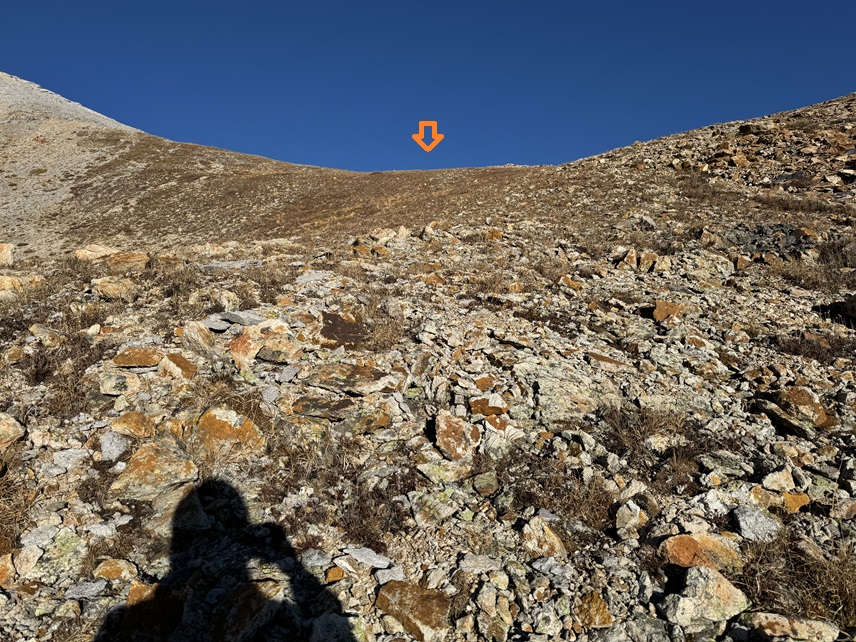
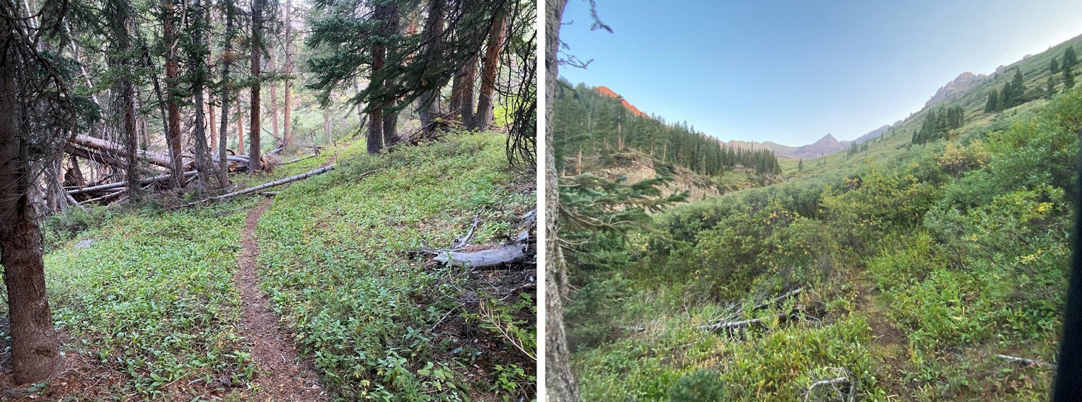
At this point I’d like to stress how much easier this hike would have been had I started in daylight: the trail is faint and hard to find/follow. See the trail?
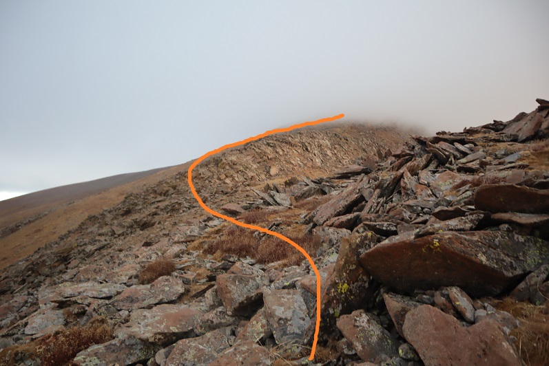
In the dark I missed it, and continued to follow the road. No worries though, because it was easy to take the road back to the trail when I realized my mistake. Here’s the trail
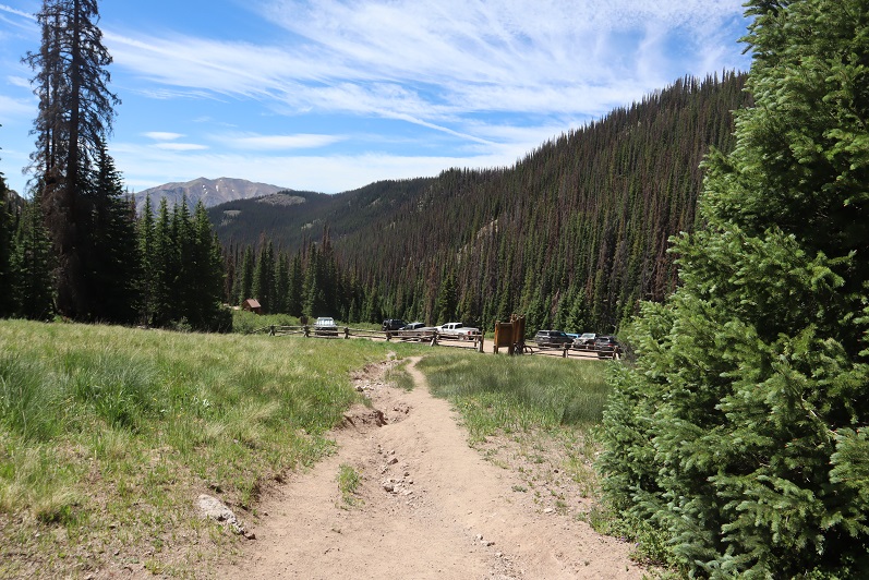
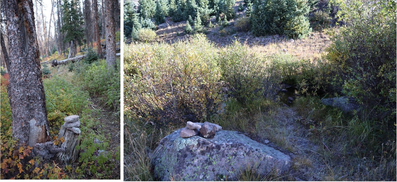
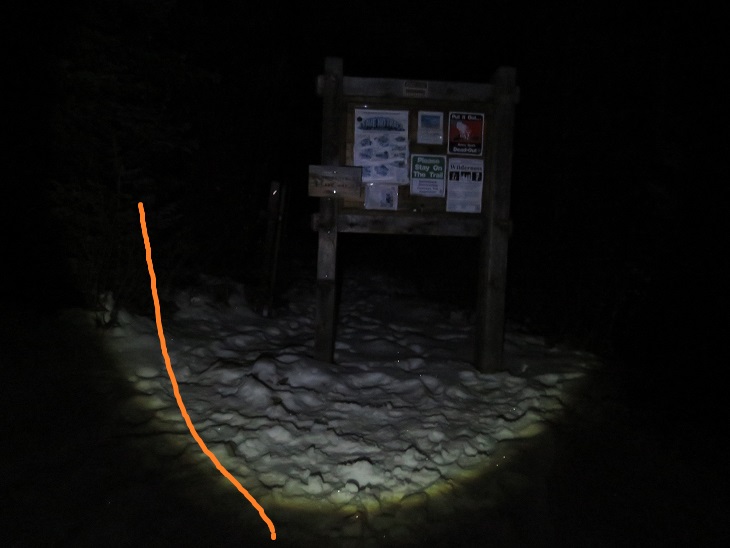
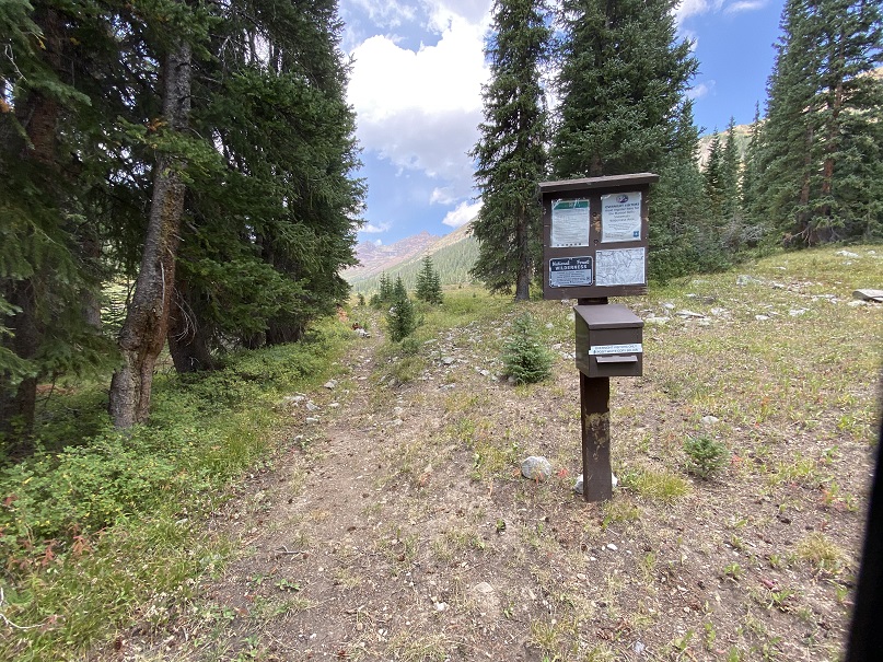
It aims towards the trees where there’s a registration box. It doesn’t look like this area gets a lot of use.
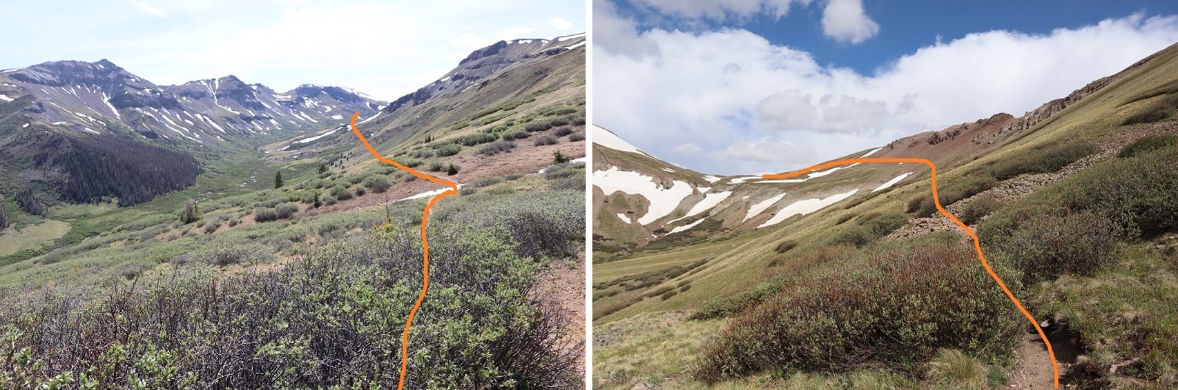
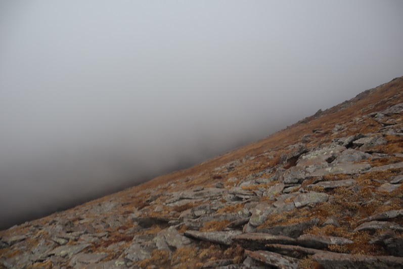
And now I was ready to hit the trail, but this is what I saw
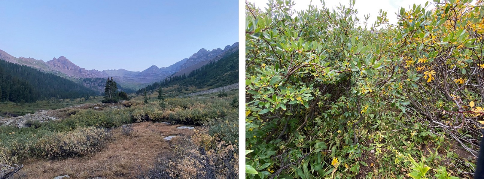
No real trail to speak of. There are a lot of game trails in the area, which can be both helpful and confusing. I’ll save you the misery I went through route finding in the willows/trees in the dark, and give you the description of the clearer trail I was able to follow on the way back. Basically, avoid the temptation to go right into the trees. Stick as close to Middle Brush Creek as you can for the first 1.3 miles after the trail register, keeping the creek and beaver ponds to your left at all times (you’ll never need to cross the creek, but you can stay close).
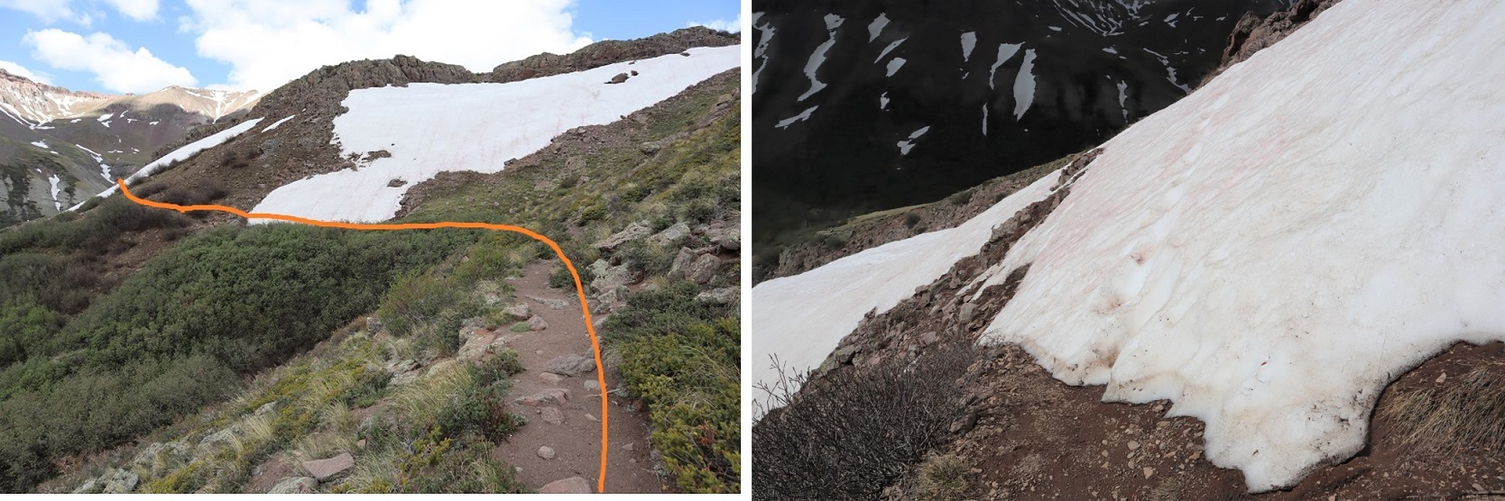
The willows become problematic around 11000’, and these willows don’t quit. They range from 2 feet tall to about 10 feet tall, and where they’re over 4 feet tall they grow over the trail towards each other. There is no clearly defined trail that remains constant, but a lot of game trails that weave in and out.
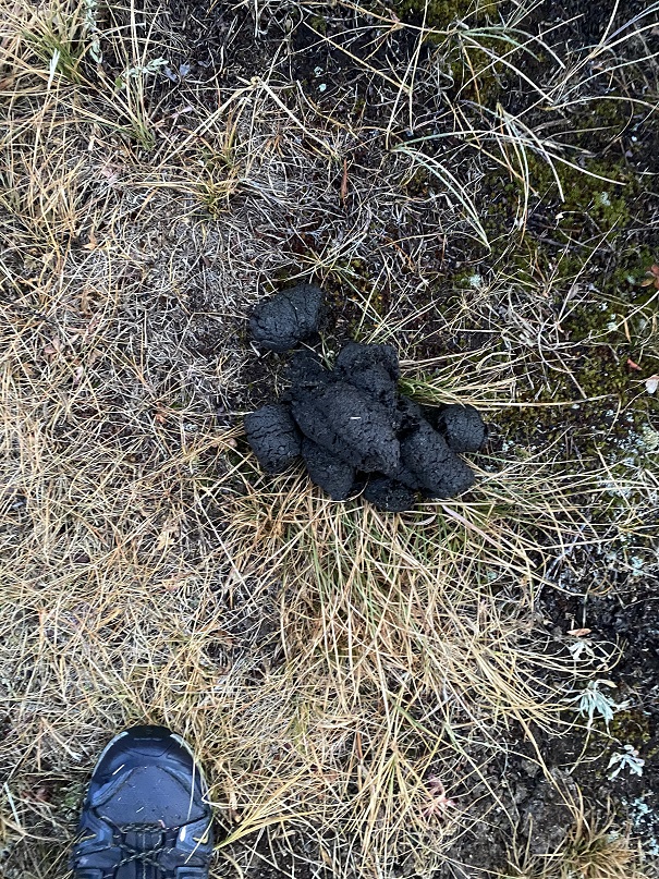
Bears don’t seem to have difficulty finding the trail however
As soon as I entered the willows I started getting wet, and I was confused, as it hadn’t rained last night? Within a couple of yards I was dripping with water. My waterproof jacket was soaked, my pants spongy and my shoes were oozing water. I kept getting hit in the face with cold, wet branches and I had leaves covering my clothes. When I got home I noticed I had red streaks where the branches had whipped my legs. Have I mentioned I’m not a fan of willows? I was getting cold, and encouraged the sun to rise. Fast.
After wretchedly whomping through the willows, and after 4 miles of hiking I came upon a trail to the right (east). I headed towards the trail in the distance and followed it
This was a nice trail through the trees, and then once again, willows.
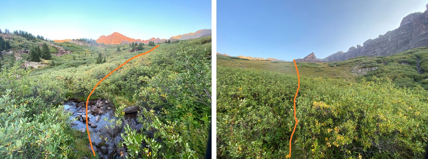
From here the trail is very obscure until you reach the upper basin. The willows have many, many game trails that make accessing the upper basin possible, but time consuming. I just kept aiming northwest, keeping the creek to my left and rejoicing when I found a game trail. I still got hit in the face with willows, but could see a trail below my knees.
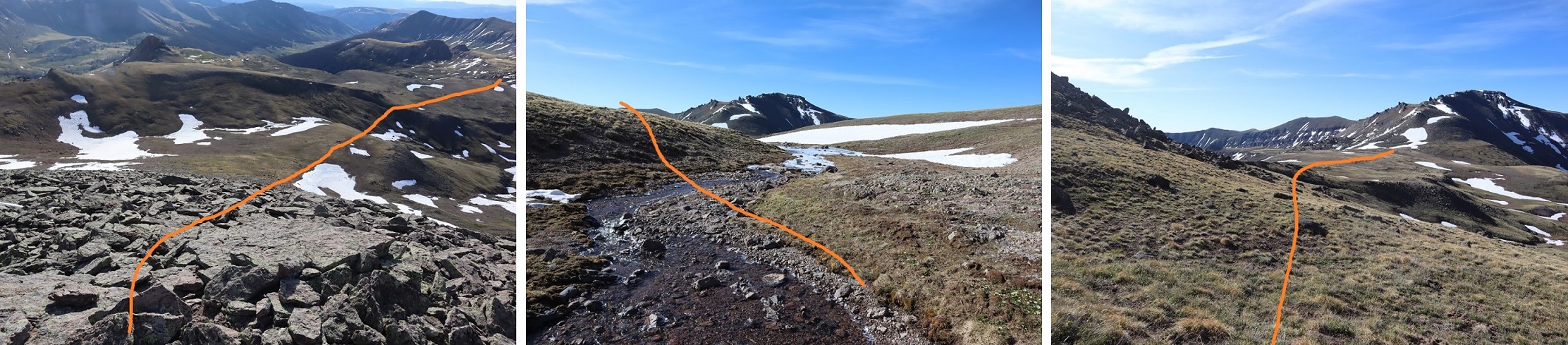
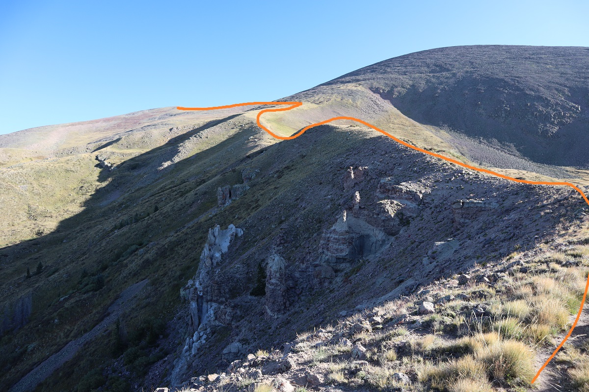
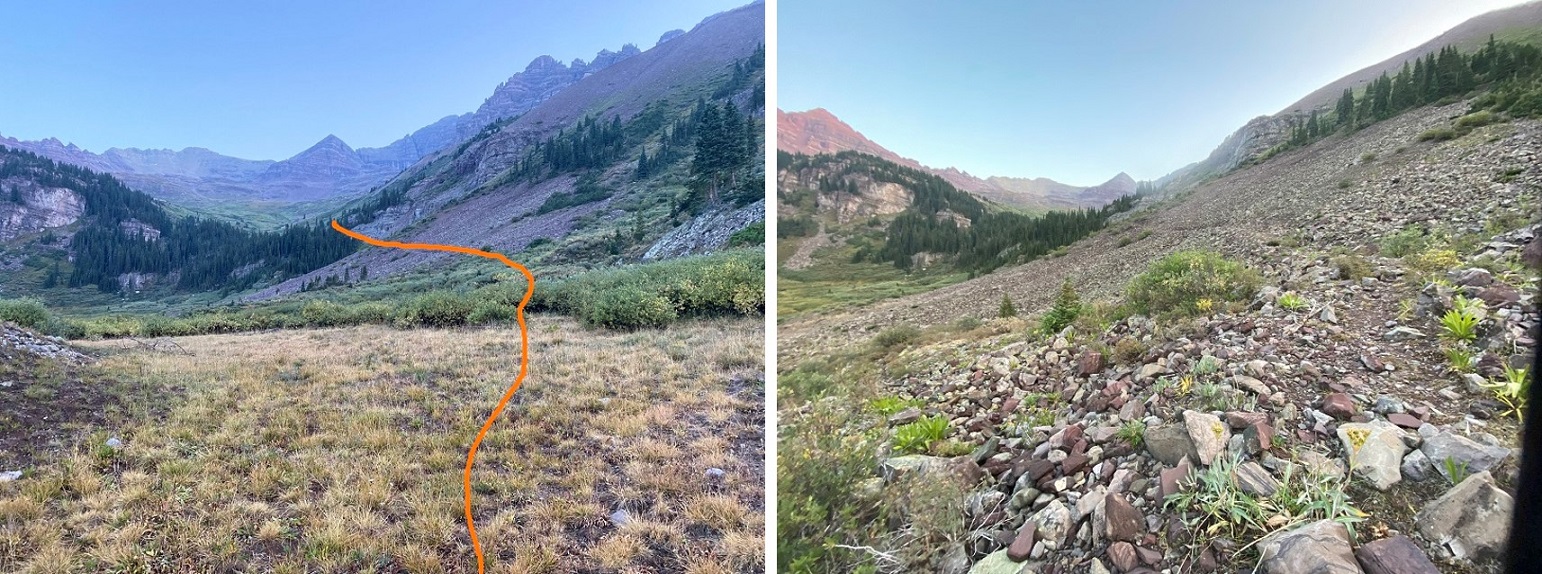
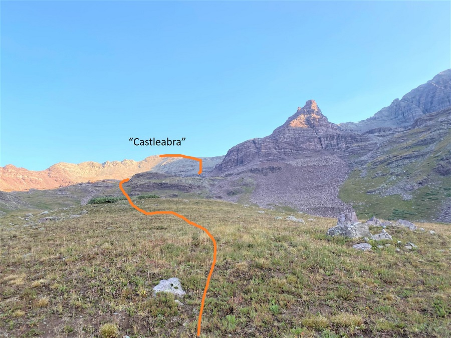
I finally made it out of the willows at 12000’. Here’s the overall route I took to get to “Castleabra”
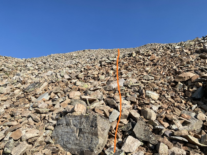
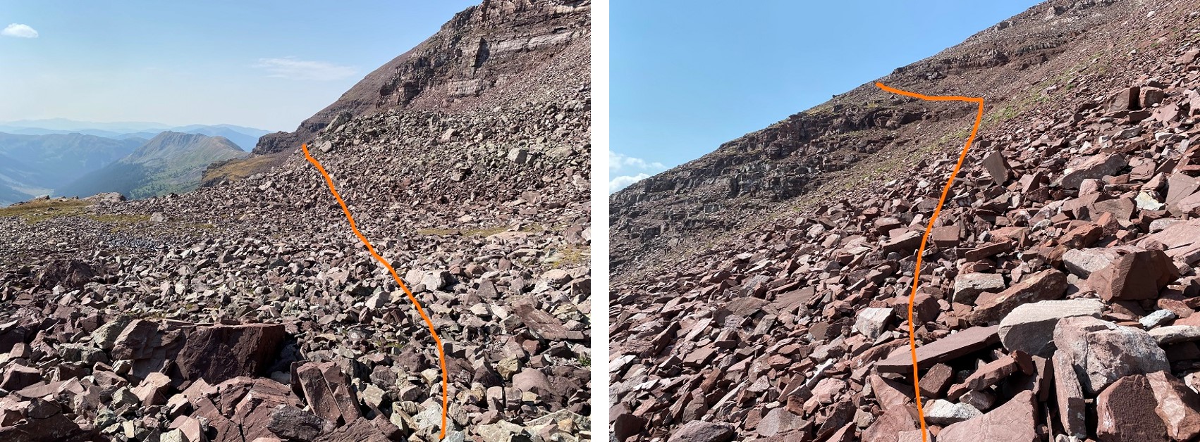
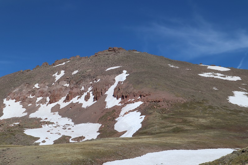
There are several ways to get to “Castleabra’s” ridge. I went directly up the south face, but could have also taken the gully to the right or left. I didn’t do this because there was a herd of about 30 goats having a grand old time kicking down rocks to the right and I didn’t bring my helmet. I was worried the scree would be brutal to my left going up, so I went straight up the middle. Here’s the route up the south face. This is all class 2 on unstable rock, and there are several access gullies. All go, just pick your line.
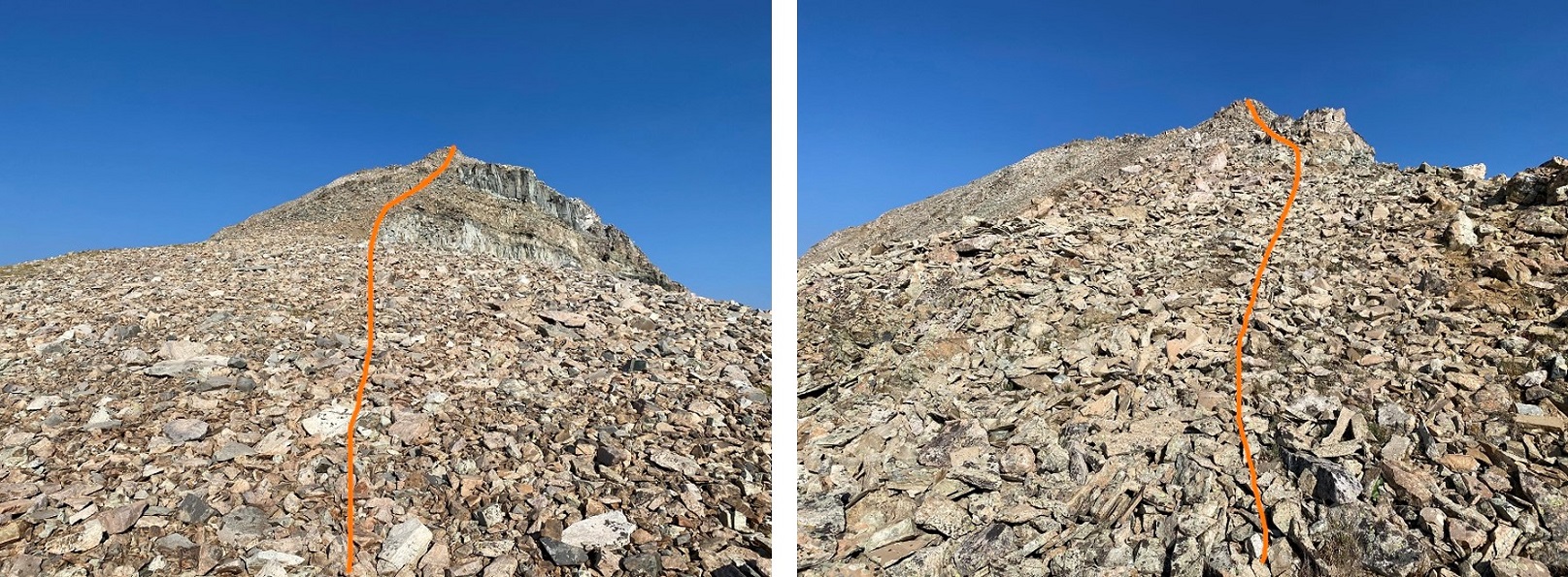
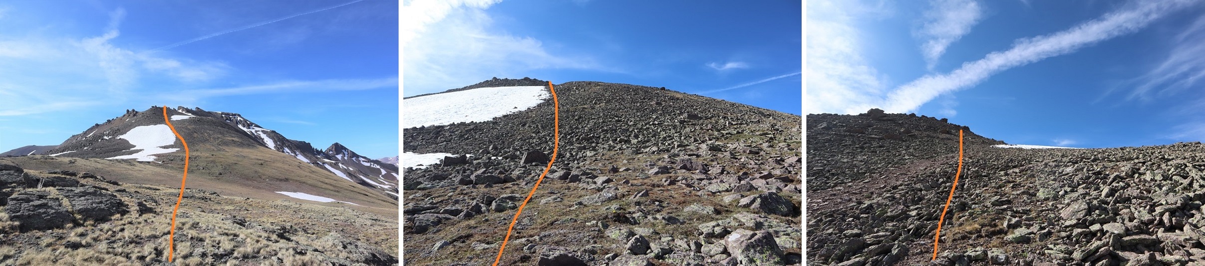
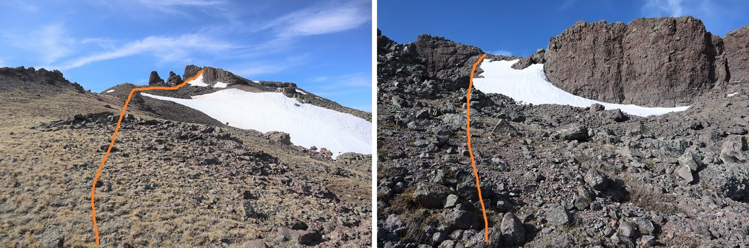
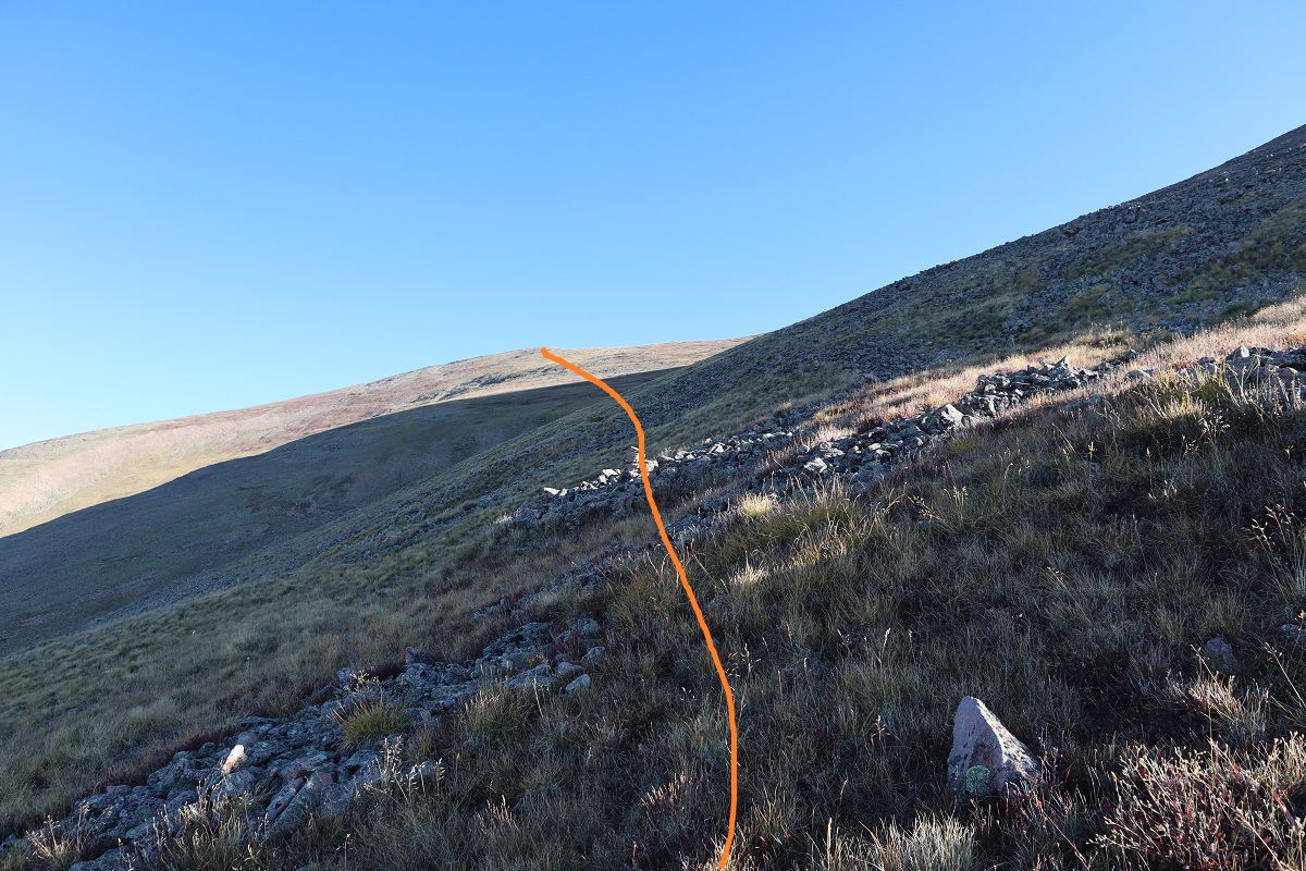
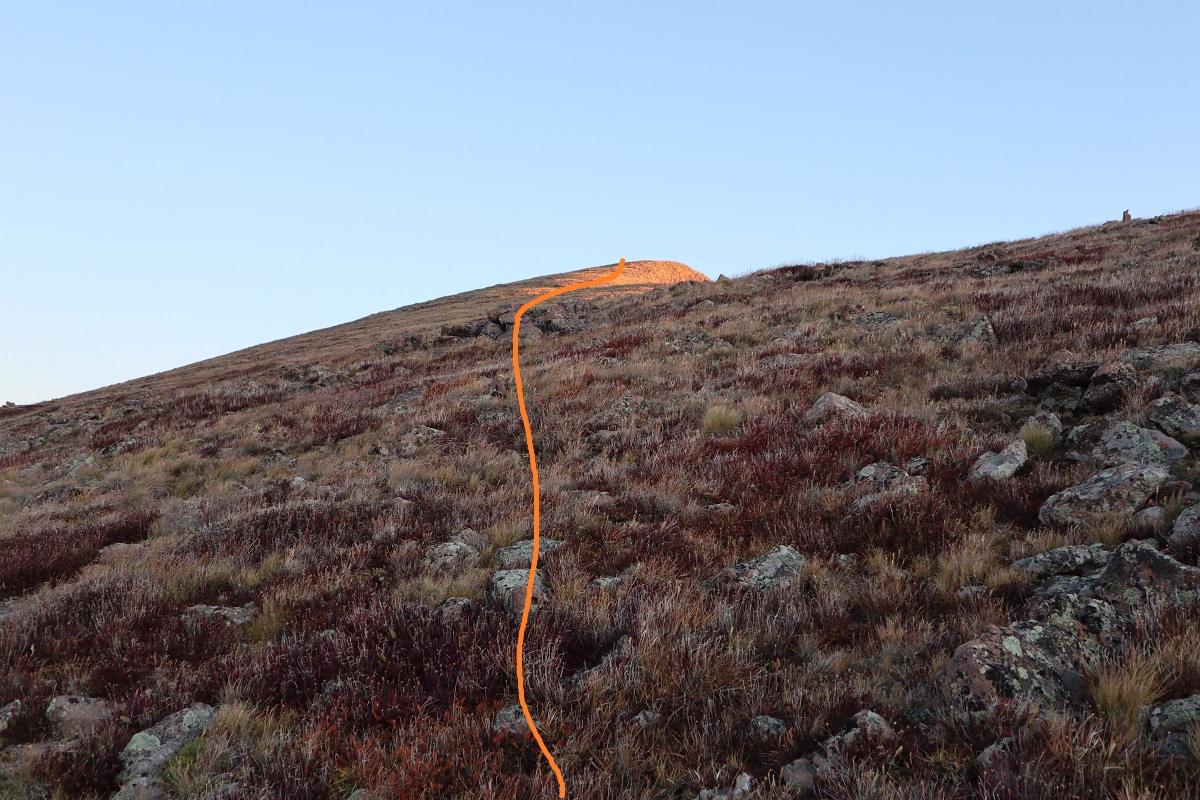
After gullies there’s some rubble to deal with to gain the ridge
Once I’d gained the ridge I turned left and headed west
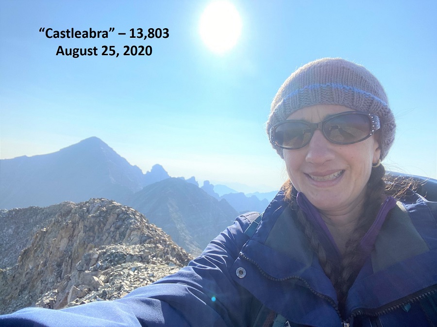
I summited “Castleabra” at 9am. Unfortunately, I’d forgotten my camera at home, so these are all cell phone pics and due to that you get selfies (and sometimes the side of my finger in shots).
Castleabra:
Here’s a look at the route I took in
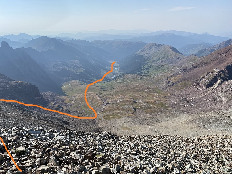
I was making this a loop, adding in PT 13550 as well. To do that I headed back the way I’d came, then angled down the scree towards the basin. There is no solid trail here, and none of the area cliffs out, so you can descend at any time and make your way scree-surfing towards the basin. Here’s the overall route I took
And step by step, back down the ridge
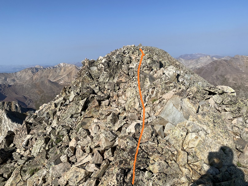
Here’s looking back up at the route I took down from “Castleabra”. As you can see from this photo, there are several options to gain the ridge for this peak, and the entire ridge is class 2.
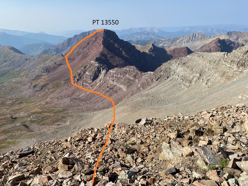
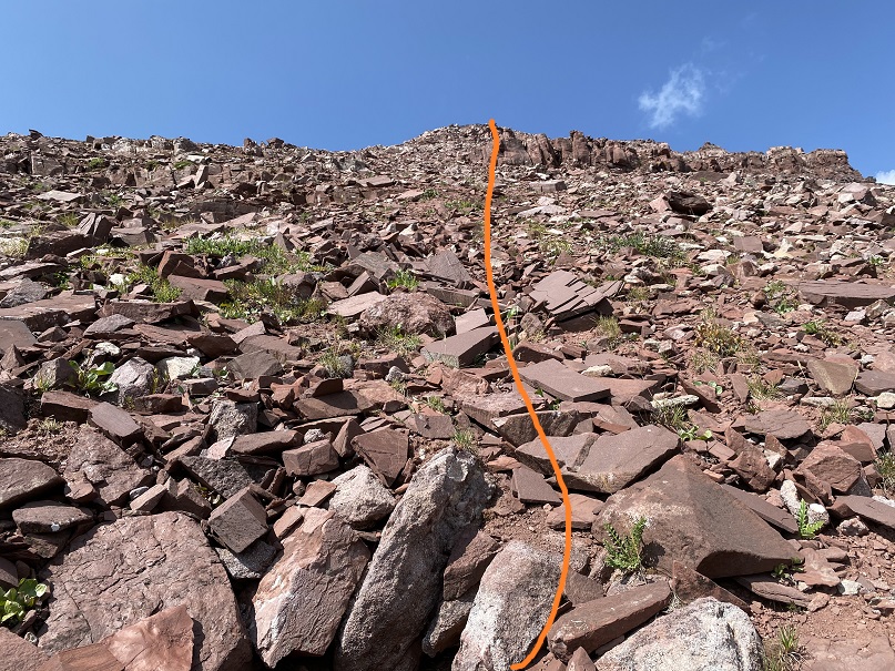
Now on to summit PT 13550. The trick is to stay high and gain the ridge as quickly as possible. Don’t dip down further than you have to, because you’ll just have to re-gain the elevation later.
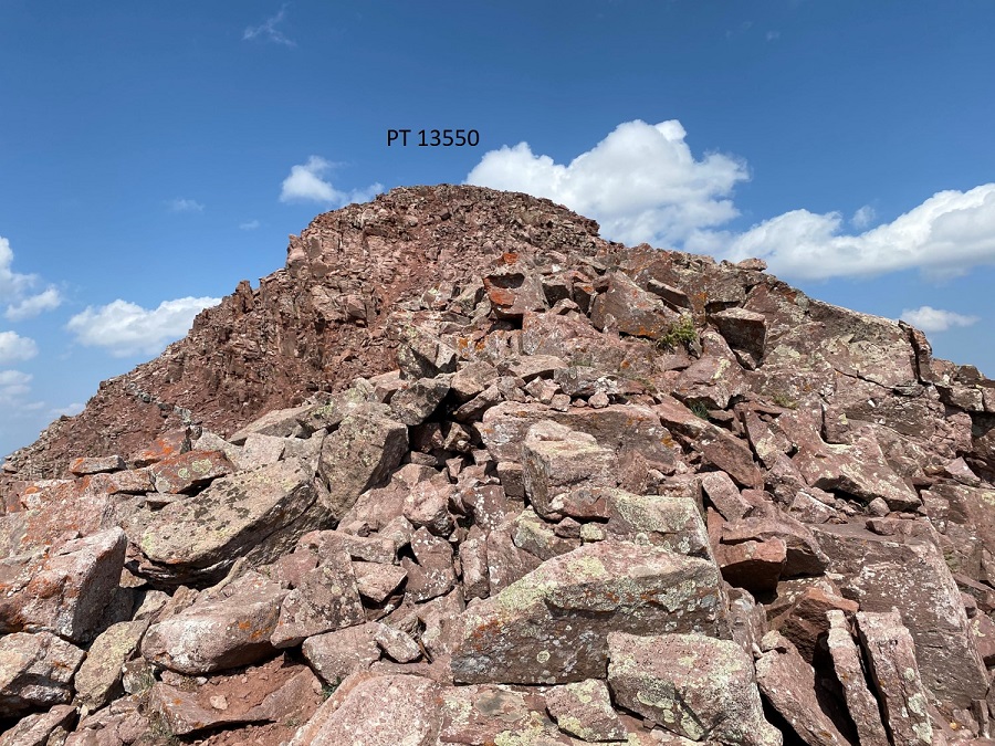
Once on the ridge it’s loose and rocky but all class 2. I followed the ridge to a false summit
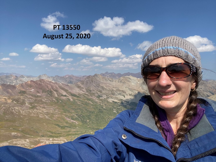
I summited PT 13550 at 11am
13550:
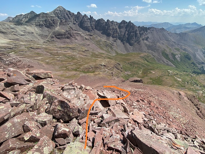
Here’s a look back over at “Castleabra” and Castle Peak
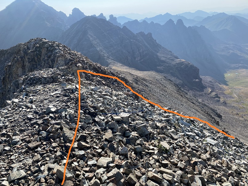
It had been a long day and I was tired. I hadn’t gotten much sleep last night, and I was hiking slower than usual in the heat (but at least it’s warmed up and I’d dried out). Time to head back down the ridge
Here’s the route I took down the ridge and through the upper basin
And back down to through the willows. Luckily, I had a good idea of where I was going and the willows had dried out in the afternoon sun, so they weren’t as miserable as on the trek in. Here’s the overall route through the willows
And step by step. Yes, I was on a trail. Anyone have a chainsaw?
Back through the trees and across the talus trail
And back down to the creek/beaver ponds, following game trails where available
I picked up the faint trail that led back to the trailhead
And took the 4WD road back to my truck
I made it back to my truck at 2pm, making this a 15.2 mile hike with 4393’ of elevation gain in 9 hours.
When I got back to my truck I noticed a faint dusting of water droplets had landed on my truck last night. Just a few here and there on the dirt that coated the vehicle from the drive in. The skies had been clear when I went to bed, and I didn’t get more than 2.5 hours of sleep, but it must have sprinkled a bit in that time. Even a quick, light sprinkle of rain can cause the willows to turn into a nightmare. Next time I’ll wear my waterproof pants when willows are involved, no matter the weather.
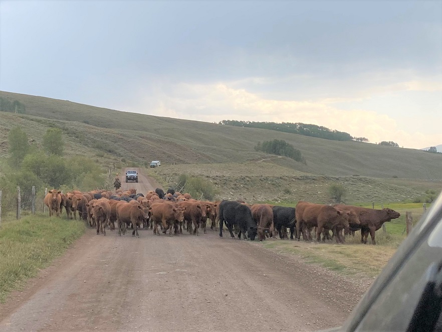
Luckily, since it was a Tuesday I didn’t pass another vehicle on my way down (I’d been worried about that). Oh, and someone was moving cattle on my drive out. The wrangler was clicking and clucking to the cows and making swishing noises. She thanked me for stopping to let them by, and I thanked her for allowing me to take a photo and complemented her on her chaps (they were really cool). I miss farm/ranch life (kind of…). Time to head home and get more work done.
Wow, the 4WD road to Nellie Creek is much worse than I remember! It’s absolutely 4WD from the turnoff, all 4 miles to the trailhead, with 2 creek crossings. Have I mentioned I love my truck?
I made it to the trailhead, which was empty. There were a few dispersed campers in the area however, taking shade beneath the trees.
The trailhead was also very much in the open, so I turned around and drove a short distance and parked my truck in a narrow parking spot under the trees, just off the road. There were mosquitoes all around, so I ate dinner in the back of my truck, jotted down notes and checked my topo map for tomorrow. I decided to go to the trailhead to take a look around and get a visual for the start of tomorrow’s hike. There was a couple with a dog standing in front of the trail maps when I arrived. Their dog charged at me, barking loudly. The couple seemed surprised and apologized for their dogs behavior. That dog barked all night long.
I walked back to my truck, took care of a branch that had been scratching the roof of the truck like a critter trying to get in, and read for a bit before turning out the light.
If you couldn’t already tell by the tone of this post, from the time got to the trailhead I wasn’t ‘feeling it’. This rarely happens to me, and I was thinking maybe I need a short break from my goals? Or maybe expand them a bit? I love to hike, but today I couldn’t seem to get myself out of bed to start. I blame it on yesterday’s failed attempt on Coxcomb, which put my training into a different perspective.
Also, I was still worried about the injured horse. My mind had a lot to think about and I couldn’t turn it off. I finally started on the trail at 4:15am.
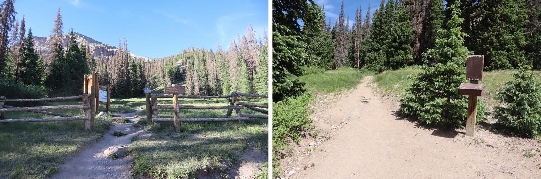
The trail starts at the north end of the parking area and follows a well defined, class 1 trail.
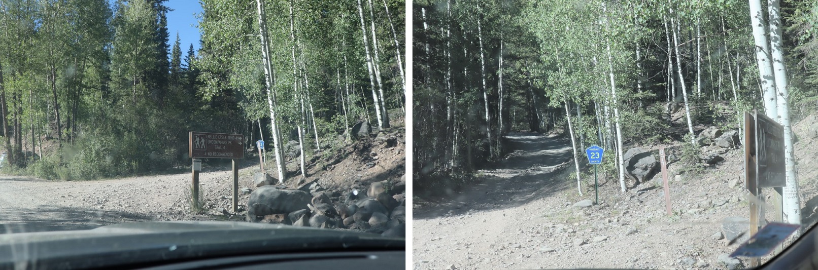
After hiking for 1 mile I turned right at this sign and switchbacked up the side of the mountain
After hiking for 2 miles I made it to the top of the pass
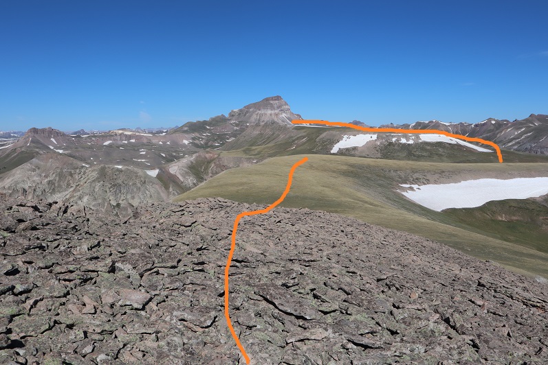
It was still dark at this time, and I knew I needed to descend a couple hundred feet. The trail seemingly ended and it took me a while to figure out which way to go, but there is an actual trail here that picks up again after about 50 feet of absence. In the daylight it wouldn’t have been an issue. I finally found it and descended in to the basin. And descended, and descended, and descended. I looked at my altimeter, concerned I’d lost too much elevation. At this point I’d lost 800’, and I could tell I’d need to lose several hundred more before starting to gain elevation again. The sun was starting to rise and I still didn’t have a good visual of the peak I’d intended to climb. I still wasn’t ‘feeling it’ and didn’t like the prospect of gaining 1000’+ at the end of today’s hike after climbing up gullies (I’m not a fan of gullies). I decided to call it and turn around. I headed back up towards the pass. I’d much rather get my elevation gain in the beginning of the hike, rather than at the end. However, I wasn’t done hiking for the day; just changing my plans. When I made it back to the pass I turned and headed east up the side of Unnamed PT 13106 (which I later found out is nicknamed Nellie Point, so that’s how I’ll refer to the peak. Names are better than numbers IMO).
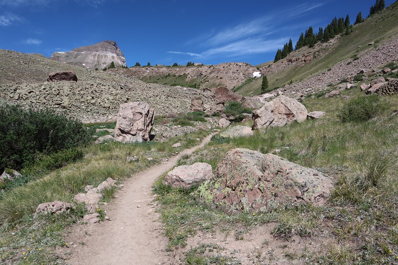
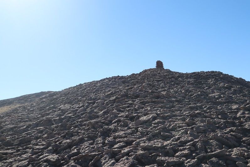
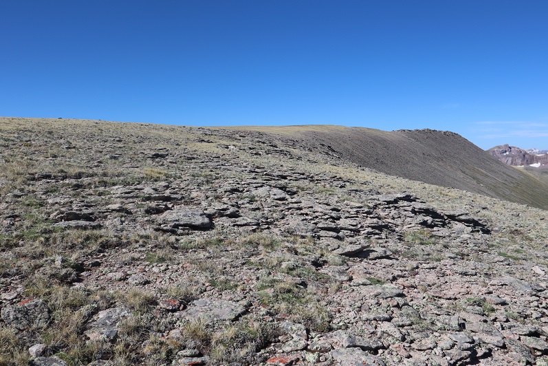
This was mostly a tundra hike until the end, when the tundra turned into very large rocks.
These rocks were fun to navigate, kind of like a maze with large obstacles to go around. All class 2. My mood improved dramatically and I was excited to be out adventuring.
There were several large cairns on the long summit. I wasn’t sure which one was the actual summit until I found a summit register inside one of the cairns. It was kind of in the middle of the summit area (which was about a quarter mile long).
Nellie Peak:
From the summit of Nellie Peak I continued following the long summit northeast. There was still some leftover snow here from winter, which didn’t pose a problem at all.
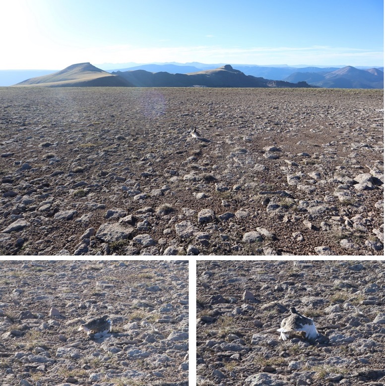
While on the ridge I scared a Ptarmigan mother and her chicks (they scared me too, as I didn’t notice them until the mother squawked). Immediately the chicks dispersed and the mother pretended to be injured, leading me away from her babies. I kept telling the mother I didn’t want anything to do with her or her chicks, but unfortunately she was leading me exactly in the direction I needed to go. She did a wonderful, if unnecessary, job leading me away from her babies. When she felt I was far enough away she flew back in their direction, chirping to gather them all together again.
Ptarmigan:
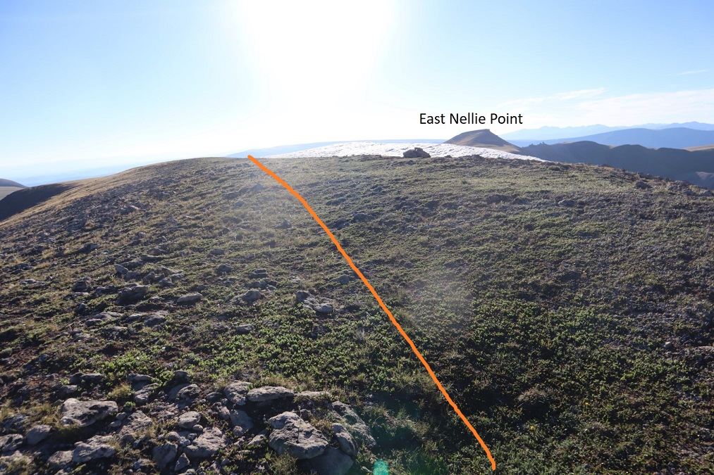
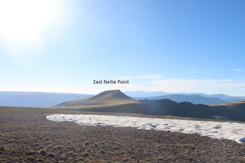
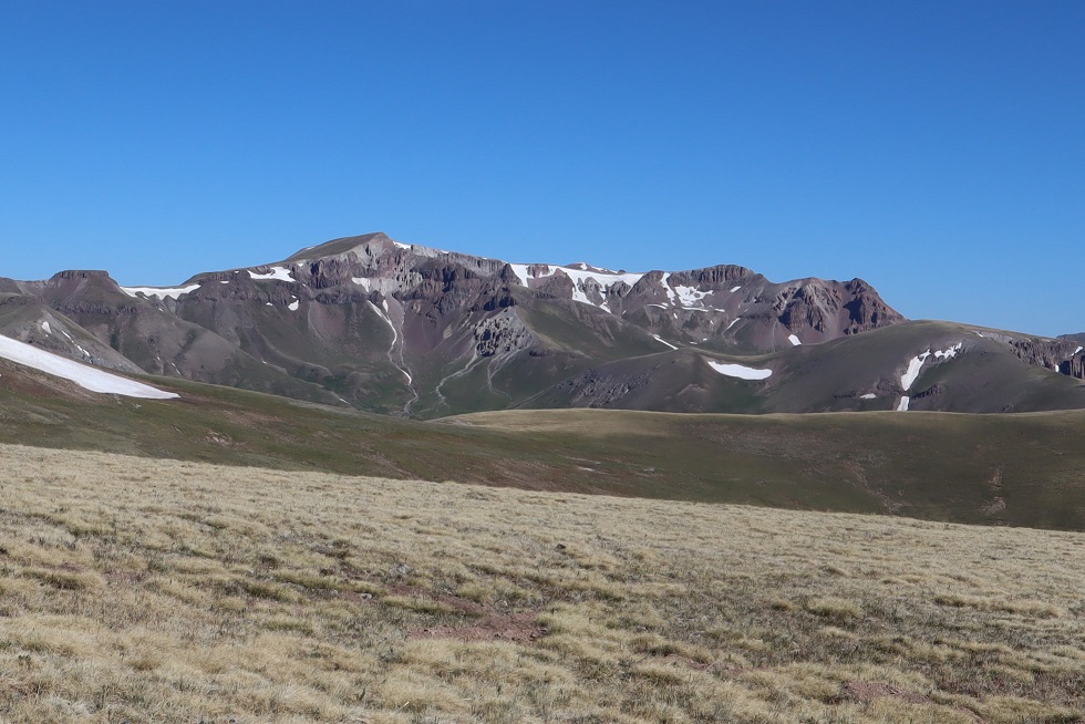
From the summit ridge I could see East Nellie Point, but getting there isn’t as easy as it initially looked.
I followed the ridge almost to the saddle and then turned and headed east, losing 600’ of elevation. Luckily this part of the hike was mostly on rolling tundra and wasn’t too taxing.
Once at the bottom I was able to avoid the small pond/creek and ascend the hillside towards East Nellie PT.
This was still rolling tundra, and there were even game trails in the area (and tons of elk tracks). At the top of the tundra hill I had about a quarter mile of tundra to walk through to the final summit push (if you could call it that).
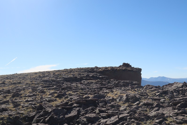
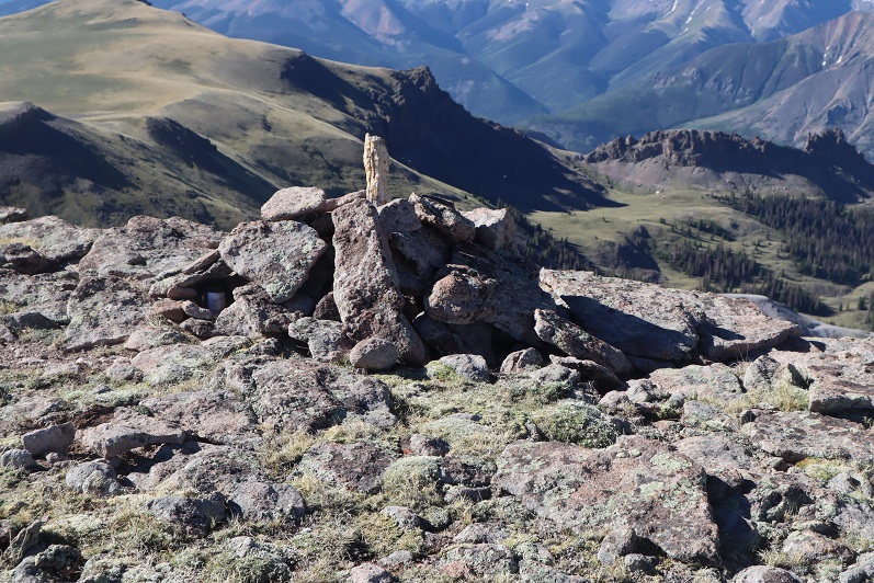
The final push to the summit was rocky and there was no trail, but it was straightforward
There was a large cairn just before the summit
The actual point of this summit was difficult to tell as well. Once again I knew I was at the summit when I found the summit register stashed inside a cairn
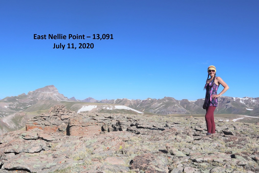
Summit Photo:
East Nellie Peak:
Here are some photos from the hike back down. I decided to make this an out and back hike, retracing the steps I took to get here from Nellie Pt.
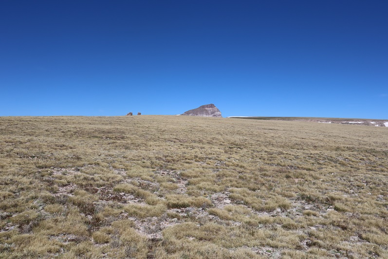
The tundra can be vast. Luckily, I could keep Uncompaghre Peak in my view most of the time, and just kept heading towards that 14er.
I also had a good view of Silver Mountain (my original choice for a summit today). With this view I could see there was still snow at the top of the access gully, so it had been a good idea for me not to attempt that peak today because the snow was unavoidable and I’d left my ice axe in my truck (I had my crampons). I was feeling better about my choices.
I hiked down to the valley and then back up to the ridge
I followed the ridge back to Nellie Point
And back down to the pass
And the class 1 trail that leads you back to the trailhead
The trailhead now had several vehicles
Also, I came to the conclusion it’s impossible to get a bad photo of Uncompaghre
I made it back to my truck at 11:15am, making this a 13.72 mile hike with 3833’ of elevation gain in 7 hours. Obviously, I made this hike more difficult and added more elevation than needed, but in the end I was happy with today’s hiking change of plans. In fact, I wished I’d have made the choice to change routes earlier. Any day above treeline is a good day. The 4WD road was easier to navigate driving down than it was driving up.
I woke up before my alarm again today, but not because I was well rested: I was cold! As I turned on a light I realized I only had half of my blankets covering me. There wasn’t any wind last night, and when I looked outside I could see tons of stars. The clear skies had made for a cold night. I jumped in the cab of my truck to warm up and get ready for the day, noticing it was 32 degrees outside (as compared to yesterday morning’s 43). It was amazing what difference a few degrees makes.
I turned the truck on to turn on the heat and was once again disappointed to notice my ABS and Traction lights were still on, as well as my 4WD light still blinking. That was going to haunt me all day.
I was on the trail by 3:30am, and it was so cold I turned back at one point, intent on sitting in my truck a little longer, but I immediately turned back again: I’d knew I’d warm up a bit once I started moving. The weather forecast was better for today, but I still wanted to get an early start. I followed the 4WD dirt road 821 to the class 1 Trail 813 as it lost a total of 400’ as it wound down the canyon, and then gained almost 1000’ to the top of the pass.
There was one small section of snow to cross, but luckily the elk had already done a great job blazing the trail.
Once at the top of the pass I continued along the trail, dipping down into the basin, losing another 700’ of elevation.
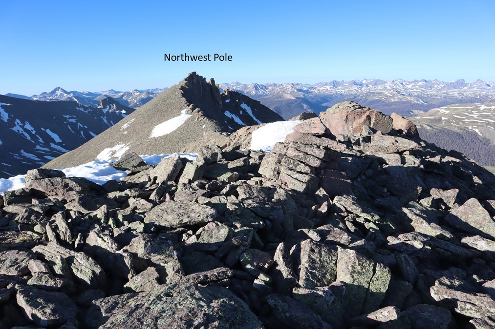
After hiking for a total of 5 miles at this junction I turned and followed 822 southwest to the base of the Northwest Pole Ridge.
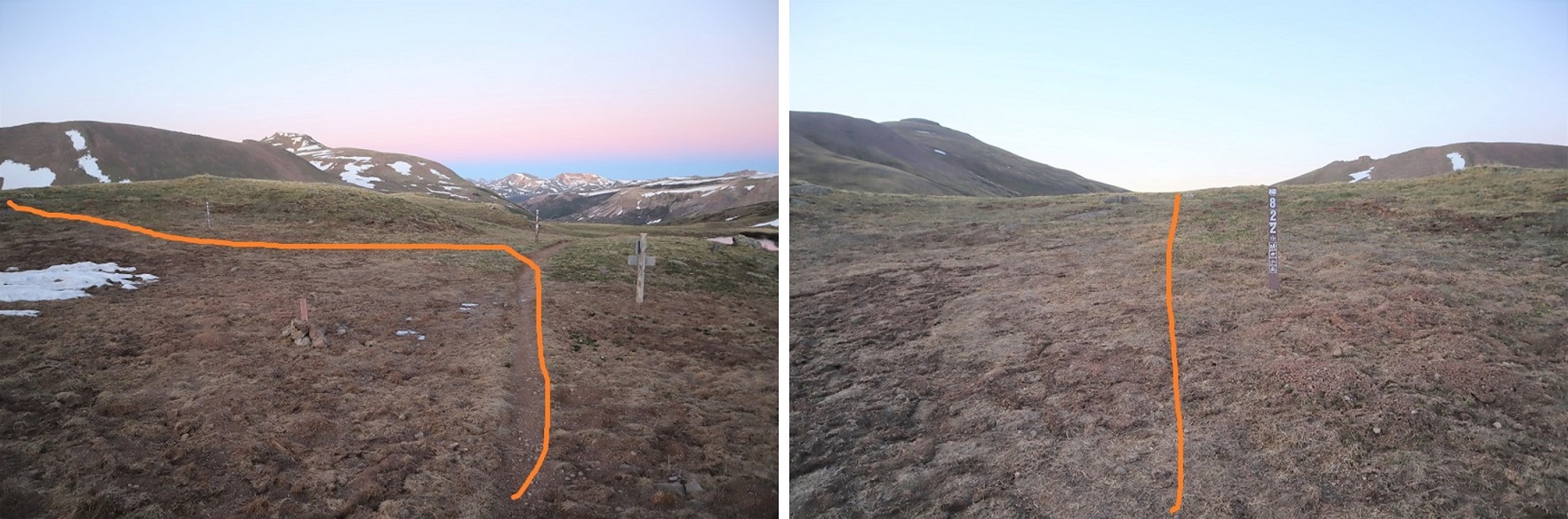
In the basin I left the trail and headed for the Northwest Pole Ridge
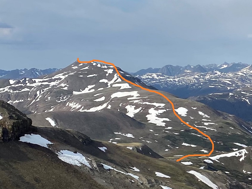
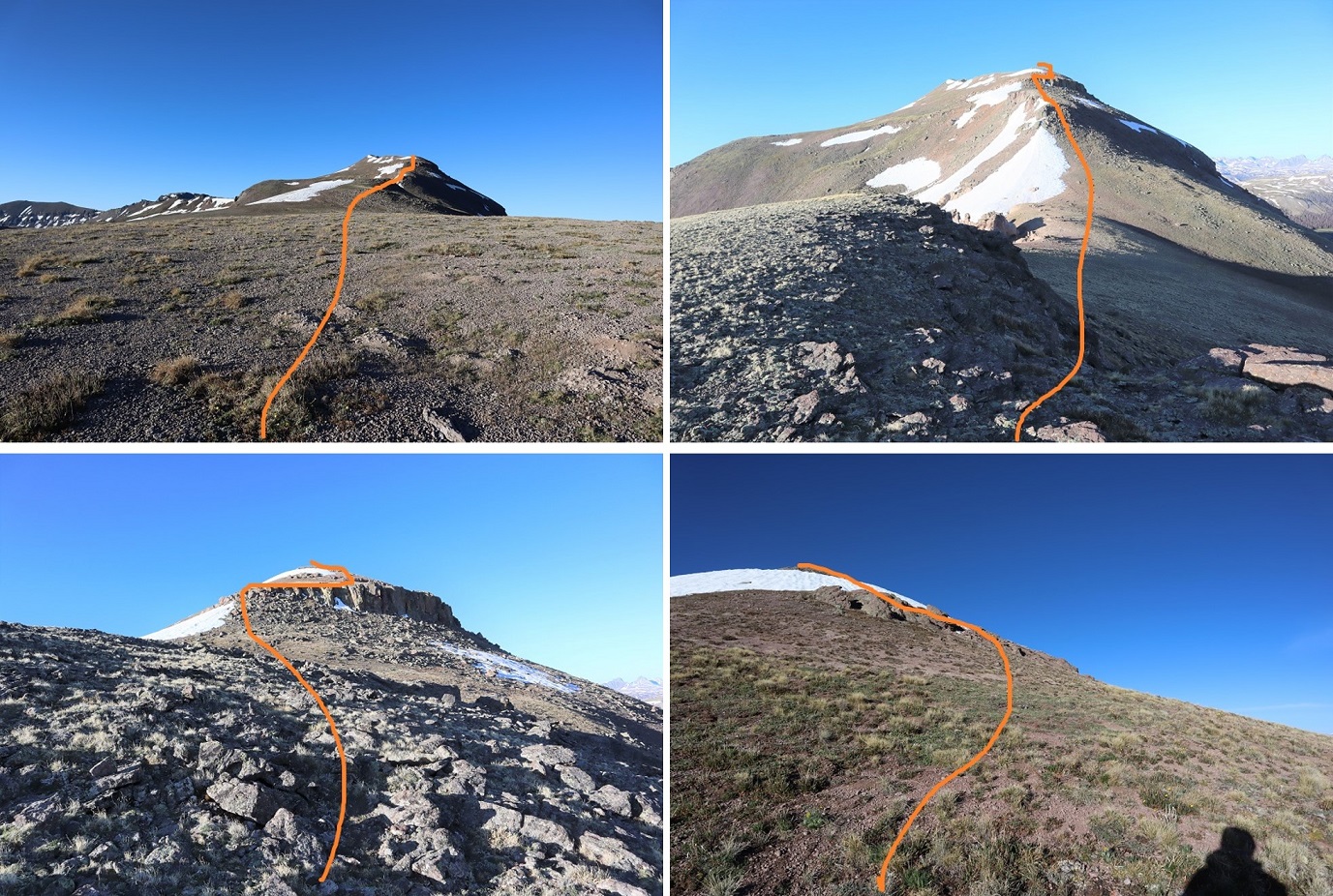
My goal here was to gain the ridge and follow it to the summit of Northwest Pole. Here’s an overview of the route:
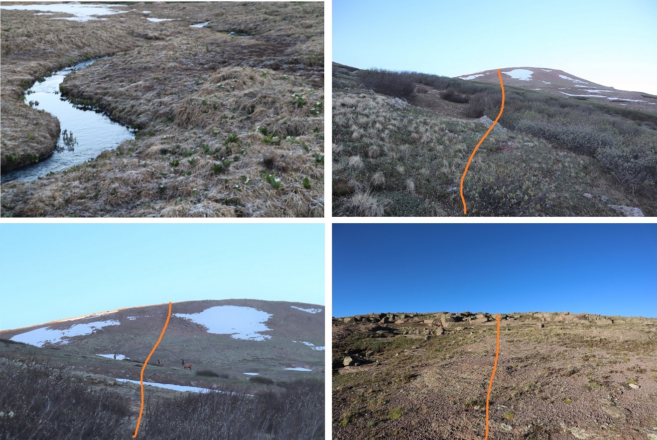
And what it looks like gaining the ridge (yes, tons of elk out there today). Also, the basin was marshy, but since it was so cold and early in the morning it was frozen and crunchy. There were ribbons of water that I hopped across. I wouldn’t want to pass this area when it’s soggy and wet.
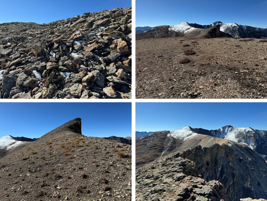
Once on the ridge it’s easy to see the snow free path to follow, all on tundra. This is all easy class 2
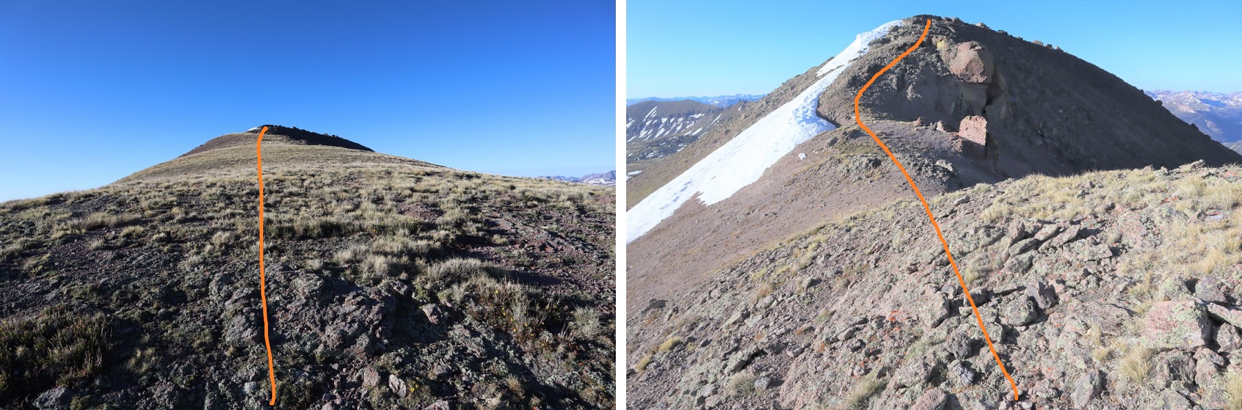
From the top of the ridge you dip down a little bit and then back up on loose rock
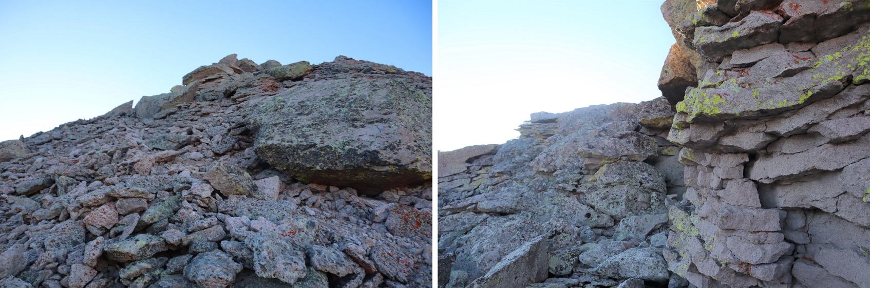
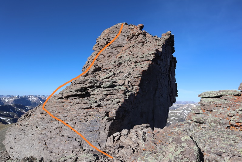
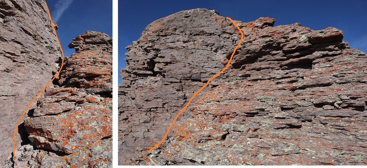
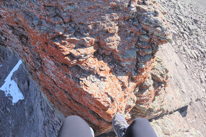
The crux of this climb comes at the very end. I spent some time trying to figure out how I wanted to summit. At first I tried to gain the block at the area where all the bird droppings were, but it didn’t look like it was the easiest way. Next I tried summiting up a chimney, but about halfway up I knew I’d need rope to get back down (I’m short) so I stopped and looked for another route. In the end I was able to summit by going up the area with all the bird droppings, just from a different angle. There is a lot of exposure here and small scree on the rocks, making it slippery and a fall dangerous.
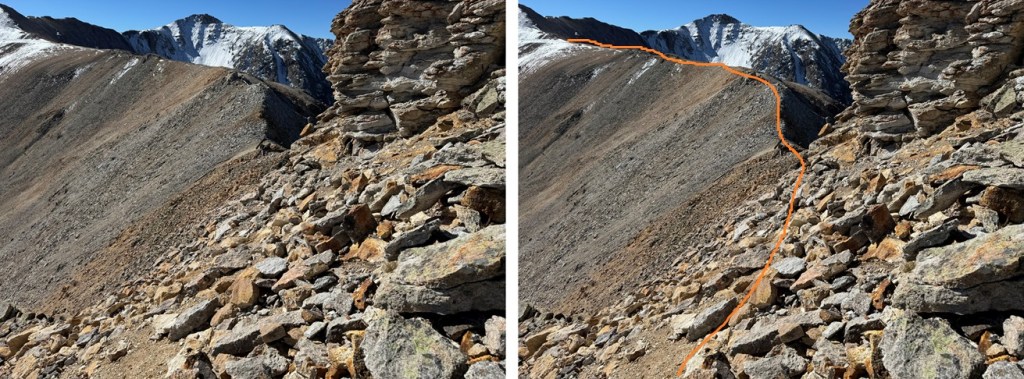
Here’s the route I took:
I aimed for the bird droppings. Here’s what that looked like from a couple of different angles.
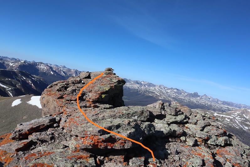
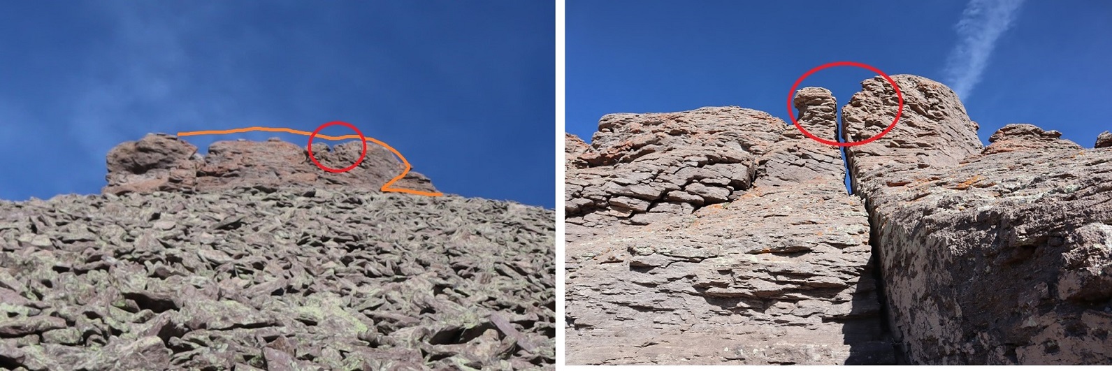
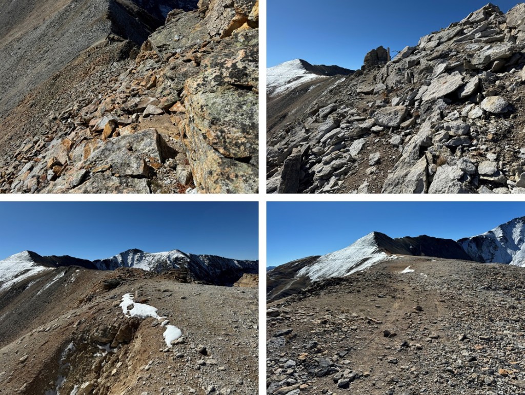
From there I traversed along the exposed edge towards the summit.
It looks easy, but this is the exposure, and yes, it included a trust jump (once again, I’m short, it could have been more of a long lean for someone over 6 feet tall, but I had to jump). Here’s looking back on the jump area (it’s too difficult to see in a picture coming from the other way, but this picture offers a good look back on the ridge too)
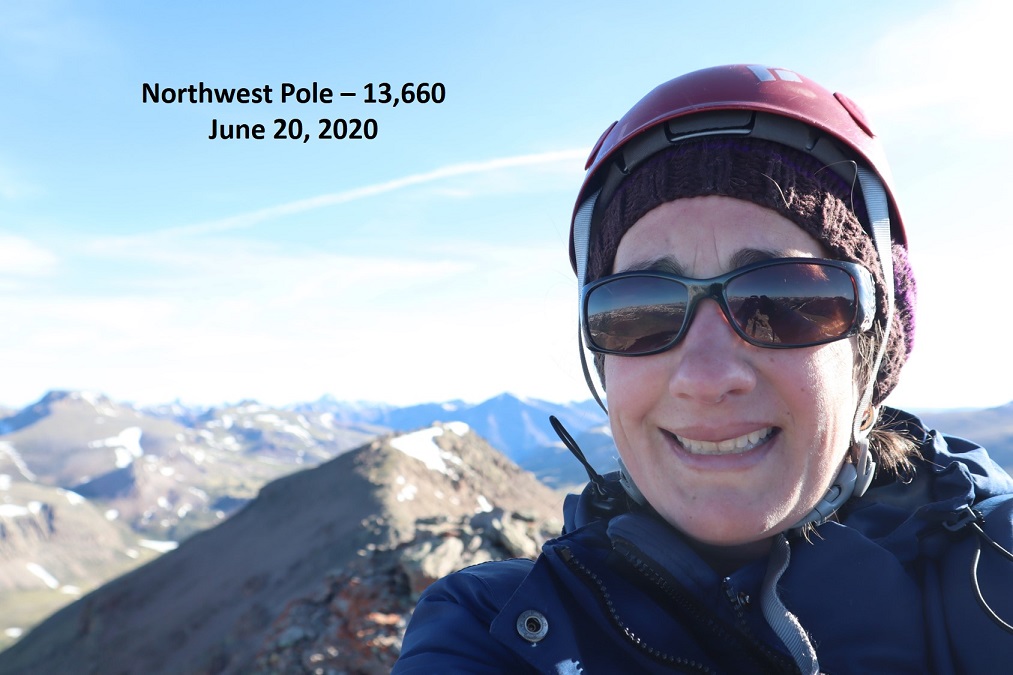
I summited at 9:45am
Northwest Pole:
Here I am getting ready to jump the area on the way back.
And from the top where the bird droppings are back down. Yes, it’s as steep as it looks
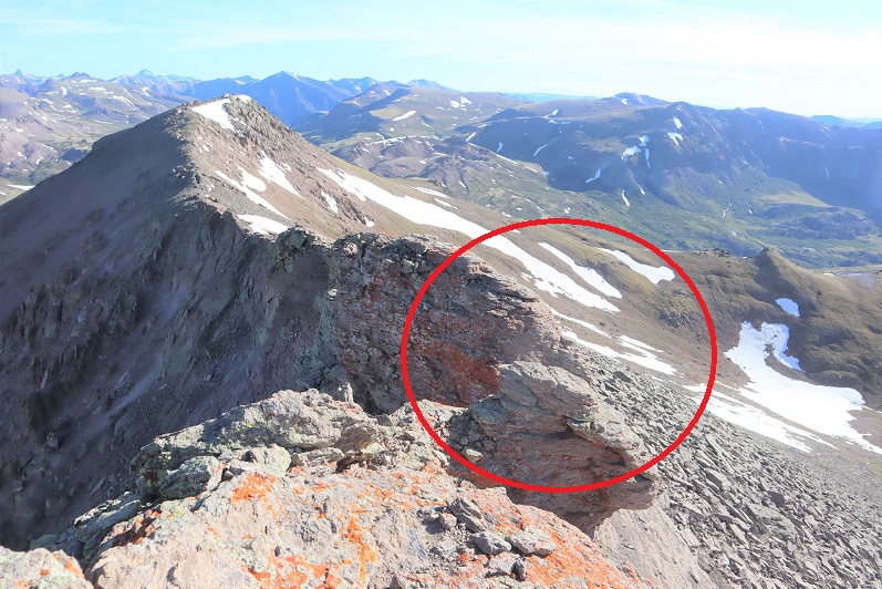
Back on solid ground I took a picture of the summit block and how I traversed it. I circled where I jumped.
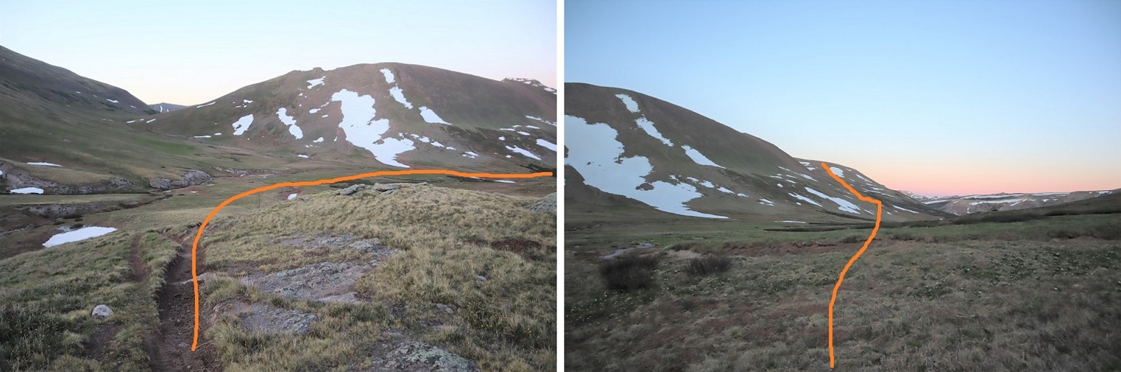
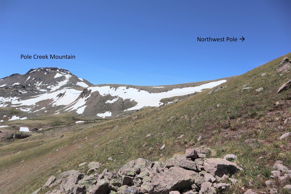
Time to head over to Pole Creek Mountain. Here’s an overview of the route from Northwest Pole
I descended east towards the basin, first on loose rock that gave way to tundra, losing 850’ of elevation, crossing a stream, and heading back up towards Pole Creek Mountain.
Here’s looking back at Northwest Pole
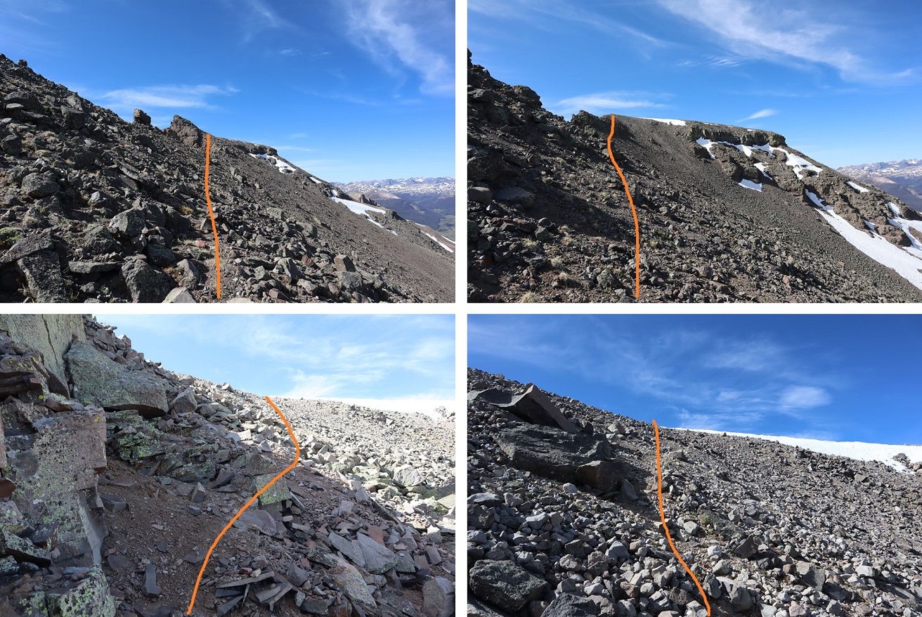
I continued southeast towards Pole Creek Mountain. Here’s how I ascended; the snow was easy to avoid, and I used it to track where I wanted to go:
After ascending the ridge I aimed for the access gully, which had snow but enough dry areas to pass easily without traction
Then I just followed the ridge south towards the summit
I summited Pole Creek Mountain at 9:45am, after almost 10 miles of hiking
Pole Creek Mountain:
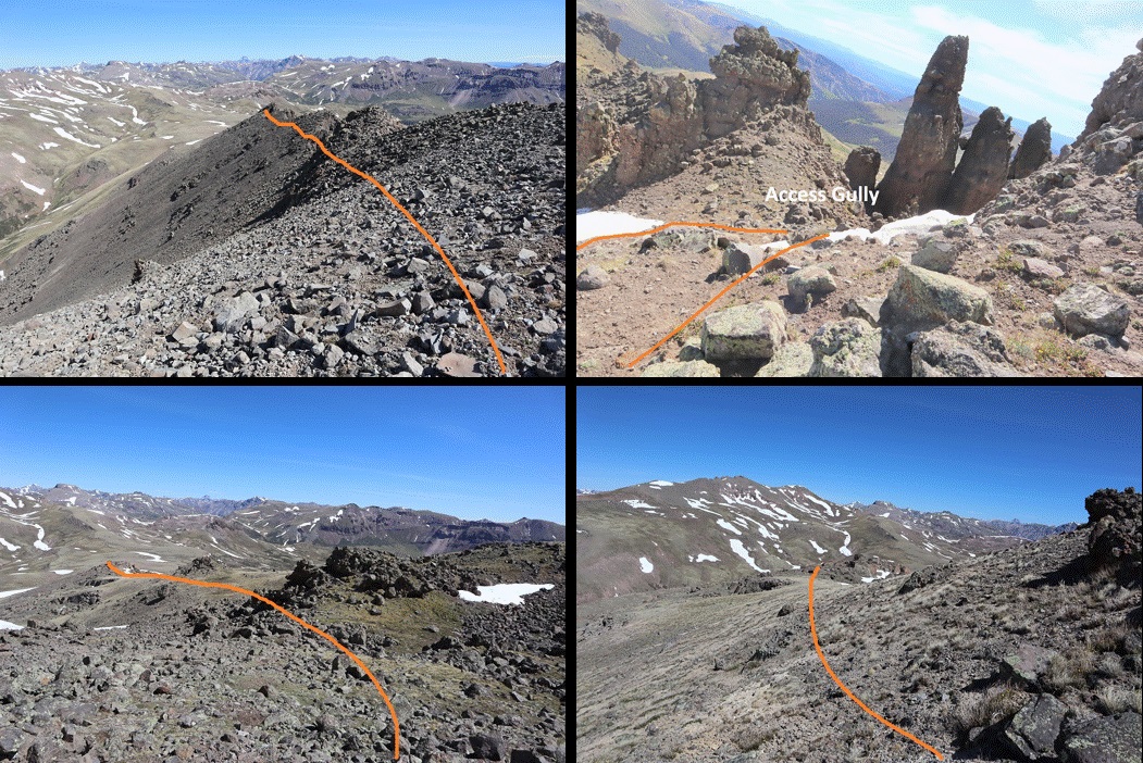
I headed back the same way I’d come in, following the ridge and then going back down the small access gully. Everything looked totally different on my way back and I second guessed myself a few times, but keeping Northwest Pole in sight helped.
Once back down in the basin between Pole Creek Mountain and Northwest Pole I wanted to stay high on my way back out to avoid the snow below Pole Creek Mountain to the east
I headed north, and then east around this small peak.
There was some snow here, but elk in the area make a great trail and traction wasn’t needed
I rounded the east side of the small peak
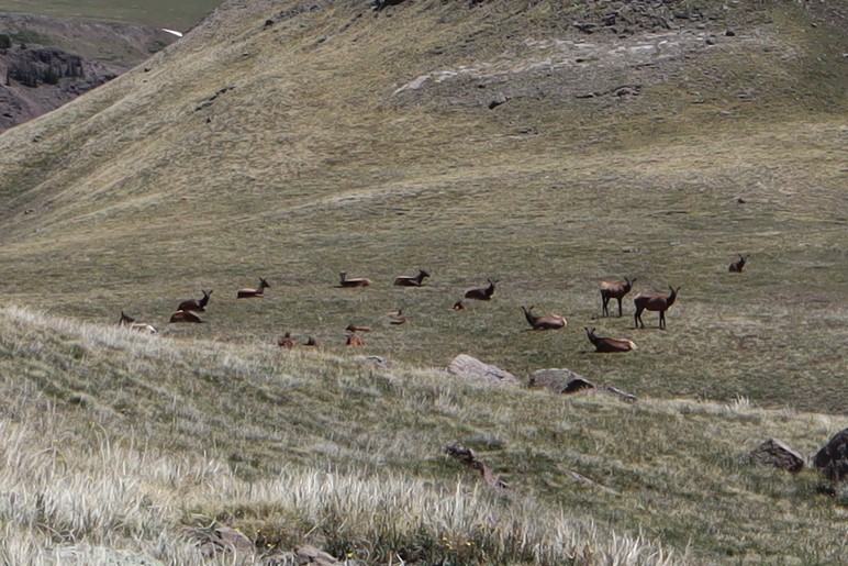
And unexpectedly came across a small herd of elk! This was so cool! I’ve heard of elk doing this, but I’d never actually seen it before: the mama elk were laying in a circle, with the babies laying down inside and two sentries standing guard. I saw them a split second before they saw me (the wind was blowing towards me, so they hadn’t heard/smelled me) and I was able to get a picture before they took off
As soon as one of the elk standing guard saw me I could almost hear him say:
“See? This is why we always employ the safety circle! Always! This is not a drill! Move! Move! Move!”
And they were off and down the hillside, out of sight.
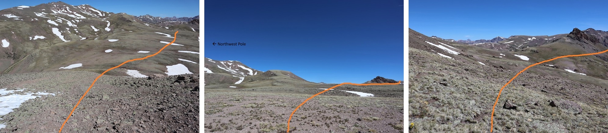
Well, that had certainly been a neat experience! I continued rounding the peak and then made my way down the hillside, all the way to the basin floor. Here’s an overview of the route I took
And looking back, here’s the route I took down into the basin. For obvious reasons I’m now referring to this as “dementor ridge”
Once in the basin I was at the lowest elevation I’d be at all day, and still had a lot of hiking left to do. I aimed northeast until I hit a trail, and then followed it up. This was trail 822 that would bring me back to Trail 813 (if I chose to go that route). This was actually easier than it looks because there are a lot of good elk trails in the area, passing through the willows.
I followed the trail to a sort of a saddle, and stopped to think
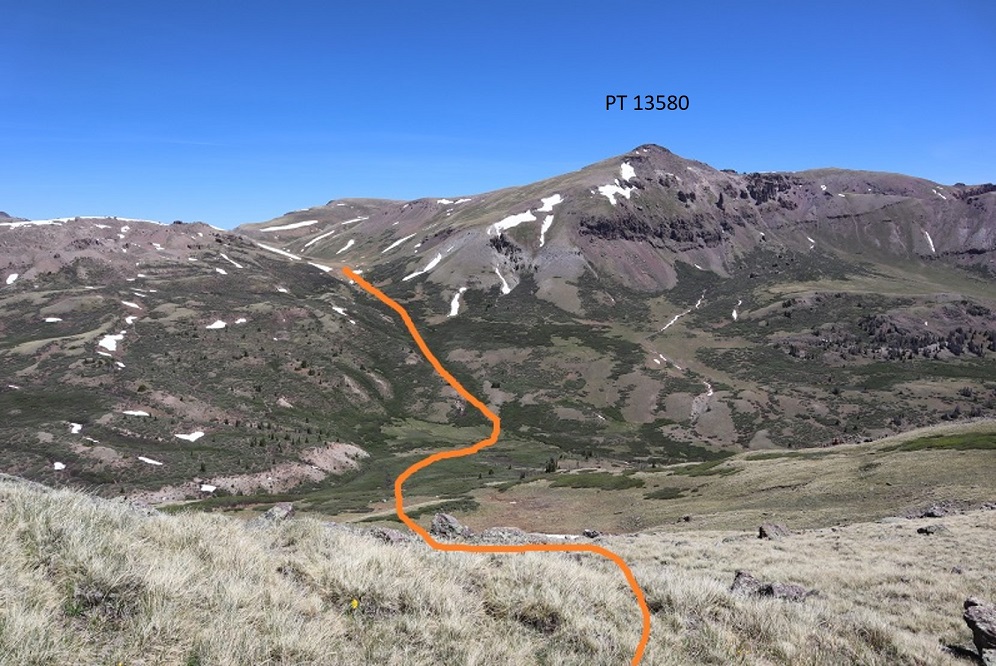
From here the trail obviously dipped down once again, losing several hundred feet of elevation before reconnecting with Trail 813 and gaining the pass, then dipping back down into the basin and up again out. Here I was, sitting directly below PT 13580, a ranked 13er that I’d want to hike sometime in the near future, but in which I dreaded that drive into Carson Pass that would be necessary again next time. It was still early in the day and the weather was great. I decided to just summit PT 13580 now while I was in the area. I’d done some scouting yesterday and today, and I was sure the route from the summit of 13580 back to the pass ‘went’ easily and would be snow free. I turned right and headed east up the mountainside. This was a very straightforward hike up tundra
At the top the tundra turned to rock, all class 2 and easy to navigate
At the top of this rocky area was the summit. I summited at 2:15pm
PT 13,580:
Here’s a look back at the route
Now I decided to stay high on the ridge and aimed north, following the ridge towards the peaks I’d climbed yesterday
And then back down to the pass and trail 813
The hike out was uneventful. It was a beautiful day and I just followed the class 1 trail back. Oh, and I saw the moose again, in the same spot as yesterday.
I made it back to my truck at 4:15pm, making this a 19.67 mile hike with 5926’ of elevation gain in 12 hours, 45 minutes. Here’s a topo map of my route:
When I made it back to my truck I noticed a marmot running out from underneath. Great. I decided it would be best to try to drive my truck down today in the daylight in case I got stuck, but because I also didn’t want to encounter other vehicles (if possible) I decided to eat dinner first and take my time. Also, I wasn’t even sure yet my truck would drive.
When it was time to go I was able to get the truck to move and tried to see if I could get 4WD to engage by driving the truck around for a bit, but that didn’t work. So I decided to just go for it and head back down the road, going as slow as possible. I probably maxed out at 2mph. When I got to about a mile from the end of the 4WD road I saw another vehicle turning around. It took them 20 minutes to do so, and by this point I was feeling pretty confident about my truck.
I made it back to the 36, kept trying different things to get my 4WD light to stop flashing and realized it was hopeless. I drove home and the first thing the next morning went to the dealership. The diagnosis: rodent damage. One of those darn marmots, chipmunks, pikas (etc.) had bitten through the wiring. Luckily it was fixable, and I was out of there within a few hours. They put rat tape over the wires to hopefully prevent this from happening again. I’d never heard of rat tape before, but it sounds like it should be on all wires.
I consider myself lucky: after years of leaving my truck in the backcountry this is the first time I’ve ever had this issue where it’s caused concern. I’ve chased some porcupine’s out from underneath my truck before, but that was before any damage was done.
I’ve done some serious thinking about the issue, and I think a physical barrier is the only way I’m going to keep rodents out. So here’s my idea: tomorrow I’m going to Home Depot and buying a large tarp and some bungee cords. When I park at the next trailhead I’m going to lay out the tarp, drive over it, and then secure it around my truck with bungee cords to prevent critters from getting underneath.
This is just a thought at this point, but something I hope to implement and test soon.
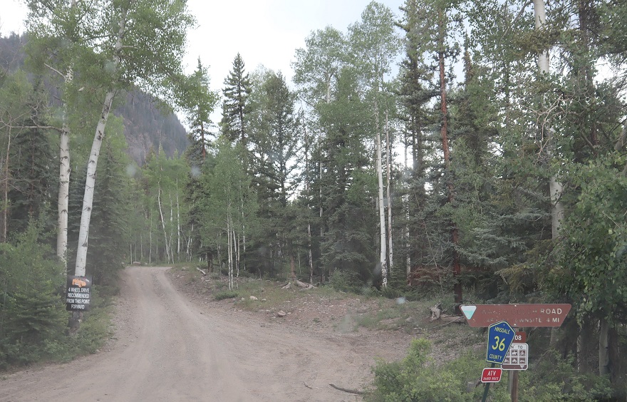
Woohoo! It’s finally summertime and I’m in the mood to start doing some serious hiking. I drove down to Lake City after work on Thursday, intending to find a parking spot on Carson Pass, spend the night, and get up early to start hiking. I looked up Carson Pass for road conditions on Bushducks and wasn’t able to find any information so I figured this was an easy 4WD road. (Note, I found out later it’s listed under Wager Gulch).
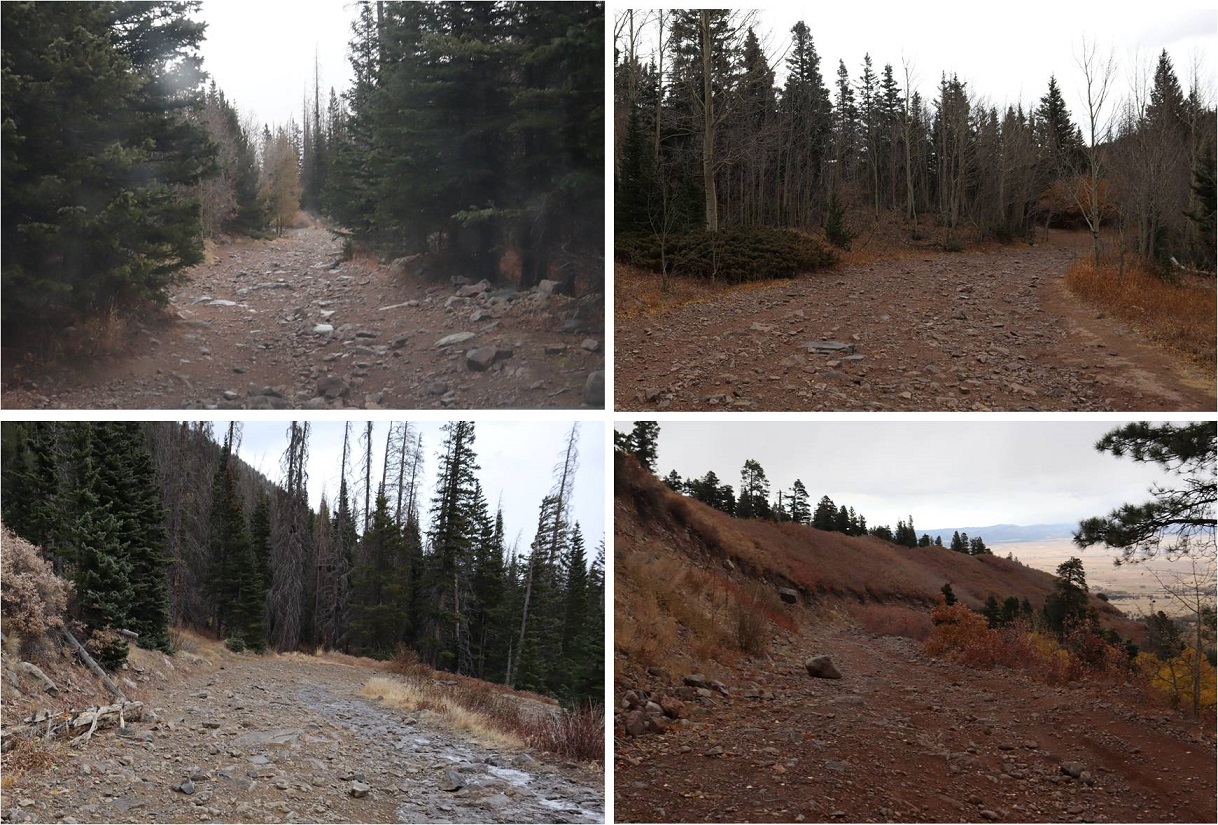
I turned left from 30 onto 36, or Carson Road. There’s a sign that says “4WD recommended”
Ha! I found out rather quickly This is a serious 4WD road. It’s narrow, has a minimum of 4 blind-hairpin turns, water crossings, and some serious rocks/trees/etc. to navigate.
The good news is if you can make it after the first mile you can make it all the way. On my drive back down I saw someone turn around just before making it a mile. It took them a good 20 minutes to turn their vehicle around. I hope they found a dispersed campsite elsewhere. Here’s a picture of the truck that turned around. My Tundra handled it famously, but this is a road better suited to vehicles with a short wheel base.
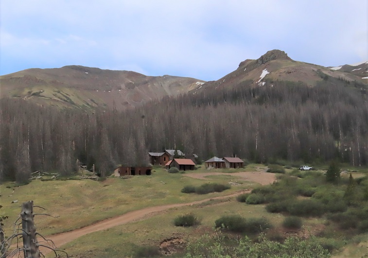
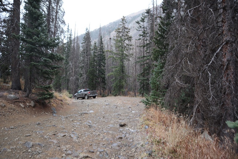
After driving for 3.5 miles I made it to Carson. It’s a ghost town, and just before reaching it there are a few dispersed campsites.
Instead of stopping I drove 1.5 miles further on the road to the top of Carson Pass. The entire drive was almost exactly 5 miles from the turnoff from 30.
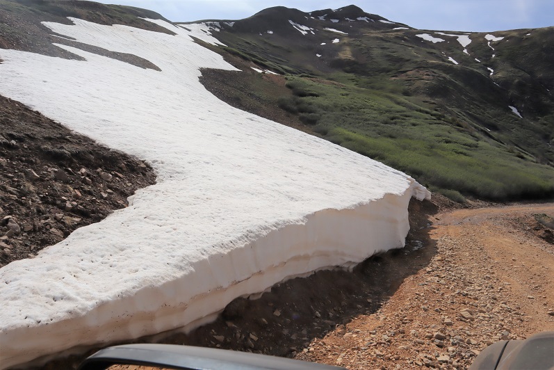
There was a little bit of snow towards the top, but nothing that interfered with driving.
I made it to the top of Carson Pass, backed into in the only available parking space (I’m assuming a lot of vehicles just park on the tundra) and realized it was only 5pm.
Hmm. I had a flexible itinerary for the weekend that included up to 8 peaks depending on weather/conditions, and while I’d already done an hour on the treadmill today I was in no way tired. I decided to tackle the peak in front of me because I had plenty of time and wanted to get the most out of this trip. Read: I did not want to make that drive again (if possible) and wanted to get in all 8 peaks.
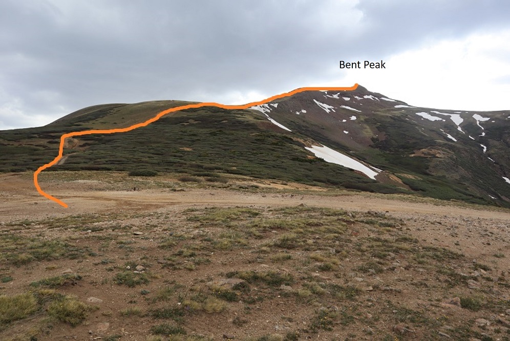
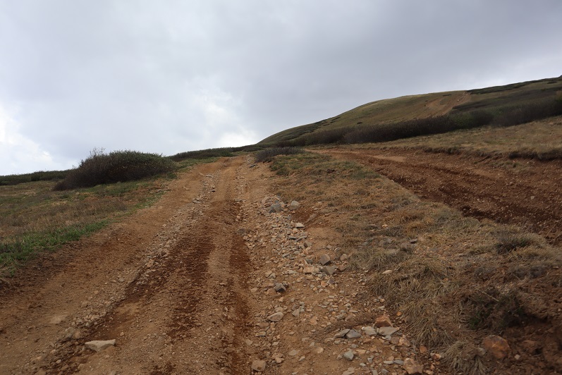
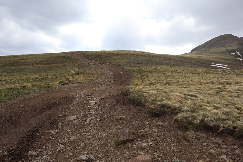
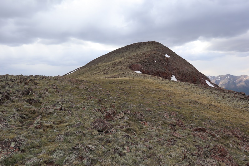
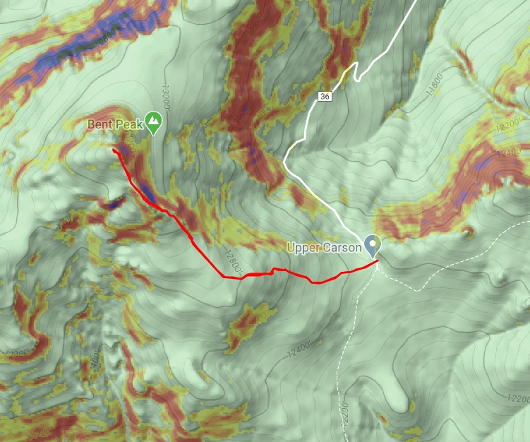
I gathered my backpack and headed west up the side of Bent Peak, following the 4WD road.
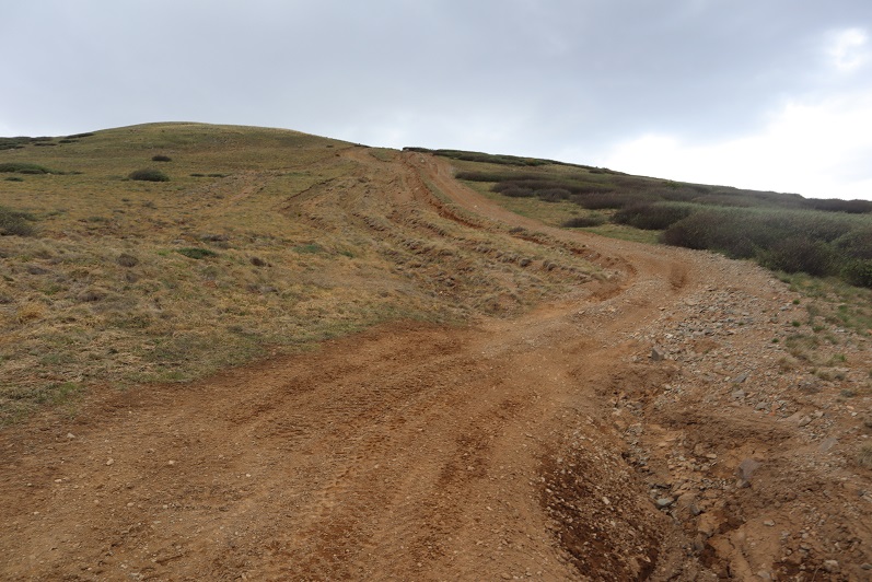
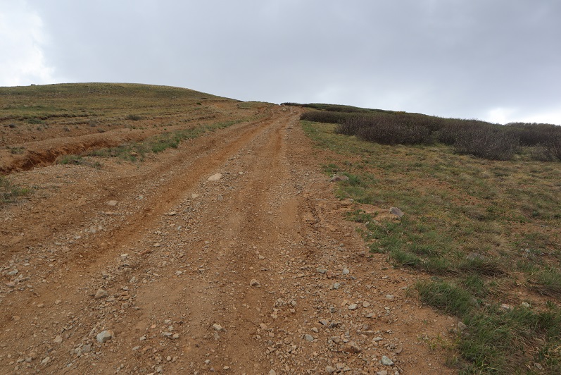
This hike is straight forward. You just follow the road until it ends
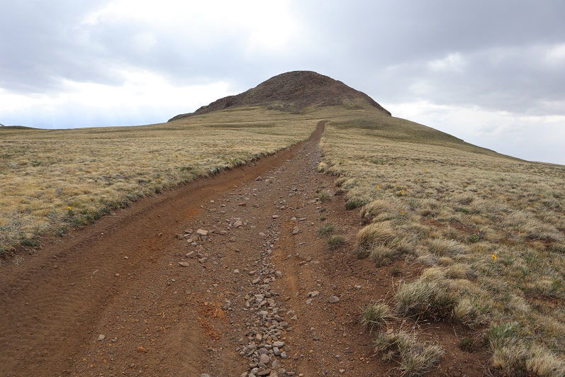
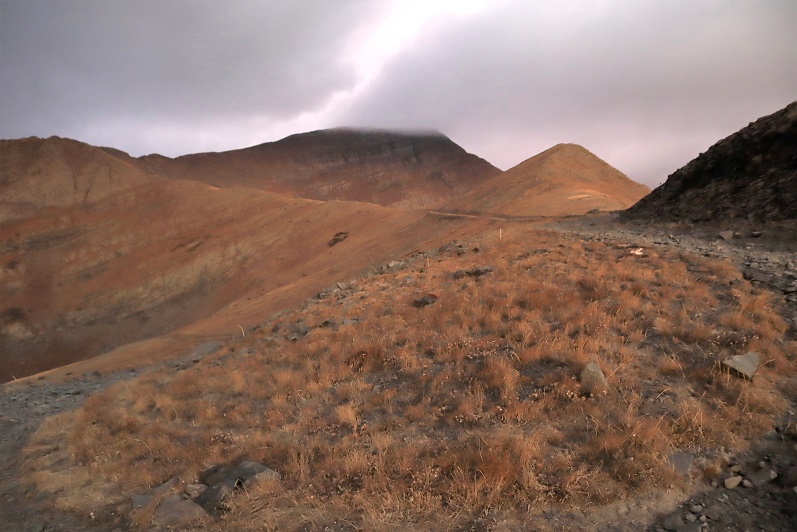
When the road ends, continue northwest up the side of the mountain
The tundra turns to rocky terrain
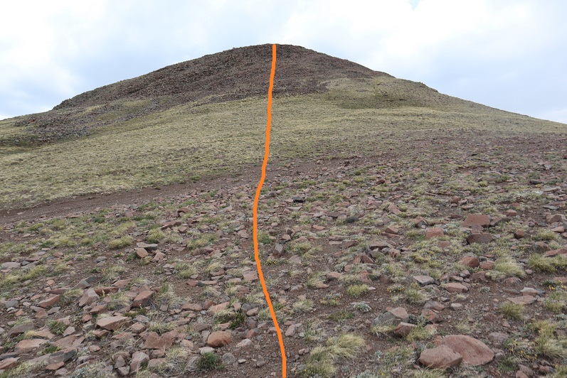
And then to a mix of tundra and rocks
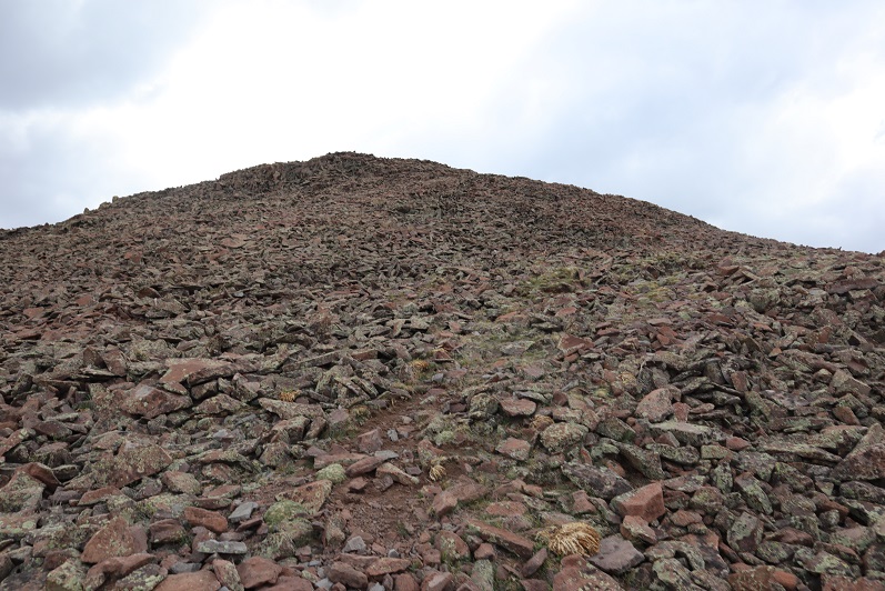
And then back to rocks
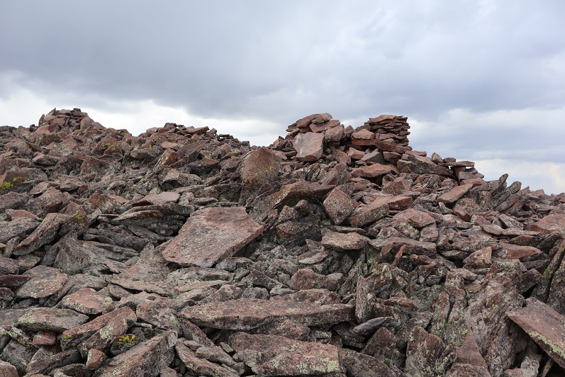
The summit was rocky and had a bunch of cairns.
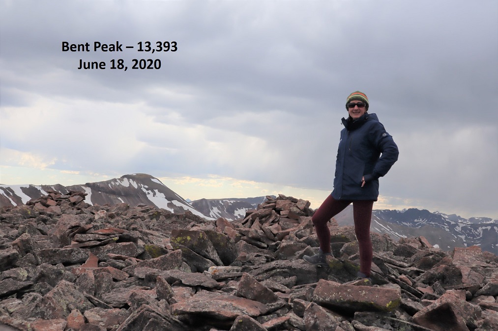
I summited at 5:50pm.
Bent Peak:
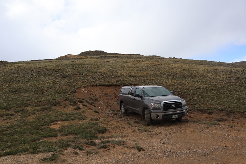
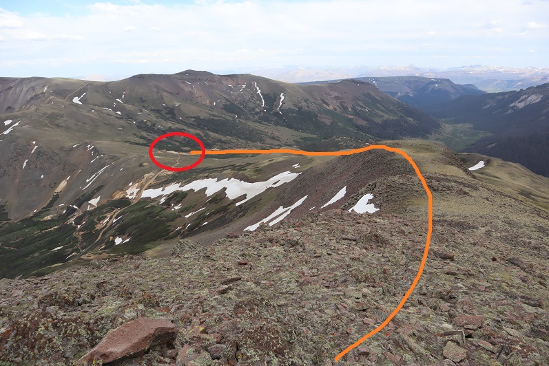
I took a good look at the conditions of the nearby peaks I intended to tackle this weekend. It didn’t look like I’d be needing traction. I turned around and re-traced my steps back to the road, and my truck (circled)
I made it back to my truck at 6:15pm, making this a 2 mile hike with 1032’ of elevation gain in 1 hour.
Here’s a topo of my route:
I was really glad I’d decided to tackle this quick peak today. Now it was time to eat some dinner and prep for tomorrow. It was now I noticed the cooler I’d brought had tumbled during the drive and leaked water all over my laptop. Oh no! My laptop was fried. Great. This was not a good start to the weekend.
The wind started to pick up and I could tell it was going to be a long night. I decided to fuel up on calories, and as I was eating dinner and sipping whiskey I thought about a movie on Amazon I’d recently watched: Ouray 100, which is about a 100+ mile endurance run in Ouray, CO. that includes 42K+ in elevation gain (84K in elevation change). I’ve been intrigued by this run, but also by one of the pacers. She’s a woman around 25 years old who at one point in the movie said “Give me some Gu, I don’t care what flavor, I just need the calories”. I need to be more on her level: I have a hard time forcing myself to eat anything while hiking, and she doesn’t seem to care; she just wants the calories. I also just want the calories but feel like I have to throw up after consuming them.
I tried to get to bed early but all I could think about was driving that road back down when it was time to leave. I was not looking forward to it. Don’t get me wrong, I have no problem driving 4WD roads and I actually enjoy doing so because my truck has always done everything I’ve asked it to do. What I don’t enjoy is passing other vehicles on the roads because my truck is big and passing can get tricky when the road is narrow. There aren’t a lot of turnouts on the road to Carson Pass and uphill has the right of way so mentally I tried to figure out the best time to drive down: Do I leave in the middle of the night at some point this weekend? If I do and encounter another driver how much fun will it be backing up in the dark on that road? How likely was that to happen? Or do I leave early morning and risk early adventurers driving up? Or late afternoon? That’s when most people are driving down, right? So drivers coming up expect a lot of drivers driving down and are more likely to avoid that time? How many people would drive up to see the sunset? What time am I least likely to encounter another driver? Is there a time the Jeeps are due back when rented? Ugh. I wish I could have just turned my mind off at this point, as it was useless worrying about something I couldn’t control. I guess I’d be flexible depending on how much hiking I was able to get in.
I noticed my truck was by far the largest vehicle up there all weekend: lots of Jeeps and ATVs and OHVs were on the road, but no larger vehicles/trucks.
Oh, and the wind never stopped, but it did start snowing.
This was my second attempt of Rito Alto Peak, as the last time I was here I had to turn around due to downed trees and too much ice on the 4WD road in. The weather forecast for today showed heavy winds (70-80mph) overnight that would calm down to 30mph around 8am, and a 20% chance of snow between 1-3pm. I wanted to summit 3 peaks today: Rito Alto Peak, Hermit Peak, and Eureka Mountain, and I figured if I started around 6am I should be able to summit them all and avoid the weather in the morning and the afternoon. Note: most of these pictures have been lightened because it was darker than anticipated and the pictures didn’t turn out well.
Let’s talk about Hermit Pass Road: It’s definitely a high-clearance 4WD road I wanted to drive when I wouldn’t need to pass another vehicle. October after the leaves had fallen off the trees seemed like a good time. It took me about 45 minutes to go the final 3 miles to where I parked around 11,300’. My Tundra handled it just fine, but it’s not something I want to drive again.
The wind was howling and I was seriously worried a tree would fall in the road while I was hiking and block my drive out. Note to self: time to put the axe and shovel in the back of the truck again. At one point I saw a two person backpacking tent (set up) on the side of the road. I thought to myself “Wow, they’re camping seriously close to the road. Who would do that?” (I’ve done this before near a trail, but never on a road). Then another gust of wind blew and the tent flew about 30 feet into the air and over my truck. Hmmm… seems like someone lost a tent.
I parked around 11,300’ but my truck could have made it all the way to the top of the pass. There were a lot of camping areas along the road, but not many areas to pass another vehicle.
I parked my truck and got out my gear, glad to notice it seemed the wind had stopped. My GPS stated it was 3.6 miles further on this road to the pass. I started hiking along Hermit Pass road at 6am. The stars were out in full force and there was only one small cloud in the sky, illuminated by the moon. The road was no more fun to hike than it was to drive. There are so many bowling ball sized rocks that you have to be careful where you step. At least there wasn’t any route finding involved.
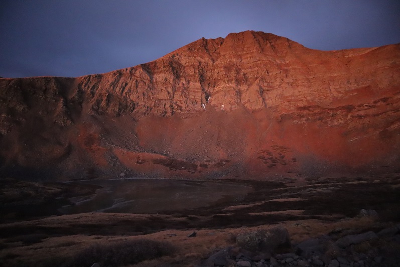
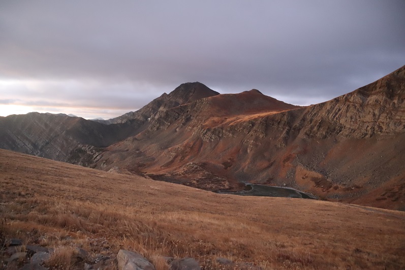
I made it to Horseshoe Lake just as the sun was beginning to rise. I could see a thin layer of ice on the lake.
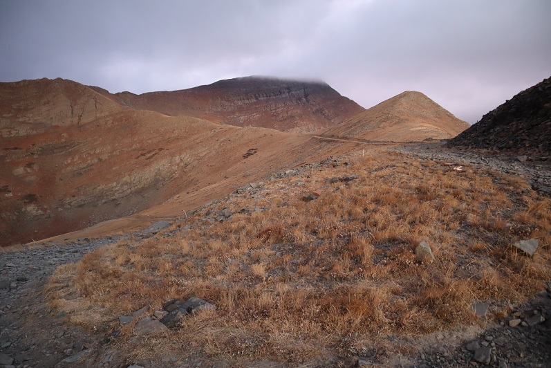
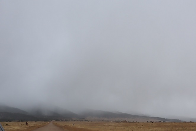
As I followed the road it curved around the hillside and up towards Hermit Pass. Here I got my first (and best) view of Rito Alto Peak. The summit was in the clouds, but I figured by the time I made it there the fog would have lifted.
Once again, well defined road to the pass
Here’s looking back on the road from the top of the pass
Just before reaching the pass I left the road and climbed a rocky gully to reach the ridge.
Once on the ridge I looked to the west and assessed the weather situation. The wind picked up and it was pushing the fog towards me at an accelerated pace. “Good” I thought. “The wind should push the fog past me around the time I make it to the summit.” Unfortunately, mountains make their own weather.
I turned northwest and headed up this rocky section
And onto the ridge
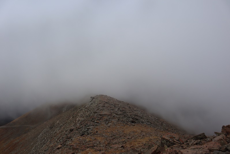
From here it was a simple class 2 ridge hike to the summit
Here is where the wind seriously started picking up, bringing the fog with it at an alarming pace. I could see it rushing up the mountainside towards me
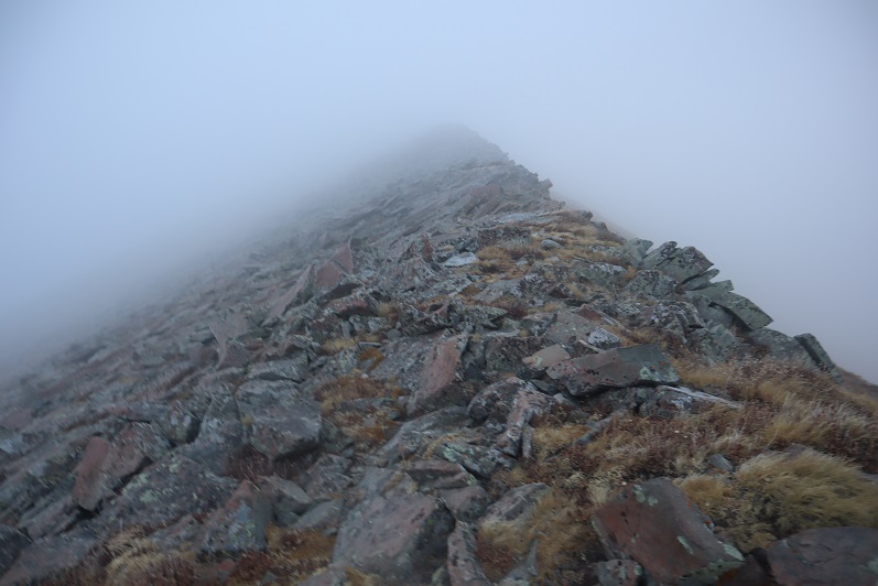
I continued following the ridgeline as the fog turned into clouds
Now I could only see a few feet in front of me, and wondered how I’d know I’d made it to the summit?
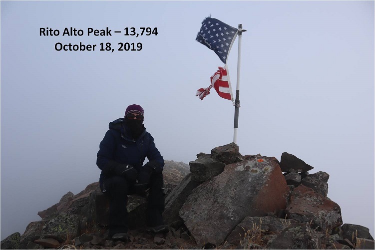
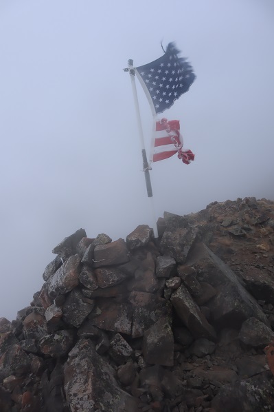
That’s when I saw it: A flag and cairn in the distance!
I headed towards that flag and when I got there I dropped all my gear and took a photo
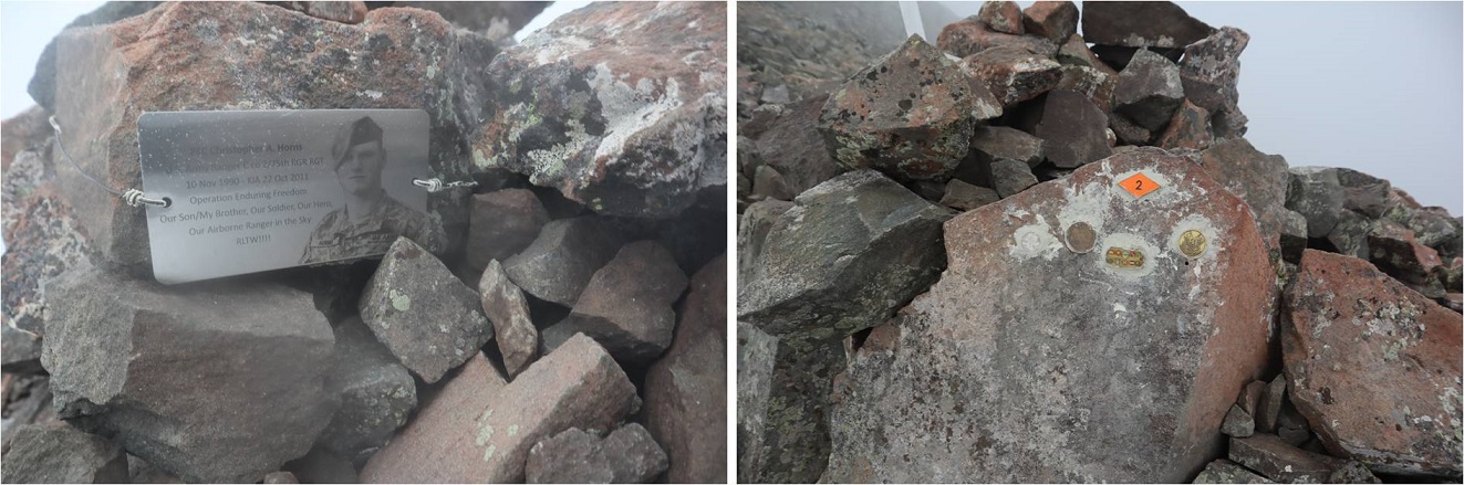
It was cold and that wind was brutal. I took some pictures of the memorial
And was taking a picture of the flag again when I noticed it:
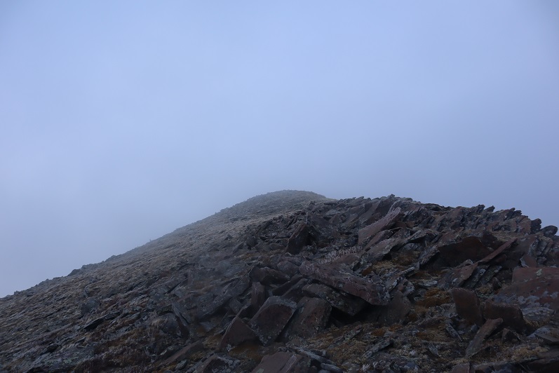
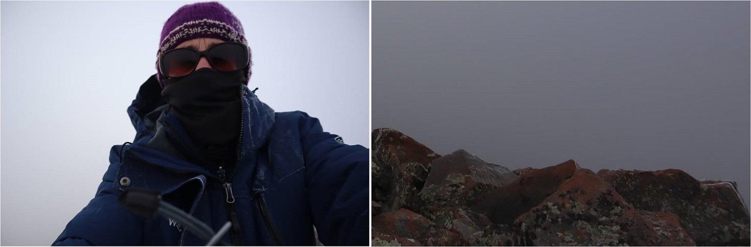
I wasn’t at the highpoint of Rito Alto Peak. The wind slowed down for a bit and I could see the terrain angled up ahead of me. Frustrated (why would the memorial be below the summit?) I gathered my gear and continued north for a couple dozen yards in almost no visibility. The rocks got larger and then I felt they were heading down. I had no idea if I’d reached the summit because I couldn’t see anything. I took a selfie (lightened for clarity) and a picture of the rocks (not lightened) and decided to head back down, hoping the clouds at this point would have cleared enough below for me to see my way to Hermit Peak.
The clouds I expected to dissipate as I hiked down instead grew thicker and I had a hard time orienting myself because I couldn’t see any landmarks. I just kept aiming southeast, hoping I was following the ridge. Every once in a while the wind would slow down and I could see a few yards ahead of me.
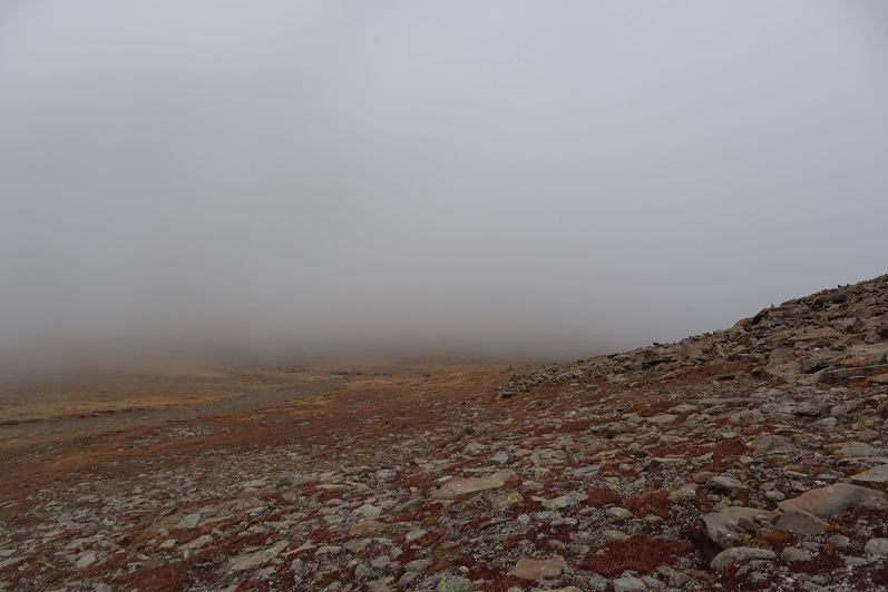
I was thrilled when I made it to a point where I could see the road again! It looked like this was where the clouds were at their lowest.
Foolishly I entertained the idea of waiting them out. I honestly expected the clouds to lift at any moment because weather wasn’t predicted until 1pm today (and then only a 20% chance). Instead of hiking down to the road I hiked straight to the pass, hoping to see Hermit Peak. When I got to the pass I couldn’t see Hermit Peak, or much of anything really
I did see this…
Undeterred, I decided to hike to the road slowly. Maybe the clouds would lift in the next few minutes?
I found a sign saying “road closed” and a trail register
The clouds grew thicker. Argh! I had all day to hike and I wasn’t even tired at this point. I really wanted to summit Hermit Peak and Eureka Mountain today as well, but without visuals I didn’t want to continue on. I also really didn’t want to come back for these peaks: that 4WD road in had not been pleasant and I didn’t want to drive it again. The weather was rapidly deteriorating. I wasn’t worried about summiting the 2 other peaks, I was worried about the descent from Eureka back to the lake. I’d had a good look at the route on the way in and in case the clouds didn’t lift (I still thought they would) it wasn’t a route I wanted to attempt with low visibility.
I wrestled with my decision for longer than I’d like to admit, and in the end chose to head back. This ended up being the correct choice: The clouds continued to form and followed me down the road.
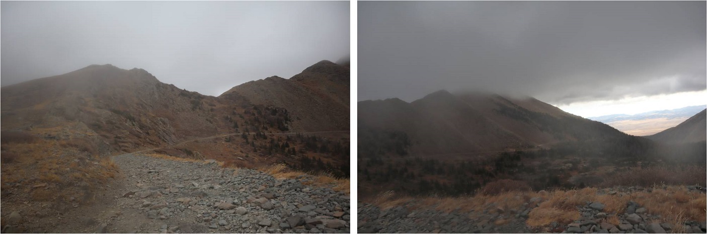
The clouds played tricks with my eyes: it was if I could see each tiny particle swirling around in the mist. It was beautiful to watch but caused me to blink my eyes every so often to refocus. Visibility got a little better as I made my way back to Horseshoe Lake.
Here’s a look at the road back out
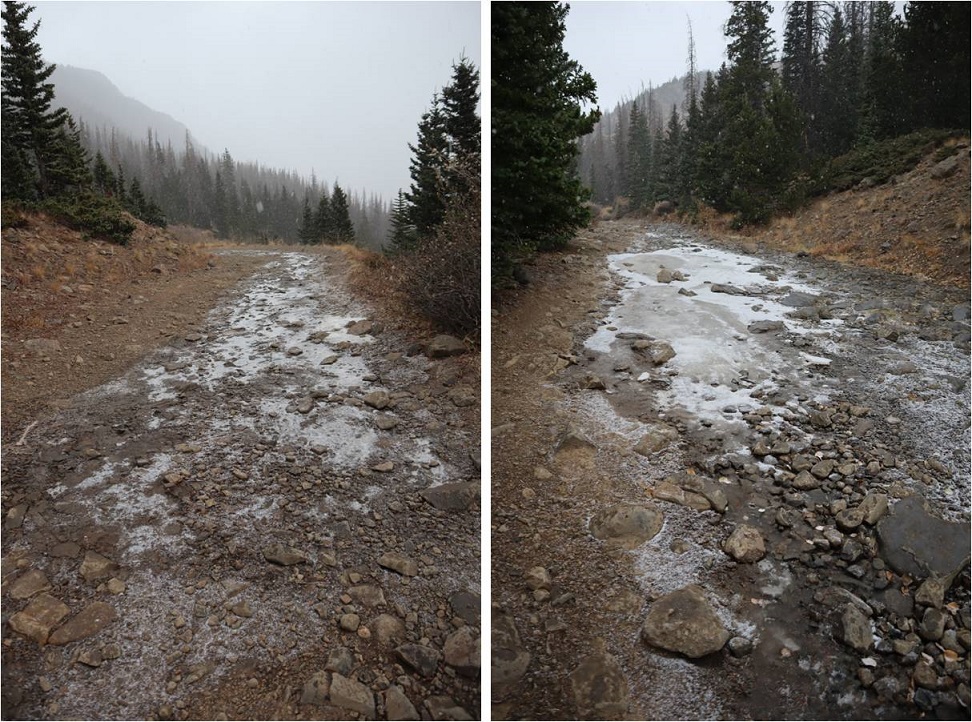
It kept getting colder and colder and then it started to snow. The snow was peaceful and nice to hike out with.
Yes, turning back had been the correct decision, but I felt a bit deflated because I didn’t get in as much elevation gain/mileage today as I’d hoped. Those clouds never lifted, they just got worse, and the snow had been quite unexpected this early in the day. I made it back to my truck at 11am, well before the possible snow time of 1pm. This was a 9 mile hike with 2849’ of elevation gain hiked in 5 hours.
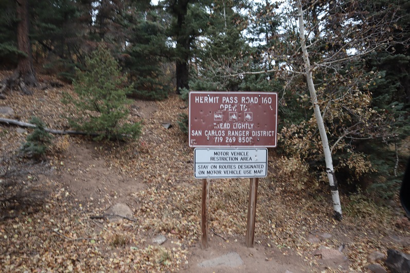
I kept apologizing to my truck on the drive down: I love my truck, and this road isn’t something you do to something you love. At this sign it’s 6.7 miles up to Hermit Pass. I know I’ll be coming back to hike Hermit/Eureka, and I want to summit Rito Alto again at the same time so I can get better summit shots. Physically the hike really wasn’t very difficult from the pass. Next time I think I’ll just park here and make it a long day (or possibly come in another way?).
Here’s a look back at the weather on my way out. The snow didn’t stop for as long as I had the mountains in view.
For some reason I was under the impression the name of this peak was “Rio Alto Peak”. Maybe I just spelled it wrong in my notes the first time and never caught the error? It wasn’t until I came home and looked at my log on a topo map that I realized my mistake. Whoops!
The last couple of trip reports have been rough to write: I’m traveling for work and using my work laptop computer for these write-ups which isn’t ideal. My work laptop doesn’t have simple functions like spellcheck (so please go easy on me there), everything I have is a “reader” and the keypad is slow, inaccurate, and last night it stopped working altogether. I googled the nearest computer store and this morning walked 2 miles to buy a computer mouse. I’m hoping the problem’s solved, but not holding my breath as the laptop is several years old and I’ve taken it to dozens of states and multiple countries so the hardware has been switched several times (I work for a software company, so this is a security measure). Side note “just in case”: I’m using this computer during off working hours, and not using it on company time.
After summiting Rio Grande Pyramid yesterday I hopped right back in my truck and drove the short drive to Creede, CO. I knew the ‘easy’ road in (503) had been washed out, so I was getting creative and took in the 502. I Google wasn’t going to get me there, so I’d created the route on Caltopo and turned it into a gpx file. I credit this ability to those who’ve challenged my summits, as a few months ago I wasn’t even aware this sort of thing was possible because I don’t use a GPS when hiking. Now knowing this is a possibility with Strava it’s opened up a lot of back country roads for me! Woot! I made it to my desired area with no difficulties.
At the north end of Creede I took the West Willow Creek Road up past numerous mines and then turned right onto a 4WD dirt road after the Midwest Mine (County Road 502).
From this point on I was glad I’d creaded a GPX file, as the roads itersected a few times and it was nice to know I was going in the right direction. The road was easy 4WD with little room for passing but luckily I was the only one on the road on this Friday afternoon.
There were 2 hairpin turns where I had to back my truck up a couple of times to navigate, but my Tundra had no problem making it to the 502/502-1A junction.
When I made it here I got out of my truck, looked at the 502-1A 4WD road and said “nope”. I wasn’t doing that road to my truck (this ended up being a stellar idea). I carefully backed in to a spot big enough for 2 vehicles if we both parked nicely and got out my maps/info for tomorrow. I’d parked next to a small creek that hadn’t been on the map but I knew where I was on the road.
Today had been a long day so I had some tuna, a few pieces of beef jerky, some dried fruit and two shots of whiskey before heading to bed rather early (5:30pm?). I was parked at the beginning of 502-1A and a little worried because the area was so small that I’d impede traffic but on the positive side I didn’t see one vehicle that night.
It was a cold, cold night. My altimeter told me I’d parked at 10,000′, and the forecast told me it was supposed to be a low of 30* at the summit (a few miles and several thousand feet of elevation away). It was colder than 30* where I parked. I woke up halfway through the night and put on socks (they were off because they needed to air out after yesterday) and I even got out an extra sleeping bag and put on my knit hat. It was so much colder than last night! I was thrilled when my alarm went off at 2:30am, and puzzled when the first thing I saw was a vehicle coming down the road at me. Kind of interesting the only vehicle I’d see at all was one at 2:30am. They didn’t stop and I never saw them again, so I’m not sure where they were headed. I put on my winter gear (winds were expected again today and it was already below freezing outside). I was on the trail by 3am.
I started the morning with a Raynaud’s attack in my hands and was worried this would prematurely end my hike. I put on my gloves and pumped my fingers back and forth: this hasn’t happened in a while and I wasn’t happy.
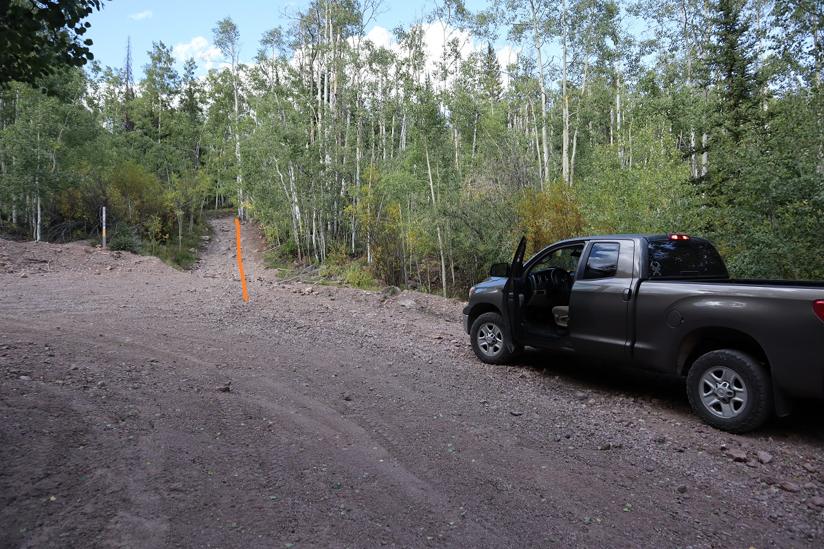
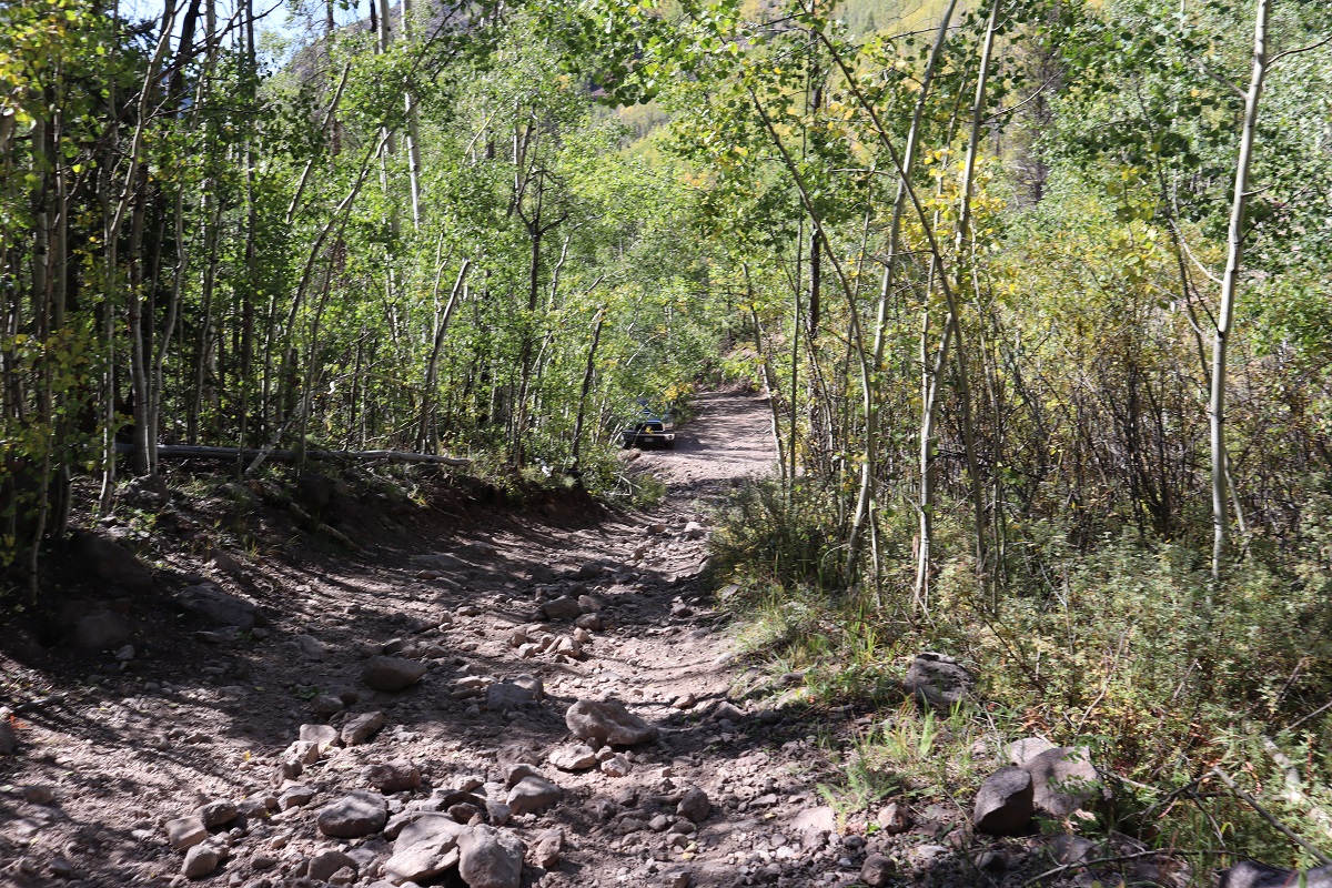
Immediately I was glad I’d decided to park my truck and hike to Phoenix Park. The road was what I’d consider “extreme 4WD”, and nothing I’d subject my Tundra to. The pictures don’t do it justice; you need high clearance and a good dose of insanity to navigate this road.
The only downside? The road started around 10K and seemed to loose hundreds of feet in elevation. It was actually only a couple hundred feet, but it felt like forever and I was worried it would ‘hurt’ on the way out.
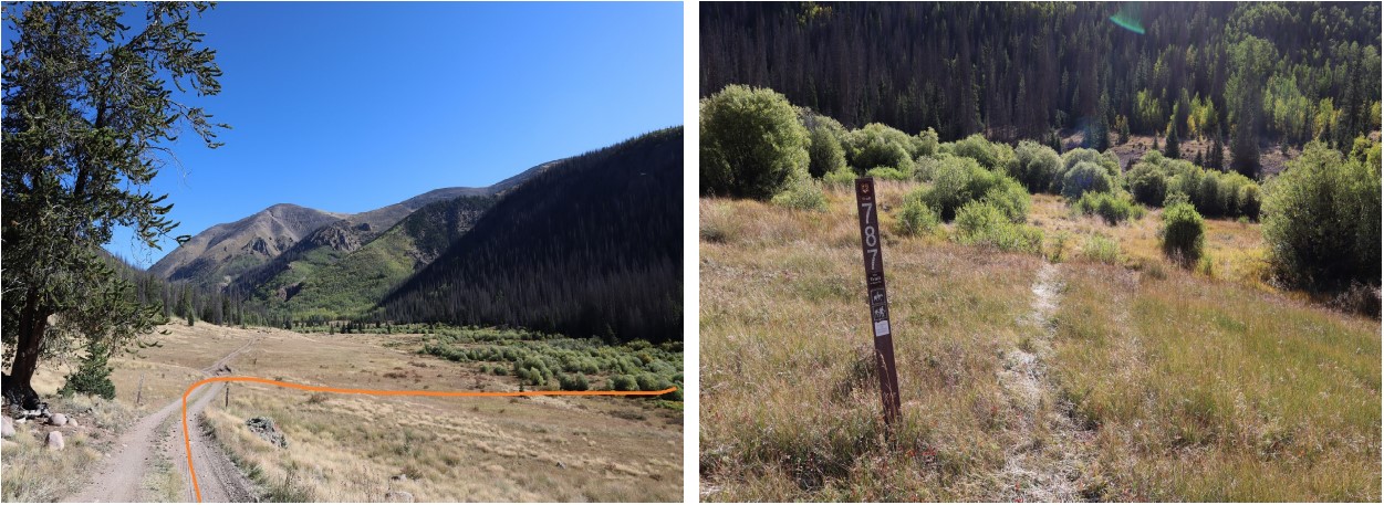
After 1.6 miles I made it to the turn off from the 4WD road to the trail (787)
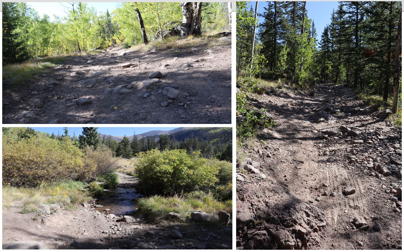
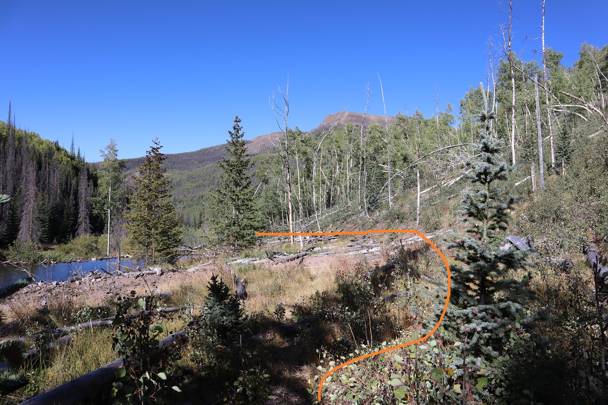
Well cairned but not well established, the 787 quickly crosses a stream
and comes across an avalanche area. I’m not sure when the avalanche occured, but there’s a trail to the left of trampled down grass to follow
This trail doesn’t look like it’s used often, and would be difficult to follow if it weren’t for the numerous cairns marking the way as I headed northeast
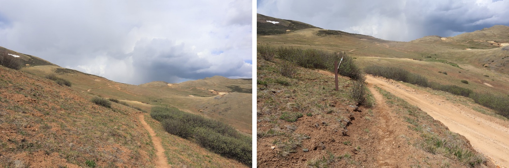
Still hiking in the dark I was now starting to get really cold. I switched my gloves for my mitts and trudged on, glad there wasn’t any wind. At 2.3 miles I came across another stream crossing and then quickly another at 2.4 miles
At this point I began to regain all the elevation I’d lost earlier in the morning. I could tell I was surrounded by raspberry bushes and lots of shrubs and plants turning fall colors, all covered in frost. I scared a bunch of ptarmigans at one point and they scared me as well. About halfway to the top of this area I could smell sheep (I used to raise them, and they have a very distinctive smell). Since it was dark I decided to figure out where they were: I hit my trekking pole harshly against a tree and heard to my right a loud snap, bleat, and rustling. The sheep went in the opposite direction and I continued on, following the cairns. I crossed one final stream at 4 miles. Here is where the trail ended.
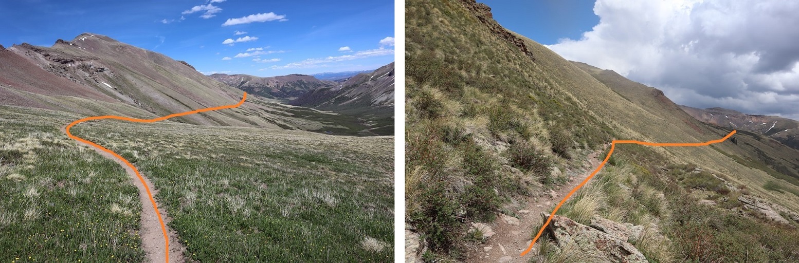
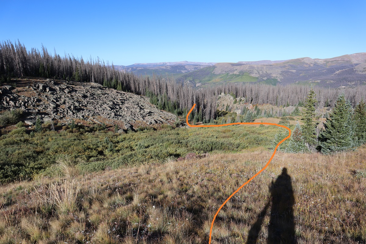
I headed south until I came across a cairn with a large wooden pole, turned right (east) and followed the slope in the dark
Here there was a solid trail for about 200 yards that went along the ridgeline
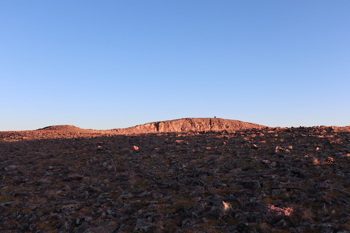
and once I made it to the end of the ridge the trail disappeared. From here I just needed to head to this point, and there was no exact way to get there so I took what I felt was the path of least resistance. Note, this point is NOT the peak, but it’s close.
Halfway to the ridge it became windy. By ‘windy’ I mean sustained 40mph winds with a few icy 60mph gusts thrown in. It was so cold my water bladder froze (something I hadn’t anticipated with a forecasted low of 30* on the summit). I kept pumping my fingers back and forth, put on my balaclava, and trudged on, noticeby tired from yesterday’s 25 miles. I heard an elk bugle in the distance and thought how amazing it was to be out here all alone.
The sun began to rise as I was halfway to the point
The wind never stopped. There’s a lot I could say about the cold for the rest of the hike, but I’ll end it here: it was cold, cold, cold. And windy. The kind of cold and wind where the snot dries as it’s flying from your face and then comes back and freezes to your cheek (another reason I like to hike solo: not the most glamerous of moments).
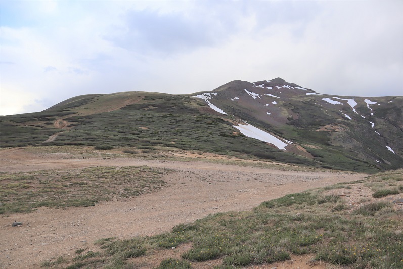
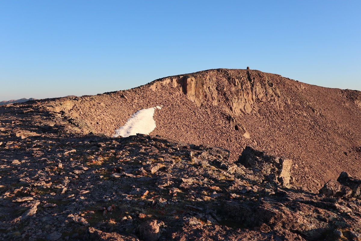
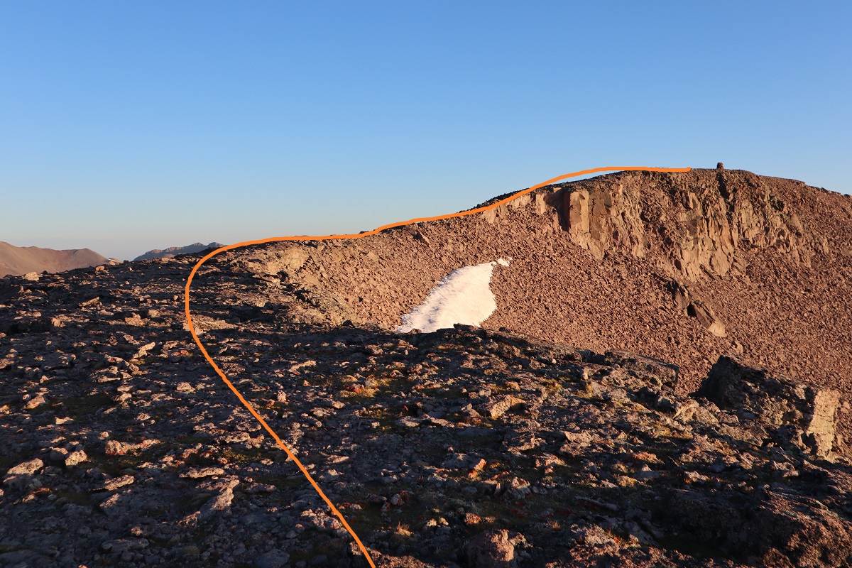
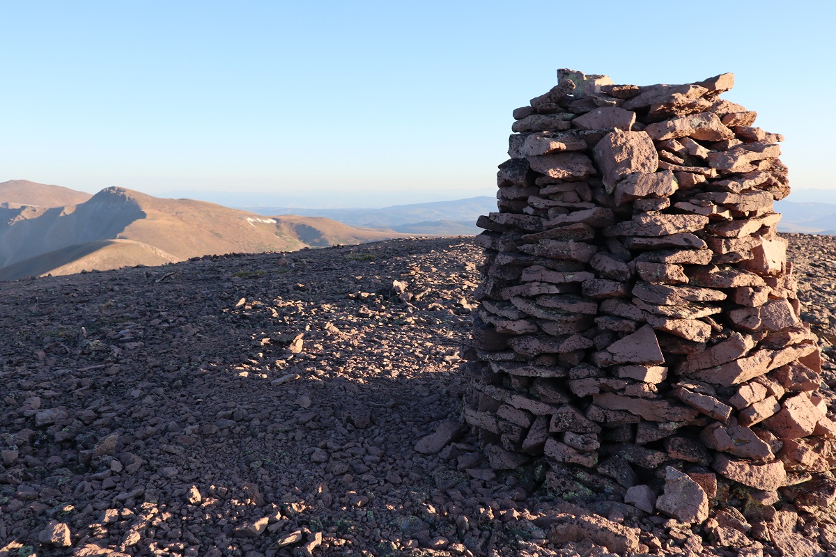
At the top of the ‘point’ I could see the rest of the route before me. Thankfully it was short and there was a well developed cairn to welcome me.
I just followed the ridge to the left as it swung around to the right
The rocks here were looser than expected but it was an easy final hike to the summit.
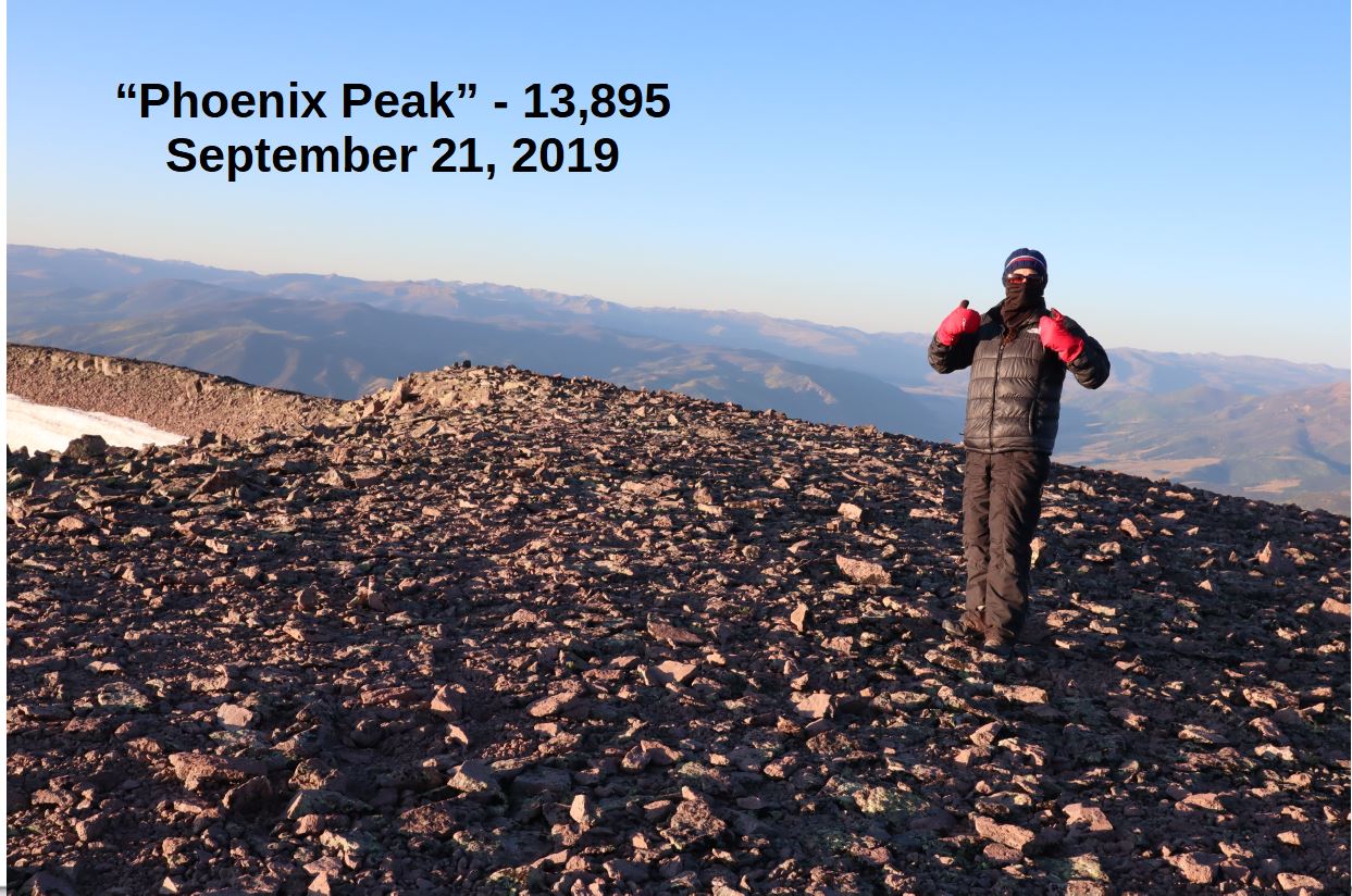
I summited at 8:15am
“Phoenix Peak”:
From here I could see unranked 13er la Garita Peak, but it wasn’t on my agenda today because I needed to get back home to watch my daughter perform at halftime. After getting a quick summit photo and video (the cold is telling me this may be the last of the year) I headed back down.
Here’s the route back down. Be careful not to desced too soon (specially if you ascend in the dark). There are two ridges you can take back down, and the correct one is the second one you see from the summit.
I made it back to the large cairn
and headed back down the hill (stay below the boulders)
The wind stopped just where it started (about a mile and a half below the summit) and I was able to warm up. Back in the treeline I took off my gloves and balaclava and tried to crunch the tube of my water bladder to get water to flow. It was light now, so I stopped when I came across a large raspberry patch. I picked one and it crumbled in my hand. Curious, I took a closer look and upon further inspection realized they were frozen! Not completely frozen but frozen enough to add a small crunch and a much needed flare to their refreshment (for in the sunlight I was now warm). I picked a handful and ate frozen raspberries for the next 10 mintues, wondering why there weren’t any animal tracks near here? The currents weren’t as tasty, so I left those for the birds.
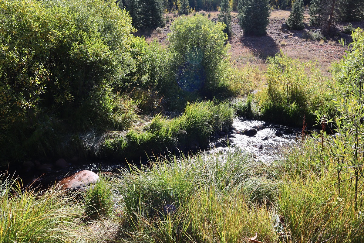
The sheep were gone and I never saw any elk, but I did see and hear dozens of crows on my way down. I wondered what had died? There was a stream along the avalanche area
and here’s a look out from the last stream crossing back onto the 4WD road
It was still 1.5 miles back to my truck, and as I walked this road I was thankful I hadn’t taken my truck this way: it was worth the walk, and actually not that bad. The last few hundred feet of elevation gain I’d been dreading was all completed in the shade and didn’t slow me down that much.
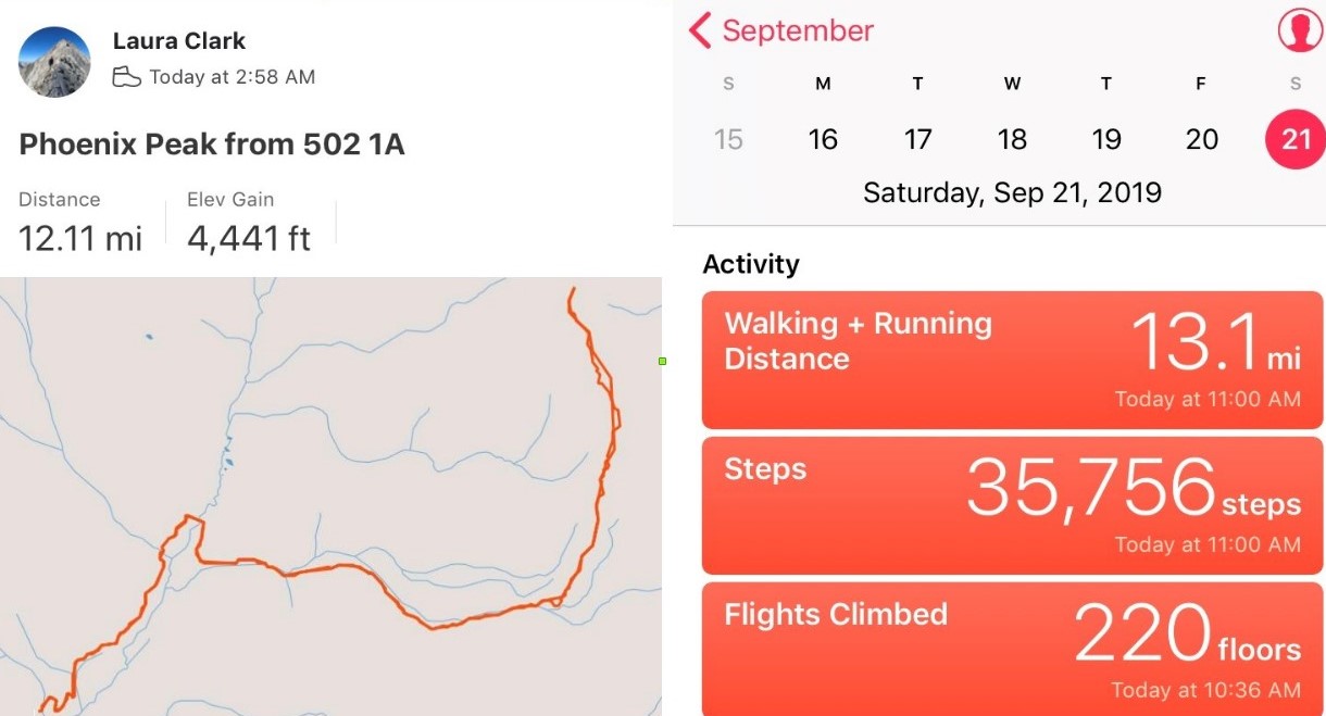
I made it back to my truck at 10:30am, making this a 12 mile hike with 4441′ in elevation gain in 7.5 hours.
I drove home and made it in plenty of time to be at my daughter’s performance. I put all my dirty clothes in the laundry and when I changed it found a dead grasshopper in the bottom of the bin. Sorry little guy! I’m sure it got caught in the holes in my snow pants (I REALLY need a new pair, but despite shopping at multiple stores can’t seem to find one that fits).
I really did’t want to write this one up because I made some amateur mistakes, but I also learned something, so here it goes…
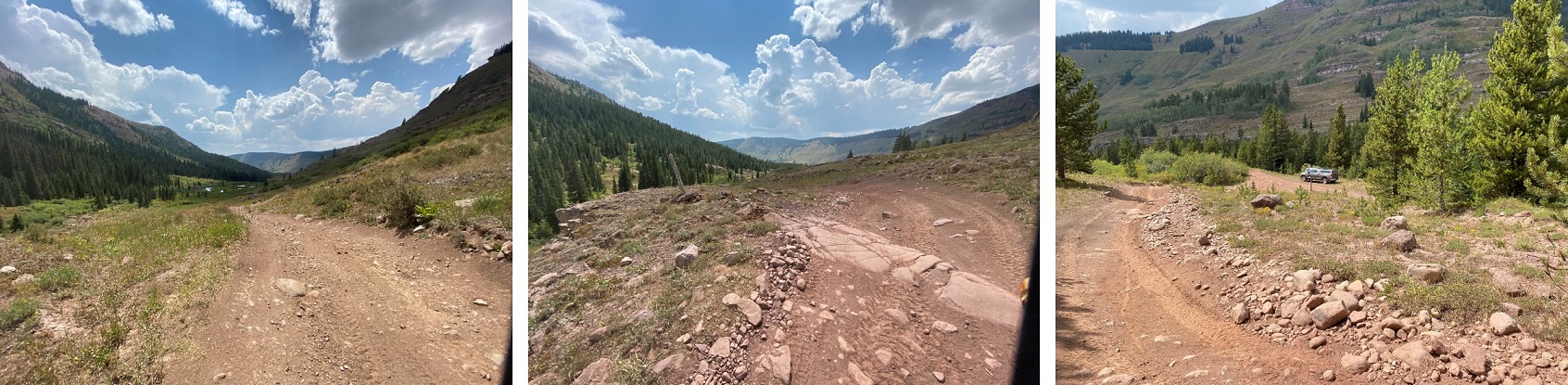
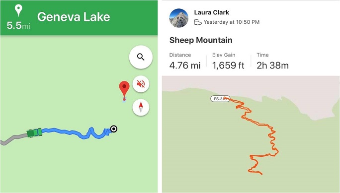
My goal today had been 13er Centennial Hagerman Peak. I drove from the Cathedral Lake Trailhead and set my GPS to Geneva Lake, where the trailhead was supposed to begin. Just after the small town of Marble (which had tons of marble statues on front lawns) the road became rough and honestly quite fun in my 4WD Tundra. The dirt road was narrow, and I had to pull over a few times to let OHVs by, but all in all I was having a great time.
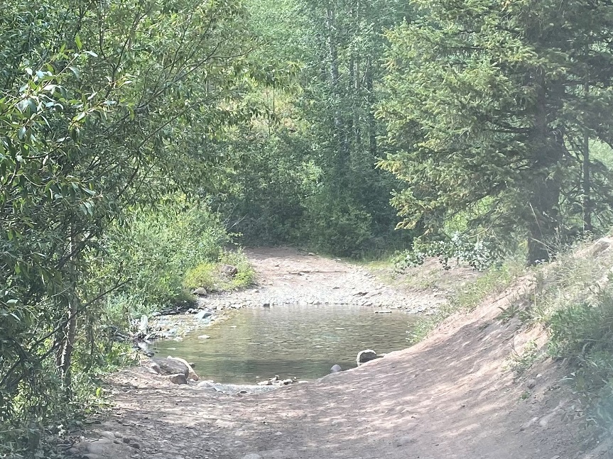
I came to a stream crossing and looked at my navigation. I was 5.5 miles from the trailhead. Not bad. Even if I decided to stay where I was and camp for the night I could still do the hike in under 20 miles. Totally doable. It’s important to note at this point I had no signal, so I was just going off this picture of my location (which rotated as I drove).
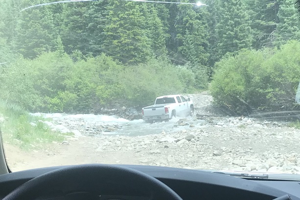
As I sat in my truck eating dinner (I’d found a Subway on the drive in) I watched several vehicles attempt to cross the creek.
The water was just to the top of most of their wheels. The OHVs were lower to the ground and thus their occupants got soaked. The vehicles did just fine crossing though. I watched a GMC truck get stuck, but after some back and forth action it was able to get unstuck. Then I saw an F150 cruise across the stream and thought “My truck can do anything those trucks can do and more” so I put it in drive and crossed the stream, no problem.
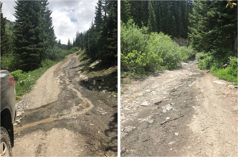
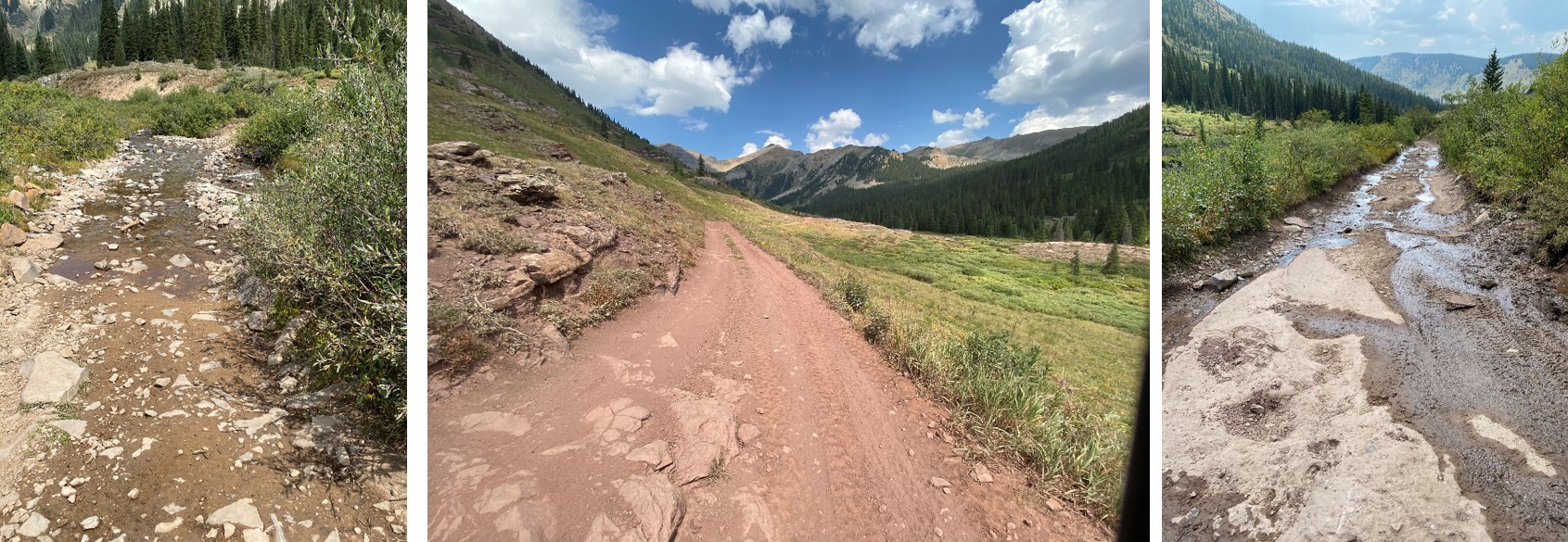
About a mile and a half up the road began to get rough. I’m talking closed upper south colony lakes trailhead rough (the part you can no longer drive on). My truck was handling just fine, but huge boulders and water were increasing on the trail and there weren’t many (any) places to turn around, so I used a switchback to reverse my course and ended up parking back at 9960’. I was pleased with this spot, as I was now 4.2 miles from the trailhead.
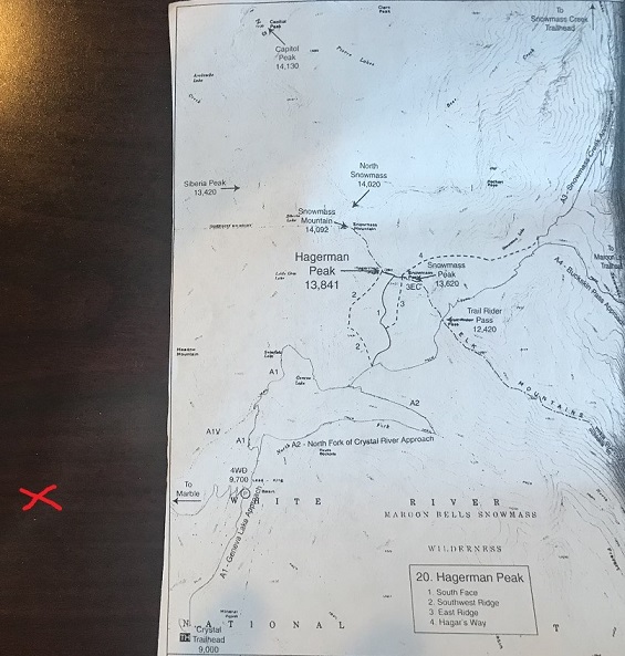
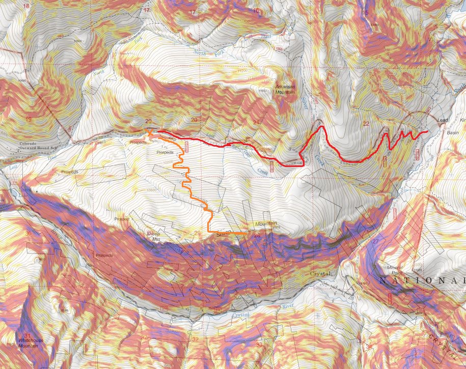
I got out my topo and did my best to guestimate where I was on the map. Unfortunately I was pretty sure I was currently “off map” at this point, but figured I was about here (red x). I realized later I was indeed correct in my assumed location.
Had I had a better topo or cell service I would have realized my mistake instantly, but going off of what I had I was sure of my current location (and actually, I was). I just needed to follow the 4WD road to the trailhead and I could pick it up from there. I had several great topo maps that started at the trailhead, as well as a pre-loaded GPX file. I spent the next 15 minutes or so going over the route again, and calculating how much elevation gain I’d add from starting from my current location. It looked like an extra 700’ each way, so no more than 1500’in total. I was willing to live with that.
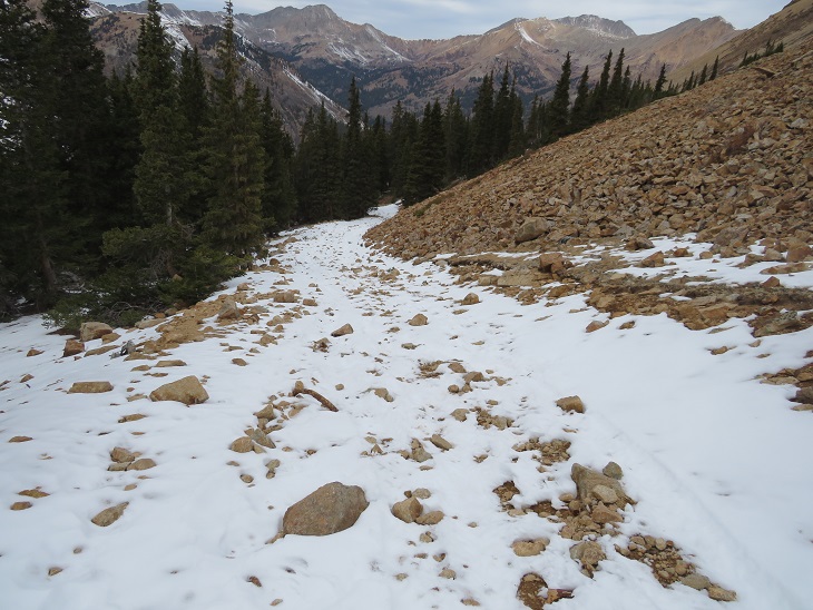
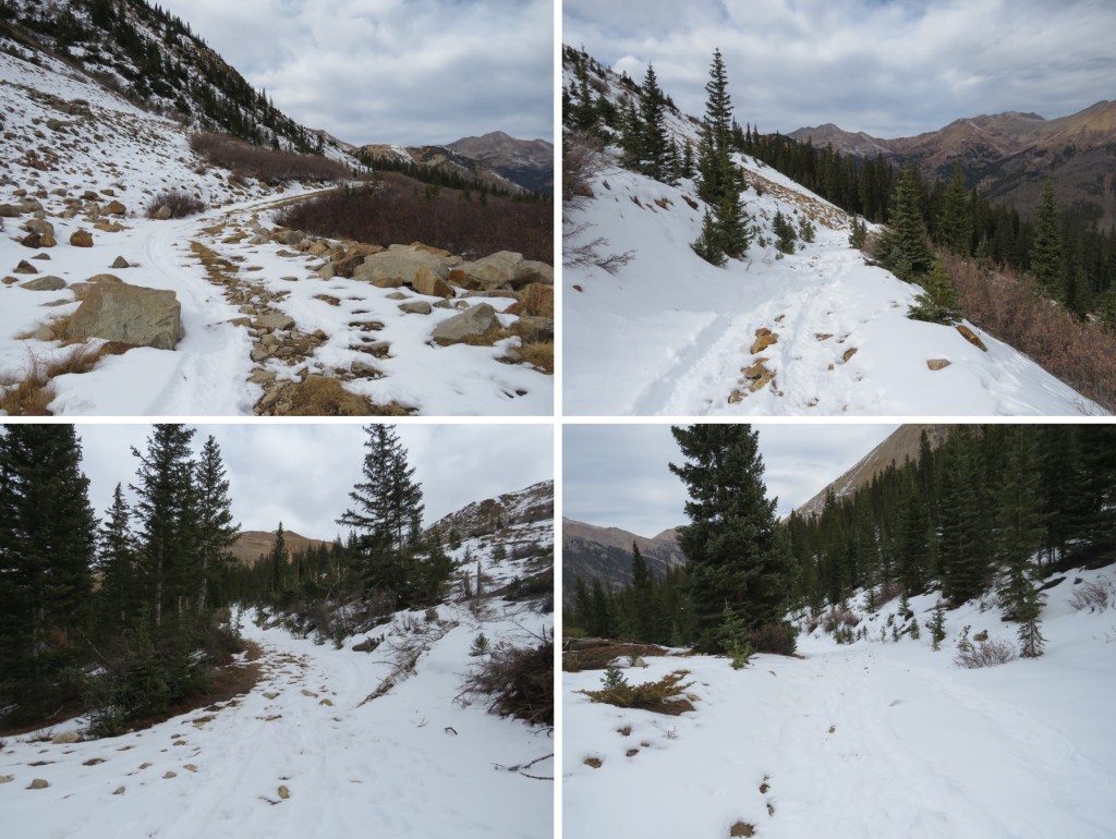
I made it an early night and woke up at 10:30pm to start my adventure. I was on the road by 10:50pm. It started out easily enough: I just followed the 4WD road. I didn’t think to take out my map (etc) because I was just following the road. After about a mile the snow started, and it was obvious no vehicle had been in this area yet this year. Hmmm. That was curious: I saw a conditions report from last week stating it was snow free to the lake. I should have stopped and reassessed here, but if I had I wouldn’t be telling this story. Also, some people lie on conditions reports (it’s happened before).
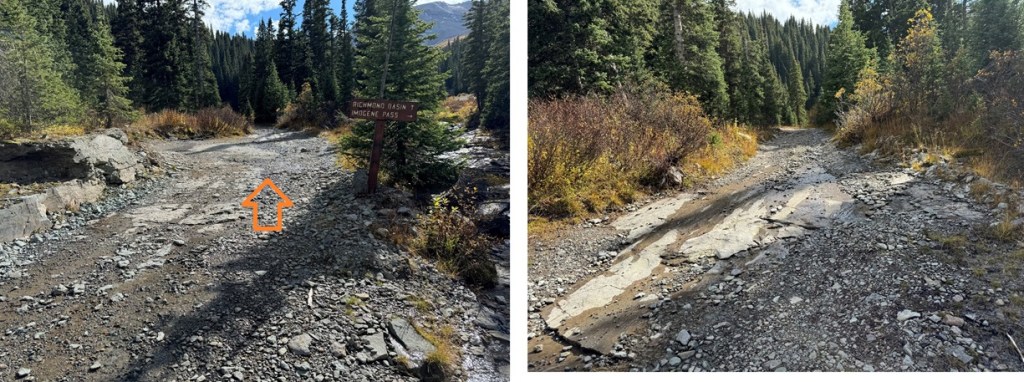
I continued on and thought to myself “Wow! This sure does feel like more than 700’ in elevation gain! I must still be sore from yesterday.” There was a full moon out but it was obscured by the trees. I kept following the road through increasing snow until the road just stopped. That was curious. It just ended and there was no trail to hook up with it. There was supposed to be an obvious trailhead… and I’d never decreased in elevation.
I took out my phone and looked at the picture I had of where I was going, and then looked at my tracks so far. It sure seemed I was going in the right direction. At least my tracks looked similar to the route description. The trail must hook up here somewhere close. I got out my GPS track and yes, it looked like I just had to head in that direction and I’d make it. The problem was ‘that direction’ led me over a cliff.
I kept scouting around and found what looked like fresh tracks. Awesome! Someone had been here after all. I walked over to them and noticed the tracks were from a mama bear and cub, and yes indeed they looked fresh. That did it. I was turning back and heading back to my truck. I did not feel confident continuing in the direction I was going, and I was sure something was wrong with my navigation (I just wasn’t sure what I’d done wrong).
I followed my tracks back to my truck and made it back a little before 1:30am. Drat. It was too late to drive somewhere else and start another hike. The day was shot. What really stinks is I lost an entire day of potential hiking. I decided to drive back home and figure out where I went wrong. On the positive side I was the only one on the 4WD road at 1:30am, so I didn’t need to move over for any passing vehicles.
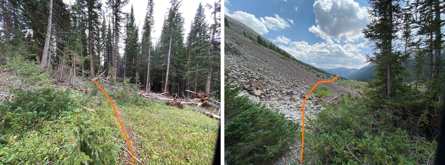
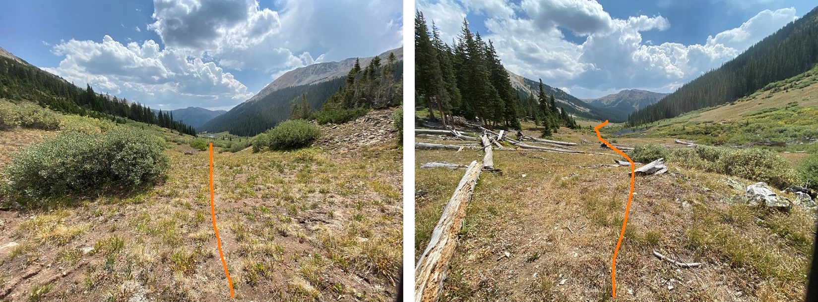
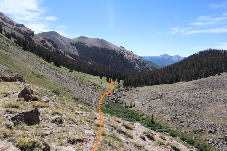
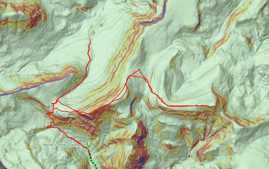
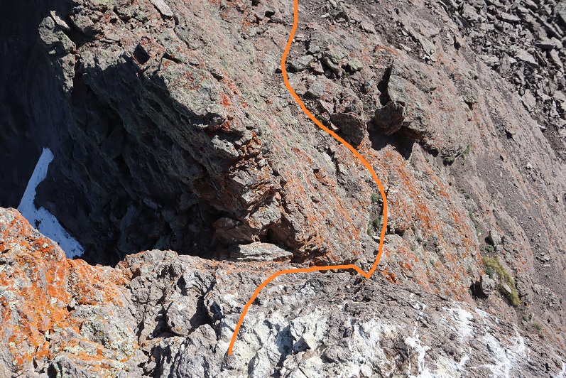
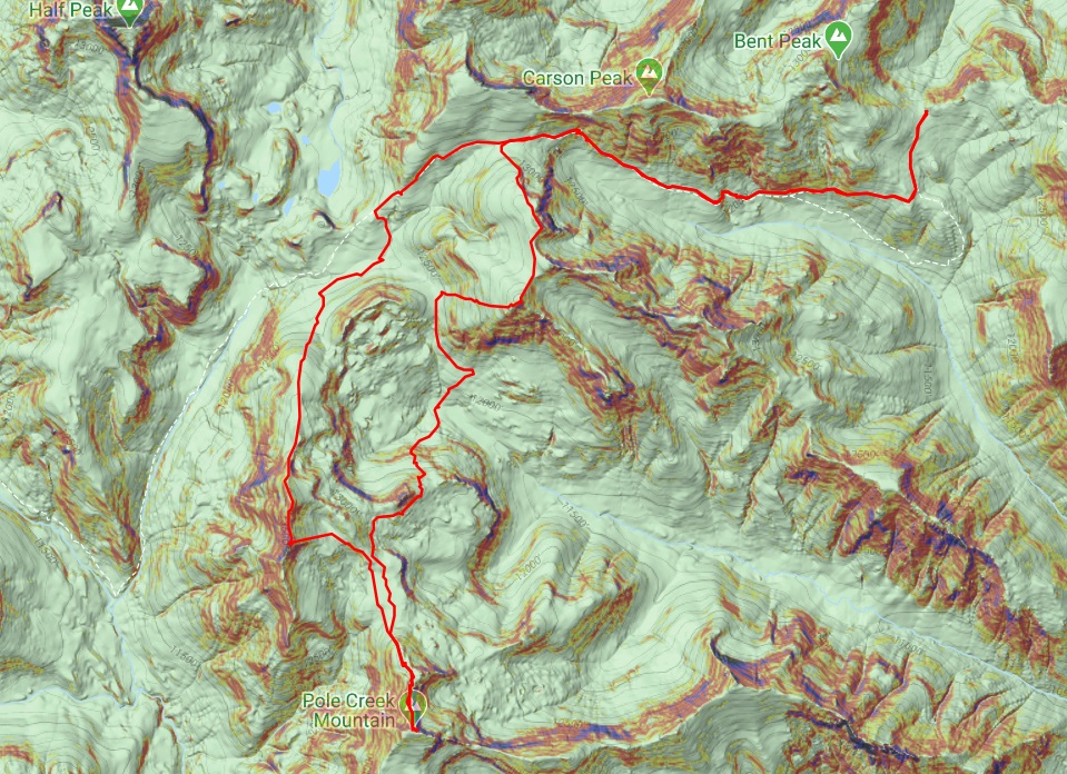
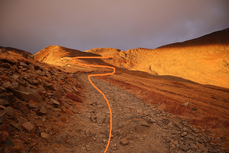
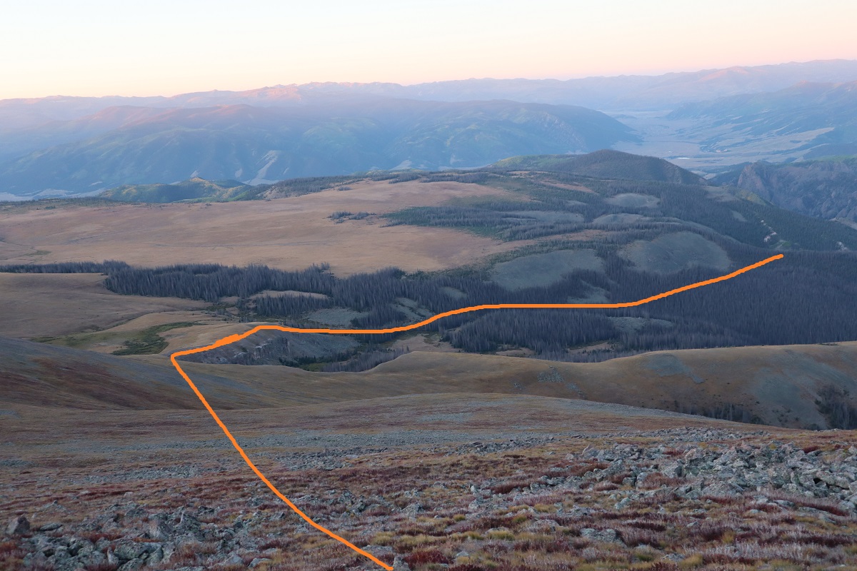
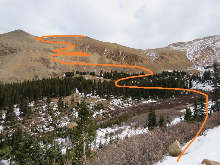
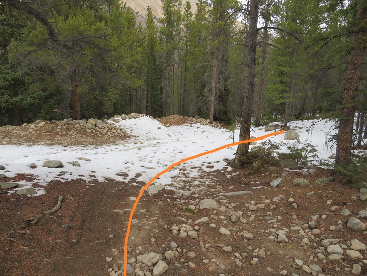
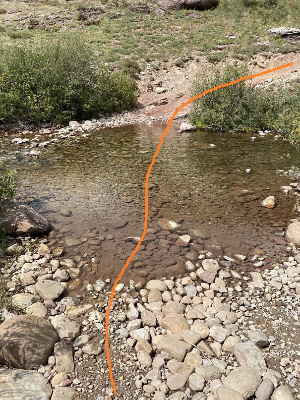
OK, so here’s what I’d done wrong: I followed the orange line, when I was supposed to follow the red line. Note: the orange trail hadn’t been on my map, so I didn’t even know it had been an option. I just figured I was following the same 4WD road.
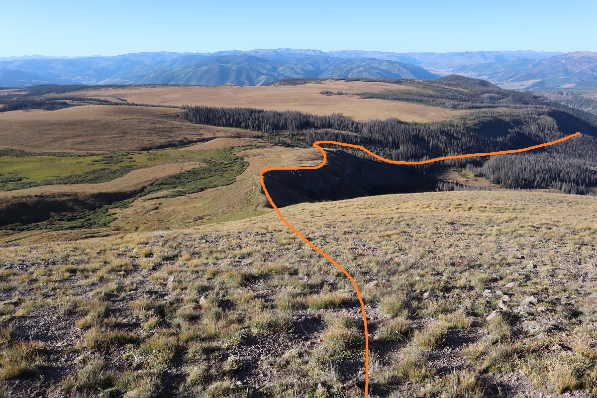
But if you look at my tracks, they do look pretty similar when you rotate them (which was what was happening as I was hiking)
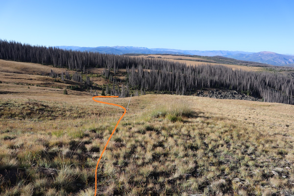
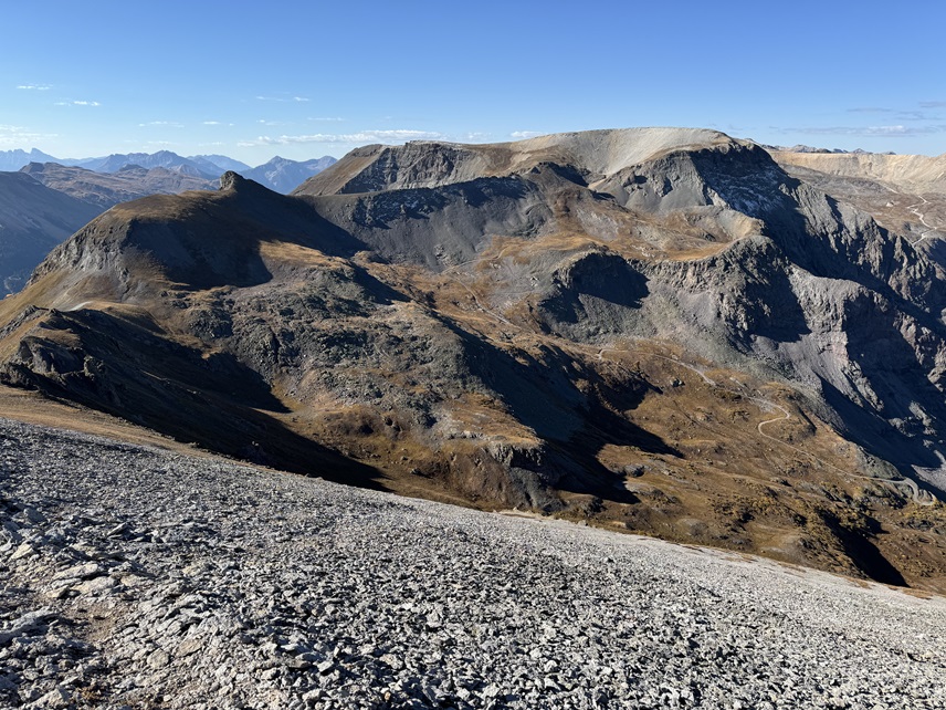
On the positive side, I ended up unknowingly summiting Sheep Mountain, a ranked 11er, so there’s that. Also, I got in 1659’ in elevation gain (see, I knew I’d gained more than 700’). So, lesson learned. Have topo maps that cover the approach in, even when it’s on a road. I’m going to have to attempt this one again… luckily it’s only a 5 hour drive.


 After gullies there’s some rubble to deal with to gain the ridge