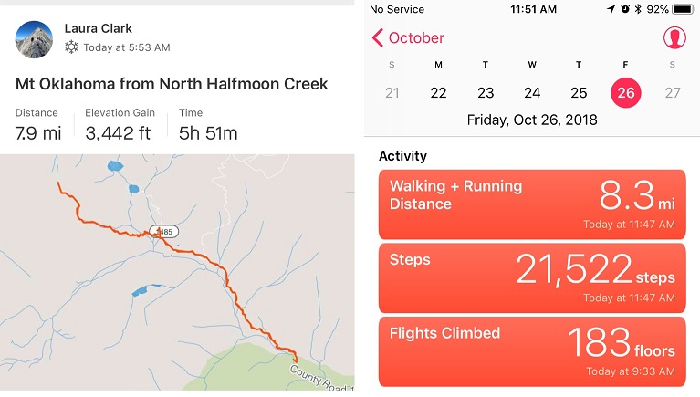
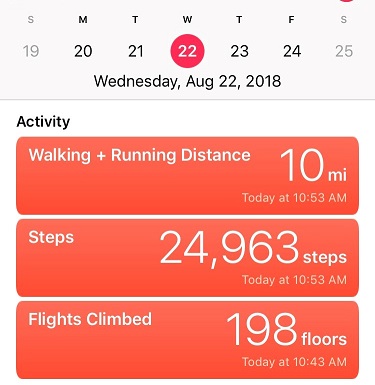
Incline X 2 and Rocky Mountain – 9250

1

RT Length:  10 miles

Elevation Gain: 4500’

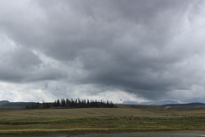
The weather forecast for this weekend was terrible.  So terrible in fact they cancelled the 14er Winter Welcomer (where they teach newbies how to hike in winter-like conditions).  I watched the weather very closely and narrowed the best weather down to the Sawatch range, right along the 82.  Unfortunately, they usually close the 82 the first week of November, and today’s the 2nd.  Oh, and the weather forecast wasn’t that great, it was just better than anywhere else in the state (40% chance of snow, 15-29*, winds 20-45mph… yes, that was the BEST forecast).

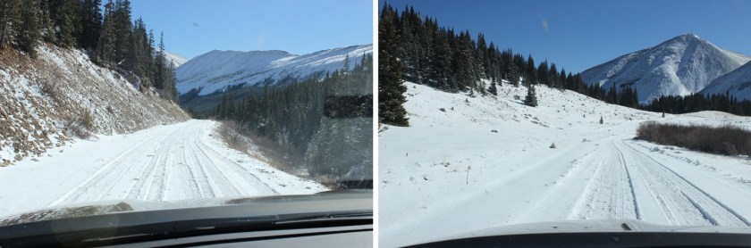
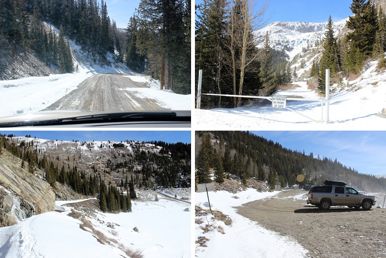
I’m still learning about alpine hiking in late fall/winter (considered early winter season conditions), so I made a promise to myself until I learn more about correlating forecasts to actual conditions to drive out to the trailheads and not make a decision on whether or not I’d hike until I was actually there.  So this morning I drove past Buena Vista and a sign indicating the 82/Independence Pass was open.  Woohoo!  Now my only worry was they’d close it while I was parked at a trailhead and I wouldn’t be able to drive out (do they have plans for that?).

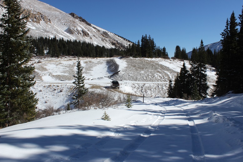
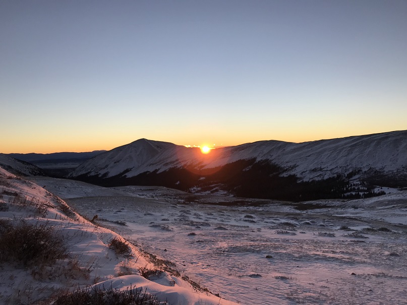
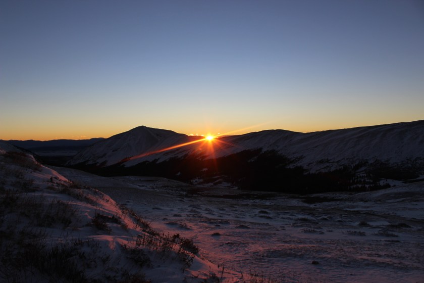
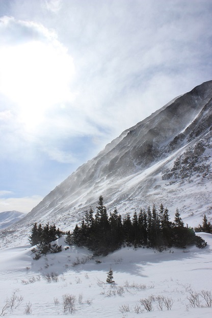
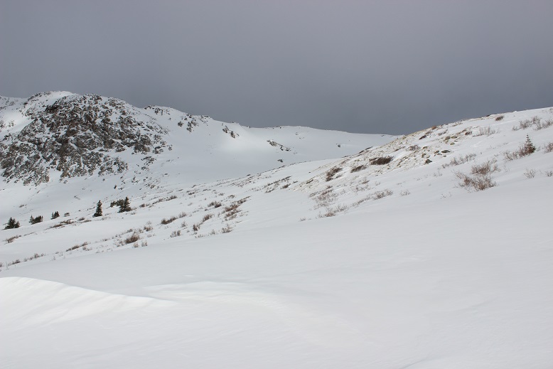
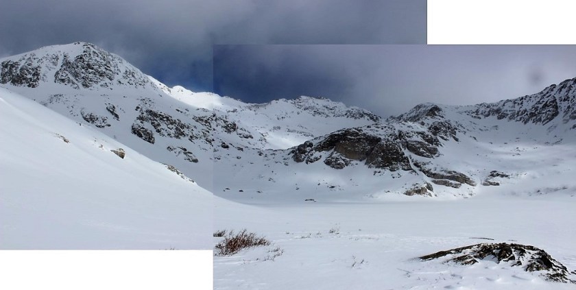
Well, that was my only worry, until I started driving on the 82.  Almost immediately it was sketchy.  It wasn’t snowing, but snow was blowing all over the roads.  I could tell no one had been on the road in quite some time (an hour or more?).  No one was passing me coming the other way, and I had to drive much slower than normal to avoid ice.  I made it to the trailhead, but when I arrived it was whiteout conditions, and actually snowing at that time.  The forecast indicated the snow would stop but the winds would pick up.  I knew it wasn’t safe to hike in the dark in these conditions (and most likely not in the light of day either).  I couldn’t wait for the sun to rise because I wouldn’t have enough time to complete the hike.  Drat.  I was going to have to turn around.  This stunk, but I knew it was the right decision.  Those winds were insane, and the snow was just going to keep blowing as long as the wind did.  If these were the conditions below treeline it would be a miserable hike, even more so above treeline, and I most likely wouldn’t summit.

When you show up to the 13er trailhead with the best weather forecast in the state and life gives you whiteout conditions but you NEED TO HIKE you change tactics.

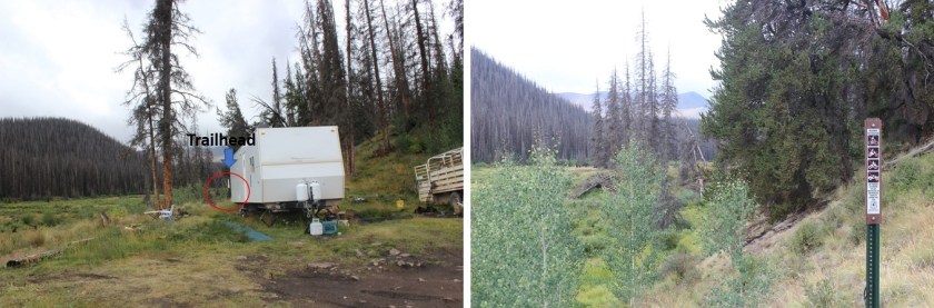
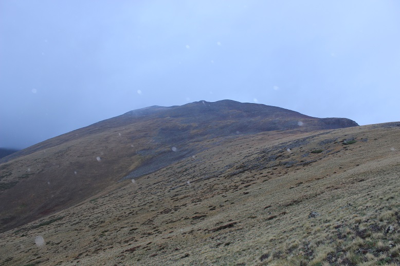
On the drive home I frantically thought of which local mountains (below treeline) I’d yet to summit.  I had none in mind… In fact, I haven’t even started planning my local winter summits because I figured if I never planned them I’d never have to use them. Ouch, that was coming back to haunt me now.  I didn’t have any of my local maps with me, or any routes planned (I did have 8 different 13er routes though, but the weather wasn’t going to let any of them happen today).  I guess I’d just hike the Incline a few times so at least I’d still get in some elevation gain.  That’s when it hit me:  Mt Manitou!  I’d heard that was a nice alternative to the incline that no one used.  I googled it.  No luck.  I couldn’t find a route, but I could find one for Rocky Mountain (a 9K summit directly behind the Incline).  I was going to go for it.

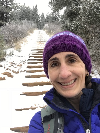
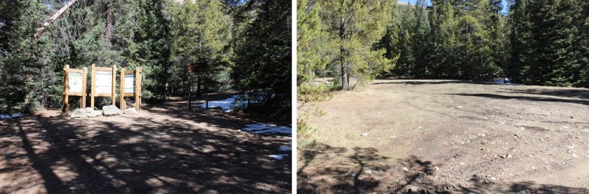
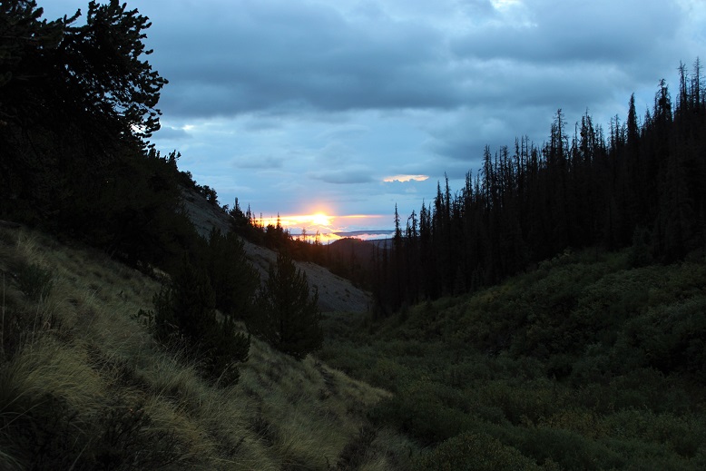
I made it to the Manitou Incline Trailhead and began at 8am (after taking off my snow clothes:  it wouldn’t get that cold below 10K today).

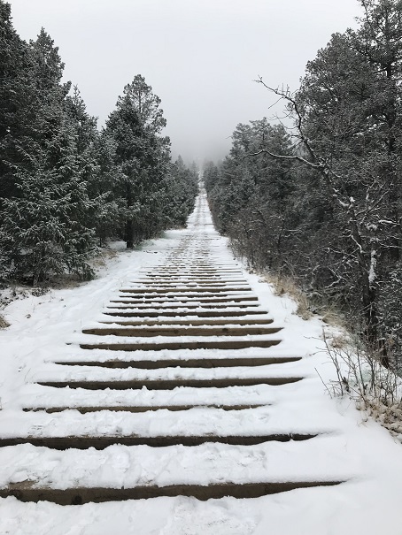
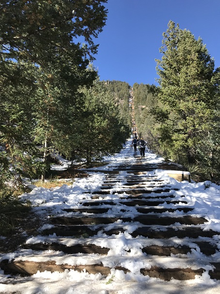
The Incline was much icier than I’d anticipated.

2

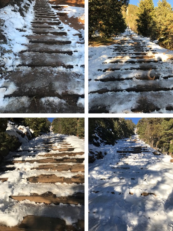
I had my microspikes, but didn’t put them on.  Most experienced incliners had theirs on.  As usual with the incline, I kept a steady pace but didn’t stop.  It took me 41 minutes 39 seconds to make it to the top, after taking time to help someone with their yack tracks and careful foot placement due to ice.

3

4

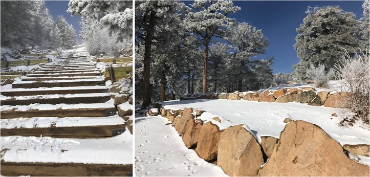
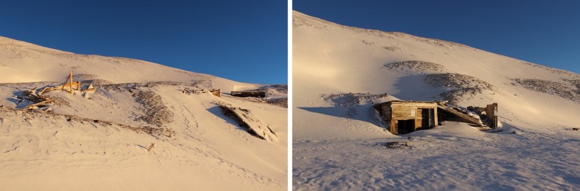
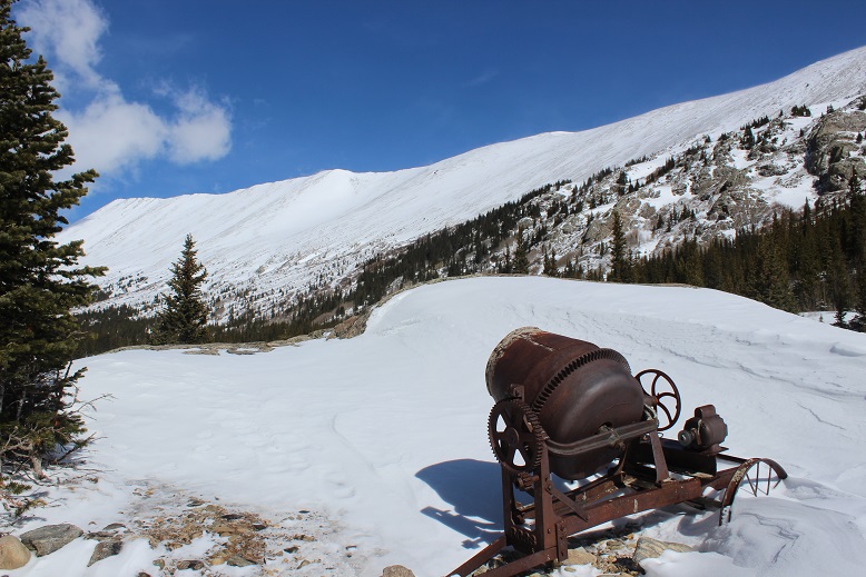
I was overdressed in my knit hat and snow jacket, but the top of the incline wasn’t my intended destination.  I took a few pictures and continued uphill, past the old foundations.

5

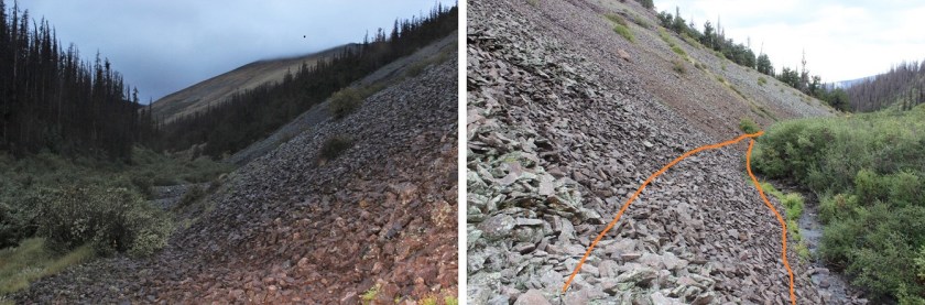
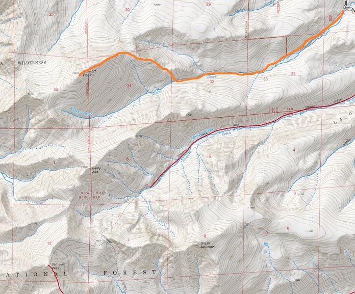
There’s actually a 4WD road here.

6

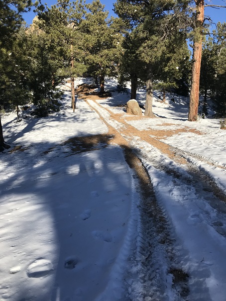
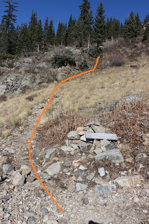
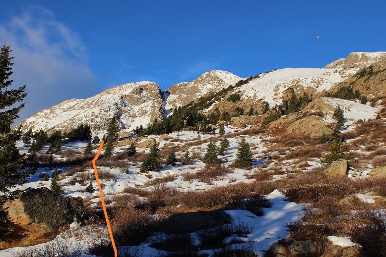
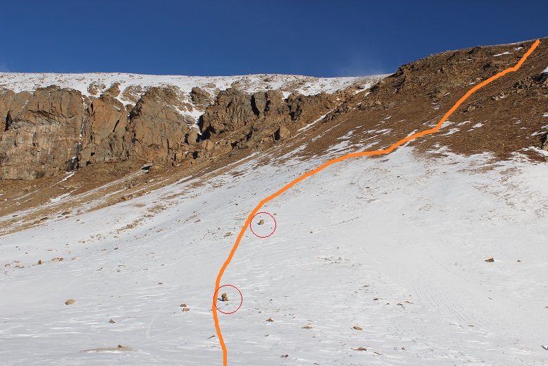
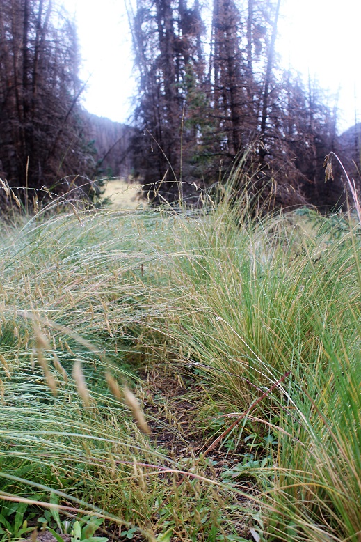
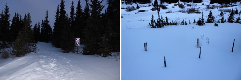
I took it for 1.5 miles and then left the road on a trail that heads towards the summit.  The cutoff is at this post.

7

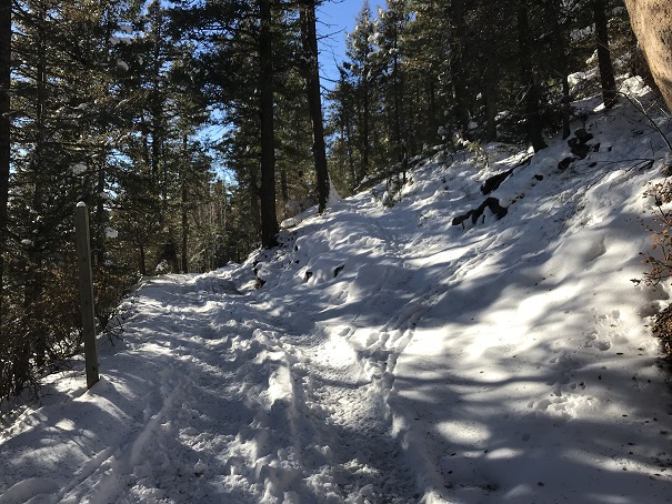
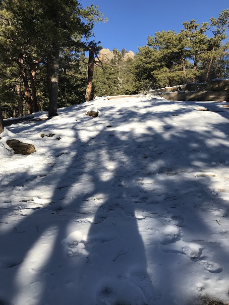
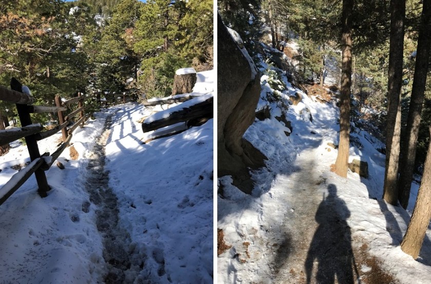
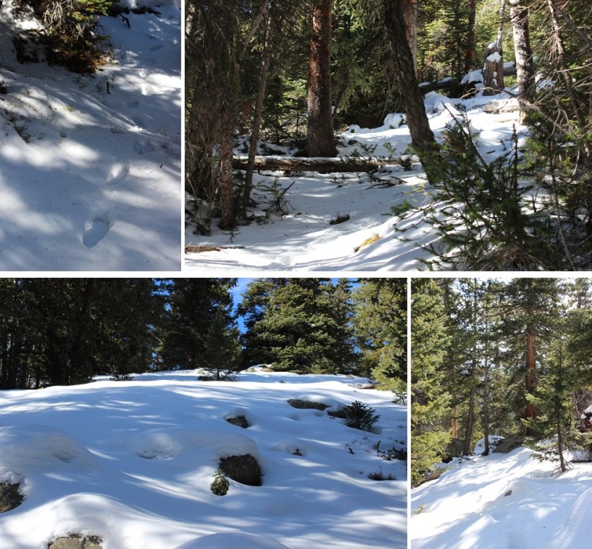
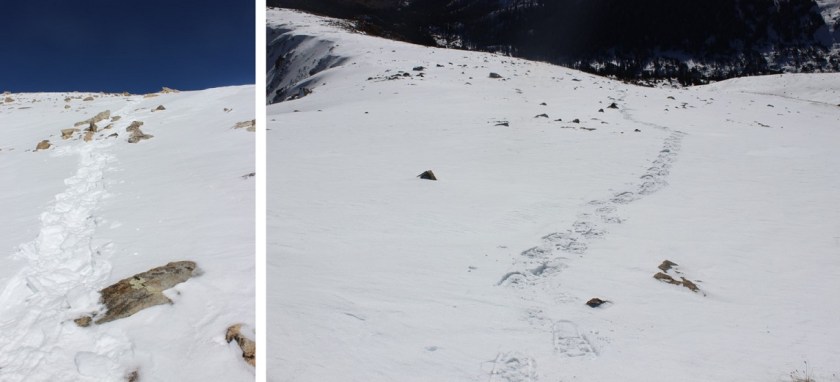
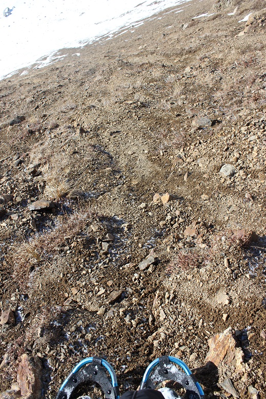
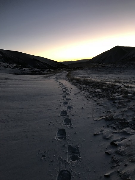
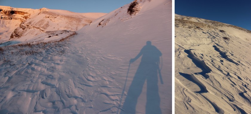
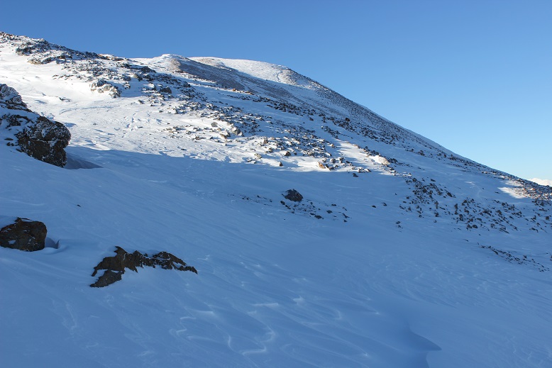
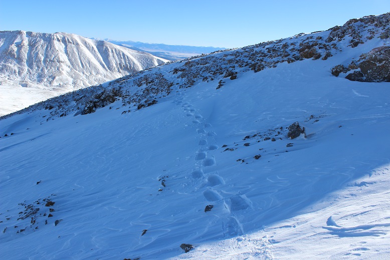
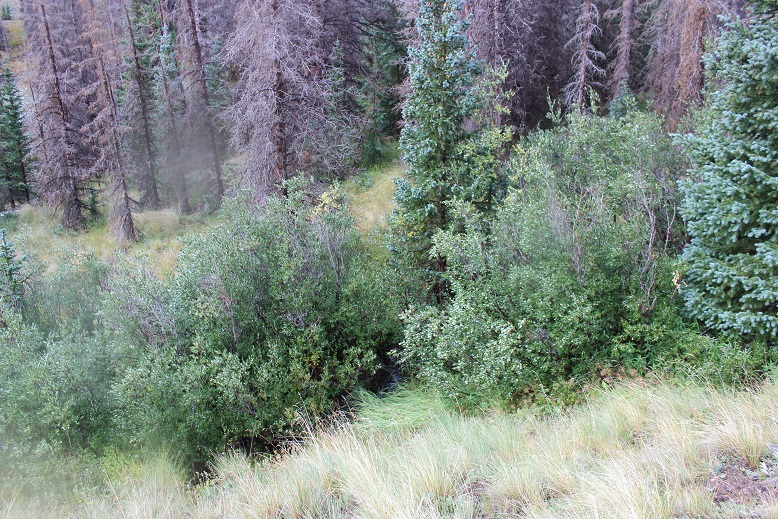
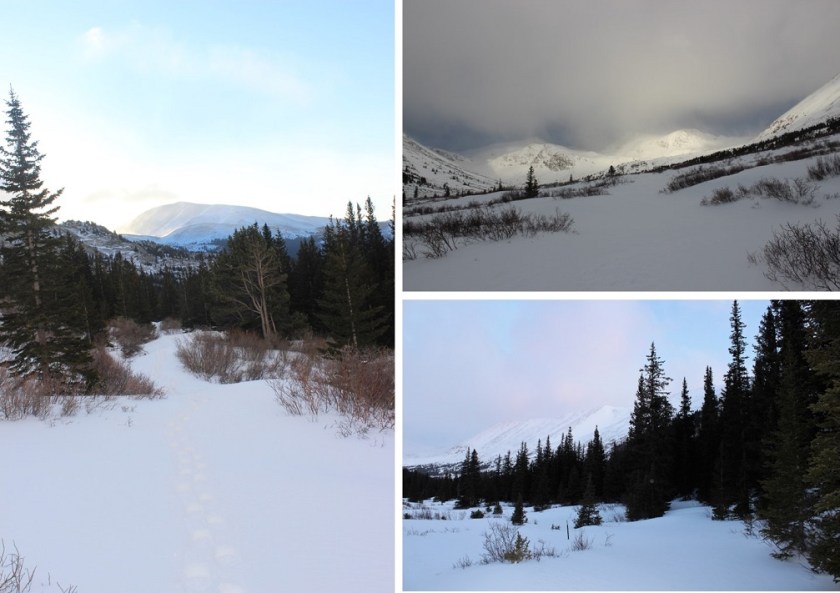
The trail was covered in snow, and I backtracked a few times due to game trails (and fresh prints from said game) but was always able to find my way back to the actual trail.

8

The snow was about 6” deep.  Luckily I had on winter boots that went to my shins.  These had looked ridiculous on the incline, but were coming in handy now.

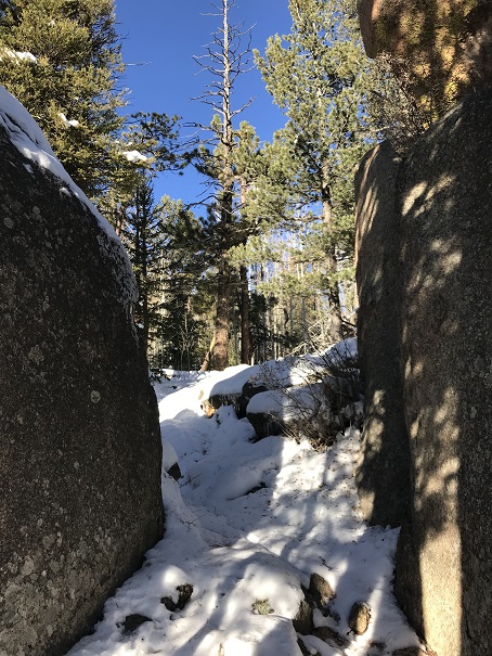
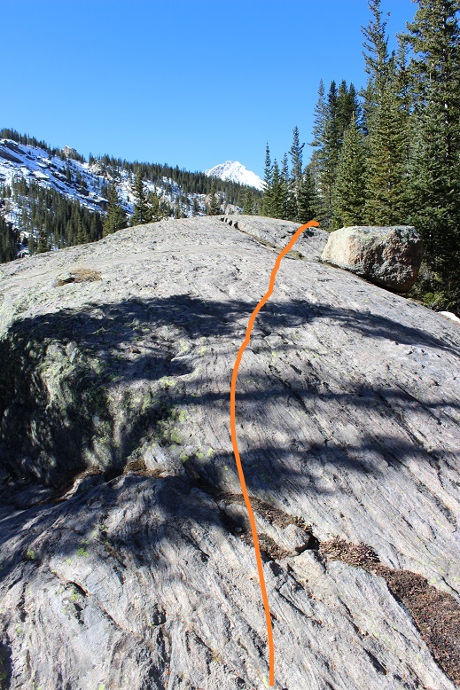
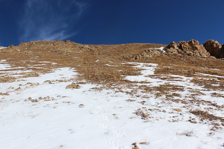
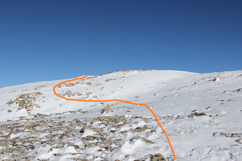
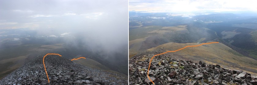
I turned right at an area with some large boulders (after initially heading straight/north, which I soon figured wasn’t a trail that led to the summit)

9

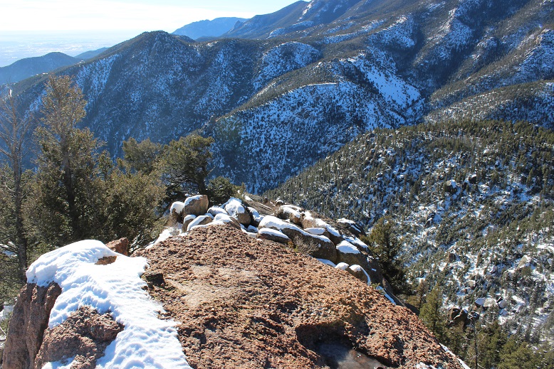
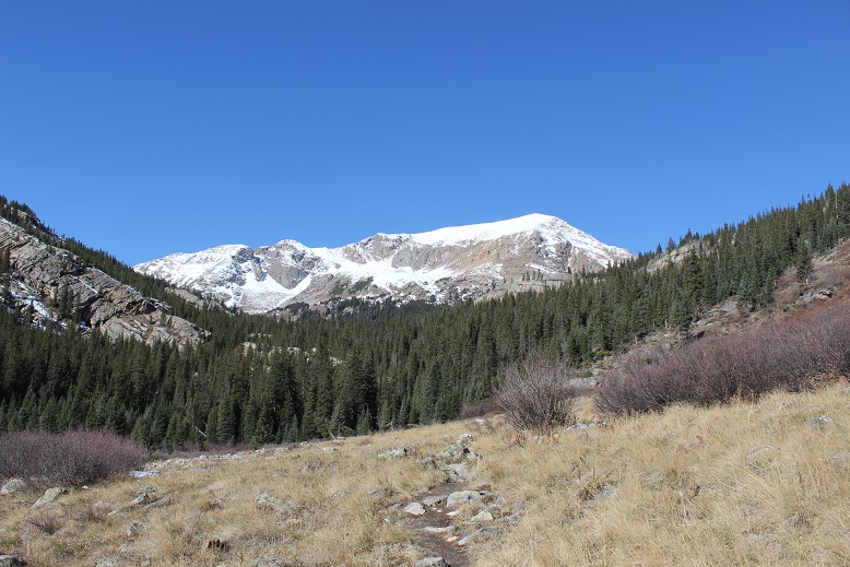
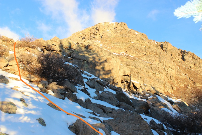
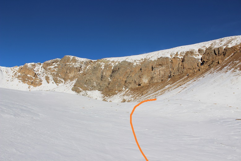
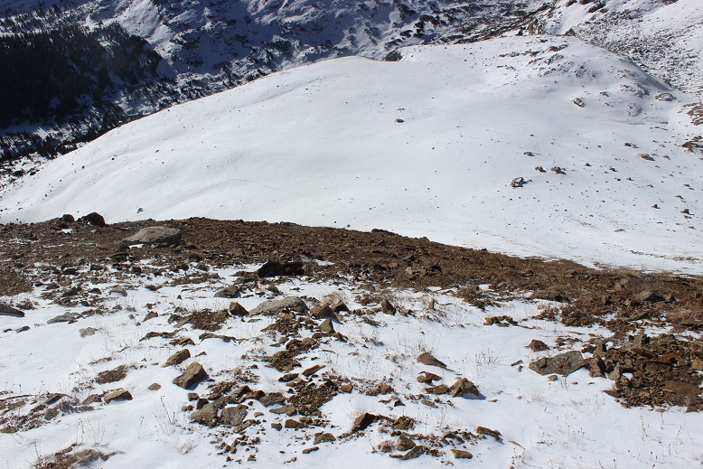
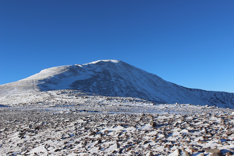
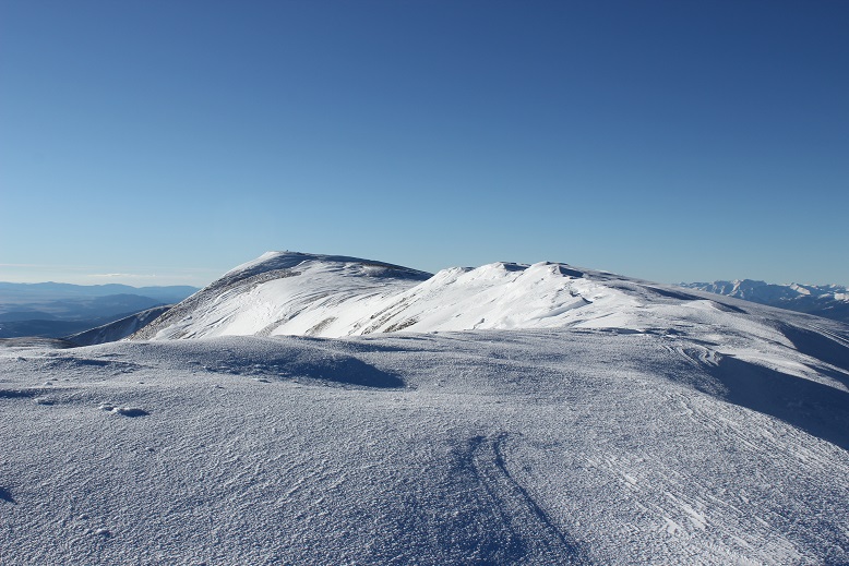
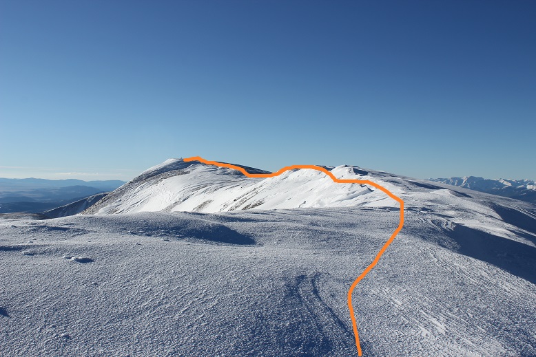
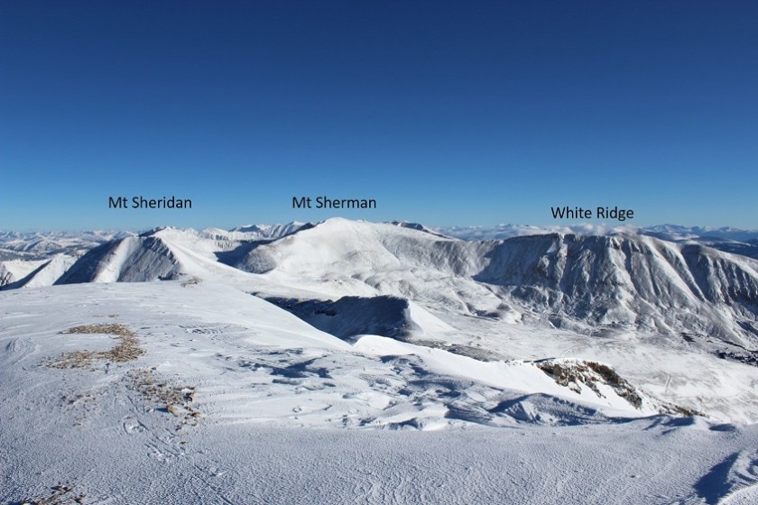
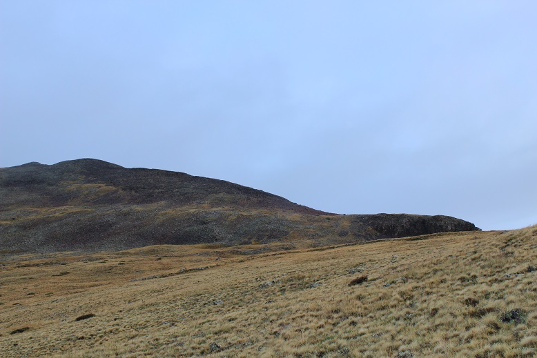
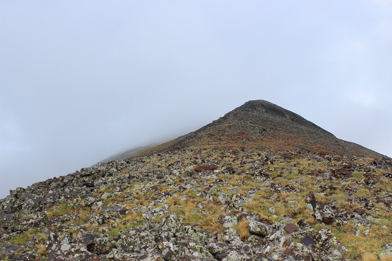
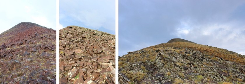
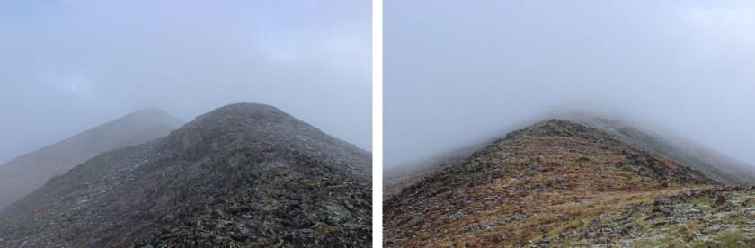
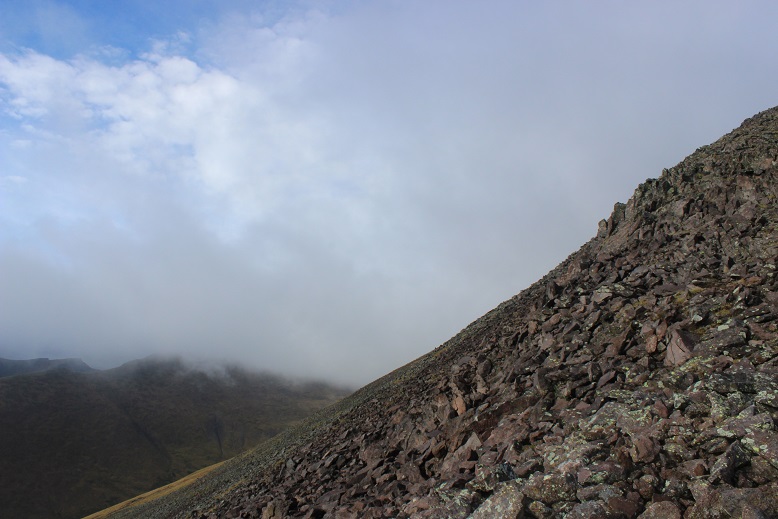
I rounded several corners and finally came to the summit block of Rocky Mountain.  This is what I saw.

10

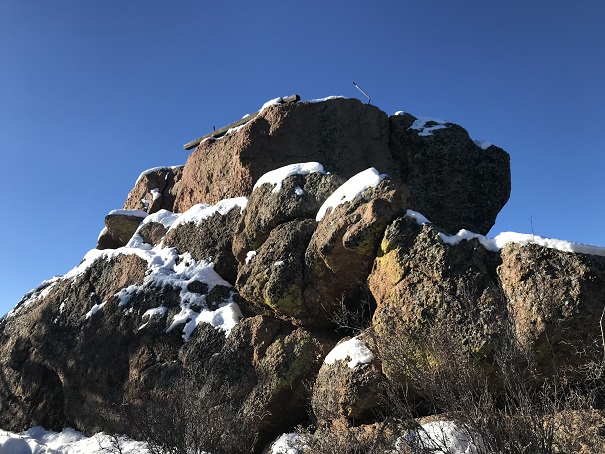
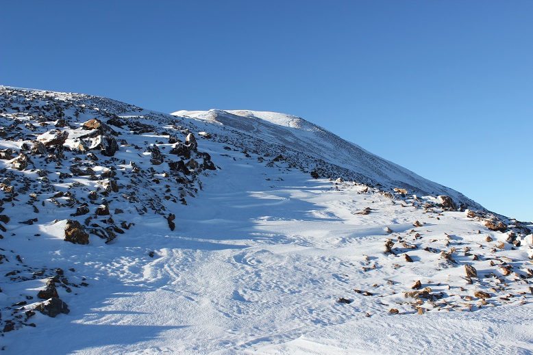
What?!?!?  This didn’t look too difficult, but I didn’t bring my helmet, as I didn’t think I’d need to do any rock climbing.  It was also icy due to snow and, well, ice.  Before climbing I decided to walk further around the side to see if there was another route up, and sure enough, there was.

11

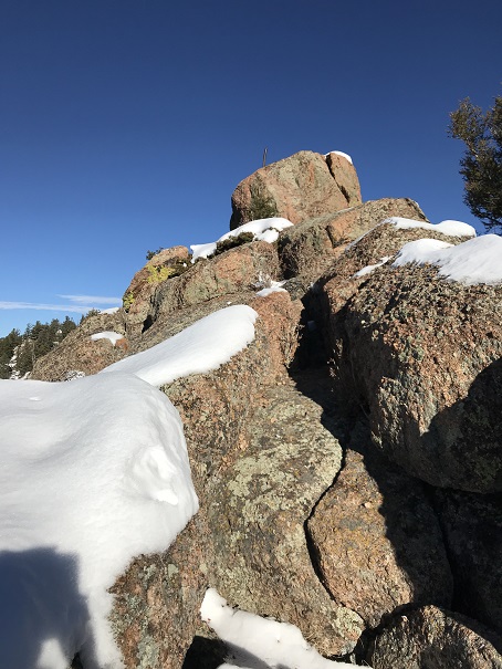
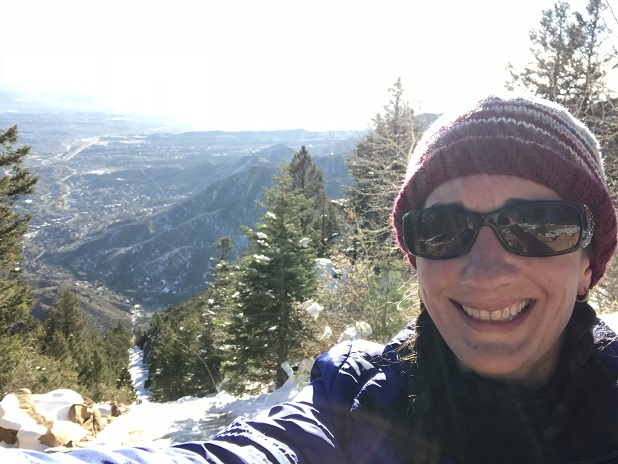
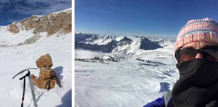
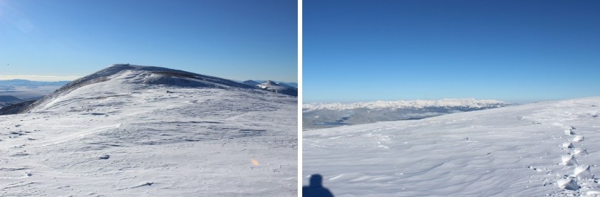
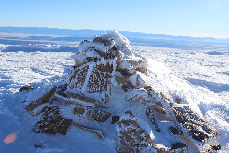
It was an easy climb to the summit, which still had remnants of some sort of past structure.

12

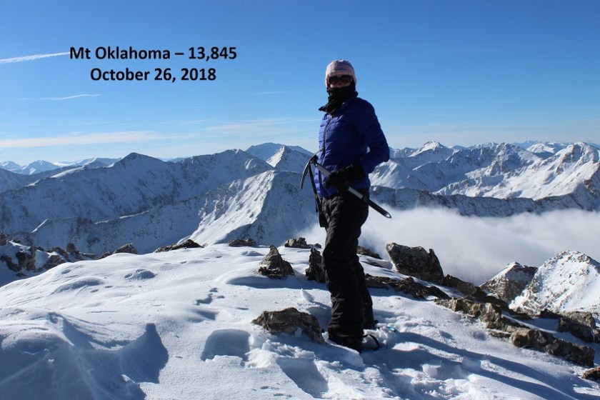
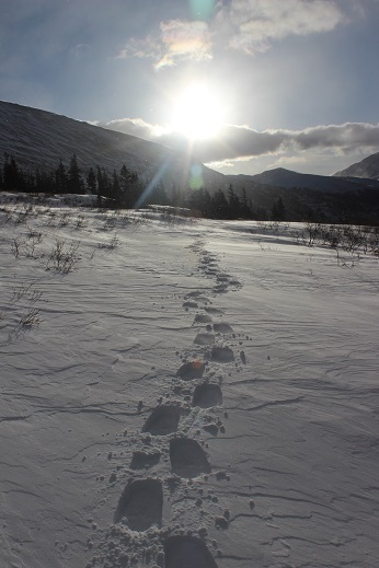
I summited at 9:15am

13

VIDEO:

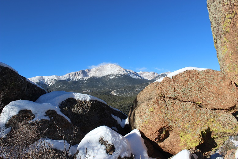
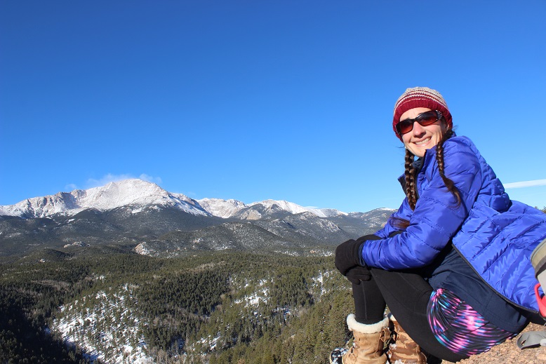
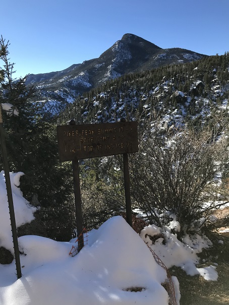
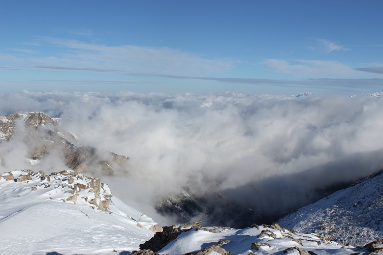
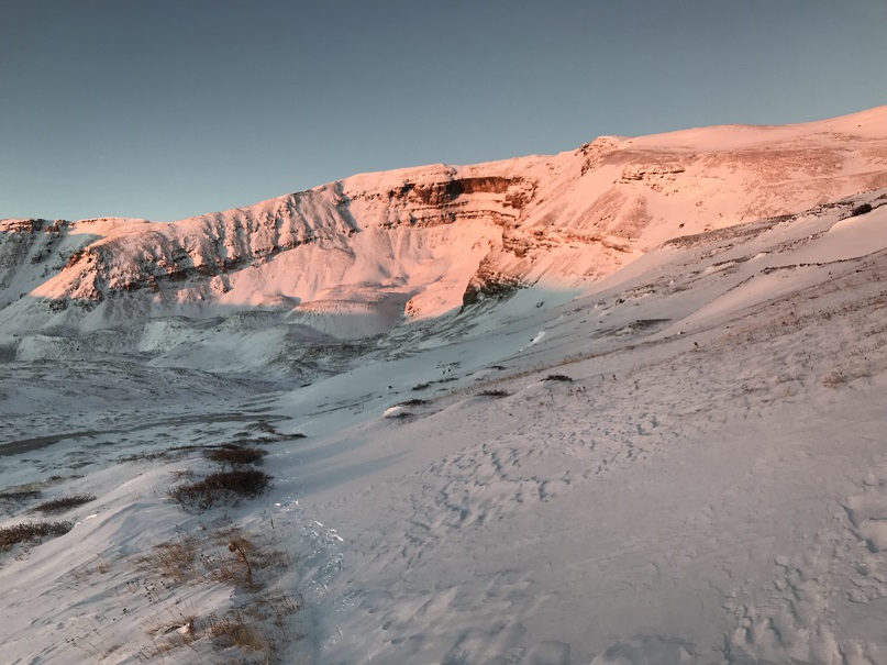
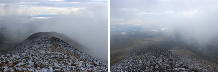
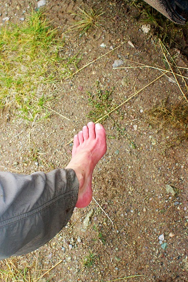
It was WINDY!  Seriously windy!  And COLD!!!  And I wasn’t even above treeline!  It was a good call to alter my hiking plans for today and to overdress for the Incline.  After retrieving a glove that had been caught in the wind and flown about 10 yards away I hiked back to below the summit block and got a few pictures of Pikes Peak.

14

15

16

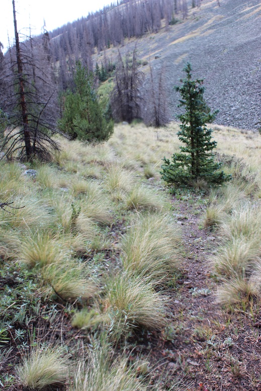
And then I was on my way down.  I just followed my tracks.  When I got to the boulder area I decided to actually take that trail I’d seen earlier, but I wasn’t entirely sure it was a trail.  I stopped for a bit, turned on my data, and tried to see if there was a trail to Mt Manitou from here?  No luck. The trail I was on went north (and lower in elevation).  I could see Mt Manitou,

17

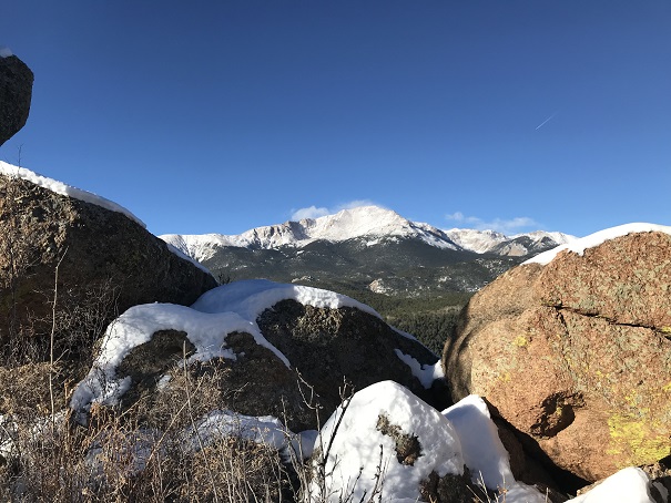
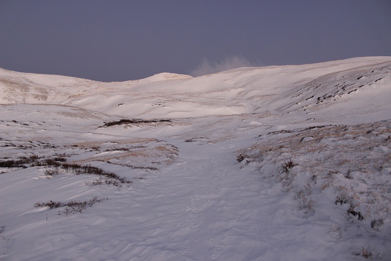
and debated just hiking the half mile over there, but the snow was getting deeper and I didn’t have snow pants/snow shoes and the snow I’d been trekking in was turning to water on my clothes.  This wouldn’t end well with the wind, so I backtracked and found the Barr trail.  Here’s a view of Cameron Cone

18

taking it back down to the base of the Incline.  The Barr trail was much icier than I’d anticipated.  Spikes would have been helpful (but I was too stubborn to put them on and instead put up with the occasional sliding:  Thank you Yoga for the balance).

19

I made it back to where I’d started, but I wasn’t tired yet!!!  It was exactly 11am, so I decided to hike the Incline again.  The second go up the incline was more difficult than the first because there were a lot more people, it was warmer out (I still had on my winter coat and hat) and I was tired.  This time it took me 49 minutes to summit.  That’s the longest it’s ever taken me, and I was quite tired when I reached the top.

20

21

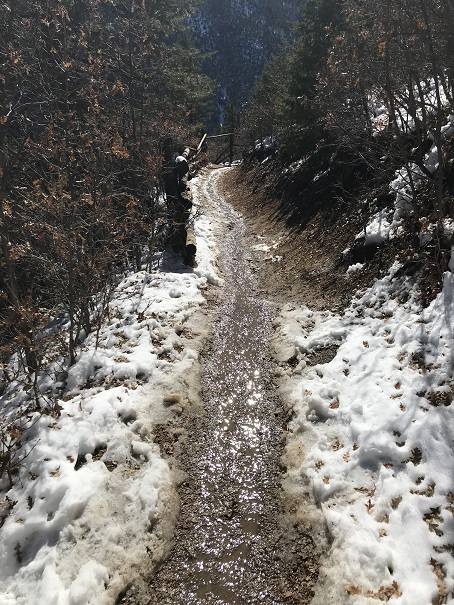
I immediately headed back down the trail, which was muddy now since most of the snow/ice had melted.

22

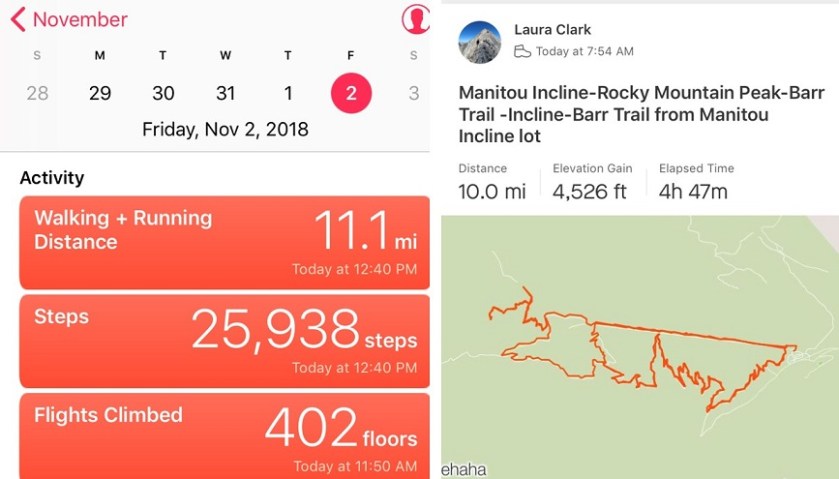
I made it to my truck at 12:40pm.  I checked Strava, and this was a 10 mile hike with 4500’ in elevation gain, completed in under 5 hours.  I felt great!

23

Here’s my relive video:   https://www.relive.cc/view/1941775243

Mt Oklahoma – 13,843

1

RT Length:  8 miles

Elevation Gain: 3450’

I made several spreadsheets this week outlining possible hikes, and finally settled on Mt Oklahoma.  Imagine my surprise when I checked the weather forecast one more time at 2am and it switched from 15mph winds to 45mph winds!  I considered changing my peak at the last minute, and then looked at the direction of the wind.  I should be ok….

Speaking of OK, when I was about 8 or 9 years old I understood the joke for the first time that “Oklahoma is OK”.  I thought this was hilarious, even though my friends didn’t ‘get it’.  I told it over and over again and got blank stares.  Maybe I just wasn’t telling it right?  But I digress…

I arrived at the trailhead around 5:30am, surprised the 4WD road was clear of snow all the way to the upper trailhead, despite snow in the forecast for last night.  Conditions of the road in are the same as the last time I was here (https://wildwandererlmc.wordpress.com/2018/07/20/55-mt-massive-14421/).

2

There were no other vehicles in the parking lot.  I gathered my gear (whoops!  I forgot my goggles, oh well, my sunglasses would have to do) and started just before 6am.  I followed the Mt Massive/Halfmoon Lakes trail to the trail junction in the dark, but by the light of the full moon.  The trail had pockets of snow, but no traction was needed.

3

The moon gave off enough light so I didn’t need my flashlight, but not enough light to get a good picture of the mountains in all their snow capped glory.  They were beautiful, and I stopped several times to try and photograph them (none of which turned out).   I was wasting serious time trying to get a picture I’d never be able to capture, so I put my camera(s) away and kept going.

4

From the trail junction I continued west, back into the trees

5

And up and over a very large rock (I’m guessing 50-70 feet long?)

6

I kept thinking to myself how I wished the elevation gain would start soon. I was over 2 miles into a 4 mile summit, and still no real elevation gain.  Those last few miles were going to be a killer!  From here I left the North Halfmoon Lakes trail and the route-finding began.  The trail was surprisingly free of snow until I passed the second creek crossing.

7

From here snowshoes would have been helpful, but I didn’t put them on. Route finding through the trees was interesting.  At points I could tell there was a trail, or a heavily used path out there somewhere, but most of the time everything was covered under lots of snow.

8

I had to backtrack once, but was able to find my way to the ridge and after exiting treeline I found a few cairns (not enough to rely on… maybe 5 total in the next 2 miles).  At the ridge I continued left

9

Over this hill and up the drainage

10

And up some more drainage.  This is where I put on my snowshoes.  The snow is deceptively deep in some areas here (it is a drainage after all) and bare in other places.  The snowshoes were worth it for the times I sank to my waist.

11

At the top of this drainage was a small basin

12

I found 2 cairns here, indicating the way I should take up the slope.

13

This is where the hike became challenging.  That slope is much steeper than it looks, and just when you reach the top, there’s another slope just as long to navigate.  I kept on my snowshoes until the snow stopped, and then put them in my pack and hiked up to the ridge.  Hiking was much easier with the snowshoes!  I’ll take snow over scree any day.

14

When I reached the ridge I was surprised to see more snow.  A lot of it!  But it didn’t look that deep, so I put on my microspikes and started forward.

15

That lasted about 30 feet.  There was no way this was going to work. I needed snowshoes.  And goggles (that wind!).  I stopped to put them on, realized I’d left my goggles in my truck (drat!) and looked at the task before me.  I had less than an hour to make it to the top before my turn around time.  My legs were burning, and it was slow going, but I knew I could do this.  I trudged on. There isn’t an exact route to the top, just keep aiming for the highest point. I chose to go left instead of straight because the snow looked deeper and less stable directly in front of me.

16

Once again, it’s steeper than it looks and I had to stop every 50 feet or so just to catch my breath.  My ice axe proved useful several times.  The wind was picking up and I was getting cold.  Those 2 miles without elevation gain were catching up on me!

17

I summited at 9:25am (my turnaround time was 9:30am)

18 Mt Oklahoma 13845

VIDEO:

The summit is mostly flat, with a small cropping of rocks near the Mt Massive side.

19

Here’s a view to the south

20

This is the way I came up

21

I turned and looked to the left of Massive, and there was the weather I’d been worried about.  45mph winds turning fresh snow into ice clouds, headed towards me.  It was time to book it off this summit before those clouds reached me.

22

But first, a shadow selfie

23

I backtracked the way I’d hiked in, following my tracks

24

The snow was soft, perfect for skiing.  I didn’t have any skis, but I had fun gliding in strides in my snowshoes.  I quickly made it back to the scree slope where the snow ended for about 200’ and the scree reigned.

25

I decided against taking off my snowshoes for this part. Snowshoes actually provide the same stability on scree as they do on snow.  Plus I was too lazy to take them off just to put them back on again. (If your snowshoes are aluminum don’t try this.  Also, get new snowshoes).

26

I made it down into the basin and stopped for a bit to reapply sunscreen and take off my gloves (I had on multiple pairs).  This was also the last time I saw my hat.  Since I had on a balaclava too I didn’t notice when it went missing.  I’m not sure if I lost it here or in the trees, but if you find it please bring it down and donate it to a worthy organization (I knit about 300 a year and give them to low income elementary schools and teen homeless shelters in Colorado).  This was the only time I wore it, and after washing it I’d planned on adding it to the donation pile.

27

I continued following my tracks back down to treeline and back to the North Halfmoon Lakes trail.  After the second stream crossing the snow virtually stopped, and when I hit the junction it was gone all except for when I was in the trees

28

I made it back to my truck at 11:50am, 10 minutes before my 12pm target time, making this an 8 mile hike/climb/snowshoe adventure in about 6 hours.

29

I didn’t see a single person the entire day, which I consider a win!  There was a Tacoma in the parking lot when I left, and I did see at least 2 if not 4 sets of tracks on the trail going up to Mt Massive as I was heading down.

Here’s my relive video:

https://www.relive.cc/view/1928750207

Note to self:  it’s time to keep goggles in gear bag.

Horseshoe Mountain A – 13,898 & Peerless Mountain 13,348

RT Length: 8.3 miles

Elevation Gain: 2500’

I needed a successful summit today.  I mean I really needed one.  The past two peaks I’ve attempted to summit have been thwarted by downed trees on the drive in or early season wind slab avalanche danger at treeline.  If I didn’t get in a summit today I was ready to call off alpine hiking for the year.  Maybe.

Last year I was new to alpine hiking and decided to take the winter off from 13ers and 14ers and instead map out the entire North Cheyenne Canyon area peaks, most of which do not have established routes.  I was able to learn quite a bit about route finding and navigation below treeline, while still staying in the relative warmth of 8K to 12K peaks where I felt I couldn’t get ‘too lost’.

This winter I may choose to do the same in another area, depending on my success rate with hiking/climbing 13ers in winter conditions.  But first, an ‘easy’ early season 13er with ‘perfect’ weather conditions (sunny at the summit and 35* with 5-10mph winds)

My alarm didn’t go off at 2am as planned, but fortuitously my internal alarm woke me up at 3am and I decided to still book it to the trailhead.  Probably the most difficult part of this whole day was the 10 mile drive in on County Road 18.  There was a 40% chance of snow last night, which I’ve found usually means if it does snow it’ll only be about an inch or so.  Well, as soon as the road turned to dirt there was at least 4-6 inches of fresh snow on the road, which was unexpected.  I’d been driving about 40 mph and quickly downgraded it to 10 mph (or slower).

Luckily there were fresh tire tracks ahead of me, so I knew someone must have made it down the road.  I figured someone was attempting Sherman this morning and their alarm clock rang on time.  From their tracks I could see where the snow became deeper in the road. At times the snow was a foot or more deep (from drifts) and at others it was non-existent.   Unfortunately, the tire tracks abruptly turned off the road to the left after about a mile in, and I was now driving the road on my own.

I have a very capable 4WD Toyota Tundra that never says “no” to anything I’ve asked it to do, but I was still cautious:  I knew this was a well maintained road but with all the snow I couldn’t tell how deep the snow actually was; and there were drifts.  Multiple times I considered turning back, but my truck kept plowing through with no difficulties, so I kept driving on.  Mental note:  it’s now time to drive with a shovel in the back of my truck.

I drove too far.  I made it all the way to the upper trailhead for Sherman, realized my mistake, and turned around and found the parking area after the Leavick Mine.  I debated driving up the 4WD road to see how much further I could go, but decided against pushing my luck.  I’d made it safely this far and didn’t want to chance my summit today by doing anything stupid.  This ended up being a grand idea because less than a mile up the road there were several tracks in the snow indicating vehicles in the past few days had tried to continue further and failed.  With the added snow from last night there’s no way I’d have made it.  Here’s a picture from the drive on my way out.  Most of the snow had melted or been packed down by this point.

2

I parked at the Silver Horseshoe Road junction and put on my snowshoes while sitting in my truck.  I kept them on for the entire hike.  I started at 6:25am.  Here’s where I parked.

3

From the beginning the road was covered in snow.  And it was dark.  And silent.  And beautiful.  The first part of the hike was relatively easy: I just followed the snow covered dirt road.

4

Around 7am the sun began to rise.  I slowed down to enjoy the experience.  I love sunrises!

5

6

I got my first view of Horseshoe.  What an amazing mountain!

7

And Peerless.  It looked like there was wind up high, but the forecast said it was supposed to die down this morning, settling around 5-10mph.  So I trudged on.  Snowshoeing takes more energy than hiking!

8

Being the first one on the trail has it’s perks:  I saw numerous animal tracks from the night before.

9

At 12,600’ I passed an old mine.

10

From here as I gained in elevation the road became more difficult to find.  It was covered in snow drifts, making it blend in with the mountainside. I did my best to stay on route and probably didn’t, but could see my intended destination (the Peerless/Horseshoe saddle) and just kept aiming for that while avoiding pockets of soft snow.

11

I made it to the 13,200’ saddle and turned left (south).  I had a great view of the route before me.

12

I did a physical check here.  The hike thus far had been tiring but not difficult.  I was sweating and could still feel my fingers.  I wasn’t a popsicle yet.  This was fantastic!  I decided to keep hiking.  On the ridge the trail was either covered in snow or held no snow at all.  I kept my snowshoes on either way.

13

The only part that gave me pause was here.  I wasn’t sure if the snow was consolidated or not.  I continued on, knowing if I slipped I wouldn’t be falling too far.  Second mental note of the day:  Bring an ice axe from now on.

14

I followed the ridge and was surprised by a false summit.  Well, surprised is the wrong word. I’ve come to expect them, but today it wasn’t appreciated because as soon as I made it to the top the wind picked up. Luckily, while it looked far it was actually an easy hike over to the true summit.

15

Here’s the route I took

16

I had fun here learning about different types of snow.  I wasn’t able to always tell what was snow and what was ridge, so I traversed carefully.  Luckily here the ridge was wide and most of the snow as consolidated.

17

I summited at 8:45am

18 Horseshoe Mountain A 13898

VIDEO:

Up until now I hadn’t been too cold, but on the summit the wind picked up.  I took a few pictures of the amazing view

19

20

The summit cairn

21

And took a look at my route back down.

22

It had been my intention to summit Peerless as well (an unranked 13er) but my fingers were burning.  I was clapping them together, putting them under my armpits, in my pockets, etc., but they just weren’t warming up.  I needed the wind to settle down.  I told myself I’d make the decision whether or not to climb Peerless when I made it back to the saddle.

Here’s my snowshoe tracks.  I love snowshoe tracks!

23

And here’s my next target:  Peerless

24

I made it back to the saddle and looked at the route back up to Horseshoe

25

And up to Peerless

26

It looked like a cornice was forming on Peerless, but there was an open path if I stayed to the left and avoided the snow.  The wind had stopped, and while I couldn’t feel my fingers they were no longer burning, so I decided to go for it.  It was a quick 150’ trek to the summit.  I summited at 9:25am

27 Peerless Mountain 13348

VIDEO:

Here’s a look back at Horseshoe from Peerless.  The only difficult part was deciding which snow was stable to hike on, and which was part of the cornice/loose snow.  In other words, I wasn’t sure where the mountain ended and cornice began, especially as I got higher up.

28

The trek back down was very easy as there hadn’t been much wind and I could just follow my snowshoe tracks.  I noticed a lot of new holes in the snow from critters who weren’t quite ready yet for winter.

29

The entire hike in the snow seemed to continually change.  It would be consolidated for 10 steps or so, and then suddenly become soft and I’d sink to my shins.  On my way back I was able to capture the experience in a photo

30

Here’s what the 4WD road looked like on my way back out

31

And I know a lot of people are wondering what Sherman looks like right now…

32

I made it back to my truck at 10:45am, making this an 8.3 mile hike with 2500’ of elevation gain in 4.5 hours.

Here’s my STRAVA route:

33

And Relive visual:  https://www.relive.cc/view/1914862651

Today was a huge learning experience for me. I know this wasn’t a difficult peak, but I learned a lot about how to navigate different types of snow, drifts, snow stability, and winter route finding.  And I stayed (relatively) warm.  I’m considering today a success!

Stewart Peak – 13,988

1

RT Length: 10 miles

Elevation Gain: 3000’

Woohoo! Unexpected summit day!  The only downside?  The weather was terrible across the entire state of Colorado!!!  I had a full day I could use for hiking (I didn’t need to be home until 6pm) but it seemed everywhere I looked there were storms forecasted for the night before and all day.  The best forecast I could find was in the San Luis Peak area, where it was supposed to rain all night until 5am, then stop until noon (when thunderstorms would hit).  I hate to waste an opportunity to hike, so I woke up at 11:45pm and drove 5 hours to the trailhead.  It rained the entire way, from the time I left my house until I arrived at the Nutras Creek Trailhead at 4:45am.  Oh, and I saw a bear as I was driving through Divide (high-tailing it away from me as fast as it could, why do they always run away?).

The road in is 20+ miles of 2WD dirt road, unless the Pauline Creek is high then it’s 4WD (it wasn’t).  I absolutely love this road!  It’s a great/solid 2WD dirt road that goes on for miles and miles and miles.  I remembered to get gas in Salida this time since the gas station in Saguache is closed at night.

A plus to the rain?  There were tons of puddles on the road in!  I had fun aiming for them and watching the water/mud splash up past my rear view mirrors. Everyone should have a truck.

I made it to the Nutras Creek Trailhead and parked on the side of the road because what looked like the parking area had a couple of trailers set up and there wasn’t any actual parking available.

2

The trailers looked semi-permanent.  I sat in my truck, eating Ritz crackers, waiting for the rain to stop.  It didn’t.  Hmmm.  It was now 5am and I wanted to get on the trail, so I decided to set out anyway.  It was just a light rain at this point and it was supposed to stop soon, what harm could it do?

There was a sign that said “Nutras Creek” directly over the bridge covering the creek.  This is NOT the trailhead.  After some searching I found the trailhead, located behind the trailers.   When I arrived and parked the lights were off in the trailers, but as I passed them looking for the trailhead, swinging my flashlight back and forth trying not to make noise (there was a generator going, so I knew they were occupied and didn’t want to be seen as a prowler) l noticed the lights had switched on and I could smell coffee.  There was a lot of logging going on in the immediate area.  I figured they were either hard core early rising campers or loggers.

3

After last Friday’s fiasco with the GPX app I downloaded another one.  Before beginning I started the track.   Almost immediately the rain died down.  I considered this a good sign and hoped the clouds would move so I could see the stars.  No such luck.  The clouds never lifted.  Well… at least it wasn’t raining!  That was a plus, right?  Well, kind of.  You see, it had rained all night, and the trail was covered in tall grass heavy with water.  As I trekked I brushed past the grass and thus copious amounts of water droplets.  Here’s a picture from later in the day

4

I’d worn my new hiking pants, which boasted they were water proof and bug proof.  Let me tell you, they were NOT water proof/resistant/etc.  I was immediately soaked:  It was like I was wearing a cotton bandana instead of pants.  I had on waterproof hiking shoes that I’ve trekked across numerous creeks with without getting my feet wet, but as I hiked today the water soaked through my pants, then my socks, and drained into my shoes.  Within minutes I was squishing in my shoes as I was walking.  This was not good on so many levels.  I knew this meant I’d most likely need to turn back before summiting, but I drove this far: I wanted to at least get some hiking in.  So I kept hiking.

There was a trail in the beginning, and then there was no trail.  Then there was a trail again, but I couldn’t really tell if it was a trail?  Then there were two trails…. Ugh!  OK, just follow the creek to the right and you’ll be fine.  After about 2 miles you have to cross the creek (it was a 2 foot jump but the area was full of brush so kind of hidden)

5

and then follow the creek again through a small boulder field.  There is kind of a trail here, but if it’s not stable (a real possibility) hug the creek.

6

I turned back and noticed the sunrise!  I love sunrises!

7

After the boulder field you’ll come across some bristlecone pines.  At this point turn right (northwest) and make your own trail until you reach a ridge (above treeline).  The area looks like this

8

There is no trail, but there are dozens of game trails, and after the rain I could see where elk had spent the night and left in the morning (I could tell due to scat and pushed-over grass).  One you make it past treeline look left and you can see Stewart Peak.  Theoretically.  I couldn’t, because it was covered in clouds.

9

This wasn’t good.  It wasn’t supposed to be cloudy!!!  There was supposed to be a 50% chance of thunderstorms after noon, but none of the forecasts I’d seen said anything about clouds.  13ers and 14ers tend to make their own weather, and that’s just what was happening here.  Clouds were forming in the saddle between Baldy Alto and Stewart Peak, rolling and settling at about 13,500’.  I’ve seen this type of thing before, and hoped as the sun rose it would go away.

I turned and headed northwest, staying in the grassy area but aiming toward the ridge.

10

The clouds lifted and the sun came out!  Woohoo!  What a great turn of events!  My feet were still squishing (I’d hoped they’d dry out by now, but there was so much water on the trail as soon as I started to dry off in an area without grass I’d pass another area full of brush and get wet again).

Once you gain the ridge follow it to the summit, passing a bunch of false summits

11

(or at least that’s what they looked like to me, but it could have been the clouds hiding the true summit… yep, the clouds were back).

12

Oh, and it started snowing.  Ugh!!!

13

The snow didn’t look like it was going to stop (it didn’t) but I was close, so close to the summit!  I decided to trudge on.  Oh, and remember how my socks were filled with water?  As I gained elevation and the temperature dropped the water in my socks turned to ice.  Just as I was nearing the summit I lost all feeling in my feet (no worries, I have Raynaud’s, so I have intense reactions to cold and know how to handle them:  I’m sure it wouldn’t have been such a big deal to anyone else).  You know that feeling you get when your foot falls asleep and you try to walk but you can’t feel your foot so you’re clumsy and over step?  That’s what this felt like.  That feeling just before the pins and needles set in, but it didn’t end.  And this is what I was walking on…

14

It was icier than it looks.  And slippery.  I was not a happy camper.  I wasn’t prepared for ice/snow.  Rain, yes (I had an umbrella, poncho, and my North Face Jacket) but snow?  Nope.  I needed warmer clothes.  All I had warm weather wise were two pairs of gloves, a knit hat, and a heavy jacket.  I needed better boots, socks, and pants.  My pants weren’t keeping any heat in (or ice/rain/wind out for that matter) and my shoes were soaking wet.  I carefully limped to the summit… but I made it at 7:50am.

15

VIDEO:

I’d love to give you a better view, but this is what I got.   I did see a confused ptarmigan at the summit

16

And despite not being able to feel my feet I wanted to continue on.  It had been my goal today to summit Stewart Peak, Baldy Alto, and Organ Mountain.  I’d gotten a good view of them from the basin and knew which way to go, but once I’d summited Stewart Peak this was my view

17

I knew to angle left/south, but I’d also see bits and pieces of the ridgeline(s) and figured in the clouds/fog it would be way too easy to get lost.  Plus, I couldn’t feel my feet.  I hiked about 20 yards towards the ridge and told myself not to be stupid:  I turned back.  I hate turning back!!!  It hurts on so many levels, but it was the correct choice.  On the positive side, heading back down meant sunshine, warmth, and eventually feeling in my feet and fingers again…

18

I kept seeing the clouds roll in and out and in and out and hovering around the peaks.  Yes, descending had been the correct decision, but that didn’t keep me from mentally calculating time to figure out if I could skirt the ridge and still summit Baldy Alto… I actually had to stop myself from doing this after turning to try it out… reminding myself my feet would freeze again and I planned on coming back again soon.

19

Here’s the path back down the ridge

20

I was saddened by all the dead trees!

21

Once you get to treeline just head towards the creek and turn left.

22

The sun never came out, so once I made it back to treeline I was soaked all over again.  Here’s one of the better trails

23

Oh, and the cows!  One of the reasons there are so many trails are the free range cattle.  I encountered a bunch of them on my way out.  I’m a fan of cattle:  I used to raise them.  However, these cattle weren’t too fond of me.  There was a lot of mooing, running as a herd (stampede!  OK, not really) and one mama got separated from her calf and was quite vocal about it.  I told her to go get her baby.  None of this was intentional on my part:  I was just hiking and following the trail, they were the ones taking it out of proportion.  The downside?  When cattle aren’t happy they poop. Immediately. And it’s sloppy poop.  It’s some sort of defense mechanism. Fight or flight or some such nonsense (since they always run).  In any event, there were slimy cow patties all over the trail, and while I tried to avoid them accidents happen.  I had to wash my boots and pants as soon as I got home.

24

VIDEO:

I made it back to my truck at 10:30am, making this a 10 mile hike in 5.5 hours.

25

Oh, and my GPX file failed.  Again.  Even though it was a different app.  This time even though I started it the app failed to record anything.  I may have to either give this up or bite the bullet and actually pay for an app.  Or a GPS.  Oh well.  Here’s the path I took:

26

When I made it back to my truck I immediately took off my shoes/socks and did an assessment on my feet:  they were bright red and almost done thawing out, but functional (and thankfully not white or black or purple).  I’d been a little bit worried I’d caused them some damage with the frozen water (a quick complication of Raynaud’s).

27

I’m not gonna lie, I was a bit disappointed with my day.  I’d planned on 3 summits, and only completed one.  It’s not fun to turn back, but it was for the best.  In any event, I was able to plan out my route for Baldy Alto and Organ Mountain (I’m thinking Nutras Creek again, up the saddle to Baldy Alto, and then over to Organ Mountain).

On a positive note, I got to drive that fun 2WD dirt road for 20+ miles back to the highway.  In the light of day I could see the creek crossing and all the logging that’s been going on.  Also, I waved to the loggers as I passed.

28

Oh, and the clouds never lifted, they just intensified.  Yes, it was a good call to head back.

29

Wheeler Lake – 12,168

1

I got my new ice axe in the mail yesterday, but unfortunately I didn’t get my crampons, so I was at a loss as to where to hike today.  I spent a LOT of time researching potential hikes, and maddingly there just weren’t many posted trip reports, so any hike would be a gamble.  I decided to just pick a hike I knew would have a little snow and go for it.  I wanted to summit something, but didn’t necessarily have to.  I also wanted to practice self arrest with my new ice axe.

The trailhead (Montgomery Reservoir) looked easily accessible, and there were 3 potential 13er summits, so I chose to try Clinton Peak.

It was cold this morning!  The road in was an easy 2WD dirt road, closed at the 4WD trailhead.

2 Trailhead

As soon as I started hiking it became apparent I’d need snowshoes.  I didn’t take them off until I made it back to my truck.  I was also glad I had my GPS because there was a lot of snow and the beginning of the trail was at the beginning of 2 other trails as well.  I’m pretty sure I’d have chosen the wrong one.  The correct trail goes past the old mill…

3 Mill

This mill was non operational and looked like a small gust of wind would take it down any minute.  There were beams missing, nails exposed, and supports splitting in half.  There was a sign telling people to “Enjoy but not Destroy” their Colorado history.  I thought it was lacking more safety notices.  I high tailed it out of there before the mill collapsed on me.

As soon as I passed the mill the trail was lost.  Kind of. You see, this is what it looked like:

4

The snow was so deep you couldn’t see the trail!  This trail was supposed to be really easy:  just follow the 4WD trail for 3 miles to the lake, but the snow was so thick it obscured the road and everything else.  There was no road!  That meant a lot of GPS’n and Guessin’

5 Trail

This part of the hike was an exercise in patience.  What I thought couldn’t possibly be the road actually was, and what I thought was obviously the road wasn’t.  I kept looking at my GPS and altering course.  That took up a lot of time and a lot of battery. And I was post-holing pretty deep.  Here’s a picture of a typical part of the trail. Yes, I was supposed to hike over that snow berm and around it to the right.

6

Luckily I’ve found it’s usually difficult to get lost in a basin, and this basin was no different.

7 Down the Basin

Unfortunately, basins are formed by wind, and this basin gave me an in depth tutorial of how that happens.  Luckily the wind wasn’t too intense (20mph).  It was cold however, and the weather on top of the peaks looked nasty (so much for no snow predicted today!)  At this point I realized a summit wouldn’t be likely.

This hike was long.  And windy.  I was breaking trail and confused as to where the trail was most of the time, but learning a lot in the process.  I loved looking back at where I’d been (most prints were quickly filled up with blowing snow).  Also, I need a solar powered cell phone charger battery pack thingy.

8 IMG_8855

Of course once the sun came up I took a snow shadow selfie because I could

9

After trudging along for about 2.5 miles I went back through some trees (off course, but not by much, and honestly, my route was better anyway) and then came to the hill below the lake.  This looked like it should have had an established trail, but once again the snow covered it, so I just hiked the lane of snow parallel until I reached the top.  Have I mentioned I love snowshoes?

10

This was a long trudge!  Snowshoeing actually takes a lot more energy out of you than hiking does (especially when post holing in wind).  I’d expected to see Wheeler Lake when I finally made it to the top, but it was covered in snow and ice.

11

This drastically changed my plans.  I was supposed to skirt the lake and find a trail to the left, but that obviously wasn’t possible in these conditions.  I didn’t know where the lake was, how deep it was, how thick the ice was, etc.  and I couldn’t see any trails on the other side.

This was supposed to be an easy 13er… one I should be able to just walk up, but with the snow obscuring everything it changed the difficulty.  I briefly considered going for it and just hiking over the lake, but just as quickly dismissed the idea as being idiotic.  I didn’t have enough conditions information and I wasn’t sure about the snow I’d encounter on the other side.  I’m sure others would have done it, but I’m just not ready to take those kinds of chances.

So I took a lake photo to prove I’d made it this far and was off

12

The hike back down was a bit disappointing and took forever!  Disappointing because I didn’t summit anything today.  I made a lot of snowshoeing progress, and learned how to carry my ice axe comfortably, but I wasn’t challenged at all. (besides route finding).  I wasn’t even tired!  Turning back was absolutely the right decision, but it made today’s hike too easy (no intense elevation gain).

And that trip back!  Those 3 miles kept going and going and going!  I was able to (mostly) follow my tracks back, and the trail was much easier to figure out hiking towards the sun (the shadows helped me see where the road was). I corrected my path several times from the way in (just to make a more accurate trench, assuming my tracks stayed).

I was hot because of the mileage, but also because it got warm. I mean really arm.  My balaclava and goggles and jacket and snow clothes all became too much, but I didn’t want to stop to take them off, so I kept trudging on in the heat.  (OK, so I really just didn’t want to put on sunscreen… It wouldn’t have mattered if I’d just made it back to the truck already!!!)

The weather cleared up from the cold and windy morning, and I was able to get a few pictures of the mining equipment

13

the ice flows on the hillsides

14

and the reservoir I’d passed in the dark on the way in

15

I hopped back in my truck, found out my son needed a new car battery (long story) and headed home to assist.  I only stopped briefly at the 9/24 junction when I saw a herd of bison.  I actually turned around because I didn’t want to miss the shot…  Colorado is amazing!!!

16 Bison

All in all, a great (if a little disappointing) day.  It’s always a bummer when you have to turn back, but I don’t do it often and only when I feel it’s absolutely necessary.  Hey, any day above treeline is a great day!

… I’ll be heading back to hike this route again.  Without snow.


Incline in the Snow

11

I didn’t really care what the weather looked like today, I was going hiking. The only problem is I had appointments starting at 11am, so it needed to be quick and close to home.  It snowed a bit overnight (unexpectedly) so I made sure I dressed warm and brought my microspikes.

I met Dave at Memorial Park in Manitou Springs and we carpooled up the Incline lot. I’m totally ok with parking there for $5 in winter (and think that’s a reasonable year long rate).  I was the only one in the parking lot when we got there, but it was obvious from looking at the trail others had been hiking already this morning.

Someone from maintenance shouted up at me, asking if the road conditions were ok. Of course they were, I had my truck (but it was really icy to walk on the pavement:  I’m sure cars without 4WD would slip).

We started at 8:22am, and it quickly became apparent we hiked at different speeds. I kind of anticipated this, but after about 2 minutes we separated and I continued hiking up the trail while Dave stretched a bit and told me he’d meet me at the top.

2

I looked at the route before me: It felt like I was the only one there.  It was quiet, peaceful, white, and green.  I took a deep breath and thought to myself again:  THIS is why I go hiking!

3

The incline is quite a workout, so even though it was 21* outside I quickly became warm. I couldn’t see much ahead of me due to the low lying fog (that turned into snow).  I’m pretty sure the fog and the lack of depth perception it caused made the hike go much faster than normal.  I didn’t stop quite as often, and I wasn’t getting tired.

Even though there was a layer of snow on the steps it wasn’t slippery. I did see a few people running down on my way up, but probably only 2 or 3.   No one passed me.  Every so often I’d look back and see a few people on the route.  One lady had brought her dog (ugh!  No dogs allowed!) and when I saw it initially I thought it was a black bear (it was the same size and ambling and dogs aren’t supposed to be on the trail, so it was an obvious assumption).

Just as I reached the top the sun started to come out.

4

I summited before 9am and enjoyed the ‘view’ for about 5 minutes before the clouds rolled back in.

5

That’s when it started getting cold. I waited at the summit for another 30 minutes before Dave arrived, but kept warm by walking around in circles.  I actually didn’t mind much because I was still getting in some exercise, and I got to talk for a bit with those who summited after me.  I got the impression the people I talked to do the incline every day.

We put on our microspikes and took the Barr trail back down to the parking lot, talking about ourselves most of the time. We’ve never been hiking together, and only met once briefly, so there was a lot to review and not much dead space.  It was a bit awkward talking back and forth to each other though, since we weren’t hiking side by side it was difficult to hear and we had to keep repeating ourselves.

All in all it was a beautiful morning for a hike, and we picked the perfect time because it just got colder after we headed back down.

I think the incline is starting to grow on me…

#32 – Quandry Peak – 14,265

I had to be at work by noon today and I didn’t really feel
like getting up at 2am this morning, so I chose a quick, easy, and close
hike.  Also it’s a Thursday and there’s
snow on the peaks, so I was hoping to avoid hiking traffic.  

I got up at 3:30am and made it to the Quandry Trailhead at
6am.  There were noticeably more vehicles
on the road this morning than when I usually drive to 14ers.  Must have been because I wasn’t leaving quite
as early.  

The road to the trailhead is a short 2WD dirt road.  I can’t imagine it ever gives people
problems.  There are two parking lots, a
lower one (with 2 clean porta potties) that can hold about 50 cars, and an
upper one that can hold 5-6.  

I started at 6:15am.  This
is obviously a great snowshoeing trail, as it’s wide and has a lot of wooden
trail signs pointing the way. I was able to see them, even in the dark.  

The trail meandered through a forest and when I came to
treeline the snow began on the trail and sun began to rise.  I absolutely LOVE sunrises from 14ers, so I
stopped to take a few pictures.  

At this point I was at 12,800’ and microspikes were
needed.  Well, not needed necessarily, as
technically you could just follow the ridge to the left and not need them, but
what’s the fun in that?  I put on my
microspikes and climbed straight up that ridge, looking for cairns.  This one was obvious, but after this I didn’t
see any more.  

Funny thing, that ridge didn’t seem to end!  As soon as I’d reach the top of one, I’d see
another.  And they were all covered in
snow.  Luckily the snow was packed
tightly, but it felt like I was hiking on my tip-toes.  

I kept climbing and climbing and climbing, and eventually I just
had one more ridge to go

It felt like it had taken FOREVER to climb that entire
ridge, but I summited at 8am.  The summit
was flat but looked a bit rocky under all that snow.

I took a look around.
The views were amazing!  The
entire high country is blanketed in snow!

I took a picture to prove I’d summited

And turned around.
Now I got to hike back down that ridge!
Hiking down is usually more difficult for me than hiking up because I
train running uphill (so my muscles are used to it) and my center of gravity is
off when hiking down hill.  Also, my
knees are at about 95% right now after those falls two weeks ago.  I only notice it when I either touch my knees
where they were injured or go down stairs/climb down mountainsides.  Not to mention by now the sun had come up and
the snow was now more icy/slippery.

That ridge seemed to go on forever on the way down as well!  It was indeed quite slippery, and I was happy
to practice maintaining my balance on the ice/snow.  I appreciated when I sank into the snow about
2-3 inches, as it gave me traction.  I
never post-holed, but it was obvious others had and would later in the
day.  

Here’s a happy story:
I rounded a corner, and saw a Mountain Goat!  

I’ve hiked 14ers dozens of times and this is the first time
I’ve ever seen a mountain goat while hiking!
I know they’re popular on a lot of the trails, but I never seem to see
them on those trails.  Anyway, I named
him Billy and he seemed to like me.

In fact, Billy followed me for about a quarter mile of the
trail!  

He was a slow hiker however, and soon I had to say
goodbye.  

This part of the trail gave me the views I’d missed hiking
in the morning: views of a few 13ers:
Wheeler Mountain, Drift Peak, and Fletcher Mountain.

All in all, this was a pretty easy hike.  I made it back to the trailhead at 9:55am,
which meant I’d hiked about 7 miles with 3500’ in gain elevation in less than 3.5
hours, and that included time to take a lot of sunrise/goat pictures, and to
hike alongside a mountain goat for quite a while.  

I’ll probably be back to do this one with more winter
conditions (and friends) later this season!
I need an excuse to try out my new snoeshoes…

Oh, and I made it to work at 11:58am.  I hadn’t made it home to take a shower first,
but that’s ok because I was the only one there and just needed to be there for
a WebEx call.  I put on a new shirt, did
my hair, and was good to go!  

Blanca Peak – 14,345 and Ellingwood Point – 14,042

I’d planned on taking an off day today instead of hiking.  I’ve hiked 5 fourteeners in the past 6 days, and I’d thought I’d accomplished a lot this week.  I wanted to take my kids to see the fall colors, but when I asked them all about their schedules two of my kids had to work and one was going to a slumber party.

So suddenly, at 7pm, I had the opportunity to hike the next day.  This was wonderful!  This was terrible!

I have the goal of hiking all 58 of Colorado’s 14ers, and when I set a goal I tend to aggressively meet that goal.  It’s an added bonus I love hiking so it’s not
much of a challenge to get me to hike a peak. But today I was supposed to rest!
I knew from my hike yesterday and listening to the forecast on the way
home most of the high country was getting snow this weekend.  I’d already done a snow hike this week and that didn’t sound like a fun repeat.  But
I had an idea:  I looked at the weather for Blanca and Ellingwood, and it was predicted to be 44 degrees, sunny, with 20mph winds all day!  Great weather!  I don’t think I’ve had a forecast yet this summer that was “sunny” all day.  

I quickly put together a pro-con list for hiking (or not) in the morning:

Con:

·I’ve only had 15 hours of sleep total this week
(due to working nights and hiking days)

·I hate hiking on Saturdays.  There are just too many people!

·I still haven’t found a “hiking buddy”

·Gas is expensive

·I’ve hiked 5 peaks in the past 6 days and should
let my body rest

Pro:

·I get to hike

·The weather was predicted to be great (for fall)

·I’m running out of good weather hiking days for the year (winter is coming)

·Hiking these two peaks would put me at 29 total 14ers (halfway to 58!)

·I just got new off road tires on my truck, and I’d get to try them out on Lake Como Road

·Although I’ve done a lot of hiking lately, I’m not physically sore

Darn it, I’m going hiking!

I woke up at 2am and made it to the trailhead by 5am.  (That’s making really great time driving).  No problems this time with directions/etc.  I only took my truck about 3 miles up the road because that was what was suggested, but after hiking in a ways it was obvious my truck could have made it at least 4 miles, if not 5 up the road.  The only problem I’d have would be finding a parking spot big enough for my Tundra that far up.  There are a few parking spots at some of the switchbacks, but they were all full, and there wasn’t a place to turn around if needed.  

Here’s what the road looked like driving in

When you see this sign, it’s a good place to park.  Most good clearance 4WD’s can make it further, but there’s no space to turn around once your vehicle can’t make it anymore.  

If you’re wondering if your vehicle can make it up this road, then it can’t.  Here are some pictures of the Lake Como road. Yes, it’s insane.  

This road continued until past Lake Como, and just gets worse as it goes on.  The road itself is intense for vehicles, but not so bad for hikers.  Not fun, but not bad/tough.  Yes, it’s a long hike in, but I’d compare it to the Pikes Peak trail to Barr Camp.  It wasn’t as bad as I’d been told it would be.

I made it to Lake Como at 7:20am (about 2 hours of hiking), and was surprised to find most people still sleeping and a few people fishing around the lake.  I didn’t know Lake Como had fish?

This is the type of vehicle that can make it up Lake Como Road.  

There were a bunch of signs indicating bear activity, but bear activity wasn’t obvious (no prints or damage).  I did like seeing all the bear bags hanging
from trees though!

The trail continued around the lake and around many more small lakes before coming to a small basin.

The trail was well maintained with plenty of cairns.  

Here you can see Ellingwood (left) and Blanca (right).  

The rest of the trail was easy to follow, but not very pretty.  It was gray and rocky.  Very, very rocky.  But at least there were a lot of cairns marking the way.  

I talked to several hikers along the way, asking if they knew where the cutoff to Ellingwood was exactly?  Most of the directions I found indicated a general area, but said it was difficult to find.  No one seemed to know for sure, but they were
all interested in completing both Blanca and Ellingwood today as well.  Everyone had an opinion on the cutoff though:  Some thought the trail was above the snow left on the mountain, some thought under, some thought further up the ridge.  

The weather was just as predicted.  Kind of. It was beautiful.  Everywhere
except for Blanca Peak.  I felt as if she was staring at me as I was hiking the basin.

Blanca Peak was covered in a thin layer of snow, ice, and a very small cloud.  As I approached it got colder and the wind got stronger.  Once I reached the ridge the weather turned nasty. The cloud that was covering Blanca’s peak was full of ice.  As I climbed the ridge I was slipping all over the place and had to use both hands to steady myself.  Obviously I put my camera away and trudged on.  

I couldn’t see where I was going because the cloud covering Blanca was so thick.  The exposure was such one false slip and I’d slide off the peak, so it was slow going as I made sure I was steady before making my next move.

The last push seemed to go on forever, until I was finally at the summit!  I was frozen and couldn’t talk, but I’d made it!  

What’s “funny” is the weather was perfect in every direction, except for directly over the peak. Heavy clouds were forming about 20 yards from Blanca’s peak, and the 20mph wind was rushing it over the peak. Then the cloud disappeared once it had gone over Blanca.  It was maddening!  The only bad weather in sight was directly above me!

I had to get back down from the peak quickly, as I was becoming a popsicle.  Even the cairns were full of ice!

As I descended I kept telling myself Ellingwood was in the sun, so that hike would be warm.  But as I descended Blanca the clouds descended as well, and started to envelop Ellingwood too.  Ugh!

Descending Blanca was beautiful (and clear)

I really wanted to hike Ellingwood, but I was very, very cold, and it didn’t look warm on Ellingwood. I was seriously worried I’d need to come back at a later date to climb Ellingwood.  This was NOT something I’d wanted to do, but was prepared to do if necessary.  I just hoped it wouldn’t be necessary.  

Added to that was the fact I didn’t really know where the cutoff was for Ellingwood.  I knew where the trail was on the ridge, but with all the ice it didn’t look safe to take that route.   I’d thought the cutoff for Ellingwood was at a cairn I’d seen earlier with a pink ribbon around it. Call me crazy, but this seemed like a sign.    When I made it back to this cairn after hiking Blanca I brought out my GPS, and guess what?  The cutoff was right where I was, at the pink cairn.  

Once I found the trail it was really easy to follow.  There were tons of cairns leading up the side of the mountain and to the left.  The rock was loose but I never felt like I was going to slip or fall.  And the sun came out!  Woohoo!
I felt like the hike up Blanca was more difficult than the hike up Ellingwood (due to the wind and ice, I’m sure it would have been cheery on a warmer day).

The only down side was the false summit, but it was really close to the actual summit, so it was ok.  

There were 3 or 4 people on the summit already, and one offered to take my picture.  I pointed out Mt. Lindsey in the background.  It was 11:15am.

And then I was off on my way back down.  I knew I had a long hike
ahead of me, and I wanted to get started.

The hike down was long but uneventful.   I wasn’t very tired, which surprised me, especially after my other hikes this week.  The trail was well maintained,
which made it easy to follow

I’m pretty sure this is the cutoff for Little Bear

I saw several modified jeeps (etc.) headed up Lake Como Road.  I saw them in groups of 3-4, and passed no less than 4 groups.  That’s a lot of vehicles headed to the lake!  I just hoped no one was trying to drive back down…

I made it to my truck at 3pm, making this a 15 mile hike with 5800’ of elevation gain in 10 hours.

Oh, and you know what ROCKS about this hike?  I’ve now summited 29 unique 14ers:  I’m halfway to 58!

Huron Peak – 14,003

I purposely saved this hike for fall:  I’d been told by many the fall colors were magnificent,
and they were right!  I also needed to
hike and get back home early today (my daughter has homecoming football game
tonight) so I needed a short hike.  

Last night I checked the weather:  50% chance of snow overnight, but clear and
windy in the morning.  I threw a pair of crampons
in my pack and loaded the truck so all I had to do was pour coffee at 2am and I
was on the road.  

I was doing great on the drive until about 7 miles down road
390.  That’s when my GPS said “You’re
here!”, but I clearly wasn’t.  So I got
out my backup instructions (I always have several) and figured the rest of the
way out from where I’d ended up.
Basically when you get to Winfield you turn left:

And then the 4WD road starts.  It is most certainly a 4WD road.  Here are pictures of some of the worst of it

And some of the parking at the trailhead.  

I made it to the trailhead and started at 5:45am.  (Yes, these pictures were taken on the way back).  I LOVE trailheads with obvious signs!

It was pitch black, so I couldn’t see if it had snowed, but
it was obvious it had rained overnight.  There
was a lot of wind, and it felt like a crisp fall morning with leaves raining
down.  I crossed a stream

And then came the switchbacks.  There were tons of switchbacks, and for some
reason they all had alternate trails at the curves (see picture below).  This isn’t a big deal in the daylight, where
you can tell which way the main trail goes, but in the dark it’s not so
obvious.  And this was at every single
switchback!  It’s like people hiking this
trail really need a place to relieve themselves at each switchback?  Anyway, after the second time I figured out
to just expect the trail to actually curve and go up the hill and not to go
straight. I really had to pay attention to the trail to look for it curving
up.  

The trail looked like this until I made it to the basin

Just before making it to the basin it began to get light out
and I could see snow on the mountains around me.  It was beautiful!  I gave myself a silent hi-five for packing
the crampons and tried to capture a few pictures in the dark.

It was like something out of a Thomas Kinkade painting!  

I made it to the top of the hill and entered a basin.  Huron is the peak to the right.

This is where the hike started getting cold.  Really, really cold.  Water had frozen on the ground and made the hike
slippery.  And that wind!  Just as predicted it was flying by at about
25-30mph, and not letting up.  

I continued through the basin and saw fresh tracks.  They looked to be coyote or bobcat.

Then I saw more tracks (hooves) of an adult and baby,
followed by the tracks I’d seen before.  

At this point I realized it was probably a goat or sheep mama
and baby being hunted by the owners of the previous tracks.  I never saw any animals this morning.  Not even a pika or marmot (but lots of
tracks)

The trail here is pretty well maintained, but the ice made
it slippery.

At the end of the basin the trail was covered in snow and
slippery in most spots, so I decided to put on my crampons.  This was an excellent choice!  The snow was over a foot deep in places and where
there wasn’t snow there was ice.

If you don’t own crampons (microspikes) you should.  They are amazing!  I was able to walk on the ice on the boulders
without slipping.  They’re a
lifesaver!  

It was still cold however, and very windy.  I’m overly susceptible to the cold
(read:  I was miserable and lost feeling in
my fingers).  I should have packed a
scarf.  Oh well, next time. At least I
had my ski gloves and beanie.

The sun still hadn’t risen over the ridge when I made it to
the final gain for the summit

When I reached the ridge I was greeted with SUN!  The temperature rose a good 15 degrees, but
the wind picked up too.  There were
several times it knocked me over, and I thanked the peak for not having serious
exposure.  I stuck to the ridge.

The final 500 feet or so of elevation was a bit of a climb,
but fun in my crampons. It looks like loose dirt/scree under that snow, so I’m
not sure how much fun it is to climb sans snow.

The views from the summit were phenomenal!  The combination of snow with the changing
colors of the fall made for an amazing backdrop!

I took a summitselfie to prove I’d made it and started my
way down.  (I summited at 7:45am).

Funny thing, there wasn’t much wind on the summit, but as
soon as I started back down the wind picked up again.  And I was hiking back in the shade until I
made it back down to the basin (read: I was cold until I reached the basin).  I saw one other person before making it to
the basin, then 4 people in the basin, and two at the end of the trail.  Not many people out today!  Oh, and several of these people were wearing
shorts, and were in for a big surprise when they hit the snow!

I made it back to the trailhead just before 9:45am, so I did
the 7 miles in 4 hours (including stopping at the summit and for pictures).

When I got to the trailhead I saw a small pond I hadn’t seen
before

And beauty everywhere!

The 2WD part of the drive back was magnificent as well!  I love the colors of fall!

Mt Antero – 14,269

Trailhead Conditions:

Turn left at this sign and drive for about 2.7 miles up a
4WD road.

This is definitely a 4WD trailhead, but I know that means different things to different people, so here are some pictures of the worst areas.  My Tundra did just fine.

If you can make it to the stream crossing you can make it all the way to 13,800’ as the trail gets easier from here.  I saw a bunch of Jeeps, 4Runners, Tacomas, a
GMC full size truck, and other modified vehicles there.   I parked here because I wanted the elevation gain /mileage.  After parking I crossed the stream and headed left.

This was not the hike I’d wanted to take today.  I had another one in mind but I had a 4pm meeting I needed to be at, so my plans changed. I needed something close, so now it was between Mt Princeton and Mt Antero.  The beta on the Mt Princeton trailhead said a week ago a 4Runner was stuck in the middle of the trailhead, with no further updates.  Not wanting to risk missing a hike due to a blocked trailhead I just went with Mt Antero.

As noted above, the trail was a 4WD trail and FUN in the dark!  I love watching the shadows play across the road as my high beams light them up. It was a challenge, but fun in my Tundra.

I arrived at 5am. After parking and crossing the stream I headed left and hiked for about 3 miles in the dark. It was pitch black.  I couldn’t see a thing when the dome light in my truck went off so I turned on my headlamp.

There are actually 4 grouse in this picture, a mama and three chicks about 3 or 4 her size.  I swear they’re in the picture!  They blend in very well.

This trail followed the 4WD trail just about the entire way.  About halfway up the switchbacks it started to get icy.  It looks like it snowed and rained yesterday, and that all turned to ice. That ice was SLIPPERY! I wished I’d brought crampons or microspikes or something as this ice slowed my speed.

I could tell I was the first person on the trail that day because there were no human footprints in the snow. I did see some goat tracks.  At about 12,800’ I saw a Tundra parked on the hillside.  See, my truck could have made it!

After this area the snow became more pronounced.

I had to really dig in my toes to keep from slipping.  At this point I saw new tracks on the snow.  The shoes were small and the stride was just about perfect with mine, so I assumed it was a female hiker.  It looked like this person was hiking in Keds?  What’s up with that?  Funny thing, I didn’t see any footprints that looked like the person had slipped.  There were also dog prints accompanying the shoe prints.

I continued up the hillside until I came to the end of the road. At this point I could see the rest of my climb, as well as a hiker climbing down from the summit. This is where the real hike begins.  The rest was just walking up a road.

I began to see pika prints!

Here’s a look at the last part of the ridge

At this point I met the hiker in front of me.  It was a young man (indeed wearing worn in Keds). The white Tundra I’d seen was his. He’d driven up the night before, slept in his truck, and started at 5am.  We wished each other well and I continued on.

I got to climb this!
It’s actually MUCH easier than it looks in this picture (this hike is an
easy class 2 in my opinion).

The only thing that made this hike difficult was the snow.  After I left the road I had trouble finding a trail (but I knew there was one).  Everything looked the same with a dusting of snow.

I couldn’t see where others had hiked before, so I used the
rocks to scramble to the top.

Here’s a look back at the climb to the summit

And a picture of the summit wind wall

Picture proof I summited. I had the entire summit to myself!

I only stayed a few minutes, then it was time to head back down.

The way back down was a bit more challenging than the way up for a few reasons.  It was easier to find the trail, but it was covered in snow.

The most challenging part however was the ice.  I was slipping and sliding the whole way back down.

It doesn’t look that bad, but most of it was difficult to see.  I had to keep looking at my feel to brace myself for the ice.  Every time I looked up at the scenery I ended up hitting a patch of ice and flying backwards onto my butt. Not cool.

This ice continued most of the way back down until treeline.  I really wished I’d have brought my crampons.  I could have hiked much faster back down if I’d had them.

I knew I was almost done with the hike when I hit this tiny
stream crossing

I saw my truck on the other side of the larger stream and breathed a sigh of relief all 4 of my tires were still inflated.  I love my truck, but I always worry!

I made it back down at exactly 10am, so it was a 5 hour hike
for me.  On the drive back down I encountered a lot of Jeeps and Off
Road Vehicles.  It was challenging navigating the 4WD road with more than one vehicle.  I moved when possible, but many times I just couldn’t go backwards.  It was really nice when other drivers backed up as well.

Oh, and I saw some of the leaves beginning to change.  Seems early, but it’s just a little, so I guess it’s ok.

This hike isn’t one I’d do again.  It was way too easy (despite the snow) and
not very pretty.  No flowers or scenery to look at, just a lot of 4WD tracks.
Such a shame!

Video from Summit