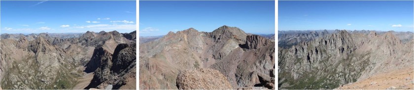
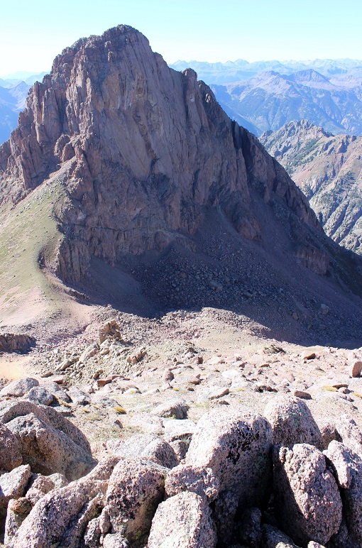
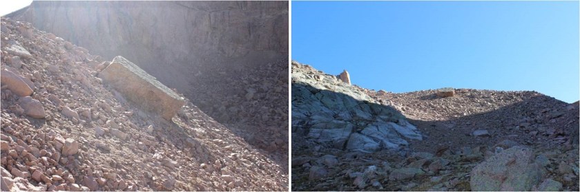
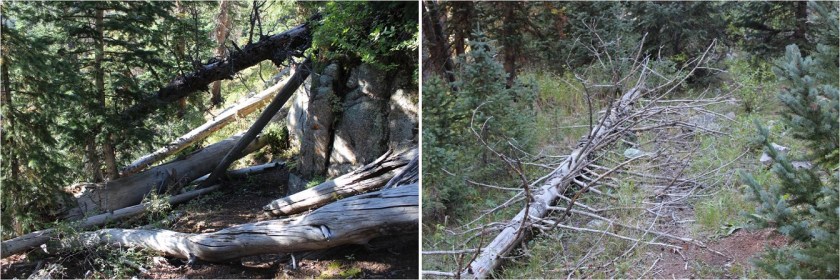
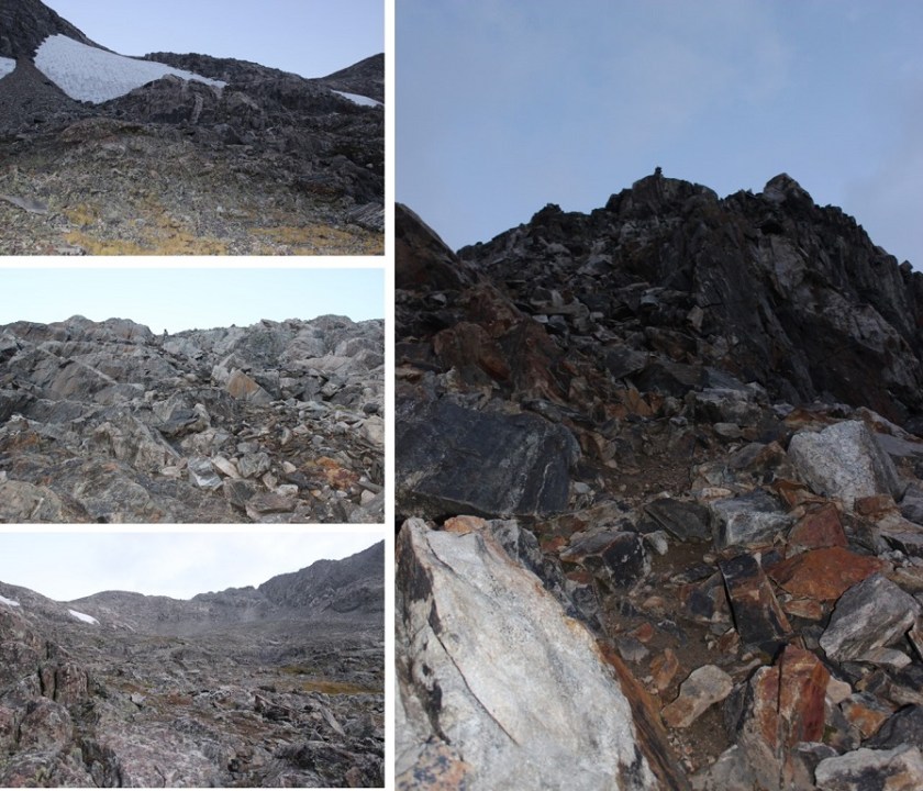
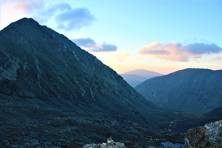
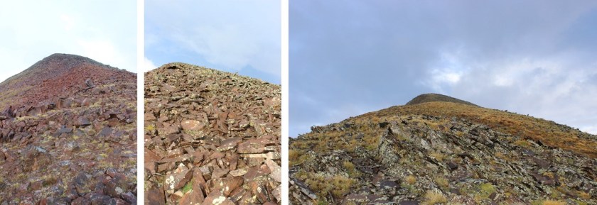
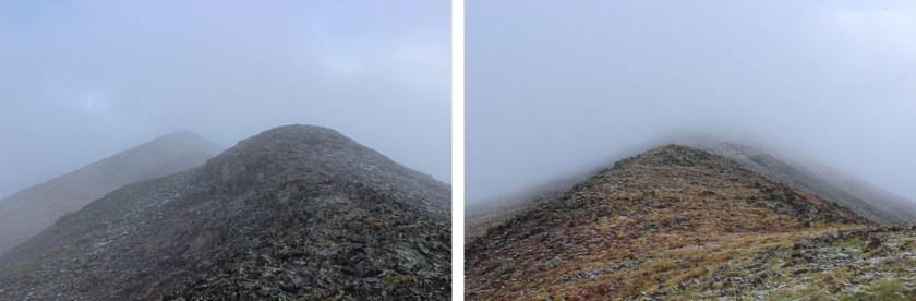
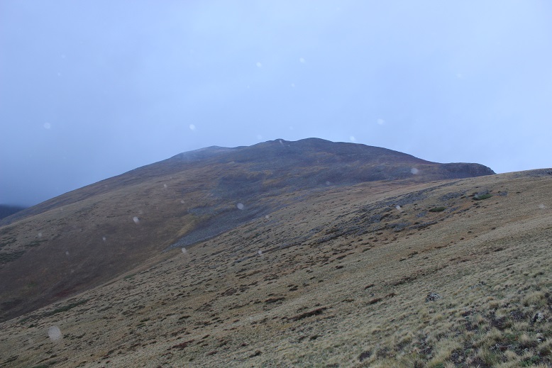
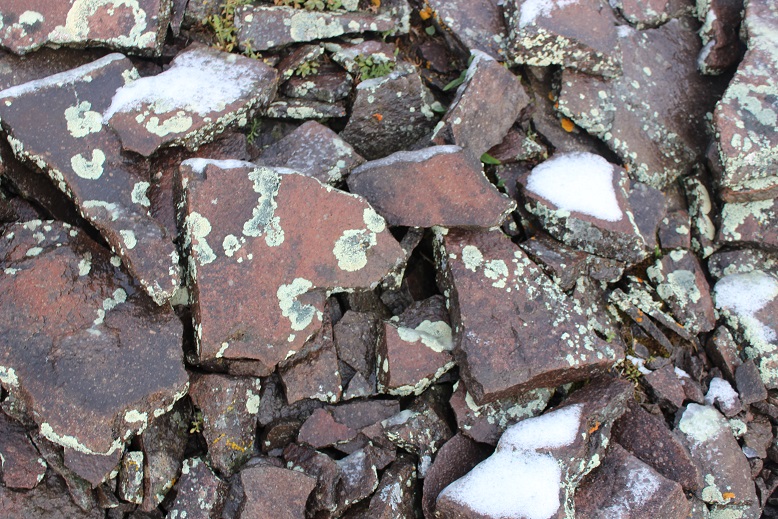
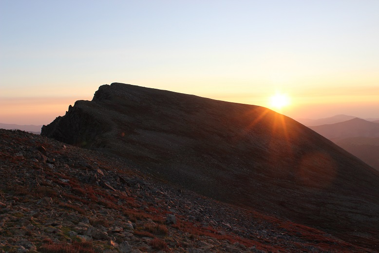
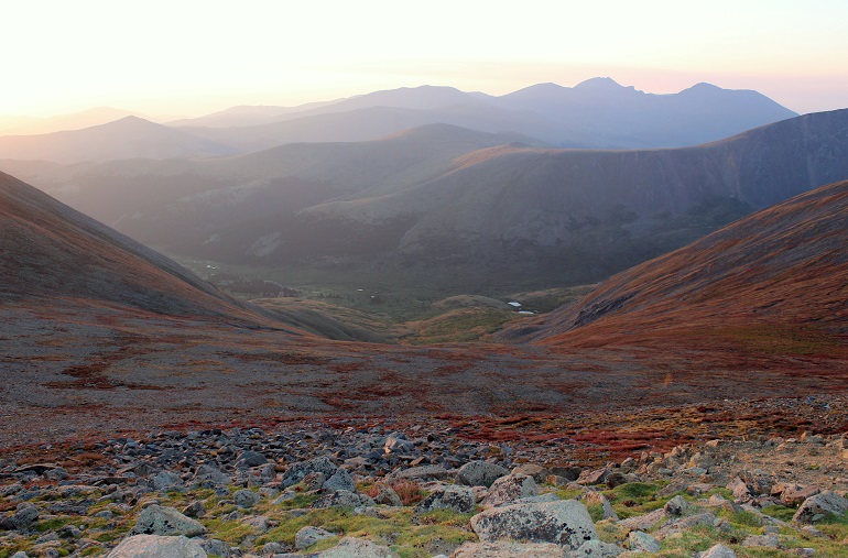
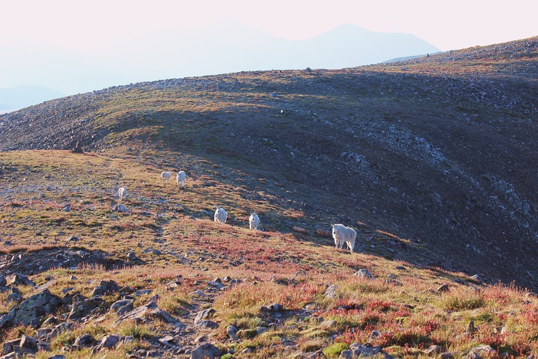
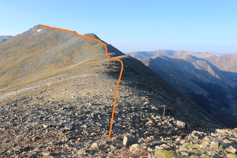
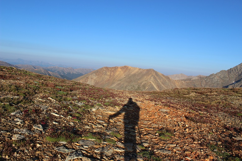
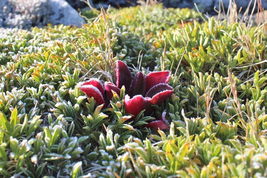
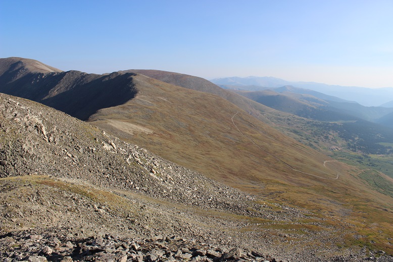
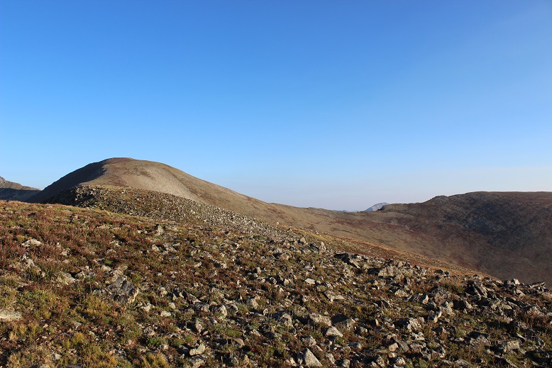
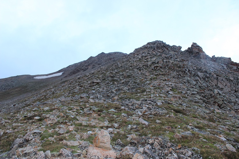
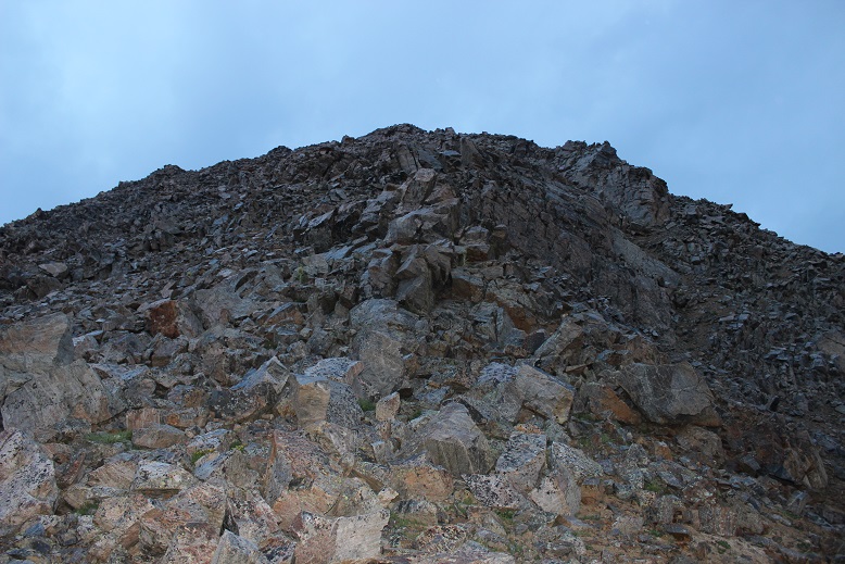
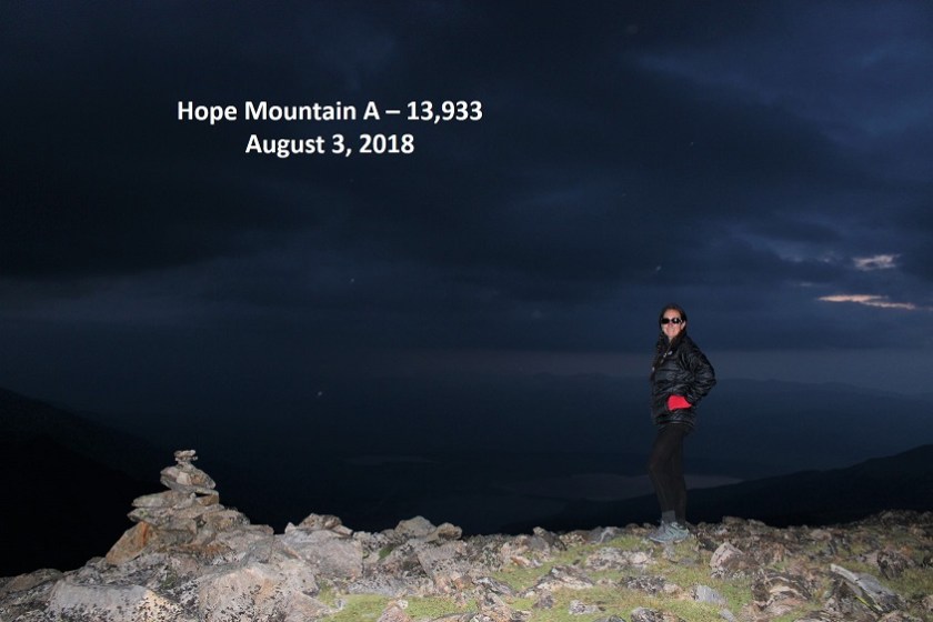
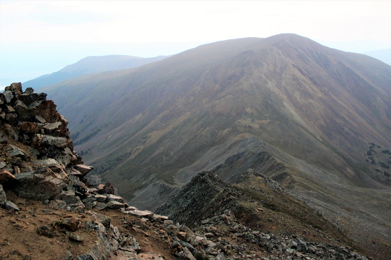
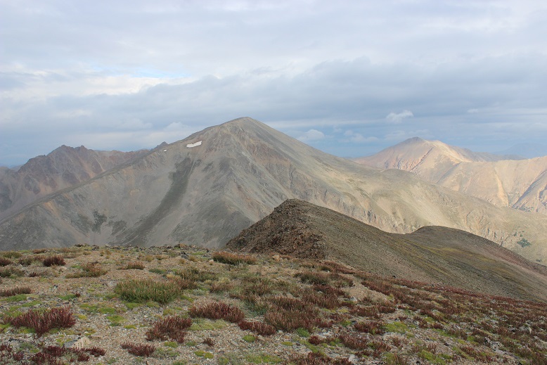
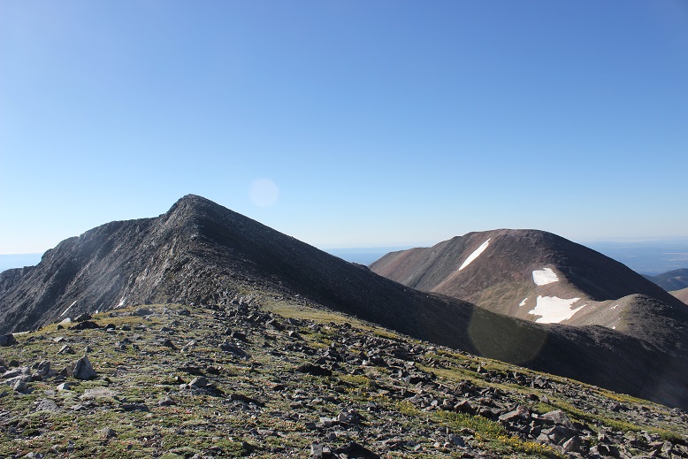
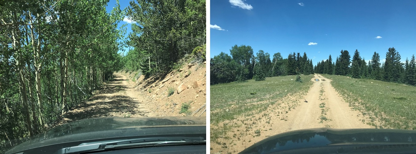
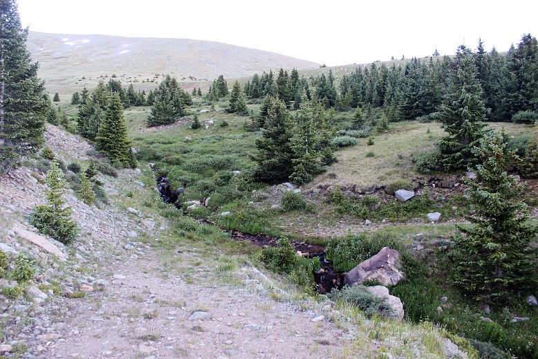
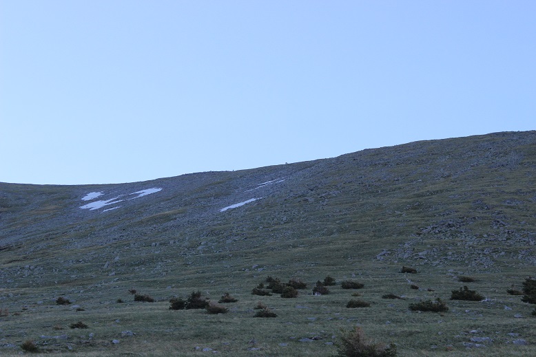
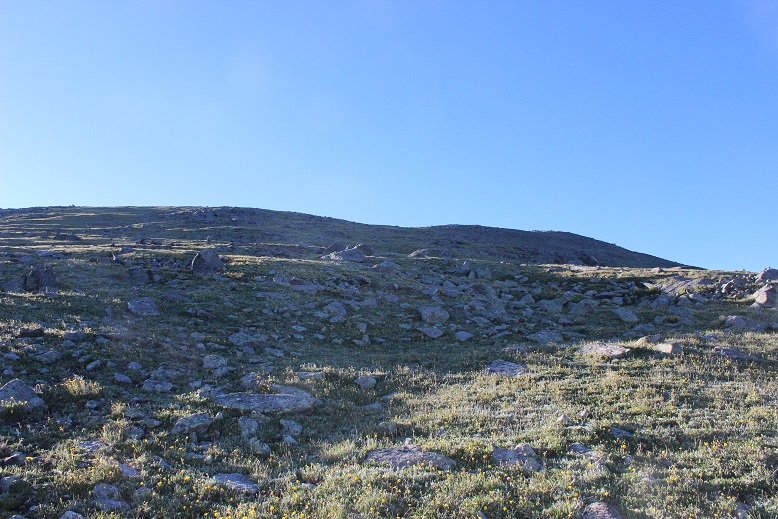
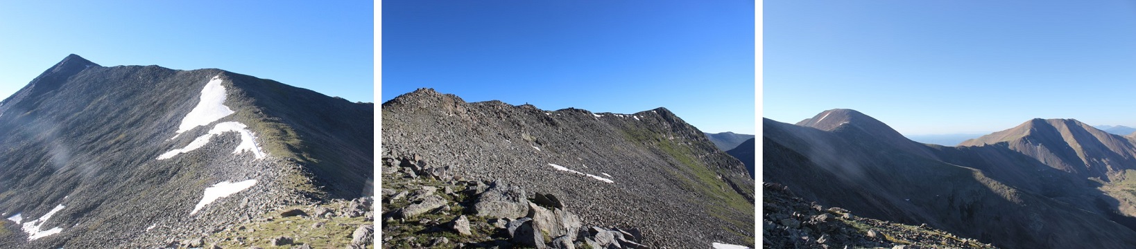
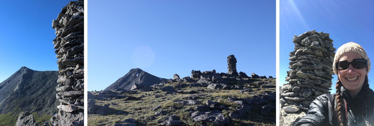
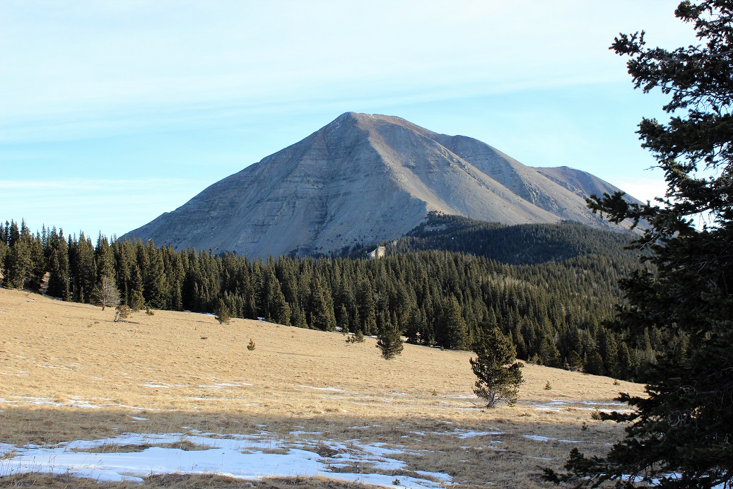
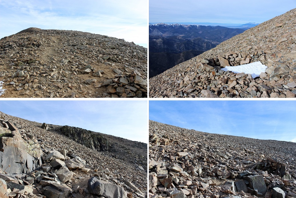
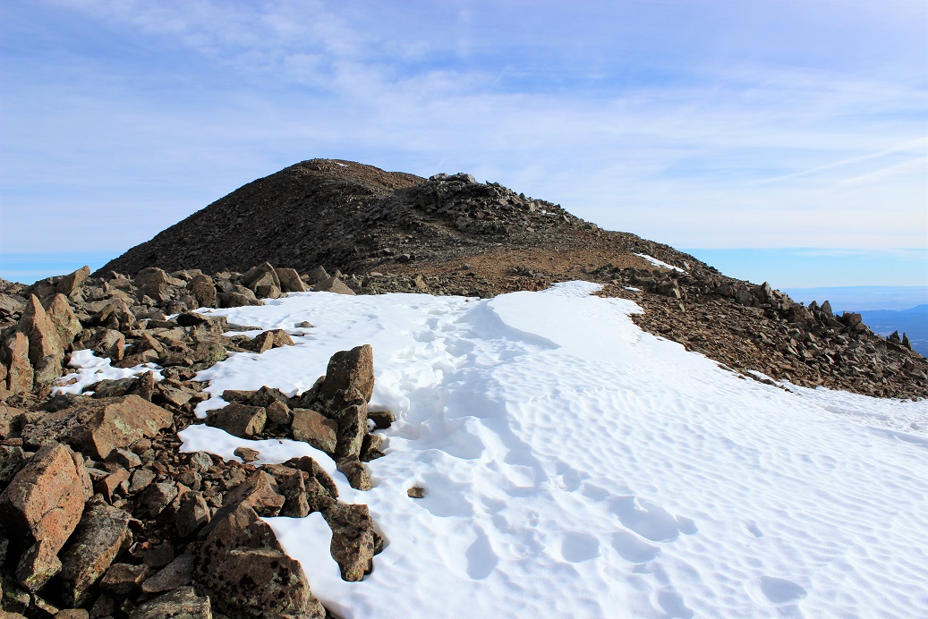
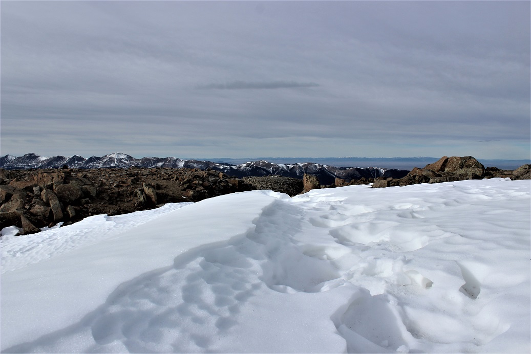
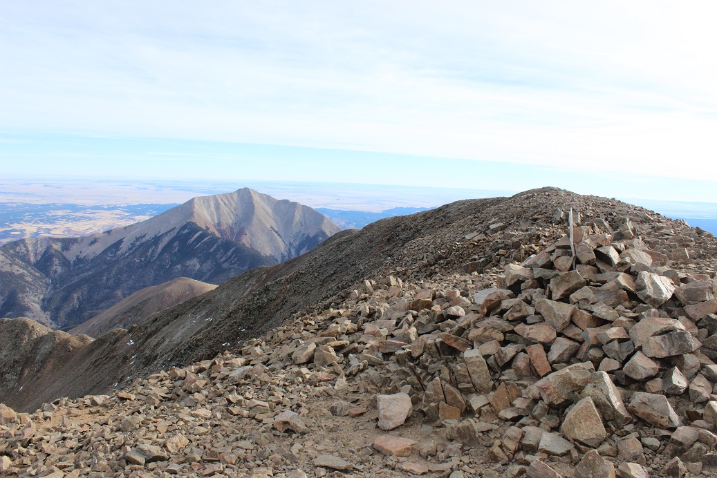
Every year for Labor Day we camp with a group at O’Haver Lake. Our campsite comes with a great view of centennial Mt. Ouray. For the past few years I’ve intended on hiking the mountain during our stay, but weather and a flat tire have interrupted my plans. This weekend however I was intent on making Mt Ouray mine. After sitting around the campfire for hours discussing life with my kids, I set my alarm and was actually sleeping in the tent before 10pm.
My alarm never went off. I woke to one of my cats gently pawing at my face (yes, we camp with our cats) and when I opened my eyes I could tell it was beginning to get light outside. Oh no! I’d planned on waking up at 4am. I looked at my phone: 6:04am. I was a bit worried because it was supposed to snow later today, so if I wanted to summit before the snow I’d have to get a move on. After a bit of fumbling with the zipper of the tent with cold fingers (we have to knot up the strings to the tent doors so our polydactyl cats don’t open the tent and escape during the night) I was in my truck by 6:07am. I guess I was foregoing the coffee and actually brushing my hair. Luckily the trailhead was less than 3 miles away: If I hurried I could still get in the hike.
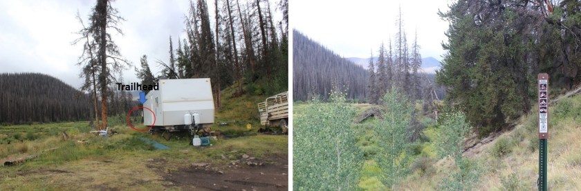
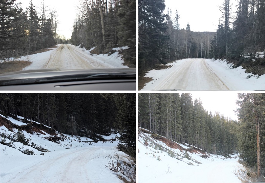
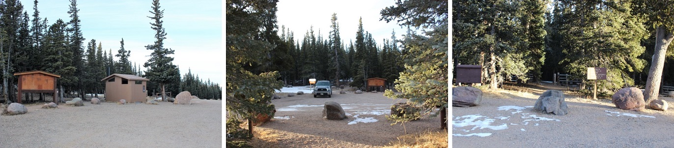
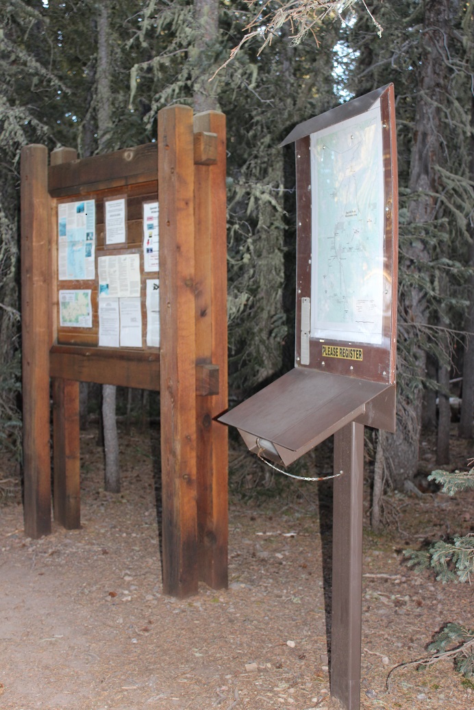
I took Marshall Pass to the Grays Creek Trailhead. Marshall Pass (County Road 200) is a well maintained 2WD dirt road. The trailhead has room for 4 vehicles, but you can also park alongside the road. There is a ton of dispersed camping in the area.
After gathering my gear I started at 6:30am, two hours later than I’d originally planned. The sky was clear so I wasn’t too worried about the weather at this point. I did want to be back to my campsite by noon however to wake up my kids (all teenagers, so yes, they’ll still be sleeping): We had sailing to do today!
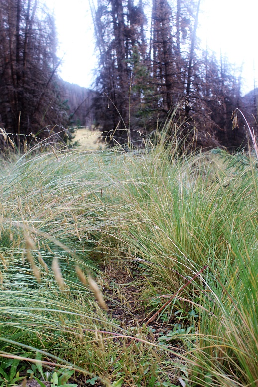
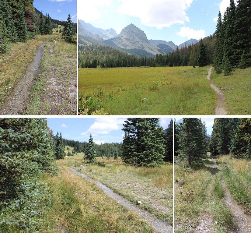
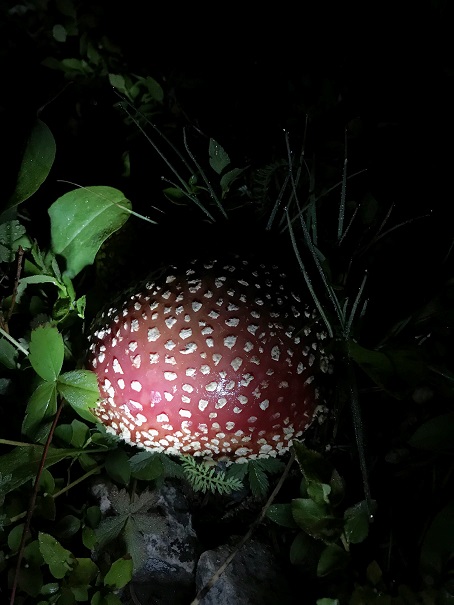
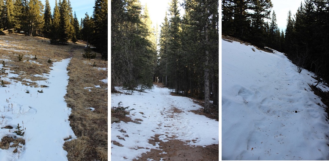
The trail begins lined with aspen and pine trees, gently heading west, crossing Grays Creek several times. Immediately I ran into an issue: my camera wasn’t working properly. Not having a functioning camera was a serious problem for me, so I fumbled with it for a good 20 minutes trying to get it to work (it wasn’t focusing… I think I just need a new lens). In the end I kind of gave up. Oh well, I guess I was just going to get fuzzy pictures today.
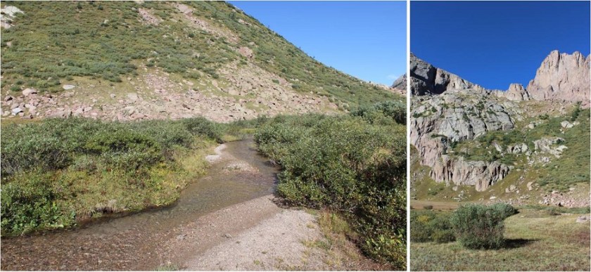
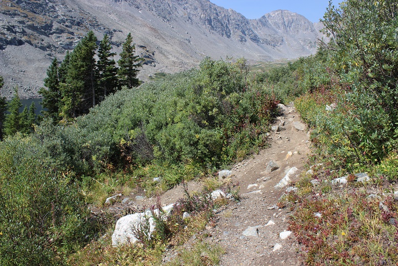
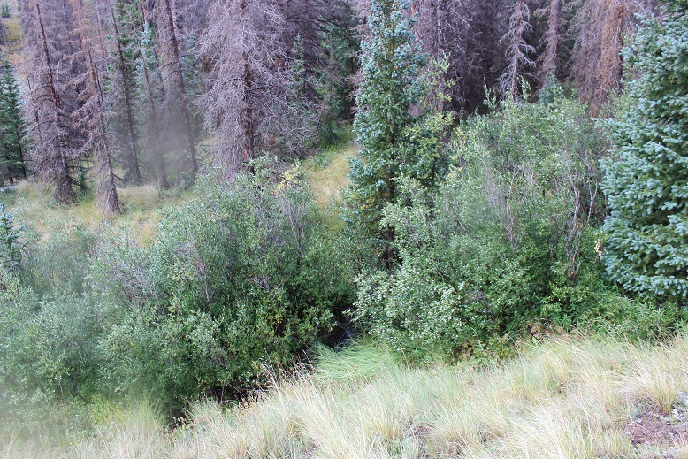
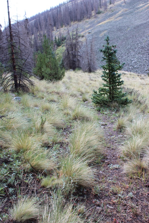
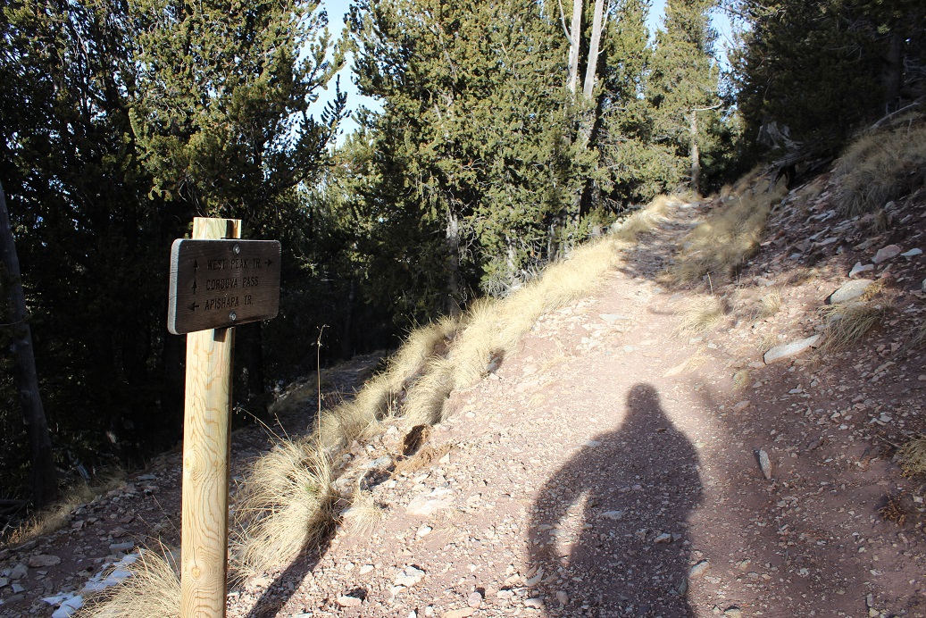
The trail was very easy to follow until I exited the trees and made it to a small boulder field
At this point the trail ends but you just continue up the drainage to the left (head west)
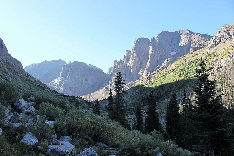
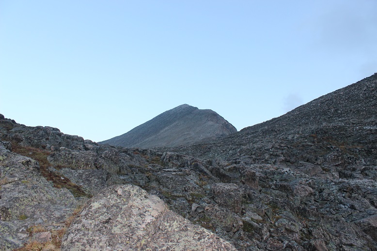
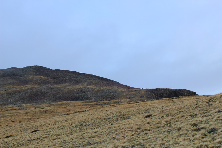
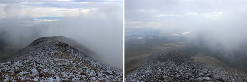
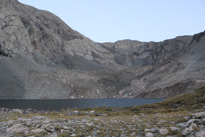
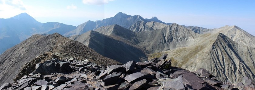
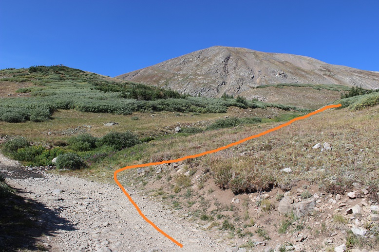
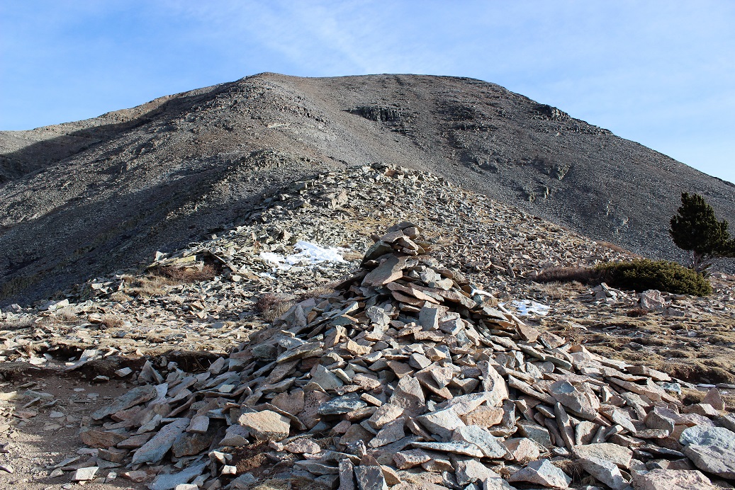
At the top of the drainage I was met with a great view of Mt Ouray’s peak, with small aspens below changing color at treeline. I was thrilled at this point because my camera decided to start working again!
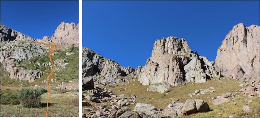
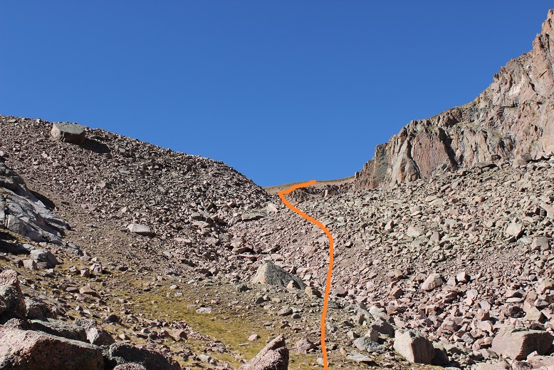
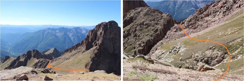
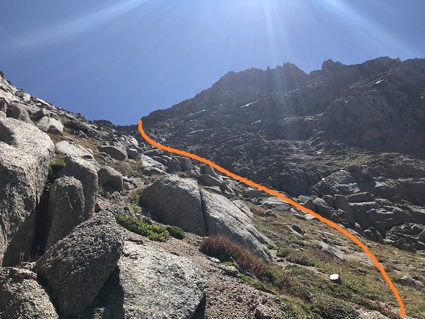
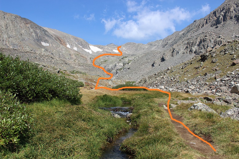
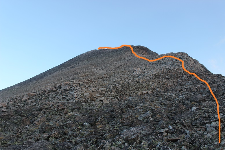
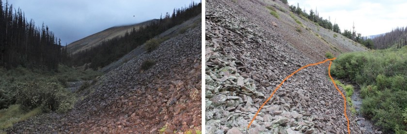
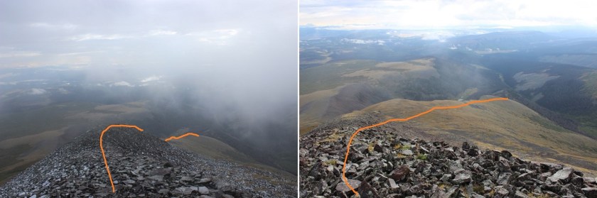
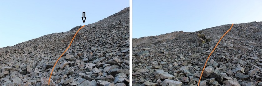
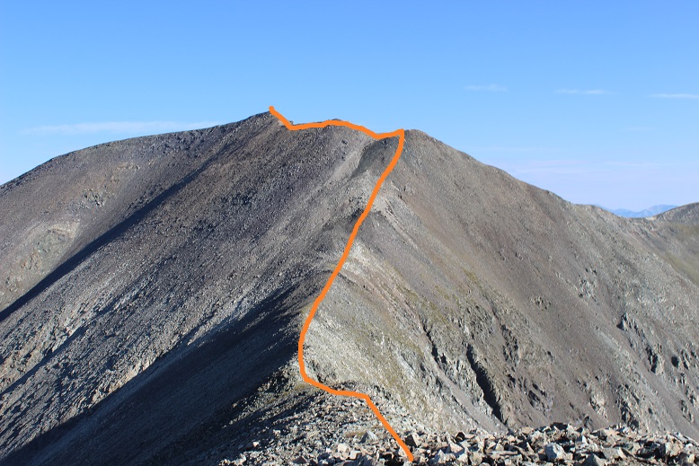
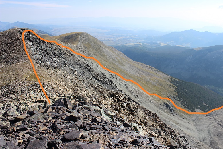
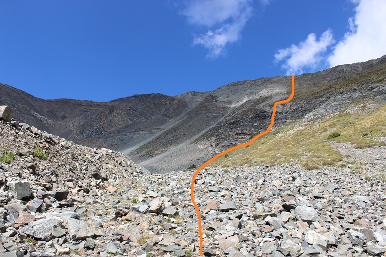
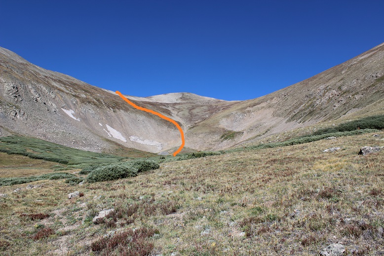
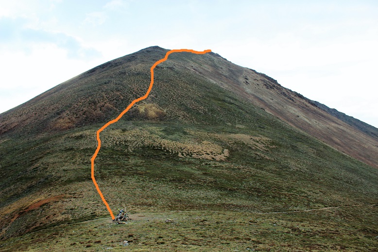
There is still no trail, but your goal is to gain the saddle to the left. Here’s the route I took
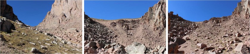
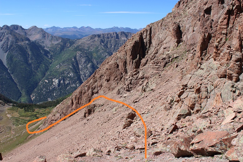
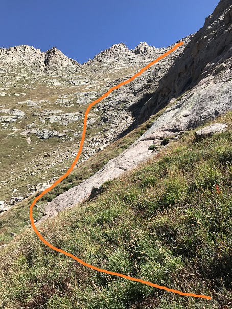
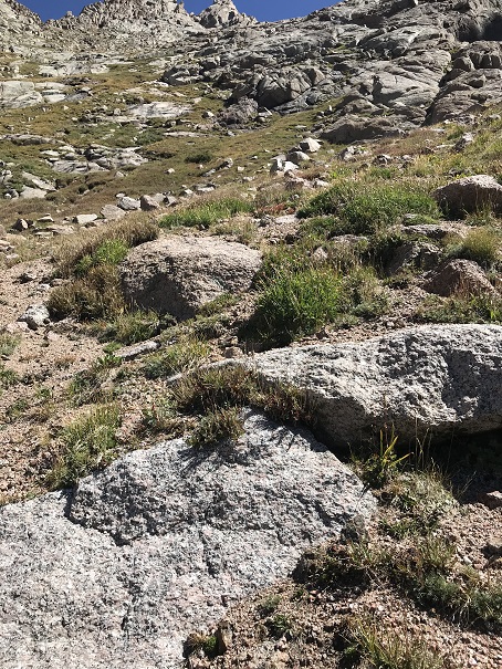
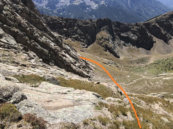
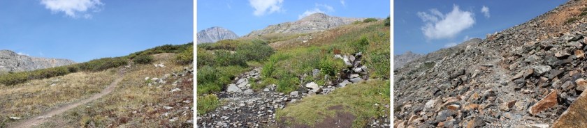
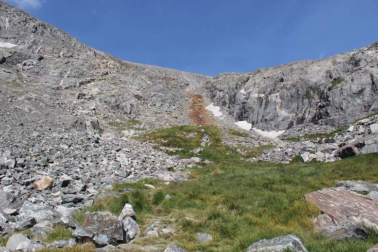
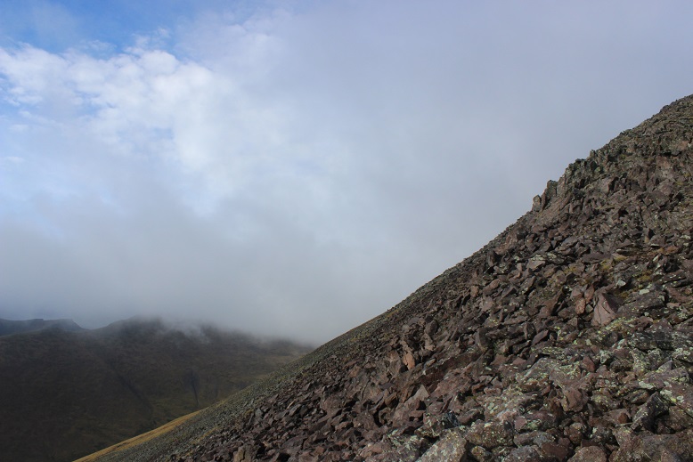
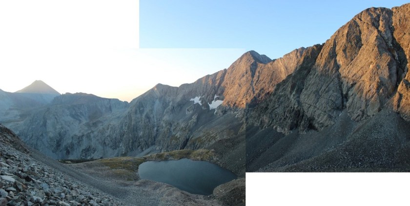
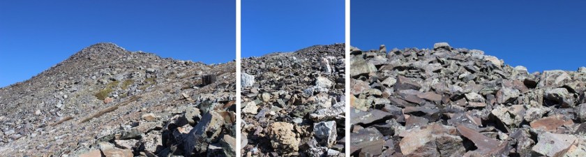
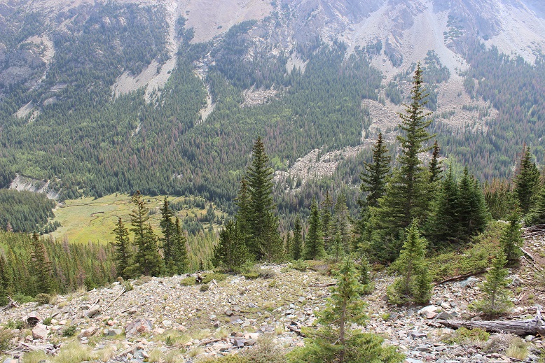
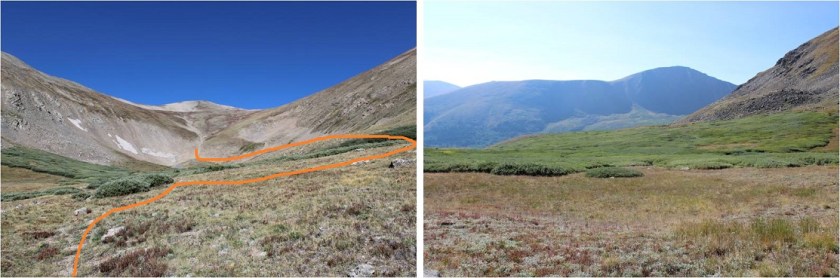
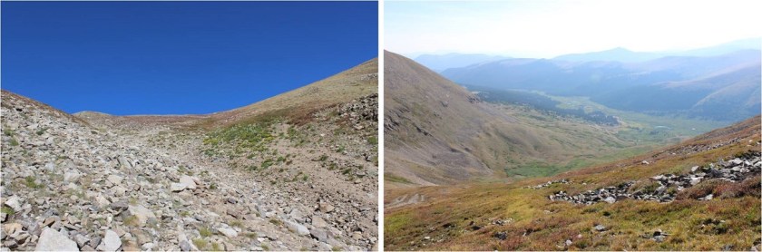
This area is much steeper than it looks, filled with rocks and when lucky a grassy slope with rocks thrown in. It was very slow going due to the elevation gain (about 2000’ in a mile) and because I was sore from hikes I’d taken earlier this week. Here’s a picture from the saddle looking back down on the route I took
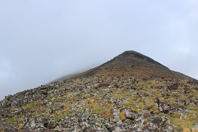
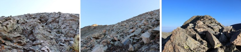
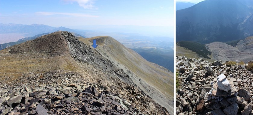
I just kept aiming for the first hump in the ridge. When I was almost there I was greeted with a solid trail that led me another mile to the summit
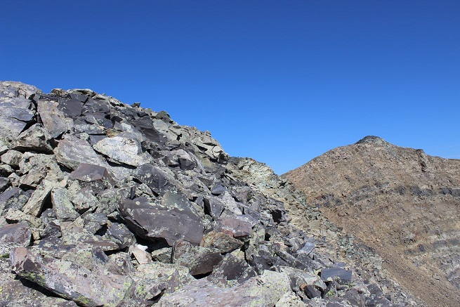
This trail switchbacks up the ridge and then around the southwest side of the mountain (which wouldn’t have been my first choice: I’d wanted to just go up and over and follow the ridge). Once you make it over the first hump you’ll notice several more smaller bumps in the ridge to navigate. Here’s your final view of Mt Ouray
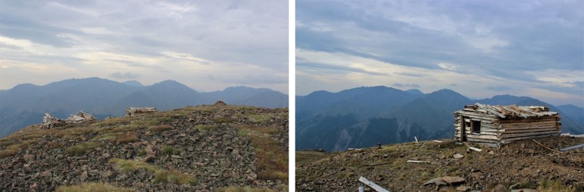
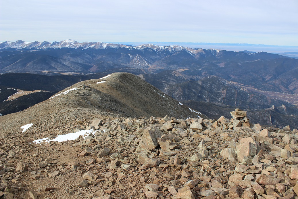
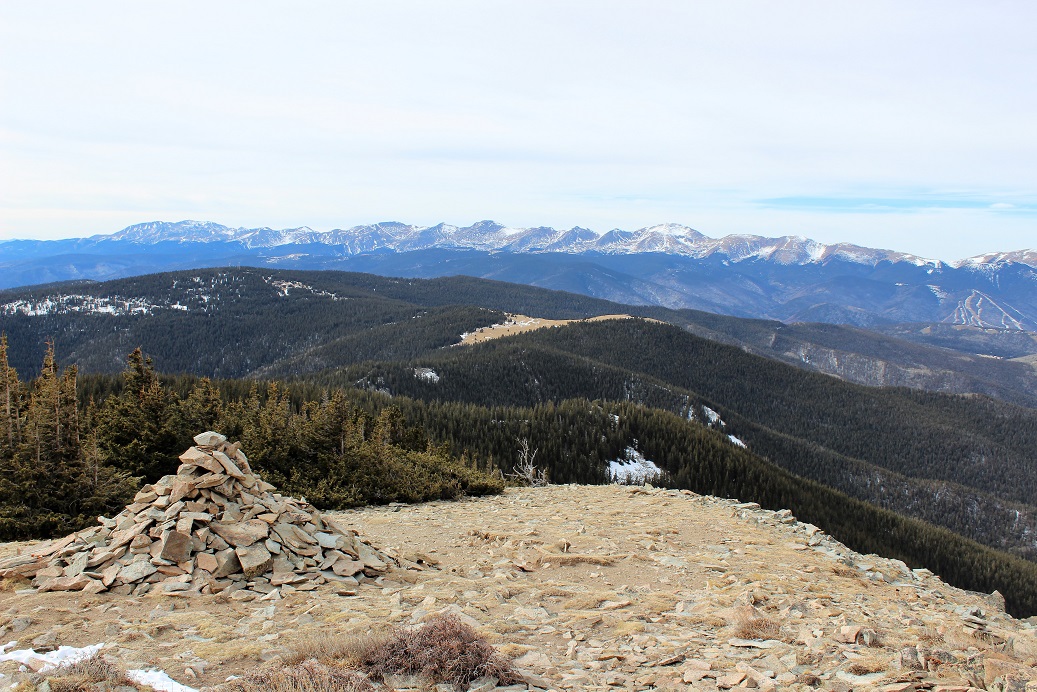
You could tell this area used to be heavily used, even if it gets little traffic now (the trail is now overgrown with tundra in many places). There are several rock wind shelters built at various points on or near the summit.
There is also a 10×15 foot cleared area that looked like it was built specifically to set up a tent and spend the night on the summit. Very cool! I may just be back to do this one day.
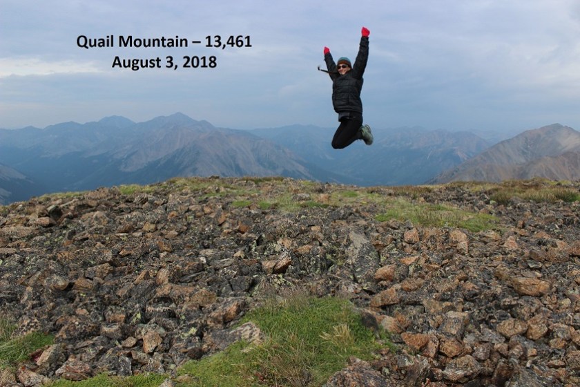
Here’s my summit photo
And video:
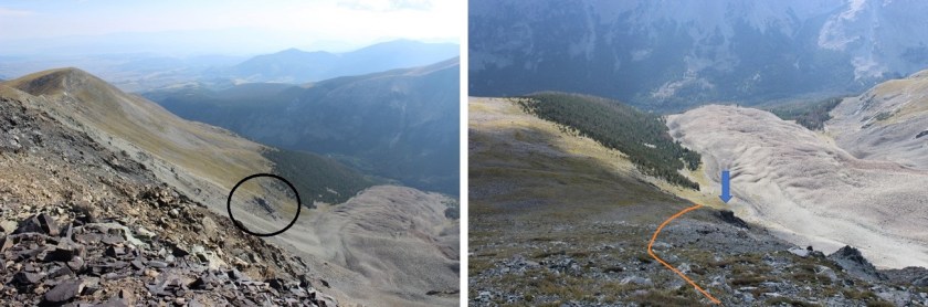
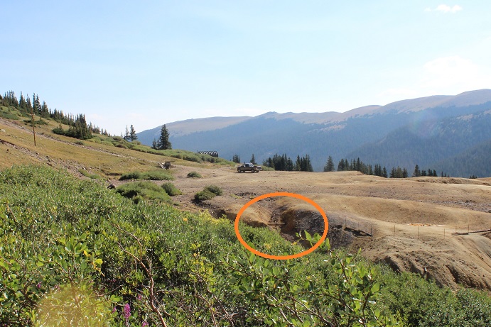
Here’s a look back on the route I took to the summit (and my campsite circled below)
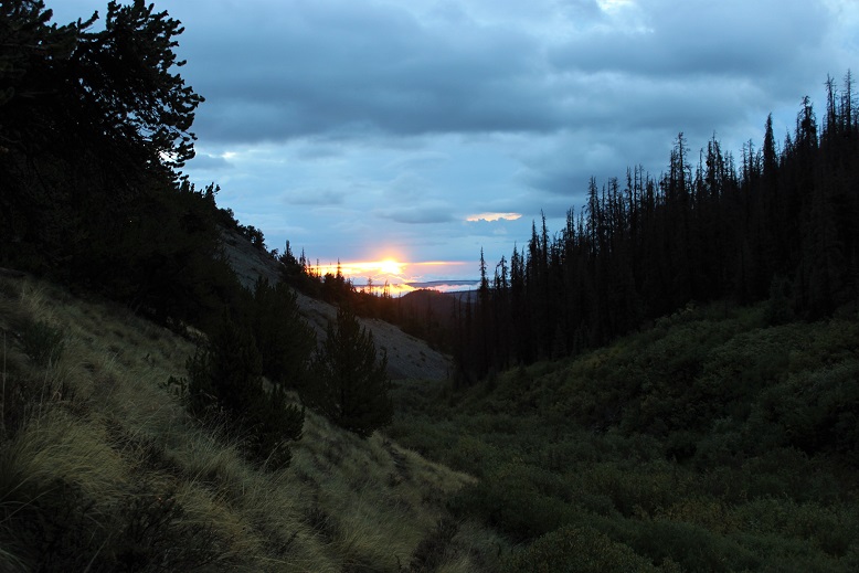
The hike down was much easier than the hike up. I could see snow clouds in the distance, but the weather held off until much later that day. I made it back to the bristlecone pine area and followed the drainage back down through treeline and Gray’s Creek to the trailhead.
I was surprised at the size of the rose hips along the way.
I made it back to my truck at noon, after stopping and talking with a few women hikers about the joys of hiking 14ers (they’d just moved here from Illinois and wanted to attempt one soon). I met them about a quarter mile from the trailhead, and they were the only other people I’d seen all day. That made this a 9.3 mile hike with 4300’ in elevation gain in 5.5 hours (with lots of time thrown in for a camera fix and a chat with hikers). Here’s my route on a topo map
I made it back to the campsite at 12:30pm and woke up my kids. My son wanted to try out the sailboat he’d made out of our canoe (it worked great!)
And later that night we all enjoyed the campfire while it snowed on the peak. IMO, every cat should get to go camping…
Next year I plan on hiking the (shorter) west ridge. I was going to do so the following day but the snow on the peak didn’t look appealing this early in the season. That and I wanted to sleep in…
I’ve been feeling guilty lately. I was one of the 5 people who actually got to ride the train to Needleton this summer. No one else I know caught a ride, yet many of my friends made the trek into the basin anyway, intent on crushing their adventuring goals. They have stories to tell of adding double digit mileage to an already intense adventure, hiking in from Vallecito, Purgatory, Beartown, and Elk Park.
I didn’t feel like I’d earned my hike in this summer; cheating it by taking the train in a year no one else was able. I felt like this made my 2018 summer of hikes/climbs too easy; like I didn’t get the full Chicago Basin summer of2018without the train experience. So I promised myself as soon as there was a nice day in the San Juan’s with no chance of rain I was rearranging my schedule and hiking Pigeon and Turret from the Purgatory Trailhead.
My plan was to drive to the trailhead, sleep for a bit and begin hiking at 1am. I was going to take the Purgatory Trail (etc.) to the Ruby Creek Trail, hike/climb Pigeon and Turret, and then hike back to my truck. Next (because I didn’t want to waste the mileage) I planned to drive an hour to another trailhead in the San Juan’s, sleep until 5am and hike 3 more low mileage13ers the next day. I know Pigeon & Turret via Purgatory is a challenging hike, but reports I’ve read placed it at about a 32 mile 10000’ hike (ha! More on this later). I’ve done Pikes Beak via Barr Trail (26+ miles, 7500’ in elevation gain) two days in a row before, and I’ve always been able to do that one in around 7 hours (even both days two days in a row), so I totally thought my Purgatory plan was doable in a day. Insert God laughing here.
The great weather chance came very last minute. I left work, drove home to pick up my daughter from band practice, made dinner, and drove 6.5 hours to the Purgatory Trailhead, arriving at 12:30am August 28th. I’d originally planned on sleeping for a couple of hours in my truck before starting out, but my target start time had been 1am, so I figured I’d forego the sleep and just hit the trail. I started at 12:30am
It’s a 2WD paved road all the way to the trailhead, with a parking lot that holds about 10 cars comfortably (and several more on the side of the road). There’s a lake and a nice trail that begins to the south and continues east.
The hike down to the Animas River was pleasant, but I couldn’t help but think of how I’d have to hike back up this trail on my way out. It switchbacked down for 4 miles and lost 1000’ in elevation as it wound its way to the Animas River, passing through meadows and hugging the mountainside, even following the Cascade Creek for a bit.
I wish I had pictures of this part of the trail, but I did all this hiking in the dark and figured I’d just take pictures on my way out in the sunlight. I had a flashlight but didn’t need it, as the full moon was lighting my way. I made it to the Animas River, crossed the bridge and the railroad tracks, and started my trek along the Animas River Trail.
This part of the trail hugs the Animas River. Its ups and downs are barely noticeable, unless you’re paying attention to that sort of thing (which I was). I couldn’t help but think how much those elevation losses now were going to hurt on my hike back out. I could hear the rushing of the river, and looked forward to actually seeing it while hiking back out later today.
There are signs at the junction of the Animas River Trail and the Needle Creek approach to the Chicago Basin that state it’s 7 miles from there to the Purgatory Trail. I was skeptical it was only 7 miles.
After some consideration, talking to others who’ve hiked in from Purgatory as well, and consulting the tracker I was using, I’ve come to the conclusion it’s about 7 miles along the Animas River Trail to the base of the Purgatory Trail from this point, plus another 3- 4 miles to the top of the Purgatory trail. Here’s proof from my tracker, stating it’s 9.7 miles from the Purgatory Trailhead to the Needle Creek Approach:
I’ll admit this tracker isn’t always 100% accurate, and tends to overestimate things (but only by a little). However in my estimation 9+ miles is much closer to the actual mileage than 7.
On to the Needleton train stop. I made it to the Needleton stop at 4:45am. This time my tracker said I’d gone 10.6 miles in just over 3 hours.
Not bad. And my tracker was accurate stating it was .9 miles from the Needleton Creek Approach to the Needleton Train Stop, so I think it’s accurate to state it’s 10.6 miles from the Needleton stop to the Purgatory Trailhead. This means if you take the train you’re saving 21.2 RT miles of hiking (or in my case, if you’re not taking the train you’re adding 21.2 miles to your hike).
The next part of the trail is where it gets tricky. There isn’t an established trail or any signs indicating the path you’re to take. I chose to take the Ruby Creek ‘Trail’ as opposed to the Pigeon Creek ‘Trail’ because I’d read the Ruby Creek Trail had some cairns and at times a trail to follow, whereas the (shorter) Pigeon Creek Trail did not. Since I was doing my route finding in the dark I opted for the trail with more indications I was headed in the correct direction.
There’s an area to camp here, where I saw a white horse tied up to a tree. At first I was thinking to myself “Harry Potter and a Unicorn” but after the horse whinnied hi to me I noticed a tent nearby.
I continued along the Animas River Trail for about a mile and turned right, heading up the North Pigeon Creek Trail to the Ruby Creek Trail (neither of which were actual trails). It was dark and I was upset I never saw the Columbine Tree, but figured I’d see it on my hike back out. I hugged the mountains and followed a steep and undefined trail northeast to Ruby Lake. Steep. And undefined. In the dark. Yes, route finding was a challenge, but there were just enough cairns in the right spots to assure me I was on the correct path. As the sun started to rise I got a good look at the path I’d taken thus far
And a good look at the trail ahead of me. Much of the Ruby Creek Trail looked like this. I was glad it was getting light out!
Just before making it to Ruby Lake I saw some bear scat directly on the trail (I was on a trail at this point)
Now I was on bear patrol. The scat didn’t look fresh, but it did indicate a bear had been in the area semi recently. Next I crossed a very thorny raspberry patch (probably why the bear was in the area) and came upon some boulders that led me to Ruby Lake.
The lake was beautiful in the morning light, but there was no good way to get a picture of it because of all the trees. It’s one big lake separated into two in the middle by a log jam.
It doesn’t matter which way you cross the lake, as both sides end up connecting on the upper northeast side of the lake. I chose to take the south route, full of boulders. It’s best to stay low and close to the lake.
If you take the south route you’ll need to cross a small stream after the lake to re-connect with the trail.
I use the term ‘trail’ loosely. I’m not sure if it’s because of underuse this year with the train being closed or if it’s just a poorly defined trail, but this is what it looks like after the lake.
There were some pretty big mushrooms in this area
Stay to the left (northeast) of the creek/waterfall as you climb into the basin. Here’s looking back at the trail from the waterfall area (and the route I took)
Above Ruby Lake:
From the waterfall area here’s the path in front of you
This path includes quite a bit of bushwhacking through high brush, willows, tall grass and flowers. I’m sure there are ticks involved. Once again, the trail isn’t clearly defined but you’ll see cairns every so often indicating you’re on the correct path. The path through the willows looks appropriate for anything about the size of a mountain goat (meaning you’ll get hit in the face with branches but your knees won’t) and in areas without willows the grass/flowers cover the trail. Stay high and to the left. I promise you there is a path the entire way. Also, wear pants (please wear pants hiking people!!!).
Ruby Basin Trail:
Continue on this path until you’re in the center of the basin. Stop here to get a good look and plan the route you want to take (there’s no trail from this point on). Turn to the south, look across the basin and you’ll see the route before you. Head south, cross the creek, and head up the drainage.
This is the path you want to take: aim for the large boulder (it’s freestanding and you can walk around it from either side).
If your goal is just to hike Turret Peak A today head to the left. If Pigeon is your goal go to the right and enter a boulder. This is where your troubles begin. This section is much steeper than it looks, and filled with large boulders and loose scree.
Aim for the saddle you can see behind the boulder field.
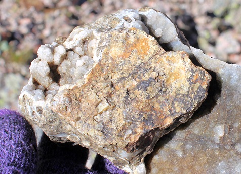
Along the way stop and look at the rocks. They’re pretty amazing, many made up of crystals. Scores of them look like the inside of geodes. They kept me busy for quite some time, until I realized I should just take pictures and keep going.
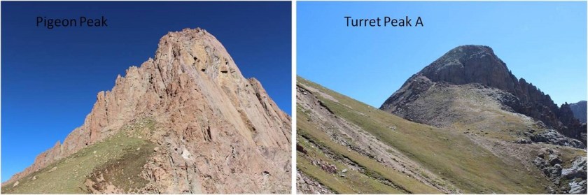
Woohoo! I made it to the 13,100’ Pigeon/Turrret Saddle. I turned around to look at the two summits.
I chose to climb Pigeon first since it was supposed to be the more difficult of the two (it was). I looked southwest and shook my head from side to side: No. That’s not what I’m supposed to do. No way.
But it was. You see, you don’t climb Pigeon from the saddle, you need to be on the other side of the mountain to summit (the west side), but it’s not a direct shot. To summit from this point you have to lose elevation and re-gain it by circumnavigating the south side of Pigeon. I knew this going in, but I’d drastically underestimated the affect it would have on me when I was there. I did not want to lose all that elevation! I also didn’t want to regain it to summit Pigeon only to lose it and regain it again to summit Turret. It was now 11am and I’d been hiking since 12:30am. I was exhausted and honestly I’d expected to already have summited both peaks by this point and be headed back down. I had a serious decision to make: This was going to take a lot longer than I’d anticipated. Did I just want to turn back now?
No. No I did not. I’d come this far, it was a perfect day (not a cloud in the sky) and I was pretty sure I’d regret it if I didn’t keep going, and possibly never come back (the hike in was brutal!). I mentally calculated distance and time and knew my chances of getting back to my truck before dark were pretty much nonexistent now. I took a deep breath and began losing elevation. Several times.
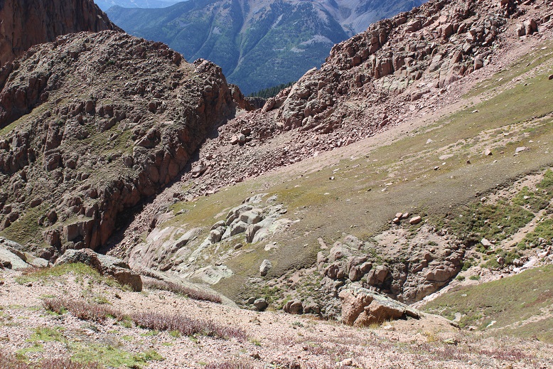
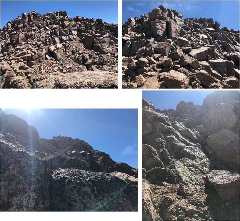
From the saddle look west-southwest and aim for a small notch/gully. You’ll be tempted to stay high, not wanting to lose elevation but trust me, you need to aim for this lower spot. The left picture shows the route looking from above
Once there you’ll continue west/southwest and drop in elevation again. Yep, all the way down to this point (12,400’). The terrain here is perilously loose, and one slip can take you sliding dangerously for a long time. Stay high, aim for the rock wall, and follow it down and around. The higher you stay early on the larger and more stable the rocks are.
Once you round the mountain you’re greeted with 1500’ of elevation to regain. It’s actually harder than it sounds/looks.
Continue west until you’re halfway across the slope. Head right (northeast) to the base of the summit pyramid. Pick your route and stay on the grassy areas as much as possible to avoid the scree. This is a very steep area.
The grass changes to the worst rubble gullies I’ve ever encountered. Scree, sand, rocks, and steep elevation don’t mix. It’s steeper than it looks. I don’t usually sweat while hiking, but today I was. I could feel drops forming and rolling down my sternum. This was a workout!
Just keep aiming here
The terrain eventually changes to large boulders. If your helmet isn’t already on now’s the time to put it on. This rock itself is stable, but it crumbles when you touch it (hence the rubble gullies). It’s very slow going.
I’ve been told this is a class 4 climb, but by aiming for the base of the ramp and following it to the summit I was able to keep it at a class 3. There was still some intense scrambling going on, but nothing class 4.
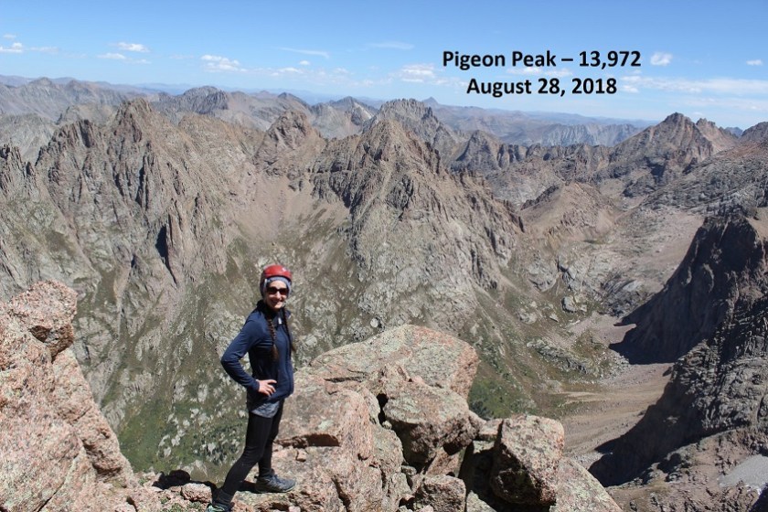
I (finally) summited at 1:15pm. I’m not standing on the photogenic rock in the middle of the picture because the longest my camera will go on automatic is 10 seconds, and it wasn’t safe for me to make it there in that amount of time. #solohikingproblems
VIDEO:
Wow. That had been intense! I’d seriously misjudged today’s hike. I’m pretty sure it took me longer to summit Pigeon Peak than any other peak I’ve attempted. (12 hours, 45 minutes). It wasn’t lost on me I wasn’t even halfway through my day yet. I still needed to descend back into that basin, regain the saddle, and summit Turret Peak A. Did I still want to summit Turret? Honestly I was seriously debating this the entire time I was descending Pigeon, and told myself I’d decide when I reached the saddle. It had already been a very long day and I was very, very tired. Pigeon had kicked my butt!
Here’s the descent route from Pigeon: First do your best to stay on the grassy areas to avoid slipping, and aim here
Locate a “thumb” in the side of the mountain. From here aim for the first gully/saddle to your left, being careful to stay as high as possible to avoid dangerous scree
From the gully/saddle you can see most of the route left. I decided to attempt Turret (not really a surprise). At this point I knew I wasn’t getting back to my truck before midnight and I wasn’t going to get to see the Animas River in the daylight. I wasn’t going to get to see the Columbine tree and I wasn’t going to get any pictures of the Aspens I knew were changing colors. (All reasons to come back I guess?)
I didn’t want to route find at night. I really didn’t, but I’d made the decision to come this far and even though I was exhausted I knew I could do this. I’d made it here route finding at night, hadn’t I? I could do the same route finding back to my truck in the dark.
Instead of re-gaining the Pigeon-Turret saddle I crossed lower, aiming for this large rock.
Once I passed the rock I turned right and followed the scree filled slope to the summit. This scree was just as bad, if not worse than the scree on Pigeon. There were also some large boulders to contend with (but it stayed at a 2+)
I summited at 4pm. Exhausted. I set up my camera but noticed too late I was out of the picture… that’s ok, people would rather see the views anyway. I was too tired to try a second time.
VIDEO:
The views were incredible! I turned around and looked back on the route I’d taken along the Animas River
And some other peaks in the area…
Wow. A 4pm summit. It was late, and I was now halfway through with my trip. I needed to book it down this mountain and back to my truck. But first I had to wish my friend a happy birthday. I turned on my phone, noticed I had reception, sent her a quick note and one to my kids letting them know I’d summited and turned my phone back off. I thought to myself how it would probably be faster to drive from my house to Purgatory (6.5 hours) than it would be for me to hike there from my current position.
I turned back towards Pigeon Peak and headed down.
The boulders at the beginning of that large rock gully were bigger than I’d remembered. And check out that boulder! It was about 30 feet across. With how loose the rock was here I didn’t feel safe anywhere near it.
I headed back down into the Ruby Basin and had to stop for a second to enjoy the enormity of it all. I hadn’t seen one person all day. I want to come back and camp here
VIDEO:
I crossed the creek and located the “trail” that would take me back to the lake. I was surprised at just how fast the sun was setting. I mean, it just kept getting darker and darker by the minute! It became my goal to make it past the bear scat before I needed to get out my flashlight. I made it (barely), got out my flashlight, and steeled myself for some serious in the dark route-finding. It’s different route finding at night in the dark instead of early morning in the dark because you don’t have the sun coming up to look forward to (or wait something out). For reference, imagine navigating the following terrain, but at night. It really gets tricky when a 150 foot tree falls directly on the trail and you have to navigate around it without one of your senses to help
At least the route in the picture above is an actual route. Most of the trail down lacked a defined trail. It was steep and route finding wasn’t easy. But I reminded myself I’d done this once already today, I could do it again. I just kept hugging the mountainside to the left and kept listening to make sure the Animas River was to my west.
Route finding at night:
I made it back to my truck at 2am. My tracker told me this was as 39.3 mile hike with 12,275’ in elevation gain. I believe it (this is my more accurate one than the one I’d used earlier). It took me 25.5 hours to complete
This was by far the most challenging hike I’ve ever attempted endurance wise. For those of you just wanting a trip report, it stops here. For those of you interested in what happened in those 6 hours it took me to hike from Ruby Lake back to my truck, read on.
I’m not sure when the hallucinations started, but I fully noticed them around 10:30pm and tried to trace them back in time. It must have been around 9pm. I was in the middle of the Ruby Creek trail when I noticed I was running a fever.
Have you ever had a hallucination before? Well, I haven’t (besides those auditory ones near the river on Snowmass, which I experienced again on this trip btw.). Well, I noticed the river singing this time for what it was and wasn’t put off by it, but now I was hearing voices in my head and having visual hallucinations as well. I was about halfway down the Ruby Creek Approach, desperately determined to correctly route find in the dark, when I became more than flushed. I could tell I was running a fever.
I began talking to myself about myself, as if I were someone else (like a doctor talking with a nurse about a patient). What’s weird is I was having a conversation in my head with another person who wasn’t there. Interestingly enough, I was the male in the conversation, talking to a female about the patient (me).
“She’s running a fever. Anything over 102.7 and she needs to evacuate”
“Make sure she keeps drinking and gets plenty of water, but ration it so she doesn’t run out”
“Now is a good time to start trying to talk her out of those other 13ers in the morning”
“You know she’s stubborn and it won’t be easy, start reasoning with her now”
I’d hiked for two more hours before I recognized I’d had this dialogue in my head, or that it was out of the ordinary. What made me think back to this conversation I’d had in my head? It was the third time I said “Hey Bear!” and it ended up not being a bear but a shadow. I paused and took time to look at what I’d thought was a smallish bear rolling on its back and happily sucking its toes. Unlike a real animal it kept doing what it was doing and didn’t run away. I walked closer and it turned into the shadow of a rock. I’d also been seeing red eyes glowing in the dark since it became dark.
I knew the hallucinations were due to low blood sugar and lack of sleep, but I have Raynaud’s and didn’t have a sleeping bag/blanket with me, so stopping to sleep or rest was out of the question. I had food and water but food didn’t sound appetizing. I felt like I’d throw up if I ate anything, but lack of food meant low blood sugar and that combined with strenuous exercise and lack of sleep meant hallucinations (I’d been up since 4am the day before so I was going on 45 hours with no sleep and all I’d had for dinner before hiking was string cheese and two slices of roast beef).
I was saying things to placate myself like:
“Tell her we’ll get the rocks out of her shoe at the next stop. She just needs to focus and keep going to the bridge.”
“When we get to the base of the Purgatory trail she can have another piece of candy”
I made it to the Needleton stop and thought to myself I still had 10 miles to go. OMG, 10 miles! This was insane! It had been dark for hours (I’m guessing it was about 10pm at this point) and I was physically ready to drop. But I kept going. Stopping just wasn’t an option.
I felt like a machine, thinking outside of my body, running on autopilot. I was referring to myself in the third person. Ever the scientist I recognized what was going on and decided to document it in my mind to remember later. I was having both auditory and visual hallucinations (and apparently talking to myself). Not only as I talking to myself, I was talking to myself in third person, treating myself like I said before as a patient instead of as me. It was more than just a “pep talk” to keep going (but it was a pep talk, just from someone else… who was me).
Why was I seeing so many shadows tonight? I hadn’t seen any last night? Why was hiking tonight so different from last night? Then it occurred to me: the full moon wasn’t out yet. Yesterday the full moon had eliminated a lot of the shadows I was seeing tonight in the rays of my flashlight.
The visual ones were the most interesting. Once I realized the bear(s) weren’t real I decided to pay attention to what was going on. I couldn’t make the hallucinations stop, but I could accept them for what they were. They came in many forms, there was only one image at a time, I never knew what they were going to do, and they were all trying to get my attention for one reason or another.
I started using the experience as entertainment, like a tv show to keep me occupied and my mind off the fact I was physically exhausted and it hurt to continue hiking. Here are some of the hallucinations I had:
A woman in a t-shirt trying to get me to notice her t-shirt (dancing around holding up the fabric on her shoulders with her fingers while moving side to side)
A life size version of Yoda climbing a tree
Horses shaking their heads and pawing at the ground
Apes / Sasquatch walking past me (I’m guessing this was because I was seeing my shadow a lot)
Witches with cauldrons
Frogs, snakes, and bugs skittering across the path (they’d been the leaves and sticks on the ground)
Flashing black and yellow freeway signs (I didn’t read them because I was scared to see what they’d say)
Street vendors trying to get me to visit their stores
Every type of animal you can imagine pretending to be a human (a giraffe trying to use an umbrella, a zebra on two legs trying to mow a lawn)
Eventually the visions would all become a shadow/rock/tree/etc. as I passed by. As the night wore on the hallucinations started getting bolder and coming towards me. Knowing they weren’t real but still fearful, I decided to keep my head down and focus on the trail directly below my feet. From the time I crossed the Animas River until I made it back to my truck I refused to lift my head to look at anything ahead because something would lunge at me from out of the dark (not really, but it felt real at the time). The good news was I’d stopped talking to myself in the third person.
The trail up from Purgatory was terrible. It was much longer than I’d remembered, the leaves and small rocks under my feet became large bugs and frogs I tried in vain not to step on, and none of the terrain looked familiar or as I’d remembered it from yesterday. I had to keep checking my map and compass to make sure I was headed in the correct direction (I was).
I needed rest. I needed to eat. I needed to make it back to my truck so I could do both. At this point there was no way I was going to drive to another trailhead and attempt any more 13ers tomorrow (today!).
I made it back to my truck at 2am. All of the vehicles in the parking lot were the same ones that were there when I’d left. I needed to eat. I wasn’t hungry but I told myself I had to eat to replace all the calories I’d burned, so I got out a Mountain House meal and the Jetboil and got to work.
I found a ‘safe’ place to light the Jetboil, which ended up being in the middle of the parking area (small rocks and pebbles were the ground cover). I’m so glad I decided to light the stove in a fire safe area because as soon as the water started boiling and I tried to turn the stove off it wouldn’t turn off: the flame just kept intensifying. Yes, I was operating it correctly and I knew what I was doing. I decided to pour the water into the bag so I wouldn’t pour scalding water on myself as I was trying to put out the flame. You can probably guess what happened next. There’s a reason you’re not supposed to turn a Jetboil sideways/upside down. The flame quickly became 5 times its original size, dancing wildly. I momentarily panicked, blew on it, and the flame went out. Whew! That was a disaster narrowly averted. Advice: Don’t try to operate a camp stove when you’ve been hallucinating.
I put the stove away, ate my dinner, set my alarm for 9:30am and quickly fell asleep in the back of my truck. Two seconds later my alarm went off. It was already bright and quite warm outside. I did a quick head to toe physical assessment of myself: My hair was a mess, my head didn’t hurt, my feet were dry, warm, and operational. I was thinking clearly, and I wasn’t sore (at all, which was weird considering all the activity I’d done). I felt fine to drive, so I jumped into the front seat and was on my way, glad I’d had the sense to fill up the truck with gas the night before.
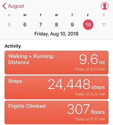
Normally I get on the treadmill everyday and do 5 miles with 4000’ of elevation gain, unless I’ve hiked more than that. I do this 7 days a week, and have done so for the past 8 years. I’ve been known to hop on the treadmill after easier 14ers like Bierstadt or Evans because I didn’t get enough of a workout in. Today I’ve only hiked 1000’ of elevation gain, but I’ve done 7 miles since midnight, so I’m calling it a draw and not getting on the treadmill today… I don’t even feel guilty!
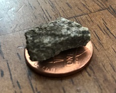
I was a bit worried about today’s hike. After hiking Stewart Peak with frozen feet last Tuesday I found this rock in my right hiking boot.
I’m not sure how long during the hike it had been there, but it had apparently rested under the ball of my right toe for quite some time. I know this because for the past 2-3 days I’ve had a hard time walking without pain. My foot wasn’t red or swollen, but I couldn’t walk on it normally, and it hurt to massage it. I researched my symptoms, and Google told me I did something to the joint. Ironically the way to treat it was to either exercise it, rest it, or take Ibuprofen. I don’t rest and I don’t take medication if I can avoid it, so I decided to get some exercise (but not too much).
So for today I picked a moderate class 3 hike that was supposed to be about 6 miles in length with around 3000’ of elevation gain in a heavily trafficked area so if something went wrong I’d have a better chance of finding help.
I woke up at 2am (woohoo! It’s like I slept in!) and made it to the trailhead at 5am. There was one other car in the parking lot but as I was getting ready someone pulled up and asked me if we were at the Quandary Trailhead. Technically we were, but it’s the trailhead for the more dangerous West Ridge route, and I figured by looking at them they were looking for the East Ridge Route, so I gave them directions back to the lower trailhead. For so many reasons sorry not sorry if I’d been wrong.
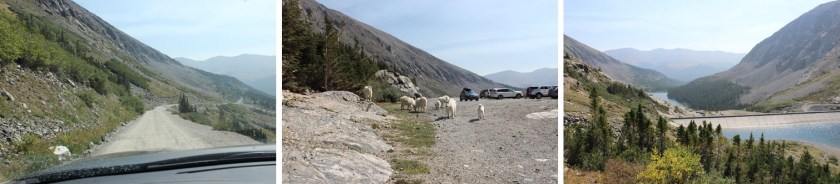
Here’s a view of the 2WD dirt road in and the parking area
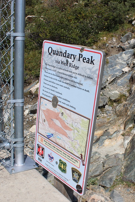
It was dark when I started out. I crossed my fingers and started my new tracker, walked to the right to the hill where the gate and dam meet and noticed this sign:
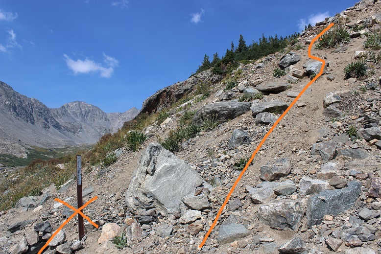
There’s a trail here that follows the lake. I took it for longer than I should’ve and quickly noticed my mistake: I was too far south. In the dark where I was supposed to turn didn’t look safe so I’d continued along the lake looking for another trail that headed up. Luckily there were several social trails that headed north towards the correct trail. I found one that was most likely more difficult than the first and was soon back on route. Here’s where you’re supposed to turn right and climb the hill.
Here’s where I joined the trail
The trail up through the basin is easy to follow (even in the dark). The trail gained elevation very gradually and my right foot throbbed with every step.
Here’s the route I took through the basin and up over to 12,500’
Once the trail ends it’s heavily cairned and easy to follow, even in the dark. I wasn’t able to see the red gully, but it was still the obvious trail to follow. As I gained in elevation and the route became steeper my foot curiously stopped hurting.
After the red gully there were large boulders and rocks to hike around, with lots of carins to help out with route finding.
When I reached the top of the basin I turned around. Quandary’s west ridge looked amazing in the morning light!
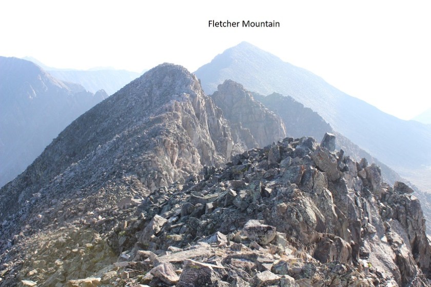
Ahead of me I could see Fletcher Mountain
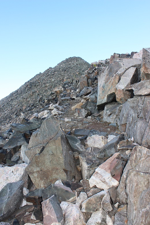
There was no trail, but the route to the summit was obvious. Here’s the route I took
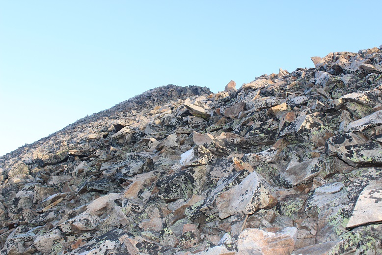
You want to stick to the left of the ridge because there are steep drop offs to the right. The rocks aren’t stable but they won’t fall on you either, they’ll just roll. About half way up it started getting tricky: I was curiously slipping with every step! That wasn’t right? I have great shoes that usually grip everything. It seemed there was a thin layer of ice on the rocks I couldn’t see but which made hiking without slipping nearly impossible. Yes, I resorted to a kind of forward crawl where I had at least 3 points of contact the entire time. I probably looked silly with my butt in the air but I wasn’t slipping and falling. And there wasn’t anyone around to see…
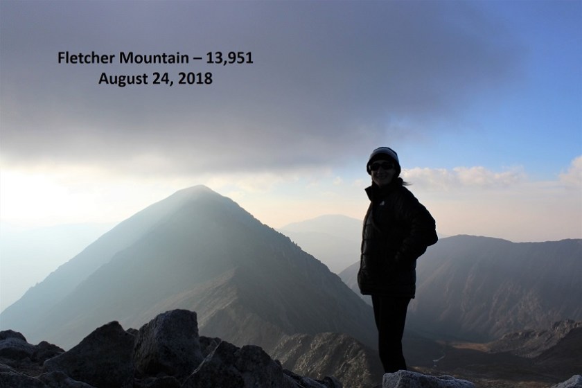
I made it to the summit at 7am and had a great view of Quandary (it looked cold up there!). The wind was intense and made it much colder than it should have been. Here’s my summit photo
And video:
The cloud above Quandary worried me, but the wind was blowing east and I was headed west so I decided to just keep an eye on the weather. Otherwise it was a perfect morning!
I looked to the southeast at my next goal
The hike down Fletcher towards the saddle was just as awkward as the hike up (I kind of spider crawled due to the ice) but by the time I’d made it to the saddle the ice was pretty much gone. Here’s the view of Drift (left) and Fletcher (right) from the saddle
This is a great place to put your helmet on (and keep it on until you make it back here). The beginning part of the ridge for Drift wasn’t too difficult. I just gained the ridge and followed it
From the picture below you want to stop following the ridge and turn right (north) to bypass the crux of the route (if you continue on the ridge you’ll encounter steep drop-offs and need to turn around)
You’re looking for and aiming towards a large round bolt in the route. It’s about 5 inches in diameter, and visible from a good ways away if you know where to look. I’ve circled the bolt in the pictures below
When you make your way to the bolt you’ll see by facing north how to drop into the gully.
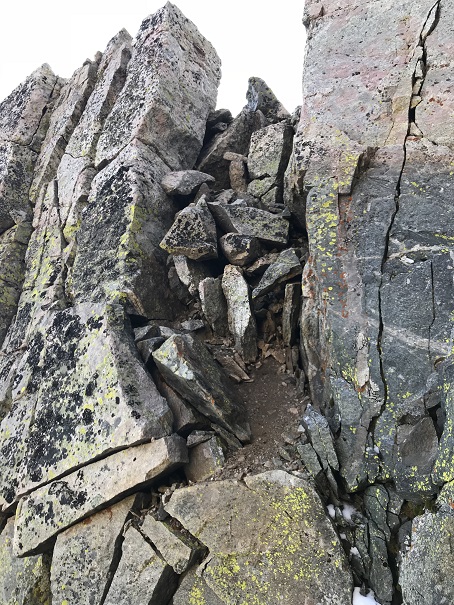
This is kind of a chimney, and gets you ready for the more serious climbing ahead
Oh, did I mention the rocks were now icy again? Here’s a better view of the ice
From here I had to re-gain the ridge. I crossed the gully, located the lighter gray colored rocks, and headed up.
There are several routes to regain the ridge but if you stay on the lighter gray rock you should be fine. Did I mention this was steep? Seriously steep and slippery (due to the ice) and definitely Class 3+. Several times I thought how helpful a rope wouldn’t been…
But once I gained the ridge all I had to worry about was ice and wind as I crossed the easy path to the summit. The rocks weren’t stable but they weren’t a problem to navigate. Just be careful for rolled ankles.
Well, easy if the wind wasn’t blustering at 40mph and there wasn’t a thin layer of ice on the rocks. I was very cold and honestly crab-walked over the slippery rocks to the summit, afraid with the wind and ice I’d slip and fall. But I made it! I summited at 8:15am. I couldn’t smile because my lips were frozen… I tried though.
Video:
Here’s a look back at the ridge
I was cold and my fingers were starting to freeze so I didn’t stay on the summit long. I knew I’d need some dexterity in my fingers to make it back down the light gray rocks. I followed the easy ridge back and braced myself to downclimb back into the gully. The first few sections were fun and I was easily able to navigate the large boulders. Until I reached this point
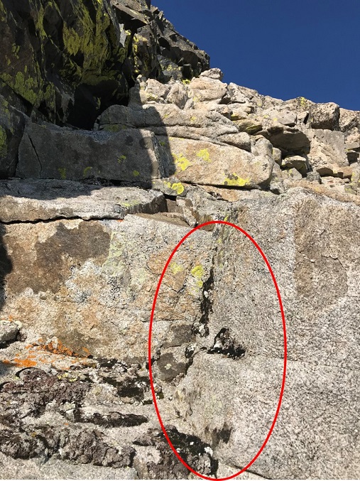
This is where I fell. Well, I didn’t actually fall, more like slid for about 4 feet (scarier when it’s actually happening than it sounds reading about it). You see, everything was once again covered in a thin layer of ice, and there were no foot/hand holds available. None. I know, I was looking. I was in a spot that (due to the ice) offered very little in the way of help for the situation I was in. There were a few patches of moss that I tried to use, but naturally they weren’t stable and quickly crumbled out from under my shoes. And that ice didn’t help at all! I knew I was going to slip and slide eventually, so I tried to minimize the acceleration as much as possible before and as it happened by hugging the rocks and leaning forward. When I slid I was able to stop myself on a ledge about 3 inches wide and 6 inches long, stabilize myself, take a deep breath, and continue downclimbing. I’d bruised my right shin (just a little scrape with minor bleeding) and I had a hole in my pants at my shin, but I was proud of myself for not turning this into a worse situation. Here’s the section where I slid. From top of the circle to the bottom is about 10 feet.
I couldn’t go to the left or right because it was actually steeper in those sections and led to larger drop-offs. This looked less steep when I was first climbing down, and the moss and lichen looked to be on larger/actual holds, or I wouldn’t have attempted it. In hindsight, before I was downclimbing this area I should have retraced my steps to where I climbed up (as I knew there were adequate hand and footholds in that area).
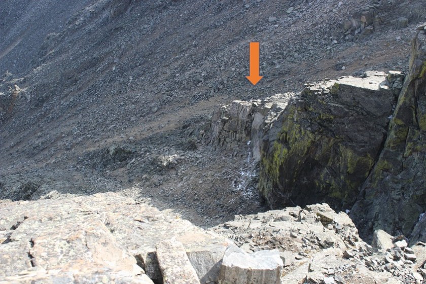
Once I was on more stable ground I took a look around: I needed to find that chimney to head back. Here you can see it from across the gully
I headed towards the chimney, climbed it, turned right and headed back to the ridge, knowing the worst was behind me. I made it back to the saddle and saw no reason to re-summit Fletcher, so I turned right and headed down the middle of the basin towards Quandary.
Once again, no trail, just rocks. Luckily, while the rocks weren’t stable they also weren’t icy. I felt humbled by the enormity of the rock field and my small place in it.
VIDEO:
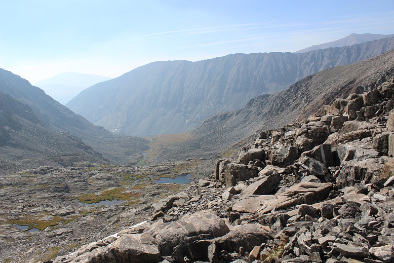
As I descended into the basin the beauty caused me to pause. This is truly a gorgeous area! I’ll be coming back to attempt Quandary’s West Route someday.
I followed the cairns down and around the several small ponds I’d missed in the dark.
I stayed here much longer than I should have, but it was worth it for the views! The red gully was clearly visible in the daylight
And those ponds and streams are much deeper than they look. For such narrow streams at a high elevation I was surprised they were 4-5 feet deep.
Exiting the basin was an easy walk. At this point I noticed my foot didn’t hurt anymore. I guess exercise was the answer! I passed an old mine
Turned the corner to take one last picture of the basin (I may frame this)
and: Goats! I love running into goats on the trail! This herd had several kids. All adorable
Video:
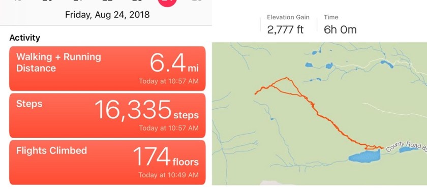
I made it back to my truck at 11am, making this a 6.4 mile hike/climb in 6 hours. Oh, and my tracker had worked! It said I’d climbed 2777’ in elevation, which I thought was pretty close to the 2800’ I’d been expecting. Now I just need to figure out how to save and transfer the GPX file to my computer. I was not happy with my time, but considering I’d crawled for a good portion of it due to ice I wasn’t too upset either. And I’d stayed safe. And I’d seen goats!
Woohoo! Unexpected summit day! The only downside? The weather was terrible across the entire state of Colorado!!! I had a full day I could use for hiking (I didn’t need to be home until 6pm) but it seemed everywhere I looked there were storms forecasted for the night before and all day. The best forecast I could find was in the San Luis Peak area, where it was supposed to rain all night until 5am, then stop until noon (when thunderstorms would hit). I hate to waste an opportunity to hike, so I woke up at 11:45pm and drove 5 hours to the trailhead. It rained the entire way, from the time I left my house until I arrived at the Nutras Creek Trailhead at 4:45am. Oh, and I saw a bear as I was driving through Divide (high-tailing it away from me as fast as it could, why do they always run away?).
The road in is 20+ miles of 2WD dirt road, unless the Pauline Creek is high then it’s 4WD (it wasn’t). I absolutely love this road! It’s a great/solid 2WD dirt road that goes on for miles and miles and miles. I remembered to get gas in Salida this time since the gas station in Saguache is closed at night.
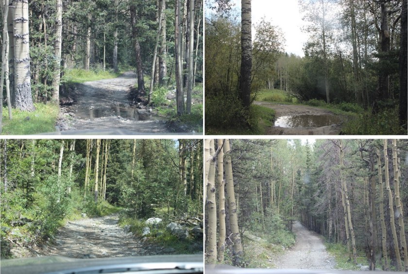
A plus to the rain? There were tons of puddles on the road in! I had fun aiming for them and watching the water/mud splash up past my rear view mirrors. Everyone should have a truck.
I made it to the Nutras Creek Trailhead and parked on the side of the road because what looked like the parking area had a couple of trailers set up and there wasn’t any actual parking available.
The trailers looked semi-permanent. I sat in my truck, eating Ritz crackers, waiting for the rain to stop. It didn’t. Hmmm. It was now 5am and I wanted to get on the trail, so I decided to set out anyway. It was just a light rain at this point and it was supposed to stop soon, what harm could it do?
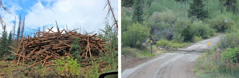
There was a sign that said “Nutras Creek” directly over the bridge covering the creek. This is NOT the trailhead. After some searching I found the trailhead, located behind the trailers. When I arrived and parked the lights were off in the trailers, but as I passed them looking for the trailhead, swinging my flashlight back and forth trying not to make noise (there was a generator going, so I knew they were occupied and didn’t want to be seen as a prowler) l noticed the lights had switched on and I could smell coffee. There was a lot of logging going on in the immediate area. I figured they were either hard core early rising campers or loggers.
After last Friday’s fiasco with the GPX app I downloaded another one. Before beginning I started the track. Almost immediately the rain died down. I considered this a good sign and hoped the clouds would move so I could see the stars. No such luck. The clouds never lifted. Well… at least it wasn’t raining! That was a plus, right? Well, kind of. You see, it had rained all night, and the trail was covered in tall grass heavy with water. As I trekked I brushed past the grass and thus copious amounts of water droplets. Here’s a picture from later in the day
I’d worn my new hiking pants, which boasted they were water proof and bug proof. Let me tell you, they were NOT water proof/resistant/etc. I was immediately soaked: It was like I was wearing a cotton bandana instead of pants. I had on waterproof hiking shoes that I’ve trekked across numerous creeks with without getting my feet wet, but as I hiked today the water soaked through my pants, then my socks, and drained into my shoes. Within minutes I was squishing in my shoes as I was walking. This was not good on so many levels. I knew this meant I’d most likely need to turn back before summiting, but I drove this far: I wanted to at least get some hiking in. So I kept hiking.
There was a trail in the beginning, and then there was no trail. Then there was a trail again, but I couldn’t really tell if it was a trail? Then there were two trails…. Ugh! OK, just follow the creek to the right and you’ll be fine. After about 2 miles you have to cross the creek (it was a 2 foot jump but the area was full of brush so kind of hidden)
and then follow the creek again through a small boulder field. There is kind of a trail here, but if it’s not stable (a real possibility) hug the creek.
I turned back and noticed the sunrise! I love sunrises!
After the boulder field you’ll come across some bristlecone pines. At this point turn right (northwest) and make your own trail until you reach a ridge (above treeline). The area looks like this
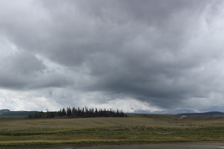
There is no trail, but there are dozens of game trails, and after the rain I could see where elk had spent the night and left in the morning (I could tell due to scat and pushed-over grass). One you make it past treeline look left and you can see Stewart Peak. Theoretically. I couldn’t, because it was covered in clouds.
This wasn’t good. It wasn’t supposed to be cloudy!!! There was supposed to be a 50% chance of thunderstorms after noon, but none of the forecasts I’d seen said anything about clouds. 13ers and 14ers tend to make their own weather, and that’s just what was happening here. Clouds were forming in the saddle between Baldy Alto and Stewart Peak, rolling and settling at about 13,500’. I’ve seen this type of thing before, and hoped as the sun rose it would go away.
I turned and headed northwest, staying in the grassy area but aiming toward the ridge.
The clouds lifted and the sun came out! Woohoo! What a great turn of events! My feet were still squishing (I’d hoped they’d dry out by now, but there was so much water on the trail as soon as I started to dry off in an area without grass I’d pass another area full of brush and get wet again).
Once you gain the ridge follow it to the summit, passing a bunch of false summits
(or at least that’s what they looked like to me, but it could have been the clouds hiding the true summit… yep, the clouds were back).
Oh, and it started snowing. Ugh!!!
The snow didn’t look like it was going to stop (it didn’t) but I was close, so close to the summit! I decided to trudge on. Oh, and remember how my socks were filled with water? As I gained elevation and the temperature dropped the water in my socks turned to ice. Just as I was nearing the summit I lost all feeling in my feet (no worries, I have Raynaud’s, so I have intense reactions to cold and know how to handle them: I’m sure it wouldn’t have been such a big deal to anyone else). You know that feeling you get when your foot falls asleep and you try to walk but you can’t feel your foot so you’re clumsy and over step? That’s what this felt like. That feeling just before the pins and needles set in, but it didn’t end. And this is what I was walking on…
It was icier than it looks. And slippery. I was not a happy camper. I wasn’t prepared for ice/snow. Rain, yes (I had an umbrella, poncho, and my North Face Jacket) but snow? Nope. I needed warmer clothes. All I had warm weather wise were two pairs of gloves, a knit hat, and a heavy jacket. I needed better boots, socks, and pants. My pants weren’t keeping any heat in (or ice/rain/wind out for that matter) and my shoes were soaking wet. I carefully limped to the summit… but I made it at 7:50am.
VIDEO:
I’d love to give you a better view, but this is what I got. I did see a confused ptarmigan at the summit
And despite not being able to feel my feet I wanted to continue on. It had been my goal today to summit Stewart Peak, Baldy Alto, and Organ Mountain. I’d gotten a good view of them from the basin and knew which way to go, but once I’d summited Stewart Peak this was my view
I knew to angle left/south, but I’d also see bits and pieces of the ridgeline(s) and figured in the clouds/fog it would be way too easy to get lost. Plus, I couldn’t feel my feet. I hiked about 20 yards towards the ridge and told myself not to be stupid: I turned back. I hate turning back!!! It hurts on so many levels, but it was the correct choice. On the positive side, heading back down meant sunshine, warmth, and eventually feeling in my feet and fingers again…
I kept seeing the clouds roll in and out and in and out and hovering around the peaks. Yes, descending had been the correct decision, but that didn’t keep me from mentally calculating time to figure out if I could skirt the ridge and still summit Baldy Alto… I actually had to stop myself from doing this after turning to try it out… reminding myself my feet would freeze again and I planned on coming back again soon.
Here’s the path back down the ridge
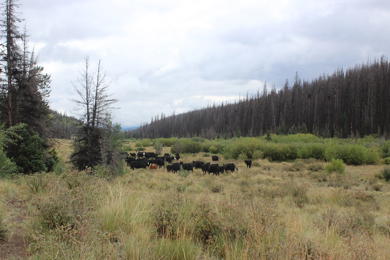
I was saddened by all the dead trees!
Once you get to treeline just head towards the creek and turn left.
The sun never came out, so once I made it back to treeline I was soaked all over again. Here’s one of the better trails
Oh, and the cows! One of the reasons there are so many trails are the free range cattle. I encountered a bunch of them on my way out. I’m a fan of cattle: I used to raise them. However, these cattle weren’t too fond of me. There was a lot of mooing, running as a herd (stampede! OK, not really) and one mama got separated from her calf and was quite vocal about it. I told her to go get her baby. None of this was intentional on my part: I was just hiking and following the trail, they were the ones taking it out of proportion. The downside? When cattle aren’t happy they poop. Immediately. And it’s sloppy poop. It’s some sort of defense mechanism. Fight or flight or some such nonsense (since they always run). In any event, there were slimy cow patties all over the trail, and while I tried to avoid them accidents happen. I had to wash my boots and pants as soon as I got home.
VIDEO:
I made it back to my truck at 10:30am, making this a 10 mile hike in 5.5 hours.
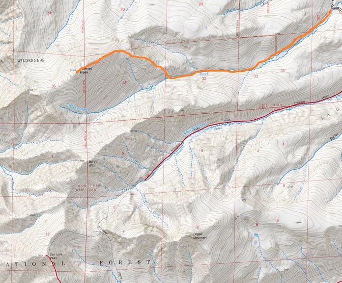
Oh, and my GPX file failed. Again. Even though it was a different app. This time even though I started it the app failed to record anything. I may have to either give this up or bite the bullet and actually pay for an app. Or a GPS. Oh well. Here’s the path I took:
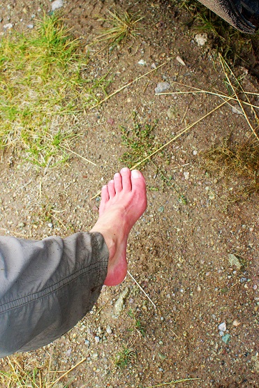
When I made it back to my truck I immediately took off my shoes/socks and did an assessment on my feet: they were bright red and almost done thawing out, but functional (and thankfully not white or black or purple). I’d been a little bit worried I’d caused them some damage with the frozen water (a quick complication of Raynaud’s).
I’m not gonna lie, I was a bit disappointed with my day. I’d planned on 3 summits, and only completed one. It’s not fun to turn back, but it was for the best. In any event, I was able to plan out my route for Baldy Alto and Organ Mountain (I’m thinking Nutras Creek again, up the saddle to Baldy Alto, and then over to Organ Mountain).
On a positive note, I got to drive that fun 2WD dirt road for 20+ miles back to the highway. In the light of day I could see the creek crossing and all the logging that’s been going on. Also, I waved to the loggers as I passed.
Oh, and the clouds never lifted, they just intensified. Yes, it was a good call to head back.
The weather changed my plans at the last minute, so the hike I’d intended to take in the Sawatch range didn’t happen today. I’m on a time crunch when it comes to my Friday hikes for the next few weeks, so I needed a hike I could complete and still be home in the early afternoon. After a quick weather search, California Peak looked promising. Plus, it has a bunch of other 13ers close to it so I could make the hike longer if I wanted… I just needed to back to my truck before noon.
I made it to the trailhead at 4am without passing a single vehicle on the 69. Oh, and that forest road 580 in seems to take forever!!! I’m always surprised this is labeled as a rough 2WD road. There are several spots I’d love to have 4WD well before the 2WD parking lot (which you aren’t allowed to park at BTW). This is my third time on this road, and the third time with lots of mud puddles…
4WD Road:
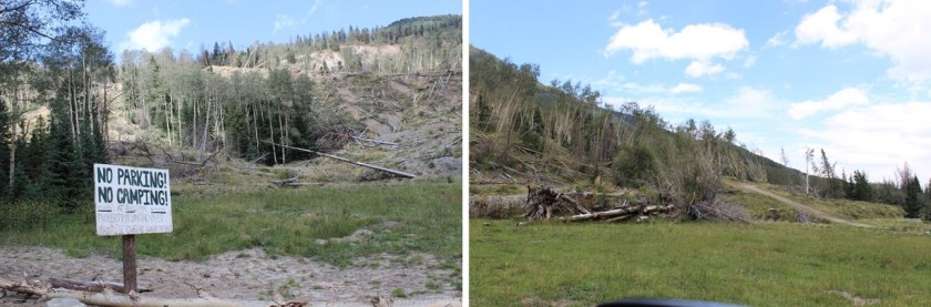
I mean, you could probably do it in a 2WD if you have high clearance and you’re a great driver, but why chance it? And that last hill before the 2WD parking lot? 4WD is totally necessary! Most people want to park in the avalanche area, but these signs tell you it’s not advised:
The 4WD parking lot has enough room for about 10 vehicles. There were 2 others there when I arrived (and 3 when I left). I got out my gear and turned on my new tracking app. I’m not a fan of GPX routes, but think it’d be careless not to have one in case it’s needed. There isn’t a GPX file for the trail I wanted to take, so I decided to try and make one. I’ve never done that kind of thing before, but I figured maybe I could make one and help someone out since a lot of this hike is off trail. I started the track, signed the trail register, and was on the trail at 4:15am.
The trail was wet. The sky was clear and I could see the stars, but it had obviously rained (hard) during the night. The trail was pretty much a small river, and all the grass and plants lining the trail were wet, making my pants wet when I brushed them as I walked by (I should have worn my hiking pants instead of my yoga pants). I accidentally stepped in the water a few times and was glad I had my waterproof Salomon’s on (so only my socks got wet above my shoes, but my feet remained dry).
Even though it was a clear night water was raining from the sky too: as I passed trees startled birds flew out of the trees, causing water droplets to rain down on me from above. Since the ground was wet I looked for animal tracks and didn’t see any, so I didn’t expect to see any large wildlife before sunrise. I did hear a rather large animal dash through the creek to the left of me, but it was obviously running away from me. I’m guessing it was a deer. I did see a cool mushroom on the side of the trail too
I missed the first junction that’s supposed to be a mile in, letting me know to turn right, but I’ve missed it every time I’ve taken this trail, so either the signs missing or I take the wrong path, which is a possibility. The trail follows the Huerfano creek but since it overflows onto trails there are several side trails. This is also a heavily used snow shoeing area, so there are tons of paths in and out of the trees. The good news is I saw the second sign and turned right, heading up the hill towards Lily Lake. I was hiking a bit too fast (I wanted to be at the lake around sunrise so I could see the lake) so I slowed down a bit. Just before the lake there was a small waterfall
I passed it to the right, and headed up a hill
And came to Lily Lake
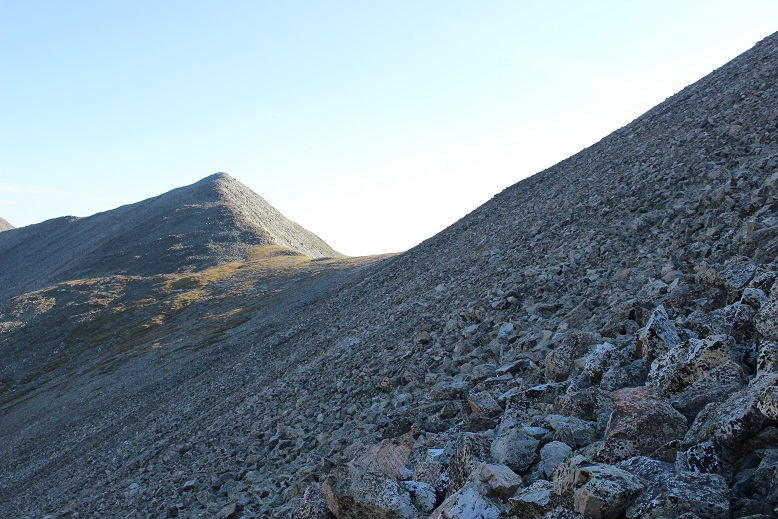
The wind immediately picked up and the temperature dropped. This is also where the trail ended. I’d read this was the “crux” of the route, and I’d agree. There is no path through the amphitheater. The goal is to avoid the loose rock and navigate your way up the mountainside to the right. The trouble is none of the rock is stable. It’s all terribly loose and when one rock falls it creates a rockslide. Think avalanche with rocks. This is rated as a class 2, but I found myself wishing for my helmet. I’d consider it absolutely necessary if I was hiking with someone else. Also, don’t follow anyone else’s GPX route up this mountain. The rocks slide and change quickly, so a route that’s safe today might not be tomorrow (and most likely won’t be next year). You need to use your best judgement and pick your own line. It’s steeper than it looks. Here’s the route I took:
I aimed for the large, stable rock, and once I made it there, passed it to the right, where I was met with larger (unstable) rocks.
I turned around and could see evidence it had snowed a bit last night as well as rained
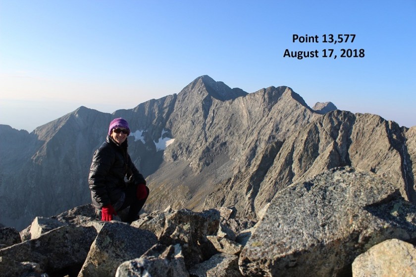
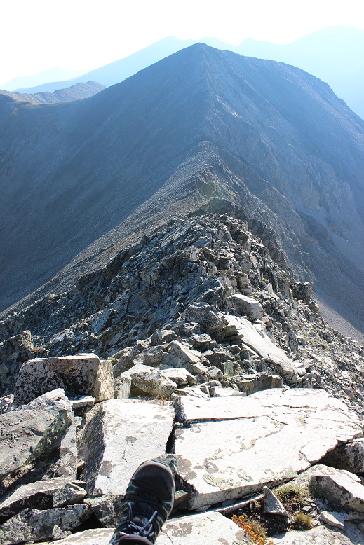
From here I gained the ridge and followed it left to the summit of Unnamed Point 13,577, arriving at 7am.
I turned around to look at the way I’d come up: steep and full of loose rocks.
Point 13,577 is a ranked 13er. Here’s my summit selfie to prove I summited:
And a video:
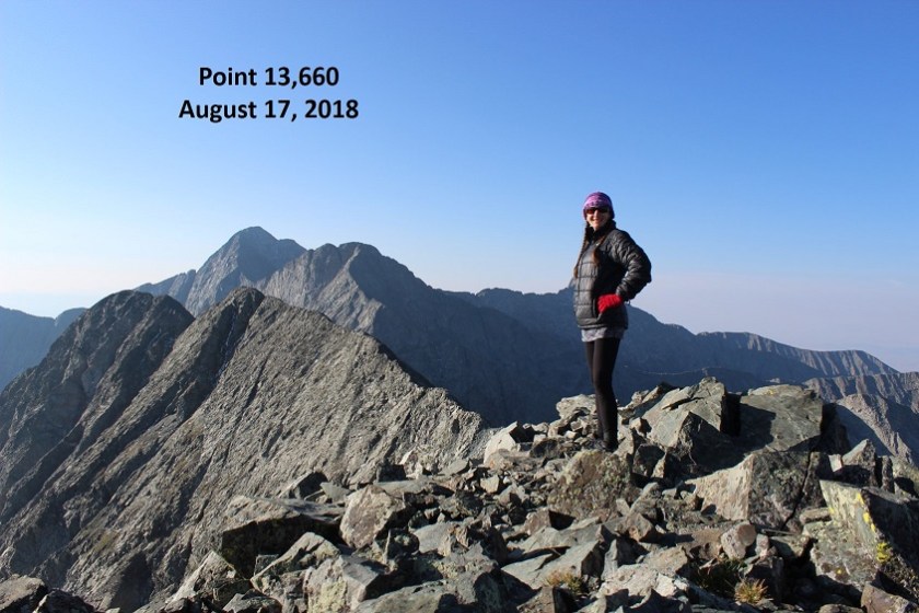
I turned and looked west at Unnamed Point 13,660. This is a bicentennial, and I’d promised myself if I had time I’d do my best to summit this peak as well since I couldn’t find another route for this one (hey, I was here, I might as well make the most of it, right?)
I mentally calculated my time (I was right on time… that crux had taken a lot longer that=n I’d anticipated) and decided to go for it. If it took me too long I could always come back for California Peak another day, satisfied I’d completed 2 ranked 13ers today.
And so I headed towards the ridge. It was a fairly simple hike until I reached the saddle. From here it got a little more sketchy, but nothing over a difficult class 2. Once again I wished I’d brought my helmet. The rock wasn’t sticky at all. In fact, my (really good) hiking boots were slipping and couldn’t gain traction. There were also a few steep spots and areas of exposure. I was able to navigate the entire way by sticking to the ridge, but if necessary stick to the right.
OK, this was actually a lot of fun! The past couple of 13ers I’ve done have been pretty easy, with no real route finding or scrambling involved. This ridge included plenty of careful scrambling.
I made it to the summit at 7:50am and turned back to look at the route and Lily Lake (not sure what the other lake is named, or if Lily Lake is just missing some of its water).
Here’s a summit selfie as proof I summited
And a video:
The last hundred yards or so of that had been worth it and so much fun!!!
From Unnamed Point 13,660 I could clearly see the route I’d taken and the route I had left. Due to time I didn’t feel it was necessary to re-summit Point 13,577 so I skirted it to the left and aimed for the saddle between it and Point 13,420.
Once again, there is no trail for this hike, so I had to carefully navigate my way across the rocks.
From this saddle it was a quick hike to the top of Unnamed (and unranked) Point 13,420.
I summited at 8:40am to some of the best views I’ve had the pleasure of having all to myself! I could see small lakes in every direction, Huerfano Peak, Mt Lindsey, Blanca, and Ellingwood. Wow!
Video :
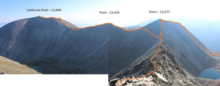
Here’s a look back at the route I took from PT 13,550
OK, time to head up California. This ridge was easy to follow, with no obstacles to face and stickier rock than Point 13,660. Here’s the route I took:
The rock was much larger and more stable than before
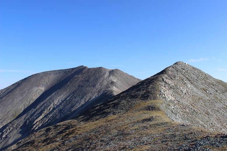
There was a false summit, but it wasn’t anything too difficult. Here you can see California Peak (to the right) from the false summit
The false summit is also a great place to stop and visualize your path down from California Peak if you are choosing to do the loop (which I highly recommend… that rock up to PT 13,577 is dangerous enough heading up, down it would be treacherous). I’ll discuss this more later, but either take a picture here or get a good look so you know how you’ll approach your descent. You want to aim for where the trees and drainage meet.
The summit of California Peak was curiously flatter than I’d anticipated
I summited at 9:15am to more awesome and amazing views!!!
Video:
Check out that ridgeline!
OK, your goal is to hike north up and around the horseshoe shape, locate a cairn, and head down (right/east) into the basin. Look for a cairn. You don’t want to descend too soon because it will be full of dangerous rocks.
Standing behind the cairn looking down into the basin you can see where you want to aim: Just where the trees and rocks come together. From there you follow the drainage until you make it to Huerfano creek (and the obvious trail) Here’s a view from the false summit of the path you want to take.
From the top (where the cairn is) your best bet is to descend and angle a bit left to avoid the loose rocks and scree you’ll immediately encounter. Try to stay on the grassy area, but aim for the left of this bump:
Once you make it to the bump you have several options ranging from class 2-4 to navigate your way down to the drainage. Just stay left and head down. I chose to climb down the wide chimney, but you have other (class 2) options as well.
Here’s a picture looking back at the terrain and what still lies ahead of you
In case you’re absolutely crazy and want to do this hike in reverse, here’s how I came down the mountain. Note: if you want to do this in reverse stay to the right (where there’s grass) and avoid the loose rock sections to the left.
This is where the route gets tricky because you’re going to enter the treeline and terrain filled with rocks, slippery wet grass/plants, creeks, and pine needles (deceptively slippery as well). I followed the drainage
Until I came to this
Once again, your goal is to head towards the creek. I did so and quickly the terrain looked like this:
This was actually much more difficult to navigate and took much, much longer than I’d anticipated, but as long as I kept heading east down towards the bottom of the basin I knew I was on the right track. There were dozens of game trails heading every which way, and a few snow shoe trails as well. It wasn’t lost on me if I were to get hurt in this area it would be extremely difficult for anyone to know where I was or to be able to find me (even though I’d let people know I was doing the loop). The area was thick with trees and bushes, most of which got caught in my hair. When I finally made it back and found the trail I did a fist bump! That was awesome, and the most difficult route finding (in the daylight) I’ve done to date. Yes, it was technically easy, but I was super proud of myself!
When I made it to the trail (which was still filled with water BTW) I turned left (north) and headed back towards the trailhead.
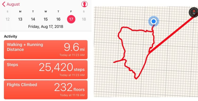
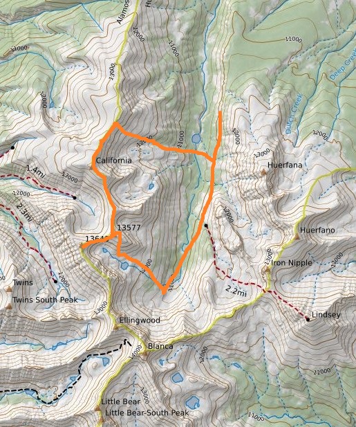
I made it to my truck at 11:15am, 45 minutes earlier than needed to remain on schedule to drive back home and pick up my daughter from school. That made this a 9.6 mile hike/climb in 7 hours. I quickly got out my phone and checked my route. Now, this is the very first time I’ve ever tried to track my route, but I’m pretty sure I didn’t teleport 30 miles away for a few minutes and come back right where I’d been on the trail. Hmmmm. Either something was wrong with the app or I needed more practice with this (probably both). Oh well, that’s what I get for using a free app. So no GPX file this time, but maybe in the future?
In any event, here’s the route I took on a topo map
This was a fantastic trip! Once again I didn’t see anyone else all day, the views and weather were amazing, and I was able to practice my route finding in an area I was familiar with and didn’t think I could get lost. I loved being able to tag a bunch of 13ers and I felt I learned a lot today. 13ers are amazing!
This is another busy weekend where I needed to be home by noon, so I was up at 1am and made it to the trailhead at 4:30am. I didn’t do much research on the trailhead in, and was surprised to find it was a little more 4WD than I’d anticipated. I’d forgotten about the mug of coffee I had in my cup holder, and after the first few yards of driving on Leavenworth Creek Road what was left in my coffee cup was all over the front seat of my truck. The road had a few 3 point turns and several small streams and large puddles to cross. High clearance and 4WD are a must.
Here’s a video for those interested:
There weren’t any signs anywhere on this trail (except the continental divide one at the end), not even at the trailhead. No one else was at the trailhead when I arrived and I wondered if I was in the right spot? I parked my truck and got out my flashlight to try and find where the trail actually began. I had my GPS, so I tried to use it to find the start of the trail. I was aware of the general direction I needed to follow.
I made several failed attempts down paths that looked correct but weren’t. They all led me down animal trails that ended in creeks and willows. See this path here with the tree across it, which usually indicates it’s a closed trail? Well, that’s exactly what it was: closed and not the trail I was looking for. However, in the dark I couldn’t find a solid trail, so I took it, walked in circles trying to find a path, and ended up back at my truck.
After quite a bit of frustration I realized there was actually a road I was supposed to follow. I felt dumb for missing it, but in the dark I’d had no idea it was there. So you don’t miss it and spend 20 minutes trying to find the correct start to this trail, here’s what you need to look for:
Ok, now I was on the correct trail and it was almost 5am. After walking for about 1/10th of a mile I came to a small stream. Here I left the road and turned right.
From this point on there was no solid trail. In the daylight you just head towards the mountain and try to find a path clear, but in the dark I struggled to find a path clear of willows. It seemed every time I tried to head towards the mountain I got stuck in willows with no trail. They were taller than I was and when I tried to see over them with my flashlight they seemed to never end. I had to keep going right, away from the mountain, but eventually I was able to curve back around to the left (and center of the basin). My advice if you’re hiking this in the dark: Stay to the right of the creek, and follow the line of willows to the right until they allow you to go left. Here’s what it looks like in the daylight (second picture is looking back down the basin)
After skirting the willows you’ll find segments of a very, very old 4WD trail. Woohoo! The only problem with this trail is it has willows too: right in the middle of the path. This was confusing and frustrating at night as well, but no problem in the light of day. Just keep aiming towards the west and middle of the basin and you’ll be fine.
At the end of the basin your goal is to hike up towards the saddle of Mt Edwards and Mt McClellan. There is no established route to do this, but I’m assuming most people head straight up the gully. I started to, but I wanted to summit Mt McClellan first, and when I looked to the right I could tell the terrain had no trail either but was easily hiked. So I aimed up and right instead of towards the saddle.
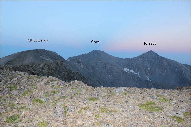
When I reached the first bump in the ridge I turned right again and followed the ridge to the summit. I summited at 6am. The summit was very long and had great views of Grays and Torreys.
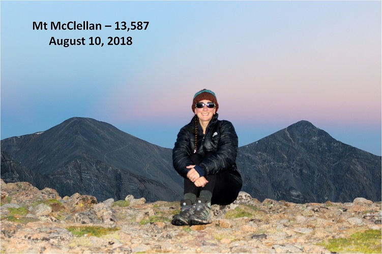
I took a summit photo to prove I’d summited (McClellan is an unranked 13er)
And a video as I was hiking to the top:
I looked over to Grays and Torreys and saw a trail of headlights coming up the road, as well as a steady stream of people already on the trail. I was so glad I was on a 13er with no crowds! I hadn’t seen anyone all morning.
I turned and faced Mt Edwards. That was my next target.
I followed the ridgeline back to the saddle, noting the drop off to the right
From the saddle I turned back towards McClellan to watch the sunrise
And then took a picture looking down the basin I’d just come up
From the summit of Mt McClellan to the summit of Mt Edwards took me half an hour to hike. I made it to the top of Mt Edwards at 6:30am
VIDEO:
The reason I’d summited Mt McClellan first and then headed over to Mt Edwards (which is the reverse way most people summit the two together) was because if I had enough time I’d wanted to summit a nearby bicentennial (Argentine Peak) as well. Since it was only 6:30am I had plenty of time to head over to Argentine before trekking back down to my truck: Argentine was about a mile and a half away.
I turned and headed southeast down the ridge. The ridge follows the Continental Divide, has a faint trail at times, and a cairn every hundred yards or so. It’s an easy ridge to follow.
I saw a few skittish mountain goats. They ran down the slope when I was about 20 yards away from them.
About halfway to Argentine Peak I came to a saddle that was crossed by Argentine Pass (a 4WD road). From here I continued to follow the ridge. On the way up I decided to skip summiting point 13,449 because it didn’t seem necessary (but I climbed up and over it on the way back)
When I made it just below Point 13,449 I aimed for where the rocks end and skirted the mountain to the left.
I also took a shadow selfie because I do that kind of thing
The trail became a bit rocky going around the point, but it never exceeded class 2. The final trek to the summit was an easy hike up a steady slope.
It was still cold, and there was a bit of frost on the ground
I summited at 7:45am
VIDEO:
There was a continental divide sign on the summit
At this point I was in a hurry to get back to my truck by 9am to make it home by noon, so I turned and looked back at the route. I could hike back to the saddle and take Argentine Pass back down to my truck. That would be the quicker route, but that would also mean I wouldn’t get pictures of the trail I’d taken in. If I hiked fast I could most likely make it the 4 miles back in just over an hour. It only had about 400’ of elevation gain. I decided to go for it. Instead of aiming for the pass I followed the ridge back to Mt Edwards.
When I got to just before the final pitch for Mt Edwards I turned east and started down the slope. Here’s a picture of where I started back down to the basin (you’re looking at the Mt Edwards/Mt McClellan saddle). Check out the scree heart on Mt Edwards…
From here there was about 200’ of scree to get through before it turned to grass.
I stuck to the slope and aimed toward the gully in the middle of the mountains.
Here’s the route I took down
In the light of day the route back to my truck was clearly visible around the willows. I was even able to see faint trails and aim for them.
I made it back to my truck at 9am, making this a 9.6 mile hike in just over 4 hours with 3 new 13er summits and 3313’ in elevation gain. There still weren’t any other vehicles in the parking area.
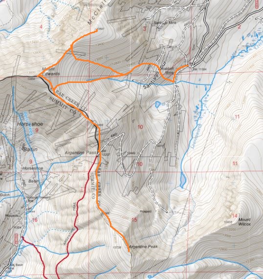
Here’s the route I took.
The best part? I didn’t see another person all day until I was driving back down the Leavenworth Creek Road. At that point I passed 1 person in a truck and 3 Forest Service jeeps, all heading up the road. We had to get creative to pass each other, but everyone was nice and we worked together to do so.
Hiking/climbing over the next few weeks are going to be tricky since I’m taking my survival troop camping on the weekends (which is always a blast!!!). Today I needed to be back home by noon so I got out my spreadsheet to look for a hike that was: 3 hours or less driving distance, around 10 miles of hiking, and didn’t require much route finding (because I didn’t have time for that today).
I love spreadsheets! They take some initial time to set up but make narrowing down this kind of information so much easier. After finding 4 different Centennials that met my criteria (it’s great having so many options open!) the one with the ‘best’ weather was Hope Mountain A: 50% chance of rain from 3am-9am with 40% chance of thunderstorms after 9am. I liked those numbers, I’d just need to pack extra rain gear.
I made it to the 2WD trailhead at 3:15am. The road is in excellent condition with great signs. There was only one other vehicle in the parking lot when I arrived (and it was still there when I left). The parking area could comfortably hold about 10 vehicles.
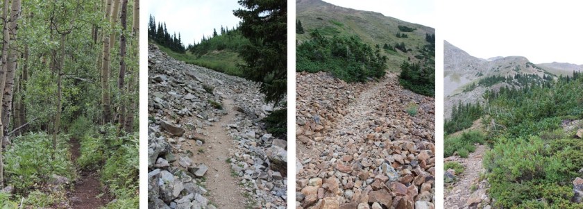
The trail was indeed excellent: no route finding necessary until I made it to the Hope Saddle. There weren’t many signs, but they weren’t really needed either.
The beginning of the trail began with solid elevation gain that never quit. It was a nice steady climb through heavily wooded areas of aspens, and after Sheep Gulch switching to small pines and then quickly to alpine tundra. It was a perfect night to see wildlife, yet I didn’t see any tracks so I didn’t expect to see any animals (I didn’t).
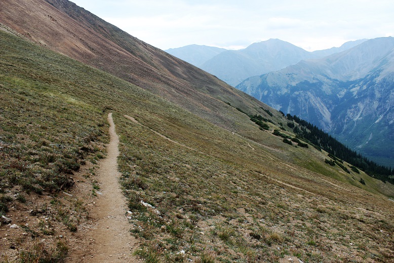
As soon as I hit an elevation of 12000’ the switchbacks began. These weren’t the kind of switchbacks that wear you out, but instead the kind that make the hike more enjoyable as they weave up the mountainside.
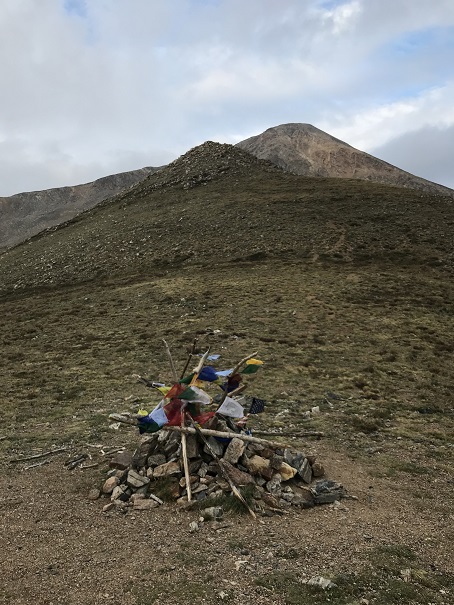
The hike this far had a lot of elevation gain, but the gain had been steady and hadn’t tired me out. I made it to Hope Pass and thought to myself it was still way too dark. I must have been hiking faster than I’d anticipated. I looked at my watch: Yep, it was only 4:30am. I’d hiked 3 miles with 2700’ of elevation gain in an hour. I was going to need to slow down if I wanted to get pictures from the summit. At the Hope Pass saddle between Hope Mountain A and Quail Mountain there was a cairn with prayer flags.
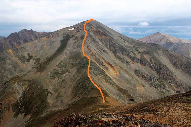
I couldn’t see Hope Mountain because it was still dark out, but I knew once I made it to the pass to turn left and head up the first ridge. The route was supposed to be easy to figure out and visible from the top of this first ridge, but since it was still too dark to see I couldn’t tell. There was no route from the pass to the summit: no dirt path and certainly no cairns. My flashlight kept going in and out (I need a new one) which was a little frustrating but I’d needed to slow down anyway, so spending time hitting it against a rock to re-light it every time it went out seemed like time well spent.
Here’s the route I took:
That ridge was FUN!!! This is rated as a 2D hike, and I hadn’t brought a helmet, but it would have been nice, especially if others had been on the mountain as well. The ridge had some exposure and would be a great training hike for someone to take before tackling some of those class 3 14ers. I hiked the entire ridge in the dark, so my advice to someone doing the same is to stick to the ridge, and if you must leave the ridge go to the left.
The ridge took me about an hour to climb, which gave me lots of time to think. My mind drifted to 14er firsts. I know some people don’t appreciate the idea of any more “firsts”, but I think they’re fun and encourage people to get outside, and while I don’t plan on attempting any, there are a few I’d like to see: The first person to summit them all in the dark, the first person to spend the night on every summit (has this been attempted/done?) and my favorite, the first to stand on every summit without actually hiking (I’m thinking this one would involve a helicopter, rope, and tons of money). In any event, the topic took up my mind as I climbed the ridge. Here’s a look up and back from halfway up the ridge. To the left is Hope Mountain A, and the right is Quail Mountain.
At about 13000’ the loose rock began. In this picture you can see there’s a false summit
This is where it got a bit sketchy in the dark: those gullies were loose! All rocks the size of microwaves or smaller were very unstable and just waiting to find their way lower down the mountain. I tried not to touch the larger ones.
The trick here is also to stay to the left (the right drops off into a couloir). But as soon as you get up those loose rock gullies you’re met with a nice gentle but rocky slope past a false summit to the true summit. I summited at 5:45am. Here the sun was just beginning to rise and I got a summit photo
I also took a good look around. Yep, it was going to rain. Hmmm… I was still debating hiking Quail Mountain today, but those clouds didn’t look friendly. I guess I was just going to have to skip it and hike it another day.
As I started descending Hope Mountain A it started spitting rain. Nothing much, not enough to put on rain gear or anything, but then the graupel began and I decided to hike a little faster. The graupel only lasted about 2 minutes however, and then was gone. I took another look around me
The sun was rising and Quail Mountain was looking really inviting. Since the rain was behind me I decided to keep looking ahead and not make a decision about hiking Quail until I made it to the pass. In the daylight the ridge was much easier to navigate. This time if necessary I just stayed to the right, but I mainly took the ridge.
I made it back to the prayer flags at 7am and took a look around. All signs of rain in the next two hours were gone, so I decided to attempt Quail Mountain. This 13er didn’t have a trail either. Here’s the route I took
The beginning started with scree, and due to the elevation gain you couldn’t see the summit for most of the hike, so I just aimed for the first bump and began hiking.
There were multiple ‘social trails’ towards the middle of the mountain. The ones to the lower right (where the mountain has red dirt) were on loose scree so I stayed to the upper right on a light but sturdy semi trail through the tundra (stick to where it’s green and you’ll be fine). It became more and more stable as I ascended and then abruptly ended at the first bump
From here I followed the slight ridge up and over the false summit to a small saddle
And just like that, I summited at 7:30am.
From the summit of Quail Mountain I could smell smoke from the nearby fires. It wasn’t overpowering, and reminded me of campfire off in the distance. It also didn’t last very long, and I could only smell smoke when the wind blew strong.
If you’re thinking about hiking Quail Mountain after Hope and the weather’s nice my advice is to just go for it! It only took me half an hour to climb the 950 feet in elevation gain, and the views were incredible! There were a few small and abandoned cabins (mines?) at the summit.
I turned to head back and got a great view of Hope Mountain A and the small ridge I’d followed to the summit of Quail. Going back I followed the mountain to the right
This is another one of those mountains where microspikes are useful on the way down to navigate through the scree. I made it back to Hope Pass at 8:10am and started my way back down the switchbacks. Here I saw the only 3 other people I’d see today: a group of men who looked like they were thru hiking.
The hike through the aspens reminded me once again of why I hike: solitude, beauty, nature, and time to think. I saw a couple of ptarmigans on the trail, but otherwise no wildlife. I made it back to the trailhead at 9am, just as it started to rain, making this 10.6 mile hike with 5200’ in elevation gain in 5.5 hours. Perfect timing to make it back by noon!
On the way out I noticed there was still only one other car in the parking lot at the Sheep Gulch Trailhead I was at, but as I passed the Missouri Gulch trailhead on my way out it was overflowing with cars and there were several passenger vans there guiding groups. I know the trail there goes to 3 different 14ers and several other hikes, but I think it’s safe to say I’m going to have no problem getting used to this less crowded 13er thing!
I’d purposely scheduled Culebra as a hike on a Sunday because I knew I’d 100% be able to do the hike availability wise, but as the date of my reservation neared I realized it wasn’t the best time for me to hike this mountain. I looked at the weather reports, and while the weather was fine for Culebra all weekend there were a few other summits I want to hit this weekend that would require more commitment and time than Culebra, and I needed to be back home on Friday for a 4pm board meeting, meaning I wouldn’t be able to hike at all on Friday because all other summits required more time. I felt I could hike Culebra and Red Mountain A and be back for my meeting by 4pm, but I did not feel I could do so with the other hikes I wanted to complete this weekend.
So I did something I NEVER do. I emailed Carlos at Cielo Vista Ranch and pleaded to change my time from Sunday to Friday. To put this mission into perspective, to me, asking to change a time I’ve reserved 3 months in advance is beyond rude, and I honestly didn’t expect him to let me do so. But he did, and I was ecstatic! This freed up my Sunday to hike a more challenging 14er(s)! Woot! Happy dance! Also, Carlos is amazing. Thank you Carlos!!!
On Wednesday of this week I went to the Colorado Springs 14er happy hour and mentioned to someone who’d done Culebra last week I was planning on hiking Culebra Friday mainly so I could hike and be back by 4pm. He blatantly told me there was no way I could do it and be back by 4pm (and I hadn’t event mentioned Red Mountain A….).
I talked with him about the hike: It wasn’t technical, was it? There wasn’t any rock climbing involved or anything, right? Nothing unexpected about this hike? I reasoned with him, letting him know I’m a strong hiker and stated some of my other summit times. This would be my 44th 14er. He wasn’t impressed. I began to doubt myself. Could I really complete this hike in enough time to make it back for my meeting? Well, I’d already committed, so I was going for it anyway. But now I wasn’t so sure…
I don’t sleep well at trailheads, so I woke up at 1:30am, got ready, and drove to the trailhead (taking special care to use the directions from 14ers.com and not google, as per previous advice). I left plenty of time for mistakes (I’m prone to making mistakes when searching for trailheads, despite extensive research) but I made it to the gate without a hitch at 5am. There were 3 gates all right next to each other (I wasn’t sure which one was “the gate”) and about 10 cars waiting to be let in. Most people had slept in their vehicles overnight and were now waking up and brushing their teeth. Hmmmm…. I wasn’t sure where ‘the line’ was so I just picked a free spot and parked.
I had an hour to kill, but I was prepared. I went over the route a few times, and when I felt I’d exhausted that avenue I prepped my gear so I could just hop out and go when the time came. And then I got out my knitting. I knit hats for School in the Woods (a school that focuses on naturalist outdoor education for 4th graders and takes place completely outside, so each student gets a knit hat because it’s cold going to school in the winter outside. I make the hats, but wear some of them on 14rers before donating them because the kids think it’s cool).
I was prepared to knit until the gates opened, but bless the man, Carlos arrived 15 minutes early to open the gate. He’s my new hero!!!
I drove the 2 miles to headquarters and was greeted by 2 of his sons. Carlos is a very charming individual, and his sons are as well. It seems today was their first day on the job: they were starting new check in and check out procedures, and it was more efficient for Carlos to let everyone in the gates and for his sons to check them in. When we were all ready to go we were told check out was to be different as well: when we were done hiking we needed to check out at the office and there’d be a code for the gate key. Please let yourself out and replace the lock and key.
From headquarters it’s 4.6 miles to the top of the 4WD trailhead. The road isn’t really that rough, but the elevation gain is pretty steep. A 4WD vehicle is needed for the grade alone.
I was anxious to get going. This was going to be the latest start I’ve ever (intentionally) had on a 14er, and it was killing me not to be out there hiking already. Time was ticking.
When I made it to the trailhead I was totally ready to go. I jumped out of my truck, fixed one of the rocks another vehicle had kicked up while parking that looked like it could puncture a tire, grabbed my gear and headed out on the trail. It was 6:32am.
I wanted (needed) to get started first. To most this will seem like an overreaction, but I really want to summit all 58 14ers solo (as solo as they can realistically get) and I feel more confident doing this if I’m first on the trail. That way I make my own trail and don’t follow someone else’s. It’s “too easy” when someone is ahead of me. Usually I do this by starting super early, but with this hike we all kind of start at the same time because we’re queued to do so.
I crossed the stream and went right, and them immediately realized I needed to go left and turned around. Whoops! Ok, now I’m on my way.
I looked toward the ridge and saw a large animal. It was either a goat or an elk, and I’m going with elk due to the body type. When I reached the ridge there was no sign of animal life (except for scat. Lots of elk scat on this hill).
This hike has no established trail. In fact, they don’t want there to be a trail. It felt very similar to hiking Matterhorn Peak: just aim for the summit and keep hiking.
I’m going to side track here for a bit and step on my soapbox. I teach Leave No Trace etiquette, and one thing that really bugs me is hiking etiquette. As far as I’m concerned, the best way to make the least impact on the environment is to hike in a straight line and create a trail for others to follow, and then to stay on that trail and properly maintain that trail. Use one animals have made, because they follow it too. But most Leave No Trace trainers will tell you to spread out to reduce impact. The problem is THIS DOESN’T HAVE THE INTENDED CONSEQUENCE!!! Instead of having low impact, everything is destroyed, especially in alpine environments. All flowers are destroyed, tundra that takes thousands of years to grow is trampled on en masse, and tons of new routes are formed because no one wants to form ‘one route’. I absolutely hate hiking off trail because it destroys the environment: It destroys all of it, instead of just damaging one single area.
However, it expressly states in the contract I signed with Cielo Vista Ranch that I’m not to use an established trail, and to create a new path if I see a trail “to limit impact”, so I did so, even though it killed me to do so. All I could think about as I did my best to hop from rock to rock to avoid crushing plant life was how I was destroying precious alpine tundra by trampling all over it. Oh, and I saw dozens of minor trails the entire hike because there wasn’t one ‘established’ trail. How is this low impact?!?!?! OK, I’m done now. I seriously love Cielo Vista Ranch. Stepping off.
The route wasn’t difficult at all. I just aimed for a peak, made it, followed a ridge, aimed for another peak, followed it to another ridge, etc. I couldn’t help but think what a bugger this hike would have been in bad weather with low visibility, but on a bluebird day it was phenomenal.
I love this cairn! It’s the only one on the hike and quite a cairn!
I looked ahead and thought I saw someone standing on the summit wearing a backpack, but how could that be? I was the first one up here? And then I hiked closer and realized it was kind of a cairn. Kind of…
I knew I summited in good time but didn’t look at the time because I wasn’t going to pressure myself. I took a summit selfie
And a video from the summit.
As per usual I didn’t stay long, even though it was a nice day. I looked at the route before me that led to Red Mountain A (or as I like to call it, Red Mountain, Eh?), and went for it. A GPX file was not needed for this route on a clear day (but you should have one just I case the weather turns). It was easy to navigate. I just had to follow the ridge down to the saddle and then back up to the summit.
Despite every intention I’m sure, the route up Red Mountain had a well established path that zig-zagged up some red colored scree. This was the best scree I’ve ever hiked on!!! Have you ever heard of good scree? Nope? Well, this was good scree (you’ll have to hike it to understand).
I summited at 8:58am and thought to myself: See? This is totally doable! You’re right on time (maybe even a little early).
And summit video
And back down. I made it all the way down Red Mountain and past the saddle to Culebra when I saw a fit father and son duo hiking towards Red Mountain. They stopped to say hi. I learned Culebra had been the dad’s 54th 14er (his finisher) and congratulated him! High five!
Father: “We’re quick hikers. We’re rarely passed, but never smoked. You smoked us!”
He was referring to how we started at the same time but at this point I was about an hour and a half ahead of them in the hike. I took this as a real compliment. I’m not gonna lie, it was quite an ego boost. We talked for a bit about training and goals, and then we went off in our separate directions to finish our hikes.
Culebra in summer conditions on a bluebird day is not a difficult hike. No 14er is easy, but I was feeling pretty good about myself. I hadn’t needed to stop to catch my breath at all, I wasn’t tired or sore or experiencing any of the usual physical effects that usually occur with hiking a 14er. I hadn’t had a sip of water and never broke open my food stash. This was almost too easy, and I felt a bit guilty for not continuing on to hike a few more 13ers on such a perfect day. But my schedule didn’t allow for it, so I hiked back.
When I reached Culebra for the second time I met a few hikers at summit debating whether or not to continue towards Red Mountain. My advice: go for it! It’s seriously not that challenging, and you’ll kick yourself for not summiting later if you choose to hike the centennials. They asked me to carry them down. I declined and hiked back on my own. Oh, and I saw this marker, which I think is more of a property/survey marker instead of a summit marker? Any insight from someone more knowledgeable? It was at the peak…
As I was hiking down I ruminated over today’s experience, as well as my previous experiences hiking 14ers and the reactions of my friends and family, mostly negative. I realized I was second guessing myself because of the fears of others, not because of my abilities or fears. I’m not scared of hiking any 14er (I hold a healthy dose of reality to the dangers, but I’m not scared). I know my abilities. I know how fast I can hike, what conditions I feel comfortable (or not) hiking, and ditto for climbing. I know I can do this, so why did I keep second guessing myself when someone says I can’t do something, like when that 14er Happy Hour guy said I couldn’t summit in a certain amount of time when I knew I could? Or last week when my mom said it was too windy so I shouldn’t even try? Why did that make me second guess myself?
I came to the conclusion I can do this: I know I have the skills and abilities, and I’m not going to live my life based on other people’s fears and limitations. Hear me out. I second guess myself because other people are afraid or can’t do something, not because I’m afraid or I can’t do something. I tend to overanalyze and internalize other people’s fears, and that’s going to stop now. I know my abilities. I trust my abilities. I have the training, I have the knowledge, and I have the skills: I just need to trust myself. I know I can do this, and I will. Stop telling me I can’t. Or go on and keep telling me, I won’t listen.
Now I was hiking with a purpose!
There’s no trail, but you can see the trailhead at the end of the dirt road (center)
I made it back to my truck at 11am, making the 8.4 mile, triple summit (come on, I did Culebra twice!!! It counts as 3…) trek in 4.5 hours. I realize that isn’t record breaking, but it wasn’t bad. In fact, it was just what I’d expected of myself.
On the drive back to headquarters, just after I crossed the meadow on the 4WD road I saw a very husky cinnamon colored bear run/lumber/gallop across my path and away into the hills (why do bears always run away from me as fast as they can?!?!?). I tried to take a picture, but I didn’t get my camera out in time (I was driving) and when I stopped where it had entered the trees it was long gone. Oh well. Weird, a bear out in the afternoon….
I signed out and left two cases of S’mores Girl Scout Cookies as a thank you to the team for allowing me to change my reservation date without a fuss (be nice to those who help you!!!!) and was on my way.
I stopped at gate and entered the access code, only to realize I was using the wrong key box (whoops, there were two, and I missed the ‘obvious’ one). I located the correct one and quickly exited, closed the gate, and drove home.
Oh, and that board meeting? I made it home in plenty of time to shower, change, do a conditions report for 14ers.com and made it to my meeting with 40 minutes to spare. Boom! Take that naysayer!!!
I’ve been eyeing this trail for weeks, and was finally able to make the hike! I don’t do well in the cold (or wind) so I’ve been looking for a relatively clear, wind free day. It’s been clear but the wind hasn’t cooperated, so instead of 14ers and 13ers I’ve been hiking 12ers, 11ers, 10ers, 9ers, and 8ers for the past month and a half: I needed to get above treeline again!!!
Today’s forecast at the summit was 38* with 15mph gusts, which I figured I could handle. I’d been keeping an eye on the Webcam, and the peak looked pretty barren from snow: http://www.keno.org/colorado_web_cams/cuchara_cams.htm (side note: If you use this link, know the best time to view for clarity is around 3pm, and the bottom webcam is only updated once a week, the others usually every half hour).
I found several directions to the trailhead, but none of them were ‘exactly’ correct. This is the exact route I took:
I25 South to Walsenburg, Exit 50 (the second 160) turn right
Continue on 160 for about 13 miles
Turn Left onto CO12
Continue on CO12 for 21.8 miles
Turn Left at Cordova Pass CR46
The trailhead is exactly 6 miles on the road, near the campground
The road in was a 2WD road, but iced over in a lot of areas, making it an easy 4WD road for this point in the year. Just be careful: there are 3-foot-deep drainages on either side of the road filled with snow so they look like they’re level with the road (but they’re not), and driving into one of those isn’t fun to get out of, even with a 4WD. It was obvious many had made this mistake.
The trailhead is the West Peak Trailhead. I parked here. There are restrooms but they’re locked. I was told to pay a fee, but all signage and fee envelopes (etc.) were gone, presumably closed for the winter. I gathered my gear and started on the trail at 8am.
A few yards in I came upon a trail register. The last entry was from December 28. I was pretty sure I wouldn’t seen anyone else on the trail today.
I hiked for about a quarter mile before coming to a meadow. I’d seen quite a bit of cow patties along the trail up to this point, and figured there were cattle in the area. When I reached this meadow I thought I saw cows on the saddle ahead of me. I made a mental note to look out for them, and stopped to put on my gloves and hat because I could hear the wind picking up. The wind didn’t stop for the entire hike!
What I thought were cows ended up being bighorn sheep! So cool! They were a bit skittish and ran up and over the hill as soon as they saw me.
When I’d entered the meadow I thought I was out of the treeline, but the trail dipped back down and I walked for about 2 more miles through the trees. Most of the path was clear, but there were a few snow covered areas.
This trail is super easy to follow the entire way to the summit. There’s only one trail junction, and it’s clearly marked.
The trail is also very easy until you get to treeline, but make no mistake, most of those 2000+ feet in elevation occur during the last mile of this hike, so it is still quite a workout. Once you hit treeline you turn right and see what’s ahead of you:
The trail follows the ridge on the left (but stay to the right while on the ridge). It’s all loose rock until it becomes scree, and it’s straight up for over a mile. Since there are so many rocks there are tons of cairns and the route is easy to follow. About halfway up I saw a small wind break made out of rocks, which was filled with snow. There was no other snow on the mountainside.
After hiking for what seems like forever you’ll come to a false summit, but it’s ok to be happy about it because the rest of the trail is very easy and is only about another 100 yards or so. This was also the only spot I saw snow above treeline (besides in that small shelter).
I was able to make that little bit of snow look like a lot of snow…
Here’s a view of East Spanish Peak from the summit of West Spanish Peak
And photo proof I summited. I started at 8am and summited at 9:45am.
The summit was very windy and cold. The weather predicted 38* with 15mph wind gusts, but those winds were actually closer to 20mph and sustained. I didn’t spend much time on the summit before heading down. Here’s a view of the ridge back down. Crazy huh? It’s January 5th and there’s no snow!!! Check out those dry ski runs…
About halfway down I noticed a very small heart on a rock. It was less than 2 inches in diameter, and randomly caught my eye. At first I thought it was moss, but upon closer inspection noticed someone had painted it on the rock. I have no idea why they did this, or why they chose this particular area: it wasn’t on the main trail and it wasn’t very visible. It made me happy to see it, and I took a picture of it before reminding myself LNT. So, to the person who painted this, it made me happy, but it’s really not cool to do this stuff so please don’t do it again.
Here’s a photo of what it looks like when you get to treeline. See that meadow in the middle? That’s the one that I crossed that had the Bighorn Sheep. The entire hike above treeline I kept that meadow in view in case I got lost (although this is such an easy, well maintained trail I didn’t foresee that happening).
The hike back down went quickly. When I reached the meadow again I looked for those sheep but didn’t see them. Well, that is until I’d made it all the way across. At that point I looked back and saw them about 100 yards away from me. Never one to miss an opportunity, I backtracked and tried to get a few photos. The wind was blowing towards me so I was able to sneak up on them pretty close before they saw me. By pretty close I mean about 15 yards away. I stood in the shade of a tree and tried to get photos of them before they noticed me and ran off (about 3 seconds).
I continued on, and during the last part of the hike I actually saw a pair of birds. They were about 10 inches long, much bigger than this picture suggests (I still need to identify them…)
I made it back to the trail register and signed out.
I reached my truck at 11:40am. I hadn’t seen another person on this trail. It’s funny how it usually takes me longer to hike down than hike up: must be all that elevation training I do everyday…lol!
The weather today for just about every 14er in Colorado was
the same: Windy. I’m not a fan of wind gusts of 45+ mph (which
usually end up being around 85mph up on the peaks if we’re honest) but they’re
manageable if it’s a warm day. I ruled
out any peak with snow on it because wind and snow don’t mix (as I learned last
week). That left me with Wetterhorn Peak
for today’s 14er. I checked the weather: 20% chance of snow and 100% chance of 25mph+
winds with gusts of 43mph. Hmmmm. That didn’t sound too promising. Not bad, but not great. I knew there wasn’t any snow on Wetterhorn,
so that was a plus. I was just worried
it would get snow during the night/day and ruin the trip. I didn’t want to drive 6 hours out there to
turn around.
I was musing all this to my kids when my youngest said “Mom,
you should just go. You’ll never really
know the weather or if you can make it or not unless you try.” She’s a smart 14 year old. (She must have an
amazing mom…). I told her she was right,
and set my alarm for midnight. Besides,
this would be my 33rd 14er and my 3rd class 3. Lots of 3’s mean it’s meant to be, right?
The trailhead is easy to find/follow. From this sign it’s really a 4WD road.
I know others have posted it’s manageable in a 2WD, and I’m
sure it is for those amazing 2WD gods out there, but if you value your 2WD
vehicle, do NOT take it on this road. However,
if you’re looking for a reason to get a new vehicle, by all means proceed. Here are a few pics:
I made it to the trailhead at 5:30am and was on the trail by
5:45 (I drive fast). There were 2 other
vehicles in the lot (I parked lower down).
There’s probably room for 15 vehicles total at the upper trailhead,
including parking about 10 yards below the lot.
Here’s what the trailhead looks like in the daytime. The trail starts to the left of the trail
signs.
Note: Most of these
pictures were taken on the way down because my fingers were too frozen to take
pictures on the way up.
The beginning of the hike was pretty uneventful. (Another Note: The summit ledger is full and the pen
provided doesn’t have any ink left. Maybe
a hiker could bring new supplies with them?) It was just me hiking in the
dark. The trail was wide, clear of snow,
with just a few muddy spots in areas. It
was about 37 degrees, and there wasn’t any wind. Yet.
As soon as I hit treeline the wind began to blow, but it
wasn’t too powerful and it wasn’t cold outside, so it was bearable. As the sun began to rise I noticed what
looked suspiciously like snow clouds on the mountains next to where I was
hiking. Luckily the wind was blowing
them away from me. It seemed like the
sun took an awful long time to rise this morning. I passed a boulder field that was easy to
navigate but didn’t have any cairns?
This could be a problem in the winter.
The entire trail was very well maintained, all the way to
the ridge
I looked for the turnoff to Matterhorn Peak but never saw
it? I did see this sign, which, despite
it’s name, does not go to Matterhorn Peak.
I could see a few hikers in front of me by their
flashlights. They seemed far away, but I
quickly caught up with them. They looked
really cold in their hoodies. I was cold
in my snow clothes.
At this time the sun began to rise and the temperature began
to drop as I hit the ridge and the wind picked up. I still think Colorado Flag sunrises are
cool!
At the top of the ridge I could see most of the route
left. This scree hill was insanely
slippery! I could tell a lot of people
had chosen to just walk on the tundra. I
put on my microspikes and braved the scree.
At the top of the scree hill I could see the path to the
summit (or part of it).
It included a LOT of scrambling over a lot of rock walls/large
gullies/insanely tall boulders. These
pictures just do not do them justice!
This part should have been fun for me (I love scrambling)
but the weather made it really difficult to find my way. The wind was cold and intense. I had to find a cave to shelter in to get out
my map, and taking my gloves off made my fingers freeze instantly. I’d look at my map, put it away, put on my
gloves, head out to hike, and the terrain kept changing on me. I even brought up the pictures on my
phone. Nothing up close looked like the
pictures I had? Well, every once in a
while they did, but not on a consistent basis.
I gave up and just followed the cairns.
Luckily there were a lot of them.
Did I mention the boulders were COLD? My hands were frozen! And it was pretty windy, so I didn’t want to
rest too long to appreciate the view. I
just wanted to summit, and was thrilled when I did!
I could see Matterhorn Peak and Uncompaghre Peak in the
distance.
I took a selfie to prove I’d summited
And a quick 360 degree video
And headed back down.
I needed to get warm again.
Soon. I was seriously worried
about two fingers on my left hand at this point that were solid and starting to
burn. I kept trying to flex them to keep
the blood pumping but they wouldn’t move.
(No, not frostbite, I have Raynaud’s, so I’m overly susceptible to cold
temperatures).
Climbing down is different than climbing up, as your center
of gravity is off and you can see more of the exposure so it’s more mental. I took my time, even though my fingers were
frozen. I didn’t want to slip.
Just as I was finishing the climbing part of this hike I ran
into the three hikers again, getting ready to cross over the first obstacle.
OK, time to book it back down in elevation to warm up these
fingers! Luckily the sun was coming out
and the clouds all seemed to gravitate towards other peaks. It was still windy
though. As I hiked back down I
contemplated Wetterhorn. She was beautiful!
Summiting had been really anti-climactic and I was trying to
figure out why? I should have LOVED that
climb! It must have been the
cold/wind. I mentally tried to decide if
I was even up for hiking Matterhorn Peak today?
I went back and forth in my mind a few times, and told myself the
decision hinged on actually finding the trailhead and my fingers defrosting. Oh, and warmer weather and less wind wouldn’t
hurt…
As I descended into the basin and passed through the boulder
field there was a brief period where all wind stopped. The silence was deafening. I didn’t hear a bird, marmot, pika, airplane,
wind, etc. Nothing. I grew up in Southern California, and
directly before and after earthquakes everything becomes still (for different
reasons). That’s what this felt
like: The still before the chaos. I hoped that wasn’t foreshadowing for the
hike ahead.
I kept debating the whole Matterhorn Peak thing. My fingers had finally defrosted, the wind
had died down a bit (but don’t let those photos fool you: the wind was intense!) and I didn’t really
want to drive all the way back here to hike Matterhorn at a different time. But I was tired, and I still wasn’t sure
where that trailhead was? As I was
hiking I had a thought: Could it be
here? At the Ridgestock Driveway and
Wetterhorn Peak junction?
That wasn’t in any of my notes, and didn’t really make sense
(shouldn’t it be at the Matterhorn trail junction where it wasn’t?). But in the daylight it looked right. I got out my altimeter. Ugh! I
was at 12,500’. If I was going to do
this hike I was going to have to gain another 2000’ in elevation, after already
doing 3300’ this morning. I was
tired. Did I REALLY want to do
this? I heard my daughter’s voice in my
head again: “Mom, you should just go.
You’ll never really know if you can make it or not unless you try.”
Before making the decision to hike Matterhorn Peak I decided
to see if this was actually the correct junction to take. Then if it was I could either continue
hiking, or know for next time when I’d most likely be hiking in the dark. I started up this hill. It really did seem to go on a lot longer than
it looked like it should, and more than once I thought about stopping this
nonsense and heading back down the trail.
But I’m stubborn, so I continued on.
At the top of the hill the trail kind of split in two. Left is the correct way to go
This is what I saw:
I was intrigued. What
I saw before me truly looked like fun.
Sure, I was tired, but this looked like FUN! There was no trail, I’d get to make a trail
for the first time, and this looked totally doable! I just needed to cross the stream and head
up! I was in a basin, so it would be
difficult to get lost.
I was in. Since there
was no established trail I designed a plan:
I’d leave the trail, cross that little creek and hike straight up the
mountain (no sissy switchbacks for me, I wanted that elevation gain). I looked at the entire mountain and visually
picked cues (rocks) to aim towards. Here’s
the route I took:
Before heading out I turned around to get a good visual of
where I’d started from so I could return to the same spot. I snapped a picture with my camera just in
case I forgot, and was off!
I told myself no looking back/down. The elevation gain was indeed intense because
I just went straight up, but I kept making small goals and taking breaks when I
met them. I took a lot more breaks than
I normally do. As I got further up the
mountain I could see the rocky ridge above me, and made out two figures in the
center that looked to me like rabbits (think Easter Bunny Chocolate
Candy). They were right in the middle of
the ridge, so that’s where I aimed.
As I got closer they looked more and more like rabbits.
I reached the rabbits and gave them my trekking pole for
safe keeping. I trudged on. I could see the summit in front of me.
There was no clear path to the top, but I could clearly see
the peak and several routes I could take to summit. There was a lot of easy scrambling (compared
to Wetterhorn this was a piece of cake!) and a very small summit. So small I couldn’t get a summit selfie. I straddled the summit and just sat there,
thinking about what I’d just done. I’d
rocked that climb! And check out my
view!
I was surrounded by Uncompaghre, Wetterhorn, and the entire
mountain range. I was in the middle of
it all, sitting on a peak, completely enjoying the experience. I the sun and a huge smile on my face. This was awesome! This is why I’d come to hike today! And guess what? For the 15 minutes I was on Matterhorn Peak
the wind completely stopped. I was warm,
could take off my gloves, and took a few pictures.
I was happy. I was
thrilled. I felt accomplished and my
self esteem soared. I love solo
hiking!!! I spent about 15 minutes on
the summit, which is unheard of from me.
I usually summit, take pictures, and head back down to a lower elevation
to warm up. However, it was now time to
head back. I still had a 6 hour drive
home ahead of me. I revisited the
rabbits, thanked them for watching my pole, looked for my point of reference
and headed back down the mountain.
I kept looking for and finding my past reference points and
headed towards where I’d initially gone off the trail. I must have done a really good job, because
about three quarters of the way back I started walking over the tracks I’d
initially made! How crazy is that? All those years of practicing orienteering
paid off!
I made it back across the creek, found the trail, and headed
back down the mountain. I was in a much better mood than when I’d started
today! I was so glad I’d decided to come
hiking. Matterhorn Peak is my new favorite
13er!
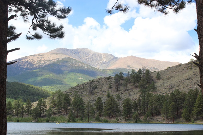
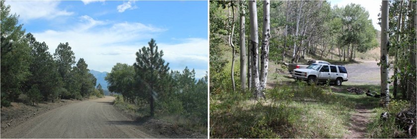
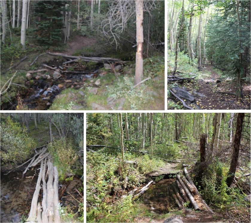
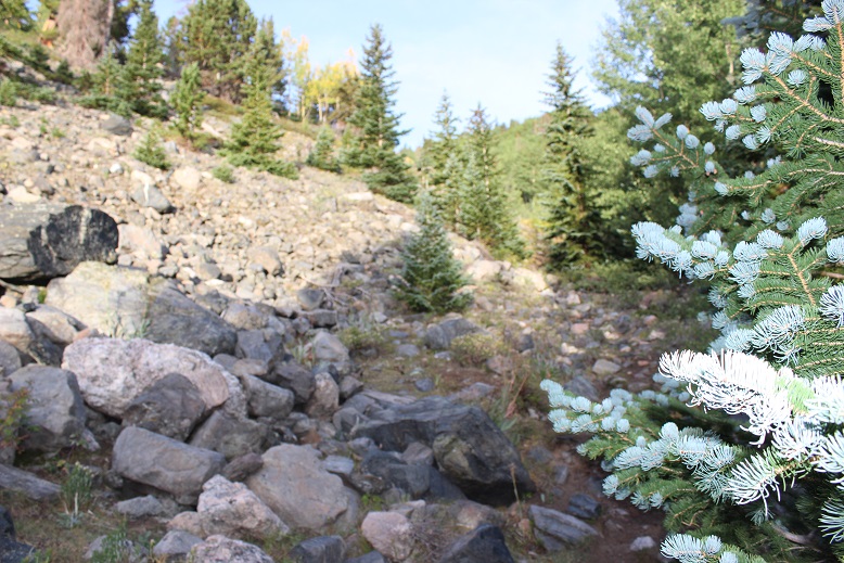

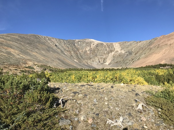
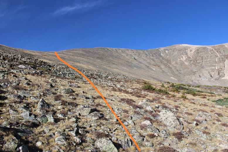
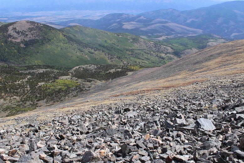

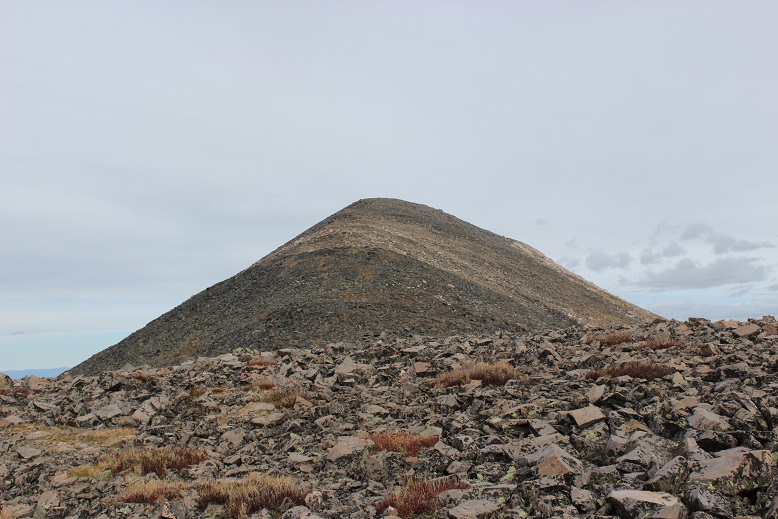

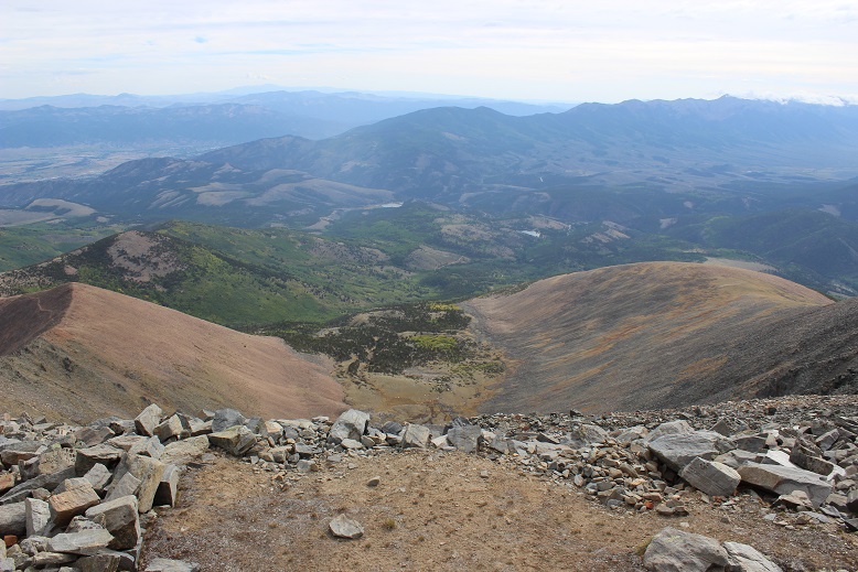
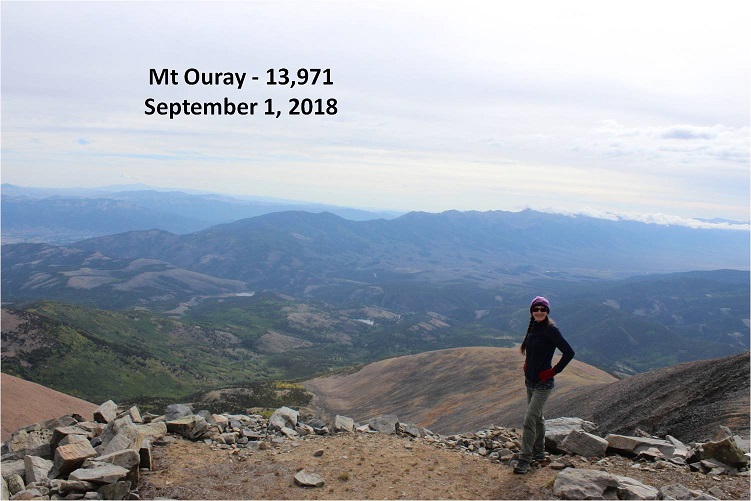

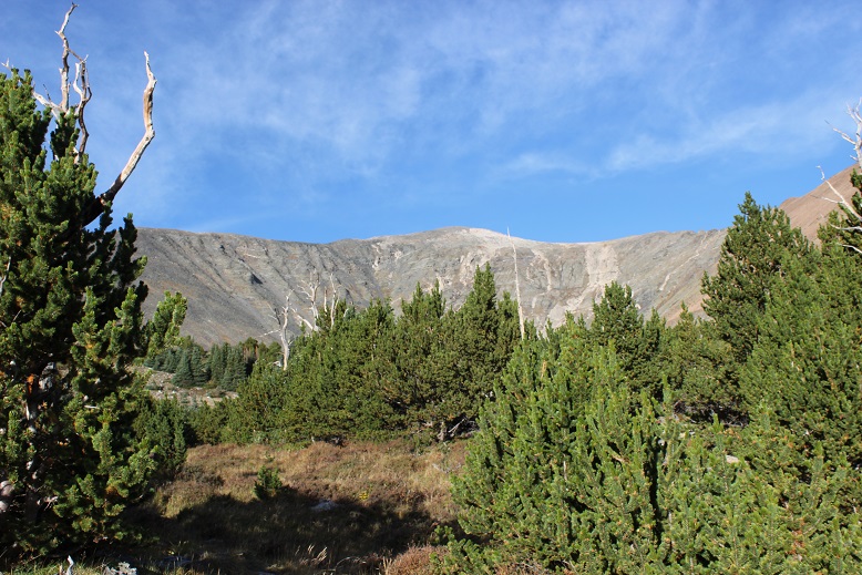
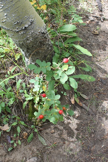
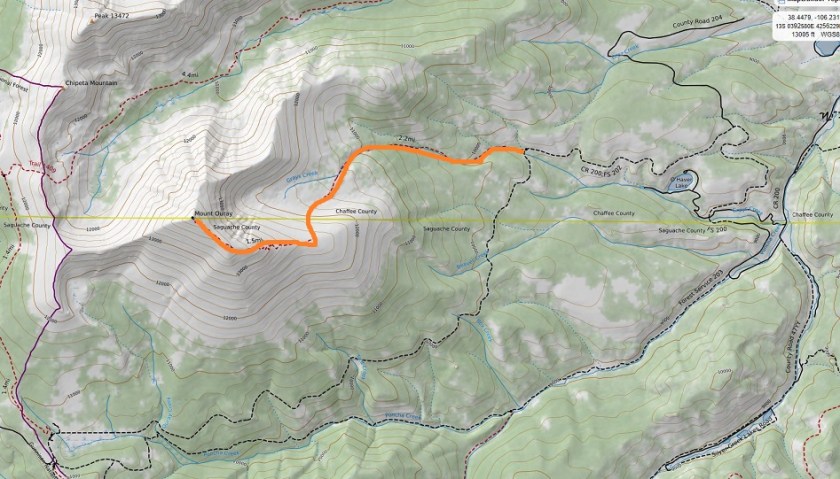


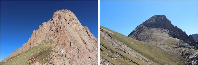

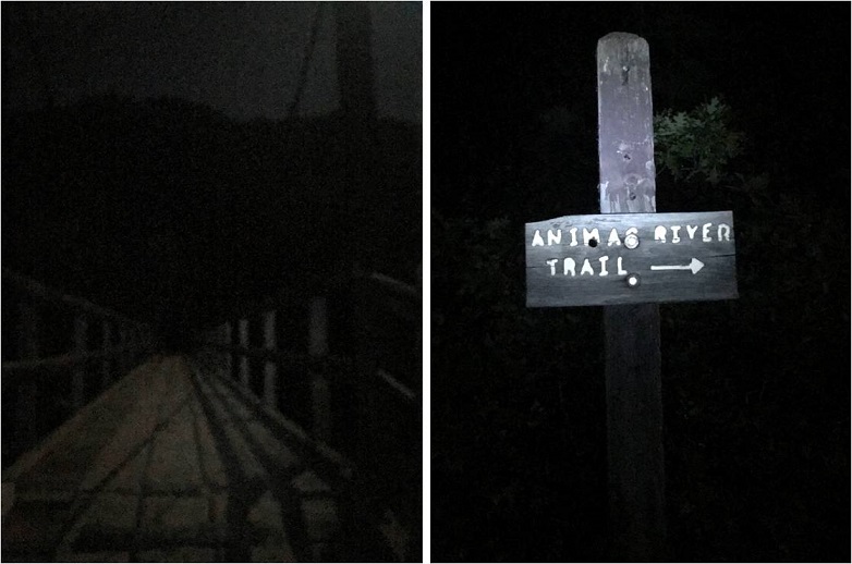


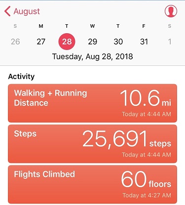
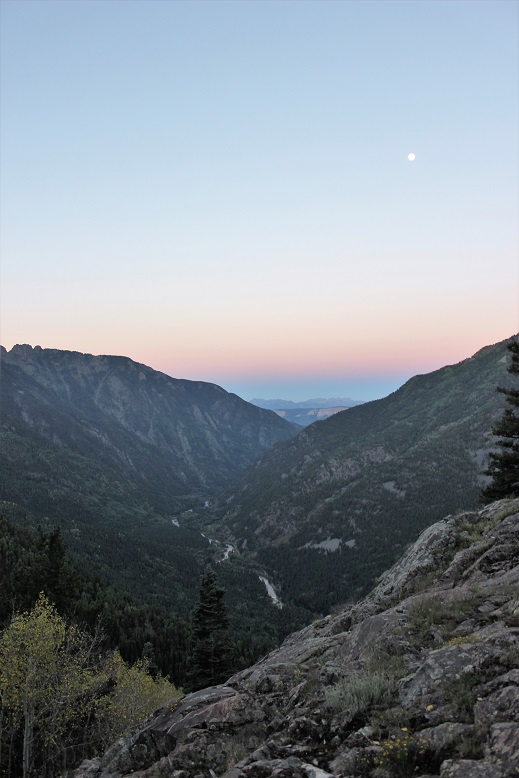
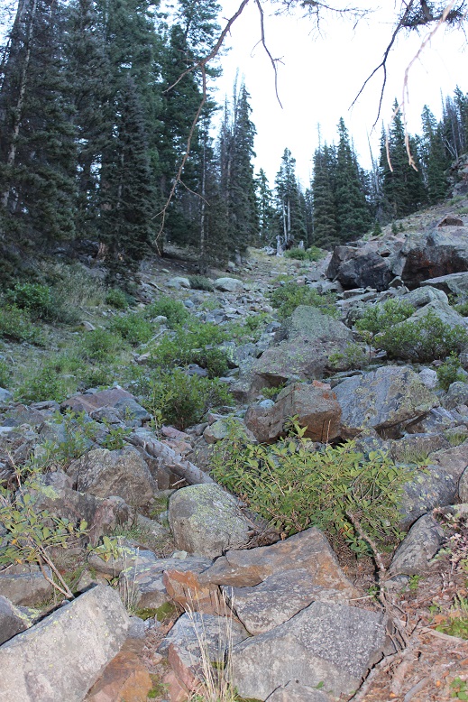
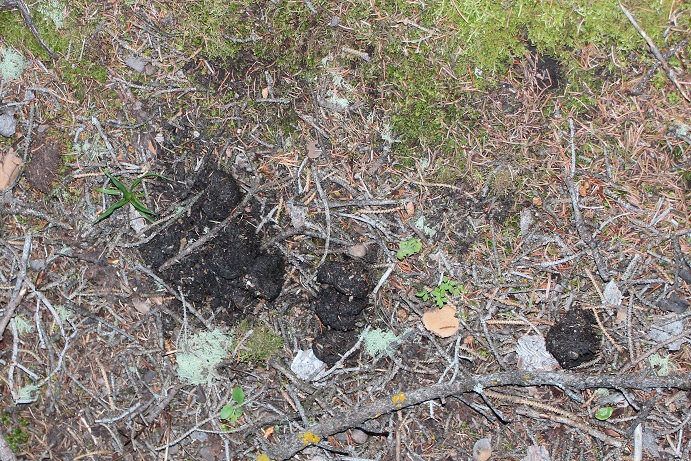

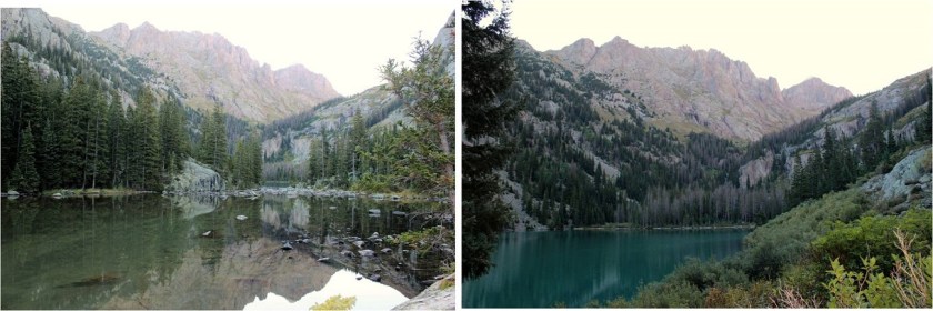
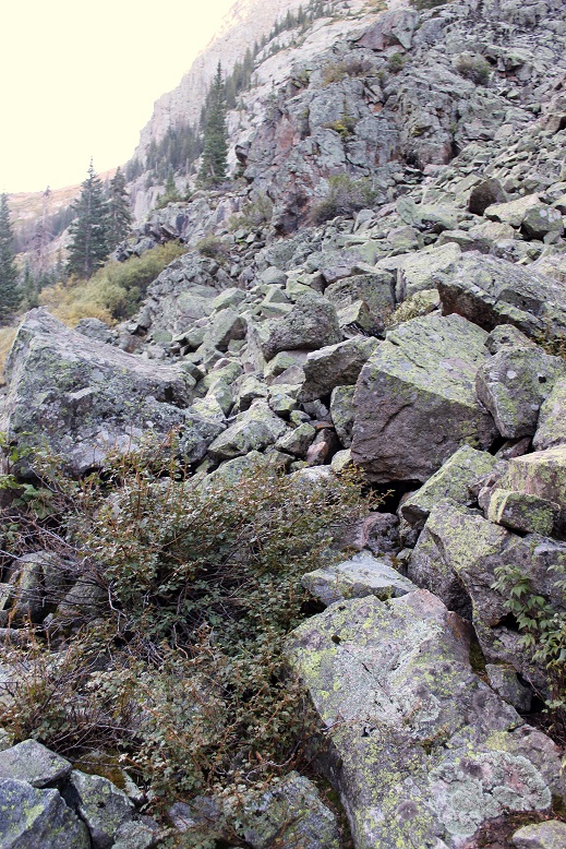
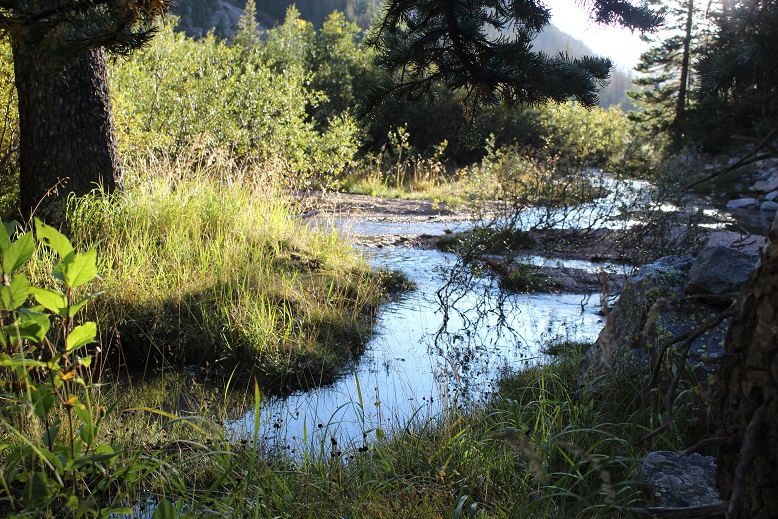
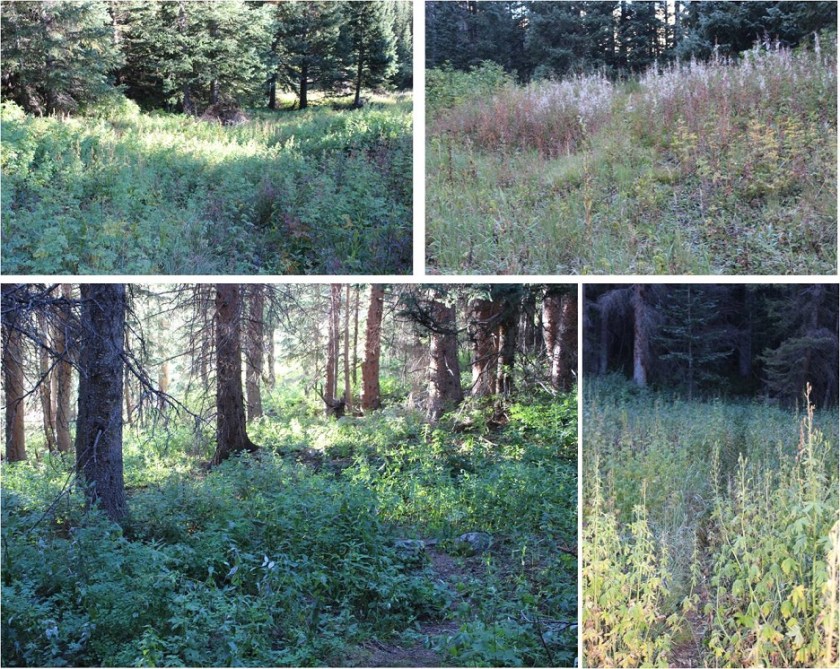
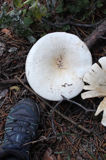
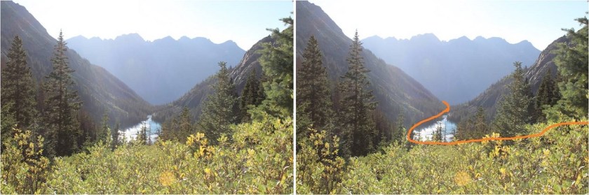 Above Ruby Lake: