Mt Herard – 13,350 and Medano Peak 13,153

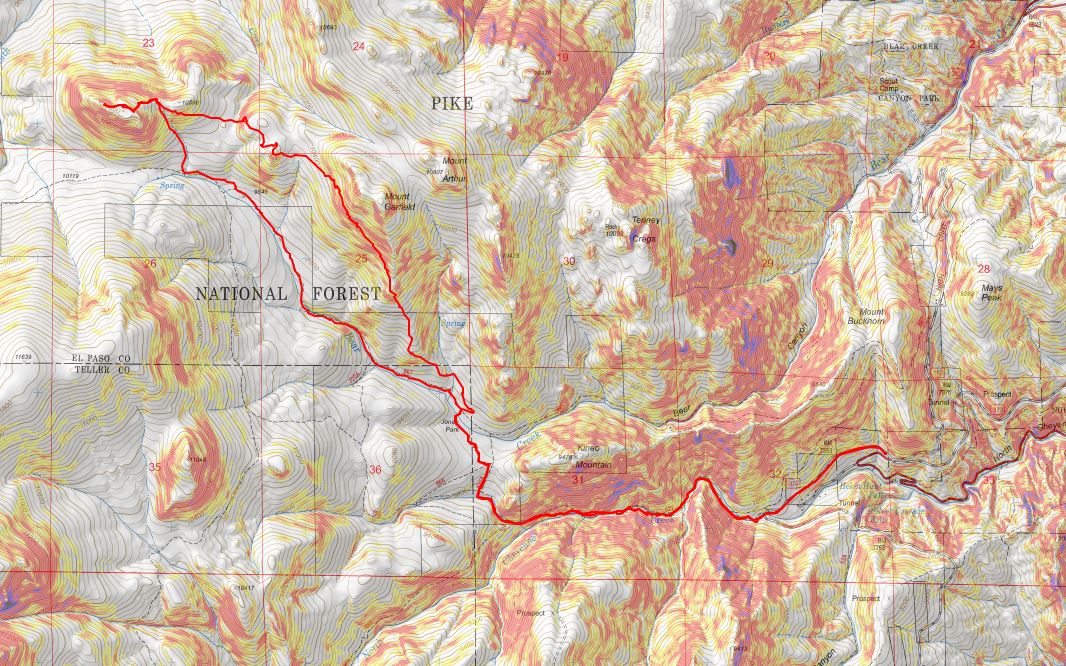
RT Length:  17.43 miles

Elevation Gain:  5584’

I drove in the night before to heavy clouds of smoke from the Arizona and New Mexico fires, but the weatherman predicted a cold front would push the smoke away by the next morning.

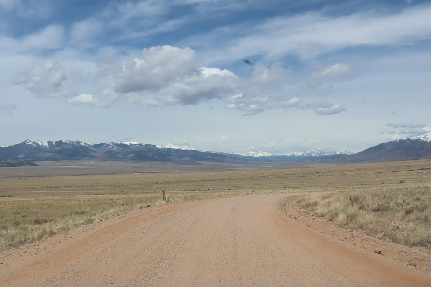
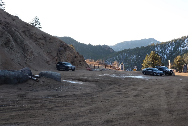
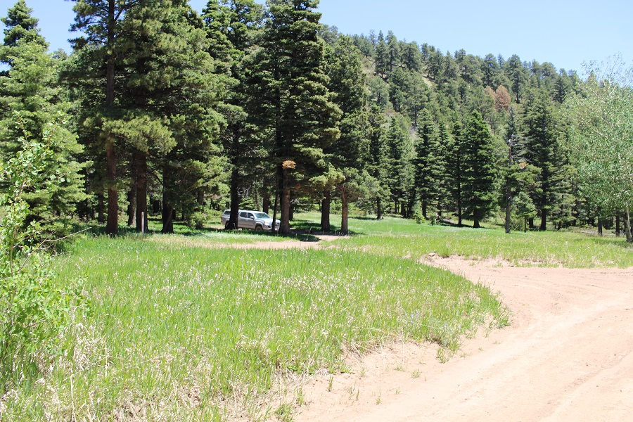
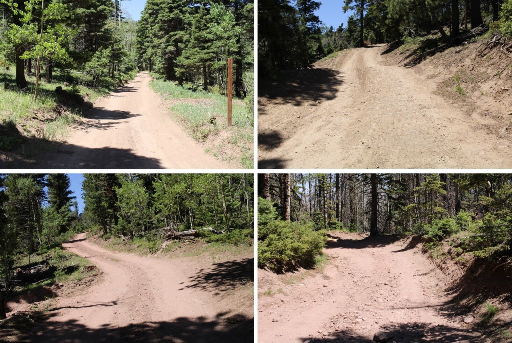
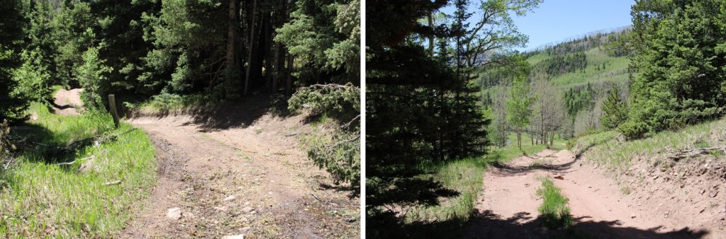
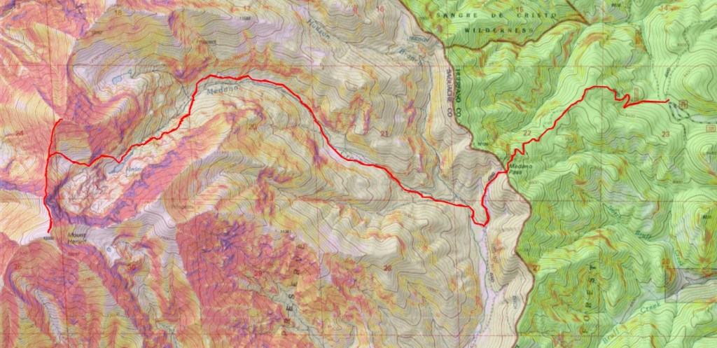
The drive in was on an easy 4WD dirt road, and probably doable in a 2WD vehicle to where I parked in the camping area before the pass. 

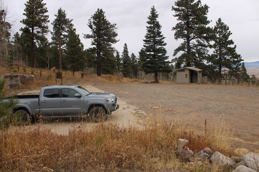
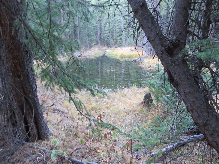
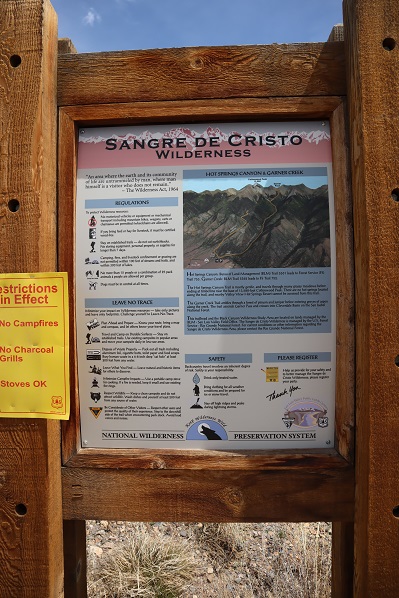
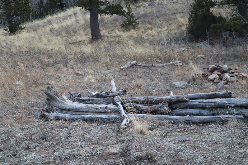
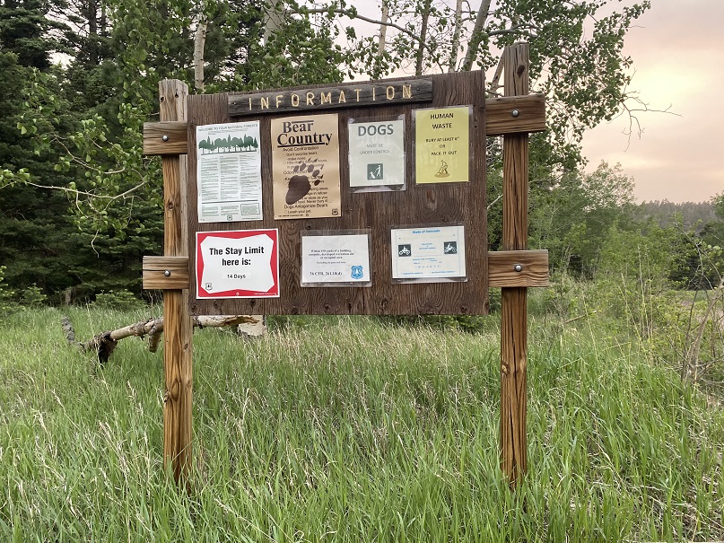
There were private ranches on either side of the road, with bison and what looked like hunting property.  There were tons of signs telling you the property was private, with information on how to report poachers.   I knew Medano Pass was closed from the Sand Dunes side, but was surprised to find it was closed from the HWY 69 side as well.  I parked in the camping area at 9200’, just over 2 miles from the pass. Mine was the only vehicle there, which made sense because the pass was closed.  Also, it was a Monday.  And extremely windy. There was quite a bit of glass on the ground from past campers who’d broken bottles and left them. 

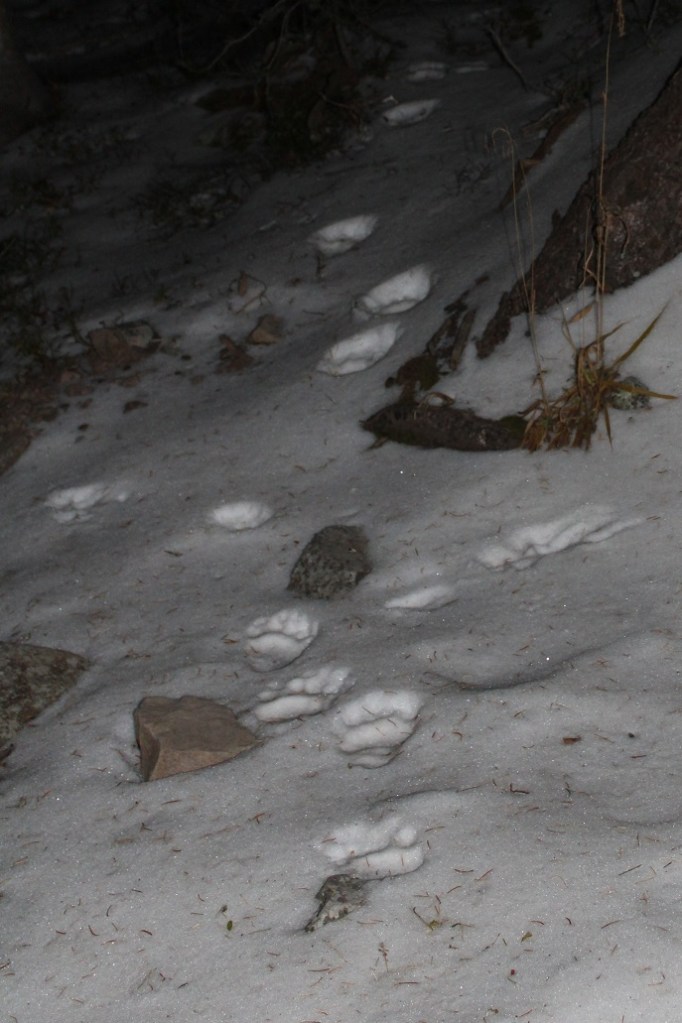
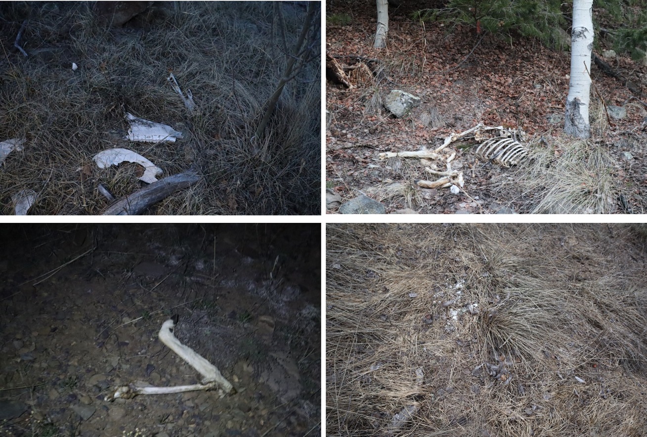
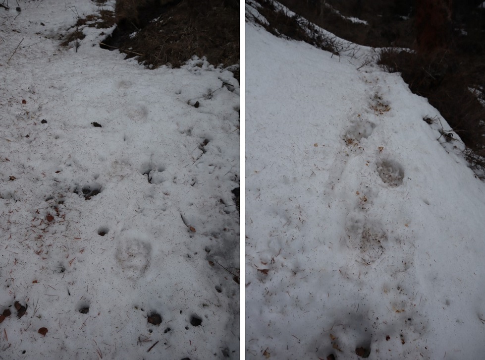
There were signs indicating bear activity in the area, which I confirmed the next morning.  If you camp here, please secure your smellables/food/etc.

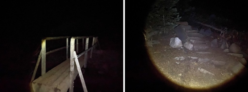
I made it to my campsite late (but it was worth it because my youngest daughter, who’s in college, called to chat with me a bit on my way in, and I had to stop where I had cell reception), so I made it an early night for what would be an early morning. I was up and on the trail at 3:30am.

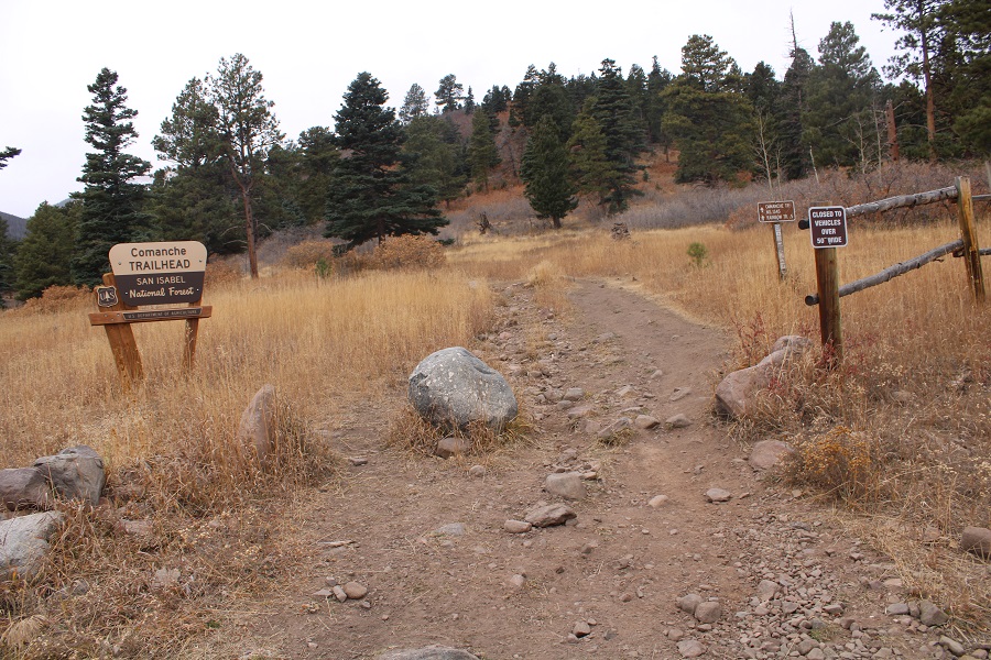
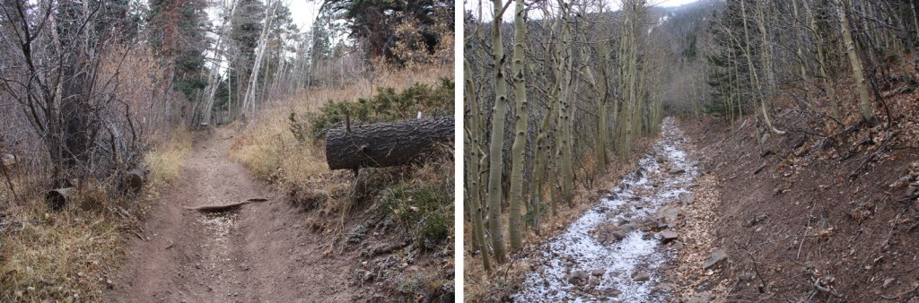
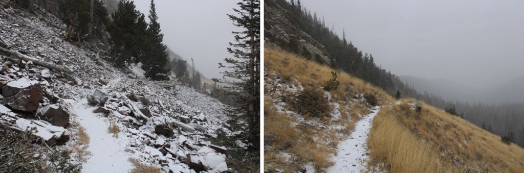
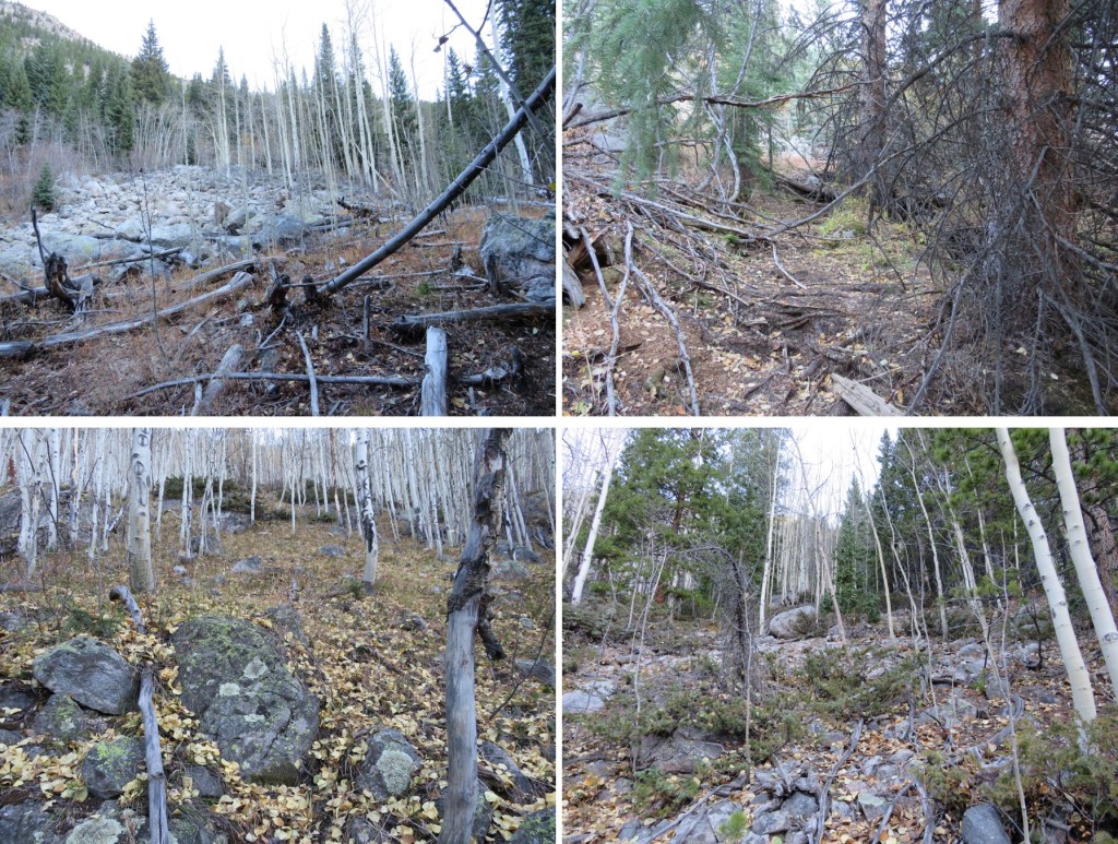
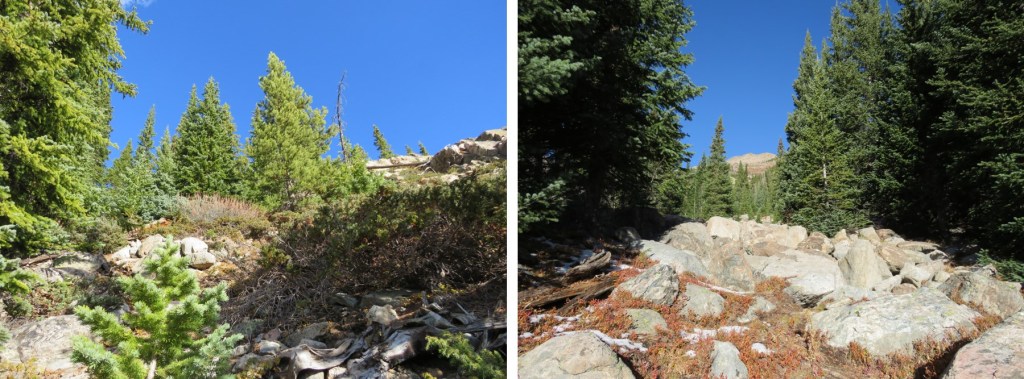
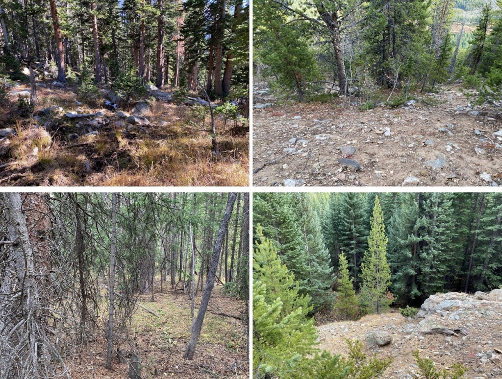
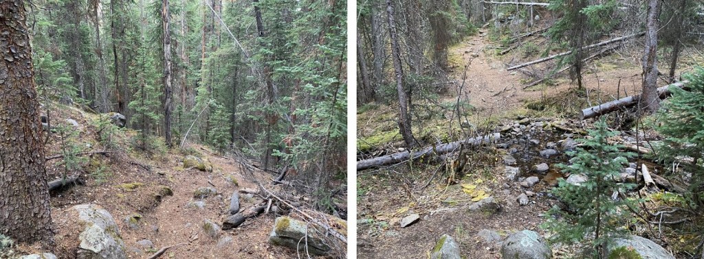
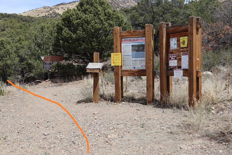
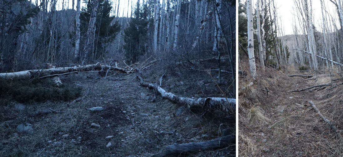
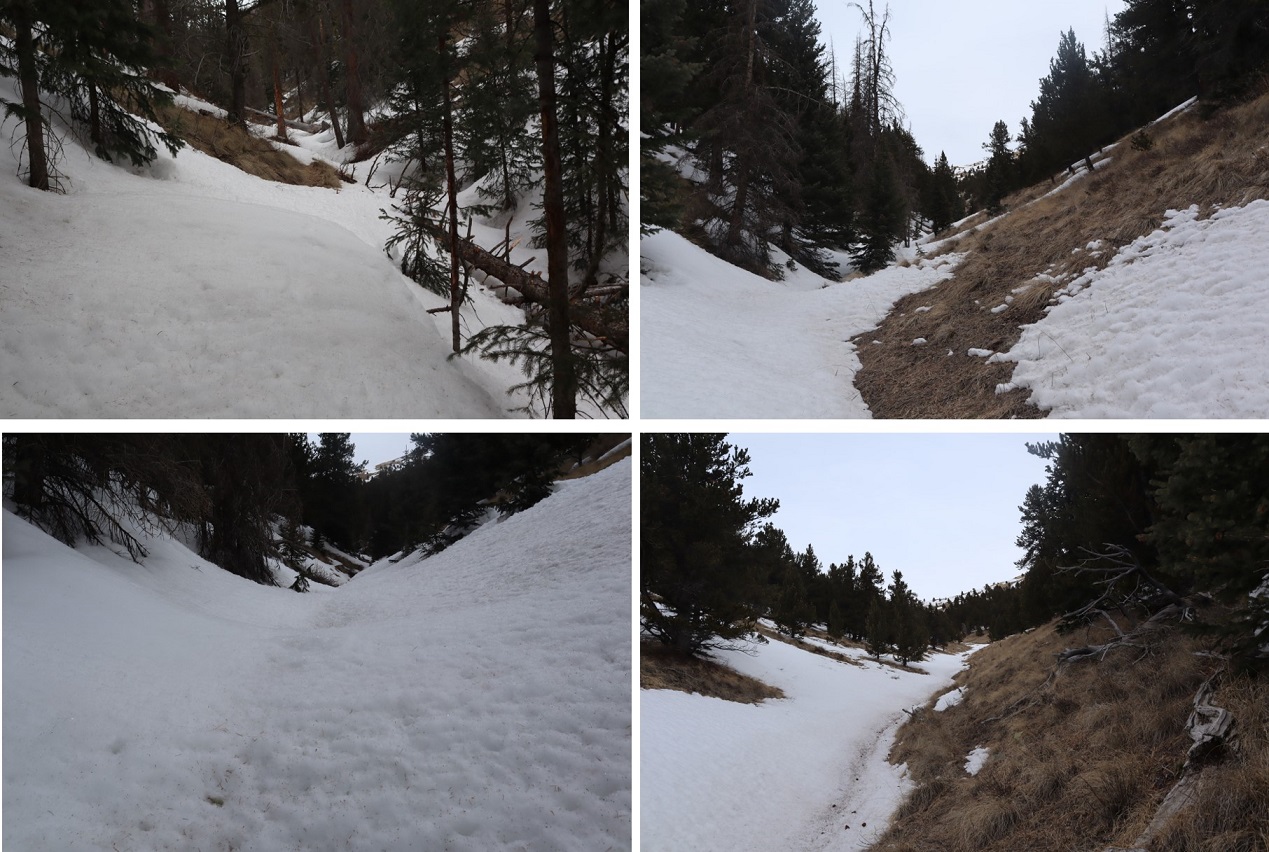
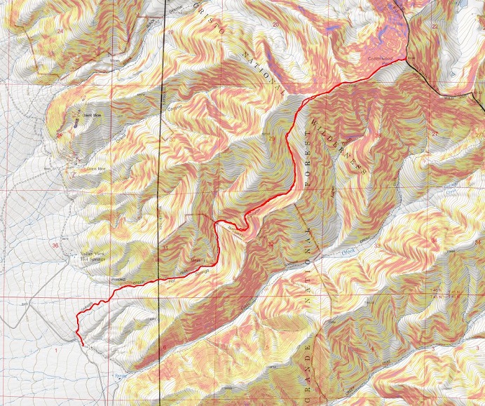
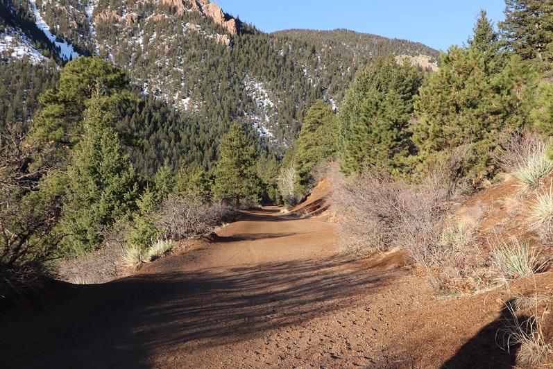
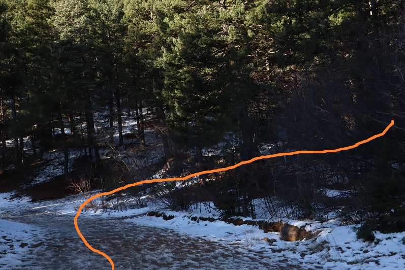
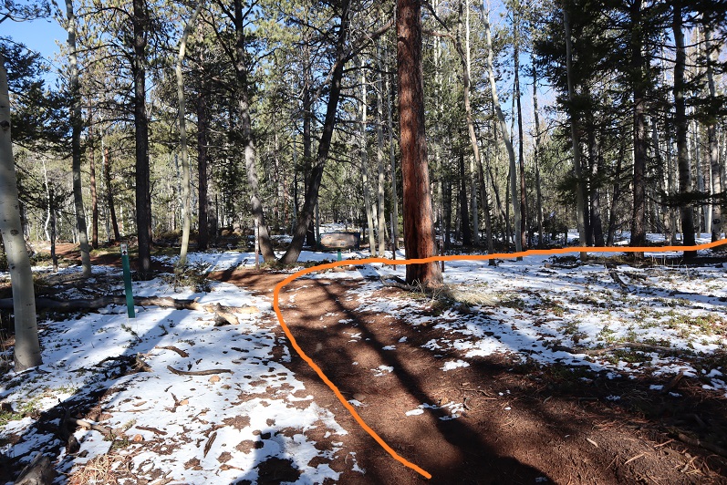
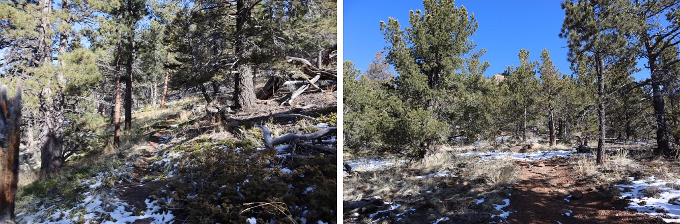
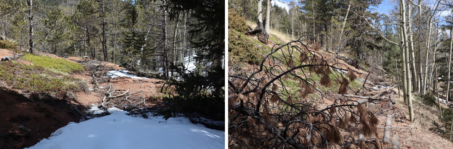
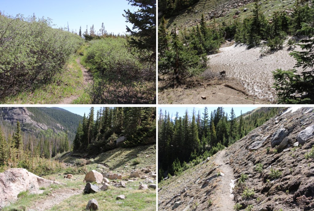
I started by following 559 west to Medano Pass.  There were a few campsites along this road, but very few turnaround points.  This is now a 4WD road.

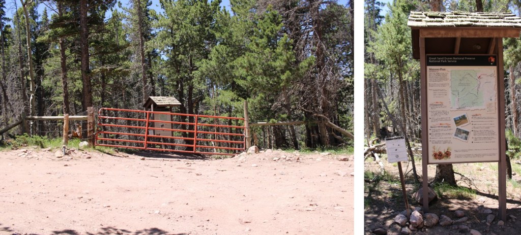
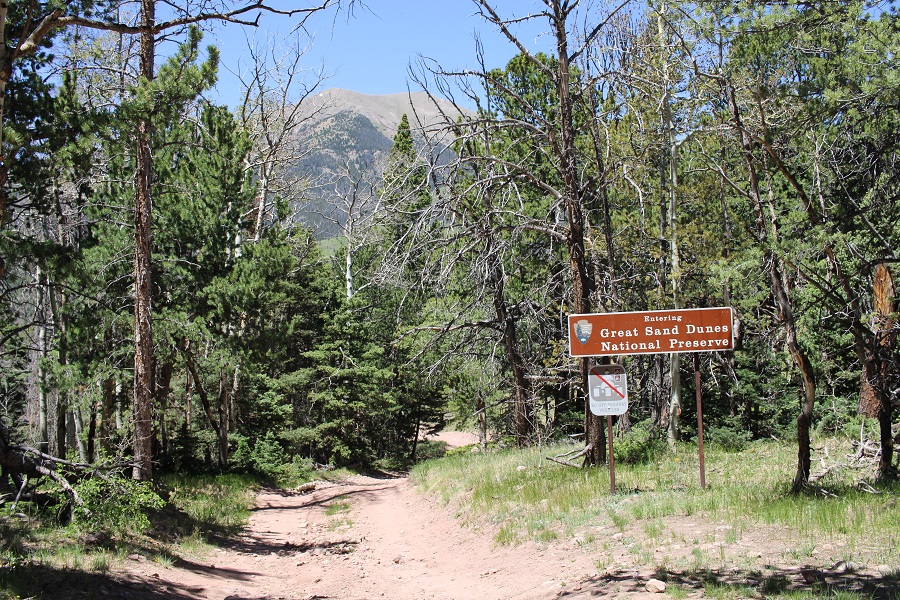
Once at Medano Pass I found the gate closed to vehicles.  I hopped over the gate, and continued towards the Medano Lakes Trailhead. 

Along the way there was a sign warning of bear activity

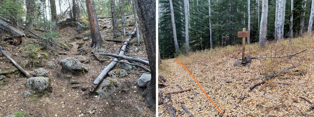
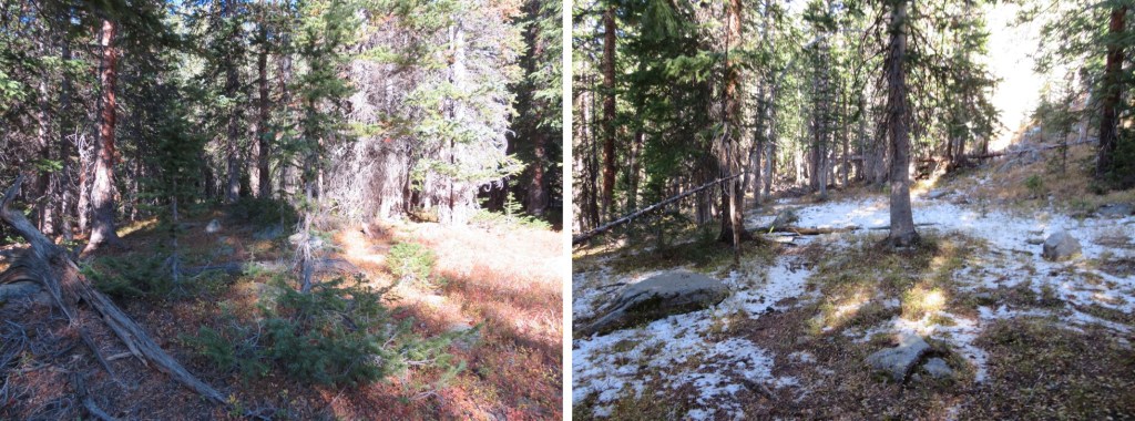
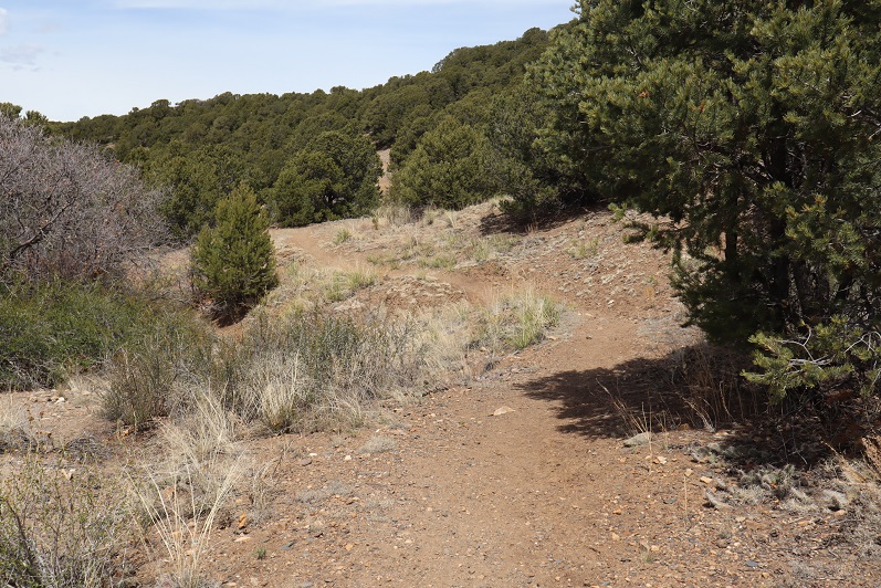
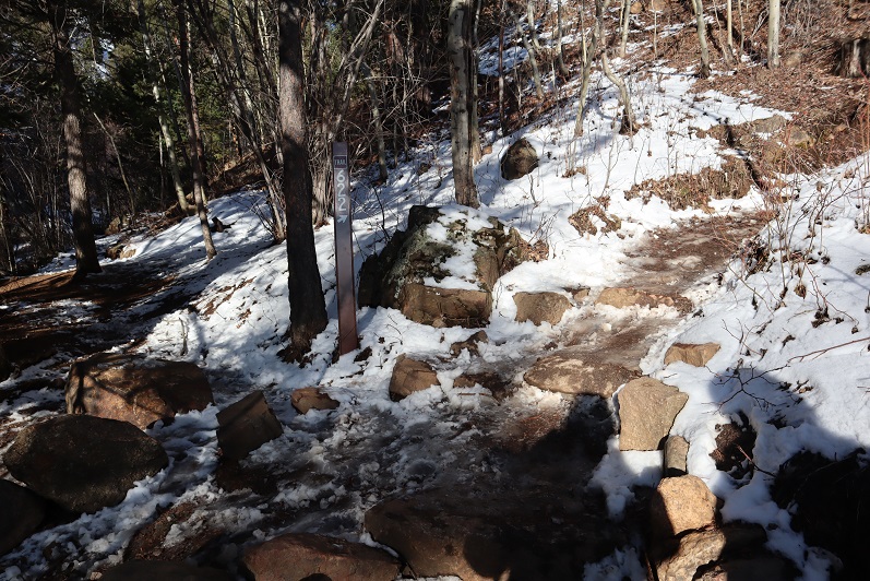
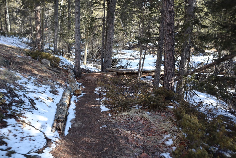
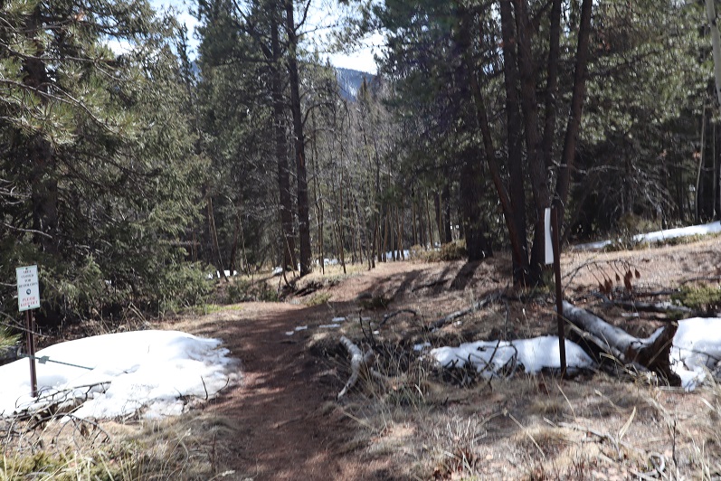
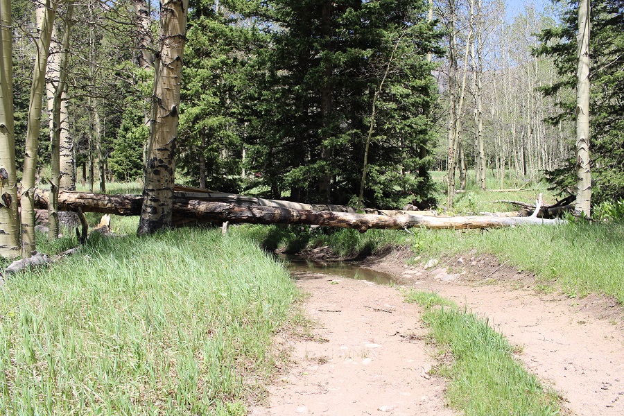
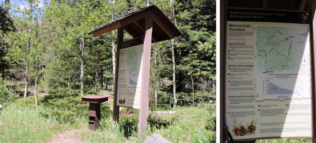
After hiking for 2.9 miles, I made it to the Medano Lakes Trailhead.  Note if you’re driving, there are still several downed trees on the road, so you won’t be able to make it all the way to the trailhead.  There are several campsites along the way with bear boxes.

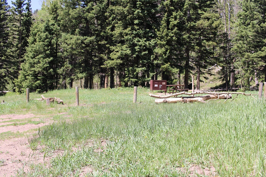
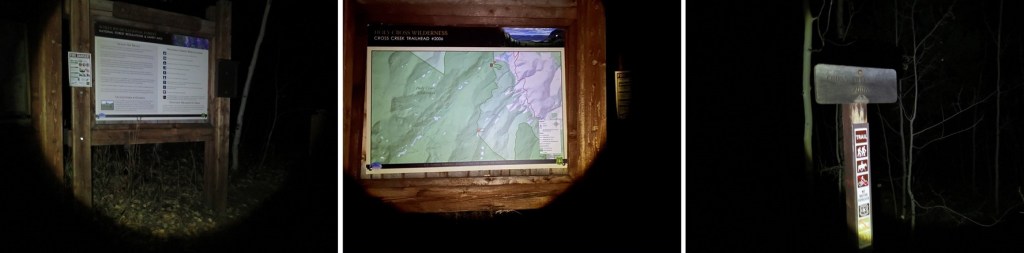
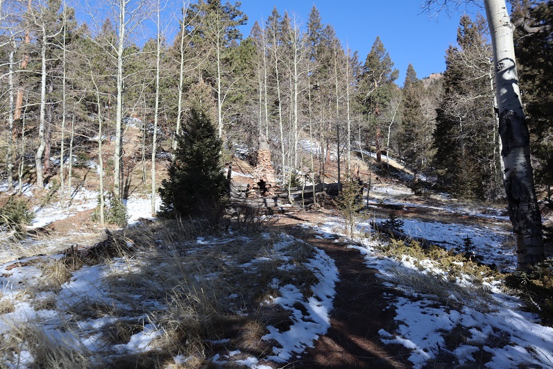
I signed the trail register and was on my way

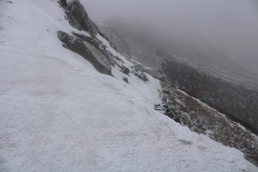
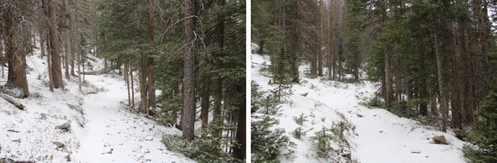
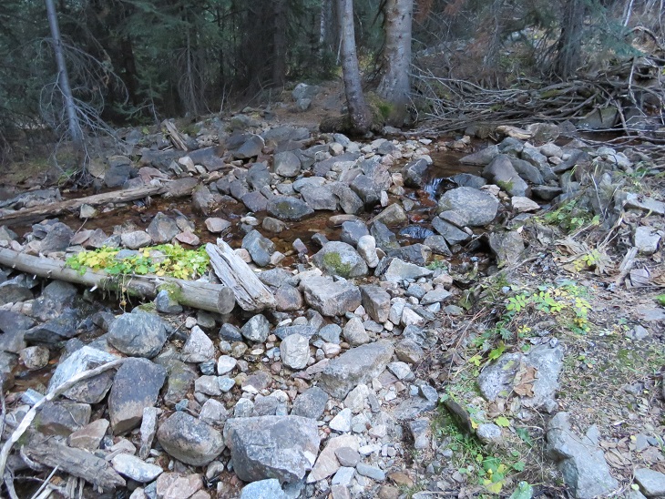
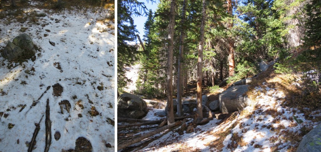
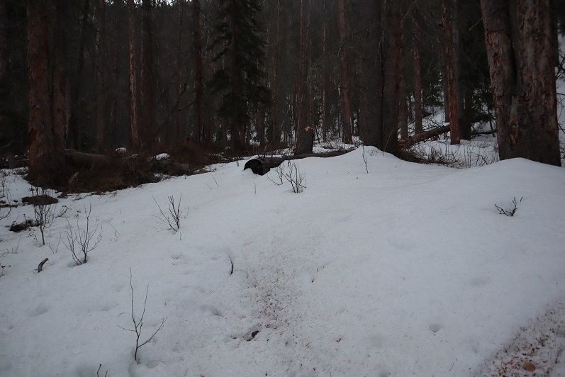
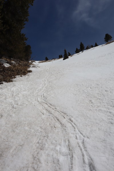
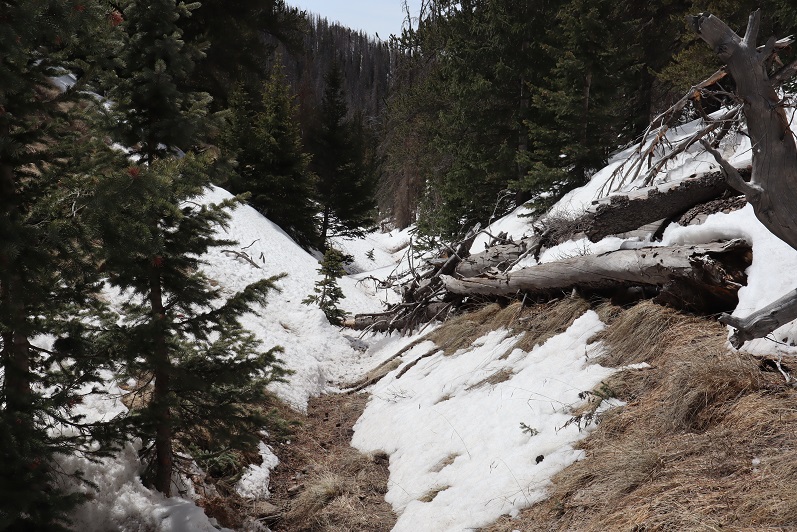
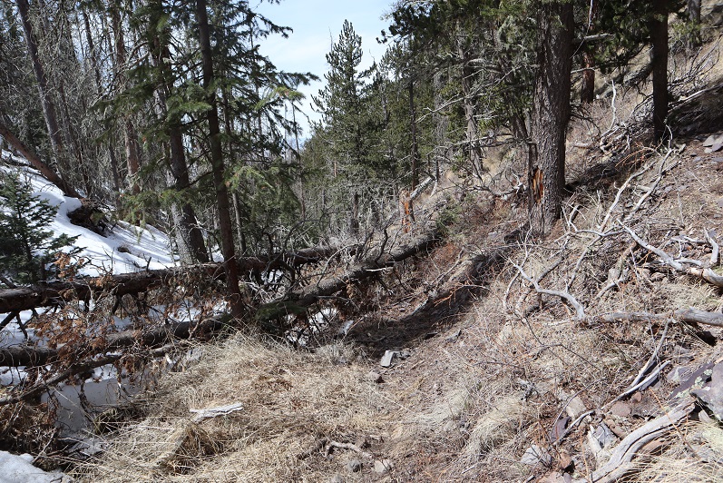
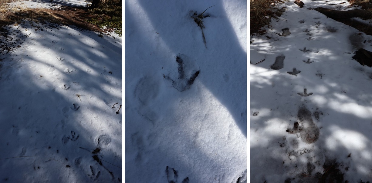
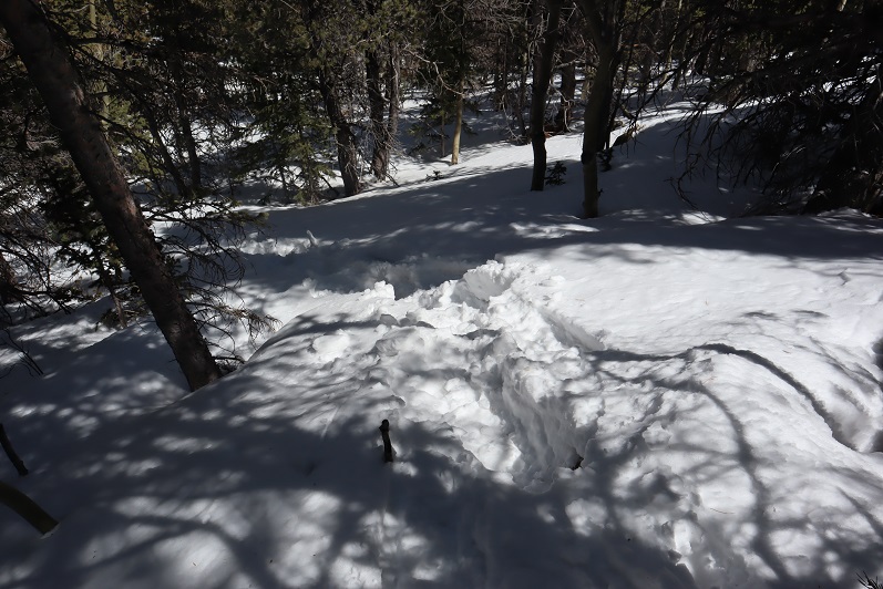
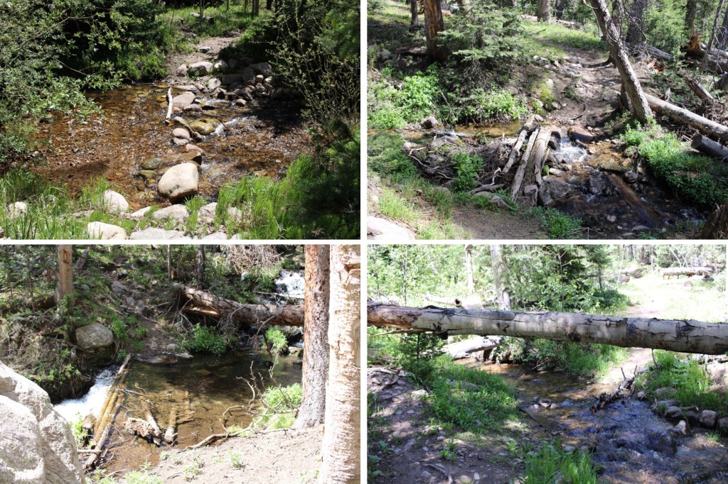
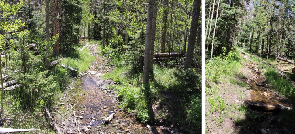
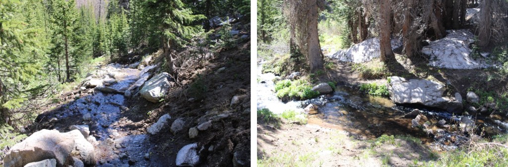
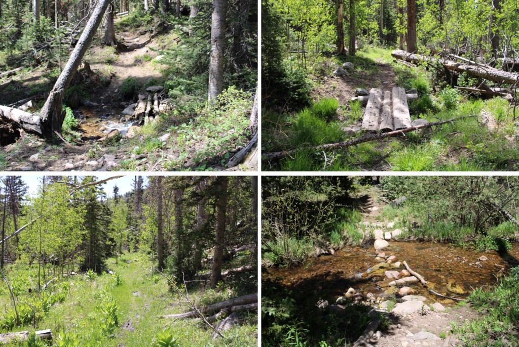
A couple of things to note:  This is a class 1 trail, and mine were the first footprints in the mud/snow.  There was a lot of evidence of bear activity, I crossed numerous streams (easily, no need for creek crossing shoes) and there was a lot of downfall.  I mean, an excessive amount. Several times I was walking UNDER avalanche debris.  These were also spring conditions, so a lot of times, the trail was under water/snow.

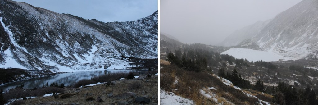
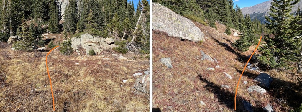
After hiking for 6.75 miles, I made it to treeline, the upper basin, and Medano Lakes

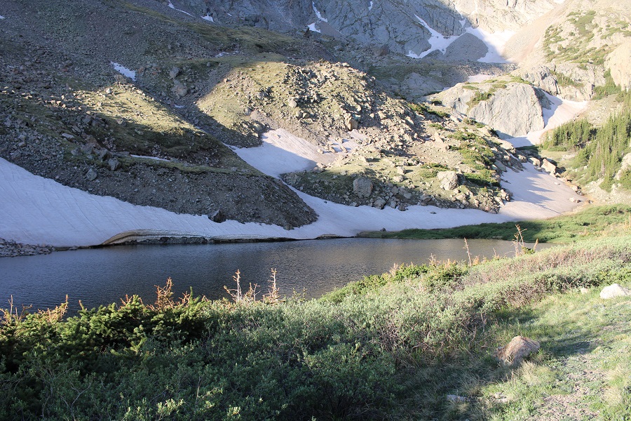
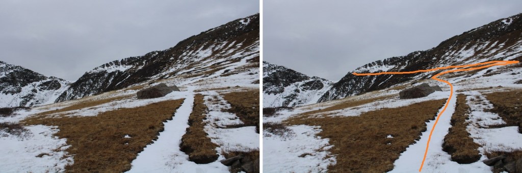
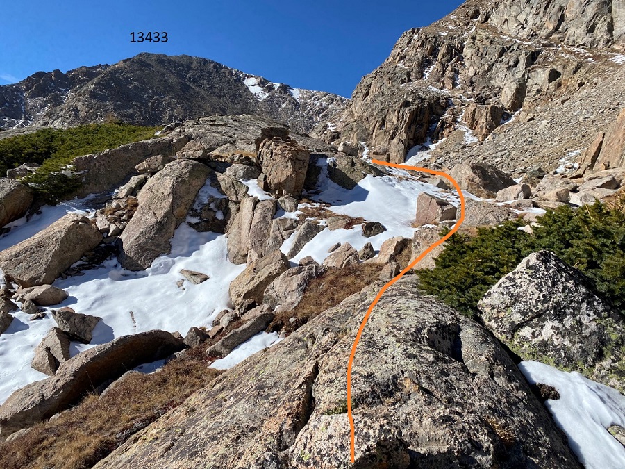
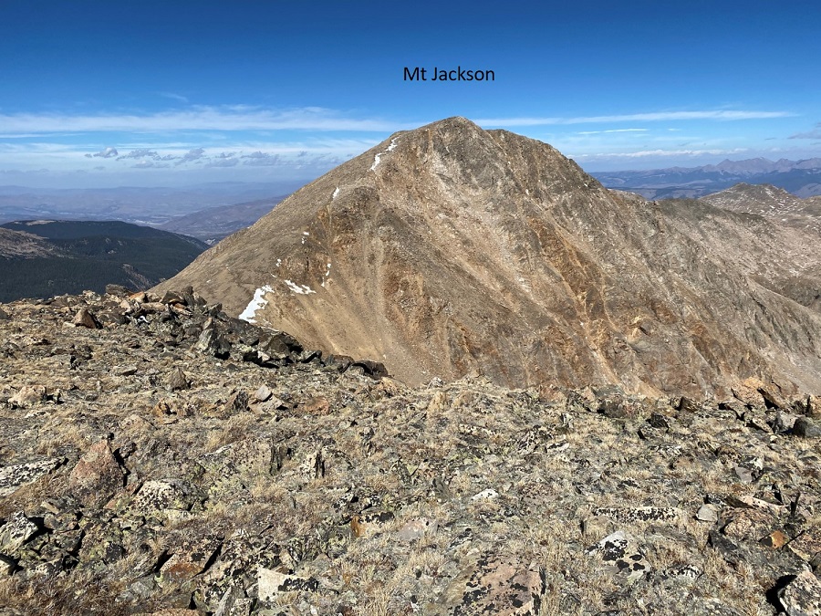
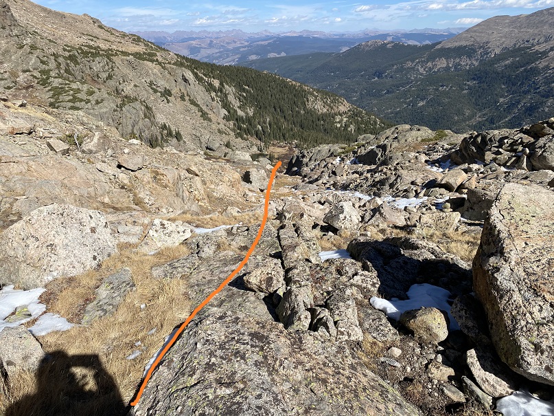
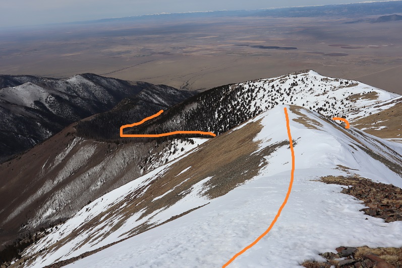
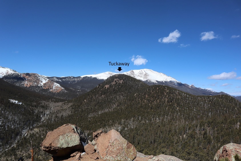
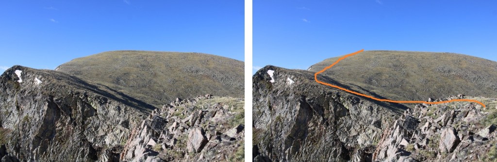
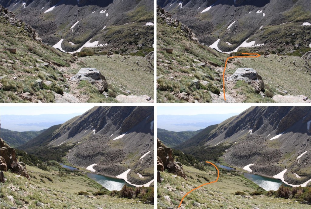
At 11540’, I left the trail and followed a faintly cairned route to the saddle of Herard and Medino.  This is where I was aiming

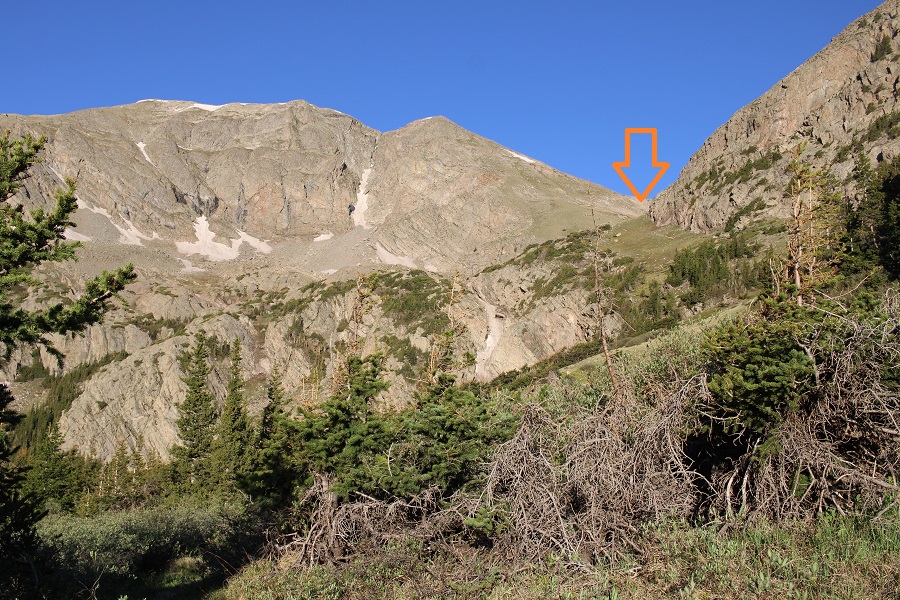
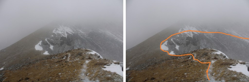
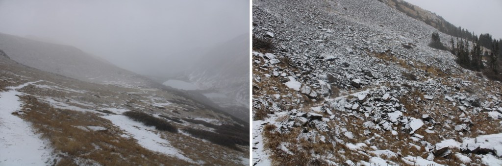
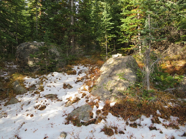
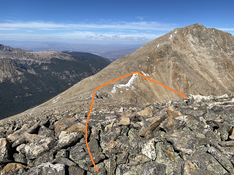
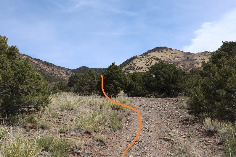
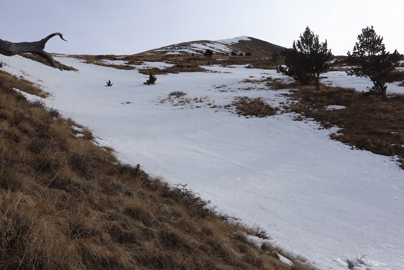
There’s a faint trail that’ll get you to the upper basin

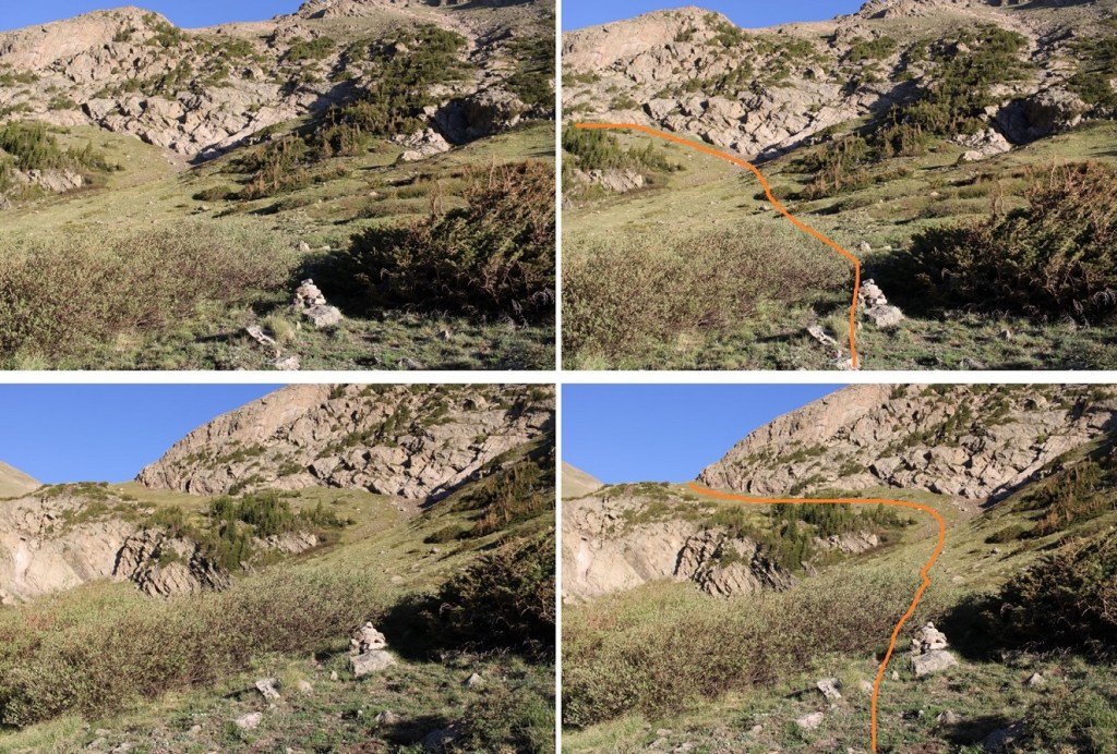
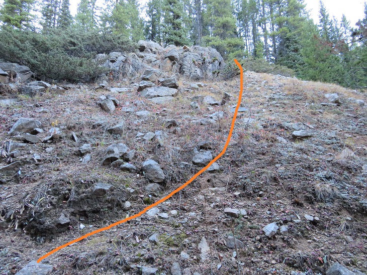
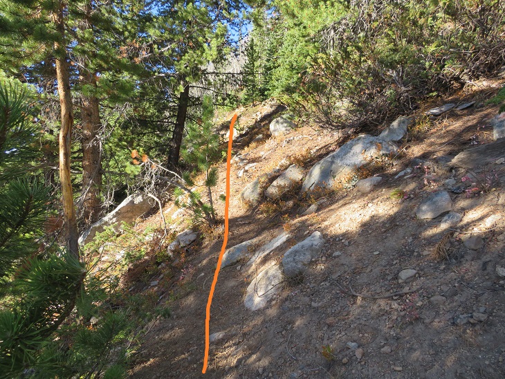
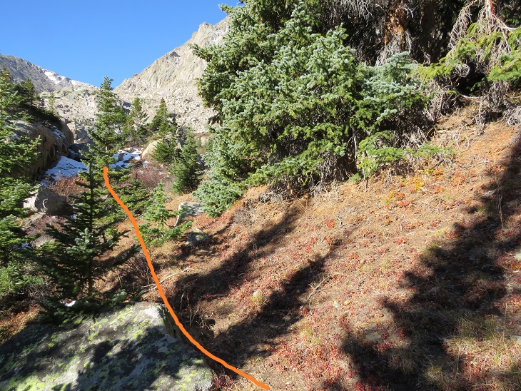
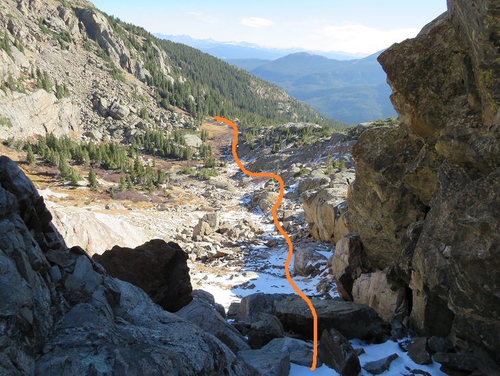
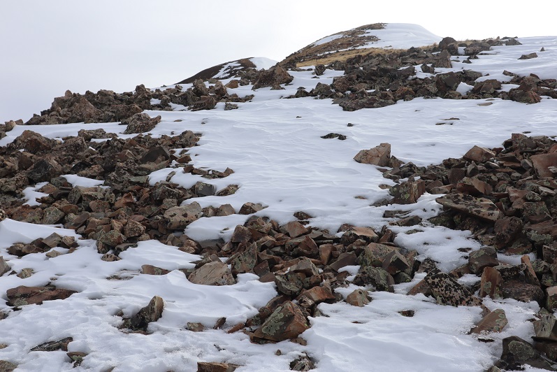
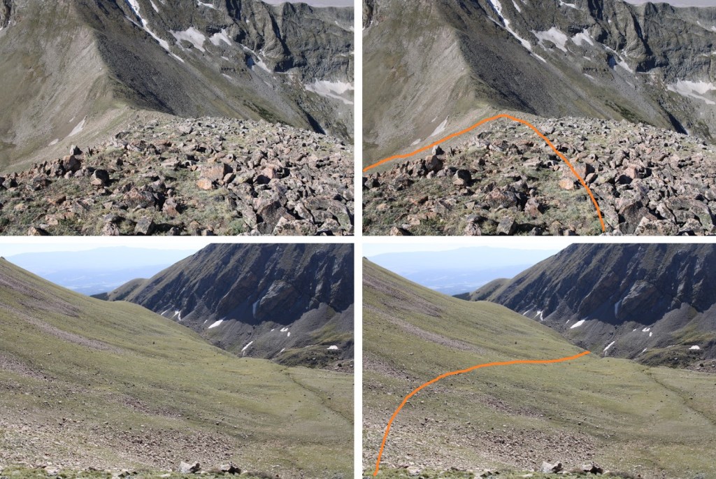
Just before the upper basin there are two cairns you’ll pass through.  Take note of them for the route down

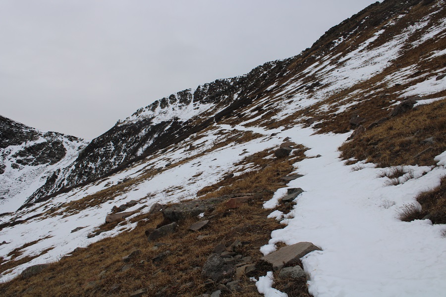
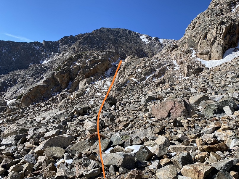
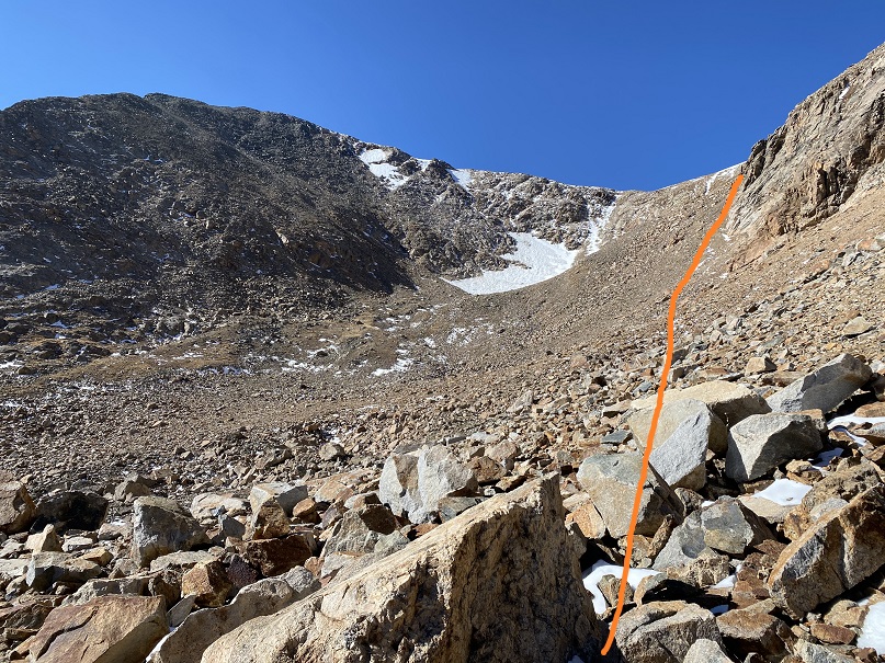
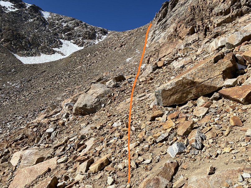
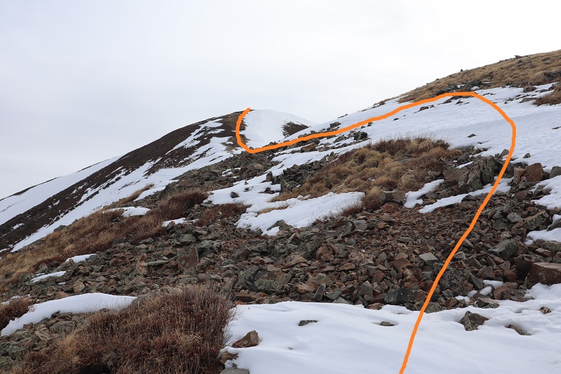
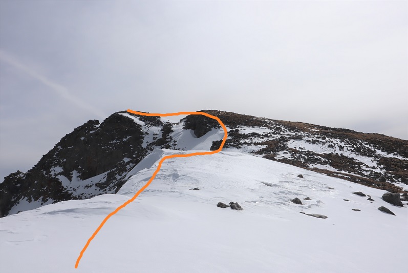
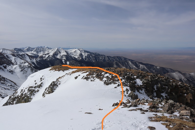
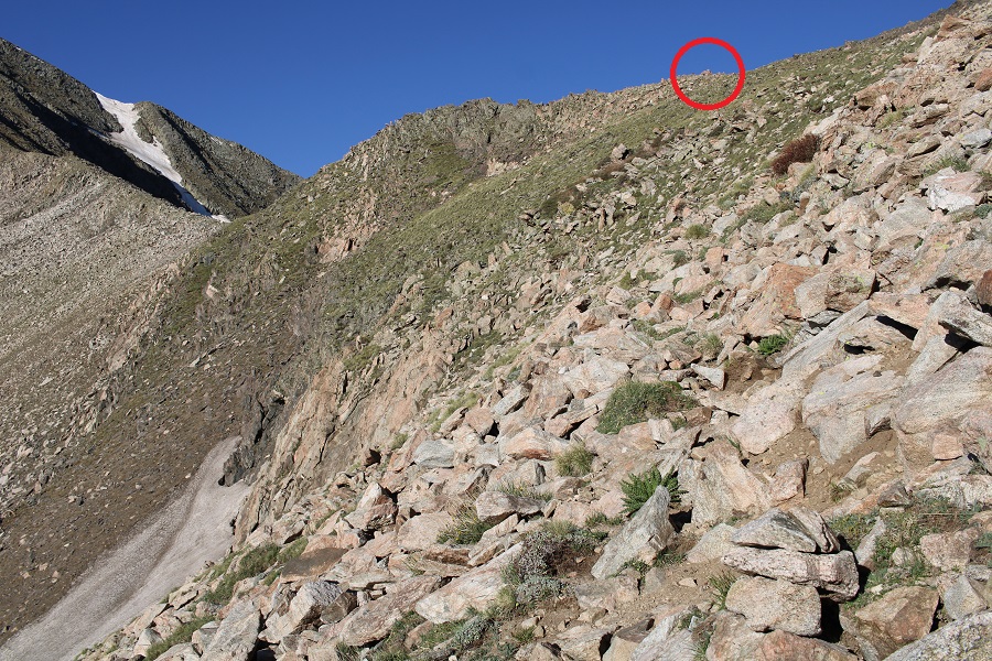
Now in the upper basin, the trail is gone for a bit, but there are cairns that will lead you to the saddle, and even a trail. This is the easiest way to make it to the saddle

The cairn you’re aiming for is circled in red

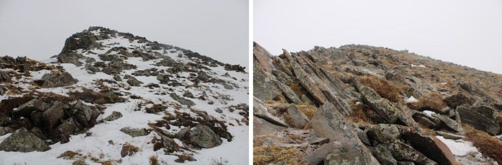
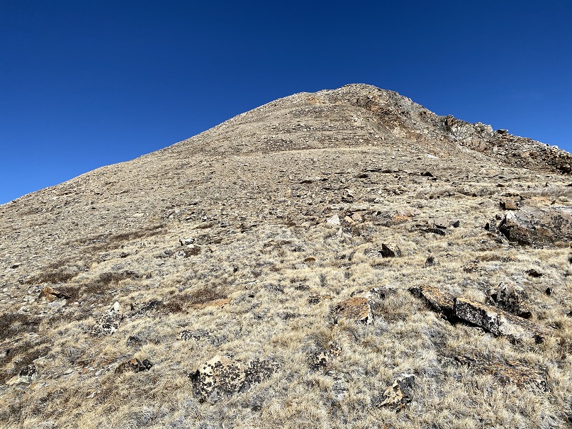
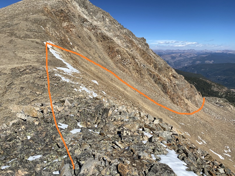
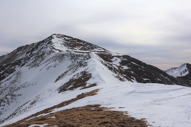
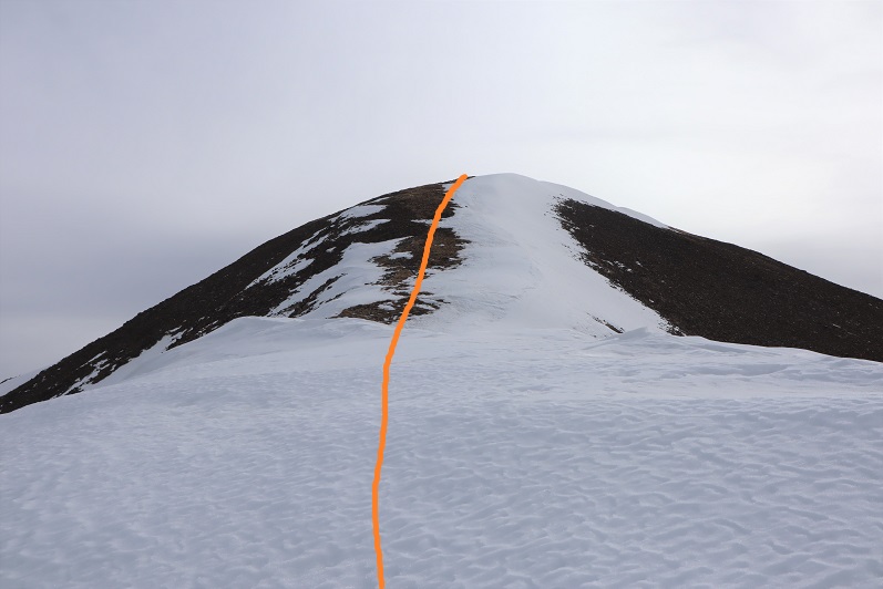
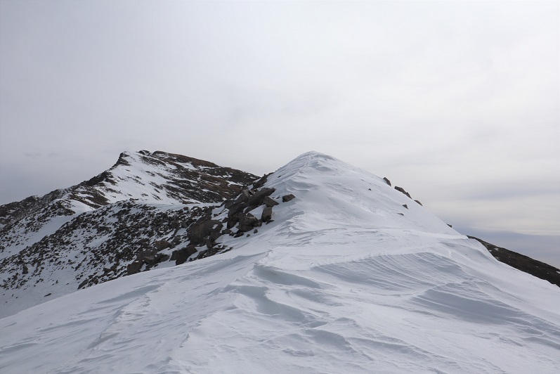
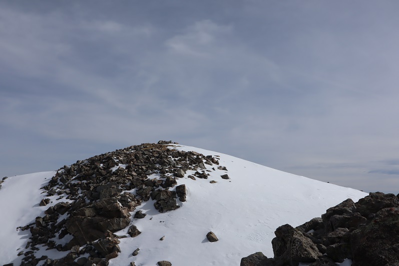
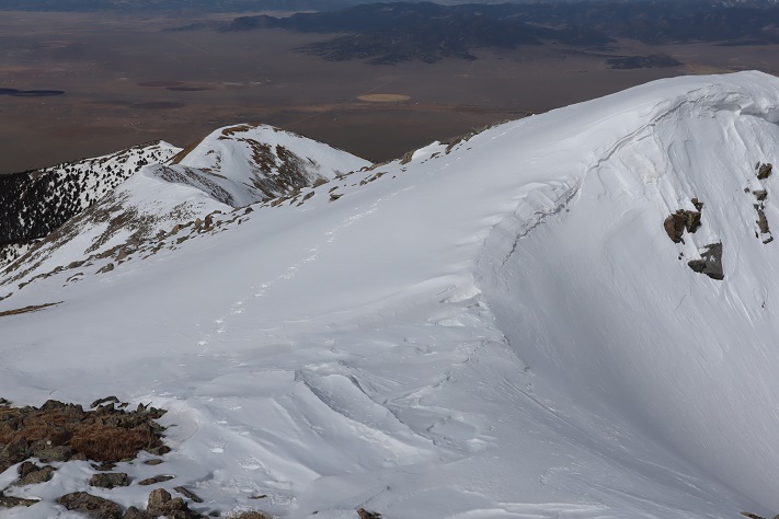
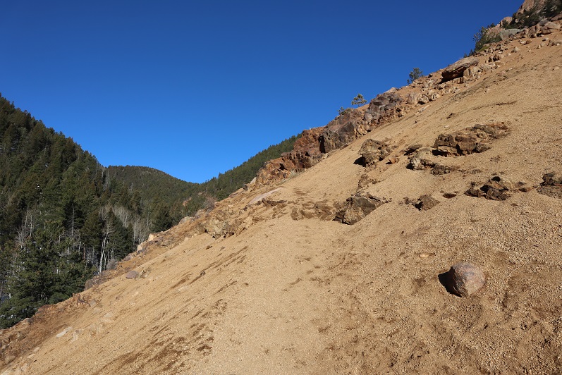
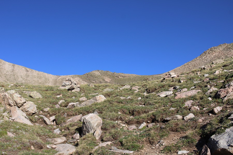
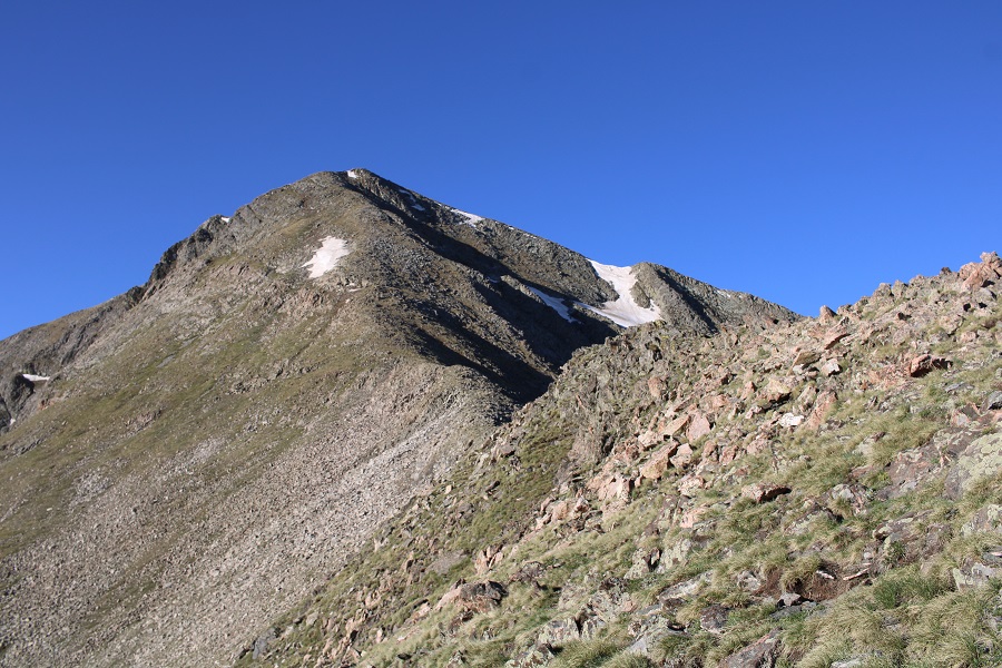
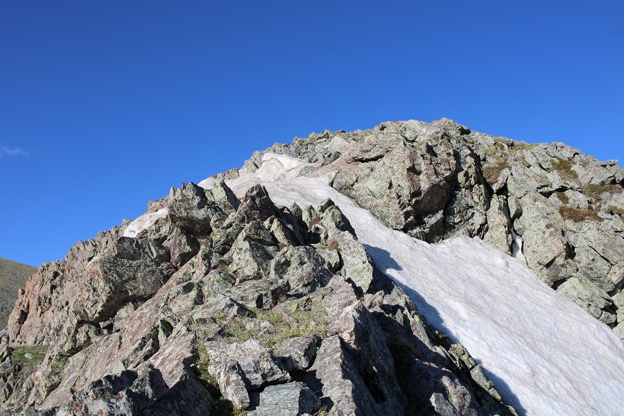
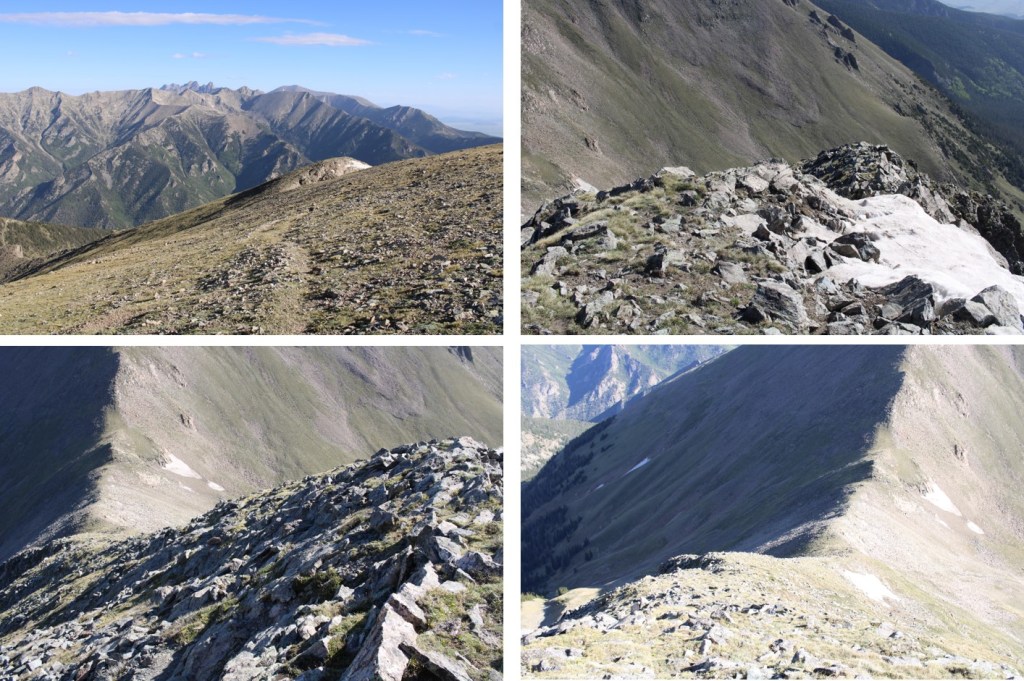
I decided to do Herard first, so after making it to the saddle, I followed the ridge south.  There was a false summit, but this (and in fact the entire hike) was all class 2.

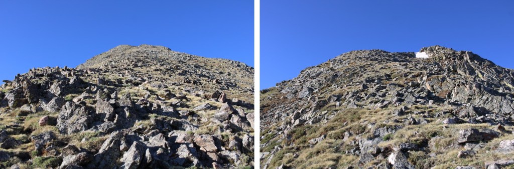
Here are some pictures of the terrain

And the false summit. 

There was a bit of snow to navigate (nothing too serious) and then I followed the tundra (and a faint trail) to the summit.

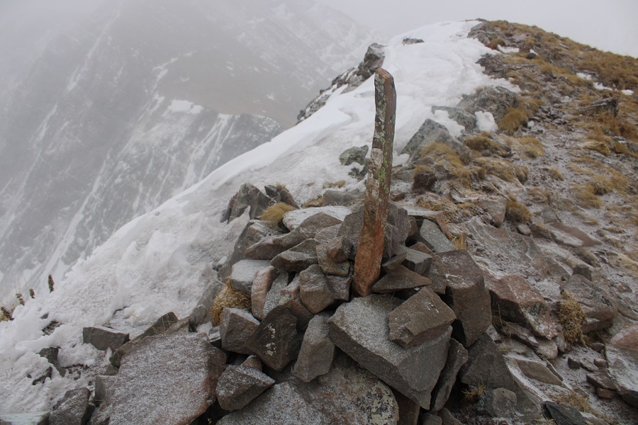
The summit was flat.  I summited Mt Herard at 8am
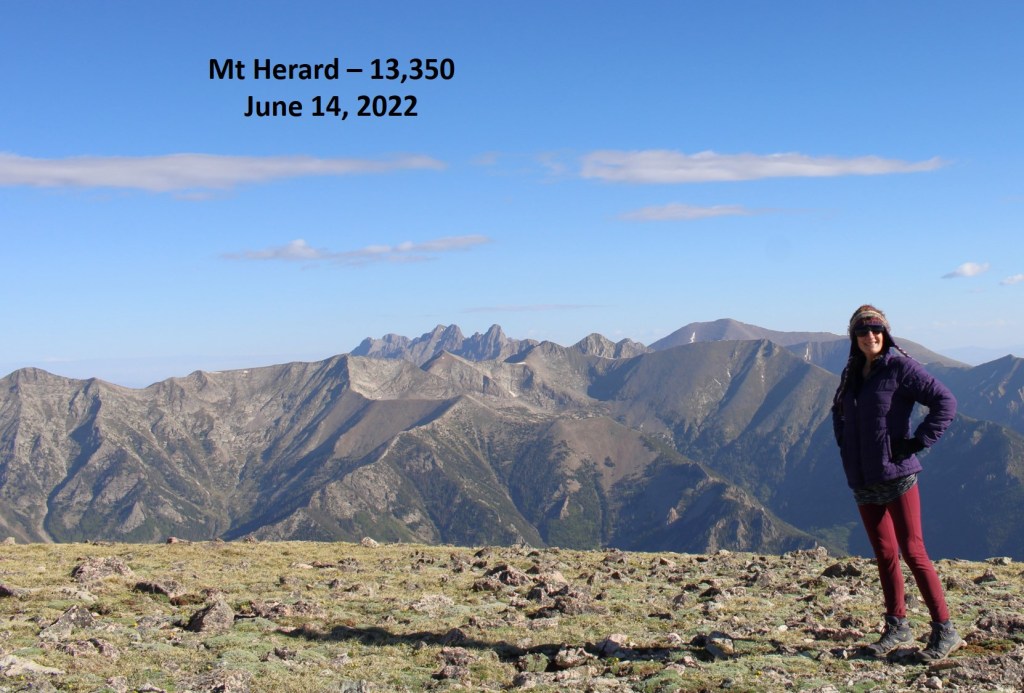
Mt Herard:

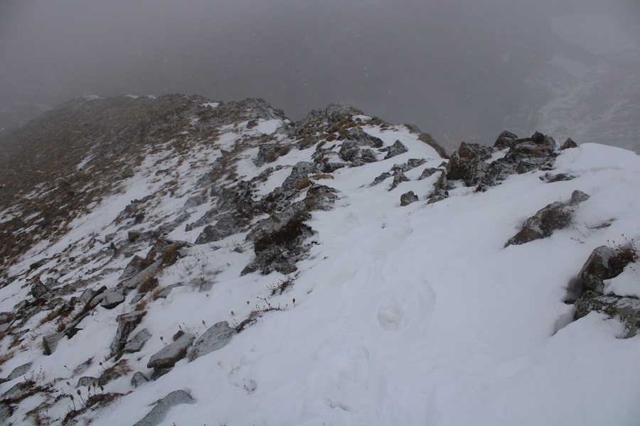
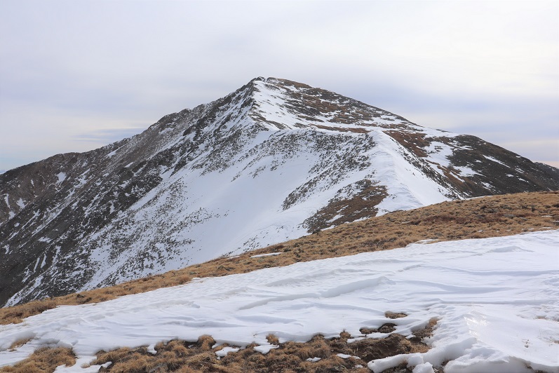
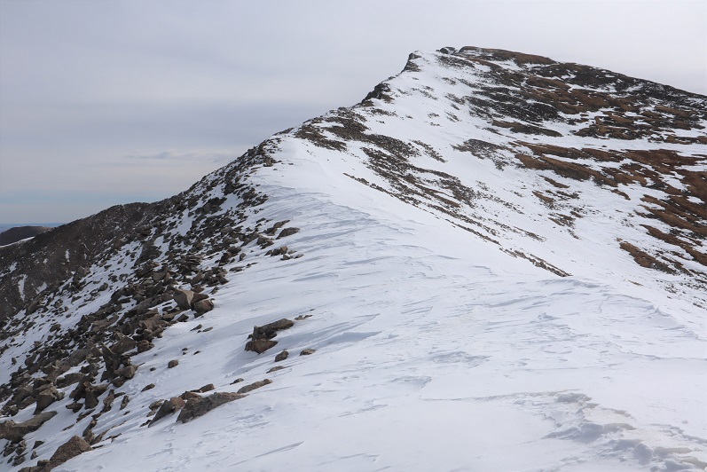
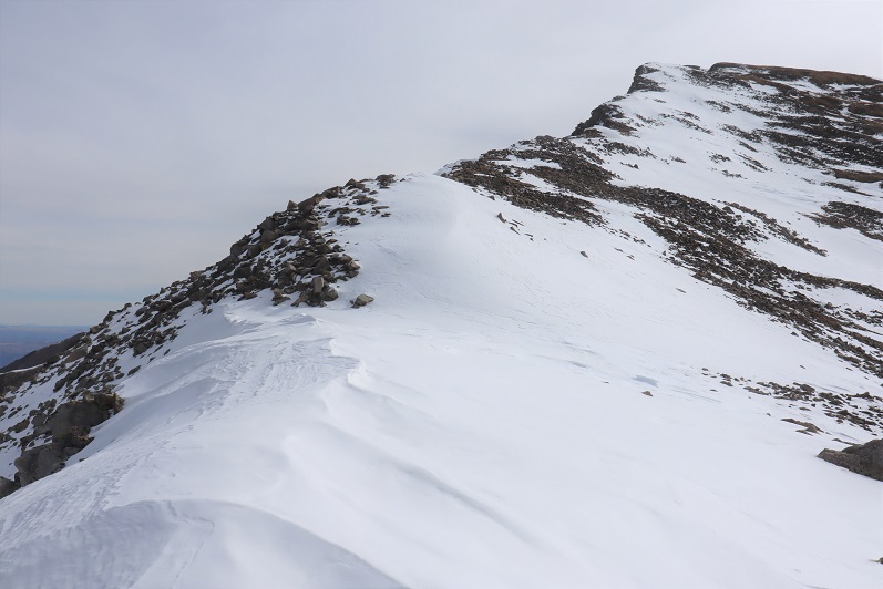
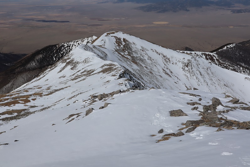
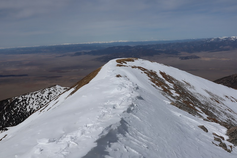
I turned and headed back to the saddle.  My next objective was Medano Peak

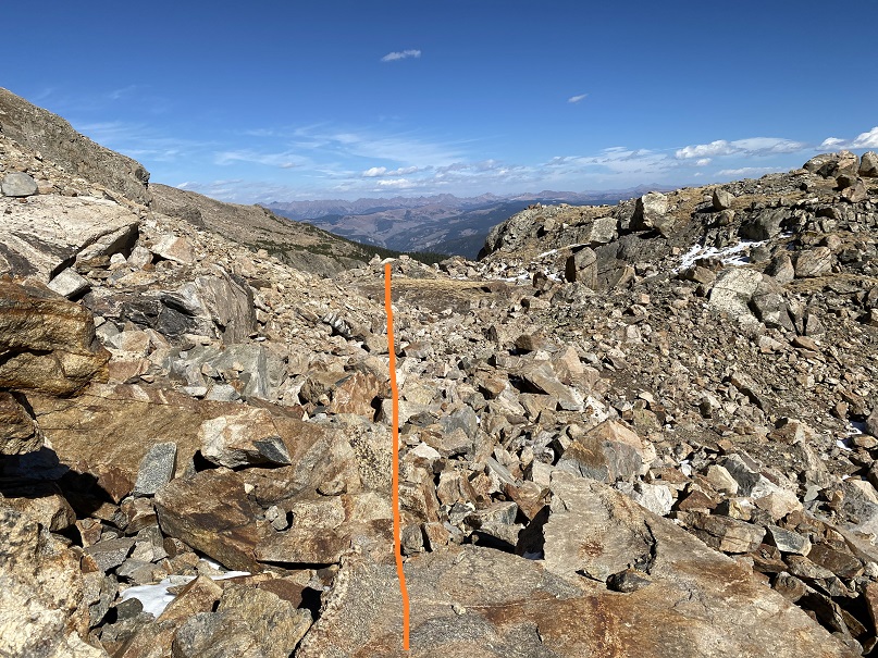
This was also a class 2 ridge walk.  Here are some step by step pictures

Also, you might be able to see them in this picture… I came across 5 elk, who weren’t too concerned I was there, until I started hiking up from the saddle.  At this point, they headed higher up, towards 13,000’.  I was curious, until I noticed they were gathering their 5 babies, who were hidden amongst the rocks.  They couldn’t have been more than a month old.  Then the mothers trotted them off along the ridge.

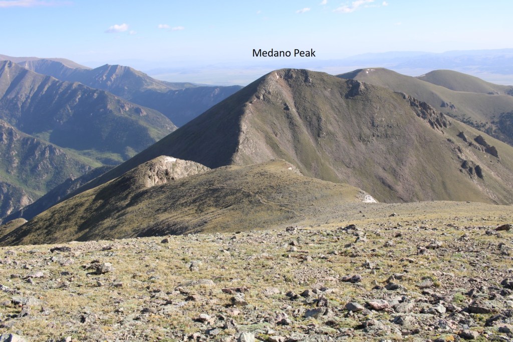
I summited Medano Peak at 9:05am
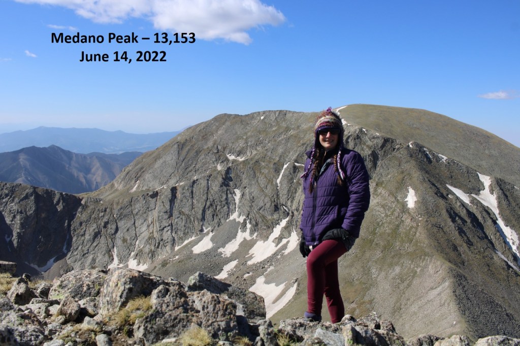
Medano Peak:

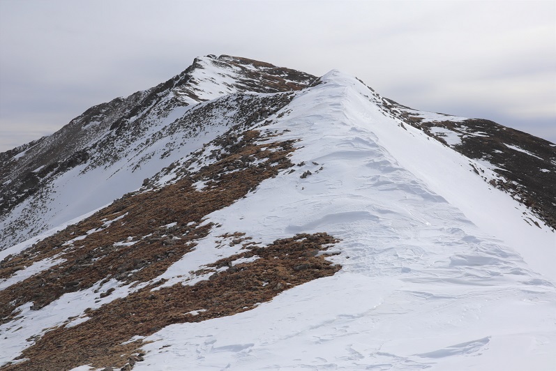
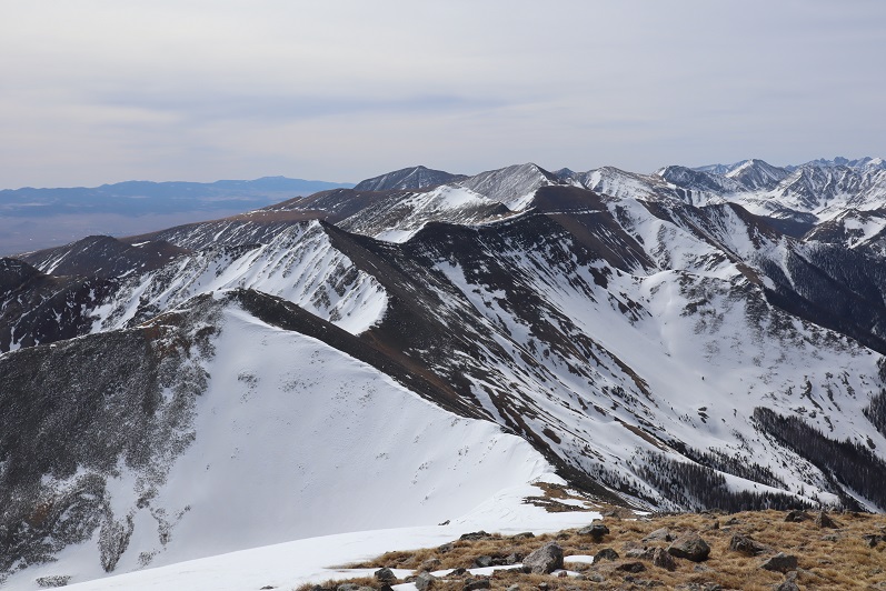
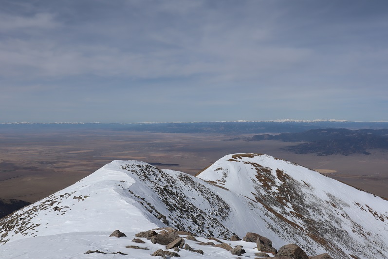
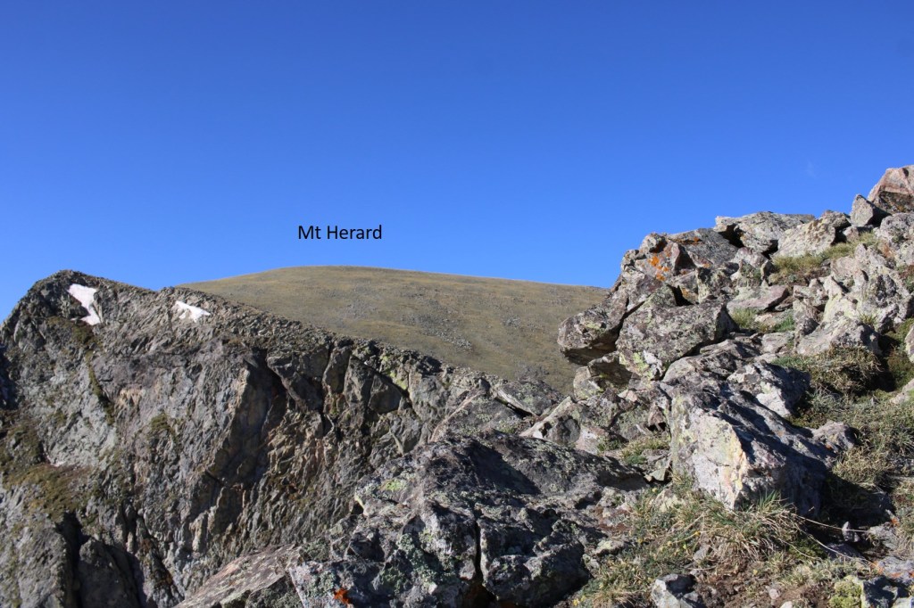
Here’s a look at Mt Herard from Medano

I retraced my steps back down to the saddle, and into the lower basin and Medano lakes

It was a super windy day (predicted winds of 45mph). As I was hiking I was able to notice a bighorn sheep ram below me.  Since it was so windy, he didn’t notice me until I was right up on him. 
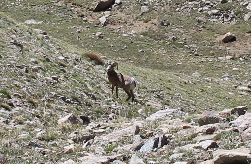
Bighorn: 

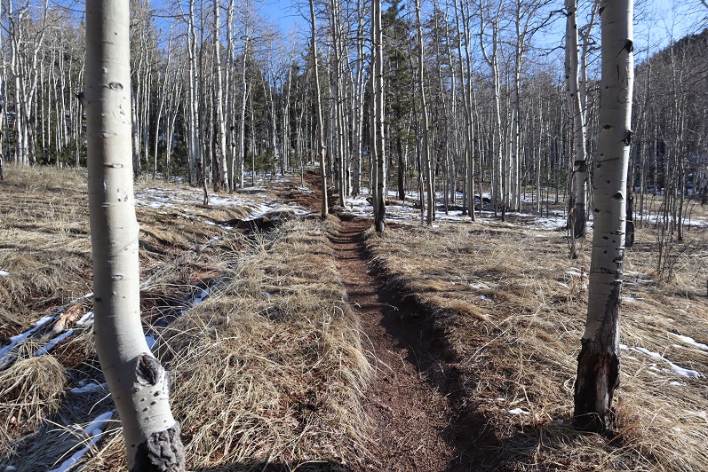
He trotted away as well, and I hooked up with the Medano Lakes trail, which took me back to the trailhead

And then I followed road 559 back to my truck

I made it back to my truck at 12:30pm, making this a 17.43 mile hike with 5584’ of elevation gain in 9 hours.

On to the next trailhead!

Comanche Peak – 13,277

RT Length:  12 miles

Elevation Gain:  4837’

The weather forecast for today predicted a 40% chance of snow after noon, and the snow would be minimal, so I decided to head to the Sangres to do the Comanche/Venable loop.  Spoiler alert: I only got Comanche Peak.  My vehicle was the only one in the lot when I arrived.  I was on the trail at 5am.

I decided to do the loop clockwise, starting with Comanche Peak.  The Comanche Peak trail was clearly visible from the parking area.

I followed the Comanche Trail for about half a mile, and crossed the Rainbow Trail.  I stayed straight on the Comanche Trail.

There was a register and information area

This trail is well groomed and wide.  I followed the trail all the way to Comanche Lake, switchbacking up the mountainside.   

Also, the bears are still awake…

After hiking for 4.25 miles, just before making it to Comanche Lake, there’s a junction.  I continued straight, instead of heading down to the lake

I was headed to the Comanche/Spring saddle

The hike to the saddle continued to be class 1, but what little snow there was had accumulated directly on the trail. On the positive side, the trail was easy to locate!

Just before making it to the Comanche/Spring saddle there was a cornice to navigate.  I got out my microspikes and ice axe, and kicked in steps. 

As I was doing so, I looked to my left and could see Comanche Peak

I could also see weather coming in from the west.  It wasn’t supposed to snow until later in the day, but I could feel the wind picking up, and see the snow coming in.  I’d have to re-assess my hiking plans as I went. 

It was 5.8 miles from the trailhead to the saddle.

After putting away my microspikes and ice axe, I followed the saddle south

It was an easy, class 2 hike to the summit, mostly on tundra or stable rocks. In some areas there were bits of a game/social trail

As I was hiking up the ridge towards Comanche Peak the wind picked up, and it started snowing.  I figured I’d get a picture of Spring and Venable before the snow moved in.  In less than 10 minutes, I could no longer see these peaks.

Here’s a look at the last push to the summit of Comanche Peak

There was a cairn at the summit

I summited Comanche Peak at 8:50am. 

Comanche Peak:

I turned around to head back to the Spring/Comanche saddle, and noted the lack of visibility.

I descended to the saddle, and realized the snow wasn’t going to let up any time soon.  I could have made this a loop, but the pictures would have been useless in a trip report, and navigating a fresh layer of sugary snow on the rocks didn’t sound like a fun time, so I decided to just head back the way I came, making this an out and back hike.  I’d come back later for the other two peaks.

Here’s looking back at the trail from the saddle

And back over the cornice

It continued to snow the entire trek out, but the trail was easy to follow.  A nice layer of snow started to build up on my camera, gloves, eyelashes, backpack, etc. as I hiked out.

Check out the difference in Comanche Lake from earlier this morning

Here are some pictures from the hike out.  It was neat having more snow on the trail on the way out than I’d had on the way in.  The only downside: There had been ice on the trail this morning I could avoid because I could see it.  Now it was covered in a layer of snow and not quite as visible.  I did some slipping and sliding, but managed to remain upright.

It finally stopped snowing just as I made it back to the trailhead, but a look up at the peaks let me know it was definitely still snowing above treeline.

I made it back to my truck at 11:15am, making this a 12 mile hike with 4837’ of elevation gain in 6 hours, 15 minutes.

Mt Jackson – 13,675 & PT 13433

RT Length:  28.33 Miles

Elevation Gain: 6674’

I’m not entirely sure why I chose this approach, but I wouldn’t recommend it; the route finding below treeline is arduous.  In any event, if you still want to do this hike, this is how I climbed Mt Jackson and 13433. 

I arrived at the Cross Creek Trailhead and was the only vehicle in the lot.  It’s a poorly designed lot that doesn’t offer much room but can fit 5-6 cars if everyone parks nicely.  It looks more like a horse corral than a parking lot, and there’s not a lot of room to turn a vehicle around.  There is parking across the way as well.  I arrived and left in the dark, so unfortunately, no pictures of the trailhead.  I was on the trail at 3:45am.  Cross Creek trail starts behind obvious signage at the west end of the parking area.

This is an easy to follow class 1 trail.  There’s a new bridge to cross over Cross Creek, and some nice stairs to ascend. 

After hiking for 3 miles I came across some avalanche debris on the trail.  As I was navigating at night I stepped over a log, and instead of hitting solid ground my right foot sank in watery mud up to my thigh. 

I quickly extricated myself and did a quick assessment.  My shoe and pants were soaking wet, cold, and covered in a layer of mud.  It was only around 5am, 30 degrees outside, and I had a serious decision to make.  Did I turn around now or continue hiking?  I was worried I’d eventually have a Raynaud’s attack, especially if I didn’t dry out before making it to treeline (where it would be windy:  I could already hear trees snapping all around me in the dark).  I cursed myself for not bringing at least an extra pair of socks.  In the end I decided the only way to dry off would be to keep moving, and I could do that either by heading back or forwards, so I continued on.  I followed this class 1 trail for a total of about 8.5 miles as it paralleled Cross Creek, staying straight at the Grouse Mountain Trail Junction (but noting where it was in case I wanted to make this a loop).

After hiking for 8.5 miles I crossed a stream and the real route finding began

After crossing the stream, I turned right and headed straight up the mountainside, passing a small pond to my left.  There is no trail here, and the bushwhacking is intense.  I passed several sets of bear tracks while route finding here.

I’d gained 800’ of elevation in 1 mile heading northwest when I came upon a trail!  Woot!  This was a pleasant surprise.  It looked like a game trail, but every now and then I’d see a cairn. 

I followed this trail southwest for just over half a mile, until it suddenly ended. 

There was a cairn here, but it didn’t seem to lead anywhere.  I went about 20 yards in every pertinent direction and couldn’t locate a trail. The snow on the ground wasn’t helping.  I got out my map and realized I’d gone too far south, so I turned right and headed north up this drainage. 

At the top of the drainage I headed west.  You can see how much fun route finding was here as well.  I kept wishing for treeline so I’d have a visual of my route. On a positive note, my shoes and pants had dried out, so while I was still dirty, at least I was dry.

I also passed more bear tracks here.  These tracks had a different gait than the ones I’d encountered before, so I figured there were multiple bears in the area.

Hiking west eventually led me to a marshy area, and here I was finally able to get a good view of where I was headed

I skirted the marshy area to the south and then headed southwest.  It’s important to head up over the rocky area and not stay low because going low will lead you to a large rock wall bordering a pond with no way to cross.  Here’s an overall view of the route

And step by step up the (first) gully

And second and third gullies.  This was really just one long gully that leveled out at times and started again.  The snow was bothersome because it was sugary and every once in a while, I’d posthole. It did make me roll my eyes at being worried my feet would be wet from the swampy water:  the snow had made sure of it. 

At the top of this long gully I continued southwest

Until I hit another (you guessed it) gully.  It was here the battery in my camera died and I had to switch to using my cellphone (I’m still figuring out my new camera, and the battery seemed to die rather quickly).

Here I got my first good look at the upper basin.  There are several routes I could have taken from here.  I’d heard there was a path up the north side of 13433, but I wanted to gain the saddle between UN 13433 and Mt Jackson.  I figured my best shot for today would be to stay high and hugging the south side of Mt Jackson.  Here’s my overall route

And step by step. 

The ground here was surprisingly stable, I just had to watch out for rolling rocks every now and then

Here’s how I gained the saddle

Up until this point I wasn’t sure which peak I was going to climb first.  I had the possibility of making this a loop (coming back down via the Grouse Mountain trail), but once I got to the ridge I was able to feel the wind I’d been hearing all morning.  Winds were predicted at 20-25mph, sustained, with 45mph gusts.  They were at least that.  And brutally cold.  I wasn’t sure I was going to be able to make one mountain today, let alone three.  I got out my balaclava and heavy-duty winter gloves, turned right, and headed north to the summit of Mt Jackson.  This was a fairly easy ridge hike.

I summited Mt Jackson at noon.  The summit was relatively flat.

Mt Jackson: 

The wind was blowing so hard all the straps on my gear were slapping me in the face and several times I had snot fly into my sunglasses.  Ah, to be a mountaineer!  I turned and headed back the way I came, bracing myself against the wind as I made my way towards the Mt Jackson/13433 saddle.

From the saddle here’s looking back at Mt Jackson and up at 13433

It was a short and simple ridge hike to the summit of 13433.  I summited at 1pm.

UN 13433: 

Here’s a view of Mt Jackson from 13433

At this point I couldn’t feel my fingers, so I quickly retraced my steps back to the saddle.  The wind refused to let up, and was blowing loudly long after I left the ridge.  I saw two crows playing with the currents above the saddle.

Here’s my route back down into the basin

And down the gullies

Here’s how I ascended the rock to avoid the pond to my left

And headed back out of the marshy area

Let the route finding begin again.  I tried to re-trace my steps, but it just wasn’t happening.  I kept looking for my original route in, but finally realized that wasn’t going to happen.   I knew Cross Creek Trail was below me, and as long as I headed down and east I’d eventually run into it.  So I headed east. 

After wandering down and east and down and east I connected up with Cross Creek Trail and followed it back to the trailhead.  I heard trees snapping in the wind the entire hike back.  They’d make a loud, booming sound I initially thought was rockfall, except there were no reverberations from rockslides, just a loud crack and boom! 

I got back to my truck at 8pm, making this a 28.33 mile hike with 6674’ of elevation gain in 16 hours, 15 minutes. 

Cottonwood Peak A – 13,597

1

RT Length: 11.5 miles
Elevation Gain: 5110’

I got a bit of a later start on this one that I’d intended, as when my alarm went off at 12:30am I hit snooze and slept another hour or so (I’d already summited 7 peaks in the past 2 days and was a little tired). I made it to the Hot Springs Trailhead after first being led by GPS to the Hot Springs (which the sign indicated clothing optional: it was also closed due to Covid-19 fears).

The drive to the trailhead is easy 2WD on a dirt road.

2

There was 1 other vehicle parked there when I got there, which I thought was odd. It was a newer VW and didn’t look like it had been there overnight. I tried to be quiet in case someone was sleeping in their car but thought to myself “Great! Someone else is trenching the trail for me!”

The trail is a loop, and I was surprised to find out it was actually an established trail. The morning was getting better and better!

3

Just as an FYI, you cannot see the peak from the parking lot, but it was dark so that didn’t matter anyway. I signed the trail register (which was difficult due to the cold temperatures and ballpoint pen available). I wanted to summit Cottonwood Peak first, so I took the trail clockwise, starting to the left

4

The trail starts off wandering through chaparral

5

Here the trail was clearly marked and easy to follow.

6

I rustled a sleeping ptarmigan as the trail switched to scrub oak

7

Once I entered the aspens the trail started to deteriorate. What I’d been pleased to discover was a good trail became a trail in much need of maintenance. I was navigating over fallen trees for the rest of the hike, and it became increasingly obvious no one had used this trail since the Fall and no one would be trenching for me today.

8

Around 2.4 miles there was a great spot for a campsite (10130’)

9

What I found disturbing were the number of dead animals I encountered on this hike. There were deer remains everywhere (I’m pretty sure it was more than one deer, spread out over a few miles) and a lot of bird feathers. It let me know there was a predator in the area, I just wasn’t sure which kind?

10

I encountered the first real snow after about 2.6 miles. It was still early in the morning so I didn’t need traction, but I did posthole from time to time. Here the trail was difficult to see, as it was both covered in fallen trees/branches and snow.

11

Here things got interesting: I came across bear tracks! They looked like they were from the day before, and since there was only one set of prints I knew it wasn’t a mama, and that it was just passing through. I followed prints along the trail for about a mile

12

Since the trail was difficult to follow and the snow was getting softer I found myself straddling the ravine and following the small stream around the mountain

13

It became increasingly apparent I was the only one to use this trail in a long time. I circled around to a gully, which would have been challenging if there’d been more snow. Instead it was a steady climb up, and when I had the option, I took the gully to the right, also easy to navigate

14

15

The second gully ended near treeline, and I became excited as I thought I could see the peak.

16

Of course in my mind I knew I was too close to treeline for that to be the peak, but surely it had to be just behind it? As I continued on I saw another peak behind the first one and figured that was the summit

17

Up, up, and up I continued, doing my best to avoid the snowy areas.

18

19

20

Imagine my surprise (and dismay) when I finally reached the top of the second peak and noticed I wasn’t anywhere near the summit: it was still quite far away

21

Not only was I still a good distance from the summit, but I would need my ice axe and snowshoes. Luckily, I had both. I sighed, broke down, and put them on. There was no way I was turning back now. The weather was great (the best day I’ve had all year) and while I’d already done 30 miles this weekend with 15K of elevation gain and was physically exhausted, I wasn’t quitting this close to the summit. I left my trekking pole here and continued on, ice axe in hand. The only way across the ridge was to walk directly on top of the cornices. Luckily the snow here seemed firm

22

23

24

25

The last bit to the summit was easier than expected

26

27

I summited at 9:30am

28
Summit Views:

There was even a summit tag on top

29

This hike is traditionally done as a loop along with Unnamed 13123B, so I went over to get a good look at the route

30

Hmmmm…. The route didn’t look that difficult. Actually, the ridge looked better than the one I’d just traversed, but it was a really nice day and the snow was warming up fast. I knew I could summit 13123, but I was unsure of the snow conditions on the route back below treeline if I were to make this a loop. I didn’t want to re-summit Cottonwood because a) I’d already done 5000+ feet of elevation today and b) the snow was getting softer by the minute on this side as well.

31

In the end I decided to go with the safer route and descend the way I’d summited, figuring that while the conditions wouldn’t be ideal, at least I knew what to expect.
I turned and headed back the way I’d come, first over a pretty cool cornice

32

And then back down the ridge

33

34

My favorite part was toe-heeling it across the cornices

35

Here’s the route back

36

37

I decided to keep my snowshoes on, and this time stuck to the areas with snow.

38

The snow was a terrible mush and I was glad I’d decided to return the way I knew, even if it meant postholing and navigating felled trees

39

I kept my snowshoes on for longer than needed, but they came in helpful when I hit the boggy areas where there was no discernable trail but a lot of willows/snow/downed trees

40

They were cumbersome in areas such as this:

41

On the way back I scared the same ptarmigan as this morning and saw a cactus in bloom

42

I made it back to my truck at 12:30pm, making this an 11.5 mile hike with 5110’ of elevation gain in 7 hours, 15 minutes. The VW was gone.

43

44
I was really happy with my decision not to make this a loop today, and look forward to trying the trail counter-clockwise next time, when there’s less snow…

Tuckaway Mountain – 10,820

1
RT Length: 12.5 miles
Elevation Gain: 4220’
Partner: Steffen

Third time’s a charm! For so many reasons…

I’ve attempted this peak on 2 other occasions. One time a few years ago I thought I’d summited (more on that later) and last week I turned around due to deteriorating snow conditions. Today I’m glad to say I had a successful summit!

I drove to Steffen’s house at 4:30am and we made it to the North Cheyenne Mountain gate by 5am, but unfortunately, the gate was locked. I guess it didn’t open until 6am? Oh well, we had a plan B, so we drive down Old Stage road for about 45 minutes, intent on Frosty’s Park and hiking Mt Rosa or Almaghre (or both). About 5 minutes from making it to the trailhead Steffen realized he’d forgotten his hiking boots. Drat! We would have to drive back and get them. As I said, third times a charm, and we arrived at the (now open) North Cheyenne Canyon Trailhead at 7am and were on the trail by 7:20am. It was already light out and I had serious doubts we’d summit today due to warm snow, but at least we’d get in a good hike.

2
We wore our microspikes the entire way, even though they weren’t always needed. I’ve done this hike several times, so I won’t go into a detailed description of the route to Loud’s Cabin, but you can find it here

I basically took the 7 Bridges Trail (622) to 677 to 622A to Loud’s Cabin. Here are the pictures:

3

4

5

6

7

8

9

10

11

12

13

Along the way we saw some curious tracks in the snow. They were about 5-6 inches long and distanced about a foot to a foot and a half apart. It took us a while to figure out they were turkey tracks. It would have been much cooler had they been emu or velociraptor tracks or something, as they seemed too big to be turkey tracks…

14

Once at Loud’s Cabin things once again got tricky. I’d made a GPX file from CalTopo with the way we were supposed to go, but the trails were no longer there. We decided to ascend the hill above the cabin and head west. It became apparent almost immediately we were on the wrong ‘trail’ but we were on a trail and headed in the right direction and felt committed… until it ended.

15

I noticed a few cairns so we followed them for a bit until they ended as well. I’m guessing the cairns were indicating an alternate route up Mt Garfield.

16

We weren’t interested in hiking Mt Garfield today, so we left the cairns and aimed northwest along the side of the mountain, making our own trail as we went. This included some fun scrambling over rocks and fallen logs. Be careful: those rocks and logs move!

17

Also, here we saw the first near tracks of the season! I’m thinking mama and cub

18

We had great views of Tuckaway when the trees cleared (which wasn’t that often). The frustrating part? We didn’t seem to be getting any closer. In fact, it felt like the mountain was always in the same place (well, it was, but we weren’t making much progress).

19

This was our view of Tuckaway most of the time

20

Finally we made it to the top of a rock formation at about 10,400’

21

Here’s the view looking back at the way we’d circled Mt Garfield

22

And a look at the route before us towards Tuckaway

23

There were tons of ways we could have traversed over to Tuckaway, and we actually went back and forth while we were hiking as to the best way: there’s snow you cannot see in a lot of areas that would make certain routes lousy. We’d initially wanted to just hike across the ridge, but instead this is the path we took:

24

I got a picture because the view was great

25

And we were off, deciding to initially descend this spot to the north (where we came across a mine not listed on the map), and then head west down some snow covered boulders. The scree here was really soft and felt a bit like quicksand.

26

27

There are no great pictures here, as we were just in the trees headed towards the saddle just before Tuckaway. When we reached the saddle it was time to don our snowshoes. We trenched a trail from the saddle to the west and came across my tracks from last week.

28

My tracks eventually ended and we had a time sinking up to our waist in the soft snow, but we were stubborn and took turns trenching: we could see the blue skies above indicating a ridge and were determined to summit today

29
We made it to the ridge and to our immediate left was a cairn. This is where I’d stopped a few years ago, thinking this must be the summit (cairns like this usually indicate a summit).

30
It certainly looked/felt like the summit, and indeed, from here you cannot see a higher spot. However, I’d had someone (not so nicely) comment on my blog that I hadn’t reached the true summit; that it was in fact further to the west. So today I was here (again) to see if he was right. We decided to follow the ridge west, through several feet of snow (I love snowshoes!!!) gaining and losing elevation as we went.

31

After about 2/10ths of a mile we came to a point I wasn’t convinced was higher than where we’d been before but was definitely the spot I’d seen in other one person’s picture as the summit. There was no summit register here either and no cairn indicating a summit.

32

We decided to climb the rock, which took careful footing and a leap of faith. Here’s Steffen heading back

Here is my summit photo

33

And some of the amazing views from on top of the rock

34

We took a summit selfie

35

And I got another shot of the way back down

36

Side note: As I said earlier, I wasn’t convinced this point was any higher than the point we were at before, so once I got home I put the route up on CalTopo. It showed the second point was indeed 3 feet higher than the first, but I hadn’t climbed to the top of the first rock like I had the second. In other words, I think both places are of similar height, and in fact, while the rock was difficult to climb I’d say the route I took the first time was more challenging than the one I took today. In any event, either way, we summited because we made it to both points. I think either point should count on its own.
We decided to descend the way I’d trekked last week, and followed our snow tracks to the saddle

37

38

39

And back down the gully to the trail I took last time.

40
What’s frustrating here is the trail that’s on ALL the maps, GPX files, etc. is a trail the forest service doesn’t want you to take. They’ve made it extremely difficult to follow because they don’t want people hiking there. They’ve essentially tried to close this trial.

41

I totally get this, but the problem is they haven’t established new trails/produced proper GPX files, etc. of new routes. This is the best they give, which is a poor excuse for a map and doesn’t include topographic features or mountain names. It’s like they want you to get lost

42

I’ve been in this area several times and their new trails are terrible and are meant for dirt bikes, not hikers. It’s really frustrating: I’d set out today to follow proper (new) trails and provide a GPX file for others interested but was unable to do so due to lack of information. In my topo picture at the end it shows I followed the trail on my return, but that’s the one they’ve blocked off, so it isn’t actually a trail. IT was however, my safest option.
We encountered a lot of snow on the trail on the way back, and instead of complaining about how we kept on postholing we decided to make it fun. Here’s Steffen trying to get across the snow without sinking by running fast (spoiler alert: that doesn’t work)

43

44

We made it back to just below Loud’s Cabin, linked back up with Trail 667, and followed it back to the parking lot

45

46

47

48

We were surprised to find when we made it back to the lot that it was overflowing with cars!

49

What was disturbing was about a third of these vehicles were from out of state. We’re supposed to be staying home and hiking only in our respective county, and I’m doing my best to abide by those rules (before they get worse). It was extremely frustrating to see so many out of state cars, and they just kept going and going and going: the lot was overflowing and cars were parked along the side of the road for miles as we exited. There were more cars here than I’ve ever seen in the summer. It must be Spring Break in other states and they’ve decided to still take their vacations.
We made it back to the truck at 3:30pm, making this a 12.5 mile hike with 4220’ of elevation gain in about 8 hours. It was a perfect day to go hiking!!! I’m so glad we got out and got some fresh air!

50

Sheep Mountain – 11,660

1

RT Length: 5 miles

Elevation Gain: 1659’

I really did’t want to write this one up because I made some amateur mistakes, but I also learned something, so here it goes…

My goal today had been 13er Centennial Hagerman Peak. I drove from the Cathedral Lake Trailhead and set my GPS to Geneva Lake, where the trailhead was supposed to begin.  Just after the small town of Marble (which had tons of marble statues on front lawns) the road became rough and honestly quite fun in my 4WD Tundra.  The dirt road was narrow, and I had to pull over a few times to let OHVs by, but all in all I was having a great time.

I came to a stream crossing and looked at my navigation. I was 5.5 miles from the trailhead.  Not bad.  Even if I decided to stay where I was and camp for the night I could still do the hike in under 20 miles.  Totally doable.  It’s important to note at this point I had no signal, so I was just going off this picture of my location (which rotated as I drove).

2

As I sat in my truck eating dinner (I’d found a Subway on the drive in) I watched several vehicles attempt to cross the creek.

3

The water was just to the top of most of their wheels. The OHVs were lower to the ground and thus their occupants got soaked.  The vehicles did just fine crossing though.  I watched a GMC truck get stuck, but after some back and forth action it was able to get unstuck.  Then I saw an F150 cruise across the stream and thought “My truck can do anything those trucks can do and more” so I put it in drive and crossed the stream, no problem.

4

About a mile and a half up the road began to get rough. I’m talking closed upper south colony lakes trailhead rough (the part you can no longer drive on).  My truck was handling just fine, but huge boulders and water were increasing on the trail and there weren’t many (any) places to turn around, so I used a switchback to reverse my course and ended up parking back at 9960’.  I was pleased with this spot, as I was now 4.2 miles from the trailhead.

5

I got out my topo and did my best to guestimate where I was on the map. Unfortunately I was pretty sure I was currently “off map” at this point, but figured I was about here (red x). I realized later I was indeed correct in my assumed location.

6

Had I had a better topo or cell service I would have realized my mistake instantly, but going off of what I had I was sure of my current location (and actually, I was). I just needed to follow the 4WD road to the trailhead and I could pick it up from there.  I had several great topo maps that started at the trailhead, as well as a pre-loaded GPX file.  I spent the next 15 minutes or so going over the route again, and calculating how much elevation gain I’d add from starting from my current location. It looked like an extra 700’ each way, so no more than 1500’in total.  I was willing to live with that.

I made it an early night and woke up at 10:30pm to start my adventure. I was on the road by 10:50pm.  It started out easily enough:  I just followed the 4WD road.  I didn’t think to take out my map (etc) because I was just following the road.  After about a mile the snow started, and it was obvious no vehicle had been in this area yet this year.  Hmmm.  That was curious:  I saw a conditions report from last week stating it was snow free to the lake.  I should have stopped and reassessed here, but if I had I wouldn’t be telling this story.  Also, some people lie on conditions reports (it’s happened before).

I continued on and thought to myself “Wow! This sure does feel like more than 700’ in elevation gain! I must still be sore from yesterday.”  There was a full moon out but it was obscured by the trees.  I kept following the road through increasing snow until the road just stopped.  That was curious.  It just ended and there was no trail to hook up with it. There was supposed to be an obvious trailhead… and I’d never decreased in elevation.

I took out my phone and looked at the picture I had of where I was going, and then looked at my tracks so far. It sure seemed I was going in the right direction.  At least my tracks looked similar to the route description. The trail must hook up here somewhere close. I got out my GPS track and yes, it looked like I just had to head in that direction and I’d make it.  The problem was ‘that direction’ led me over a cliff.

I kept scouting around and found what looked like fresh tracks. Awesome!  Someone had been here after all.  I walked over to them and noticed the tracks were from a mama bear and cub, and yes indeed they looked fresh.  That did it.  I was turning back and heading back to my truck.  I did not feel confident continuing in the direction I was going, and I was sure something was wrong with my navigation (I just wasn’t sure what I’d done wrong).

I followed my tracks back to my truck and made it back a little before 1:30am. Drat.  It was too late to drive somewhere else and start another hike.  The day was shot.  What really stinks is I lost an entire day of potential hiking.  I decided to drive back home and figure out where I went wrong.  On the positive side I was the only one on the 4WD road at 1:30am, so I didn’t need to move over for any passing vehicles.

OK, so here’s what I’d done wrong: I followed the orange line, when I was supposed to follow the red line.  Note:  the orange trail hadn’t been on my map, so I didn’t even know it had been an option.  I just figured I was following the same 4WD road.

7

But if you look at my tracks, they do look pretty similar when you rotate them (which was what was happening as I was hiking)

8

On the positive side, I ended up unknowingly summiting Sheep Mountain, a ranked 11er, so there’s that. Also, I got in 1659’ in elevation gain (see, I knew I’d gained more than 700’).  So, lesson learned.  Have topo maps that cover the approach in, even when it’s on a road.  I’m going to have to attempt this one again… luckily it’s only a 5 hour drive.