Kelso Mountain – 13,164

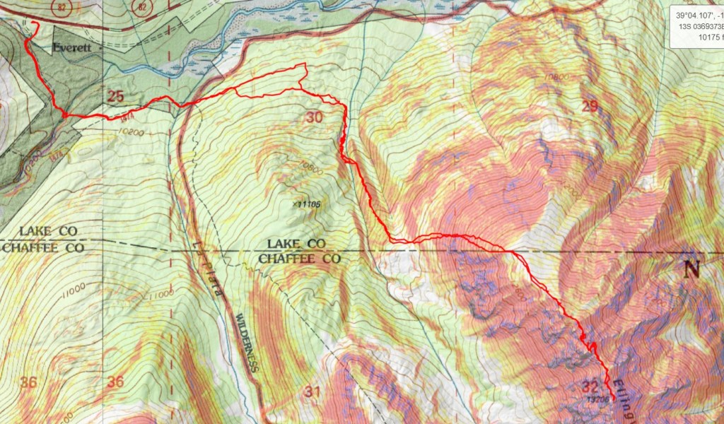
RT Length: 6.32 miles

Elevation Gain:  1937’

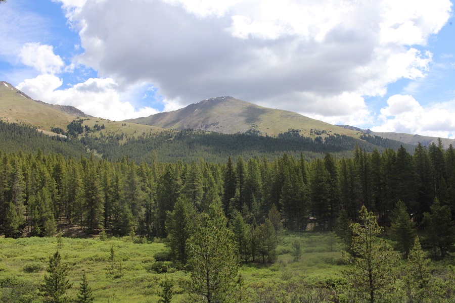
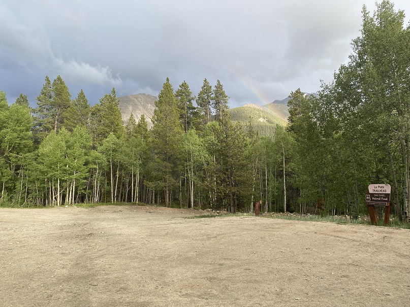
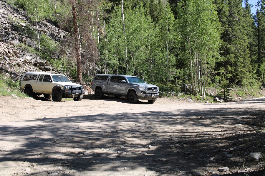
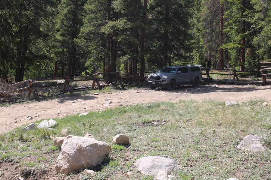
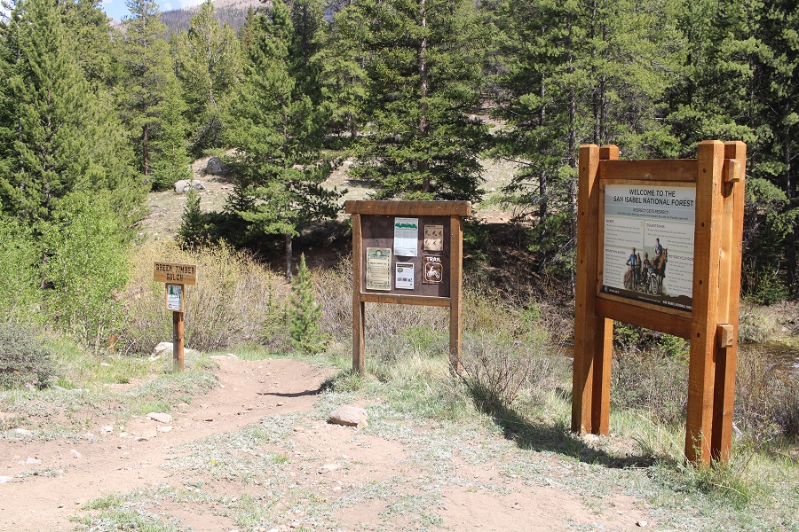
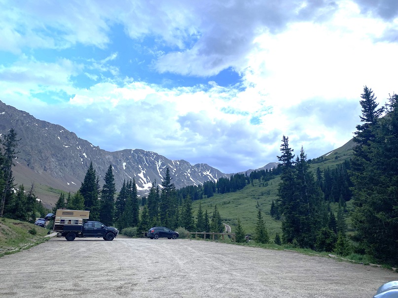
I arrived at the Grays and Torreys Trailhead the night before, curious to find there were only a handful of vehicles in the parking area.

I picked out a prime spot (that proved later to be a bad choice), and settled in to read a bit before heading to bed.  I talked to an awesome CDT thru hiker, and noticed two girls fiddling with a camper in the parking lot.  A very old camper, on top of a very old Tundra.  They were all over that camper; on top pulling at buckles, on the back, fiddling with the door, banging on the sides, etc.  When I saw them bring out a hatchet I stopped reading and walked over to them.

I said hello, told them I was a mom and a Girl Scout Leader, and also told them my kids ages, trying to let them know I wasn’t a freak. I asked them if they needed any help? Yes, yes they did.  It seemed they’d locked the keys to the camper inside the camper.  I asked them how old they were. 16 and 17.  Wow!  I was impressed!  Not only had they driven this clunker up to the Grays and Torreys Trailhead, they’d convinced their parents to let them do it alone, in their dad’s truck.  When I was their age my mom wouldn’t have let me do that.  I know because I’d asked, then had to resort to the “I’m sleeping at Kelly’s house” thing as I went to bonfires in the woods where my mom had no idea where I was at.  Kudos to their parents.    The girls has about 15 14ers under their belts, and wanted to tackle Grays and Torreys in the morning, but it was going to be a long night if they couldn’t get the back open.

OK, time to problem solve.  I didn’t think breaking a window was a good idea if we could help it.  I knew how to open a car window with duct tape.  I asked if they had any, and they brought out a small roll of electrical tape. That wasn’t going to work.  Next, I looked at the door handle, which didn’t look too secure.  I was thinking we could probably jolt it back and forth and it might break.  As I was jiggling the handle, I asked how close the next set of keys would be?  They said it didn’t matter, because the keys to the truck were inside the camper as well.  I was really thinking I’d just drive them back to Denver or something to pick up the keys from their parents, when one of the girls got the fabulous idea to look for another set of keys to the camper, and found them inside the glove box inside the truck.  Problem solved.  I wished them luck, happy they hadn’t broken a window with a hatchet, and told them to knock on my window if they needed anything during the night. 

It rained.  Around midnight I heard something crawling around underneath my truck. It sounded slow, and it was trying to get itself inside the gears.  I pounded the side of the truck and it seemed to creep away.  Half an hour later it came back, so I knew if I didn’t get rid of this thing it was going to be a long night.  Also, I wasn’t going to make friends at the trailhead if I kept banging on the side of my truck all night.

I got out of the topper and into the front seat of my truck. I turned it on and revved the engine a few times.  When I was done, and crawling back into the topper, I saw a porcupine waddle away from underneath. It seems my secluded spot at the back of the parking area had been a bad idea, as it was easy access for porcupines.  No one else had porcupine trouble that night (that I talked to).

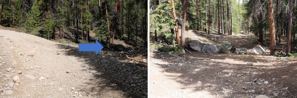
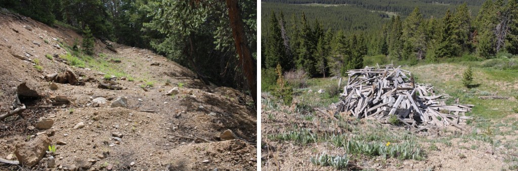
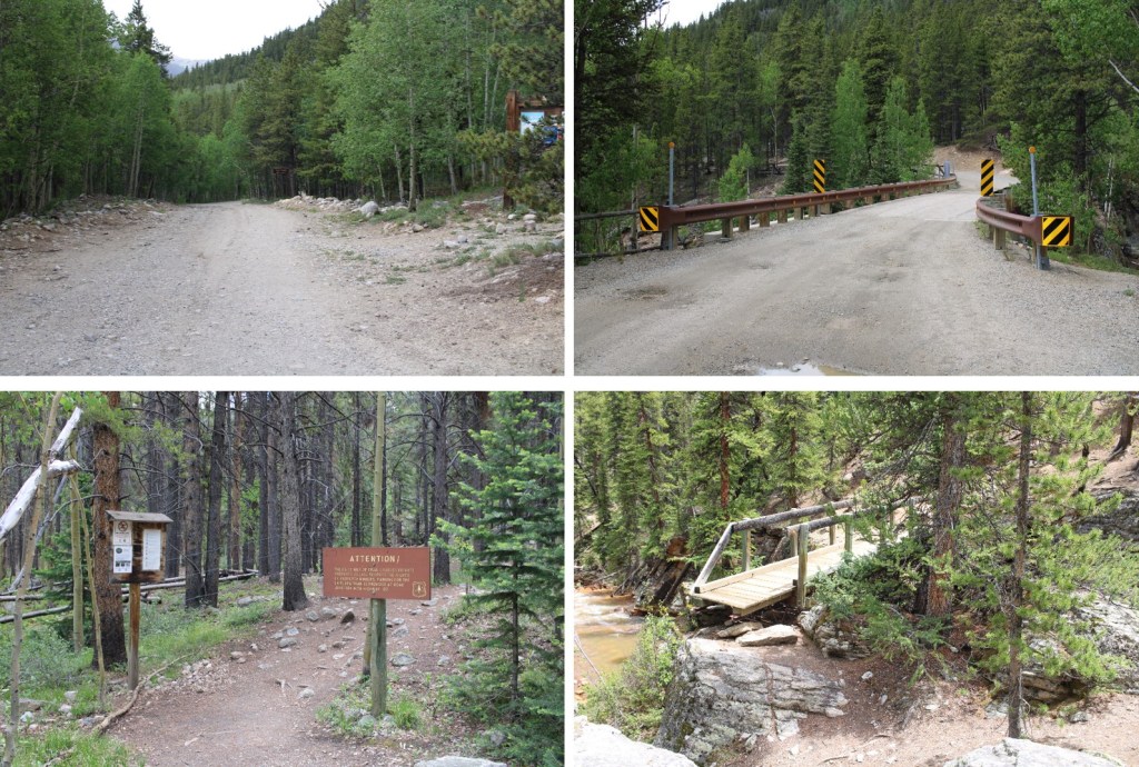
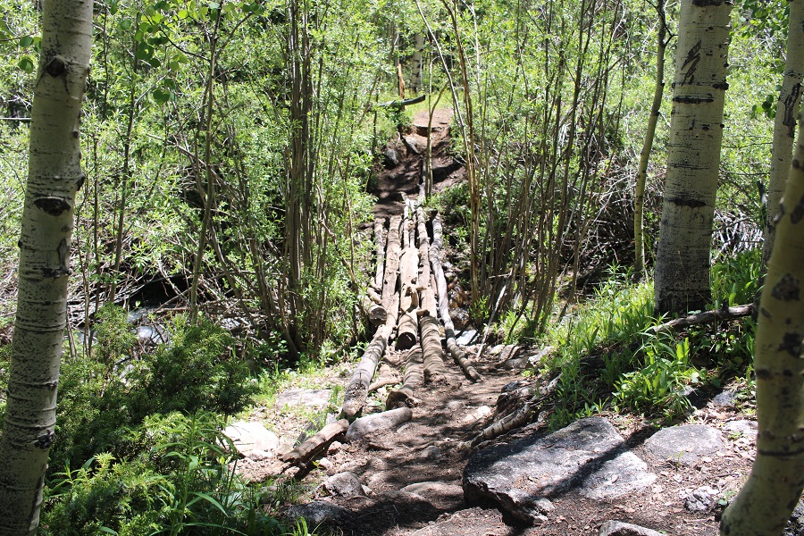
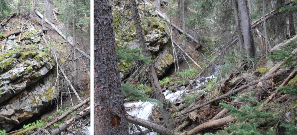
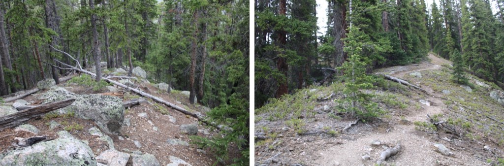
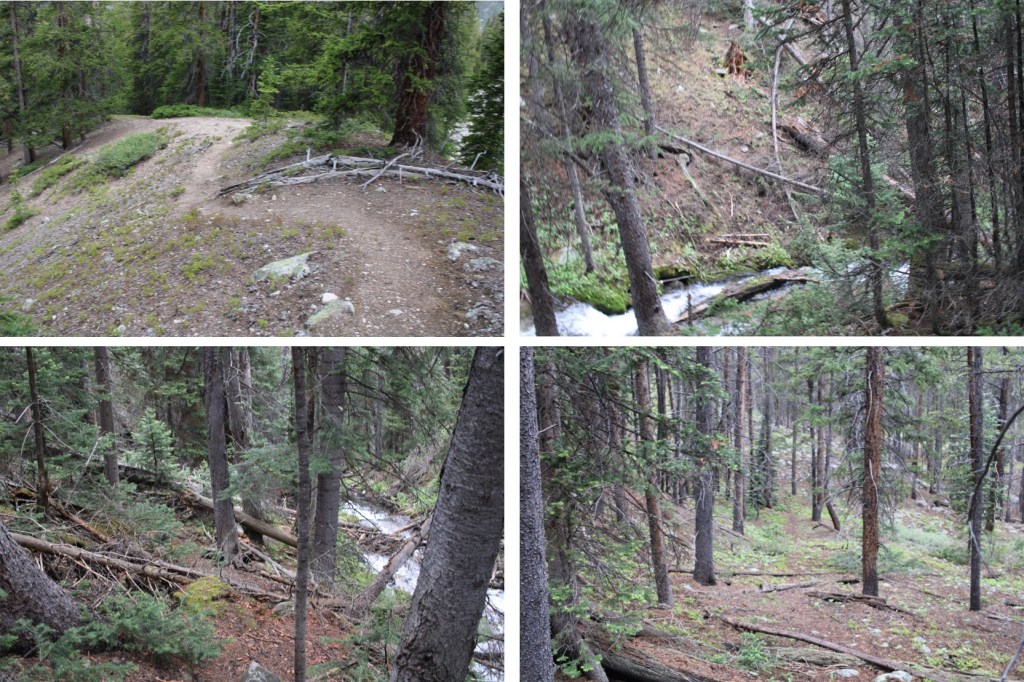
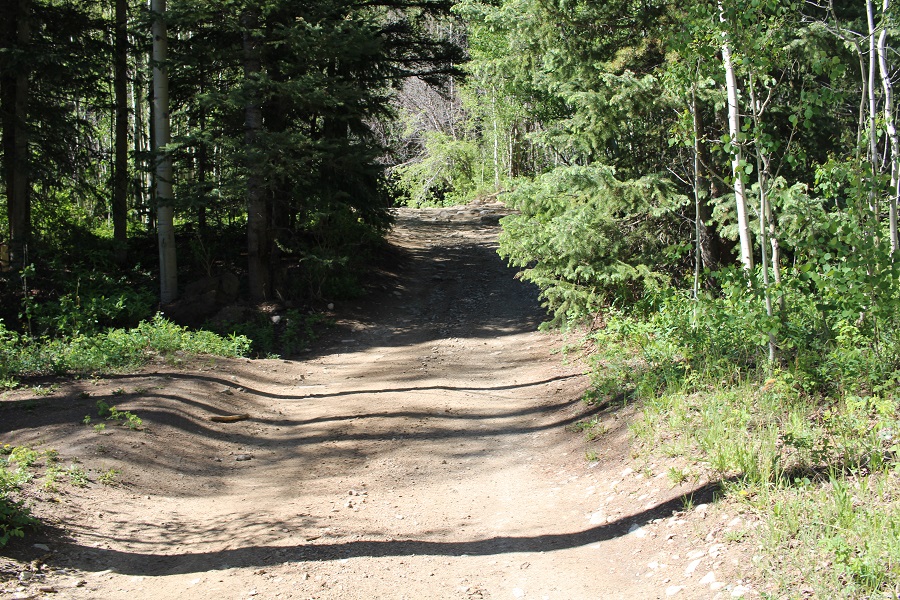
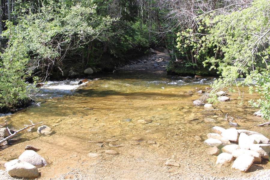
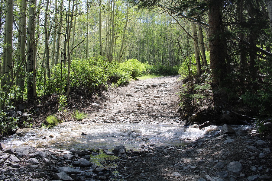
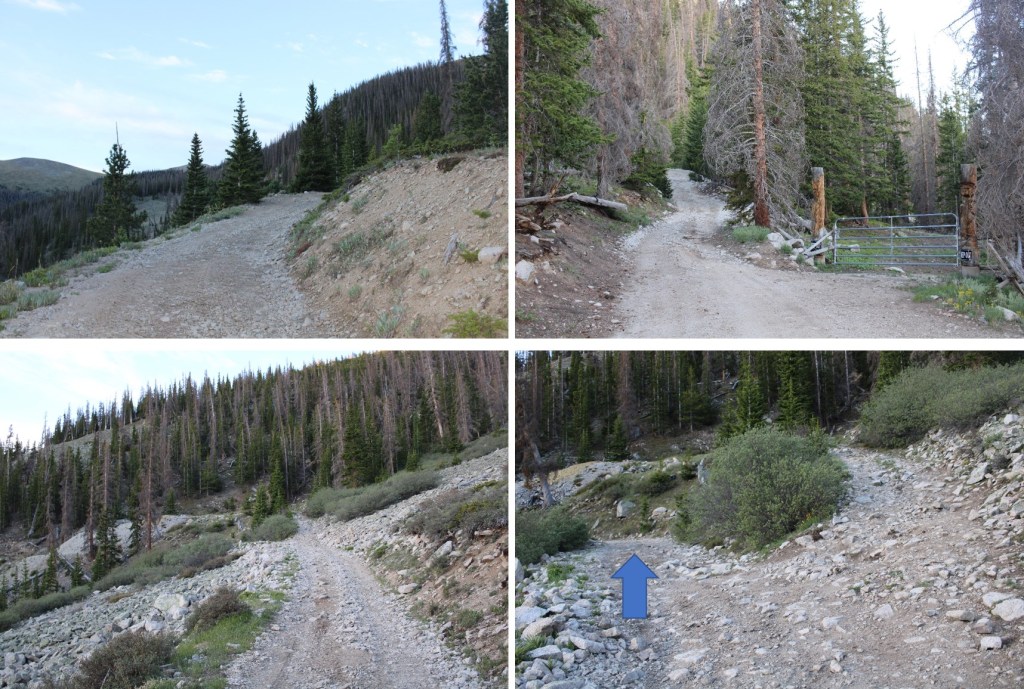
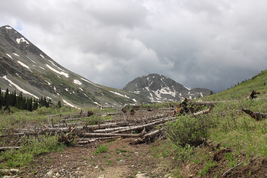
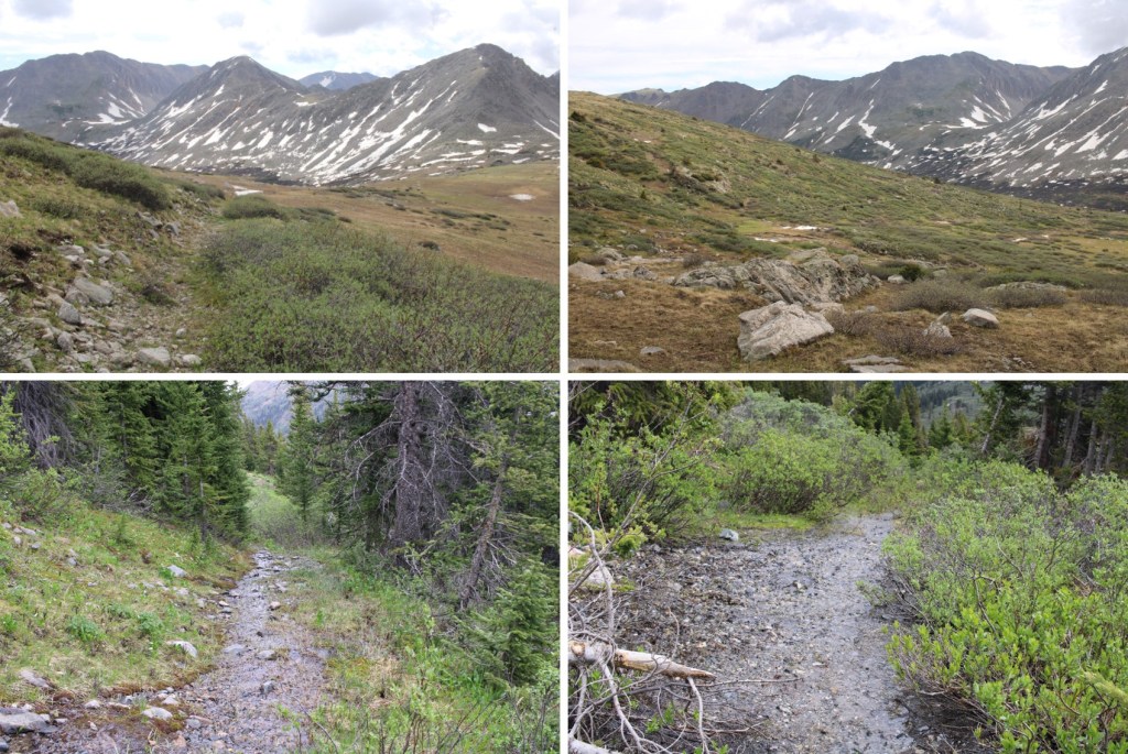
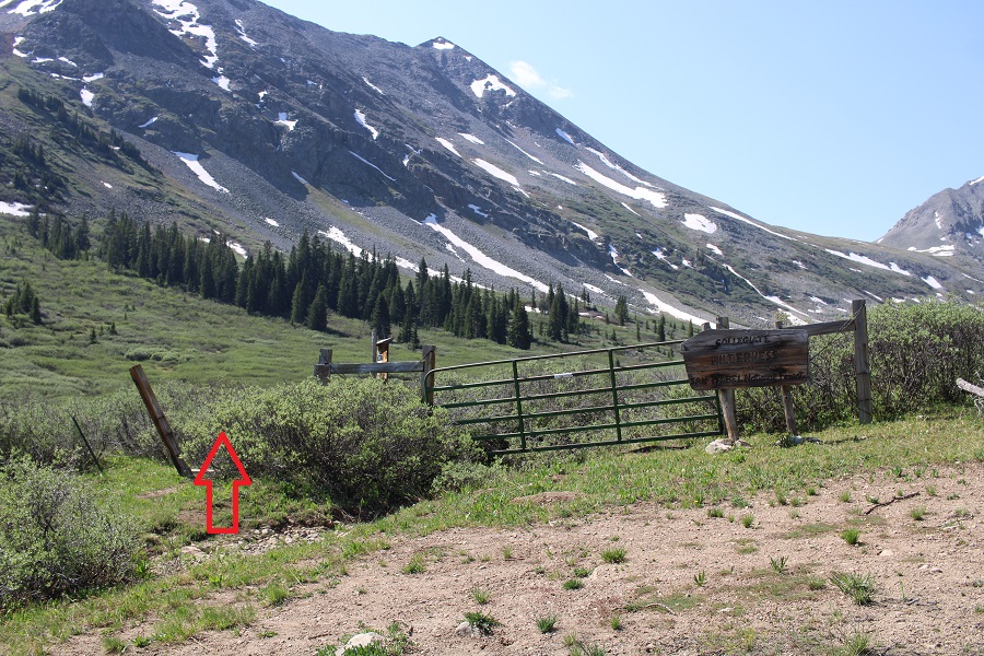
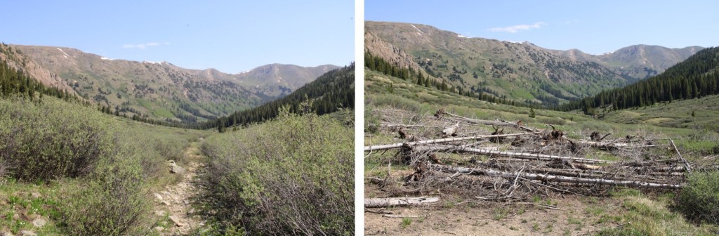
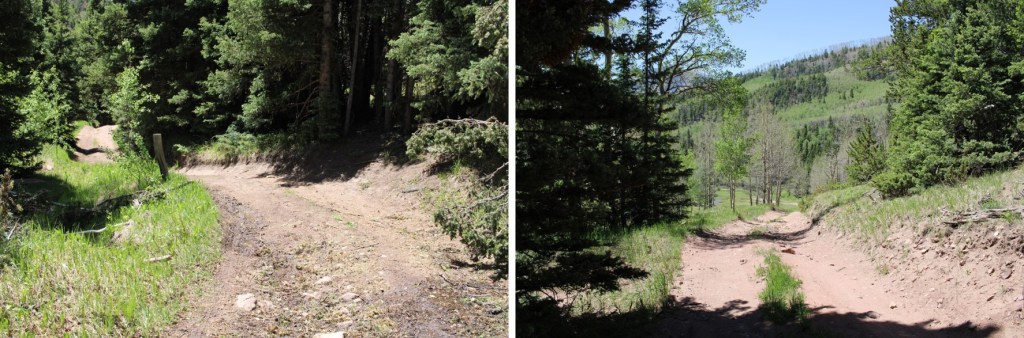
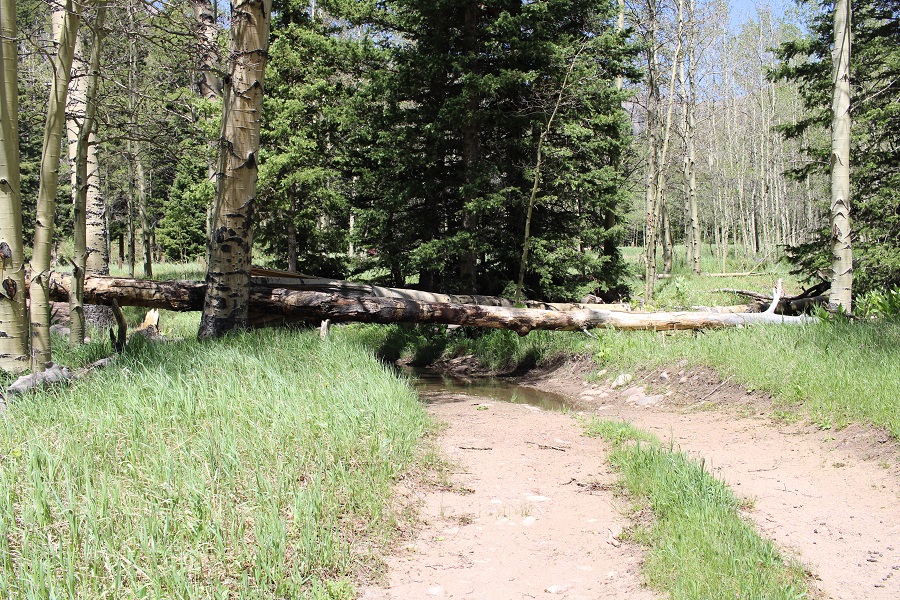
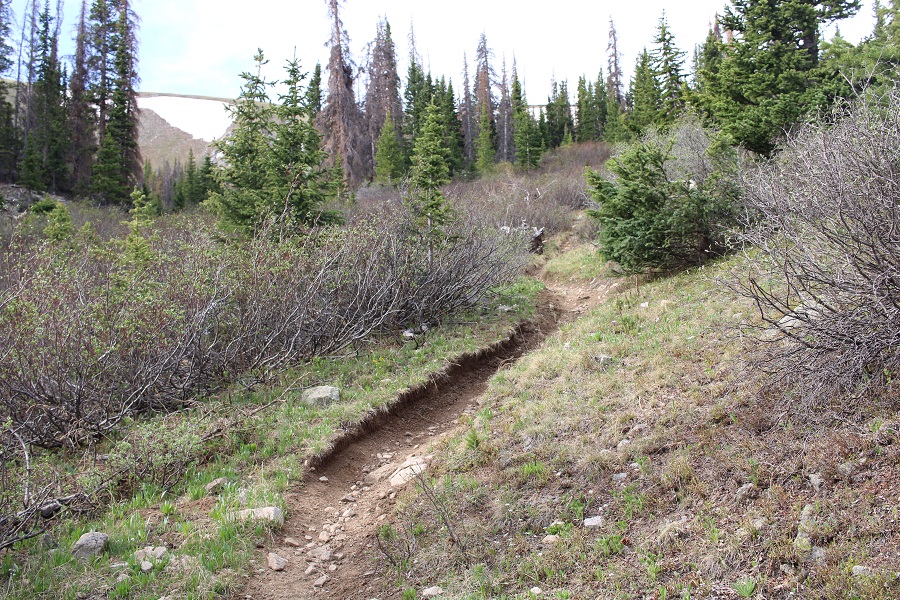
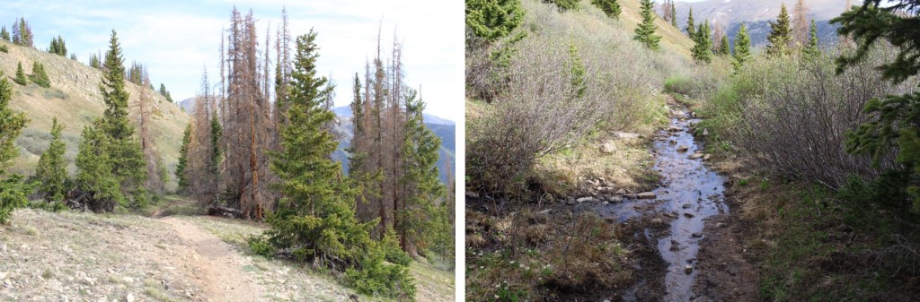
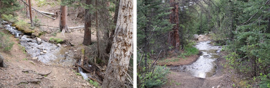
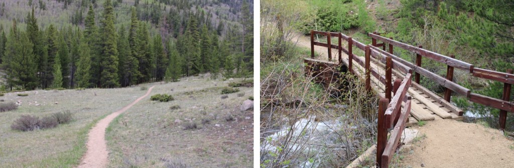
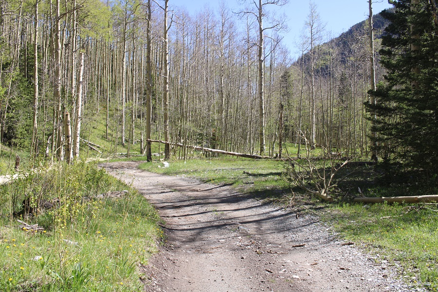
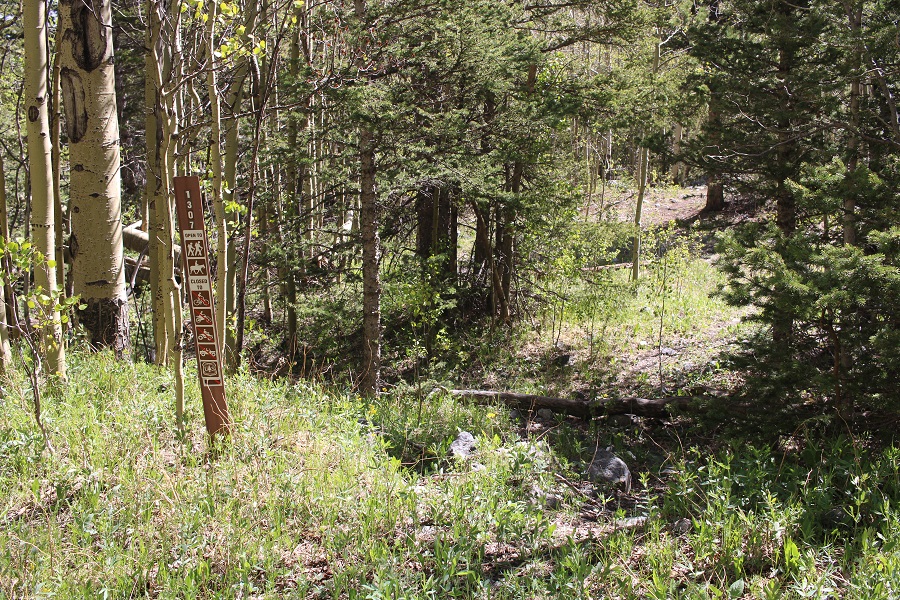
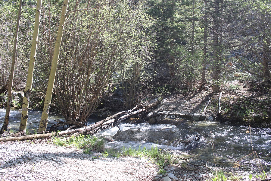
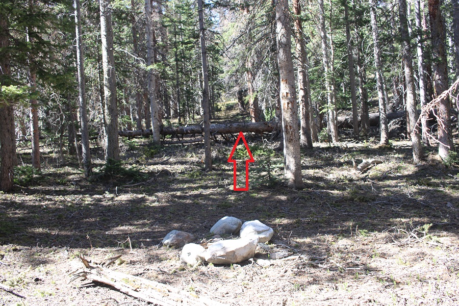
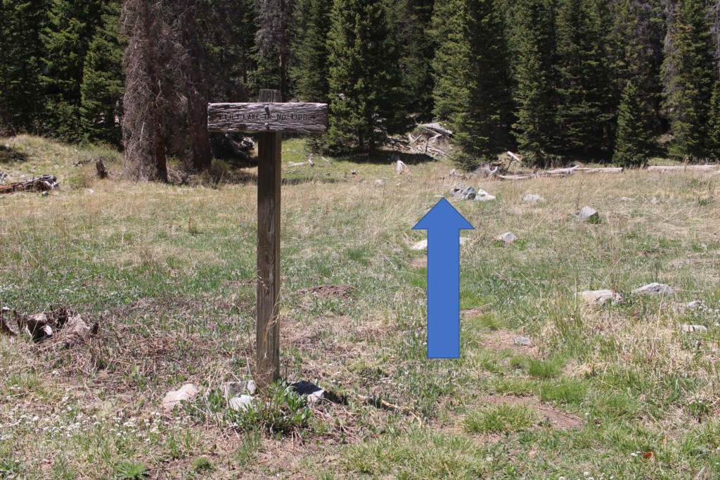
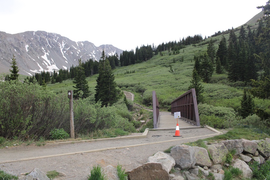
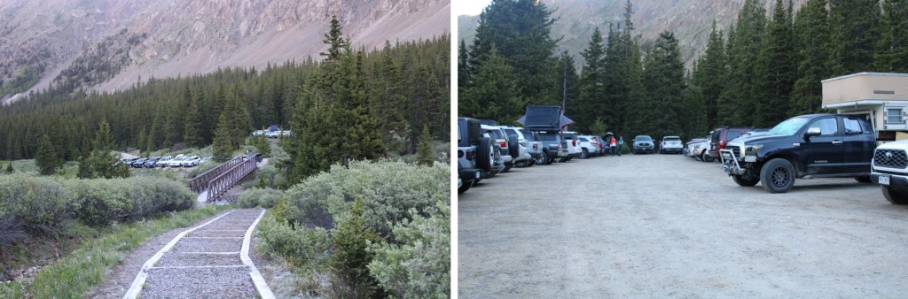
I was up and on the trail at 4:30am, and the trailhead was now about half full of vehicles.  I crossed the bridge, and began following the Grays and Torreys trail.

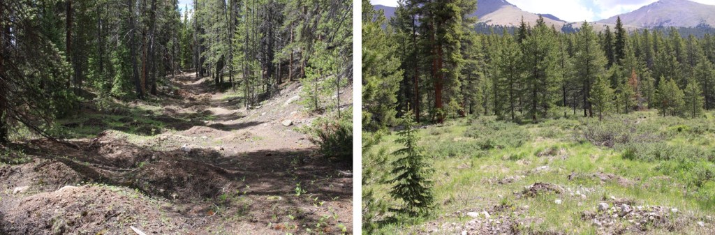
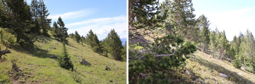
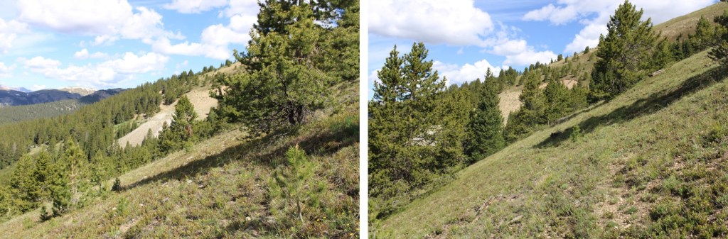
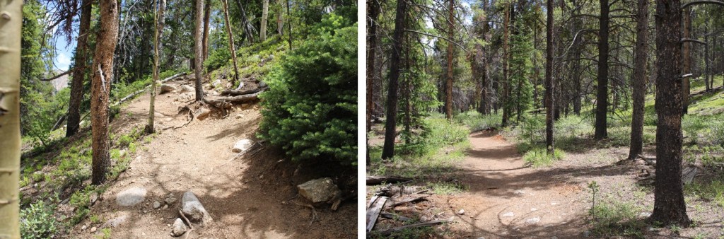
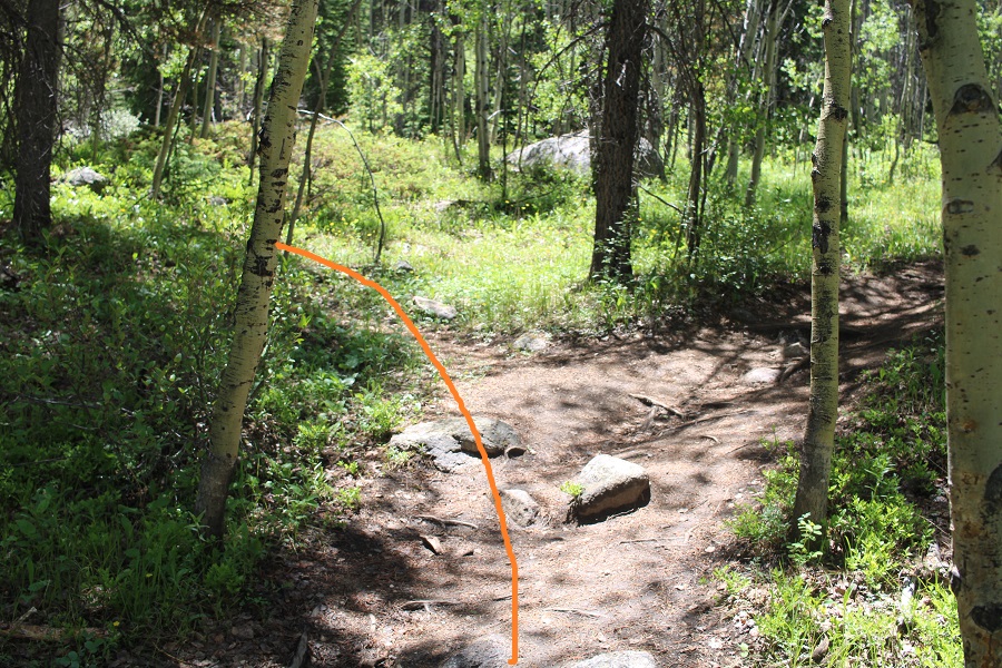
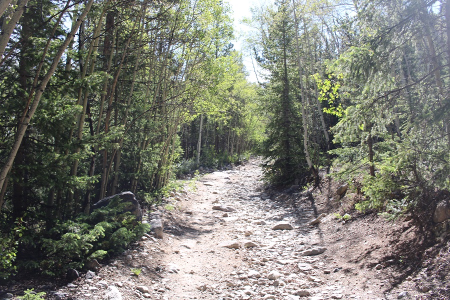
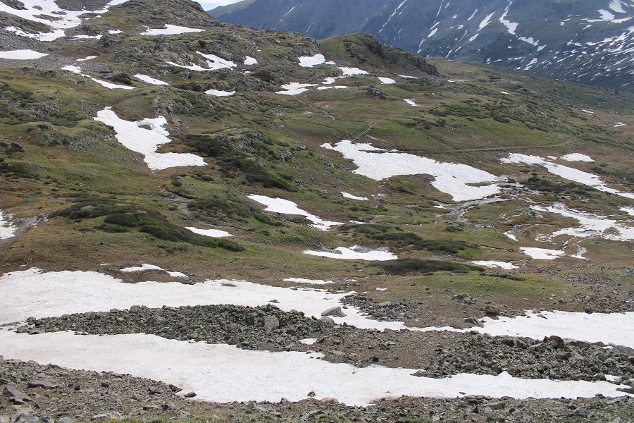
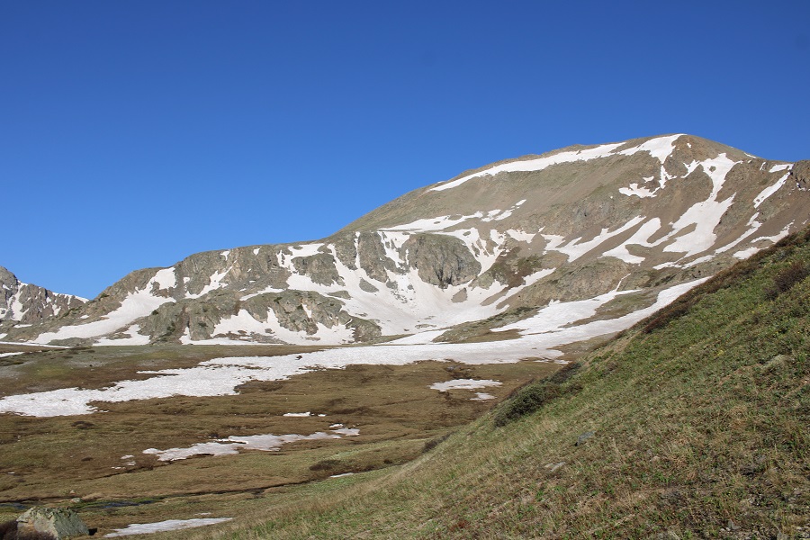
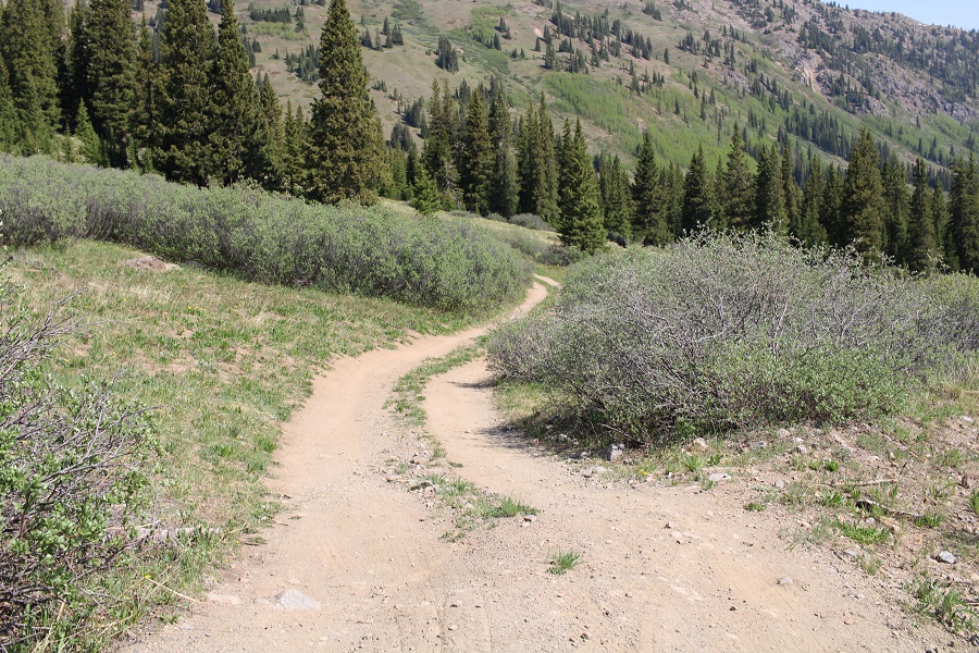
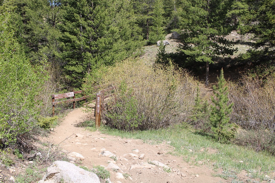
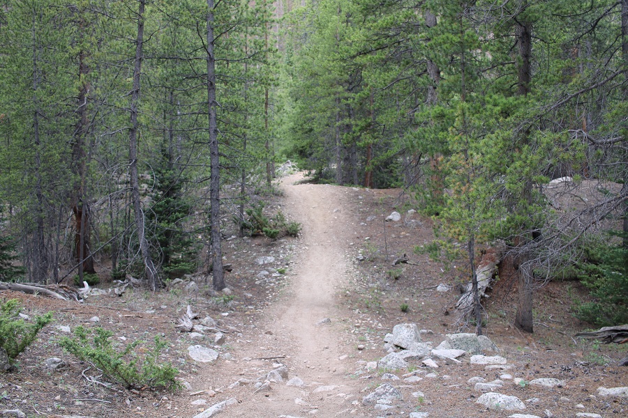
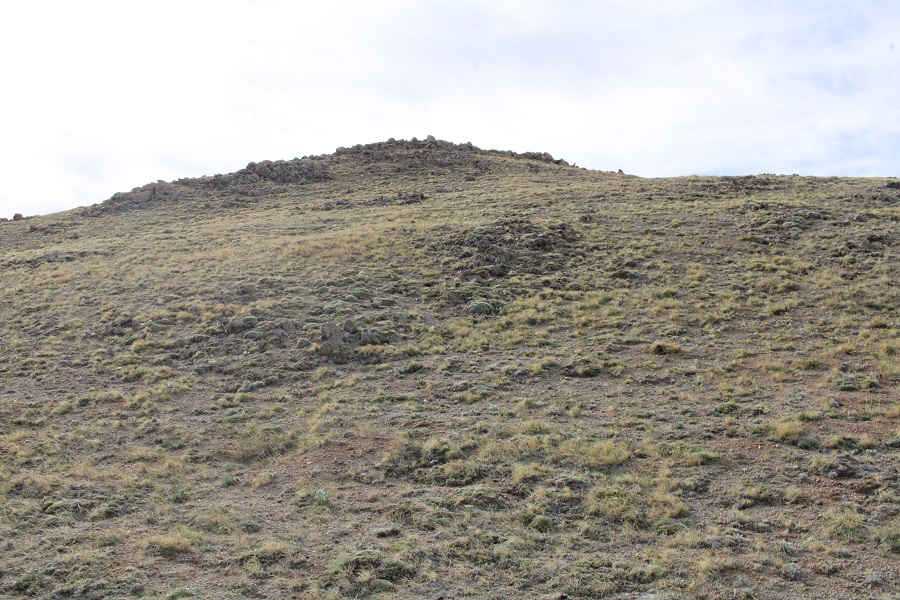
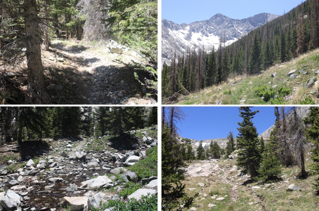
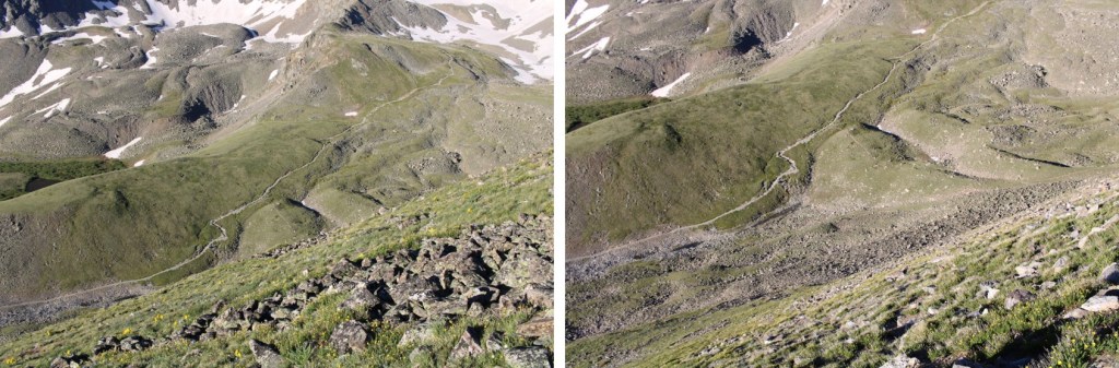
This is a class 1, wide, easy to follow trail. 

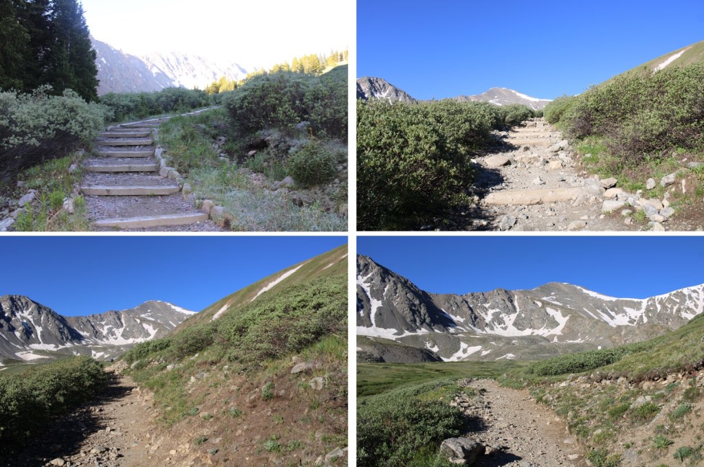
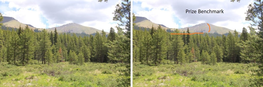
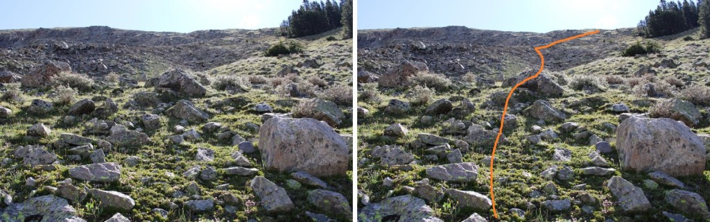
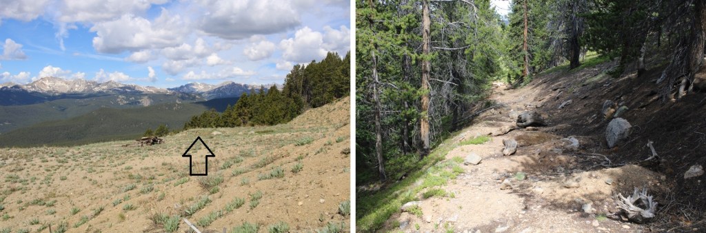
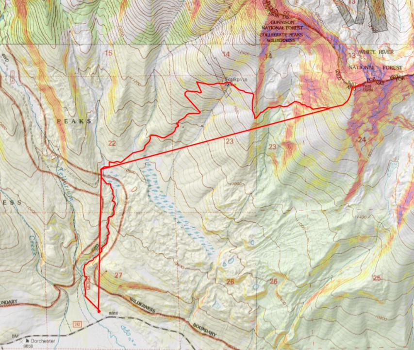
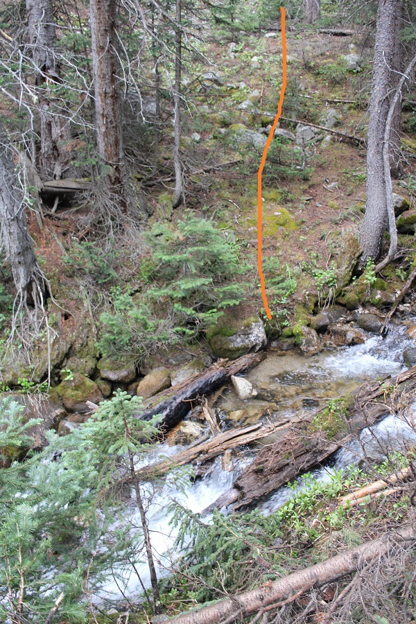
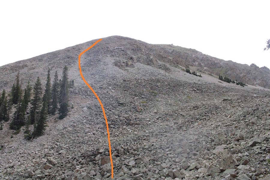
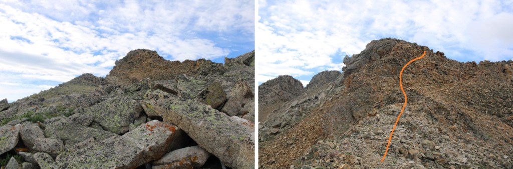
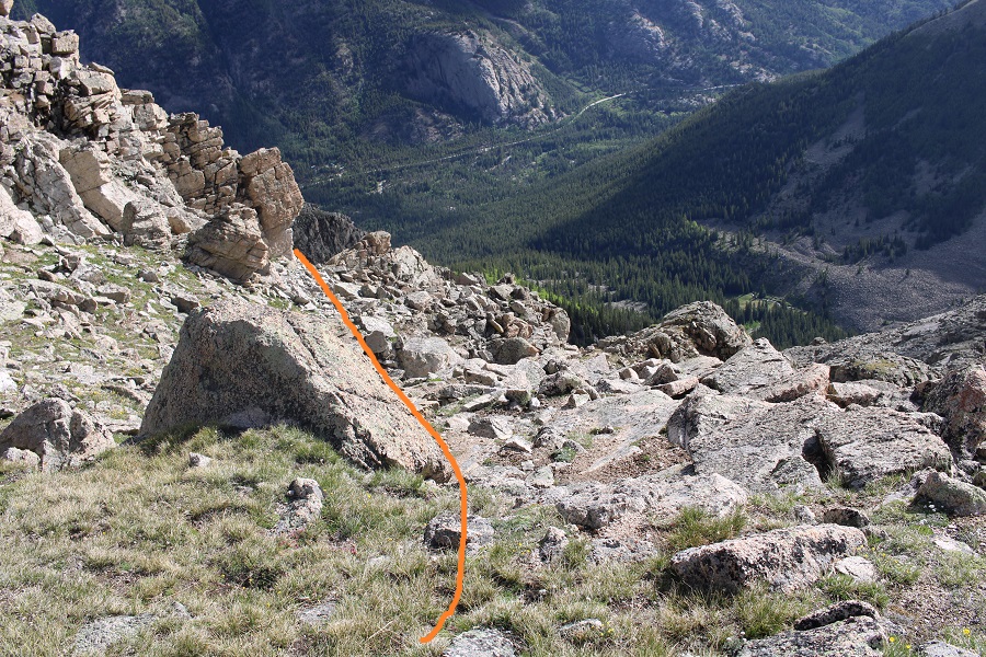
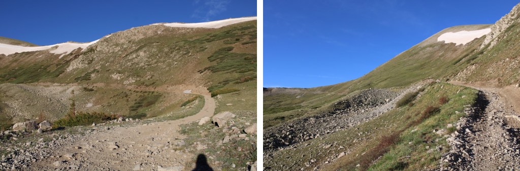
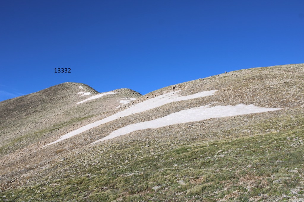
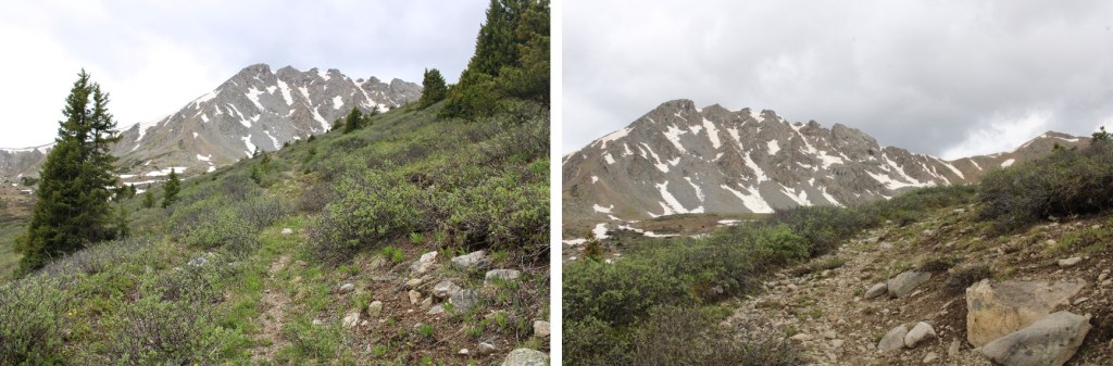
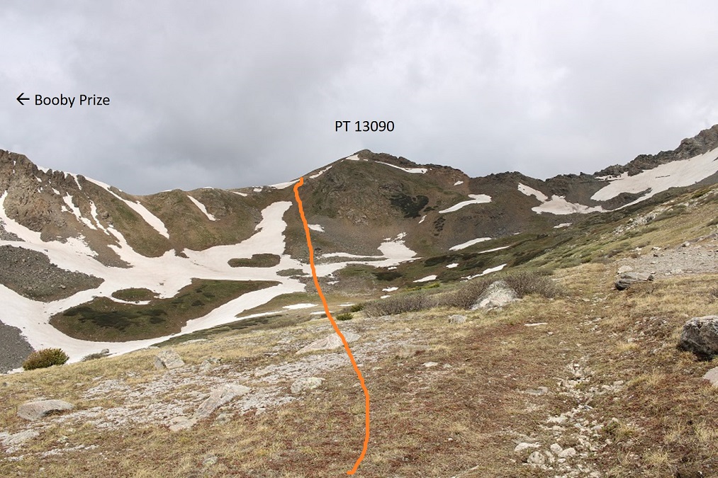
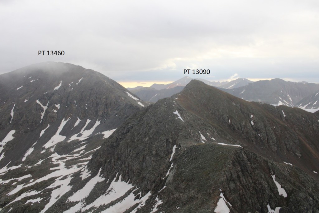
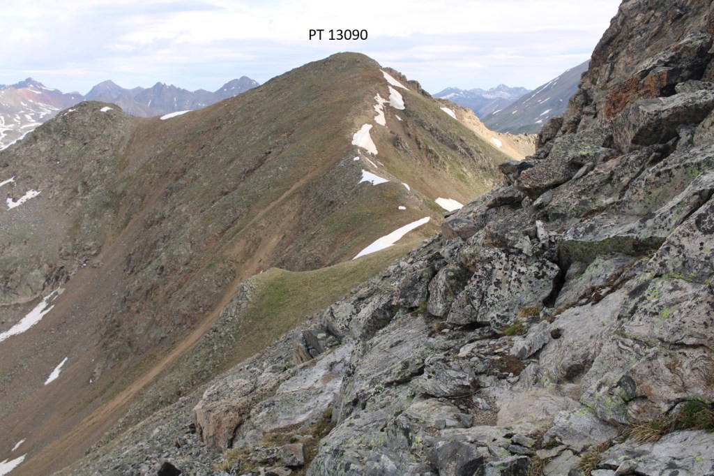
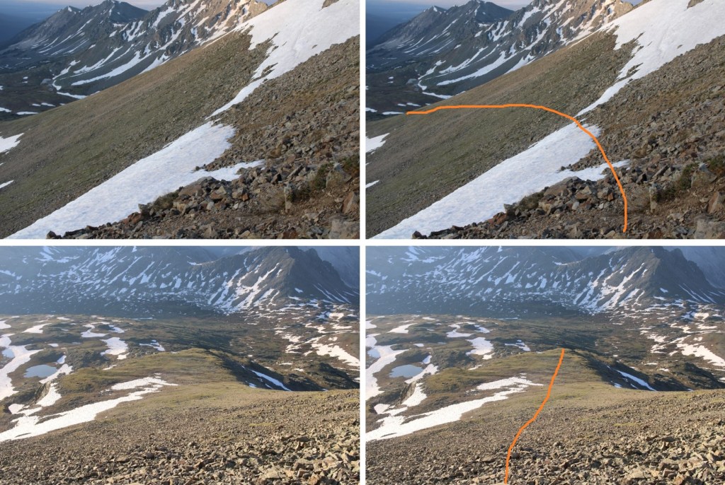
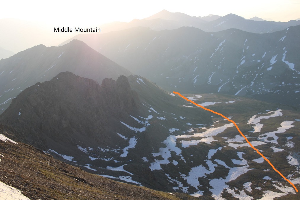
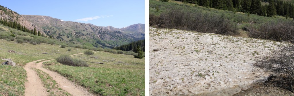
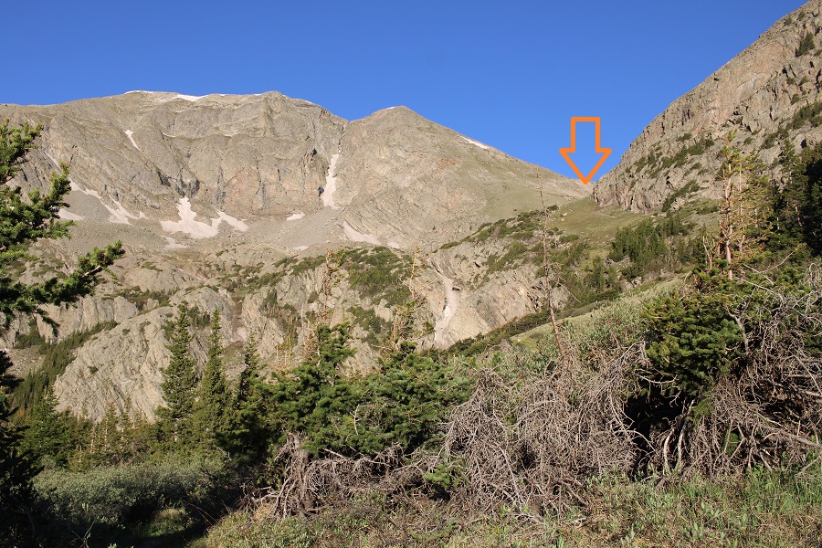
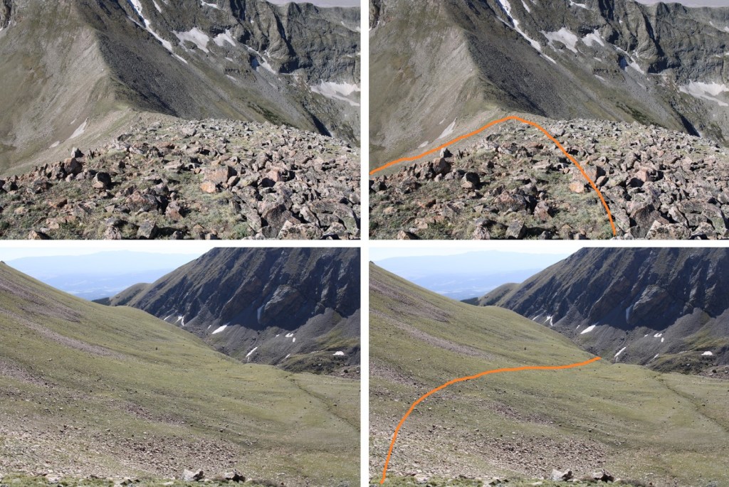
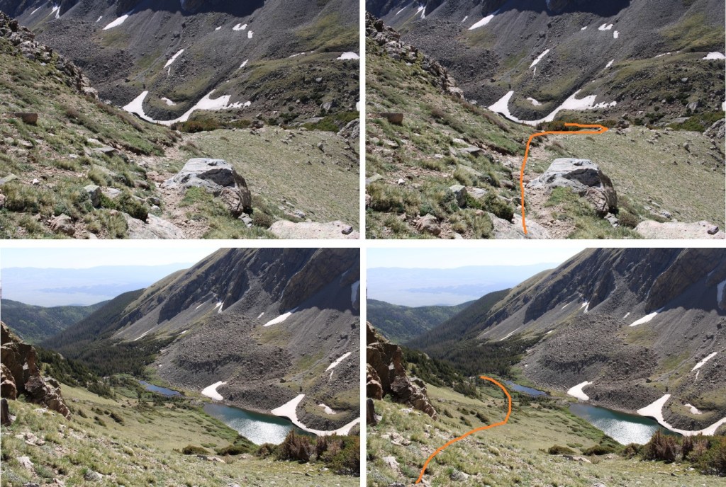
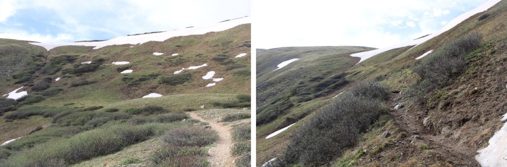
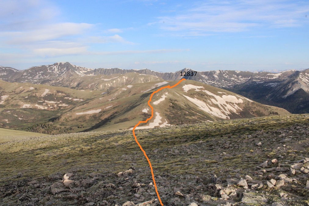
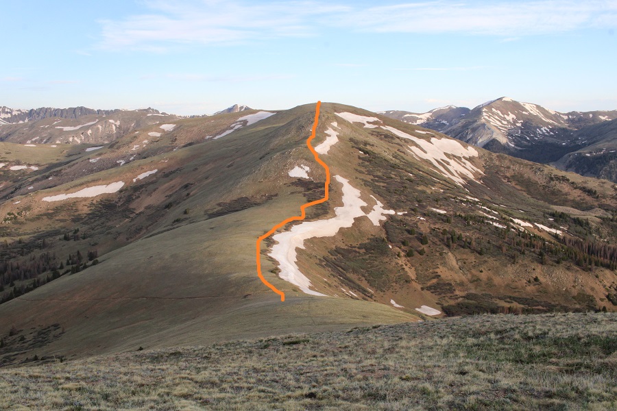
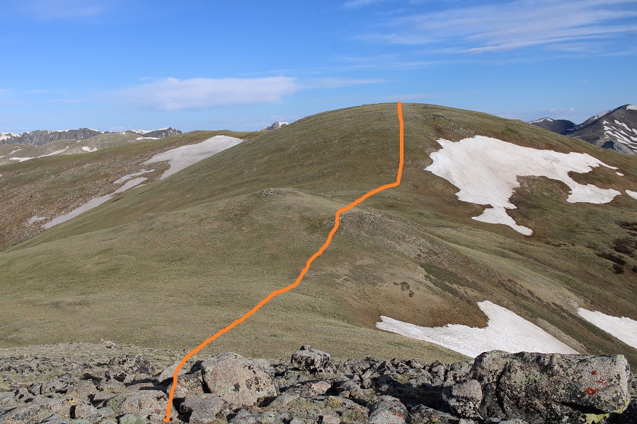
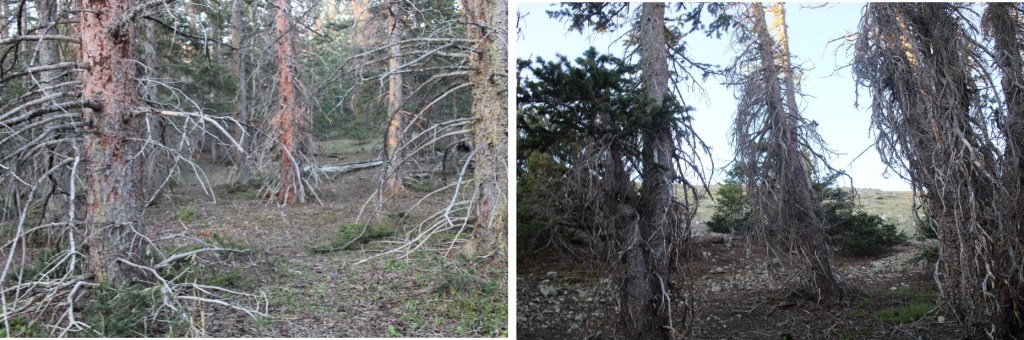
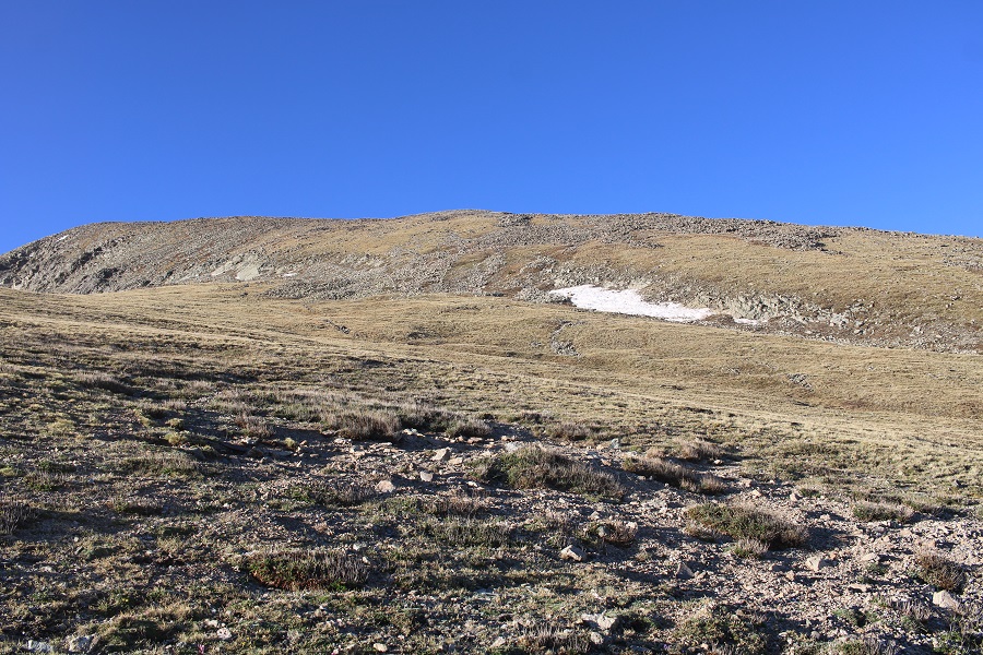
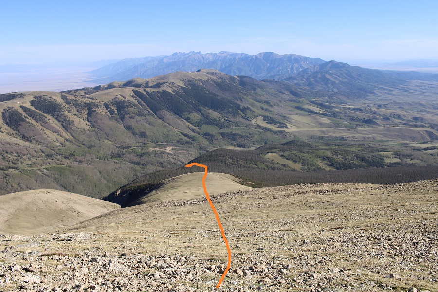
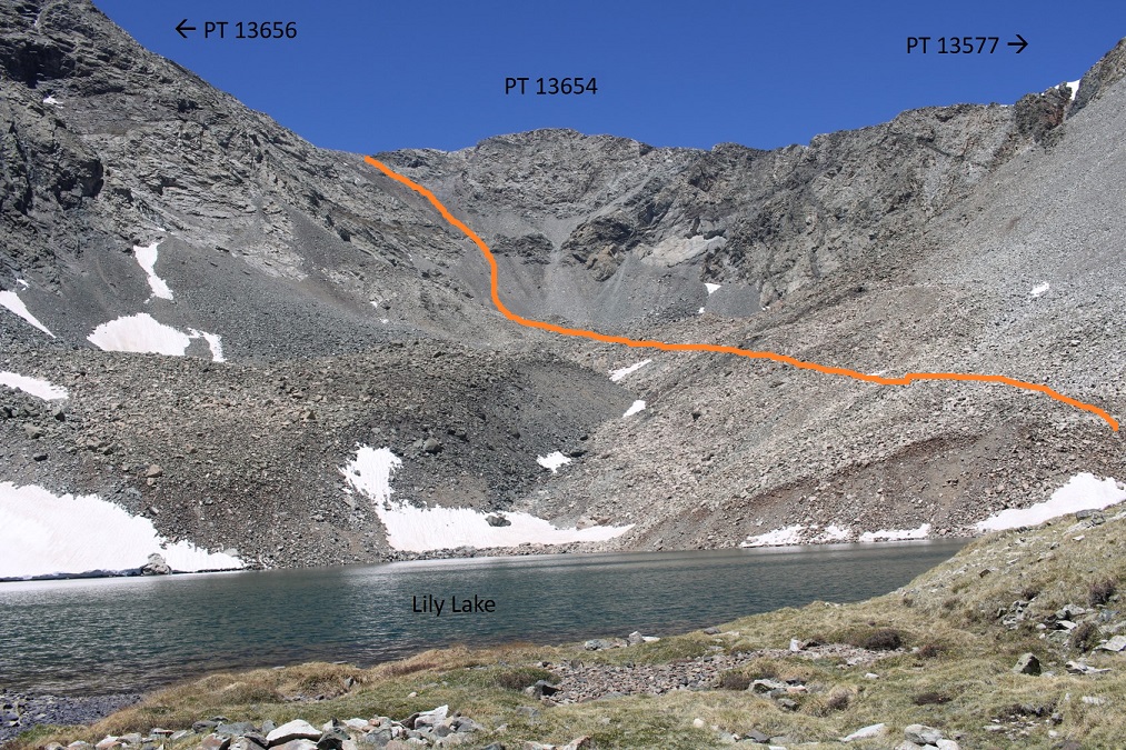
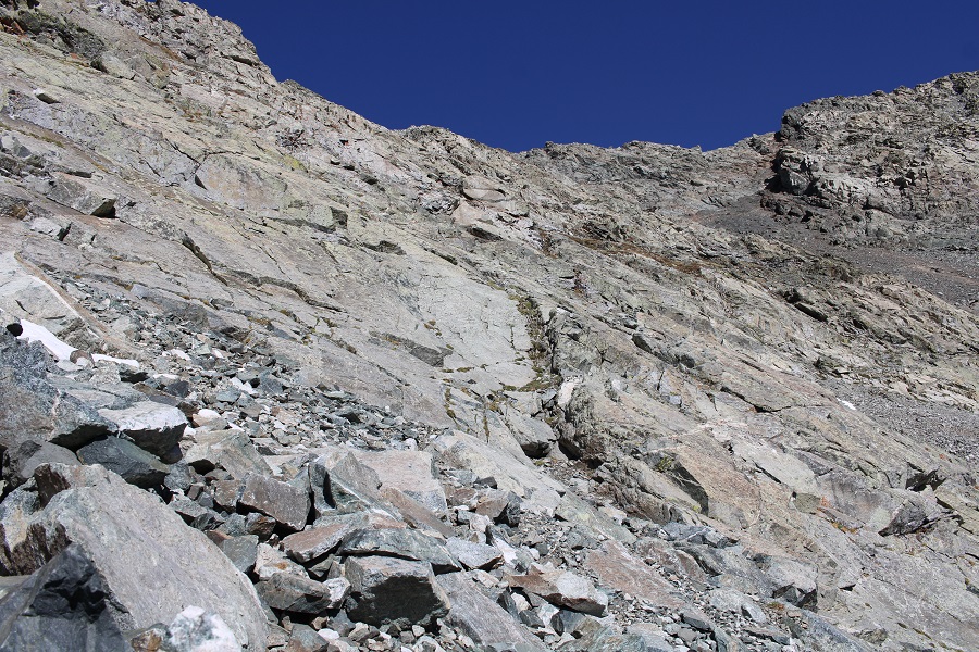
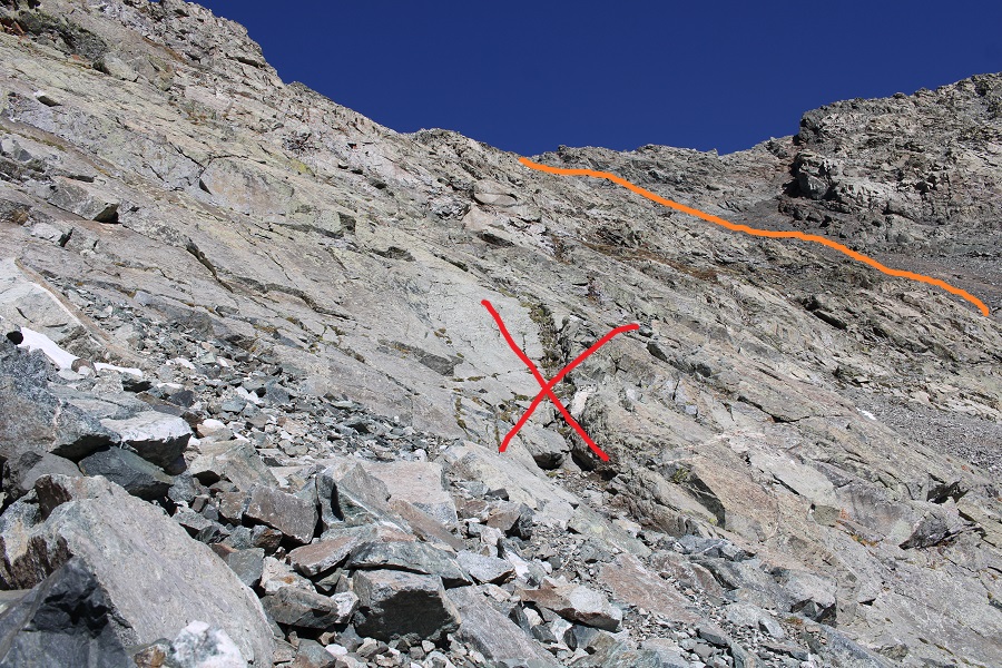
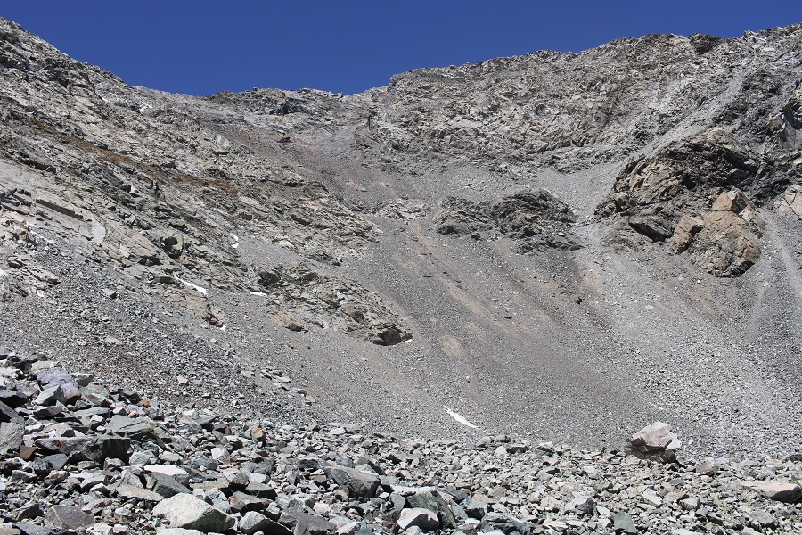
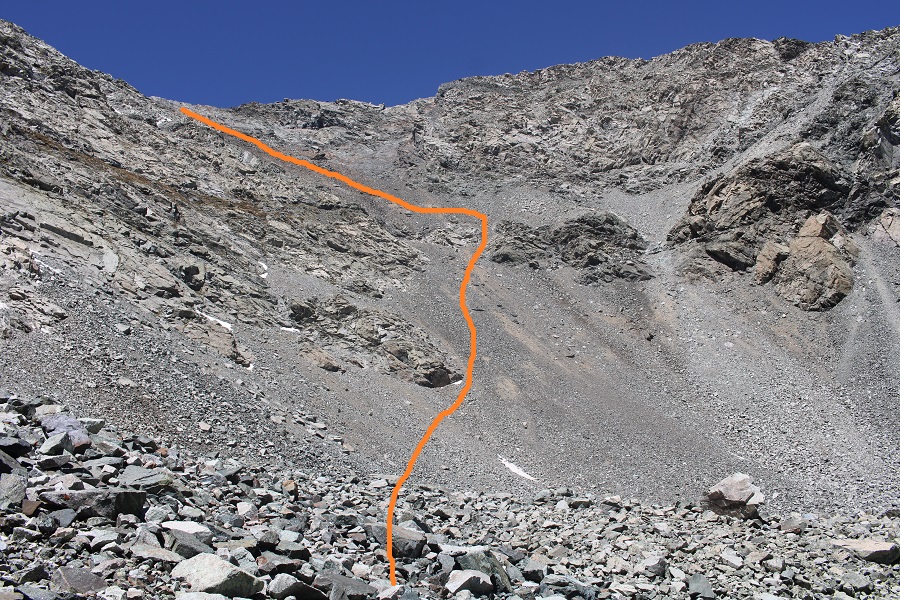
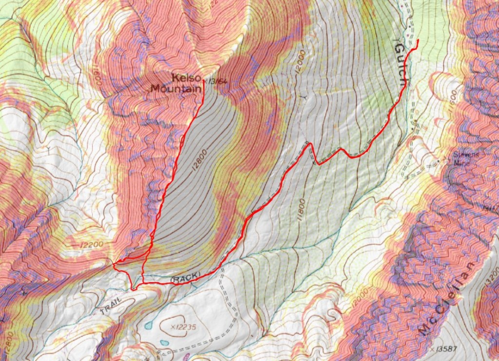
My beta said to follow the trail all the way to the Kelso/Torreys saddle, so that’s what I did, but you don’t need to do that.  You can gain the ridge at any point after about 11900’.  If I had to do this again, this is where I’d ascend the ridge

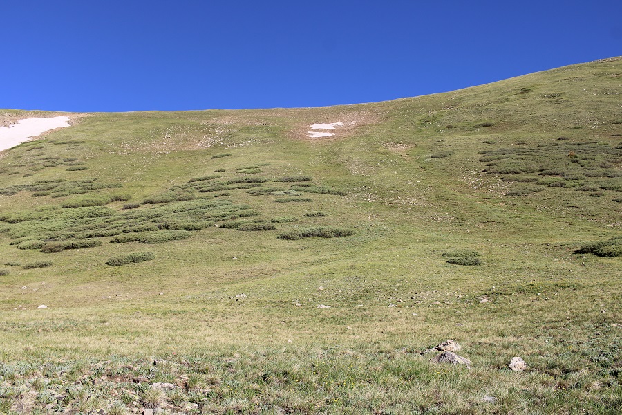
But, I had beta that said to go to the saddle, so that’s what I did.  I followed the trail for about 2 miles, and then made my way to the saddle. There’s a trail the entire way.

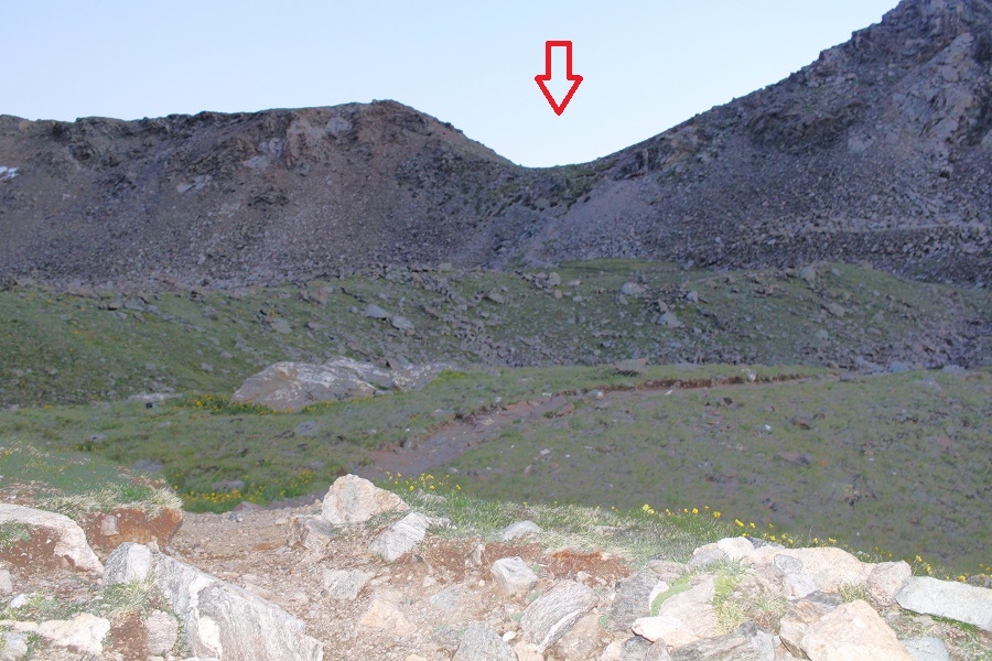
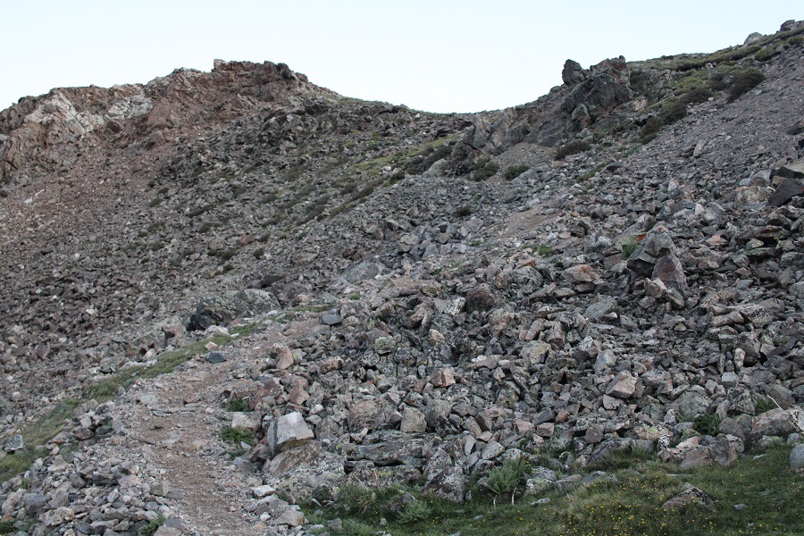
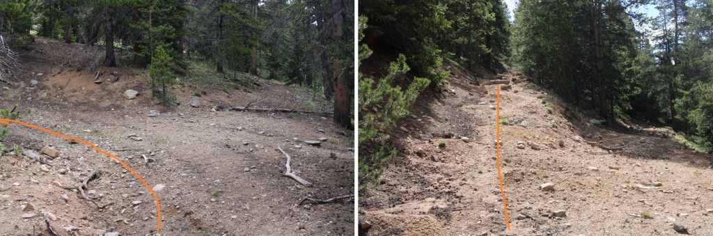
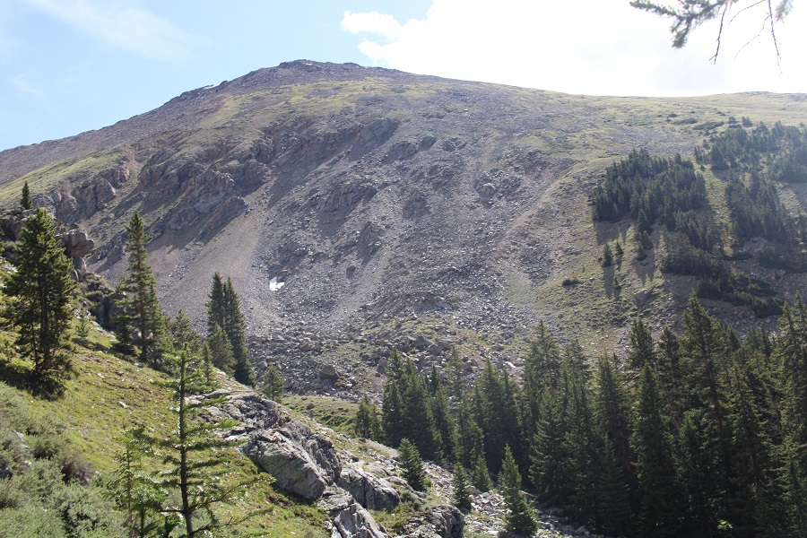
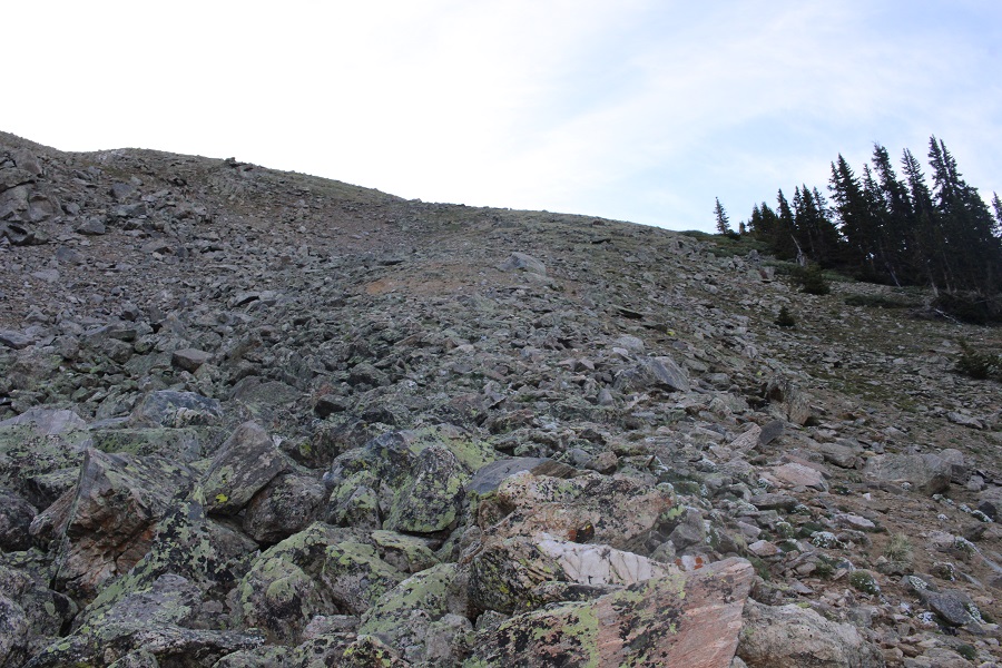
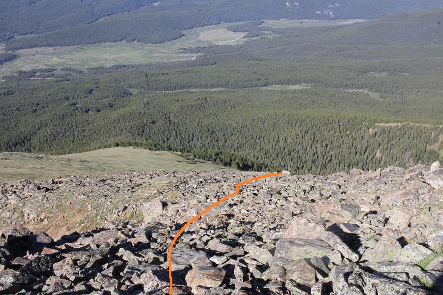
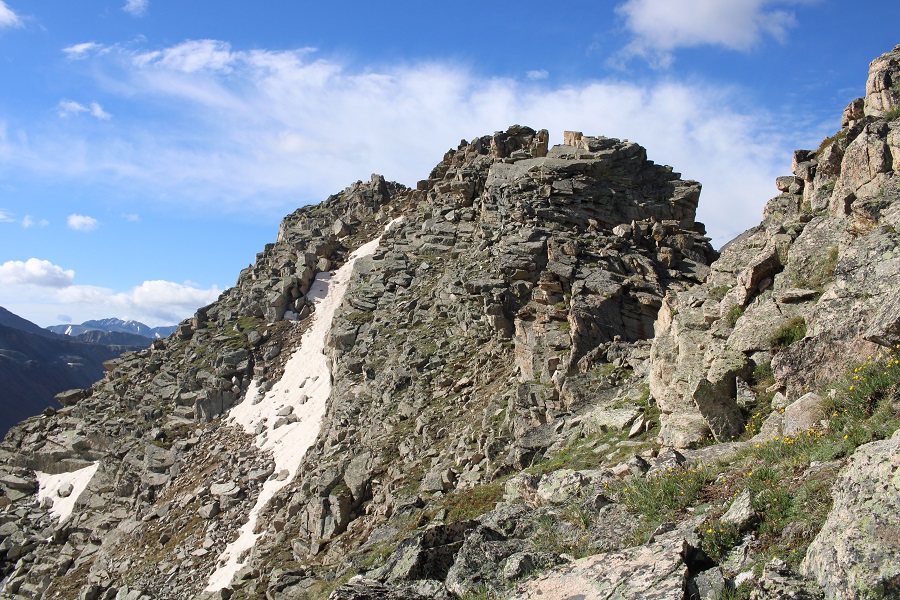
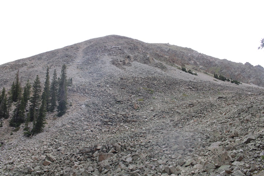
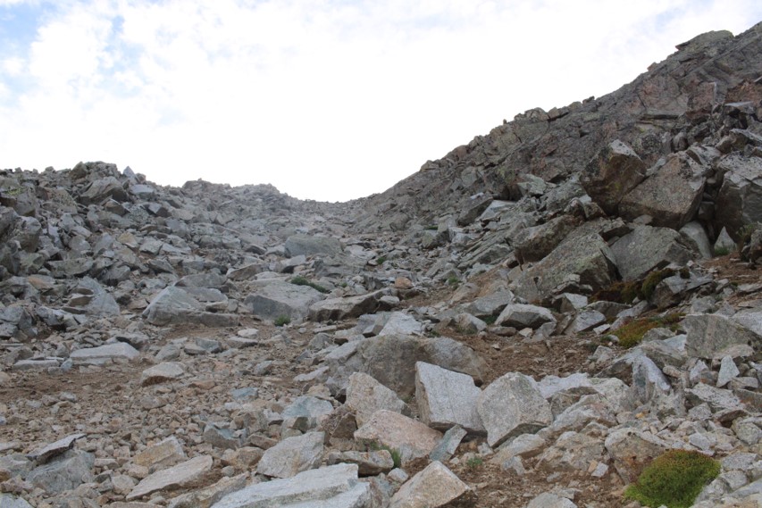
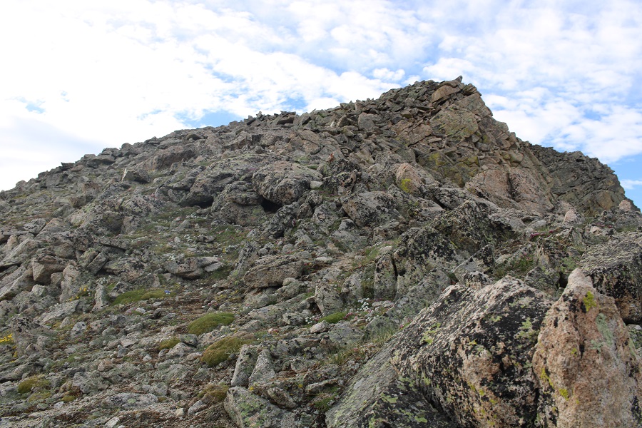
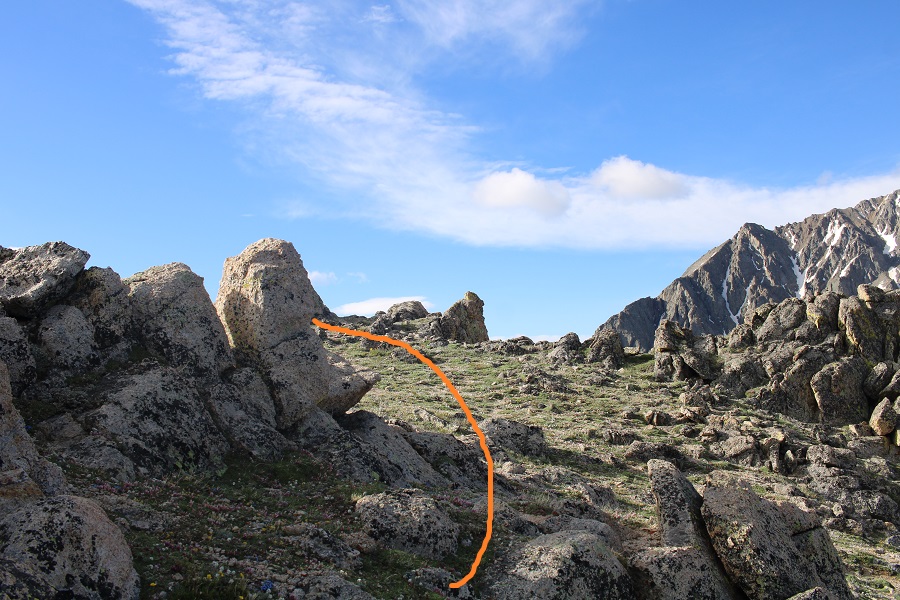
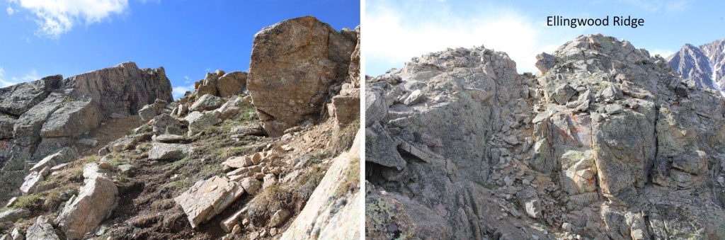
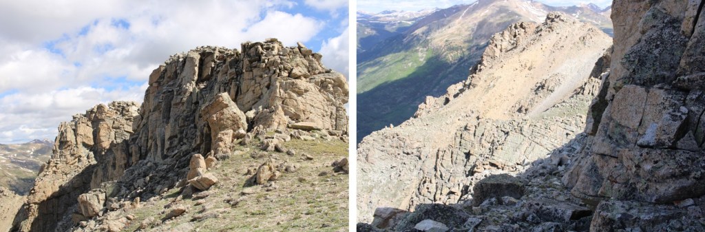
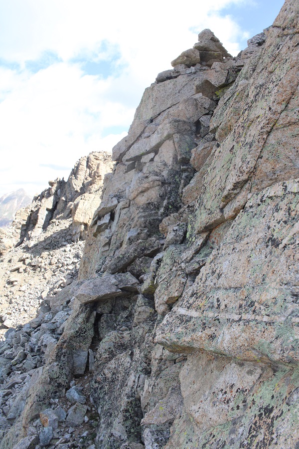
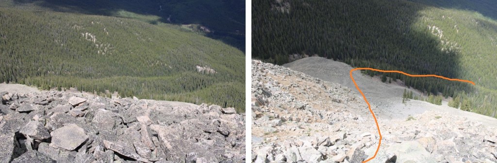
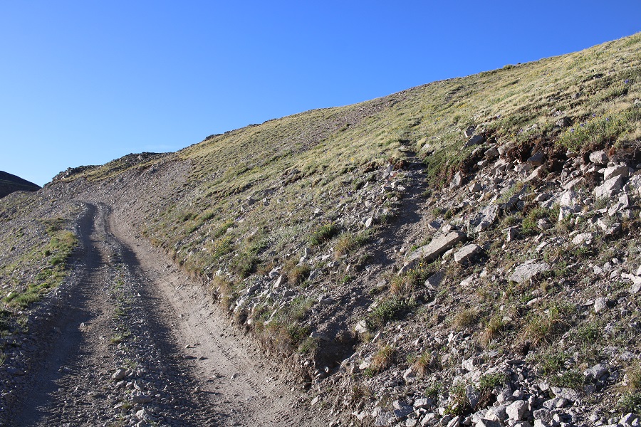
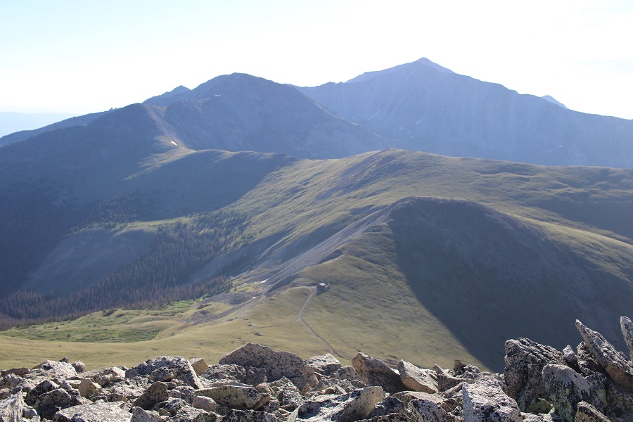
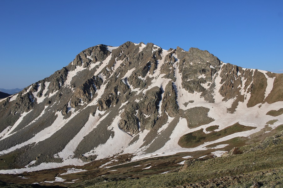
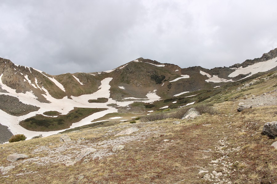
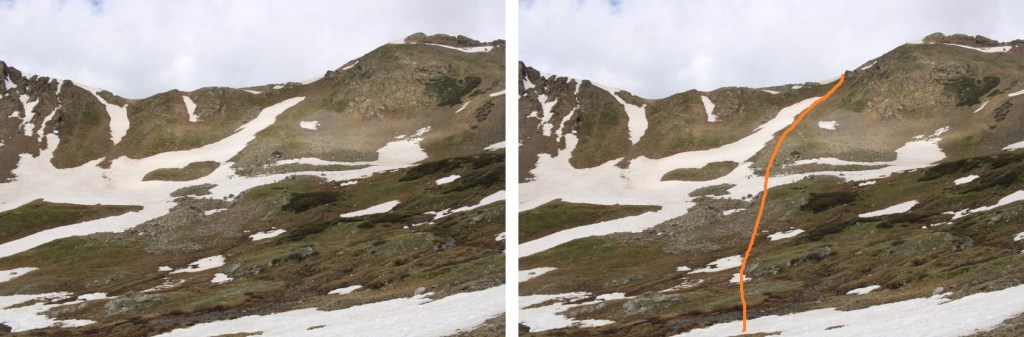
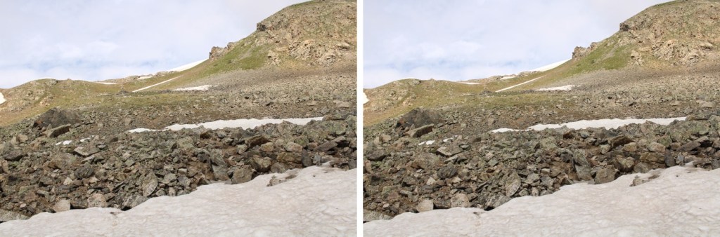
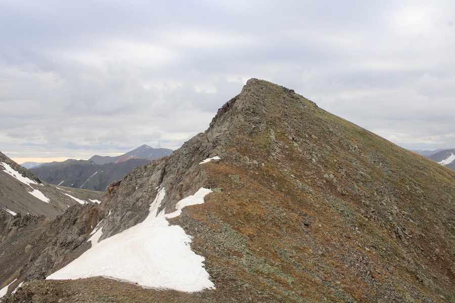
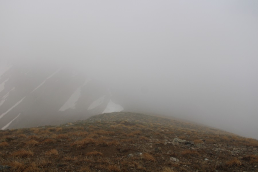
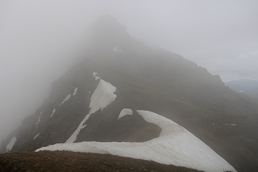
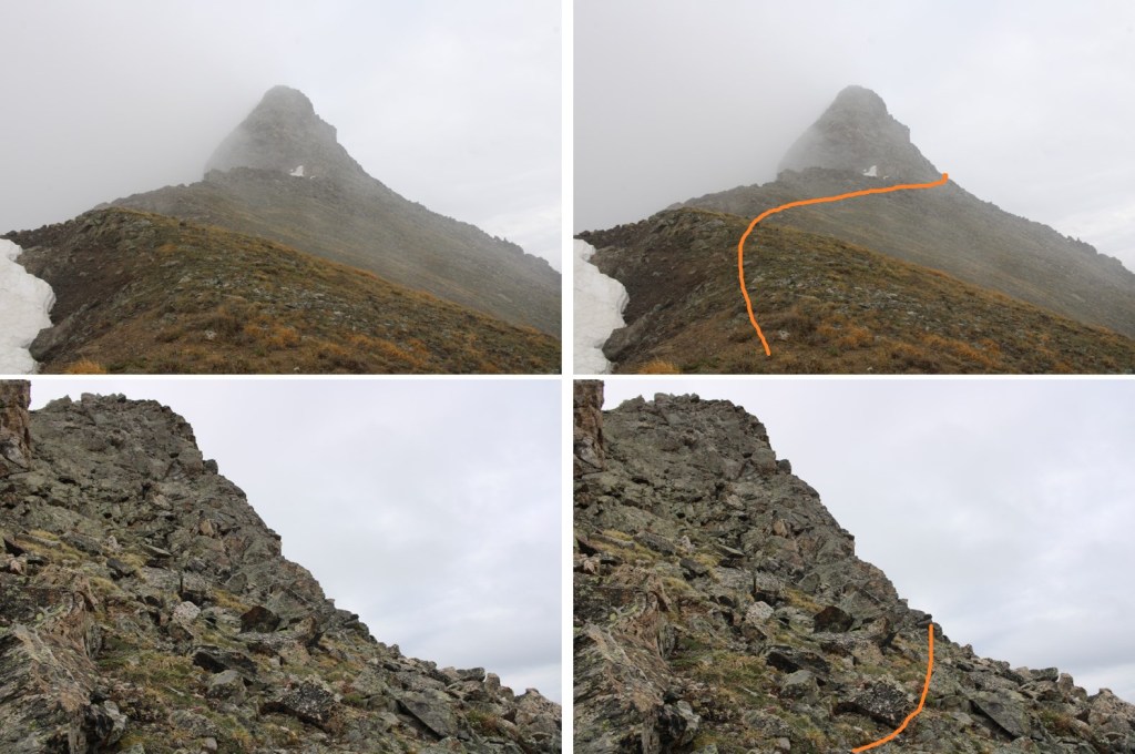
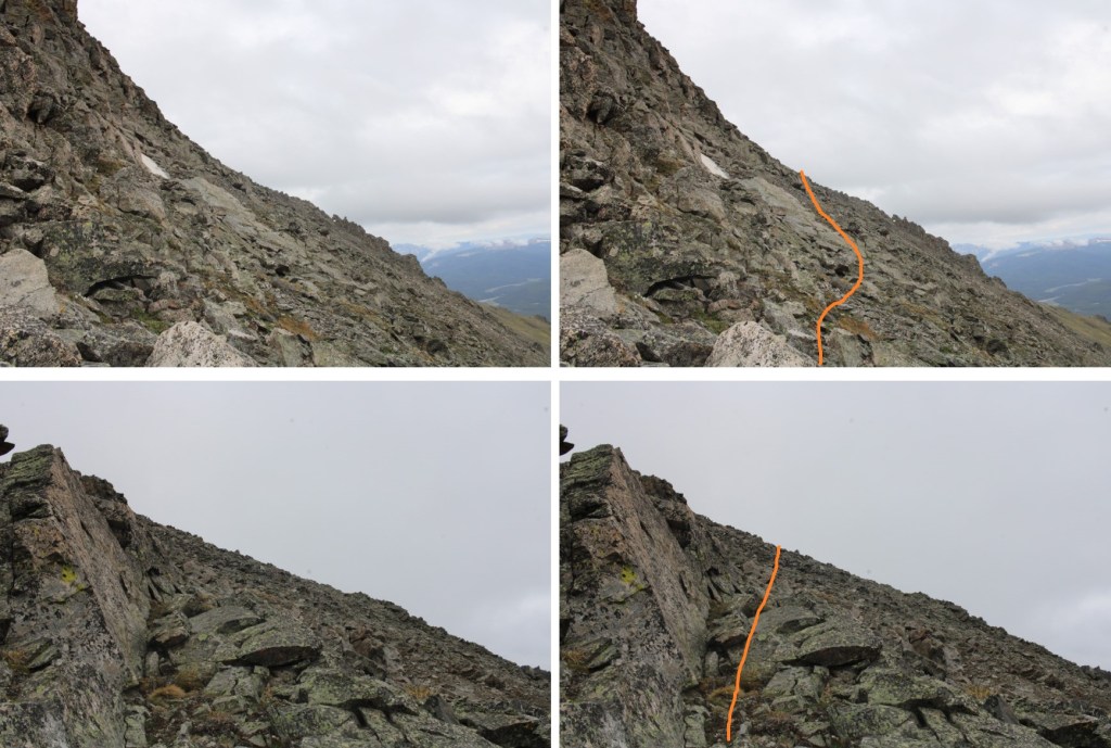
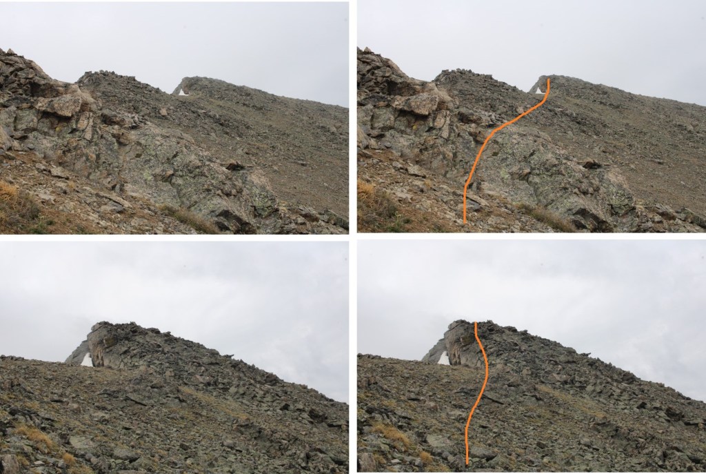
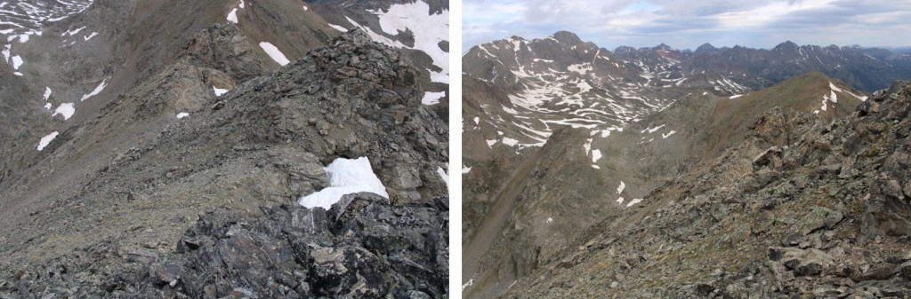
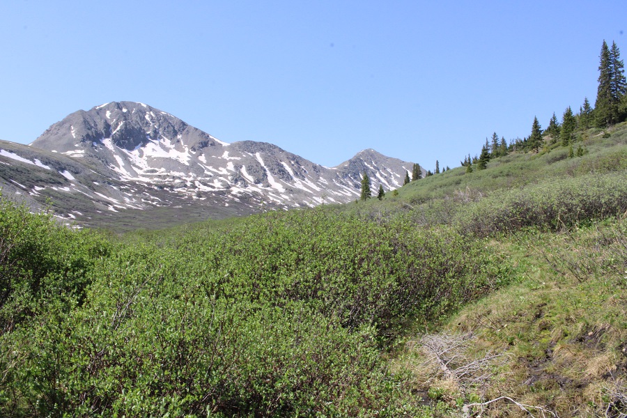
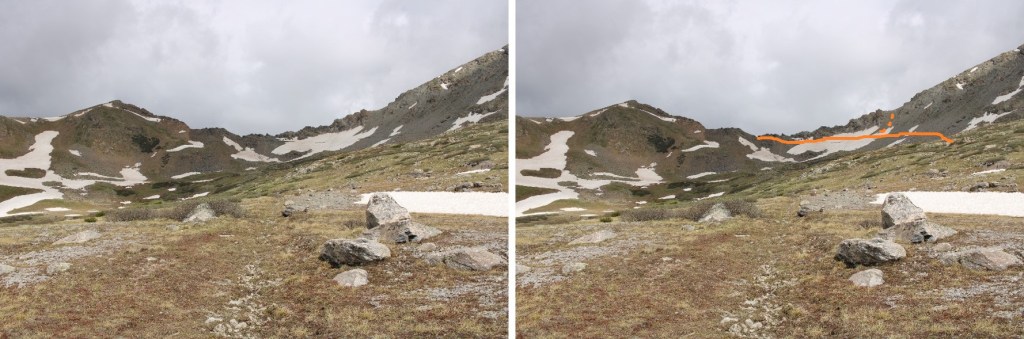
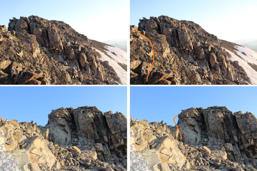
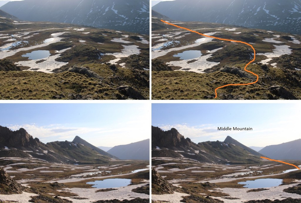
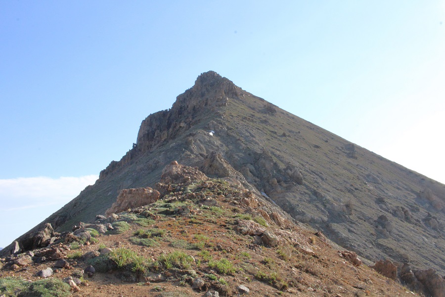
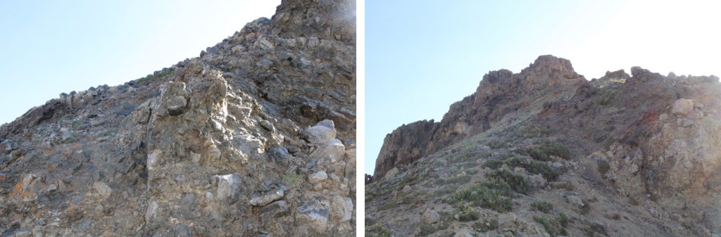
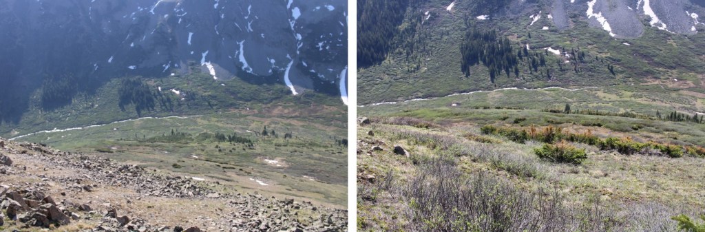
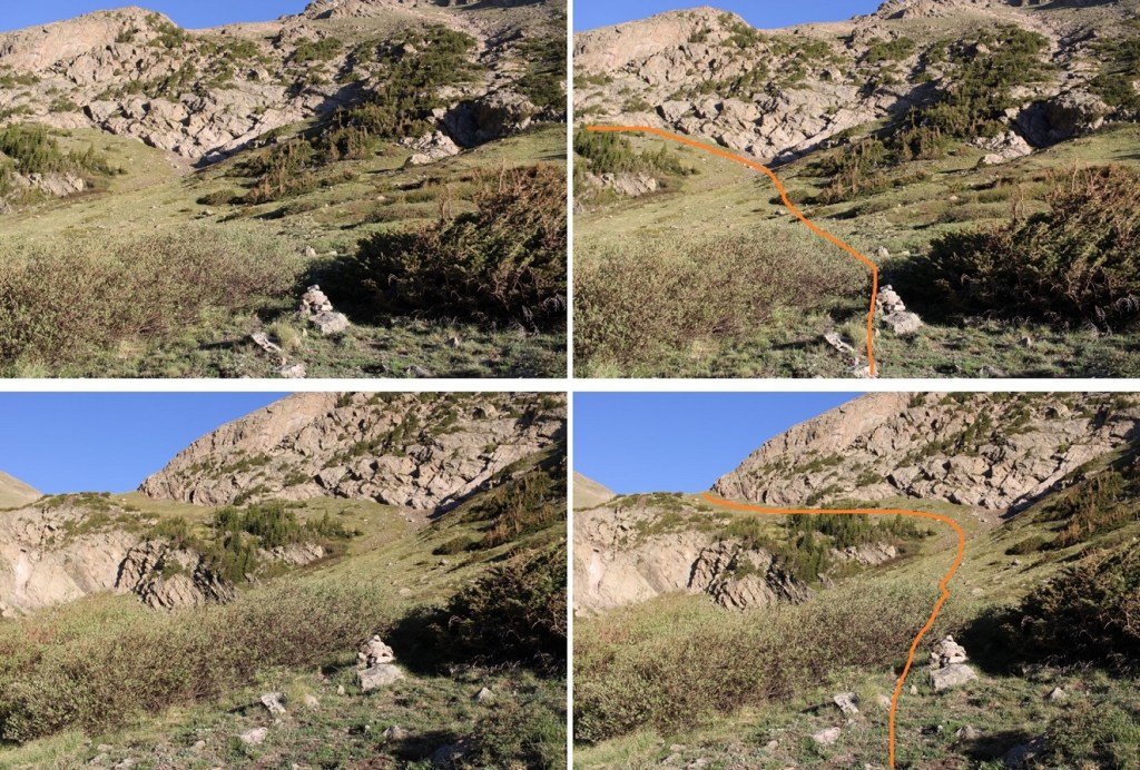
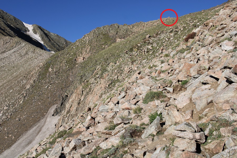
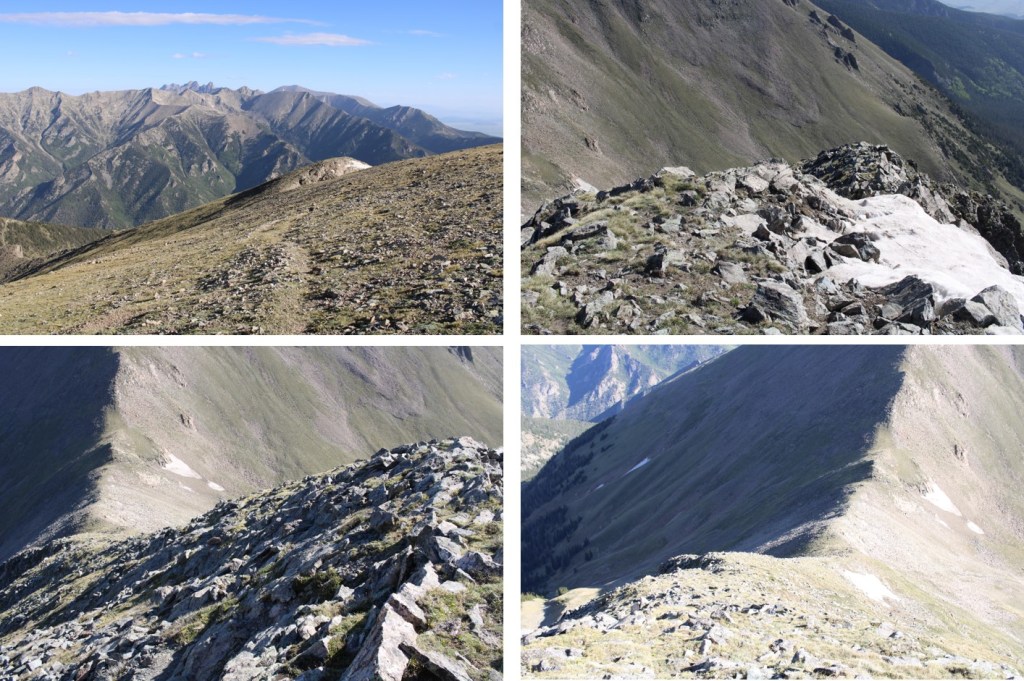
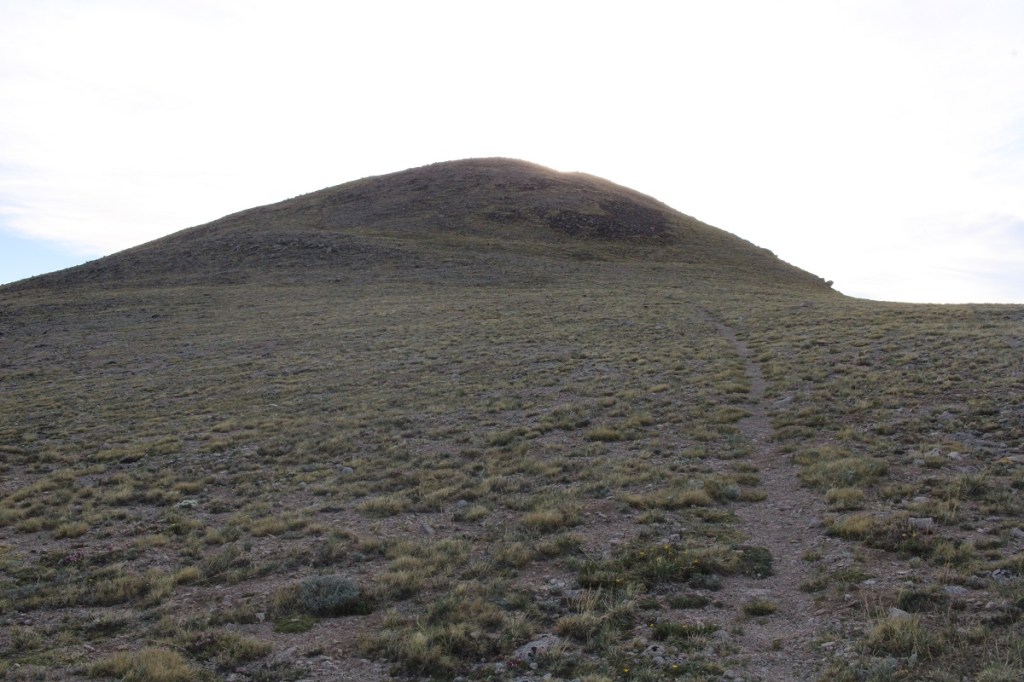
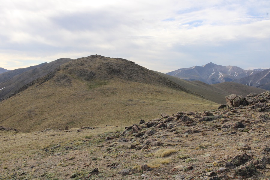
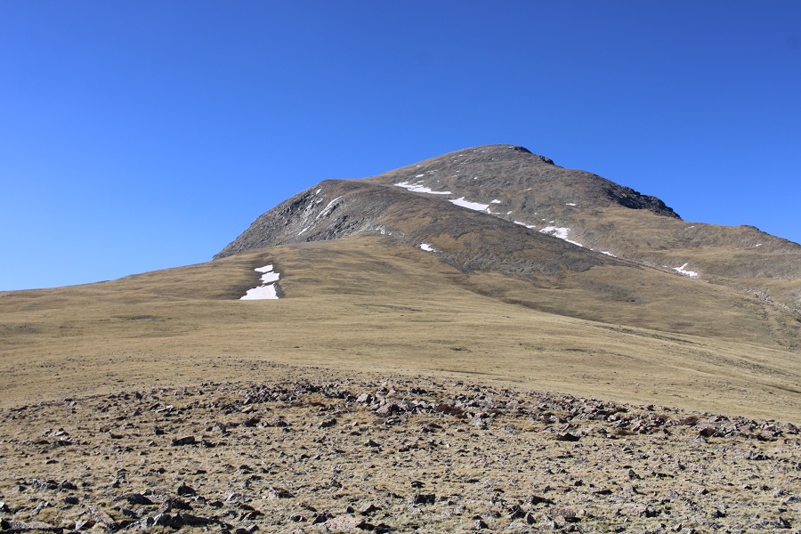
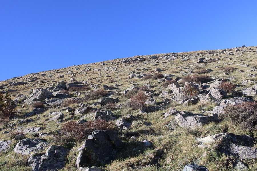
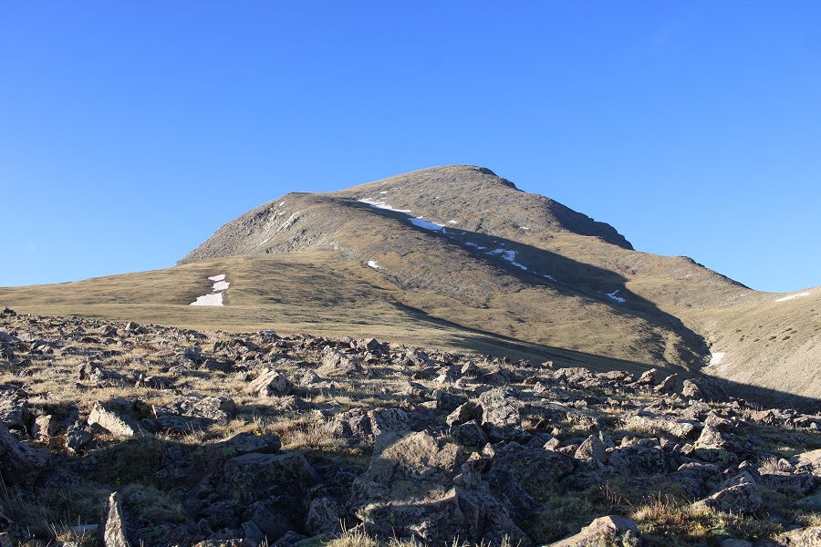
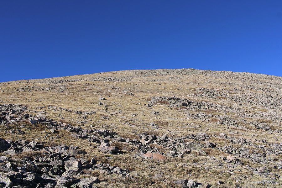
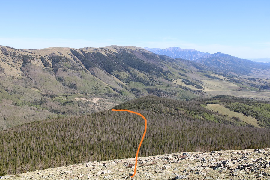
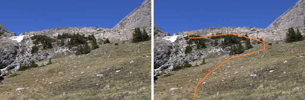
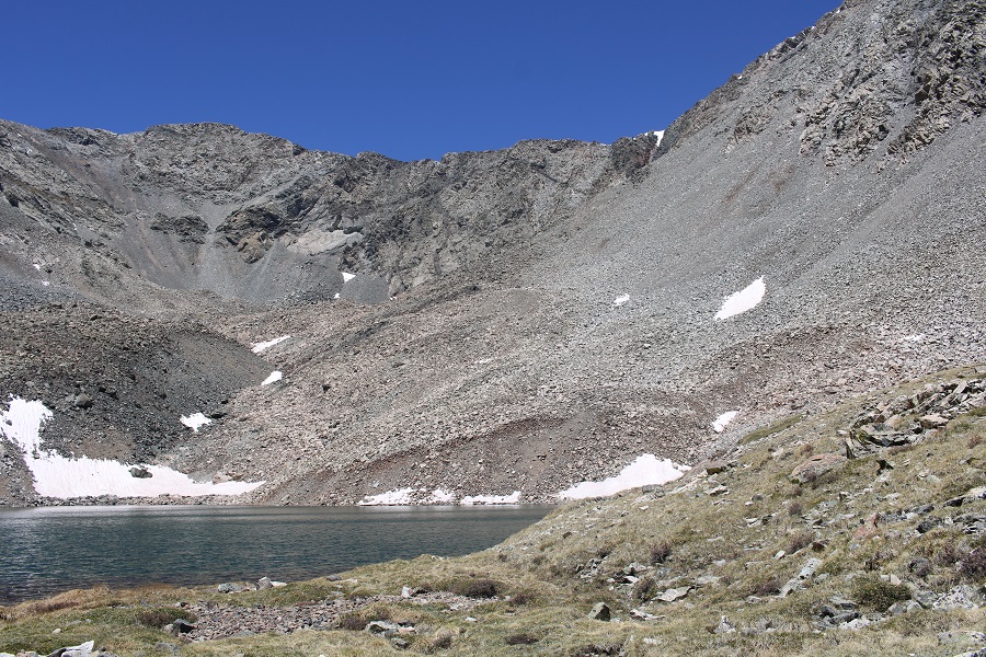
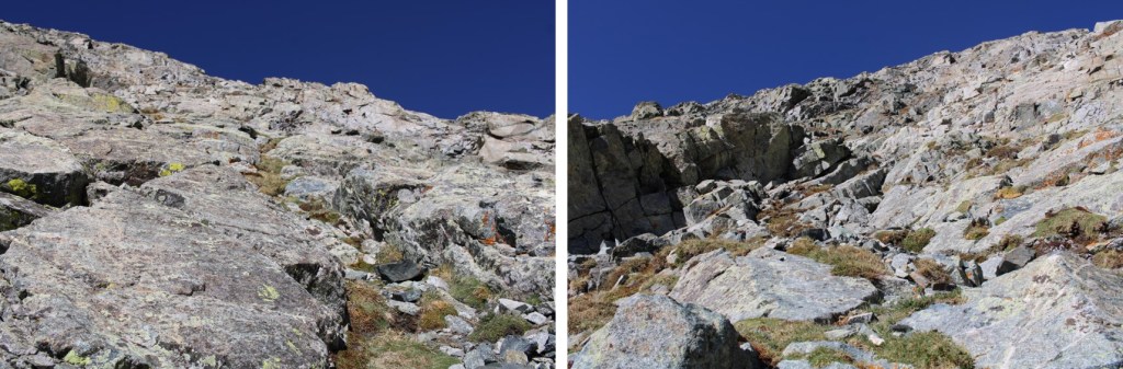
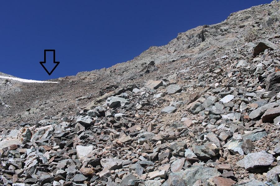
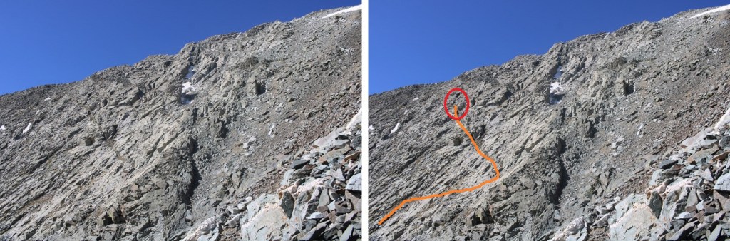
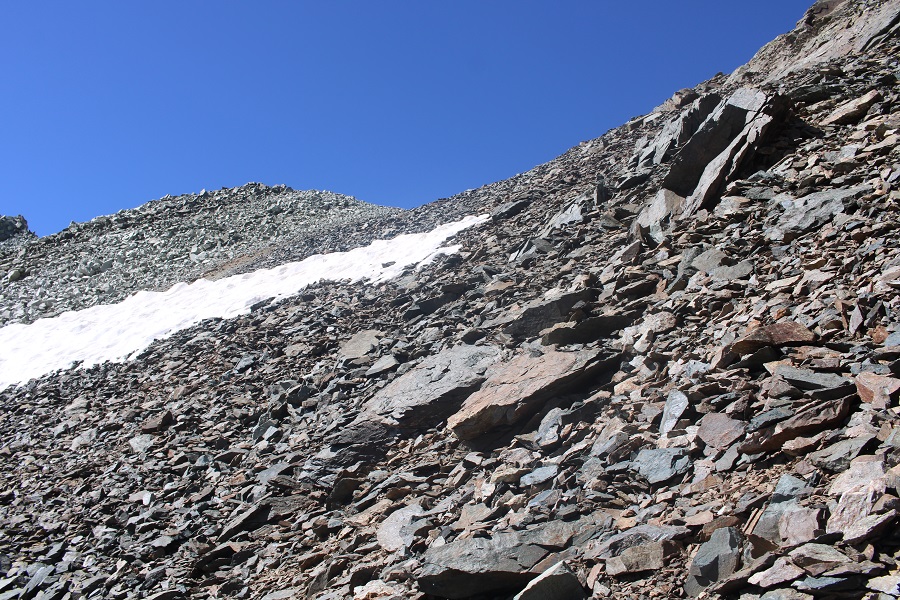
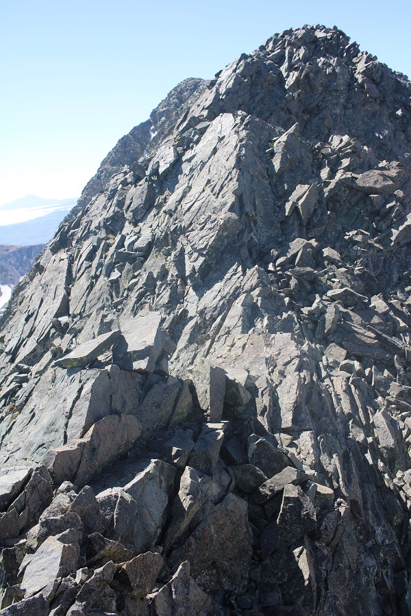
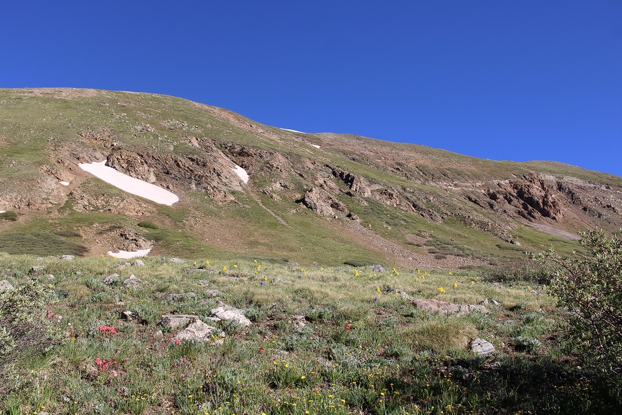
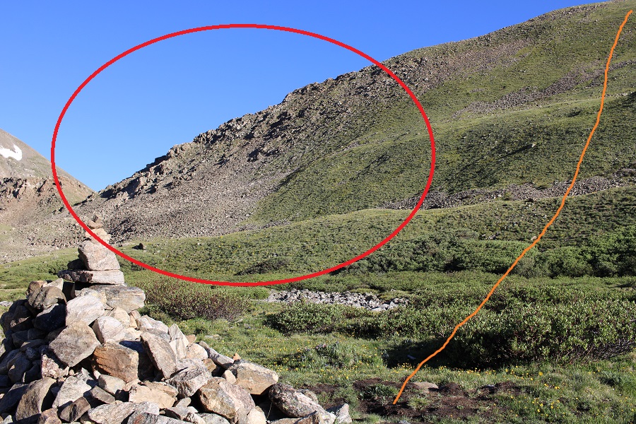
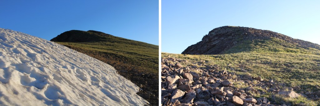
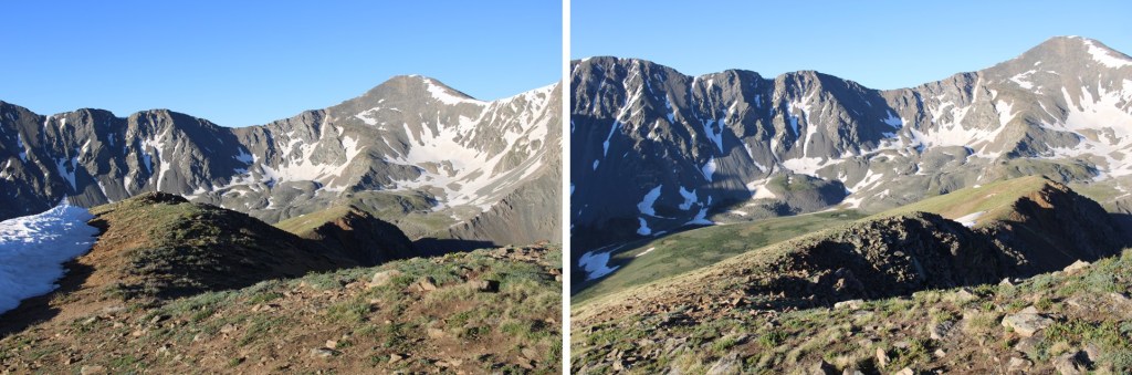
When I got there, I turned to go east up the ridge, but noticed it was all class 3 and above.  This seemed silly to me, because there was clearly tundra below.

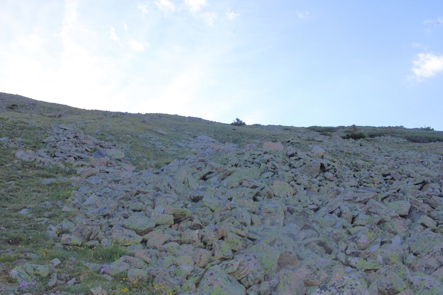
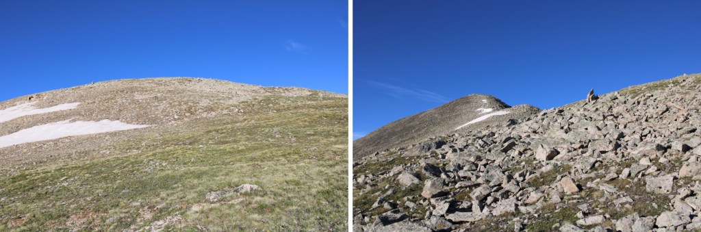
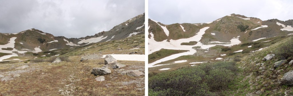
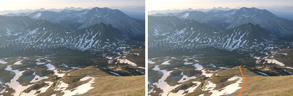
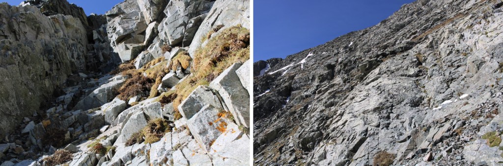
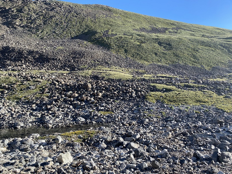
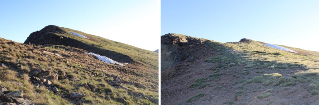
So I backtracked and took the tundra route to the ridge.  This was a fabulous idea, easy going, and I didn’t need a helmet.

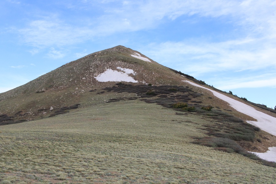
This is what I was trying to avoid, which looks ok from this side, but more spicy from above.  Just take the tundra route.

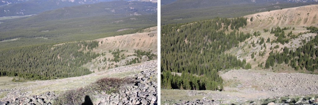
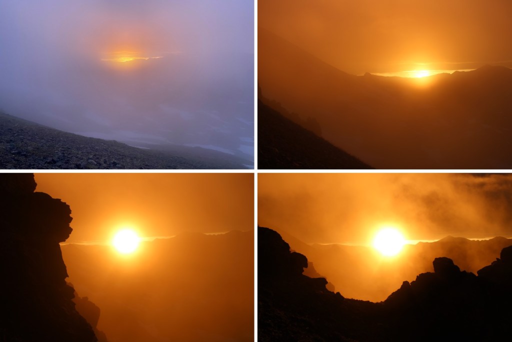
It was here, around 5:30am, when I saw my first helicopter flyover for the day.  It got dangerously close to the mountains, and I was worried someone needed SAR.  All kinds of scenarios went though my head. I knew CFI was doing work in the area, but the post I’d seen a few days ago said they weren’t starting until next weekend (I found out later they posted again with the proper dates last night, but I was already at the trailhead, so I didn’t know this).  I was worried someone needed help, and the helicopter couldn’t find them.  I spend a lot of time looking for someone myself as I hiked.  
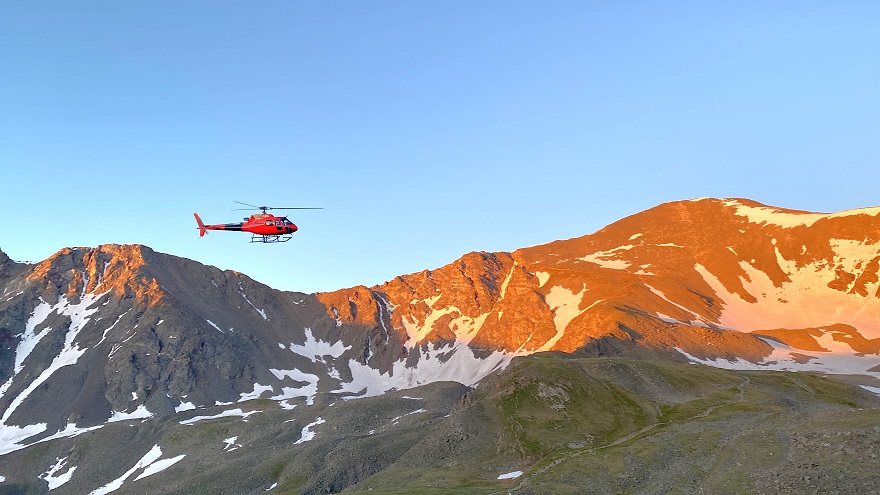
Helicopter:

The helicopter came back around about 20 minutes later, and took a different path.  Once again, I was worried they were searching for someone.  Then about 20 minutes after that I saw the helicopter carrying wooden ties, and knew it must be CFI doing trail maintenance.  THANK YOU CFI!

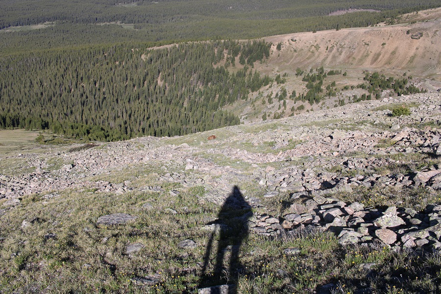
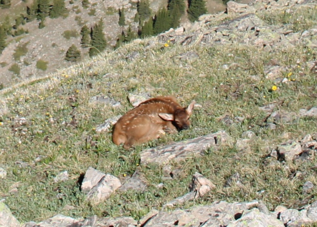
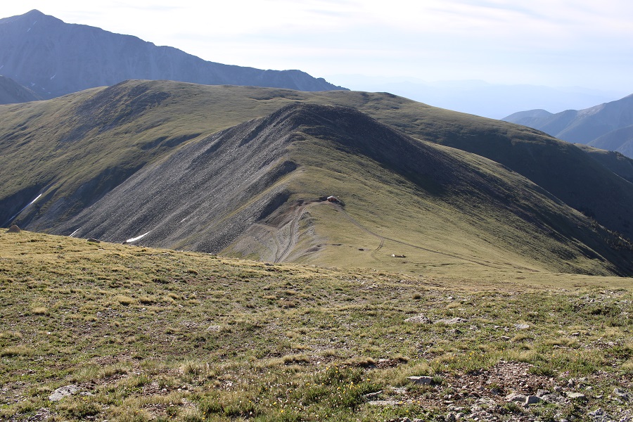
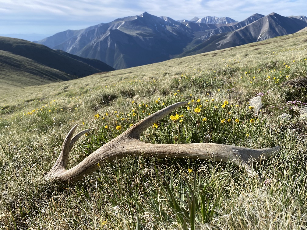
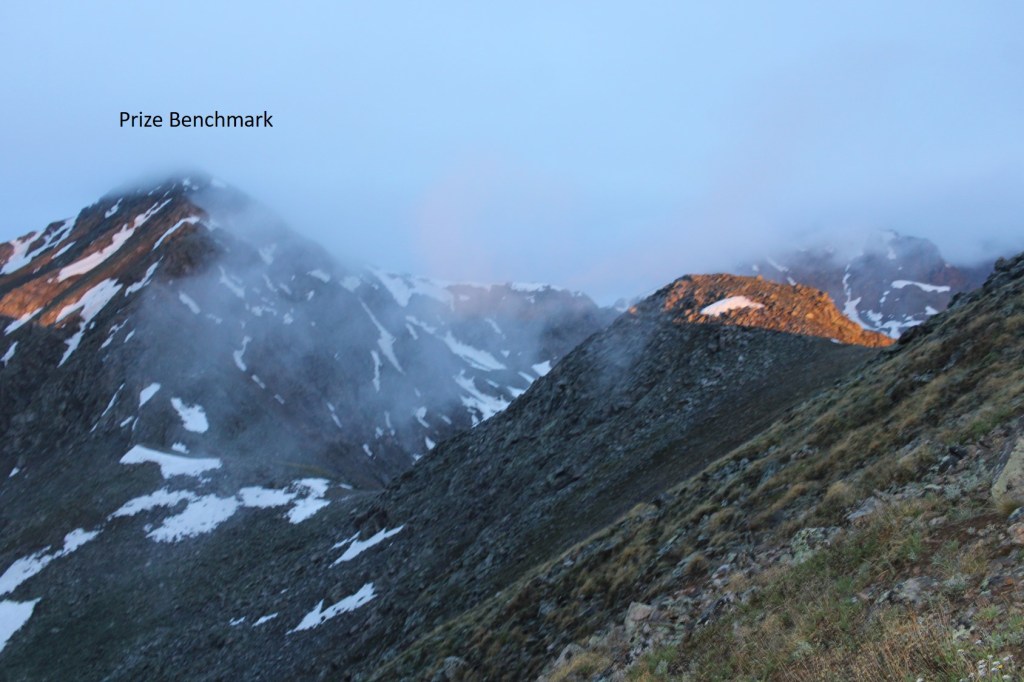
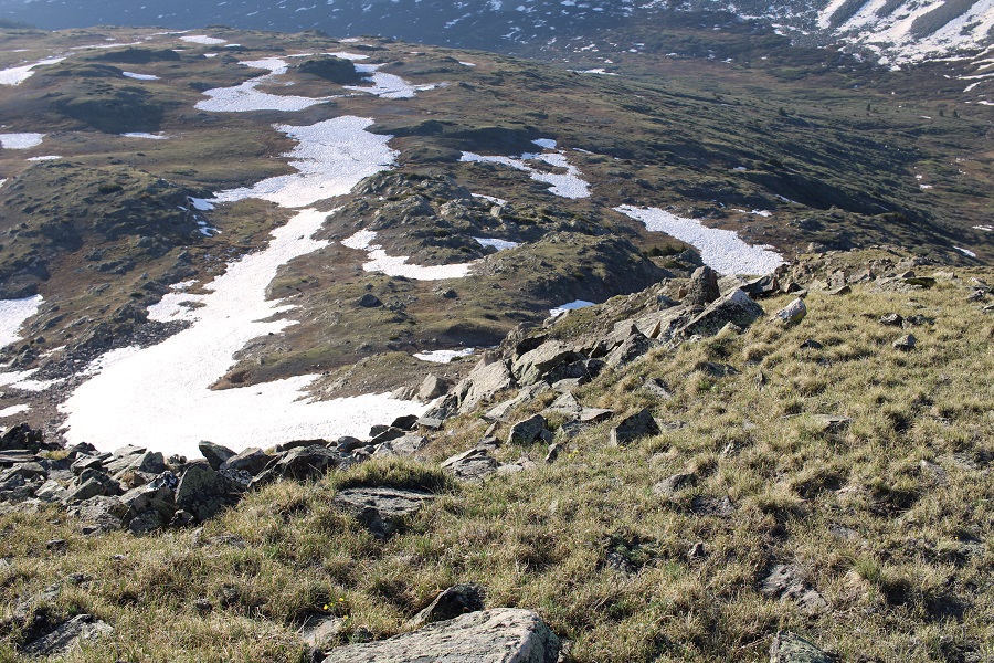
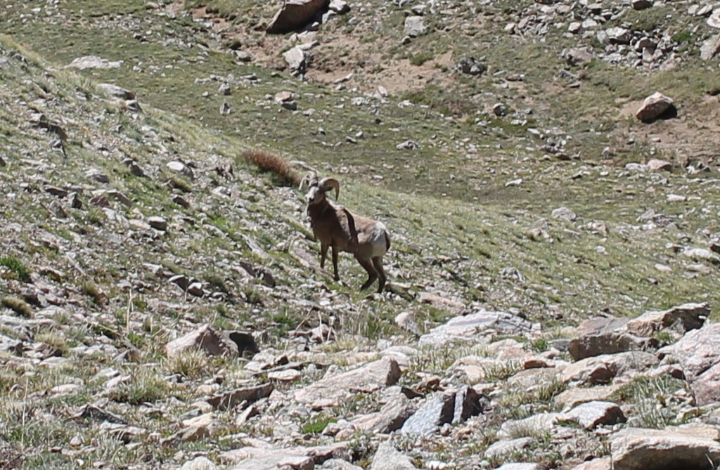
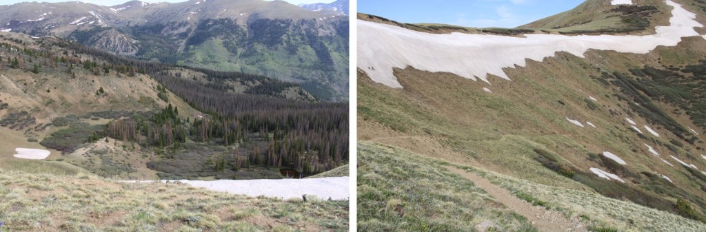
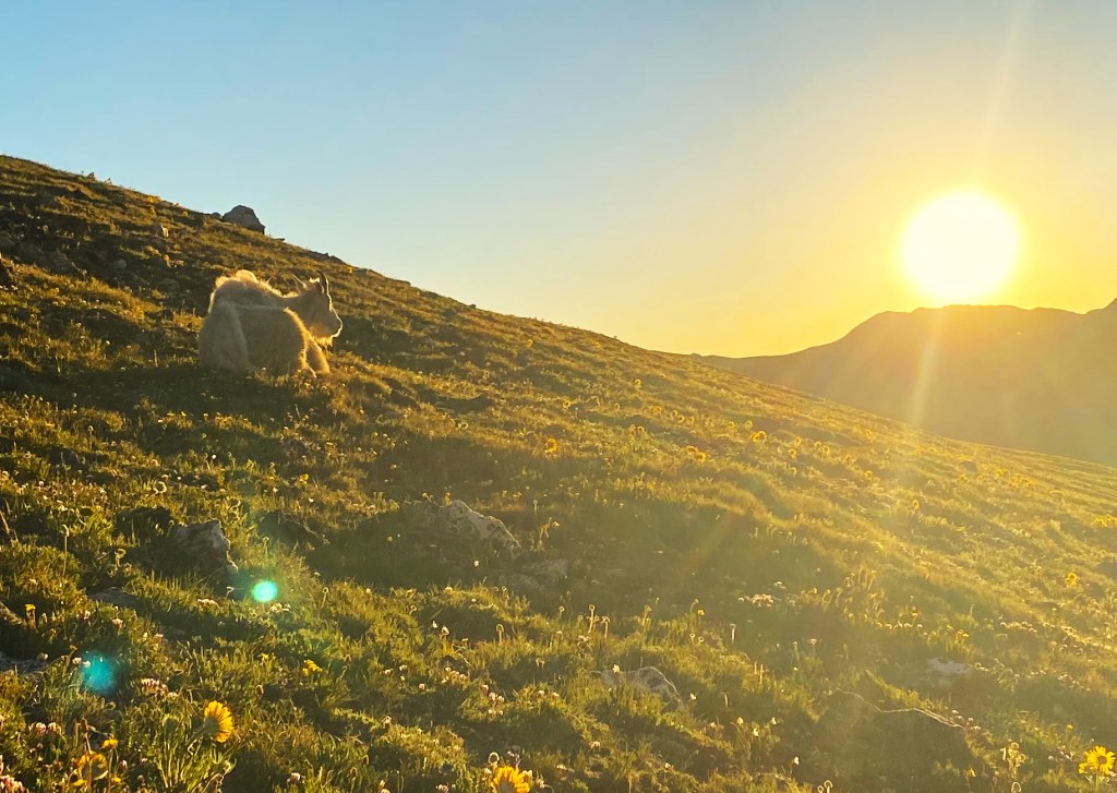
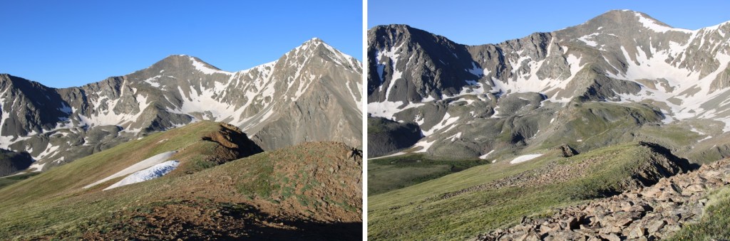
Once on the tundra, before gaining the ridge, I came across some mountain goats lounging, watching the sunrise.  I stood there and watched it with them.

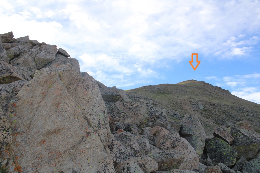
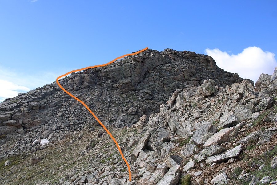
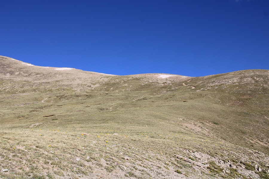
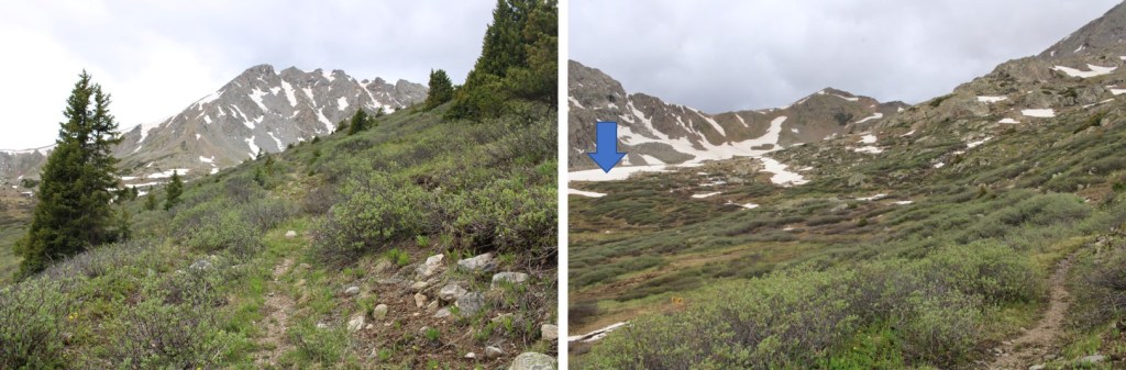
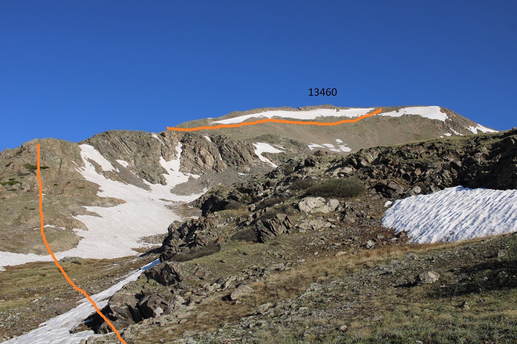
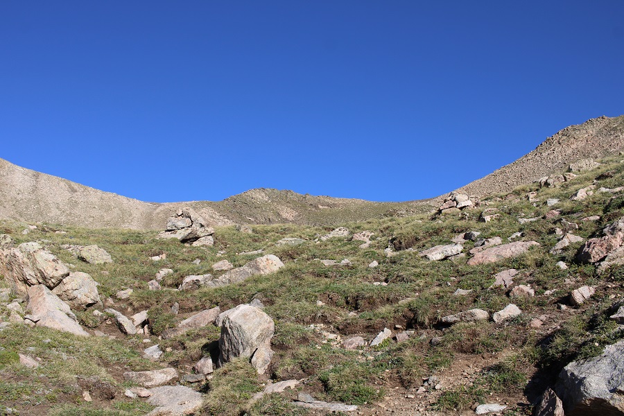
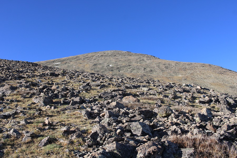
Then I continued on towards the ridge

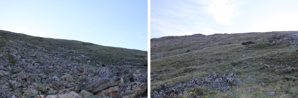
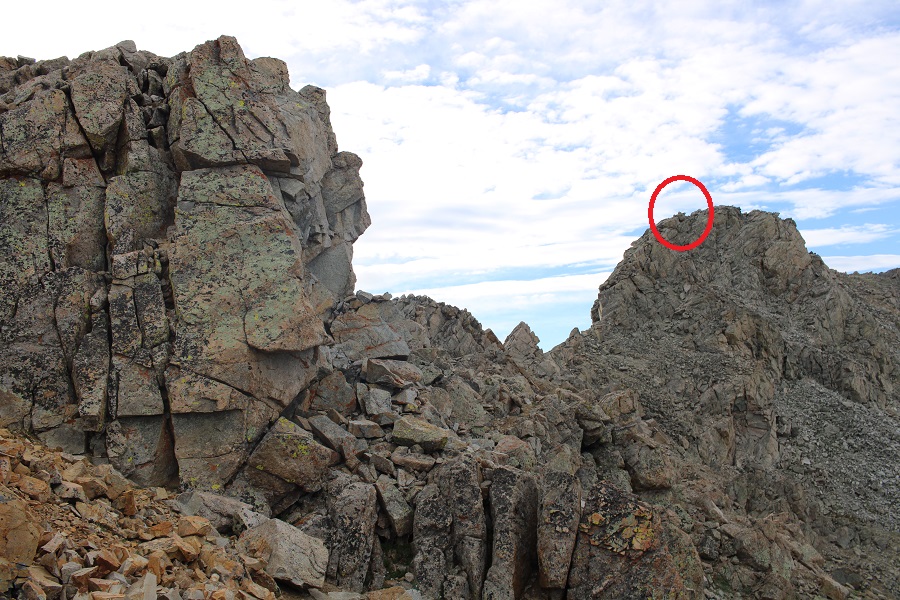
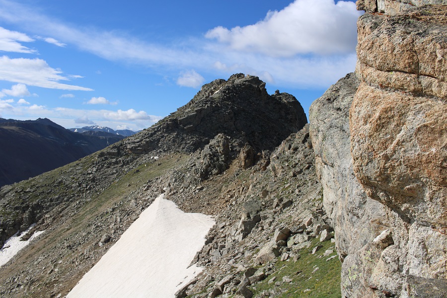
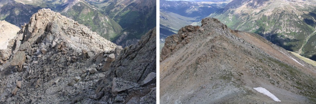
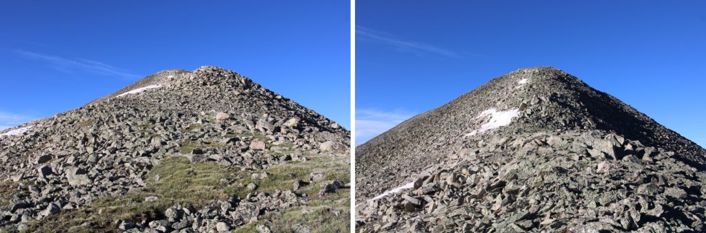
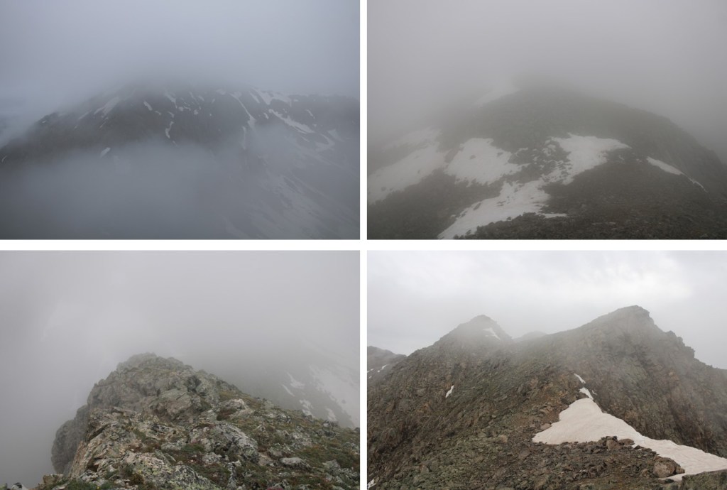
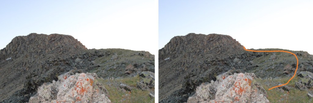
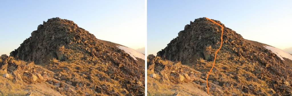
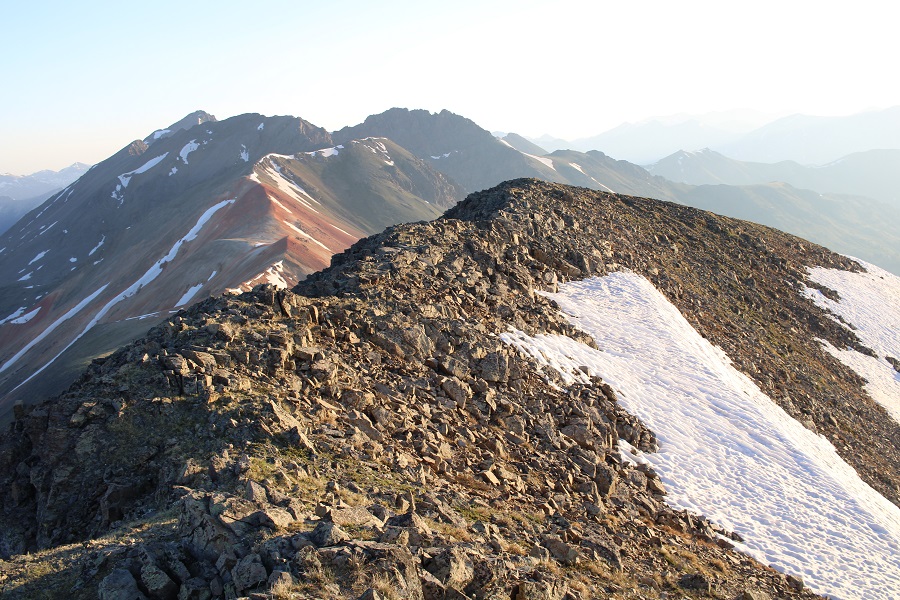
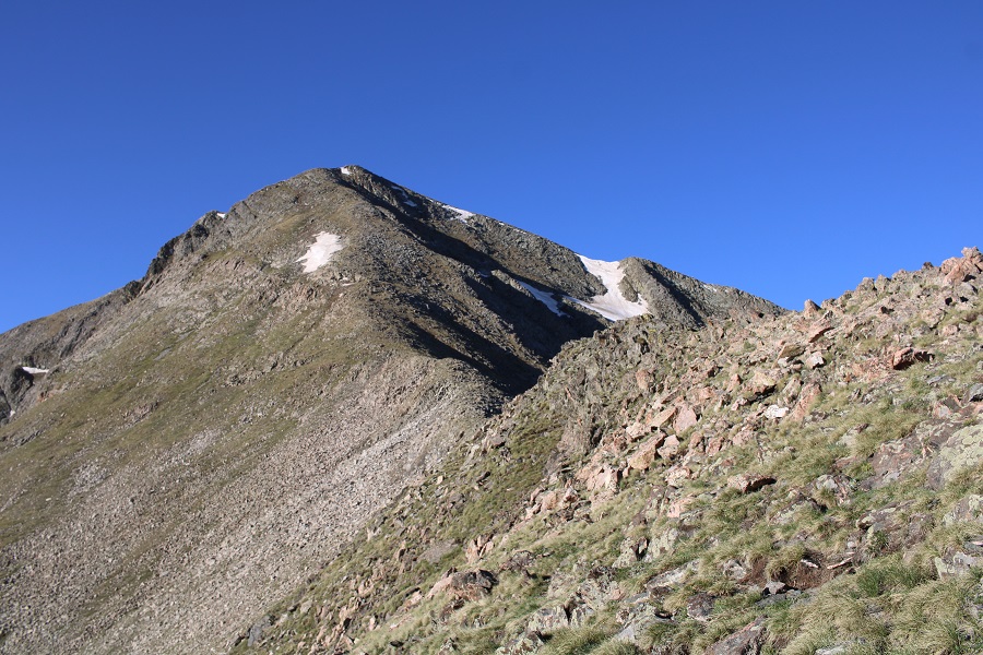
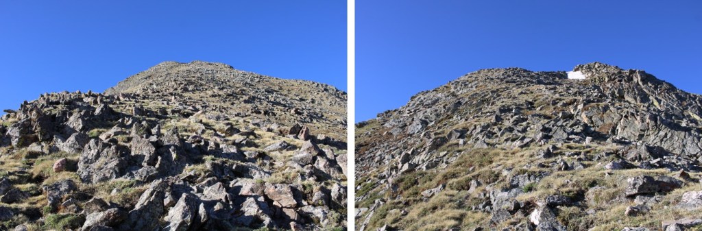
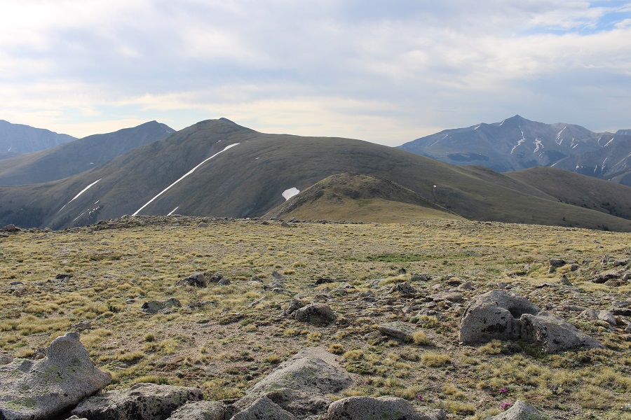
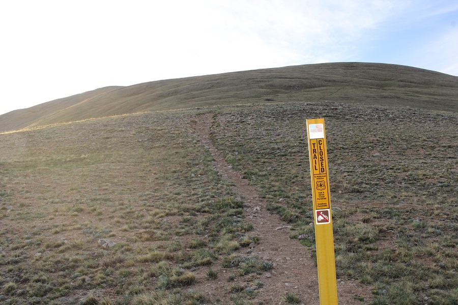
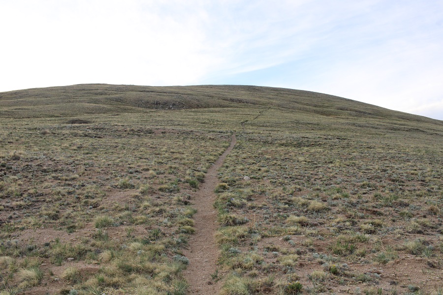
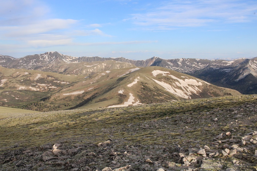
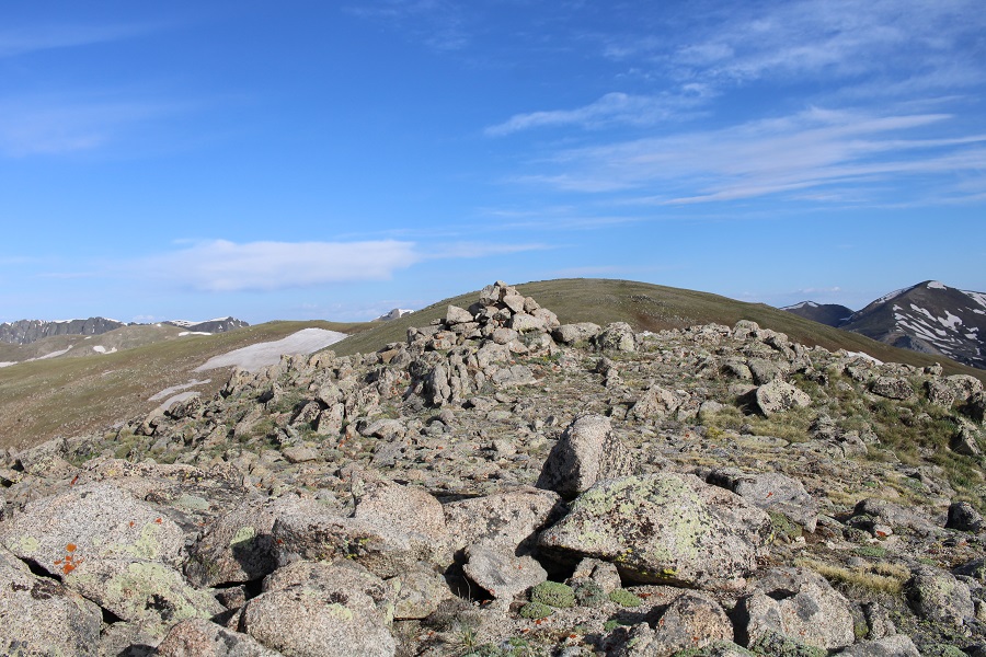
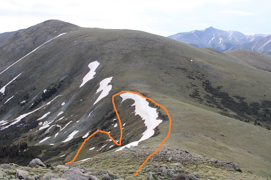
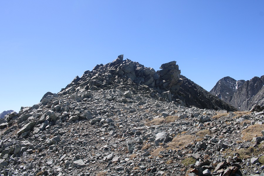
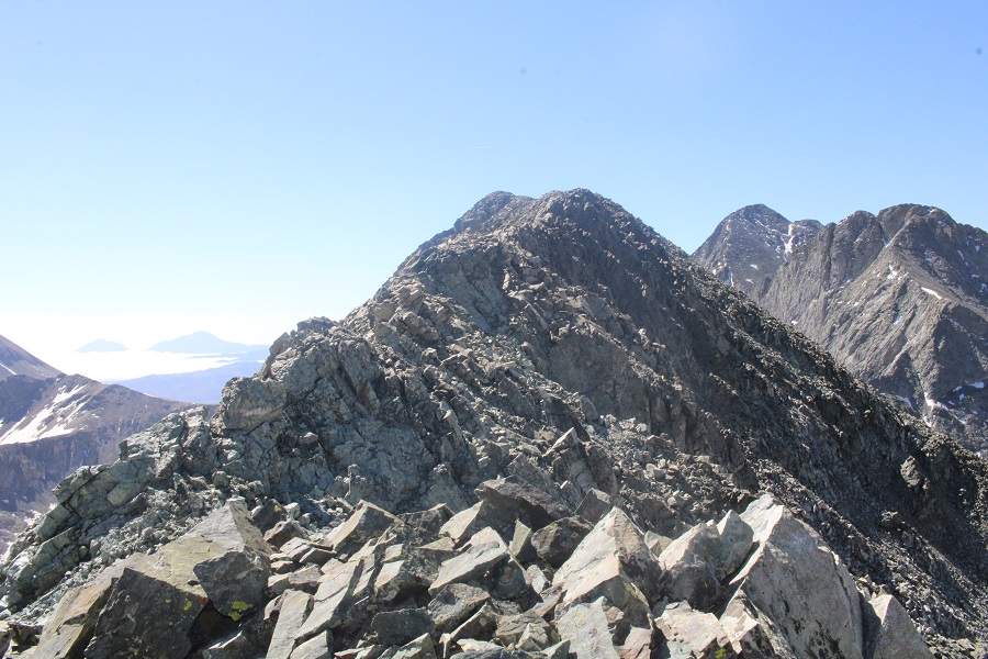
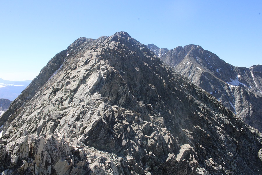
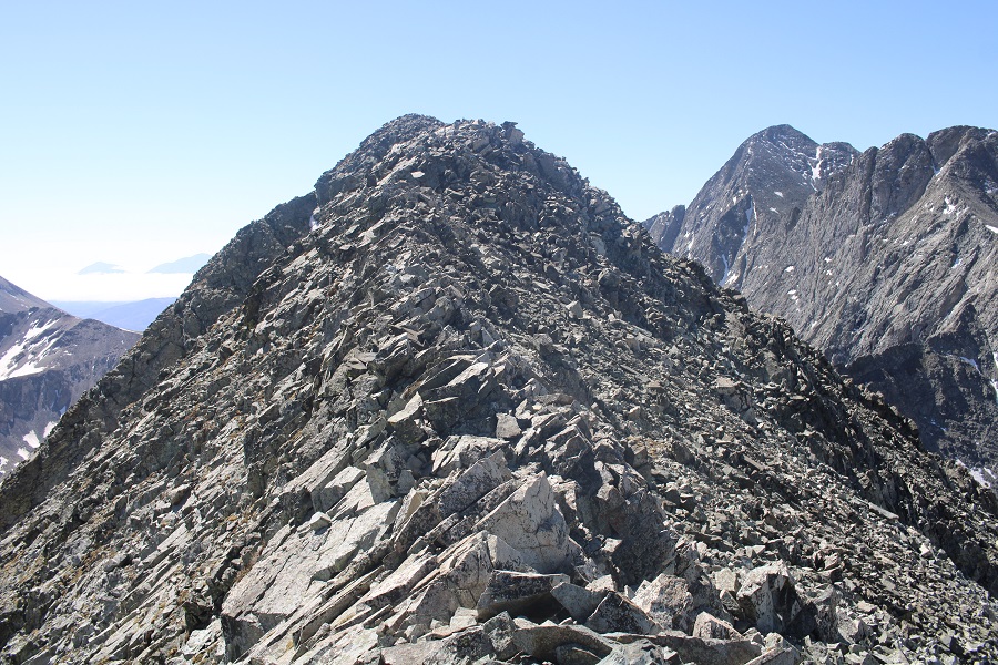
After making it to the ridge, I followed it northeast to the summit.  This was a simple ridge walk on tundra.

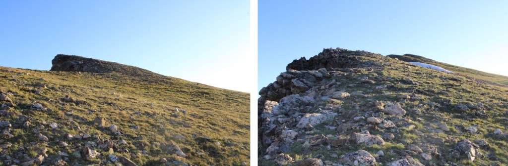
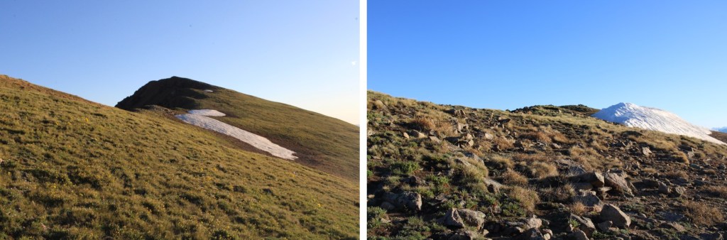
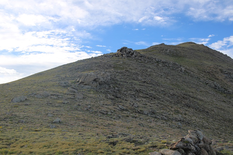
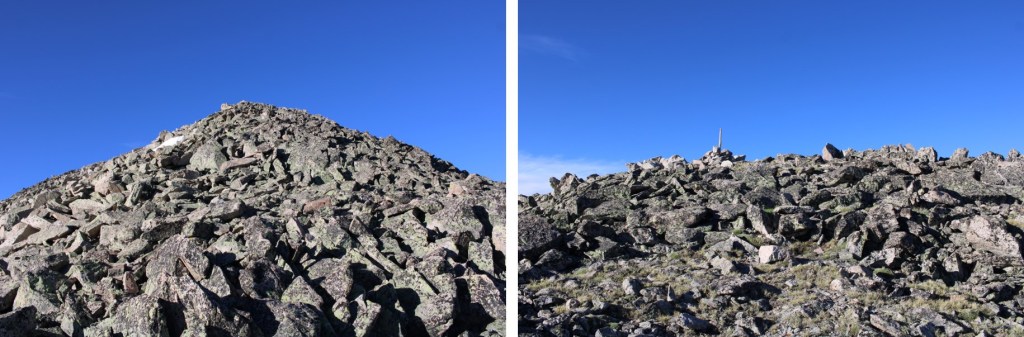
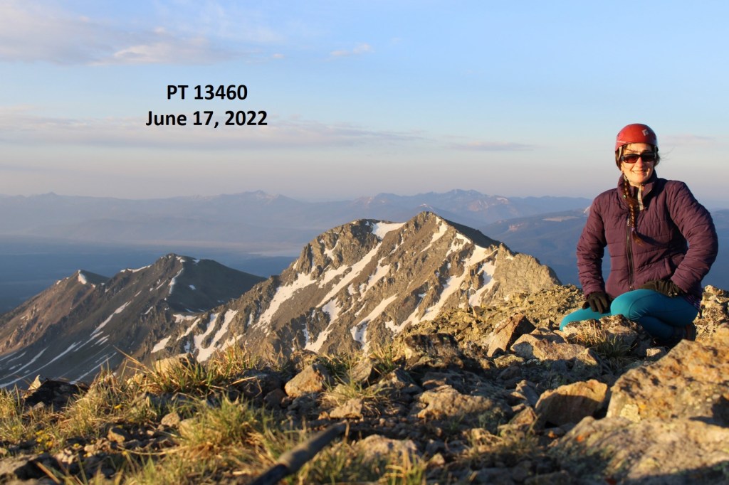
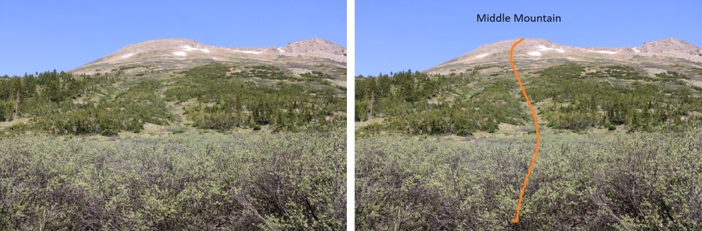
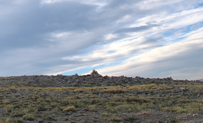
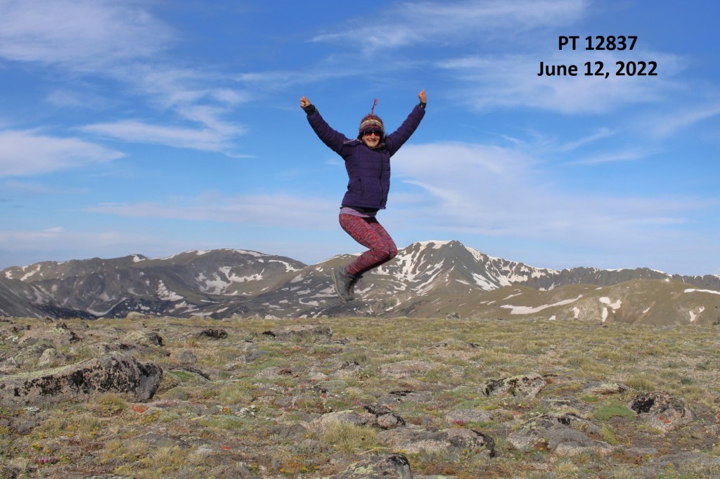
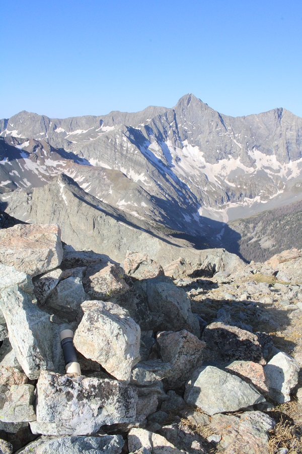
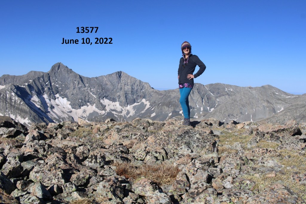
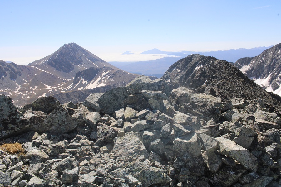
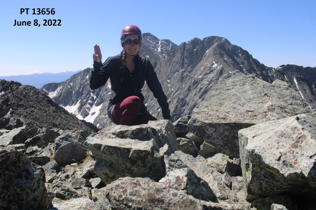
I summited Kelso Mountain at 6:30am
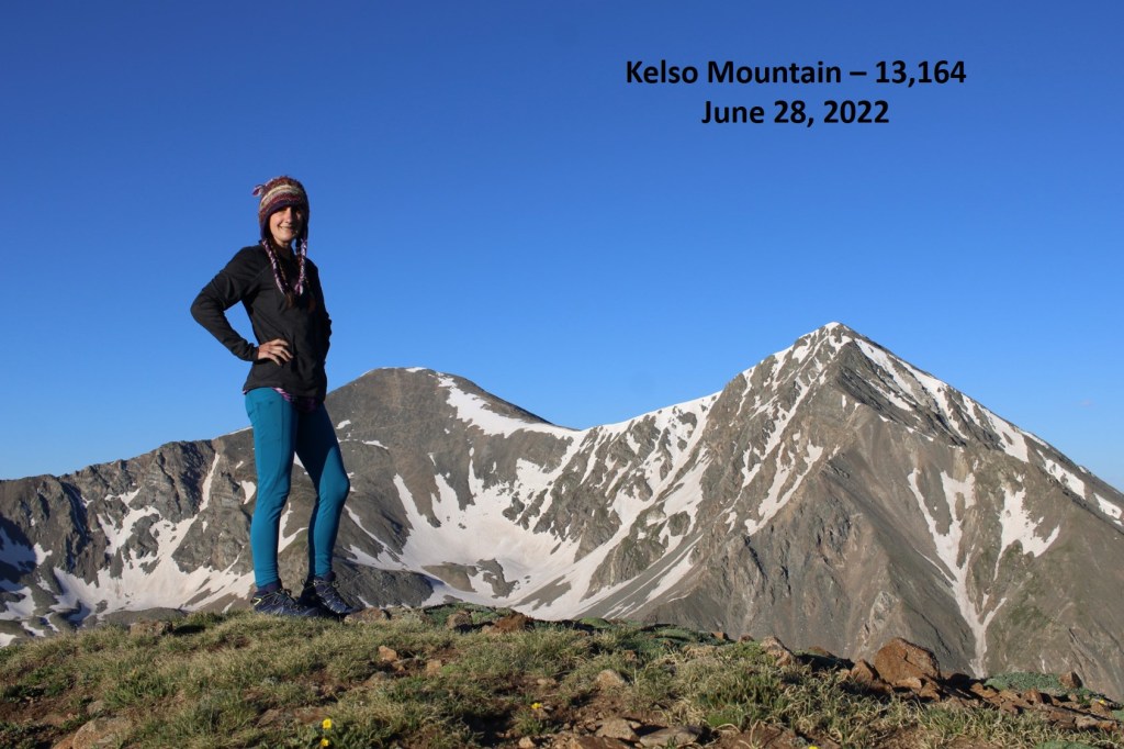
Kelso Mountain:

At the summit cairn there was a journal that was recently placed there.  I know some people get worked up about this type of thing, but it’s there for a good cause, and it will be taken back down.  Needless to say, I text the man battling cancer a good morning, and sent him pictures of the goats. 

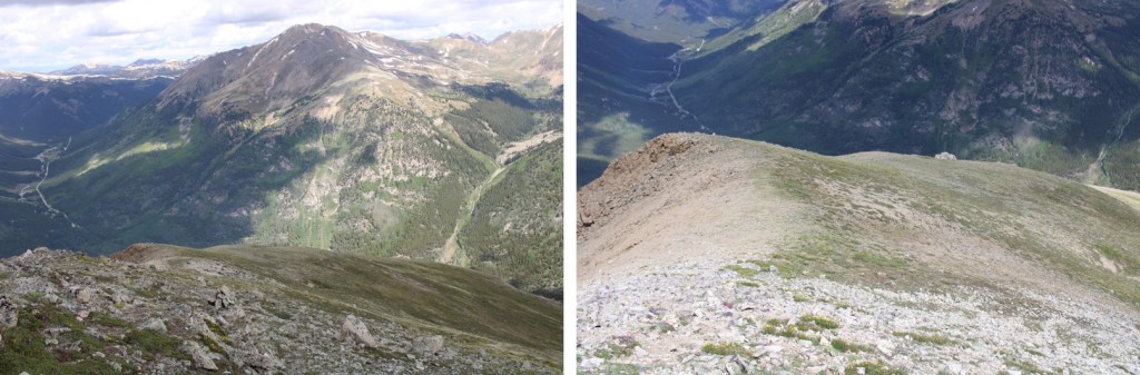
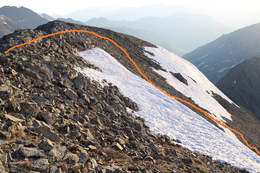
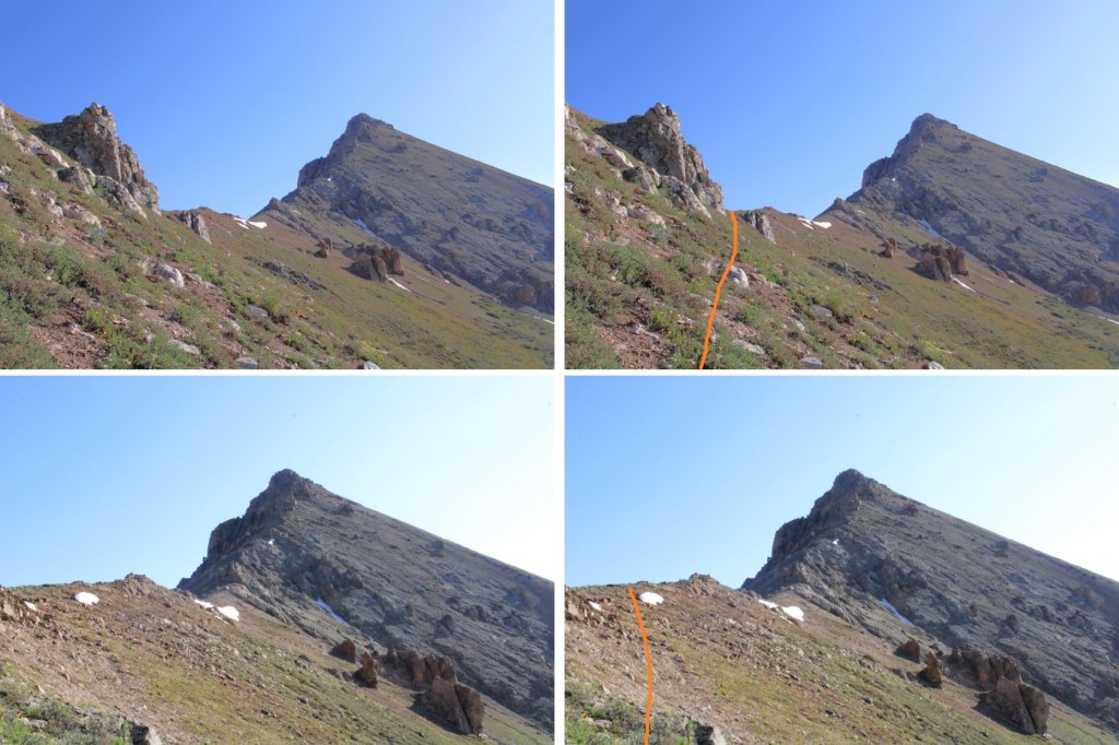
Then I retraced my steps back down the ridge

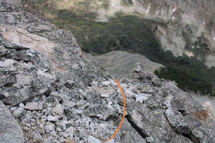
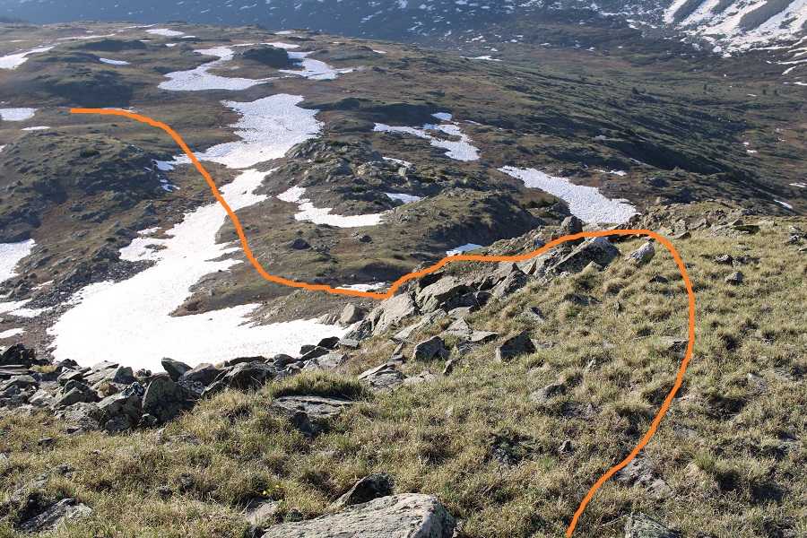
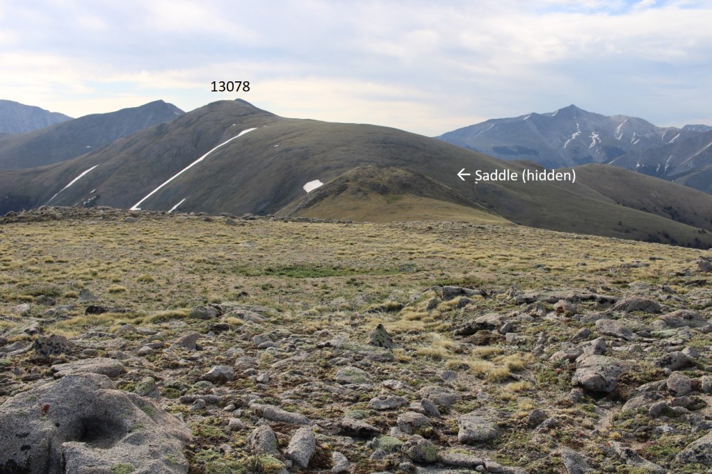
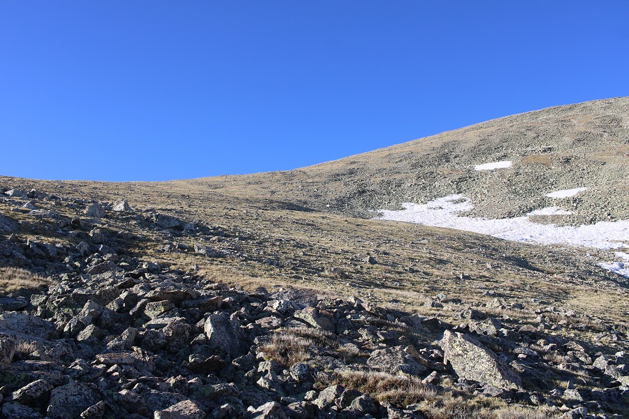
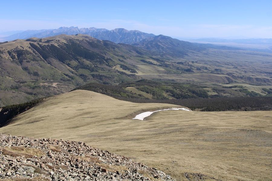
I left the ridge at 11250’ to head back into the basin.  I aimed southwest, towards the obvious Grays and Torreys Trail

The goats were still lounging around, so I stopped for a bit to enjoy their presence.  They seemed unbothered by the flyovers.  I didn’t get too close, but it was neat they were so relaxed.  The views were incredible.

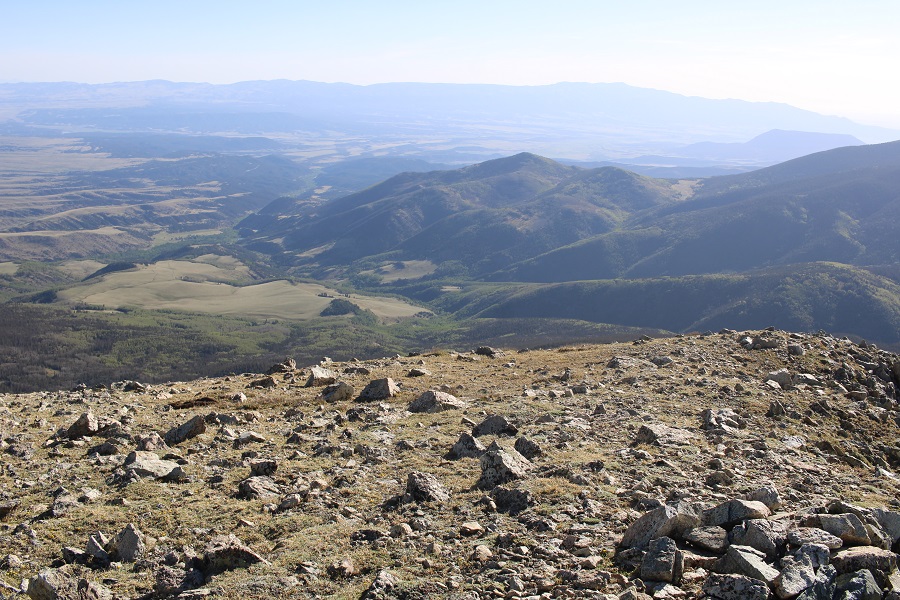
After a few minutes I got up again, and headed down the tundra to the trail below, noticing there were tons of people hiking like ants below.

Once back on the trail I realized it was still early, and considered Grays or Torreys or both, but I had a 10am meeting I needed cell service for, and I wasn’t 100% sure I’d have it on the mountain, so I headed back to the trailhead.

Check out the CFI helicopter picking up ties

I made it back to the trailhead at 7:30am, and the parking lot was already full.  It’s a Tuesday.

I got back to my truck at 7:30am, making this a 6.32 mile hike with 1937’ of elevation gain in 3 hours.  This would be an easy addition to Grays and Torreys.

On to my meeting!

Prize Benchmark – 13,384

RT Length: 10.4 miles

Elevation Gain: 3996’

There is a ton of camping at the Tellurium Trailhead, so that’s where I spent the night. 

I was parked next to a small stream, and had the entire area to myself. Not bad for a Friday and Saturday.

I was up and on the trail at 4:30am, following the 4WD dirt road 584 north for just under 1.5 miles.  There were a lot of dispersed camping sites along the road.  I was glad I’d parked where I did and hiked in.

After hiking for just under 1.5 miles I came to an old dirt road that has been blocked off.  It was on the right, and wouldn’t have been obvious in the dark.  There is no parking there.

This was a road someone had tried to make unusable.  It made hiking interesting, as I could not hike in a straight line.  The road was obvious and easy to follow however.  

When you come to the meadow, if it’s light out, get a good look at Prize Benchmark. This is the route you’re going to want to take.  Notice there’s a ridge?  You’re going to want to parallel that ridge, then dip into a basin before ascending Prize.  This will make more sense later.

There were two creek crossings I did not need to take off my shoes to cross

There were a few side roads that went to old houses and mining operations.  Every time I had an option to turn I kept left (twice).  I followed this road all the way to the Enterprise Mine.  There’s not a lot left…

Here’s where I messed up. I went over the ridge.  Don’t do that.  Instead, try to stay parallel with the ridge, as you’ll want to cross it at a low point because you’ll be descending into a basin.  There is no trail here, but don’t try to ascend the ridge, stay at about 11800’.

When you can see east, it’s time to descend into the basin.  There are a few game trails here. Yes, you’ll be headed back into the trees.

I just kept heading east.

I could see a grassy band I wanted to take to the ridge, and thought the easiest way to get there was over a pile of rocks.  It wasn’t.  The rocks weren’t stable, and more than once I seriously considered heading back.  This is the way I’d recommend ascending

Here are some pictures of the way up the ramp.  I stayed to the left of the trees.

Then I followed the tundra east to the ridge

As I was heading east, and the sun was trying to rise, I notices a small herd of elk to my right.  They were sharing the tundra, and after a while the mamas woke their babies and trotted off. 

I continued hiking east.

As I was trudging up the tundra, I heard what sounded like a bark.  At first I thought it was a coyote, but they don’t bark.  Then I thought maybe a dog, but it was unlikely there was a dog all the way out where I was.  I heard a single bark every two minutes or so.  One time, when I turned around, I saw an elk, and realized the ‘bark’ belonged to her

Elk barking:

I figured she’d gotten separated from her herd, and was calling them. On I trudged.  I reached the ridge, and turned left.

This was all class 2. I navigated the rocks to the left

And then could clearly see the summit

I summited Prize Benchmark at 8:15am.  I could still hear that elk barking, but watched as it went in the direction of the herd.

Prize Benchmark:

I turned and re-traced my steps, thinking to myself how much easier this route had been rather than doing this from the other side with Booby and 13460.  I aimed for the tundra below.

This time I stayed to the right of the trees, aiming for the grassy rib and gully below

As I was hiking down, I saw something that didn’t fit with the terrain.  It was small and brown, and even from a distance, I thought it was an elk calf. IF was curled up, and I was worried it was dead, but seriously hoped it was a misplaced piece of wood.

As I got closer, it was obvious this was an elk calf, and I was sure the elk I’d heard earlier was looking for her baby. 

Then, suddenly, the calf popped up and stood on all fours, looking at me straight in the face.  I was relieved it was alright, then went into mom mode:  I chastised the baby, saying “Your mom’s looking for you! I know you heard her, because I heard her for over half an hour. Go back to your mama!” I pointed to where the mom had gone off to, and the calf ran in that direction. 

Now to continue on back to the basin

Here’s the route I took out of the basin.  While taking this route, I saw something I hadn’t on my way in:  remnants of a mine (circled in red).  I was going to explore when I made it down there.

There wasn’t much to see.  It looked as if the opening was entirely covered by snow… or a large boulder had been placed to cover the entrance.

I took a few pictures and continued on.  Now to regain the ridge. 

Once on the ridge I stayed level at 11800’ and aimed for the Enterprise Mine, which I could clearly see while on the ridge

Once at the mine I followed the destroyed road back to 584

I then followed 584 back to my truck

When I got there, I stopped my tracker, only to find it had gone all wonky, right at about the time I’d seen the calf, so my mileage was taken from my iPhone (which is usually pretty close to my tracker) and the elevation gain from CalTopo.  I made it back to my truck at 11am, making this a 10.4 mile hike with 3996’ of elevation gain in 6.5 hours.

On to the next trailhead!

Ellingwood Ridge – 13,222

Rt Length: 9.9 miles

Elevation Gain: 3622’

I’d been crying all day, so when I made it to the trailhead I was quite the mess.  My eyes were swollen, my nose was red, and I was tired.  My 23-year-old daughter coaches color guard, and last week, one of her team members was murdered.  I’m not going to go into the details of what happened (news article here), but my daughter wanted to be at the viewing and also at the funeral to support her students.  I wanted to be there to support my daughter.  She was determined to make sure she talked with each and every one of her students individually, which meant we were there a long time.  I watched high-schooler after high-schooler break down in front of the (open) casket, crying, some uncontrollably.  There was a slide show of the best moments of her 17 years scrolling, with several pictures including my daughter.  When all of the guard members were there, they held hands and stood in a semi-circle around the casket, grieving together.  This was one of the hardest things I’ve had to witness in my life, and I was just on the sidelines.  I was mad, angry, hurt, confused, and so many other emotions I can’t put into words, for everyone involved.  I cried excessively during the entire funeral, my arm around my daughters’ shoulder, trying to comfort her as well.  I dropped my daughter off at the airport (she’d been in Georgia for the summer, and flew back for the funeral), and drove to the trailhead.   I needed a hike, as I had a lot to process. 

When I got to the La Plata Gulch Trailhead it was raining, but after a few minutes a rainbow came out.  I needed that rainbow.  I also needed sleep.

I went to bed early, and was on the trail at 4:30am.  The trail begins by following the La Plata Gulch Trail

After following the trail for 1.3 miles, and after the second bridge crossing, there was a faint trail I took to the left

I followed this faint trail until I came to a third creek

At the creek the trail stopped, so I turned right and followed the creek.  It’s important not to cross the creek too soon! 

The creek had a lot of deadfall, but there is a faint trail that can be navigated.  I followed it until just after I saw this large rock formation on the left, at about 10630’.

AFTER this rock formation I crossed the creek, and made my way to a small ridge

I followed this ridge to treeline

At treeline, to my left I could see my route to gain the ridge. 

This is the route I took… up an obvious gully.

I started out rock-hopping on unstable rocks, which gave way to a scree and raspberry bush filled gully, which gave way to tundra.

I followed the tundra southwest

This is where the hike gets interesting.  I’ll show you the route I took that worked (I tried a couple of different things that didn’t, so I have a messy GPX file).  First, I put on my helmet for some rock hopping

Then, I went straight up the face of this

And then class 3’d this ridge to the right.  Notice the cairn in the red circle?  I erroneously assumed this was the summit of Ellingwood Point, but it isn’t.  In any event, DO NOT aim for that cairn.

Instead, you’ll encounter some class 3-4 scrambling as you go under the ridge, losing about 50 feet of elevation. 

I descended down what I felt was a class 4 chimney, before turning left and finding a somewhat grassy ramp that turned to rocks and took me back to the ridge

Just before reaching the ridge, I saw another cairn, and what I thought would be the summit of Ellingwood Ride.  This is also not the accepted summit.  DO NOT follow this cairn. 

However, when I made it to this point I could clearly see it was about level with the OTHER point I wasn’t supposed to summit (here’s looking back)

When I turned and looked south, I could see the true summit of Ellingwood Point.

The route wasn’t straightforward.  I made my way down, and over to the ridge.  I then lost 115’ of elevation as I made my way towards Ellingwood Point.  Here’s my overall route

Here are some step-by-step pictures

Make sure you choose the correct gully to descend!  It’s not the first gully you encounter, but the second that ‘goes’

Then I turned right and made my way towards the saddle, staying above the snow

At the saddle it was choose your own adventure up

I think the traditional route is to take the gully up, but it was covered in snow, so I made my way on the rocks until it was safe to use the gully, quite near the top.  This is the route I took

I did encounter a little bit of snow towards the top, but I was able to navigate around it.  Once at the top of the gully, I descended some class 3 terrain, and re-ascended another short gully

There was a small cairn there, letting me know I was at the summit

I summited Ellingwood Ridge at 9am

Ellingwood Ridge:

Here’s looking north at the route I took in.  As you can see, it’s difficult to tell where the ‘true’ summit is.

I was making this an out and back, mainly because there was a storm headed my way, so I turned and retraced my steps.  Here are some visuals of the harder areas to ‘figure out’

Looking down the gully, I stuck to the wall and did just fine

Then I made my way back down the ridge, keeping to the right, and heading back up that second gully, which is more obvious going this way, as it’s the only one that ‘goes’

At the top of the gully I once again lost elevation and navigated the west side of the mountain

Here’s looking up at that class 4 gully

And the ridge back to the tundra

The tundra to the rocky gully

And the gully to the ridge

As soon as I hit the ridge it started raining.  I followed the ridge to the stream crossing, then followed the stream back to the trail

Once on the trail, it was easy to follow it back to the trailhead

I made it back to my truck at 12:30pm, making this a 9.9 mile hike with 3622’ of elevation gain in 8 hours.

While I unpacked quite a bit emotionally, I didn’t come up with any answers on the hike, except that it’s important to listen when people tell us something is wrong, and to love each other, as you never know what the other person is going through.  I can’t combat the evil in this world, but I can appreciate and acknowledge, and even contribute to the good.  I raised a daughter who chose to go out of her way to be there for her students, when it would have been easy to say something like “I’m all the way in Georgia”, “I don’t do well with death”, “I can’t afford the trip” or “I don’t do well with funerals” and not show up.  She showed up and she supported her students as they grieved, and even shared some of her favorite memories of Riley with her parents.  That’s something to be proud of. 

On to the next trailhead!

PT 13332

RT Length:  11.82 miles

Elevation Gain:  3452’

I parked about 3 miles past Cottonwood Lake, in a small parking area where 344 and 348 intersect. 

I was on the trail at 4:30am, following 348 south.  There is a lot of dispersed camping in this area. 

Almost immediately I came to Cottonwood Creek, which I was going to have to cross.  I put on my creek crossing shoes and rolled up my pants to my thighs.  My pants still got wet on the crossing, as the water was high.

Safely on the other side, I put my hiking shoes back on, and continued to follow the 4WD road as it switchbacked up the side of the mountain. There was one more (small) creek crossing, about half a mile away from Cottonwood Creek

I followed 348 all the way to treeline, for 5 miles

Someone had a rough night… blood and what looked like fur from an ungulate.

It was easy to follow the road all the way to the saddle

Just before the saddle I saw a game trail, and took it to the saddle instead, since it looked like a shortcut (it was)

Once on the saddle, I could see another trail that led to the ridge

I followed the trail to the ridge, where it abruptly stopped

I then turned and followed the ridge southwest. The terrain changed from tundra to class 2 rock hopping, but was very straightforward. 

I summited PT 13332 at 7:30am

13332:

The summit register was shattered, and while I found a pen on the ground, the paper was long gone, so I left another register.  From the summit I could see a cabin on the road I took in.  I would have passed it if I’d stuck to the road, but I’d taken the side trail instead.  I planned to head down there and see what it was all about. 

I turned and retraced my steps back to the saddle

And then I aimed for the cabin below.

I was halfway there when I spotted an elk shed a few yards away.  I looked around for more antlers, as I know elk usually shed both within a few hundred yards of each other, but didn’t see any more. 

I continued on towards the cabin

For those of you wondering, this is what it looked like.

I then followed 348 north back to the trailhead

I put on my creek crossing shoes again to cross Cottonwood Creek, and kept them on for the short distance back to my truck.

I made it back to my truck at 9:45am, making this an 11.82 mile hike with 3452’ of elevation gain in 5 hours 15 minutes.  This was probably the easiest 13er I’ve done in years.  I didn’t see another person, or vehicle, all day. 

On to the next trailhead!

Booby Prize – 13,312 and PT 13090

RT Length: 11.08 miles

Elevation Gain: 3174’

Trailhead: Just before South Fork Lake Creek, where 391 and Trail 1466 meet.

I drove in the night before, so I could start early the next morning.  The only problem?  I wasn’t able to drive all the way to the trailhead.  There was a small ice flow that still hadn’t melted, and it’s the middle of June!  It wasn’t very big, but so far no one has been able to cross it. 

It wasn’t a big deal, but I did have to back up for half a mile before I could find a place to turn around, which happened to be at a nice campsite at 11,000’, so I parked there

I was up and on the trail at 3:30am, hoping to avoid some of the cold, wet, rainy weather that was supposed to arrive today.  No such luck: It was raining when I left my truck, so I put on rain pants and a waterproof jacket and started following the road south.

After hiking for .8 miles I made it to the trailhead.  Just before reaching the trailhead the road was covered in old avalanche debris. 

The trail starts to the left of the gate

As I mentioned earlier, it was raining.  I followed a very wet, willow-filled trail all the way into the upper basin.  This trail is class 1, but a bit overgrown since it’s early in the hiking season.  It was also teeming with water, and bear tracks (although I did not see any bear scat).

When I made it to the upper basin, I knew I wanted to gain the ridge.  I also knew, from yesterday’s experience, that I wanted to gain it from the left, and not the right. 

Note:  There is a game trail here that goes to the ridge, but most of it was covered in snow. I was only able to see it in bits and pieces on my way up and down. This is the route I took to the saddle

The basin was mush.  Not only was it raining, it was warm enough for the snow to thaw, so I was walking on 6 inches of water most of the time.  Here’s my route to the ridge

As I was gaining the ridge, the sun was rising.  It was a beautiful, misty morning

I gained the ridge, and headed over to Prize Benchmark, my first intended peak of the day.  As you can see, conditions weren’t ideal:

In fact, that was one of my better photos of the day.  The clouds kept coming in and out, obscuring my route. 

Eventually, I was in class 4-5 territory, and decided to call it and come back another day when I could see what I was doing.  I knew I was headed in the right direction, but the terrain didn’t feel safe.  I wanted to take the gully, and it was still full of unstable ice. 

I downclimbed, and headed back to PT 13090.  Even though it’s not ranked, I summited it, just because I was there

This was an easy ‘summit’

PT 13090:

I turned right, and headed southeast towards Booby Prize

Here’s the overall route I took, avoiding the rock slabs and snow.  This was all class 2, with some loose scree/rocks to navigate

The clouds picked up again, obscuring my view, but luckily, this was all class 2

Here are some step by step pictures

I summited Booby Prize at 8:10am

Booby Prize:

Nasty weather was predicted for the day, so I decided to re-trace my steps and head back to the PT 13090/Booby Prize saddle

Back on the saddle, I could see the game trail that led down, but it also went right through a large patch of ice, so I went a little further up the saddle to find a snow-free route.

Here’s my route back to the trail

The route down was obvious

And the trail was easy to follow, if wet, back to my truck

I made it back to my truck at 10:30am, making this a 11.08 mile hike with 3174’ of elevation gain in 7 hours.

On to the next trailhead!

13457 and Middle Mountain – 13,108

RT Length: 9.37 miles

Elevation Gain: 3246’

Trailhead: Just before South Fork Lake Creek, where 391 and Trail 1466 meet.

I drove in the night before, so I could start early the next morning.  The only problem?  I wasn’t able to drive all the way to the trailhead.  There was a small ice flow that still hadn’t melted, and it’s the middle of June!  It wasn’t very big, but so far no one has been able to cross it. 

It wasn’t a big deal, but I did have to back up for half a mile before I could find a place to turn around, which happened to be at a nice campsite at 11,000’, so I parked there for the night.

I woke up at 1am, 1:30am, and 2am to something moving around underneath my truck.  It sounded about the size of a squirrel, and made sleeping difficult, so eventually I got up and sat in the front seat of my truck, ate breakfast (vanilla Breakfast Essentials shaken with a sleeve of Folgers instant coffee crystals), and was on my way at 3:30am.   I could smell the Arizona and New Mexico fires as I hiked.  I followed ROAD 391 for .8 miles to the proper trailhead. 

The entrance to the trail is to the left of the gate

I followed the trail until it ended in the upper basin.  This is a class 1 trail, but it goes through willows and since it’s currently spring conditions, there was an excess of water running in the middle of the trail. With no way to avoid it, my feet became wet and muddy early on in the hike.

When I made it to the upper basin, my intent has been to take the trail to the saddle, and summit Prize Benchmark first.  The intended route is the solid route, the route I took is the dotted line.  Note:  the solid route wouldn’t work, because it was too chossy on the other side to utilize.

I put on my microspikes and started crossing the ice.  I got about halfway across and felt out of my comfort zone:  The ice was too slippery, and I didn’t have an ice axe.  Instead, I turned and headed northeast towards a different part of the saddle

Now at the saddle, I turned and looked over at Prize Benchmark, but the route the rest of the way across the saddle looked sketchy.  It was loose, with spires and talus. 

I got out my map, considered my options (did I want to backtrack?) and decided to change my plans for the weekend and head over towards PT 13460.  I headed east along the ridge.

This was all easy class 3 or below, with a few scree gullies and rocks.  The route was obvious, but there were a few false summits

The summit was obvious, with a summit register clearly visible

I summited PT 13460 at 6:10am

PT 13460:

From the summit I could see my next intended summit, Middle Mountain, to the southeast.  Sorry for the bad picture… the smoke from the fires created a haze that was hard to photograph through.

I didn’t have a good view on my way in of the snow conditions, so I walked southeast for a bit along the ridgeline to gauge the best descent route. 

The conditions looked sketchy:  All I could see from above were drop offs and snow, so I got creative and headed down into the basin, avoiding cliffs and snow.  I found out I had cell service, and ssat for 30 minutes on the mountain, checking weather forecasts.  Here’s my route:

I came to some tundra gullies, and was able to navigate down them without a problem.

Here’s my route into the basin

And through the basin to Middle Mountain.  You can see the ridge to the left I was trying to avoid

Here’s a look back on the route down into the basin

The upper basin was still melting out, and very… squishy. Once again, my socks and shoes got wet. I slogged my way southeast towards the saddle

Here are the last few bits before the saddle.  I was trying to avoid a large boulder and the willows

Middle Mountain was also easy class 3, with several false summits.

I went right here

Left here

And then right again

Now it was some easy scrambling over false summits to the true summit.  I always stayed right (south)

I summited Middle Mountain at 8:25am

Middle Mountain:

Here’s looking back at 13460

Now to head back to the trail.  This was easy, and choose your own adventure.  I just looked and headed south, doing my best to avoid the willows (etc.).

From the lower basin, here’s looking at the route I took down from Middle Mountain

Now back on the trail, I followed it back to my truck

I made it back to my truck at 10:15am, making this a 9.37 mile hike with 3246’ of elevation gain in 6 hours, 45 min.

On to the next trailhead!

Mt Herard – 13,350 and Medano Peak 13,153

RT Length:  17.43 miles

Elevation Gain:  5584’

I drove in the night before to heavy clouds of smoke from the Arizona and New Mexico fires, but the weatherman predicted a cold front would push the smoke away by the next morning.

The drive in was on an easy 4WD dirt road, and probably doable in a 2WD vehicle to where I parked in the camping area before the pass. 

There were private ranches on either side of the road, with bison and what looked like hunting property.  There were tons of signs telling you the property was private, with information on how to report poachers.   I knew Medano Pass was closed from the Sand Dunes side, but was surprised to find it was closed from the HWY 69 side as well.  I parked in the camping area at 9200’, just over 2 miles from the pass. Mine was the only vehicle there, which made sense because the pass was closed.  Also, it was a Monday.  And extremely windy. There was quite a bit of glass on the ground from past campers who’d broken bottles and left them. 

There were signs indicating bear activity in the area, which I confirmed the next morning.  If you camp here, please secure your smellables/food/etc.

I made it to my campsite late (but it was worth it because my youngest daughter, who’s in college, called to chat with me a bit on my way in, and I had to stop where I had cell reception), so I made it an early night for what would be an early morning. I was up and on the trail at 3:30am.

I started by following 559 west to Medano Pass.  There were a few campsites along this road, but very few turnaround points.  This is now a 4WD road.

Once at Medano Pass I found the gate closed to vehicles.  I hopped over the gate, and continued towards the Medano Lakes Trailhead. 

Along the way there was a sign warning of bear activity

After hiking for 2.9 miles, I made it to the Medano Lakes Trailhead.  Note if you’re driving, there are still several downed trees on the road, so you won’t be able to make it all the way to the trailhead.  There are several campsites along the way with bear boxes.

I signed the trail register and was on my way

A couple of things to note:  This is a class 1 trail, and mine were the first footprints in the mud/snow.  There was a lot of evidence of bear activity, I crossed numerous streams (easily, no need for creek crossing shoes) and there was a lot of downfall.  I mean, an excessive amount. Several times I was walking UNDER avalanche debris.  These were also spring conditions, so a lot of times, the trail was under water/snow.

After hiking for 6.75 miles, I made it to treeline, the upper basin, and Medano Lakes

At 11540’, I left the trail and followed a faintly cairned route to the saddle of Herard and Medino.  This is where I was aiming

There’s a faint trail that’ll get you to the upper basin

Just before the upper basin there are two cairns you’ll pass through.  Take note of them for the route down

Now in the upper basin, the trail is gone for a bit, but there are cairns that will lead you to the saddle, and even a trail. This is the easiest way to make it to the saddle

The cairn you’re aiming for is circled in red

I decided to do Herard first, so after making it to the saddle, I followed the ridge south.  There was a false summit, but this (and in fact the entire hike) was all class 2.

Here are some pictures of the terrain

And the false summit. 

There was a bit of snow to navigate (nothing too serious) and then I followed the tundra (and a faint trail) to the summit.

The summit was flat.  I summited Mt Herard at 8am

Mt Herard:

I turned and headed back to the saddle.  My next objective was Medano Peak

This was also a class 2 ridge walk.  Here are some step by step pictures

Also, you might be able to see them in this picture… I came across 5 elk, who weren’t too concerned I was there, until I started hiking up from the saddle.  At this point, they headed higher up, towards 13,000’.  I was curious, until I noticed they were gathering their 5 babies, who were hidden amongst the rocks.  They couldn’t have been more than a month old.  Then the mothers trotted them off along the ridge.

I summited Medano Peak at 9:05am

Medano Peak:

Here’s a look at Mt Herard from Medano

I retraced my steps back down to the saddle, and into the lower basin and Medano lakes

It was a super windy day (predicted winds of 45mph). As I was hiking I was able to notice a bighorn sheep ram below me.  Since it was so windy, he didn’t notice me until I was right up on him. 

Bighorn: 

He trotted away as well, and I hooked up with the Medano Lakes trail, which took me back to the trailhead

And then I followed road 559 back to my truck

I made it back to my truck at 12:30pm, making this a 17.43 mile hike with 5584’ of elevation gain in 9 hours.

On to the next trailhead!

13078 and 12837

RT Length:  9.62 miles

Elevation Gain:  3588’

My beta was wrong.  It was my fault, and I knew it on my drive in.  When there are avalanche conditions in the high country, I spend my time putting together potential routes and topo maps.  Then I print them out and put them in a binder I keep in my truck, so I’m always ready for a hike. 

However, my spreadsheet had different information than I was seeing at the time.  Specifically, a “No Trespassing” sign on what was supposed to be public lands.  This could completely have been my fault, as wine might have been involved while I was putting together topo maps.  Actually, it most assuredly was.   This changed my plans a bit, but I could still get in a hike. 

I parked at the Green Timber Gulch Trailhead after driving through thousands of tourists fishing at Cottonwood Lake, and the slowest driver I’ve ever encountered on a 4WD road.  He had a 4WD vehicle, but didn’t go over 5mph on this easy 4WD road (dirt 2WD?) and refused to pull over.  There were 10 vehicles behind him.  Not cool. 

Anyway, as I was sitting in the parking area putting together a trip report from that morning, a family pulled up beside me, then got into their Razor and took off.  They came back covered in more dirt and dust than I’ve ever seen, and were laughing hysterically.  I was glad they were having fun. Instead of hopping into the creek they took a wet-wipe bath, which caused more harm than good.  They looked like they were covered in volcanic ash.  In any event, eventually they left and I had the site to myself for the night.  Note:  No camping here, but I was sleeping in my vehicle, so I was just parked.

The trail is obvious, and starts with a bridge crossing.

I followed the Green Timber Gulch Trail all the way to treeline and to the 12,837/13,078 saddle, for 3 miles.  This is a class 1 trail, with a few minor creek crossings.  It’s currently spring conditions, so there was a lot of water on the trail.  There was a lot of moose scat on the trail (I mean, a lot), but no tracks, so I’m assuming the moose has moved on.  This is also a motorized bike trail, so watch out for bikes.

Once at treeline I turned left and headed east towards 13078. This was a straightforward tundra walk, and there was even a faint trail most of the way.  Oh, and the sign says trail closed to motorcycles… hiking is ok.

I summited 13078 at 6:45am

13078:

I left a register, and turned and headed back to the saddle. 

My next goal was PT 12837.  From this height, you can clearly see the three false summits, which actually have more drop and gain than it looks like from here.  This is the route I took

Here are some step by step pictures.  First, to the saddle

Then I looked for a break in the willows, and cut over to the ridge, avoiding the rocks to the left, and snow to the right

Here’s the first false summit

There was a large cairn at the top, but was obviously not the true summit.  Here you can see the cairn, as well as the second false summit

Here’s the route I took to the summit (all very straightforward)

I summited 12837 at 7:50am The ground was relatively flat, so I jumped for the picture

12837:

Here’s looking back at the route from 13078, as well as my route back to the saddle

I headed back to the 13078/12837 saddle

And then picked up and followed the Green Timber Gulch Trail back to the trailhead.

I made it back to my truck at 9:30am, making this a 9.62 mile hike with 3588’ of elevation gain in 5 hours.

On to the next trailhead!

13557

RT Length: 8.88 miles

Elevation Gain: 3538’

I was I this area two days ago, but had a commitment back in Colorado Springs, so I went back home for a day.  The event ended at 8pm, and I drove back up to the Lily Lake trailhead that evening.  It was a Thursday night, but I was surprised to see a lot of the dispersed campsites already taken.  I ended up taking the last space, at 10350’, just before the downed trees started along the road.  I’d wanted to camp lower, but this would be a good place to set off for my next hike in a few days.  I was on the trail at 5am.

I followed the 4WD dirt road north for XXXX miles, to the Raspberry Trail (1307).  This had been where I’d wanted to stop for the night, but there were vehicles already camped there.

I followed the Raspberry Trail to a register, signed my name, and navigated around the downed tree blocking the path

I followed the trail down to the Huerfano River, and crossed it on downed logs

From here, I followed the class 1 trail as it switchbacked up the hillside.  There were several large downed trees obscuring the trail, but the trail was always easy to find.

The trail leveled off, and I came across some fire rings.  Here I left the trail and headed south until I hit treeline.  There was no path, and there were a lot of downed trees, but navigation wasn’t very difficult.

Once at treeline, the ground changed to tundra.  I continued following the tundra south.

Quickly, 13577 came into view

Here’s my route to the summit

This was a simple, but long, tundra walk, with some rocks thrown in. The ridge was 1.5 miles from treeline to summit.  Here are a few pictures of the route

I summited 13577 ay 7:45am

13577:

Check out the views of Lindsey

I turned and retraced my steps back to the trail

Here’s the overall route I took back to the trail

One in the trees it was difficult to navigate because I didn’t have any visuals.  I continued heading north until I crossed the Raspberry Trail.  There will be a lot of deadfall in this area.

Once back on Raspberry Trail, I followed it back to the 4WD road

I then followed the road back to my truck

This gave me a great view of PT 13577 from below

I made it back to my truck at 10am, making this an 8.88 mile hike with 3538’ of elevation gain in 5 hours.  I’ll be staying at this trailhead…

PT 13656

RT Length: 16 miles

Elevation Gain: 4031’

Please note, my stats are off.  This summit took some route finding, and additional miles/elevation gain.  Your numbers should be lower.

I’ve been going crazy for about a month. It was May 21, while we were getting 2 feet of snow during a spring storm, when I went online to check some summits for an upcoming trip.  It was then I noticed I no longer had 200 bicentennials, but 199.  I panicked!  And of course, did some research. It was then I noticed we now had a new bicentennial, PT 13656.  I’d summited what I’d thought were all the Bicentennials last September, and spent the next 7 months writing a book about my journey, which was published May 8th.  I knew my completion date still stood because I’d completed the Bicentennials as listed at the time, but it didn’t feel right marketing my book so soon after the change without completing this peak as well.  So I didn’t.  Instead, I planned. 

I couldn’t find much information about this peak, so I pulled up my previous trip reports from other peaks in the area, and came up with 3 possibilities of summit options from the Upper Huerfano/Lily Lake trailhead, and upper Lily Lake:

1: Take a line in south to the ridge, which looked like it ‘went’ (It didn’t)

2: Take the gully

3: Summit 13577 and take the ridge to 13656 (I’m glad I didn’t end up needing to do this, as the ridge looked rotten).

I was in Minnesota, hiking its highest point, Eagle Mountain.  (Side note: If you’ve ever wanted to experience mosquito swarms of biblical plague proportions, along with questionable foot bridges through swamps teeming with water snakes, this hike is for you!)  I was only there because of Charles Mound, the highest point in Illinois.  For those of you who know about state high pointing, you know the highest point of Illinois is located on private property, and only open a few days a year.  Long story short, I decided to hit this high point instead of PT 13656 because of accessibility issues, but, when I was in Minnesota I checked the weather and did the math, and realized if I drove with a purpose, I’d be able to make it to the Upper Huerfano/Lily Lake trailhead the next day, and could attempt a summit.

I made it to the trailhead at 4:15am, parking a little lower than necessary because I’d heard there were blowdowns across the road.  There were, so this was a great idea.  I parked at about 10,200’.

I was on the trail at 4:30am, and followed the 4WD road to the Lily Lake Trailhead.  Crews have done a great job clearing downed trees, but there were very few places to pass other vehicles, and honestly, there are still a lot of trees to be cleared.

It was about 2.3 miles from where I parked to the trailhead.  The parking area as littered with branches, but once the downed trees along the way are cleared, it should be good to go.  I signed the trail register, which is in need of more paper, and was on my way.

Did I mention the blowdowns?  There were quite a few alone the trail as well.  They weren’t difficult to navigate around, just a bit annoying.  You can see a few here at the beginning

And here are a few more…

I followed the class 1 (minus the downed trees) trail to the Lily Lake cutoff, and turned right (the path to the left, that goes towards Lindsey, was blocked by a downed tree).  This junction was 1.25 miles from the upper trailhead.

I then followed the trail to another junction, .2 miles away, which is where I made my first mistake of the day.  The sign showed the Lily Lake trail as going straight, so that’s what I did, I continued hiking straight. But I should have turned off the trail and headed north at this point.  You’d think, because I’ve been on this trail, I would have remembered this, but… I didn’t.  I ended up hiking along a path that paralleled the Huerfano river for way too long before noticing my mistake.  Here’s some advice:  If you see yellow surveyors tape and are heading through avalanche debris but you’re on a trail… you’re on the wrong trail. The good news is they parallel each other, so if you head west, you’ll eventually connect with the correct trail. Here’s the junction and the way you should go:

This trail is easy to follow, and will lead you to Lily Lake

Here’s the final push.  There is a trail here, it’s just overgrown.

After 4.1 miles of hiking from the upper trailhead I was at Lily Lake, where the trail ended.

Here’s the info you need.  This is the route you want to take.  Trust me. 

Here are some pictures on the way to the upper lake.  The rocks aren’t stable, and a lot of them roll, so make sure you watch your step while rock hopping.

Here’s where I made another mistake.  I tried to take a route to the left first, by following a dry couloir and what looked like a line filled with tundra/dirt. This was a bad idea.  It started out as class 3, then sustained class 4 (for about 300’).  I quickly felt out of my depth as it increased to class 5.  I had a helmet, but seriously felt I needed a rope.  I got to a place where it was decision time, and decided to descend those 300’ and try a different route. I knew I was close to the ridge, but could not justify the exposure and class difficulty.  I reminded myself I had 3 potential routes for this peak, and an event I was speaking at tomorrow talking about managing risk and being a positive mentor to Girl Scouts.  I did not feel I could continue on and still remain truthful tomorrow, so I backtracked.  Climbing down was much more difficult than climbing up: I had to face the mountain and take it one step at a time.  This entire side was sketchy.  Please don’t use this route, especially since the gully can be kept at 2+.   Here are some pictures of the route you SHOULD NOT TAKE

Instead, here’s what you want to do:

Take the gully!  It’s slippery due to the scree, but with microspikes, manageable

I aimed for the 13654/13656 saddle.  Once again, slippery scree, but manageable

Here’s a view of that line I was trying to take earlier in the day.  The red circle is where I retreated.  Once again, don’t take this line!!!

I kept working my way towards the saddle

Here’s a view of PT 13656

Once at the saddle I turned and followed the ridge southeast.  This was all class 3 scrambling.  I was able to stick to the ridge the entire time.  Here are some pictures of the ridge

I summited PT 13656 at 10:15am. 

I spent a lot of time on that summit, making sure the true summit wasn’t further to the southeast.  I pulled up Peakbagger (not yet updated), CalTopo, my Compass (which read 13660) and several other sites. In the end, I determined this was the true peak, and left a summit register.

PT 13656:

The route back was now very straightforward.  I worked my back down the ridge towards the saddle

Oh, and the route up to 13654 looks sketchy…

And then scree surfed back to Lily Lake. Once again, this is very loose scree, and I wore microspikes.  I consistently had 6 inches of scree sliding beneath me, and as long as I kept up with it, I kept a good pace.

Here’s my route back to the lake

This is where I picked back up with the trail

Following the route back was easy, except for all those blowdowns. 

I made it back to my truck at 2:30pm, making this a 16 mile hike with 4031’ of elevation gain and a ton of route finding in 10 hours.  I hope this trip report was helpful, and I’m sure you can do this route faster!  It felt so good to check this one off the list!!! 

On to the next trailhead!