V3 – 13,545

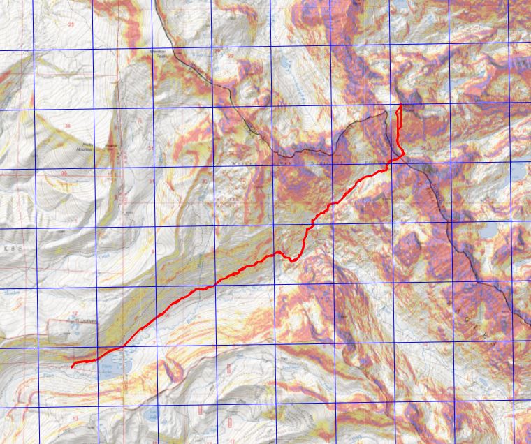
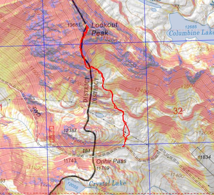
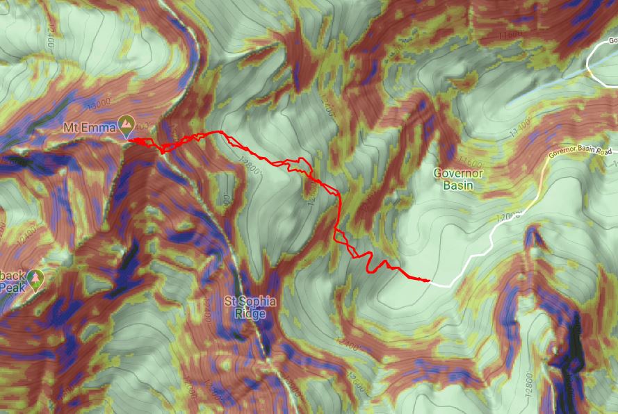
RT Length:  8.29 miles

Elevation Gain: 3542’

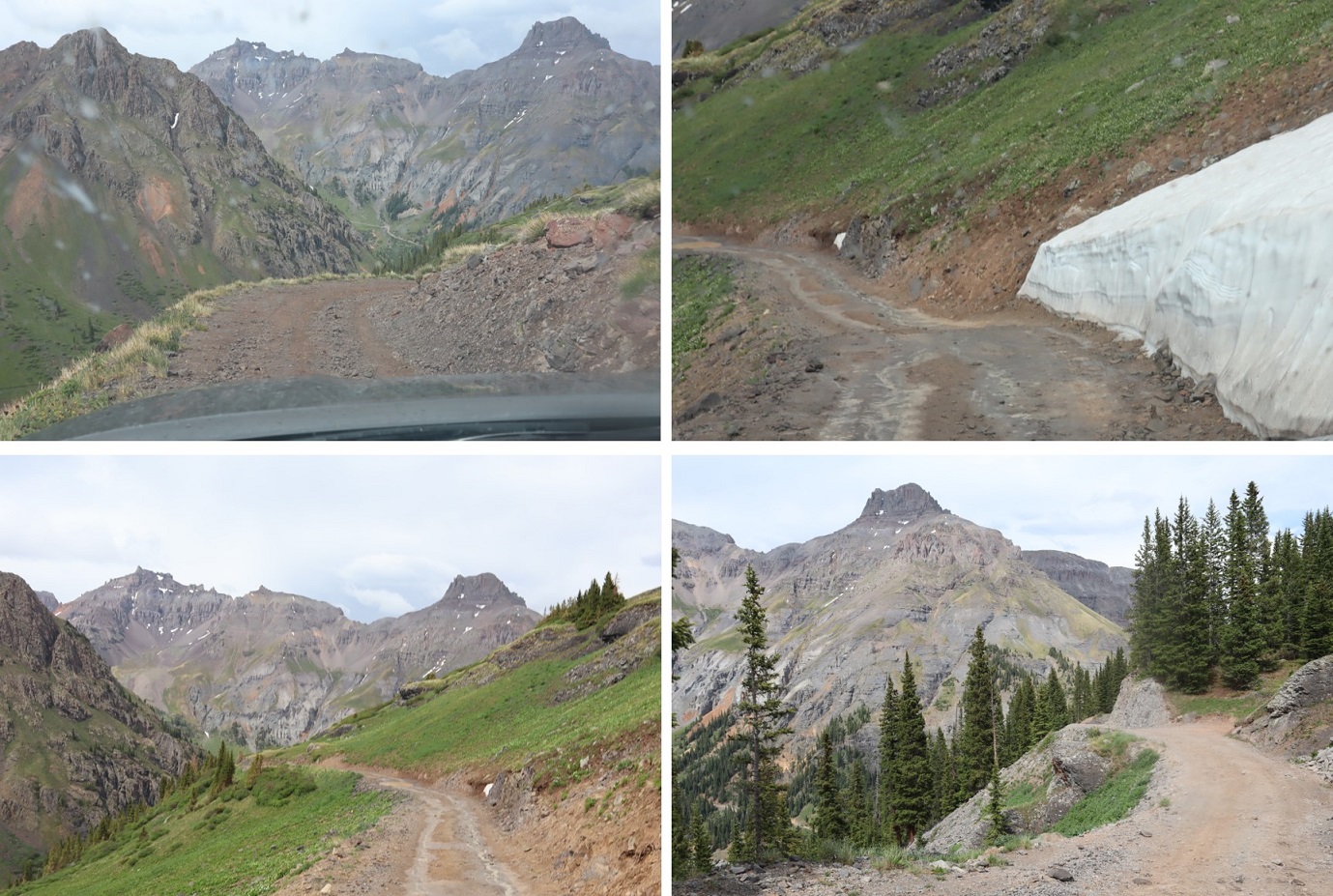
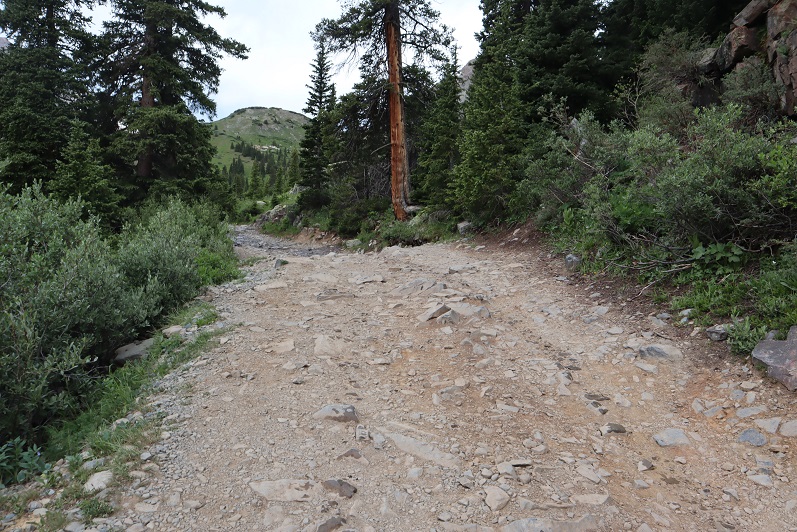
Ophir Pass Road is a serious 4WD road, but the trailhead for this peak can be accessed from the Ophir city side with just a high clearance vehicle.  There were a few small water crossings, but 4WD was never needed.

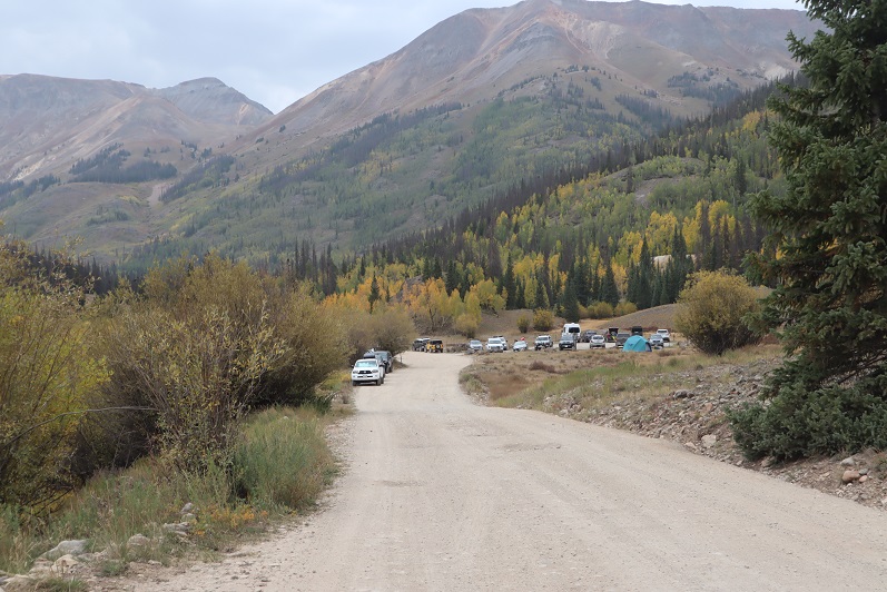
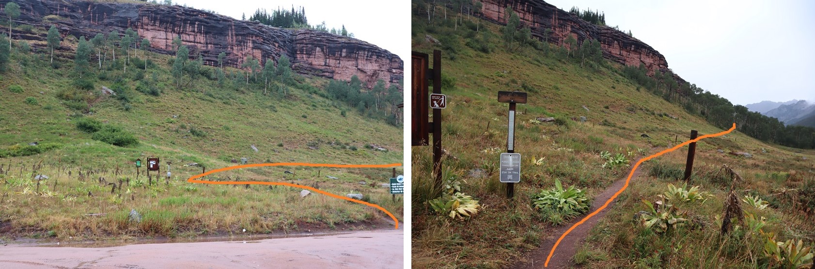
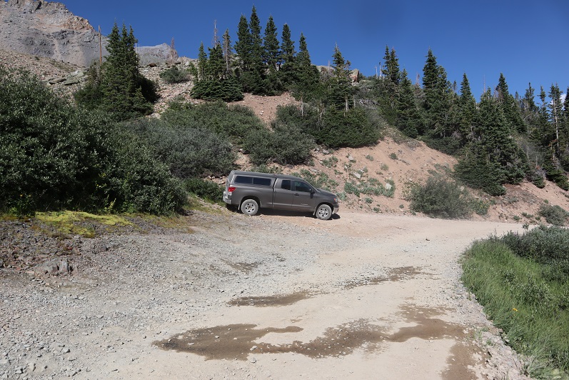
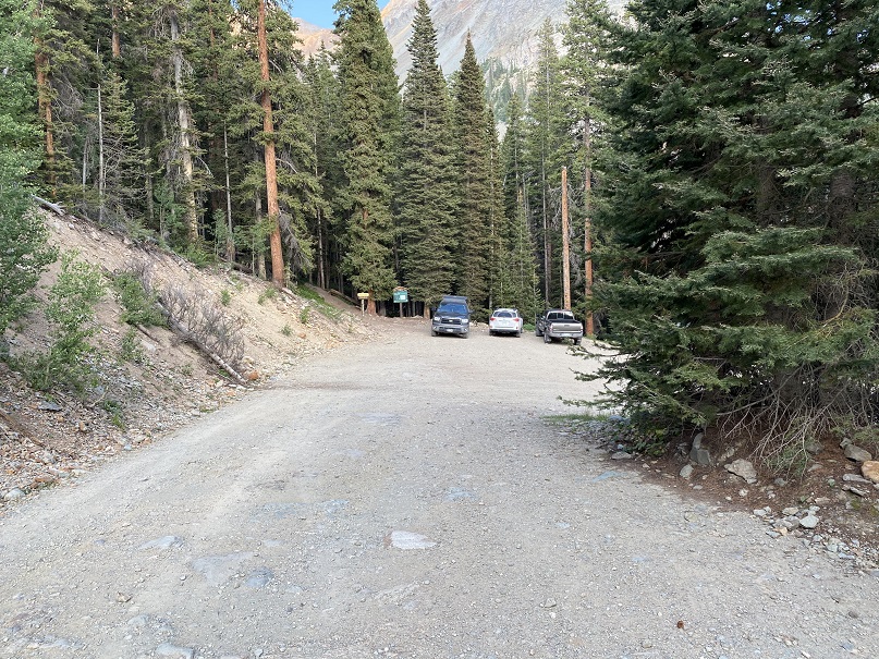
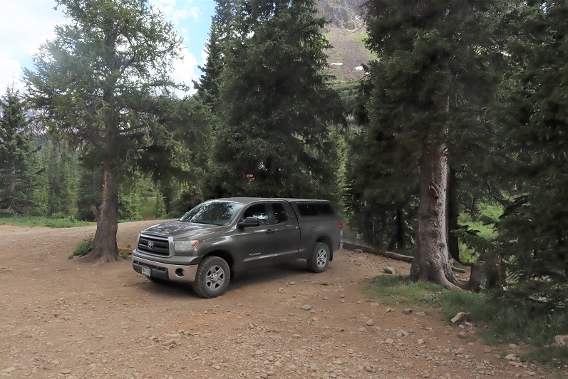
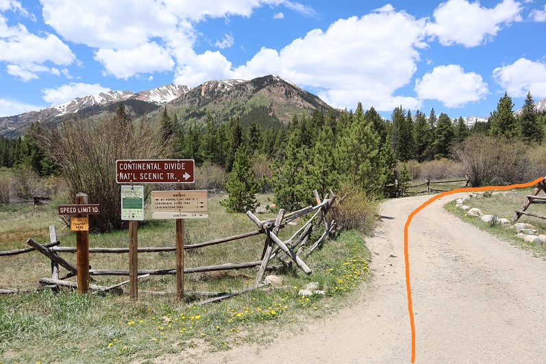
I parked in a parking area about 1.3 miles east of the town of Ophir, on Ophir Pass Road, in the Iron Spring area.  All the parking spots were taken but 1, and every vehicle was parked there overnight.  This is a popular spot to park to backpack/hike in the area. 

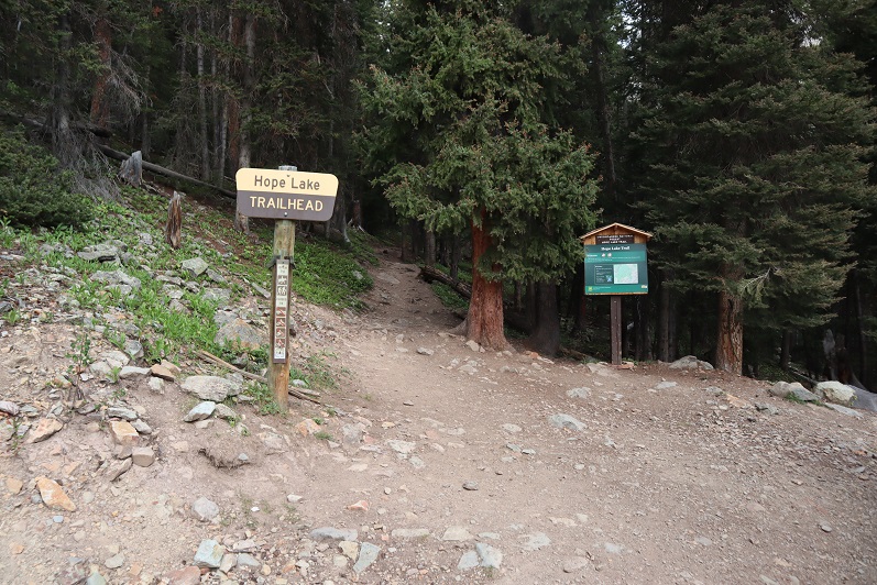
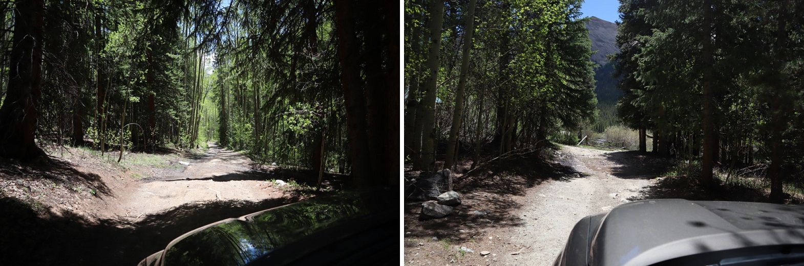
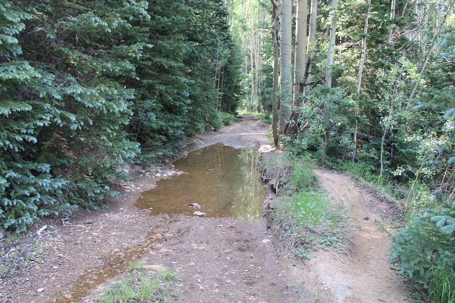
The mosquitoes were out here as well, so I made it an early night and got some sleep.  I was up and on the trail by 3:45am.  The trail starts on a blocked 4WD road to the south of the parking area.

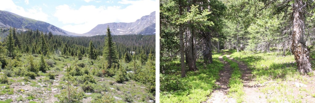
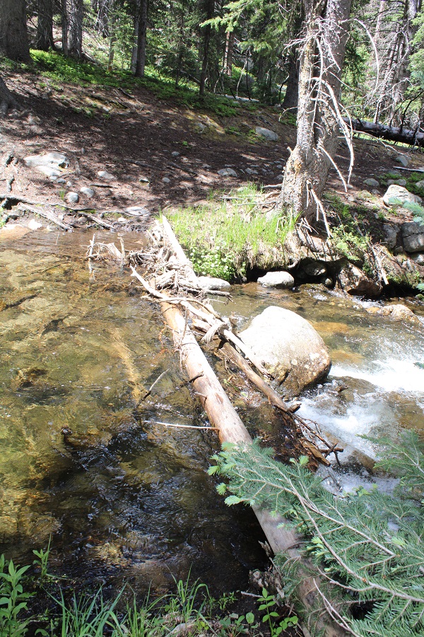
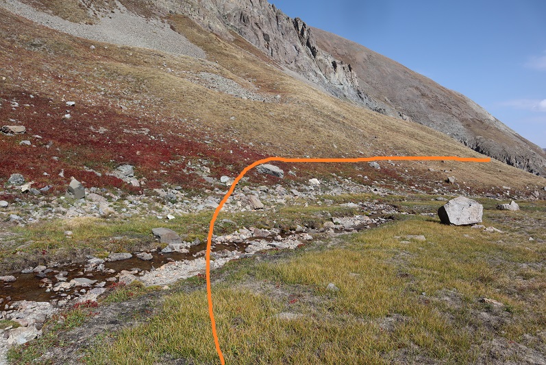
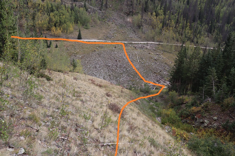
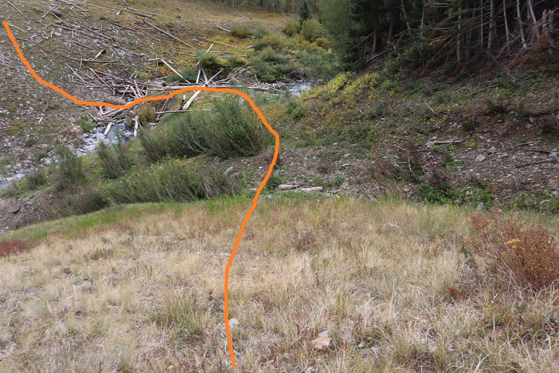
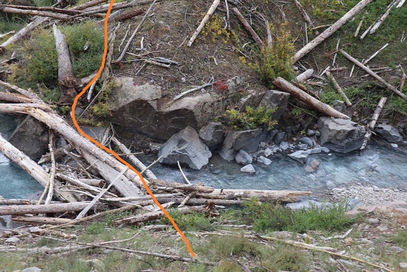
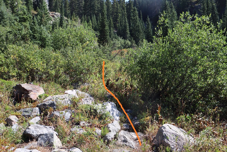
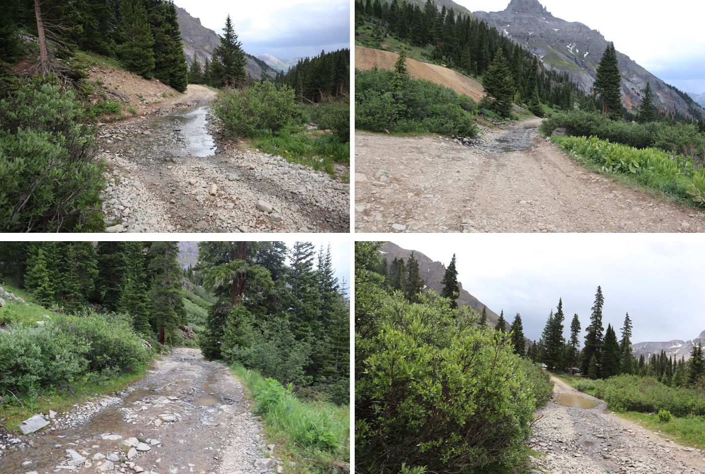
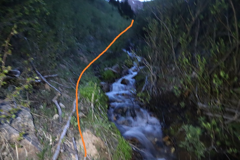
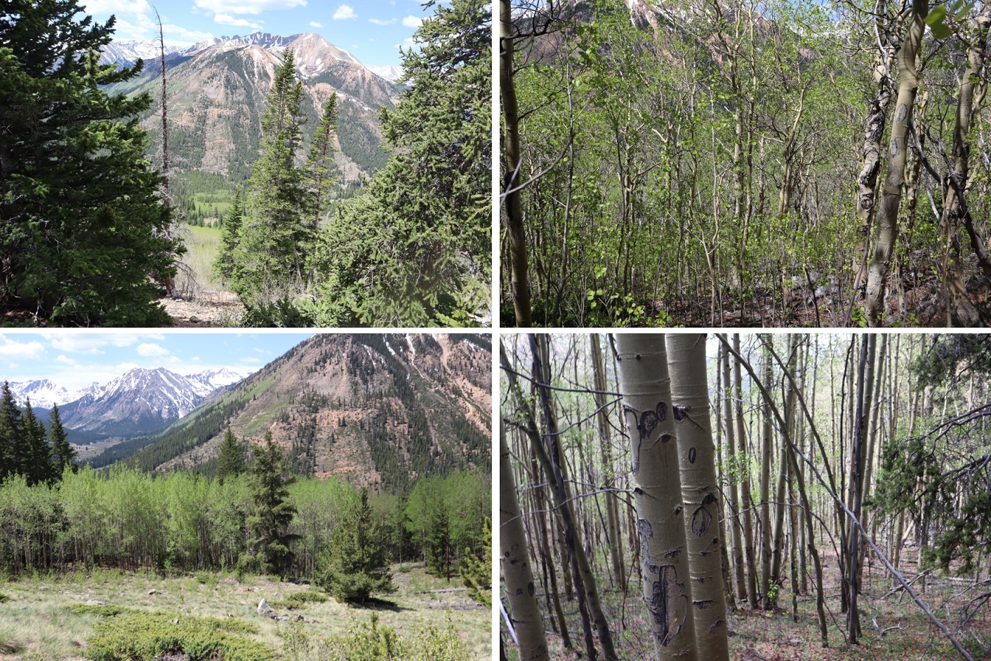
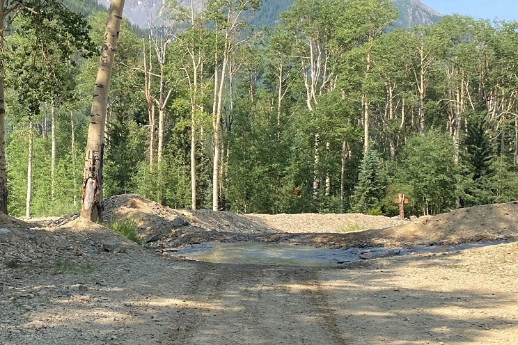
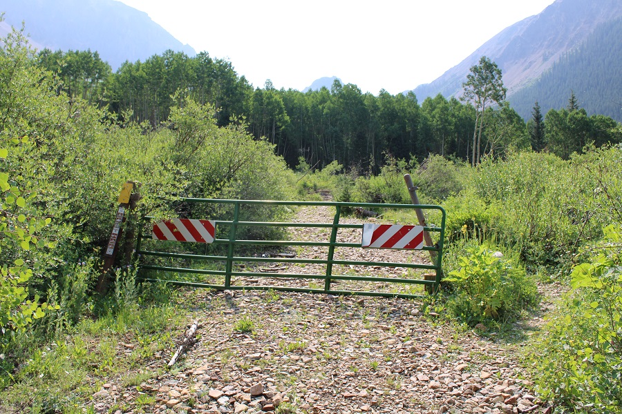
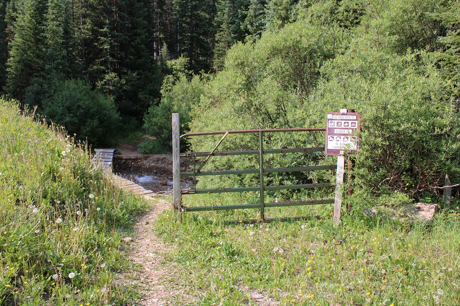
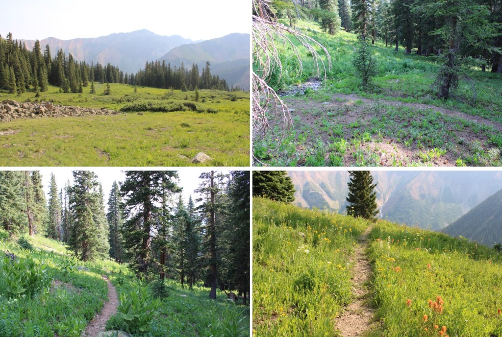
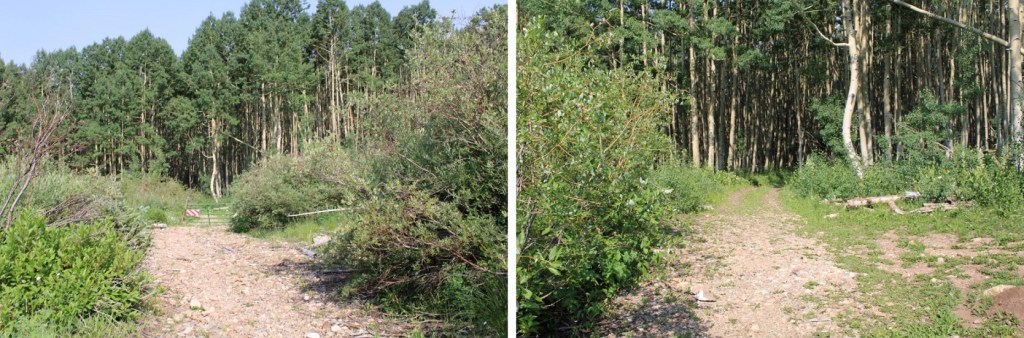
I followed this road southeast and then south, through gates, aspen trees and two stream crossings with easily crossable bridges

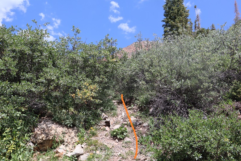
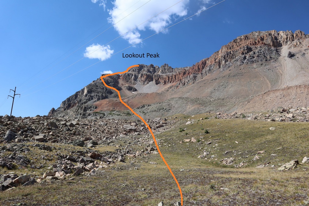
After the second stream crossing, I passed below some power lines, turned left to follow the trail, and started gaining elevation.

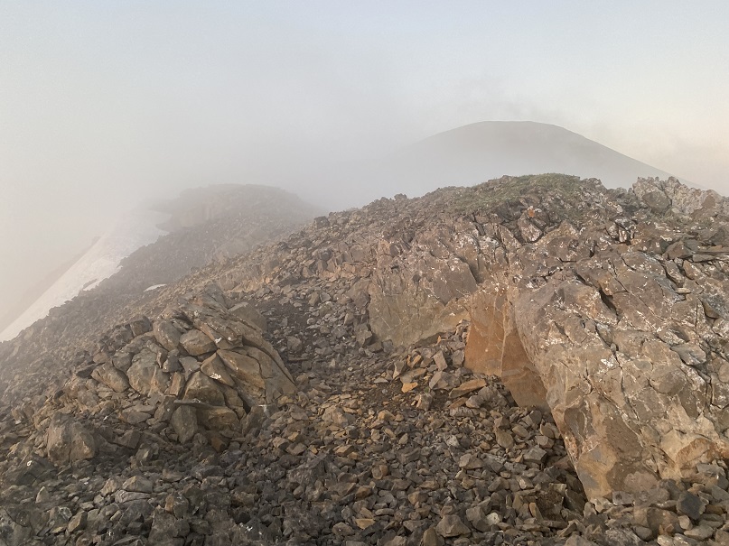
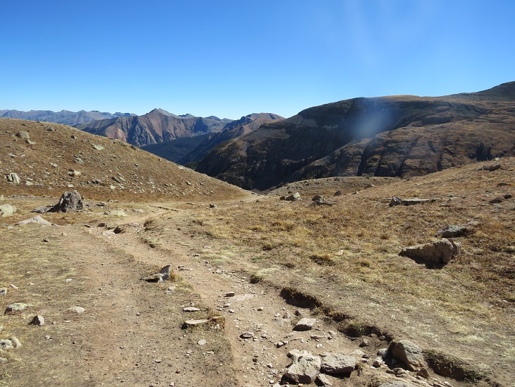
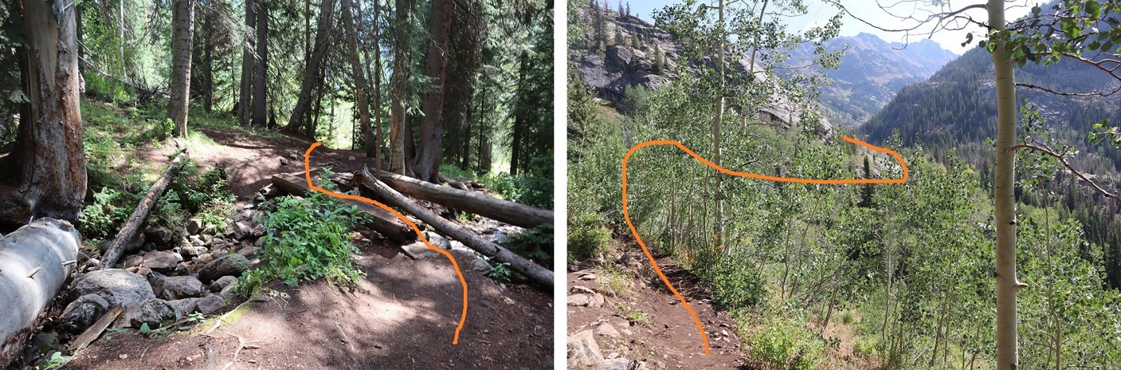
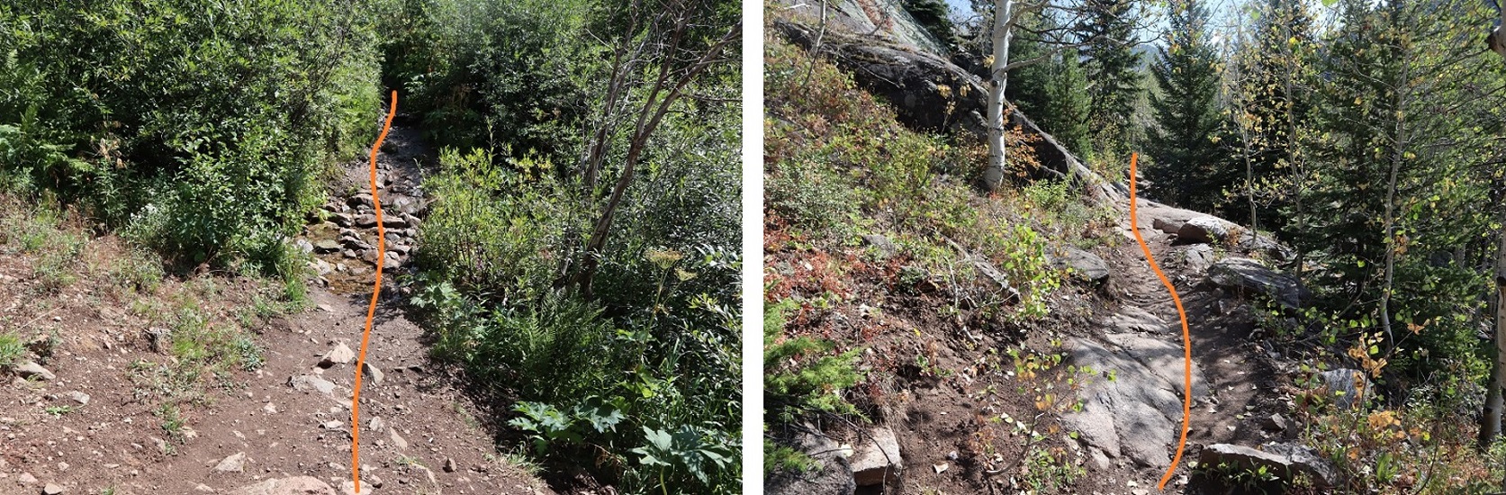
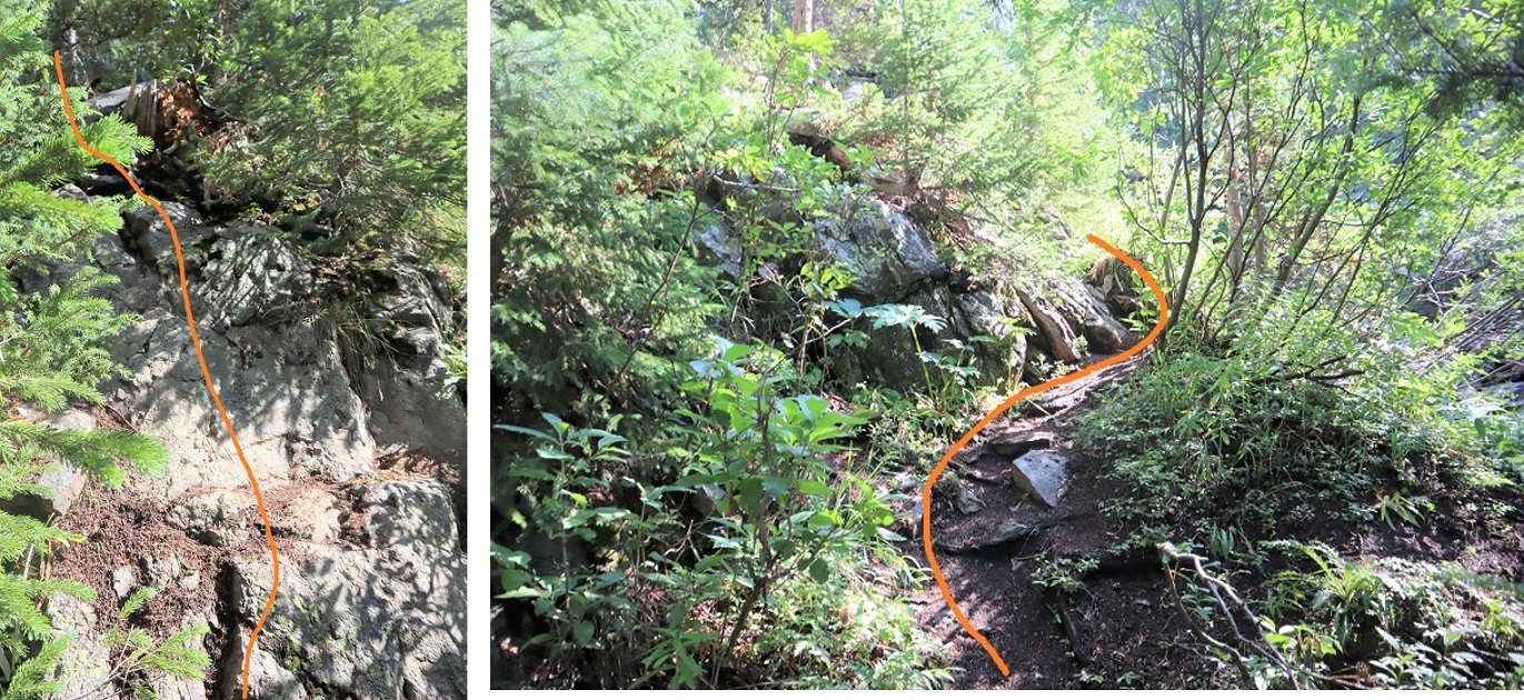
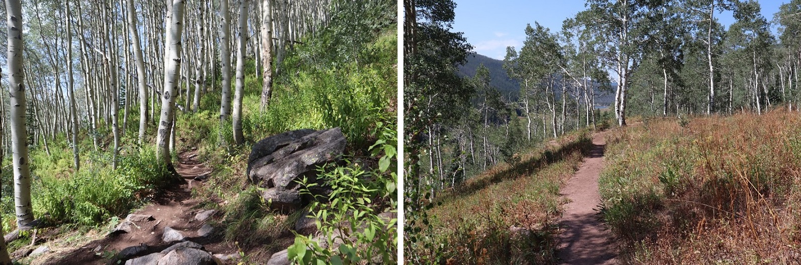
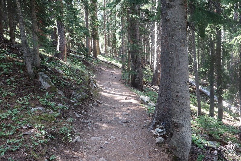
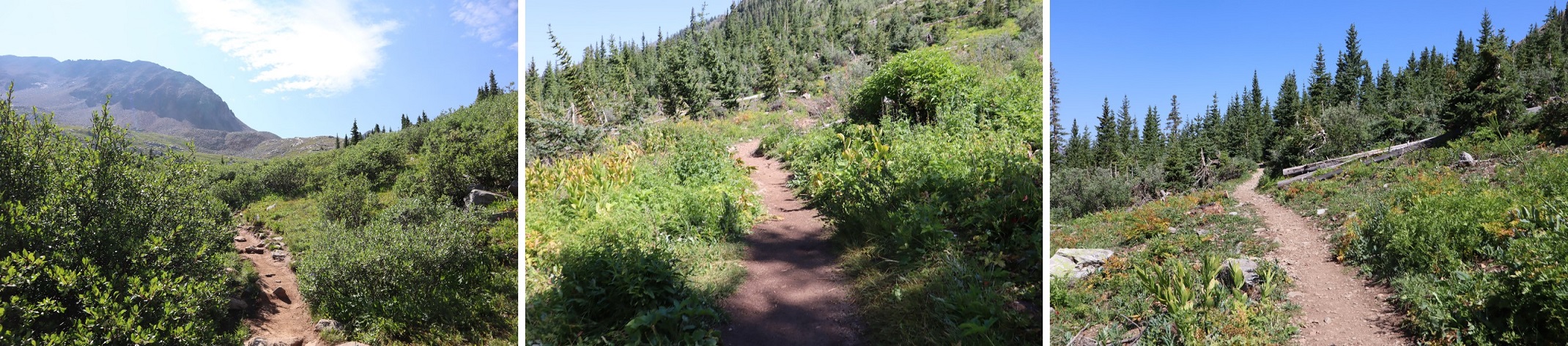
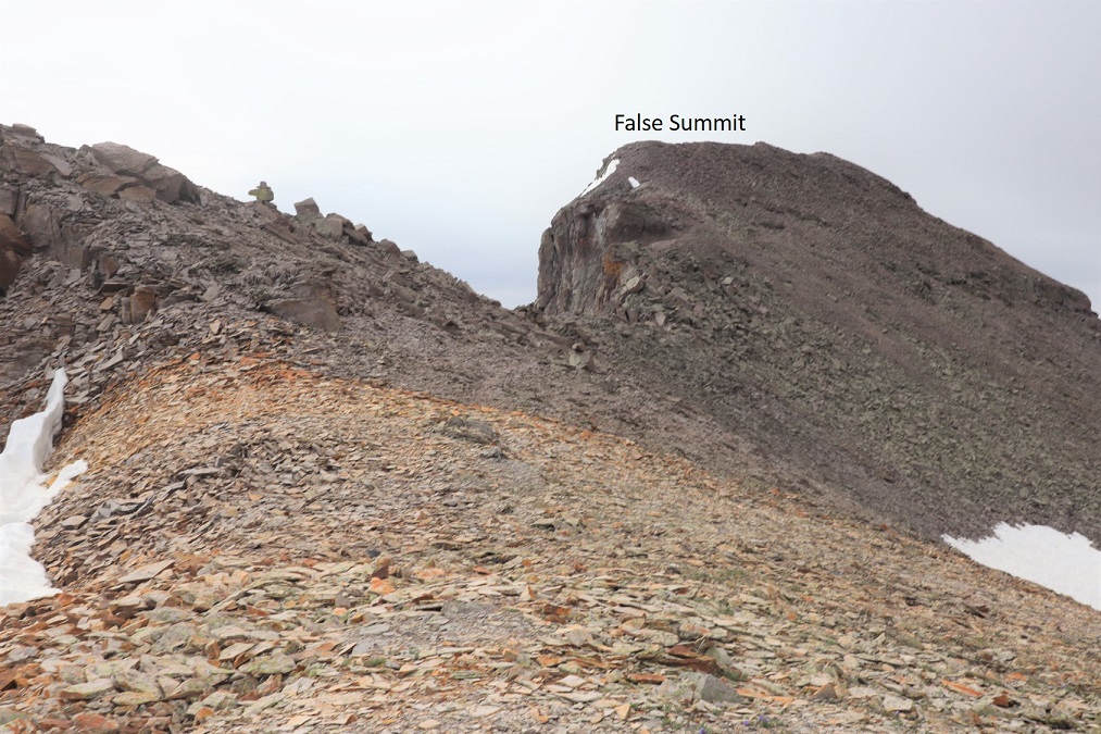
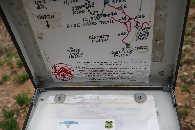
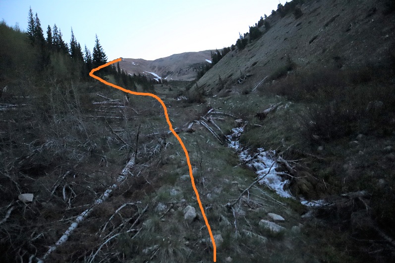
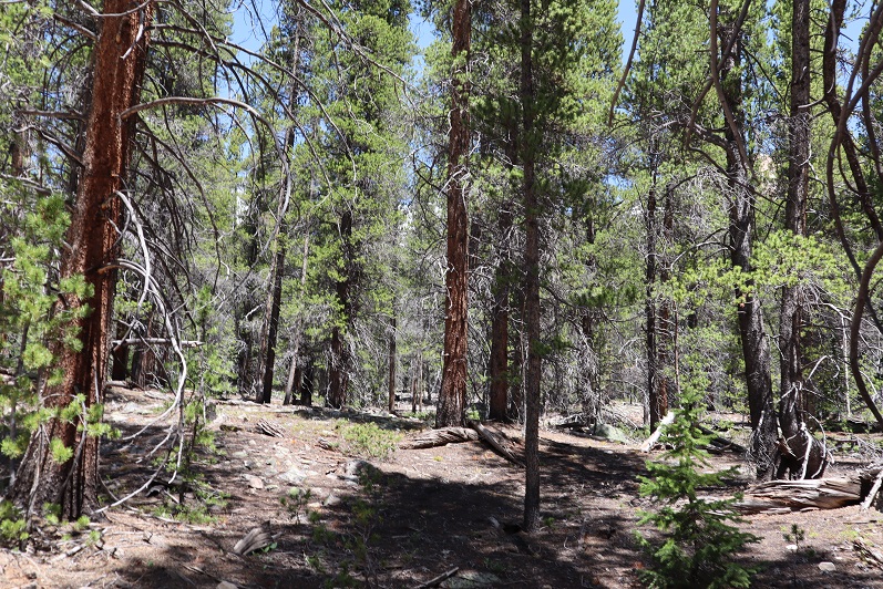
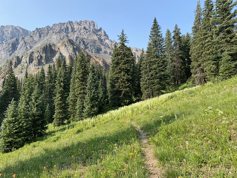
The hike below treeline was nice, and the trails were class 1, but there were no trail signs or numbers, and several trail crossings.  I’ll do my best to describe the correct route.

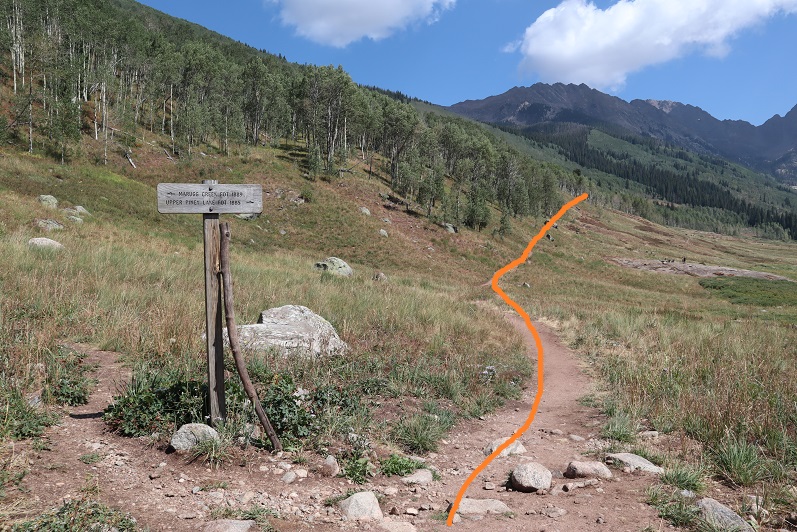
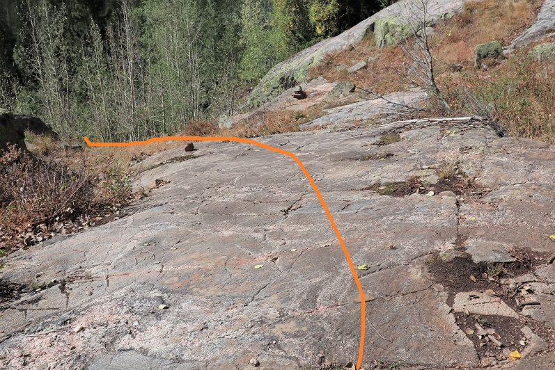
I followed a well-defined path south.

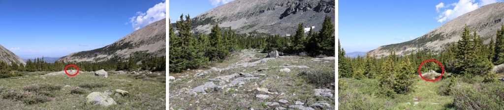
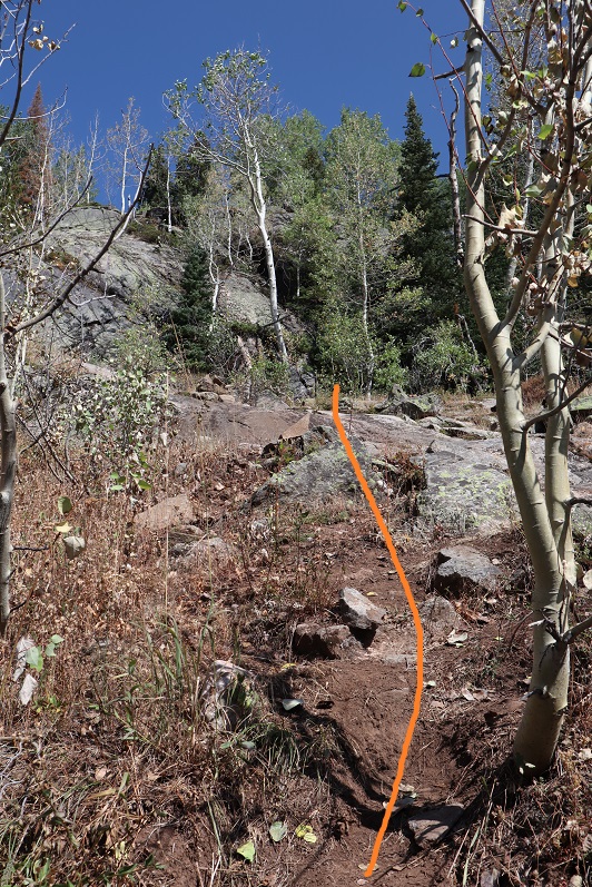
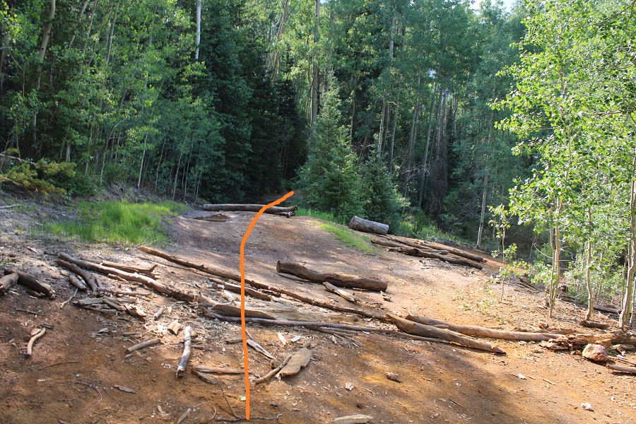
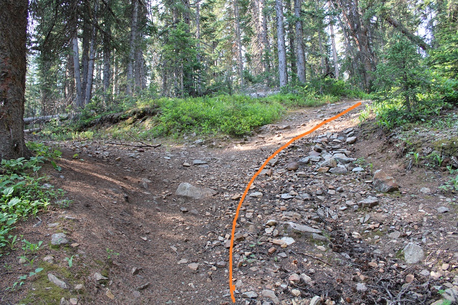
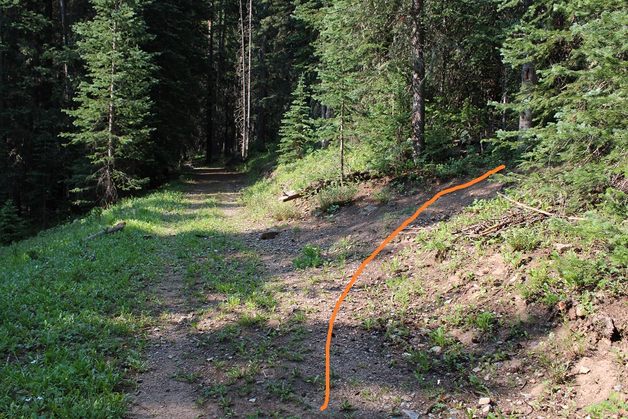
At the first fork in the road, I turned right

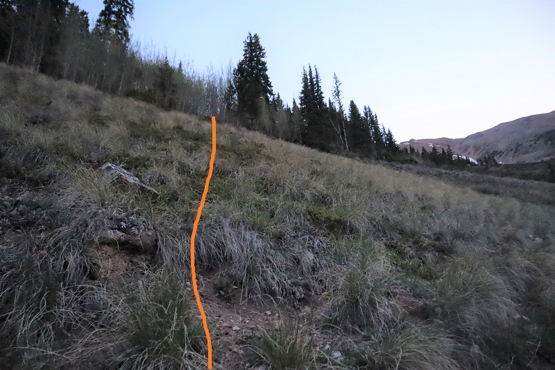
At the second fork I turned right again, off the road and onto a trail (I’d hiked a total of 1.15 miles at this point)

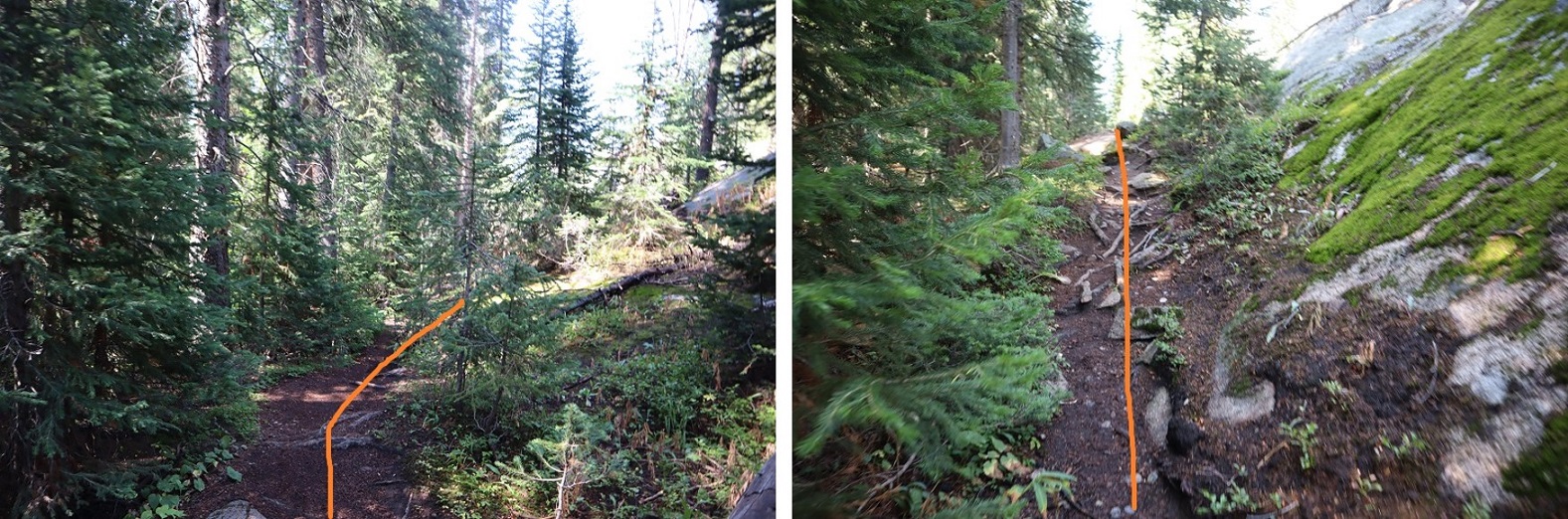
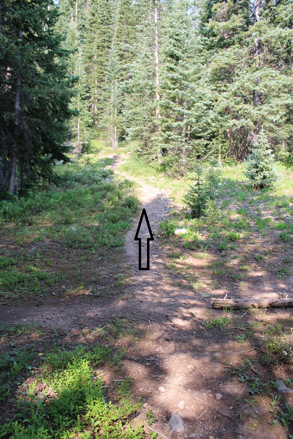
I hiked west for a few yards, and then came across a trail junction.  I continued heading straight

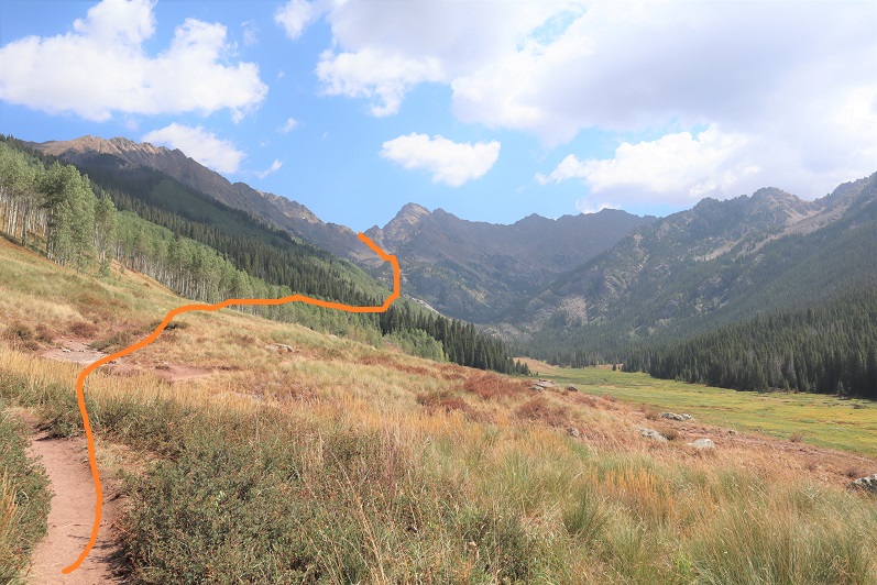
I was now on the trail that heads south/southwest up the hillside.  This is also where I ran into a porcupine.  Porcupines don’t run, but we noticed each other while we were about 3 feet away from each other:  He quickly turned and waddled away in the dark, showing me his full backside of quills as he did so. 

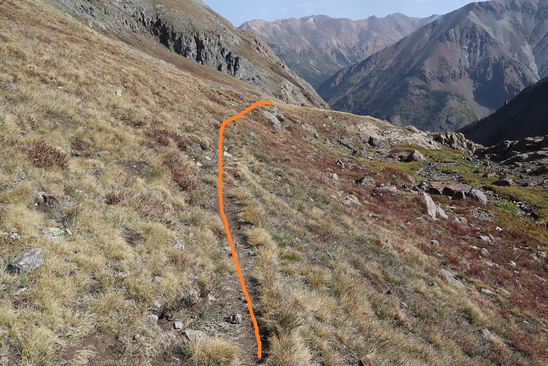
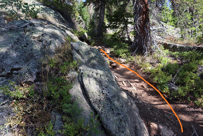
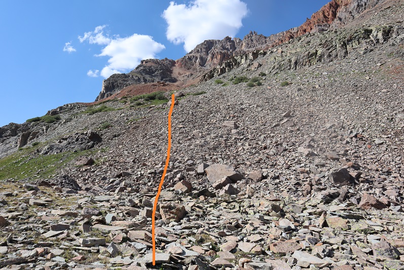
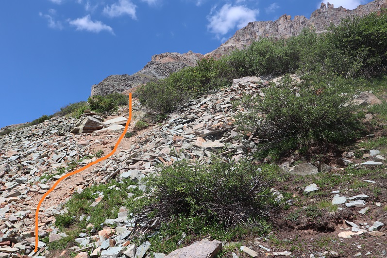
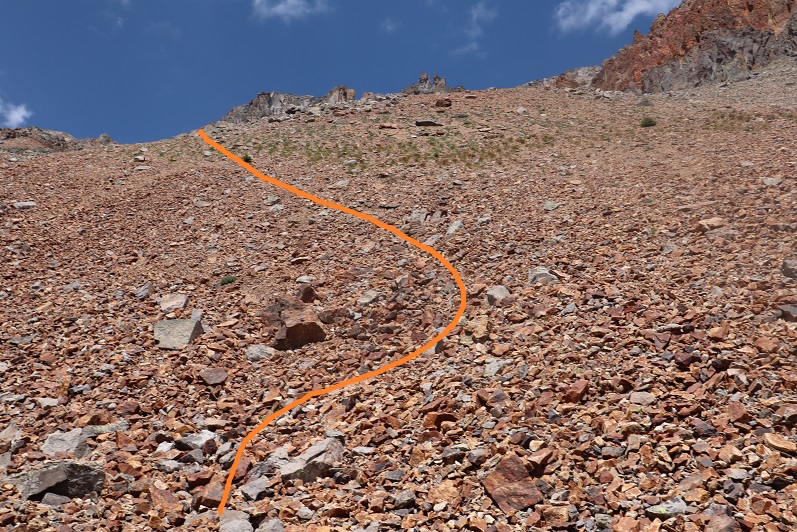
I continued on this well defined trail

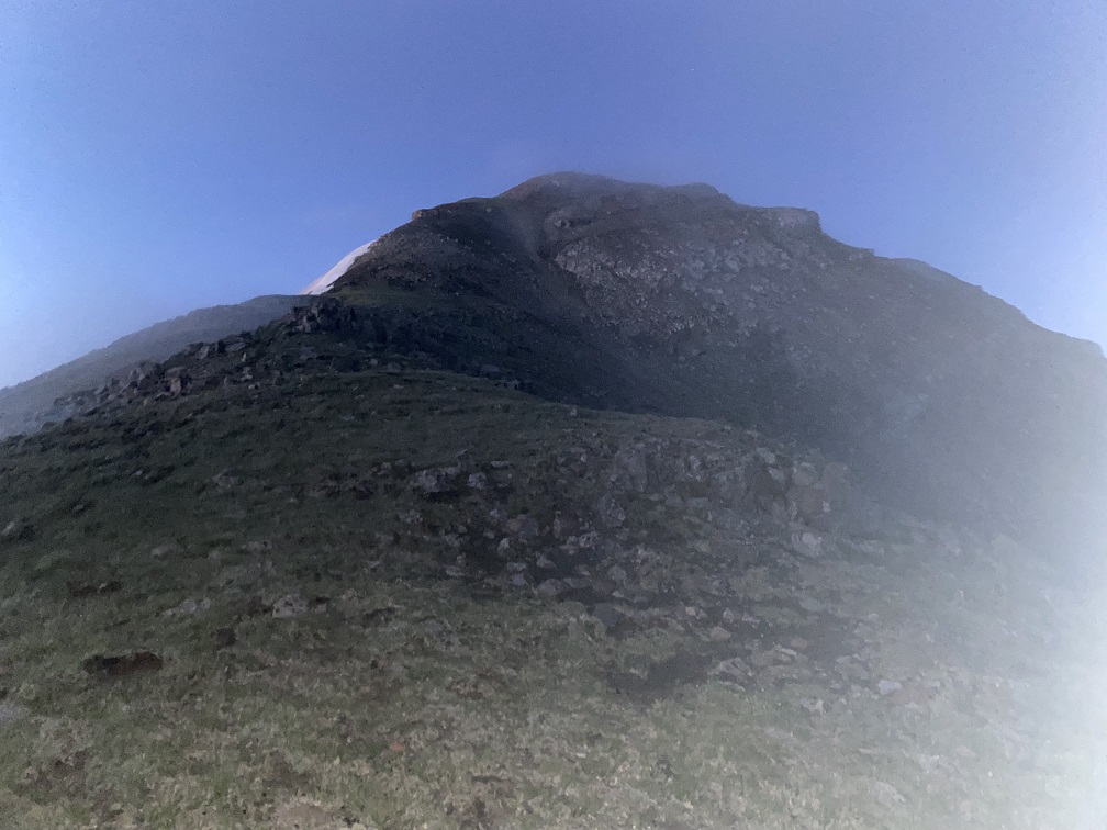
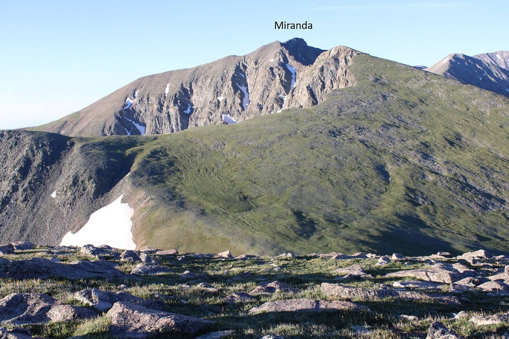
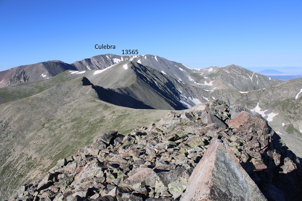
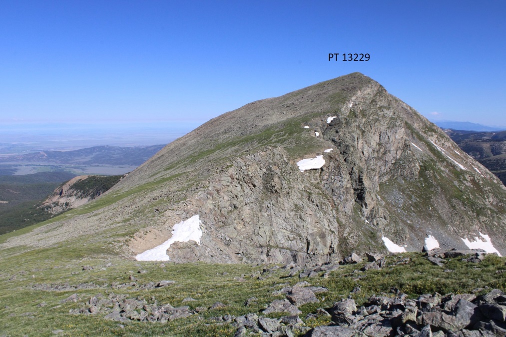
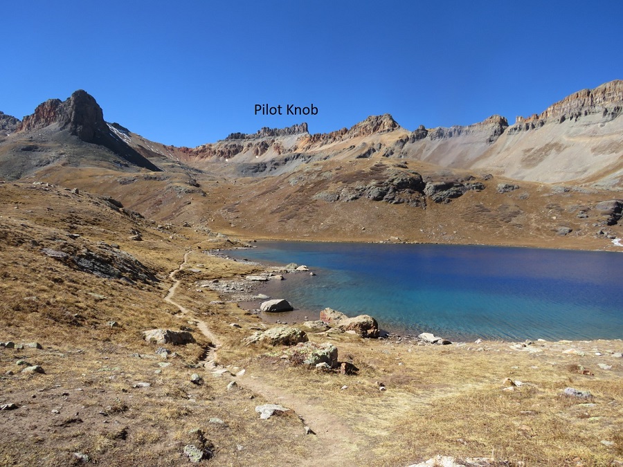
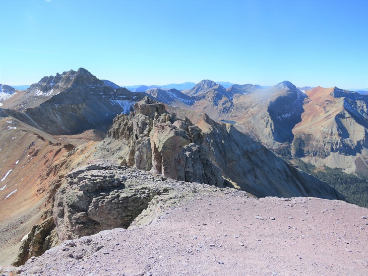
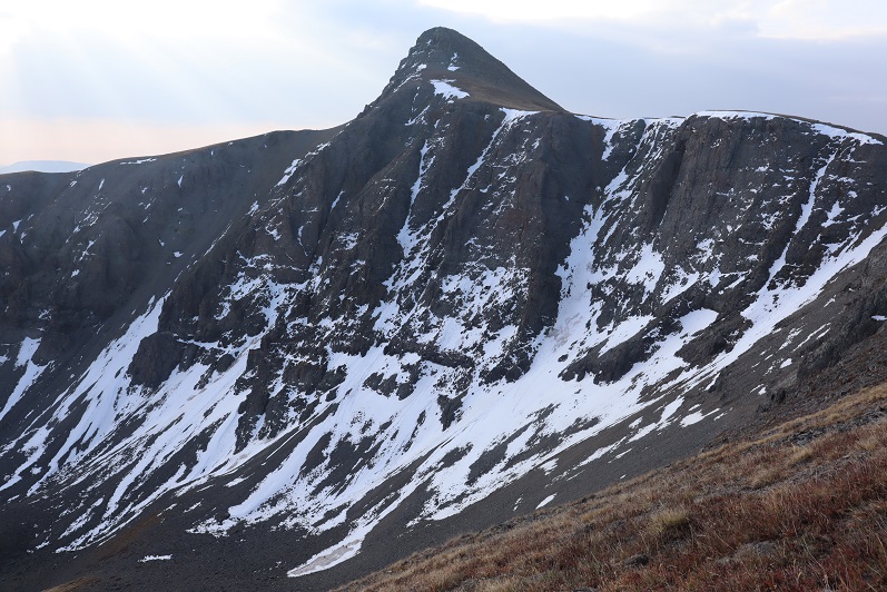
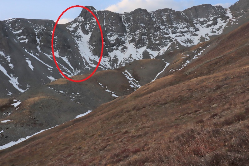
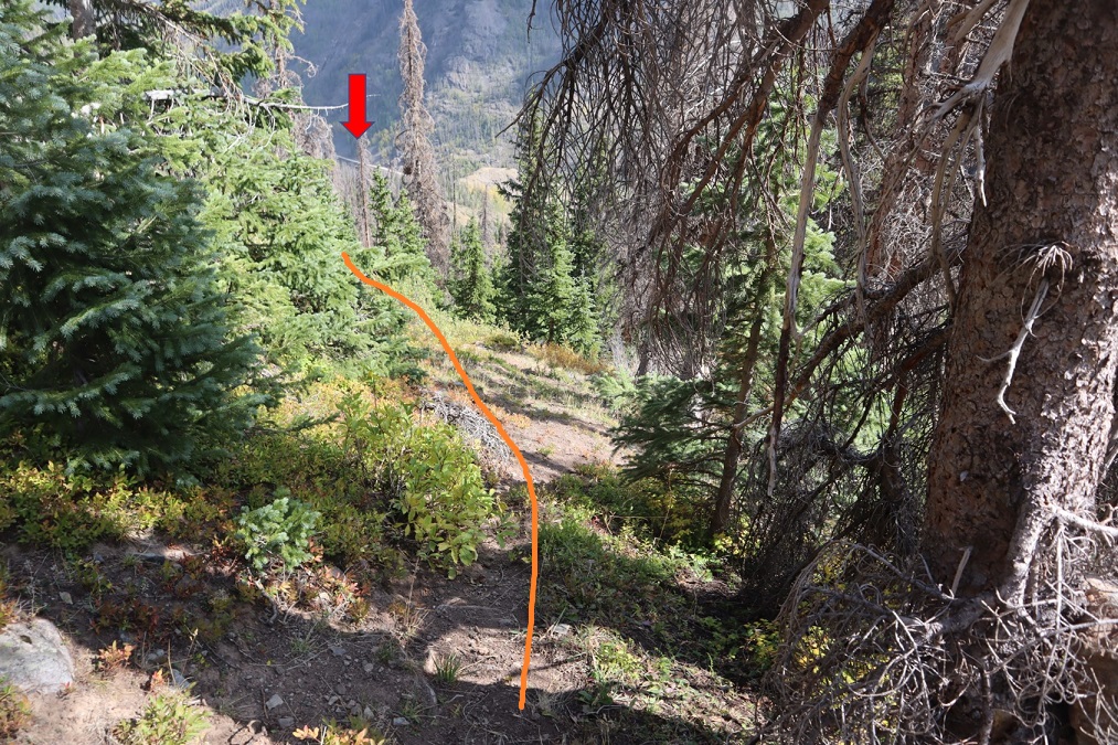
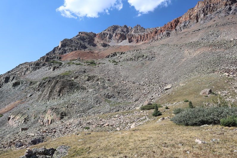
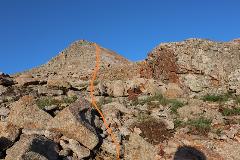
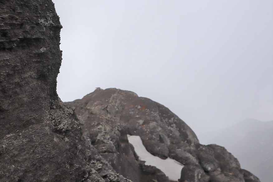
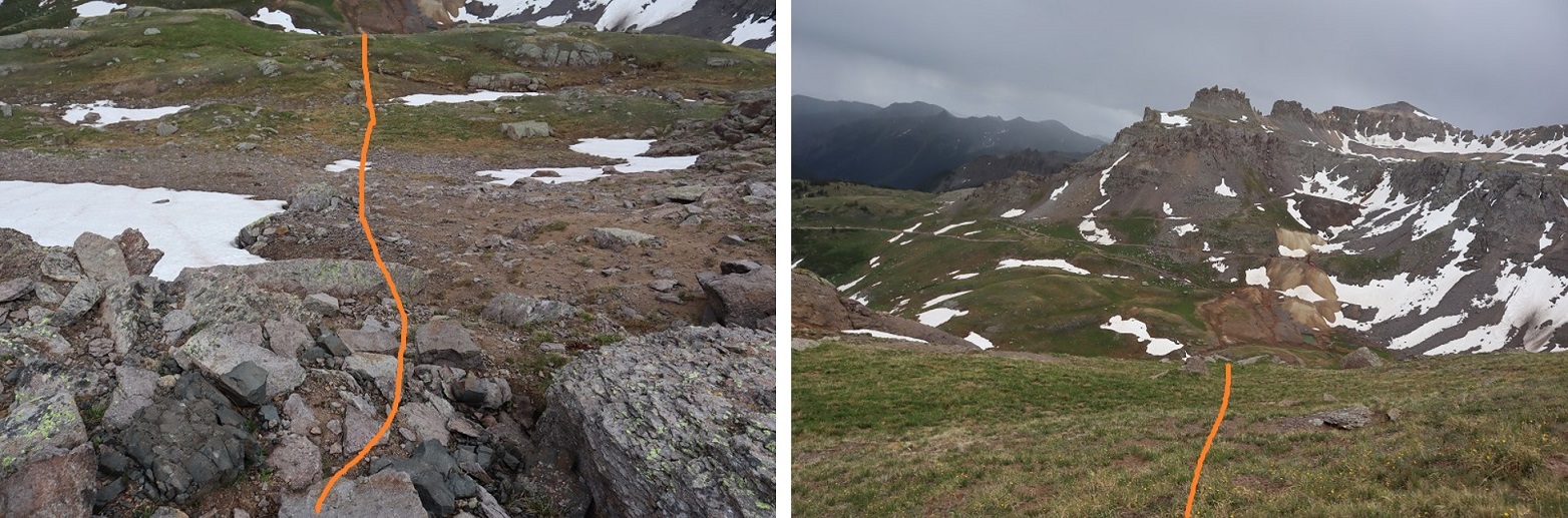
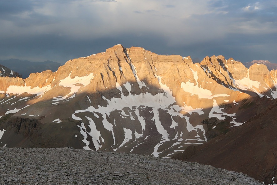
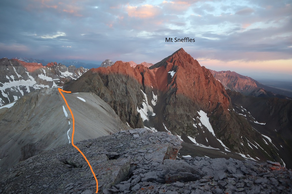
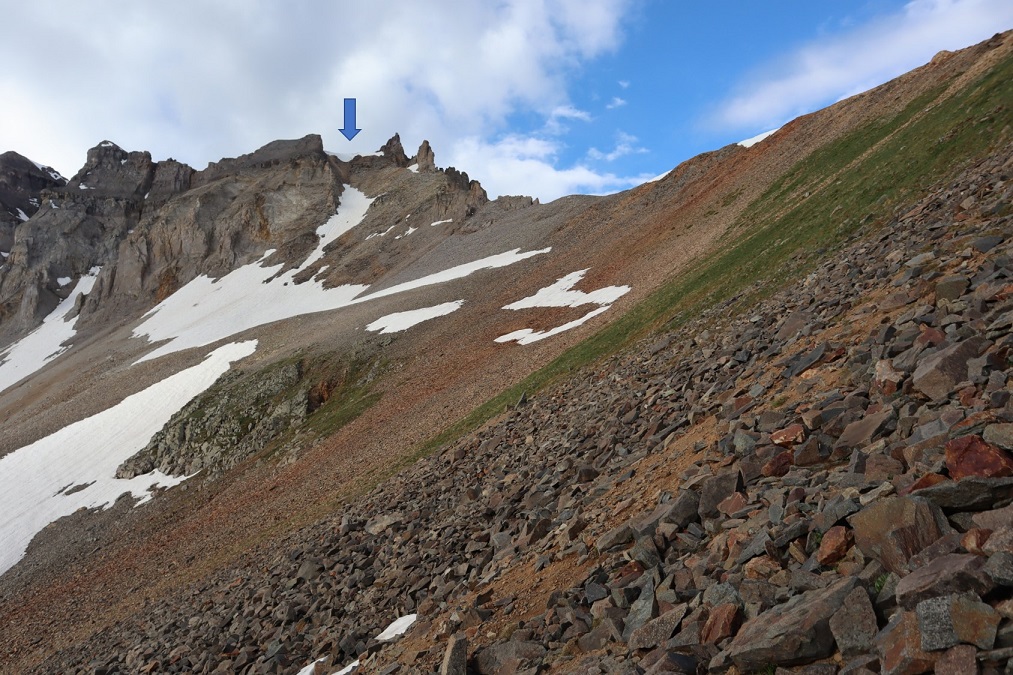
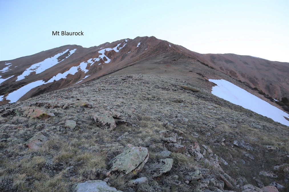
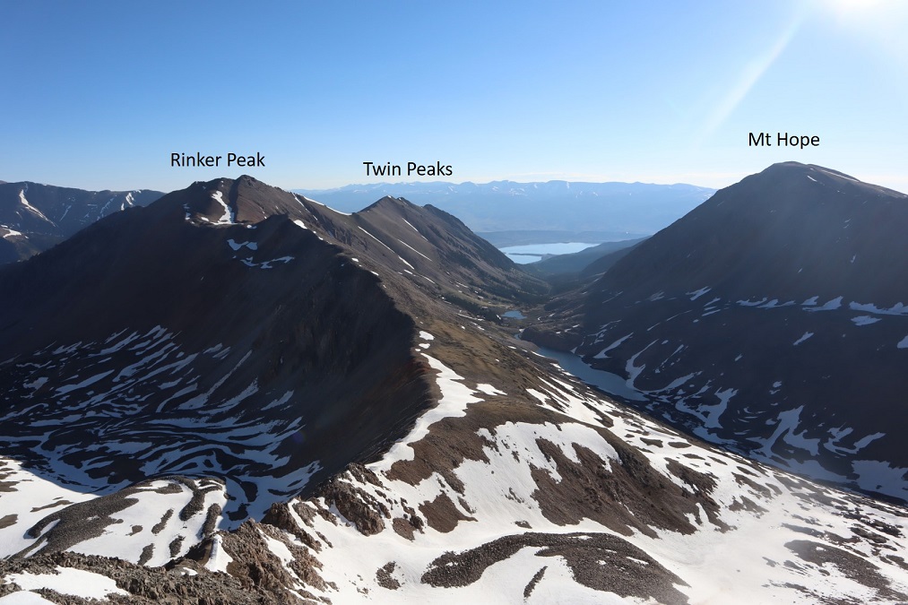
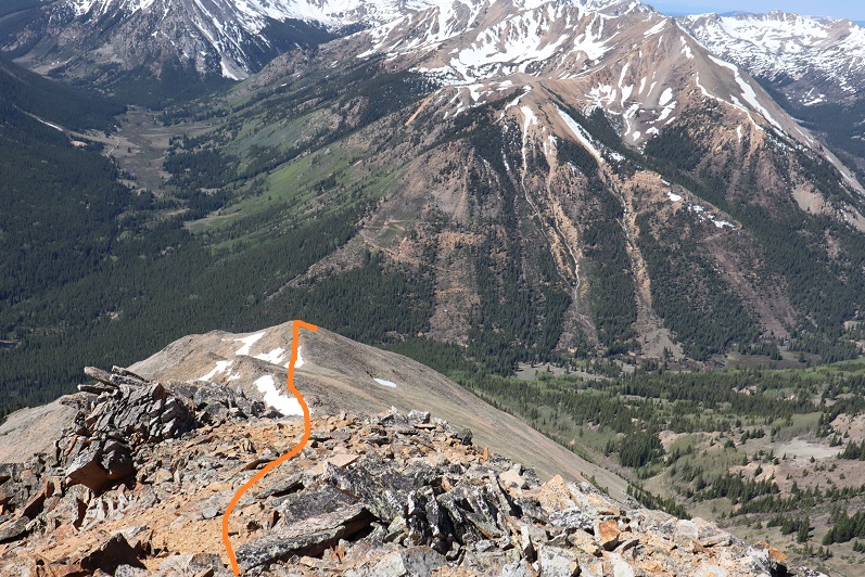
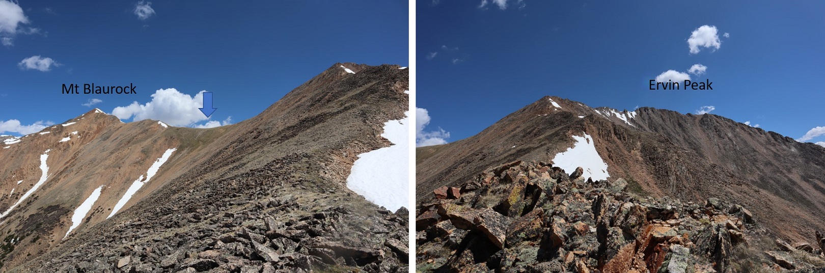
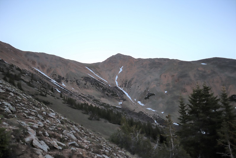
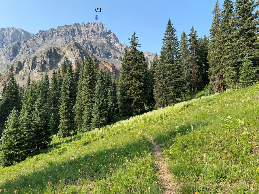
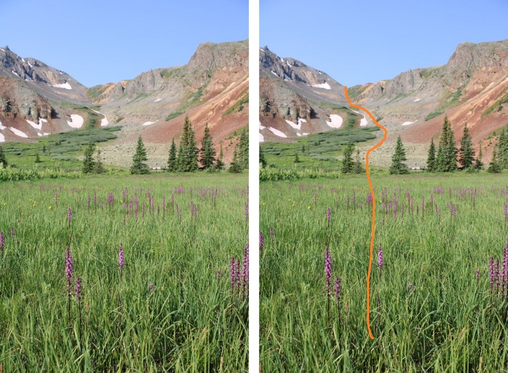
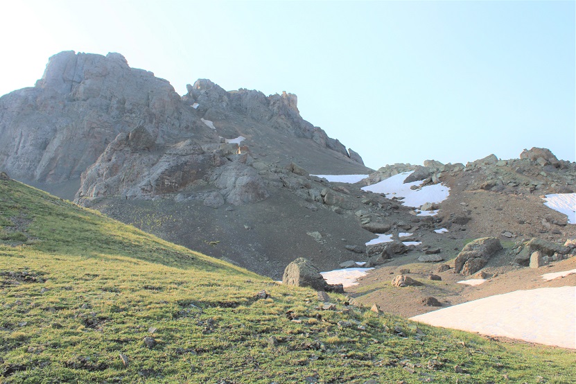
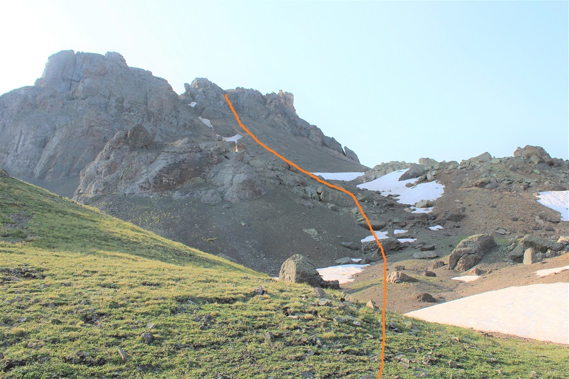
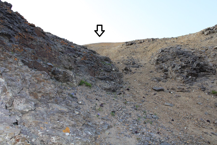
Here’s your first glimpse of V3.  Look carefully, the arrow points to the exact summit, which you won’t see again until you’re there.

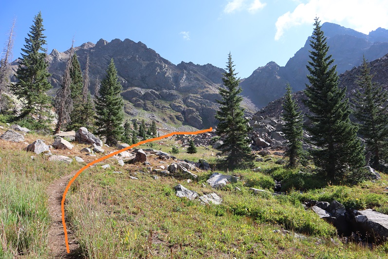
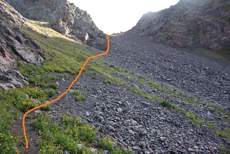
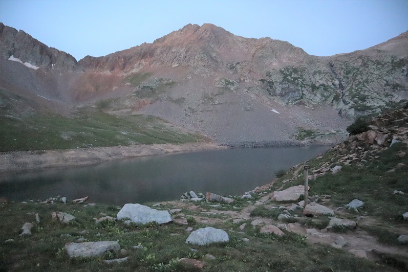
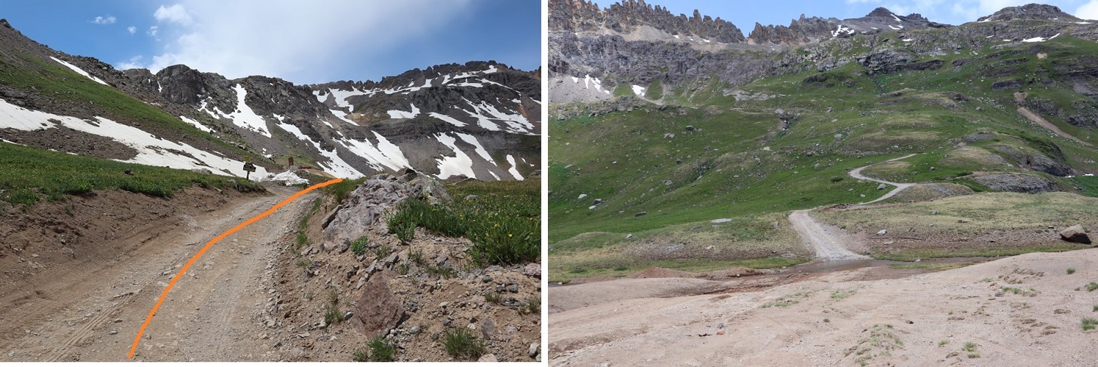
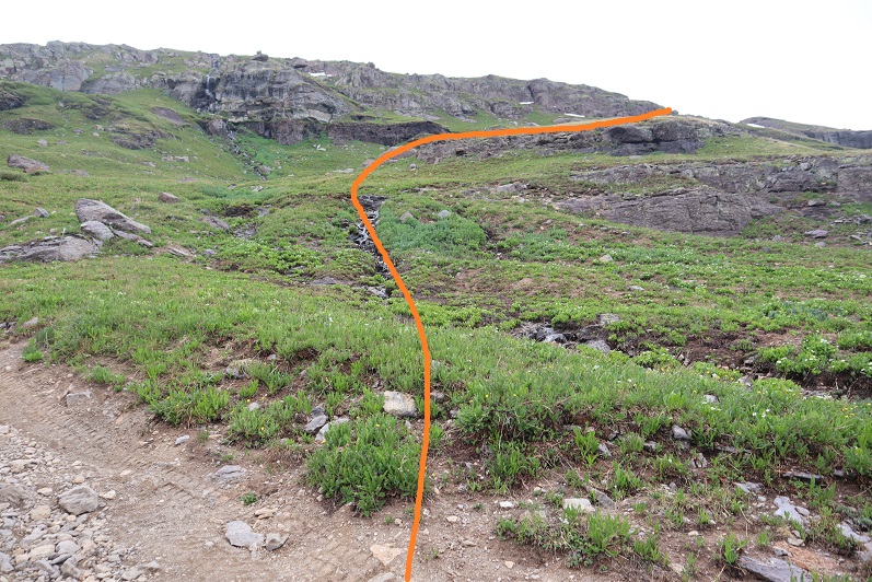
After hiking for a total of 2.25 miles and 11350’ I came to a small water crossing over the trail, and a meadow to my right. I left the trail and headed through the meadow.  It was still dark, and there was a camper with a bright headlamp getting ready for the day.  He was confused why I was ‘off trail’ and tried to direct me back to the proper trail.  I assured him I was going in the right direction, apologized for walking so close to his campsite, and nicely told him I didn’t expect to find a trail to the summit.

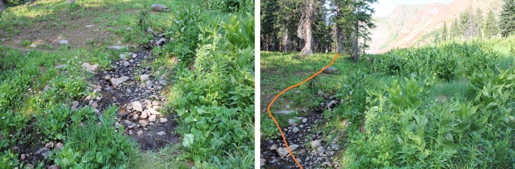
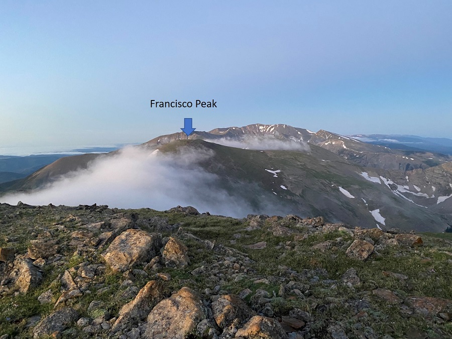
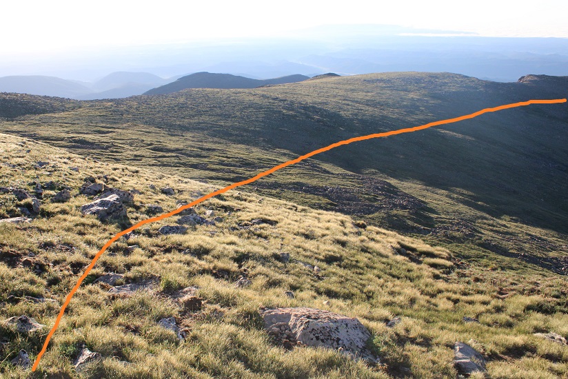
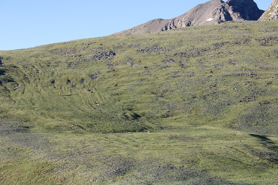
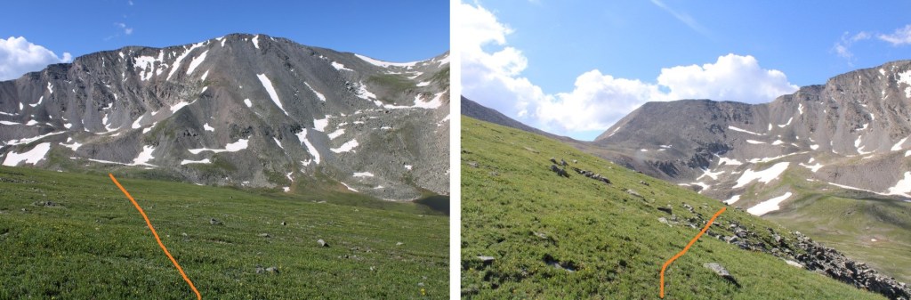
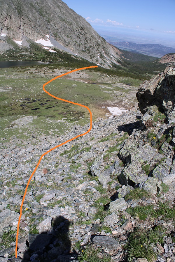
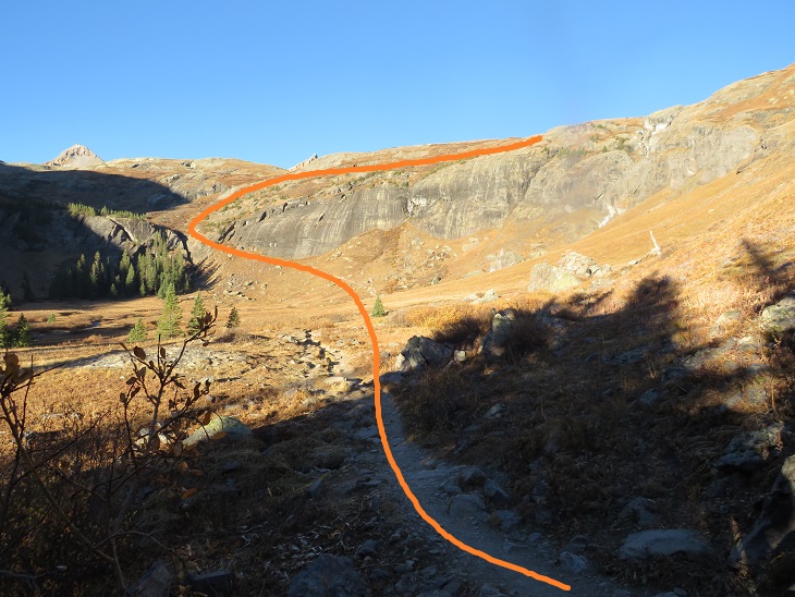
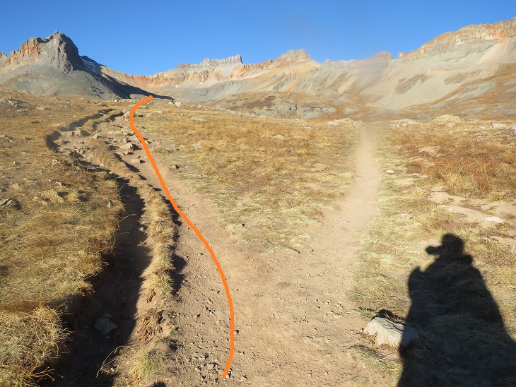
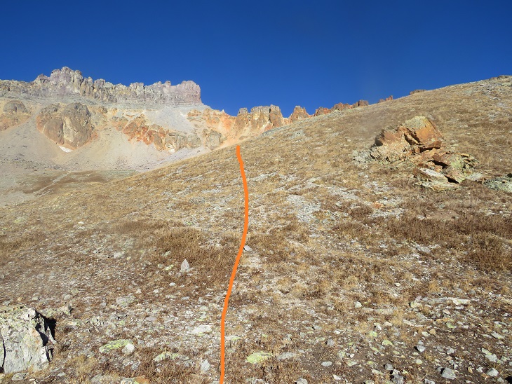
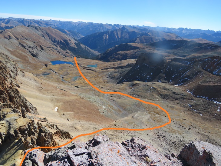
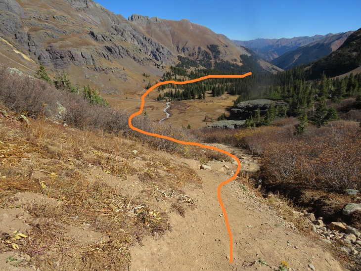
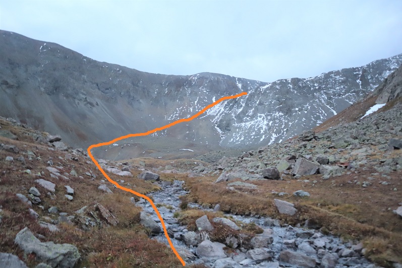
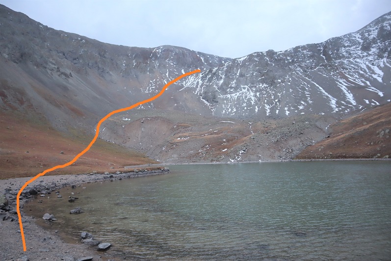
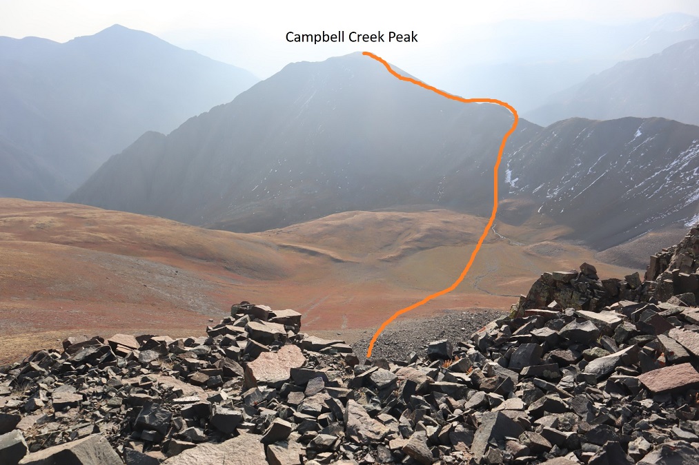
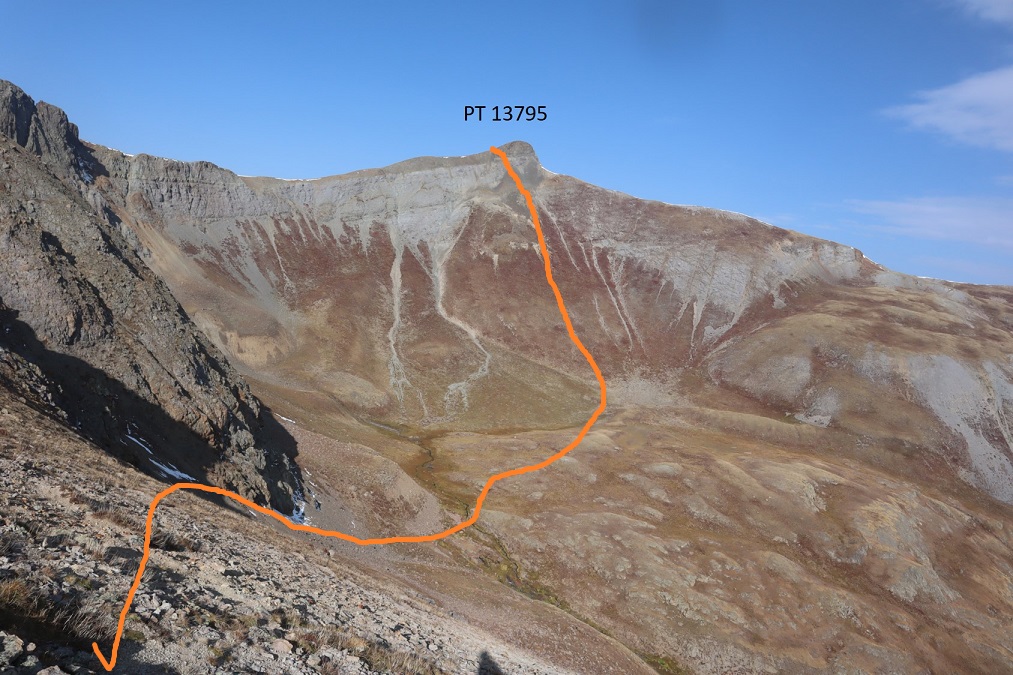
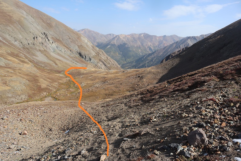
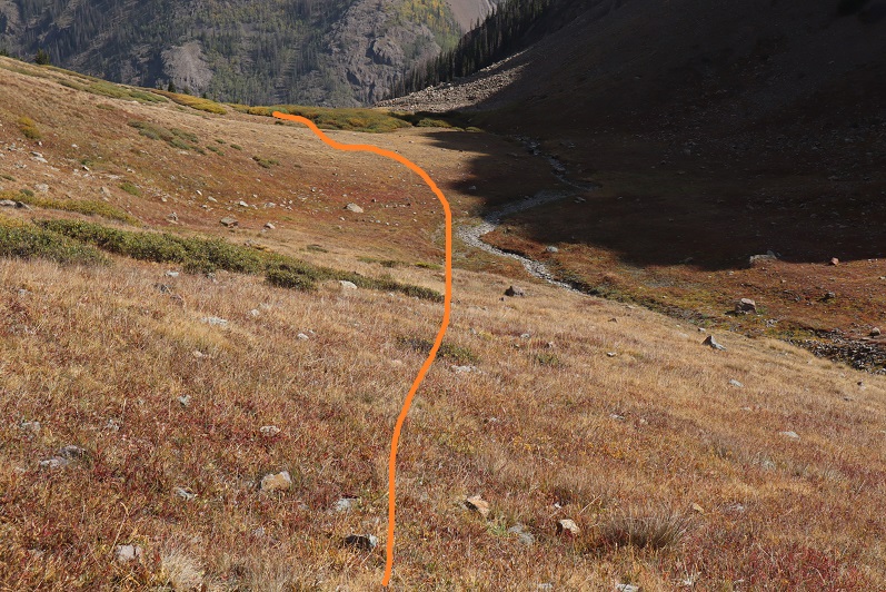
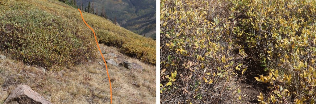
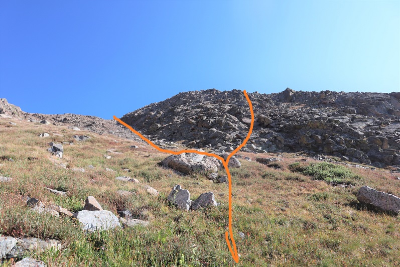
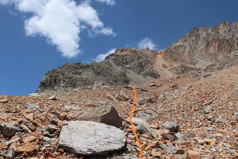
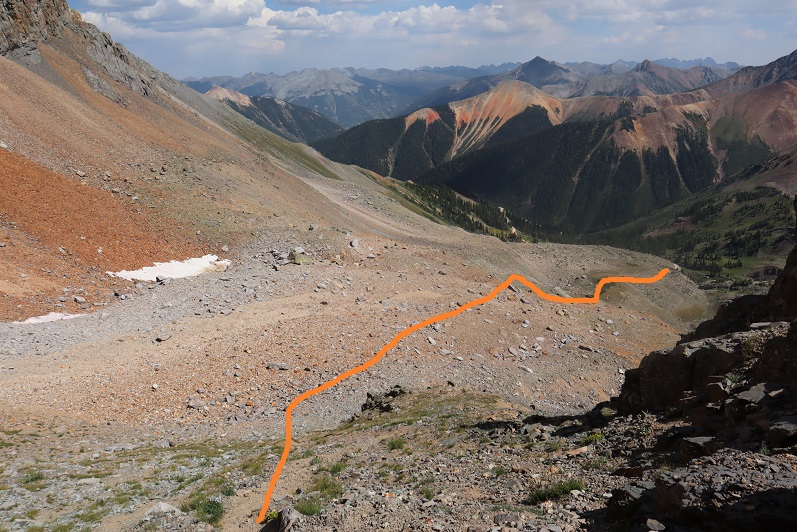
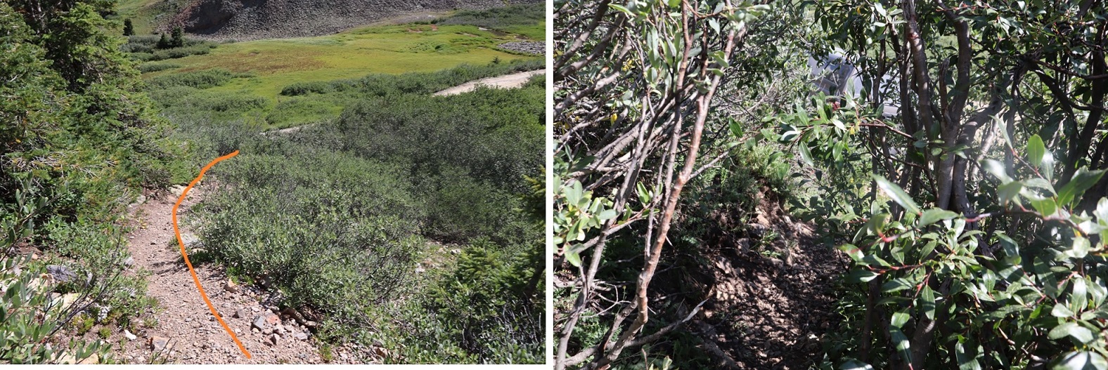
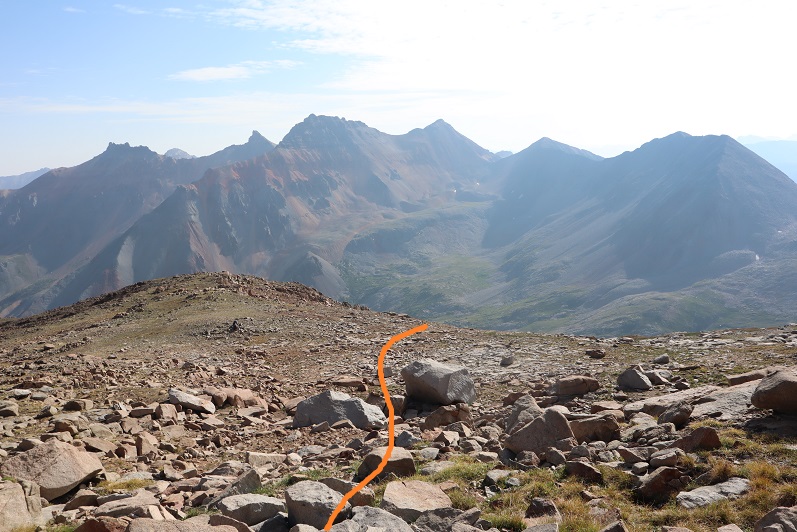
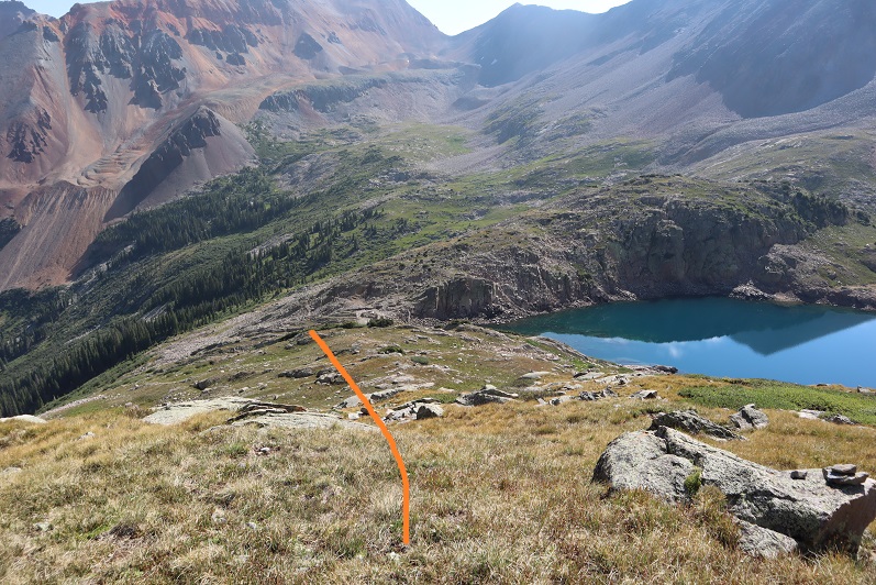
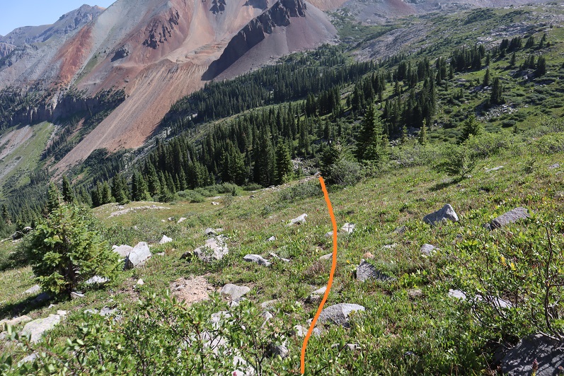
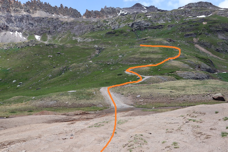
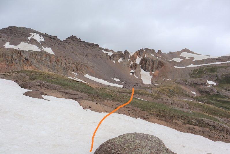
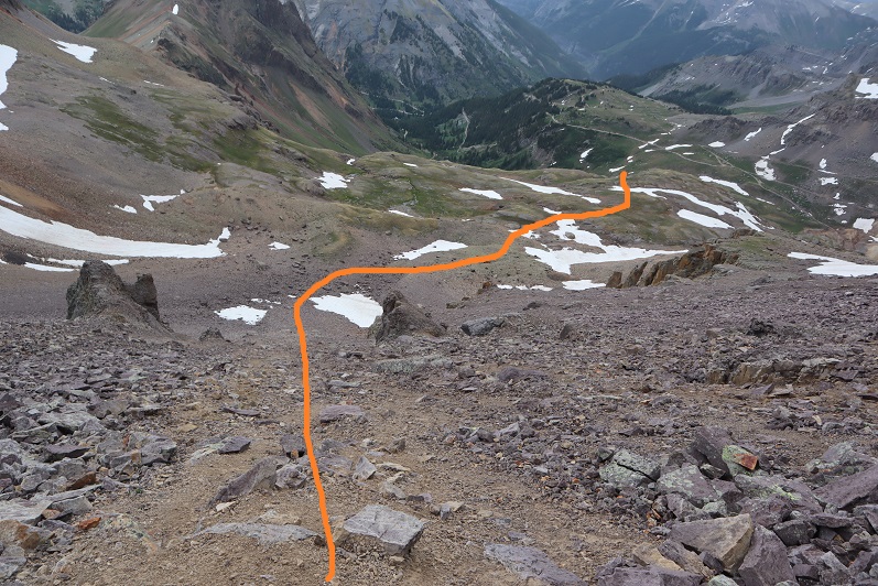
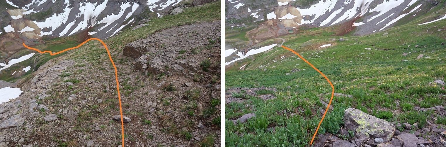
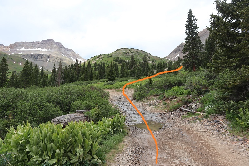
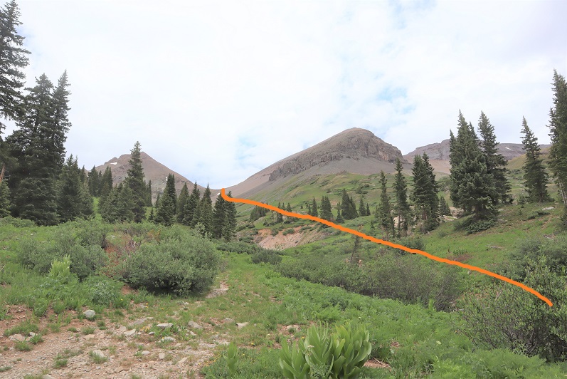
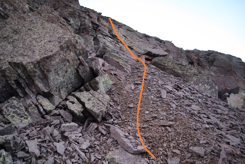
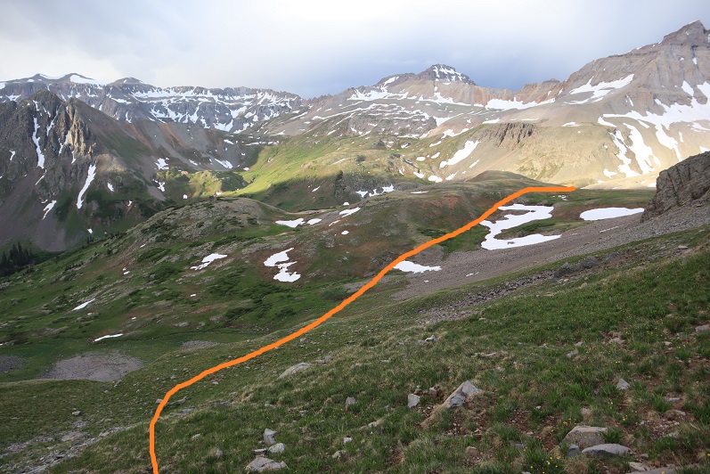
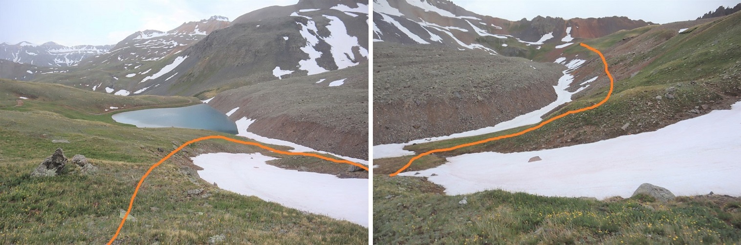
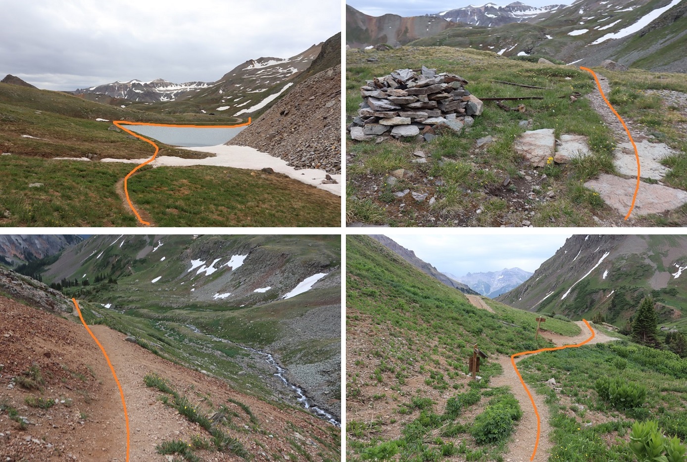
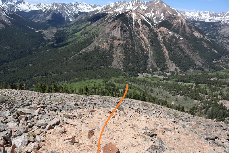
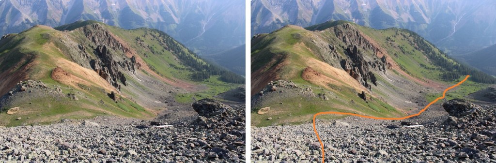
I was now in a meadow and basin.  There were wildflowers I couldn’t yet see in the dark, and willows I kept encountering.  I found out the hard way to stay right to avoid the willows.  The path is obvious in the daylight.  Here’s the route I took.

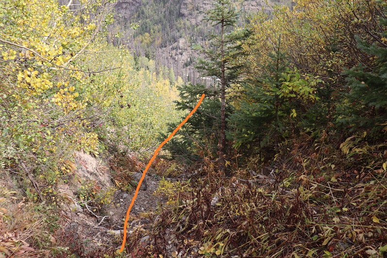
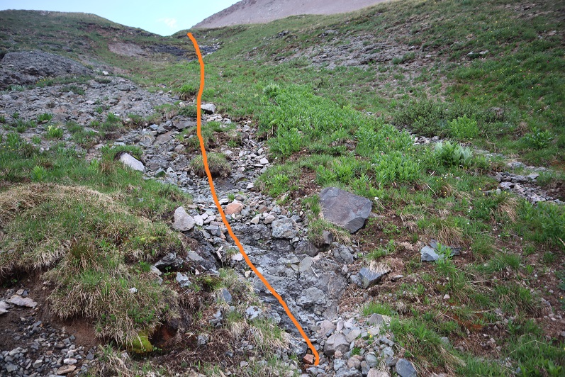
And some step-by-step pictures of my way to the saddle, first hopping across a small stream

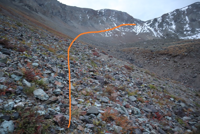
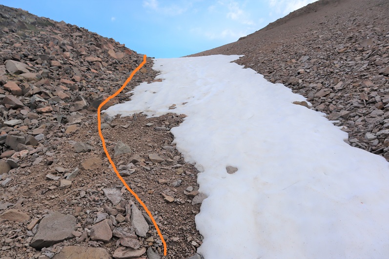
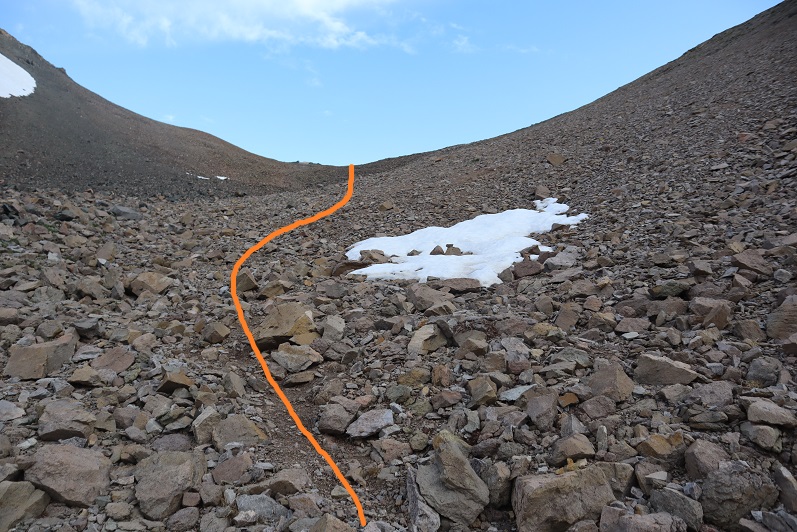
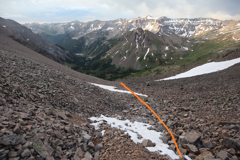
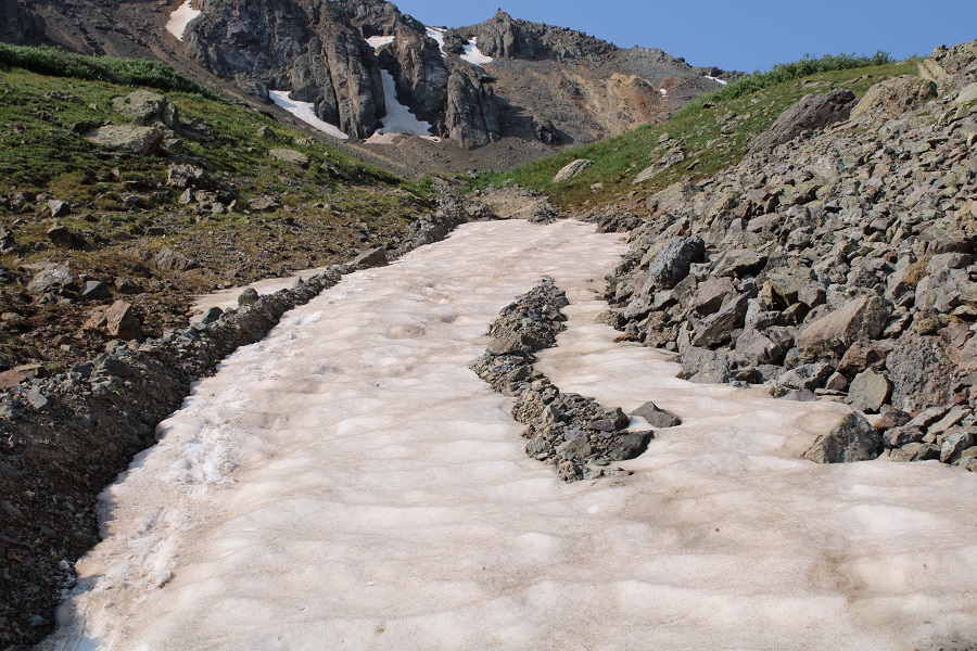
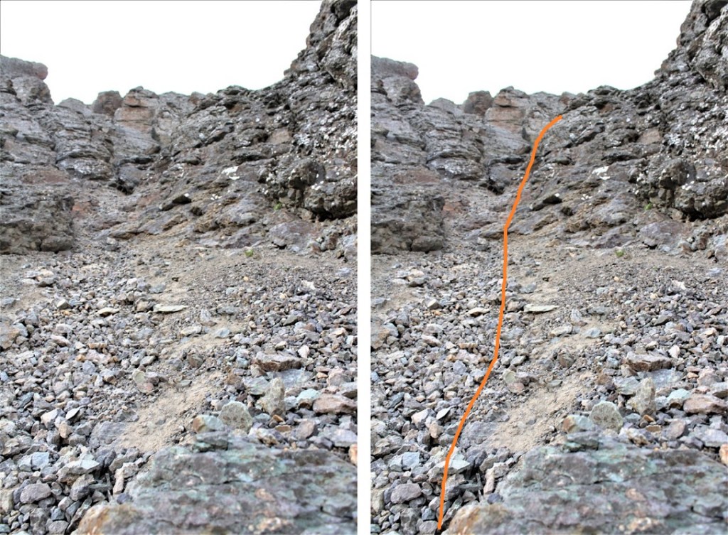
Staying right to avoid the willows and ascending a small gully that still had snow.  Microspikes were helpful here, both on the scree and snow.

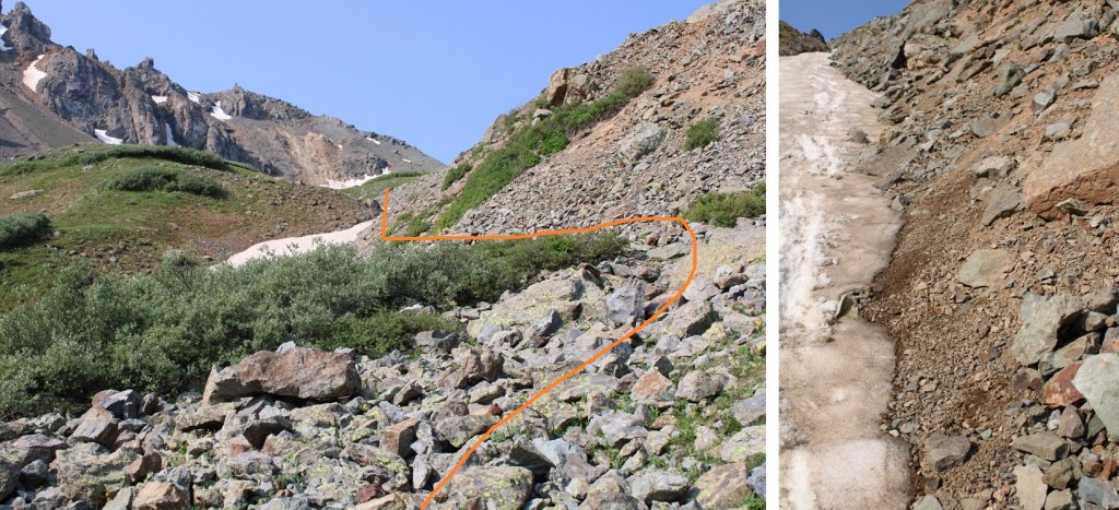
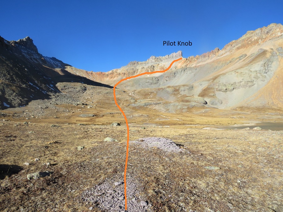
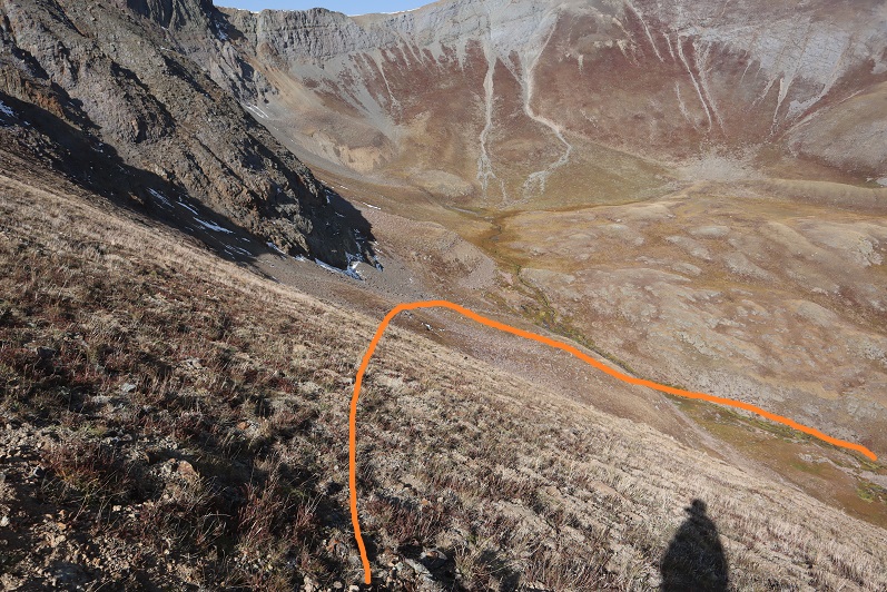
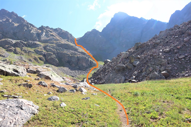
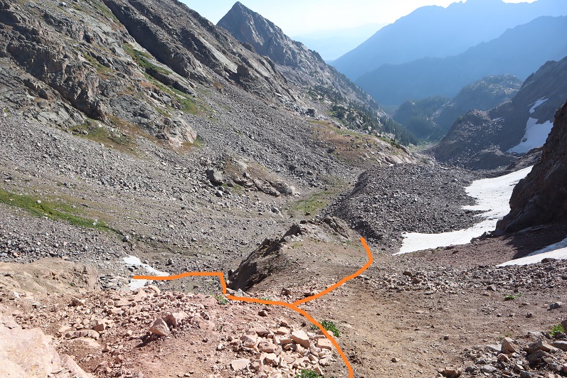
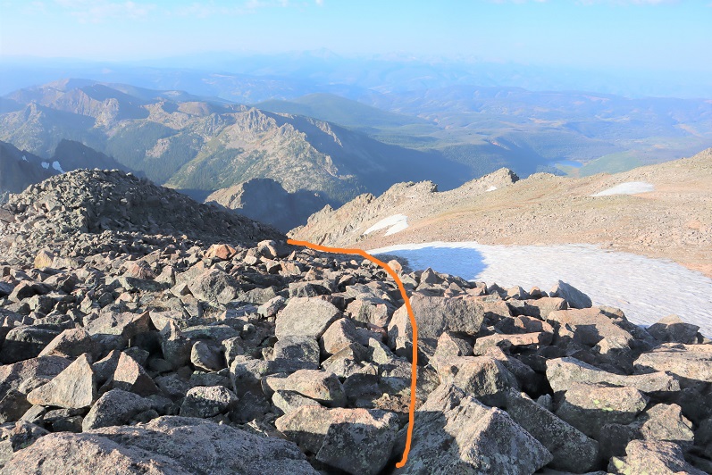
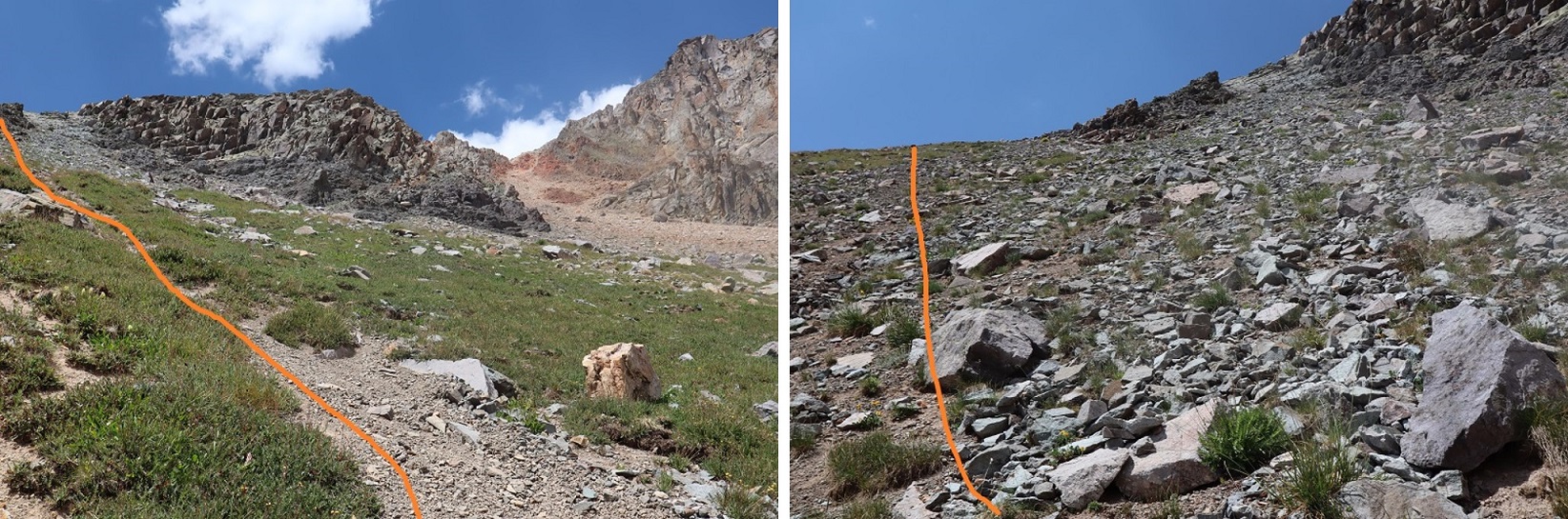
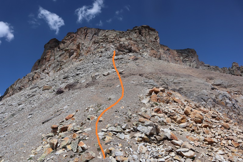
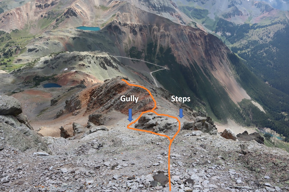
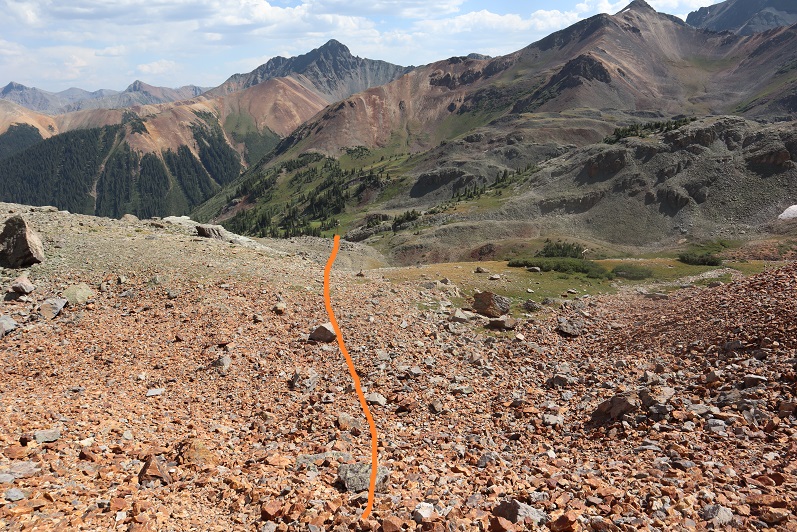
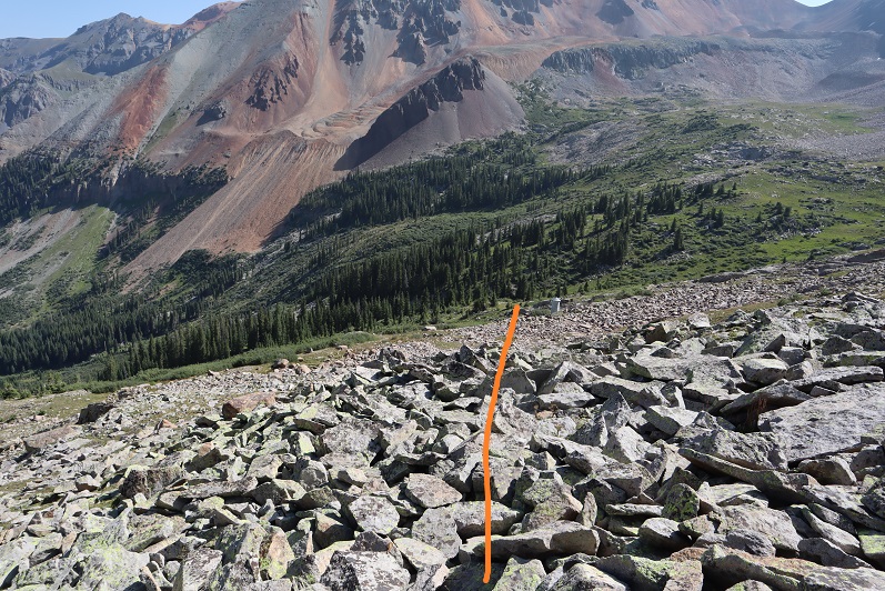
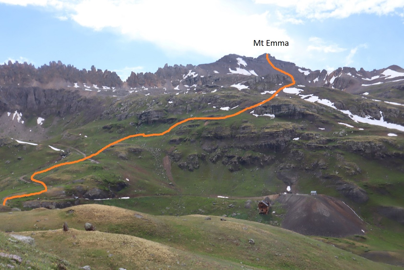
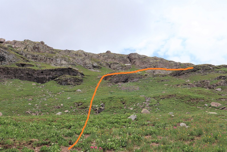
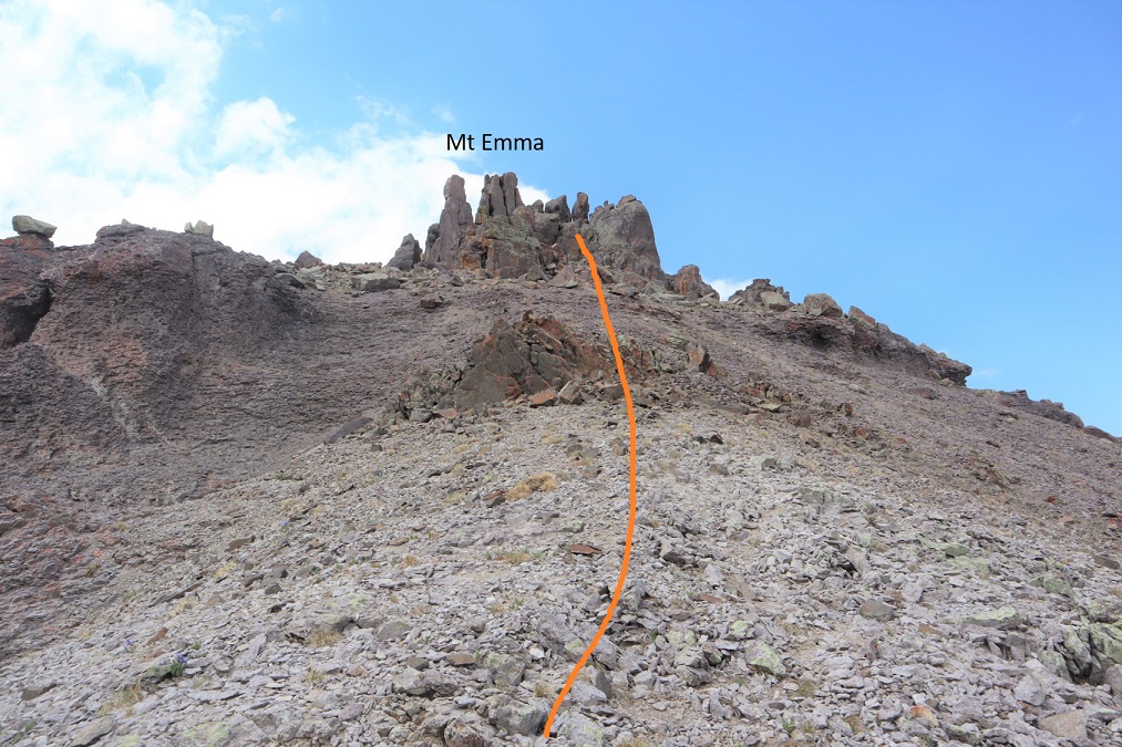
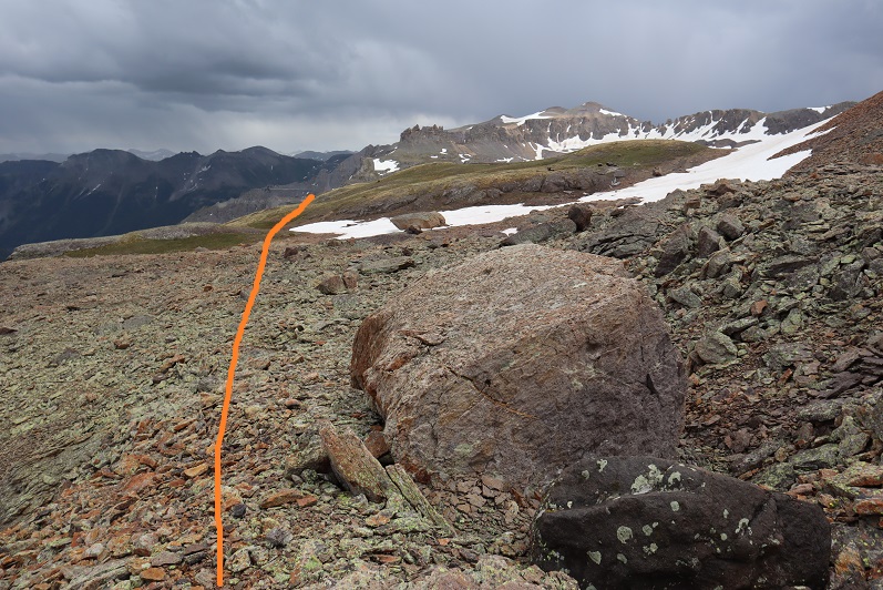
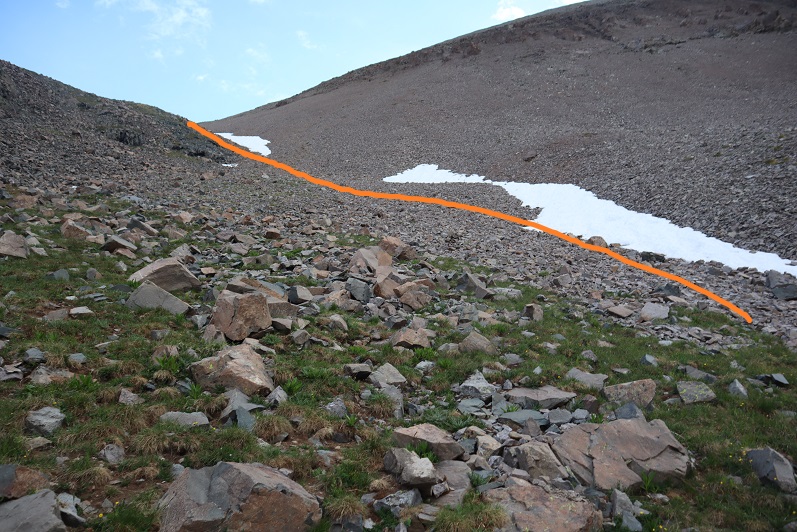
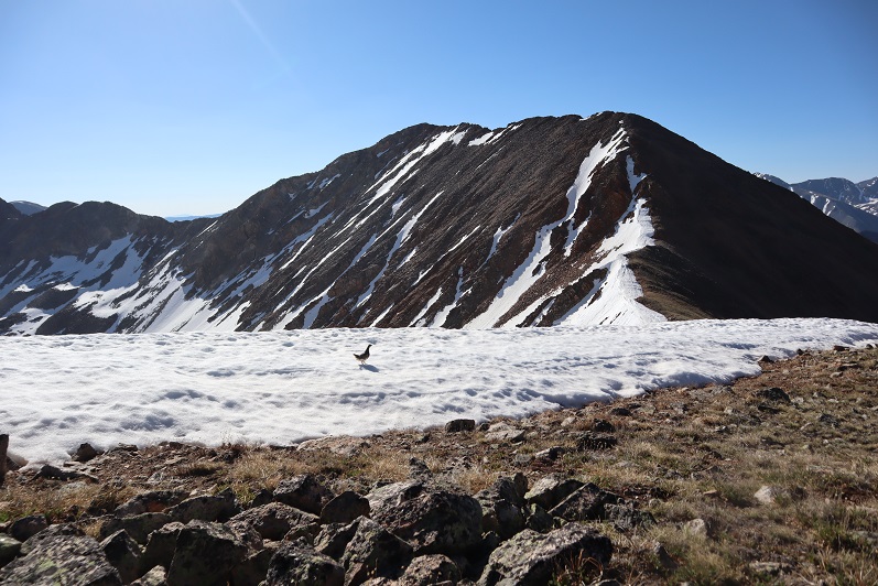
At the top of the gully, I was now in a rocky upper basin.  I crossed a boulderfield and headed towards the saddle.

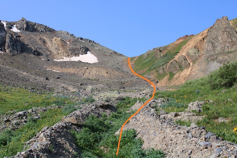
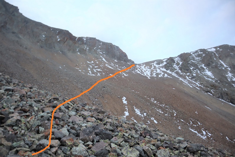
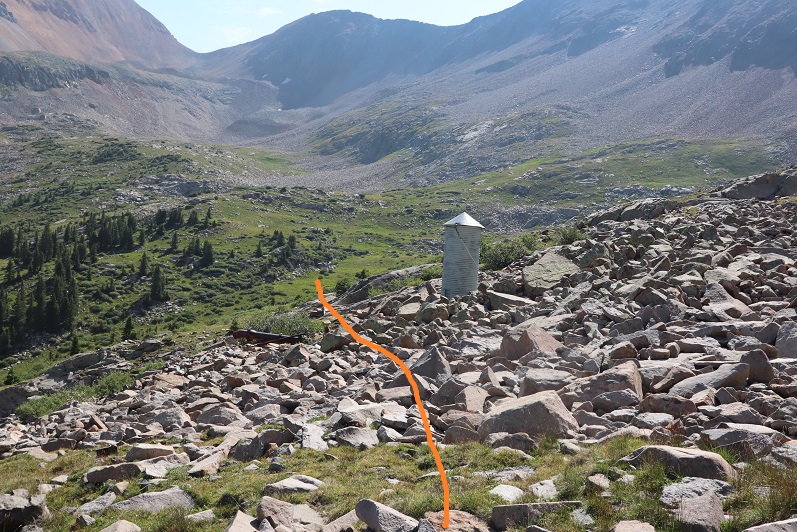
Here’s a look at the last bit of hiking to the saddle

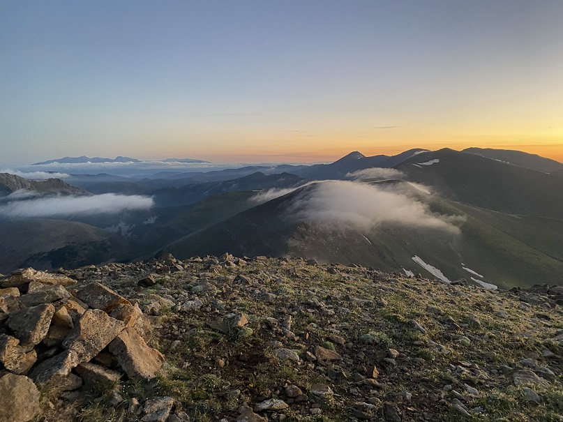
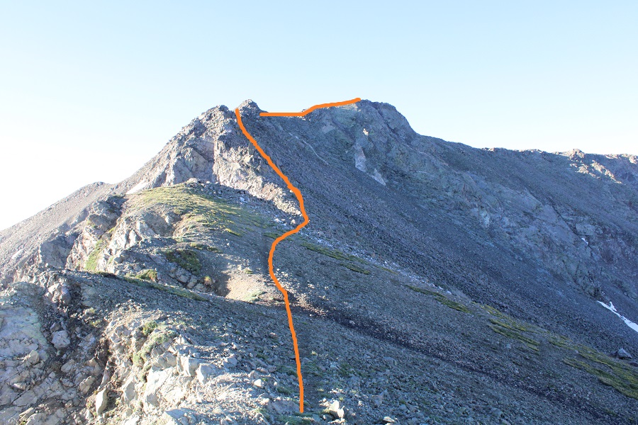
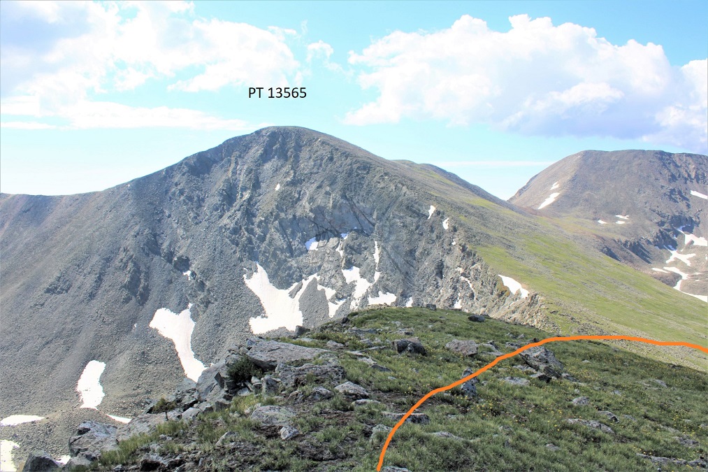
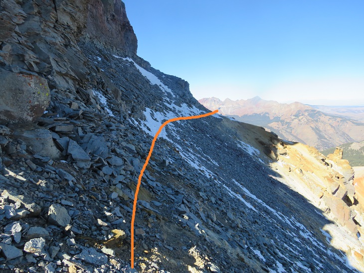
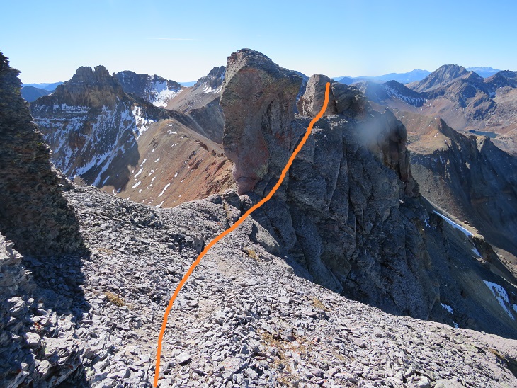
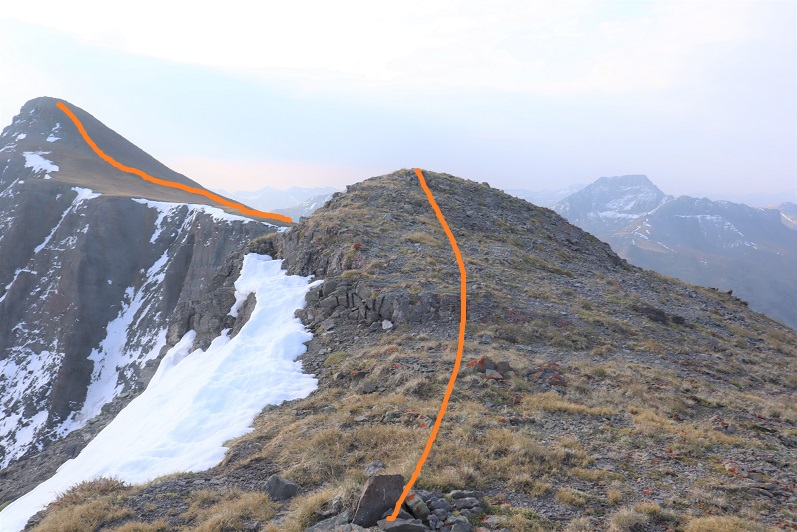
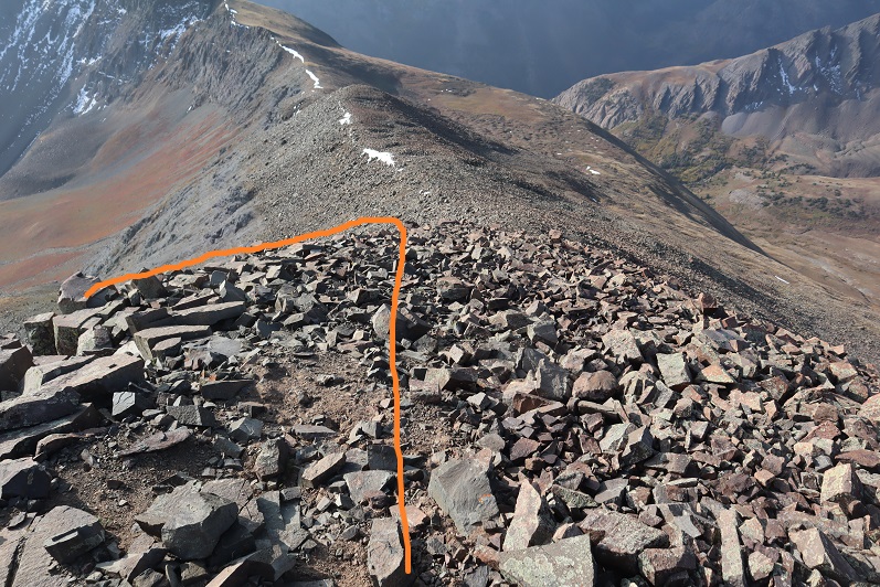
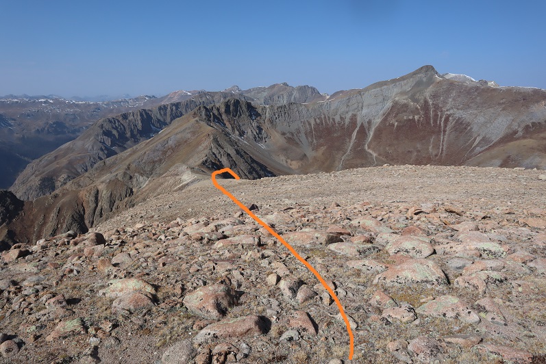
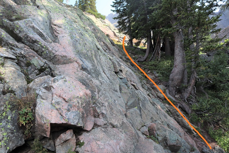
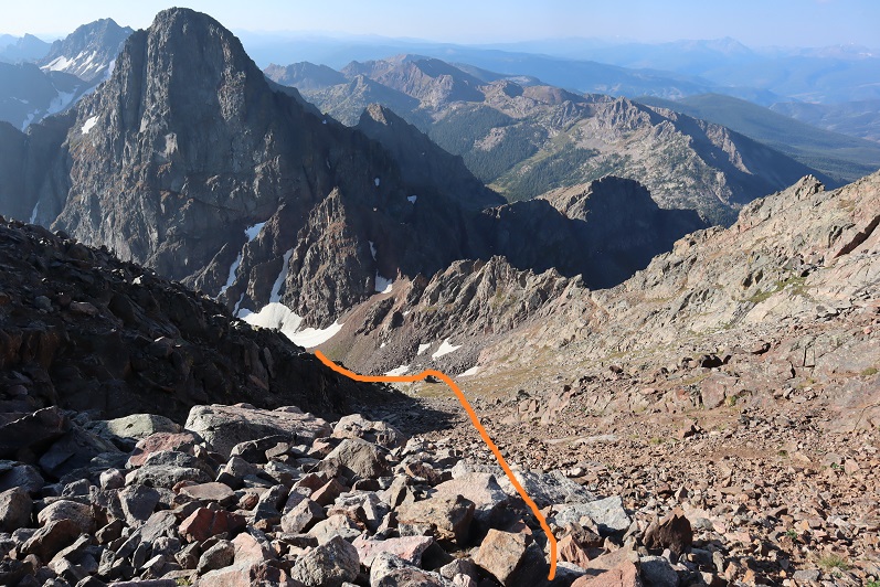
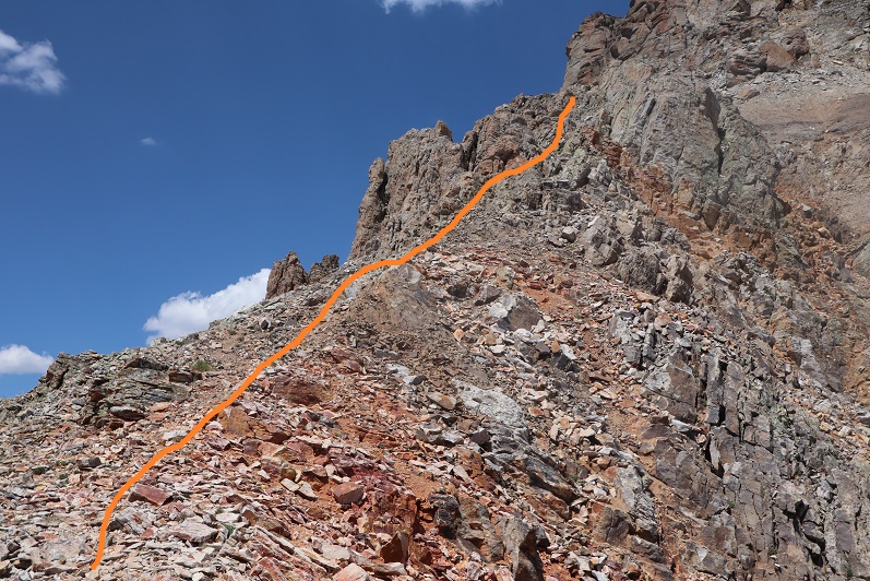
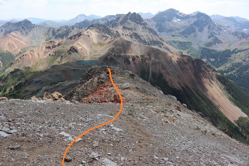
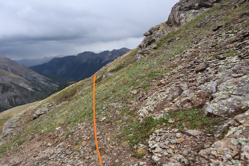
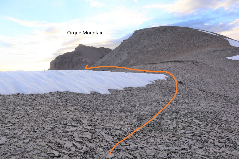
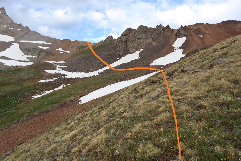
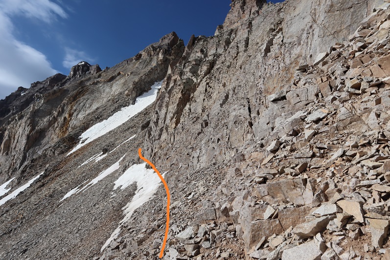
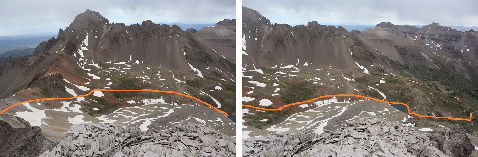
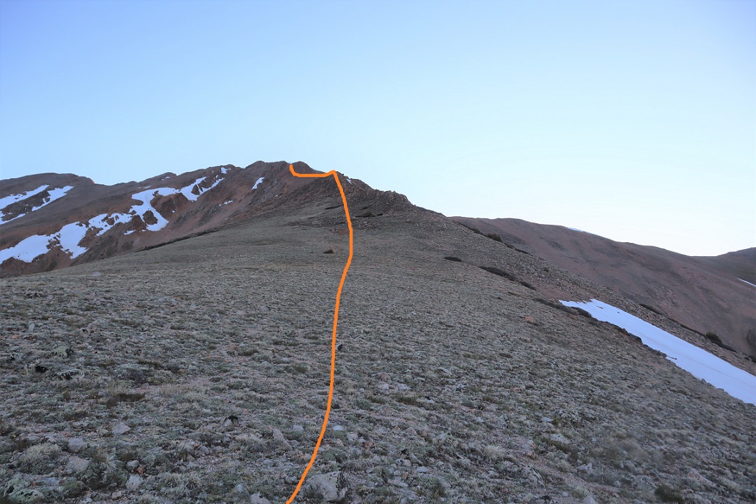
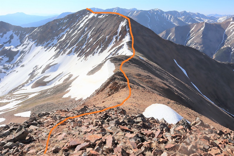
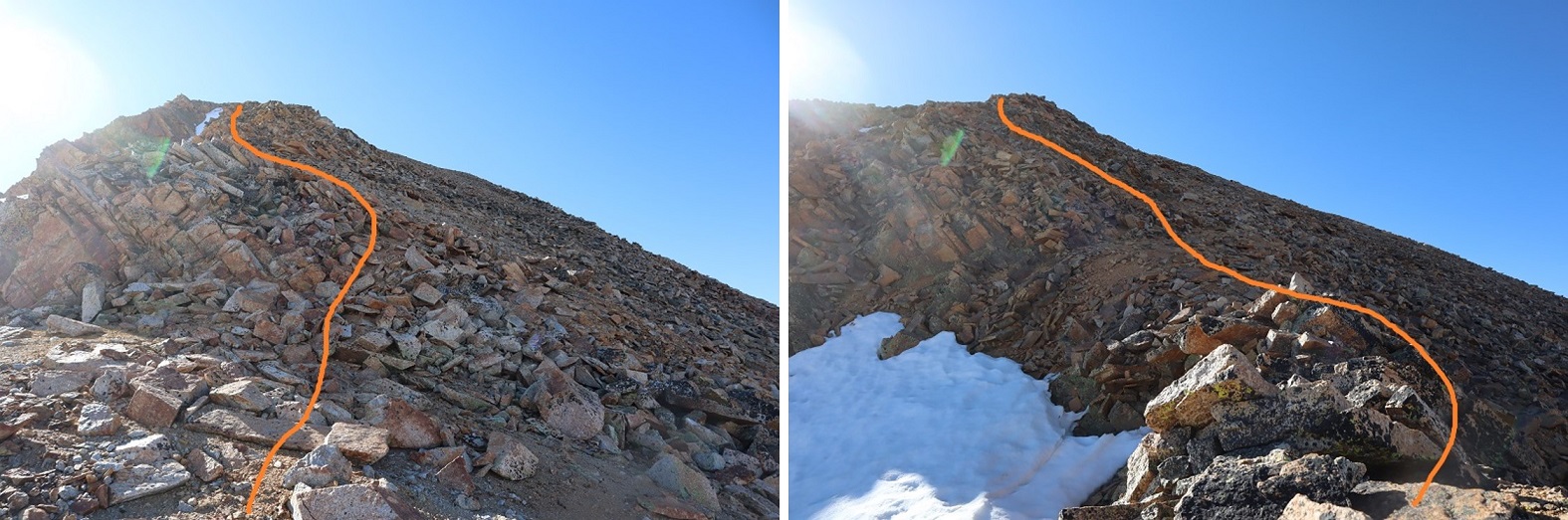
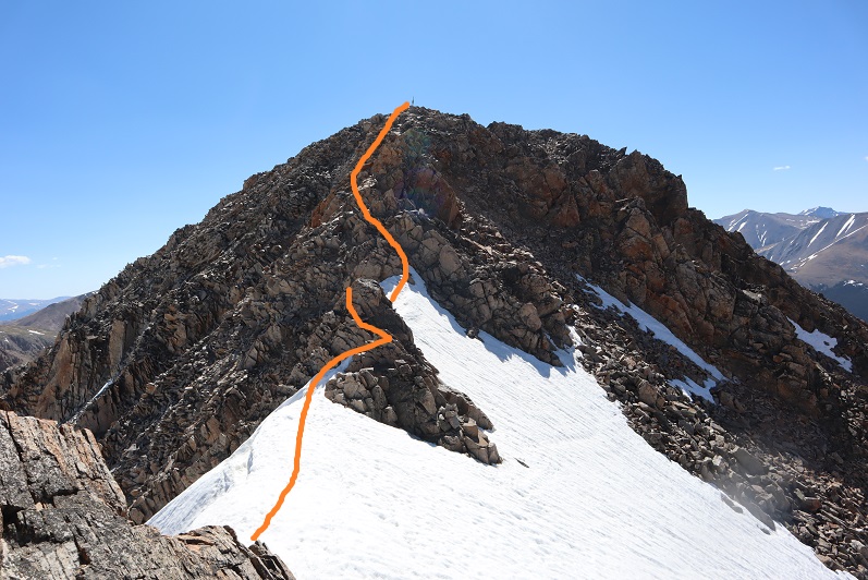
Once on the saddle I turned left and followed the ridge southeast, staying to the left of the snow.

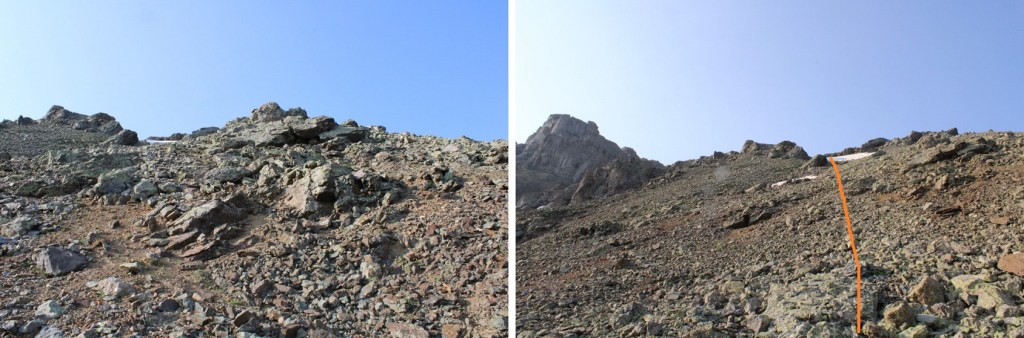
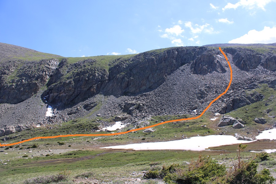
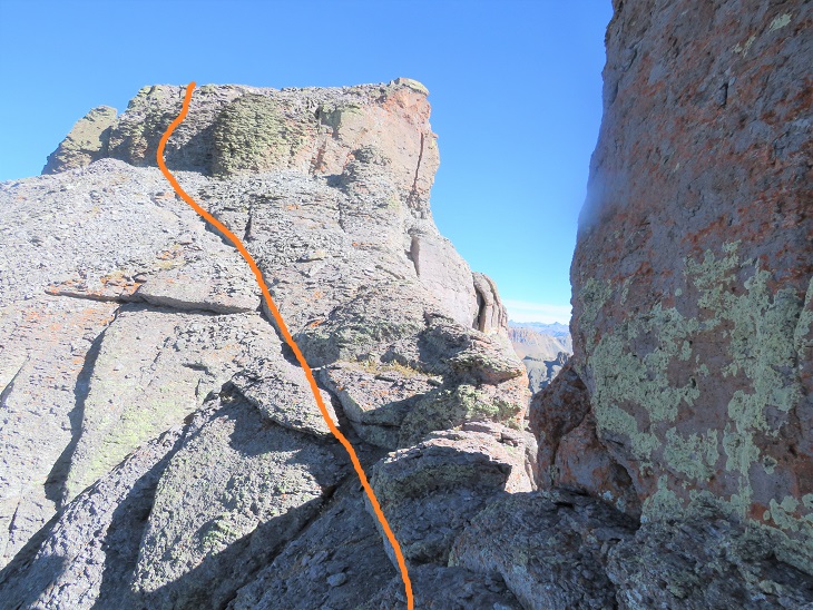
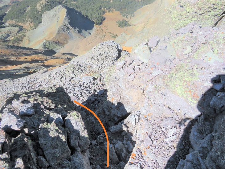
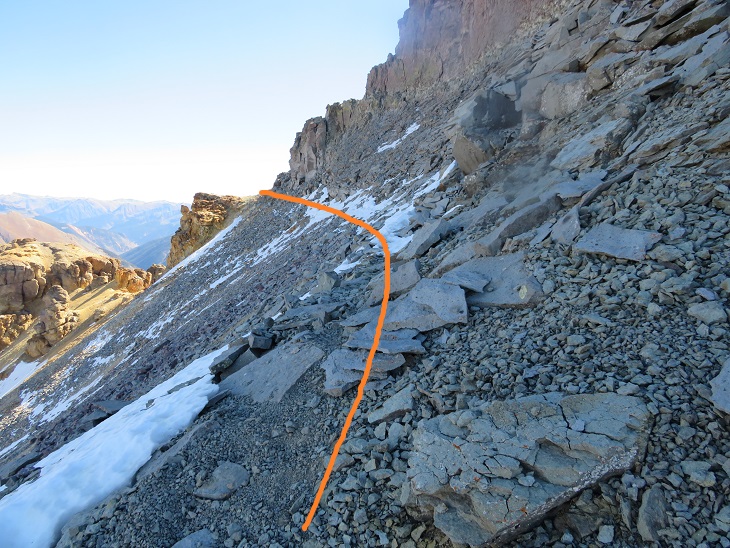
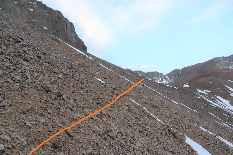
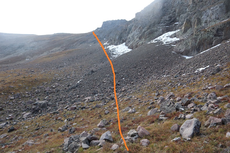
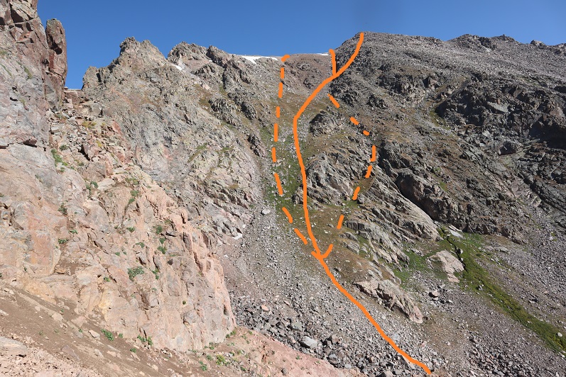
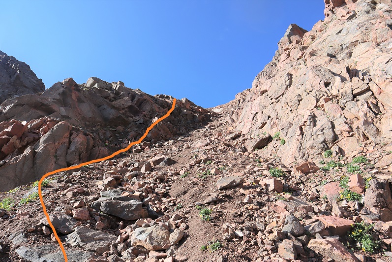
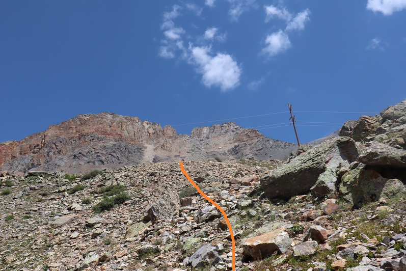
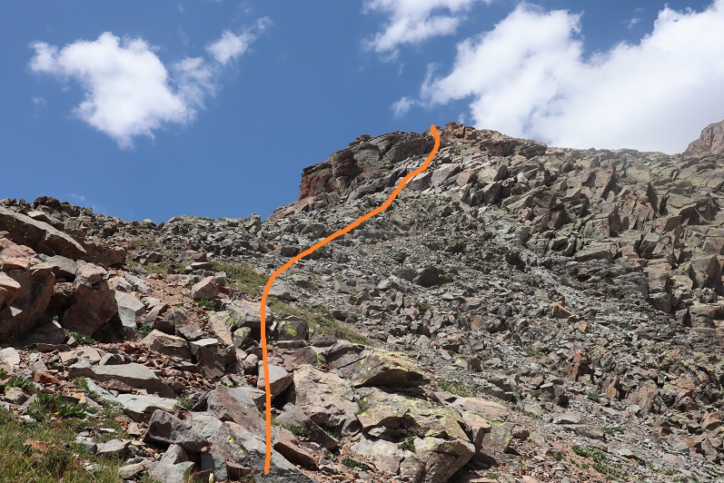
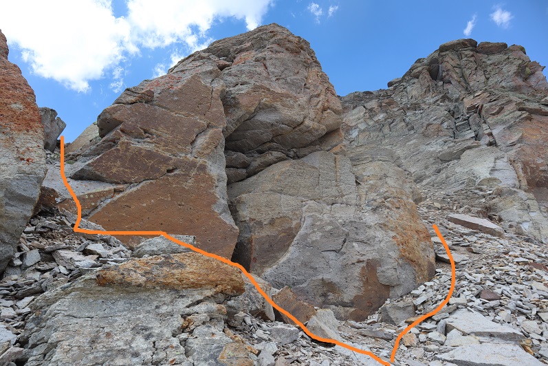
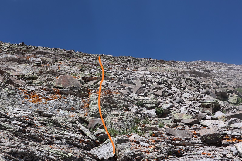
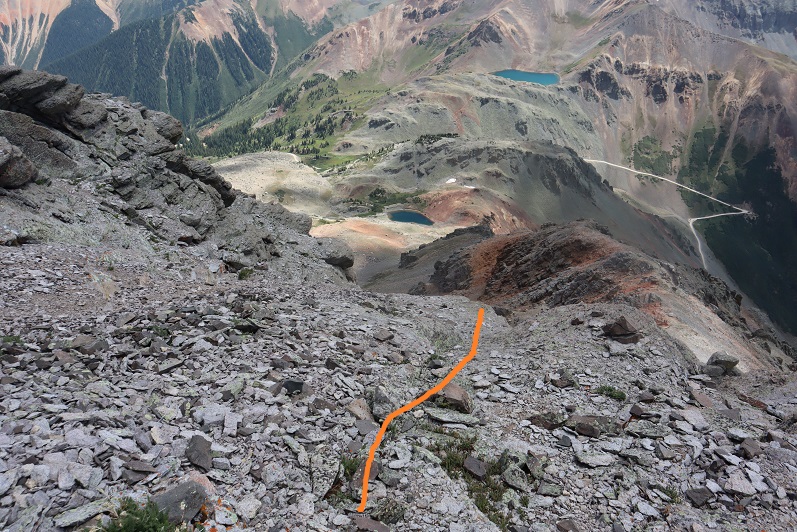
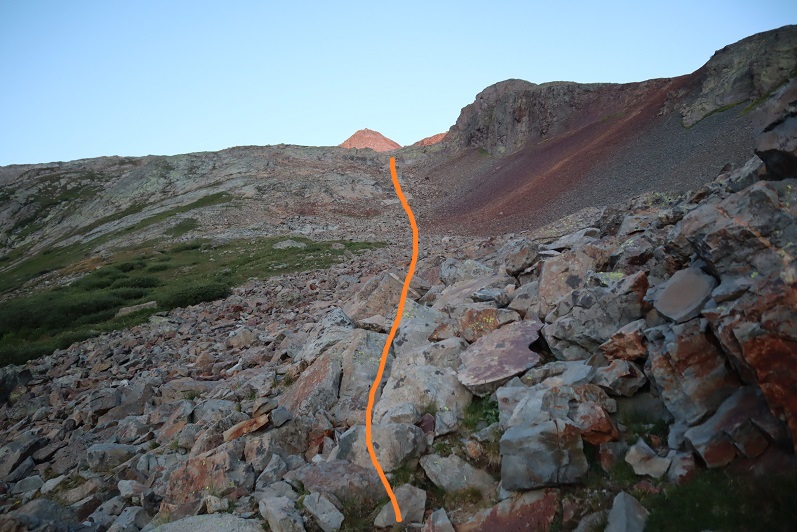
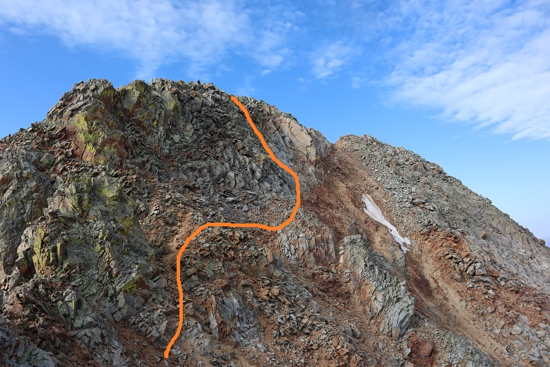
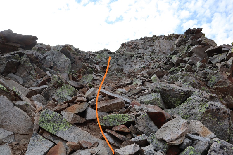
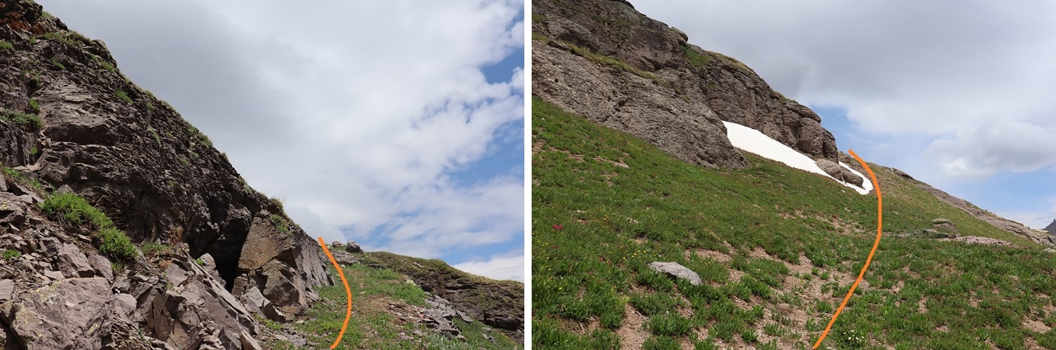
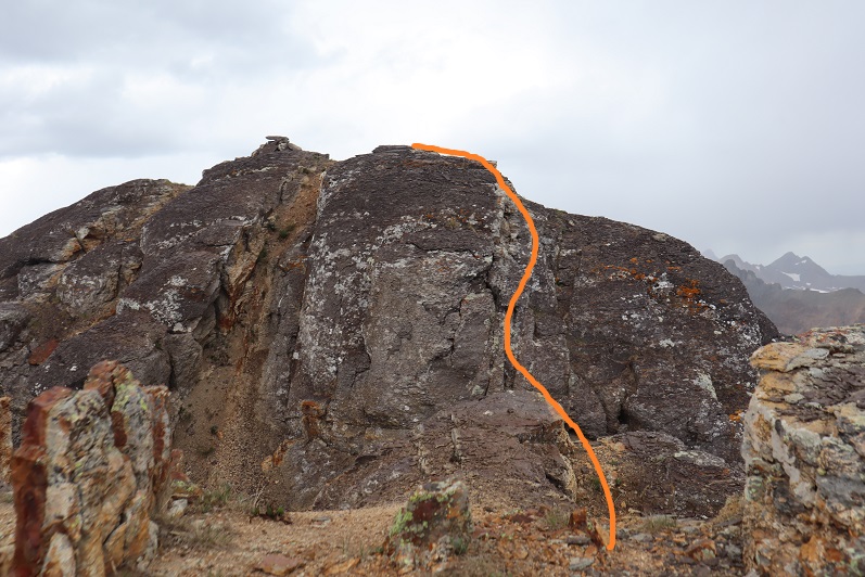
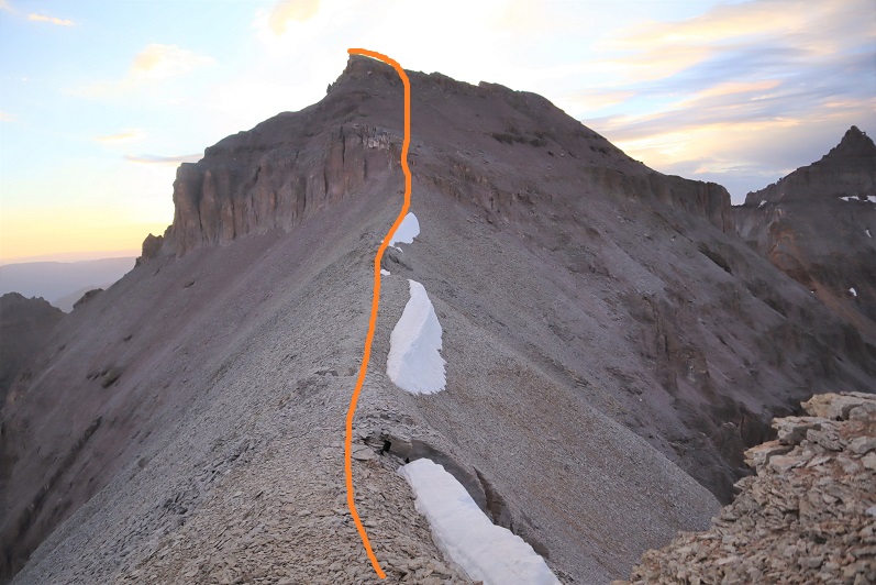
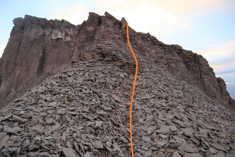
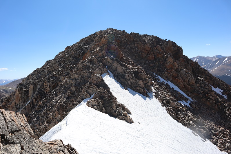
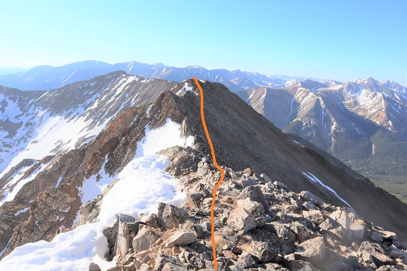
At the top of this area you can see the crux of the route.  Now is a good time to put on your microspikes and helmet, if you haven’t already.  It’s much steeper than it looks, and the scree isn’t manageable without microspikes (trust me on this one).

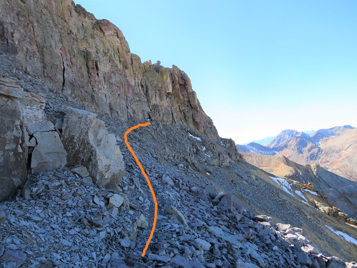
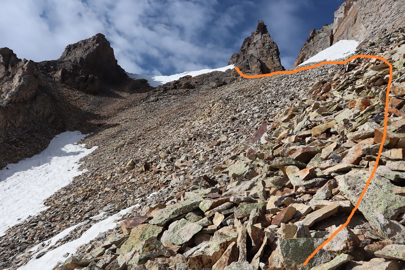
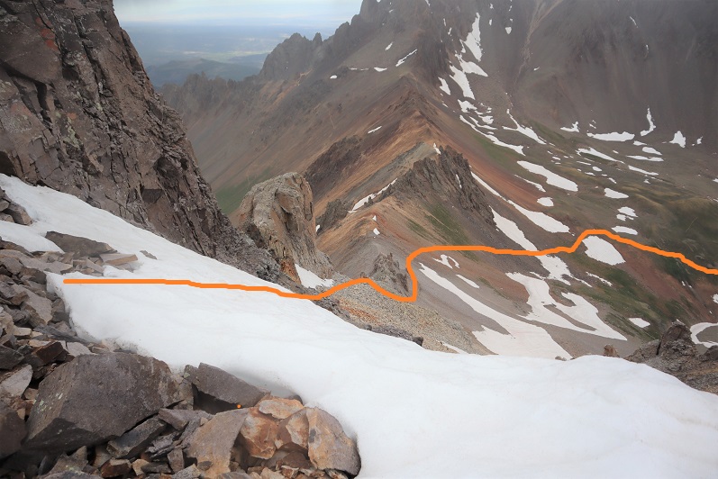
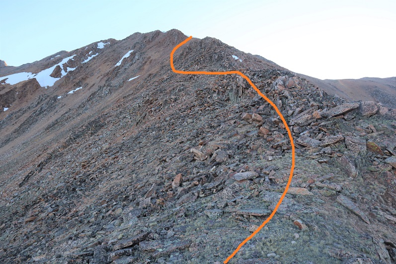
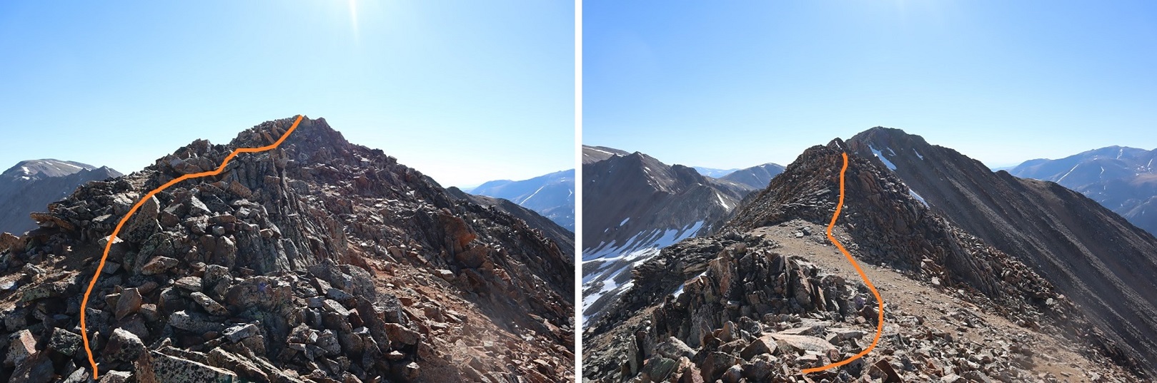
Here’s your intended route:

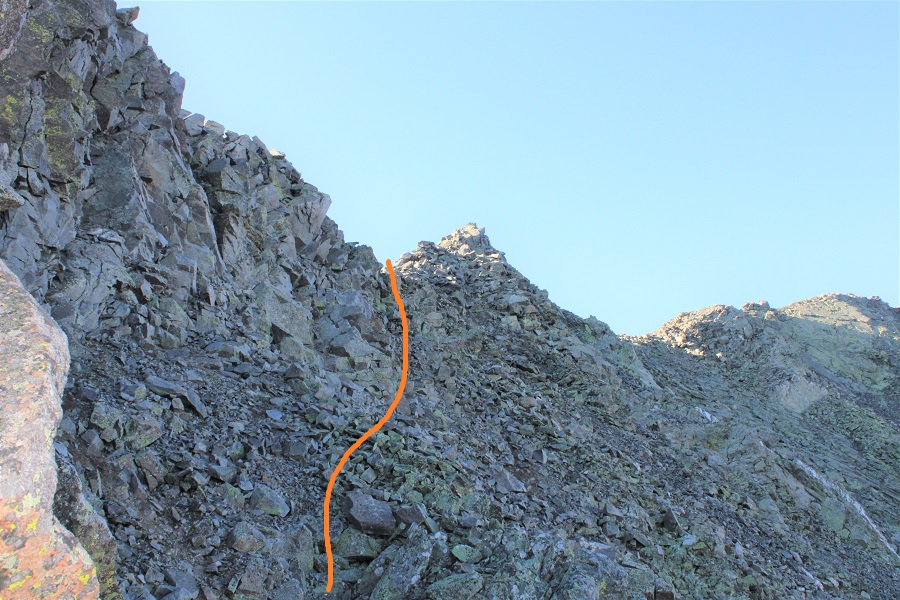
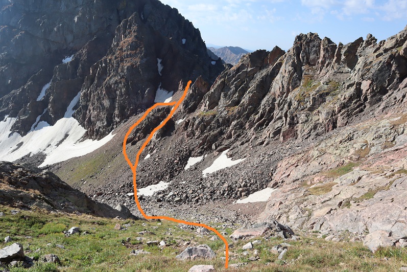
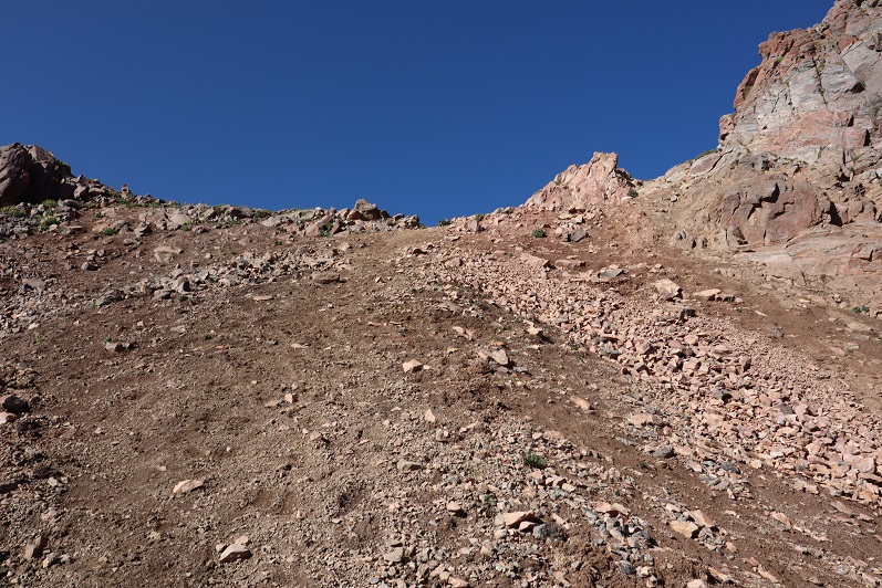
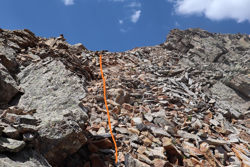
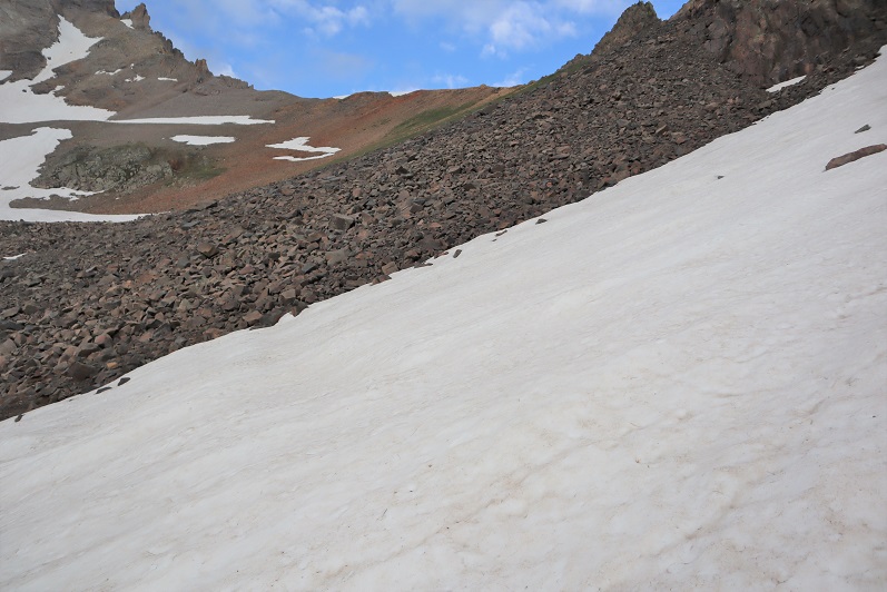
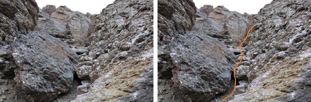
You’re aiming for this gully.  The scree here is steep; a 45 degree angle for an extended amount of time. 

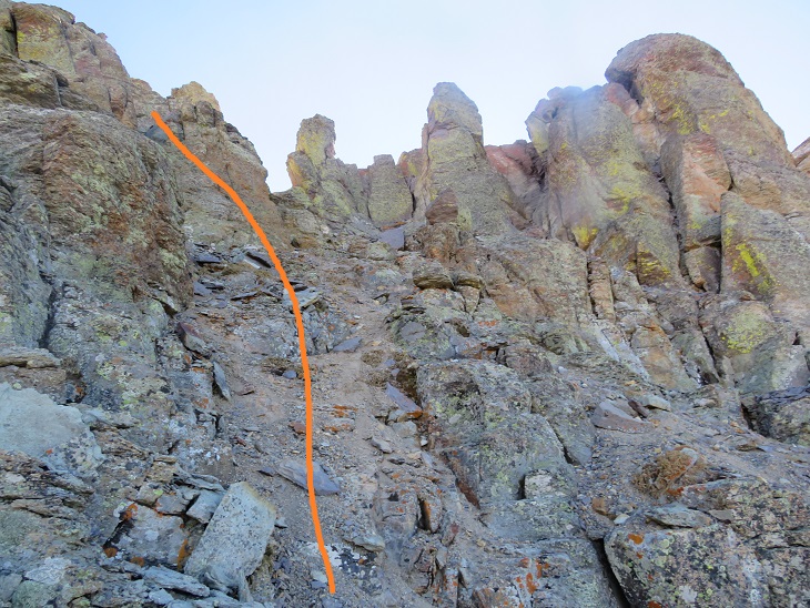
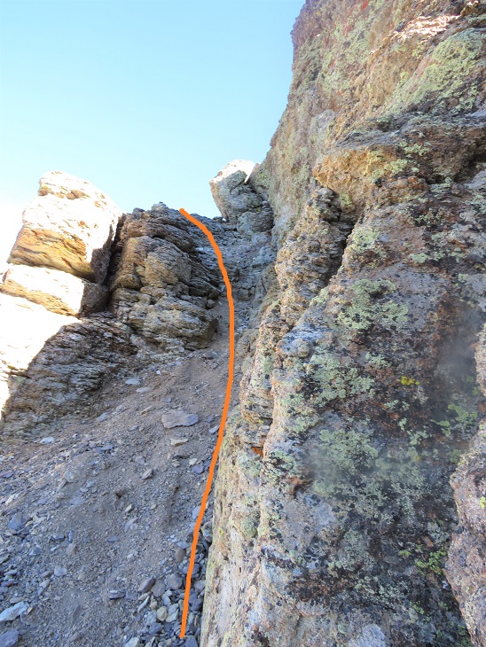
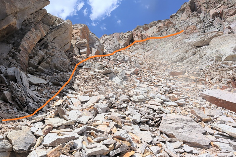
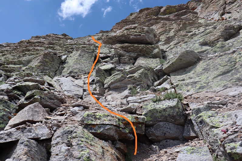
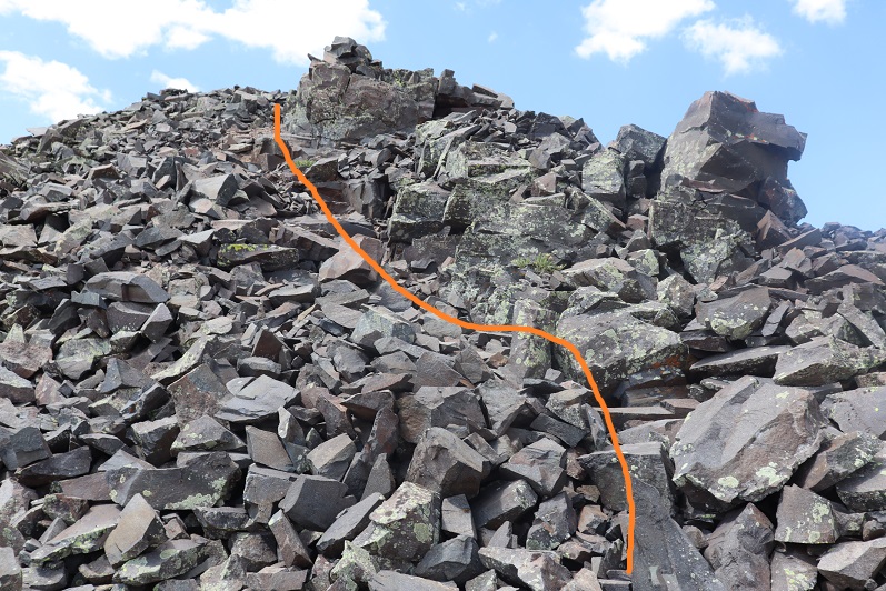
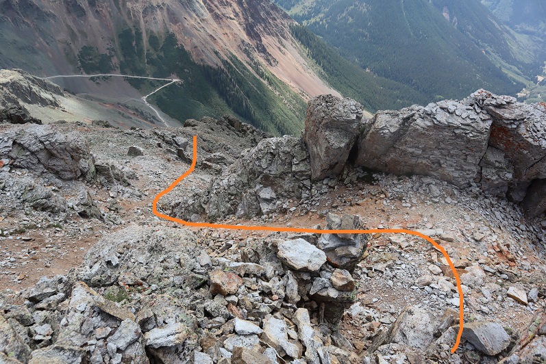
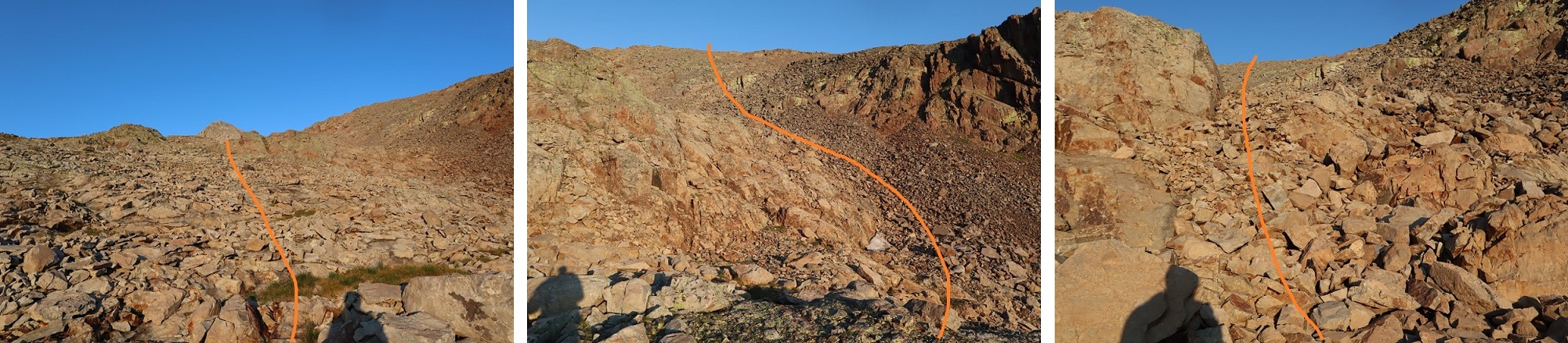
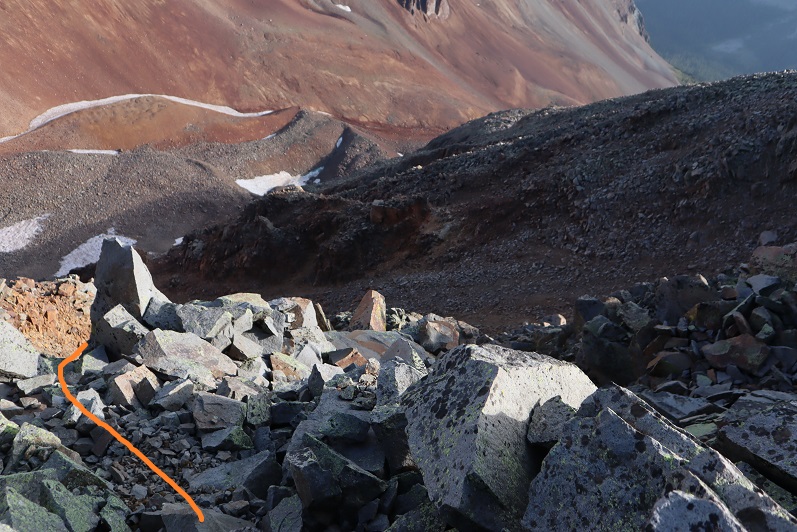
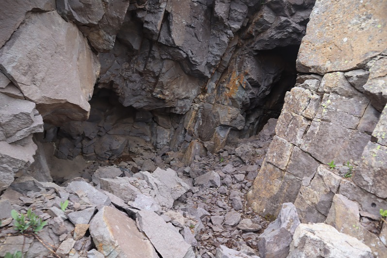
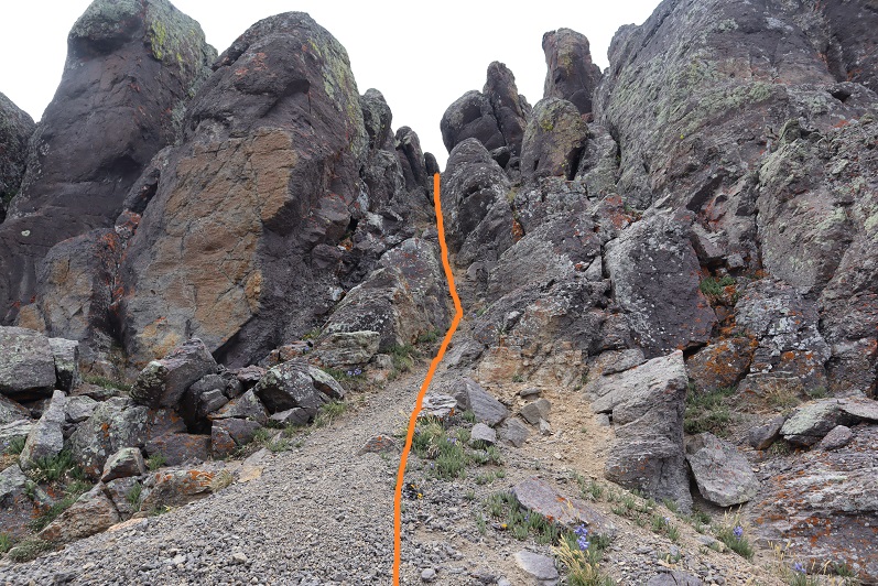
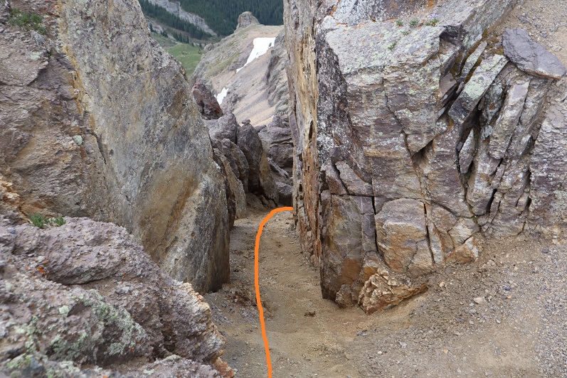
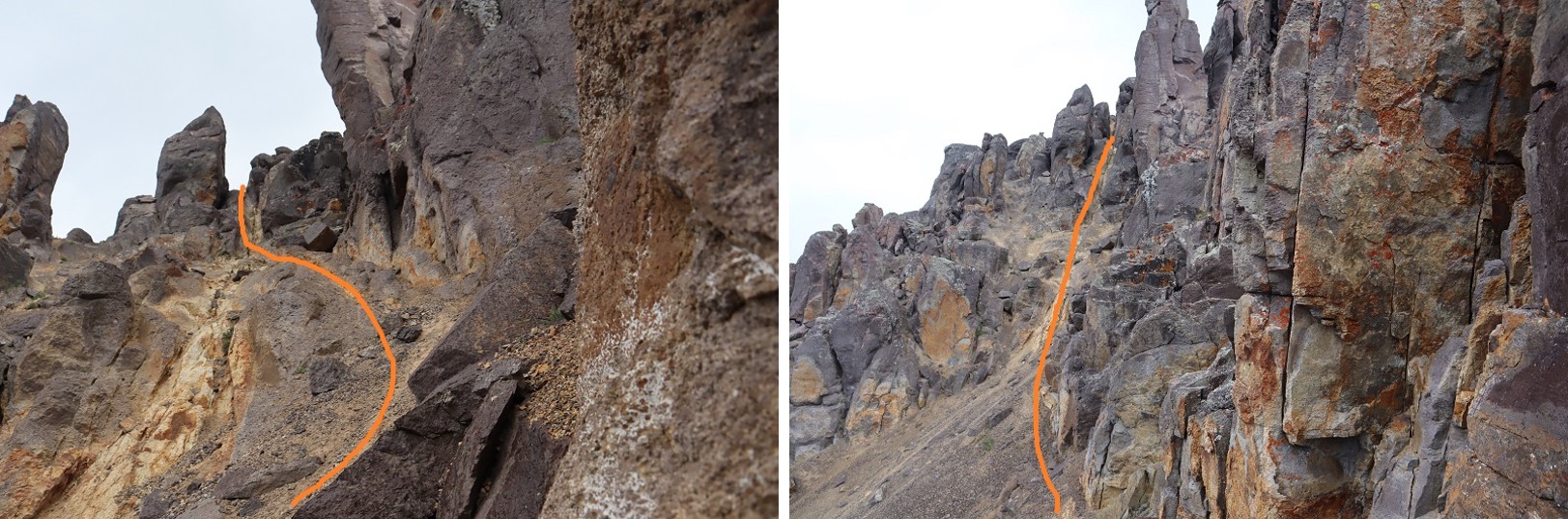
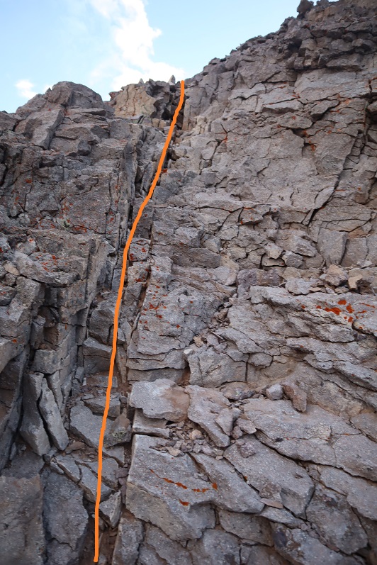
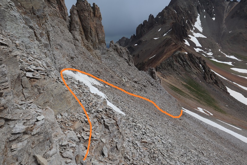
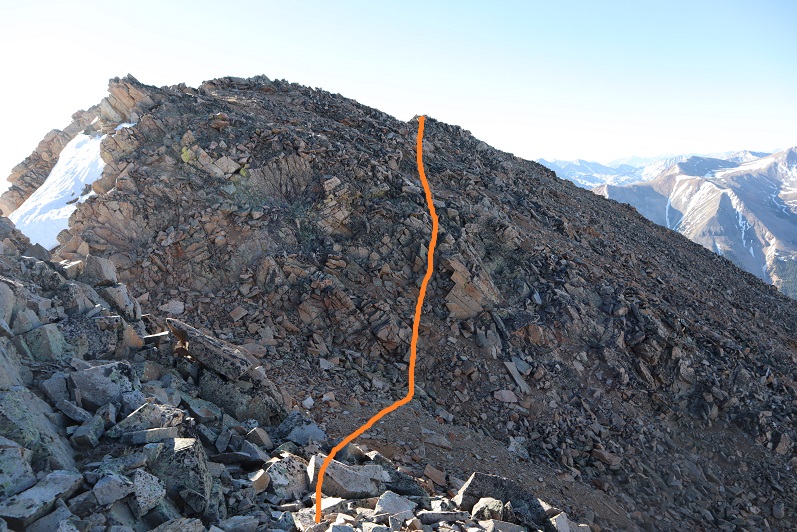
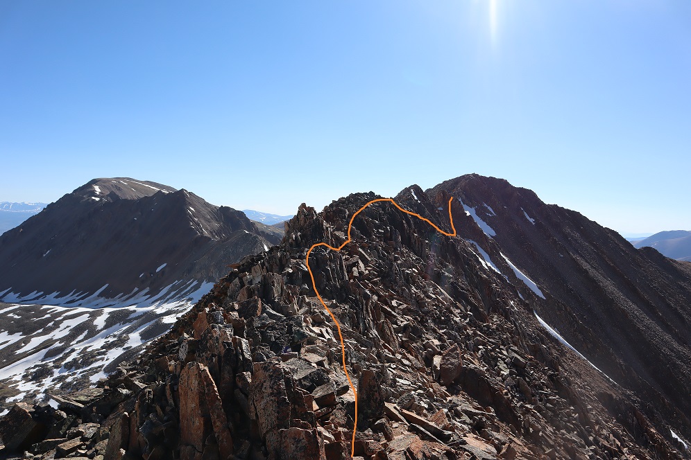
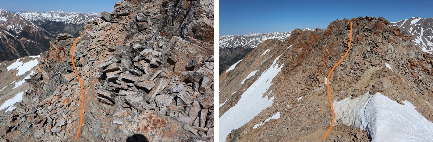
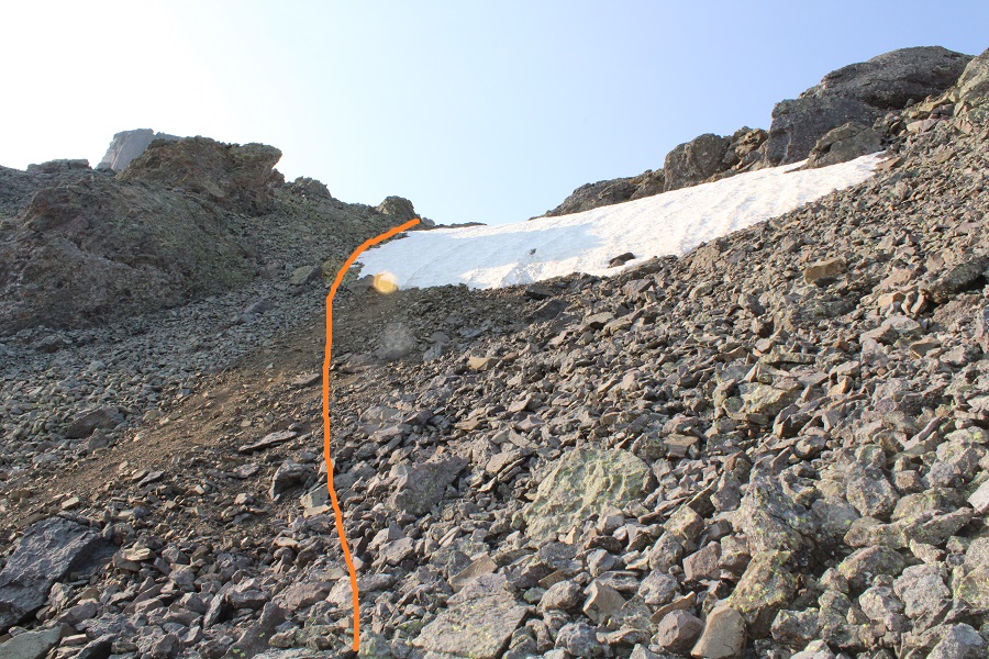
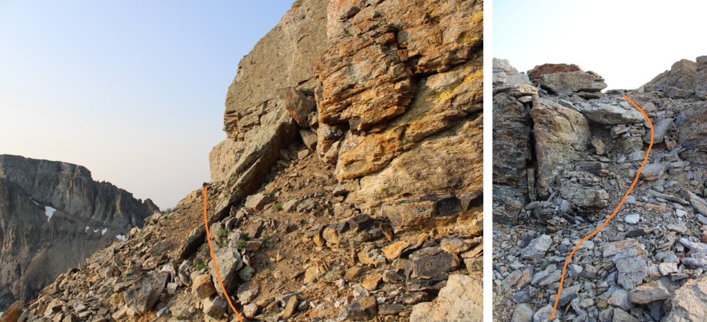
Once at the base of the gully the class 4 climbing begins.  The route is obvious, curving around to the right.  There is really only one way to go:  follow the trail set out for you from the fallen scree.  Also note:  the scree and rocks here are loose. Very loose.  I wouldn’t attempt to upclimb or downclimb this area with another person:  take turns the entire way up and down.  You will be causing screevalanches on climbers below you. 

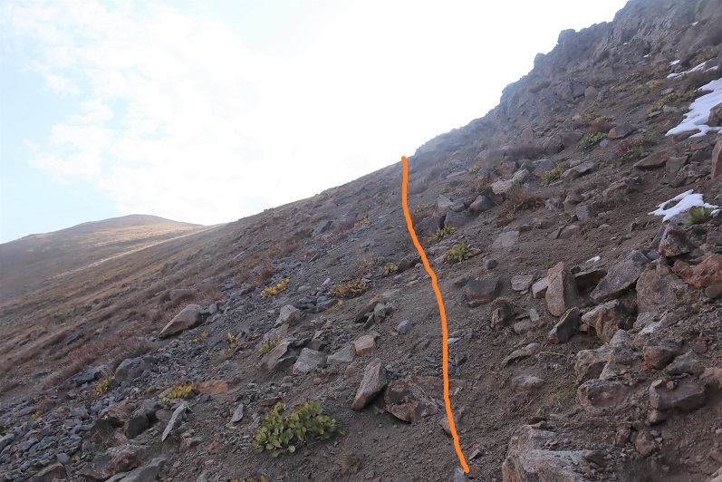
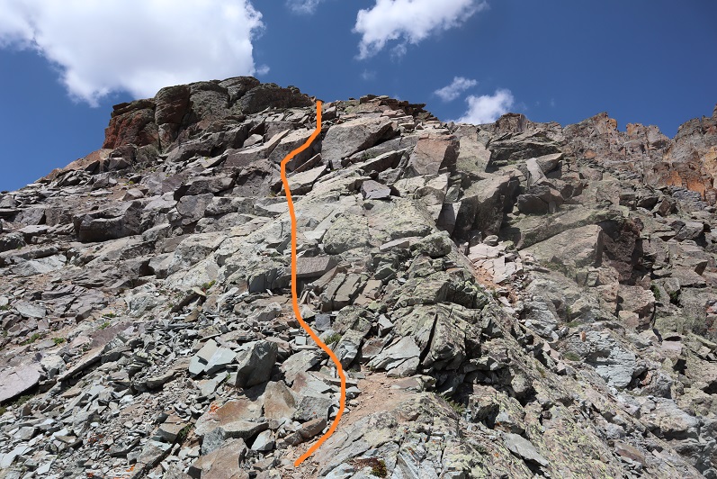
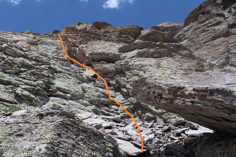
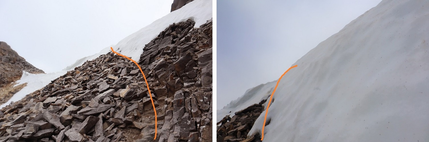
Here are some pictures from the inside of the gully. Pictures do not do the steepness justice (although the pictures down give you a better perspective).  When heading up, continue climbing southeast.

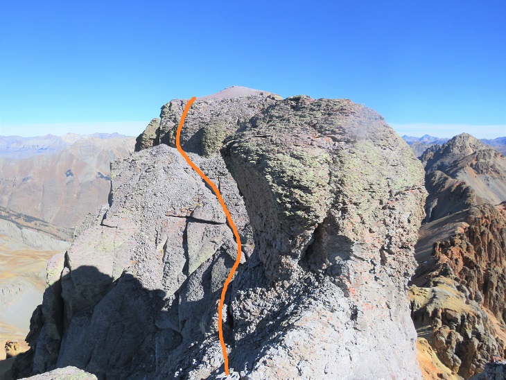
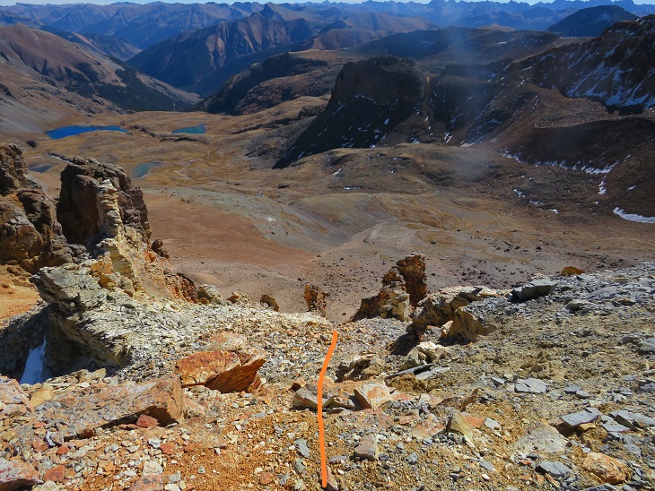
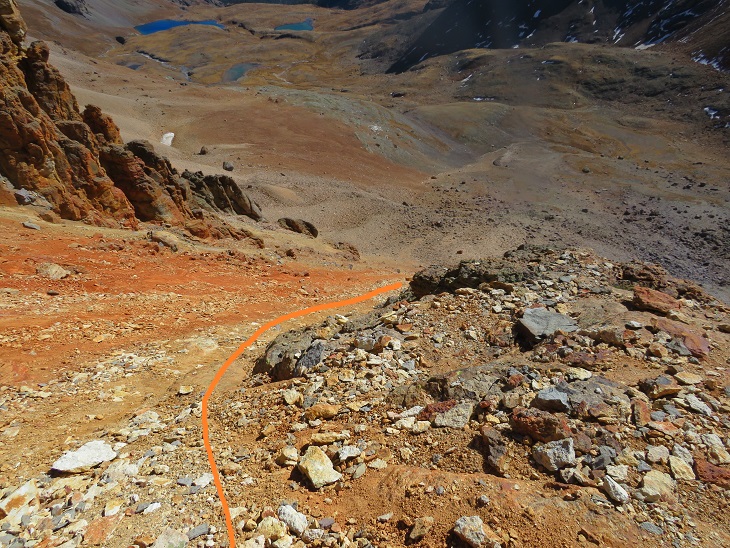
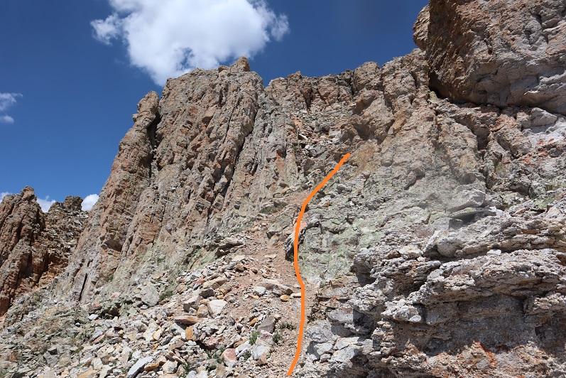
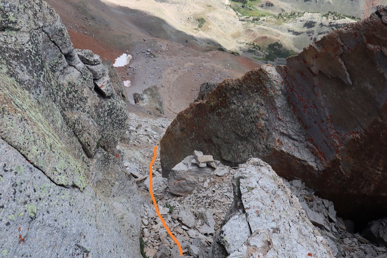
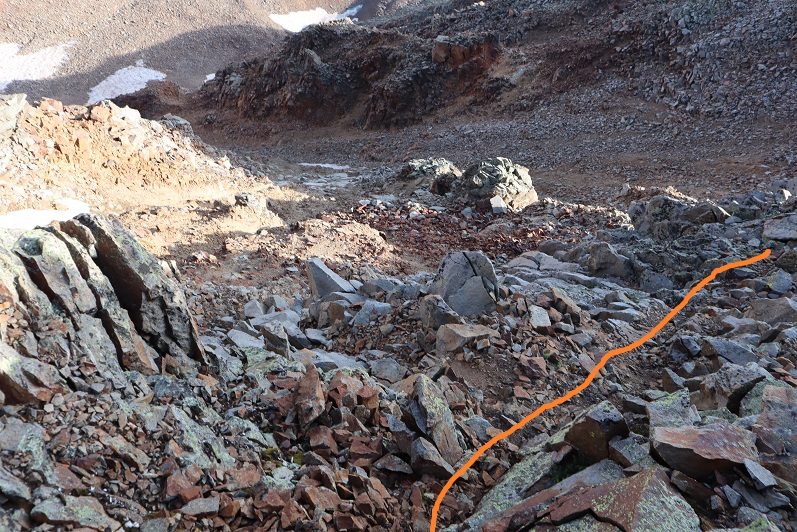
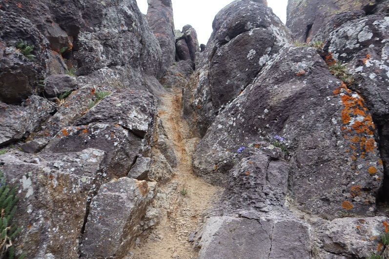
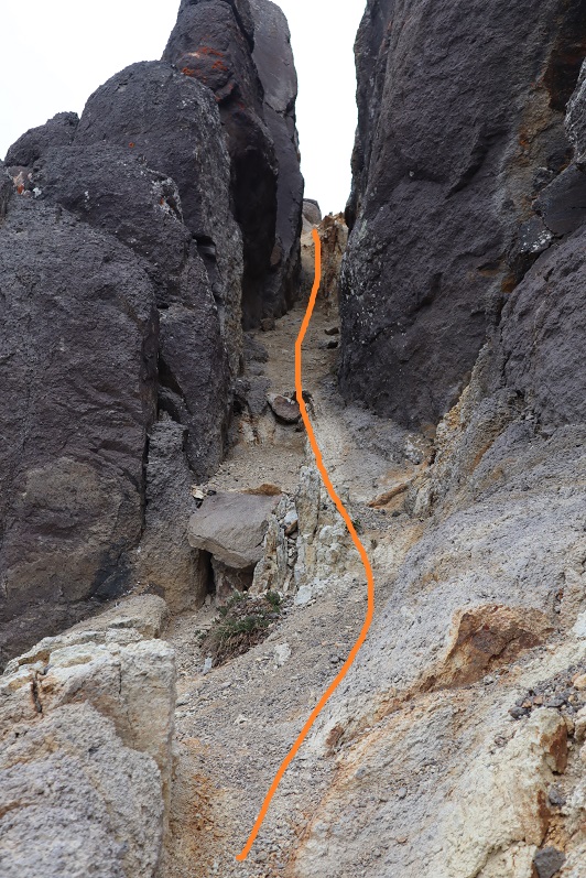
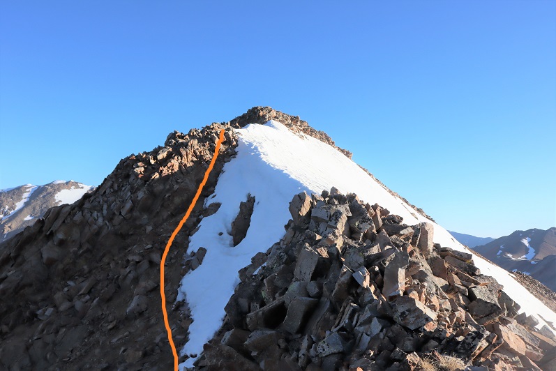
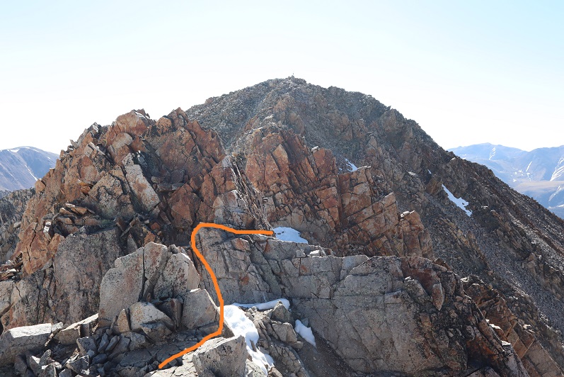
Here’s a look at the exit of the gully

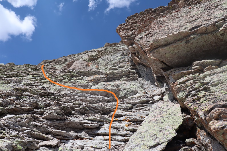
At this point it became even steeper.  I did not have on my microspikes, lost grip, and slid on my stomach backwards for a full 12 feet.  I seriously thought I was going to slide all the way back down that gully.  I braced myself, and without taking off my pack located my microspikes in my backpack pocket and gingerly put them on while trying to balance without much traction. It was much easier to upclimb once I put on my spikes.  Here is where I aimed

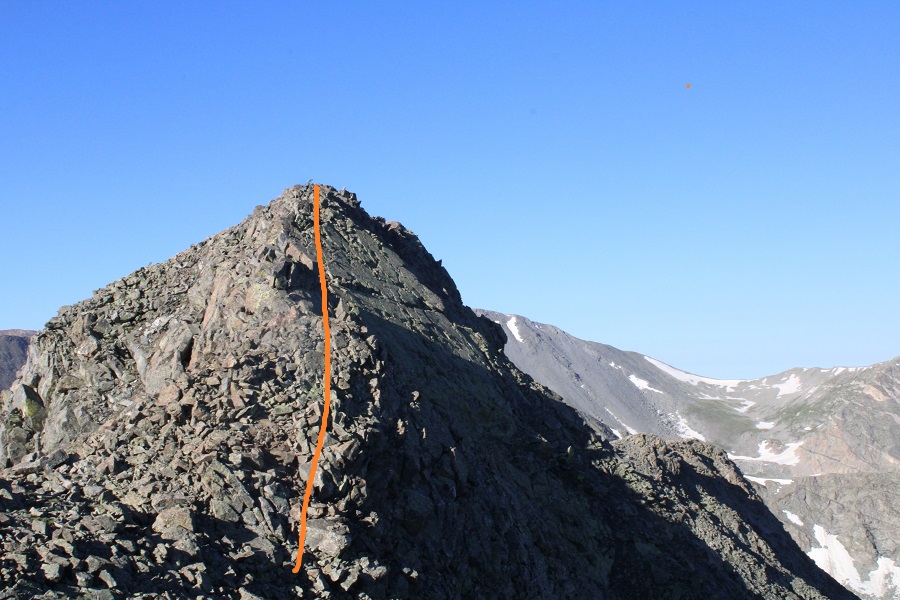
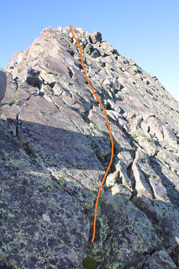
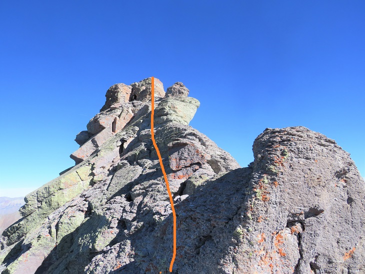
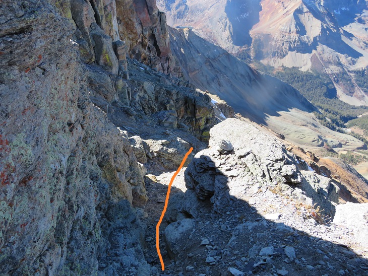
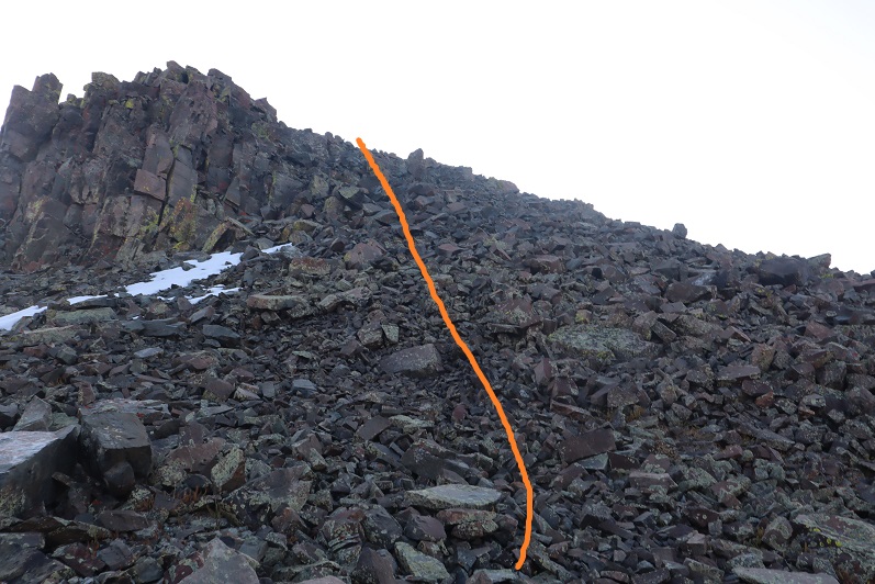
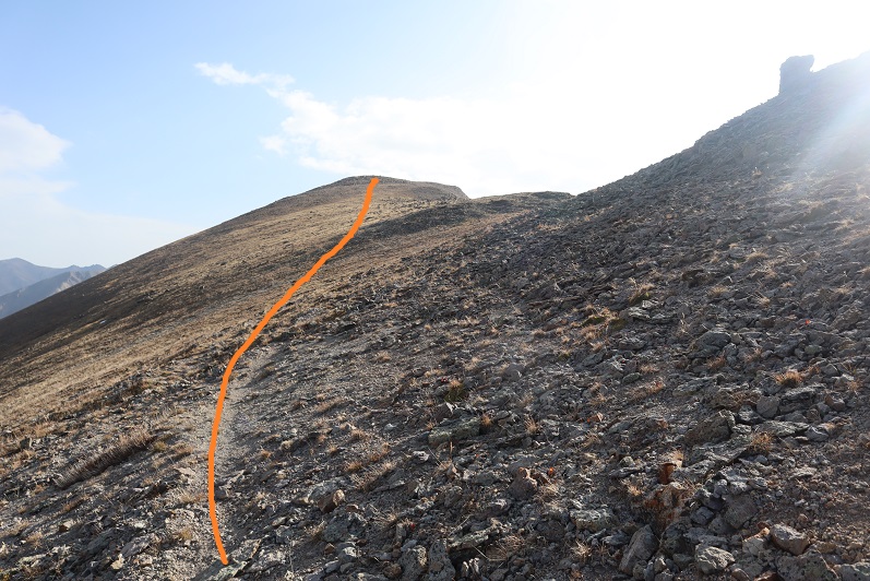
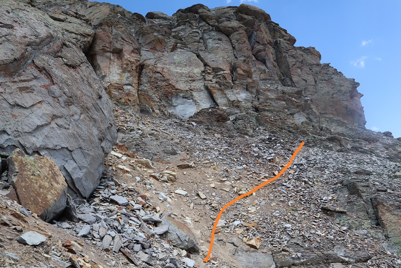
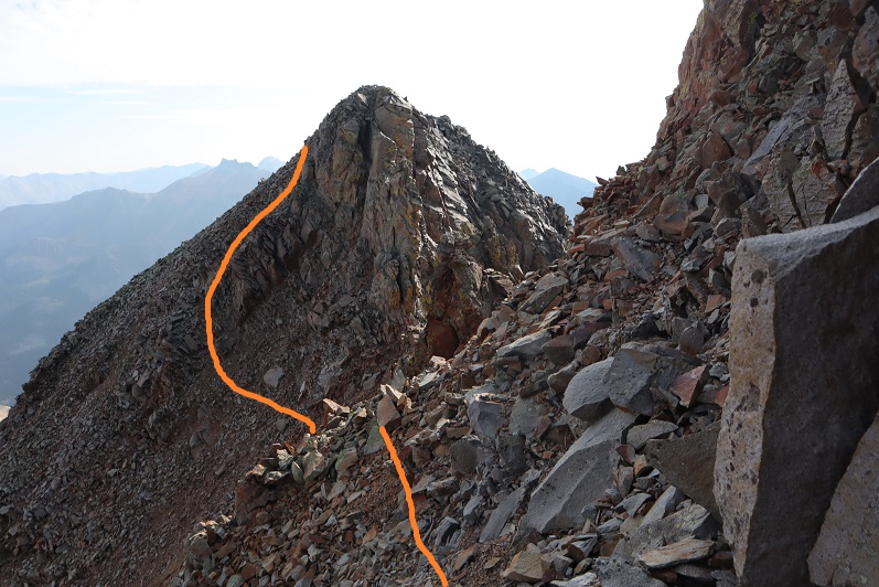
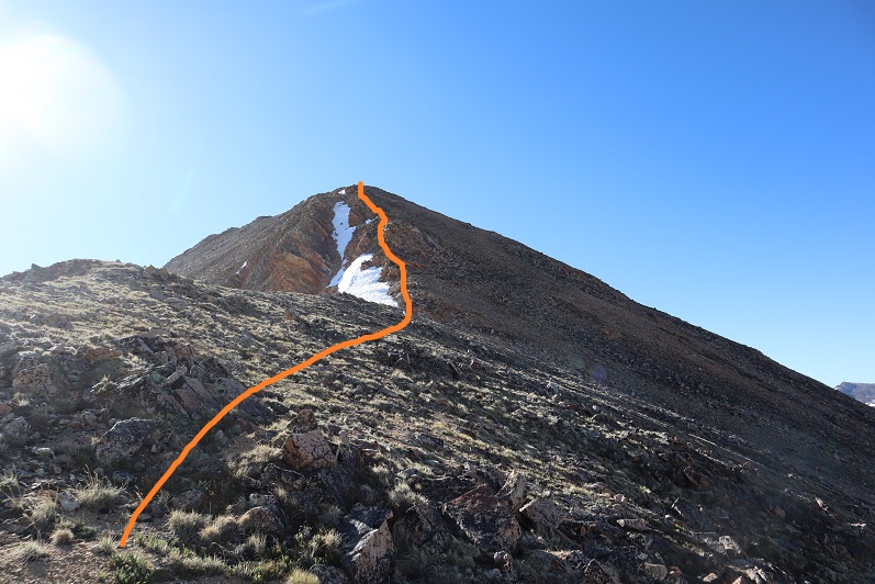
I then turned right, and hiked south towards the summit block. 

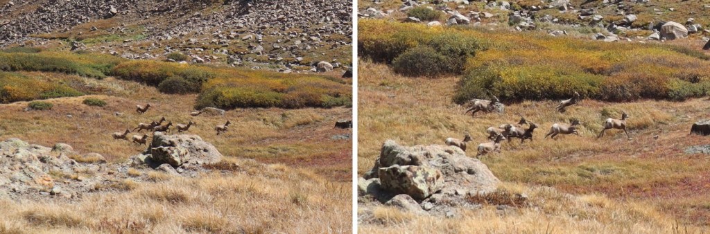
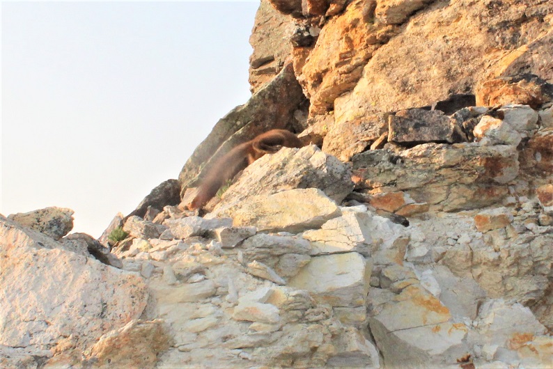
I made it to the base of the summit block and was surprised to see a pine marten.  He sat there and looked at me.  I tried to get a picture, but he quickly turned around and all I got was a picture of his tail and backside.  Why are all of my wildlife pictures of animal butts?

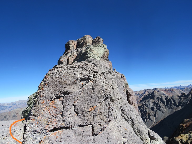
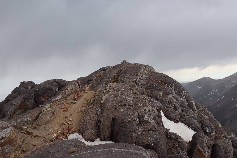
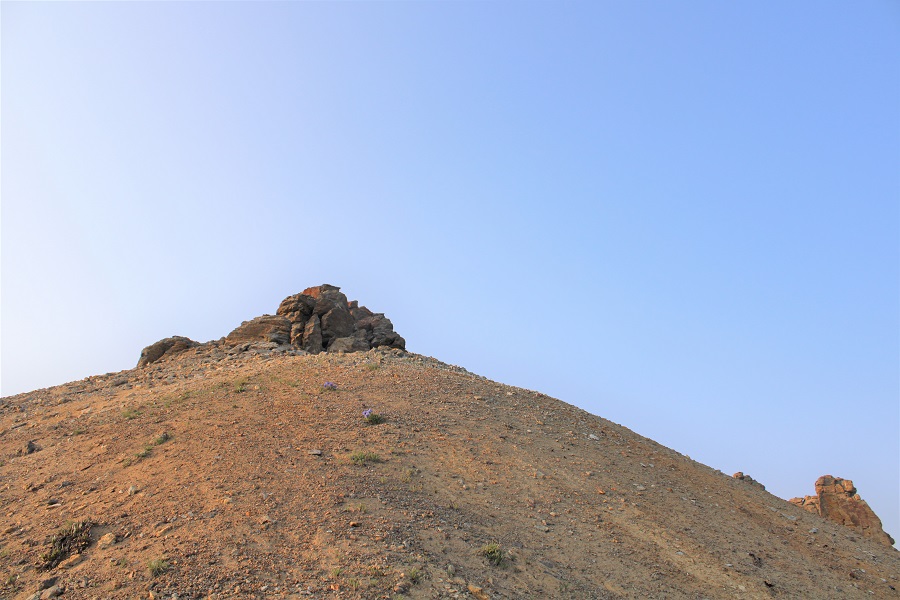
Ok, now, don’t let this summit block scare you:  yes, you can upclimb it, but you can also skirt it to the left and follow it around and have a class 2 trek to the summit, which is what I did.

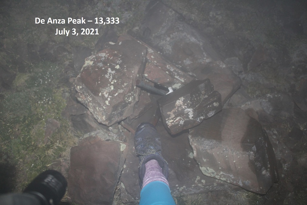
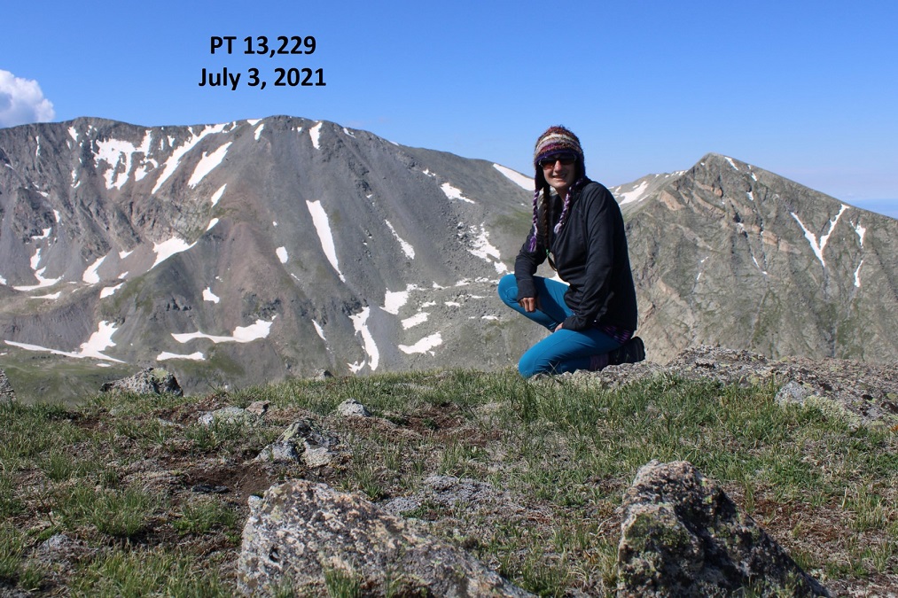
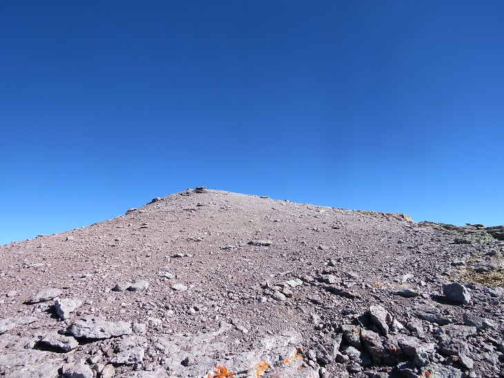
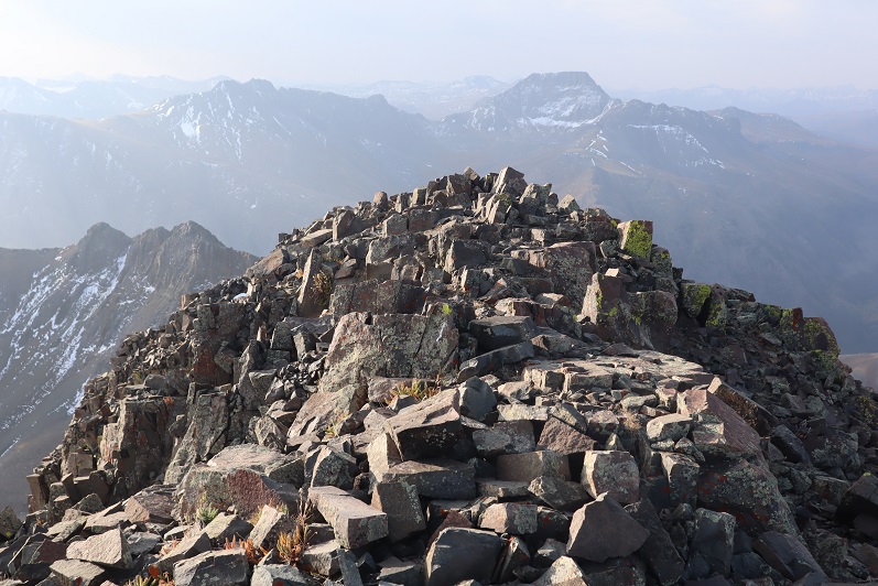
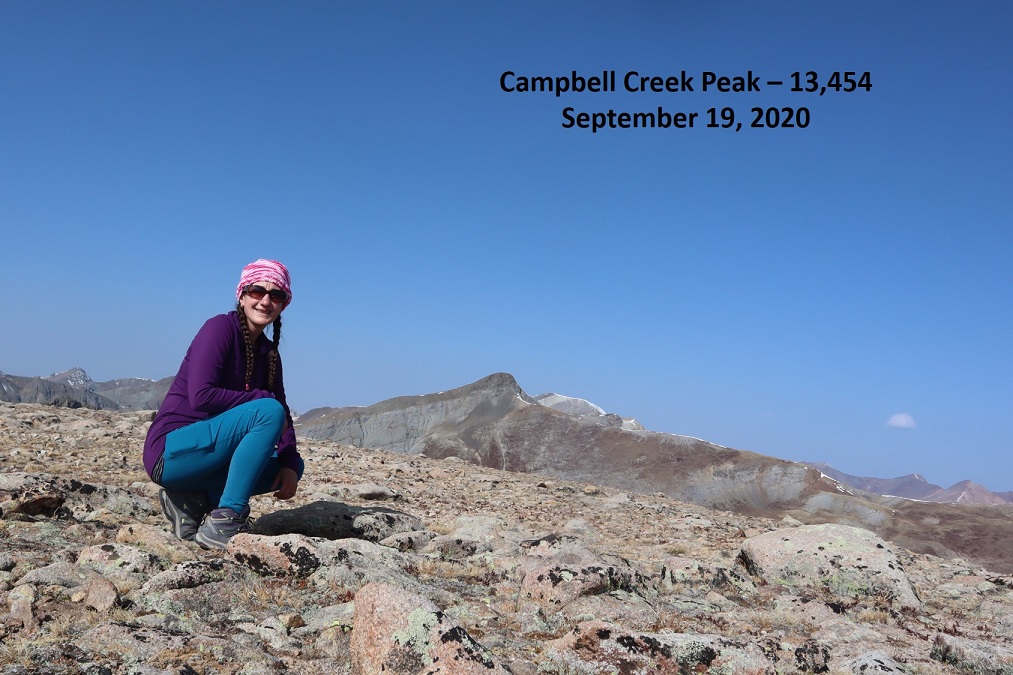
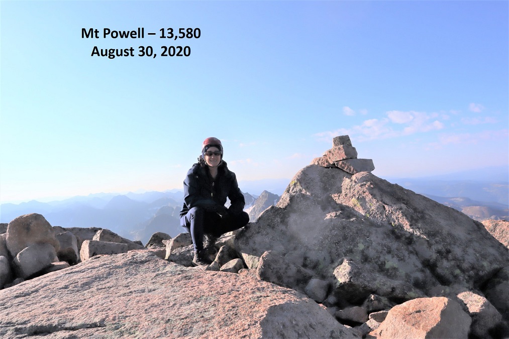
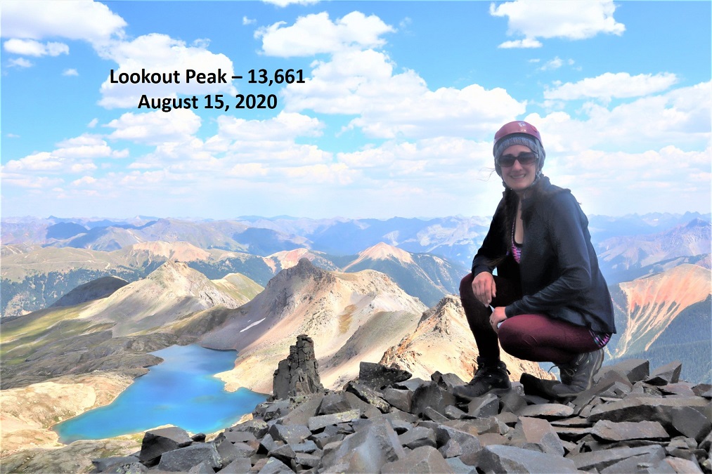
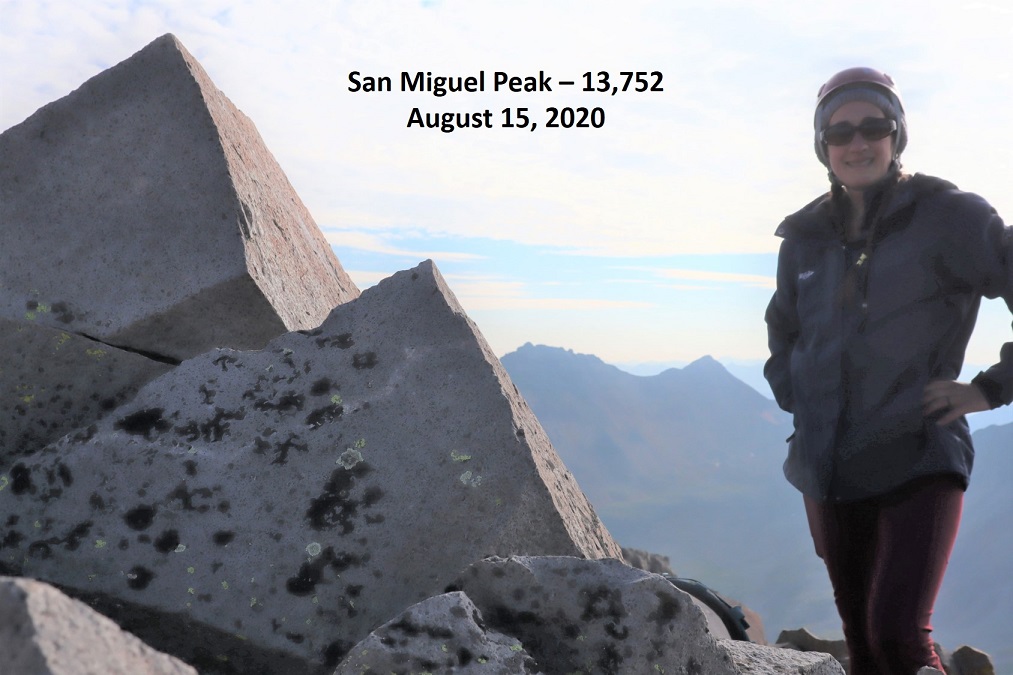
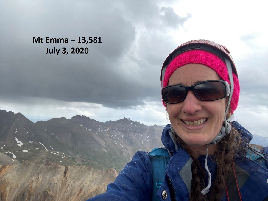
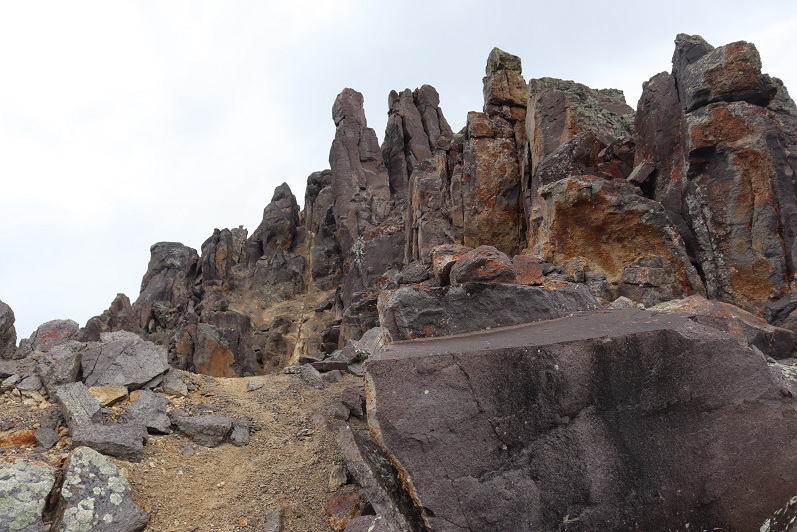
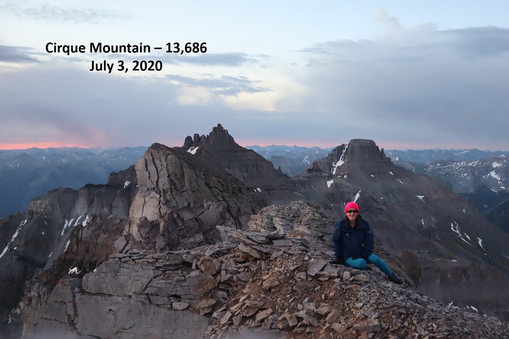
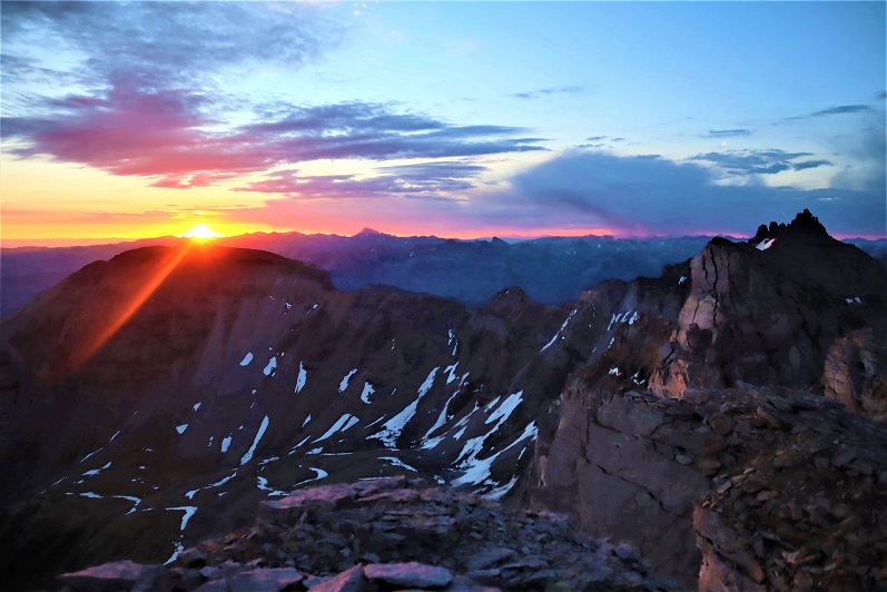
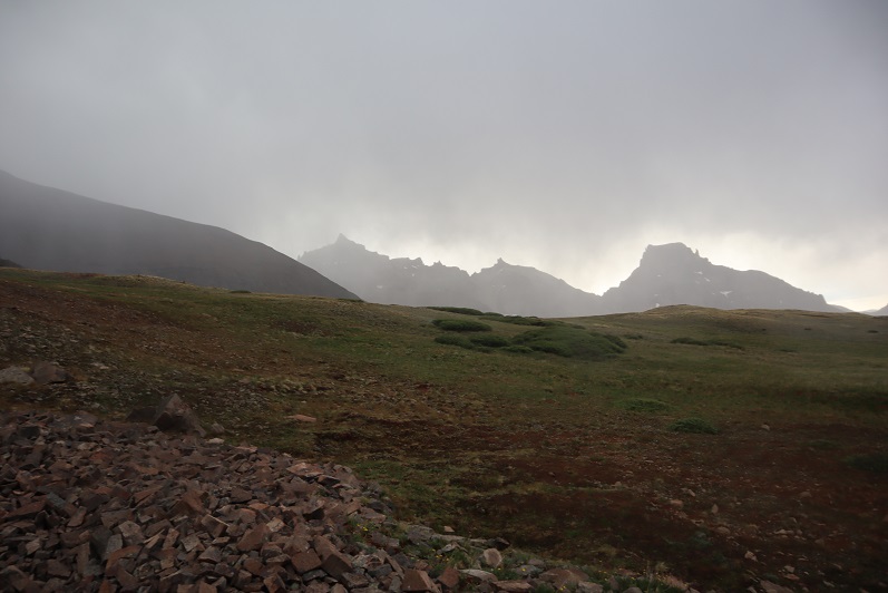
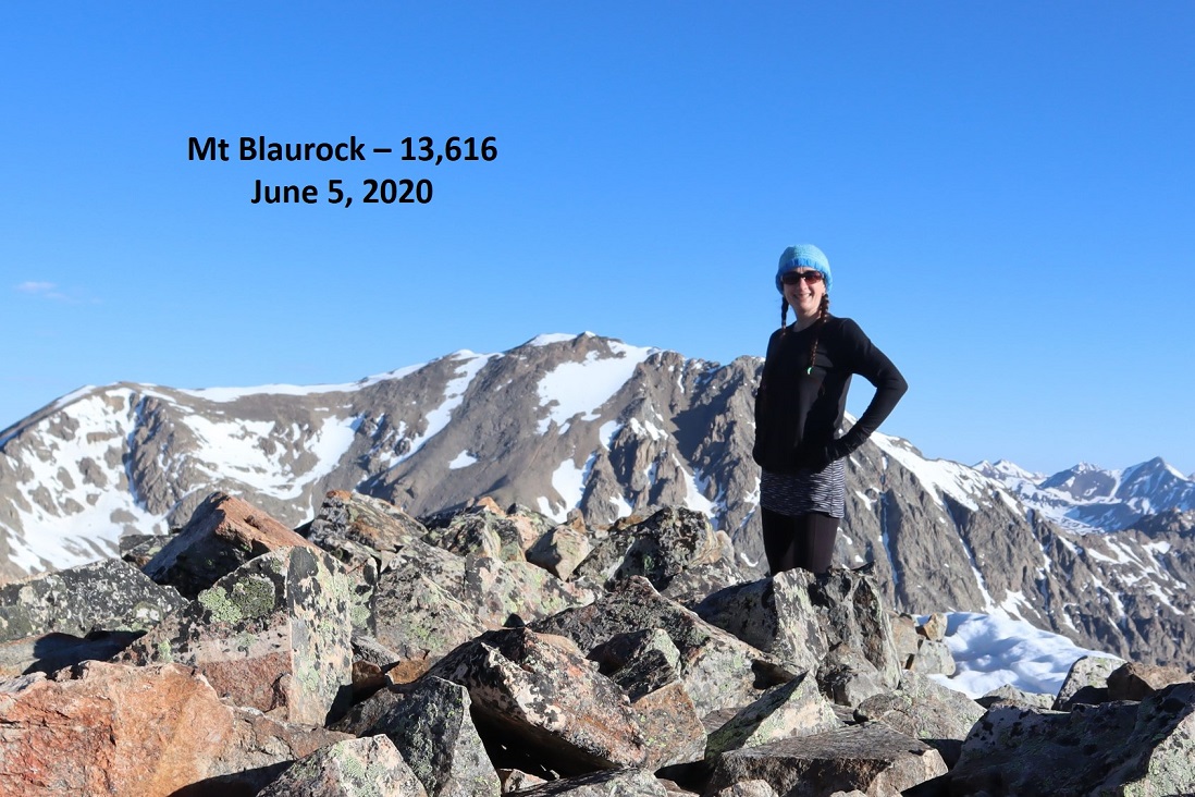
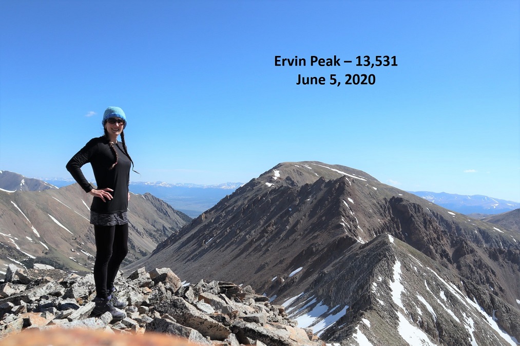
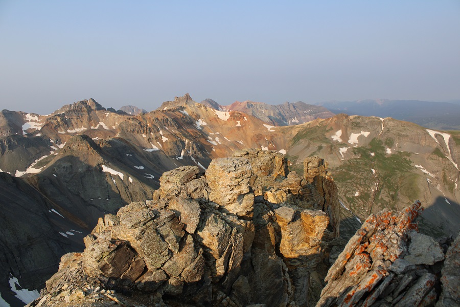
I summited V3 at 7:15am.  There was a lot of smoke in the air from far away fires this morning.
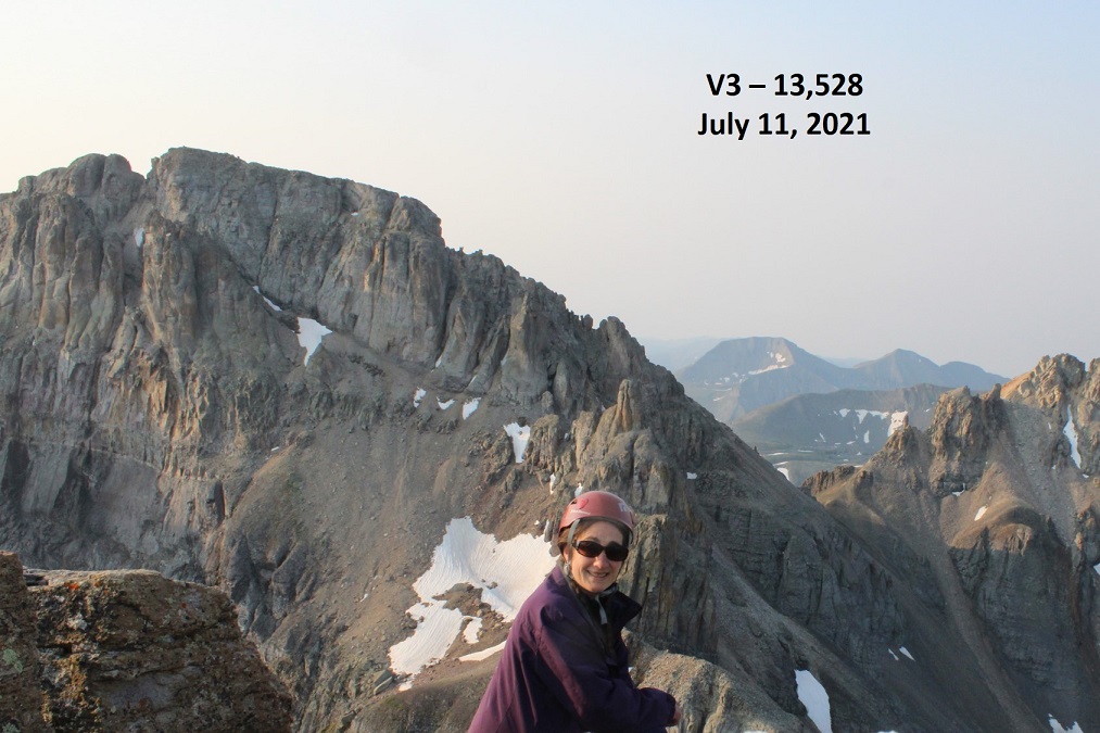
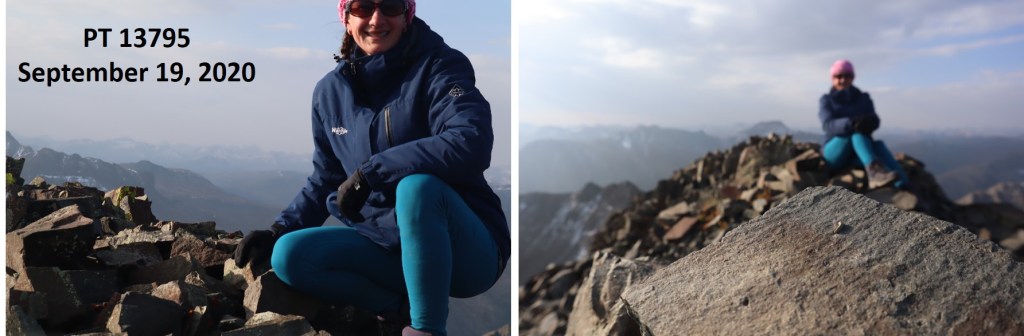
V3:

I was surprised there wasn’t a summit register, so I left one.  It was obvious this peak does not get a lot of visitors. 

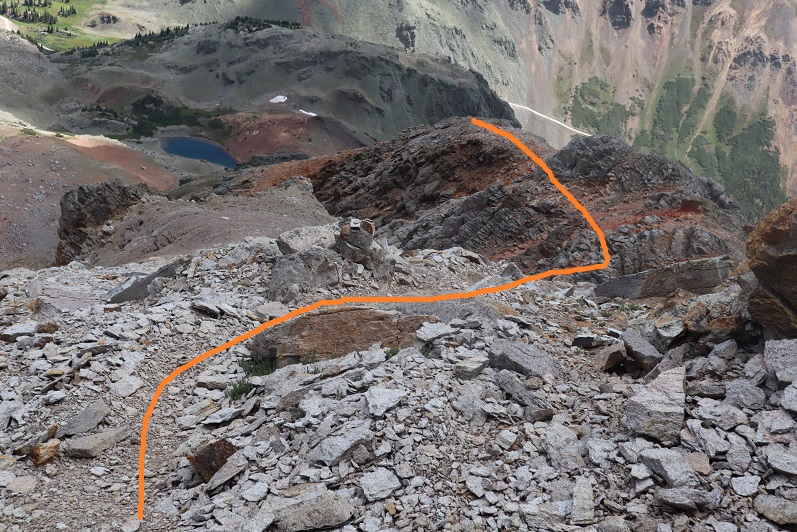
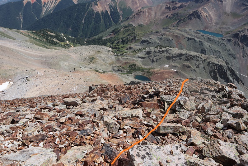
I kept my microspikes on for the trek back down, which seemed easier than the trek up.  Here are some pictures of the way back down the gully.  Once again, do this one person at a time, and when you’re done, head far away from the gully, as the rocks will slide and they will pick up speed as they do so. 

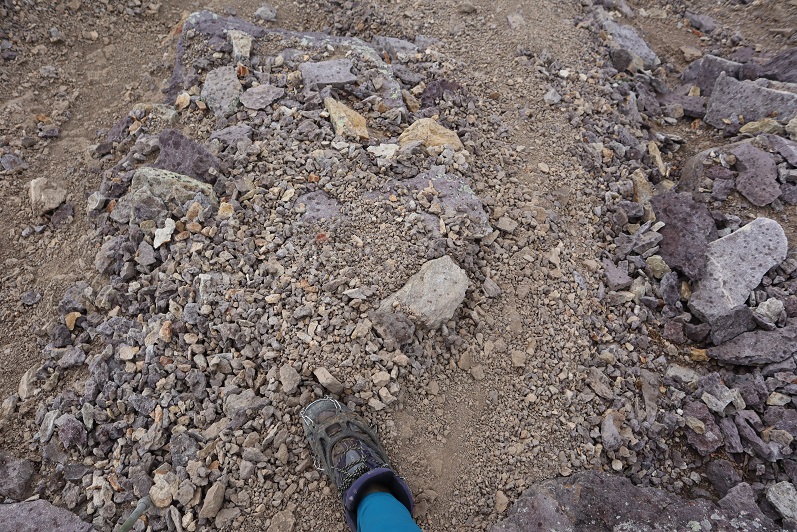
Once out of the gully, the scree-surfing will begin.  It’s always fun when you can ride the same pile of rocks all the way down the hillside.
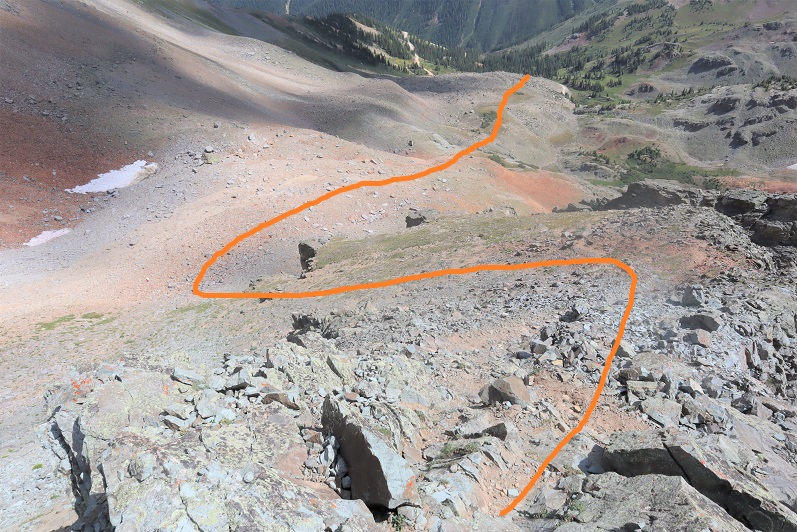
Scree Surfing:

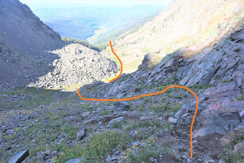
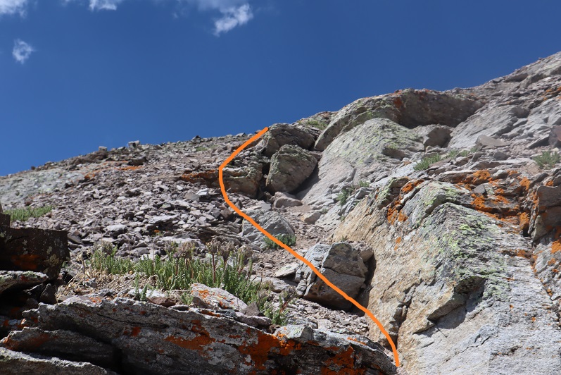
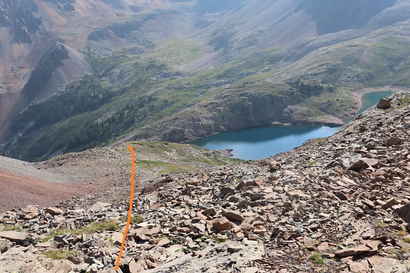
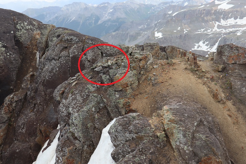
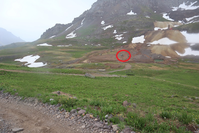
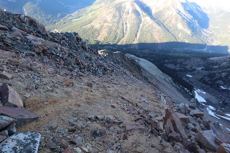
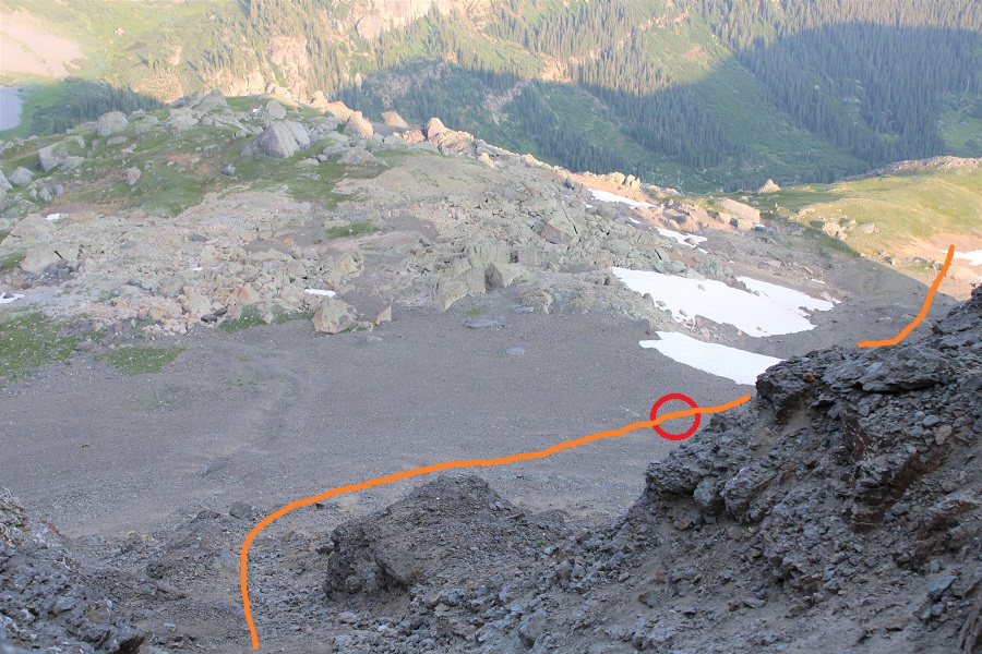
Here’s where you’re aiming.  If you’re doing this with another person, you should be standing far away from the rockslide area while they’re ascending/descending.  I’ve circled a good place to stand out of the way.

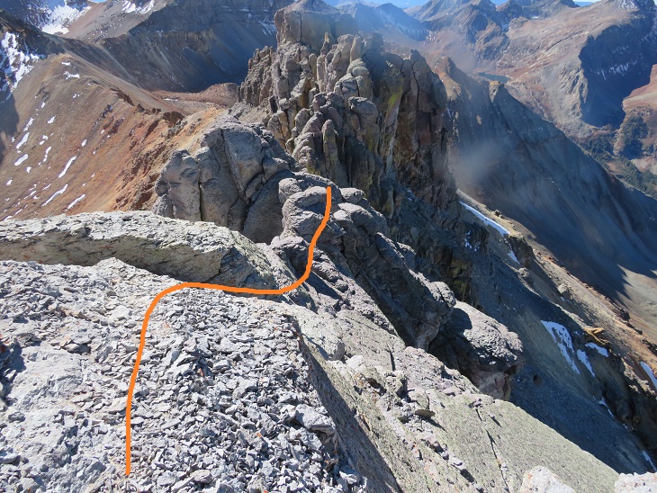
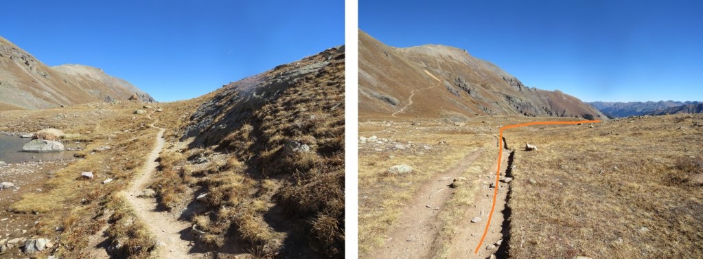
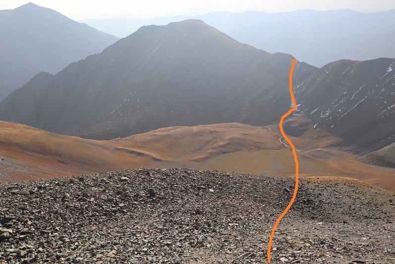
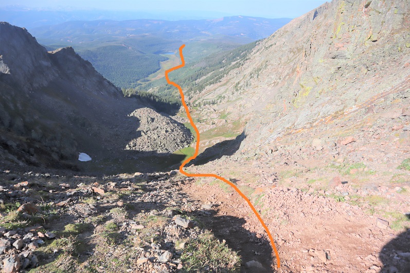
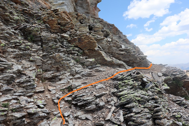
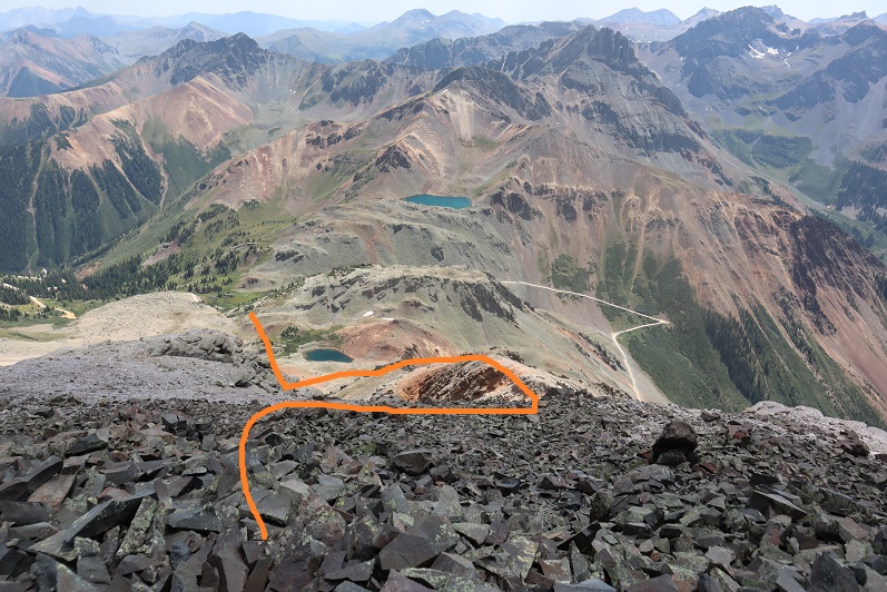
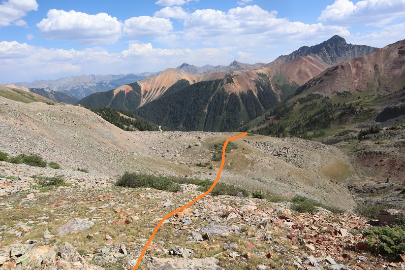
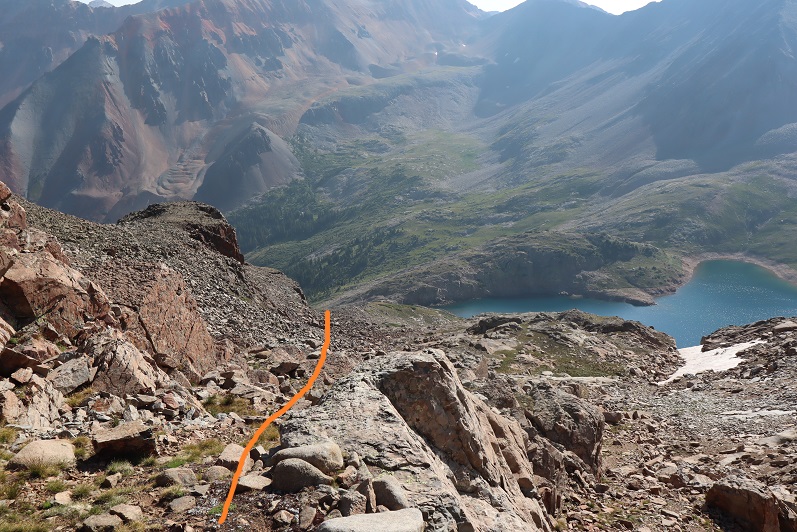
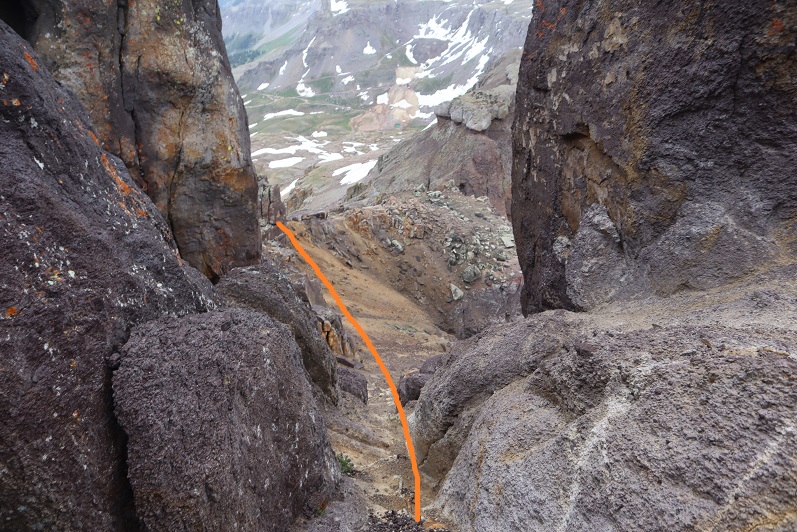
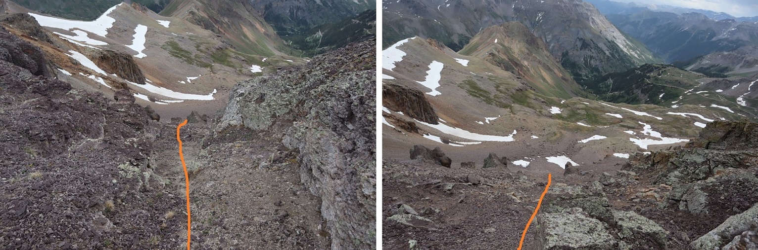
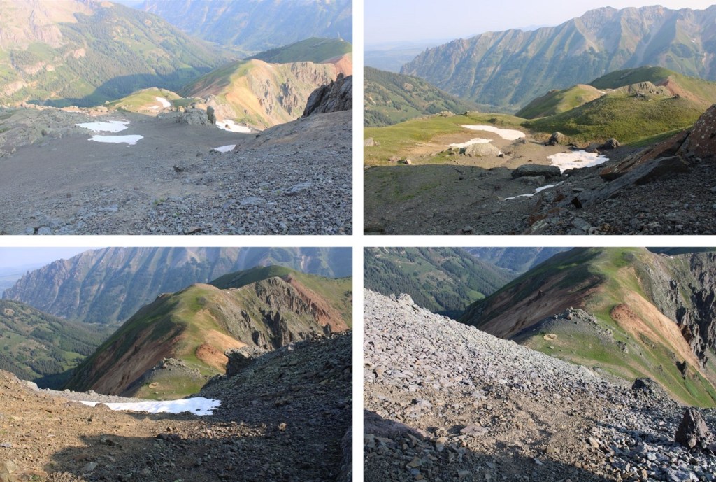
And now to hike down the ridge to the saddle, and exit the basin.

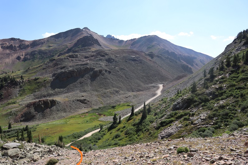
I made it back to the meadow, marveled again the wildflowers, and saw the group of campers were almost done taking down camp (I guess the man I talked to this morning was part of a larger group).  I made it to the trail, turned left, and followed it back to the trailhead.

I made it back to my truck at 9:45am, making this an 8.29 mile hike with 3542’ of elevation gain in 6 hours. 

De Anza B – 13333, Beaubien Peak – 13184, Francisco Peak – 13135, Lomo Liso Mountain – 13112, Miranda Peak – 13466, PT 13569, PT 13229

RT Length:  16.25 miles

Elevation Gain:  6102’

I am so glad this happened!  Everyone I met on this trip was highly competent, an avid mountaineer, and just a generally great person.  My only regrets are that we didn’t have more time to chat, and the group was split due to weather and all 15 of us couldn’t have met at the same time.  I’m looking forward to when we have gatherings again, as you are all my people!   

We had originally planned to hike these peaks last weekend, but the forecasted snow had us put off the trip for a week, and our group of 15 got split up into 3 groups.  6 of us arrived at the Whiskey Pass gate around 4pm and were escorted up to the Whiskey Pass campsite to be the first group of 2021 to hike the Northern Cielo Vista 13ers.  We left the two Subaru’s down low, but they could have made it up the 4WD road to the campsite (but not to where they shuttled our vehicle and we exited).  I never put my truck into 4WD on the way up.

Our campsite for the night was at 11,500’, and absolutely beautiful.  If was obvious no one had been up there in quite a while.  It was nice to put faces to names, and all of us chatted for a bit.  Some of us slept in our vehicles, and others set up tents.  We all had different ideas for what we wanted to accomplish on our hikes the next morning, and all got to bed relatively early so we could start early. 

I was unsure when I went to bed what time I’d start, but when I woke up without an alarm at 1:45am I knew it was time to get going.  I was on the trail by 2am.  I didn’t see anyone else up, which meant they were either already on the trail or starting later (both ended up being true).  I wanted to get De Anza peak first, so instead of going over Whiskey Pass I started out heading northeast.  Here’s a visual.  There’s actually a road up there I followed for a couple dozen yards before I circled around the side of the mountain and headed northeast for the De Anza/Whiskey Peak saddle. 

Sorry, but since it was so early in the morning, I don’t have pictures from the hike to De Anza or Whiskey Pass, so you’ll need to use the topo map as reference, but I believe it’s self-explanatory.  Also, the weather was terrible:  I was hiking in fog the entire time.  I’m not sure if you’ve ever hiked in fog in the dark, but flashlights are useless.  You can only see about 5 feet in front of you, and actually have a better visual turning your flashlight off for a second to see the terrain.

Hiking up to De Anza was easy, as all I had to do was keep hiking northeast and up and I knew I’d eventually make it to the summit. When I did, I thought to myself “that was too easy” and had to check my Peakbagger app to verify I was already at the summit.  I was, so I took a picture of my feet at the summit cairn, and headed back down. My advice on this peak:  If you’re already paying to hike here, hike De Anza as well.  I’m guessing it may have added half an hour total to my hiking time.  Totally worth it, and super easy, especially by avoiding Whiskey Pass on the way up, which meant less scree/talus to navigate:  it was all tundra for me.

Hiking back down the ridge was the tricky part.  It was still dark and foggy and I had no visual sense of direction.  At one point I encountered snow and knew I was going the wrong way because I hadn’t encountered snow on the way up.  At times I’d point my flashlight away just so I could see the terrain better.  I kept my compass in front of me and did my best to head southwest down the ridge. Hiking in the dark with fog is not ideal. 

Once again, no pictures here as I made my way to Whiskey Pass.  In the daylight this is probably easy to navigate, but in the dark I kept coming across large gaps in the ridge I had to maneuver around.  If you’re doing this in the daylight I’m sure the route is obvious.  If you’re doing it in the dark I’d say if you’re in doubt, stick to the right (west) when you encounter a chasm/drop off.  It’s all class 2, so if you feel it’s more difficult than that, re-assess your route. 

The hike from Whiskey Pass up to Beaubein Peak was a straightforward ridge hike.  It was still dark, but the sun was starting to rise as I kept heading south. 

Summit of Beaubien Peak

Beaubien Peak:

Here’s my view looking back at De Anza. 

It’s colder than it looks

Next, I continued following the ridge south.  The clouds didn’t seem to want to go away. I could see Culebra in the distance, and was just waiting for the fog to lift and the sun to rise

Here’s a look at Francisco Peak

Once again, I hiked through the fog to get there

From the summit, it looks as if the true summit of Francisco Peak is further southwest (where the cairn is), but it isn’t. It’s actually where I’m standing, taking this picture.

However, I didn’t realize this until I’d walked over to the other side, so you get a picture of me there, not at the actual summit… but close. 

Francisco Peak: 

Here’s looking back on the route so far.  Still colder than it looks

The clouds now behind me, I continued following the ridge south towards Lomo Liso Mountain.  This was an easy ridge walk on tundra

The summit was large and flat and it was again difficult to figure out where the ‘true’ summit was, so I went with where the cairn was located.  Side note:  all the summit registers on all of these peaks have been broken and are empty. 

Lomo Liso Mountain:

From the summit of Lomo Liso you can clearly see the rest of the route

From the summit of Lomo Liso I turned and headed northeast, and then followed the ridge southeast.  It’s really quite obvious the direction you should go.

There were some ups and downs to the ridge, but it was a simple tundra hike

This is also where I saw my first herd of elk for the day (I ended up seeing 3 herds total, but some were too far away to see in pictures, as they were down in the basins)

After the elk ran away from me I hiked up the north slope towards Miranda Peak

The last bit to Miranda is class 3 for a short distance.  Here’s the overall route.  If you’re in a large group you may want a helmet for the loose and rocky gully (but it’s relatively short, I’d suggest just taking turns ascending so you don’t kick rocks on the person below you).

Once in the gully, here’s how I ascended to the ridge

Once on the ridge I dipped to the left (east) to go around PT 13247, and then stayed on the ridge proper towards Miranda.  This area reminded me of the knife edge on Capitol, but with less exposure and better footing. I was able to put my feet in the cracks and walk across easily.

Miranda Peak: 

Miranda is unranked, so I didn’t take a summit selfie. From Miranda you can see Culebra, as well as the next ranked peak:  PT 13565.  As you can tell from the picture below, it’s a simple ridge hike.

The summit of PT 13565 was also flat, and the summit register was also broken with the information missing (hopefully the next group will bring new summit registers)

13565:

Here’s looking back at some of today’s peaks from PT 13565

Turning west, then following the ridge northwest, it was an easy hike to PT 13229

13229:

After summiting PT 13229 I returned to the 13565/13229 saddle and then turned right and headed south.

This is where it gets tricky.  There’s a large area where you can cliff out on your descent.  You’ll need to hike much further south than you want to so you can avoid the cliffs.  I looked for a break in the cliffs, and didn’t descend until about 12500’, down a gully.  Here’s what that looked like from above

Here’s what you’re trying to avoid, and a view of how I came down (from below)

Once in the basin, I headed northwest.  It’s important to stay between Cameros Lake and the smaller pond

Here I saw a herd of elk.  Of course, they didn’t stay long

As I exited the basin, I came upon two sets of cairns, which led to a very faint trail that eventually became a more pronounced trail and then an OHV track that led me out of the basin, and back to the 4WD road.

The trail stays to the north of Carneros Creek.

Once below treeline the hike seemed to take forever, as it was another 4 miles to where they’d shuttled our cars.  There were a lot of downed trees, and a lot of elk tracks.  I heard a few turkey, and I even startled some elk on the trail that ran away as I approached.  Eventually I crossed Carneros Creek on a few logs that had been placed for just such purpose. 

And made my way back to where they had shuttled our vehicles.  As I arrived, Carlos was just bringing the last of the vehicles up.  We chatted for a bit (they are seriously super nice:  every time I’m here they act as if all they care about is my happiness, which is appreciated, considering we pay quite a lot for the privilege of hiking there).

I’d really recommend having a GPX file for this route, if just to get out of the basin and back to the vehicles, as most of the rest of the hike above treeline is self explanatory.  Message me if you’d like mine (although I’ll admit it’s not perfect).  I’d assume if you’re hiking these peaks you have a good sense of direction, and that you have a lot of off route hiking experience, so you should do just fine.  Most of this hike is on tundra, and the gully/ridge section just before Miranda is quick and nothing to worry about.  I’d like to add the drive down was more difficult than the drive up, as we were now in a different area and the road had more divots and ruts to navigate.  I still didn’t need 4WD, but I couldn’t have done it without clearance.  Carlos did use spray paint on the grass/dirt to indicate which turns to take, which was helpful.

I made it back to my truck around 11:30am, making this a 16.25 mile hike with 6102’ of elevation gain in 9.5 hours.  On to the next trailhead!

Pilot Knob – 13,746

RT Length:  12.6 miles

Elevation Gain: 4162’

This was my second attempt of Pilot Knob, the first being a few years ago when I tried to link it up with Golden Horn and got caught up in some seriously scary scree.  This time I was approaching from the north, my only fear being lingering snow from an early September storm. 

I arrived at the Ice Lakes trailhead at 5am and was the only vehicle in the lot.  It was a balmy 22 degrees and since I wasn’t in a hurry I decided to take a nap in my truck until first light.  I was on the trail at 6:45am.  The trail starts at the obvious trailhead sign at the west end of the parking area

From here it was an easy hike on a class 1 trail all the way up to Ice Lakes Basin.  The avalanche area was easy to navigate. 

Stay left here

And continue to follow the trail to gain the basin

Once in the Ice Lakes Basin the trails get kind of goofy.  I skirted Ice Lake to the south and continued heading west.

After Ice Lake there’s a little stream to cross, and then the trail ends and the class 2 section/route finding begins.

Here’s an overall view of the route I took up to Pilot Knob

And step by step (sorry, I couldn’t resist; I thought this was cool)

I followed the drainage west up the basin

And once I reached the basin I turned right and headed for the gully that would lead me to the ridge

There are a lot of ways to ascend this gully, none of them fun.  The rock here is loose, the scree runs out below you, and there aren’t many handholds.  Basically, pick your line and head for the ridge. Microspikes and poles help. I took the solid line up, the dotted line down, but there are tons of options here

Once on the ridge I continued to skirt the north side of Pilot Knob.  There was a little bit of snow here, but nothing that required traction.  Here the wind picked up, and in the shadows it got really cold. 

I rounded the corner and picked up a faint trail in the scree that continued to skirt the mountain.  You basically want to stay high here.  The scree here is loose, but much, much more table than the scree when coming from the opposite direction (Golden Horn).

By sticking high here I came upon cairns that led me to the access gully.  This gully is extremely well cairned and easy to follow.  The climbing is class 3, bordering on class 4, and when you see a cairn and think to yourself “There’s no way I go over that”, you do.  Stick to the cairned route here; it goes.

Here are some highlights:  I followed the gully northeast to the ridge

Once on the ridge the scrambling got interesting.  This is class 4 and there’s exposure, but luckily the rock is grippy.  Here’s the exact route I took, staying to the left of the ridge

The last bit to the summit was underwhelming, and very, very windy.  And cold.  And windy. 

I summited Pilot Knob at 11am

Pilot Knob: 

Here’s a look down at the way I came in through Ice Lakes Basin

Time to head back.  Here’s an overall view of the ridge to the gully

And a step by step view back down the gully

Once down the gully, here’s the route back to the access gully

The access gully was much more fun do descend than ascend.  I put on my microspikes and literally scree-surfed the entire way down, stopping a few times when the rubble became dangerously fast. 

Once at the bottom of the gully I followed the same route out

Past Ice Lake and down into the lower basin.

And back down to the trailhead

I made it back to my truck at 2pm, making this a 12.6 mile hike with 4162’ of elevation gain in 7 hours.  On to the next trailhead!

PT 13801 & “Campbell Creek Peak” – 13,454

RT Length: 11.29 miles

Elevation Gain: 4559’

To finish off my birthday weekend I wanted to hike two more 13ers, which would bring my total to 200 unique Colorado 13er summits.  I chose these peaks because we’ve recently had our first snow and I’ve attempted this peak before and turned back due to snow/conditions.  If I wanted to get PT 13795 in this year I was going to have to do it soon.   

I drove down to the Grizzly Gulch/Silver Creek Trailhead and didn’t make it there until after dark.  The parking lot was packed, there were several tents set up, and tons of campers enjoying campfires.  In short, it was loud and everyone seemed to be enjoying themselves.  I parked, fired up my jetboil and made my birthday dinner of cup noodles and mashed potatoes.  As I ate dinner, I made some notes from the days climb, then got ready for bed.  There are clean bathrooms at this trailhead (no toilet paper though).  As I came back from the bathroom I ran into a rather large deer licking my truck.  I tried to shoo it away but she wouldn’t budge, so I carefully made my way into the back of my truck while she continued licking my bumper.  On a positive note, by 9pm the entire trailhead was silent and everyone had gone to bed, so I had no problem falling asleep.

I awoke to 32 degree weather and a layer of frost on top of my sleeping bag.  Looks like I’m going to have to start winterizing my topper.  Since it was cold I put on my puffy as well as my windbreaker, knit hat and gloves, and was on the trail at 5:15am.  

I started out by heading west, following the same trail as Handies Peak.  If you’re reading this I’m going to assume at this point you’ve summited Handies Peak and I won’t go into detail about the initial approach.  If you’d like to see the approach I’ve written it up from my failed attempt of PT 13795 last year.

I followed the Grizzly Gulch trail through the woods and past treeline.  After hiking for 2.5 miles I turned left and headed southeast towards an upper basin.  There was a faint trail here

Once in the upper basin I came to a lake.  There were two tents set up, so I tried to be quiet as I passed.  I skirted the lake to the left and headed towards the gully that would bring me into another basin.

Ascending the gully beyond the lake was class 2+.  The scree here was awful:  I’d take one step forward and slide backwards.  I actually used my ice axe and trekking pole here for stability, glad the sand was wet from the recent snow.  There was no trail, so I just aimed southeast and tried to avoid the snow (it was bulletproof by the way).

Once in the upper basin I had a few options.  I’ve read trip reports where hikers have used the gully to the left, but I’m not a fan of gullies.  In fact, I consider ‘gully’ to be a 4 letter word.  I took a look at the gully and said “nope”.  Instead I took the ridge to the right.  This was an easy hike on tundra, and should be the standard route.

Here’s a look at that gully I didn’t want to ascend

Just before gaining the ridge the tundra gave way to rock

At the top I turned left and headed southeast for an easy tundra stroll towards PT 13795

The last push to the summit was rocky, but stayed class 2

The summit was rocky as well

I summited PT 13795 at 8:20am. I only took 2 photos, and when I got home they were both terrible (oh well). 

PT 13795:

It was really hazy due to the fires, so I had a hard time getting a clear view of Campbell Creek Peak.  I’d heard the ridge between PT 13795 and Campbell Creek Peak didn’t ‘go’ so I was going to need to drop down into the basin and ascend another gully.  That gully didn’t look too bad.   Here’s the overall route I took

First heading south to avoid the class 3-4 section directly below the peak, and then east towards the basin

I just aimed for the stream, and then stayed to the left of the rock to gain the ridge

Here’s a look back at the route I took down from PT 13795 (it’s not as steep as it looks, but I was glad I’d hiked down this and not up)

I followed the ridge northeast to the summit of Campbell Creek Peak

I summited Campbell Creek Peak at 9:45am

Campbell Creek Peak:

After summiting I turned around and headed back down the ridge and into the basin.

Once in the basin I turned right and followed Campbell Creek north.  I crossed the creek towards the end of the basin and picked up a faint game trail

It was here I saw a herd of Bighorn Sheep.  They also saw me and quickly bounded away.

The game trail I was on kept disappearing and reappearing, so I decided to just follow the creek out of the basin

This led me to a large patch of willows.  I followed game trails northeast through the willows, around the side of the mountain

From here on out there was a lot of bushwhacking and route finding involved.  Luckily, I could see CR 30 in the distance, so I just kept traversing the side of the mountain, heading northeast and aiming for the road, slapping willows, bushes, and branches out of my way as I went. 

Eventually I came to a gully and followed it own to the Gunnison River, crossed the river on avalanche debris, and followed the road a mile back to the trailhead. 

Here’s a look back at the gully I came down

I made it back to my truck at 12:30pm, making this a 11.29 mile hike with 4559’ of elevation gain in 7 hours 15 minutes.

Oh, and I didn’t get a picture of the deer licking my truck, but there were obvious signs it had when I got back and saw it in the daylight.

Campbell Creek Peak was my 200th unique 13er.  Not a bad way to end a birthday weekend! 

Mt Powell – 13,556

1

RT Length:  15.92 miles

Elevation Gain: 5039’


I drove to Piney Ranch in the rain. The dirt 2WD road to get there is more like easy 4WD:  tons of potholes make this slow going for 2WD vehicles and 4WD vehicles alike.  Given that it was raining as well it was a slow drive in (the Escalade in front of me was extra cautious, and didn’t seem to mind I was behind them:  gotta love California drivers.  I say this being from California myself, and understanding their driving mentality).  I parked near the gate and ate dinner as I waited for the rain to stop.  It finally did and the sun came out. Woot!  The sun dried up all the rain and I wasn’t going to need to worry about my legs getting wet from water droplets brushing against my pants from the plants on my way in.  This picture is from one of the good parts of the road, just before the ranch.

2

3

I hadn’t planned on hiking this peak today.  In fact, it wasn’t on my list for the net few weeks, but weather earlier today had caused me to alter my plans.  This meant I hadn’t done as much research on this peak as I should have, so I asked everyone arriving back at the trailhead where they’d been to see if I could get more beta.  No one had been hiking Mt Powell.  I did talk to one guy who hadn’t hiked it, but said “That’s one heck of an approach!”  This scared me a bit.  I asked him to be more specific?  I told him I’d hiked all the 14ers, could he compare the approach to any of those?  His reply was “I’ve done the 14ers as well.  Nothing compares”.  It wasn’t lost on me he didn’t say ALL the 14ers, but I figured it couldn’t be that bad or I’d have heard about it by now, even with just some cursory research.

I sat in the back of my truck with a glass of whiskey and finished reading “Death in Yosemite” (the last chapter is ‘Homicides’, and I’d advise against reading that chapter, especially if you’re hiking alone in the dark the next morning:  also, avoid hitchhiking).

I went to bed early, and was woken up around midnight to the sound of rain. Wonderful.  Oh well, nothing I could do about it now.  I fell back asleep for a few hours, woke up and was on the trail by 3am.  The trail starts just to the north of the gate, and heads east.

4

It passes Piney Lake and continues along the basin.  In the morning moonlight I could see the basin was covered in fog.  Such a cool experience!

5

I continued heading east at this sign (after about half a mile). It’s the only junction you’ll come to.

6

Other than that, this is pretty much a class 1 hike all the way to the pass.  There’s a trail that passes rocks/goes up drainages/waterfalls in areas, but it’s difficult to get lost on this trail, especially in daylight.  Here’s the overall route to the pass, with the more difficult parts highlighted

7

and some photos of the trail

8

9

10

This area was a bit tricky for me in the dark, but when the trail ended I really just needed to follow the granite slab up.  There was a cairn at the top, but I couldn’t see it from below in the dark

11

I went through an area with willows

12

And then some dry waterfall areas (the waterfall stays to your right, and you don’t ever cross it).  If you come to large boulders, they’re ALL passed to the right on the way up. If I ever lost the trail, it was because I was supposed to climb up the rocks (nothing other than class 2).

13

14

I passed a camping area.  (There are 3 in total, this was the first).  From far off I could see a green tent lit from inside with a flashlight, and someone standing with a headlamp.  It was now about 4:30am.  I was sure this person could see me too, because I was right in front of them and I had a flashlight as well.  Apparently, he was groggy, because as I got closer I realized he was peeing.  He didn’t notice me until it was too late.  He also didn’t bother to recognize I was there (I’d have been embarrassed too).  He turned away and went back to his tent.  I’m only saying this to reiterate to everyone out there:  don’t pee by your tent, instead head for the trees, and turn your flashlight off while you do so!  Just assume someone can ALWAYS see you (I had a pair of hunters follow me with binoculars once in the middle of nowhere.  They watched me for over a mile just to talk with me when we met up.  Good thing I hadn’t stopped out in the open to pee….).  Just before entering the upper basin there’s a large boulder.  This gave me some pause in the dark.  Yes, you do traverse a few feet above the ground here, and then the trail picks back up

15

It’s now back to class 1.  There’s also a camping area here.  If I were backpacking, this is where I’d camp (at 11200’ after 5.25 miles of hiking).

16

Imagine my surprise when, upon entering the upper basin, there was still a trail!  In fact, there was a trail up the gully as well.  I thought back to what that man had told me last night about this being a difficult approach and laughed.  The only thing ‘difficult’ was it seemed to take forever to get to treeline (over 5 miles, it seemed like I would never get there, and it was all up).  Other than that, I’d been following a trail the entire way.  I smiled and continued on.  Here’s the trail to the top of the gully

17

The scree here wasn’t even that bad.  You could just go up the middle directly, but the scree there looks loose.  I kept to the left.  If there were snow I’d most likely have gone directly up the center.

18

At the top of the gully I was thrilled to discover the snow was avoidable.  I’d seen several trip reports where there was unavoidable snow until September, but luckily the snow today was avoidable.  I decided to descend 150’ and keep this class 2 instead of traversing the ledges.  I went down to the right, and came back up to the left.  Since it had rained last night the scree was easily navigable, but is most likely a nightmare when dry:  bring microspikes for the dry scree.

19

Then I dipped down a bit, crossed the ravine, and headed back up.  All of these gullies go to the top, and the short saddle is relatively flat.  However, I found when I’d summited there was still about 200 feet of snow/ice at the top. To avoid this, take the gully as far right as possible.  By this time it was getting windy:  the cold, early morning wind was coming straight down the gully and that spells disaster for my Raynaud’s.  Also, I was done with gullies (I’d done 13631 the day before with, like, 10,000 gullies) and decided to rock-hop the last bit of the way to the summit.  This was all class 2 and went easily to the summit (and I was now working different muscles so my legs thanked me). I went right on the way up, left on the way down. Dotted lines are alternate routes. They all go, and there are most likely many more lines that go as well.

20

Here’s what the rock-hopping looked like.  Most of the rocks, especially the larger ones, were stable. Once again, all class 2.

21

The last bit up to the summit was especially easy, and needs to be climbed if you take the gully or ridge

22

I summited at 8am

23

Mt Powell:

It was windy and cold so I didn’t spend a lot of time on the summit:  I couldn’t feel my fingers and wanted to get down as soon as possible.  I chose to take the gully down.  There was still snow at the top, but it was avoidable.

24

25

Here’s looking back up the gully.  I took the route to the right up, left down

26

Here’s a look back up to the pass.  I went left on the way down (less steep but I lost elevation) and right back up (steeper, just a tad bit of ice left at the top but will be gone in a day or two).  All snow was avoidable

27

Here’s a look at the gully I went up on my way back.  It’s more solid to the left

28

Also, there were mountain goats here

29

I made my way back up to the pass on muddy scree (thanks to the rain)

30

And back down into the upper basin

31

32

33

Here are some pictures from the class 1 trail back down to the trailhead

34

Here’s looking down that rock slab that had given me trouble earlier in the dark…

35

Back around the rocks and across the stream

36

37

And back to the ranch

38

39

I made it back to my truck at 12pm, making this a 15.92 mile hike with 5039’ of elevation gain in 9 hours.

40

So, in the end I got 2 peaks this weekend, and only 1 of the 5 I’d planned for, but I consider it a success just the same.  Also, any day above treeline is a great day!

Lookout Peak – 13,661

1

RT Length: 4.03 miles

Elevation Gain: 2060’


After summiting San Miguel Peak I still had some energy and I could make Ophir Pass be on the way home, so I decided to head over and hike Lookout Peak.  Word of advice: if you plan on hiking this peak drive in from the 550 side, not the Ophir City side.  You can make it to the trailhead in a 2WD from 550, but there’s some serious exposure/4WD needed on the Ophir City side.  My truck handled it, but there were times I was scared it wouldn’t.  Also, seeing a vehicle that had fallen/rolled a few hundred feet down the shelf road didn’t make me feel any better (it looked like it had been there a while).

The trailhead is located just to the east of Ophir Pass, and can fit 2 cars if you squeeze in tight.

2

I tried to leave as much room as possible so other vehicles could pass each other at this point if needed.  The trail starts just behind where I parked my truck.  You can see a faint trail through the willows.  It also looks like people use this area to pee (there were old wipes/tp littering the area).

3

The willows don’t last long (a few yards or so) and then I aimed for the power lines, heading north.

4

Once at the power lines I had a good view of the entire route up to Lookout Peak

5

From here the route is especially well cairned.  I’m thinking someone a) had a really slow hiking partner, b) wanted to be very helpful to future hikers, or c) has a cairn fetish, because there were cairns placed no more than 50 feet apart for the entire route.  If you don’t see a cairn on this hike, you’re off route.  I fixed a couple of downed cairns for fun, just because I felt if they were there they should be there properly.

The first goal is to gain the ridge, and this is done by following the cairns northwest.  At times there is a faint trail here, but there were a lot of cairns

6

7

8

9

10

Once on the ridge I turned right and followed it north

11

This boulder area looks tricky, but was all class 2

12

13

I kept following the ridge and the cairns

14

15

16

At 13380’ I came to a rock formation that looked like it went either way (it did).  I went east on the way up, west on the way down, and both went. The east side has a slippery gully though, so I’d recommend staying west and taking the steps.

17

18

At the top of the gully I turned right and followed the faint trail and cairns northeast

19

20

At 13475’ I put on my helmet and did some class 3 scrambling to the summit.  This looks much more difficult than it actually was.  The scrambling was easy, but the little rocks covering the boulders were a little annoying. I ditched my trekking pole and followed the cairns north.

21

22

23

24

This would be a good introduction to class 3 climbing for someone looking for a quick summit to practice on.  At the top of the short class 3 section it became class 2 to the summit

25

26

27

I summited Lookout Peak at 2:30pm

28

Lookout Peak:

Here’s what the route looked like on the way back down:

29

30

31

I took the steps on the way back down instead of the gully

32

And then followed the ridge back to the basin

33

34

35

36

And from the basin, aimed for the power lines and Ophir Pass road and my truck

37

38

39

40

41

42

I made it back to my truck at 4pm, making this a 4 mile hike with 2060’ of elevation gain in 3 hours, 20 minutes.

43

I drove home and didn’t get to bed until past midnight.  When I woke up my first thought was “Wow!  I didn’t get woken up at all last night due to wind/wildlife!”  Then I realized I was sleeping in my own bed and not in the bed of my truck…

San Miguel Peak – 13,757

1

RT Length: 10.69 miles

Elevation Gain:  3834’

Wow!  What a busy trailhead!  There was parking, and overflow parking, and parking along the side of the road, and all spots were full.  I was lucky enough to snag a spot as someone was leaving directly in front of the trailhead sign.  The trailhead is at 10,700’, and I planned to spend the night here before hiking the next morning (there was only 1 other vehicle in the lot when I got up the next morning to hike)

2

I’d already had a long day but it was early, so I ate dinner, got out a glass of whiskey, and jotted down some trip notes from my hike today.  There were dogs barking and tons of people coming back from their hikes.  I even saw one family of 4 (and a dog) setting out.  I thought it was a little late to set out for the hike, but they looked like they were backpacking in and planned to camp at the lake.  I guess it’s better to hike after 3pm when it’s cooler (and there was still about 3 hours of daylight left:  they had a good chance of making it in time).  The kids (both under 10 years old) were thrilled, and bouncing up and down, ready to head out.  They kind of reminded me of my kids when they were little:  full of energy and excited to be outside, everything new and exciting.  Now when we go camping as a family we’ve done it so much we all have our ‘roles’ and everything just kind of happens. It’s no longer novel, but I do have some great campers (and fire starters, outdoor cooks, etc.).  My 20 year old son still makes a tradition of climbing the tallest tree he can find just to prove he can, a tradition he started at 5 years old.  Bravo to this family for starting them young!

I talked with a bunch of hikers and made it an early night.  Bonus:  the mouse that had been residing in my truck must have left because I didn’t hear a squeak all night.

I was up and on the trail by 4:45am.

3

This is a class 1 trail that goes for 2.5 miles to Hope Lake.

4

The only downside here all the willows/bushes lining the trails:  I was the first one out this morning and got spiderwebs in the face to prove it.  After the third web I started pole swinging…

5

I made it to Hope Lake just as the sun was coming up.

6

This lake isn’t much to look at in the morning, but once the sun came up it was beautiful!  I made my way west, following the lake.  Here I saw a tent set up, presumably for the family I saw hiking in last night.  I tried to be quiet and not disturb them as I walked right past their tent and followed the lake.  I wanted to cross the dam here, but the water level was too high to allow me to walk along the shoreline

7

So instead I gained the ridge and made my way over to the dam.

8

As I was gaining the ridge the family’s dog came up to me.  It was nice, I gave it a pet, and was on my way, wondering to myself why the dog wasn’t sleeping inside the tent with the family?  It wasn’t a large dog, and would totally have fit with them inside their tent.  Also, not much of a guard dog:  it licked my hand and didn’t bark once.  I was confident the family was still asleep as I passed their tent again to gain the ridge. I followed the ridge to the dam, crossed the dam, and headed southwest up the side of the mountain (note, there is a lot of old ‘trash’ here:  tin cans and cast iron and the like).

9

There were a few cairns here, but I basically just followed the gully southwest up the mountain

10

11

As I was hiking I erroneously believed this was the summit of San Miguel Peak. It’s not.  I ended up going straight up the face, but here’s the way you should go instead:

12

Once at the top you’ll see a ridge.  The ridge goes for about 500 feet.  I followed it…

13

And at the end came to an unexpected drop off.

13

14

This is where the hike became interesting.  I looked at my options and I felt going right was safer than going left.  (the left side of the mountain absolutely looks summitable, just more loose and time consuming).  Here’s the route I took to the summit. Note:  This was class 3 climbing, and on my way up I stuck to the solid rock (as opposed to the scree filled gully… the rocks were still loose here).  Luckily I’d brought a helmet.  I put it on and started towards the gully.

15

I summited San Miguel Peak at 8:30am (this one didn’t have a great place to set my camera…)

16

San Miguel Peak:

Time to head back down.  I took a slightly different approach on the way down, following this track (mainly because at the summit I found a cairn indicating this was the ‘trail’ and started off in that direction…)

17

Here’s what it looked like, and I’d like to note neither way was better than the other (one was more exposed but on relatively stable rock, the other was on loose scree over rocks)

18

19

20

Back up to the ridge

21

22

And then back down to Lake Hope

23

24

25

26

27

This time, when I got to the lake I crossed the dam, and then just went over the hill, heading northeast until I came to the trail I’d hiked in on… passing a lot of old mining trash along the way. I could hear the family that had been camping having a grand old time:  the kids were obviously thrilled with their adventure, and the parents were too.  They genuinely sounded happy (I could hear their excited exclamations from the summit all the way back down to the lake).  Once again, rock on mom and dad!  Well done!

28

29

Once back at the trail, I followed it back to the trailhead.  I passed dozens of people hiking.  Every one of them had a dog, and more than half were obsessed with their masks (not judging, just stating).  There were tons of kids out, and they all looked miserable.  Who starts a hike with kids in the afternoon and expects them to be ‘excited’ hiking while they’re miserable and hot?  I’ve been a park ranger, scout leader, and a mom, and I can tell you from experience, hike early or late, but don’t do the bulk of your hiking between 11-3pm if you want happy little hikers.

30

31

32

33

I made it back to my truck at 11:15am, making this a 10.69 mile hike with 3834’ of elevation gain in 6.5 hours.

34

This had been a fabulous morning, it was early and I wasn’t tired, so… on to the next trailhead!

Mt Emma – 13,592

1

RT Length: 4.48 miles

Elevation Gain: 1861’


After summiting Cirque and Gilpin it was still early in the day and the weather seemed to be holding so I decided to try and get one more bicentennial in. I drove down from Yankee Boy Basin to the junction with Governor Basin Road and took that 4WD road all the way up to Governor Basin. This is a narrow road and 4WD but luckily I only had to pass OHVs.

2

3

Originally, I parked at the top of the hill and started walking down into the basin, but when I saw other vehicles parked below I got back in my truck and drove all the way to the bottom.

4

Here’s an overview of the entire route:

5

From the parking area I crossed a small creek and followed the 4WD road.

6

When the 4WD road intersected with a small waterfall/drainage I turned right and headed northwest up the side of the mountain

7

8

This led me to a faint game trail that brought me around the mountain

9

There was a neat cave here that looks like it used to be a mine but now belongs to an animal (hence the game trail)

10

I rounded the corner of the mountain and Mt Emma came into view

11

12

I walked across the basin, crossing a small area of firm snow, and then continued hiking up the scree filled gully

13

14

This gully was very loose and for every two steps I took forwards I took a step back sliding down scree. I tried to stick towards the larger rocks when possible because they afforded me more traction hiking up.

Towards the top of the gully the scree changed to rocks and I did a little scrambling to gain the ridge.

15

Once on the ridge I turned right and headed northwest towards the summit towers, putting on my helmet as I went.

16

There seem to be endless ways to summit Mt Emma from this area, all class 3 and above.  I summited by going right first, up a small gully and then back down another before ascending a third to summit. I took a different, more direct route on my way back. These gullies ranged from bare, solid rock walls to being filled with soft sand. Microspikes helped here. I wore them until I made it back down to tundra later in the day.

Route on the way in:

17

18

Back down another gully

19

And back up a third gully

20

As soon as I went up this last gully I could see the summit

21

That had been easier than I’d expected. I snapped a picture, took two giant steps towards the summit, and felt it: Zzzzzzp! Zzzzzzp! Two quick buzzes just under my helmet accompanied by a tingling sensation. Even though I’d never felt this before I instantly knew what it was: indication of an imminent strike of lightning. I was just feet from the summit but I immediately turned and bolted for the gully I’d just ascended.

Well, that was unexpected! Sure, there were clouds and mist all around me, but none of the clouds looked threatening. As I sat there in the gully, looking at the summit just a few yards away, it started graupeling. Then raining. Then graupeling again. I sat and considered my options.

22

I could hike back down the mountain, but as soon as I left these gullies I’d be exposed for the rest of the hike. I did not want to be the tallest thing above treeline. I licked my finger and held it in the air to test the wind and watched the clouds: the storm was moving away from me. I looked all around and no, the clouds didn’t look menacing (even though it was raining all over). I decided to sit and wait the storm out. After about 30 minutes of sitting on the summit, not seeing any lightning or hearing any thunder, I tried again.

I quickly left my spot and scrambled the last few yards to the summit

23

I summited at 2:15pm. I was still very scared of lightning and instead of taking the time to set up my camera I took a selfie with my cell phone and a very quick summit video. That’s a nervous smile by the way: I still didn’t completely trust the weather and wanted to get out of there.

24

Mt Emma:

Despite my earlier plan of taking the time to check out the conditions of the peak for tomorrows hike I didn’t spend more than 30 seconds on that summit. I quickly turned around to head back. Circled in red is where I’d spent the past 30 minutes waiting out the weather. This is also the access point to the gully I descended on my way back.

25

From the summit I could see a more direct route back through a different gully and decided to take that route down. It’s still class 3, but you can see your objective the entire time. I went back down the last gully I’d ascended

26

And east towards the small saddle

27

28

Here’s looking back for those of you who want to ascend this way (I’d recommend doing so, it’s entrance is to the left of center of the summit area)

29

30

Back on the saddle the weather looked to be improving. I found the access point and headed back down the gully.

31

While descending I stuck to the areas of dirt and scree. My microspikes helped tremendously. At times the scree would give way and there would be sections of 10 feet or so where all of the rocks would loosen and slide together for a few yards. At one point my leg became buried in scree past my shin. My shoes had so much scree in them I had to take them off and shake them out twice before making it to the bottom. Tons of fun!

32

33

I retraced my steps out of the basin back down to my truck

34

35

36

37

38

The small waterfall/creek/runoff is a great visual for how to make it back to the 4WD road

39

40

I made it back to my truck at 3:10pm, making this a 4.48 mile hike with 1861’ of elevation gain in 3 hours (including the half hour spent waiting out the weather). It was raining as I made it back to my truck. Here’s a topo map of my route

41

On to the next trailhead!

Cirque Mountain – 13,686 & Gilpin Peak – 13,699

1

RT Length: 11.1 miles

Elevation Gain: 4382’


I’m kind of liking this ‘work from home’ thing that’s been going on for the past few months. Today I had a zoom meeting I attended at a Starbucks and then I was off to the Yankee Boy Basin (which I considered an appropriate place to spend the 4th of July weekend). The road to Yankee Boy Basin is easier than I remember. It’s only 4WD for the last mile or so. There’s a little bit of exposure but the road is plenty wide enough to pretend it’s not there.

2

I arrived at the trailhead and backed into a spot near the bathrooms (P.S. bring your own TP).

3

I got out and took a look around at the route I intended to take while it was still daylight. I was pretty sure I wanted to hit Cirque Mountain first, and then cross over to Gilpin Peak. Everything is different in the dark and a good visual in the daylight is helpful.

While I was looking around I heard a couple talking about Mt Sneffles. I went over to ask if they’d seen any snow on Cirque Mountain/Gilpin Peak while hiking. They were staying the night at the trailhead too, climbing Teakettle in the morning. We struck up a conversation and ended up exchanging beers and candy and 14er stories and caps full of whiskey. About an hour later two more of their friends showed up and we huddled around my truck as it rained a bit. When the rain stopped, they went over their gear and practiced some rappelling. They allowed me to tag along. I ended up calling it a night really early (I get up at 3am to work and get tired early in the evening). I’m sure I forgot to say it, so I’ll say it now: It was really nice getting to meet you all! Also, I will never be able to hear the word ‘traverse’ again and not say it twice @climbingcue, @dwoodward13, @hikesingeologictime, & @tallgrass!

4

I woke up at 3:30am, hit snooze once because I was really warm in the bed of my truck. I was ready to go a little before 4am. Tallgrass came to say goodbye and good luck. I was still groggy (I don’t wake up until about an hour into a hike). Thanks for the beer Tallgrass! I started by following the 4WD road northwest.

5

After hiking for almost half a mile I turned right and followed the small ridge up to the saddle of Kismet and Cirque.

6

7

The trail eventually narrowed and I went up a low flowing waterfall type gully

8

And then followed the scree filled gully to the saddle. All snow was avoidable.

9

10

11

At the saddle I turned right (east) and followed the ridge. Note, the point on the right isn’t a ranked peak. It’s easily bypassed by a trail to the left. I climbed it on my way back just to get in some added elevation and for the views.

12

I picked up my pace here because it looked like I could make it to the summit for the sunrise. Wow, that part of the hike hadn’t taken as long as I’d anticipated.

13

14

There was some choss and a chimney to climb. I put on my helmet and worked my way up.

15

16

There was some route finding for the last little bit as well as some easy scrambling

17

I summited Cirque Mountain at 5:45am

18

Cirque Mountain:

I made it a few minutes before sunrise and decided to stay to enjoy the show. It didn’t disappoint.

19

I also had some great views of Teakettle and Potosi to the southeast

20

I headed back the way I’d come, and decided to summit the small point and then head back down the gully

21

22

23

I didn’t go all the way down the gully. Instead when I hit tundra I turned right and headed west until I reached a small pond.

24

At the pond I hooked up with the Wrights Lake Spur trail and followed it until the first switchback.

25

Right about now it started to rain. I looked back on Teakettle and thought about my new friends hiking up there. I hoped they were staying dry.

26

The trail was an easy to follow, class 1 trail. At the first switchback I left the trail to continue heading west towards the saddle. There was a little bit of snow to contend with here so I put on my microspikes and walked across.

27

28

At this point I could see there was a gully I’d have to ascend that was still holding a little bit of snow at the top

29

Once on the saddle I followed it south. On the ascent I made the wrong choice and tried to ascend directly up the gully. This got me onto very loose, chossy terrain and took me longer than necessary to figure out. The rocks were the size of toasters and none of them were stable. Large sections would move below me at a time, taking me with them. On my way down I found a better route, so I’ll describe that route here.

From the ridge, dip down to the left to go around this first obstacle

30

Next, hug the area where the snow meets the rock. I’m pretty sure there’s an actual trail here under the snow

31

From here I’d wanted to ascend directly up the gully. DON’T DO THAT. Instead, try to make it as close to the ridge as you can

32

33

At the small saddle there was snow to contend with (a lot more snow than the pictures suggest). Glad to have brought my ice axe and crampons (something I do on every hike I don’t have beta on) and got to work kicking in steps and climbing over the snow. There was probably 30 feet worth of work to do over the snow at its narrowest point.

34

At the saddle I sat down to take off my crampons. From here it was a short trek to the summit, after first going over a false summit. This was all class 2, but I kept my helmet on.

35

36

37

I made it to the summit of Gilpin Peak at 9:30am. It was lightly snowing.

38

39

Gilpin Peak:

Here’s a look at the route I took out the basin from the summit

40

I turned and headed back over the false summit and headed back to the saddle

41

Because I’d already kicked in steps I made the decision to put on microspikes instead of crampons to go down the snow. This was a bad idea, but I didn’t realize it until I was already too committed. I made it down the snow safely, but I was shaking as I did so: crampons provide much more stability than microspikes (duh) and I wasn’t very stable on the downclimb. I relied a lot on my ice axe.

Here’s looking at the ridge back down

42

43

I re-crossed the snow below, this time without traction: I boot-slid my way across much of the snow.

44

I made it back to the trail and there was a family standing there, waiting for me. There was a mom and dad and grandparents with 6 kids who all had to be under 10 years old. They’d been watching my descent, and the father asked if I would show the kids my gear (crampons, helmet, ice axe). The kids were fascinated with the equipment, and proudly told me they were hiking to the lakes. I wished them luck and was on my way.

After making it to the pond I followed the class 1 trail above Sneffles Creek until I made it to a road, and followed the road back down to my truck.

45

Just before making it to the road I passed what I thought was a trail register. I opened it and found one of the most confusing maps ever! Not only did it not correspond with the visual direction of the peaks, north was at the bottom. This map is going to get a lot of people lost.

46

I passed a jeep that had gotten stuck. Everyone pitched in to get her un-stuck.

47

It was easy to follow the 4WD road back to where I’d parked my truck

48

I made it back to my truck at 11:15am, making this an 11.1 mile hike with 4382’ of elevation gain in 6 hours, 15 minutes.

49

I still had plenty of time left in the day, so I decided to drive to the next trailhead and attempt another mountain.

Mt Blaurock – 13,626 & Ervin Peak – 13,538

1

RT Length: 6 miles

Elevation Gain: 3821’

There’s currently a curfew in place in Colorado Springs, so the beginning of the drive felt a bit ominous: I didn’t see any other vehicles on the road until I made it to the freeway, and even then there were very few vehicles compared to normal, even for 1am, and even when compared to being quarantined. I’d stopped for gas the day before so I didn’t need to stop at all this morning. With less people out I felt like I saw more wildlife: 4 foxes and a dozen or so elk. I made it to Winfield around 4am and decided to take the easy 4WD dirt road a little further, past the cemetery to some dispersed camping spots .85 of a mile from Winfield. You can park at Winfield and it won’t add more than 2 miles to this hike.

2

3

4

5

Looking at a topo map, I wanted to follow Grey Copper Creek to begin. After finding a dispersed parking spot I headed northwest in the dark, following game trails, zig-zagging in what felt like I was in a horror movie until I hit the creek. The creek was easy to find because there’s been a recent avalanche in the area.   This also made the creek easy to follow (after initially climbing over some downed trees).

6

I crossed the creek and stayed on the west side, startling a porcupine as I went. There are new game trails starting here that parallel the creek.

7

There are a few ways to summit Mt Blaurock: You can follow the creek until it ends and continue climbing until you make it to the Blaurock/Ervin saddle, or gain the south ridge and follow that route. There was still some snow in the gully so I decided to take the south ridge route.

8

There is no special point to gain the south ridge. I turned and headed west after a little over a mile of hiking, aiming for the ridge

9

From treeline it was easy to see the route, following the ridge northeast

10

The first part of the ridge is an easy stroll on tundra

11

Once the tundra ended the loose rock began and didn’t quit until the hike was almost over and I was back at the avy area. I’d call it rotten rubble, or choss most of the way. I rounded the first bump in the ridge to the left, climbed straight over the second, and then took a gully up to the top. There is some loose rock here.

12

13

14

9

Here’s a look back down to this point

16

Turning left (northwest) I dipped down to the left a few times to avoid snow and unnecessary ridge crossings

17

18

Of course, the summit is the furthest ‘hump’ on the ridge

19

I followed a small, rock filled gully to the summit

20

I summited Mt Blaurock at 7:30am

21

Mt Blaurock Summit:

There are some great views of surrounding peaks, a few of which I visited last week;

22

23

I headed back over the ridge on the same path I took in:

24

25

26

Here’s looking down at the traverse between Blaurock and Ervin Peak. The hike down to the saddle from Blaurock is easy

27

I met a nice ptarmigan along the way

28

Here’s a look from the saddle of the ridge to Blaurock and Ervin

29

This is where it gets tricky. Here’s the route I took to avoid the snow:

30

31

It looks like there might be a class 2 path here along the right (south) side, but with the snow in key areas I wasn’t able to take that route. There was snow in this section, turning the rest of the hike into class 3 on loose rock. I had one rock the size of a microwave fall while I was testing it. Luckily, I was just testing and didn’t have any weight on the rock. It scared me though. A helmet would be a good idea. Note which areas actually “go”: The dirt gullies here make it look like there are trails where there are not. Here are pictures of how I navigated the ridge. This took quite a bit of careful route finding.

32

33

34

35

This is actually easier than it looks. Class 3, and I placed a cairn here so I’d remember how to get back (there are a lot of drastic drops in this area).

36

The last hurdle was unavoidable snow just before the summit. I tested the snow and honestly considered turning back. The snow was slippery and a fall would have took me a long way. In the end I strapped on my crampons and got out my ice axe, glad I’d brought both. I traversed these two areas (about 40 feet each) gingerly.

37

The last bit up to the summit was full of loose rock but was straightforward

38

I summited Mt Ervin at 9:30am (that’s Mt Hope in the background)

39

Ervin Peak Summit:

I didn’t stay long on the summit. The day was warm and the snow was melting fast: I wanted to cross the snowy areas as quickly as possible to avoid slipping. I turned around and headed back the way I’d come.

40

41

I was making this a loop, so when I hit the westernmost part of the ridge I turned and headed southwest down. This ridge was easy to navigate but full of loose, rolling rocks. It was slow going because I had to be careful with foot placement. This ridge kind of turns right as it goes. Here’s a hint: If it’s daylight, just keep heading towards the switchbacks that you can see in the middle of the picture below.

42

From about halfway down the ridge here’s looking back at Mt Blaurock and Ervin Peak. The blue arrow points to where you could hike from the landslide area straight to the saddle instead of taking the ridges up and down

43

Here you can see you want to meet back up with the landslide area, and that to do so you’ll be bushwhacking through dense aspen. I could still see the switchbacks, but only just barely and only because the aspens aren’t completely full of leaves yet.

44

There were enough game trails here to follow not to make this too difficult. It would have been easier if I were 2 feet tall though, because those trails go under logs and through brush.

45

I made it back to the landslide area, took a picture of it in the daylight, and turned and headed south towards my parking space.

46

47

I made it back to my truck at 12pm, making this a 6 mile hike/climb with 3821’ of elevation gain in 8 hours, most of it spent route finding and watching for rolling rocks.

48

Here’s a picture of the saddle, should you choose to ascend that way

49

When I got home and started jotting down notes I realized today I’d hiked my 145th unique 13er, as well as my 145th unique bicentennial. Pretty cool!

Also, it’s time to retire my hiking boots, as they are no longer waterproof. They almost made it a year….

50