PT 13540 and PT 13403

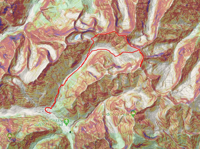
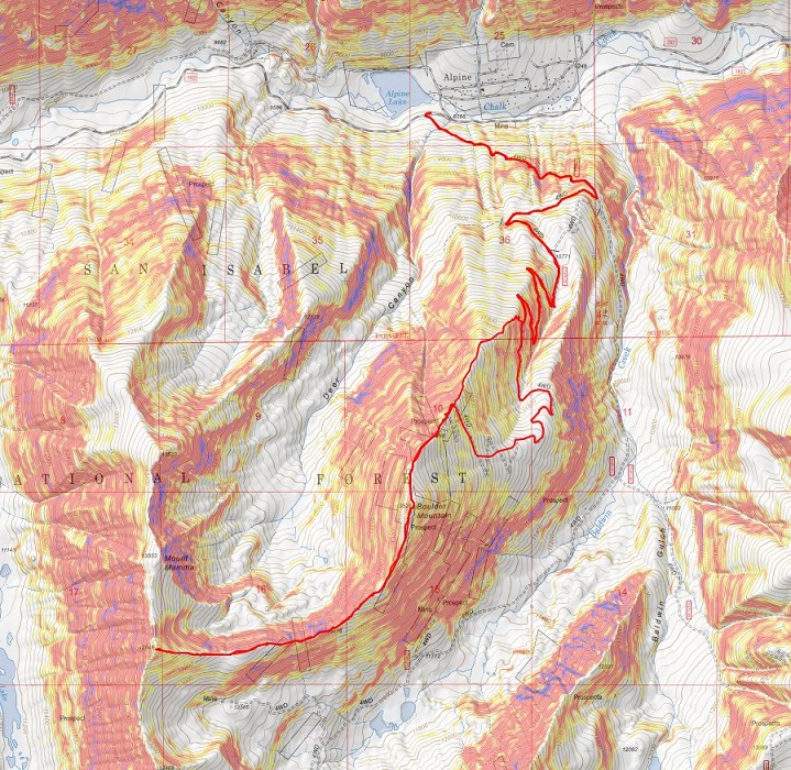
RT Length: 8.95 miles

Elevation Gain: 4206’

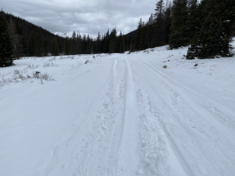
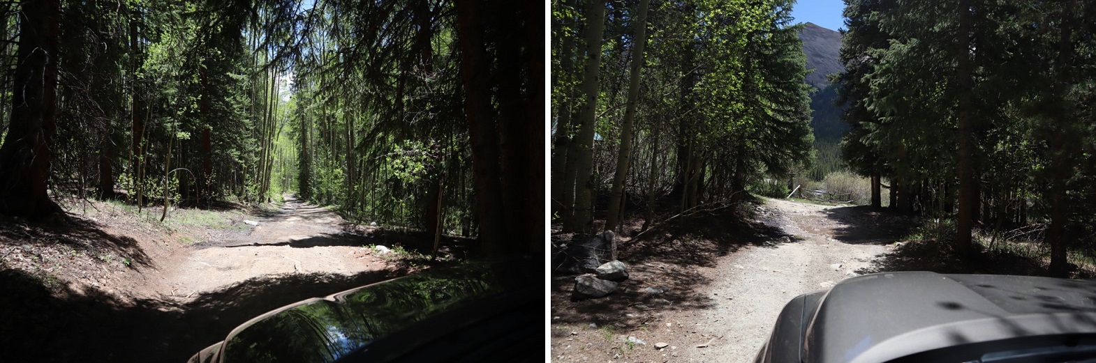
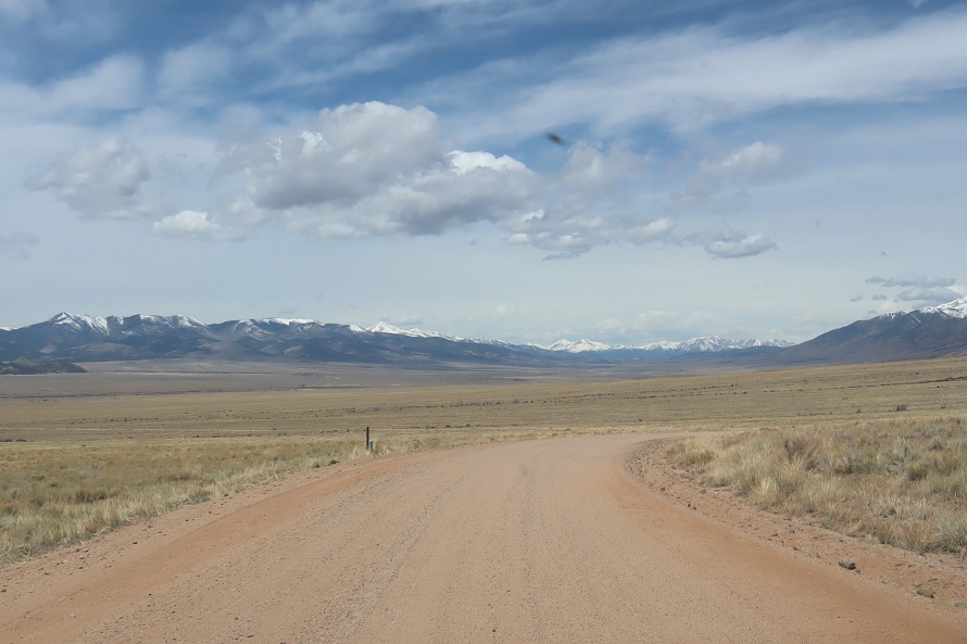
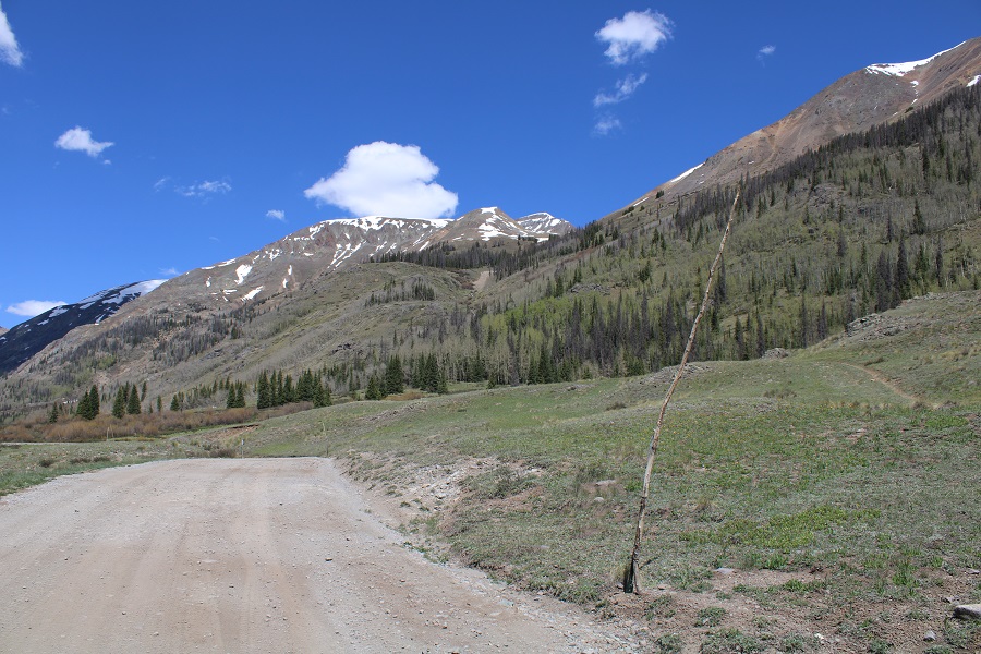
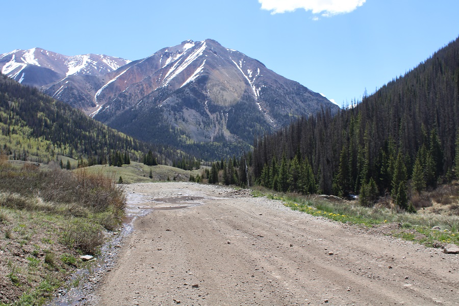
CR 30 has had some work:  the road was much nicer to drive than it was last year.  No more potholes!  At least the firsts 11 miles or so.  The last 5 were still a little rough.

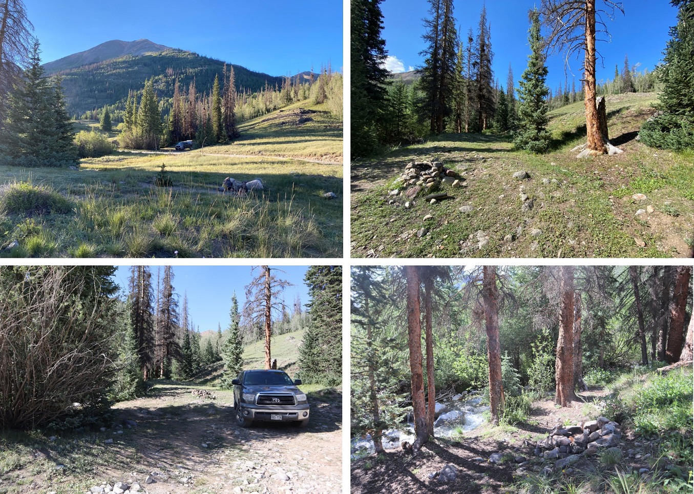
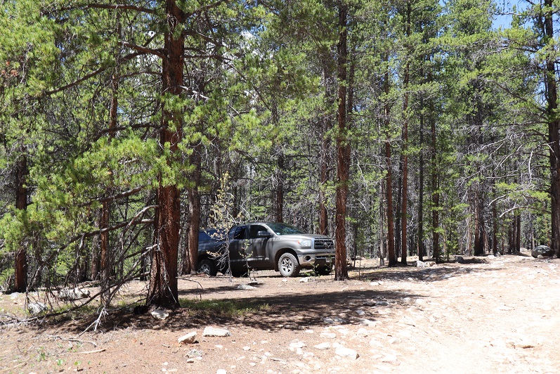
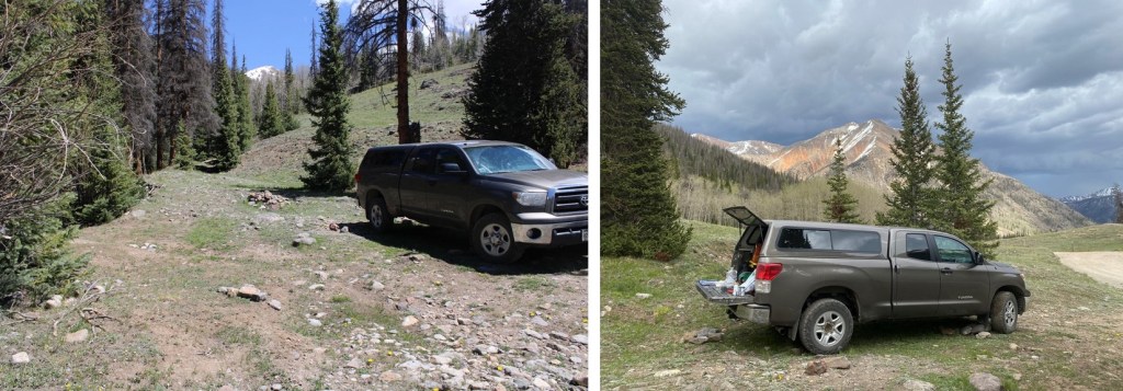
I parked near Cooper Creek and settled in for some dispersed camping.  There was a storm rolling in I and I got to listen to the thunder roll as I ate dinner (Pho, which was awesome) and read a little.  After a while campers set up across the way.  I went over and talked with them:  It was a father and son duo from Alabama, road-tripping because the son had just finished college.  Very cool father/son time. 

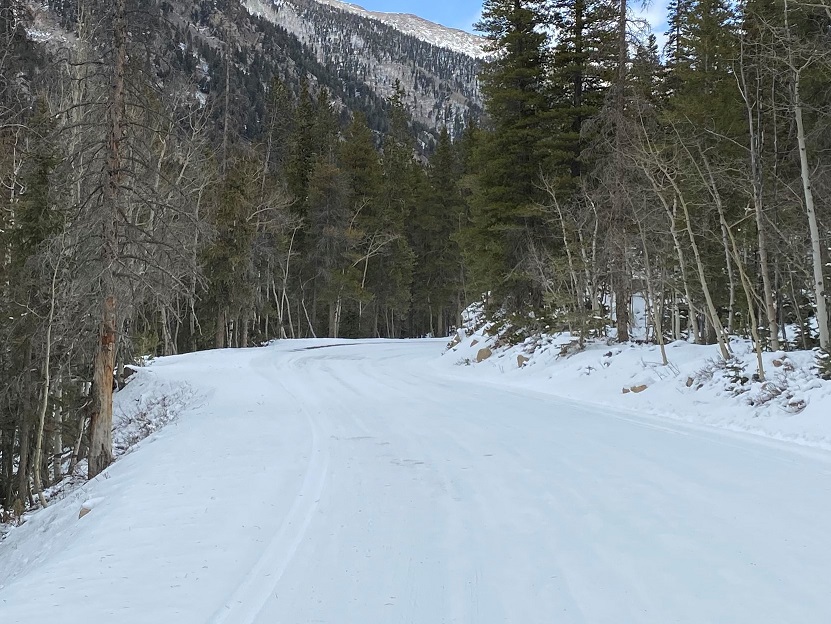
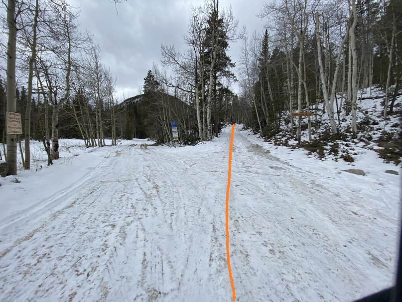
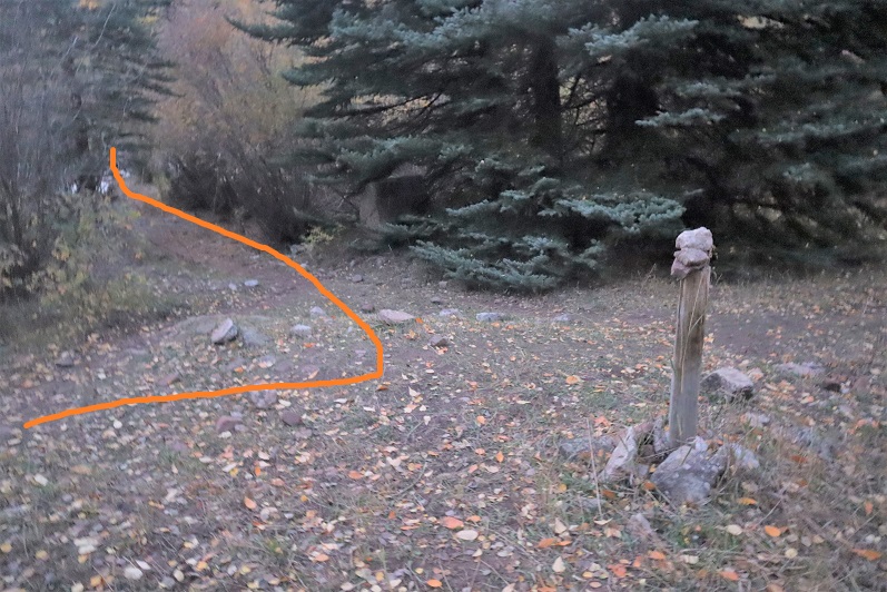
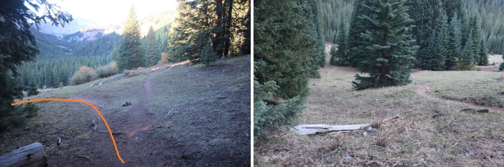
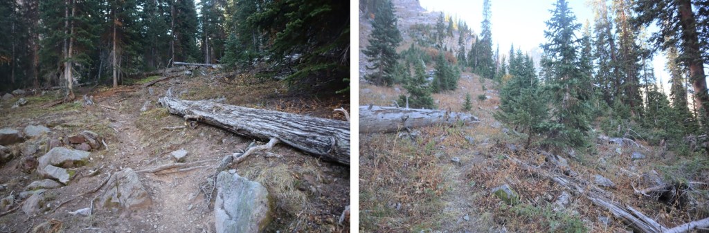
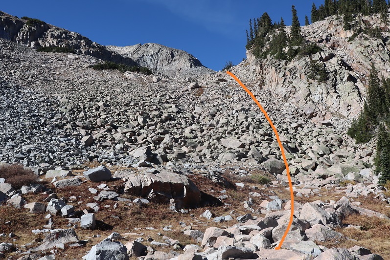
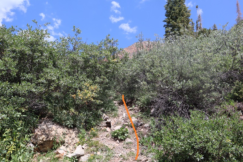
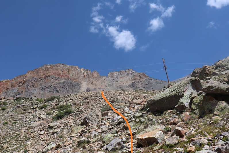
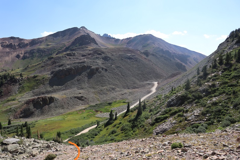
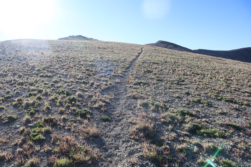
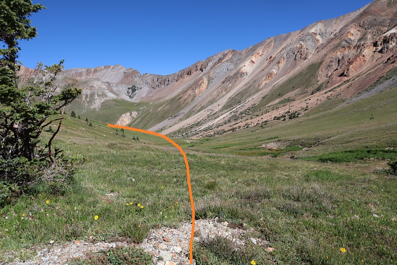
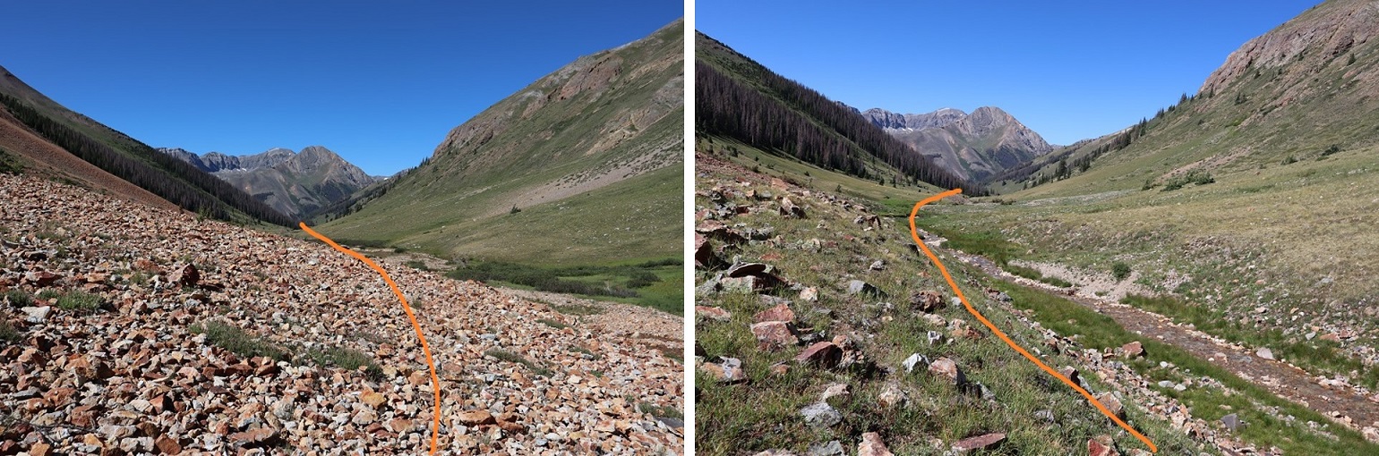
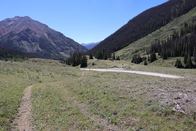
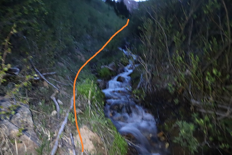
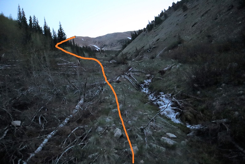
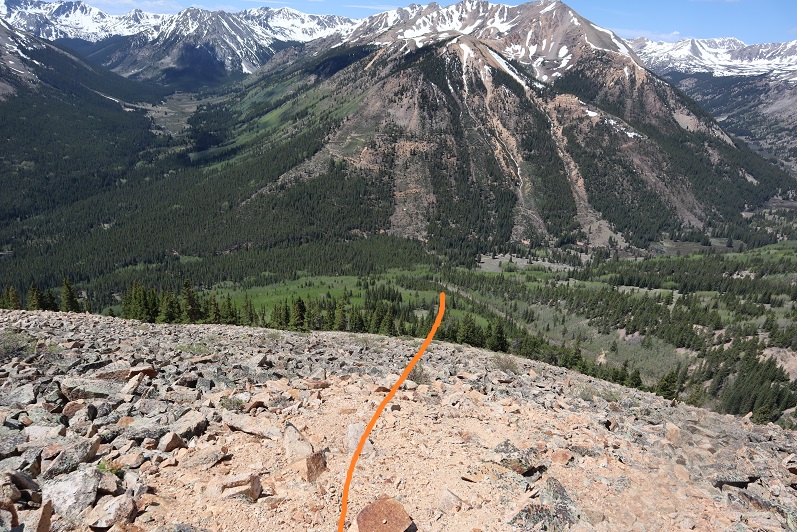
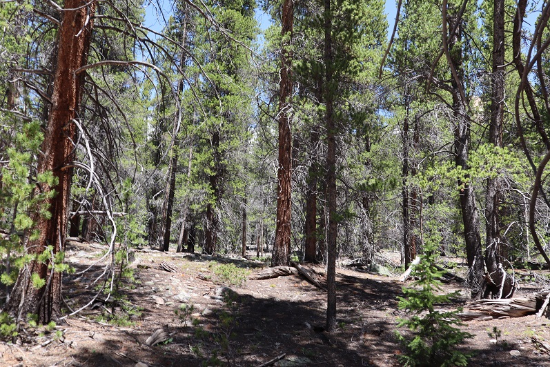
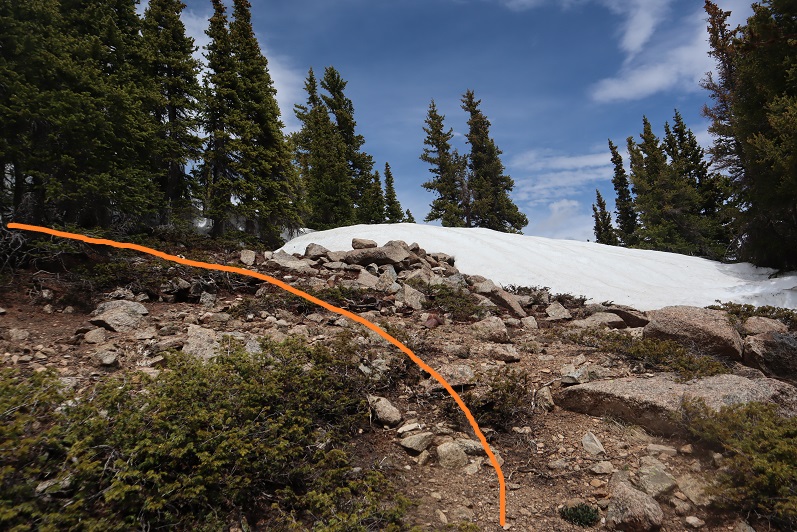
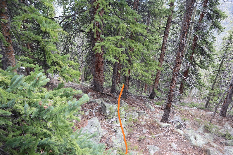
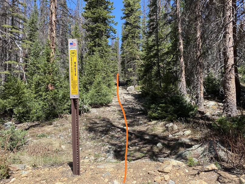
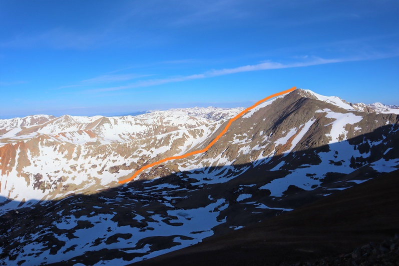
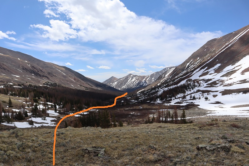
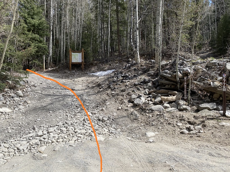
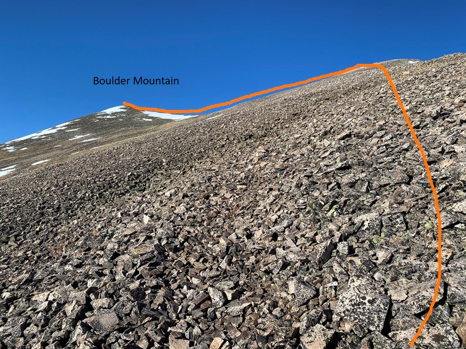
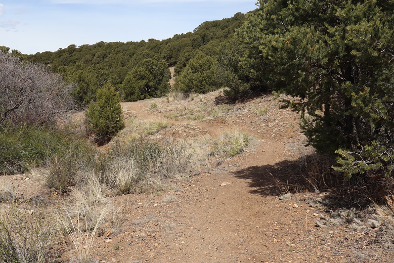
I made it an early night, sleeping until my alarm went off at 3am.  I hit snooze and was on the trail by 4am.  The route starts out following CR 30 west for about a third of a mile, then I left the road and followed the drainage/Rock Creek northwest.

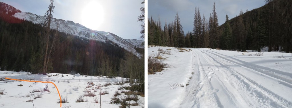
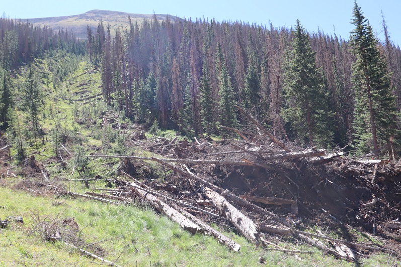
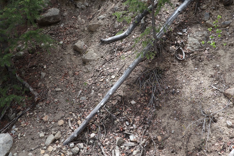
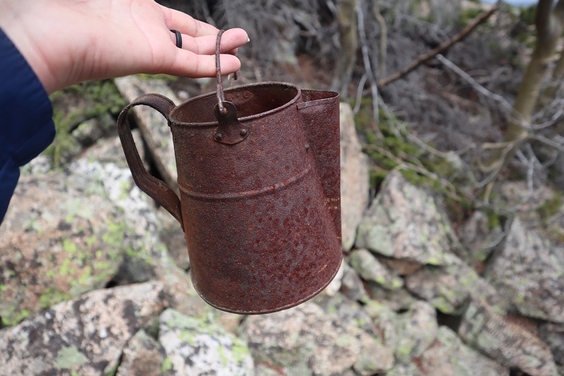
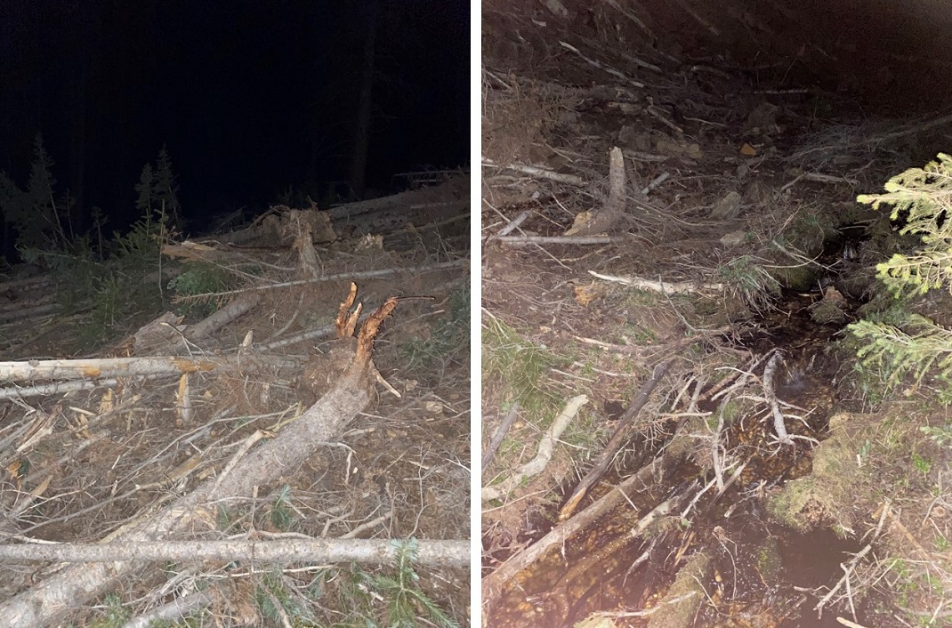
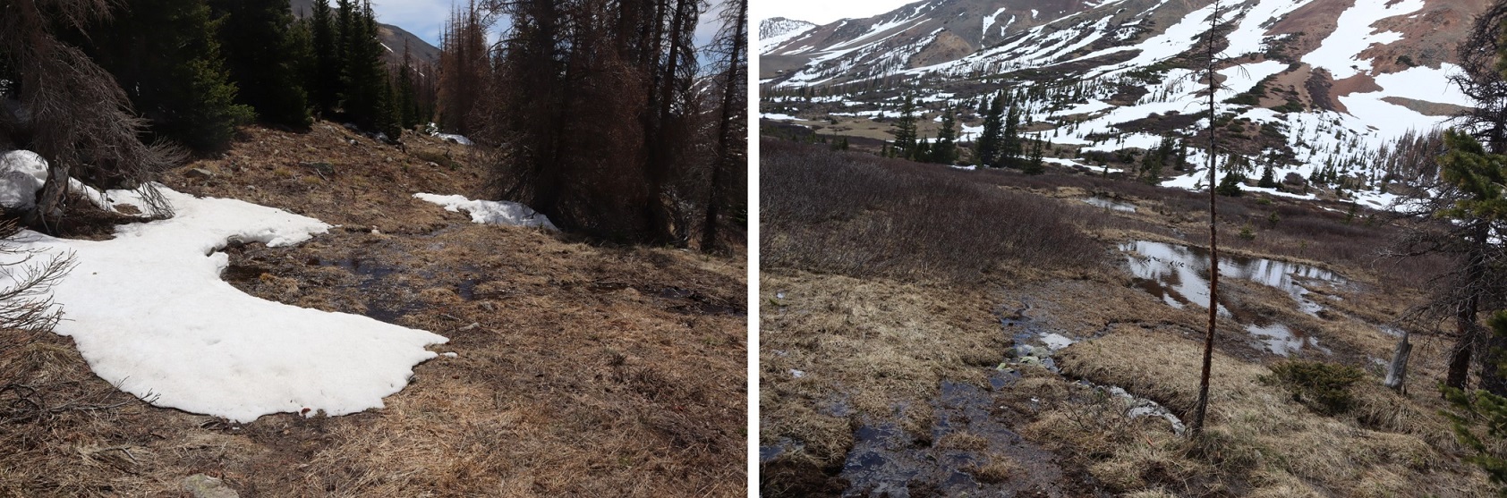
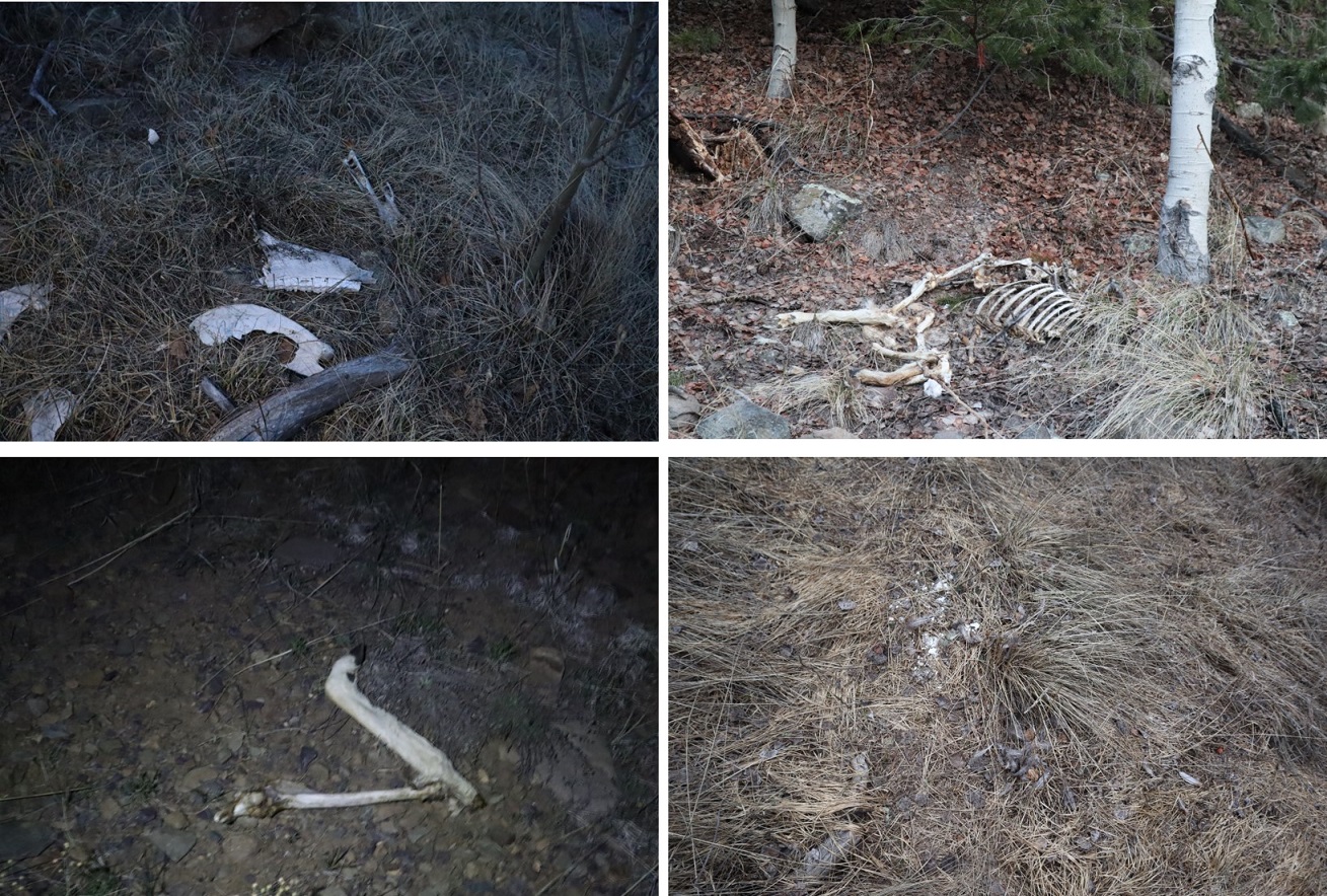
The area where you leave the road is also the site of a recent avalanche:  a house was destroyed, and there are pieces of the house, roof, furniture, shoes, etc. strewn about the area for about 100 yards.

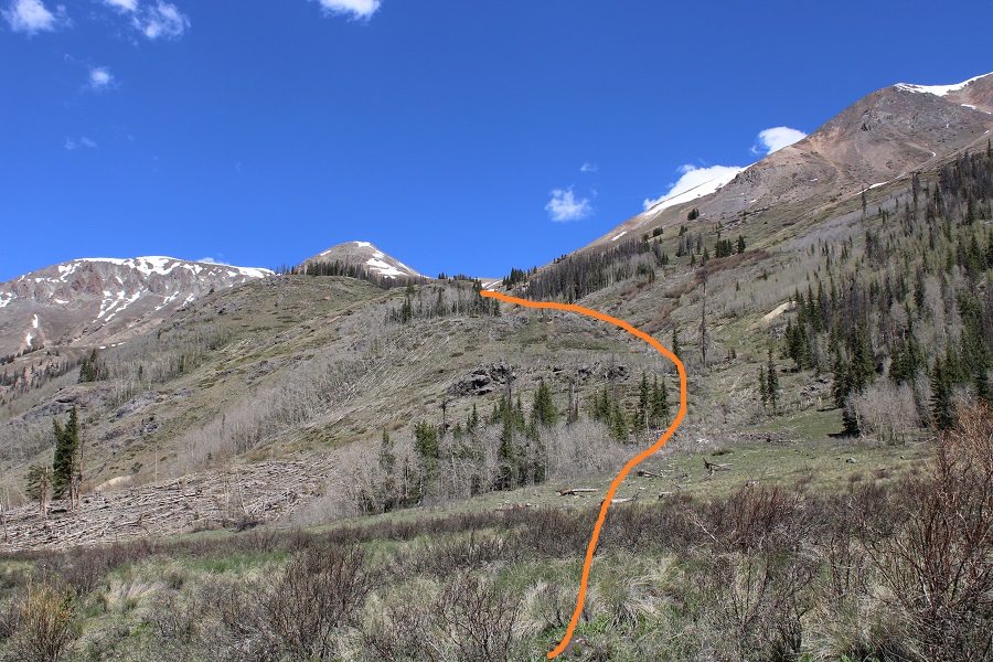
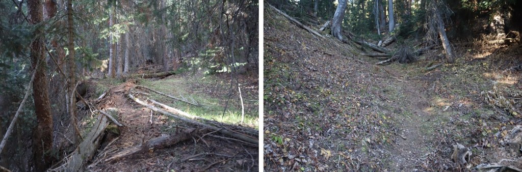
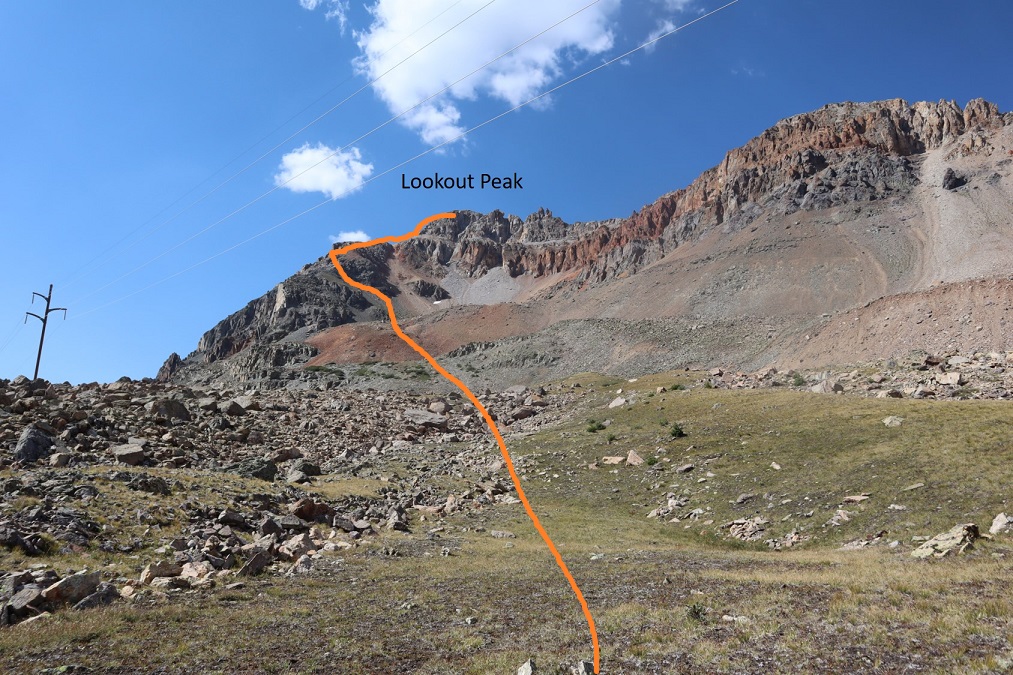
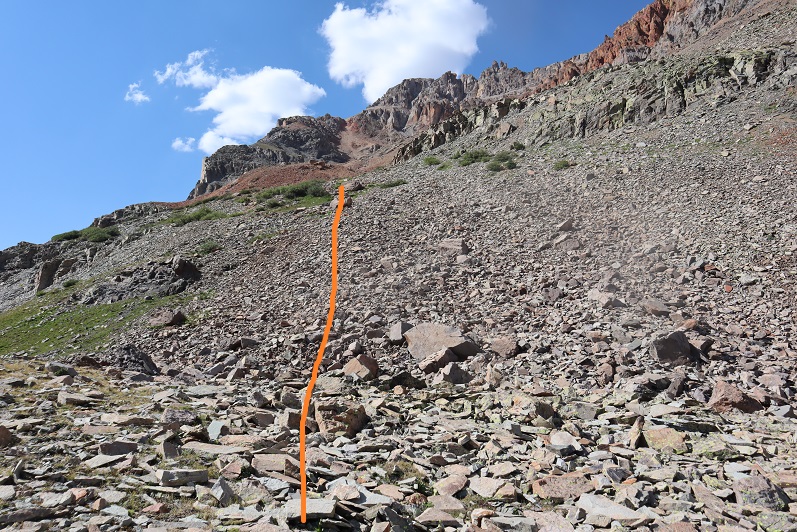
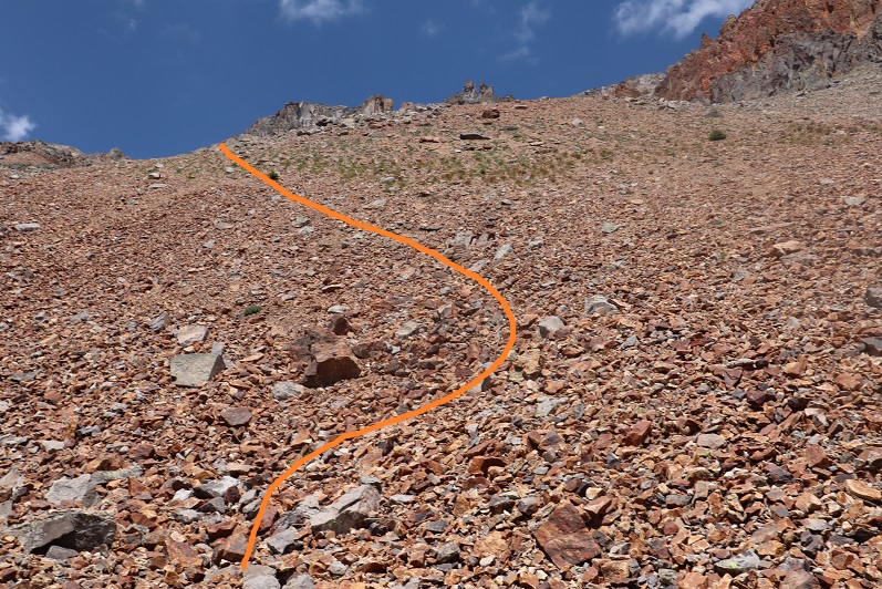
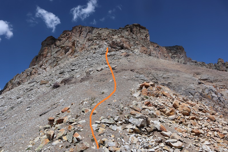
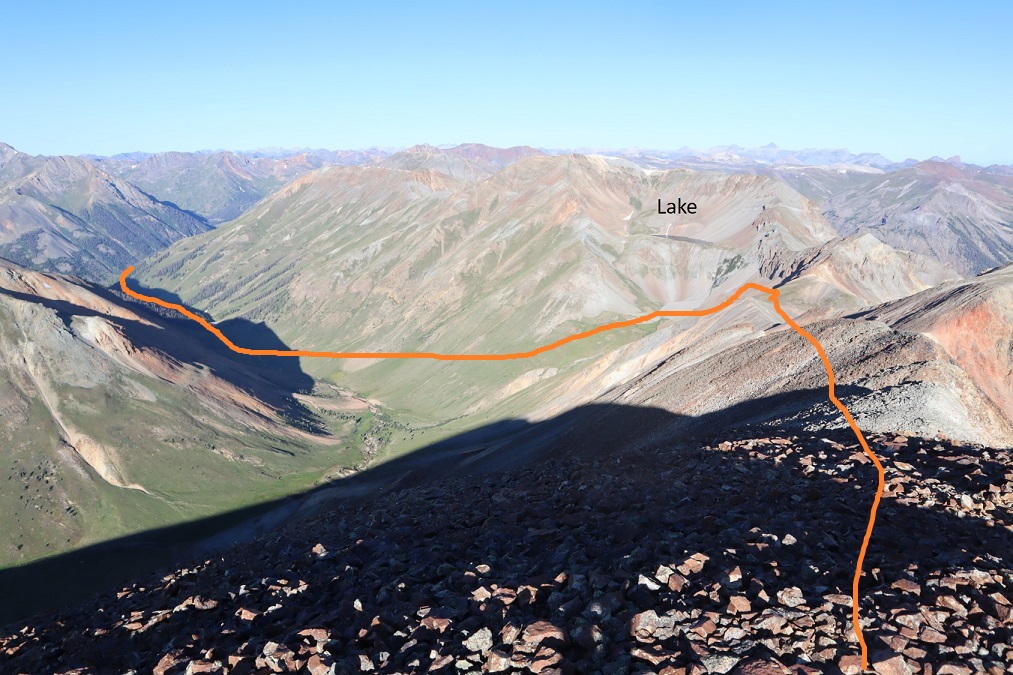
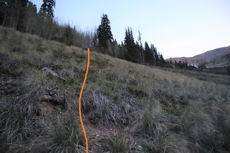
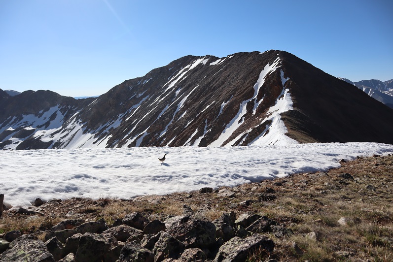
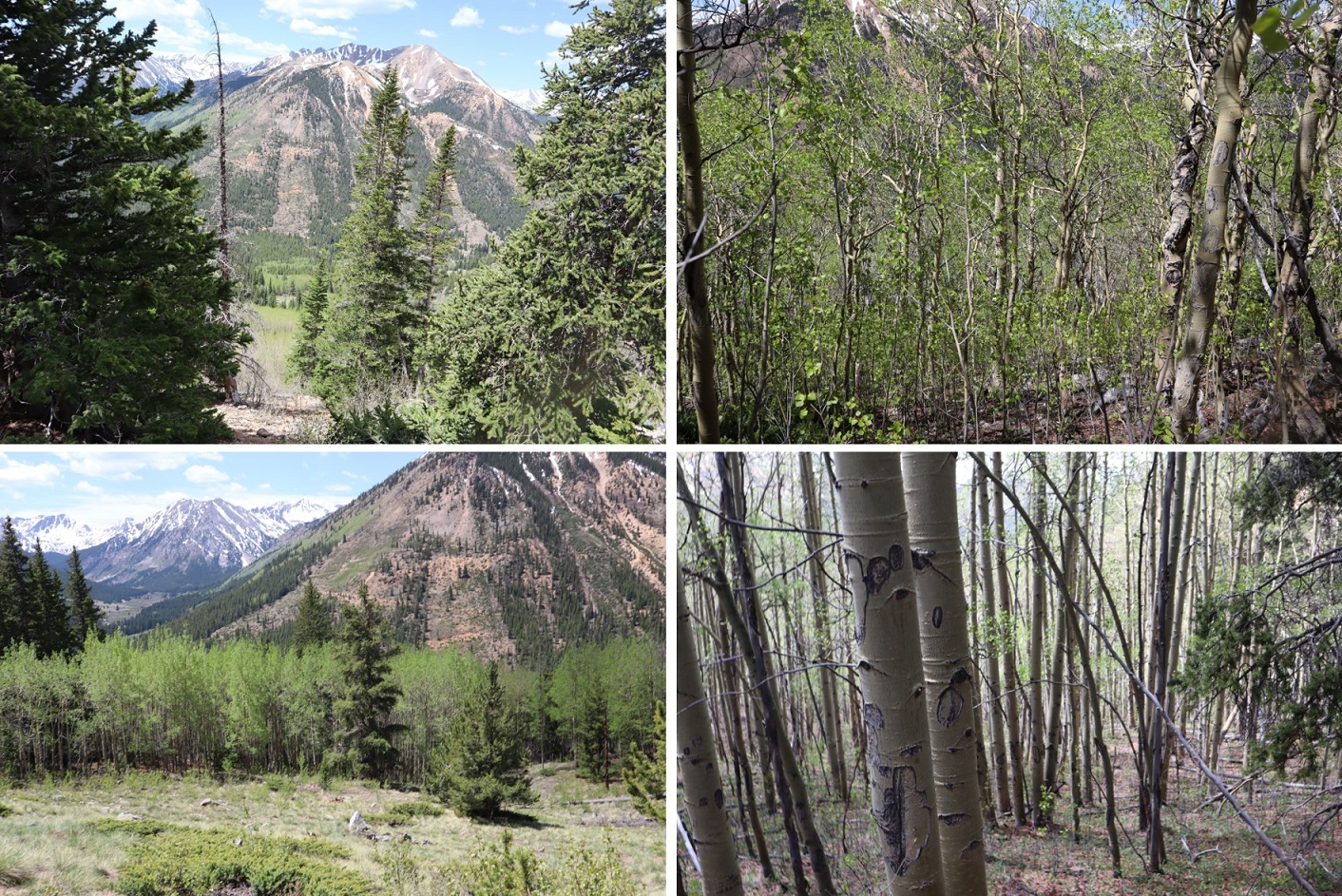
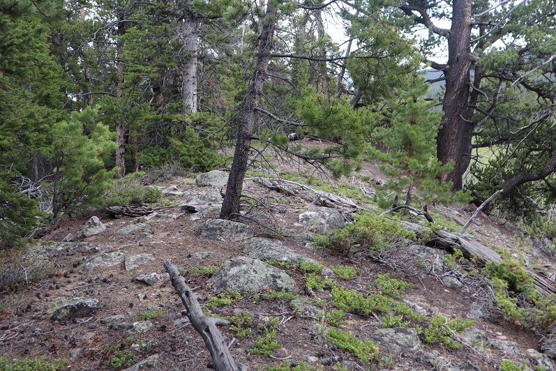
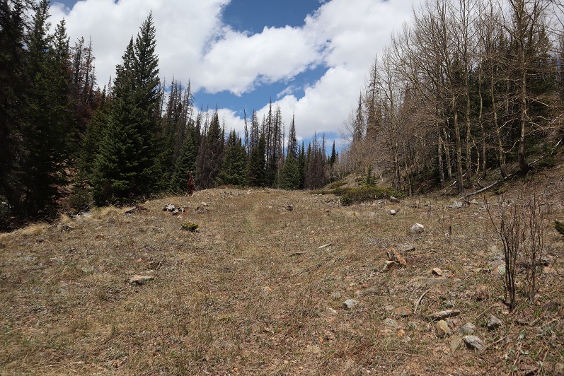
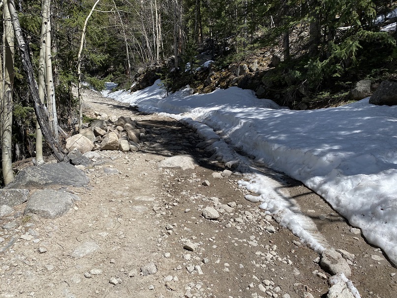
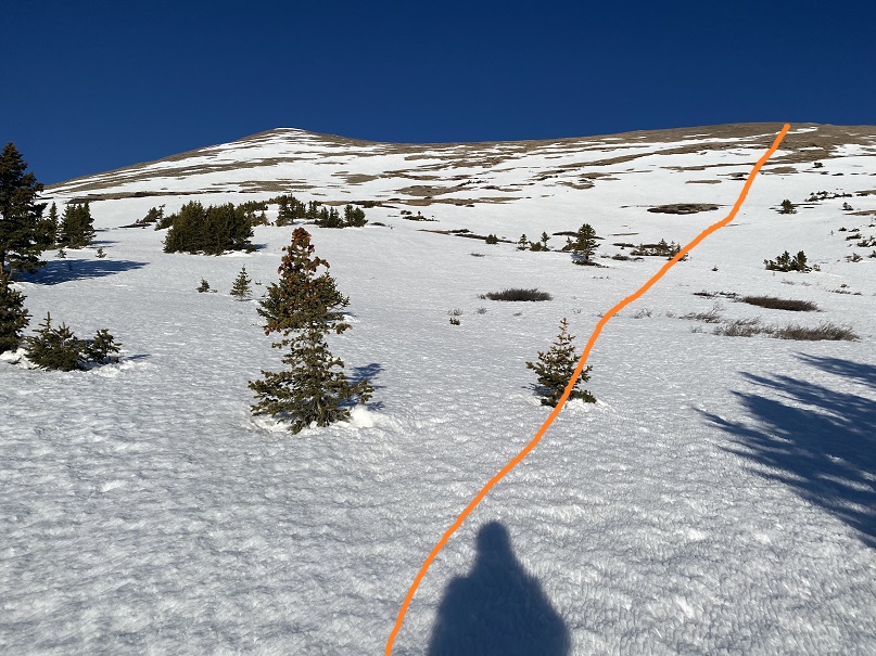
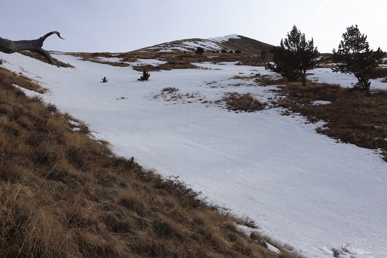
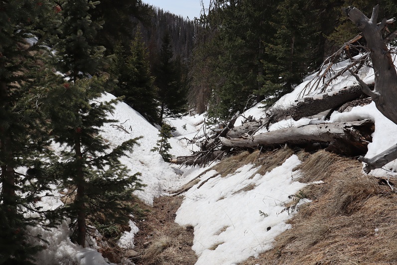
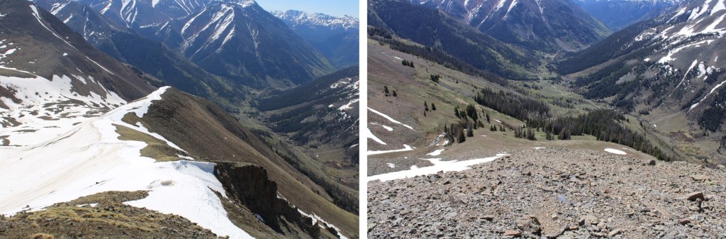
I followed Rock Creek into the upper basin, staying to the left of the creek (but hugging the creek the entire way).

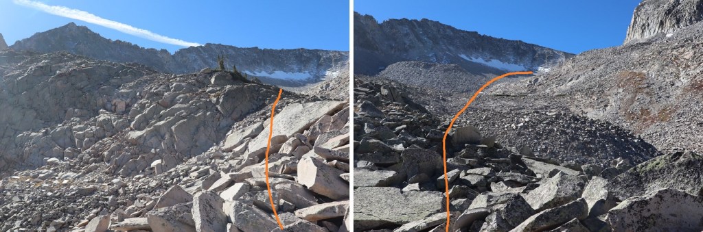
Once in the basin I followed it as it curved northwest.

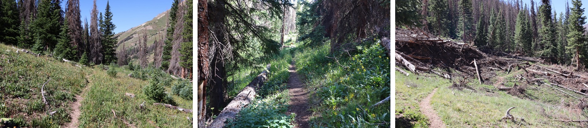
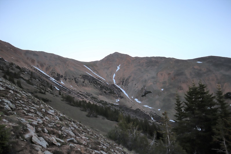
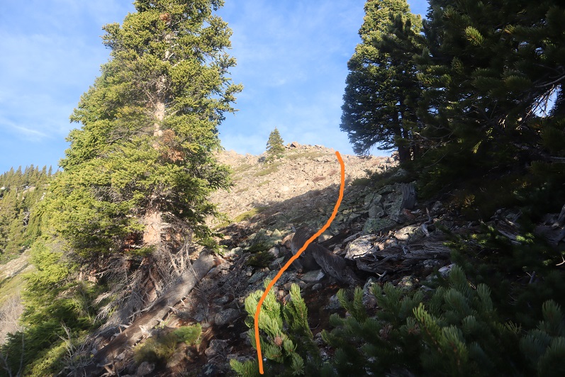
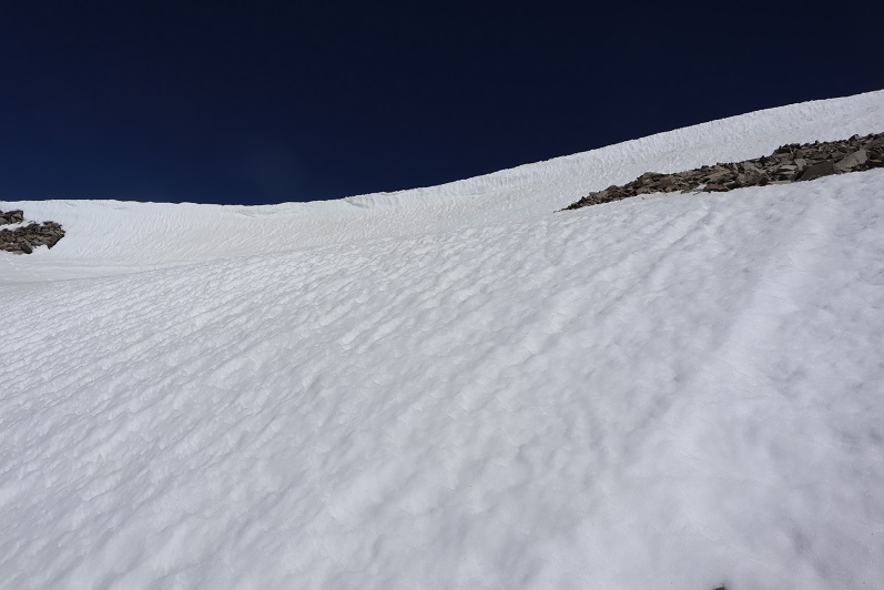
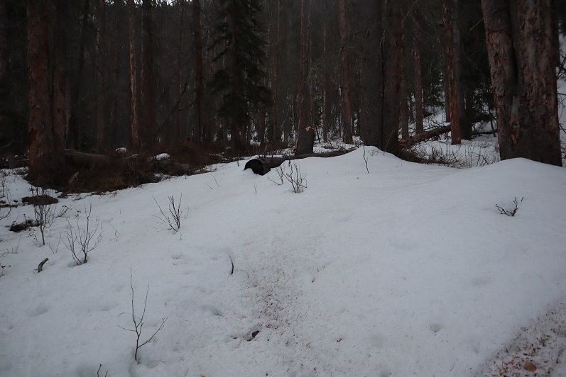
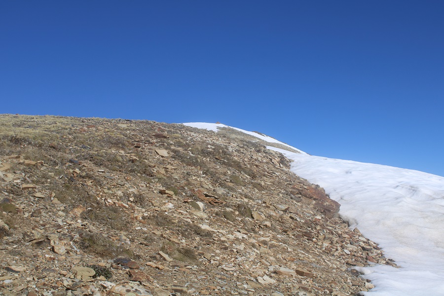
There was a lot more snow here than I’d expected:  I put on my microspikes and climbed into the upper basin.

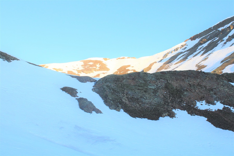
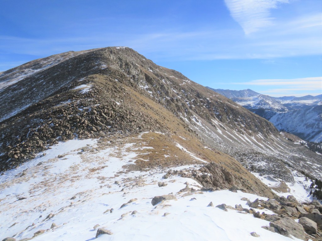
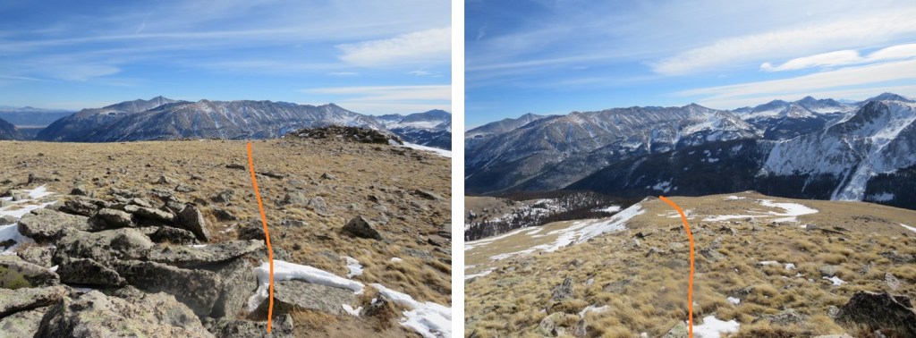
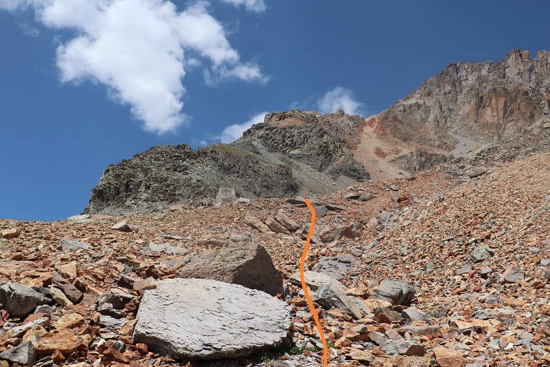
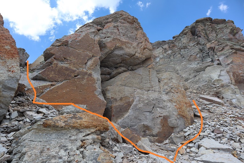
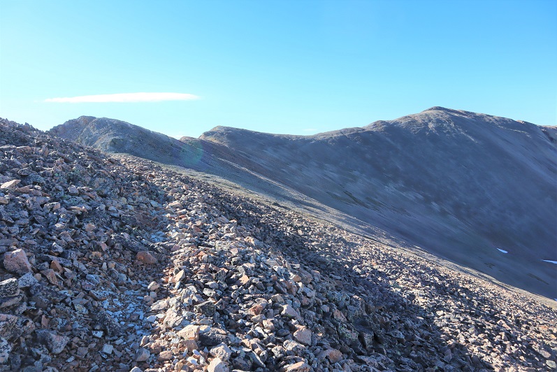
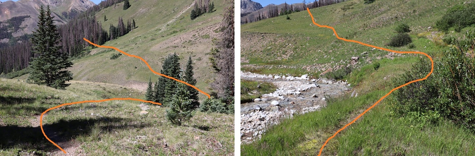
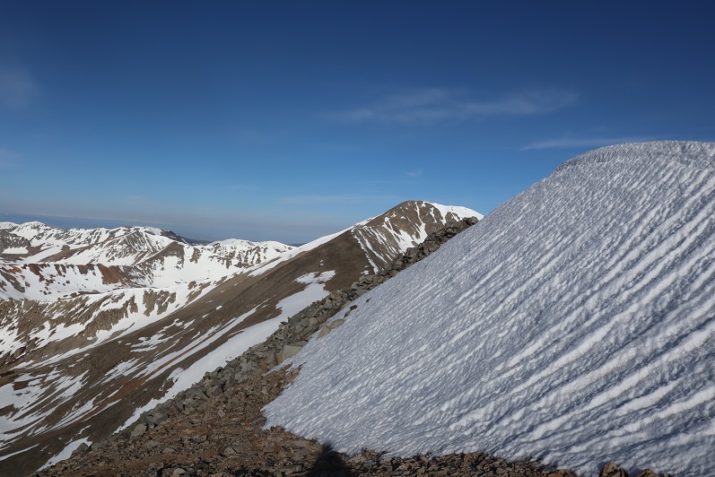
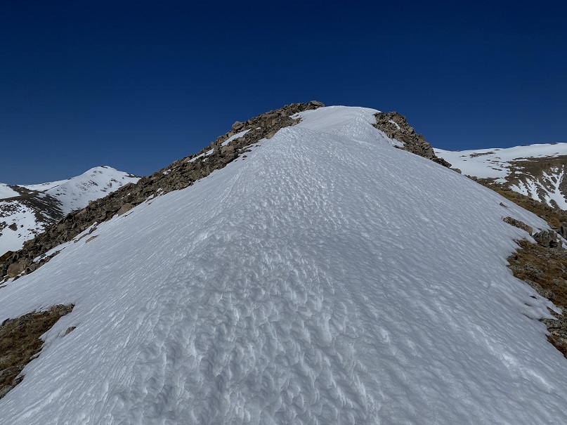
Once in the upper basin there was even more snow.  Microspikes were still ok at this time, but I knew I’d want to take a different route down, as the sun was going to warm up this snow quickly and there was no telling how deep I’d be postholing.  I aimed for the ridge, and once on the ridge, followed it west to a kind of saddle

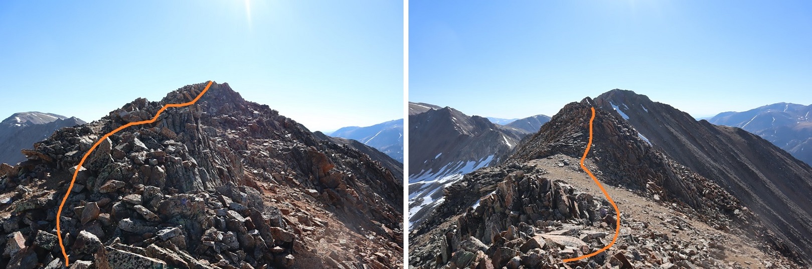
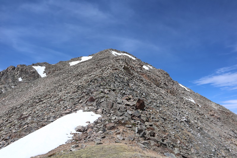
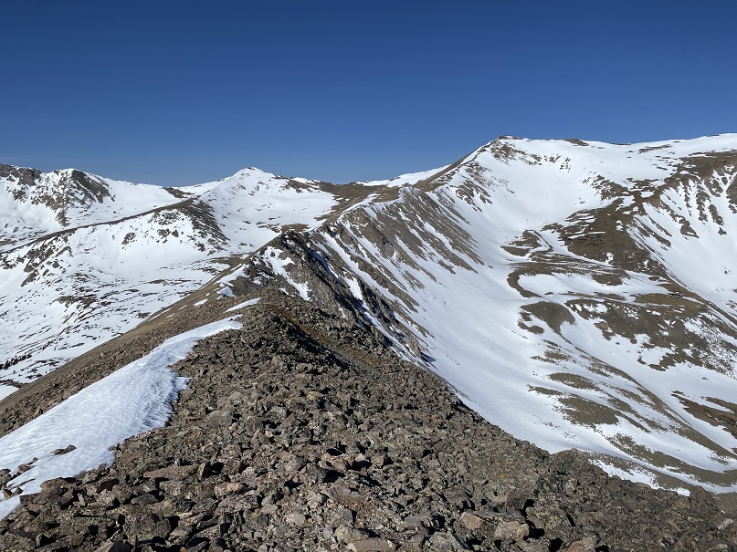
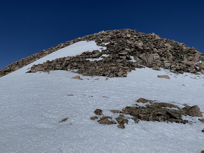
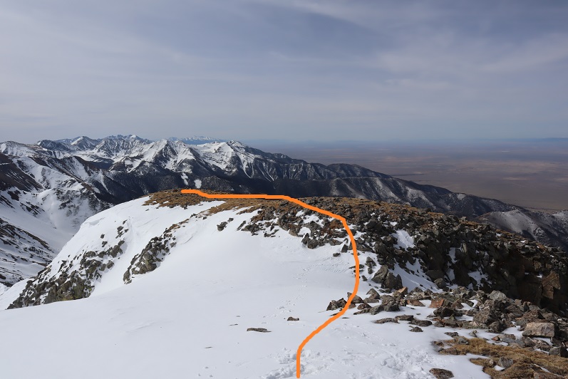
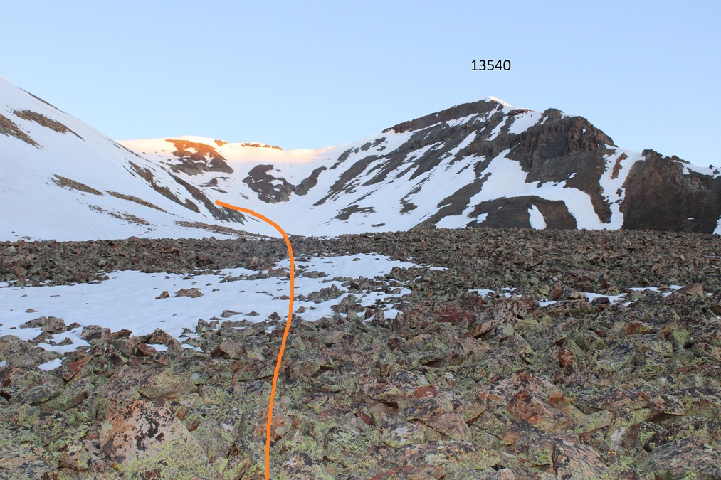
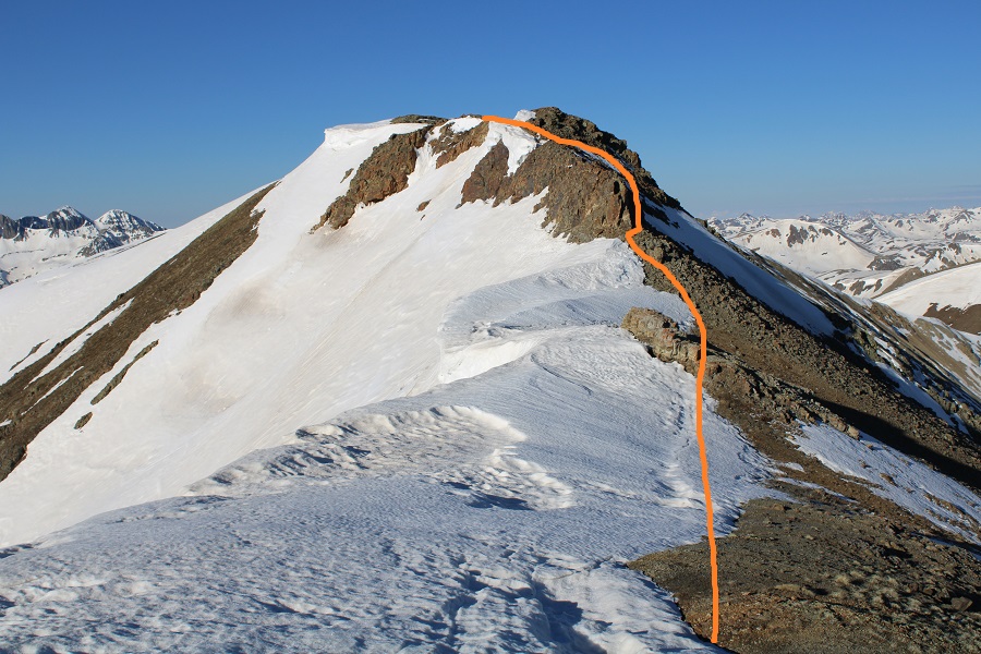
At the saddle I turned right and followed the ridge northeast to the summit of 13540.

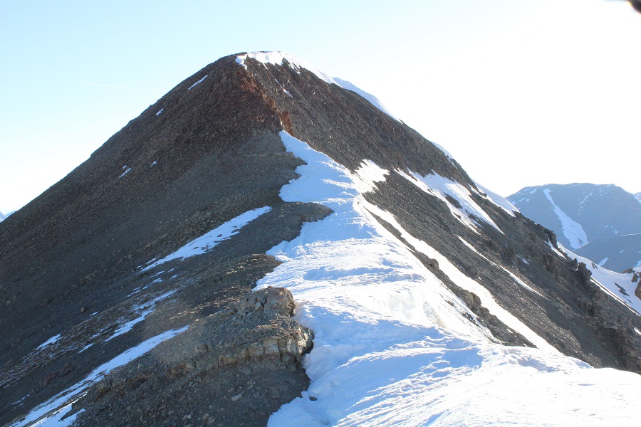
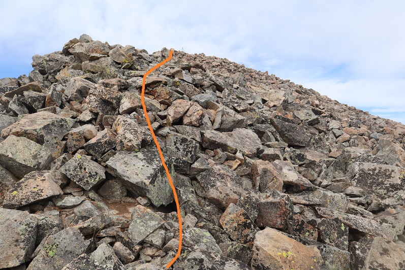
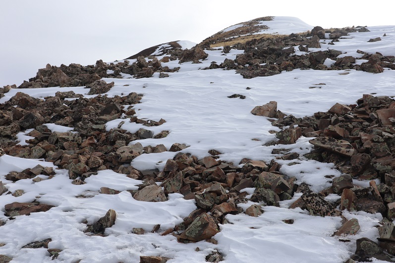
There was a class 2 rocky section to navigate.  I just went up and over this.

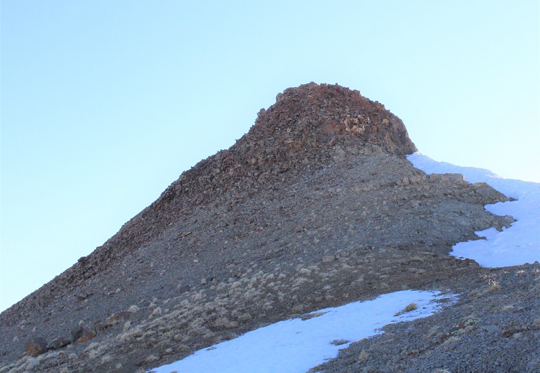
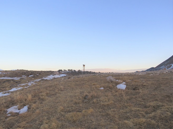
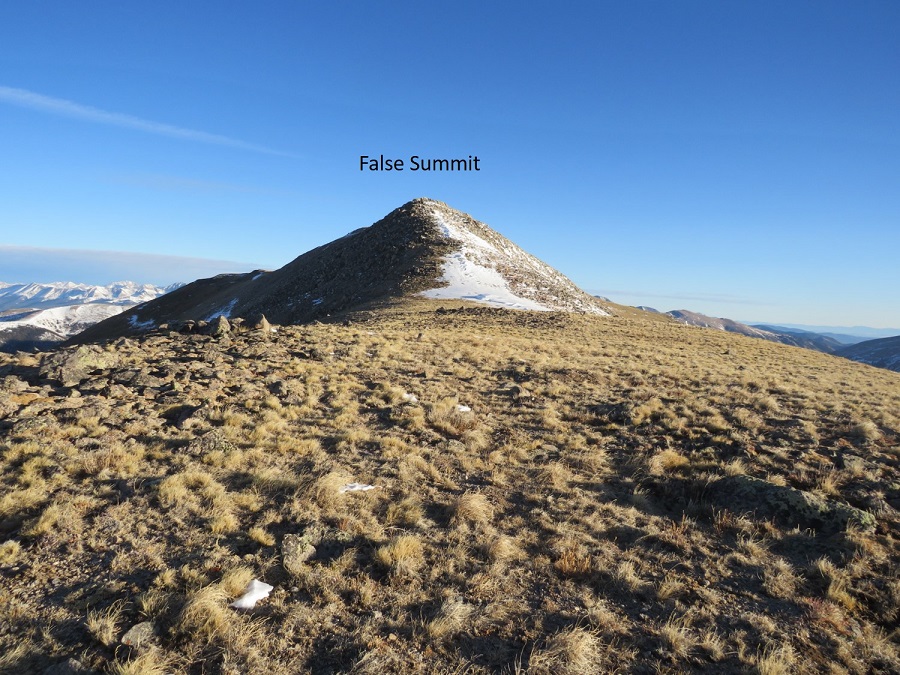
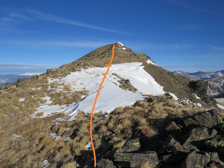
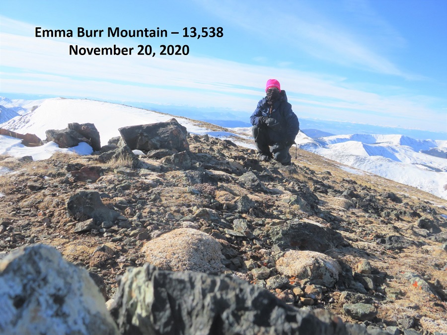
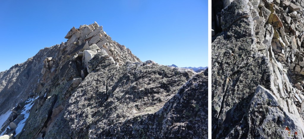
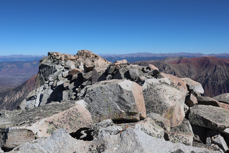
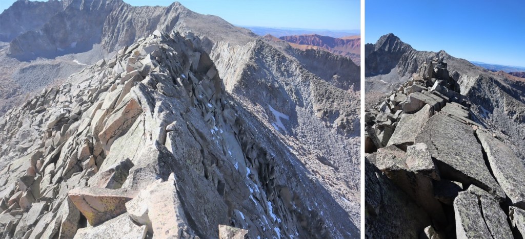
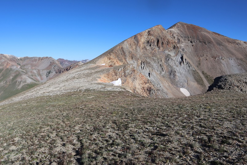
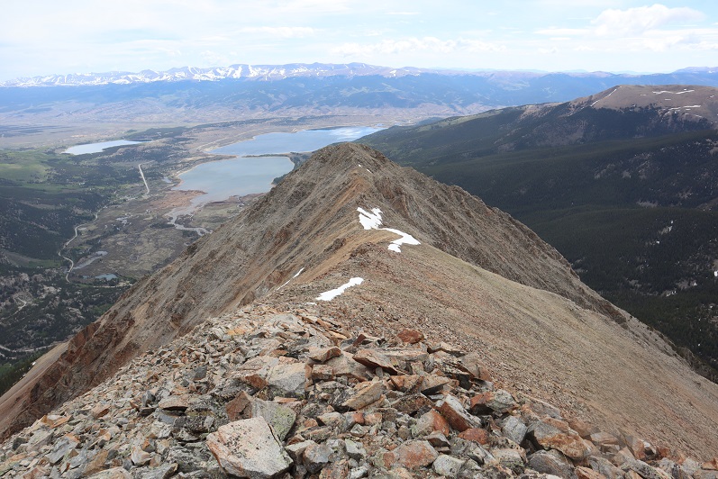
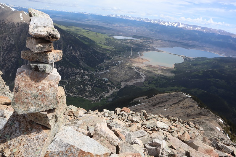
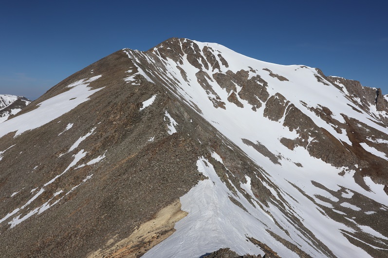
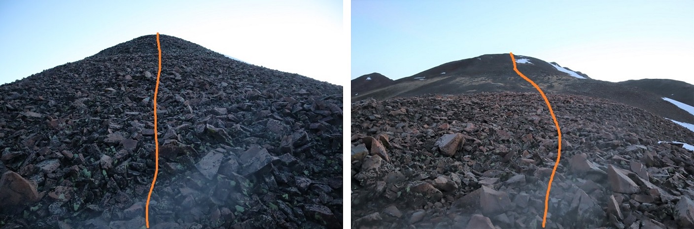
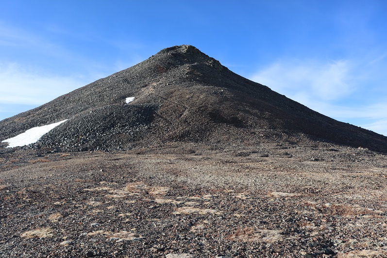
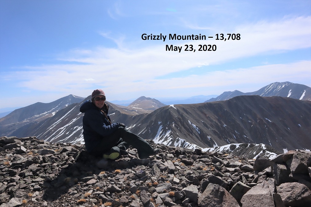
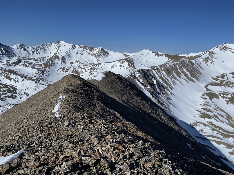
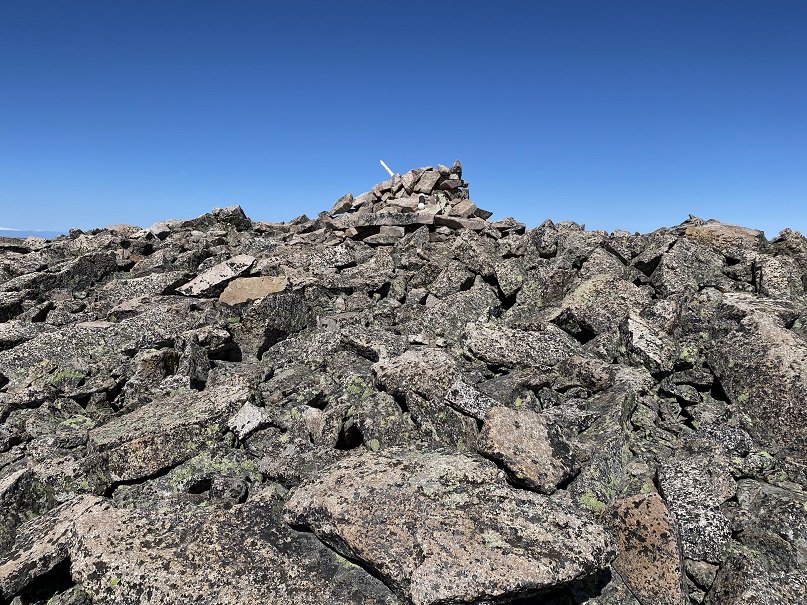
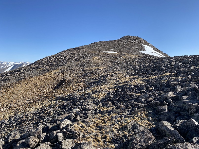
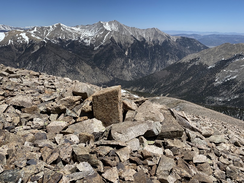
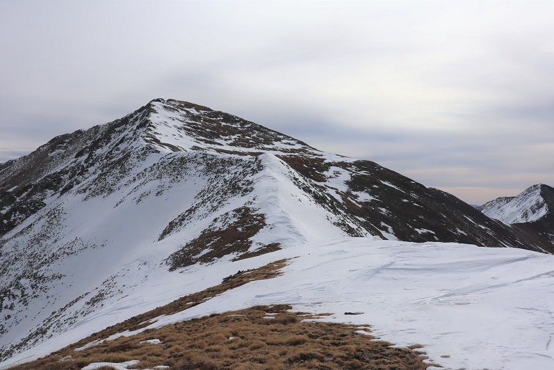
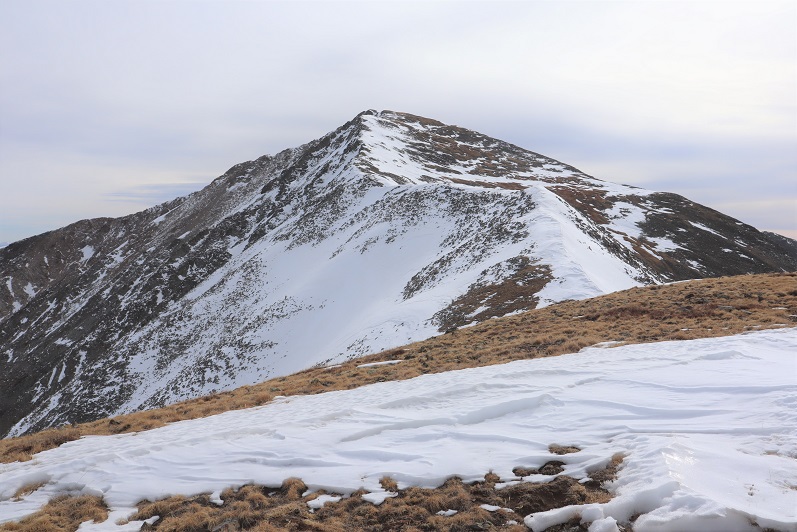
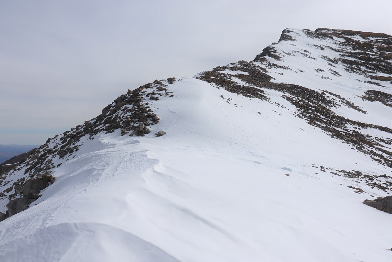
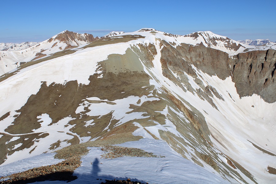
Here’s a look at the summit

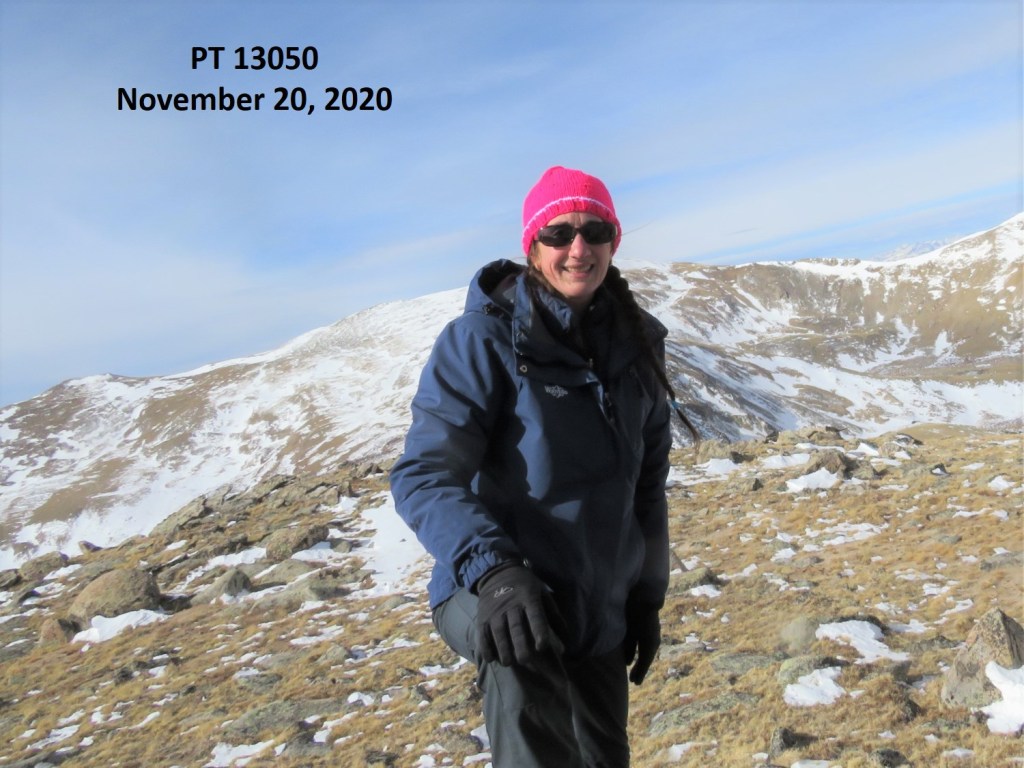
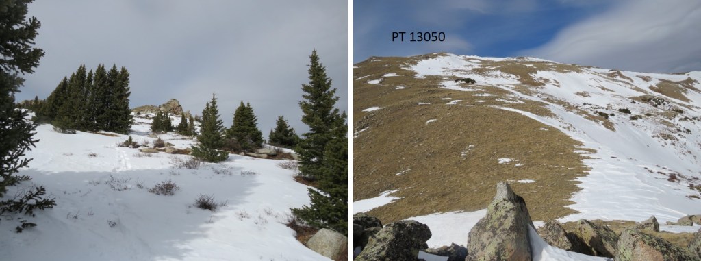
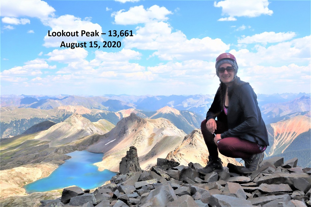
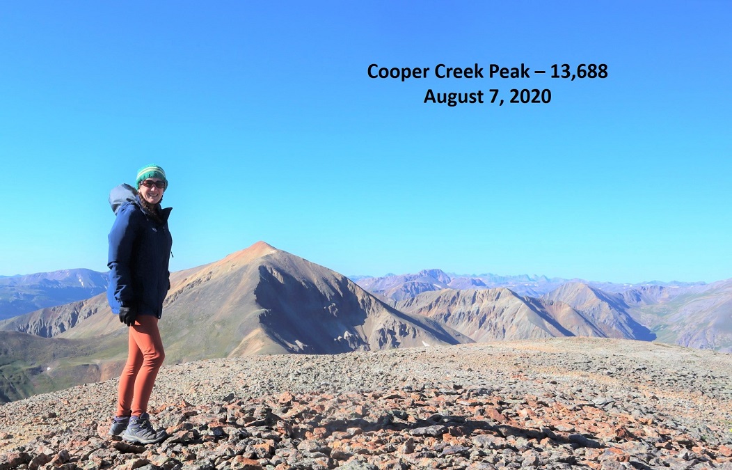
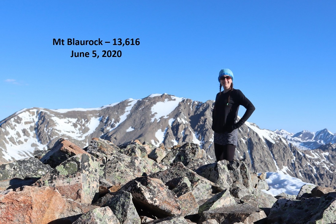
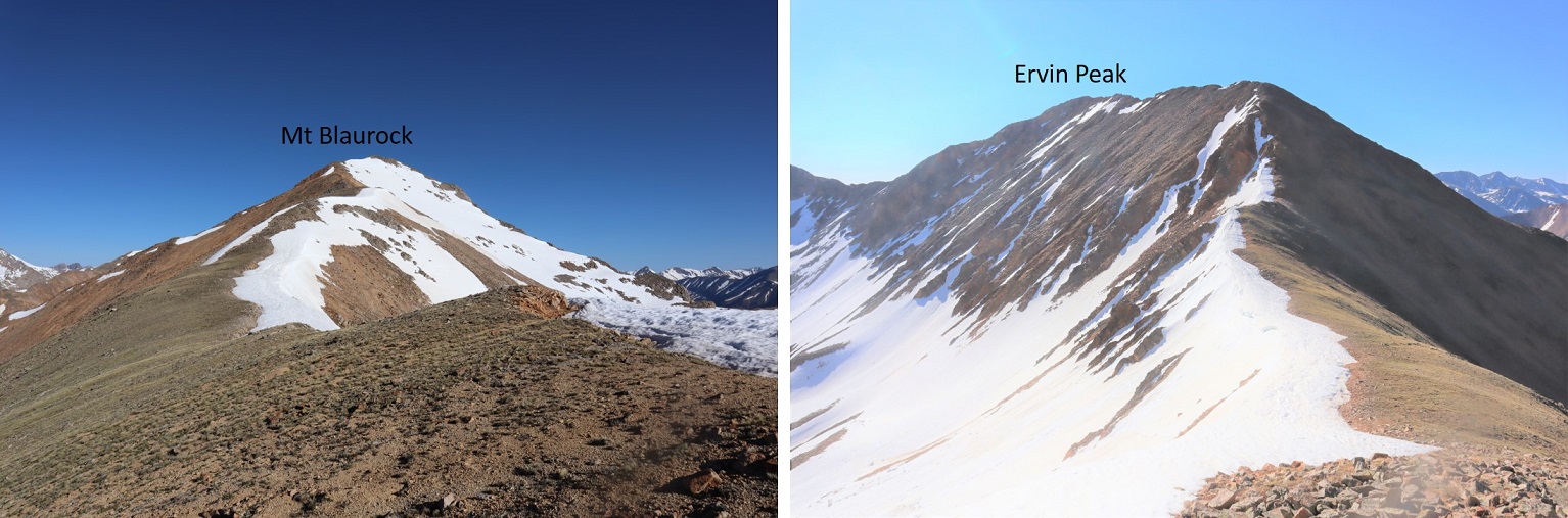
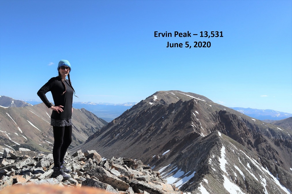
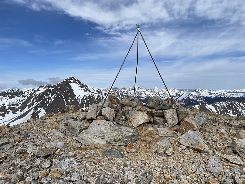
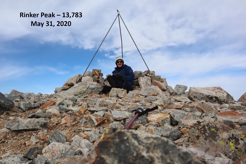
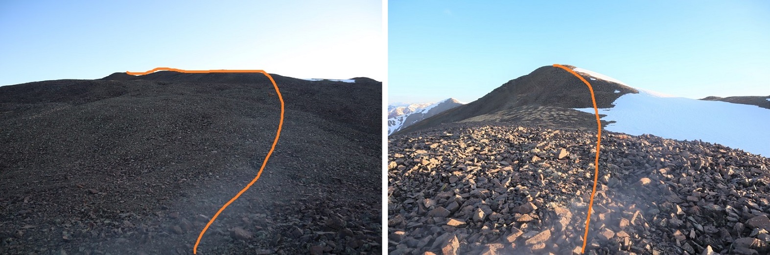
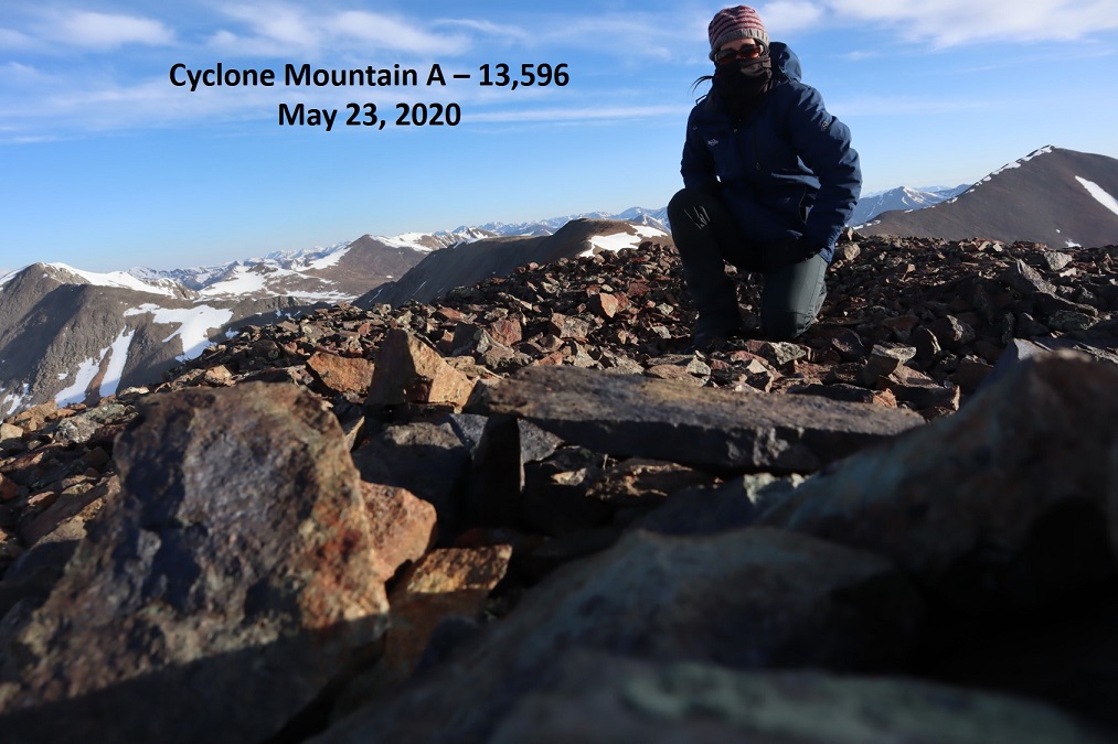
I summited PT 13540 at 7am
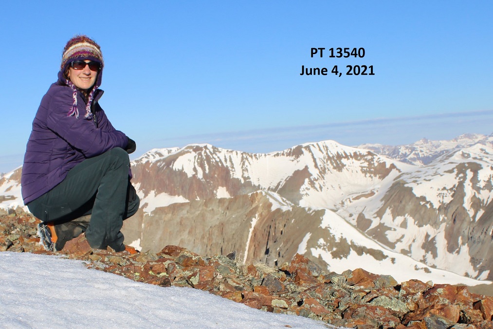
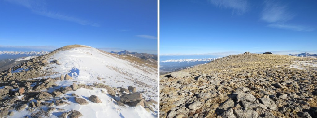
PT 13540: 

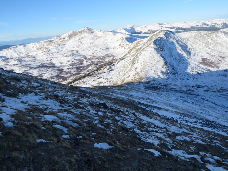
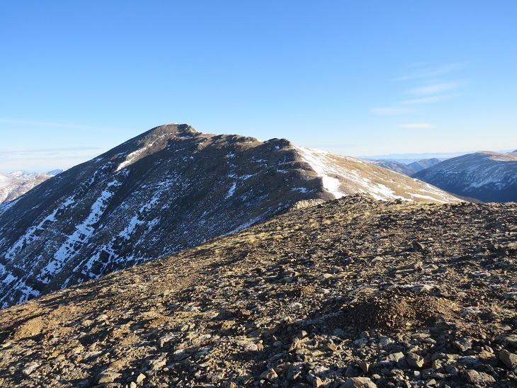
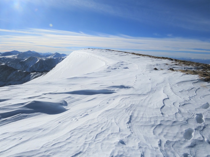
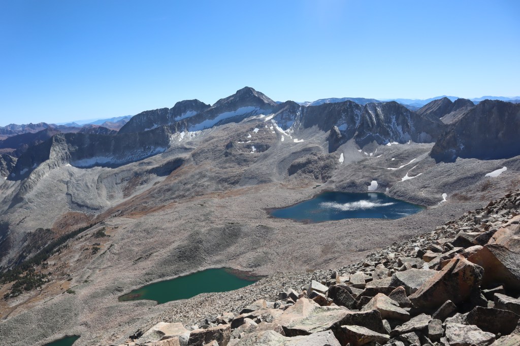
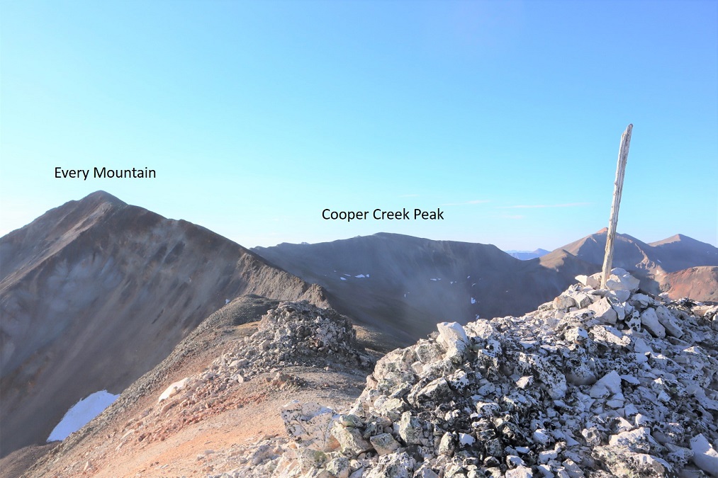
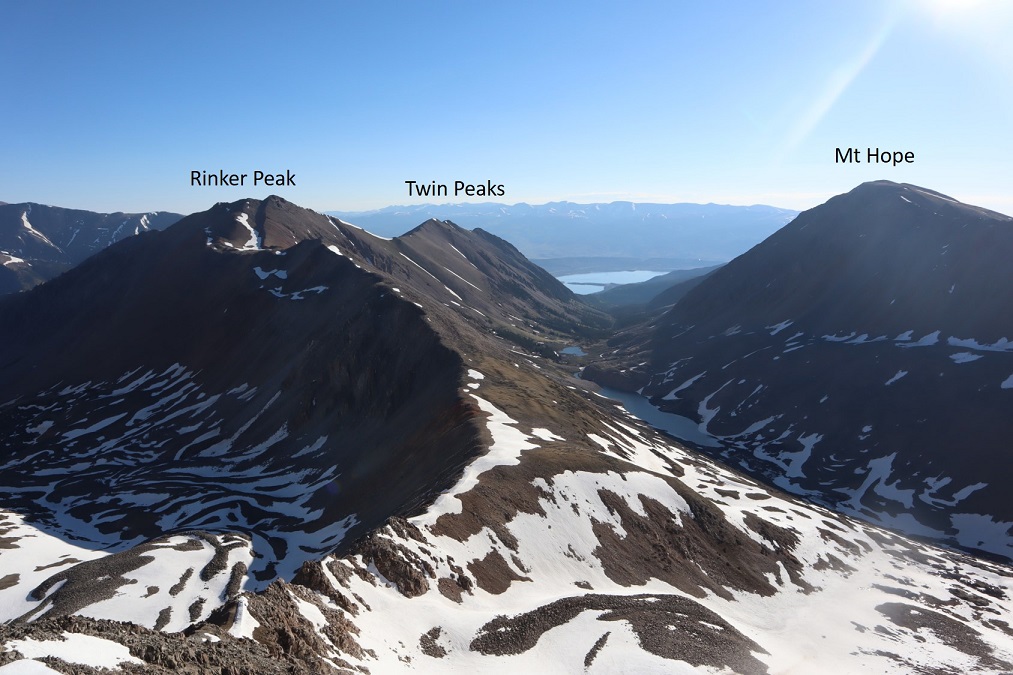
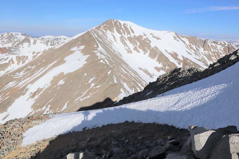
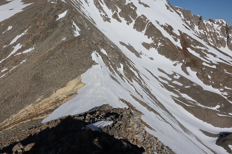
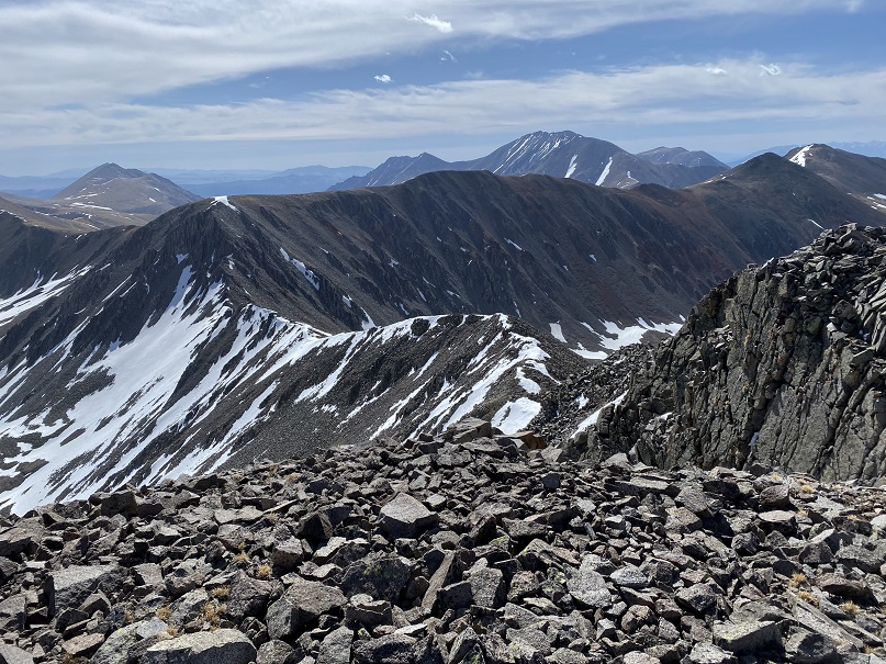
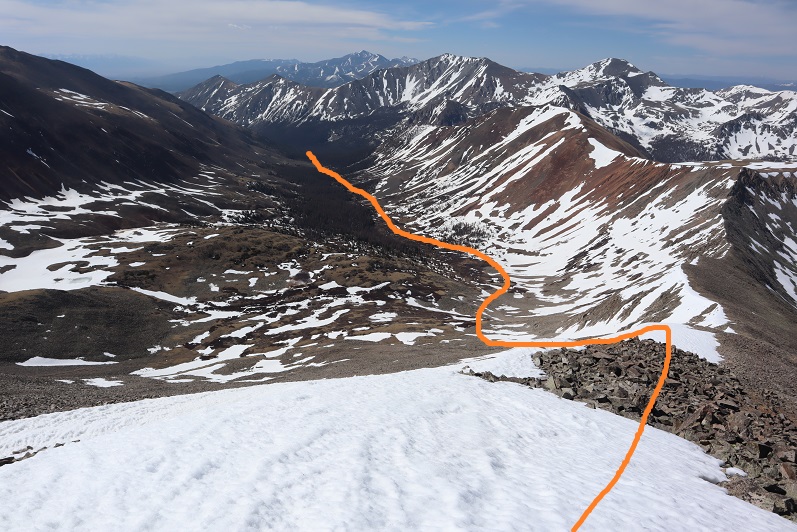
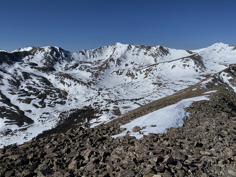
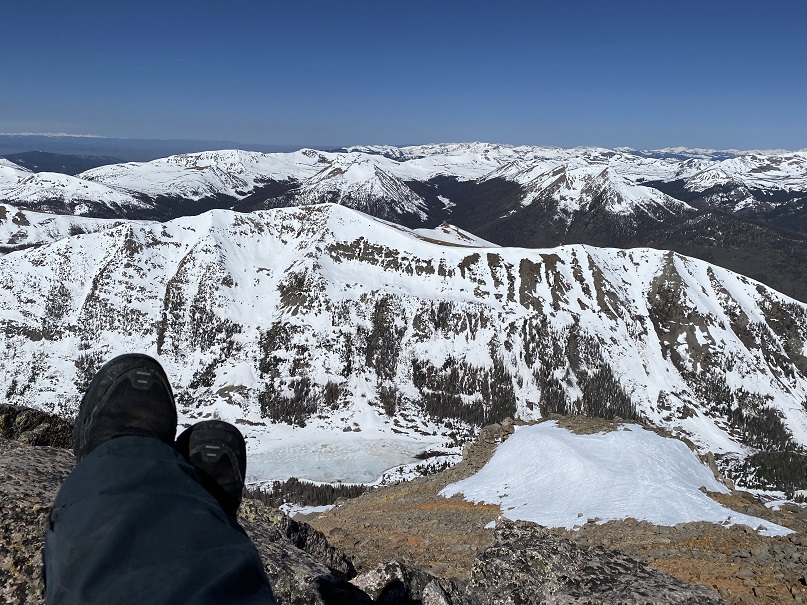
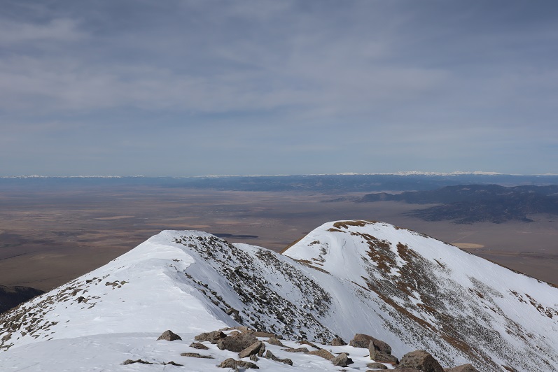
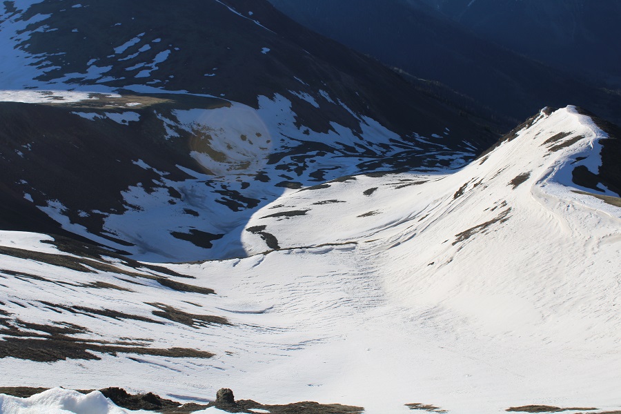
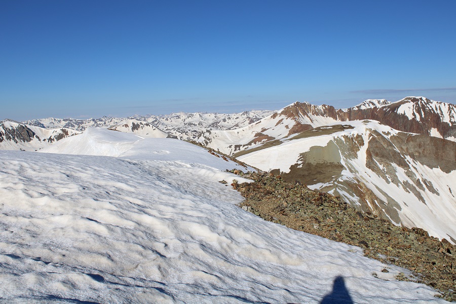
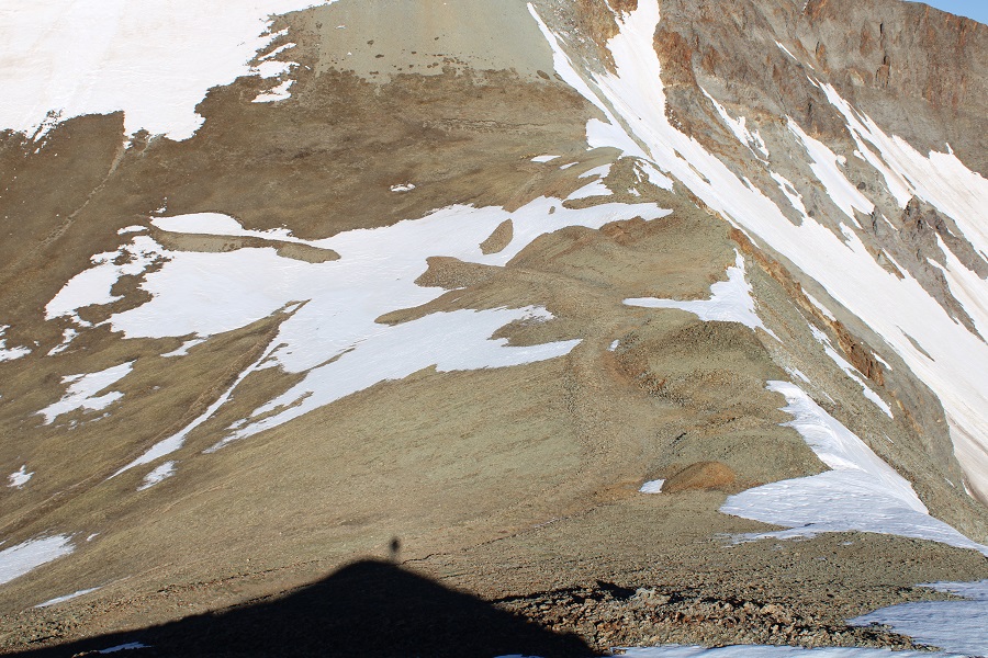
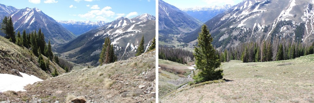
Here’s a look back down at the upper and lower basins. 

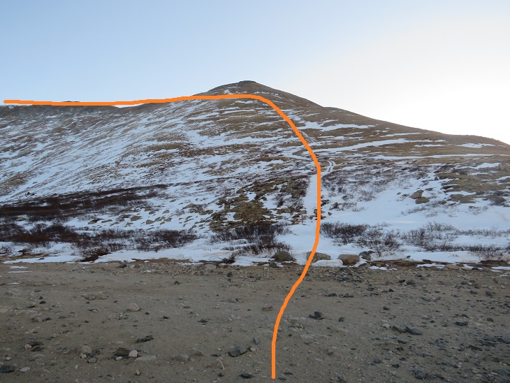
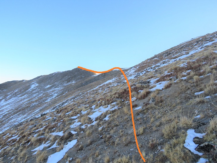
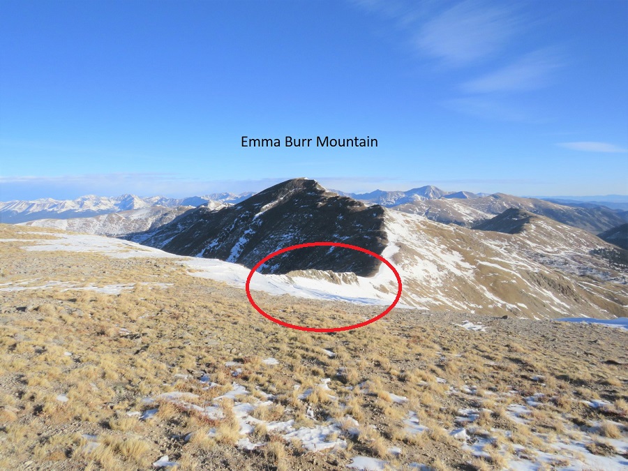
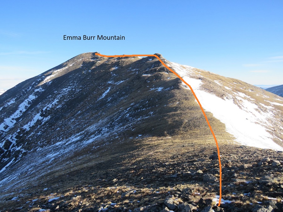
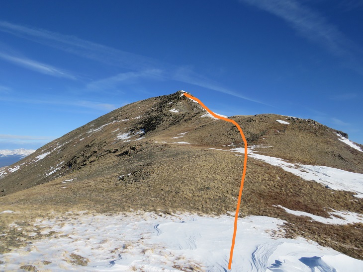
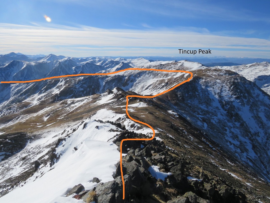
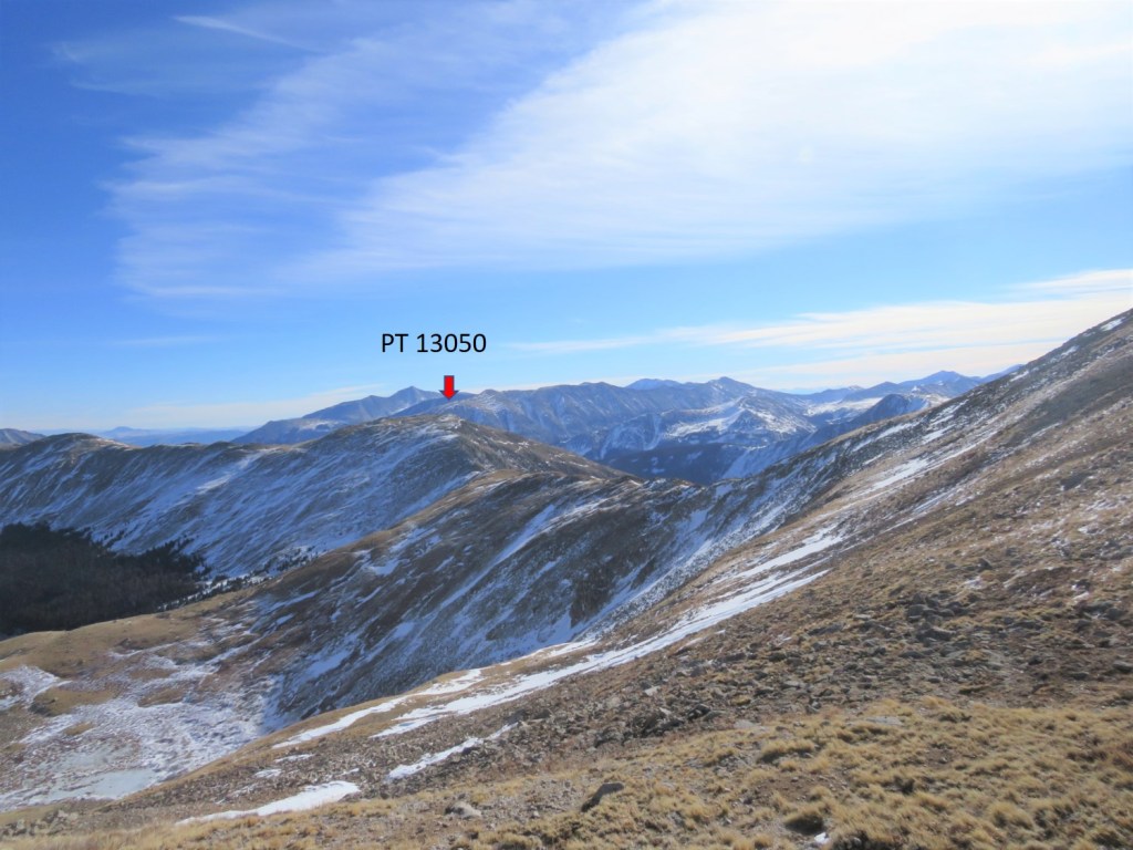
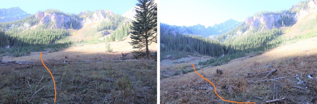
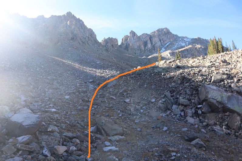
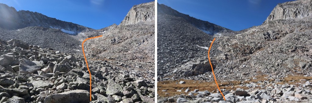
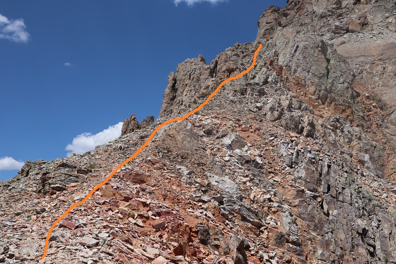
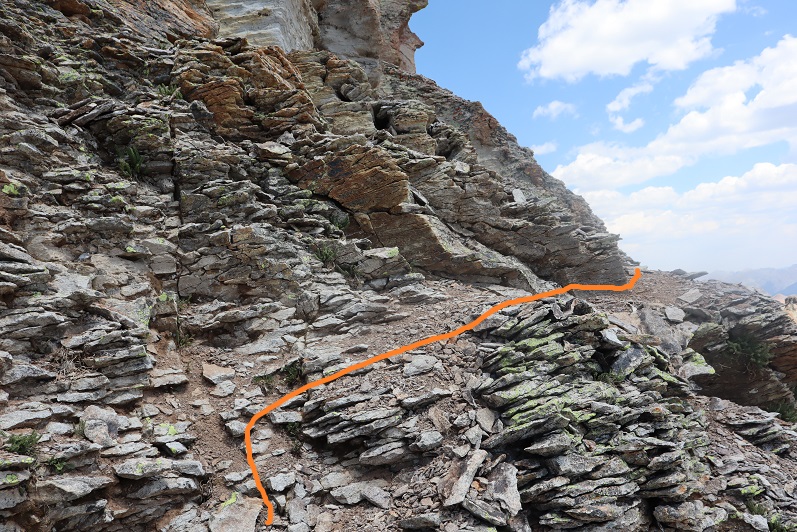
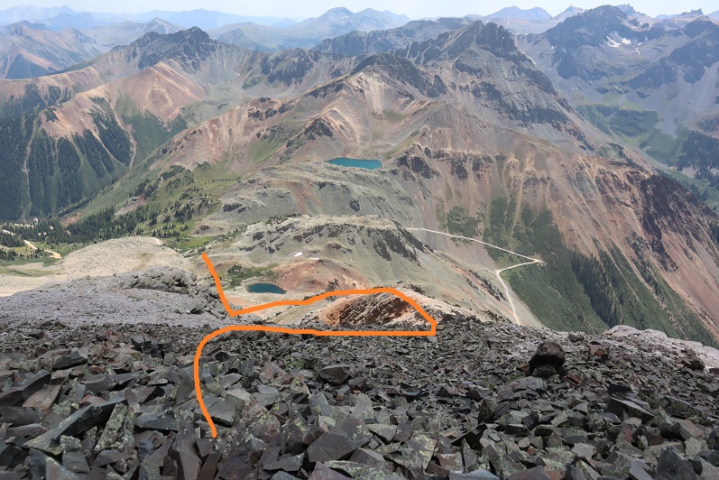
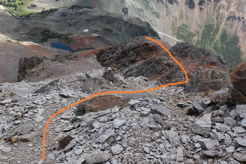
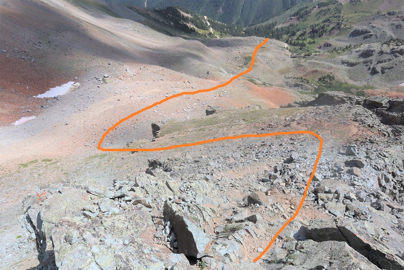
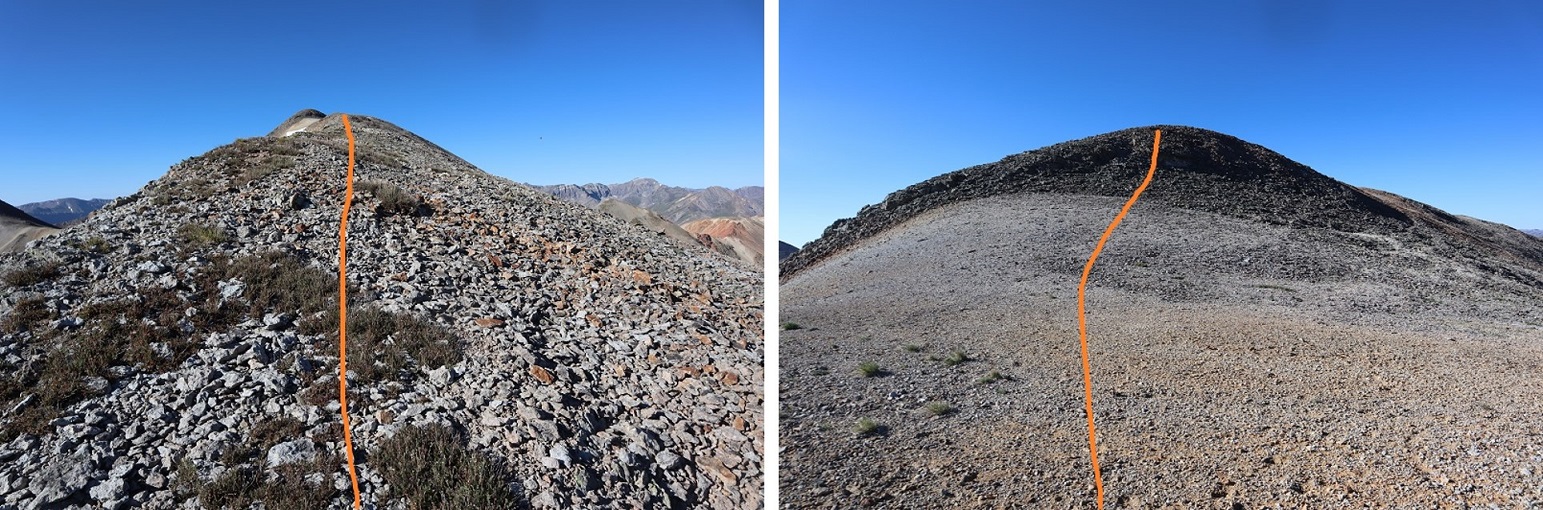
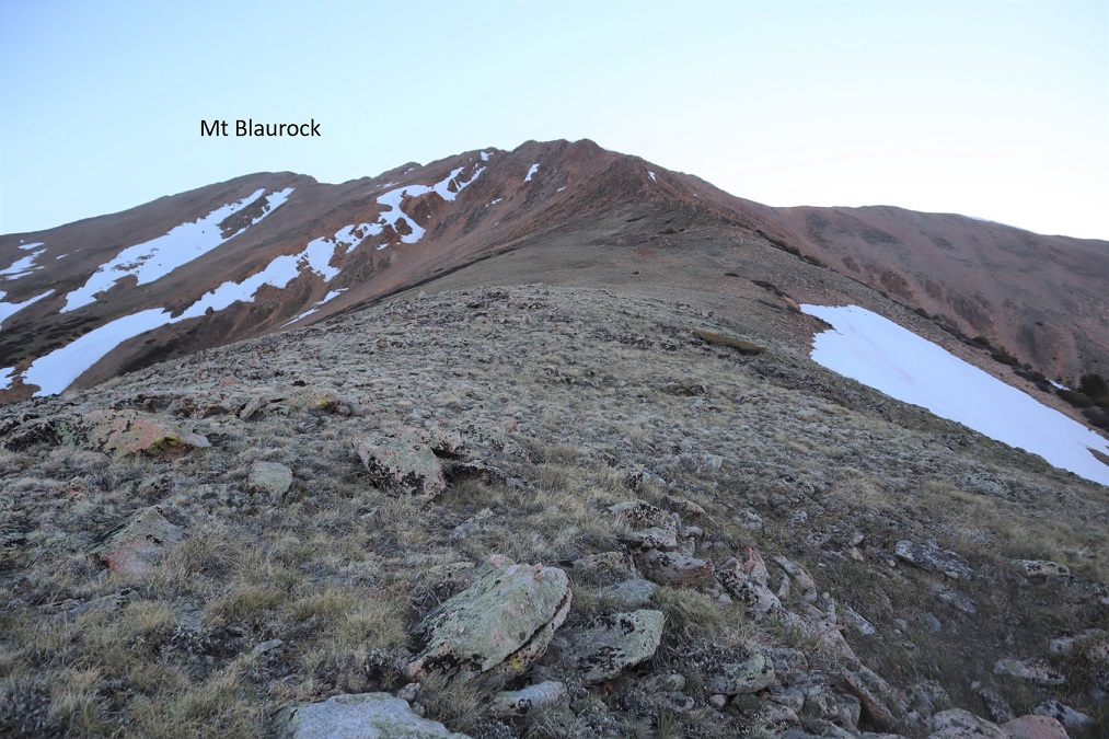
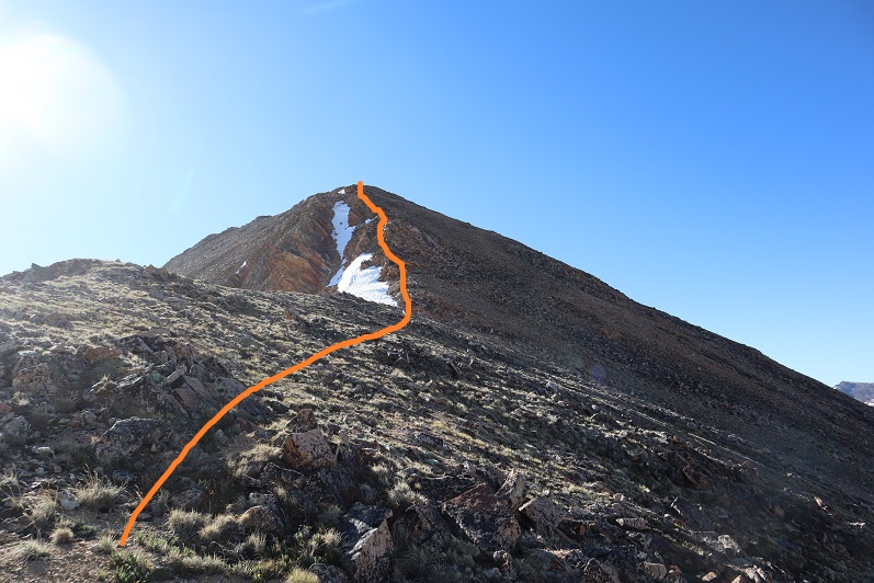
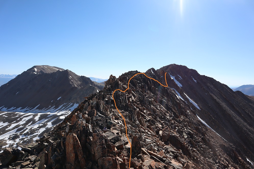
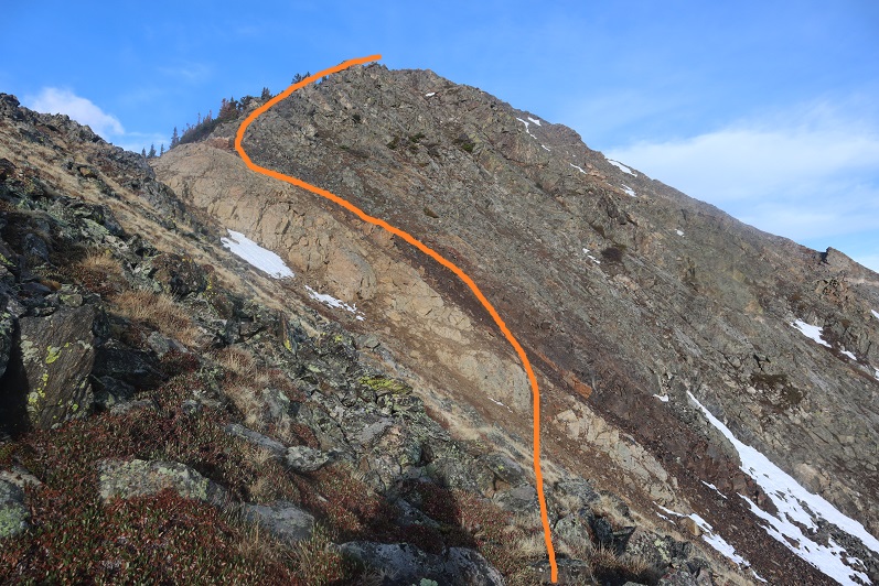
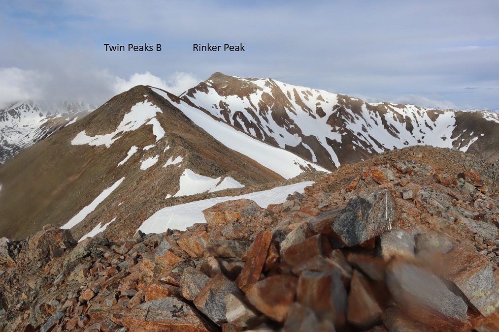
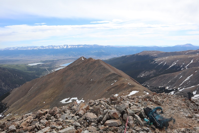
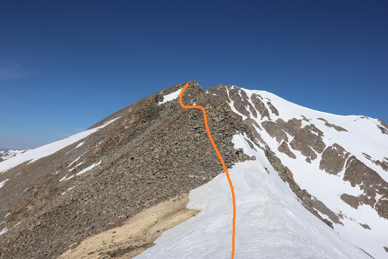
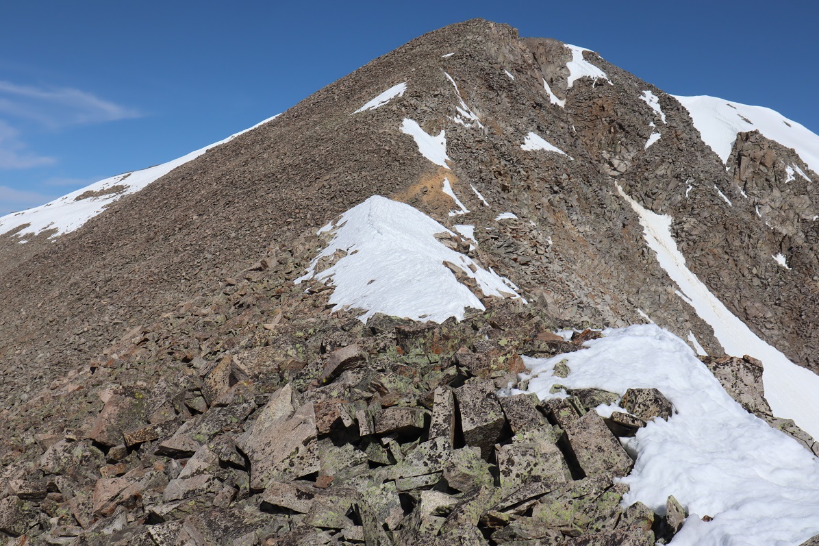
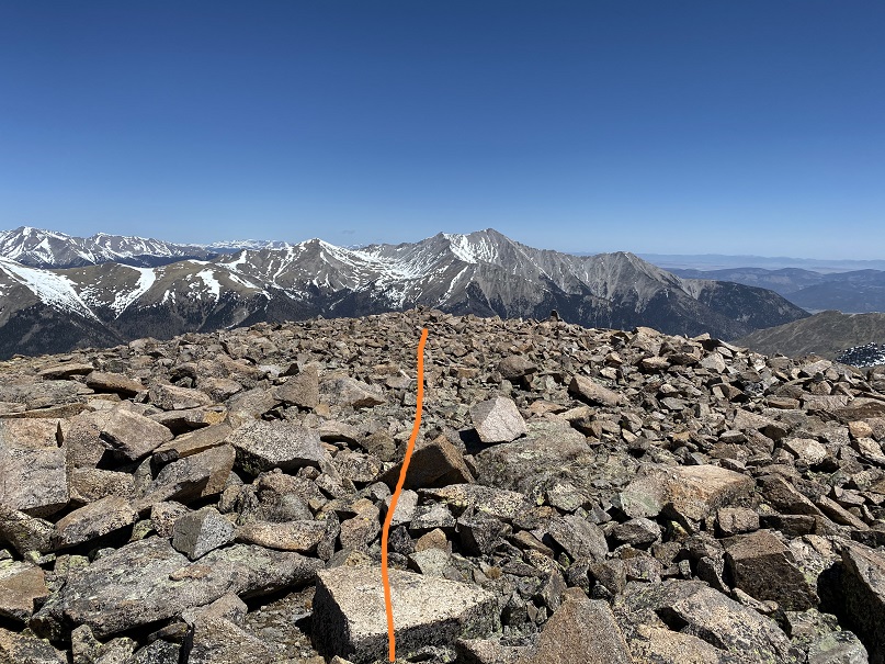
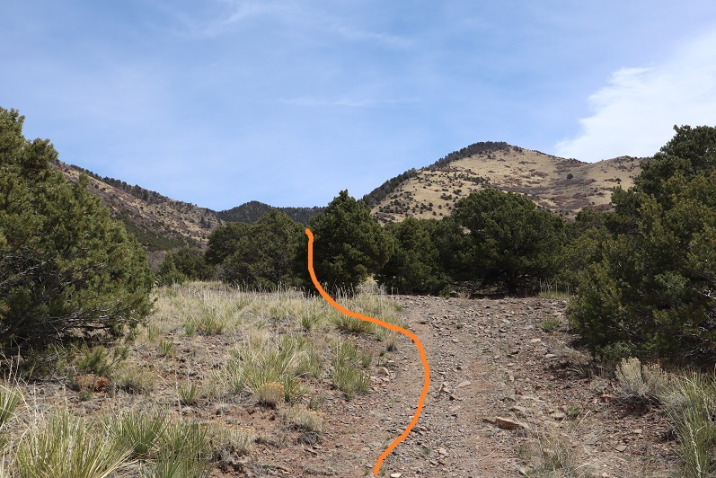
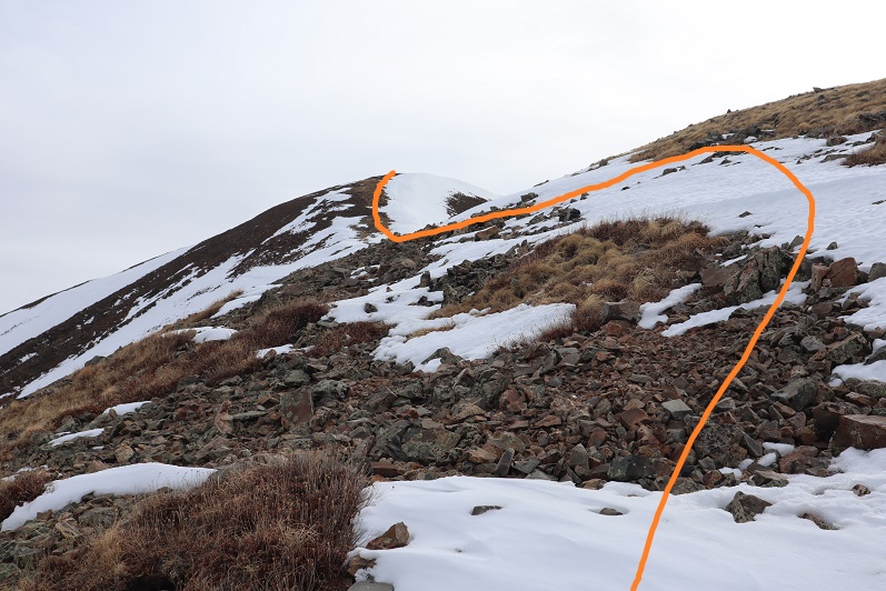
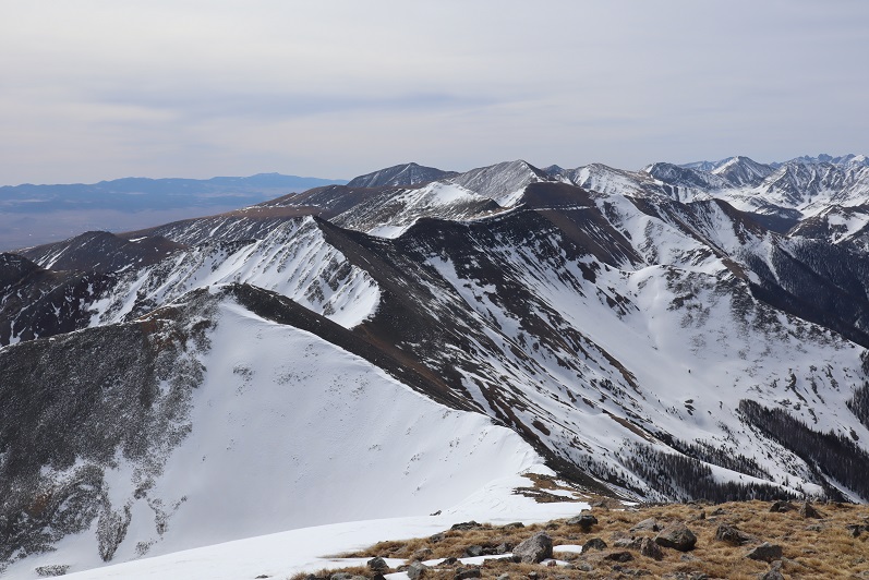
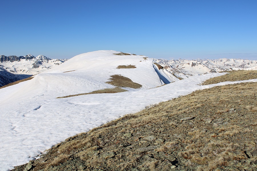
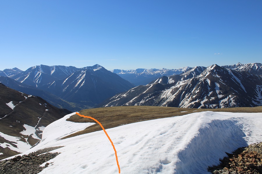
My next objective was PT 13427

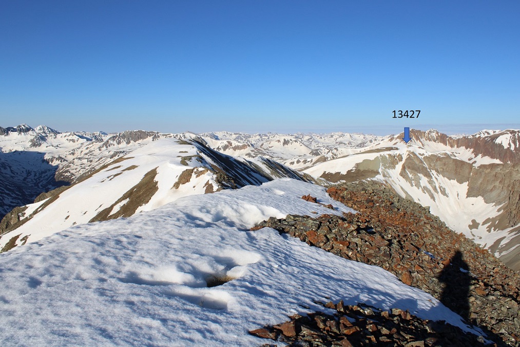
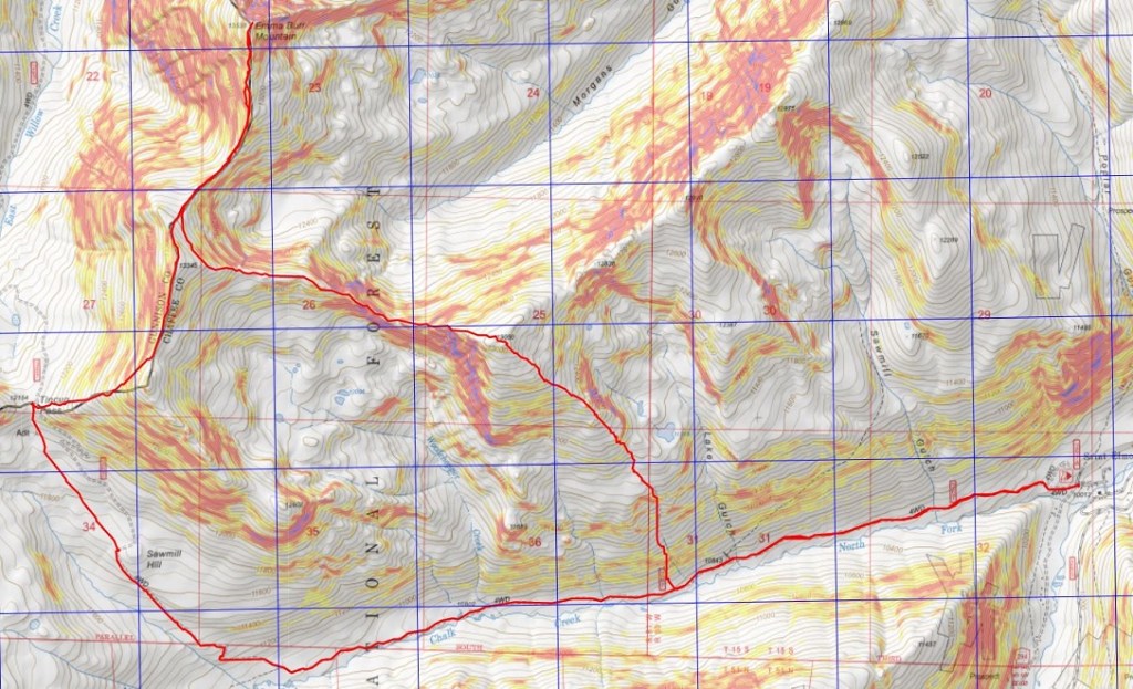
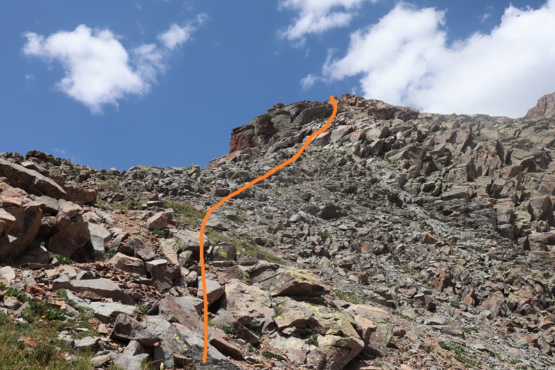
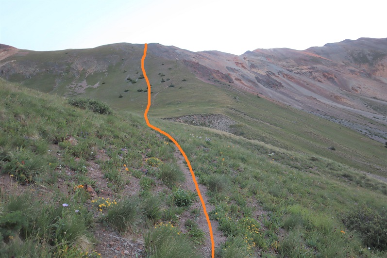
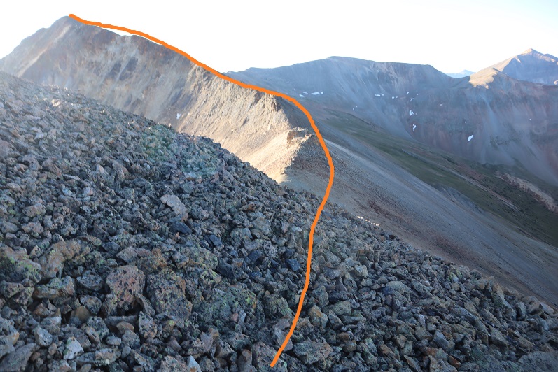
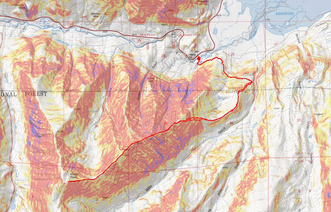
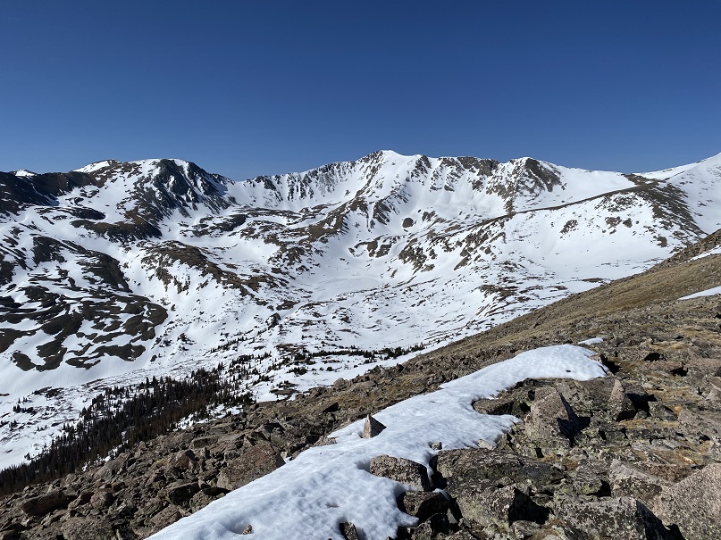
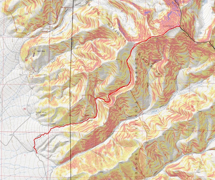
Here’s the route to get there

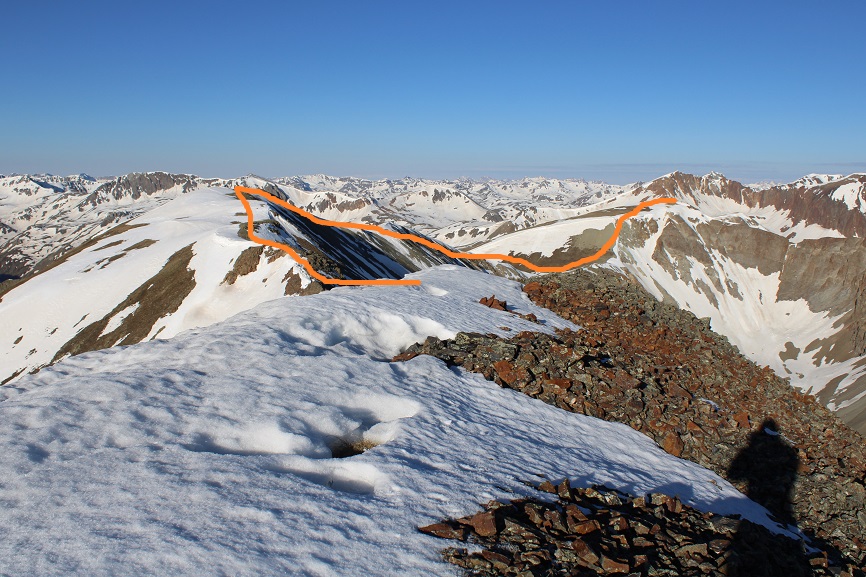
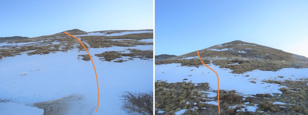
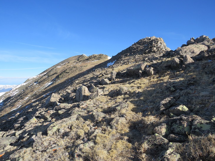
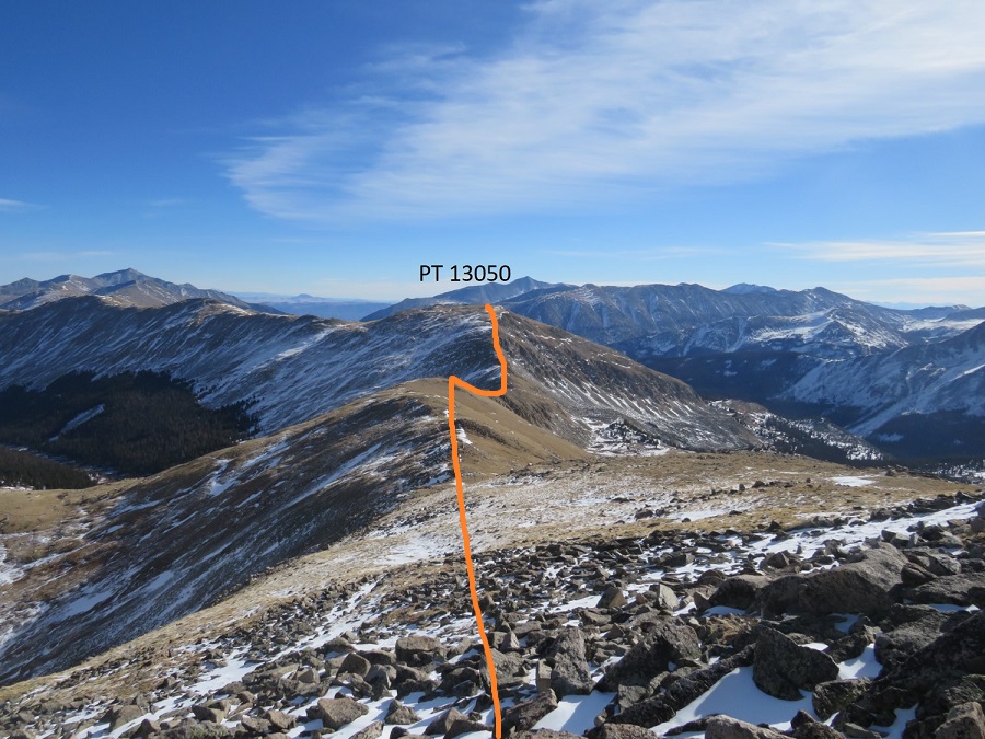
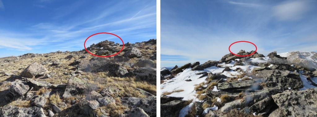
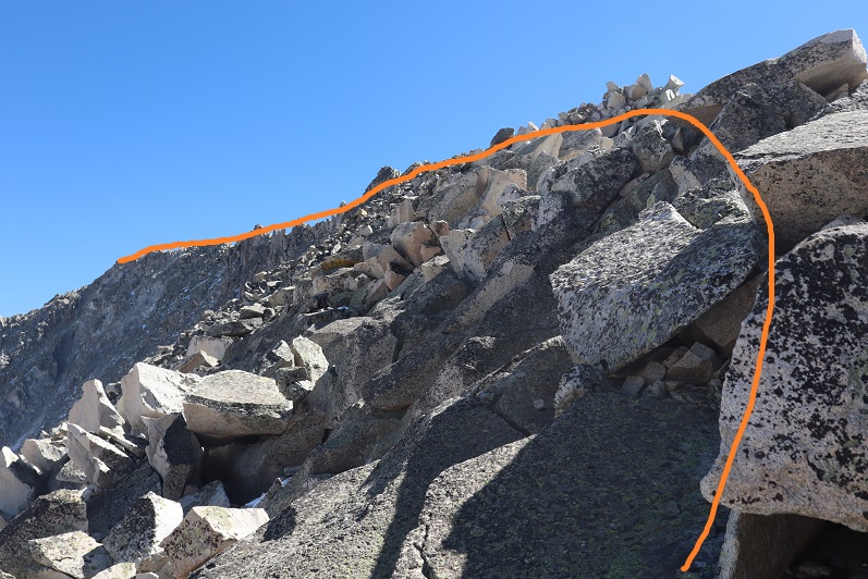
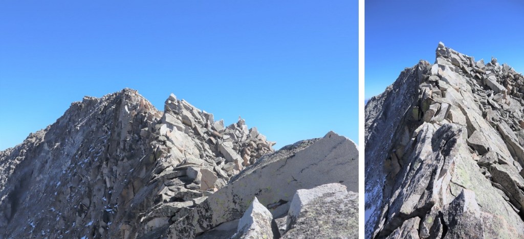
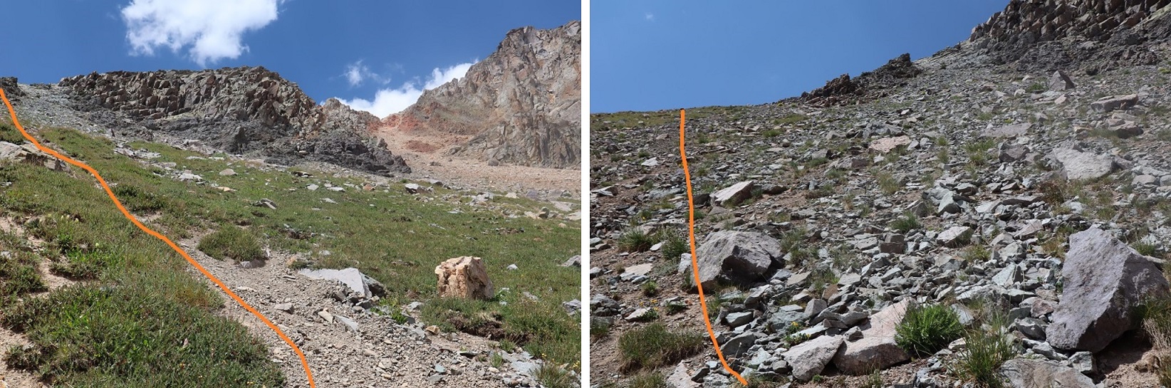
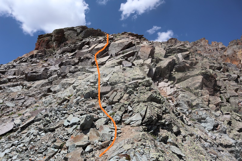
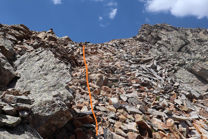
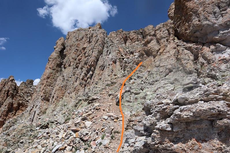
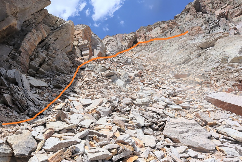
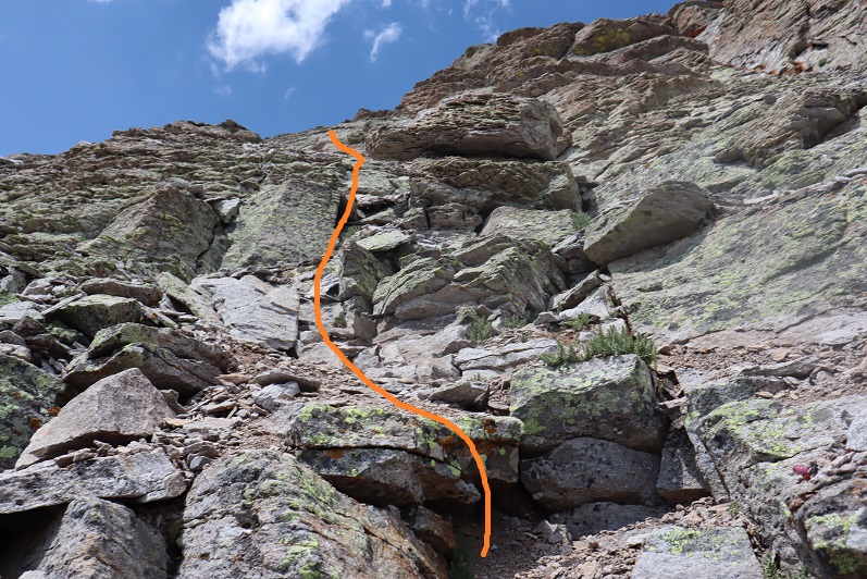
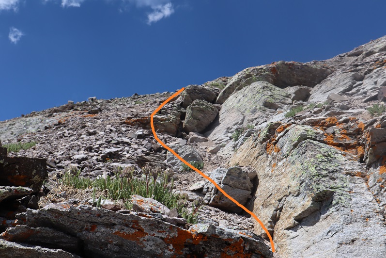
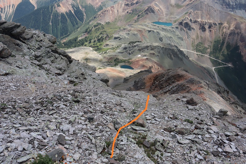
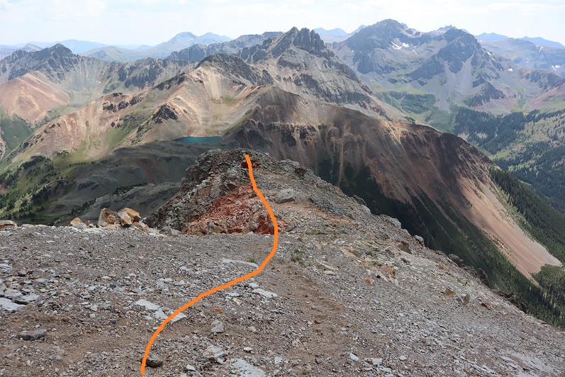
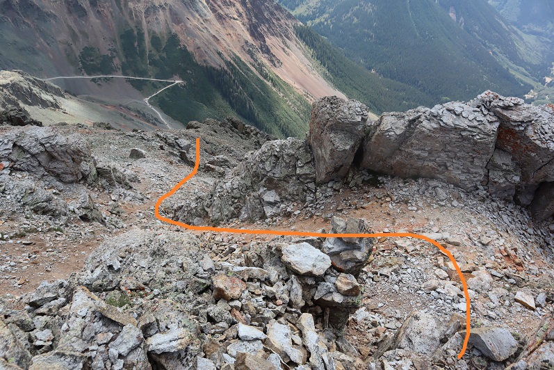
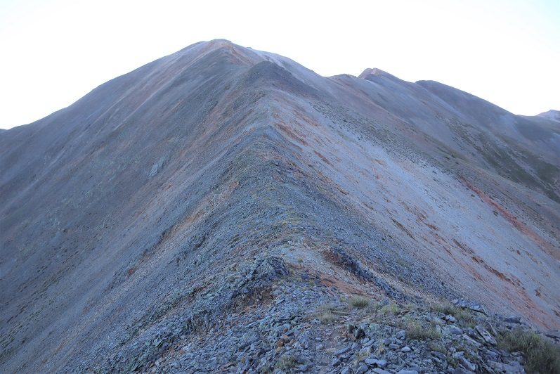
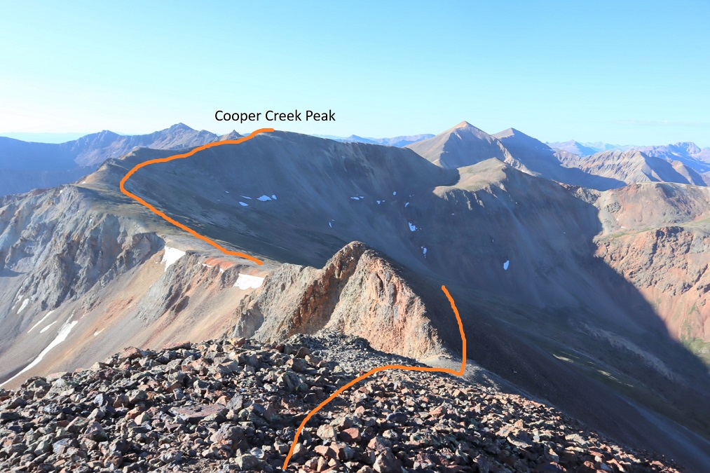
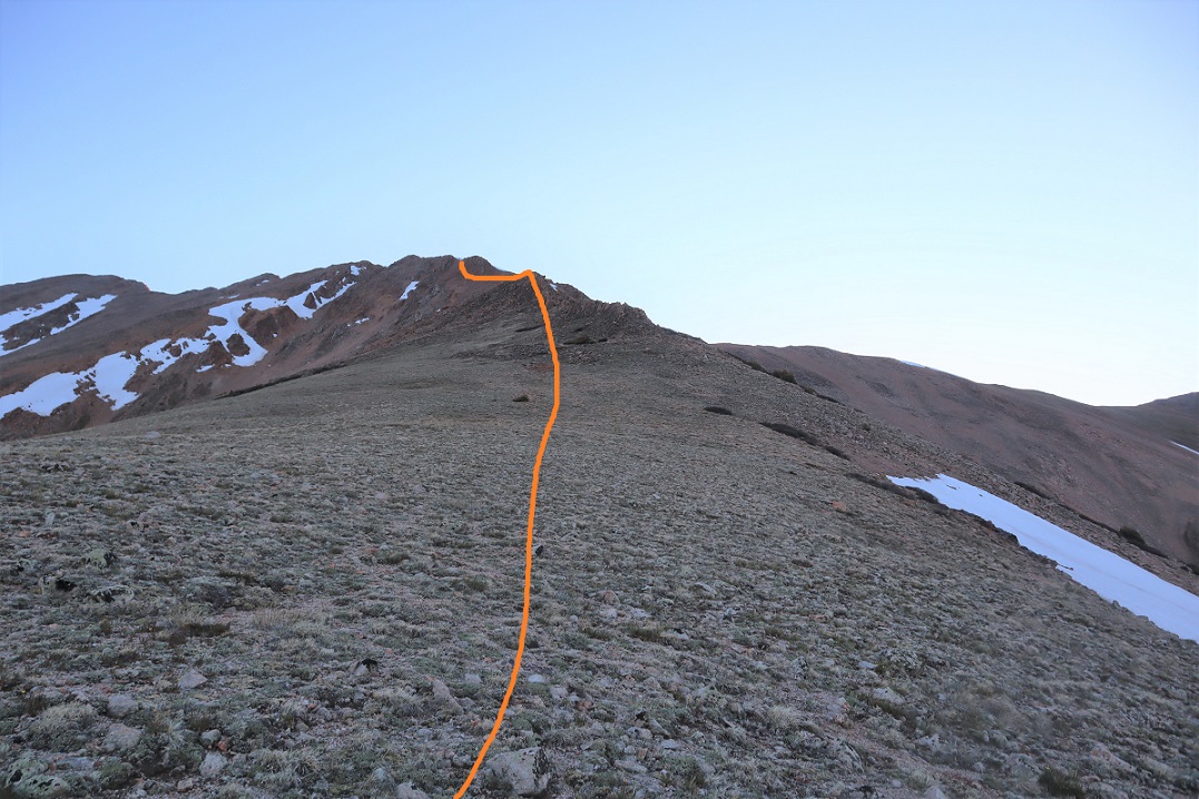
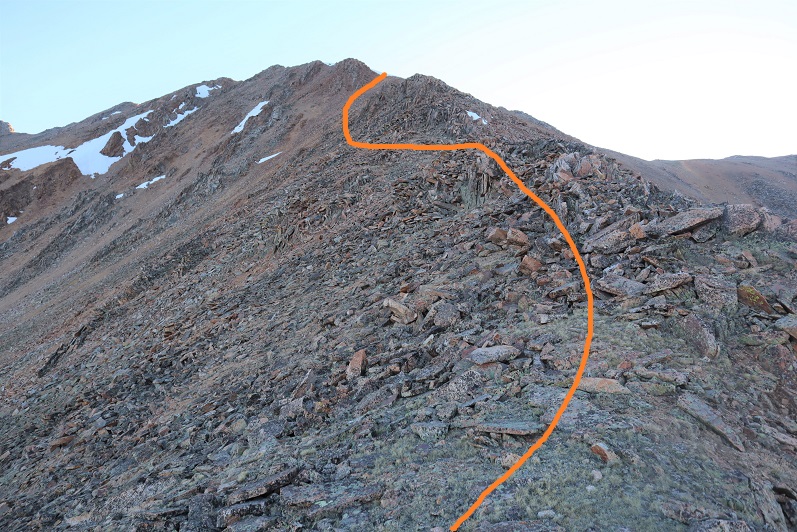
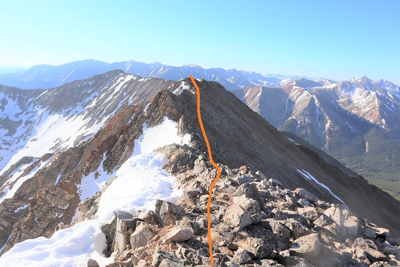
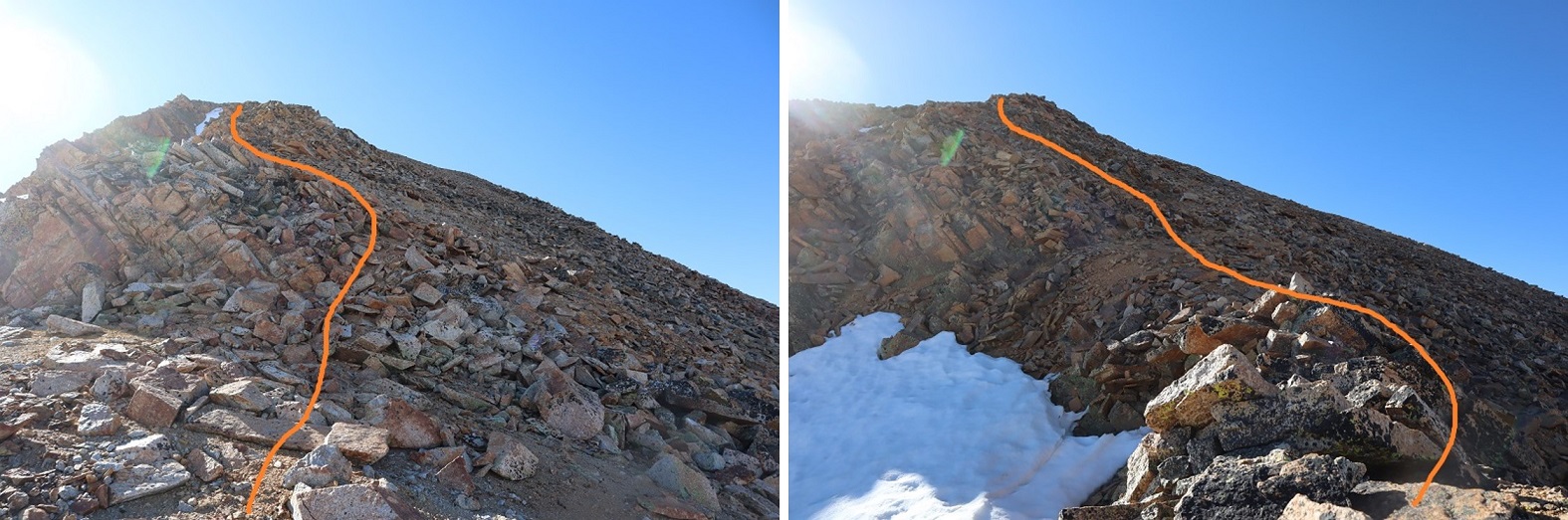
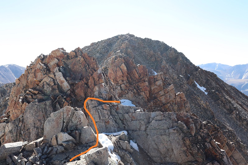
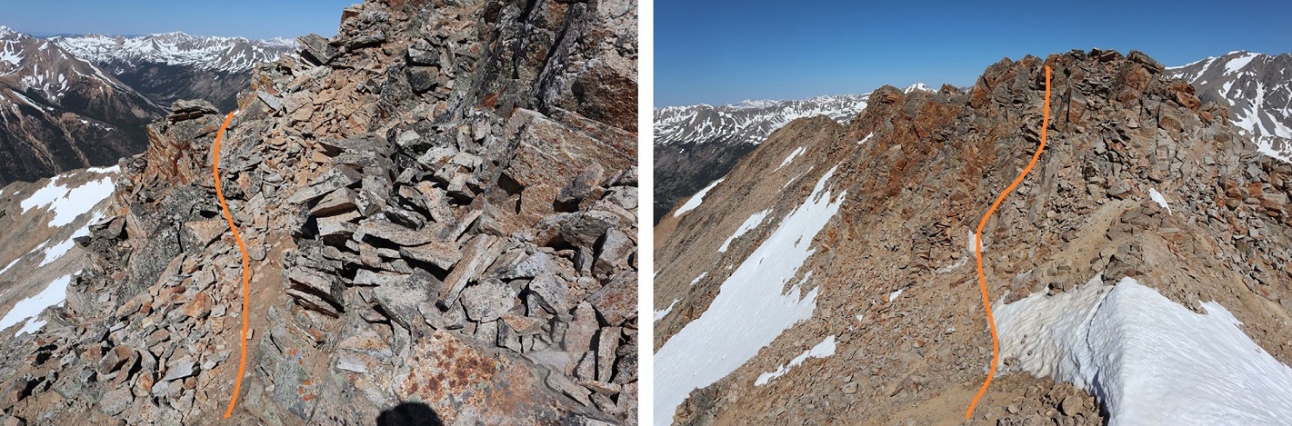
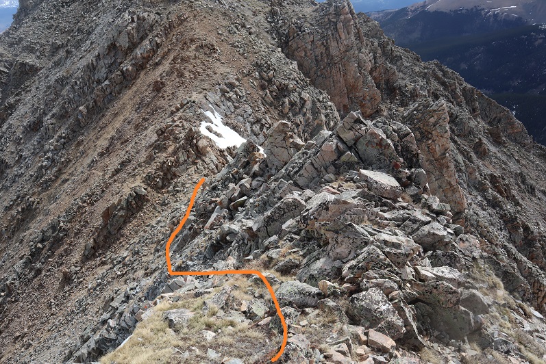
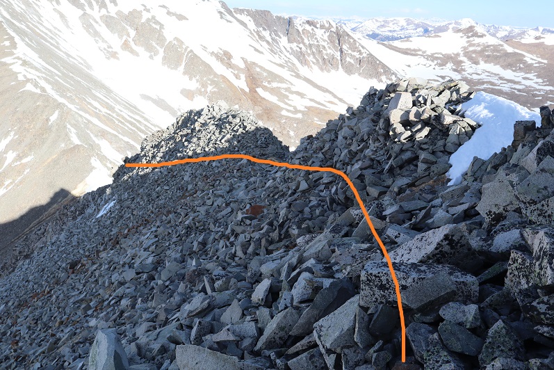
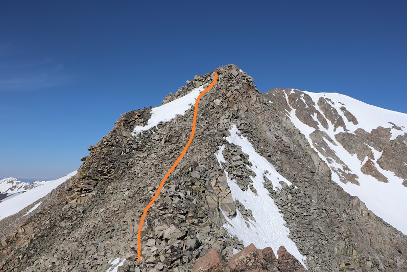
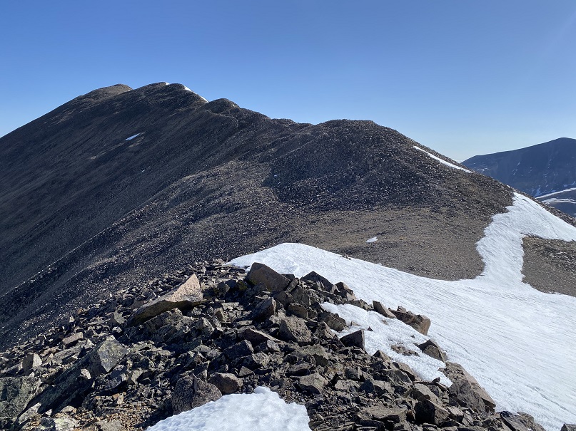
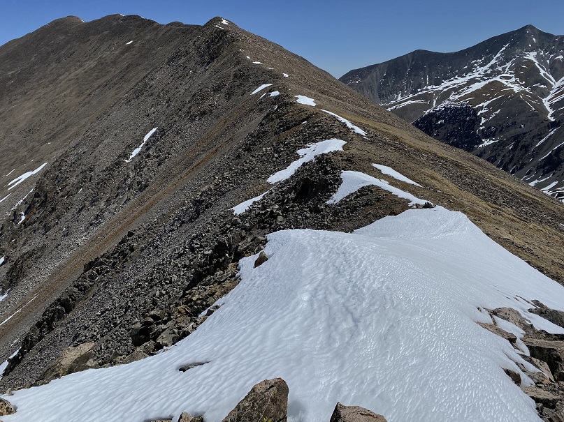
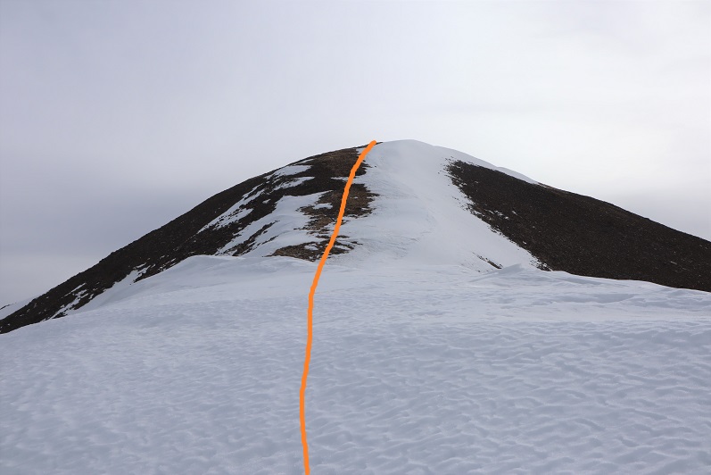
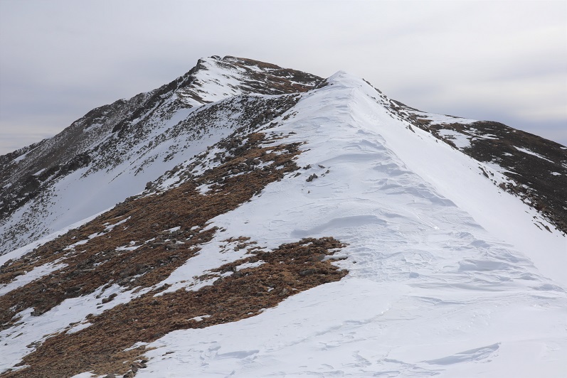
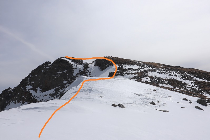
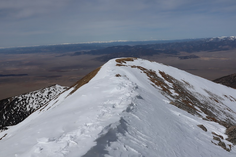
I turned and followed the ridge southeast.  Here are some step by step pictures

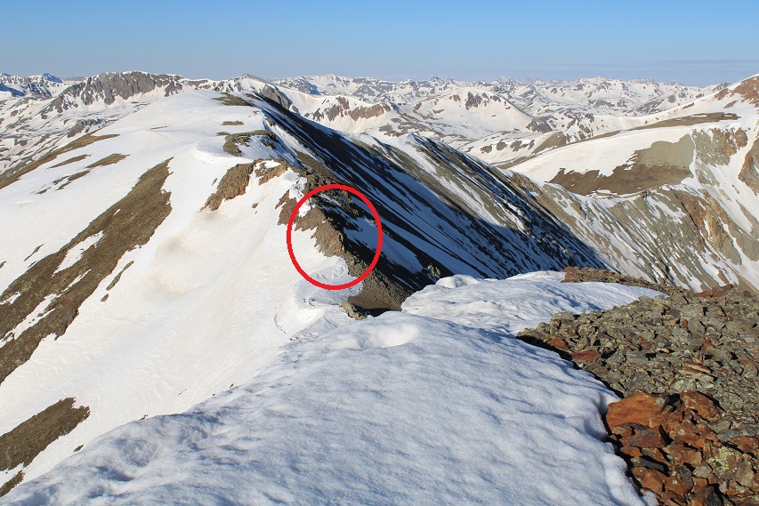
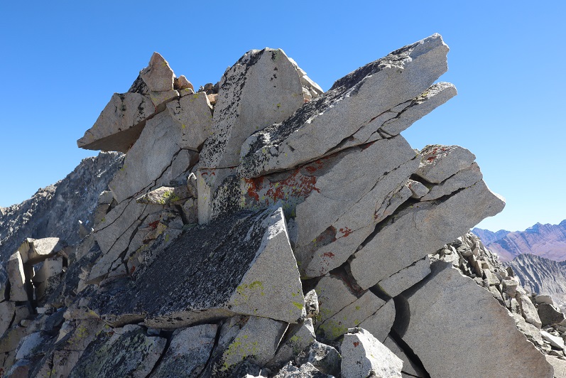
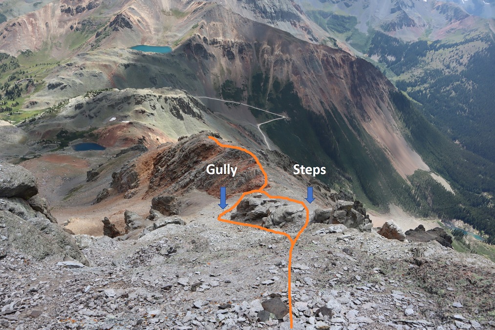
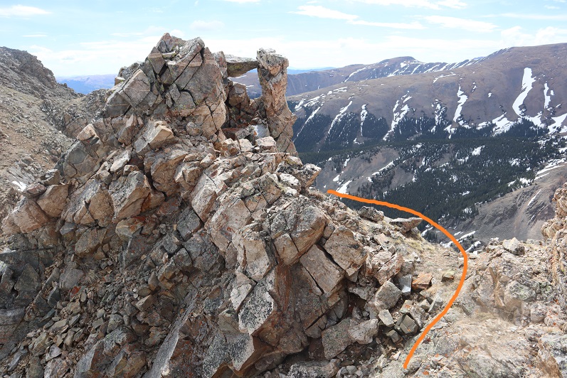
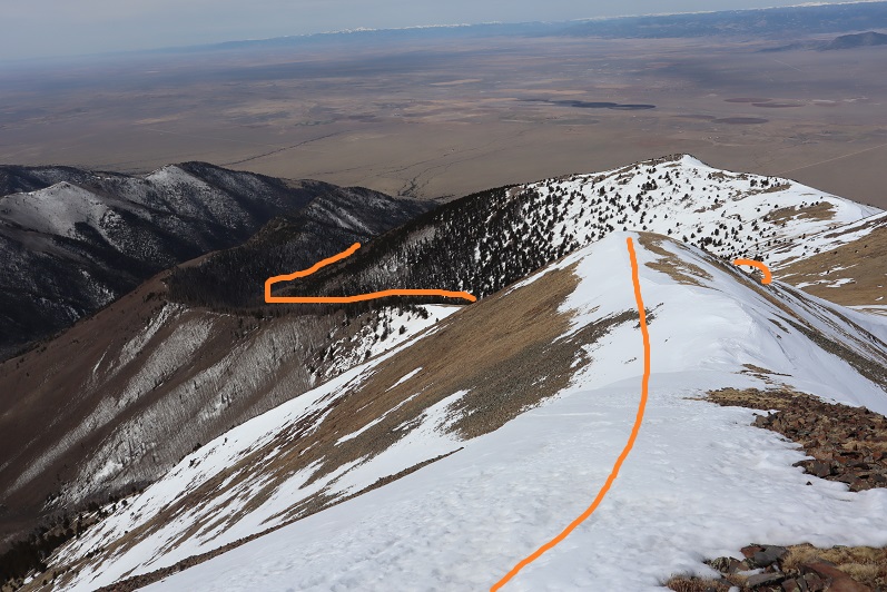
The area in the above picture, circled in red, is pictured below.  I skirted this to the right

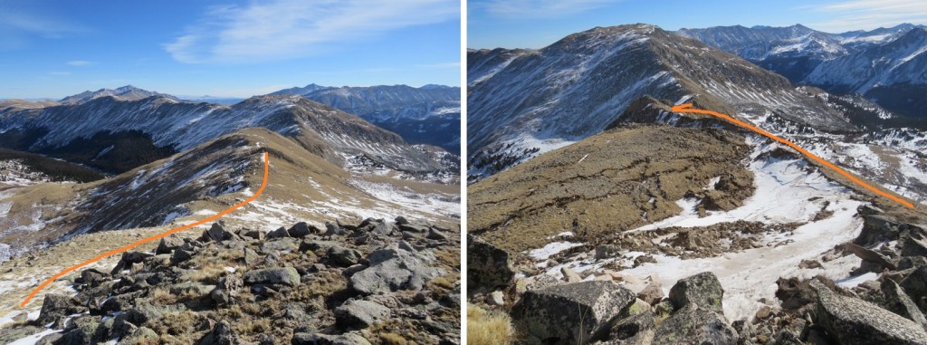
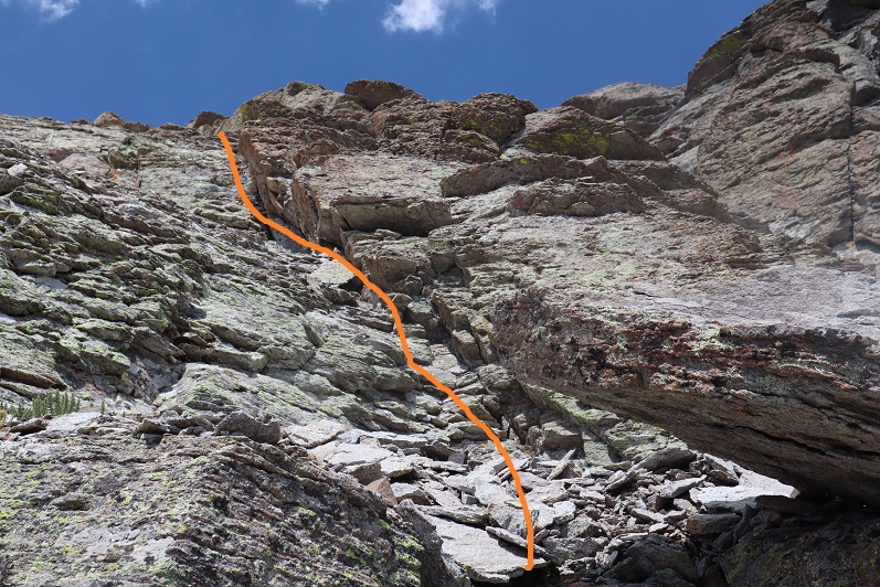
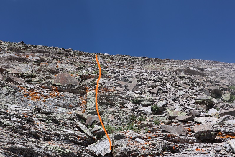
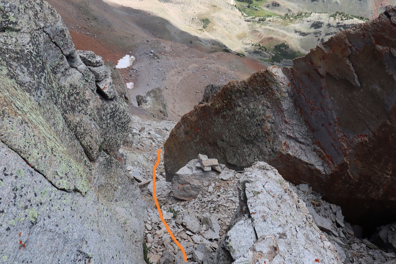
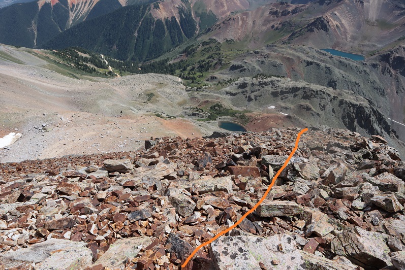
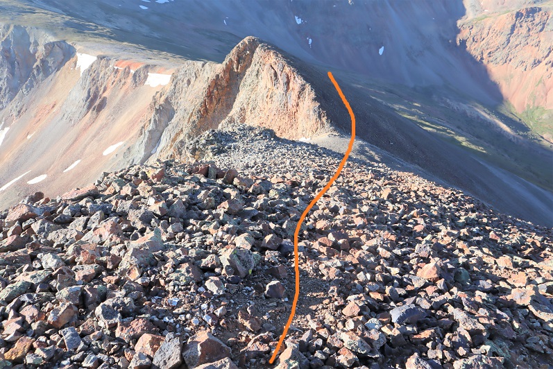
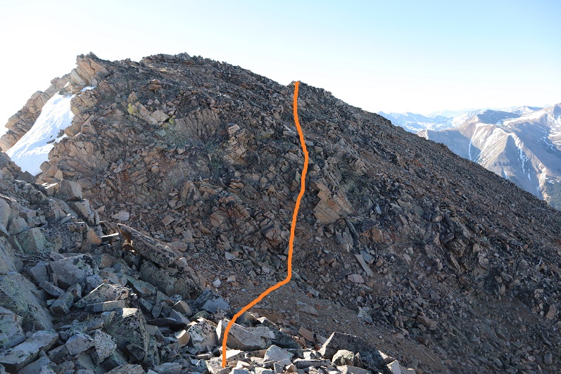
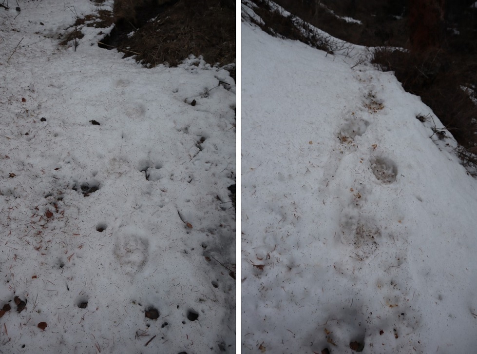
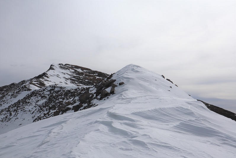
Then followed the ridge, glad I’d put on my microspikes

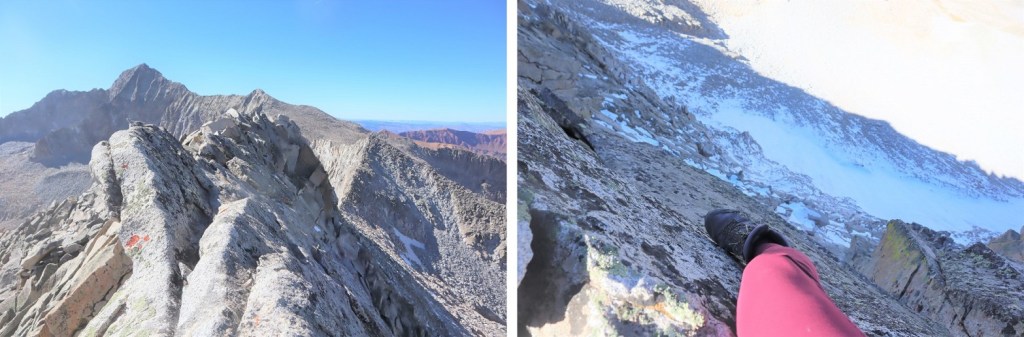
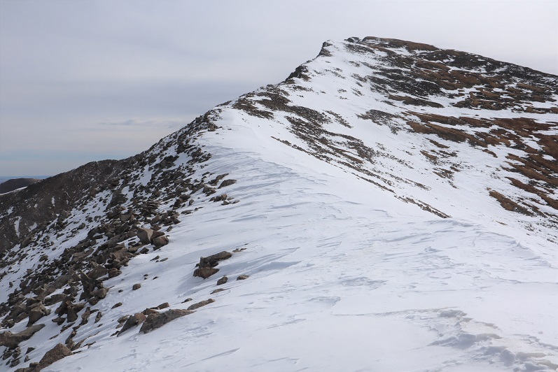
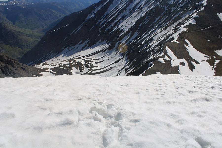
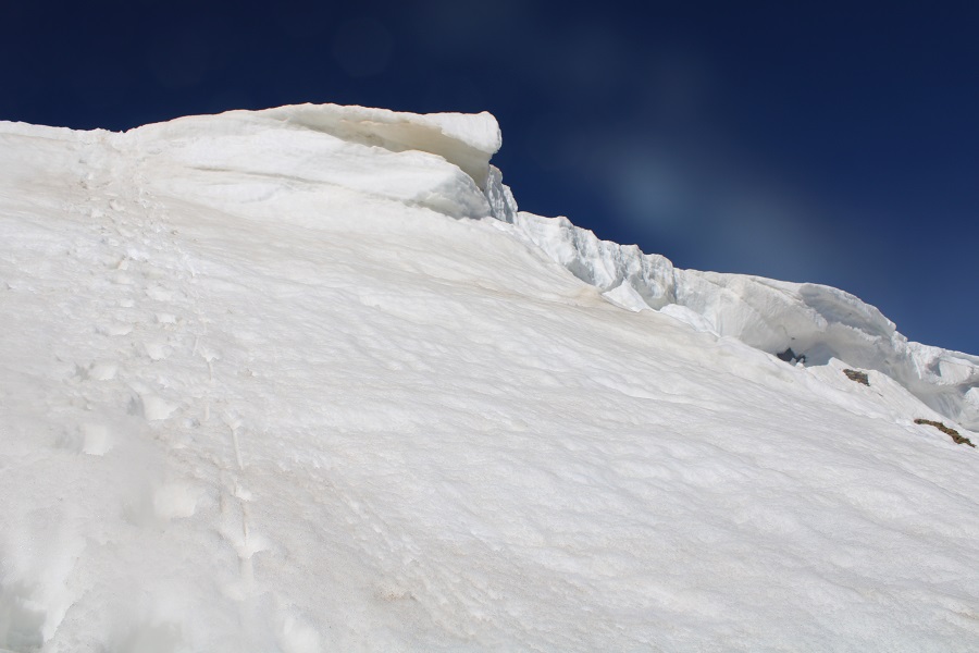
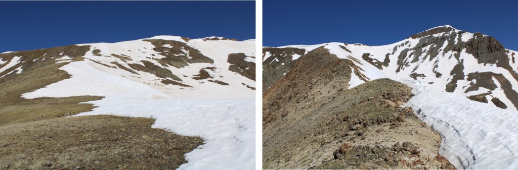
Eventually I came to an area where I started losing elevation.  The snow was largely avoidable by sticking to the left on the ridge.  I was a little worried about that cornice in front of me however

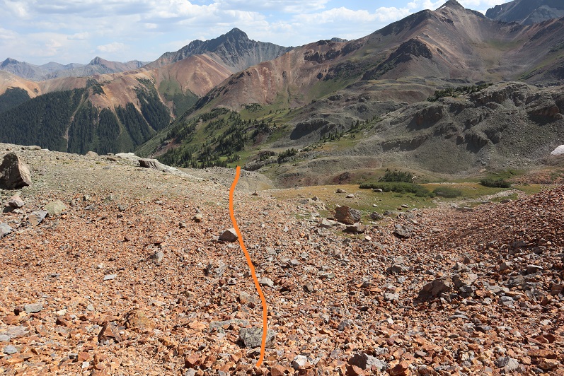
I lost about 475’ of elevation to the saddle

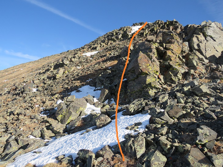
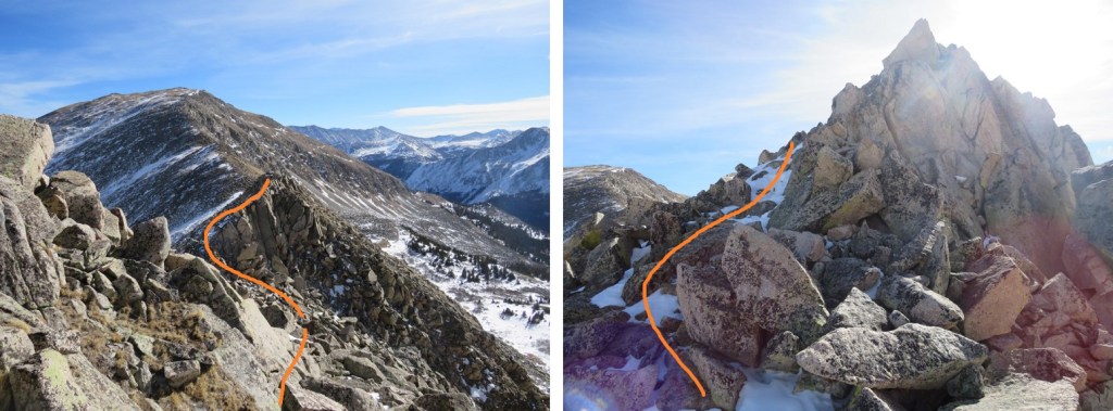
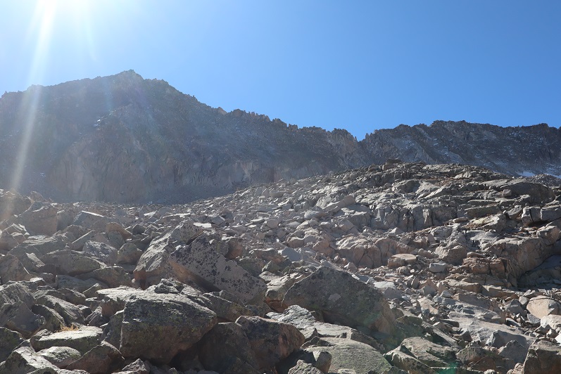
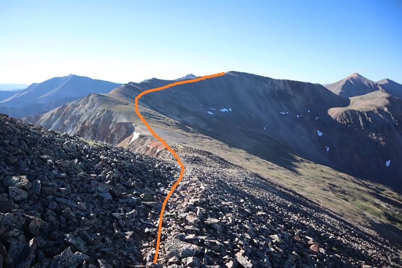
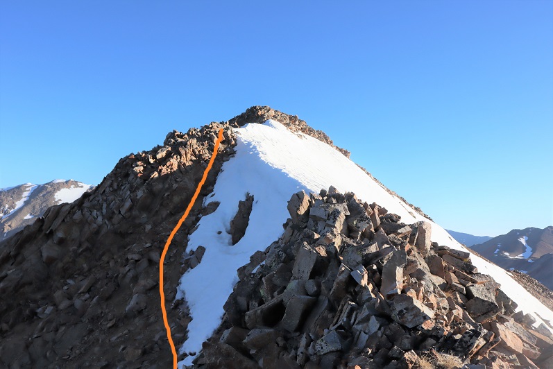
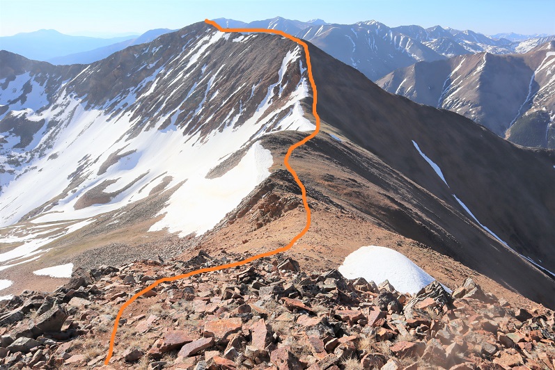
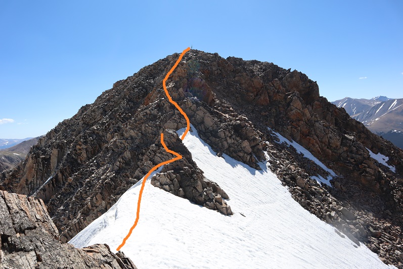
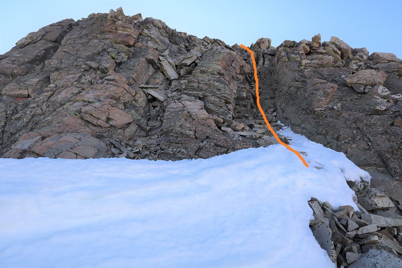
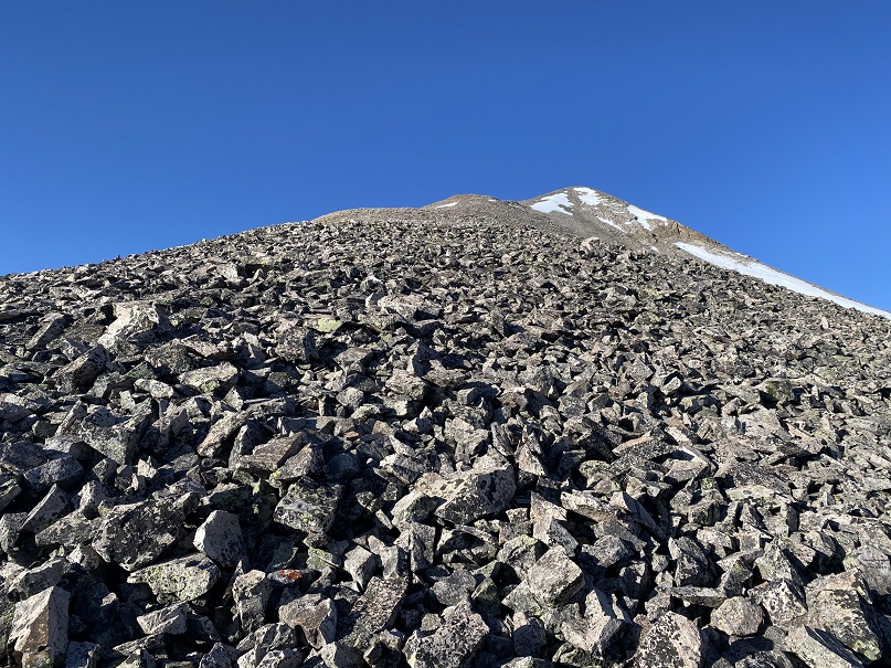
Then started up the east slope.  This area was covered in scree, and quite steep. I kept eyeing the cornice, trying to find the best way to ascend.  While I had snowshoes, I didn’t have crampons, so my microspikes would have to do if it came down to it.  Here’s the path I chose to take to the summit, looking for a stable but accessible part of the cornice to climb.

When I got to the cornice, I was able to kick in steps with just my microspikes, although, lacking in forward facing spikes, they needed a little creative help from my ice axe at times. 

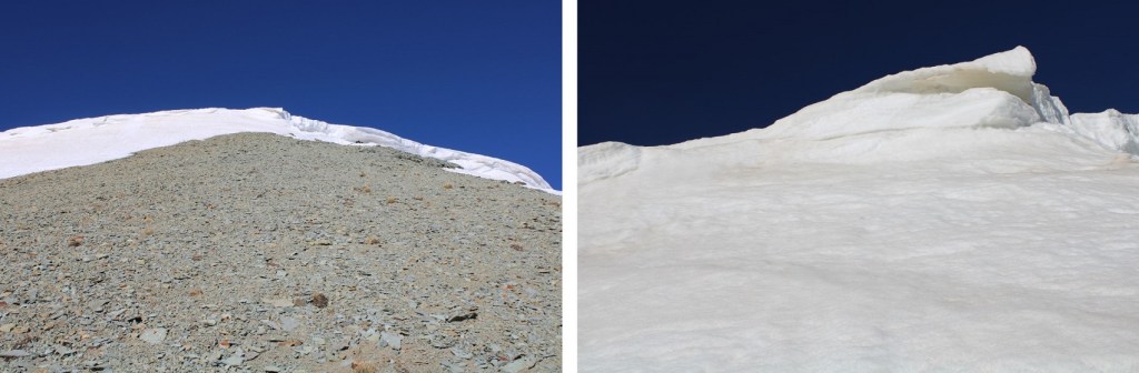
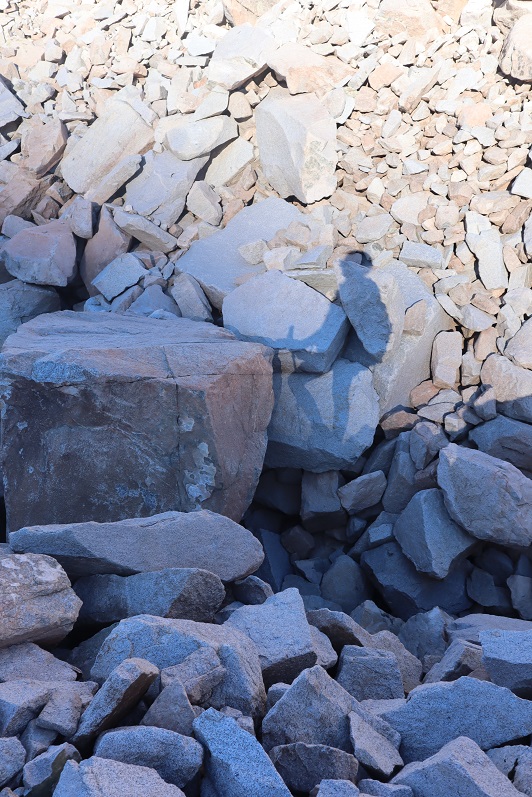
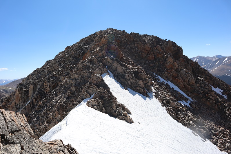
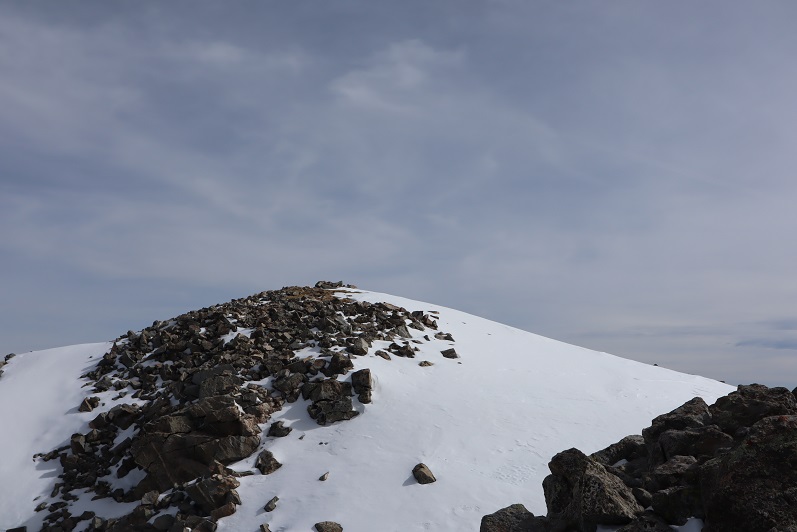
Towards the top I started postholing as the cornice leveled out, and had to slide on my belly the last few feet to make it to the tundra. Once over the cornice the summit was obvious, to the north

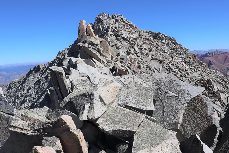
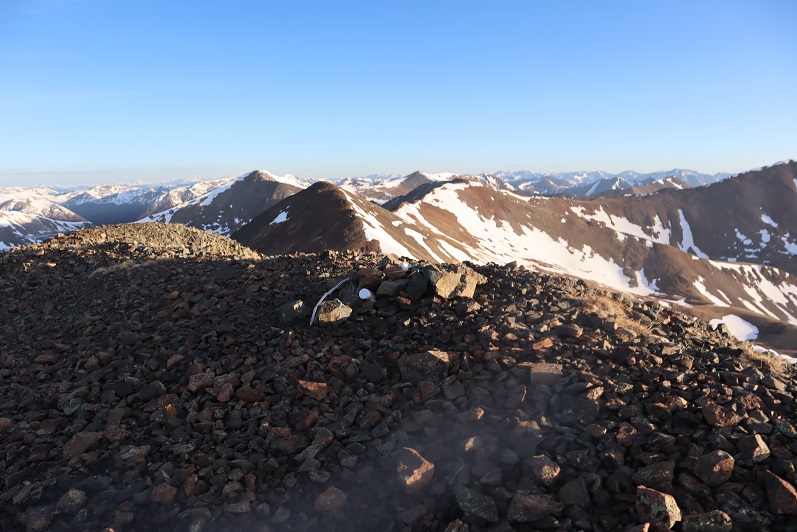
I summited PT 13427 at 8:30am
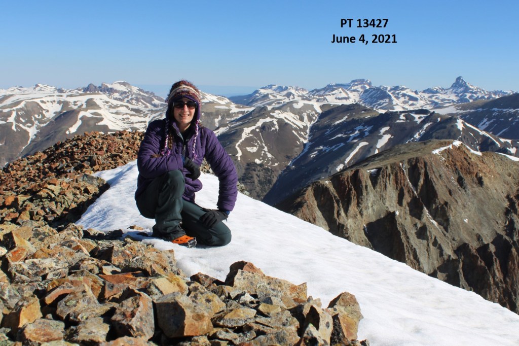
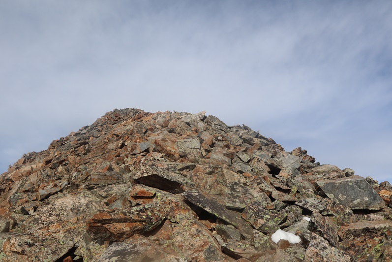
PT 13427:

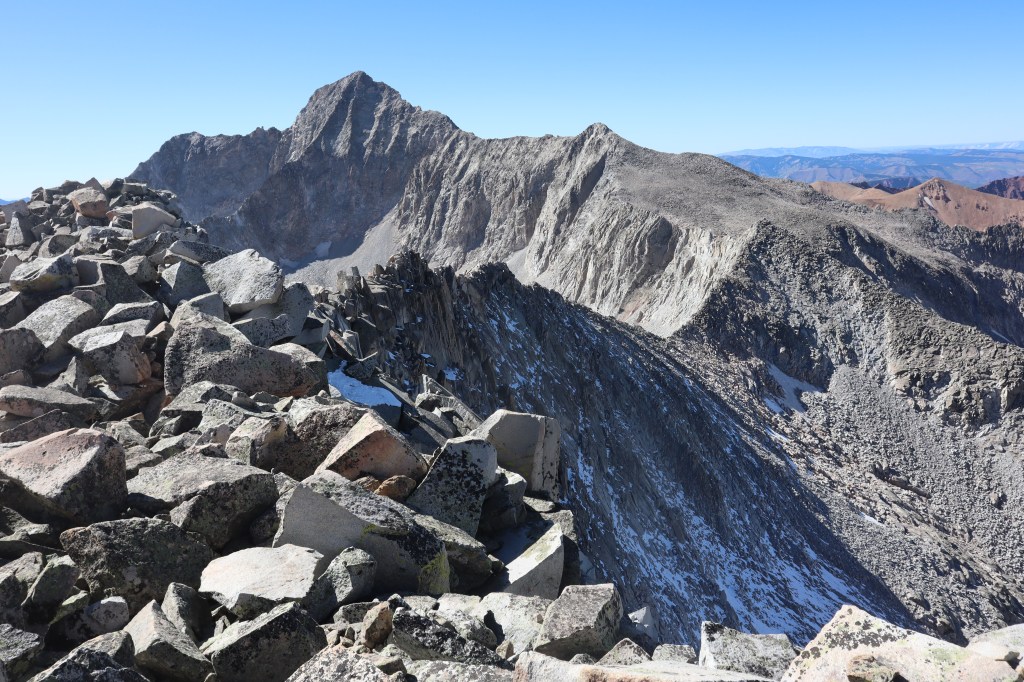
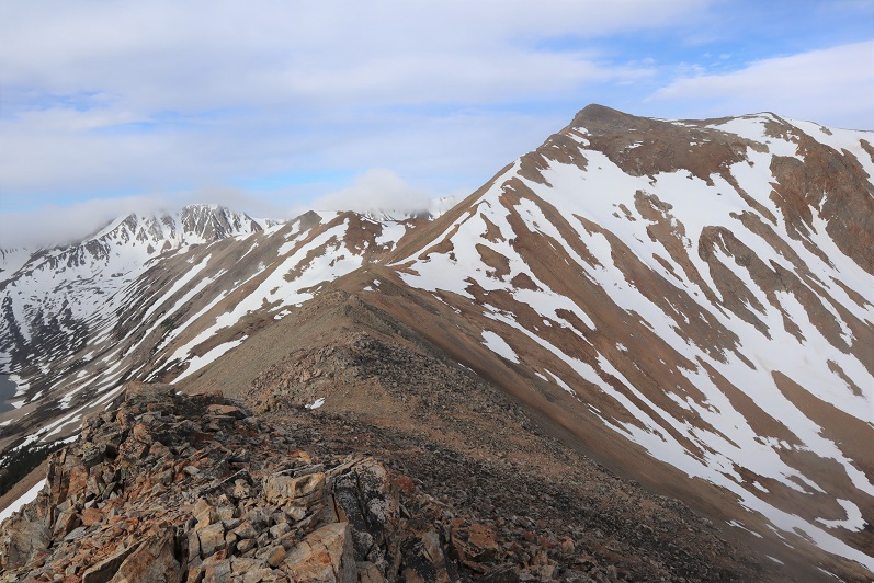
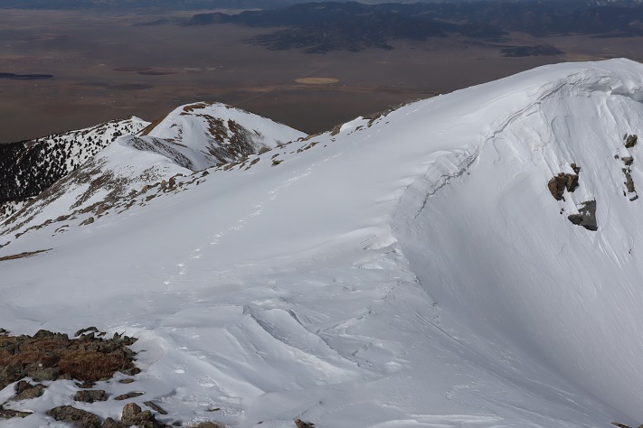
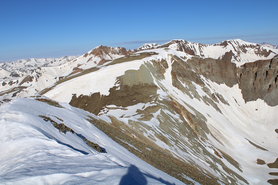
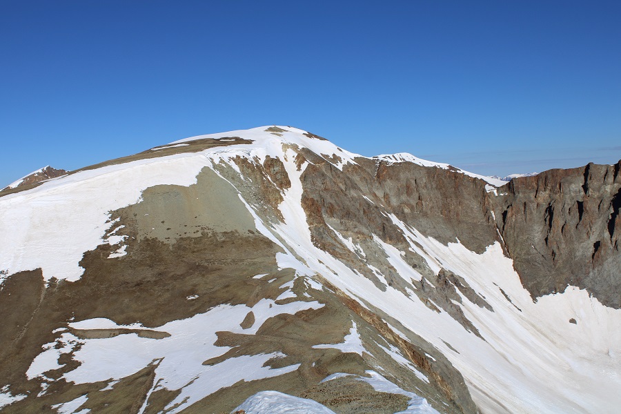
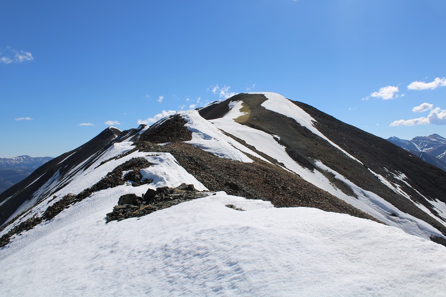
Here’s a look back on PT 13540

It was still morning, but the snow was softening up quickly.  I wanted to get back over that cornice asap. I turned and headed back towards the cornice

It was easy to find my entry/exit point, as I could still see the marks from where I army crawled a few minutes ago.

I did the same thing again, facing the mountain and using the steps I’d kicked in earlier.  It was rapidly warming up:  the tip of the cornice was now steadily reedripping water.

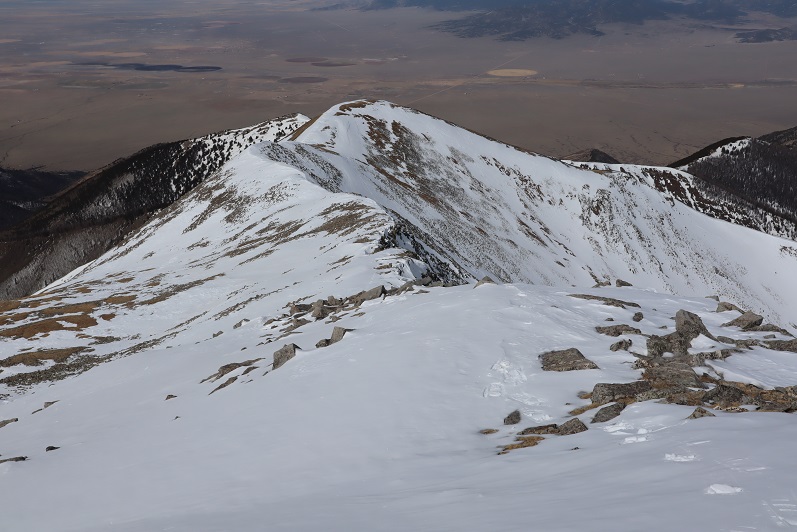
Here’s a look at the ridge back up towards PT 13540

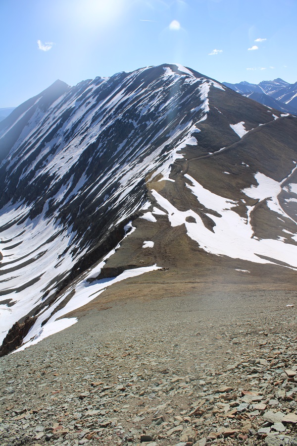
I slid down the scree and followed the ridge back. 

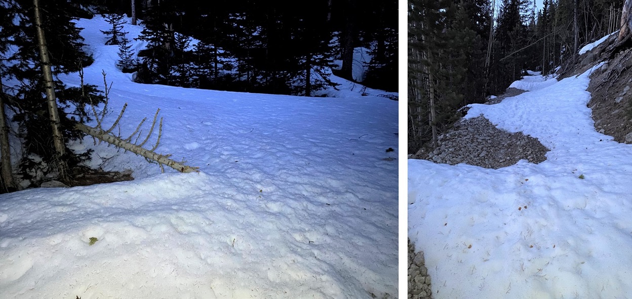
The snow was mostly avoidable until I made it to where the ridge kind of levels out for a while.  From then on it was posthole city

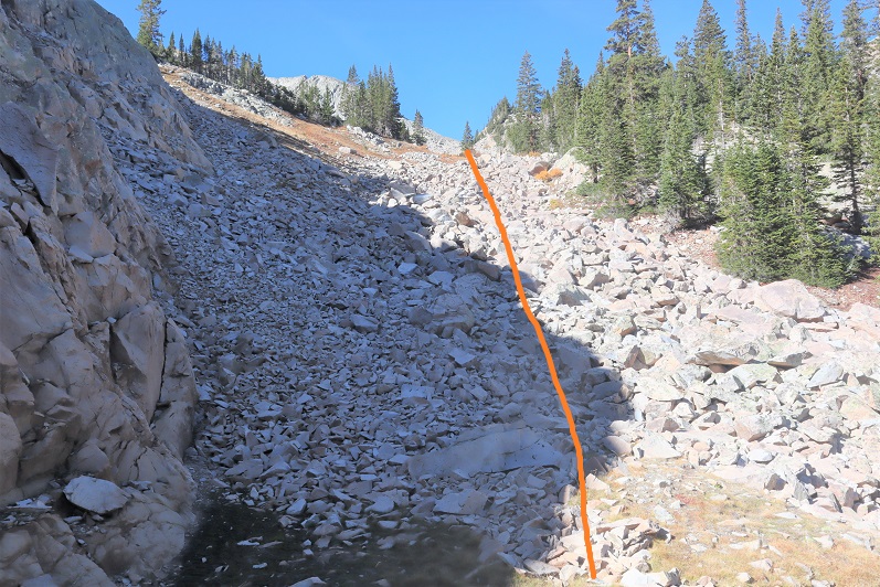
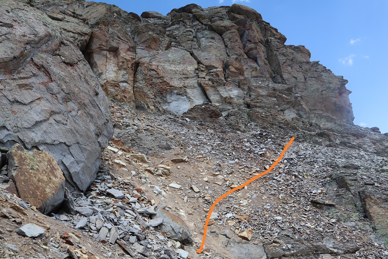
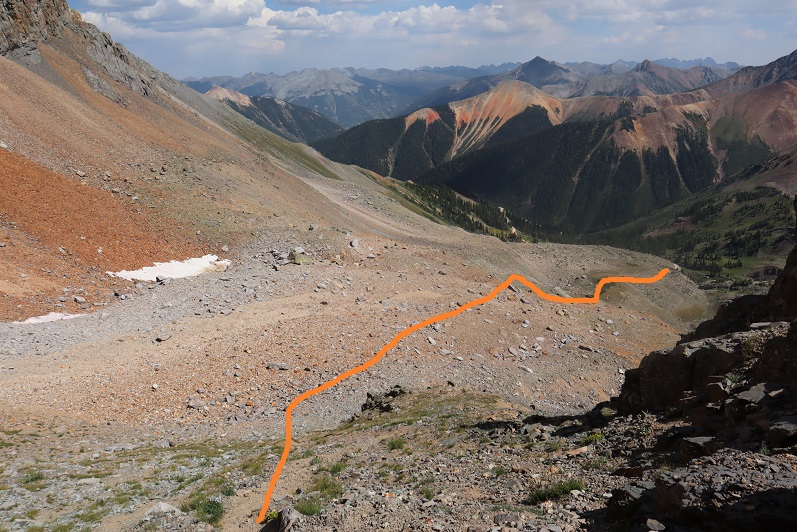
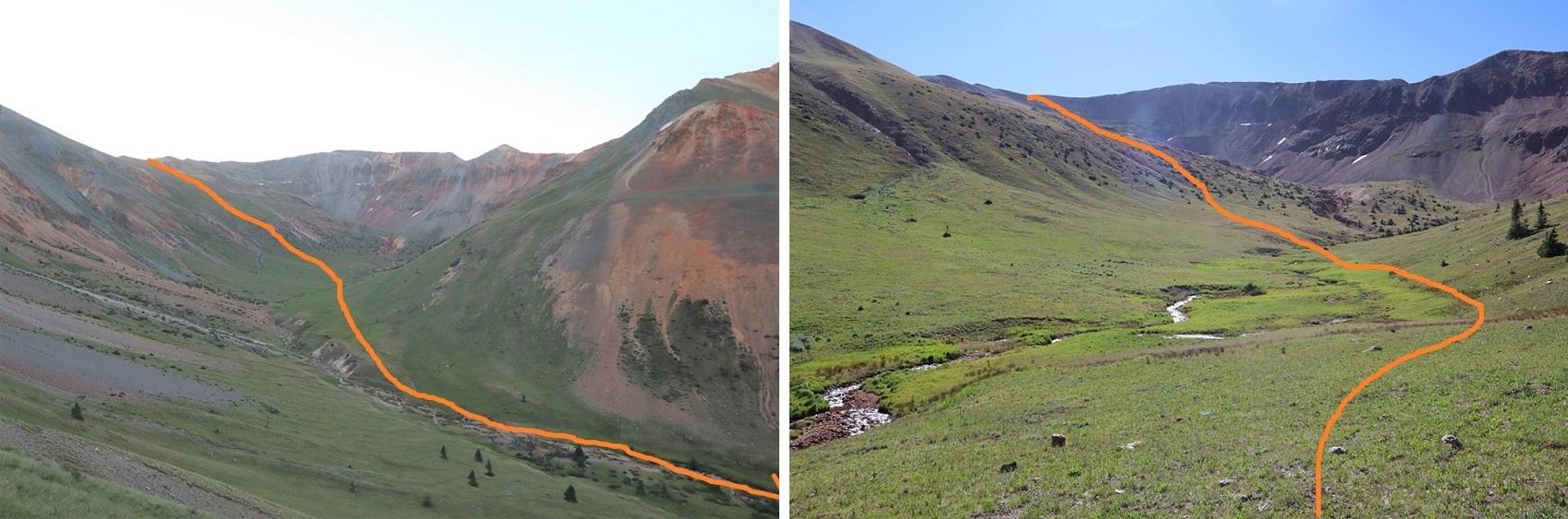
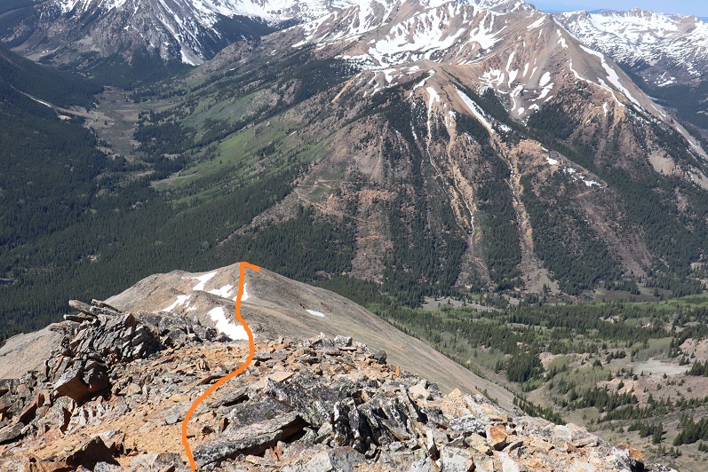
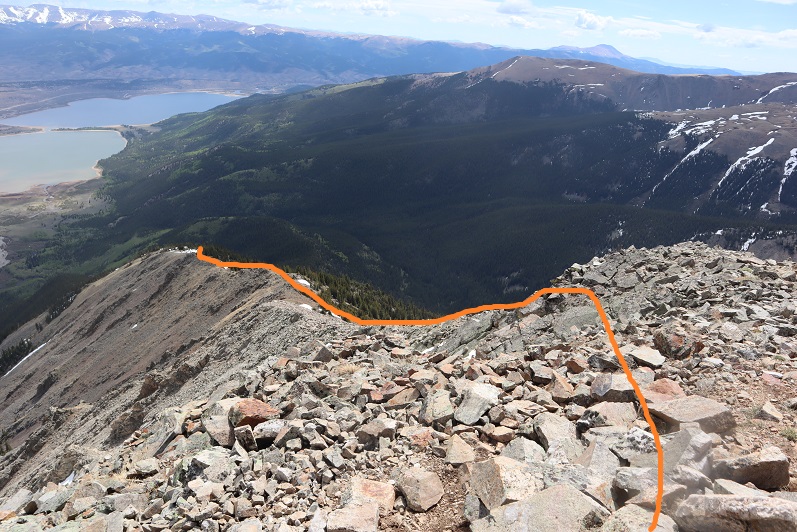
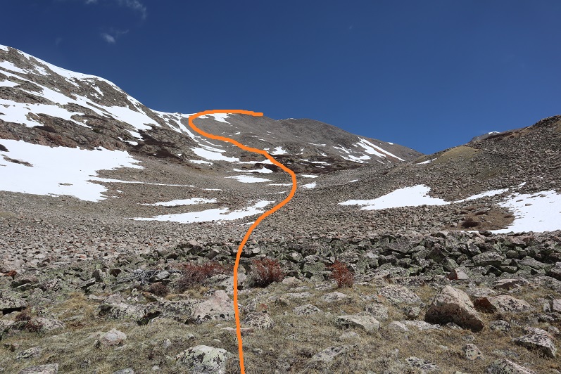
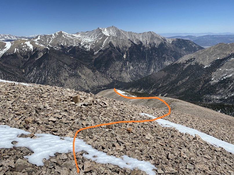
I knew there was no way I wanted to re-enter those basins, so I decided to take the southeast ridge down.  It parallels the basin, and while there was snow, a lot of it was avoidable.  Where it wasn’t I was postholing.  I had snowshoes, but was too stubborn to put them on.  Here’s the overall route out

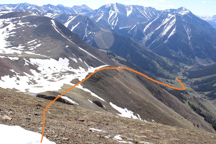
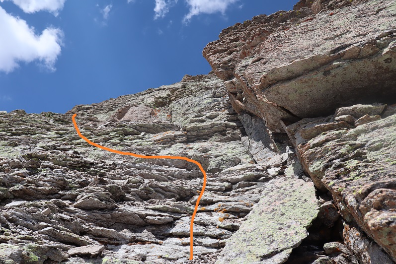
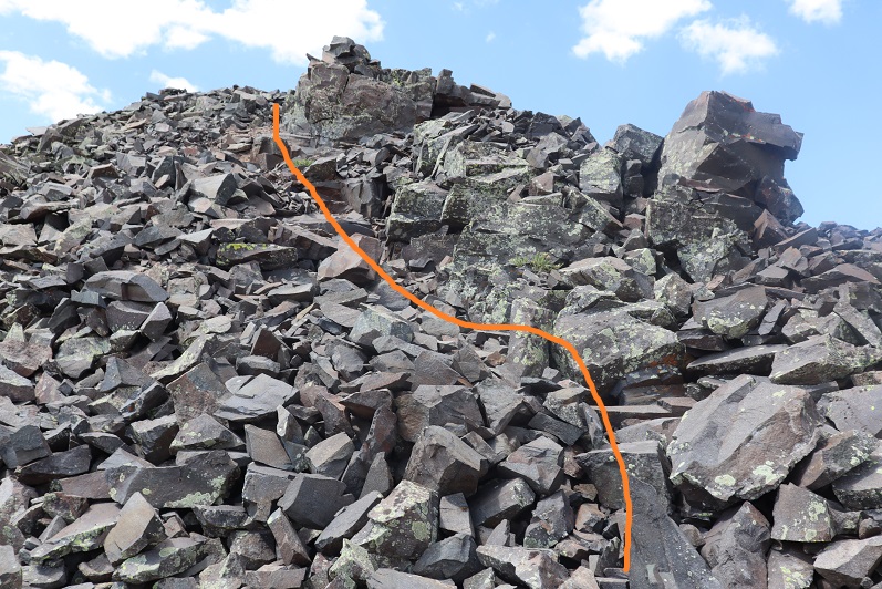
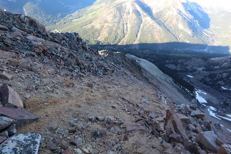
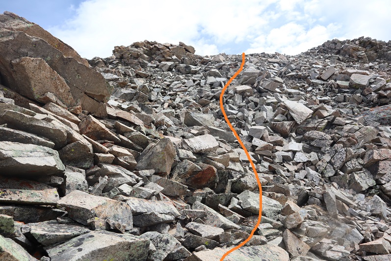
And step by step, first down the ridge

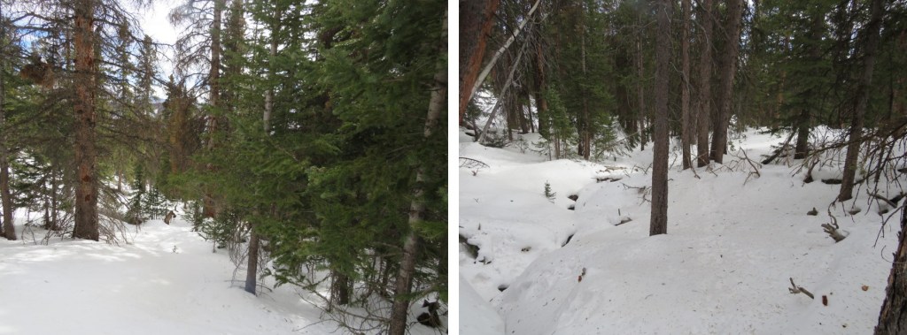
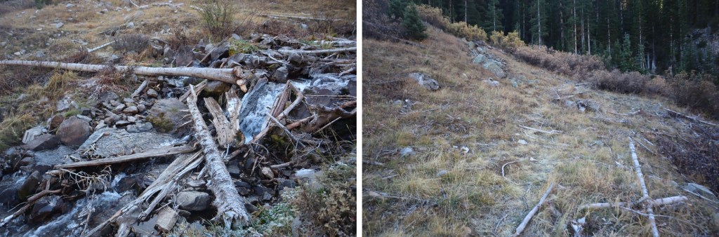
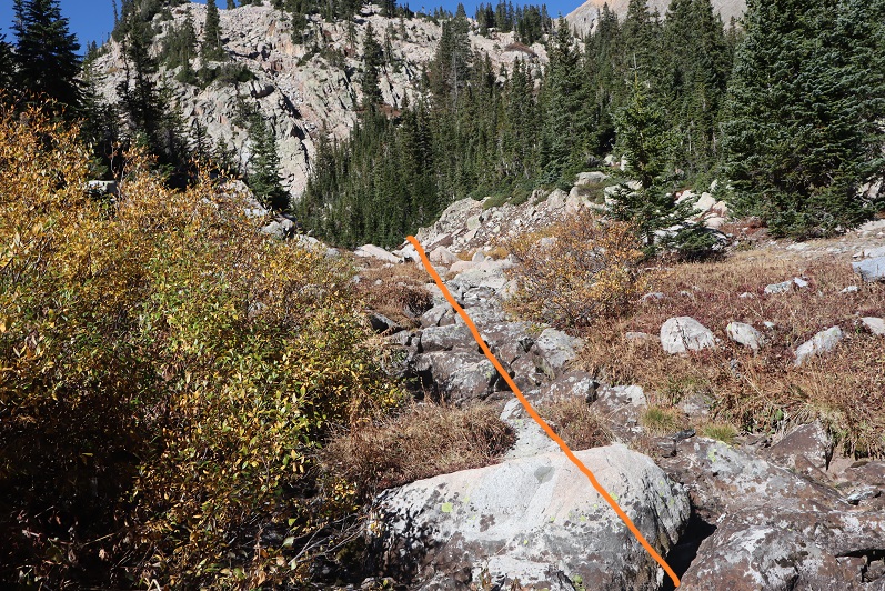
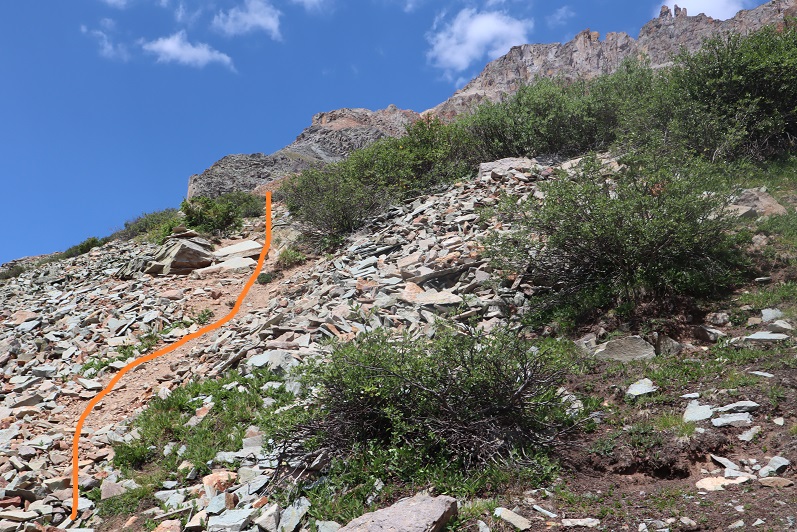
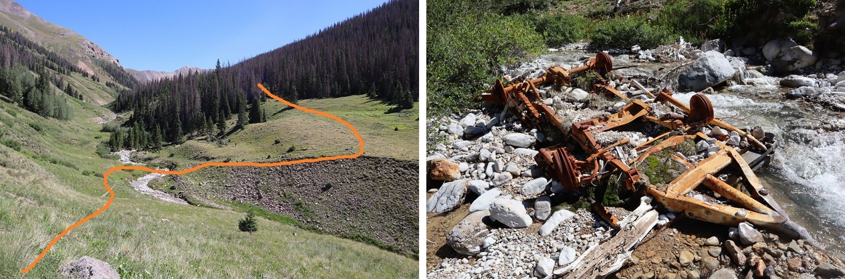
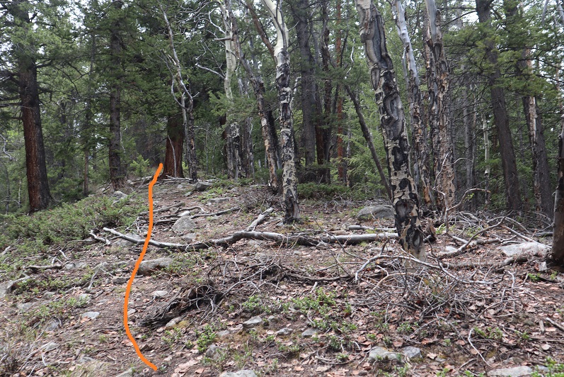
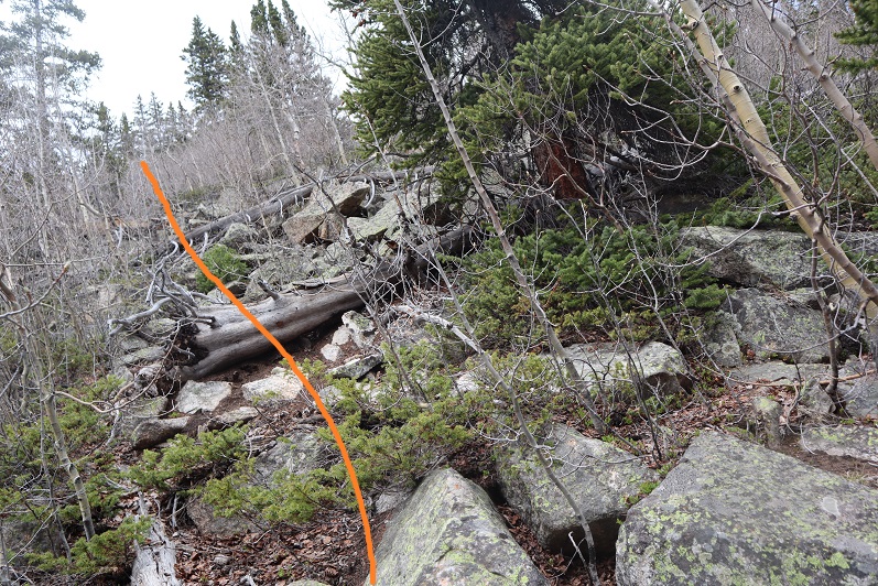
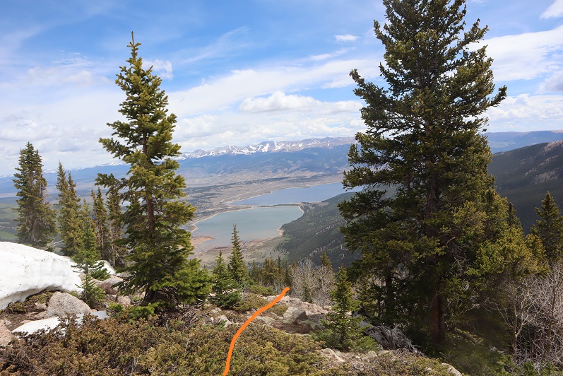
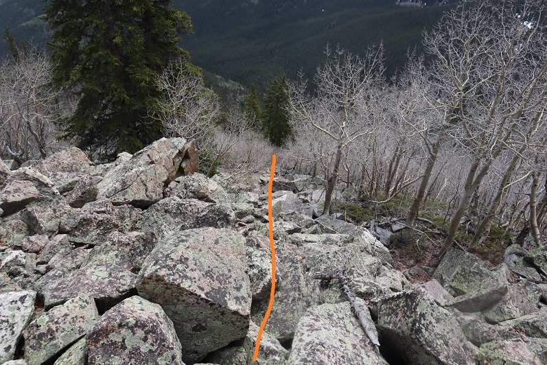
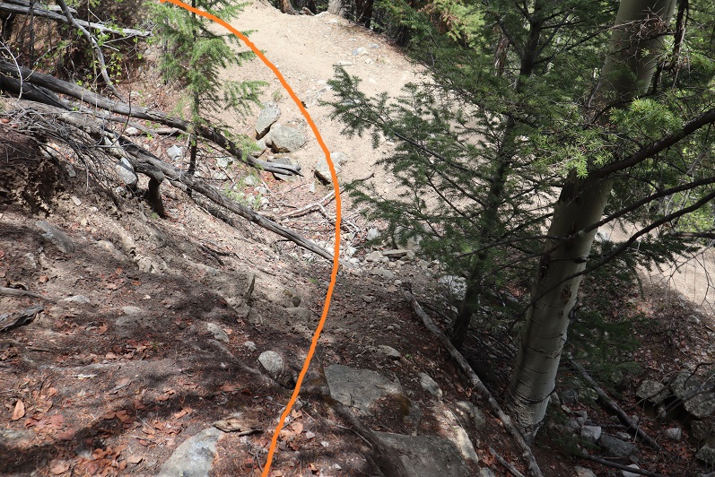
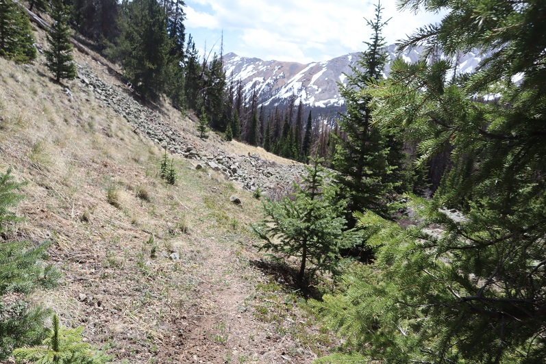
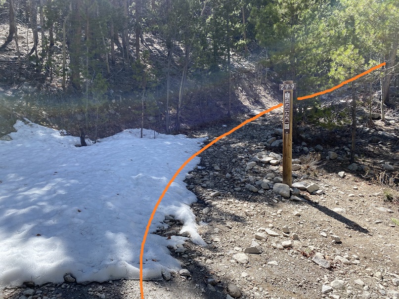
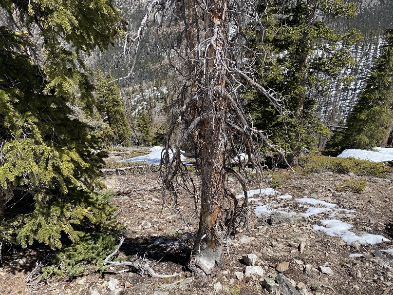
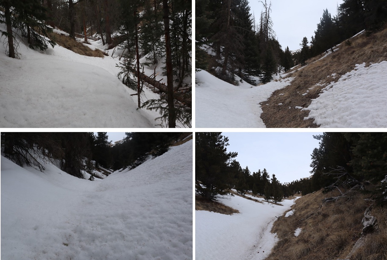
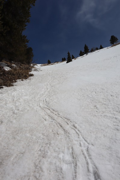
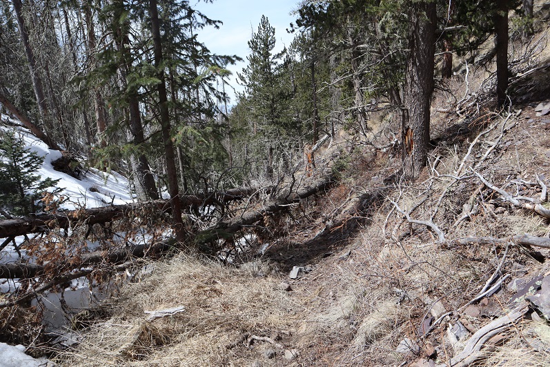
Then following Rock Creek back to CR 30

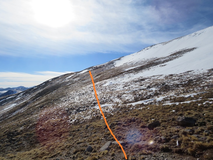
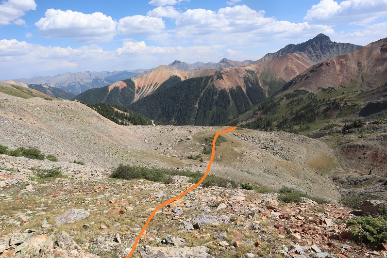
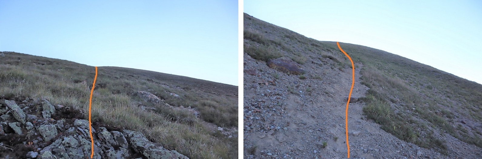
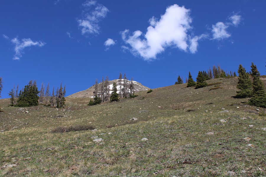
Here’s a picture looking up the ridge (in case you want to take the ridge up)

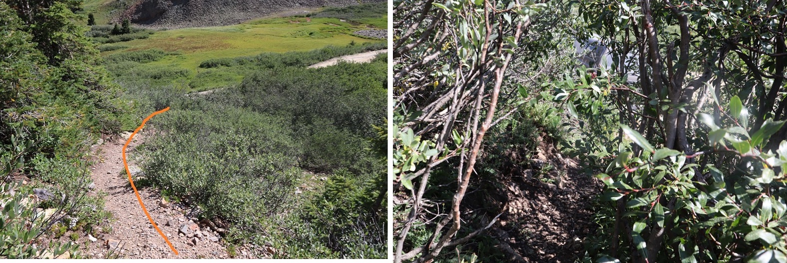
I came to the avalanche area, and it was then I realized a house had recently been destroyed (more on this in my next trip report on “C.T.” Peak). 

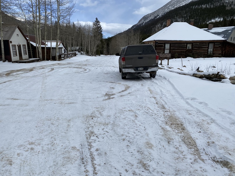
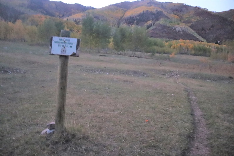
I made it back to the road and followed it back to my truck

I made it back to my truck at 11:15am, making this an 8.95 mile hike with 4206’ of elevation gain in 7 hours, 15 minutes.

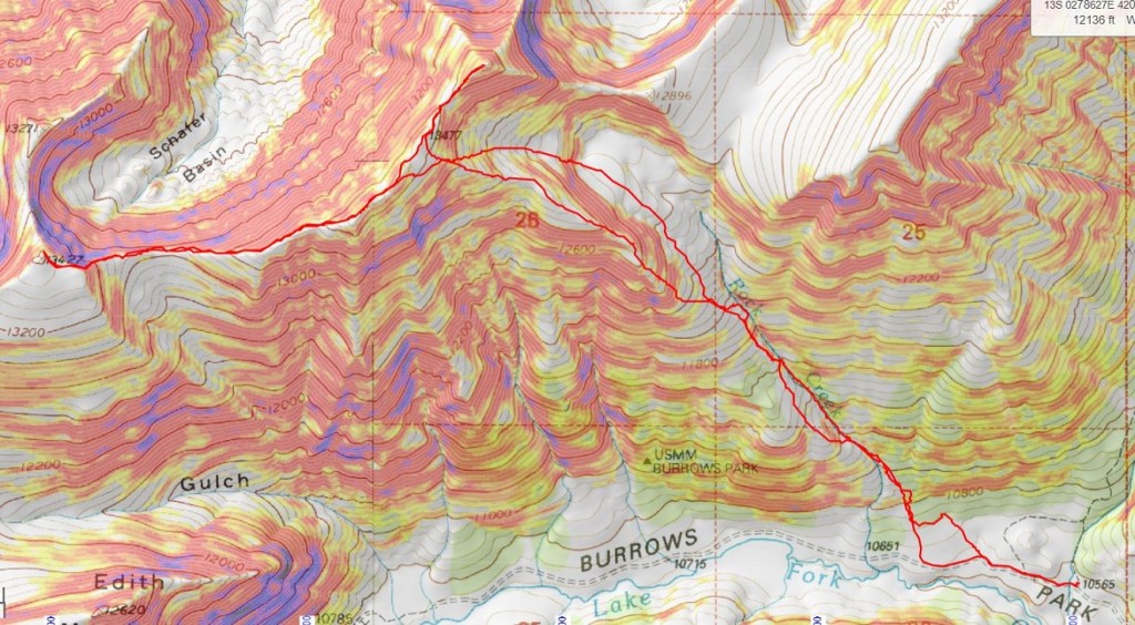
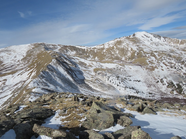
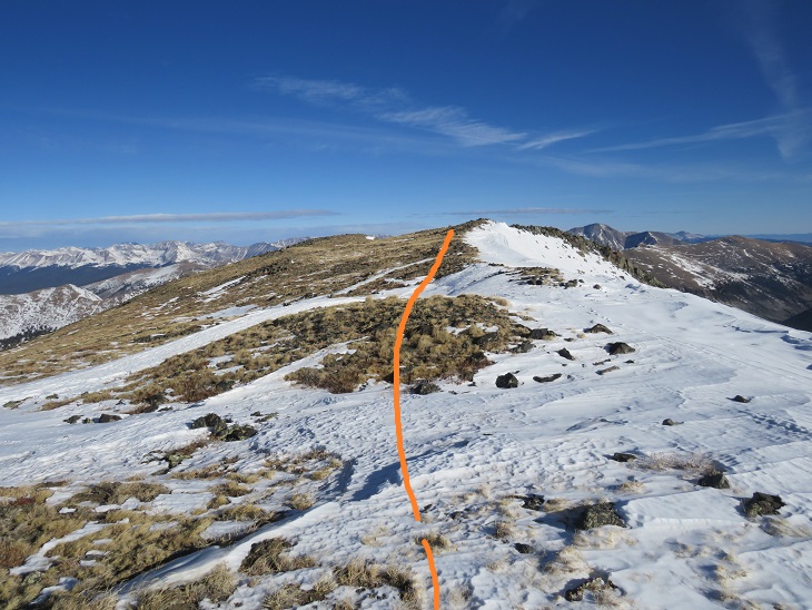
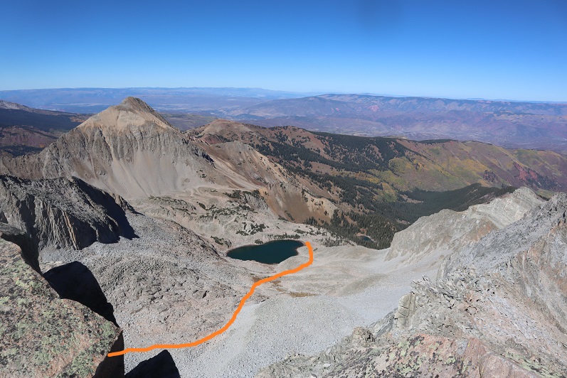
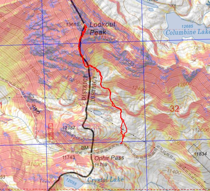
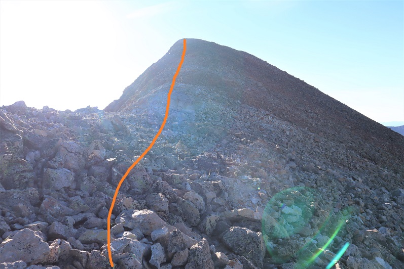
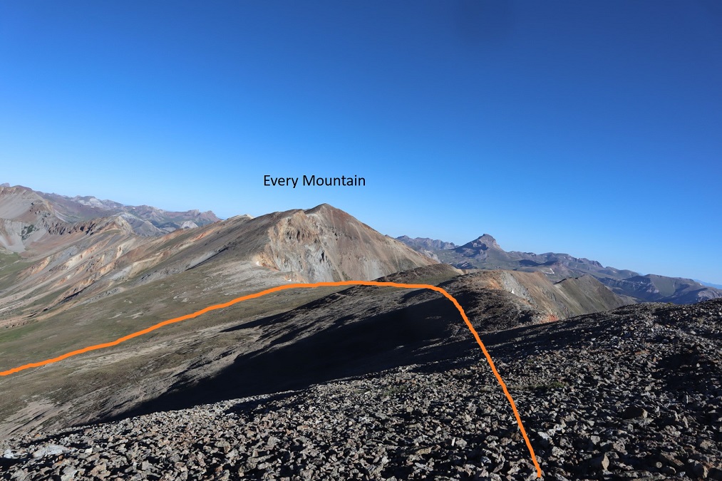
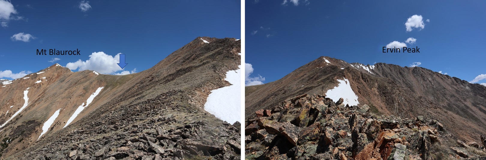
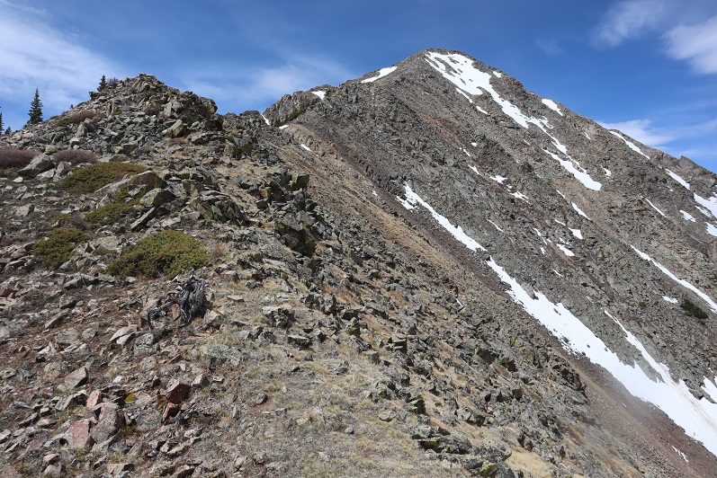
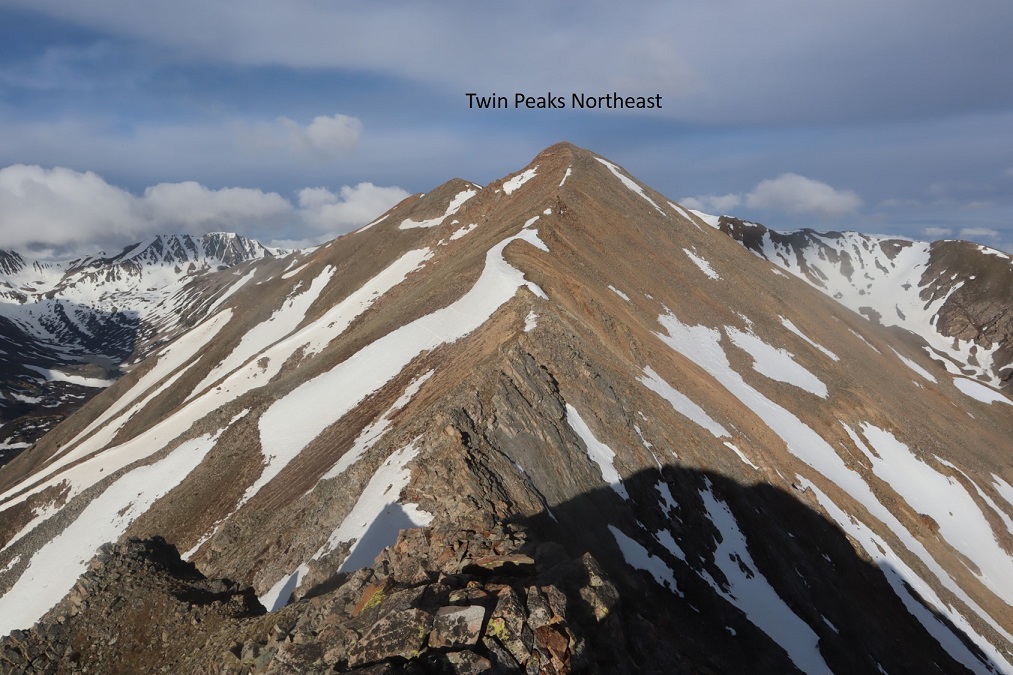
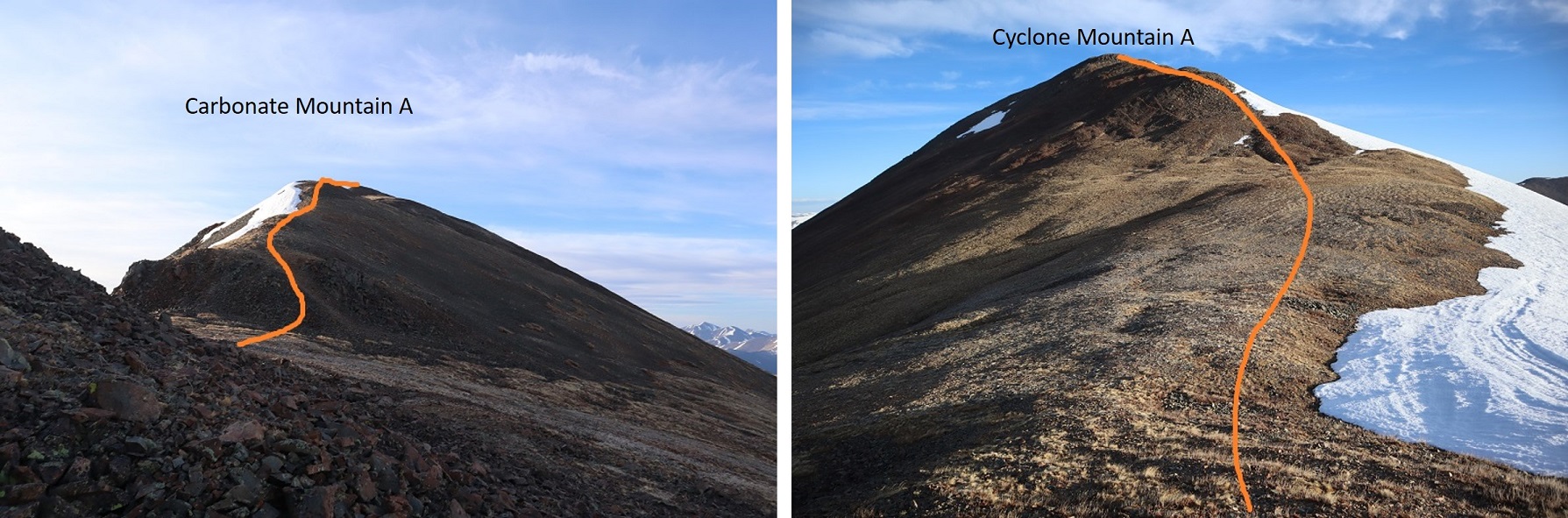
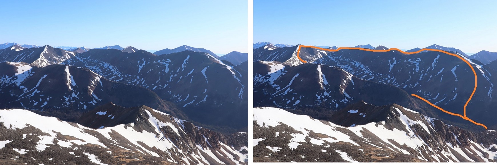
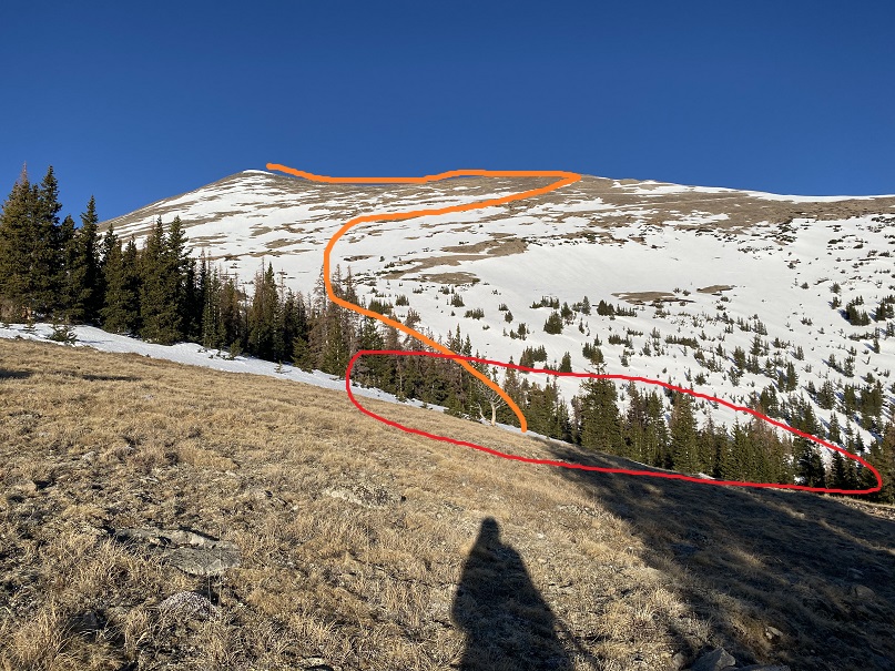
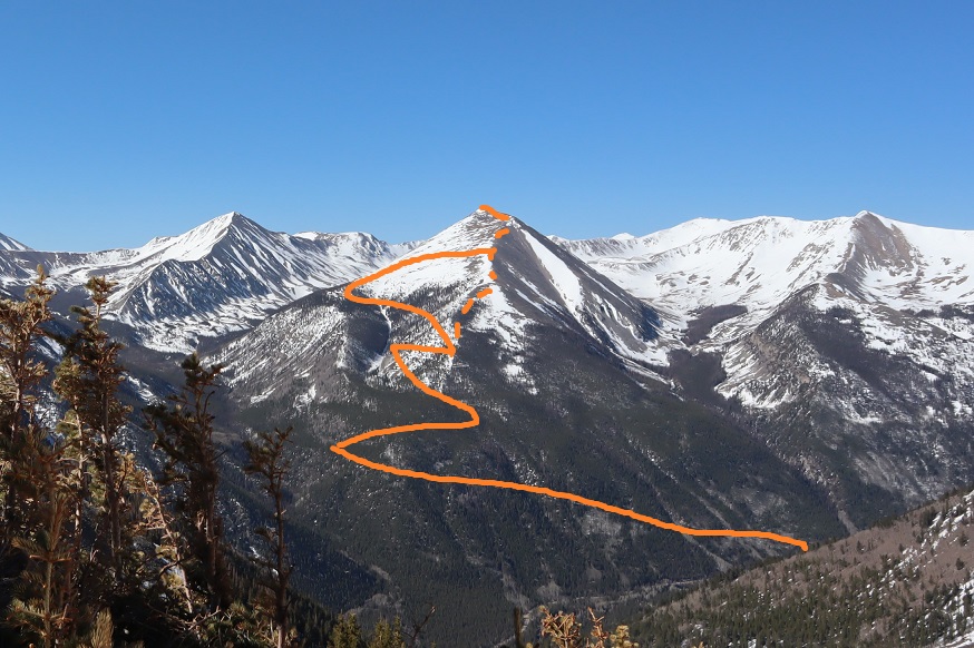
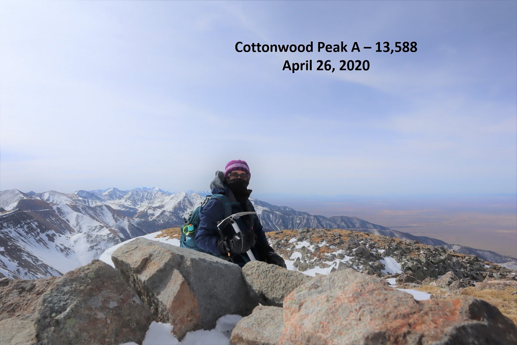
For reference, here’s a look at my route up to PT 13540 (solid line) and down (dotted line), as seen from the west ridge of “C.T” Peak.

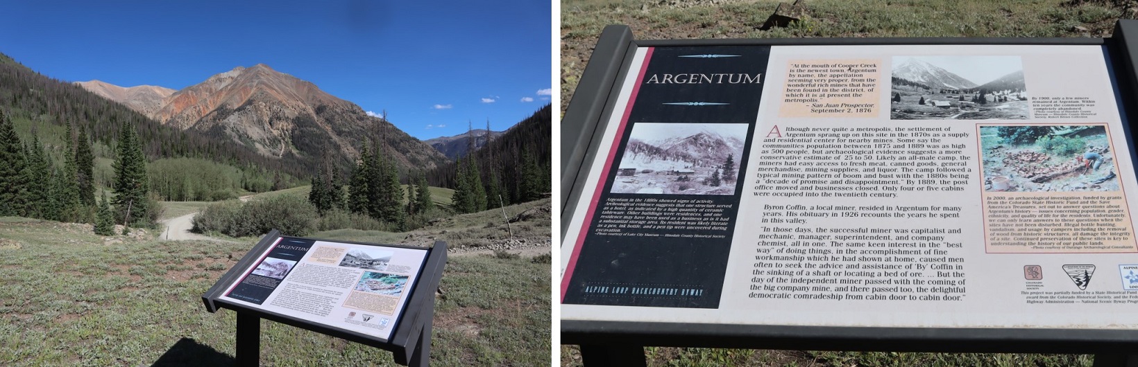
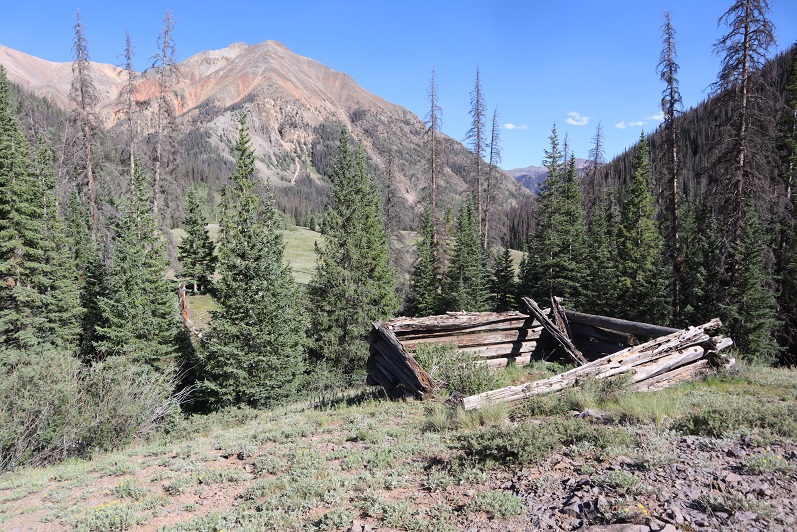
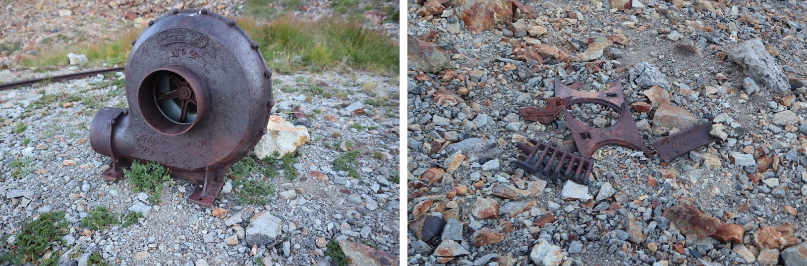
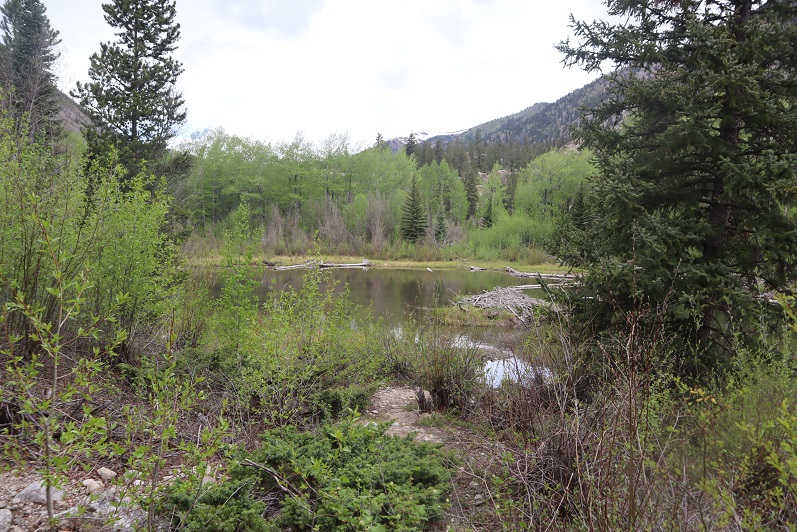
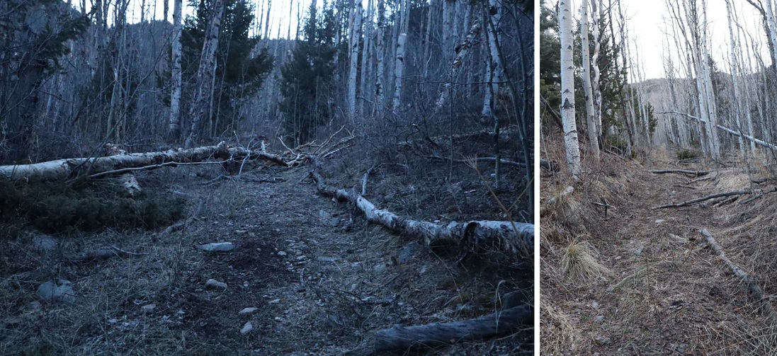
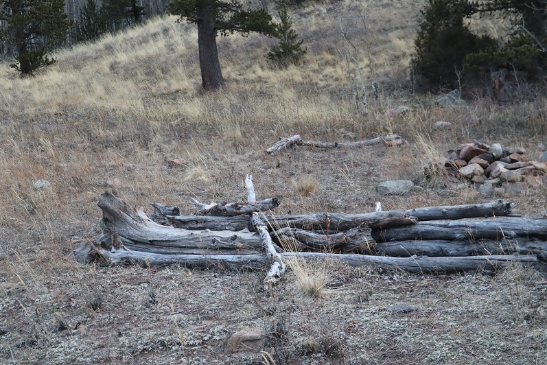
It was still early:  I’d initially intended to add “C.T” Peak on today as well, but didn’t want to re-enter the basin with the way the snow was warming up, so I switched my plans and was going to do that peak tomorrow.  Instead, I got out a book my daughter just finished reading and was eager for me to read as well so we could discuss it together.  I walked around Argentum, found some old structures hidden way up in the hills behind my campsite, relaxed, and sipped whiskey.  Dinner was a block of white cheddar cheese and some bacon.  I had new neighbors, so I welcomed them, and then made it an early night.  It rained.

Tincup Peak – 13,345, Emma Burr Mountain – 13,538 & PT 13050

RT Length:  15.94 miles

Elevation Gain:  4888’

This was my third attempt at Emma Burr Mountain.  The first two times I turned back due to wind, but today the forecast kept wind speeds around 15mph, so I tried again.  I was in this area last week, and the approach conditions are still the same, so I’m just copying and pasting for efficiency purposes. 

The drive in to St Elmo was icy but doable in a 2wd

I was on the trail at 4:00am.  The trail starts out following Trail/Road 267 west

This road goes all the way to Tincup Pass, and by the looks of it, a 4WD vehicle had driven the entire way recently.  High five to this individual, as they have some serious chutzpah. I was glad I’d parked below however, as I wasn’t sure how my truck would have done on the ice.

This trail parallels North Fork Chalk Creek. 

I followed the road for 5.15 miles, staying right here to stay on the road. As I hiked, I saw quite a few moose tracks.  It looked like a mama and baby were in the area, so I was on the lookout.  I saw tire tracks, but no human footprints.

After hiking for just over 5 miles I made it to the upper basin.  Just as with last week, here the tire tracks stopped.  I donned my snowshoes and made my way northwest to Tincup Pass.  I also noticed the snowshoe tracks I’d made last week were gone, and unfortunately, no moose sightings this time.

Once at the pass I got the picture I’d wanted but forewent last week due to the weather.  My son and his Boy Scout Troop always had an annual campout here, with a corresponding picture with this sign.  He’ll get a kick out of seeing the snow in this picture.  The sun was starting to rise.

Here I took off my snowshoes and turned around, heading east up the side of the mountain

This was a much easier hike than I remembered from the last time I was here.  I was pleasantly surprised the wind wasn’t more intense.  Microspikes were overkill here, but once I put them on I rarely take them off because doing so would require me to take off my gloves, and I can’t recover from that type of cold, especially if there’s wind. There was a faint trail here that eventually disappeared. 

Before gaining the ridge I kept to the left, traveling northeast.

Here’s a look back at Tincup Pass

Once on the ridge I followed it to the summit.  This is also where the wind picked up.  I put on my balaclava and followed the ridge. The ridge is long, and there’s a false summit here.

Once at the top of the false summit the true summit was clear. 

I made it to the summit of Tincup Peak at 8:21am. 

Tincup Peak: 

I’d already summited Tincup Peak previously:  My real goal today was Emma Burr Mountain, which can be seen to the north. 

The trek over to Emma Burr looked more difficult than it was. I was especially worried when I saw this part of the ridge

As it turns out, I was worrying about nothing, as there isn’t a dropoff on the left side of the ridge.  This was a class 2 hike all the way to the summit.  I stayed directly on the ridge.

Here are some step by step visuals of the ridge to Emma Burr.  You can stay low here or go high.  Both are class 2

I summited Emma Burr Mountain at 9:22am

Emma Burr Mountain:

It was quite windy, so I didn’t stay on the summit long. Instead, I turned and headed back the way I’d come, towards Tincup Peak.  Heading south now I had a great view of a cornice forming on Emma Burr

The day was still young and the forecasted snow hadn’t materialized, so I decided to make this a loop and head over to PT 13050.  Here’s an overall view of my route to the ridge.  I didn’t re-summit Tincup, but instead stayed just below snowline

I traversed Tincup’s east slope to the ridge.  Here the wind stopped and it was getting warm, so I was able to take my balaclava off.

Once on the ridge I followed it east.

There were times I was worried I’d cliff out (I didn’t have much beta on this peak), but if you stay to the right this stays a class 2 hike.  I lost 660’ of elevation as I hiked east towards the Tincup/13050 saddle.  There’s a gaping hole on the ridge here (I skirted it to the right)

The trickiest part of this ridge comes just before the saddle/lowest point.  This is the only area I went left instead of right. 

From the saddle it was an easy ridge hike to the summit.  I gained about 500’ here

I knew I was at the summit when I found this cairn (it’s difficult to tell where the exact summit is for this peak, so I went with the cairn, but walked all over the summit). 

I summited PT 13050 at 11:40am

PT 13050: 

Here’s a look back on the route from Tincup Peak/Emma Burr Mountain

I was making this a loop, eventually making my way back to the 4WD road I’d hiked in on.  So, I continued heading east

I followed the mountainside east, went right around this rock outcropping, and then headed for the trees

Here’s looking back

At this point I put on my snowshoes and aimed southeast, heading towards the 4WD road.  Once in the trees I found a drainage and followed that down.  This would not be fun to do in reverse.

The snow lessened just before making it to the road.  If you were to do this hike in reverse, the spot I exited was just over 2 miles from where I’d parked.

Once o the road, I followed it back to my truck, parked on the west side of St Elmo.

I made it back to my truck at 1:40pm, making this a 15.94 mile hike with 4888’ in elevation gain in 9 hours, 30 minutes.  As a side note, I saw a ‘no parking’ sign on this side of the road this time (it must have been covered in snow last week), so I’d advice you to park before entering St Elmo and hike through town to start this hike.

Clark Peak – 13,579

RT Length: 25.36 Miles

Elevation Gain:  6619’

This was my second attempt of Clark Peak.  On the first attempt I’d been unaware there was a creek crossing, and the creek looked too high for me to safely cross in the dark.  A storm was coming in later in the day, so waiting for daylight hadn’t been an option.  I’d turned around and done another peak instead.  This time I was prepared (or so I thought) for the creek crossing.  Also, please don’t make the same mistake I did crossing the creek…

I drove to the trailhead the night before and got a few hours sleep before staring on the trail at 5:45am.  The trailhead has space for about 20 vehicles, and good signage

I started off following the Maroon Snowmass Trail south, and then southwest.  I went through two unlocked gates

And shortly after the second gate there’s an unmarked side trail that leads down to cross Snowmass Creek. However, after my last failed attempt I’d done more research, and was told I’d gone too far last time and to look for an easier crossing earlier.  So I did.  I ended up crossing the creek and then running into Beaver Ponds about 20 yards long.  I was able to gingerly cross them, stepping through a thin layer of ice while doing so.  I picked up a faint trail on the other side, which brought me to the actual trail, where I noticed last time I’d indeed been in the correct area.  Hmph.  So I’d done all that wading in cold water for nothing.  Here is where you should cross:

Doing so will bring you to the West Snowmass Creek Trail.  A well-defined, class 1 trail.

The trees were absolutely beautiful!  It was still early morning, so these pictures aren’t the greatest, but the trees had me daydreaming.

This is where I made my second mistake of the morning:  I missed the cutoff.  The cutoff comes after hiking for just over 4.5 miles.  It’s an obvious junction you can see if you’re not looking up at the trees. And cows (there were cows in the meadow). I ended up hiking quite a ways past this junction, just following the trail.  It wasn’t until I realized I was switchbacking and I wasn’t supposed to be that I noticed my mistake.  This mistake cost me well over a mile and added about 1000’ of elevation to the hike.  Here’s where you turn left

After hiking a few dozen yards south the trail abruptly ends.  When it ends, turn right and head west towards the hillside.  A trail will pick on the hillside.

Here’s where I made my third (and final) mistake of the morning:  When you see the path split in two, take the higher one (the lower one is a cow trail that leads you through gooey mud then ends).

From this point on the trail becomes faint.  At times I questioned whether I was on an actual trail at all.  It will parallel West Snowmass Creek, and stay high.  Here are some photos:

I came to a clearing and headed southeast, crossed West Snowmass Creek, and once again picked up a trail.

I took this trail to treeline, where it ended. I put pink surveyor’s tape on a tree so I’d know where the trail picked up on my way back.   

From here the rest of the hike was full of rocks and boulders.  I headed southwest

I lost a little bit of elevation before gaining it again

Rock-hopped up this drainage

Followed the creek for a bit until it ended

Ascended another drainage and at the top turned left to skirt Moon Lake

This basin never seems to end!  I just kept heading southwest

At the end of the basin it was time to gain the ridge.  I stayed right of the drainage. 

This was mostly class 2, but towards the end became class 3 to avoid the snow

Once I gained the ridge I turned left and followed it to the summit.

Ha!  That’s an oversimplification.  I did indeed follow the ridge. The ridge proper goes all the way to the summit.  However, it’s a fun scramble to get there, with a lot of exposure, and more than one knife edge.  If you did Capitol Peak and it left you wanting more, this is the peak for you!  Here are some highlights:

I summited Clark Peak at 2:25pm

Clark Peak:

There were some great views of Snowmass and Capitol Peak, and check out the ridge looking back!

Here’s looking back on the way in through the basin and around Moon Lake

Here are some pictures of the ridge on the way back.  I had fun with the exposure here

At the saddle I turned right and headed back through the basin

Skirting Moon Lake to the east and back to the trees

Next profile pic?

Once at treeline I picked up the trail again.  After crossing West Snowmass Creek I headed for the trees.  The trail picks up again in-between these two trees

Here are some pictures of the trail back down.  As I was hiking, I heard a faint bugle.  It didn’t sound like a normal elk call:  it sounded close but faint.  Usually when I hear an elk bugling it resonates, it’s crisp, and I can hear it from far away.  This didn’t seem loud enough for being so close. As I reached the meadow I noticed a hunter sitting beneath a tree.  I raised my hand to silently say hi, he did the same, and I continued back to the trail.

I kept picking up my pace.  Due to this morning’s route finding errors this hike was taking me much longer than I’d anticipated.  It was quickly getting dark, and I wanted to get back to cell service so I could call my daughter and tell her I was ok, just running late.  I ended up using a flashlight for the last two miles of the hike.  Here are some pictures from the rest of the way back to the creek.

I crossed the creek and took Maroon Snowmass Trail back to the trailhead

I made it back to my truck at 8pm, making this a 25.26 mile hike with 6619’ of elevation gain in just over 14 hours.

Lookout Peak – 13,661

1

RT Length: 4.03 miles

Elevation Gain: 2060’


After summiting San Miguel Peak I still had some energy and I could make Ophir Pass be on the way home, so I decided to head over and hike Lookout Peak.  Word of advice: if you plan on hiking this peak drive in from the 550 side, not the Ophir City side.  You can make it to the trailhead in a 2WD from 550, but there’s some serious exposure/4WD needed on the Ophir City side.  My truck handled it, but there were times I was scared it wouldn’t.  Also, seeing a vehicle that had fallen/rolled a few hundred feet down the shelf road didn’t make me feel any better (it looked like it had been there a while).

The trailhead is located just to the east of Ophir Pass, and can fit 2 cars if you squeeze in tight.

2

I tried to leave as much room as possible so other vehicles could pass each other at this point if needed.  The trail starts just behind where I parked my truck.  You can see a faint trail through the willows.  It also looks like people use this area to pee (there were old wipes/tp littering the area).

3

The willows don’t last long (a few yards or so) and then I aimed for the power lines, heading north.

4

Once at the power lines I had a good view of the entire route up to Lookout Peak

5

From here the route is especially well cairned.  I’m thinking someone a) had a really slow hiking partner, b) wanted to be very helpful to future hikers, or c) has a cairn fetish, because there were cairns placed no more than 50 feet apart for the entire route.  If you don’t see a cairn on this hike, you’re off route.  I fixed a couple of downed cairns for fun, just because I felt if they were there they should be there properly.

The first goal is to gain the ridge, and this is done by following the cairns northwest.  At times there is a faint trail here, but there were a lot of cairns

6

7

8

9

10

Once on the ridge I turned right and followed it north

11

This boulder area looks tricky, but was all class 2

12

13

I kept following the ridge and the cairns

14

15

16

At 13380’ I came to a rock formation that looked like it went either way (it did).  I went east on the way up, west on the way down, and both went. The east side has a slippery gully though, so I’d recommend staying west and taking the steps.

17

18

At the top of the gully I turned right and followed the faint trail and cairns northeast

19

20

At 13475’ I put on my helmet and did some class 3 scrambling to the summit.  This looks much more difficult than it actually was.  The scrambling was easy, but the little rocks covering the boulders were a little annoying. I ditched my trekking pole and followed the cairns north.

21

22

23

24

This would be a good introduction to class 3 climbing for someone looking for a quick summit to practice on.  At the top of the short class 3 section it became class 2 to the summit

25

26

27

I summited Lookout Peak at 2:30pm

28

Lookout Peak:

Here’s what the route looked like on the way back down:

29

30

31

I took the steps on the way back down instead of the gully

32

And then followed the ridge back to the basin

33

34

35

36

And from the basin, aimed for the power lines and Ophir Pass road and my truck

37

38

39

40

41

42

I made it back to my truck at 4pm, making this a 4 mile hike with 2060’ of elevation gain in 3 hours, 20 minutes.

43

I drove home and didn’t get to bed until past midnight.  When I woke up my first thought was “Wow!  I didn’t get woken up at all last night due to wind/wildlife!”  Then I realized I was sleeping in my own bed and not in the bed of my truck…

Every Mountain – 13691 & Cooper Creek Peak – 13694

1

RT Length: 12.93 miles

Elevation Gain:  3987’


The Cooper Creek Trailhead is located about a mile past the Silver Creek/Grizzly Gulch trailhead on 30 past Lake City.  There were cars parked and camping at the trailhead, so I parked at a dispersed camping spot right next to Cooper Creek.

2

It was still early so I decided to take a look around.  The Cooper Creek Trailhead is located in the historic town/settlement of Argentum, and there were still some old structures in the area.

3

4

It was an uneventful night.  I slept soundly until midnight, when campers at the spot across from me returned from their outing.  They weren’t loud, but they did wake me up.  I went back to bed and didn’t wake up again until my alarm went off.  I was on the trail at 5am.  The Cooper Creek Trailhead is just to the west of Cooper Creek, visible from the road.

5

The trail is class 1 for the first 3 miles, and seems to follow an old mining road.

6

After hiking for 1.5 miles the trail crosses Cooper Creek, just where an overturned trailer sits in the water.  It looks like it’s been there for a long time.

7

The trail continues to follow the creek up to the basin, passing a fresh avalanche area (there was still snow under the trees, but there was a clear path to follow)

8

After 3 miles of hiking along this class 1 trail it abruptly stopped.  I crossed the creek and headed northeast along the mountainside, eventually picking up another class 1 trail (I’m not sure where it had started, as I crossed the creek at a couple of cairns and must have missed the trail)

9

The trail eventually leads to a lake in the upper basin (going left), but I didn’t follow it that far.  Instead I crossed Cooper Creek one more time and headed towards an old mine to check it out.  If you don’t want to check out the mine, here’s the overall route to gain the ridge.

10

The creek crossing was simple

11

The mine was filled in, but there were some pieces of equipment lying around.

12

I turned around and noticed 2 tents set up along the trail that leads to the lake and a couple other 13ers in the area.  It was just starting to get light so I decided to be quiet as I gained the ridge.  Eventually I found a trail here that led to the ridge as well (it actually goes up and over and down into the basin on the other side of the ridge)

13

Once I gained the ridge I turned right (east) and followed the ridge towards a false summit.

14

15

16

After reaching the false summit it was a half mile hike along the ridge to the actual summit. This was class 2, with no real obstacles to overcome.

17

18

19

20

I made it to the summit of Every Mountain at 7:55am

21

“Every Mountain”

Here’s a look back at my route in

22

Here’s a look at the route over to Cooper Creek Peak

23

This was another easy class 2 ridge hike without any difficult obstacles.  At times there is even a trail.  Actually, there are quite a few game trails here.

24

25

26

27

28

I summited Cooper Creek Peak at 8:50am. It was very, very windy.

29

“Cooper Creek Peak”

Because it was windy it was also cold, so I didn’t stay long on the summit. Instead I headed back down to the Every Mountain/Cooper Creek Peak saddle and from there down into the basin

30

Here’s the overall route

31

I hiked down the grassy slope, aiming for the creek.   I then crossed the creek and stayed a little high to avoid the muddy areas

32

The creek didn’t look like it had water fit for filtering

33

Still, I followed it back to the trail

34

Here’s a look back at my way down the basin

35

And the route back on the class 1 trail

36

37

Back across the creek

38

And back to the trailhead.  On my way out I noticed a trail register I hadn’t seen on my way in

39

40

I made it back to my truck at 11:10am, making this a 12.93 mile hike with 3987’ of elevation gain in 6 hours, 10 minutes.  Here’s a topo map of my route:

41

It was still early and I wasn’t yet tired, so I decided to drive to the next trailhead and get in a few more peaks for the day…

Mt Blaurock – 13,626 & Ervin Peak – 13,538

1

RT Length: 6 miles

Elevation Gain: 3821’

There’s currently a curfew in place in Colorado Springs, so the beginning of the drive felt a bit ominous: I didn’t see any other vehicles on the road until I made it to the freeway, and even then there were very few vehicles compared to normal, even for 1am, and even when compared to being quarantined. I’d stopped for gas the day before so I didn’t need to stop at all this morning. With less people out I felt like I saw more wildlife: 4 foxes and a dozen or so elk. I made it to Winfield around 4am and decided to take the easy 4WD dirt road a little further, past the cemetery to some dispersed camping spots .85 of a mile from Winfield. You can park at Winfield and it won’t add more than 2 miles to this hike.

2

3

4

5

Looking at a topo map, I wanted to follow Grey Copper Creek to begin. After finding a dispersed parking spot I headed northwest in the dark, following game trails, zig-zagging in what felt like I was in a horror movie until I hit the creek. The creek was easy to find because there’s been a recent avalanche in the area.   This also made the creek easy to follow (after initially climbing over some downed trees).

6

I crossed the creek and stayed on the west side, startling a porcupine as I went. There are new game trails starting here that parallel the creek.

7

There are a few ways to summit Mt Blaurock: You can follow the creek until it ends and continue climbing until you make it to the Blaurock/Ervin saddle, or gain the south ridge and follow that route. There was still some snow in the gully so I decided to take the south ridge route.

8

There is no special point to gain the south ridge. I turned and headed west after a little over a mile of hiking, aiming for the ridge

9

From treeline it was easy to see the route, following the ridge northeast

10

The first part of the ridge is an easy stroll on tundra

11

Once the tundra ended the loose rock began and didn’t quit until the hike was almost over and I was back at the avy area. I’d call it rotten rubble, or choss most of the way. I rounded the first bump in the ridge to the left, climbed straight over the second, and then took a gully up to the top. There is some loose rock here.

12

13

14

9

Here’s a look back down to this point

16

Turning left (northwest) I dipped down to the left a few times to avoid snow and unnecessary ridge crossings

17

18

Of course, the summit is the furthest ‘hump’ on the ridge

19

I followed a small, rock filled gully to the summit

20

I summited Mt Blaurock at 7:30am

21

Mt Blaurock Summit:

There are some great views of surrounding peaks, a few of which I visited last week;

22

23

I headed back over the ridge on the same path I took in:

24

25

26

Here’s looking down at the traverse between Blaurock and Ervin Peak. The hike down to the saddle from Blaurock is easy

27

I met a nice ptarmigan along the way

28

Here’s a look from the saddle of the ridge to Blaurock and Ervin

29

This is where it gets tricky. Here’s the route I took to avoid the snow:

30

31

It looks like there might be a class 2 path here along the right (south) side, but with the snow in key areas I wasn’t able to take that route. There was snow in this section, turning the rest of the hike into class 3 on loose rock. I had one rock the size of a microwave fall while I was testing it. Luckily, I was just testing and didn’t have any weight on the rock. It scared me though. A helmet would be a good idea. Note which areas actually “go”: The dirt gullies here make it look like there are trails where there are not. Here are pictures of how I navigated the ridge. This took quite a bit of careful route finding.

32

33

34

35

This is actually easier than it looks. Class 3, and I placed a cairn here so I’d remember how to get back (there are a lot of drastic drops in this area).

36

The last hurdle was unavoidable snow just before the summit. I tested the snow and honestly considered turning back. The snow was slippery and a fall would have took me a long way. In the end I strapped on my crampons and got out my ice axe, glad I’d brought both. I traversed these two areas (about 40 feet each) gingerly.

37

The last bit up to the summit was full of loose rock but was straightforward

38

I summited Mt Ervin at 9:30am (that’s Mt Hope in the background)

39

Ervin Peak Summit:

I didn’t stay long on the summit. The day was warm and the snow was melting fast: I wanted to cross the snowy areas as quickly as possible to avoid slipping. I turned around and headed back the way I’d come.

40

41

I was making this a loop, so when I hit the westernmost part of the ridge I turned and headed southwest down. This ridge was easy to navigate but full of loose, rolling rocks. It was slow going because I had to be careful with foot placement. This ridge kind of turns right as it goes. Here’s a hint: If it’s daylight, just keep heading towards the switchbacks that you can see in the middle of the picture below.

42

From about halfway down the ridge here’s looking back at Mt Blaurock and Ervin Peak. The blue arrow points to where you could hike from the landslide area straight to the saddle instead of taking the ridges up and down

43

Here you can see you want to meet back up with the landslide area, and that to do so you’ll be bushwhacking through dense aspen. I could still see the switchbacks, but only just barely and only because the aspens aren’t completely full of leaves yet.

44

There were enough game trails here to follow not to make this too difficult. It would have been easier if I were 2 feet tall though, because those trails go under logs and through brush.

45

I made it back to the landslide area, took a picture of it in the daylight, and turned and headed south towards my parking space.

46

47

I made it back to my truck at 12pm, making this a 6 mile hike/climb with 3821’ of elevation gain in 8 hours, most of it spent route finding and watching for rolling rocks.

48

Here’s a picture of the saddle, should you choose to ascend that way

49

When I got home and started jotting down notes I realized today I’d hiked my 145th unique 13er, as well as my 145th unique bicentennial. Pretty cool!

Also, it’s time to retire my hiking boots, as they are no longer waterproof. They almost made it a year….

50

Rinker Peak – 13,789, Twin Peaks B – 13,333 & Twin Peaks Northeast – 13,270

1

RT Length: 10.5 Miles

Elevation Gain: 5471’

Wow, what a difference a couple of months make! I’d attempted Rinker Peak back in January but didn’t get very far. Today there was no snow on the ground at the Willis Gulch Trailhead and I was easily able to get a parking spot instead of parking on the side of the road. I gathered my gear and was on the trail by 3:30am.

The trail begins at the south end of the parking area by crossing a bridge over Lake Creek and turning right.

2

At this sign turn left and follow Trail No 1471

3

This will lead you through some Beaver Ponds on a nice trail. In the dark of the morning I heard a beaver sized splash about 4 feet away from me, stood in place for a second making noise, and for the next 15 minutes hit my trekking pole on every rock/tree I saw. I’m pretty sure it was a beaver, and the beaver didn’t care.

4

I followed the class 1 trail and stayed right at this junction to stay on Trail No 1471

5

After hiking for 1.3 miles I turned right off the trail and bushwhacked my way up to the top of the slope. And I mean bushwhacked.

6

This was harder to do than it sounds, and I’m glad I did it at this time of year (before the bushes have too many leaves). There was a 20% chance of rain here last night and it looked like this section of the mountain got it: The branches and groundcover were wet and slippery and the slope angle just enough to keep me on my toes. There were tons of trails here, but they were all game trails and frequently and abruptly stopped. I just kept heading southwest, doing my best to find the path of least resistance, thinking to myself this ‘wet’ is the reason I could never do a thru hike, as I’d never dry out. Give me snow any day! (Also, I truly do want to do a thru hike…). It was quite an experience running into so many spiderwebs in the dark…

7

At 9275’ and after about half a mile of hiking off trail I came to the top of this part of the mountain, a kind of ‘ridge under the trees’. I wouldn’t call it a ridge per se, but from here if I would continue heading southwest I would have started losing elevation, so I turned left (south).

8

I followed this ridge south and then west as it rounded to treeline. There wasn’t a trail and I only saw 1 cairn all day (on the ridge)

9

I came to an area with a lot of downed trees (which was fun to navigate at night, easy during the day)

10

And headed straight up the mountain to treeline, passing through pine trees, dense aspens, and some loose rock piles

11

12

The rocks were large but many were loose. Be careful of your footing here: I don’t think any rocks will tumble down, but they will roll out from under you.

13

This brought me to treeline, where I found what looked like maybe an old structure (or windbreak) covered in snow so I couldn’t really tell. There were also rusted cans scattered all over and an old coffee pot. That means there had to be a better trail to get to this point than the one I’d taken, as it was obvious this area was once used more frequently.

14

This was basically treeline, but there was just enough snow that I skirted it for a bit to make it to the ridge.

15

16

The ridge is straightforward. I thought the top would be Twin Peaks Northeast (it’s not).

17

There are a couple of goat trails on the left side of the ridge, and one area where I had to dip down to the right to avoid a gully

18

19

There’s a cairn at the top. I reached the ridge after 3.75 miles of hiking

20

And from the top of the ridge you can see Twin Peaks Northeast

21

From here there are a lot of ups and downs to the rest of this hike. This is a class 2 ridge, and nothing too difficult presents itself. I went right here

22

But mostly just followed the ridge. I made it to the top of Twin Peaks Northeast at 7:38am, after 4 miles of hiking. It was windy and thus cold, and here I put on my outer layer and balaclava and extra gloves. I got selfies here and at the next peak but I’ll spare you those and just let you see the videos, as these are unranked peaks.

23

Twin Peaks Northeast:

A storm was coming in, or at least it looked like clouds were rapidly forming, so I had to make a decision: Should I continue along the ridge or turn back? In the end I decided to continue to Twin Peaks and make the decision at that point. This is a long ridge, and requires commitment on the weathers part. I continued southwest along the ridge to Twin Peaks. The hardest part of this ridge was over and it was a simple trek (or it would have been simple without all that wind!!!). I made it to Twin Peaks B at 7:50am after 4.5 miles of hiking.

Twin Peaks B:

24

The weather seemed to be holding so I headed over to Rinker Peak. This was an easy class 2 ridge hike to the saddle

25

Here’s the route I took up to the summit of Rinker. Snow was (mostly) avoidable, and while I did some minor postholing, no traction was needed

26

27

There was a tripod at the top, so if you brought up a tarp and rope you could have a nice shelter from the wind. I summited at 8:50am, glad I’d decided to continue this hike. It was 5.35 miles to this point and the weather was great.

28

29

Rinker Peak:

Here’s looking at the route to this point

30

And the route back along the ridge (there are goat trails in areas to follow here)

31

32

33

As on the way in, the only really tricky section (if you want to call it that) is between Twin Peaks Northeast and the point on the ridge to head back down

34

Go right around this rock

35

Left here (just before the saddle)

36

And this is the route to the top

37

Be careful of loose rock here

38

This will bring you back to the cairn

39

Just follow the ridge back to treeline

40

And back through the rocks, aspens, and pine trees

41

42

43

That will lead you to the ridge to follow below treeline

44

And eventually back to the trail

45

I passed the beaver pond in daylight (I didn’t see any beavers)

46

And crossed Lake Creek. It had more raging water than I’ve ever seen there before but to be fair, I’m usually in this area in winter and it’s mostly frozen.

47

I made it back to my truck at 1:30pm, making this a 10.5 mile hike with 5471’ of elevation gain in 10 hours. I didn’t see another person all day, even when I was on the class 1 trail. It started raining as I left the parking lot. Here’s the route to the ridge as seen from Twin Lakes

48

And my topo

49


Carbonate Mountain A – 13,663, Cyclone Mountain A – 13,616, & Grizzly Mountain – 13,708

1

RT Length: 8.75 miles

Elevation Gain: 4090’

I made it to the 1 vehicle trailhead early the day before after hiking another peak in the area. I had a lot of time to kill before heading to bed for the night and enjoyed every minute.  The Cyclone Creek Trailhead is located at 10750’, where the Cyclone Creek and CR 240 meet. It’s located 8.25 miles after turning onto CR 240 from HWY 50. The road is 4WD (not too rough, any stock 4WD should be able to make it).

2

Since I made it here early I decided to check out the area. The trail starts just on the other side of the road, but isn’t marked well. In fact, the sign just says “closed to motorized vehicles”

3

I woke up at 2:45am and was on the trail by 3am. The trail started out decent, but quickly deteriorated and became difficult to follow.

4

After hiking for about half a mile I turned right (east) and headed up the side of the mountain. There was no trail here and it was dark so route finding was tricky, especially in the avalanche area (11,150’). I found a small stream and followed it until it went away, right at about treeline

5

Here the terrain became very, very steep (scree) and at times I crawled to continue moving forward. The wind was intense and cold, cold, cold. My nose started dripping like a faucet and yes, that’s snot you see on the lens at the bottom of the next few pictures. The scree gave way to some of the loosest talus/rubble I’ve ever experienced as I made my way towards the ridge thinking “there has to be a better way to ascend the ridge than what I’m doing, there just has to”. I probably would have altered my course a bit if it were daylight and I could see.

6

7

This ridge seemed to last forever, with a few small false summits

8

9

I’m not sure I’d ascend Carbonate this way again: I’d instead ascend the ridge to the right (start ascending directly from where I parked my truck). Here’s looking back at the way I ascended. The dotted line is how I’d do it if I were to do this again.

10

I summited Carbonate Mountain A to frigid winds that just wouldn’t quit. There was a summit register, but I didn’t even try to open it.

11

I couldn’t feel my lips or fingers and decided I’d just take a quick selfie with my camera and not stop to set the camera up for a better shot. This is also when I noticed the snot on my camera lens and cleaned it off…

12

I needed to keep moving and I needed the sun to warm things up and the wind to die down. The only thing I could control was my pace, so I kept moving. I followed the ridge north to Cyclone. The terrain was full of loose rocks but was straightforward

13

This was easier than it looked and didn’t take much time. Here’s looking back at the decent off Carbonate Mountain, and the ascent route up Cyclone Mountain

14

Somewhere along this route I stopped to put on my balaclava, and things immediately warmed up a bit. Here’s the talus filled final push up Cyclone

15

There was a summit register but it was open and empty. The wind hadn’t stopped but I was a tad bit warmer. I set up the camera, but only took one shot. This is what I got

16

Here’s the route to Grizzly Mountain. I was especially concerned with the area circled in red, as that’s the scrambling section and I was worried it had some snow I couldn’t see from my view atop Mt Aetna yesterday.

17

It looked good from this angle. I kept going, looking for possible bail out routes should I need one. I descended Cyclone Mountain, which was once again composed of steep and loose rubble

18

The rest of the trek was on more stable ground as I headed towards the traverse.

19

Here’s looking back on Carbonate and Cyclone

20

From the beginning the traverse over to Grizzly Mountain doesn’t seem that intimidating

21

22

But as soon as you round the first corner things get interesting. I began by sticking to the ridge

23

But that quickly became impossible. The rock here is very, very loose, large, and ready to fall. There are tons of rock-filled gullies and route finding can be tricky. I stayed to the left of the ridge the entire time because the right side was full of varying amounts of snow. I definitely experienced some class 4 sections. Here’s the way I went:

24

25

Here things got spicy, as I encountered a gully with several options for descent. There seemed to be three possible lines. I felt the safest route was the middle route and aimed for the snow

26

It’s steeper than it looks. Here’s looking back at the route I took. I’m thinking it was about 35 feet of downclimbing

27

I continued to make my way down towards the snow filled saddle. Luckily it was firm and easy to cross. I breathed a big sigh of relief when I made it here, but the dangerous part wasn’t over yet

28

Here’s an overview of my way to the saddle (looking back on my route)

29

The rock was still loose and I had to be careful to triple check every hold so as not to dislodge a rock. I went slowly here, carefully choosing my route.

30

31

Here’s the final route up Grizzly. The terrain became more stable as I continued, but the rocks were always loose

32

33

34

35

36

I summited Grizzly Mountain at 9:30am.

37

Grizzly Mountain Summit:

Here’s a look back at the ridge traverse as seen from the summit of Grizzly Mountain

38

While on the traverse I’d studied my intended route down. I was able to avoid most of the snow to head down into the basin.

39

While avoiding the snow I instead descended on scree and loose rock: I wasn’t sure which was worse, the ascent up Carbonate or the descent down Grizzly. I took it slow to avoid rolling an ankle and headed towards the basin.   Here’s the route out:

40

I did have a little snow to contend with, but only for about 100 feet or so. The conditions were perfect to cross without traction.

41

Here’s a look at the rubble

42

And a look back at my descent route.

43

Once in the basin I knew I wanted to stay just to the right of the trees and follow the creek back to my truck. There was supposed to be a trail here, but I was unable to see it from above. Either that or it was under one of the dozens of small streams of water. What I hadn’t known until I’d made it down into the basin was the ‘dry’ area between the trees and the creek was actually a boggy mess! The mountains were melting out. It was impossible not to get my feet wet. For a while I tried hiking in the trees but the snow was just soft enough to make postholing miserable and snowshoes overkill. So I stayed in the marshy area, following game trails through the willows. I even saw two elk bounding away from me as I sloshed along.

44

45

I passed an avalanche area (not the same one as in the morning) and rounded a small boulder field, always keeping the creek to my right

46

In this area I was almost done with the hike but somehow I came across an actual trail and followed it back to my truck.

47

48

I made it back to my truck at 1pm, making this an 8.75 mile hike with 4090’ of elevation gain in 10 hours.

Looking from Mt Aetna, here’s an overview of the route

49

And my topo

50

Boulder Mountain – 13,528 & Mt Mamma – 13,646

1

RT Length: 15 miles

Elevation Gain: 5607’

I realized I’d forgotten my camera about 10 minutes after leaving the house, and decided it wasn’t worth it to drive back and get it. That decision haunted me for the next hour. Luckily I still had my phone and it was supposed to be a warm day, so as long as it wasn’t too windy I’d still be able to take pictures.

I arrived at the Baldwin Gulch trailhead, parked, and was on the trail by 4:30am. A little later than I’d wanted to start, but early just the same. The trail starts here, at the intersection of 162 (which parallels Chalk Creek) and 277.

2

The 4WD road that is 277 was drivable, but I was glad I’d walked the 1.25 miles because there was no place to park a vehicle: all of the parking areas were covered in snow.

3

After hiking for 1.25 miles I turned right (west) onto 279 and followed another 4WD road. This road was not drivable.

4

5

At this time in the morning the snow was still solid and I could walk on top of it, but I knew it would be a slog-fest by the afternoon. There weren’t any footprints/snowshoe/ski/animal tracks on this entire road, so I knew no one had been here in while.

279 switchbacks around the east side of Boulder Mountain. Last week I’d attempted 13,626 and got a good view of how I wanted to summit Boulder: My goal was to hike along the road until I made it to the ridge, and then take the ridge up. However, as I was hiking the road looked ‘doable’ so instead of aiming for the ridge early I continued hiking on the road. I realized later this wasn’t the best option. I crossed a snow-filled gully at 11,700’ that did not look like it would be stable in the afternoon sun and followed the road until about 12,100’ when the road became too dangerous to traverse. The slope angle here was between 29-32* and luckily for me the snow was still fairly solid. I decided to leave the road and instead climb straight up to the ridge. Snowshoes and spikes were not needed, as the snow was still firm.

6

7

This was trickier than I’d anticipated, and I decided as I was climbing up I was not going to take the same way back down. I had several options for my descent and would make my final decision depending on further conditions. The route I took is in orange, the gully I wished to avoid is circled in red, and everything above the circle was avalanche prone. I didn’t want to walk on the road below the gully on my descent, or traverse across the gully again.

8

I felt much safer once I made it to the windswept ridge. It was a simple hike up the ridge to the summit on loose talus. Also, that’s not the summit.

9

I passed quite a few mines and a small, empty building

10

As I continued hiking up the ridge the true summit came into view

11

It was a straightforward hike to the summit. I summited at 8:15am. It was a little over 6 miles from where I parked my truck to the summit.  This summit gets a selfie because I left my camera at home…

12

Summit of Boulder Mountain:

Here’s the view of the ridge over to Mt Mamma

13

The traverse was straightforward. I stuck to the ridgeline as much as possible to avoid the snow

14

It looked like there was a trail to my right, but when I tried to take it I found it was full of very loose talus. One slip would send me tumbling, so I stuck to the ridge.

15

While on the ridge I got a good look at the basin below and Baldwin Lake. Nope, I didn’t want to descend that way, as it looked too similar to the conditions I’d experienced last week on 13,626: The basins looked the same, and last week I found the basin to be impassable due to punchy snow. I didn’t want to get all the way to this basin just to have to turn around because the snow was dangerous and re-summit the ridge.

16

17

There were a few cornices to contend with on the ridge, but the snow was firm so they weren’t a problem to traverse. Sticking to the ridge is the way to go.

18

19

20

There was a bit of a saddle before the final push to Mt Mamma. I was glad there was a seemingly straight snow free line to the summit.

21

There were a few areas of snow to contend with, but nothing that kept me from hiking straight up

22

The rocks here were loose and rolled, so watch your step

23

I summited Mt Mamma at 10am, after hiking for 8 miles. It took me about an hour and 45 minutes to complete the 1.8 mile traverse from Boulder to Mamma. Once again, no camera, so I got a selfie with my phone.

24

25

Summit of Mt Mamma:

The summit had a register, with the last person to sign being from October 13 of last year. Also, the register needs a new pencil, so if you go up there soon be sure to bring one with you. The day was perfect: no winds and lots of sunshine. This is probably the best weather day I’ve had on a mountain so far this year. I decided to head back over to Boulder Mountain, as I did not want to get stuck in the basin.

Here’s a look at some of the mountains visible from Mt Mamma on the route back

26

27

Time to head back towards Boulder Mountain

28

As you’re hiking down from Mt Mamma you can clearly see a trail on the west side of Boulder Mountain. Don’t take it: stick to the ridge. I’m pretty sure the trail is a goat trail, not a human trail. It’s very loose and a fall would send you a long way down the mountainside. I saw mountain goats grazing in Deer Canyon to my left.

29

The ridge was still almost completely snow free, but the areas with snow were turning to mush quickly.

30

I re-summited Boulder Mountain

31

And decided to take the ridge as far as I could back down.

32

33

I passed a stone with some numbers engraved on it

34

And kept following the ridge, keeping to the left of the snow. From my view last week I knew the ridge would be dry all the way to treeline

35

Here’s a look back up at the ridge

36

There were cairns here (some not so traditional) so I knew I was on some sort of a trail

37

I looked over at the route I’d taken in and knew it had been a good idea not to take it back: I could tell by just looking at the snow it wasn’t stable. The ridge was indeed snow free/snow avoidable until treeline

38

But once I got to treeline I encountered unexpected deep, slushy snow. I knew I couldn’t go back the way I’d come and to be honest, this snow caught me off guard. I could tell I only had a couple hundred feet to deal with, so put on my snowshoes and zig-zagged my way carefully through the snow towards the road I knew would be below.

39

40

It was touch and go at times, and more than once I asked myself if this really was the safest way, but when I made it back to the road I knew I’d made the right decision. The snow stopped about 200 feet before the road (which is why I’d thought it would be snow free from the ridge to the road; thankfully I only had a couple hundred feet of snow to contend with).

41

42

Once on the road I breathed a sign of relief but kept on my snowshoes. I knew there would be just enough snow to need them for a while yet. Every time I encountered snow on the road I postholed. It was indeed a long slog back to the snow-free 277 4WD road. On a positive note, the pine trees smelled amazing!

43

44

From last week’s trek up 13,626/Mt Princeton here’s a view of Boulder Mountain and my route. My ascent is solid, my decent is dotted. You can clearly see the gully you want to avoid: the road traverses it and should be avoided in snow.

45

I made it back to my truck at 3:15pm, making this a 15 mile hike with 5607’ of elevation gain in 11 hours, 45 minutes. Here’s my topo

446

I picked the wrong time of year to do this hike. It’s definitely not a spring hike, and still needs a few weeks to melt out. If I were to do this again I’d take the ridge up from the beginning and only take the road if it were in summer conditions. I’d take the basin by Baldwin Lake in more winter-like conditions. Beware of the gully area if you take the road, as it’s full of snow and looks prone to avalanching. I’m a little upset I didn’t get a picture of it on my way in for a visual, but I’d avoid the area if possible if there’s any snow at all.


Cottonwood Peak A – 13,597

1

RT Length: 11.5 miles
Elevation Gain: 5110’

I got a bit of a later start on this one that I’d intended, as when my alarm went off at 12:30am I hit snooze and slept another hour or so (I’d already summited 7 peaks in the past 2 days and was a little tired). I made it to the Hot Springs Trailhead after first being led by GPS to the Hot Springs (which the sign indicated clothing optional: it was also closed due to Covid-19 fears).

The drive to the trailhead is easy 2WD on a dirt road.

2

There was 1 other vehicle parked there when I got there, which I thought was odd. It was a newer VW and didn’t look like it had been there overnight. I tried to be quiet in case someone was sleeping in their car but thought to myself “Great! Someone else is trenching the trail for me!”

The trail is a loop, and I was surprised to find out it was actually an established trail. The morning was getting better and better!

3

Just as an FYI, you cannot see the peak from the parking lot, but it was dark so that didn’t matter anyway. I signed the trail register (which was difficult due to the cold temperatures and ballpoint pen available). I wanted to summit Cottonwood Peak first, so I took the trail clockwise, starting to the left

4

The trail starts off wandering through chaparral

5

Here the trail was clearly marked and easy to follow.

6

I rustled a sleeping ptarmigan as the trail switched to scrub oak

7

Once I entered the aspens the trail started to deteriorate. What I’d been pleased to discover was a good trail became a trail in much need of maintenance. I was navigating over fallen trees for the rest of the hike, and it became increasingly obvious no one had used this trail since the Fall and no one would be trenching for me today.

8

Around 2.4 miles there was a great spot for a campsite (10130’)

9

What I found disturbing were the number of dead animals I encountered on this hike. There were deer remains everywhere (I’m pretty sure it was more than one deer, spread out over a few miles) and a lot of bird feathers. It let me know there was a predator in the area, I just wasn’t sure which kind?

10

I encountered the first real snow after about 2.6 miles. It was still early in the morning so I didn’t need traction, but I did posthole from time to time. Here the trail was difficult to see, as it was both covered in fallen trees/branches and snow.

11

Here things got interesting: I came across bear tracks! They looked like they were from the day before, and since there was only one set of prints I knew it wasn’t a mama, and that it was just passing through. I followed prints along the trail for about a mile

12

Since the trail was difficult to follow and the snow was getting softer I found myself straddling the ravine and following the small stream around the mountain

13

It became increasingly apparent I was the only one to use this trail in a long time. I circled around to a gully, which would have been challenging if there’d been more snow. Instead it was a steady climb up, and when I had the option, I took the gully to the right, also easy to navigate

14

15

The second gully ended near treeline, and I became excited as I thought I could see the peak.

16

Of course in my mind I knew I was too close to treeline for that to be the peak, but surely it had to be just behind it? As I continued on I saw another peak behind the first one and figured that was the summit

17

Up, up, and up I continued, doing my best to avoid the snowy areas.

18

19

20

Imagine my surprise (and dismay) when I finally reached the top of the second peak and noticed I wasn’t anywhere near the summit: it was still quite far away

21

Not only was I still a good distance from the summit, but I would need my ice axe and snowshoes. Luckily, I had both. I sighed, broke down, and put them on. There was no way I was turning back now. The weather was great (the best day I’ve had all year) and while I’d already done 30 miles this weekend with 15K of elevation gain and was physically exhausted, I wasn’t quitting this close to the summit. I left my trekking pole here and continued on, ice axe in hand. The only way across the ridge was to walk directly on top of the cornices. Luckily the snow here seemed firm

22

23

24

25

The last bit to the summit was easier than expected

26

27

I summited at 9:30am

28
Summit Views:

There was even a summit tag on top

29

This hike is traditionally done as a loop along with Unnamed 13123B, so I went over to get a good look at the route

30

Hmmmm…. The route didn’t look that difficult. Actually, the ridge looked better than the one I’d just traversed, but it was a really nice day and the snow was warming up fast. I knew I could summit 13123, but I was unsure of the snow conditions on the route back below treeline if I were to make this a loop. I didn’t want to re-summit Cottonwood because a) I’d already done 5000+ feet of elevation today and b) the snow was getting softer by the minute on this side as well.

31

In the end I decided to go with the safer route and descend the way I’d summited, figuring that while the conditions wouldn’t be ideal, at least I knew what to expect.
I turned and headed back the way I’d come, first over a pretty cool cornice

32

And then back down the ridge

33

34

My favorite part was toe-heeling it across the cornices

35

Here’s the route back

36

37

I decided to keep my snowshoes on, and this time stuck to the areas with snow.

38

The snow was a terrible mush and I was glad I’d decided to return the way I knew, even if it meant postholing and navigating felled trees

39

I kept my snowshoes on for longer than needed, but they came in helpful when I hit the boggy areas where there was no discernable trail but a lot of willows/snow/downed trees

40

They were cumbersome in areas such as this:

41

On the way back I scared the same ptarmigan as this morning and saw a cactus in bloom

42

I made it back to my truck at 12:30pm, making this an 11.5 mile hike with 5110’ of elevation gain in 7 hours, 15 minutes. The VW was gone.

43

44
I was really happy with my decision not to make this a loop today, and look forward to trying the trail counter-clockwise next time, when there’s less snow…