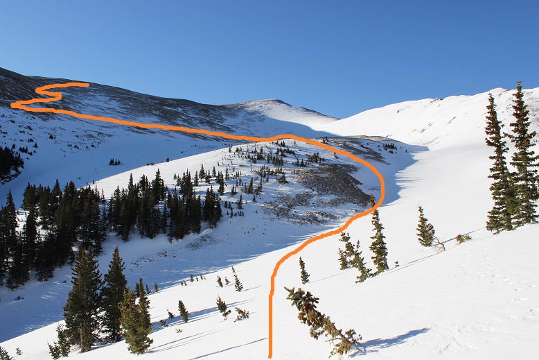
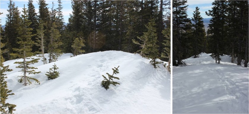
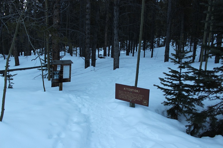
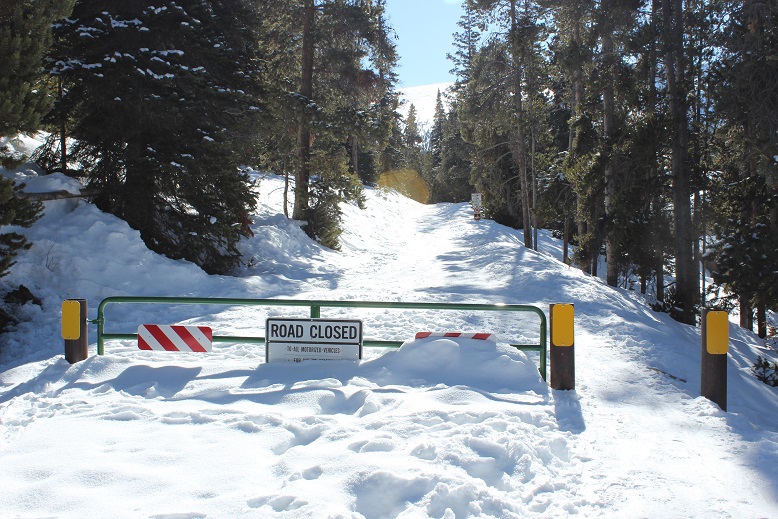
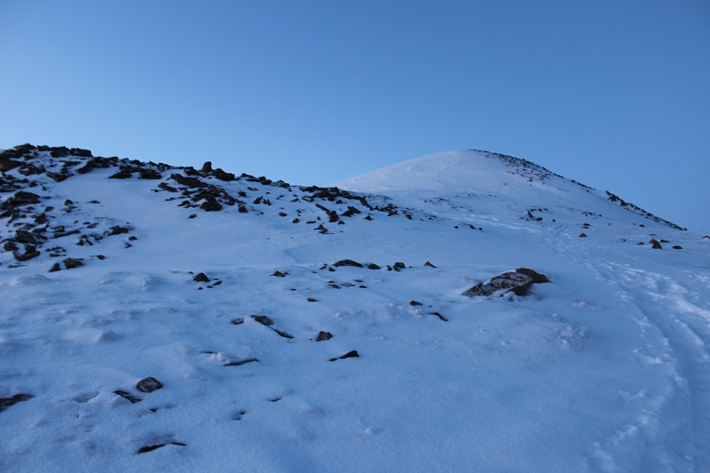
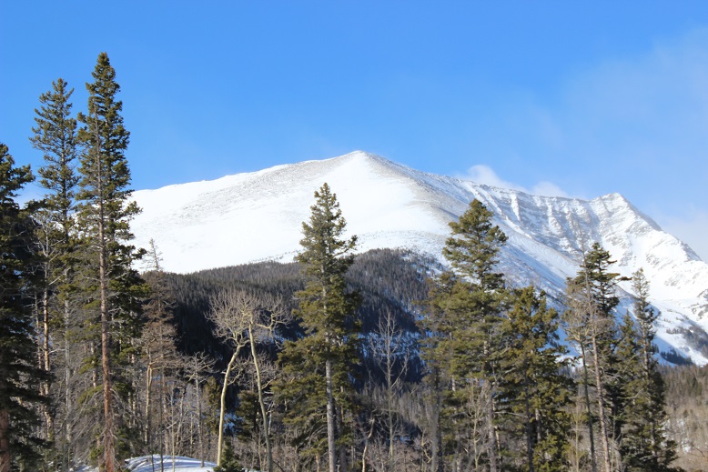
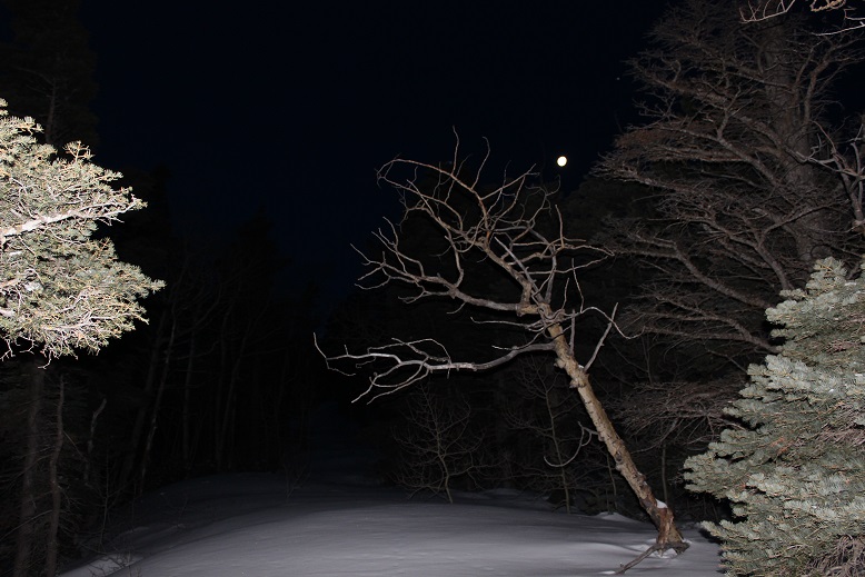
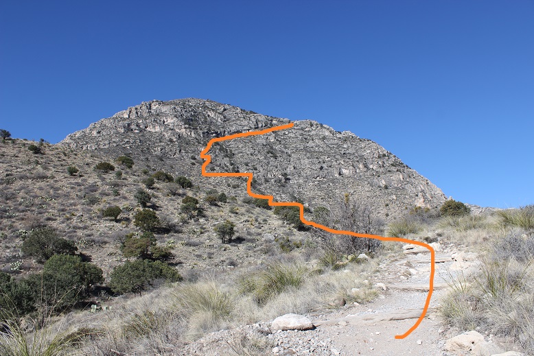
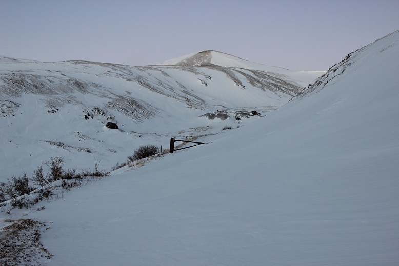
I have mixed feelings about this river. I’ve been rafting here at least a dozen times, but that one time in 2009 still haunts me. I’d been invited out on the water today (with the added bonus of some potential rock climbing) and was determined not to think about what happened in that icy river 10 years ago. Instead I was going to focus on today’s experience.
I didn’t even realize you could go rafting in Colorado in April, but apparently it’s a thing! Because we were rafting we took 2 separate vehicles and met at a gas station on the way. A local 4H club was having a bake sale, and I couldn’t resist (no, I didn’t but cookies, but left a donation). 4H and FFA bring back so many awesome memories I couldn’t not donate, even just a little bit. Oh, and they were totally taking over that gas station. There were probably 15 students there with their parents. They made an impact, and the belt buckles and handmade signs were a nice touch.
In any event, we parked my truck at the end of our intended route and drove together to the launch area. I breathed a sigh of relief when I realized we were nowhere the crash site (it was miles upstream). OK, I could completely relax now. Even though I try not to, on past trips I’ve been glued to the water to see if I can find where we landed. Funny thing, my success rate in actually finding the spot is about 50/50.
First things first: setting up the raft. To be honest I didn’t do much work, but it seemed straightforward. There’s tons of gear you need (or hope you don’t need) for a day on the water. After setting up I stayed by the raft and just relaxed and did yoga for a bit while he parked his car in a lot a few minutes away.
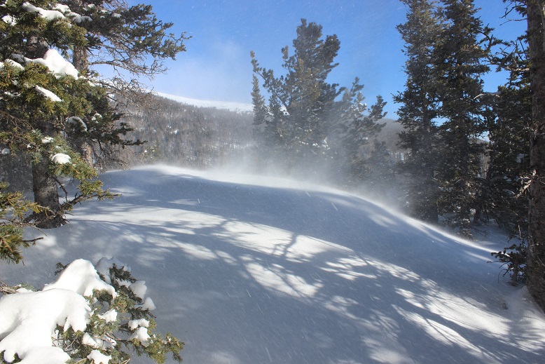
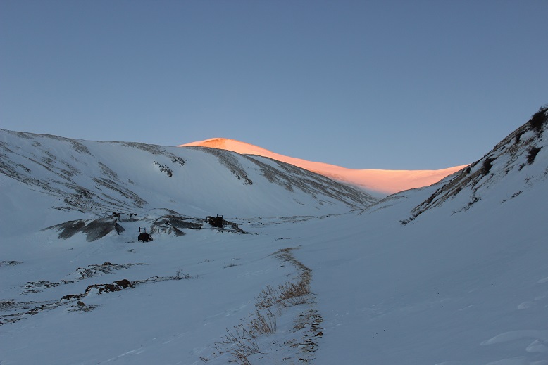
To my surprise it was a beautiful day; A bit chilly when the wind blew, but with the PFD on it wasn’t too bad. My feet were cold, but that was to be expected. I was only splashed by the water a few times, and tried to make it fun. Today’s trip down the river was more serene than any other trip I’ve taken, most likely because I’m usually in charge of 25 excited girls and the river’s flowing faster. It was nice just floating on the river, my friend doing most of the work (which I felt guilty about). On the downside the water could be loud at times and I had a hard time hearing and missed a few strokes (whoops). There were dozens of geese and lots of small birds on the water’s edge. One of my favorite parts about being in nature is seeing wildlife.
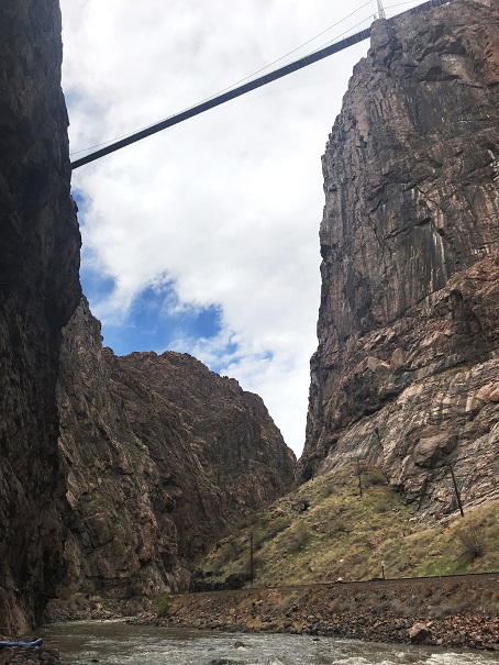
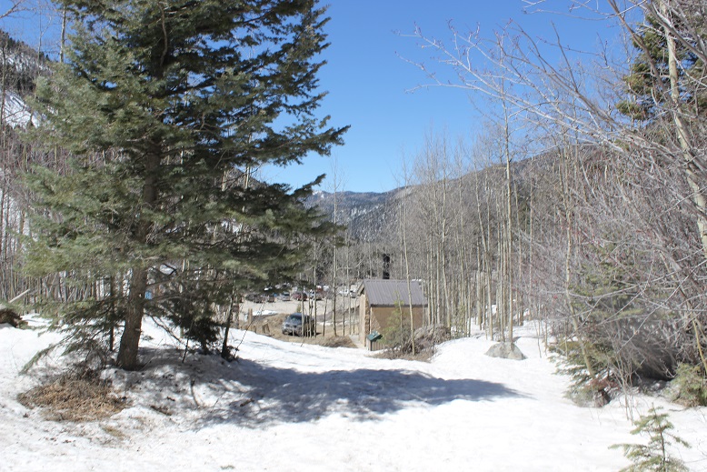
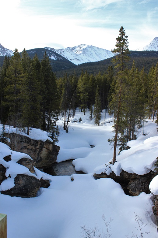
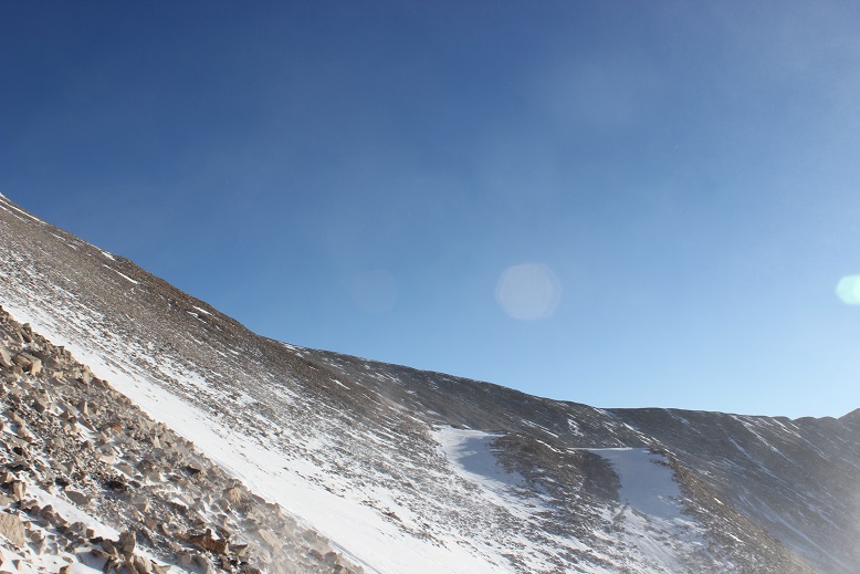
After a few hours of rafting we stopped directly underneath the Royal Gorge. I’ve never actually been to the Royal Gorge (something that needs to be rectified soon).
Our intention was to get some photos of me climbing. My main intention was to learn. I want to solo a few Centennials this summer that include rock climbing, and while I’ve climbed for years in a gym and many times with groups, I’ve never been solo, or even in charge of setting up my own equipment. That means I have no true idea what I’m doing, and that needs to change.
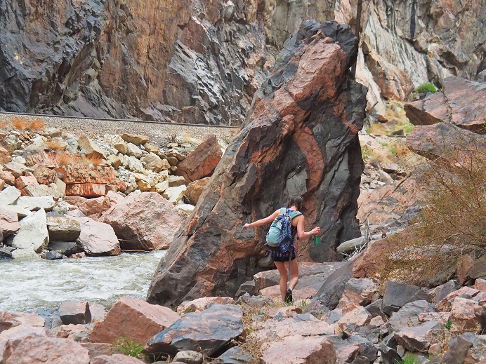
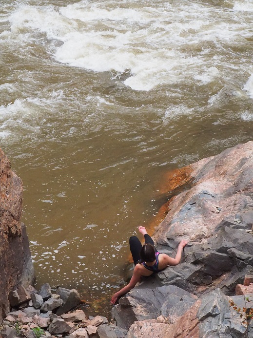
I found a friendly rock to hide behind and changed into my climbing gear (this was tricky; as we were directly under the viewing platform of the Royal Gorge, and I’m sure there were tourists with binoculars up there).
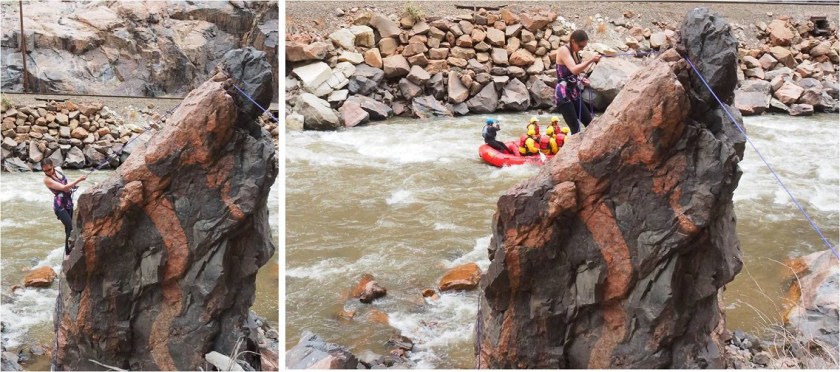
I was given a quick briefing about how to secure ropes that astonished me in its reliance on trusting the strength of rocks I’ve been taught not to trust, and then started climbing. I’ve never been climbing without shoes before, and it was trickier than I’d imagined. I’ve also never self belayed, and I was clumsy to say the least. The rope kept getting longer than I wanted it to, but I wasn’t sure how to quickly shorten it.
Climbing up was pretty easy. The only difficult part was stopping for pictures. I like to keep moving, and I wasn’t too steady staying in one place. I felt nervous and unsecure, and my harness was definitely too tight.
OK, after climbing up it was time to maneuver around the rock so I could rappel down. I like bouldering, and this was exactly what this was (except for the rope and harness continually getting in the way).
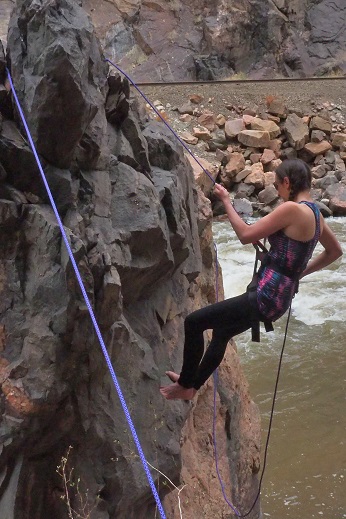
I started rappelling and then stopped in place for a picture.
All was going well, or at least I thought it was, as staying in one place was working. But as soon as I tried to rappel just a little bit something went wrong: I started sliding and couldn’t stop myself. Believe me, I tried, and I have the rope burns on my fingers to prove it. Luckily I was able to slow myself down so I didn’t hit the ground too hard, but I was immediately consumed by tons of negative and unproductive emotions.
I was embarrassed I’d slipped, I wasn’t quite sure how it’d happened, and yes, I was in a little bit of shock from the whole experience. Now I felt very silly for not bringing my helmet (I’d left it in the car… on purpose). I don’t fail well, but need to get over that if I want to accomplish my goals. I still don’t quite know what I’m doing when it comes to solo climbing, and this incident proved that. I’m going to need more practice before tackling this myself. I wanted to get up and try again, but was advised otherwise. So I walked down to the river to cool my burnt fingers in the water.
We did have time to hang from some rocks though….
Note to self: Now that cookie season is over I need to work on toning my arms.
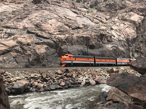
Oh, and it was fun to see the Royal Gorge train go by. Everyone waves at you and you’re kind of supposed to wave back…
We gathered up our gear and rafted back down to my truck. I was amused to learn we just tied up the raft and left it on the water while we drove to get the other vehicle. This seemed pretty trusting to me, but I guess the rafting community’s pretty honest? Deflating the raft and putting it away proved similar to taking down a tent. A heavy, canvas tent made out of rubber. It was much later than I’d realized (wow! Was it really already 4:30pm?) and I’d promised the girls I’d be home by 6, so I drove a bit faster than I should have home.
OK, so lessons learned today:
You can raft the river in April
It wasn’t as cold as I’d expected on the river in April
A canyon is wider than a gorge (duh…lol!)
I’m better at taking photos than being a subject (this needs work!)
If your guide knows what they’re doing you can avoid getting wet (but it’s probably more fun to tackle the rapids instead of glide through them. Still, I appreciated staying mostly dry)
I need to do some research and practice on how to set up webbing safely (I’ve tried this before and came up empty, so I’m going to have to search again)
I need to buy webbing (maybe on my trip to get a new backpack?) and figure out exactly how much I need
Self belayed rappelling is not my strong suit. I need to practice, preferably in a place where a fall won’t be too tragic.
I may need a thicker and longer rope (mine will hold me, but it’s slippery… maybe gloves?)
I need to develop more patience with myself
I need to fail faster and not beat myself up so much when I do
While I feel like I got the perfect amount of sun, sunscreen is my friend and I can’t forget that
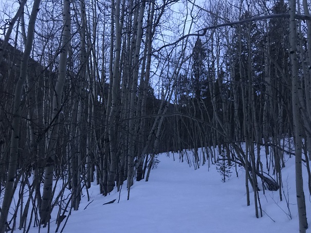
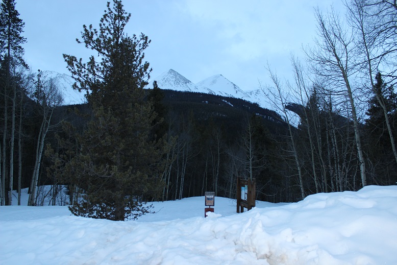
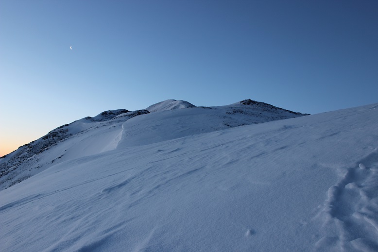
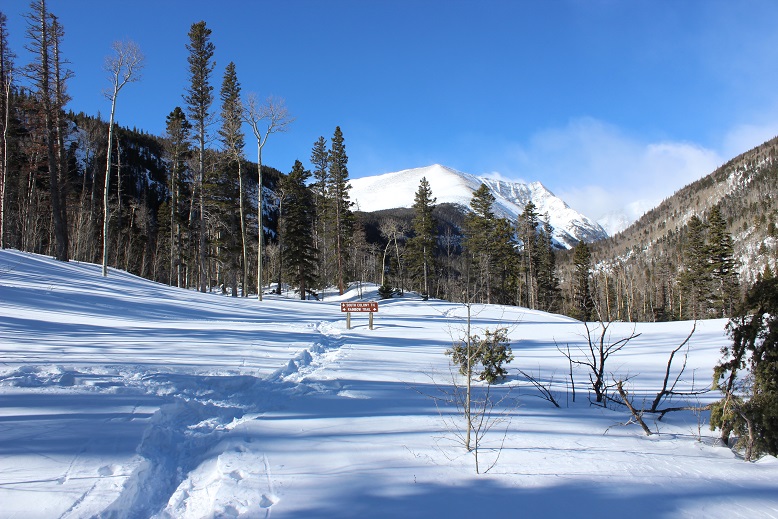
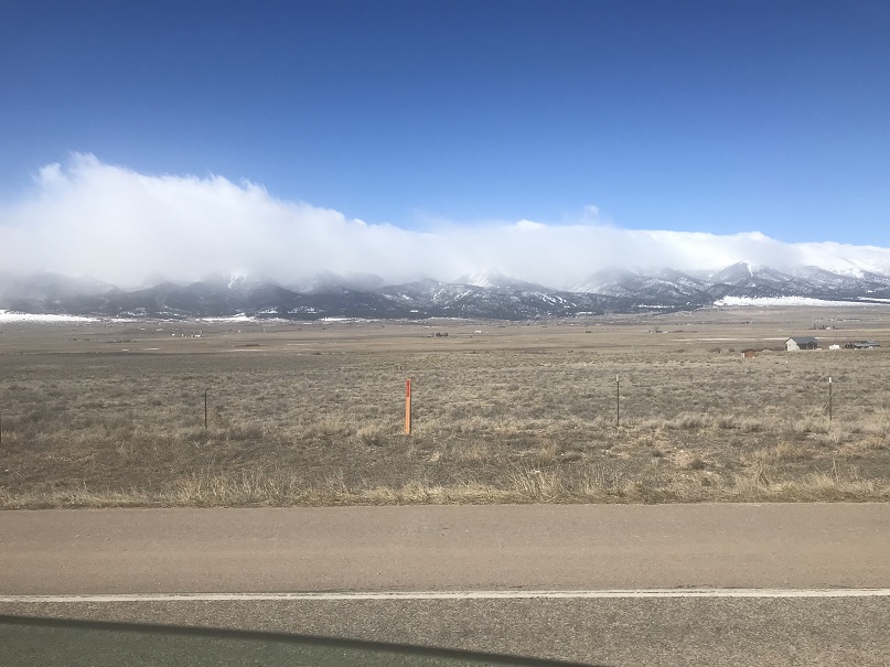
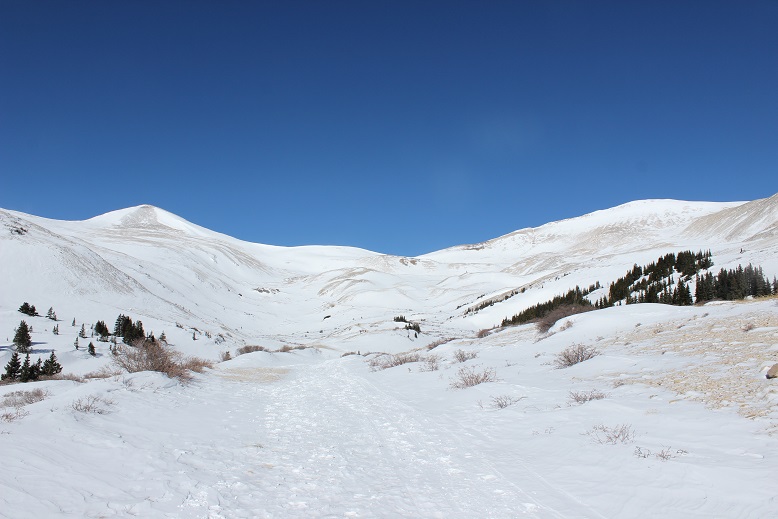
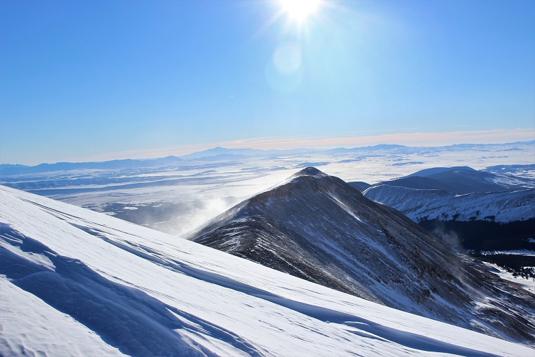
The Colorado winds were high so I decided to head down to New Mexico this week to do some highpointing. Taos is actually closer to my house than many Colorado peaks, so the 4 hour drive wasn’t too demanding. In fact, it was kind of fun. When I made it past Ft Garland I saw a road sign indicating there were bighorn sheep in the area. To my surprise I immediately encountered a herd of bighorn sheep standing along the side of the road. A few minutes later I saw a sign warning of cows, and wouldn’t you know it? Cows on the road. The same thing happened with the deer and elk warning signs, and a few minutes later, even horses! I hadn’t realized there were wild horses in the San Luis Valley, but yep, there sure are! With all this good luck with animal sightings I kept hoping to see a sign indicating buffalo or elephants or zebras were in the area, but alas, wild horses were about as exotic as it got. Kudos to the group that placed those signs so accurately.
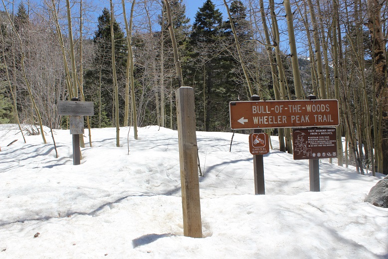
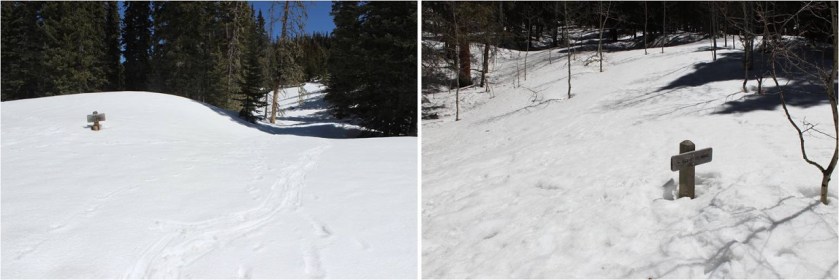
I made it to the trailhead at 4:45am and was on the trail by 5am. Oh, and I did a terrible job parking (without realizing it). I actually made it to the trailhead about half an hour earlier than expected, and only recognized I was there because I saw the “Bull of the Woods trailhead” sign as I was driving by, so I backed up, parked, and was on my way.
It wasn’t until I was on my way down I saw there was a real parking area directly below where I’d parked. Oops!
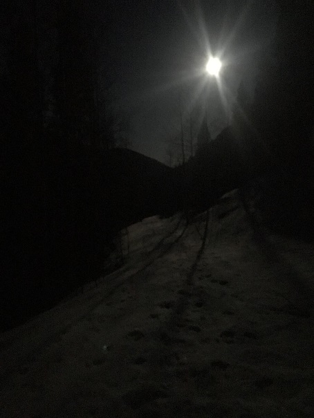
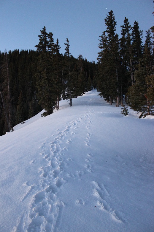
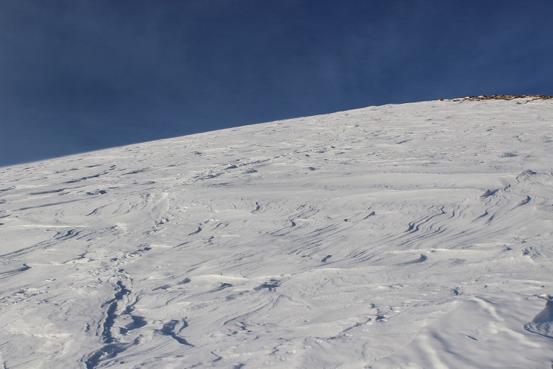
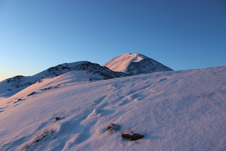
The full moon was absolutely amazing! Unfortunately I wasn’t able to get a good picture, but it was so bright I didn’t need my flashlight. I brought my snowshoes but didn’t put them on until I’d almost made it to treeline. There was quite a bit of snow on the trail (4 feet or so) but the snow was consolidated so I was able to just walk on top of it. There were also tracks to follow.
I could hear a stream to my right, but in the dark I wasn’t able to see the water. There were numerous trails criss-crossing the trail I was on, but as long as I kept hiking in the same direction (northeast) and aimed for the ridge I knew I was on the right track. I stayed on the widest path, or what looked like the widest path.
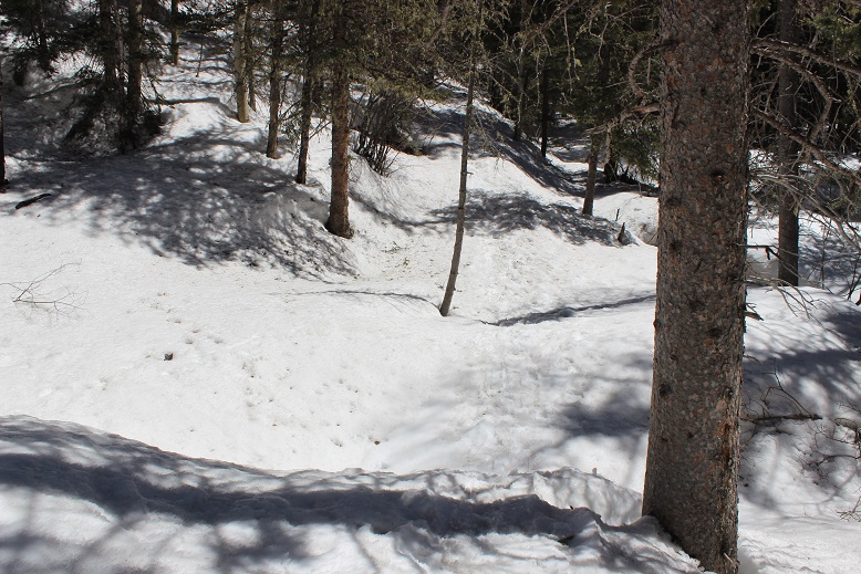
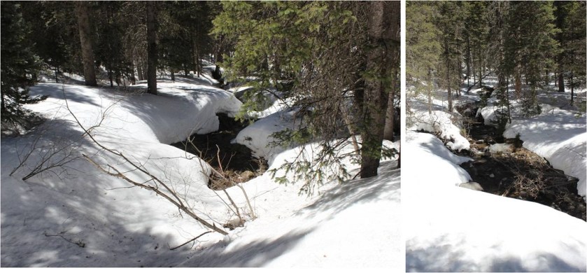
I knew I was supposed to cross the stream at some point, but never saw a bridge. It turns out I crossed the stream without knowing it! Here’s a look at the “stream crossing” from my way back.
Yes, that moon was full!
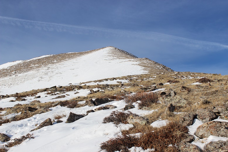
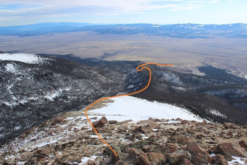
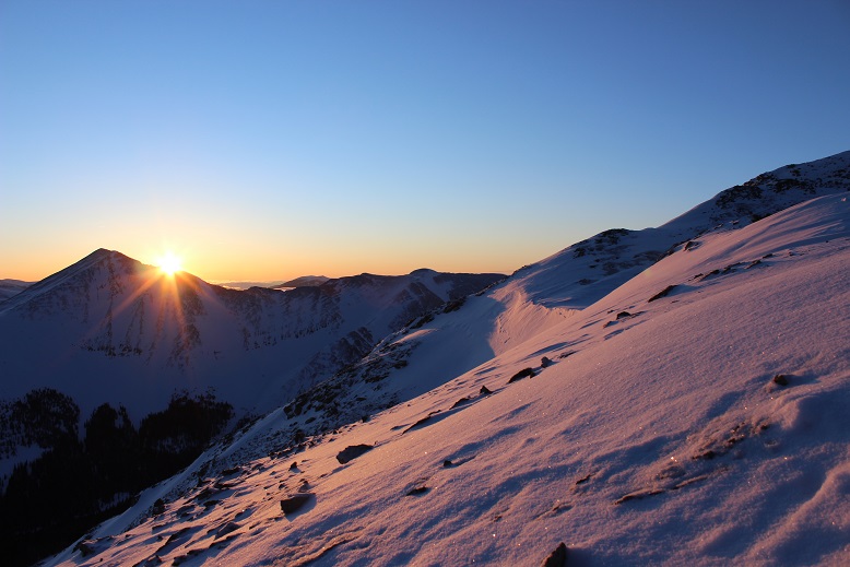
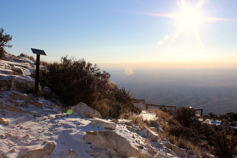
I made it to the Red River Canyon Overlook just as the sun was beginning to rise
At the overlook I turned right and followed the trail to the Bull of the Woods pasture (which didn’t resemble a pasture at all. Maybe it was the snow?)
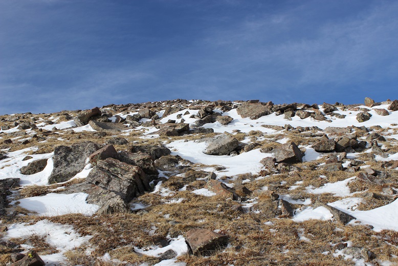
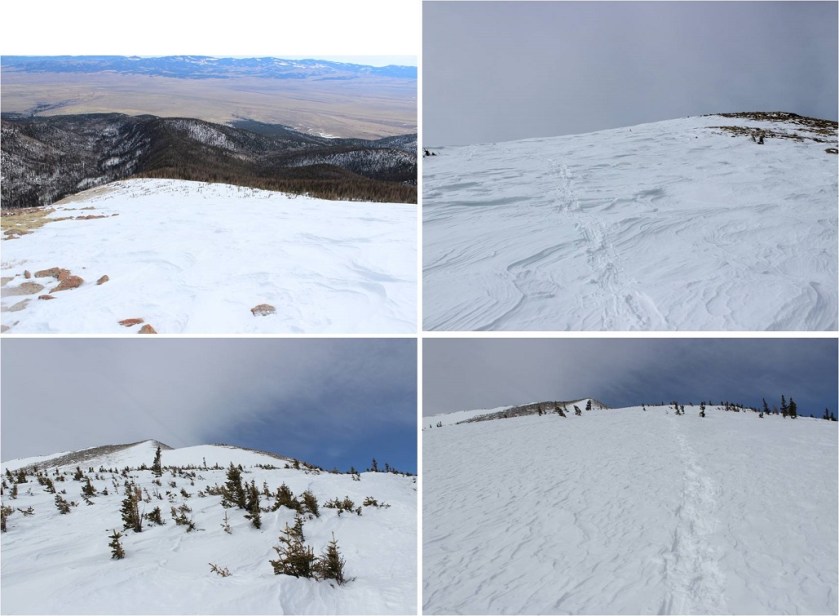
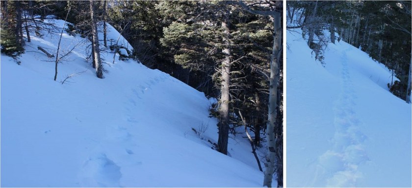
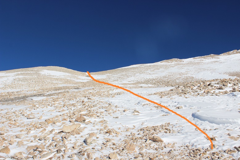
The footprints stopped, so I was breaking trail from here on out. I got lost a few times trying to stay off private property, but there was so much snow it was impossible to know where the trail was on the mountain. (Hint, go left)
I stopped and put on my snowshoes and followed the ridge, making my own trail.
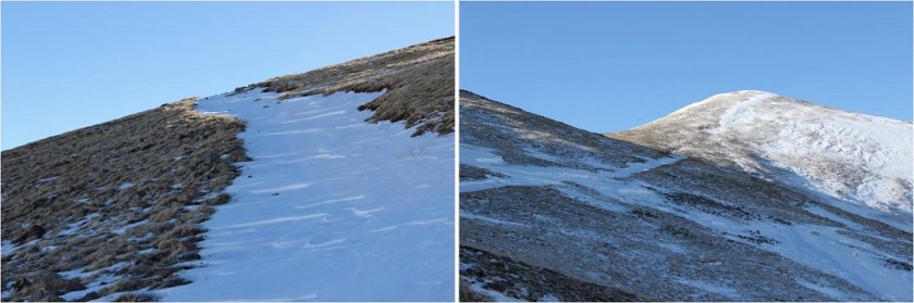
The section after cresting this hill was much steeper than it looks. I had to swing around to the right in order to safely climb through the snow. Here the crampons on my snowshoes came in very helpful.
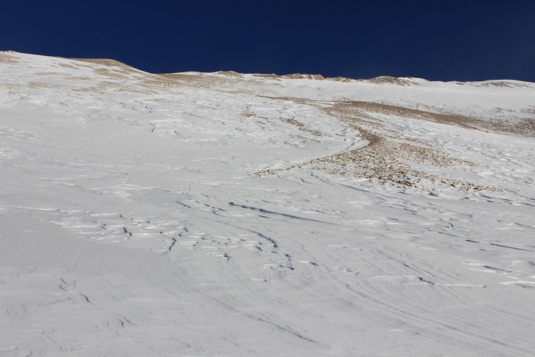
Until the snow just kind of stopped. I knew more snow was coming, so instead of taking off my snowshoes I followed the faint trail of snow around Bull of the Woods Mountain. Here there was either very little snow, or large, steep drifts of 20+ feet. I was glad to have my ice axe.
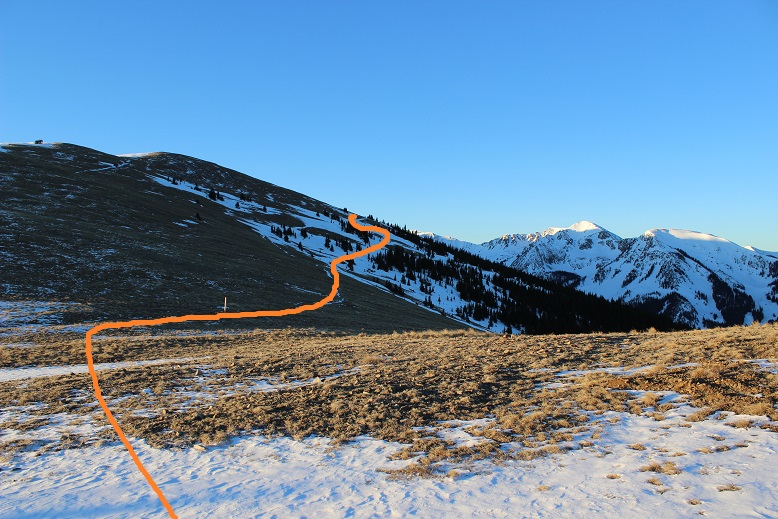
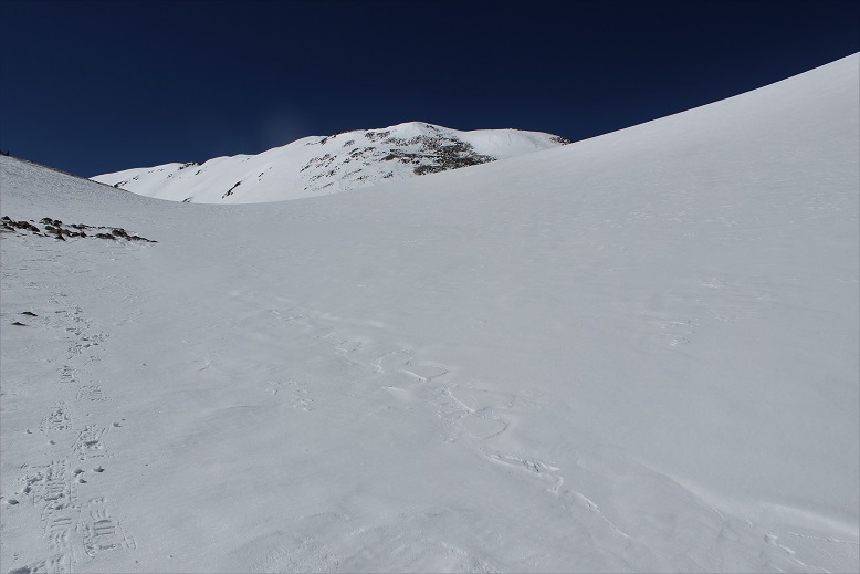
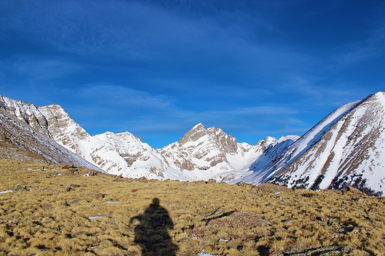
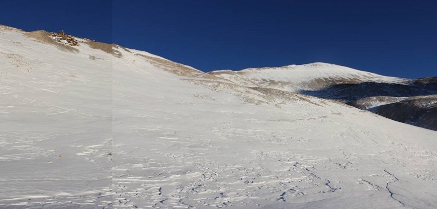
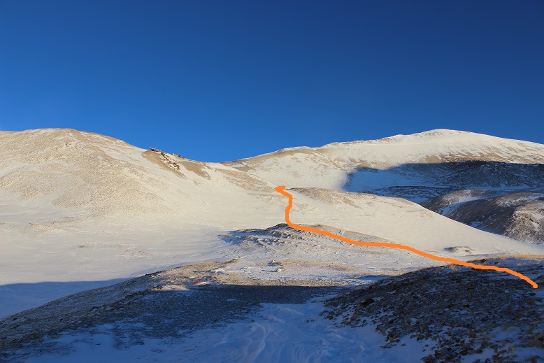
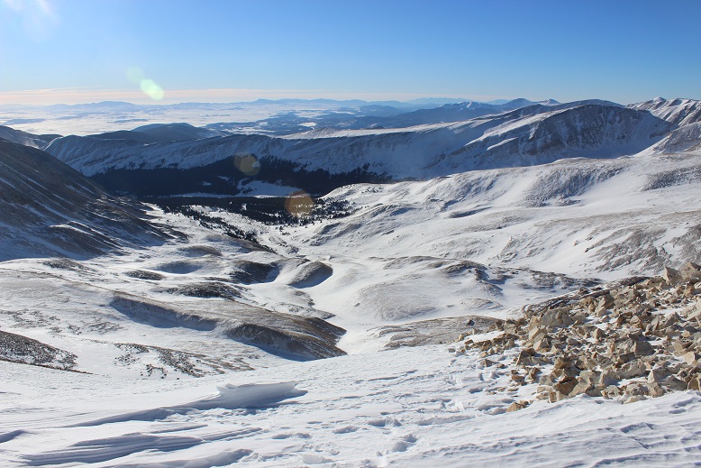
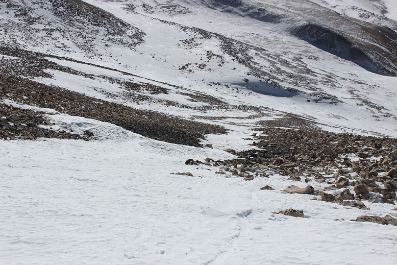
I rounded Frazier Mountain and could smell sheep. I looked all around, but not seeing any figured they must have passed the area recently (but that smell was strong!). I was now presented with the La Cal Basin, which included a 300 foot loss in elevation. This is also where there was quite a bit of snow, which I decided to take advantage of. I needed to cross the basin, avoid those dicey avalanche areas, and then re-ascend the switchbacks on my left.
Crossing into the basin was a bit sketchy
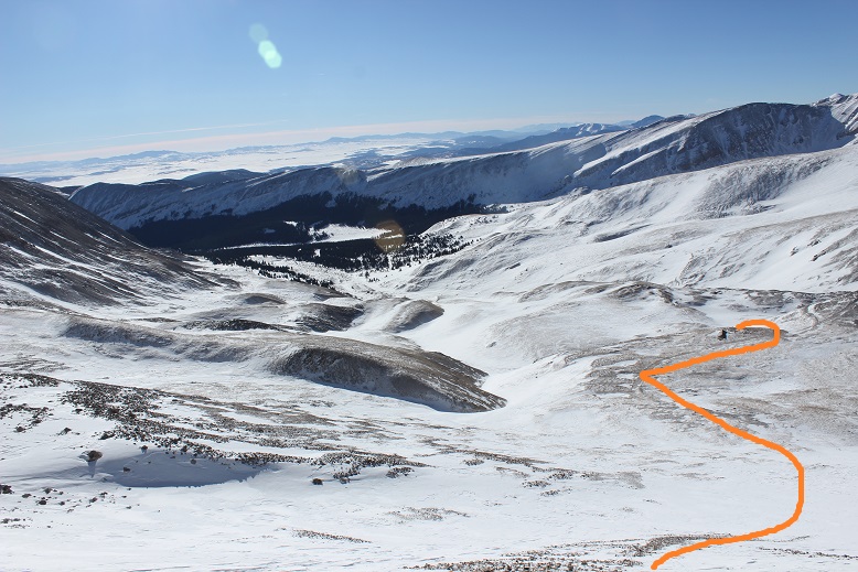
And I was glad to make it to the switchbacks on the other side. Here there wasn’t much snow, so in keeping with my goal of not taking off my snowshoes (just to put them back on again) I stuck to the snow lined trail.
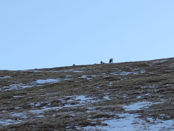
About halfway up the mountainside I saw a few bighorn sheep
And when I looked across the ridge I saw even more!
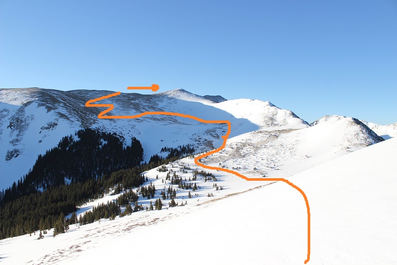
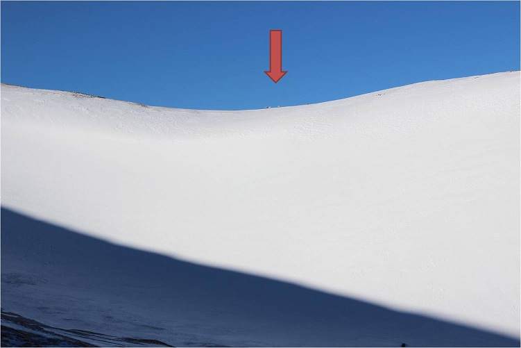
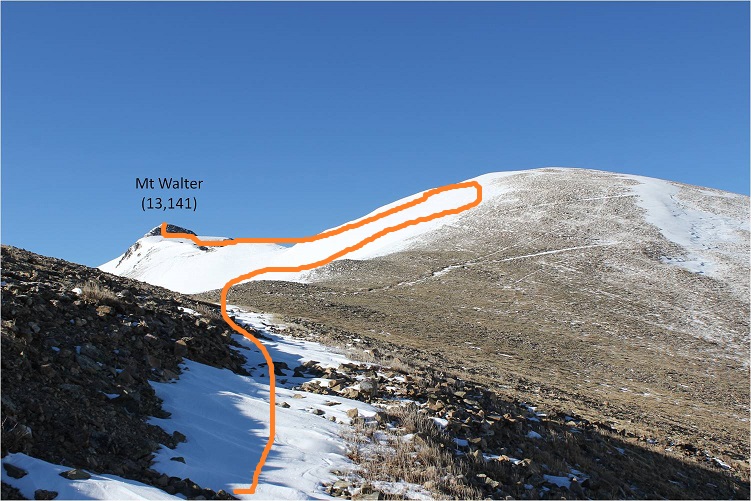
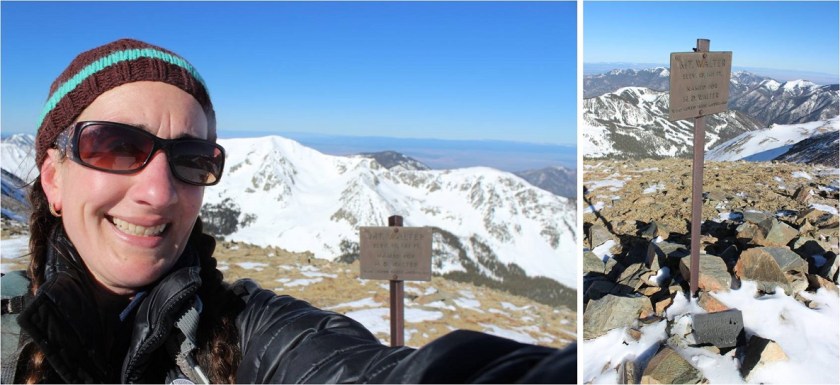
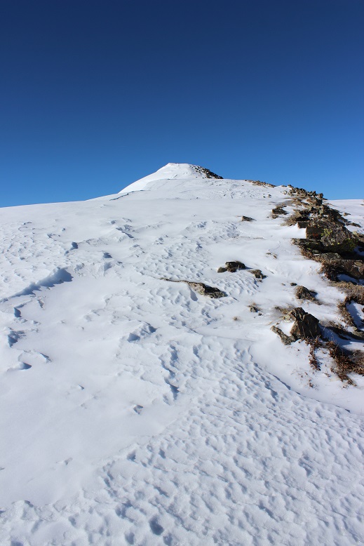
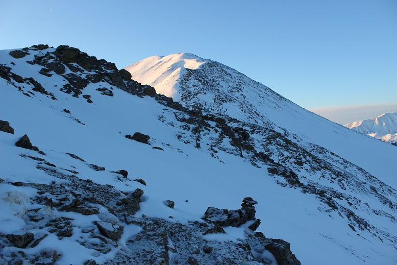
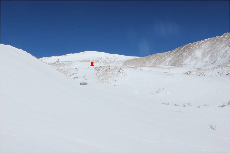
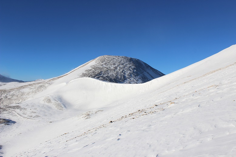
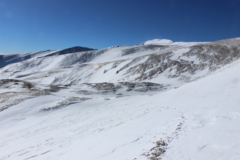
From here I saw what I thought was Wheeler Peak, but it was instead Mt Walter (Wheeler is beyond). I stuck to the snow to make use of my snowshoes
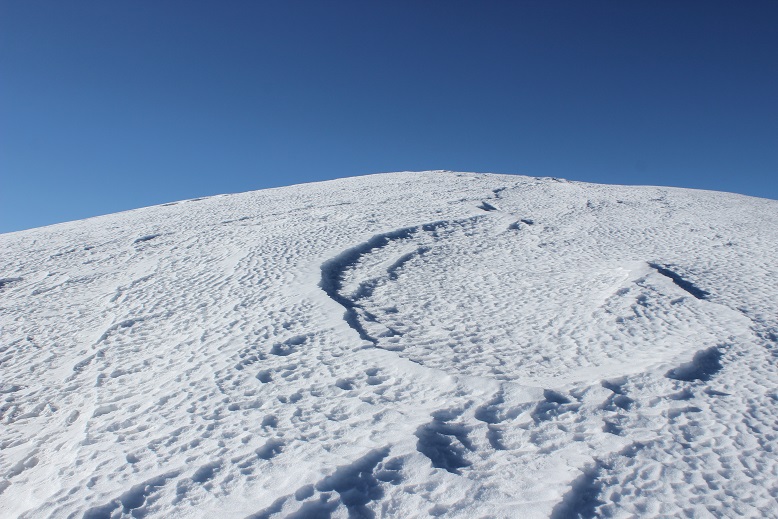
Sticking to the snow looked like this
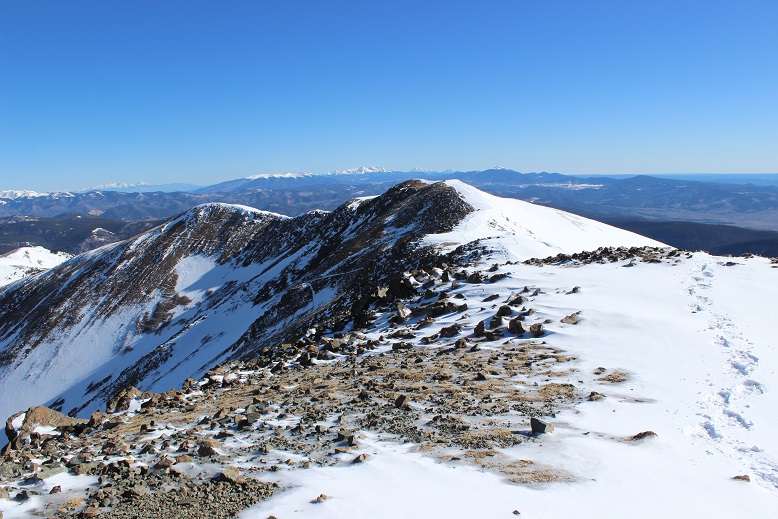
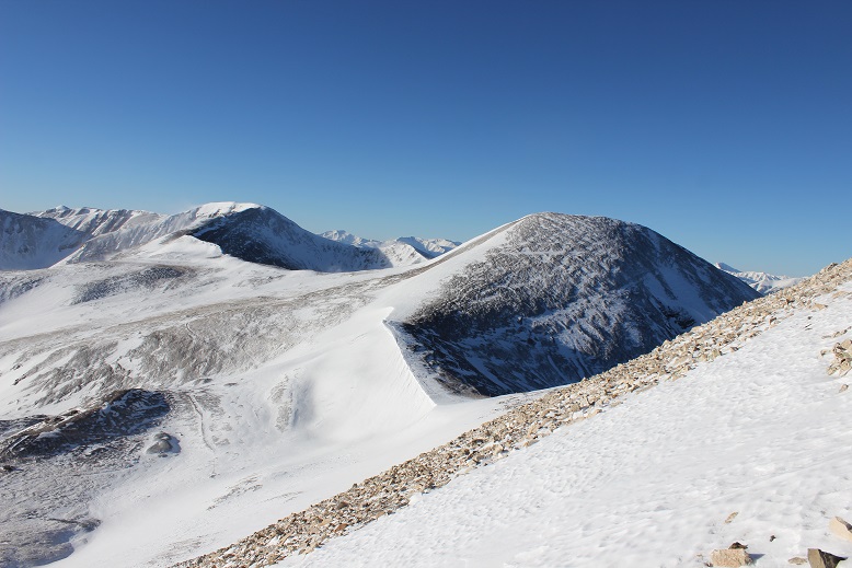
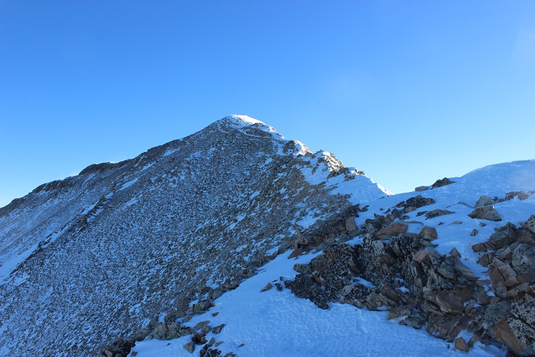
And from the top of this point (13,045) I could see Mt Walter and Wheeler Peak. Sticking to the ridge (and the snow) was the way to go!
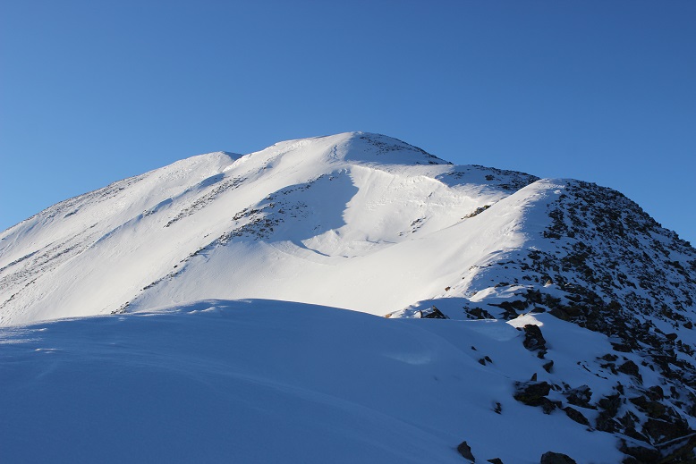
I passed Mt Walter and took a few quick photos of the signs and a selfie to prove I was there.
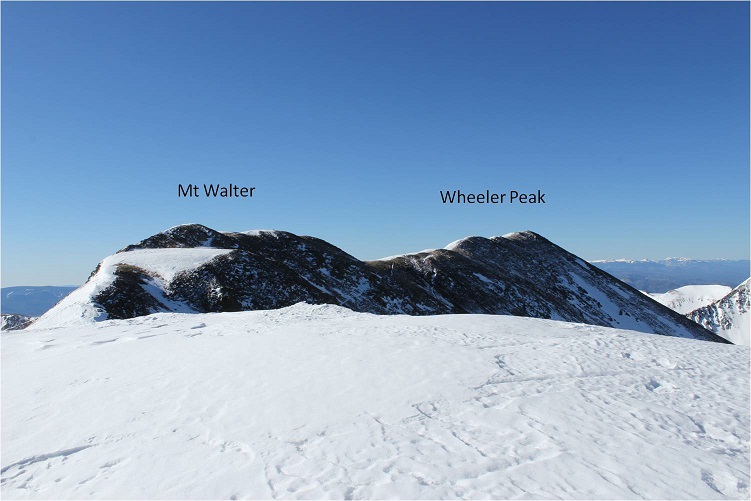
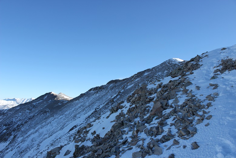
From here you can clearly see the summit of Wheeler Peak
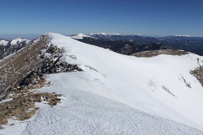
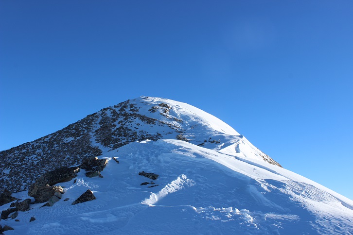
Once again, I stuck to the ridge
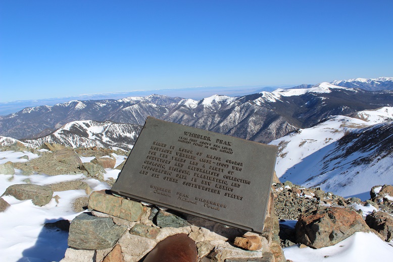
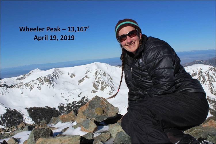
And summited at 8:45am
Here’s the Summit Video, which I’m excited to say is the first summit video I’ve been able to take all year! I’m so glad it was warm today and sans wind.
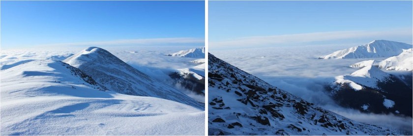
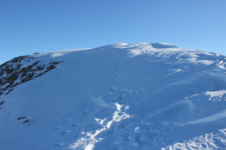
OK, time to turn back. Here’s what the route looks like back from Wheeler Peak… just stick to the ridge
Yep, lots of snow! I was glad to have my ice axe. Snowshoes were a must the entire way back down.
I started crossing the basin again, and unfortunately the sun had warmed up the snow. Snow kept collecting under my snowshoes and I had to keep stopping to kick it off. I made it back to Frazier Hill and saw those sheep I’d smelled earlier (I KNEW they were there somewhere!)
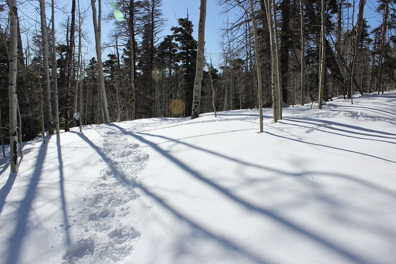
Following the trail in the light of day proved much easier than in the dark, with the added bonus of being able to follow my snowshoe tracks.
I made it back to Bull of the Woods pasture and once again found footprints. Lots and lots of prints, both human and animal.
The only downside to the warmth of the sun (besides clumps of snow in my snowshoes)? Rollerballs the size of dinner plates
As I followed the trail back to the stream I was actually able to see the stream
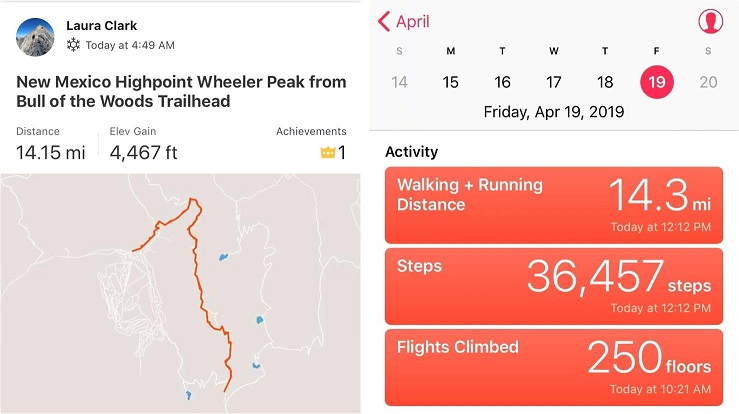
I didn’t see anyone all day until I was about half a mile from the trailhead on my way back down. I talked with a gentlemen about the conditions on the trail. He said he’s hiked these trails for years and was surprised I’d summited today. He was even more surprised when I told him I’d started at 5am. In fact, he didn’t entirely believe me. I made it back to the trailhead at noon, and when I stopped my Strava tracker I was told I’d sent a new app record for completing this hike. Pretty cool! I’d hiked the 14.2 miles of 4467’ in elevation gain in 7 hours.
Just for fun, here’s the relive of my hike. Note: Obviously I summited today, yet the tracker shows my high point was just shy of Mt Walter at 13,139’ (not Mt Wheeler at 13,167’), which is one of the reasons I take what these trackers record with a grain of salt. I’ve had people tell me because my tracker doesn’t show a summit that I didn’t summit. I call those people summit snobs and unfollow them from my account(s). No one needs that kind of drama in their life!
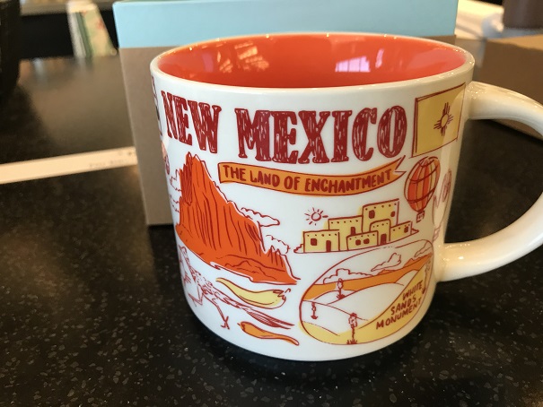
Oh, and the good news? I was finally able to get my New Mexico Starbucks mug in Taos! I’ve been trying for years to get a New Mexico mug to add to my collection, but they’re always out when I visit. Funny, the mug doesn’t mention aliens at all…
Also, the ski season in Taos is over, which was a real shame because there was so much snow! And, Taos is beautiful! Majestic even. I had no idea!
I’d attempted this peak a few weeks ago but had to turn back due to high winds above treeline. Today I was ready to try again, armed with a beautiful weather forecast and a full night’s sleep.
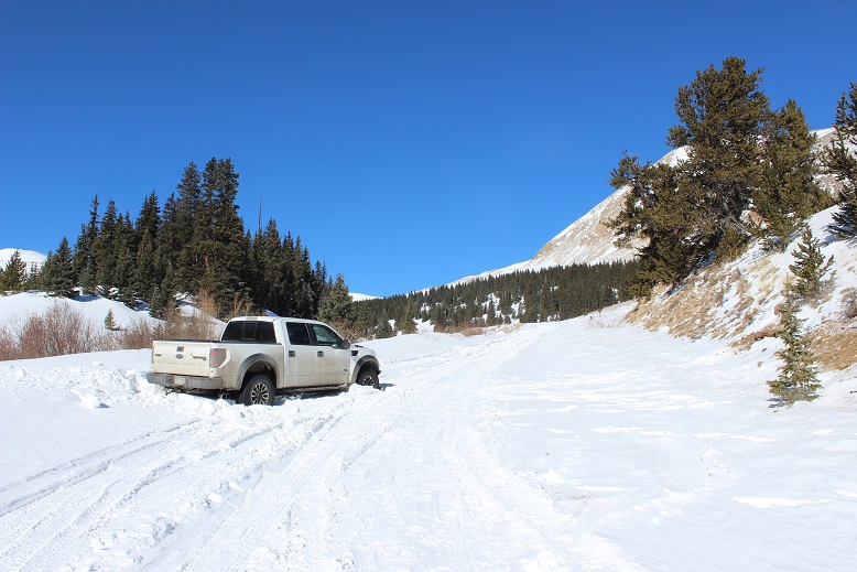
Since I’d been here 2 weeks ago and knew it had snowed here quite a big since then I didn’t even attempt to drive to the upper South Colony Lakes trailhead. I made it to the South Colony Lakes lower 2WD trailhead at 4am to one other vehicle in the lot. It looked as if someone was sleeping in their truck. I got together my gear and was on the trail around 4:15am. After hiking about 100 yards I came upon snow on the 4WD road and was glad I’d parked in the lower lot.
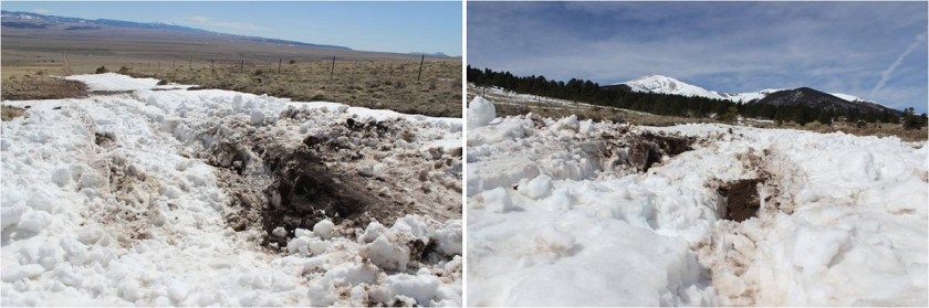
Unfortunately, it looked like someone had attempted to drive up the road in the past few days. When the road got too much snow on it they drove off the dirt road, kept driving parallel to the road, and then when they felt there was less snow went back to the main road.
This tears up everything people! Don’t do this! It also looks like they learned their lesson because they got stuck in a snow drift. I’m guessing there’s about 4 feet of snow here. Not only did they get stuck, they tore up the road trying to get out, which will make it more difficult for drivers to make it to the upper trailhead once conditions actually improve.
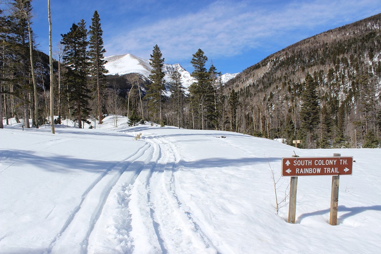
The road in was well packed in areas, soft in others, and covered in 2-6 feet of snow. It was still dark so I kept looking over my shoulder to see if anyone drove in behind me or was hiking with a flashlight but didn’t see anyone. I put on my snowshoes at the Rainbow Trail Trailhead.
This trailhead is still inaccessible by vehicle and covered in snow.
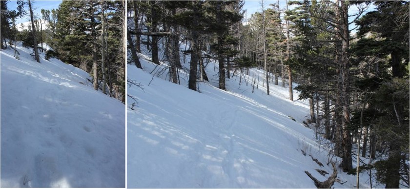
I had a map with me, but since I’d just done most of this hike 2 weeks ago I never took it out of my pack. From the Rainbow Trail I turned left (northeast) and followed the slope up to the ridgecrest. Here the tracks I’d put in earlier were still in place, and it looked like a few others had been here since then, so there was a faint trail to follow
At the top of the slope I immediately turned right and followed the ridge. The ridge looks mostly flat, but does gain in elevation, all except for one area where it dips down a couple hundred feet and then inclines again.
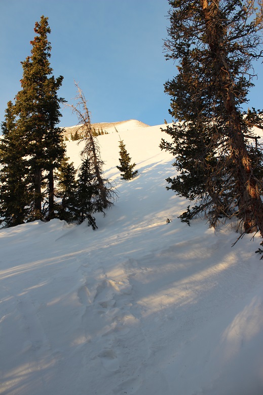
This was supposed to be a 7-10 mile hike, with about 3500’ in elevation gain, but for some reason it felt like a lot more than that. It seemed I was below treeline for much, much longer than I should have been, yet I knew I was still on track because as the sun rose I could see Humboldt peeking at me through the trees to my right.
Finally (and I mean finally) I crested a vertical slope
And made it to treeline.
Here the snow was hard packed and I was glad I had snowshoes (crampons would have been necessary otherwise). I traded my trekking pole for my ice axe and started up the hill.
The wind picked up, and remained a steady 15mph until I made it back below treeline. In this area it was impossible to avoid the snow
But as soon as I was up over this hill I had the option to stick to the snow or hike on tundra instead. I was tired of the snowshoes, so I took them off and kept to the right, following the ridge.
The view of the Crestones and Humboldt was beautiful!
The rest of the route was pretty straightforward, but I was curiously more tired than I should have been for just 3500’ in elevation gain. I was seriously worried I was losing my touch, or that I was getting out of shape? As I neared the summit the terrain became more rocky and steep. I found myself zig-zagging my way up, doing my best to avoid the random snow patch that had me post holing up to my thighs
I summited to some amazing views of Humboldt, the Crestones, and a bunch of 13ers!
Here’s my summit photo
It was a beautiful day, but that wind made it cold and my fingers were starting to burn so I turned around and headed back down the slope. Here’s a look at the way I came
Here’s what it looks like just above treeline. Snowshoes were helpful (and here I put them back on). I appreciated the full coverage of snow
The ridge back once again seemed to take longer than necessary. It felt like I was in the trees forever! I was still glad I had my snowshoes
The wind stopped below treeline and the temperature increased dramatically. I took off my hat and gloves and noticed my hands had some minor damage, but nothing that wouldn’t heal in a few days. I saw a couple of early season mosquitoes on the ridge, which were easily distinguishable against the white backdrop of snow. I made it back to the Rainbow Trail and followed it to the Lower South Colony Lakes trail, noticing the temperatures had warmed up the snow quite a bit and once again praising my snowshoes: The road was becoming a slushy mess.
I fully expected to see people hiking up the trail or skinning, or something, but I never did. I didn’t see another person the entire day, and as I rounded the corner and could see the parking lot it became apparent why: my truck was the only vehicle in the lot! I’d had the entire mountain to myself today!
It had been a beautiful day to hike: Little wind, warm temperatures, and solitude. When I checked my tracker it said I’d gone 11.6 miles and gained 4682’ in elevation in 6.5 hours. No wonder I’d felt out of shape! I’d expected a 7-10 mile, 3500’ elevation hike. As I’d been hiking I’d begun to doubt my physical fitness, but these new numbers seemed much more accurate.
Here’s my Relive (which I like this time because it portrays the snow above treeline)
This winter summiting has been a challenge. I feel I’ve had to turn back more than I ever have, maybe more than all the other times I’ve been hiking combined. It hurts to turn back. It’s a pain that’s both mental and physical, and a decision I don’t make lightly. Or often.
Today’s trip was doomed from the start: I’d only had 2 hours of sleep, I didn’t much care to eat breakfast, and I was both emotionally and physically exhausted from a week of little sleep and lots of problem solving. I decided to head out anyway because when it comes to winter hiking I still don’t know what I don’t know and I need to be on the ground experiencing the conditions as often as possible so I can learn and fail fast for future summiting success.
On the drive in I noticed there had been an avalanche recently that had caused quite a bit of damage. Avy danger is serious and real this year people!
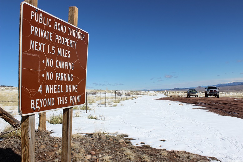
There was no parking at the trailhead because it was covered in snow, so I continued driving and found a turnout about three tenths of a mile away and considered this close enough. Since this is near a winter road closure I didn’t see another vehicle the entire morning. I set out and hiked in the middle of the road back to the trailhead and immediately put on my snowshoes.
The snow here was deep. I’d say about 6 feet or so. My instructions said to follow a service road, and luckily I could tell where it was. I could also tell no one had been on this trail in quite a while. I’m guessing it’s been months.
And then suddenly I couldn’t find the road, or a trail, or signs of either. I knew I was supposed to follow the stream, but here the snow really started to pile up and falling into the stream became a genuine danger. In places the snow was about 10 feet deep and very soft. It was still dark as I was postholing up to my waist at 5:30am and all I could think was how messy this hike would be on my way out. It wasn’t going to be pretty. As I trekked further into Echo Canyon the snow got thicker and any sign of a trail was nonexistent.
I made it about a mile into the canyon and as the sun started to rise I noticed I was in an area very similar to the one I’d see avalanche about half a mile away: The slope was the same, the angle was the same, and it was loaded with snow. That did it. I decided to turn back. I didn’t like the wet slab conditions, avalanche danger, or intense early morning postholing I’d encountered.
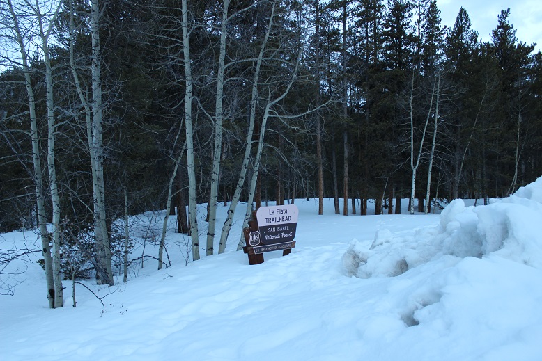
I was bummed, but considered this the right call. And then it hit me: I was about 5 miles away from La Plata! I knew that trail very well: I’d just make it back to my truck, drive to the La Plata trailhead, and hike until I felt like turning back. I knew at this point a summit wasn’t going to happen today, no matter where I hiked, but at least I could get in some elevation gain, right?
OK, on to plan B. There weren’t any other vehicles in the La Plata parking lot, despite it now being 6:30am. It looked like it was going to be a quiet day on the mountain for me.
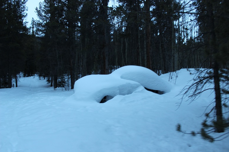
I started along the closed 2WD road and saw the utility truck that was there back in January is still in its same place, accompanied by more snow.
There was a ton of snow on the trail but there was a well packed trench through the trees
I followed the trench over the creek
And continued up the slope, intending to make it to treeline and then turn back. Maybe I’d get a good look at the headwall to see how much snow it had? I was in a bit of a sour mood because I knew there was no way I was getting in a summit today. I wasn’t too fond of the conditions on this side of the mountain either: there was a ton of snow and none of it looked too stable. However, I also knew it wasn’t in a prior avalanche path. Still… crispy snow on steep slopes isn’t a good thing.
I was tired, I was hungry, I was lethargic, and now I was hearing voices coming from above me on the trail. I stopped, making sure I wasn’t hallucinating. There hadn’t been any other vehicles in the parking lot, but I was definitely hearing man and woman talking to each other from above me on the slope. Maybe they’d parked somewhere else and skinned up? In any event, with the snow conditions the way they were I did not want to hike below other people for fear of them starting an avalanche above me. I immediately turned around and headed back to my truck.
This day had gone from disappointing to worse. So I tried to keep my mind positive: What had I learned today? How had today been worth getting up at 2am, driving for 3 hours, and turning around twice within the span of the next 2 hours?
Well, I saw firsthand the powerful force that is an avalanche. The snow had destroyed trees that were 3 feet around, breaking them like matchsticks. I needed the reminder avalanche danger is no joke. I also learned that just because a trailhead is accessible doesn’t mean the trail is climbable. Another lesson learned: I need more sleep before attempting a hike, and even though I’m not hungry in the morning, I need to force myself to eat before hitting the trail: Low blood sugar makes me grumpy.
On the way out I took some pictures of the stream and just enjoyed being out in nature without being cold.
I made it back to my car around 8am and looked at my tracker: 4.81 miles and 1514’ in elevation gain. Boy, was that disappointing! I decided to call it a day, drive back home, and get some sleep.
I was supposed to hike yesterday. I got up at 2am and drove up and through Woodland Park to increasing snow. I checked my weather app and it looked like it was going to snow in this area until 8am. I made it to Lake George and was forced to turn around due to road conditions (they don’t plow this road at night). So while I’d done my research and the weather conditions were good on the peak I’d intended to hike, the only road into that hike had bad weather and I was forced to turn around. Bummer! What’s worse is I’d already had quite a bit of coffee, so when I made it home around 5am I was unable to go back to sleep. Oh well, I ran on the treadmill, got a lot of much needed cleaning done, took my daughter ice skating, did some grocery shopping, and made it to bed a bit early to try again the next day.
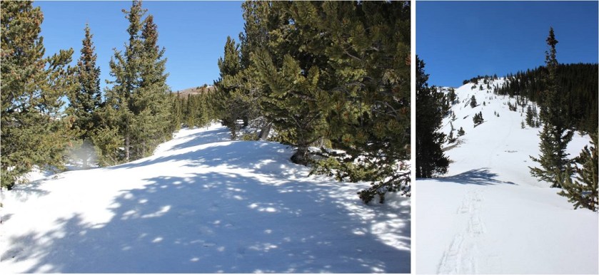
OK, round two. I chose a different peak for today because of weather reasons. I drove almost the exact same roads as I had last night and thankfully they were completely clear: You’d never know it had snowed yesterday. I made it to the Baldy Trailhead around 4:45am and there were several other cars already parked in the lot.
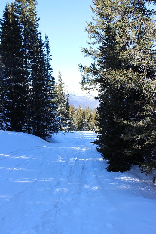
I gathered my gear and was on the trail around 5am. The 4WD road was closed, but the hike along the road was packed down from previous skiers/hikers. I wore my snowshoes from the parking lot, but they weren’t really necessary (I just didn’t want to carry them). They were necessary at the Iowa Mill.
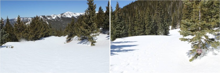
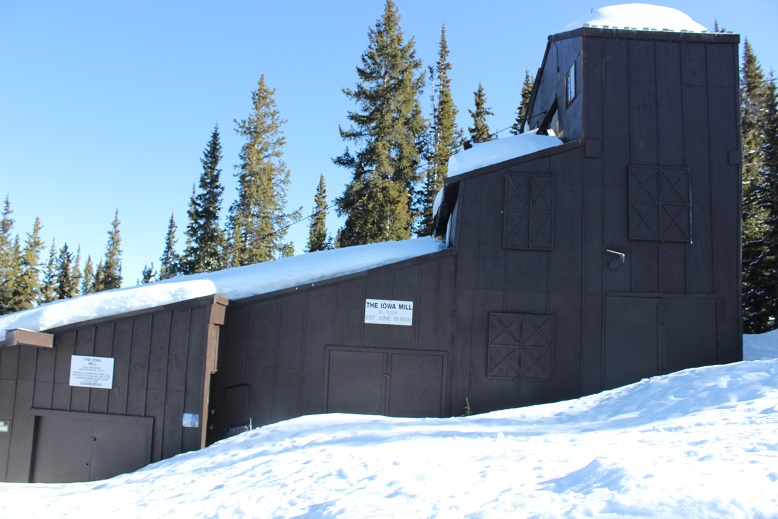
This part of the hike was quite peaceful. I made it to the Iowa Mill while it was still dark and here is where the road ended and I encountered tons of ski tracks. I got out my map and saw there was supposed to be a dirt road that switchbacked up the slope, but since I couldn’t find the road under all this snow and I’m not a fan of switchbacking I just aimed south and hiked straight up the slope. This was very efficient and quite a workout on my calves. There weren’t any ski marks here, or footprints. In the dark the slope seemed steep, but I knew it was less than 30 degrees. Also, in the dark it seemed to last forever! I just kept aiming towards the radio tower and trudged on. I could see what looked like a mine in the distance I’d like to explore on my way down and made a mental note to check it out later.
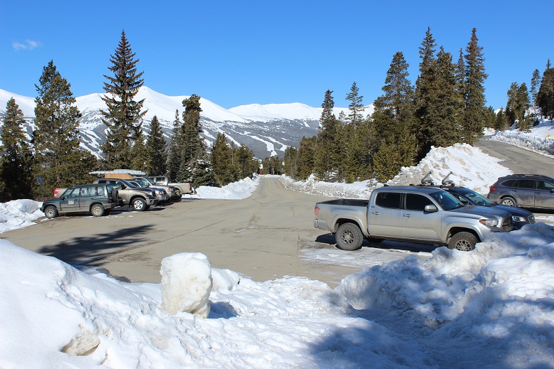
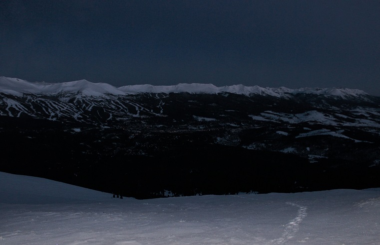
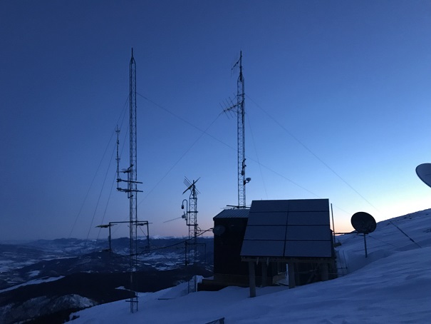
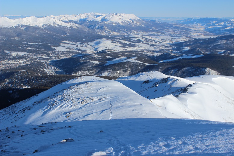
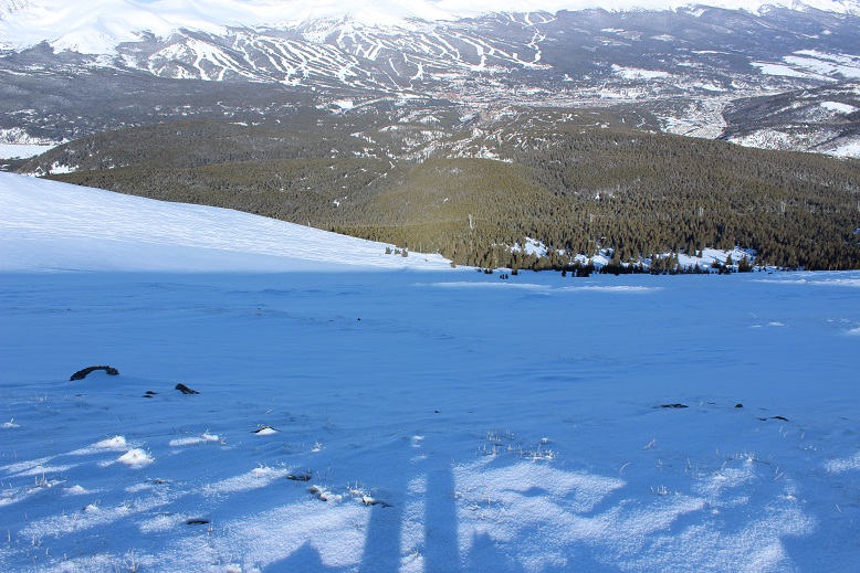
I made it to the radio towers and took out my phone to take pictures. It immediately died and I stuck it back in my pocket. It’s a good thing I always lug around my DSLR while hiking. For those of you wondering what Breckenridge looks like from 12000’ at 6am, here you go:
OK, I’d made it to the radio towers
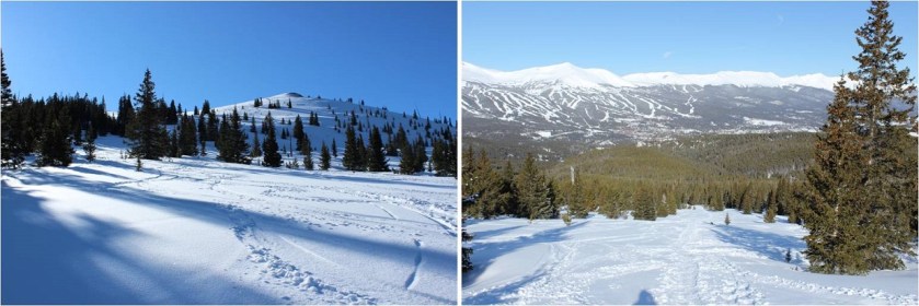
From the radio towers here’s the view of the remaining route
This was going to be easy! All I had to do was follow the ridge to the summit. There were many ups and downs. Here’s a look at the first up
and a few more
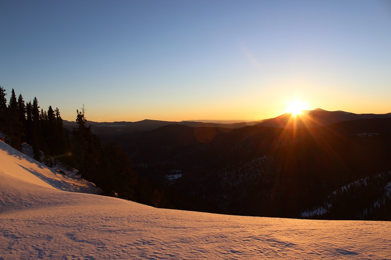
Around now the sun was beginning to rise. Alpine sunrises are totally worth 2am wake up times! I took a few minutes to just stop and enjoy.
There are cairns indicating you should go right (west)around the mountain, but with this much snow it’s much easier to just stick to the ridge (at this point I took the cairned route, but don’t recommend it). The cornices are very large but also very avoidable.
The sun had only just risen, but I could already tell it was going to be a bluebird day for most of the day, despite the cloudy forecast. As I looked in the distance I could see clouds, but they wouldn’t be getting in the way of my hike today.
I’m not sure what time I summited (my phone was still dead and while I had a charger I didn’t much care). The summit was flat and snow covered, so much that even the wind shelter was invisible. I wanted to get a picture with the mountains in the background so this is what I came up with.
Not only was today a bluebird day, there was no wind! This was fantastic! I wasn’t even cold (it had to be warmer than the forecasted 18 degrees… it felt more like it was in the 30s). My fingers and toes weren’t cold either. Woot!
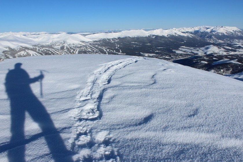
Here’s a look back at the way I’d summited
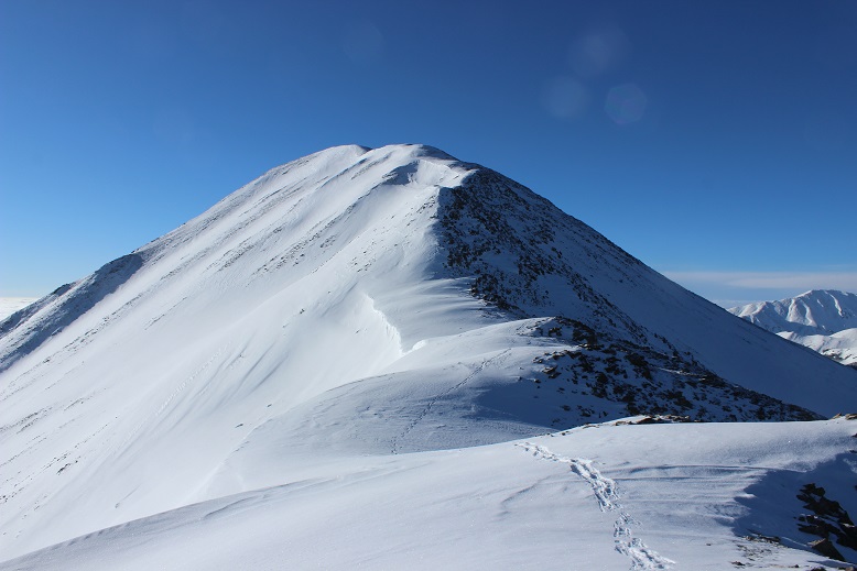
OK, so on the way up I’d taken the cairn way around the side of the mountain, but I could tell from my view here it’d be an easier hike if I just stuck with the ridge, avoiding all of the exposed rocks on the west side. The climb was a bit steeper in areas, but that just meant I got to use my ice axe
Using my ice axe means shadowselfie time
Here’s more proof it’s better to stick to the ridge
I made it back to the radio towers and in the light of day could see the slope here is a popular backcountry ski area.
This is when I realized I hadn’t seen another person all day, yet there had been several other vehicles in the parking lot when I’d arrived, with signs that clearly said no overnight parking/camping. Hmmm.
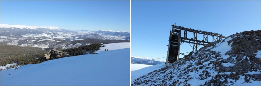
All the tracks were to my left (west) but I really wanted to get a look at that mine, so I went right. It was nothing special, or it could have been more special when less covered in snow. In other words, there wasn’t much to see.
From here you can just follow the wires back to the Iowa Mill, but I decided instead to cut across the slope and pick up the trail the way I’d come. I could see my morning tracks from where I was, so I just aimed for them and cut across the slope. I debated glissading but in the end decided against it as it would put me far away from my earlier tracks.
It’s actually a bit steeper than it looks (although apparently not 30 degrees)
Back at treeline all the ski tracks came together and I was able to find the road again.
Here’s the Iowa Mill in daylight
The hike out was very straightforward. I saw three skiers hiking up as I was hiking out (the only people I saw all day). I was glad I’d gotten an early start: I wouldn’t want to be hiking the slope while others were trying to ski.
The entire hike today had been very enjoyable. The weather was perfect, there weren’t other people on the trail, I got to make my own route for much of the way, and I even used my ice axe for a bit. Nothing had been too technical, which allowed me to get in some really good thinking.
I made it back to my truck at 9:30 am, making this a 9 mile hike in 4.5 hours. I changed my clothes and put on sandals in place of my shoes for the drive home. I took a good look at my feet, surprised they hadn’t hurt today like on so many of my recent winter condition hikes. My feet were a yellow-white, and I mentally high-fived myself, not exactly sure how but thinking I’d avoided an attack. My truck wouldn’t start so I adjusted the battery (that fixed it) and looked at the temperature: 21 degrees at the trailhead. Wow! It had been cold out there! I just hadn’t noticed because there hadn’t been any wind and I’d been exercising.
About 10 minutes down the road my left toes started hurting quite a bit. The pain was a very intense burning sensation. I immediately knew what was going on but kept driving anyway, as there was nothing I could do about it. I looked down and yes, my toes were blue. Ugh! When I made it to the town of Alma I stopped to take a quick picture for documentation purposes (they looked much better at this point) and just kept driving. When I have an attack they go from white to blue to red. Red is the good color. My toes were still hurting but since my left foot was the only one affected I could still drive. I saved this picture for the end, as well as one of the less graphic pictures of my digital ulcers from last month. By now I’m used to this, and know it’s a consequence I’m willing to pay for getting above treeline in winter/spring. Apparently it happens even when my toes don’t get cold. Luckily, as long as I baby them they only take about a week to heal, which ends up being perfect for my next week’s hike!
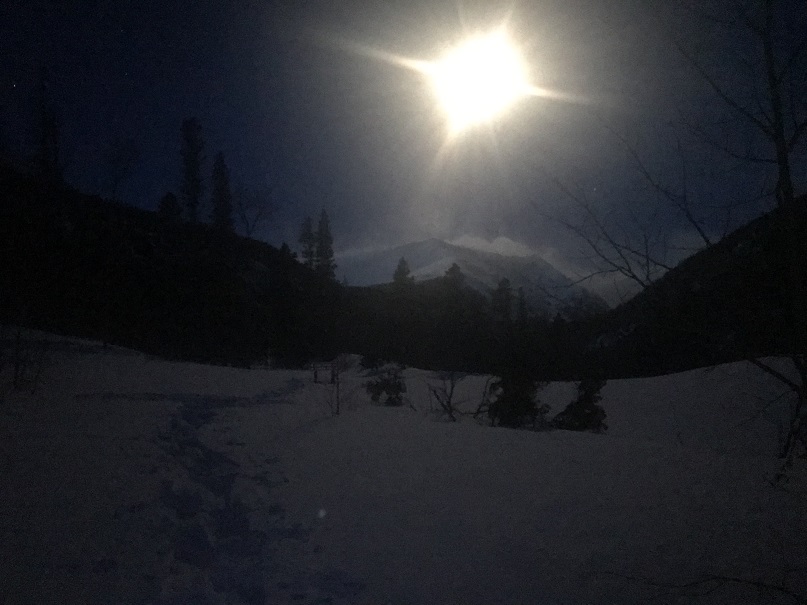
I knew I wasn’t going to summit from the time I made it to the trailhead. It was still dark, but through the moonlight I could see an outline of the mountains covered in clouds. So much for those sunny skies and that 20% chance of snow today. Yes, I knew I wasn’t going to summit from the time I made it to the trailhead, but there wasn’t really another hike with better weather anywhere in the state so I made the decision I was going to get in a good hike anyway and just turn around when I felt it was necessary.
It’s been too long since I’ve done a serious hike. Over a month in fact. And by serious I mean something above treeline (Guadalupe Peak had the mileage and elevation gain but topping out below 9K didn’t count). I was beginning to feel like I was out of shape.
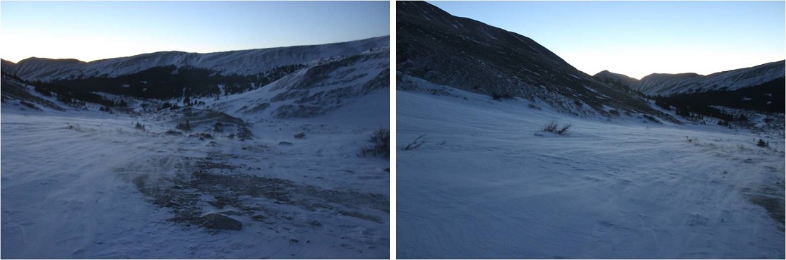
I arrived at the Lower South Colony Lakes trailhead at 5am to cars parked in front of the 2WD road in, blocking my drive any further. I immediately questioned their choice of parking spots but soon realized the road was impassable, so it didn’t really matter anyway. And here’s a shock: there was a couple sleeping UNDER their truck. I’m afraid I woke them up on my drive in (sorry guys! I turned off my headlights as soon as I realized you were sleeping!). They rolled over in their sleeping bags and went back to sleep as I gathered my gear and set out, thinking “Boy, were they brave!” It was frigid out here this morning, but you couldn’t beat the view of the stars and full moon.
I started out at about 5:20am carrying my gear, but quickly stopped to put on my snowshoes. Parking at the South Colony Lakes trailhead would add over 4 miles to the hike, but they would be an easy 4 miles along a dirt road.
Well, a dirt road covered in 2-3 feet of snow. Luckily there was a trench already in place.
I followed the trench up to the Rainbow Trail Trailhead, where the trench immediately stopped.
From here on out I was trenching the trail myself. This was my view as I navigated my way around the mountainside
This part was a bit sketchy: I’ve never trenched along a hillside before. Up a hill sure, but never straight across. Here’s a view looking back at some of my fancy footwork (it’s steeper than it looks)
I rounded the corner, hiked a bit up a hill, and found myself at an obvious juncture to turn right and follow the ridge. Well, maybe not obvious (there weren’t any signs or anything) but I could tell this was the ridge and to follow it I must turn right.
This is where the wind started picking up. I was in the trees, yet the wind was howling all around me. I’ve never experienced such wind while still below treeline. There was also quite a bit more snow along the ridgeline than I’d expected. It was at a minimum 4 feet deep, with drifts that went over 10 feet.
No maps or special navigation tools were needed: I just kept following the ridge. The fun part was hiking up and down the drifts, checking for stability as I went.
I kept trudging along and the wind kept increasing. The blustery weather was coming from Humboldt, kicking up snow and flinging it around like little chards of glass. I knew the wind was forecasted to be 20-25mph today, but the forecast didn’t mention sustained winds that didn’t let up. This would have been useful information. Also, I’m pretty sure the winds were higher than 25mph above treeline.
The entire hike along the ridge I kept thinking of Sir Edmund Hillary’s quote: It’s not the mountain we conquer, but ourselves. That was indeed true. Pushing and overcoming our limits is what makes the experience worthwhile. However, I’ve learned to be a little more cautions when it comes to wind and weather. My fingers are still recovering from Sherman over a month ago, and I didn’t want to reinjure them too soon. Yes, I knew I wasn’t summiting today, but I wanted to at least make it to treeline. On the positive side I wasn’t cold and I could still feel my fingers and toes.
When I got to treeline the views were terrible! There was only a 20% chance of snow today, but the high winds were developing their own weather above treeline, flinging snow and creating clouds as they went. Despite predictions snow was indeed falling on the summit. The wind here knocked me down. I stood back up again and was knocked down again. It was like I was living a Chumbawamba song.
I was close to the summit (I’m guessing about a mile) but from experience knew in these types of winds are too much for my body to bear for the hour or more it would take to summit and make it back down to treeline. I would have turned into a popsicle. The winds were also supposed to increase in the afternoon, so I took a picture in my mind of the route for next time and headed back through the trees the way I’d come.
What’s this? My tracks were completely gone! I’d just hiked through this area no more than 15 minutes ago, yet my snowshoe tracks had been filled in from blowing snow. Wow!
I tried to get a picture of Humboldt, but ended up getting a shadowselfie instead and a peak covered in blowing snow.
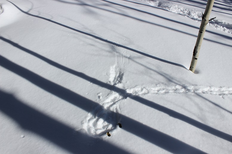
Hiking back down the ridge was much easier than hiking up the ridge, even with my tracks gone. Eventually I came back to the trail junction and the wind stopped. Here my tracks were in place, and alongside them another set of tracks. Hmm. That was curious? They just seemed to stop. It looked like an animal had walked out into the open just to use the restroom. Then I looked closer and noticed that wasn’t the story at all: Something had been caught by a large bird and became breakfast!
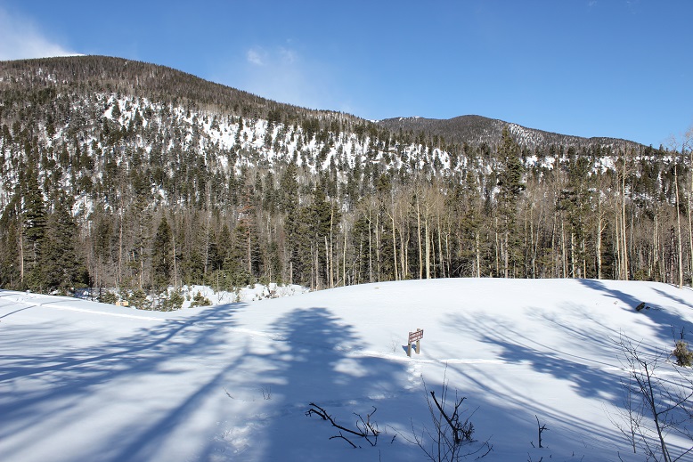
After crossing the hillside and following my tracks I made it back down to the Rainbow Trail trailhead. Behind the sign is the parking lot I would have used if the road were clear. This parking area is currently covered in a few feet of snow.
As I reached the sign I looked back up at Marble Mountain and was a bit miffed to notice the wind had apparently stopped on the summit. The summit looked calm, clear, and was mocking me at my current position. I started second guessing my decision to turn back.
Just then a big gust of wind began again from the Humboldt side and both mountains (and the Crestones) were clouded in ice again. They remained that way even after I’d made it to my truck and was driving back home.
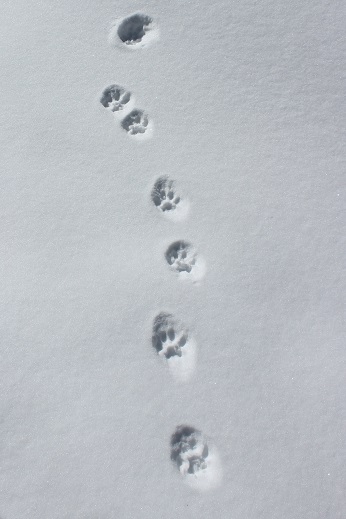
The 2+ miles back to the Lower South Colony Lakes trailhead was peaceful and quiet in the early afternoon, and getting warmer by the minute. My left pinky toe was hurting something awful, but by now I’m used to this. I saw some fox tracks that I hadn’t earlier
I made it back to my truck at about 9:45am, surprised to notice the ground was now muddy at the trailhead.
I looked at my tracker(s) and saw I’d only hiked a little over 2500’ in elevation. It had seemed like so much more, but I had been breaking trail, which takes quite a bit of energy.
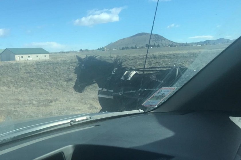
On my drive home I had the opportunity to race a horse drawn carriage. Yes, I’m sure the horse knew we were racing.
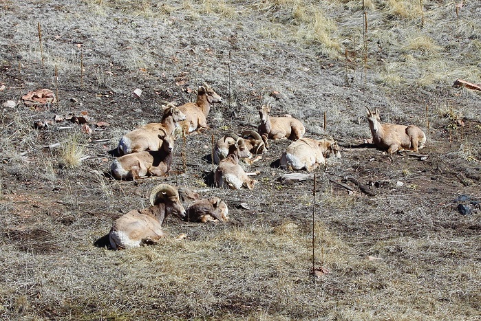
I also came along a herd of bighorn sheep in the exact area that has signs indicating they were there. It’s one of the first times I’ve seen such an accurate sign. Only one of the Bighorn Sheep seemed interested in my presence.
OK, so in the end this had been a worthwhile day. No, I didn’t summit, but I did get in a good hike. I saw some wildlife and practiced my “trenching on a slope” skills, so I’m considering today a win. Oh, and also I didn’t get frostbite. Well, at least not on my fingers. I did reignite the frostnip on my pinky toe that had recently healed, but it isn’t as bad as before. I’m sure it will heal faster this time!
Elevation Gain: 1570′ (I’m suspicious of this number)
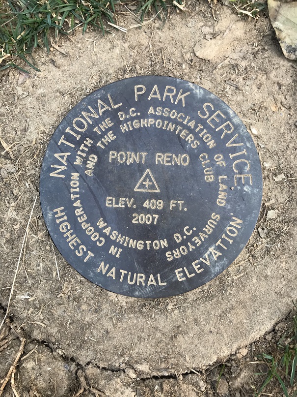
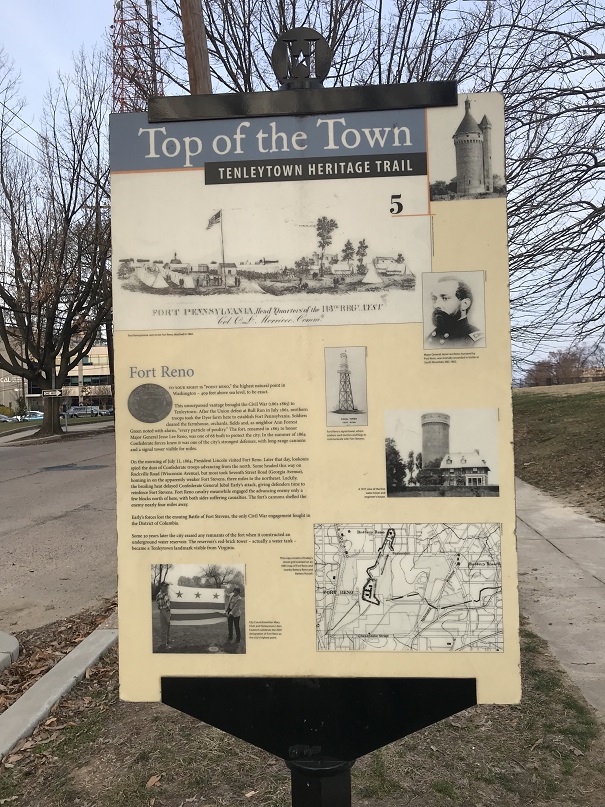
I’m currently in Reston, Virginia for work, and before flying here I did a quick search to see how far away it was from the Virginia Highpoint. About 6 hours, which was way too far, but I noticed it was about 20 miles from the Washington DC Highpoint, Point Reno. That was interesting. While Point Reno isn’t one of the “official 50” because Washington DC isn’t a state, I felt it would be a shame to miss the opportunity to check off a highpoint, so I did some more research.
The highest point in Washington DC isn’t really all that high: Point Reno only has an elevation of 409′, but since most of Washington DC is just above sea level, I might get some good views.
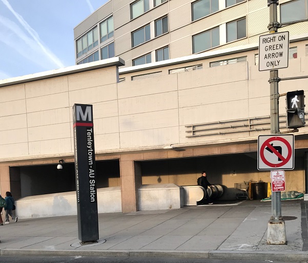
My challenge was I didn’t have a vehicle, but the Metro was supposed to drop off very close to the highpoint (ironic, I know). So all I had to do was get to a Metro station, make a few connections, and I should be good. The closest Metro station to where I was staying was a mile and a half away. Challenge accepted.
I woke up at 4am, ran on the treadmill for an hour, came back and was ready to go before 6am. It was very, very dark outside, with the exception of the full moon and some street lights. This 1.5 mile walk to the Metro Station was going to be interesting. My directions took me off the main streets and on a side bike route that looked a bit sketchy to me. Especially in the dark. I wished I’d brought a flashlight, but honestly hadn’t even thought darkness would be an issue. On the plus side I was waking up birds as I passed them, and I was pretty sure there was a golf course to my left. About halfway there runners started coming towards me with their headlamps shining and I felt a bit safer.
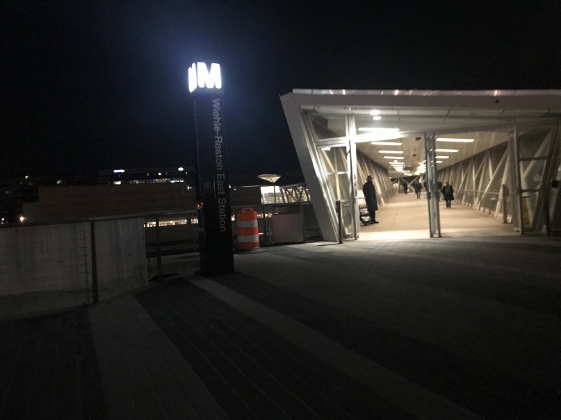
Finding the Metro Station was easier than I’d anticipated.
I walked up to the ticket counter to buy a pass but the attendant directed me to the automatic kiosk instead, and when I told him which stations I was using as switching points he gave me quicker directions. I thanked him and was on my way.
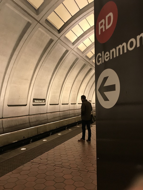
I took the Silver Line to Metro Central Station, got off and switched to the Red Line towards Shady Grove. This brought me to the Tenleytown-AU station. I had my phone but decided to people watch instead. Oh, and rummaged through my backpack, where I realized in fact I did have a flashlight with me. Oh well, I’d made it without one just the same.
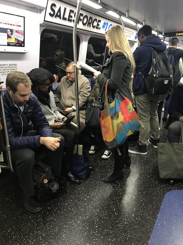
Metros and Subways and Lightrails are interesting, but not too difficult to navigate once you know how they work. I had no problem making transfers and finding correct platforms. Also, I really felt comforted looking at the map and listening to each station being named as we stopped, reaffirming I was going in the correct direction. Until this man boarded and for some reason stood right in front of the map. He was oblivious to the fact I was appreciating its usefulness. Oh well, I had no hiccups and the whole process was much quicker than anticipated.
Once at Tenleytown-AU I exited the station and got my bearings.
It was dark when I got on the first Metro, but by the time I exited at Tenleytown the sun had some up. I headed north and when I made it to a soccer field I turned right. I was a little worried because it looked like I was on school property and school was supposed to start soon, but no one looked like they were going to stop me, so I continued hiking up over a hill.
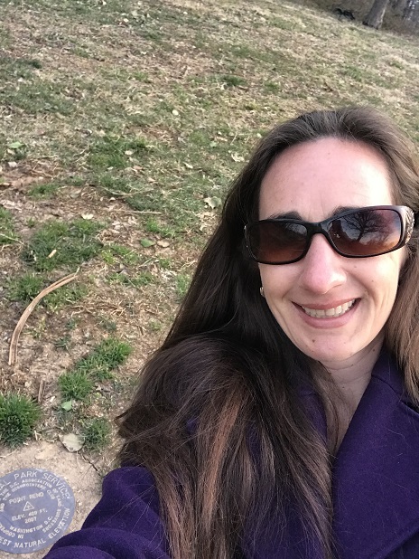
I crossed a dirt path, and much sooner than I’d anticipated I came upon the ‘summit marker’. For some reason I’d thought finding it would have proven more difficult.
I quickly sat down on the grass and took a selfie to prove I was there, and then got up and left.
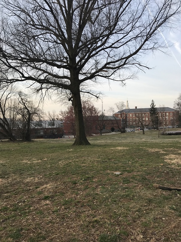
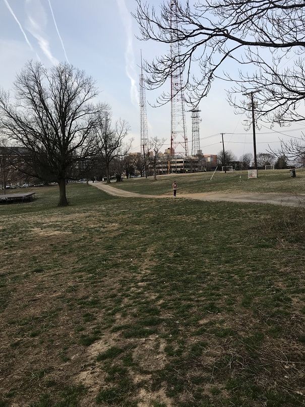
Here are a few pictures I took while standing at the highpoint.
It felt weird to be celebrating checking off another one on my list with all these middle and highschoolers trudging to school. They probably thought I was weird. There were signs however indicating this was the high point, so I’m sure they must be used to highpointers taking selfies on the hill?
Here’s what the outside of the Tenleytown station looks like
And a few metro pictures. It was busy!
The walk back from the Reston station was much nicer in daylight.
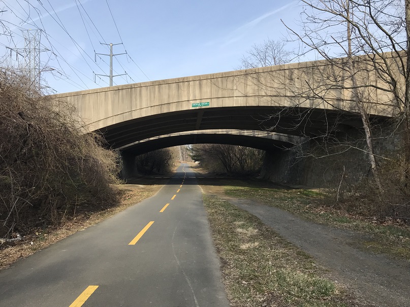
Passing under bridges wasn’t quite so scary either
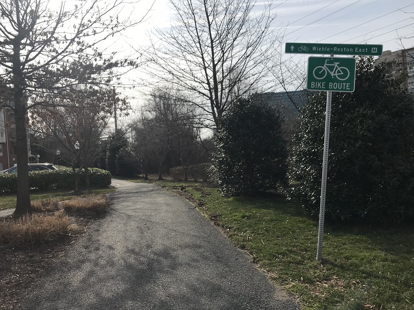
Here’s the start of the bike trail that brought me close to the Reston station (about .4 miles away)
I made it back to my hotel room at around 9am, making this a 43.5 mile journey in just under 3.5 hours. Looking at my stats I walked about 4.5 of those miles, and it looks like I had 1570′ in elevation gain, but that’s highly questionable. I’d put the number at closer to 100′.
So even though this was an easy highpoint, it still felt like an adventure navigating the Metro through town and people watching. Now to get to work!
It’s about time I went hiking again!!! This past month has been rough. It was the end of cookie sales, I was in Germany for a bit for work, came back from Germany with the flu (and I NEVER get sick, so I’m blaming it on being exposed to some German type of illness I’m not resistant to) and my fingers are still healing from my last trek up Sherman. What concerned me most really though were my fingers: I developed digital ulcers (yep, those things that looked like blisters under my nails were thick blisters that eventually popped). Now they’re healed but still very raw and the skin on the tips of my fingers is thin and fragile. I haven’t been in the high country because I didn’t want to expose my fingers to too much cold too soon. Oh, and then there’s the historic avalanche danger we’ve had in Colorado over the past 2 weeks….
In any event, I finally had a day to hike and now just had to choose between a 14er and a highpoint. I really wanted to get in one more 14er this winter but with the avalanche danger as high as it is I opted for a road trip instead to a place with zero avy danger
Texas! I was dreading the 10 hour drive and missing out on my potential 5th winter 14er, but I also have highpointing goals this trip would help, and I felt it best to do this trip before the heat and summer gas prices increased. The only downside was the drive and my tight schedule: My oldest was coaching a guard in the St Patrick’s Day parade at noon, and since I really wanted to be there to support her and take a video I didn’t get on the road until about 1:30pm. Almost as soon as I left I realized I’d left my trekking pole at home, so I decided to pick up a cheap one at a gas station along the way (knowing full well there’d most likely be a few free ones at the trailhead left by others).
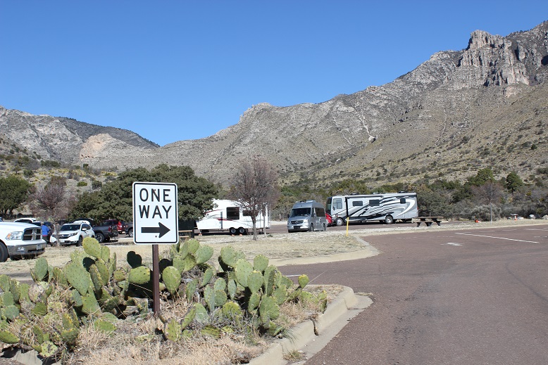
I made it to Guadalupe Mountains National Park at 10:30pm… or 11:30pm after the 1 hour time difference at the Texas State line. There were about a dozen RVs parked in the RV lot.
I filled out the self reservation form, parked my car in one of the parking spaces, text my kids to let them know I’d arrived, and got settled for bed. After turning out the lights the full moon gave me a great view of the silhouetted peaks against the night sky. I took a deep breath: yes, taking this road trip had definitely been the correct decision. I was so happy I was here right now, snuggled in my sleeping bag, looking up at the stars.
Now if I could only fall asleep. I usually have difficulty sleeping at trailheads and tonight was no exception. I really just wanted to get started hiking but since it was midnight and it had been a full day it was a better idea to try to get some sleep first. I couldn’t, and pretty soon I got cold. Very cold. It was in the 20s outside but I was very cold inside the cab of my truck, even with double layers of clothing, socks, jackets, a sleeping bag, and 3 fleece blankets. The seatbelt clips were chilly and kept sticking into my back. Note to self: next time bring 2 sleeping bags instead of 1.
The campground was quiet for being so occupied, and as a bonus I only heard a generator go off once (those are obnoxious). I drifted in and out of sleep (mostly out) for the next 6 hours. The moon set at about 3:30am and it suddenly got very dark outside.
I’d done my research, and the sun was supposed to rise at 7:11am. That meant the sky should begin to lighten around 6:30am. I set my alarm for 6 so I could be on the trail no later than 6:30am but when my alarm went off it was still very dark outside. Hmmm. Ok, so I re-set it for 6:15am. Still dark, and again at 6:30. This didn’t make much sense but I felt I was wasting valuable hiking time and I was still really cold (hiking would warm me up). So I got ready and was on the trail by 6:45am. Yep, a bunch of trekking poles had been left by other hikers near the trailhead.
The trail starts at the end of the RV parking lot, just to the left of the information sign.
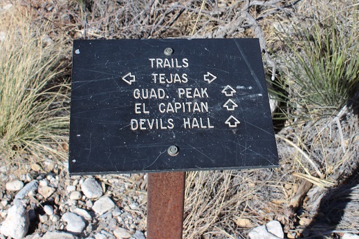
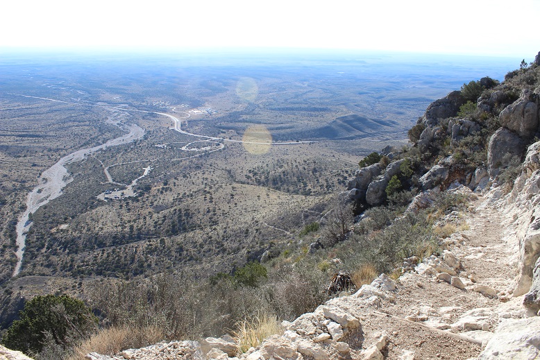
Another bonus: this trail was very well marked. I just followed the signs that indicated “Guadalupe Peak trail”
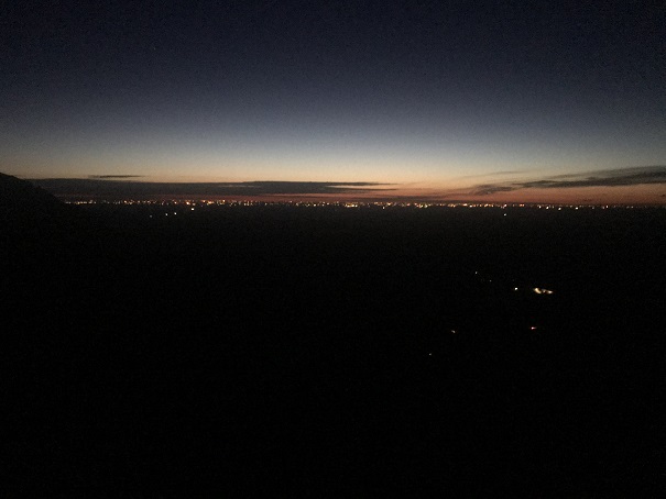
The trail was very also well maintained, wide enough in most places to walk side by side with another person, and easy to follow. I quickly warmed up and waited for the sun to rise. I hiked for over an hour before the sky began to lighten. I could see Carlsbad in the distance.
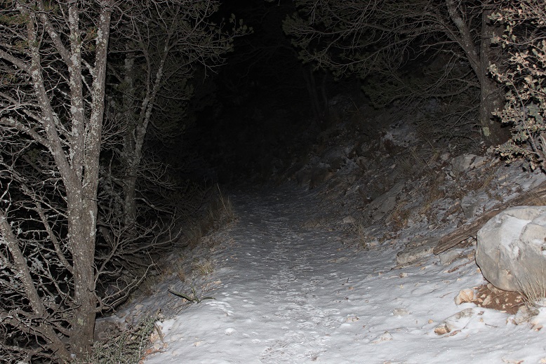
Right about this time I encountered a thin layer of snow on the ground that persisted all the way to the summit. I’d known it was supposed to have snowed yesterday between 2-3pm, and here was the evidence it had.
I looked for tracks in the snow and was surprised to see small deer prints. I also saw a lot of squirrel tracks and some from a small creature (I’m thinking a ringtail?)
Suddenly I heard a low, guttural noise that sounded like ujjayi breathing coming from my left. I stopped to see what it was. It took me a few seconds to realize it had been me (my throat is still recovering from my cold). I cleared my throat and continued on.
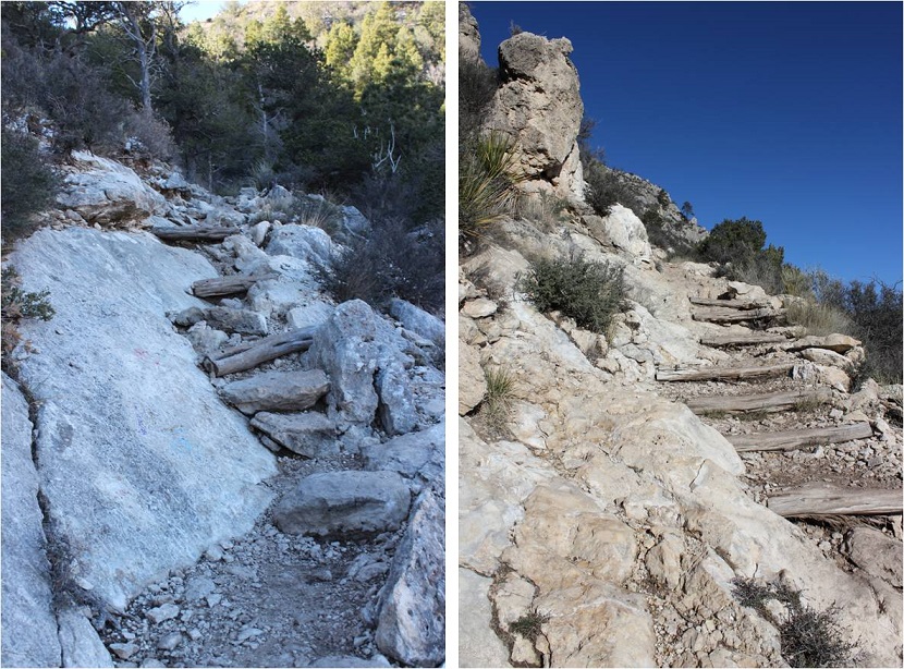
Have I mentioned the switchbacks? This was supposed to be a “strenuous” hike, but there were a ton of switchbacks, making it longer than necessary but not too difficult. Here’s a look at the first part of the route
The sun started to rise as I made it to the top of this area, and I could see the rest of the hike before me (there’s actually still about 2.5 miles of hiking left)
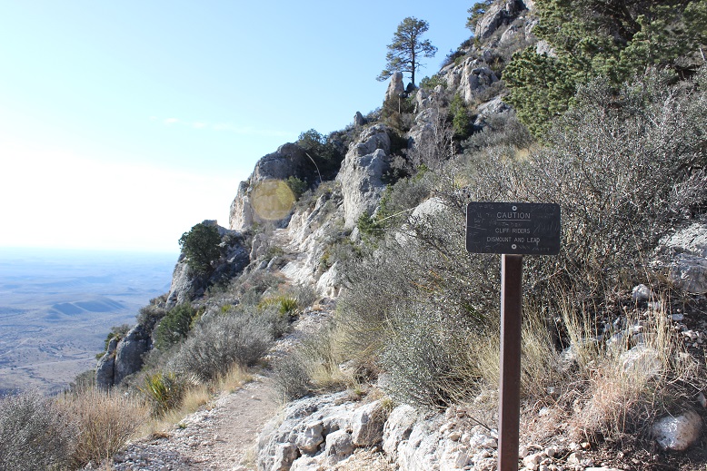
Once I’d rounded the first slope there was a cliff to pass, and I was surprised to see a sign that said if you were on a horse to dismount and walk it across.
I was surprised because I hadn’t seen any horse hoof prints or manure on the trail. Usually when they allow horses on a trail it’s littered in both.
This part of the hike took place behind the first mountain so I was able to see the sunrise a second time from a different angle.
I came across a false summit and some camping sites
I rounded the corner once again and saw more switchbacks. Here I could tell the trail went to the left, but it seemed there was another trail to the right. I figured the trail to the right was from others cutting switchbacks and took the well established trail to the left.
The path was lightly lined with snow and just gave way to more and more switchbacks. Would they ever end?
A great view of the valley below
Here’s where the trail got tricky: I was almost to the summit and the path gave way to walking along exposed rock. This in itself wouldn’t be too difficult normally, but the rock was covered in a thin layer of ice, making traction tricky
I couldn’t help but think this section was most likely why I hadn’t seen any hoofprints/manure along the trail: it was too difficult for a horse to maneuver. Then I saw hitching posts and none of it made sense.
Oh well. There was a little bit of a scramble
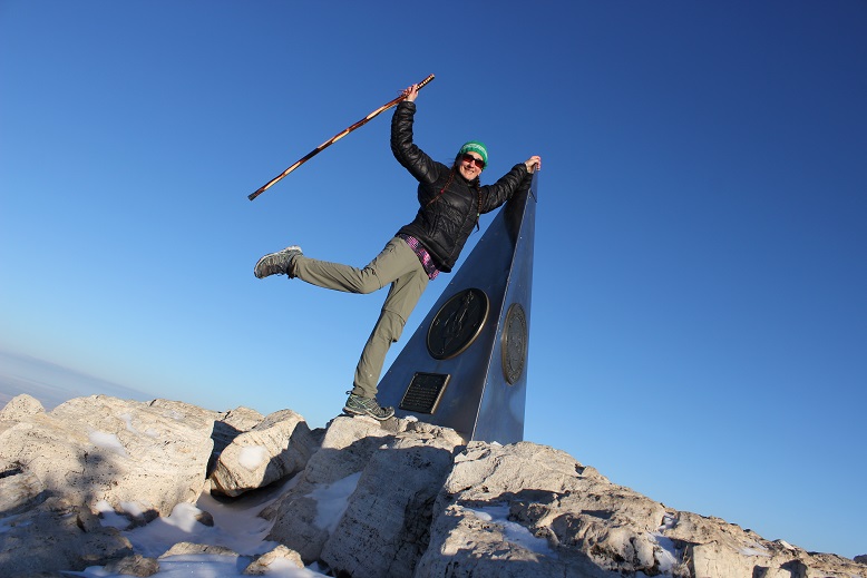
And then I was at the summit. I thought it was cool to be at the Texas highpoint on St Patrick’s Day when it also had a dusting of snow (apparently snow here is rare, even in winter)
Summit Video:
I summited at about 8:40am and had fun taking photos at the top
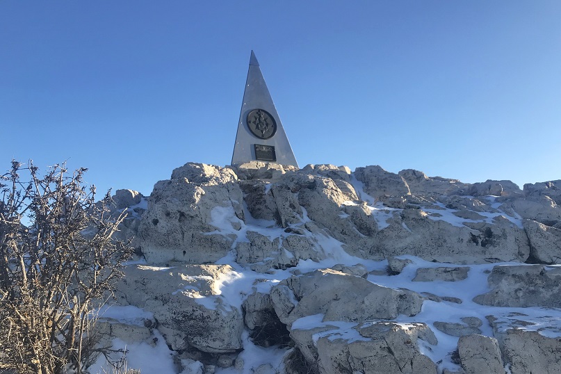
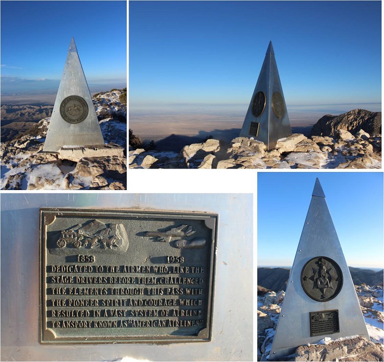
Since this was Texas the summit marker was huge, but interestingly enough didn’t have any mention it was a highpoint or of the elevation.
I’d taken off my gloves to take photos, and this ended up being a bad idea. My fingers felt raw and were beginning to tingle in a bad way, even at this relatively low elevation, so I decided to put back on my gloves and head back down. It turns out that fork in the trail that went two ways was legit. The trail to the right had actually been a maintained trail (the other was the horse trail) so I took that one back down.
In the daylight I could see the parking lot I’d stayed in and just how many switchbacks there had been up this trail
I encountered dozens of people starting their hike as I was nearing the end of mine. Dozens. A ton of college students, families, large groups and individuals out for a day hike. They all seemed surprised I was almost done. I was surprised they’d chosen to hike in Texas during what would now be the heat of the day.
Here’s another look at some portions of the trail (open to horses)
And evidence horses were allowed
One of the interesting parts about this hike was all the very large Manzanita Trees I saw. I haven’t seen so many in such good shape in a long time.
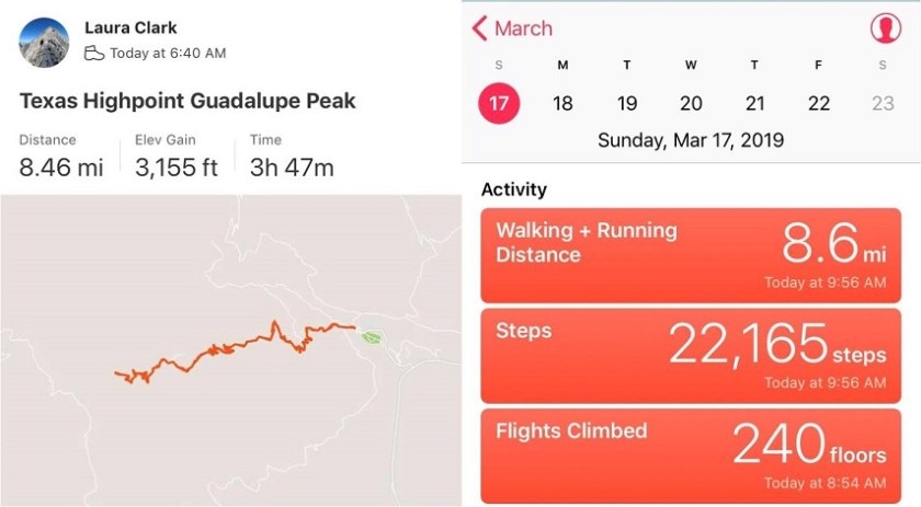
I made it back to my truck at 10:15am, making this an 8.5 mile hike in around 3 hours 30 min
Just for fun, here’s the Relive link. I’m not entirely convinced all those switchbacks were necessary. Relive: https://www.relive.cc/view/2220225056
There are always signs telling you not to cut the switchbacks, but if you don’t want people cutting switchbacks, don’t unnecessarily make so many of them! Personally, I’d rather just take the stairs to the top.
I made it back home at 6pm. That was pretty good time!
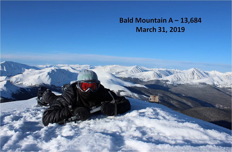
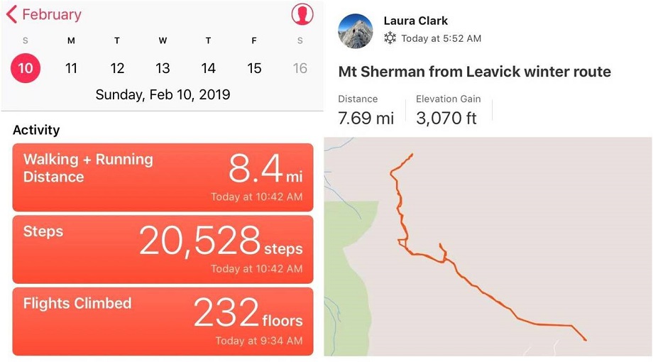
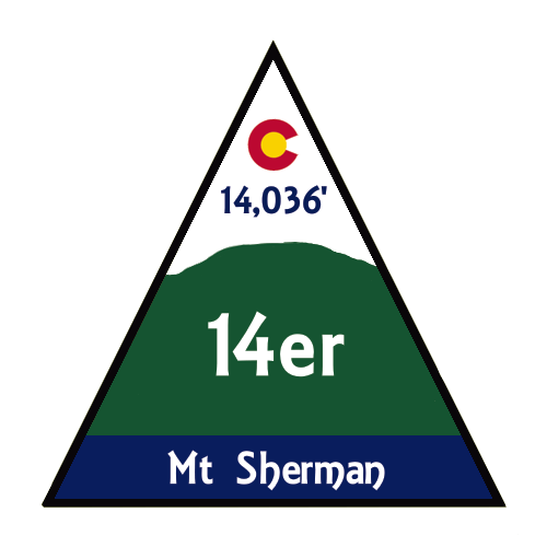
Out of the 12 peaks on my short list to hike today Mt Sherman had the best weather, coming in at 12* with 15-20mph winds, and 30mph gusts. This was by far the best weather for wind gusts (most other peaks forecasted 50+mph winds) so it was a no brainer as to which peak to pick. Unfortunately (as you’ll read later) I made this decision at 9pm the night before and didn’t do much (ok, any) research on hiking Mt Sherman in winter because I’d seen some FB posts there was minimal avy danger that was easily avoidable and read the trailhead was clear. And hey, I’ve done this peak before and I knew what I was getting into. Right?
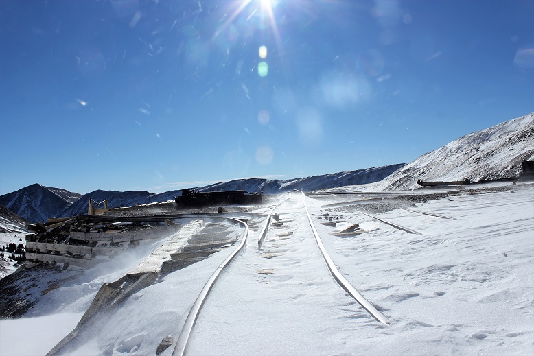
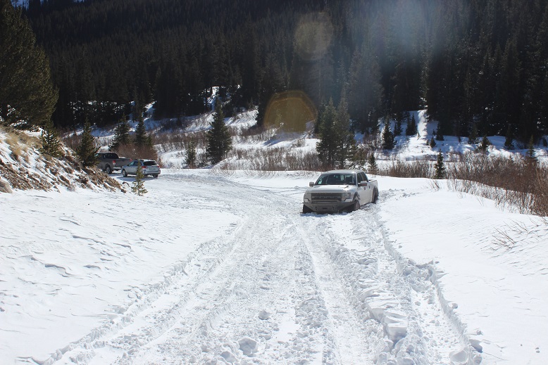
I was more nervous on the drive in to this trailhead than I’ve ever been. The last conditions report hinted it wouldn’t be difficult to make it to the Leavick site, and possibly further in a 4WD. However, about 4 miles before the Leavick site the normally 2WD road became a sketchy, drift and rut filled one way snow fest. This was a ‘both hands on the wheel’ kind of experience that required skill to stay in the lane and not drift into the deep snow on either side of the vehicle. I didn’t feel stellar about continuing on, but there was no place to turn around and in the dark I couldn’t see to back up so I just kept driving onward, bolstered by the fact others had obviously succeeded on this road yesterday.
I made it to the Leavick site at 5am in one piece (woohoo!) but there was no safe place to park my truck without it getting stuck in a snowbank. The wind had drifted snow all over the area, so I set about using my trucks tires as snowplows and drove it back and forth, up and down, flattening out an area big enough to park. This took a lot more time than anticipated as the snow was soft and kept sinking and squishing up on the sides as I drove over it. I had no idea how deep the snow actually was and the more I drove over it the more it pushed up the snow around it to make new walls. I got out my snow shovel and started scooping up some of the bigger areas of snow to make more room. Just as I was doing this another truck arrived and I let out a sigh of relief: The more vehicles to drive up the road and stomp down the snow the better! It looked like he was going to continue on, but then suddenly he backed up…. right into a drift. Ouch. I lent him my shovel and went back to work trying to make a suitable parking area. Once I felt I’d made enough room for my truck to safely park and about 2 others I went over to help the man with the stuck truck. We tried shoveling away all the snow, putting dirt and then rocks under the tires, and him gunning it while I pushed. No dice. That vehicle was stuck.
I was now an hour behind schedule and that truck wasn’t going anywhere. The man told me he had a few friends meeting him soon so I offered him the further use of my shovel and began my hike at 6am.
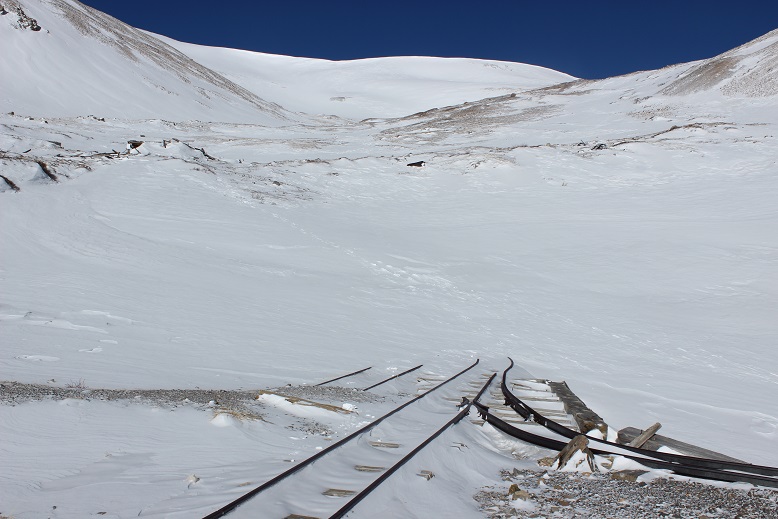
The Leavick area is 2.5 miles below the trailhead, but an easy hike on a 2WD dirt road (well, 2WD in the summertime). I put my snowshoes on in the truck and was grateful for them as I made my way up the road. It was windy but I’d anticipated the wind and was grateful for my balaclava, mittens, and hat.
At this point I started seeing footprints and even though I knew the road curved around to the left I decided to follow the footprints that led in the general direction of the basin, knowing they’d all connect when I made it further up. I made it to about here and stopped
The snow just didn’t feel right. I knew if I continued on I’d make it to the basin, but it felt like I was walking on a thin crust of ice with spongy layers below. It didn’t feel or sound right and the slope was getting steeper. I decided to just backtrack to the road. (Later I learned this was indeed the winter route, and others made it up said route that day, so I was most likely being over cautious, but no regrets).
I made it back to the road fairly quickly. There was plenty of snow blocking the gate
The sun started to rise just as I walked up to the Dauntless Mine area. I silently wished I’d started just a bit earlier so I could fully enjoy the alpenglow.
The wind was still present. Every once in a while a gust would hit me full force and I had to turn around and put my back to the wind, but this meant I was facing the sun
I was now in the basin. I looked at the summer route (or what I could see of it at the time) and got a little nervous: that was more snow than I’d anticipated and no ‘quick, easy way around’.
There are several routes (trails/roads?) around the hilltop mine. They were all covered in various degrees of snow, and some were too steep for my liking.
Here’s the route I took:
OK, so now I was in the basin and it was obvious the standard route was a no-go due to avy and cornice danger
I looked at the mountain and decided I had some options. I saw what looked like a viable path up the face and through a gully, and another that went off to the right, up a ramp, and then left to the summit. I knew from previous experience the ramp was a way down from White Ridge, and I was considering doing that peak as well today, so I decided to go up the gully (solid) and down the ramp (dotted).
By now the wind had died down and I was starting to get warm. This was fantastic! The gully had snow, but now very much. It was just enough to provide the necessary traction on the scree (which would have been nasty without the snow).
And boy was it steep!
From about halfway up I had a good view of my intended route down
The route kept getting steeper and steeper but I just kept to the areas where there was snow. Towards the end I got out my ice axe for support/stability.
I gained the ridge and looked back on what was the standard route. Yep, it had been an excellent choice to avoid the area altogether.
From the ridge I took a look back at the basin: yes, I could have just gone the way I’d started out, but I was where I wanted to be, so this was good too.
I turned north as the wind picked up a bit. Obviously others had been here recently. This didn’t look too bad
I gained one small ridge and saw what looked like more fun than I’d remembered last time I’d summited Sherman. Woot!
This was easy to cross, and as I was making my way I looked over to Gemini (another peak I was considering after Sherman)and debating if I should summit White Ridge or Gemini first?
Sherman has a very long ridge to the actual summit. Here’s more proof
I stopped for a second and looked over at White Ridge. It looked like it was getting some wind!
I continued on to the summit, with the wind increasing as I went. As I stood on the summit I turned around to get out my camera and was immediately knocked over by a gust of wind. Wow! That hadn’t been expected! I got to my knees and stood up again. Wham! I was knocked down again. Ugh! So I got out my trekking pole and used it as leverage, struggling to stand and the wind continued full force. It wasn’t happening. The wind was too strong! Ok I thought, I’ll just wait this gust out. But it didn’t stop. It became a sustained wind that didn’t seem like it was giving up anytime soon. There was no way this was the forecasted 30mph gusts. I’m not sure the speed, but it had to be pretty significant if I couldn’t stand. There was no way I was going to attempt Gemini or White Ridge in these conditions. It looked like I was heading back the way I’d come.
I couldn’t stand so I got out my ice axe and crawled back towards the ridge. This was a good and bad idea: I was making progress towards the ridge, but holding the ice axe was brutal on my hand. Note to self: bring something to wrap around my ice axe to work as a barrier for warmth between my glove and the axe, as gloves (mittens) don’t cut it. I noticed I couldn’t feel my fingers. This happens to me a lot, but this was the worse it’s ever been, and I got scared. Really scared. I was breathing fast and my breath froze my balaclava stiff. This meant I was now having a hard time breathing in and out of it due to the barrier. Wind chill is no joke.
I had to get out of this, and fast. I kept crawling down the ridge, hoping the wind would let up. It didn’t. Me being me, all I could think about was not getting a picture on the summit. I told myself there was no way I’d have been able to because the wind would have blown my camera away, but I still wanted one. I made my way to a rocky area that provided some shelter from the wind and took a selfie (kind of). I wasn’t on the summit at this time, but I was close, and it was the best I was going to get.
The camera wouldn’t focus due to the wind, and I thought it weird there was so much blowing snow on White Ridge but none on Sherman. The wind was insane but it wasn’t blowing any snow. I actually would have preferred blowing snow in a way because then I could have seen the wind coming towards me and anticipated the blast.
I put my camera away and while the wind was still brutal I was able to stand up. My fingers were seriously bothering me. I’d been trying to pump them back and forth but I wasn’t sure if it was working because I couldn’t feel them, and there was no way I was taking off my glove to check them out. Just before making it to the end of the ridge my fingers started burning intensely, as if I were touching a hot stove and not pulling my fingers away from the heat. The pain was extreme but I was relieved because this meant the blood was starting to flow through them and it also told me I hadn’t done any permanent damage.
I trudged back to the gully and started my way back down, pulsing my fingers the entire way. The initial descent from the ridge through the gully is very steep. I faced the mountain and used my ice axe. About 50 feet from the ridge the wind finally stopped and never started again. By now the sun had warmed up the snow in the gully, making it not quite slushy but still slippery.
Once I’d made it back to the basin I headed towards the hilltop mine.
And then followed my snowshoe tracks back down the mountain
By now my hands were sweating in my gloves, but I still didn’t want to take them off: the tips of my fingers hurt in a way they never had before and I wanted to keep them covered for as long as possible. I kept pulsing them and thinking to myself: now I know where my limit is. I can do cold to a certain point, but I cannot do wind chill. When I got home I looked it up, and if it were 10* on the summit (the forecast high had been 12*), after 40mph the wind chill stays constant at -39* up to 60mph winds. I learned today that’s too much for my body. From now on I cannot go hiking above treeline if the winds are forecasted over 25mph. I just can’t, and I need to hold myself to that. Also, I’m pretty sure the forecast had been wrong in this case, and if I’m honest I kind of knew this going in since Sherman’s forecast was so much better than every other mountain in the area. It had been too good to be true, and if it seems too good to be, it probably is.
Back to the trip report. The Dauntless Mine takes on a whole new quality with snow
I followed the road back to my truck, meeting a few hikers along the way. At one point it looked like someone had tried to drive further up the road past Leavick and had second thoughts. Instead of turning around it looked like they’d backed up down the road.
As I was walking the 2WD road back I was so warm I took off my balaclava and gloves about half a mile from my truck. My hands were swollen and sweaty and red and sore, but no blisters! It was warm and there wasn’t any wind so I kept my gloves off to let my hands dry out. I made it back to my truck at 10:15am, making this an 8 mile hike in just over 4 hours.
When I made it back the white truck was still stuck and there was one other vehicle in the area.
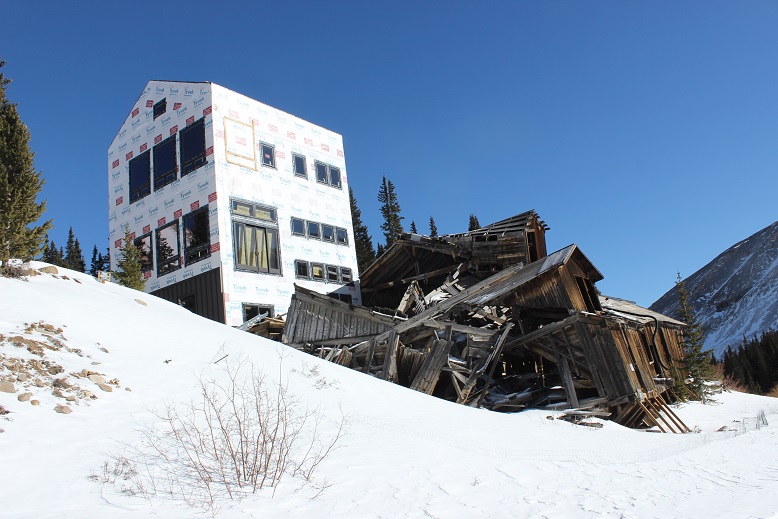
They’re still building a structure at the Leavick site. I’ve been told it’s a home but that sounds questionable to me. And creepy: the old structure creaks and groans with the wind continuously at night.
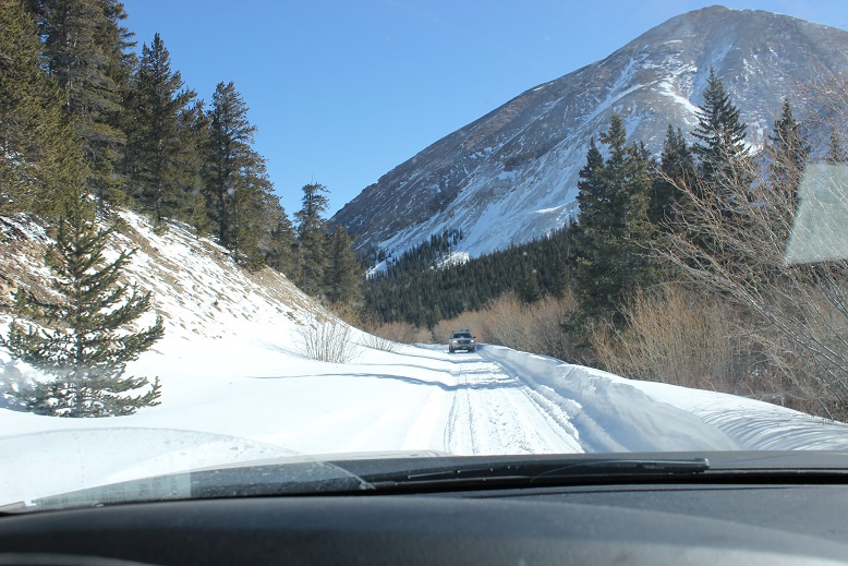
OK, let’s talk about the drive out. I wasn’t looking forward to driving those first 4 miles, but I was looking forward to them being over. After about a mile I came across a Jeep heading up the trail. Ugh! One of us was going to have to back up, but then the driver did something I hadn’t expected: He did what I’d done this morning to make a parking space, and drove up and down and up and down about a dozen times to make a spot for him to park and me to drive around. I slid around him with less than an inch to spare (and I mean this in more ways than one as despite being on my A-game I wasn’t 100% in control of the vehicle the whole time). I took a deep breath. That had been very, very close. I couldn’t believe I hadn’t hit him or gotten stuck on the side trying to pass, and I wasn’t entirely sure he could make it out of his ‘parking spot’.
Almost immediately after passing the Jeep I saw another vehicle coming towards me and thought “Oh no! Not again!” But this guy did something unexpected as well: He started backing up, quite efficiently, and didn’t stop for 2 miles! Even though I’d had the right of way he’d done the backing up. I was so grateful (and told him so when I was finally able to pass him). Once again, THANK YOU! You kept us both from potentially getting stuck. As a side note, whenever possible I used my truck to make the ruts in the road wider because it can do that kind of thing. Have I mentioned I love my truck?
Ok, let’s talk damage to my hands (and feet). I had indeed pushed them to their limit, but they aren’t permanently damaged. The tips of my fingers feel very raw, similar to how the little red sores you get on your feet feel after being in the pool for too long and rubbing your toes along the side. The tops are all red, and there are small blisters and lines under the tops of my fingernails (kind of like when you bend your nail backwards below the nail plate. Last night it felt like I had blisters all over the tips of my fingers (but no actual blisters present). My left pinky toe once again took the brunt of the hike: It’s swollen to twice its size, a fun purple/black color in the middle (not frostbite, but pretty bad chilblains, which are a consequence of Raynaud’s meeting cold) and very, very tender to the touch. I couldn’t get a shoe on today. Here’s a positive note: I teach wilderness first aid and we use aloe to treat frostnip (NOT frostbite). Since my chilblains have similar symptoms I put aloe on them, and it instantly felt the same relief as if I were cooling a sunburn. Woot! What’s even better is it’s not medicine so I can apply it as often as I’d like!