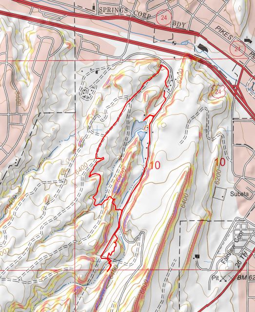
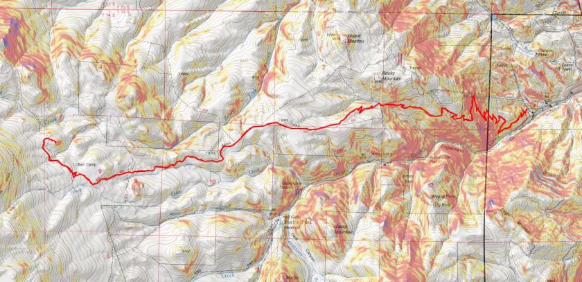
Paint Mines

1
It doesn’t look like much, it’s always windy and it’s in the middle of nowhere, but this is a fun and easy family hike. Rebecca is a night owl, which means she sleeps in every morning. Today I woke her up at 2pm (yes, 2pm) to go hiking with us. She was grumpy and didn’t want to go, but I promised her she’d feel better once she was outside.
When we got there the parking lot was full so we had to park on the side of the road. No worries about social distancing though, as the trails are wide and even with a full lot we only passed people a handful of times.

2

3
The goal today wasn’t to get in mileage or elevation gain, but to just get outside. You aren’t supposed to scramble on the rock formations (to preserve them) so here are some highlights we were able to get without damaging the structures:

4

5

6

7

8

9
And some pictures of the landscape

10

11

12

13

14
We got in about 2.5 miles of walking and 300’ of elevation gain. Oh, and it took about half an hour of hiking, but eventually Rebeca’s sour mood turned upside down and she enjoyed herself!

Afterwards we went to Big R looking for chicks, but they were out (and so is everyone else).  So we drove home and I sent the girls to Raising Cane’s for dinner while Steffan and I put the skid rack back on my truck:  The girls love Sweet Tea and I’d never had their food before, so it was a win/win.

Mt Manitou – 9460′

1

Rt Length: 10 miles
Elevation Gain: 3499’
Partner: Steffen

Winter and spring summits tend to be all about being flexible: snow is usually present but the ability to hike through it is unpredictable. We started out wanting to hike some highpoints along Rampart Range Road, but when we got to the road it was closed (but looked to be in great shape, so I’m not sure why it wasn’t open?). So we sat in the truck for a bit, trying to decide where to go. We had chosen these peaks today because Steffen’s knees were hurting him and he was looking to hike something short. The only other peaks I’d done any research on in the area were Sheep and Mary’s, so we decided to go there. Please note, I hadn’t done much research on them, but I had a map…
We parked at the Barr Trail Parking lot as all the other parking lots in the area are closed due to the Coronavirus. We were the only vehicle in the lot when we arrived, but when we got back there were a few more cars.

2
I paid the $10 to park and we were off

3
We backtracked down Hydro Drive to Ruxton and followed Ruxton west

4
Crossed a small bridge over Ruxton Creek

5
And made our way up to the cog railway tracks (which are gone now because they’re re-doing the tracks/cog/cars).

6
Signs told us we were on National Forest Land

7
We followed the tracks for 3 miles. Let me tell you, this is much, much steeper than it looks! I kept expecting the road to even out a bit, but it just kept getting steeper and steeper. There were some neat waterfalls and rock formations to see along the way

8
They also have materials to start setting new tracks

9
After 3 miles we were supposed to turn left to head up the side of Sheep Mountain, but the snow here was several feet deep and Steffen didn’t have his snowshoes. We considered continuing up the cog tracks but there was a “no trespassing” sign and even though the cog is obviously not running it seemed a bad idea to continue hiking on private property. So I got out my Pikes Peak Atlas and noticed we were at the junction to 706, what looked to be an ATV route. It looked like it would eventually hook up with Barr Trail, so here we turned right and followed the trail.

10
We hiked across a bridge carrying a water pipe over Cabin Creek that kind of freaked Steffen out a little (he’s not too fond of heights)

11
And continued following the trail around the mountainside.

12
It was a nice path, and there were several places along the way I thought would be great backpacking spots (I can see hanging a hammock here for the night)

13
The trail eventually led us to the Barr Trail, where it intersects just past the Experimental Forest, and right where I distributed flower seeds in memory of my Granny a few years ago.

14

15

16
We turned right (east) and followed the trail to the Experimental Forest Junction.

17

18
At the junction we decided to summit Mt Manitou today, just to say we’d summited something. So here we turned left and followed the road north, past the Experimental Forest

19
And up the road to its highest point, where we left the road and headed north to the summit of Mt Manitou.

20
It was rockier than I’d remembered, and further from the trail, but an easy trek. The views of Pikes Peak are wonderful!

21
Oh, this is the ‘summit’ of Mt Manitou

22
It was windy so we headed back to Barr Trail and followed it for 3 miles back to the parking lot. It ended up being a good hike, with decent mileage and elevation gain. As an added bonus, I found a way to connect the Barr Trail with the cog. I filed that information away for later use.
As we were getting ready to head home we had a squirrel come up to the door of my truck. It moved back and forth a few times and looked like it wanted to jump into my truck. I’m guessing he was hungry: he stole one of my Do-si-do Girl Scout Cookies!

23
This little guy obviously didn’t understand social distancing so I closed my door and we drove away. I didn’t want to take a squirrel home with me!
Here’s the route we took today

24

Tuckaway Attempt and Mt Kineo

1

Note, my successful climb of Tuckaway can be found here.

This whole Coronavirus thing is crazy, and it’s driving me crazy. Half the states are closed to outdoor recreation, with the other half open. Our county is open for hikers (with restrictions to social distance), others in the state are closed (and there seems to be no consistency) so I chose to social distance close to home today, getting in 14 miles and 4300’ of elevation gain on a trail that hasn’t been used much, if at all this winter. I didn’t pass a single person all day.
My intent was to hike Tuckaway Mountain. It’s located off North Cheyenne Canyon well off the beaten path but at a popular trailhead. I arrived at the trailhead at 6am, the first vehicle in the lot. Right behind me was a car full of runners: they parked and immediately started running down the trail. I envied them their lack of gear.
I’ve explained this hike several times so I’ll just paraphrase: I took the Seven Falls Trail (622) to the junction with 677 and then 622A to Loud’s Cabin. This part of the trail was snow free but I wore microspikes because there was ice in areas.

2

3

4

5

6
Once at Loud’s Cabin the trail ended, but it wasn’t supposed to. I ended up backtracking a bit and finally finding a trail! The only problem? They obviously didn’t want anyone using this trail.

7
Hmmmm. In the past few years they’ve done a lot of re-routing trails here. This must be one of the ones they closed off. I knew which direction I was supposed to go, so I decided to leave the old trail and bushwhack my way towards another trail I was sure would be ahead of me.

After crossing a stream

8
I just aimed west, keeping the snow filled gully to my left.

9
I hiked like this for about 2 miles, until guess what? I found a trail! It was obvious this trail hasn’t been used all winter.

10
I followed it north and held out as long as I could before putting snowshoes on

11

12
Just as soon as I put on the snowshoes, the snow stopped. I found myself at another gully, and this time followed it up to the saddle. This part reminded me a lot of Mt Garfield, and there wasn’t a trail.

13
Once at the small saddle I turned left (west) and once again donned my snowshoes.

14
After about 200 feet of snowshoeing I could tell I was very close to the summit, but unfortunately the snow became impassable in snowshoes (I could have done it in skis). Every step I took I sank up to my waist. The snow was just too sugary and warm for snowshoes to be effective. Maybe if I’d started earlier in the day the snow would have been more firm?

15
I turned around a couple hundred feet from the summit. This was my second attempt of this peak (I thought I’d summited the first time but was told the summit was actually 50 feet more to the north, so I wanted to go back and see for myself/hit the true summit). I wasn’t that upset about turning back because I was really proud of all the route finding I’d done. Also, I have a friend who wants to hike this mountain with me, so I knew I’d be back no matter what. Now I just have more accurate route information.
From here I could see my path back down the canyon. Yep, I now know these hills like the back of my hand. Who needs a map?

16
I made my way back down the gully to the trail, and followed my footsteps back

17
To where I’d written I the snow where I’d bushwhacked in from so I knew how to get back

18
Back down the mountain I went, keeping the snow to my right this time

19
I was thrilled when I made it back to Loud’s Cabin. This had been a great day! This is also where I got the idea to summit Mt Kineo, just to say I’d summited something today. I’ve summited Mt Kineo several times, and it isn’t a difficult summit. I didn’t need a map or directions to get there. I hiked back to the 677/622 Junction and left the trail to hike up the Kineo mountainside

20
At the false summit I had a pretty good view of Tuckaway Mountain (the mountain I’d attempted that morning). It didn’t look snow-filled, even though it had been.

21
There was actually more of a trail this time up the mountain than I’ve ever seen. The first time I hiked here there was no trail, but now it’s a clear path.

22
The views from Kineo don’t disappoint!

23

24
The hike back was uneventful. It was weird not seeing anyone on this part of the trail: the last 1.5 miles is usually teeming with people

25

26

27
I made it back to my truck and the lot was about halfway full. I was glad people were getting out and enjoying the sunshine while they can. The cool thing about our trails being open is they self-regulate. There are only so many parking spaces at the trailheads so only so many people can be allowed in.
Here’s a copy of my track

28

Red Rock Open Space

1

I took the girls to Red Rocks today to get out side.  While they are fond of staying inside and playing on their phones (etc.) I suspect they’re beginning to get a bit of cabin fever.  The parking lot was full when we arrived, but the nice thing about trailheads is once the parking lot is full, no one else can enter, so social distancing takes care of itself.  There were signs asking people to practice social distancing

2

Because of where we ended up parking we decided to do the loop backwards, starting instead by the pond.

3

We continued past all the rock climbers and did a bit of scrambling ourselves.

4

I took the girls to see the landfill.  I’d never really mentioned it to them before and they were curious as to why the city would pick it’s most beautiful location to dispose of trash, but on the bright side it looks like they’re trying to clean it up.

Next we hiked up the quarry

5

6

and then made our way back to the truck.  There were a lot of people on the trails today but social distancing was no problem at all with the wide trails and lots of open space.  I think we need to make hiking as a family a bi-weekly thing as long as we’re still allowed to be outside… I fear it won’t be long before our parks and open spaces are closed as well, which is truly a shame because it’s how I keep my mental and physical health…

We got in about 3 miles and 750′ of elevation gain in today.

7

Tincup Peak – 13,345′

1

RT Length: 14.5 miles

Elevation Gain: 3590′

I absolutely needed to get above treeline today: the past few weeks has been a whirlwind cookie season, limiting my availability to hike, and the weather hasn’t been cooperating on the days I’ve had available so I’ve been highpointing instead closer to home. Also, today is a leap day and I’ve never had a leap day summit. So I did what I always do and checked the weather forecast for about 10 peaks and chose the one with the best forecast.

The road to St Elmo is mostly dirt and (thankfully) well plowed. A 2WD vehicle could easily have made it to the trailhead.

2

I arrived around 4:30am and drove through town looking for a parking space. No luck. The streets were plowed but because of the snow there was nowhere to park, so I ended up turning around (twice) and parking near the east end of town in a lot that looked reserved for trucks pulling trailers. I was the only vehicle in the lot when I arrived.

3

I gathered my gear and was on the road by 5am, turned and headed back to make sure I’d turned off the dome light in my truck, and started off again. Almost immediately a Bobcat ran across my path, doing it’s best to run away from me as fast as it could. I considered it a good omen. It was a bit eerie walking through a ghost town at night, and with all the snow you could tell which houses were occupied and which ones had residents who went somewhere else for the winter. Every building had a sercurity system flashing a red light every few seconds or so.

4

At the end of town I turned right onto 162E and then left after the bridge and followed the signs towards Tincup pass. It’s 6miles from here to the pass.

5

6

7

8

9

The road was nicely groomed and looked like it had a lot of snowmobile activity. I spent my time hiking fantasizing about the new truck set up I’m working on for Spring/Summer (same truck, new setup). Embarassingly I jumped a few times at noises in the night, just to realize it was the sound of an invisible (snow-covered) creek or a tree about ready to fall. My original intent was to leave the trail and summit Point 13,050 and traverse the ridge over to Tincup Peak, but it quickly became obvious that wasn’t going to happen today: the snow wasn’t going to cooperate. There were several sections where I could tell snowmobiles had gotten stuck in the snow and had to be pulled out after leaving the road to head north (the way towards 13,050). So instead I followed the road slightly southwest for 4 miles, until I came to a trail junction. I could also tell the weather wasn’t going to be as sunny/calm as originally forecasted. The winds were only supposed to be 5-10mph here today, yet I could tell by the sounds the trees were making the wind was much more intense. Several times I heard wind that scared me into thinking I was hearing an avalanche. Tons of fun!

10

I continued straight (northwest) and followed the trail until I made it out of the trees.

11

12

From here I followed orange poles to Tincup Pass. Here’s the basic route:

13

At about this time I couldn’t feel my toes/feet anymore, and it felt like I had two half-dollar sized rocks under the balls of my feet. I wasn’t cold, I was just having a Raynauds attack and decided to just keep pushing on: they usually only last about half an hour or so, and as long as I keep moving everything ends up fine. Here’s the last section up to Tincup Pass

14

15

It’s steeper than it looks but honestly short and not too bad. Tincup pass is located at 12,154′

16

I turned right (east) and headed up the side of Tincup Peak. Here’s the route I took, doing my best to avoid the areas covered in snow (after postholing too many times to count):

17

About a quart of the way up the wind picked up fiercely. I hadn’t put on a balaclava this morning because it hadn’t been windy when I’d started, and now the wind was so intense I couldn’t get it on (well, I might have been able to, if I took off my gloves). The winds were forecastd at 5mph, but there were several times when I had to turn my back to the wind and brace myself to remain standing. Not for the first time I told myself that when the forecast looks too good to be true, it probably is. I made it to the top and took a look around what I thought was the summit: there were cairns and a windbreak.

18

19

The wind was extremely intense here. I still couldn’t feel my feet but I wasn’t cold, and I knew taking off my gloves would be a terrible idea in all this wind, but my face was starting to hurt from the constant abrasion of the wind. I crouched down behind the windbreak and clumsily put on my balaclava wearing just my glove liners, and then hastily put my gloves back on. It was here I noticed I was not at the summit of Tincup Peak. The sumit was actually to the north about another half mile or so.

20

Ugh! It didn’t look like to difficult a trek, but that wind was insane! And I still couldn’t feel my feet. I did a mental calculation and decided I wanted to go for it, so I headed north. The wind only knocked me down twice. From the small saddle here’s looking back at the way I came

21

and at the peak before me (spoiler alert: another false summit)

22

The snow on the last part here was soft enough to twist an ankle, so I tried to stick to the rocks where possible.

23

At the top of this hill I was disappointed to find I still wasn’t at the true summit, but determined to press on: I was too close NOT to summit at this point. So I kept going.

24

25

This last little stretch was still windy, but luckily not technical in the least. I also had a great view of PT 13,050 and the connecting ridge that I filed away for next time. I was so glad I’d decided against taking that route up today!

26

I summited and tried to take a summit photo but the wind kept knocking the camera (and me) over. I was finally able to get one shot while bracing myself against the wind

27

It was a quick decision not to attempt Emma Burr Mountain today: That wind was just too much and I still couldn’t feel my feet (I was getting worried now). I told myself I’d be back to get PT 13,050 and Emma Burr together another time. Here’s looking at Emma Burr Mountain

28

Time to head back

29

Here’s the path back to Tincup Pass

30

It was easy to avoid the cornices

31

32

And straightforward to Tincup Pass

33

The wind didn’t die down until I was in the same place where it had started. I made it to Tincup Pass and decided to take a selfie (my son took one here a few years ago when he was here with his Boy Scout Troop and I wanted a similar one to show him).

34

Here’s the trek out of the basin. I was surprised I hadn’t see anyone all day, considering it was a Saturday. The basin was empty: There were tons of fresh snowmobile tracks, but they were all from yesterday.

35

The wind died down as I made it back into the trees, and I was finally able to feel where my feet were. There was about half an hour of intense pain as the blood started to flow again, but I kept walking, knowing stopping to take off my shoes (etc) was a terrible idea.

36

The 6 miles back to St Elmo seemed long, but as I was just walking on a groomed road not to terribly difficult. Snowmobiles started passing me at alarming speeds, and a few times I had to jump out of the way and into a snowbank to avoid getting run over.

St Elmo was beautiful with the snow, and just as wonderful as in the summertime, except of ourse the chipmunks were now hibernating.

I made it back to my truck at 12:30pm, making this a 14.5 mile hike with 3590′ of elevation gain in 7.5 hours. There were several trucks hauling snowmobiles when I got to the parking area, and it looked like there were a ton of people about to snowmobile into the basin. I counted dozens of snowmobiles and just as many people walking around the town. I totally needed my time above treeline today: I felt energetic and excited and not the least bit tired. Being in the mountains seems to rejuvenate me. Time to head home and pass out come more cookies!

Screen Shot 2020-03-02 at 8.08.46 AM

PT 10245

1

RT Length – 14.15 miles

Elevation Gain – 4000′

Time – 7 hours

After our misguided attempt at PT 10245 a few weeks ago we really wanted to summit this peak asap, but the weather wasn’t cooperating and my cookie deliveries kept getting in the way. Finally, today seemed like a good day to try it again.

We arrived at the Barr Trail parking lot at 5:30am and were on the trail by 5:45am. The parking situation is the same as last time: $10 via card at the kiosk.

2

From the beginning microspikes were necessary. We kept them on for the entire hike.

3

The creek just after the Barr Trail / Incline turnoff was flowing nicely

4

The ‘cave’ had some snow

5

Just before the experimental forest, where the path was all ice 2 weeks ago it was now covered in several inches of snow and nicely trenched. This made it much easier to navigate.

6

We turned left at the experimental forest and continued along the well trenched Barr trail.

7

Past mile marker 5.5

8

Here’s where we messed up last time: We had gone all the way to Barr Camp (6.5 miles) and at the advice of the guy staffing Barr Camp took the trail just after Barr Camp, ending up at AdAmAn Peak instead of PT 10245. To be fair, the routes are strikingly similar, and while AdAmAn is unranked, it is taller than 10245 at 10405′. This time we were prepared and looked for trail 671, which is about a mile before Barr Camp. This is where we found it:

9

I’m sure there’s an actual trail here, but today it was covered in snow and not detectable. We put on our snowshoes and got ready to trench. At the above sign we left the Barr Trail and headed right (north), trenching our own trail, skirting the rock formation to the left

10

and heading down a small hill, losing about 200 feet of elevation before coming to a creek and turning left (northwest).

11

Here I was able to pick up the trail again anf followed it around the creek. Please note, this was NOT South Fork French Creek, but a willow filled off shoot.

12

13

14

We followed the ‘trail’ until it seemed to end. We were just about parallel with AdAmAn peak at this point. Here we turned right (northeast) and could see PT 10245

15

We were going to have to cross an aspen grove to get to the peak. When we were right in the thick of it Steffen said: “This looks like the type of place you’d see a moose” and about 2 steps later we saw evidence a moose had spent the night here. In fact, on our way back we saw moose tracks going over/through our trench, so we must have scared him/her away with our approach.

16

Once past the aspen grove we were in the willows. I’m pretty sure this is where we crossed French Creek, but it was frozen and covered with snow so all we saw was a marshy area. Trenching here wasn’t fun: I sank up to my thighs several times. Here’s the path we took through the trees to the summit

17

There were large boulders everywhere, and a band of boulder piles to the right that weren’t climbable. Sticking center left of the mountain seemed to work well.

18

At several points we wanted to take off our snowshoes, but then we’d encounter snow that made us thankful we hadn’t. The summit was located to the left, at the mountain’s northernmost point. There was a cairn indicating the summit. We sumited at 9:50am

19

There were beautiful views of Pikes Peak, with AdAmAn Peak below (the pile of rocks in the center of the photo).

20

We took summit photos

21

22

and headed back down, solidifying our trench

23

back through the willows

24

and to Barr Trail, where we took off our snowshoes and continued our descent. The trench on the trail was indeed deep in places, and microspikes were still appreciated after the incline cutoff.

25

26

We made it back to my truck at 12:45pm, making this a 14.15 mile hike with 4000′ of elevation gain in 7 hours. I got a bunch of pictures on the way back, but unfortunately I’m still learning how to use my camera and it had been stuck on ‘program’ mode for the entire hike down, making my pictures all dark and fuzzy. We gave each other a high-five at the bottom, glad to be able to say we’d actually summited the correct peak this time. Check off another El Paso County Highpoint! Here’s a link to the GPX file, for those interested.

Screen Shot 2020-02-17 at 8.15.28 AM

AdAmAn Peak

1

RT Length: 15 miles

Elevation Gain: 4027’
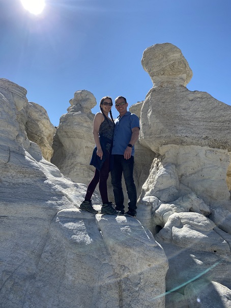
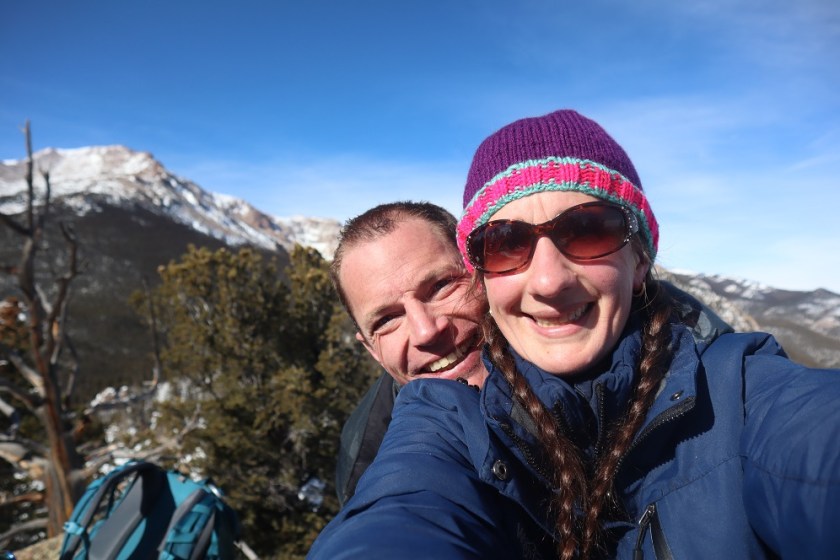
Partner: Steffen

Steffen was interested in visiting Barr Camp, it felt like it’d been forever since I’d been,  I hadn’t been aware of and the weather was perfect, so today seemed like a great day to hike the Barr Trail.

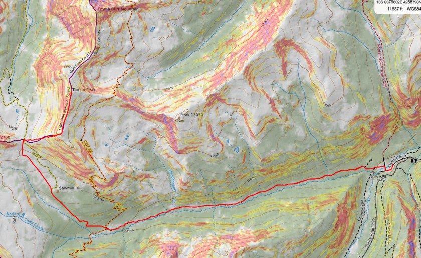
I wasn’t able to find a lot of information on this peak, but looking at the Pikes Peak Atlas it seemed to be just behind Barr Camp. I figured we’d figure it out.

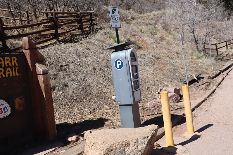
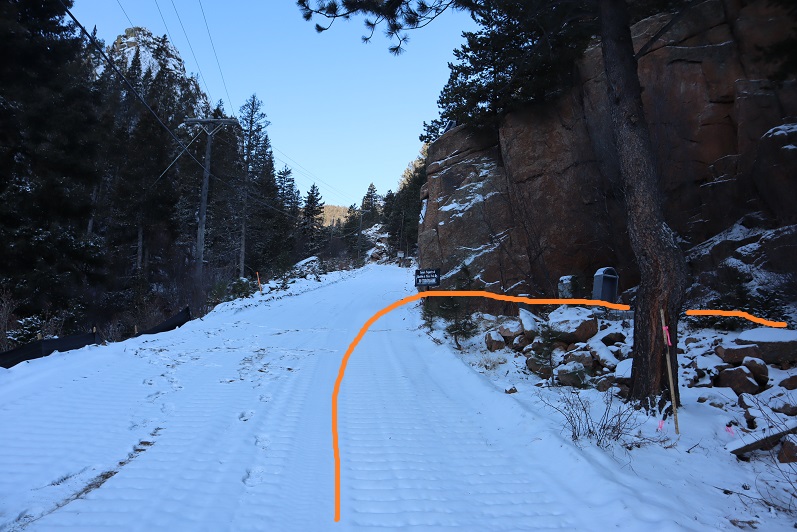
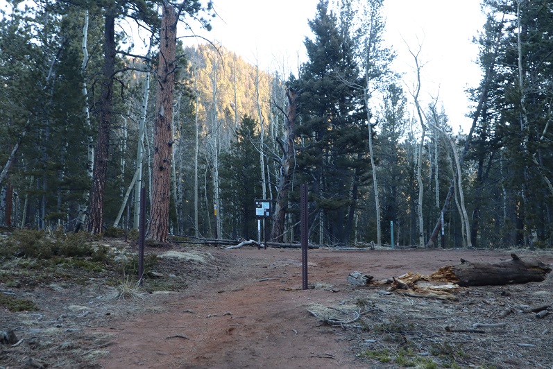
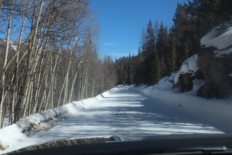
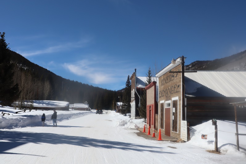
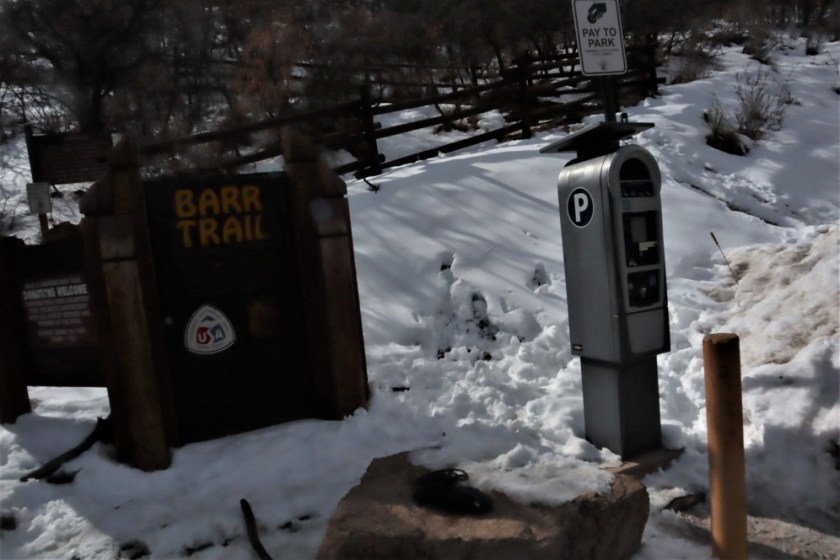
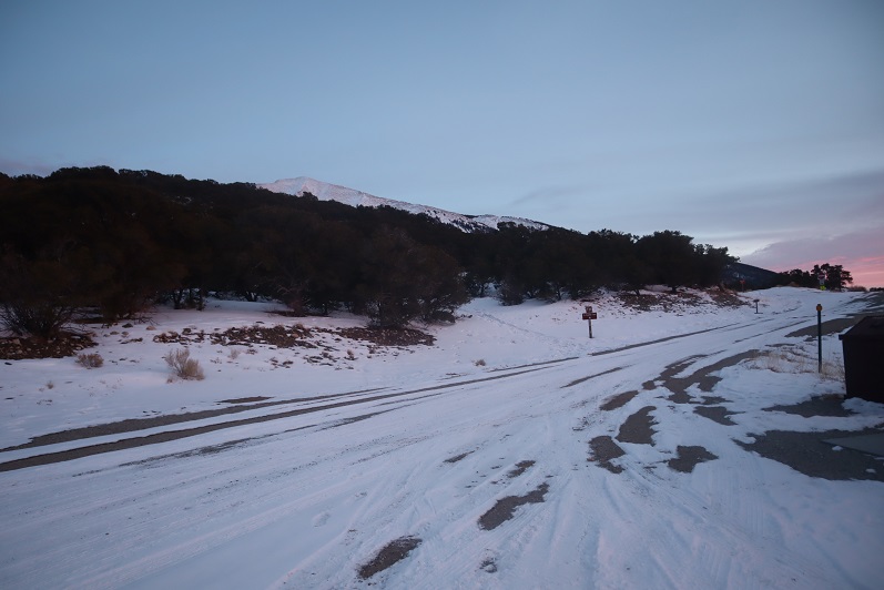
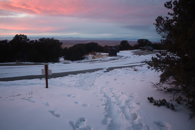
We arrived at the Barr Trail parking lot around 5:30am and were surprised the parking situation has (again) changed. As of today it’s $10 to park in the upper lot.  Last time I was here it was $40, but it’s been $5, $10, and $20 in the past.  The parking app is gone, and the fee machine is back.  This is all good news.

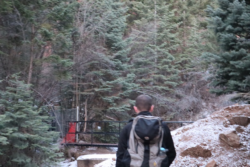
We gathered our gear and were ready to go at 5:45am. The guy who parked next to us unfortunately left the dome light on in his truck, but fortunately (maybe?) he also left his truck unlocked so we were able to shut it off for him.  He was planning on summiting Pikes Peak and most likely had a 12 hour day; we didn’t want him to come back to a dead battery.  Also, he was getting a late start if he truly intended to summit today. We ended up passing him within 20 minutes and let him know about the situation.

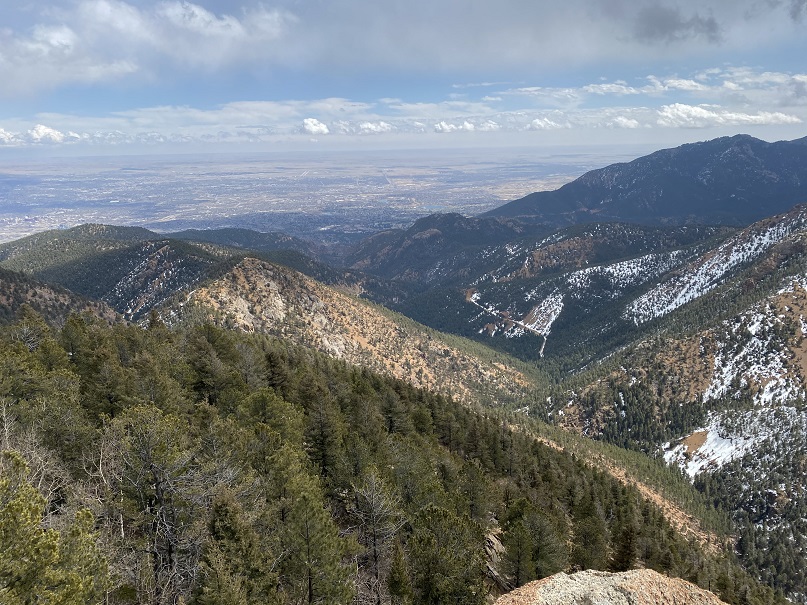
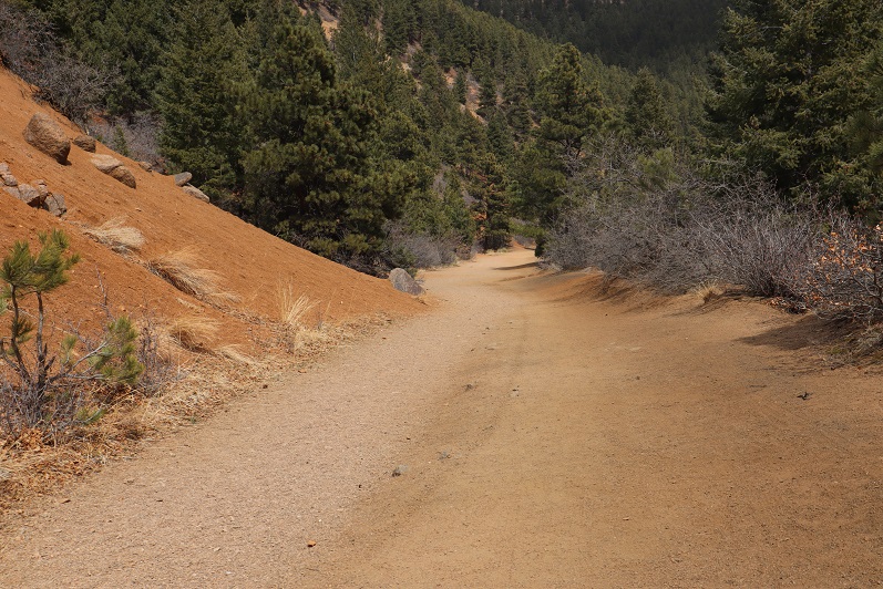
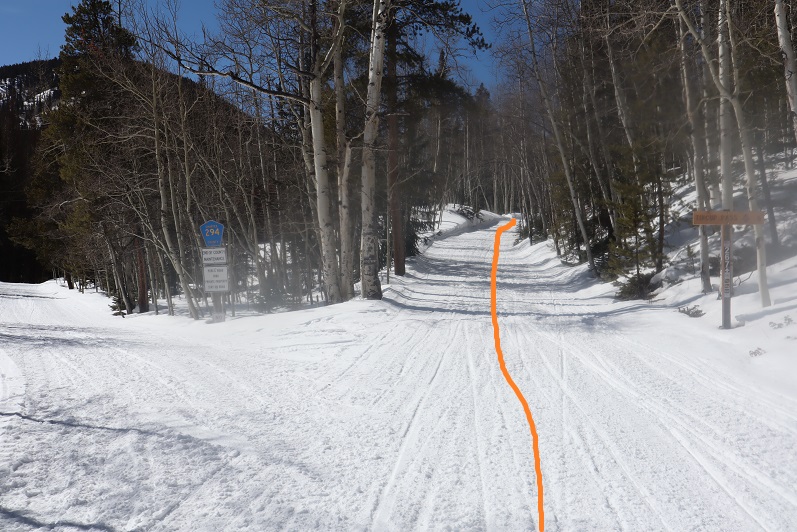
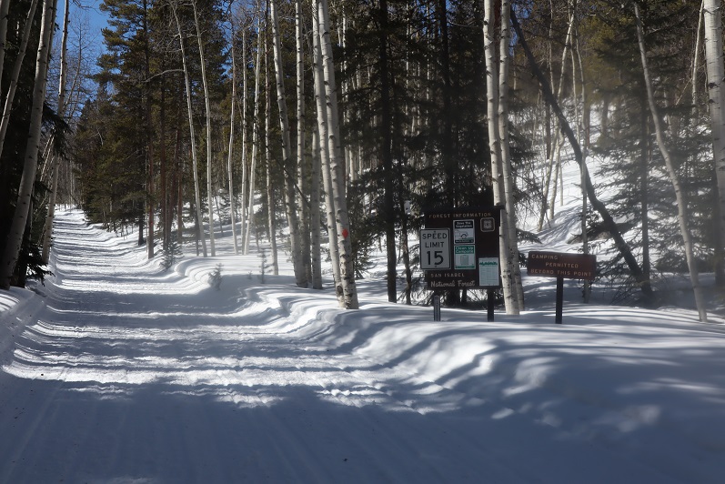
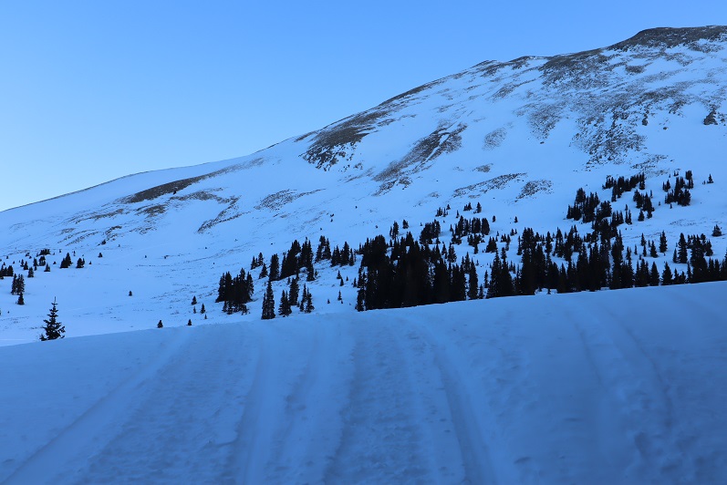
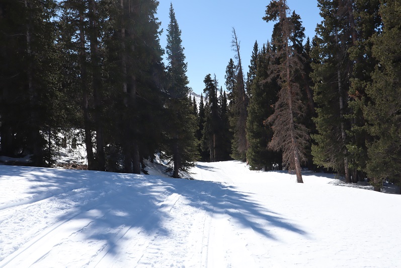
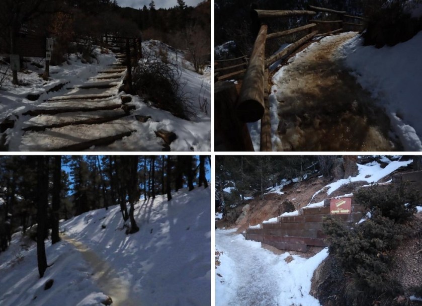
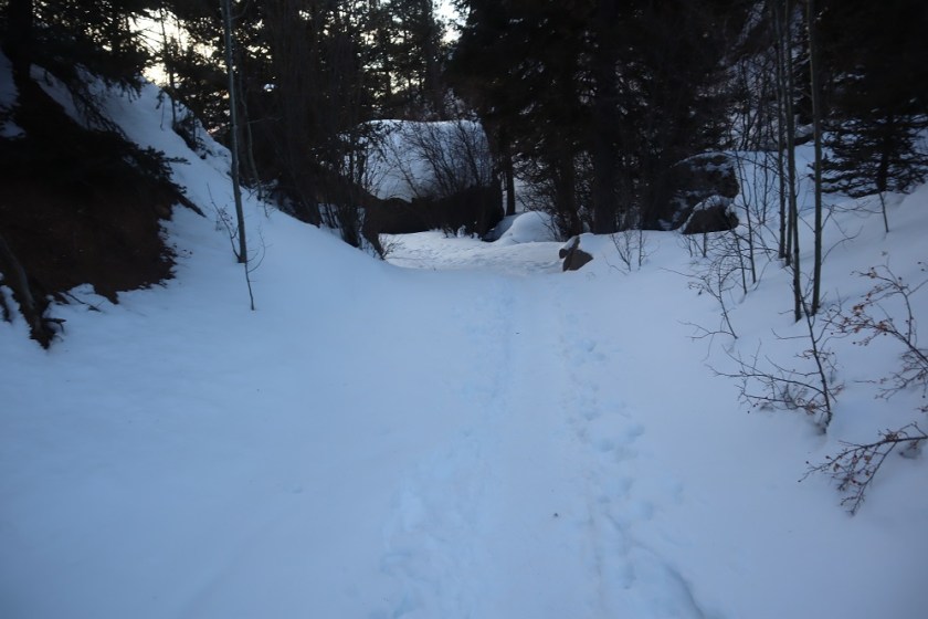
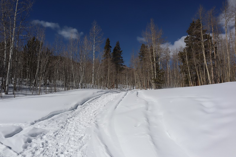
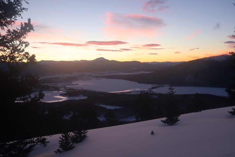
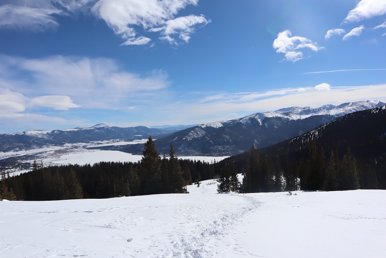
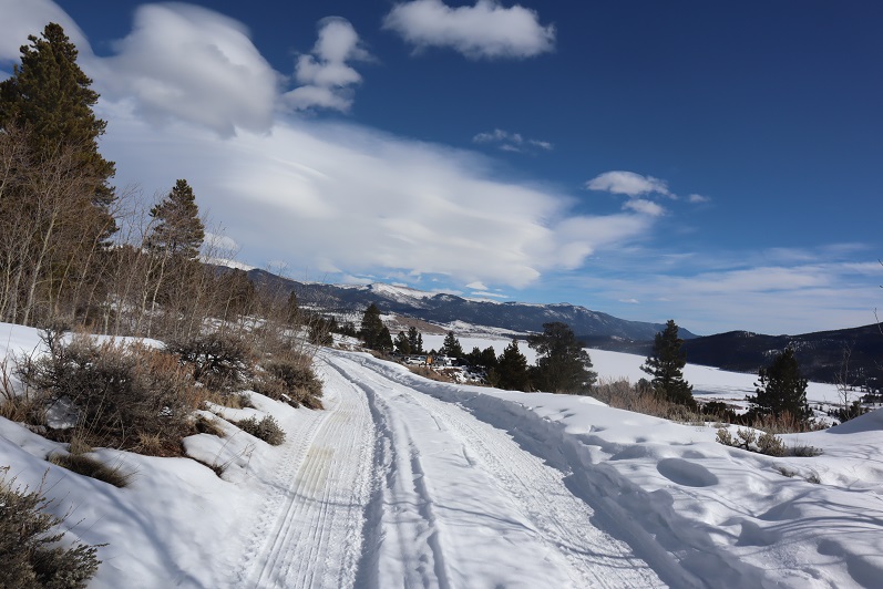
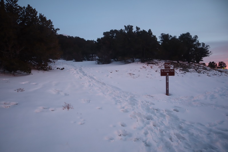
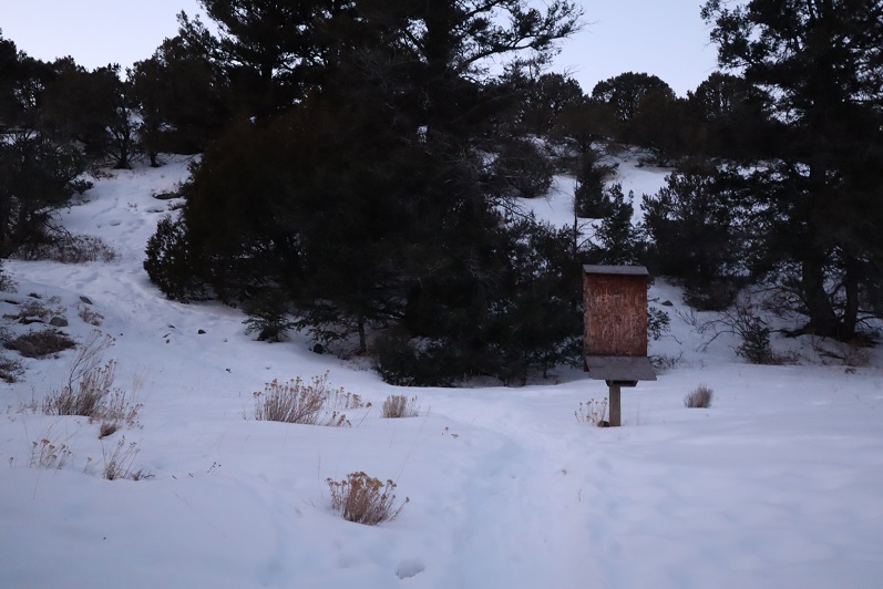
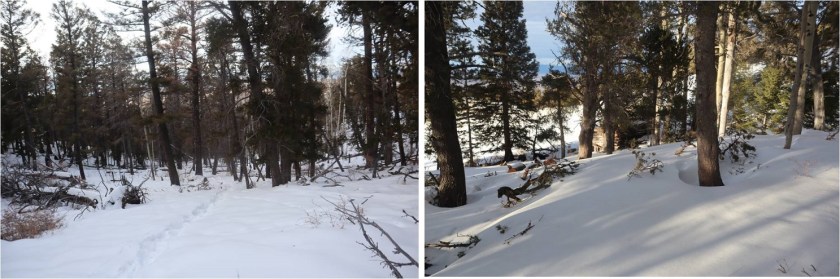
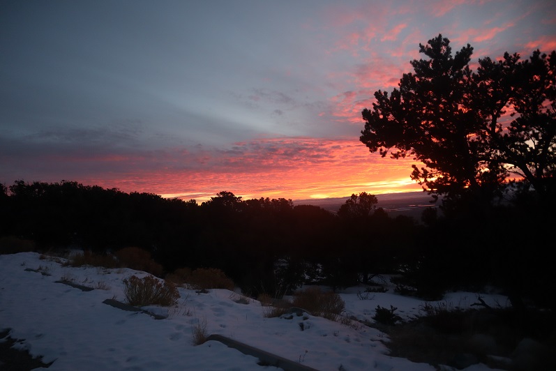
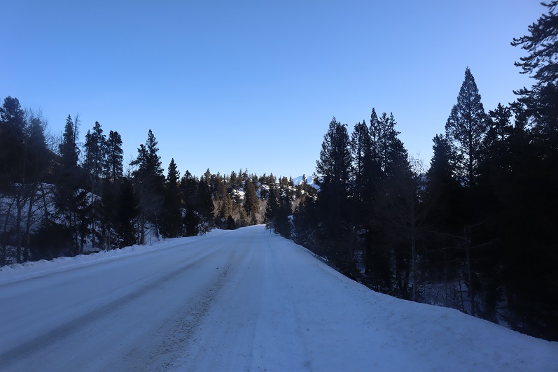
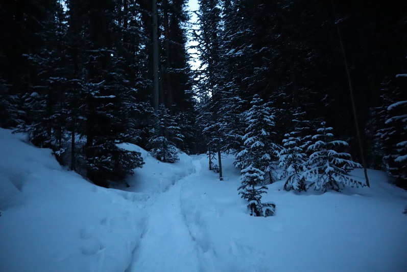
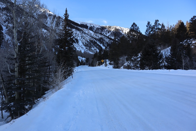
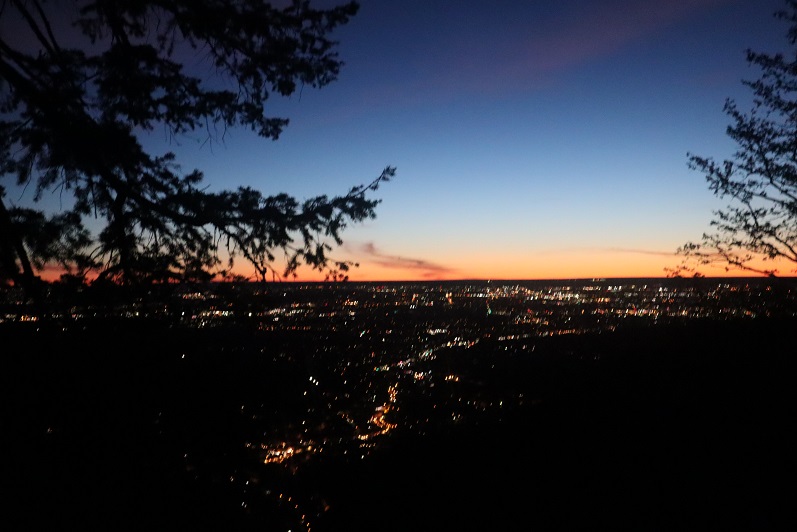
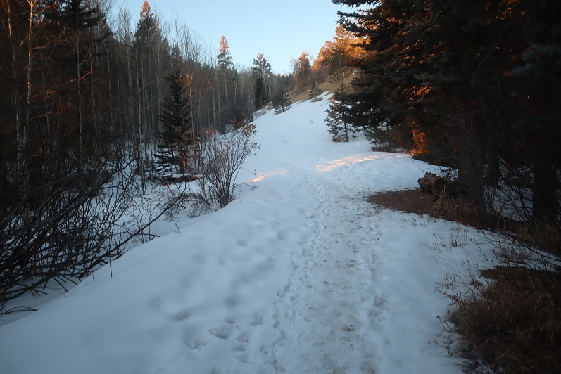
I’m not going to spend a lot of time describing the trail to Barr Camp because it’s an easy class 1 hike the entire way. There are very accurate mile markers every half mile, great signage, and as long as you stay on the trail it’s difficult to get lost, even in winter.  As we ascended the first 3 miles we had great views behind us of the city lights.  Too bad it’s difficult to get pictures at night.

2

We passed the cutoff for the incline as the sun started to rise

3

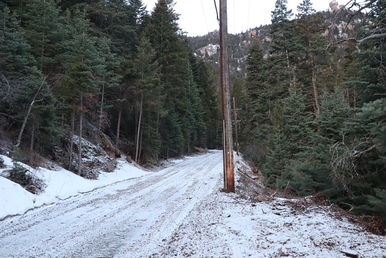
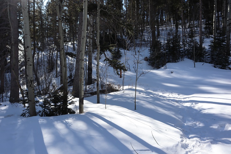
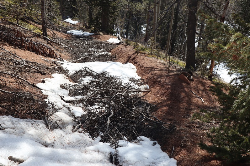
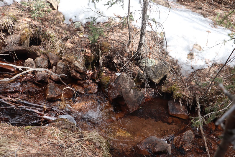
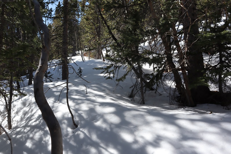
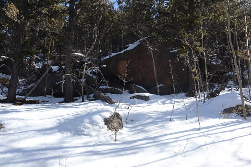
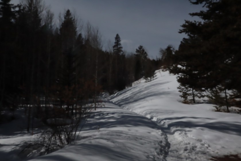
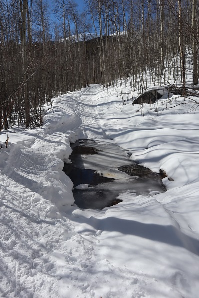
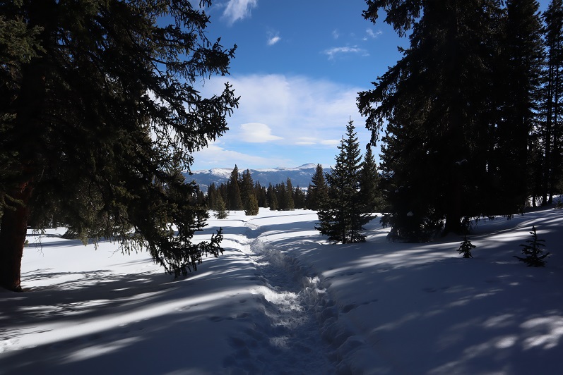
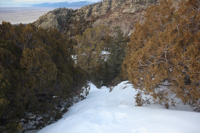
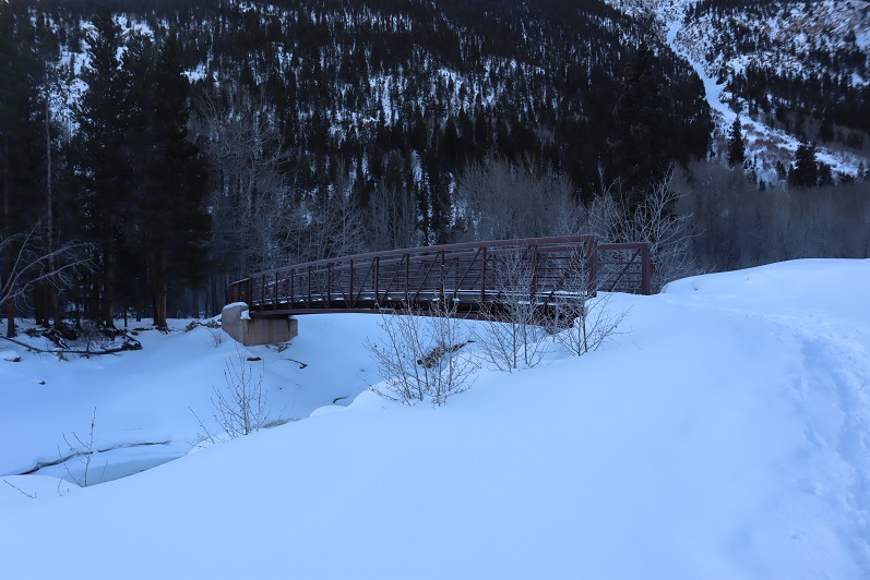
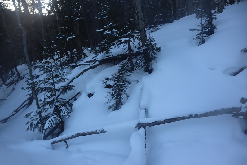
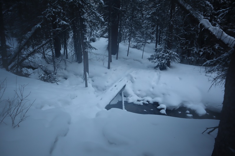
And as soon as we crossed the creek (which is usually dry in summer) the trail conditions changed.

4

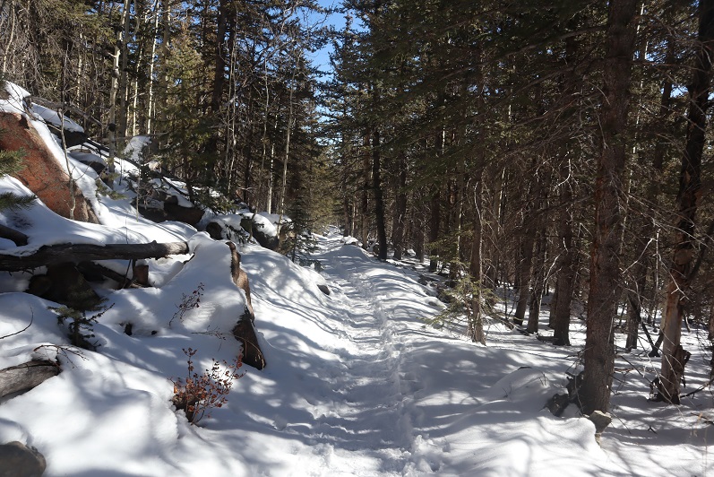
They went from a bit of ice every once in a while to a frozen river of water that would be perfect for ice skating

5

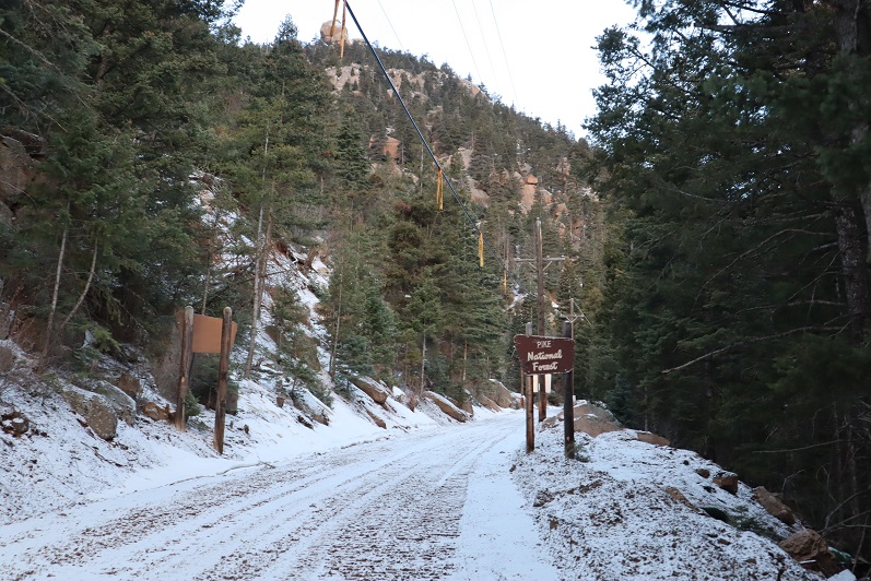
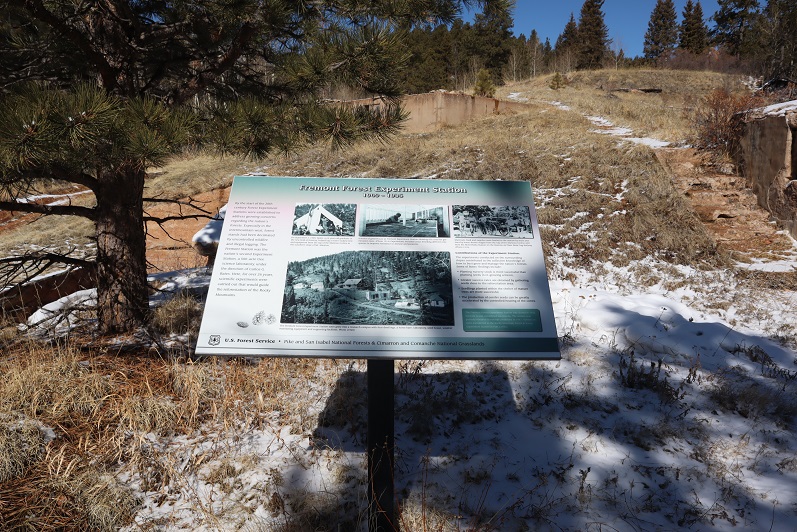
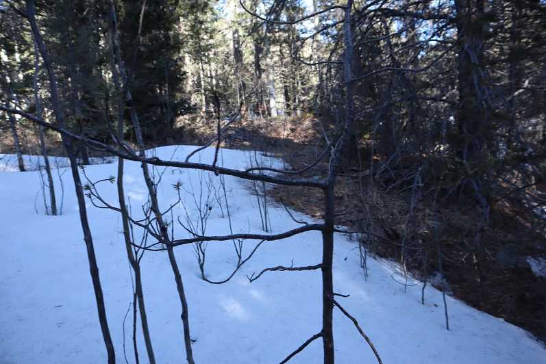
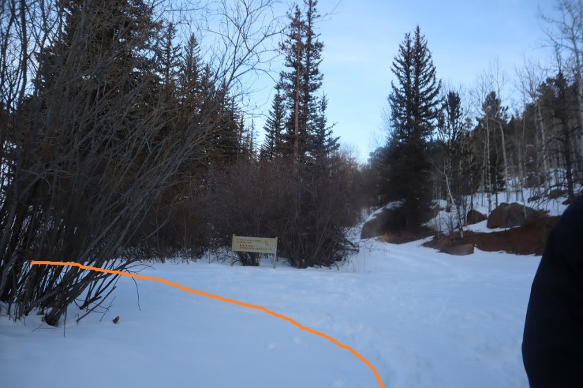
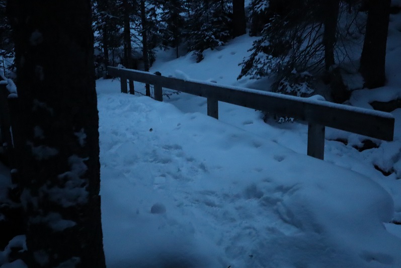
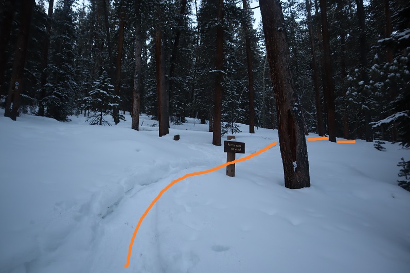
This lasted until just after the junction with the experimental forest (turn left/southwest here)

6

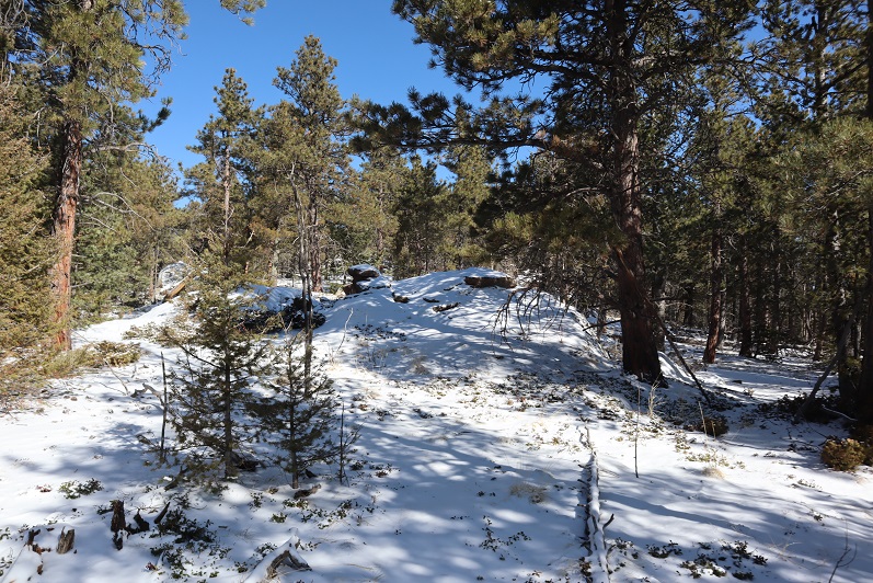
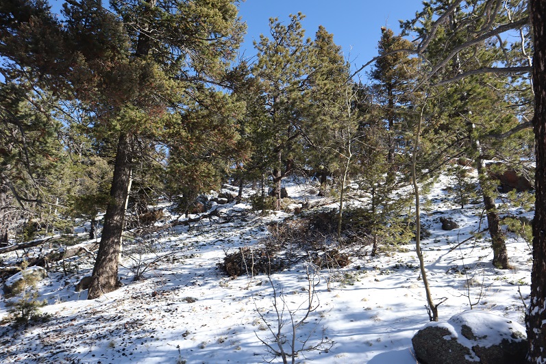
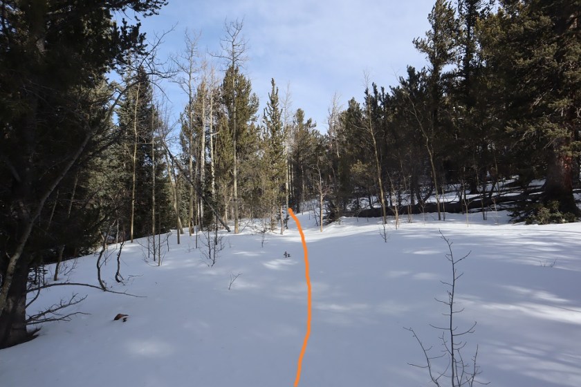
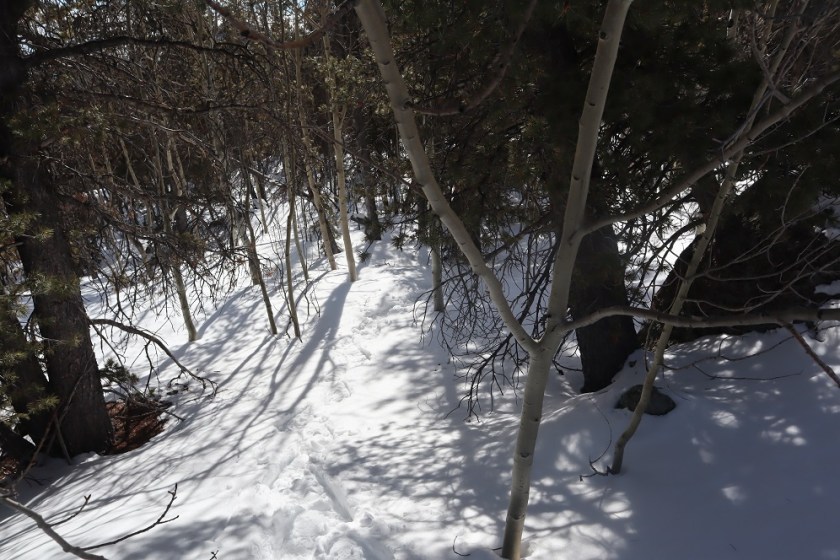
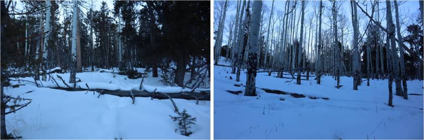
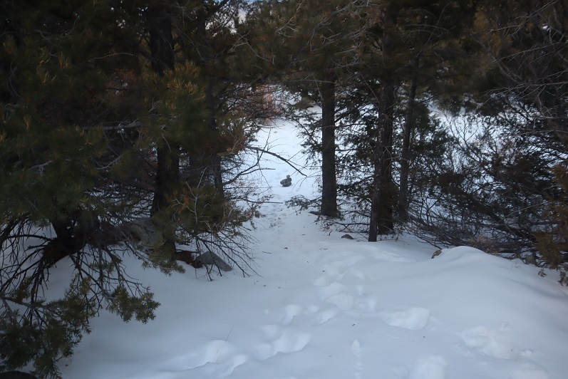
This is where the trenched snow started, and also where I scattered wildflower seeds two years ago in memory of my Granny (yes, the seeds were local to the area)

7

If it were summer you could walk three people wide without tripping on each other along this trail, but today we walked single file.

8

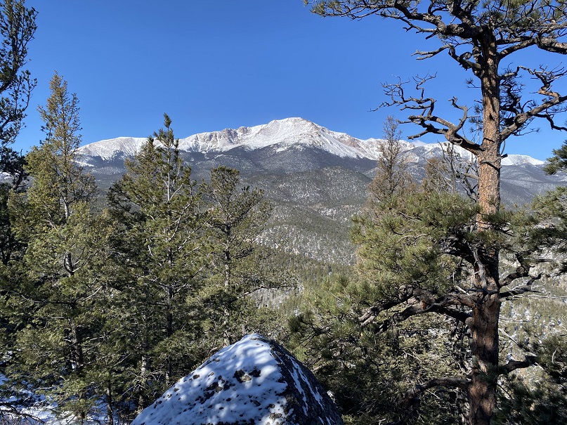
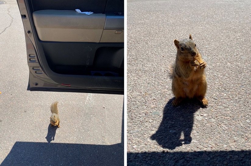
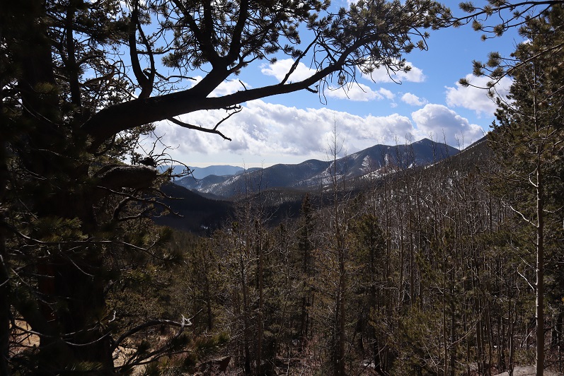
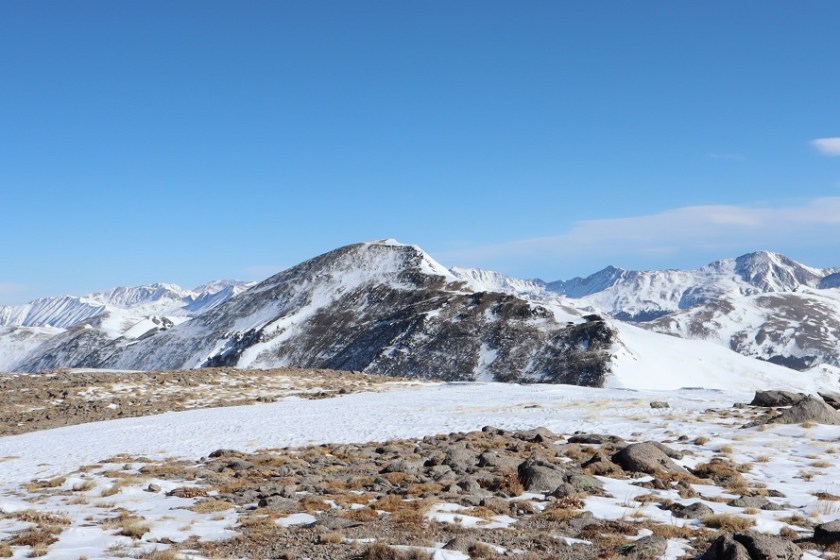
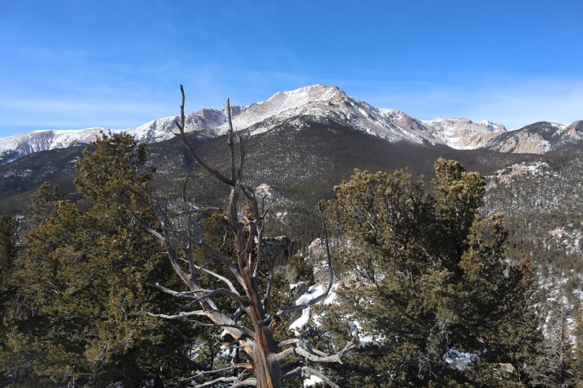
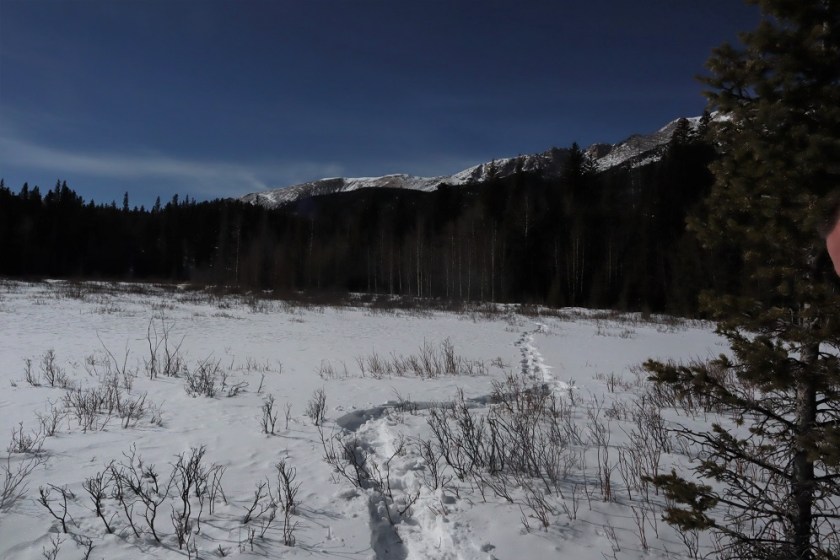
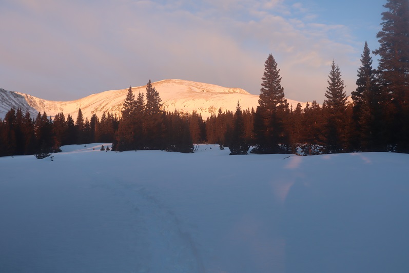
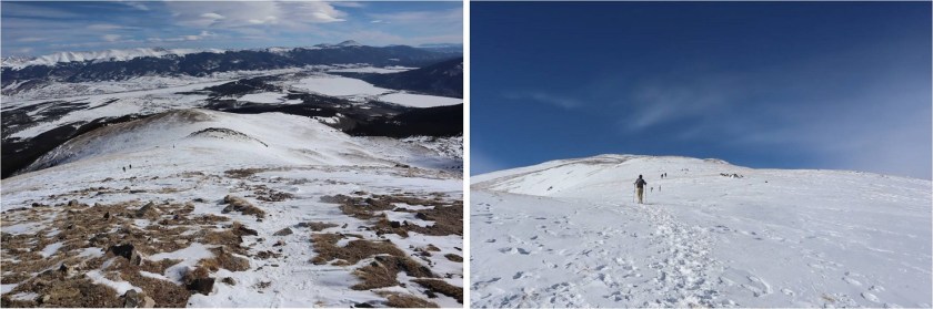
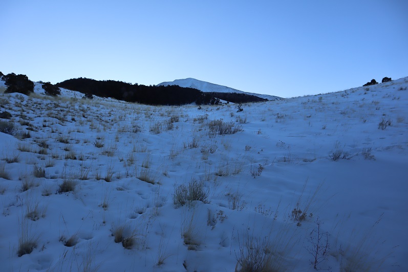
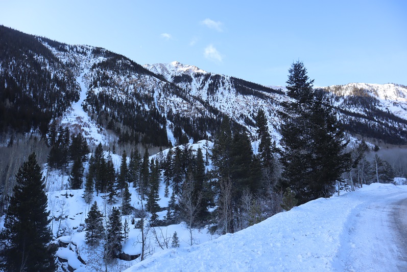
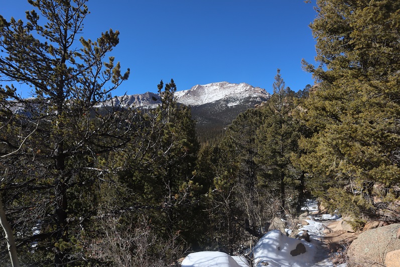
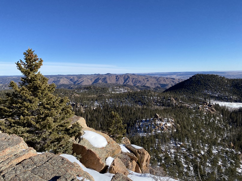
Around mile 4 we heard a noise and looked up, confused to see a rather young looking squirrel jumping around in the trees. Shouldn’t he be hibernating?  The views of Pikes Peak were (as always) amazing today

9

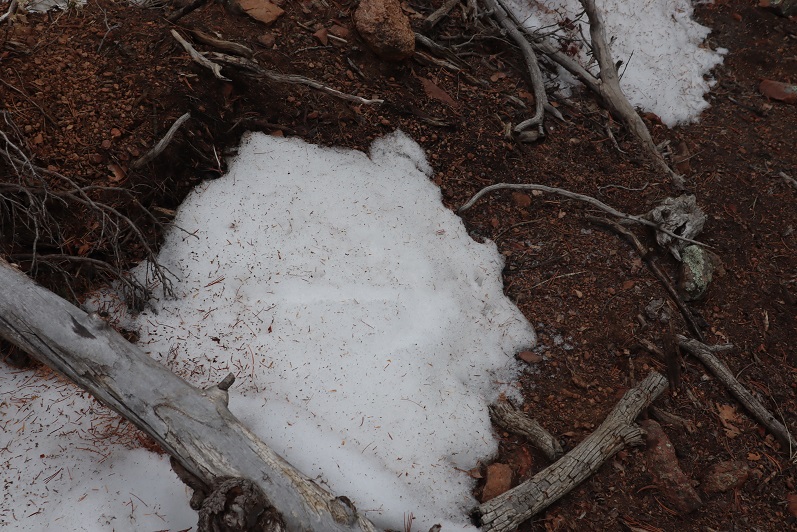
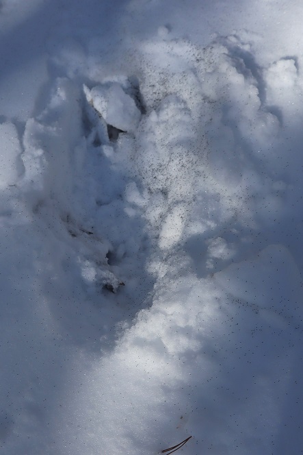
I stopped for a second because I saw something curious on the ground: it looked like some sort of pollen (which made no sense:  it’s February) but upon closer inspection discovered they were little bugs on top of the snow!  I could see them jumping and wondered how in the world they got there?

10

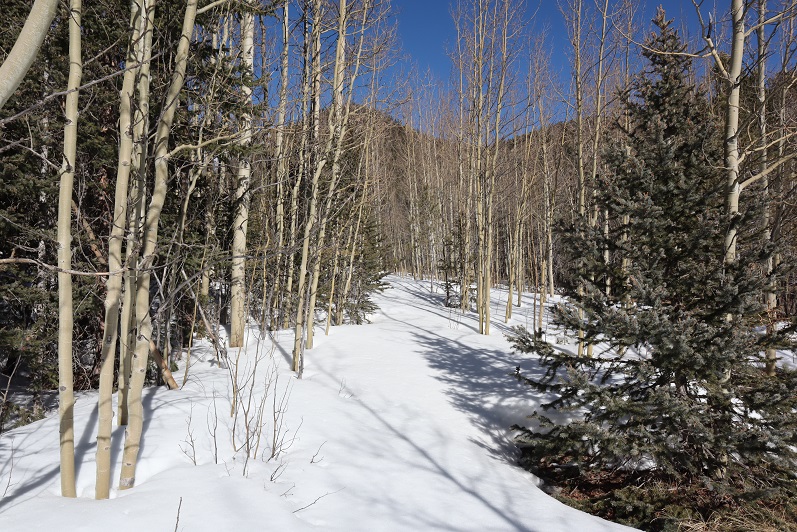
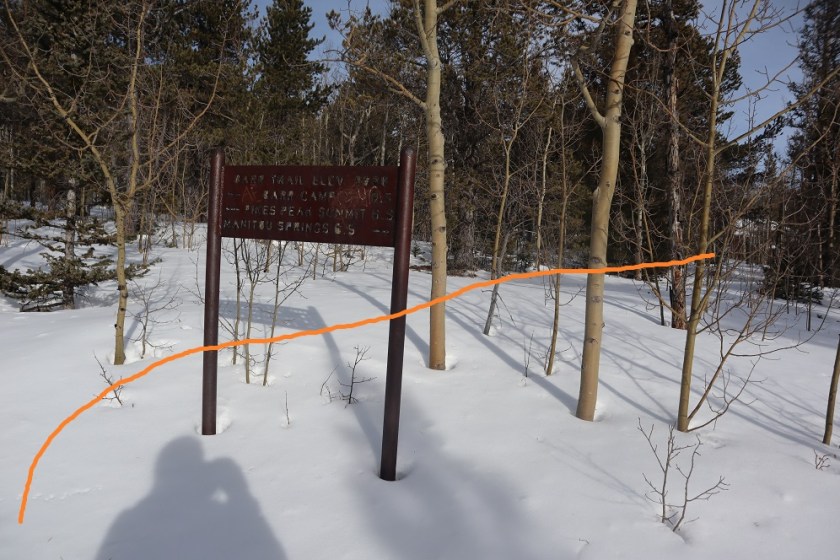
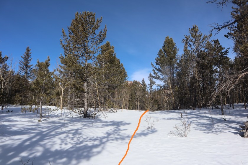
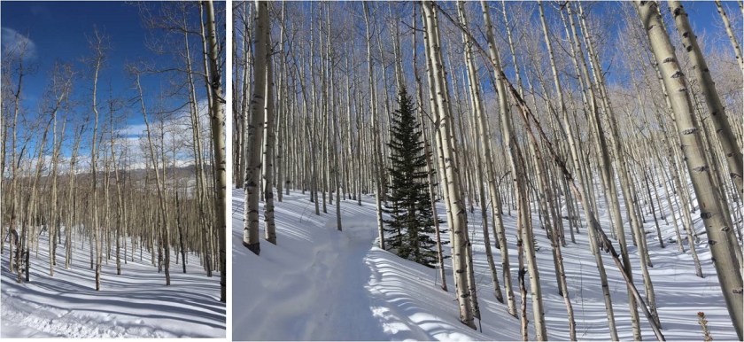
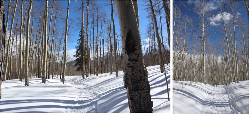
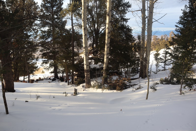
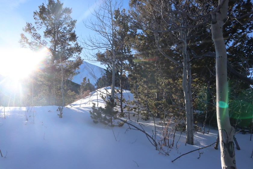
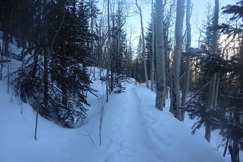
We made it to the aspen grove just before Barr Camp and I took a picture: I have a picture of this grove in every season except winter, and was excited to add this one to my collection.

11

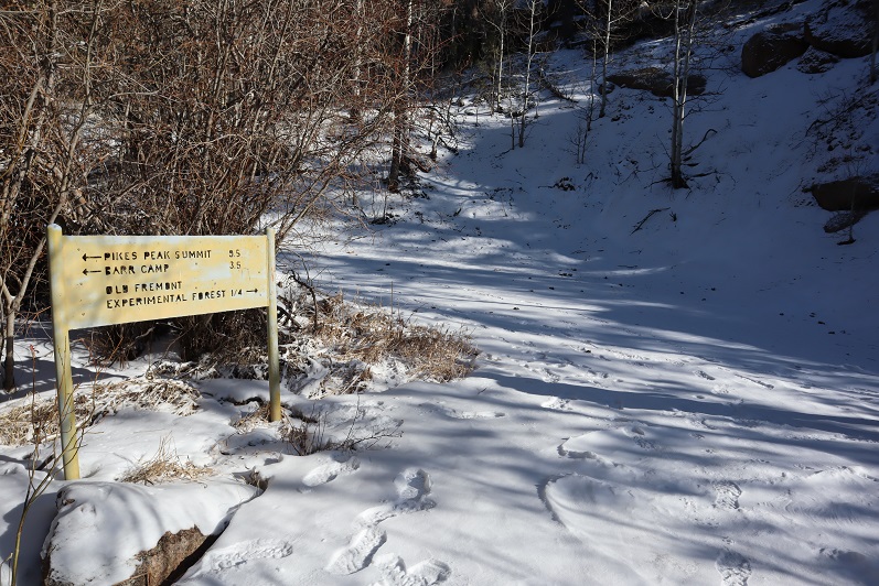
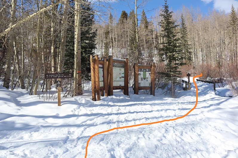
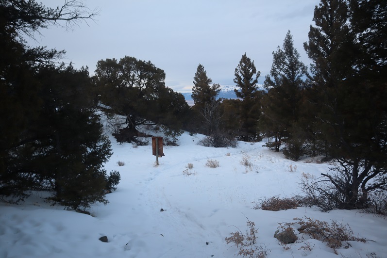
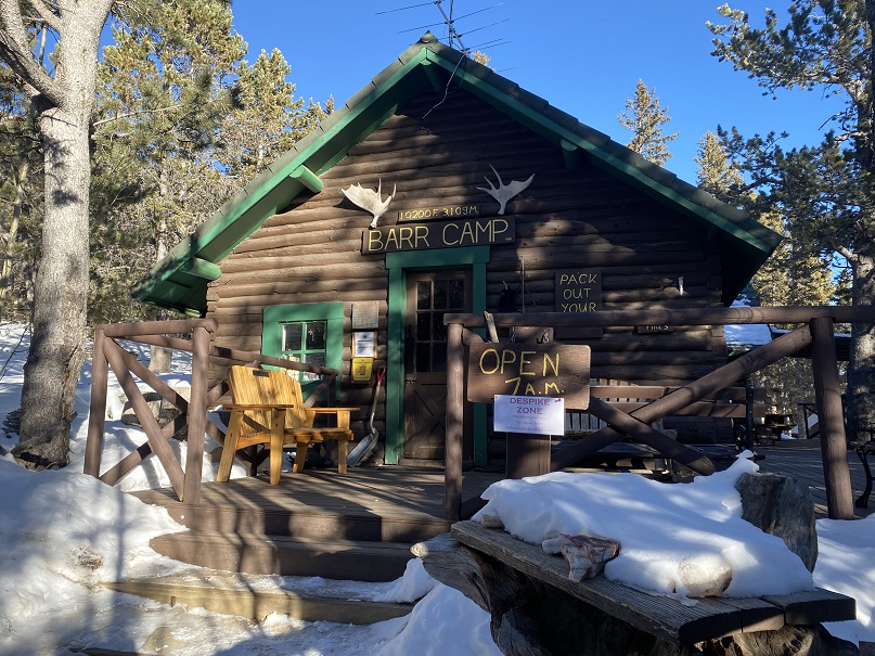
From the aspen grove it’s a quick jaunt to Barr Camp

12

13

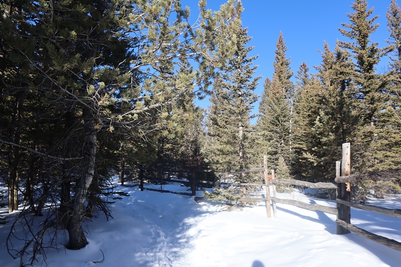
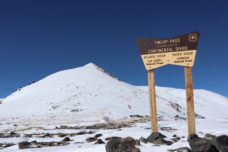
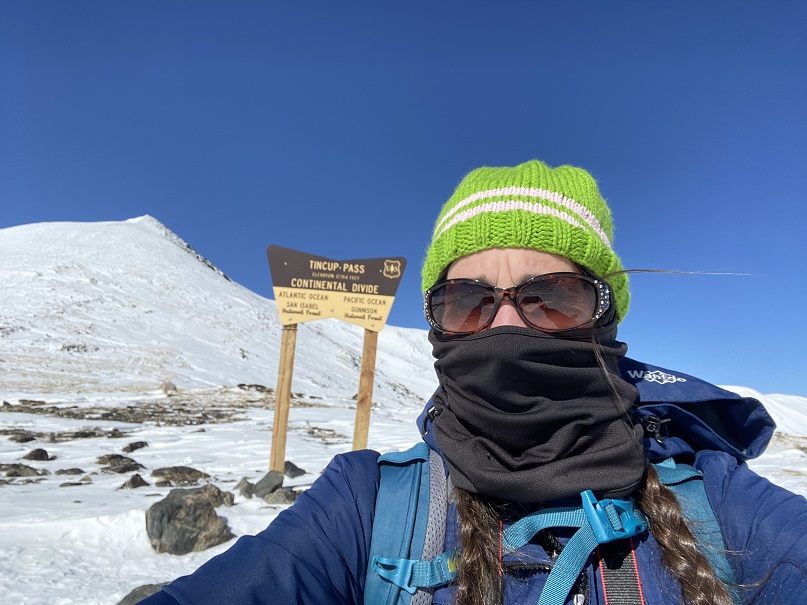
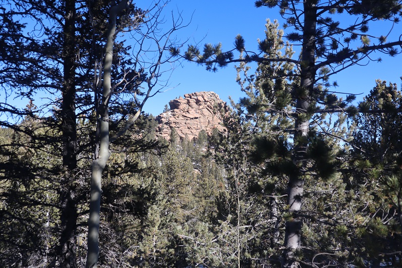
We decided to use the restrooms there and then went inside to inquire about PT 10245’

14

15

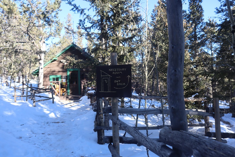
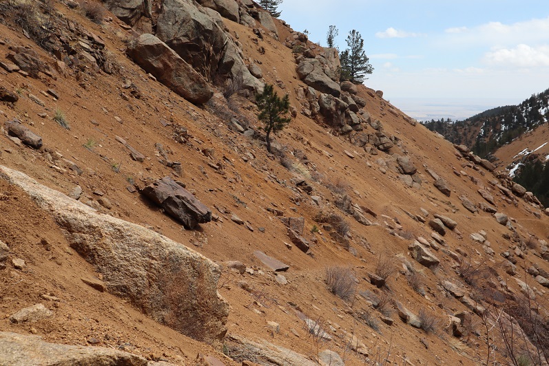
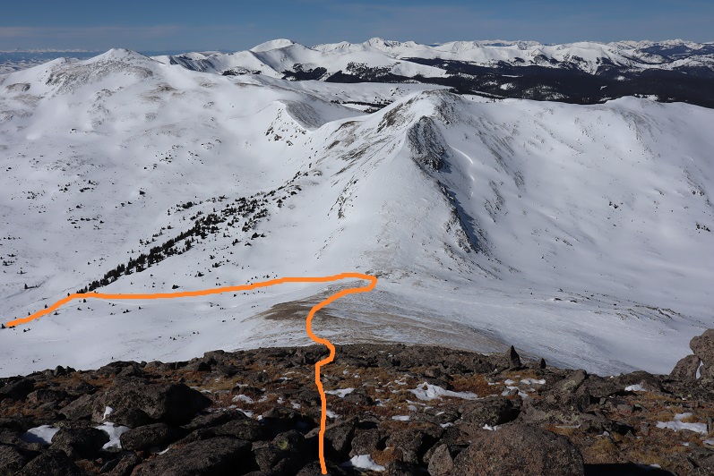
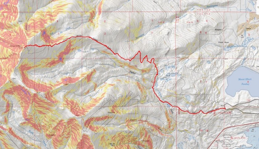
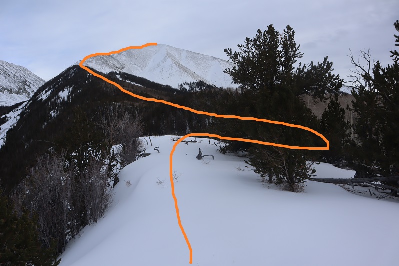
The caretaker didn’t know what PT 10245’ was, but when we looked at the Pikes Peak Atlas he said they called it “AdAmAn Peak”. (Note, this ended up being a different peak altogether).  In the summer there’s a nice trail that will get you within a few dozen yards of the peak, but since it was winter the trail was covered in snow.  He said to go up, then down, then up again, and then back down, heading northwest.  Then there would be quartz rocks on the ground in an arrow showing us where to go (but those would be covered in snow as well).  We couldn’t miss it.

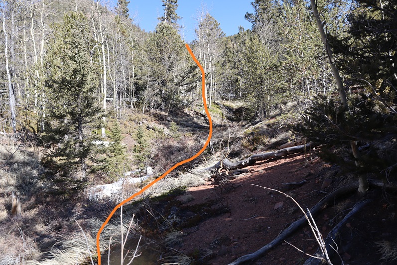
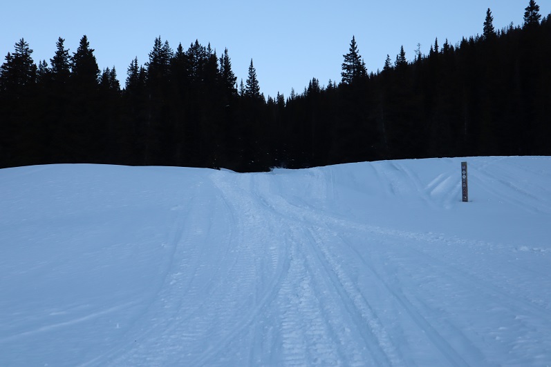
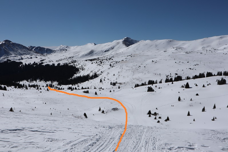
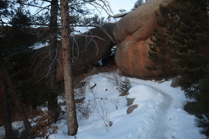
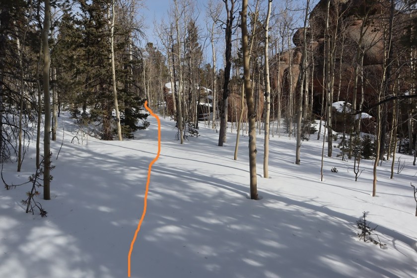
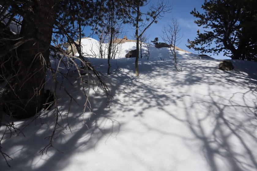
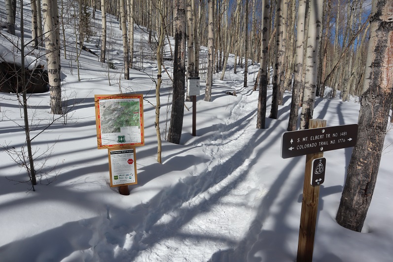
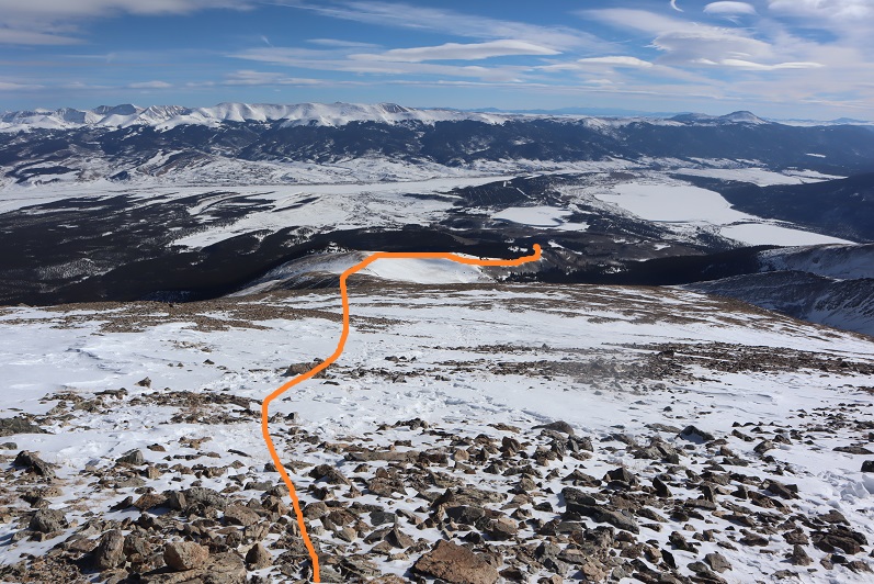
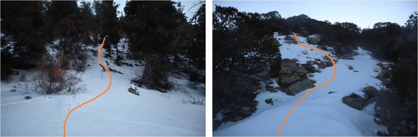
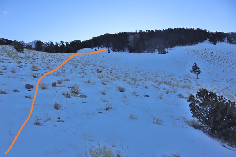
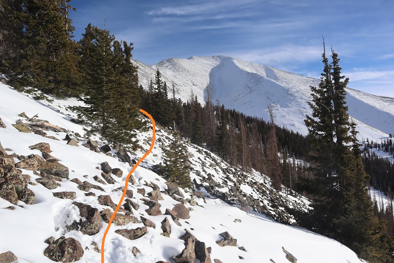
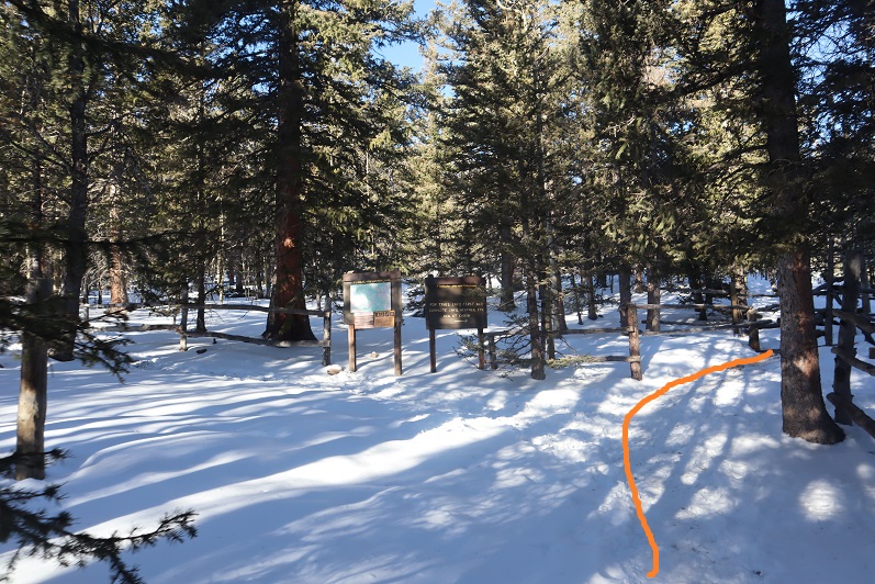
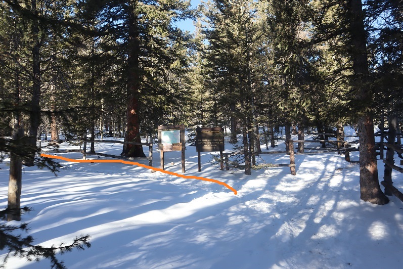
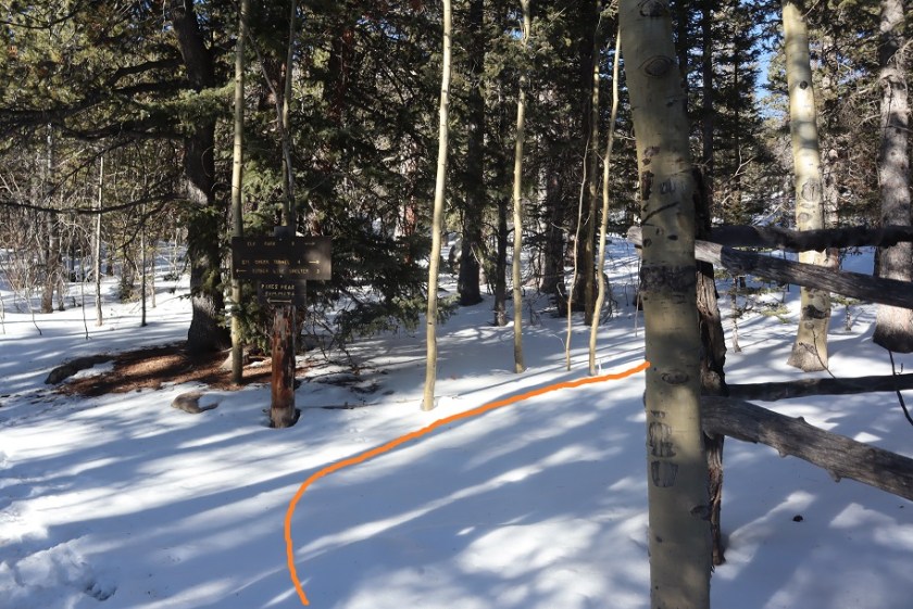
Um, ok. Good thing we’re good with a map and compass!  We exited the lodge, put on our microspikes, and were on our way.  We took the Barr Trail again a little bit southwest (just to the end of the fence) and turned right (north) towards Elk Park on trail 652.

16

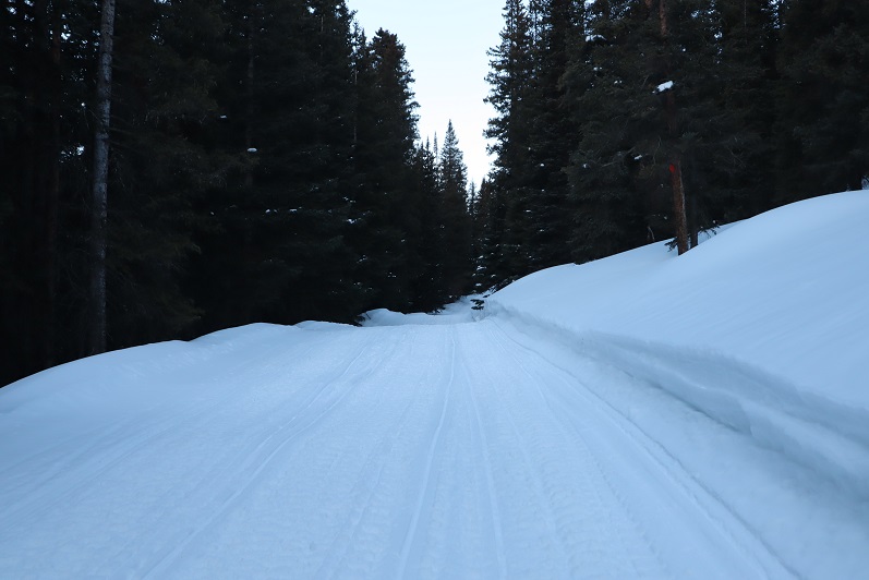
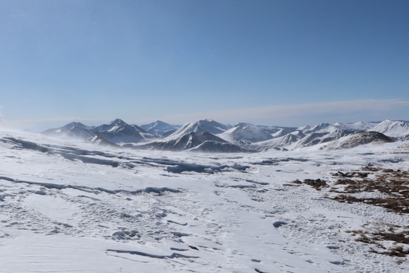
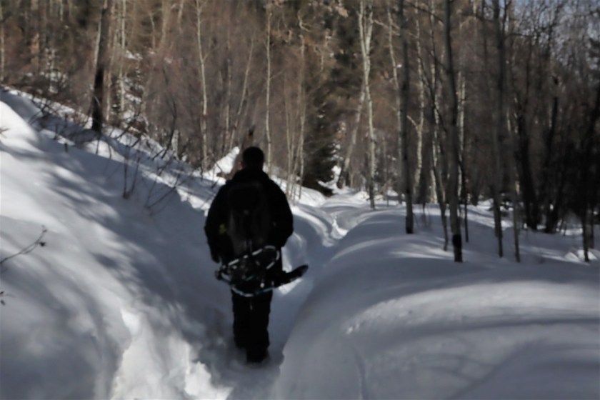
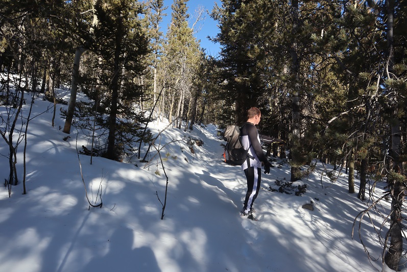
The caretaker had been correct: the trail was covered in snow, but some of the time we could make out where the trail was.  We hadn’t brought our snowshoes, so we were having a time getting snow in our shoes (and pants, etc.).  Next time remind me to bring gaiters.

17

18

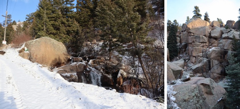
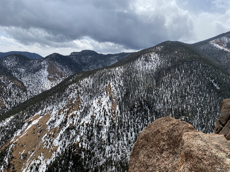
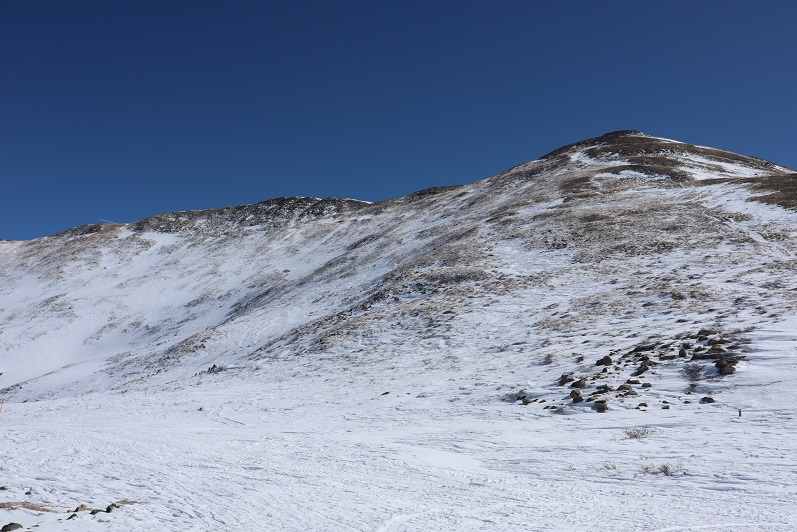
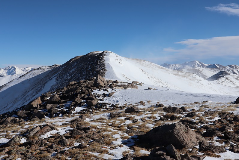
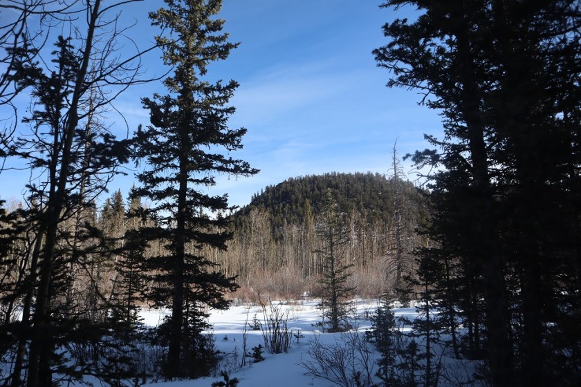
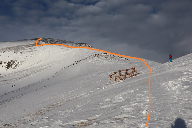
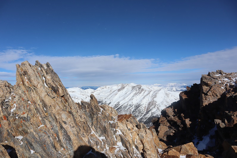
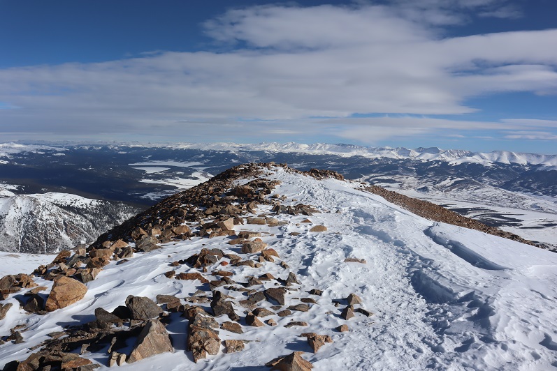
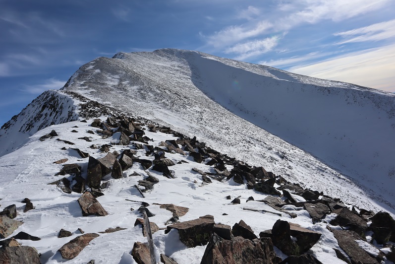
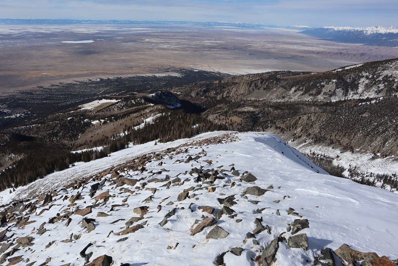
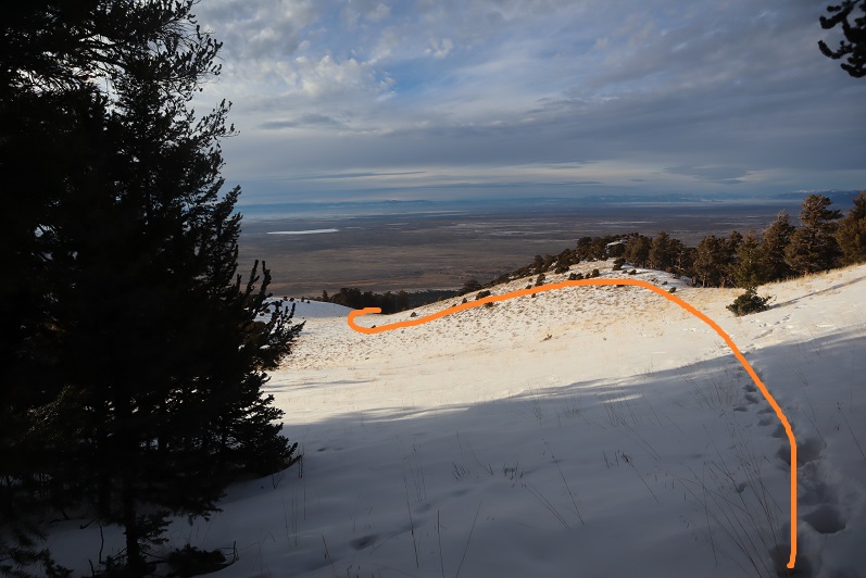
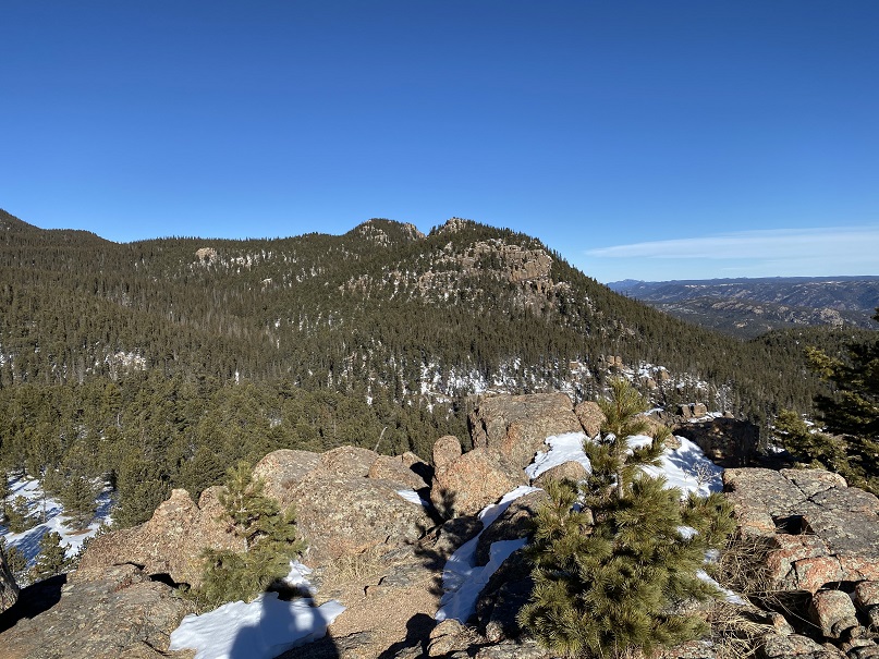
We hiked on this trail for almost exactly half a mile, and we did indeed have a great view of the summit from the trail. I started to worry we wouldn’t be able to summit today:  I hadn’t brought any rope and that summit looked like it needed rope!

19

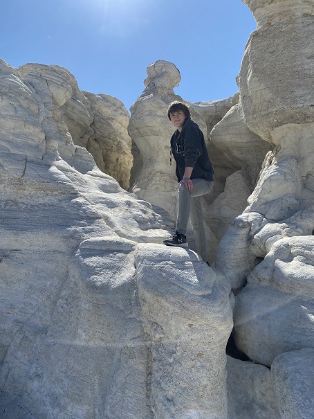
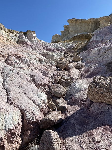
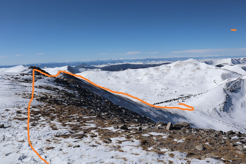
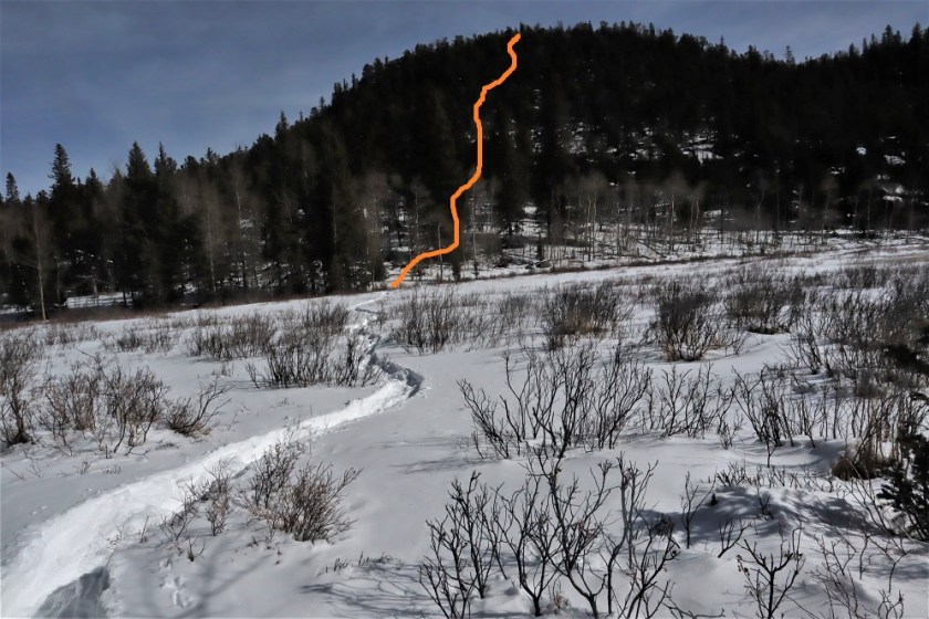
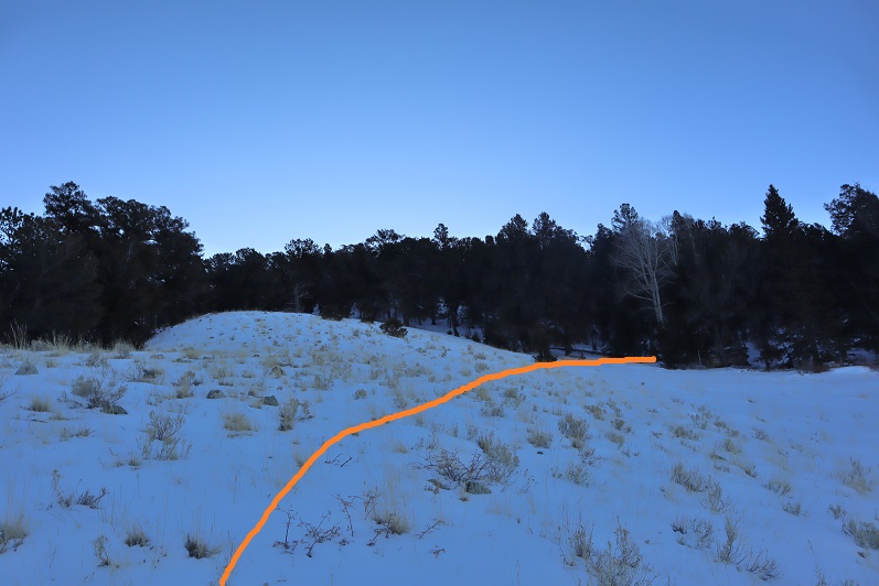
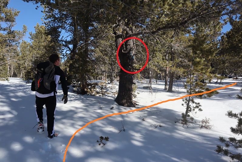
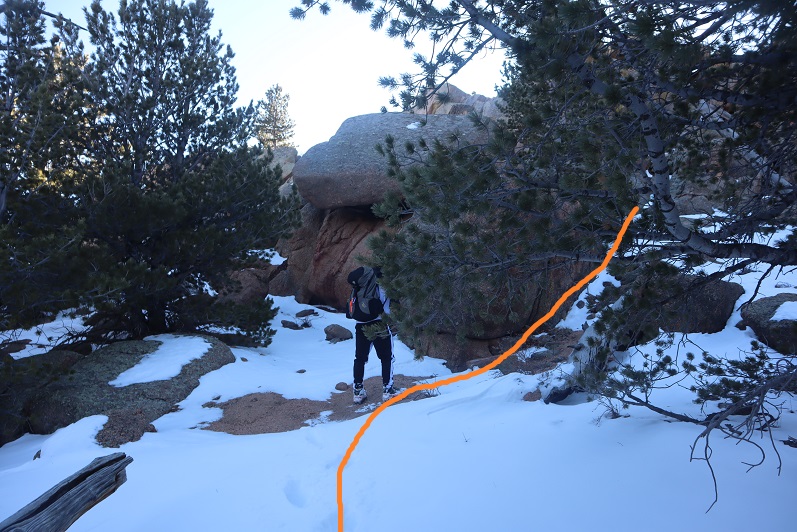
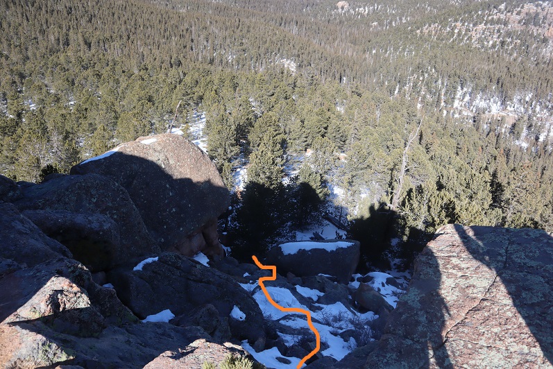
The trick to this summit is to summit from the west. After half a mile we came to a small saddle and decided to turn right and head for the summit (this is how the caretaker should have described the route to us:  follow the trail until you come to the saddle, turn right, and then scramble to the summit).  Coincidentally, there were blue dots spray painted on the trees here, a good indication that’s where you should turn

20

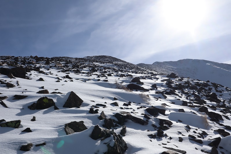
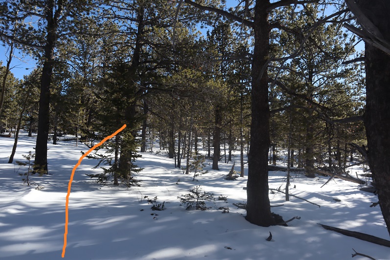
There was no visible trail here, so we just aimed for the summit block (east)

21

Here’s how we summited:

22

23

24

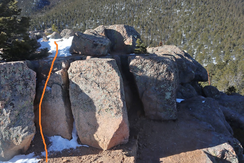
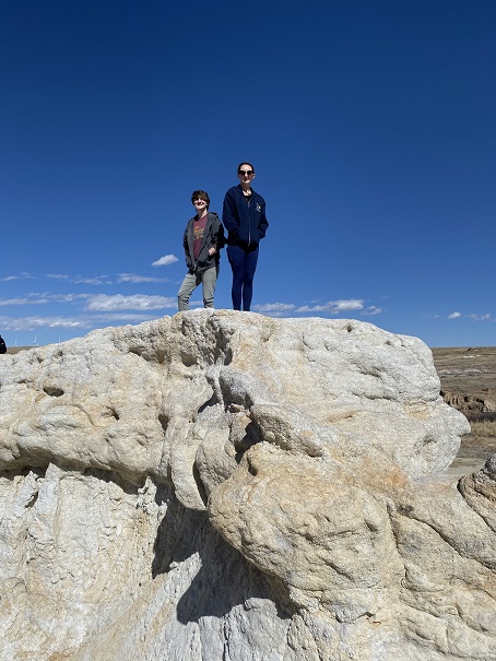
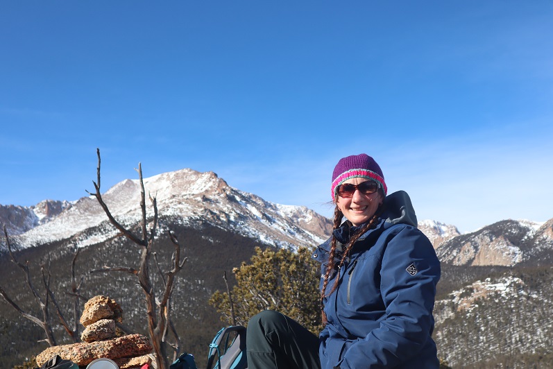
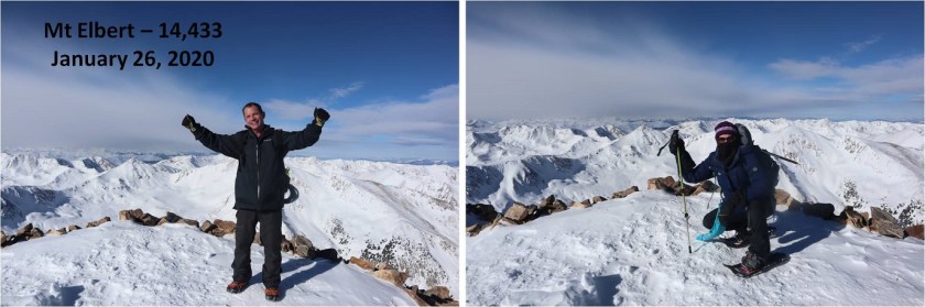
It was a class 3 scramble and tons of fun! My advice is to initially go left up the rocks, but you summit more near the middle of the rocks.  The summit was flatter and larger than I’d anticipated

25

26

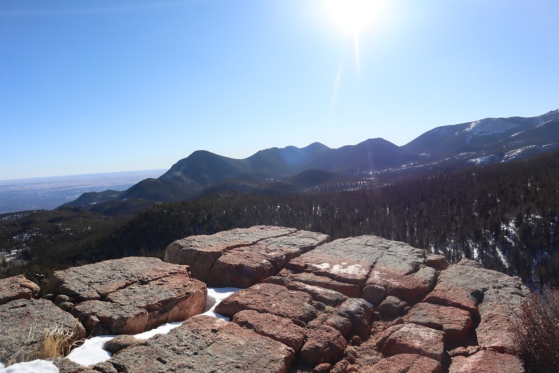
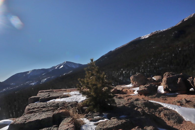
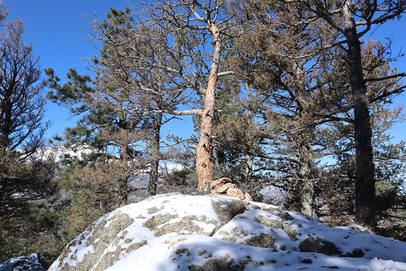
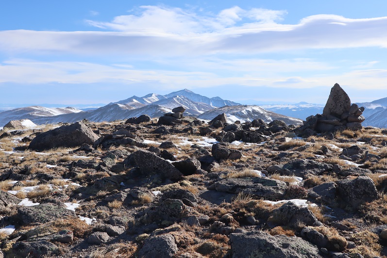
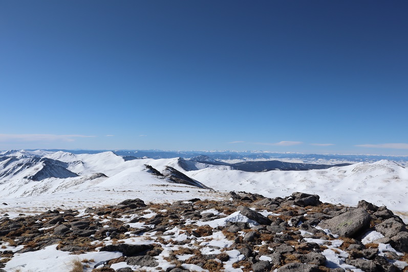
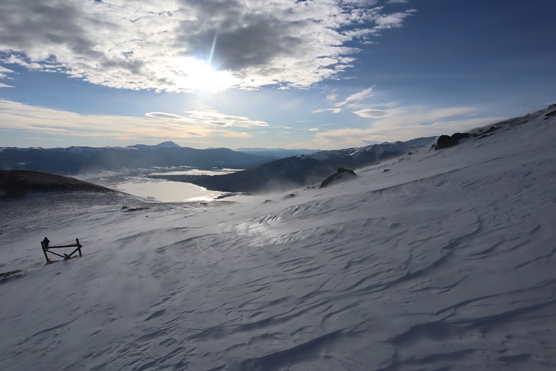
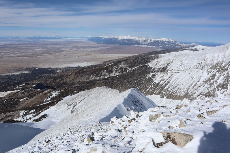
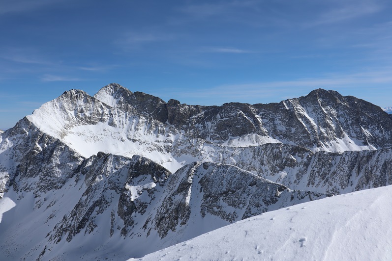
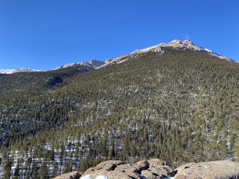
There were some great views!

27

28

29

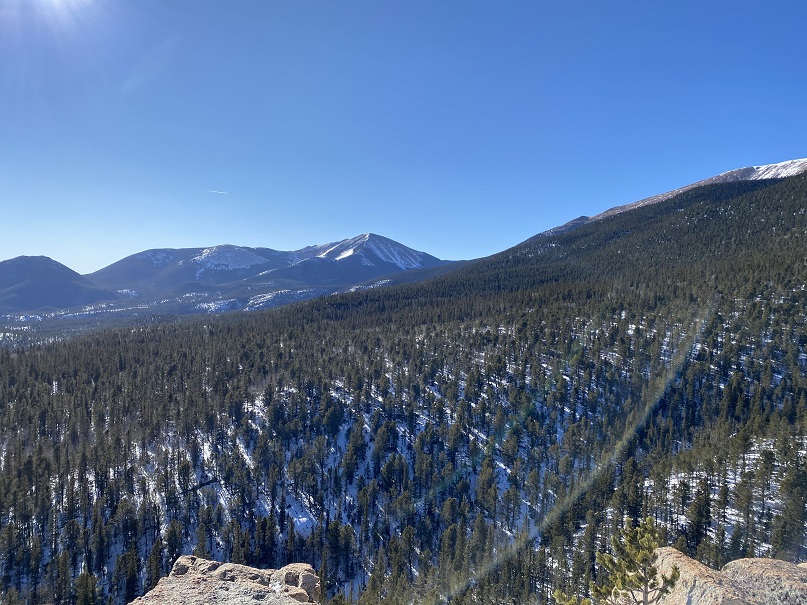
I’ve never seen Pikes Peak from this angle before…

30

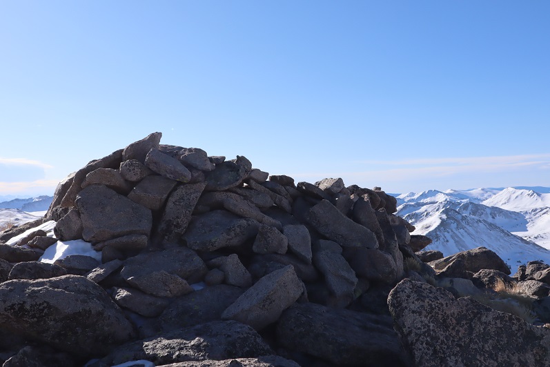
There wasn’t a summit register (we looked longer than we should for one)

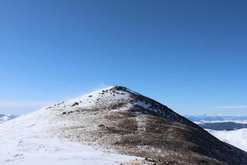
Time to head down. It’s not as scary as it looks…

32

33

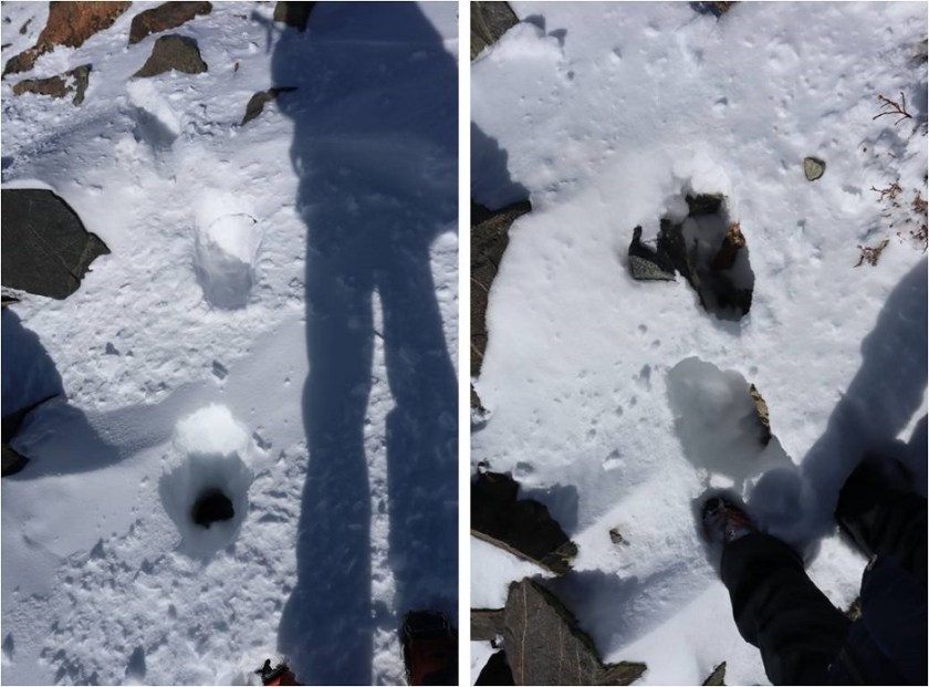
We followed our tracks back to Barr Camp, and noticed our tracks were filled with thousands of those little bugs already! Yuck!  I went home and researched them and apparently they live under the snow until it’s a nice day out, and then they hang out on top of the snow.  They were very, very small.  So small I’m thinking we were probably breathing them in and not noticing it.  Yes, those little black dots are the bugs.

34

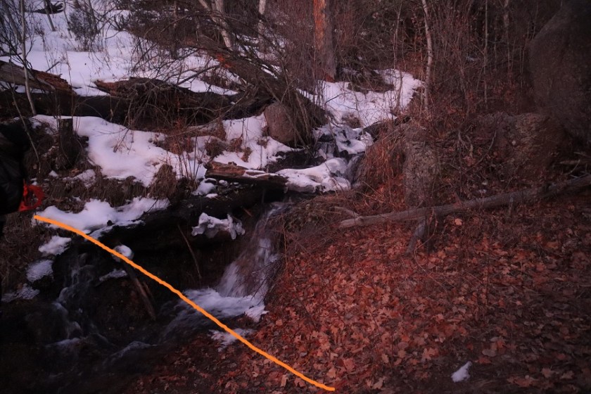
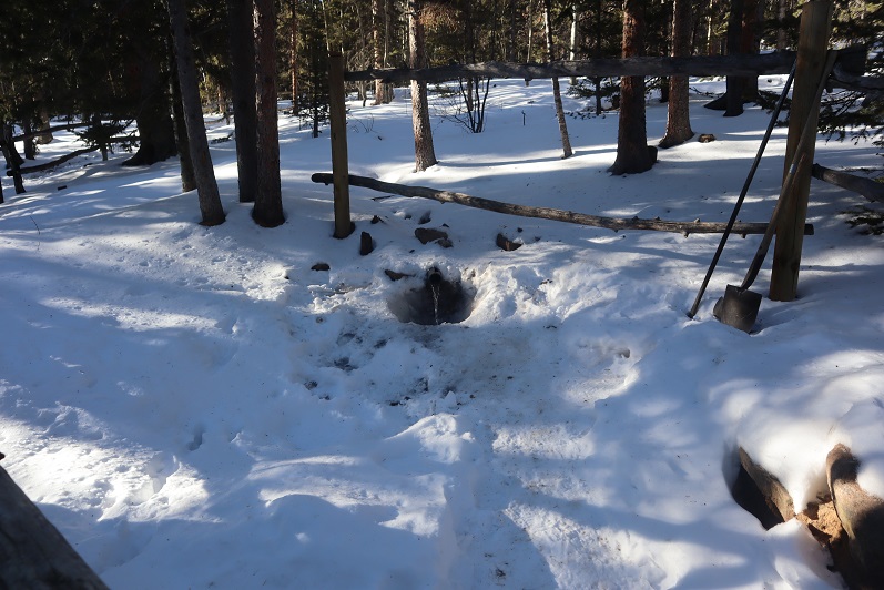
We made it back to Barr Camp and decided to buy a protein bar and leave a donation (hey, we used their bathrooms). I noticed the stream where I usually filter water was just a trickle

35

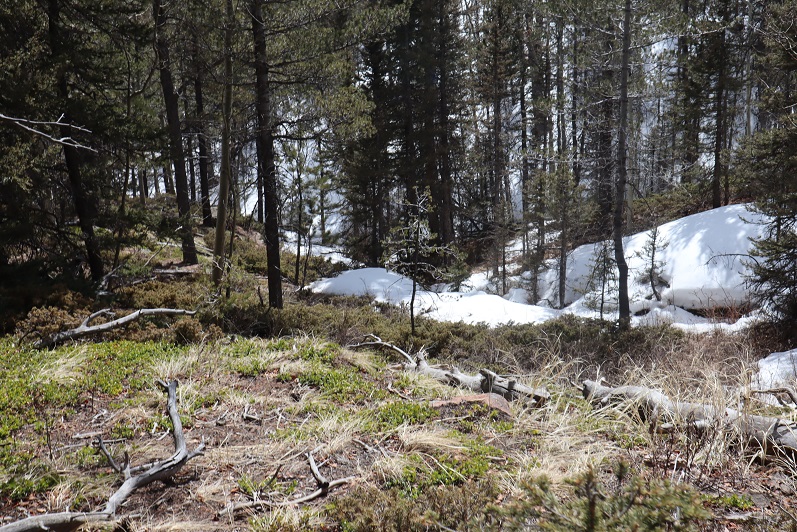
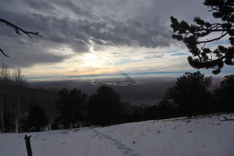
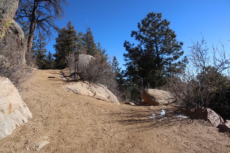
The hike back down was uneventful except for the flight for life helicopter we saw making a beeline for Pikes Peak (it never landed). Actually, the hike was beautiful!  I’ve hiked this trail dozens of times and I never get tired of it!  We kept our microspikes on the entire way, even though they weren’t necessary most of the time.  The trail cleared and opened up around the incline junction

36

We made it back to my truck a little before 12:45pm, making this a 15 mile hike with 4027’ of elevation gain in 7 hours.

37

This was a really nice trail with decent elevation gain you don’t notice much because it’s so gradual.

Mt Elbert – 14,433 in winter

1

RT Length: 13.25 miles

Elevation Gain: 4934’

Partner: Steffen

We pulled up to the South Mt Elbert trailhead at 5am and were ready to go soon after. There were about 5 vehicles already in the lot, and we were now worried we’d started too late and eager to get started

2

On our last (failed) attempt of Mt Elbert in winter we took the trail, but this time we hiked in microspikes along the 4WD road/Colorado Trail for 1.75 miles to the upper trailhead. I would recommend hiking the road instead of the trail.

3

The road was passable for about a mile in 4WD vehicle, and then it became solely a hiking trail. I was glad I’d parked at the lower trailhead.

4

5

At the upper trailhead we turned right, crossed the bridge, and continued along the Colorado Trail for another quarter mile

6

This trail is really well marked, and the trench was nice and solid

7

After a quarter mile we came to the Colorado Trail/South Mt Elbert Trail junction and continued on the South Mt Elbert Trail

8

This well maintained trail took us to treeline

9

10

Here there was a lot more snow so we decided it was time to put on our snowshoes. The sun was also rising and we could put away the flashlight.  Here’s looking back at Mt Elbert Forebay and Twin lakes

11

From treeline here’s the route up Mt Elbert.

12

Not long after making it to treeline we passed a hiker and wondered where everyone else was who’d been parked at the trailhead? There were at least 5 other vehicles there, and we only saw this one hiker along the ridge.  Seemed curious.

13

The wind picked up as we hiked up the ridge. The forecast said 15-20mph winds, but we felt they were much higher here

14

Snowshoes were useful until about halfway up the ridge, and then they weren’t really needed. I kept mine on because the wind had picked up and I didn’t want to take off my gloves to take off my snowshoes.  Steffen offered to help, but I was worried I’d need to put them back on again and honestly didn’t mind hiking wearing them, so I kept them on.

15

This was a simple ridge hike. I don’t do well with breaks (my feet lose function so I can’t stop) and since there weren’t any obstacles I hiked ahead of Steffen at a slow and steady pace while he took breaks as needed.  I kept looking behind me to make sure he was still on track.  I was excited to see the sign on top, indicating the summit was near.

16

At the saddle I decided to slow down and wait for Steffen so we could summit together. The only problem?  It was super windy.  So windy the wind kept knocking me down.  So I decided to crouch down behind this rock and take in the Massive view while I waited for Steffen to catch up. Luckily he wasn’t too far behind

17

18

When he made it to the small saddle we turned and headed towards the summit together

19

It was a blue skies kind of day, but extremely windy on top. I’m proud of Steffen:  this is his second 14er, and second in winter.   It was weird having someone else there to take my picture:  I had to crouch down because I kept getting blown over.

20

21

We didn’t stay long on the summit due to the wind. Steffen teaches skydiving, and was pretty sure the winds were closer to 50+mph than 20mph.  It was nice having someone else there to verify the wind speed and let me know I wasn’t crazy for thinking it was higher than forecasted.  The winds lessened as we hiked down the ridge.  Here’s the way we took back

22

23

24

Along with the wind came some pretty cool clouds. I took off my snowshoes for most of the ridge descent.

25

About halfway down the ridge we began seeing other hikers. Tons of other hikers.  They were like ants, marching their way up the mountain, and must have been sleeping in their vehicles when we made it to the trailhead.

26

Once we made it back to the snow we both put our snowshoes back on: we were postholing and it soon became evident the return route would be miserable without them.  We were glad we’d started when we did:  in a couple of hours this would be posthole city.

27

28

29

The route back was just as easy to follow as the route in, but with the added bonus of sunlight we had some pretty amazing views of the aspens

30

31

32

We made it back to the trailhead at 1:50pm, making this a 13.25 mile hike with 4934’ of elevation gain in 9 hours 40 minutes.

33

Twin Peaks A – 13,584

1

RT Length: 9 miles

Elevation Gain: 4625’

Any time your hike begins in the Piñon Pines and Junipers you know it’s going to be a long day. I arrived at the South Zapata Creek Trailhead after mistakenly being directed to a gated community a few miles away (Google Maps was taking me to South Zapata Creek, not South Zapata Creek Trailhead:  I’d suggest putting in Zapata Falls as it will direct you to the campground and trailhead).  No worries though, I was free all day and this only put me back about 15 minutes from schedule.  The 4WD road to the correct trailhead was a little rough in the beginning with a lot of softball-bowling ball sized rocks, but after the first mile or so it smoothed out.  I parked my truck just before the campground entrance and was on the trail at 6:30am.

2

I followed the trail that led to Zapata Falls for .85 miles

3

Just past a defunct trail register

4

And at this cairn left the trenched trail and turned right and headed up the hill.

5

From here on out I was ‘off trail’. At this point I should have put my snowshoes on, but I tend to be stubborn about such things and kept hiking in just my microspikes.  My next objective was to gain the ridge to the south.  This ridge was steep and I kept sliding backwards in the snow.  Yep, snowshoes would have been a good idea.  Here the snow was soft but I was only postholing about a foot at a time.  To make things easier I did my best to follow recent game tracks.  It looked like there were a lot of deer in the area.

6

From the top of this ridge I followed the drainage up to a small plateau. Once again, there were tons of deer tracks here and it looked like they’d bedded down in the area last night.  I even saw a buck bounding away as I arrived.

7

I also got my first view of Twin Peaks A

8

The view was short lived however, as I dipped back into the trees again.

9

In the trees I came upon an unexpected cabin. It looked old but well kept up.  I would have taken a closer look but the snow was really deep here.  I broke down and put on my snowshoes.

10

11

From here on out the snow just kept getting thicker and stayed sugary. I kept heading southeast, this time through some thick aspen groves. Shout out to the deer/elk that helped me by breaking about 250 vertical feet of trail:  I followed their tracks through the trees until they disappeared over the ridge.

12

This route mainly follows the ridge, but it takes forever to get to treeline. Well, it took me forever because I was trenching the entire time.  This was the most challenging trench I’ve ever put together:  the snow was deep, unconsolidated, and never ending.  Several times the snow was so deep I couldn’t go forward and I had to get creative and zig-zag my route to make it possible to continue.  This type of trenching is tiring!

13

14

I’d make it to what I thought would be the treeline, only to find more trees ahead of me. Here’s a look at the route from one such area

15

More trenching through the trees

16

And I came to an area so thick with snow it was untrenchable. I was exhausted and seriously considered turning back:  where was treeline anyway?!?!  Last week I’d had to turn back on Rinker Peak due to unconsolidated snow, and I really didn’t want to repeat the same scenario twice. I decided instead of continuing along the ridge to descend a little to the south to see if the terrain was any easier, and it was!  I came across a rocky area and easily traversed a little below the ridge and then regained the ridge (to more snow)

17

I (finally!) exited treeline and had just a little bit more trenching to do before taking off my snowshoes and tackling the rest of the route in just microspikes. Up until this point I wasn’t sure I was going to complete this hike:  all that trenching had worn me out and I thought I’d never make it to treeline.   Several times I’d thought about turning back, but I’d put in so much work I didn’t want to give up.  This clear view of the peak renewed my spirits and I was ready to go.

18

I could see the summit ahead of me and it was a nice day: warm with no wind.  I thought taking off my snowshoes would be a good idea and could also save some valuable time.  In the beginning, this was a good idea.  I was able to quickly rock-hop up the ridge

19

After gaining the first bump however, things changed. The snow was no more consolidated here than it had been before treeline.  In fact, the snow was 4-6 inches deep:  a thin layer over rocky terrain.  The snow never held my weight and I frequently postholed in areas where I could easily have twisted an ankle.  I was cursing myself for taking off my snowshoes, and would have put them back on except the wind had now kicked up and I was afraid to take off my gloves because of the exposure.  I was just going to have to be careful and rock-hop whenever possible.

20

I followed the ridge as closely as possible, but those cornices were weak. I kept postholing in the shallow snow and my feet were becoming frozen.  I wasn’t giving up though:  I could see the summit!

21

Here’s a look at Twin Peaks B (unranked) and Twin Peaks A. There was a lot more snow at the summit than I’d been able to see from below, those cornices are bigger than they look, and once again, hollow.  I followed the ridge to the summit.

22

I took a few steps up the cornice to try and get as high as possible and heard a hollow sound below my foot. I quickly retreated: In no way was I going to climb to the top of the cornice.

23

I found the summit wind break, set up my camera on top of my backpack, got a (terrible) picture, and decided to book it back down. I wasn’t going to play with that cornice.

24

I had no desire to climb Twin Peaks B today as well: The cornices were hollow and I would need to go over one just to start, that wind was becoming insane, and I could no longer feel my feet.

25

Time to head back down the ridge

26

27

There were some great views along the way of Lindsey, Ellingwood Point, Blanca, and Little Bear

28

29

And also the Sand Dunes

30

Here’s the rest of the route down the ridge and back into treeline

31

And a look from treeline up the ridge

32

I stopped to put back on my snowshoes at treeline and headed back to the trees, carefully retracing my steps and making my tracks into a solid trench. This is more tiring than it sounds.

33

I followed the ridge and in a small clearing between hills saw what looked like a reverse shadow far ahead of me. Anyone know what this is?

34

I made my way back to the cabin

35

And decided to keep my snowshoes on for the rest of the trek back to the trailhead. Here’s the way down the ravine

36

And down the ridge

37

Back to the Zapata trail

38

It had been a long day, and it was starting to get dark. I’d originally wanted to visit Zapata Falls while I was here, but looking at the time I wouldn’t make it there until after dark.  I’ll just have to come back when I’m here later this season. The trail was easy to follow from here

39

Back to the trailhead.

40

I watched an absolutely stunning sunset as I broke down my gear and got ready to head home.

41

I made it back to my truck at 5:30pm, making this a 9 mile hike with 4625’ of elevation gain in 11 hours. This was by far the most tiring day I’ve had trenching ever, but totally worth it!

42

Rinker Peak (winter attempt)

1

RT Length: 6 miles

Elevation Gain: 1500’

Note:  My successful summit of Rinker Peak can be found here.

winter. That time of year when I should stick to the peaks below treeline but find myself tempted by good weather and attempting higher summits anyway.  Each time I go out I’m reminded there’s a lot I still don’t know.  Today was such an event.

The weather was cold but the wind was forecasted to be nonexistent so I decided to attempt a ridge route. I picked the ridge with the best weather and made it to the trailhead while it was still dark.  Well, in actuality the Willis Gulch Trailhead was under several feet of snow so instead I parked along Highway 82.  It took me about half an hour of driving my truck back and forth along the side of the road, packing down the snow to make a parking space I felt comfortable getting out of on my return. I felt the time was well spent.

2

I put on my snowshoes and travelled a quarter mile down Highway 82 towards the trailhead. It was 9 degrees outside and I had on my new balaclava.  Brrrr!

3

From the road I was pleased to find there were tracks indicating the trail. I followed them south

4

Crossed a bridge

5

And followed Trail 1471.

6

The trail was well trenched and I was getting excited for today’s climb. There were two ways to climb this peak:  One is to take the ridge, and the other is to take the gulch.  My preference was to take the ridge but when I got to the place where I was supposed to begin ascending there was too much snow to make it possible.

7

There wasn’t a trench indicating anyone else had attempted this route since the last snow, and when I attempted it myself I sank up to my waist. Oh well, I guess I’d just continue following the trenched route and try the gulch instead.  I continued on towards my second option

8

Passed a snow covered bridge

9

And continued following the well defined trail

10

I came to a junction for Little Willis Gulch and Big Willis Gulch, where I turned right (west) aiming for Big Willis Gulch.

11

Here the well defined trench stopped, but luckily there was still an older, snow filled trench I could follow. I was postholing but at least I had a trail to follow.  The trail had tons of rodent footprints scurrying back and forth on the new snow.  I was able to follow this trail as it crossed the creek again.  This log bridge was ‘fun’ to traverse while wearing snowshoes

12

I crossed the logs and followed the trail for about 10 more yards before it abruptly stopped. Hmmm…. Maybe this was the wrong way?  I retraced my steps, crossed the stream again and went a little more south, following tracks again.  These tracks ended sooner than the last; it looked like they’d stopped because the trees were too dense and turned around.  Whoever had trenched this trail hadn’t gotten further than here and decided to turn around.  Twice.  Once again I backtracked and crossed the stream a third time (in snowshoes) intent on trenching my own trail if there wasn’t one established.  I reached the area I’d previously stopped and took one step forward

13

And sank up to my chest in snow. The only thing that kept me from sinking further was my backpack.  It took me about 10 minutes to backwards-wriggle out of the snow, and when I was safe decided to call it a day and head back to my truck.  I wasn’t thrilled with this decision, but I also knew it was the right one.  There was no way I was going to be able to continue here without skis.

As I was trudging back the thought occurred to me if I’d have taken the ridge up and headed back down the gulch in a loop as I’d originally planned I could have ended up in a very dangerous situation: If I wasn’t able to go any further from this angle, just imagine the predicament I’d be in if I’d successfully summited via the ridge and went back down to the gulch, only to discover the snow was too deep to traverse?  I’d have been stuck in the gulch, or I’d need to re-ascend thousands of feet in elevation to gain the peak to exit, making for a very, very long day.  Instantly my mood improved:  Today was worth it after all, as I’d learned an important lesson:  in the winter, if doing a ridge route, always return the way you summit.  I re-crossed the bridge

14

And followed the side of the mountain back towards the trailhead

15

16

In the daylight, Lake Creek was beautiful!

17

I made it back to the road and back to my truck, where the temperature read 12 degrees and I had frost in my hair.

18

So in the end I didn’t get in a full hike today: Only about 6 miles with 1500’ of elevation gain.  I was bummed because I had so many options for hikes today and chose one I wasn’t able to complete, but I was glad I’d at least learned a valuable lesson (or two:  I should have picked an easier peak, but didn’t want to re-summit something I’d already done.  Next time I’ll take the safer option).

19