
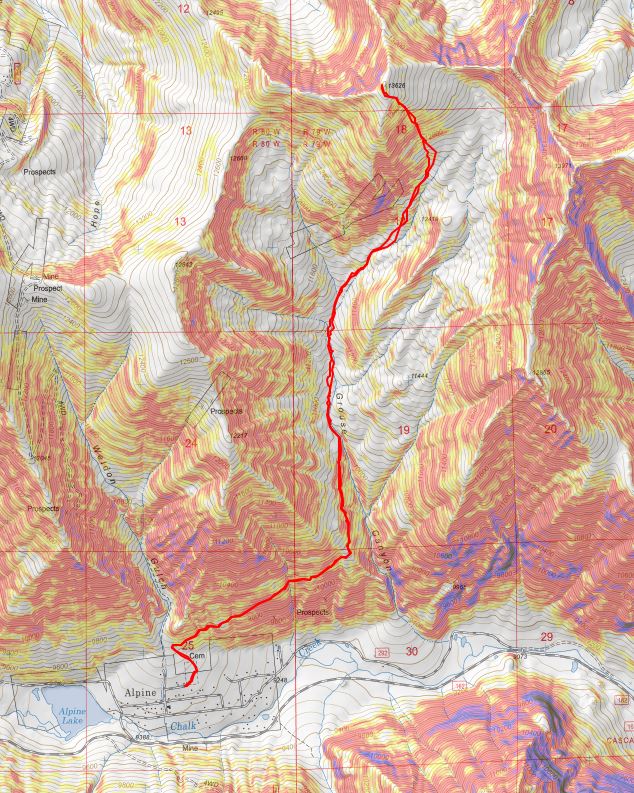
RT Length: 8.14 miles
Elevation Gain: 4197’
I am so glad I drove to the trailhead when it was daylight! I didn’t have good directions: google maps stopped at Alpine Lake and when I CalTopo’d the drive from there I unknowingly set my route through private property (that wished to remain private). So I drove around for a bit and eventually found a road that went straight to the Alpine Cemetery Trailhead:
Directions to Alpine Cemetery: From 162 turn right onto 292B, and then take your third right onto 292B. It’s the street that has a sign that says “dead end”, which I chuckled at because it ends at a cemetery. It’s also the only street in the area that’s a dead end.

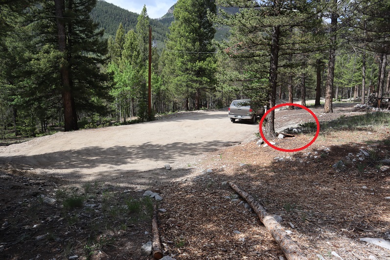
There’s room for a handful of cars at the dead end.

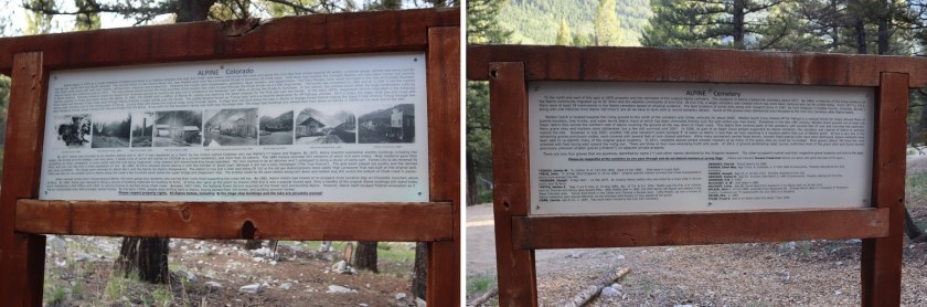
I parked my truck and took a look around. The trail started at the east end of the parking area and wove through the Alpine Cemetery to begin. Yes, I was extra glad I came here while it was still light out, as I was able to locate the beginning of the trail and walk it in the daylight (tomorrow I’d start in the morning when it was still dark). I also discovered there were tons of tiny worms hanging on threads from the trees. This was also something I was glad to know: they’d be no fun walking through in the dark through the cemetery, but at least I’d know what they were. I’d be hiking and using my trekking pole as a web catcher through here. There was a sign telling the history of the cemetery at the trail entrance. It looked like the ‘headstones’ were all re-done a few years ago, and already deteriorating.
Oh, and there are graves that go right up to the road. That’s my truck, and circled is a gravesite.
I walked around the cemetery for a bit, then headed back to my truck to make dinner.

When I spend the weekends hiking and sleeping in the back of my truck I try to make meals as easy as possible, mainly because I just don’t get hungry when I hike so it’s worthless to spend a lot of time preparing them. Today I’d hiked 18 miles with 7100’ of elevation gain and I wasn’t hungry. But I knew I had to eat for tomorrow’s hike of PT 13,626 so I heated up dinner anyway. Yesterday I’d cooked some brats on the grill and put one in a ziplock bag for today. I filled my JetBoil with water, put the brat inside to heat it up, and got a glass of wine. As soon as the water was boiling I picked up the brat with a fork and poured the water into a Cup Noodles container to warm up the rest of my dinner.
I took a bite out of the brat. Nope, I wasn’t hungry. Ugh. Hearing a noise I turned around and saw the largest Golden Retriever I’ve ever seen trotting over to me. She sat down in front of me and smiled. Three high school aged girls came up behind her and asked me if she was my dog.
Me: “No, sorry, I don’t have a dog”
Girls: “We didn’t think so but we thought we’d check. Her collar says her name is Molly and she has the same last name as the sign in front of a house down the street, so we’ll take her there”
Me: “Good idea. Good luck!”
The girls called for Molly to follow them but Molly had gotten wind of my brat and wasn’t budging. She sat there and looked at the sausage longingly. Molly wasn’t my dog, and even though I didn’t want the brat I didn’t feel right giving it to her because I didn’t know her diet, so I did the only thing I could do: I ate it as fast as I could. I probably finished it in 30 seconds and in 4 bites. Now I really felt sick. To add insult to injury when I was done eating Molly didn’t turn and walk away: She rolled on the ground, shook back and forth and asked for belly rubs.
It took the girls a solid 5 minutes to get Molly up off the floor and to walk with them towards her owners’ house. I tried but was too full to eat my cup noodles, and after 3 bites pretty much wasted the rest. It’s weird how I can burn thousands of calories on a hike but can’t force myself to replenish those calories afterwards without feeling like I was going to throw up. A couple hundred calories wasn’t going to do it for tomorrow, but oh well; it would just be a slow day.
I’d wanted to make this an early night, but after jotting down some trip notes from today and making dinner and walking around it was getting late. After slapping the third mosquito I closed my truck and sat in the back with the doors closed. I lit a candle, writing by candlelight. I have lights set up I could have turned on, but candlelight just felt better. Ambiance = candlelight in a cemetery. Trust me.
I was finally ready to go to bed around 9pm. I blew out the candle and set up the curtains over my back window and noticed some of the graves had solar powered lights outlining them. Oh great: So now even in the dark I’ll know where the graves are (that’s sarcasm). I really didn’t think this whole “sleep at the cemetery trailhead” thing through. I went to bed wondering if I knew any good cemetery songs? I’m a Girl Scout Leader and have a song for every occasion, but currently I was drawing a blank.
Interestingly that night I slept at the cemetery was probably the most peaceful night I’ve ever had sleeping at a trailhead. You could say I ‘slept like the dead’. Seriously: no noises woke me up in the middle of the night, no wind, no animals, no chatter from dispersed campers. It was great!
I woke up at 3:45am and was on the trail by 4:15am. This was my second attempt of PT 13,626, the first one foiled due to snow in the basin and a lost water bottle. Also, I took a different route on that hike.
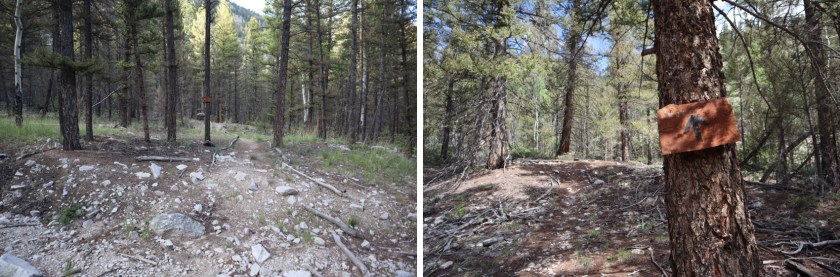
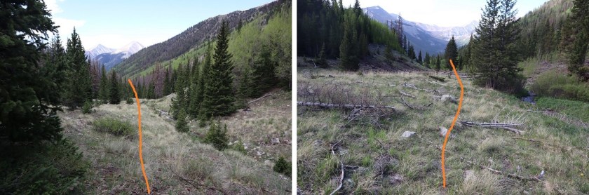
The trail starts at the Alpine Cemetery sign and winds around the cemetery, following a crumbling trail outlined by tree branches.

The trail is a bit rough to start but there are signs that while they aren’t the most elaborate, indicate the way
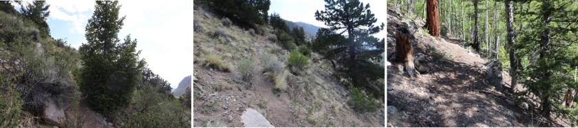
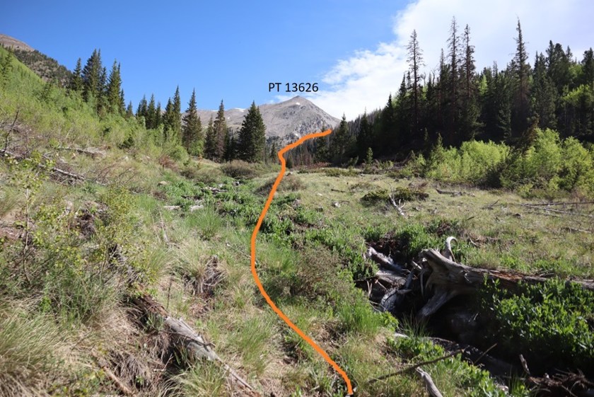
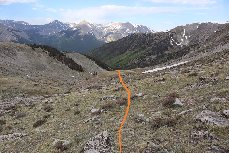
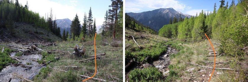
After you get past the cemetery the trail narrows and is more defined. The trail changes from pine trees to chaparral to aspens as it hugs the south side of the mountain, gaining elevation for 1.3 miles until turning left and heading north up Grouse Canyon. The trail is a little overgrown but easy to follow. I kept thinking “This route is SO MUCH EASIER than the last route I’d tried to summit PT 13,626. So. Much. Easier.” Images of bushwhacking and ticks and tons of compass time flashed through my head and I wondered why last time I’d chosen the route with no trail?
After hiking for 1.6 miles I encountered a small avalanche area, easily crossable

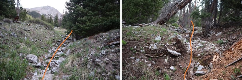
I hiked for about a tenth of a mile more and the trail stopped in a larger avalanche area. From here on out there was no trail to the summit. However, there is a creek. If you follow the creek it will take you through to the basin. I ended up crisscrossing it several times when there seemed to be more of a trail on one side or the other.
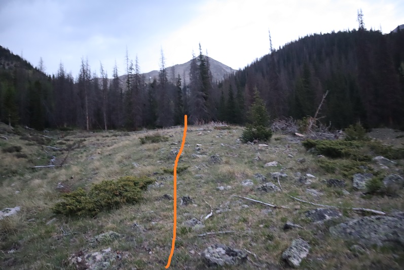
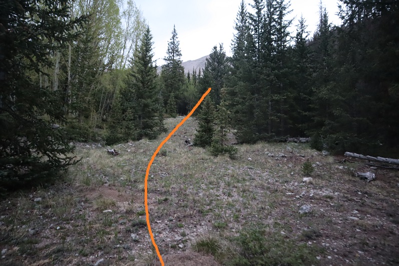
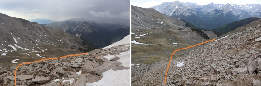
Here are some pictures of the route up the valley
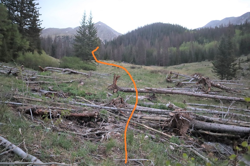
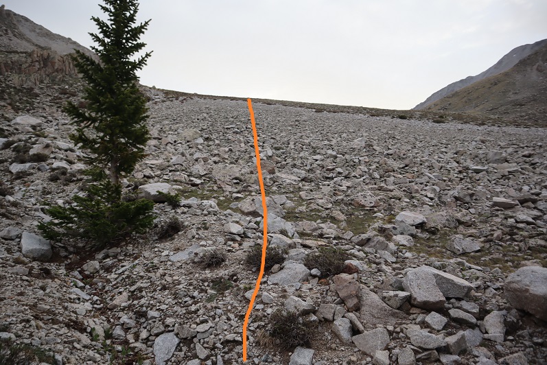
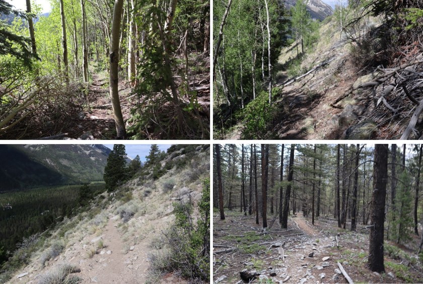
After hiking for 2.7 miles the drainage curved to the right (east) and I followed it up to the basin. This looked like a dry creek, but was probably due to snow runout
This brought me to treeline, and rocks. I stayed high and left here and didn’t regret it, but you could also follow the drainage to the right all the way up to the basin.
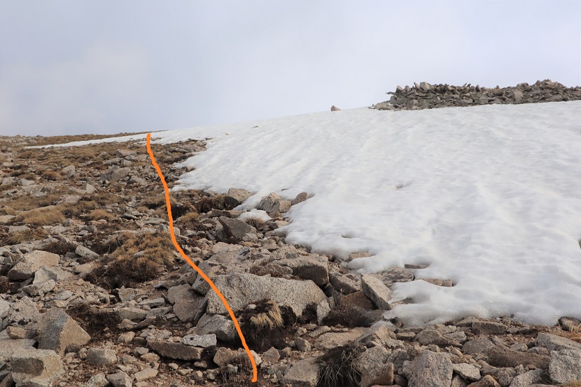
The rocks turned to tundra

There are multiple ways to summit here. You can keep going northeast and follow the ridge to the summit or go straight up the face (northwest). This is all class 2.

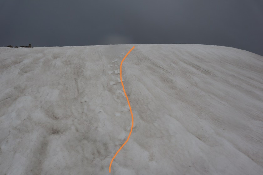
I decided to go straight up the face. This was steep but easy to navigate, with a lot of tundra and stable sand in the gullies.


I started encountering a little bit of snow as I made it to the top. Easily avoidable snow as I just stayed to the left
There was a cornice at the top
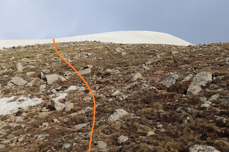
I headed towards the smallest part of the cornice to investigate. I took off my pack and decided to put on microspikes and get out my ice axe. I realized halfway up the snow crampons would have been a better choice but I was already committed and the spikes held. Also, here it started snowing.
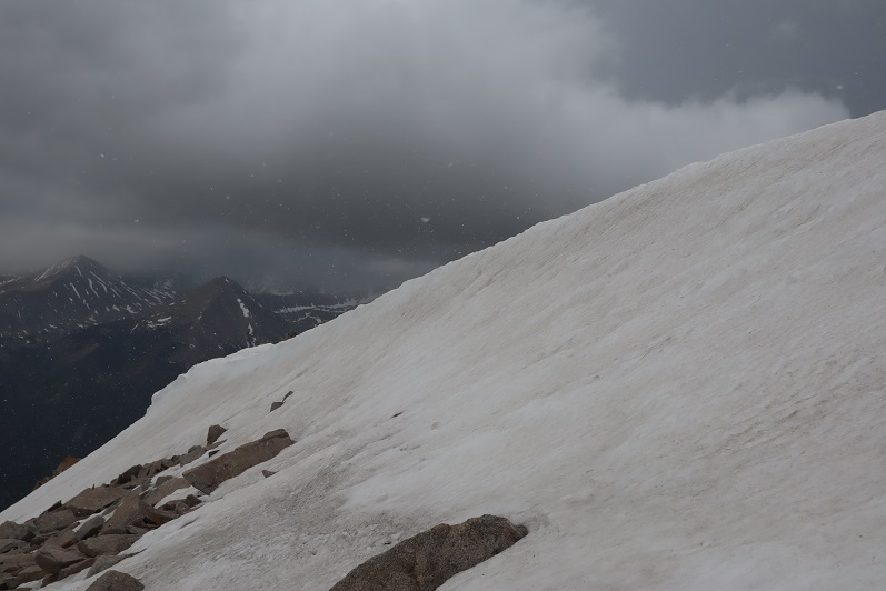
When I got to the top I turned right. There was still a little more snow to contend with before reaching the summit, but the summit itself was dry

I summited PT 13,626 at 7:30am. It was lightly snowing and cold and very windy. The forecast had mentioned thunderstorms after noon but said nothing about snow this early in the day. I wasn’t sure how I felt about it. Yes I was. Cold. I felt cold.

PT 13,626:
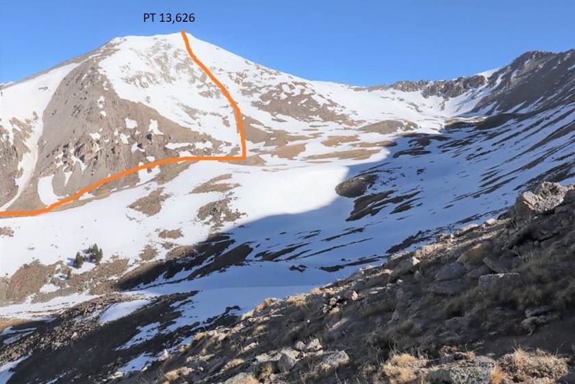
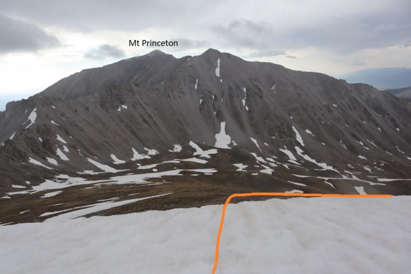
There was a nice summit register under the cairn. As always, I didn’t open it. Here’s a picture of the route I took in this time (taken from the route I attempted last time. Unfortunately, the way I came today didn’t afford any good views of the peak)
This wind was insane. And cold. Time to head back down.

I took off my microspikes and headed back down to the basin, following the same way I went in
Staying high and then dropping down into the drainage, following it down


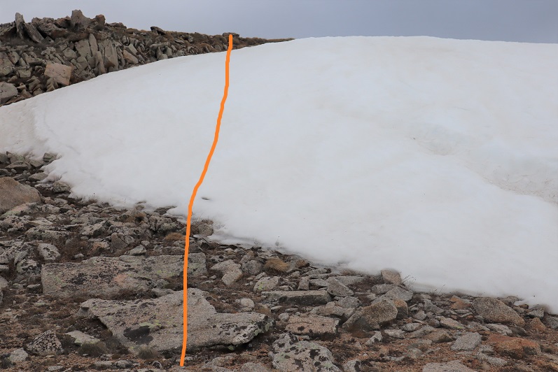
Until I reached the avalanche area and once again found the trail
The trail was easy to follow back to the trailhead
I made it back to my truck at 10am, making this a 8.14 mile hike with 4197’ of elevation gain in 5 hours, 45 minutes. Here’s a topo map of my route:

Their is so much to be said of Your posting and I’m not sure that I post will be acceptable to You.Will add to this at a later time because of my commitments set before me.
LikeLiked by 1 person