RT Length: 10.32 miles
Elevation Gain: 4101’
The Rico-Silverton Trailhead past South Mineral Creek has to be one of my favorite trailheads to spend the night. The 4WD road in isn’t very 4WD (except for the creek crossings), and there are rarely any people there. Also, no marmots. I was woken up in the middle of the night by a rustling sound I thought was a rodent in my truck, but ended up realizing it was just my elbow brushing a bag of chips.
It was another cold night, but I was ready to go at 5:45am. It was still dark, but I’ve taken this trail numerous times, so I knew which way to go.
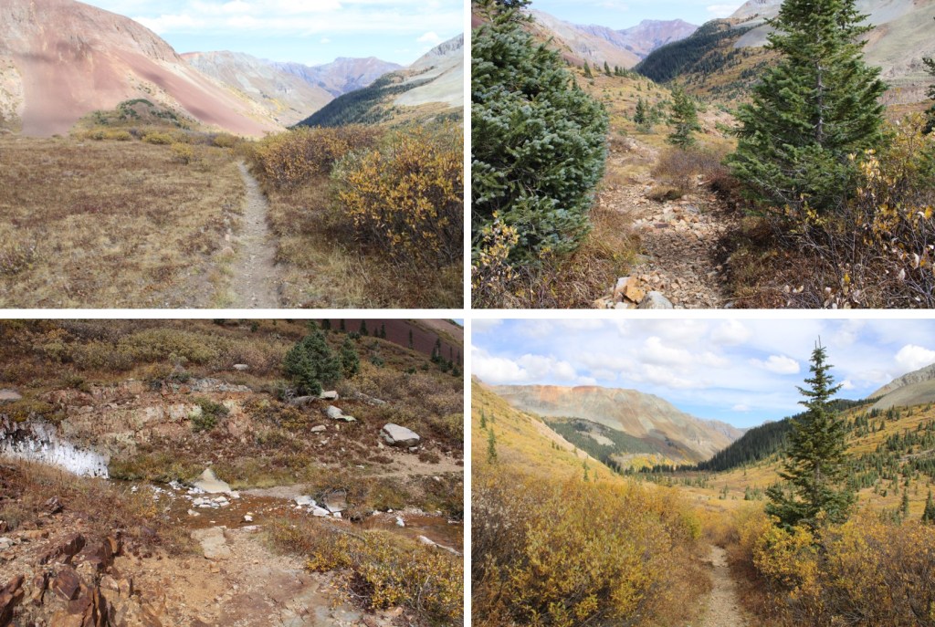
The trail starts at the south end of the parking area, and immediately crosses the creek


I followed this class 1 trail all the way to treeline, crossing the creek several times along the way.

Another perk of hiking here is a mama moose owns this basin. Every year for the past few years I’ve seem mama, mama and baby, or mama and yearling in this basin. It’s been neat to see mama get bigger, and baby(ies) as well. This yearling seems to be female, as she didn’t have antlers. I saw these two just as it was beginning to get light out, so the pictures didn’t turn out well. As soon as they noticed me they headed south, slowly making their way over the pass.

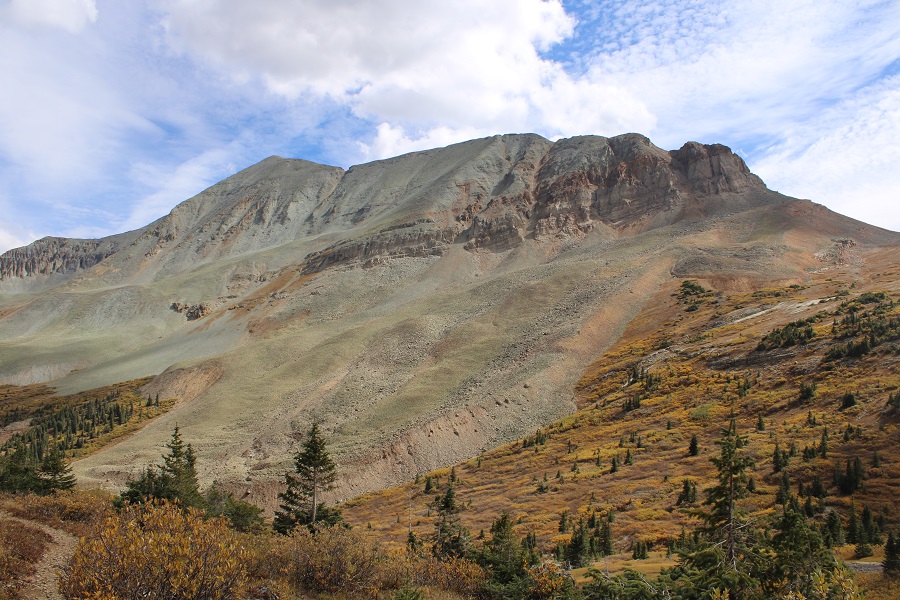
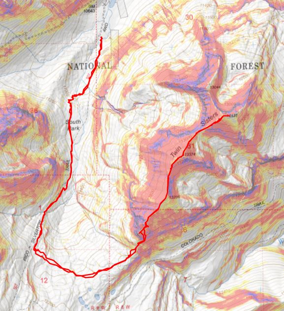
I hiked the Rico-Silverton Trail for 2.2 miles, to about 11925’, and then left the trail to follow the contour of the upper basin east, towards the south side of Twin Sisters. This is the route I took

And some step-by-step pictures:

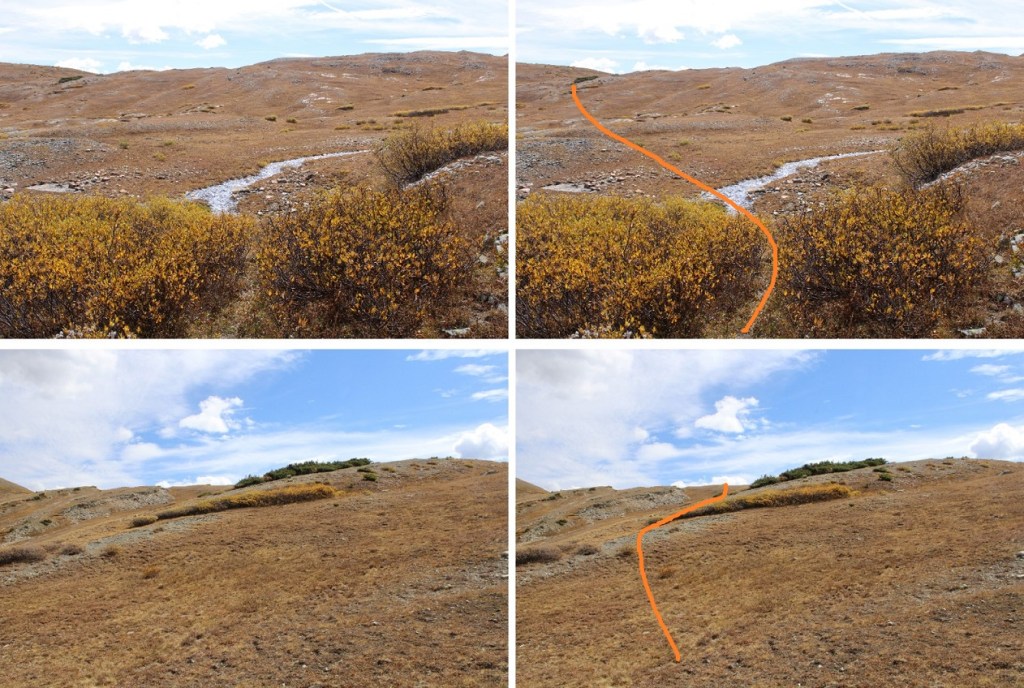
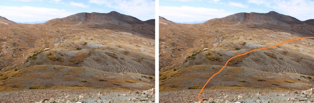
There are some faint game trails here, but they aren’t really needed, as long as you’re heading for the base of the mountain

Once there, I found a clear path through the willows and ascended the talus
I was surprised when I heard coyotes yipping during the day: I usually only hear them at night
Coyotes:
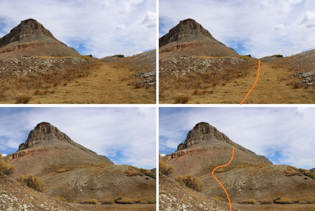
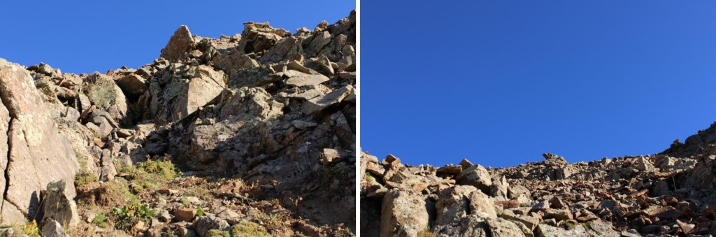
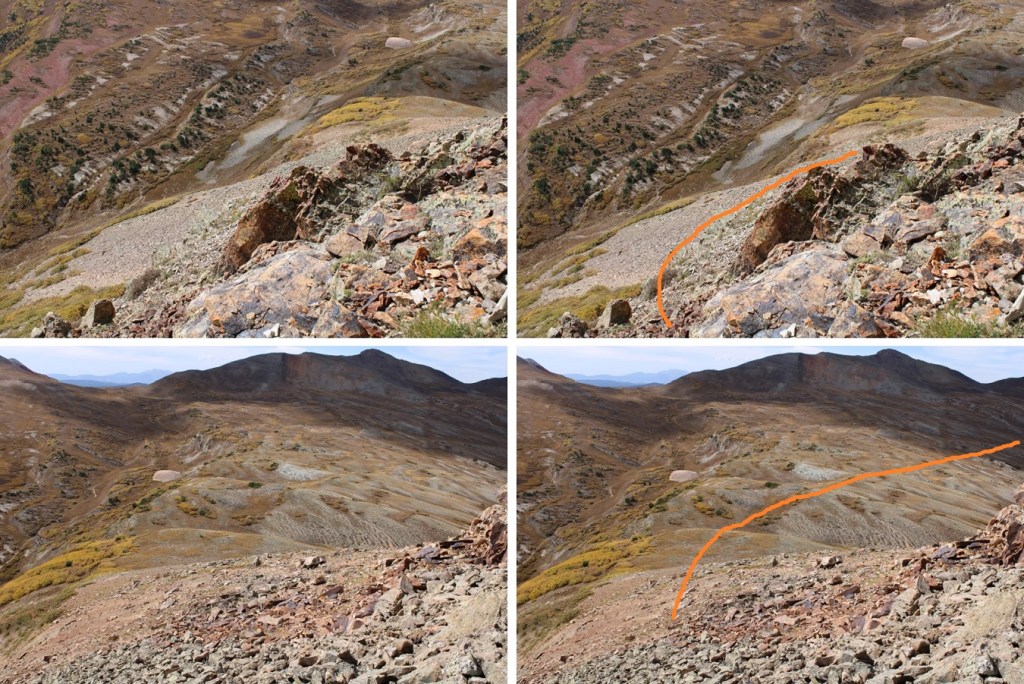
Following this line brought me to the base of the rock outcroppings. I put on my microspikes, and followed where the slabs met talus until I found the gullies.

All of the gullies go, but, as I found out on my way back down, find the first one and stick with it (turn left and follow it to the ridge). You’re aiming for the ridge, which means hiking northwest. Microspikes were extremely helpful here. This shouldn’t be more difficult than class 2+
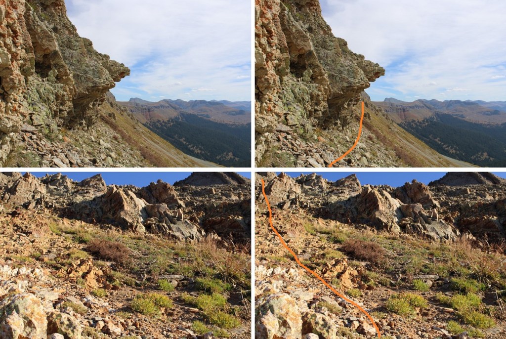
It’s going to be a chossy-talus-scree-filled mess, but it’ll go
Once on the ridge, I followed it northeast, staying on the ridge. There’s a false summit here. I kept my spikes on, but they were overkill. The rock here was talus, and annoying, but firm.
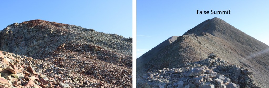

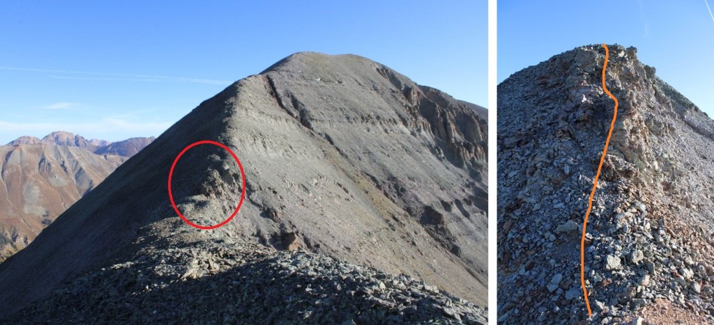
Hitting the false summit was a bit of a downer, but the hike had been easy thus far, so it was kind of expected. I continued following the ridge. There’s a quick chasm to cross in the circled area. It can be kept at 2+. I dipped down to the left about 30 feet, then re-ascended and started climbing towards the summit
Form here it was a simple ridge hike to the summit

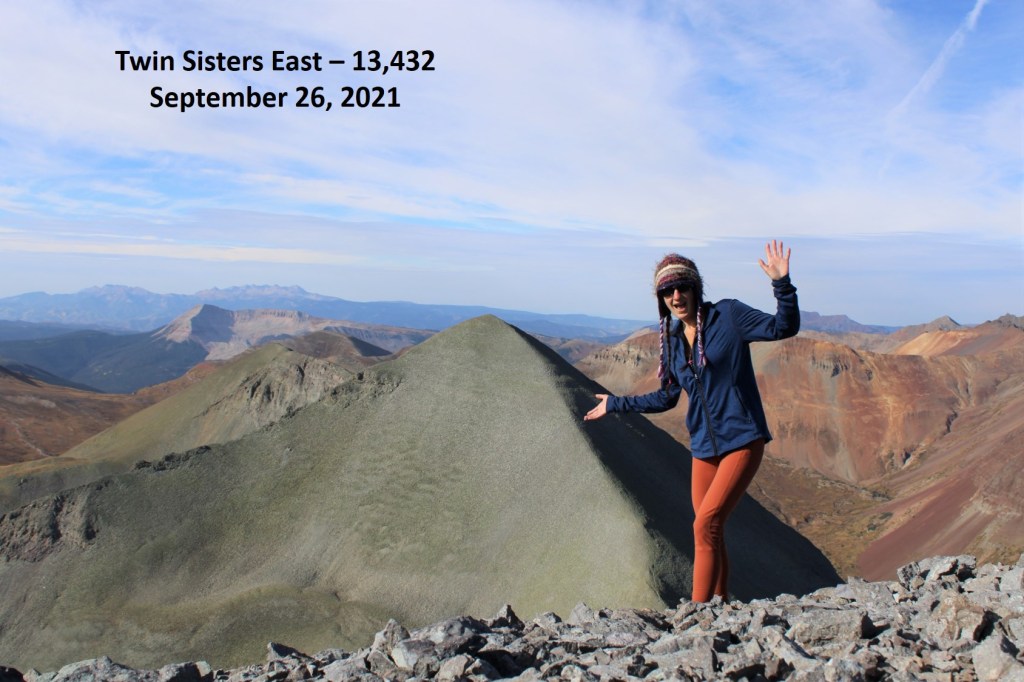
I summited Twin Sisters West at 8:40am

Twin Sisters West:
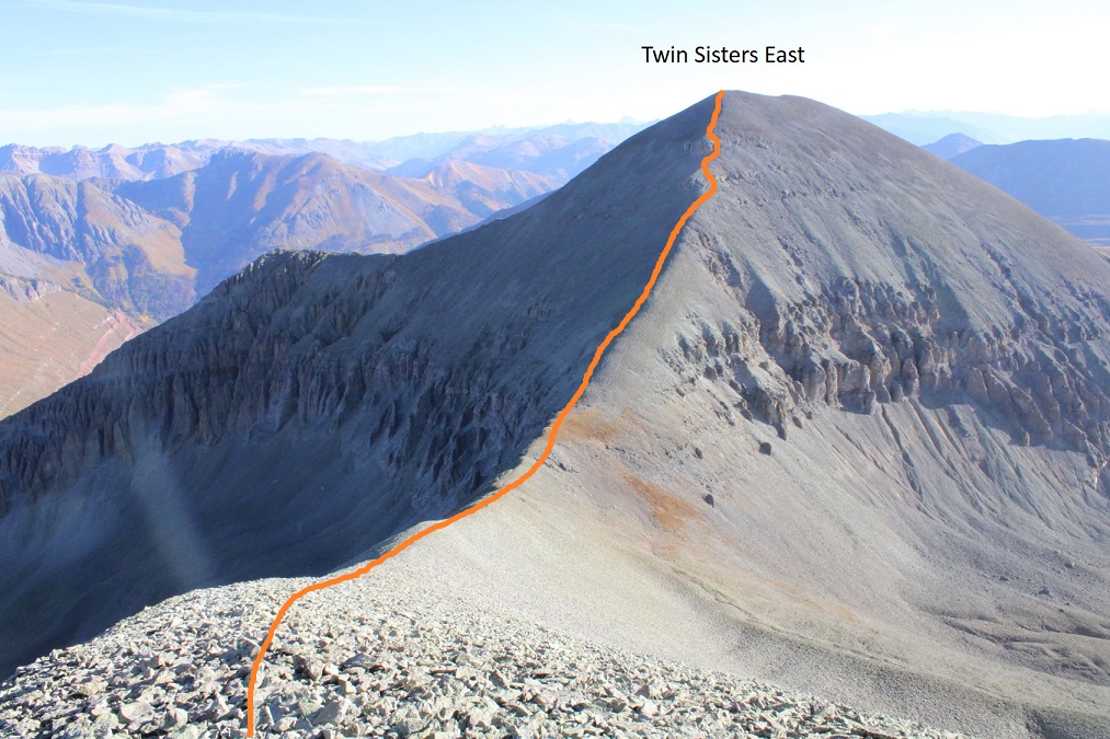
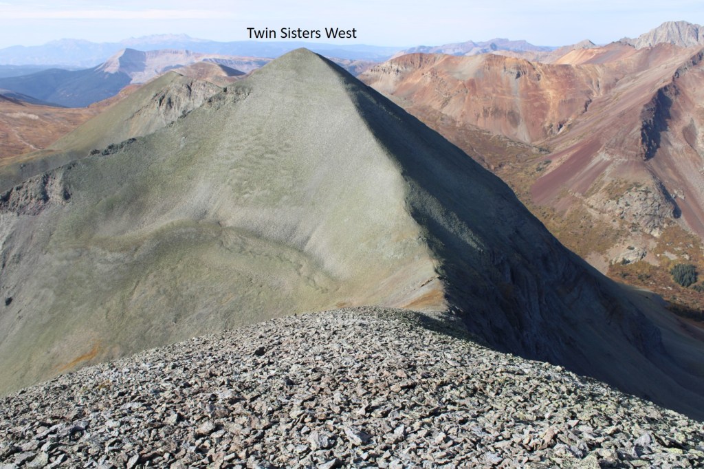
From the summit of ‘west’ it was easy to see the route to Twin Sisters East: I just needed to follow the ridge
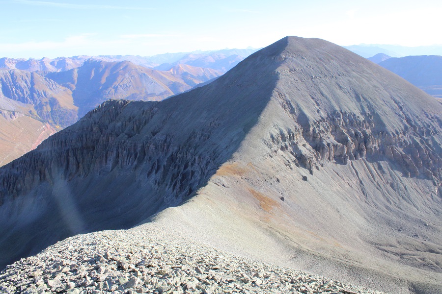
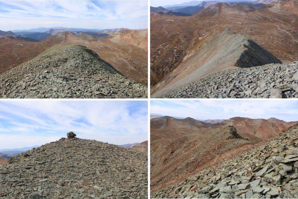
There were no big surprises on this one. There were some game trails to the right, but they didn’t seem prudent. I just followed the ridge, and then closely navigated the rock problems, which were all class 2. This is the route I took
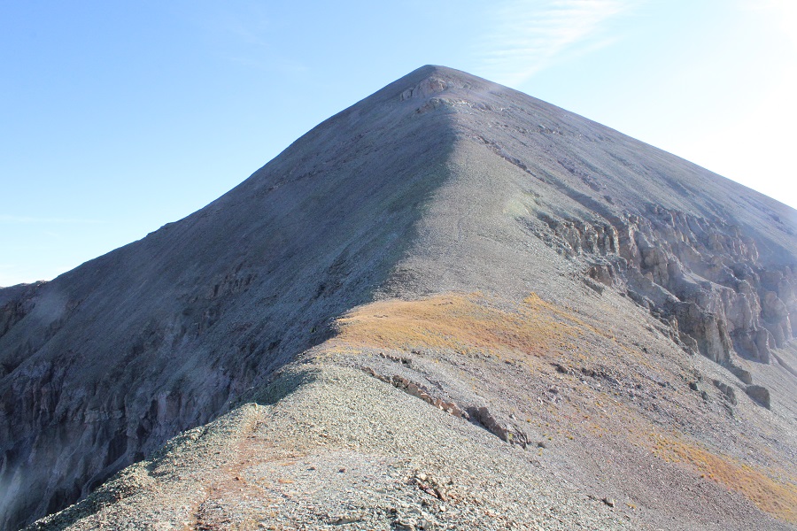
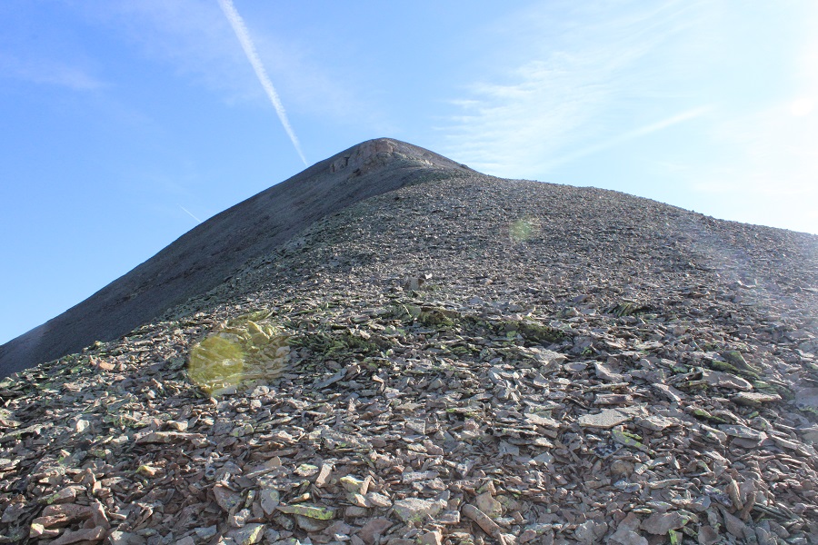
And some closer pictures

The summit was relatively flat. I wasn’t sure where the exact summit was, so I waked the entire length, just to realize the summit was at the top of the ridge

I summited Twin Sisters East at 9:20am
Twin Sisters East:
Because I’d done most of my hiking in while it was dark, I decided to make this an out and back trip so I could get better pictures of the trek i. So, I retraced my steps back to Twin Sisters West. This was a simple ridge hike

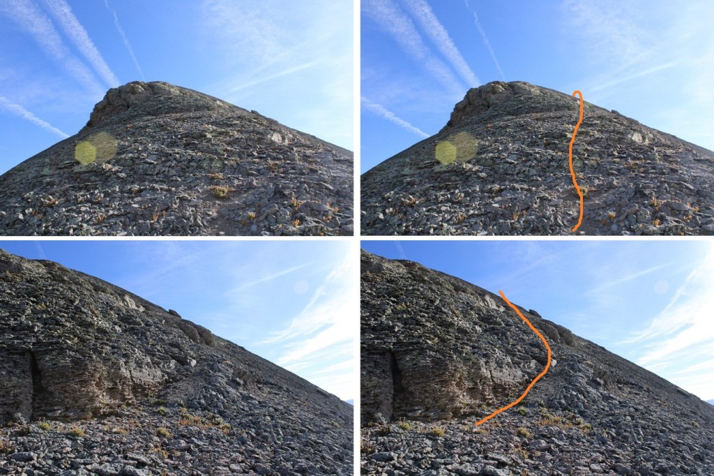
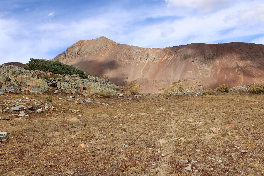
From Twin Sisters West I continued following the ridge southwest. It’s important to follow this ridge all the way to the end (black arrow). Also, here’s an overview of the route around the basin. Fun fact: the white area isn’t water, but rock from a dry stream bed. I’m sure at some point in the year it holds water, but I’ve only seen it dry.
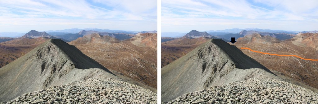
Here’s a close up of the ridge problem
And following the ridge to the end
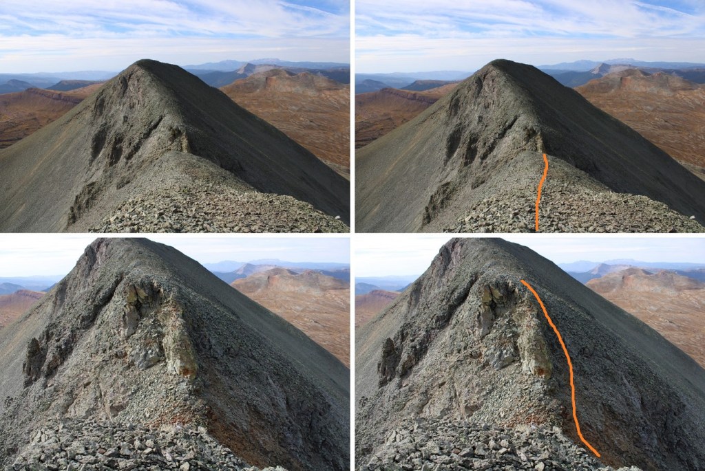
Once at the end of the ridge, I turned left and scree surfed/carefully navigated my way down the gullies


At the base of the gullies I turned right, and headed out of the basin

There were faint game trails here
That led me back to the Rico-Silverton Trail, which I took north back to my truck
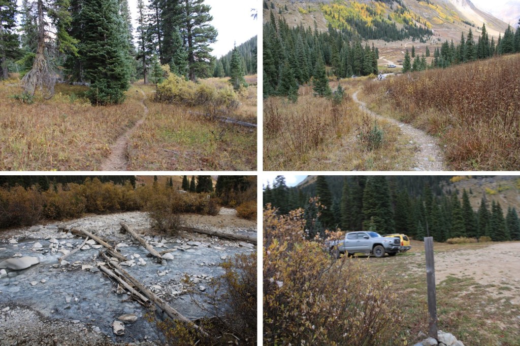
I made it back to my truck at 12:30pm, making this a 10.32 mile hike with 4101’ of elevation gain in 6 hours, 45 minutes.
On to the next trailhead!
