RT Length: 17 miles
Elevation Gain: 4750’
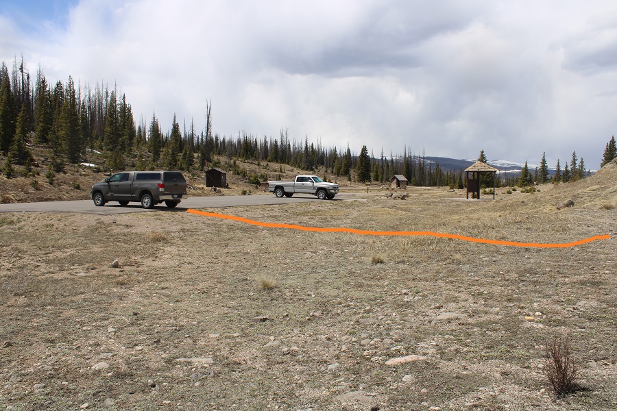
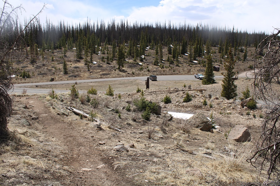
On my way to the Spring Creek Pass Trailhead I was the only one driving on the road. Probably because it was 1am. I did have to slow down for a moose who wanted to jaunt back and forth across the center line, and a herd of elk I surprised as I drove by (they’d been lying down by the side of the road). I made it to the trailhead before 1:30am and decided to get some sleep before starting out. My truck was the only vehicle in the lot. I love my heater.
I was on the trail at 4:30am. There are several ways to get to the snow mesa. Last time I was here I took the snowmobile route
This time I decided to take the Colorado Trail/Continental Divide Trail/813 trail. This is the one I’d recommend without snow on the trail. If there’s a groomed snowmobile track, take that instead. The trailhead is directly across from where I parked my truck.

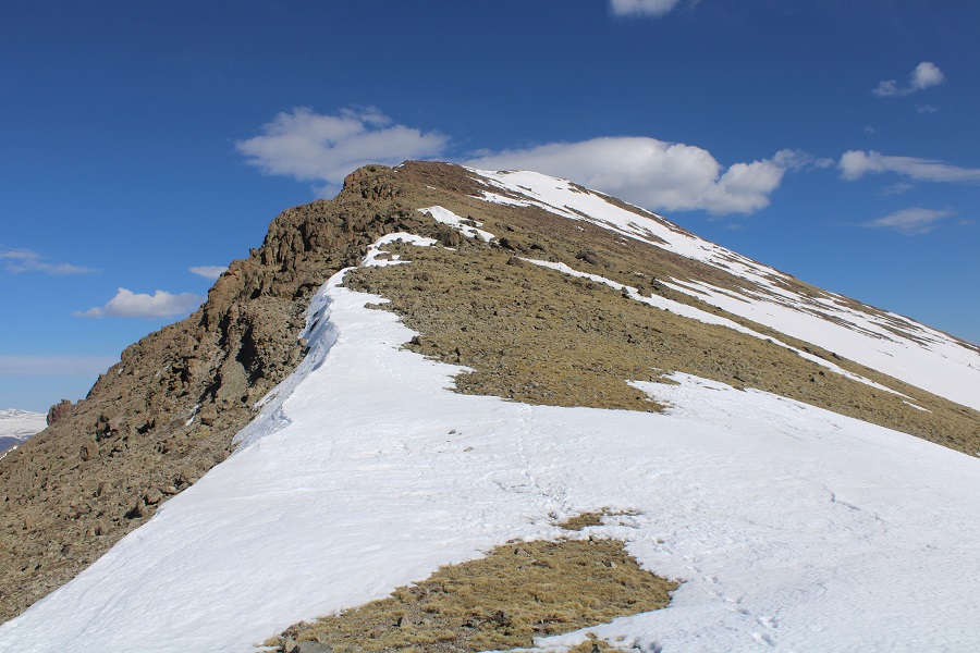
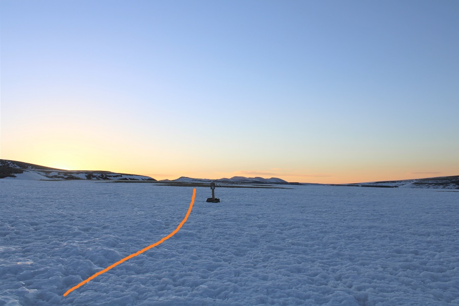
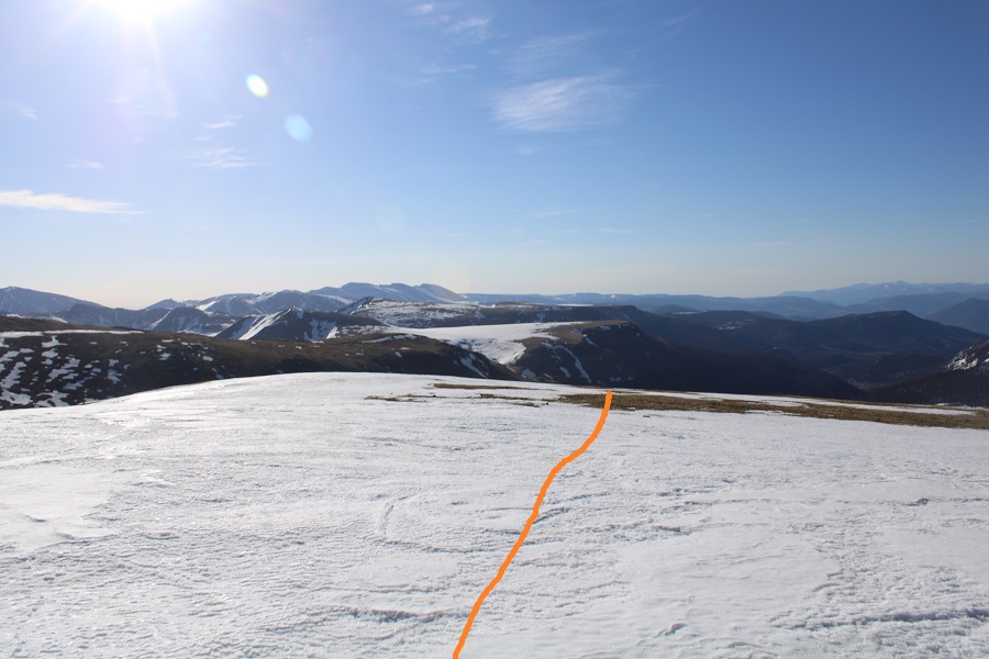
From the trailhead it’s a nice uphill hike for about 2 miles to the mesa, heading east and southeast. Here’s an overview of where you’re headed

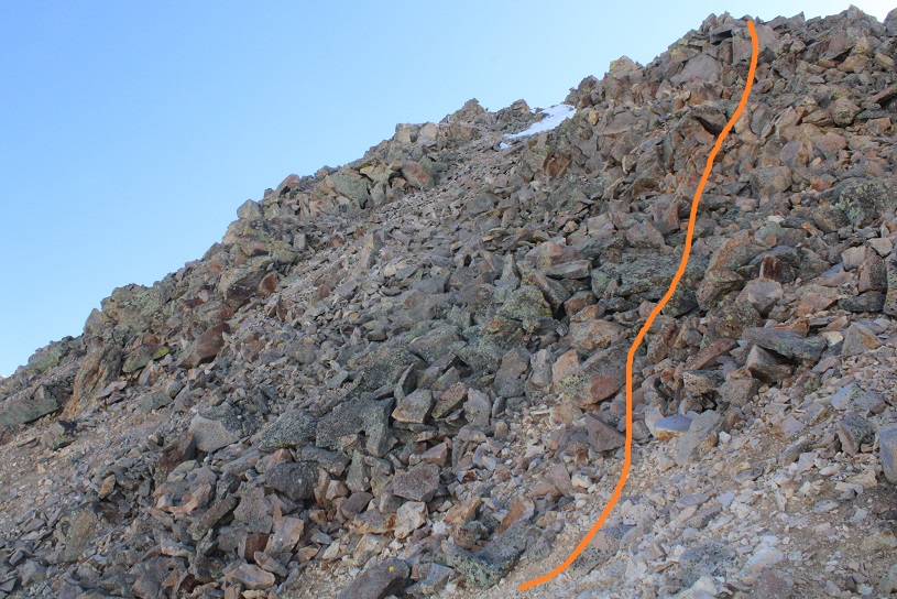
And what the trail looks like

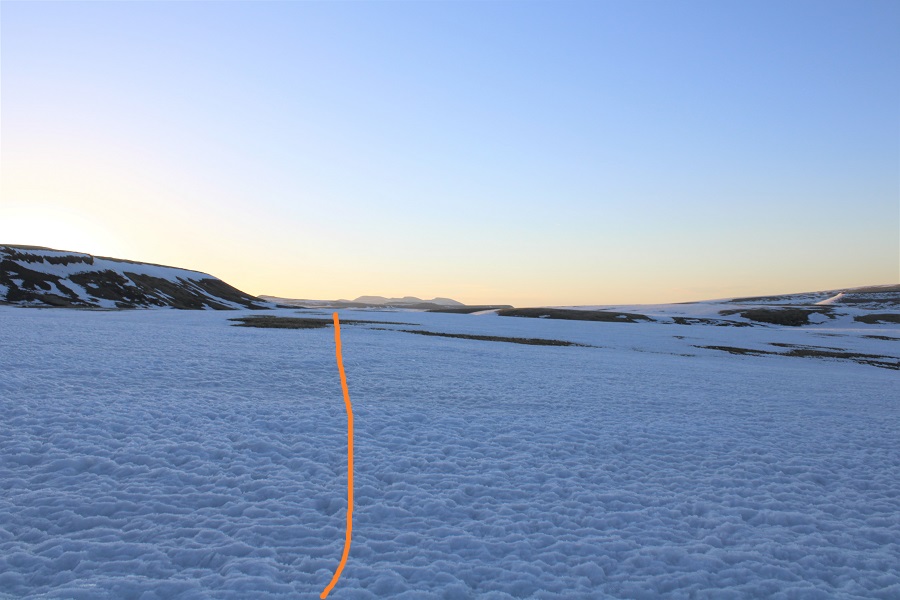
You’ll know you’re getting close to the mesa when you parallel a gully to your right.
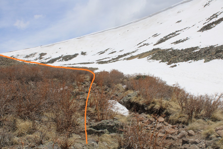
Be careful here in winter conditions: the cornices fall. Luckily for me, today there was a lot less snow than last year. I didn’t need traction to ascend into the mesa. From below, you can see a Colorado Trail marker. Aim for the marker. This is also where my flashlight ran out of batteries. I was glad it was starting to get light out.
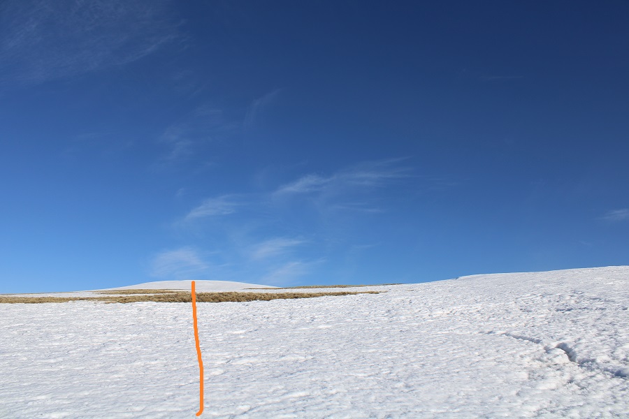
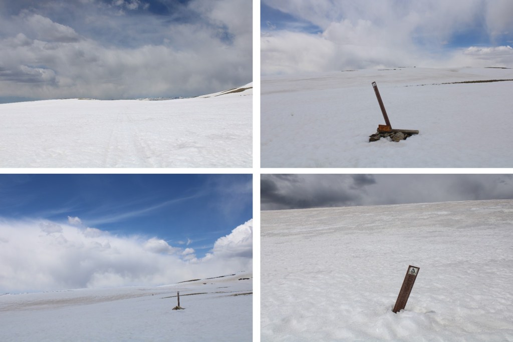
Once on the mesa I followed the Colorado Trail / Continental Divide Trail markers for 3.3 miles. These markers are great most of the time. In the summer the trail is well defined and not needed. When I was here last they were covered in snow and useless. Today they were nice benchmarks, keeping me on track since there were no tracks. In the morning, the snow was firm (not so by noon). The trail initially looks flat, but you’re really losing and gaining elevation all the time. This was especially frustrating on the way back.


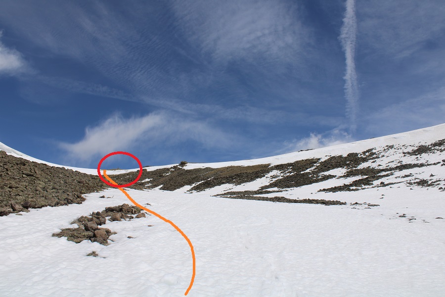
After a total of 5.1 miles since the trailhead I came upon a junction and continued heading north on 813. Note: The trail looked doable when I started. If doing this in winter conditions, I’d recommend taking the lower route (the one I took back, via 787). However, I wanted to stay high to avoid losing and re-gaining elevation, and I had all the necessary gear (snowshoes, crampons, ice axe, etc.) so I decided to go for it. Also, from the junction vantage point, all looked good. Here’s the route I took

Unbeknownst to me, there was a slide area directly on the trail. This area is prone to cornice falls/slides. I felt comfortable crossing the area so early in the morning, but wouldn’t advise taking this route later in the day. I knew immediately I wanted to take a different route back.

Here’s a look back on the slide area

After the slide area there was another solid area of snow. I decided to descend a bit to make this more manageable. I brought out my ice axe and traction here.

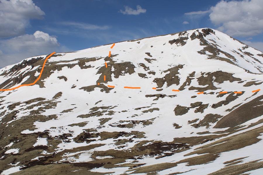
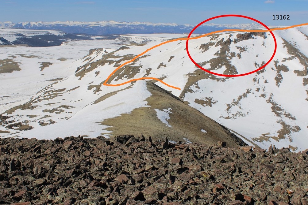
I was still ‘following’ the trail (under snow), and as soon as I started heading north it was time to head up the east side of PT 13162. Here’s what that looks like (as seen later in the day from point 13020). Solid line is path up, dotted line is the route I took down and across to the 13162/13510 saddle. I was just doing my best to avoid the snow.
When not covered in snow this area is covered in tundra. It’s steep, but an easy ascent.

I just kept heading west, until I was at the ‘ridge’, where I started heading northwest to the summit


I summited Unnamed 13162 at 7:45am
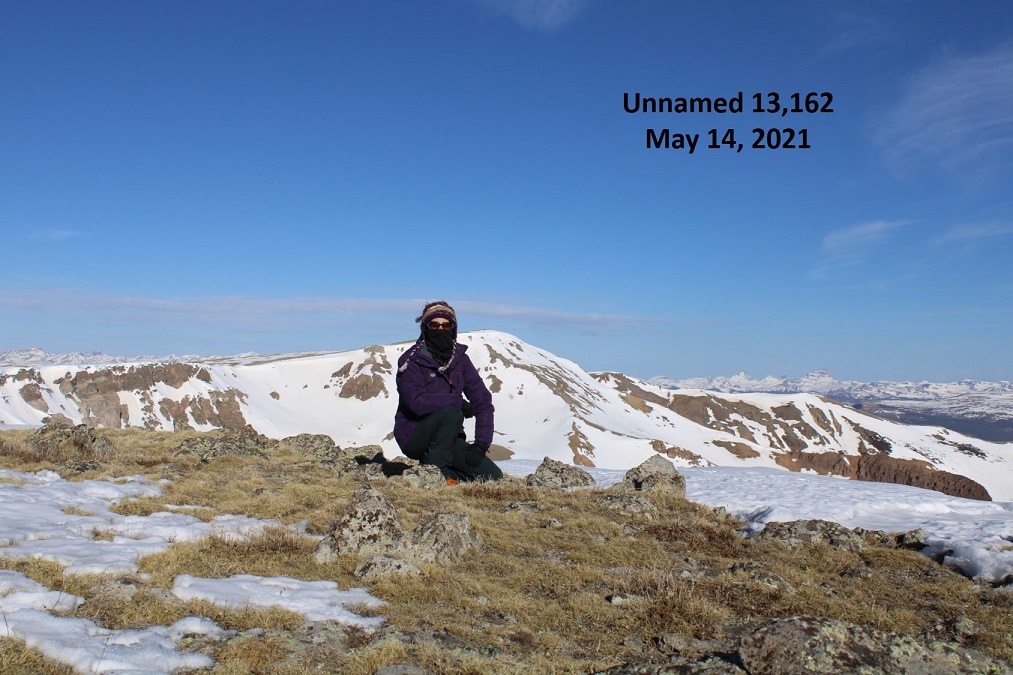
Summit of 13162:
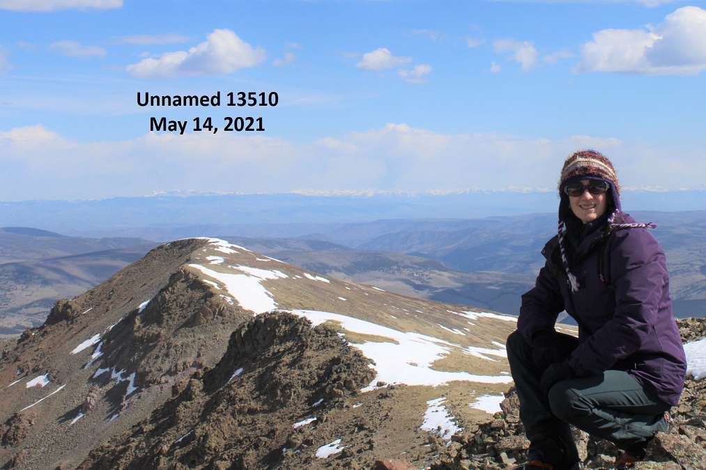
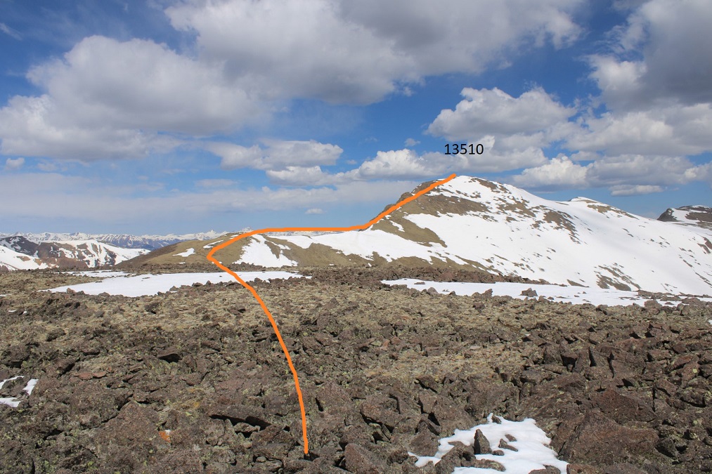
From here I could see the summit of 13,510 to the northeast. It looks like it should be a simple ridge hike to get there, but unfortunately, there’s a steep section in the way, so I re-traced my steps back to scenic trail 813.

There was one section I was worried about after the 13162/13510 saddle. I was hoping I could just go straight over the area, and not around. (Note, when I first wrote this report, I thought what I labeled below was PT 13020, but it’s actually further east… in the same general direction, but it’s actually the small peak just above the saddle in this picture).

Ok, back to trail 813 and to the saddle of 13162/13510
Here’s the rest of the route to 13510

I made it to the saddle and the rocky area looked climbable. It didn’t get any harder than difficult class 2. The gullies in this area were either snow free, or the snow was avoidable. I stuck to the ridge, dipping to the left (west) when necessary.
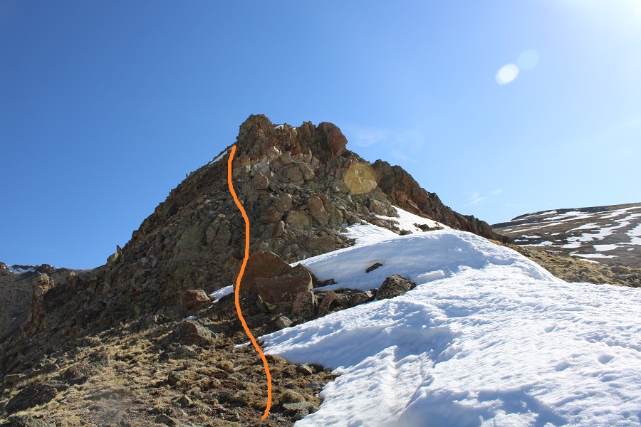


The rock here was loose, but once again, difficult class 2
I gained the ridge and looked back at 13162. I’ve circled the area I was trying to avoid on my way down, and detailed my route down.
The rest of the route to 13510 was an easy ridge hike. The snow was either consolidated or avoidable.


I summited PT 13510 at 9:40am
Summit of 13510:
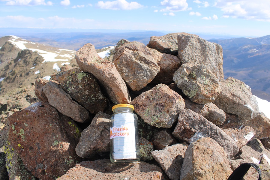
Interestingly, there had been a summit register on 13162, but there wasn’t one on 13510, so I left one. There were also a lot of crow droppings. I even saw a few flying around.
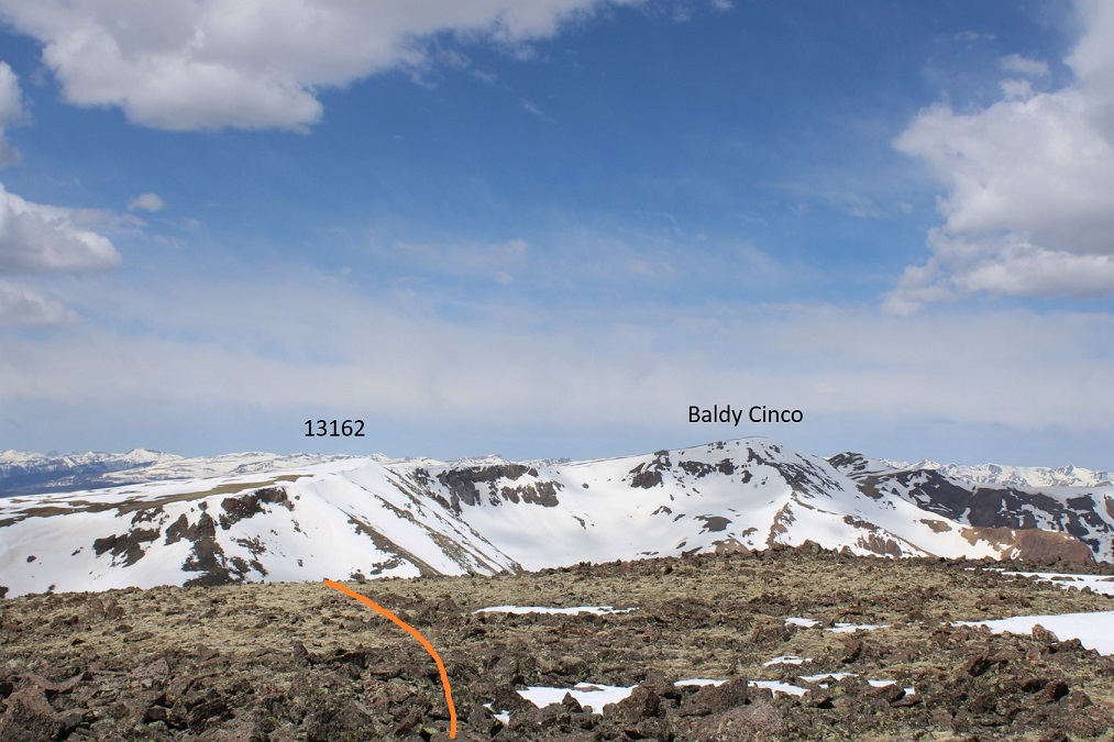
From the summit of 13510 I had a clear view of PT 13020 (unranked). I decided to go for it before heading back down. Here’s the route

Here’s looking back on the route I took from 13510
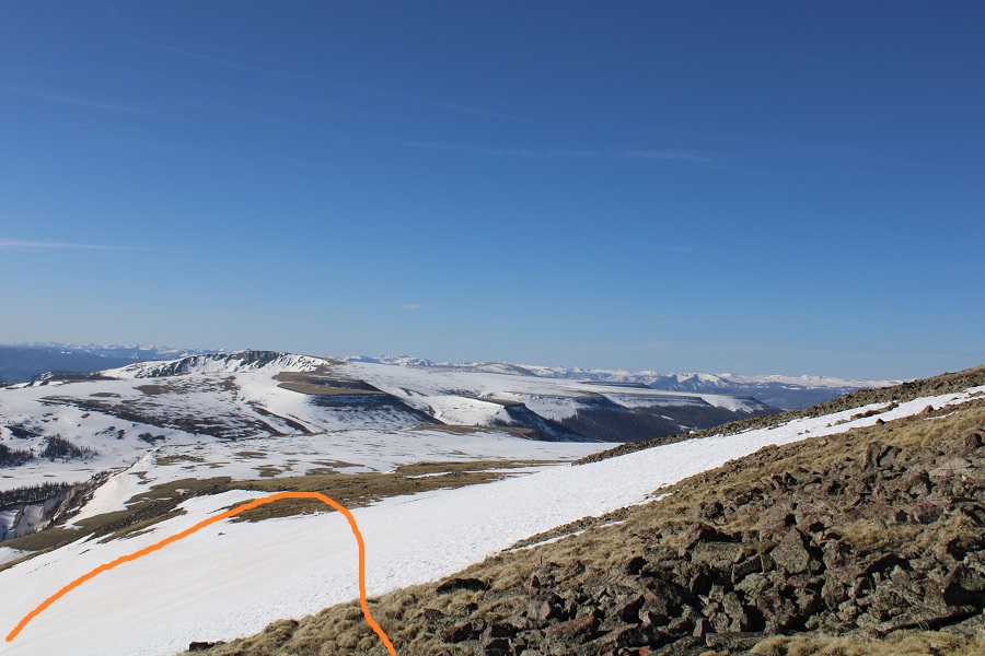
Time to head back. I didn’t want to take the way I’d hiked in back out because of deteriorating snow conditions and possible slide activity. Instead, I hiked directly down into the basin, heading southwest. Here’s a view of the route I took down from 13020, as seen from my way to 13162. I just did my best to avoid the areas of snow when possible (and the willows at the bottom).

From the summit of 13020, here’s the route back to Trail 787
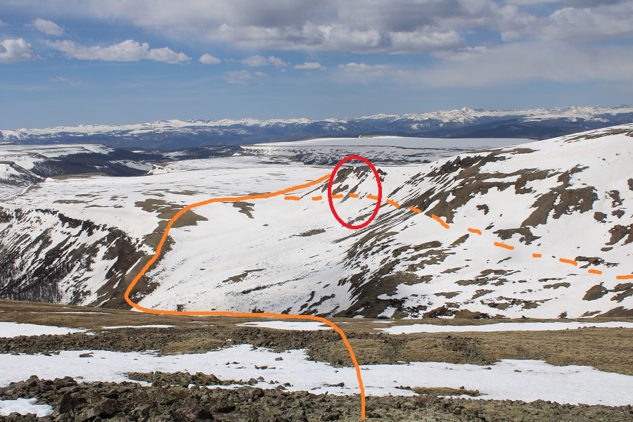
Here I’ve outlined the route I took in (dotted line) and the route I took out (solid line). Trail 787 was dry on the ridge/elevation gain back to the snow mesa. I could see it from the summit, and aimed there, doing my best to avoid snow on the way down. I’ve circled the small slide area.
The snow wasn’t totally avoidable however, and I did posthole through the section of willows. From down in the basin, here’s a look back at my route down.

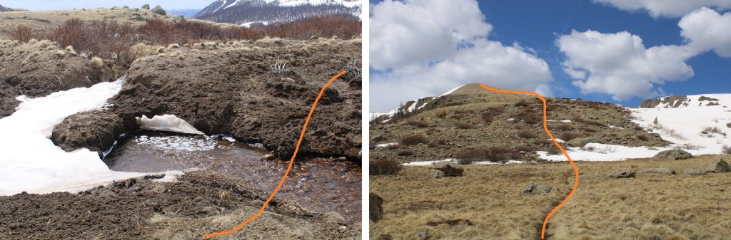
I hopped a small creek, then took trail 787 southwest to the snow mesa and the Colorado/Continental Divide/813 trail.
Here’s another look at the slide area. It’s small, but the trail goes right through it. Also note the cornices above.

Once on the mesa I followed the trail posts across the snow. The snow had softened up considerably, so I had to put on my snowshoes. Even with them I was postholing up to my knees. It was a very long 3.3 miles back.
Here’s a look at the decent route off the snow mesa.

And the trail back to the trailhead. At this point the snow was mostly avoidable, so I took off my snowshoes.

I made it back to the trailhead at 2pm, making this a 17 mile hike with 4750’ of elevation gain in 9.5 hours
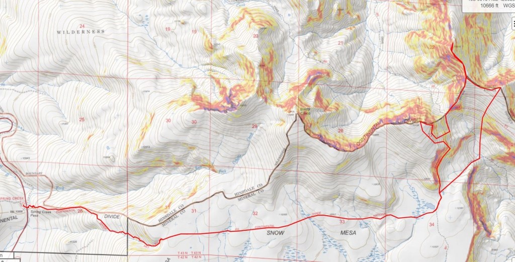
When I got back to my truck I was a little disappointed, as Strava hadn’t engaged. Luckily, most of this route was done on established trails, so it was easy to hand draw this topo route (just note it is hand drawn, and I don’t have a GPX file to share for this one).
On to the next trailhead!
