The weather has been outstanding, so I decided to get in one last bicentennial for the year. I woke up at midnight, worked for a bit, and then drove to Cataract Gulch Trailhead. This trailhead has a bathroom (just an FYI). I was on the trail at 6am.
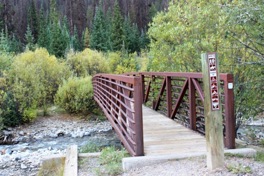
The trail starts at the south end of the parking area, first crossing a bridge, and then a few more smaller bridges (which are new and weren’t here the last time I was in the area) to get across Cottonwood Creek.
I came to a trail register, signed it, and was on my way
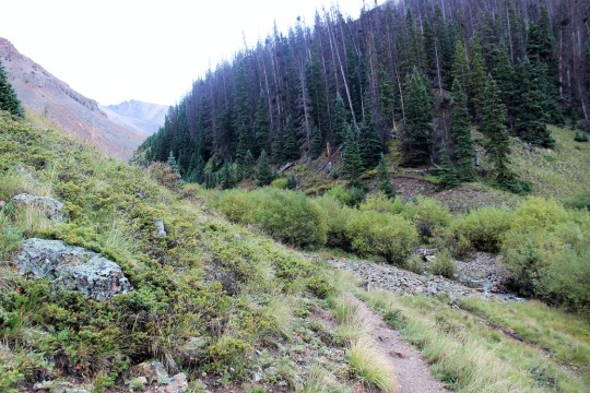
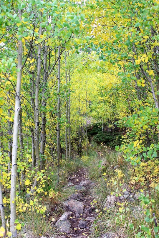
I followed the class 1 Cataract Gulch Trail 475 as it switchbacked south for 3.25 miles
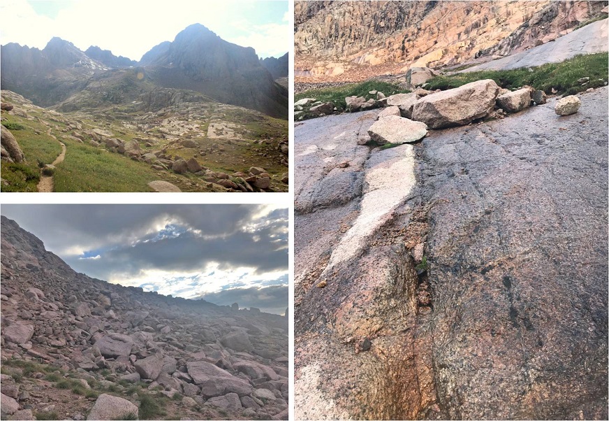
At the top of the waterfall area I crossed the creek a few times (cross the large rock slab first, and then a log)
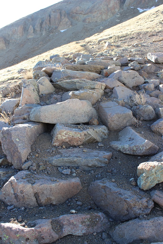
And came to a boulder field
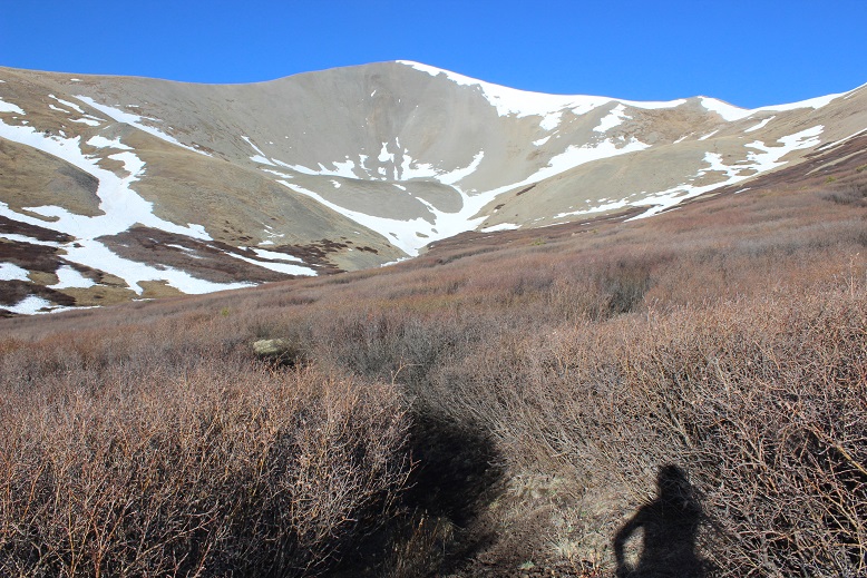
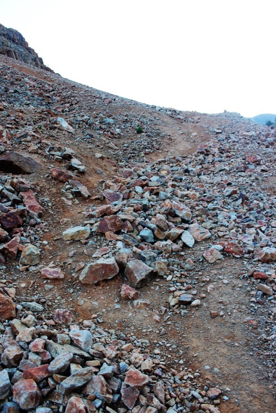
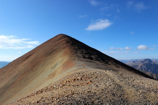
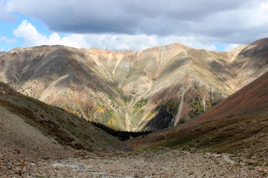
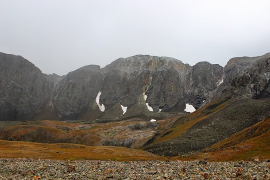
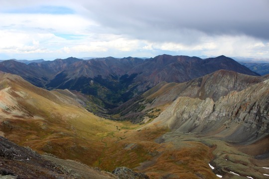
At the top of the boulder field I’d hiked for 3.5 miles. Here I turned right and headed west up the slope. Here’s an overall view of the route. There are many ways to do this, the goal is to gain the upper basin.
The terrain began rocky
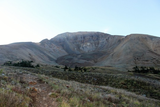
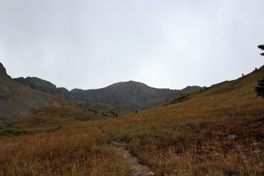
And then changed to tundra
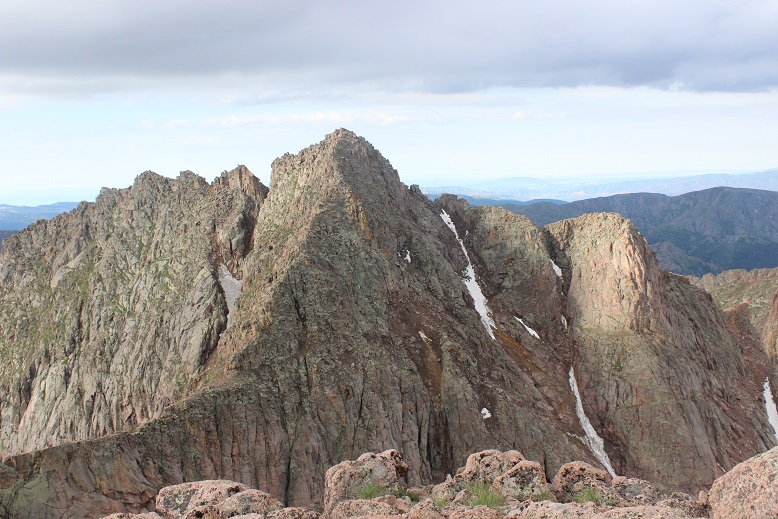
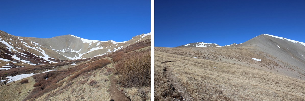
At the top of the hill the tundra started rolling. Here you can see Quarter Peak, and the overall route to get there
I headed northwest and rounded the upper basin
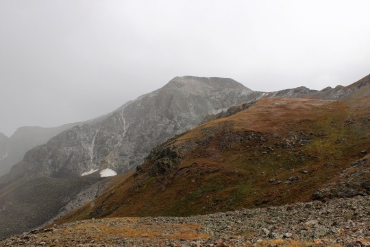
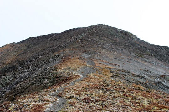
And then turned left and headed up the ridge
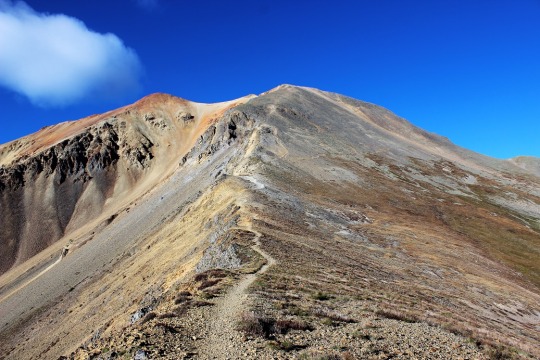
This part of the ridge started out as nice, rolling tundra
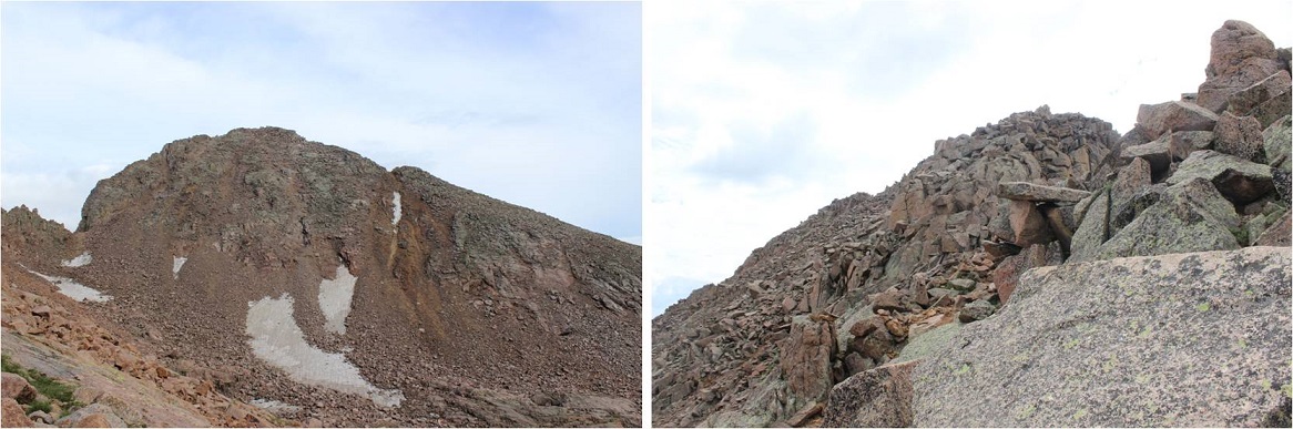
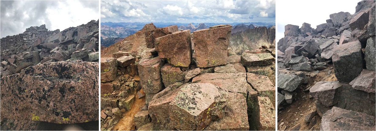
But about halfway up turned to rubbish rock. I’ll say that again: rubbish rock.
Getting to and staying on the ridge is the best option for this part of the hike. The rock is loose, but at least it can’t fall from above
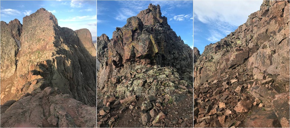
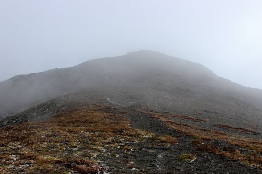
At the top of the ridge I skirted the north side of the mountain for a bit. There’s a gully here, and you’ll want to go straight up it, but don’t (this is a false summit). Instead, ascend about 50 feet up the gully, and then continue skirting the north side of the mountain. This gully is very, very loose, and the terrain changes every time someone ascends/descends.
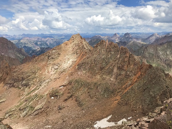
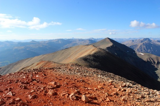
I quickly came to the false summit, and could see the short path to the true summit. This was class 2
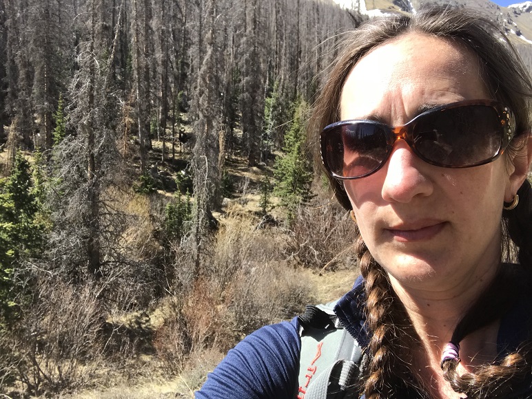
I summited Quarter Peak at 9:30am (unfortunately, I’d lost my sunglasses last weekend camping and didn’t realize this until I was leaving my truck this morning, so I was squinting all day)
Quarter Peak:
This is an out and back trail, so I headed back the way I’d hiked in. Route finding was much easier this time as I initially stayed low before the gully
When I got to the gully it was just as bad going down as it had been going up. Very, very loose.
Then on to the rubbish rock, heading east/southeast down the ridge. This was slow going, as I didn’t want to roll an ankle
The rock changed to tundra and I turned right and followed the basin east back down to Cataract Gulch trail
Here are some highlights from the trail down
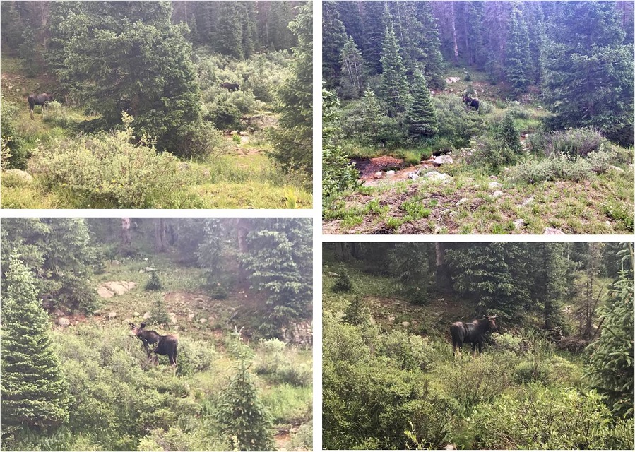
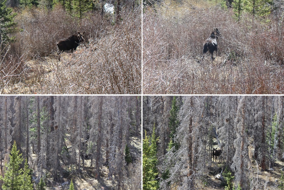
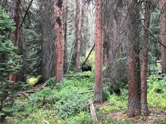
I signed out of the trail register (I’d been the only one to sign it in the past week) and was almost back to the trailhead when I heard a loud rusting. I stopped and turned to my right. No more than 10 feet away from me was the biggest bull moose I’ve ever seen! He was just as startled as I’d been and quickly ran to the cover of denser trees. I gave him plenty of room, and he kept his back to me, so this was the best picture of him I was able to get.
I didn’t stay there long, as he obviously wasn’t in the mood for company. I crossed the creek and made it back to the trailhead
I made it back to my truck at 12pm, making this a 10.3 mile hike with 4227’ of elevation gain in 6 hours.
RT Length: 49.5 Miles (CalTopo) 42.61 Miles (Strava)
Elevation Gain: 9166’ (CalTopo) 13428’ (Strava)
Day 1: Approach, Columbine Lake, Aztec Mountain
After quite a long drive I made it to the trailhead around 9pm. Just before Vallecito campground there’s a sign indicating trailhead parking is to the left. I parked, and was surprised I had cell service. There were several horse trailers in the parking area, and a few vehicles.
I tried to get some sleep, but my nap earlier in the day had lasted longer than it was supposed to (my alarm didn’t go off, and 30 minutes turned into 3 hours). So, I read a bit, made a few phone calls, and got to bed later than anticipated. I was up and on the trail at 2:30am. The trail starts at the northeast corner of the campground. I started and ended the hike in the dark. Also, I had my new camera with me, and was interested in how the pictures from today would turn out.
This is a class 1 trail that goes north without any junctions, so it’s difficult to get lost/off track. I crossed the first two bridges (there are actually 3 if you consider the one that leads you out of the campground but doesn’t cross Vallecito Creek), but made it to the third bridge while it was still dark. I couldn’t see across the river, and I didn’t want to cross without a visual, so I laid out my sleeping pad and took a nap for 30 minutes until it got light enough for me to see, then I put on my sandals and crossed the river. I’m glad I waited until daylight: crossing wasn’t too difficult, the water only went up to my knees, but there were pockets/pools where I could have sunk in the water much, much further. My advice is to cross this creek (river?) in the daylight.
I continued hiking along the class 1 trail, but the stream crossing was causing me to have a Raynaud’s attack. Surprisingly, it was in my hands and not my feet. I kept pumping my fingers and balling my hands into fists, willing them to warm up and stop burning (yes, I realize that was a juxtaposition). My fingers burned for another 2 hours. I should have stopped and warmed up some water to revive them, but instead I continued hiking until I came to the Vallecito/Johnson Creek Junction. I made it to the junction after hiking for 10.3 miles, and continued left (west) towards Johnson Creek
This led me over the 4th bridge, where I continued heading west, up into Vallecito Basin.
Just as I entered the Vallecito Basin I came across a moose. She was just as surprised to see me as I was her. She was the size of a horse, adorable, and reminded me of a puppy dog, but I gave her space. After the initial inquisitive look she gave me she pranced off to the trees and watched me timidly as I hiked away.
I continued on, up a thousand or so switchbacks, through the Vallecito basin to Columbine Lake.
It took me 18.5 miles to make it to Columbine Lake. I made it there at 1pm and decided to sit and take a break for a while. It was here I realized my biggest mistake of the weekend: I didn’t have any chapstik. My lips would be burning until I made it back to the trailhead (and especially after each shot of whiskey). I snacked on a packet of tuna, filtered some water, and considered my options. I’d wanted to hike Grizzly and McCauley today, but I didn’t think I had enough time to make it back before the sun went down behind the mountains. I need to be in my bivy before the sun sets, so this was a serious concern for me. But I wasn’t tired yet. I decided instead to leave my large pack here, take just what I needed in a small pack, and summit Aztec Mountain this afternoon instead.
Here’s an overall view of the route I took to the ridge to Aztec Mountain, as seen from Hope Pass the next day
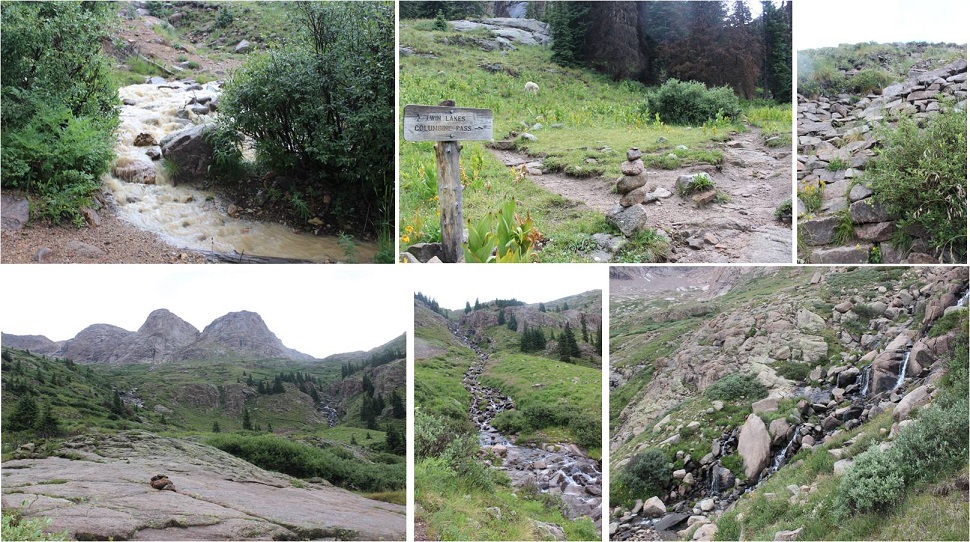
From Columbine Lake I turned and followed the trail northwest towards Columbine Pass, then turned left when it hit trail 541 (no signage, and in fact I had to wing it for a bit as the trail didn’t quite go through, but it was obvious from below where the trail was and I just aimed for it) and headed south.
I followed trail 541 for .7 miles, and then left the trail and aimed for this grassy area. My goal was to gain the ridge, and this seemed the best place to do so, as I could see a path on tundra/scree up to the ridge. After hiking up and down this is the route I’d recommend to ascend the ridge.
The terrain here is steep, and it was slow going, but I was able to ascend the ridge
Once on the ridge I was at a bit of a saddle. There is no need to head right (north) to gain this point, as it’s not ranked and you’ll just need to head back down anyway. Instead, skirt the point by heading west.
This will bring you to the ridge that will lead you to Aztec Mountain. This ridge doesn’t ‘go’. Staying low is the better option here. Here’s an overview of the path you’ll want to take
Staying low keeps this class 2. The final gully is easy to access, and the final scramble to the summit is straightforward
I summited Aztec Mountain at 3:15pm
Aztec Mountain:
Here are some pictures of the way back down to Columbine Lake
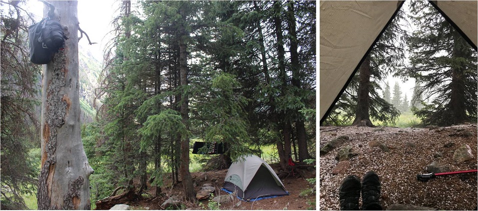
I was chasing the sun, trying to make it to the lake before the shadow of the mountain made it there and cooled everything down. Between the shadow and I it was pretty much a tie, so I gathered my gear and hiked a bit further into the sunshine and set up camp for the night.
I made it back to Columbine Lake at 5:15pm, satisfied with my choice to hike Aztec Mountain today instead of Grizzly and McCauley. I was spending the night at 12,300’, with a great view of Columbine Lake. I went to dry out my feet but my sandals were still wet from this morning (I’d forgotten to take them out and place them in the sun when I left for Aztec). I ate dinner, filtered some water, heated the water in my jetboil and filled my Nalgene with warm water for the night. I looked around for my extra pair of socks but couldn’t find them, so I guess my feet weren’t going to dry out tonight. I placed the water bottle at my feet and looked at my tracker: it said I’d done 20 miles today. Not bad. I snuggled up in my sleeping bag and bivy and looked over at Grizzly Peak. I thought about the approach tomorrow, jotted some notes down in my journal, put on all the clothing I had with me, and called it an early night.
It was a long night. A long, cold night. I was warm in my bivy and sleeping bag. Halfway through the night I felt something sniffing my ear. Seriously. It felt like a dogs’ muzzle and startled me awake. From inside my bivy I flailed my arm at it, unzipped my bivy, and looked around. There was no moon but the sky was bright with stars. I could see the mountains and the lake and rocks and tundra, but no animal. It hadn’t made a noise when I’d touched it, but I’m guessing it was a fox or a coyote with an ear fetish. The air is thin at 12,000’. A few hours later I woke up, noticing breathing was more difficult than usual. To breathe better I quickly opened my bivy to get in a few gulps of air. Not only did this not help with my breathing, but when I put the bivy back over my head the condensation from my breath had turned to ice. Wonderful. Note to self: don’t unzip the bivy.
Day 2: Grizzly Peak C, McCauley Peak, Descent
The morning couldn’t come soon enough. Just before first light I re-heated the water in my water bottle, packed my gear and was on the trail with just the essentials, leaving my big pack at the lake. I took the same trail I’d taken to summit Aztec, but at the junction with trail 541 I went right and followed the trail towards Hope Pass. Here’s an overall view of the route from yesterday’s hike
This part of the hike was on a nice trail, and when there wasn’t a trail there were great cairns. From Hope Pass I got a good look at Grizzly Peak C, and the route I wanted to take to gain the ridge. Here’s the overall route I took, aiming for a gully and rock rib that ascends the mountain
I didn’t descend to Hazel Lake, but instead stayed high, aiming for the grassy slopes below Grizzly’s ridge. There are several ways to do this
From there I aimed for the obvious gully/notch/access point (not sure what to call this?)
This gully/notch/rib is easy to follow to the ridge. Stick close to the wall and follow it southeast as it hugs the mountainside. It starts out as class 3 but after the initial solid gully it becomes class 2. I was pleasantly surprised to find cairns here.
Here’s the last bit to gain the ridge. Aim for the notch (there are cairns here too). The last part of this is class 3.
I went through the notch and found snow on the other side. This wasn’t unexpected, as I’ve spent the past 3 weekends in this area and knew north facing terrain was holding snow. What was unexpected was the amount of snow, and how it all lined the trail. It ranged from non-existent to 3 foot drifts, and from bulletproof to sugary. What’s important for the reader to know is there are multiple ways to summit Grizzly Peak, and tons of cairns to prove it, so I was able to get creative these last 250’ or so to the summit. I rock hopped where necessary, kicked in steps, and created trenches to get to the summit, always heading up and east. Here are some highlights.
The last bit to the summit was luckily snow-free, and class 3-4 (the chimney was class 4)
As I made it to the summit I wasn’t sure if the true summit was left or right. I went right and luckily chose correctly (there was a summit register beneath this point).
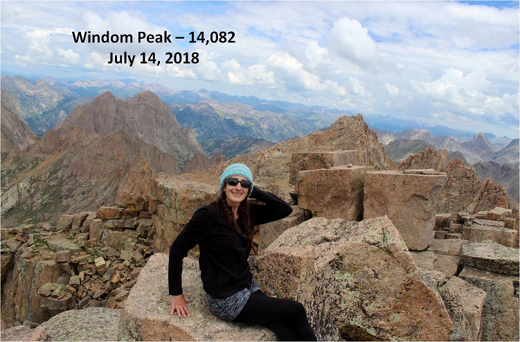
I summited Grizzly Peak at 9:15am. I know some of you are wondering, did I did I sit at the top of the summit point? The answer is no. The point was too pointy to sit directly on top of, but I did climb up the summit boulder, sat on it about a foot from the point and touched the top, so I’m calling it a summit. You can sit wherever you’d like. I also didn’t take the video from the point, as I do a 360 degree video and wasn’t about to attempt turning in a circle while standing on the point.
Grizzly Peak C:
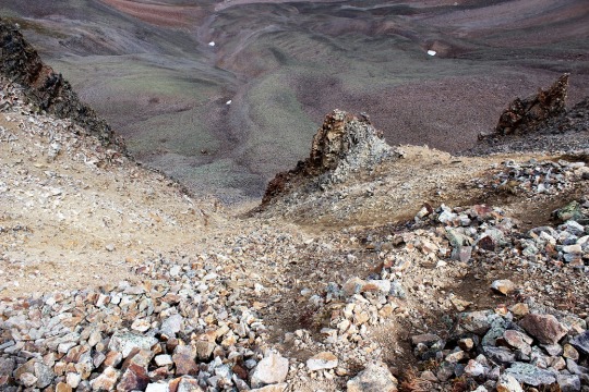
Time to head back down. I down climbed the chimney and headed back, retracing the steps I’d left in the snow to the notch
I made my way back down around the side of the mountain to my entry point
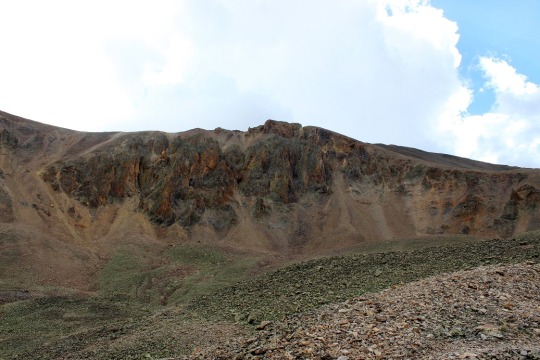
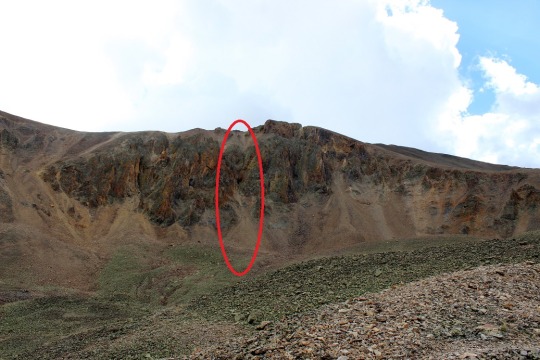
My next objective was McCauley Peak. I could clearly see the line I wanted to take, up the grassy slopes to the Grizzly/McCauley saddle. Staying high didn’t cliff out, but there was one class 4 downclimb required in the area circled in red. If this scares you, you can just go lower initially (the dotted line) and re-gain elevation.
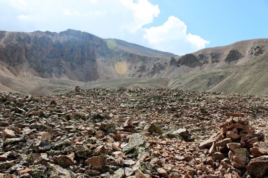
I gained the saddle and headed south along the ridge. This was all class 2
From the top of the ridge I could see the rest of the route. There were cairns here indicating I should go low, but the route was no more than class 3 sticking to the ridge. Here’s an overview of the route I took
The summit is actually the southernmost point. I rounded the west side of the mountain and found a gully to ascend (note: all gullies here ‘go’).
There was one class 3 move and then it was all class 2 to the summit
I summited McCauley Peak at 11:30am
McCauley Peak:
It was a beautiful day! The predicted winds never materialized, so I stayed a little longer on the summit than usual. Then I headed back down the gully and over the ridge
Here’s the overall route back to Hope Pass
And the route from Hope Pass back down to Columbine Lake (and my stashed gear)
I made it back to my gear at 1:30pm. I mulled it over, and decided instead of sleeping here tonight I was just going to hike as far back as possible, stopping along the way if need be (there are tons of camping spots along this trail). I consolidated my gear and was on my way back down the basin towards those thousands of switchbacks.
Back down to Vallecito Creek and its bridges (or lack thereof). This was much more enjoyable in the daylight. I was able to appreciate the creek and its depth, and even saw dozens of trout swimming in the deeper pools.
I followed the class 1 trail back to the trailhead, following the creek, and passing a hunters’ camp along the way. The mules said ‘hi’ as I trekked by. There were no people to be found.
The whole way back I was prepared to stop and camp, but I was making great time so I just kept going. I mean, I really, really needed that chapstik. About a mile from the trailhead my camera stopped working. It wasn’t until I made it back home I realized the battery had somehow fallen out. This was weird because the door was still closed, and I only realized it was gone when I opened it to take out the flash card. Luckily I have a spare. I made it back to the trailhead at 8pm, and found my extra pair of socks sitting nicely in the passenger seat. I have very different numbers for my stats looking at CalTopo and Strava. I usually go with CalTopo for numbers for consistency sake, but I’ll just leave these here for you to decide which are more accurate, along with a few topo maps of my route.
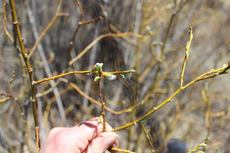
I’ve put off these peaks because I was a bit anxious about the drive in from Silverton, but the weather was perfect and they’re on my list, so off I went. After a Girl Scout meeting where we sewed masks (I have a girl working on her Gold Award who did an awesome job leading the meeting), I drove 8 hours to the Hunchback Pass trailhead. Along the way I saw a moose. And let me tell you, this is why they don’t call it “moose in the headlights”: they really don’t care. I sat there for a bit watching her, and then just drove by. She munched on willows as I passed.
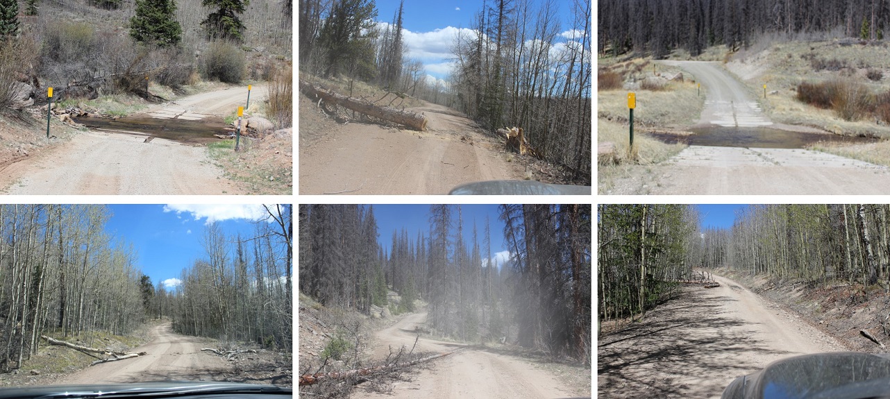
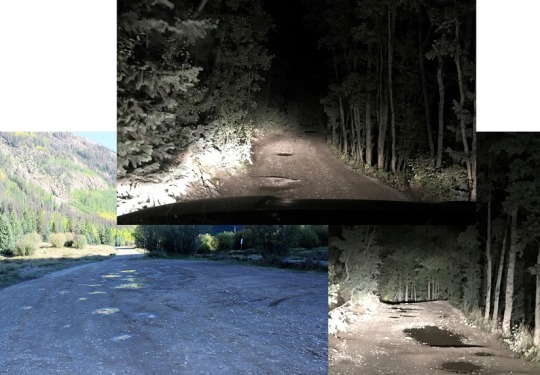
The drive in on the dirt road was underwhelming. I have no idea what I’d been worried about? It took me an hour and a half, and was actually quite pleasant. These pictures are from the way out, but it was just as easy to drive both ways. I never had difficulty passing others, and 4WD was only needed once or twice. This is actually one of the better 4WD roads I’ve done this year, and if weather permits, I’ll be back again next week. Here are some pictures from the drive in
And the Rio Grande river crossings (easy in late September)
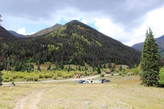
I found a place to park much sooner than I needed to. I’m not sure why I stopped here except it was dark and I was tired and it was a good spot, but I could have continued driving another mile to the trailhead and been fine. I parked, slept for half an hour (I’d been up for 24+ hours, and needed the rest) and was on my way at 5:30am.
Since I’d parked along the road I followed the 4WD road for 1.3 miles before turning left onto Trail 813. There was room for 2 vehicles to park at the trailhead. There’s a trail register here, but nothing official.
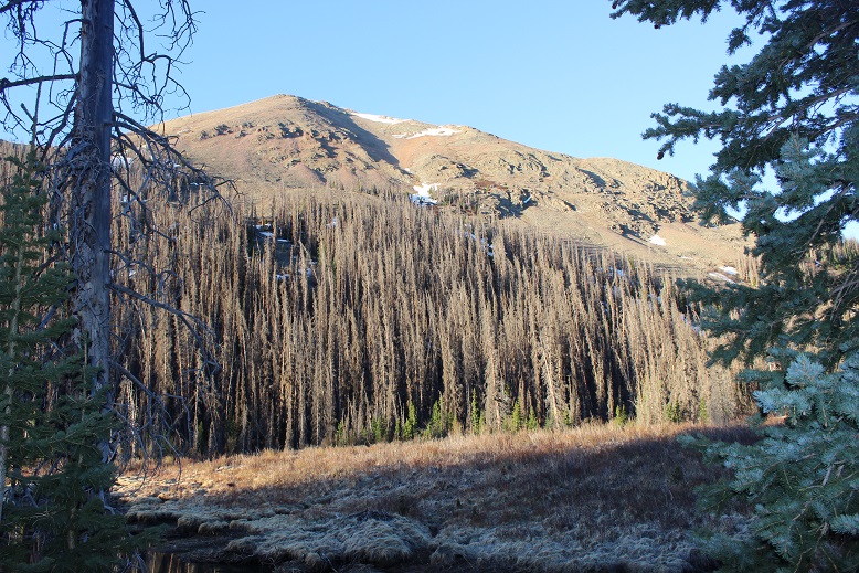
I followed the class 1 trail as it curved up and over and then down hunchback pass. As I was hiking the sun rose, and I got a good look at Hunchback Mountain. I didn’t have a topo for it, but it looked doable. I’d file that one away and maybe attempt it on the way out.
From the top of Hunchback Pass I hiked for 3.4 miles and lost almost 2000’ of elevation as I followed the class 1 trail down the mountain, crossing small creeks and navigating through willows.
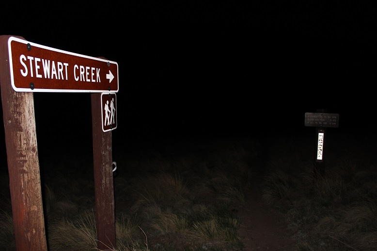
Stay straight at this sign/junction
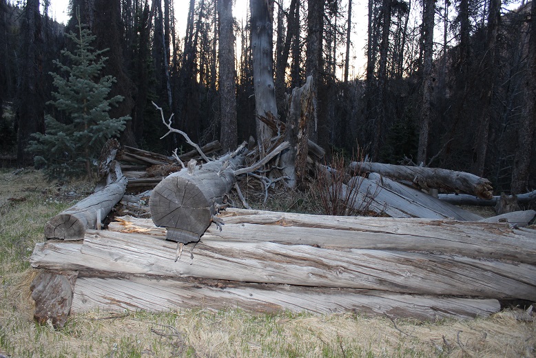
I missed the initial turnoff and had to do some route finding (because there is no official turnoff). However, after hiking for 3.4 miles there are some logs on the right side of the trail, split in half, and a waterfall. There are waterfalls all along this trail, so don’t just look for a waterfall, but look for the split logs. Leave the trail here and head west.
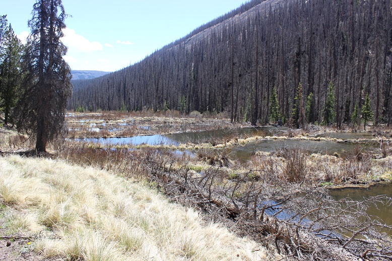
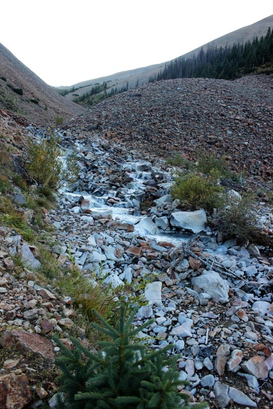
From here you’ll quickly come to an easy creek to cross and a waterfall. This is Nebo Creek. You can camp here, and it’s worth spending a little time enjoying the area.
There is no clear trail here, but there is a bit of a game trail. Several in fact. They all go to the same place, so follow stormy creek by heading west, stay north of the creek for better terrain. Here are some pictures.
I headed west for just under 2 miles. I believe the standard way to enter the basin as it leads to Lake Silex is to use the obvious scree/rock filled gully (dotted line). I didn’t do this, and I’m glad I didn’t (I did take it down and was disappointed, as it seemed more trouble than the way I took up). Instead, I went further west, found a different, smaller gully by the rock/grass/willow filled slopes, and ascended that way. Here’s an overview
And step by step
I was able to follow game trails the entire way, and even saw some cairns in areas. At 11500’ I turned left and headed south, then southwest up the side of the mountain, aiming for this narrow gully.
Here’s looking up into the gully, and back down from the top. The rocks here were solid and it was an easy climb
From the top of the gully I still had a ways to go. I headed south, and then west, curving high along the side of the mountain. I wasn’t headed to Lake Silex today, but instead to the pass, so staying high was helpful.
After rounding Lake Silex I headed up the rocky gully to the pass at 12800’
It took me 10 miles to make it to the pass. I took off my gear and took a break. I ate a packet of tuna (I’d forgotten to eat breakfast) and decided to leave my large pack here and just take some water and a first aid kit in my small pack for the rest of the day. Before I left, I filled my water filter up with snow and laid it out in the sun, hoping it would melt so I could filter it later.
First up: Storm King Peak. Here’s a view of the overall route from further down the pass below later in the day.
And a view from the pass
I did some scrambling, following the ridge north east. There really is no established route here, just pick your line. It shouldn’t be harder than class 3
At 13430’ there’ll be a small dip, and an obvious place to cross the gully
After crossing the gully, I headed north along the ridge. The peak is just to the left
I summited Storm King Peak at 12:25am
Storm King Peak:
Here’s the route back down to the pass
From the pass my next objective was Peak Seven. I headed west, losing about 300’ as I descended into the basin, and then headed back up towards Peak Seven. Here’s an overall look at the route
This was pretty straightforward. Here are some step by step photos. First, I entered the basin and then rounded the side of Peak 8
There were a few game trails here. I stuck high, and then aimed for a gully that would bring me to the pond underneath Peak Seven
From the pond I turned right and headed west up the gully
Once I’d gained the ridge I headed south. There was some scrambling here, and due to the fact there was snow on the normal route I had to get a bit creative. Instead of going up the face I stuck to the left and avoided the snow, and had some fun class 3/exposed scrambling instead. Here’s the basic route
There was a nice, airy game trail that led me to some rock slabs, which I used to ascend
I summited Peak Seven at 3:10pm
Peak Seven:
Heading down Peak Seven was just as fun as heading up. Here’s the way back to the saddle
From the saddle I hiked back down to the lake, and made my way over to the south side of Peak 8, intent on attempting Peak 9 today as well.
However, as I rounded the corner to Peak 8 I noticed the sun was already starting to set behind Peak Seven. It’s fall, and the days are short. Looking at the hike ahead, I knew I wouldn’t be back to my gear before dark. I have Raynaud’s, and I need to be bundled up and in bed as the sun goes down. I sighed and retraced my steps back to where I’d left my gear at the pass. Once I got there, I’d do some thinking. Here’s the route from the top of the gully of Peak Seven back to the pass.
As I made my way back to the pass I noticed a gully in between Peak Eight and Peak Nine. It looked like it went.
I filed that away and kept hiking to my gear
As I hiked, I strategized. I could hike back down to the lake to set up camp, but right now I was really upset about not getting in Peak Nine today as well. The approach was a lot for one peak, and I really didn’t want to drive/hike in all this way in the future just for Peak Nine at a future date. Maybe I could get it tomorrow morning? I got out my topo map and the route I’d passed on my way to/from Peak Seven indeed looked like it went, but I was a little worried about the snow. Luckily, I’d packed spikes. I decided to sleep on the pass tonight (at 12,830’) and attempt Peak Nine first thing tomorrow.
I made it back to the pass and looked for a place to spend the night. I didn’t have many options, and all of them were rocky. And windy. Time to set up camp. Check out my bivy for the night. Side note: it’s hard to dry out your feet when it’s windy and cold. I ended up putting dry socks on and wearing my sandals.
As the sun started to set I filtered some water (glad I’d thought to melt snow now that I wasn’t camping at the lake), jotted down some notes, and had dinner (a handful of peanuts and 4 or 5 slices of dried mangoes: eating while hiking makes me nauseous, so I probably only get in 500 calories in an entire backpacking weekend). Oh, and a couple shots of whiskey. That adds calories. I set up all my gear so in the morning all I’d need to do was put away my sleeping bag and bivy (important when you have no function of your fingers, which I won’t in the morning cold), watched the sun set, and poured over topo maps for two other of tomorrow’s peaks: Mt Silex and The Guardian
Anyone else think it looks like The Guardian is wearing a mask?
I set my alarm, bundled myself up in all my clothes, gloves, hat, etc. and went to bed. It was a windy night but my bivy did its job. I woke up at 5:30am and it was still pitch-black outside. I watched a few shooting stars and re-set my alarm, knowing getting outside of my bivy with this wind/cold would be a bad idea. By 6:30am it was just starting to get light. I enjoyed the sunrise tucked inside my layers, and then as quickly as possible put away my bivy and sleeping bag and bundled my gear together. I was going to attempt Peak Nine with just my daypack today as well (which I’d pre-packed last night), so I left my large pack on the pass and started out.
Day 2: Peak Nine, Mt Silex, The Guardian
I started off the same way I’d headed towards Peak Seven yesterday, heading down the pass, but when I saw the access gully for Peak Nine I turned left (south) and up
I’d been a bit worried about the snow, but it wasn’t a nuisance. Most of the gully was dry. I didn’t need to put on traction to kick in steps in the snow, and it didn’t cause me to slip. There was only about 20 feet or so to deal with.
I was excited when I made it to the top of the gully to find I was in the perfect spot to continue the hike. I stayed high and aimed for the ridge. Note: Here it became very windy. The wind didn’t stop all day.
At the end of the ridge an obvious cairn trail picks up.
It will lead you up a class 3-4 chimney and then around the mountainside.
You have the option of taking the gully or the ridge. I took the gully up, the ridge down. The gully takes some route finding and I found it to be class 4. The ridge is easily and highly cairned. Here’s the entrance to the gully. I don’t think there’s a way to cliff out, but there are tons of options to ascend. Just keep heading northeast
Here are some photos from inside the gully
If you keep heading northeast you’ll hit a wall. There will be cairns in the northeast corner of the top of the gully that lead you both to the exit route back down the ridge, and to the summit.
These cairns will take you to the ridge, which if you follow northwest will take you to the summit
I summited Peak 9 at 8:25am
Peak Nine:
Here’s looking down the gully from the summit. Here you can see you can pick your route but need to head to the northeast corner to gain the ridge
I’m not gonna lie, I didn’t want to head back down the gully. I’d known there was a ridge route when I’d ascended, which kept me going up, but the class 4 moves were bordering on class 5, and I felt safer taking the ridge down. Here are some pictures of the very well cairned route down the ridge. I followed the ridge southeast the way I’d come, dipped down a bit, then found the cairns that led me back up to the ridge
I then followed the ridge
Dipping down to the left once, then staying to the right for the rest of the ridge
The ridge led me to a short gully. I took it southwest
And this brought me back to the trail I’d hiked in on.
I followed it back to the chimney, climbed down
And aimed for the gully I’d hiked in through
I used my kicked in steps from this morning to descend, then made my way back to the pass and my gear.
I sat at the pass and had a packet of tuna and looked at the time. It was still early, so I figured I had plenty of time to hike Mt Silex and The Guardian today as well. I gathered my large pack and set off for Lake Silex below. I was a bit worried about the access gully (circled in red). The snow looked to be covering the entire last part of the route, and I wasn’t sure I’d be able to get up the gully.
I dropped my large pack at the lake. It was now 11am, so the sun wouldn’t be my friend as I ascended the gully: it would be shining in my eyes the entire time. Here’s an overview of the route I took from the pass, down to the lake, and up the gully
When I got to the gully the snow wasn’t as bad as it had looked from down below. I was able to avoid most of it by sticking to the left
Here’s an overview of the route I took to summit both Mt Silex and The Guardian and back from the top of the gully
I started out kind of low, but my advice is to gain the ridge as soon as you can and follow it to the summit. I took more of the gully route, which made things more difficult than they needed to be. Here’s my route
I summited Mt Silex at 12:55pm
Mt Silex:
Here’s a look back down the ridge I’d just hiked up
Now to head over to The Guardian. I went back down the gully, and hugged the side of the mountain
Then I stayed high and worked my way southeast
Here’s step by step.
At around 13400’ I came to a gully, turned and headed northeast to the summit. The climbing here was class 4, and seemed to get sketchier as I went.
At the top of the gully was a well-cairned summit ridge
Here’s a look back down the gully
I summited The Guardian at 2:55pm. The views were a bit hazy due to the smoke from the fires
The Guardian:
As I’d summited, I noticed an easier gully I could have accessed to summit if I’d hiked just a little further southeast. I decided to take that gully down. It’s scree filled and I scree surfed down. This is class 2.
At the bottom of the gully I turned right
I had a great view of my route back to the gully that leads back to Lake Silex. It’s important to stay high here, as it does cliff out a little below. Here’s my route
Here’s a look back at the route down from The Guardian, staying high to avoid the cliff bands
Back at the top of the gully here’s looking at my route back to Lake Silex. I hiked down to the lake, gathered my gear, and went around the north side of the lake, looking for a spot to spend the night.
At the northeast side of the lake I found a set of 3 windbreaks and picked the most well-constructed one to spend the night.
I set up my gear inside a windbreak built in-between two large boulders. It was well made, but the wind was so intense the barrier wasn’t doing much to keep out the wind.
I filtered some water from the lake, ate dinner (my last packet of tuna, a handful of peanuts, and a few shots of whiskey) and made it an early night.
The wind howled all night long. It was intense, but my bivy once again did its job.
Day 3: Descent, Hunchback Mountain, Hunchback Pass
I woke up the next morning, gathered my gear, and was off at 7am. I followed the gully northeast towards Stormy Gulch.
There was still some snow left in this gully from last winter.
I made my way down the scree and back Stormy Gulch
I much preferred the way I hiked in rather than this scree hike out. Here’s looking back on the scree slope
I picked back up the faint trail and followed it east
The waterfall seemed a good place to stop for a bit. I sat on a log and relaxed for a few minutes before the long hike back up to Hunchback Pass. Once again, this would be a great camping spot.
I crossed Nebo Creek and quickly found the trail.
I followed the trail north past treeline, keeping a steady pace as I still had one more peak to climb and didn’t want to get too tired too quickly. I filtered water one last time and took frequent breaks just because I could.
Once above treeline I had a great view of Hunchback Mountain. Here’s the overall route I took to the summit
And step by step, all class 2. Sometime during this part of the hike I lost one of my gloves. It was really windy, and I suspect it was blown out of my pocket. Time for a new pair of gloves. I left the trail and aimed for a small grassy area near a band of rocks
After the grassy area the terrain became rocky. I aimed northwest (note, this is a false summit)
Here’s a view of the summit of Hunchback Mountain
I summited Hunchback Mountain at 11:15am
Hunchback Mountain:
I spent some time on the summit, getting a good look at some 13ers I wanted to attempt next weekend if the weather held out. I figured out which route I wanted to take next week, and then it was time to head towards Hunchback Pass. I just followed the ridge east until I reached a tundra/willow filled gully, then followed the gully back to the trail.
Here’s looking back on my descent
Back on the trail it was an easy hike back down to my truck
I made it back to my truck at 1pm. This was a 3 day hike, with 39.49 miles and 11981’ of elevation gain according to CalTopo, 28.9 miles and 19042’ of elevation gain according to Strava. I’m not sure why the big gap in elevation gain/mileage, but to remain consistent I always use CalTopo data.
This is the third time I’ve been to Maroon Bells this month. I was able to secure 3 separate permits, and the past few weeks went with friends to summit North Maroon and Pyramid. Today I was here to tag a new 13er for myself: PT 13631. Since I70 is now open (it was closed due to fires) I was the only one driving on HWY 82. I didn’t pass one vehicle between Granite and Aspen. It was awesome. I did see 2 vehicles parked at a trailhead near Independence Pass, and two scruffy porcupines to go with them, merrily munching on the wires underneath. The owners of those vehicles were not going to be happy when then made it back to their cars. I’d have gotten out and shooed them, but, you know, they may be slow but they have quills. I saw three other porcupines waddling along the highway as I drove. HWY 82 is popular among porcupines.
As I passed the parking structure for Maroon Bells I saw a pear shaped bear butt running away from a trash can and then jump over a fence. It was cute to see it bounding away (although I kind of wanted to get a picture so I wished it had stood still for a second).
I had a permit to park at Maroon Bells from 12am-4:30pm. It was 1am when I arrived and I felt it was still a little too early to head out so I took a quick nap. A large group of hikers passed by at 2:40am and woke me up, so I was on the trail by 2:45am.
The trail starts at the west end of the parking area
And follows a well-defined path around Maroon Lake
At the end of the lake I followed the trail towards crater lake. I noted the signs: One said “bear activity in area” as of August 23 (August 1st had been crossed out) and there was also a sign saying there was a moose in the area. In the last few weeks I’ve seen a bear standing on the side of the road while taking the shuttle ride out and a moose standing in Maroon Lake, so I knew these signs to be true.
This is a class 1 trail to Crater Lake
I turned left at the junction for Crater Lake
And then followed the trail (still class 1) around the ‘lake’ and up the basin.
I passed a few camping areas while it was still dark. In one a large man was standing by the trail, bald, shirtless, and in possession of a rather hairy pot belly. He seemed to be waiting for me to pass by. Luckily this is a well-travelled trail, especially at this time in the morning when others are looking to summit Maroon Peak (I count the flashlights so I know who’s ahead of/behind me when it’s dark out: that large group of hikers wasn’t too far away). I could see him because he had a headlamp shining from his forehead. I didn’t see his dog, who started barking at me as I neared. Of course, I jumped. The man seemed to think it was funny. I continued on. Also, it wasn’t funny. Here’s an overview of the next few steps, as I made my way up to Len Shoemaker Basin
After hiking for 4 miles from the trailhead, and at 10515’ I left the trail to cross Maroon Creek (which at this point of the year isn’t flowing much, but earlier in the season is several feet deep). There are cairns in the area. An obvious trail picks up on the other side.
I followed this trail for .25 miles, until I saw a cairn to my left and then followed a very faint trail east through and then out of the willows, and up the side of the mountain, towards the basin.
Making it to the basin required ascending a series of gullies. I’ve been here several times, and the route gets easier to find each time. This time there were plenty of cairns indicating the way. However, the route sometimes doesn’t seem like it should follow the cairns, but trust me, it does. Here’s the route step by step into the basin. After exiting the willows and crossing a small boulder field there is a faint trail behind the next set of bushes/willows that will lead to the first gully. Now’s a good time to put on your helmet.
I ascended the loose gully, staying to the right for more traction
At the top of the first gully you’ll see another gully to your left. (These are tons of fun in winter BTW, so bring your crampons and ice axe if you expect snow). Ascend the second gully, this time sticking to the left for more stable ground
At the top of this gully is… another gully. Sorry for the hand in this picture: the sun was at an unfortunate place in the sky while I was trying to take pictures and this was my solution.
From here I aimed for the grassy slope and went behind it, angling towards the ridge
And could see another gully to my left. (This entire time I was heading east)
Next, I aimed for the grassy slopes, and the final gully that would take me to the upper basin.
Here I got my first view of PT 13631. I just followed the basin south towards the end
The end of the basin was still holding some snow. This was a light snow year, so I expect there’s snow here almost year-round. The snow can be avoided, but I just walked over it into another basin
I followed the talus rib towards the base of the gully that would lead me to the saddle of Lightening Pyramid and PT 13631
This is the last gully of the day. It’s class 2 but the scree is loose. I looked for larger rocks whenever possible. There is no direct path but there are a bunch of game trails. No area seems to cliff out, so you can pick your line depending on conditions.
At the saddle I turned right and headed southwest up the ridge. Most of this was easy scrambling, after first initially gaining the ridge. To do this I went right, found a class 3 chimney and ascended it. This was the most difficult part of the entire hike, and I probably could have found a class 2 option around this if I tried harder. I felt this chimney was pretty easy.
Here’s looking up at the chimney. There are plenty of hand/foot holds. It’s only about 8 feet high and all of the rocks are stable.
Once on the ridge I scrambled my way to the summit. This is all easy class 3, just scout around for the best route.
The summit is relatively flat. There’s a summit cairn with two summit registers. The metal one is closed and has 2 pens inside. The white one is open (without a lid) and is empty. Bring some paper if you want to sign this register.
I summited PT 13631 at 7:20am
PT 13631:
The views were great, but the smoke from nearby fires shaded them a bit.
Here’s the route back down the ridge
Down the chimney (you can see my trekking pole below for reference)
And back around to the saddle.
Once again, great views
Back down the gully and through the basin
And back down the gullies, following the cairns west along the way.
Through the willows
Back to the trail that would lead me across the creek
And back to West Maroon Creek Trail 1975 and Maroon Lake
When I was here last week there’d been a moose standing in the lake. Guess what? He was still there (this time lounging by the lakeshore). Pretty cool!
I made it back to my truck at 11:45am, making this a 14.93 mile hike with 4584’ of elevation gain in 9 hours (with some time spent ogling the moose).
Here’s a topo map of my route. I have to say, the views were incredible but the peak itself was kind of a letdown. It had just been too easy, when I’d been expecting the more intense scramble over crummy rock the Elks are known for. It almost wasn’t worth bringing my helmet, but the moose was an added bonus.
I drove up to Carson Pass the night before and slept in my truck. For details on the drive in, please see this post: Carson Pass.
That night was a rough night, not only because my mind wouldn’t turn off, but because the winds were constant and curiously loud. I woke up before my alarm and decided to sit in the cab of my truck with the heat on to warm up a bit before starting out. I turned the ignition, heard a “thunk” and noticed my ABS and traction control lights were on. Oh, and my 4WD light was blinking. That seemed strange, and a little troublesome. I tried turning the truck off and on again and taking it in/out of 4WD but I couldn’t get it to engage. I didn’t like this turn of events but figured I might just need to get the truck moving to get it to work. Hopefully it was just an actuator problem. I was on the trail at 4am.
The forecast called for rain today, which most likely would transfer to snow at this altitude. I usually like to do the longer hike first, but today I was afraid I’d get caught too far when weather hit and since these entire hikes are above treeline that just didn’t sound safe. I grabbed my helmet and figured I’d play it by ear.
From my parking spot I traveled south for half a mile along trail 821 before turning right onto the Continental Divide Trail/The Colorado Trail/Trail 831. I didn’t know it at the time, but just past this junction there is actually a parking area, so if you wanted to cut off a mile from this hike (and extra elevation gain) you could just park there.
I followed the class 1 Trail 813 as it lost a total of 400’ as it wound down the canyon, and then gained almost 1000’ to the top of the pass.
There was one small section of snow to cross, but luckily for me the elk had already done a great job blazing the trail.
I saw quite a few elk this weekend. They are definitely all over this basin. The first ones I encountered at about 5:30am. Of course they trotted away from me, but I was able to get a photo of one up on the ridge (I’d be on that ridge in about half an hour)
Up towards the top of the pass the trail got a little wet, but it was still easy to follow.
From the top of the pass I left the trail, turned right and headed northeast to the ridge.
I aimed for the saddle and got a great view of the sunrise.
From here it was a class 2 ridge hike. I stayed on the ridge when possible, and when not I dipped to the right. Here’s the route I took:
In the beginning there were some steep sections to navigate. Nothing too difficult, but it’s all choss and there’s some decent exposure, so choose your footing carefully. This area was about a foot and a half wide in places.
This section is easier than it looks: Just dip down to the right
From there it’s an easy walk up tundra to the summit
I summited at 6:40am
Carson Peak:
I turned around and headed back over the ridge. From here I had a good view of my next 2 objectives: Tundra Top and Cataract Peak
The route looks a little different on the way back.
Go straight over this part. Once again, there is some exposure here, along with loose rocks. Be sure of your footing.
And straight up this. Once again: loose, but straight up is the way to go
Once the ridge section is done it’s an easy walk up tundra
The only problem? I’m not sure exactly where the summit is to Tundra Top. It looks like it’s at the jagged point you can see from Carson Peak, and indeed that feels like the summit and also has a large cairn, but when I used my altimeter I measured the middle of the flat, open space further to the west as being 30 feet higher. Also, there are cairns all over the summit, as well as at the high point after the ridge. So I basically walked all over the mountain (between summiting the first time and when I came back over from Cataract) and I’m considering it a summit.
In any event, here’s a couple of summit photos from somewhere on the top of Tundra Top, and a video (not sure if the video is from the actual summit though)
Tundra Top:
I turned north and headed over towards Cataract Peak
The hike down started with unstable rocks and then switched to scree. This was class 2, and I’m pretty sure I was using game trails, making my way towards the saddle.
There are two ways to summit Cataract Peak: you can go to the left (west), gain the ridge, and then summit, or go straight up the south face. Not knowing ridge conditions, I decided to go straight up the south face, even though that meant crossing some snow. (After summiting Cataract I realized the ridge is easy class 2 and a viable option).
After crossing the snow I made my way up the mountainside on loose scree, which was steep at times. I followed an obvious game trail with one switchback.
At the top of the ridge I turned left, went around this boulder, and hiked the short distance to the summit (which had a cairn)
I summited Cataract Peak at 8:25am
Cataract Peak:
I re-traced my steps back to Tundra Top
Encountering an elk on the ice flow before the easy hike up to Tundra Top
From Tundra Top you could see a bunch of the peaks I was hiking this weekend. I spent a lot of time here, checking out the weather and looking at routes for tomorrow to see if they were clear or not. Unfortunately, these peaks require a lot of ups and downs through basins, and while I could see ridges were clear, I had no idea what the basins looked like.
I headed back to the pass, picked up the trail, and headed back down into the basin.
When I got to the lowest point in the basin I decided to attempt PT 13581 today as well. The weather looked like it would hold, and I was so close (and not yet tired) that I figured I should at least give it a try. I eyeballed this one, looking for the best route up. I decided to leave the trail, cross Lost Trail Creek, and follow the drainage until I hit the tundra that paralleled willows. Then I would stay on the tundra, using the willows as guidance before taking a gully up. To gain the ridge I took the solid line up, the dotted line down.
This proved to be a fabulous plan. The only downside was the gully: it had recently melted out and was still soft. I almost lost a hiking boot in the mud, and it was very steep. It almost felt like it should have been a winter route with snow, an ice axe and crampons.
Here it is in a little more detail:
At the top of the ridge I turned right and followed the ridge to the summit block
I was keeping a close eye on the weather. The clouds were building, and fast. Luckily, they looked like snow clouds and not thunderclouds. I had a feeling that 40% chance of rain was going to happen.
When I made it to the summit block I was surprised to find it wasn’t a class 2 hike as my (quick) research had told me. Nope, this was definitely class 3. I was glad I’d brought my helmet. I strapped it on and left my pack and trekking pole and headed in to figure out how to summit. This is the route I took: I circled around to the left, found a bunch of easy class 3 access gullies, took one up, followed the ridge around to another access gully and climbed to the top. There was exposure in the second gully.
I summited at 12pm
PT 13581:
The weather was turning so I quickly retraced my steps back down the gullies to my gear, then followed the ridge
On the way out I took the second gully down, which wasn’t as steep, and then followed the same path I’d used as on my way in back to the trail.
The wind picked up as I hit the gully and it started snowing. Not big fluffy flakes, but more like slush being carried by the wind that splattered when it hit me. I put on better gloves and kept hiking.
The hike out was uneventful, as it was on a well maintained class 1 trail. The extra 600’ of elevation gain on the way out was kind of a bummer, so I just took it slow. The trail actually inclines gradually, so it wasn’t too bad.
Oh, and I saw a moose in the basin, so that was kind of cool. It was a little far to get a good picture of, but it’s a male.
I made it back to my truck at 2pm, making this a 15.41 mile hike with 5543’ of elevation gain in 10 hours.
Here’s a topo map of my route:
It was still early so I decided to clean up, get something to eat, and try to start my computer. It lit up but quickly turned off. Maybe it will dry out overnight and work tomorrow? OK, with my computer out I decided to do some reading. My favorite book for a long time has been “Death in the Grand Canyon”, so I picked up it’s sequel, “Death in Yosemite” and have been reading it the past few weeks. Lovely how the book reiterates, several times, how it’s important to always make good choices, retrace your steps before committing when you’re unsure if you can continue, and not to go solo. Also, don’t be a male between 20-30 years of age. I like to remind myself of these things often and use these stories to try to learn from others’ mistakes.
Idea: Devotionals for hikers (not necessarily religious) that are quick, a page or two, and detail real accidents and how they occurred. Then discussion questions to see what steps could have been employed to prevent the accident. In other words, more books like “Death in the Grand Canyon”, just in a different format.
From inside my truck I watched the marmots and pikas and chipmunks go about their business. They couldn’t see me in the topper, and it was fun to watch them skitter around. One marmot chirped incessantly for over an hour, and I as I sat there my thoughts drifted to how everyone should get to experience climbing in the mountains at least once in their life.
After reading I got out my topo map and looked at routes for the next day, prepped my gear, and got to bed early. I wanted to get a lot of rest before an early start tomorrow, and I was still a little worried about my 4WD and computer problems…
After our misguided attempt at PT 10245 a few weeks ago we really wanted to summit this peak asap, but the weather wasn’t cooperating and my cookie deliveries kept getting in the way. Finally, today seemed like a good day to try it again.
We arrived at the Barr Trail parking lot at 5:30am and were on the trail by 5:45am. The parking situation is the same as last time: $10 via card at the kiosk.
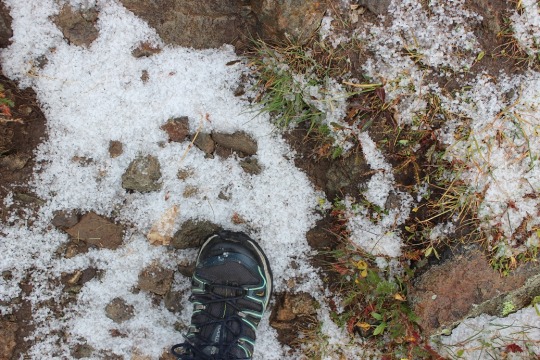
From the beginning microspikes were necessary. We kept them on for the entire hike.
The creek just after the Barr Trail / Incline turnoff was flowing nicely
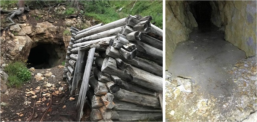
The ‘cave’ had some snow
Just before the experimental forest, where the path was all ice 2 weeks ago it was now covered in several inches of snow and nicely trenched. This made it much easier to navigate.
We turned left at the experimental forest and continued along the well trenched Barr trail.
Past mile marker 5.5
Here’s where we messed up last time: We had gone all the way to Barr Camp (6.5 miles) and at the advice of the guy staffing Barr Camp took the trail just after Barr Camp, ending up at AdAmAn Peak instead of PT 10245. To be fair, the routes are strikingly similar, and while AdAmAn is unranked, it is taller than 10245 at 10405′. This time we were prepared and looked for trail 671, which is about a mile before Barr Camp. This is where we found it:
I’m sure there’s an actual trail here, but today it was covered in snow and not detectable. We put on our snowshoes and got ready to trench. At the above sign we left the Barr Trail and headed right (north), trenching our own trail, skirting the rock formation to the left
and heading down a small hill, losing about 200 feet of elevation before coming to a creek and turning left (northwest).
Here I was able to pick up the trail again anf followed it around the creek. Please note, this was NOT South Fork French Creek, but a willow filled off shoot.
We followed the ‘trail’ until it seemed to end. We were just about parallel with AdAmAn peak at this point. Here we turned right (northeast) and could see PT 10245
We were going to have to cross an aspen grove to get to the peak. When we were right in the thick of it Steffen said: “This looks like the type of place you’d see a moose” and about 2 steps later we saw evidence a moose had spent the night here. In fact, on our way back we saw moose tracks going over/through our trench, so we must have scared him/her away with our approach.
Once past the aspen grove we were in the willows. I’m pretty sure this is where we crossed French Creek, but it was frozen and covered with snow so all we saw was a marshy area. Trenching here wasn’t fun: I sank up to my thighs several times. Here’s the path we took through the trees to the summit
There were large boulders everywhere, and a band of boulder piles to the right that weren’t climbable. Sticking center left of the mountain seemed to work well.
At several points we wanted to take off our snowshoes, but then we’d encounter snow that made us thankful we hadn’t. The summit was located to the left, at the mountain’s northernmost point. There was a cairn indicating the summit. We sumited at 9:50am
There were beautiful views of Pikes Peak, with AdAmAn Peak below (the pile of rocks in the center of the photo).
We took summit photos
and headed back down, solidifying our trench
back through the willows
and to Barr Trail, where we took off our snowshoes and continued our descent. The trench on the trail was indeed deep in places, and microspikes were still appreciated after the incline cutoff.
We made it back to my truck at 12:45pm, making this a 14.15 mile hike with 4000′ of elevation gain in 7 hours. I got a bunch of pictures on the way back, but unfortunately I’m still learning how to use my camera and it had been stuck on ‘program’ mode for the entire hike down, making my pictures all dark and fuzzy. We gave each other a high-five at the bottom, glad to be able to say we’d actually summited the correct peak this time. Check off another El Paso County Highpoint! Here’s a link to the GPX file, for those interested.
I arrived at the Cataract Gulch trailhead the day before, after summiting Point 13,832. I was pleasantly surprised to find a well stocked and clean bathroom, as well as plenty of open parking space. Mine was the only vehicle in the lot, despite it being 4th of July weekend.
Also, apparently this is a Lynx recovery area, which I found interesting.
I’d ended my hike early and desperately needed to catch up on sleep, so I went to sleep around 2:30pm and only woke up twice: once because it was too hot in my truck (the sun was going down but at exactly the right angle to heat up my vehicle drastically in just a few minutes) and another time I around 10pm. I still had over 4 hours of potential shut eye so I took a melatonin with a shot of whiskey and fell back asleep. I didn’t wake up again until my alarm went off after 2am, so I consider it a successful night of truck camping (I notoriously sleep terribly at trailheads).
I fished around in my backpack for my flashlight and couldn’t find it. I was sure I’d placed it in the small pocket the day before, but it was nowhere to be found. Luckily, I always carry a spare as well as extra batteries. Immediately I remembered why I didn’t like this flashlight: it was TOO bright. That sounds like a good thing, but when hiking in the forest in the dark I’d actually rather not see every detail. This flashlight was too good. I was going to have to replace it when I got home.
On this hike I was armed with a topo map, a compass and some beta from the campers I met last night, as well as a rough route description. I started on the Cataract Gulch trailhead around 2:45am, crossing Cottonwood Creek on a well built bridge over a swiftly flowing creek
And then I crossed the creek twice more on well placed log bridges I had to hunt for in the dark because they weren’t on the main trail. I was seriously worried I’d have to ford this creek multiple times before discovering the log bridges, which were (as usual) easy to spot in the daylight.
This trail had a trail register (Woot! More noise!) and was easy to follow up to the first avalanche area
The avalanche area was very small and well packed down
I didn’t have any difficulties until I made it to the waterfall area. There had been a small avalanche and it looked as if the trail wanted me to cross the waterfall. I took out my topo map and it looked too early to cross yet, which meant I’d have to follow the waterfall up for a ways first. There was no trail so I bushwhacked in the dark up the mountainside, paralleling the creek.
Here’s when I came to the crux of the waterfall. It was still dark out (I’m guessing it was around 3:30am) and the waterfall was raging. I could feel the spray of water on my face, even though I was standing several feet away. I went right and left looking for a better way up and encountered very large boulders blocking the route in every direction. I could tell I just needed to ascend 15 feet or so (maybe less) and I’d be where I needed to be to cross the waterfall. It took some fancy footwork and a class 4 move, but I was able to work my way up the side of this boulder, up and over to flat terrain. (Side note, apparently I made this too difficult and there’s an easier way I was unable to find in the dark. Check out Angry’s conditions report for a class 2 route over the waterfall).
There was a camping area directly above the waterfall, and I was able to pick up a trail again. I was already considering today a success: the campers I’d talked to the night before hadn’t made it this far. The trail rounded a corner and brought me to a creek crossing above the waterfall. I had 2 options here: either balance my way across the log and potentially fall in the water (I was carrying a full pack) or take off my shoes and wade across. In the dark I took off my shoes and put on my water shoes (hurray for new gear and dry socks!). Yes, I’m sure some could have walked across the log, but I decided to use the log for stability and wade across, keeping my feet dry in the long run.
The well established trail picks up directly after the creek crossing
And brings you to a boulder field
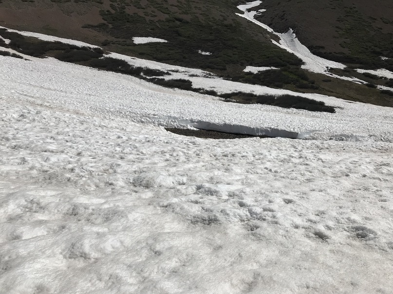
Just after the boulder field there’s another creek crossing. Unfortunately, the creek was running quite high here and I became frustrated trying in the dark to find a passable route. I noticed some cairns to the right and followed them to what looked like a goat trail through the willows. This led me to a snow bridge that looked ready to collapse any day now, but it would get me across the roaring creek.
Check out the snow bridge. I was so excited to come across this in the dark. There weren’t any footprints from here on out, so I crossed my fingers I’d be able to find my way.
I didn’t find many pictures of this route, and to be honest route finding was difficult in the dark due to the snow, so I’m going to do my best to post some details. I followed the well defined (when there wasn’t snow) Cataract Gulch Trail. Just after the last creek crossing I headed south and rounded a large boulder
The (still snow free) trail brought me to a ravine
(In case anyone wants to see what the trail looks like at 4am…)
Here the snow picked up, covering the trail about 80% of the time. This was both good and bad: It was nice to see a trail every once in a while, but it was covered so much it was difficult to follow and became frustrating to someone like me who hikes on established trails when available. Just head south until you reach Cataract Lake. It feels like you’re hiking forever, but I promise you it’s there. My tracker showed it at 4.9 miles from the trailhead.
Here the birds started waking up. This is one of my favorite part of early morning hikes! I also saw a herd of Elk in the meadow.
Video:
Continue past the lake and you’ll come to a trail junction. Continue heading South
You’ll pass a small pond on your right and head towards Cuba Gulch, which is also the East Fork Middle Pole Trail (another well defined trail when there’s no snow).
Follow this trail west as it hugs the side of a mountain, unfortunately losing a little bit in elevation in the process. Here’s the general idea of where you’re headed
And some close ups. There was quite a bit of snow here, obscuring the trail.
Here I rounded the small basin and headed to a small saddle
This section is steeper than it looks, and snowshoes were helpful.
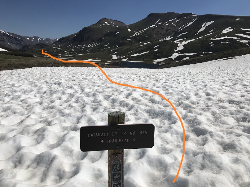
Turn right at the saddle and follow the trail towards Point 13,164. The dotted line is the suggested route to summit this ranked 13er, but I didn’t like the angle of the snow, so I continued on the trail until I found a better way to summit.
This is the route I took to gain the ridge of Point 13,164: I needed snowshoes and an ice axe here
At the top of the ridge I wound my way north to the summit.
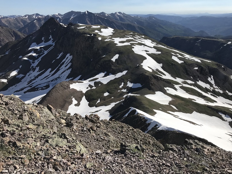
From there it was an easy walk up a tundra slope to the summit with a rather large cairn and a great view of Half Peak
I summited at 7:10am
Video:
Also, the San Juan’s still have a lot of snow!!!
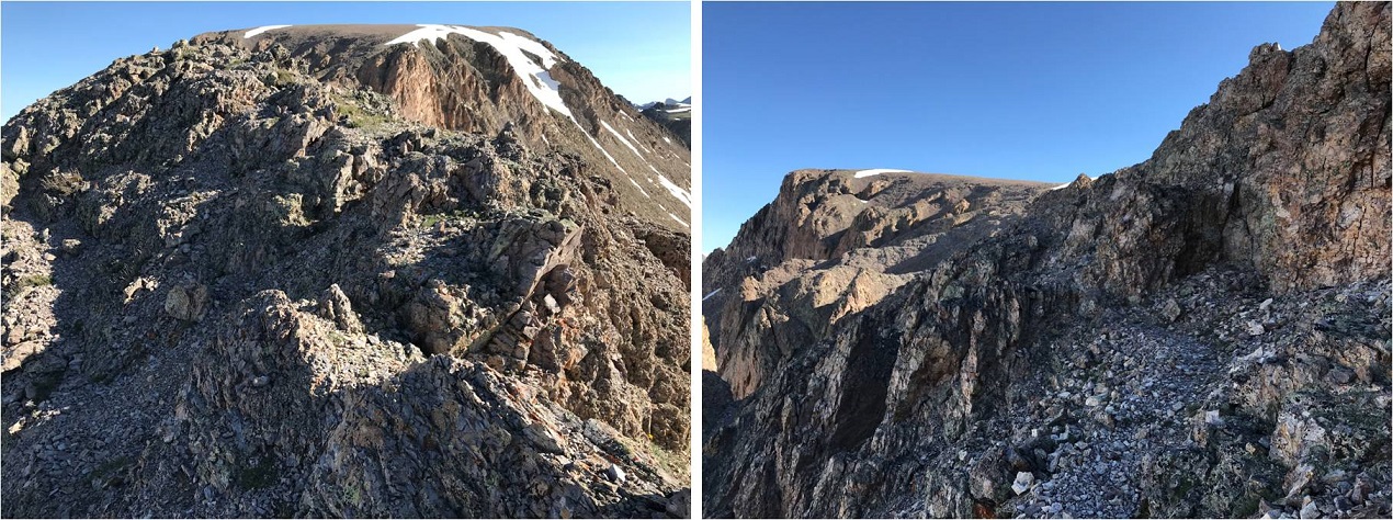
Ok, back down so I can get started with Half Peak. Here’s the view of the way I went back down and then gained the ridge to hike up Half Peak.
Side note: If you’re not interested in summiting 13,164 here are the coordinates along the trail you turn east at to gain the ridge of Half Peak
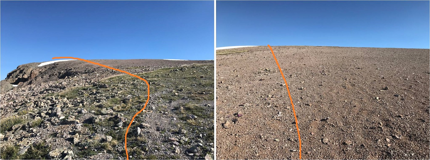
This is a long but gentle slope with no defined trail.
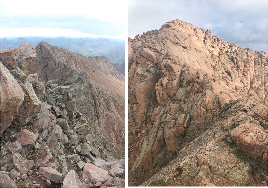
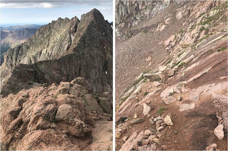
The crux of this route comes just before the summit at around 13,500’. There is a narrow ridge to navigate.
There’s a lot of exposure but I agree with Roach’s assessment this can be kept class 2 with careful footwork. I found the best strategy was to stick to the ridge in most places, dropping down 15 feet or so only when necessary
Here’s a picture looking back. The ridge reminded me of the catwalk along the ridge to Eolus.
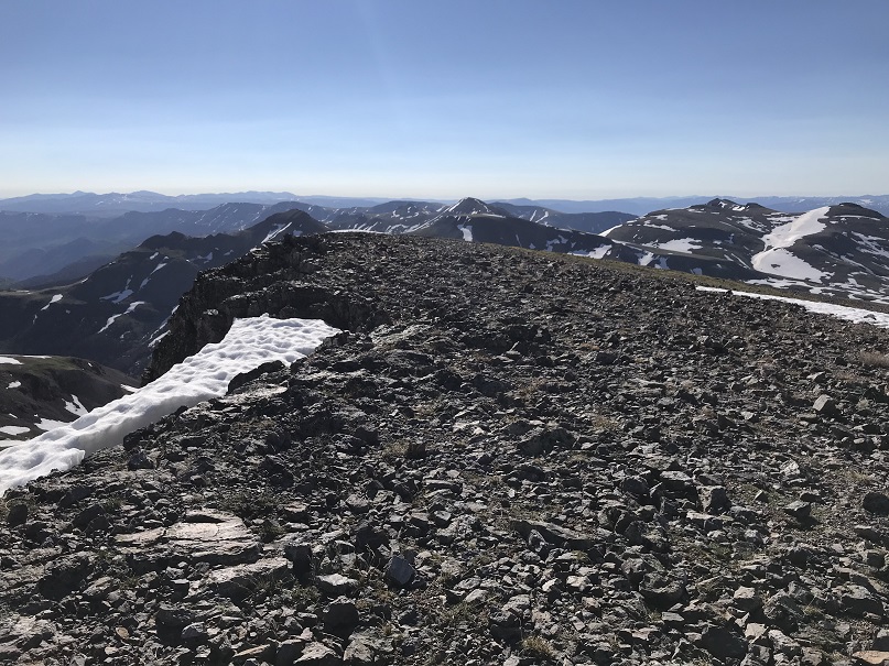
From here it’s an easy walk to the summit
The summit is large and pretty flat
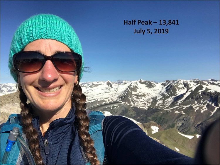
I summited at 8:30am
Video:
Here’s a look back on the route up the slope
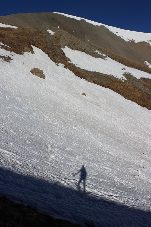
I’d initially planned on hiking Quarter Peak (a bicentennial) today as well, but in the morning I’d gotten a look at Half Peak and the decent route off Half and towards Quarter had a lot of snow. I didn’t feel ready to commit to the descent in this warm weather. However, looking at Quarter from Half the ridge up to the summit of Quarter looked dry enough to summit without tackling snow
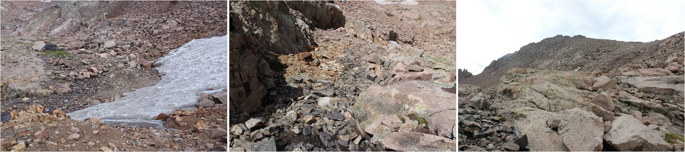
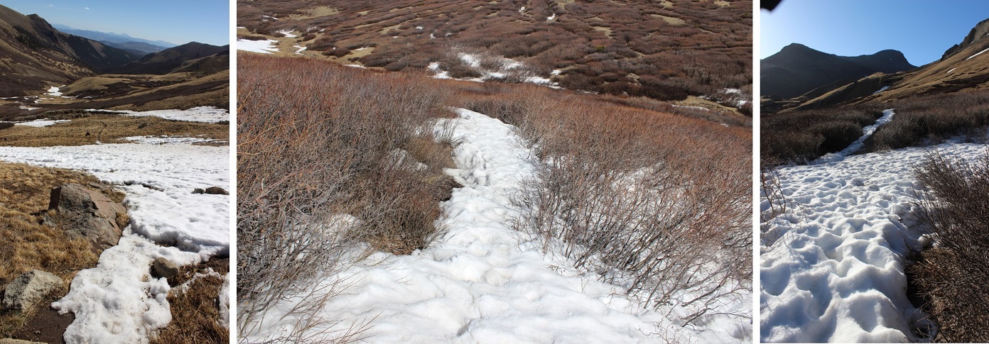
Oh well, time to head back down. The snow was softening up, and the snow below the saddle required snowshoes once again (more necessary this time). In this picture you can see a river flowing underneath several feet of snow
Here’s a look at the route back from Cataract Lake
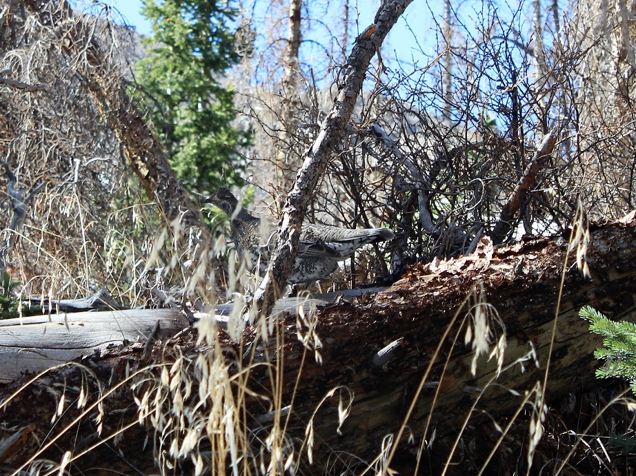
I was almost back to the river crossing with the snow bridge when I looked over at the basin and saw 3 Bull Moose enjoying lunch together in the willows! Very cool!
Video :
I crossed the snow bridge, following my previous tracks. Here I started seeing people on the trail. I warned those with unleashed dogs about the moose up ahead and gave some people advice on how to find the snow bridge so they could hike to the lake. Actually, the park ranger/mom in me talked to everyone on the way down, but mostly just to see where they were headed. Today was such a beautiful day to hike!
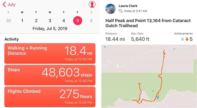
I crossed the stream above the waterfall, descended the waterfall the same way I’d ascended, and made it back to my truck at 12:45pm, making this an 18.5 mile hike with 5640’ in elevation gain in 10 hours.
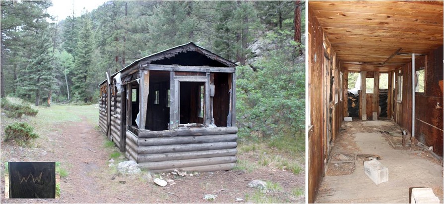
I’ve been preparing for this weekend since February when the summer camp catalog came out. I knew I wanted to plan this trip for the days when my youngest daughter was at summer camp, so when she chose her camp I made my reservations with the Durango & Silverton Narrow Gauge Railroad for the days she’d be gone.
It didn’t matter what the weather was, that was the time I had available to go. My son was going on a solo road trip to Arizona (well, he brought the cat) and my oldest would be at Drums Along the Rockies, so I had 1 free weekend to backpack this summer.
Well, then the fires happened and not only did they shut down the railroad, they closed the entire San Juan National Forest. This was unfortunate for numerous reasons, and also because it looked like my trip wasn’t going to happen. Then they re-opened the forest (woot!) but not the railroad. This was getting frustrating! I kept calling the railroad station to see if they were going to be running the train, and every time I called I got a different answer.
So I made two plans: One for if the train was running, and another for if it was not. This was my one weekend to visit the Chicago Basin and attempt its 14ers this summer and I didn’t want to waste it. Going through Purgatory didn’t sound fun but if it was my only option I was prepared to hike into Chicago Basin that way. Normally I wouldn’t mind, but I had a strict time limit because I had to work Monday morning.
I checked and re-checked and checked the weather forecast again. It did not look promising. 70% chance of thunderstorms in the morning, afternoon, and evenings for the entire weekend. These conditions were less than ideal but at least I could prepare for them. I became a weather expert (it seems this isn’t monsoon season yet, but pre-monsoon season that mirrors the actual monsoon season… yeah, basically it’s going to rain buckets with lightning and thunder added in for fun, and it won’t be predictable).
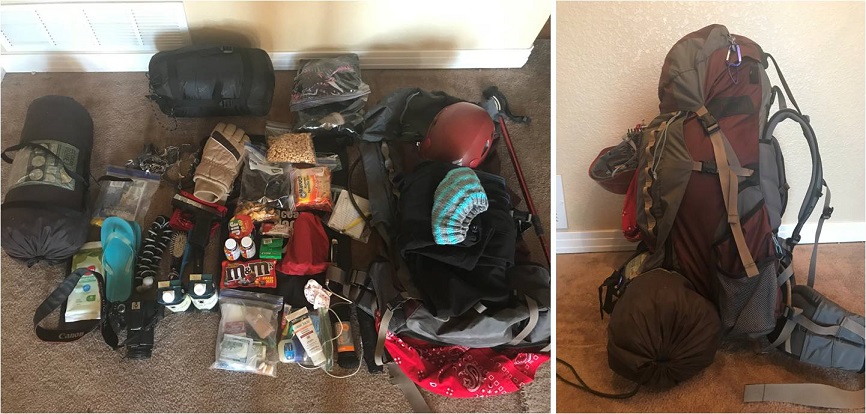
I packed, unpacked, reduced, and packed again. I decided to cut weight by eliminating the need to cook my food (I make a mean beef jerky and dehydrate fruit to bring with me that doesn’t need to be cooked) and added warm layers. Extra socks, pullovers, hats, and gloves.
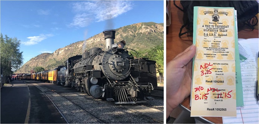
The day before my trip the train was scheduled to run again, but they weren’t giving out backcountry permits until late August. However, they would honor my tickets since I’d bought them so long ago. Woohoo! I was good to go!
Thursday afternoon I closely watched the weather out the windshield of my truck as I drove the 6.5 hours to Durango. If the weather tomorrow was like today I was golden: heavy cloud cover with no rain. Before checking into the motel I stopped by the train station to pick up my ticket. There was only one other backcountry permit in the queue besides mine, which told me not many of us would be packing in with the train.
Next I checked into the motel. I made small talk with the man at the front desk wearing the Zia Marching Festival shirt (my kids went two years ago for band so small talk was easy) and was assigned a room and a parking space. I stopped by Wendy’s for a quick dinner and brought it back to my room.
This was the smallest motel room I’ve ever stayed in, mainly because I’m a hotel snob. I travel a lot for work, and I need the hotel to have a gym so I can work out every morning. Most hotels with gyms are just… nicer in general. I didn’t think that was necessary for tonight’s stay, so I just chose the cheapest place I could find. I had an assigned parking space my truck didn’t fit into and a room just big enough to walk around the bed. I was a little concerned my truck would get broken into overnight. Well, all I really needed was a place to sleep, so this would do just fine. Check out the view from my room…
I poured myself a glass of wine and brought my backpack in from the truck. After dumping all the contents on the bed I went through my gear one last time. I’ve been backpacking many times, but tonight I seriously felt like Cheryl Strayed. I dipped a fry into my frosty and considered: I’d done a good job packing. There was nothing I thought I didn’t need and I had extra space in my pack. Everything was in a Ziplock bag and I had extra large trash bags if needed. I was good to go! But it felt weird only packing for myself. I haven’t been solo backpacking in a long time: I’m usually in charge of a group of scouts, so I have to over pack things like emergency supplies, food, etc. I could get used to this!
I took a last minute shower (I’d brought my Disney shampoo for good luck: if you’ve ever stayed at one of their resorts you know what I’m talking about), and charged my cell phone and camera. I made a list of goals for this weekend (stay warm/safe/make good choices, learn something, make the most of the time I had, hike at night if necessary, and if the weather’s bad sleep until it’s good). I did some texting and problem solving and answered some very important last minute emails that came in about a potential magazine interview on Monday and made it an early night so I could get started early in the morning.
I had a couple of people who had considered hiking in with me but had canceled due to weather. I was actually relieved they weren’t able to make it! I would have been a terrible hiking buddy in this weather because I’m too goal oriented and I don’t need much sleep. Hiking solo gave me time to hike as fast as I needed, set up camp (or not) and hike/eat/etc. whenever it worked for me. If someone else had been with me I’d have felt responsible for their comfort/ etc. and I’m pretty sure I’d have either made them mad or I wouldn’t have summited (making me mad).
The night had been sweltering. There was an air conditioner that I had to turn off because all it did was make noise. Well, you get what you pay for. I had to take another shower in the morning because it had been so hot overnight. I dressed for success in my new hiking pants that are supposed to repel insects and are two inches too short because I had to get them in the kids section. (Note to athletic/outdoor clothing manufacturers: not every “woman” is large. I’d like some hiking pants that fit a 5’4” 105lb woman please… I’ve been looking for years and resorting to wearing yoga pants under your size 2’s or shopping in the kids section isn’t working for me!)
I did one last sweep of texts and put my phone on airplane mode. The weekend had officially begun.
Check out at the motel wasn’t until 8am but I had a train to catch. The front doors were locked so I dropped off my room key in the slot and headed to the train station. It was a beautiful morning! And that sunrise! It almost physically hurt not to be hiking now when the weather was good.
I was the first one of the day in the parking lot at the train station. I parked in long term parking with 3 other vehicles from yesterday and mentally calculated how many people should be in the basin.
McDonalds was close so that was breakfast. I haven’t eaten this much fast food in quite a while. In fact, I don’t think I’ve been to a McDonald’s since I was in High School. Thoughts from the McDonald’s lobby: it smells like cigarette smoke in here, there are two types of people here: those in their pajamas and those in their motorcycle gear. The parking lot filled up fast.
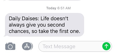
My Daily Daisy text pinged my phone and I took it as a good sign:
I went back to my truck to get my gear and walked to the train station.
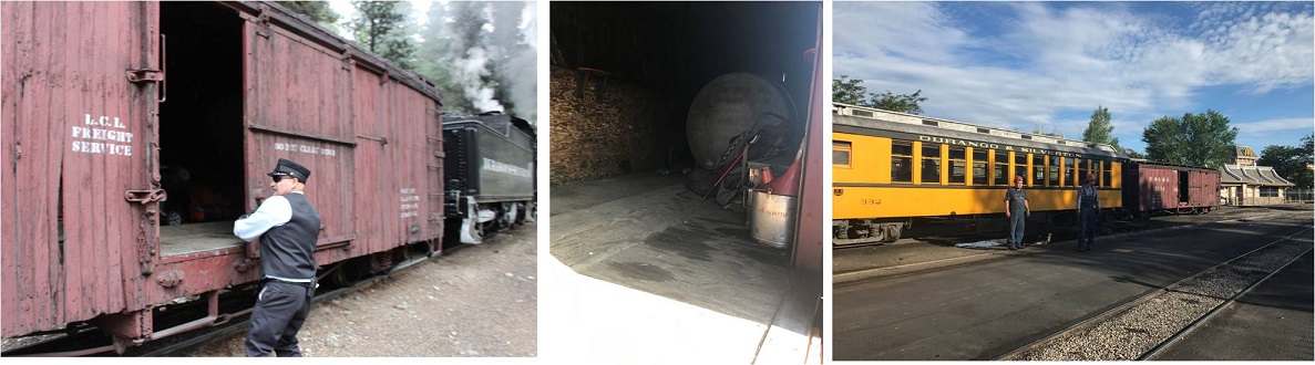
Of course I got there early, so I walked the platform and talked to the volunteers and employees. They were all thrilled to be working again, as they’d all been out of a job for the past 6 weeks. Some teared up as they talked answered questions.
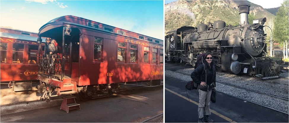
With the help of brakeman Chris I loaded my gear into a boxcar with the two other backpackers and thought to myself how it was already hot outside and I stunk. Those two guys in the picture below on the right stayed behind and watched the wheels on the train to make sure there weren’t any sparks. Several employees shook hands with the engineer and told him to “stay safe out there”.
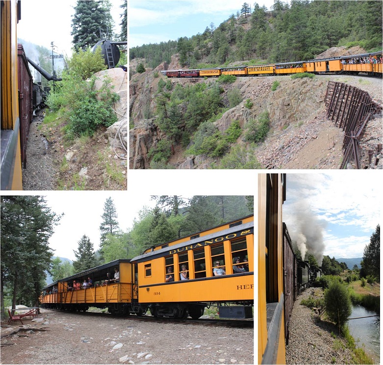
The train left right on schedule. There were homemade signs and posters all over the fences thanking firefighters and welcoming the train back. Several houses had “Welcome Back Train” signs, and tons of people stood by and cheered the train on as it left, or came out to see the train as it passed by their front yards. The citizens were visibly emotional to see the train in action again, wiping away tears sand clapping. You could tell the closure of the train had impacted the community greatly.
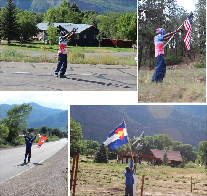
Check this guy out! We saw him every few miles or so, cheering us on. I’m not sure if he was an enthusiastic Durango citizen or paid to do so by the train station, but he would cheer us on, get in his vehicle and drive ahead of the train, change is outfit, and get out and cheer us on again. Everyone on the train loved him. We passed him at least 8 times.
I sat next to a brave mother and father of 6 well behaved boys under 10 years old. One of the train employees talked with me about stopping in Needleton and asked me if I knew how to jump off of a moving train. The boys eyes got wide when I said “Absolutely, I just tuck and roll, right?”
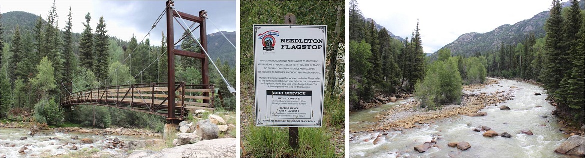
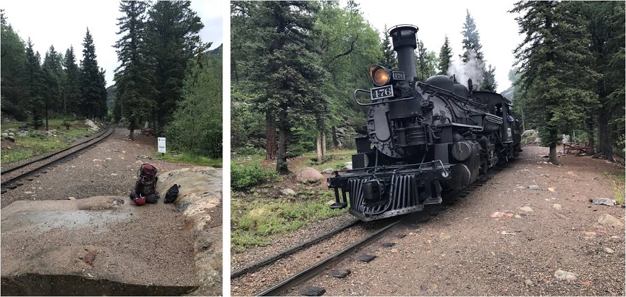
It was a long 2.5 hours to the Needleton stop. I passed the time by going over my trail notes again and again. I arrived at the Needleton flagstop at 11:40am.
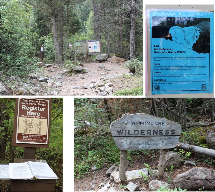
I waved goodbye to the train, said a quick greeting to the other two hikers, and started the 6 mile hike to the Chicago Basin. This hike has excellent signage. I signed in at the trail register at about .8 of a mile up the trail where it intersects with the Purgatory Trail.
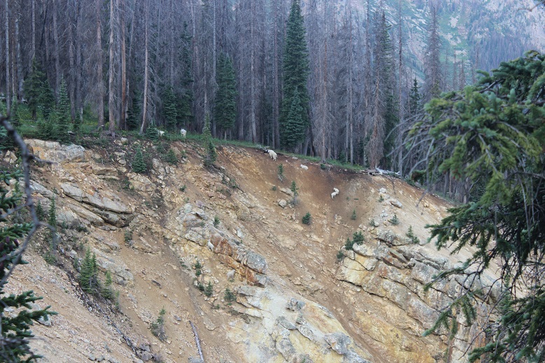
I passed several groups of hikers hiking out as I was hiking up. They gave me some advice that ended up being very useful: Hang everything up when you leave with your bear bag. Leave nothing in your tent or on the ground. The goats and marmots will eat through your tent to get to your stuff. Also, don’t pee anywhere near your campsite: the goats like pee and will follow you to get it. I found this last part weird since usually urine (especially male urine) usually keeps predators away, but I guess goats aren’t predators and like the salt. In any event, their advice was correct.
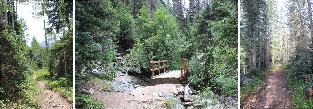
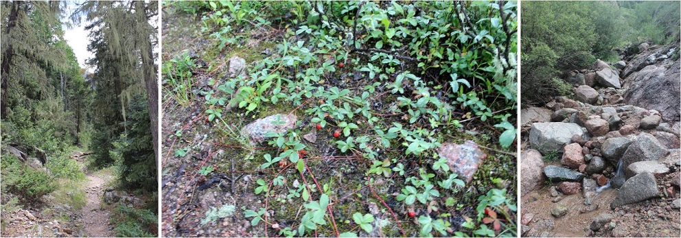
The trail was heavily shaded and followed a creek, but that didn’t stop it from being hot out! I don’t usually hike in the middle of the day: It’s tiring! Most of the hike in follows a creek. At the halfway point I crossed a bridge, knowing I had 3 miles left of the hike and seriously hoping it would rain soon.
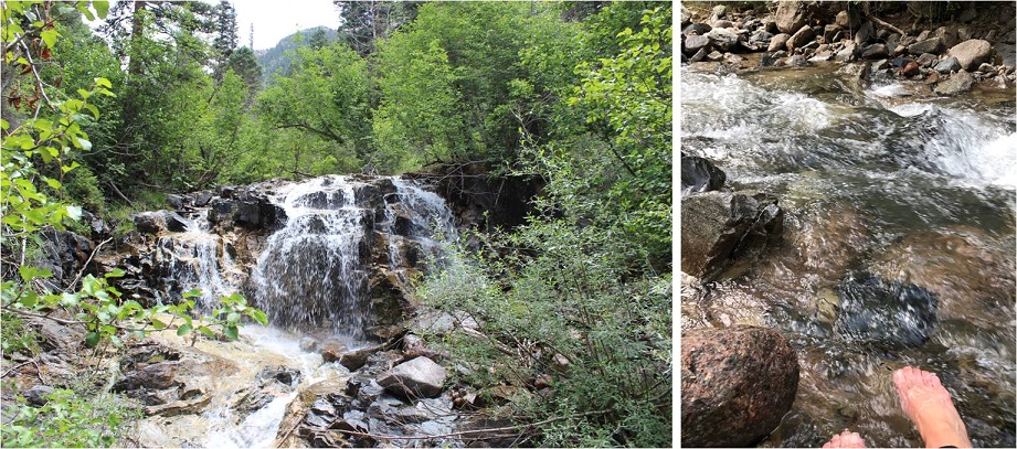
There were tons of strawberries covering the ground, as well as downed trees. When I saw this small waterfall I stopped and dipped my head in the water (swallowing some in the process, so if I get Giardia I’ll know why). This cooled me off and felt amazing! I soaked my bandana and continued on. From here it was 1 mile left to the basin.
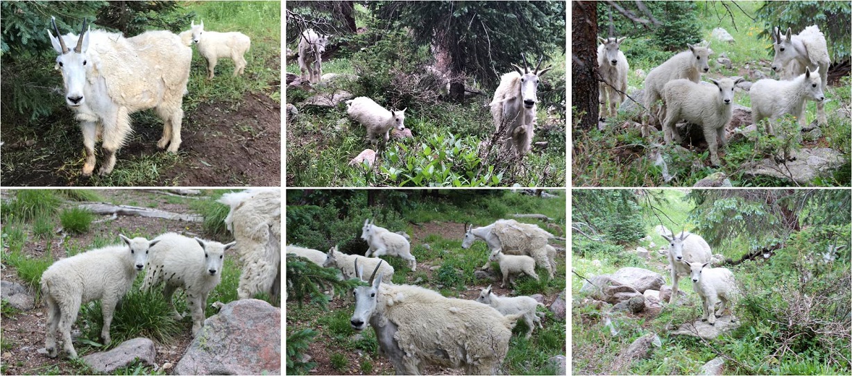
I arrived at 2:40am and was greeted by tons of bold and very adorable goats! Here’s proof:
The goats were everywhere, and seemed to like my company. I carefully placed a beer in the creek to cool off, set up camp, hung my bear bag, re-hung my bear bag because the first place I hung it was covered in sap, and looked up at the weather. It didn’t look too promising, so I went back to the creek to retrieve my beer and went back to camp to eat something. I’d been saving the beer for tomorrow but I was really hot and needed to cool off. I sat down to eat and it immediately began to hail!
This lasted for about 45 minutes and cooled everything off in the basin. It was a good time for me to eat, rest, and get my bearings. There were a lot of people camping in the basin, many more than I’d anticipated considering they couldn’t take the train. They must have all hiked in from Purgatory. Oh, and the inside of my tent was getting wet. Lovely. It stopped raining at 5:15pm and just before it completely stopped I decided I wasn’t going to waste any time. I hung up everything I wasn’t taking with me, gathered my gear and headed towards the trail.
The Twin Lakes Trail gets you to the intersection for all 4 14ers, so I decided to hike up to Twin Lakes and make my decision then which 14er I’d attempt tonight once I got there. I passed several goats along the way.
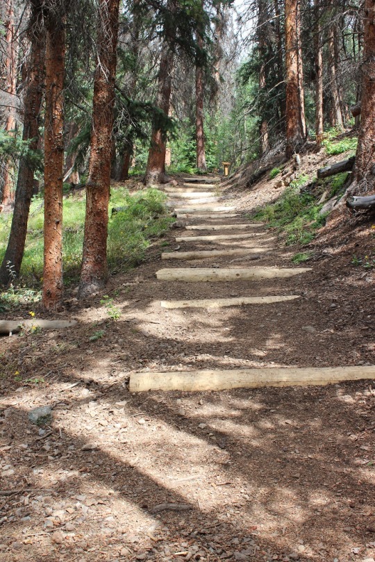
Since it had just rained/hailed the creek crossings were high. I had to get creative to cross them. The trail came to a junction where I turned left and followed it up the hill, through some rocky areas and some well maintained stairs up a slope and through some waterfalls.
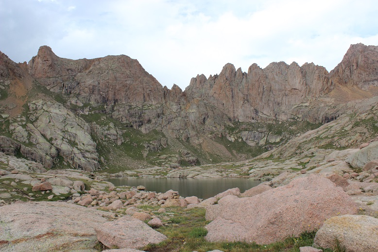
At the top of the slope was Twin Lakes. I could go either left towards Mt Eolus and North Eolus, or right towards Sunlight or Windom.
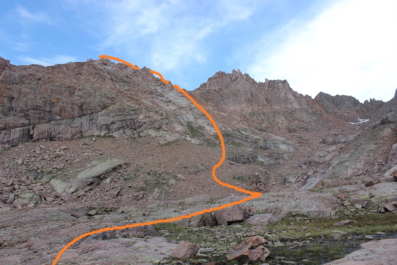
I’d been doing a lot of thinking on the trek up to Twin Lakes about which 14er I should attempt. I really wanted to get both Eolus and N Eolus done tonight, but as I was watching the weather it looked best near Sunlight Peak. It was a difficult choice, but I chose Sunlight, purely due to weather. I mean, doesn’t it look inviting?
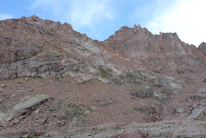
Here’s the route I took:
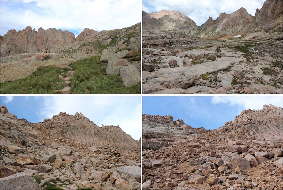
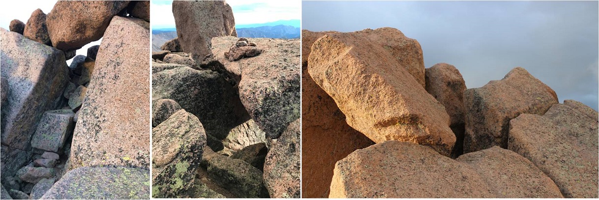
As you can see, the route is very well cairned. I followed the 6 foot tall cairns toward the gully, and then up the gully to a notch. This gully was a good gully! It had some loose terrain, but was mostly made up of rocks about the size of a tire. I was keeping an eye on the weather, but as you can see, it looks great!
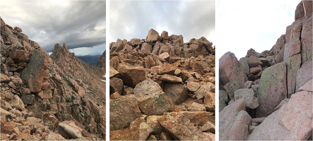
From here I followed the route left. This part was actually quite easy and didn’t require much route finding, just some scrambling over class 3 terrain.
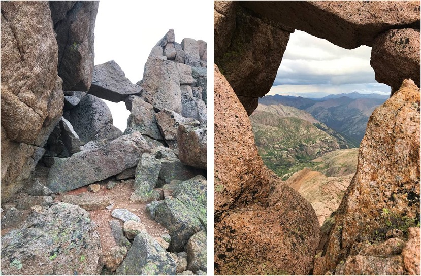
Here’s a great view from a hole in the ridge. I decided not to take this route but to turn left and head to the final summit pitch.
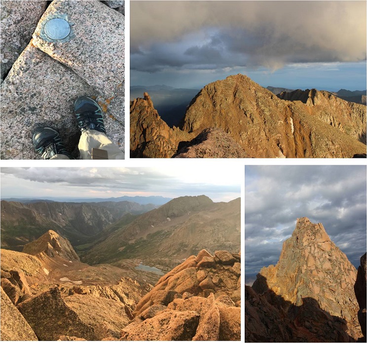
From here there were a couple of class 3 moves, and then a class 4 move up and around to the summit. I made it to the summit and decided to drop my gear and climb the last bit to the “true summit”. It was a scramble on some grippy rock to the top of a few boulders placed a few feet apart in all the critical areas. That had been too easy!
I made it up to the top of the highest boulder and took a look around. Wow! I needed a picture of this! Drat! My camera was back down with my stuff. No worries, I’d just climb back down and get it. I slid feet first down the rock and jumped onto more solid ground. I got a few pictures of the summit marker and surrounding peaks
And took a summit selfie to prove I’d summited.
I took a quick video of the summit, and came to the realization a storm was approaching very quickly. I hadn’t been able to see it from the way I’d climbed in, but it was obvious now I needed to get back to treeline as soon as possible.
Please watch the video below with the sound on. Note it starts at 7:58pm, and then it jumps to 8:30pm.
In 10 minutes time I made it to the top of the gully and it started sprinkling. Wow, that was fast. No worries, I’d just put on my poncho and keep heading down. I made it about a quarter of the way down the gully when the sky broke loose: it started pounding rain, and then hail, and then the thunder and lightning started. There was nowhere to hide: No caves or rocks to hide in or under. I was completely exposed and I couldn’t hike up or down to find shelter, as there wasn’t any. I didn’t want to be a moving target so I found two large rock slabs that didn’t provide any shelter to back up and huddle against. I still had my helmet on, but water was cascading down the rocks straight onto my head, and I was being pelted from the front by the storm. The second half of this video takes place after the worst of the storm is over, but you can still get a sense for the atmosphere.
Just for reference, this is where I was during the storm.
I sat there for over an hour and a half, listening to the thunder crackle all around me and waiting for the lightning to stop. There was no lightning tingle or electric current in the air as I’ve heard from other people who’ve been caught out in storms. Luckily most of the lightning stayed in the clouds, but every so often I’d see a bolt strike Windom. I couldn’t get off that mountain fast enough, but I needed to be safe at the same time, so I waited it out. When I finally felt the lightning was far enough away I got out my flashlight and hiked back to the Chicago Basin soaking wet.
Well, as far as picking a peak to hike tonight I had picked the right one. Windom was a nightmare with all that lightning, and I realized the next day I wouldn’t have been able to summit the other two peaks: I’d have had to come back and hike at least one if not both of them again the next day.
I made it back to my campsite sometime before midnight, and the entire basin was already asleep (besides the goats I said hi to as I passed them on the trail). I was hungry, so I brought down my bear bag and rummaged around for something to eat. Peanut Butter sounded good, but where was my spoon? In the dark it was difficult to find anything, and I was trying to be respectful and quiet for the other campers. Well, I couldn’t find a spoon, but I did have some dehydrated bananas that I could use as a spoon. So there I squatted next to my bear bag, trying not to sit on the ground because it was wet, flashlight on the soil, with a tub of peanut butter in one hand, and the other scooping it out with a banana slice. When I was done I licked my fingers and put everything away.
Now to deal with my sleeping arrangements. I’d put my sleeping bag in the tree with my bear bag before leaving to keep it away from the critters, not anticipating the rain, and now I had a soaked sleeping bag (or so I thought). Luckily I’d brought two tarps. One I’d put under my tent earlier today when setting up, the other I got out now and as quietly as I could folded into a square and placed it inside my wet tent, forming a barrier between the wet floor and myself. I opened my sleeping bag and was delighted to find the fleece blanket I’d rolled around the sleeping bag had absorbed 95% of the rain water, and the sleeping bag itself was mainly dry. I hung the fleece outside and settled down for bed.
Saturday morning came early. After almost 4 hours of sleep I was up at 3:45am and out by 4:15, ready to tackle another peak. I re-hung all my gear by my bear bag and set out in the dark, hiking under the stars and some wispy clouds. The clouds didn’t look too threatening. Everything was still wet from the storm.
I followed the same route I had yesterday up to Twin Lakes. My legs were still sore and I was actually thirsty. I hiked slow and steady past Twin Lakes and towards Mt. Elous. Here the sun began to rise and I got a good look at the route before me.
I hiked towards the edge of a basin and then up a ramp and over some rock slabs
Here’s where the hiking got fun! It became a climb from here on out. I climbed up this optional (class 4?) wall to reach the saddle / ridge
And looked at the catwalk to my left. This was going to be fun!
There was a lot of exposure here but the route wasn’t too narrow. I followed the catwalk to the final pitch up the East Face, which required a lot of route finding and class 3 moves. Let’s just say aim up: There are tons of cairns and they all parallel each other, but the basic route goes up.
Woohoo! Summit Selfie
Now it was time to head back and tackle North Elous. Here’s a look back at the Catwalk and North Elous’ Ridge
The ridge was actually very easy to navigate. It had grippy rock and was a sticky but simple scramble towards the top. Once again, I was glad I’d chosen today to hike this instead of yesterday. Oh, and I was a bit sore so I was hiking slow.
I took a quick summit selfie
And looked back at the way I’d come. Pretty cool! The catwalk looks like a beast, and so does the way back down.
Ok, 3 down, 1 to go. I was closely watching the weather today as I hiked back to Twin Lakes. I made it to the lakes at about 9am and was concerned with the amount of clouds I saw in the sky. I figured I had a 50/50 chance of needing to bail on Windom, but like I said before, I was sore and didn’t want to hike down to Chicago Basin just to hike back up to do Windom again later today: That elevation gain was brutal! I decided to try it, as I could always turn back if needed. I’d just take it slow and keep watching the weather.
At Twin Lakes I met Boy Scout Troop 393 from Phoenix, a fun group of guys to talk with. They were filtering water, and told me about the time a couple of years ago when they hiked Windom. A few of them were Eagle Scouts and Life Scouts.
I continued on towards Windom. The trail follows much of the same route as Sunlight through the basin, but then angles right up a gully (there is a trail to the right near the ridge but it’s currently washed out).
There were several routes, but I took the gully up and aimed towards the ridge, to what I found was a false summit. Drat! I thought I was making great time and I’d been so excited I was going to climb this mountain before the weather set in, but when I hit the notch I realized I still had another 45 minutes or so to go. I steeled myself against the let down and kept climbing, more intent now than ever on finishing this trek.
The final push from the notch follows the left (not the right as the GPS told me to go) and contains some class 3 moves, even though it’s rated 2D. It was very well cairned, and quite a bit of fun!
It took me longer that I’d have liked to summit, but when I did I felt fabulous!
Check out that view of Sunlight!
OK, now it’s time to head back down. The weather was holding, but I didn’t want to cut it close. I turned around and the Boy Scouts called to me from the saddle. They wanted to know if they could summit before the rain hit. Now, that’s a difficult question to answer. I’m not sure how fast they hike, and sure, they could probably make it up, but they weren’t going to make it down before the rain hit. I told them as much and passed them on their way down. They’d already hiked this one a few years ago, so they knew the route. I wished them luck and continued on.
Just before making it to Twin Lakes I met up with the rest of their troop (not all were prepared enough to climb Windom today). We had a nice chat before I excused myself to head back down to camp. I practically skipped back down as the weather held. Sure, I hadn’t brushed my hair in 2 days, I was getting hungry and I was tired, but I’d just summited the 4 14ers I’d come to summit! This mission was a total success!
To top it all off, today I did everything right. All my clothes and sleeping bag were dry, as it hadn’t yet rained. I took a trip down to the stream to filter some water and stumbled upon two moose! A male and a female who didn’t much care I was there
I went back to my tent, ate about ¼ a package of Ramen and some dried fruit, and then cleaned myself up before the rain started. My feet were sore and I stunk, but I was happy as I sat all dry in my tent. I thought about tackling Jupiter tonight/tomorrow. Should I? I kept going back and forth with it in my mind. I took a quick 2 hour nap and was woken by my neighbors. Unfortunately they were boisterous and the man’s voice carried. It continued to rain so I decided against Jupiter for now. I lay down, and the next thing I knew I woke up at 1am, needing to use the bathroom. Well, that had been quite a nap! I guess I’d caught up from the night before. The only problem was it was too early to hike. I didn’t want to summit in the dark, so I decided to just lie in bed and wait an hour or two. The next thing I knew it was 5am, and now it was too late to summit and still make it back. Or was it?
I jumped out of bed, gathered some food, and went to look for the Jupiter trail. As I was hiking I really gave the outing some thought, and while I felt I could summit in time I was worried it would put me hiking back down to the train during the wet weather time of day, and I didn’t much want to do that. So I made a nice 3 mile loop out of the hike instead. I came across an abandoned mine I’d wanted to explore but the ice kept me from it
I stopped for a bit to filter some water, and then continued the trail as it followed a ridge. Here I meet a ton more goats all playing on the scree slope. Two baby goats looked like they were trying to push each other off. The rest just seemed to be rock climbing.
I leisurely walked back to camp, and when I arrived at 7am I was surprised to find the Basin was totally cleared out! Everyone had packed up and left. Wow! So I packed up my things, said goodbye to the goats, searched for and picked up pieces of trash, and left at 7:45am to head back down to the train.
I was in no rush today, which is not normal for me. I’m always in a hurry. I actually stopped, took breaks, and enjoyed the waterfalls and streams. It was so nice not to be in a hurry! I stopped to have a snack by a waterfall, and once I’d made it down to the Needleton/Purgatory Junction I took off my shoes and soaked my feet in the stream as I heard the 11:30am train go by. I washed my hands and re-did my hair. There were tons of flies here, and I tried not to take offense they seemed enamored with me.
I put my shoes back on, passed 4 hikers who’d been let off the train and watched the clouds roll in as I made it to the flagstop. Hey, guess what? I just realized I hadn’t seen a single mosquito this entire trip! I thought the Chicago Basin was notorious for mosquitoes? Hmmm… I must have been lucky!
I made it to the flagstop at 12:30pm, which meant I had 3 hours to wait for the train. That’s quite a bit of time to do nothing, but almost immediately it began to rain. I crossed the tracks and found an old shelter on the other side. It didn’t look too safe, but it did look like it would keep me dry. I’d just have to be careful not to sit down/step on any nails.
For the next 2 hours I watched the rain from inside the shelter. It looked much worse on the trail, and I congratulated myself for not going for Jupiter today: I’d have been stuck in that hailstorm hiking right now if I had.
At about 2:30 the rain stopped, so I went back out by the tracks. A little before 3pm the 2:30 train went by, and out of nowhere 3 high school aged boys ran across the bridge to wave at the train. It seems they’re staying at a cabin on the river (they’d come in by train this morning) and their only entertainment was waving at the train, so they were coming out every time one passed.
My train came closer to 4pm. The two other hikers who’d come in on the train with me were there to take the train back (they’d gotten caught in the hailstorm hiking back down). After getting a $5 beer I had some great conversations with the other people sitting next to me. I tried to relax before my 6 hour drive home, but everyone was chatty. I was ok with that. In fact, I was just fine. I’d accomplished what I’d come to accomplish, meaning I didn’t have to hike in through Purgatory next week to finish hiking the Chicago Basin 14ers. But… I’d still like to come back at a later date, maybe with others next time. I would also still like to come back and do Jupiter someday, but I’m thinking of making it a day hike from Purgatory…
Elevation Gain: 3600’
I’ve never had a traffic ticket in my life, but I was pulled over by two different police officers on the drive to the trailhead this morning. I left at 12:30am for this hike, and at about 1:30am I saw police lights flashing behind me. I knew I wasn’t speeding. I never speed when driving in Colorado at night. I’ve had too many rabbit, deer, elk, bear, fox, porcupine, bear, squirrel, etc. dart in front of me at close range to drive over the speed limit. It’s a death sentence for both you and the animal. I actually drive slower at night than I do during the day. Confused, I pulled over into a closed Sonic and looked for my license and registration. The officer was very nice, and let me know I had a headlight out. After making small talk for about 10 minutes he gave me his card and let me go.
About an hour later I saw flashing lights behind me again, and once again pulled over to the side of the road. This time I was prepared (I hadn’t put away my license and registration yet, so it was still in my lap). The officer walked up to my car:
Officer: “Do you know why I pulled you over?”
Me (as nicely as possible): “Yes, I was just pulled over a little while ago. I have a headlight out”
Officer: “Nope, you were speeding”
Me (a bit shocked): “Isn’t the speed limit here 60mph?”
Officer: “Yes, but I clocked you coming over that hill at 62.”
I took a deep breath and apologized for going over the speed limit. He asked me for the card of the previous officer that pulled me over, and then went back to his truck for a minute.
You can imagine all the things I wanted to say at that point, but I just put on a smile and politely waited for him to return. When he came back he gave me his business card (and kept the other officer’s card for himself). He chatted with me for a bit about where I was going, and then eventually…
Officer: “I’m going to let you go with a warning, but from now on keep if 5 below the speed limit. Here’s my card. It has my phone number on it. See, right here (he pointed to the phone number he’d written on the back of the card). If you have any questions about why I pulled you over today, call me. If you get pulled over again for your headlight being out before you can fix it call me and I’ll take care of it for you. My number is right here (he pointed again). Call me if you have any questions”.
At this point I clearly knew what was going on, thanked him, and was on my way. I had no intention of calling him.
I’d started the drive with a full tank of gas, and planned on getting gas before the turnoff to the dirt road that led to the trailhead, but unfortunately I drove for over 75 miles and never saw a gas station. It was going to be tight, but I thought I could make it. Note to others driving from the North: The last gas station is in Saguache, and it’s closed overnight, so you need to get gas in Salida.
I drove down 27 miles of 2WD dirt road in the dark to the trailhead. The conditions were actually pretty good. There were a few downed trees in the road, and the creeks were pretty low for this time of year. Here are some pictures from the way back (note, the creeks rose about a foot during the day)
There isn’t actual parking at the trailhead, you just park on the side of the road. So I parked, got my gear together, and was on my way at 5:15am.
This trailhead has signs! Woot! I love a trailhead with good signage.
I followed the Stewart Creek for a couple of miles on easy terrain
Eventually coming to an area with a lot of beaver dams.
I saw a beaver swimming in the pond in front of me and decided to take a quick video. The birds were chirping, the sun was rising, and the beaver was swimming peacefully from his den when all the sudden: Whap! This happened:
Hmmm… is it mating season? I continued on, noting how most of the trees were dead here. It was really quite sad.
I passed the remnants of a cabin
And started seeing tracks. Lots and lots of tracks. I’d been seeing deer and cattle tracks (and scat), but these were different. These were moose tracks. It made sense: The creek/willow area was prime moose habitat. I’ve seen moose in the San Juans before, so I decided to keep a lookout for them. Oh, and there was moose scat too. Lots of it!
The trail was very easy to follow for most of this hike. The only time it was challenging was when it crossed the creek and came back. There were so many dead trees on the trail there wasn’t a clear path to follow. It was obvious people had broken branches and climbed over logs to try to make their way back to the trail. This will not be fun when the trees here get their summer leaves…
I exited the trees and was immediately deposited in the willows.
It was here I saw the moose. Or, well, what I thought was a moose. I only saw it for about half a second, bounding away from me. It looked too light colored to be a moose, and I couldn’t tell how tall it was because I only saw it’s ears above the willows. I walked around a bit to see if I could see where it bounded off to, but was unsuccessful. I rationalized it was probably a moose, because elk don’t usually travel alone and I’d seen moose tracks. I spent the rest of the hike wondering if I’d seen a moose or an elk.
Well, here I was in the willows, so I decided to try out something. I teach outdoor survival skills, and I’d recently learned you can eat willow buds, the inner bark, and leaves (remember, this is in a survival situation: in reality this doesn’t offer many calories, but when there’s no food, it’s an option). I like to actually try out the stuff I teach people before teaching it if possible, so I took off a few buds in varying states and ate them.
This is what I learned:
The small buds were actually not too bad. They tasted a bit nutty. The only problem is it would take tons of them to make much of a dietary difference. They could be picked and put in your pocket to chew on though and to keep your spirits up.
As you can probably imagine, the catkins are terrible and fluffy. Stay away from them.
I didn’t take apart the plant and try this, but I’d probably boil the inner bark before eating it.
The leaves were bitter. Stick to the buds.
In the end I didn’t get sick, so I’m considering this experiment a success.
Shadowselfie with the willows!
Back to the trail. I looked ahead of me and saw what I assumed was the peak. It wasn’t. The actual San Luis Peak is behind this peak (which is unnamed because it’s not really a peak)
From here the trail had a little bit of snow in places. It was consolidated and limited, and more of a minor annoyance than anything. No traction (except shoes) needed.
Another shadowselfie because I do that kind of thing
The trail was actually very well maintained.
I made it to the saddle and took a look back down at the basin
Ahead of me I could see the actual San Luis Peak. The trail was very easy to follow, and full of talus.
I summited at 8:30am.
I love the summit marker! So few peaks still have them.
The summit wasn’t that cold, so I spent a few minutes doing yoga before heading down. OK, I stood on my head and balanced because I was the only one there and could.
When I was hiking down I looked up at that peak that looks like it’s San Luis Peak but isn’t, and saw something there that wasn’t before. It was far away and I couldn’t quite make it out. It was either a person or a goat. I hadn’t seen anyone else today, or any other vehicles, so I assumed it was a goat. It was! (Sorry it’s not a great pic… I was pretty far away when I took it).
The entire way back I looked for that moose. I was positive I was seeing moose tracks and scat, and this was the perfect area to see a moose! Also, I didn’t want to be surprised by one. I saw a grouse who didn’t like her picture taken…
And when I was exactly 3.3 miles from the trailhead I heard a rustling, looked up, and there she was! A beautiful cow moose! This was not the same creature I’d seen before. She trotted over to the opposite side of the creek and tried to hide in the trees by shielding her face with a trunk. I found this comical, as the trees did little to actually hide her.
Without saying a word it was obvious we both wanted to adventure alone today, so we made a silent agreement: she’d stay on her side of the creek and I’d stay on the other. I let her win the staring contest.
I did my best to steer clear of her, but was able to get a few photos and a quick video. I’ve seen moose while hiking before, and I understand their body language. If this was a fight or flight decision, this moose would definitely have chosen the flight option. She was skittish and wanted nothing to do with me. She watched me carefully until I was gone. I thought it odd she didn’t have a calf and was obviously not pregnant. She looked fully grown.
All in all it was a great hike today! I made it back to my truck at 11am and checked my pedometer: 13.8 miles in just under 6 hours with lots of picture stops and summit playtime. Total success!
I didn’t see anyone on the 27 mile dirt road drive out, so maybe no one knows the trailhead is open? Oh, and my GPS stopped working on the dirt road and wouldn’t re-load, so I had to try and figure out directions in the daylight from the route I’d taken in the dark. I had print directions, but they just didn’t seem right, so I didn’t use them and went by memory: dangerous because I was very low on gas at this point. I ended up choosing correctly, and made it to the Saguache gas station with about a gallon of gas to spare. Next time I’ll fill up in Salida on the way to the trailhead, as apparently that’s the last stop for gas….
·
If you’re thinking about making Redcloud and
Sunshine a loop and it isn’t winter, don’t.
·
Don’t do the loop unless you LOVE, LOVE, LOVE
gullies (I don’t love gullies)
·
If you do decide to do the loop, wear a helmet
and crampons (for the rocks & scree, not snow)
·
Don’t do the loop
Since I’m not a fan of sleeping at trailheads I woke up at
midnight and drove five and a half hours to the Grizzly Gulch/Silver Creek
trailhead. I missed a turn (I blame the
lack of signs) and ended up not making it to the trailhead until 6:30am, which
meant I didn’t start until 6:45am. This
is the latest start I’ve ever had on a 14er.
Yes, I was pretty mad at myself.
In any event, here’s what the rough 2WD road to the trailhead looks
like:
There were a few bumpy spots, and a lot of puddles. Unless your car is lowered, it can probably
make it.
OK, so I started at 6:45am, which meant the sun was already
out. Here’s the trailhead
parking/bathroom situation.
As I was leaving my car I saw a man rushing down the
hill. Apparently his friend was visiting
from out of state, and he’d forgotten the beer at his car. Luckily they weren’t too far into the trail
when he realized his mistake, and he was rushing back to get it. I wished him luck, and silently thought to
myself it would probably be a better idea to enjoy the beer after successfully
making it back to the vehicle. I any
event, I appreciated his enthusiasm.
The trail up was very well maintained
And the aspens are just starting to change color.
The first part of this hike follows the Silver Creek. It was absolutely beautiful in contrast to
the red rocks.
For reference to those of you who do choose to do the loop,
here’s where you either turn right to go up Sunshine first, or where you come
out after making the loop. It wasn’t
obvious, as it just looks like a trail to the creek. Note the placement of the mountains in the
back.
The trail did include a lot of scree
Once I reached the basin the trail evened out for a bit,
then climbed up to the right.
Here you can see Redcloud
It’s important when you get to the saddle to turn
right. A lot of people were turning left
to head to a beautiful 13er, but it isn’t on the trail to Redcloud.
Here’s a look at the trail up Redcloud. As you can see, it has a false summit (right)
and true summit (left).
And once again, a view of the false and true summit
From the saddle the final push wasn’t too bad
I took a shadowselfie because I do that type of thing
And a picture of me at the summit.
I had the summit all to myself. The pair of guys hiking behind me was about a
mile behind me at this point.
I turned and looked south to Sunshine Peak. It was a good mile and a half to this summit.
It looked like another double summit was
in order!
Take note here for those of you who wish to make this a loop
instead of crossing back over Redcloud to head back to the trailhead: The topo map shows this as a blue line above
#3,
but when I passed the place this intersects I saw this sign
indicating it’s NOT a trail and not to use it as such (14ers.com states the
same).
The hike up Sunshine was long but steady. Here’s my summit photo.
Here I got out my maps and tried to decide which route to
follow. I knew not to go down the saddle
from Sunshine, and I really didn’t want to go back over Redcloud (that 1.5
miles and another summit climb didn’t sound like fun).
When I have the option I try to make my hikes a loop, and
that seemed like an option when looking at my map (I took the loop below the 3). It included a gully, which I’m not fond of,
but it looked like a doable trail. I
brought up my GPX file and looked at the pictures. Yes, it looked doable as a difficult class 2. So I headed down the Northwest Face of
Sunshine. It hugged a ridge, and was
FULL of exposure, rock, and scree
When I made it down the ridge this is what I saw. It looked like a pretty easy way to hike down
Until I hit the top of the gully. This is what it looked like from the top
I noticed several cairns indicating several different ways
to go down the gullies, but I wanted to stick with my GPS route. So I did some investigating, looking over and
around as much as possible. In the end I
decided to go with the GPS suggestion.
I put my camera and hiking pole in my bag and took a deep
breath. This was going to be an
adventure! I slid more than I hiked, but
I was careful and made it down my gully of choice without stopping/getting
stuck. I carefully close each
step/foothold, and hand placement, and thought to myself how one wrong move
would result in my sliding down a rocky slope for several hundred feet. It was very slippery and a bit scary but it
was obvious this was how I was intended to complete the trail. Here’s what it looked like from the bottom.
This is the route I took.
I can’t imagine hiking up this!!!
I was deposited in a basin and could see the trail I needed
to connect with further ahead, so I just started walking towards that
trail. There were cairns, which was
helpful, but not needed on the way back because I could see where the trail
led. Here’s a picture looking back at
the gullies
And a picture of the hike ahead.
I came to the stream where two men dressed in camo, along
with their black lab, greeted me: “You
must have some big ovaries to have hiked that!”
I was a bit confused until they told me they’d seen me climb
down the gully. They had binoculars,
heard a few rocks drop, and thought they’d be seeing a rockslide. Instead they saw me descend the gully and
were quite impressed. Their exact words
were that I “seemed in control the whole time”. They also said two guys came down behind me,
or at least they think they did. They
saw two guys looking at the cairns and trying to descent to the right. I mentally thought about those two guys
behind me and the beer. Ugh. I hope they made it!
I smiled, wished them luck, and tried to quicken my
pace. I still wanted to get in one more
peak today if the weather allowed.
Almost immediately it started hailing from out of
nowhere. It was cloudy but didn’t look like
hail. The hail/rain came down quickly,
and was over in 5 minutes.
At this point I connected with the Silver Creek trail and
headed back down to the trailhead.
I’d started at 6:45am, and it was now 12:30pm. The hike had taken me almost 6 hours, 12.25miles,
4669’ elevation gain.
Now I had a choice to make.
Should I hike Handies Peak or spend the night in my truck and try to
hike it in the morning? I was
exhausted. I mean really, really
tired. My lungs hurt and so did my
calves. I hadn’t eaten all day (besides
some beef jerky and dried bananas along the trail) and I was running on 3 hours
of sleep. And it looked like a small
storm was going to roll through. The
only thing keeping me from stopping and getting some rest was the thought of
sleeping at the trailhead. I know from
past experience this never ends well.
Although I try I’m never able to sleep, and I’m always really, really
cold. I have Raynauds, so I’m overly susceptible
to the cold, no matter how much I bundle up.
It makes for miserable trailhead camping experiences. I did not want to get up at 5am freezing cold
and try to start out on a hike. It takes
me forever to defrost!
I decided I’d attempt Handies. I knew I could always turn back, since I didn’t
really need to summit today. If the
weather got too bad or I felt I couldn’t go on I’d just head back to the truck,
sleep, and try again tomorrow.
So I grabbed my new maps and headed up the Grizzly Gulch
trail, crossing a bridge
The aspen trees here were also beginning to turn
I was hiking slow. I
mean, really, really slow. I usually
hike around 2mph when hiking 14ers, rarely stopping to do much but take
pictures. However, on this hike I found
myself stopping every 50 feet or so to catch my breath. This wasn’t normal, especially for such an “easy”
hike. I was embarrassed for myself, but
explained it away: I’d hiked Mt. Lindsey
yesterday, and Redcloud and Sunshine Peaks this morning. That’s a lot of mileage and elevation gain/loss
in under 24 hours. I was allowed to be a
bit tired, right? I was still upset with
myself. Breathing only got more difficult.
I continued on, rounded a corner, and I saw her: A beautiful mama moose! I knew she was a mama because I could hear
her calf braying in the bushes somewhere like a donkey jumping in circles. It was an adorable sound! However, Moose are dangerous and known to
charge, especially mamas protecting their babies. She was really close on the trail so I gave
her a wide berth and didn’t make eye contact.
I took this one picture from behind a tree and hurried on. She kept her eyes on me the entire time I was
in view. It was a bit daunting, but
really, really cool. I usually expect to
see Moose in meadows, so seeing on in the trees, and so close, caught me off
guard. In fact at first I’d thought she
was a horse. In any event, cool
experience! I was already glad I’d made
the decision to hike Handies today.
Then I heard the thunder.
Great. I looked up, but the
clouds didn’t look threatening. I exited
the trees and came into the basin and caught my first glimpse of Handies.
I saw a quick flash of lightening and began
counting/mentally calculating my options.
I looked up at the clouds again.
Hmmm. Now I had a choice to
make. The clouds really didn’t look
threatening, but I’d heard thunder and seen a bit of lightening. Thunder was rumbling in the clouds but there
was no more lightening after that one bit (it didn’t hit the ground, but stayed
in the clouds). The wind was moving to
the Southwest of me (I could see the clouds moving) and behind the peak I could
see sunlight. I was hiking very, very
slowly. I decided it would probably take
me longer to summit than it would take those clouds to pass, so slowly I
continued on. At this point I knew I was
the only one on the trail (I couldn’t see anyone ahead of me and no one else
was signed in the trial register. I’d
also passed someone who told me they were the last one up today).
I continued on at a slow but steady pace. By now I was stopping every 25 feet to catch
my breath. I wanted to cry. This was an easy peak, and yet I hadn’t been
this tired/sore/exhausted since climbing my first 14er (Pikes Peak 26 mile
route). It kept sprinkling off and on,
so I kept putting my jacket off and on.
It was a nice excuse to stop and still be “productive”. I kept my eye on the sky.
I was about ¾ of the way through the basin when I looked up
and saw sheets of ice raining down from the direction of Handies. It looked like it was going to hail again,
and here I was, 2 miles above treeline, with no place to go. I’d known this was a possibility when I’d
started this hike, so I pulled up my hood, turned against the wind, and braced
myself. I knew these storms usually only
last a few minutes or so, and this one was over in about 5 minutes. It left me with a wonderful view! Check out that layer of hail/snow (graupel?)
This was cool! It was
beautiful, and just as I’d predicted, there was sunlight after the brief storm. I stopped to take off my jacket and heard
what sounded like a loud clap, then tumbling.
The brief storm had caused a rockslide!
I couldn’t see where it was coming from, but I could hear a steady
stream of rocks tumbling down. I tried
to get it on video, but due to the wind didn’t come out very well. For the rest of the hike I heard rocks
tumbling. Geological time is now people!
The last mile and a half seemed quite steep. The elevation gain seemed more here than I was used to, but it was a short hike to the summit, so I guess I needed to make up elevation somewhere.
Did I mention I was hiking slow? I mean really, really slow? After the storm my paced slowed to hiking 10 steps, stopping to breathe for 5 seconds, and continuing. I was hurting all over, couldn’t breathe, and even this pace seemed to be killing me. I was mad at my body, but kept going. I knew the storm threat had passed, and I could see the summit. I was going to make it: Just give me a second to breathe.
At this point I looked down at my feet saw a rock shaped like a skull. It was about the same size too. This took me back for a second, but I decided to do the obvious thing and take it as a good omen and continued on. No pictures of the rock (it seemed morbid and too much like negative foreshadowing). The peak was once again in the clouds. Weather changes quickly on 14rs!
The last quarter mile was steep scree, with loose rocks wet from the recent storm. Read: slippery. I had to hike even slower, but I enjoyed it when I got to the rocky part because it meant using different muscles in my legs. Climbing was easier than hiking. This was actually a lot easier than it looked (besides being slippery).
Woohoo! Another false summit! That’s three for three for today!
I turned around and looked back on the basin I’d hiked, with Redcloud and Sunshine in the background. Pretty awesome!
I made it the final push to the summit winded, out of breath, and with a frozen face and fingers. I couldn’t smile because my lips were frozen, but I’d made it!
I was super proud of myself, but ready to hike back down. My body seemed to enjoy hiking down as compared to up (I didn’t need to stop/rest/catch my breath). The clouds continued to swirl around the mountain
After I’d hiked about a mile down the sun came out and birds/pikas/marmots started chirping. The rest of the hike was uneventful (I looked but didn’t see the moose again). I was very, very proud of myself for making the decision to hike when I did. It was probably the most exhausting hike I’ve ever done. I started at 12:45pm and didn’t make it back to my truck until 5:30pm. That’s 5 hours for an 8 mile hike. Ouch!
When I made it back to my truck I was hungry and tired, so I made some Mountain House Lasagna, thinking I’d eat the entire serving and still be hungry. But I wasn’t. I wasn’t even able to finish half the meal. I sealed it up, put it away, changed my clothes, and hopped into my sleeping bag, exhausted. I pulled out Roach’s book, and looked up my Sunshine descent today. His notes: “Avoid this route of Sunshine’s West Gullies are snow free”. SMH.
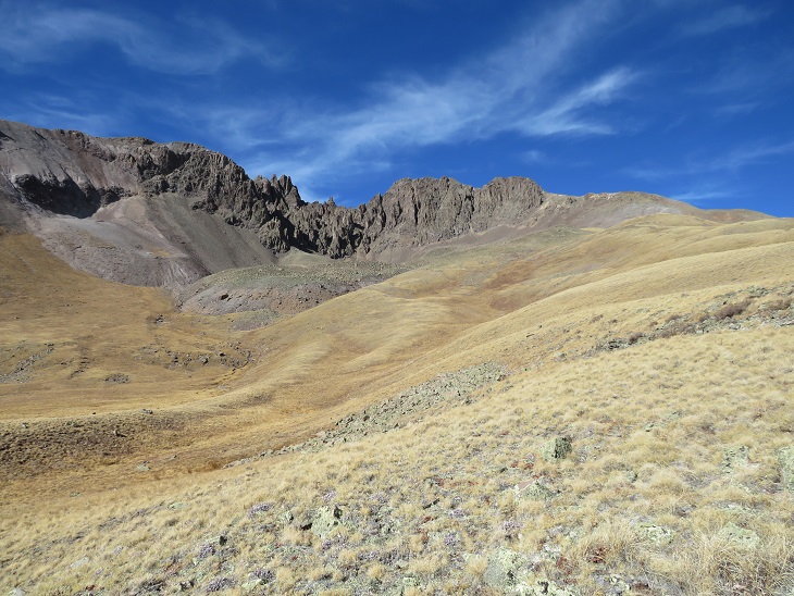
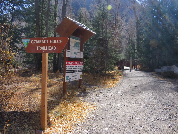
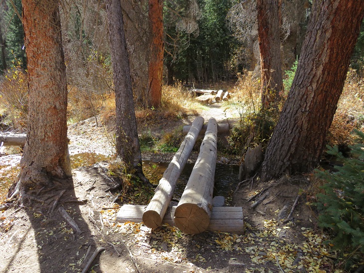
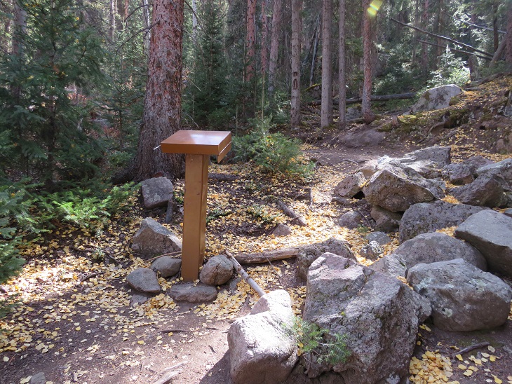
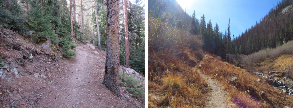
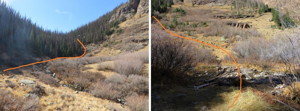
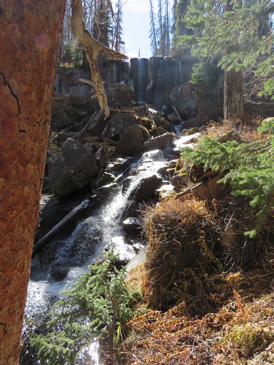


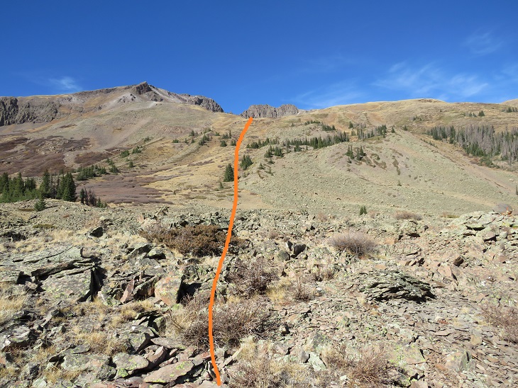
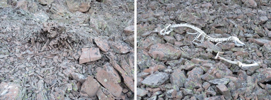
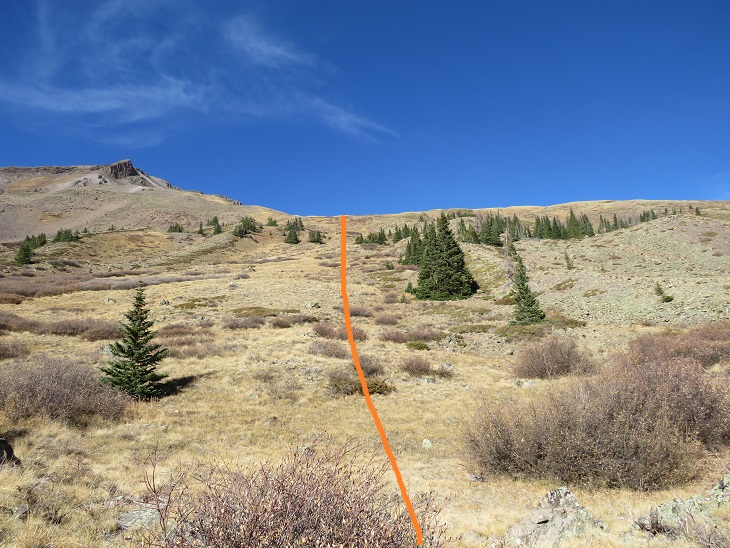
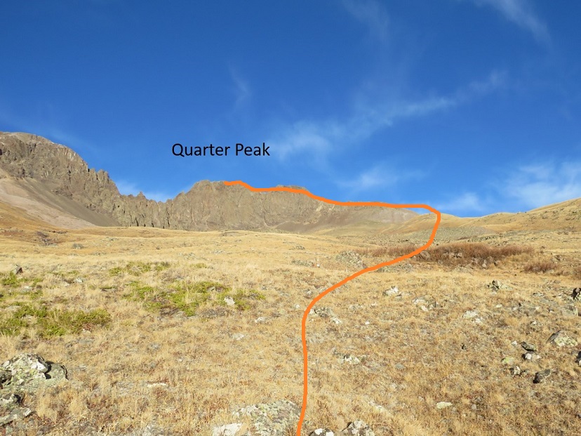
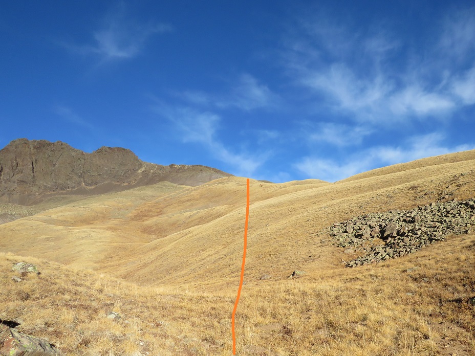
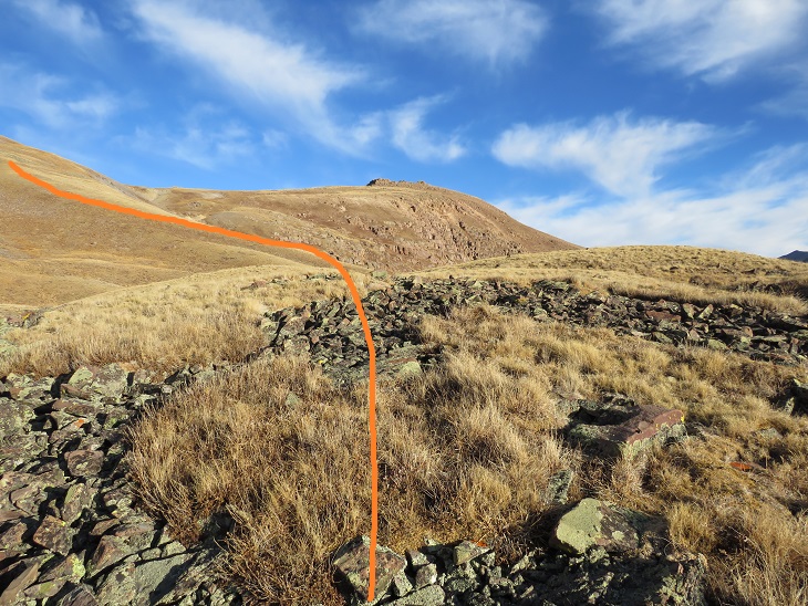
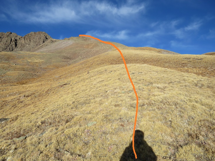
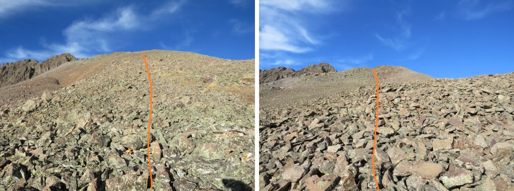
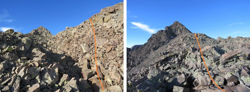
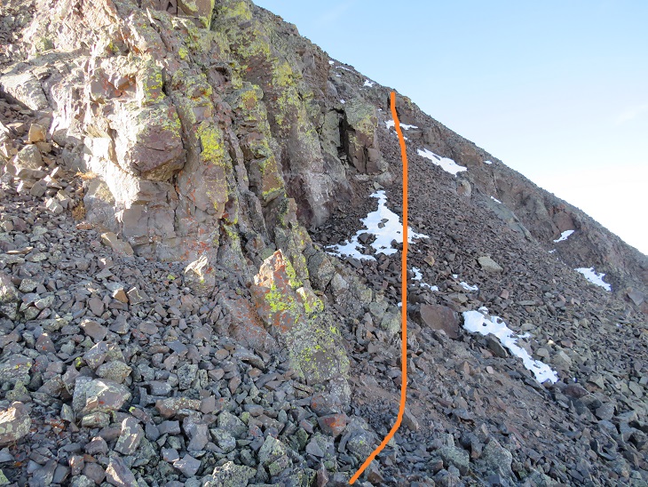
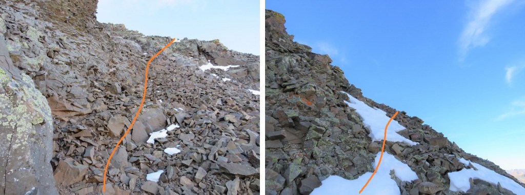

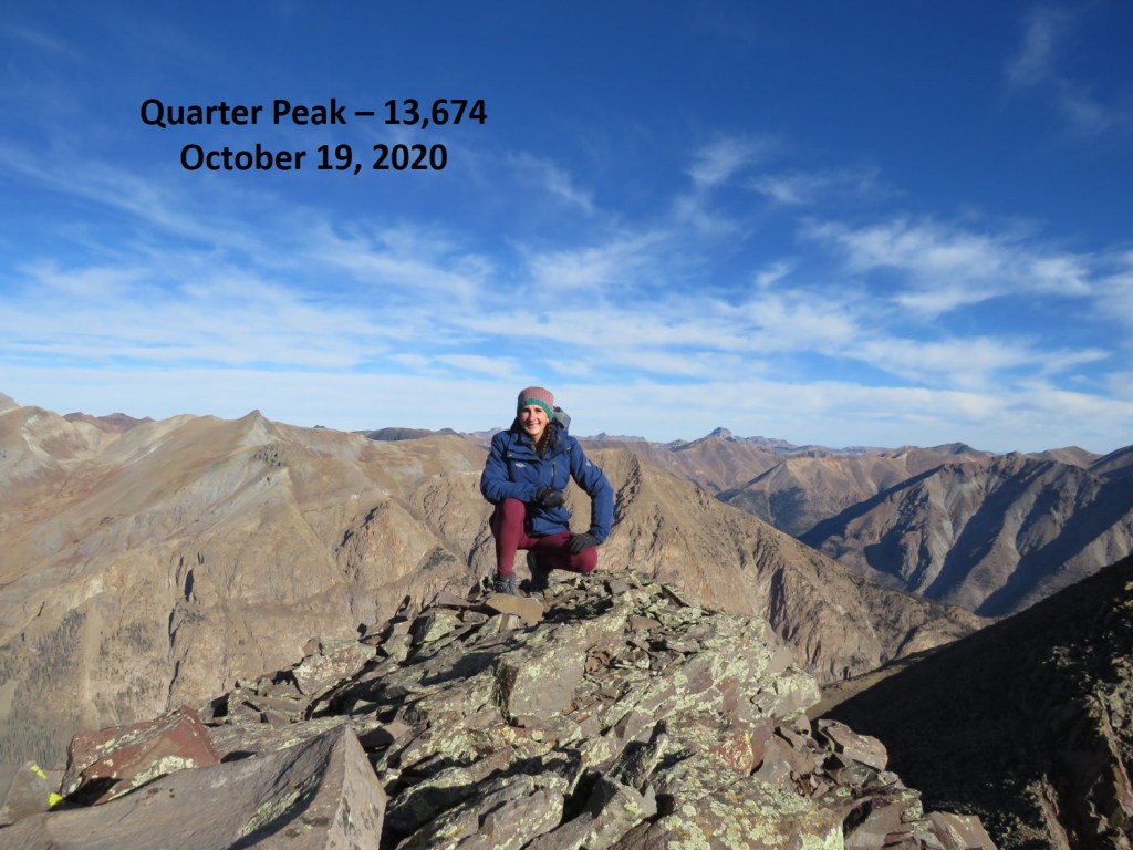
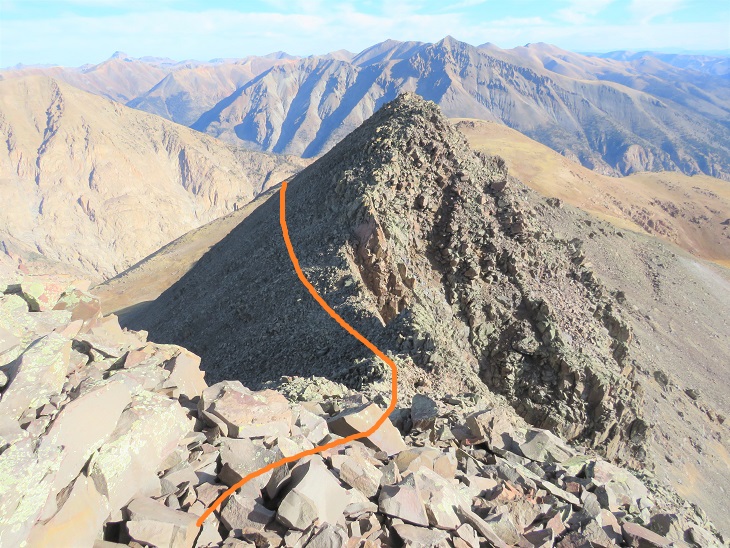
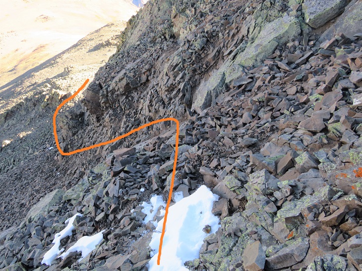
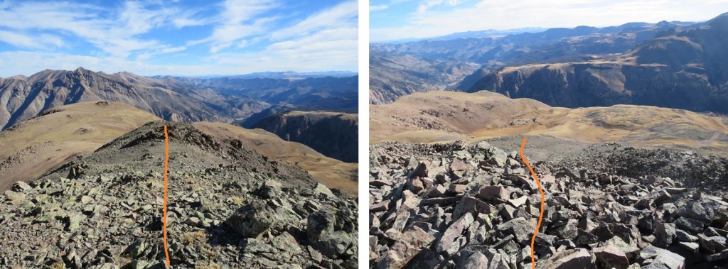
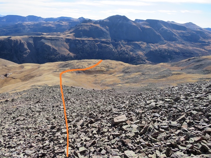
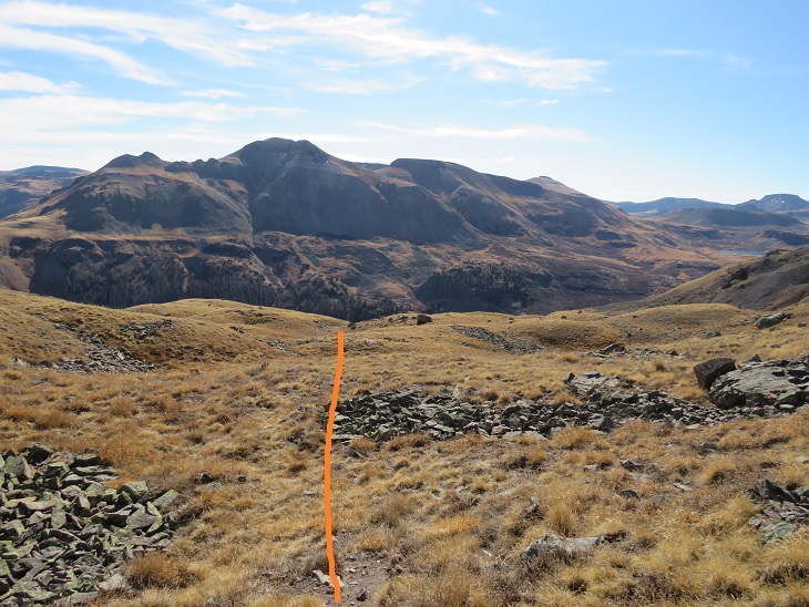
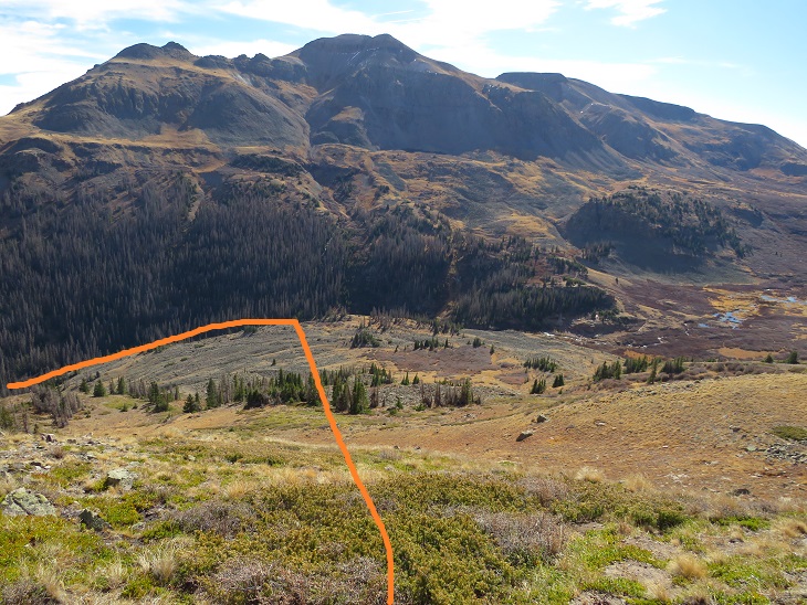
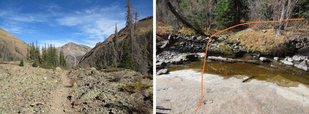
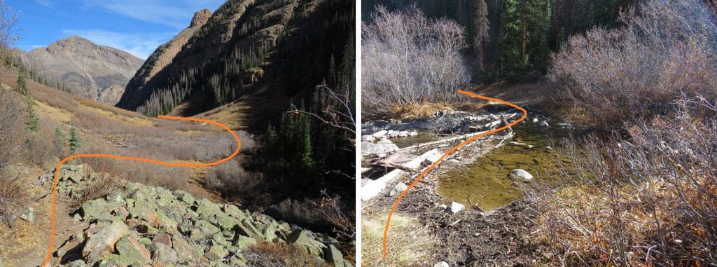
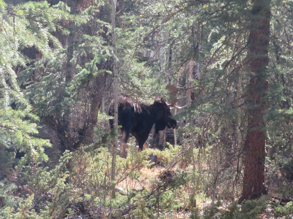
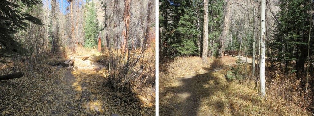
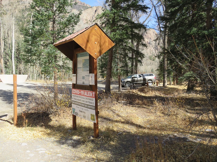
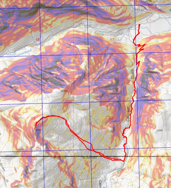
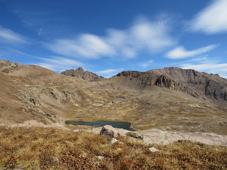
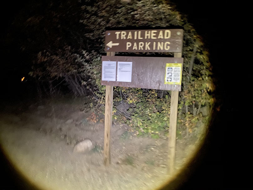
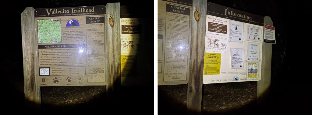
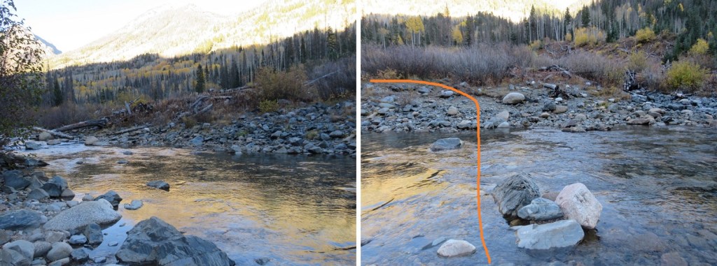
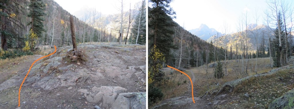

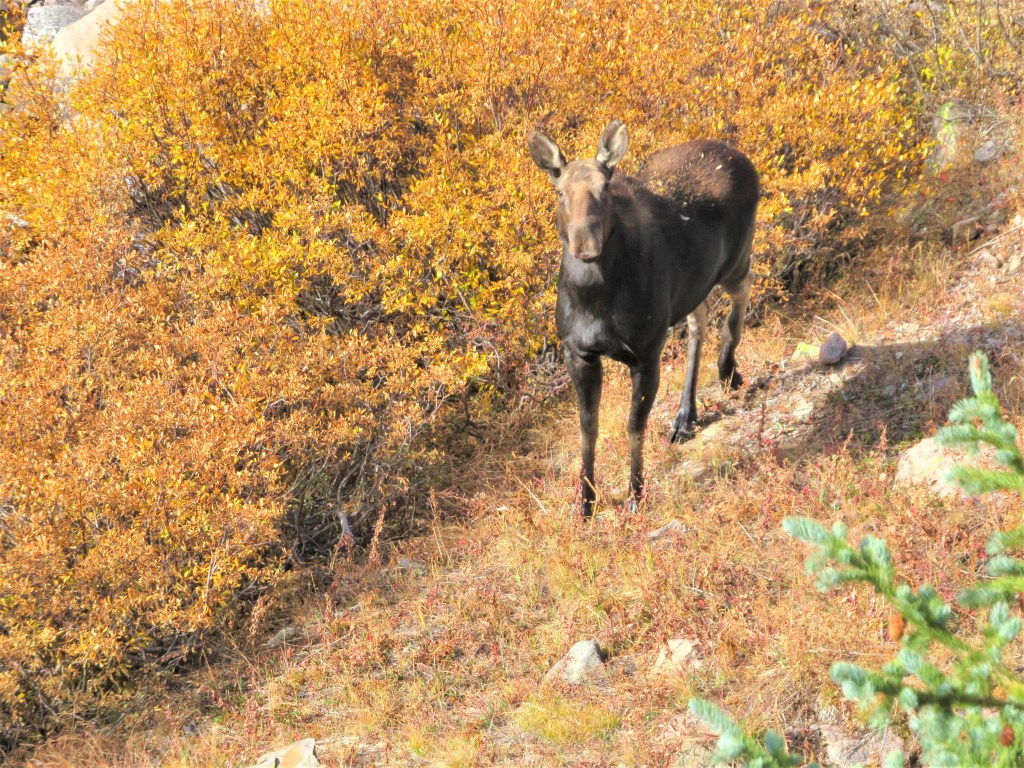

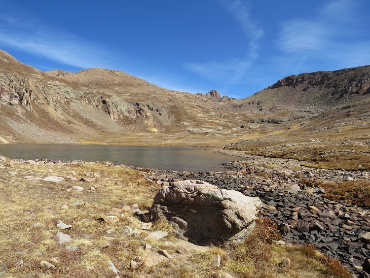

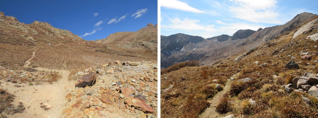


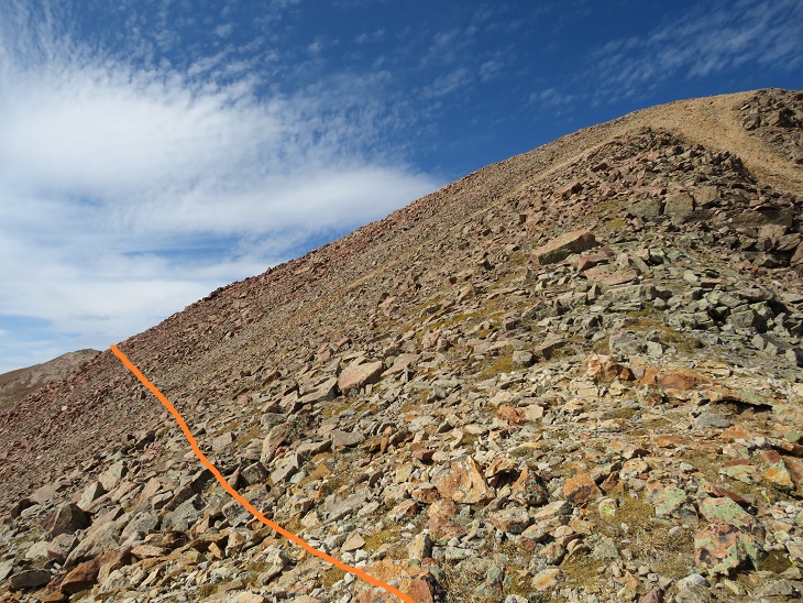

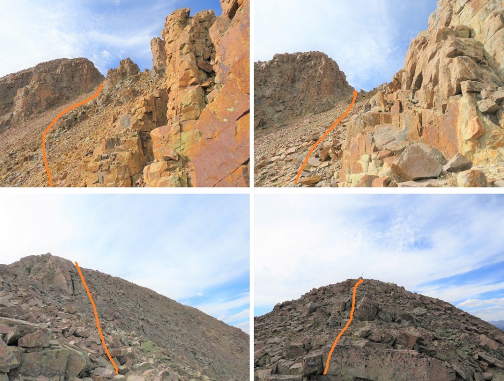

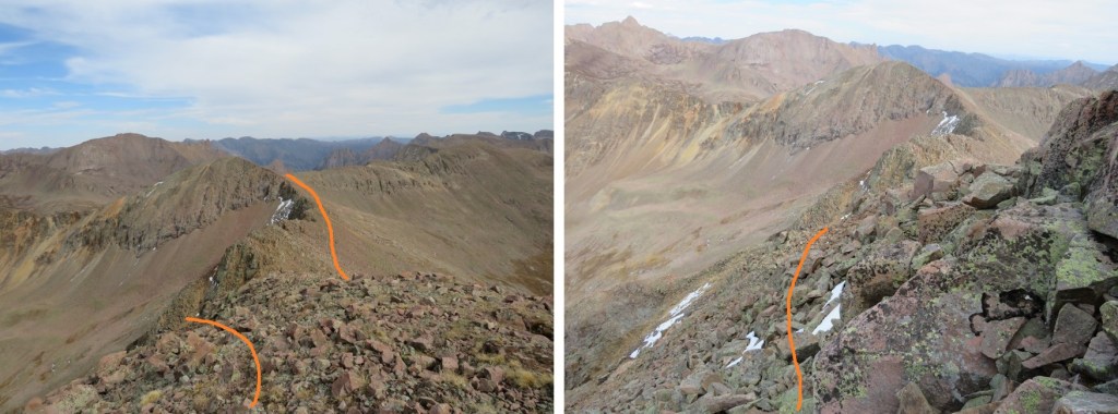
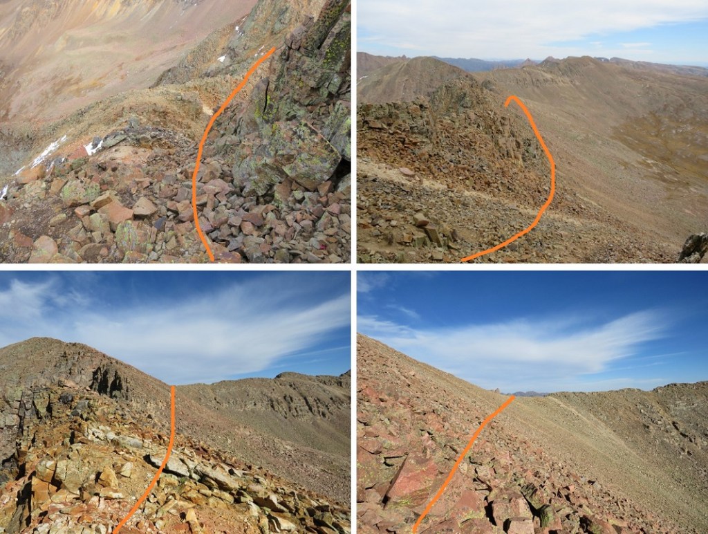
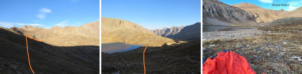

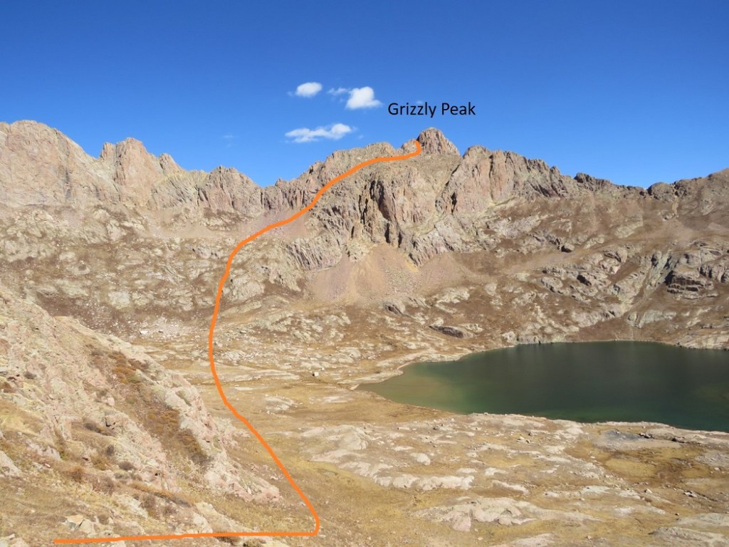
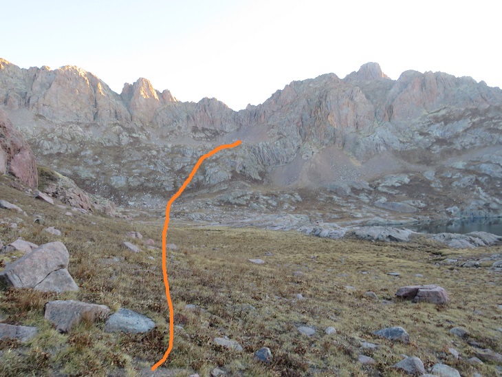
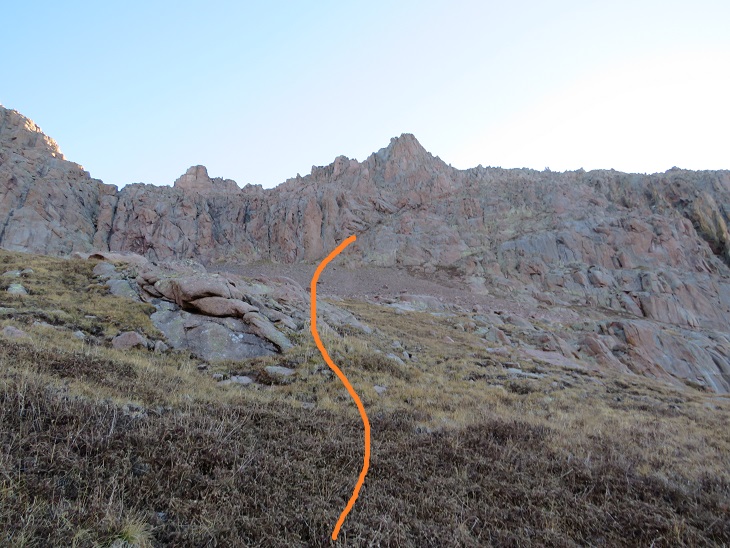
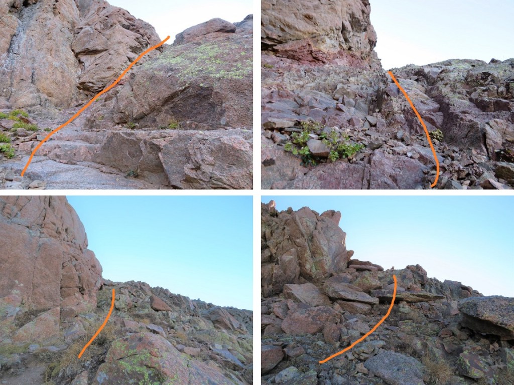
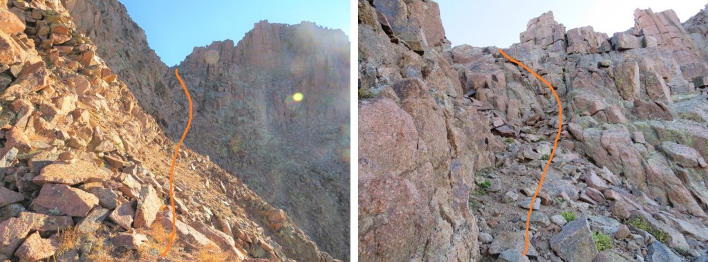
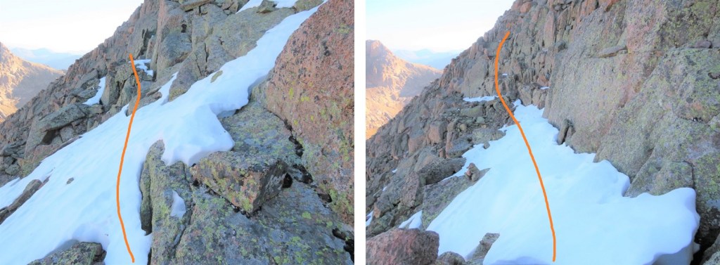
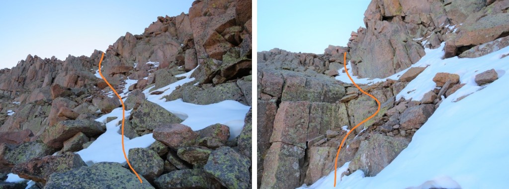

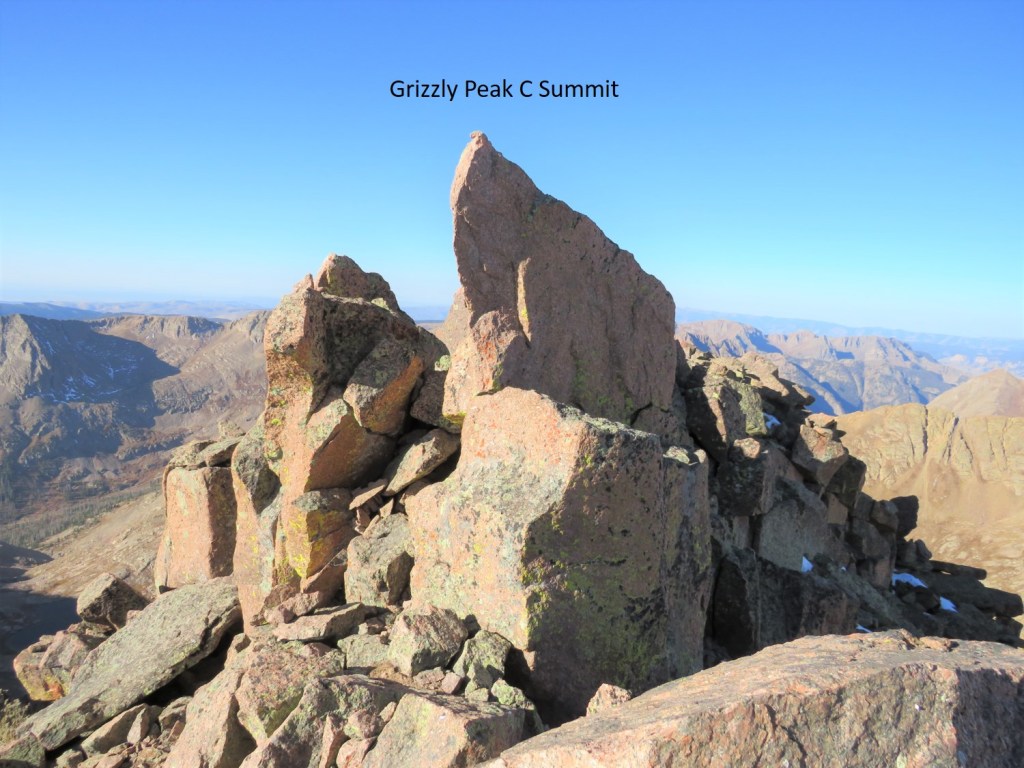
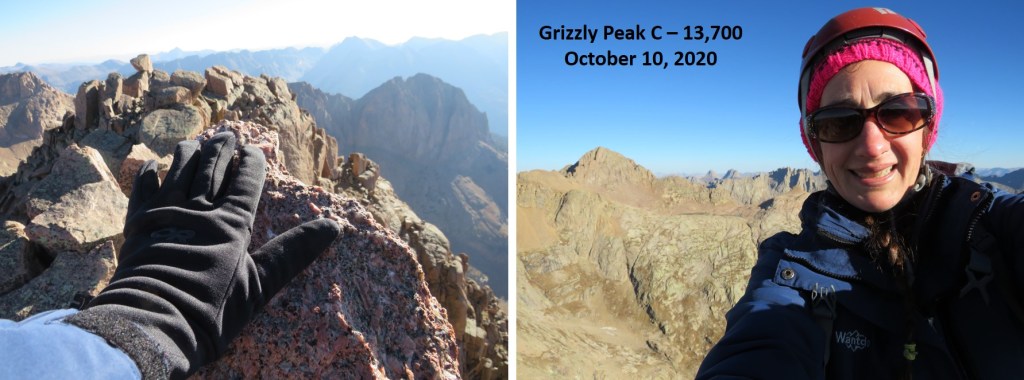

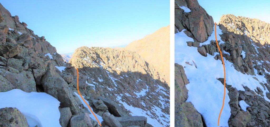


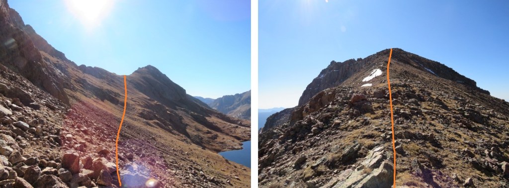
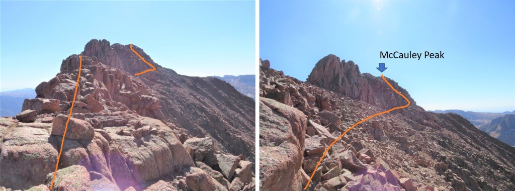
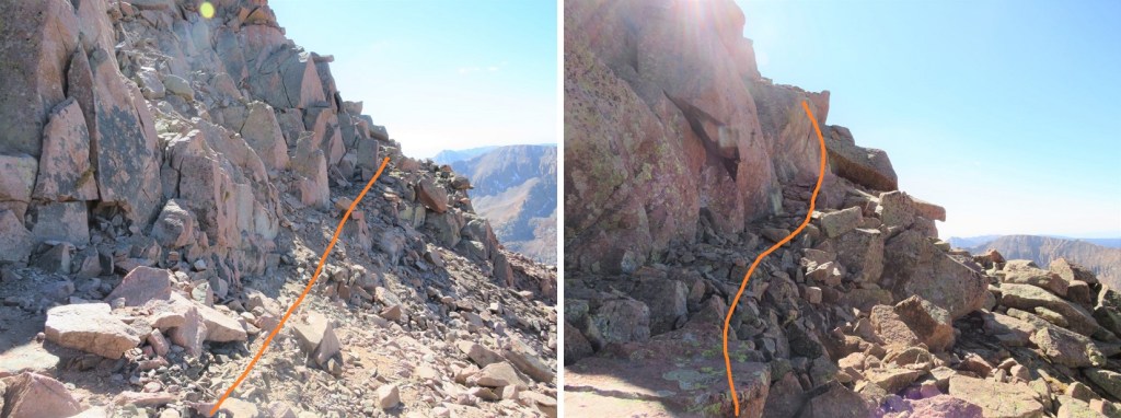
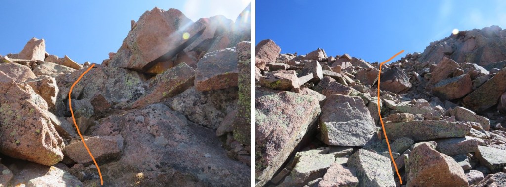
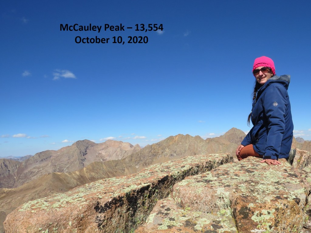
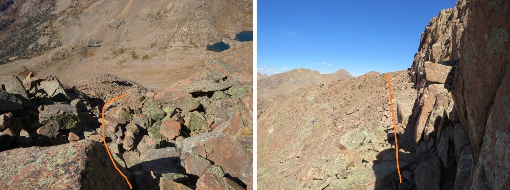

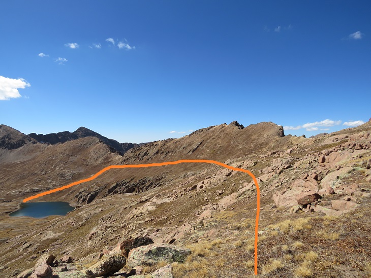
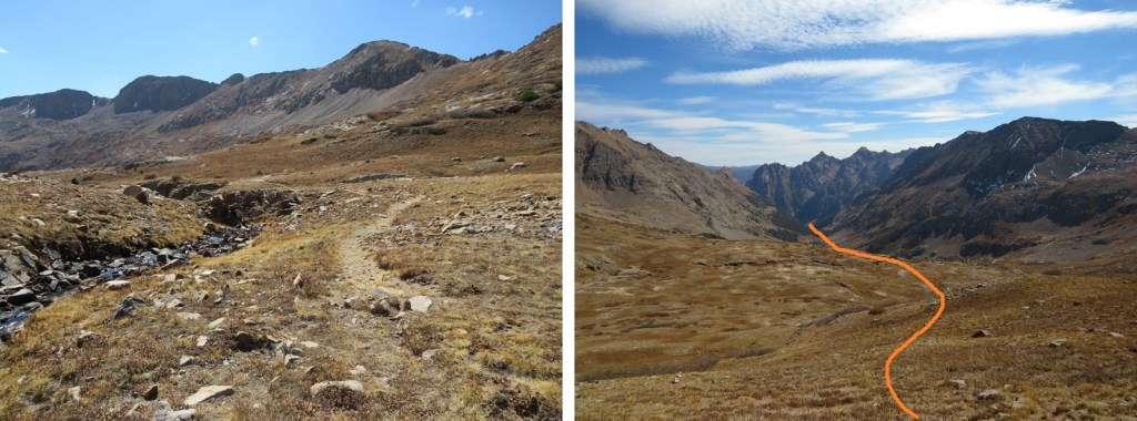
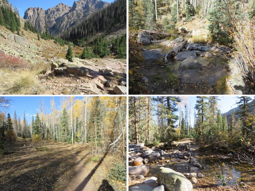
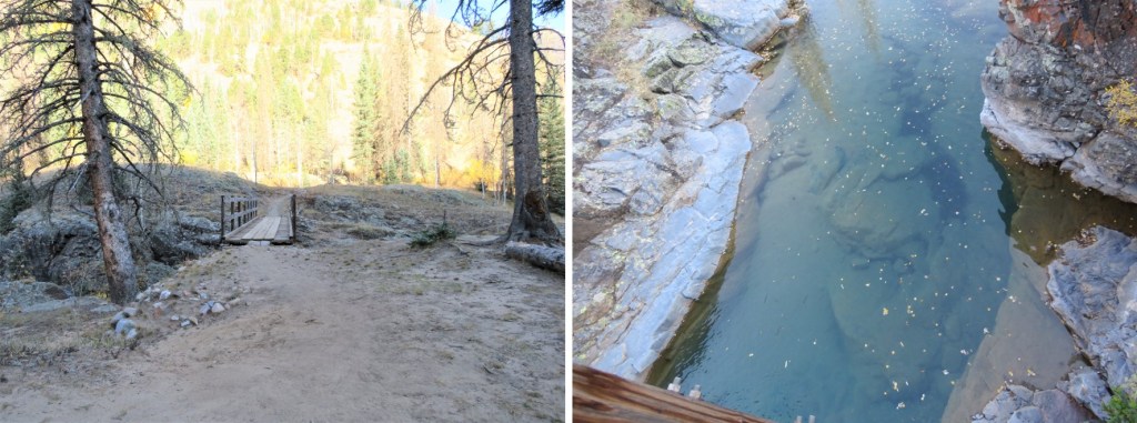
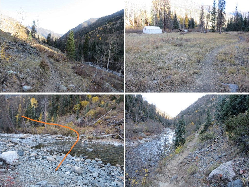

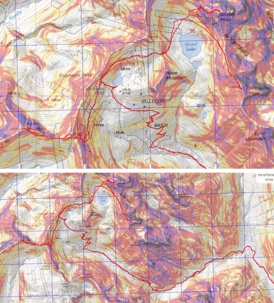
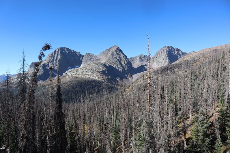
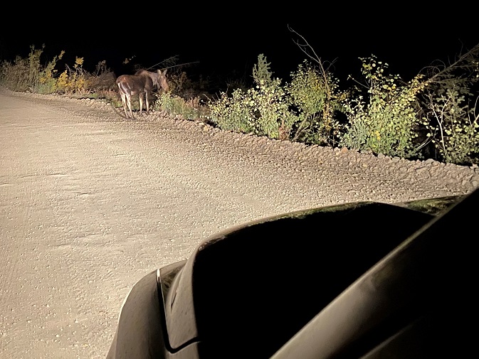

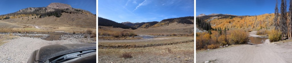
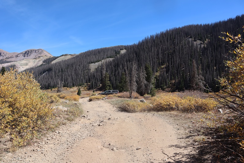
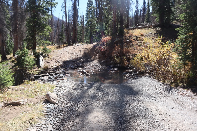

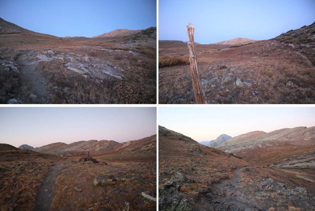
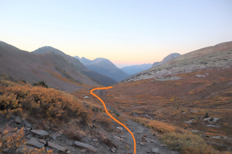
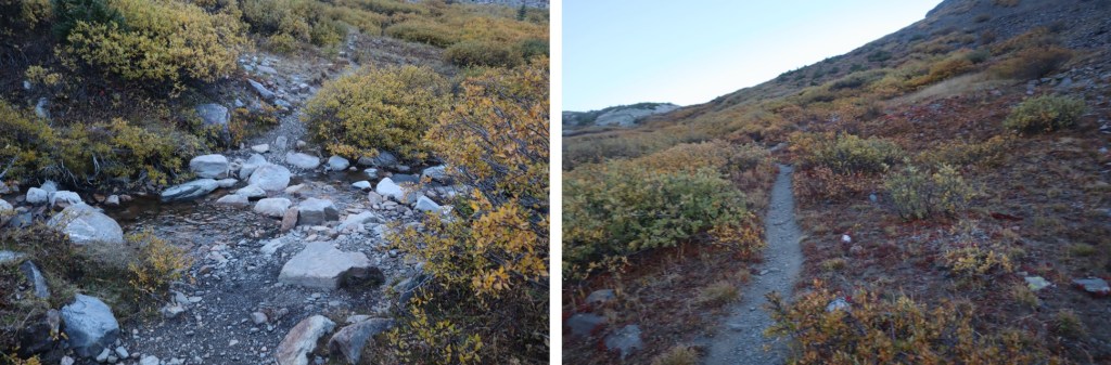
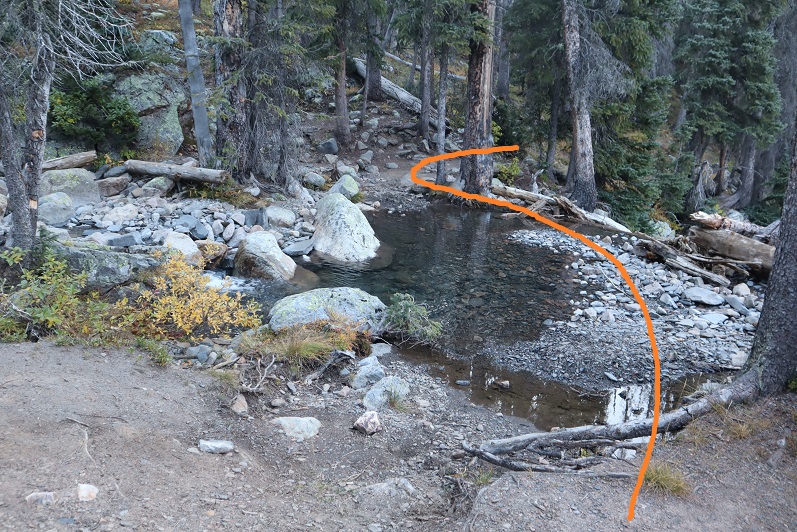

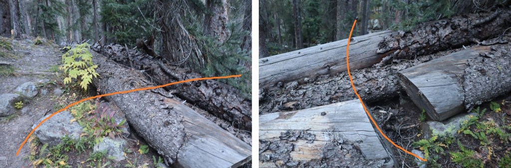
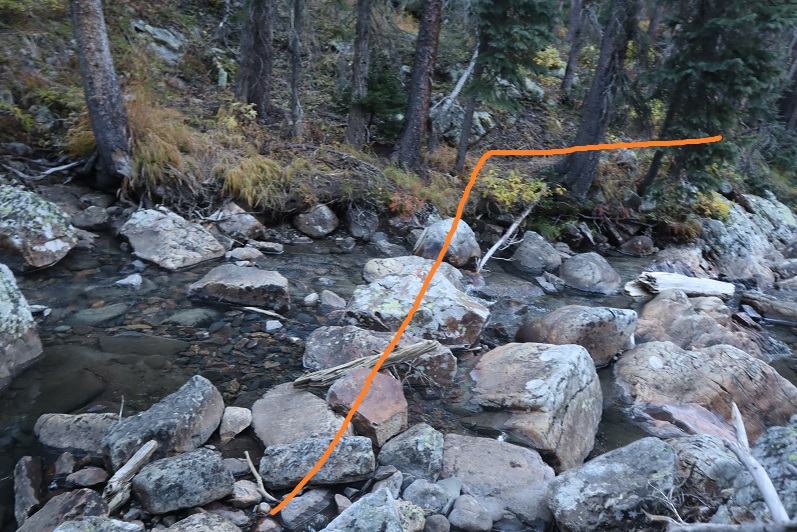
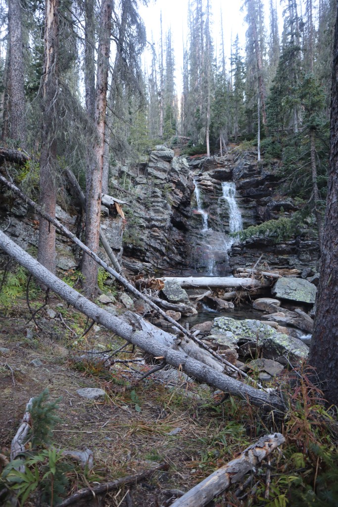

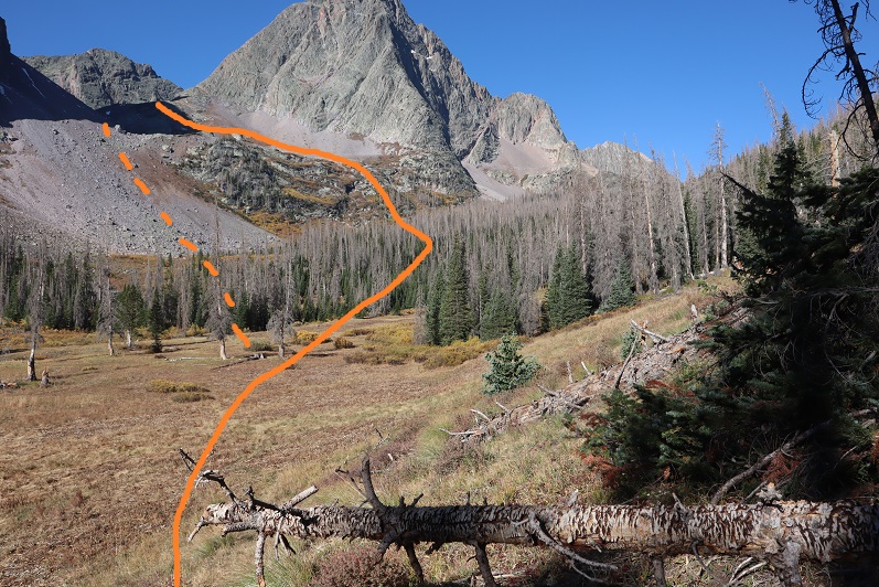
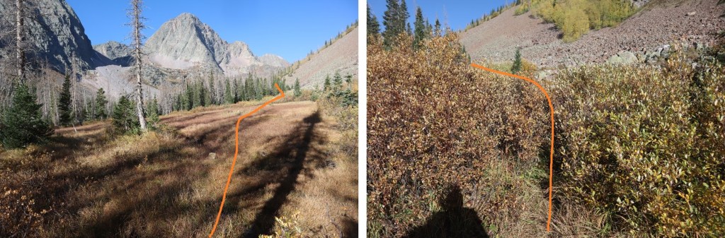

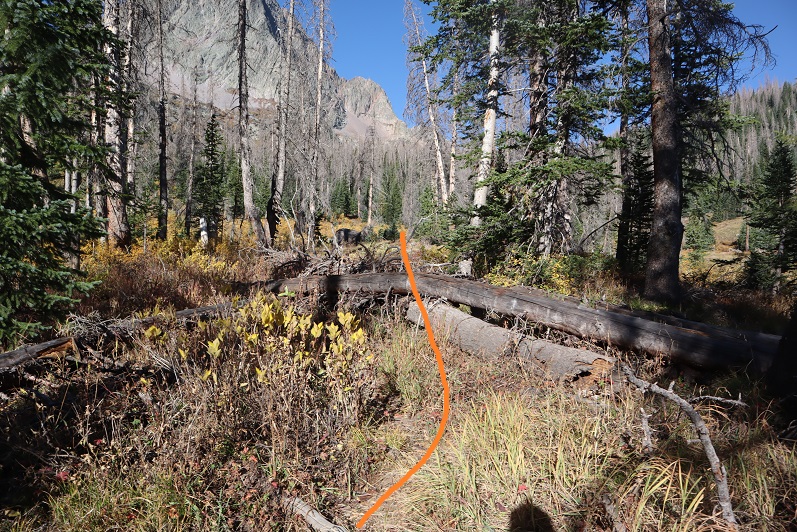
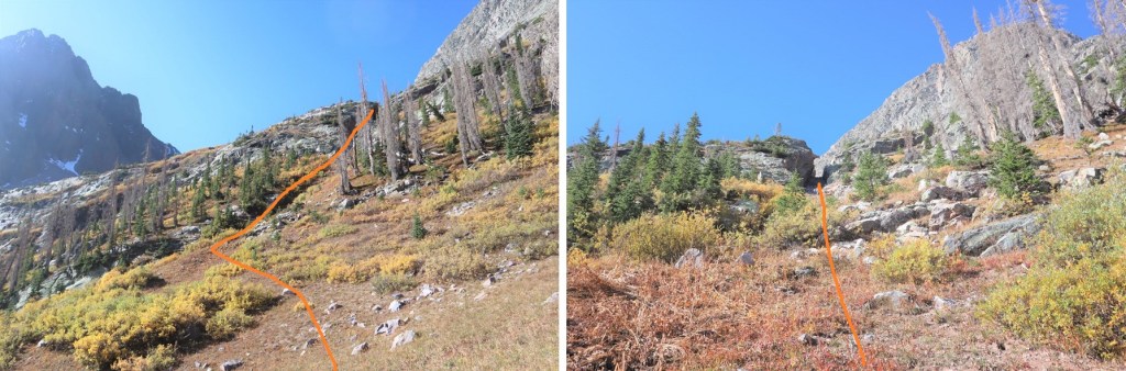
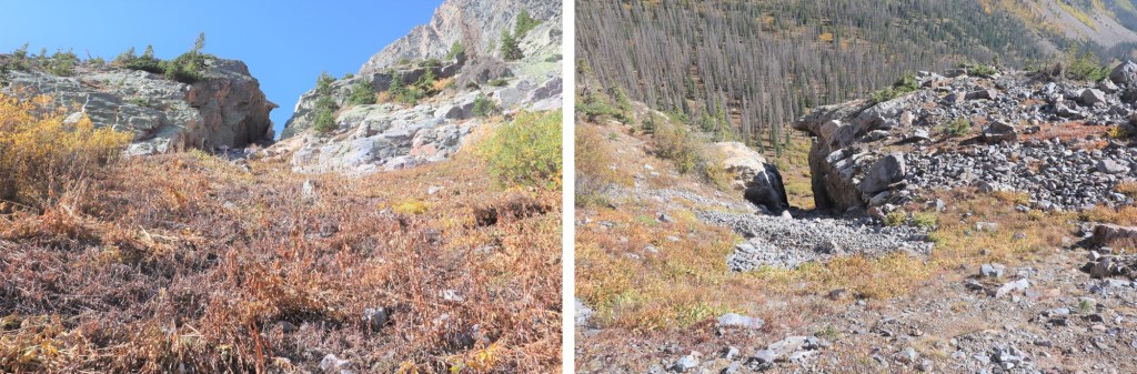
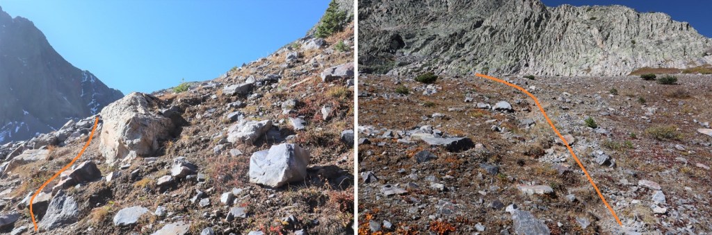
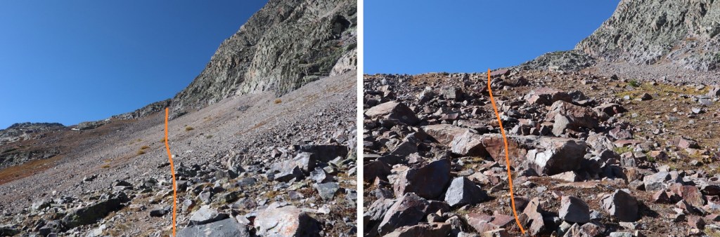
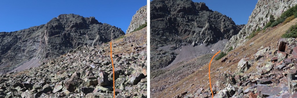
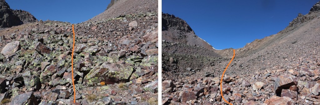
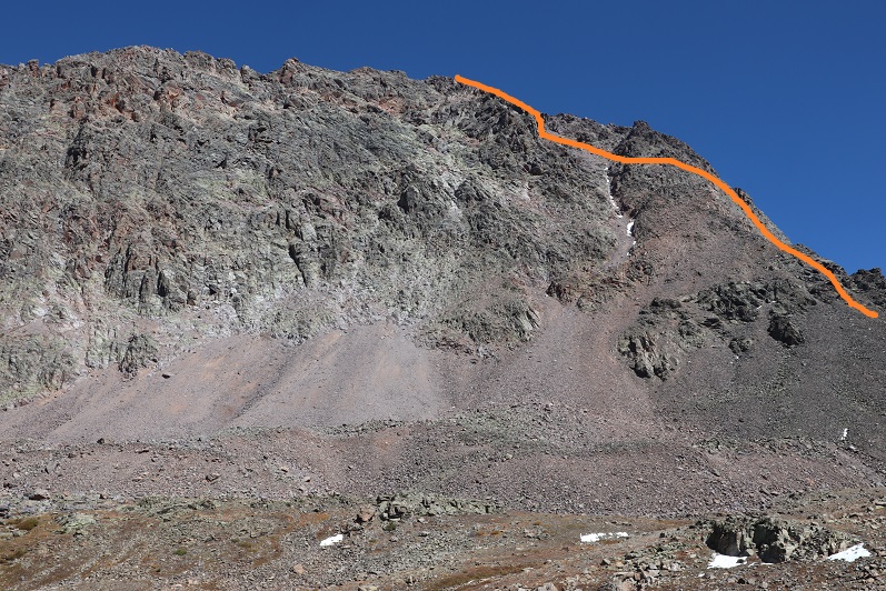
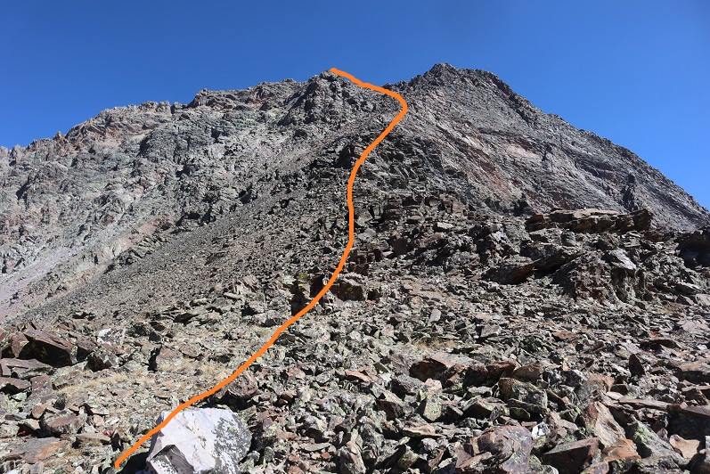
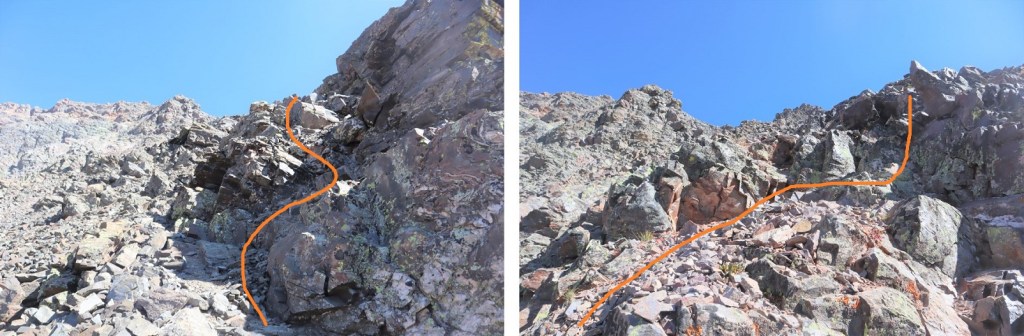
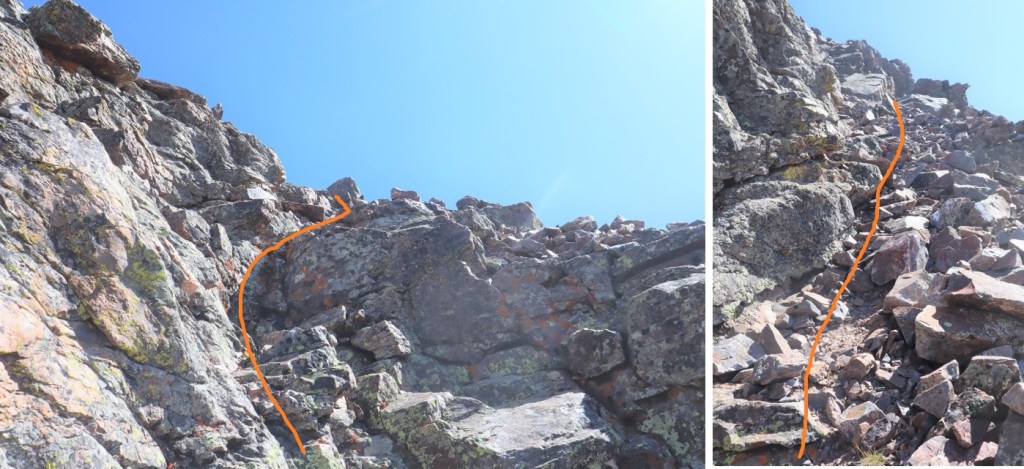

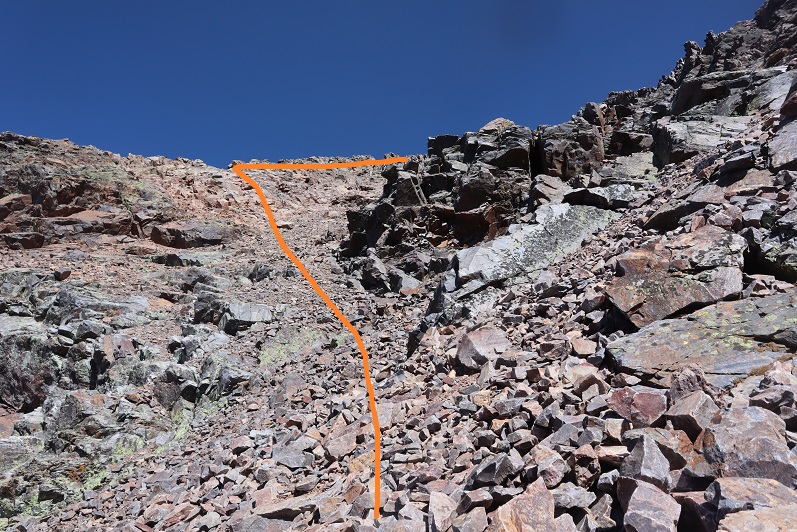
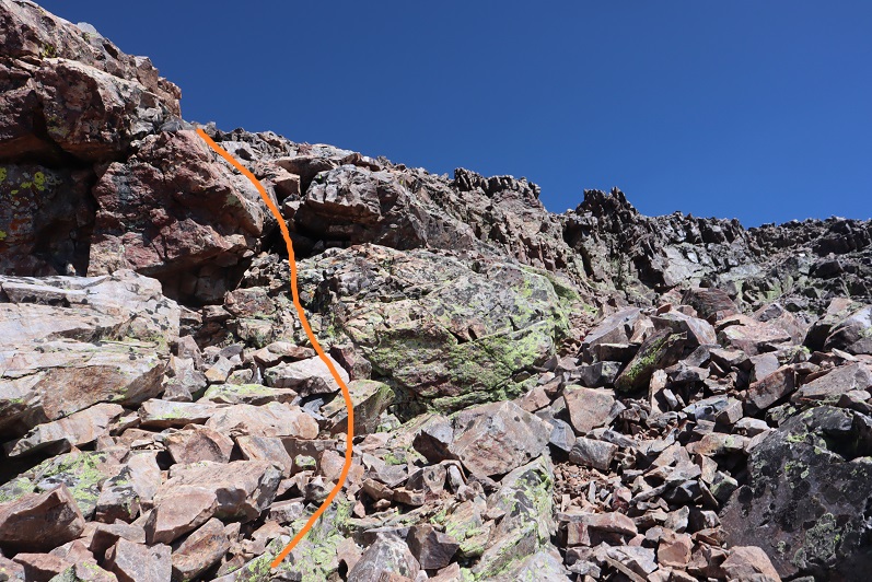
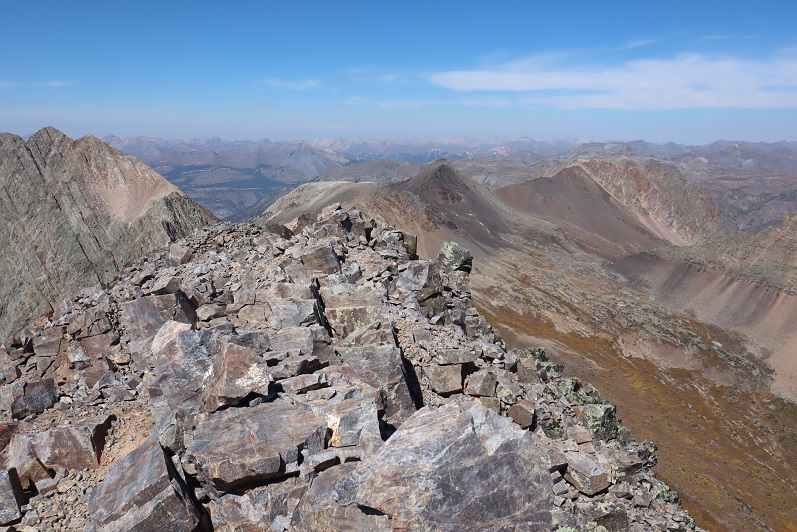
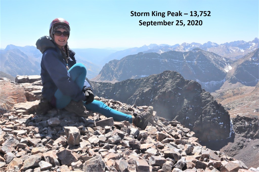

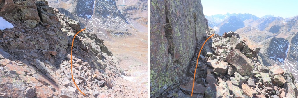
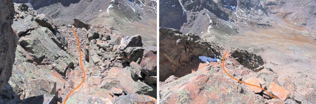

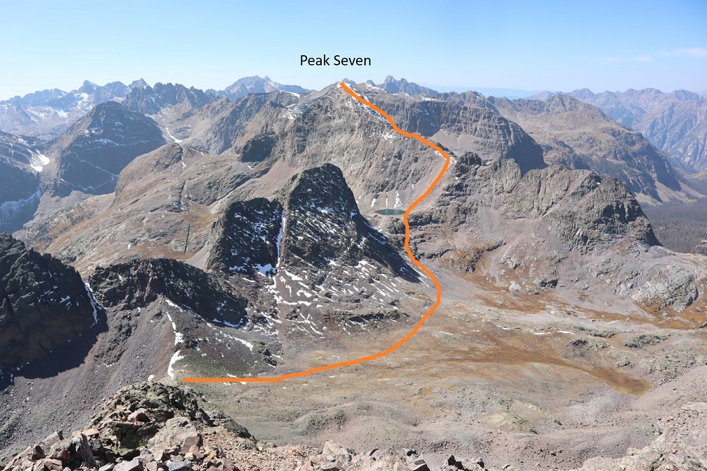
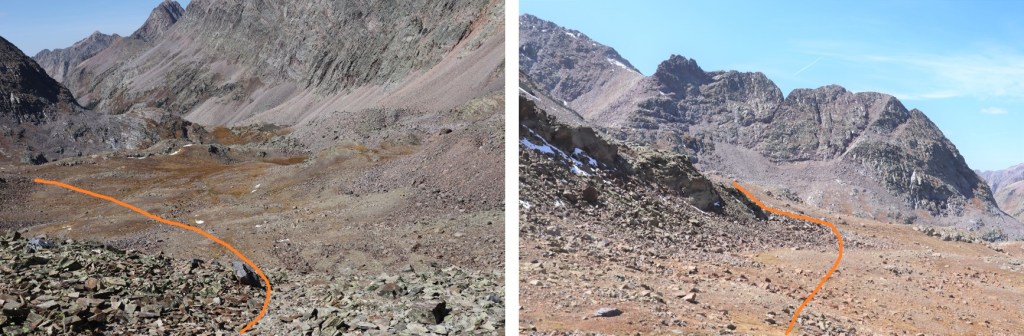
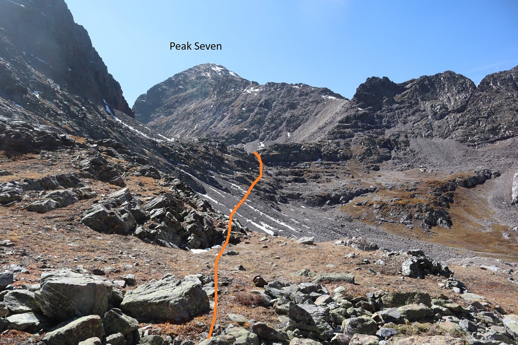
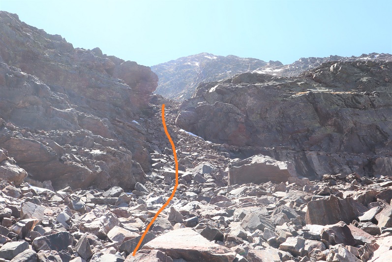
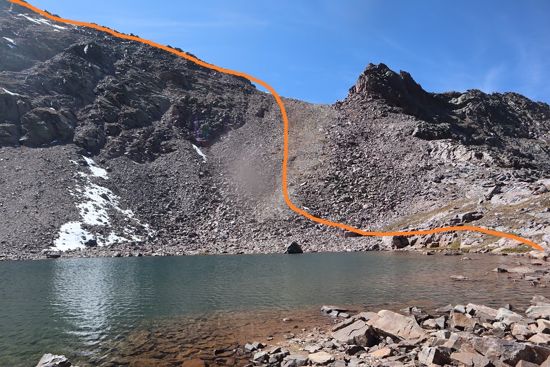
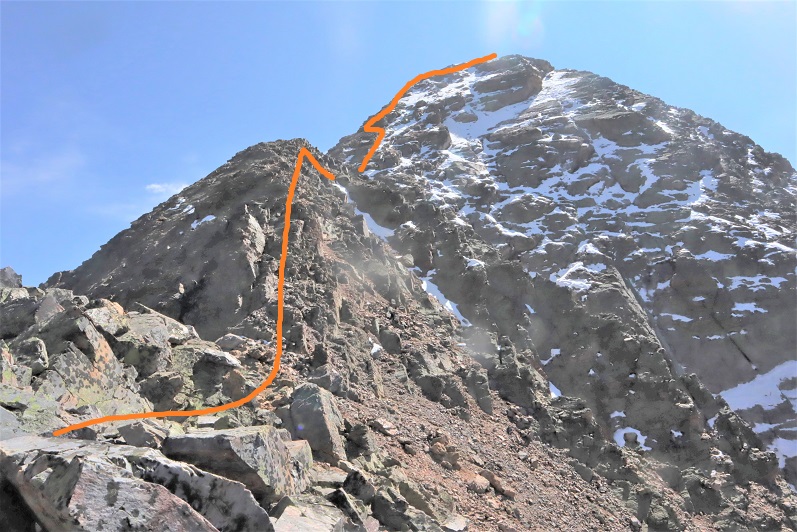

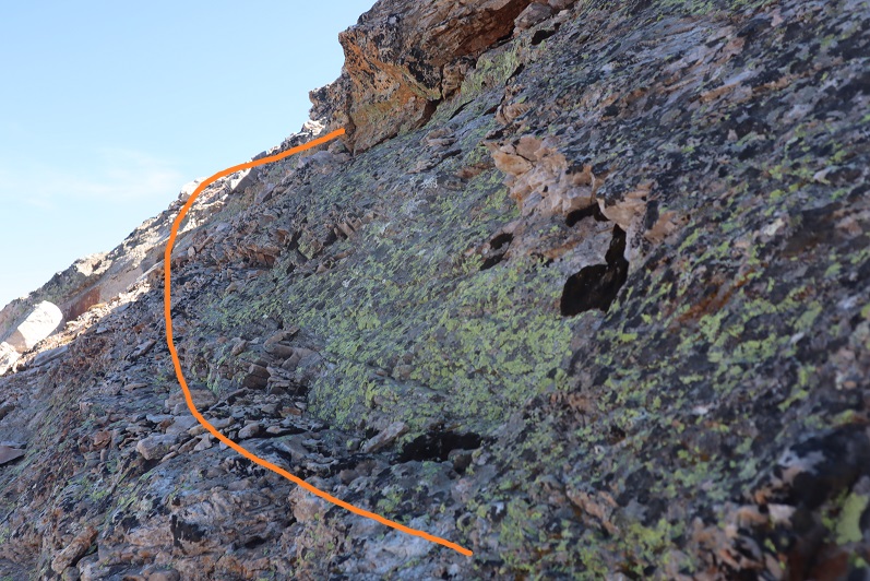
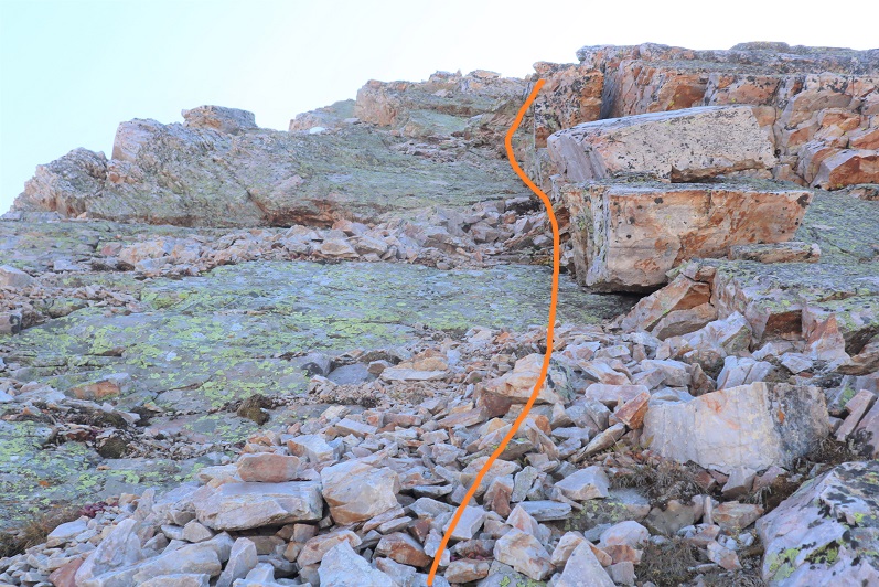
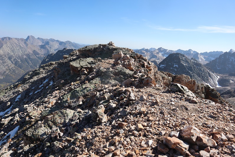
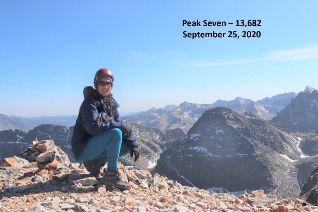
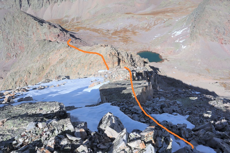
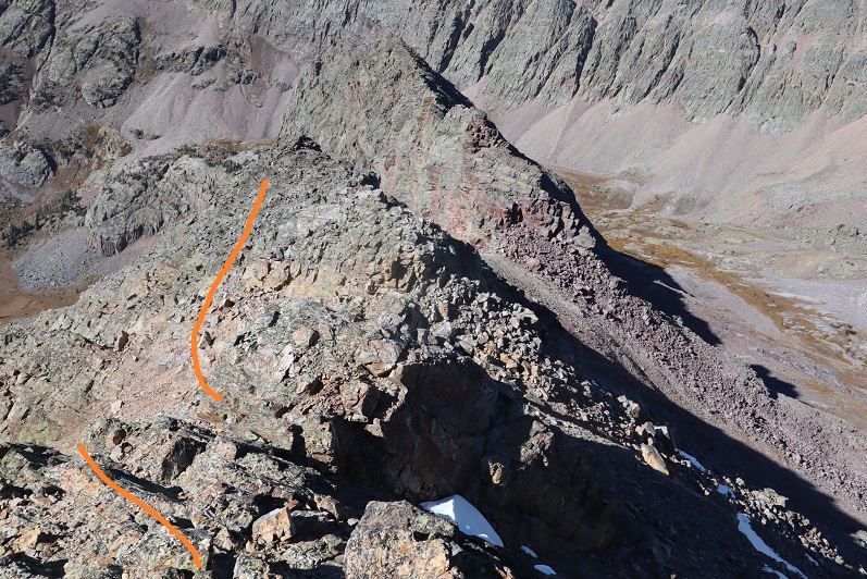
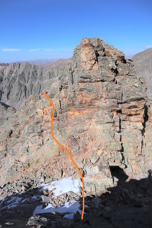


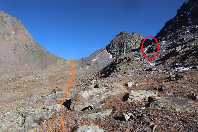

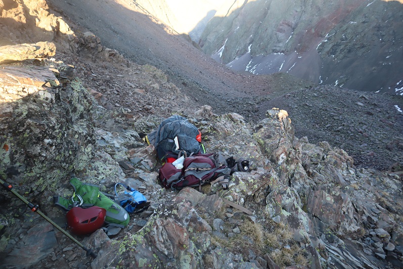
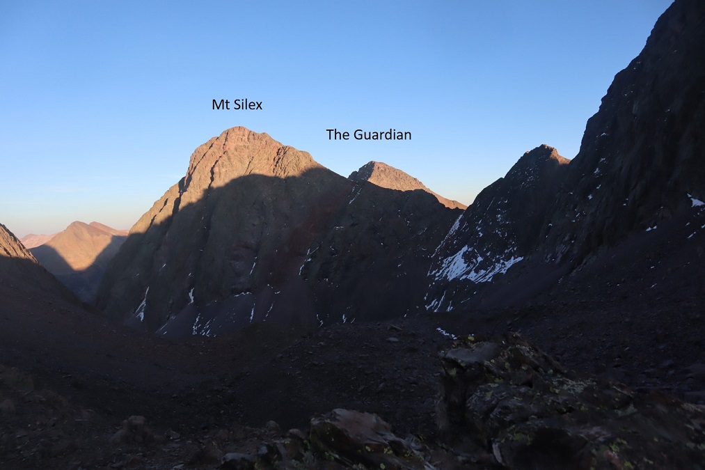
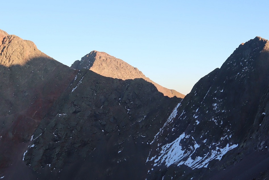
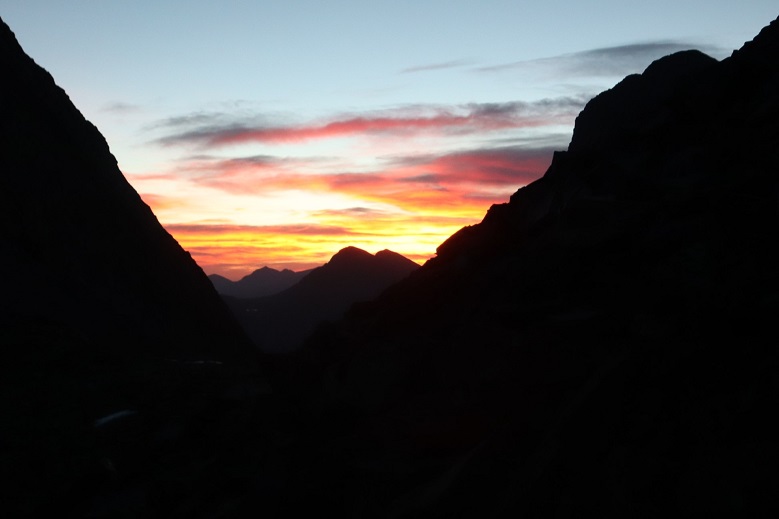
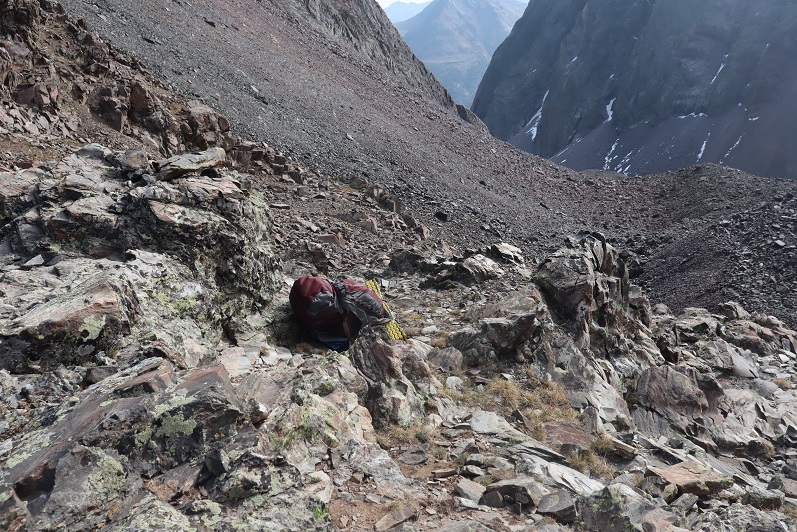
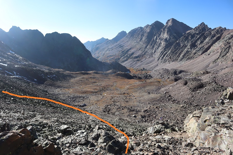
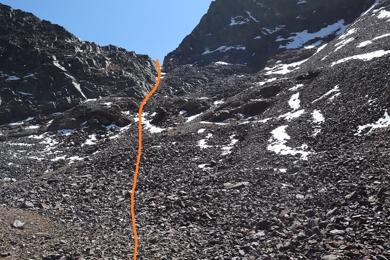
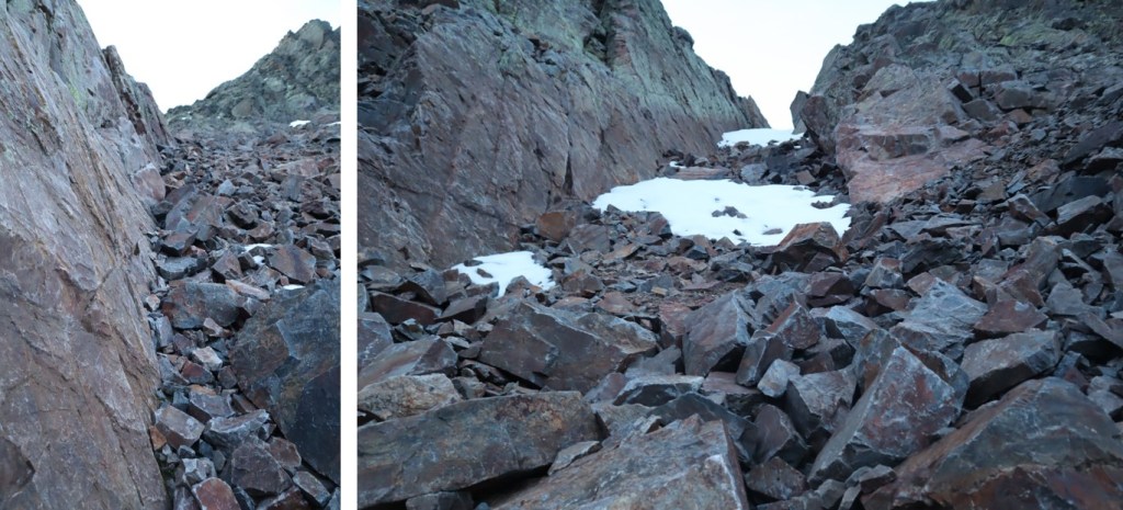
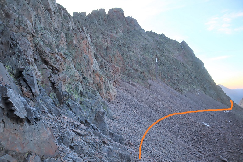
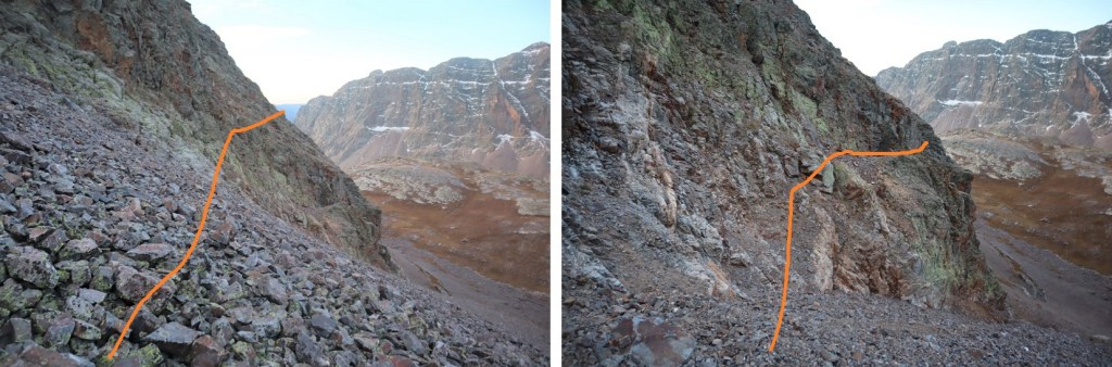
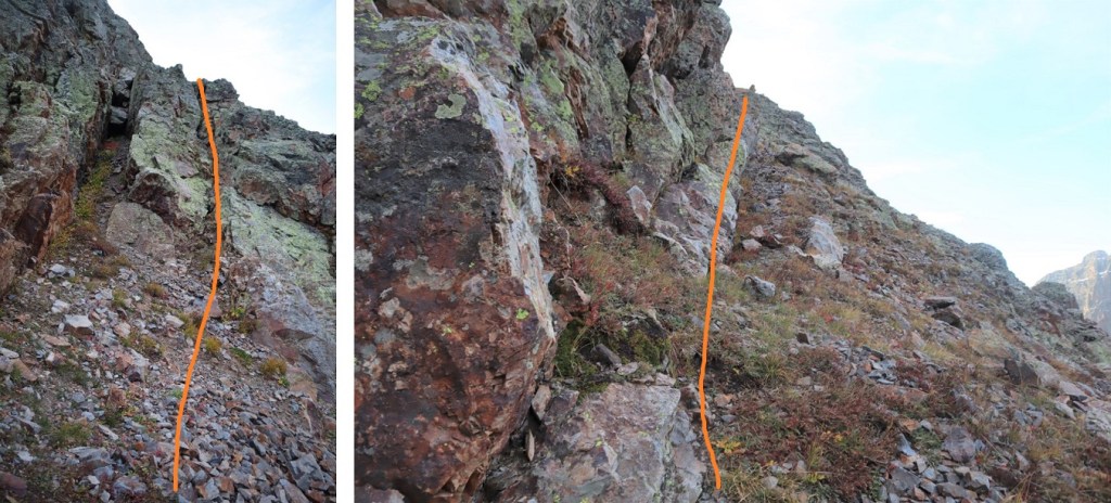
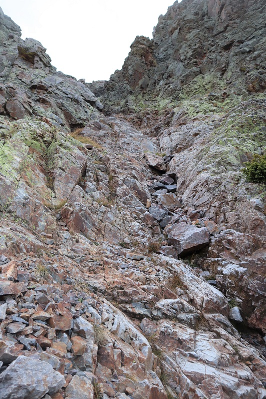

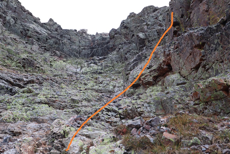
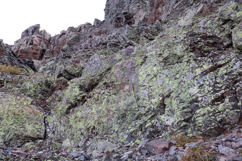
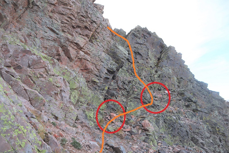
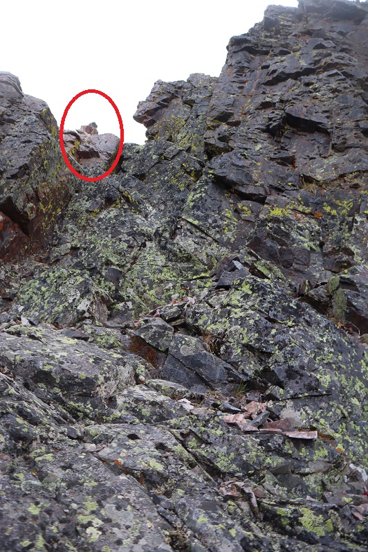
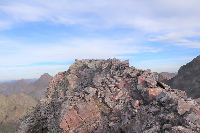
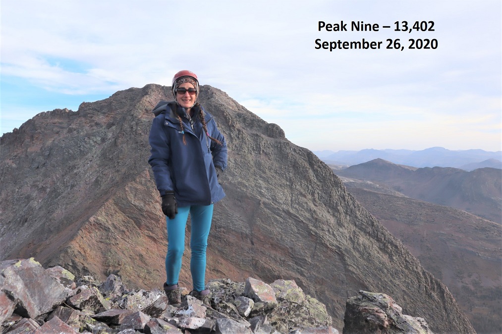

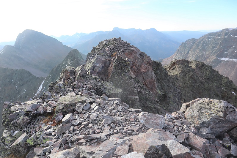
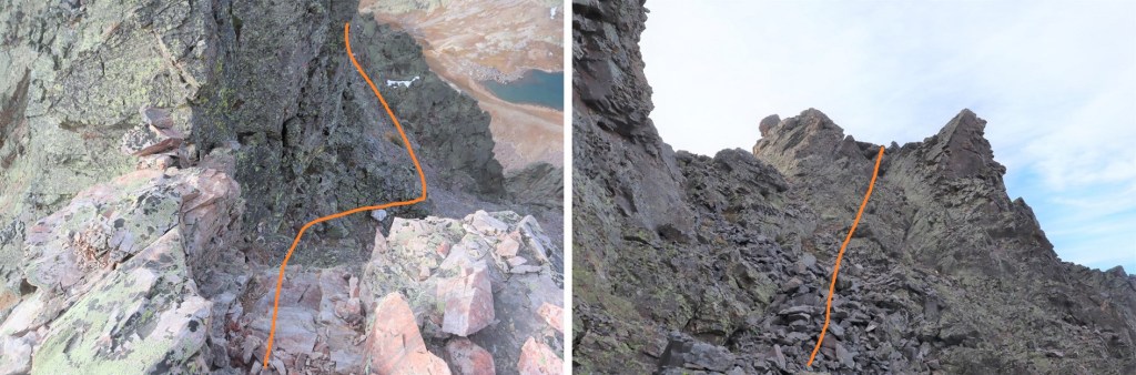
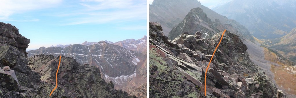
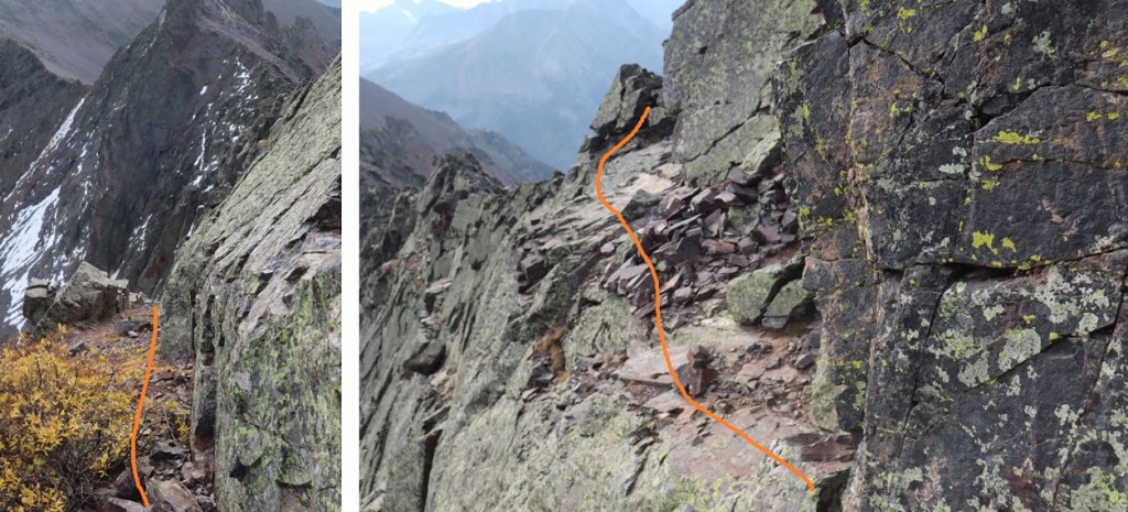


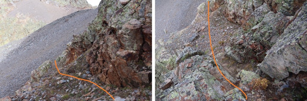
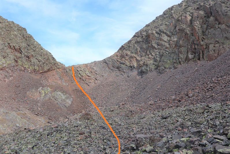
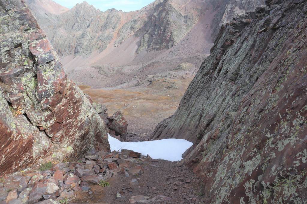
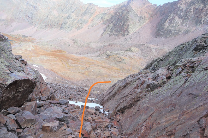
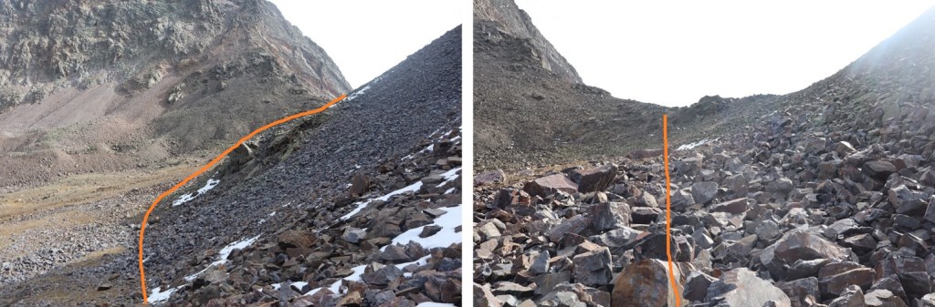

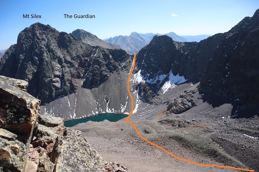
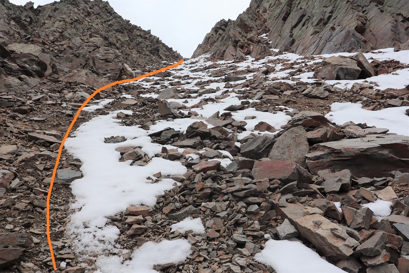
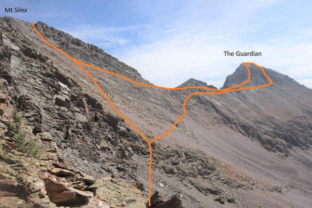
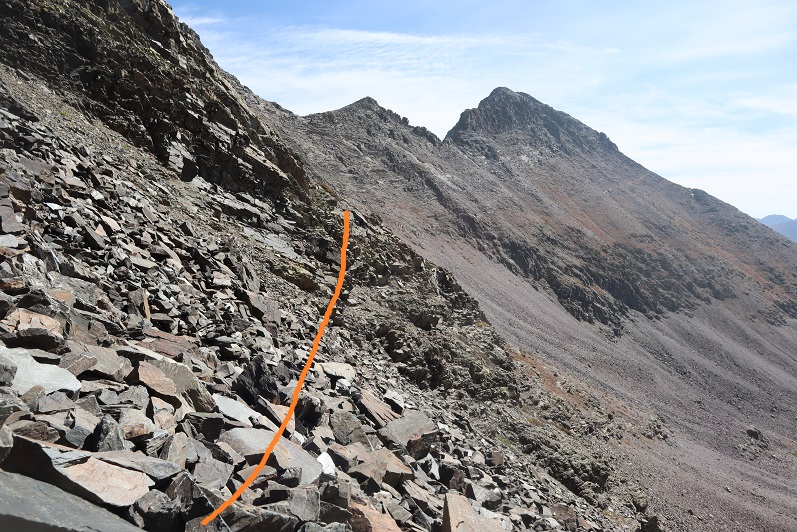
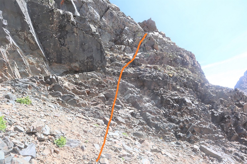
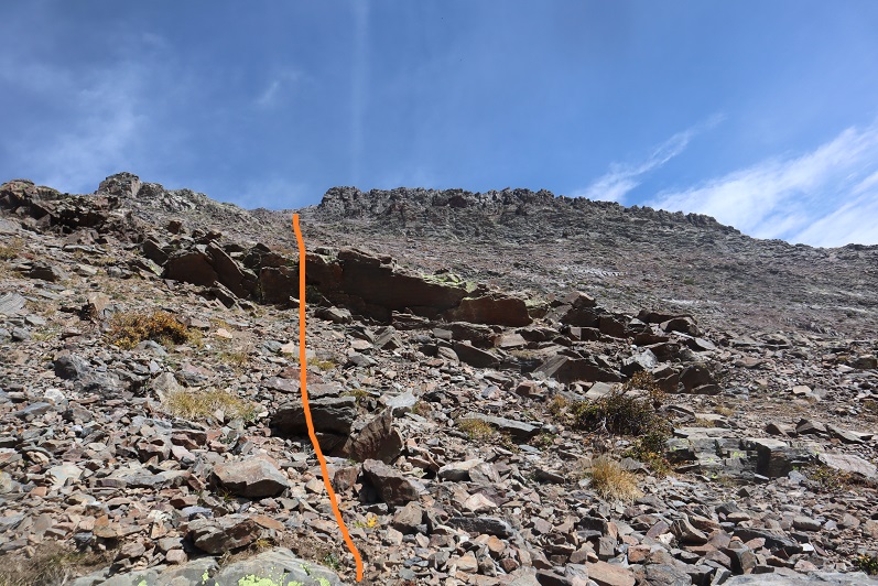
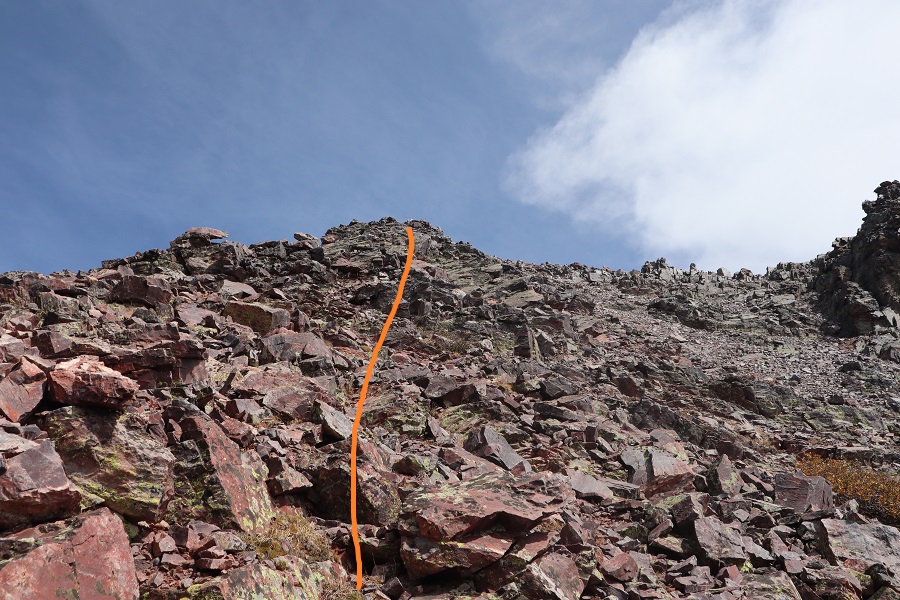
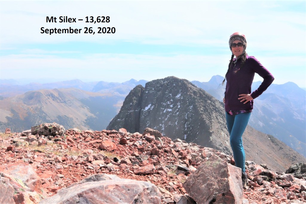


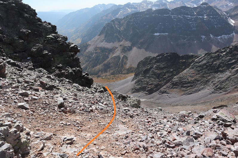
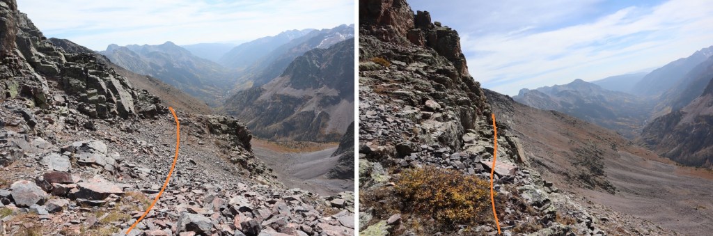

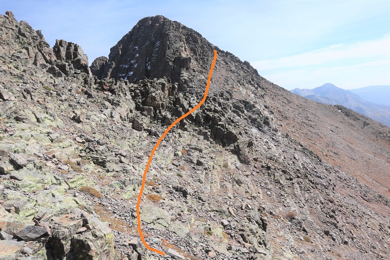
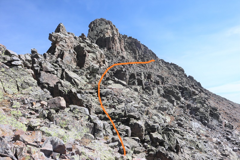

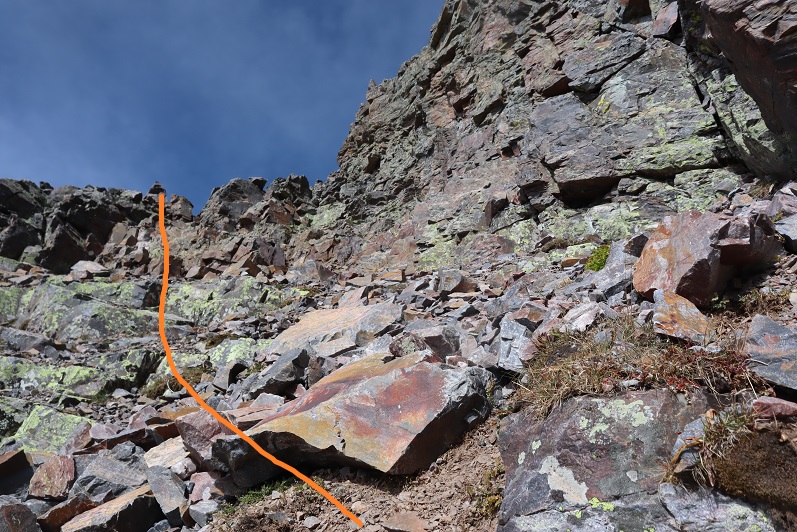


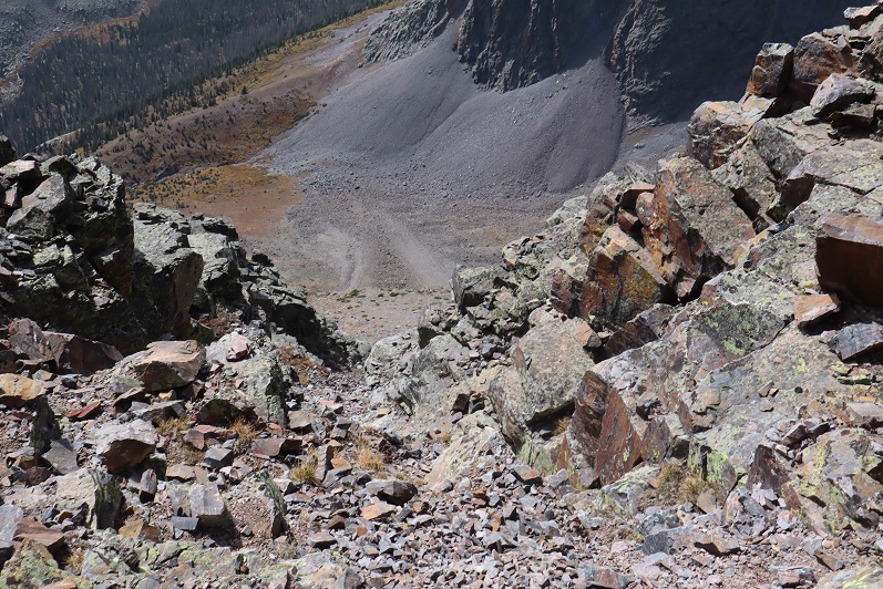
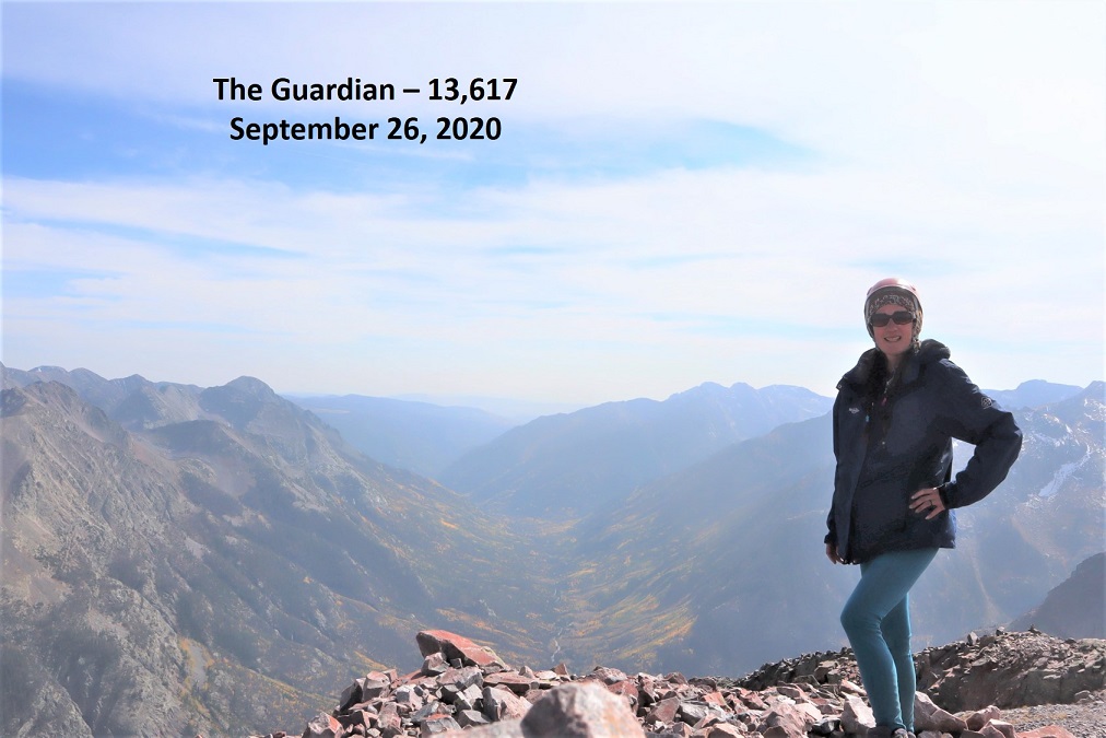
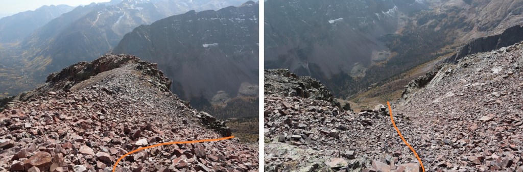
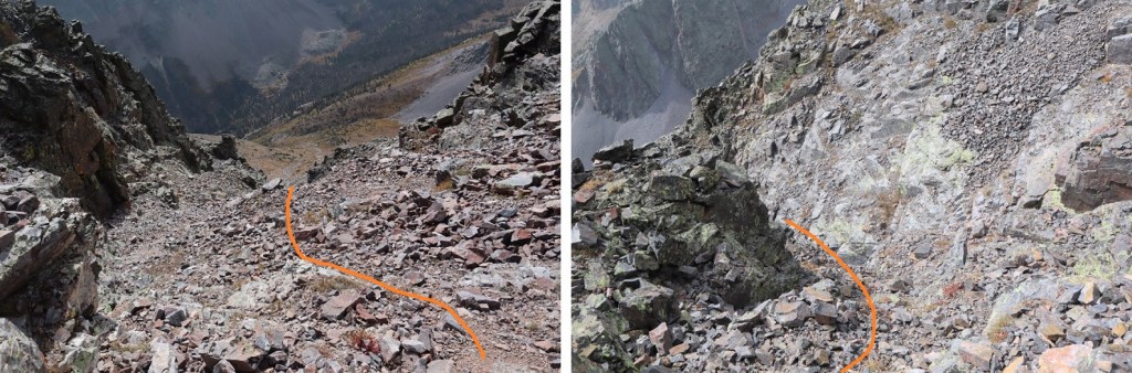


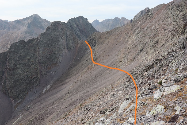


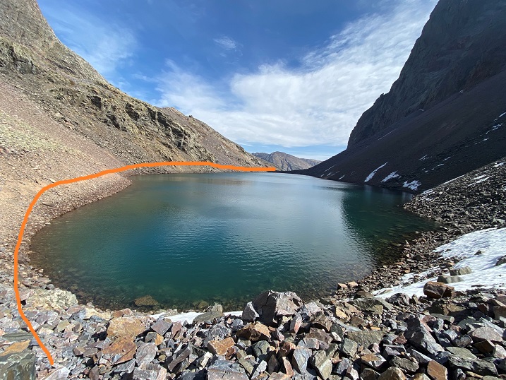
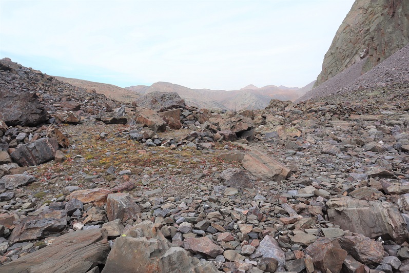


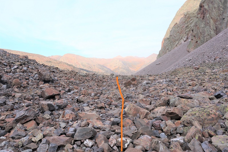
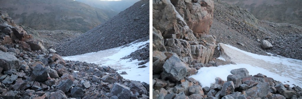
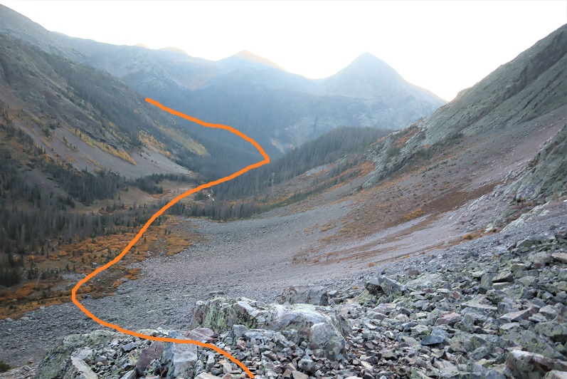
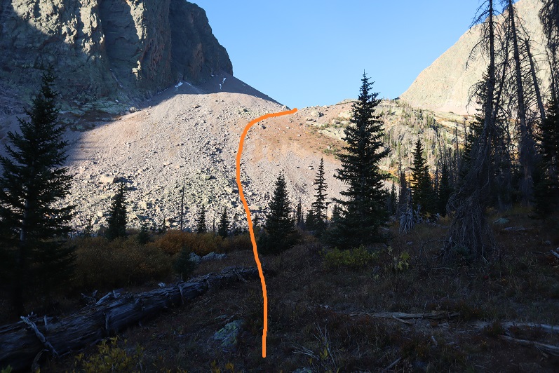


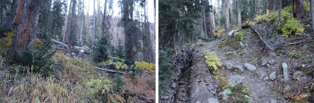
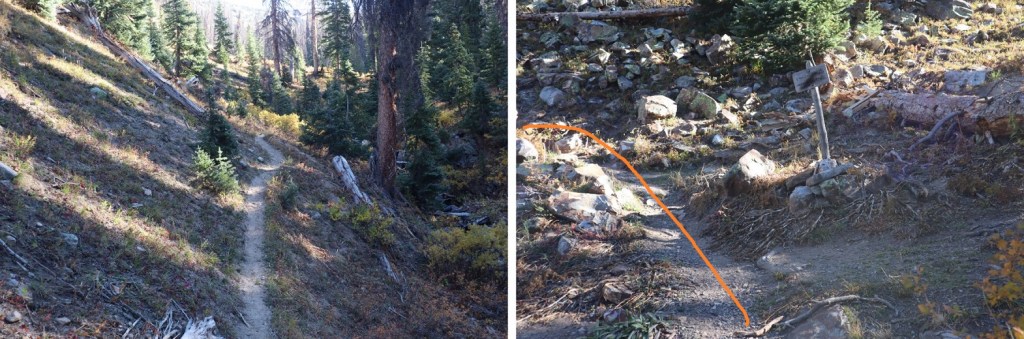
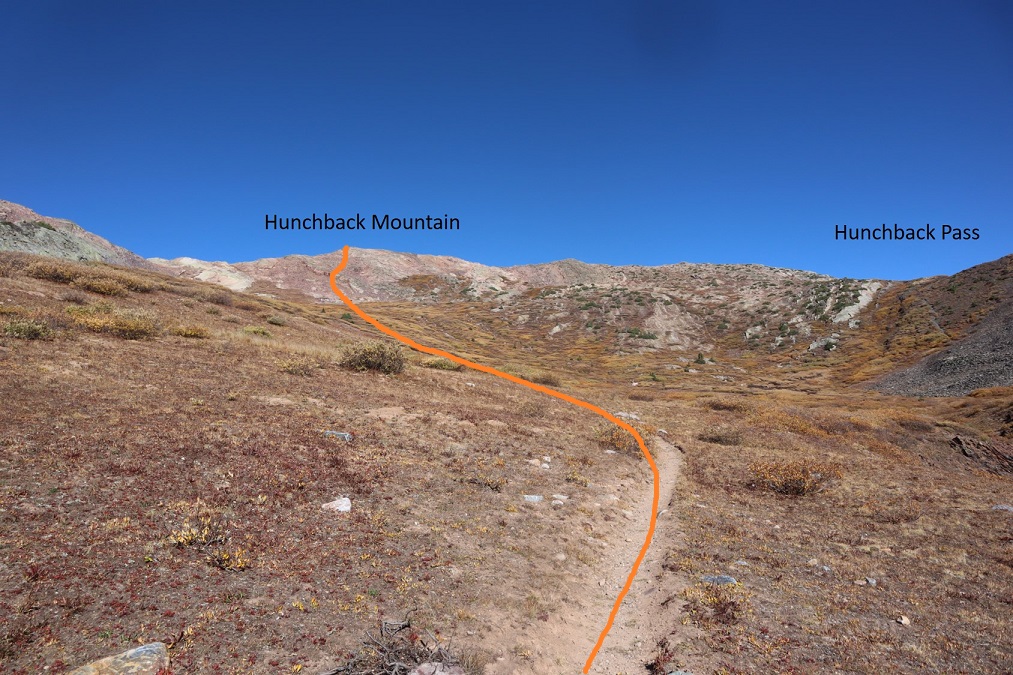
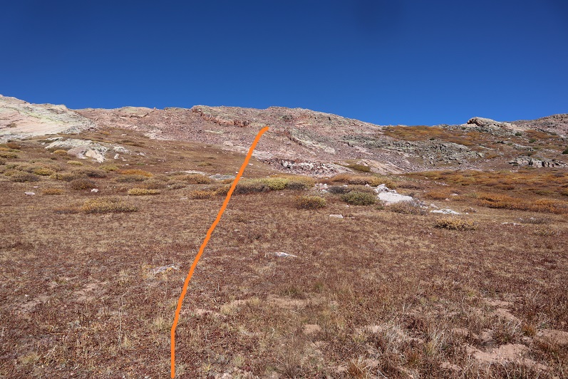
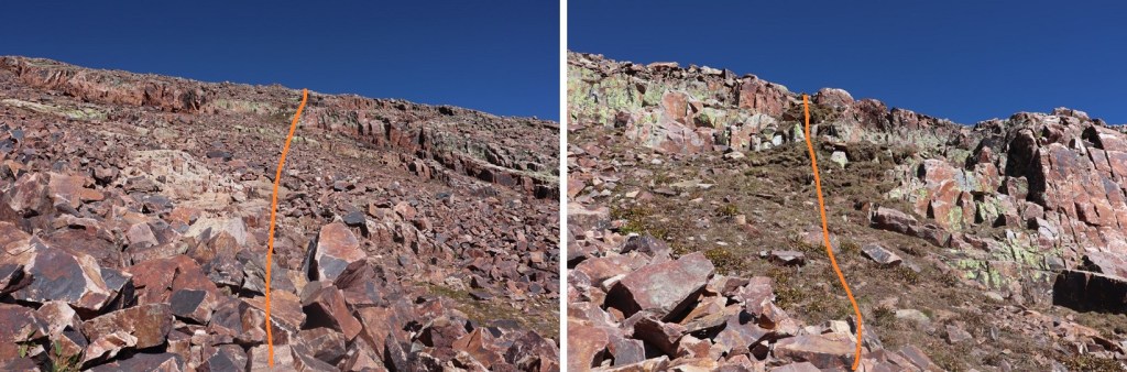
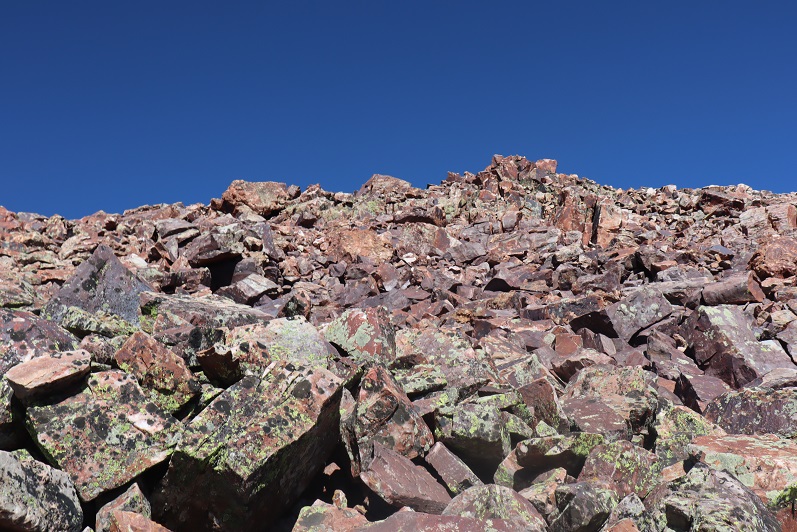
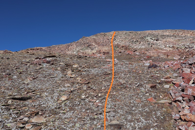
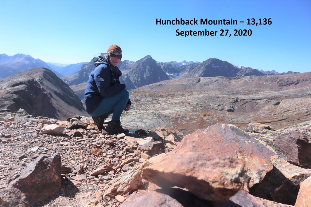

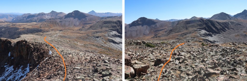

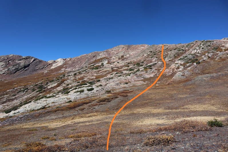

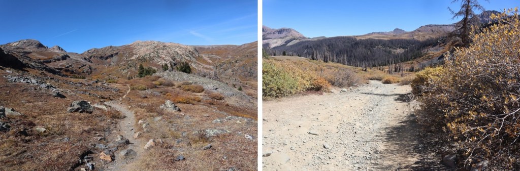


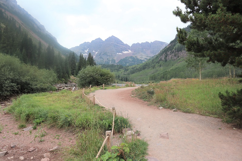
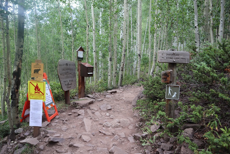

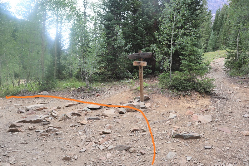
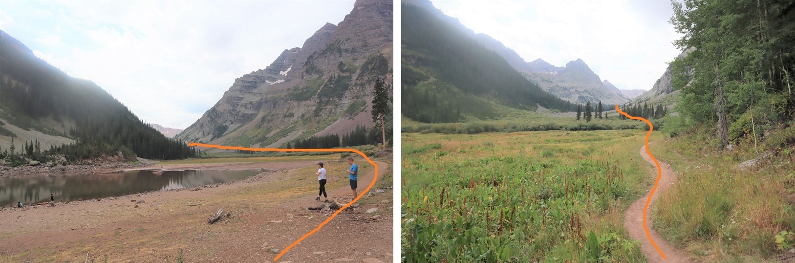


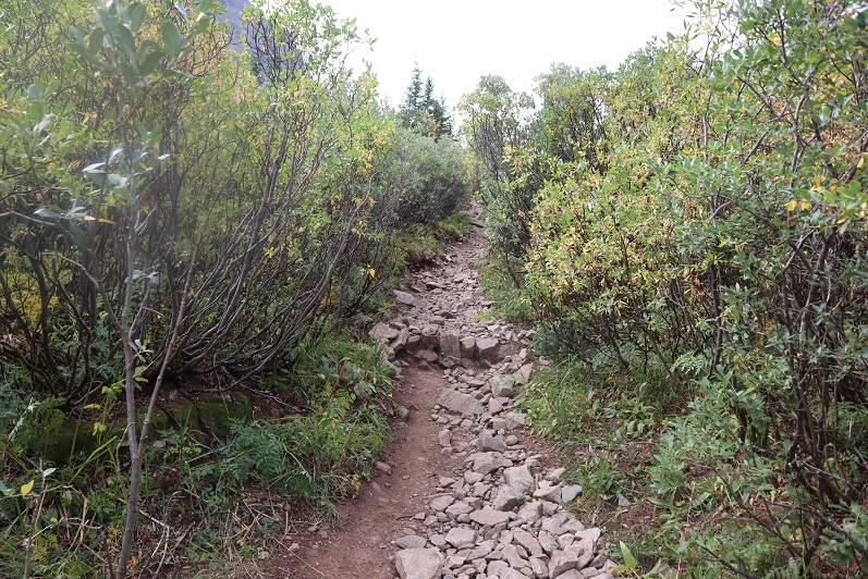
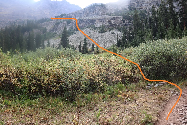
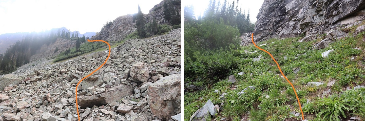
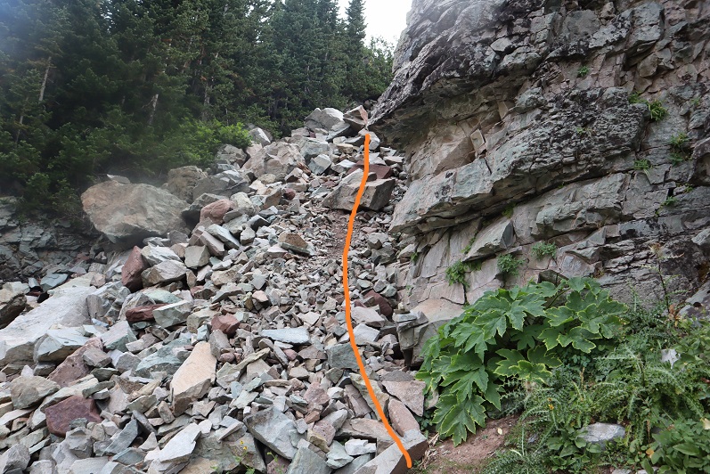
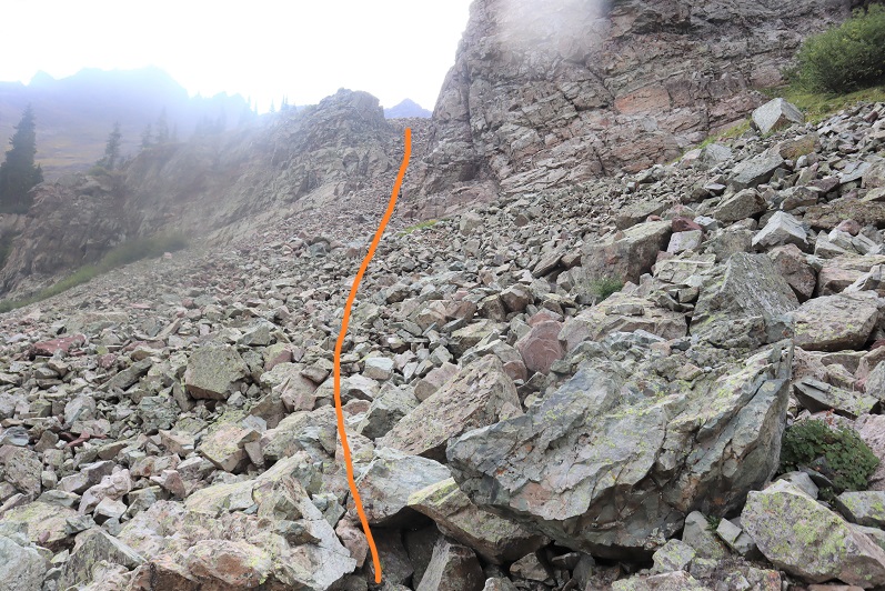
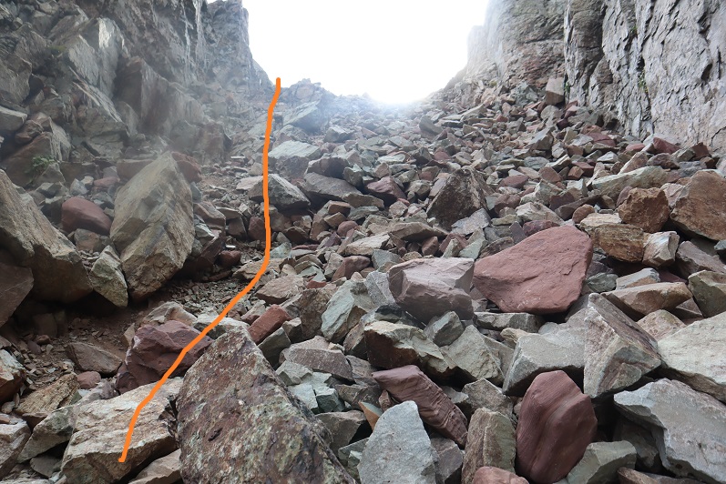
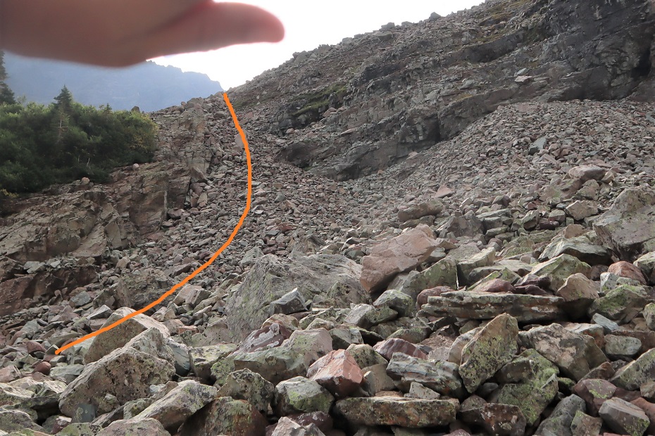

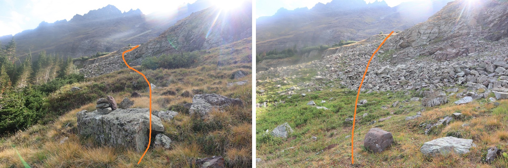
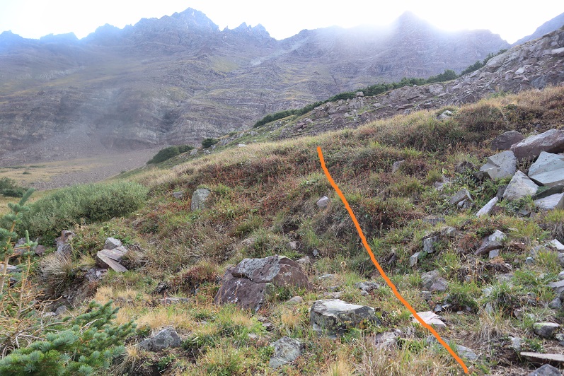
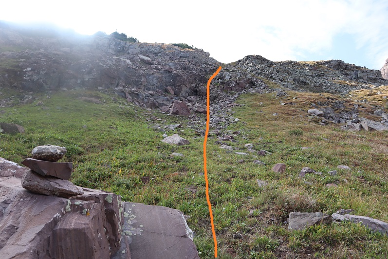
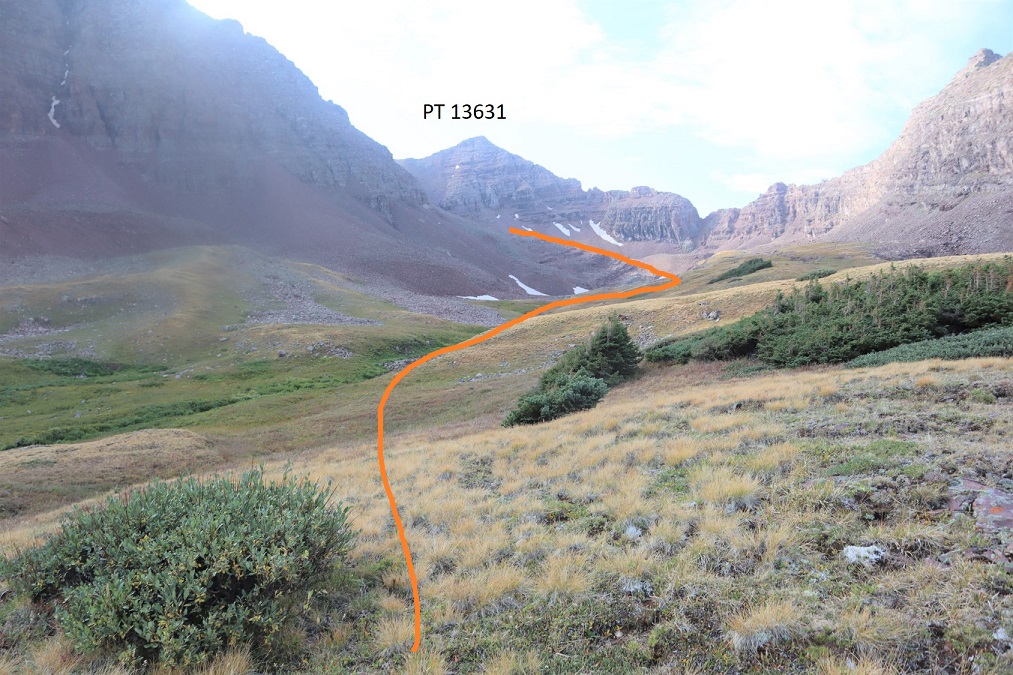
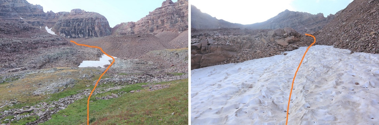
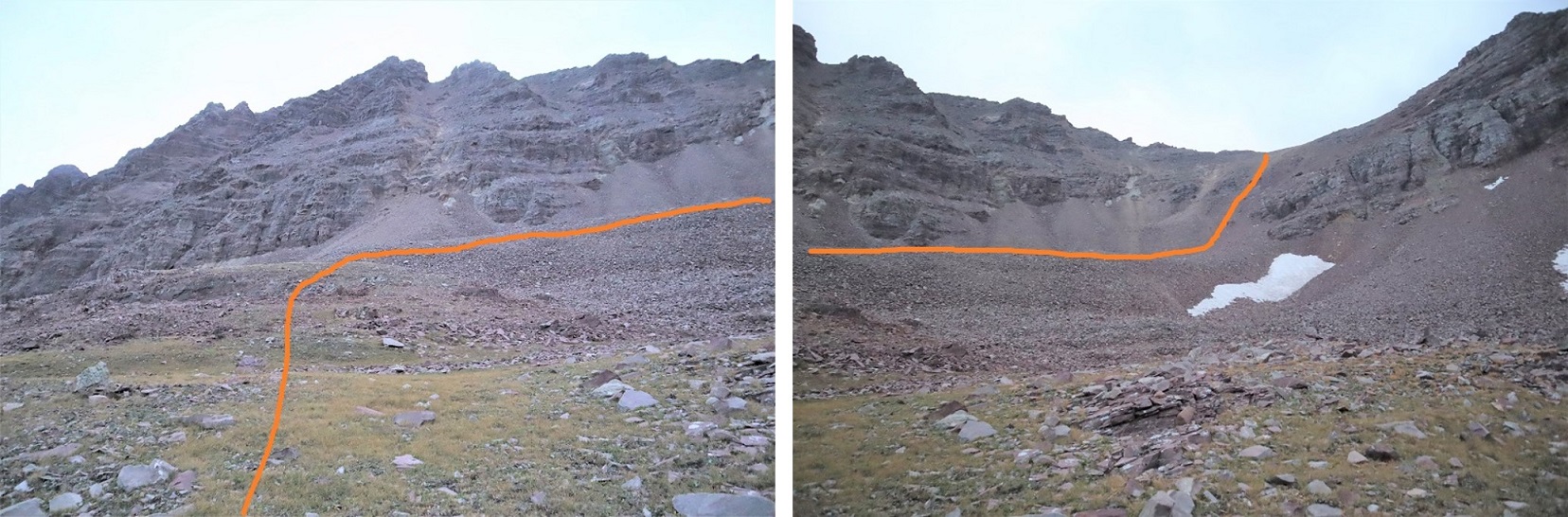


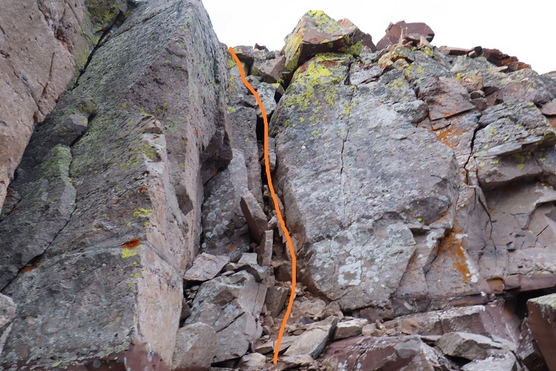
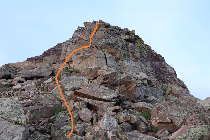
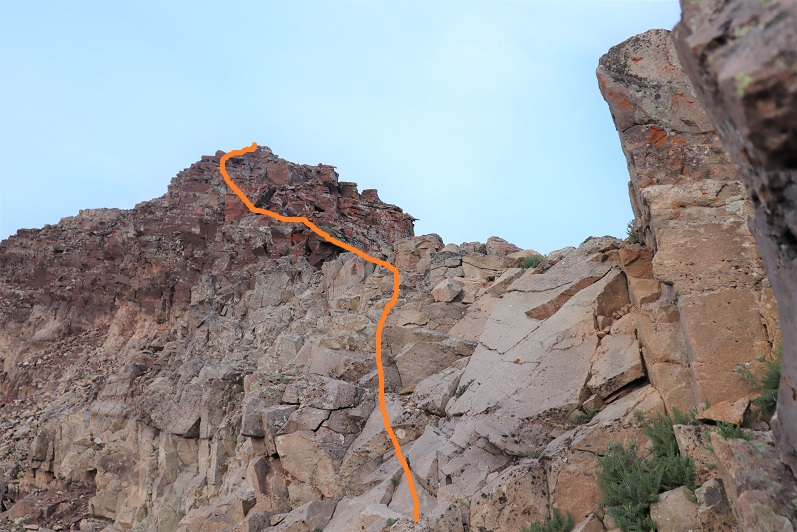


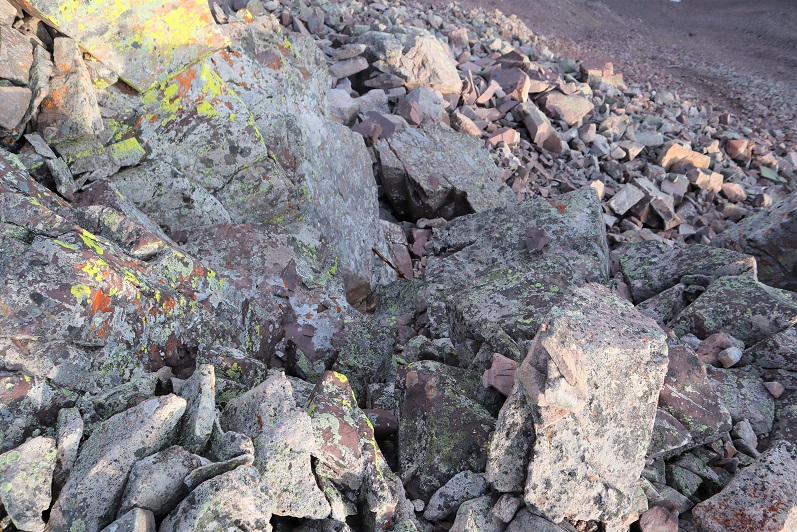
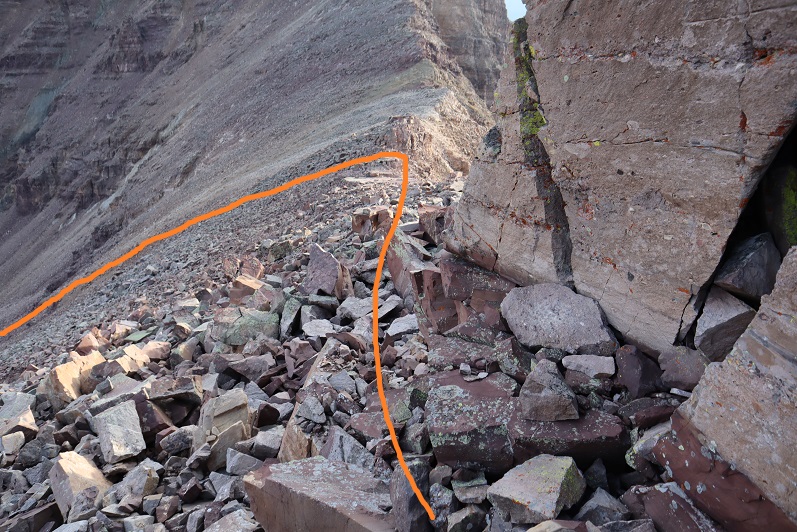

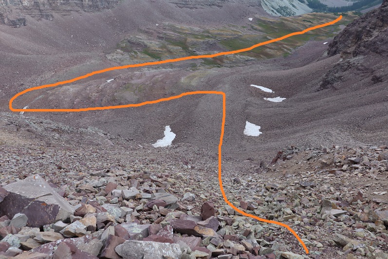

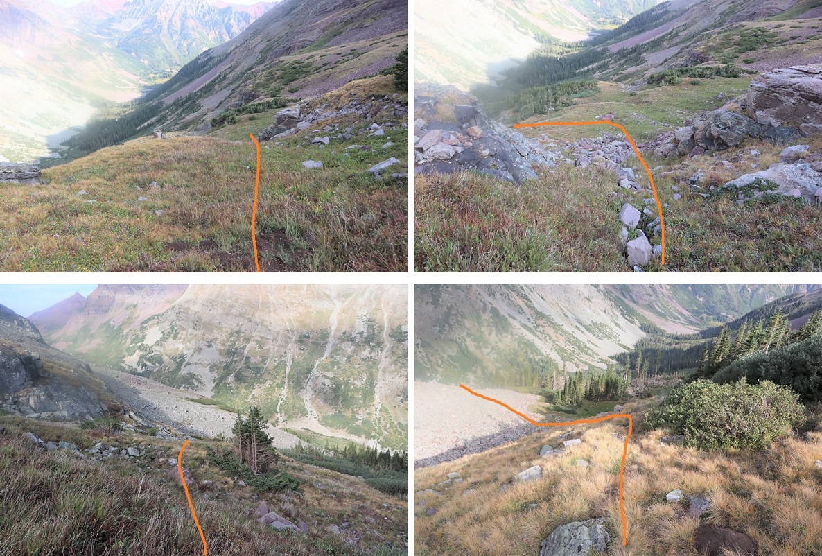
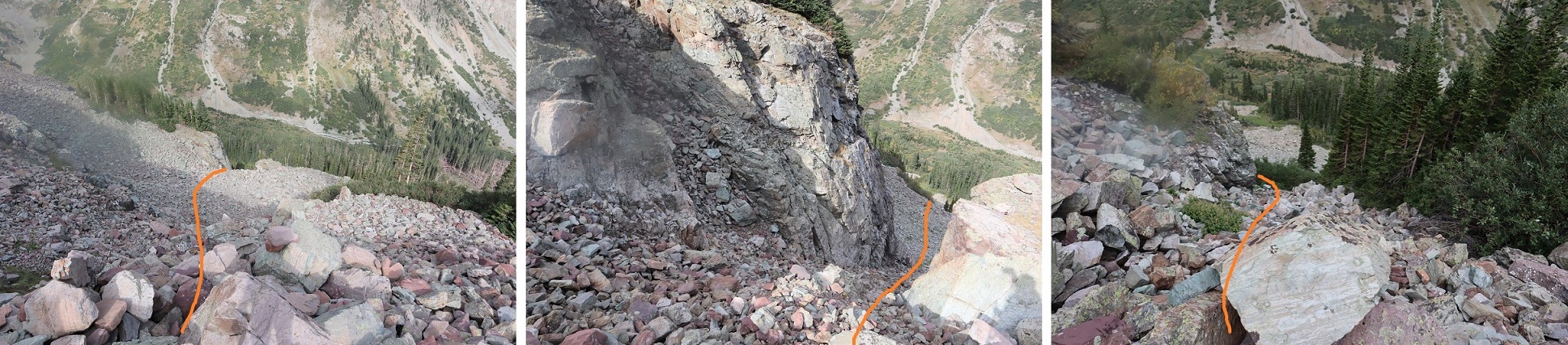

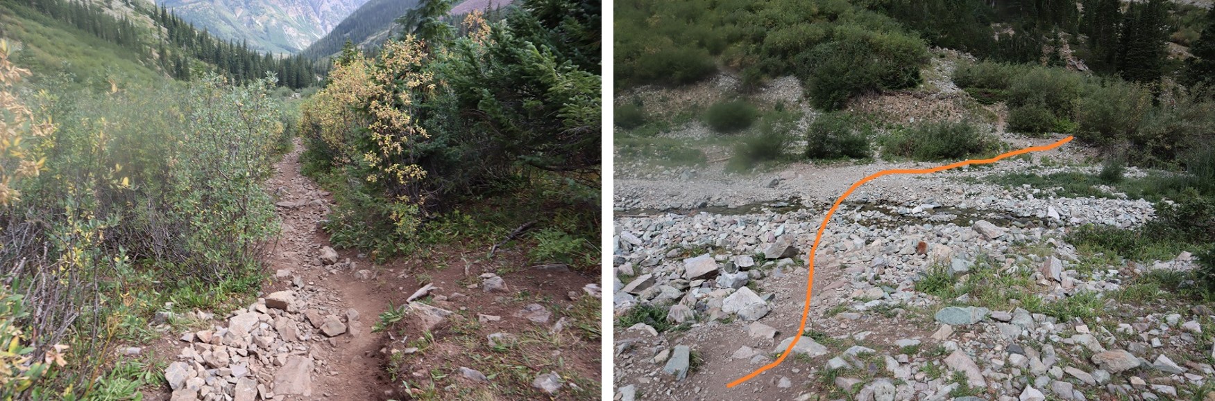


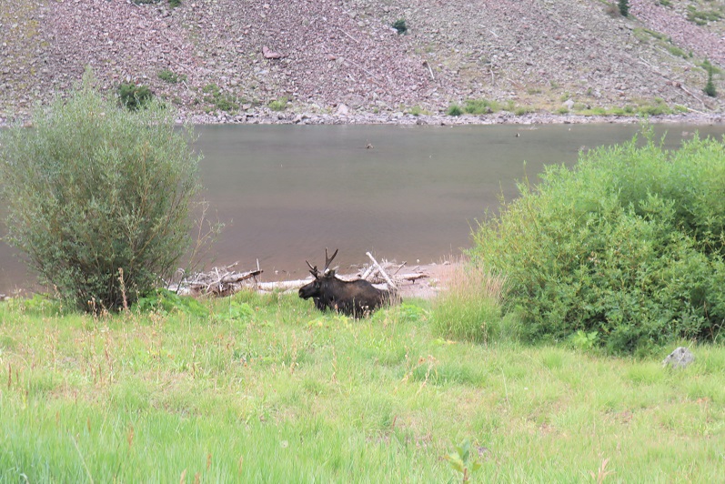

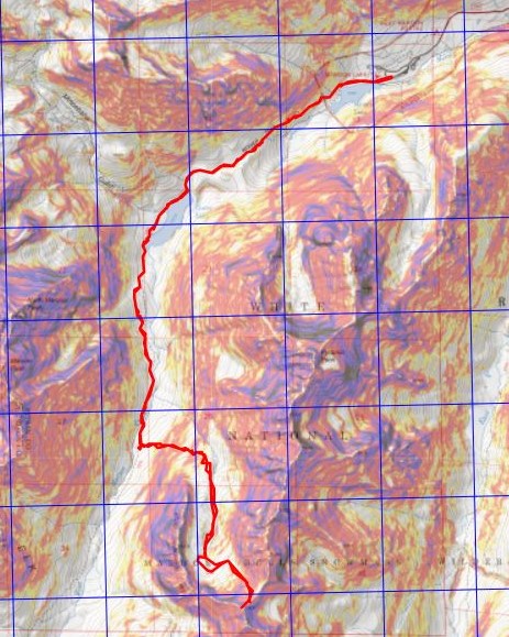
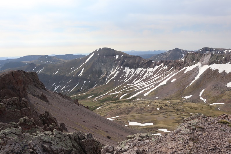

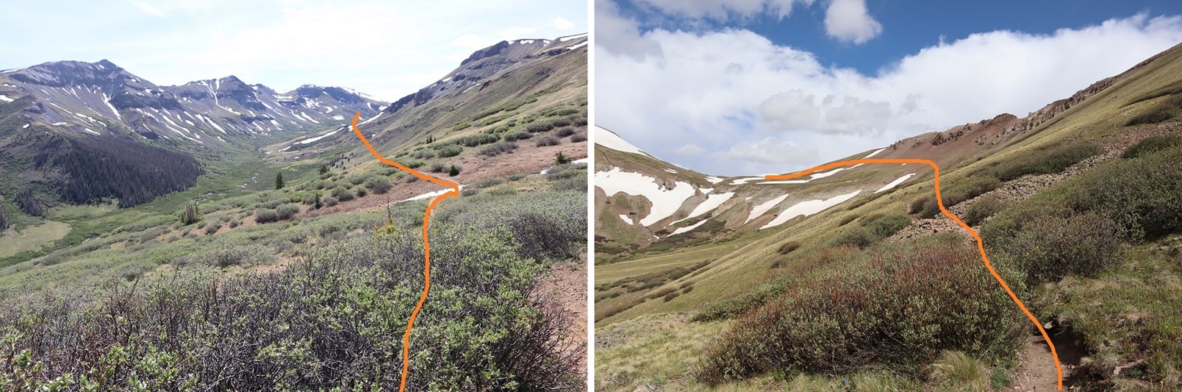
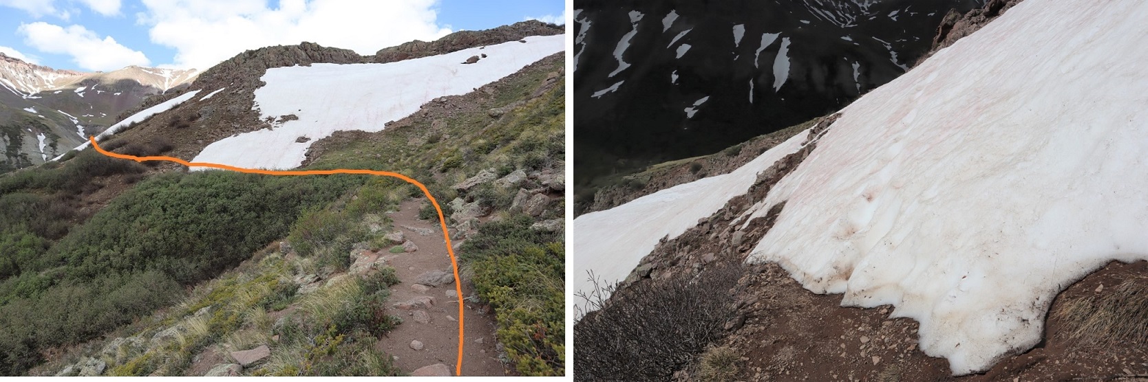

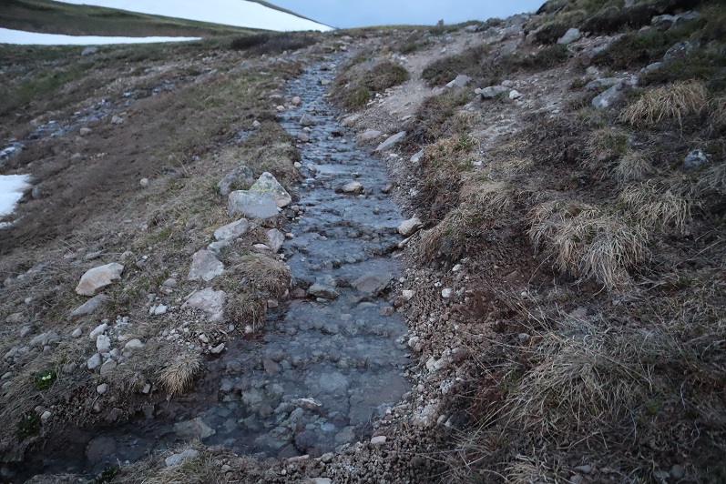
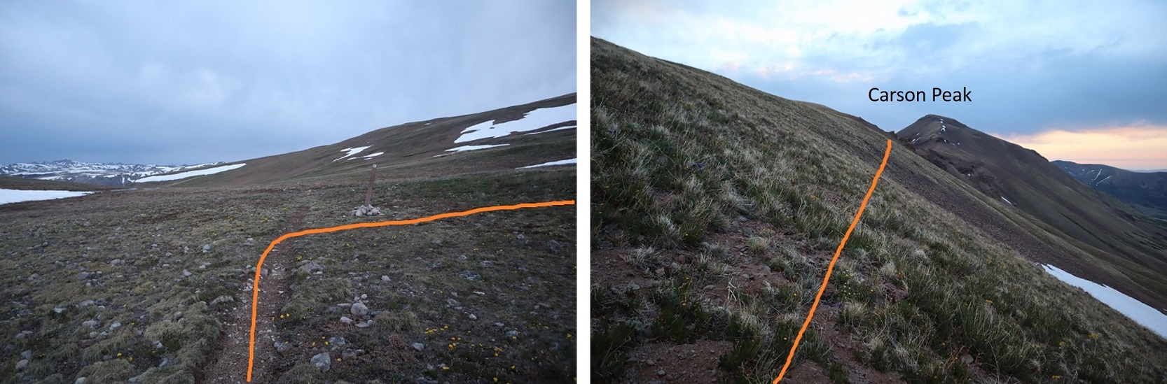
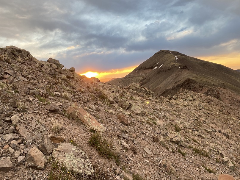
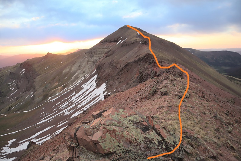


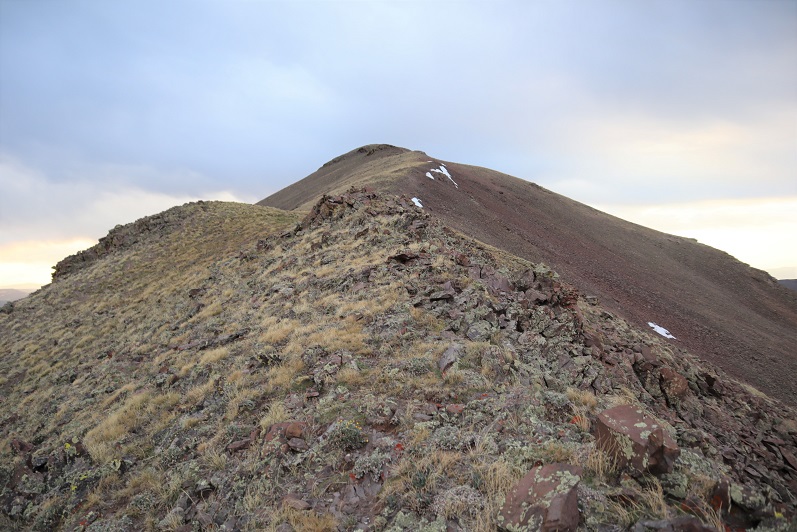

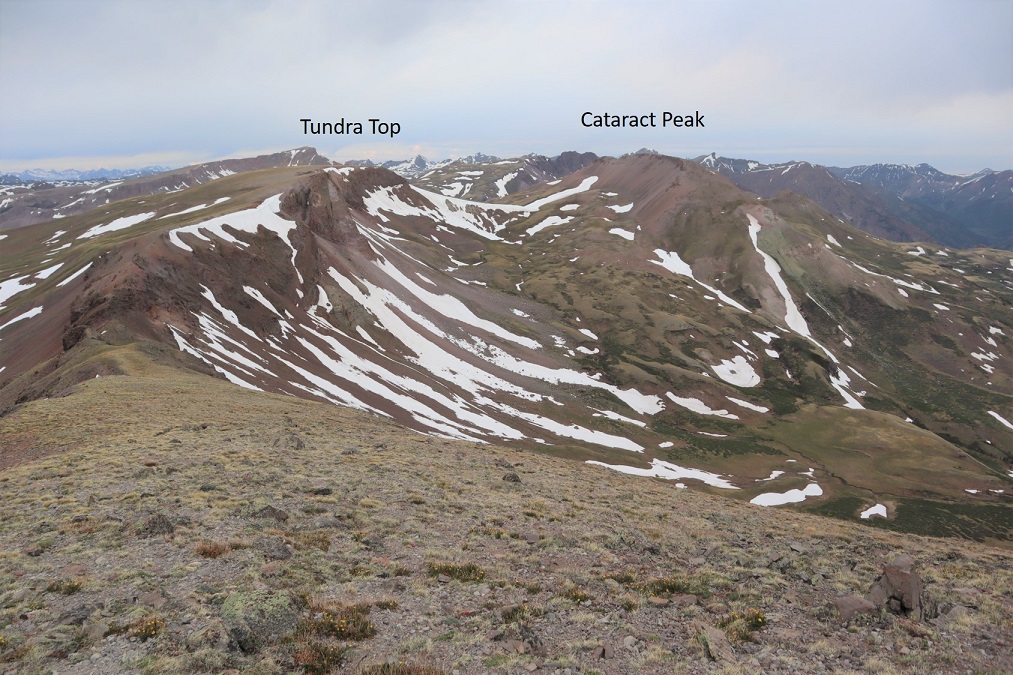
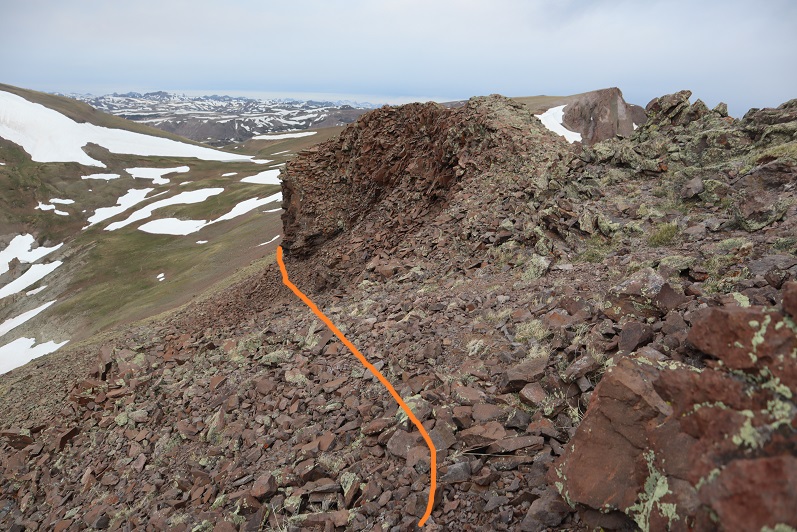

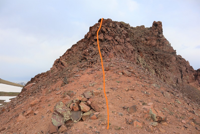
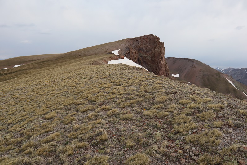

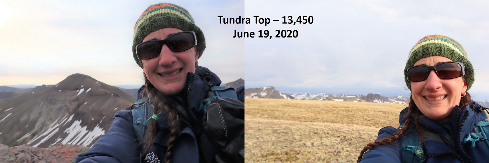
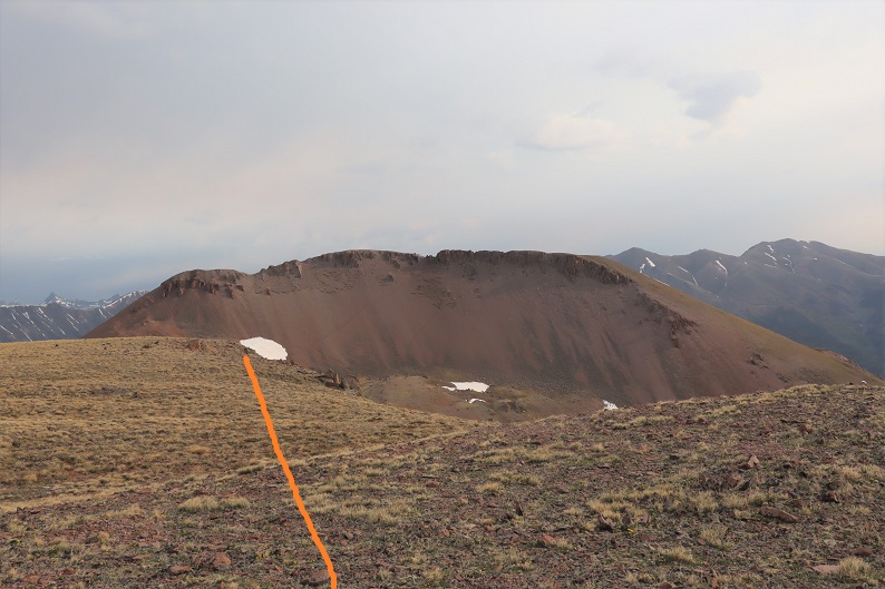
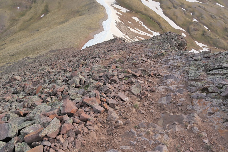


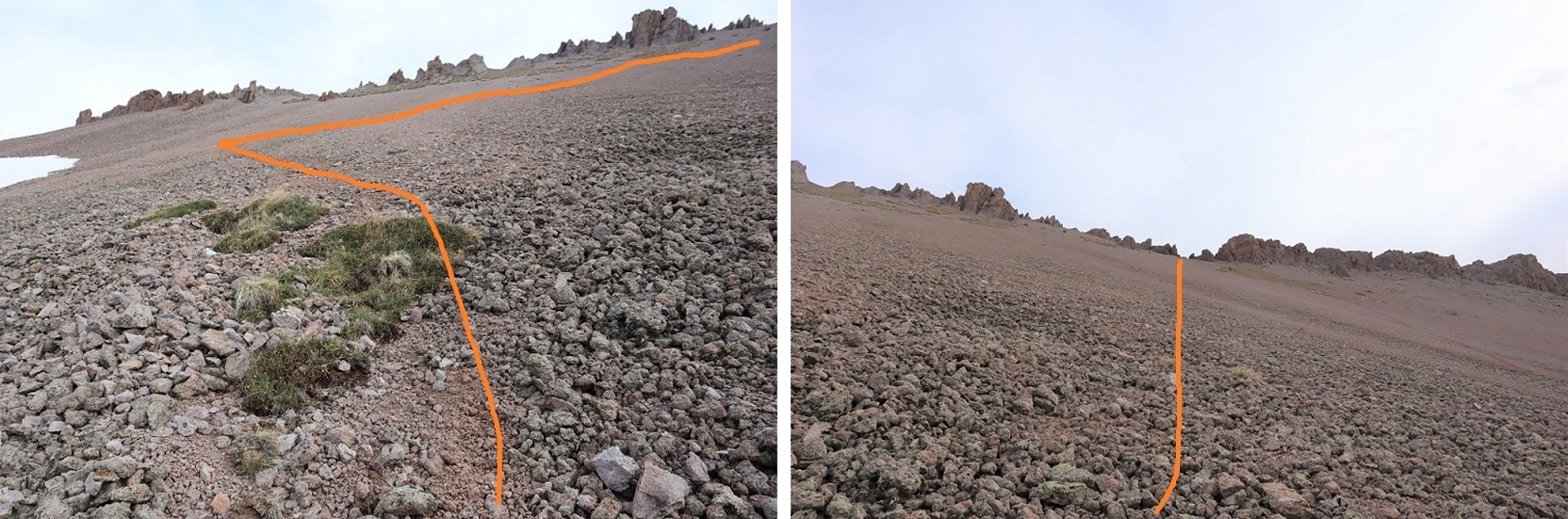
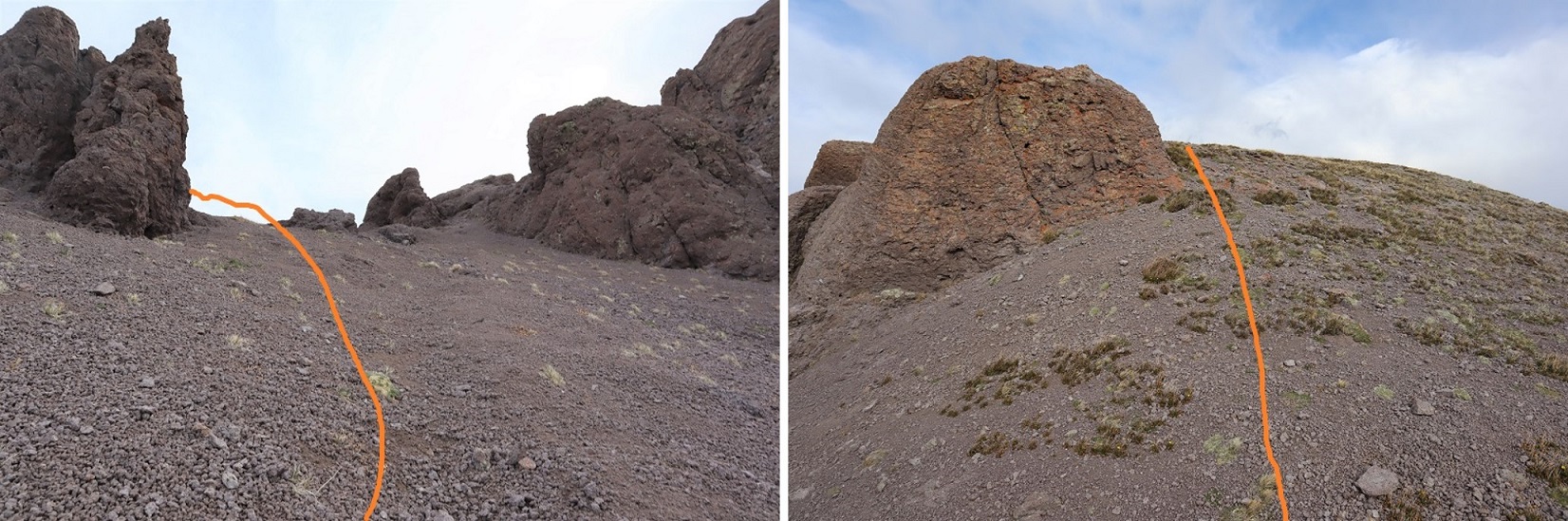
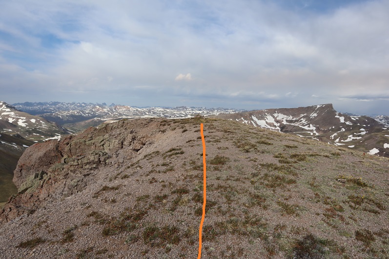
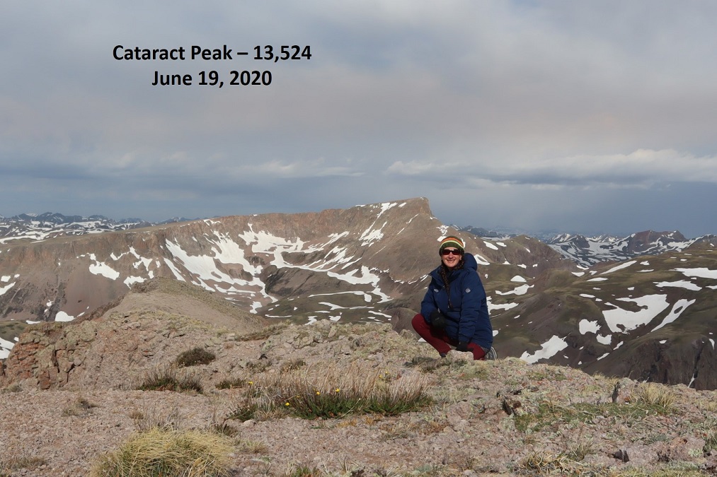
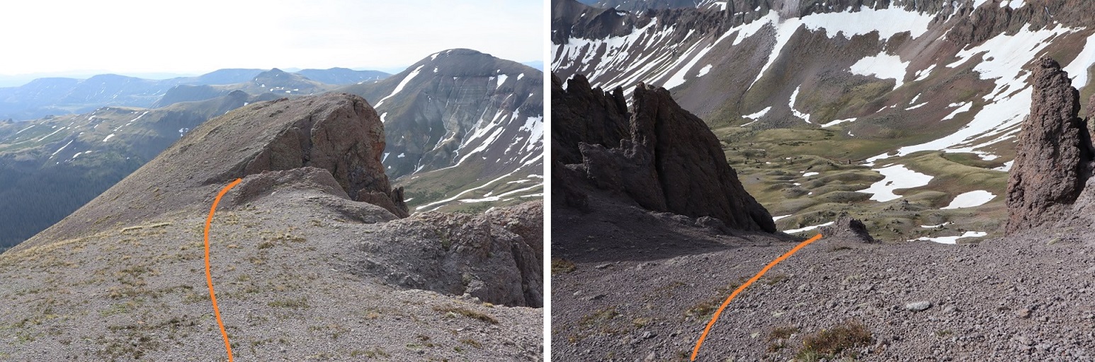
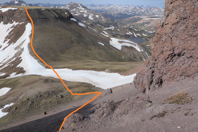

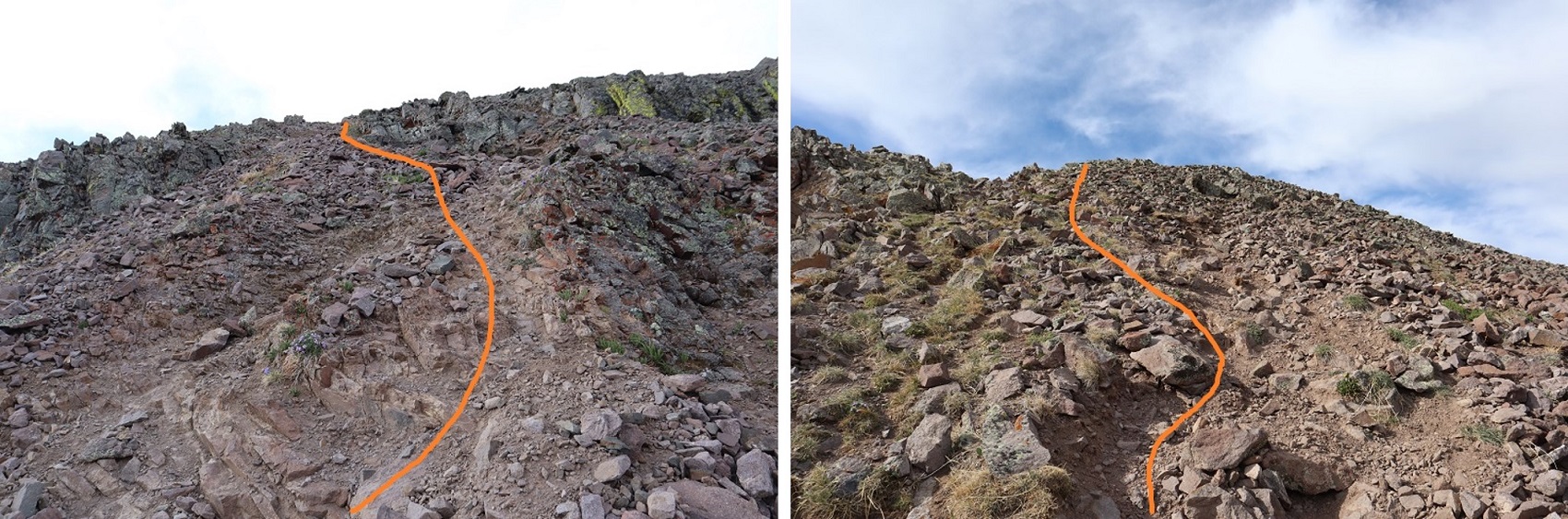
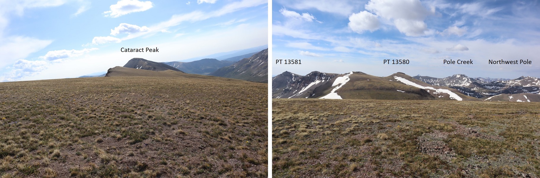
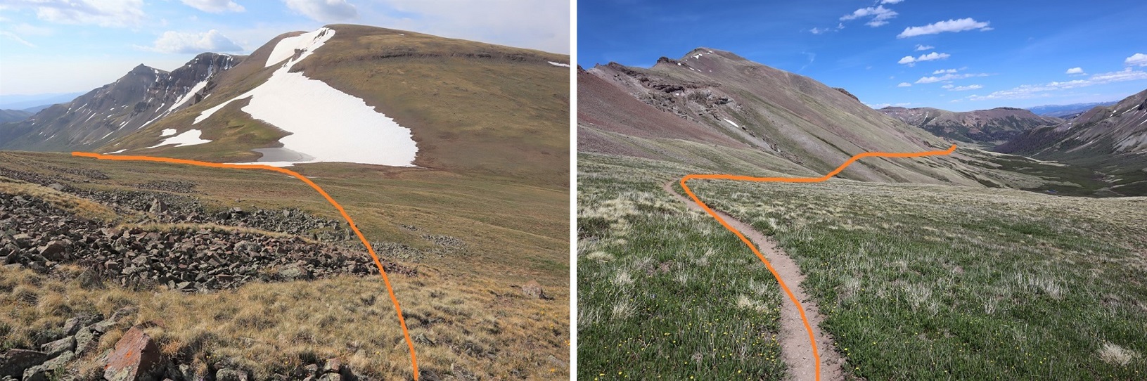
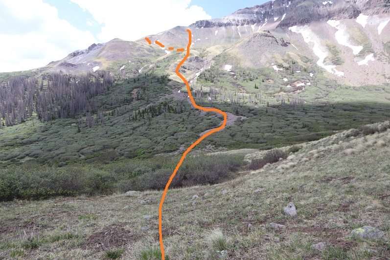

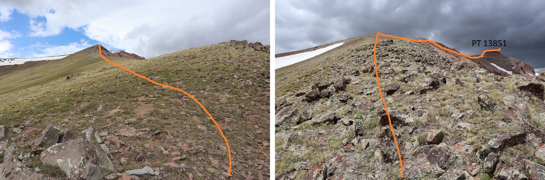
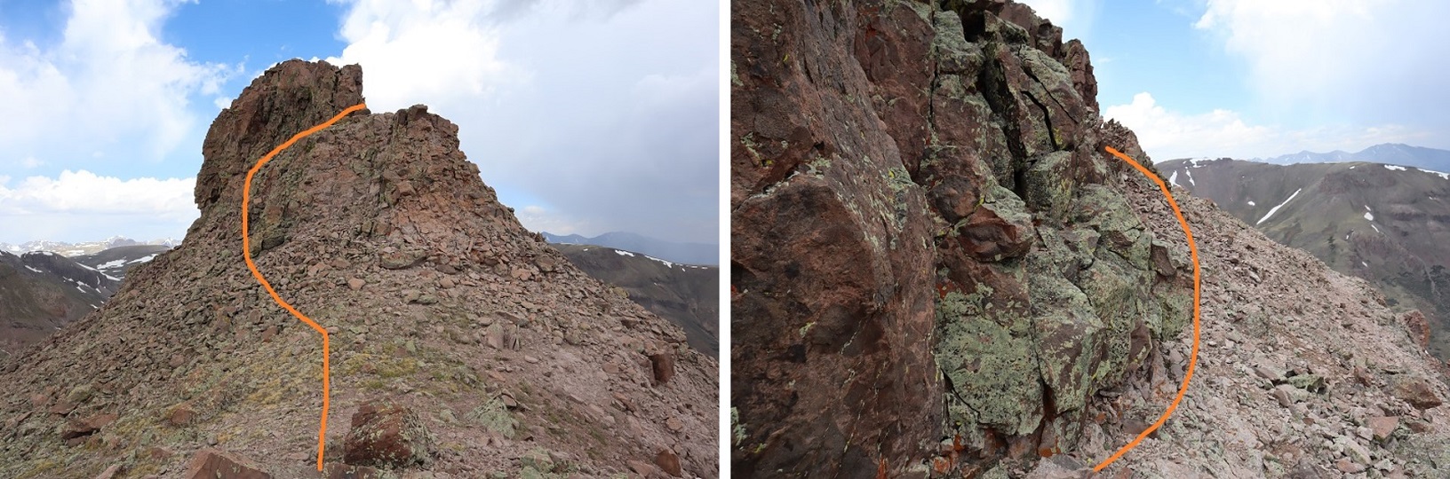


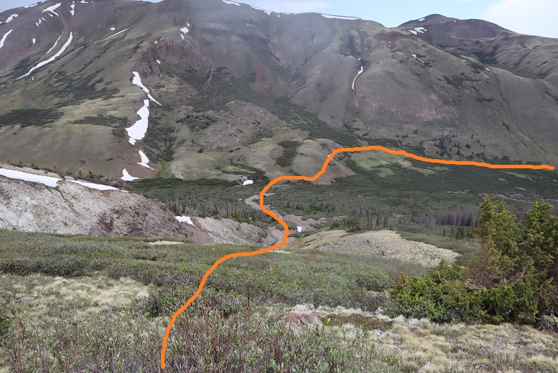
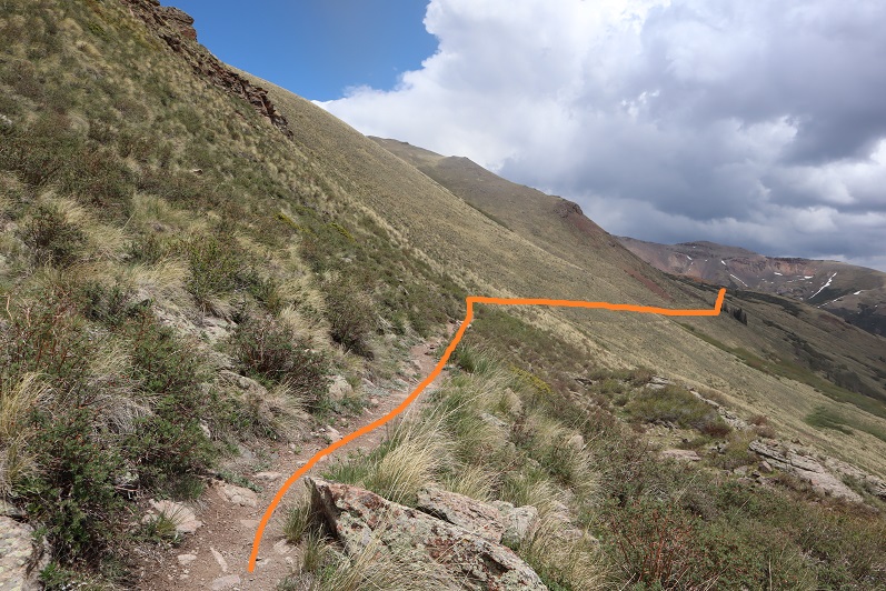
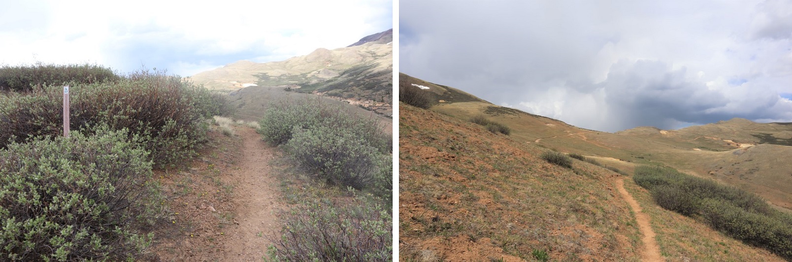
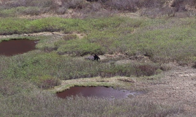

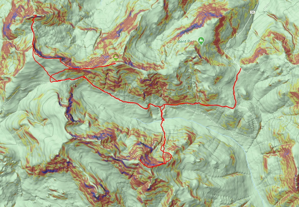
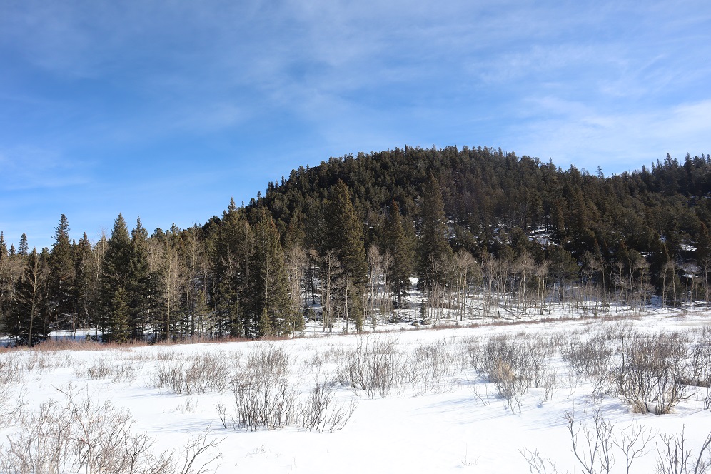
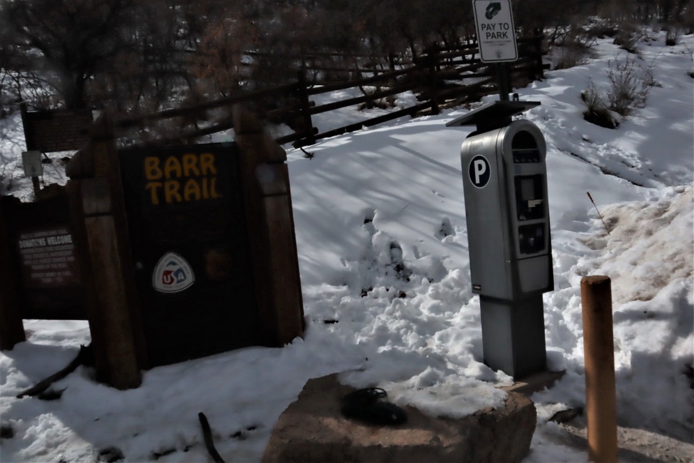
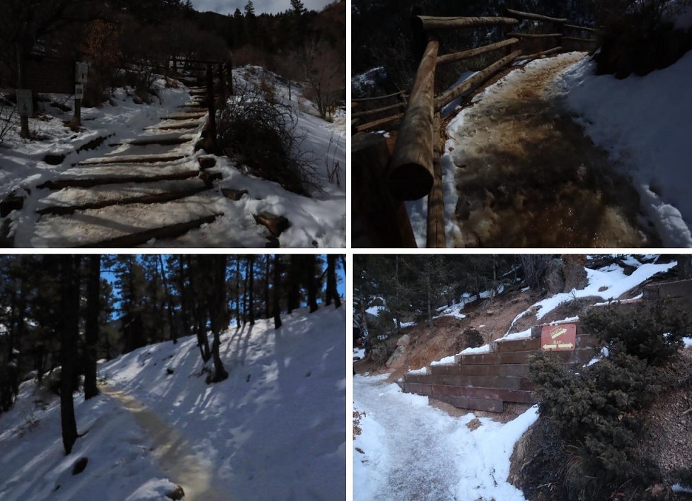
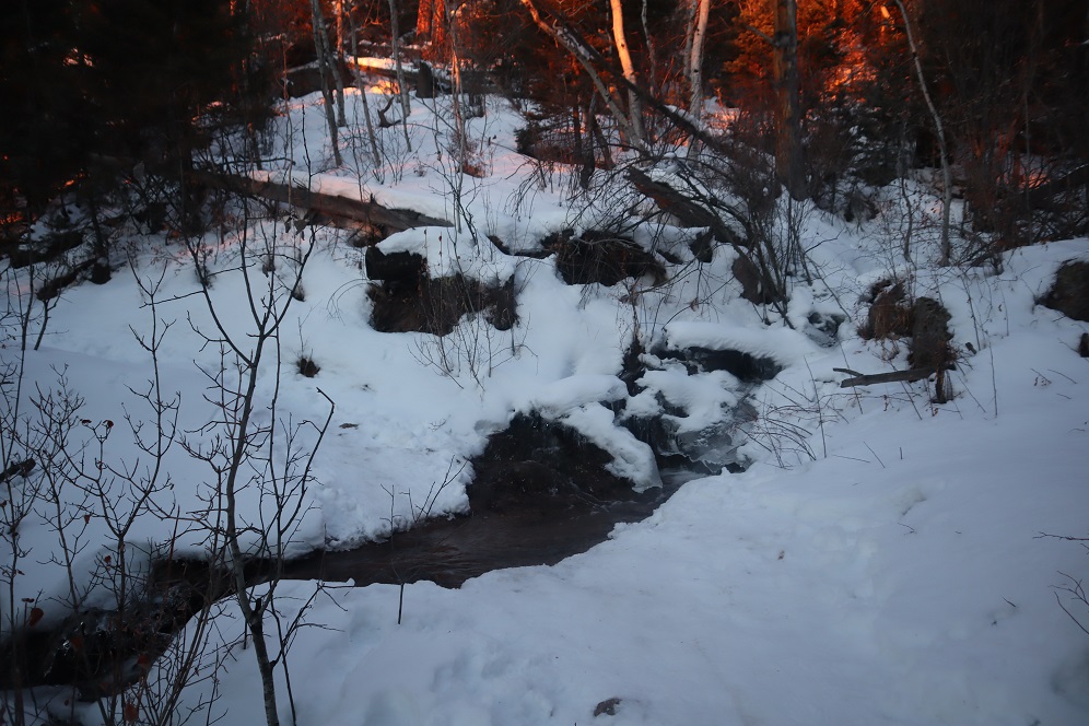
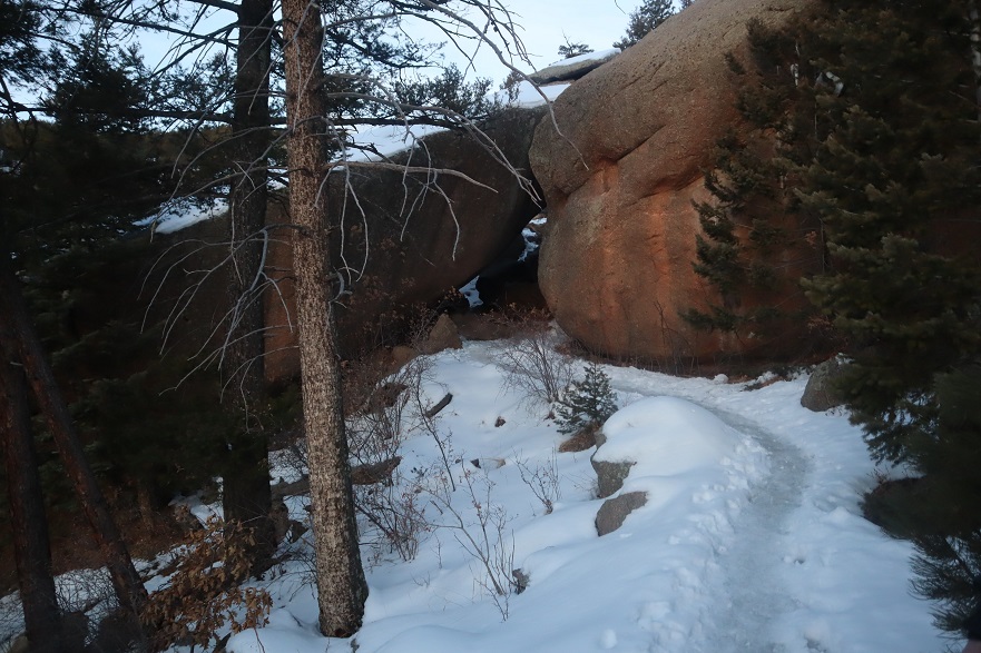
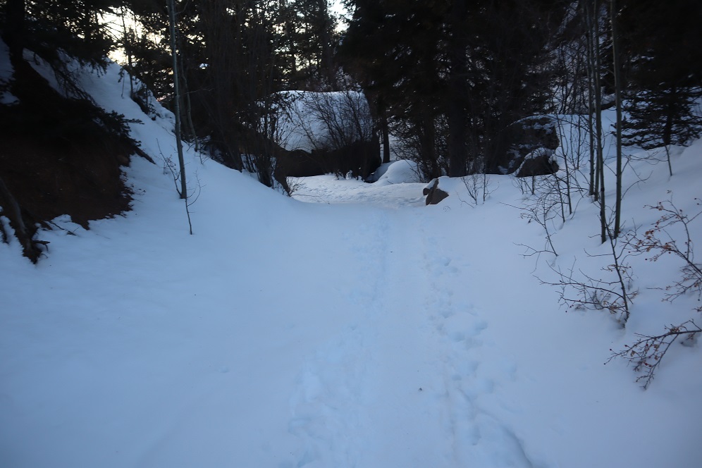
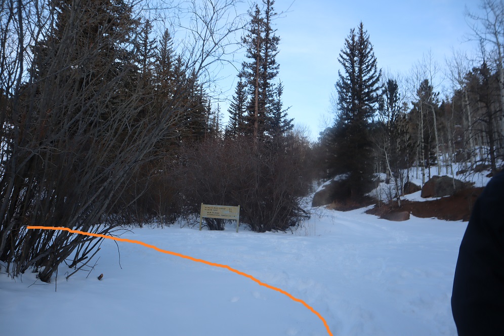
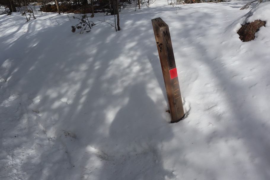
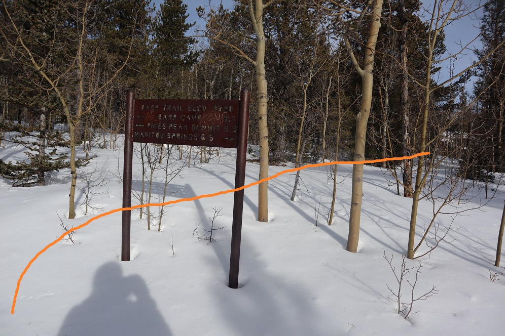

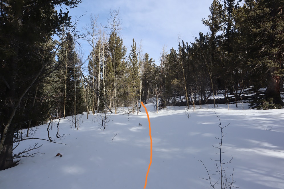
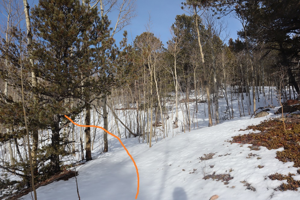

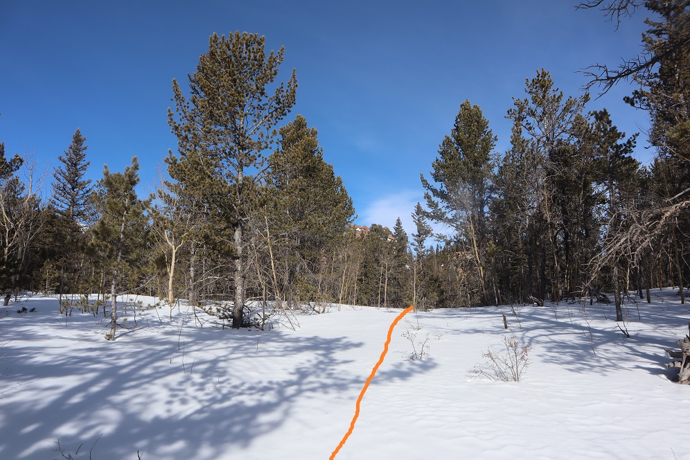

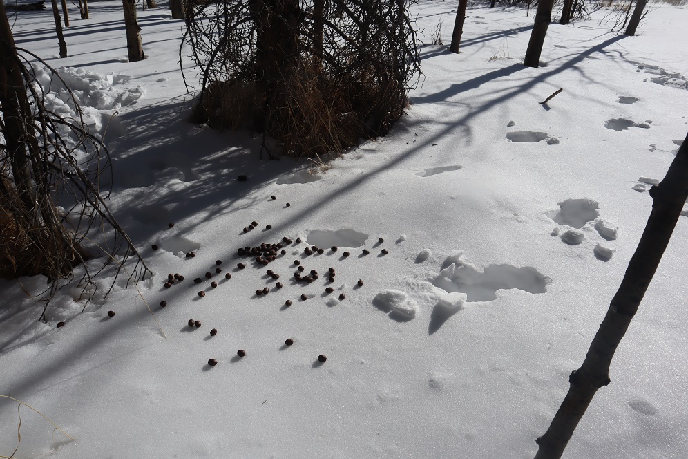
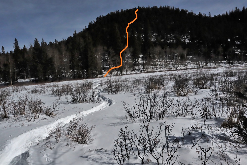
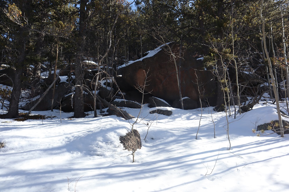
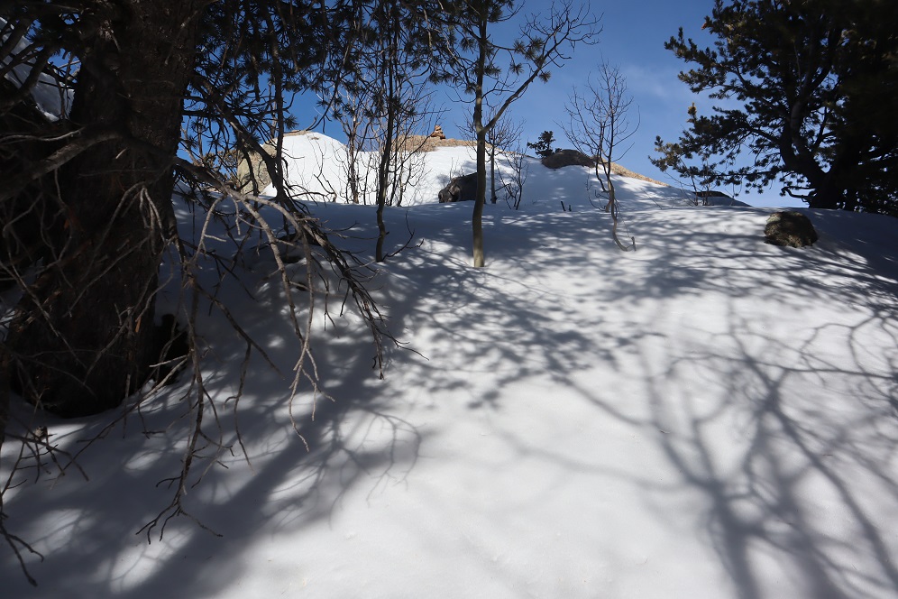
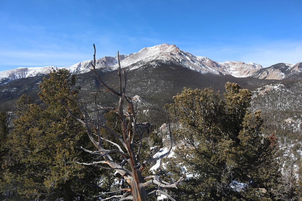
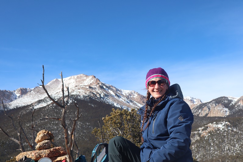


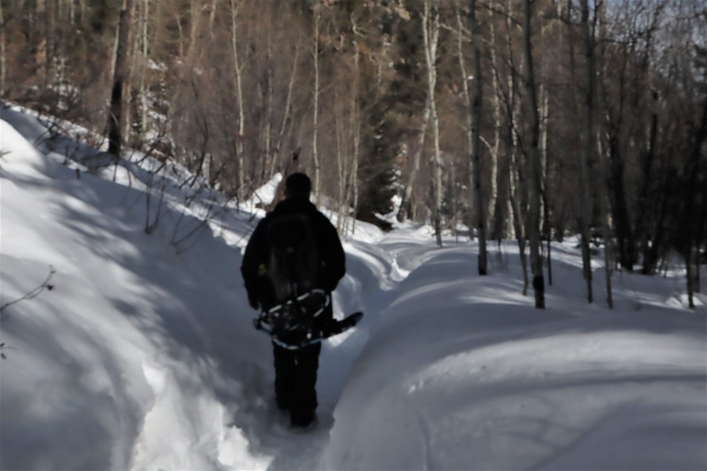


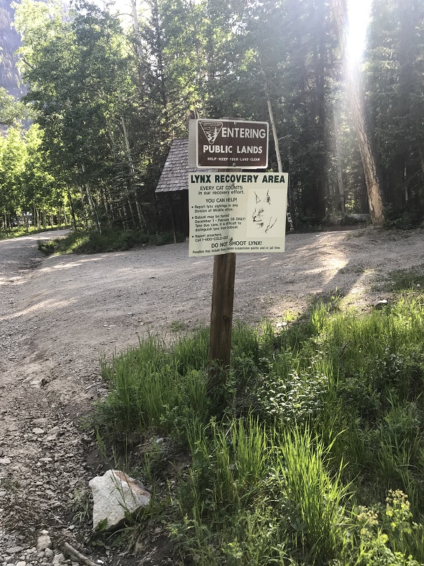
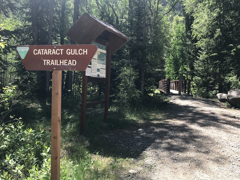
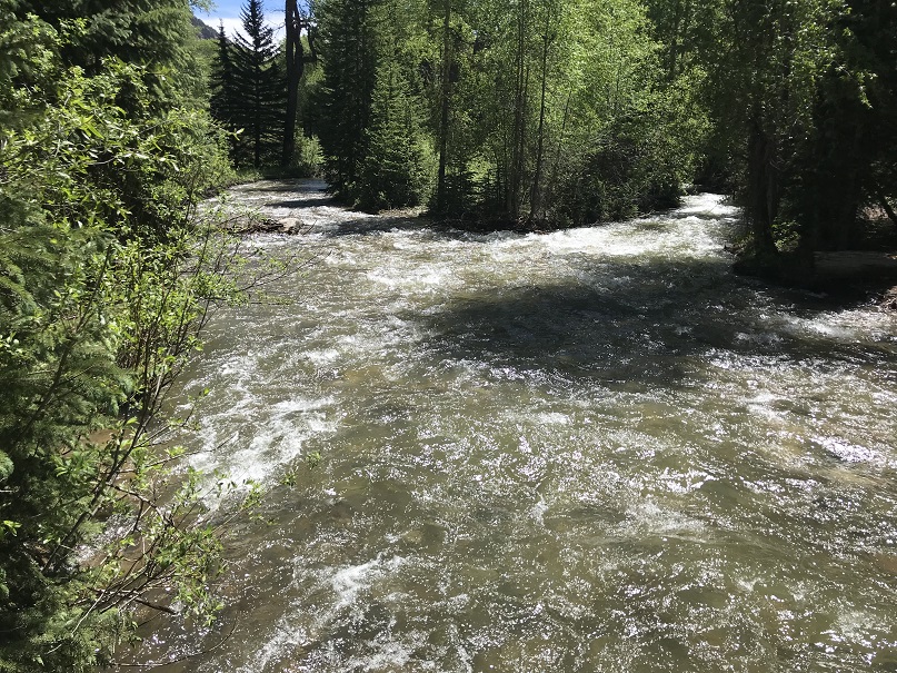

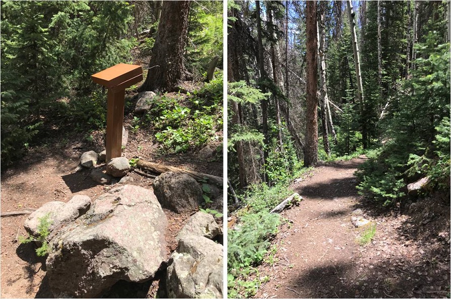
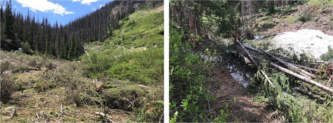
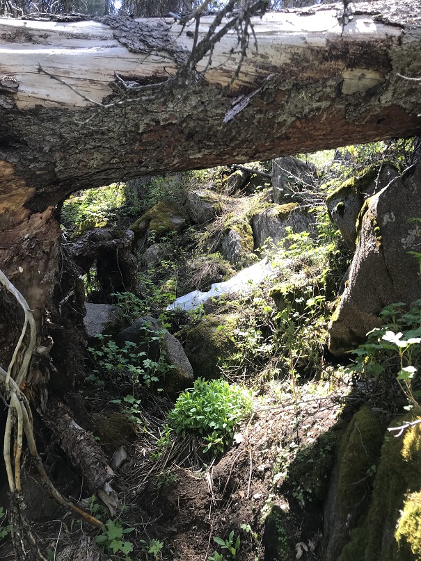

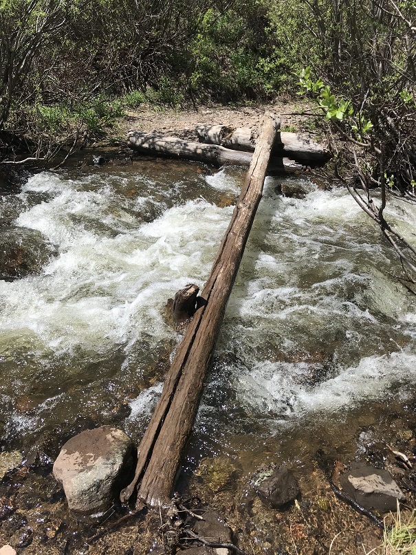

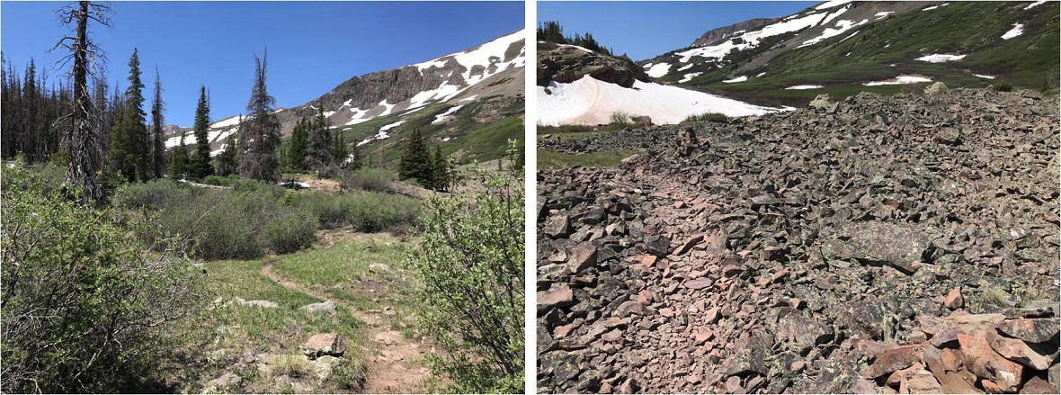
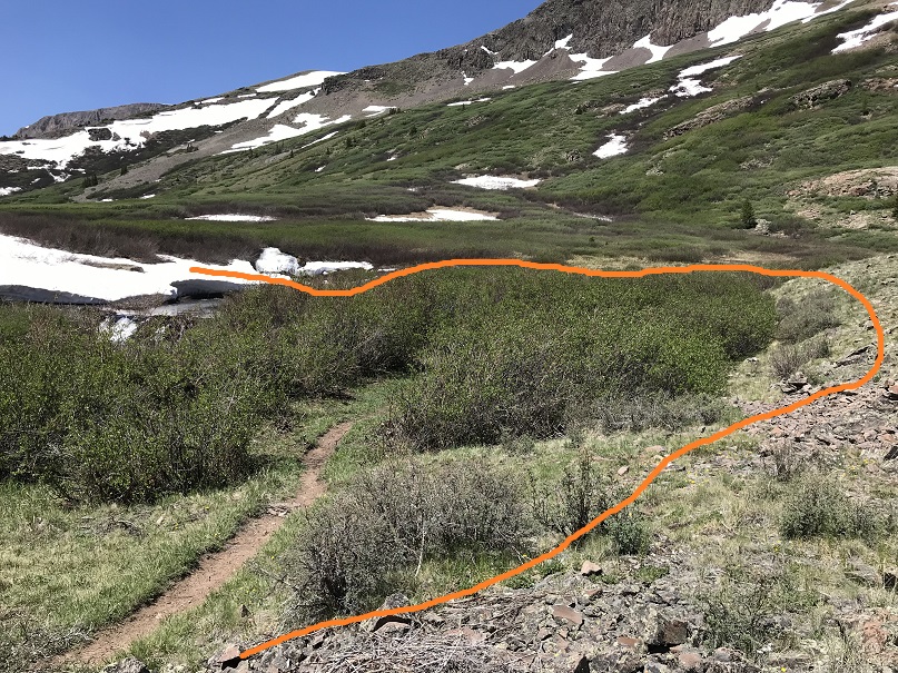
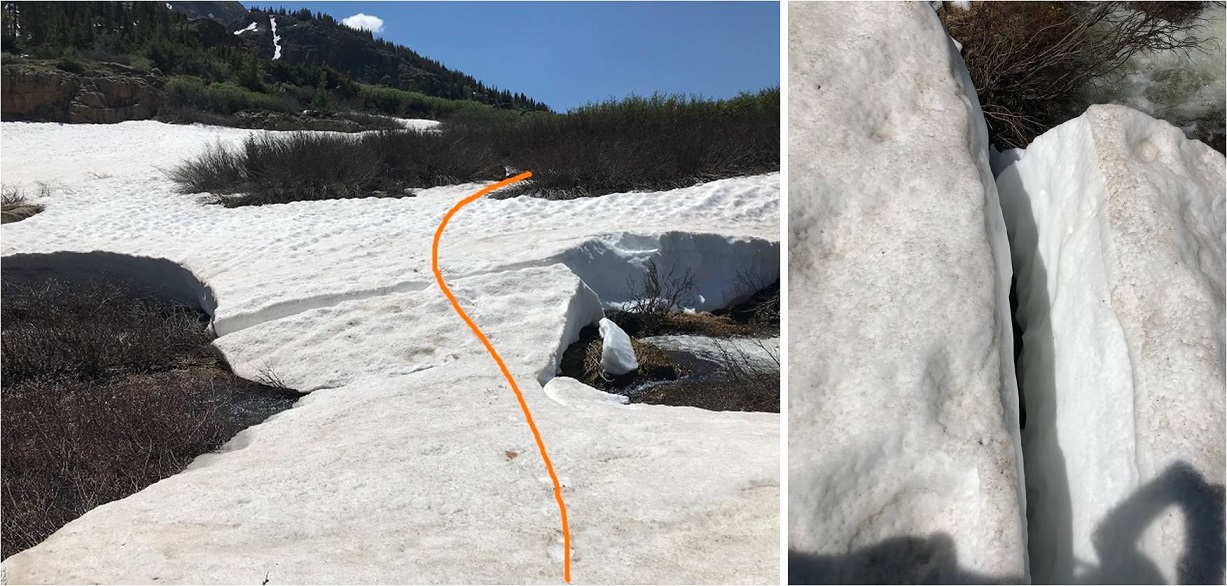

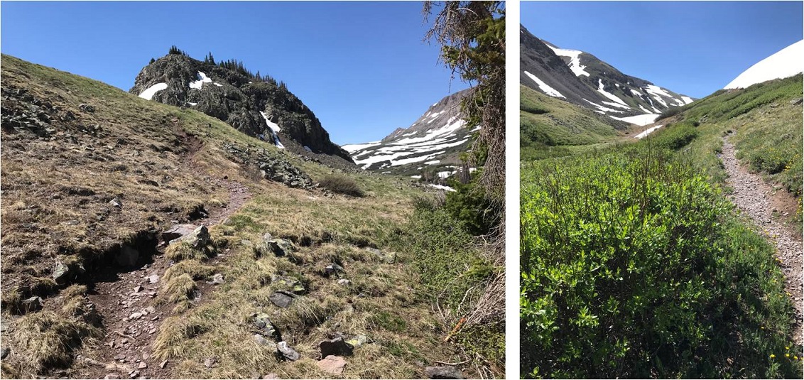
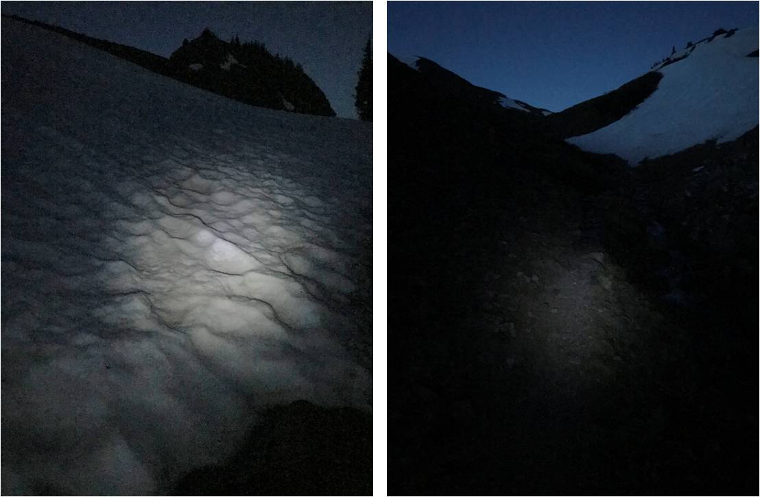

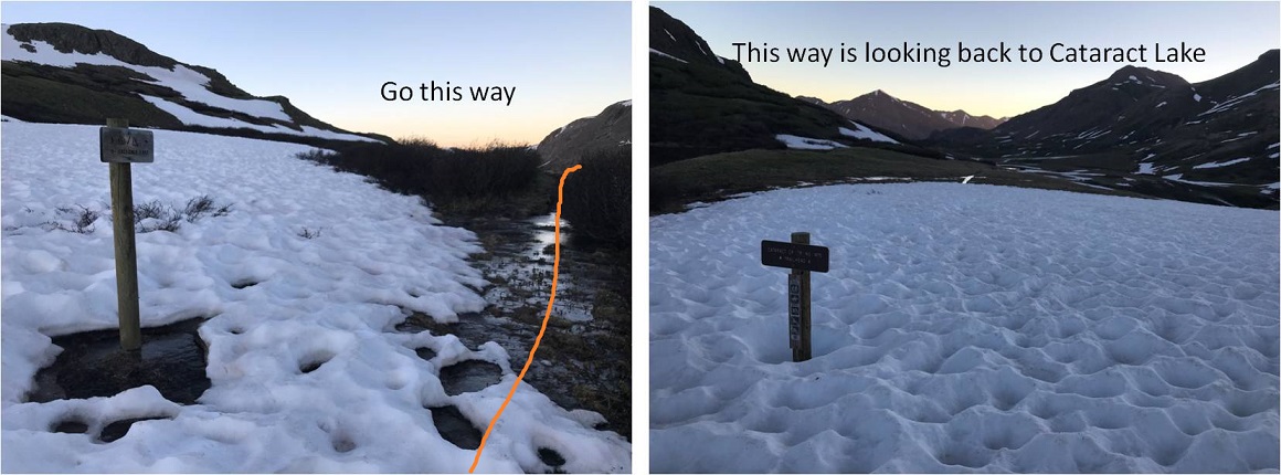
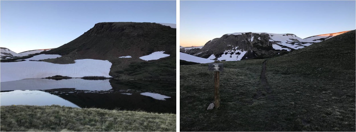
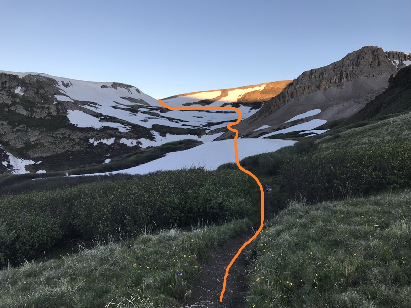

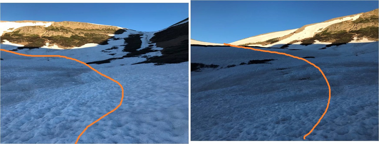

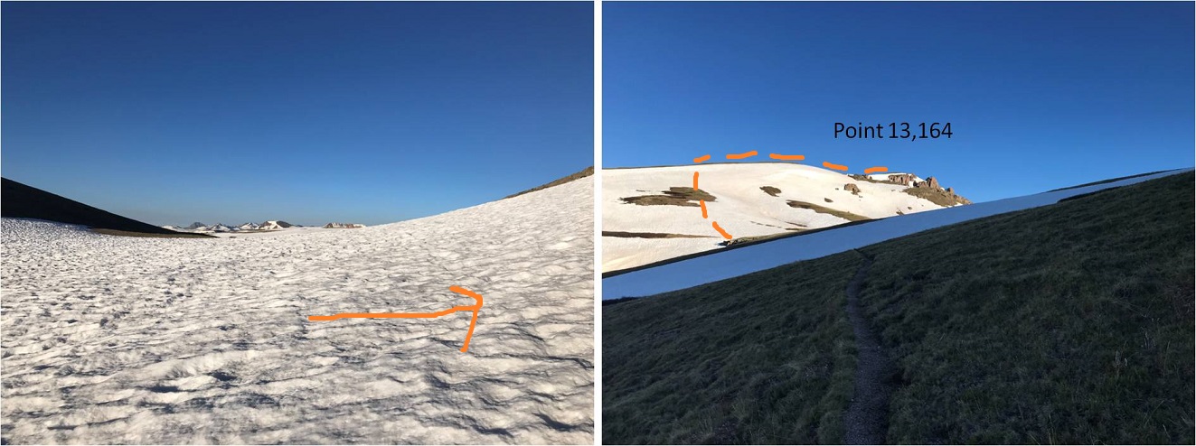

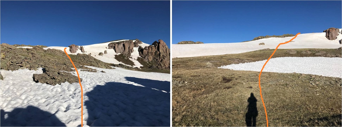
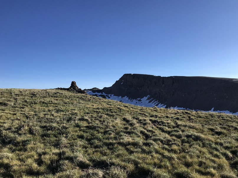
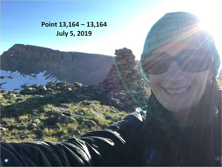

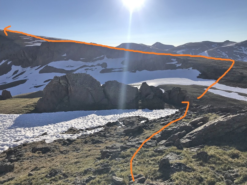


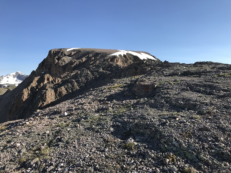
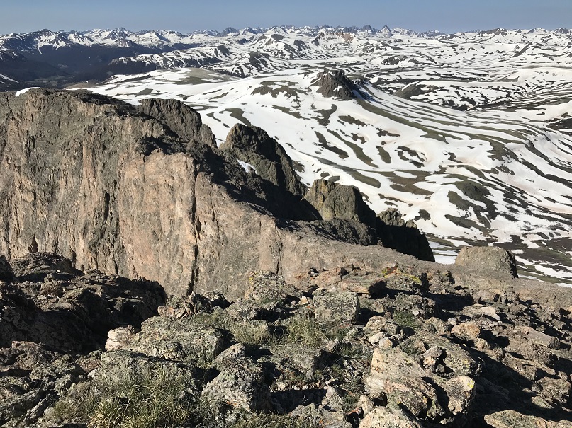 e’s a lot of exposure but I agree with Roach’s assessment this can be kept class 2 with careful footwork. I found the best strategy was to stick to the ridge in most places, dropping down 15 feet or so only when necessary